This post is intended to be used by the reader as an easy navigation tool for posts on Tinners’ Mills (Stamping, Blowing, Clash or a combination of these) as recorded on the Dartmoor Explorations website. The post is based around a paper presented by Dr Tom Greeves at a Dartmoor Tinworking Research Group (DTRG) conference held in May 2016, which was to commemorate and celebrate the 25th anniversary of the society.
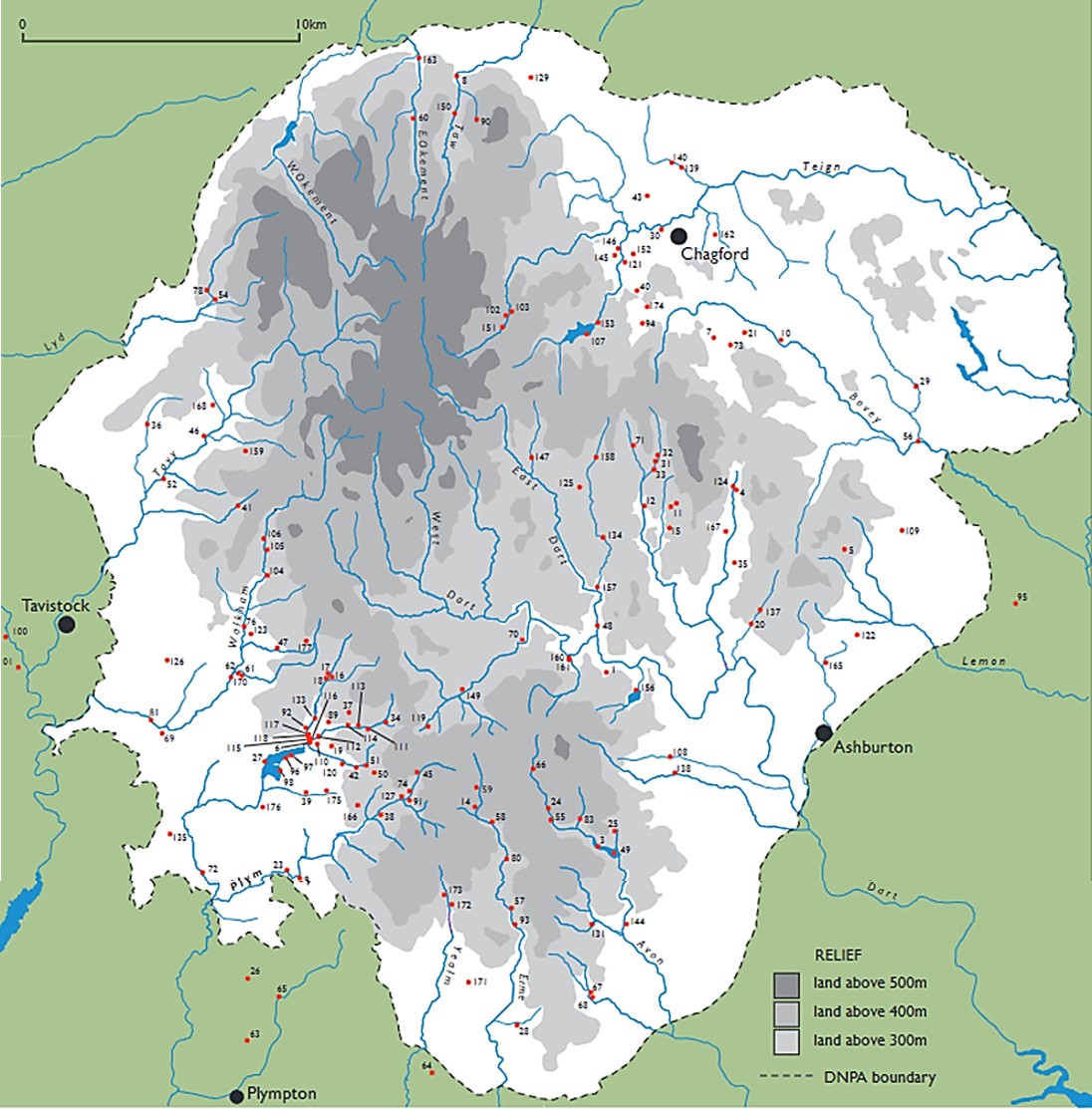
The intention of the post is not to plagiarise the work previously presented by Dr. Greeves but merely to acknowledge the painstaking research historically conducted, to provide useful ‘hyperlinks’ to the photographic record(s) in Dartmoor Explorations website posts whilst ensuring the historical numerical referencing is maintained. The author asked if he may use of the ‘Lodges and Mills’ map published in Dr. Greeves paper and permission was gratefully received.
This post mainly comprises tables of information, namely; 11 tables with details of 15 Tinners’ Mills plus one table with the remaining 12 Tinners’ Mills, which makes a grand total of 177, the same number as published in the aforementioned paper. The numbering is the same as that devised by Dr Tom Greeves.
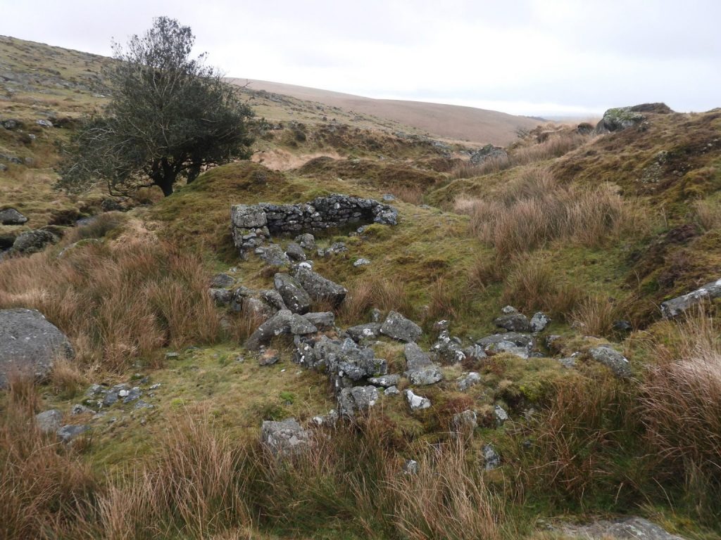
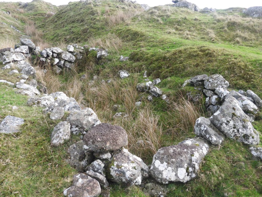
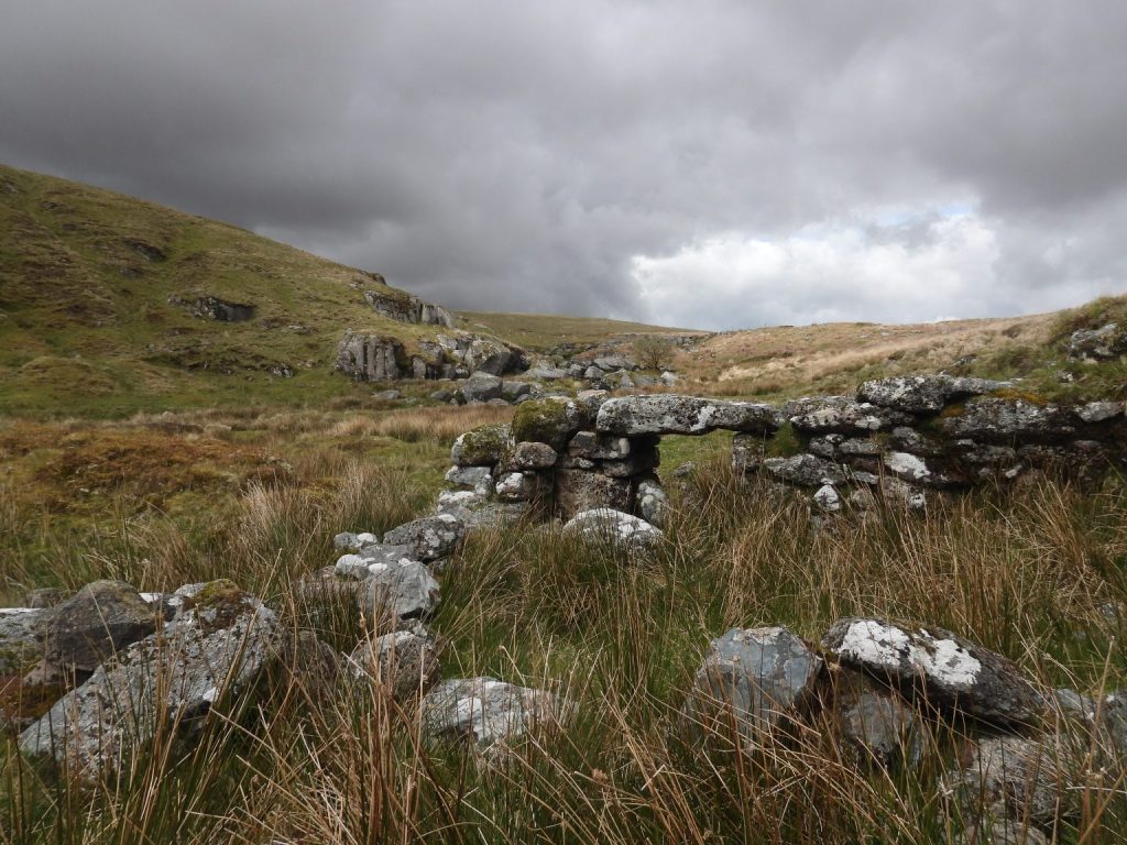
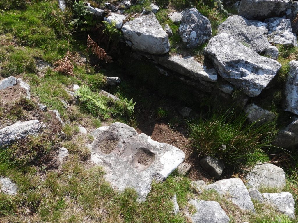
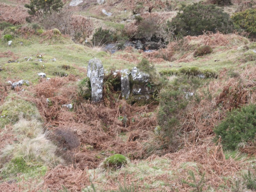
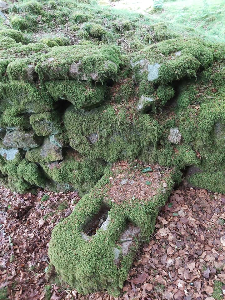
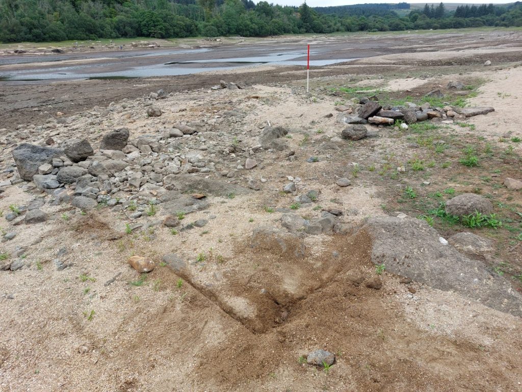
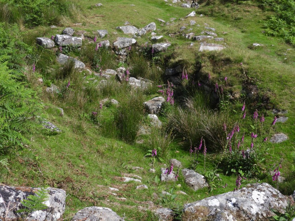
The term ‘mill’ in this context means a structure with water-power which was used to aid the crushing and / or smelting of tin ore. A Tinners’ Mill used for crushing ore is generally known as a Stamping / Knocking / Knacking Mill and many still have mortar stones indicating where the crushing took place. A Tinners’ Mill where there was a blast furnace used for smelting tin is generally known as a Blowing Mill or House and many still have mould stones and / or float stones indicating where molten tin was processed and poured. There are also examples where both crushing and smelting took place in the same mill. Another term sometimes used is a Clash Mill, which had the function of crushing tin ore and preparing un-smelted black tin. All mills generally have evidence of where a water wheel was located (wheelpit).
Dr Tom Greeves in the title of his paper uses the noun ‘Lodges’ as a generic term ‘for an accommodation building used by the tinners (and others) before about 1750….’. The word ‘Tynlogge’ is evident in historical documents. The term ‘Lodge’ relates (in the main) to Tinners’ Huts, which are structures associated in the main with tinworks. The reason for mentioning the term here is that it is known that many sites on the OS maps of Dartmoor are marked as Tinners’ Hut (ie Lodge) but some are also known to be sites of mills.
Bibliography
- The Tinworking Landscape of Dartmoor in a European Context – (2016) – Paper presented by Dr Tom Greeves – Lodges and Mills: The Field Archaeology of Tin Accommodation, Stamping and Smelting on Dartmoor at the conference (6th – 11th May 2016) at Tavistock
- Dr Tom Greeves – (2026) -Pers. Conv.
| Mill Number / Name / Date (if known) | NGR Location | Comments |
| 1. Aller Brook (Holne) | SX6753 7181 | Structure, possible leat |
| 2. Ashburton (1504) | Not Known & not on map | Documented as Tin Mill |
| 3. Avon Dam | SX6722 6553 | Usually submerged under reservoir, many feature(s)** |
| 4. Bag Park (see also Pitton) | SX722 783 | Private land, mortar stone |
| 5. Bagtor | SX7612 7625 | Mortar stone |
| 6. Bal Mine / Whitemoor Mead | SX5683 6928 | Broken mortar stone recorded in 1971 but this is now missing. |
| 7. Barramoor | SX7140 8388 | Private land, mortar stone |
| 8. Belstone | SX6212 9337 & SX6213 9332 | Mould stone & mortar stone found |
| 9. Blacka Brook | SX564 644 | Eric Hemery reported a double mortar stone at the NGR in 1962 |
| 10. Blackaller (1527) | SX7377 8377 | Slag found at site of documented tin mill. Donated to Plymouth Museum. |
| 11. Blackaton (pre-1566) | SX700 779 & SX6986 7782 | Private land, the mill was already a ruin in 1566 |
| 12. Blackaton Ball Moor | SX6884 7812 | Private land, knocking mill, leat embankment, wheelpit, buddles |
| 13. Blackaton Brook/ Lovebrook* (1530-1590) | Not Known | Documented as a Blowing Mill |
| 14. Blacklane Brook / Wollake (1532, 1538-9) | SX6290 6690 | Leat and Building |
| 15. Blackm[ore] (1582) | SX698 770 | Documentary references indicating the presence of a Medieval tin mill but no proof has been found to confirm this. |
| Mill Number and Name | NGR Location | Comments |
| 16. Black Tor Falls A (left bank) | SX5749 7161 | Building, leat, mortar stones |
| 17. Black Tor Falls B (right bank) | SX5748 7162 | Building, leat mortar stones and other features* |
| 18. Black Tor Falls C (lower) | SX5743 7157 | Cache and holed stone at location |
| 19. Blacktor (Middleworth) (1693) | SX5760 6915 | Leat and wheelpit remains |
| 20. Bowden (Buckland) | SX7277 7356 | Poor remains, possible wheelpit |
| 21. Bowden Mill (North Bovey) | SX7252 8407 | Mortar stones found. Also probable mould stone and crazing mill stone |
| 22. Bradford (1687-1697) | Not Known and not shown on map | Documented as Tin Mill |
| 23. Brisworthy (1560) | SX5602 6469 | Worth in 1940 reported two mortar stones at mill |
| 24. Broad Falls (1599) | SX6545 6692 | Clash Mill with leat, wheelpit and structure. Mortar stones reported by Worth |
| 25. Brockhill Stream | SX6783 6609 | Leat and structure |
| 26. Brownie Cross | SX5452 6090 | No remains. A group of anomalies recorded by geophysical survey |
| 27. Burrator Lodge | SX5520 6859 | Undocumented. Two mortar-stones recovered from pile of dumped stone here |
| 28. Butterbrook | SX6422 5920 | Structure extant, part mould stone, slag found nearby |
| 29. Caseleigh (1599,1613) | SX7877 8216 | Tin slag from extensive spread on right bank of Wray Brook |
| 30. Chagford Bridge | SX6950 877 | A possible mortarstone was found in pile of stone removed from wall near Chagford bridge |
| Mill Number and Name | NGR Location | Comments |
| 31. Challacombe A | SX6933 7941 | Mould stone at Challacombe Medieval Village |
| 32. Challacombe B | SX6940 7961 | Mortar stone at Challacombe Medieval Village |
| 33. Challacombe C (16th cent.) | SX6922 7915 | Private land. Very disturbed structure |
| 34. Chance, Wheal | SX5955 7000 | Wheal Chance Tin Mine, dating from the early 19th-century, is thought to be located on the site of a possible post-medieval stamping mill. |
| 35. Chittleford | SX7215 7577 | Mill Meadow (tithe apportionment) contains a stony mound in its north-east corner and old tin workings in its south-west corner |
| 36. Cholwell Brook | SX5095 8076 | A double mortar stone was discovered here in June 2000 |
| 37. Claziwell | SX5824 7035 | Building, wheelpit and possible buddles |
| 38. Colesmills | SX5935 6676 | Leat, building, wheelpit and mortar stones |
| 39. Colleytown | SX5668 6748 | Private land. Earthen bank bordered the wheel-pit. No leat or mortar stone. A mould stone from the site is incorporated on the inside face of a cart-shed by Collyton Farm. Mentioned by Worth |
| 40. Collihole | SX6863 8558 | Private land. Mortar stones |
| 41. Colly Brook | SX5423 7782 | Buildings, a possible wheelpit and buddles |
| 42. Combeshead / Harthill (1571, 1582, 1584) | SX5850 6838 | Recorded by DTRG. Wheelpit, mortar stones, building, dressing floor, leat |
| 43. Cornish Adventure (1690) | SX69 89 | Documented mill. NGR is estimated |
| 44. Cowsic Combe (1602) | Not known | Documented Clash mill |
| 45. Crane Lake | SX6077 6818 | Was this mill the pre-cursor to Wheal Katherine? |
| Mill Number and Name | NGR Location | Comments |
| 46. Creason (1606, 1607,1609, 1716) | SX 5300 8034 | Private land. Structures and wheelpit |
| 47. Criptor | SX 5564 7266 | Structure – very overgrown |
| 48. Dartmeet (1514) | SX 672 735 | Documentary evidence of Knocking Mill and Blowing Mill. Only leat remains |
| 49. Dean Moor | SX 678 653 | Tin Slag found |
| 50. Deep Adit / Deepwork, South (Ailsborough) | SX 5915 6820 | Mortar stone found at NGR |
| 51. Deepwork, North | SX 5886 6846 | Structure, wheelpit, leat |
| 52. Devon United (Central) | SX 5155 7879 | Structure, wheelpit, leat |
| 53. Ditsworthy | Not Known | Tin slag found |
| 54. Doetor Green / Mary Emma (1594, 1627, 1694,1732, 1740) | SX 5333 8524 | Building, leat, furnace, dressing floor, slag found |
| 55. Dorothy, Wheal | SX 6552 6650 | Building, leat dressing floor, wheelpit |
| 56. Drakeford Bridge | SX 7878 8015 | Leat and tin slag |
| 57. Dry Lake, Lower | SX 6400 6337 | Building and leat |
| 58. Dry Lake, Upper (aka Hux Lake) | SX 6336 6636 | Building, wheelpit, dressing floor, leat |
| 59. Ducks Pool Stream | SX 6293 6766 | Building, leat, axle-bearing stone, wheelpit |
| 60. East Okement Farm | SX 6062 9181 | Structure and leat. Tin slag found |
| Mill Number and Name | NGR Location | Comments |
| 61. Eggworthy A (1583) | SX 5435 7183 | Structure, wheelpit, mould stone, tin slag found, |
| 62. Eggworthy B | SX 5425 7183 | Structure and wheelpit |
| 63. Elfordleigh | SX 545 586 | Tin slag found |
| 64. Fardel | SX 6118 5743 | Mortar stone set as garden ornament |
| 65. Fernhill / Portworthy (1545-8, 1550, 1552, 1562, 1570, 1594) | SX 5565 6018 | Site marked as ‘millands’ on Shaugh Prior tithe (1842), refer to a blowing house |
| 66. Fishlake Foot | SX 6490 6834 | Building, wheelpit, fireplace |
| 67. Glazemeet A | SX 6683 6031 | Structure, wheelpit, leat, mortar stones, dressing floor, tin slag found |
| 68. Glazemeet B | SX 6682 6017 | Structure |
| 69. Gnatham / Fillace / Furze-hill / Little Horrabridge (1521, 1528, 1538, 1569, 1576-1588, 1596) | SX 5149 6962 | Former Blowing / Knocking Mill. Now a series of mortar stones set into a wall. Inspired DTRG logo |
| 70. Gobbett | SX 6453 7280 | Mortar stones, mould stones, crazing stones (upper and lower), building, site of furnace, leat |
| 71. Golden Dagger | SX 685 800 | Ordnance Survey first edition map of 1809 depicts the stamping mill adjacent to a small cottage in the vicinity of the later Dinah’s House |
| 72. Goodameavy / Doubts House (1616, 1815) | SX 5295 6460 | Documentary evidence only |
| 73. Gratnar / Everly | SX 7201 8362 | Private land. Structure, mortar stones and leat |
| 74. Hartor Tor, Lower | SX 6748 6743 | Mortar stones, leat, wheelpit, structure |
| 75. Hatchwood, Little (1743, 1748) | SX 443 719 | Documentary evidence of a Stamping |
| Mill Number and Name | NGR Location | Comments |
| 76. Heckwood and Rock Plantation | SX 5445 7347 SX 54380 72547 | Both Private land. Structure and a wheelpit at Heckwood and structure, wheelpit, embankment, leat and adit at Rock Plantation |
| 77. Hemerdon Ball* (1706) | Not known | Documentary evidence of Knocking Mill |
| 78. High Down | SX 5315 8559 | Possible structure, leat. Tin slag found |
| 79. Hole & Collaton* (1617) | Not known | Documentary evidence only |
| 80. Hook Lake | SX 6393 6509 | Structure, lea, wheelpit, bearing stone and other features |
| 81. Horrabridge (Franco) | SX5109 7010 | No additional information known |
| 82. Horridge* (1631) | No known | Documentary evidence only |
| 83. Huntingdon | SX 6658 6653 | No additional information known |
| 84. Ilsington* (1557) | Not known | Documentary evidence of Blowing mill |
| 85. Impham A* (1724, 1726, 1728-9) | SX 4398 7055 | Structure and tin slag found. Documentary evidence of stamping mill and ‘melting house’. Near Morwellham |
| 86. Impham B* | SX 4405 7130 | Stamping house and wheelpit. Near Morwellham |
| 87. Ivybridge / Meyes / Lewes Burys* Blowing Mill (c.1550,1555) | Not Known | Documentary evidence of Blowing / Knocking mill |
| 88. Keaglesborough A* (1565, 1577, 1584) | Not known | Documentary evidence of Blowing / Knocking mill |
| 89. Keaglesborough B | SX 5750 7002 | Mortar stone next to Raddick Lane track |
| 90. Lady / Louder Brook | SX 6285 9175 | Structure, wheelpit, leat, dressing floor |
| Mill Number and Name | NGR Location | Comments |
| 91. Langcombe | SX6037 6723 | Structure, wheelpit, mortar stone and dressing floor |
| 92. Leather Tor Farm (1511) | SX5668 6981 & 5672 6981 (tin slag) | Mortar stone (incomplete) built into inside face of north east wall of ruins of main dwelling of leather tor farm. Tin slag found |
| 93. Leftlake, below | SX6413 6273 | Mortar stones found by Worth (1940) and Hankin (1977) |
| 94. Lingcombe | SX6883 8440 | Tithe map field name Smithy Meadow. Lots of tin slag found. |
| 95. Liverton (1566) | SX823 743 (?) | Field name higher ‘blowing moor’ on tithe map. A38 now runs through location of field. |
| 96. Longstone A | SX5600 6876 | Inscribed stone on site is dated 1740. Slag found here plus structure and slotted stones. Below high water point at Burrator |
| 97. Longstone B (1623) | SX5607 6880 | Structure and tin slag. Below high water point at Burrator. Mould stone moved to Burrator discovery centre |
| 98. Longstone C | SX5575 6828 | Tin slag found |
| 99. Lovaton, Meavy (c.1550) | Not Known | Documentary evidence of Blowing mill and Knocking mill |
| 100. Lumburn (1560) | SX 4590 7310 | Documentary evidence of Blowing mill |
| 101. Lumburn Meadow (1579) | SX 463 720 | Documentary evidence of Knocking mill |
| 102. Manga, Left Bank | SX 6399 8467 | Possible double mortar stone |
| 103. Manga, Right Bank | SX 6409 8478 | Structure, leat, wheelpit |
| 104. Merrivale, Lower | SX 5527 7535 | Building, mould stone, float stone, furnace, leat. Tin slag found |
| 105. Merrivale, Middle | SX 5527 7624 | Mould stone, wheelpit, structure |
| Mill Number and Name | NGR Location | Comments |
| 106. Merrivale, Upper | SX5519 7640 | Two mills, wheelpits, numerous mortar stones, numerous mould stones, two buildings, bearing stone, leat, furnace, slag, dressing floor |
| 107. Metherel | SX6682 8402 | Under high water level of Fernworthy Reservoir. Tin slag found |
| 108. Michelcombe (Dodbrooke) | SX6983 6877 | Mortar stone found |
| 109. Middlecott (Ilsington) | SX7820 7693 | Mould stone found |
| 110. Middleworth | SX5709 6923 | Possible mortar stone at NGR |
| 111. Newleycombe (Blacksmith’s Shop) | SX5893 6986 | Structure, wheelpit, leat, dressing floor, possible reservoir |
| 112. Newleycombe (Nosworthy) | SX5713 6952 | Wheelpit, fireplace, structure, leat |
| 113. Newleycombe (Plym Consols) | SX5858 6990 | Double mortar stone with shallow hollows in openwork |
| 114. Newleycombe Right Bank | SX5820 6991 | Dressing floor on the edge of an area of streamworks |
| 115. Nosworthy Bridge | SX5678 6940 & SX5678 6940 | Unfinished mould stone incorporated in the north-western side of the base of the wall of the path from Norsworthy. Also, an unfinished mould stone lies in River Meavy beside right bank, about 30m above Nosworthy Bridge. |
| 116. Nosworthy | SX5687 6942 | Tin mould stone at Bal Mine found by R. M. L. Cook, E. Hemery and G. M. Spooner |
| 117. Nosworthy, Left Bank | SX5678 6958 | Structures, wheelpit, leat, mould stones, mortar stones, tin slag found, dressing floor, slotted stone |
| 118. Nosworthy Right Bank (1511) | SX5674 6954 & SX5675 6943 | Structure, mortar stone, wheelpit |
| 119. Nuns Cross Ford | SX6105 6988 | Two roomed building at NGR, other features* recorded by Greeves but not located |
| 120. Outcombe | SX5801 6860 & SX 5795 6861 | Structures, mortar stones, wheelpit, leat and other features* |
| Mill Number and Name | NGR Location | Comments |
| 121. Outer Down (1617) | SX682 866 | Private land. Structure, wheelpit, mould stones, tin slag found |
| 122. Owlacombe Cottage | SX7658 7317 | Private land. Mortar stones at NGR |
| 123. Parktown | SX547 732 | Private land. Mould stone at NGR |
| 124. Pitton (1526, 1574, 1581, 17th cent.) | SX7210 7852 | Private land. Documentary evidence suggests Stamping mill. Mortar stones and leat at location |
| 125. Pizwell (1521, c.1538,1578, 1599) | SX6656 7849 | Documentary evidence as Smithy. Leat and mould stone |
| 126. Plaster Down (pre-c.1750) | SX5168 7225 | Leat. Documented as Stamping mill |
| 127. Plym Steps (1499) | SX6026 6724 | Structure, wheelpit, leat. Recorded bearing stones |
| 128. Plympton St Mary (parish)(1680,1719, 1730,1751) | Not Known | Documentary evidence of a Smelting house / Blowing mill |
| 129. Ramsley | SX6480 9327 | Documentary evidence of a Blowing mill |
| 130. Rattlebrook Combe (1602) | Not known | Documentary evidence of a Clashing mill |
| 131. Red Brook | SX6694 6279 | Possible tin mill with leat leading to it. Burnard and Lewis refer to mould stones. They probably refer to two troughs |
| 132. Redlakecombe (1609) | Not Known | Documentary evidence of a Clashing mill |
| 133. Riddipit (1565, 1584) | SX5702 7016 | Mortar & mould stones recorded. Structure next to track. Knocking Mill |
| 134. Riddon | SX6741 7668 | Undocumented mill site. Field evidence includes a mould stone, mortar stone and tin slag found |
| 135. Roborough Down (1600, 1603) | SX52 66 | Documentary evidence of a Clashing mill and Knocking mill |
| Mill Number and Name | NGR Location | Comments |
| 136. Rudford next Churlbroke (1451-2) | Not Known | Documentary evidence as a Blowing Mill |
| 137. Ruddycleave | SX7308 7407 | Structure, wheelpit, slotted stone |
| 138. Runnaford Combe (1619, 1622- 3, 1630, 1651, 1652) | SX700 682 (approx) | Documented as Blowing mill, Stamping mill / Knocking mill |
| 139. Rushford Wood | SX7024 9002 | Structure with possible wheelpit and tail race |
| 140. Sandsgate | SX6989 9019 | Small structure, possible wheelpit |
| 141. Seven Stone, Holne (1685) | Not Known | Documented as a tin mill |
| 142. Sheepstor A (1530) | Not Known | Documented as a knocking mill |
| 143. Sheepstor B (1680, 1719, 1730, 1751) | Not Known | Documented as a Blowing house |
| 144. Shipley Cottage | SX682 628 | Mould stone and possible float stone |
| 145. South Hill A | SX6783 8685 | Well preserved mill with wheelpit, leat. Tin slag found |
| 146. South Hill B | SX6801 8710 | Tin slag found |
| 147. Stannon Brook | SX6483 7956 | Structure, wheelpit, leat, tin slag found |
| 148. Stennan (1601) | Not Known | Only documented, mill type not known |
| 149. Swincombe River | SX6239 7113 | Structure, leat, possible wheelpit & dressing floor |
| 150. Taw River (1538-9, 1608) | SX6205 9197 | Takfield Mill (Hemery). Blowing / Knocking mill. Structure, wheelpit, leat, furnace, dressing floor, slotted stone, reservoir |
| Mill Number and Name | NGR Location | Comments |
| 151. Teignhead Farm / Fayrecombe / Blacksmith’s Shop (1457) | SX6377 8426 | Structure, wheelpit, furnace, buddles, mould stones, leat, tin slag found |
| 152. Thorn / Smutty Park | SX685 869 | Name which, when found in a historic context, seems invariably to relate to a tin blowing mill; these were often referred to as tin smiths |
| 153. Thornworthy | SX6723 8443 | Structure, slag found. Mould stone noted by Crossing in 1912 and now missing |
| 154. Throwleigh (? Ford) (1558, 1560) | Not known | Documented as Blowing mill |
| 155. Topsham (38 Elm Grove Rd) | SX969 881 | Mortar stone recorded |
| 156. Venford Brook | SX6859 7118 and SX68570 71174 | Submerged mill recorded by Worth plus mortar stone by reservoir path |
| 157. Wallabrook Clapper | SX6720 7489 | Tin slag found |
| 158a. Wallabrook Soussons | SX6716 7957 (mortar stones) | |
| 158b. Wallabrook Soussons | SX67273 79899 | Author is unsure why this isn’t on Greeves original list of 177, so has been added here for completeness. It maybe because it post dates 1750 and is ‘Runnige Moor Mine’ recorded in 1792. Structure, wheelpit, leat, dressing floor |
| 159. Wapsworthy | SX 5450 7980 | Tin slag found |
| 160. Week Ford Lower / Oakbrookfoot (1521?, 1608, 1609,1730, 1737) | SX 6619 7234 | Major structure, mould stones, mortar stones, leat, wheelpit, furnace, tin slag found. Known as Beara House |
| 161. Week Ford Upper / Oakbrookfoot (1521?, 1608, 1609, 1730, 1737) | SX 6618 7232 | Major structure, mortar stones, hearth stone, wheelpit, leat |
| 162. Week, Great | SX 7145 8760 | Double Mortar stone in barn wall |
| 163. West Cleave | SX 6077 9397 | Structure, wheelpit, leat |
| 164. Westhill, Torquay (1680, c.1695) | SX 91 65 | Documented as stamping mill |
| 165. Whiddon (1757, pre-1765) | SX 7545 7217 | Documented as Stamping mill |
| Mill Number and Name | NGR Location | Comments |
| 166. Whittenknowles | SX5859 6696 | Tin slag found |
| 167. Widecombe North Hall (pre-1669) | SX7184 7690 & SX7194 7683 & SX7185 7679 | Mortar stones recorded. Documented as Smelting house |
| 168. Will | SX5332 8145 | Mould stone. Recorded by Worth |
| 169. Willaford Mills (1479, 1578, 1609, 1614) | Not known | Documented as Smelting house, Blowing house, Knocking mill and Smithy |
| 170. Woodtown | SX5398 7164 | Private land. Mortar stone recorded |
| 171. Yadsworthy | SX6250 6070 | Findspot. Two-thirds of a granite mould stone found in a pile of stones at NGR |
| 172. Yealm Steps Lower | SX6179 6352 | Structure (two-roomed), mould stones, mortar stone, furnace |
| 173. Yealm Steps Upper | SX6172 6385 | Major single-roomed structure. Mould stones, wheelpit, leat, furnace, tin slag found. |
| 174. Yelland (Chagford) (1755) | SX69 85 | Documented as Stamping mill |
| 175. Yellowmead / Oldmede (1502, 1727) | SX5742 6755 | Structure, mould stone, mortar stone, tin slag found, slotted stone. Documented as Blowing mill |
| 176 Yeo (Sheepstor) | SX5512 6696 & SX5509 6697 | Mortar stones found |
| 177 Yes Tor Bottom | SX5669 7295 | Tin slag found |