A collection of walks, discoveries, insights and pictures of exploring Dartmoor National Park
November 6, 2022
Tinners’ Huts and Mills around Duck’s Pool, Blacklane Brook, Wollake and Erme Pits
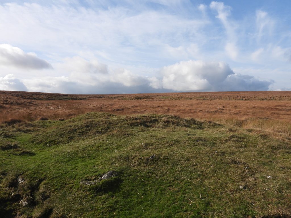
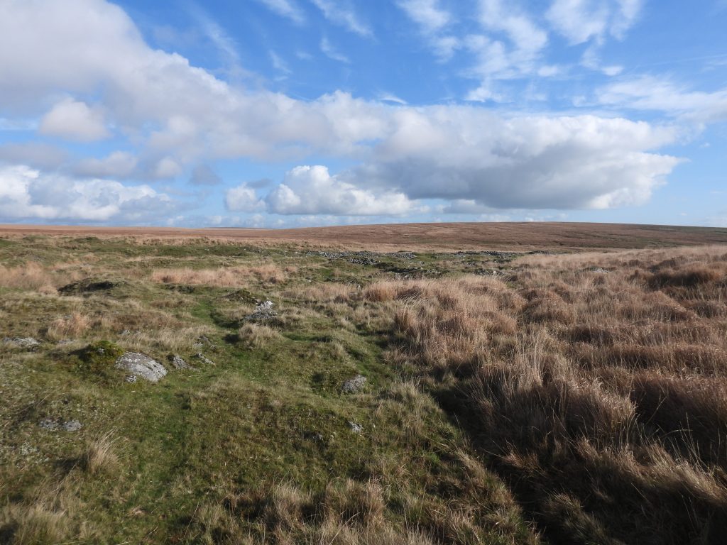
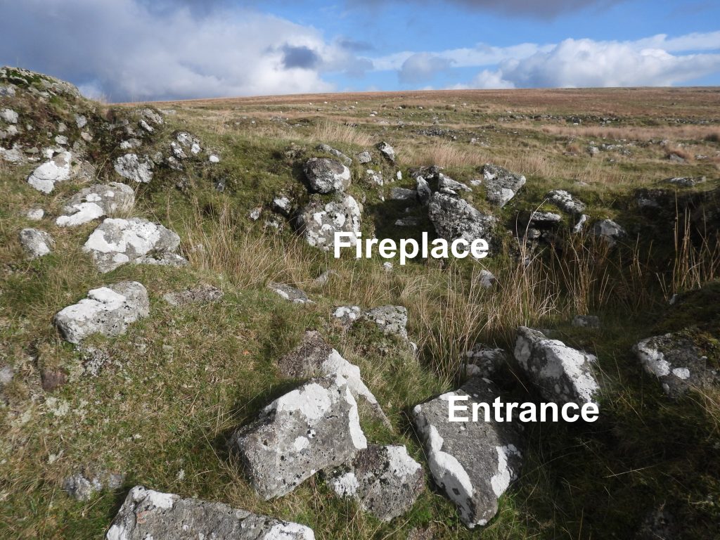
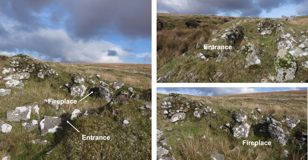
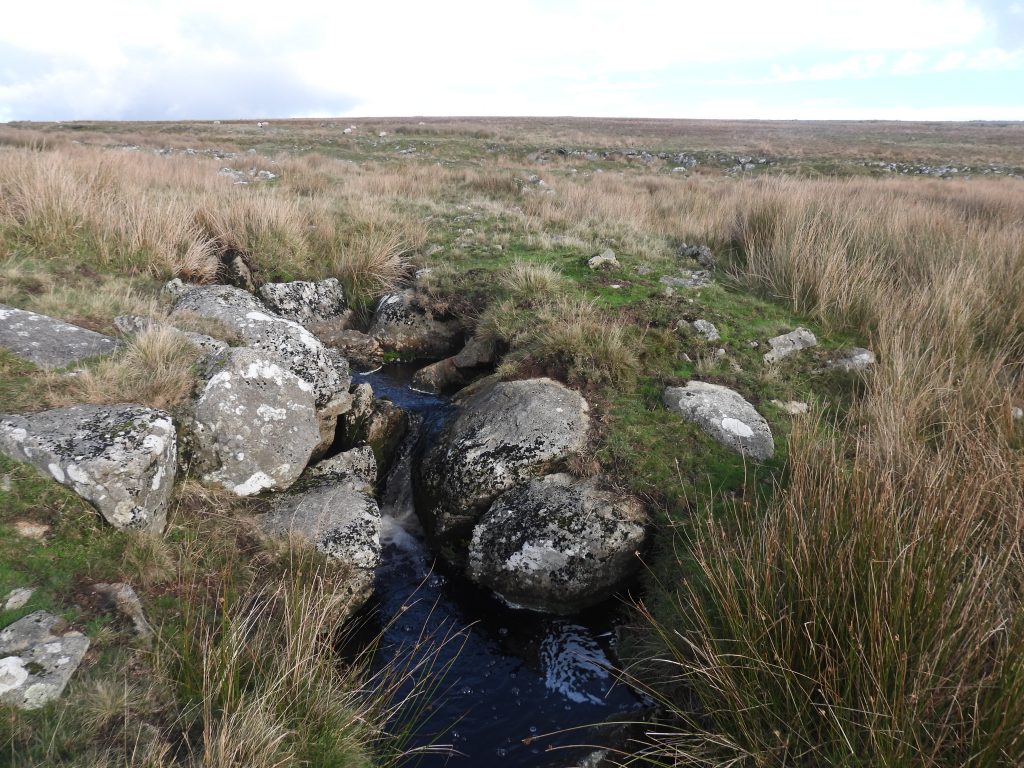
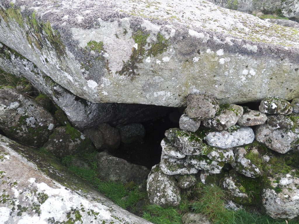
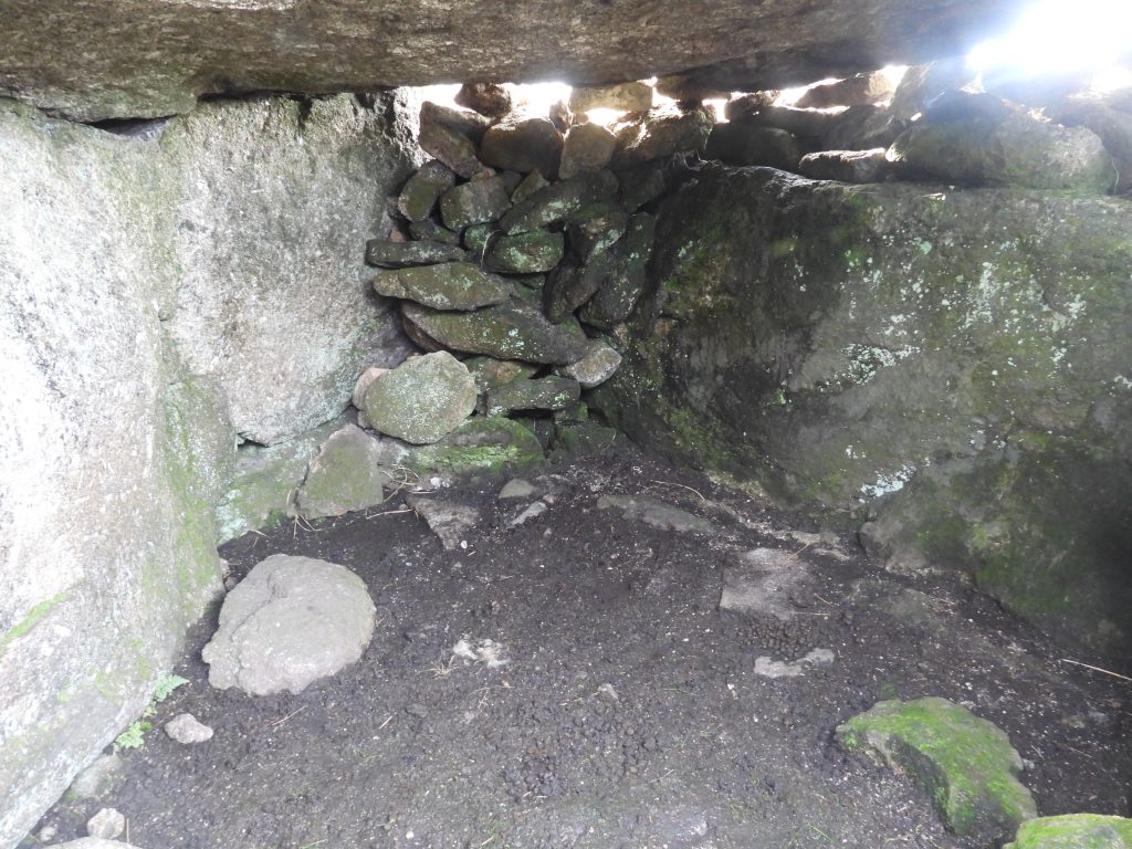
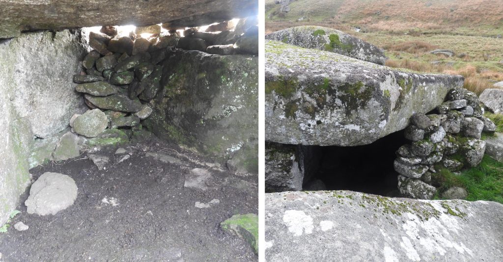
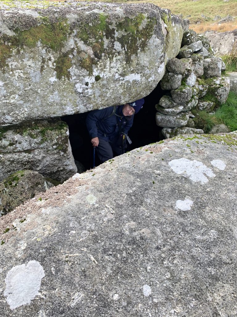
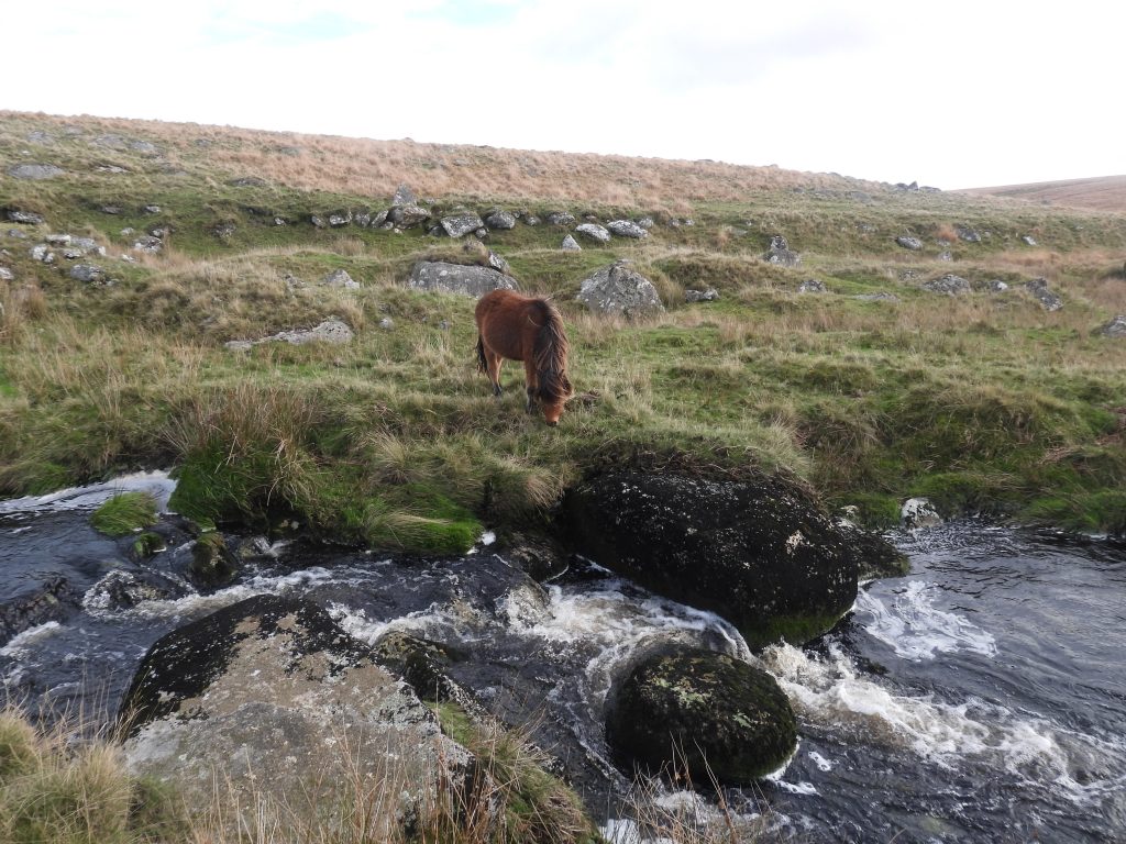
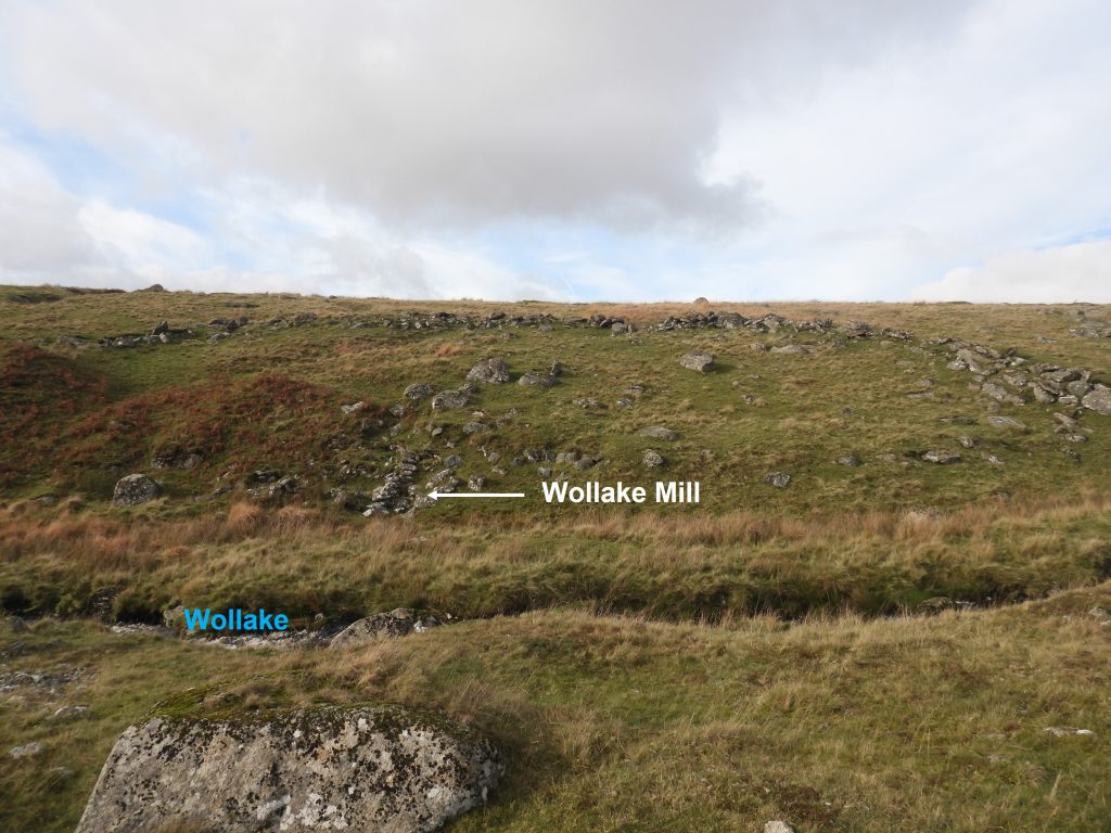
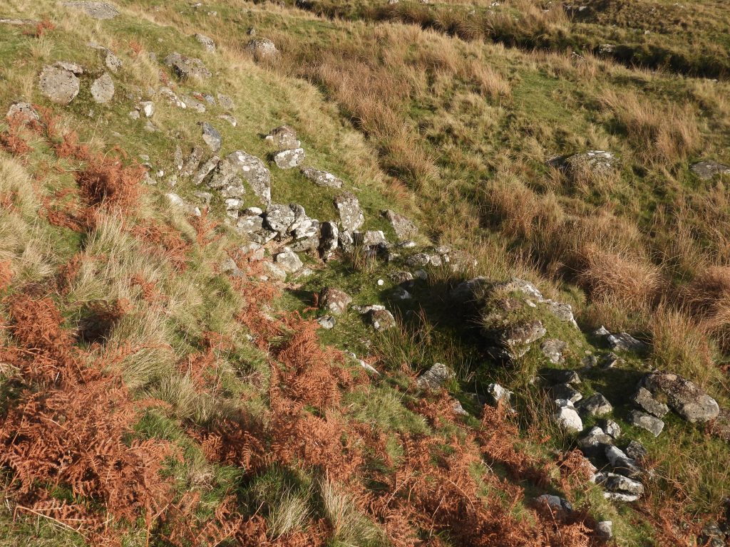
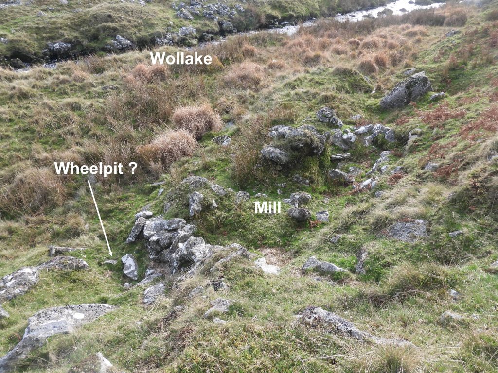
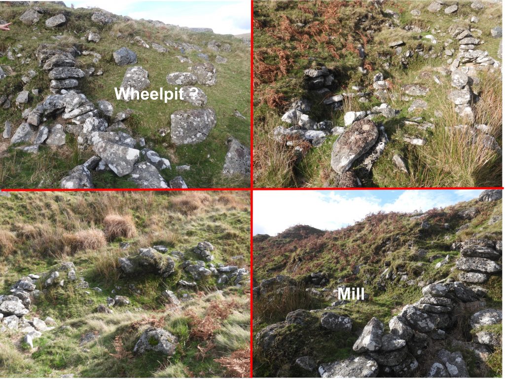
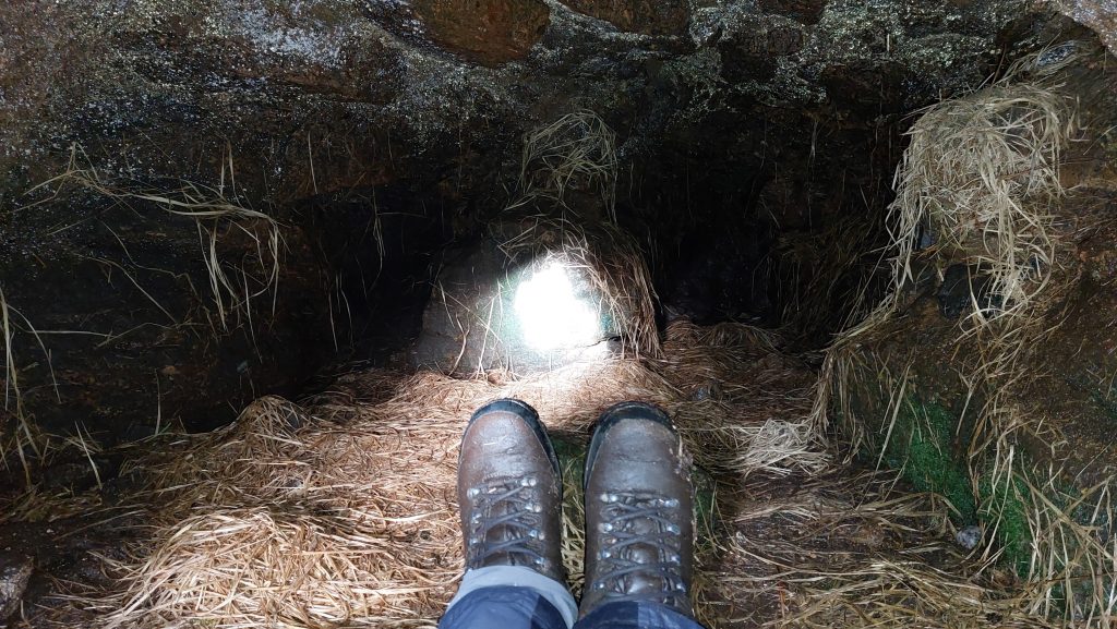
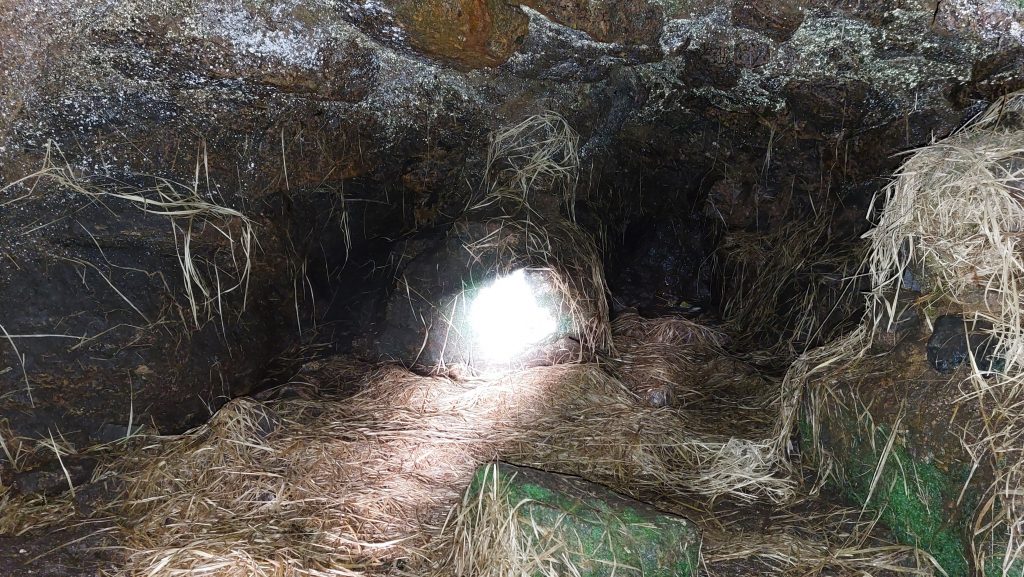
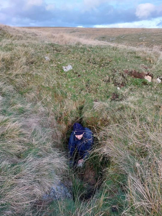
The upper reaches of the River Erme and its tributaries of Blacklane Brook, Ducks Pool Stream and the Wollake have extensive tin stream workings, which date from before 1600. As there has been little disturbance in this area since the abandonment of these workings they constitute some of the clearest and best preserved examples of this type of tin extraction on Dartmoor. Associated with the tin streaming are the related remains of blowing houses, tinners huts, other buildings and leats in the area. Couple this with the William Crossing memorial at Ducks Pool plus the underground chamber at Grants Pot the moormans shelter at Phillpotts Cave, this area makes for a fascinating exploration.
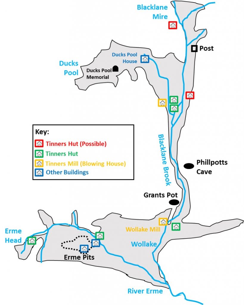
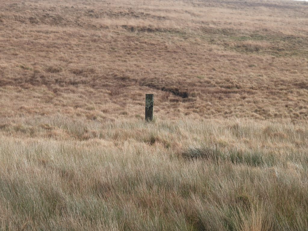
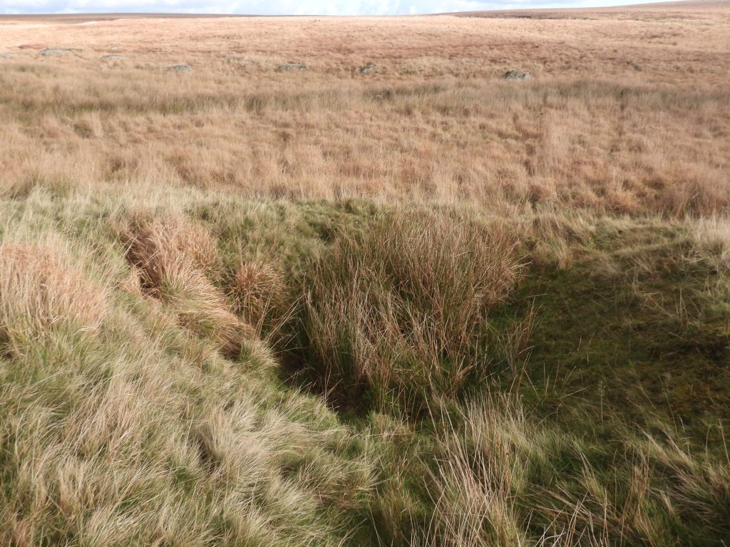
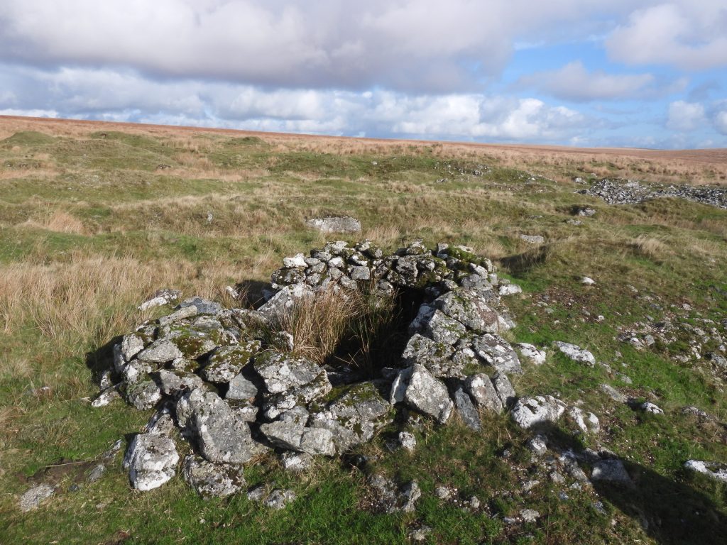
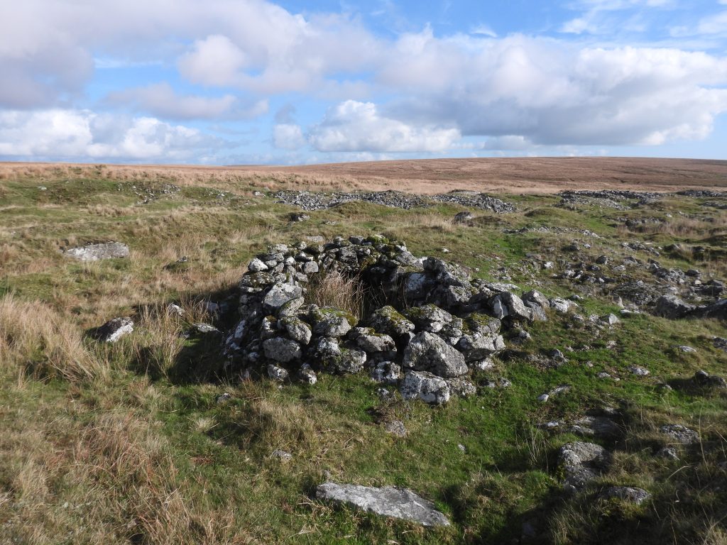
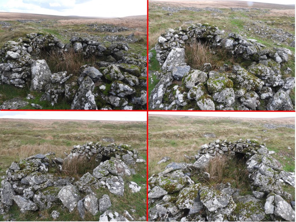
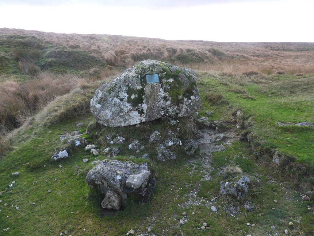
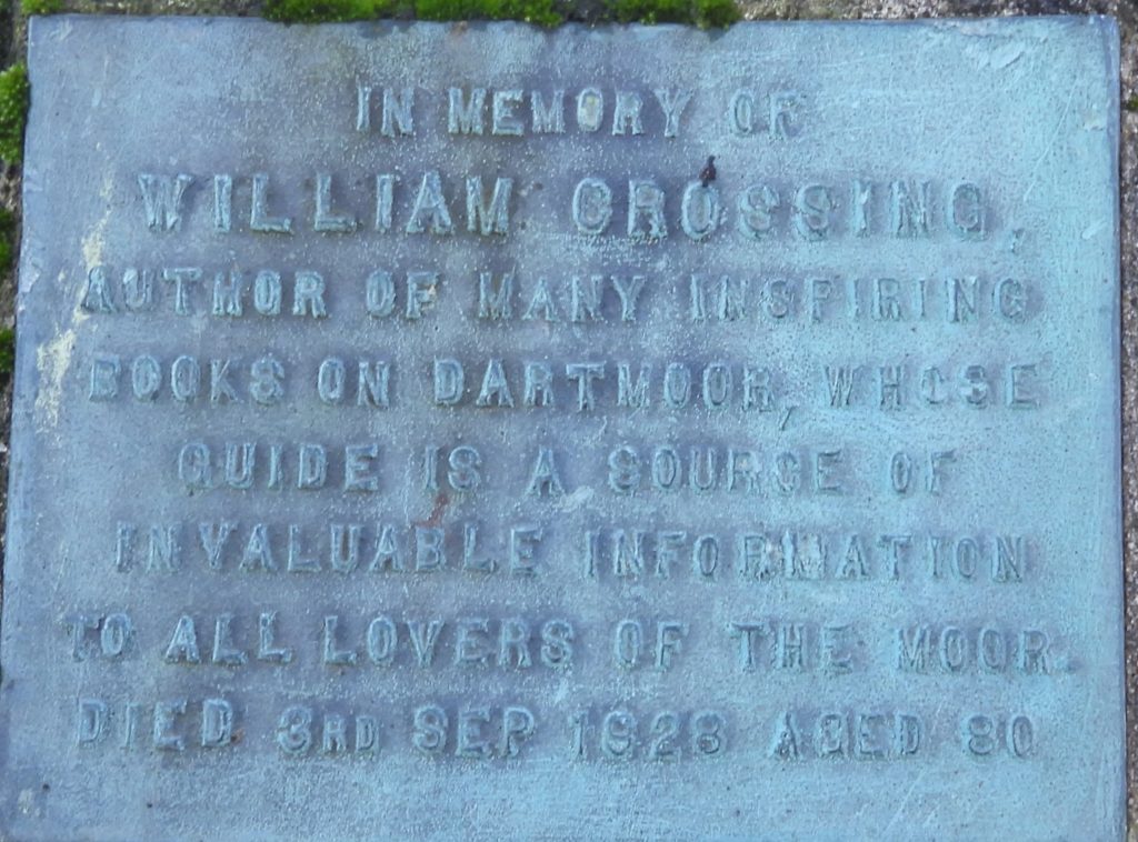
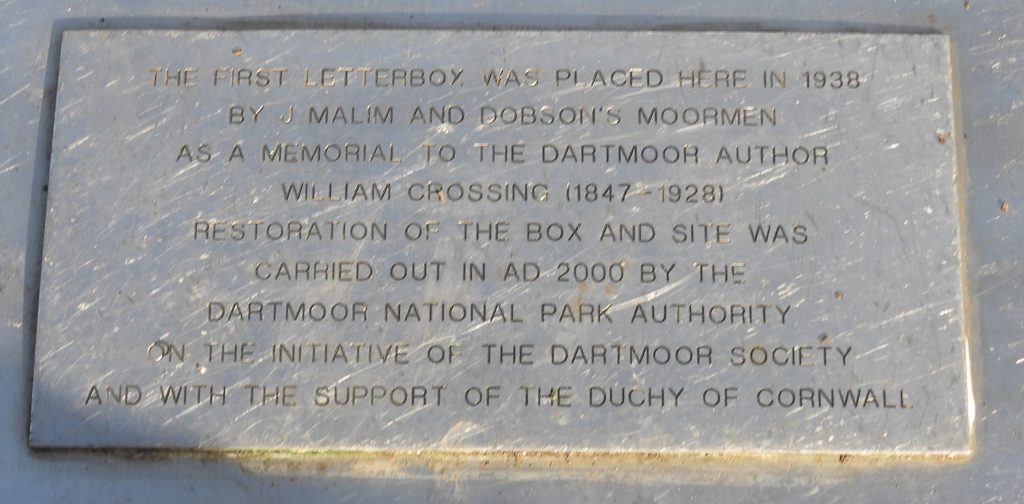
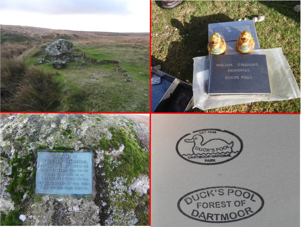
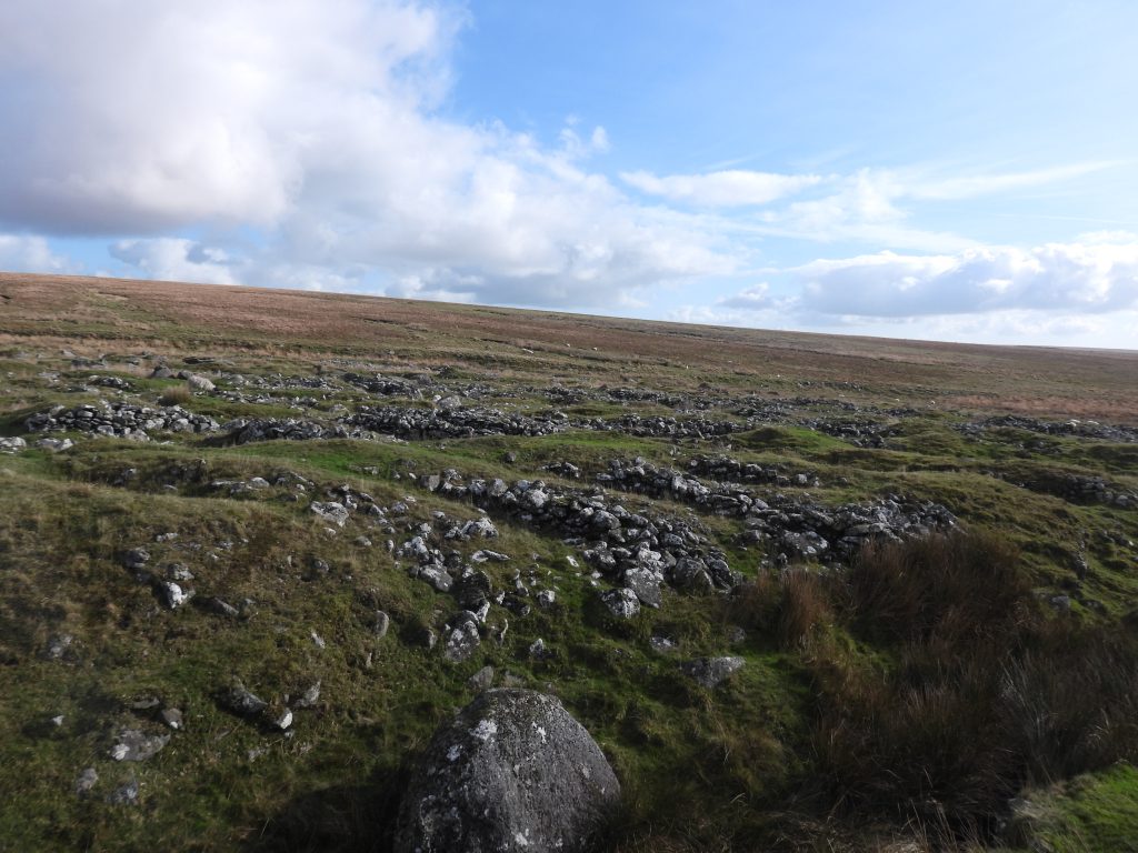
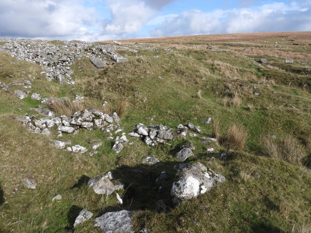
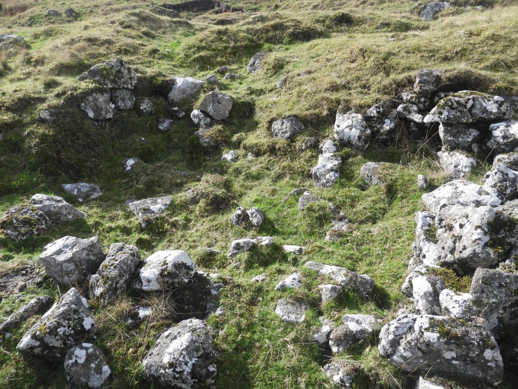
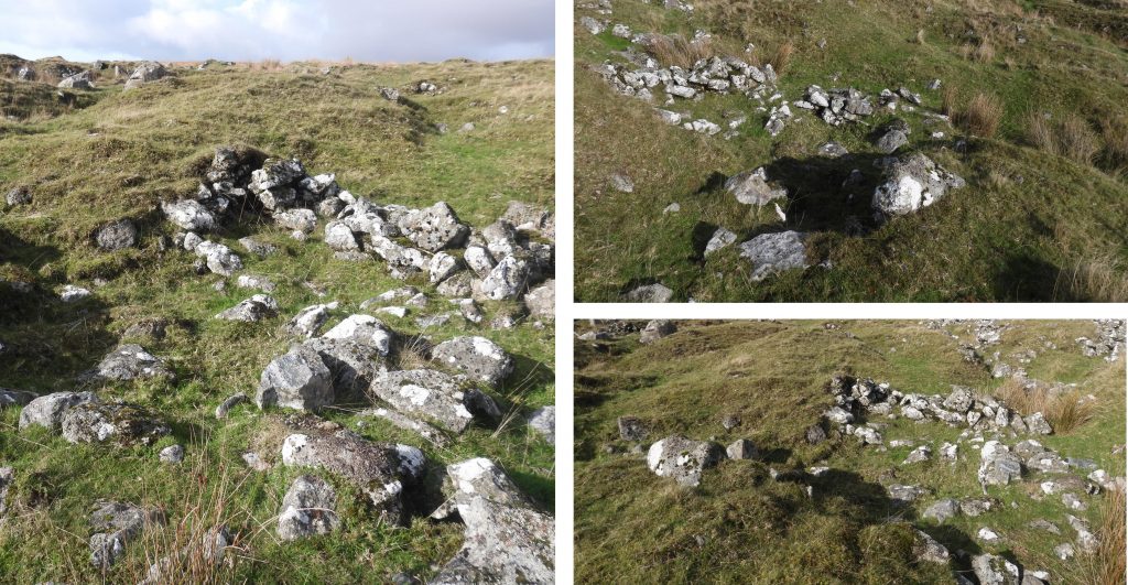
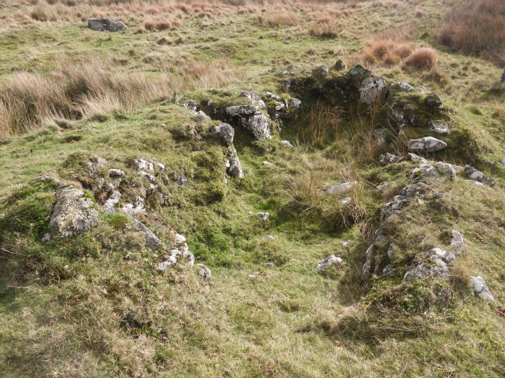
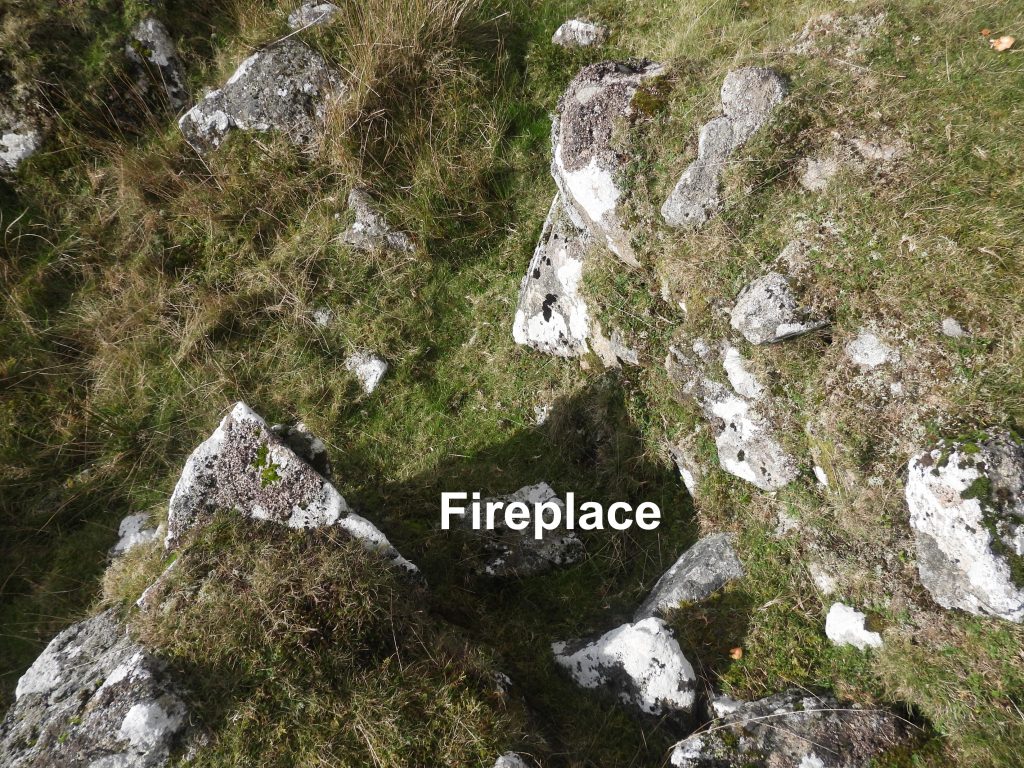
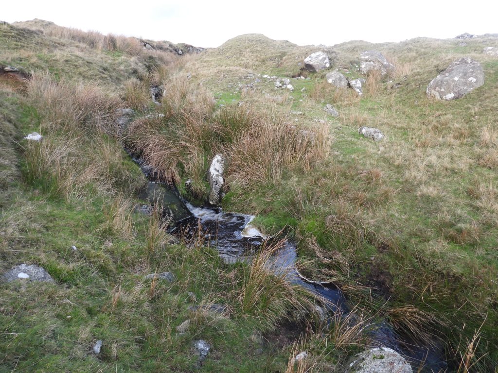
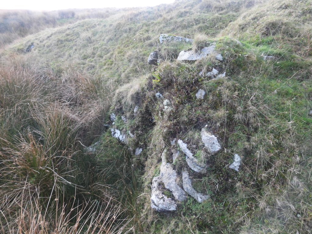
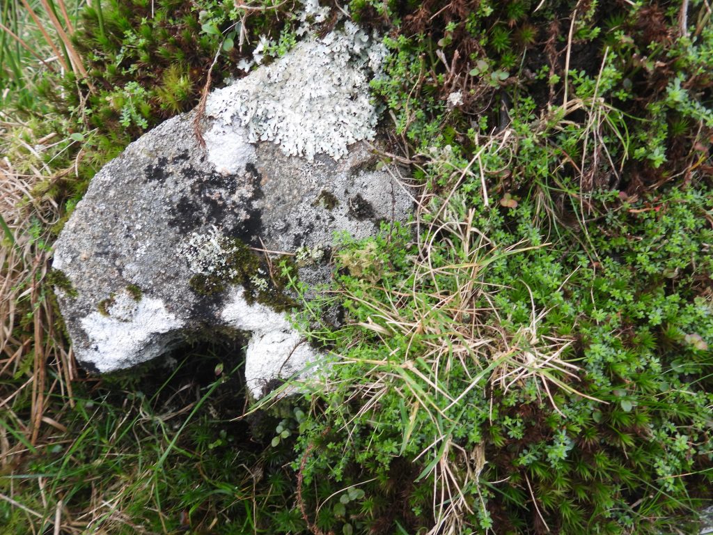
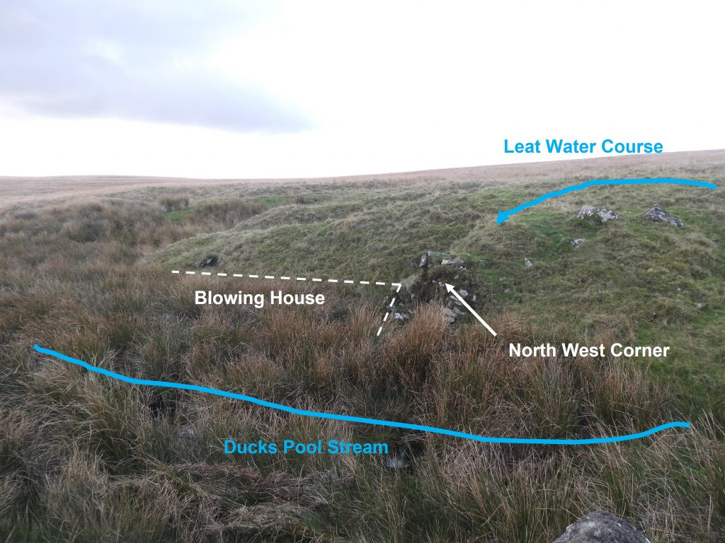
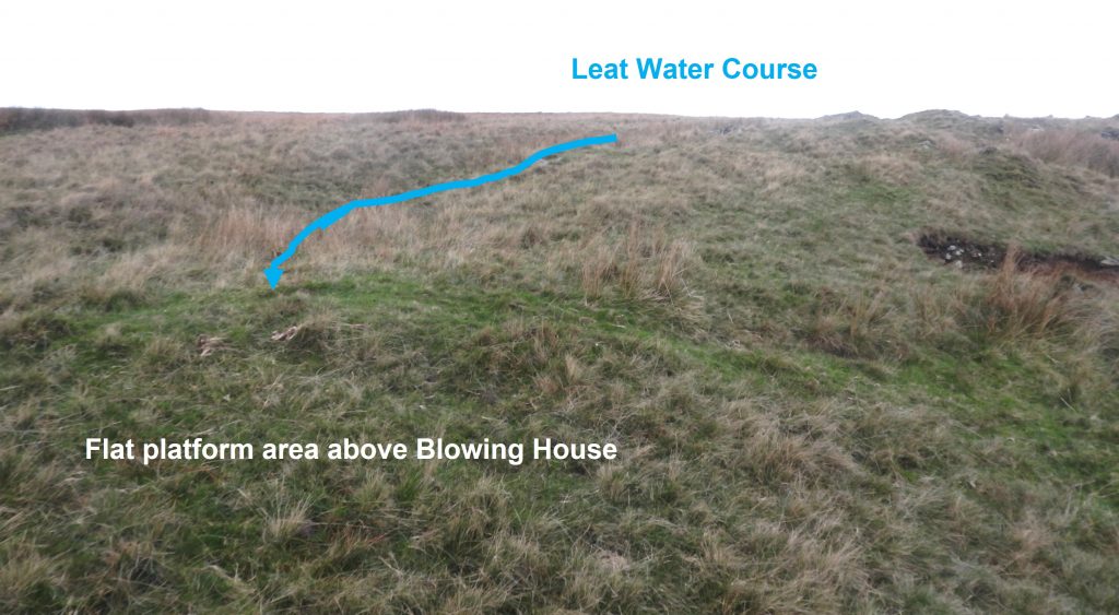
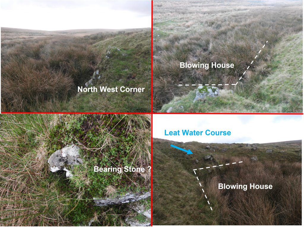
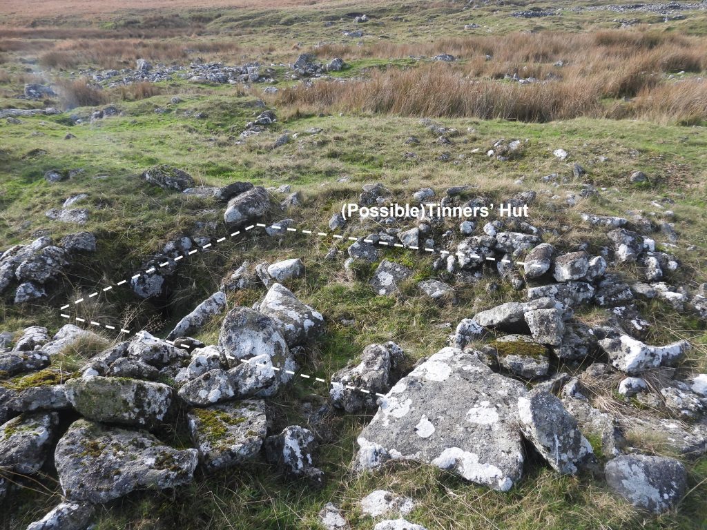
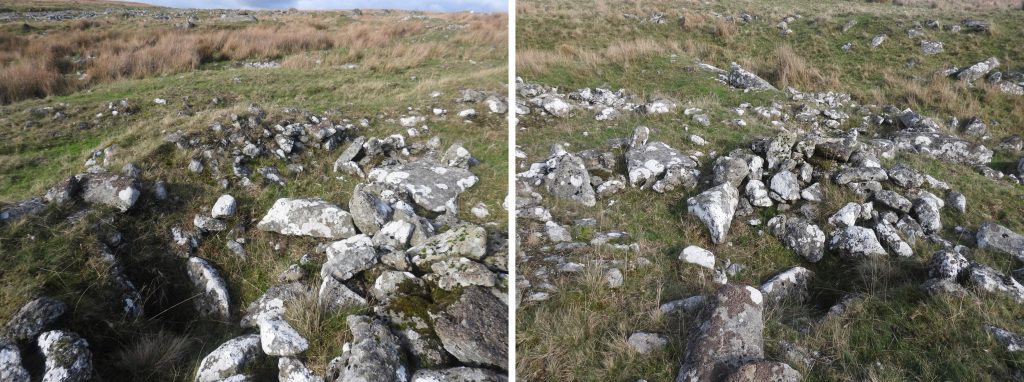
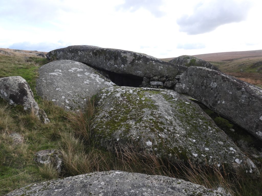
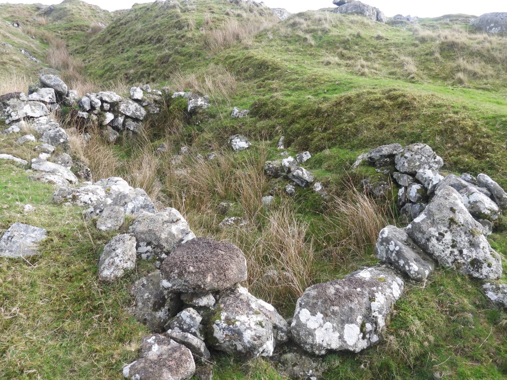
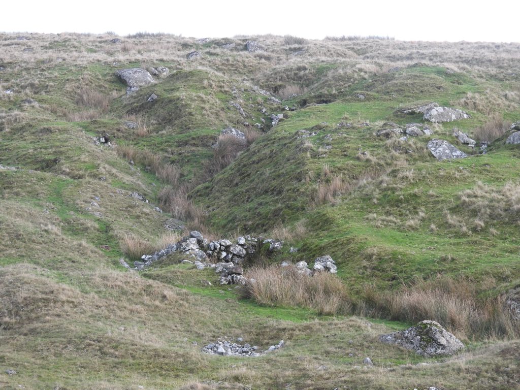
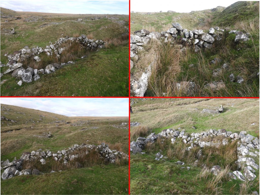
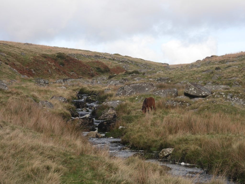
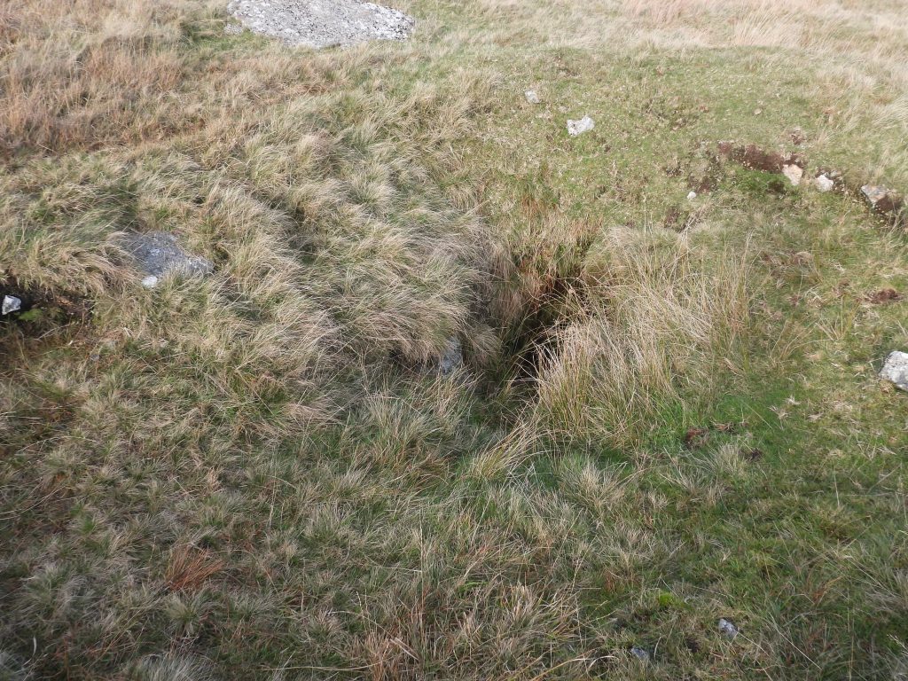
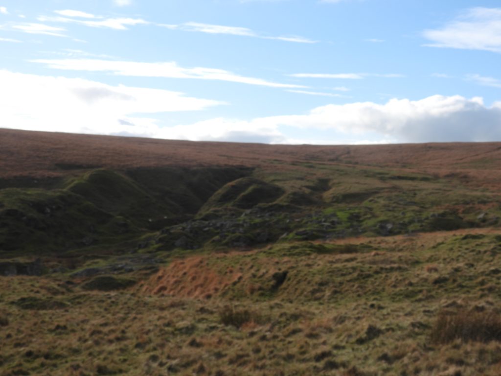
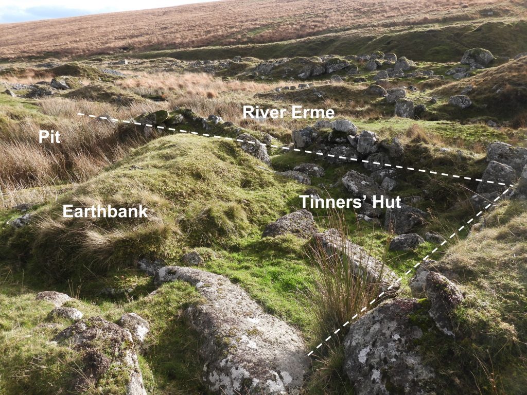
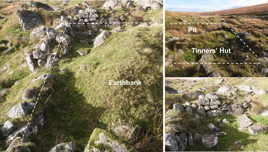
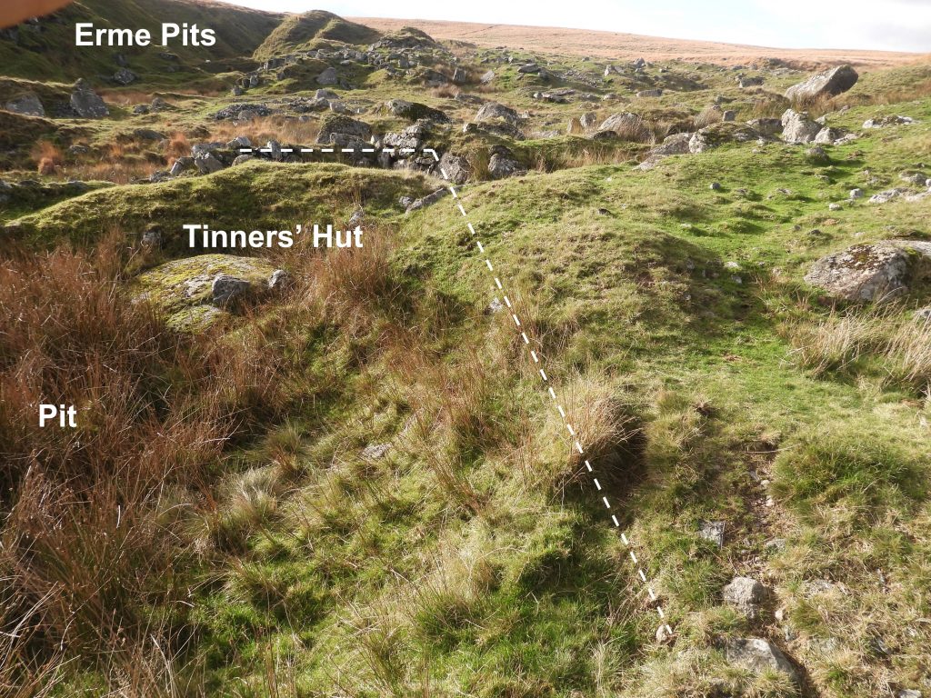
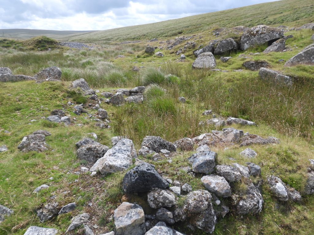
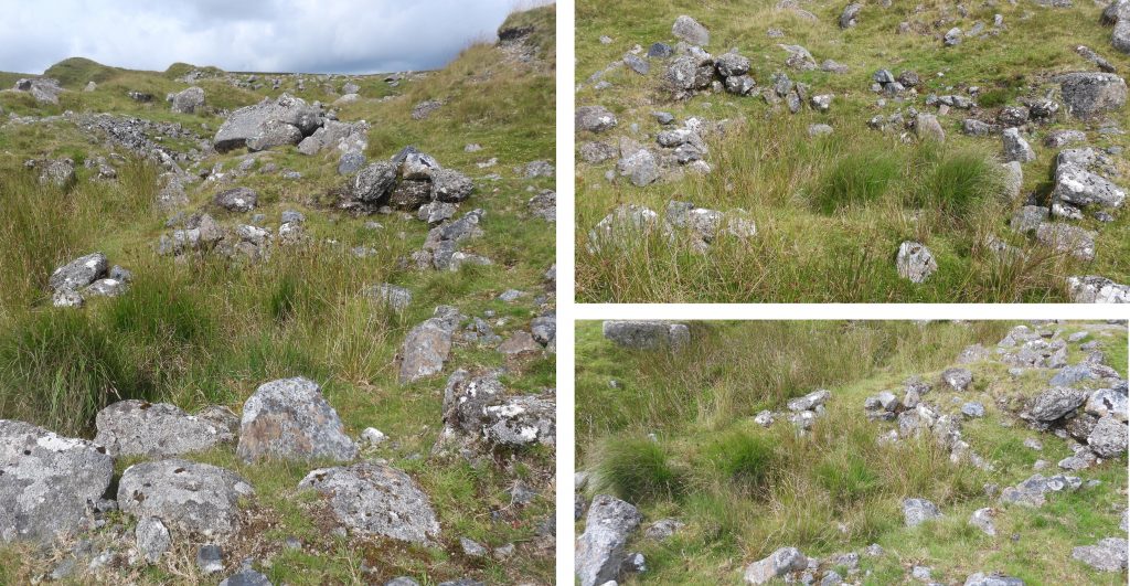
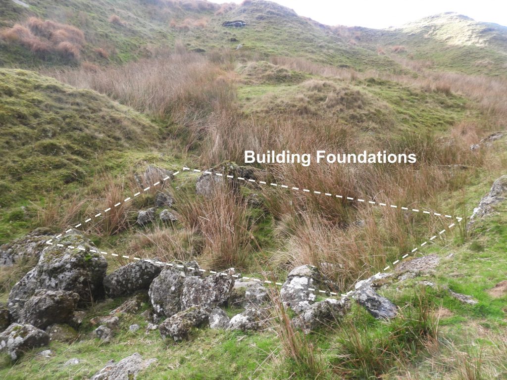
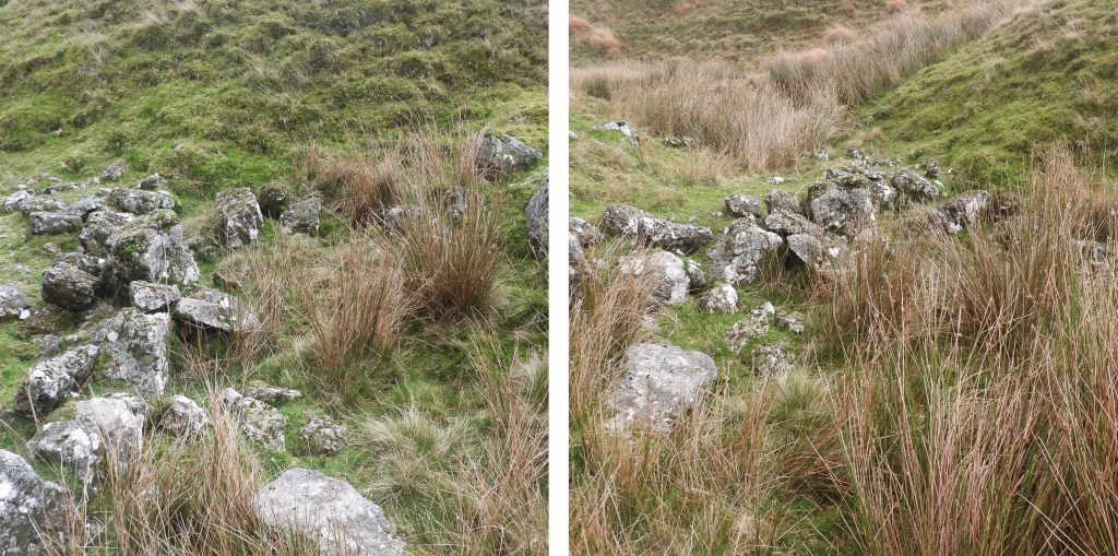
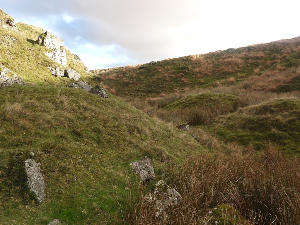
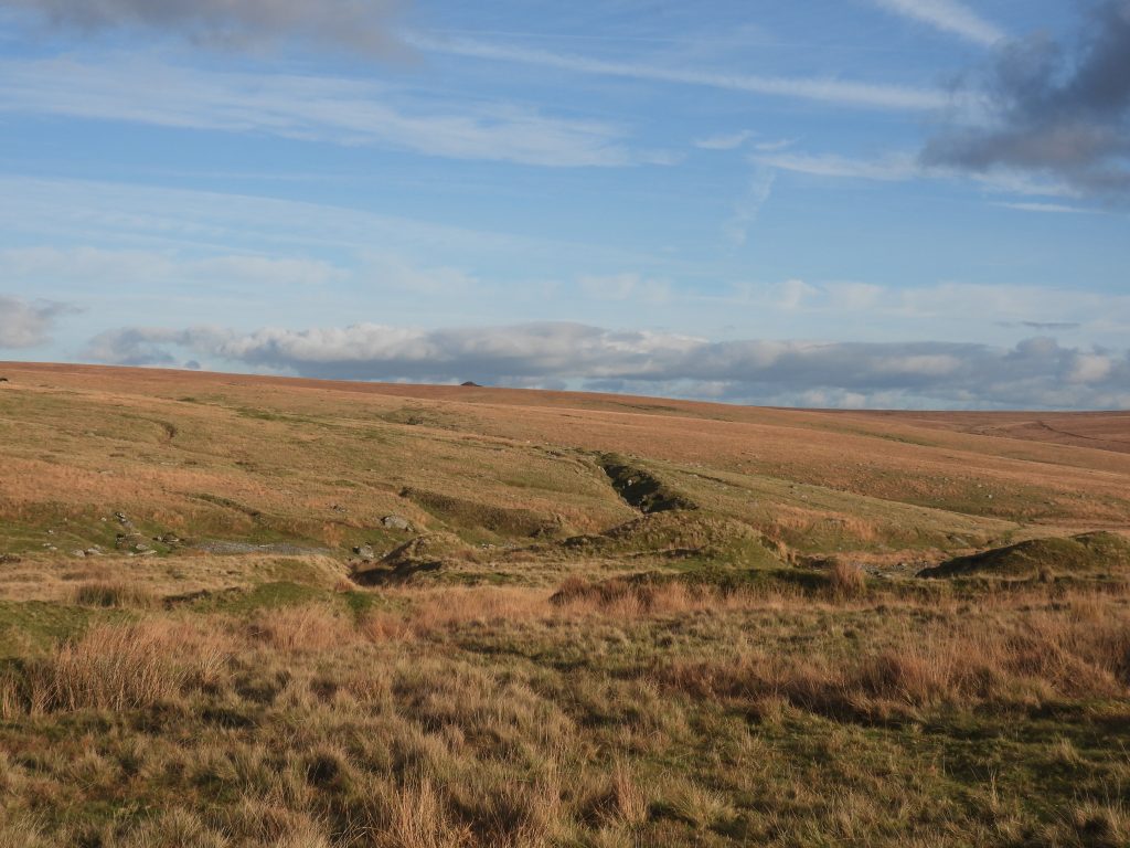
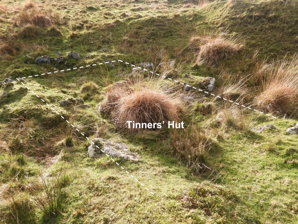
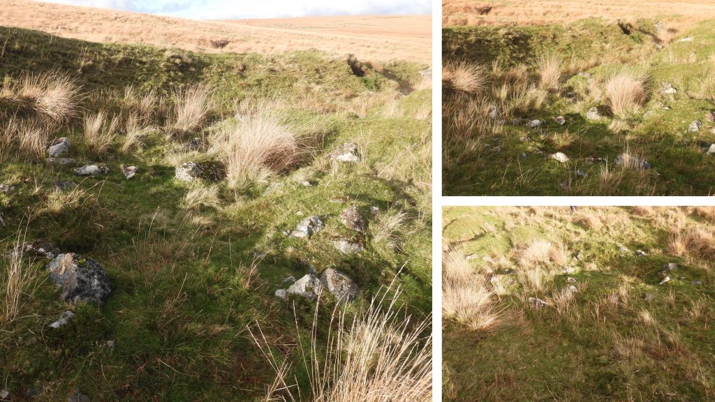
Sketch map of the area covered in this post. There are 12 buildings to find, namely; two Blowing Houses (mills), five definite tinners’ huts, three miscellaneous buildings plus two other possible tinners’ huts. All locations are shown in this post with annotated photographs with grid references.At the southern end of Blacklane (south) is an upright railway sleeper which is ideal for navigation in the area in low visibility conditions. The peat pass of Blacklane (south) formed a vital part of the old Dartmoor north-south route. It is the authors favourite route into the Ducks Pool area. In 2019, recorded in the Dartmoor HER by Dr Tom Greeves was the location of a possible tinners building on the right bank of the Blacklane Brook near SX6299 6815. There is very little evidence of any building in this area and the above picture is the most likely candidate of a tinners’ hut the author could find. The location is certainly is not a natural hollow but is it or was it the location of a building? The author is very doubtful that this is a tinners’ building simply because of the apparent lack of stones (which could of course be buried). The location is at SX62989 68137Jeremy Butler in Dartmoor Atlas of Antiquities: Volume Four – The South-East, 81, Map 55 recorded ‘Duck’s Pool House’ (TB12) as “a tiny building of 3.2 metres by 1.8 metres (which) was perhaps a tinners’ house but rebuilt with door jamb and fireplace”. Other observers have cast doubts as to whether this building had tinners’ origins.‘Ducks Pool House’ is located 200 metres east of Ducks Pool William Crossing Memorial at SX62775 67964. The Royal Commission for the Historical Monuments of England (RCHME) measurements for the building differ from those from Jeremy Butler being 2.5 metres east to west by 1.3 metres internally with coursed boulder walls 0.7 metres wide and a maximum of 1.1 metres high. Butler must have measured the building to the outside walls. The entrance is in the north wall and there is a recess 0.6 metres wide and 0.5 metres deep lies in the south-east corner (Ref: RCHME).According to RCHME: “This structure does not conform to the usual siting of tinners huts in that it is built on rather than into the streamworking remains and its condition would seem to indicate a relatively recent construction. It seems more likely to be a shepherds dwelling or shelter”. In 2018, Phil Newman wrote: “The site has previously been designated as a shepherds’ hut rather than a tinners’ hut, though there is no certainty that either is correct. The building certainly post-dates the tinworking remains within which it sits”. View of Ducks Pool William Memorial and the former tarn beyond.William Crossing Memorial at Ducks PoolClose up of plaque on the memorial. It reads: IN MEMORY OF WILLIAM CROSSING AUTHOR OF MANY INSPIRING BOOKS ON DARTMOOR WHOSE GUIDE IS A SOURCE OF INVALUABLE INFORMATION TO ALL LOVERS OF THE MOOR DIED 3RD SEP 1928 AGED 80The box containing the stamp(s) and visitors box at the William Cross Memorial has an inscription which reads: THE FIRST LETTERBOX WAS PLACED HERE IN 1938 BY J.MALIM AND DOBSON’S MOORMEN AS A MEMORIAL TO THE DARTMOOR AUTHOR WILLIAM CROSSING (1847 – 1928) RESTORATION OF THE BOX AND SITE WAS CARRIED OUT IN AD 2000 BY THE DARTMOOR NATIONAL PARK AUTHORITY ON THE INITIATIVE OF THE DARTMOOR SOCIETY AND WITH THE SUPPORT OF THE DUCHY OF CORNWALLFeatures of the William Crossing Memorial. It is nice to see the effort put into making such a professional looking visitors book. Very different from when the author first visited the site in the 1980s. Ducks Pool was once a moorland tarn which was drained by the tinnersLeaving the Ducks Pool area heading towards Blacklane Brook. The ‘dome’ of Green Hill can be seen in the distance.The former tinners’ workings near the junction of Ducks Pool Stream and Blacklane Brook are very characteristic spoil heaps and water channels enclosed by a sharply cut ‘cliffs’.Between the junction of Ducks Pool Stream and Blacklane Brook is the first of two tinners’ huts. The hut measures 3.7 metres by 2.3 metres internally and is located at SX62948 67683.The hut has no internal features visible in the rubble strewn interiorThe tinners’ hut is assumed to be a post-medieval date (Ref: Phil Newman). The second tinners’ hut is located 30m to the south of the first tinners’ hut at SX62949 67655In the second tinners’ hut is a fireplace (0.8m wide) located in the eastern wall.Opposite the fireplace is the assumed entrance on the western side. The interior dimensions of this tinners’ hut is 5.5 metres by 2.1 metres. The walls are around 0.8m thick and around 1.0m high. There is a tinners’ mill (Blowing House) approx 15m to the west. This hut is a perfect spot for lunch !Ducks Pool Stream between the second tinners’ hut and the tinners’ mill (Blowing House).Blowing House (mill) remains adjacent to Ducks Pool Stream. This mill is mentioned by Worth (Ref: Worth’s DARTMOOR – page 300) as ‘Blacklane Brook (B)’. Worth records that: “The leat is clearly traceable, and there is the usual raised bank to take the launder which fed the wheel. No moulds or mortars are to be seen, but there is a stone with a bearing well worn and polished. May have been Wallack Mill”. Wallack Mill is documented in 1532-3 and 1537-9 (Greeves) but identifying this site with Wallack Mill is uncertain and there is considered to be a ‘better candidate’ further downstream next to the Wollake.Is this the bearing stone mentioned by Worth circa 1940 ? The Ordnance Survey dated 1977 stated that the axle-bearing stone is still in position and the outline of the wheel pit can be seen on the north side. The blowing house is at SX62935 67654. All that remains today is a fragmentary north-western wall corner next to the right bank of the stream but large parts of the original structure are largely obscured by marsh. There is a small platform above the remaining wall from which a leat can be traced.The RCHME records that “Immediately north of the wheel pit is a slight platform above the stream measuring about 2.0m square and bounded on the west by a well-constructed revetment 1.9m high”. In spite this additional information, the exact location of the wheelpit is very difficult to discern. Writing in 2019, Dr Tom Greeves stated that Worth’s original plan of the structure in 1933 seemed reliable but queried the position of the wheelpit. He further stated the confirmed status as a mill is known. However that said, he discusses a stamps area next to the wheelpit, which suggests thoughts of this being a knacking (stamps) mill and not a Blowing House.Blacklane BrookIn 2019, recorded in the Dartmoor HER by Dr Tom Greeves was the location of a second possible tinners’ building, this one being on the left bank of the Blacklane Brook near SX6302 6770. As with the first tinners’ building (near Blacklane Mire) recorded by Greeves in 2019, no additional information is recorded, so an assumed location in the above photograph is suggested by the author. The area is heavily strewn with boulders but a rectangular outline can just be made out.This location of this possible tinners’ hut / building is at SX63028 67685, so within the bounds of error from the Greeves recorded grid reference. Entrance to Phillpotts CavePhillpotts Cave is located at SX63037 67289. Essentially it is a huge rock slab (10.5m x 4m) with supporting boulders and ‘plugged’ in stones to make a cave / shelterInside the cave / shelter. According to Eric Hemery, it is known as Phillpotts Cave as Eden Phillpott’s used it in World War 1 to store provisions for moormen. Hemery also states that a John Spencer used to shelter here but not date is supplied. An alternative for the name is given by J.Earle who states that Tony Phillpotts, a hunt servant, stored food and drink as refreshments for the hunt here, which is why its called Phillpotts CaveExiting Phillpotts CaveAt the southern end of Blacklane Brook, the stream becomes known as Wollake. Here, there is more evidence of tin streaming and a tinners’ hut and mill. The tinners’ hut shown in the above photograph is 5.2m. by 2.5m with walls 0.9m thick. It is located at SX62953 66909View of the tinners’ hut as zoomed in from across the Wollake. The tinners’ hut is assumed as being Medieval or later date. As recorded in the Dartmoor HER: “The only possible position for a doorway would appear to be central in the north (long side) wall although much wall tumble has now disguised that position. The, shorter, west and east walls appear to be complete and the complete south wall is also backed by a substantial streamwork bank”. As can be seen from the photographs the tinners’ hut is in relatively good condition.The Wollake to the south of the tinners’ hut and tinners’ mill – whilst in spate the easiest place to cross the brook is at Wollake Foot near where it enters the River Erme.Pony by the WollakeAs viewed from the east side, ‘Wollake Mill’ can be seen nestled into the steep west bank of the Wollake. It is considered as probably the best candidate for ‘Well Lake Mill’ of 1532 or ‘Wallack Mill’ of 1538-9 as the Blacklane Brook at this point is known as the ‘Wollake’.This mill is mentioned by Worth (Ref: Worth’s DARTMOOR – page 300) as Blacklane Brook (A). He states it measures 8ft (2.4m) x 17ft (5.2m). He cites that Crossing states there was a watercourse leading to it and also identified with the Wallack Mill mentioned in 1538 as being let to Richard Coole and Thomas Hele (both Cornwood men). He further states that it is small for a Blowing House and that he could not trace a leat or watercourse.The Ordnance Survey of the mill on the Dartmoor HER state there is no associated wheelpit. That said, to the authors (very untrained eye) a section to the north of the north wall does appear ‘wheelpit like’. If, however, Crossing, Worth, Greeves, Newman et. al do not record a wheelpit then there is very unlikely to be the 100% discernible remains of one.The author found a possible ‘zig-zag’ leat above the mill, which is best made out from the photograph previously shown in this post taken from across the Wollake. Although the building is described as a tin mill or ‘blowing house’, there is a lack of diagnostic evidence. That said, the building is considered to be the most likely candidate for Wollack Mill. It is located at SX62916 66931.Grants Pot (or Hole) is located at SX62973 67066. It is a underground chamber within tin workings which is probably 17th century or earlier (ref: Tom Greeves)Grant’s Pot is rather wet inside at any time of yearInside the ‘Pot’. The unusual light effect is caused by the low (autumnal) sun entering the chamber. Eric Hemery describes this as an adit, whereas Tim Sandles suggest its a natural cave. It certainly has a man made feel to it and being within tin workings does suggest it was part of that history. On the far right of the picture (under the straw) an ammo can can just be made out, within which is a letterbox (one of the oldest on the moor).Exiting the ‘Pot’. It is named “Grant’s” Pot after John Grant (scoutmaster) who with a group of Teignmouth scouts discovered it in 1953.Erme Pits. Along the southern edge of the area, is lode working, exploited by using an opencast techniques. The workings have steep sloping sides of up to 14 metres deep. Cited by Dr Phil Newman in 2018, The Upper Erme Valley, Dartmoor National Park, Devon: An Archaeological Survey, Appendix 1, within the Erme Pits area there are two further tinners’ huts and the foundations of a third building. In the picture is a rectangular building, which is recorded as being a tinners’ hut or lodge. It is very large with internal dimensions approximately 7.3 m by 5.1 m with a maximum height of 0.6 m. As described by Newman, the building is “slighted by the imposition of a pit being sunk into its eastern end”.The pit is 2 m deep by 8.7 m wide. With its associated spoil heap, it has completely destroyed the south-eastern end of the structure.The entrance to the tinners’ hut / lodge is considered to be at north east corner. Its relative position to the main workings of Erme Pits can be seen in the above photograph. The building was recorded by the author at SX62499 66837.There are remains of a rectangular building which have been recorded as having internal dimensions of 4.2m by 2.2m and a doorway off centre to the right in the southern wall. It lies within the streamworks at Erme Pits. It is located at SX62487 66808The entry for this building in the Dartmoor Historic Environment Record states: “The remains of a low platform constructed across the full width of the building are visible at its western end. Built with small granite boulders and of a double skinned construction the wall is approximately 0.6m at its highest (north-western) corner”Deep inside the Erme Pits workings another set of building foundations can be found, albeit there can easily be missed. They can be found near the southern deep sloping sides of the tinwork gully and are very tumbled. The internal dimension are approximately 3.5 metres by 3.6 metres. (ref. Newman).Phil Newman records: “The walls stand mostly to less than 0.4 metres, though the north-east wall, which is revetted into the base of a steep slope, is over 0.6 metres. The purpose and date of the structure are unknown, but it was quite clearly built sometime after this portion of the tinwork had become exhausted”. This structure can be found at SX62403 66760.Near to the building foundationsAnother view of the Erme Pits area, a few hundred metres from Erme Head showing the opencast workings (gullies) and tin streaming. The area is around ten hectares. The ‘sky tip’ at Redlake is just discernible on the skyline in this picture.The final tinners’ hut in this post can be found near Erme Head at SX62081 66826.The outline is just about discernible and has internal dimensions of approximately 2.2 m by 5.6 m. It is assumed to be post-medieval date.