A collection of walks, discoveries, insights and pictures of exploring Dartmoor National Park
September 5, 2021
Cole’s (or Caw’s) Mill
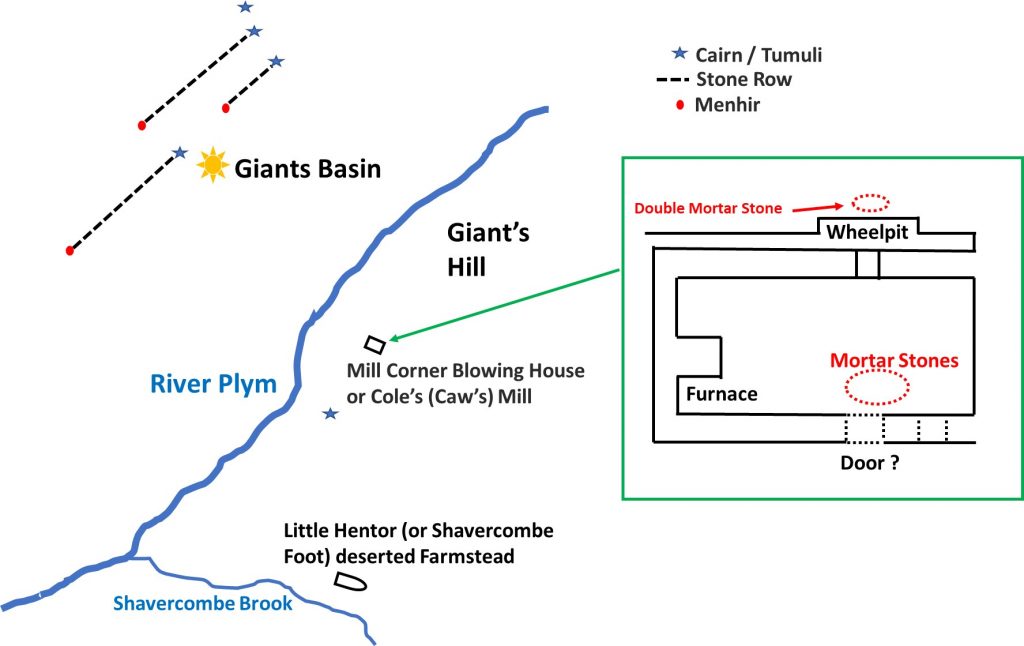
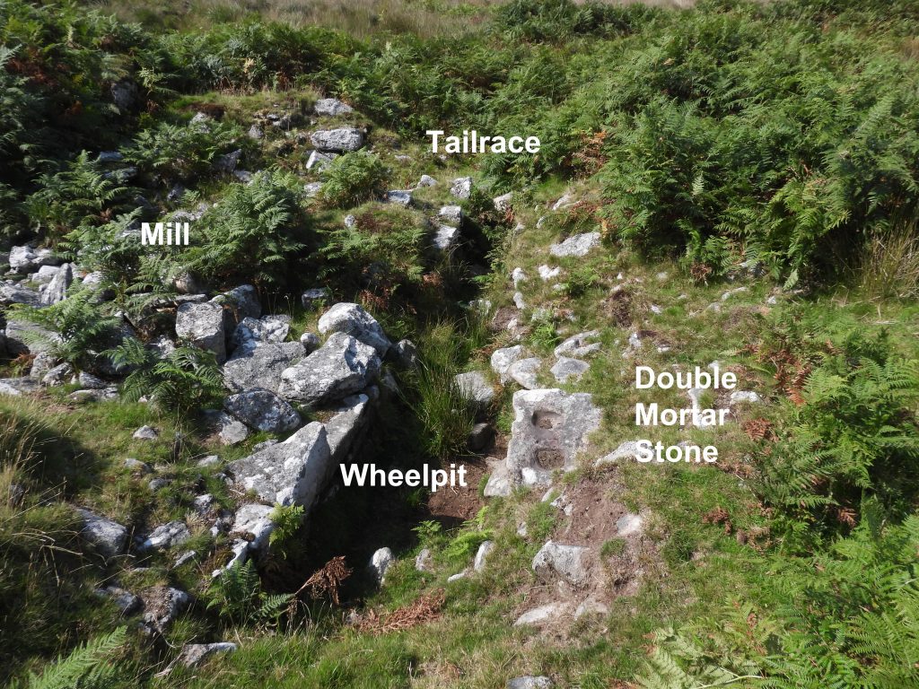
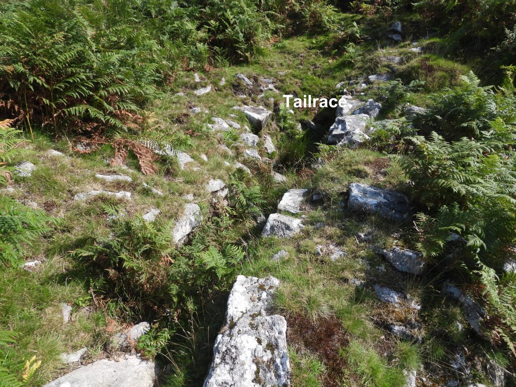
This mill is located on the south-east bank of the River Plym at a spot named Mill Corner. It is an extremely ruinous building but has a very well-marked wheel pit and five mortar stones which are of interest to any visitor. The site would have been fed by a leat which coming further upstream on the Plym and approaches from the east. A short launder bank lies immediately above the wheelpit, where there is now a rather boggy area. It is listed as being a pre-1700 tin mill.
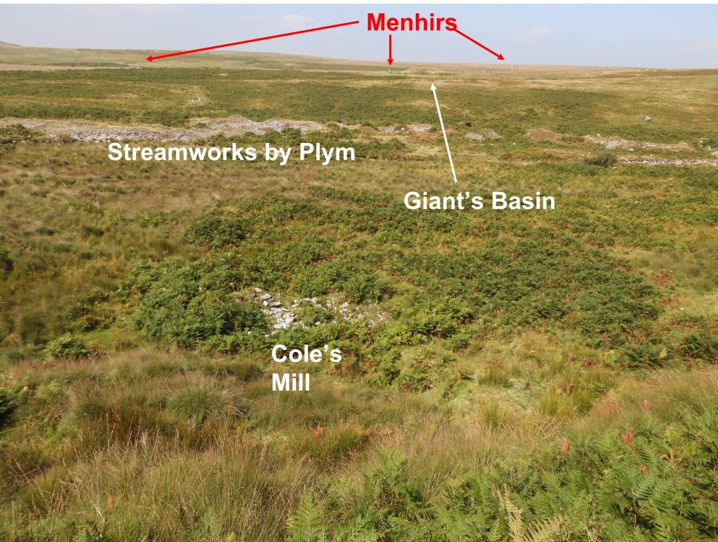
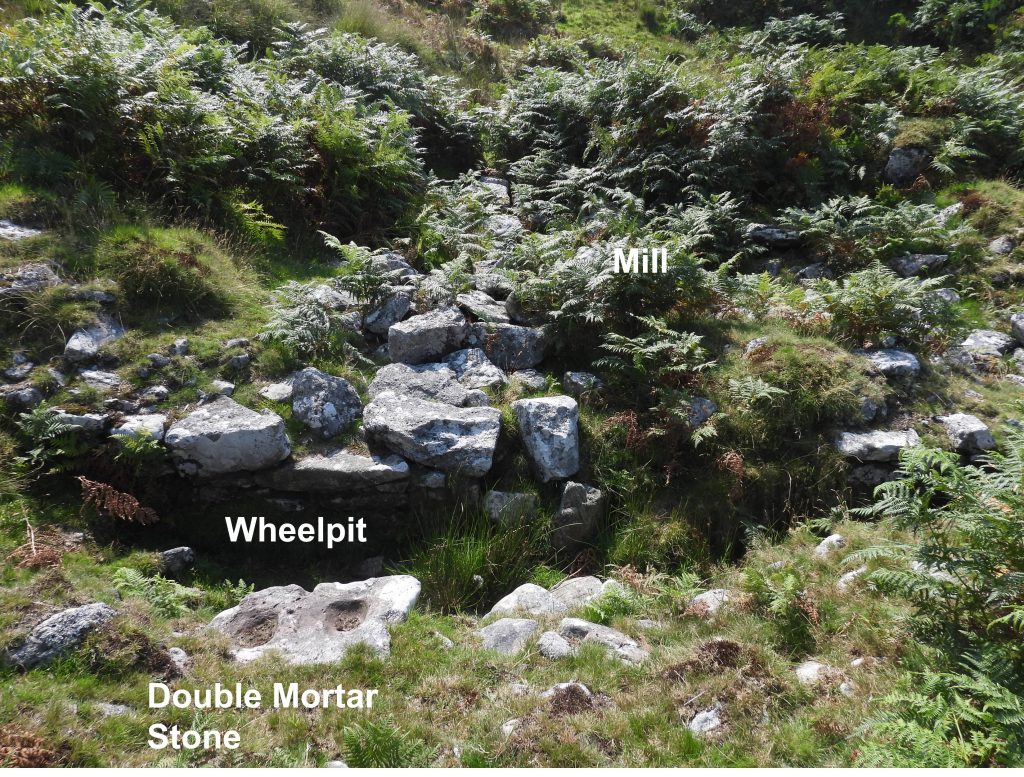
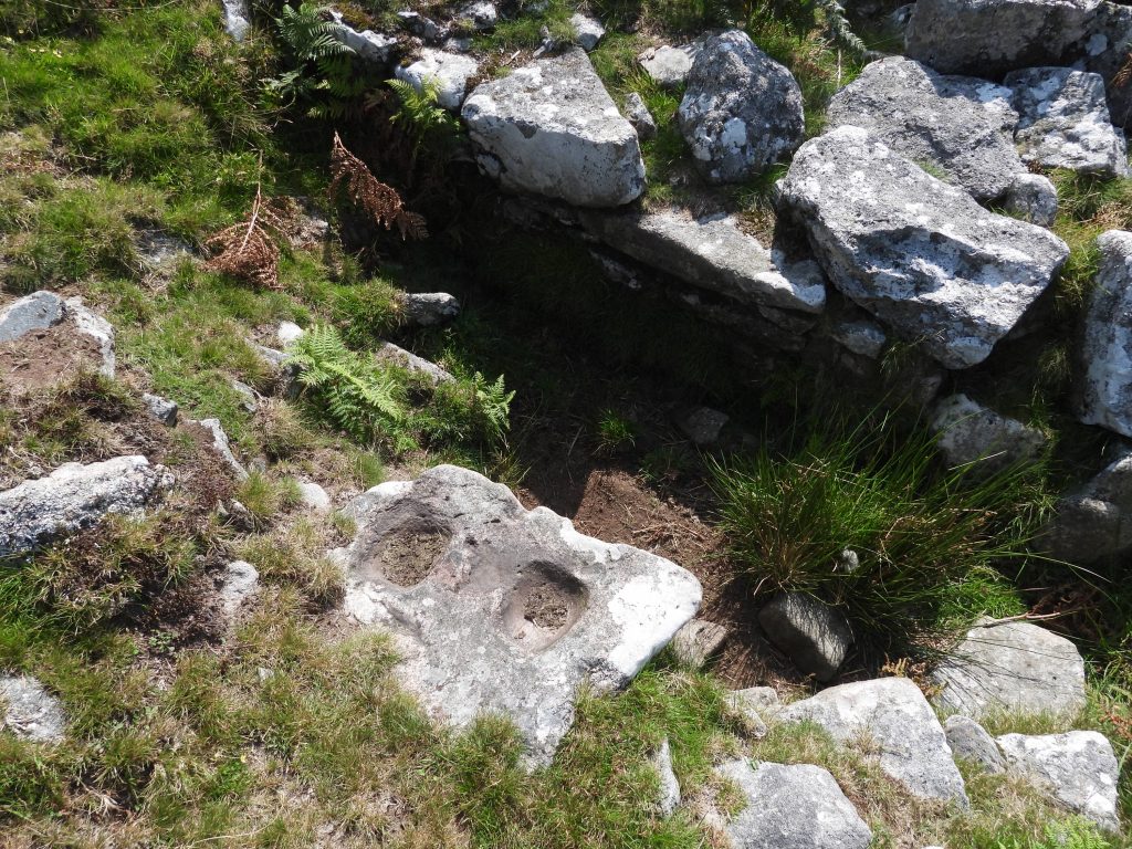
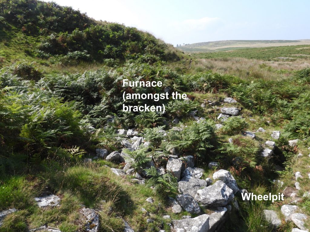
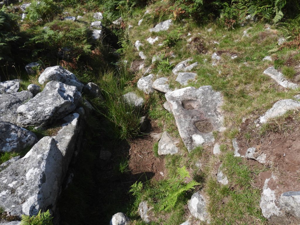
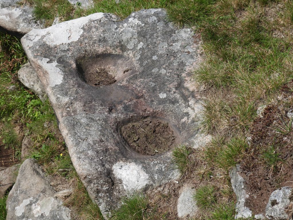
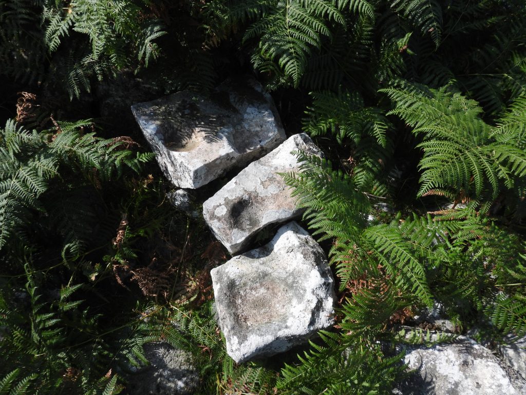
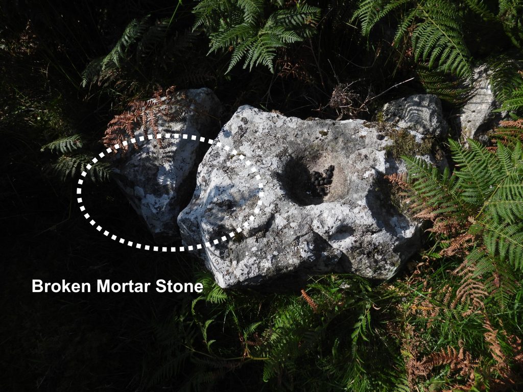
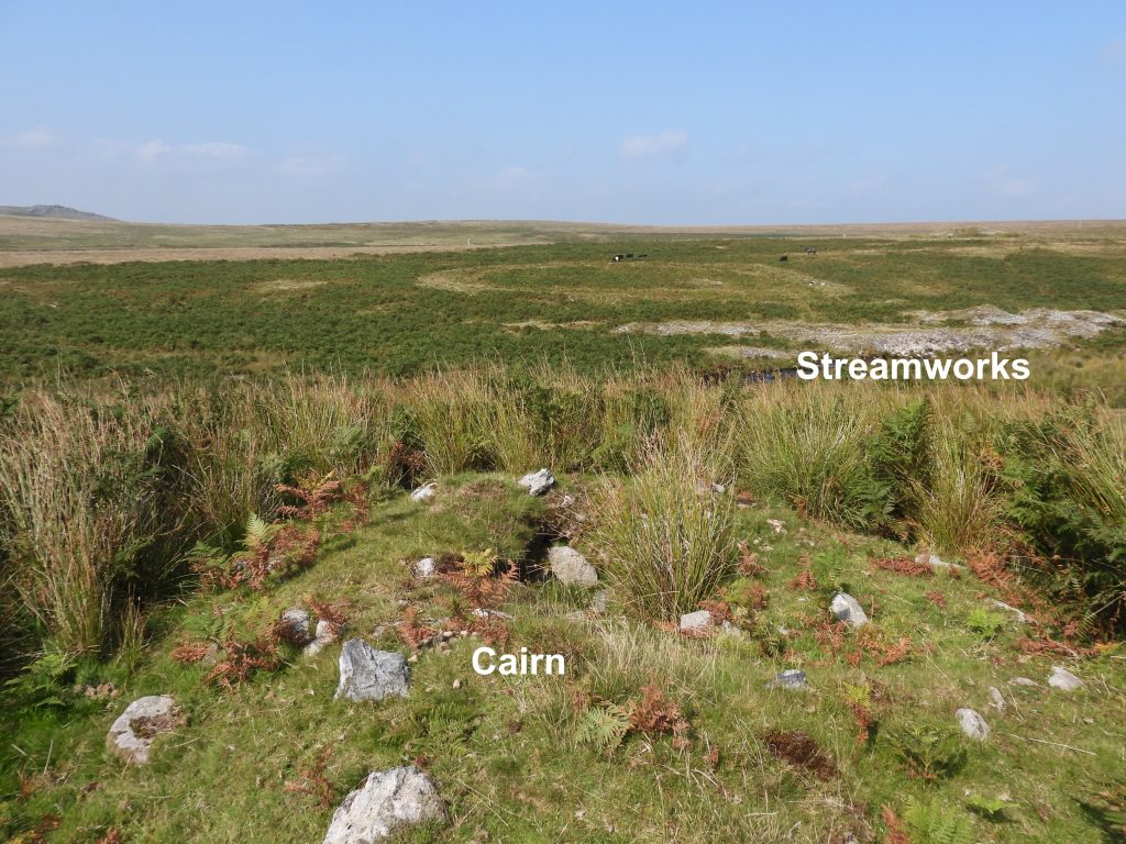
Sketch map showing the location of Cole’s Mill in relation to other features in the area. The inset drawing of the mill is based on a plan shown in Worth’s Dartmoor, page 302 (figure 90). It is intriguing that on the Dartmoor HER, neither the door or the furnace shown on Worth’s original sketch are mentioned. Approaching the site from the south and looking down the steep escarpment at the mill below. From this point the faint outline of a leat (not in picture), which fed the waterwheel can be made out. Looking across the Plym, views of tinners’ streamworks, the Giant’s Basin and the menhirs of the Drizzlecombe stone row complex can be seen.View of the Mill looking from the east. A double mortar stone is incorporated into the walling of the wheelpit. The Dartmoor HER describes the mill as having “maximum internal dimensions of 7.4m east to west by 6.2m with coursed boulder walling around 0.8m wide and a maximum of 0.7m high”.The double mortar stone incorporated into the walling of the pit appears to have a “notch” facing into the wheelpit which ordinarily looks like it might have supported an axle for a wheel, but possibly isn’t it substantial enoughView of the mill, wheelpit, double mortar stone and tailrace as seen from above. Worth (page 303 in Worth’s Dartmoor) states the mouth of the furnace is 3ft 7in wide (around 1.1m). The wheelpit according to Worth would have housed a 9ft diameter wheel (the wheel pit is 10ft long). He further states the wheel width might have been 2ft (the wheel pit is 3ft wide). In metric the wheelpit is 3m x 0.9m. The Dartmoor HER describe the wheelpit as being 8m long and 0.55m wide, which is at odds with the Worth measurements. That said, maybe the HER has included what appears to be a “tailrace” section which may account for the additional length.Close up of the double mortar stone next to the wheelpit. It is located at SX59355 66757.The tailrace leading away from the waterwheelThree mortar stones located close to where Worth states was the doorway to the mill. These three stones are located at SX59354 66755. The fifth mortar stone can be located at SX59354 66756, just a metre away from the group of three mortar stones. It appears to have been broken at the point where one of the mortar “bowls” is located.A short distance from the mill is a rather wonderful cairn and views over the streamworks. Rather intriguingly the Dartmoor HER describes the cairn as consisting of “a mound of turf-covered stones 5.0m in diameter and 0.5m high. In the centre is a 1.0m square depression 0.4m deep. Surveyed in 1977 and 2002. No evidence to suggest the former presence of a cist or retaining kerb. The central hollow appears to be a result of military activity rather than an unrecorded antiquarian excavation”.