A collection of walks, discoveries, insights and pictures of exploring Dartmoor National Park
December 1, 2022
Tinners’ Huts, Caches and a Blowing House around the Erme tributaries of Redlake Brook and Dry (Hux) Lake, plus an exploration of Erme Pound
This post is an exploration of tin streamworking and associated tinners’ structures associated with medieval and later period, which flank the left bank of the River Erme and the floodplains of two of its tributaries, namely: Dry Lake and Red Lake. This post complements a previous post on this website which considered another tributary of the River Erme, Blacklane / Wollake, which too has lots of evidence of tin streamworking and structures.
Also considered in this post is Erme Pound, a Bronze Age settlement, which not only has antiquities from that period but also has evidence of a more ‘modern’ (16th to 18th century) impact and use of the site.
The post records details of 10 structures, namely; 4 probable tinners’ huts, 2 tinners’ caches, a blowing house and 3 buildings which were most likely built by 16th-18th century moormen who used the area to look after cattle. Also recorded in this post is a Bronze Age cist / cairn, which was of particular personal interest to the author and a part of Dartmoor’s longest stone row, where it crosses the flanks of Green Hill.
The following documents and references have been used throughout this post:
Newman, P., 2018, The Upper Erme Valley, Dartmoor National Park, Devon: An Archaeological Survey
Butler, J., 1993, Dartmoor Atlas of Antiquities: Volume Four – The South-East, Map 55
Royal Commission for the Historical Monuments of England, 1993-1998, Dartmoor Royal Forest Project
Dixon, C. E. B., 1953, 71st Report of the Barrow Committee, 176
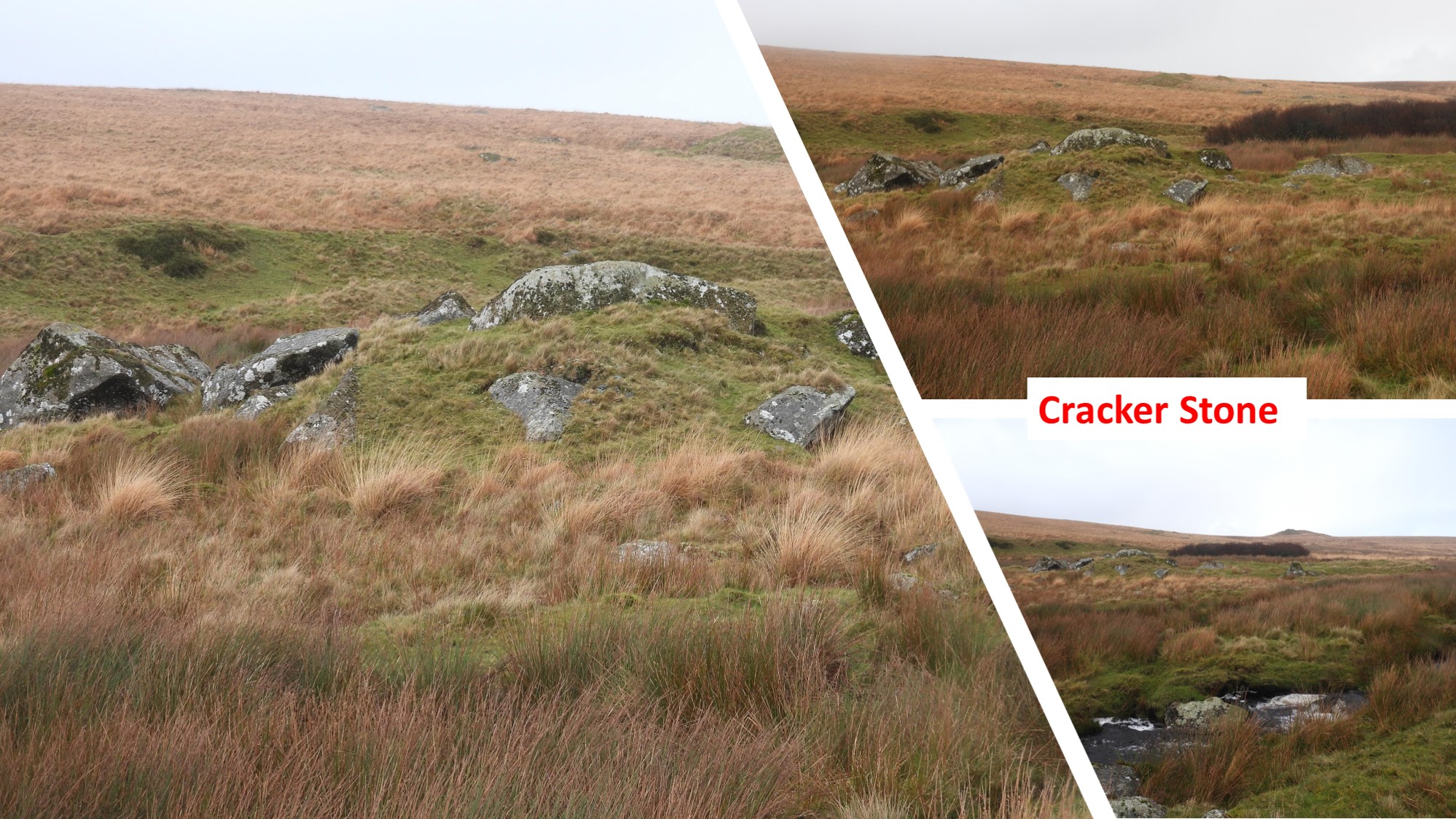
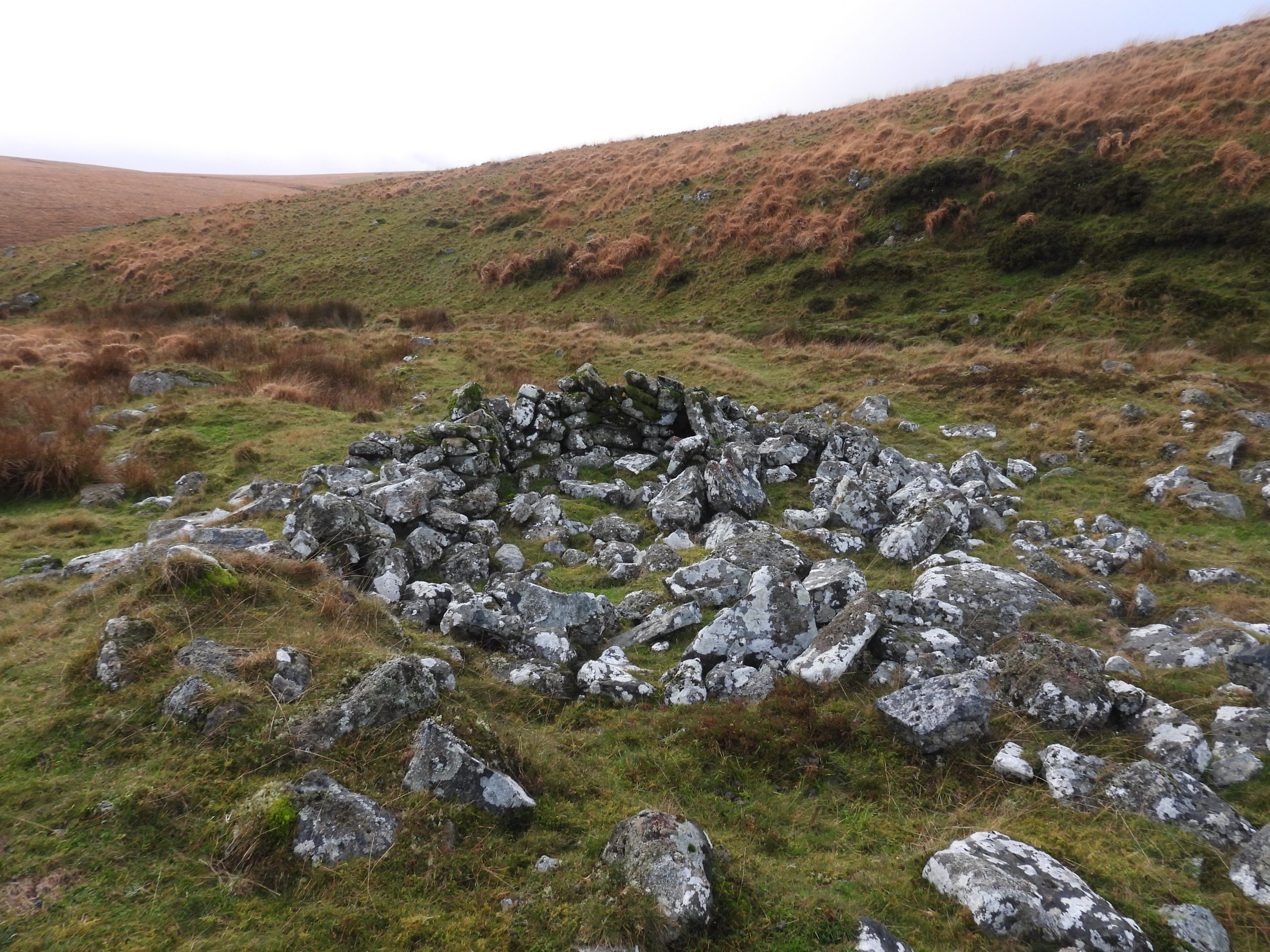
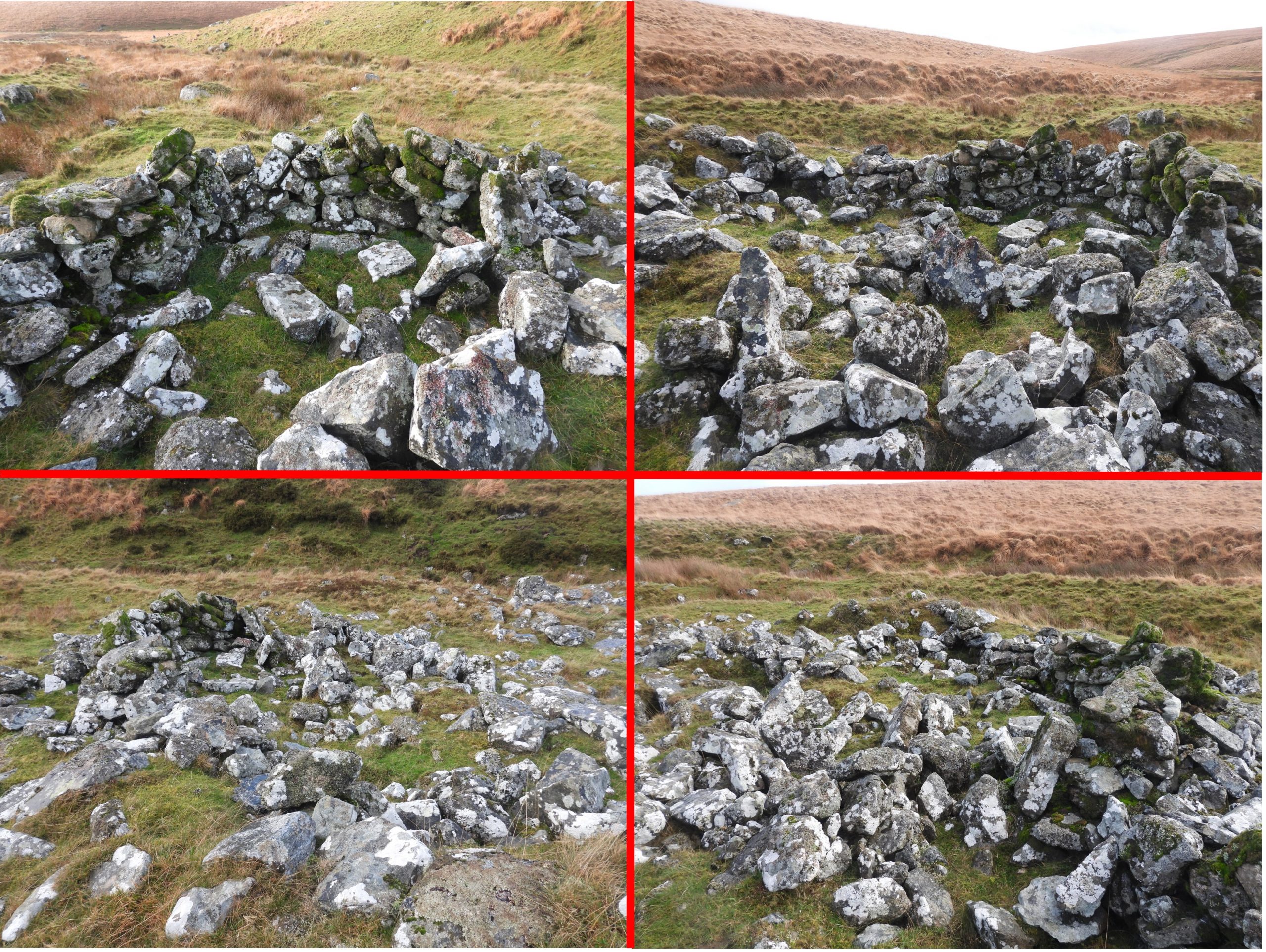
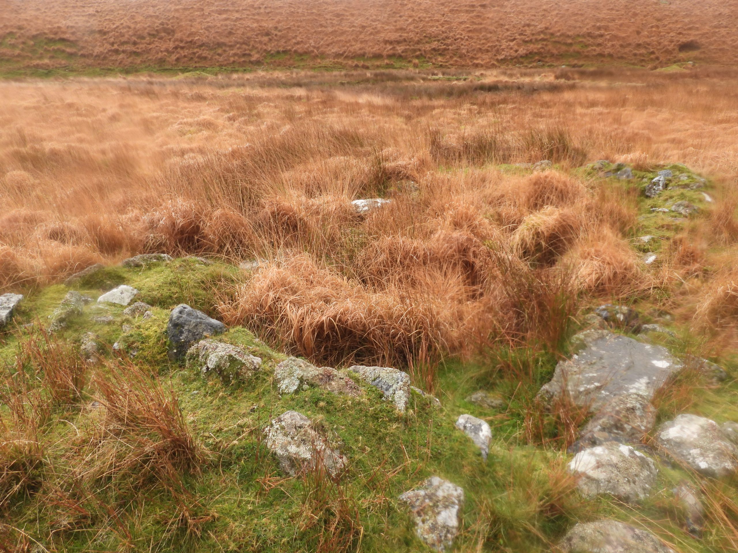
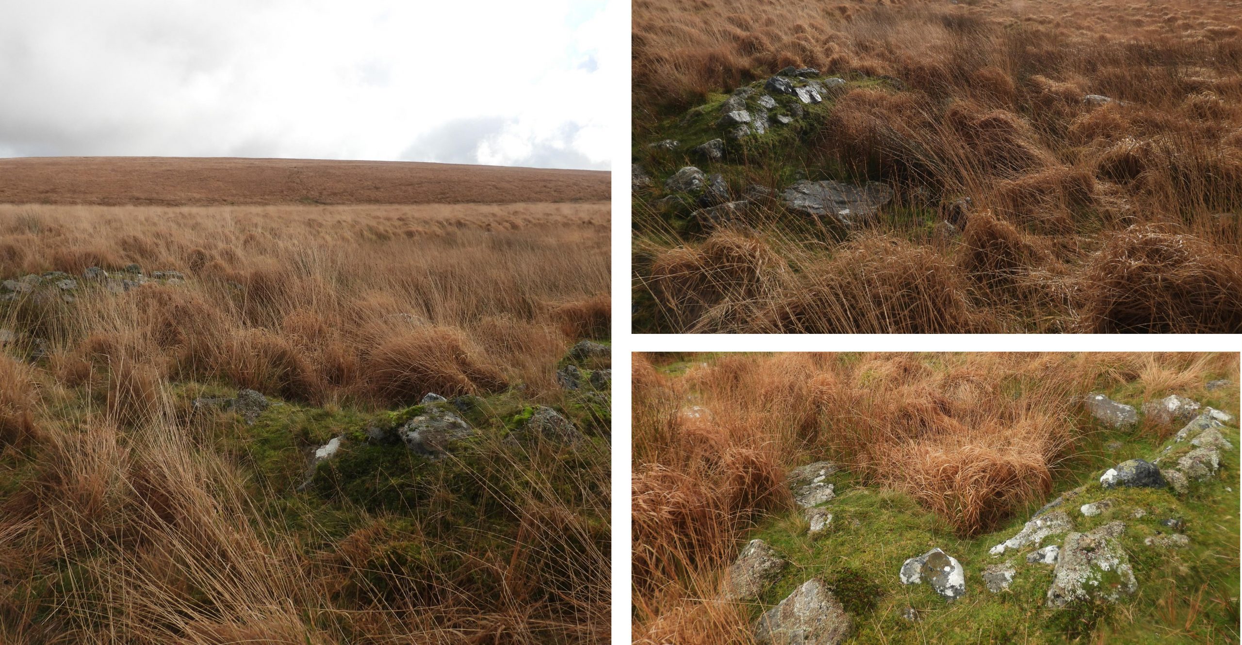
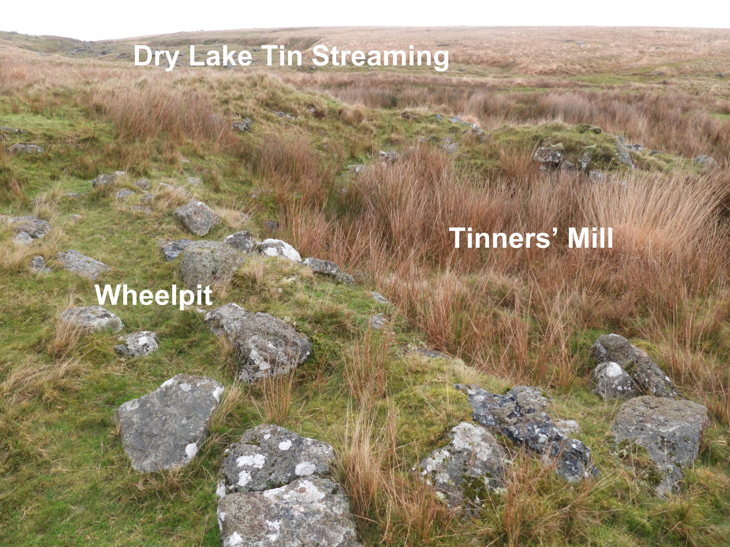
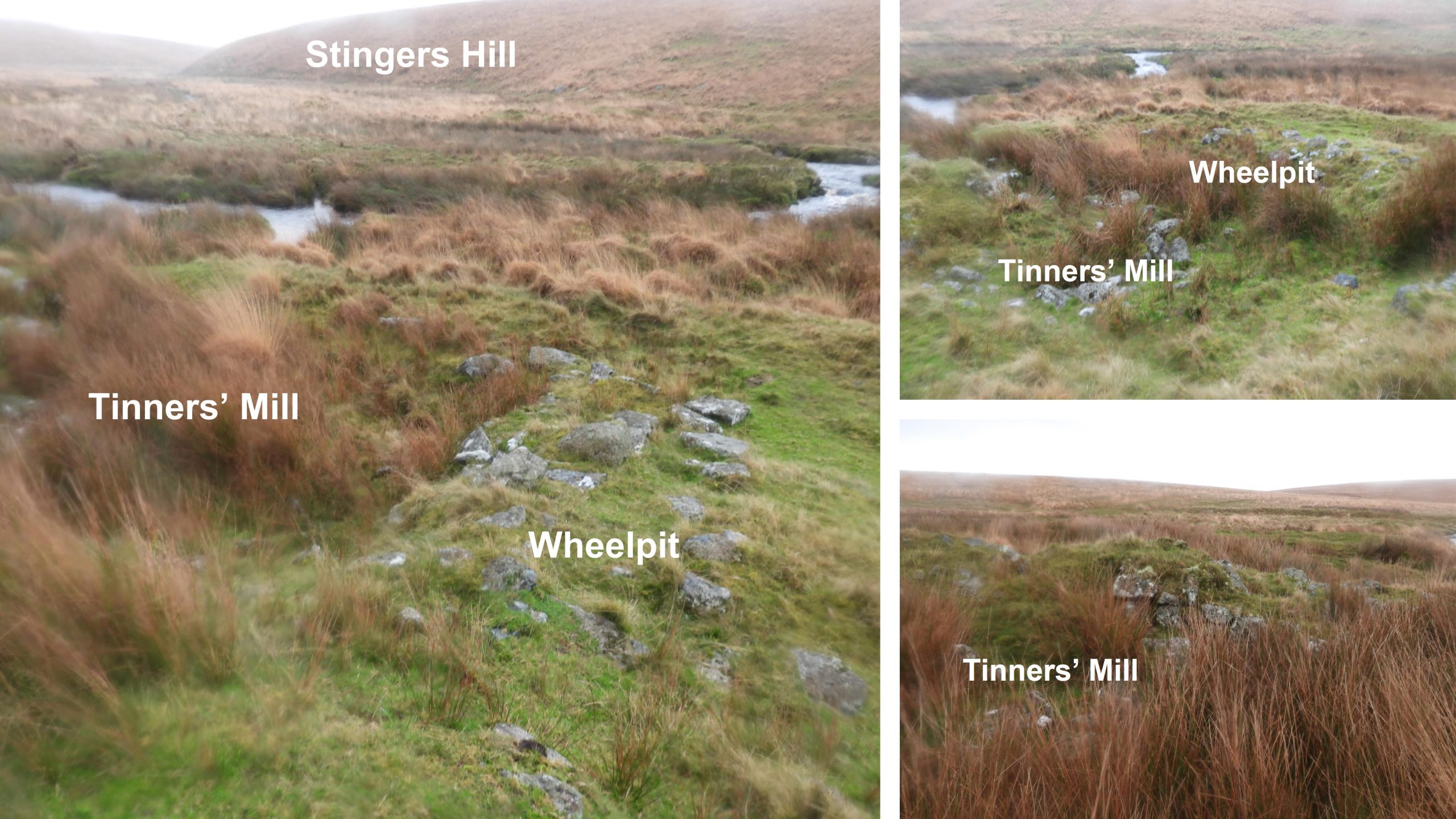
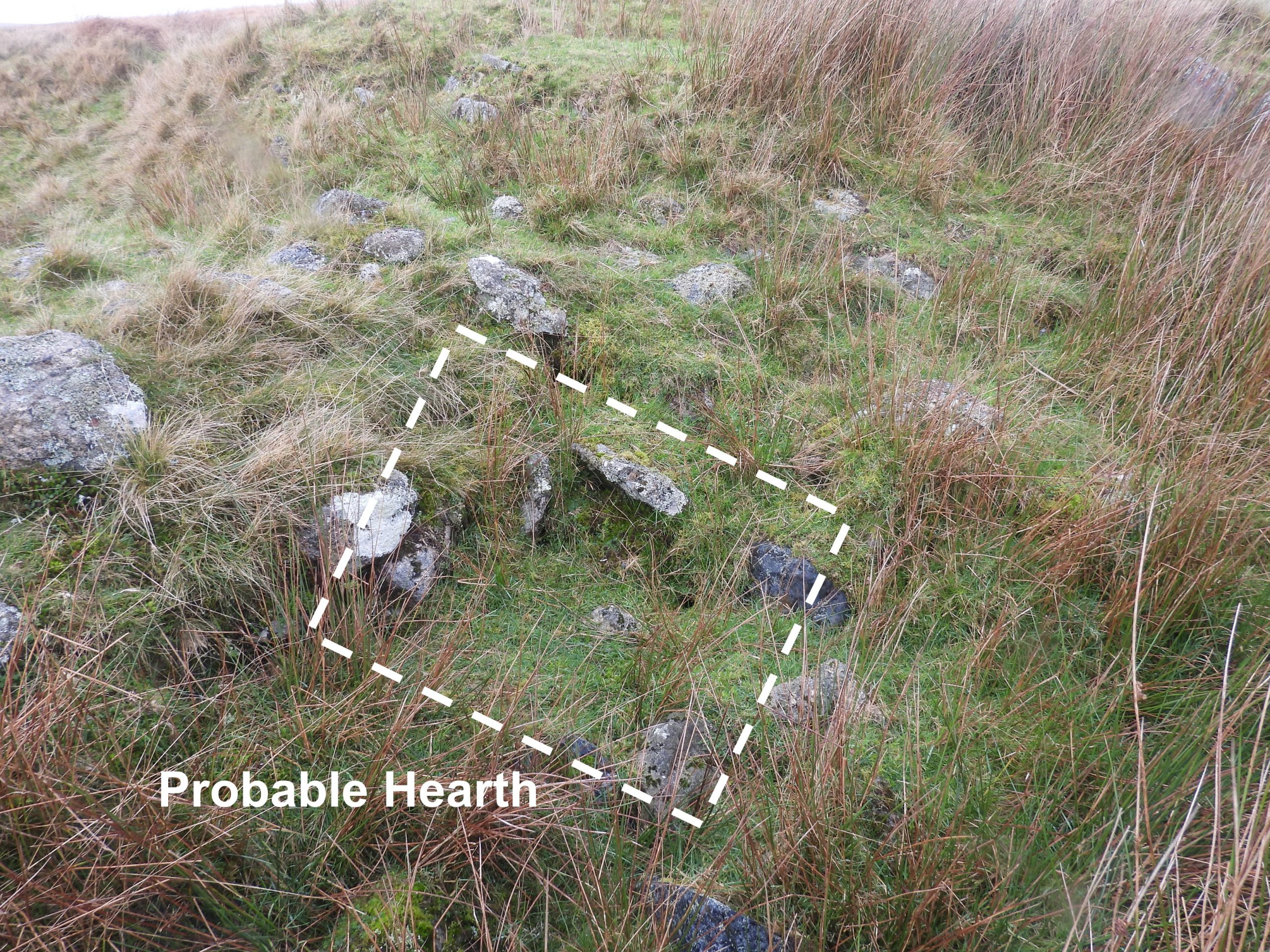
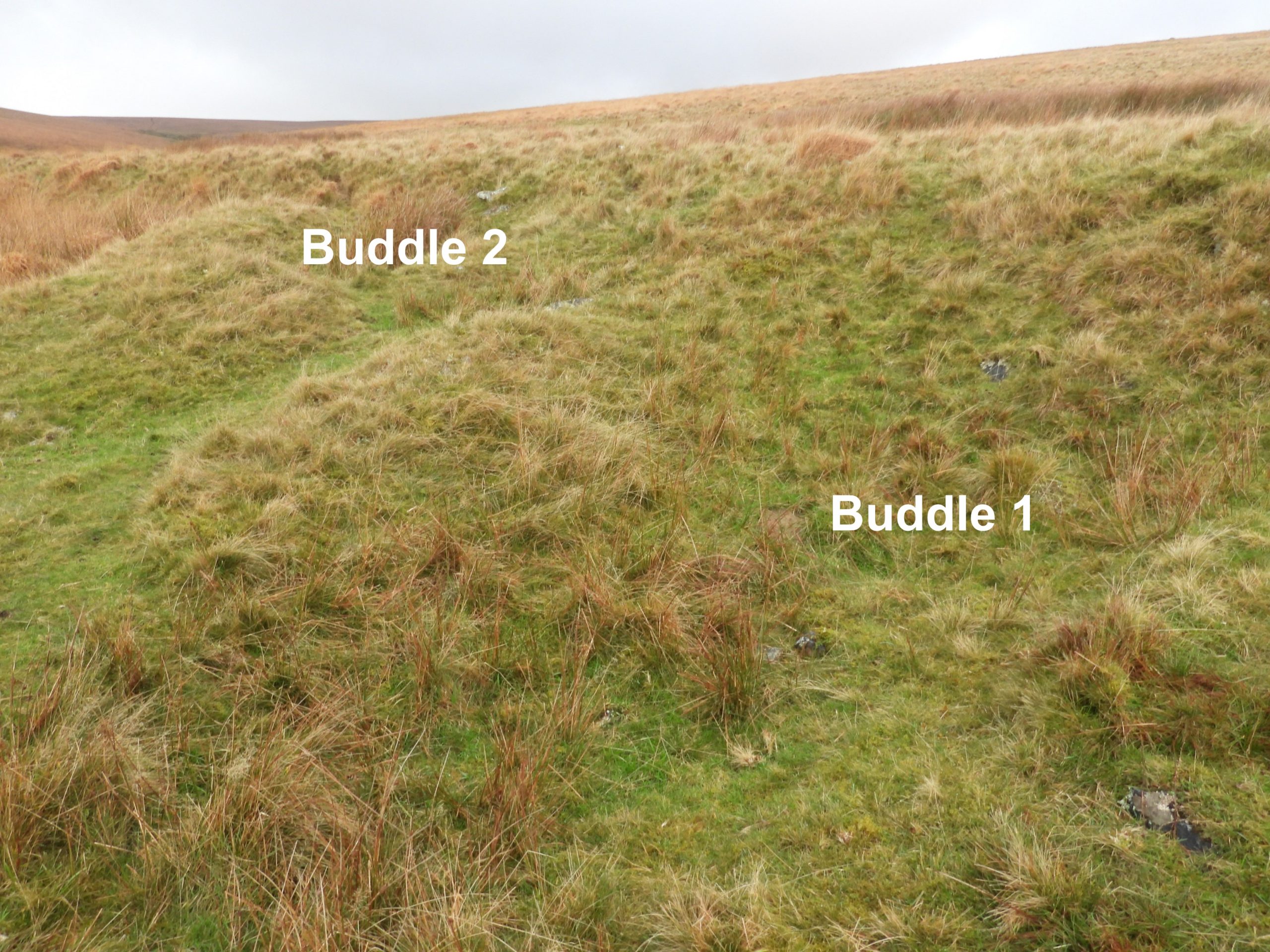
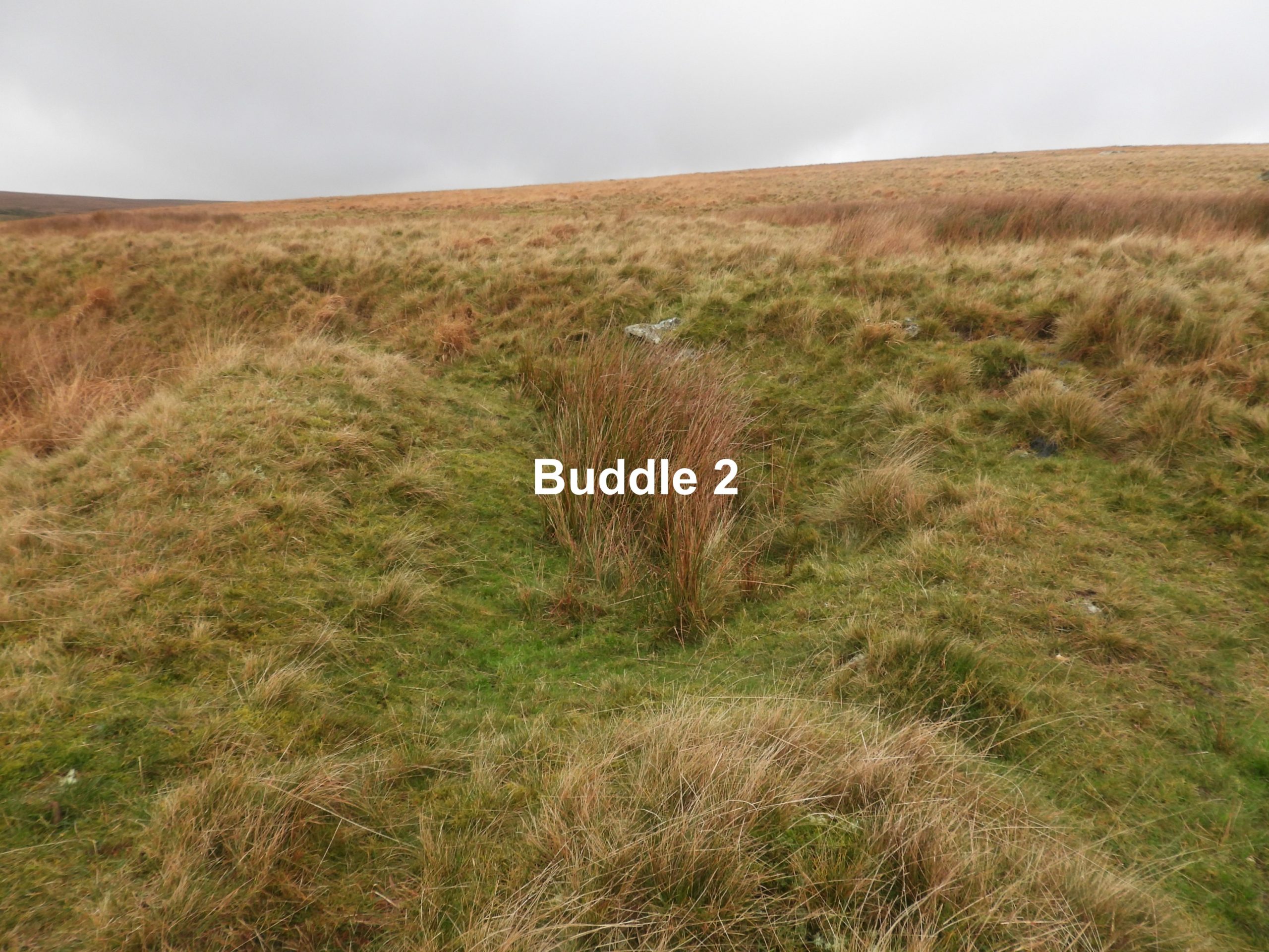
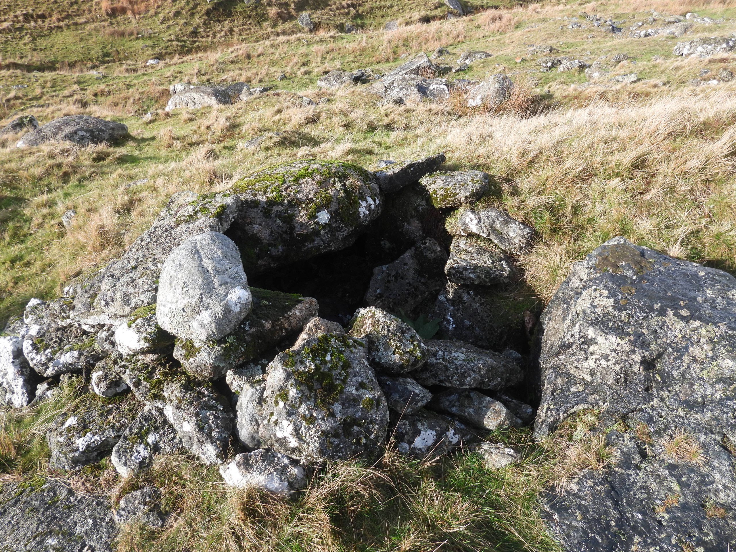
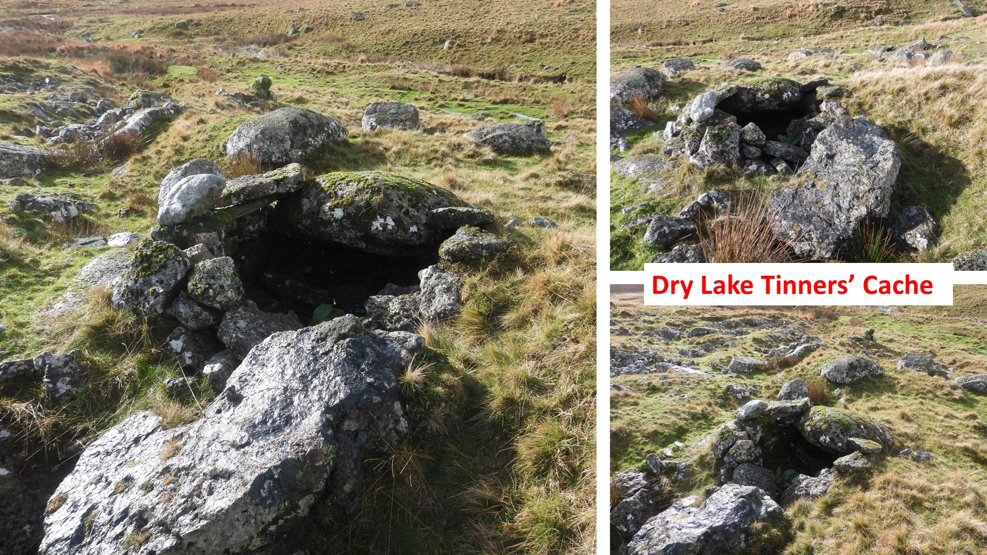
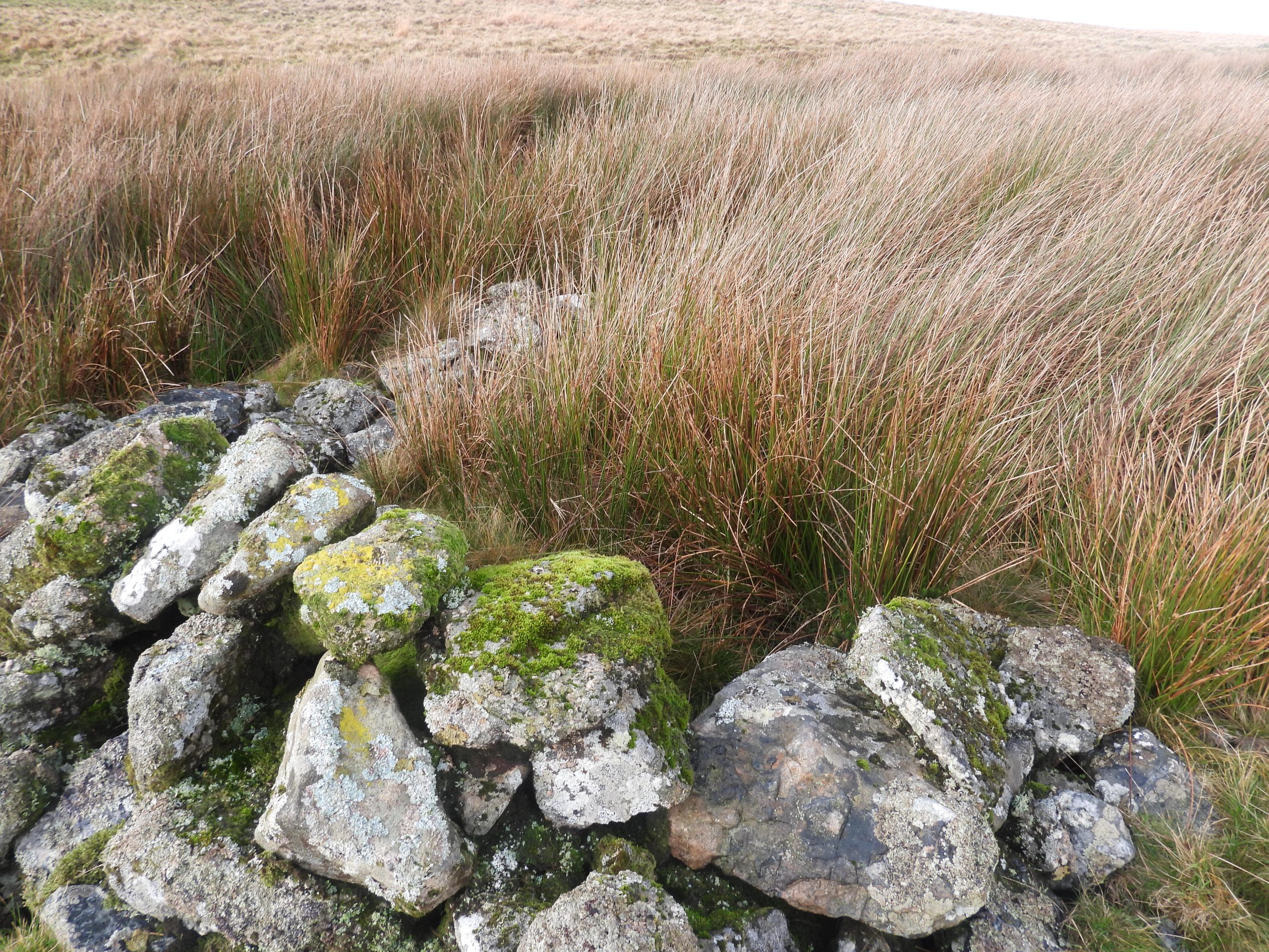
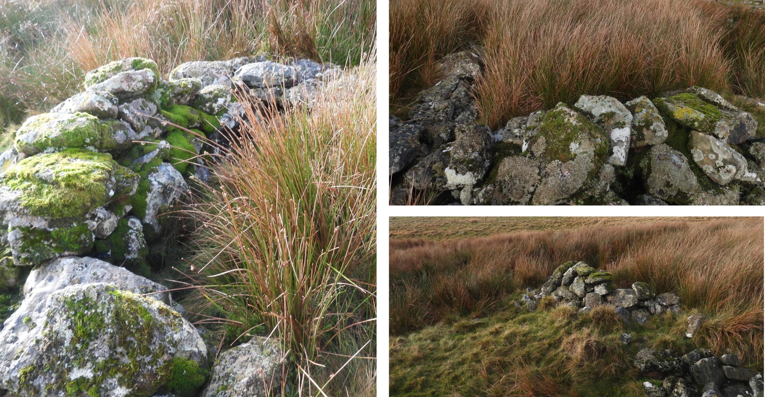
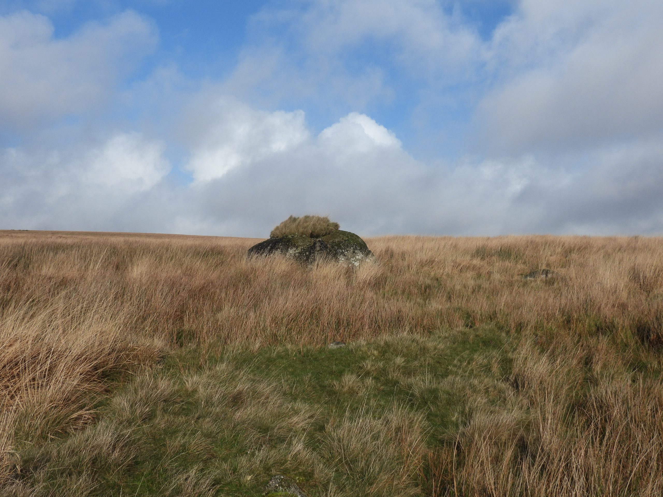
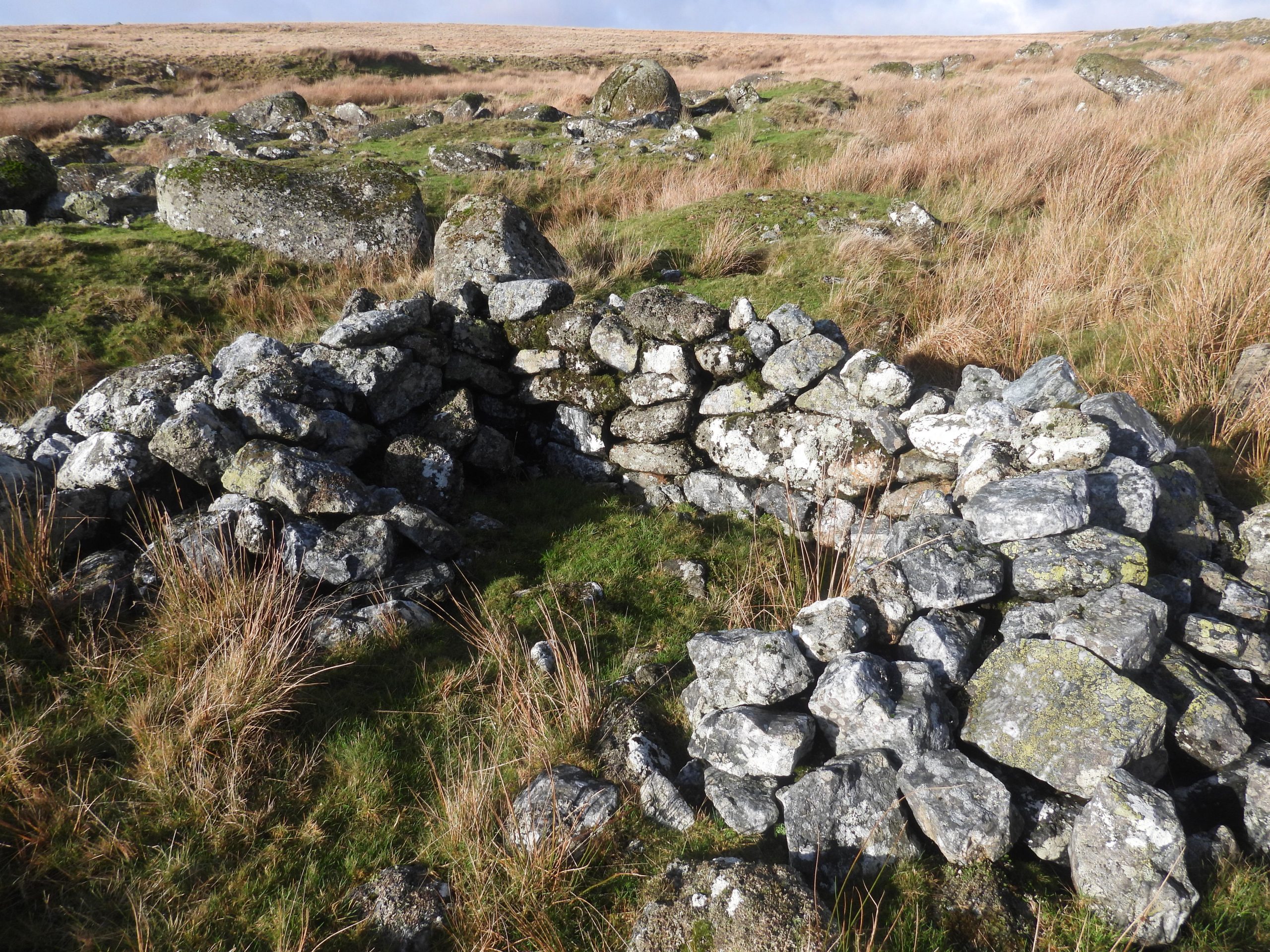
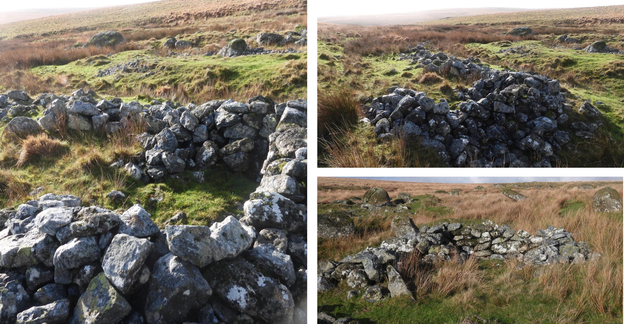
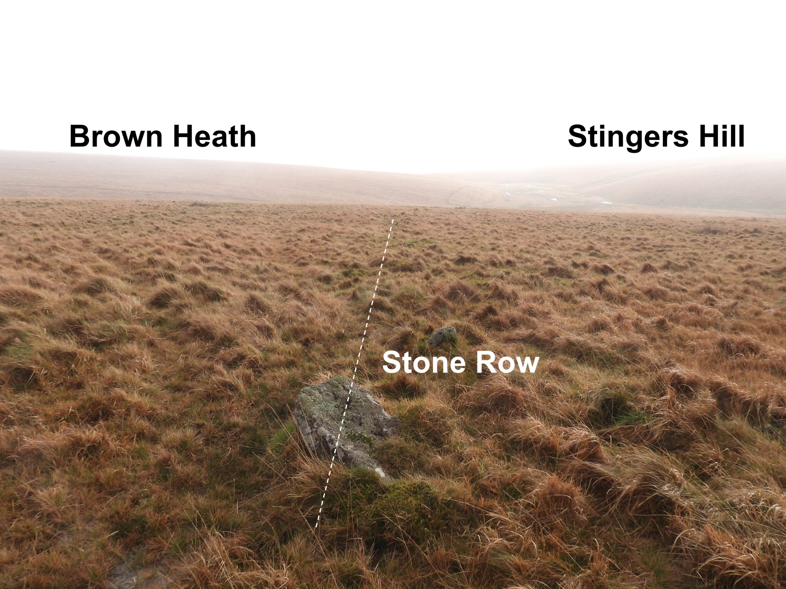
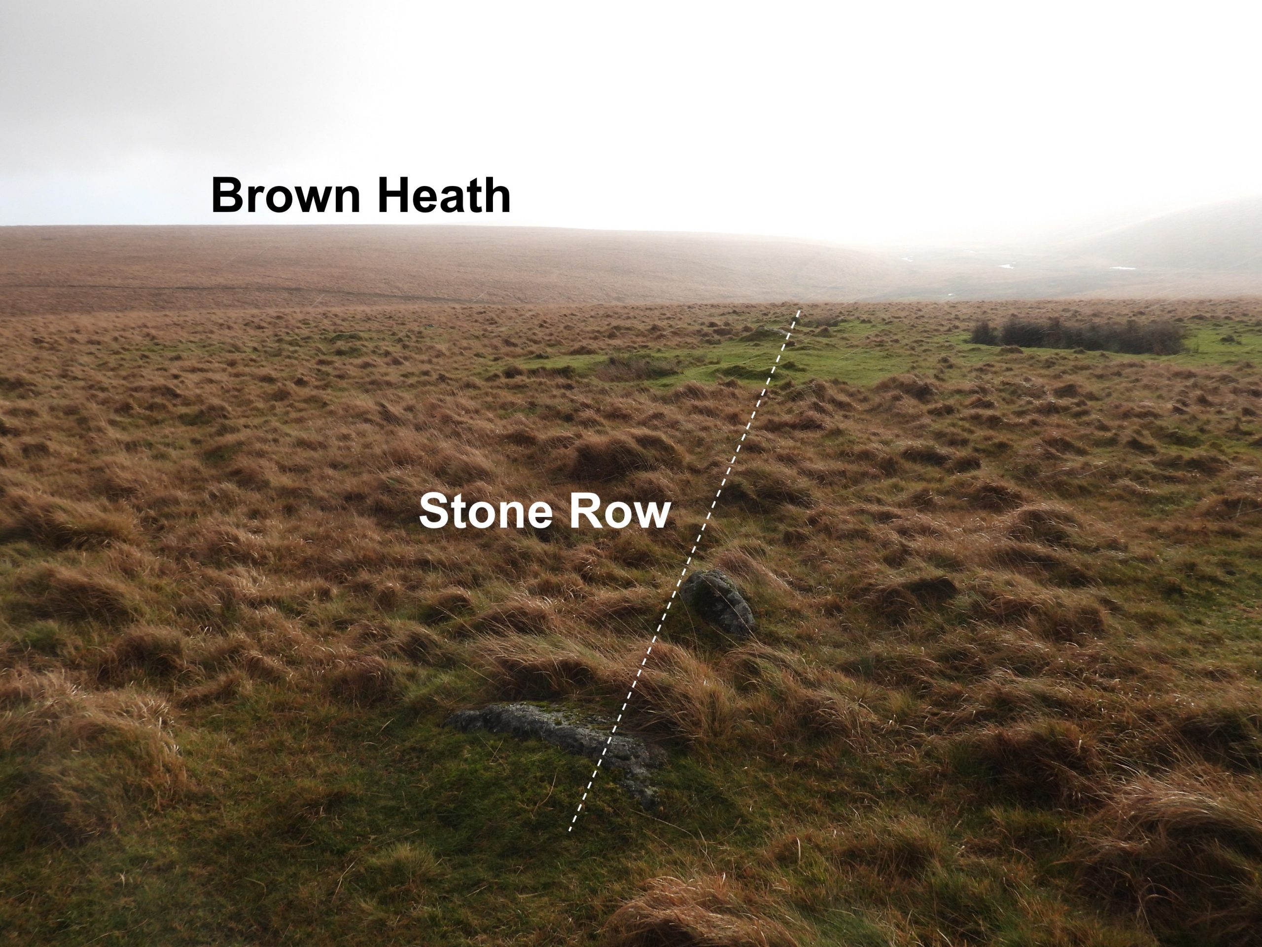
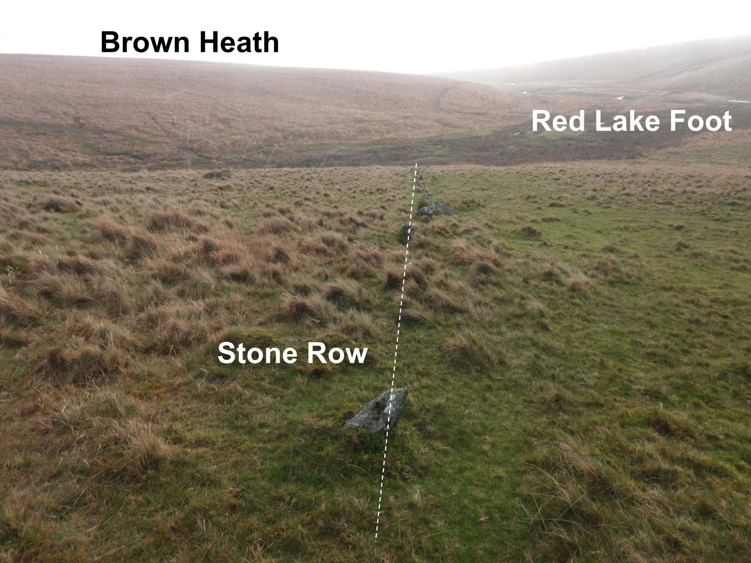
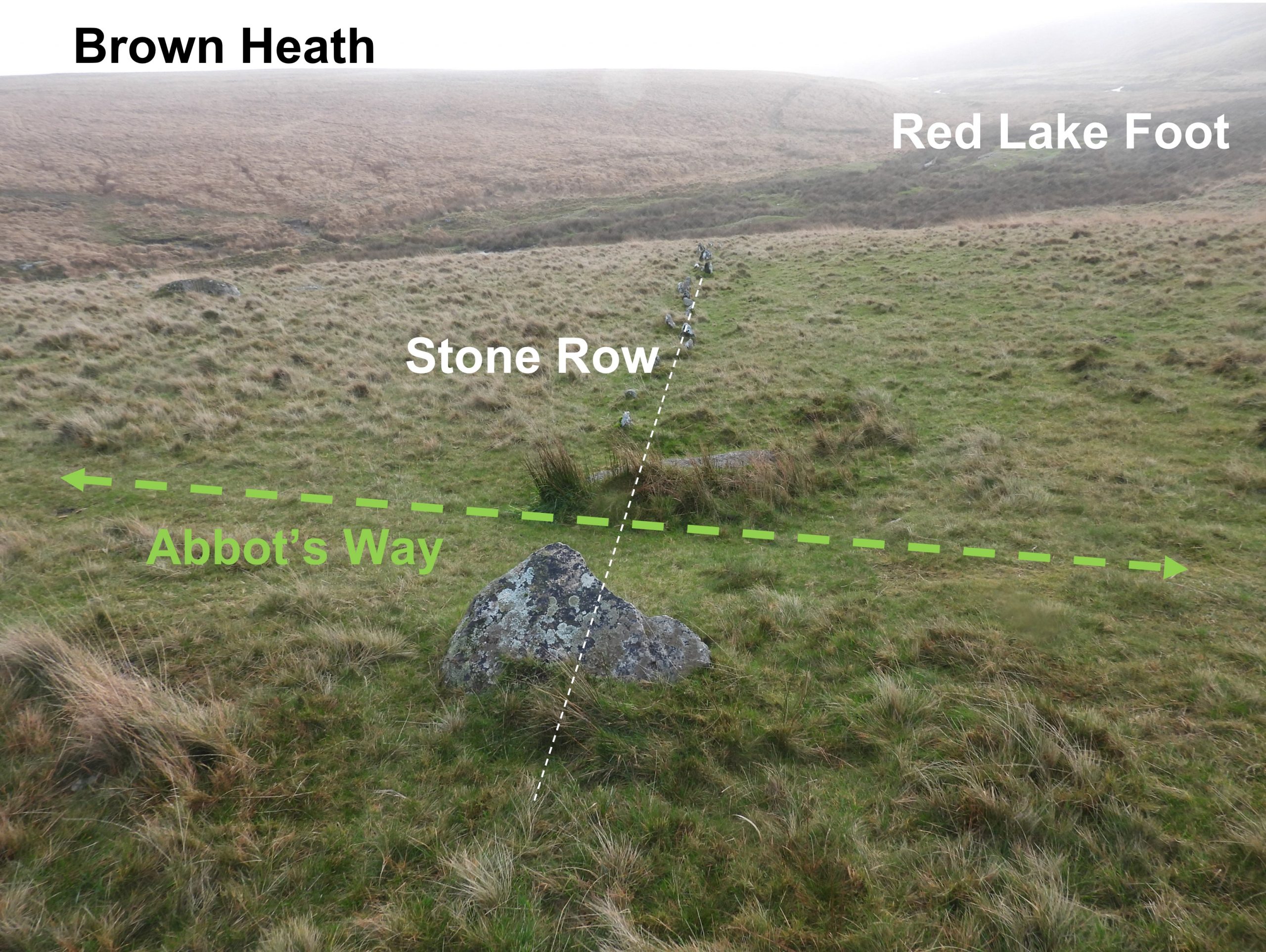
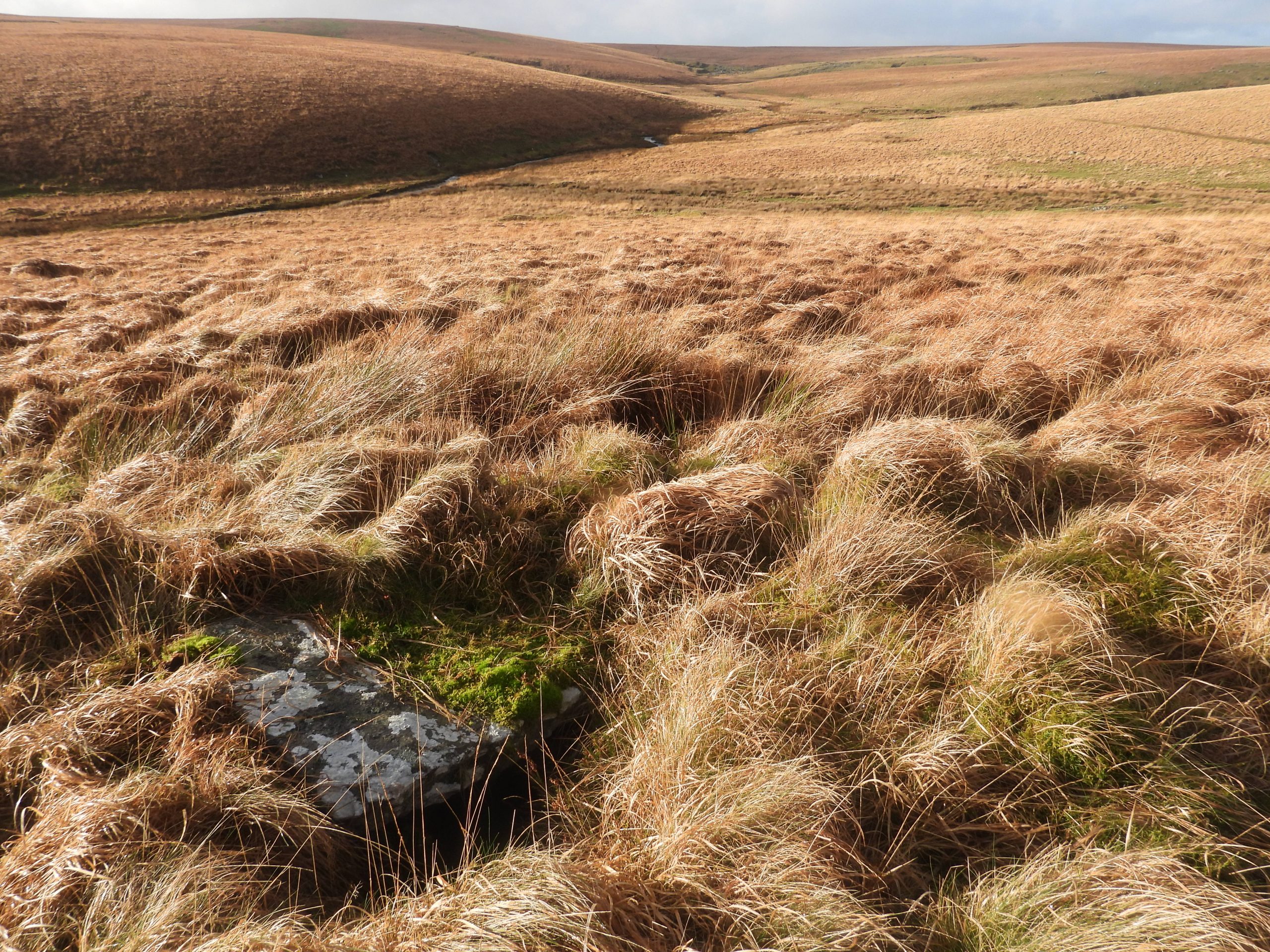
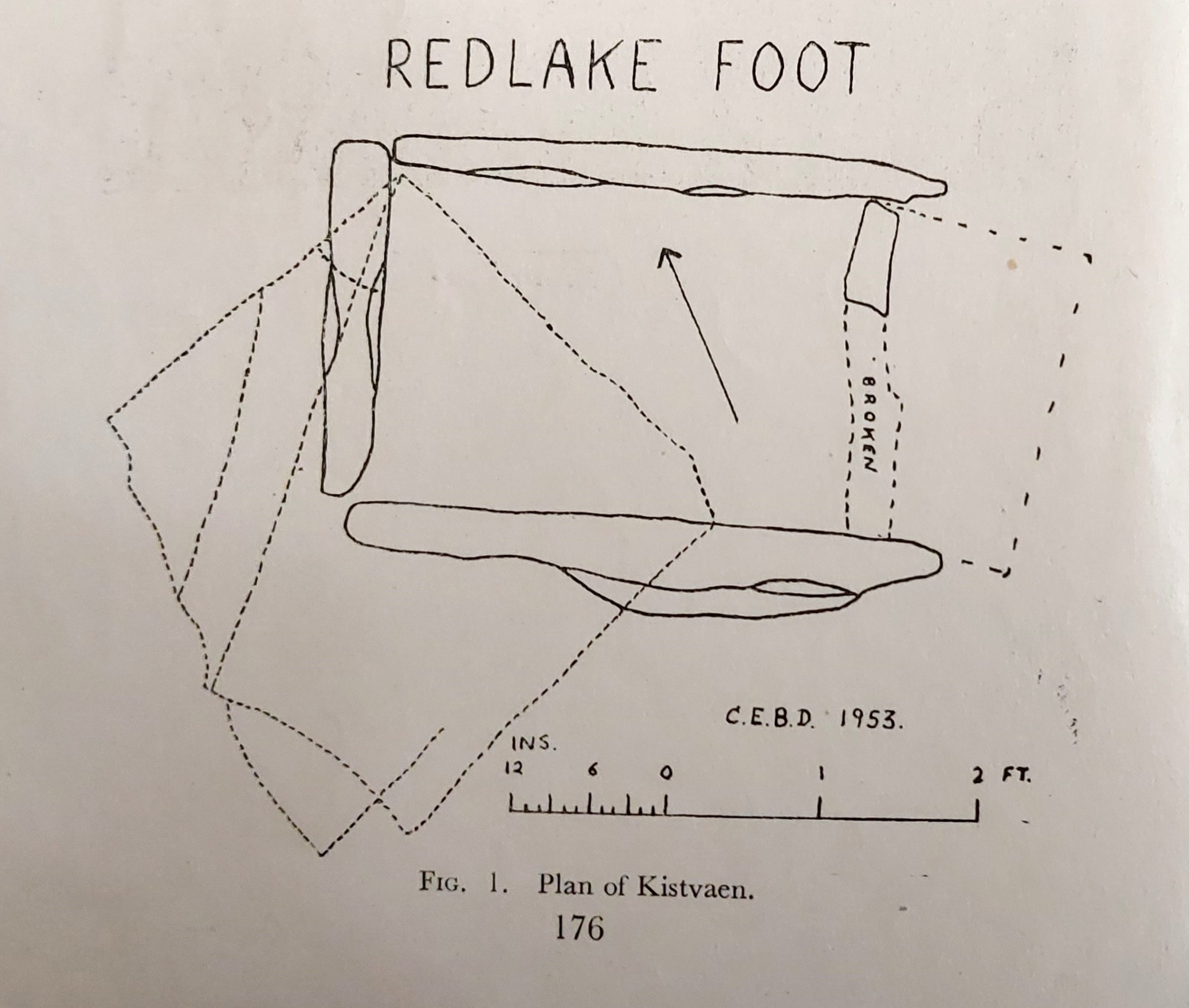
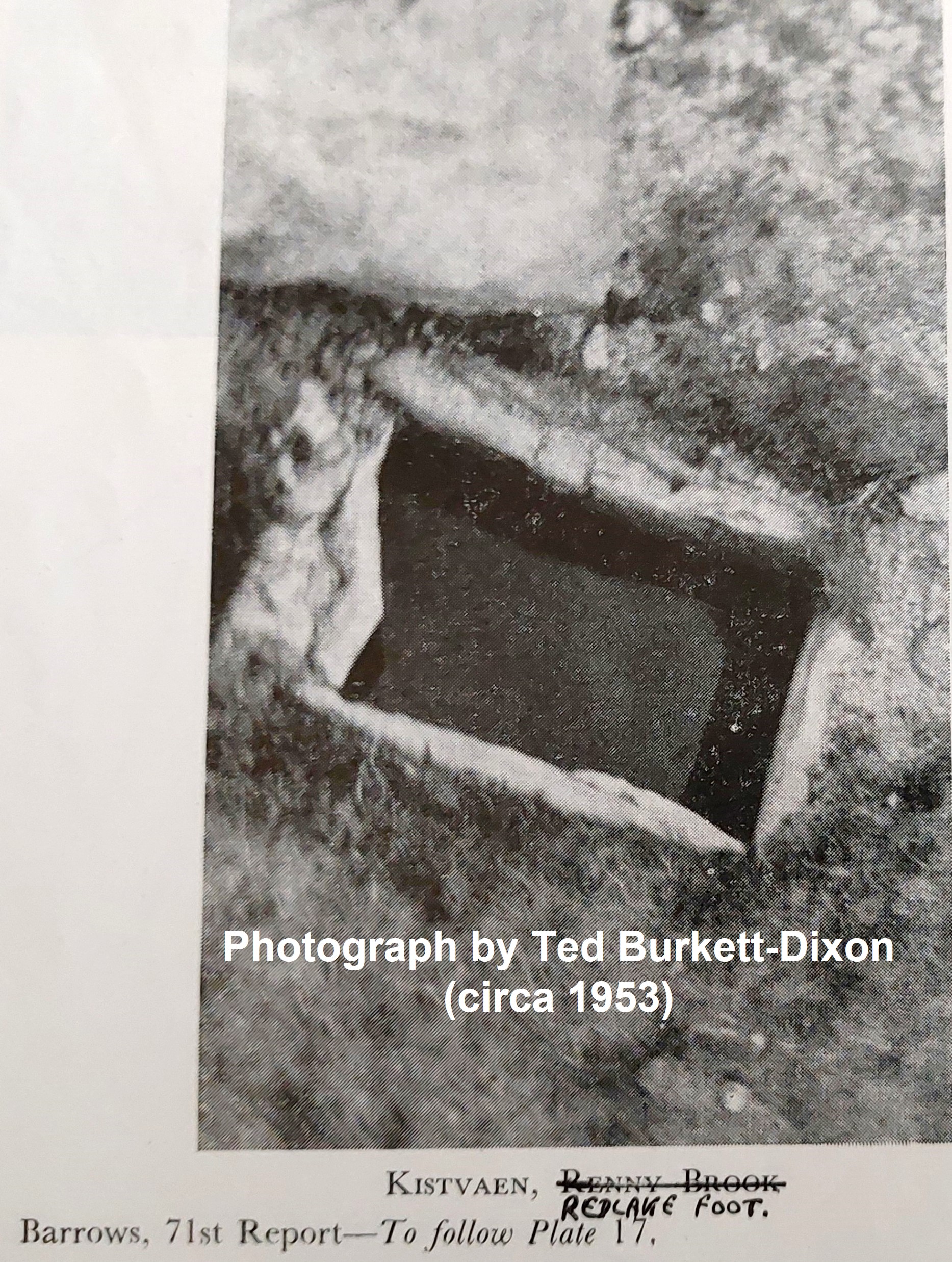
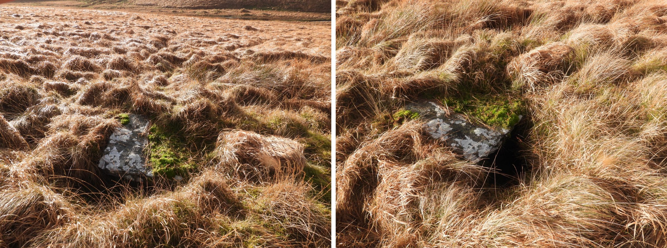
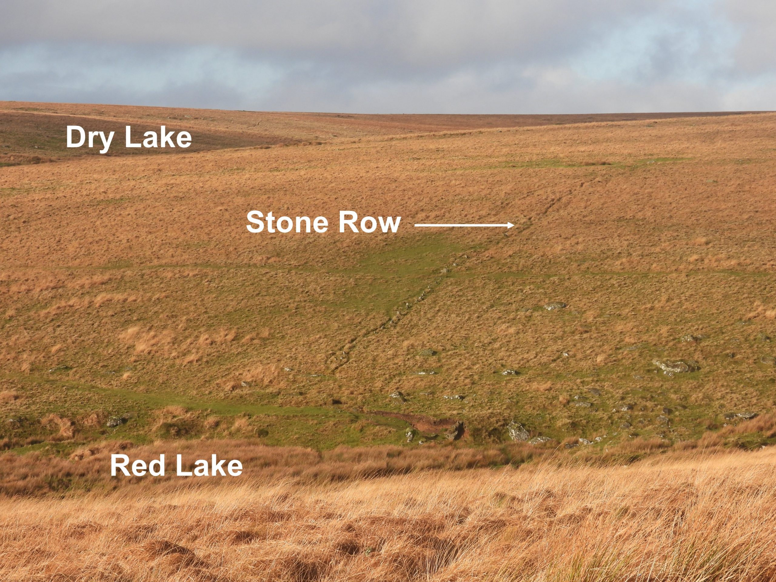
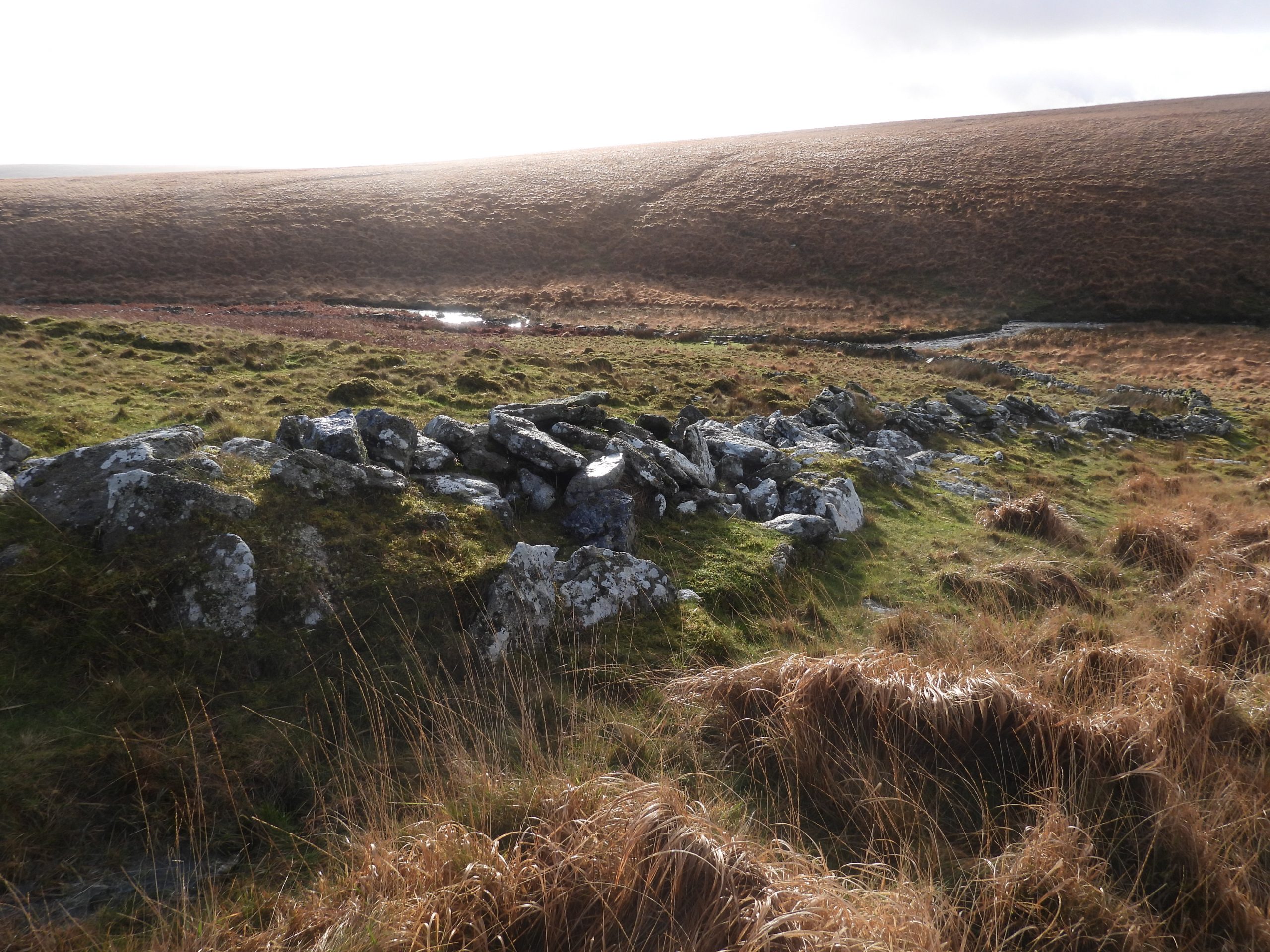
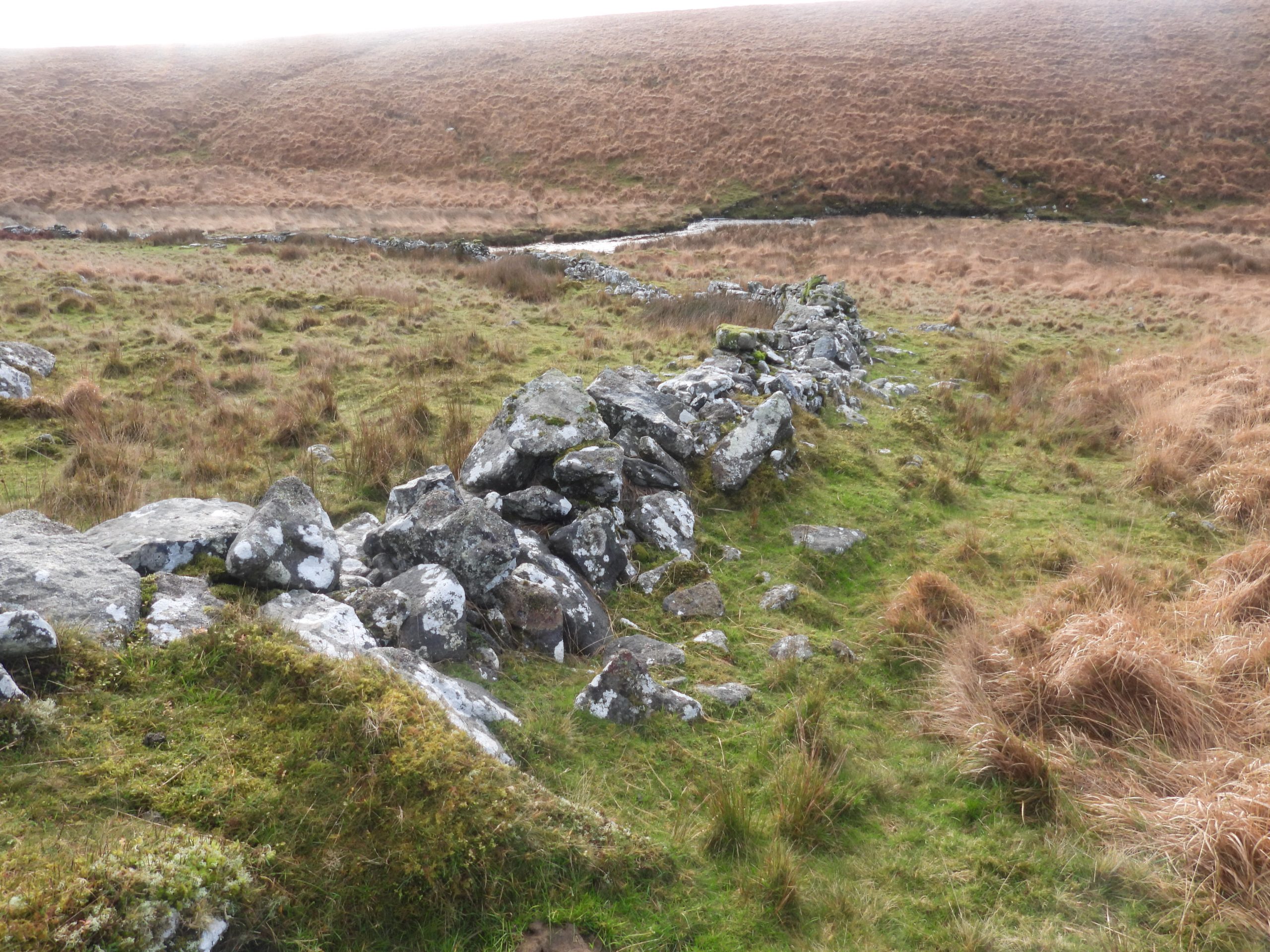
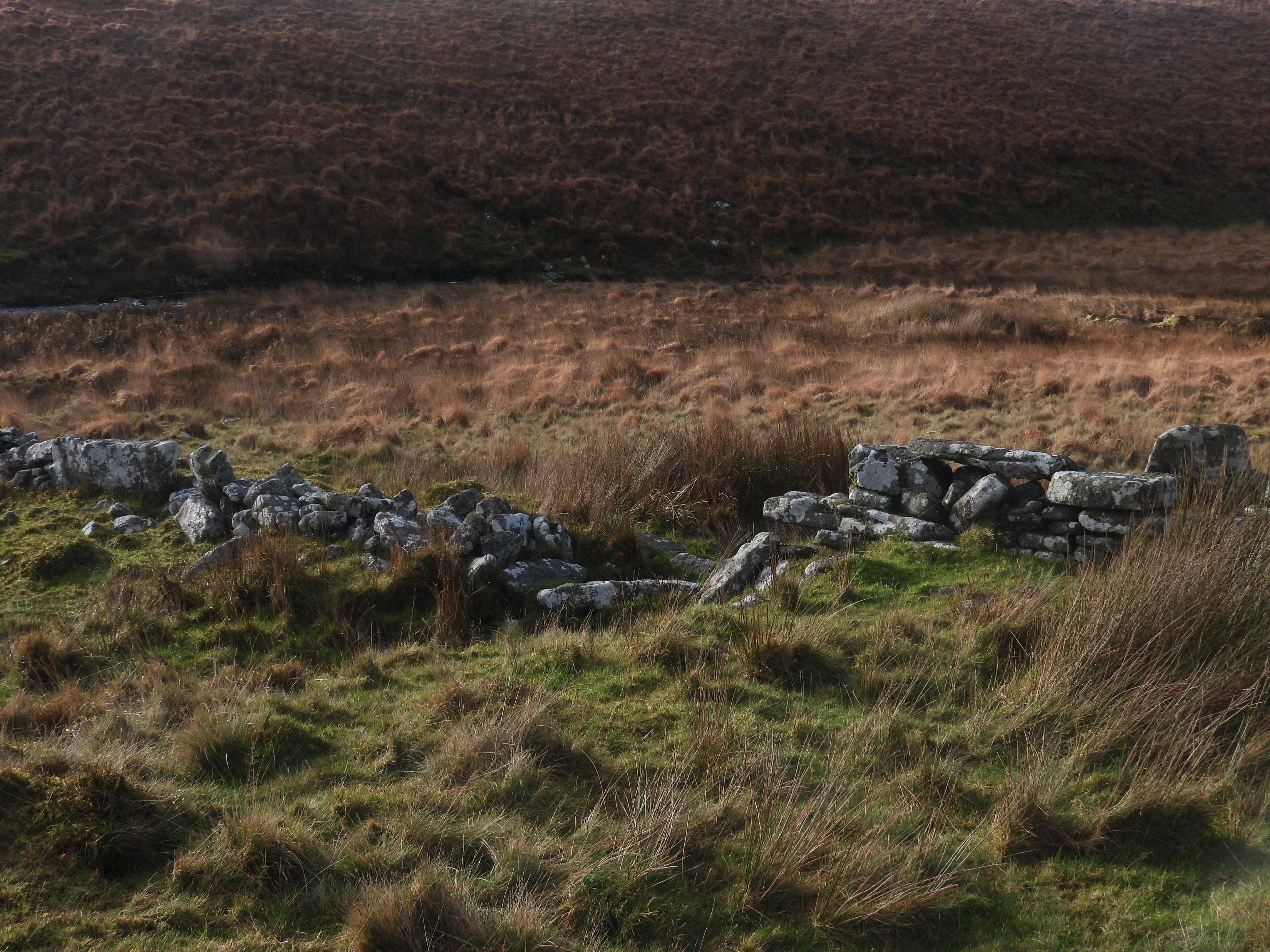
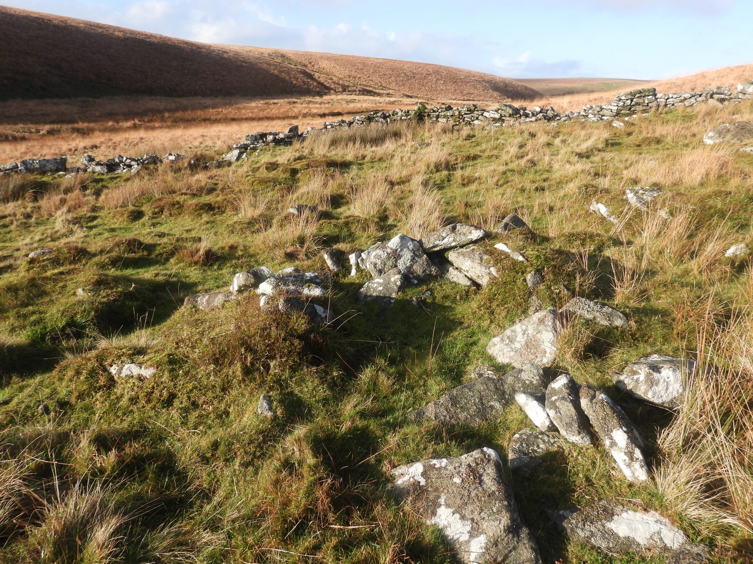
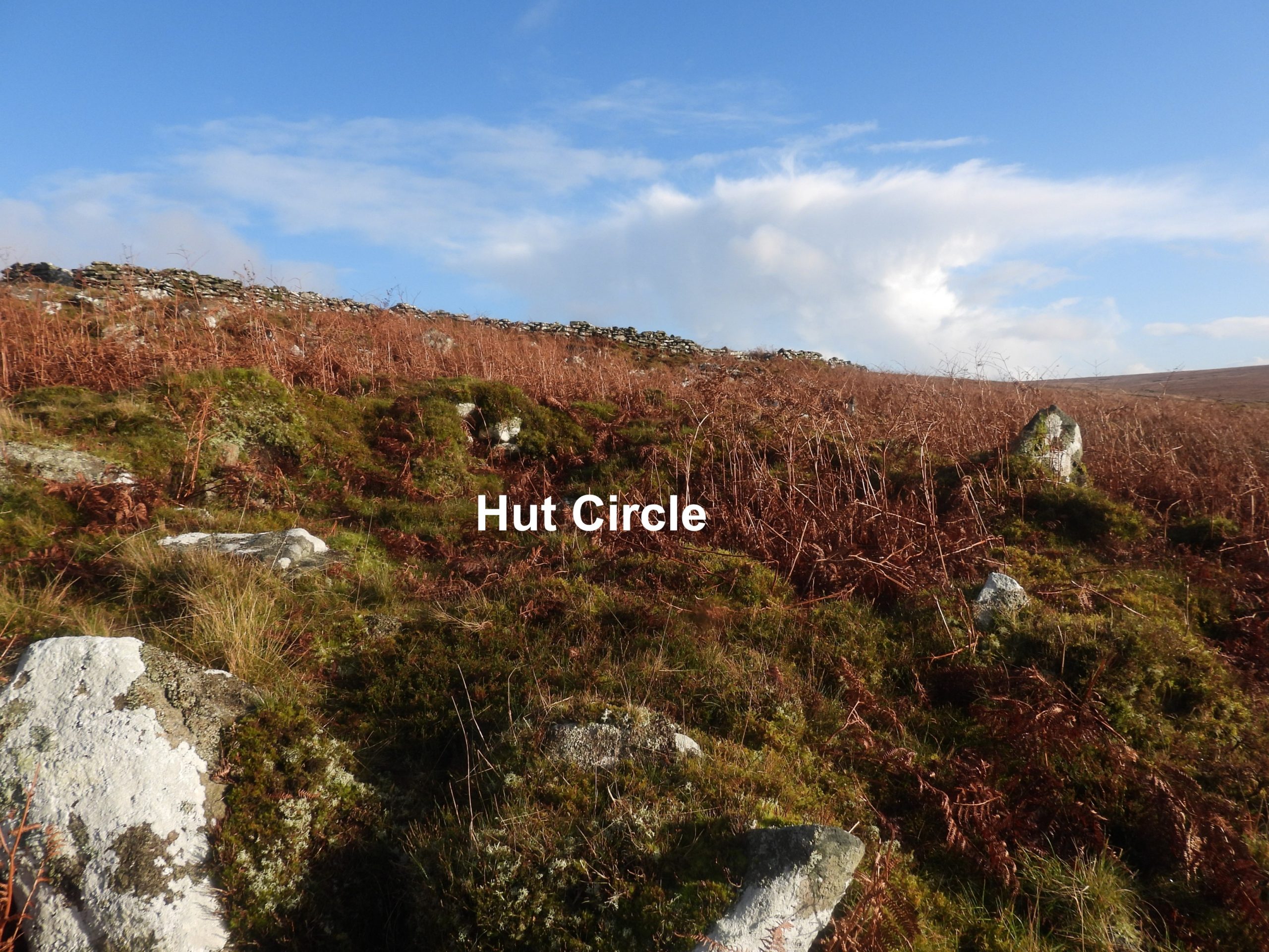
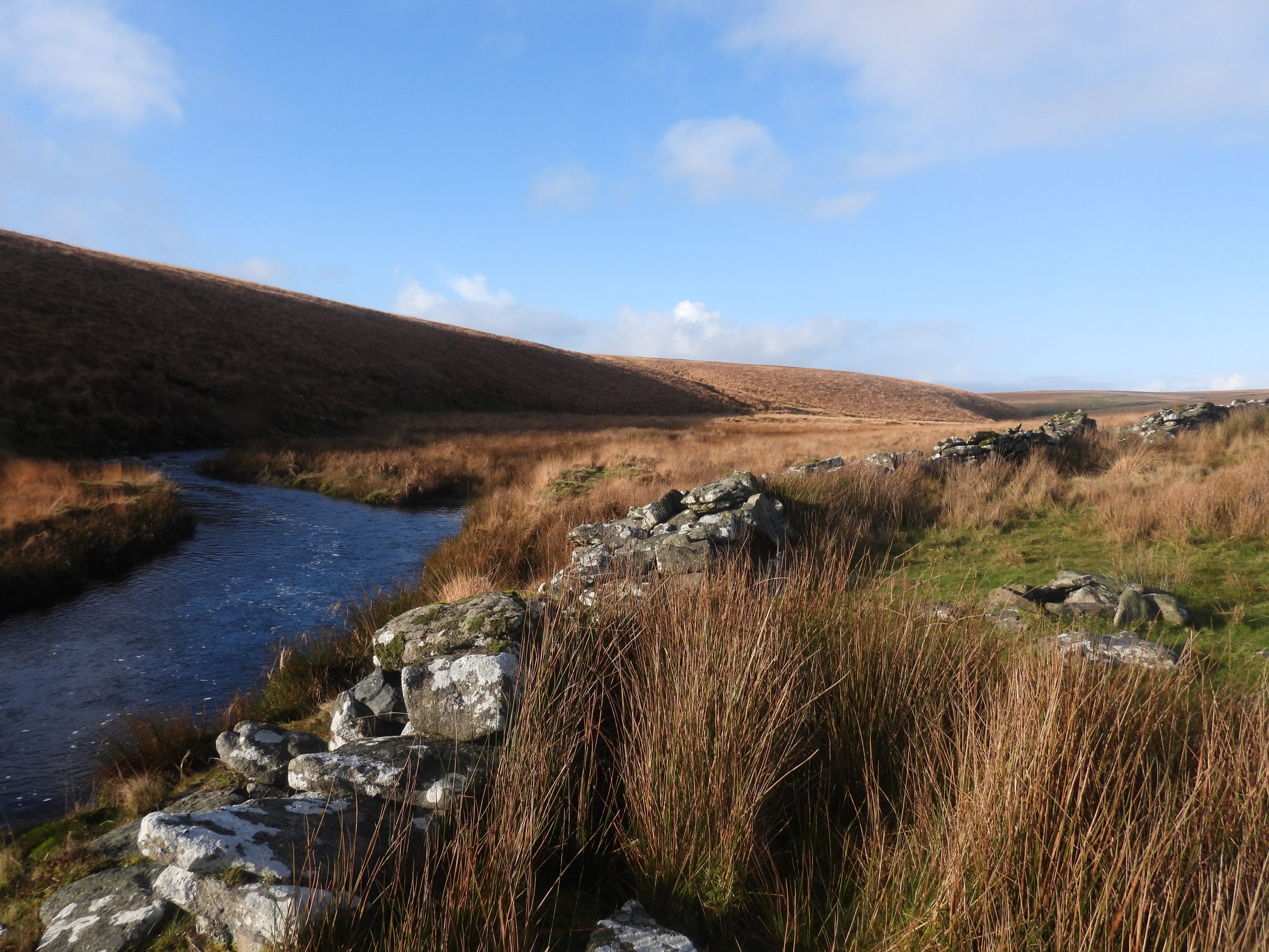
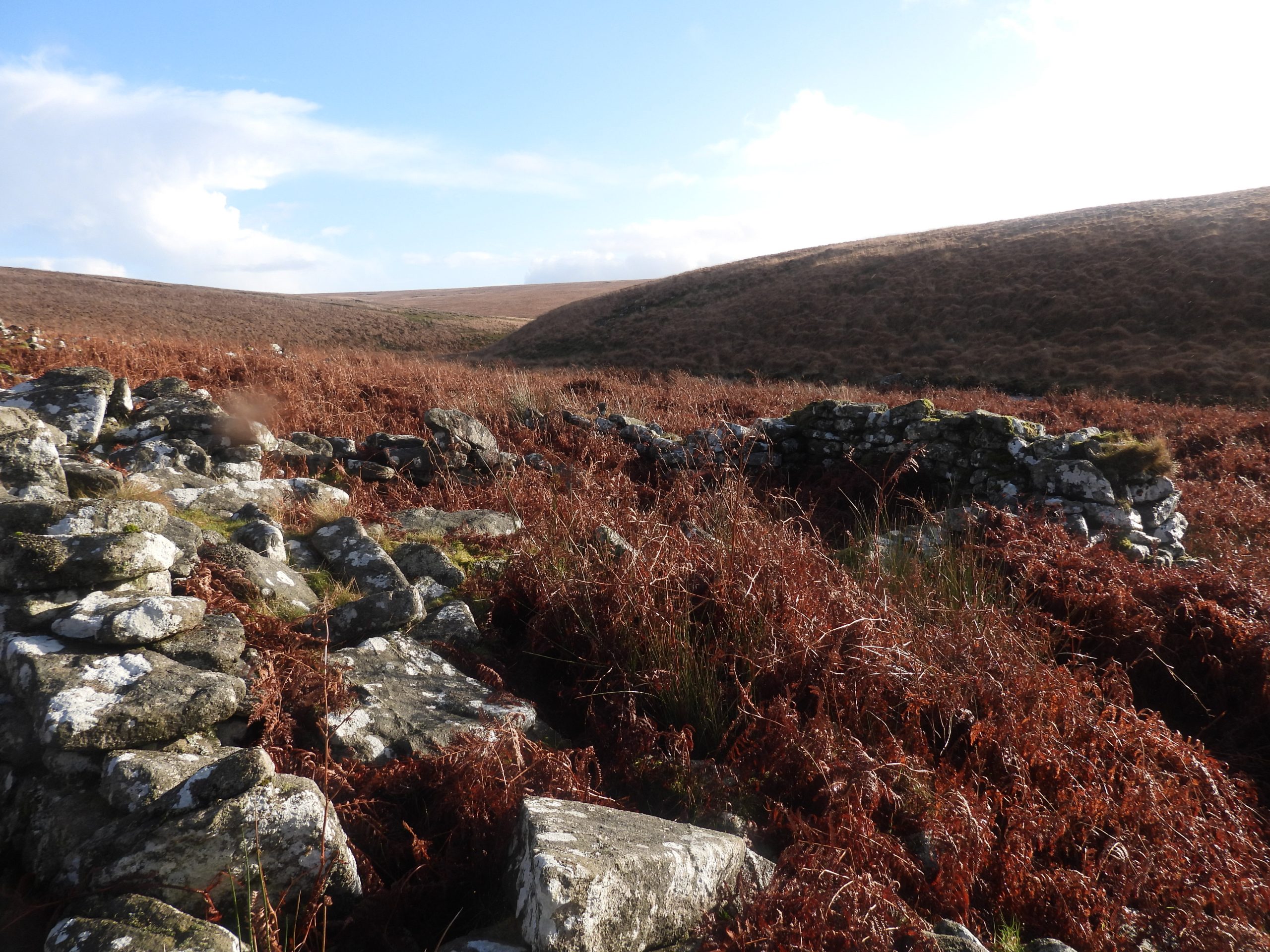
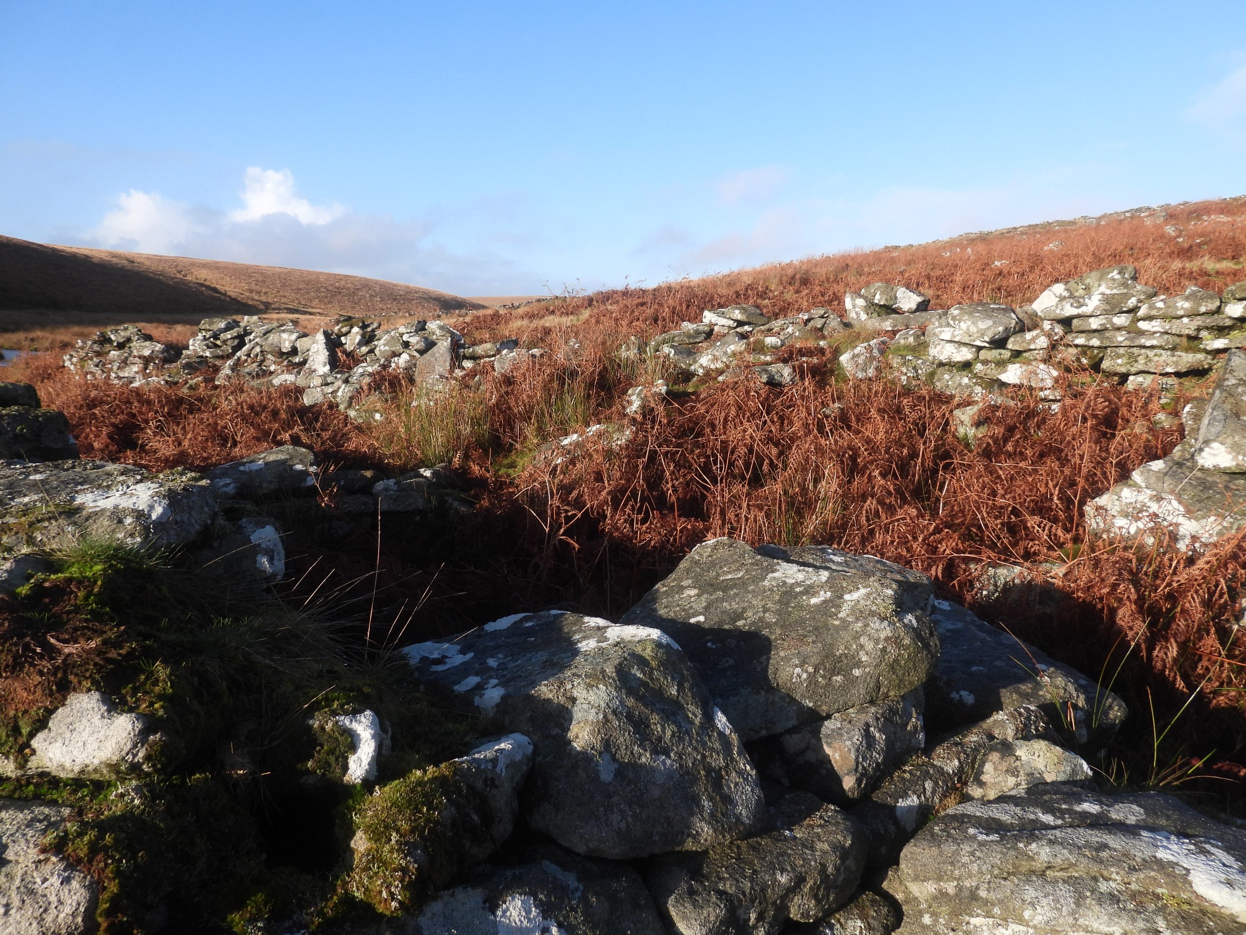
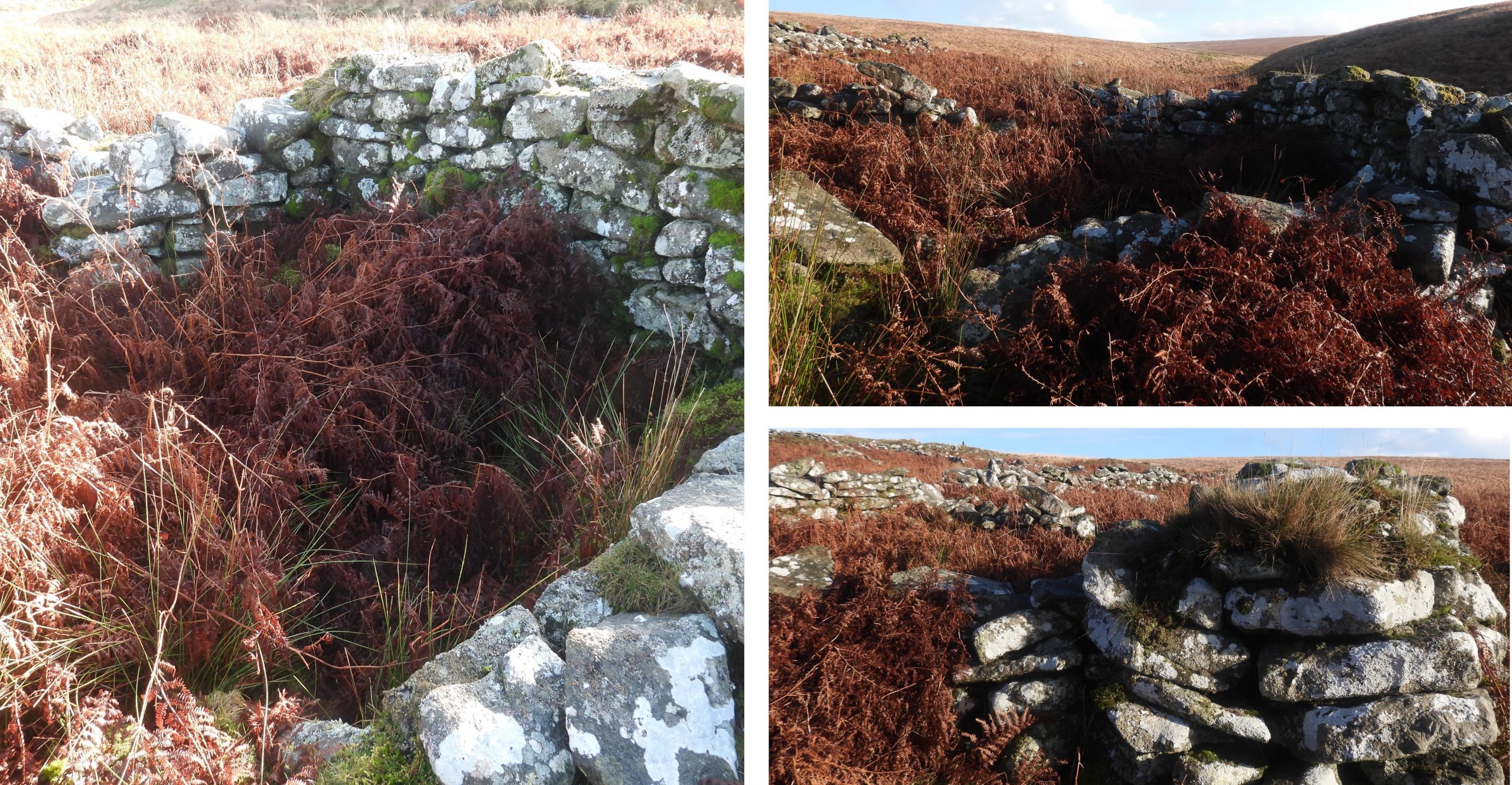
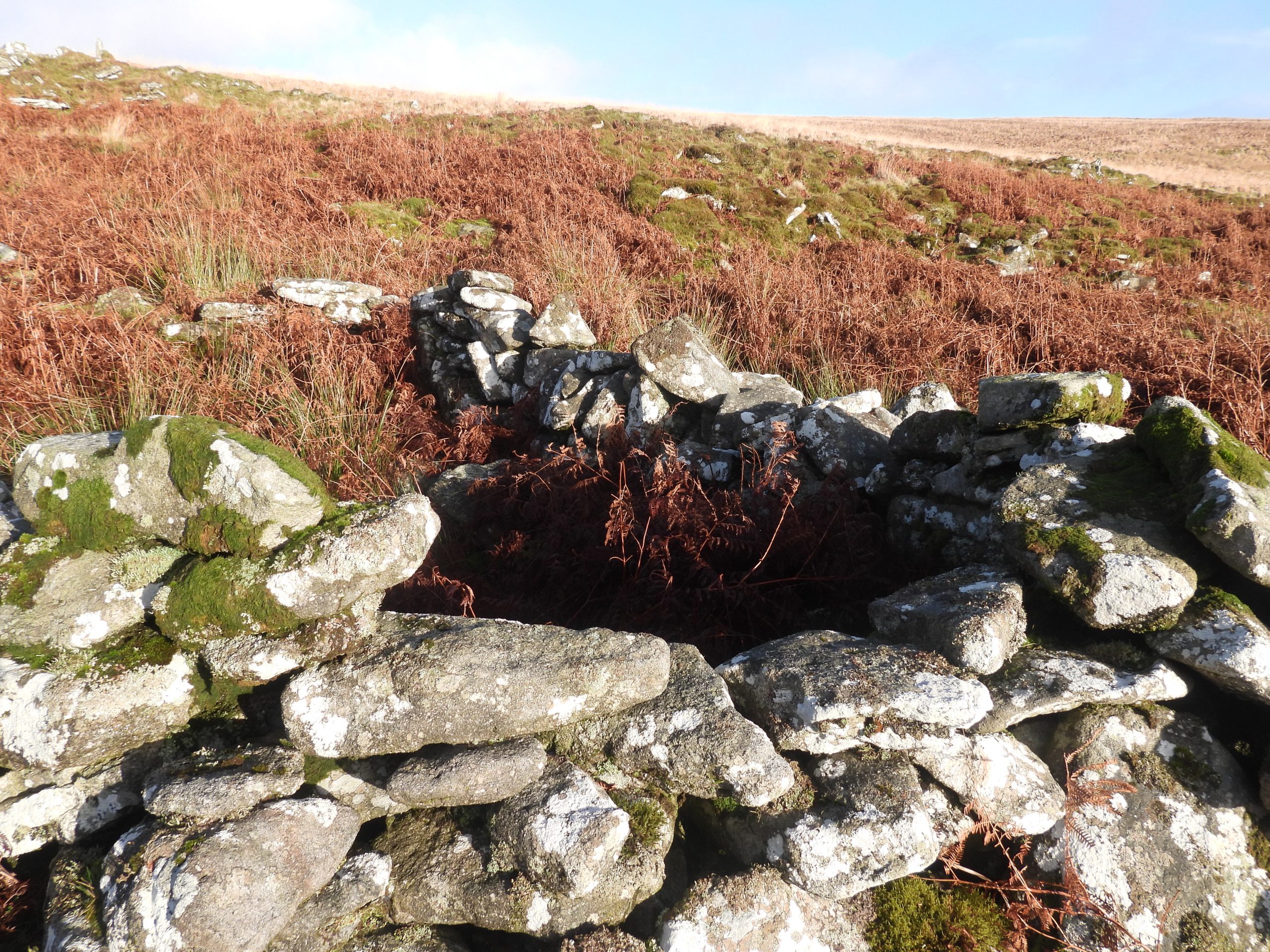
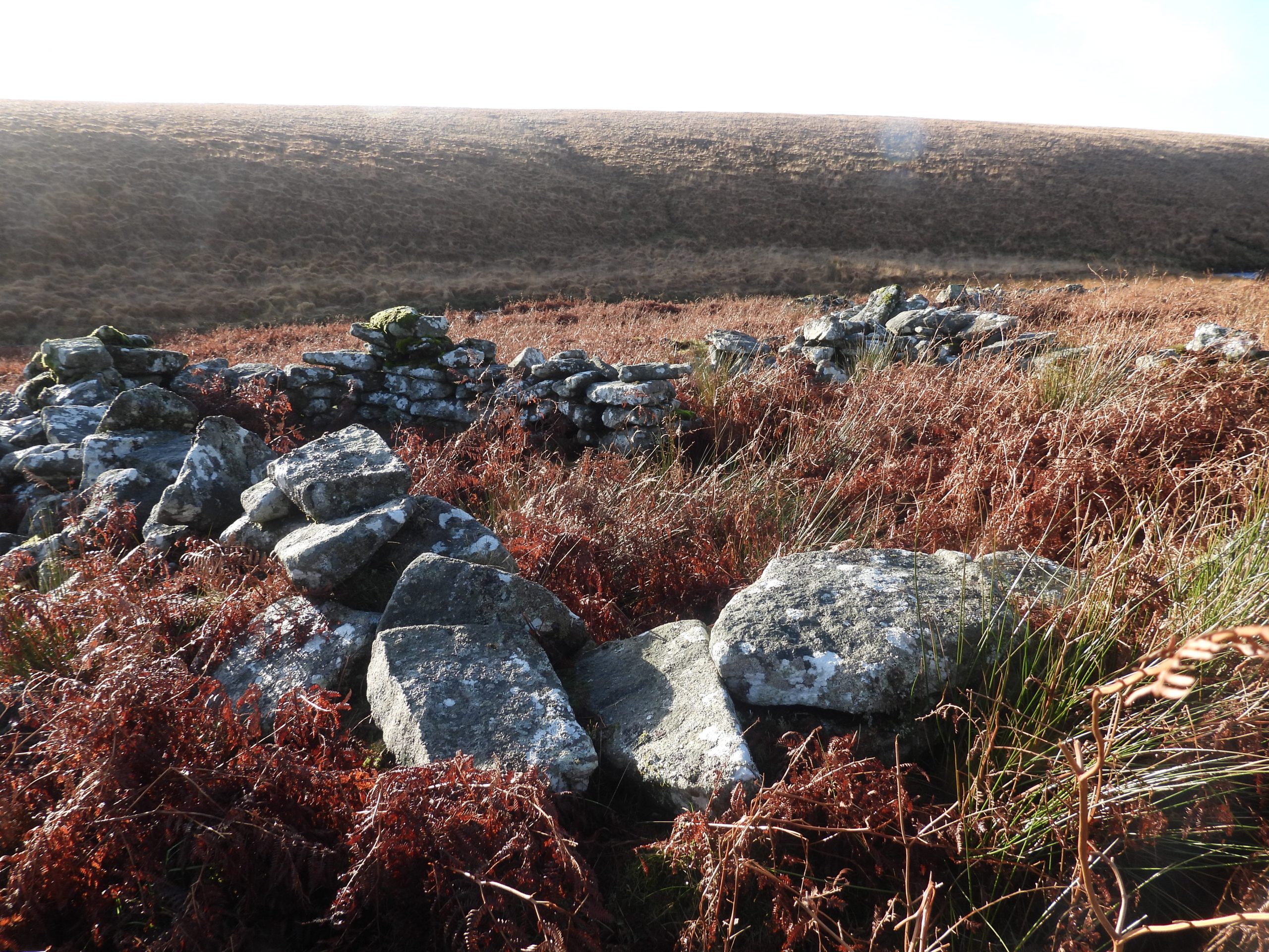
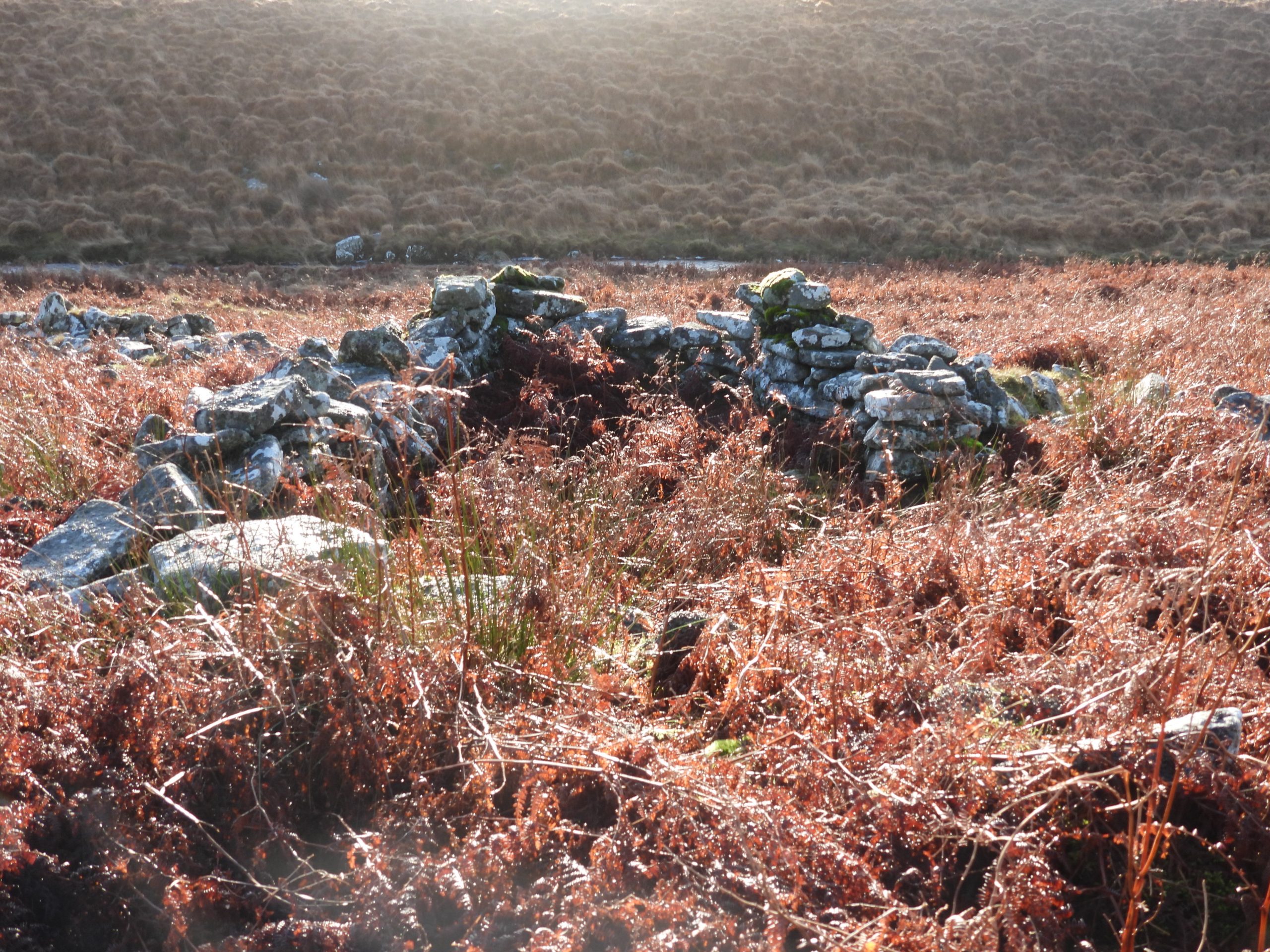
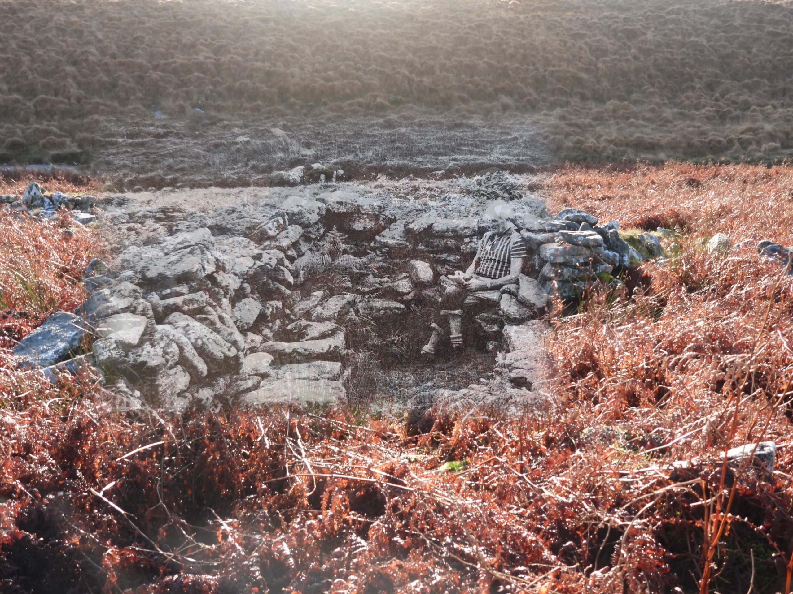
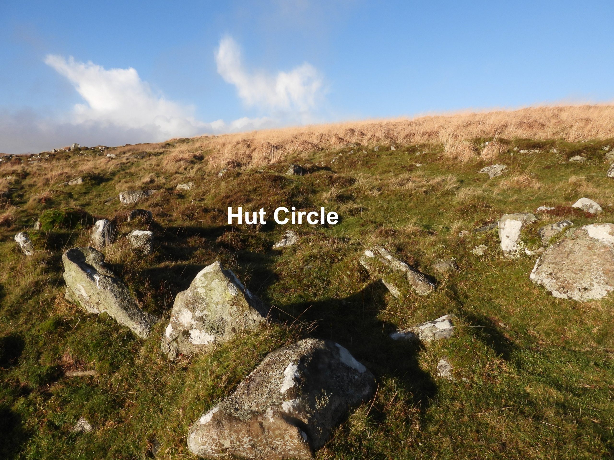
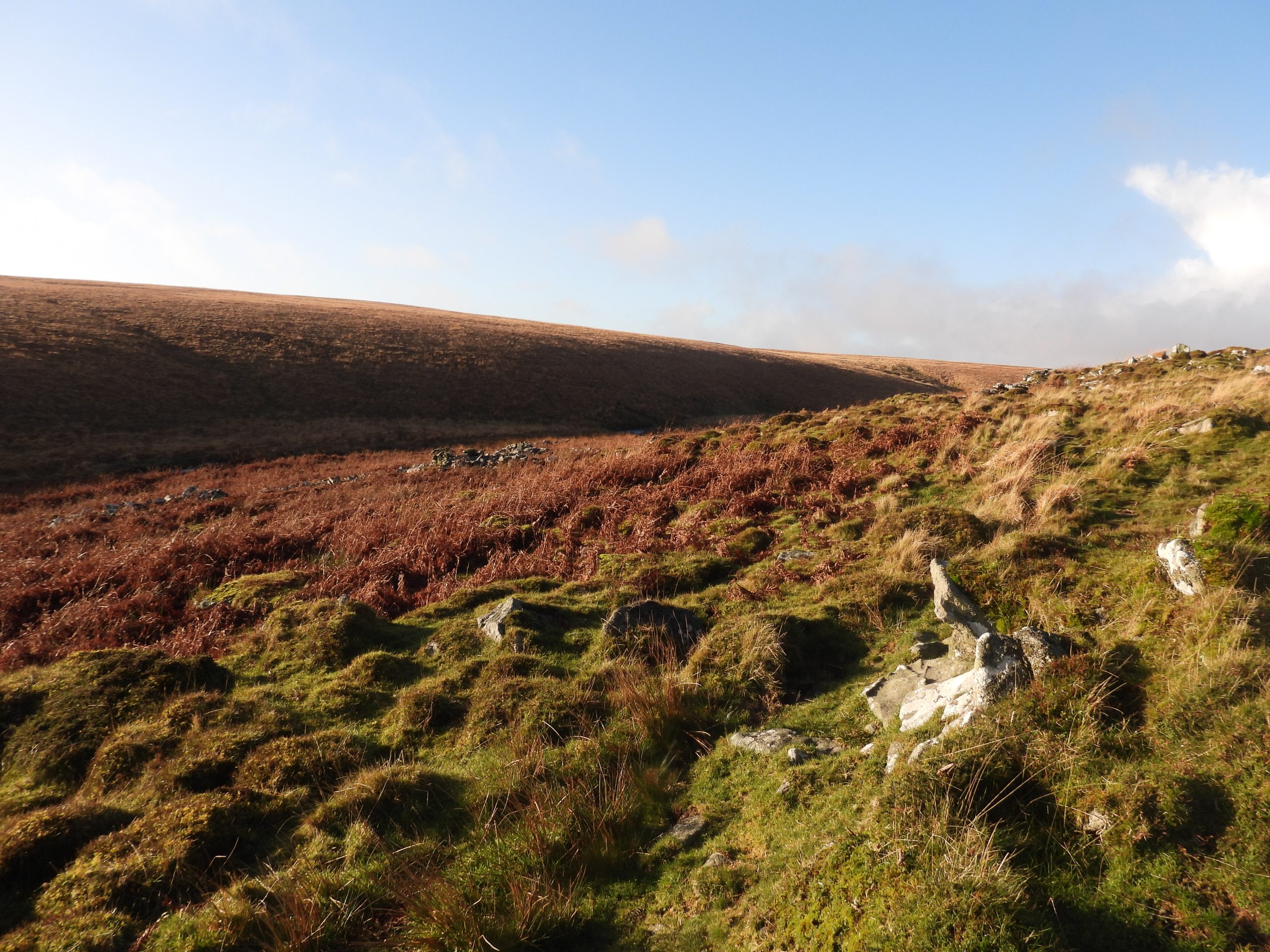
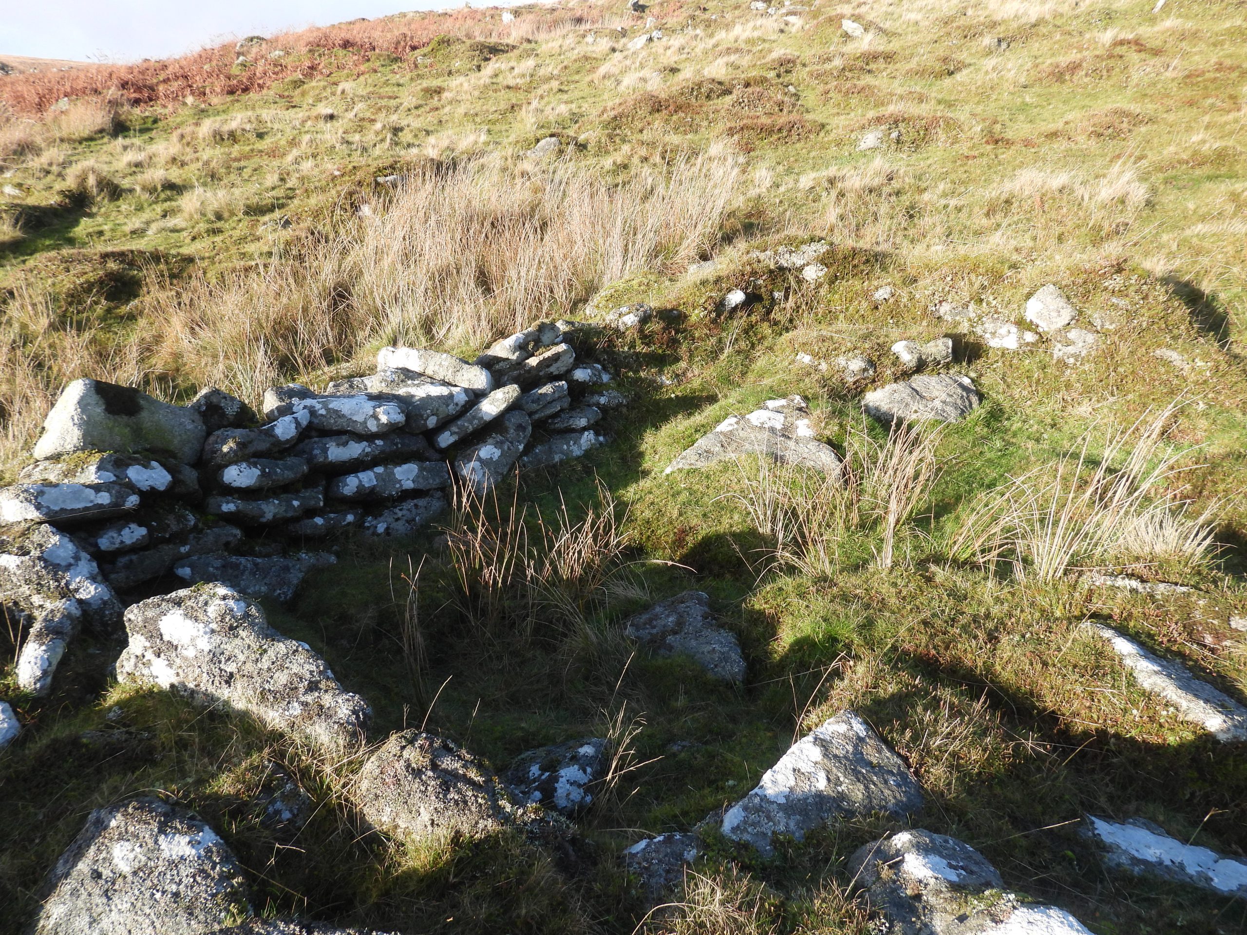
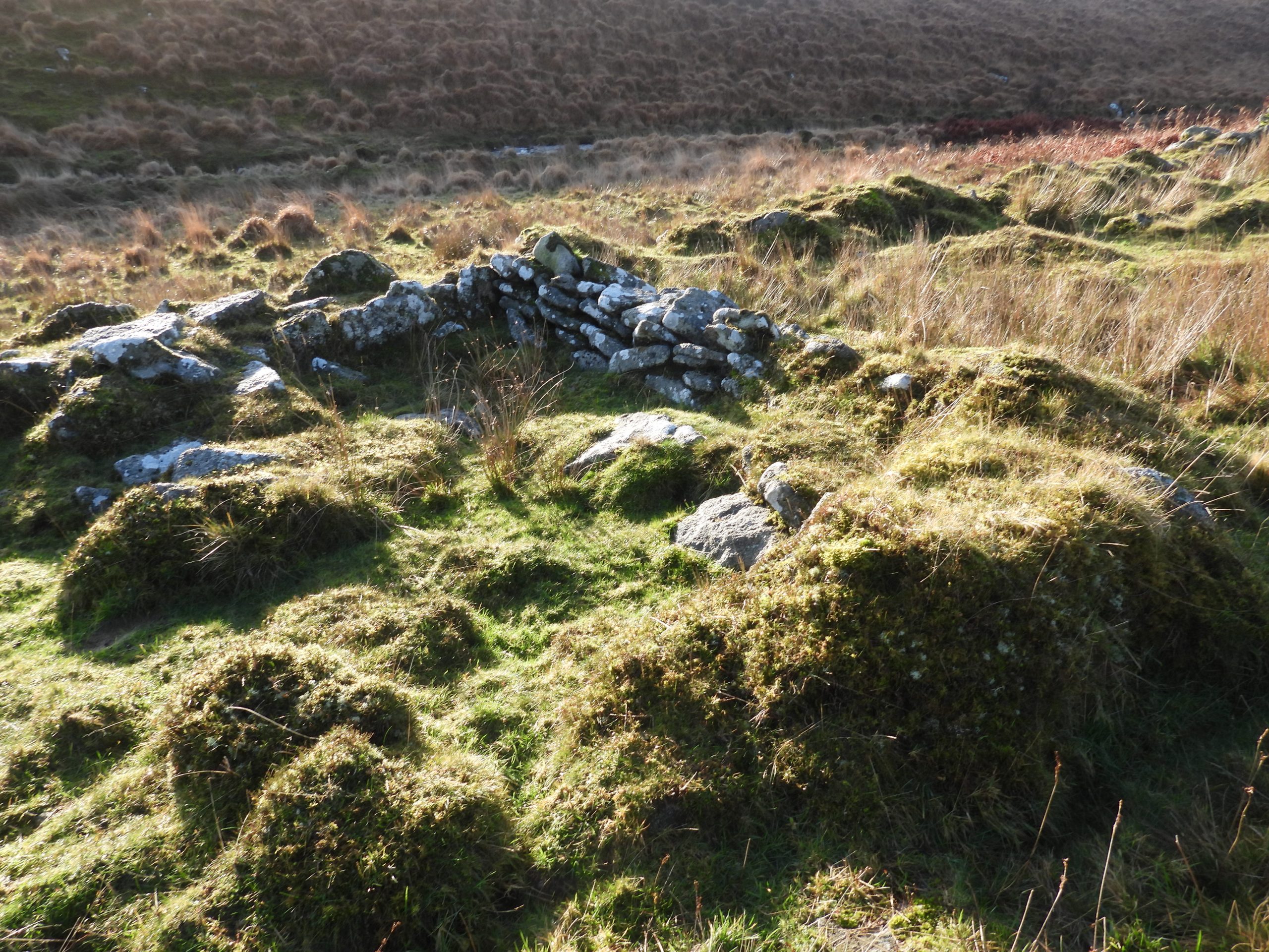
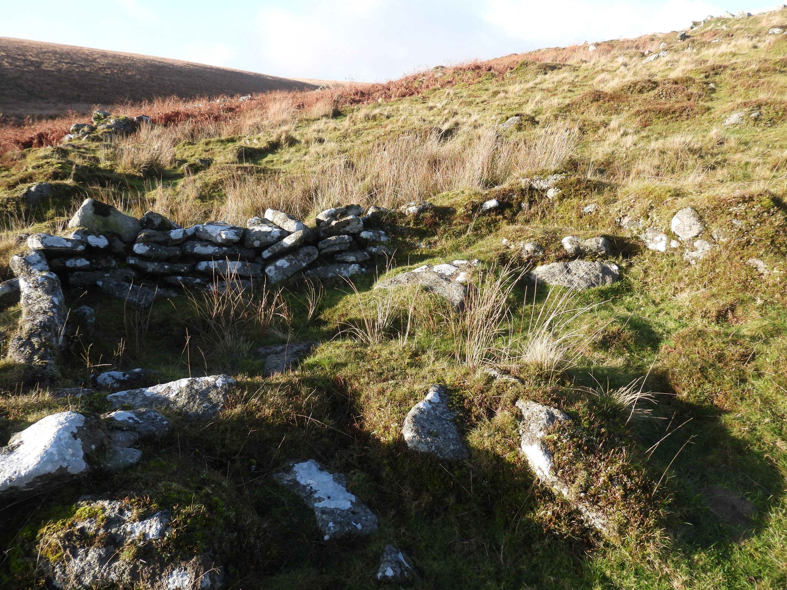
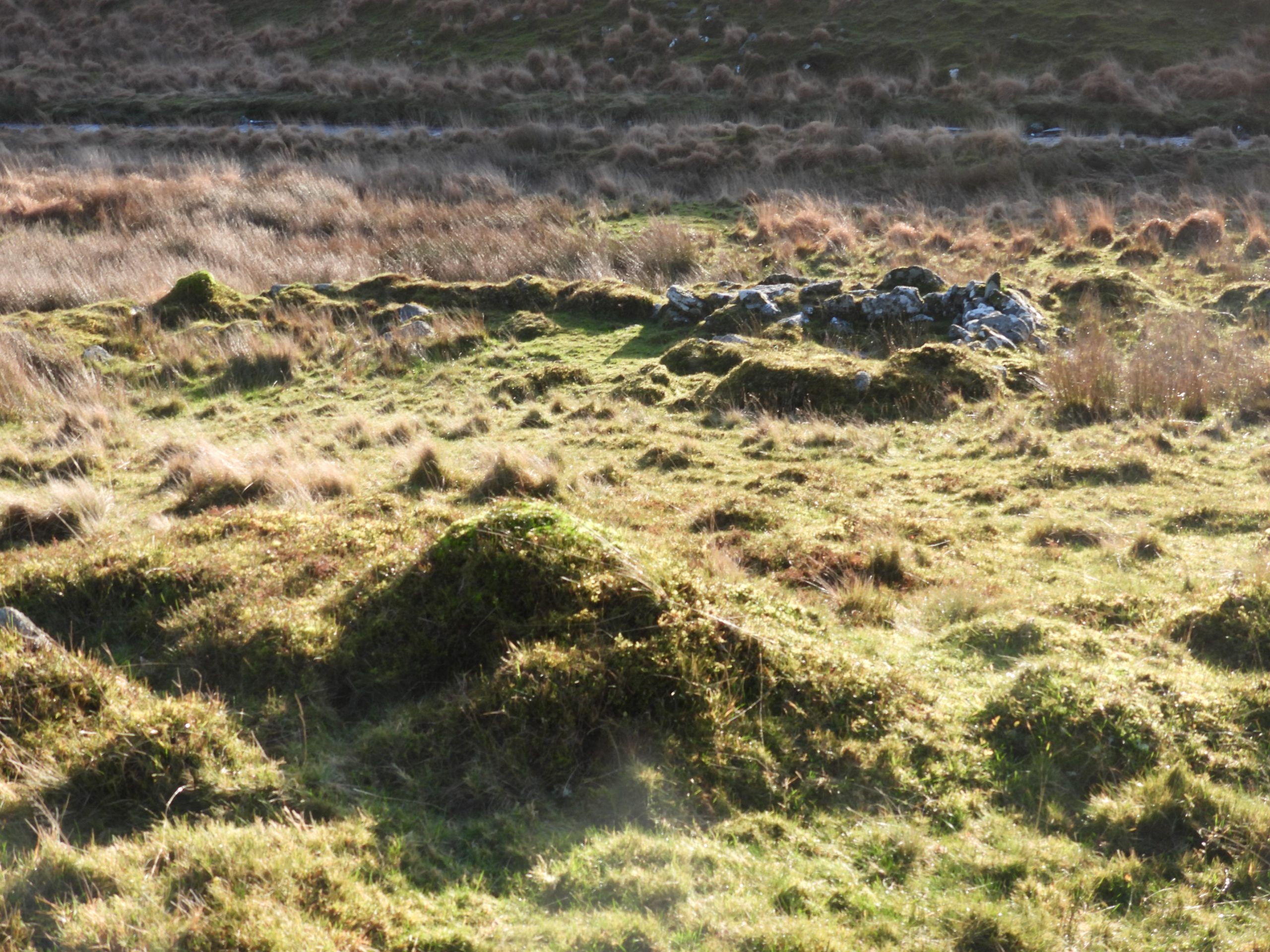
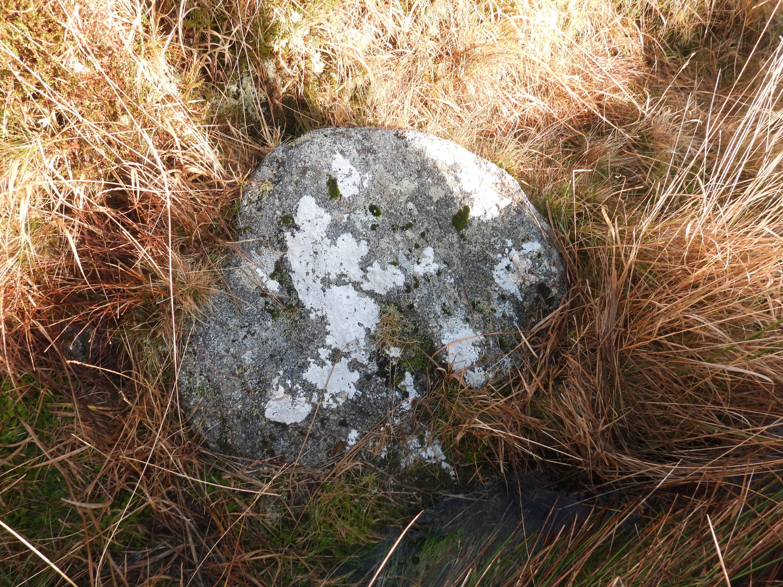
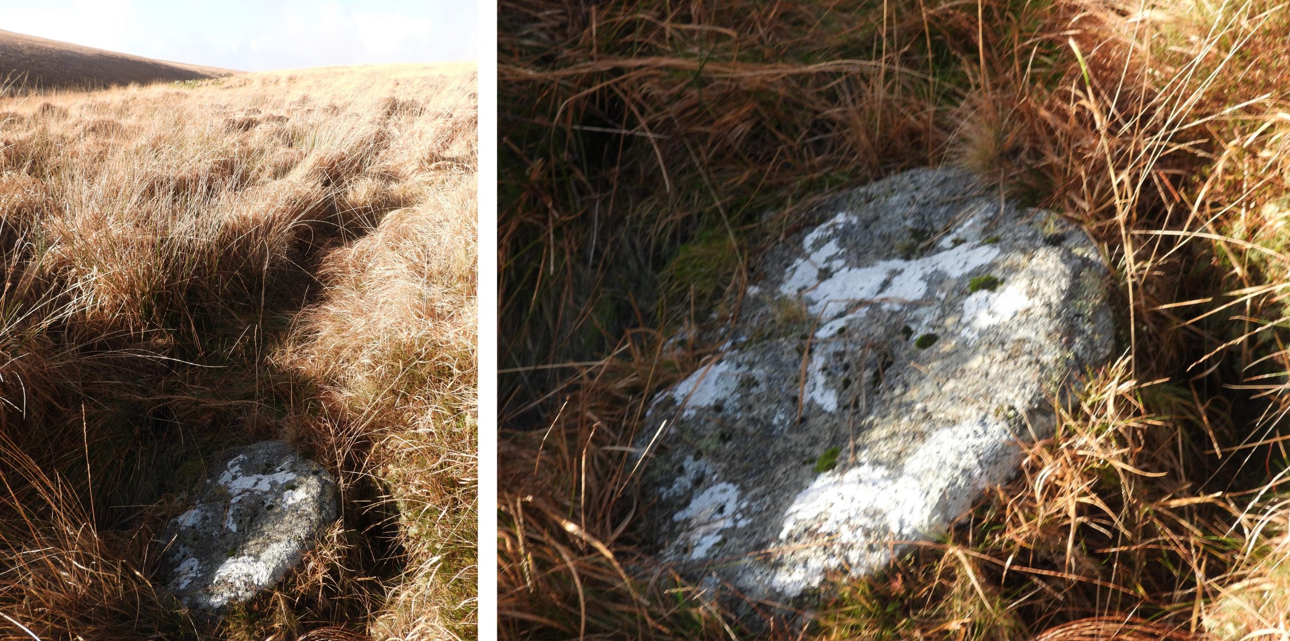
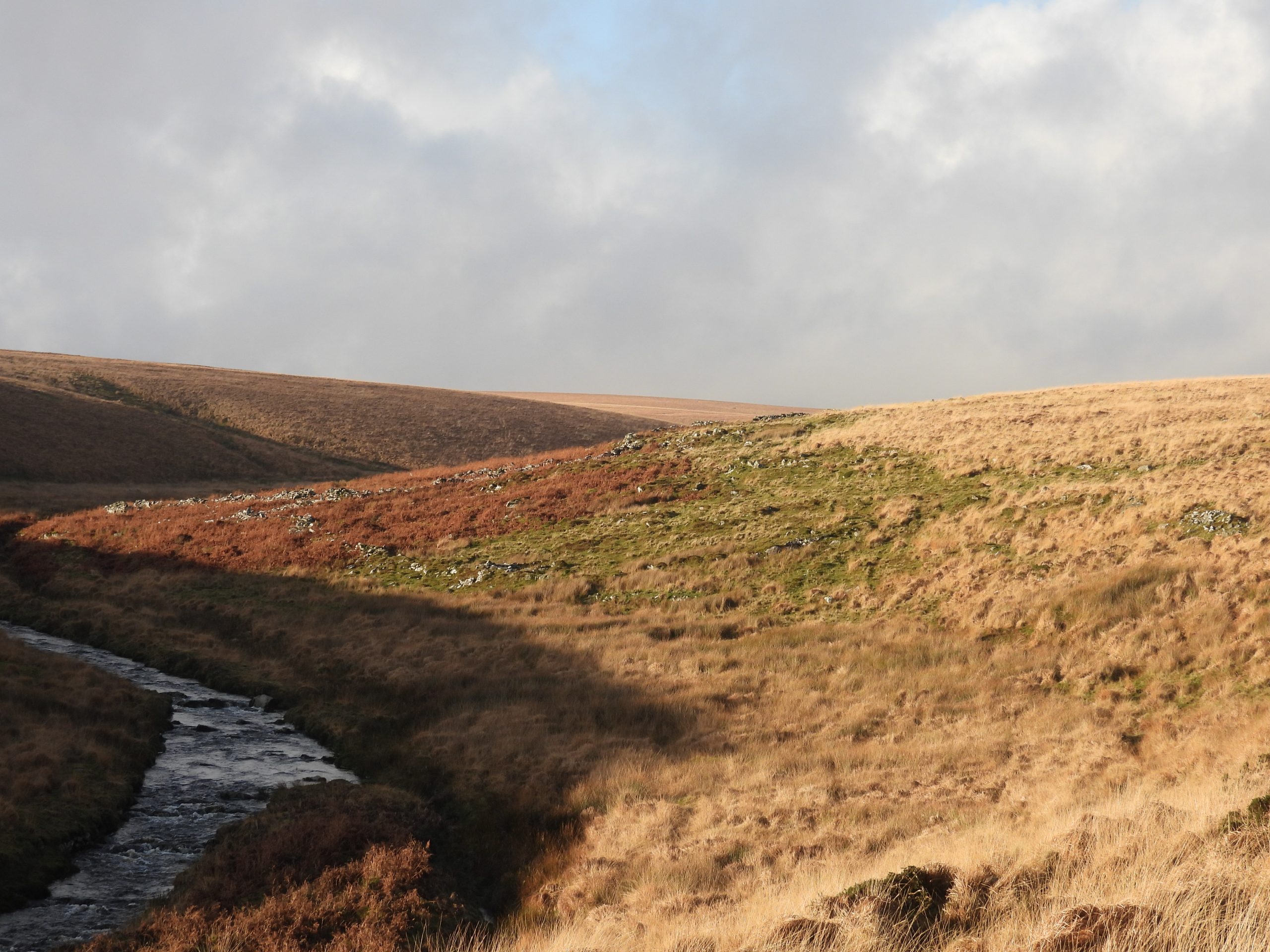
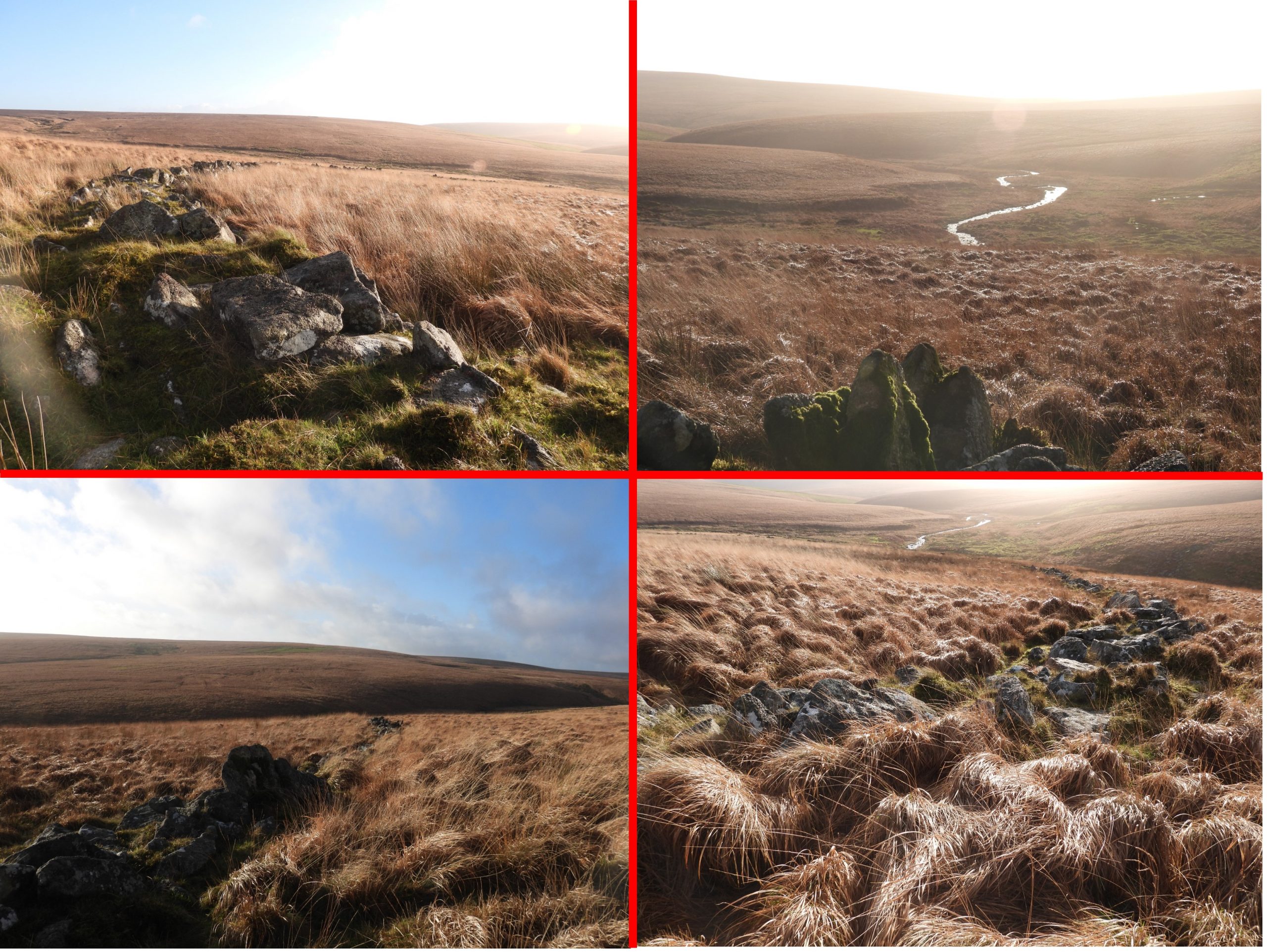
Sketch Map showing the main area of exploration in this post.The author hiked to the area covered in this post using the Zeal Tor tramway from Shipley Bridge, then followed the path past Redlake Cottages to Redlake Ford. Just beyond the ford, en-route to the first tinners’ hut is a mound covered in earth bound boulders, which is where the purported “Cracker Stone” is believed to reside. This ‘stone’ has been mentioned by both William Crossing and Eric Hemery. More information can be found here: https://www.torsofdartmoor.co.uk/tor-page.php?tor=cracker-stoneFurther downstream from the area of the ‘Cracker Stone’ is this ruined rectangular building, which is located within an area of tin streamworks along the Redlake Brook. It has been measured as being 5.2 m by 2.8 m and is at SX63793 66339.The ruined building next to Redlake Brook is considered as most likely being a tinners’ building or lodge. However (ref: Newman) its authenticity is in doubt as: a) It appears to consist of a fairly recent adaptation of an existing section of tinwork revetment and b) the floor is covered by large boulders which are unlikely to have tumbled. So is it a post medieval Tinners’ Hut or is it possibly more modern?This ruined tinners’ hut is located close to the River Erme and just to the north of Redlake Foot. It measures 5.2 m by 2.5 m with walls approx. 0.5 m high. This probable post-medieval tinners’ hut is located at SX63516 66248.Squeezed between the Abbot’s Way path and the River Erme and close to Dry Lake ford is a probable Blowing House (Tinners’ Mill)as cited by Dr Tom Greeves (1981) and Jeremy Butler (1993). The site comprises the mill with a wheelpit and two buddles to the west. It is located at SX63372 66369.The mill building measures 6.0 m by 5.4 metres with a low bank forming the south wall. The rubble filled wheelpit is 3.8 m by 1.2 m. In the north-west corner of the mill building, close to the wheelpit is a probable hearth. It is recorded as being 1.0 m by 0.7 m. The two buddles associated with the mill are located to the west of the mill and are survive as two depressions. Buddle 1 is located at SX63367 66371.Buddle 2 is reed filled and is located at SX63367 66375.Medieval streamworks at the lower end of Dry Lake. (Note the Dry Lake is also known as Hux Lake being named as such in Eric Hemery’s ‘High Dartmoor’) . These workings have characteristic spoil heaps and water channels enclosed by a sharply cut cliffs. The worked area appear (according to observers) to have been reworked at a later date.This small shelter on the east bank of Dry Lake is considered to have been a tinners’ cache (ref: Jeremy Butler). It can be found at SX63440 66486.The cache comprises moorstone walls built around two large boulders. It measures 2.1 m by 0.8 m. Its size suggests that it may have been a one person shelter.Moving north up Dry (Hux) Lake from the tinners’ cache is a small tinners’ hut at SX63483 66755. The tinners’ hut lies within a rather wet area. It has been measured as being 3.8 m by 2.0 m. The remaining walls stand up to 0.6m high.At the top (north) end of Dry Lake (Hux Lake) stands a large boulder with a piece of turf on top. This building is marked as a small ‘square’ on modern OS maps and is described by the Royal Commission for the Historical Monuments of England as a tinners’ hut. However, as pointed out by Dr. Phil Newman, the walls are built directly onto an existing turf floor and no vegetation has yet become established between the stones. This might suggest that this is an unlikely tinner’s hut, and may have been built much more recently. It is located at SX63509 66896.This “Tinners’ Hut” is single-roomed and is recorded as measuring 2.2 m by 1.7 m. The walls are 1m high and 1m wide. It is a delightful spot for lunch.Leaving upper Dry Lake / Hux Lake in an easterly direction, the longest stone row on Dartmoor can be located. This single stone row is variously recorded as being 3.1 km (1.92 miles) or 3.4km (2.1 miles) long from the cairn on the summit of Green Hill to a stone circle (the Dancers) on Stall Moor. Some observers have recorded 922 stones in the row. There was thought to have originally been around 2000 stones in the row.Whilst researching for this post the author came across some research from the early 20th century (1905) by T.A Falcon, ‘Dartmoor: A Note on Graves, 460 (HER ref: SDV255372). According to Falcon there are 800 stones between the Dancers stone circle and Green Hill. Of interest, however, is that he states that the row continues to stone “896” by the Blacklane Brook depression, followed by an intermittent alignment of some further 21 stones to a ruined cairn on Cater’s Beam. The Ordnance Survey Archaeology Division in 1979 could not identify the ‘Falcon’ stone row “extension” beyond Green Hill. How did Falcon identify over 100 extra stones ?The Abbots Way, the alleged route of monks between Tavistock and Buckfast Abbeys crosses the stone row near Redlake Foot. The author has completed the Abbot’s Way walk on 6 occasions, which is an organised event usually on the first Sunday in October. It was not named as “Abbot’s Way” until the 18th century. Both Crossing and Hemery suggested that it was actually an old ‘Jobblers or Jobbers’ Path’ (route used by yarn-jobbers to cross the moor).The author was first made aware of this cist / cairn which lies on the lower slopes of Brown Heath during the 1990’s. He was fortunate enough to have joined ‘night walks’ at that time which were guided by Ted Burkett-Dixon. It was during one of these walks that Ted, spoke of a four day wild camp he undertook at the nearby Erme Pound, when amongst other artefacts he recorded this antiquity. Ted gave the author a copy of his 71st Report of the Barrow Committee (from 1953), in which there is a sketch and a photograph of this cist / cairn. It has become heavily overgrown in the intervening 70 years.Sketch from the 71st report on Barrows by Ted Burkett-Dixon. As can be seen it is signed by Ted from 1953. Ted recorded: “There appears to be a retaining circle of which five stones remain, with a possible diameter of about 11 feet, but owing to scattered stones which might be the remains of a cairn, it is difficult to ascertain this. The kistvaen is in a mound which is raised 2 feet above the ground on the down-hill side”. Ted’s sketch shows a ‘cover stone’ (dotted line), which he temporarily moved for the sketch and a subsequent photograph. It is likely that it is this ‘cover stone’ we see atop the cist (kistvaen) today. Ted Burkett-Dixon photograph from 1953, complete with a ‘correction’ (the printed version incorrectly transposed the annotation of the Redlake Foot and Renny Brook Kistvaens). In the 71st report on Barrows, Ted recorded: “Recently vandals have displaced one of the surrounding stones and dropped it into the kistvaen. By the time this report is in print, I hope to have replaced this stone by aid of the necessary equipment , and also to replace the cover stone to the position shown in the accompanying plan, which is as it was when first examined by me”.R.H Worth, (1902), in 21st Report of the Barrow Committee, reported that the barrow was “opened and found to contain a rifled kistvaen, 2 worked flakes were found in it. Flake ‘a’ has been used on some hard substance; the solid angles left by flaking have been rubbed down, smoothed and left with a dull polish. Flake ‘b’ Is similar to other flints found on Dartmoor”. In Ted Burkett-Dixon report there is a photograph of these two ‘Flakes’. The cist is recorded as measuring 1m by 0.7m. It is located at SX63772 66062View of the Stall Moor – Greenhill stone row as viewed from the cist / cairn. The line of the Abbot’s Way / Jobbers’ Path can be discerned in the picture. Dry Lake / Hux Lake is in the background.The northern end of Erme Pound with the river belowErme Pound was originally a Bronze age settlement but was used by the moormen during the middle ages between 16th to 18th centuries to corral their cattle. The north entrance to Erme PoundTinners’ Cache within Erme Pound. Recorded by Dr Newman as the only feature within Erme Pound to resemble the fabled ‘Dartmoor tinners’ cache or beehive huts‘. There are other buildings associated with the pound which are Bronze Age huts or shelters built by the moormen from the middle ages.The Erme Pound Tinners’ Cache / Beehive Hut comprises a 2 metre diameter ring of boulders and is located at SX63738 65673Typical Bronze Age Hut Circle at Erme Pound.Erme Pound is located in a wonderfully sheltered area next to the River ErmeThere are three buildings associated with Erme Pound which relate to 16th-18th century moormen. The above building is one such structure.This structure is well built and made up from drystone granite walls. The interior dimensions have been measured as being 6 m by 2.7m. There is an entrance opening on the east side.It is known that Erme Pound was used for impounding cattle by at least 1586 and that this practice continued until the 18th century. Therefore this construction and occupation is likely to have been around this period and used as a shelter. It is located at SX63759 65600.A second 16th-18th century ‘moormen’ building can be found at SX63787 65596 adjacent to the south-east exterior of the pound.This 2nd building measures 5.5 m by 2.3 mThis 2nd building is built from large, coursed granite boulders. The walls are up to 0.8 metres thick and up to 0.9 metres high.The interior of the 2nd building has a raised plinth, capped with flat granite slabs. This has created seating around 0.7 metres wide. This seating arrangement makes this an ideal resting place for walkers.One such walker, who utilised this raised plinth with its capped flat granite slab seating was the well known Dartmoor author, Eric Hemery. This building features in Eric’s book ‘Walking Dartmoor’s Ancient Tracks – A guide to 28 routes’. The above picture shows Eric in this building and looks like he is sketching or possibly taking notes.The author has the greatest respect and admiration for Eric and has many of his books. The details and information in Eric’s books are all the more remarkable as they were penned during the pre-internet days. This composite picture of Eric superimposed onto the authors picture of the building shows little has changed in this isolated location on the south moor.Another hut circle in Erme Pound. It is located between the 2nd and 3rd buildings (non-Bronze age) shown in this post.This is a general view of Erme Pound. Some commentators have noted that the cattle who were impounded here would have caused damage to the Bronze age antiquitiesThere is a 3rd (non-Bronze age) building associated with Erme Pound tucked inside the southern, central section of the enclosure.The structure of the 3rd building is located at SX63844 65543.The interior dimensions of this 3rd building have been recorded as being 4 m by 1.6 m.The 3rd (non-Bronze age) building nestles against the external wall of Erme PoundFound by Dartmoor guide Paul Rendell, this probable millstone is as yet unrecorded on the Dartmoor HER but is recorded on ‘Dartefacts’.The probable millstone is located in a small hollow and could easily be missed. It is located at SX63904 65541.Leaving Erme Pound to the south as the late autumn / early winter mid-afternoon shadows start to extend across the site.These views are of the pre-historic enclosure to the south-east of Erme Pound looking across the Erme Valley as the sun sinks down on a beautiful autumnal afternoon. Time to leave this beautiful remote part of the southern moor.