A collection of walks, discoveries, insights and pictures of exploring Dartmoor National Park
April 28, 2022
East Birch Tor Mine
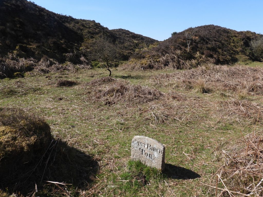
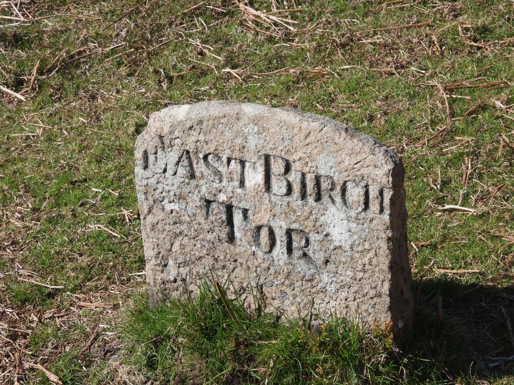
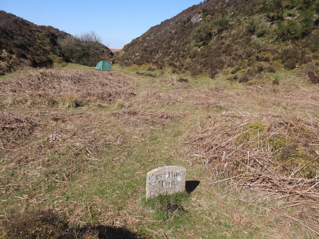
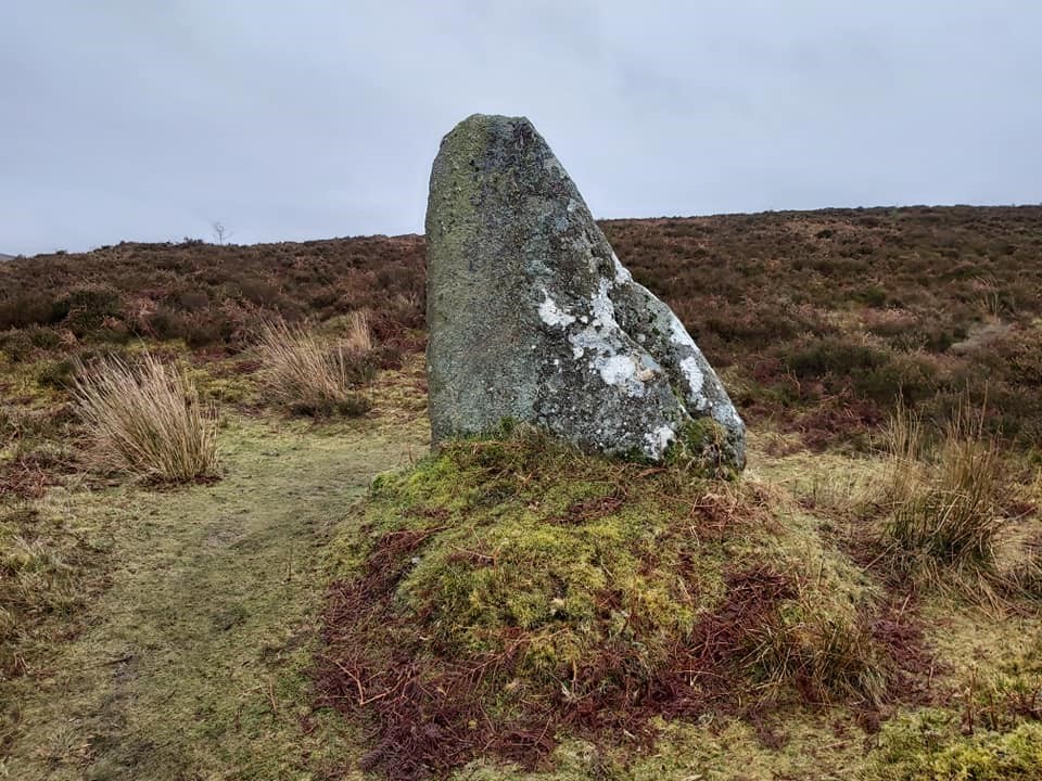
The vast openworks and streaming associated with East Birch Tor Mineextend from the eastern flanks of Challacombe Hill and along the West Webburn River near Headland Warren Farm downstream to its junction with Redwater Brook. The western limit of the sett is located in Chaw Gully and is defined by an inscribed ‘East Birch Tor’ boundary stone.
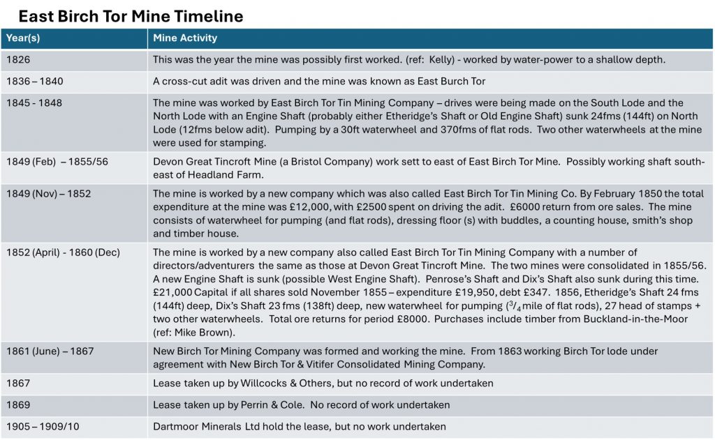
The earliest tinners workings are said to date from the Medieval period and were in use until the 18th century. However, during the 19th and early 20th century these techniques were replaced by nucleated shaft and adit mines and it is probable that the 19th century revival at East Burch Tor Mine was first fully instigated by 1836 by Captain Paull (having made his fortune at Birch Tor and Vitifer Mines in the Redwater Valley). This may have succeeded earlier activities in 1826 (Kelly). In the 19th century a number of shafts (around 13 in number and up to 24 fathoms deep) were sunk on the West Webburn valley floor and lower valley sides and adits were driven into the hillside. The details of production of East Birch Tor mine were estimated by D.G Broughton (1968/9 – The Birch Tor and Vitifer Tin Mining Complex) as being only around 55 tons of black tine between 1848 and 1864, which were the most active period of the mine. The sett, however, was abandoned by 1867 but there are records of at least three hopes of a revival all the way until 1910.
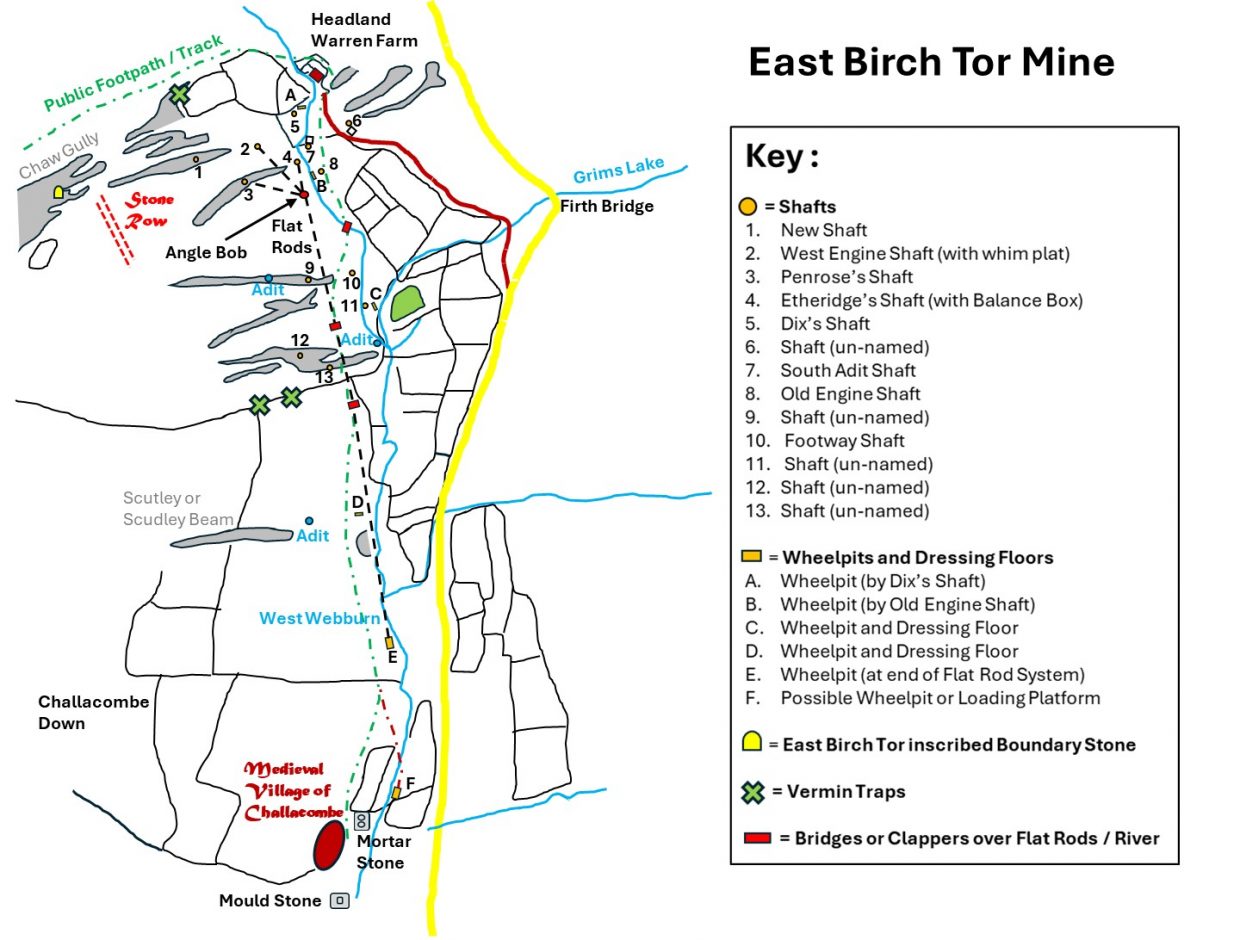
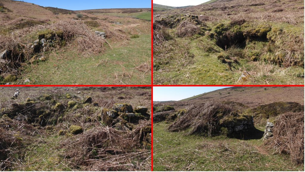
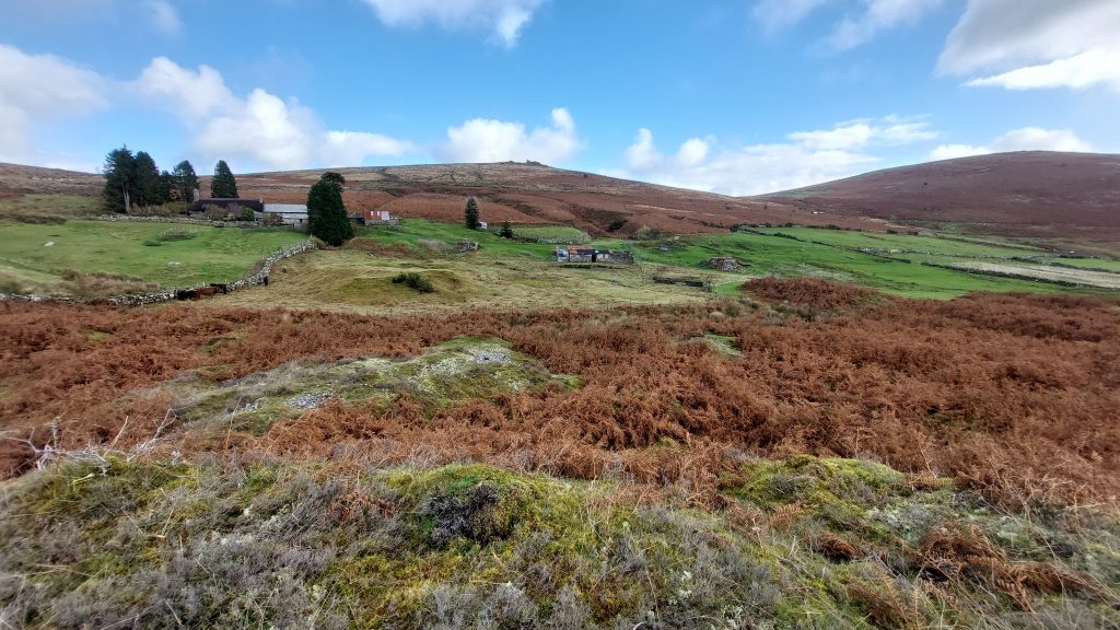
On the valley floor there are six main areas of interest; From north to south: 1. The remains of mine buildings and foundations, a two Wheelpits, at least 8 Shafts (many named) and the remains of Flat Rod Channels near Headland Warren Farm; 2. A probable stamping mill with a Wheelpit and Dressing Floor near Grims Lake as it meets the West Webburn river; 3. A possible tinners’ mill with a Wheelpit and other features close to the public footpath and track; 4. A large Wheelpit where the wheel was once located to drive the Flat Rods to pump the Shafts near Headland Warren; 5. A possible Wheelpit or Loading Platform near Challacombe; 6. Evidence near Challacombe of Tinners’ Mills with a Mould Stone and a Mortar Stone.
Bibliography
Jeremy Butler – (1991) – Volume 2, the North – pages 25-27
Mining Journal – articles from 6th June 1840 – 28th October 1866
D G Broughton (Dept of Geology and Geography, College of Technology, Kingston Upon Thames) – Birch Tor & Vitifer Mining Complex
A.K. Hamilton Jenkin – (2005) – Mines of Devon
Royal Commission for the Historical Monuments of England -(1987-1993) – Duchy Farms Project Survey Visit, P. Pattison (Report – Survey). SDV350839
D.J. Bonney – (1971) – Former Farms and Fields at Challacombe, Manaton, 83-91 (Article in Monograph). SDV289513.
Stephen Holley (Dartmoor Tinworking Research Group (DTRG) Chairman) – Pers. Conv.
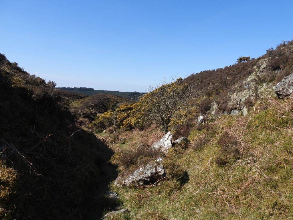
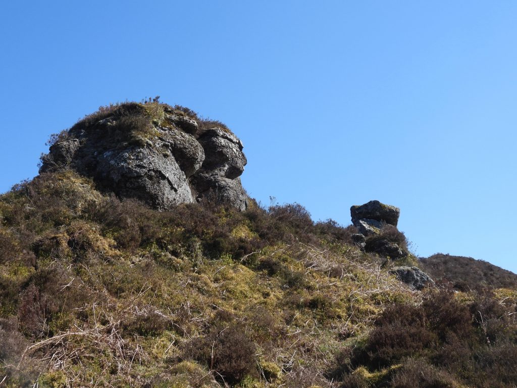
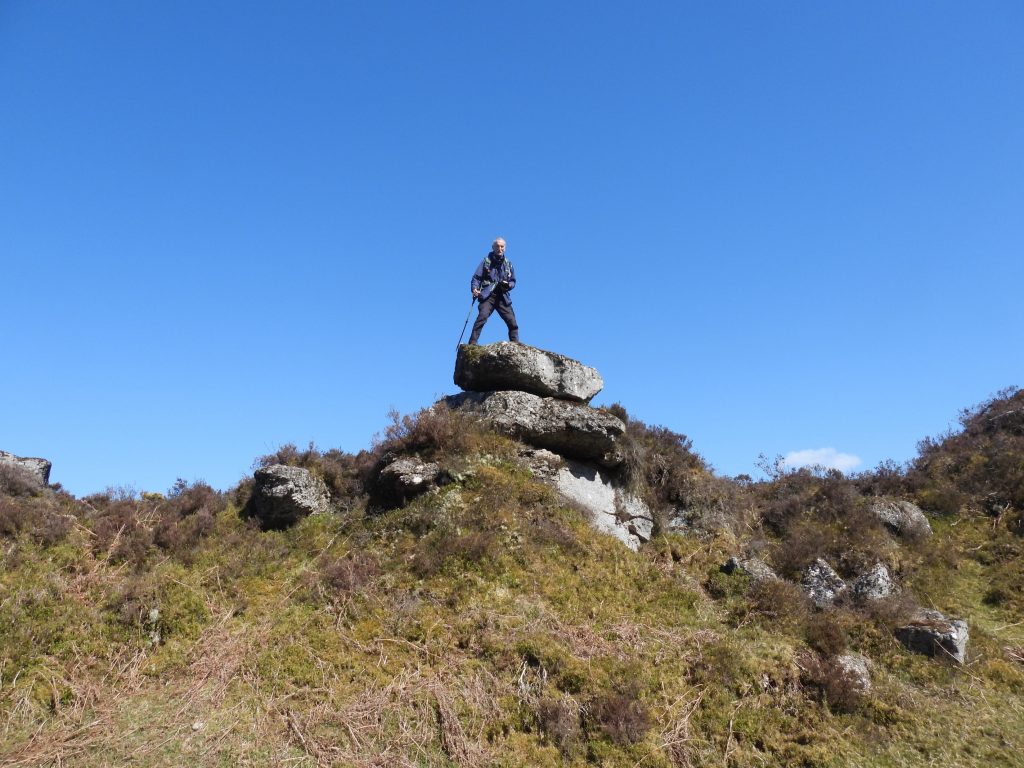
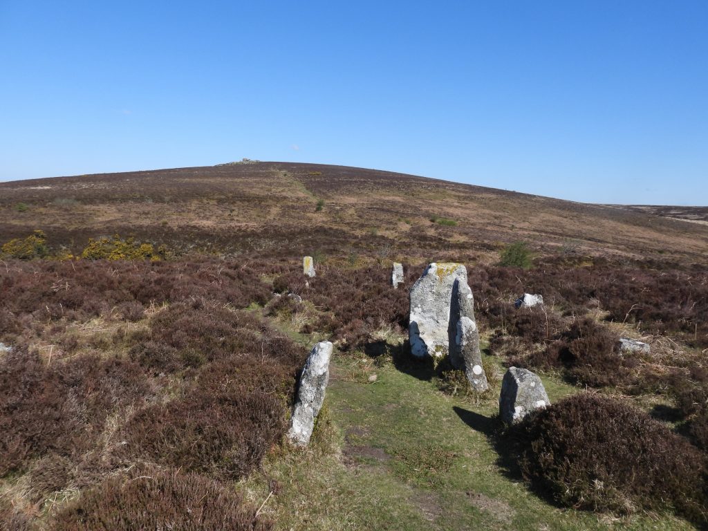
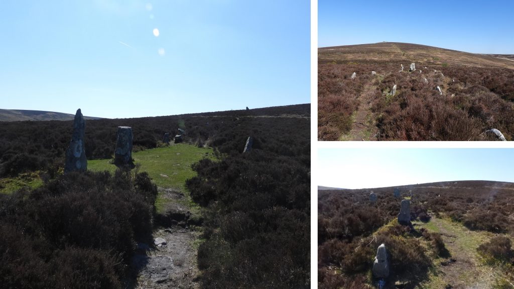
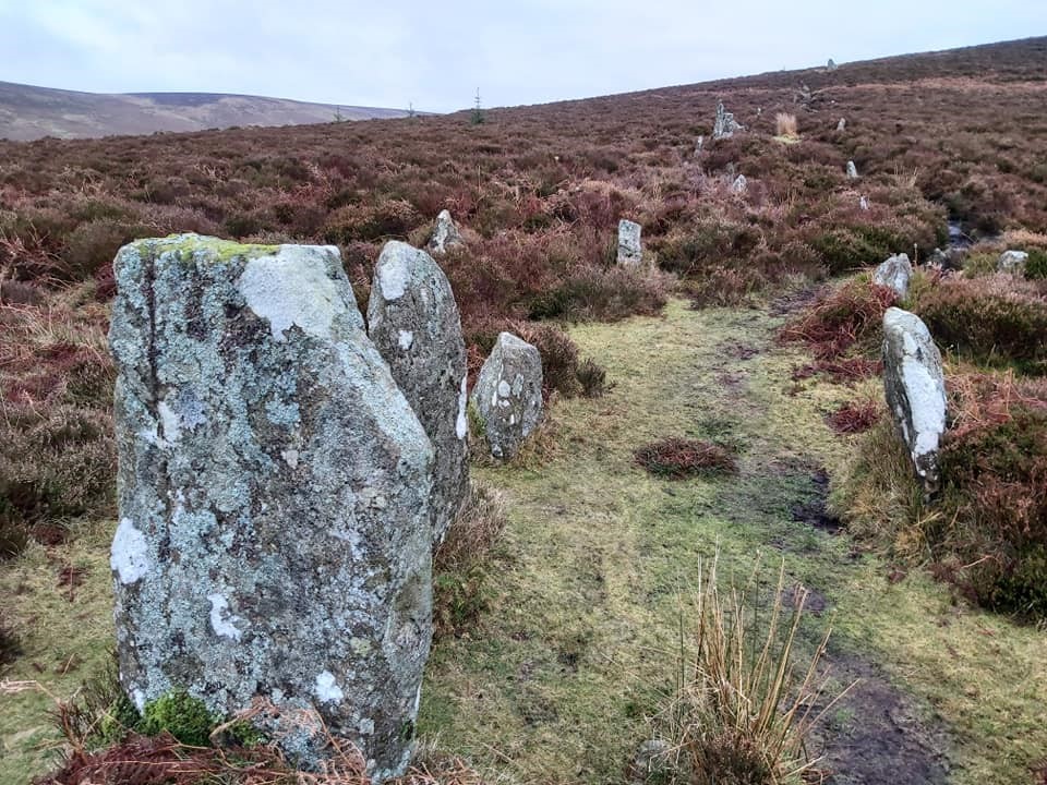
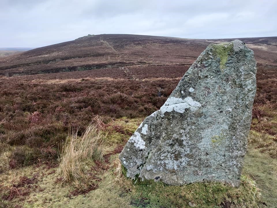
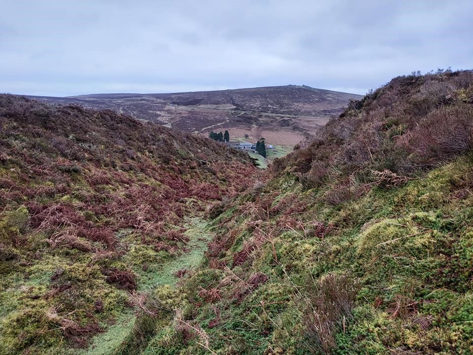
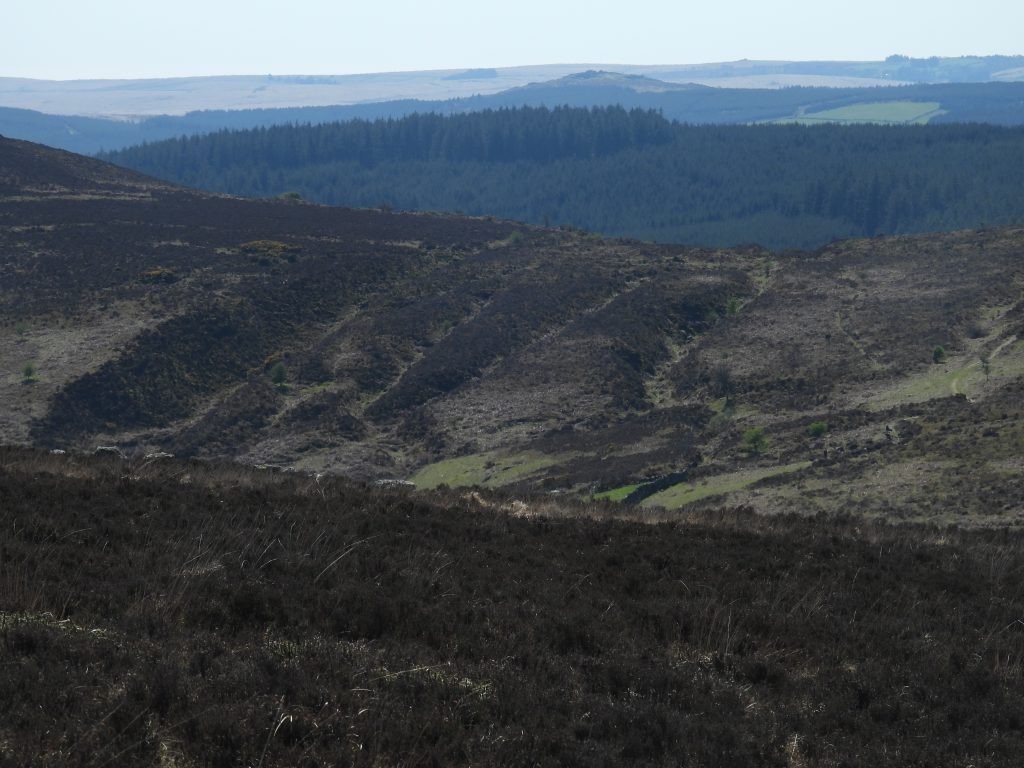
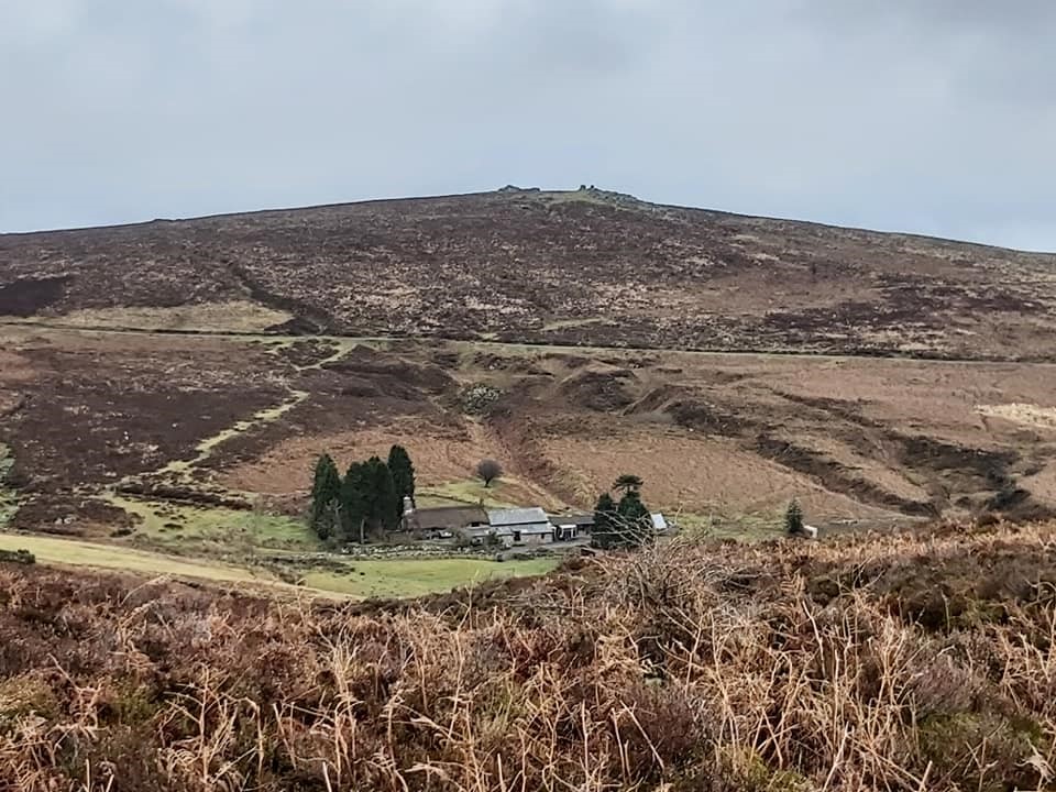
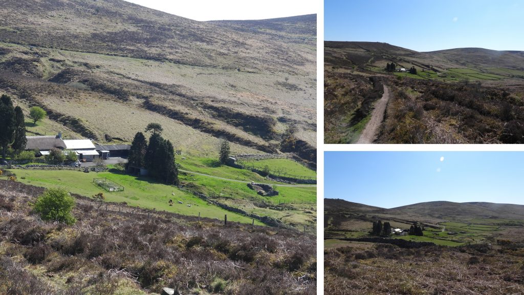
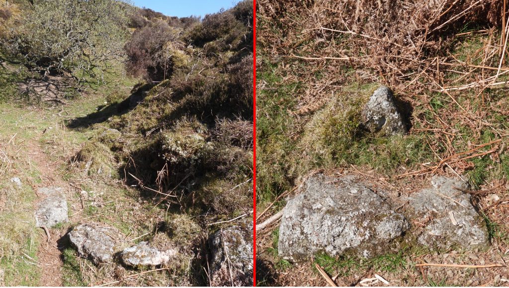
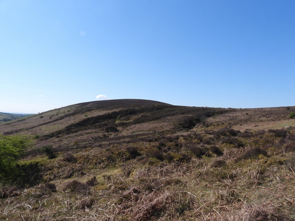
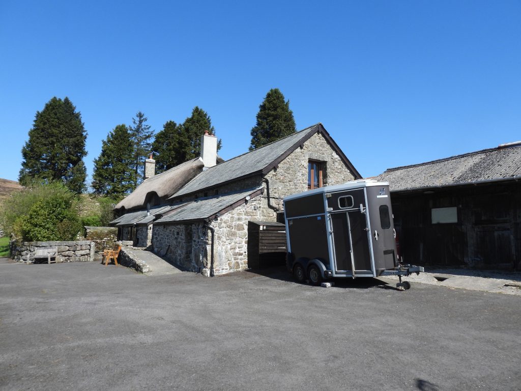
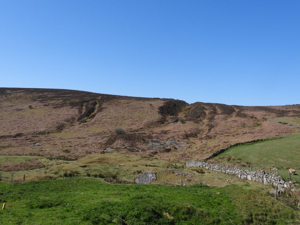
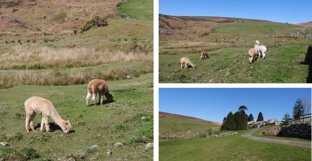
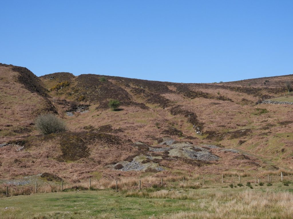
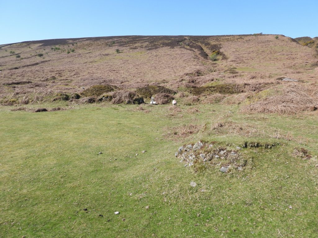
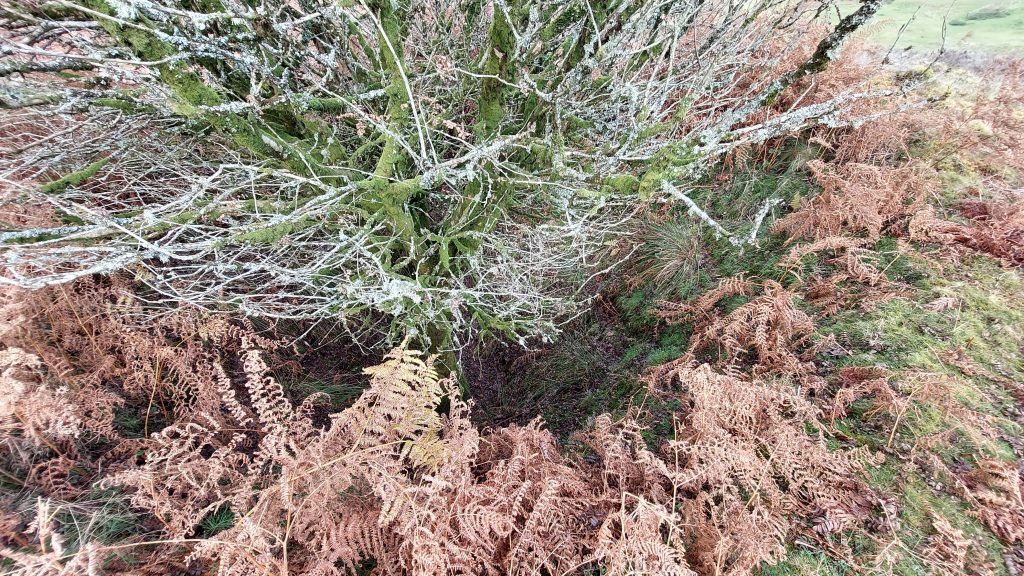
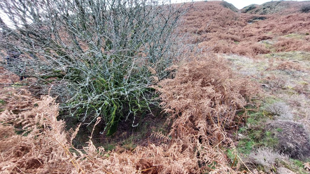
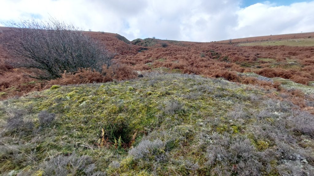
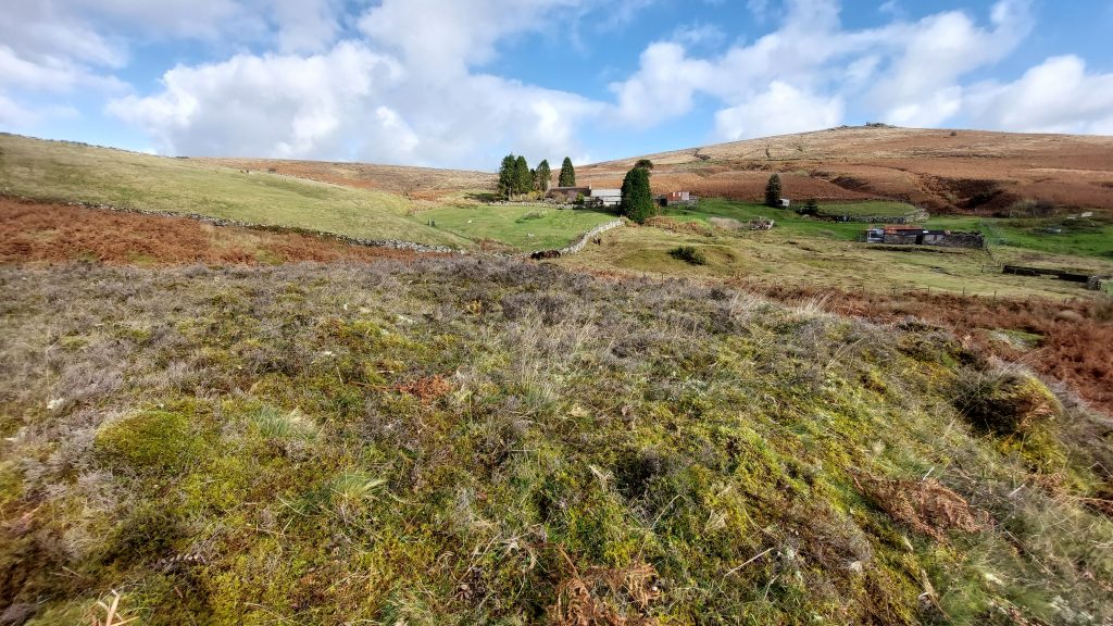
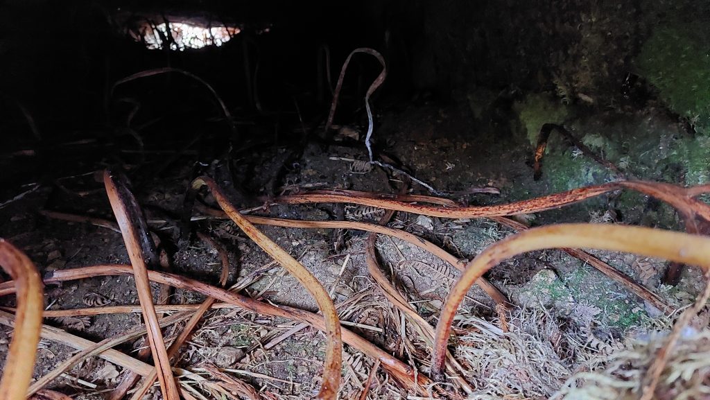
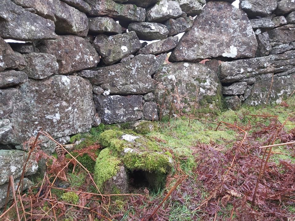
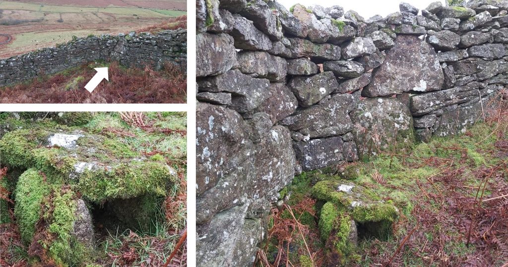
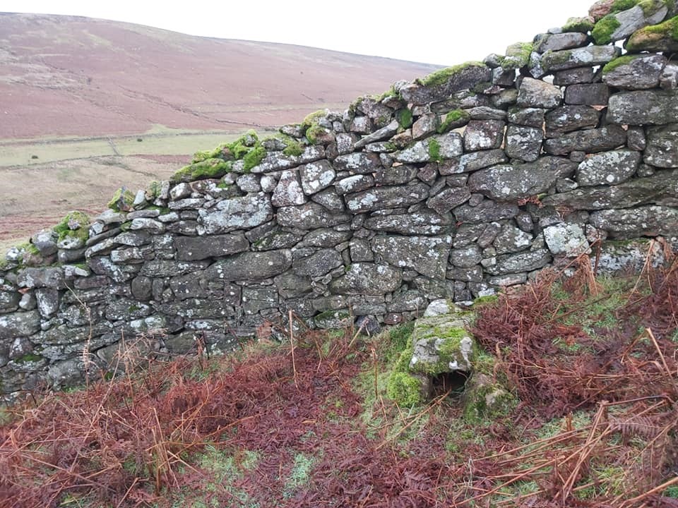
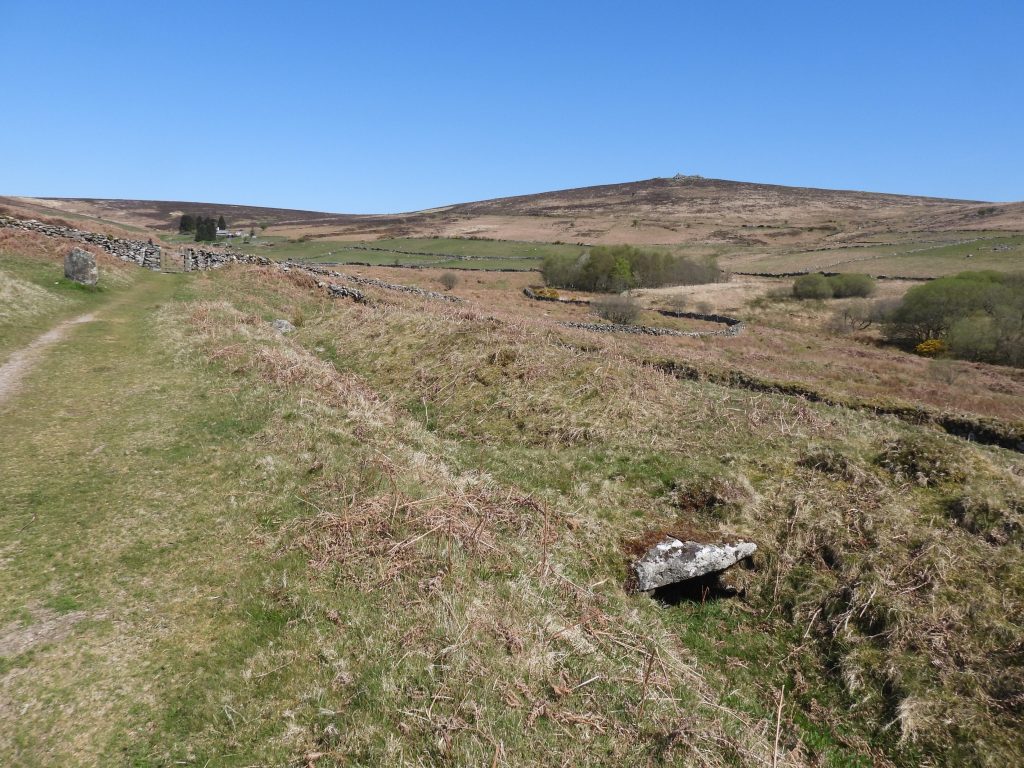
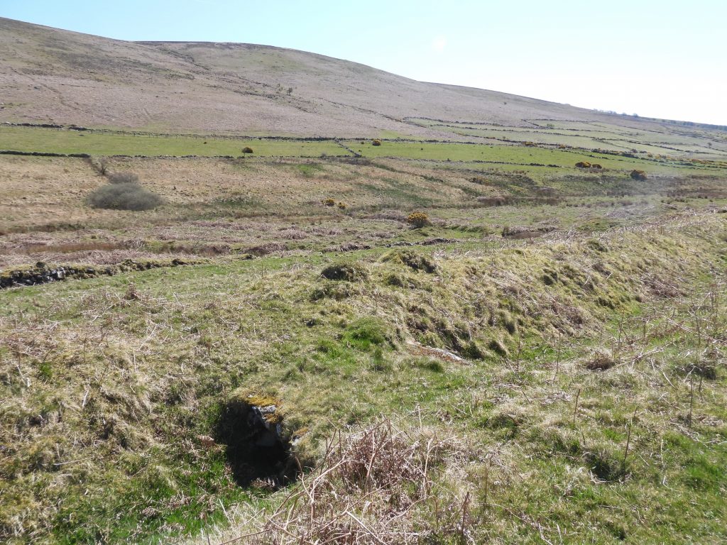
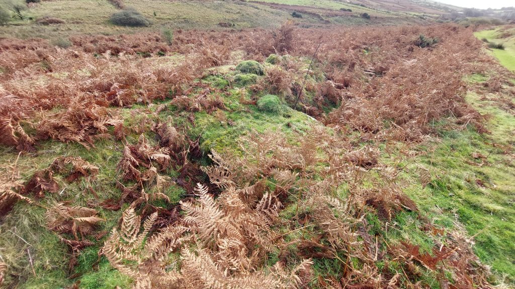
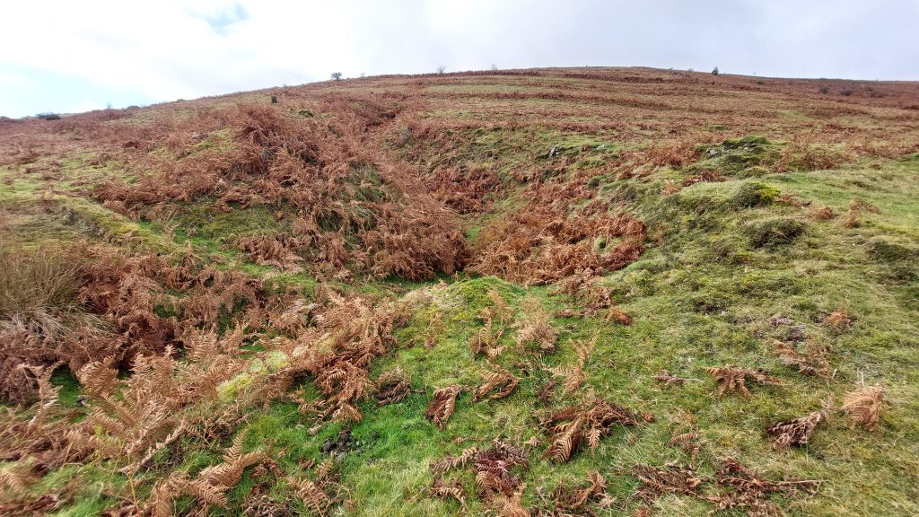
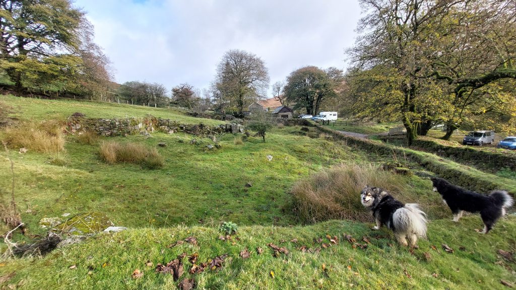
Sketch map of the area covered in this post. As well as the the six main features covered in the introduction, other features of interest in the area are three vermin traps, the “East Birch Tor” boundstone, the Challacombe Stone Row and a series of “V” shaped channels (with bridges), where the former Flat Rods would have run.Timeline summary of operations at East Birch Tor Mine (and its derivatives)This post starts at the north east corner of the East Birch Tor sett on the boundary with Vitifer Mine sett between the West Webburn and Redwater Valley’s. The photograph is near the brow of the hill between the two valley’s and shows some East Birch Tor sett tinners’ gullies / lodes from near the Challacombe Stone Row.The “East Birch Tor” Boundary Stone marks the western boundary of the sett. Behind the tree in the picture lies a working known as Lane Shaft Gully.“East Birch Tor” is inscribed on the eastern face of the upright slab. It is believed it was erected about the middle of the 19th century to mark the western limit of the East Birch Tor tin mine in the West Webburn valley below.View of the boundstone looking west. The boundstone can be found at SX68888 80883.Above the boundstone are “islands” of rocks left stranded by the tinners’ workings.This boulder is a rocking logan.Looking west into the upper reaches of Chaw Gully at the eastern end of East Birch Tor sett. Warren House Inn can be seen in the distance below Water Hill.The early tinners took great care to avoid unnecessary damage to prehistoric antiquities such as Challacombe Stone Row. This row, overlapped their workings and was spared. The picture shows part of the row looking north towards towards Birch Tor.At the northern end of the stone row is a grouping of stones, which could indicate a fourth row, but is more likely to be the result of partial reconstruction in the 19th century. This rather curious re-erection is recorded as having taken place in 1893. Challacombe triple stone row is recorded as being 141.7 metres long with 57 upright stones. Challacombe Stone Row terminal (blocking) stone at the south end.View from the southern terminal (blocking) stone looking north towards Birch Tor.Looking down the mine workings to the east of Challacombe Stone Row towards Headland Warren Farm.East Birch Tor Mine workings as viewed from the slopes of Hookney TorHeadland Warren Farm with more tinners workings between the buildings and the road to Widecombe.Headland Warren Farm comprises a small farmhouse with an adjoining barn. It was probably built in the late 16th/early 17th century but was considerably altered in the 20th century. As the name suggests, this farm was once used for the warrening activities in the area which date from the late 18th century.Evidence of the warrening activities from the area can be seen in the shape of a vermin trap (marked on the sketch map) some 200 metres to the west of the farm. The trap is in quite a ruinous state and a three metre wall alongside it is covered in moss and grass and is virtually invisible. None of the trap stones are present but the giveaway of this being a vermin trap is the backstone which contains a hole, which was part of the trigger mechanism.Challacombe Hill and tinners workings as seen from the footpath heading down to Headland Warren Farm.Headland Warren Farm had part of its roof re-thatched in 2020. The 19th century building doubled up as an ale house and was renamed Birch Tor Inn, for a short period, no doubt to cater for the tin miners who were working in the immediate area. The warrener at the time of Birch Tor Inn was Jan Roberts. The modern OS map shows a footpath through the farm but there are now signs up suggesting the permissive path is to the east and north. Exiting the area of Headland Warren House heading towards Challacombe, the extent of the tinners workings can be seen from below.Llamas at Headland Warren FarmRemnants of possible original mine buildings, now being used by the farm.East Birch Tor mine workings on eastern flanks of Challacombe Hill.
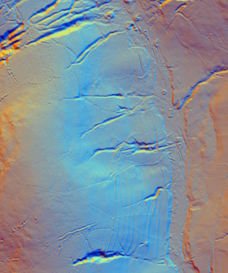
This LiDAR image is the West Webburn Valley. Top left where the three ‘fingers’ of workings can be seen is where the ‘East Birch Tor’ boundstone is located. The openworks, shafts are all very evident. The scar (straight line) of the flat rod channel can be made out running north – south
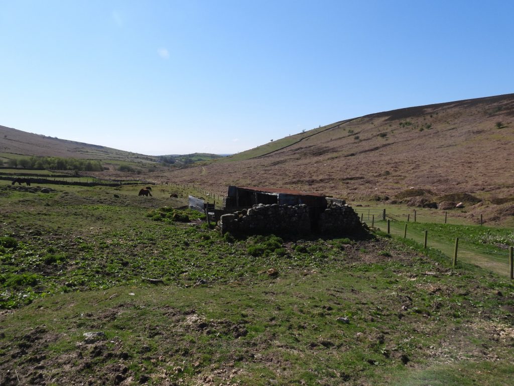
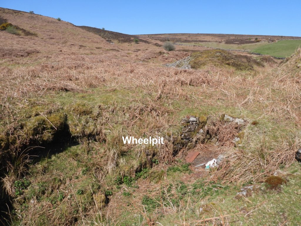
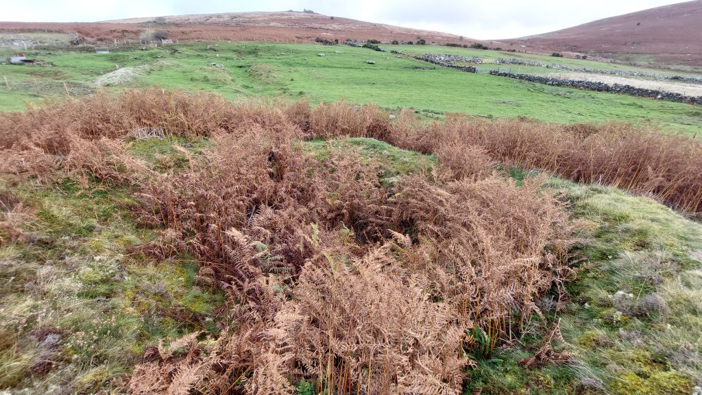
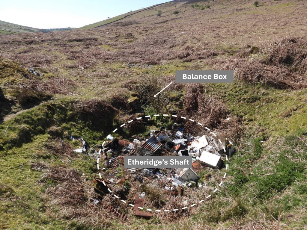
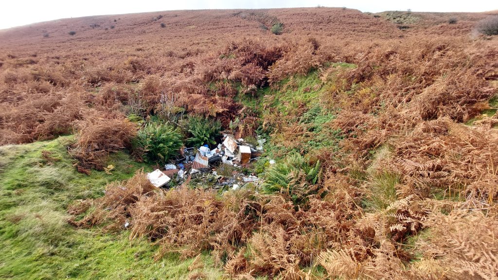
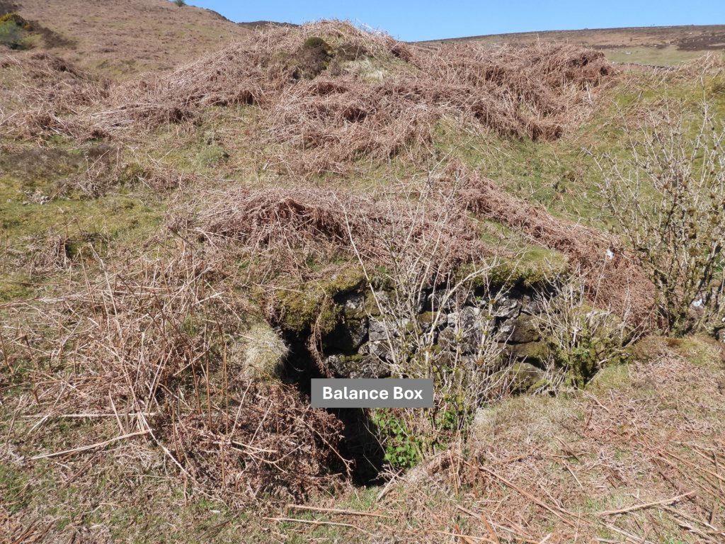
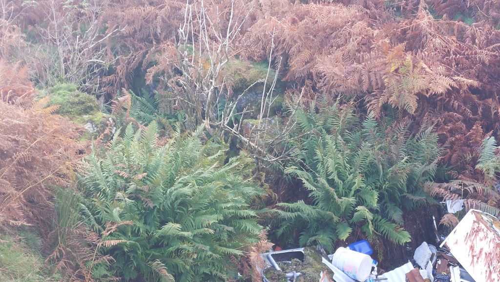
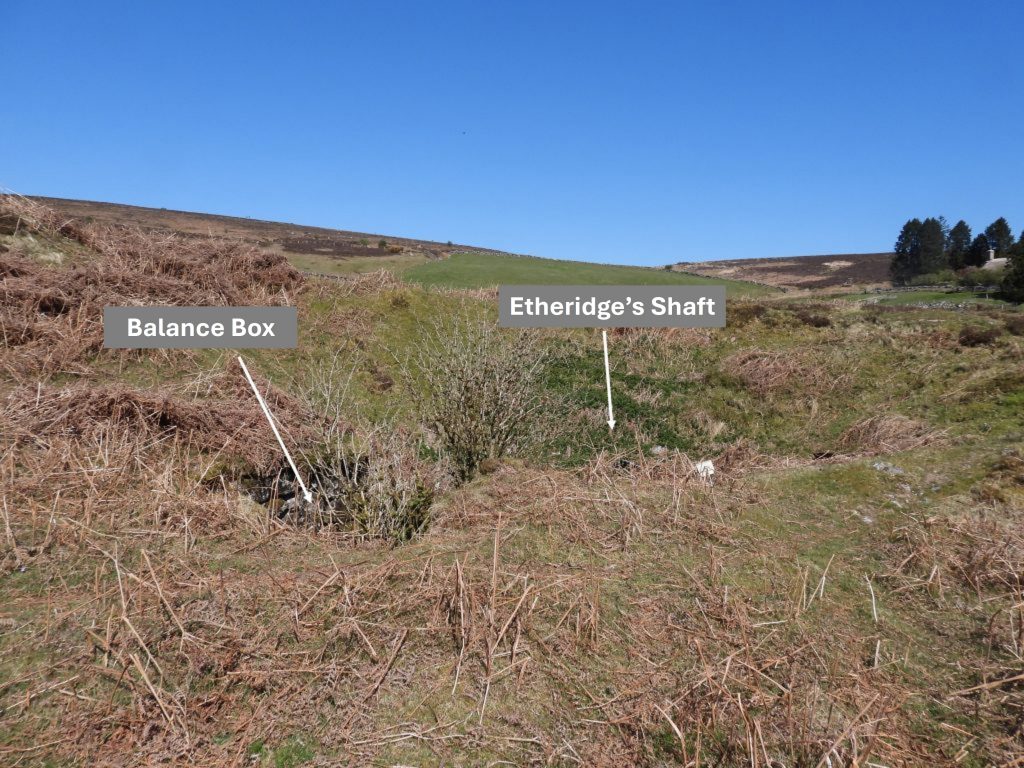
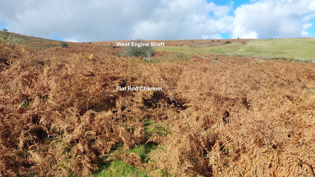
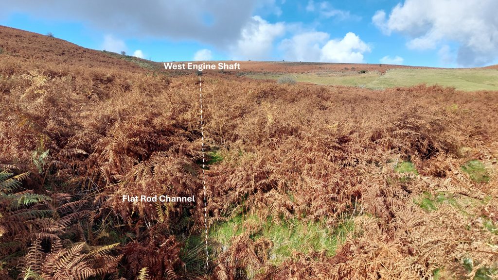
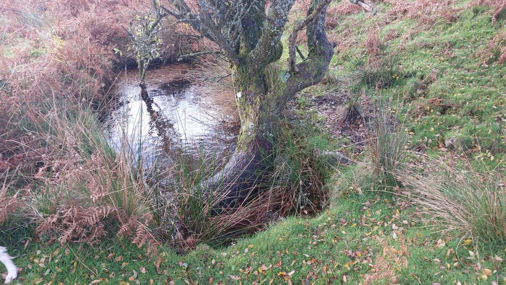
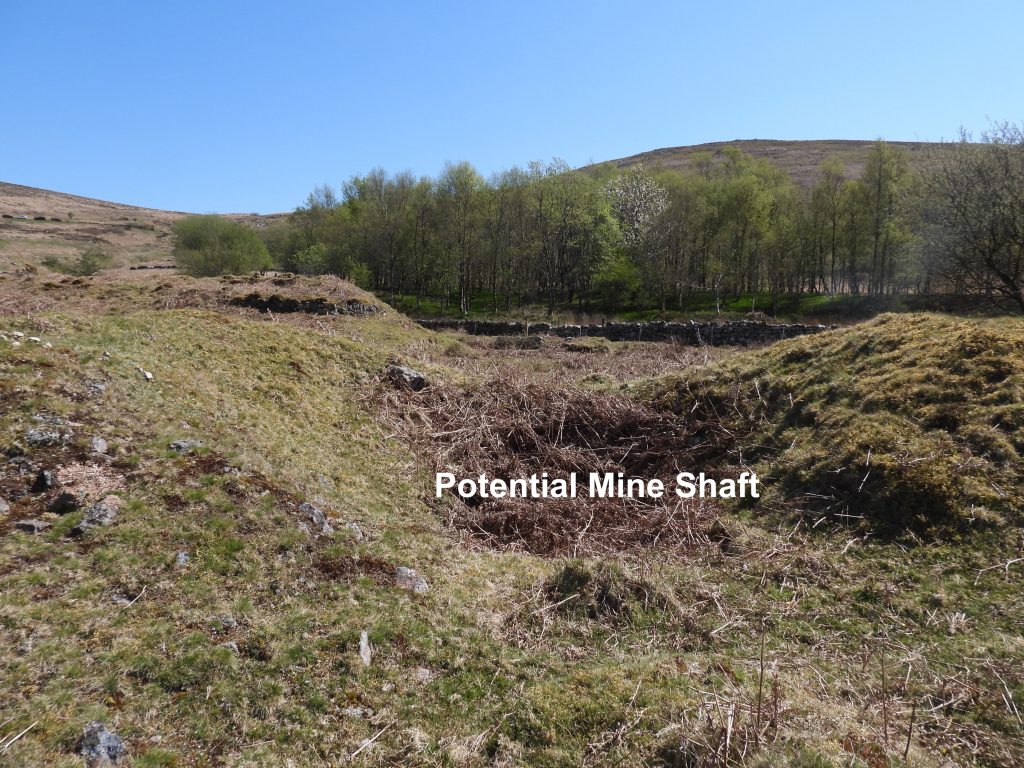
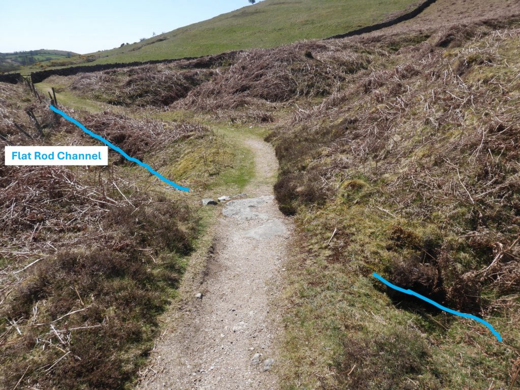
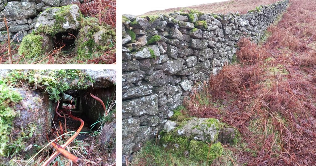
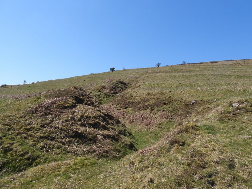
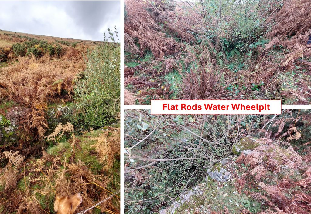
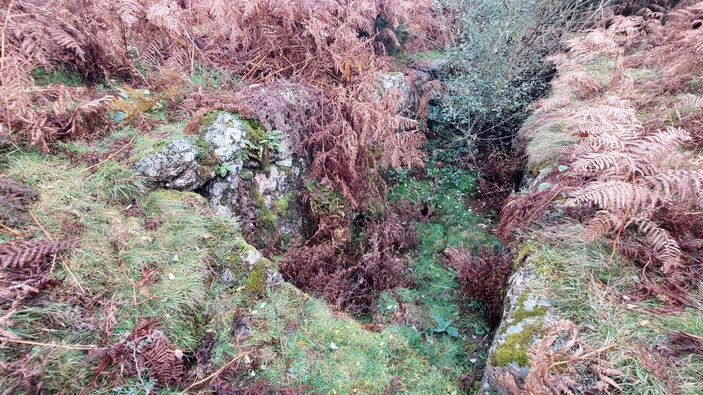
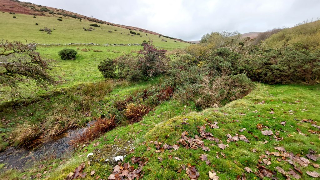
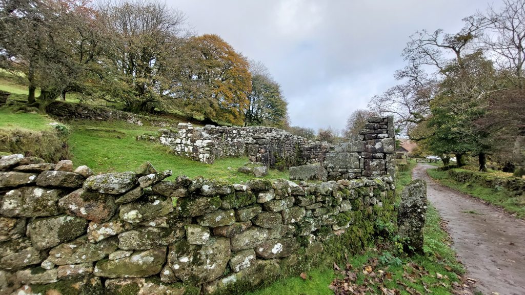
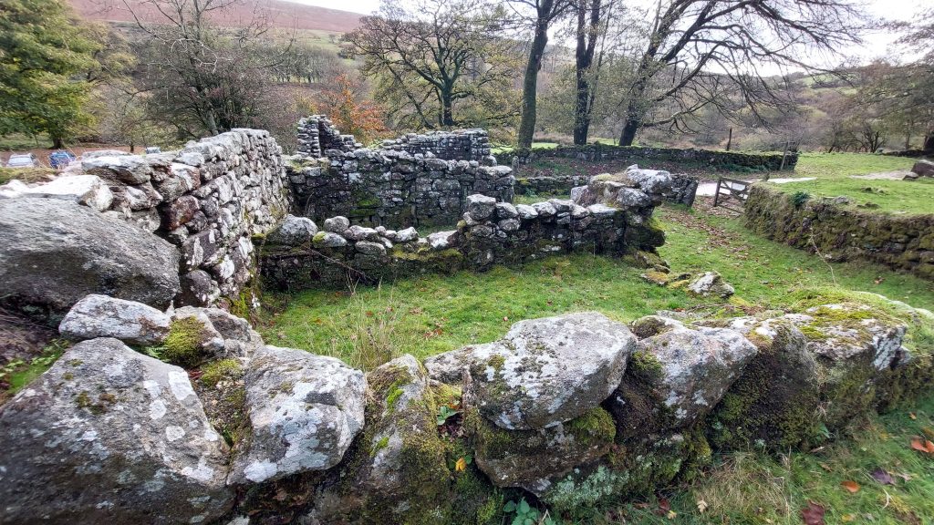
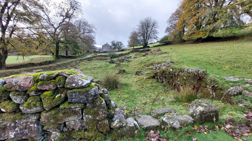
A flat area with low walls / mounds where possibly more mine buildings had been erected. This is in the area of Dix’s Shaft (23 fms). Moss covered walls, possibly old mine buildings. These are located around SX69337 80898Next to where the possible mine buildings are lies a wheelpit. The wheel here was fed by a short leat coming off the West Webburn river. The power generated by this wheel might have been used for draining the nearby shaft. The wheelpit is located at SX69333 80904. This Wheelpit is annotated as ‘B’ on the sketch map in this postJust to the east of the wheelpit is South Adit Shaft at SX69342 80908. The name of the shaft suggests the location of an adit nearby. It is recorded that in 1836, a Captain Paull was supervising the driving of a long cross-cut adit to drain the east-west lodes – if there was an adit near to this location, it is certainly and contender for the location of the adit from 1836To the west of the wheelpit and South Adit Shaft is Etheridge’s Shaft which has an associated Balance Box. The author has agonised as to whether to publish this picture due it showing a clear fly tip and its location may cause embarrassment to those who placed these items here. The author has decided to publish this picture on the basis of it being an industrial archaeology artefact and is a part of the history of the East Birch Tor Mine story.In June 1856, Etheridge’s shaft was reported as being 24 fathoms deep. This shaft is considered to be the deepest at the mineA Balance Box at Etheridge’s Shaft showing the granite wall lining. It is located at SX69307 80922. The details of production of East Birch Tor mine were estimated by D.G Broughton (1968/9 – The Birch Tor and Vitifer Tin Mining Complex) as being only around 55 tons of black tine between 1848 and 1864, which were the most active period of the mine.The balance box in October 2025, still overgrown from the summerEtheridge’s Shaft and Balance Box looking north.West Engine Shaft was possibly sunk between April 1852 – December 1860West Engine Shaft has a distinct tree nowadays and is located at SX69232 80965West Engine Shaft (as the name ‘Engine’ implies) was drained using a flat rod system. The Shaft is annotated as number ‘2’ on the post sketch mapNext to West Engine Shaft is a distinct flat area which was probably a whim plat. The centre has a depression, which would probably have been where the melior stone was located. The location is SX69238 80965From the West Engine Shaft looking towards Headland Warren Farm and Hookney Tor beyondA view across the workings and shafts to the south of Headland Warren FarmLeading up to West Engine Shaft is a Flat Rod Channel, which is covered in bracken for 6 months of the yearThe Flat Rods ‘split’ at an Angle Bob, with one section leading to West Engine Shaft and the other to Penrose Shaft and Etheridge Shaft as shown on the sketch map associated with this post. Of historical note is that on 27th November 1847 John Offord recorded : “there are three waterwheels – one 30 ft. in diameter, attached by 370 fathoms (0.42 mile) of flat-rods to work in the engine-shaft, by which the mine is pumped; the others stamping wheels. All necessary materials for the present effective working of the mine are there. The engine-shaft, which is well placed for the first, third and fourth lodes, is down 24 fathoms from grass, and the lodes opened upon 70 or 80 fathoms”.
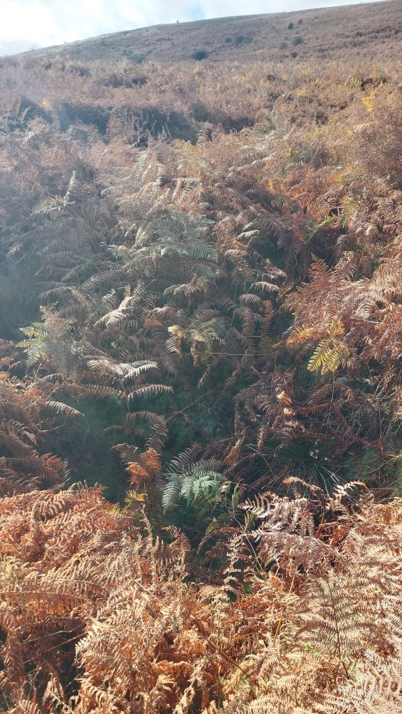
This rather indistinct hole covered in bracken is where the Flat Rod Angle Bob was located at SX69315 80877
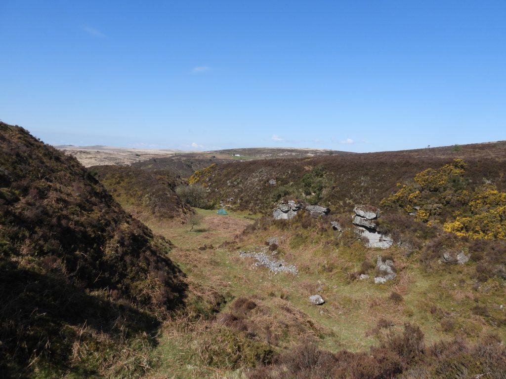
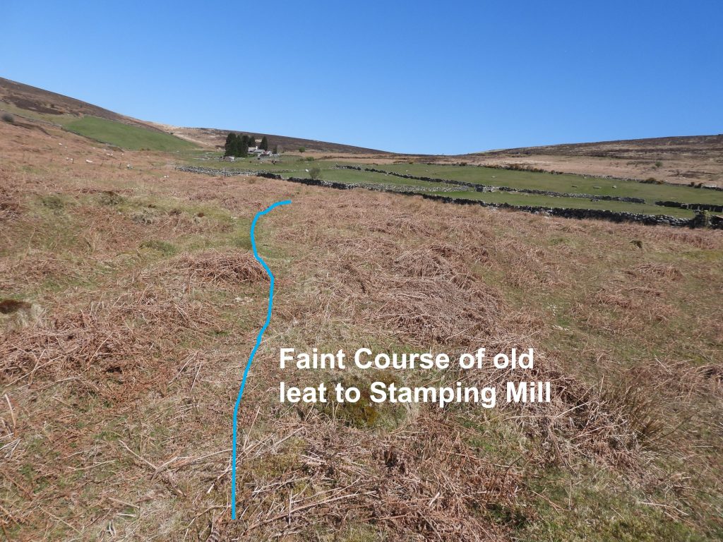
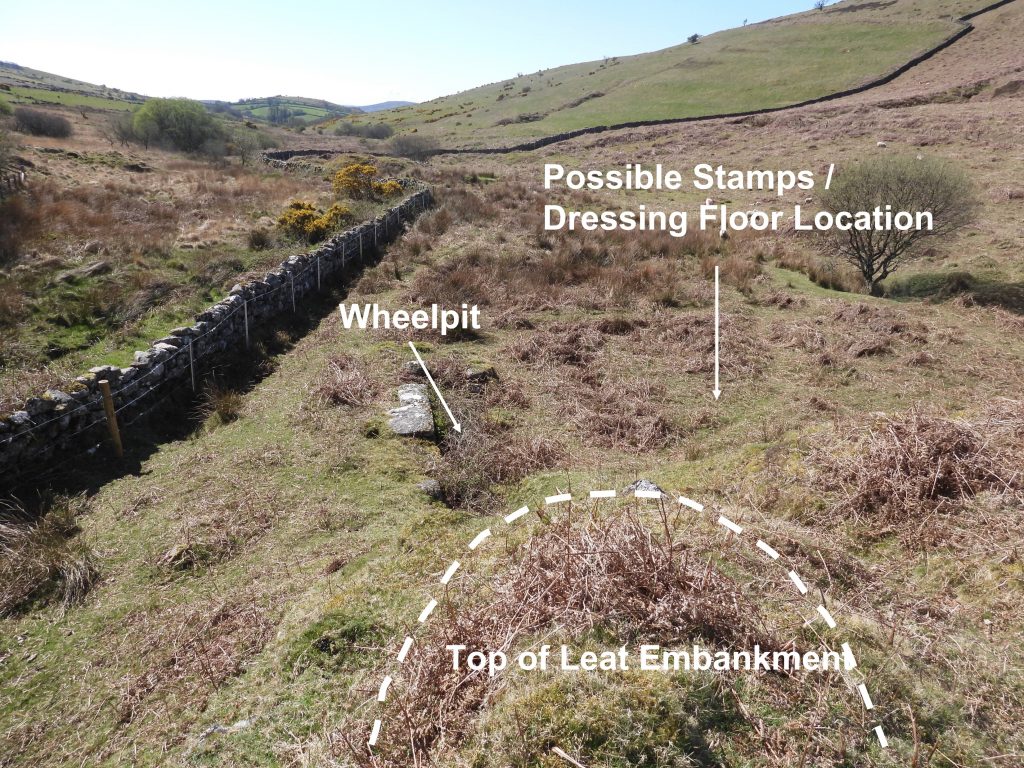
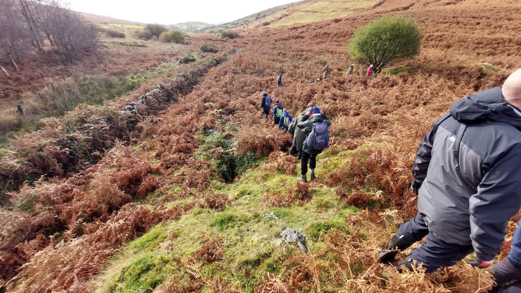
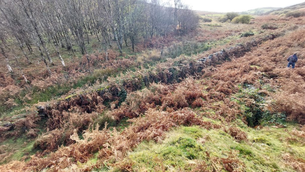
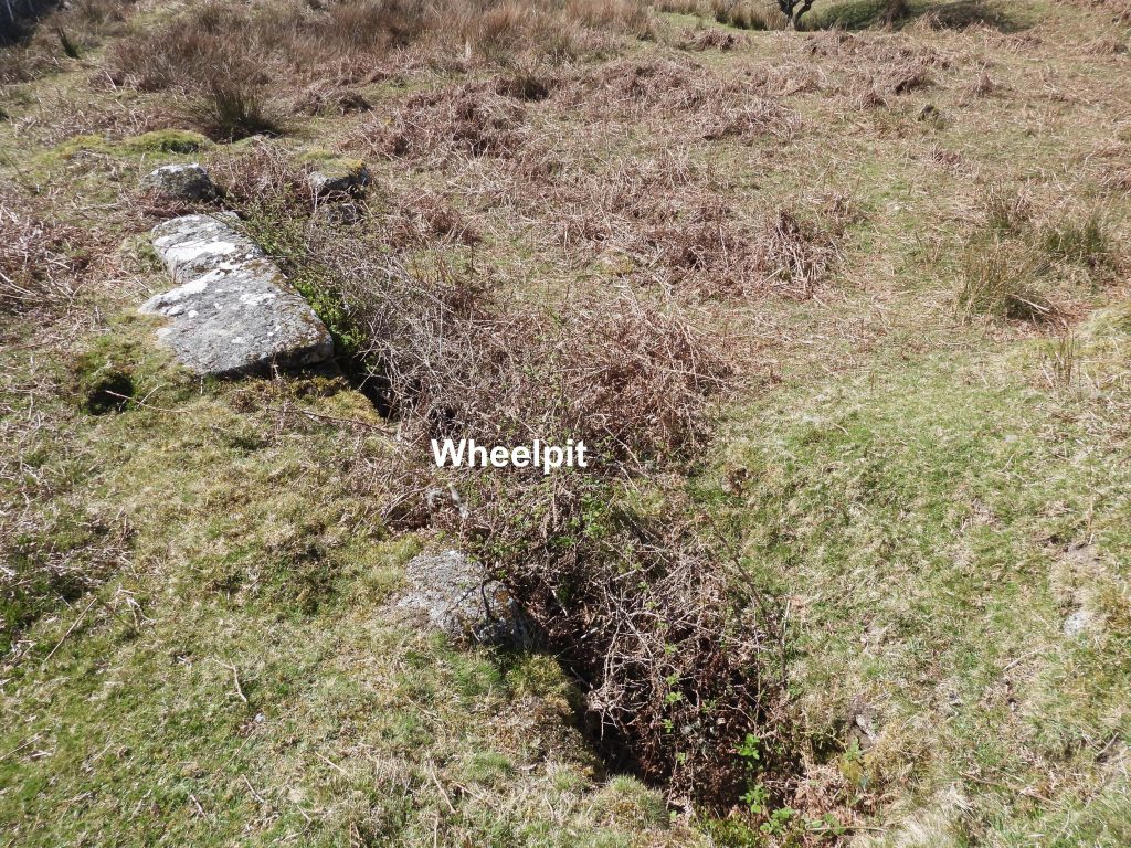
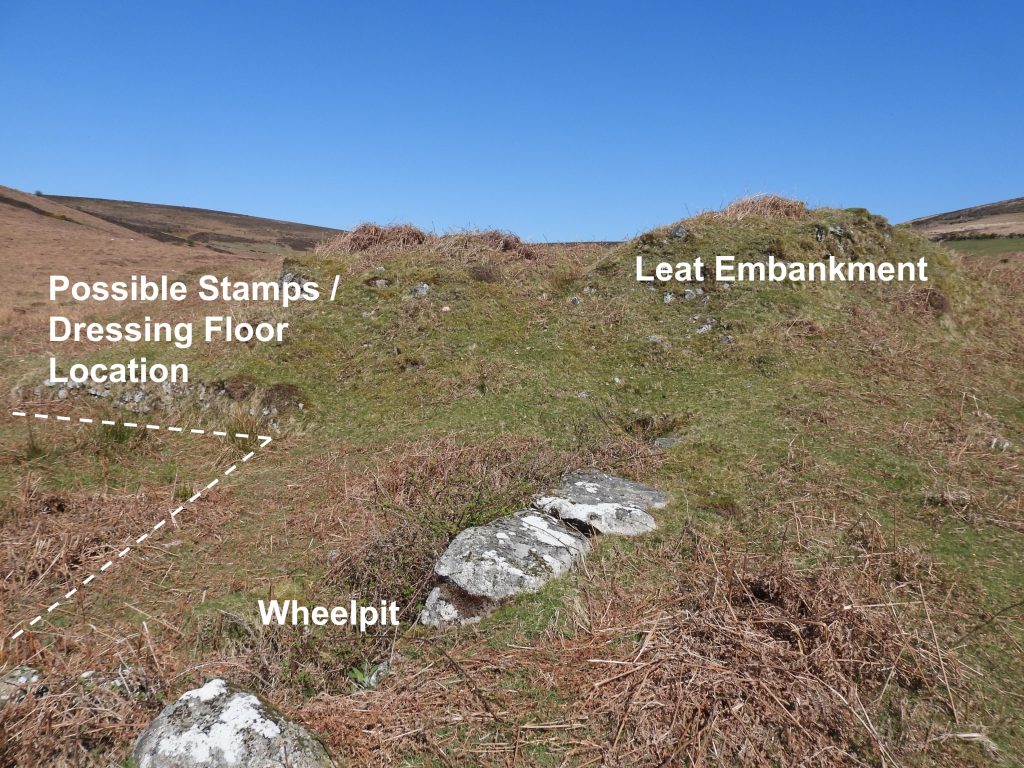
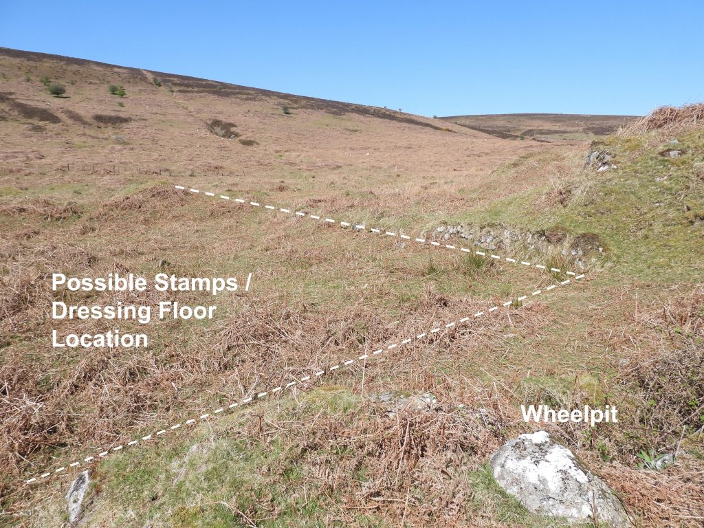
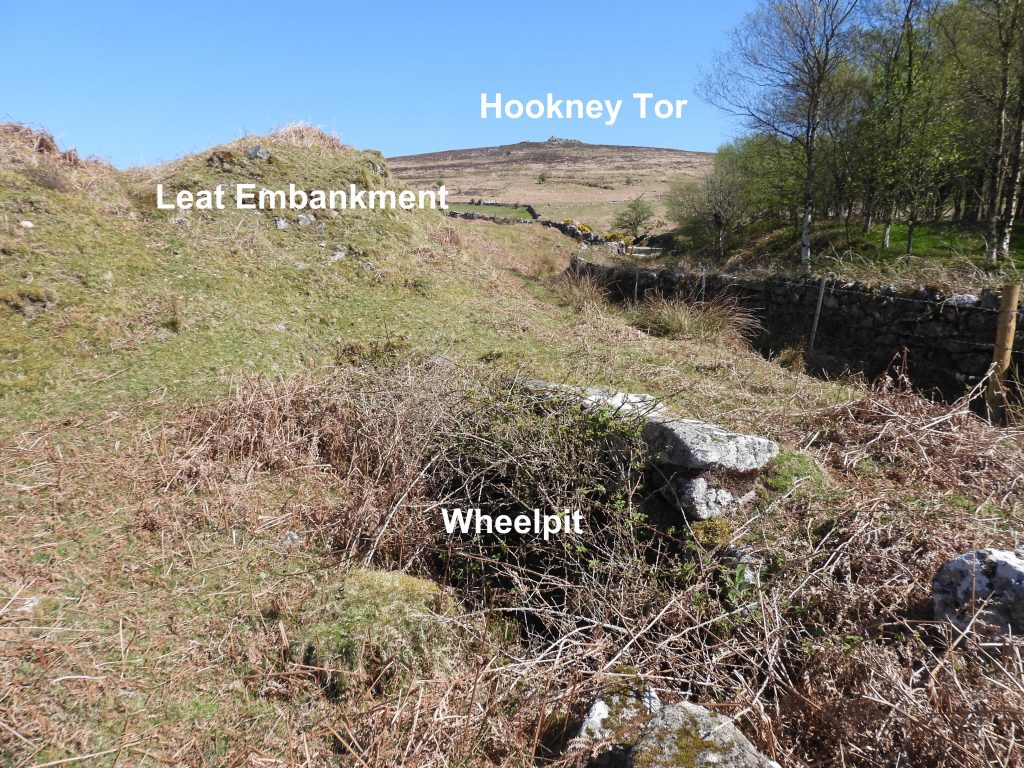
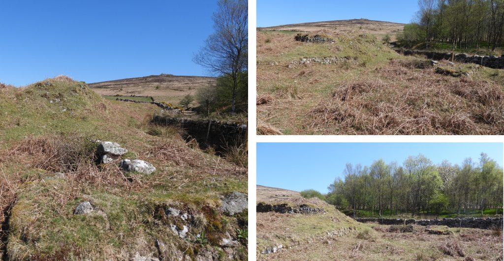
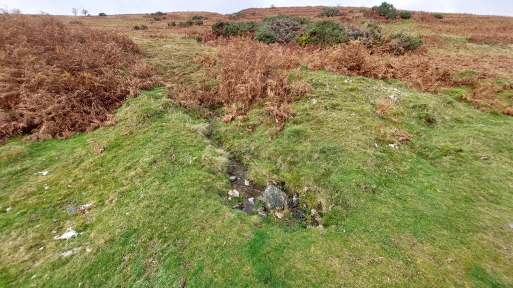
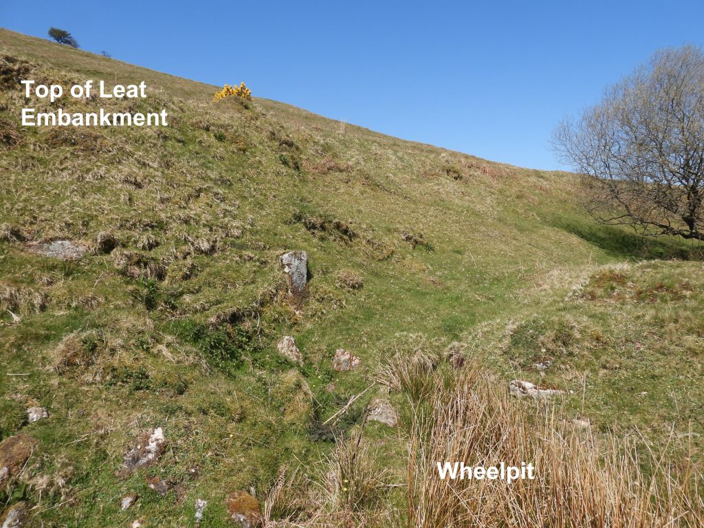
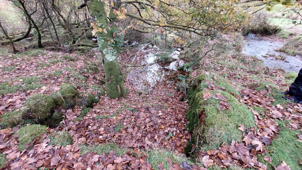
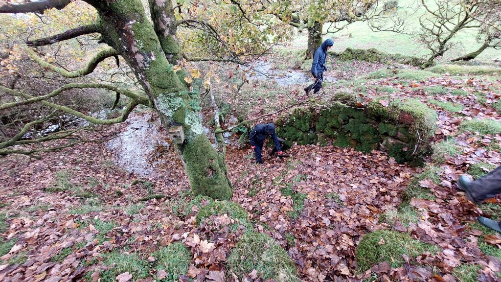
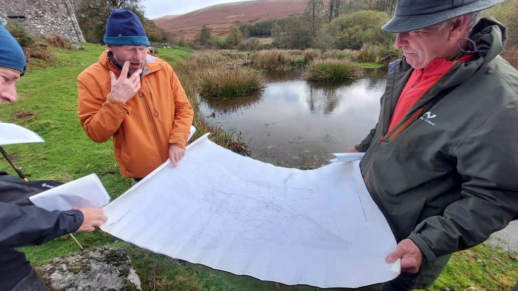
Leaving the shafts and infrasture near Headland Warren Farm, on the east side of the Challacombe / Headland Warren track near to Grims Lake (where it descends the hillside from Grimspound), there is faint course of an old leat which can be picked up. This leads to a Wheelpit and Dressing Floor – annotated ‘C’ on the sketch mapThe faint course of the old leat terminates at the top of an earth embankment, which overlooks a wheelpit and an area where there was possibly a stamping mills and dressing floor.Dartmoor Tinworking Research Group (DTRG) members on a walk in October 2025, descending the Leat Embankment and passing the WheelpitA good indicator of the location of this site is the line of the wall and a small copse to the east.
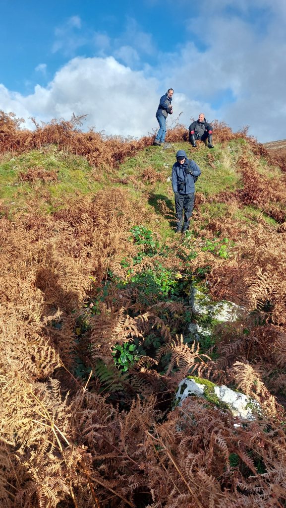
DTRG members by the Leat Embankment and the Wheelpit
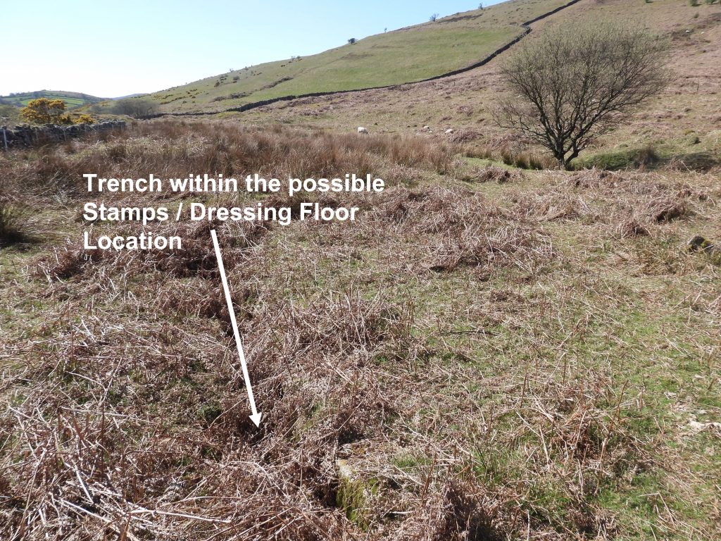
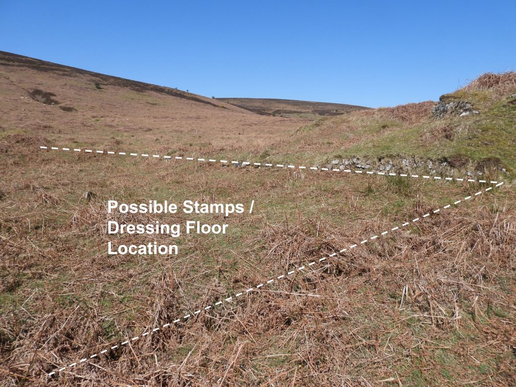
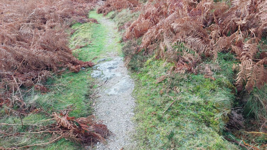
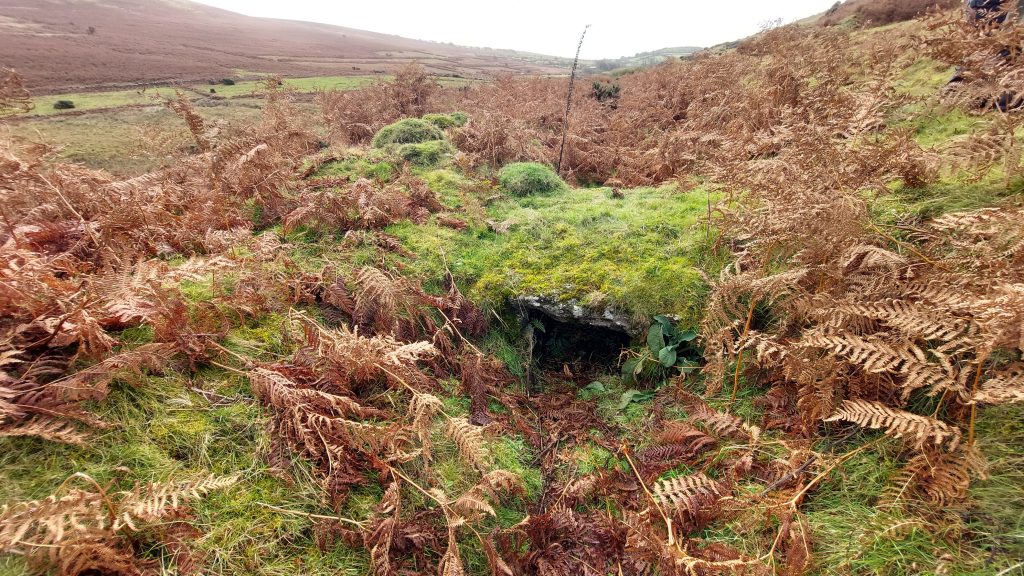
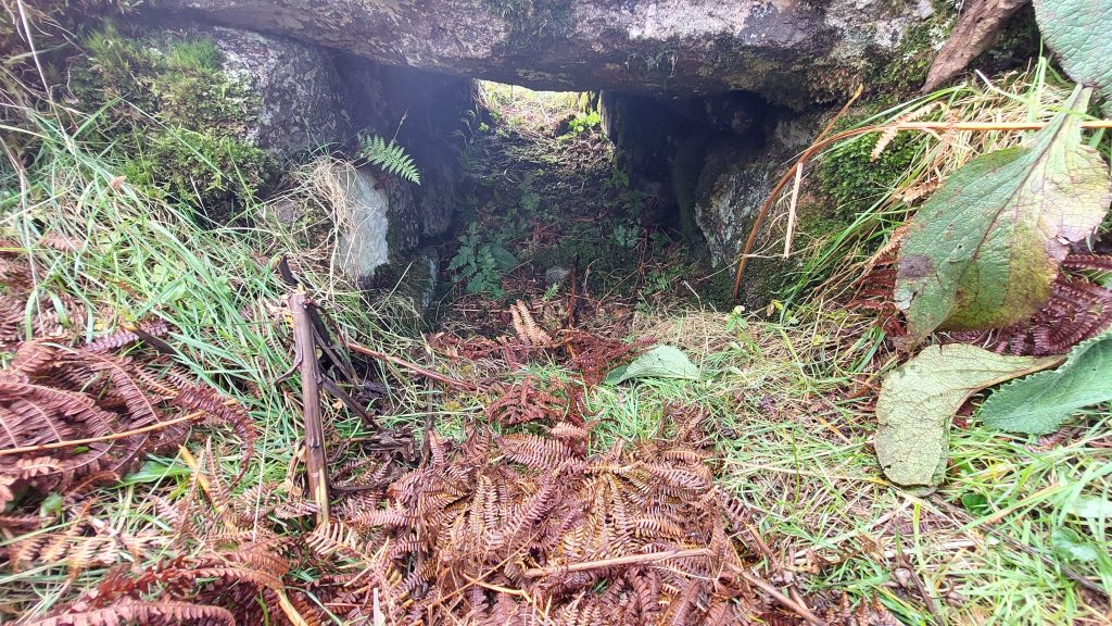
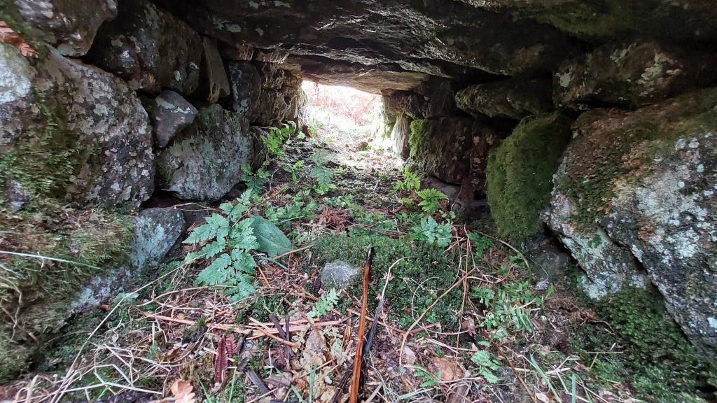
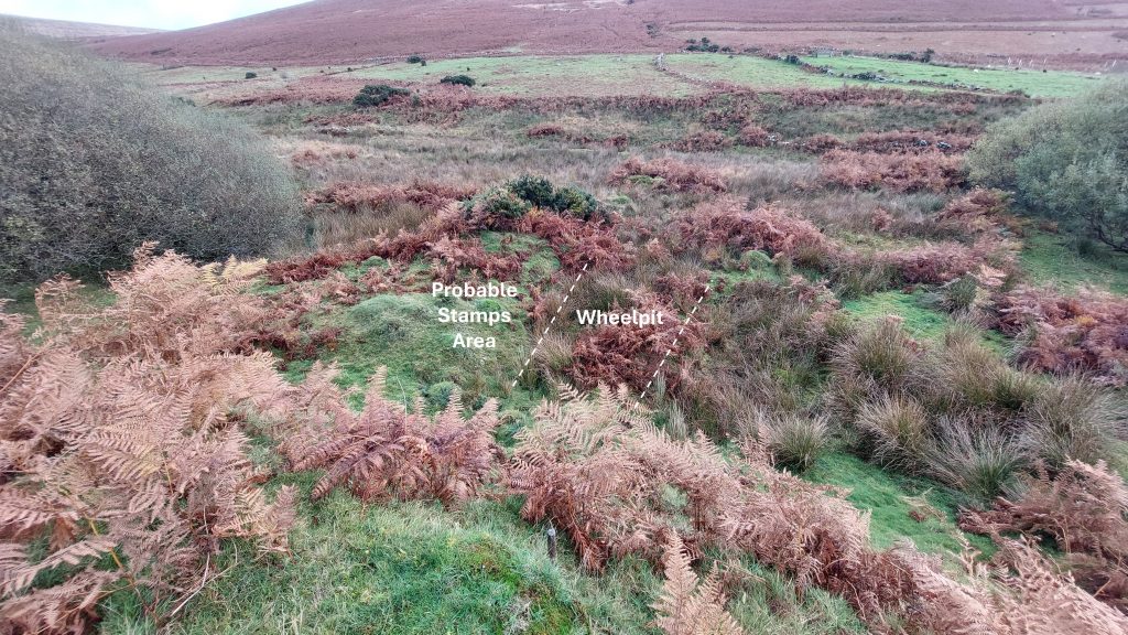
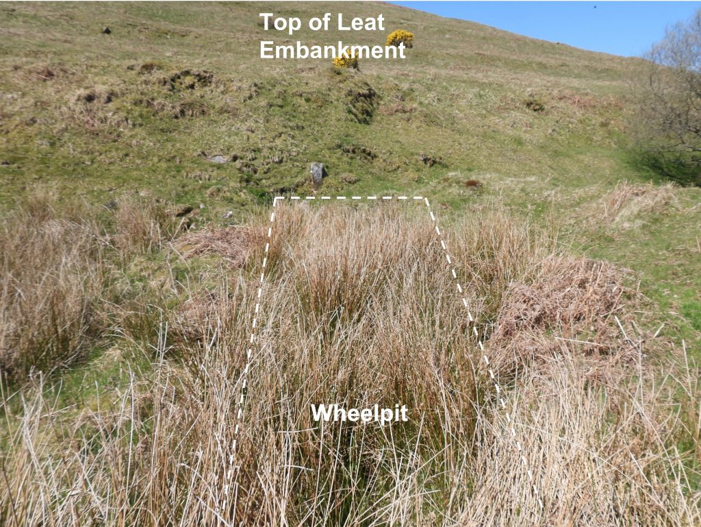
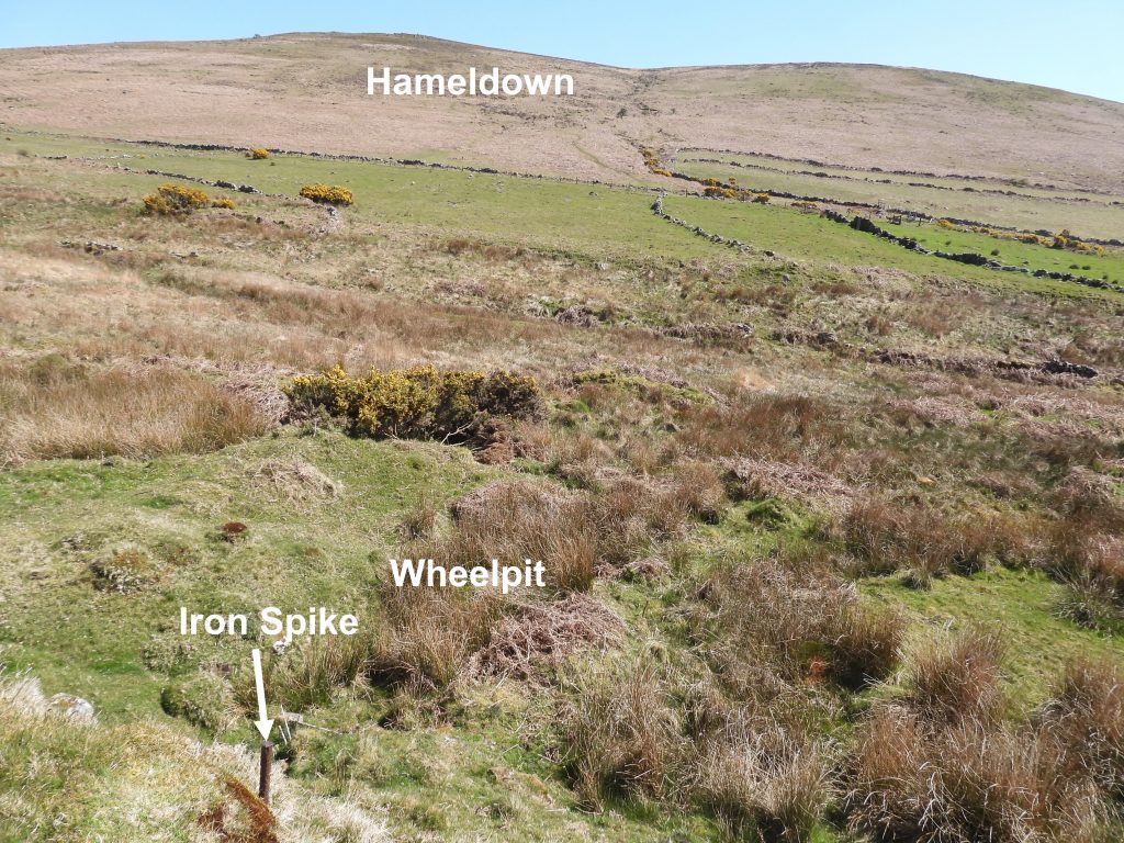
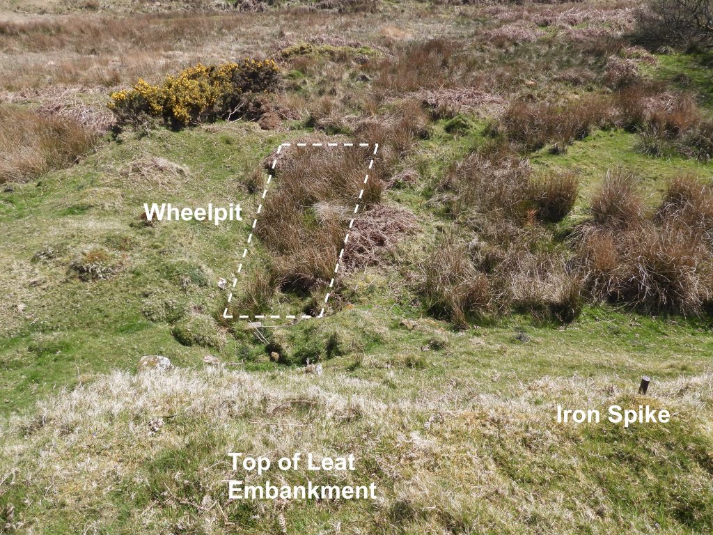
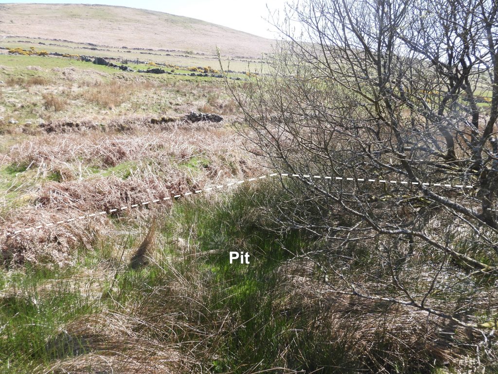
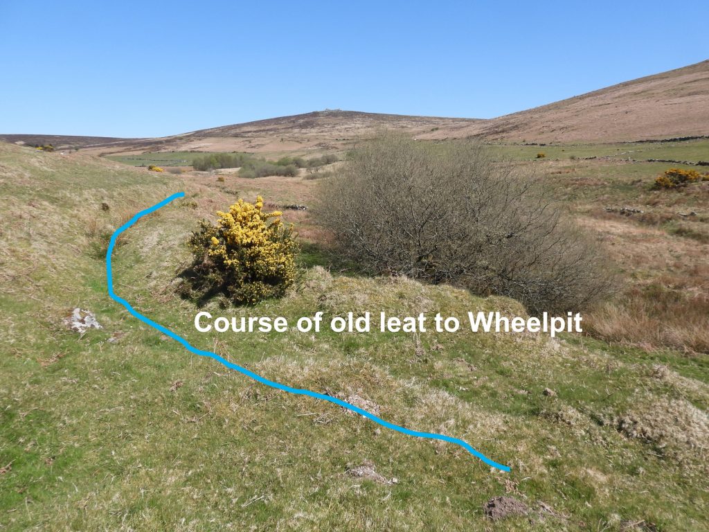
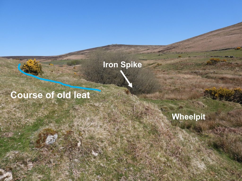
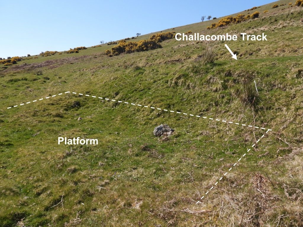
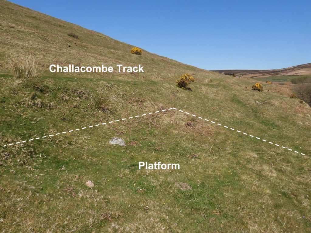
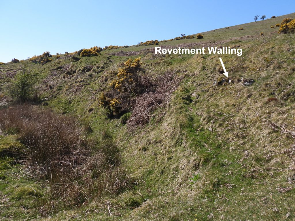
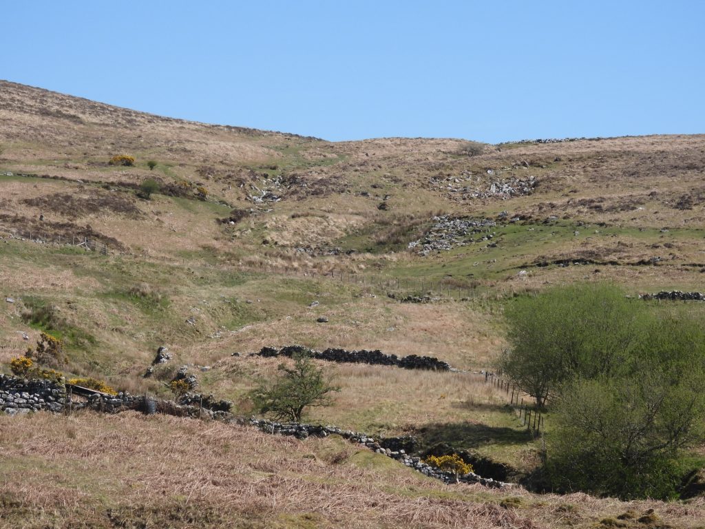
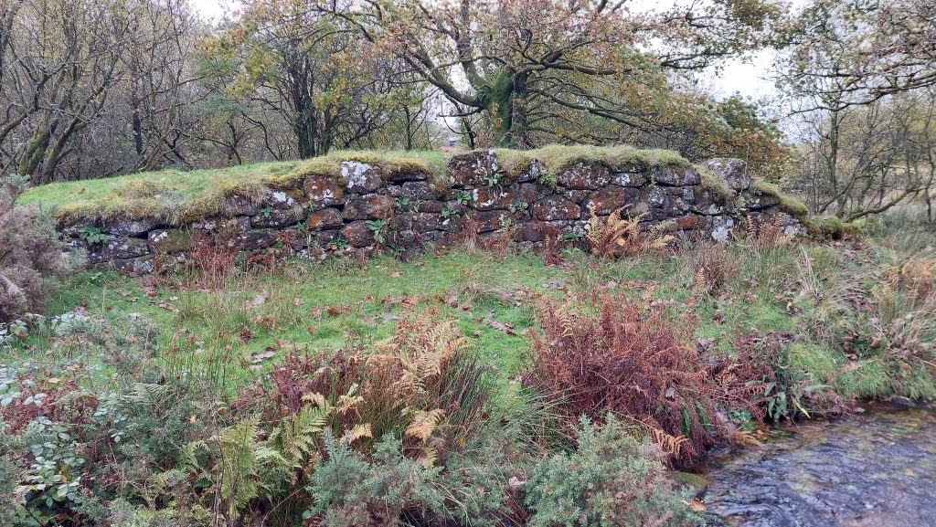
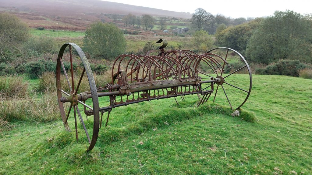
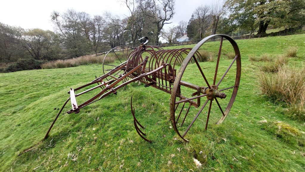
The small copse by dressing floor with Grims Lake running through by the wallThe wheel would have been very narrow as the pit is just under 1m wide. The stone lined pit is just under 7m long. The wheelpit is located at SX69446 80659.To the west of the wheelpit is a large flat area with a small retaining (revetment) wall where the waterwheel powered stamps would have been located. The revetment wall is recorded as measuring 16.5m long.The stamping mill is depicted on an 1852 plan of the area. The area contains a trench of unknown origin. Within the area lies at least two buddles which are faint rectangular earthwork depressions.General views of the Stamping Mill, leat embankment and wheelpit.Square Buddle located close to the Dressing FloorTo the immediate west of the stamping mill lies a series of earth banks amongst which is a depression, which might represent a former shaft or at least a trial pit. It can be found at SX69417 80655.Back to the Headland Warren Farm / Challacombe track. Alongside, lies there is a shallow “V” shaped trench, which is crossed by a bridge / clapper at SX69374 80567. This is a “flat rod” channel (as indicated by Jeremy Butler).Another view of the bridge / clapper in October 2025Under the Flat Rod BridgeTo the west of the Flat Rod channels and built into the high southern boundary wall of Headland Warren are two Vermin Traps There are no funnel walls as they are carefully built as a hole into the wall. This Vermin Trap or “hutch” is located at SX69238 80454. A second Vermin Trap is of similar construction to its neighbourThis Vermin Trap or “hutch” is located at SX69277 80486.Moving southward and through a gate onto Challacombe land alongside the track lies the distinct shallow “V” shaped trench, which might initially look like a 19th century leat. The Devon HER (ref: Pattison) states it is a leat but the map in Jeremy Butler Atlas of Antiquities (The north, volume 2, fig 24.6) indicates this section to the south of the wall (which can be seen in the photograph) would have been a Flat Rod channel. The “V” shaped (Flat Rod) channel with a bridge across it at SX69385 80458. This most likely would have been constructed to allow cattle to cross. This Flat Rod system was in place by June 1856 when it is recorded that: “Pumping was by bucket-lift worked by a waterwheel and three-quarters of a mile of flat-rods” (Mining Journal).The Flat Rod Bridge in October 2025The Flat Rod Bridge in October 2025The Flat Rod bridge is very well engineered. There are substantial imposts used in the construction of the bridgeOne of a number of “beams” crossing the lynchets on challacombe commonThe same openwork / beam in October 2025This may be Scutley or Scudley Beam, which has a draining adit towards its east end. Mike Brown in his Gazetteer of Dartmoor Names locates the Beam at SX692 802This possible Stamping Mill lies below the Headland Warren / Challacombe track to the east. It can be found by identifying a leat embankment and shallow leat by the track. It is annotated as ‘D’ on the sketch mapThe possible Stamping Mill is sited in the lee of the steep tinners’ slope alongside the Headland Warren Farm / Challacombe track. As recorded in the Dartmoor HER: “They are in fragmentary state and appear to be extensively robbed”. That said, an east-west aligned wheelpit can easily be discerned.The wheelpit is recorded as being around 7.5m long, 1.9m wide and around 0.6m deep. It is reed filled which is a giveaway as to its location. The picture shows an upright 1m granite post which is part of a small section of masonry still in situ.At the top of the embankment above the wheelpit is an iron spike, whose purpose is unclear. One assumes the spike was part of the feature but may well not be in its original position. A great view of the broad back of Hameldown can be had from this location.The wheelpit is located at SX69405 80253.Near to the wheelpit is a rather boggy area containing a rather ill defined pit. It is assumed this was part of the c.1852 operation. The pit is located around SX69424 80238.The course of an old leat which fed the overshot water wheel can be made out from the top of the embankment above the wheelpit. The works were in use c.1852 and operated as part of East Birch Tor mine. Dr Tom Greeves suggests the position of these works might indicate a pre-c19th origin. View of the course of the old leat above the wheelpit. The full function of the works is not known exactly but it was probably a stamping and/or dressing plant. Sandwiched between some tin works and abutted against the east side of the Headland Warren Farm / Challacombe track is a rectangular building platform. It is located at SX69394 80231.The platform is recorded as measuring 5.6m by 3.7m. It is clearly man made but true purpose is unclear. It may have been for a building.A little further south from the platform is a revetment wall possibly associated with some building(s). It is 0.4m high and runs north-south for around 15m. This piece of walling is located at around SX69403 80208.Zoomed in view of Grims Lake descending the hillside enroute to West Webburn River. The 19th century miners were very astute at using all sources of water, this stream included.At the end of the Flat Rod channel is a rather overgrown but nevertheless large wheelpit and is possibly where the power for the 3/4 mile long Flat Rods was located.This wheelpit is annotated ‘E’ on the sketch map and is located at SX69460 80002Across the West Webburn, not far from Challacombe is a revetted platform, which has a ramp to the north and a open ‘recess’ area to the south. It is annotated as ‘F’ on the sketch map. The RCHME describe it thus: “There is a sub rectangular elevated platform c.21m by 14m overall, revetted on the north-west, south-west and south-east with roughly-coursed drystone granite block walling 1.5-2.5m high. The platform is reached by a ramp from a track approaching from the north”.The walled recess to the south does give this feature the look of a wheelpit. The rectangular recess is 6.4m by 2.9m. The very wide recess and perhaps precludes it being a typical stamping wheelpit ? The revetment walling is partially removed on the south-west and south-east. The ramp feature to the north and a track leading here may suggest (at least to the author) that this was a loading bay where raw material (ore) was brought along the track, up the ramp onto the platform and was tipped over into a treatment area. The RCHME believe it was a tin working site, possibly 19th century stamps for ore crushing. The ‘Loading Bay’ (for want of a better description) with two members of the DTRG for scale. In 1966 (Linehan) recorded this a the remains of a tin blowing-mill first recorded in 1303, since such time this theory has been dismissed as there is no proof (Greeves)The recess is located at SX69471 79715Side view of the revetment where the ramp and recess are locatedSome abandoned (probably early 20th century) farm machinery located between the ‘Loading Bay’ and ChallacombeThe abandoned Farm Machinery is located at SX69417 79690
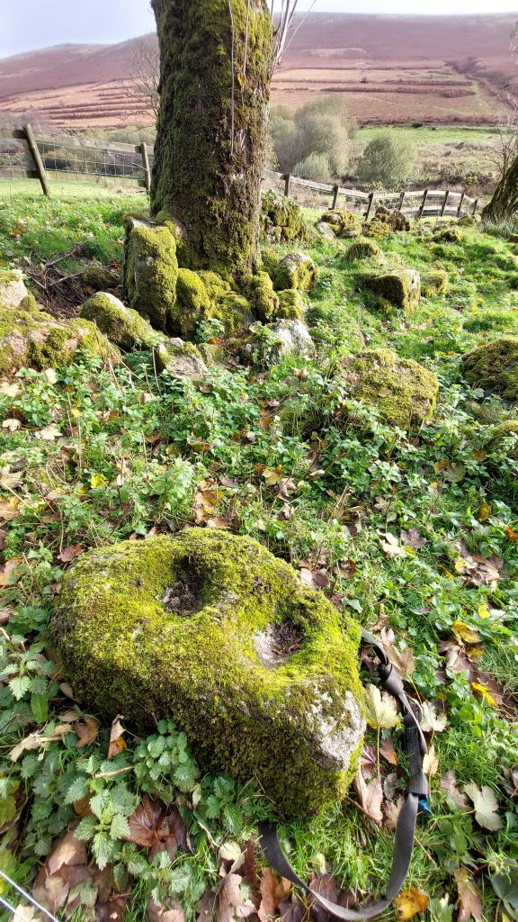
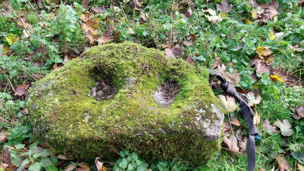
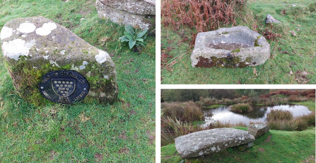
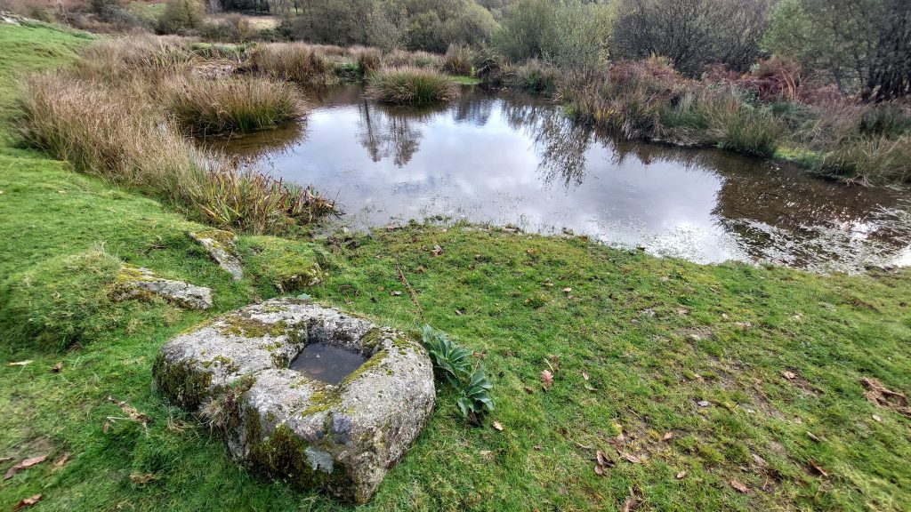
Just inside the fenceline, near the north gate to Challacombe is a Mortar Stone. This is evidence of Tin ore stamping in the area. Its original location wouldn’t have been too far away
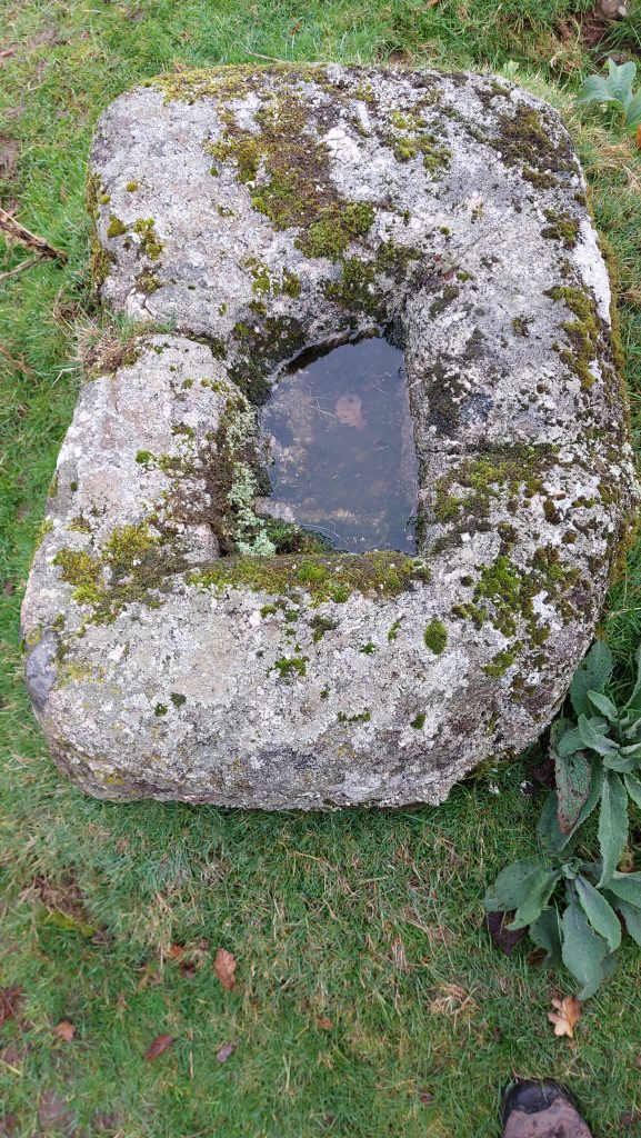
Close up of the Mortar StoneChallacombe Medieval settlement and enclosures. They have been mentioned in 15th and 16th century documents. The first definitive historical reference is in 1481 (when it was referenced as ‘Chalvecombe’), and five tenements are recorded in 1613. The same number appear in a lease of 1841 (ref: Bonney)There are around 12 buildings at Challacombe. The village thought to have probably been in existence at Domesday, with an associated name ‘Cherleton’.Challacombe Medieval Village looking north. Challacombe Medieval Village looking southLooking at the Challacombe Estate Map with Mark (tenant farmer) during a visit with DTRG in October 2025Challacombe Pond with granite bench and trough. The land here is part of the Duchy of Cornwall estate; in 2005 it won Silver prize in the Duke’s Habitat Award which is “to encourage and recognise good conservation practices within farm management.”A Mould Stone by Challacombe Pond, perhaps indicating there was once a Blowing House not too far away. There is a know Tinners Mill a short distance down the valley but its ruins are very fragmentary
Close up of the Mould Stone at SX69316 79417. The stone was found by Tom Greeves (1981) and is 1.05m long, 0.72m wide and 0.42m deep. RCHME record the following : “In the upper face is cut a rectangular mould; a recess 0.4m long, 0.28m wide and 0.14m deep with sloping sides. This stone is not in situ. It was made for casting tin ingots in a tin mill of Medieval or early Post-Medieval date
Well done, Steve, this is a wonderful resource beautifully designed and executed. Hopefully it will help many people enjoy this bountiful landscape and maybe even join the Dartmoor Tin Working Group (DTRG) and enjoy such walks in good company.


Mike Jeffery December 16, 2022
Another brilliant set of photo’s
SteveGriggDartmoor December 18, 2022 — Post author
Thank you
david eeles November 18, 2025
Well done, Steve, this is a wonderful resource beautifully designed and executed. Hopefully it will help many people enjoy this bountiful landscape and maybe even join the Dartmoor Tin Working Group (DTRG) and enjoy such walks in good company.
SteveGriggDartmoor November 18, 2025 — Post author
Thank you for your comments David