A collection of walks, discoveries, insights and pictures of exploring Dartmoor National Park
March 30, 2023
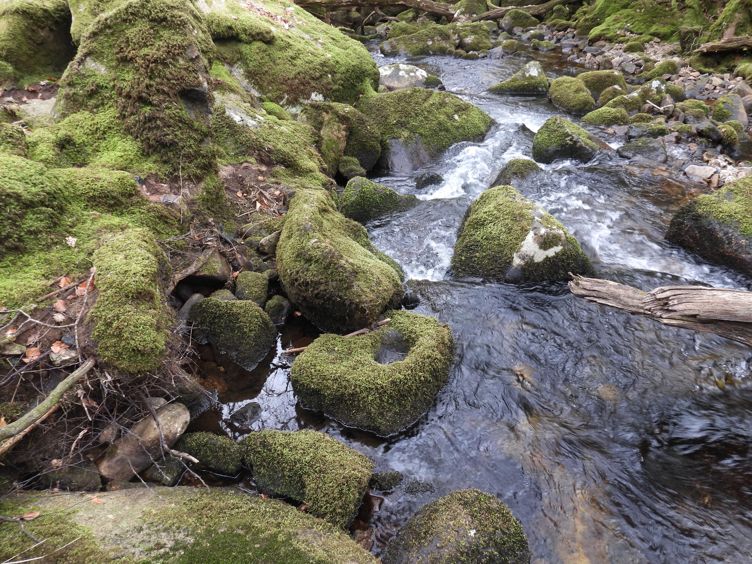
Norsworthy Bridge (LH Bank of River Meavy) Stamping Mill
This Stamping mill lies around 250 metres north of Norsworthy Bridge being sandwiched between the track leading to Leather Tor bridge and the River Meavy. It lies on the left hand (east) bank of the river and is probably the most visited Tinners’ Mill within the National Park due to its location and number of artefacts (e,g mortar stones), contained therein. The author can recall visiting it on night walks led by Ted Burkett-Dixon of WEA (Workers Education Association) in the late 1980’s / early 1990’s, which gave it a wonderful magical feel and he still gets a sense of wonder when visiting today. The mill has been recorded by many well known Dartmoor observers including Richard Hansford Worth, Tom Greeves, Phil Newman, R. Robinson, Sandy Gerrard and George Thurlow to name but a few. In 1991, John Haywood selected the mill as a feature in one of his 365 ‘mile squares’ (reference Q6) in his book Dartmoor 365, which probably added to its notoriety.
Richard Hansford Worth recorded in 1940 that he had found at least 11 mortar stones here but no mould stones and that the mill was almost certainly just a knocking (stamping mill) for pounding tin ore and not a Blowing House (for smelting). The word ‘Knakke‘ is an old Middle English word for “strike” or “crack”. Worth further emphasises his case by citing a lease dated 1511, which he states: “almost certainly referring to this building, names it as a knocking mill”. Interestingly a few observers have mentioned that a mould stone was found in the river and indeed modern OS maps refer to this mill as a ‘Blowing House’.
This post provides a photographic exploration of this mill and considers the many professional observations made about it over the last 80 years, some of which appear contradictory or at least are different given the passage of time.
Bibliography:
R.H. Worth, The Blowing House, Worth’s Dartmoor (page 302).
R.H. Worth 1946, Fifty-first Report of Scientific Memoranda: Archaeology, 282, 284 (Article in Serial). SDV350164.
Historic England, (2018), National Heritage List for England, 1019583 (National Heritage List for England). (Ref: SDV360653).
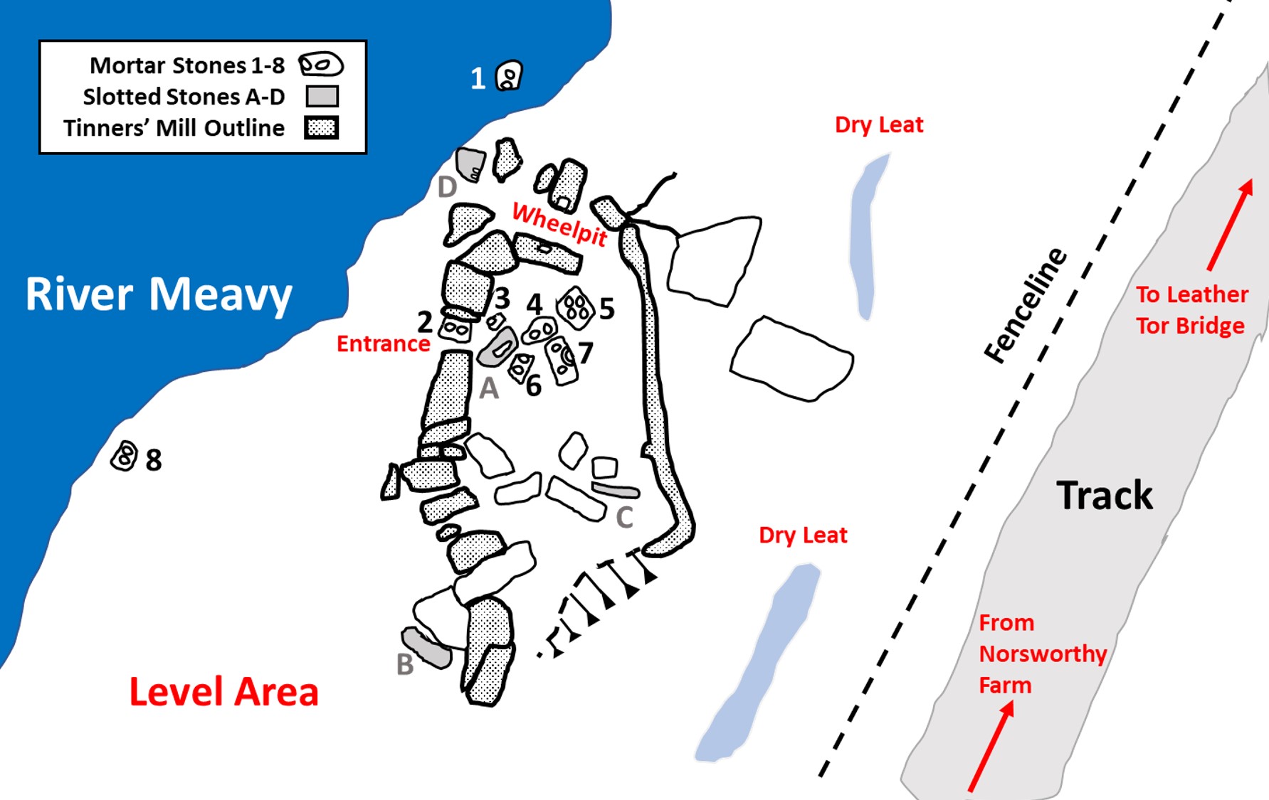
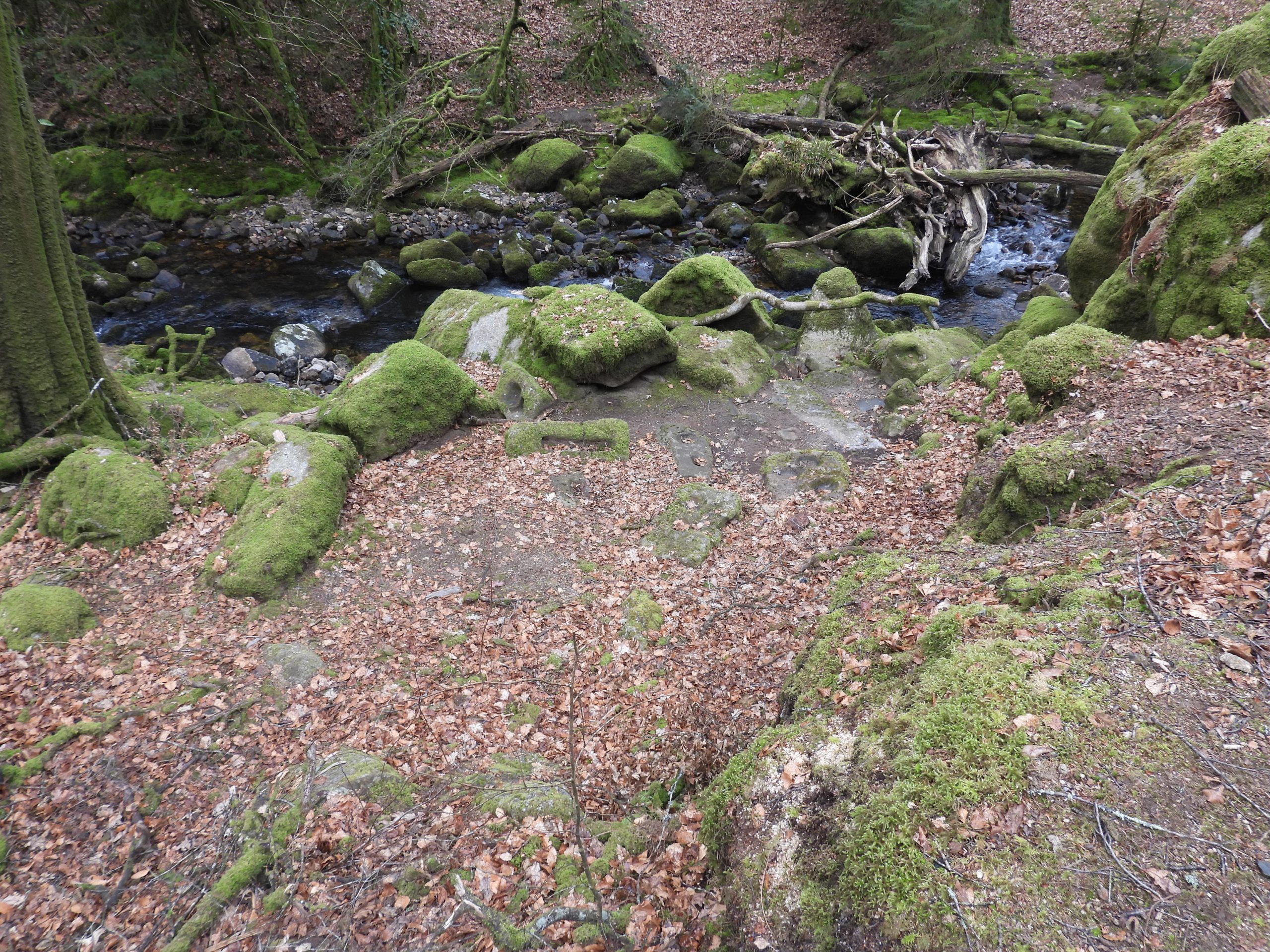
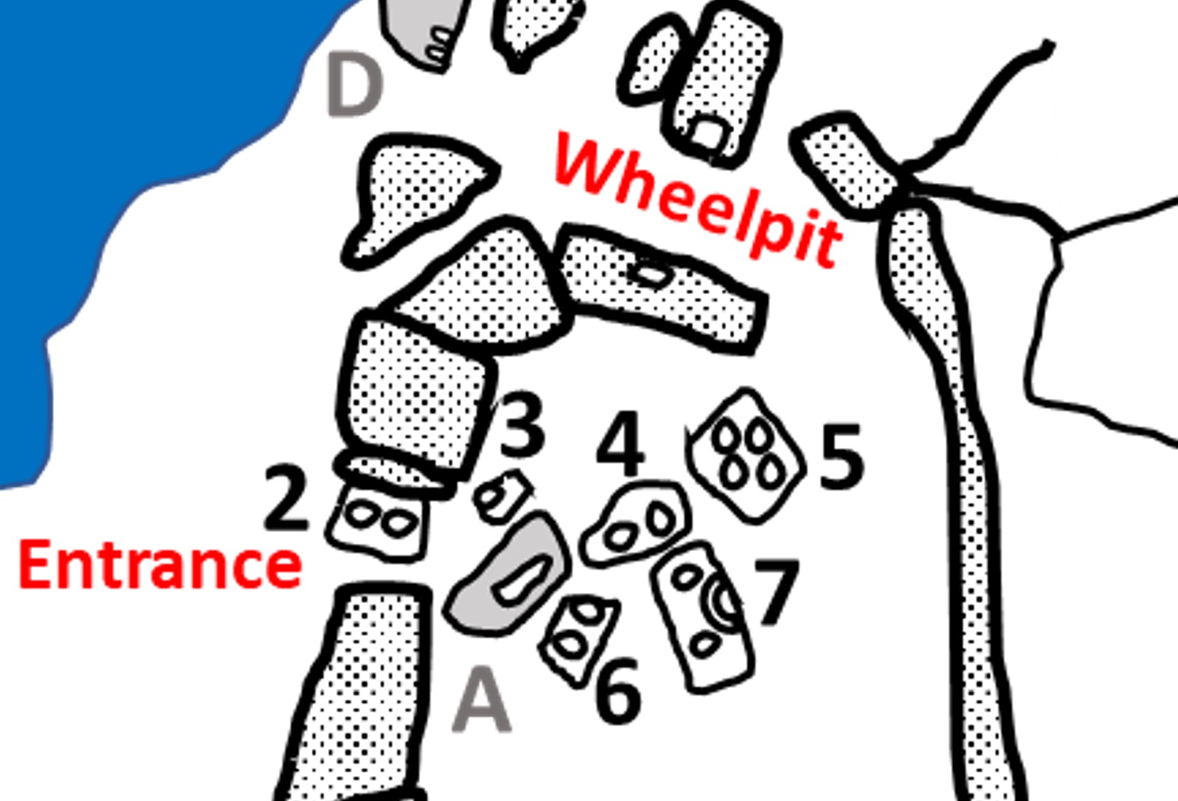
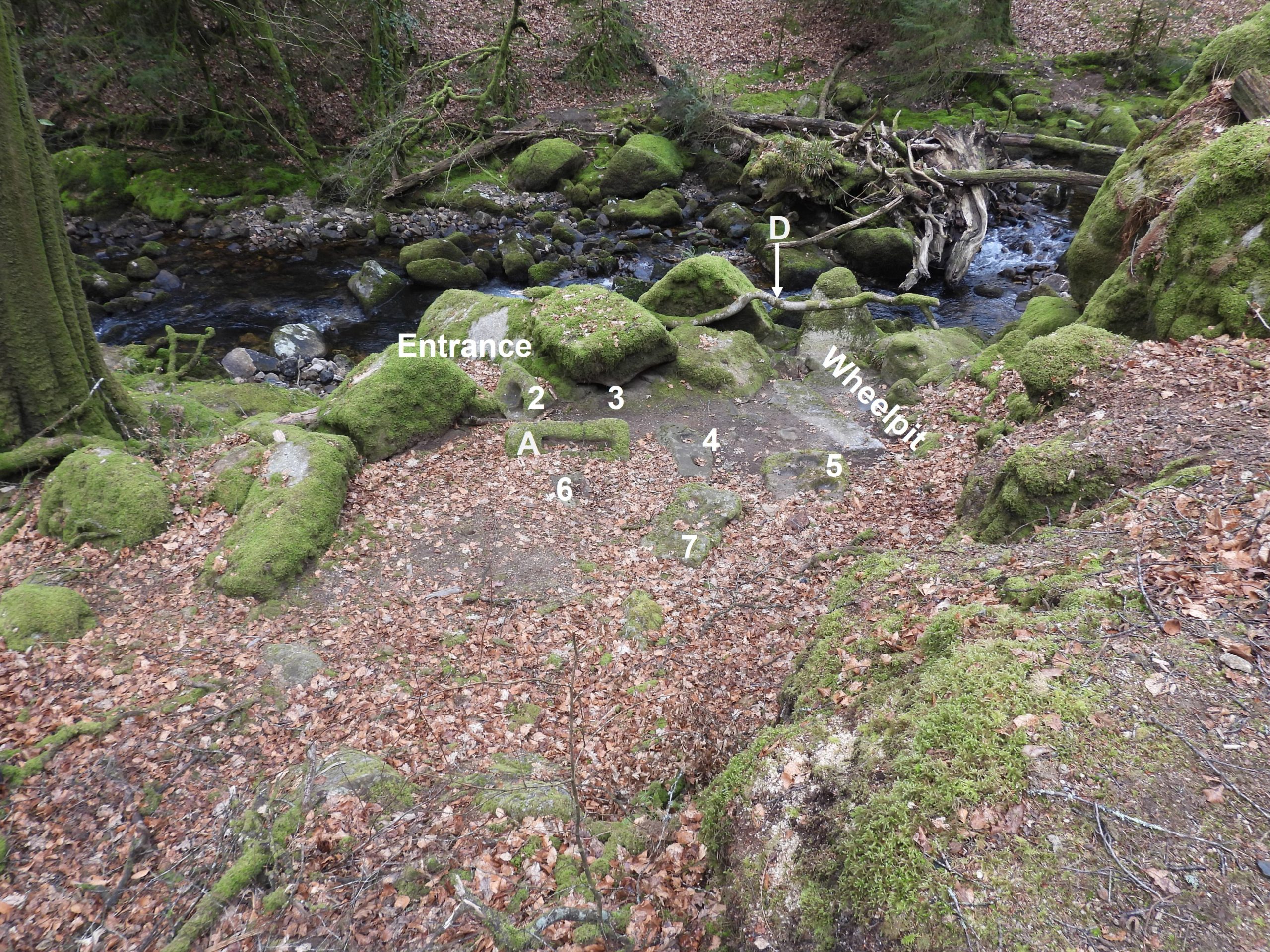
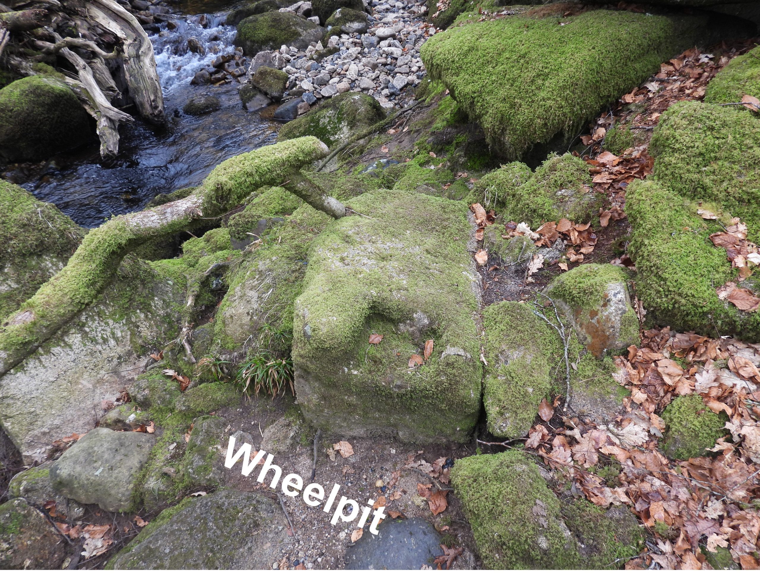
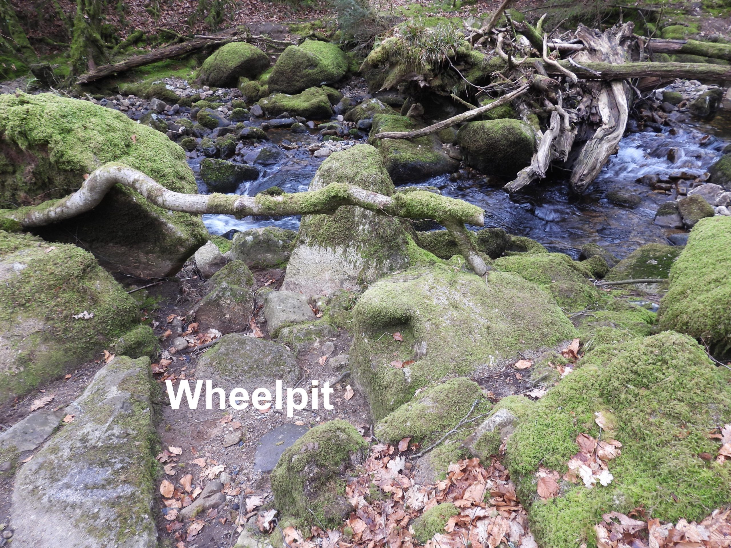
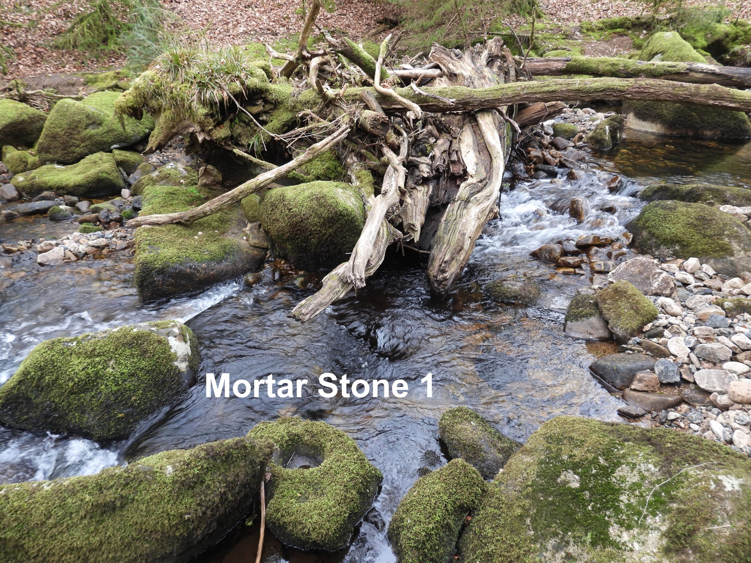
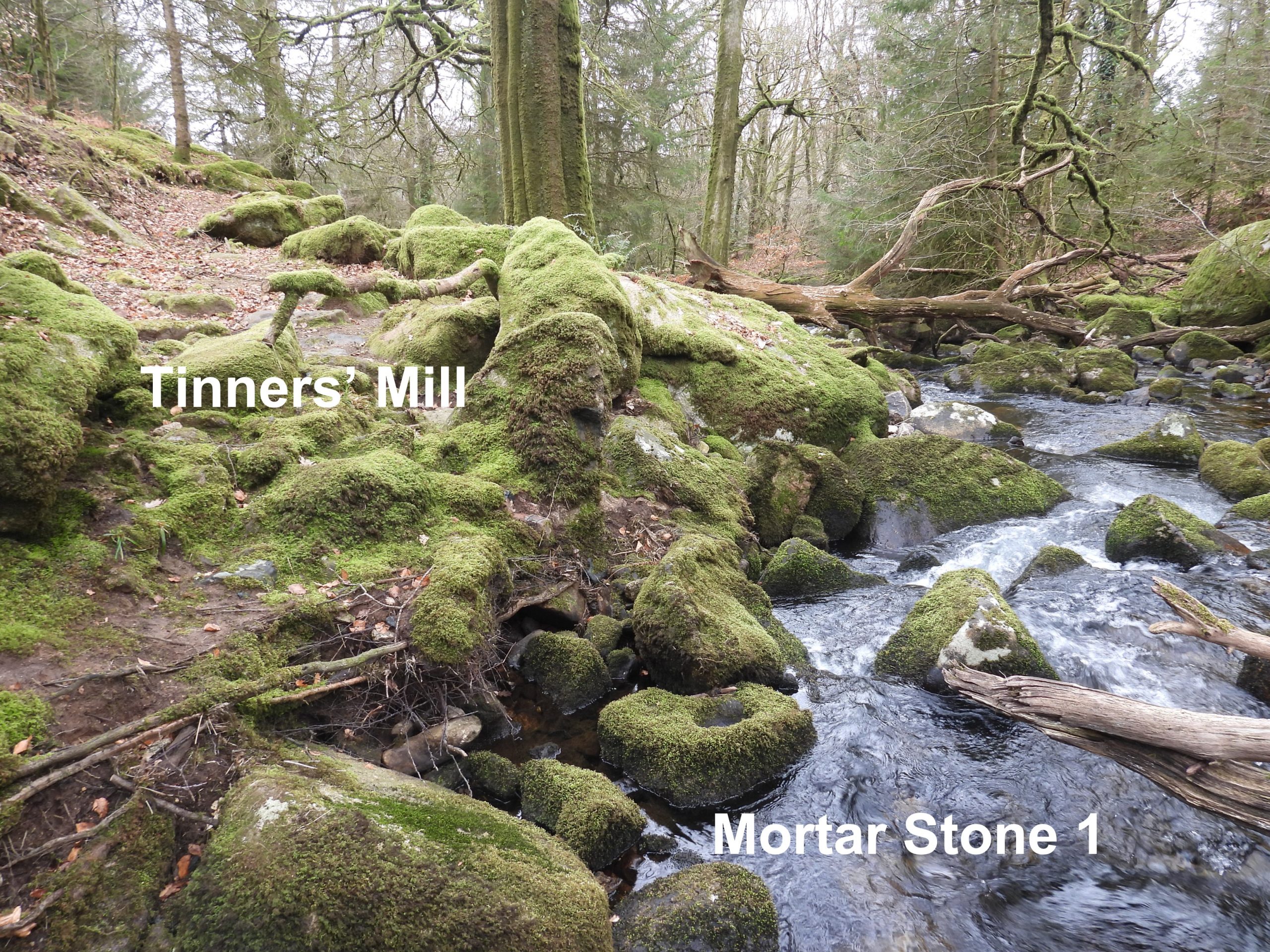
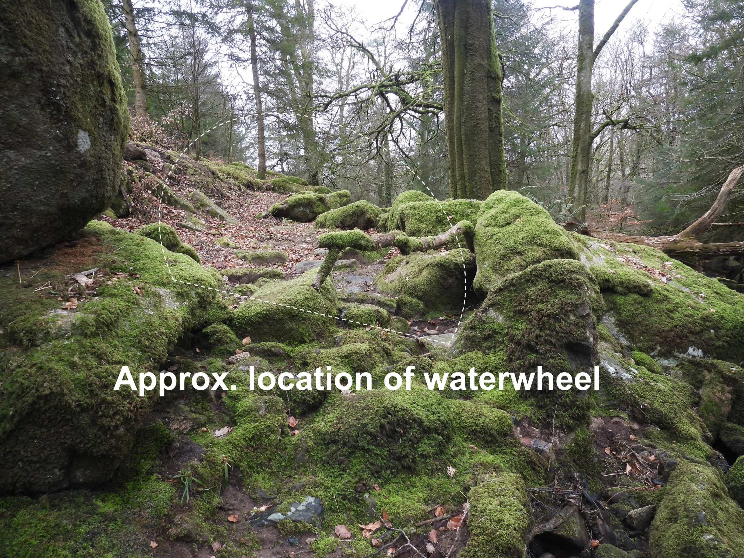
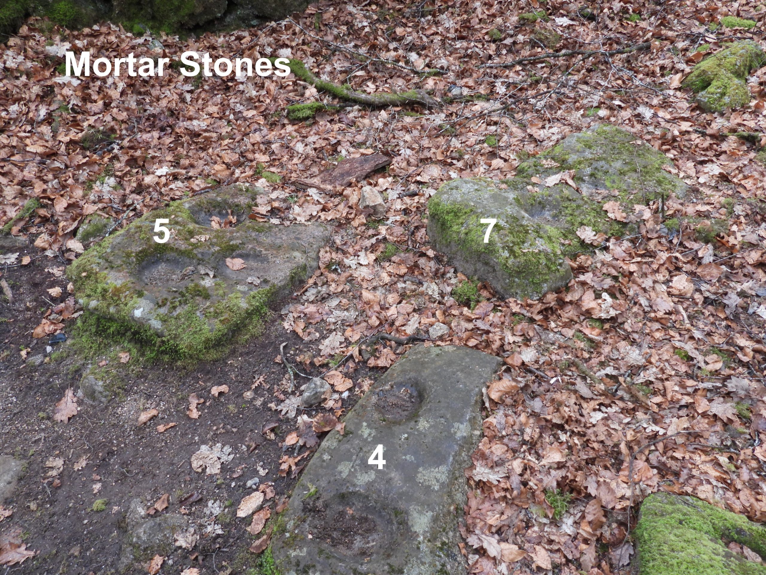
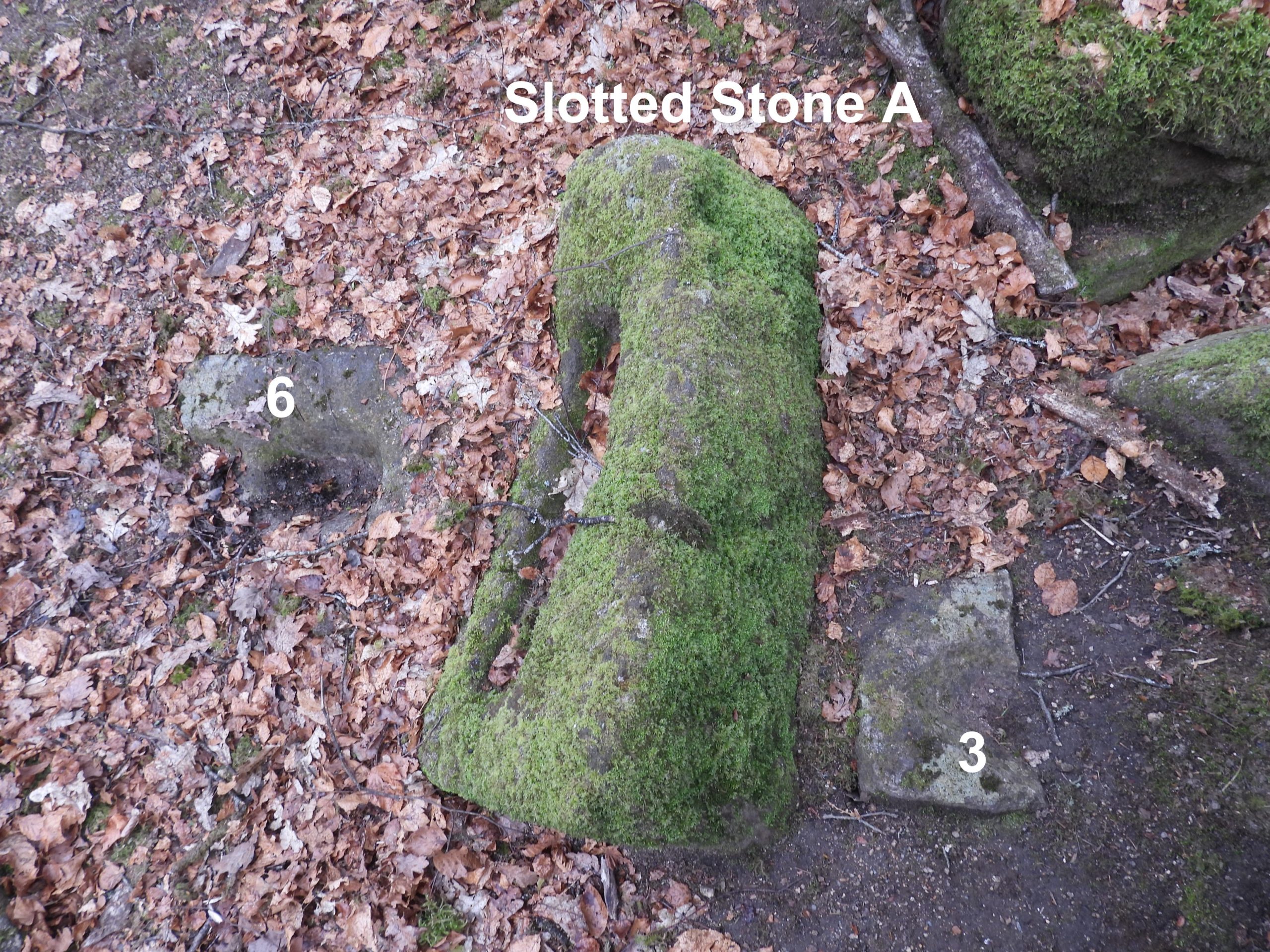
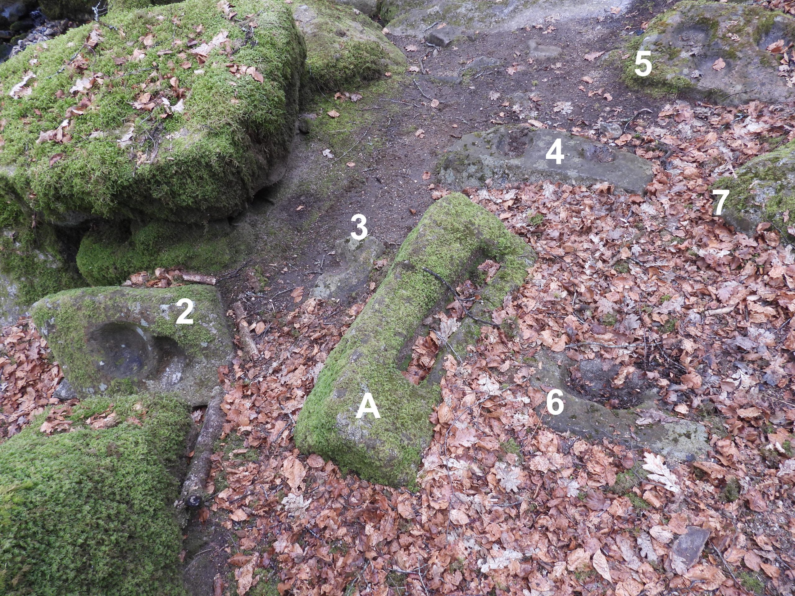
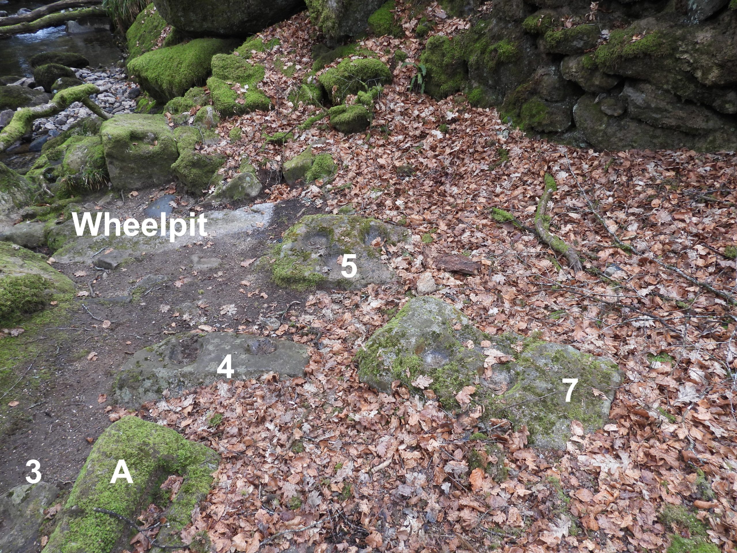
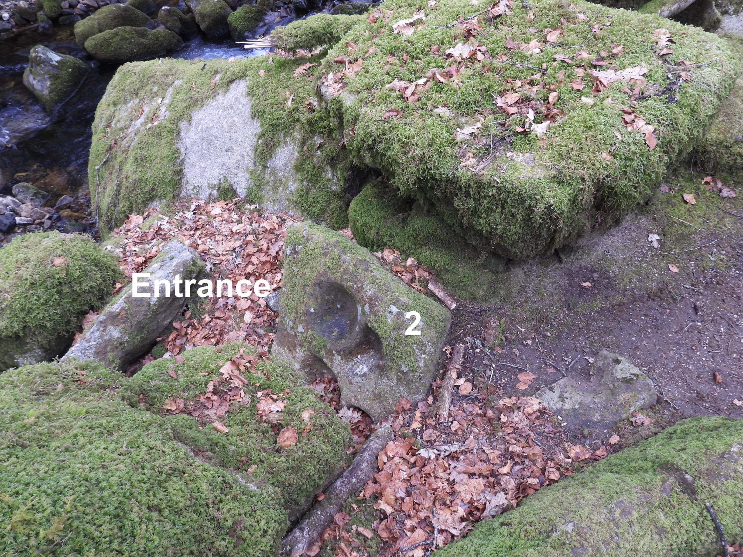
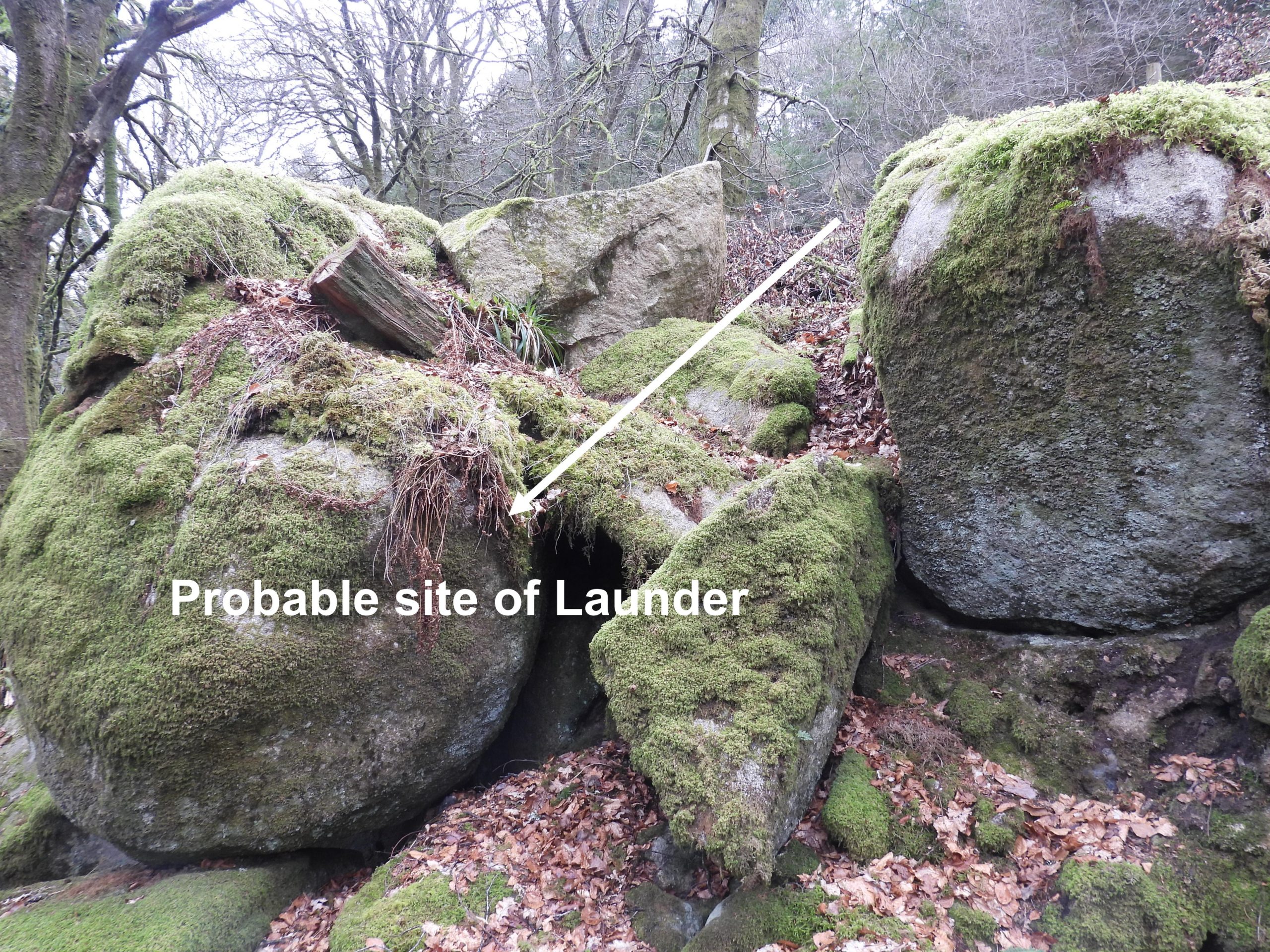
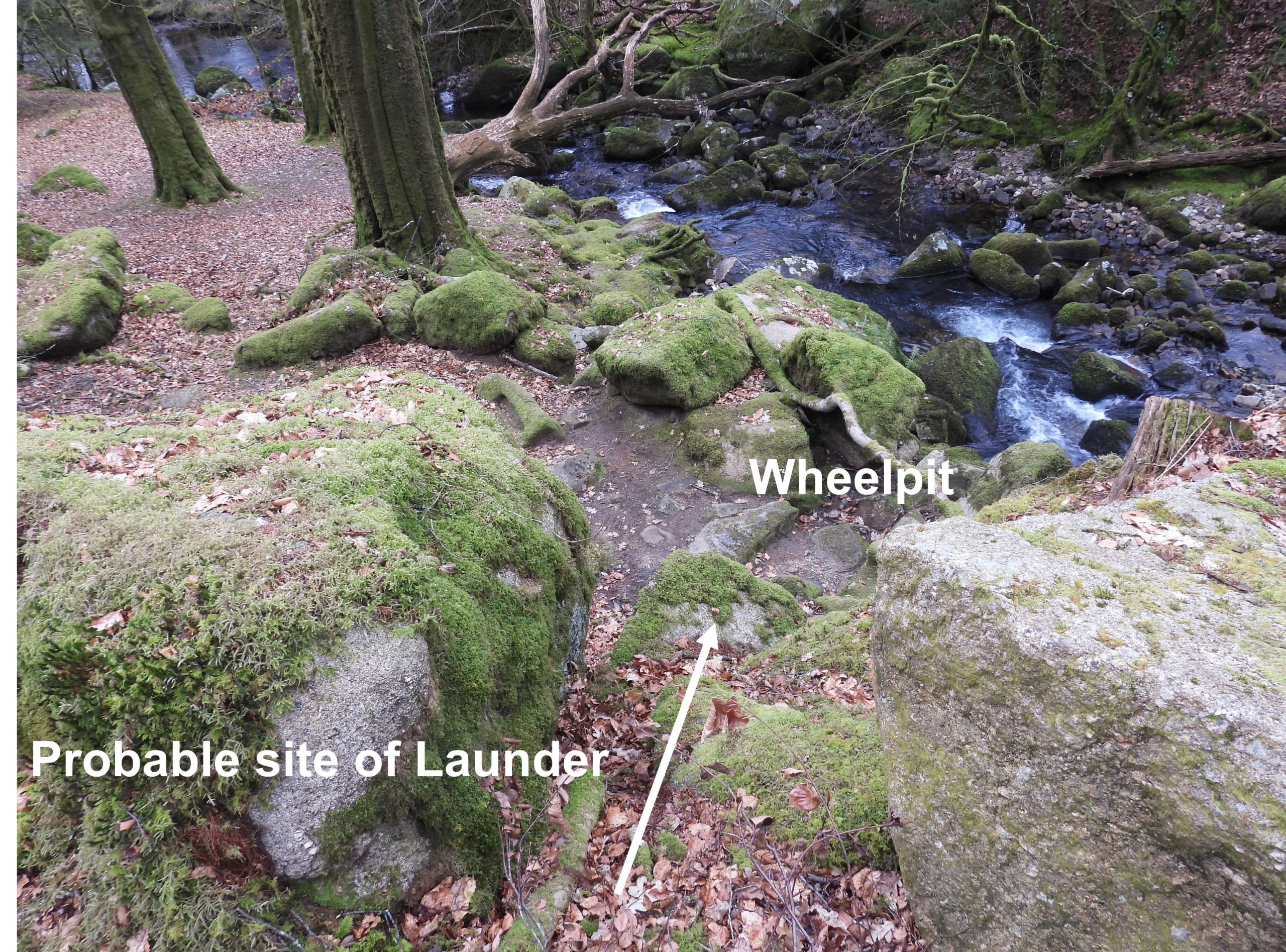
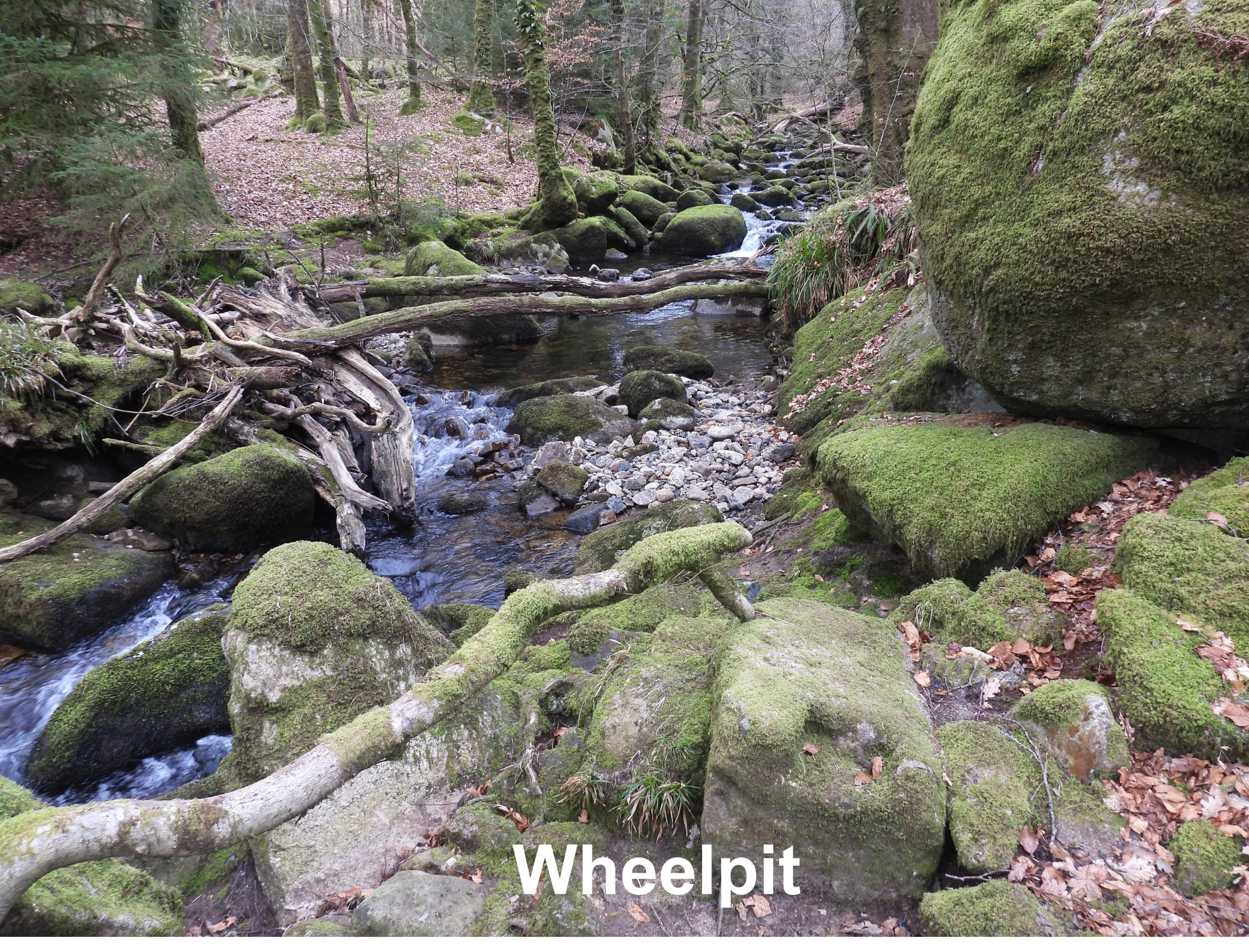
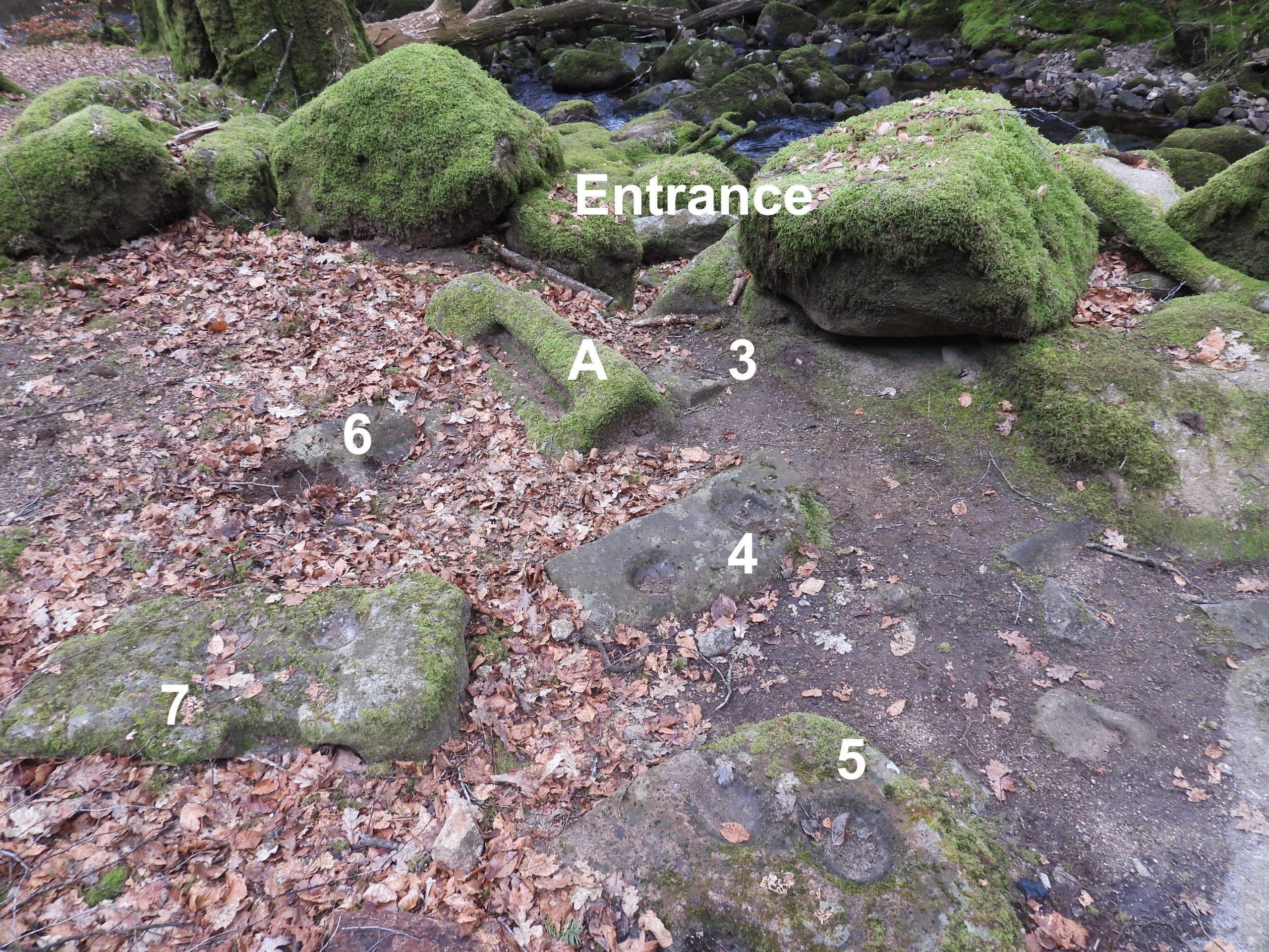
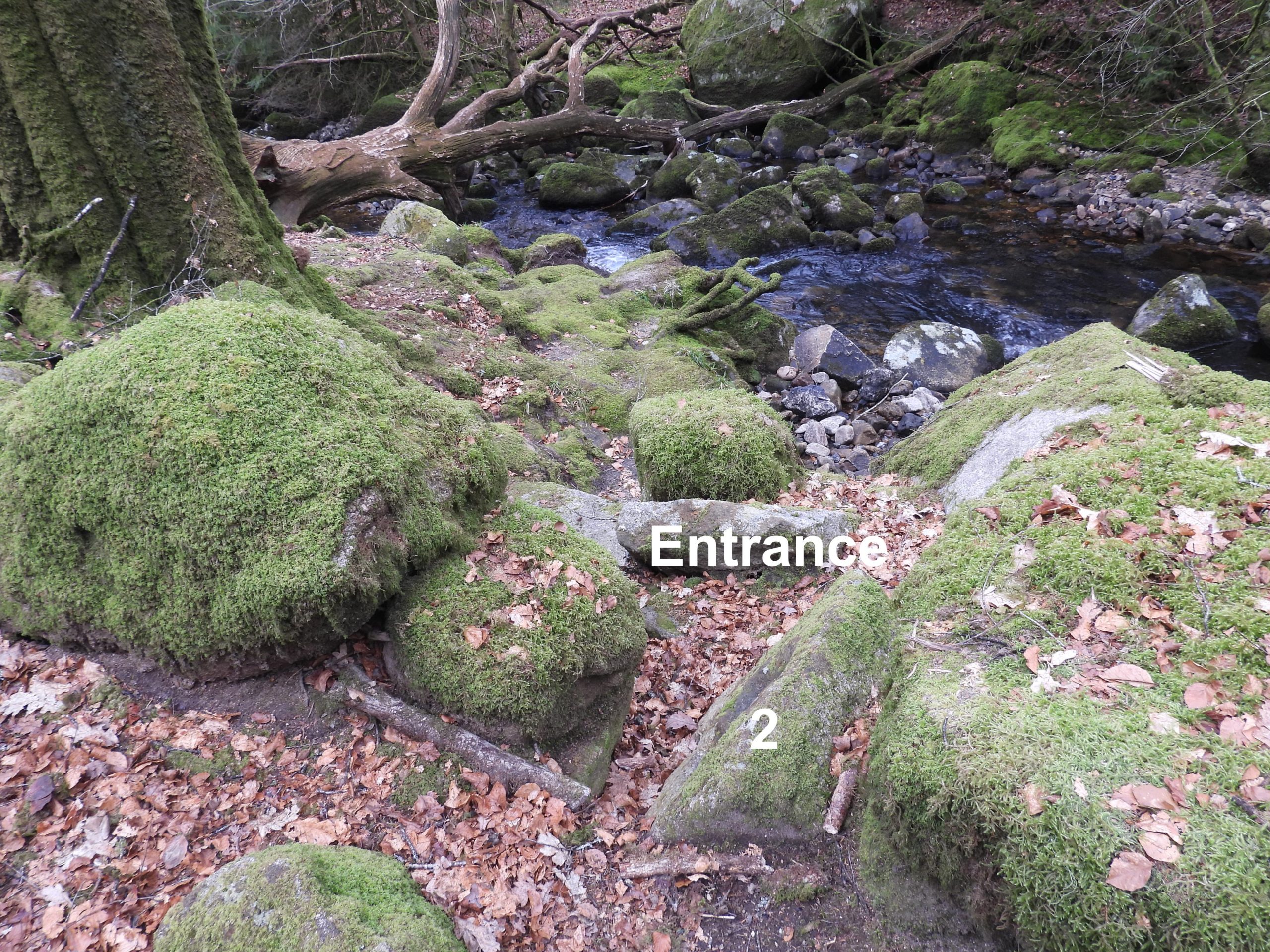
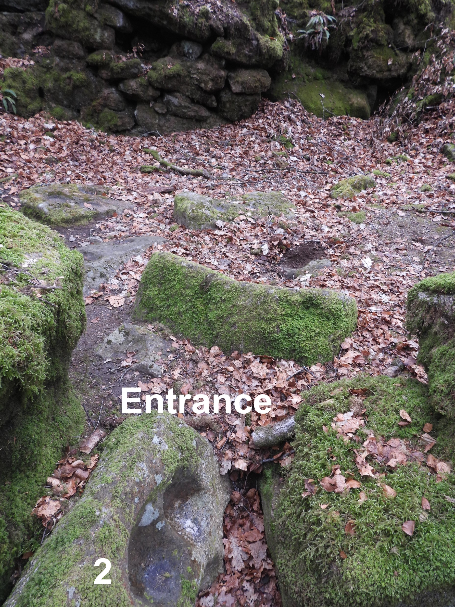
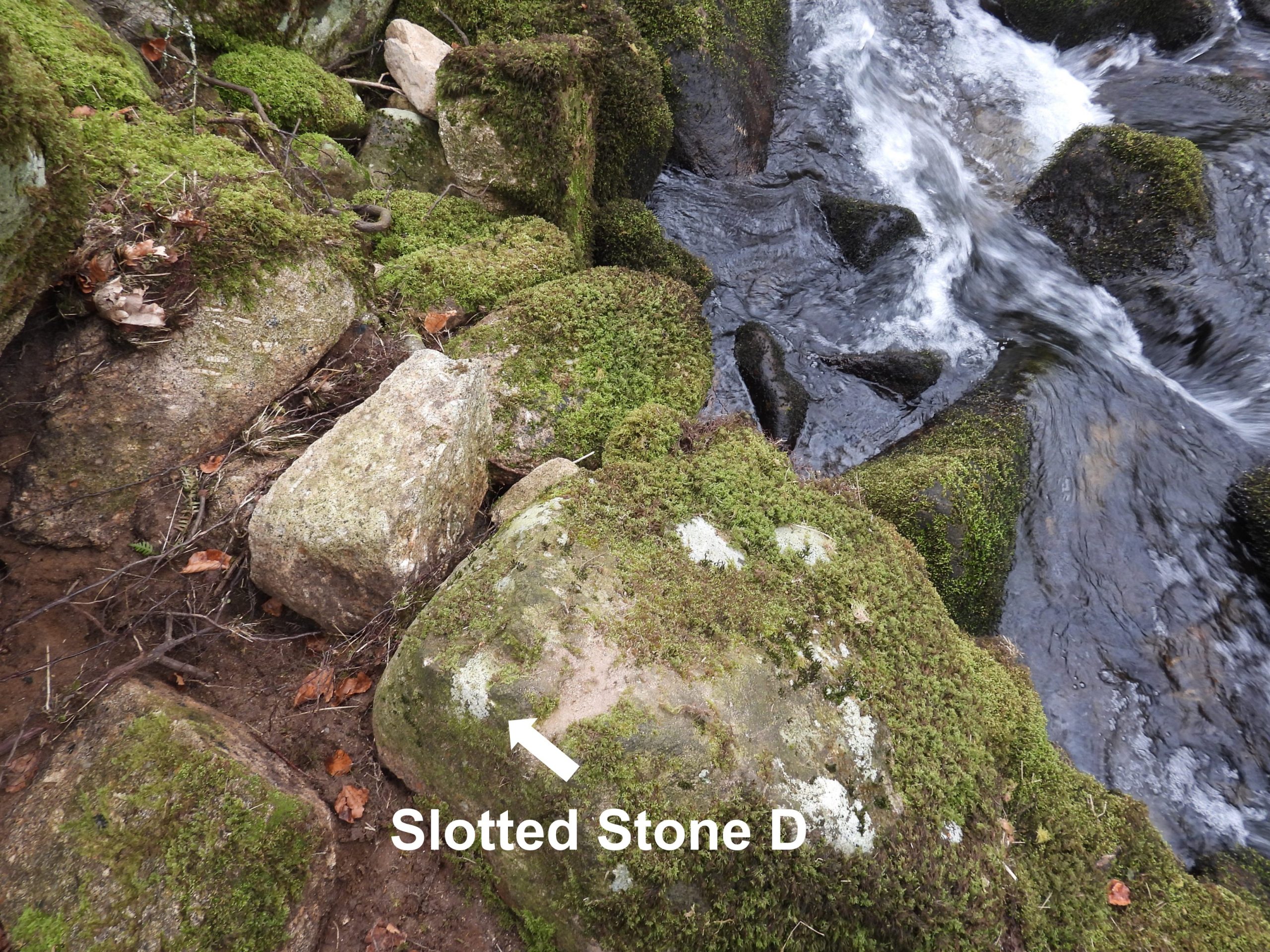
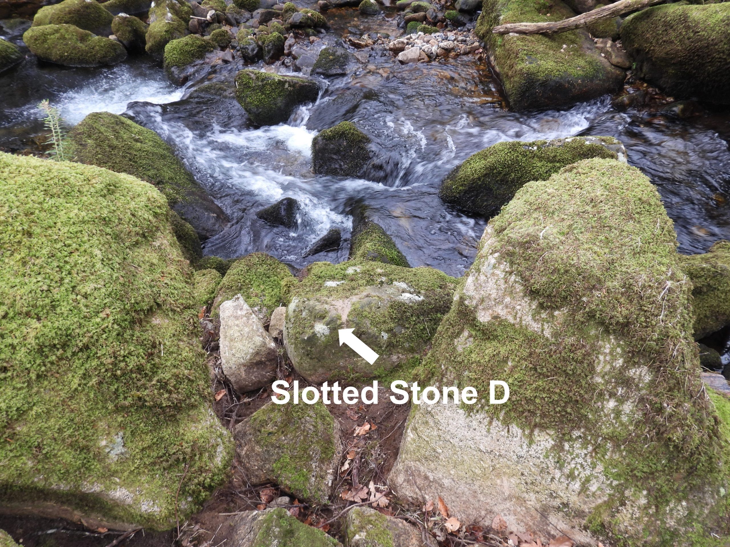
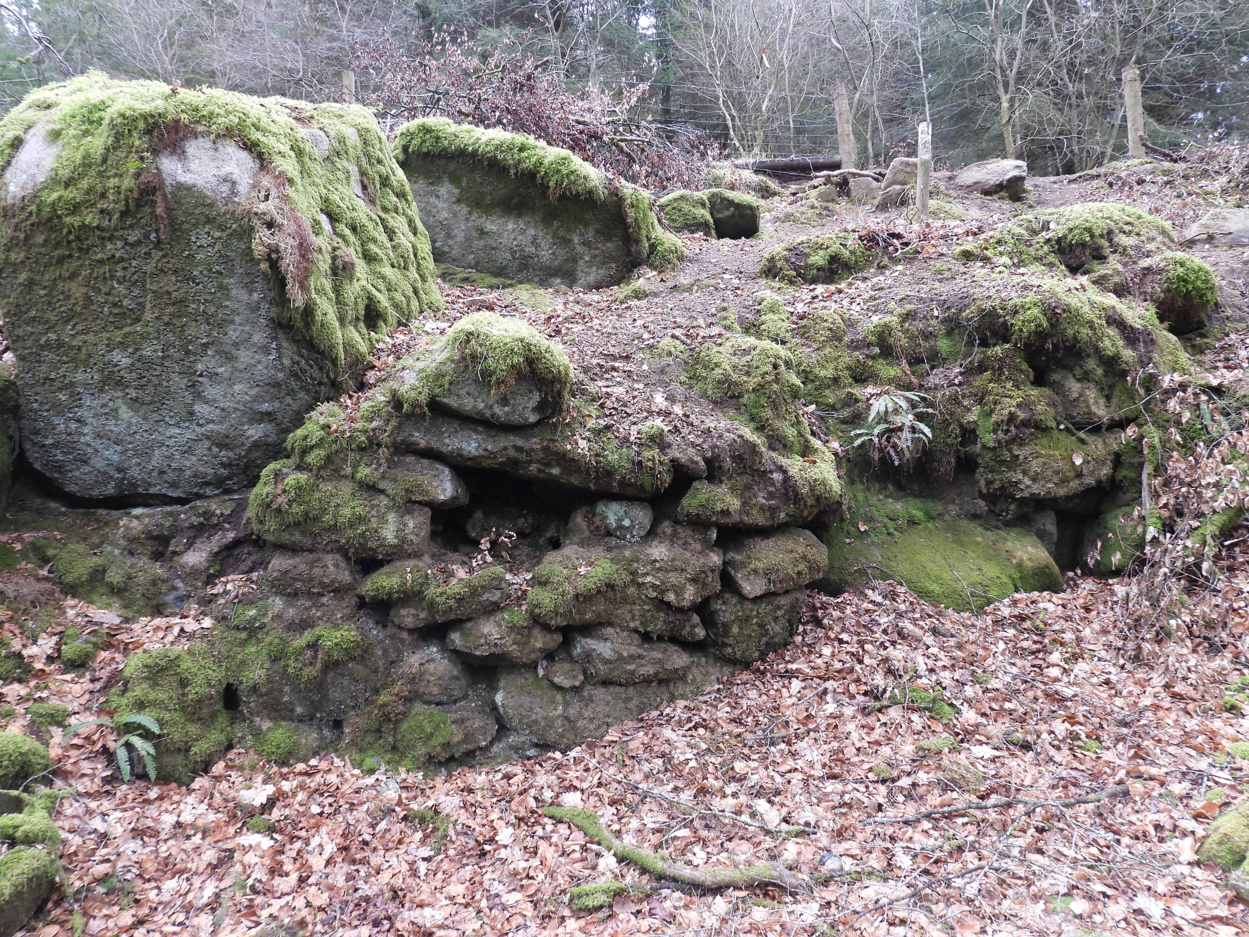
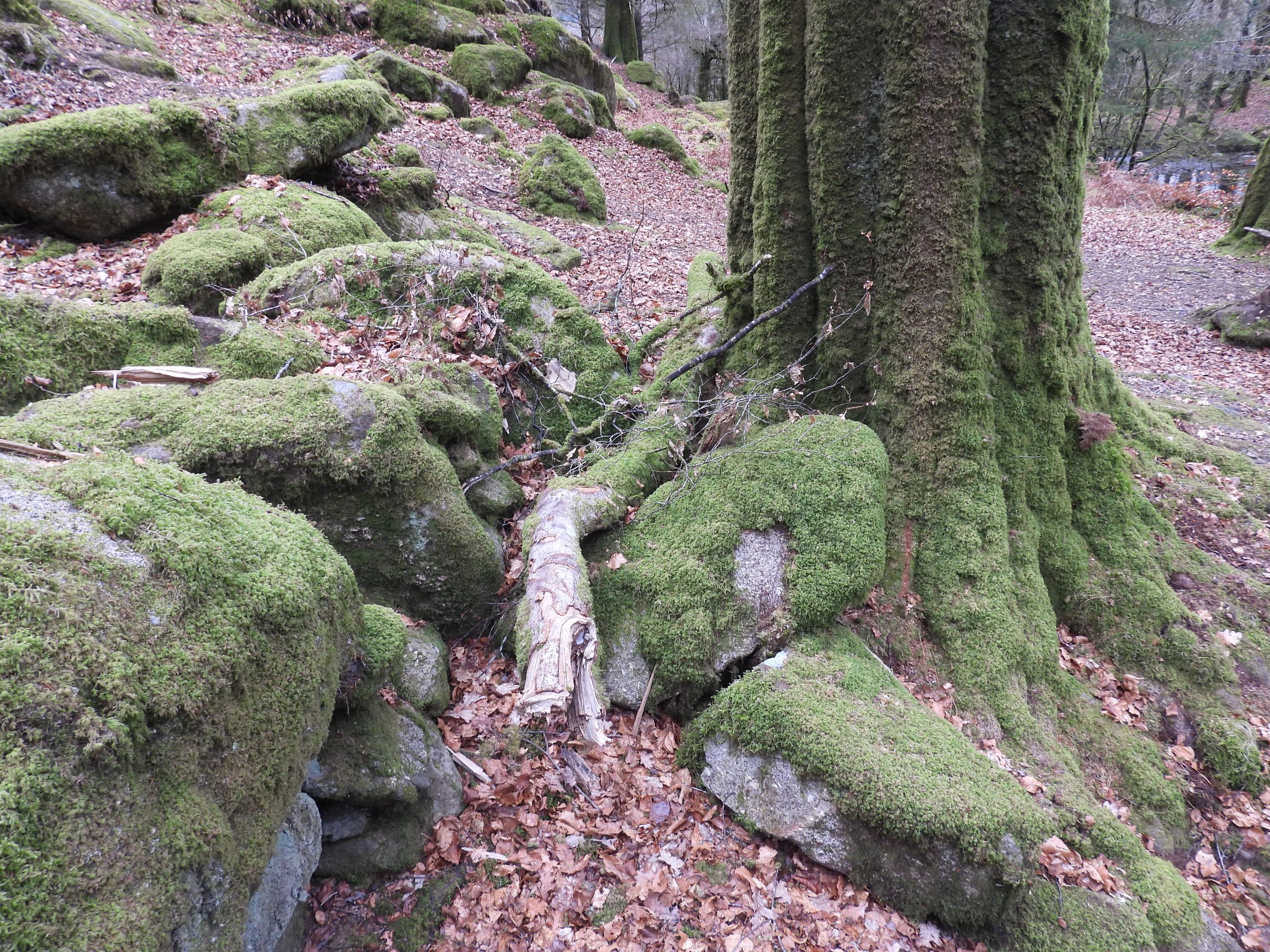
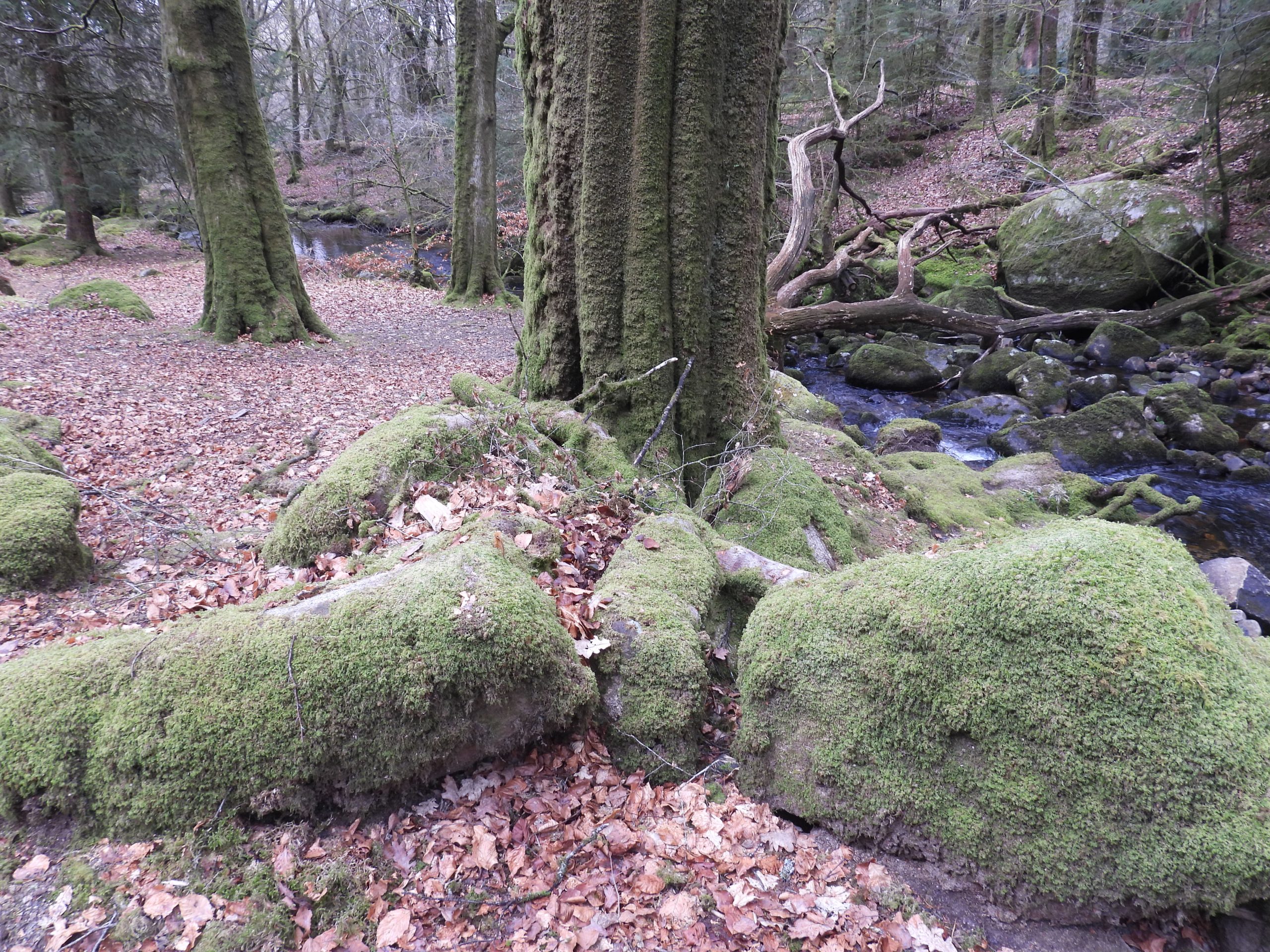
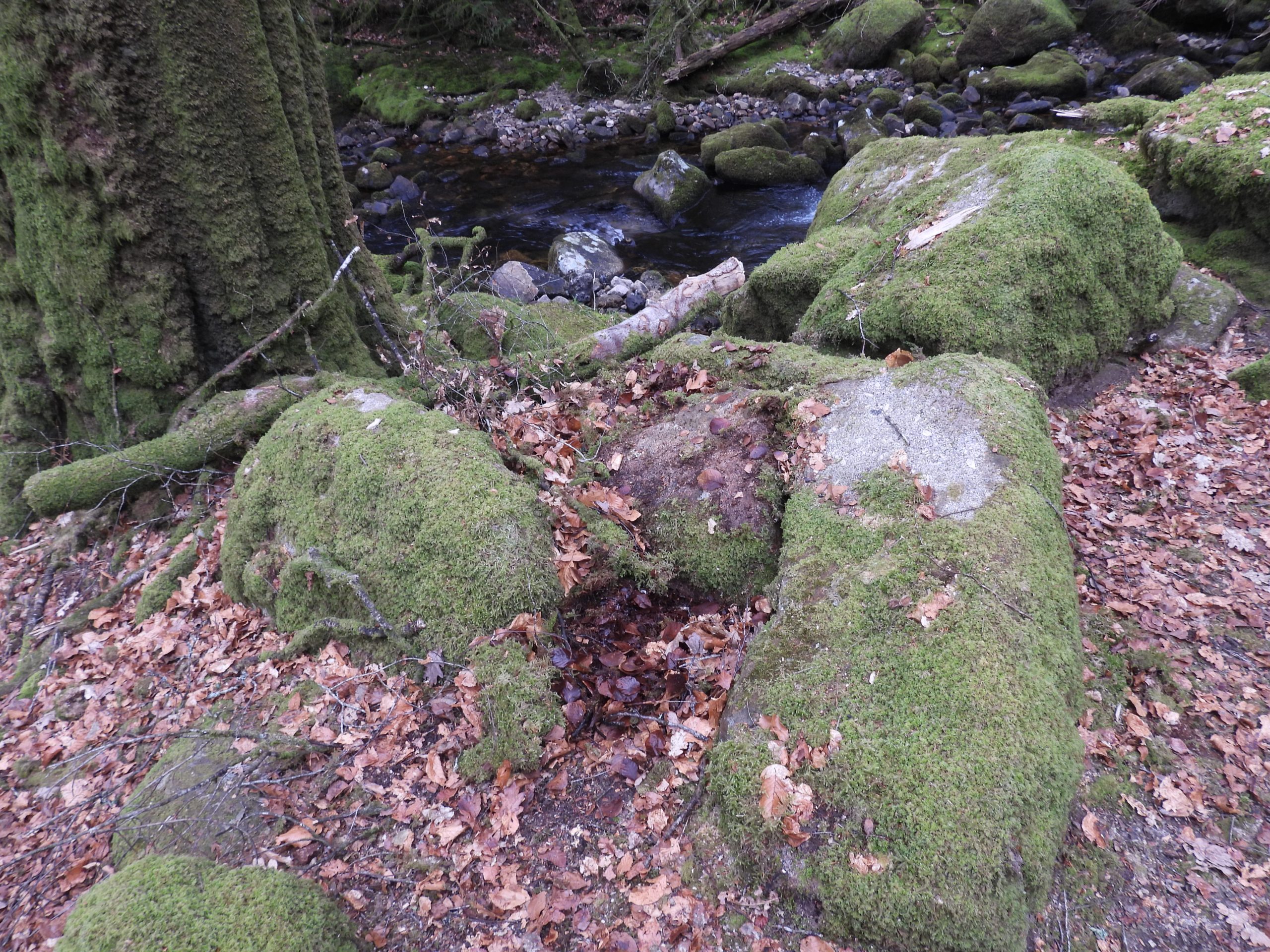
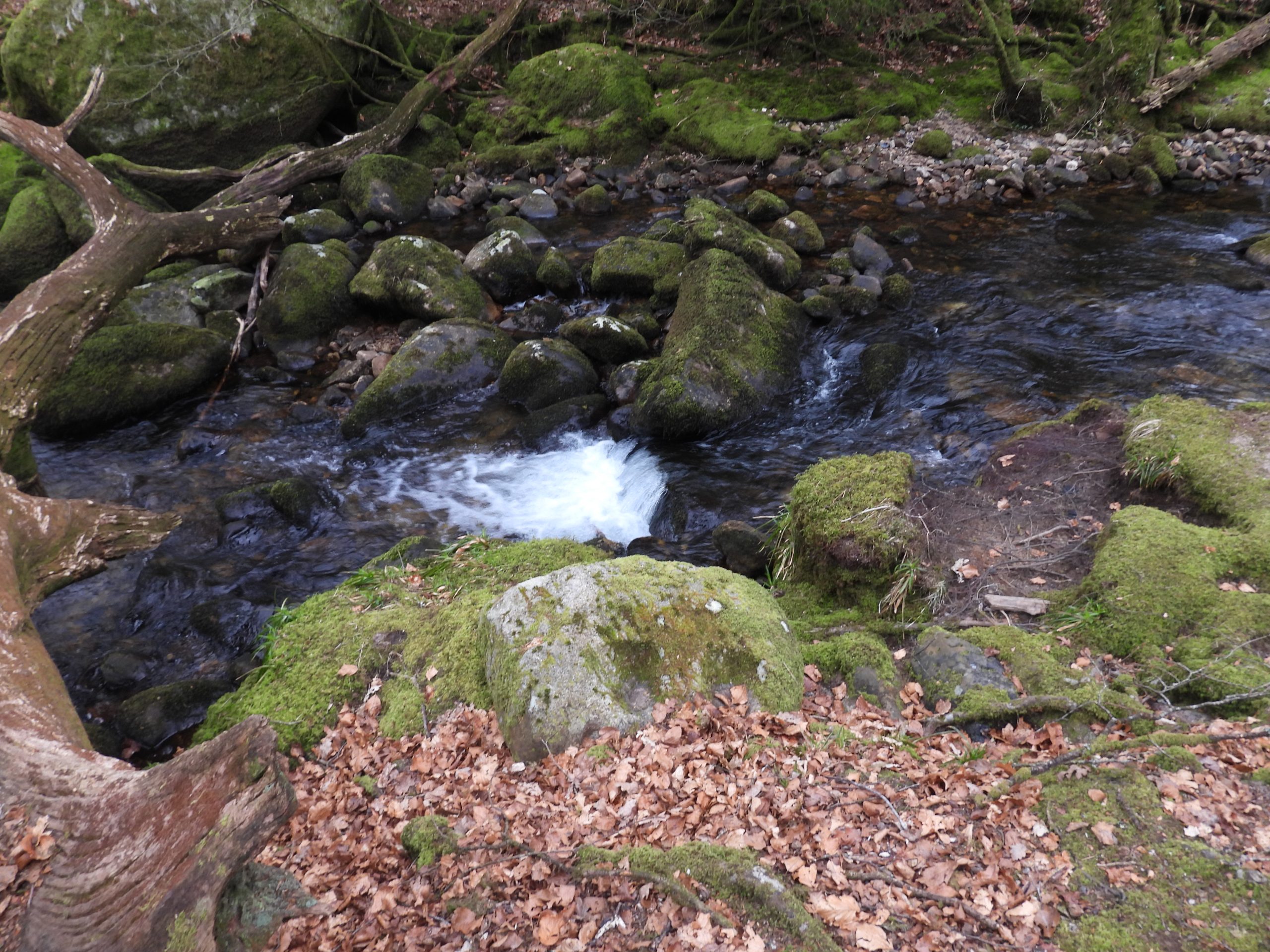
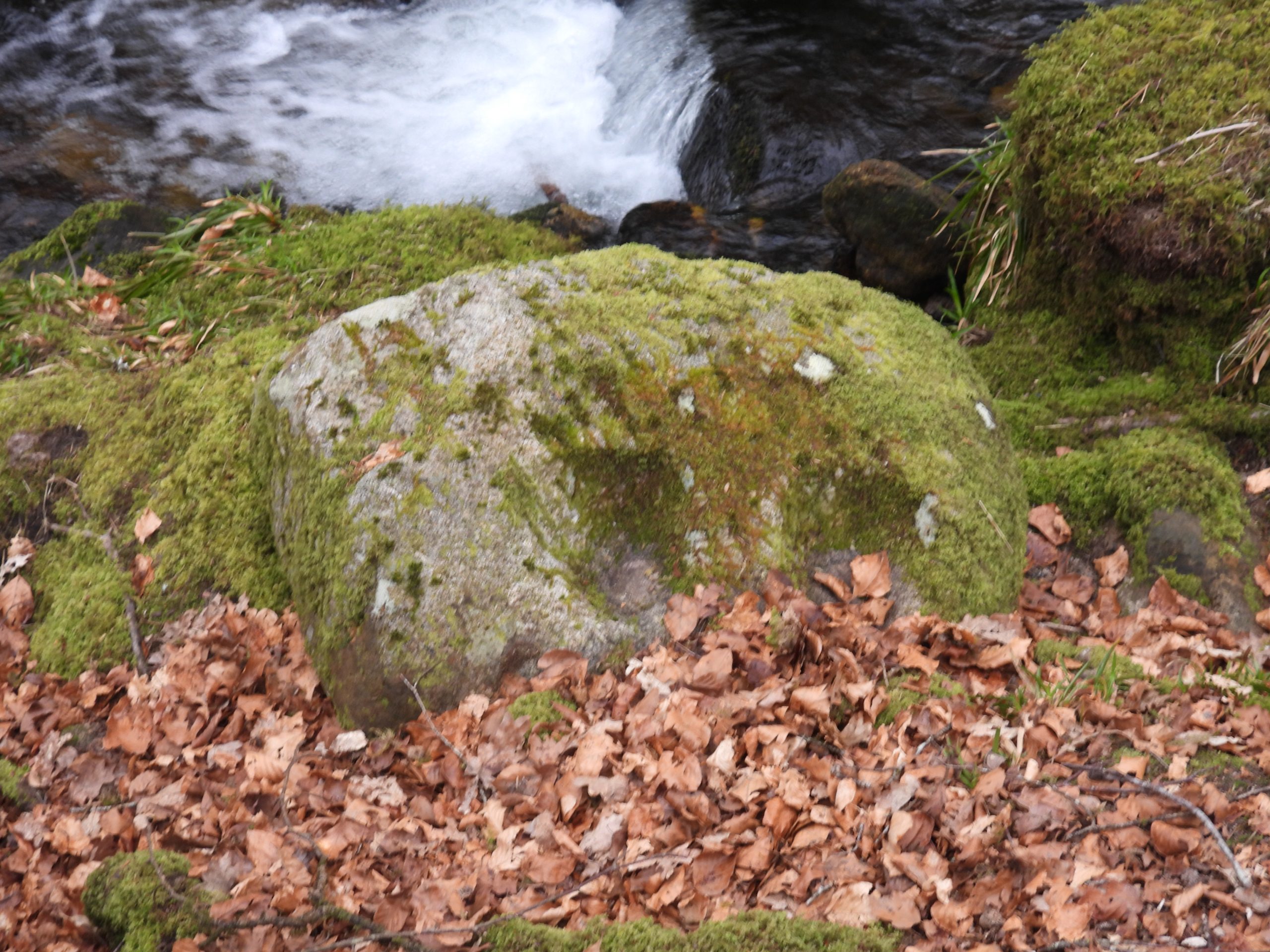
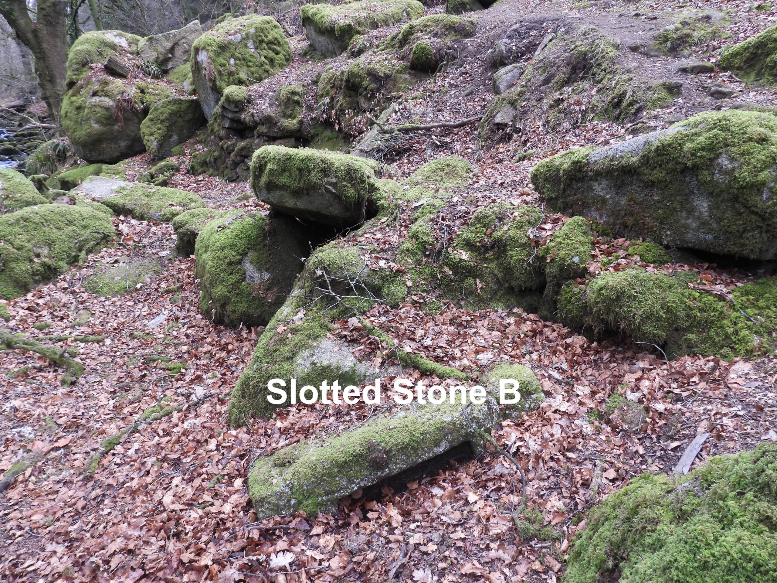
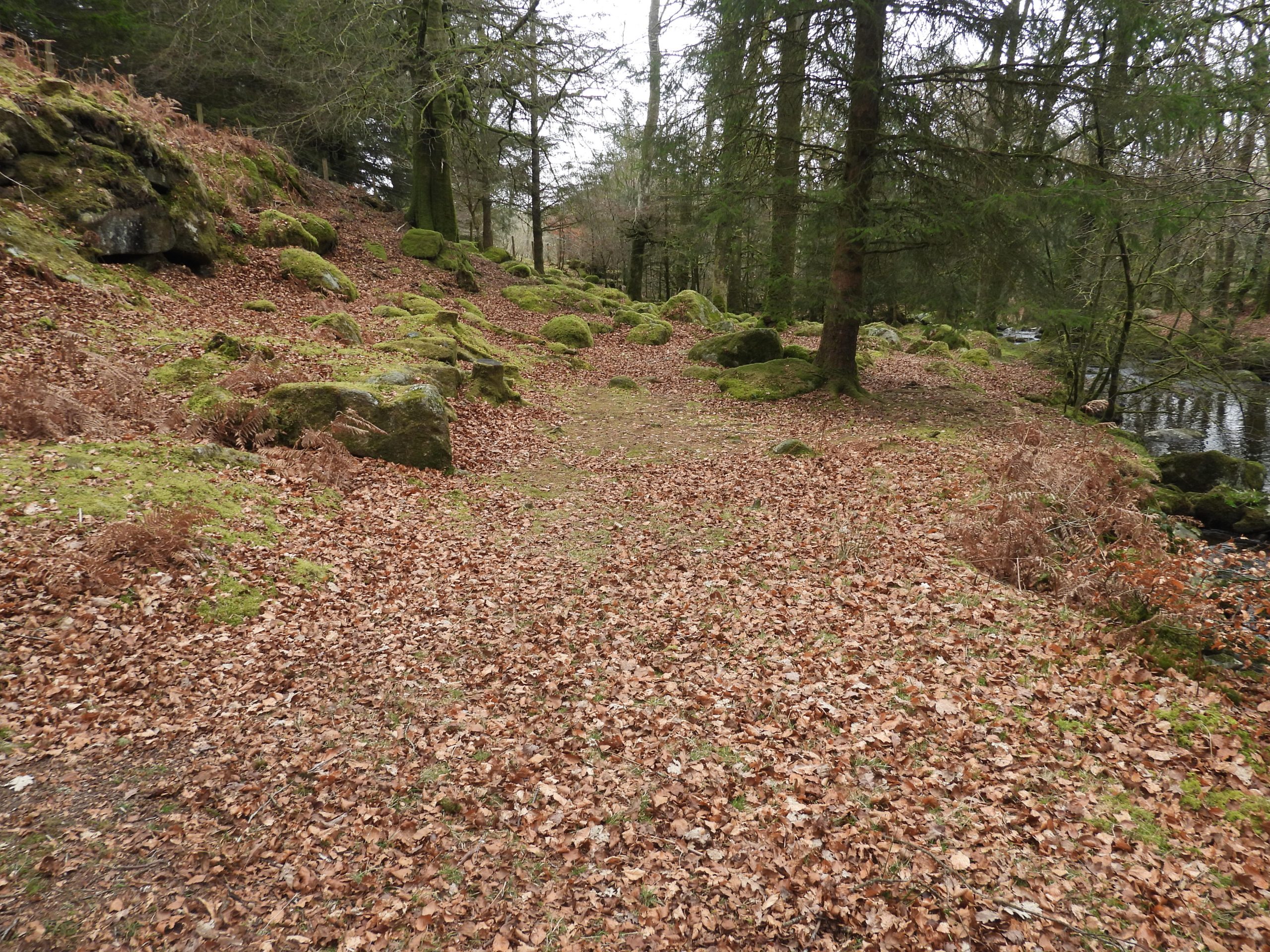
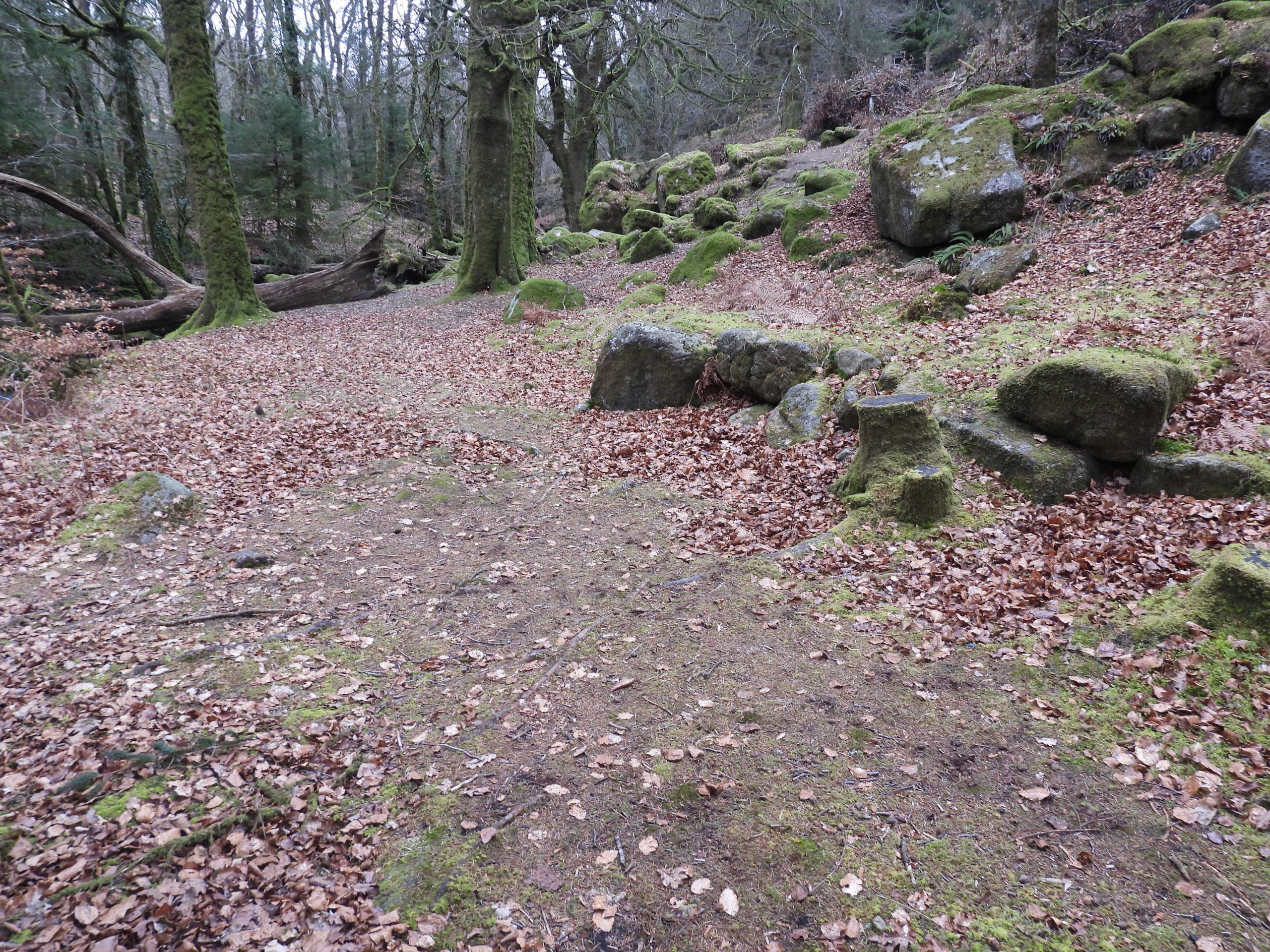
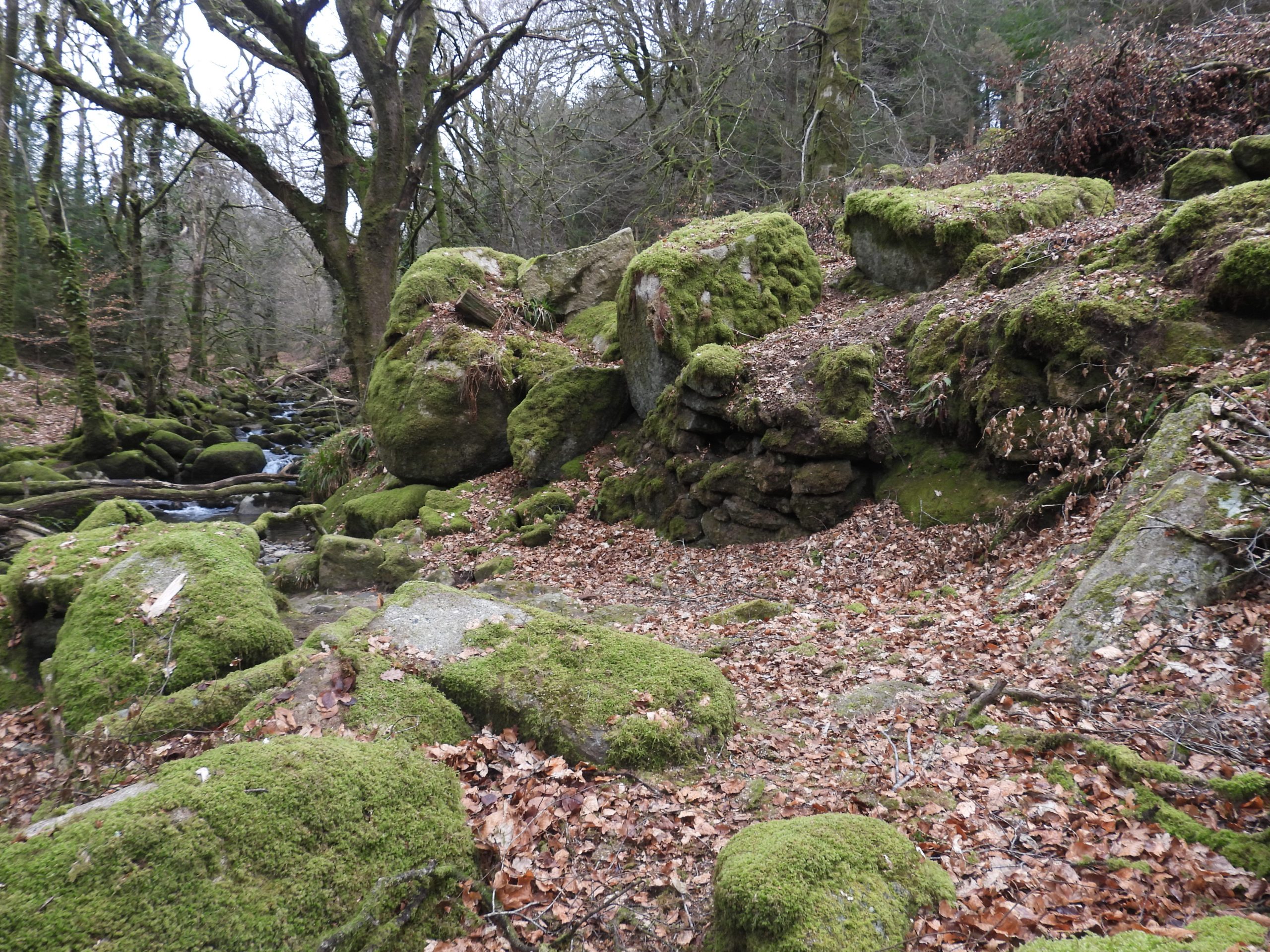
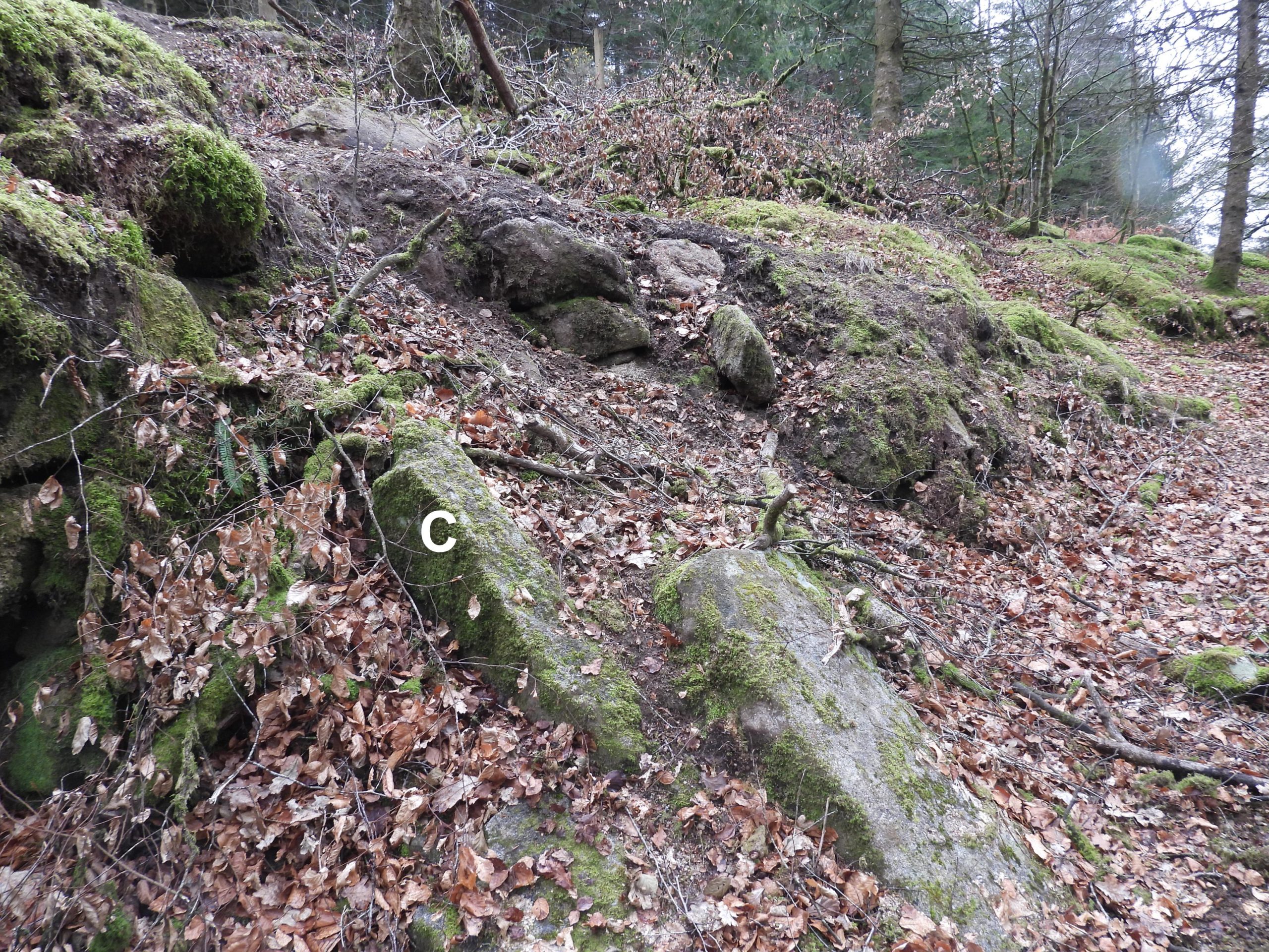
This sketch is a close representation (with some items missed out and others added) of one first produced by Tom Greeves in Devon Archaeology No. 3 – Dartmoor Issue from 1985. The labelling has been kept the same for continuity.General view of the Tinners’ Mill from above, where the visitor gets their first view of the plethora of the mortar stones and other features.Inside the mill itself are at least 6 mortar stones and a slotted stone, as shown in the above ‘zoomed in’ part of the sketch. Of interest is an observation by the Ordnance Survey Archaeology Division, in 1980, stating that inside there are six mortar stones and two pieces of mould stones. It is possible that the two pieces of mould stones referred to by them (OS) have been described as being used for other purposes by others since 1980. This is considered later in this post.Annotated features inside the mill showing the locations of 6 Mortar Stones, two stone with slots, the wheelpit and the mill entrance. The wheelpit with a reputed water wheel axle bearing stone which shows signs of rotational wear. The run off from the waterwheel would have been a short distance back into the River Meavy.A short distance upstream from the wheelpit a single holed mortar stone can be found (labelled ‘1’ on the sketch).Contextual view of mortar stone 1 in relation to the main Tinners’ Mill.Mortar Stone 1 looking downstream.Returning to the mill, the author has speculated the size of the former waterwheel, which is guessed at at being around 3m in diameter. The author hasn’t found any dimensions recorded by any of the professional Dartmoor observers.Mortar stones 4, 5 and 7. Sandy Gerrard recorded that all mortar stones were created by the use of double stamps. He further observed that one face of a Mortar Stone has been shifted resulting in the production of 4 hollows (It is probable that he was referring to mortar stone 5).Between Mortar Stones 3 and 6, lies an interesting slotted stone (labelled A on the sketch map). This may well be one of the “mould stones” referred to by the Ordnance Survey Archaeology Division in 1980. Historic England consider that these types of stone are “known from grist and crazing mills, where they are considered to have formed part of the support for the machinery”. The conjecture being is that this building may, at one time, been used for crushing tin using horizontally rotating stones. The slot in stone ‘A’ cut into the upper face is about 0.55 m long and around 0.1 m wide / deep (this relates to around 337cu in). A typical mould stone of the period would have had a volume of around 370 cu in to hold 100lbs of tin, which was the typical size of ingot (ref: Dr Tom Greevs thesis (page 229), where it is mentioned that 100lb ingots were used in Devon dating back to 14th century). If the stone ‘A’ were a mould stone (unlikely) it would have been undersized.Mortar Stone 7 appears to the largest in the area and may possibly have extra ‘bearing marks’ on it. The author decided not to disturb the ground / leaf cover to expose more of the Mortar Stones as this may be considered as causing further degradation of historical artefacts.Mortar Stone 2 has four (probable) depressions and lies in what is believed to have been the entrance to the mill.On the north east corner of the mill, there is a gap in the large boulders, which the author assumes may have been the access point for a wooden launder to serve the waterwheel below.Looking down on the gap in the large boulders. Certainly the gap ‘lines up’ with the wheelpit and is probably where a wooden launder may well have been placed. The professional Dartmoor observers have suggested there is a short section of a dry leat leading to this point. The author found it difficult to discern one.Once more down at wheelpit level looking upstreamMore views of the slotted stone and Mortar Stones looking west down towards the Meavy.The mill entrance.The mill entrance looking into the building. Note the small ‘alcove’ on the opposite wall, which probably is just fallen stone work.Near the river, below the wheelpit is a boulder which appears to have a couple of ‘slots’ or axle bearing marks. It is labelled ‘D’ on the sketch map. R. H. Worth has recorded that slots like this could have been used by small iron axles, probably in connection with the bellows. Is this evidence of there being a Blowing House here at one point of were the axle marks part of something different ?A Contextual view of the slotted stone (‘D’).A cavity in the internal mill wall, which has most likely been caused fallen stones as opposed to having any historic purpose.External (west) wall and corner of the mill.Internal (west) wall and corner of the mill.Internal (west) wall and corner of the mill.This large Mortar Stone was not recorded in this location in the original Tom Greeves (Devon Archaeology) sketch plan. The author believes this has been moved since the 1980’s to its current location. It is labelled as ‘Mortar Stone 8’ on the sketch plan.Mortar Stone 8 appears to have two depressions (albeit there could be more buried).Slotted Stone ‘B’ can be found to the south just outside the mill. It is of similar dimensions to Slotted Stone ‘A’ thus an assumption might be made that there operated as a pair. As R.H. Worth stated in 1940, these are “similar to stones that took the ends of beams bearing the footstep of the upper mill stones in old flour and grist mills, and were probably intended for such use when it was decided to convert this building into a grist mill”. Eric Hemery (High Dartmoor – page 126) suggests that the slotted stones were not used in a grist mill here as the house / mill is too small and the waterwheel wouldn’t have provided enough power. The alternative conjecture given is that corn from the area was taken to a nearby Meavy Mill and Hemery suggests that these stones were probably cut in-situ for use elsewhere, which was an old practice on Dartmoor.A flat area to the south of the mill probably represents where the crushed tin was ‘dressed’. Historic England suggests this area four rectangular hollows which probably represent the remains of buddles. These ‘hollows’ are difficult to discern.A final view of the Mill. Modern observers have recorded the mill as being a sub-rectangular building measuring either 7.3m long by 3.7 m wide (with a drystone wall standing up to 1.7 metres high) or indeed only 5.2m x 3.6m. R.H. Worth’s measurements were 15ft to 16ft (4.5m to 4.9m) x 13ft 4in (4m). One wonders were the extra length has come in from the various observers? Have some included / excluded the wheelpit ?The final rectangular (slotted ?) stone, labelled as ‘C’ on the sketch map can be located just inside the south east corner of the mill. The author is unaware of its purpose and was loathed to dig around it or even attempt to turn it over.
Wow thank you so much for posting this. I found this very interesting when this subject has never been in my thoughts. I might go venture out to find this!
Rena Barnes May 23, 2026
Wow thank you so much for posting this. I found this very interesting when this subject has never been in my thoughts. I might go venture out to find this!
SteveGriggDartmoor May 23, 2026 — Post author
Hi Rena,
Thank you for reading the post. Hope you manage to get to the site
Kind Regards,
Steve (Dartmoor Explorations)