A collection of walks, discoveries, insights and pictures of exploring Dartmoor National Park
September 21, 2022
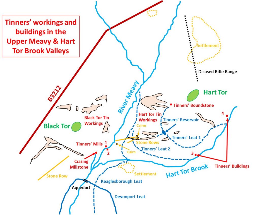
Tinners’ workings and buildings in the Upper Meavy & Hart Tor Brook Valleys
Within the Upper Meavy and Hart Tor Brook valleys there is a rich history of tin workings with many alluvial and eluvial stream works, openworks, lode-back pits, shafts and shoad collection pits. These are complemented with tinners’ leats and a reservoir plus a number of tinners’ buildings (including two mills). The water management including the leats and the reservoir in the area is covered in a separate post, here: https://dartmoorexplorations.co.uk/water-management-across-the-centuries-in-the-upper-meavy-and-hart-tor-brook-valleys/
This post, however, covers the workings, buildings and tin processing in the area and is split into six sections, namely: a) Hart Tor Tin Workings; b) Hart Tor Brook Streamworks and Tinners’ Buildings; c) Black Tor Tin Workings; d) Black Tor (Meavy) Falls right hand bank tin mill; e) Black Tor (Meavy) Falls left hand bank tin mill and e) Crazing Mill stone (plus tinners’ cache amongst Meavy streamworks).
The author is indebted to the information found and referenced from the publications shown in the following bibliography.
Bibliography:
1.Walkhampton Premier Archaeological Landscape; Field Investigation Project (Report – Survey). SDV359195 by M.J, Fletcher, 2007-2008 (found in the Dartmoor HER)
2. Meavy Valley Archaeology Site Report No. 10 – HART TOR TINWORKS by Sandy Gerrard (1998)
3. One Hundred Years at Black Tor Falls (Part 1) by Dr Phil Newman – Dartmoor Magazine No 21 – Winter 1990
4. One Hundred Years at Black Tor Falls (Part 2) by Dr Phil Newman – Dartmoor Magazine No 22 – Spring 1991
5. Worth’s Dartmoor – R.H.Worth – Pages 306-307 (Black Tor Falls, left bank and Black Tor Falls, right bank)
Sketch map of the various tinners’ workings, mills and buildings covered in this post.
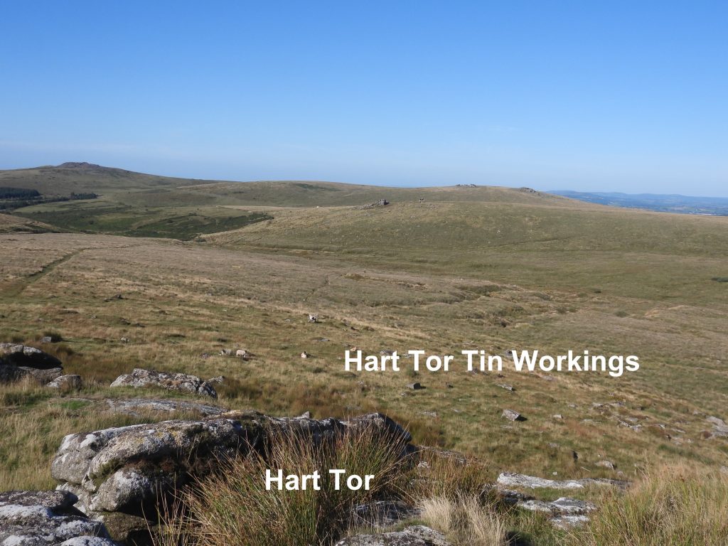
a) Hart Tor Tin Workings
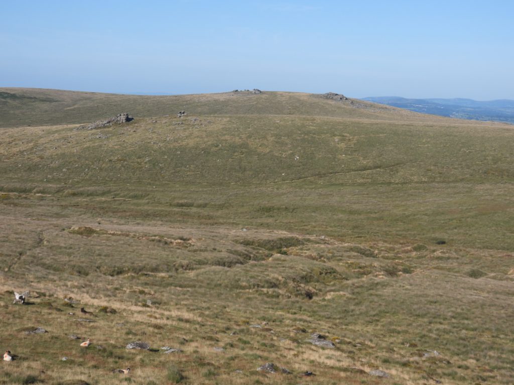
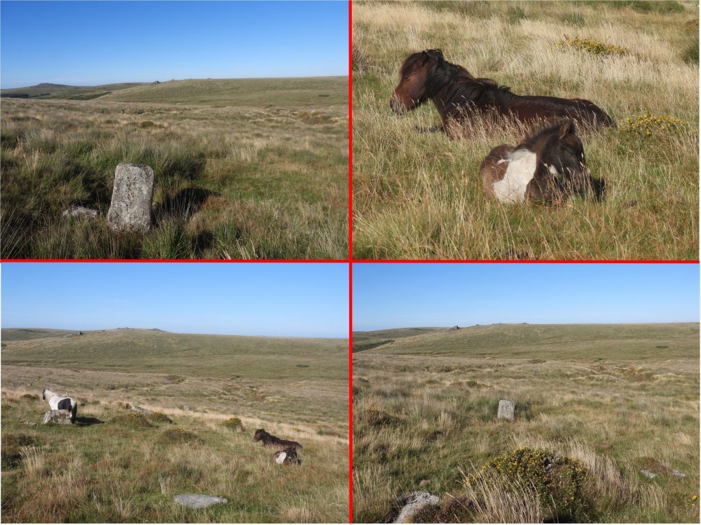
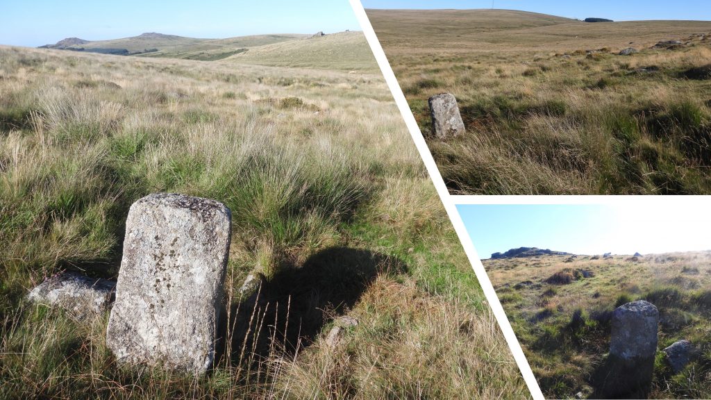
To the south and west of Hart Tor there are a complex of multi-period tin workings, in which most ‘types’ of tin working can be seen. There are particularly impressive openworks with deep channels to the west of Hart Tor. These can be seen when driving along the B3212.Near the openworks to the west of the tor a probable tin bound stone can be found. It is around 130 metres from the tor.The tin bound stone can be found at SX57964 71961The openworks with deep channels to the south-west of Hart Tor are fed by a tinner’s leat and reservoir. These openworks cut across the pair of stone rows – this is covered in the post on the ‘water management’ in the area, the link is given at the start of this post.View of the deep openworks with views extending to Sharpitor and Leather TorClose to the openworks on the south west side of Hart Tor several shafts can be found. These are known as lode back pits and are part of a wide distribution of prospecting pits scattered over the entire area south and west of Hart Tor. The shaft / pit shown in the picture is located at SX57822 71723.The pictures show where the openworks cut across two stone rows
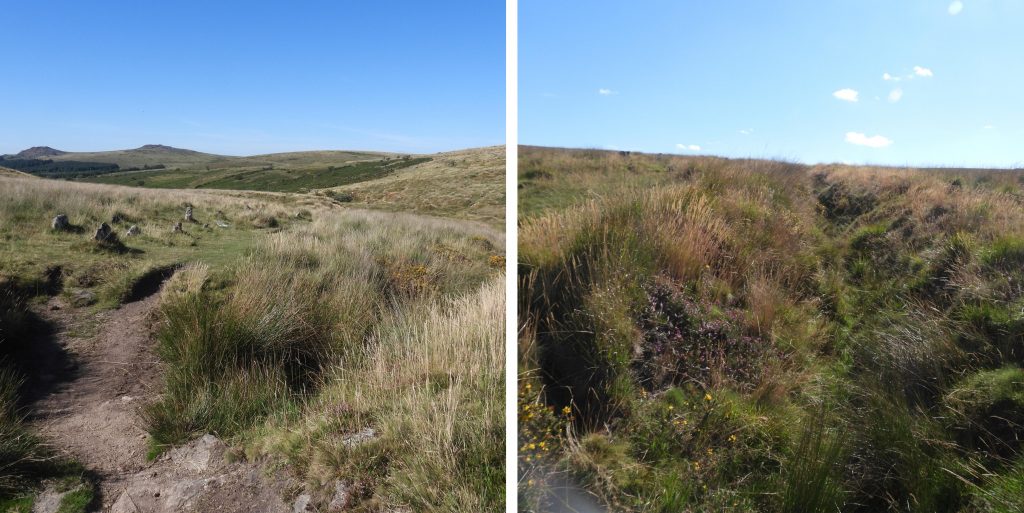
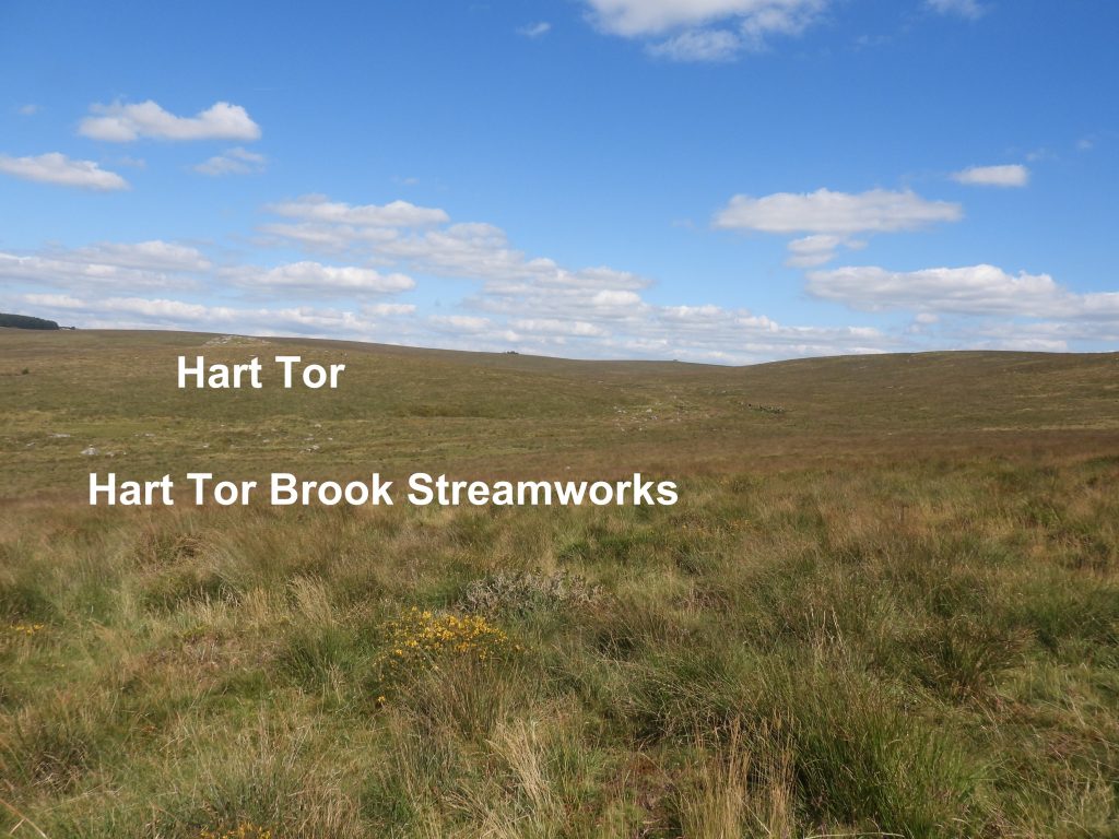
b) Hart Tor Brook Streamworks and Tinners’ Buildings
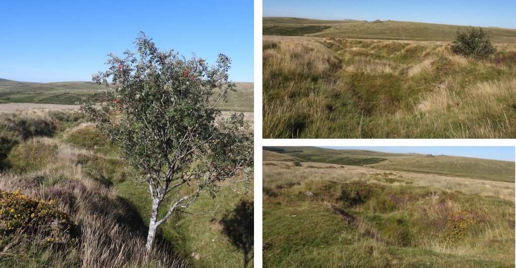
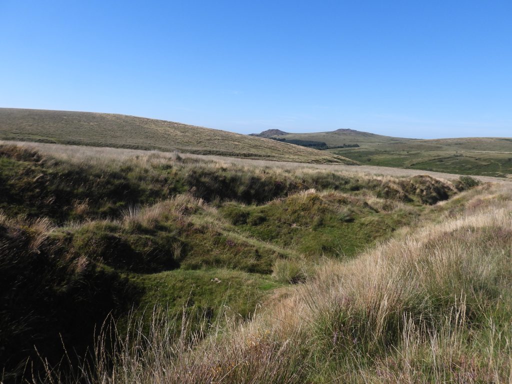
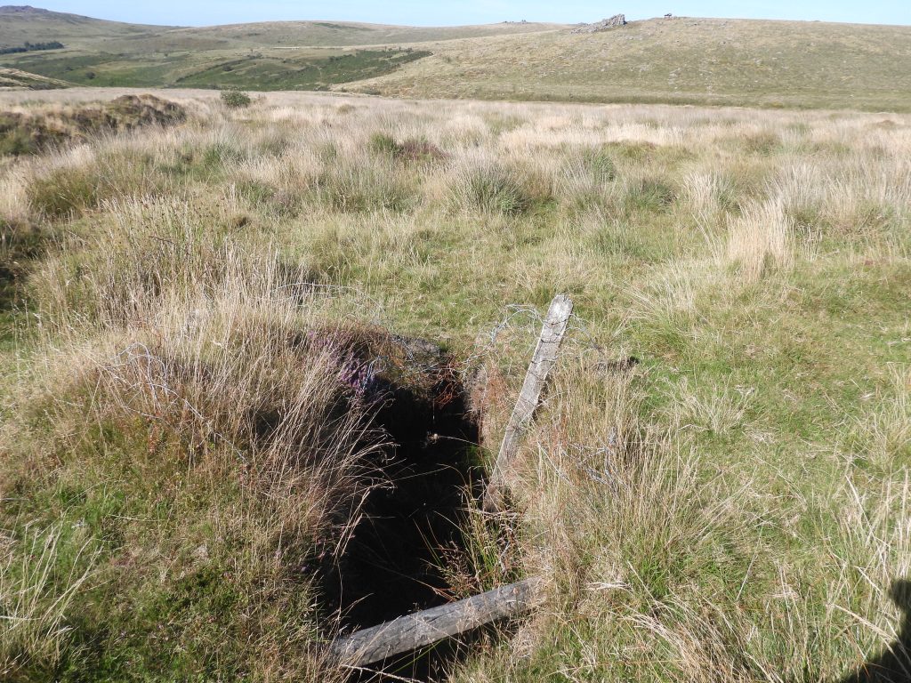
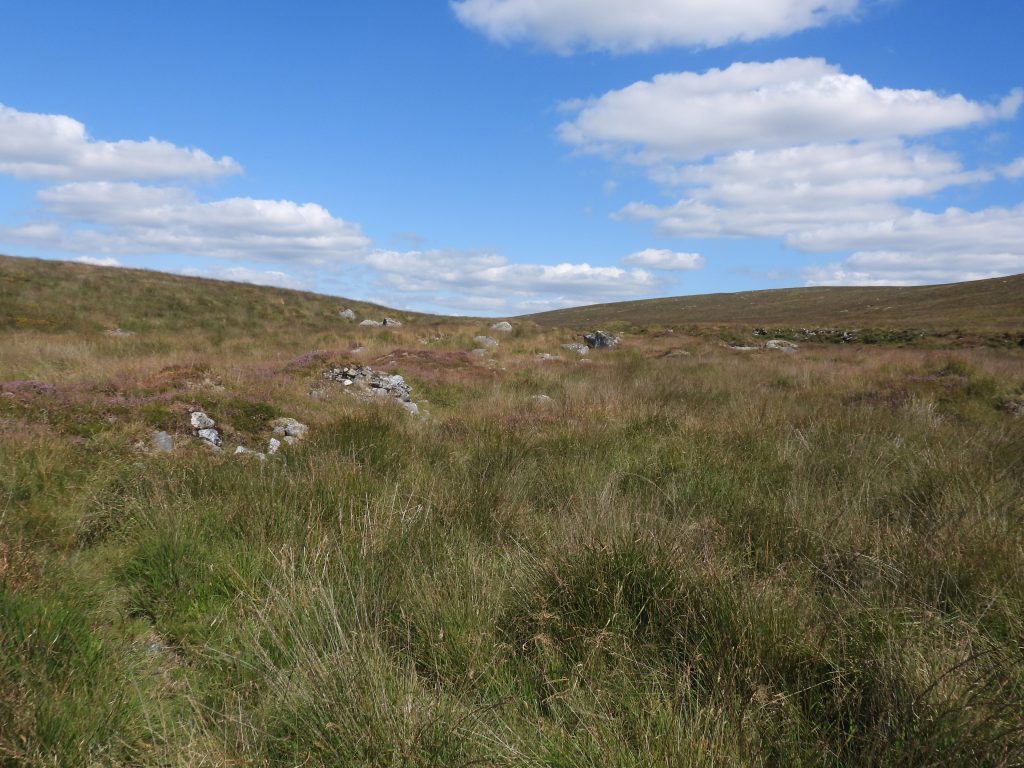
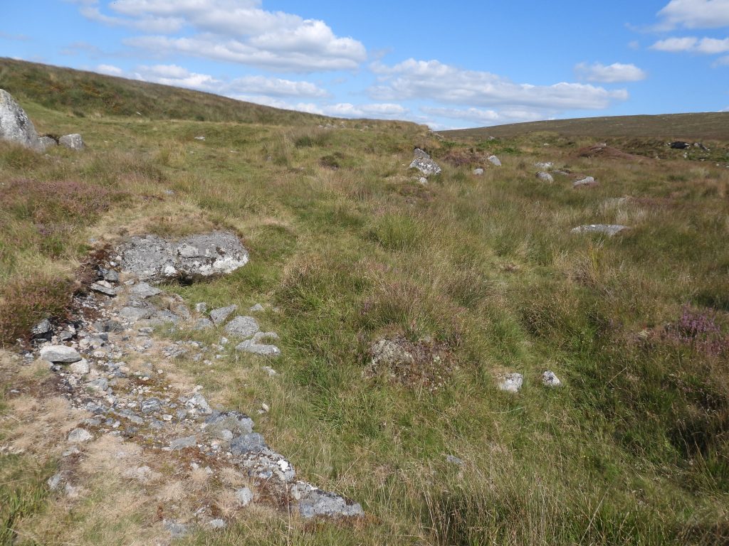
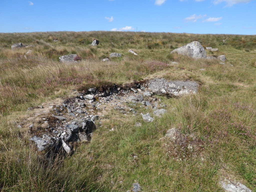
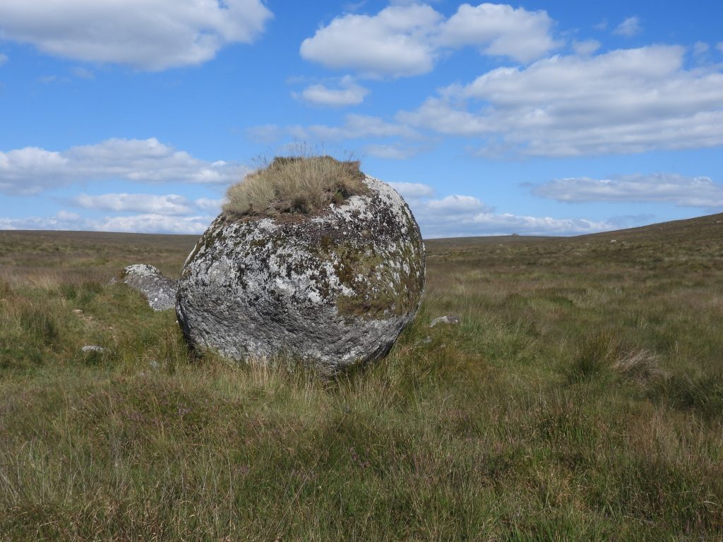
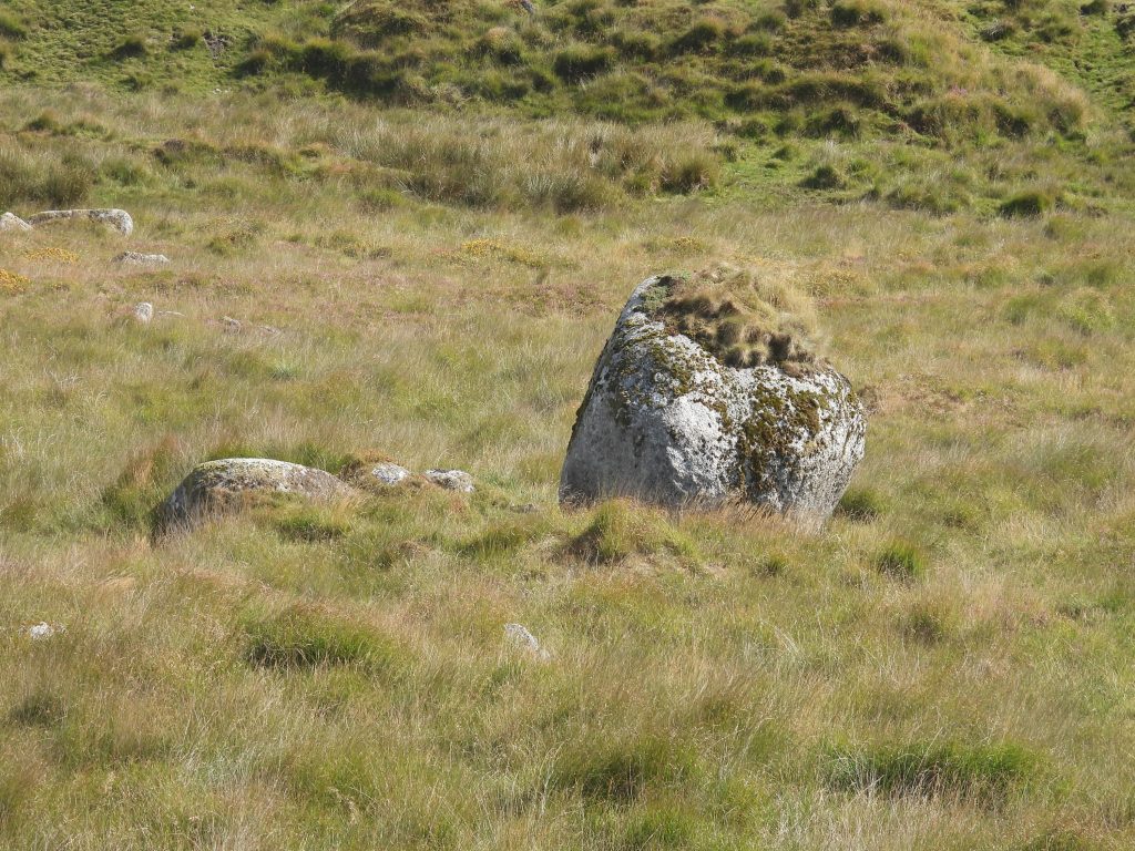
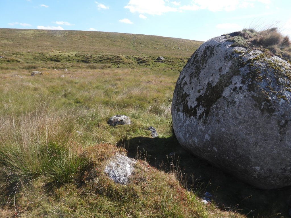
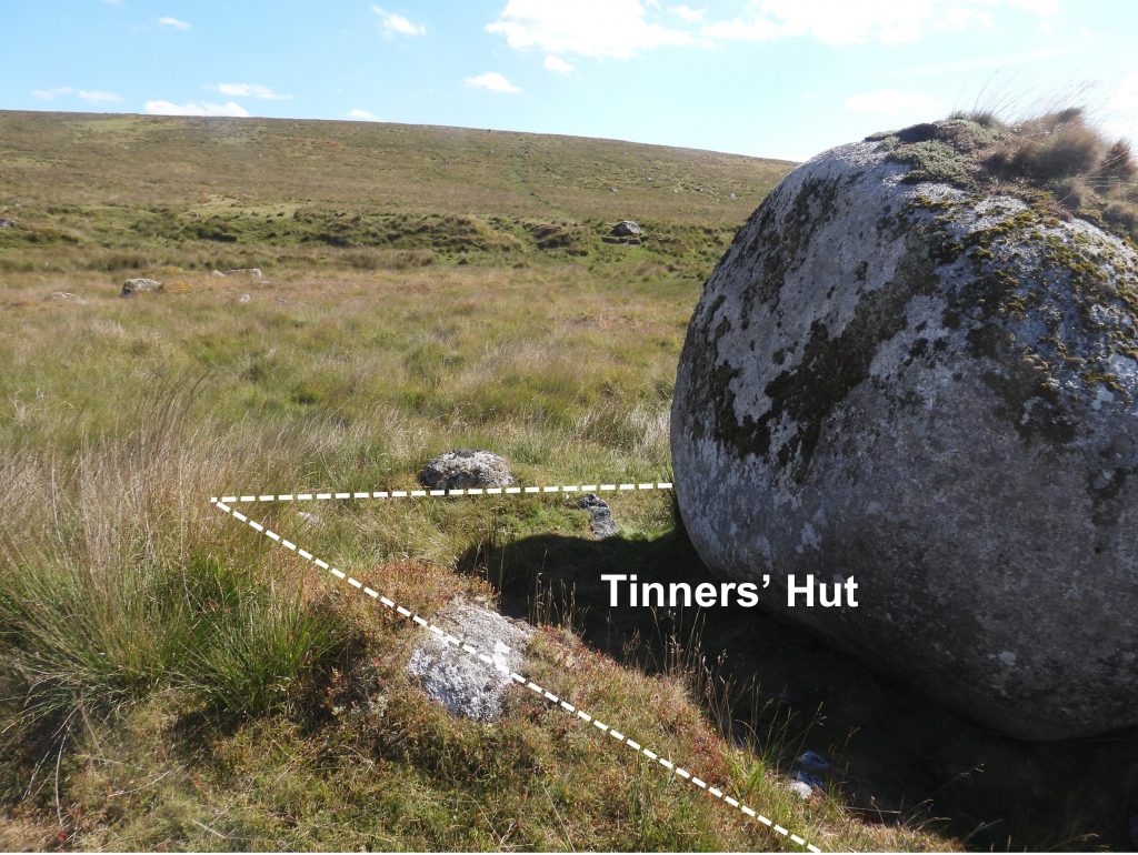
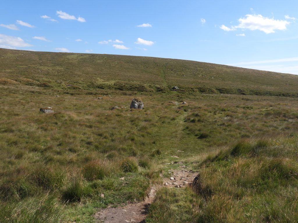
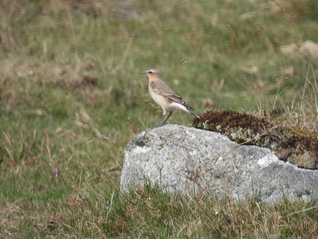
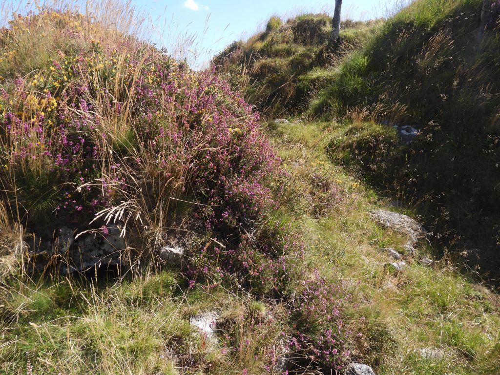
To the south of Hart Tor along Hart Tor Brook is an extensive area of tin streamworks. They extend from the confluence with the River Meavy, East along both sides of the brook to an area west of South Hessary Tor. Some areas of the streamworks are marshy and the approaches are across tussocky grass.A ford across Hart Tor Brook.The streamworks comprise a series of linear channels and stony spoil heaps alongside Hart Tor BrookA tinners’ building within the Hart Tor Brook alluvial tin streamworkOne of the two tinners’ buildings described by Sandy Gerrard in his report Meavy Valley Archaeology Site Report No. 10 – HART TOR TINWORKS. It can be located at SX58013 71518There is a Tinners’ Hut / Building “hiding behind” the Giants Marble.The large round boulder between Hart Tor and Cramber Tor near Hart Tor Brook is often referred to as “The Giant’s Marble”, “Christmas Pudding Rock” or “Pixie Rock”. The author has walked past this rock dozens of times (including on night walks) since the 1980’s, never realising there was a tinners’ hut behind it !The tinners’ building is located on the east side of the rock at SX58227 71689Tinners’ hut outlined. This is the second tinners’ building described by Sandy Gerrard in his report Meavy Valley Archaeology Site Report No. 10 – HART TOR TINWORKS. There is a diagram (figure 17) in his report on page 25. Looking across Hart Tor Brook and the ‘Giant’s Marble’ from the track which leads from Hart Tor to Cramber Tor.Possibly a wheatear near Hart Tor
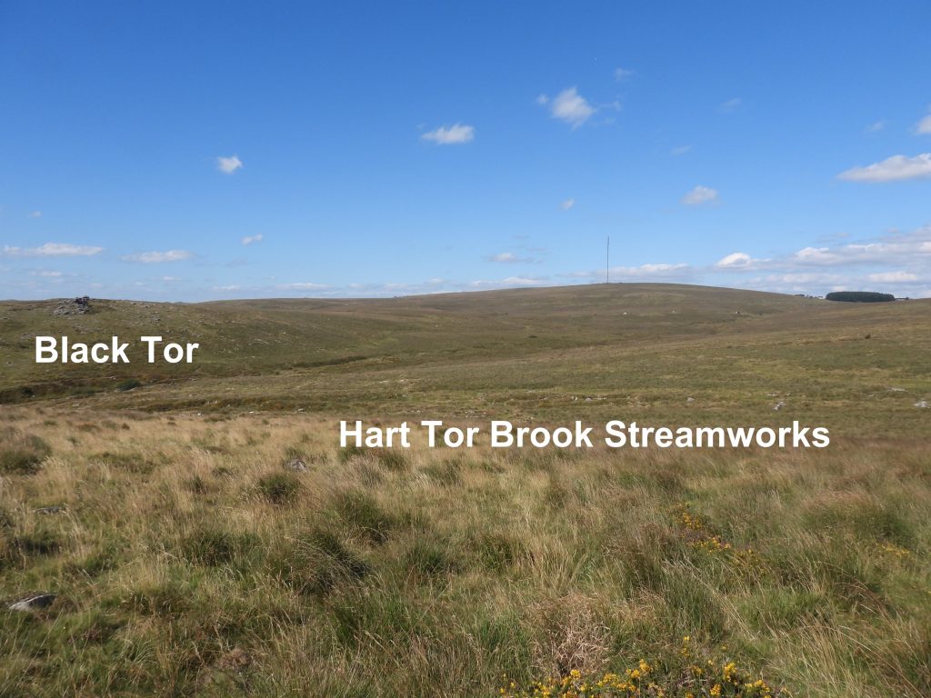
c) Black Tor Tin Workings
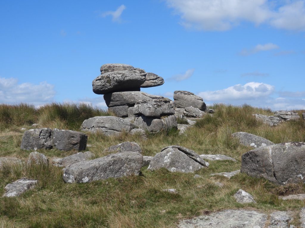
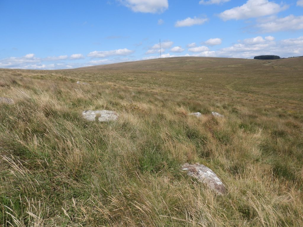
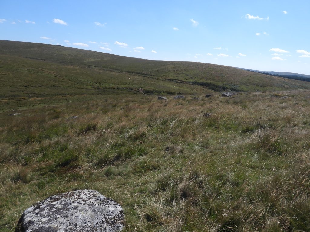
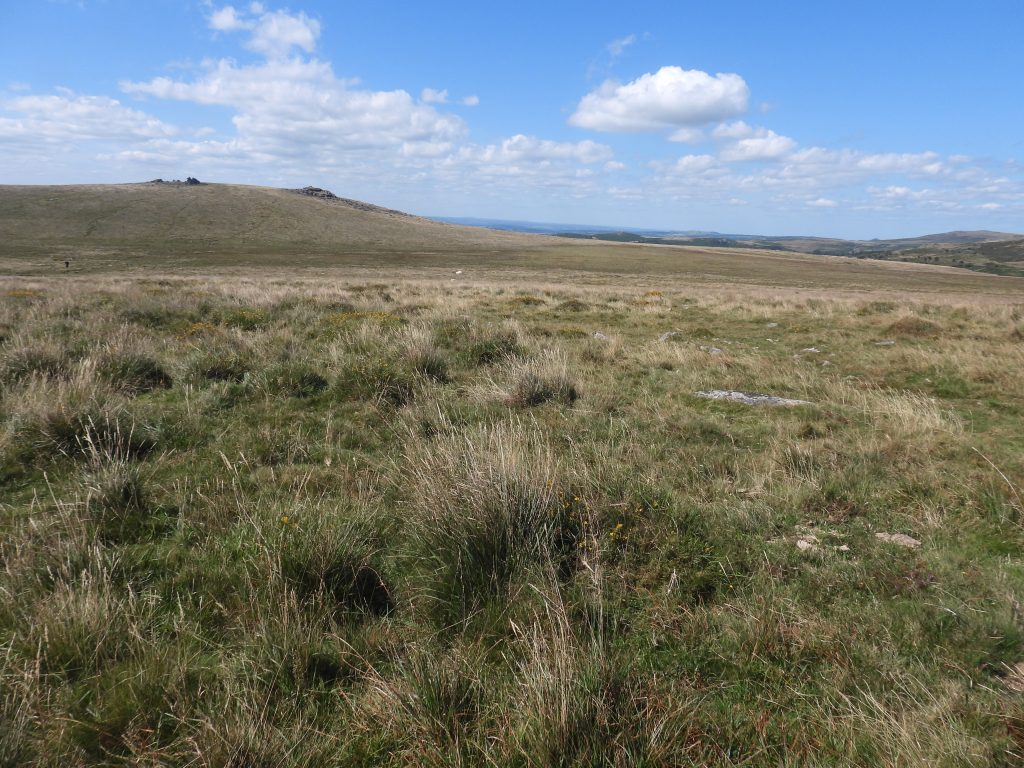
Black TorPart of the eastern tinwork at Black Tor.The Black Tor eastern lode-back tinwork includes over 40 pits ranging in sizes. Most are relatively small and represent prospecting. They are difficult to discern in the long grass during the summer months.The northern tinwork is the most extensive around Black Tor and includes at least 3 broad lines of pits. On the south side of Black Tor there is a group of tinners’ prospecting pitsAnother tinners’ prospecting pit on the south side of Black Tor. A series of deep channels extending up Hart Tor Brook can be seen by the lower slopes of Raddick Hill (on the right side of the picture)
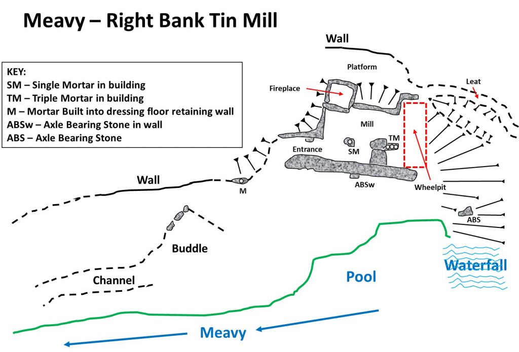
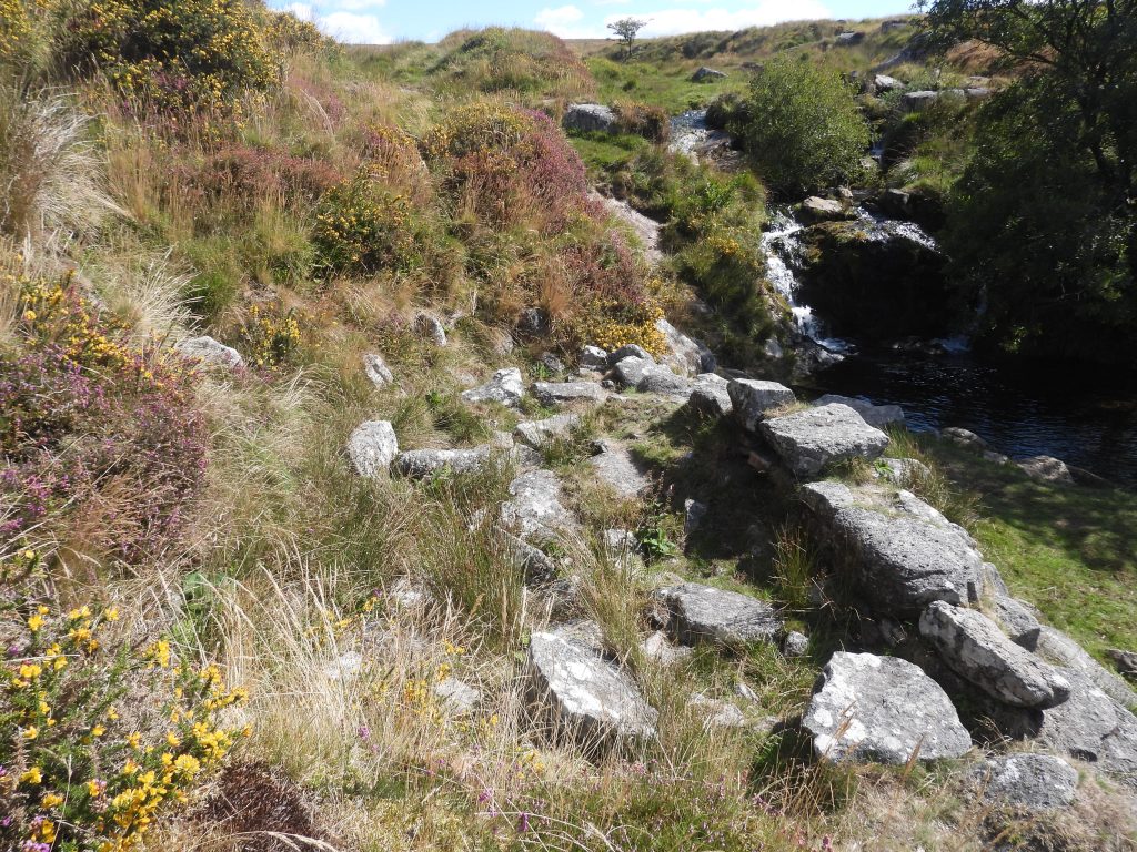
d) Black Tor (Meavy) Falls right hand bank tin mill
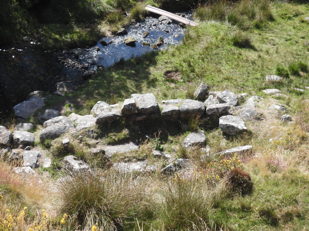
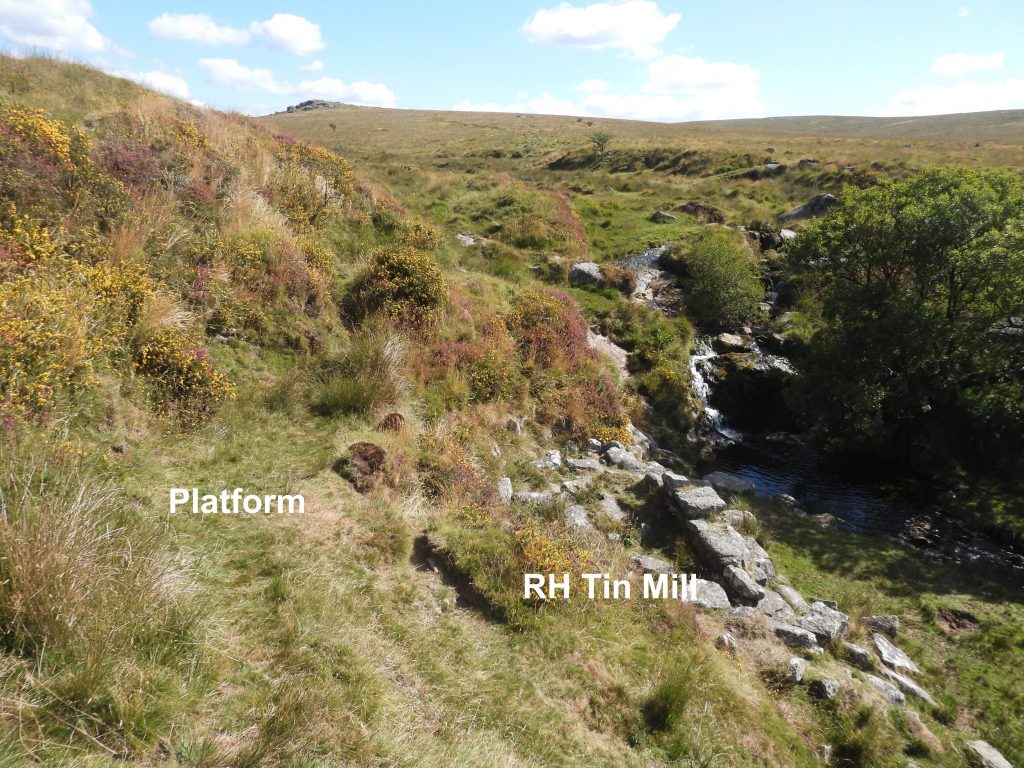
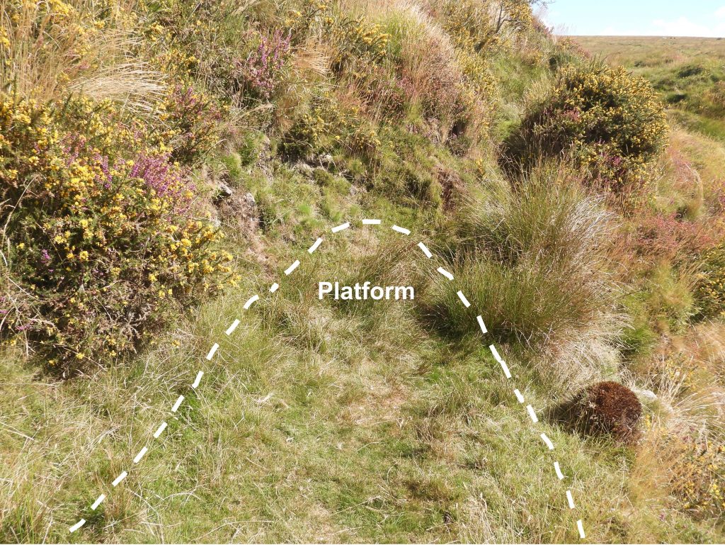
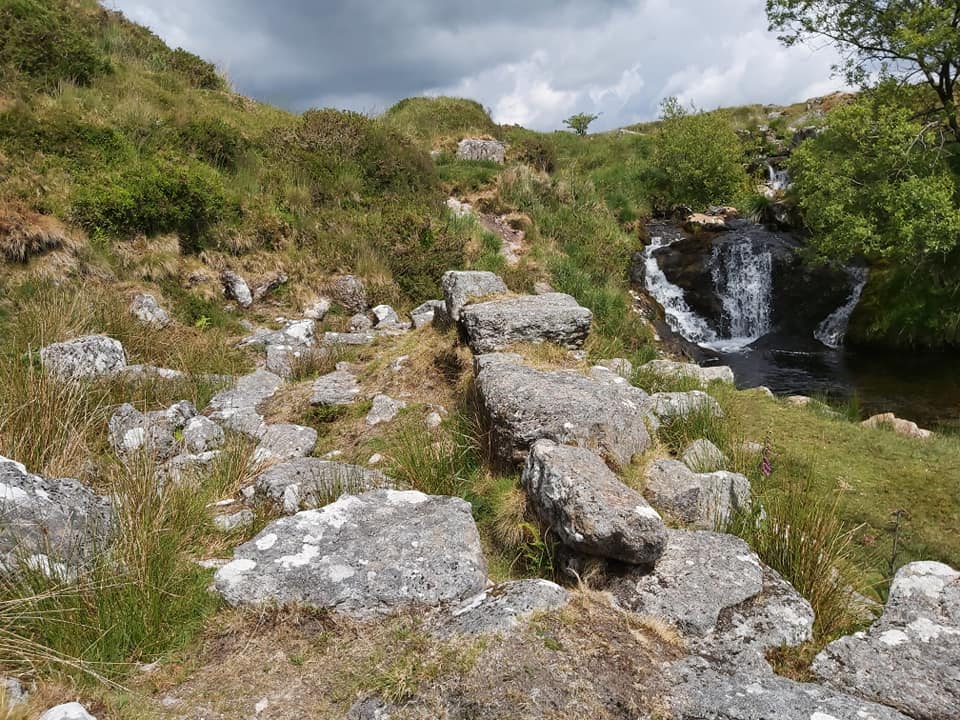
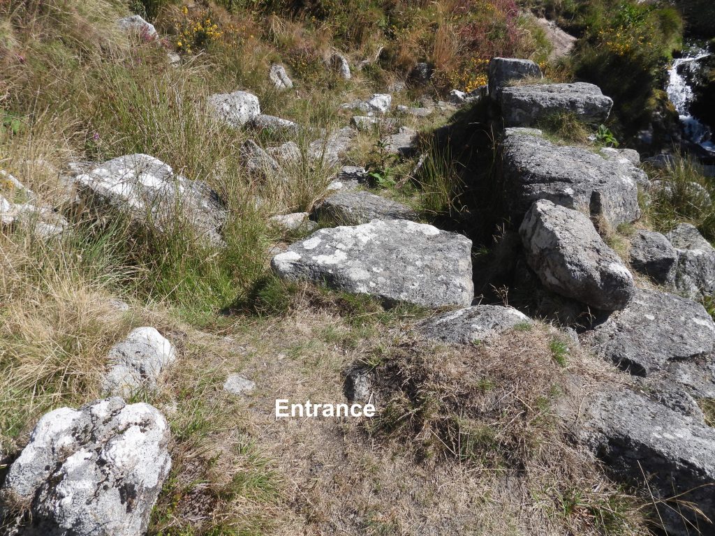
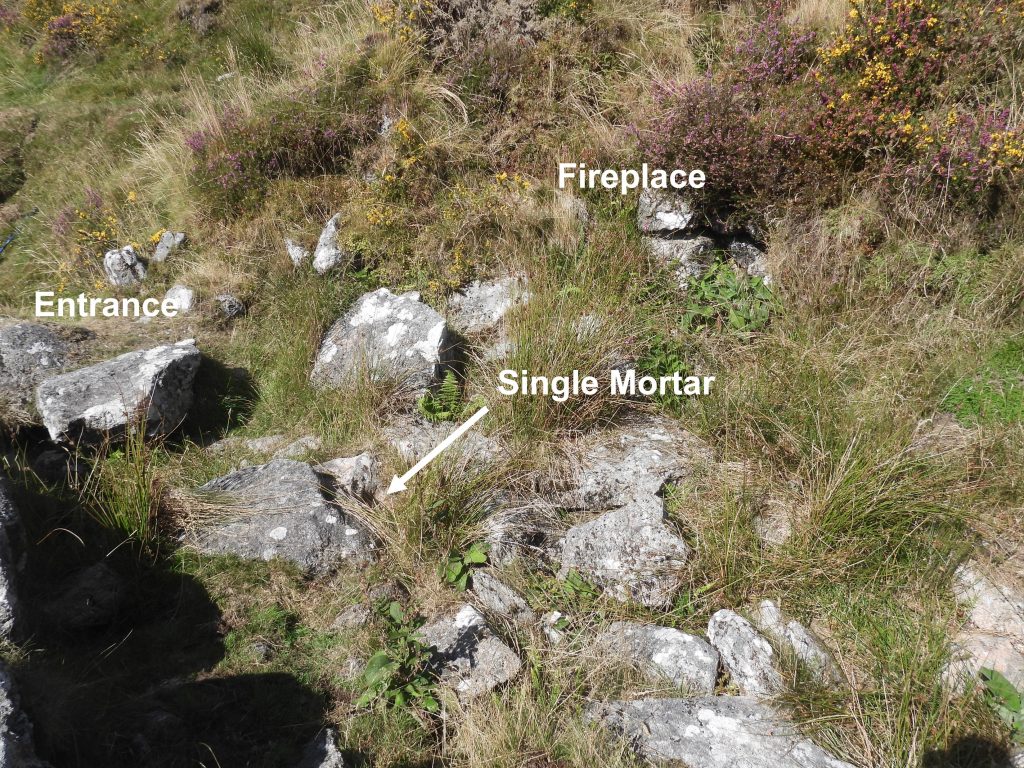
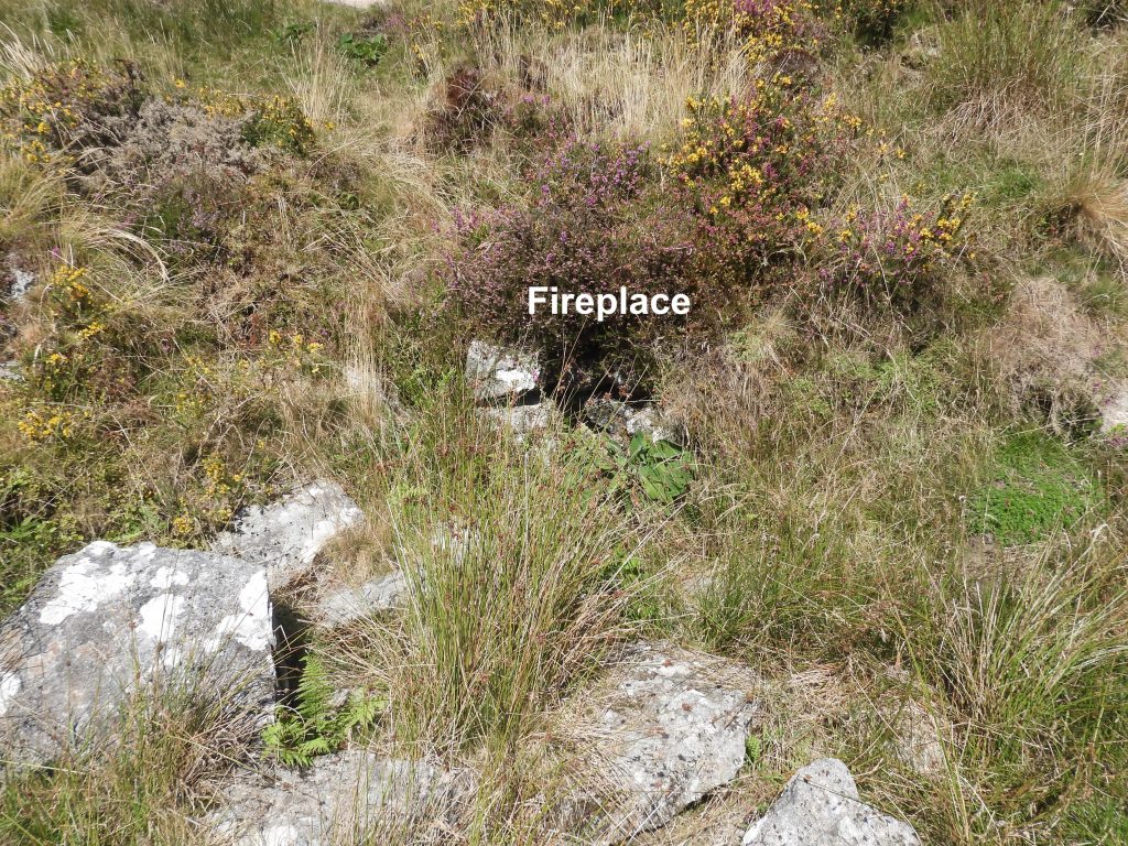
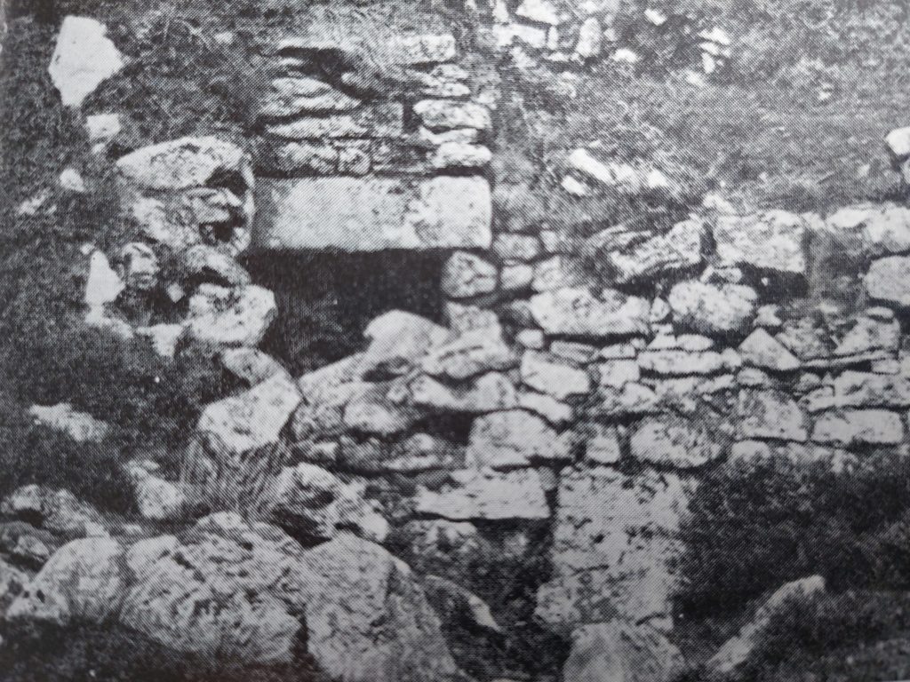
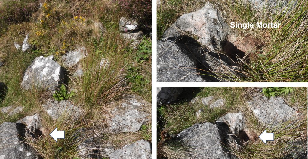
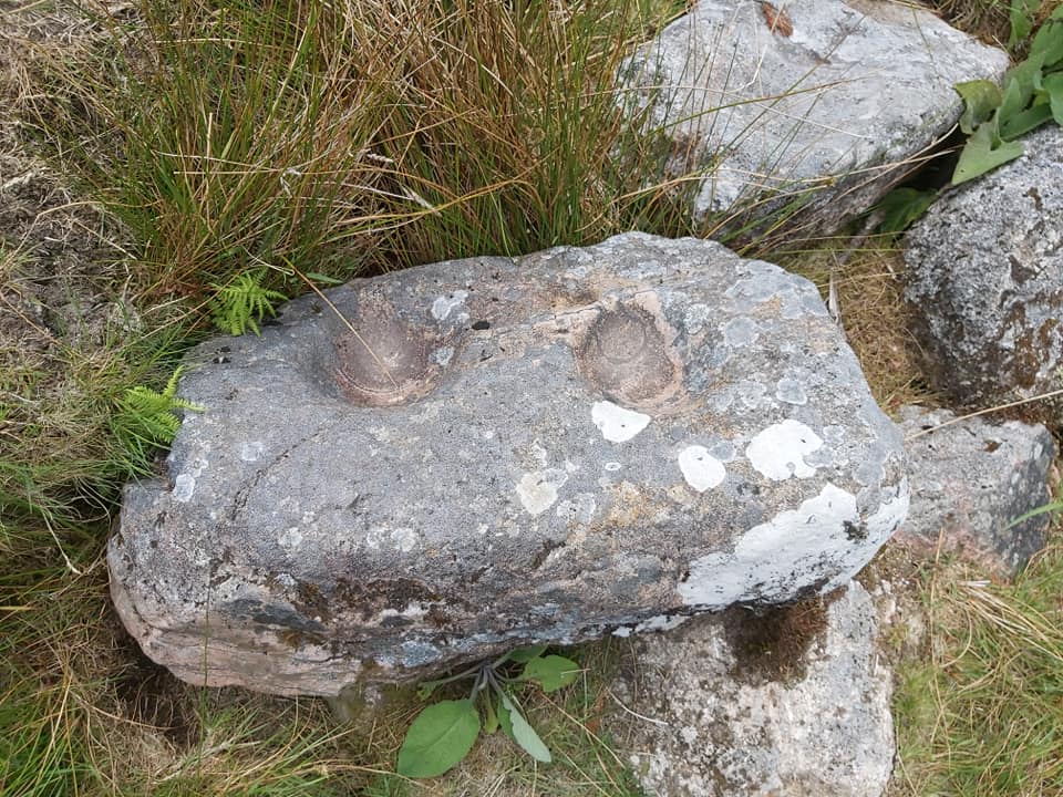
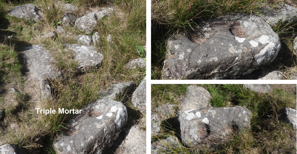
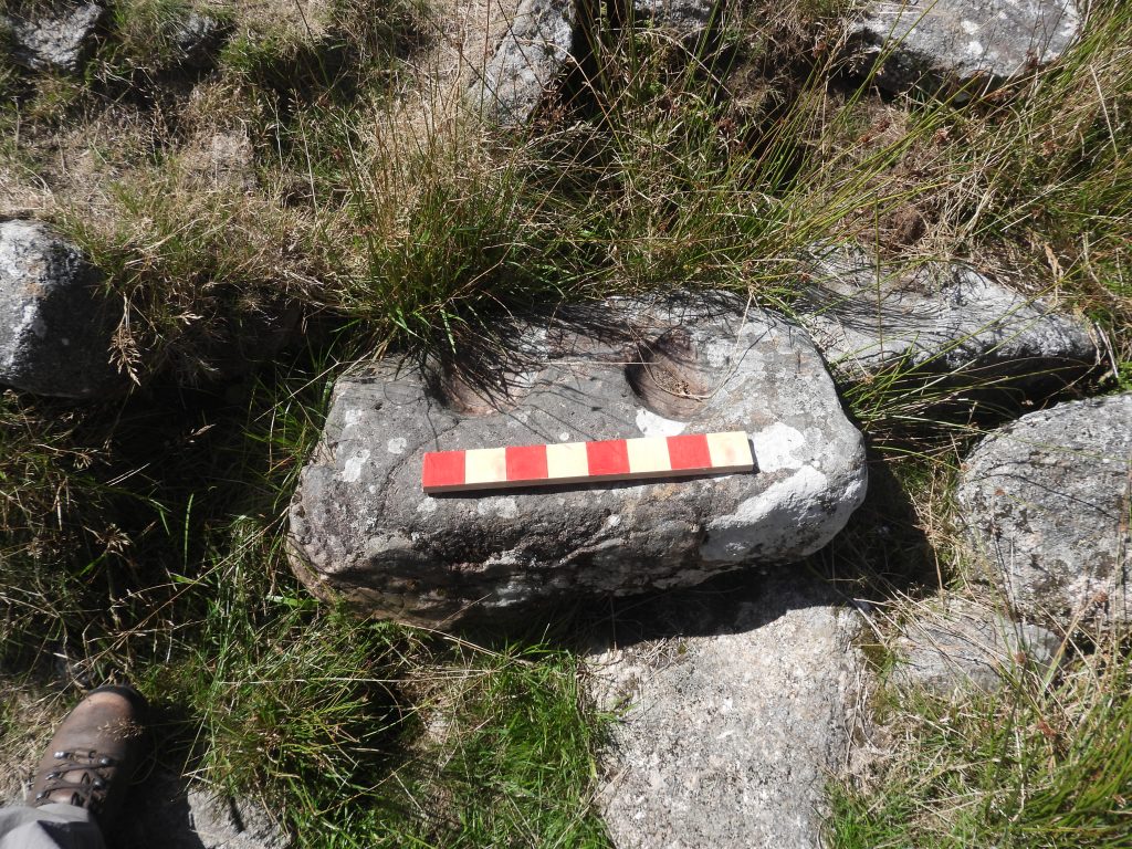
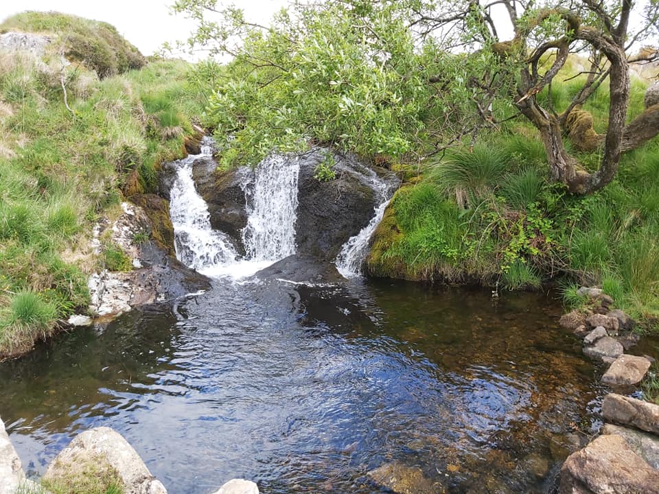
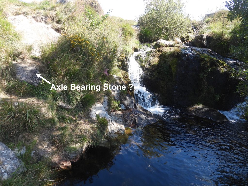
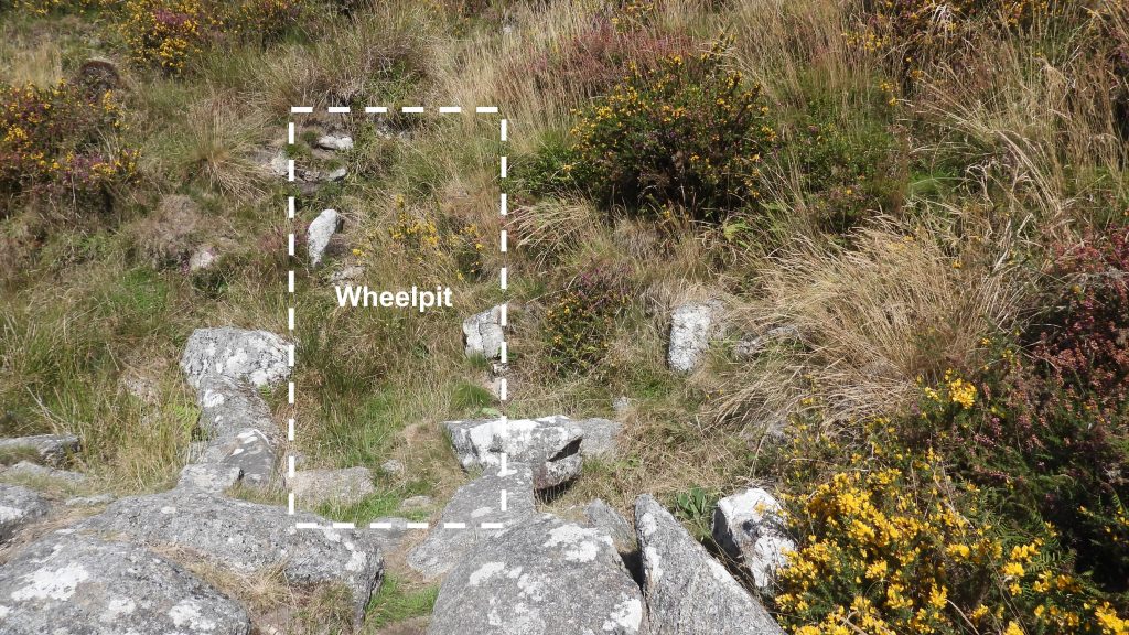
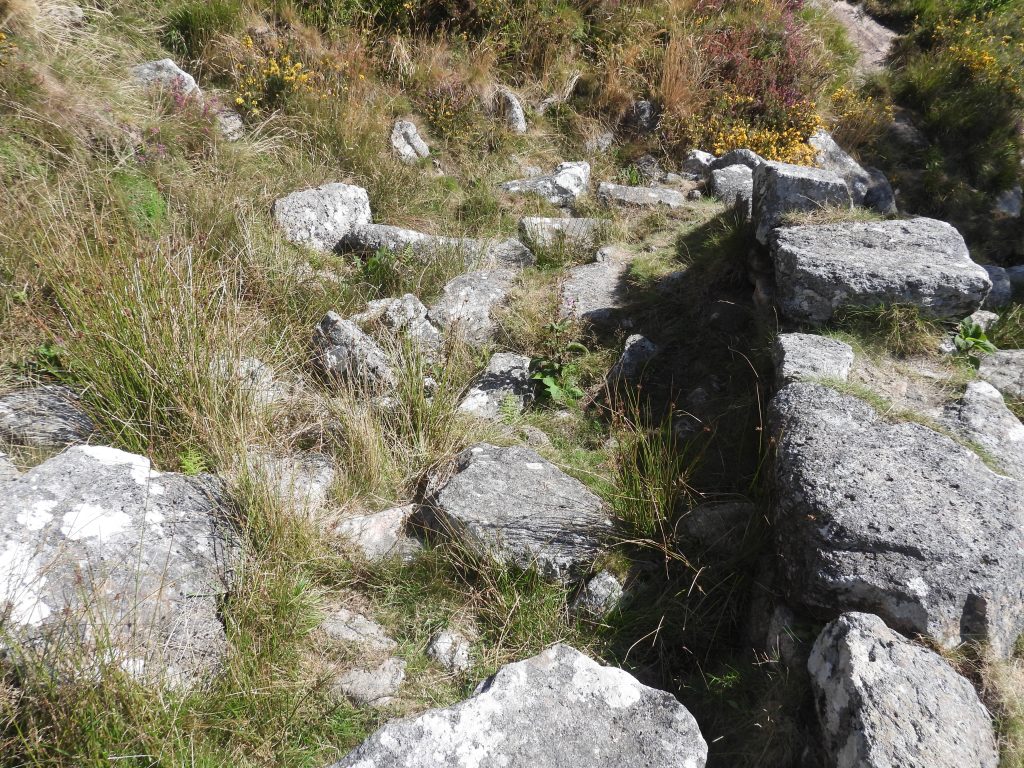
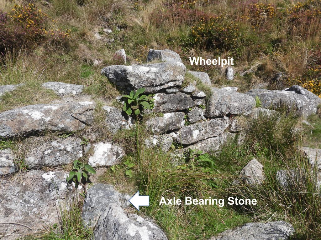
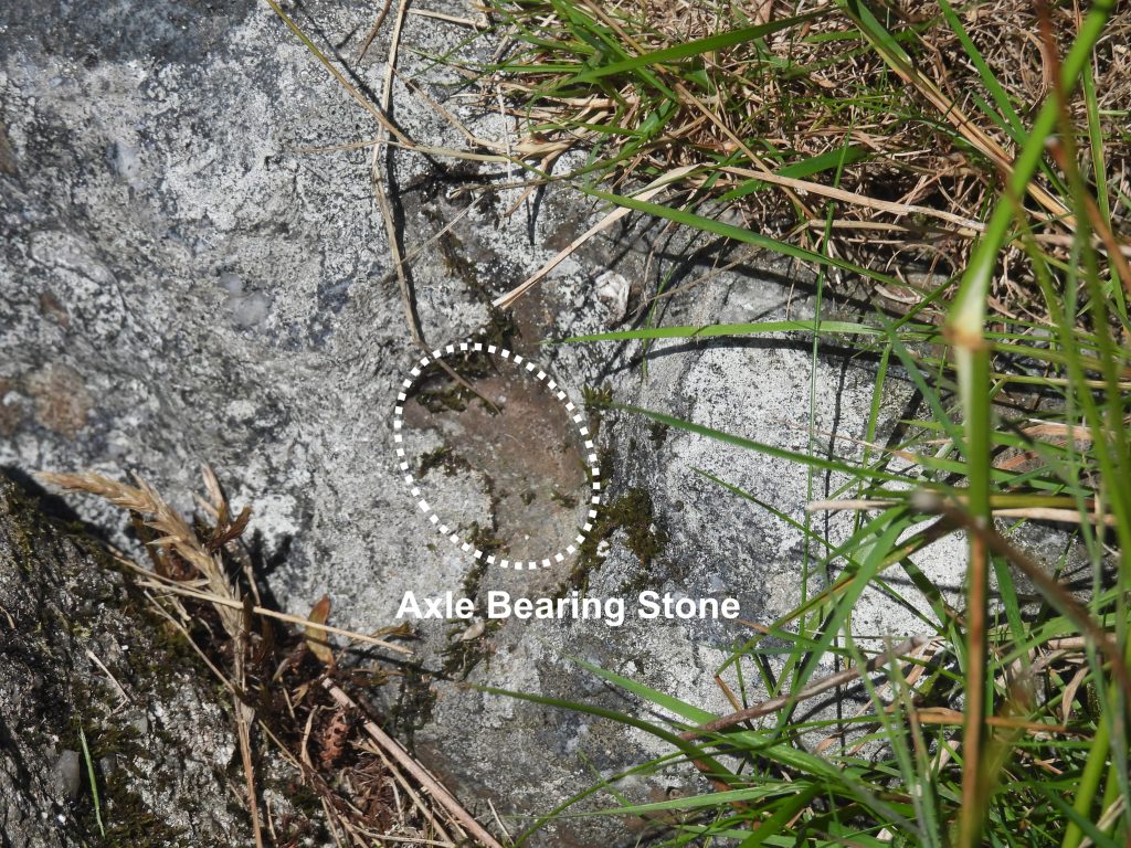
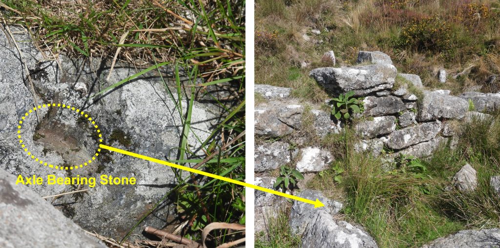
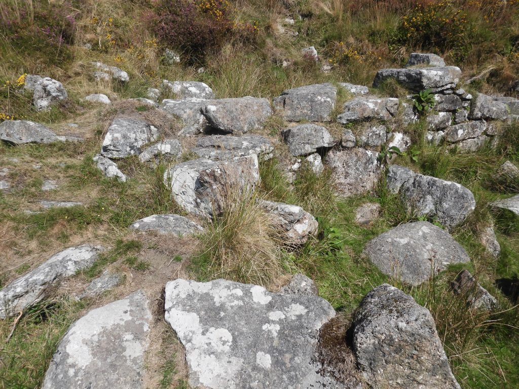
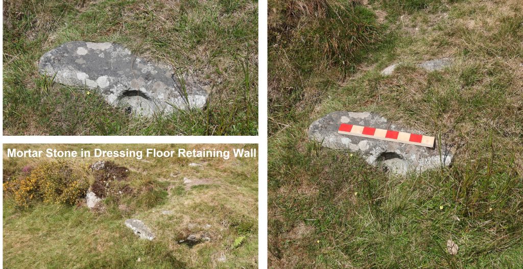
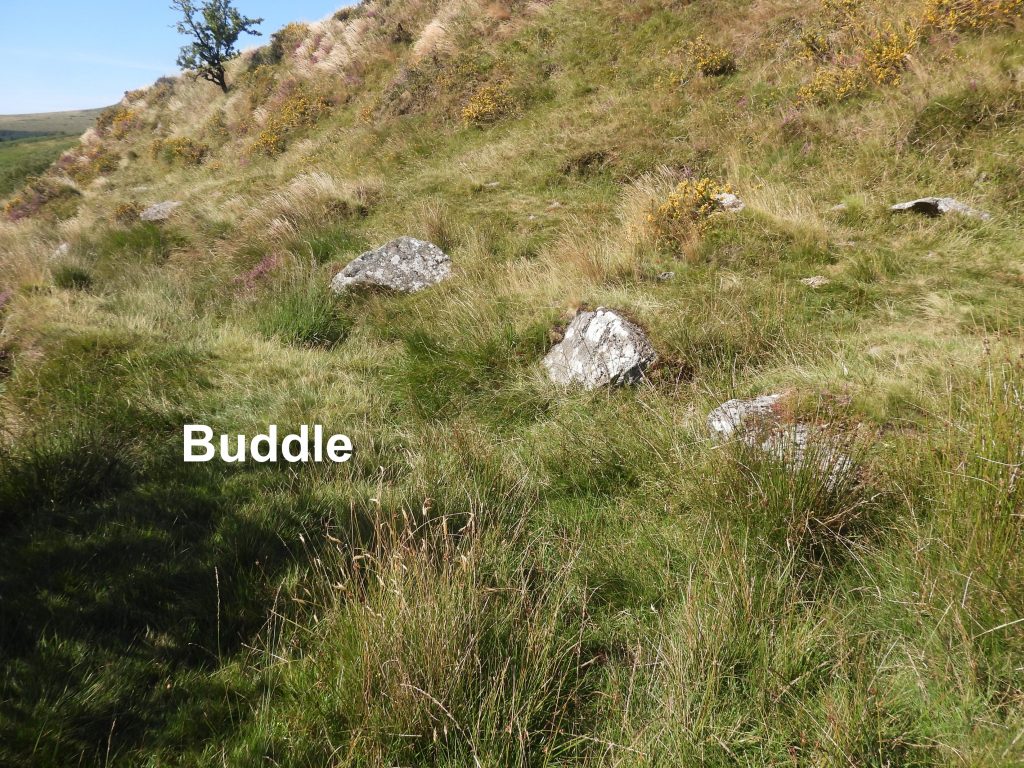
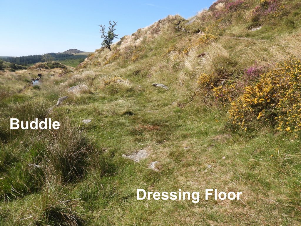
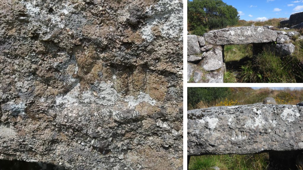
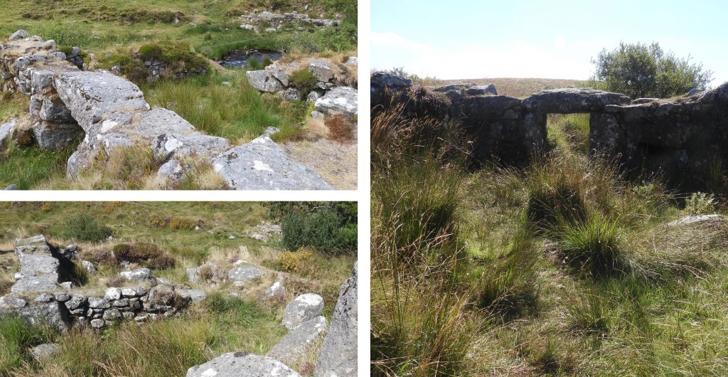
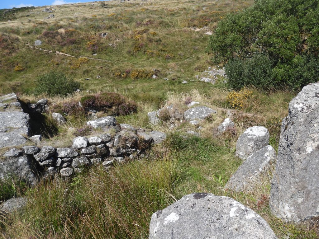
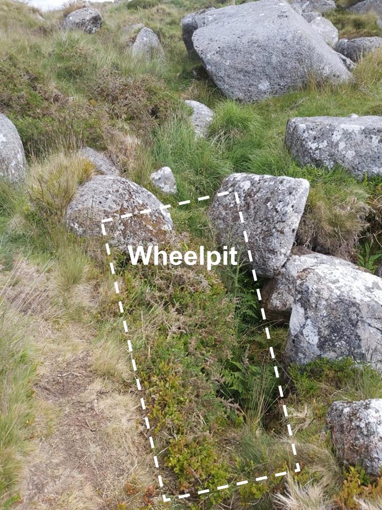
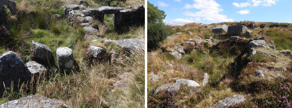
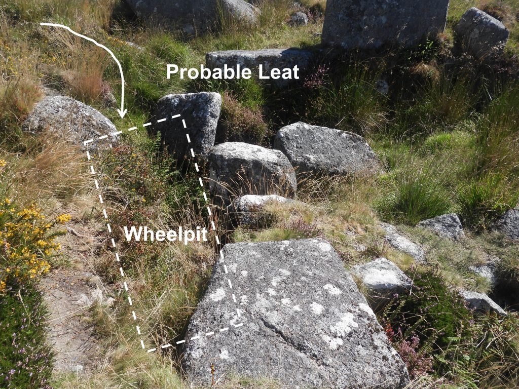
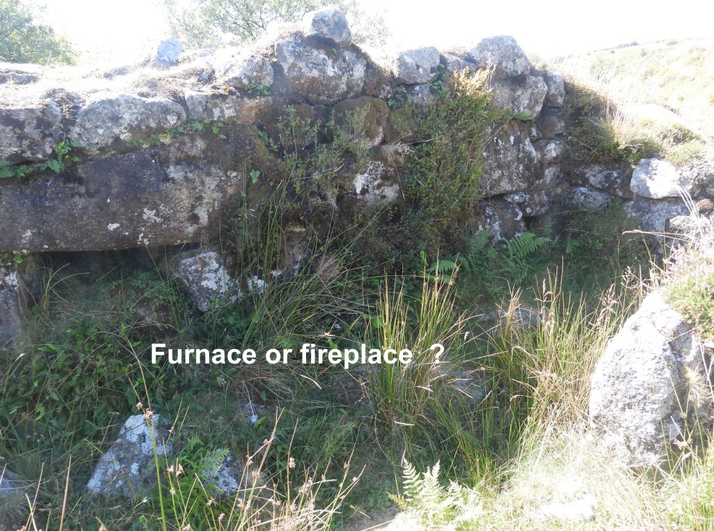
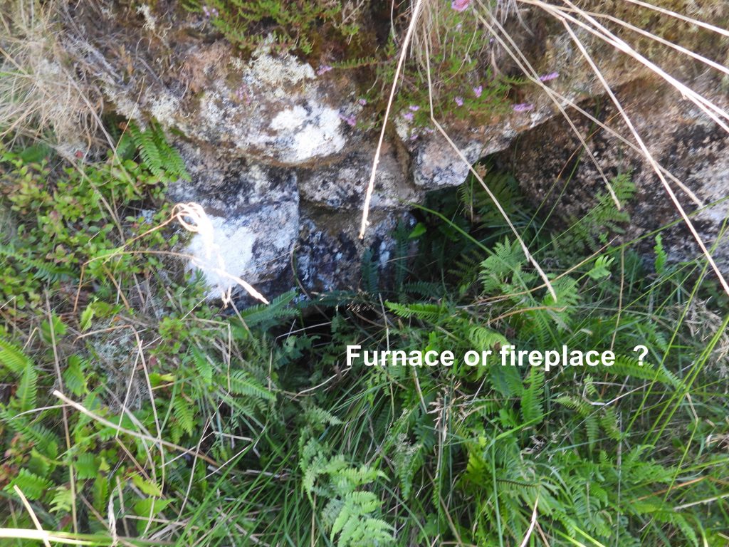
Plan of the Tinners’ Mill (R.H Bank) adapted from the survey conducted by Dr Phil Newman and Paul Glanville. The original sketch was dated 21.06.88 and was published in the article ‘One Hundred Years at Black Tor Falls (Part 1) by Dr Phil Newman – Dartmoor Magazine No 21 – Winter 1990’. View from the north of the right hand tin mill. The label “right hand” refers to the mill being on the right side of the Meavy (travelling downstream). The mill is probably from 17th century. There is evidence of a 1654 lease of tinbounds for a tinwork at Black Tor, albeit this does not provide a direct link to the mill.Just above the mill is a flattish area (platform) with a 1.2m high drystone revetment (retaining wall). There are several interpretations of what purpose the platform was used for. Dr Phil Newman interprets is at possibly a by pass for the leat, northerly access to the mill or to just prevent landslip from the very steep slope above the mill. It is located at SX57470 71659.A different interpretation of the platform is provided by Gerrard (1996) who states : “It has been cut into the hillside and is connected to a clearly defined trackway which leads out of the valley bottom. This platform would have been used to dump the mined ore prior to its being fed down a shute into the stamping machinery within the mill the trackway leading to this platform would have been constructed to allow access to the ore dump and it is interesting to note that it leads towards the larger of the tinworks on Black Tor”.View of the tin mill from the west near the entrance with Meavy falls in the background.The tin mill was interpreted by Richard Hansford Worth. He stated the mill was 17ft 8in (5.385m) by 11ft 6 in (3.5m).The mill entrance can be located on the south west corner Close to the entrance amongst the jumble to fallen stone a single mortar stone can be found. Immediately behind which is an alcove variously interpreted as a fireplace or a furnace.R.H.Worth records this alcove as being a furnace 4ft (1.22m) by 4ft 4in (1.32m).R.H Worth in his survey of the mill found a lintel over the furnace / fireplace and he stated that in 1893 there was a chimney nearly 3ft (0.91m) in height (see picture). He further states that a colt fell into the chimney and the stonework around the chimney had to be taken down to release the animal. Crossing reported the dismantling of the chimney in 1907, due to the rescue of trapped livestock. Worth further states that during the winter of 1940/41, due to erosion or “as I fear, following the robbery of stones from the building”, the furnace collapsed and the lintel disappeared. It is speculated that the lintel is still extant in the rubble.The single mortar stone near the entrance. The “hollow” had an earth ‘plug’ which was removed for the photographs. This is evidence that the mill was, at the very least a stamping mill (known as a knocking mill before 1850). No mouldstone or float stone has ever been found in this mill, which would have been evidence of it being a Blowing (Smelting) House. Triple mortar stone can be found to the eastern side of the mill near where there are remains of a wheelpit.The triple mortar stone has three shallow hollows. In 1933, Worth records that a Mr. T. Davey found a granite ‘ball’ close to the house, of around 4in diameter (around 10cm), which was possibly a pounder or pestle.Using a home made measure with each ‘band’ being 5cm width indicates the hollows to be around 15cm across.Meavy Falls. It was recorded by Dr. Phil Newman that a double mortar stone with a polished axle wearmark on one side was once found at the mill in 1987 but was put into the river (by hands unknown near the north bank (to the left of the picture).Near the falls lies a stone with an axle bearing wearmark.R.H. Worth identified a probable wheelpit location (which was recorded by Dr. Phil Newman as being defined only “by a mass of loose and fallen masonry which once formed the eastern side”.Of interest in the mill approx 2/3rd’s along the southern wall from the entrance, is a structure (bottom of picture) protruding into the floor space, which is speculated as possibly as having been an implacement for machinery. It could, of course, just be a part of the original wall On the outside of the wall another axle bearing stone can be found. Close up of the axle bearing stone on the southern wallContextual picture showing the axle bearing stone on the southern wall.The south west corner of the mill. From all the surveys by R.H Worth, Dr. Phil Newman et. al over the years, there is no definitive evidence that this mill was anything other than just a tin ore crushing mill (stamping mill). The fireplace was simply for a fire to keep warm and there is no evidence tin was smelted here. Another reason for this statement is that other mills around the moor with more definitive furnaces do not look like this one. In spite of this, modern OS map state there is a ‘Blowing House’ here (note the singular not plural). To the south west of the mill lies a dressing floor, which has a further mortar stone with a single hollow built into a low retaining wall.The ‘hollow’ of the mortar stone which is built into the dressing floor wall is around 10-15cm acrossIt is unusual to find such a good example of a dressing floor in a 17th century tin mill (ref: Dr Phil Newman). The are two sides of a rectangular pit here which are lined with masonry is likely to have been a buddle (or tin concentrating pit). It was where crushed tinstone would have been separated from lighter waste gravels using water from the river.The low retaining wall of the dressing floor is around 14m long. A track leading out (uphill) from the mill area can be seen on the right of the picture.
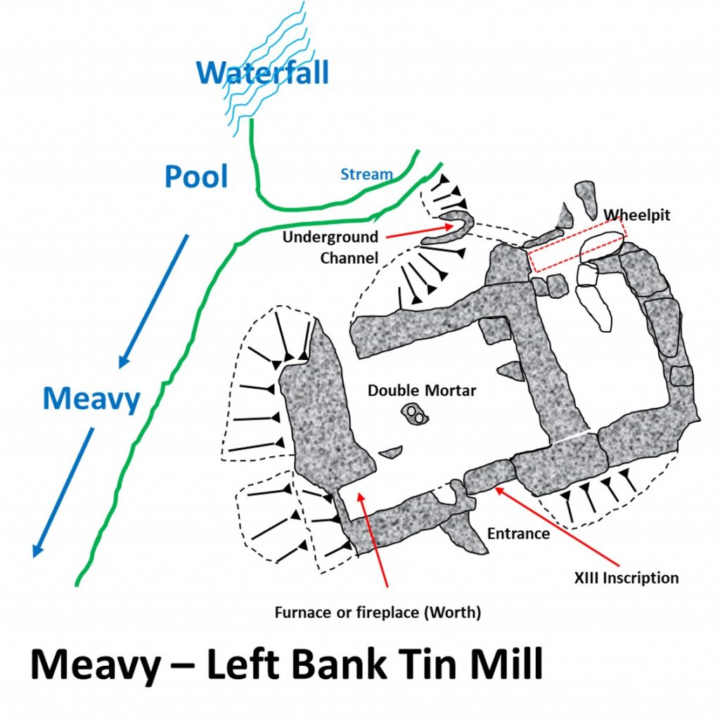
e) Black Tor (Meavy) Falls left hand bank tin mill
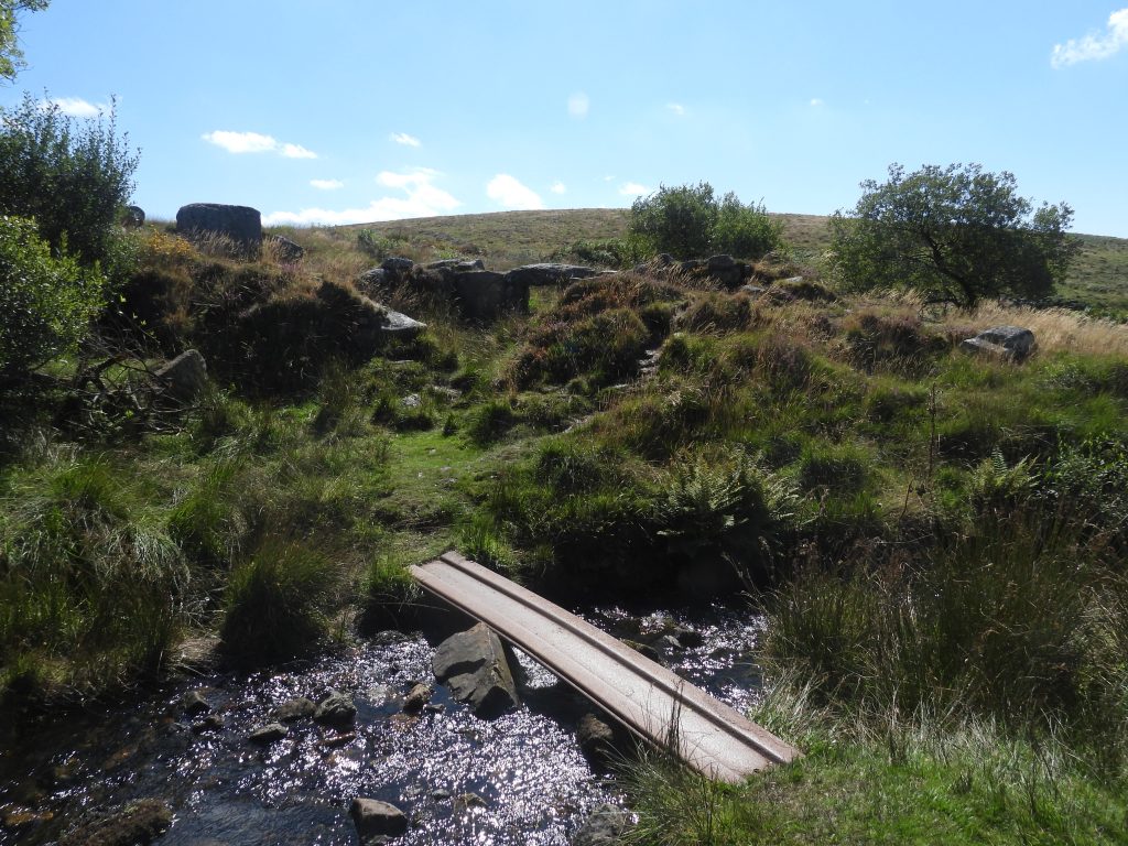
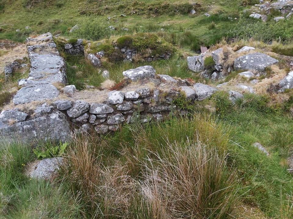
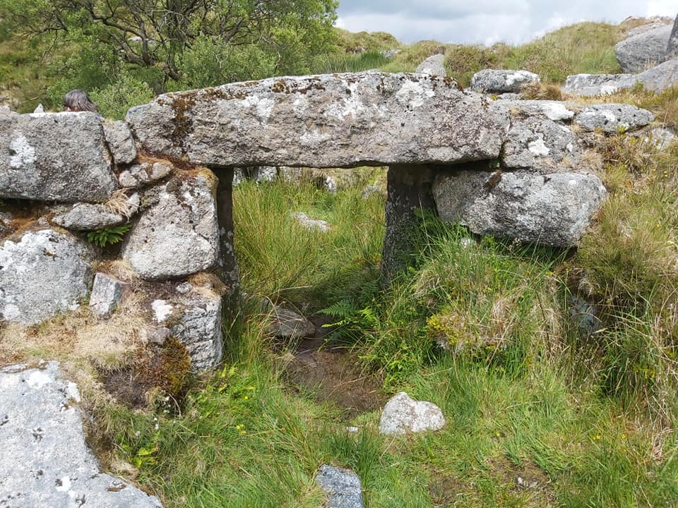
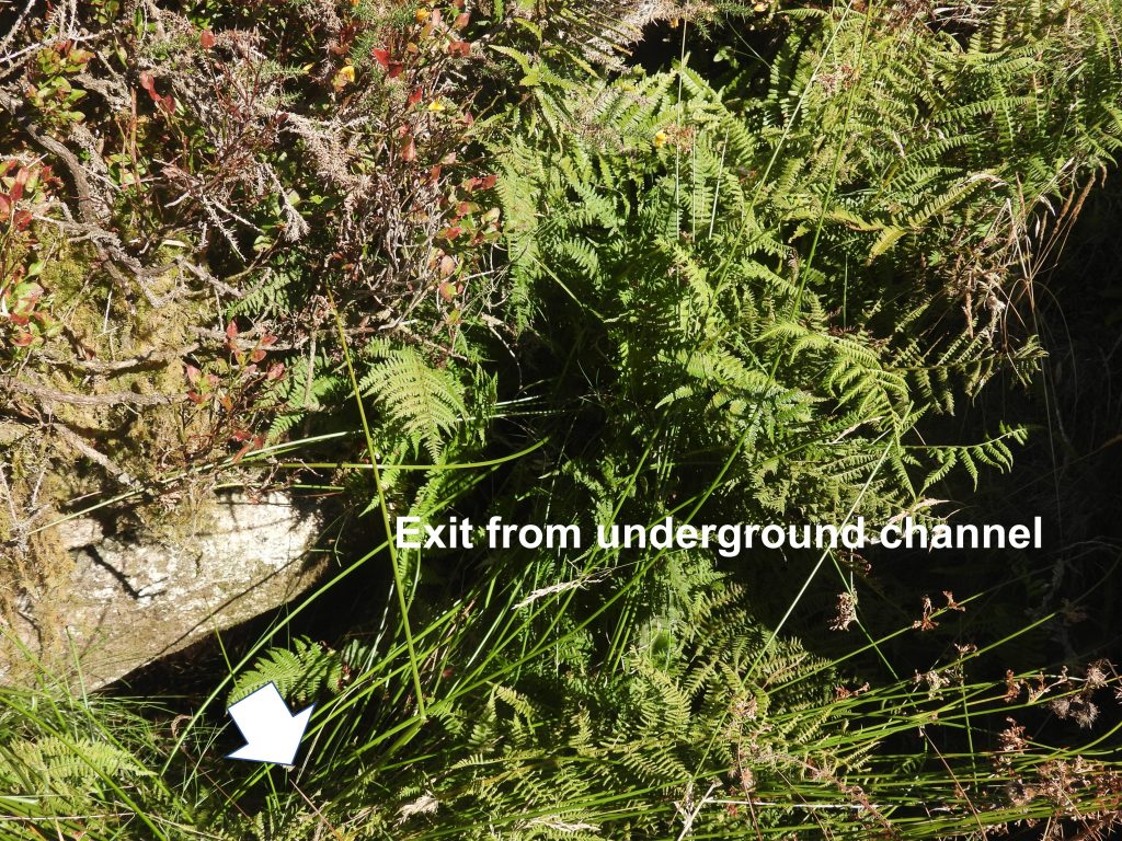
Plan of the Tinners’ Mill (L.H Bank) adapted from the survey conducted by Dr Phil Newman and Paul Glanville. The original sketch was dated 22.06.88 and was published in the article ‘One Hundred Years at Black Tor Falls (Part 2) by Dr Phil Newman – Dartmoor Magazine No 22 – Spring 1991’.The ruins of the left bank tin mill as viewed cross the Meavy and high above the right bank tin millAccess between the two mills has been made easy in recent times with the addition of an iron bridge.The LH tin mill is considered to be one of the best preserved on Dartmoor, but as Dr Phil Newman states: “ironically, it is one of the last mill-like, having few obvious tin mill features”. The tin mill has been interpreted by Richard Hansford Worth and he stated the two sections of the mill measure: a) 17ft 6in (5.33m) by 14ft 9 in (4.5m) main room and b) 14ft 6in (4.42m) by 10ft 10in (3.3m) side room. The main room is in the background and the side room in the foreground.There is a fabulous lintel at the entrance into the main room and there are still jambs which support it. On the lintel there is an inscription in Roman Numerals ‘XIII’ and is often referred to as house number 13. Worth considered the numerals as representing the registration of blowing houses. As outlined in the Dartmoor Magazine article from Spring 1991, there was a similar example uncovered during excavations of a tin mill in Horrabridge, which had an ‘X’ inscribed. Of course, both the Horrabridge mill and this mill lie within Walkhampton Parish and would have both been part of the Tavistock Stannary so some form of building registration is quite conceivable.Inside the main room of the mill lies a mortar stone with two hollows. Intriguingly, in a photograph, which was part of an article in 1903 (Falcon), this mortar stone appears to have been located in the RH tin mill. So is this mortar stone out of context in this location ? The hollows of the mortar stone are around 10cm in diameter.Is it possible that this mortar stone was brought across from the RH tin mill in the last 50 years ? In Worth’s Dartmoor (page 306) it is stated that no mould or mortar stones were found in this mill. The mystery of the building is, was it a stamping mill or a blowing house (or even both?).Overlooking the side room with the main room walls beyond (which are around 1.5m high). The RH tin mill can just be seen in this picture behind the tree.Worth speculated that the second room was a wheelpit, but did say it was ‘doubtful’. The wheelpit has been identified as being at the northerly end of the second room aligned in an east-west direction. Evidence of the location of the wheelpit can be seen to the west near a small stream which runs into the Meavy as it is here there is the outlet from an underground tail race. There was once, a axle bearing polished wearmark found on a boulder in the location of the wheelpitThe picture on the left shows the two rooms side on. The picture on the right shows the second room above which is where a possible leat once ran.Looking west from above the side room. It is most likely any stamping machinery would have been located in the ‘side room’The wheelpit is filled with collapse masonry. The author speculates the direction a probable leat would have come from. Worth stated that the leat could still be traced.R.H.Worth records this alcove as being a furnace 6ft (1.83m) by 4ft (1.22m).As with the RH mill, this possible furnace and layout does not conform to the ‘morphologically’ (as described by Dr Phil Newman) of mills with furnaces found elsewhere on Dartmoor. Without evidence such as mould stones or float stones, it is difficult to confirm what this alcove was for (unless it was just for a fire to keep warm). Other furnaces across Dartmoor had openings of only 80cm, which certainly doesn’t apply to either the LH or RH tin mills of the Meavy. Just outside the main room (north end) the exit from an underground channel (tail race) can be found thus confirming the location of the wheelpit.
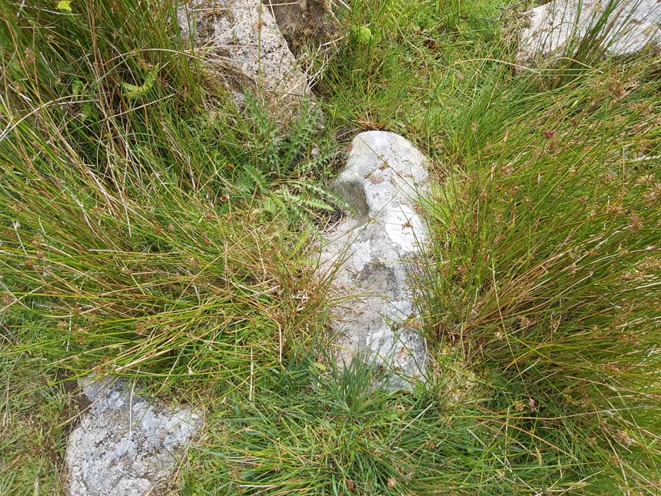
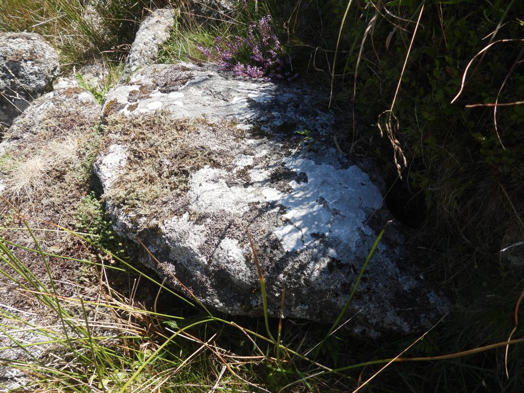
e) Crazing Mill stone (plus tinners’ cache amongst Meavy streamworks).
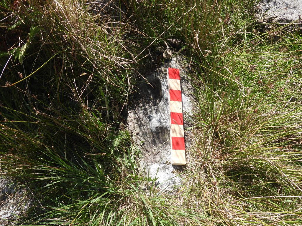
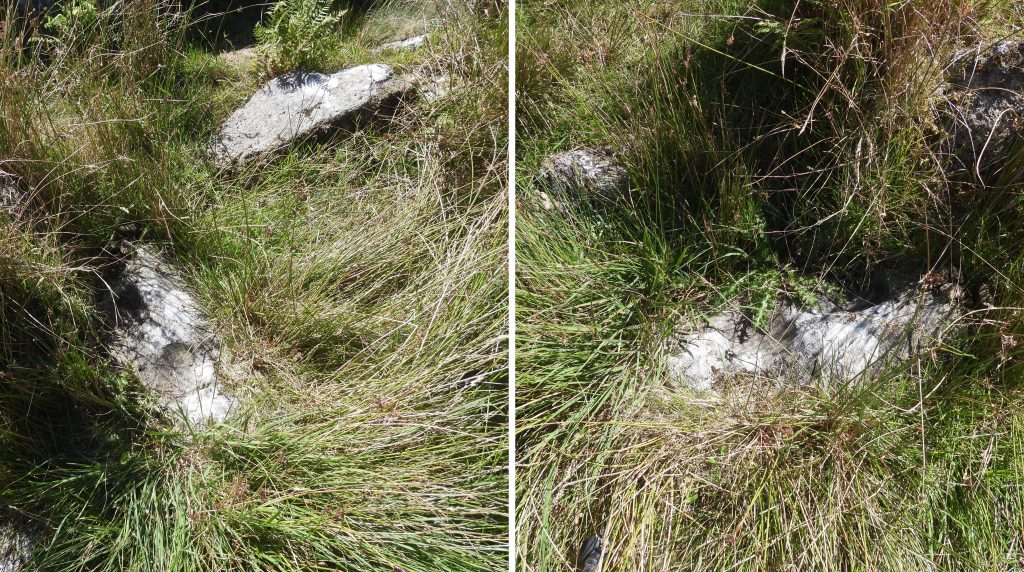
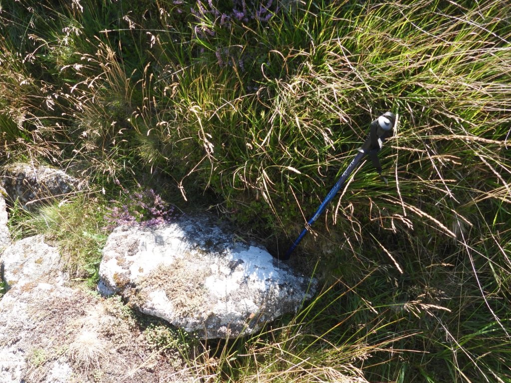
A short distance down stream from the RH tin mill amongst streamwork earthworks is a possible tinners’ cache (Gerrard). It is likely to be below the purple heather shown in the picture under the granite block (in the shade).Just a few metres from the tinners’ cache is a holed circular stone. It is sometimes known as Lethbridge’s Crazing Mill Stone. It can be found at SX57420 71575Walking pole indicating the hole of the ‘Lethbridge’s Crazing Mill Stone’. The name comes from a report by S. Gerrard called ‘Stanlake Alluvial Streamwork’. In this report under the title ‘Crazing Stone’, it is recorded that: “…nestling at the foot of a steep slope is an incomplete millstone…..(it) is partially buried but the visible part measures 0.95m by 0.65m and is cut by a 0.11m diameter and 0.12m deep circular hole”. The report further states that: “The stone was clearly broken during its manufacture and whilst it is not possible to be sure that it was either intended to be a crazing stone (it may have been destined for a corn mill), its proximity to a known tin processing site is very suggestive and may indicate that crazing was once carried out at the Black Tor Falls tin mills” in his summary Gerrard states that he would like to thank Mr D.W. Lethbridge for bringing this stone to his attention.