A collection of walks, discoveries, insights and pictures of exploring Dartmoor National Park
August 6, 2023
Stannon Brook Tinner’s Mill
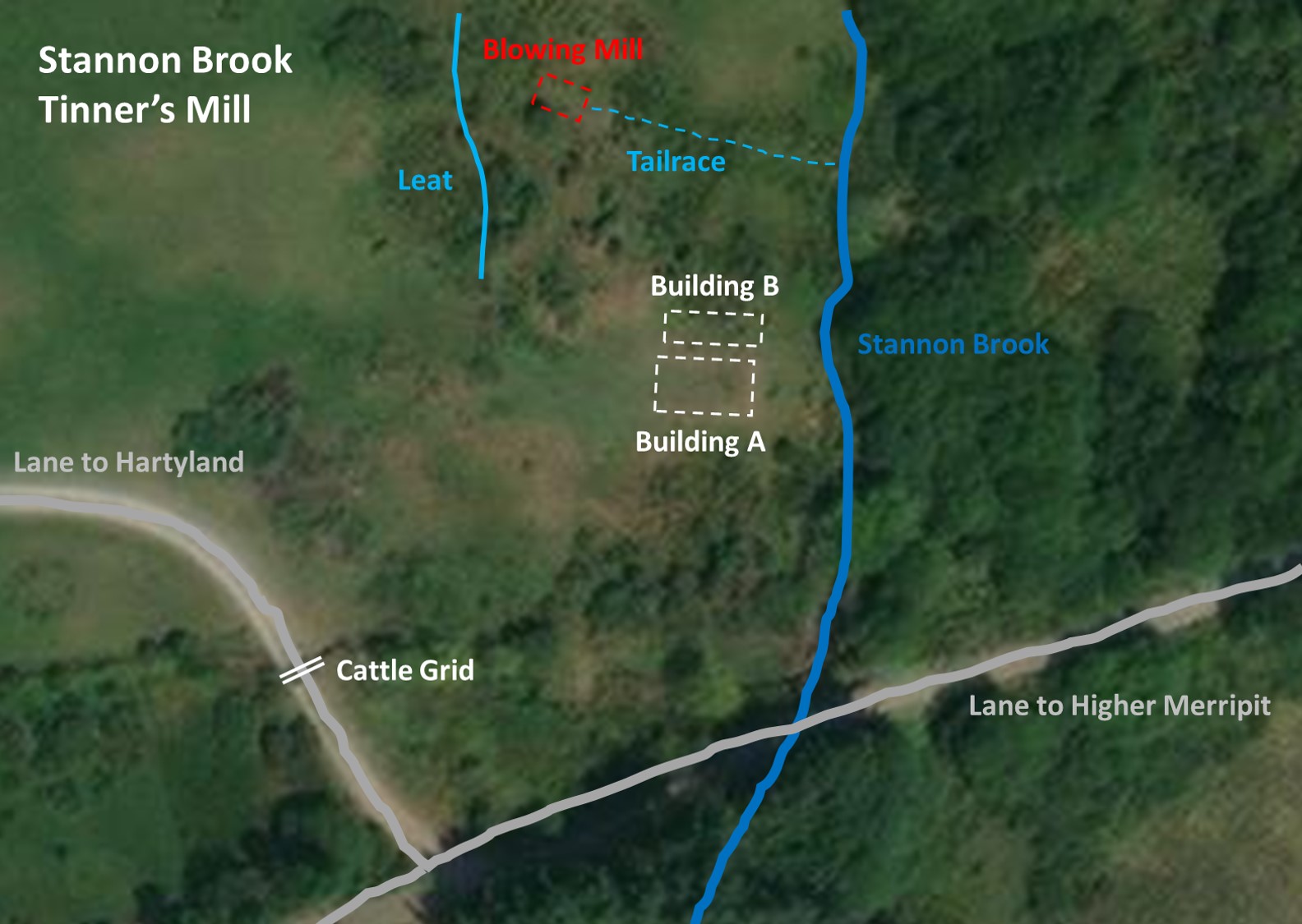
Tucked away, a short distance to the north of Postbridge, near to the lane which leads to Hartyland and close to Stannon Brook are the ruins of a Tinner’s Blowing Mill (House), which is marked on 19th Century maps but not the modern OS maps. The Mill is located in an area known as Hartiland Moor or Mucks Hole Gate and is on private land, so when a visit to the site with the Dartmoor Tin Research Group (DTRG) came along, the author took the opportunity to do so.
The DTRG, in their newsletter number 15 (July 1998), recorded that there are three buildings on the site but need a little effort they can be identified. On this visit (July 2023), the author and others on the visit could only positively identify two buildings with only a possible third or enclosure. In the DTRG newsletter, it further stated that the Tinner’s Mill, in 1981, was overwhelmed by the dumping of topsoil from a new agricultural building at Middle Merripit.
Intriguingly, the Heritage Gateway (entry by Royal Commission for the Historical Monuments of England) there is only mention of two buildings on the site. Their entry does, however, mention a small rectangular enclosure, earthworks, associated leats and the site of the Blowing House. This post records attempts to record as many as the aforementioned features recorded in both the DTRG newsletter and on the Heritage Gateway.
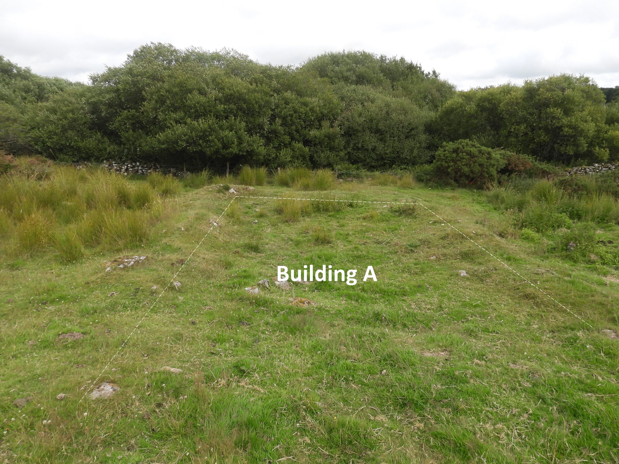
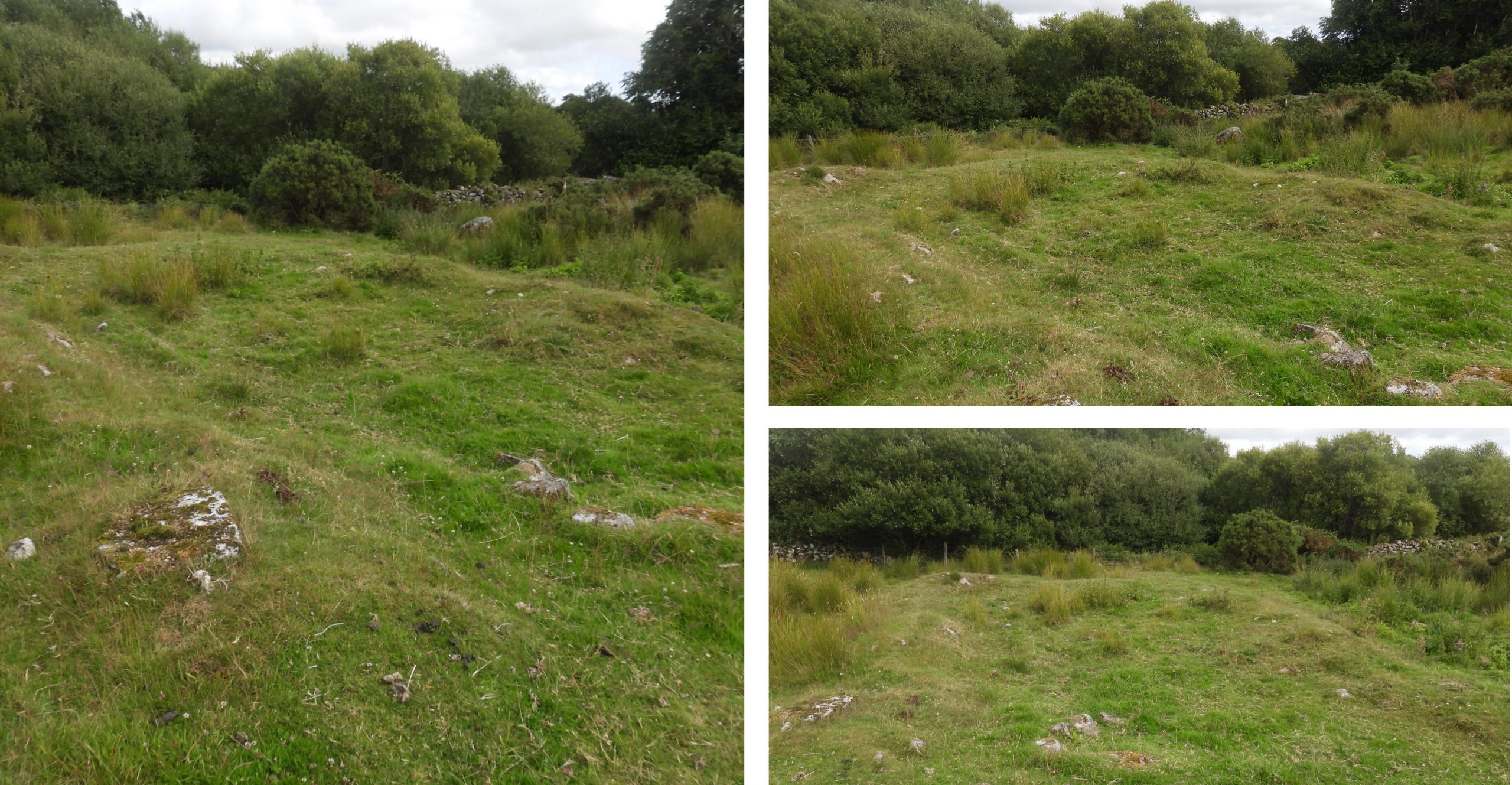
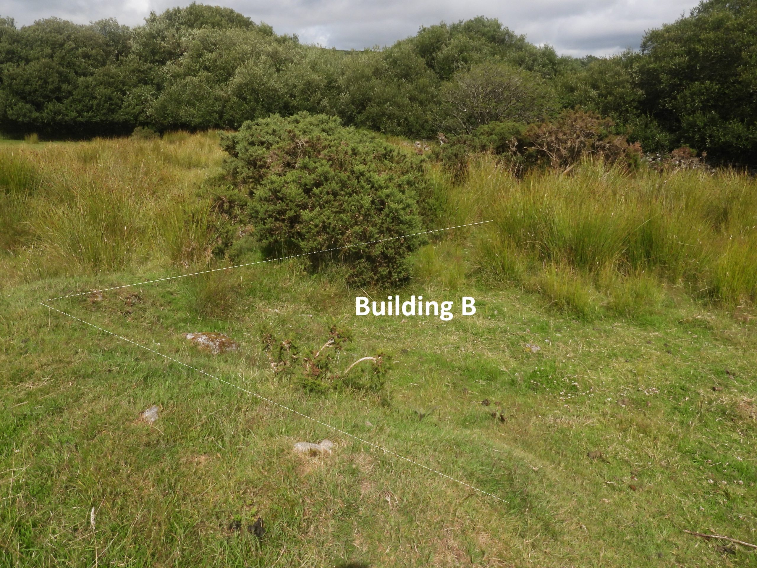
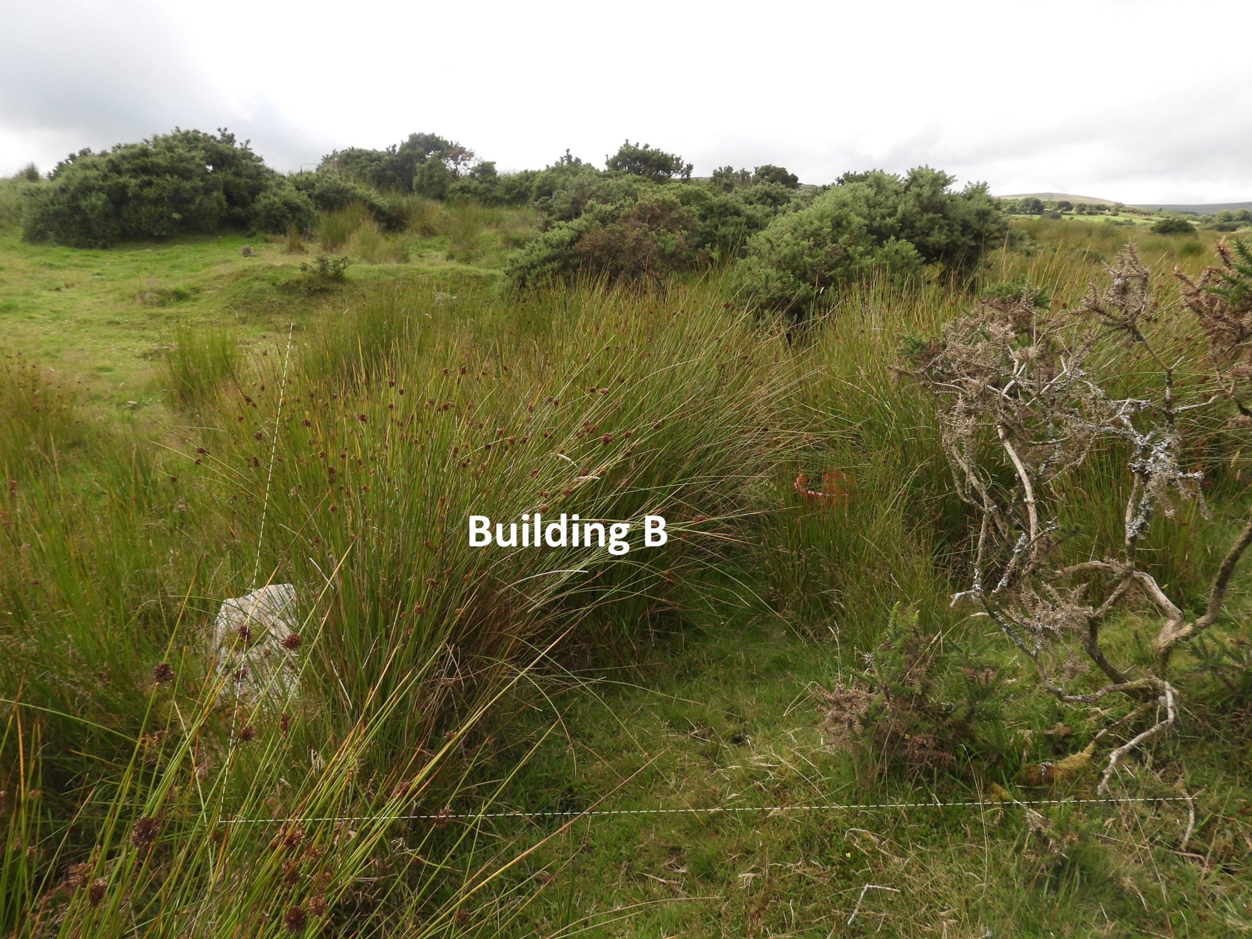
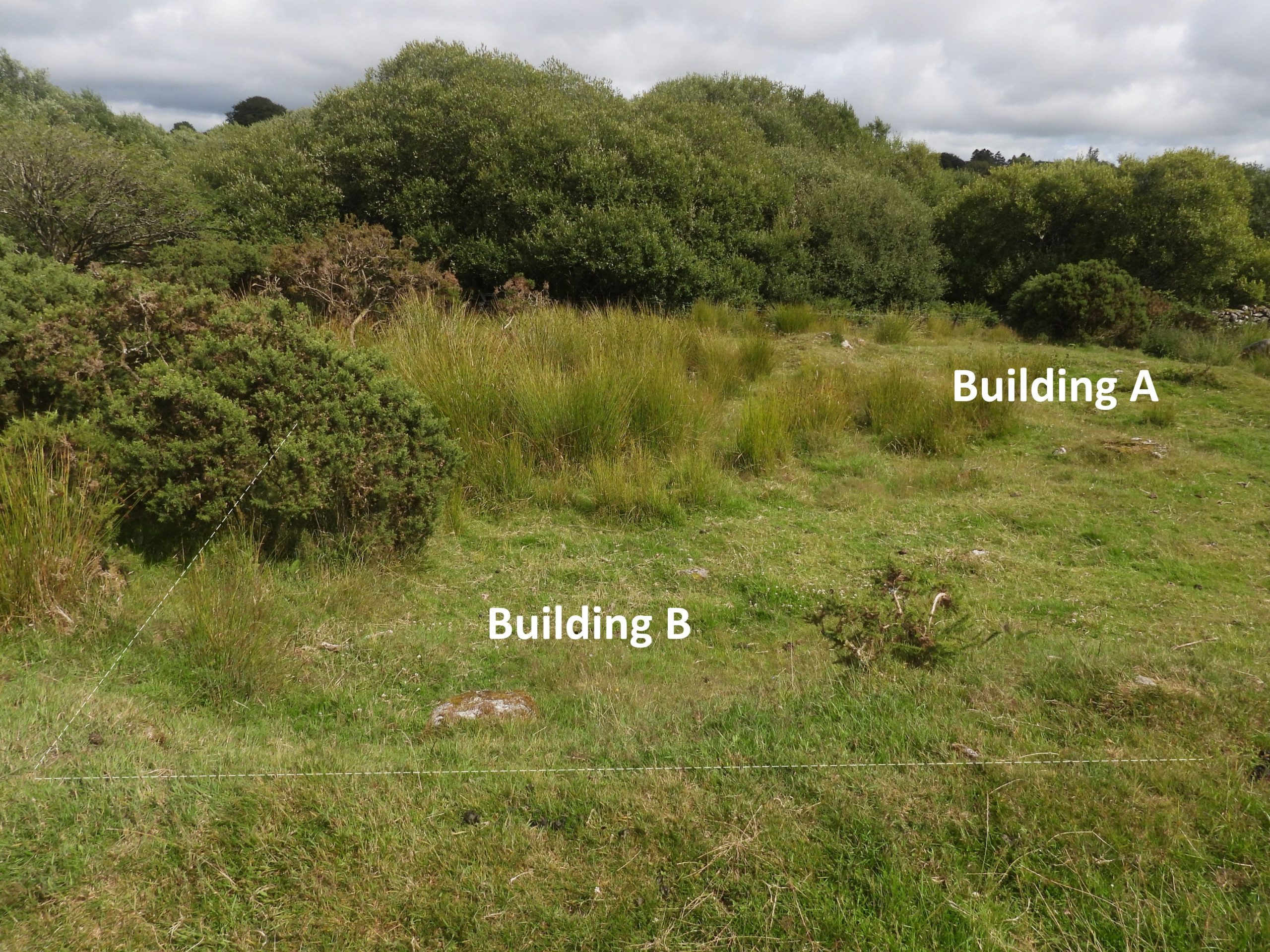
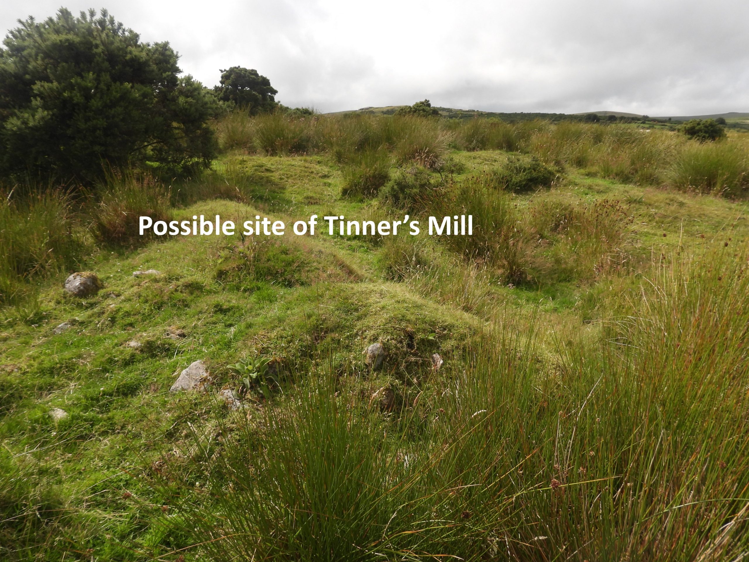
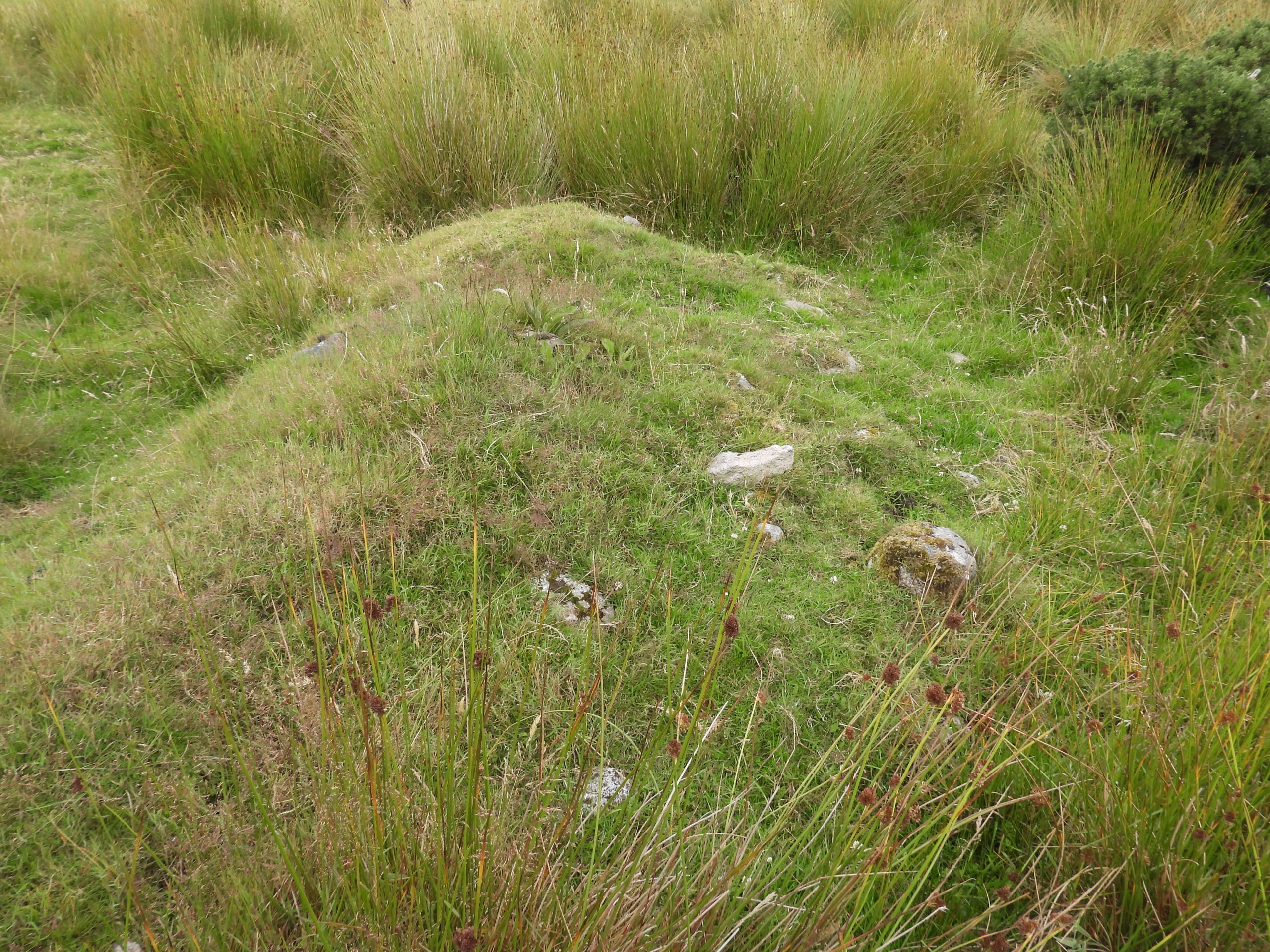
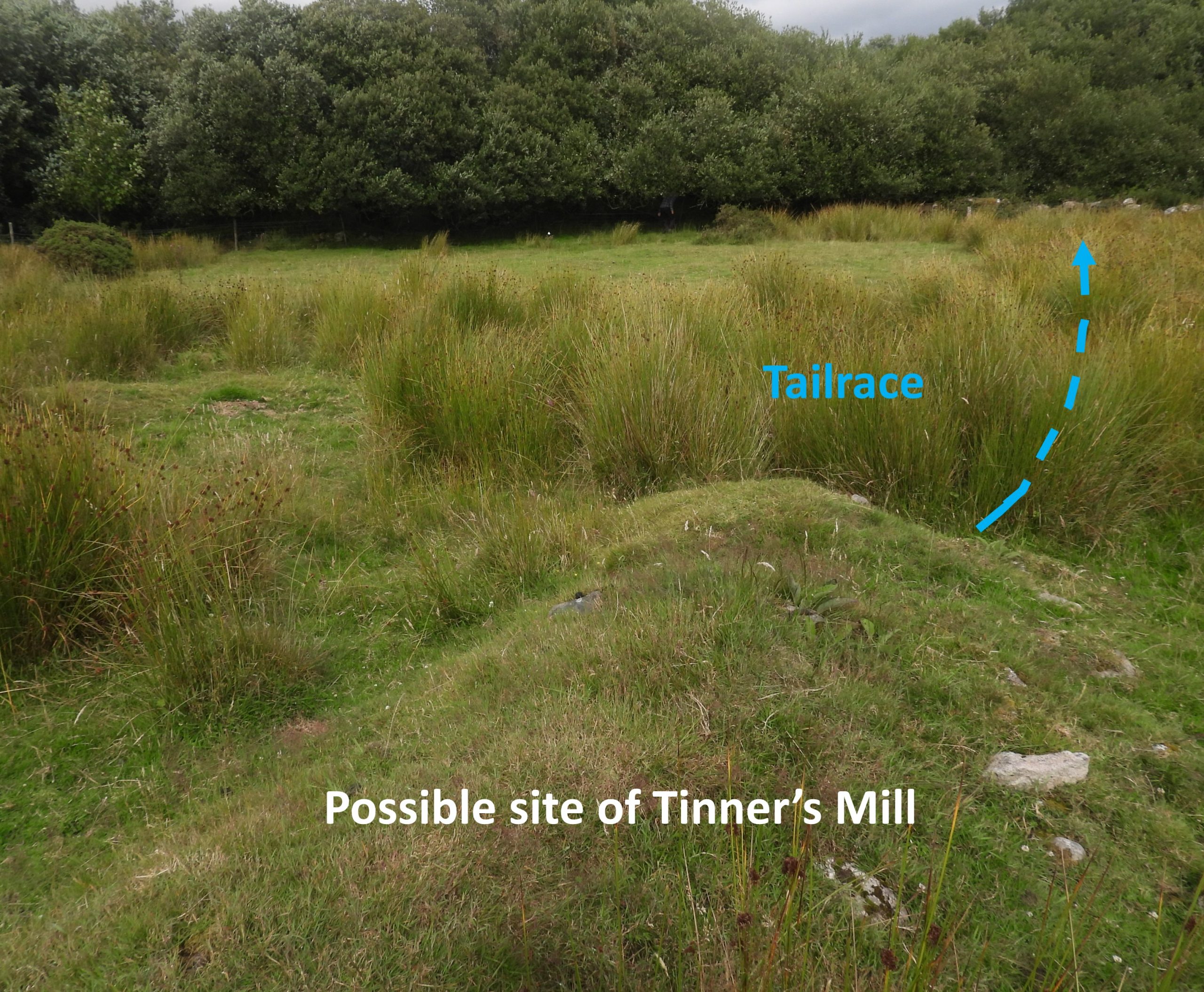
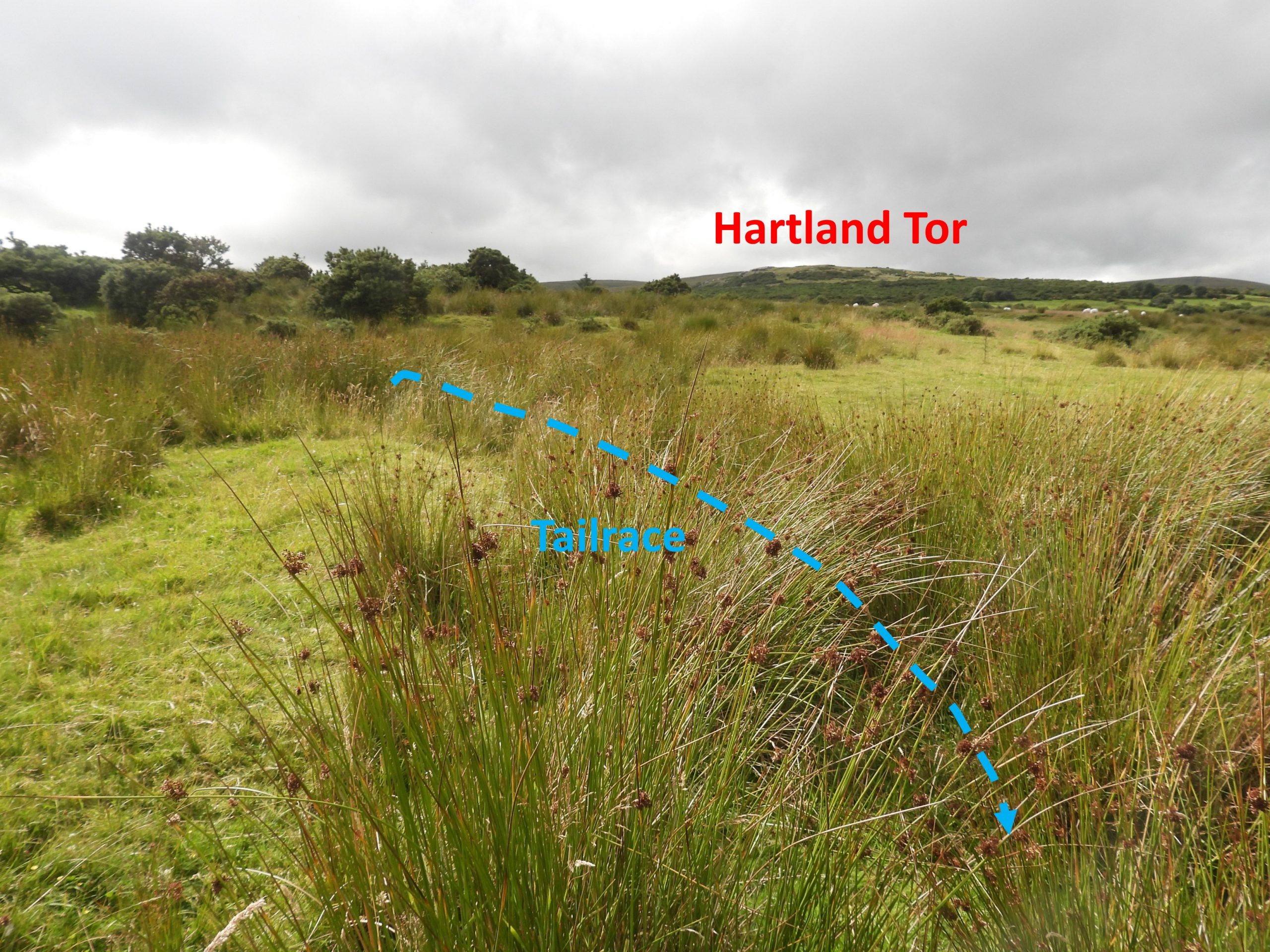
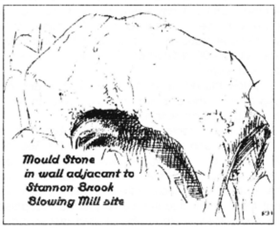
This annotated Google Earth picture, identifies where the author believes the main features covered in this post are located. Note that the area from the cattle grid to Stannon Brook is on private land.The first feature that is encountered when visiting the site is the outline of a building (labelled as Building A on the sketch map). The building looks quite modern (late 19th / early 20th century ?) constructionBuilding A is located at SX 64851 79517 and measured around 10.8m east-west by 3.4m internallyBuilding B is partially overgrown on its east side (side nearest Stannon Brook)Overgrown portion of Building B. The building is located at SX64854 79499 and is approx. 7.8m east-west by 4.5m internally.Buildings A and B lie side-by-sideThe Stannon Brook Tinners Mill is hard to discern. That said, the mound shown in the photograph is located at the (top) end of what is appear to be a tailrace leading away from a probable mill. Dr Tom Greeves in the 1970’s found some tin slag and a piece of furnace lining on the site suggesting the mill was a Blowing HouseThe (probable) mill is located at SX64851 79517. The site was recognised for what it was, by Burnard, Crossing and Worth and mention of the site is made in Transactions of the Devonshire Association (TDA), 1902, p164. Five years later (1907) in the TDA, p 74 there was a report of the discovery, during the repair of a fence, of a ‘rough cake of impure tin’ weighing 20 lb and was thought to have been cast in an improvised mould. This also suggesting this mill was a Blowing House. The probable tailrace which is reed filled, which leads to Stannon BrookThe DTRG have recorded that: “ln 1894 Robert Burnard found tin slag and a mould-stone here. lt (the mould stone) is built into the dry stone wall that follows Stannon Brook”. The sketch above (by Keith Lane and Richard Horsham) is of the mould stone (which could not be located on the visit due to the vegetation being high)