A collection of walks, discoveries, insights and pictures of exploring Dartmoor National Park
February 19, 2022
Upper Erme Tinners’ Mill, Tinners’ Hut, Steamworkings, and a Tinners’ Cache
Evidence of Dartmoor tinners’ from the medieval period to the (probable) 19th century can be found on the upper Erme, between Piles Copse and Blatchford Bottom. This area is blessed with lots of tin streamworks, a tinners’ mill, a tinners’ hut plus a cache, all of which are covered in this post. Additionally, this beautiful valley contains several Bronze Age settlements (not covered in this post) and a modern weir used for taking off water to a water treatment works.
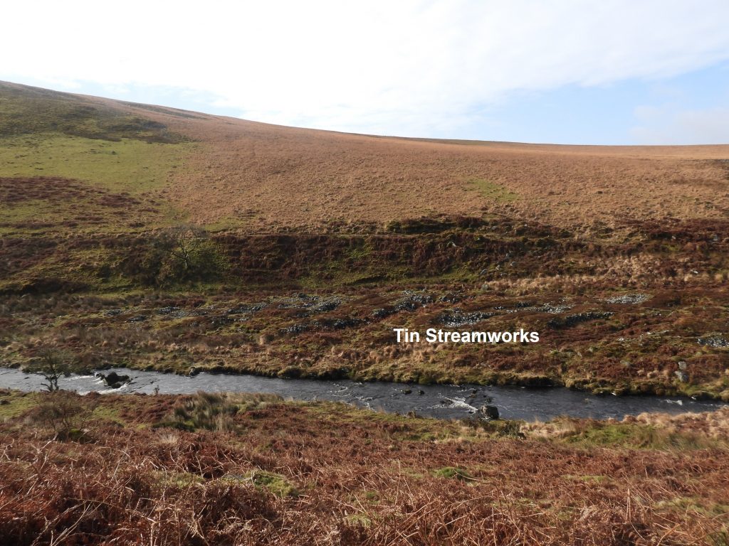
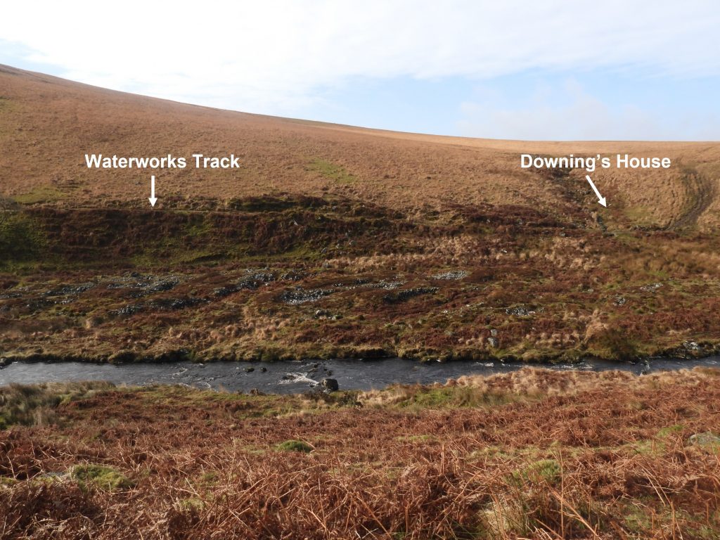
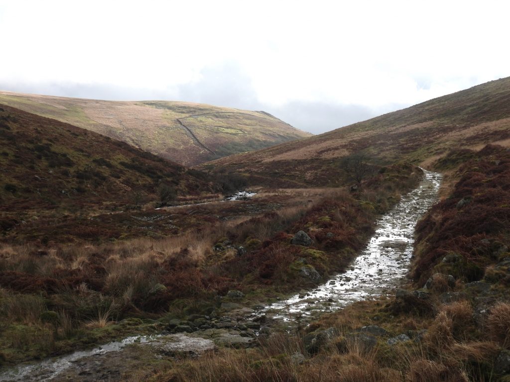
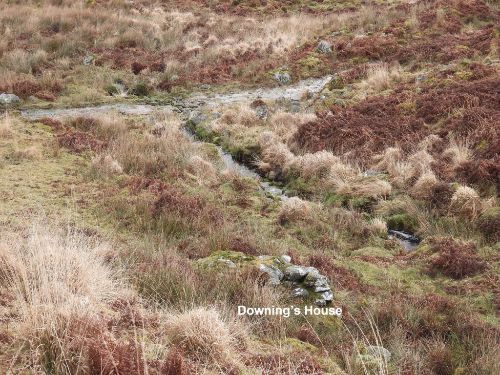
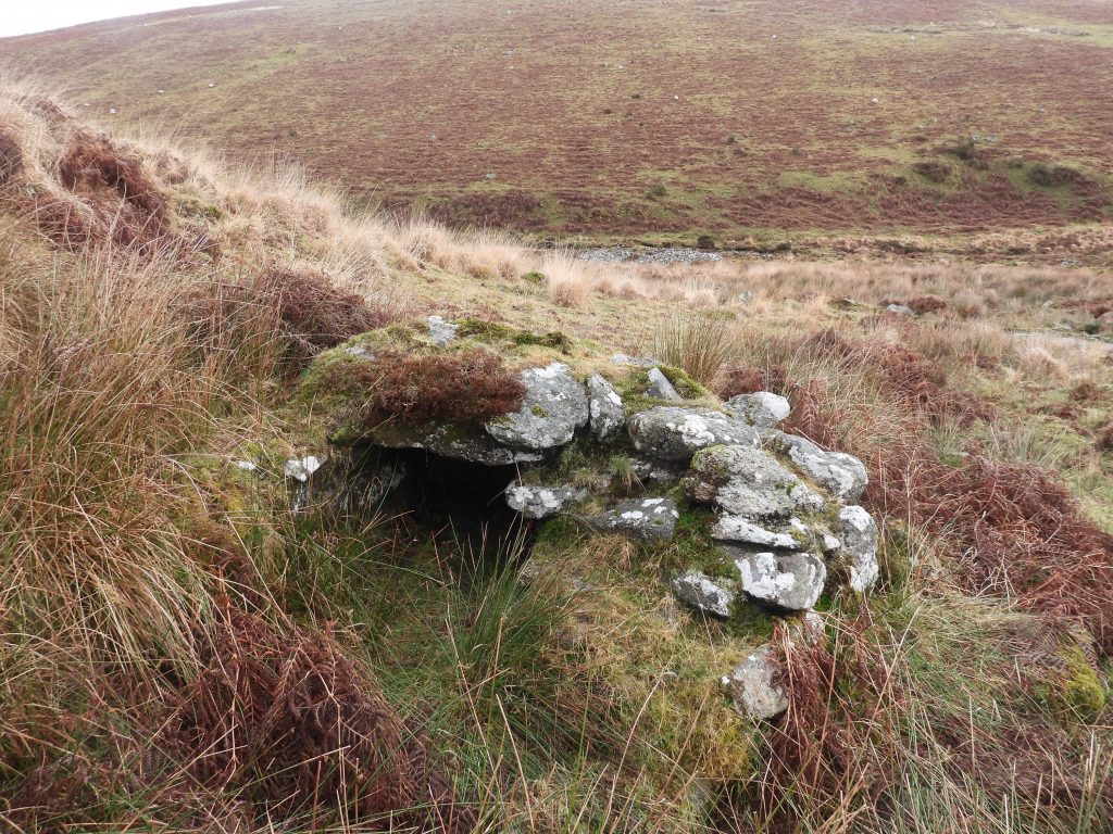
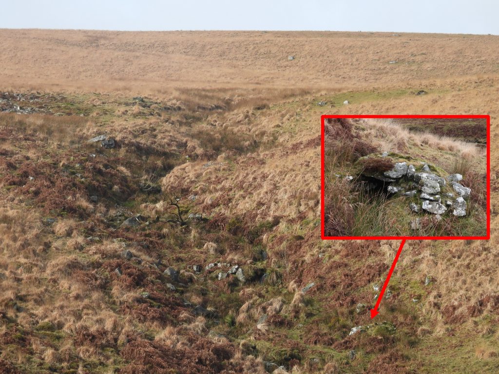
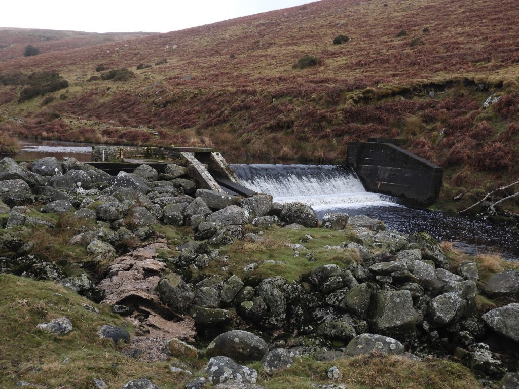
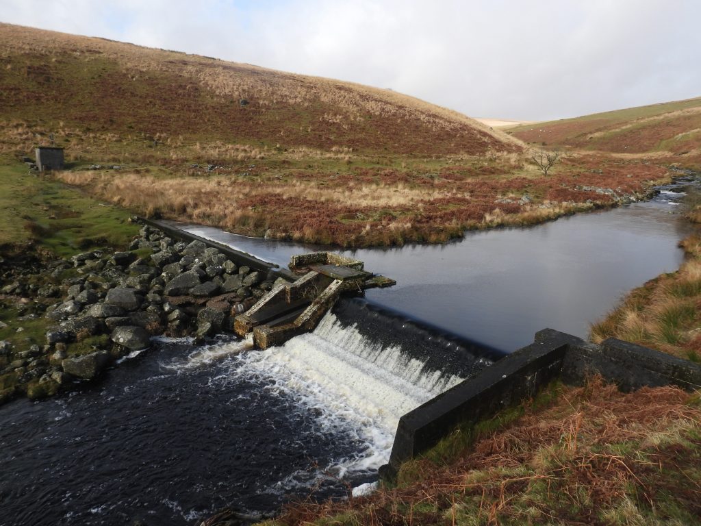
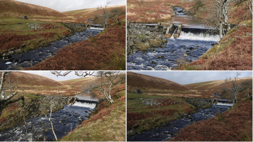
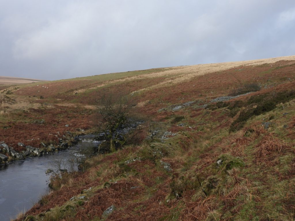
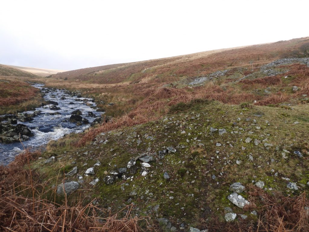
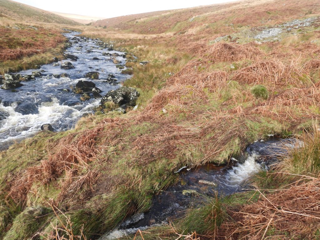
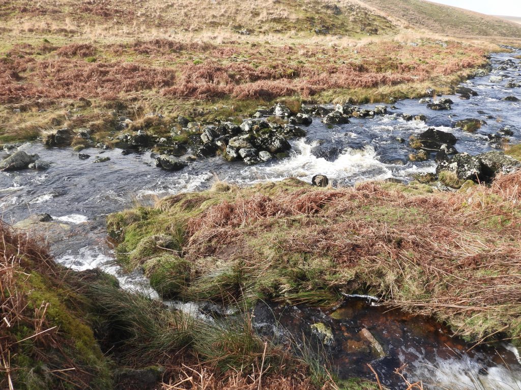
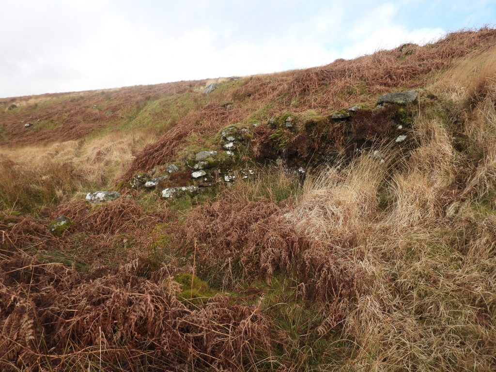
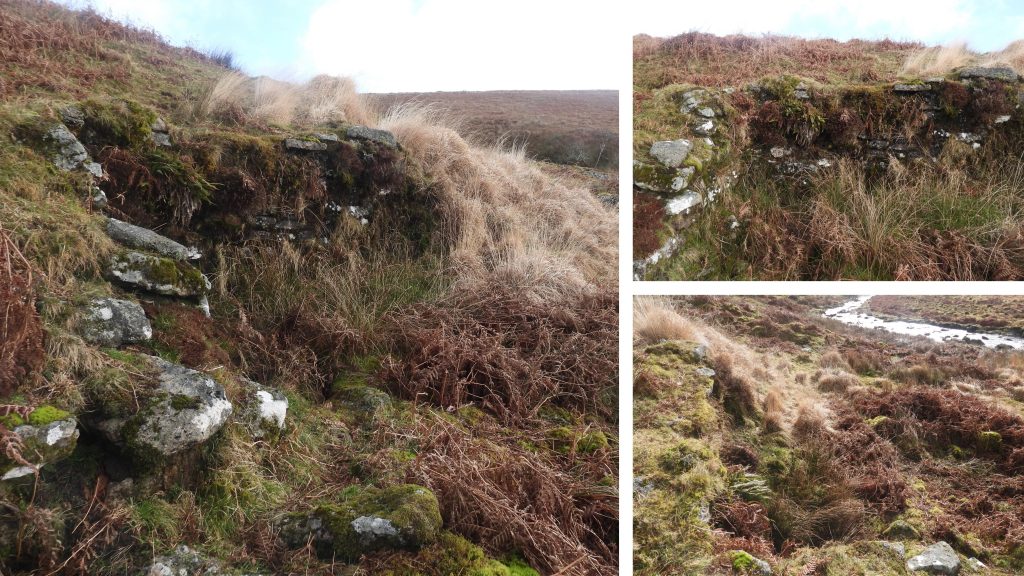
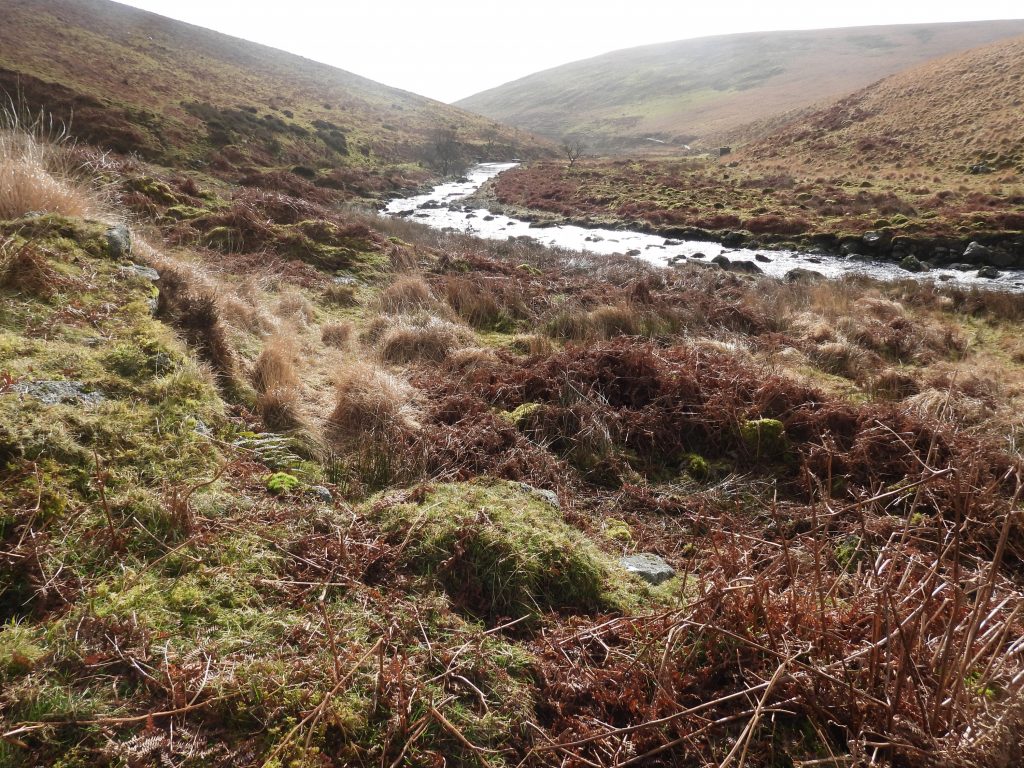
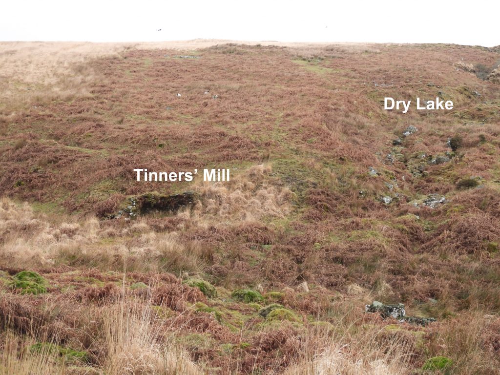
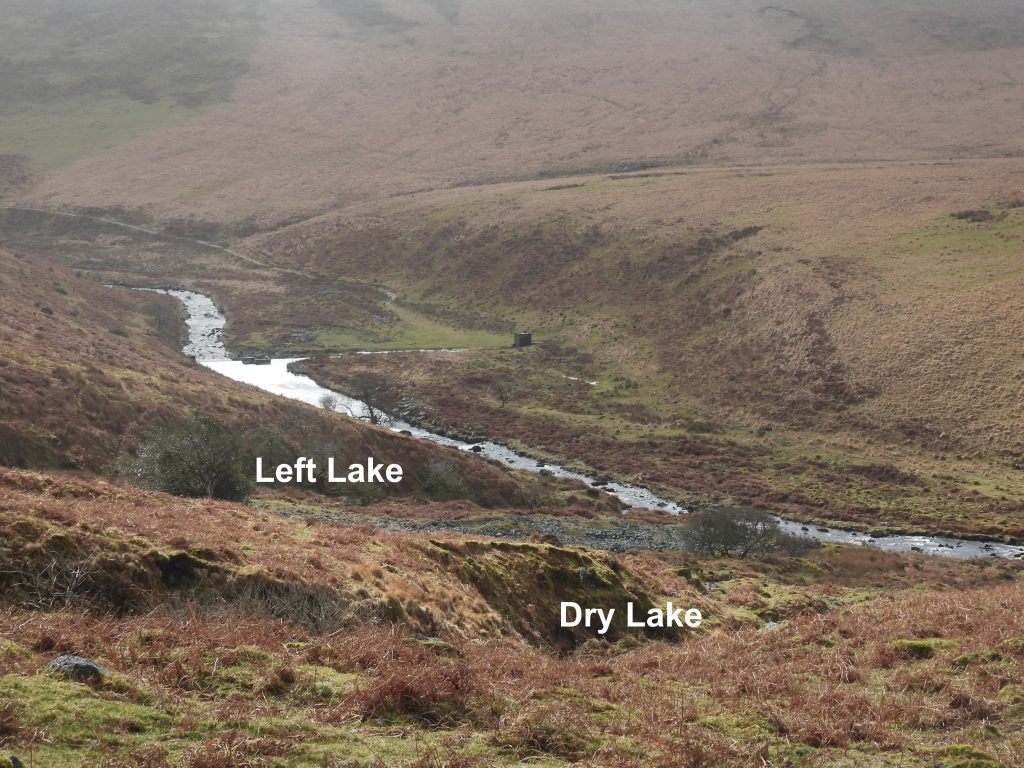
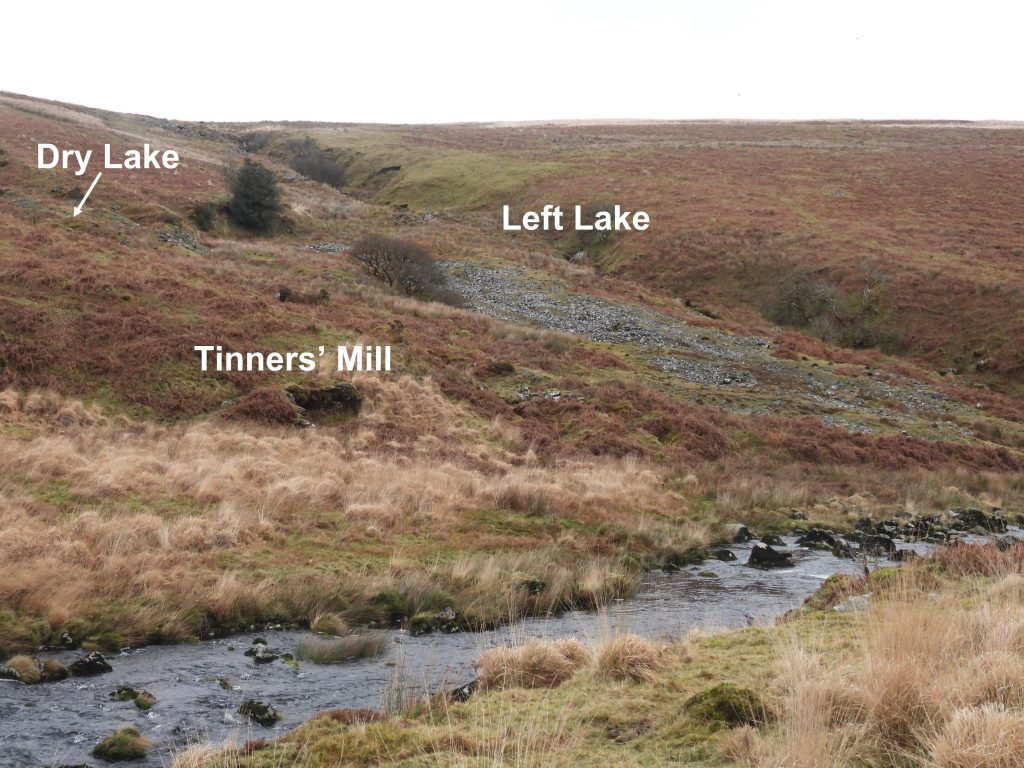
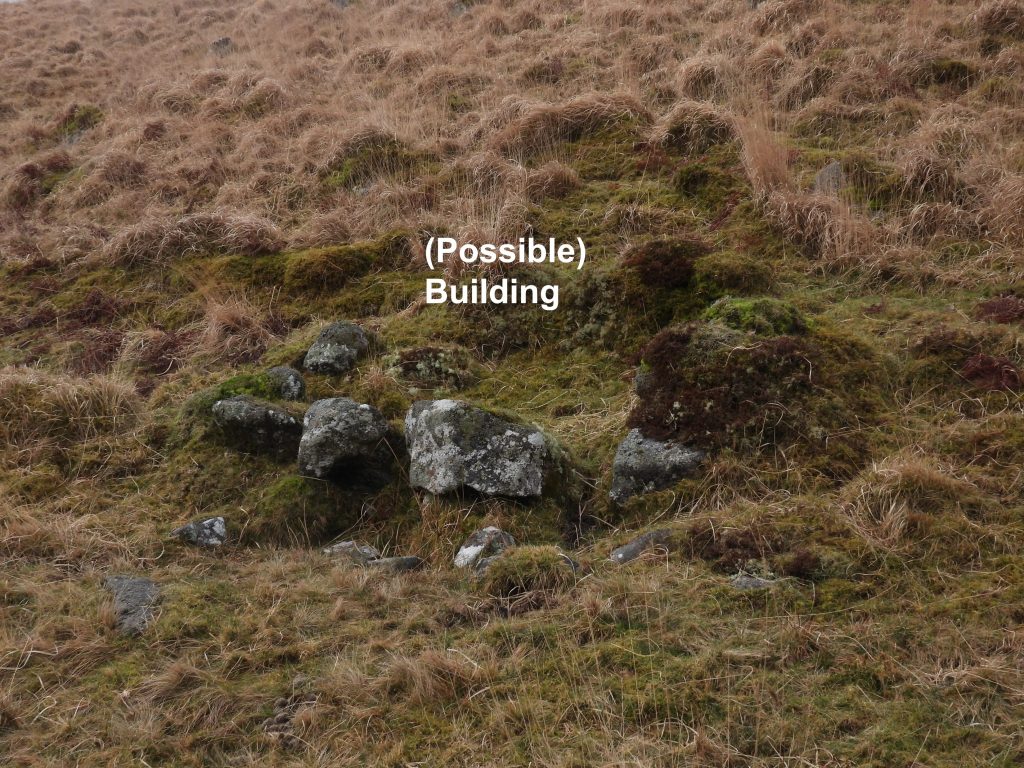
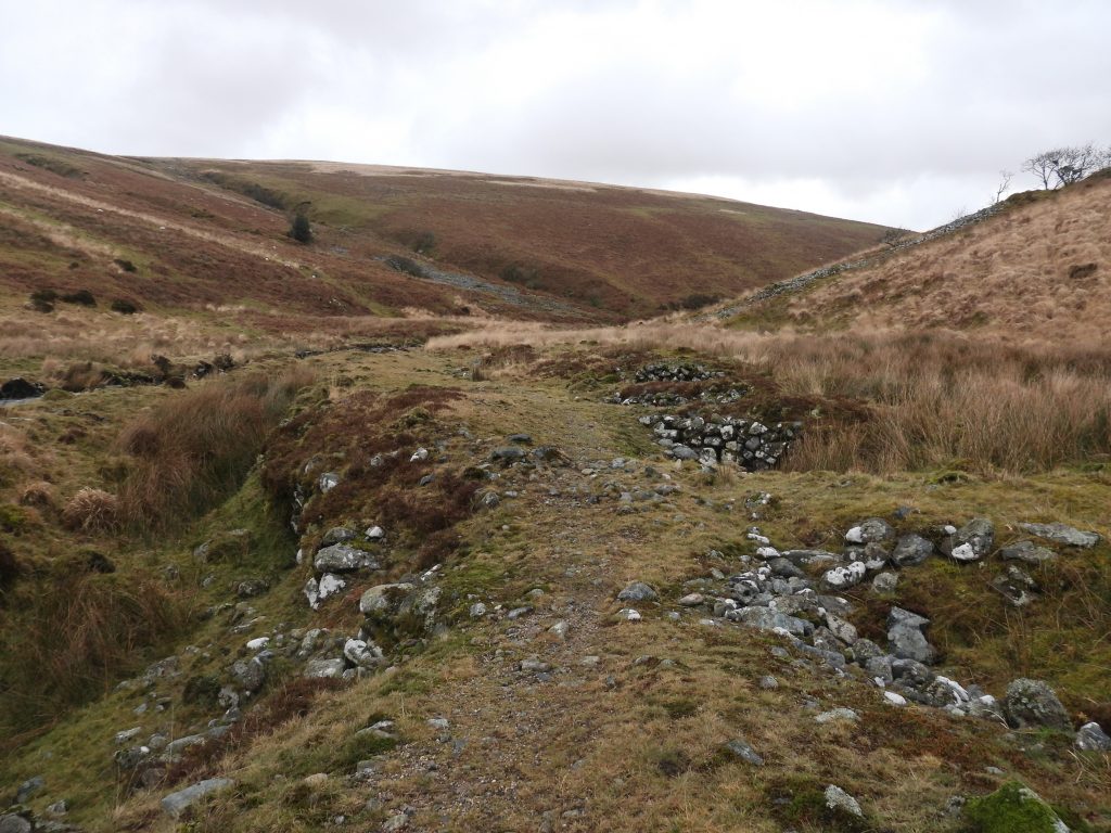
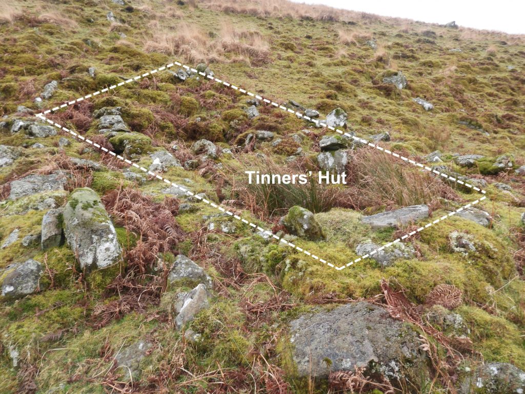
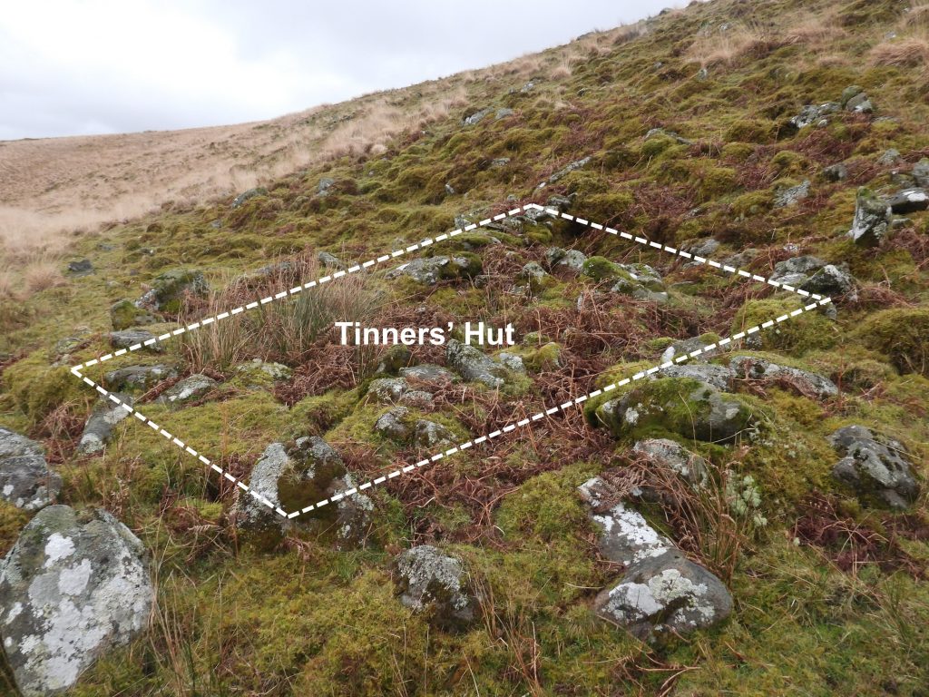
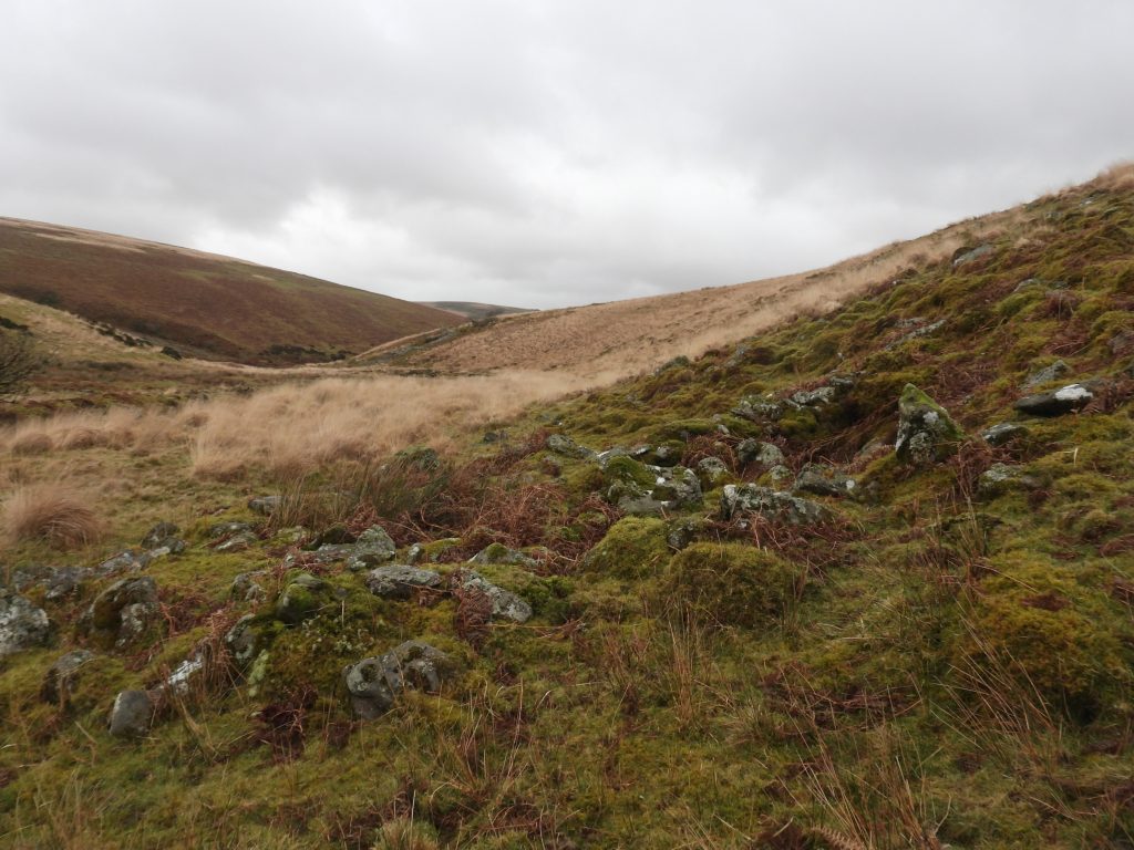
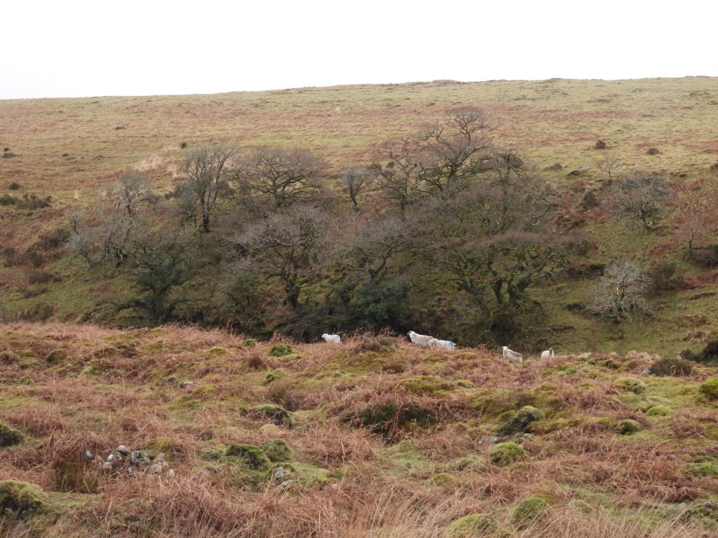
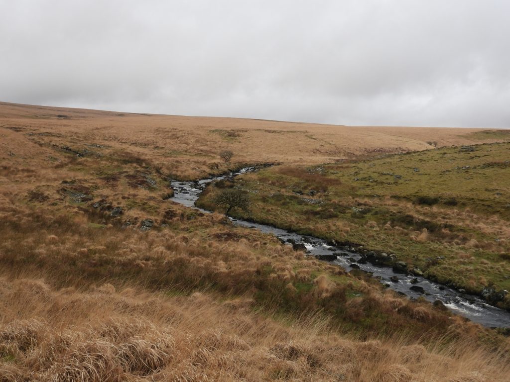
Sketch map of the tinners’ workings on the upper Erme, between Piles Copse and Blatchford Bottom.Tin streamworks on the west bank of the River Erme, just downstream from the weir and Downing’s House. Up until the 17th century, the majority of tin works were of the streaming type where alluvial deposits were worked since cassiterite had collected in depressions in the landscape.Beyond the tin streamworks is Downing’s House (in the gully of an un-named stream) and the waterworks track which comes up from the New Waste water treatment works.On the west side of the Erme, above the tin streamworks, looking downstream with the waterworks track in the foreground and Sharp Tor in the distance. The area where the wall climbs the hill by Sharp Tor is called ‘The Dungeon’.Downing’s House (locally known as Smugglers Hole) can easily be missed when approached from the waterworks track. It is a small roofed structure, which is believd to have been a probable tinners’ hut or cache. Its proximity to the modern track and un-named stream is evident from the above photograph. It can be found at SX63950 62930.The Dartmoor HER records the interior as being “an approximate rectangle of 2.2 metres by 1 metre and the roof height is approximately 0.8 metres”. It further states: “The walls and roof are constructed from overlapping granite slabs, giving a domed appearance from the outside, hence the structure is often referred to as a beehive hut. An entrance, with a single lintel survives on the western side”.Viewing Downing’s House from the east side of River Erme, gives a prospective of how easy it is to miss. The river Erme weir from the west side.The river Erme weir is the water take off point for the pipeline leading to the New Waste water treatment works, approx 3.5km away.General views of the weir as viewed from the east side of the river.Just upstream from the weir more tin streamworks can be found near to the point where the twin ‘Lakes’ of Left Lake and Dry Lake.Approaching Left Lake and Dry Lake from the south. The two ‘Lakes’ have a lot of evidence of tin streaming as can be seen from the photograph (towards top right).Left Lake just before cascading into the river Erme.Left Lake cascading into the river Erme.Just beyond Dry Lake on the east side of the river Erme, is a probable tinners’ mill. It is built into the foot of the escarpment, and is recorded as measuring 5.7 metres by 3.7 metres, with walls a little over 0.6 metres thick. (Ref: Dartmoor HER)The tinners’ mill eastern wall (against the hillside) is in the best condition and stands to over 1.5 metres. The other three walls have all but collapsed, being almost at ground level. The tinners’ mill is located at SX63983 63364.There is no evidence of a wheelpit associated with this building, but there appears to be a faint outline of a leat leading to it.The tinners’ mill location relative to Dry Lake as viewed from the west side of river Erme.View of the Erme and its weir as seen high up on its east side just to the north of Dry Lake.Another view of the tinners’ mill, Left Lake and Dry Lake from the west side of the Erme.Almost opposite from the tinners’ mill on the west bank of the Erme is a (possible) building of unknown origin. It does not appear in the Dartmoor HER, which leads the author to suspect its authenticity as a building is in question. This feature can be found at SX63955 63297.On the west side of the Erme, between Dry Lake and Blatchford Bottom, there are some fabulous tin streamworks. The ‘streaming process’ comprised diverting the watercourse and with the use of a raised wooden ‘launder’ and flowing water alluvial ground that had been dug up and loaded into the launder was washed. Small particles of rock and sand would have been washed away by the water and the denser cassiterite collected behind small battens, called ‘riffles’, fixed across the bottom of the launder at 90 degrees to the flow. With larger rocks cast aside this left the characteristic Dartmoor feature we see today of wide shallow valleys with linear banks of waste rock enclosed by escarpments. Approaching Blatchford Bottom a ruined rectangular building, which is a probable tinners’ hut can be found. The building appears to comprise an inner and outer wall.The Dartmoor HER describe this tinners’ hut as being of an unusual construction style. It further states: “The inner structure measures approximately 6.6 metres by 3 metres wide, surrounded by the outer wall, which is 7.2 metres by 5.6 metres wide leaving a void between the two. The eastern end of the outer structure is curved in plan. Both inner and outer walls are approximately 0.6 metres thick, and no part of the ruin stands higher than 0.5 metres”. The tinners’ hut is located at SX63721 63539Small copse on east side of the Erme looks like a ‘mini-Piles copse’ and is approx 1.5km upstream of it.View of the Erme heading north to Blatchford Bottom (left middle of photograph) and beyond.