A collection of walks, discoveries, insights and pictures of exploring Dartmoor National Park
July 28, 2021
Soussons Tin Stamping Mill
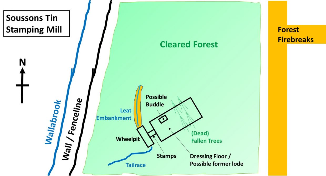
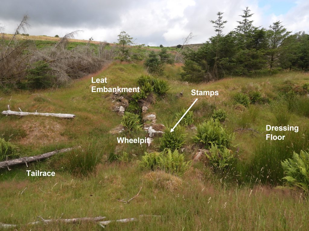
This tin stamping mill is a typical of those from 19th century, containing a wheelpit, stamps, leat, tailrace and a buddle / dressing floor. Once overgrown with densely planted with trees from the Soussons plantation, the explorer can now access the site with relative ease due to the clearance of trees. It is the only remaining example of this type of stamping mill in the golden dagger and vitifer area and is marked on modern OS maps, albeit just as a small rectangular shaped graphic near the north west corner of the plantation.
Interestingly, as recorded on the Dartmoor HER, “There seems to have been two phases of use, with the original mill being refurbished and the good retaining wall (on dressing floor) either representing a refacing of the original wall or, more probably, an enlargement of the dressing floor, the layout of which would be of the later date”. It is summised that the site may have been part of the ‘Runnige Moor Mine’ recorded in 1792, followed by evidence supporting usage by Golden Dagger Mine from around 1850 to 1880, when it is assumed the site was abandoned.
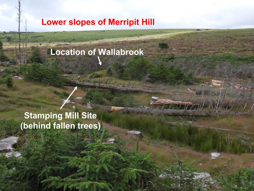
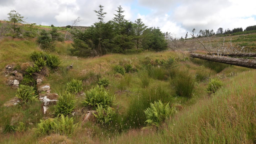
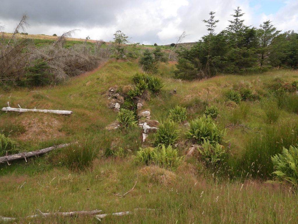
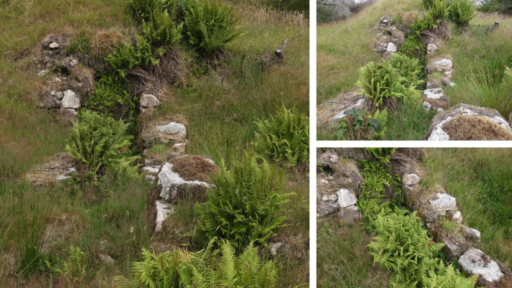
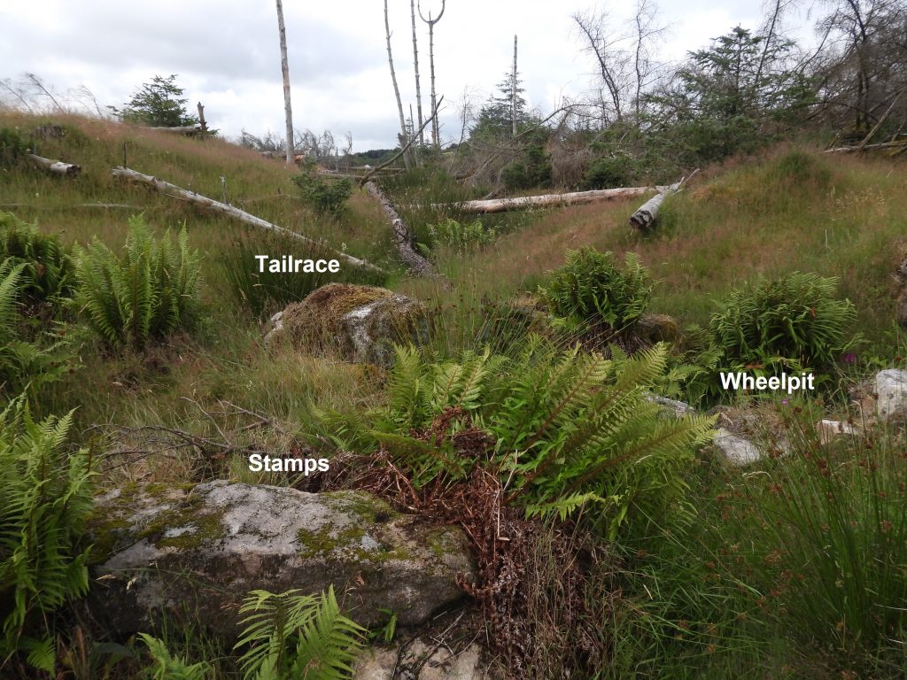
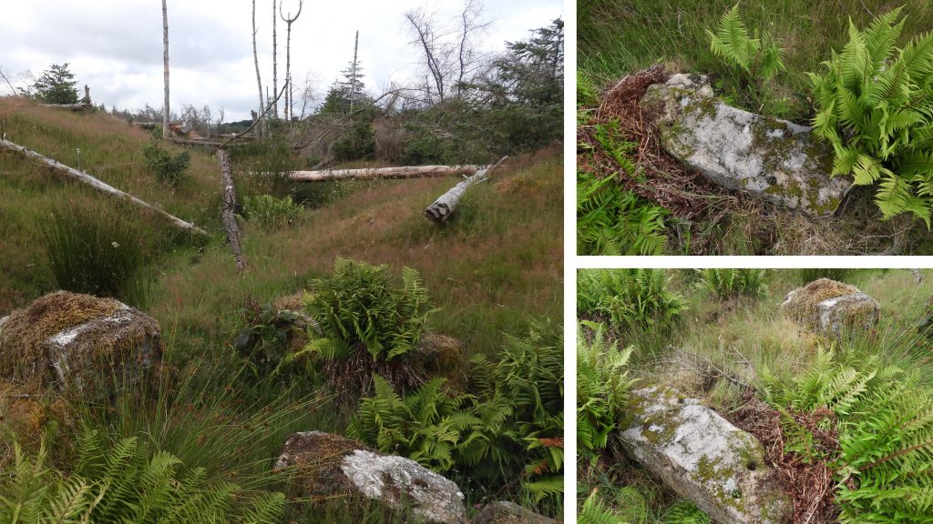
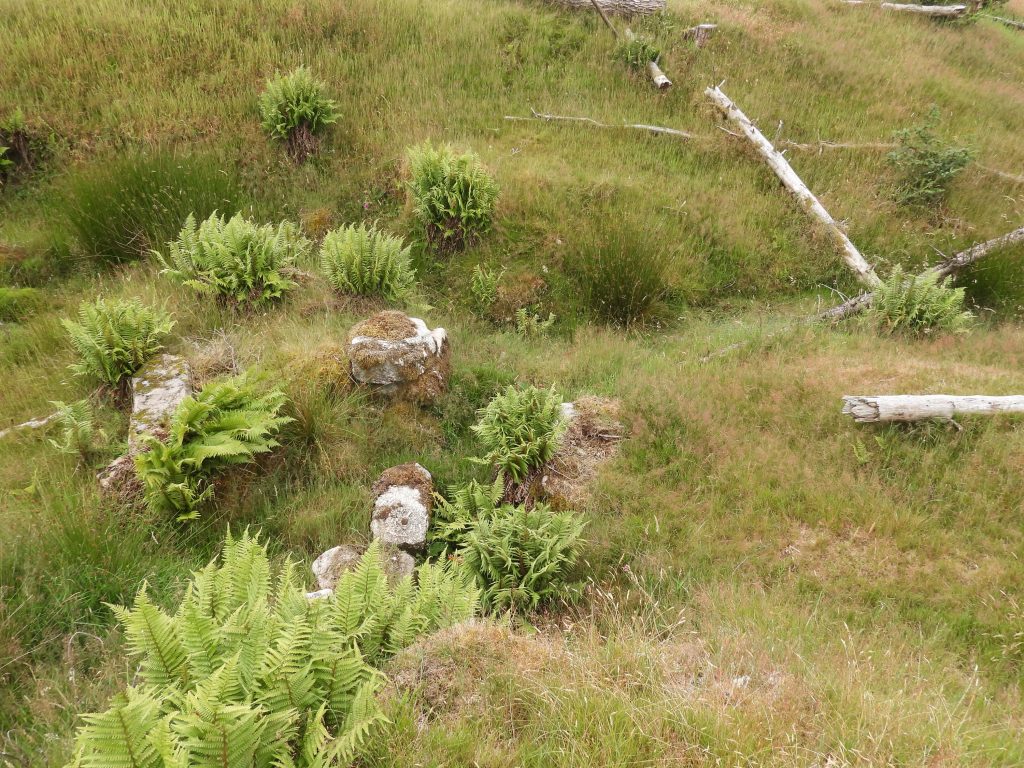
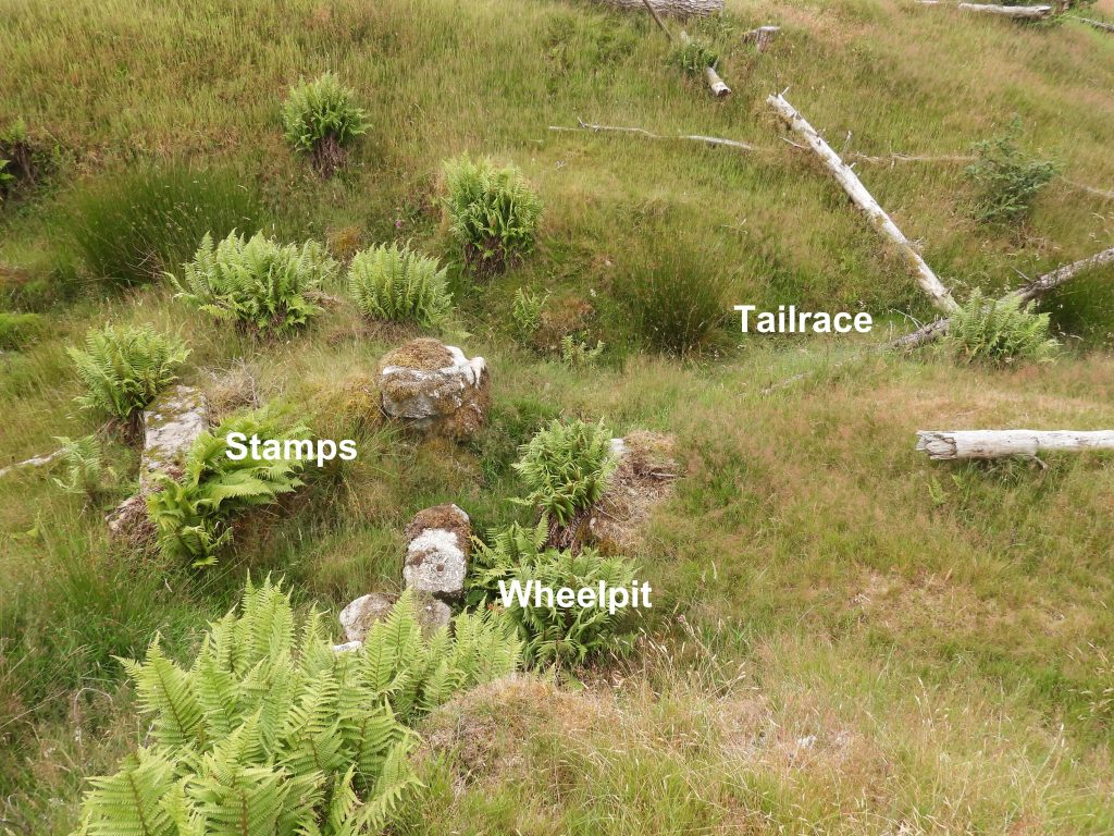
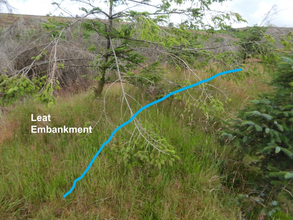
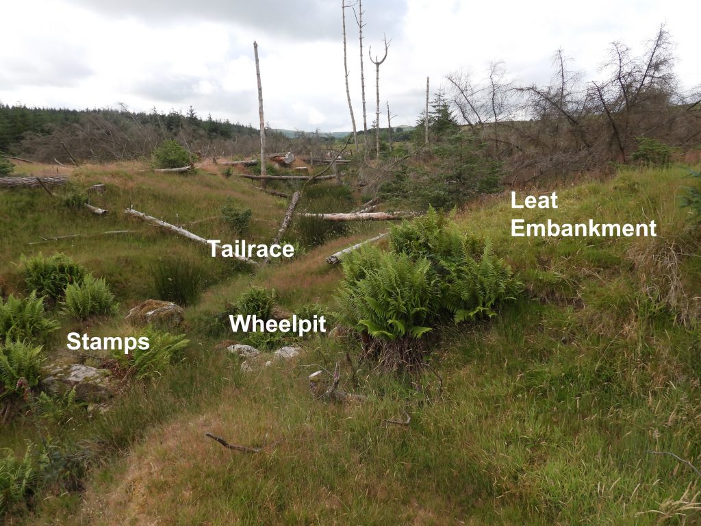
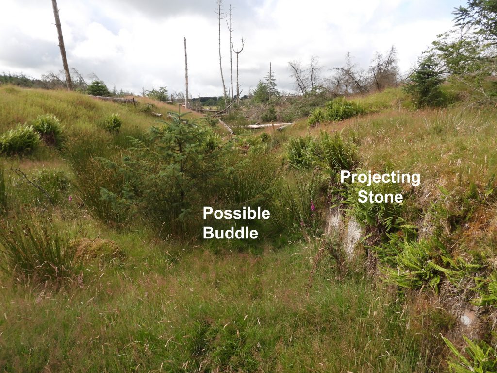
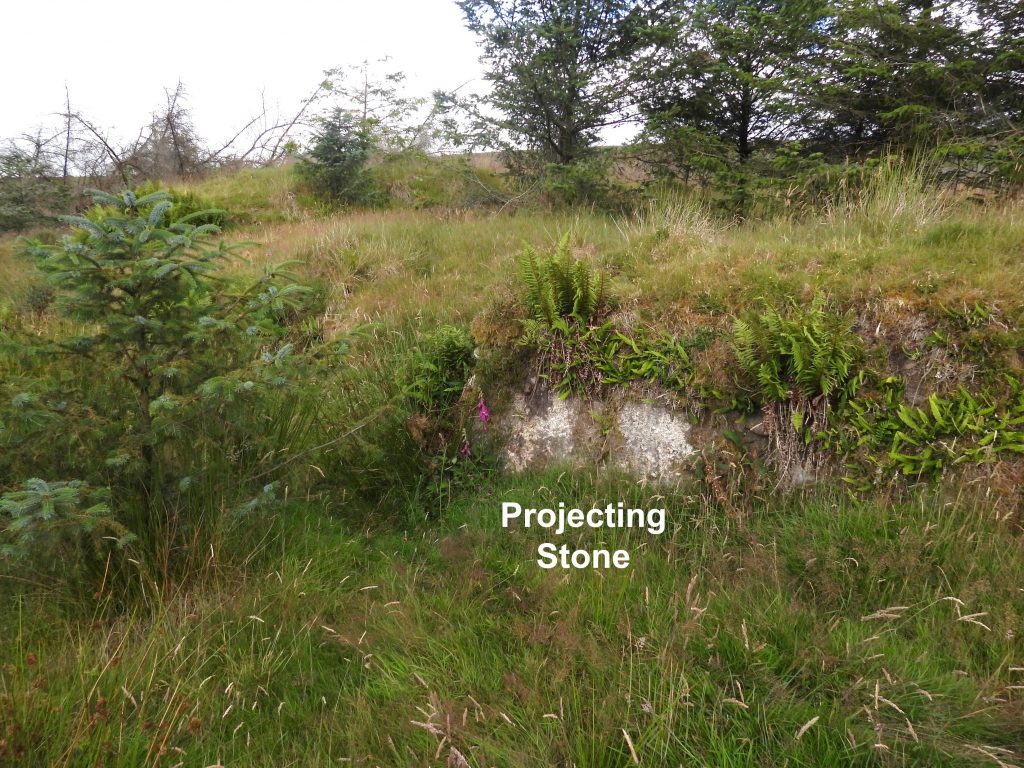
Sketch map of the location of the tin stamping mill. For the explorer access cannot be made from the West as there is a wall / fenceline by the Wallabrook. It is recommended to use the forest tracks and forest firebreaks which is relatively easy going underfoot.Approaching the mill from the East. There are two fallen trees across the dressing floor, behind which is the siteGeneral view of the mill viewed from the south. The two fallen tree across the dressing floor can be seen on the right and the wheelpit clearly seen on the left.More detail of the wheelpit. A leat embankment can be clearly seen above the wheelpit and the tailrace (by fallen tree) to the left.As previous picture with features labelled.Detailed photographs of the Stone-lined wheelpit. It is recorded as being around 4.5 metres long and 0.65 metres wide. It has been partly demolished and infilled. It is believed that the Wheel would have been of nominal 10 ft diameter and breast of a little under 2ft. The wheelpit can be located at SX67271 79899. Source: Dartmoor HER record – Bird, R. + Hirst, P., 1995, Survey Notes: The Soussons Forest (Northwest) Tin Stamping Mill (SX672799) (Report – Survey). SDV289571. Close up of Leat Embankment, Wheelpit and StampsHoled block in Stamps areaAdjacent to the wheelpit is a platform area where the stamps would have been located.Looking across Wheelpit to Dressing FloorThe platform structure adjacent to the wheelpit is where the stamps would have fallen. On a large boulder within the structure several drilled holes can be found alongside some bolts. The stamps were recorded as SX67273 79899.View of the wheelpit, stamps platform and tail race as viewed from on top of the leat embankment View of the wheelpit, stamps platform and tail race as viewed from on top of the leat embankment – same as last picture with features labelled.Leat embankment evidenced by a curved mound.Another view of the site from the dressing floor looking WestThe Dressing Floor to the East of the wheelpit and stamps area are recorded as possibly being from early streamwork or surface working of a small lode. The dressing floor is approx 1.5 metres below surrounding ground level. For much of the length of the Dressing Floor there is a well-constructed retaining wall. A large projecting stone is recorded as having been sited as a support for a rectangular buddle or for a launder serving a buddle. The dressing floor layout and retaining wall are estimated as being mid-19th century. The projecting stone is an obvious feature and can be located at SX67284 79906.