A collection of walks, discoveries, insights and pictures of exploring Dartmoor National Park
November 2, 2022
Ruddycleave Tinners’ Mill
Ruddycleave Tinners’ Mill doesn’t appear on a modern OS map and therefore is less well known and (probably) less visited than other mills across Dartmoor National Park, in spite it being only 500m from the nearest road. It was recorded by Tom Greeves in 1986 (record can be found in the Dartmoor HER) as initially being thought of being either a *Grist or **Crazing Mill. The record further states “…..the presence of the ‘slotted’ stone indicates the latter”. It was with this limited information, the author paid a visit to the mill to record the site.
Of note is that a *Grist Mill is defined as a mill which turned grain into flour and middlings that were used as food for livestock. A **Crazing Mill was a mill where tin ore was placed between two large circular granite stones, the upper one of which rotated around a static lower one.
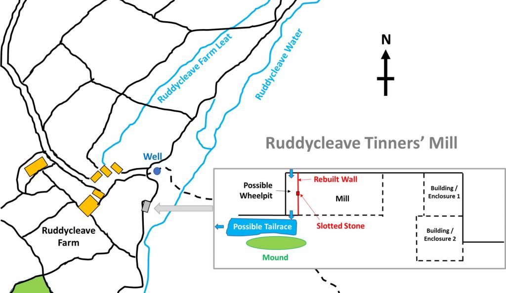
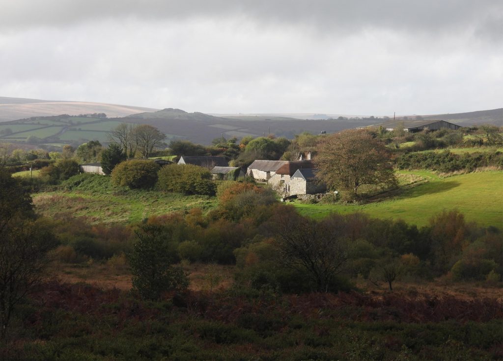
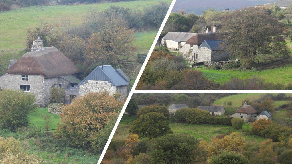
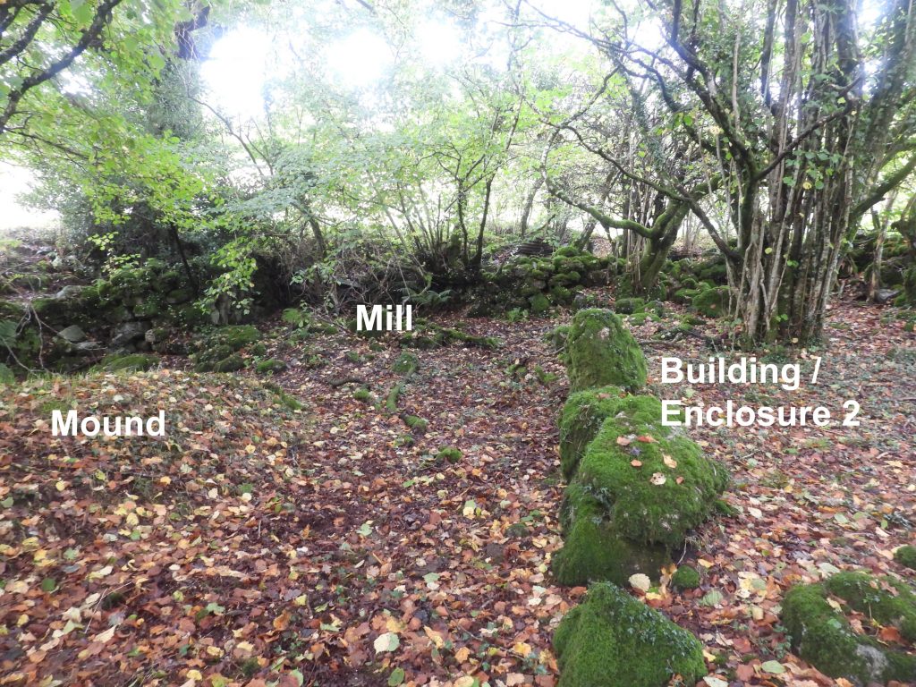
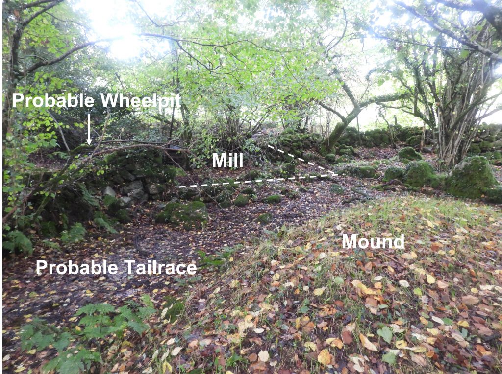
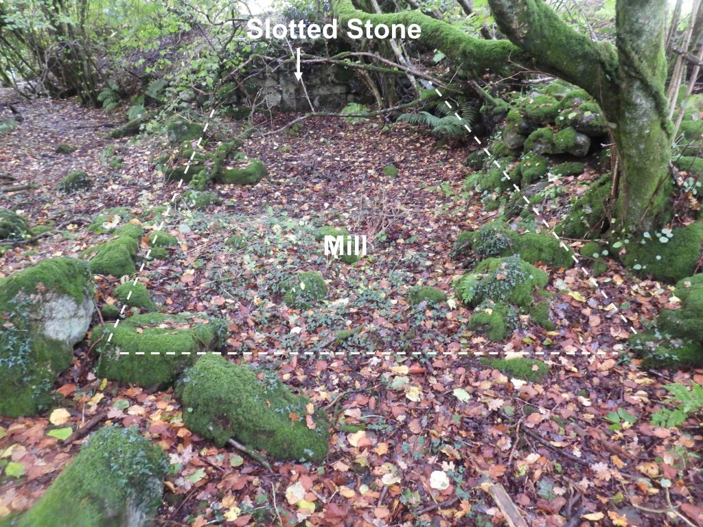
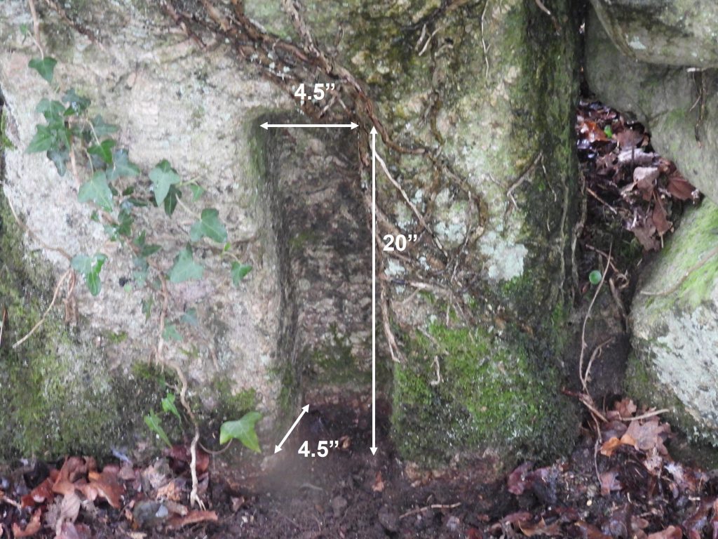
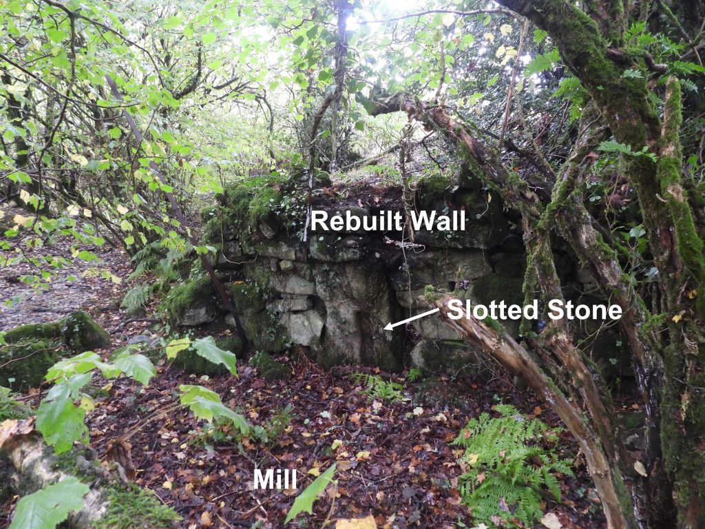
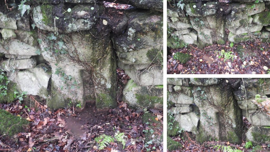
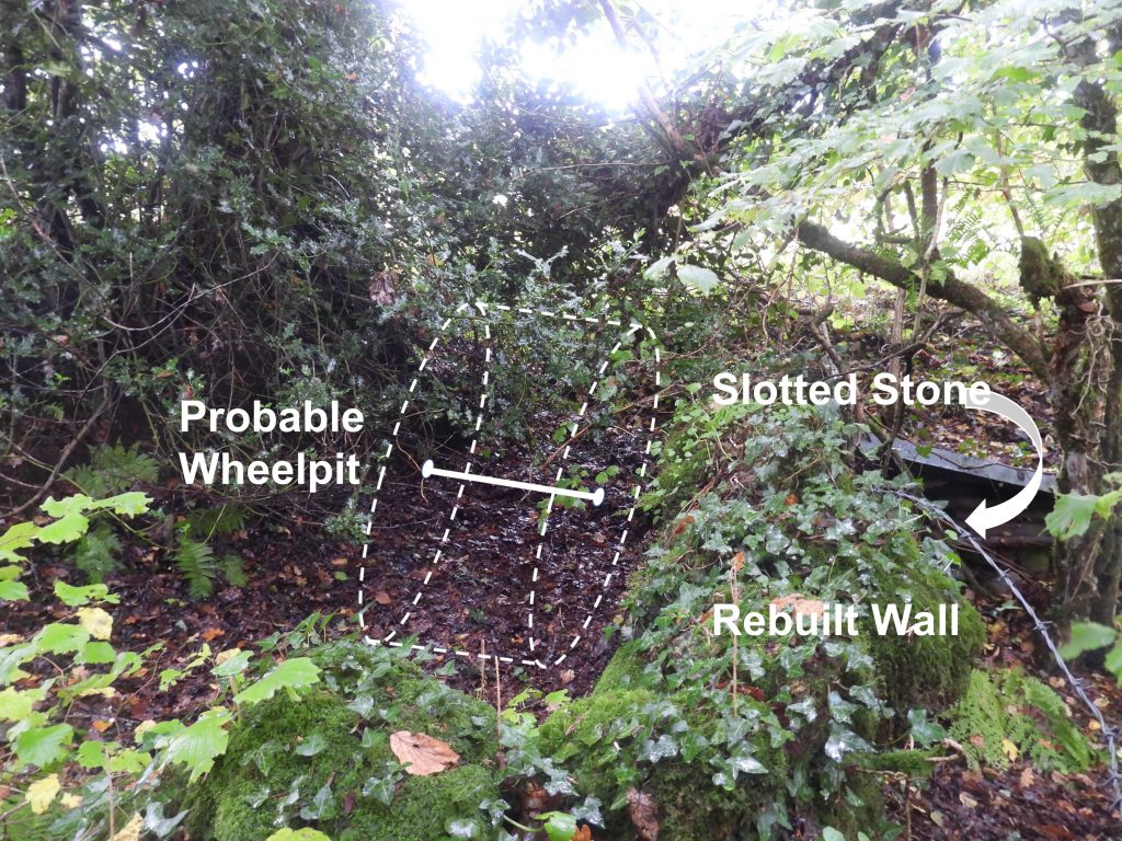
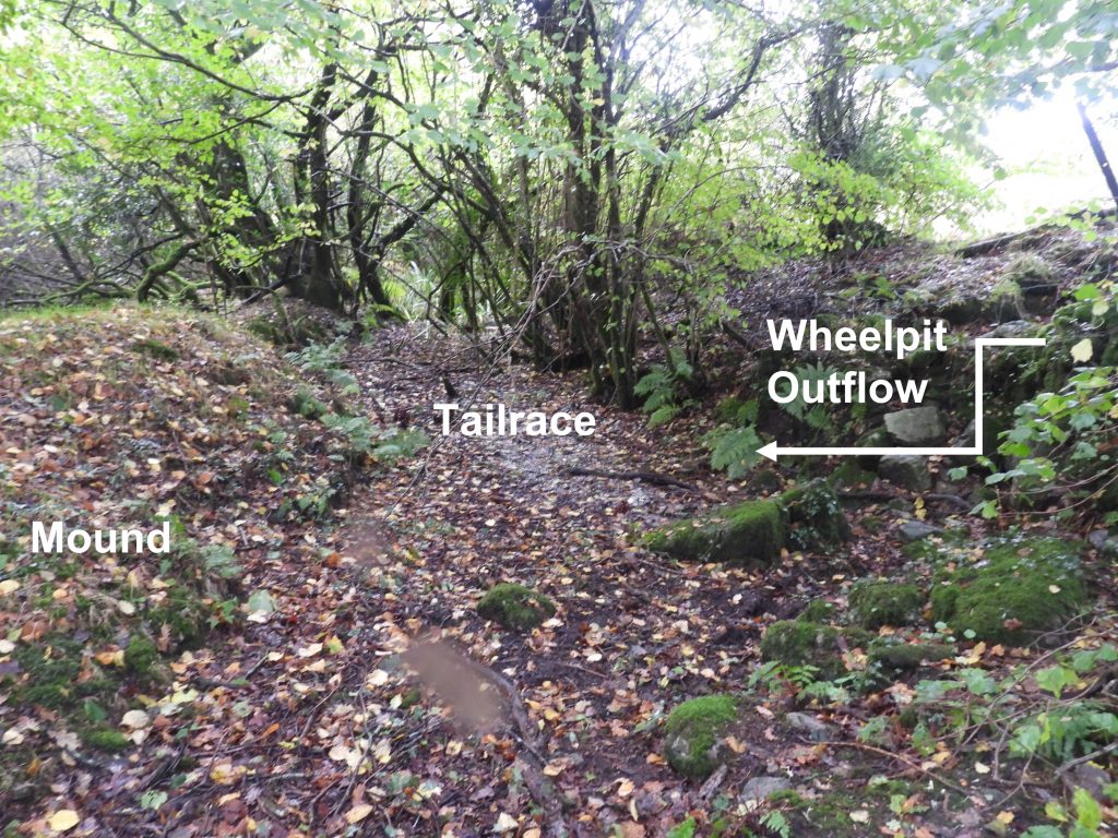
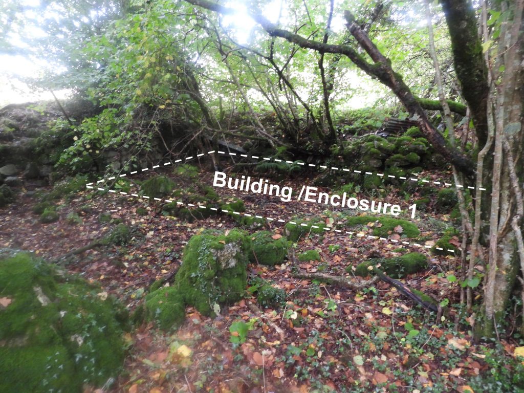
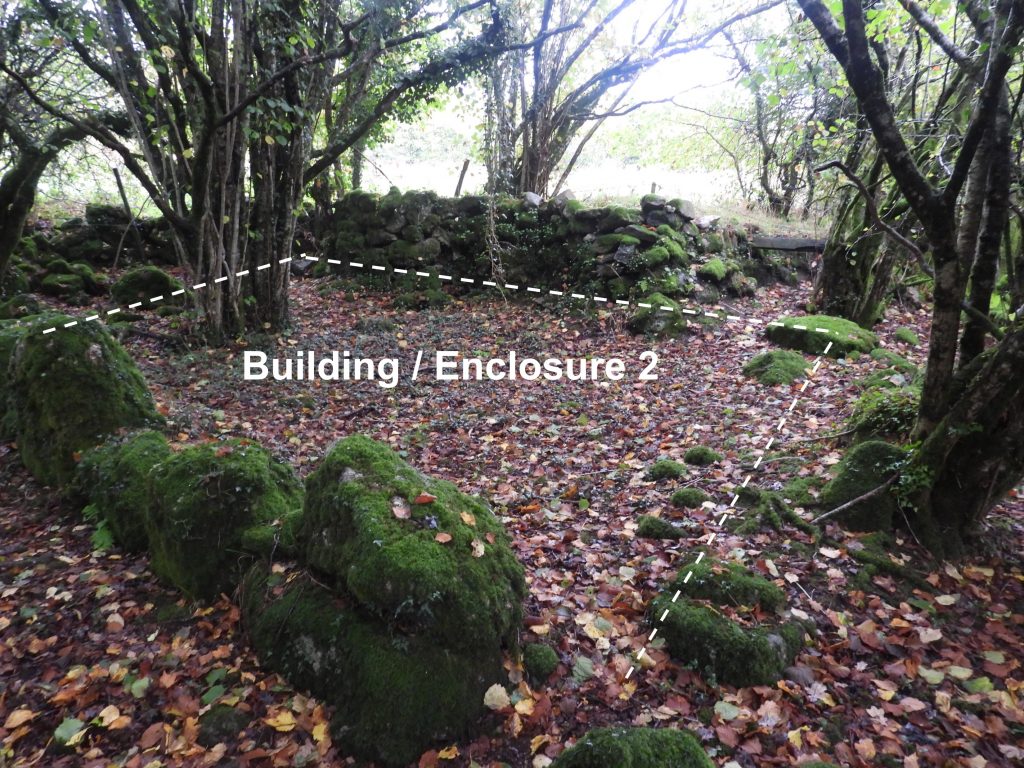
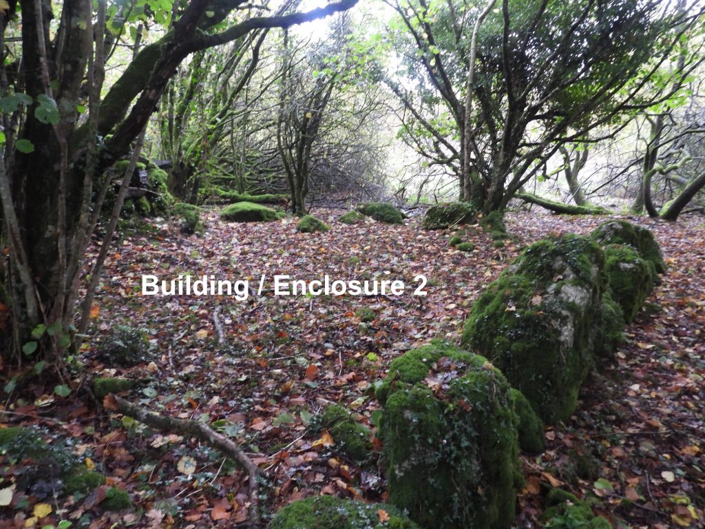
Sketch map and interpretation of the Tinners’ Mill site. Nearby, as mentioned in the Dartmoor HER is a well near the driftway to Ruddycleave Farm. Access to the area, however, is not via Ruddycleave Farm but from Buckland Common. The access is quite difficult (wet underfoot) with a mire to negotiate and Ruddycleave Water to be crossed.Ruddycleave Farm from Buckland Common. The trees between the Common and the farm is where the Tinners’ Mill and Well are located. The name Ruddycleave (or Reddicliff / Redeclyve) means “red cliff”.Ruddycleave is first mentioned in circa 1200 and in the lay subsidy rolls of 1330 as Redeclyve (Source: Gover, Mawer, and Stenton,1932, The Place-Names of Devon). The farm is believed to have been given to the church in 1566 and to have been owned by them until at least 19th century. (Source: White,1968, Reprint of History, Gazetteer and Directory of Devonshire). In modern times, Ruddycleave comprises a number of farm buildings which include stables, pigsties, barn and shippon set around a central farmhouse. Amongst the trees, the tinners’ mill is a few 10’s of metres to the west of Ruddycleave Water, an area with lots of evidence of tin streaming. There are several courses of drystone walling in the area which possibly were other buildings or enclosures. A probable wheelpit and tailrace adjacent to the Mill along with a man made mound are among the evidence of previous tinners’ activitiesThere are several courses of drystone walling in the area which the author believes belong to two other buildings / enclosures as well as the Mill itself.The Tinners’ Mill is identifiable by having a ‘slotted stone’ in a re-built wall at its south end. The slotted stone is similar to two found at Longstone (Burrator) in terms of size of both the stone and the slot. If the building was a Crazing Mill (Greeves – 1986), could it this slotted stone have been a building block to hold the crazing stones. If however the mill was a blowing house could the slotted stone be a possible tin mould stone ?The author ‘estimated’ the length, width and depth of the slot in the stone as shown in the photograph. Its volume is approx. 405 cu. in (ie 4.5×4.5×20). Tin density is 7.265g/cm3 (or 0.2625lb / cu in) so if this slotted stone was a mould stone it would have held just over 106lbs. From the Dr Tom Greeves thesis (P229), he mentions 100 lb ingots were used in Devon…dating back to 14th C. It is very co-incidental that the slotted stone could have contained around 106lbs so evidentially it could have been a mould stone. The stone appears to have been (re) built into a wall behind which is where the probable wheelpit was located. There is no evidence of any crazing stones, so the question is was this a crazing mill or could it have been a blowing house ? There is no direct evidence of a furnace either.Close up of the slotted stone, which is located at SX73059 74107Behind the rebuilt wall with the slotted stone is a probable wheelpit (mentioned in the 1986 record by Greeves).The probable wheelpit in relation to the slotted stone and rebuilt wallThe evidence of the location of the probable wheelpit is added to with a well defined tailrace leading to Ruddycleave Water. The mound assists with the channelling of water. The mound is clearly man made but seems too tall to have been an embankment purely for channelling water. It might have been part of the original tinstreaming surrounding Ruddycleave Water or possibly a tinners’ slag heap. The only real way to determine its original use, would, most probably be to conduct an excavation into it to see if there is any tinners’ slag in it. If there was, the mill would most certainly would have been a blowing house. On the north west corner of the site is a some drystone walling (plus old field walls) which might have been a building or enclosure. On the 1840 tithe this was at the boundary of the numbered field system and Buckland Common. A second (larger) building / enclosure foundations lies to the east of the first building / enclosure.Another view of the second building / enclosure foundations.
Short video showing the key features around the Ruddycleave Mill SiteJust to the north of the mill site is the ‘driftway’ to Ruddycleave Farm. This is on private land and not accessible. Next to the driftway is a probable well, albeit not an obvious, or indeed exciting feature. It is defined by Belsey (1985) as a “spring or well, stone lined cavity covered with two stone slabs. Outlet below lined with three granite slabs above and on either side”. From that definition, the location shown in the photograph is the ‘best fit’ the author could find.Adjacent to the probable well (SX73085 74171) is a flattish area with a small embankment on the eastern edge. The land has clearly been disturbed here, but the purpose is unknown.