A collection of walks, discoveries, insights and pictures of exploring Dartmoor National Park
March 18, 2023
Bal Mine
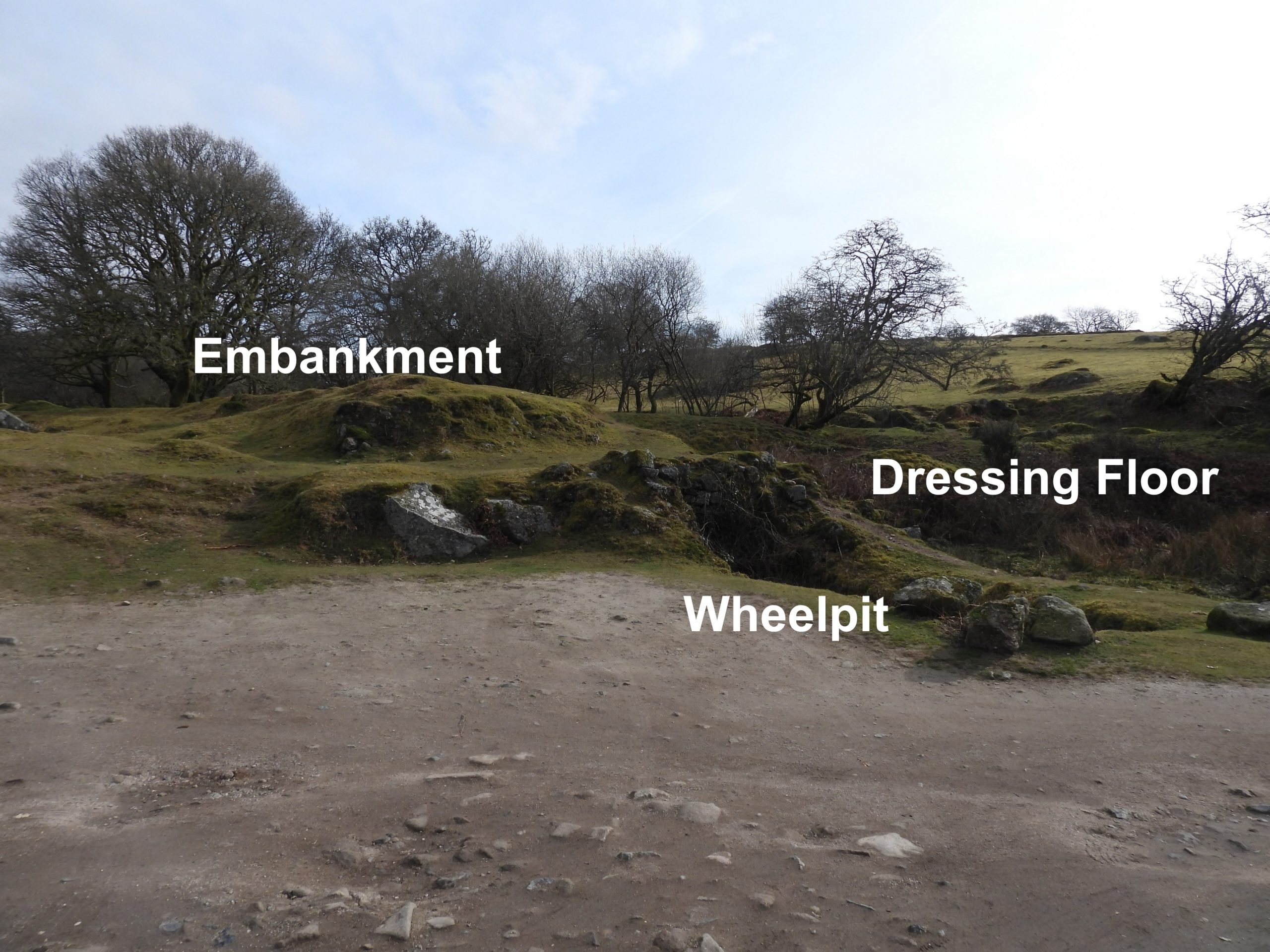
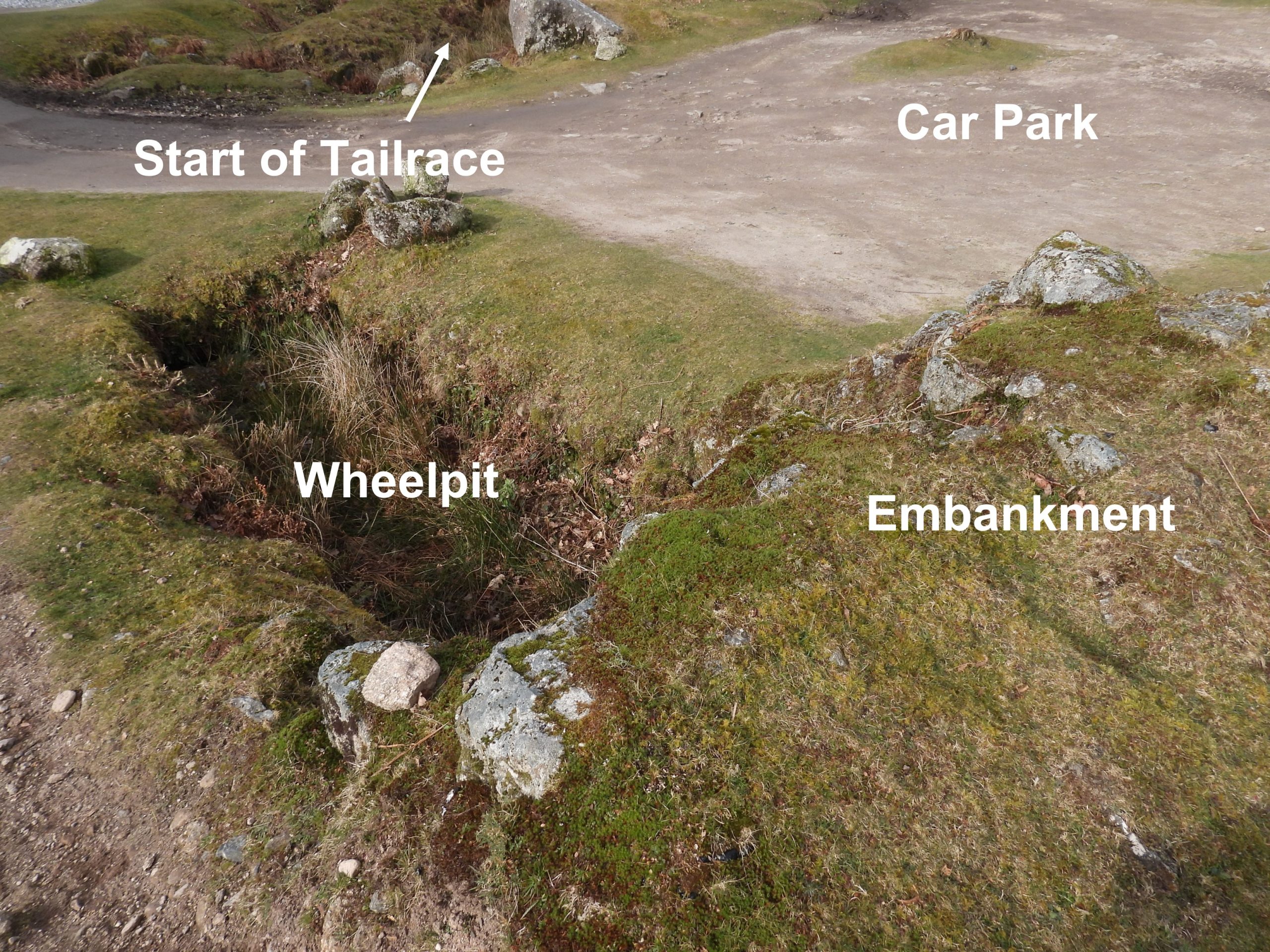
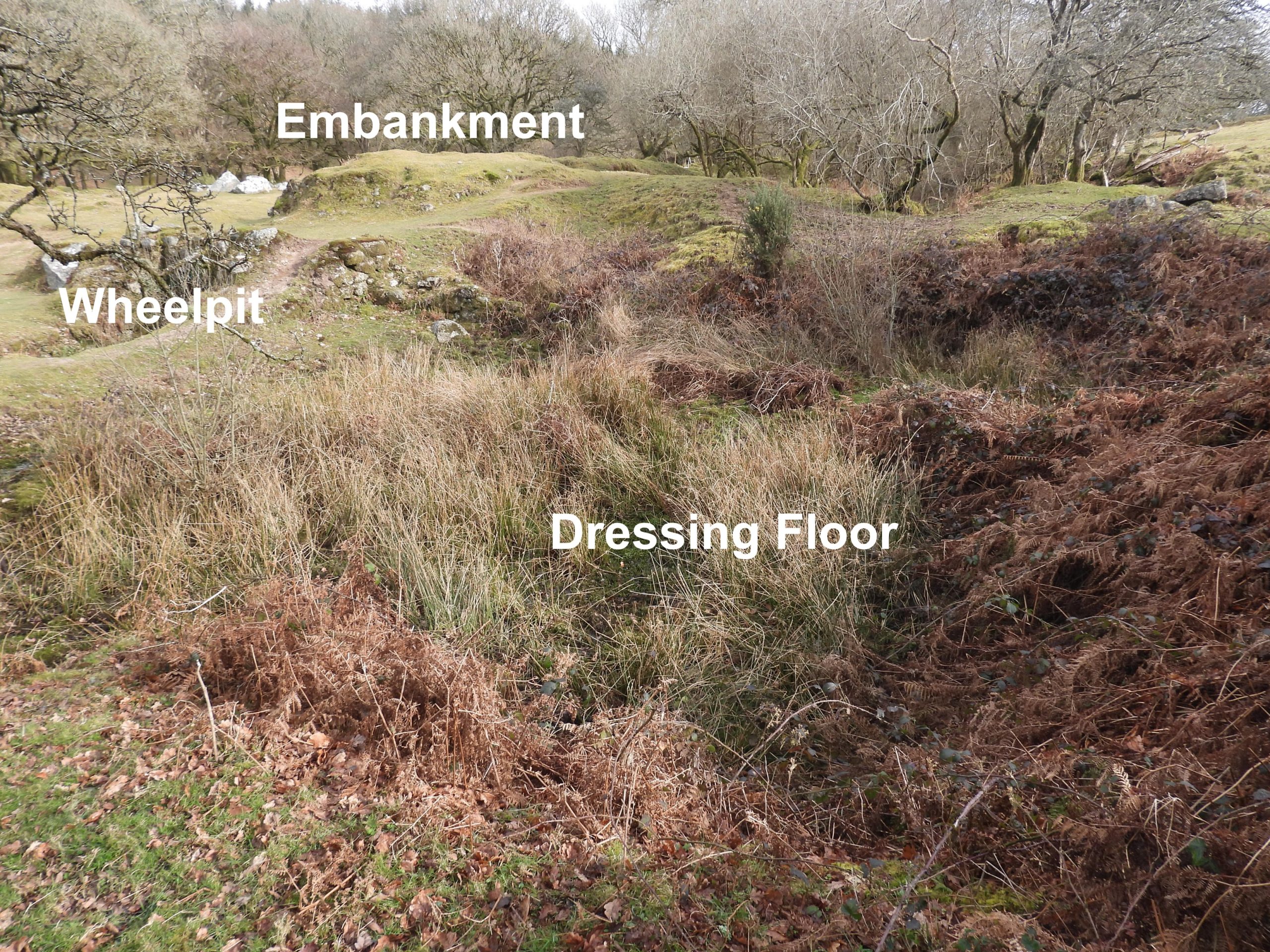
Bal Mine, near Norsworthy Bridge probably dates from the early 19th century and in all probability had a different name at one point. The word “Bal” in the Cornish language means ‘Mine’ . There appears to be very little documented about the mine, but surveys by the Dartmoor Tin Research Group (DTRG) and Historic England provide an insight into the main features still extant and were used as part of the research for this post. The mine complex features include a wheelpit, a tailrace, a leat embankment, a dry leat, walled ‘tunnel’ (which some observers have suggested was once a flue), tailing pits, openworks, at least two shafts, a Melior stone and an adit. A car park was constructed (circa 1971) in the area which might have been part of the dressing floor.
Bibliography:
Historic England, 2021-2022, Historic Environment Record website
Dartmoor Tinworking Research Group, 2013, Survey of Bal Mine
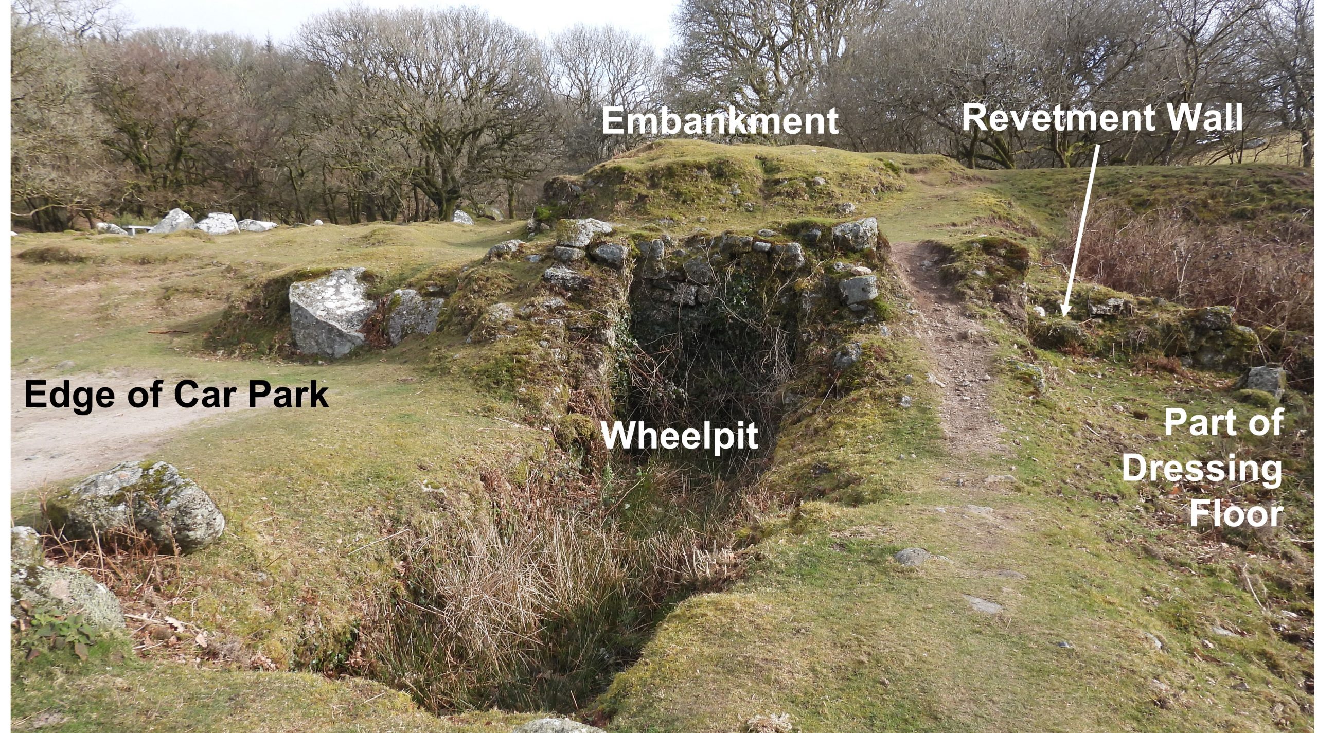
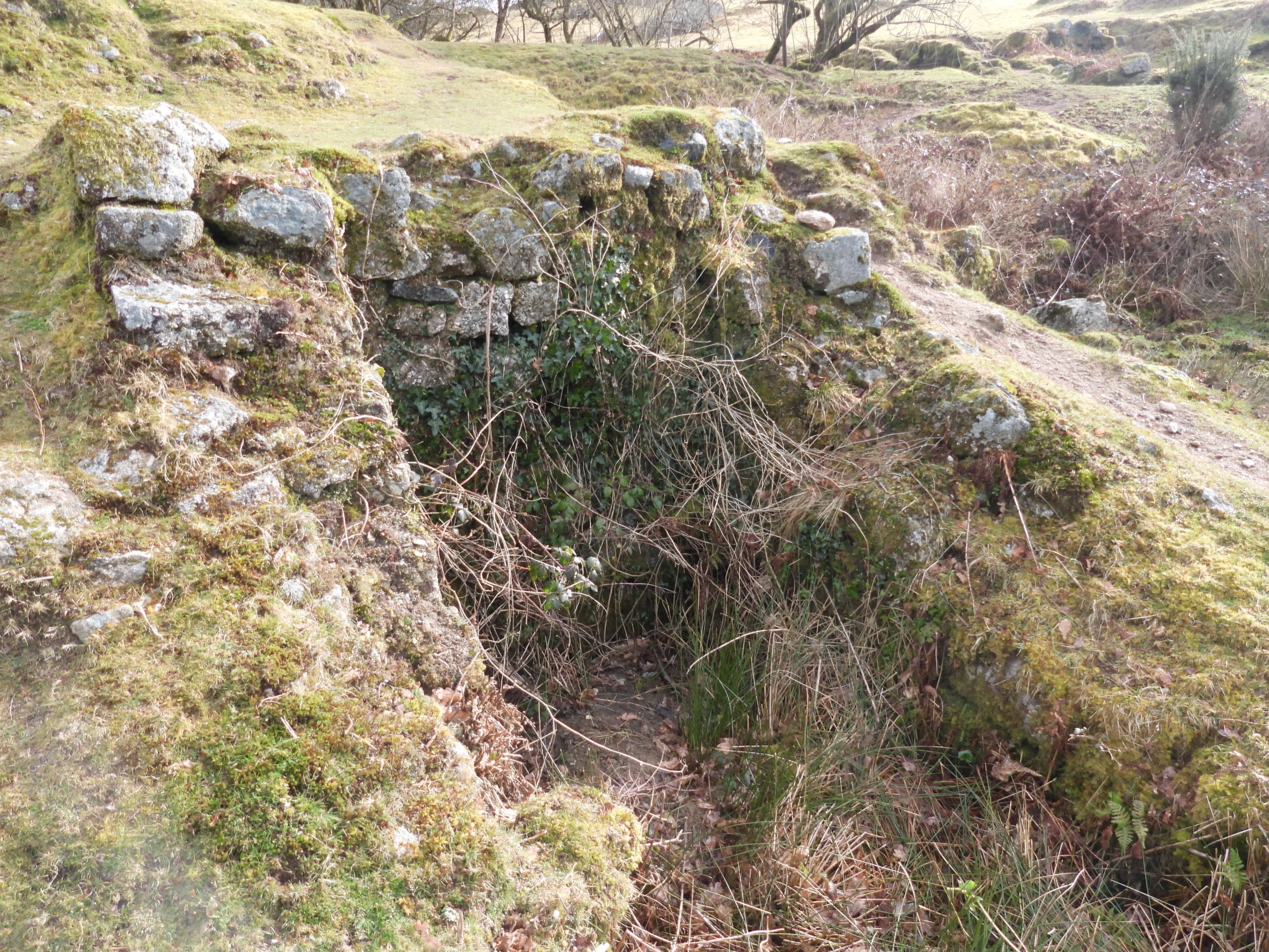
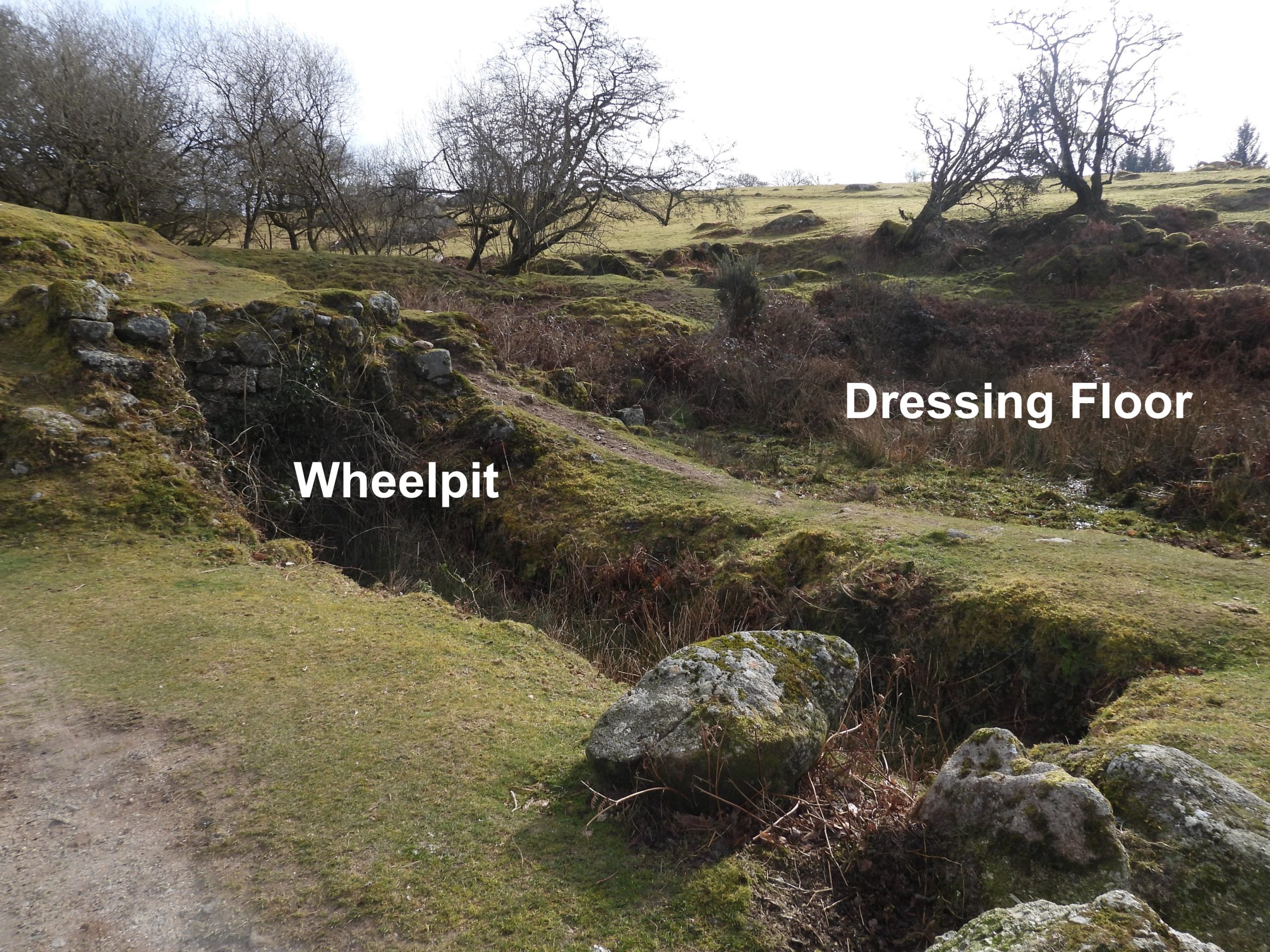
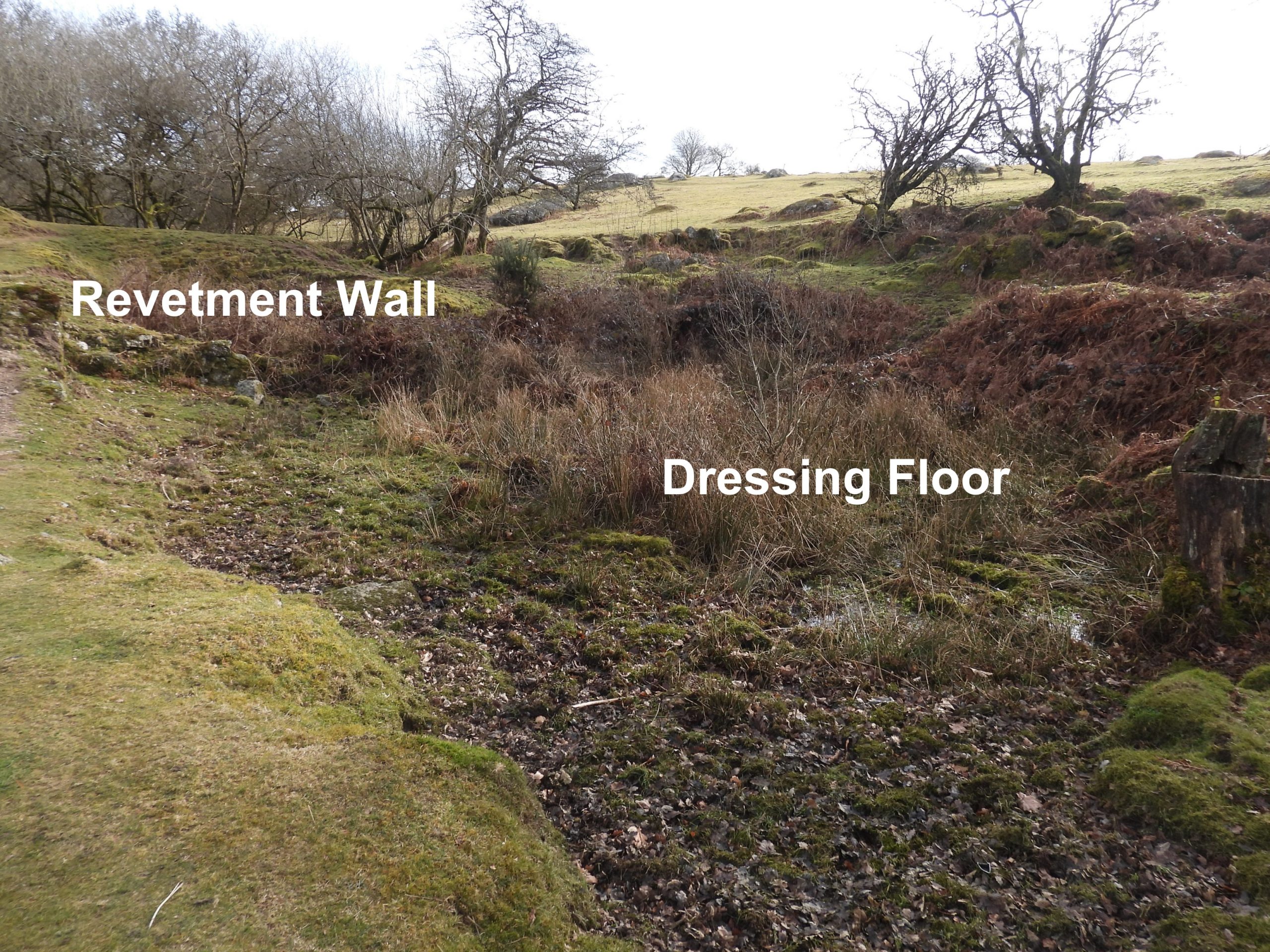
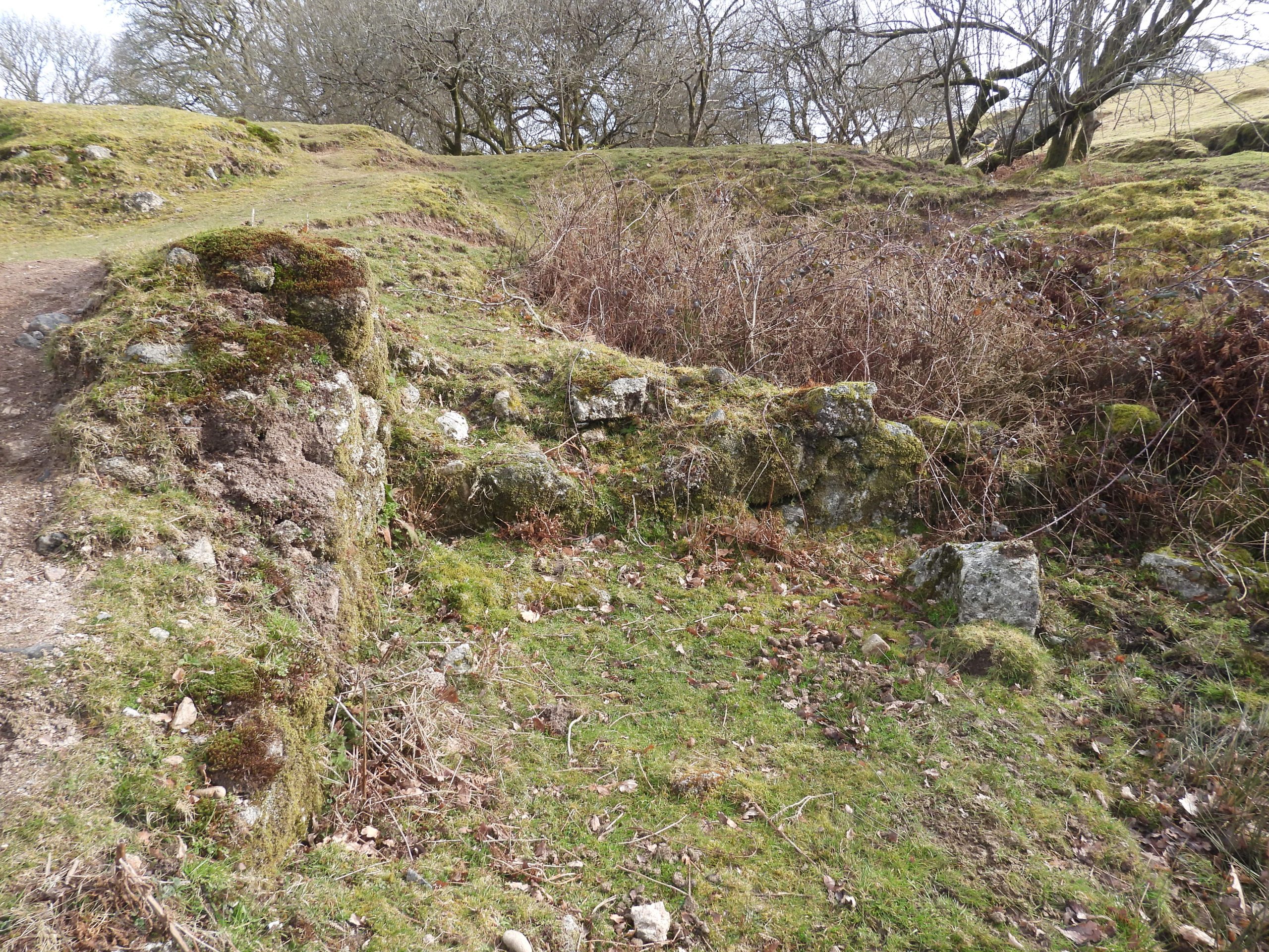
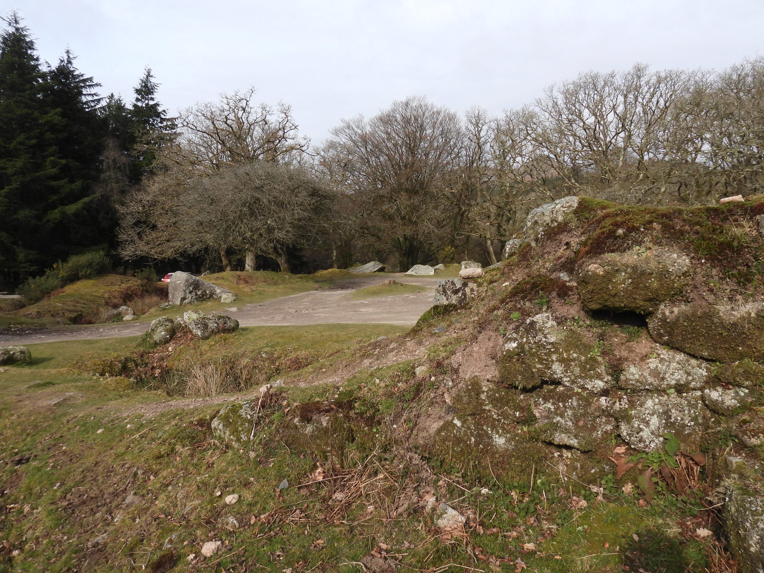
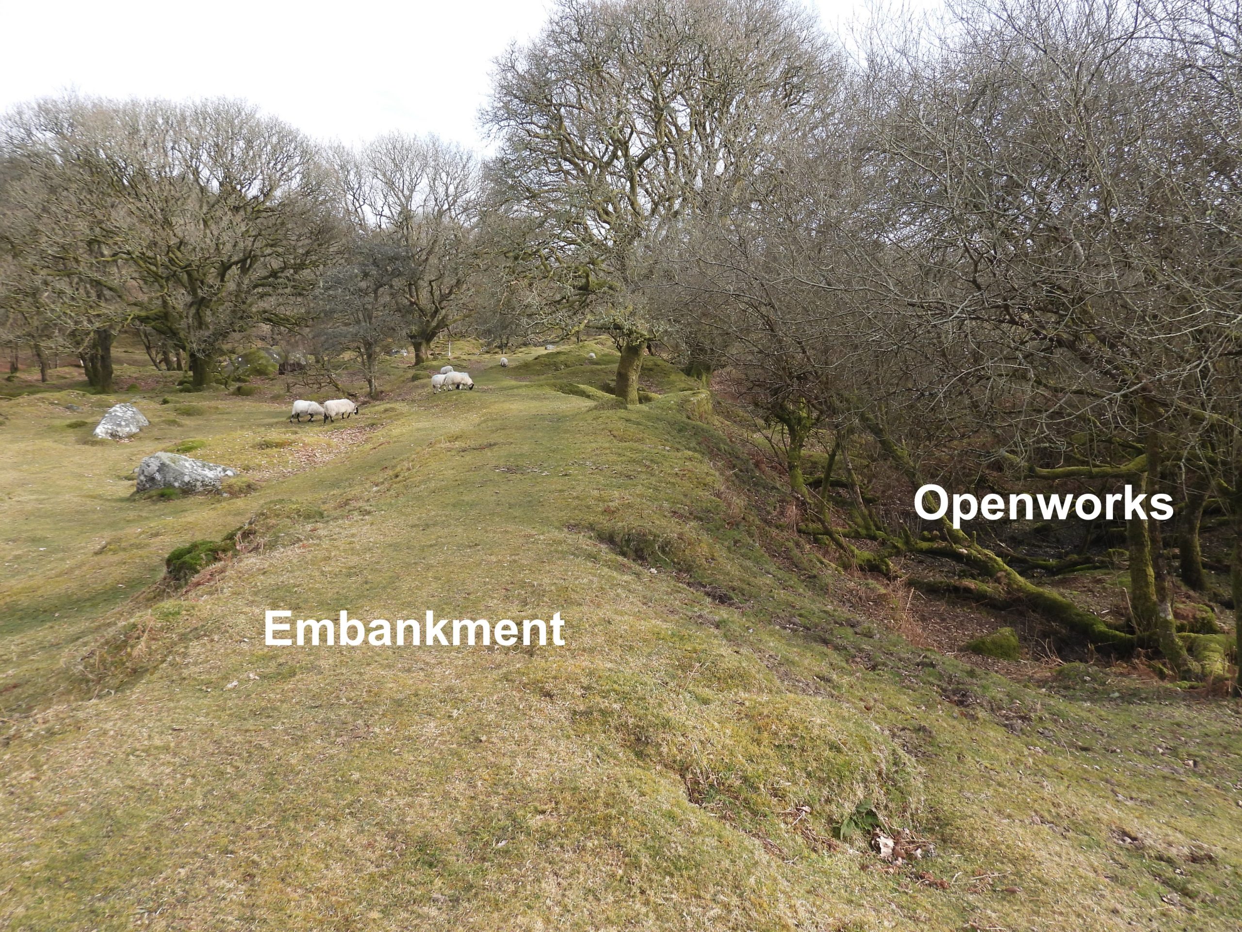
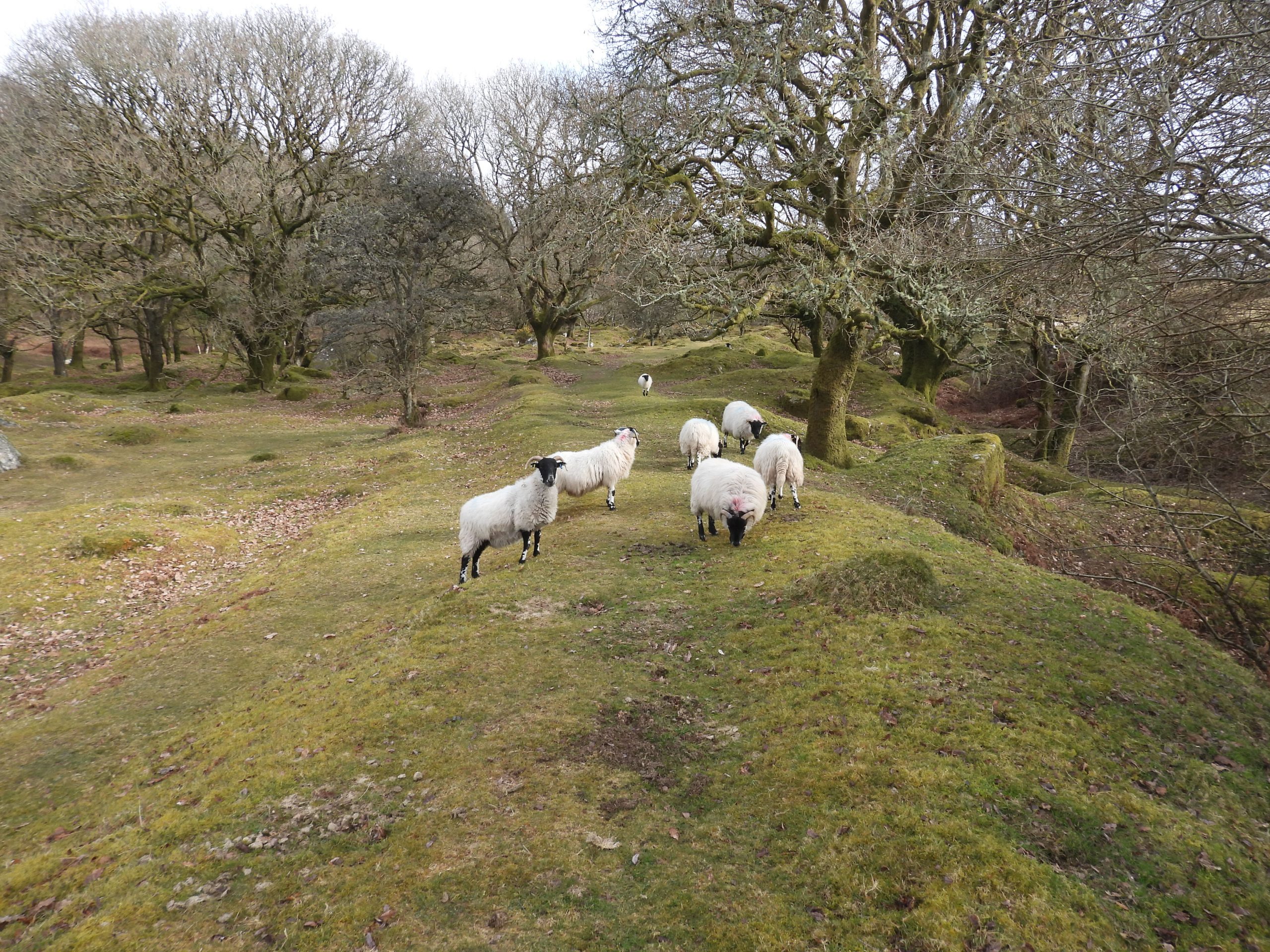
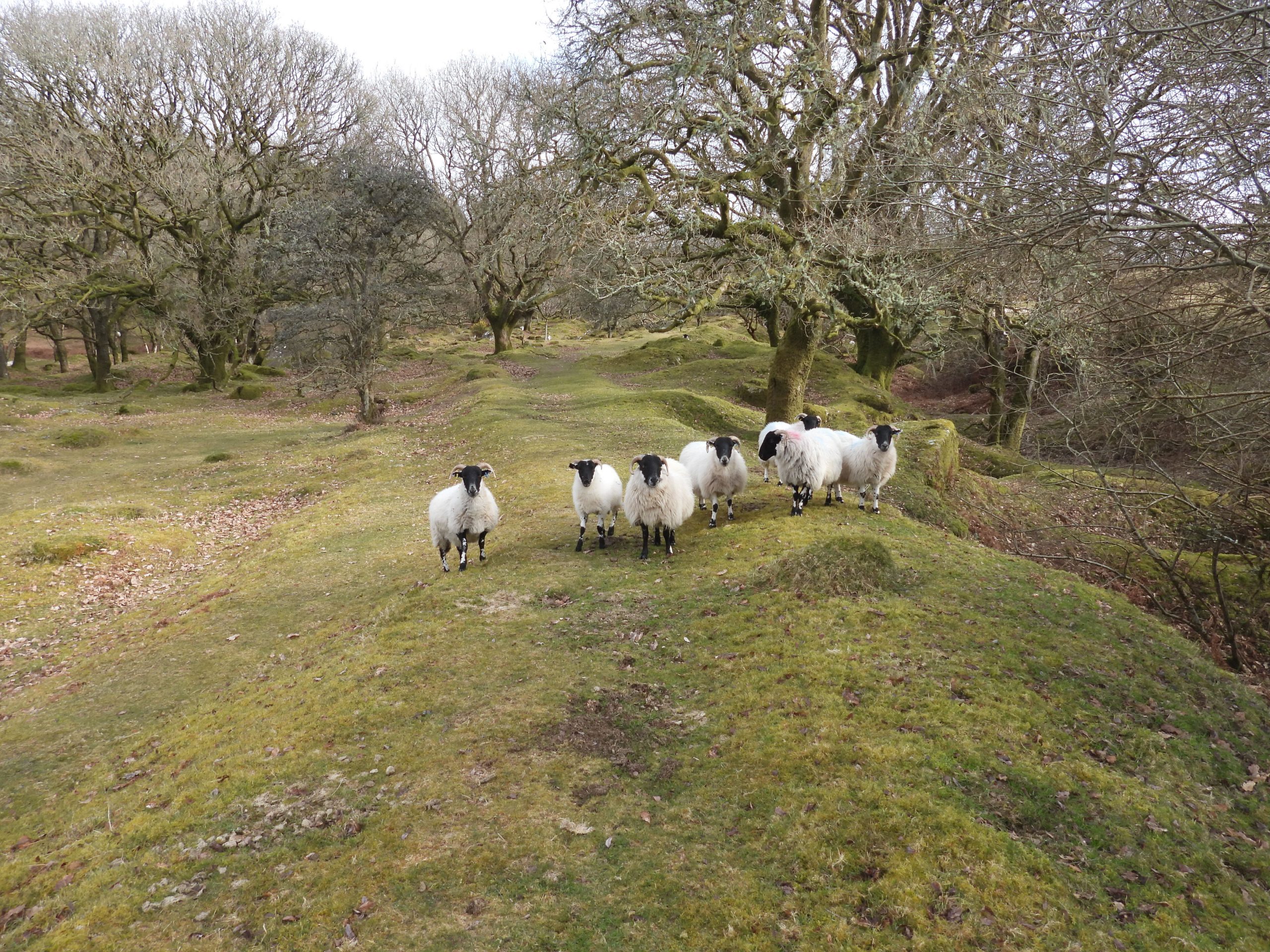
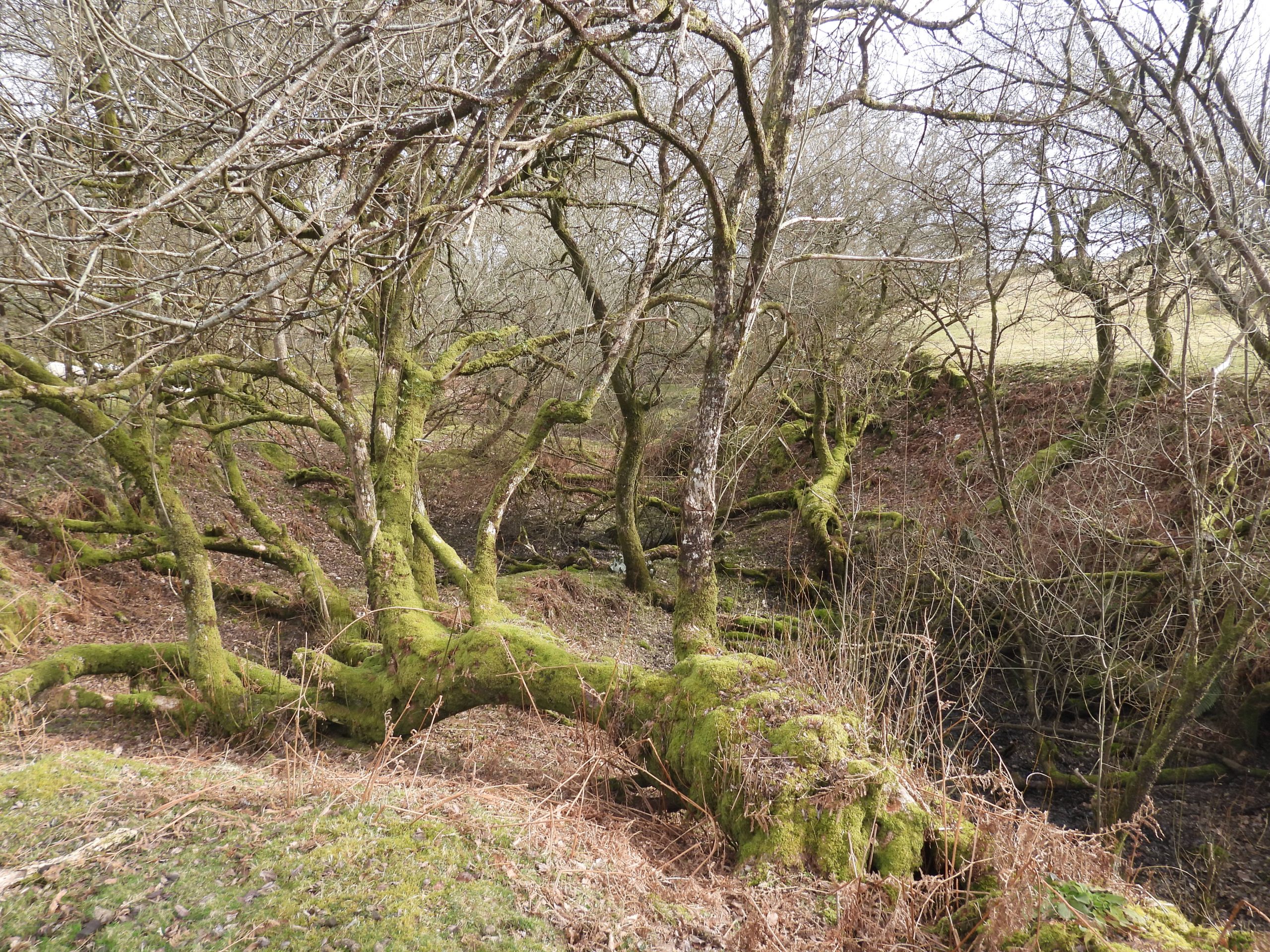
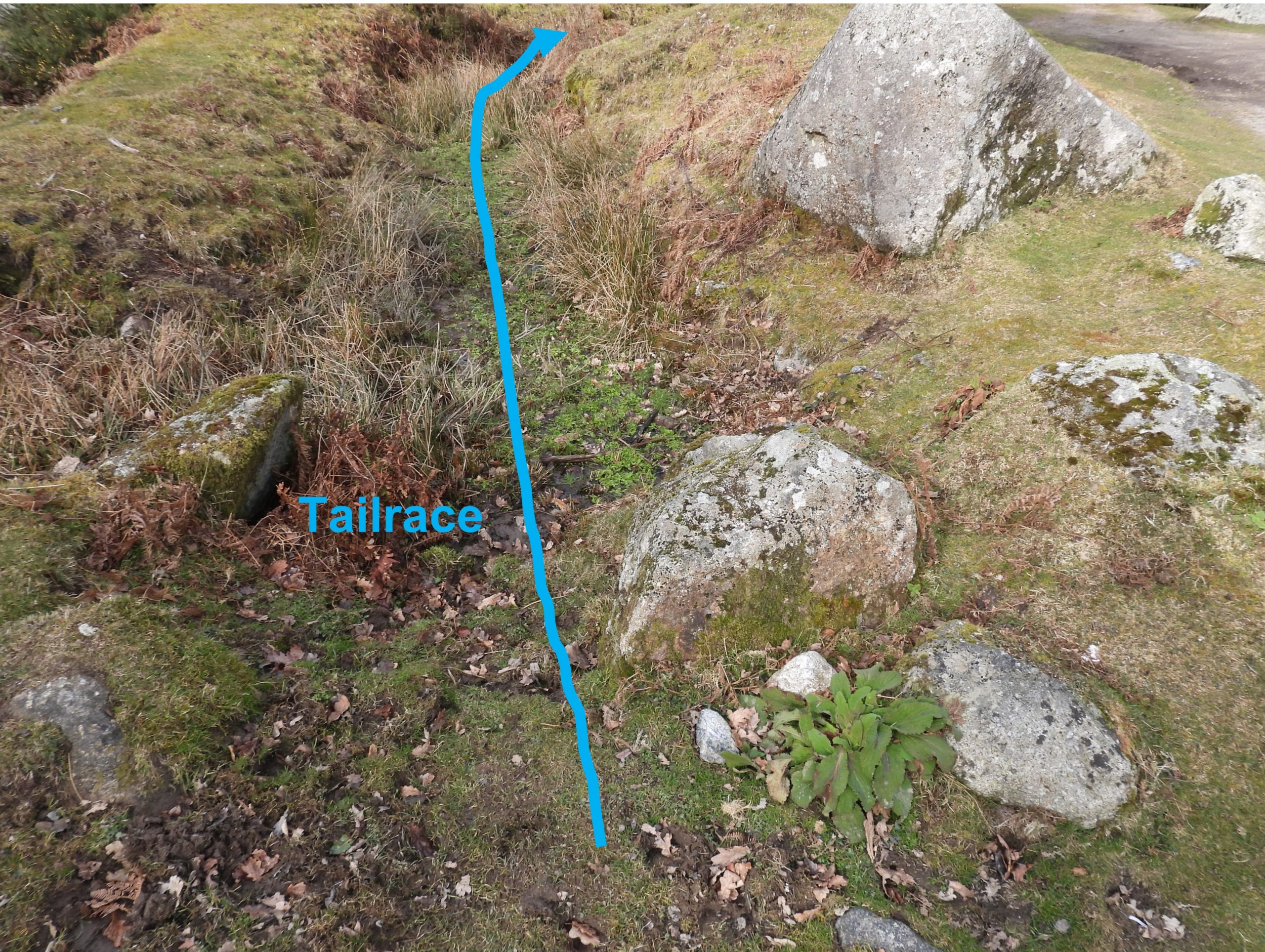
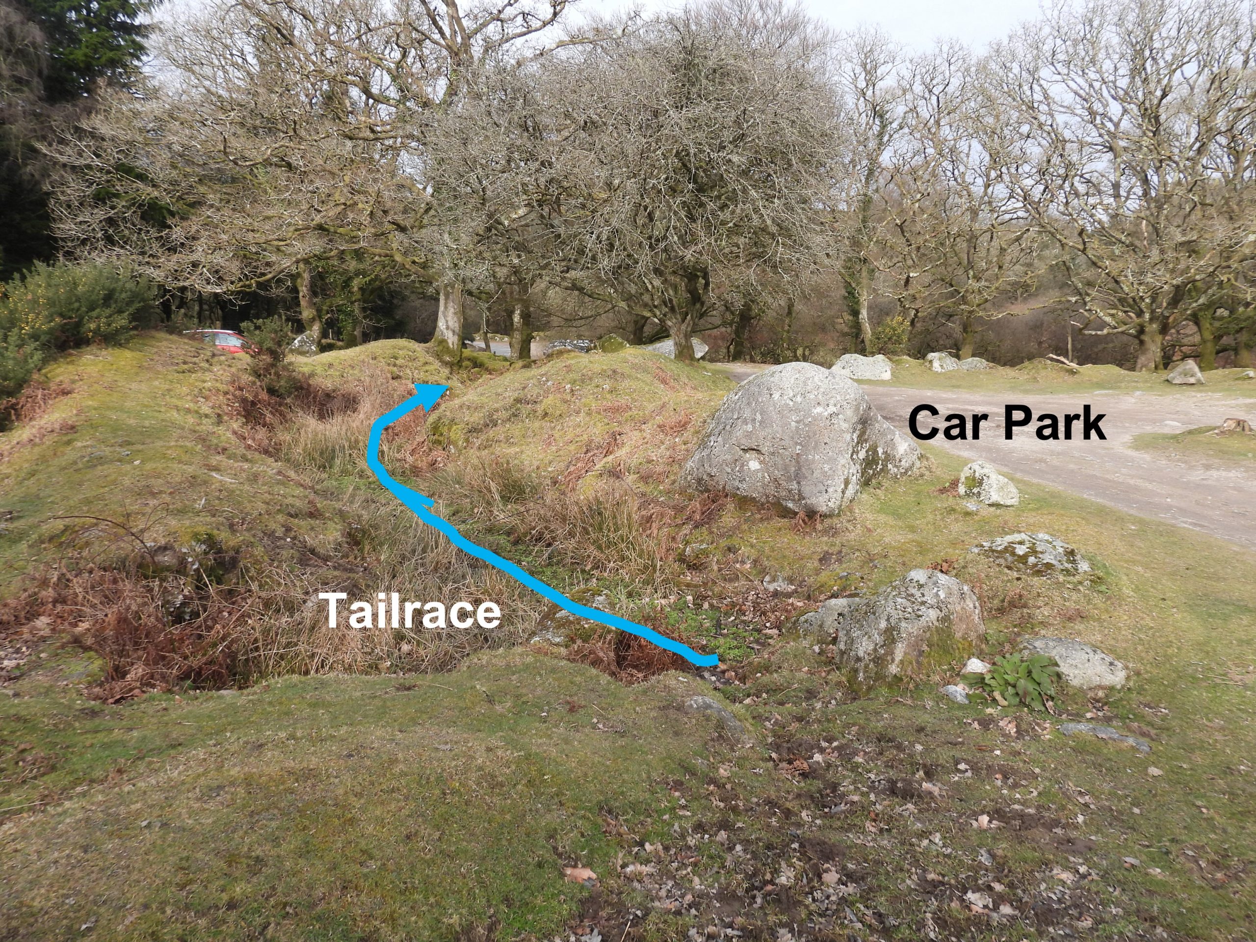
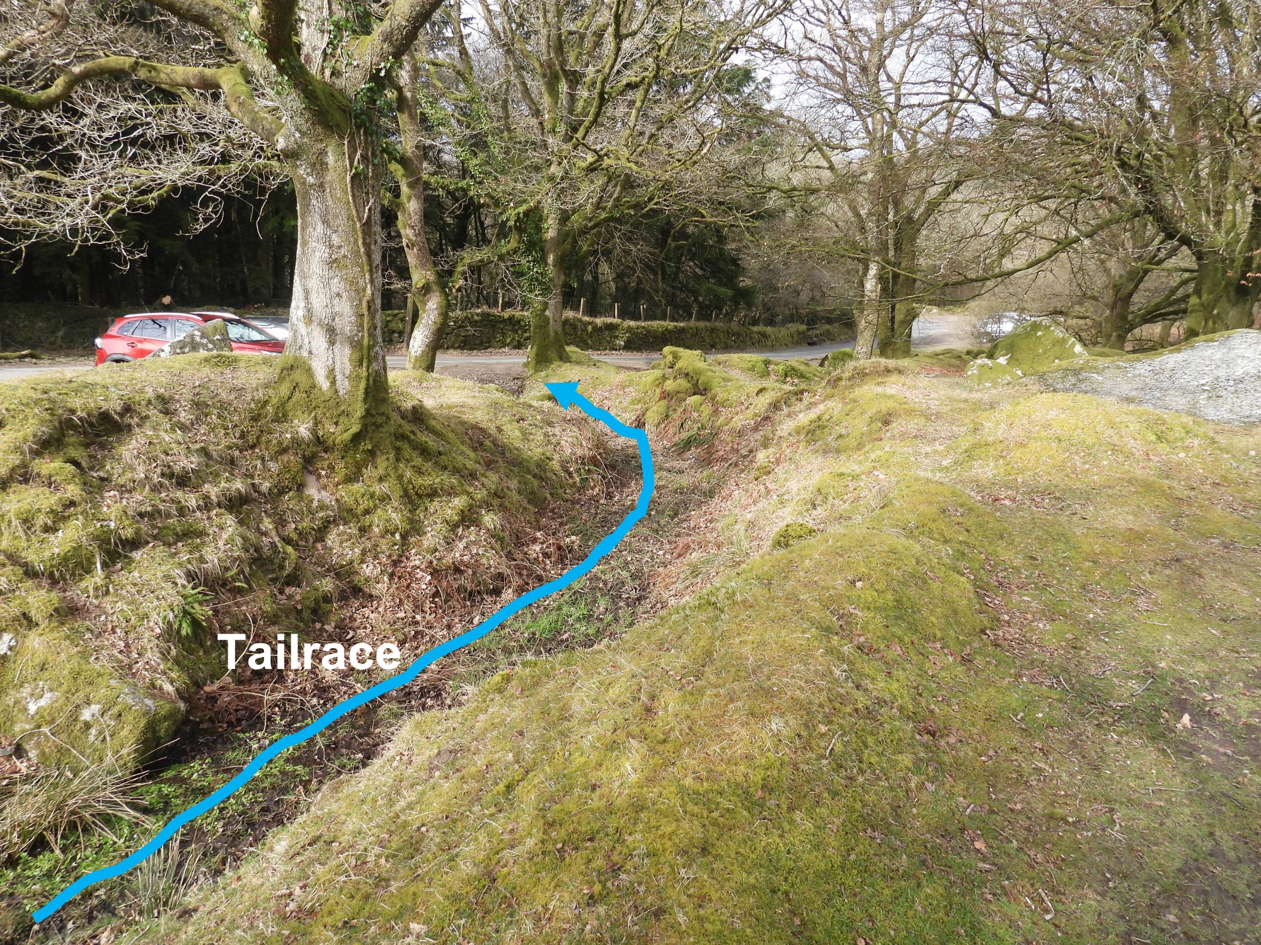
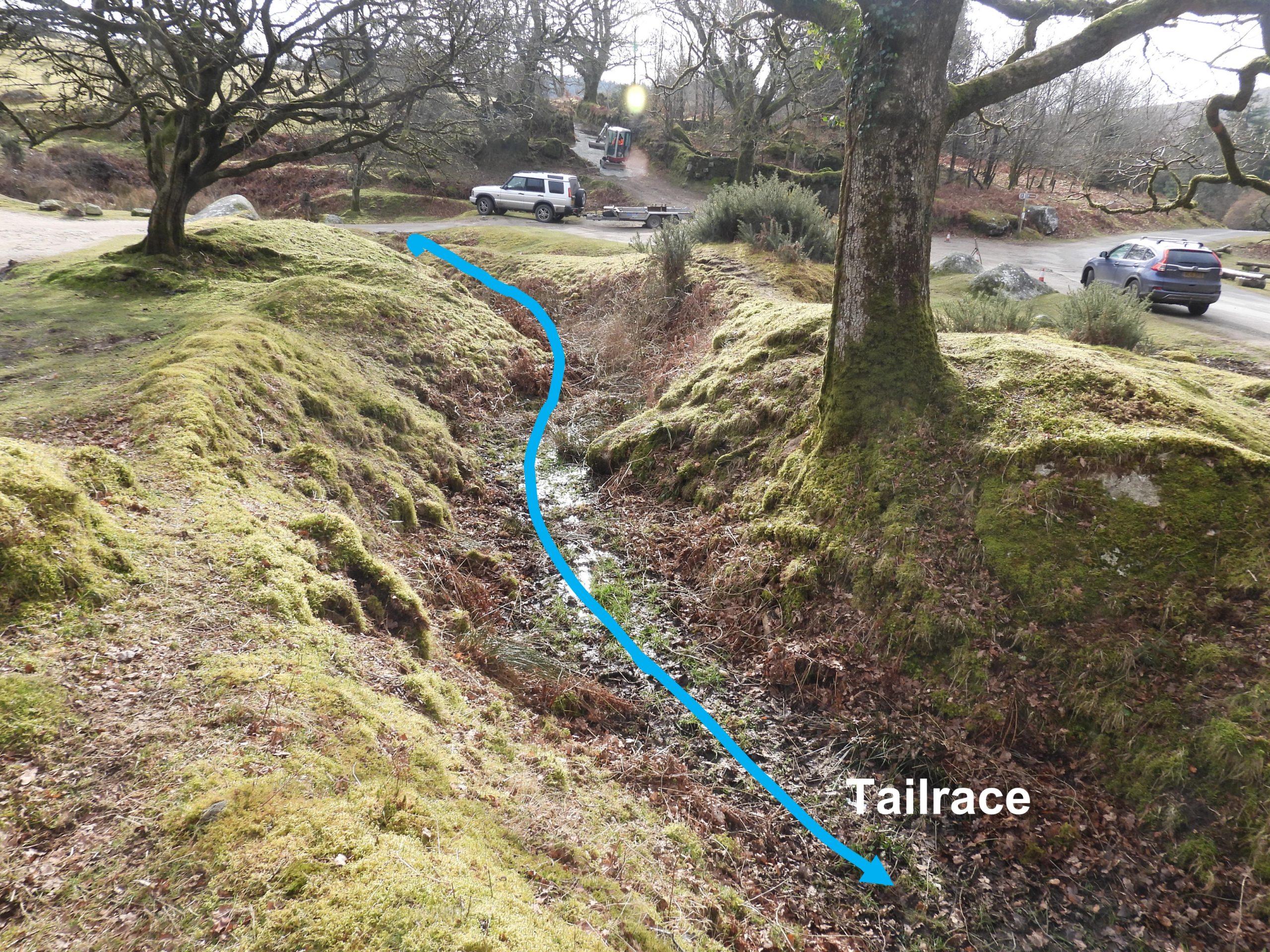
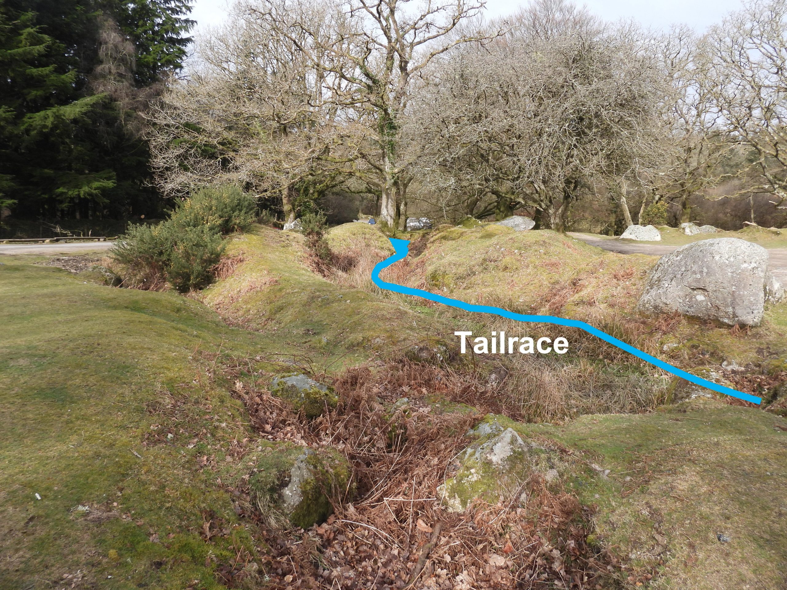
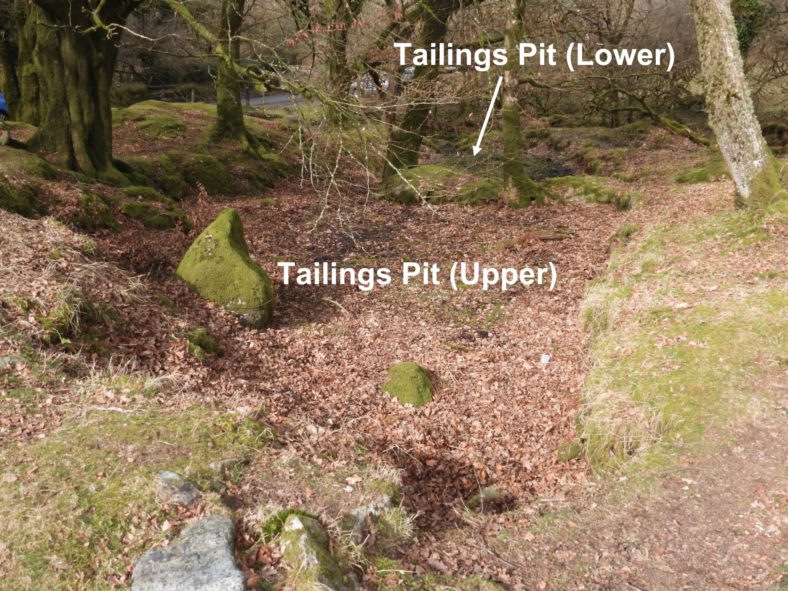
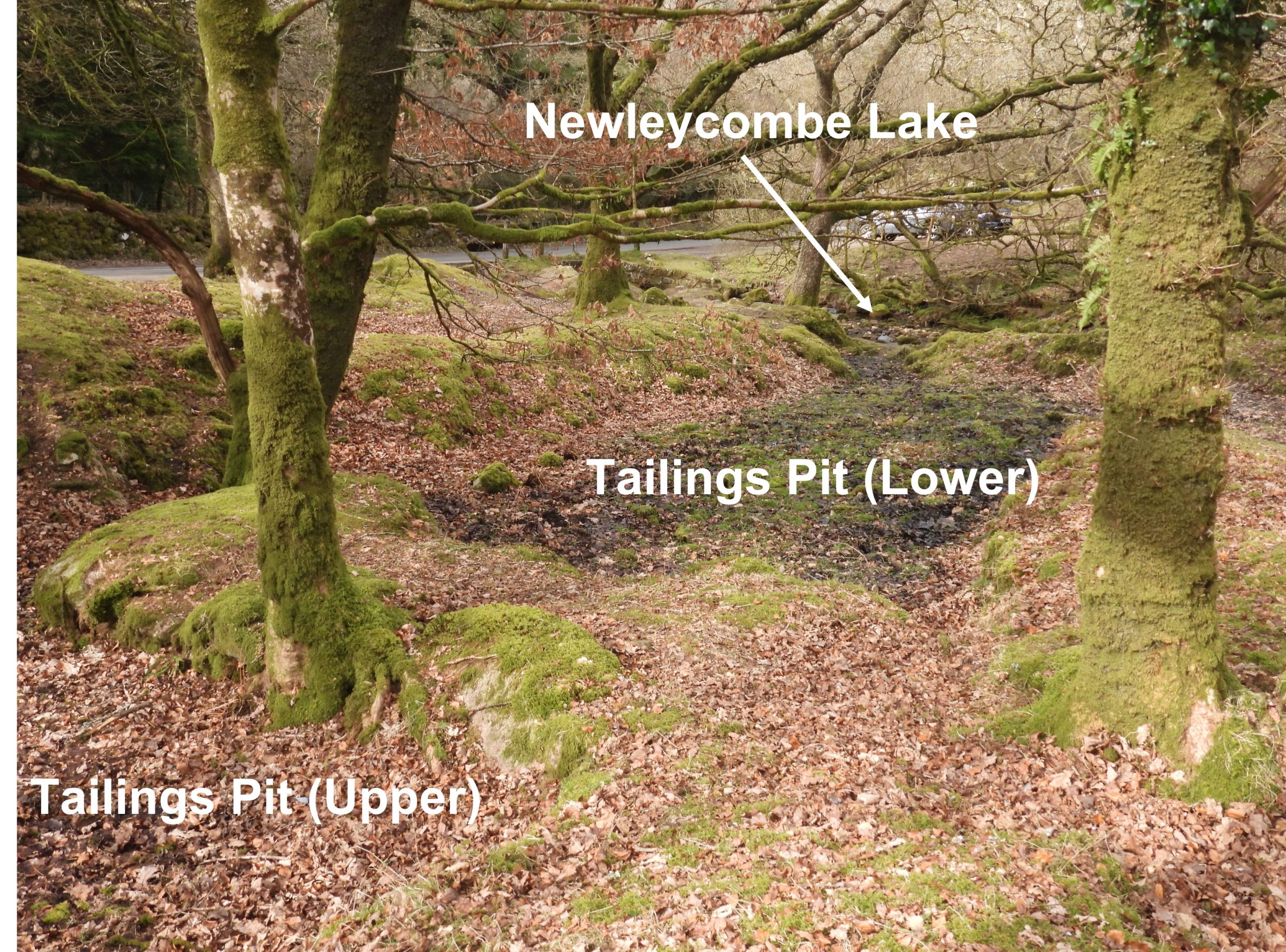
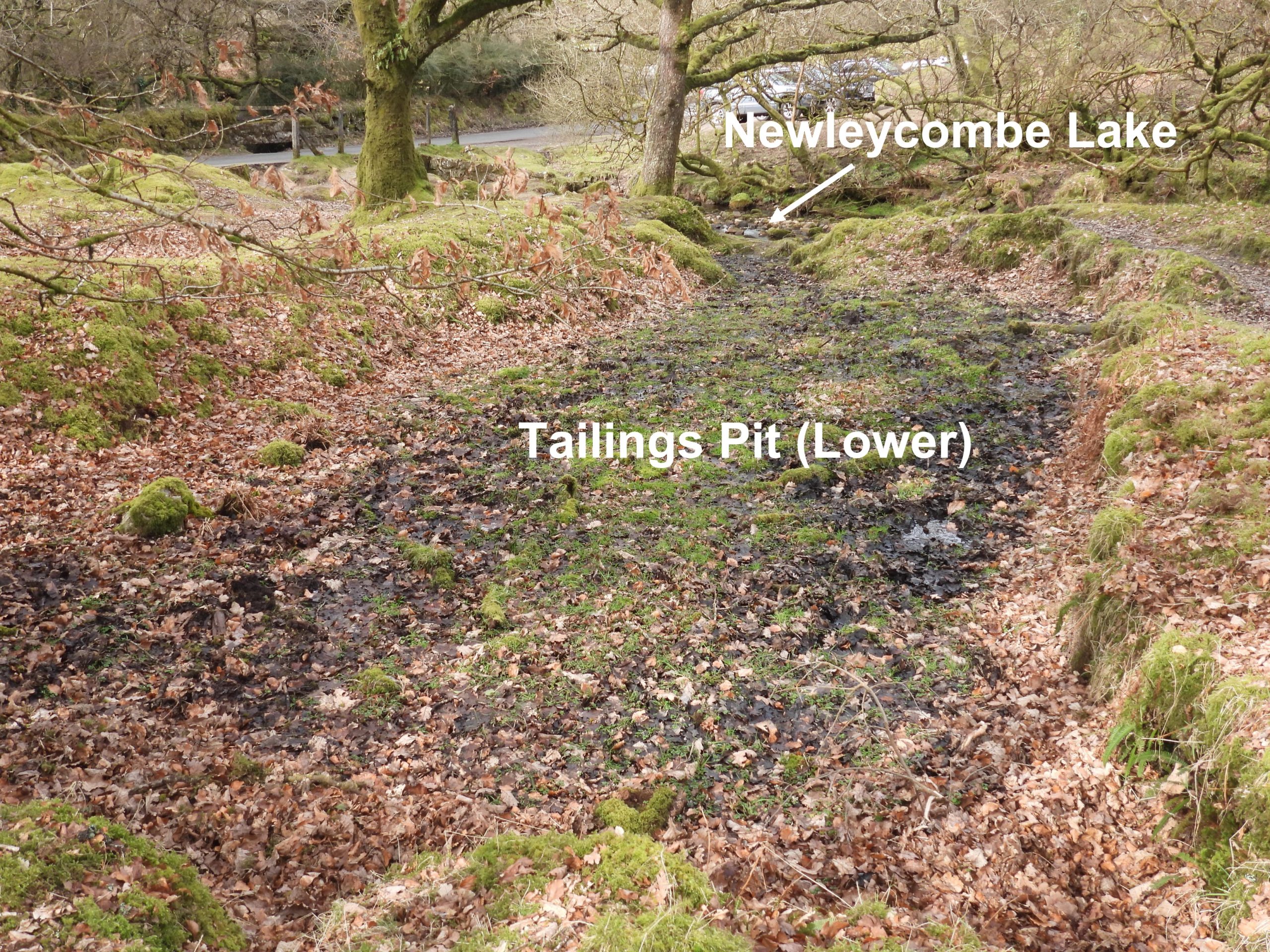
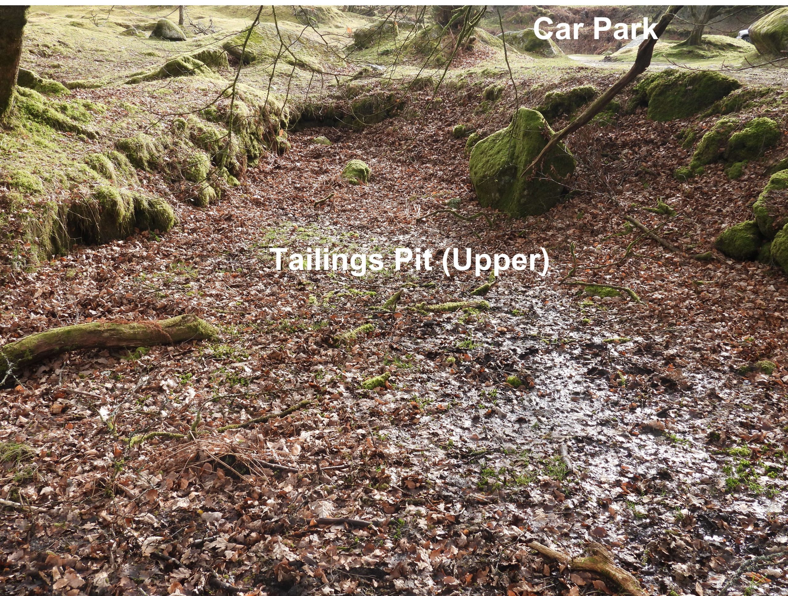
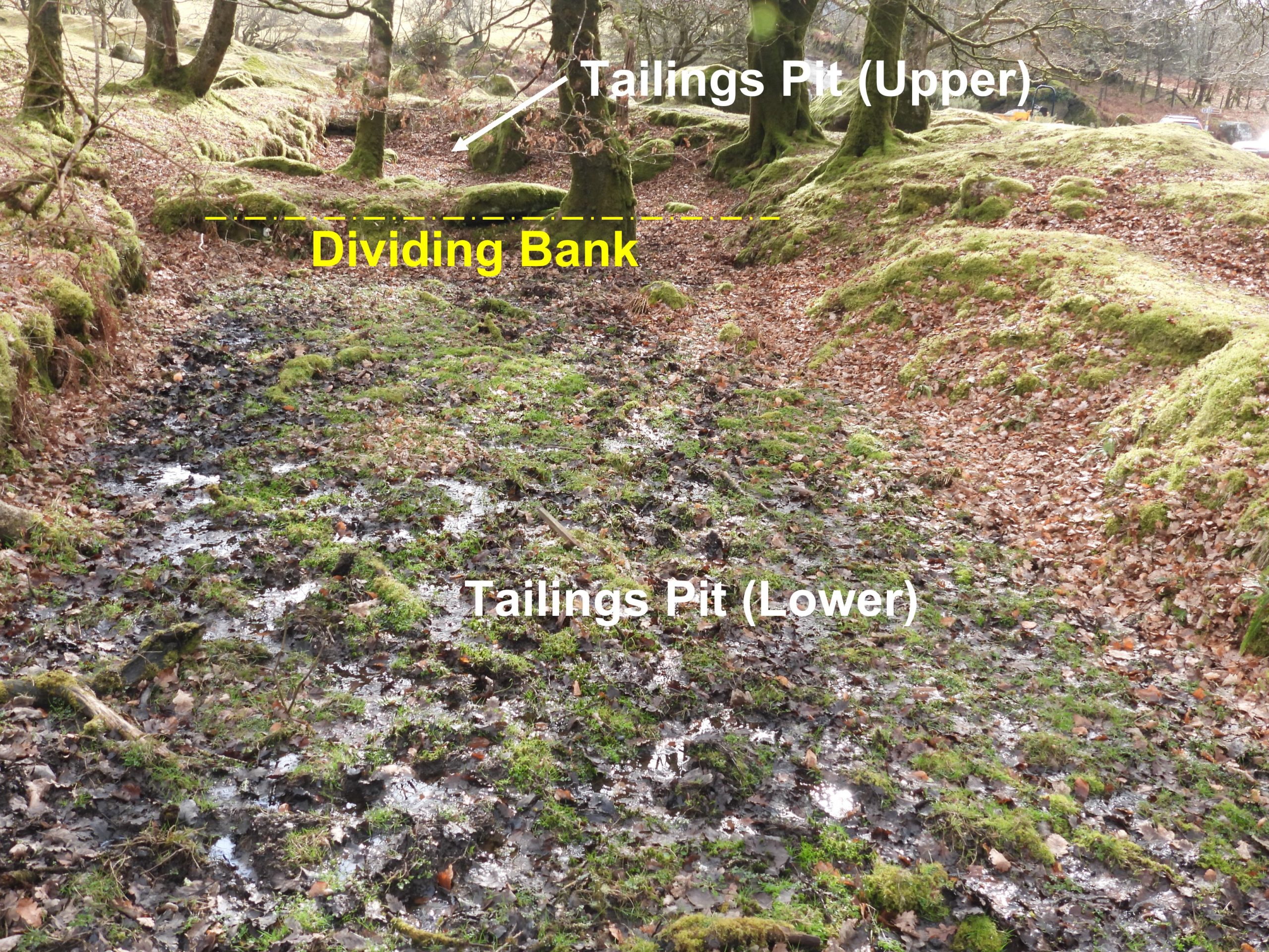
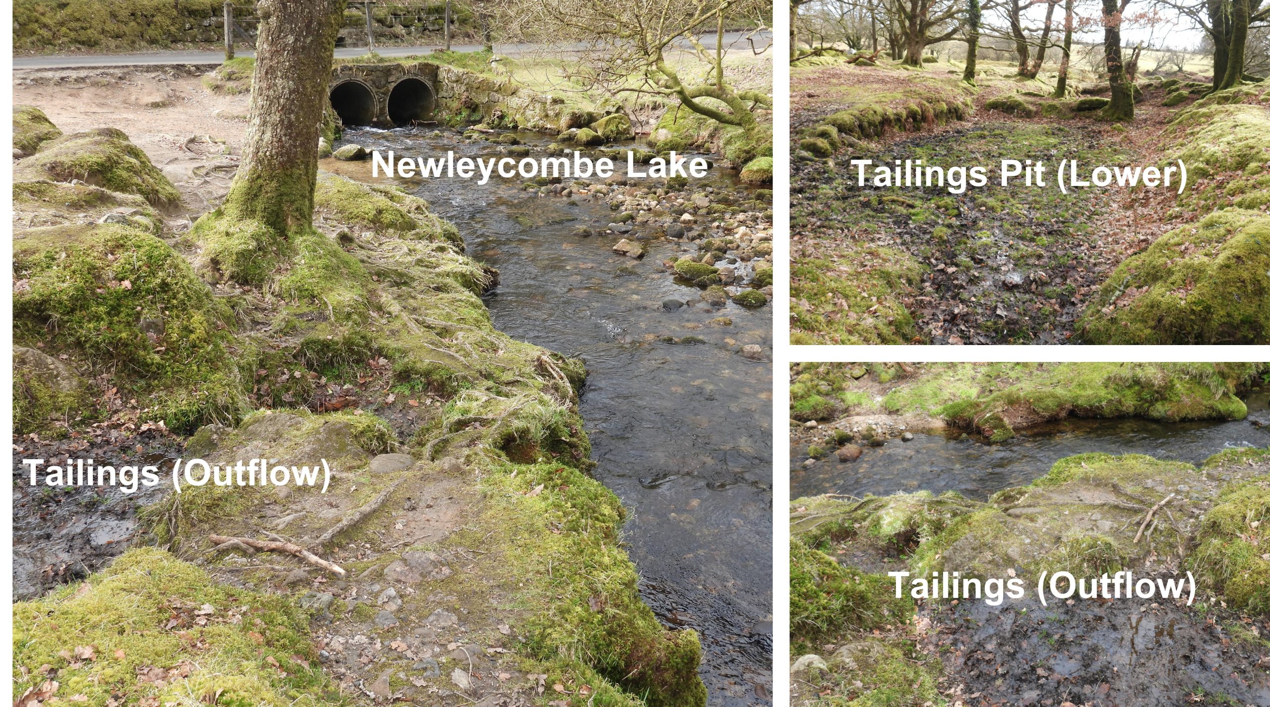
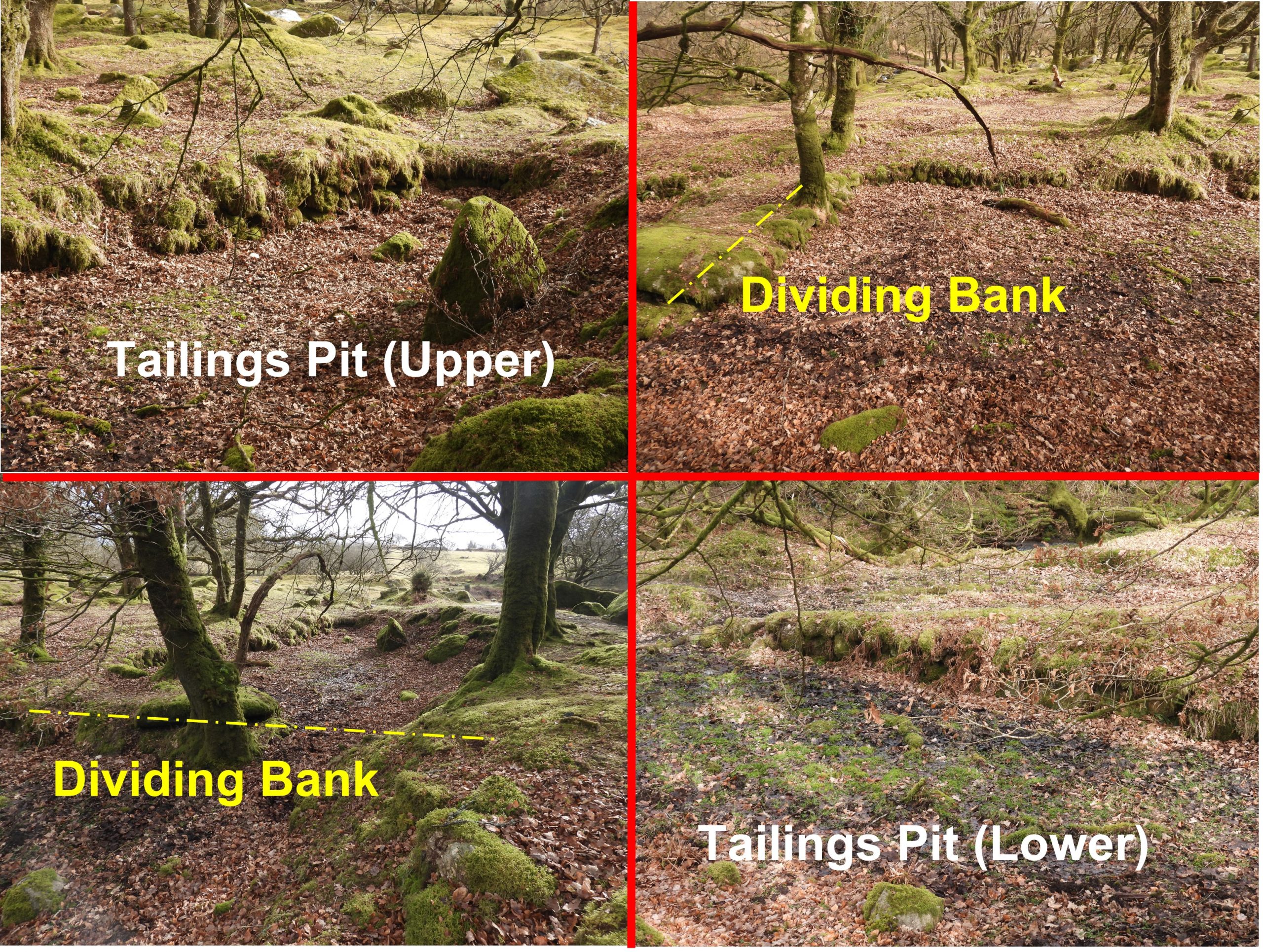
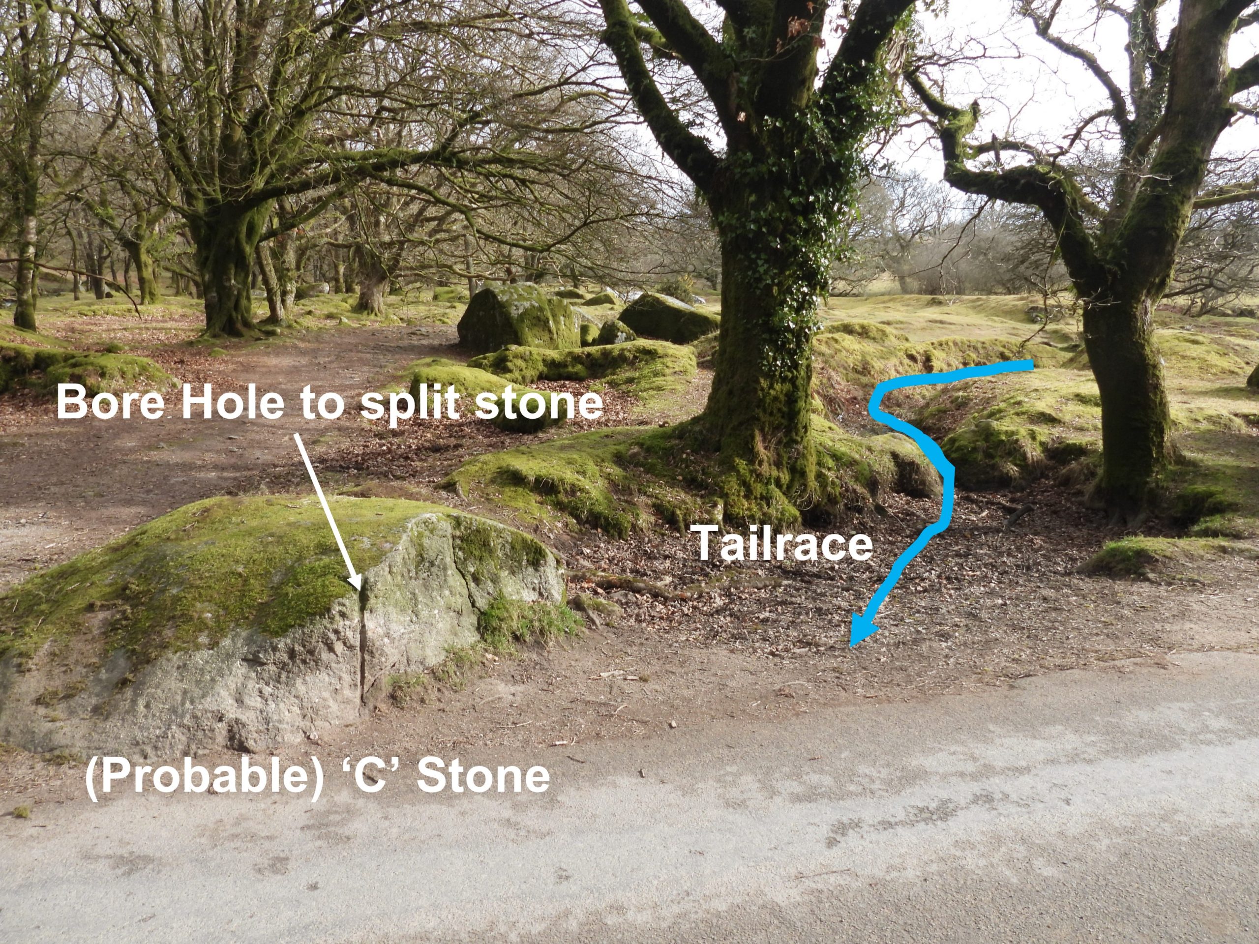
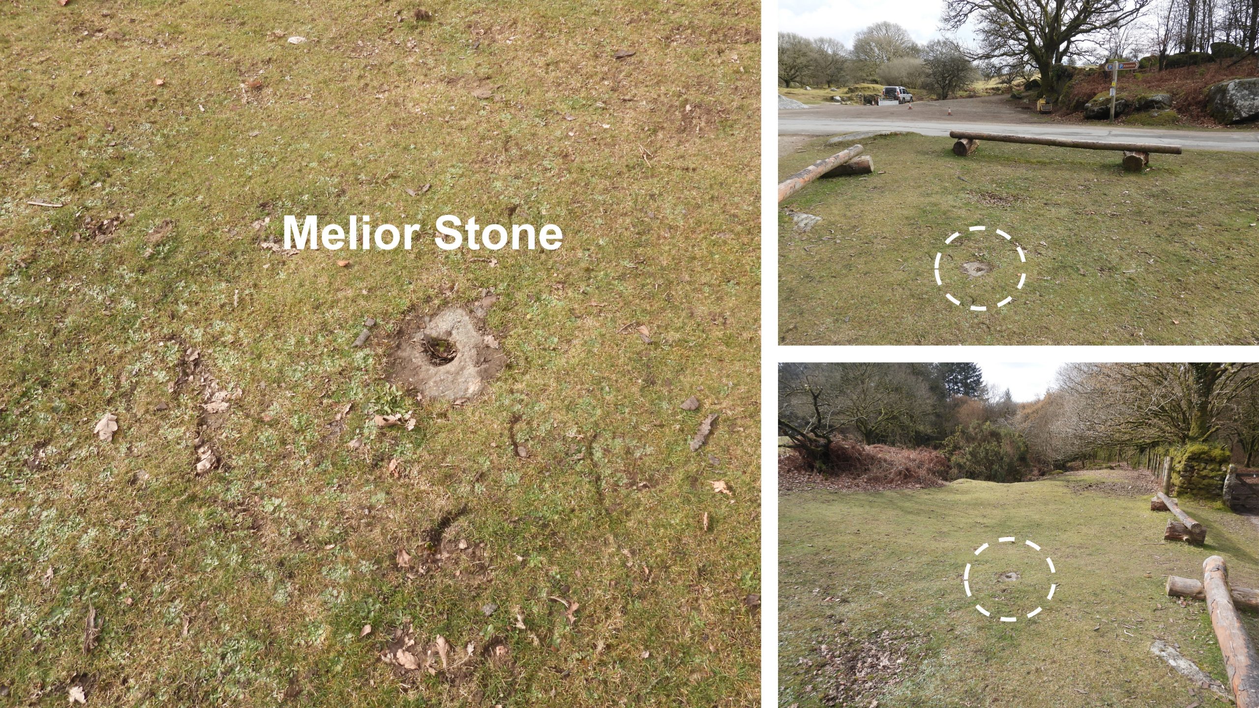
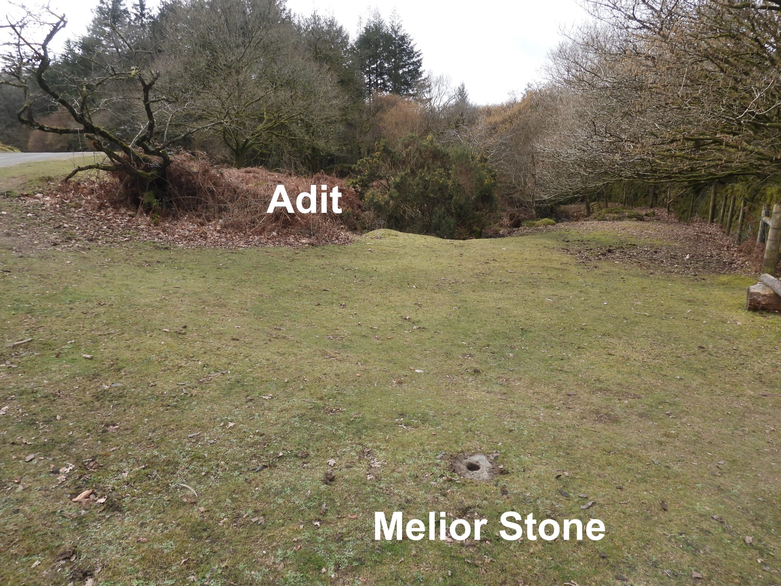
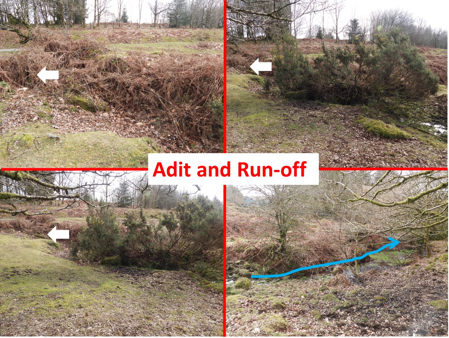
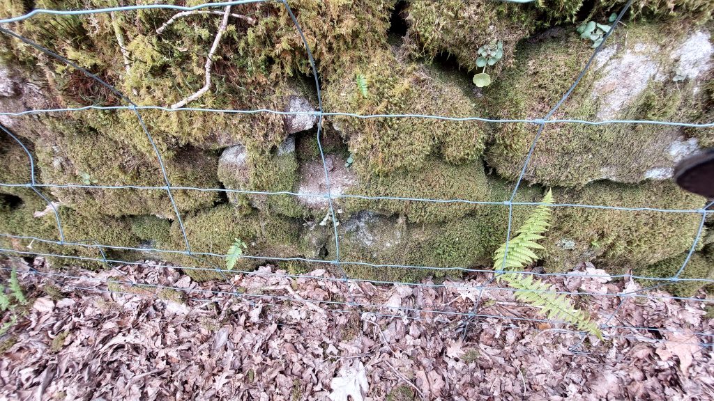
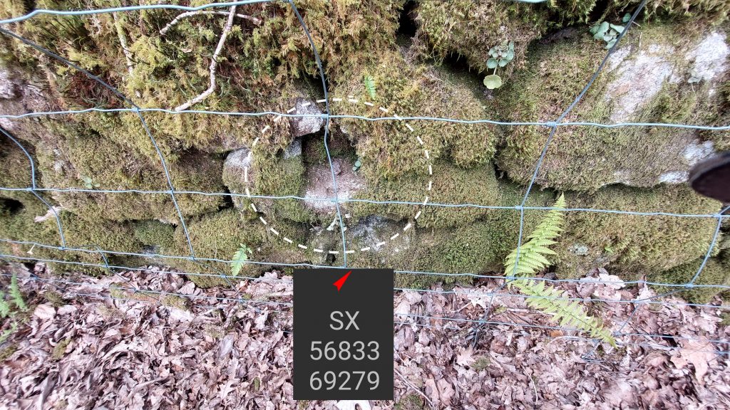
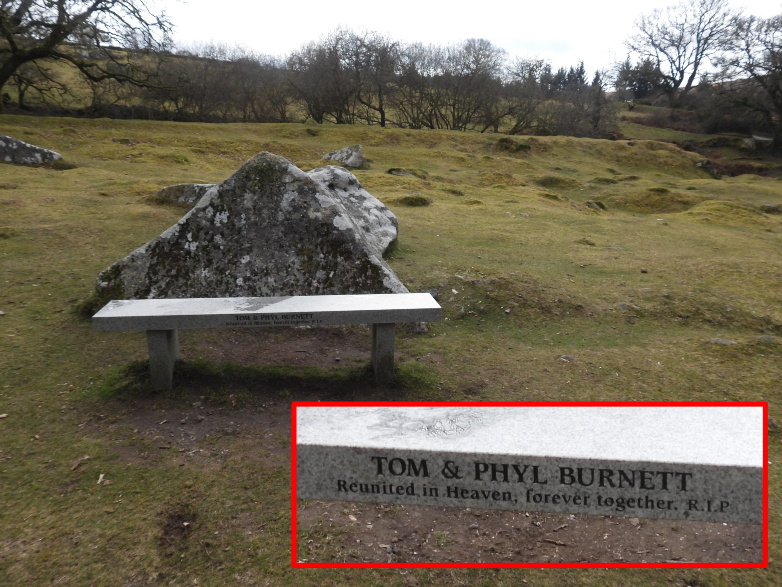
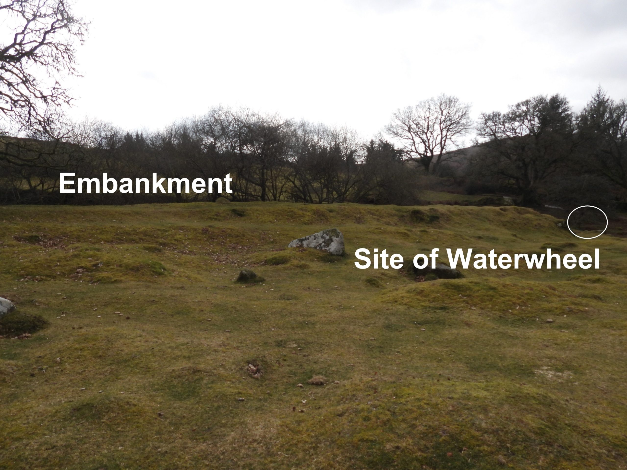
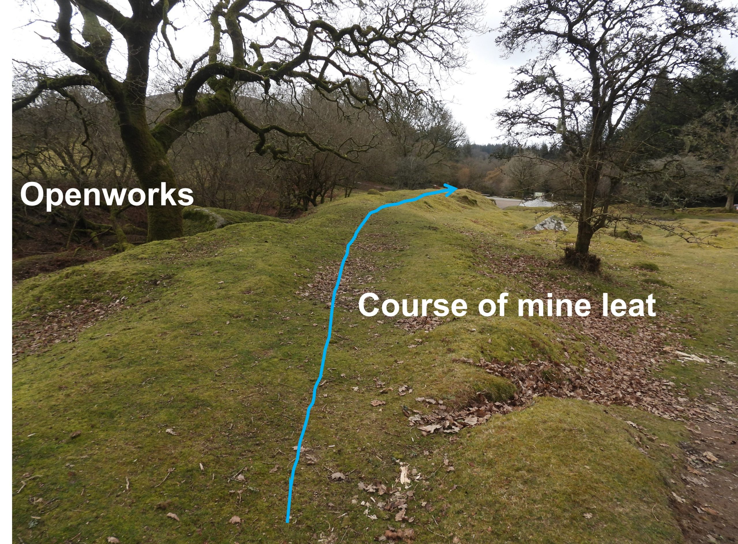
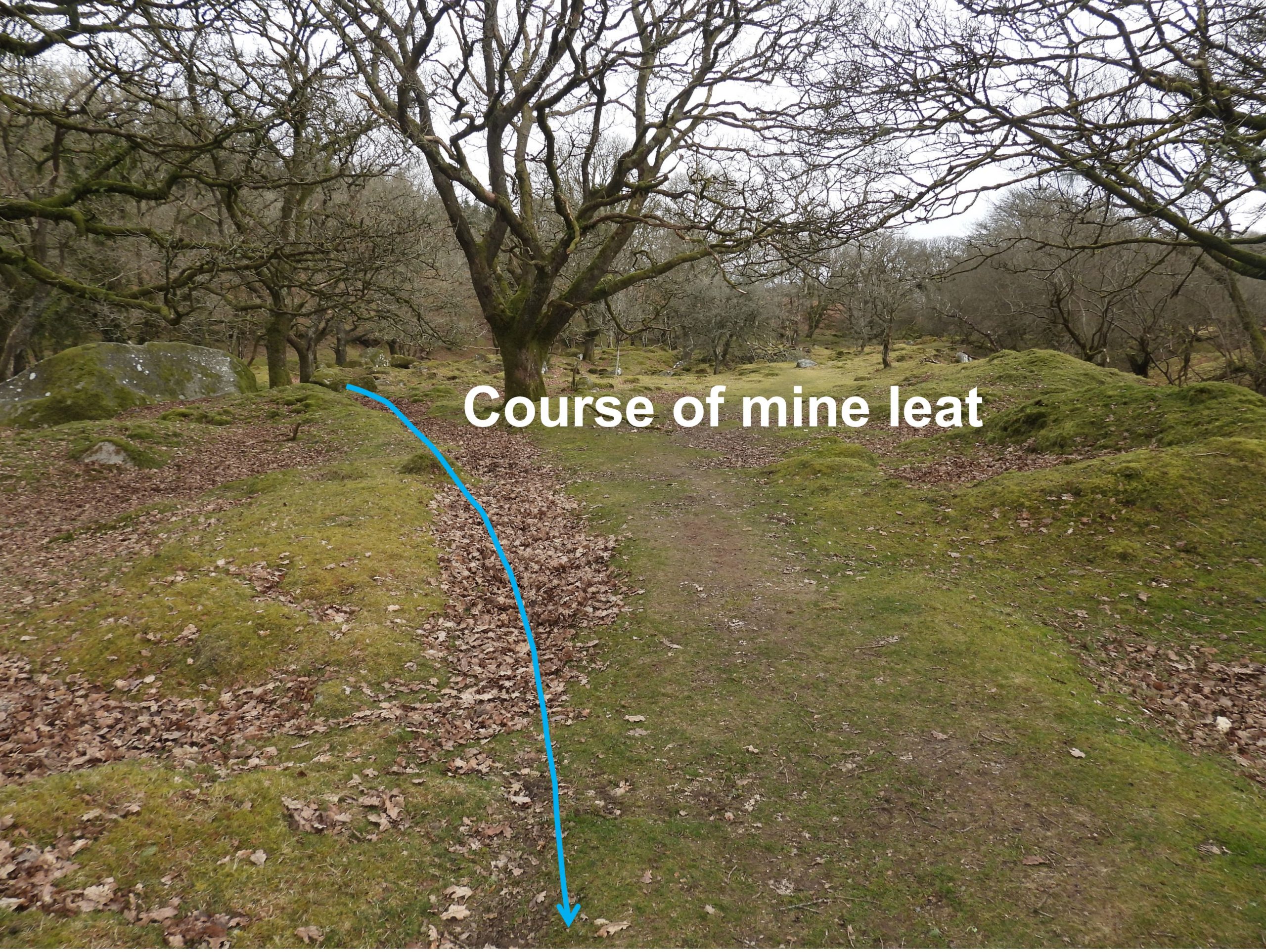
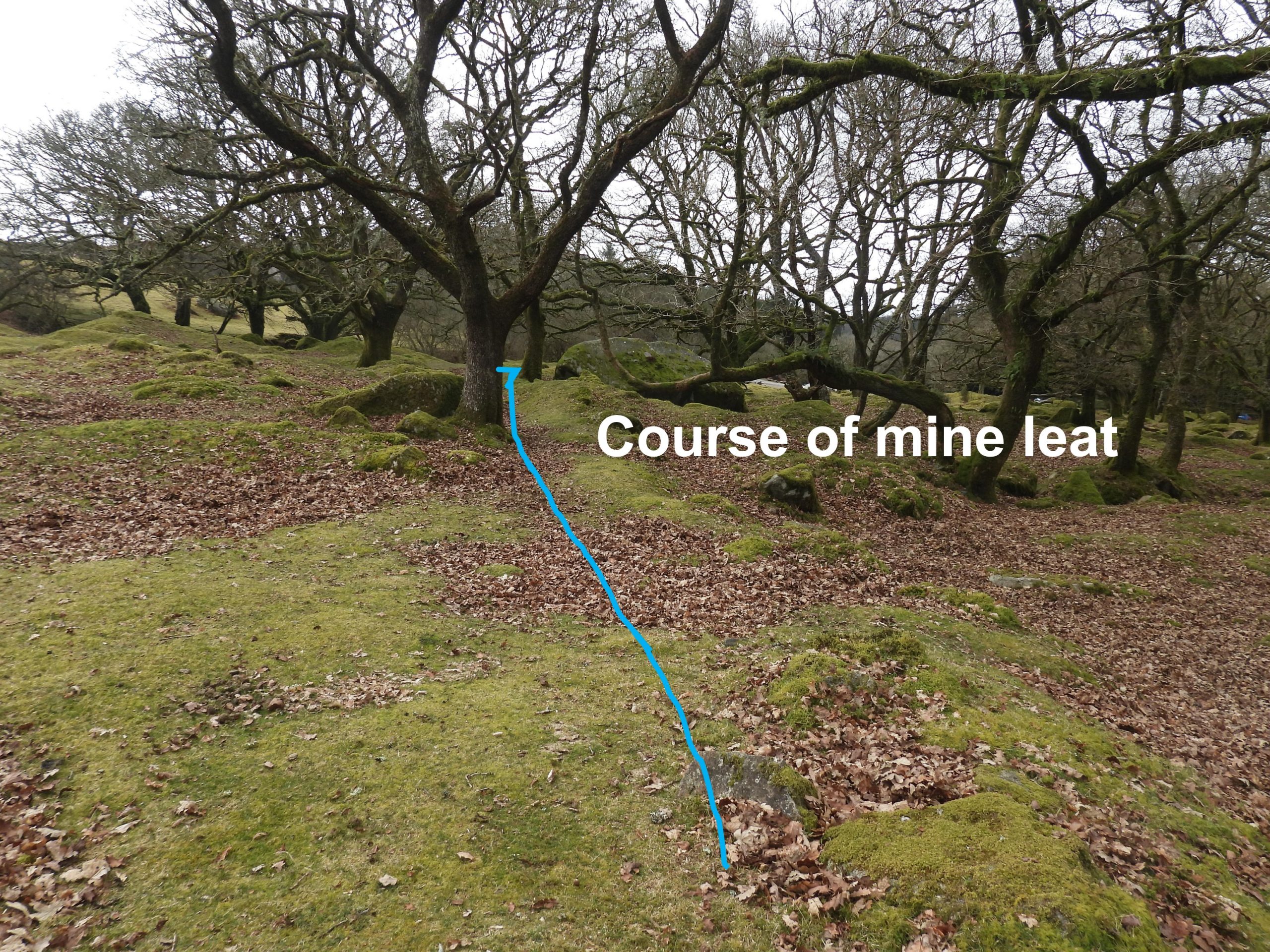
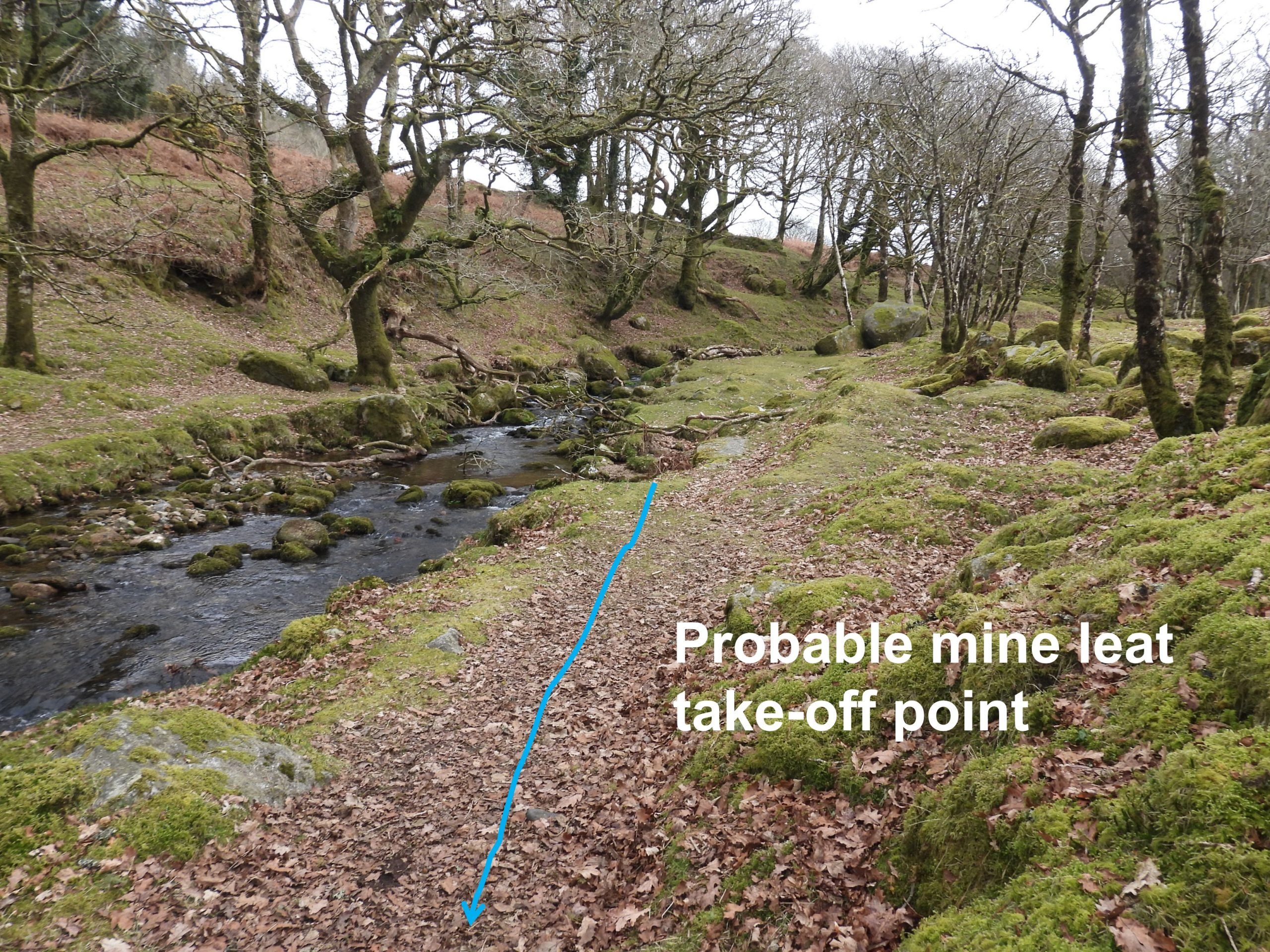
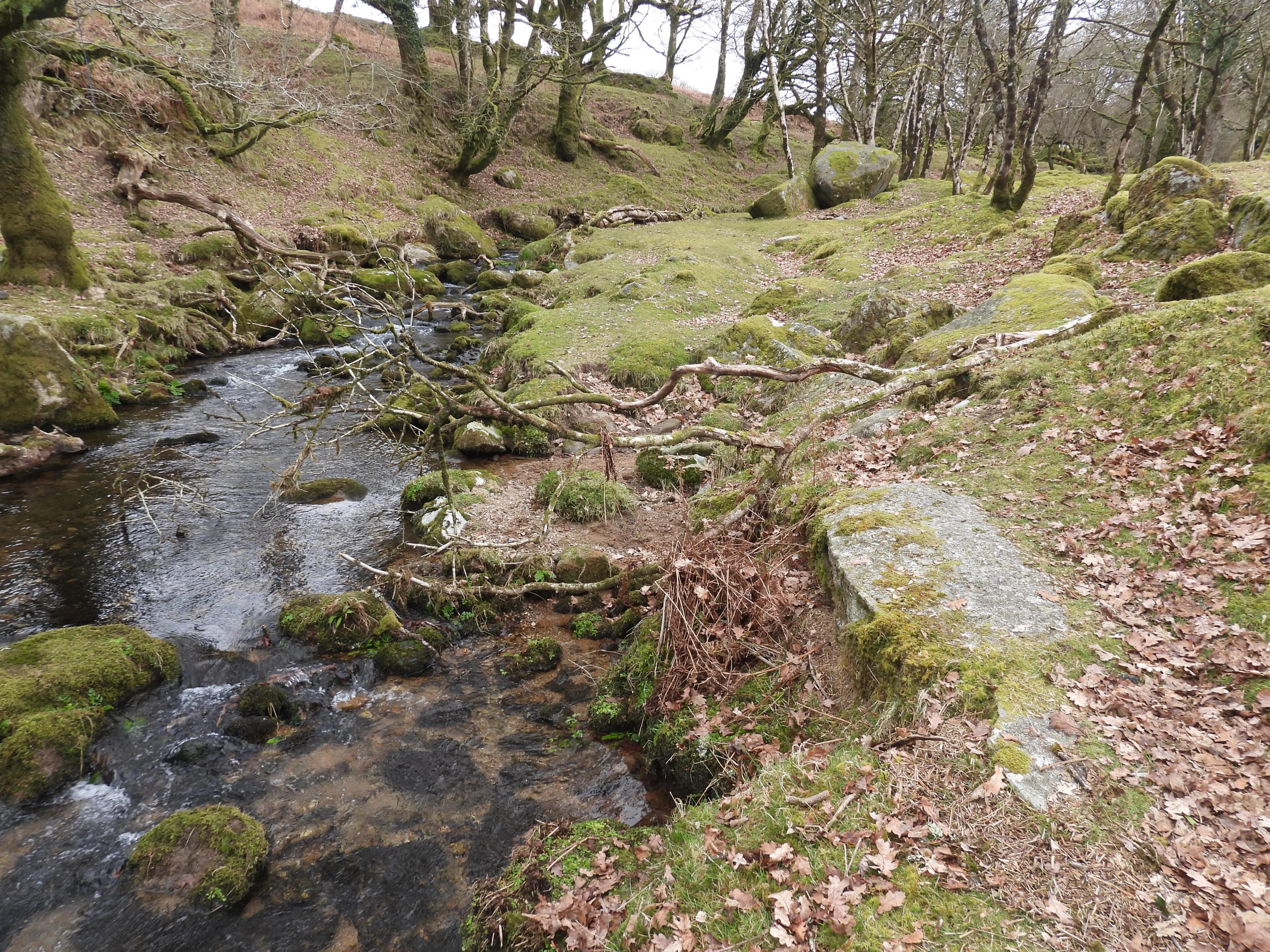
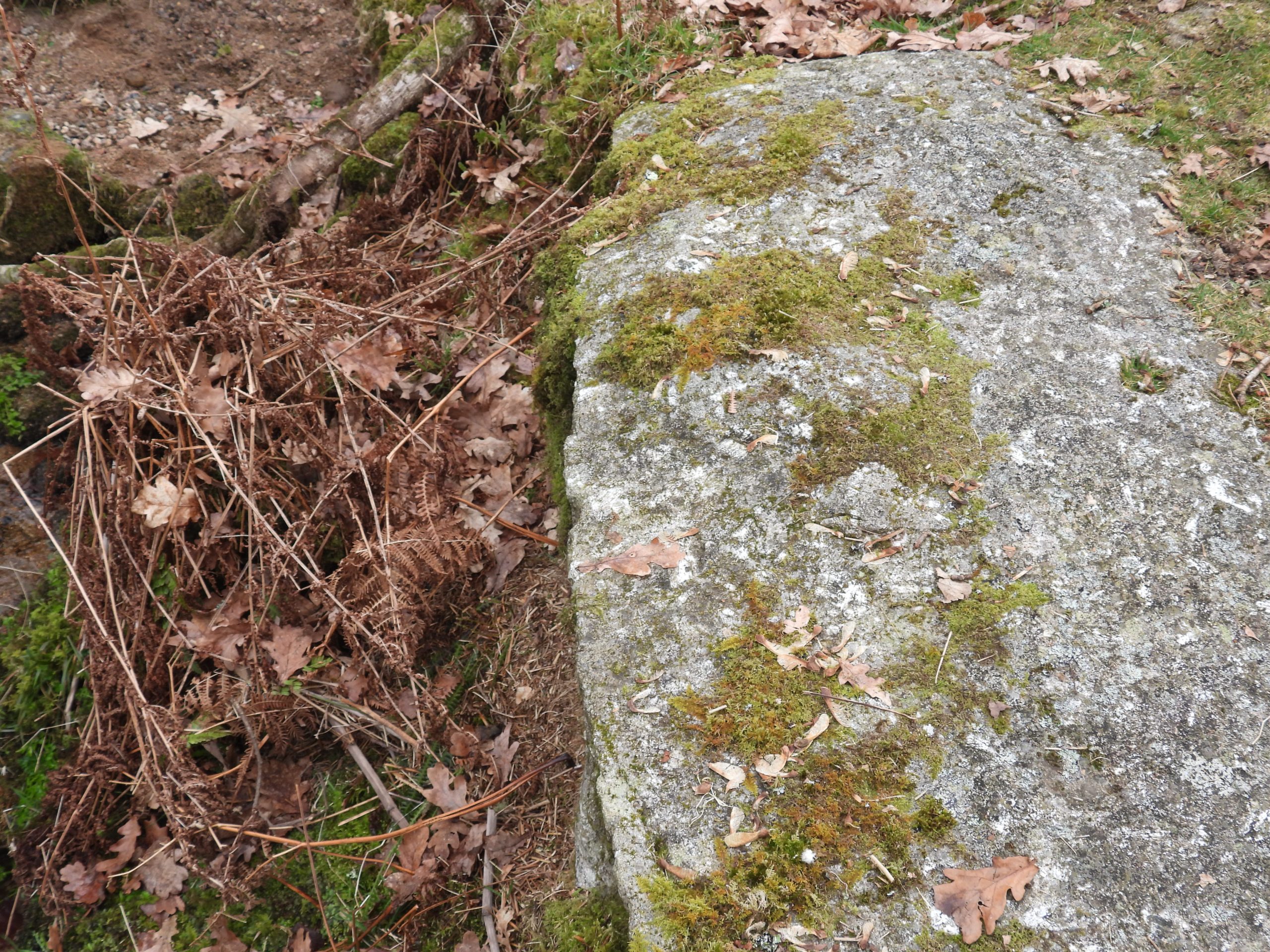
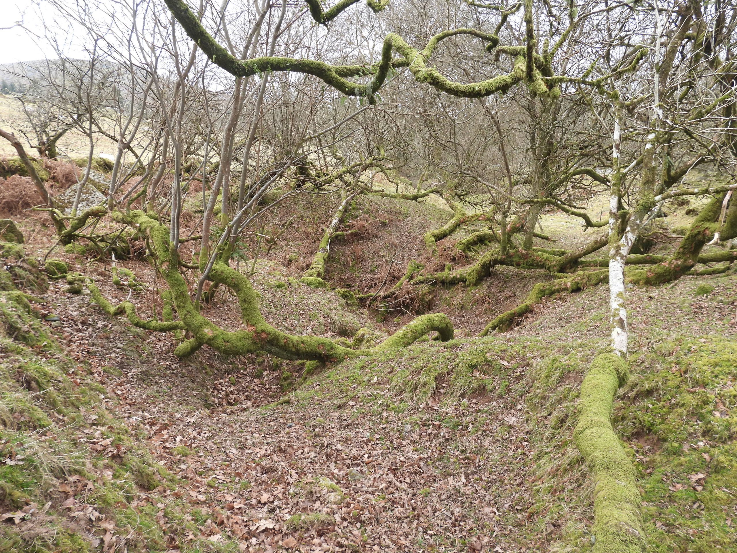
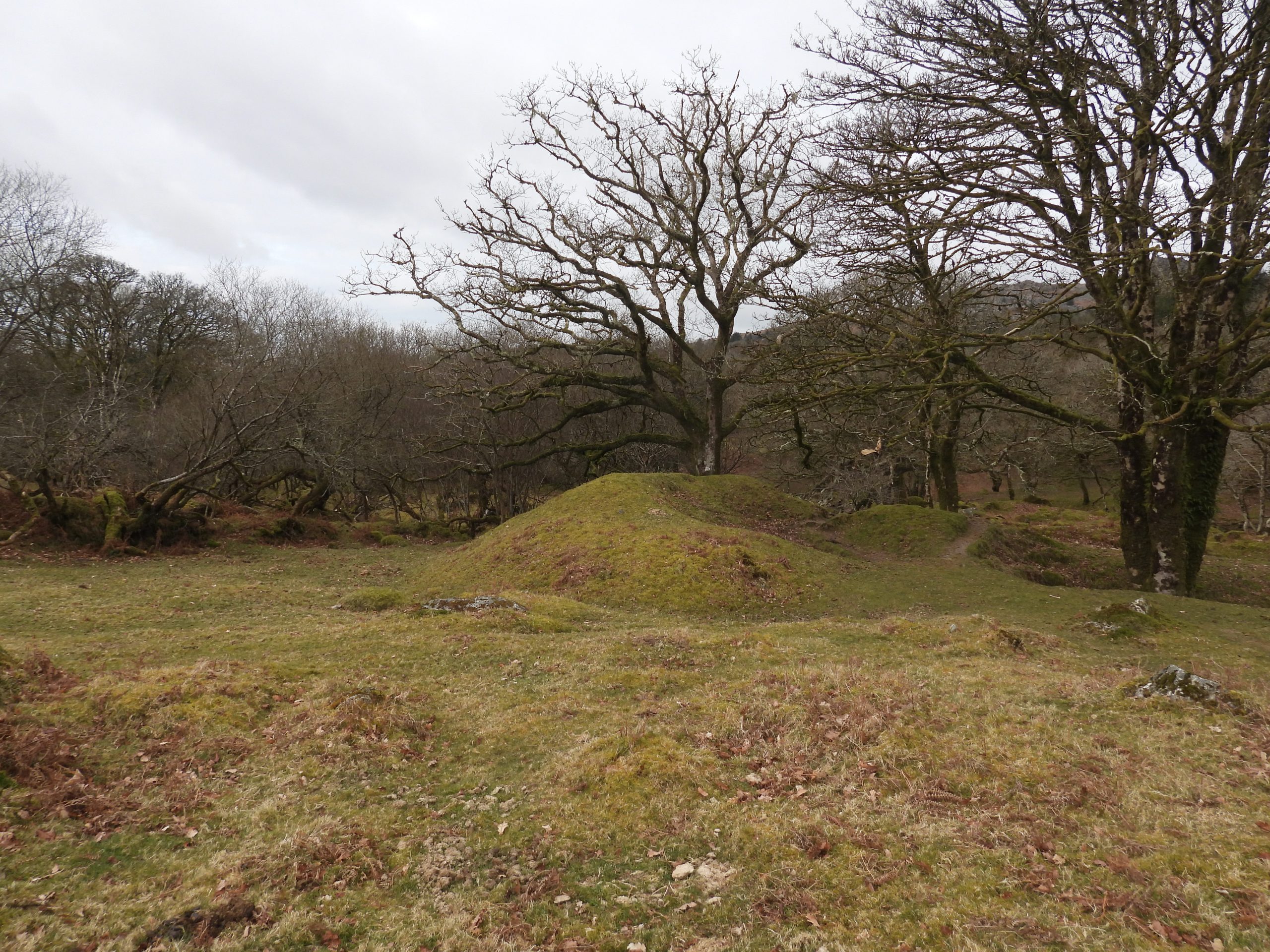
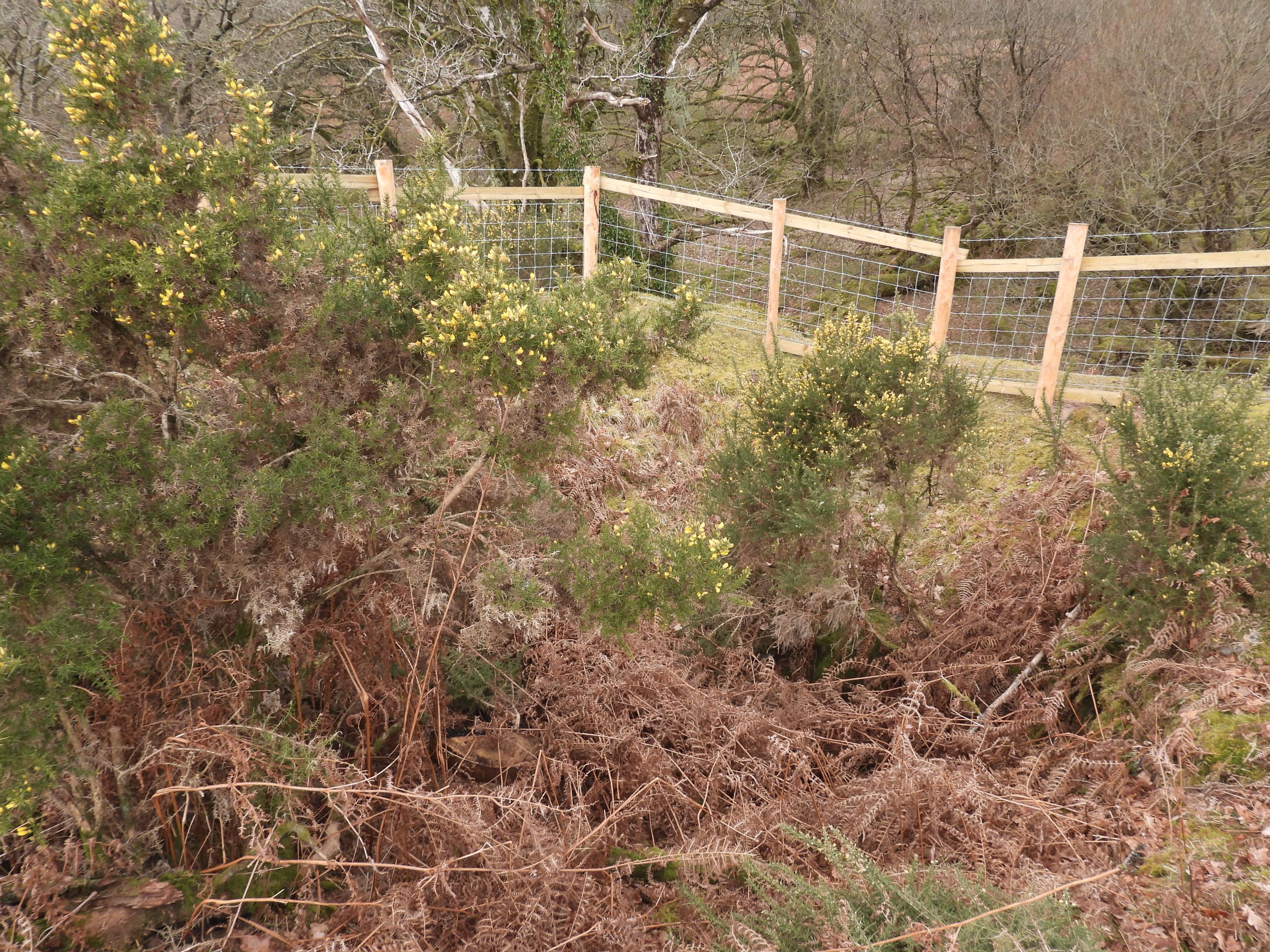
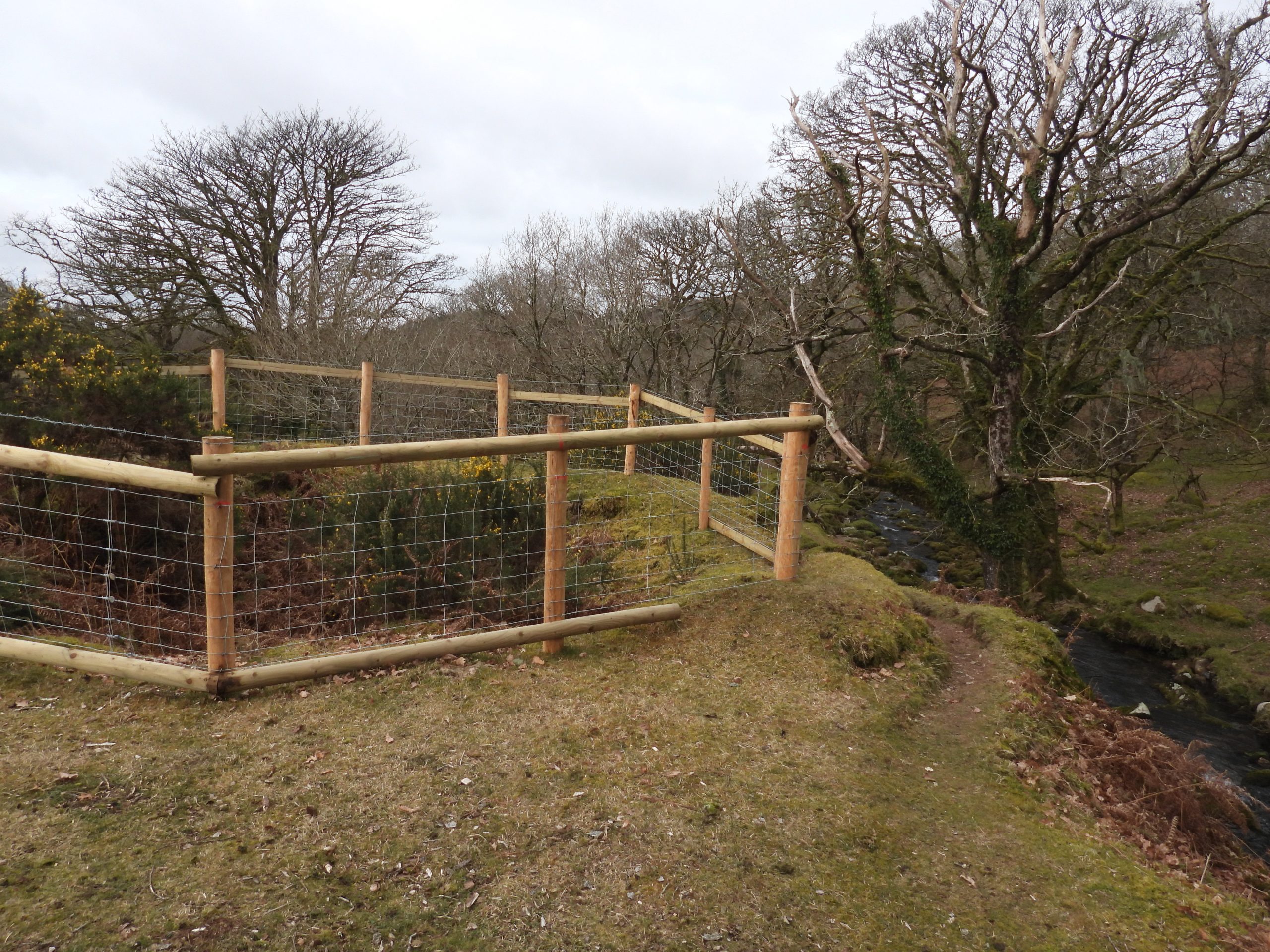
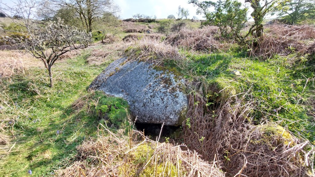
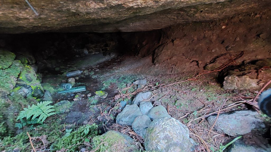
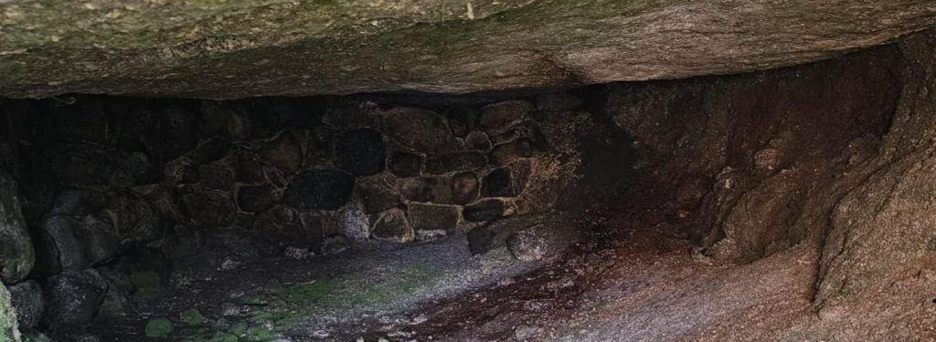
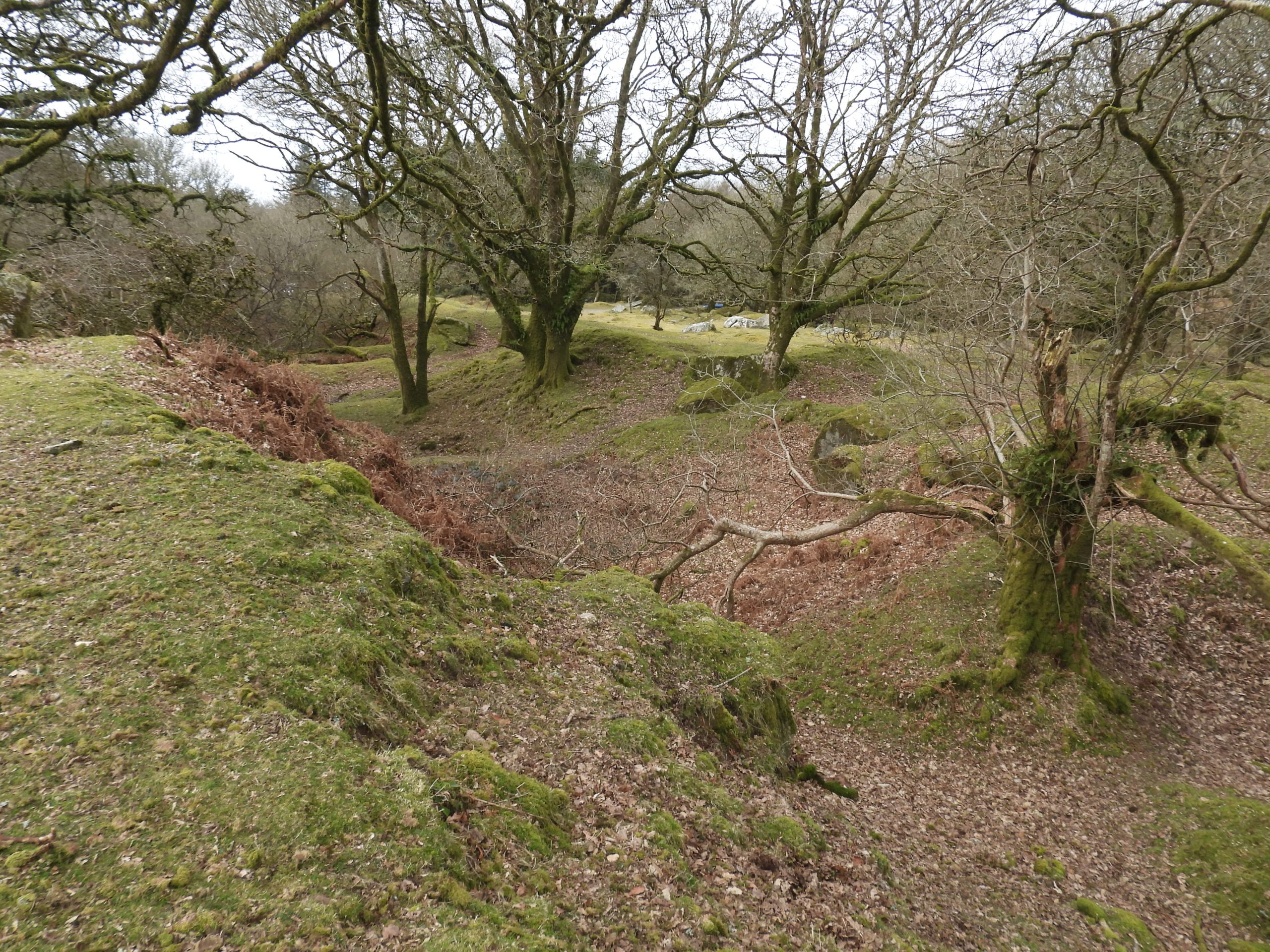
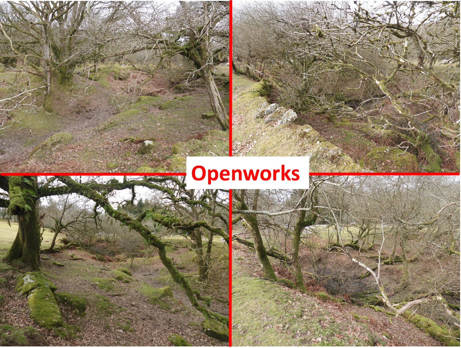
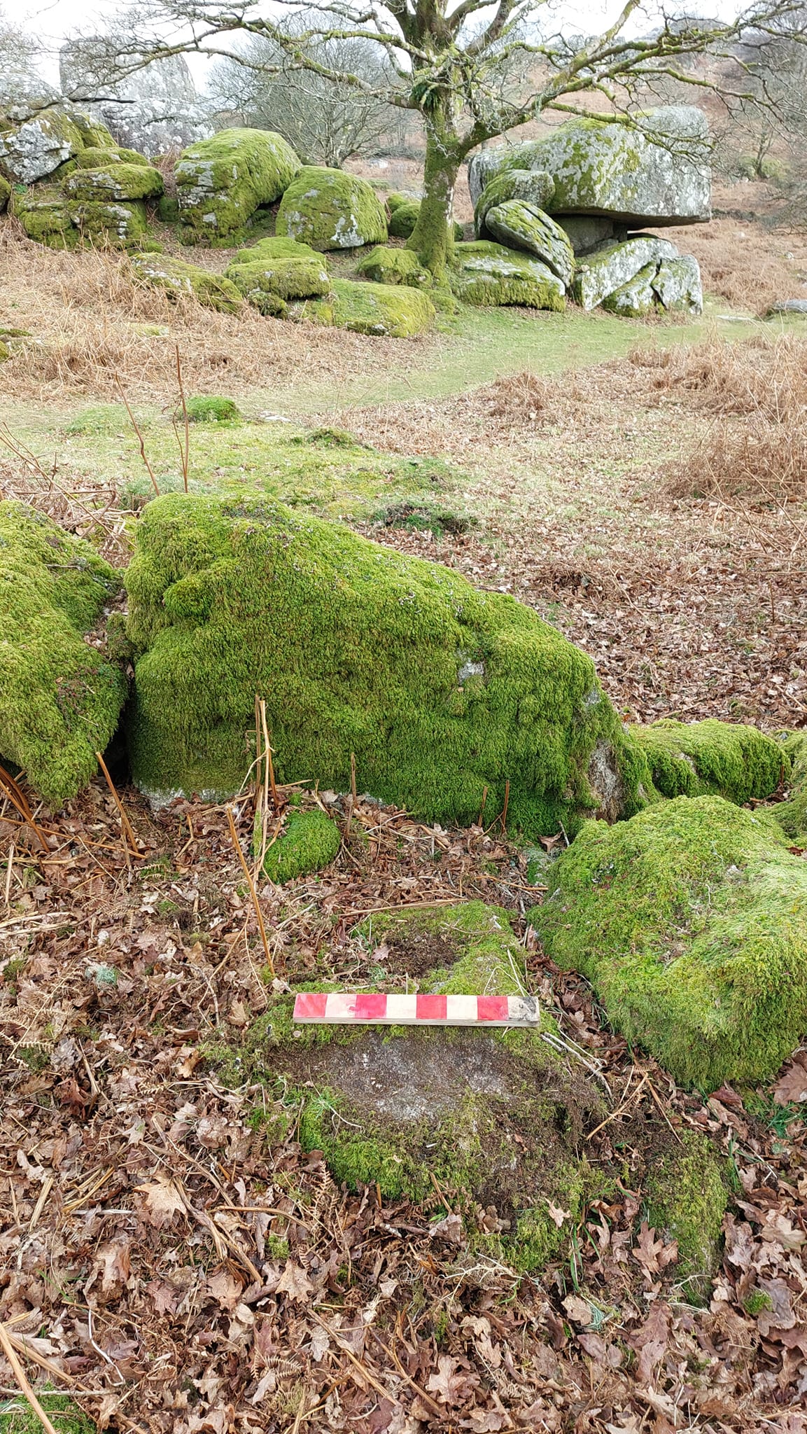
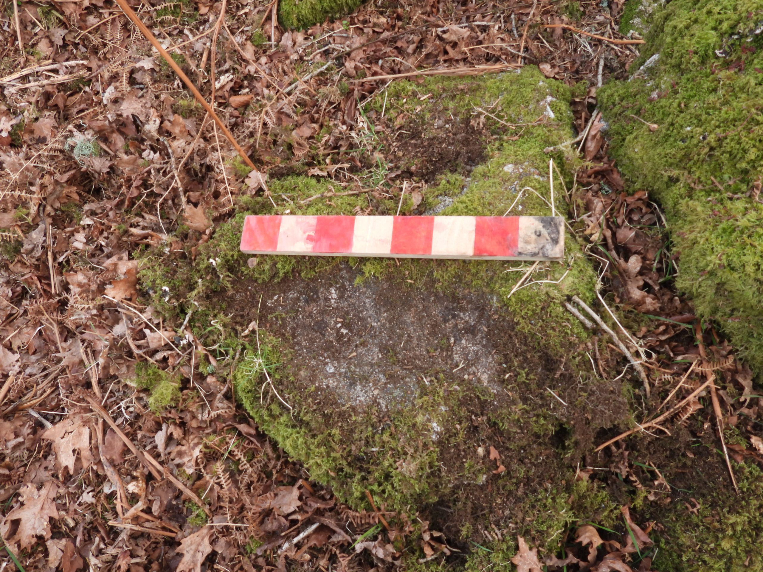
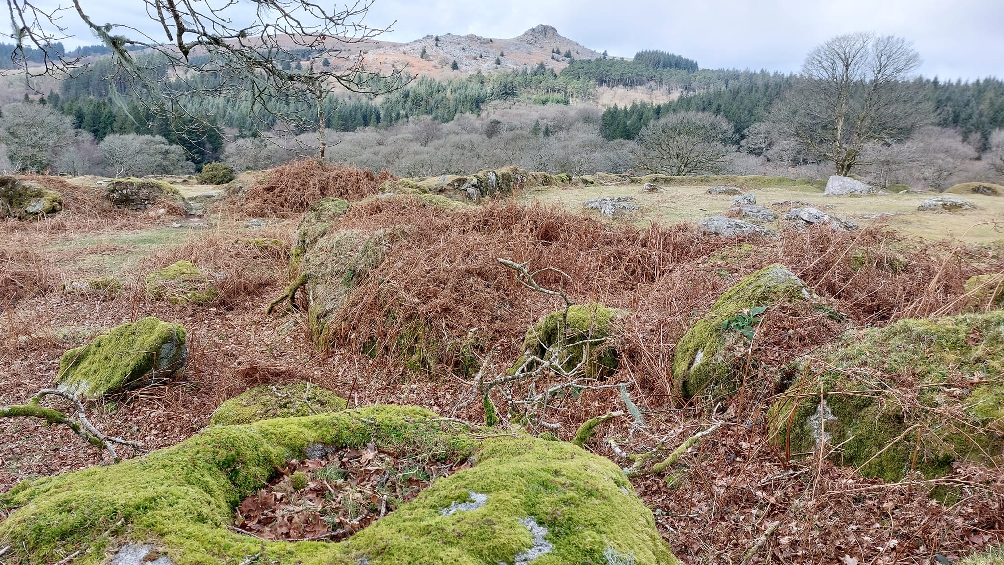
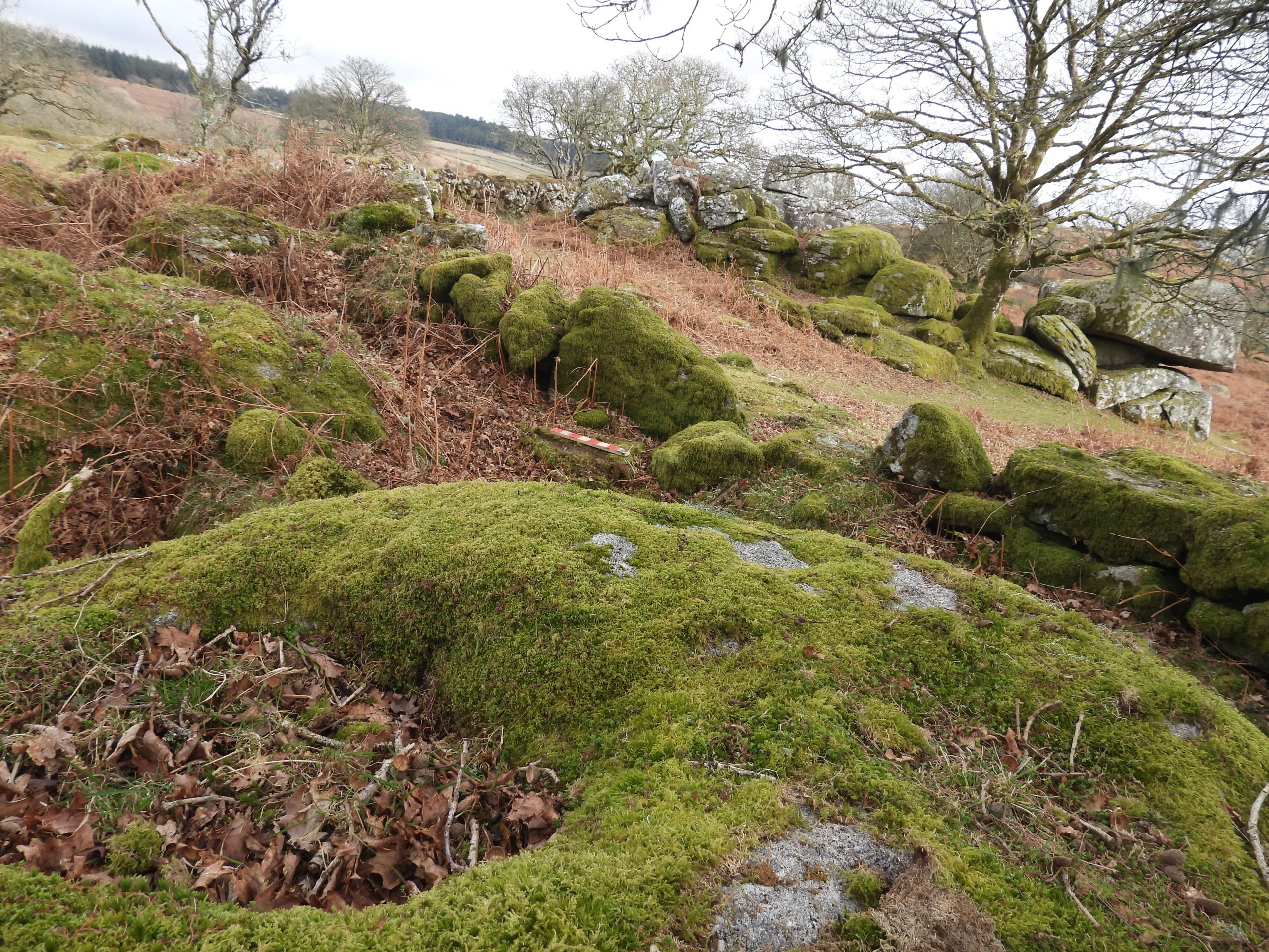
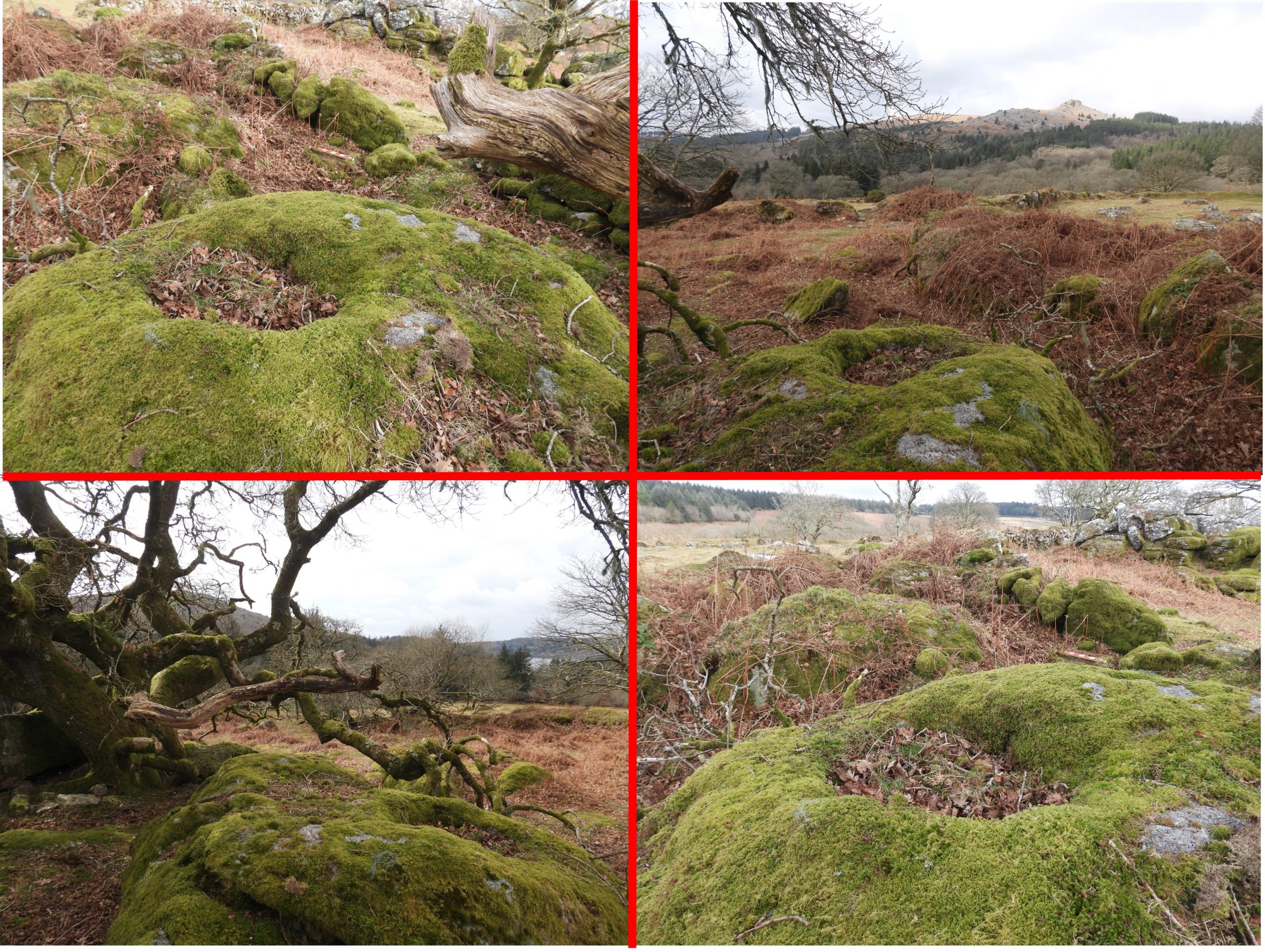
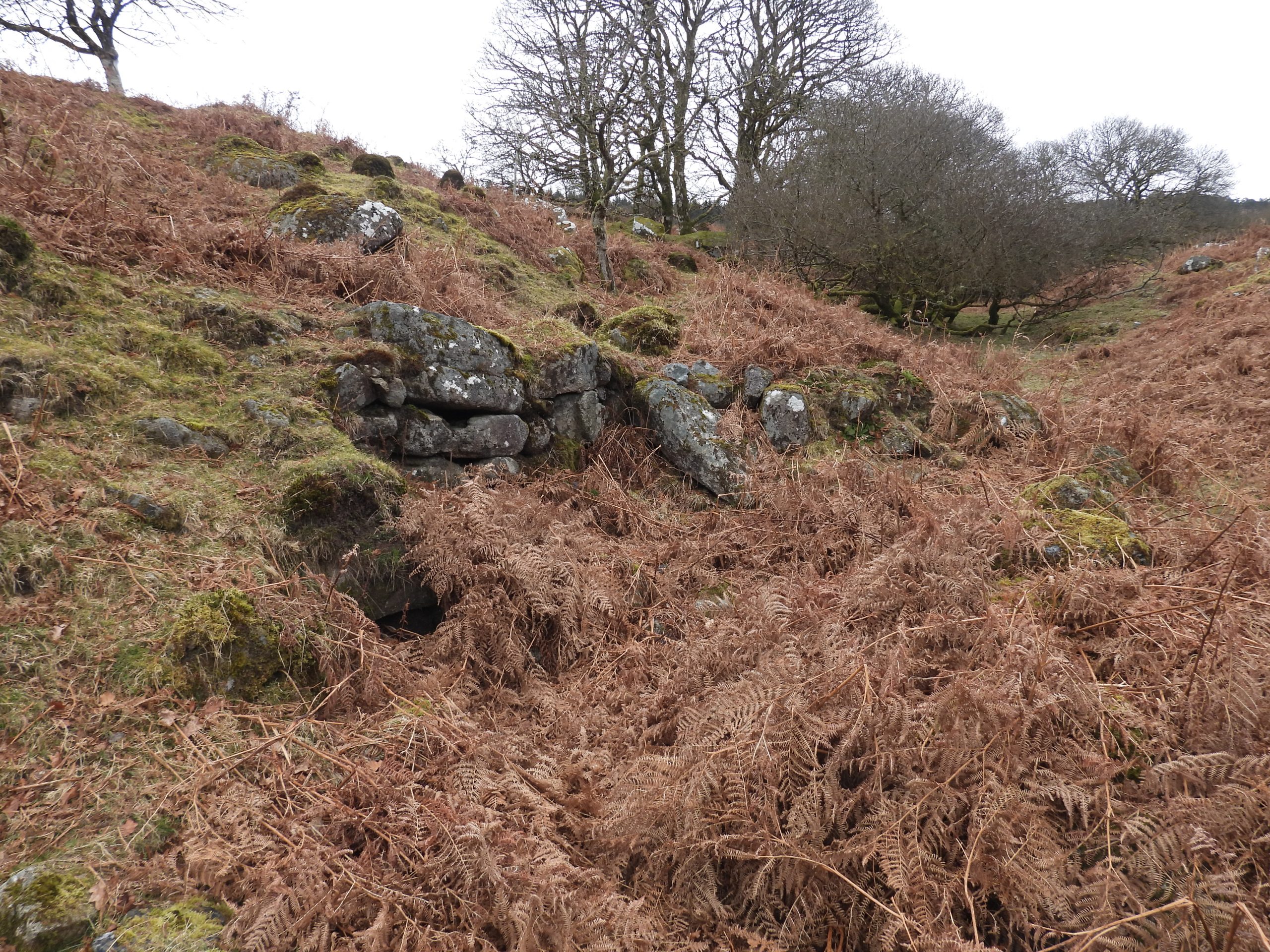
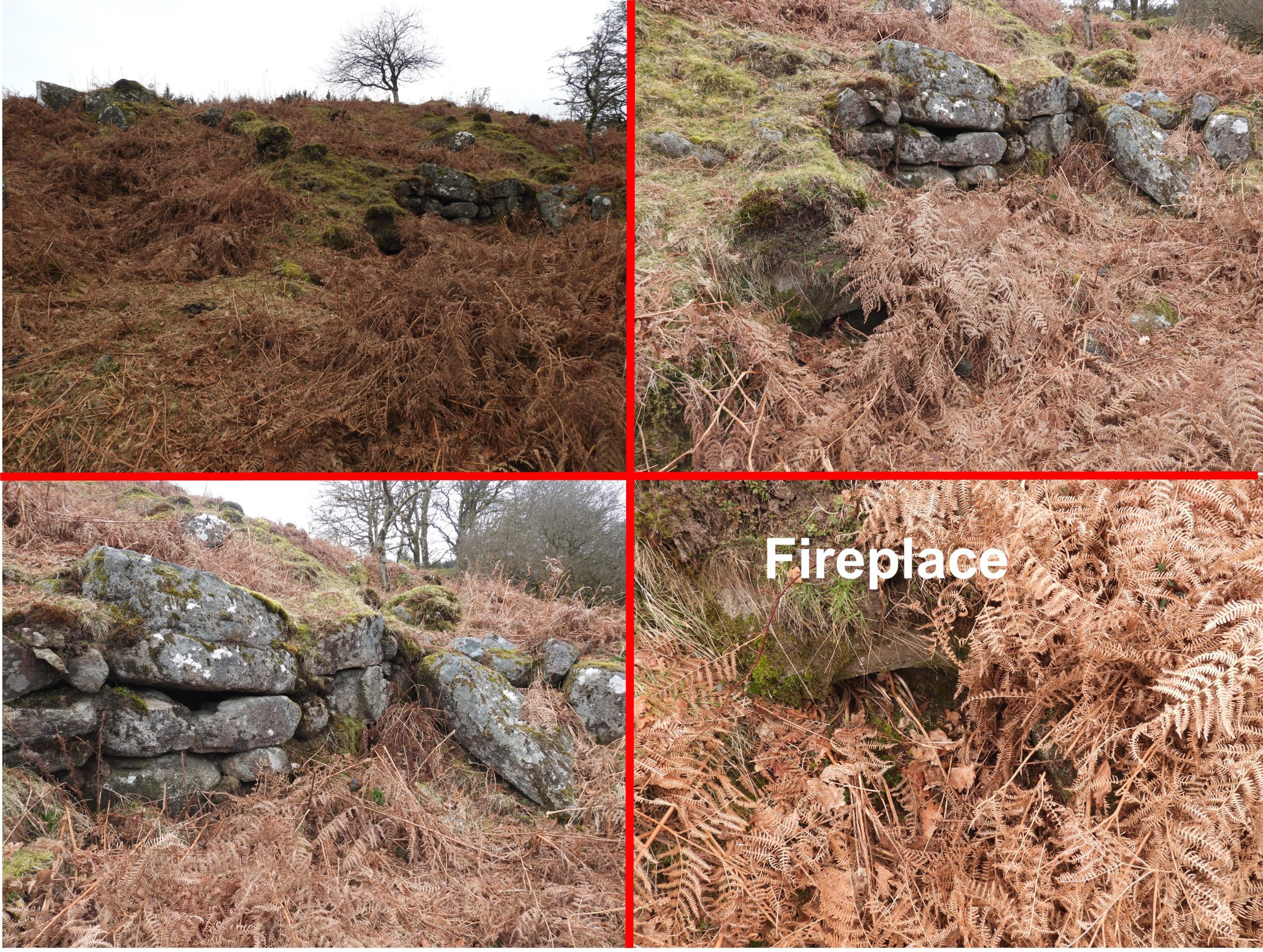
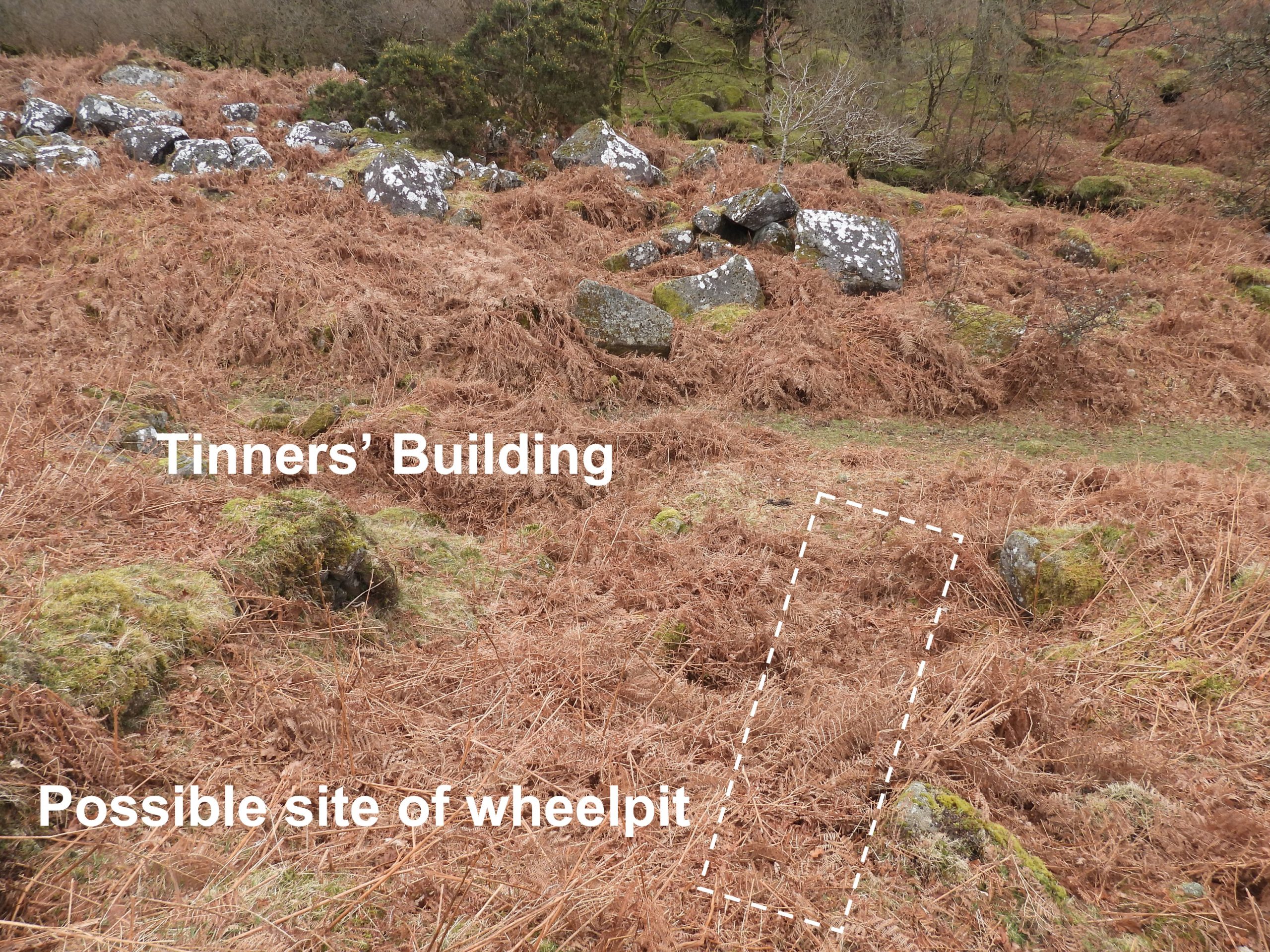
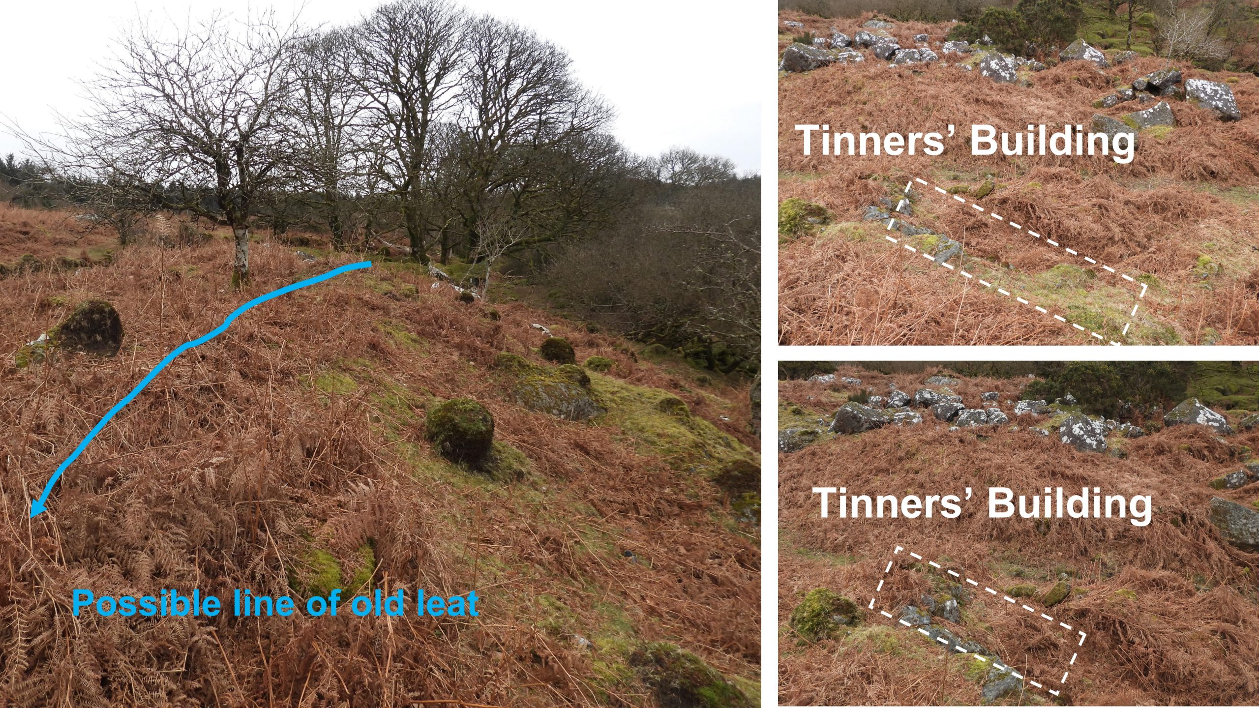
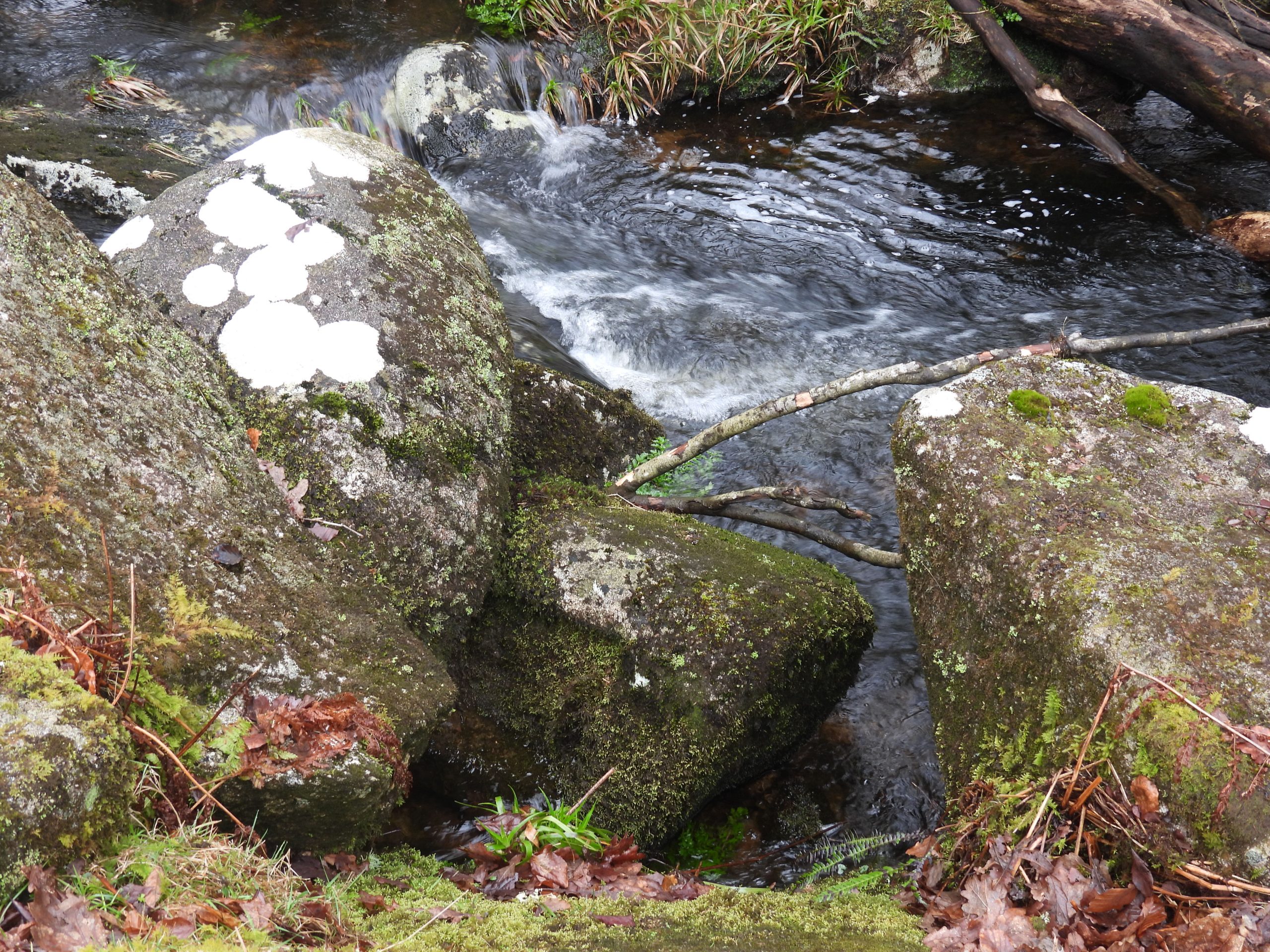
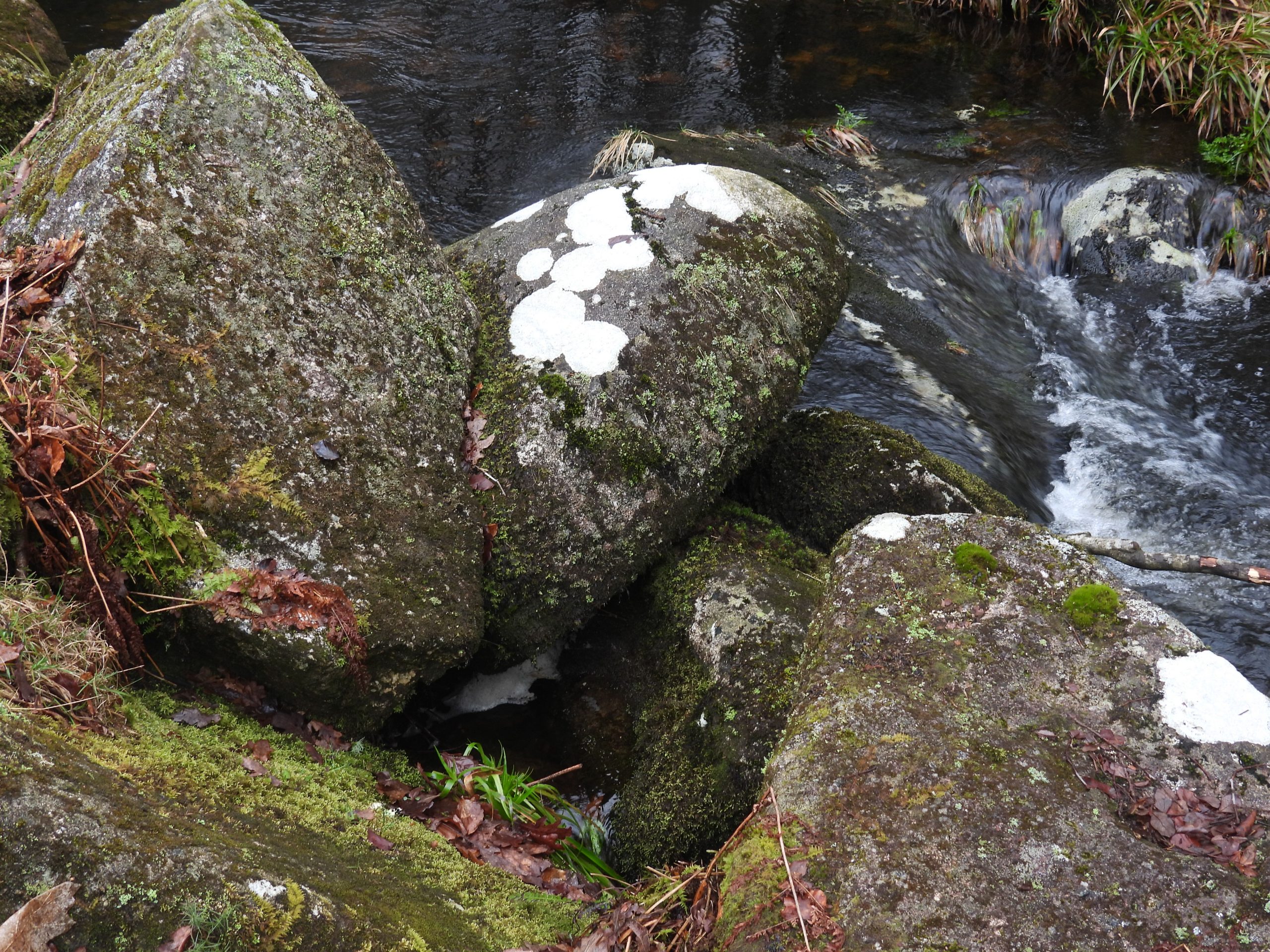
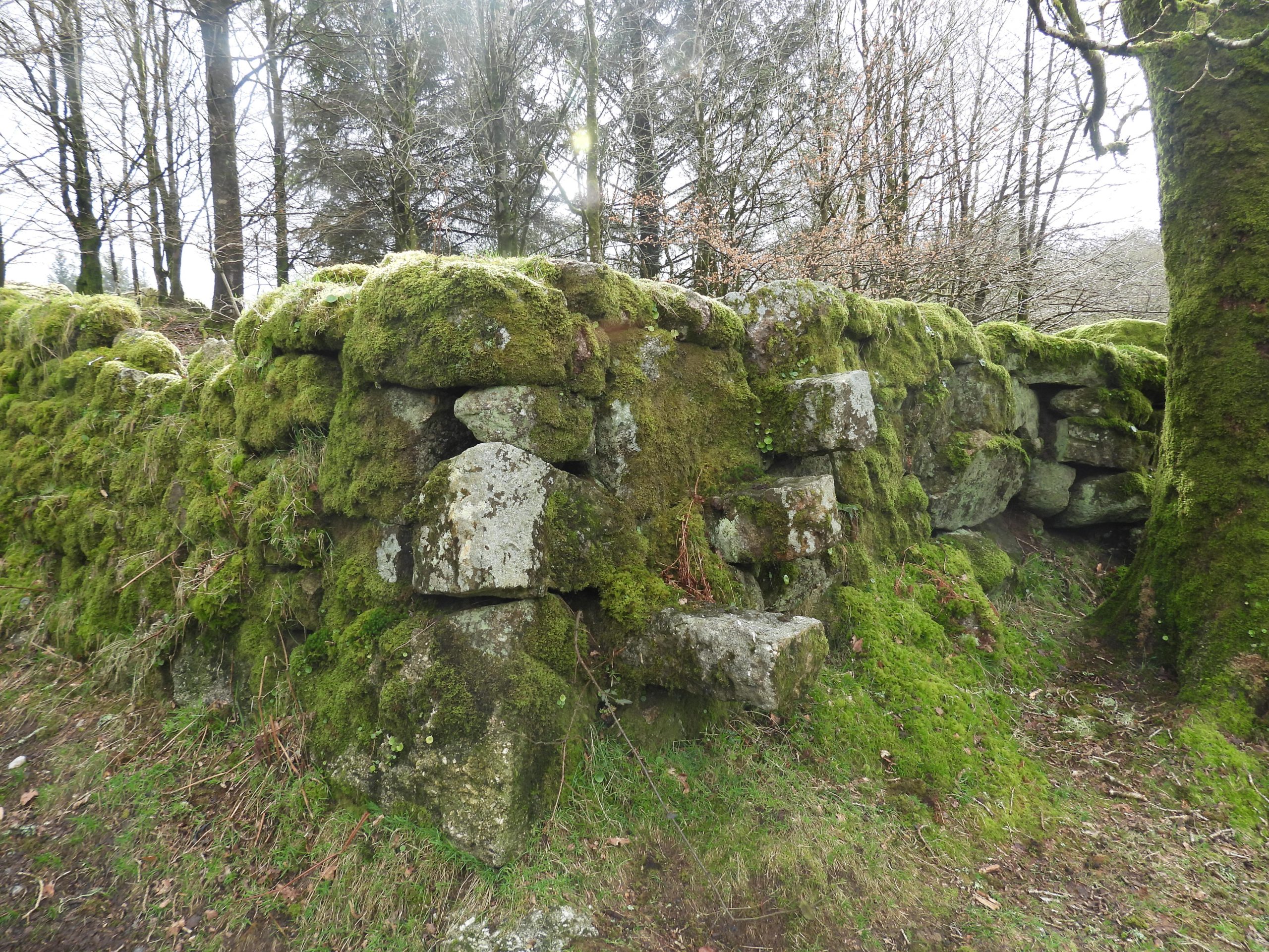
Sketch map showing the key features of Bal Mine plus other tinners’ artefacts within a few hundred metres of the site. All the features are covered in this post.The three main features alongside the car park are the wheelpit, the leat embankment and the dressing floor.View of the alignment of the wheelpit and leat embankment. Adjacent to the wheelpit there is a revetment wall, which might mark the probable position of a stamping mill. Of note is that R.G Haynes (in 1966) recorded that there are possibly two wheelpits on the site.Close up of the wheelpit. The internal dimensions are recorded as being 6.8m by 1.7m. At the launder end, the wall is revetted into a bank with the structure being around 2.6m deep here..From this photograph, there are three sides shallower than the launder end, which might suggests the upper section of the walls have been demolished and may have once stood proud of the ground. If the walls were once higher then it would have been a wheelhouse not a wheelpit.Looking down on the wheelpit from the top of the leat embankment. The start of the tailrace can be seen across the car park entrance. The dressing floor is on the south side of the site and is a boggy level area 15m by 15m. On the north east and south east sides of the area is a stone revetment.Close up of revetment wall at corner of dressing floor. It is adjacent to the wheelpit. Could there have been a possible stamping mill in this location? Interestingly recorded by Historic England in the Historic Environment Record: “Approximately 2m from the wheelpit the revetment is breached and an earthwork hollow cuts into the ground behind the floor. It is uncertain if this is an original feature. A small rectangular aperture, the entrance to a short tunnel, was recorded in the south east corner of the revetment in the 1980’s but this is currently covered by brambles”. The feature described can be seen in this picture. Eric Hemery believed this was a flue, (2 feet 6 inches square internally), open above a furnace, suggesting that the site was a blowing house. The Hemery interpretation has been dismissed by other observers.Close up of wheelpit wall / revetment wall at corner of the dressing floorView from the south edge of the Dressing FloorOn top of the leat embankment just above the wheelpit with the openworks to the east.Some woolly residents on the leat embankment …..and suddenly they turned, as one, to face the camera.The openworks are covered in some lovely moss covered trees. The start of the water wheel tailrace.The curving channel of the tailrace is over 1m wide and up to 1.5m deep. A portion of the tailrace has been filled in when the car park was constructed in the early 1970’s.The tailrace curves towards the road, but would of course, originally have conveyed the water back to Newleycombe Lake.Looking back up the tailrace. The photograph was taken on the day the car park was closed as ballast was being added into Middleworth lane. A mini-digger can be seen in the background.The curving course of the tailraceSome features of Bal Mine may have been lost when the area was levelled when the car park was created. Beyond the car park, there is evidence of a tailings pit, which is split into two sections. The tailings sunken pit is 0.6m deep (max) and has a gently sloping interior. In mining tailings or tails are the materials left over after the process of separating the valuable from the uneconomic portion of an ore.The pit has some stone lining which survives in places along its edge as can be seen on the right side of the lower pit as can be seen in the above photograph.The pits are irregularly shaped albeit their eastern sides are straight. There is a narrow opening the upper pit, where an inlet allowed the water and dressing waste to enter.English Heritage recorded the overall length of the tailings pit as 28m, with a central dividing bank 2.6m wide. The upper pit is around 12m and lower pits approx 14m in length. The division between the two pits does not take up the full width with the opening being just over 2m between the two ‘chambers’ (to the right of the tree as seen in the photograph).After settling, the water from the lower pit would have been released through an opening in the north-west end into Newleycombe Lake. Imagine the toxic waste entering Newleycombe Lake and then the River Meavy. Various views of the tailings pitsA ‘C’ (county) stone (or boulder) would have been located on the east side of Norsworthy Bridge, near Bal Mine. At the bottom of the remaining part of the mine wheelpit ‘tailrace’ (which would have at one time extended to Newleycombe Lake), is a large rock, whose location lines up with the grid reference taken from an old 19th century map (from side-by-side maps). This boulder appears to have once protruded into the road and has had part of it cut away as indicated by a bore hole which appears on it. The author (along with Dave Brewer – Dartmoor Boundary Markers) speculates that this boulder once had a ‘C’ inscribed on it which at some time was removed.On the opposite side of the road from the mine is a probable melior stone, which is a flat, granite stone set into the ground with a vertical hole approximately 60mm in diameter on the upper face. The stone would have been associated with a whim plat (or a horse capstan), which was used for hauling materials from a shaft. That said, there does not appear to be any evidence of a shaft nearby. The melior stone is located at SX56854 69289Near the melior stone is a possible adit (marked as spring on modern OS maps). The adit (with associated run off) appears to be quite shallow and runs underneath the modern road. The adit is blocked and is at the top end of a shallow mire-filled gully, from which water flows. The adit portal is at SX56850 69277Built into a wall near to the adit and run off is a stone with an axle groove in itAnnotated picture highlighting the axle grooveNear the mine at SX56900 69369 is a granite memorial bench. It has a lovely outlook facing Newleycombe Lake.Side on view of the leat embankment with site of the waterwheel.Course of the mine leat across the embankment alongside the mine openworksThe course of the mine leat can be followed to the take-off point on the Newleycombe LakeThe mine leat follows a course through trees and around large granite boulders.The probable mine leat take-off point on Newleycombe LakeProbable take-off pointThis boulder at the probable take off point appears to have been split from a larger boulder. Was this done as part of the take-off channelling of water ? The boulder is located at SX56966 69442.The mine appears to have been worked over two periods. There is some surface evidence of underground activity (ie two shafts) but this evidence is scarce. The wisdom of modern experts believe that the later miners concentrated on re-working a lode which had previously been exploited as a shallow openworks. The picture shows part of the 120m long shallow openworks.Probable shaft (marked as shaft 1 on sketch map) is located at SX57014 69404. The earth ‘upthrust’ is very evident here.Shaft 2 has recently been surrounded by a ‘protective’ fenceShaft 2 is located near to Newleycombe Lake at SX57052 69417Norsworthy Tinners’ Cache – one of the finest examples there are. A large purpose built chamber complete with wall at the rear of the cache. It can be found at SX57296 69581 just a short stroll from the car park. This large domed rock (5.5m x 3.2m x 1.4m) covers the cache chamber. The entrance is 1.1m wide by 0.45m high (ref: Gerrard). It is located near to Newleycombe Lake left bank amongst waste heaps of streamworkingInside the cache, sadly with a few bottles left behind. The chamber is 5.5m long x 3.2m wide and up to 1.4m high. It would have been used by tinners for storage purposesAt the rear of the cache is a low piece of walling (0.5m high) which appears to support the rock on one side. Picture courtesy of Frank CollinsonThere are a number of pit works running the length of the openworks, which might represent the later miners working the previous works.The openworks follows a SW-NE direction and are approximately 120m long by 4m deep (max) and 18m wide.A few hundred metres to the east of Bal Mine there is a probable shallow double mortar which can be found near Middleworth Tor.Recorded in Dartmoor HER (by Dr Tom Greeves) the double mortar could be evidence of possible tin work referred to in 17th century “blackthorn, lying at Myddleworth”. SX57095 69249Rock basin a few metres from the double mortar. Nice example at SX57093 69246Rock Basin, Double Mortar and Middleworth TorViews of the Rock BasinTo the north east of Bal Mine lies a Tinners’ Mill. It is located on the north side of Newleycombe Lake and is sited against the outer scarp of a tinwork.There appears to be evidence collapsed fireplace inside the Tinners’ Mill. The mill is located at SX57134 69486.Next to the Tinners’ Mill is the possible site of a wheelpit, albeit the site is very overgrown.More views of the Tinners’ Building with line of possible old leat above.Next to Norsworthy Bridge there is a mould stone in the river (Meavy) providing evidence that there was another Tinners’ Mill nearby. There are two known mills a few hundred metres upstream (one on each side of the river).The mould stone is located at SX56743 69396.The final feature of note in the area are three ‘floating’ steps alongside Middleworth Lane.