A collection of walks, discoveries, insights and pictures of exploring Dartmoor National Park
October 16, 2021
Venford Medieval Farmstead
This medieval farmstead consists of a longhouse with two associated “service” outbuildings and enclosures and is located to the south-west of the Venford reservoir, within an area of medieval fields.
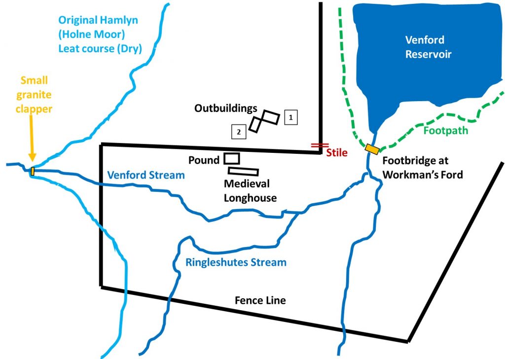
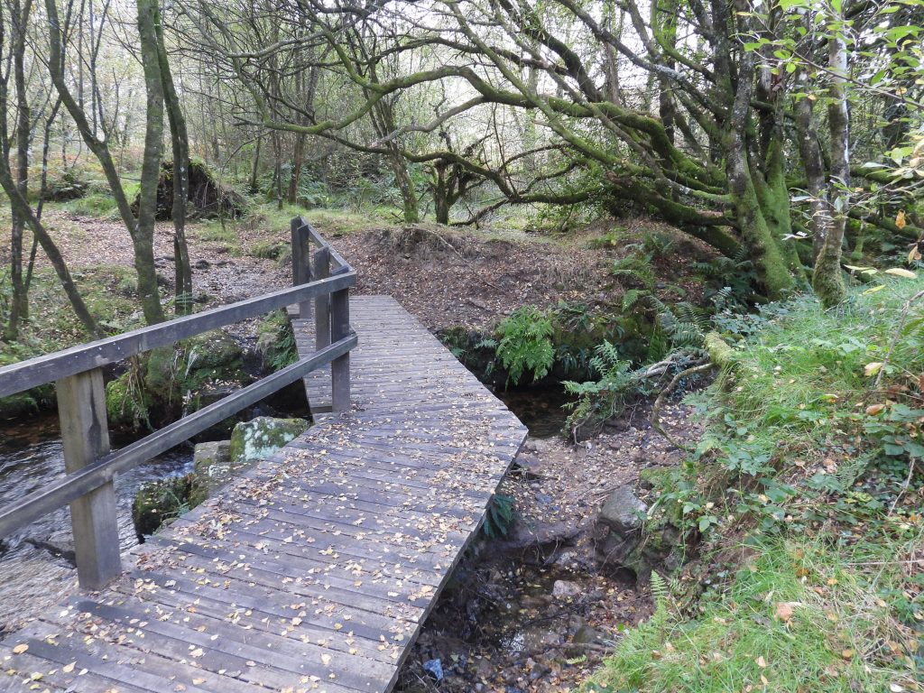
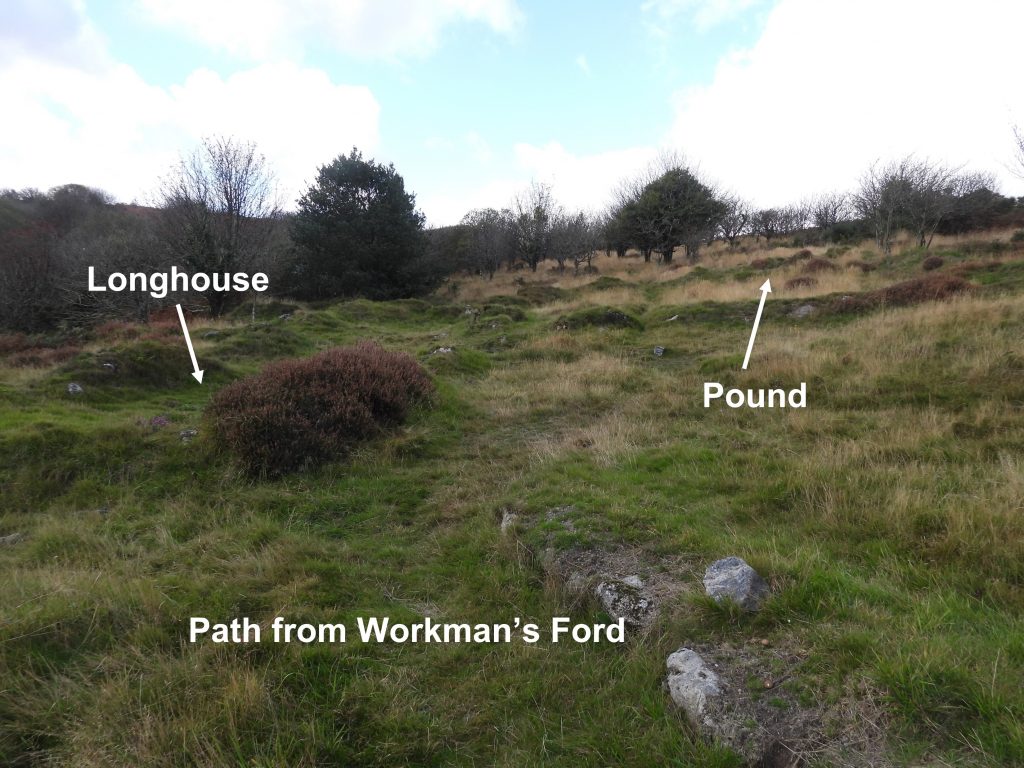
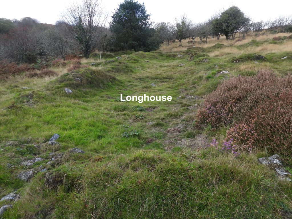
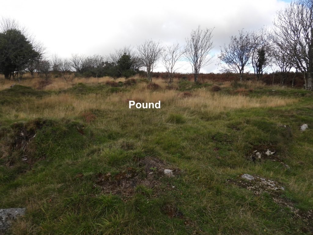
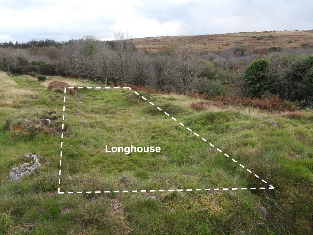
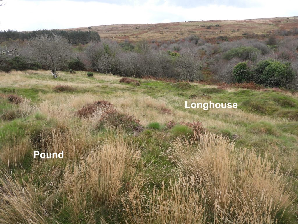
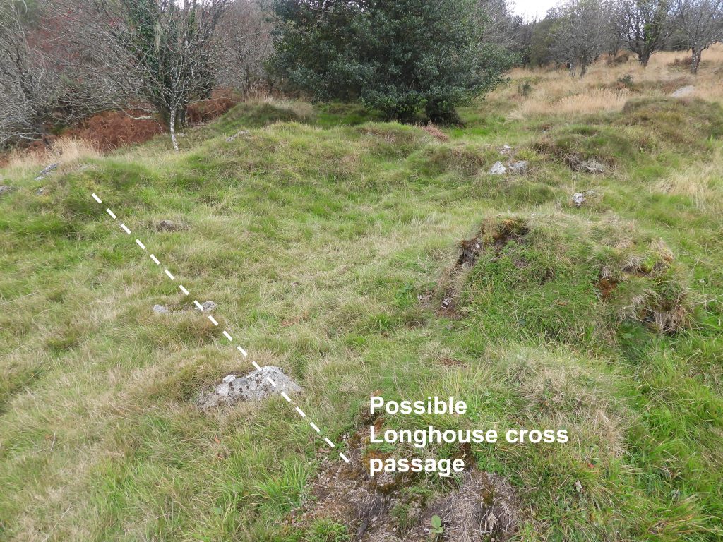
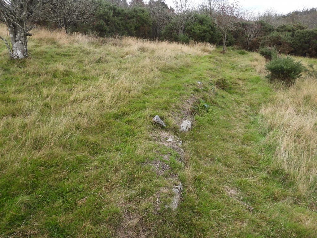
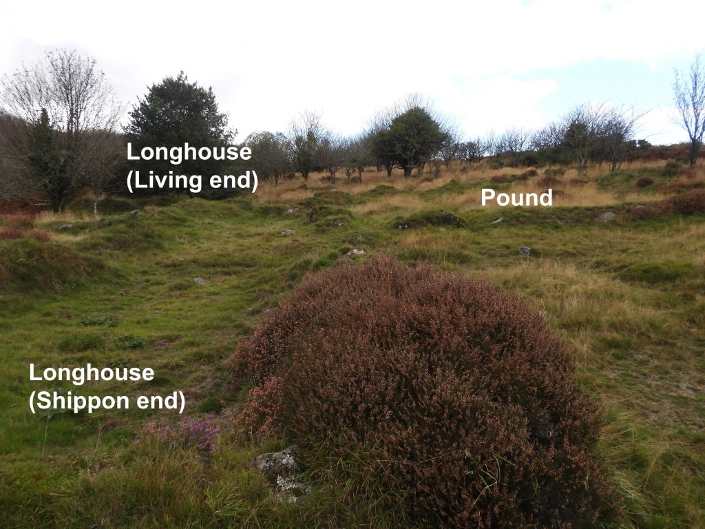
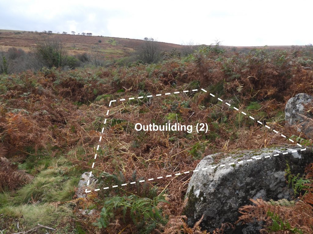
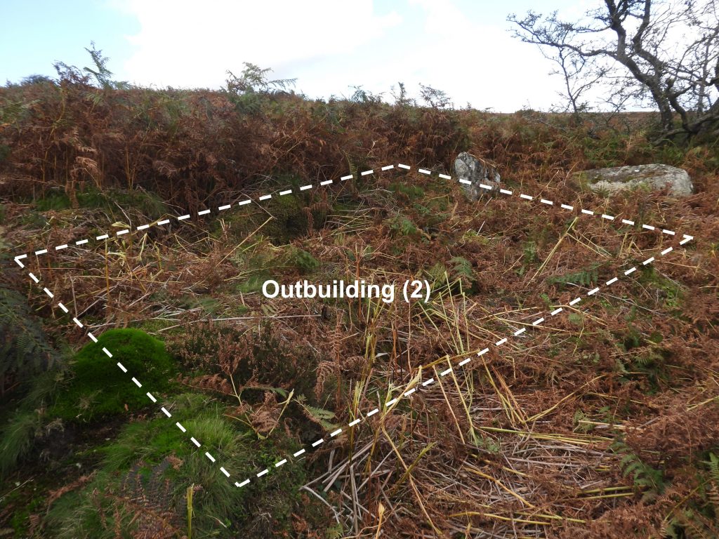
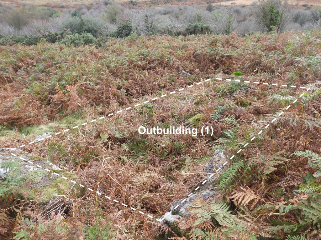
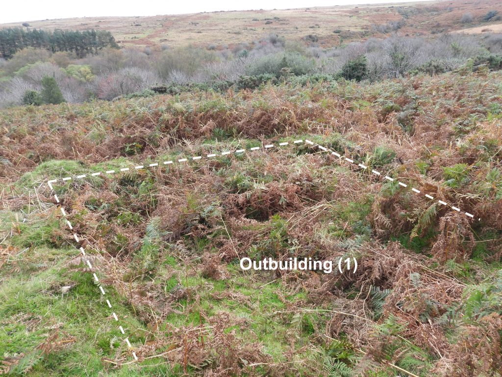
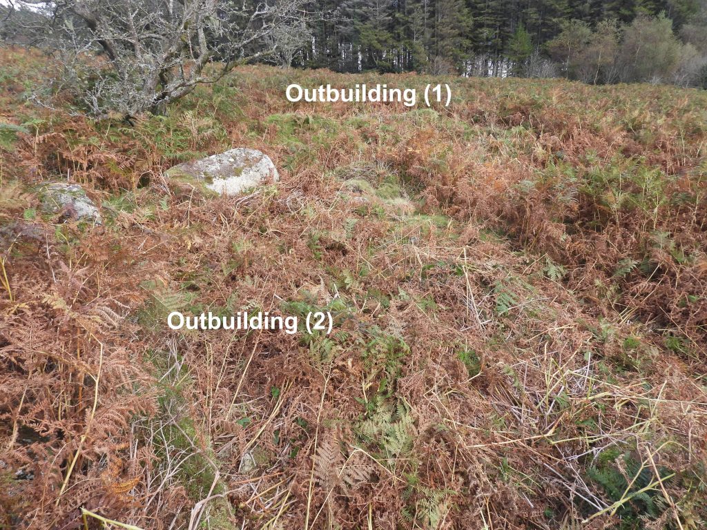
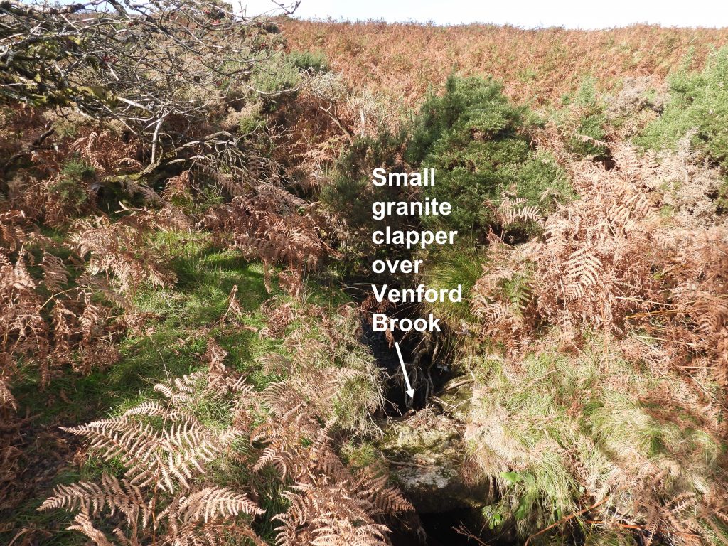
Sketch map showing the location of the farmstead. Access to the longhouse and pound is easiest by using the footpath west of Workman’s Ford. Then find and cross the stile for access to the two service outbuildings.Footbridge at Workman’s ford. From this point (behind the camera) is a narrow footpath which follows a westerly direction and will take the explorer to the longhouse and the stile over the fence.First views of the Longhouse and pound from the path from Workman’s FordThe Longhouse looking west. It is centred at SX68232 70647.Sandwiched between the Longhouse and the reservoir fence is a pound (or courtyard). It is centred at SX68218 70653The pound is square and approx 15m x 15m The longhouse is described in the Dartmoor HER as being “cut into the slope and is aligned east to west. Internally it measures 18.1 metres long by 4.7 metres wide with coursed boulder walls 0.7 metres wide and a maximum of 0.7 metres high”.View across the Pound and Longhouse towards the eastern end of Holne Moor.Within the Longhouse there are traces of the cross passage, which would have separated the living area from the shippon.Path back to Workman’s Ford and the stile over the fence. Probable walls from the farmstead.The living end of the Longhouse would have been up the (slight) slope, with the shippon at the lower end.Having crossed the stile, the explorer can find two outbuildings associated with the Longhouse. There are approx. 50 metres to the north. These buildings will be overgrown in summer. Some gardening was needed to take this photograph of building (2). Outbuilding (2) is centred at SX68239 70702 . The Dartmoor HER describes this building as being “on a moderate, well drained, south-east facing slope at 290 metres above ordnance datum” The HER further states: ” It is rectangular, 8 metres by 3.5 metres internally, with walls 0.8 metres thick and 0.7 metres high, built of coursed boulders and massive slabs set on edge”. The picture doesn’t do the old structure justiceOutbuilding (1) lies perpendicular to Outbuilding (2). The structure (once the bracken was beaten down) was far more discernible. It is centred at SX68248 70698Outbuilding (1) is described in the Dartmoor HER as being “open to the north measures 7.5 metres north to south by 5.5 metres internally”.View of both outbuildings with Venford Reservoir just visible through the trees beyond. Interestingly the Dartmoor HER describes the west wall of outbuilding (2) as forming part of one of a series of associated fields with massive walls 1.5 metres thick and 1.5 metres high, extending over approximately 5.0 hectares. Several of these walls were seen but were very overgrown as bracken had yet to fully die back.A short distance to the west from the medieval farmstead is the former “cut” of the old Hamlyn’s (Holne Moor) leat, which was diverted when the reservoir was built. Where the old leat would have cross the Venford Brook lies a small granite clapper (was this once part of an aqueduct ?). It can be found at SX68039 70648. Today Hamly’s leat enters a pipe to the west of the reservoir by the road and re-emerges on the east side of the reservoir having been gravity fed through a pipe.