A collection of walks, discoveries, insights and pictures of exploring Dartmoor National Park
September 11, 2020
River Walkham (East Bank) Blowing Houses
This post is an exploration of two Tin Blowing Houses upstream from Merrivale Bridge on the East Bank, which are known as the Lower and Middle Blowing Houses. There is a third Mill known as the Upper Blowing House which is on the Western side of the river and is the subject of its own post. The author makes due reference to the excellent Jeremy Butler Dartmoor Atlas of Antiquities, Volume 2 (The North), first published in 1991, which provides an excellent background and lovely sketches of the two Blowing Houses, covered here.
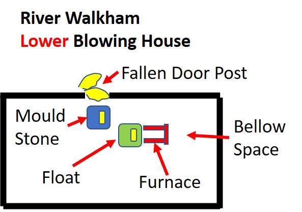
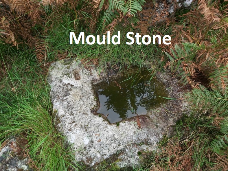
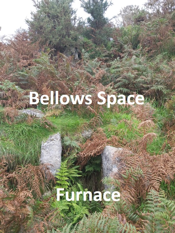
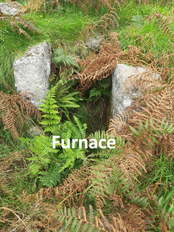
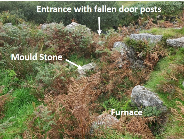
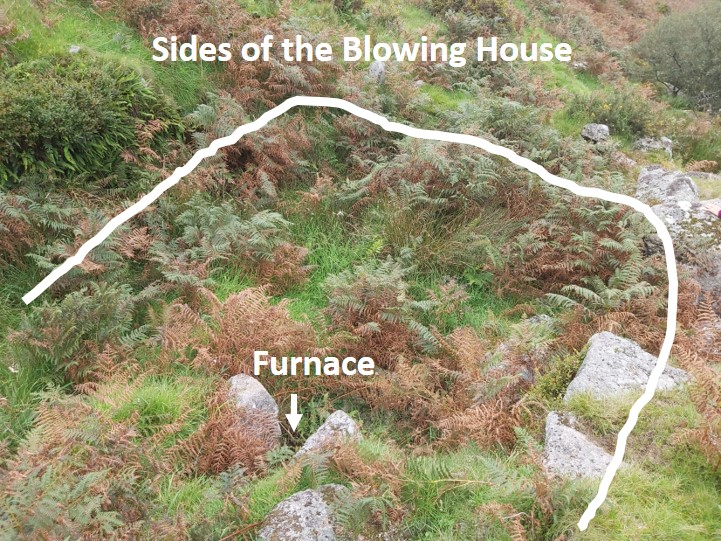
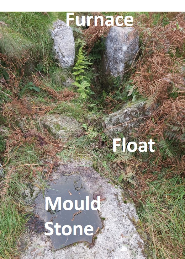
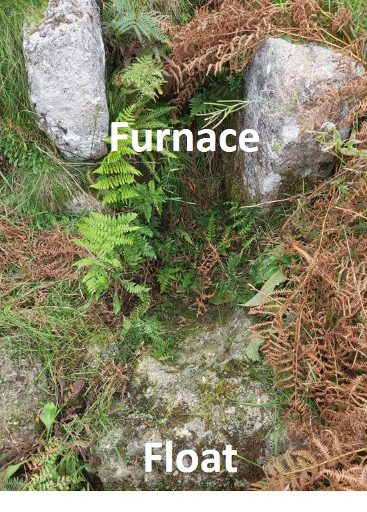
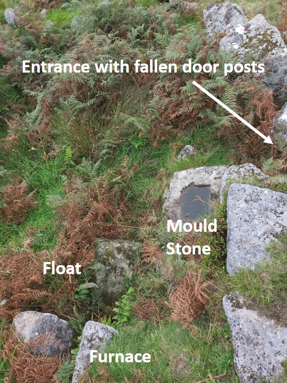
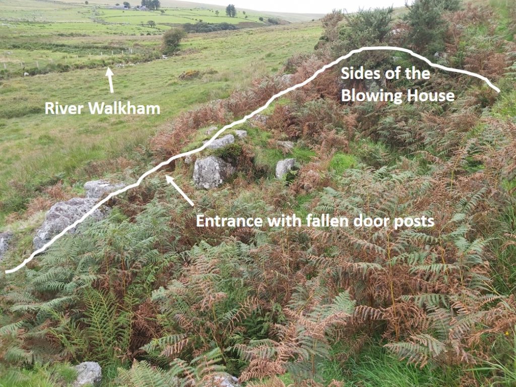
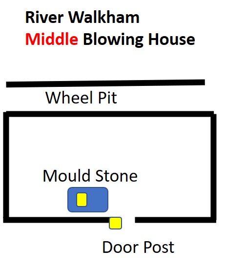
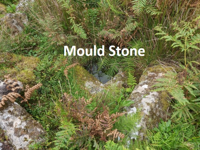
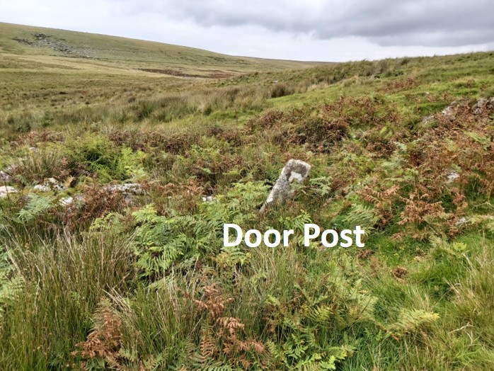
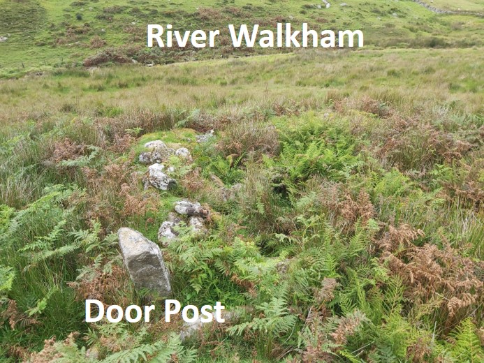
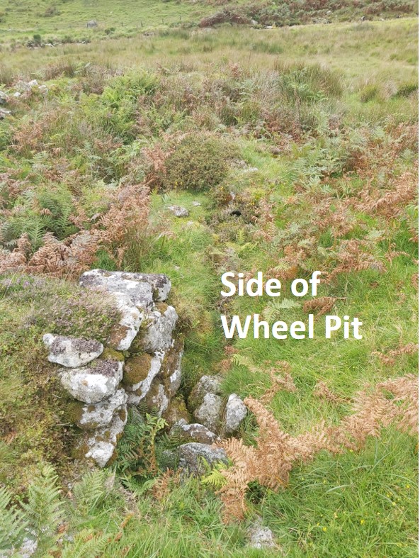
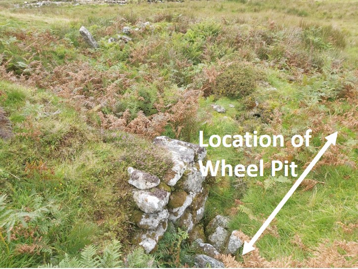
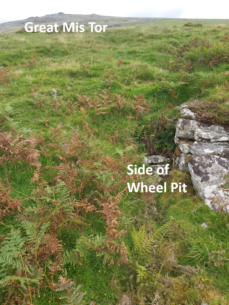
Plan of the Lower Blowing House. Sketch adapted from the Jeremy Butler version. This Blowing House can be found at SX55258 75349 approx 300m north of Merrivale Bridge.Mould Stone lying close to the door entrance. Note, there is a small rectangular sample mould on the stone The overgrown Furnace area with room for Bellows behindFurnace close up. Behind the ferns in the foreground is a Float StoneMould Stone and Furnace in relation to the Blowing House entrance, below which are the fallen door postsEmphasising the walls of the Blowing HouseAfter clearing the ferns, the Float Stone appeared by the Furnace. The Float Stone would have originally been in the horizontal position. The Float was to receive the molten metal. The Mould Stone has a groove to accommodate a lifting bar, which was used to move the solidified metalAfter clearing the ferns, the Float Stone is very obviousThe Mould Stone, Float and Furnace from aboveJeremy Butler comments that there is no wheel pit on this site and also no “sandy waste”, which suggests the site was solely used as a Blowing House.Plan of the Middle Blowing House, based on the Jeremy Butler sketch. Unlike the Lower Blowing House, this one has the distinction of having a Wheel PitLocation of the Blowing House in relation to River Walkham.Nice Mould Stone near the Blowing House entranceThe entranceThe entrance is at SX55264 76223Entrance and Mould Stone are adjacent to one another.Opposite the entrance side of the Blowing House is a Wheel PitThe Wheel Pit is located at SX55267 76236. It is believed the wheel would have been 0.3m across and 3.5m in diameter. A leat which fed the wheel is easily discernableGreat Mis Tor in backgroundRiver Walkham in relation to the Blowing House


John Matthews April 26, 2024
What is the mortar stones use? Thanks
SteveGriggDartmoor April 26, 2024 — Post author
Hi John,
Mortar Stones were used in Tinners Mills, where stamps crushed tin ore on them creating a fine powder before further processing.
Regards,
Dartmoor Explorations (Steve)