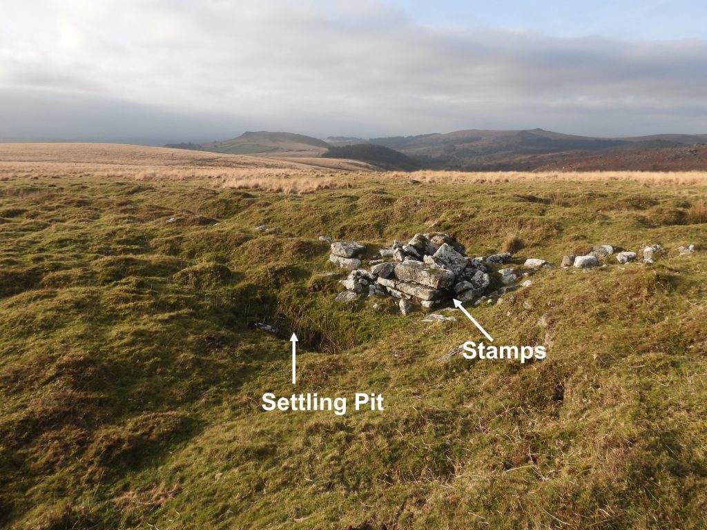
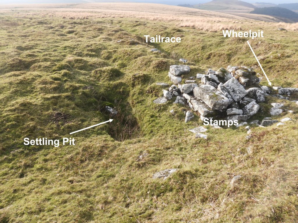
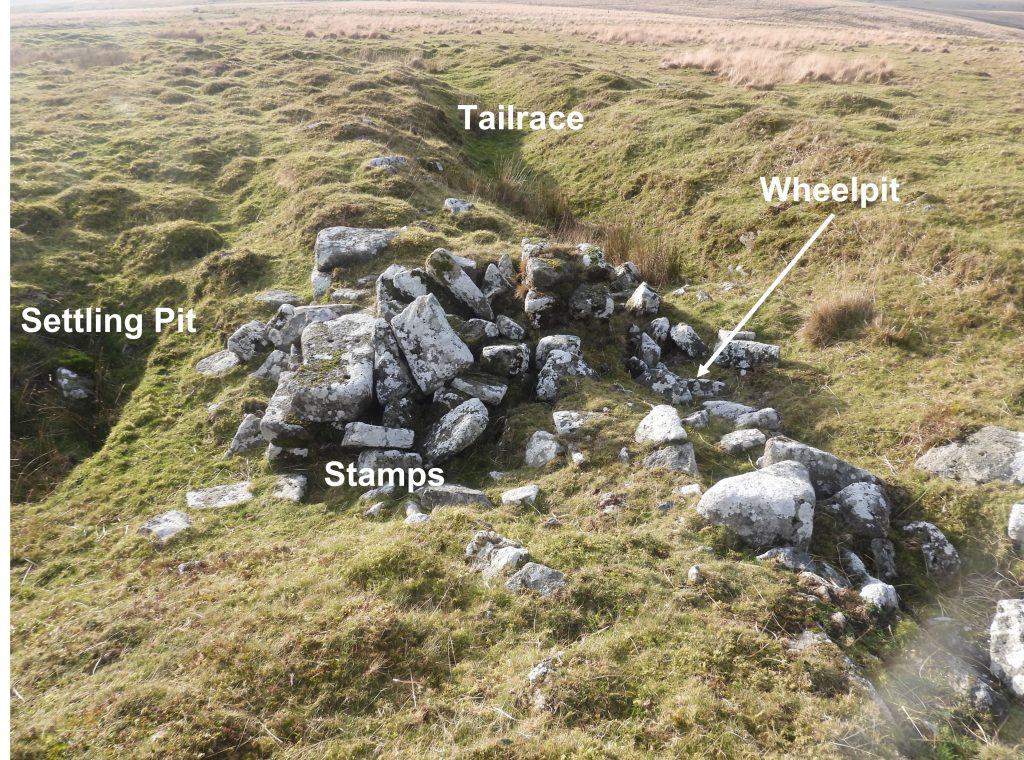
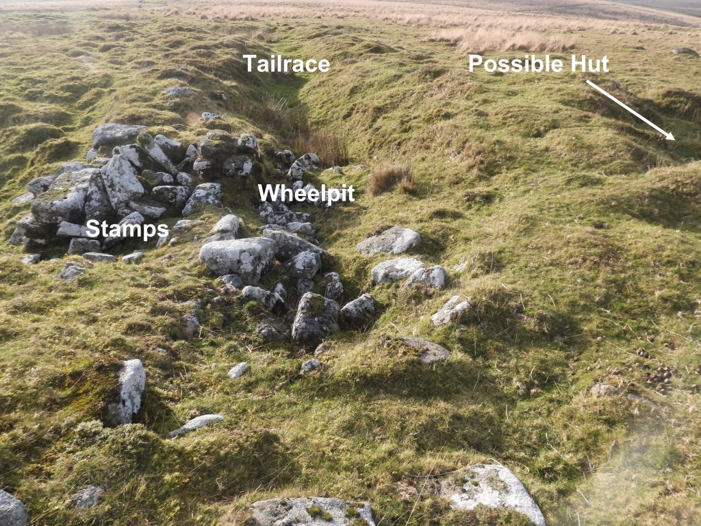
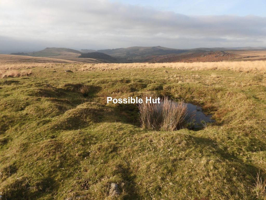
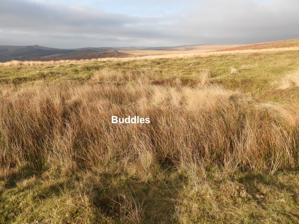
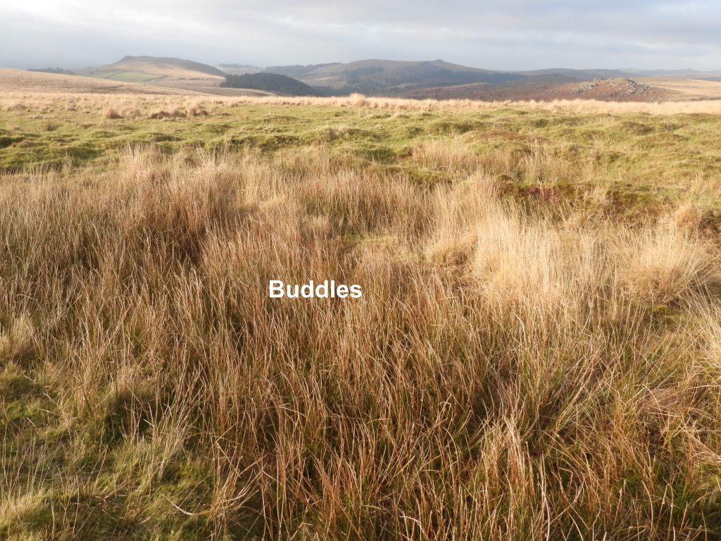
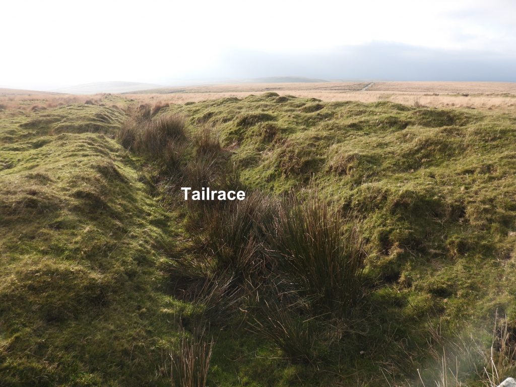
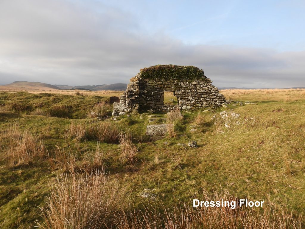
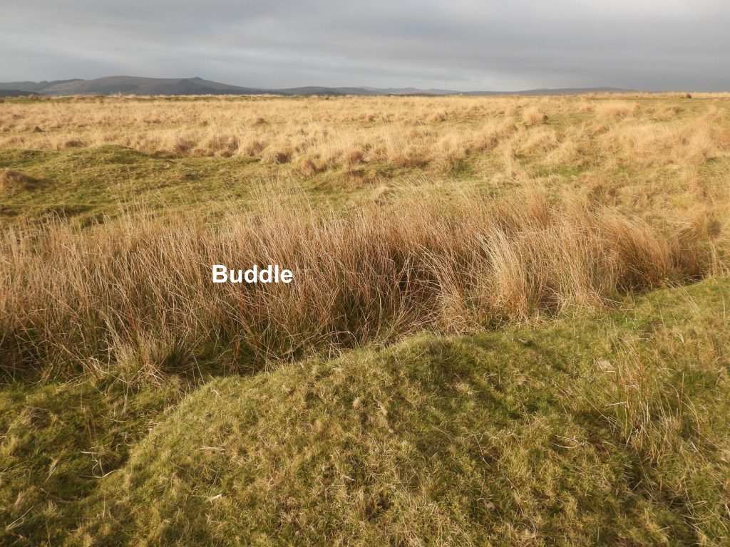
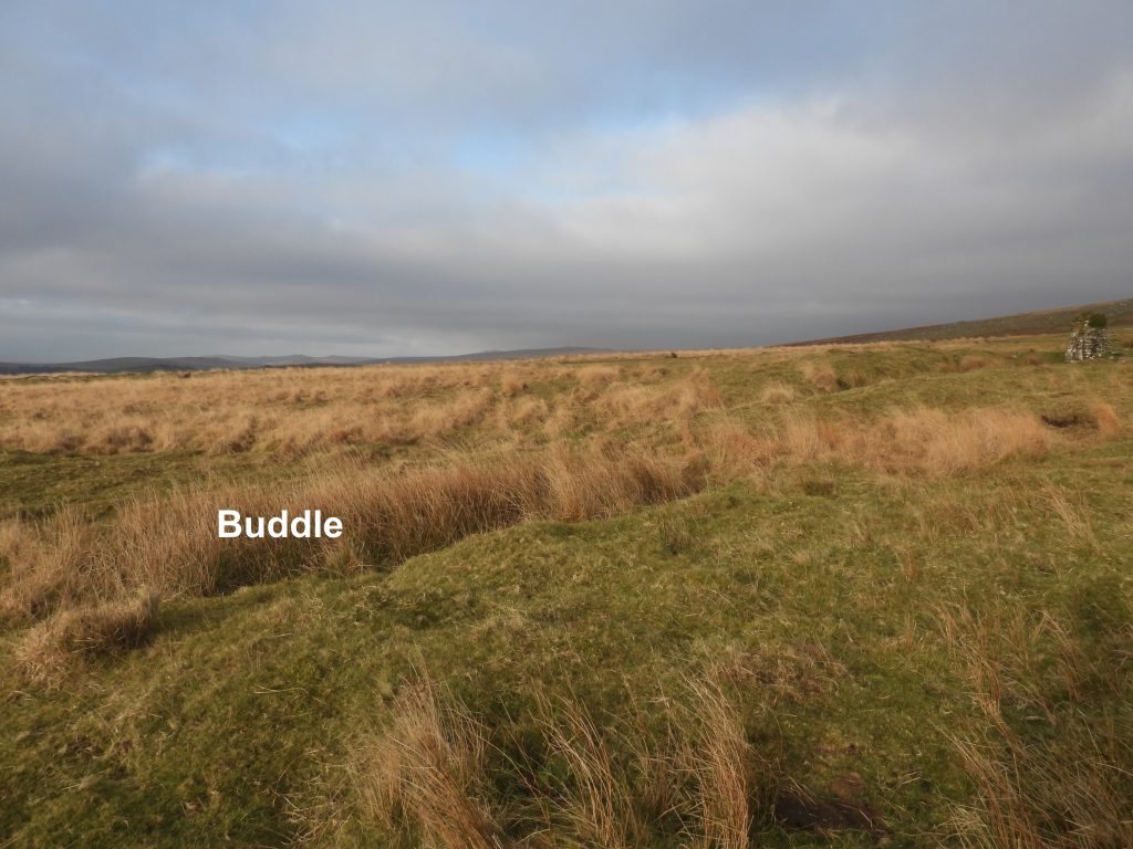
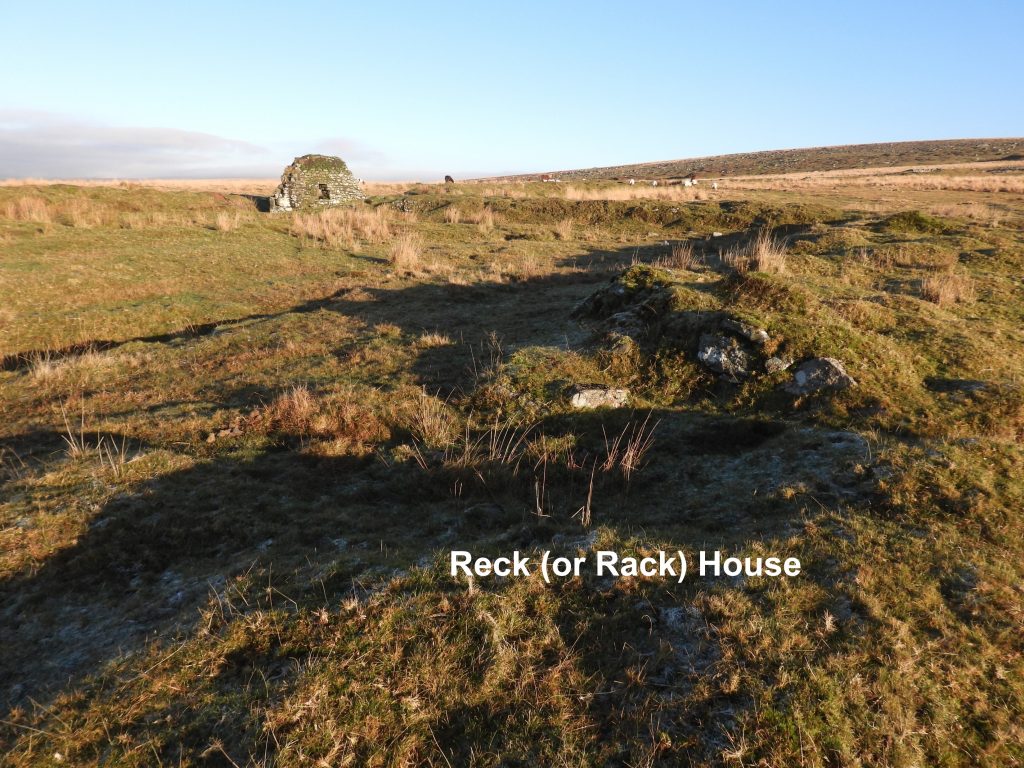
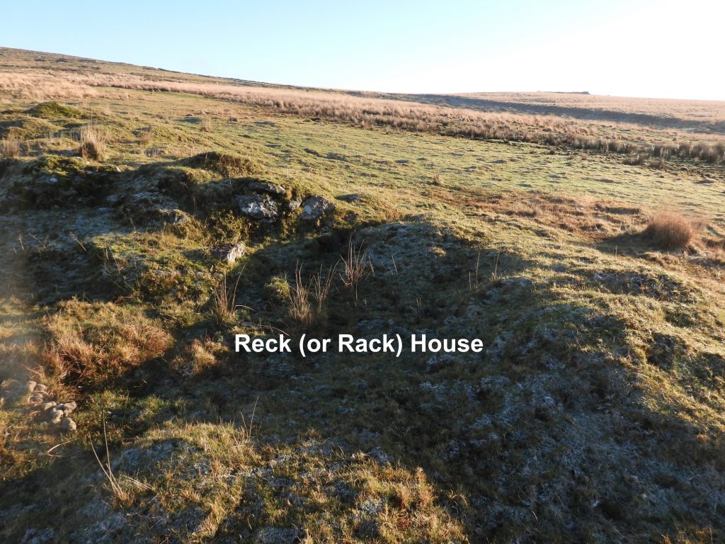
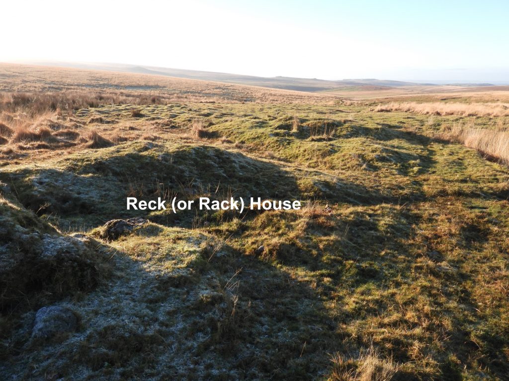
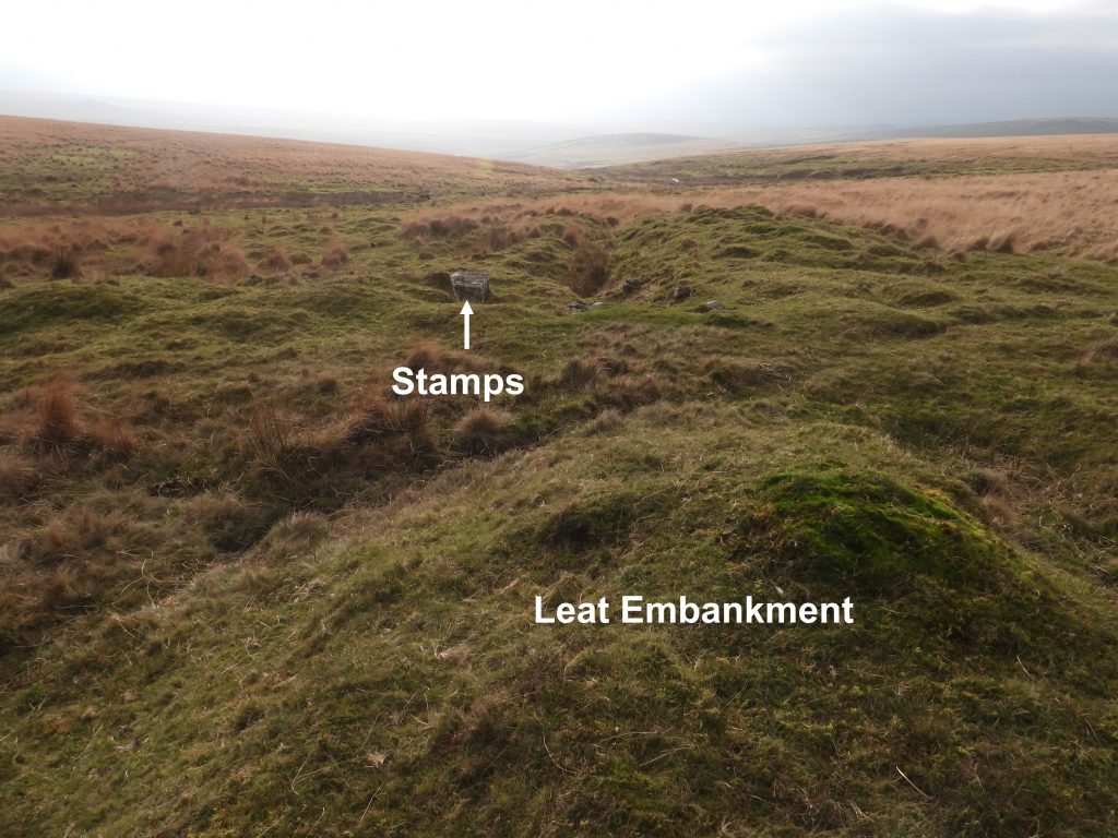
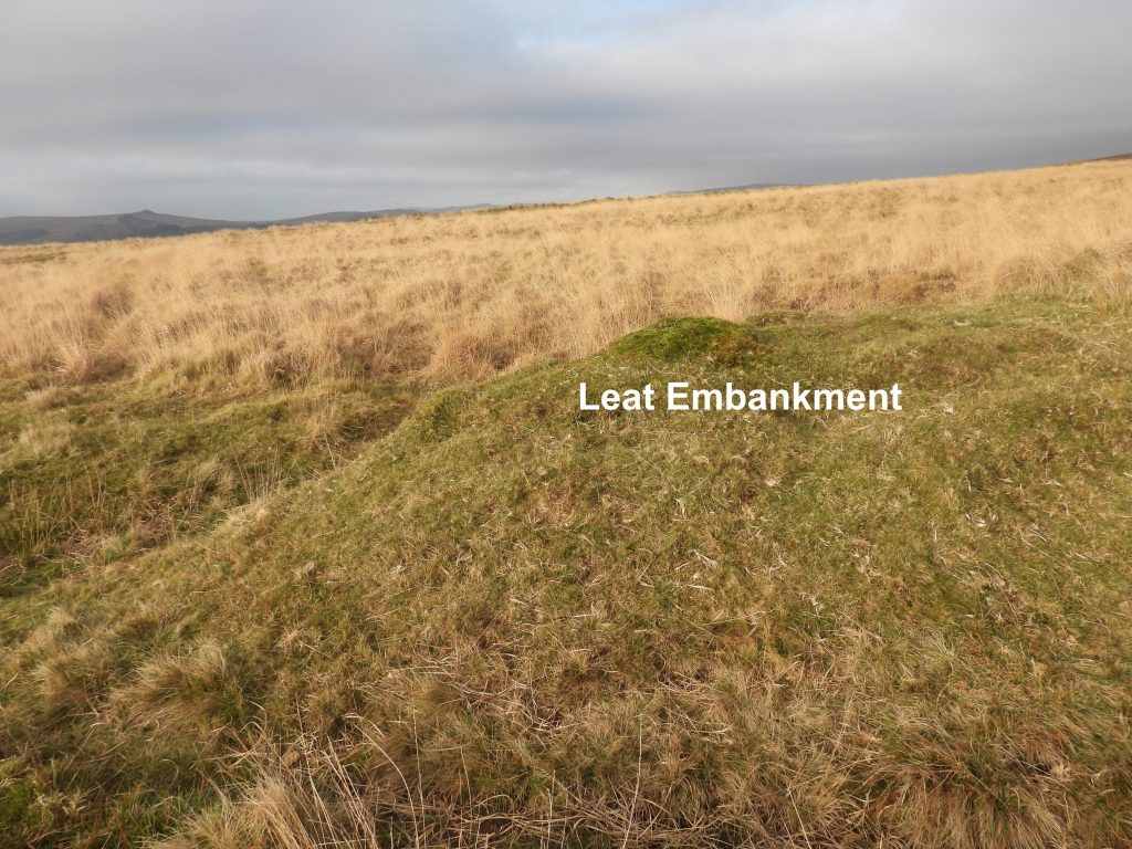
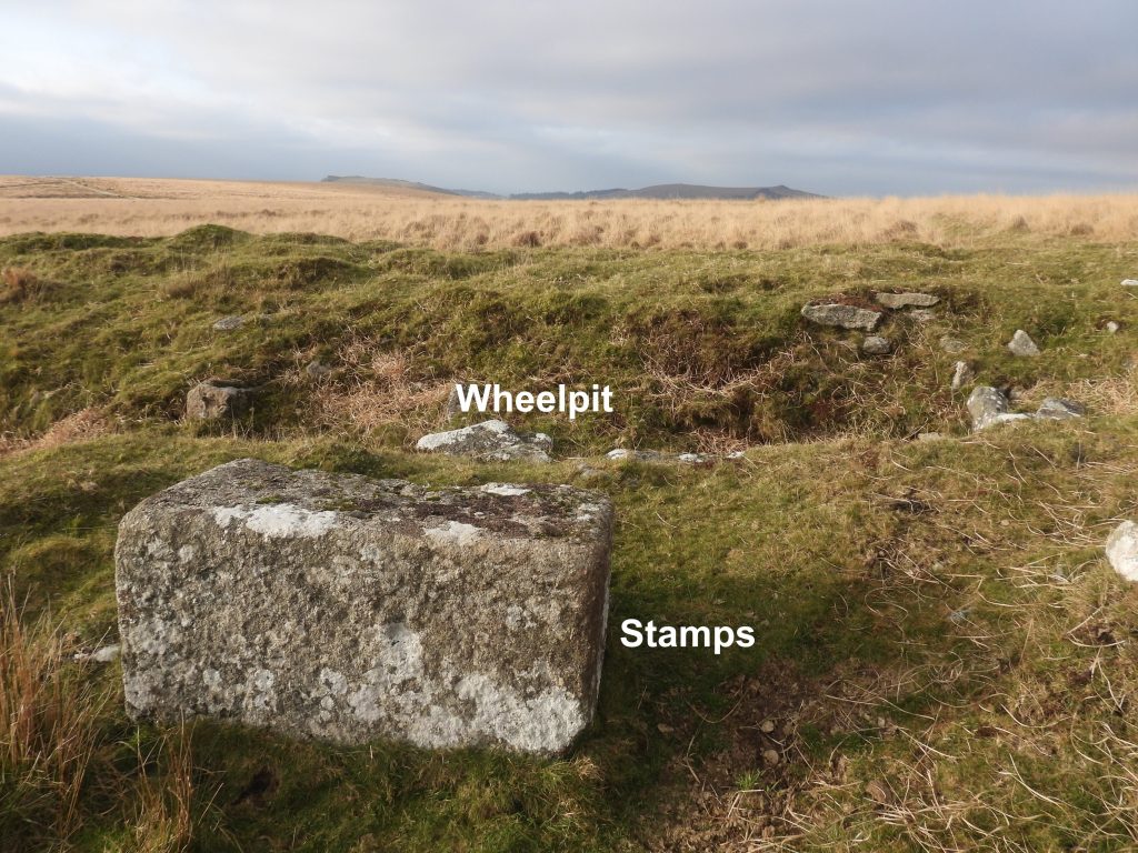
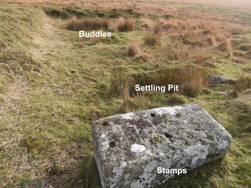
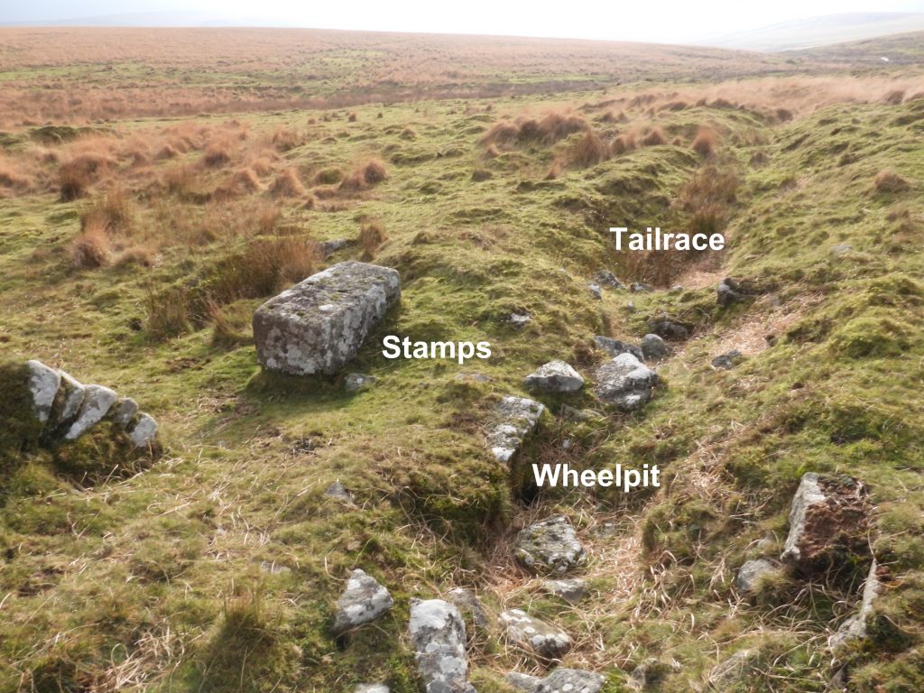
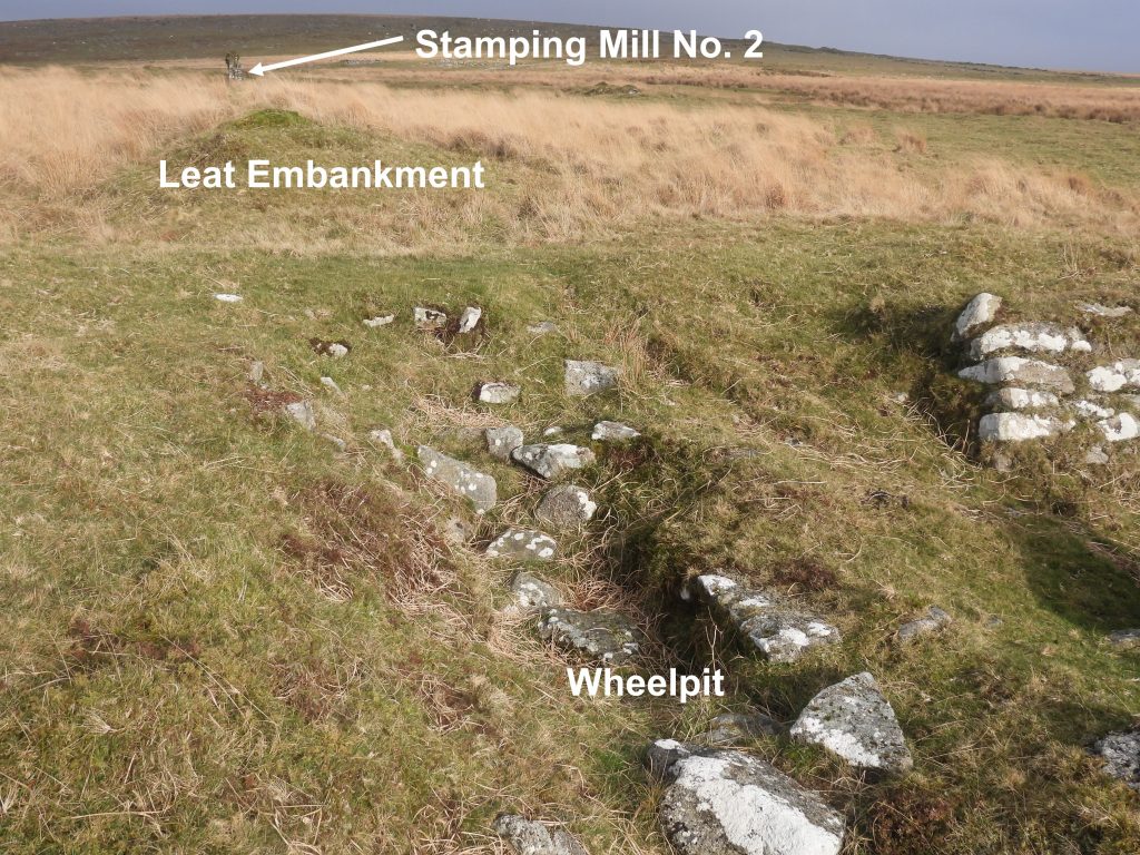
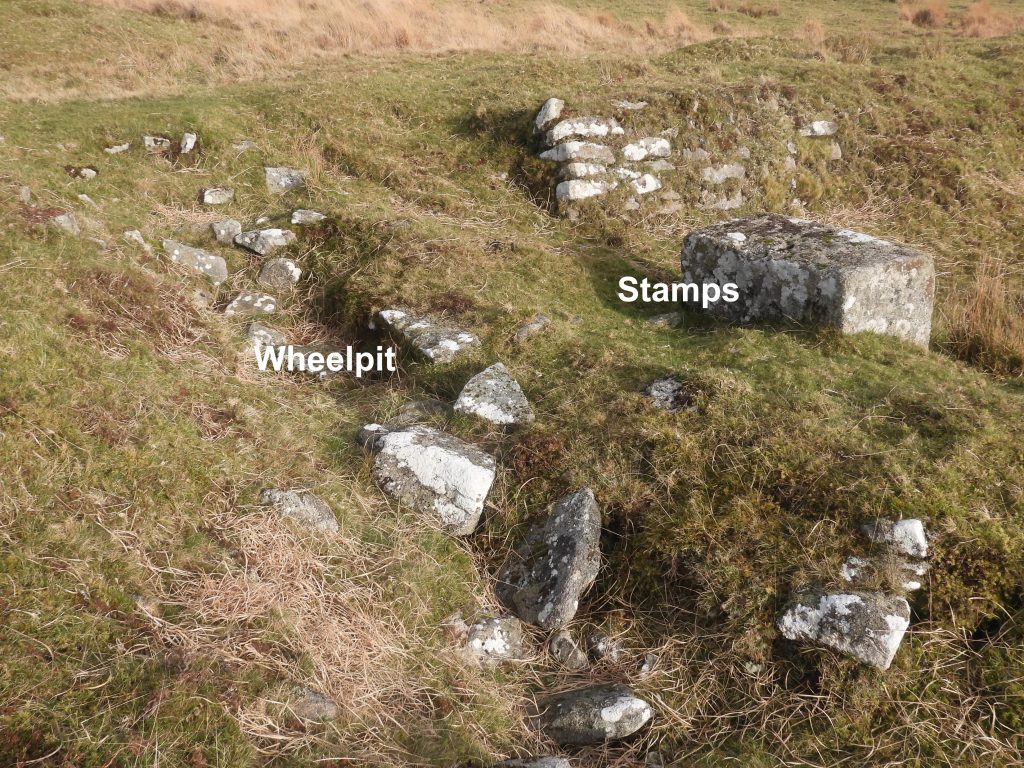
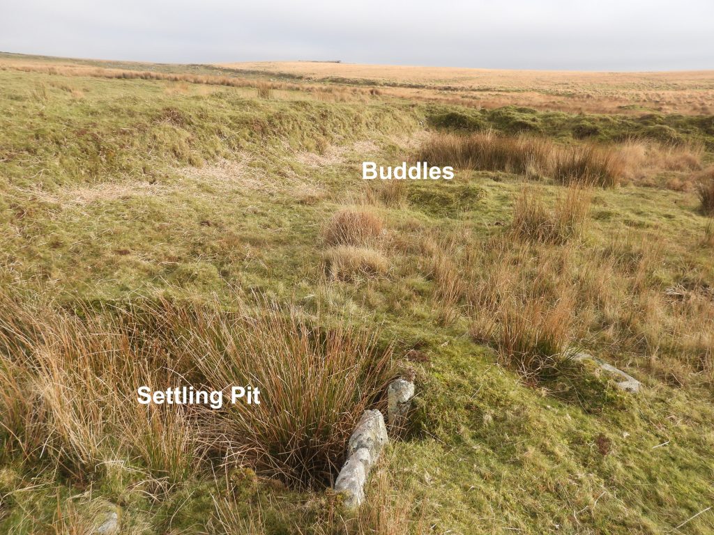
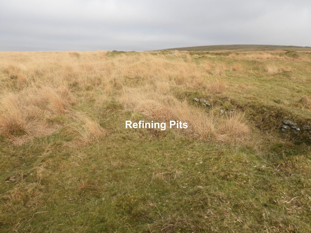
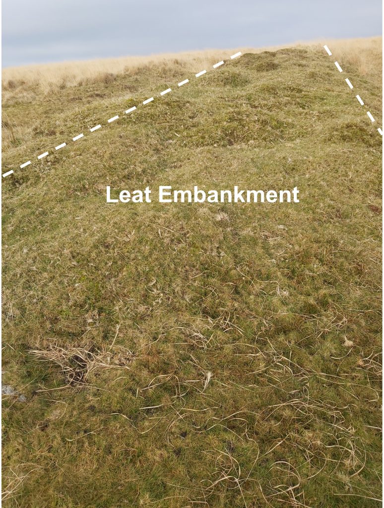
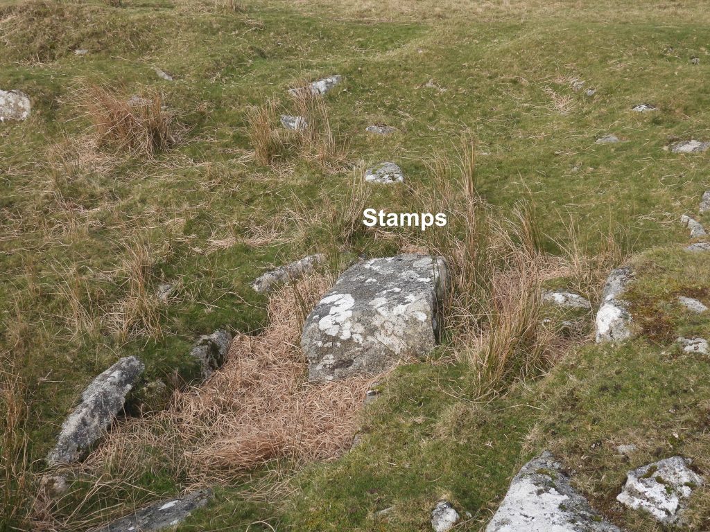
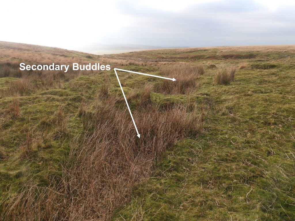
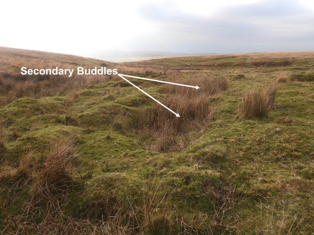
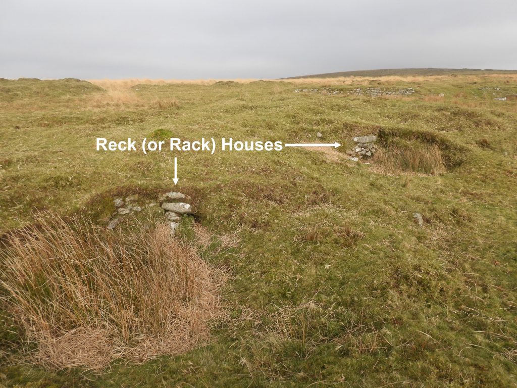
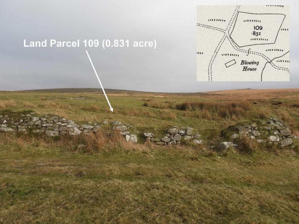
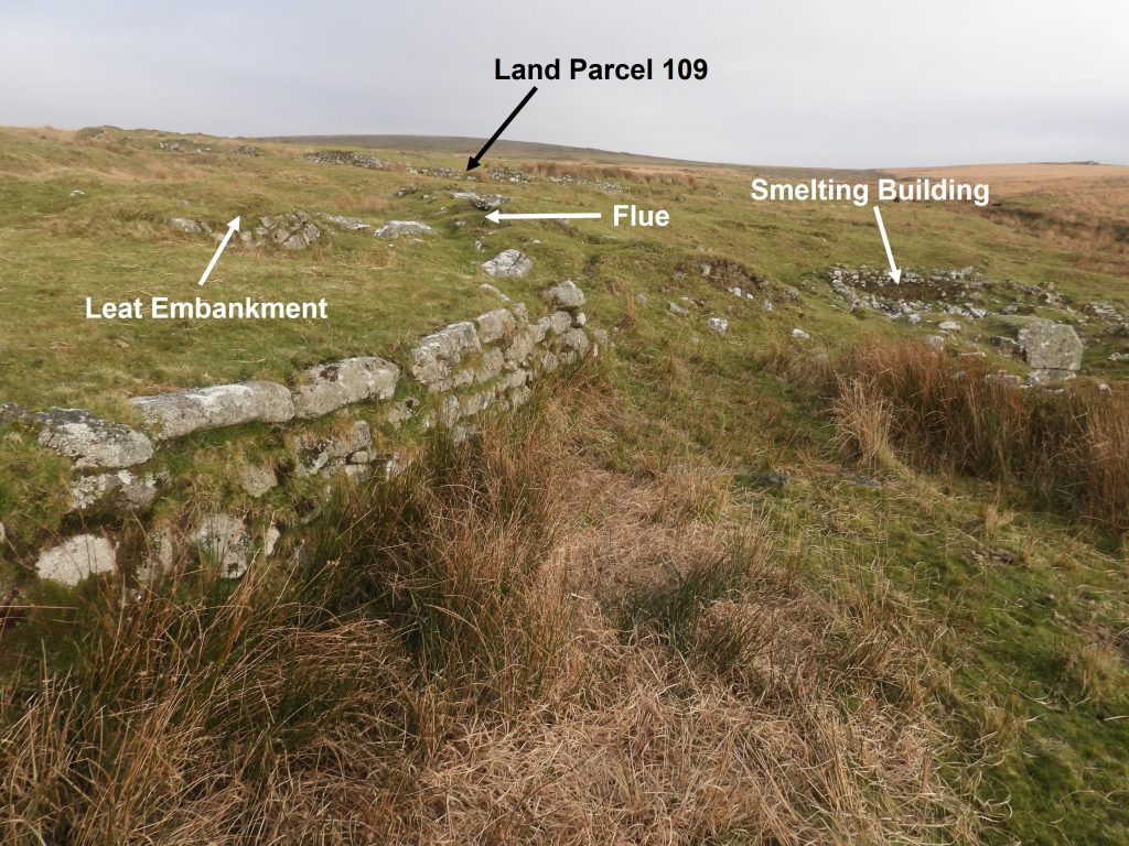
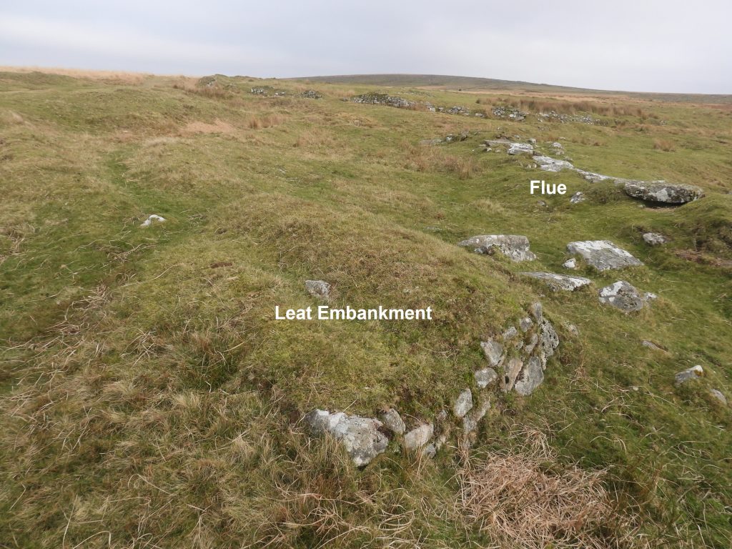
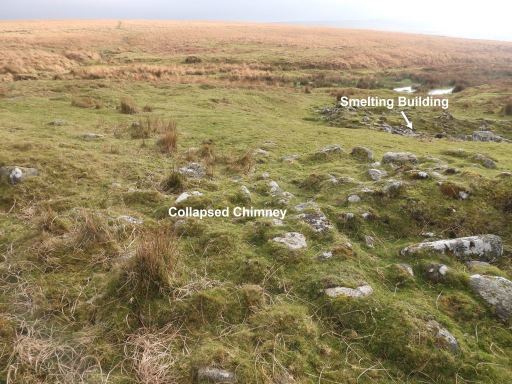
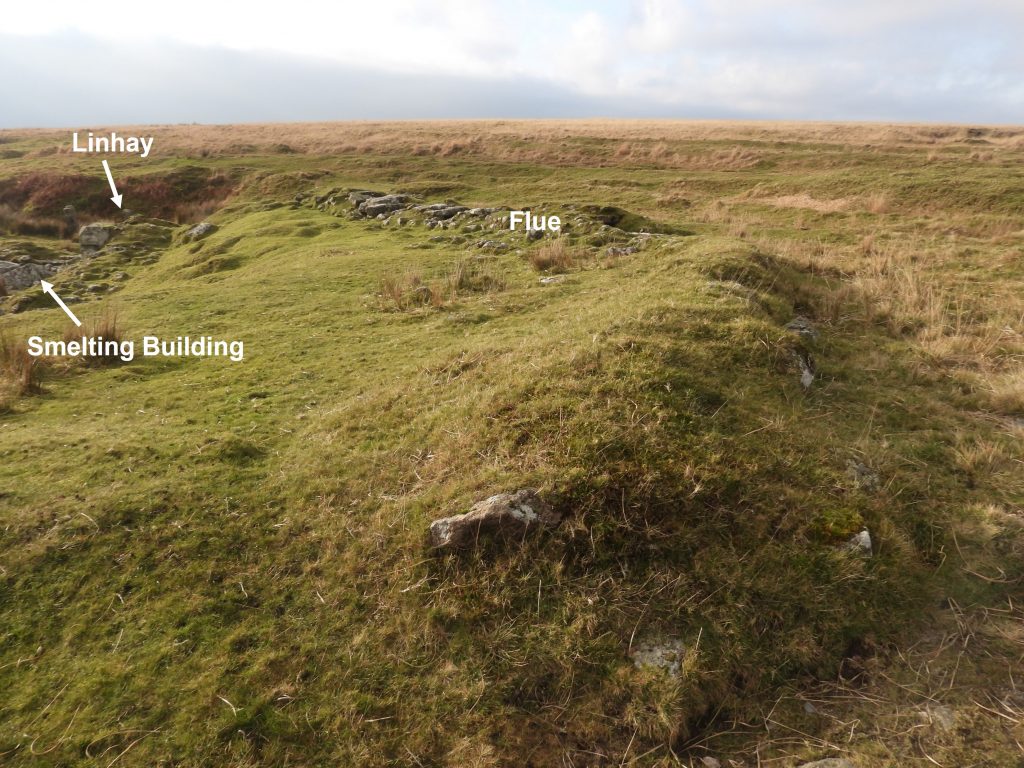
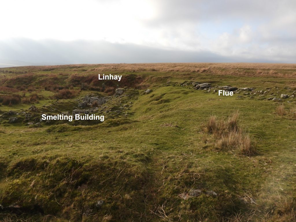
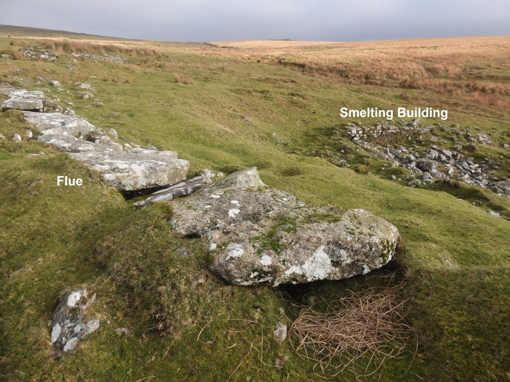
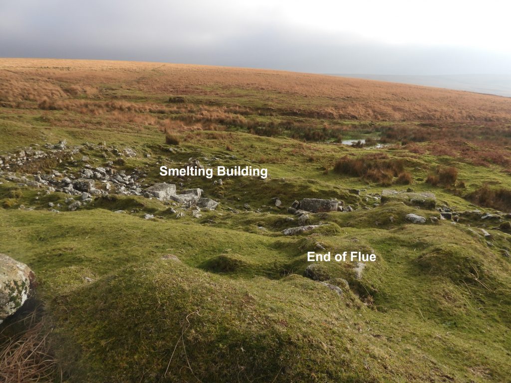
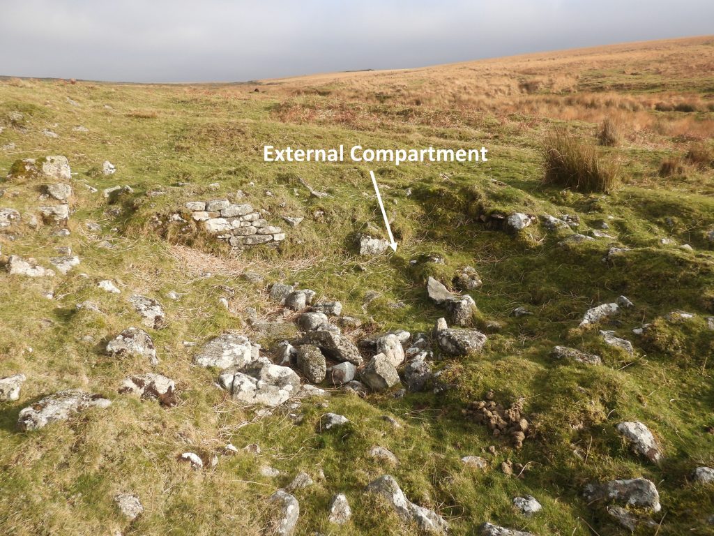
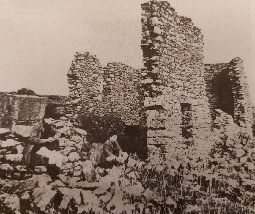
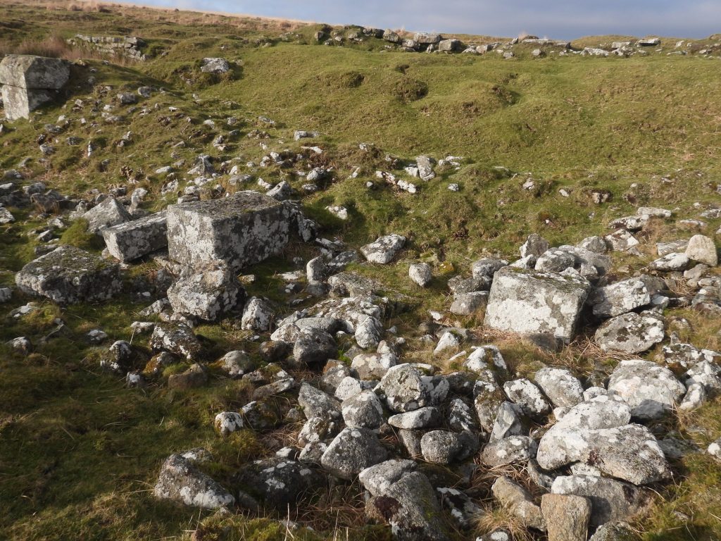
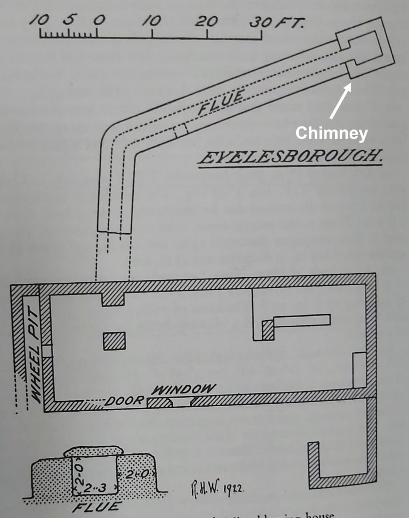
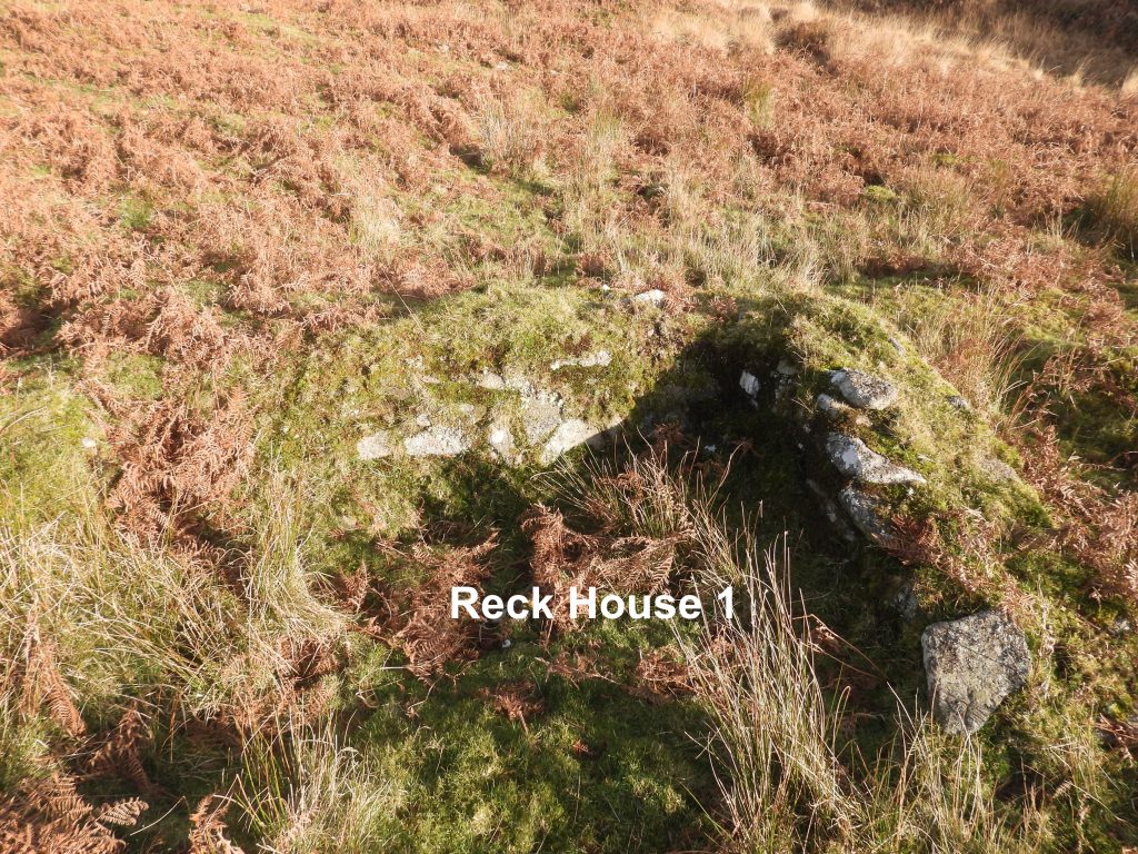
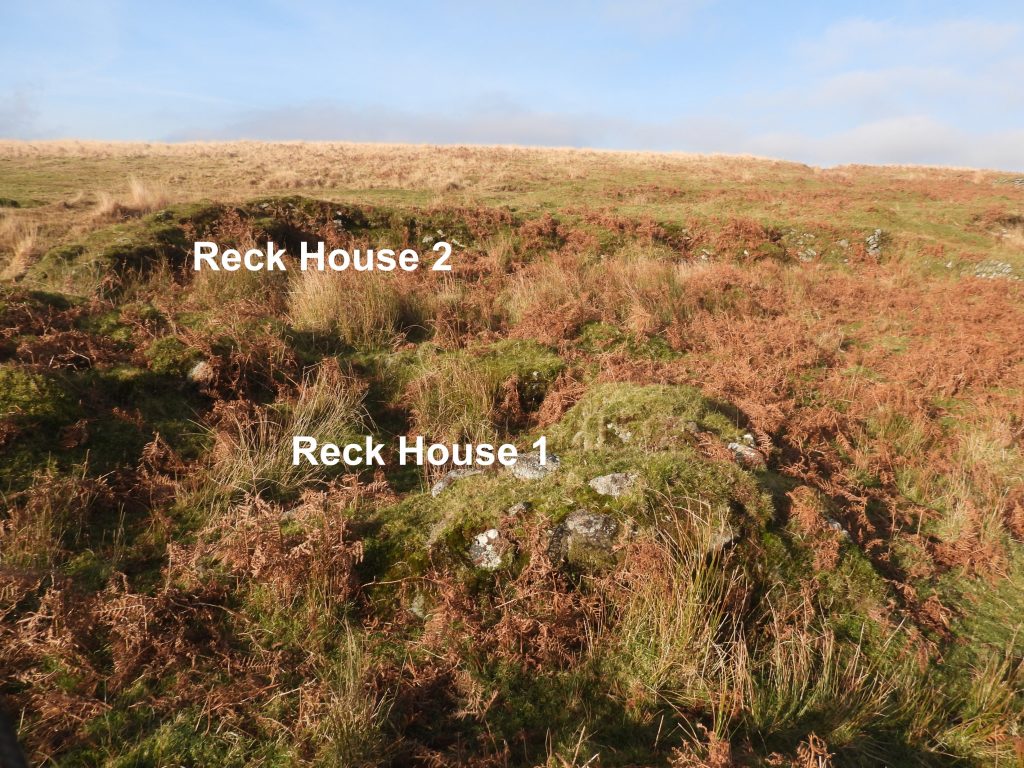
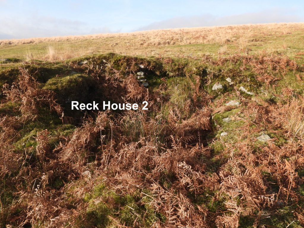
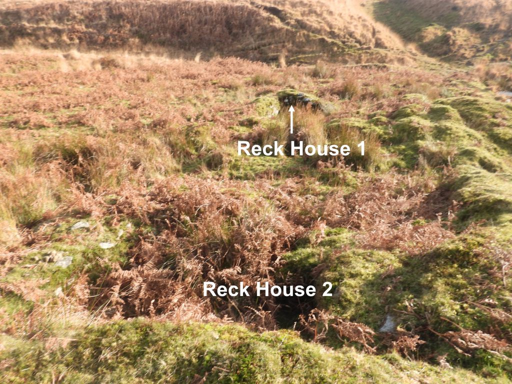
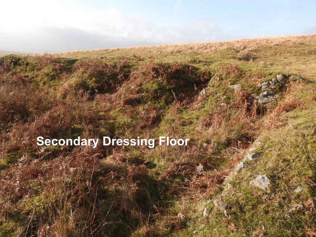
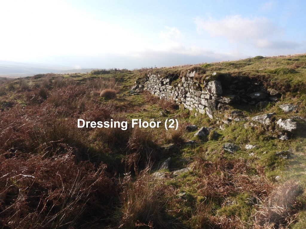
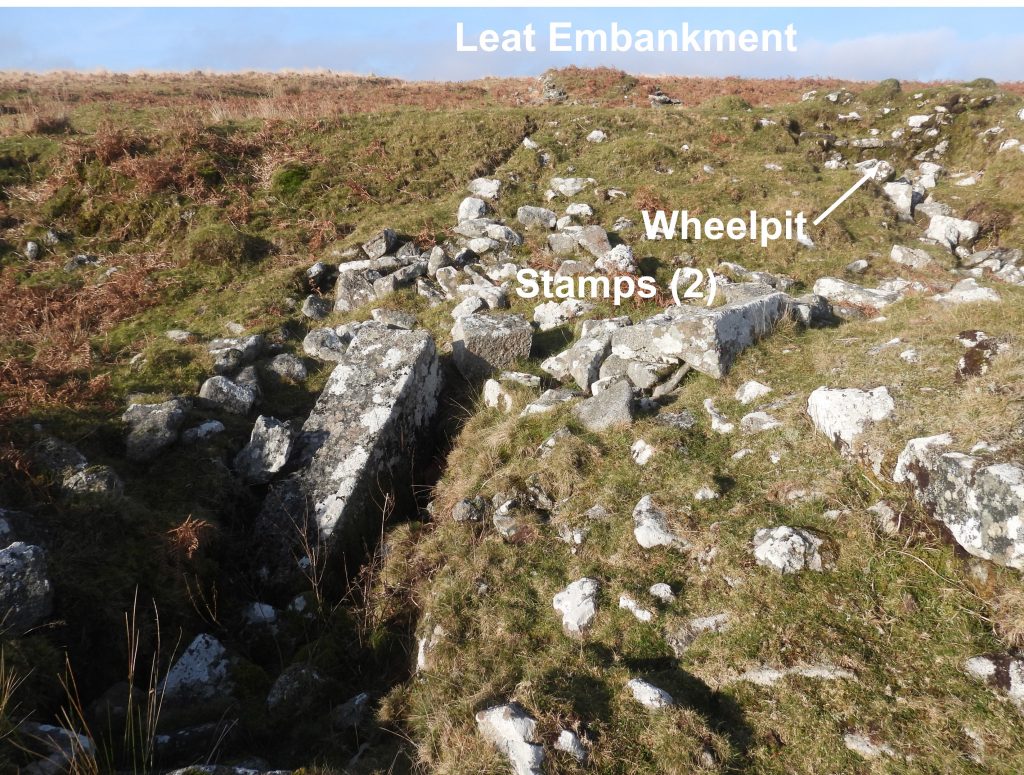
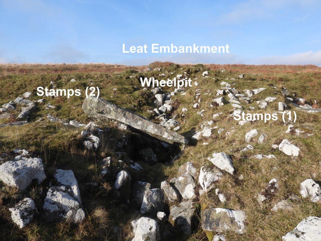
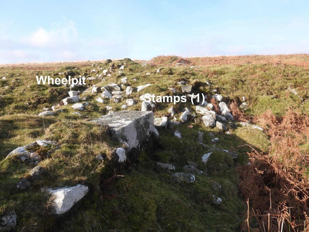
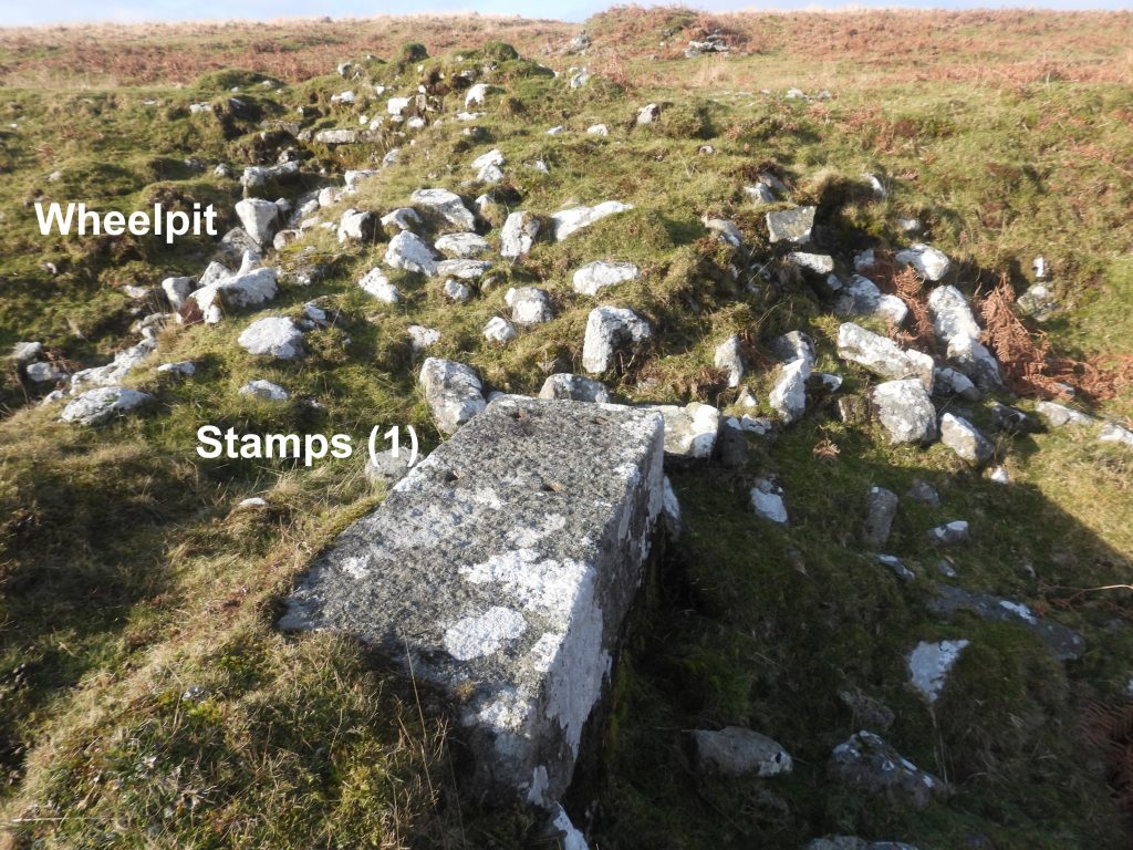
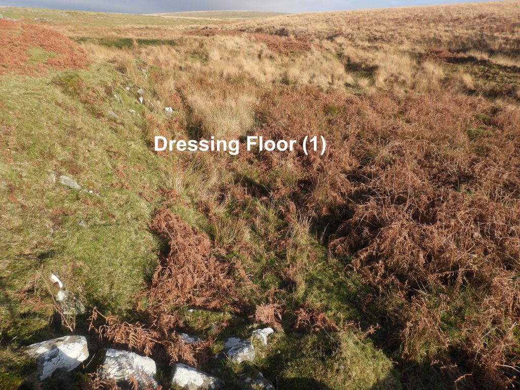
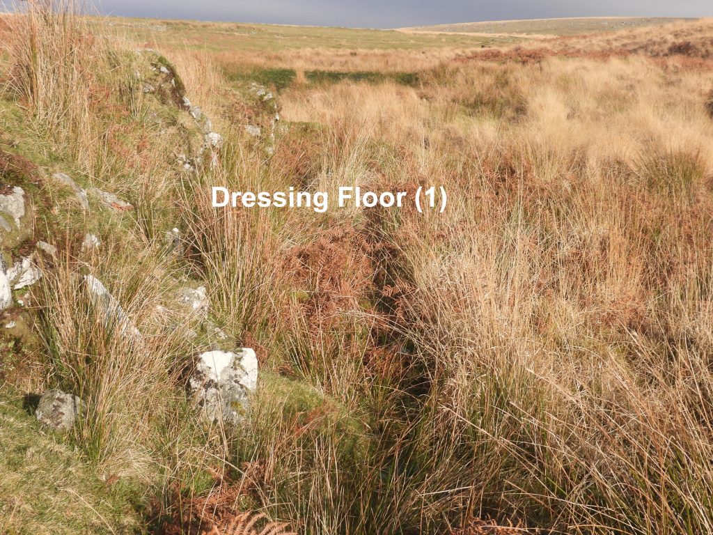
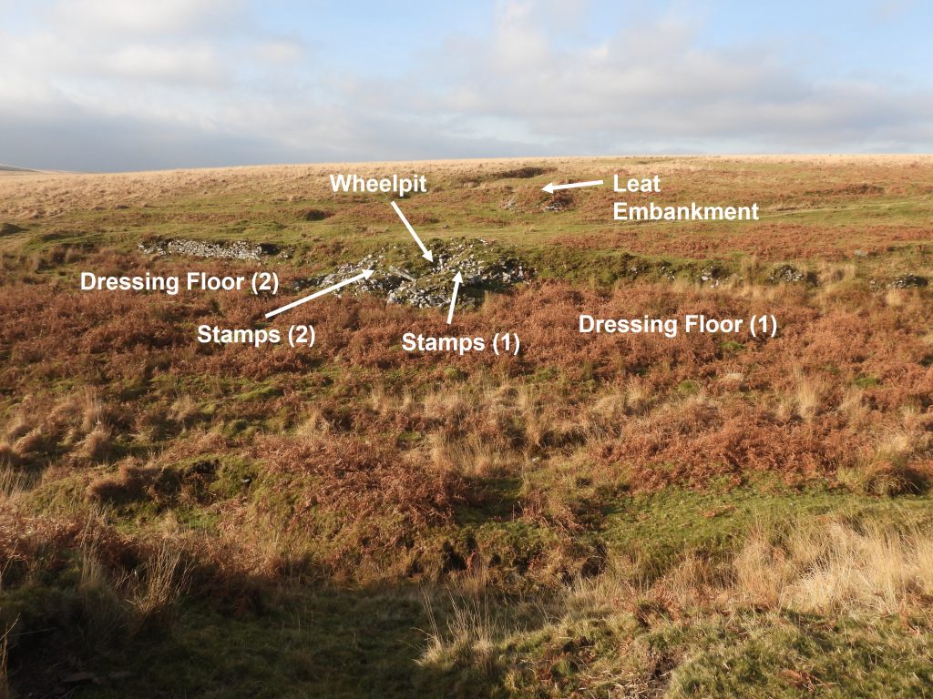
Eylesbarrow Tin Mine is recorded as starting in February 1815 (albeit some of the infrastructure was put in place in 1814). The mine is located in an area where mining had been carried out since the 16th century. The mine finally closed in 1852, although production stopped between 1831 and 1835 (due to low tin prices). Between 1836 and 1841 a little tin was smelted under ‘Dartmoor Consolidated Tin Mines Company’. In 1847 parts of the mine were reorganised, now under the name of Dartmoor Consols. The mine was renamed once more in 1851 (Wheal Ruth) before finally closing in 1852. This post covers much of the early infrastructure to the south west of the main part of the mine, being 6 stamping mills (with one smelting house), the Engine Wheelpit and the water provision via a Tinners’ Reservoir.
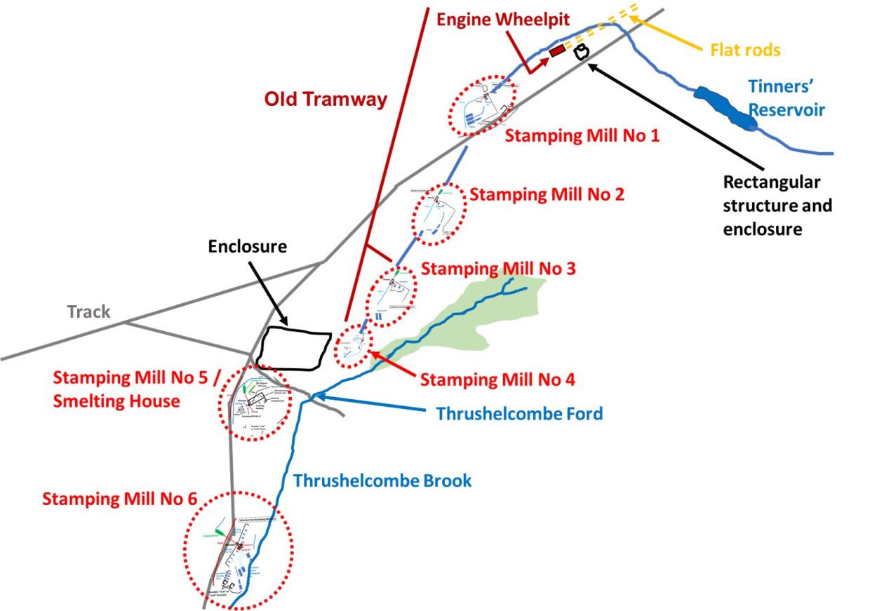
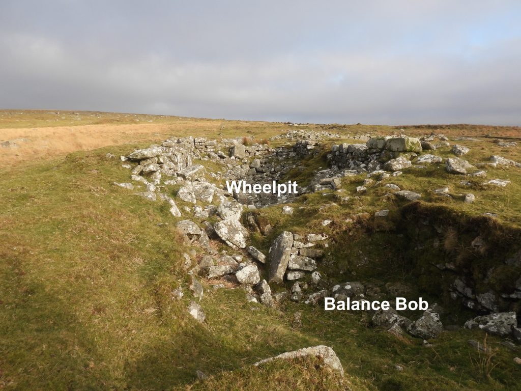
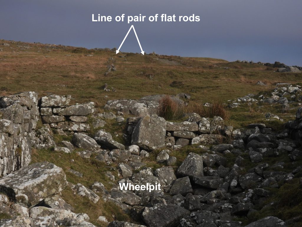
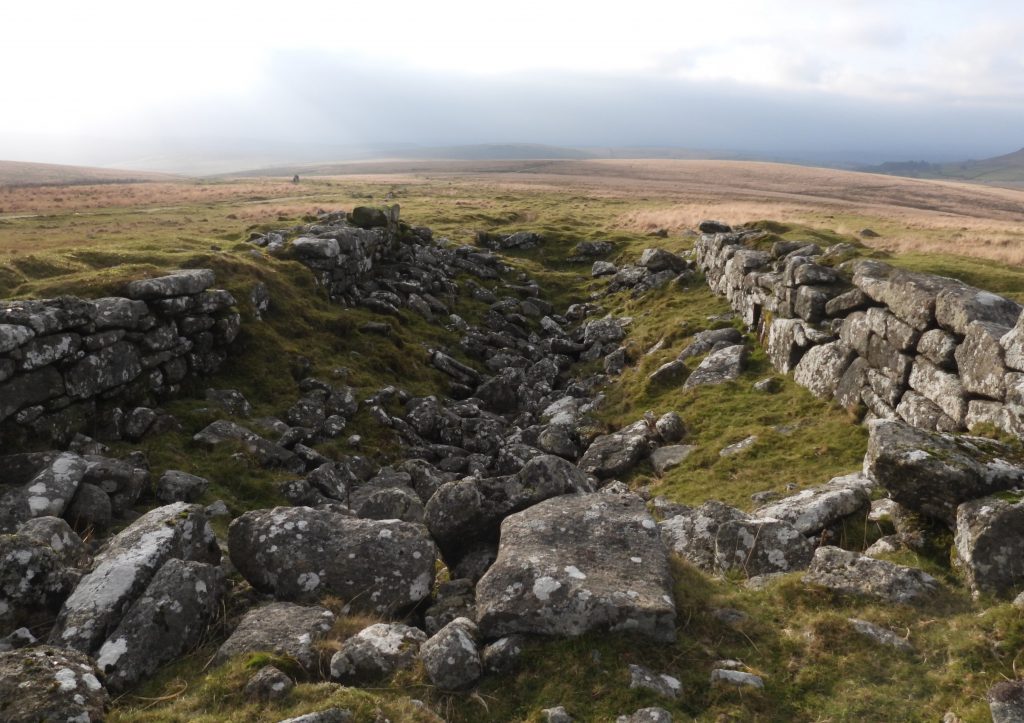
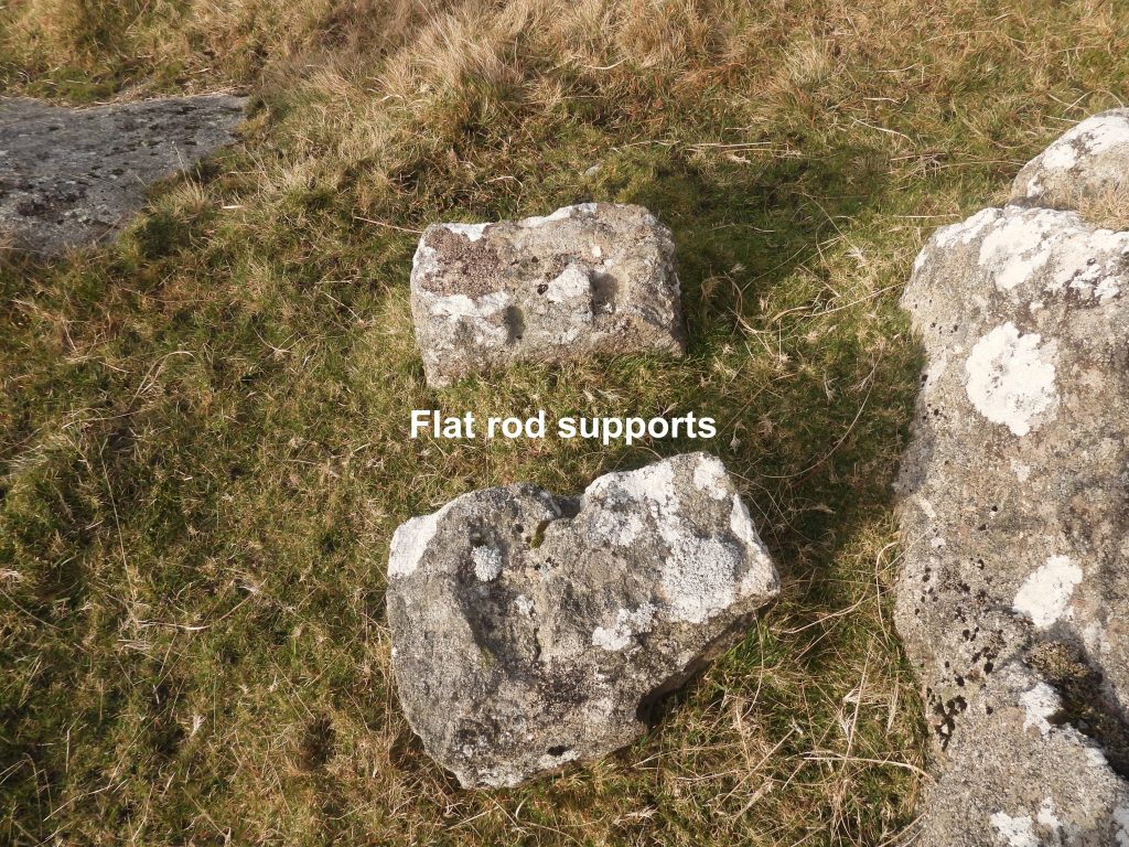
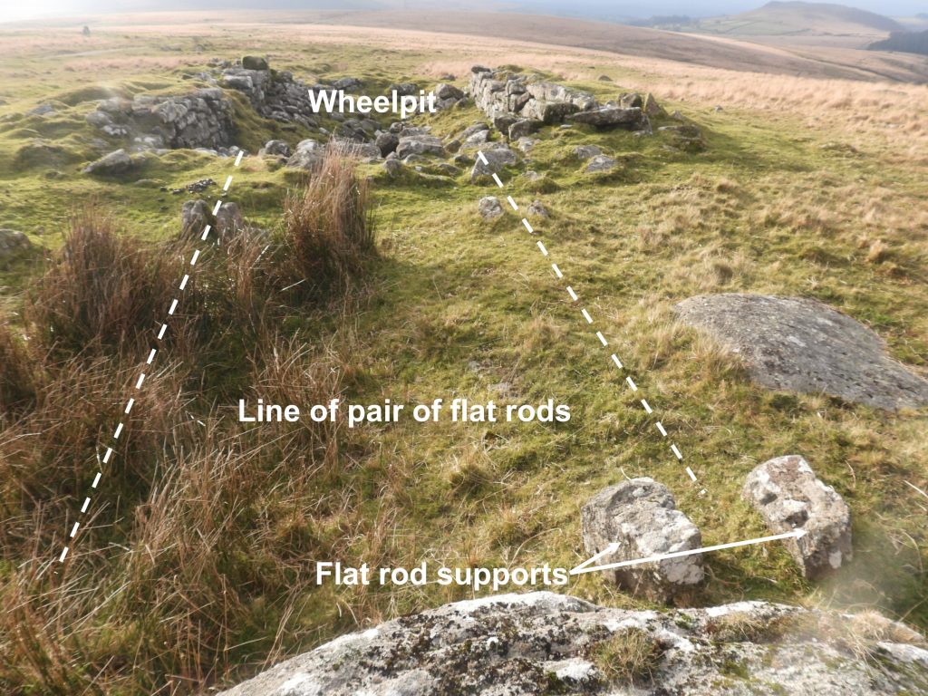
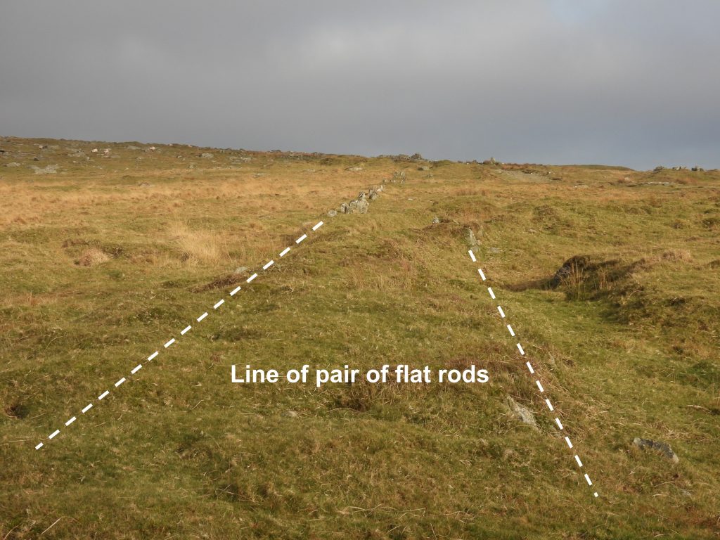
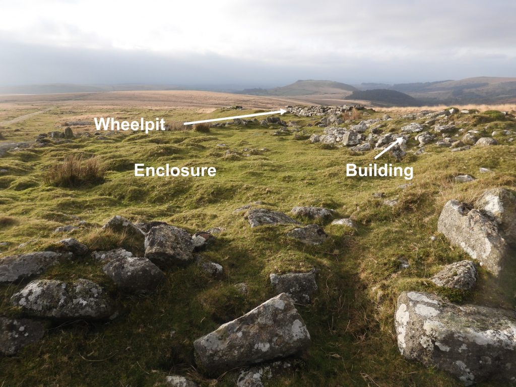
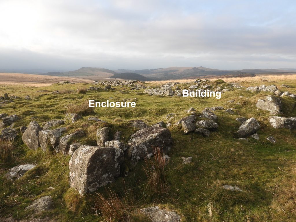
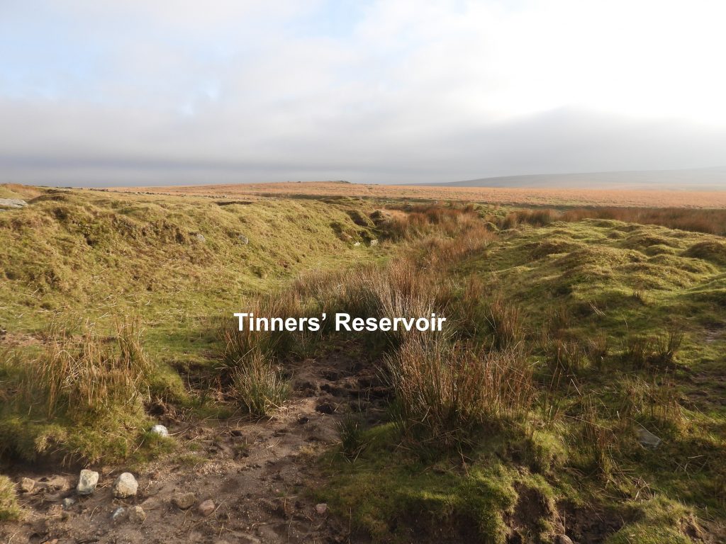
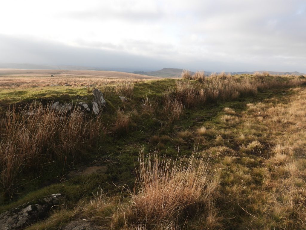
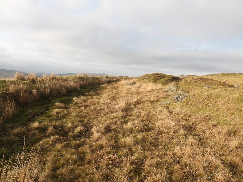
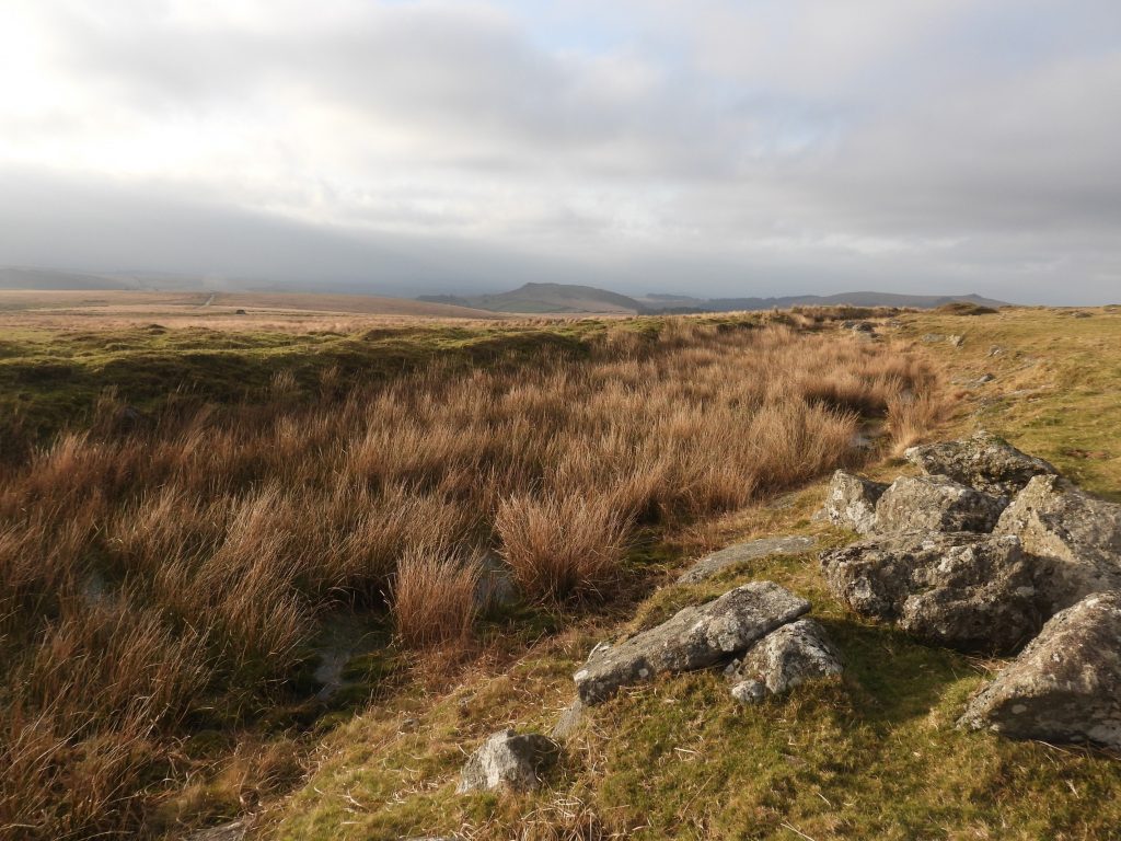
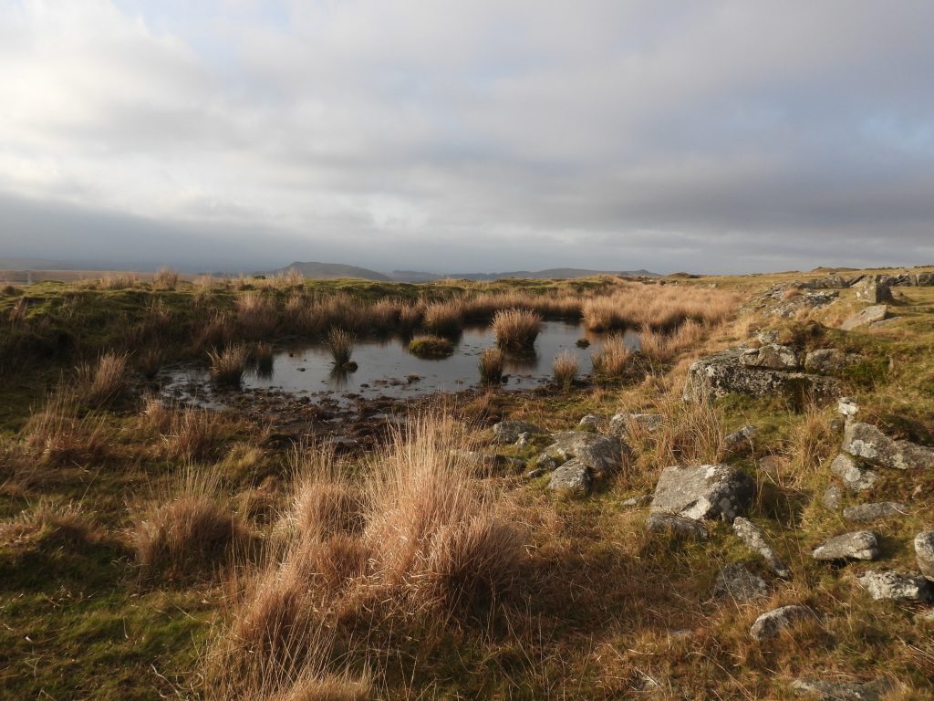
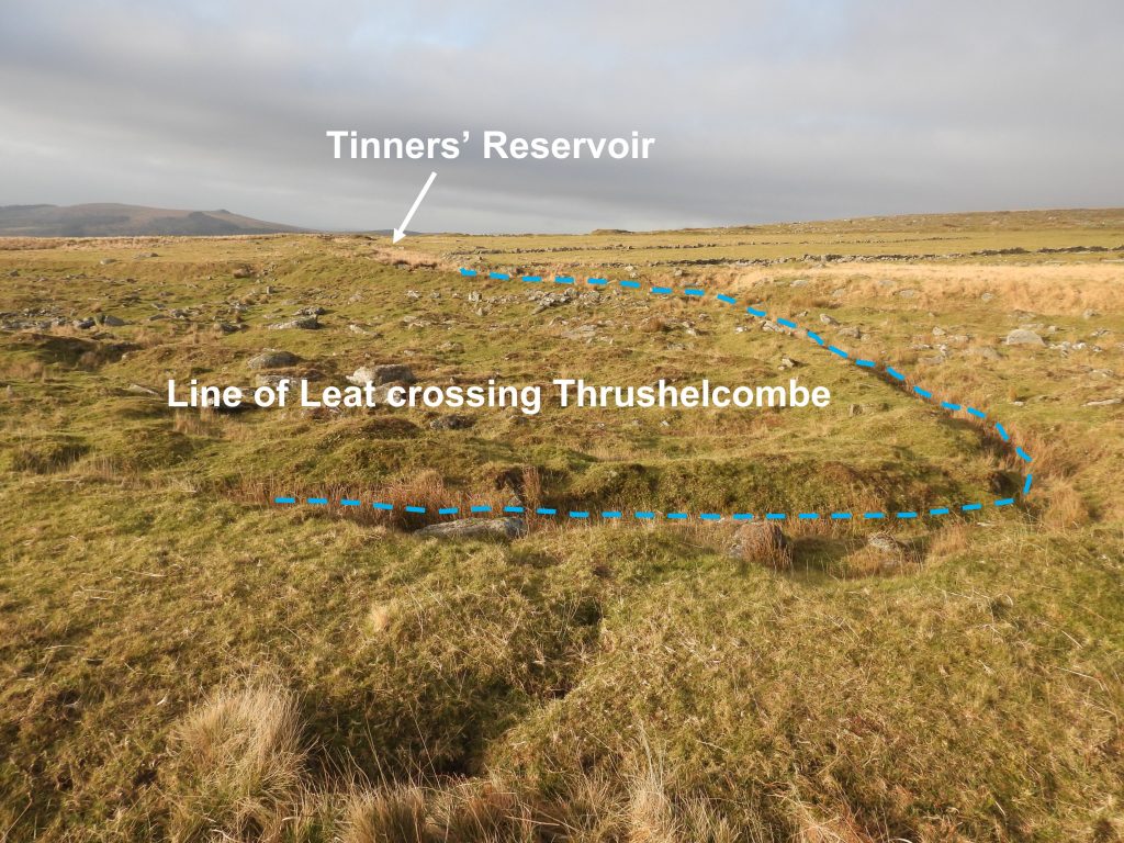
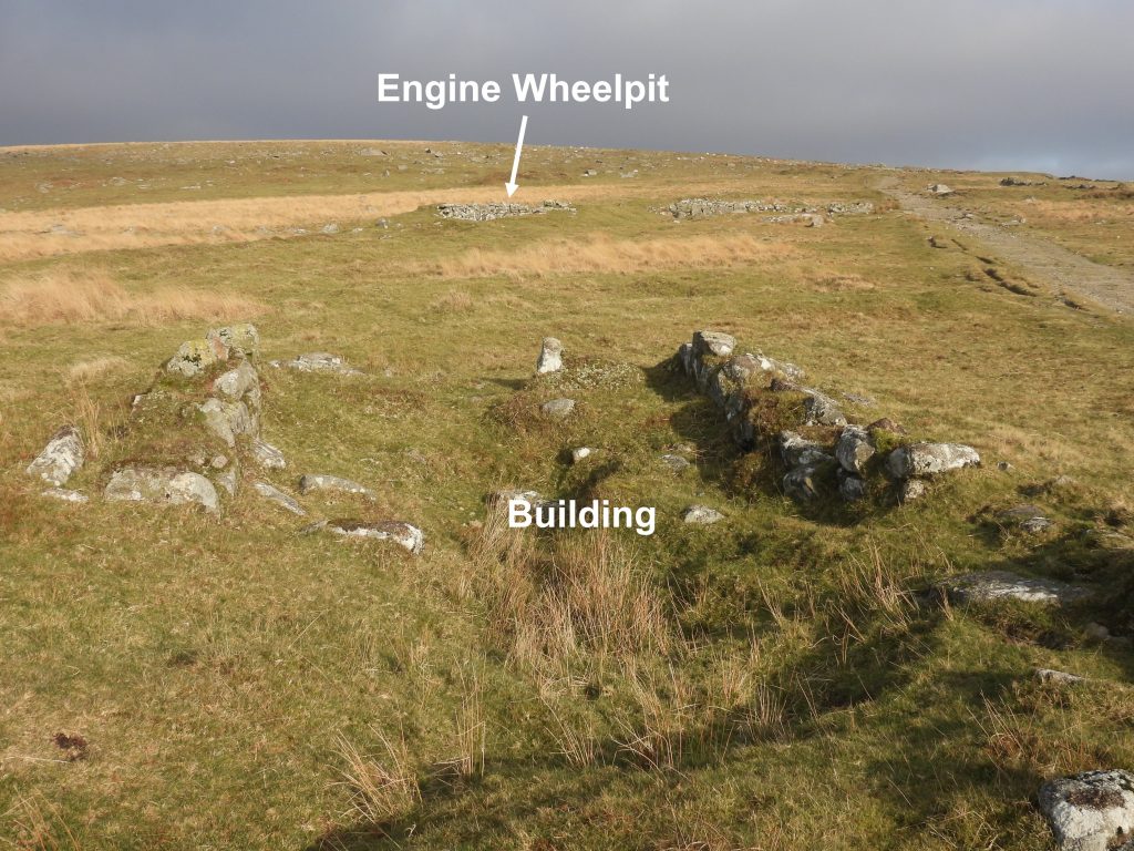
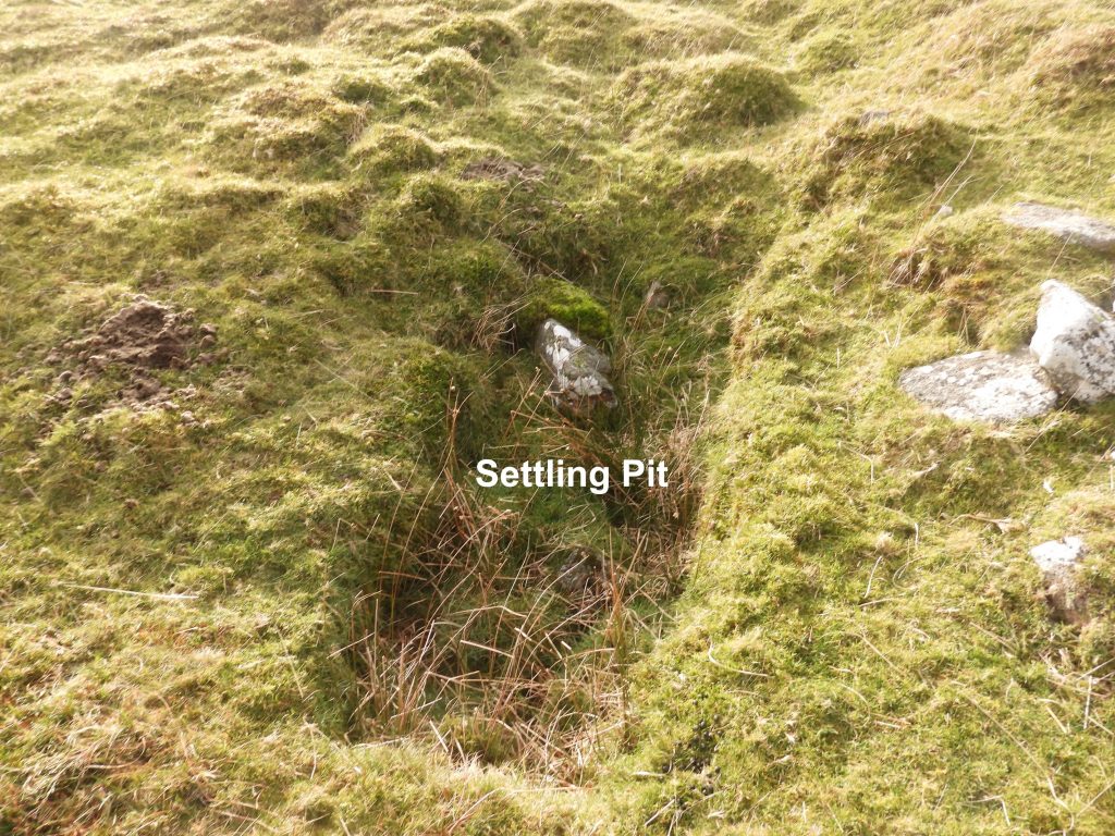
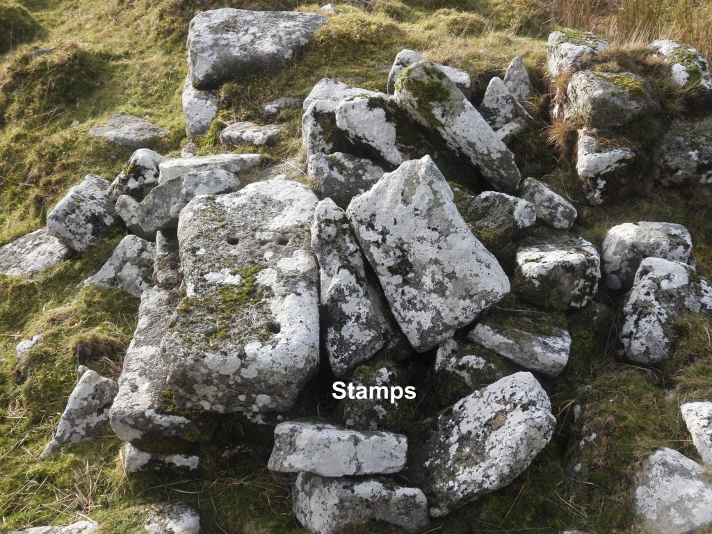
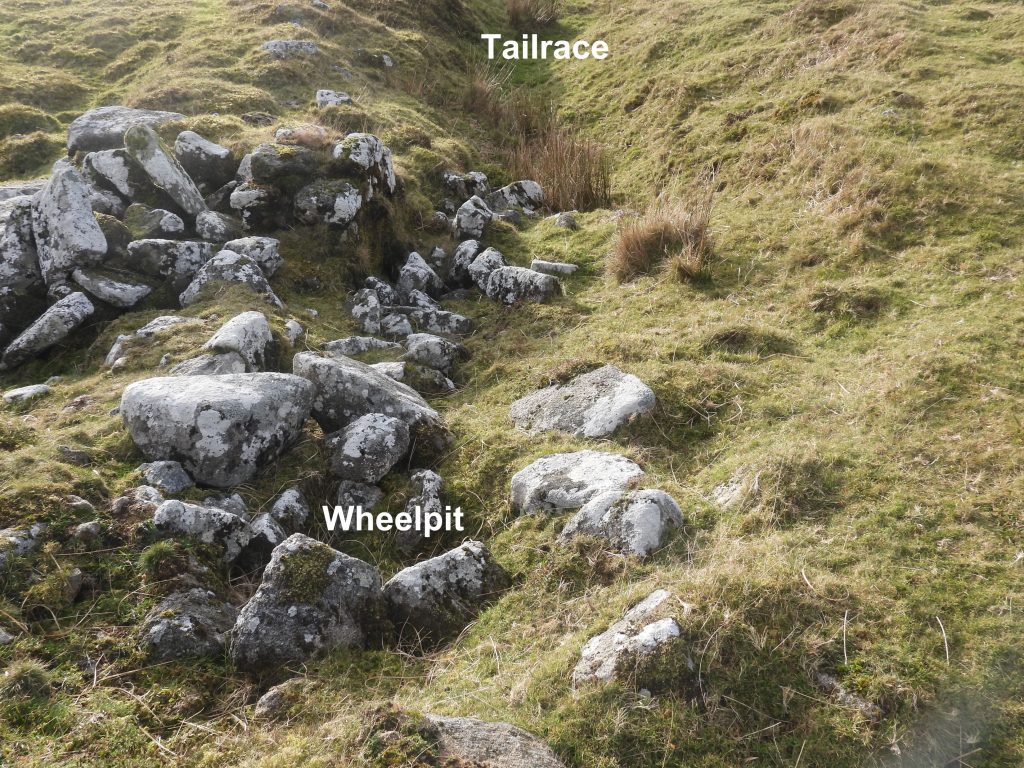
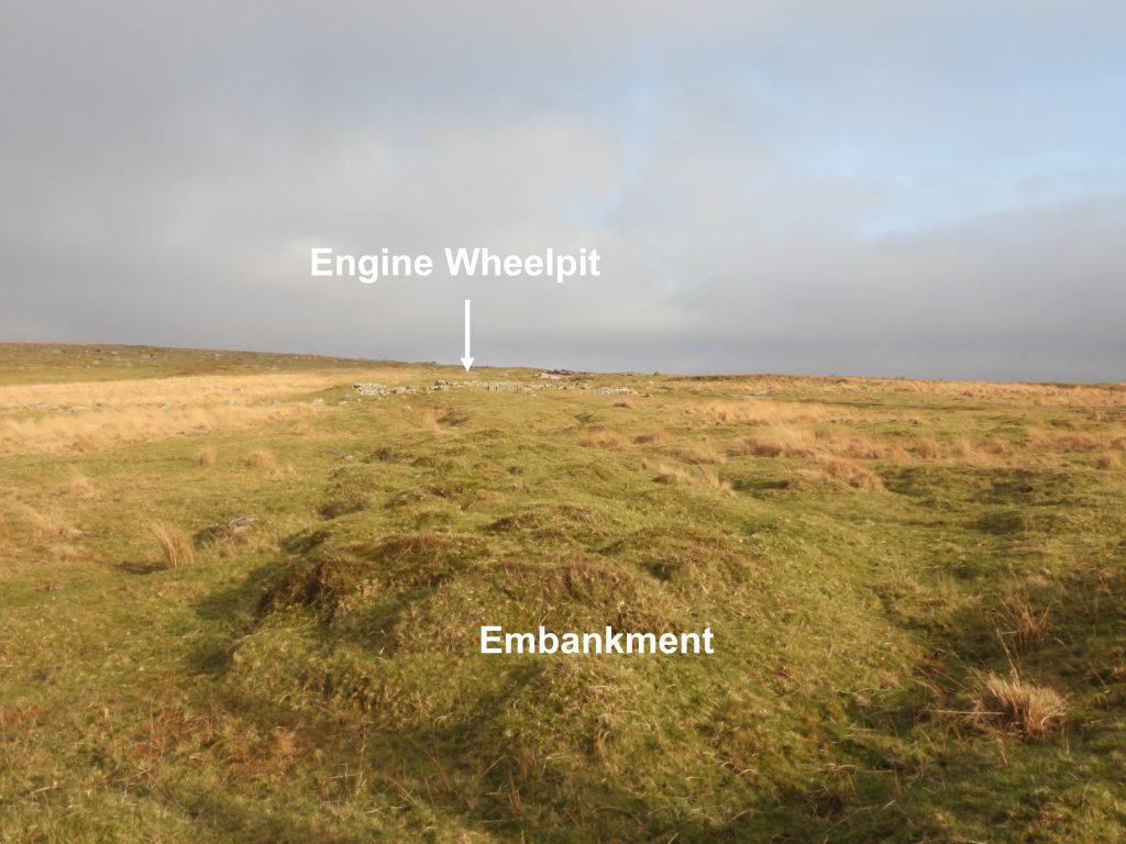
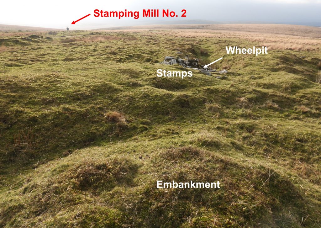
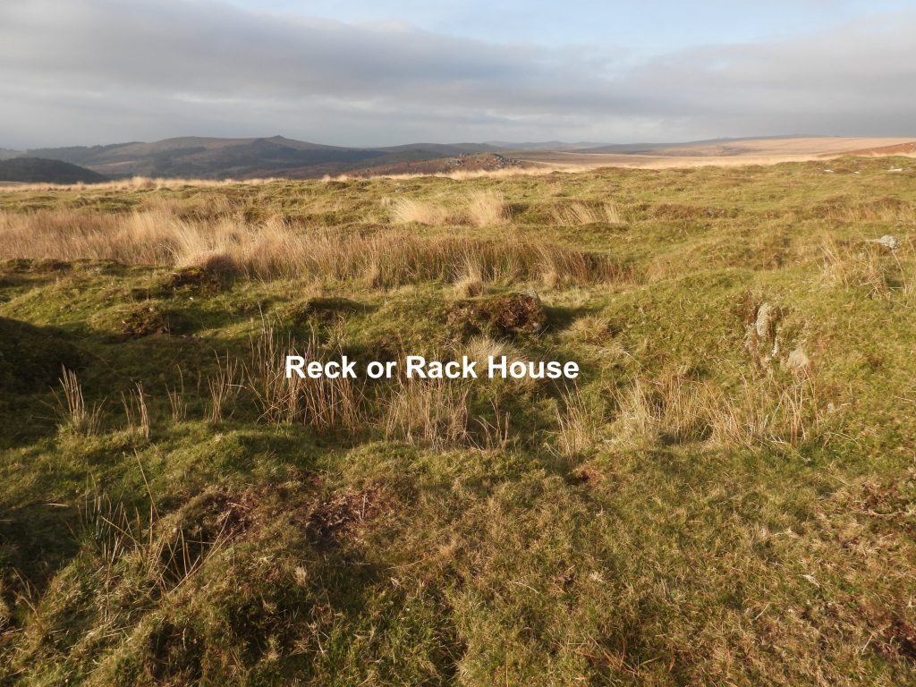
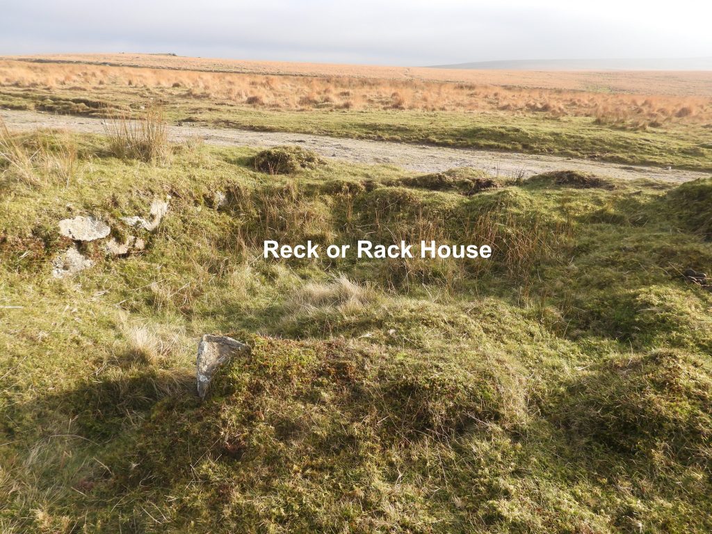
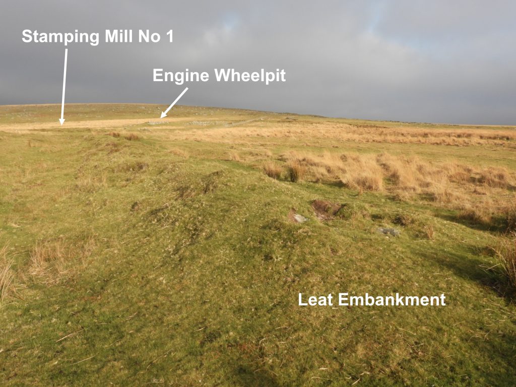
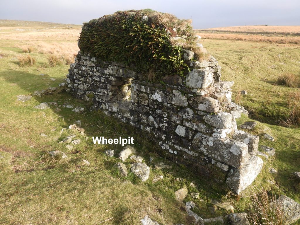
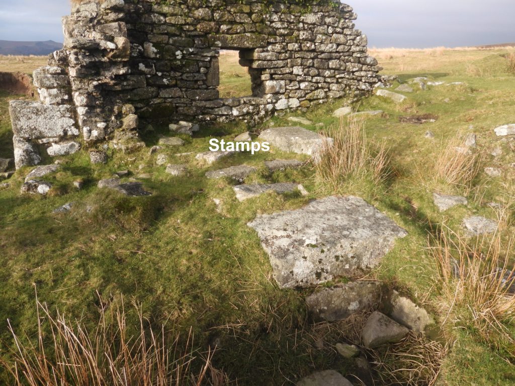
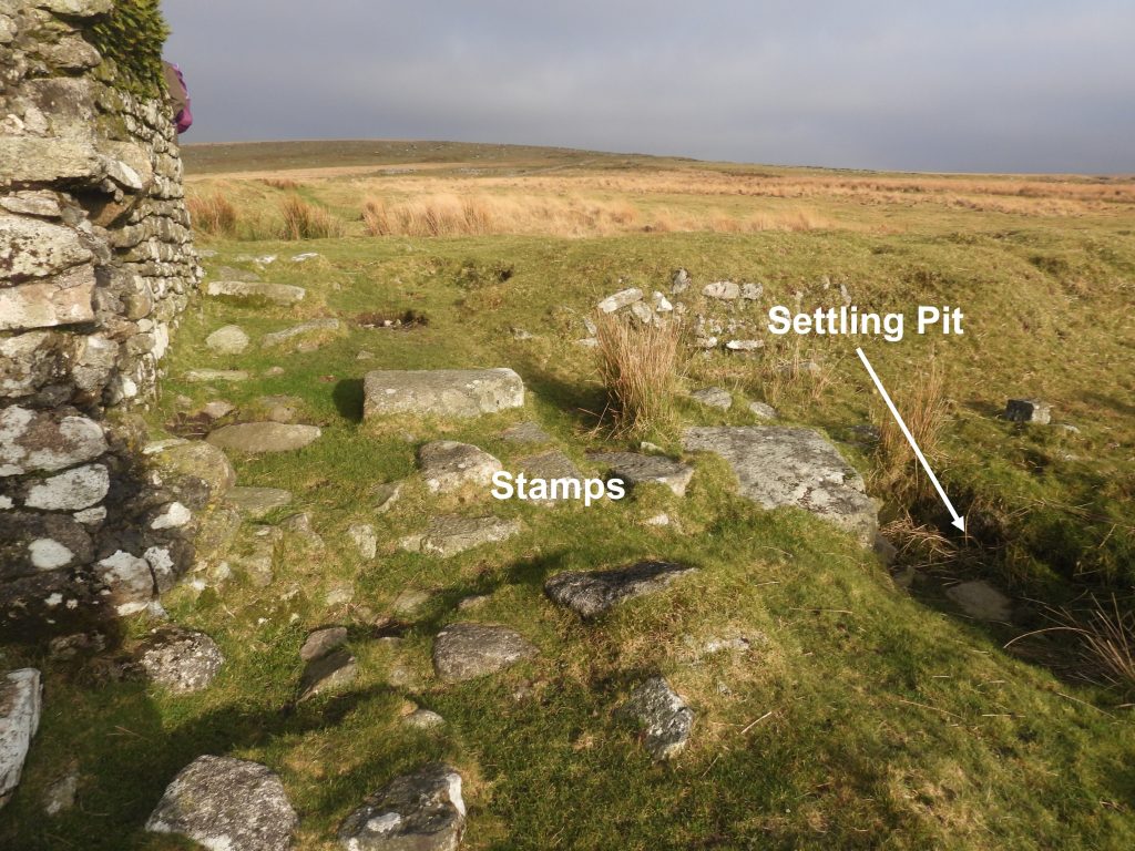
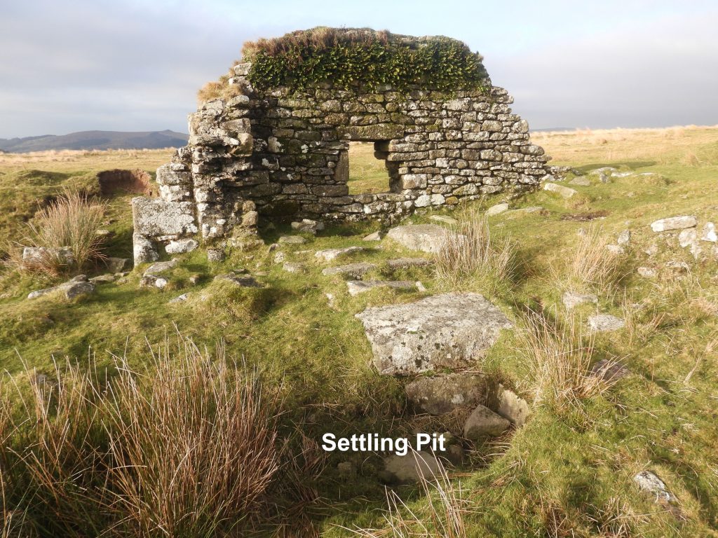
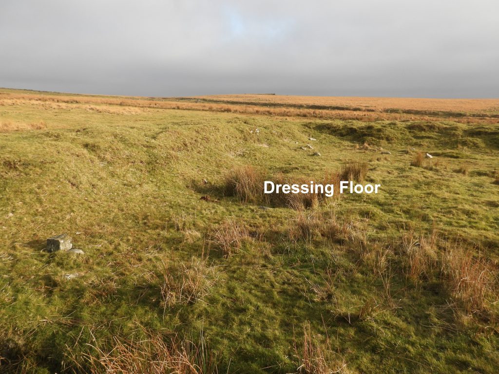
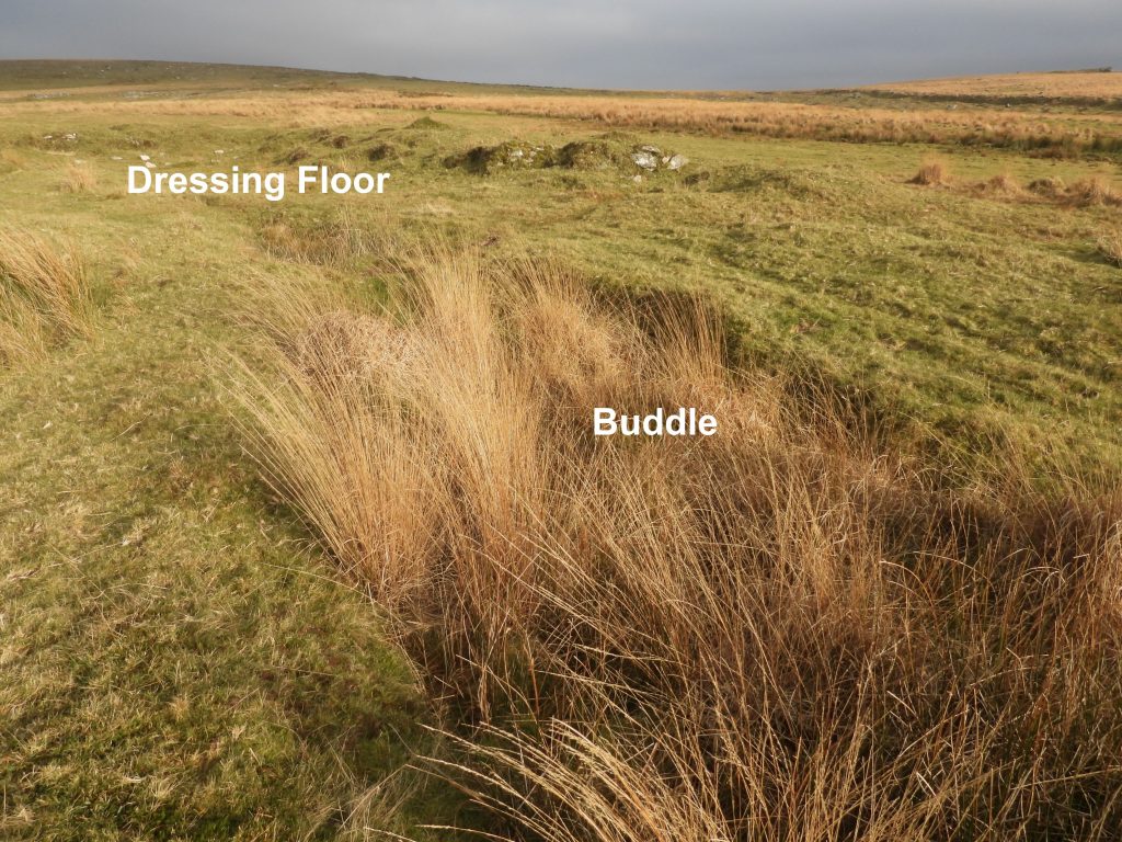
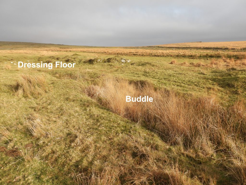
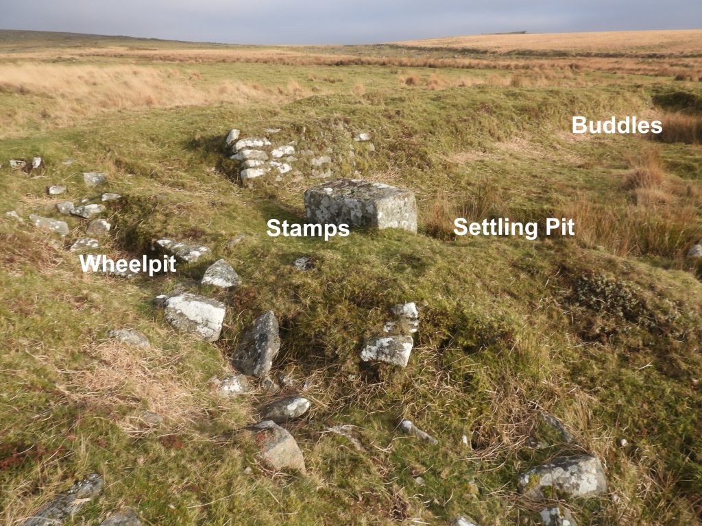
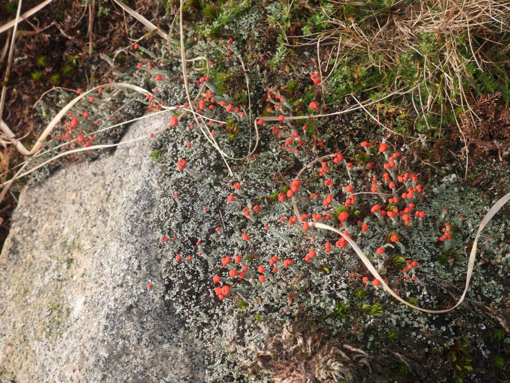
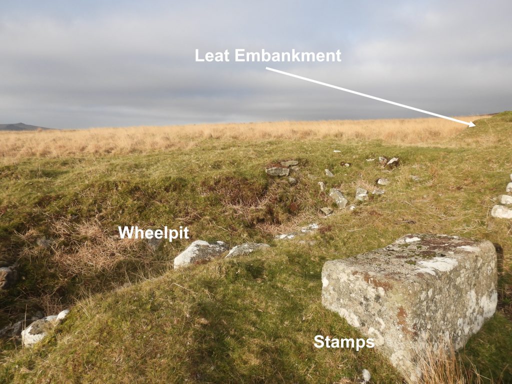
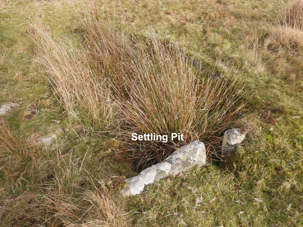
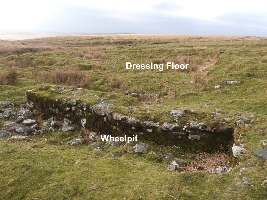
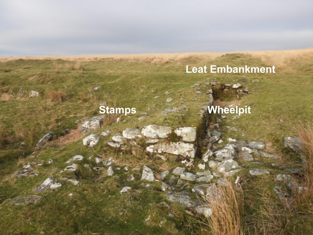
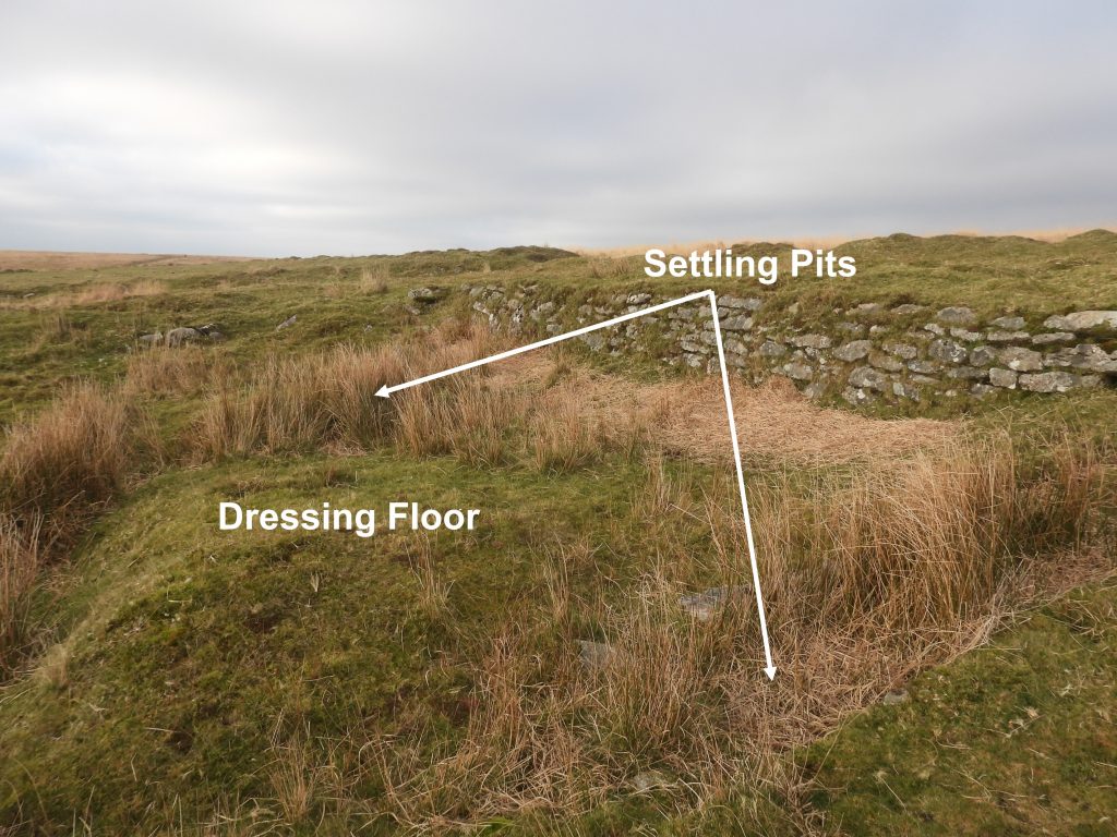
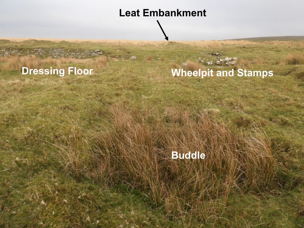
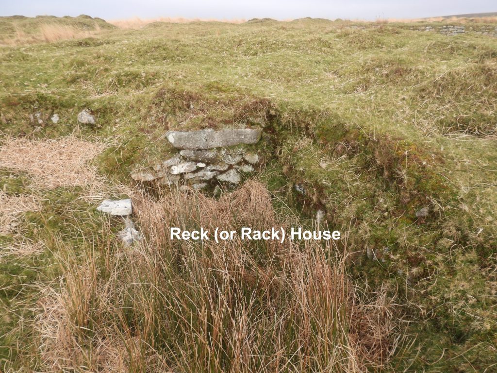
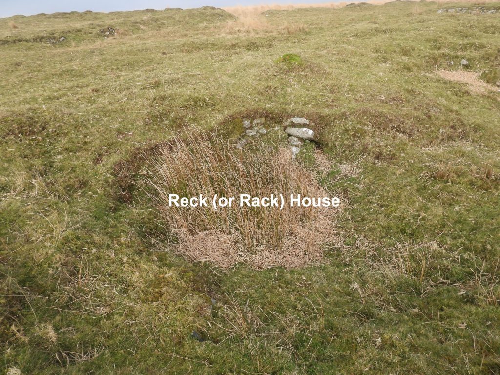
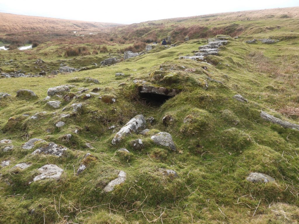
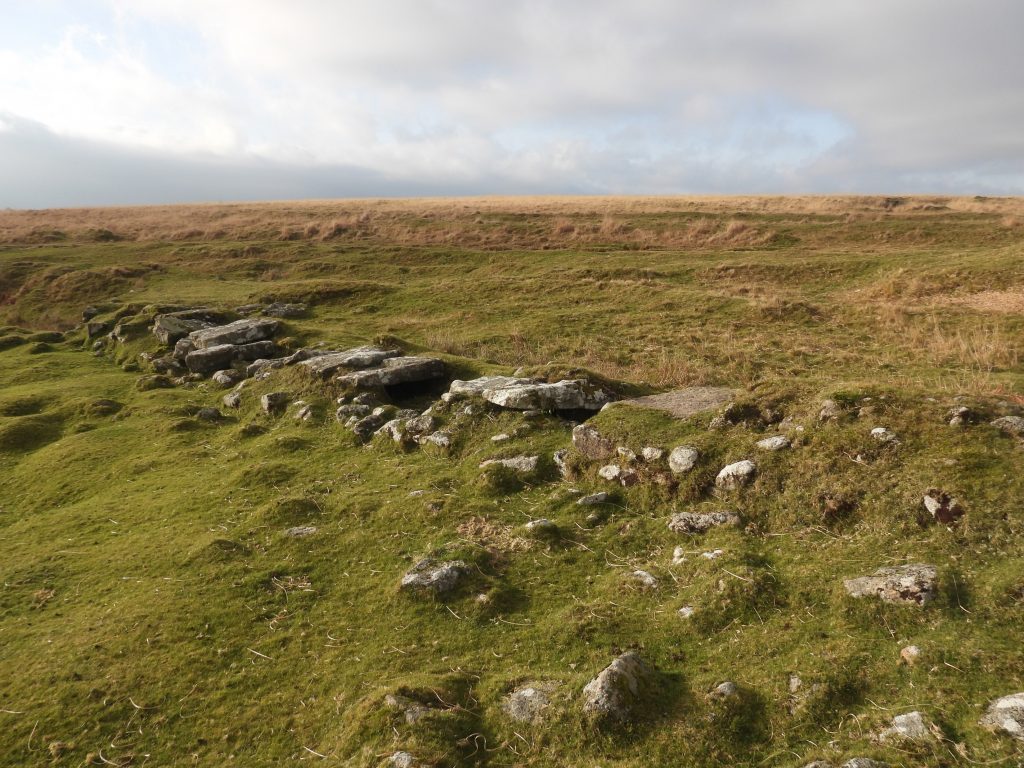
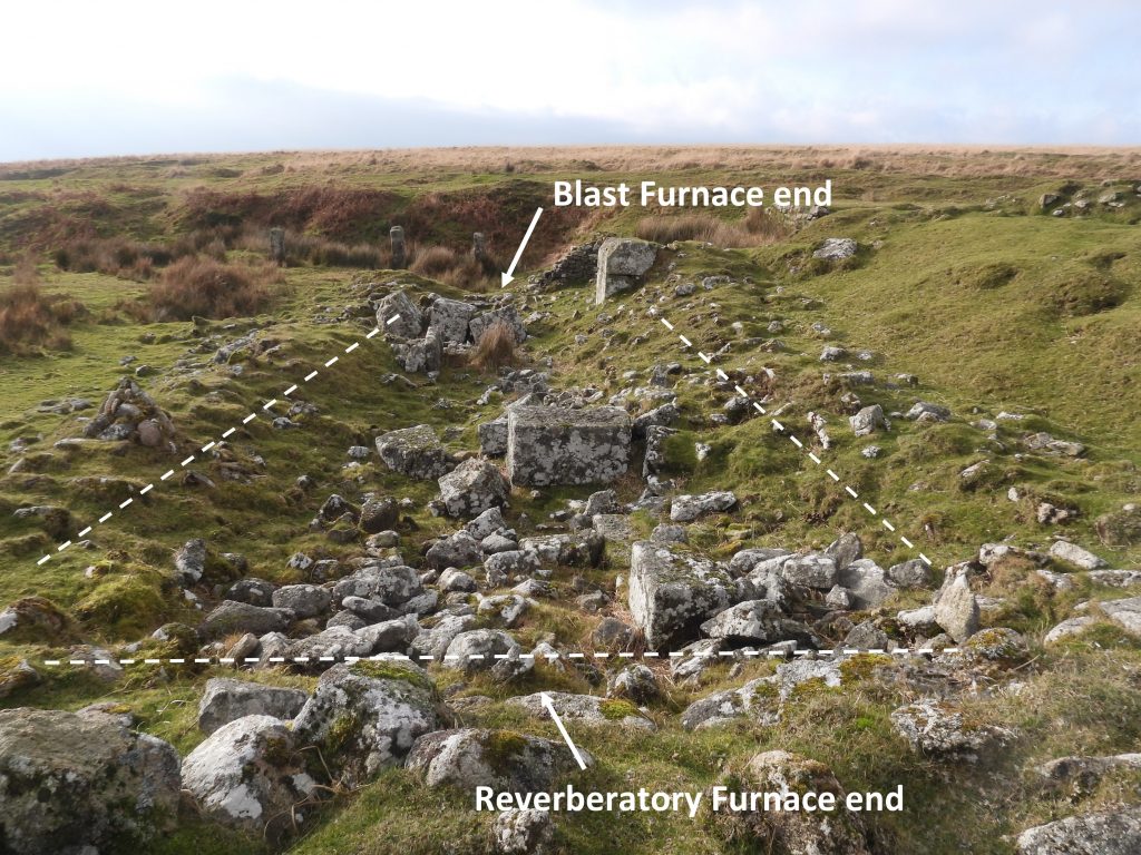
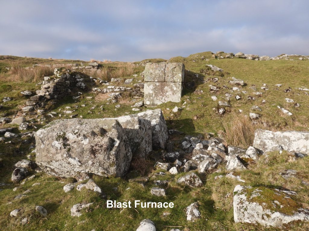
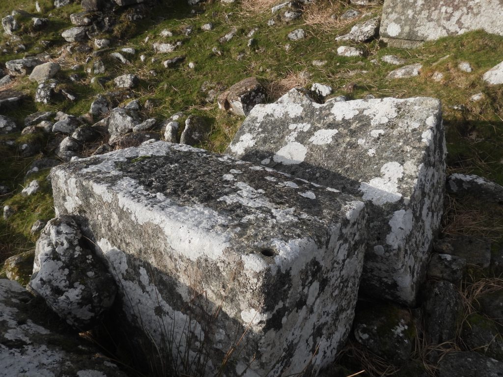
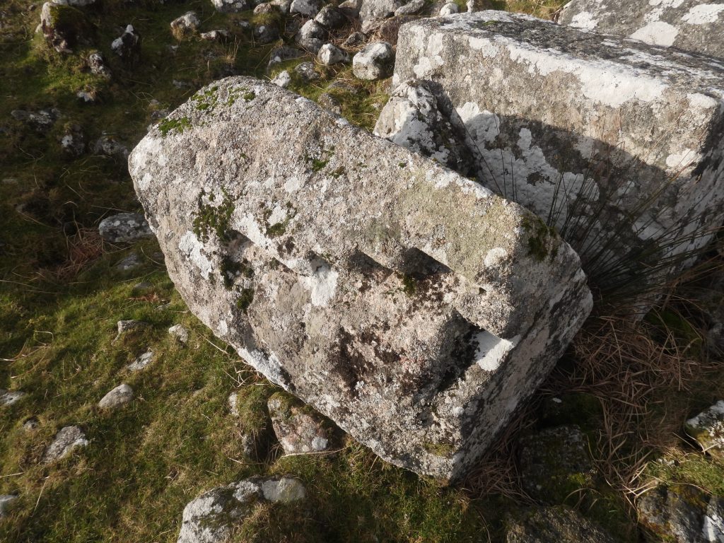
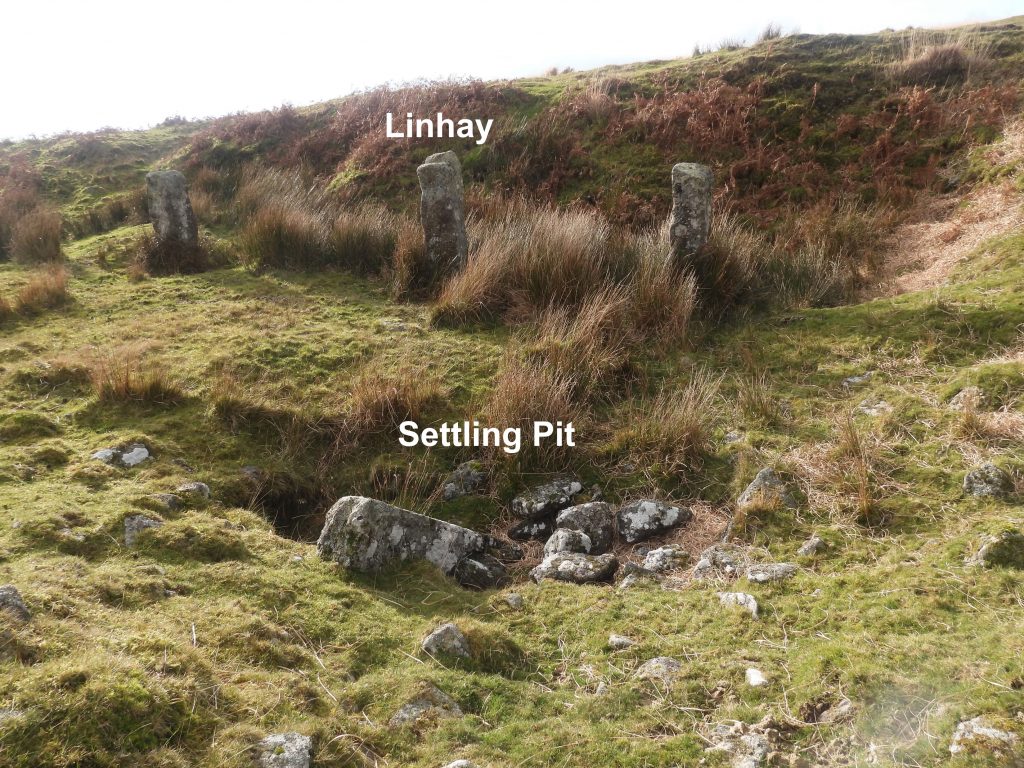
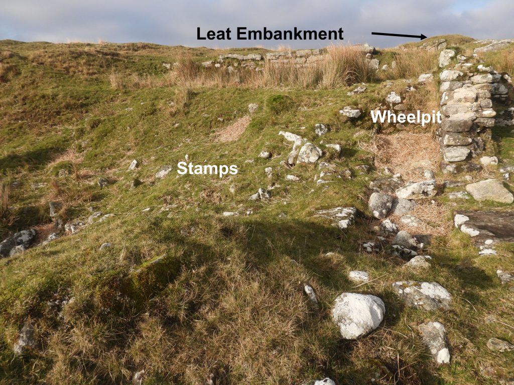
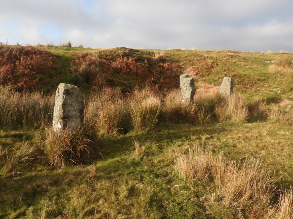
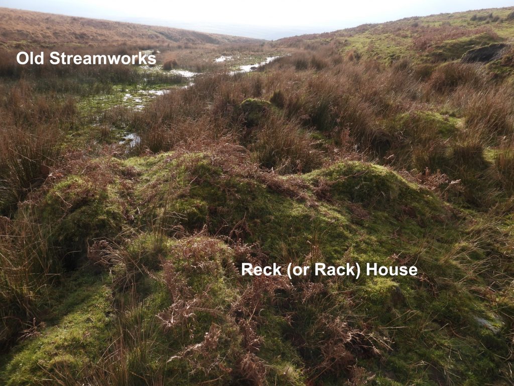
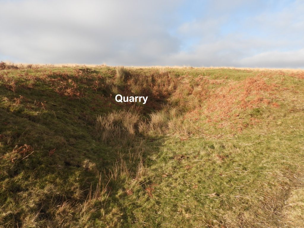
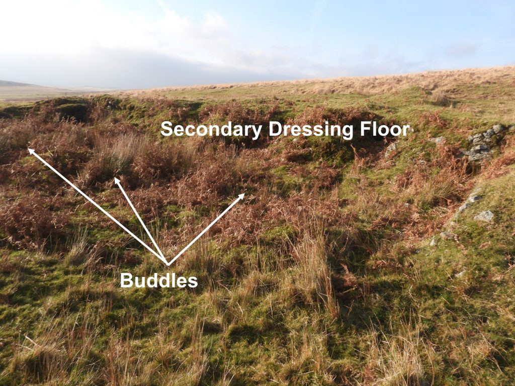
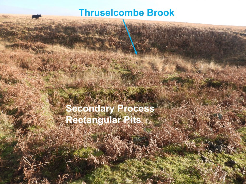
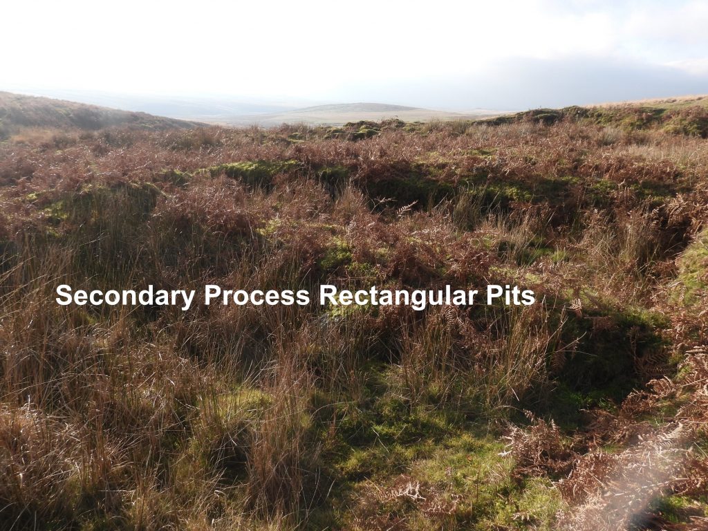
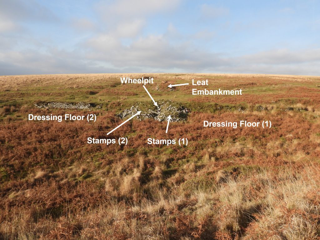
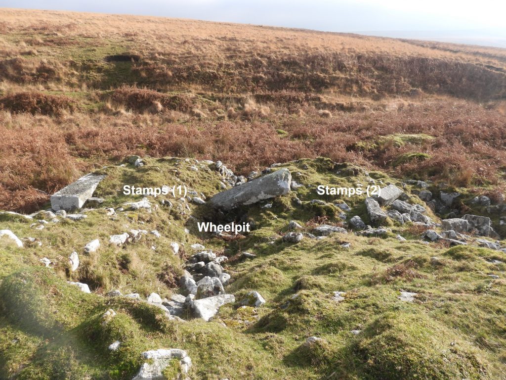
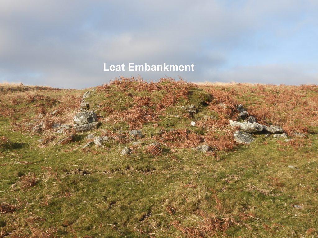
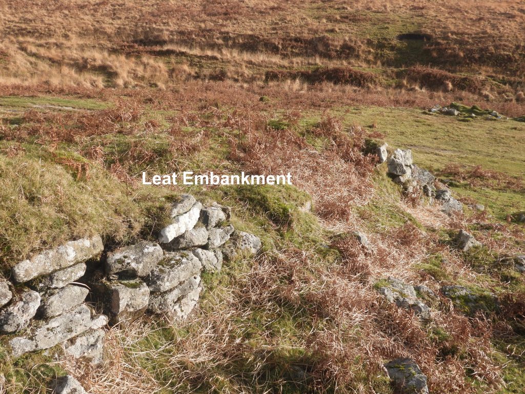
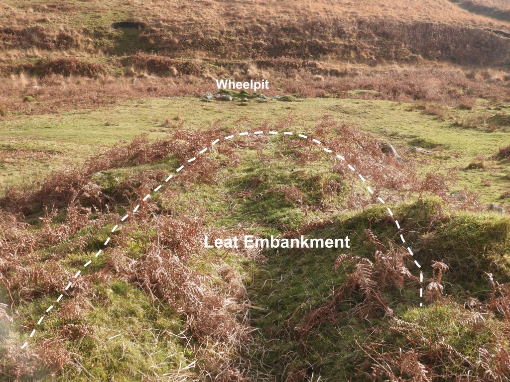
This sketch map shows the features covered in this post. Each Stamping Mill (and one Smelting House) has their own sketch of the features associated with their operation.The first Engine Wheel was recorded in 1815 when Eylesbarrow Mine was opened. Its installation is documented as being in 1814. The main wheelpit structure is 13.8 metres by 5.7 metres as recorded in the Dartmoor HER. To the south west of the wheelpit is a rectangular stone-lined pit 5.5 metres by 4.3 metres for the ‘Balance Bob’, which is at SX59519 68025. The Engine waterwheel is the first to be used in the mine and was used to power below-ground pumping equipment at the mine uphill via a flat rod system.This picture shows how a typical water wheel and balance pit (bob) was used in conjunction with flat rods to transmit power to an engine shaft and ultimately pumping equipment. The Engine Wheel operated between 1814 and 1852. The double line of flat rod support granite posts can be seen running up the hill. The centre of the wheelpit is SX59528 68028.It is believed that the wheel would have been housed within an inner structure of less than 2m wide. This is difficult to discern today. The flat rods system is very well described in the Dartmoor HER as “……consisting of rods of iron, joined together to extend between the waterwheel and the engine shafts. The rods were supported on upright pulley wheels with concave rims in which the rods could move. The axles of the pulley wheels rested between pairs of granite posts, which had semi-circular bearing slots with a diameter of 3.5cm cut into the uppermost surface”.The line of the the flat rod supports indicating where the flat rods would have been located.It is recorded that the granite posts are spaced on average 0.4m apart and 5.5m and 7m between pairs. The two alignments of paired granite posts leading off to the east can easily be followed to a number of shafts. The flat rod system through its life is recorded as serving the ‘Old’ Engine Shaft, Henry’s Engine shaft, the ‘New’ Engine shaft and probably Pryce Deacon’s shaft up the hill.A rectangular structure (building) and enclosure, sited to the south east of the Engine Wheelpit. The building is totally ruined, and is only as a pile of rubble. It is recorded as measuring 3.7 metres by 3.7 metres and is located at SX59553 68033. The use of the building and enclosure is unknown but is likely to date from the 1830s or 1840s.The enclosure is recorded as being 0.02ha. The author recorded the centre of the enclosure as being SX59558 68025.Across the track from the Engine Wheelpit there is a linear reservoir which supplied the water for the wheel operation. The reservoir was supplied with water from the Engine Leat, which was constructed around Higher Hartor Tor hillside taking water from the River Plym from near Wheal Katherine. The Tinners’ Reservoir was in use between 1814 and 1852 and is the largest of its type on Dartmoor. It is recorded in the Dartmoor HER that the Tinners’ Reservoir is 192 metres long and having a maximum width of 13 metres and a depth of up to 2 metres. On the downslope side of the Tinners’ Reservoir is a dam up to 12 metres thick which has a granite revetment lining the inside.The inlet point of the Tinners’ Reservoir.The line of the Engine Leat as it crosses the Thrushelcombe is very discernible as it feeds into the Tinners’ Reservoir.Stamping Mill No. 1 is believed to have been built in 1814. It is the first of six aligned Stamping Mills along the Drizzlecombe Valley to the south west of the Engine Wheelpit. It uses the same water supply as the Engine Wheelpit. The sketch map shows the key features of the Stamping Mill. Sketch is based on original, SM1 by Dr. Phil Newman (page 138 Eylesbarrow (Ailsborough) Tin Mine – Proc Devon Archaeol Soc 57 1999) Next to the mine track lies the ruins of a rectangular building of unknown purpose. It is sited on the SE corner exterior of the dressing floor of Stamping Mill No. 1. It is constructed from stone and parts of the walls are missing. It has approximate internal dimensions of 11.9m by 3.7m. It is located at SX59458 67957.Stamping Mill No. 1 used a “wet” stamping process where a flow of water was passed over the base of the stamps. This washed the crushed particles through a perforated grate into a stone lined settling pit.The stamping area at this mill is immediately adjacent to the wheelpit and settling pit.View of the Stamping Mill looking south west.The unknown building / hut lies very close to the Stamping Mill. Leading away from the wheelpit is a deep open tail race channel to divert the water away.The Dartmoor HER describes an earthwork immediately north of the stamping mill as representing a building or hut. The structure appears to be two roomed building with walls up to 1.6 metres wide and 0.8 metres high. The author recorded the centre of this building at SX59439 67981.The settling pit measures 2.8 metres by 0.9 metres long and was recorded by the author at SX59443 67973The stamping area is adjacent to the wheelpit and comprises a 2.6 metres by 2.2 metres stone revetted platform. It is recorded that a Cornish set of stamps were used. A large stone with 4 holes can be seen within the stamps area. The author recorded the stamps area at SX59440 67976The rectangular stone wheelpit measures 8.2 metre by 0.9 metres and is still quite discernible. It was recorded by the author at SX59441 67976.Upslope of the wheelpit was a wooden launder channel which took water at correct height via an embankment. The wheel was an overshot type. The photograph shows the line where water was fed from the Engine Wheelpit up the slope. The ‘lower edge’ of the embankment was recorded by the author at SX59450 67980.The photograph is from the top of the embankment from which the launder would have fed water to the wheel. At this point Stamping Mill No. 2 can be seen to the south west. A possible Reck (or Rack) house building measuring 3.8 metres long by 2.4 metres wide can be found next to the mine track at SX59439 67944The Dartmoor HER records the operation of a Reck / Rack House is very detailed and beautifully descriptive way. The construction was a final processing stage: “where fine residual tin trapped in the tailings underwent a further refining process. The apparatus consisted of single or paired boards onto which the tailings were placed and over which a gentle flow of water was introduced. The concentrate would build up and then it was removed either by tipping the board or washing it into a separate launder by a more powerful stream”.Below the main dressing floors the explorer can find a range of secondary buddles and tailings pits, which were used for further refining. The author recorded the centre of these buddles at the south west of the site at SX59425 67948.There are three ‘secondary’ rectangular buddles and one triangular buddle associated with Stamping Mill No. 1.Stamping Mill No. 2 is believed to have been built in 1814. It is the second of six aligned Stamping Mills along the Drizzlecombe Valley to the south west of the Engine Wheelpit. The sketch map shows the key features of the Stamping Mill. Sketch is based on original, SM2 by Dr. Phil Newman (page 138 Eylesbarrow (Ailsborough) Tin Mine – Proc Devon Archaeol Soc 57 1999)The water source for Stamping Mill No. 2 was the Engine leat, which in turn stored water in the large tinners’ reservoir. Before connecting with this mill the water had passed over or bypassed, the Engine Wheel and the upper stamping mill No. 1 wheel. The end of the leat embankment is at SX59396 67876. The raised earth leat embankment, would have supported a wooden launder channel at the correct height to bring water to the overshot wheel. The embankment is 50 metres long and 5.5 metres wide.This stone wheelpit, measures 8.2 metres by 0.9 metres next to the stone revetment. The wheelpit is located at SX59384 67866.This deep open tail race channel diverted water away from the wheel onwards to Stamping Mill No. 3.The probable stamping area is adjacent to the wheelpit revetment and consists of a 1.9 metre by 2.4 metre stone level platform. Like Stamping Mill No. 1 there were a set of Cornish stamps operating using a wet stamping process. The stamps are located at SX59392 67859.Alongside the stamps area is a settling pit. The settling pit is recorded as measuring 2.9 metre by 1metre long.Close up view of the settling pit.View of the stamps, settling pit and wheelpit revetment from the main dressing floor.The main dressing floor, the centre of which is located at SX59393 67856.Associated with Stamping Mill No. 2, there are three secondary buddles and tailings pits. The buddle in the picture is located at SX59388 67832.The Buddles are recorded on the Dartmoor HER as measuring between 5 metres by 7 metre in length. and up to 3 metres wide, and survive to a maximum depth of 0.5 metres The Buddles associate with Stamping Mill No. 2 are recorded as being up to 3 metres wide and up to 0.5 metres deep. This Buddle is located at SX59371 67829.Some of the Buddles have traces of a masonry lining.The Reck (or Rack) House is located at the south east end of the Dressing Floor.The Reck House of Stamping Mill No. 2 is located at SX59396 67836View from the Reck House of Stamping Mill No. 2 looking south.Stamping Mill No. 3 is believed to have been built in 1814 as was Mills 1 and 2. It is the third of six aligned Stamping Mills along the Drizzlecombe Valley to the south west of the Engine Wheelpit. The sketch map shows the key features of the Stamping Mill. Sketch is based on original, SM3 by Dr. Phil Newman (page 138 Eylesbarrow (Ailsborough) Tin Mine – Proc Devon Archaeol Soc 57 1999)Looking south west from the leat embankment to Stamping Mill No. 3. The leat embankment is upslope of the wheelpit and would have supported a wooden launder channel at the correct height to bring water to an overshot wheel.The leat embankment is recorded as being 52.5m long with an average width of 4.5m. The end of the leat embankment is at SX59337 67784.The wheelpit and the stamps area of Stamping Mill No.3. The machinery block in the stamps area is at SX59336 67770.All that remains of the stamps is a 3.0m by 2.2m stone revetted level platform, raised above the dressing floor onto which the stamps would fall, contained within a timber coffer. On the platform is a machinery block which is 1.2 metres long, 0.58 metres wide by 0.58 metres thick. Four holes cut into the north-east end are 5 centimetres in diameter and 8 centimetres deep. Source: Dartmoor HER. A deep open tail race channel diverted water away from the wheelpit of Stamping Mill No. 3, onto the launder of the fourth stamping mill in the sequence to the south west. As with the previous mills, this one would also have used the wet stamping process whereby a flow of water was passed over the base of the stamps, washing the crushed particles through a perforated grate, into a stone lined settling pit sited on the dressing floor. (Description from Dartmoor HER)The wheelpit at Stamping Mill No. 3 is recorded as being 0.9 metres wide, 0.7 metres deep. It is 8.2m long and is at SXSX59336 67777 The robust granite kerb (machinery block) would have contained rammed quartz and possibly scrap iron, onto which the stamps would strike. General view of key features on Stamping Mill No. 3Dartmoor Matchsticks at the Wheelpit. Also known as Pixie Lichen, Pixies Marchsticks, Cladonia cristatella, British Soldiers and Devil’s Matchstick.View of the wheelpit, the machinery block in stamps area in relation to the leat embankment. The settling pit would have had crushed tinstone from the stamps running into it. The settling pit is site approx. 1m from the stamps area. It is recorded as measuring 2.8m by 1.3m long and has a lining of flat granite slabs. The ‘centre’ of the area of the buddles was recorded at SX59344 67762To the south west of main dressing floor and Stamping Mill area, there are 2 additional pits. It is believed that these could have served further refining the tin concentrate and settling the waste sands, or ‘tailings’. The Dartmoor HER records them as measuring approximately 7.5m by 2.8m, and between 0.3m to 0.5m deep. One has remains of a masonry lining. They can be found at SX59320 67745.This water powered stamping mill and associated dressing floor processed tin ore at Eylesbarrow Tin Mine. It is the fourth of six aligned Stamping Mills along the Drizzlecombe Valley to the south west of the Engine Wheelpit. The sketch map shows the key features of the Stamping Mill. Sketch is based on original, SM4 by Dr. Phil Newman (page 138 Eylesbarrow (Ailsborough) Tin Mine – Proc Devon Archaeol Soc 57 1999)The leat embankment is recorded as measuring 36.6m long with an average width of 6.6m. The end is at SX59300 67713The leat embankment have supported a wooden launder channel at the correct height to bring water to an overshot wheel. To the west of the wheelpit is the stamps area and dressing floor. The wheelpit was recorded at SX59297 67706The stamps area as defined on the Dartmoor HER consists of a 2.4m by 2.7m stone revetted level platform and is located at SX59296 67709View of the wheelpit, stamps area and the leat embankmentTo the west of the stamps area and wheelpit is a dressing floor with four settling pits. The ‘centre’ of the dressing floor was recorded at SX59287 67707Buddle to the south of the wheelpit, stamps and dressing floor. There are two, with the one in the picture located at SX59290 67695At the south-west part of Stamping Mill No 4 complex lies a row of three secondary buddles arranged north-east to south-west. The northernmost buddle is triangular with the other two being rectangular.The ‘centre’ of the three secondary buddles was recorded at SX59268 67681.At Stamping Mill No 4, there are two ‘reck’ or ‘rack’ houses was where fine residual tin trapped in the tailings underwent a further refining process. The one in the picture is located at SX59276 67693The second reck house is located at SX59263 67688The two reck (or rack) houses at Stamping Mill No 4 are sited close to one another. As described in the Dartmoor HER: “The apparatus consisted of single or paired boards onto which the tailings were placed and over which a gentle flow of water was introduced. The concentrate would build up and then it was removed either by tipping the board or washing it into a separate launder by a more powerful stream”.This tin smelting house and water powered stamping mill served Eylesbarrow Tin Mine. The Stamping Mill (No 5) was one of six mills to serve the mine and was operational between 1822 and 1831. The sketch map shows the key features of the Stamping Mill. Sketch is based on original, SM5 by Dr. Phil Newman (page 138 Eylesbarrow (Ailsborough) Tin Mine – Proc Devon Archaeol Soc 57 1999)Between Stamping Mill No 4 and Stamping Mill No 5 (plus smelting house) lies an old walled enclosure / land parcel. It is labelled as ‘109’ within the Sheepstor Parish and recorded on 19th Century maps as 0.831 acre.View of the site from the west towards the east end (land parcel 109). The water supply to power the wheel of the smelting house came from the same leat which powered Stamping Mill No 4. The water was also used to drive the water wheel (and double stamps) of Stamping Mill No 6 further down the valley. The end of the Leat Embankment was recorded by the author at SX59162 67656The collapsed chimney is located at SX59176 67669View of the Flue from the east end by Land Parcel 109.Another view of the Flue (plus Smelting Building and Linhay) from near the east end by Land Parcel 109. Close up view of the Flue overlooking the Smelting Building. View from the end of the flue (nearest the furnace) overlooking the Smelting Building.The Dartmoor HER records the flue on the northern side of the smelting house as consisting of a “stone-lined tunnel 0.6 metres by 0.4 metres in section which terminates at the vestigial remains of a square chimney stack”.The Dartmoor HER describes the horizontal, angled flue as being used to “direct fumes from the blast furnace to a square stack, 19m from the back of the furnace”The smelting house consists of a rectangular building with internal dimensions of 17.9m by 6.1m, split into a Reverberatory Furnace end (to the east) and a Blast Furnace end (to the west). There was a very high tonnage of tin recorded as being smelted in the period 1822 to 1831. The Reverberatory Furnace would have required many tons of coal while the Blast Furnace would have required charcoal. This small external compartment on the south-east side of the Reverberatory Furnace is recorded as measuring 2.5 metres by 4 metres and is shown on the Richard Hansford Worth diagram of 1922 shown in this post. Its purpose is unknown. It can be located at SX59184 67645This Robert Burnard picture was taken 19th January 1889, nearly 40 years after Eylebarrow Mine closed. It is the Smelting House and the blocks on the left are still there today. The window nearest the camera is shown in the Richard Hansford Worth sketch from 1922.The Reverberatory Furnace end of the Smelting Building was recorded by the author at SX59183 67649In the reverberatory furnace there is a large square block with a reddish brown deposit on it. This is tin slagThis tin slag can be dated from between 1822 and 1831Close up of the tin slagRichard Hansford Worth interpretation of the Smelting Building, Flue, Chimney, External Compartment and Wheelpit (dated 1922). The sketch can be found on page 304 of ‘Worths Dartmoor’. Worth stated: Slag from the Eyelesborough furnace differs in type from any found at the blowing-houses, in consequence of use of lime as a flux”. He records the Flue was over 70ft in length.The three large (approx 1.2m by 0.9m) granite blocks at the south-east end of the building were part of the blast furnace plus two similar pieces stacked one above the other and built into the north wall. These are all shown on the Hansford Worth sketch interpretation from 1922 and some are on the Burnard photograph from 1889.Large blocks which formed part of the Blast Furnace. There are three in total which the author recorded at SX59175 67643Indentations in one of the blocks from the blast furnaceTo the west of the Smelting Building and Stamping Mill lies a settling pit and three granite uprights which mark the position of where a ‘linhay’ once stood. The settling pit is recorded as measuring 3.3m by 1.4m with a granite lining and a sluice opening at the lower end.The external wheelpit is recorded as measuring 9m long by 0.8m wide and is an integral part of the smelting house structure which has been suggested that the stamping mill was constructed as part of the same building phase. The wheelpit was recorded by the author at SX59170 67645. Next the wheelpit is a very disturbed stamps area at SX59168 67643. The alignment of the three granite posts are recorded as being spaced 2.6m and 4m apart. These were the supports for a ‘linhay’ type structure which abutted the steep scarp behind. It is thought that this structure was likely to be a fuel store. The centre of the structure was recorded by the author at SX59160 67634The reck (or rack) house is approx 50m south of the smelting house, on the edge of the marsh of Thrushelcombe Brook. It is a rectangular structure recorded as measuring of 3.9m by 3.0m. It can be located at SX59180 67591.A small quarry to the west of Stamping Mill No 5 (adjacent to the track leading to Stamping Mill No 6) can be found at SX59134 67586. The author assumes some stone was quarried here to assist with the construction of the Stamping Mill(s).This water powered stamping mill served Eylesbarrow Tin Mine. The Stamping Mill (No 6) was one of six mills to serve the mine and is believed to have been one of the first to be operational. It is last in the chain of mills. The sketch map shows the key features of the Stamping Mill. Sketch is based on original, SM6 by Dr. Phil Newman (page 138 Eylesbarrow (Ailsborough) Tin Mine – Proc Devon Archaeol Soc 57 1999)To the south of the dressing floor (2) as annotated on the map lies two rectangular structures which are recorded as probably the remains of reck (or rack) houses. Reck House 1 was recorded at SX59146 67436 and Reck House 2 was recorded at SX59137 67438Reck House 2 is slightly larger than Reck House 1 and is recorded as measuring 4 metres by 2.5 metres by approximately 1metre deep. The two reck houses looking south from atop the embankment at the end of the secondary dressing floor.The secondary dressing floor is situated to the south of the main area of the mill and contains two or three earthwork buddles.The centre of the Secondary Dressing Floor was recorded at SX59143 67451A number of larger rectangular pits on the south eastern side of dressing floor (2) were part of a secondary process.The largest of the Secondary Process Rectangular Pits is recorded in the Dartmoor HER as being 9 metres by 3.3 metres and has a masonry lining. The pits in the picture were recorded at SX59155 67455.The Stamping Mill had two sets of stamps (each side of the wheelpit) with each side having an associated Dressing Floor. The stone revetment is measured as 54 metres long either side of the wheelpit albeit it is collapsed in many places. Dressing Floor (2) revetment remains. The centre of the Dressing Floor (2) was recorded at SX59141 67470.On either side of the wheelpit are the remains of stamps areas. The centre of the Stamps (2) was recorded at SX59149 67478The wheelpit is badly ruined with fallen stone filling much of the wheel housing. It was recorded at SX59154 67482. The Dartmoor HER record the wheelpit internal dimensions as being 8.5 metres by approximately 1metre wide.Stamps (1) was recorded at SX59156 67479.This large rectangular granite block with holes in was most likely used to accommodate iron bolts onto which the axle bearings sat. There are three recorded for the site.Dressing Floor (1) to the east has much of its revetment wall missing. The centre of Dressing Floor (1) is recorded at SX59158 67496General view of Stamping Mill (6) from across the Thrushelcombe Brook looking north.Another general view of the Stamping MillView from above the wheelpit and stamps areas looking south east. From this angle the stamps areas either side of the wheelpit which comprised two raised platforms with dressed granite blocks are very discernible.To the north west of the wheelpit is a stone clad leat embankment and is recorded on the Dartmoor HER as being 12 metres by 4.5 metres and being 18 metres away.The end of the stone clad leat embankment is recorded at SX59131 67501.The water which eventually crossed this leat embankment and onto the overshot wheel via a wooden launder, as discussed in this blog was the used many times on its journey. Water was taken off the Plym near Wheal Katherine, progressing around Higher Hartor Tor thence into the Tinners’ Reservoir before being released for use for Engine Wheelpit and the 6 Stamping Mills – quite a journey.