A collection of walks, discoveries, insights and pictures of exploring Dartmoor National Park
February 5, 2023
Tinners’ Mills, Huts, Buildings and Streaming on Upper Plym Valley and Langcombe Brook
This post is an exploration of tin streamworking and tinners’ structures associated with medieval and later periods, which flank both banks of the upper River Plym and the lower part of one of its tributaries, Langcombe Brook.
The post records details of 8 structures, namely; 3 probable tinners’ huts, 2 tinners’ stamping mills, a further mill, a mystery building / shelter and a ‘modern’ piece of drystone walling. Also recorded in this post is a Bronze Age cist / cairn, which was visited as a waypoint in the 1608 Dartmoor Perambulation of the forest of Dartmoor.
Bibliography:
Dr Phil Newman, 1999, ‘Eylesbarrow (Ailsborough) Tin Mine’
R. Hansford-Worth; ‘Worth’s Dartmoor’ (compiled from previously published works)
Eric Hemery, 1983,High Dartmoor
S.Probert + M.Fletcher ,2002, Plym Valley survey
Jeremy Butler, 1993,Dartmoor Atlas of Antiquities: (Volume Three – The South-West)
William Crossing, 1912, Guide to Dartmoor
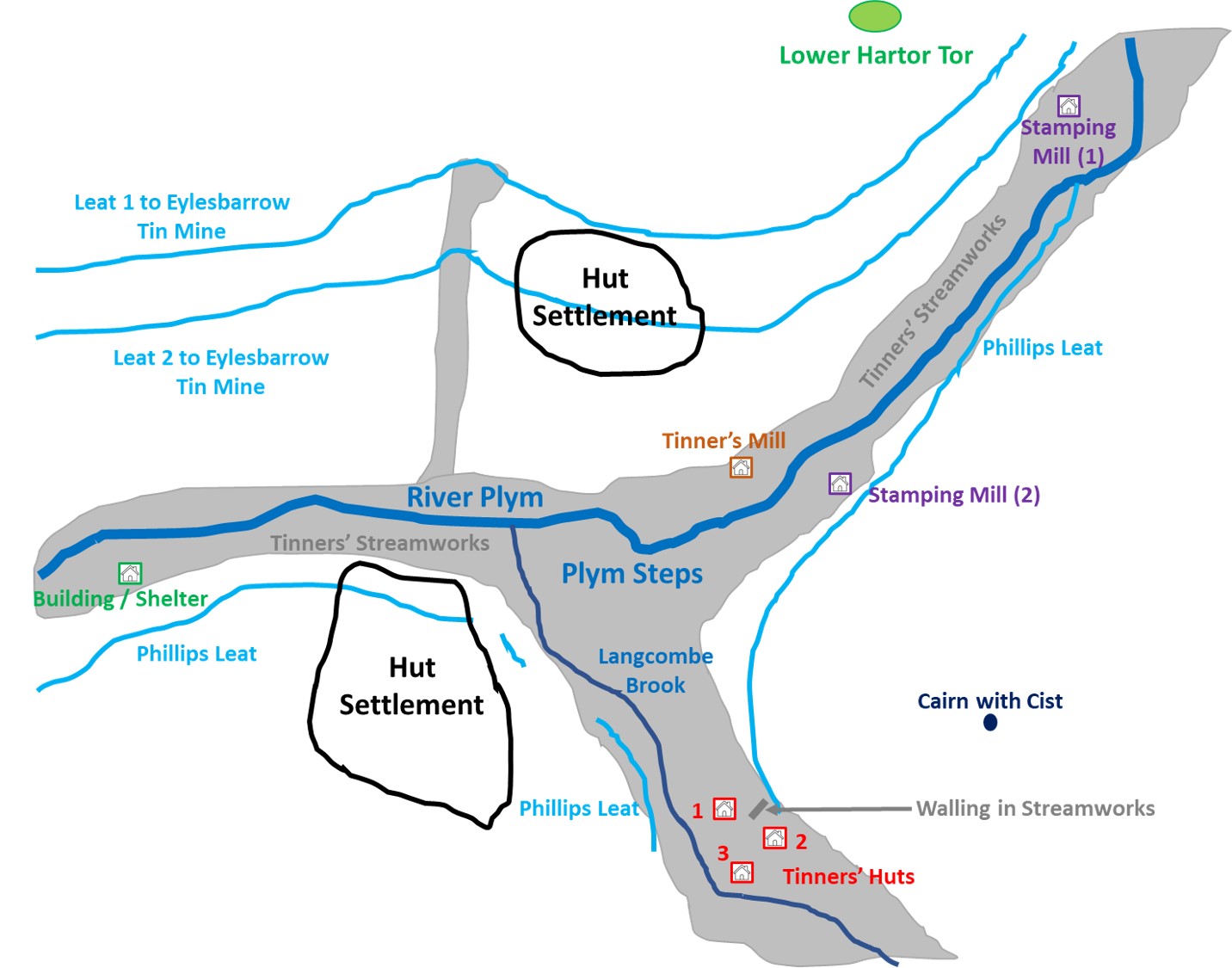
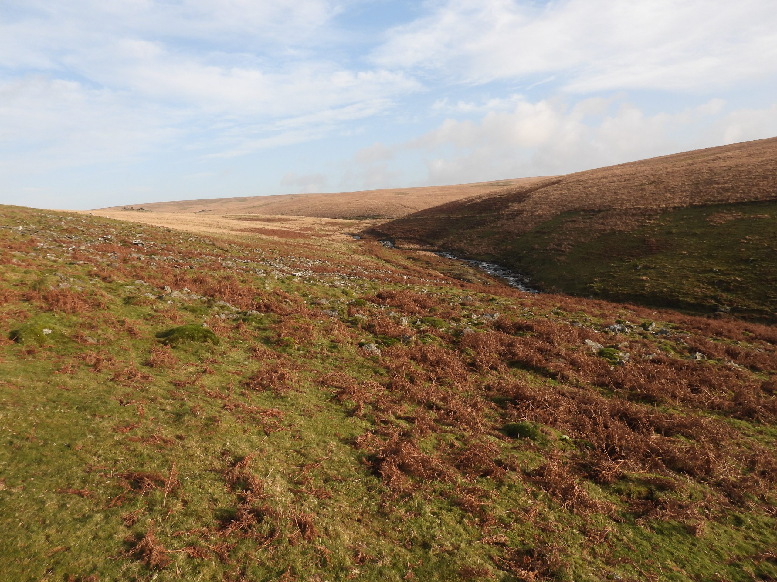
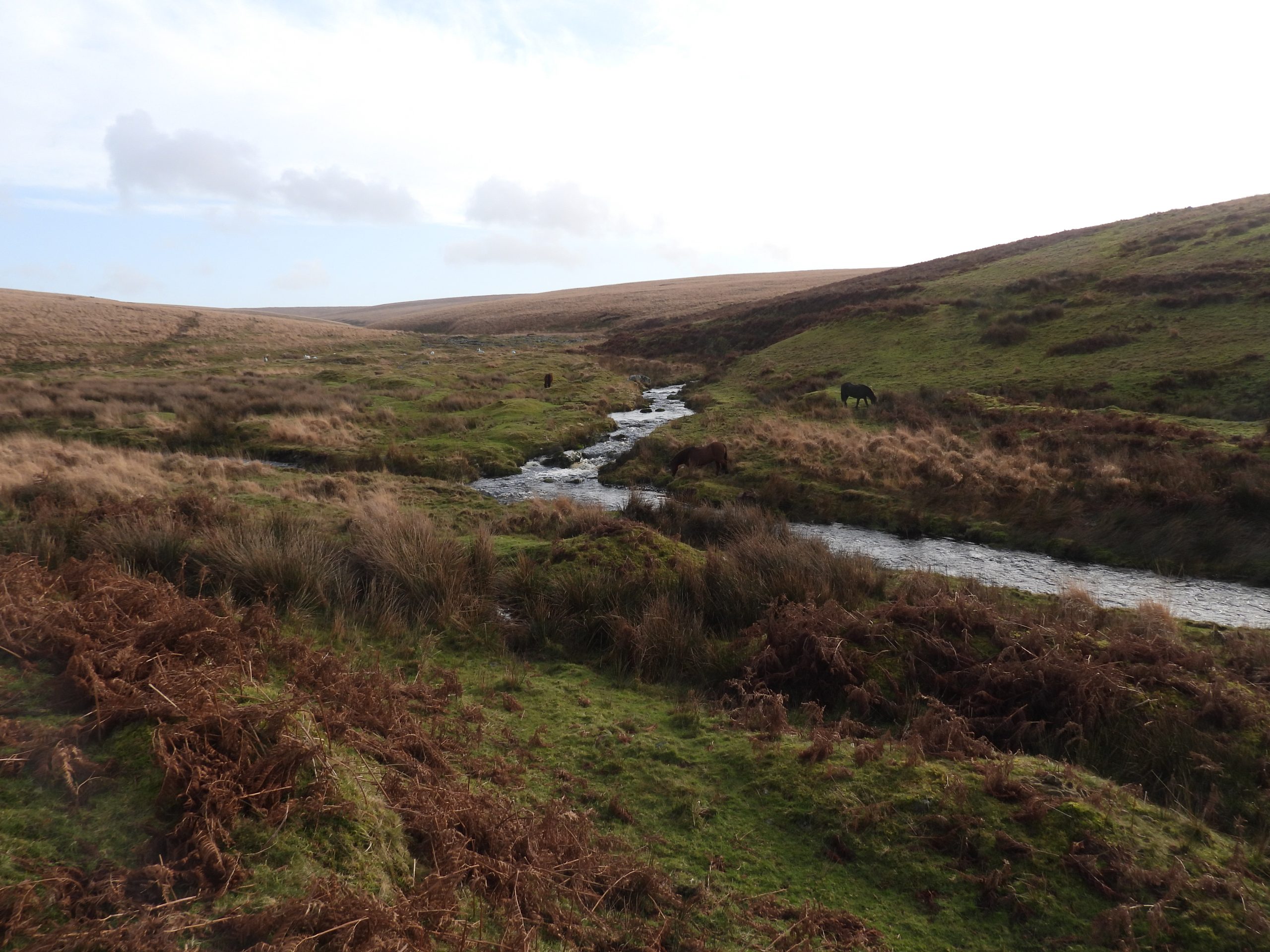
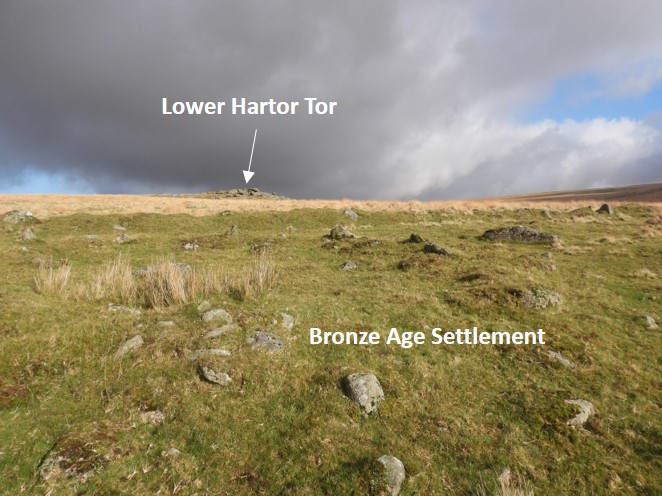
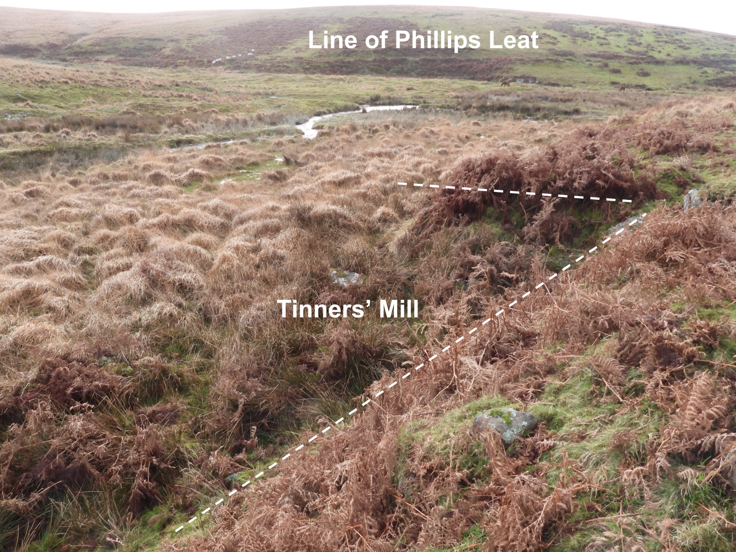
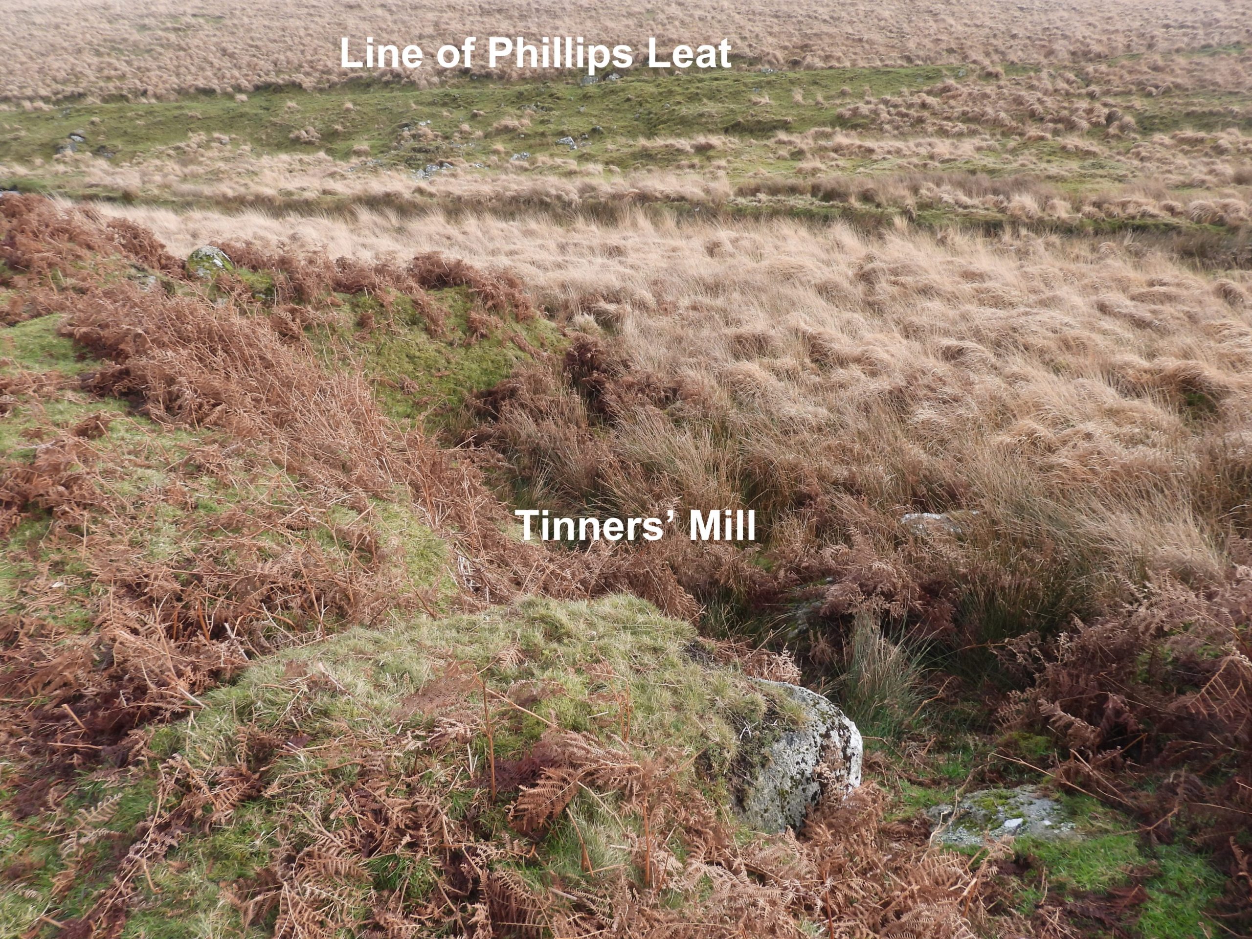
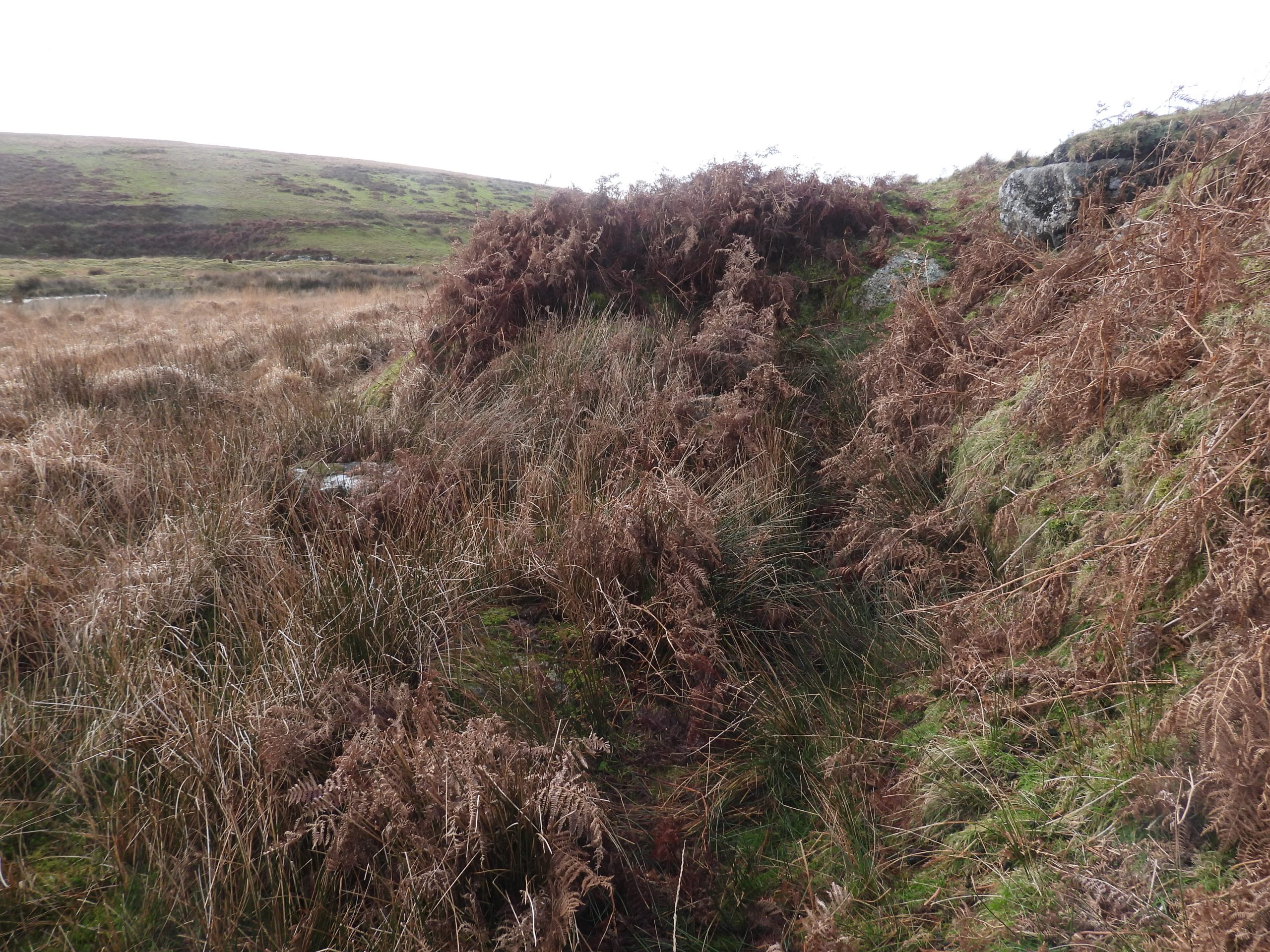
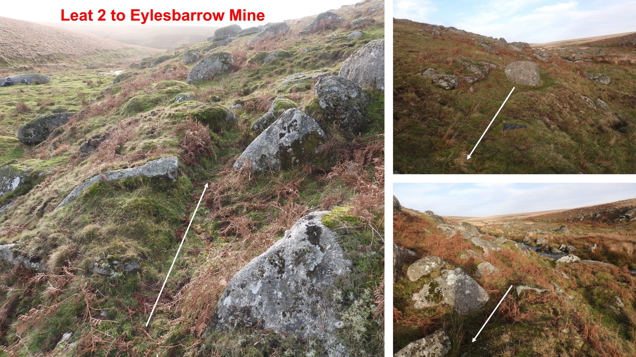
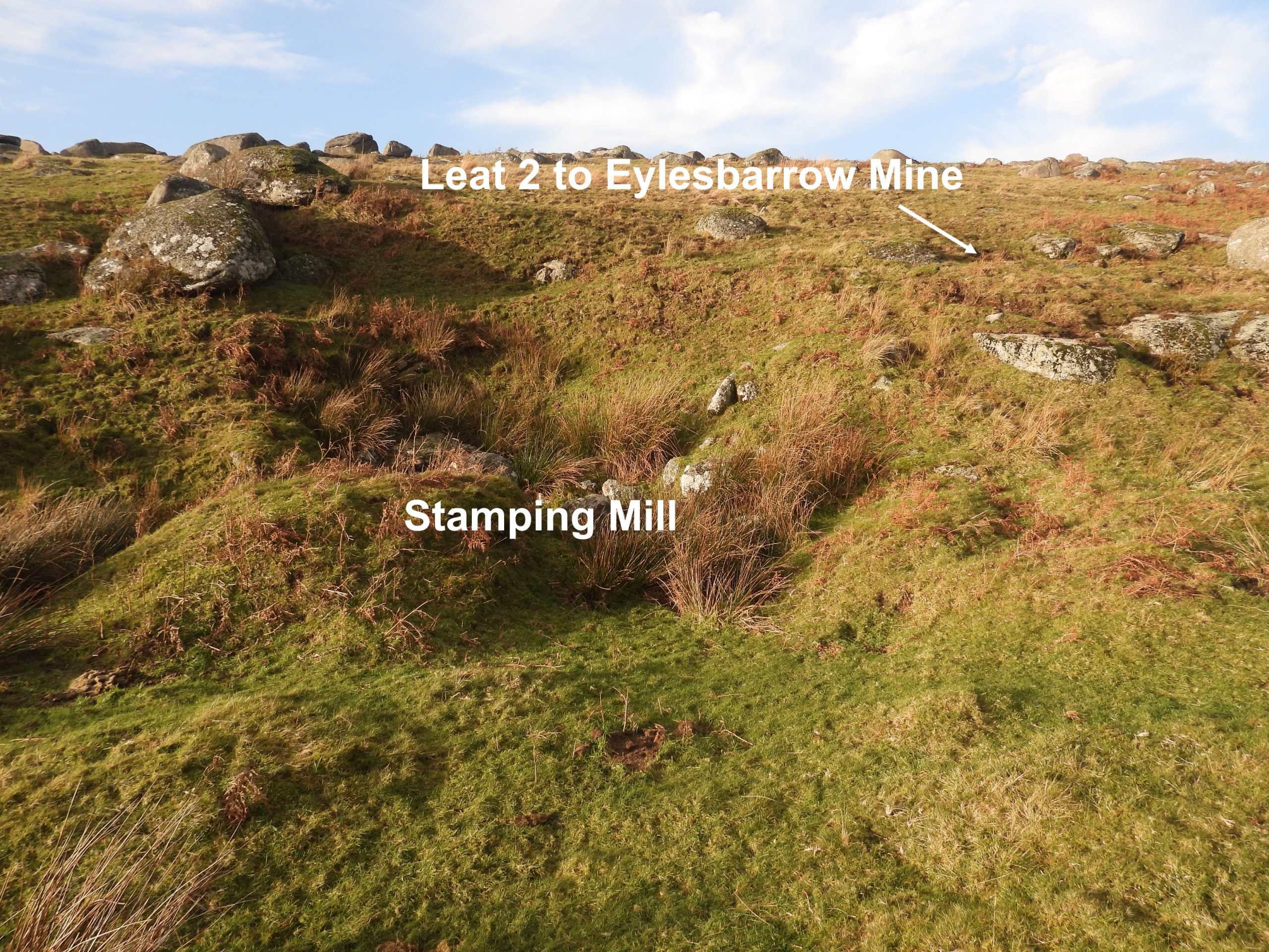
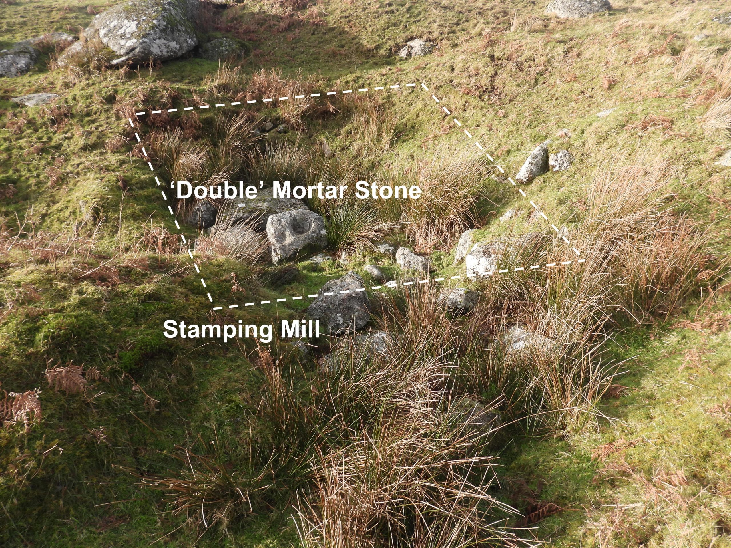
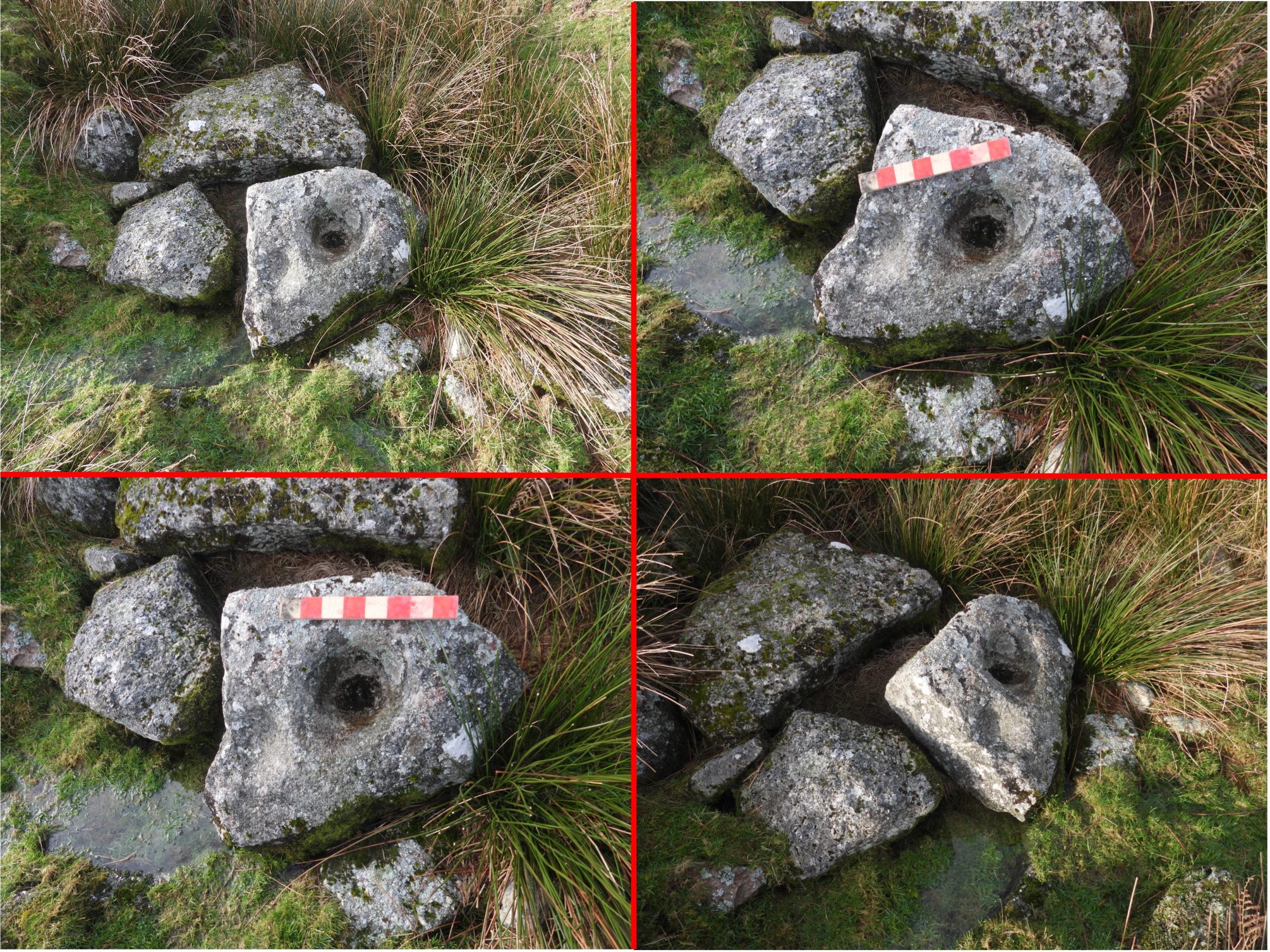
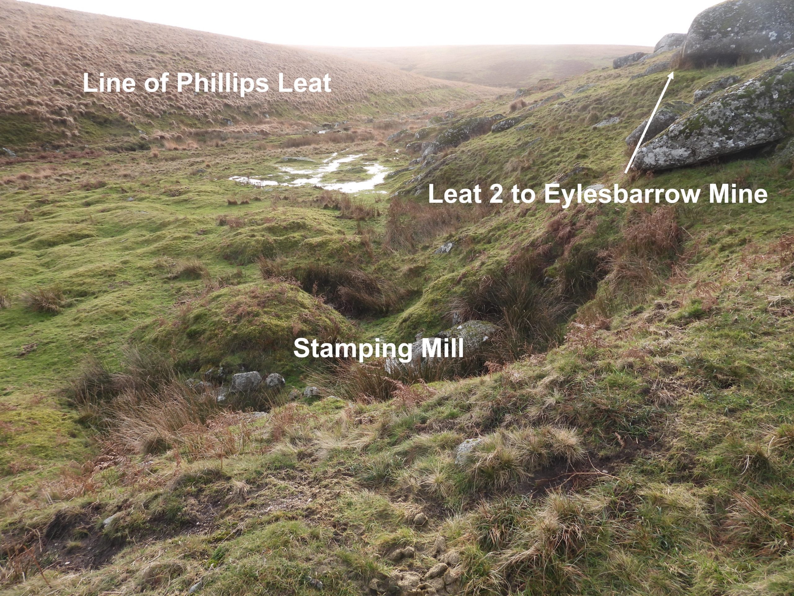
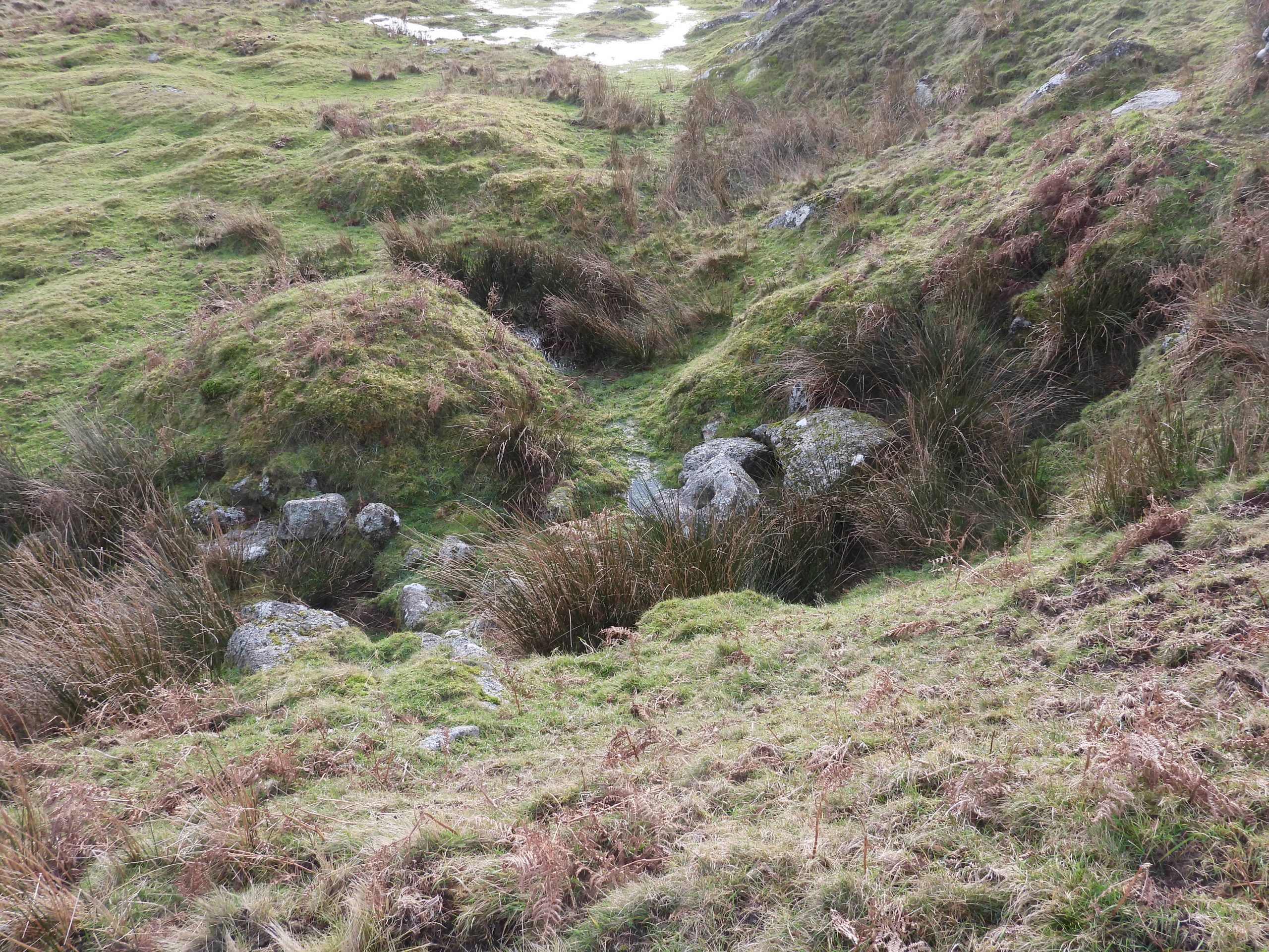
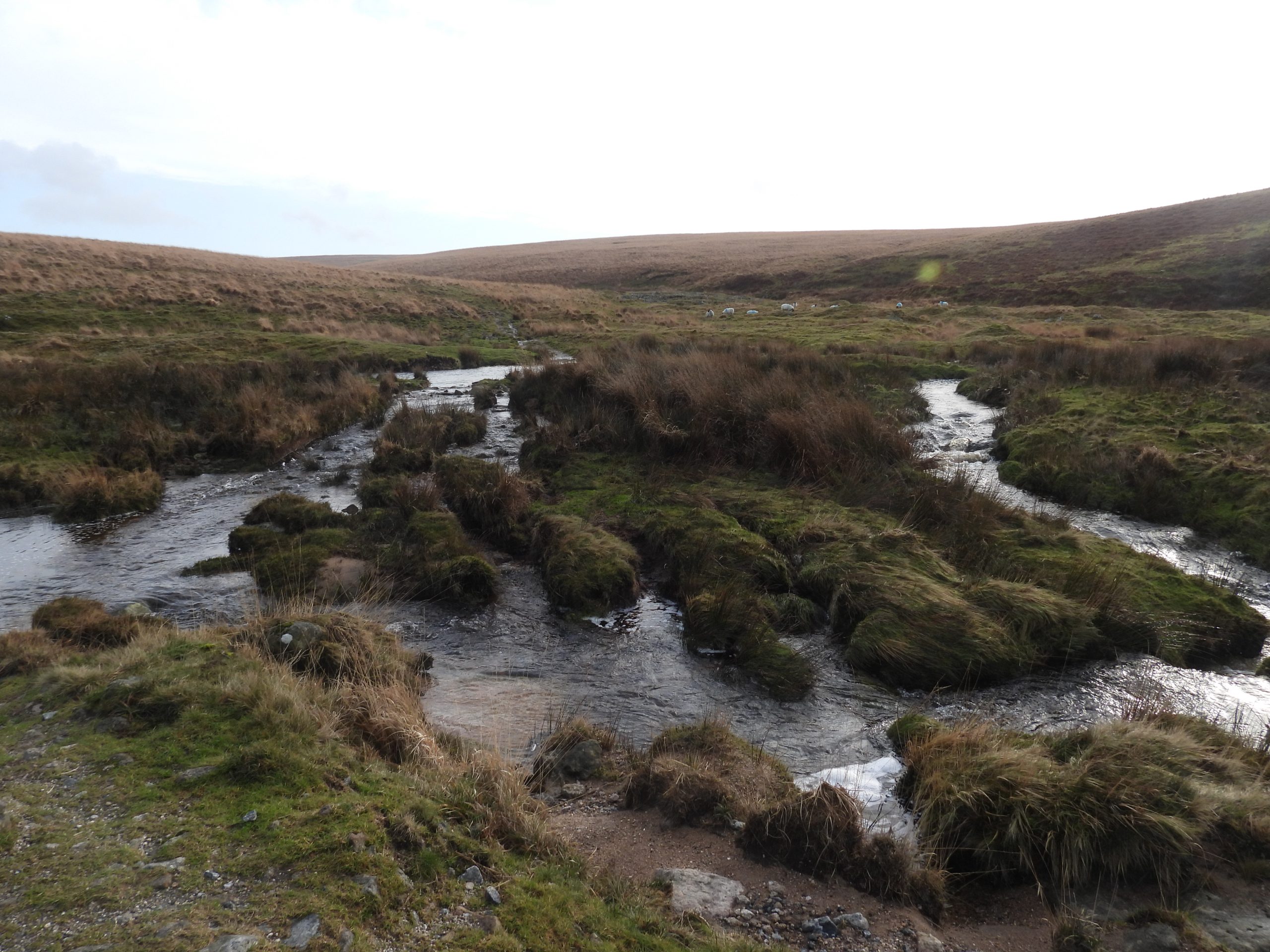
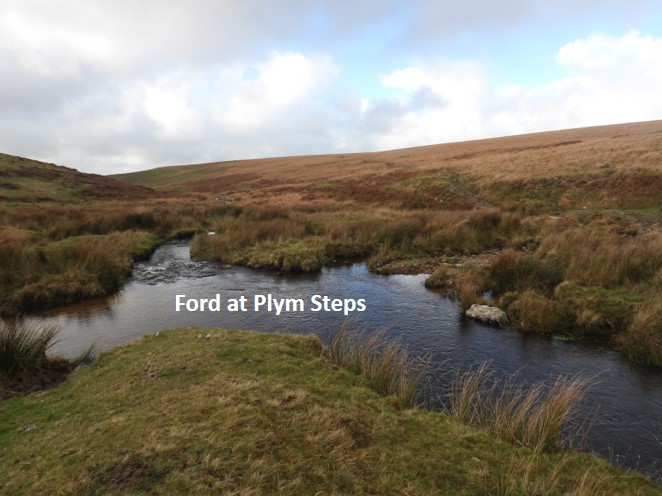
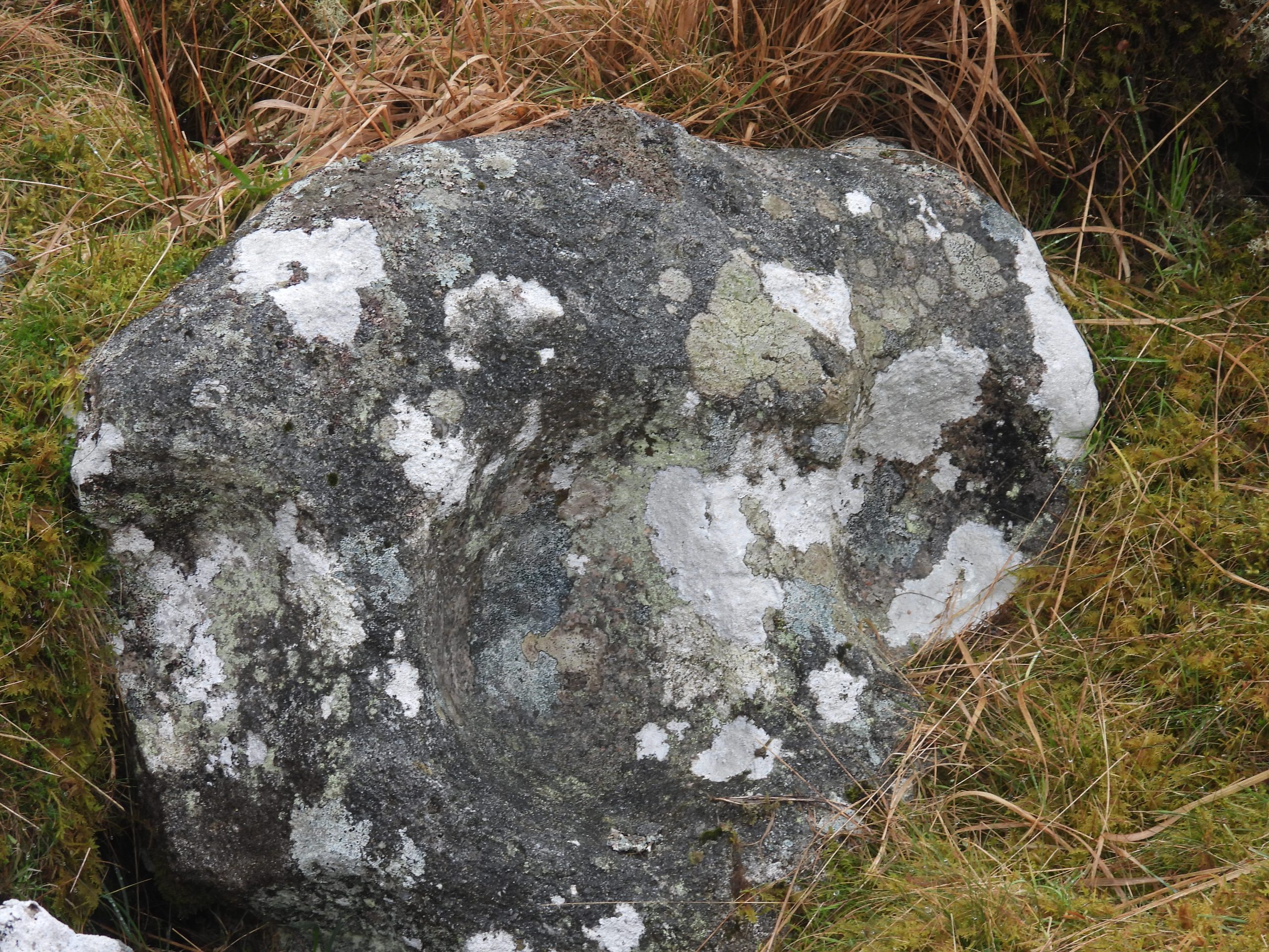
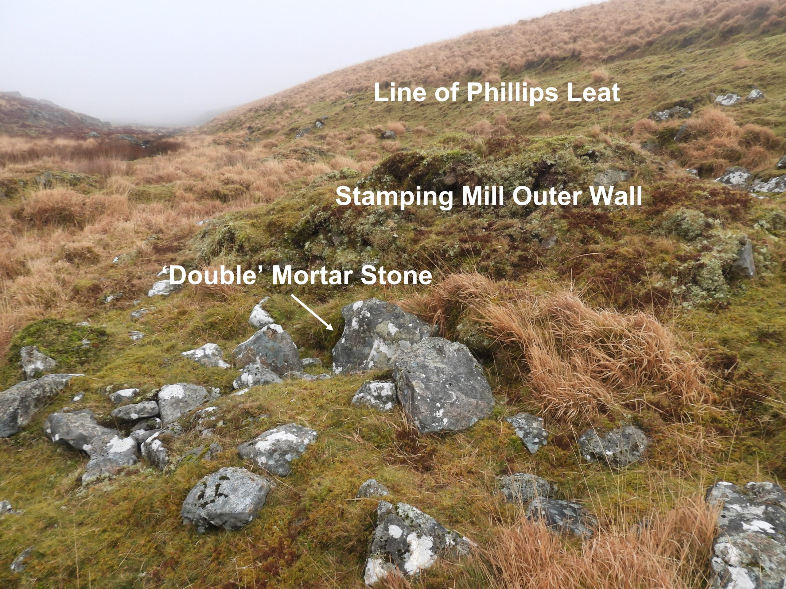
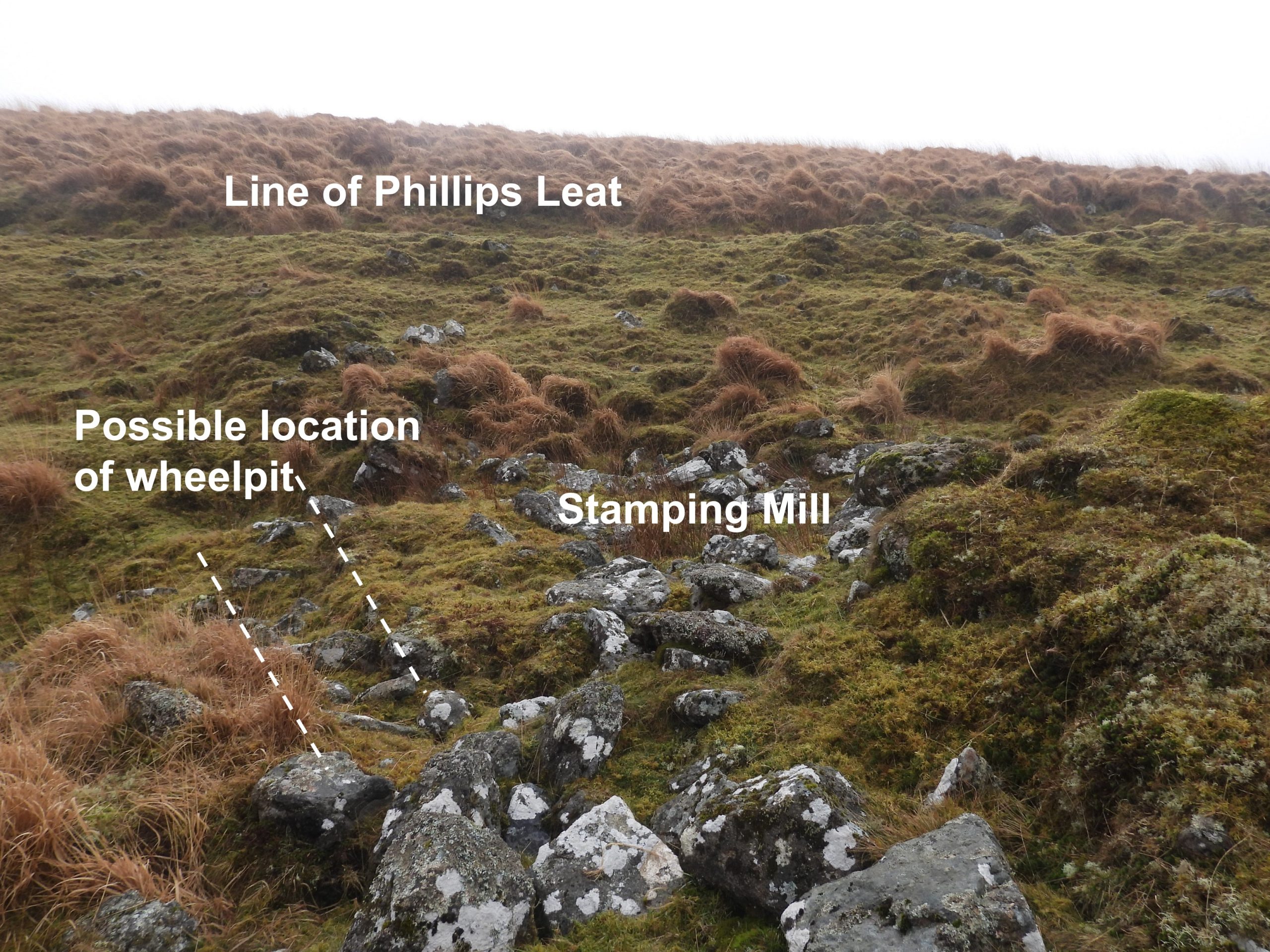
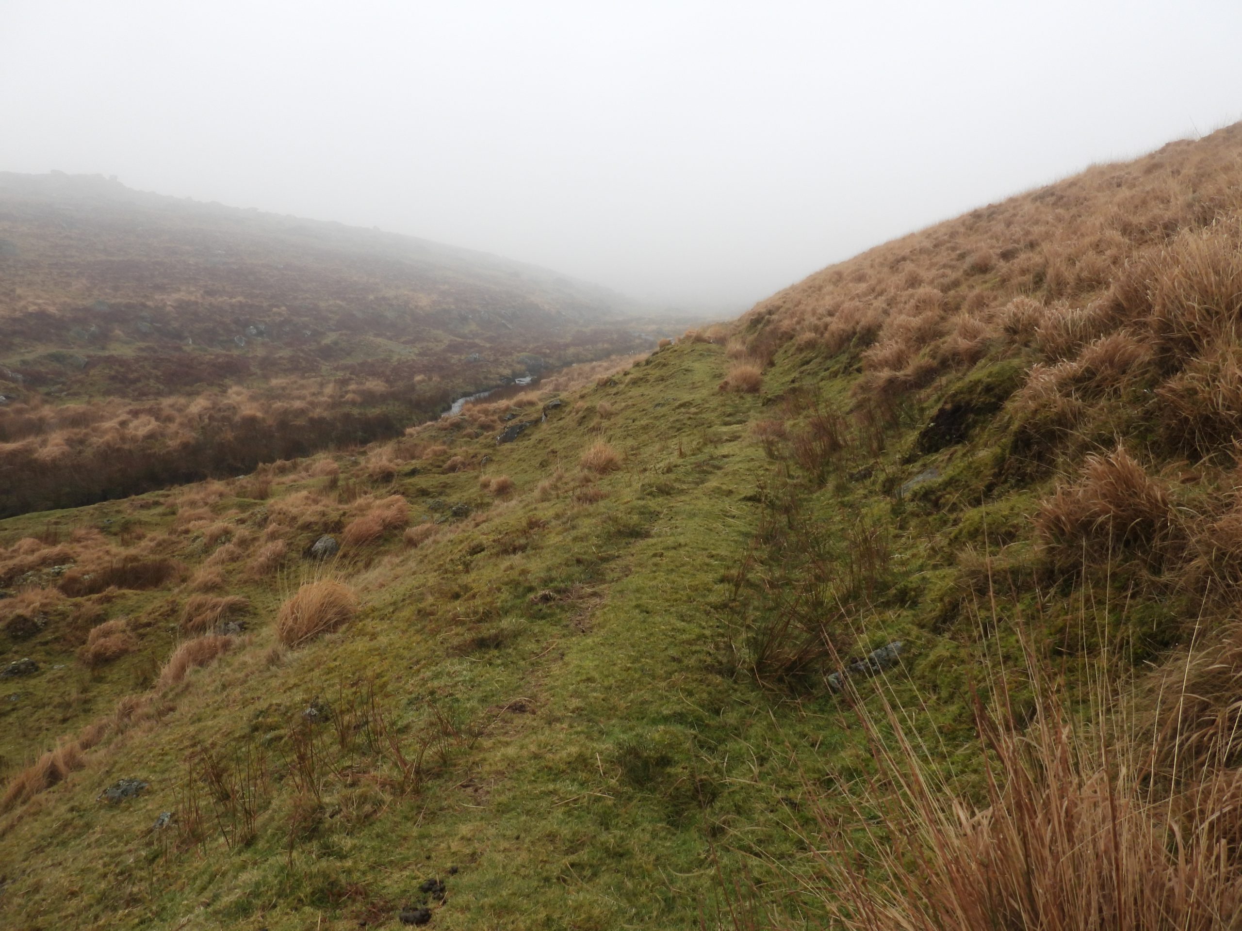
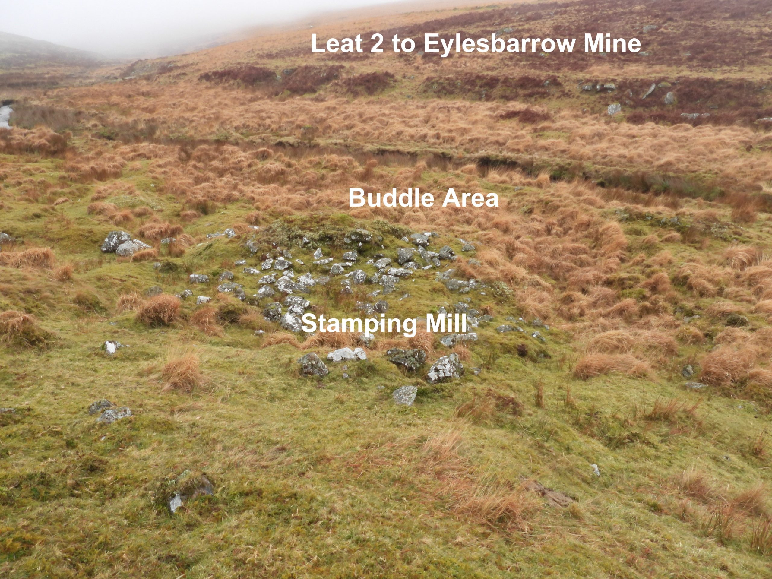
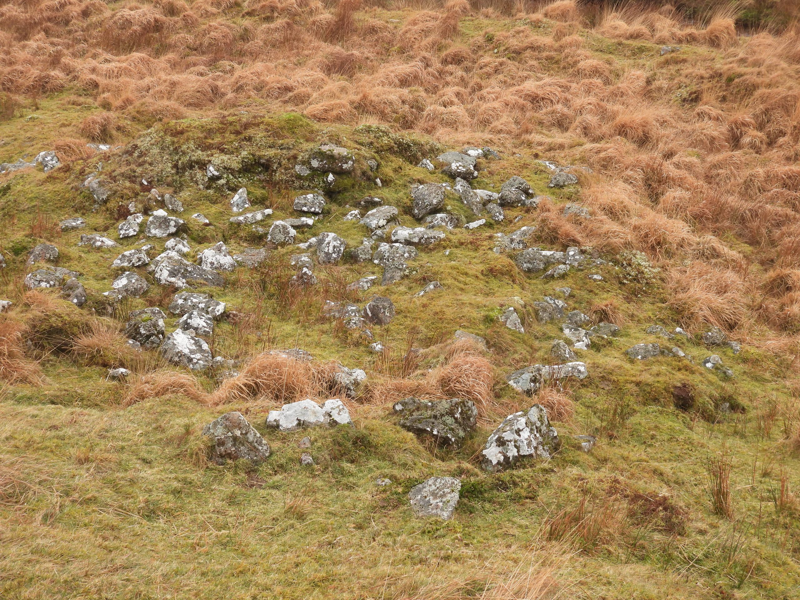
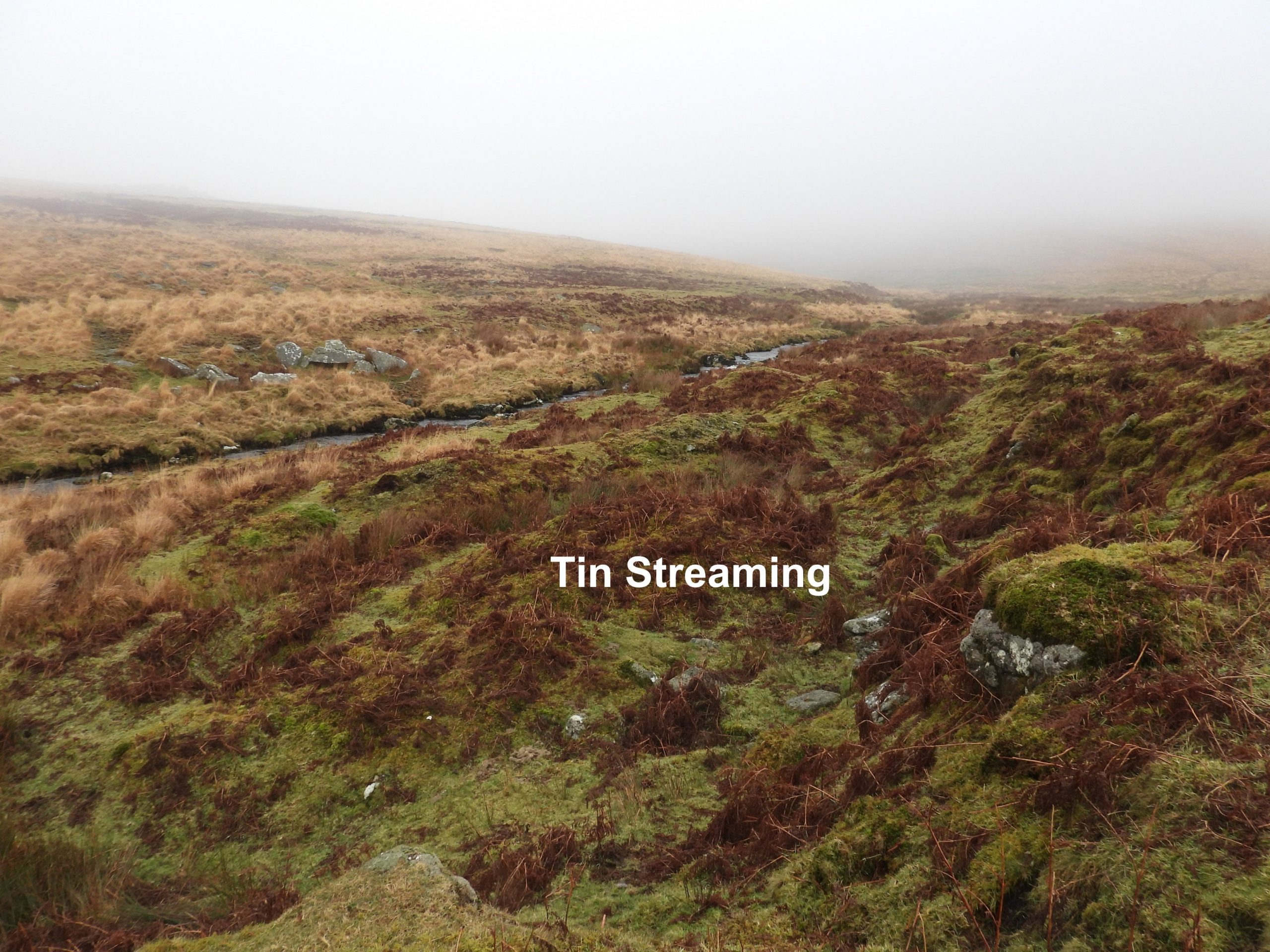
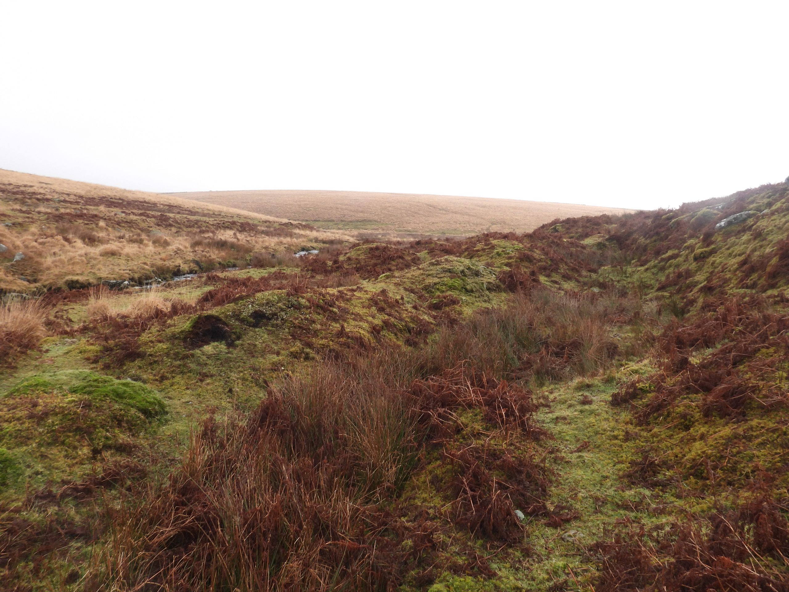
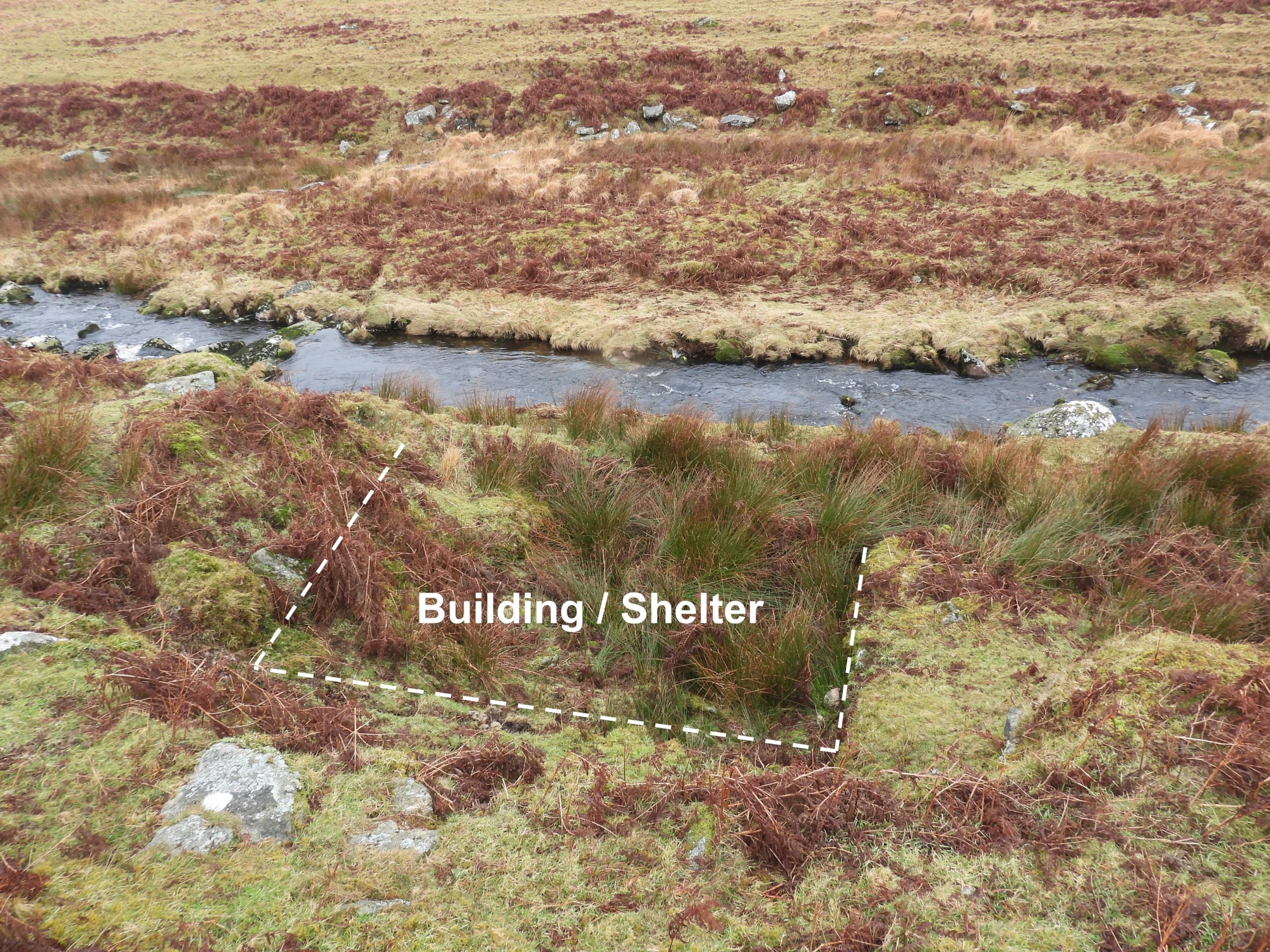
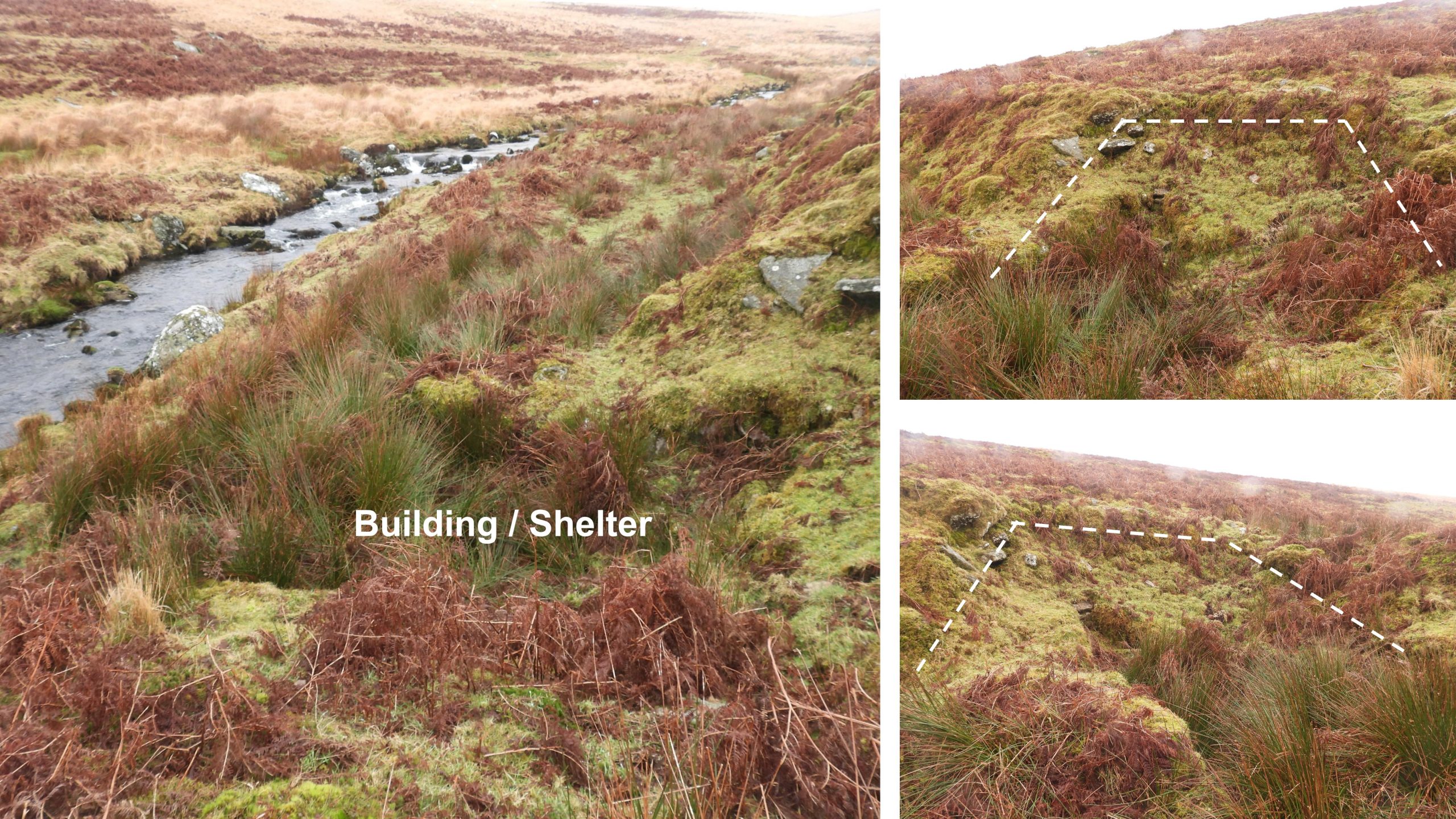
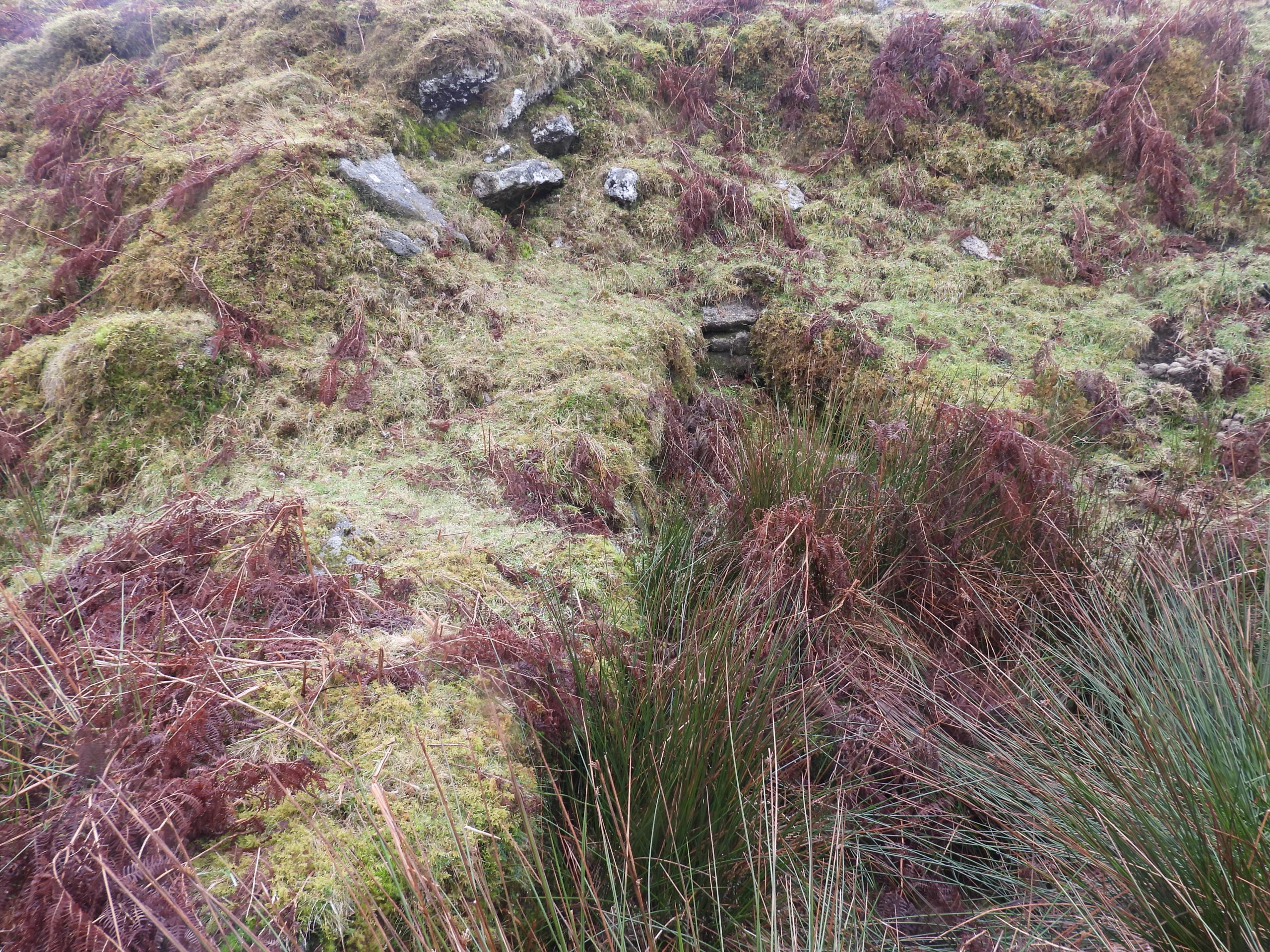
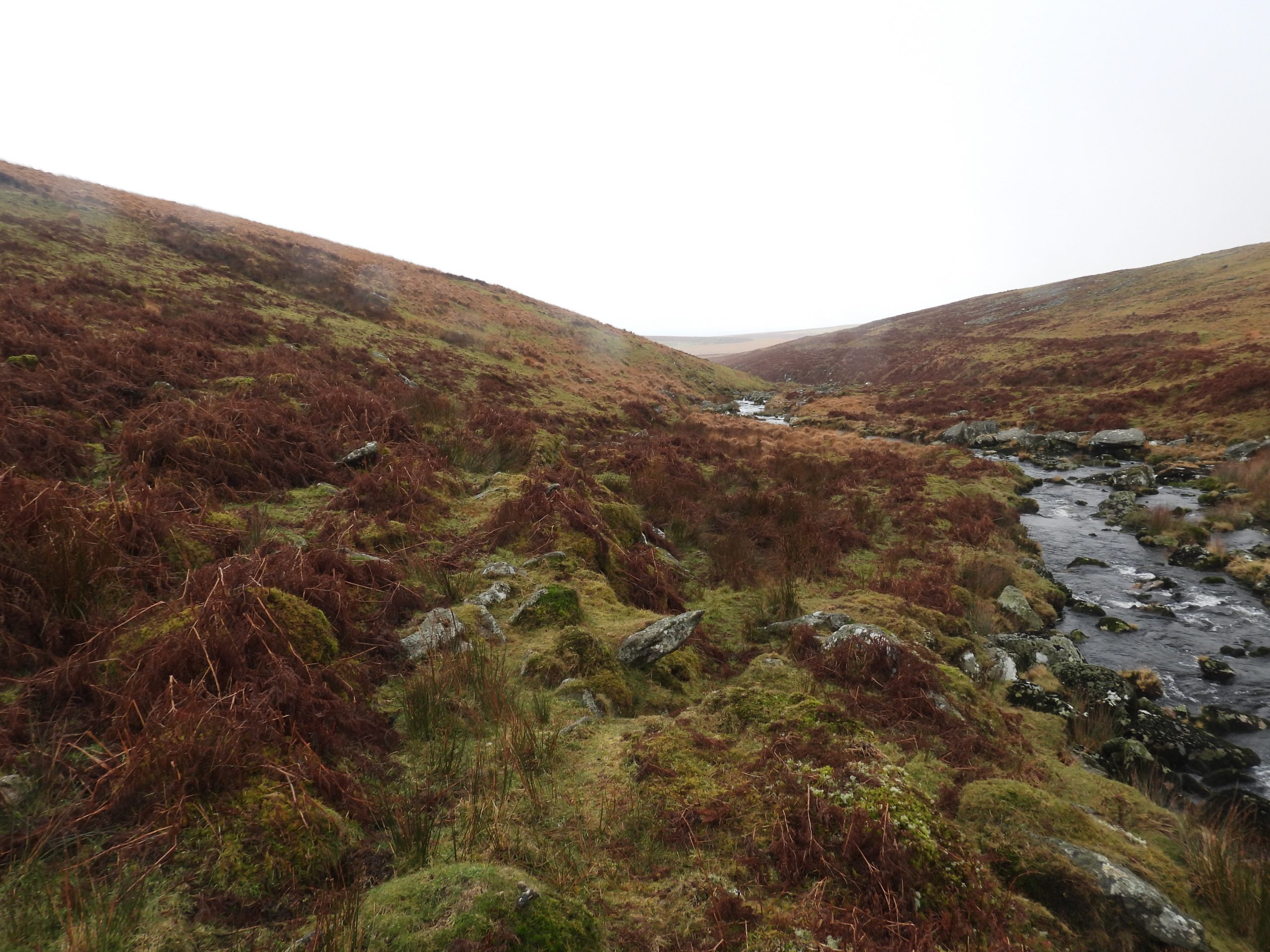
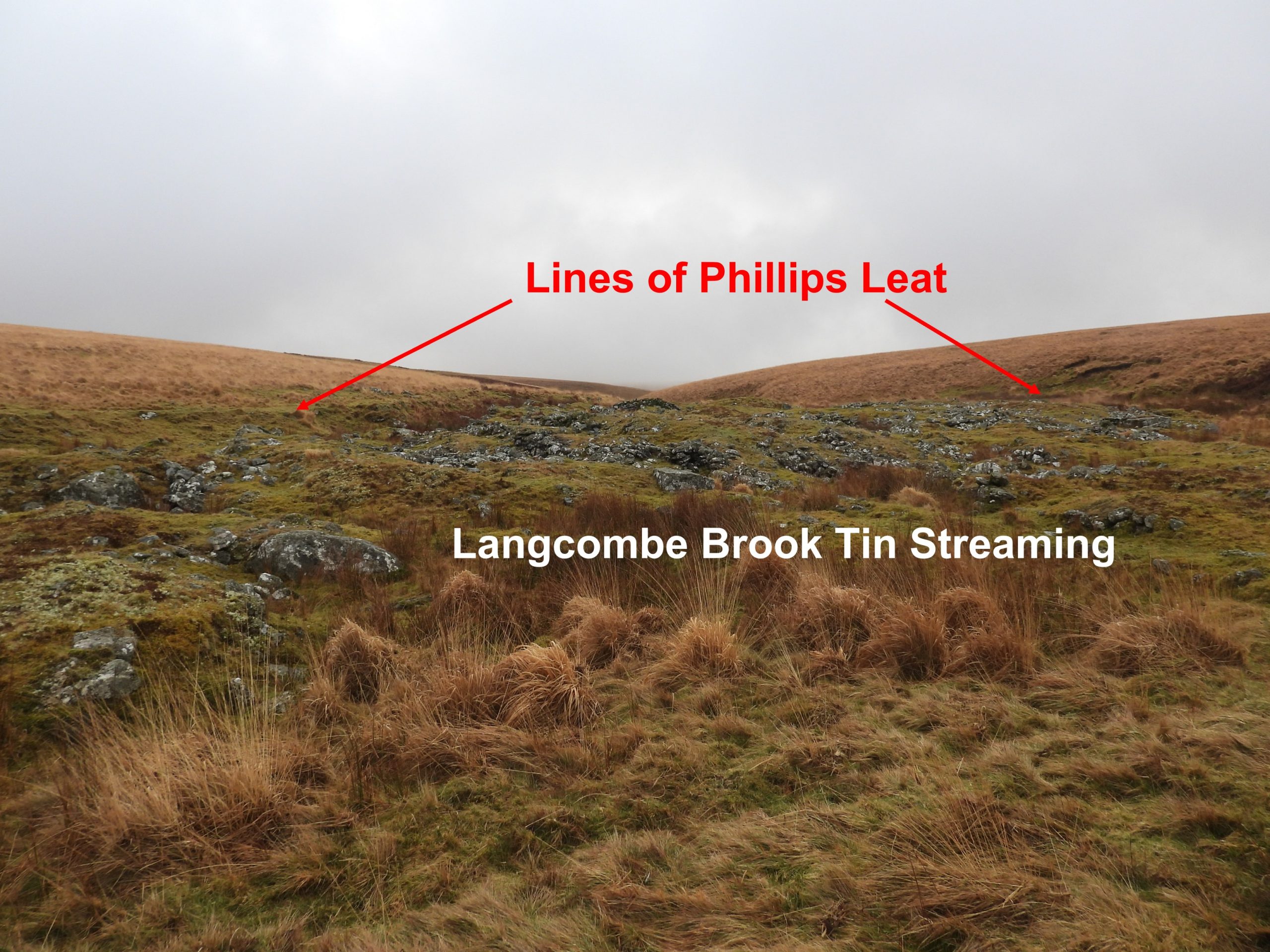
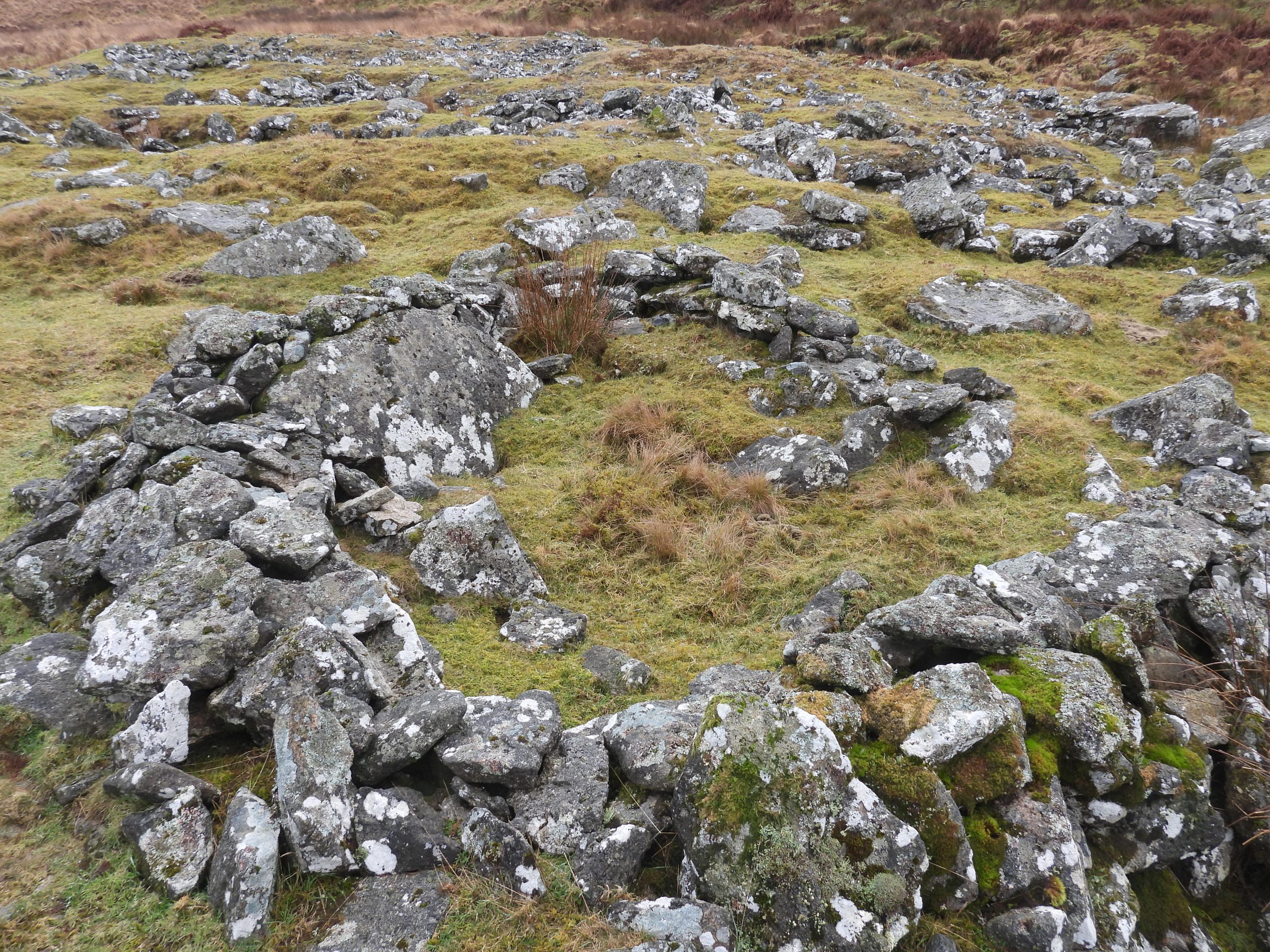
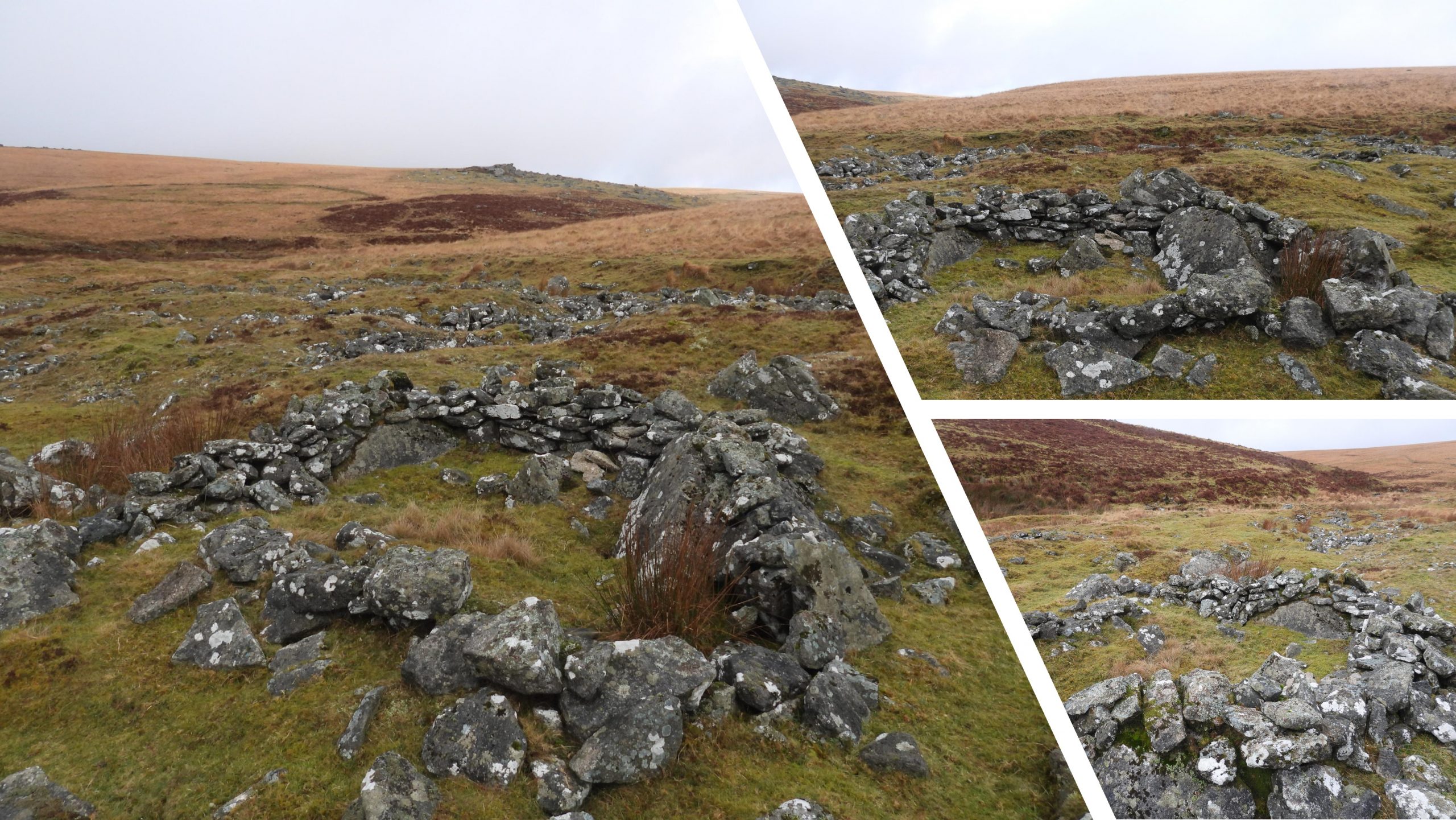
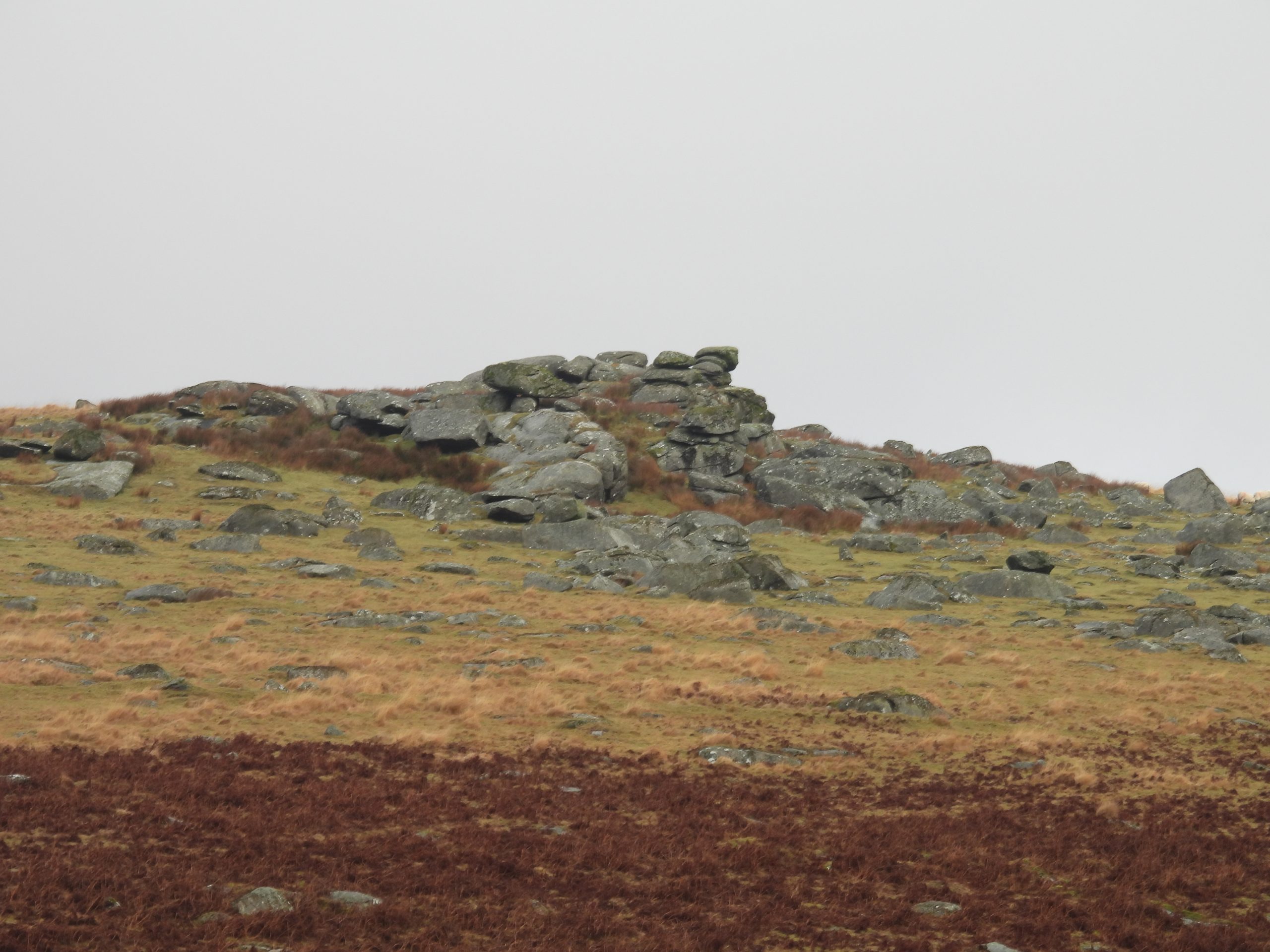
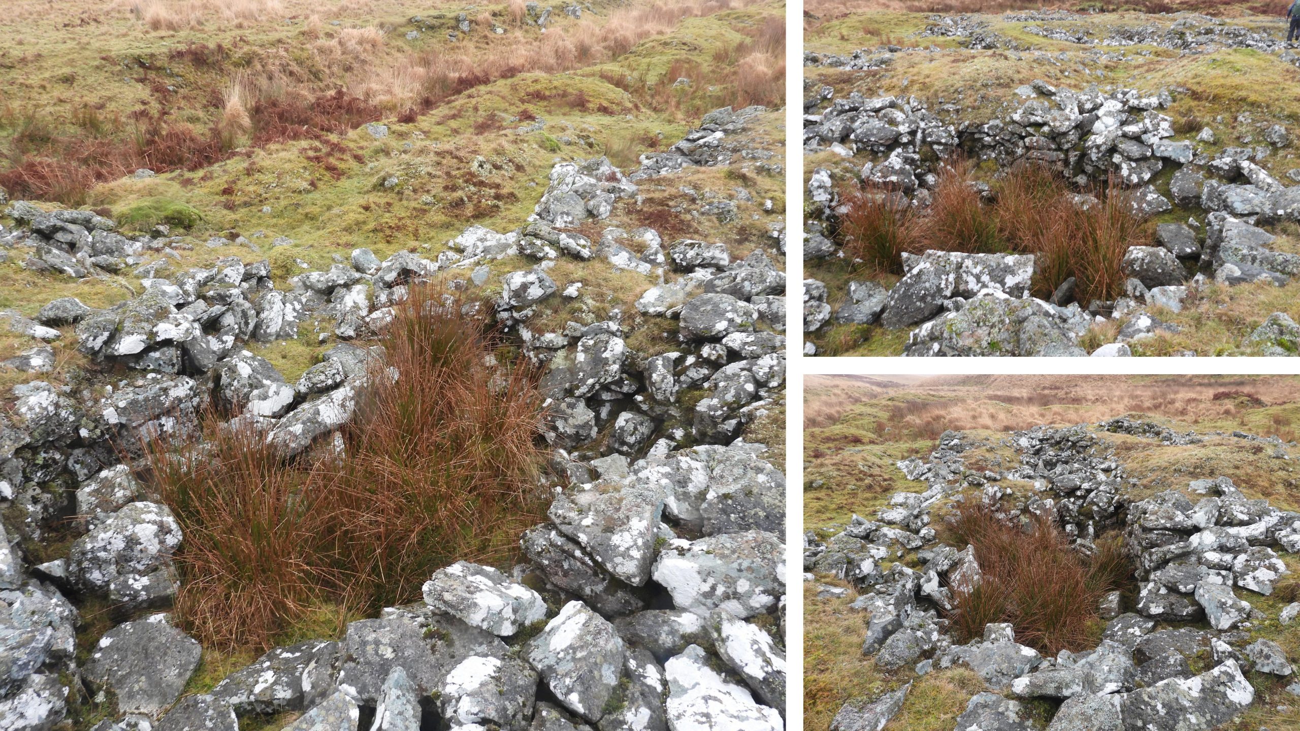
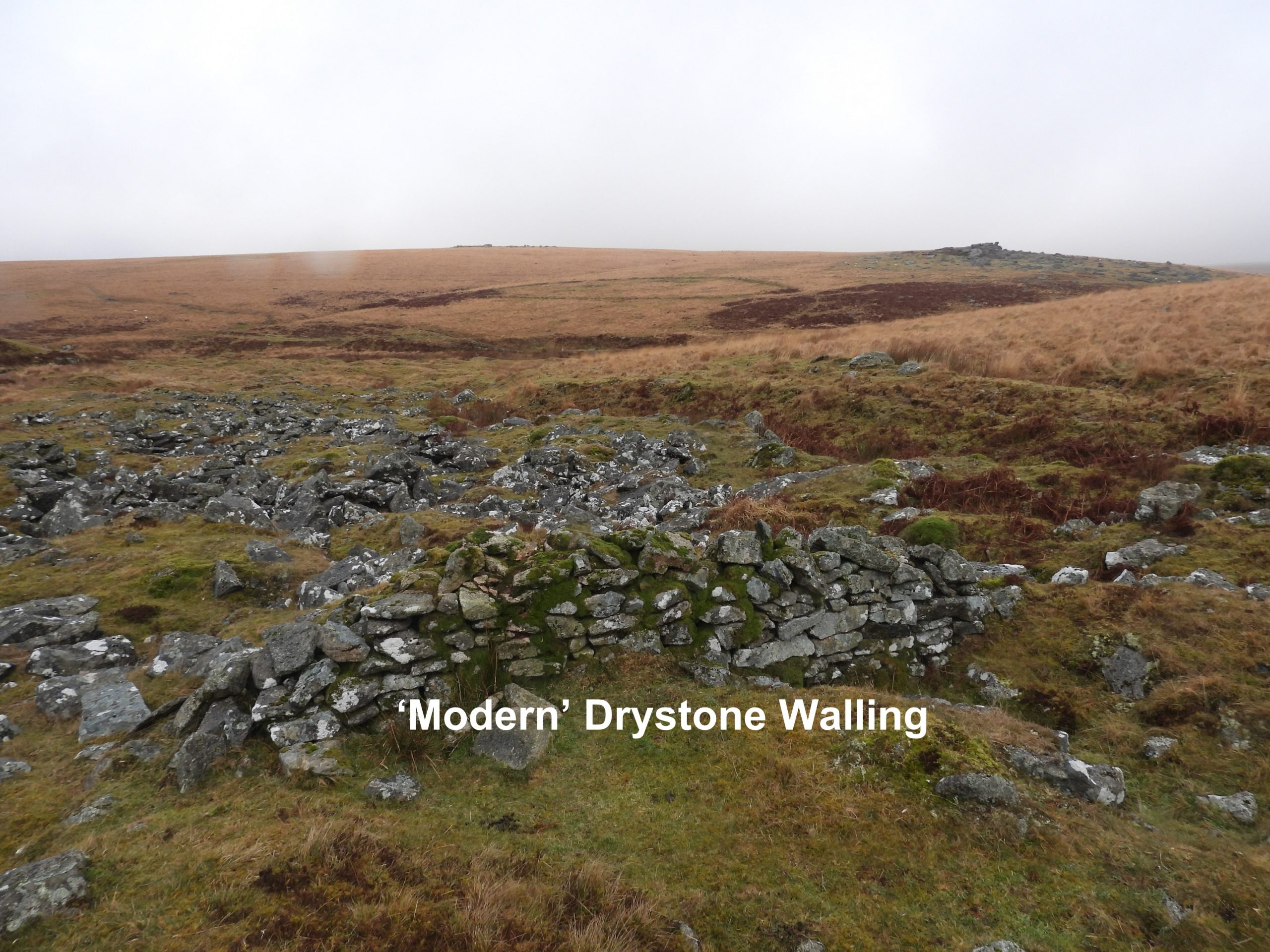
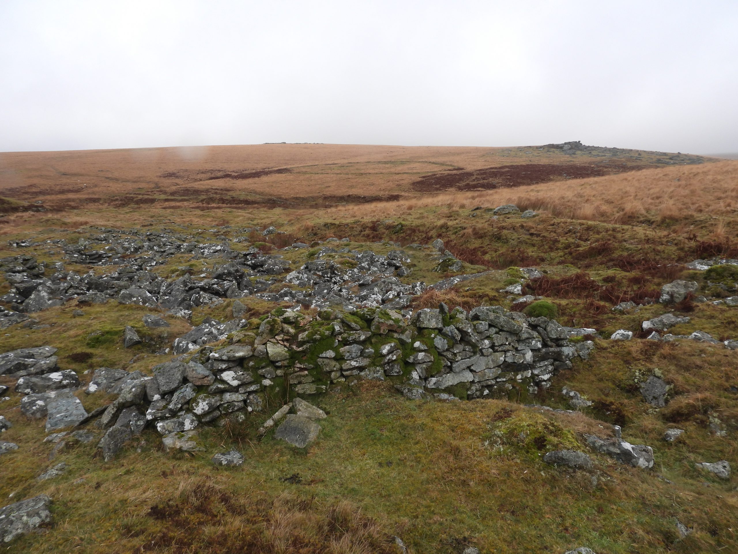
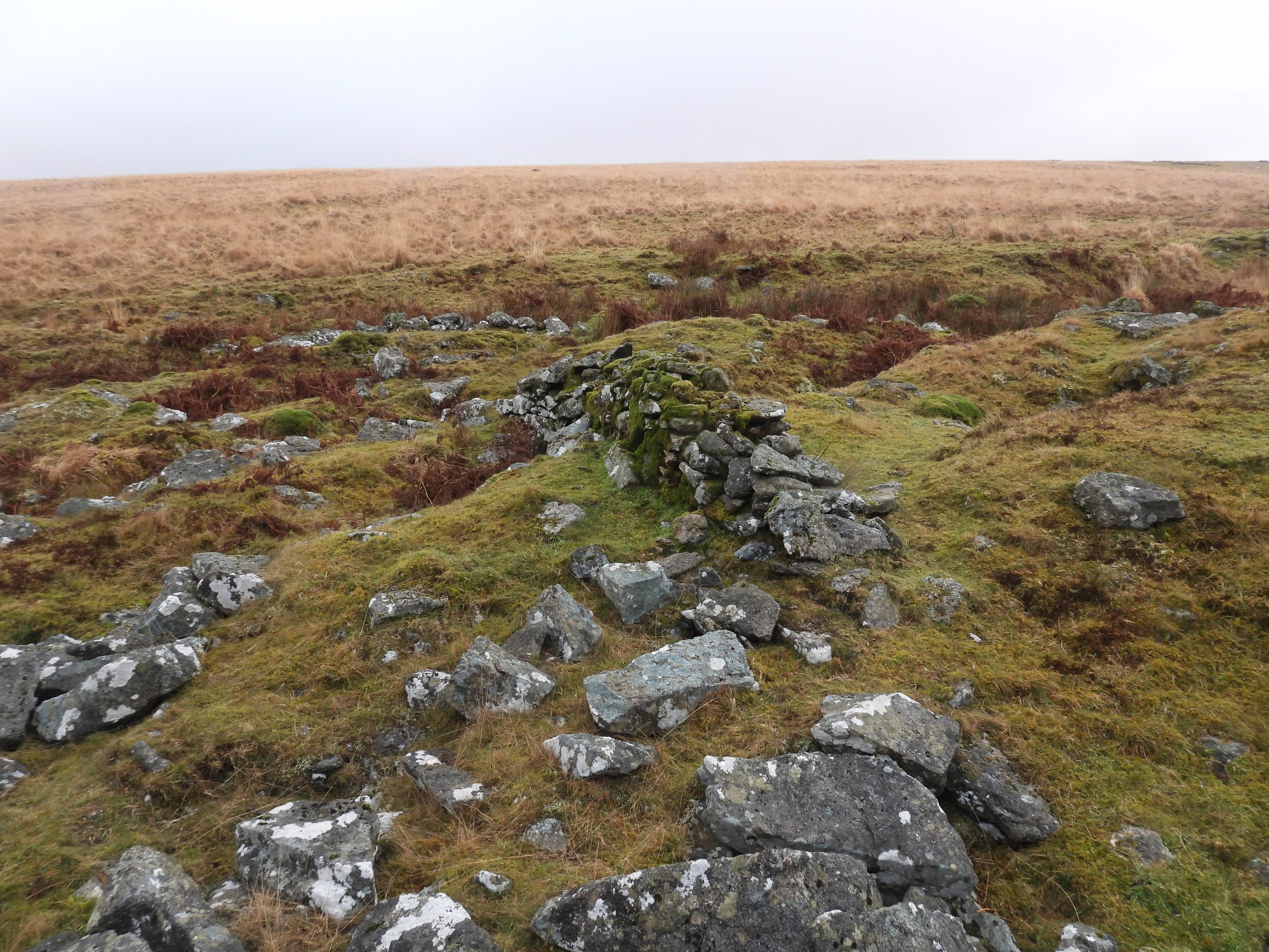
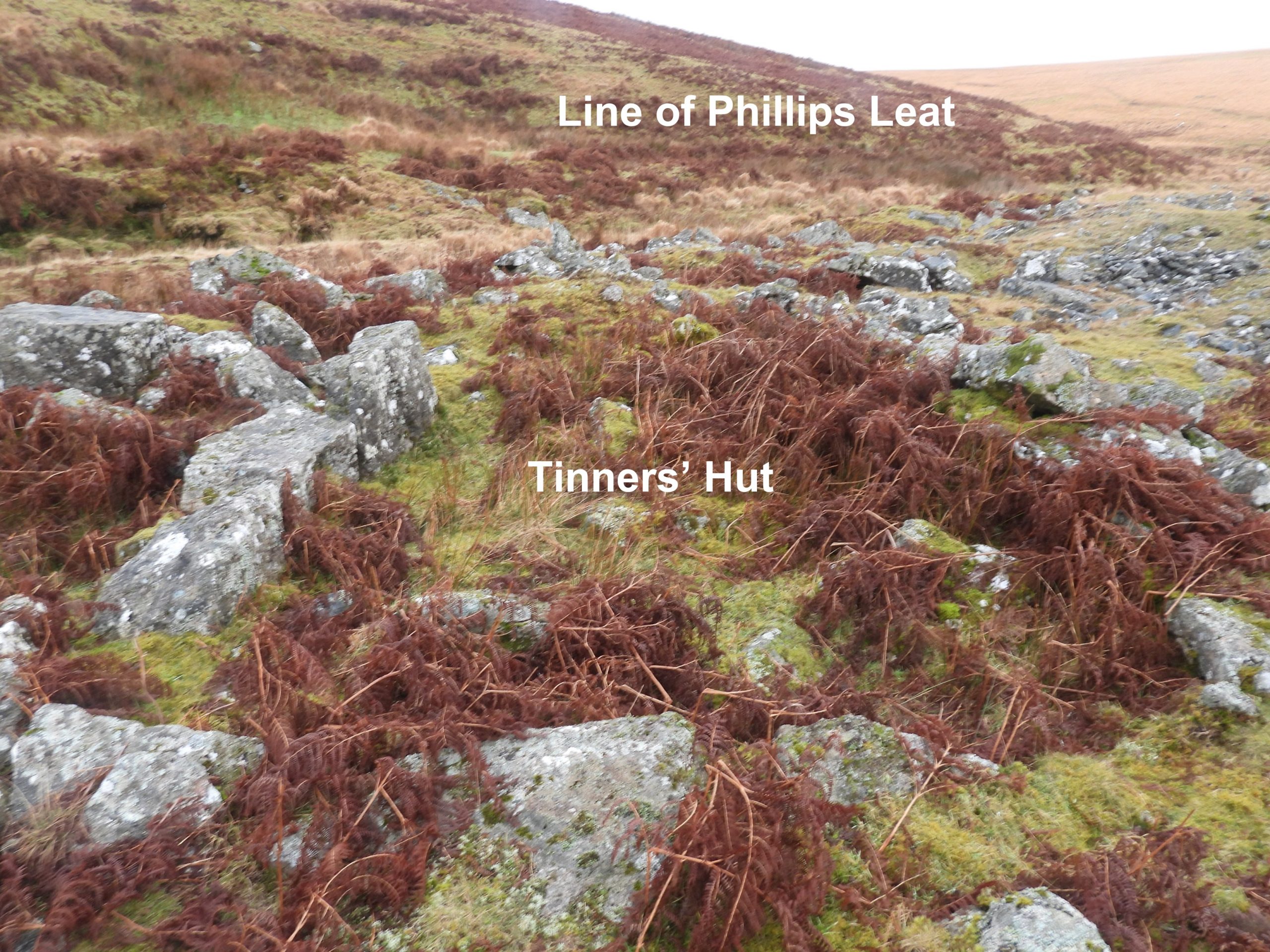
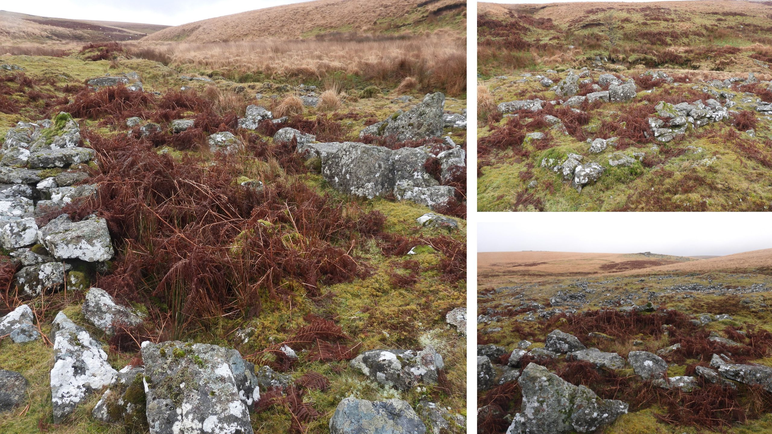
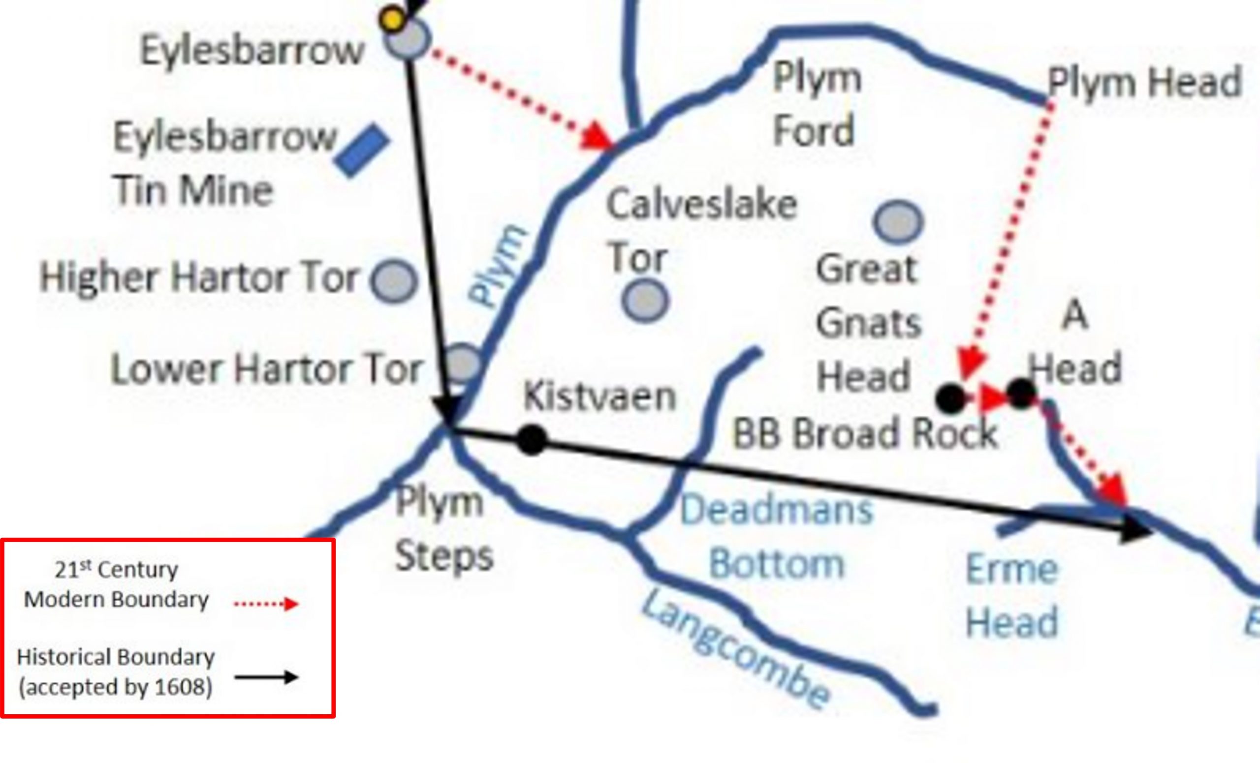
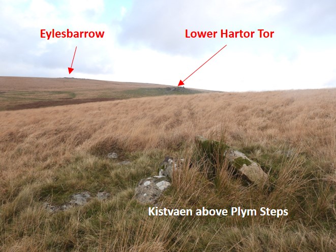
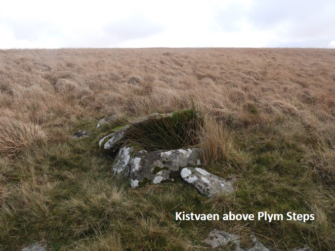
Sketch Map showing the main area of exploration in this post. In the area there are lots of tinners’ streaming plus 2 stamping mills, 3 tinners’ huts, a tinners’ mill and a mystery building / shelter. There is also a couple of historic leats and hut settlements and a cairn with cist which was a waypoint on the 1608 Dartmoor PerambulationApproaching the area covered in this post from the Drizzlecombe area. The junction of the River Plym and Langcombe Brook Valleys can be seen towards the upper / middle part of this photographJunction of the River Plym and Langcombe Brook near Plym Steps.Lower Hartor Tor overlooks this part of the upper Plym Valley. William Crossing in his guide to Dartmoor (excursion 37 – page 434) wrote: “As we make our way down by the Plym through the great stream-work we pass under Lower Harter Tor. This is not a very large pile, but is, nevertheless, striking on account of the massive blocks of which it is composed. The ground around is strewn with granite.” Note Crossing’s spelling compared to that on modern OS maps.Between Lower Hartor Tor and the junction of the Plym / Langcombe Brook is a rather splendid Bronze Age settlement. It is located between the two leats (1&2 as shown on sketch map), which once fed Eylesbarrow Mine. There are four huts here and a cairn nearby.To the south east of the Bronze Age Hut Settlement and a little way upstream from the Plym / Langcombe Brook junction built into a tinners’ cliff are the remains of a building, which possibly are an old tin mill. Dr Phil Newman describes having found a “mark of a wheel bearing on one of the large slabs” in 1999. The mill is very overgrown and the author failed to find such a mark. The (probable) tinners’ mill is located at SX60294 67244Marked on the sketch map as Leat 2, this water course was used to supply water to the lower dressing floors of Eylesbarrow Tin Mine. It would have been dug around 1814. See also: https://dartmoorexplorations.co.uk/eylesbarrow-stamping-mills-smelting-house-engine-wheel-pit-and-tinners-reservoir/Just below leat 2 are the remains of a stamping mill at SX60456 67426. It is probable, the leat would have originally been dug for use for this stamping mill, then extended for the Eylesbarrow lower stamping mills. The stamping mill is recorded as being likely 17th century.This stamping mill (Blowing House) is mentioned in Worth’s Dartmoor (Ref No 28 on Page 303). Worth states:“Right bank of the River Plym, above Langcombe. Internal dimensions of building 17ft (5.2 metres) by 10ft (3 metres). Thickness of walls 2ft 9in (0.84 metres). Leat still traceable. Definitely identified as a blowing-house by the broken remains of a mortar found”.Dr Tom Greeves wrote in1993 in an article titled ‘New mortar stone exposed at mill’, that this mortar stone had previously been unrecorded. One assumes he meant that it hadn’t been measured not that it hadn’t been found as Worth recorded it around 50 years earlier. As to the mortar stone Greeves wrote: “…. large and highly visible double mortar stone lying in the centre of the mill structure. Measures 0.8m by 0.7m (0.34m thick) and may have fallen out of the west wall of the mill. Two large mortars (0.25m diameter) in upper surface”. In 1978, the Ordnance Survey Archaeology Division, recorded: “No wheelpit or furnace can be seen, and the broken mortar referred to by Worth is not visible”. So where was the mortar stone which was recorded by Worth and is so visible today ?Dr. Phil Newman in 1999, suggested that the large mortar stone had “….apparently fallen from the side of the tinners cliff fairly recently”. This may account for the fact that Worth noted it (around 1940’s ?), then the Ordnance Survey did not (1978) before Greeves noted it (1993).Junction of the Plym and Langcombe Brook.Ford below Plym steps. This ‘Double Mortar Stone’ is associated with a stamping mill (blowing-house) on the left bank of the Plym above the Langcombe Brook junction.The mortar stone is situated outside the blowing house and lays against the remains of the north wall.The stamping mill is cut into the hillside immediately below a dry leat, which is recorded as being ‘Phillips Leat’ dating from 1830’s (to carry water to his newly leased clay works on Lee Moor). That said, because the mill is listed as a pre-1700, the leat very probably dug for the mill before being used again later in the 19th century.This stamping mill (Blowing House) is mentioned in Worth’s Dartmoor (Ref No 27 on Page 303). “Left bank of the Plym, above Langcombe. The building is much ruined, but its internal dimensions can be ascertained to have been 20 feet (6.1 metres) by 9 feet 6 inches (2.9 metres). There is a mortar-stone, with two large mortars, one oval in plan”. Worth does not mention any wheelpit, leat or buddles. The author conjectures that there may be faint traces of where a wheelpit may have been.The dry leat above the stamping mill is recorded as being ‘Phillips Leat’. Eric Hemery, inHigh Dartmoor, (page 197 and 199) records the story: “The leat took in water from the River Plym, above Langcombe Brook, under Little Gnats Head, and during its working life was known as the ‘Little Gnats Head Leat’. It was cut William Phillips during the 1830’s to convey water to his newly-leased clay works on Lee Moor. Not long after the leat was opened, the owners of Hemerdon Tin Mine entered into a rental agreement with Phillips to take water after it left the Clay Works, for the mine-wheels at Hemerdon”.Between the stamping mill and the river, there are some linear earthworks (very overgrown) which are believed to have once been an area of buddles (settling pits).Close up of the ruinous remains of stamping mill (2).Contextual picture of stamping mill (2) on a murky February morning.According to the Royal Commission for the Historical Monuments of England (RCHME), there are approximately 9.0 hectares of streamworking remains on the upper reaches of the River Plym and its tributaries. The tin streaming shows itself as a series of parallel dumps. The tin streaming in the photograph is on the left bank of the Plym just below the confluence with Langcombe Brook.The well preserved tin stream workings are bounded by steep sharply defined ‘cliffs’ as can be seen on the right side of this picture.A few hundred metres down from the confluence of the Langcombe Brook and the Plym is a small three-sided structure built into the steep scarp / tinners’ cliff.The three sided structure has no discernible internal features (except a wall / revetments) and measures around 5.5m by 3.1m.Internal walling of the building which is conjectured as once having been a shelter. It is located at SX59985 67182. The author conjectures that it is from around 18th century.Just downstream from the building / shelter there is more tin streaming an a well defined tinners’ scarp / cliff.At Langcombe Brook foot there are very well preserved tin streamworks which lie parallel with the brook. Of note is that the line of Phillips Leat (previously mentioned in this post) can be made out either side if the brook. Did the water coming in from the Plym (left side of picture) just supplement the waters of the Langcombe Brook before the leat continued (right side of picture) onward to Lee Moor clay works ? Or was there a launder here ? The author suspects the former of these two options.A short distance up the Langcombe Brook valley is the first (of three) probable tinners’ hut. This is located at SX60285 67060The tinners’ hut (marked as no. 1 on sketch map) is 3m x 2.5 m and believed to be of more ‘recent’ origin (Probert and Fletcher).Zoomed in view of Lower Hartor Tor from Langcombe Brook. There is a delightful entry in Eric Hemery’s ‘High Dartmoor’ (page 215), where he recalls being below the tor by the river in 1972, during a Spring day of hailstorms, when ….”a kite twice flew towards me, with swiftness of cut-away wing and forked tail: a thrilling sight!”A second tinner’s hut can be found in the Langcombe streamworks at SX60311 67047Probert and Fletcher record this tinners’ hut as measuring “3.6m NW to SE by 2.3m internally with an entrance in the centre of the NW wall. The surviving walls stand 1.2m high”.This unusual section of ‘modern’ drystone walling can be found in the streamworks at SX60306 67055The walling is approx 5m long by 1.2m high. It serves no purpose. Paul Glanville, kindly supplied the following information: “Built in the late 1980’s by a chap called Greenwood after he’d been on a walling course as part of an employment scheme. The rebuilt walls of the prominent building above the dressing floor at Crane Lake is another example of his handywork”.The drystone walling is well constructed.On the west side of the lower Langcombe Valley streamworks is a third tinners’ hut at SX60294 67022. From here the line of the Phillips Leat is discernible.Tinners’ Hut 3 measuring 4.3m N to S by 2.8m internally with coursed boulder and block walls 0.9m wide and 0.8m high (Probert and Fletcher).Of note in the area, is the boundary perambulation of the forest of Dartmoor. The original 1240 perambulation was written in medieval latin and was subsequently open to interpretation for a few centuries. In 1608/9, a major attempt was made to clarify the boundary and later when OS mapped Dartmoor in the 19th century, they relied on locals to define the boundary. Both these boundaries are shown on the above sketch map.Just above the Langcombe Brook valley lies this kistvaen (with traces of a kerb circle), which lies on the 1608 forest of Dartmoor boundary. This is at SX60420 67103Jeremy Butler in hisDartmoor Atlas of Antiquities: (Volume Three – The South-West, 148-153, Map 50, Figure 50.2.1) records the cairn as being 5.0 metres diameter. He further records that there is a “large capstone of the cist propped up against one side makes it conspicuous from a considerable distance”. This can be seen in the photograph. The cairn was re-excavated in 1900, which was recorded by Worth, in the 19th Report of the Barrow Committee.