A collection of walks, discoveries, insights and pictures of exploring Dartmoor National Park
January 20, 2022
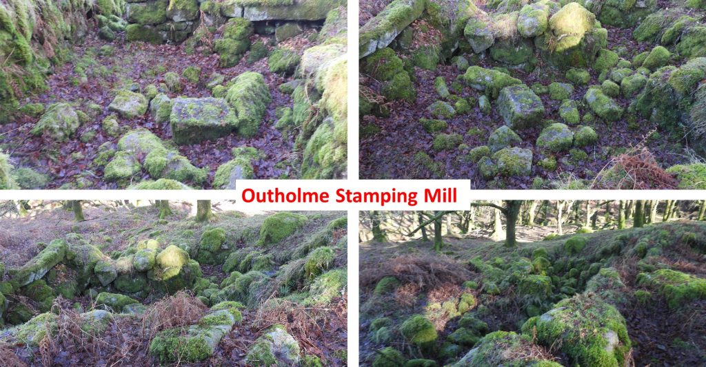
Outholme – Tin Stamping Mill, Mine, Adit, Tinners’ Openwork and Farmstead
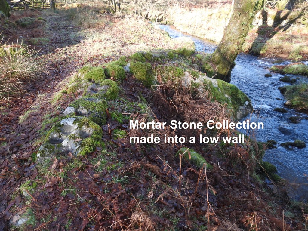
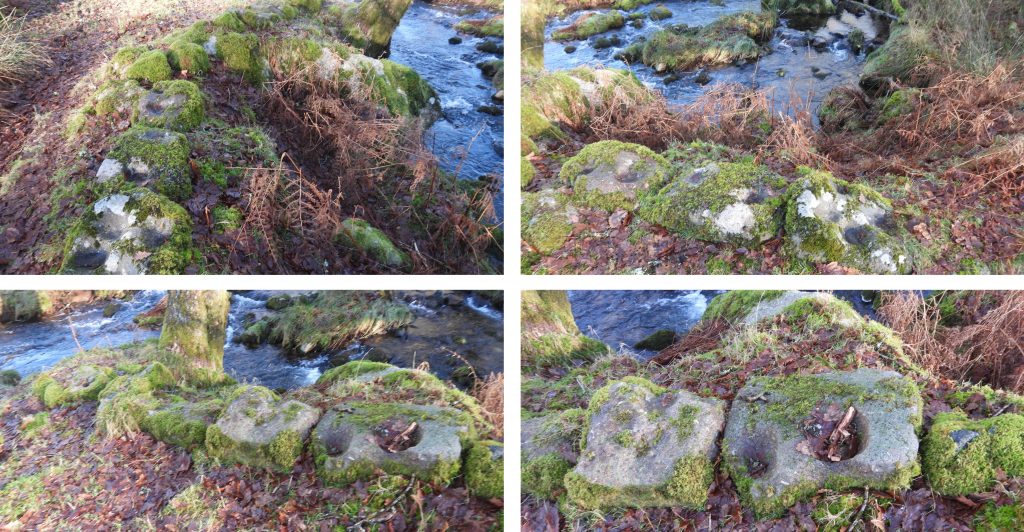
Located immediately to the south of Narrator Brook, the features of the Outholme tin stamping mill, mine, adit, tinners’ openwork and farmstead lie mainly within a delightfully quiet oak wood. The area also boasts a couple of clapper bridges, a couple of benchmarks and an unusually constructed low wall made from mortar stones.
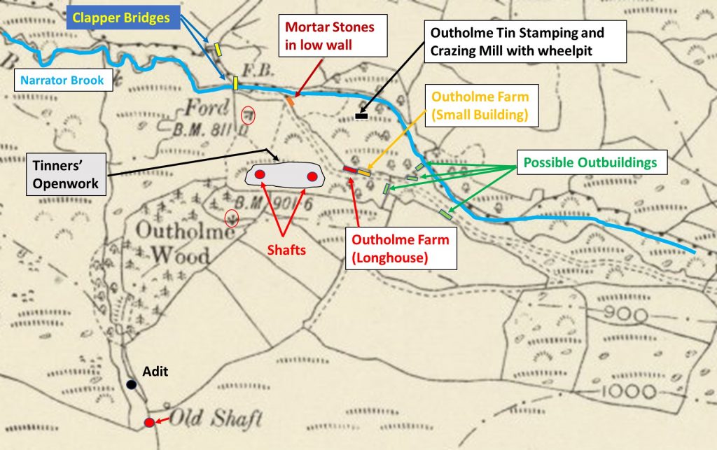
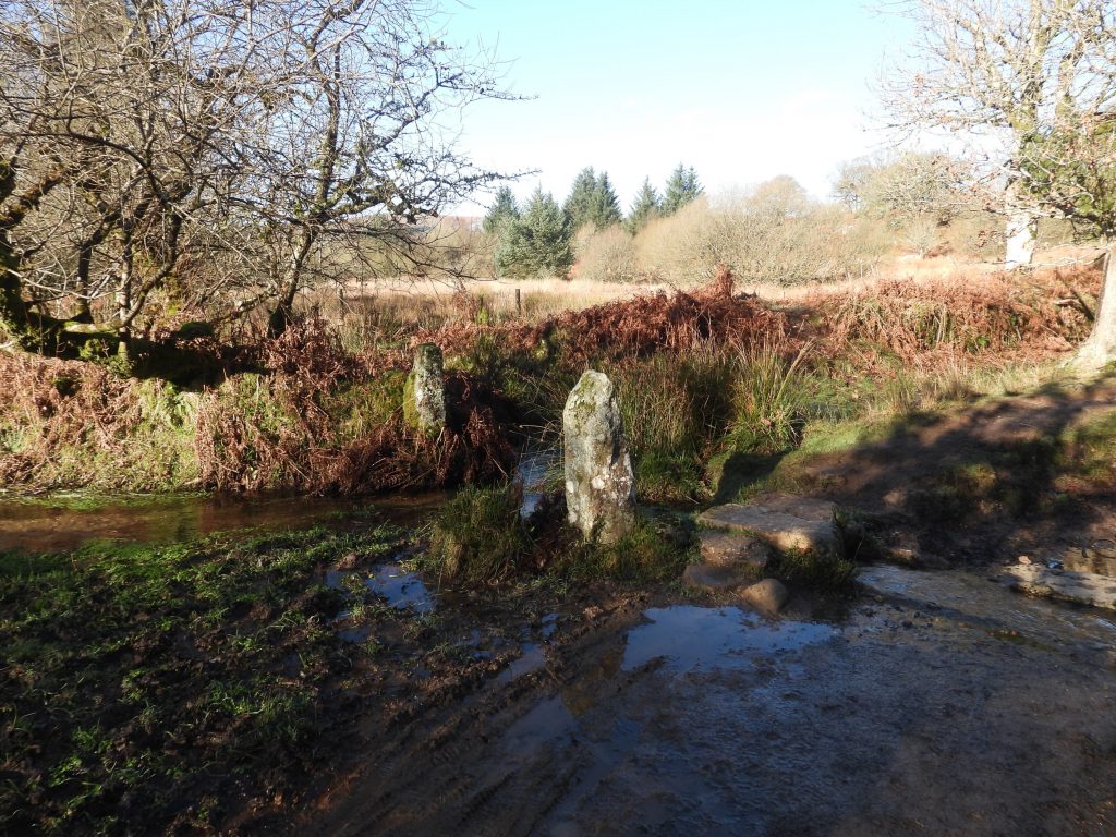
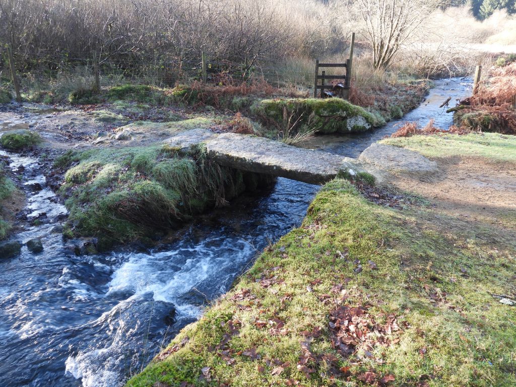
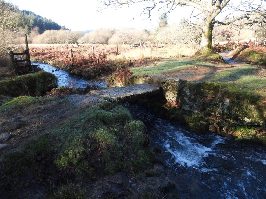
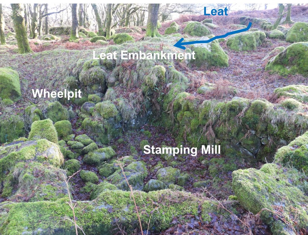
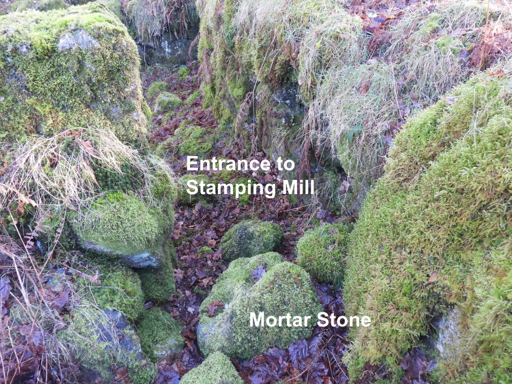
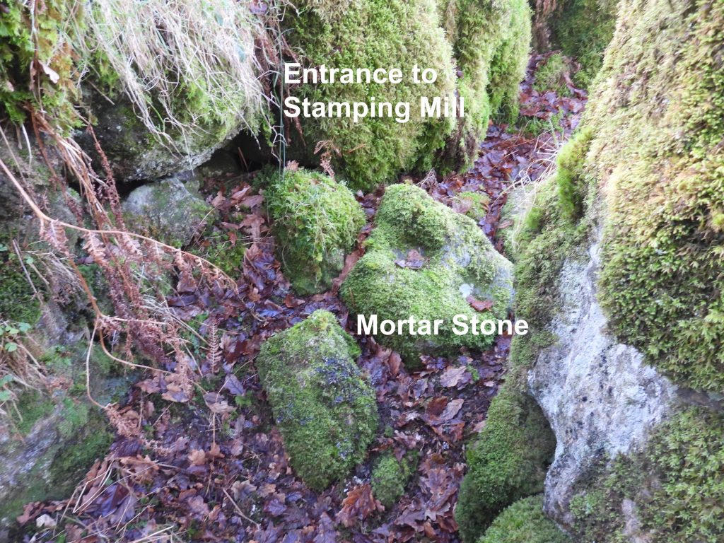
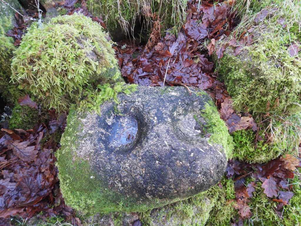
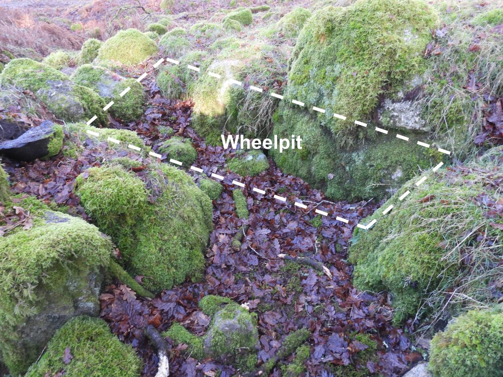
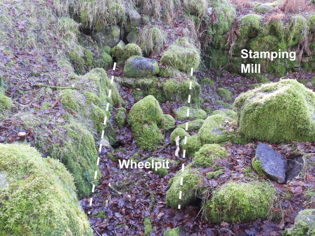
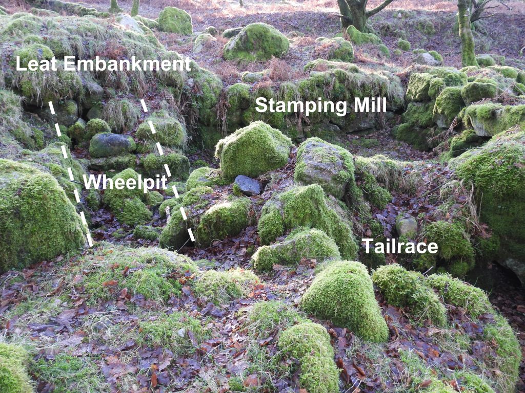
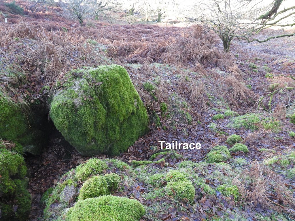
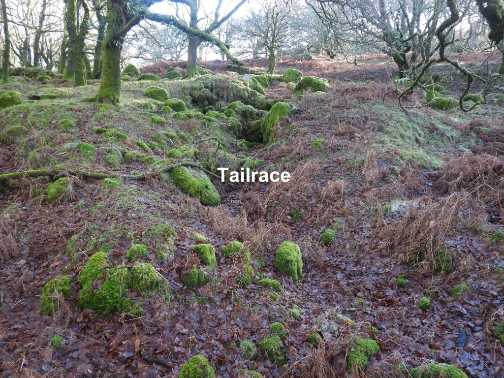
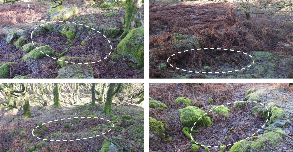
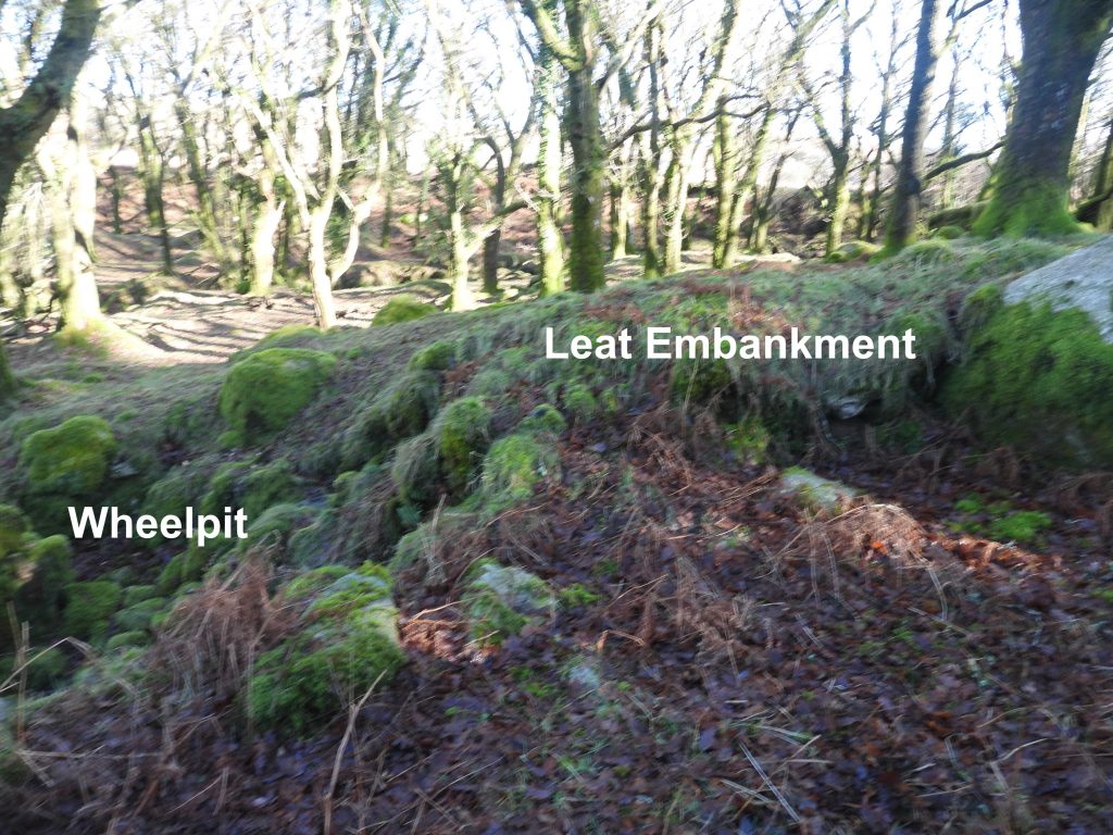
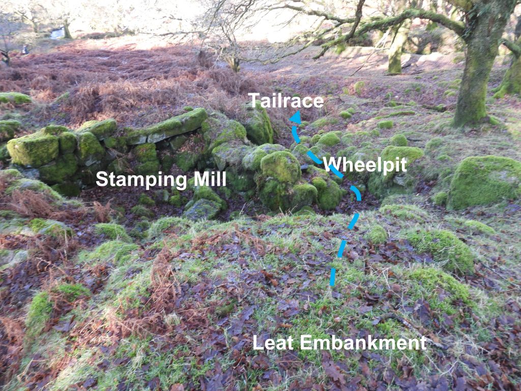
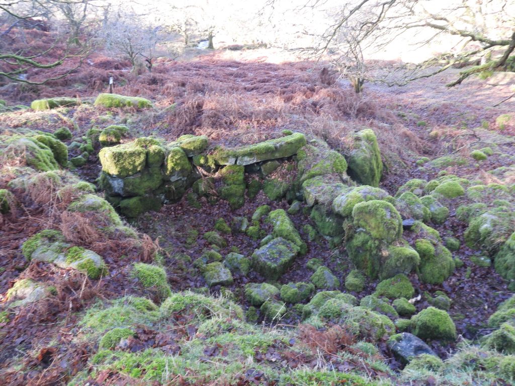
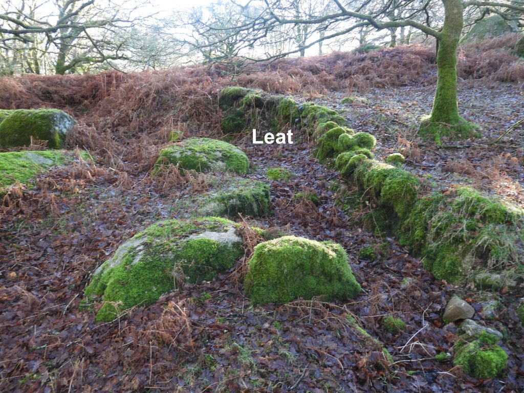
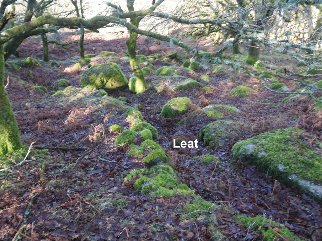
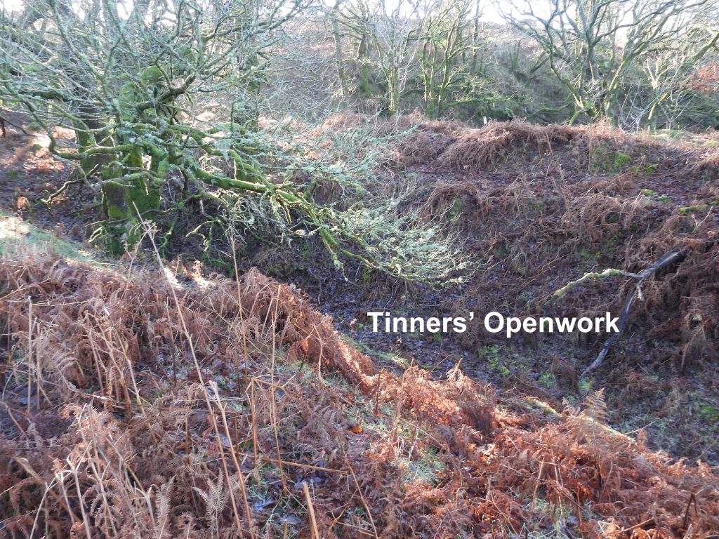
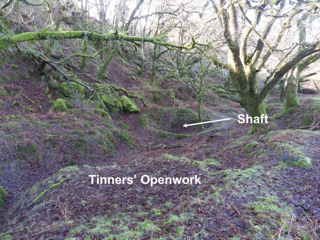
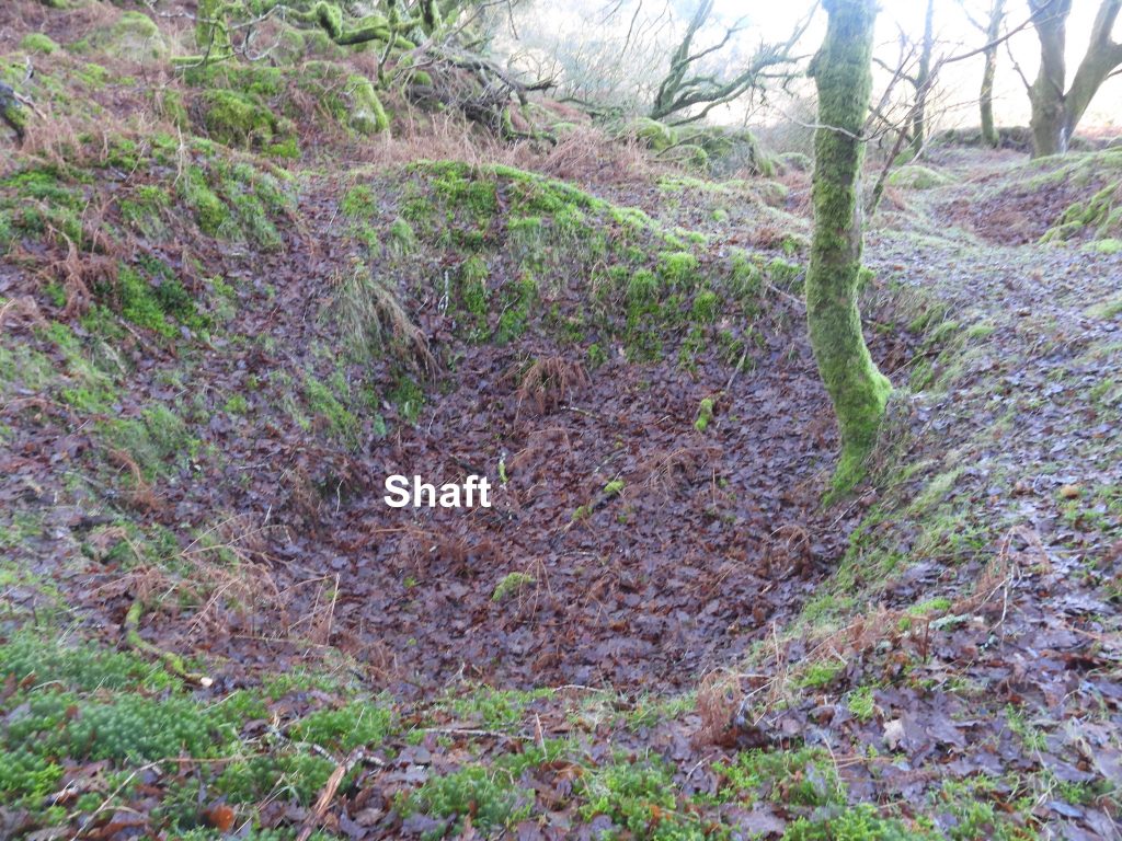
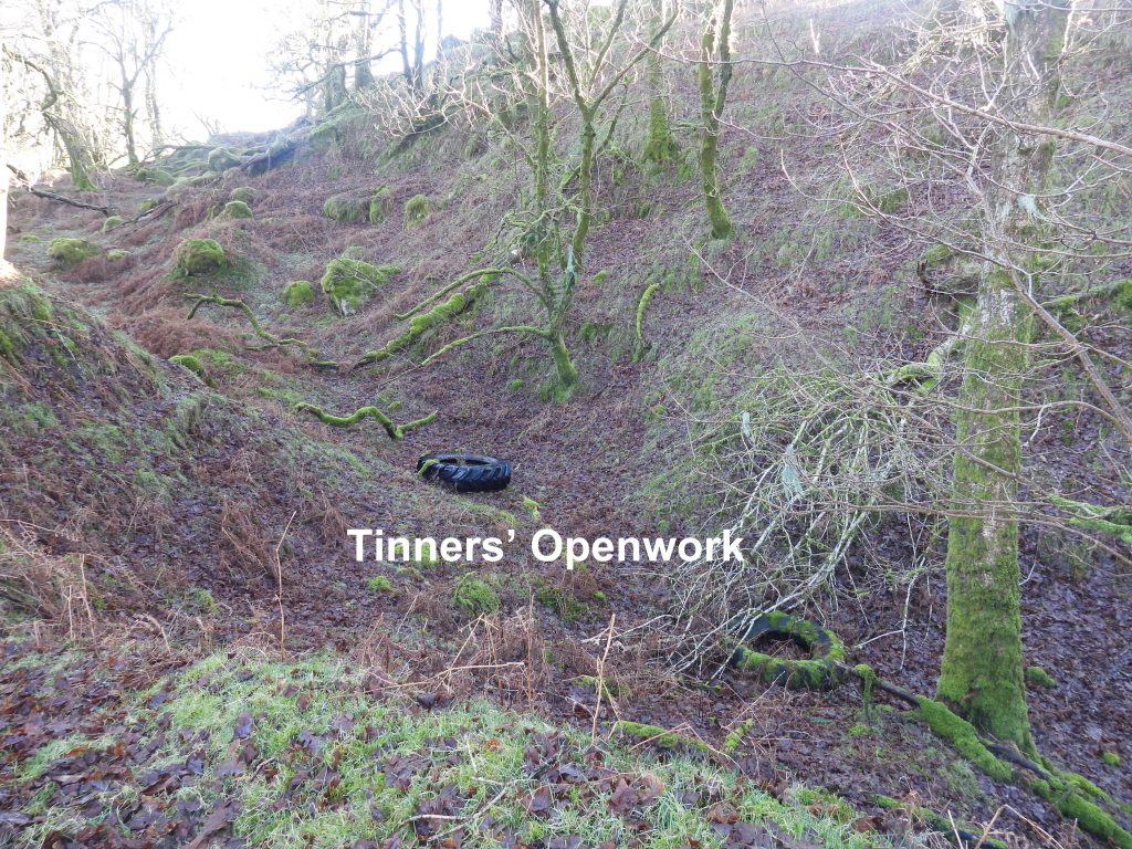
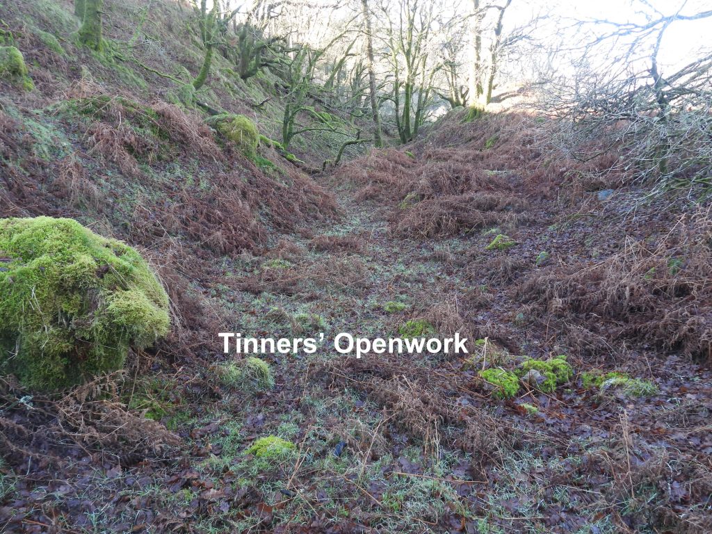
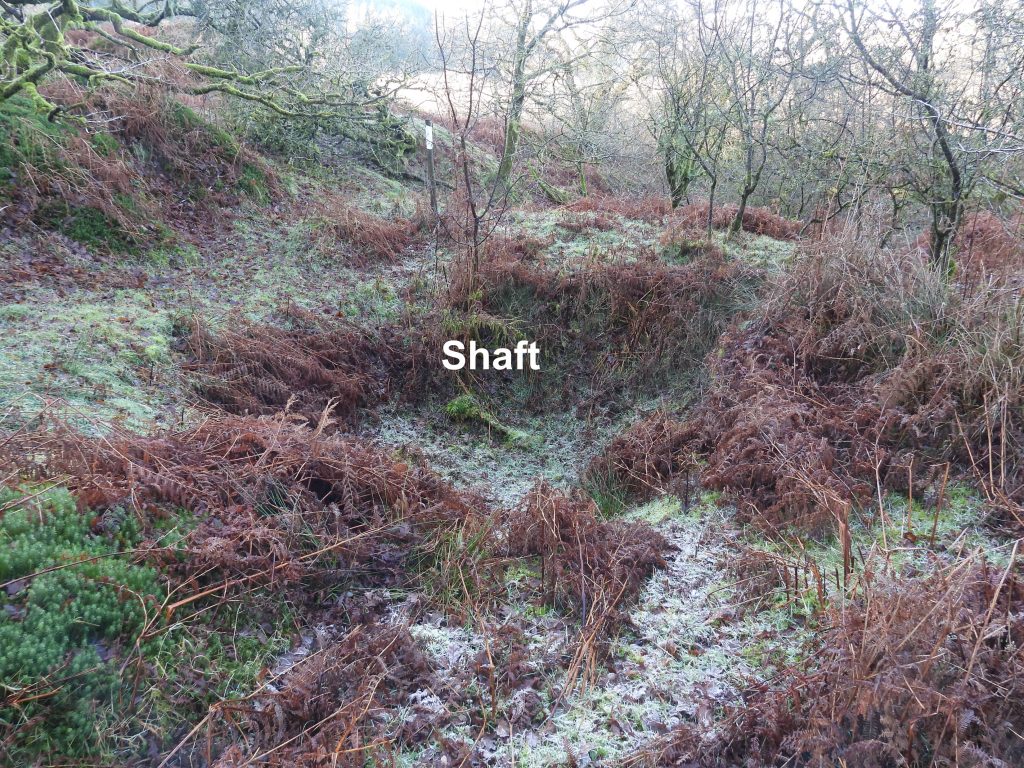
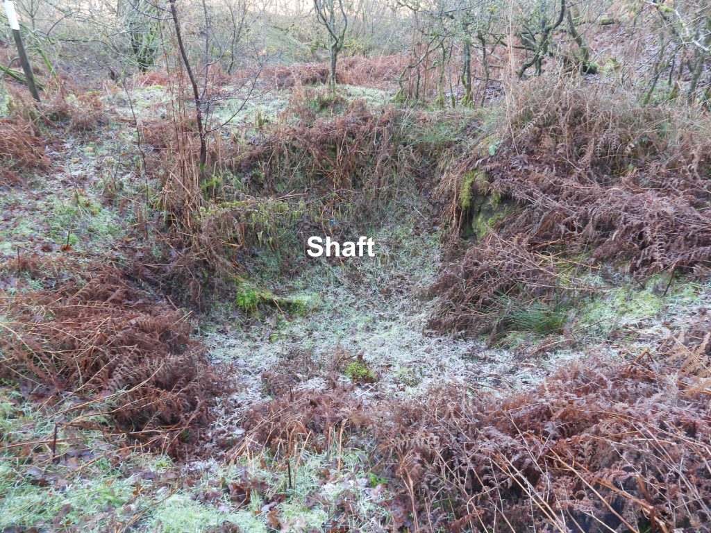
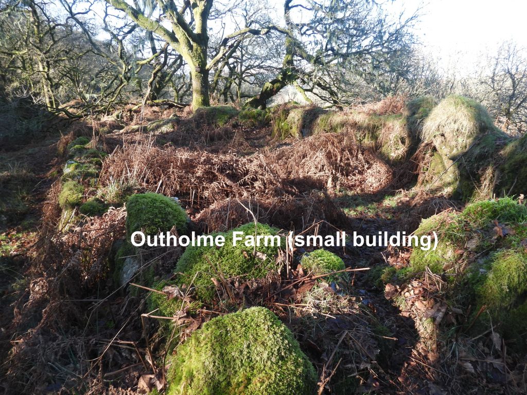
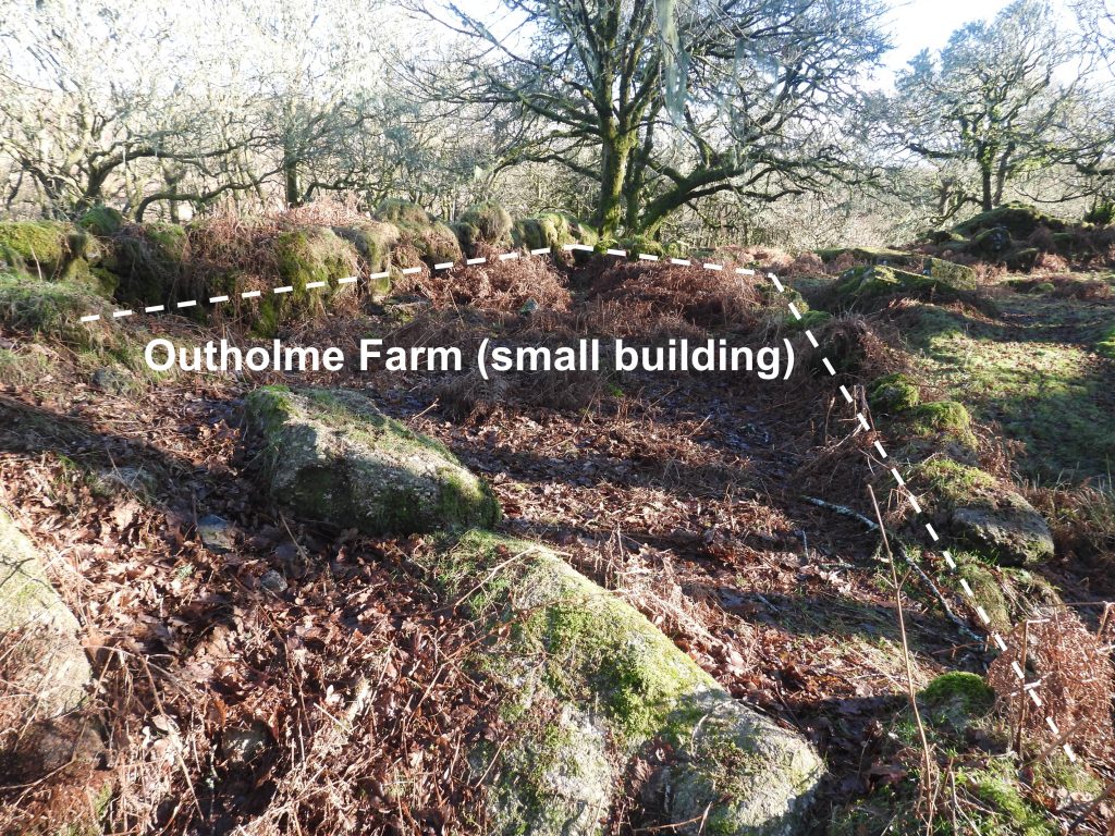
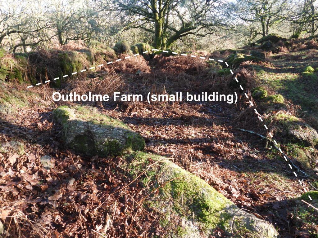
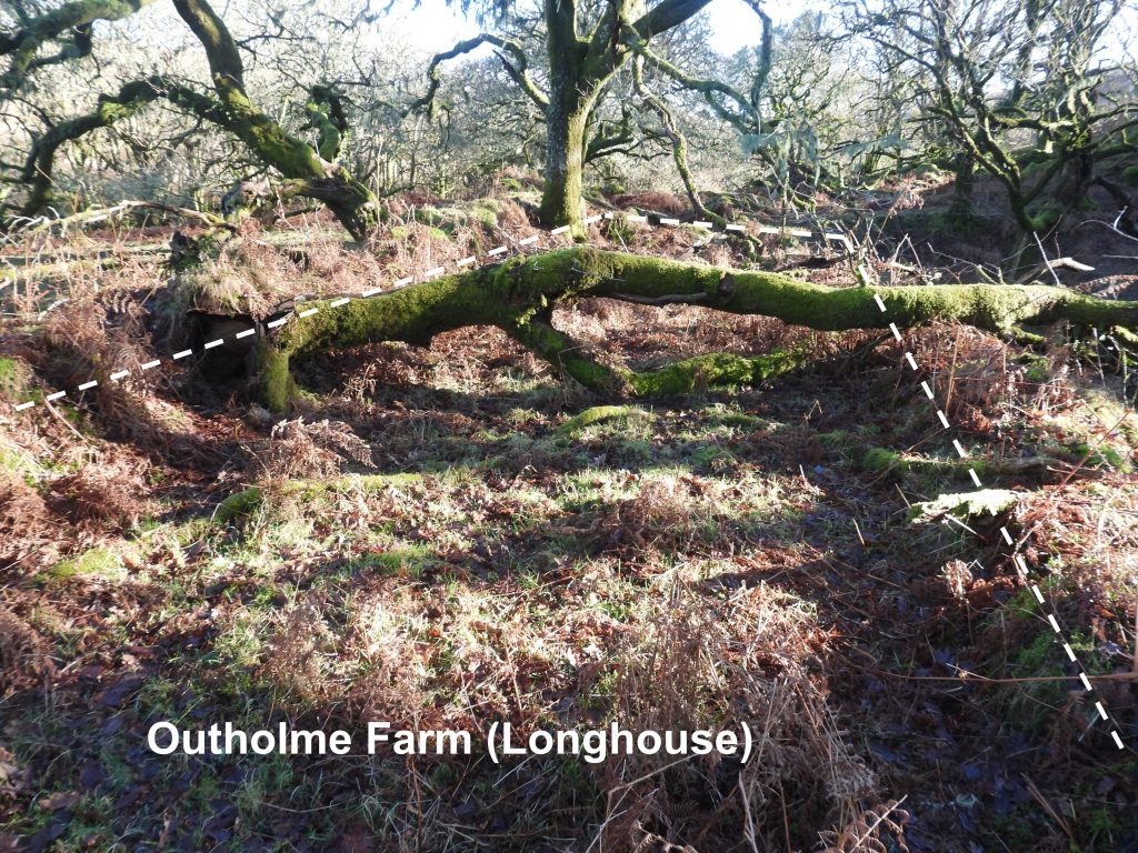
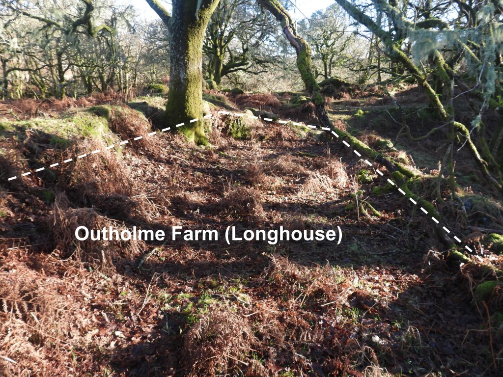
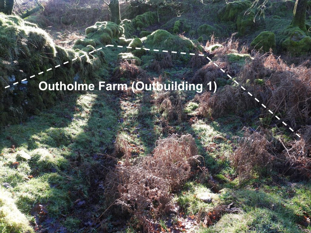
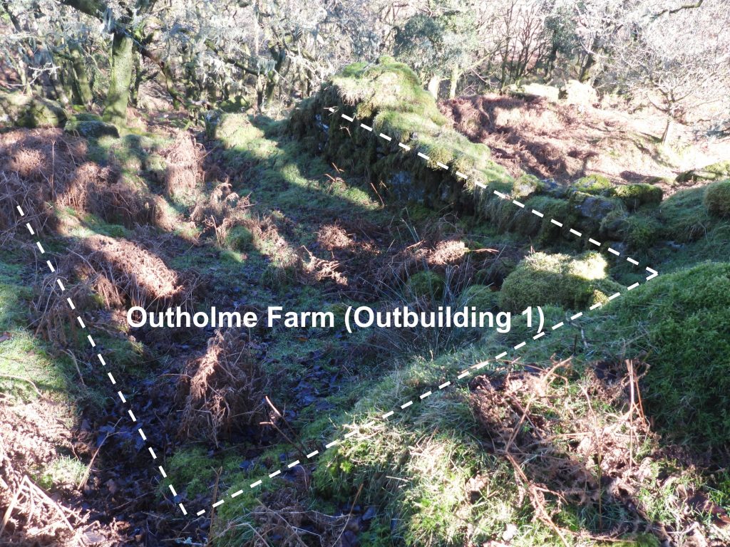
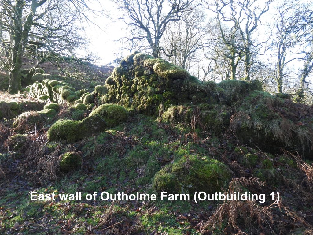
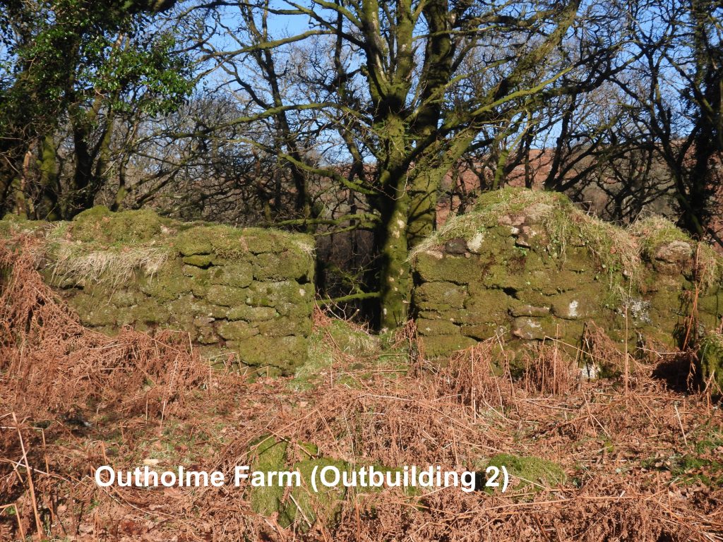
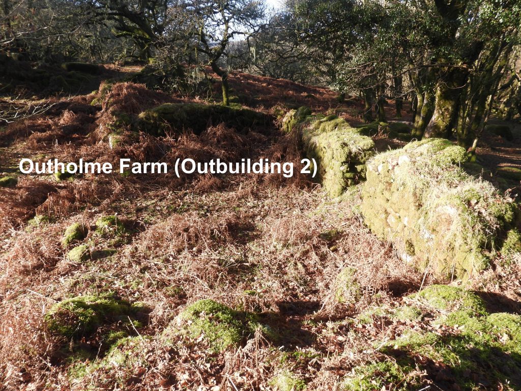
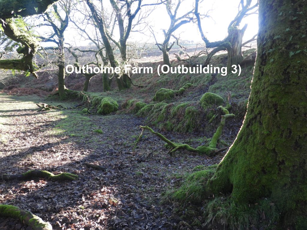
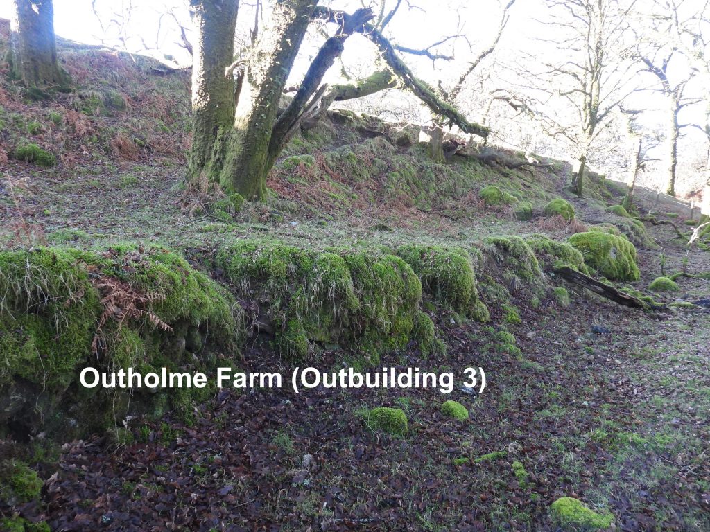
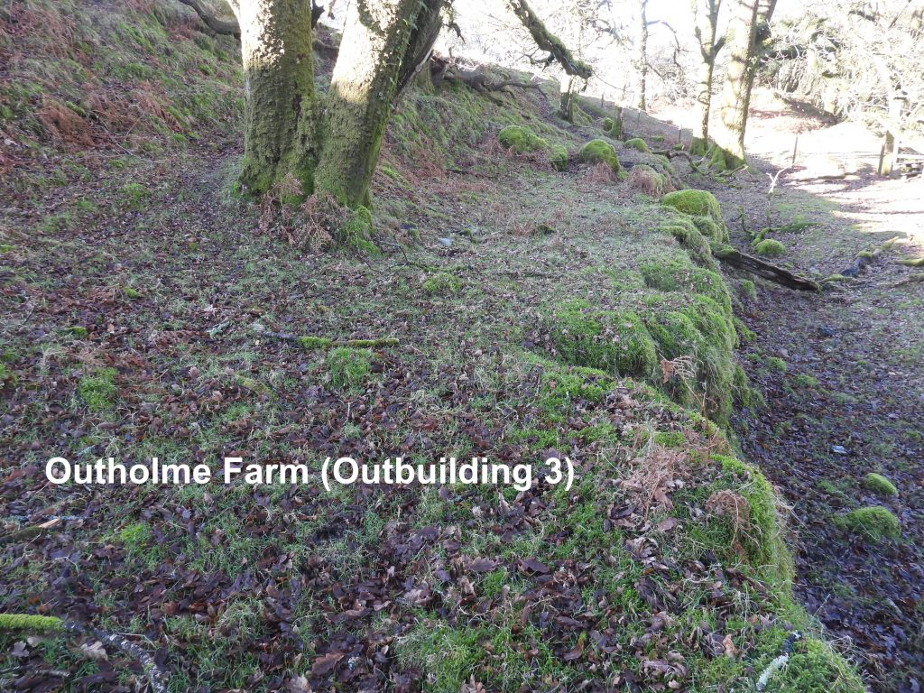
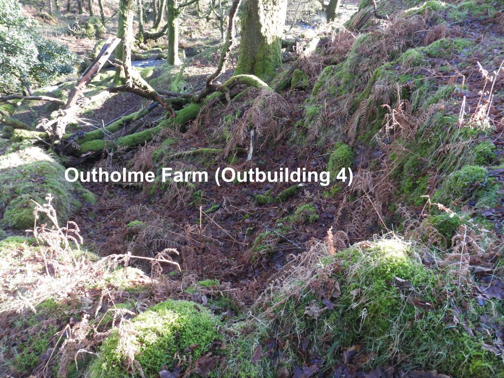
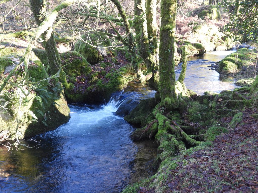
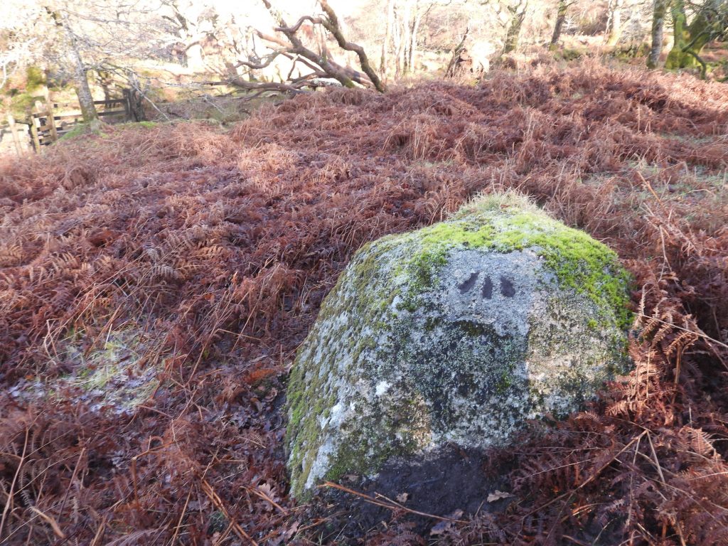
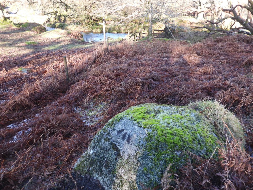
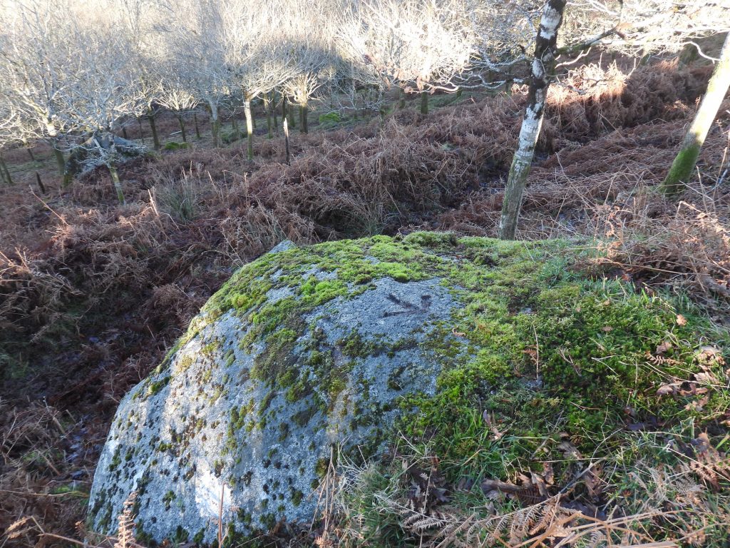
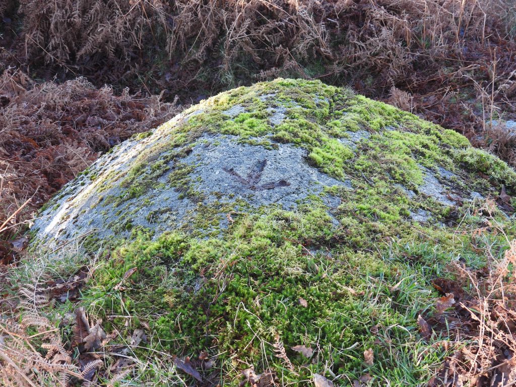
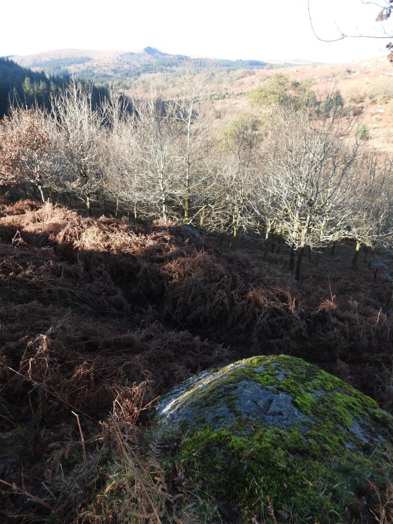
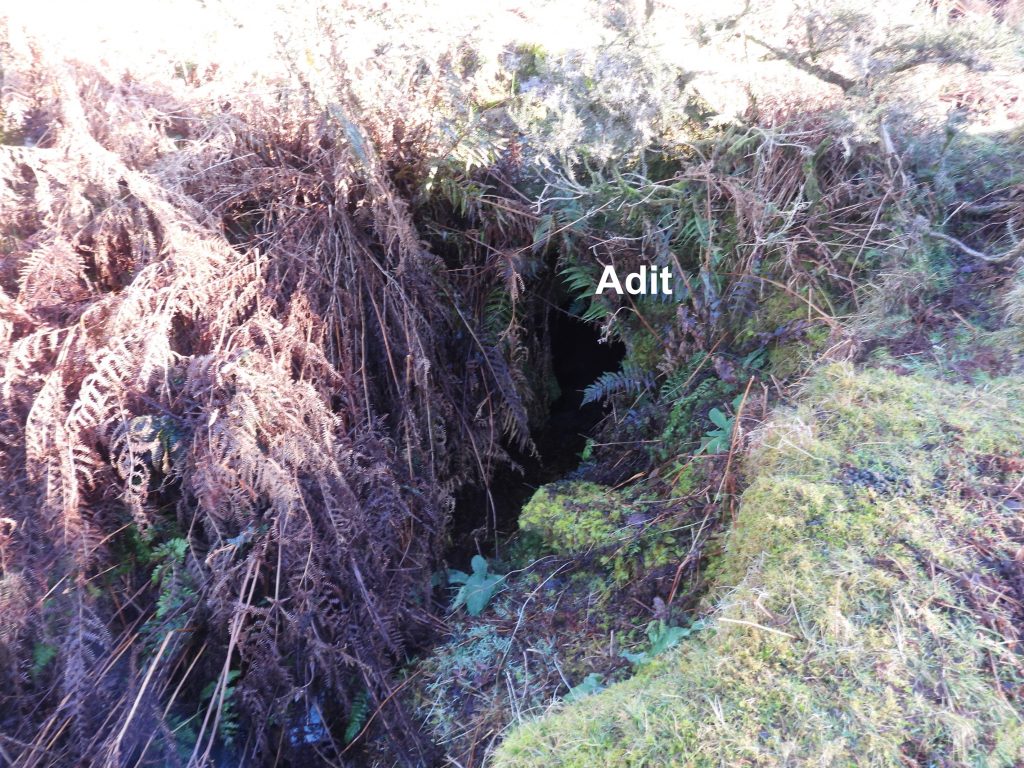
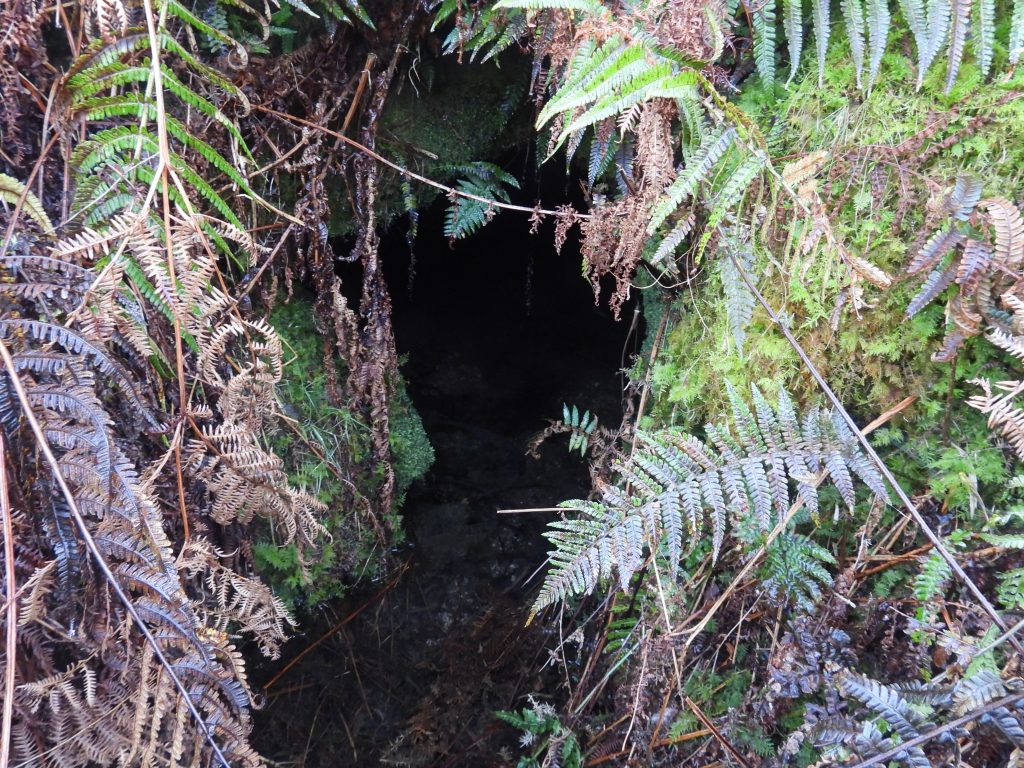
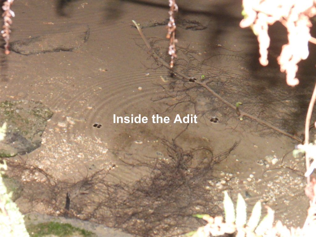
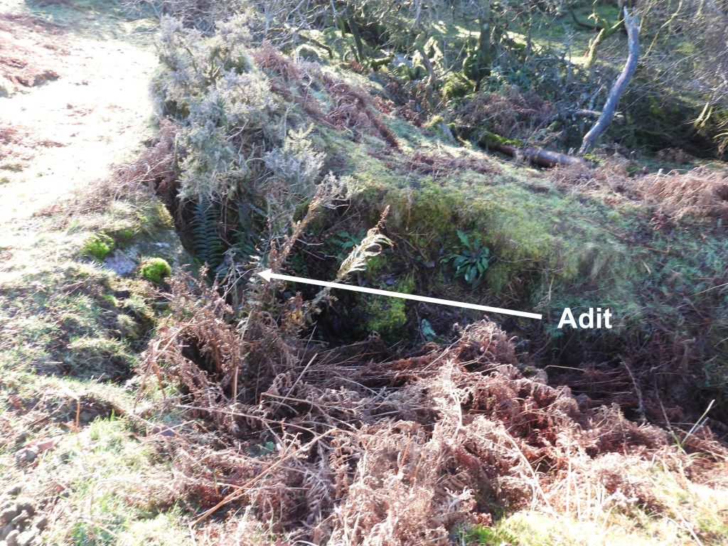
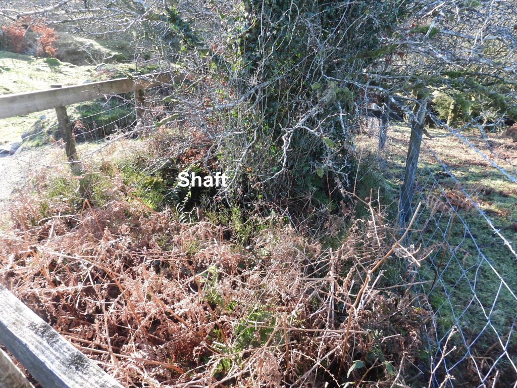
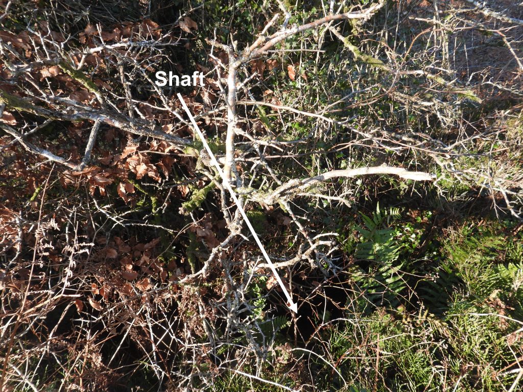
Map showing the locations of the features covered in this post. National Grid References (NGRs) are contained within this post.Taking the path which leads south from Deancombe Farms (west and east) a pair of gateposts alongside a small clapper bridge are soon reached. These features are located at SX57856 68691A second clapper bridge crosses Narrator BrookThis clapper Bridge is located at SX57870 68660An unusual feature in Outholme wood (approx 70m from the stamping mill) is a low wall built out of old mortar stones. There are at least ten mortar stones here.The mortar stone collection in the low wall can be found at SX57931 68633The tin mill is an irregular shaped structure and is composed of large granite blocks standing up to 1.9m high. The interior measurements of the mill are recorded as being 5m long by 4m wide. It is strewn with large granite rocks, many of which are discarded mortar stones bearing one or more circular depressions formed by the hammering of the stamp head (Ref: Dartmoor HER).Within the area of the stamping mill a wheelpit, leat embankment can be found.At the entrance of the stamping mill, which is a narrow passage leading into the structure from the west, an abandoned mortar stone can be found.Another view of the mortar stone in the entrance to the stamping mill.Close up of the mortar stoneThe stone faced wheel pit is located on the eastern side of the building at SX57995 68598View of the wheelpit and the stamping mill as viewed from the south.View of the wheelpit, leat emabankment, stamping mill and the tailrace.The tailrace can be discerned leading off to Narrator Brook.The tailrace looking from the south back towards the stamping mill.The Dartmoor Historic Environment Record (HER) records possible buddles near the stamping mill as : “Two relatively steep sided hollows to the north” representing the site of dressing activity. Possible buddles are shown in the photographs, one of which was recorded by the author at SX57975 68622 (pictures at top left and bottom right) Side on view of the leat embankment which would have fed water onto the overshot wheelThe top of the embankment was recorded at SX57989 68593Another view of the mill building, which is recorded in the HER that it also would have been at some stage used for grinding ore between rotating horizontal mill stones (This type of mill is known as a crazing mill and although no crazing stones are currently visible). The leat leading away to the north east from the wheelpitThe leat looking back towards the stamping mill. The Dartmoor HER suggests the wheelpit was served by at least two separate leats. There is only one which is very easily recognised as such.Much of the ore crushed at the stamping mill would have come from the nearby tinners’ openwork as shown in the photograph.The main part of the tinners’ openwork was documented in 1577 as Oldebeame, otherwise Outhombeame or Liteltorsworke.The first of two shafts (or prospecting pits) found by the author within the tinners’ openwork was at SX57949 68565Unfortunate evidence of late 20th / early 21st century fly tipping in the tinners’ openworks with two abandoned tractor tyres.An east to west view of the tinners’ openwork.A second shaft (or prospecting pit) at SX57893 68564. Shaft close up on a cold frosty day. The picture taken early afternoon in January showing how the light doesn’t penetrate the woods very well at this time of year.The Outholme farmsteadis shown on 19th century maps. It is also shown on the 19th century Tithe Map as ‘Outhome’ but has also been known as Outcombe. The farmstead is post-medieval and was a series of rectangular buildings and structures linked to each other by field walling. The farmstead is believed to have been abandoned around 1849.There are two ruined buildings shown on 19th century maps (as shown in the one in this post). The smaller building is irregular in shape, measuring 13 m by 5 m approx. It is located at SX58003 68558The interior of the building is level and around 0.6 metres above the exterior ground level. There is no obvious entrance or doorway to the building. (source: Dartmoor HER)The large (to the west) of the two buildings measures 20 m by 5 m and is believed to have been a medieval longhouse.The longhouse is located at SX57994 68563The Dartmoor HER describes there are at least seven distinct structures surviving within the area of the farmstead, all of which are composed of drystone walls. One such structure (once incorrectly believed to be the farmhouse by the author) is very discernible. The description of “Outholme Farm (Outbuilding 1)” is given by the author and is located at SX58028 68544The east wall of the outbuilding is far more substantial than the longhouse of small building at the far itself.A second potential outbuilding of Outholme FarmThis outbuilding is located at SX58059 68548Passing over a stile to the east of the main farmstead is a raised man-made platform, which the author labels “Outholme Farm (Outbuilding 3)”. This platform is located at SX58096 68506Close up of the platformA fourth possible outbuilding (albeit it is located on a slope) can be found at SX58062 68561The delightful Narrator BrookBenchmark B.M. 811.0 is south west facing not far from the stile which is crossed to access the woodland. Benchmark B.M. 811.0 looking towards Narrator BrookFurther south in Outholme Wood a second benchmark can be found on a very large rock. B.M. 0901.6 can be found at SX57873 68516B.M. 901.6 with view towards Leather Tor and Peek HillAt the south west corner of Outholme Wood there is evidence of a small tin mine on the bank of Outcombe brook. A stile leads the explorer to the adit shown in the picture.This adit is located at SX57758 68387Zoomed into the adit. A shaft associated with this small adit lies 80m uphill to the south. A small stream flows from the adit.The fenced off shaft of Outholme Brook Mine.The shaft is located at SX57797 68322