A collection of walks, discoveries, insights and pictures of exploring Dartmoor National Park
July 24, 2023
Worth’s Mortar Stone – Wallabrook : Soussons and Runnage
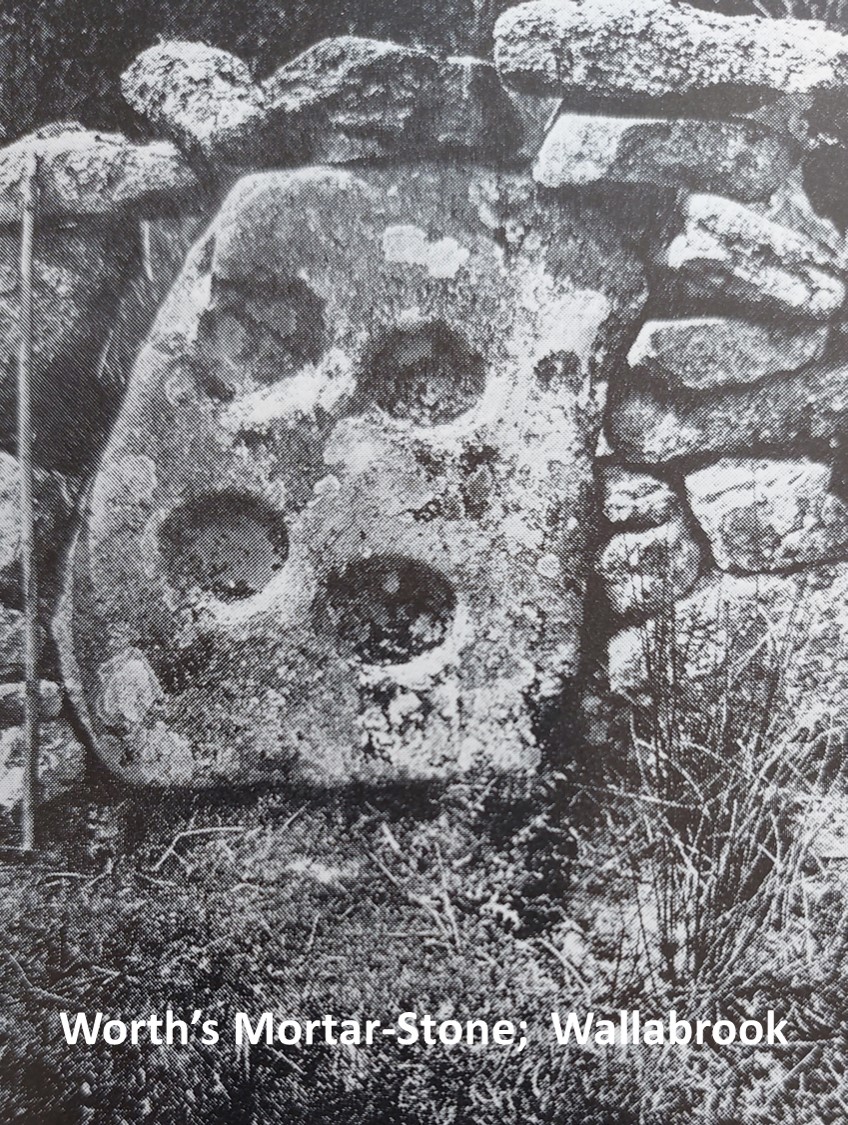
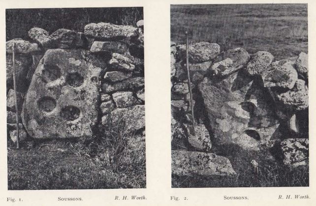
The ruins of a Blowing House on the right hand bank of the Wallabrook is mentioned together with a mortar-stone (which is built into an enclosure wall on the left hand bank of the same brook), on page 294 of Worth’s Dartmoor. Further to this, there is a picture (plate 71B) of the Mortar-Stone in the publication, which presumably was taken by Worth.
The author has passed this spot many times (it is on the route of the Dartmoor Perambulation) but for some reason had never really noticed these artefacts recorded in ‘Worth’s Dartmoor’ or indeed any Tinner’s artefacts in this small valley adjacent to Soussons Plantation enroute to Runnage. This was until he participated recently in a DTRG (Dartmoor Tin Research Group) walk (July 2023). During the walk, the mortar stone was visited alongside the (possible) Tinner’s Mill (Blowing House). Other evidence of Tinner’s activities either visited or mentioned on the walk, included several shafts, a dressing floor, spoil dumps and a possible powder house.
The author plans to re-visit the area in the Winter when the bracken has died down, to be better able to discern many of the aforementioned Tinner’s artefacts. In the meantime, this post just covers the Mortar-Stone first recorded by Worth.
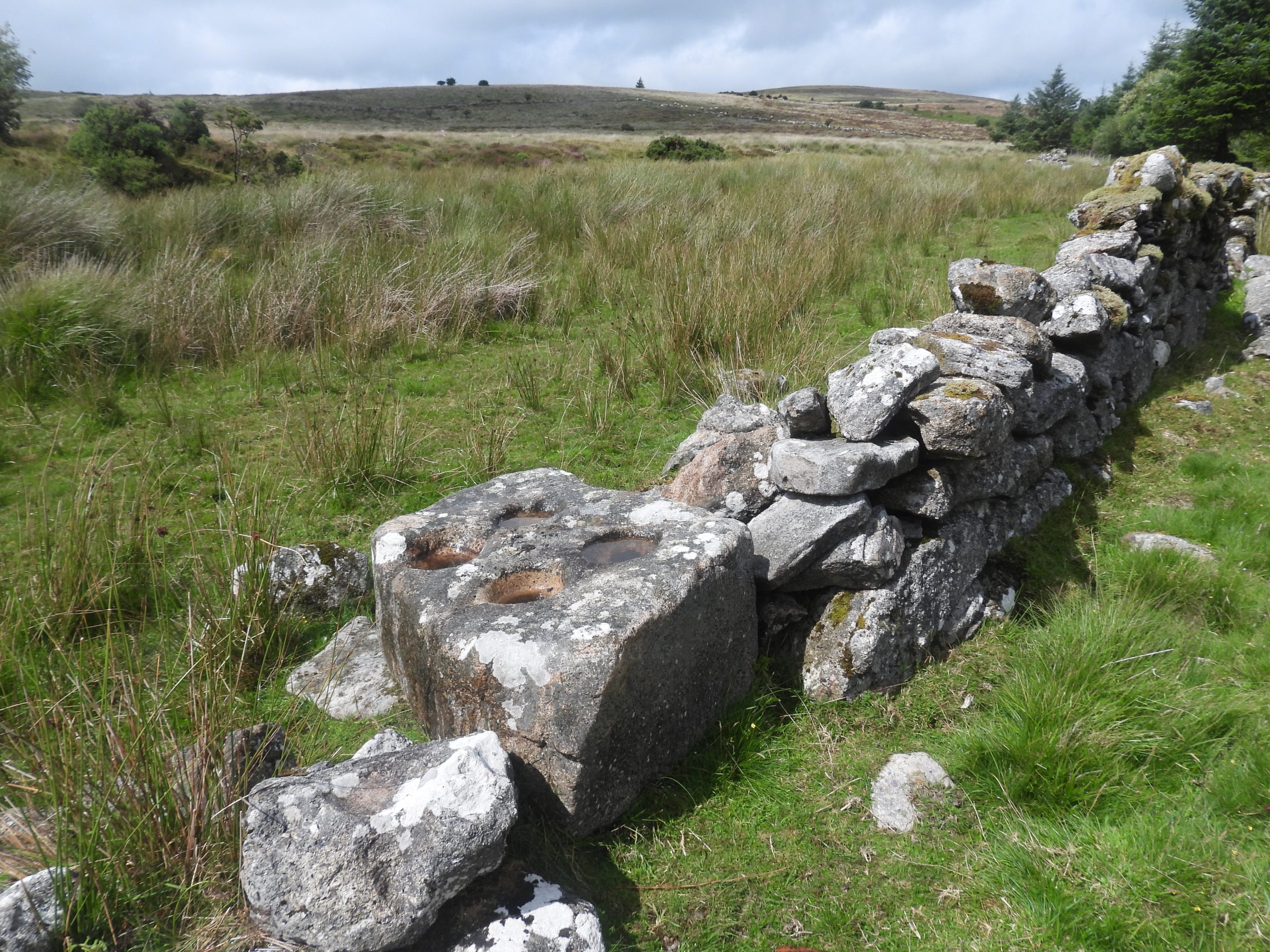
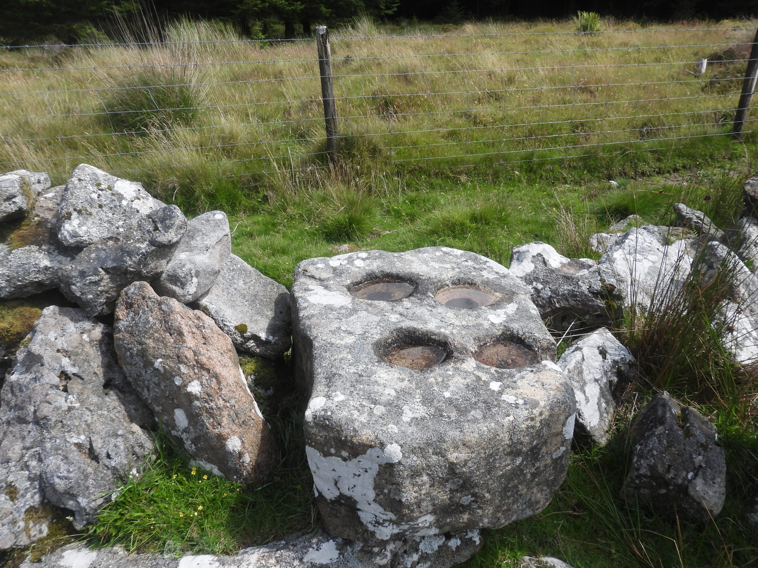
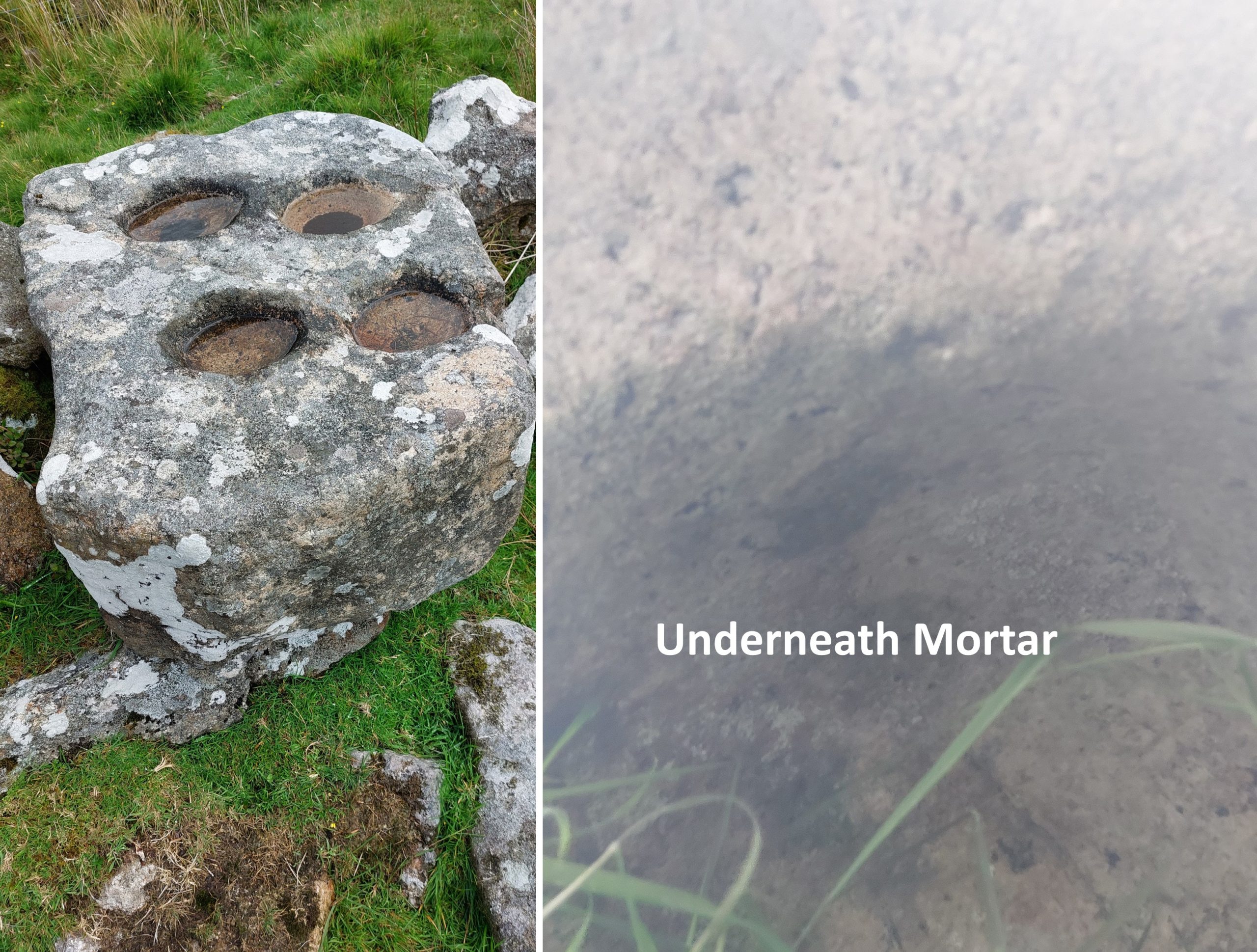
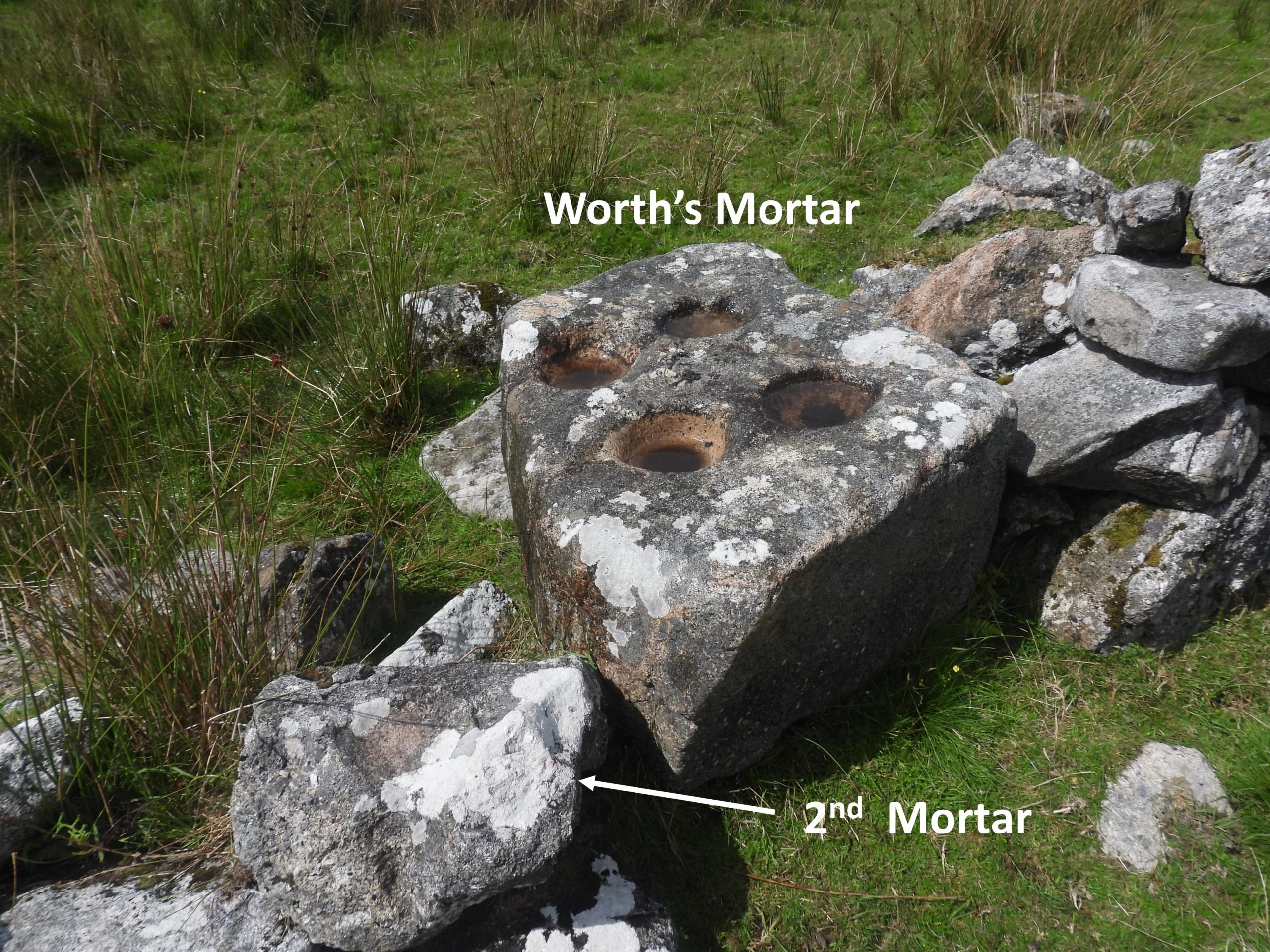
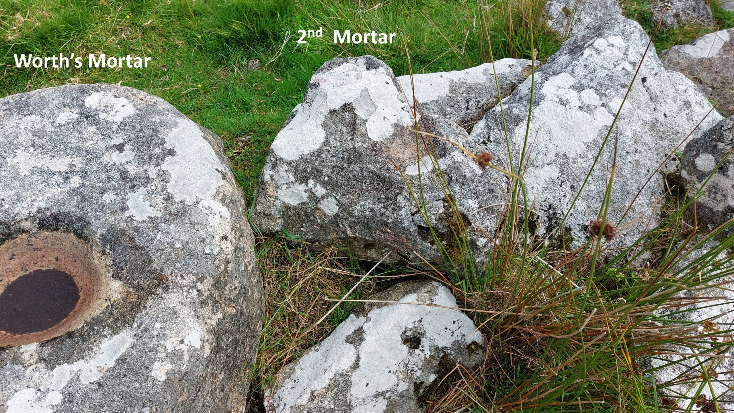
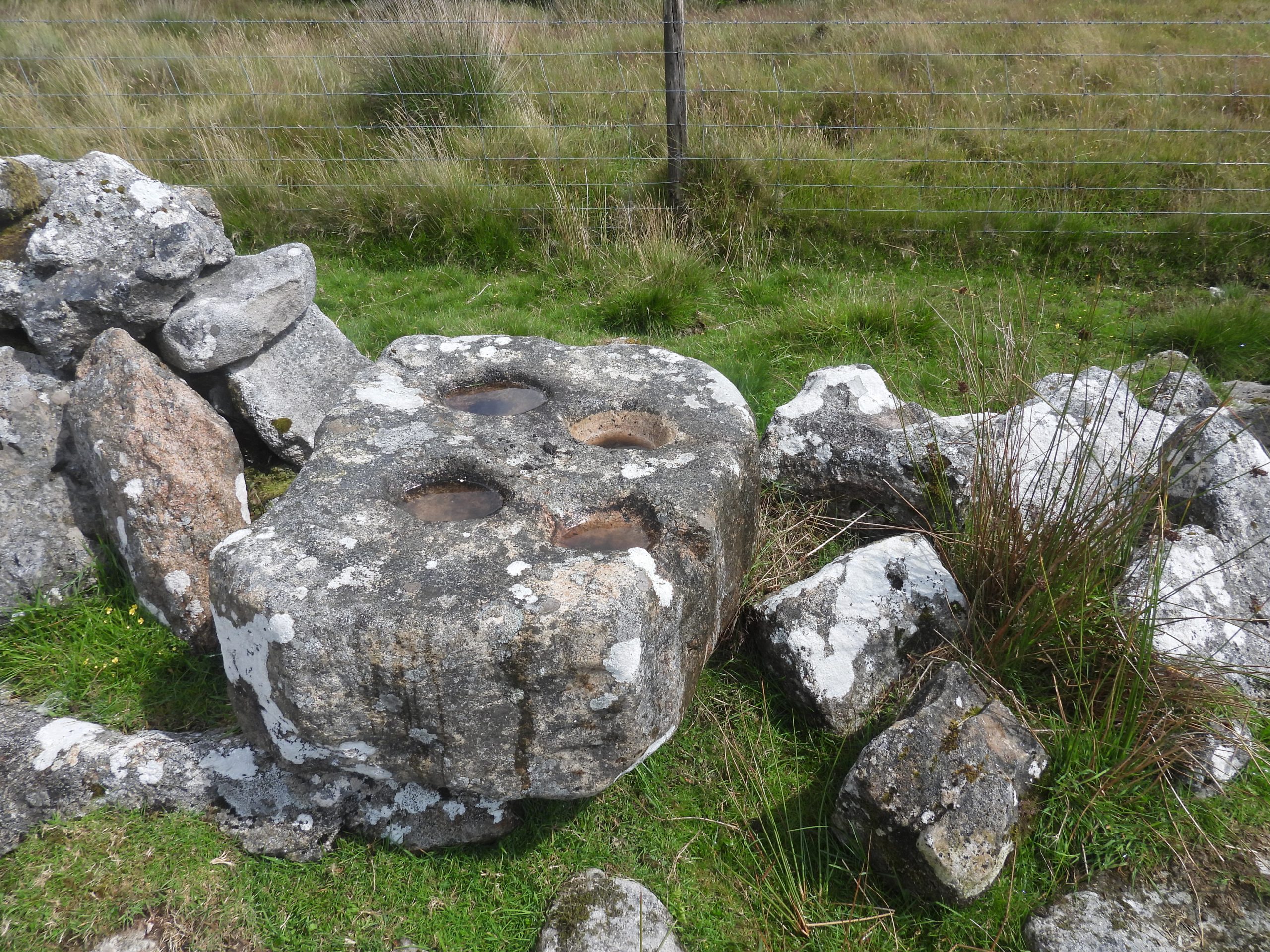
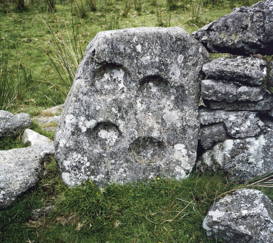
The picture by Worth is probably from the 1930s. Worth states that the mortar-stone has: “three mortars on one side, with four on the other”. The picture clearly shows the four mortars, which at the time could have been on either the west or east side as Soussons Plantation was initially planted between 1947 and 1949 after the picture was taken. Worth states that the largest mortar was 8in (20cm) diameter and 3in (7.6cm) deep with the smallest being 7.5in (19cm) diameter and 2.5in (6.4cm) deep. He further mentions that his ‘staff’ was 3ft 6ins (107cm) longThe Mortar-Stone (July 2023) is no longer vertically set into the wall as can be seen here. The contextual view is looking upstream of the Wallabrook. The smaller rock below and to the left of the large Mortar-Stone has evidence of a single Mortar on its upper surfaceClose up of the Mortar-Stone. Effectively the line of this wall represents the boundary of the Forest of Dartmoor.Using a mobile phone in ‘selfie mode’ the author took a photograph of the underneath of the Mortar-Stone, which shows one of the three Mortars. Next to the main Mortar-Stone is a 2nd Mortar. The number of Mortars on the larger stone here represent the fact that the Stamping Mill from which it came had two-heads. It is interesting that Worth mentions a nearby Blowing House not a Stamping Mill. These Mortar-Stones are located at SX67147 79563The author was intrigued to know if the Mortar-Stone has not only ‘fallen’ but may also moved through 180 degrees. If Soussons is behind the original Worth photograph then this would be the case. It would seem strange for the stone to have been rotated ?Picture taken by Dr Phil Newman (published with permission), which appears to confirm that the 4 mortar hole side is on the Soussons Wood side (east) therefore conforming the stone has only fallen to the west.These two photographs from Worth are from ‘Dartmoor Blowing Houses Stray Notes III (Read at Barnstaple 23rd June 1938). The 4 mortar side is the east (Soussons side) and the 3 mortar side is the west (Wallabrook side).