A collection of walks, discoveries, insights and pictures of exploring Dartmoor National Park
April 26, 2024
Upper Avon Tin Workings, Tinners’ Huts and a Tinners’ Mill
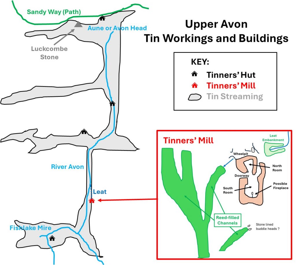
Around the Upper Avon, from its head down to Fishlake are extensive medieval and later streamworks. In an area around Avon (Aune) Head the streamworks have been recorded as being between 0.5m and 1m deep, being covered by or merged by blanket bogs. Further to the south the valleys of Fish Lake and the River Avon contain more discernible and extensive streamworks, which are said to cover an area of about 10 hectares. From Avon (Aune) Head to Fishlake there are five associated tinners’ buildings, comprising four Tinners’ Huts and a Tinners’ Mill. This post is an exploration of this rather remote part of Dartmoor, which is best (easiest) approached from the north via the Sandy Way, which is marked on modern OS maps.
Bibliography
Royal Commission for the Historical Monuments of England (RCHME) : (1993-8) – Dartmoor Royal Forest Project
T.A.P Greeves (2022) – Tinners Lodges and Prehistoric features of River Avon
Devon Archaeology – The Dartmoor Issue (1991) – Page 35 (Plan of tinners’ mill above Fishlake Foot by TG (Greeves) and RR (Robinson) 27.7.83)
T.A.P Greeves, (1981) – List of Known Devon Tin Mills c1450 – c1750, No.26
Eric Hemery (1983) – High Dartmoor (pages 301-302)
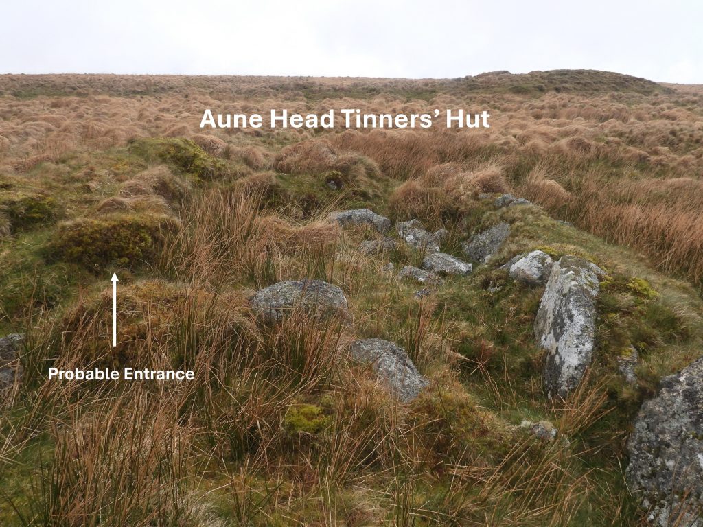
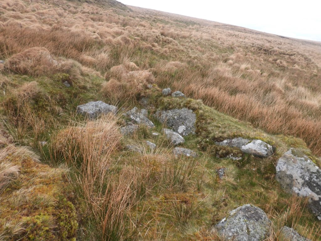
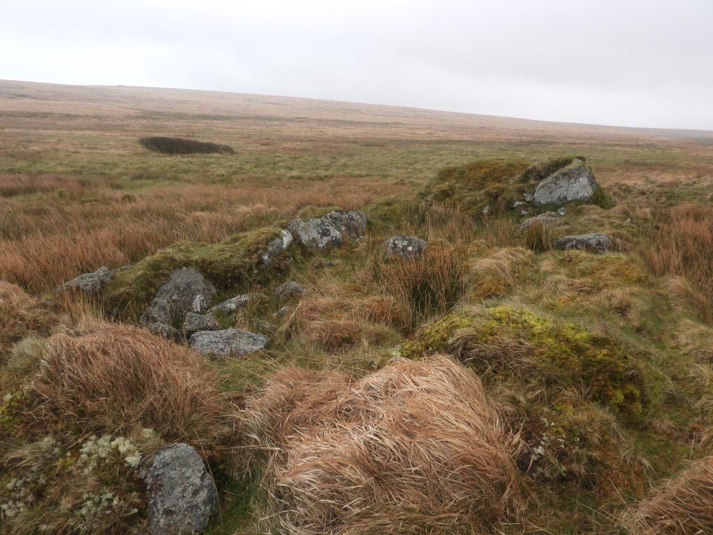
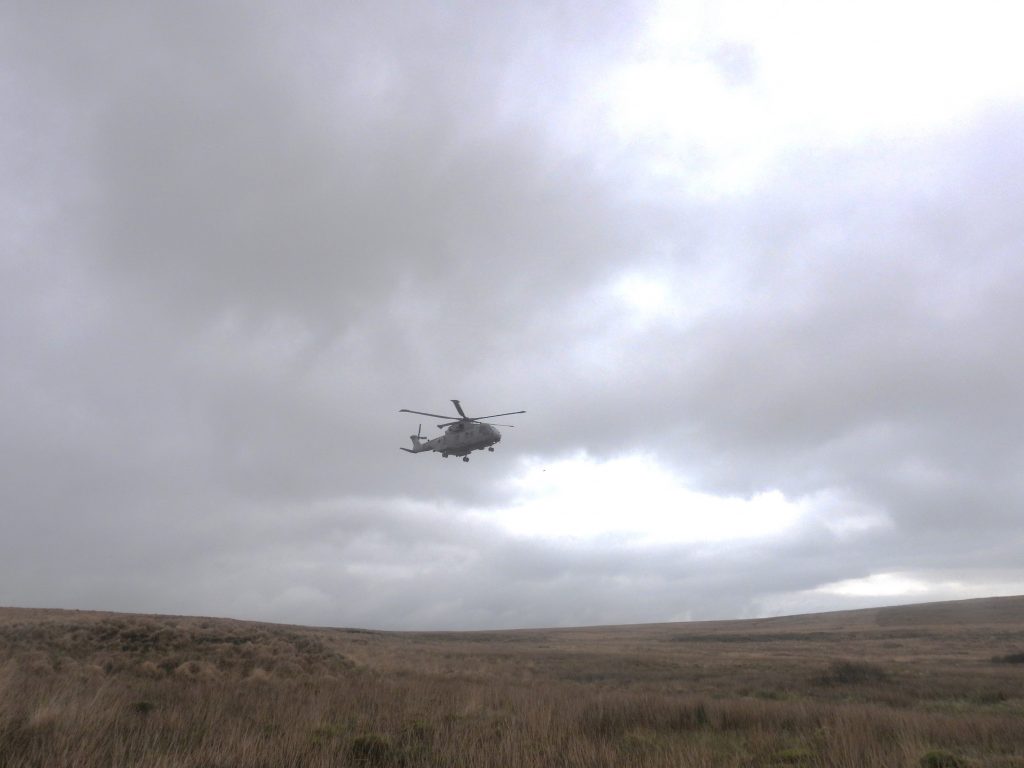
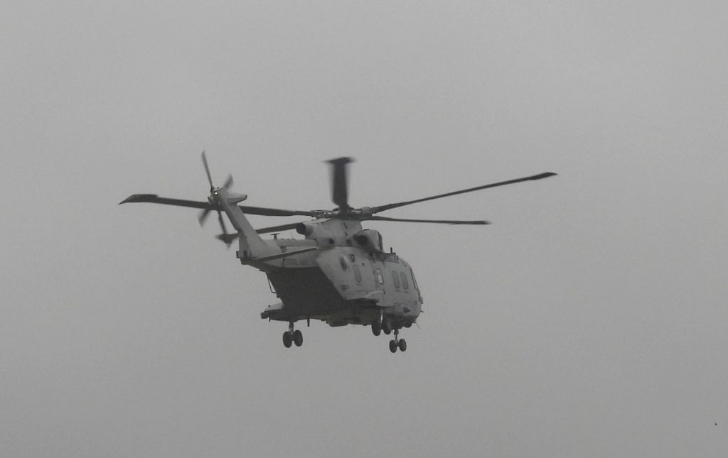
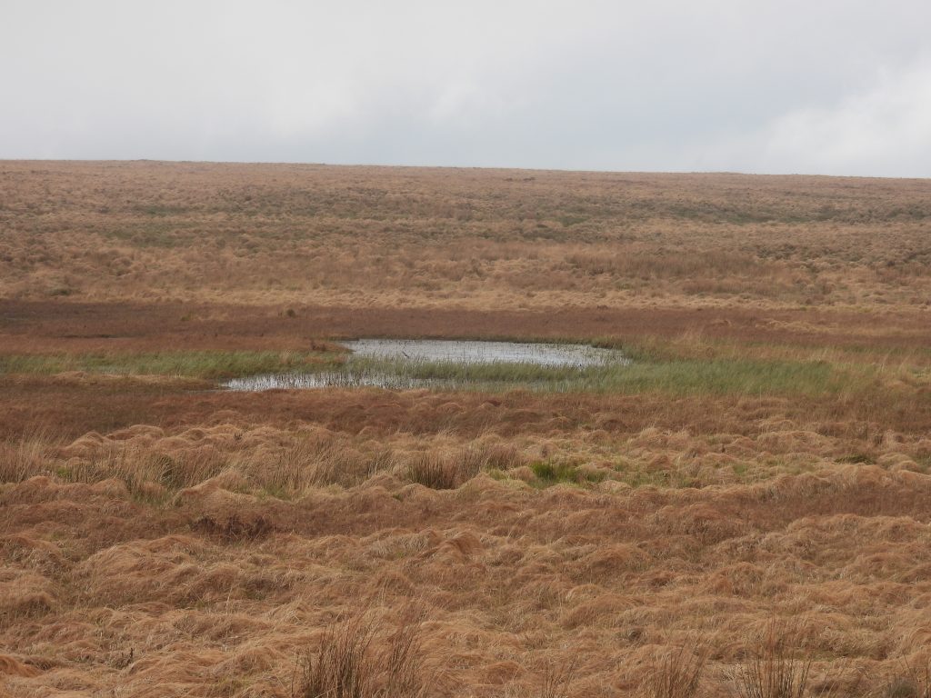
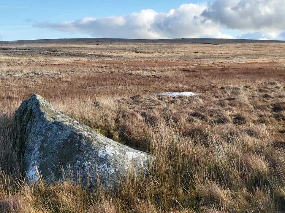
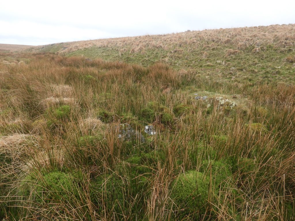
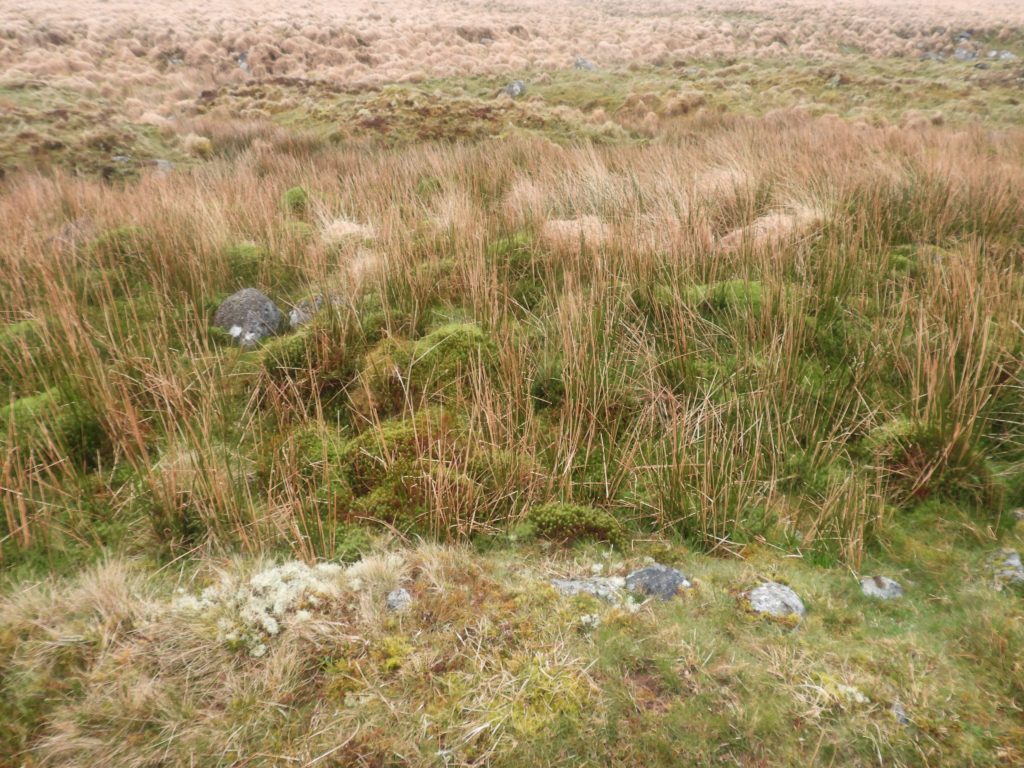
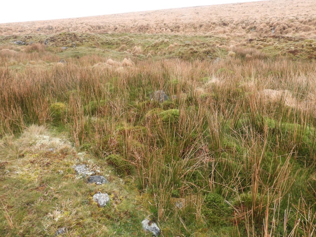
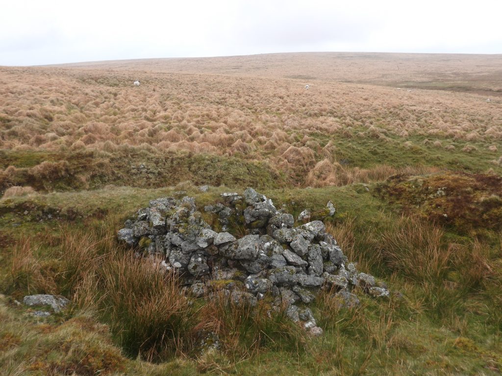
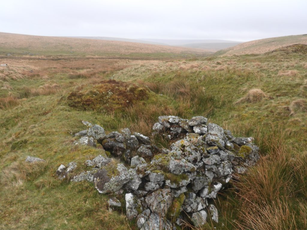
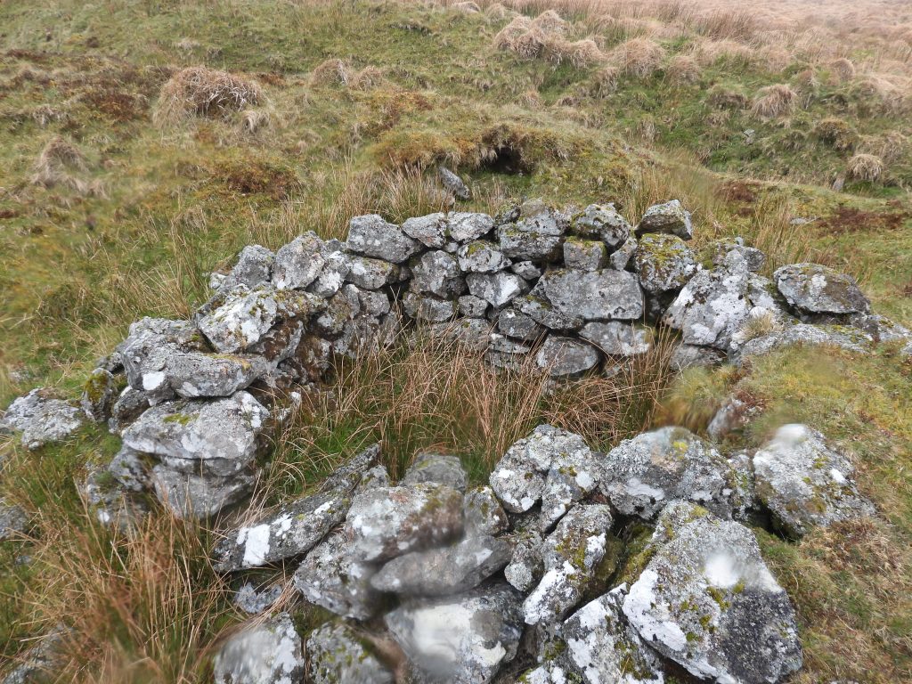
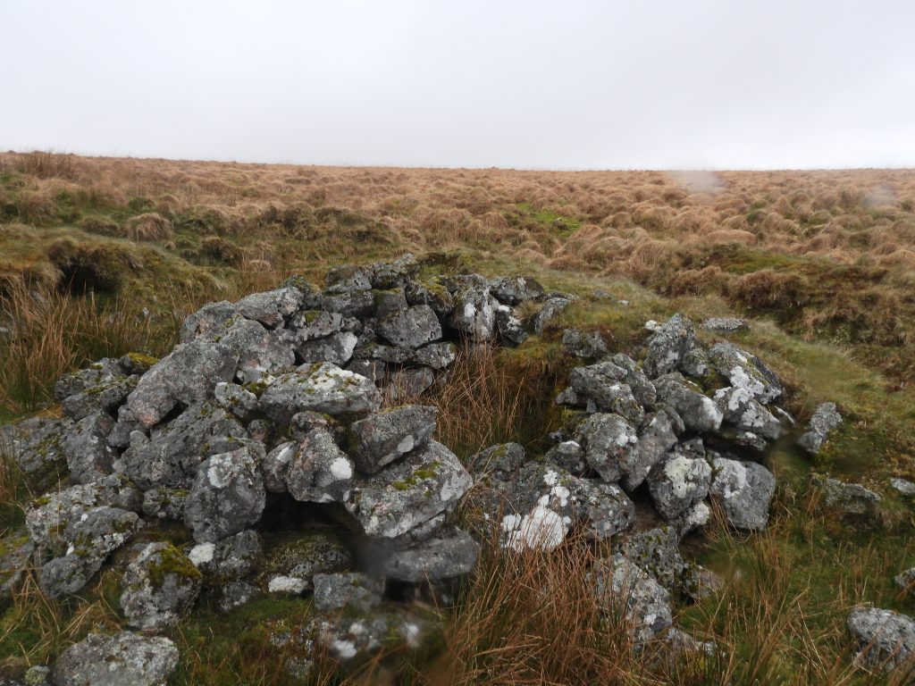
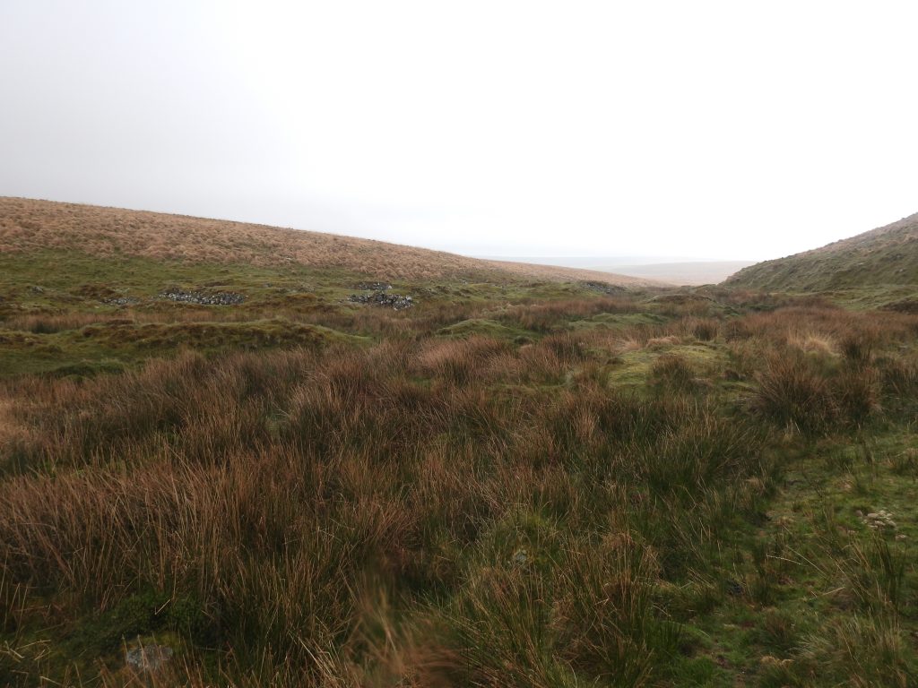
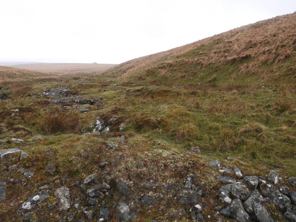
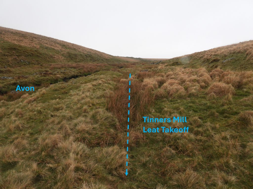
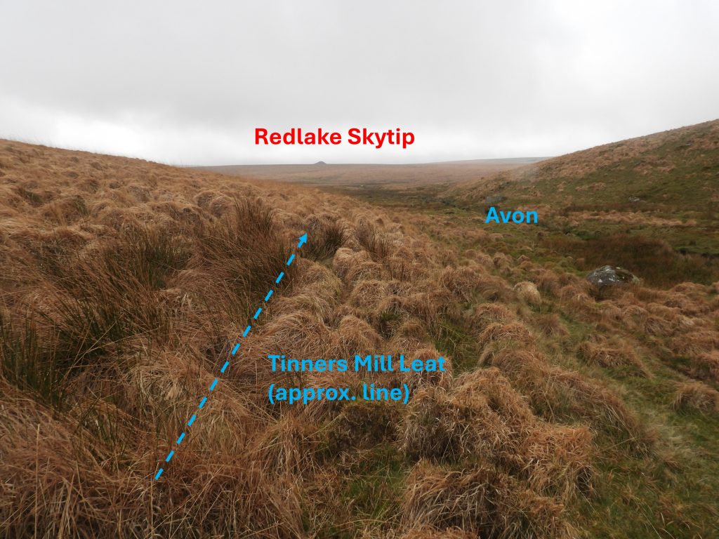
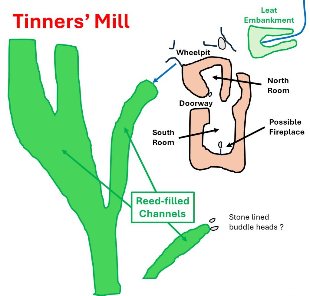
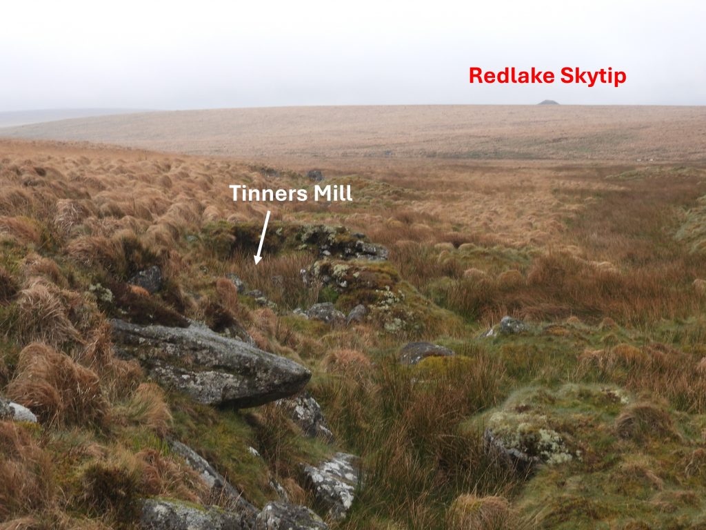
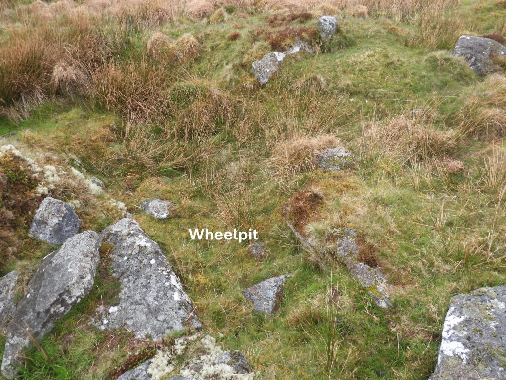
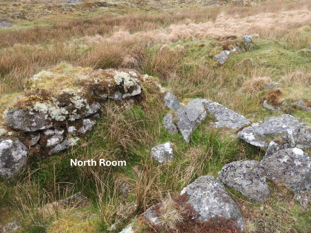
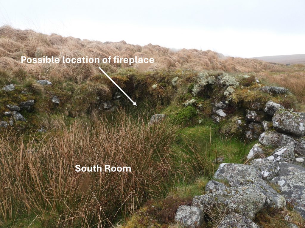
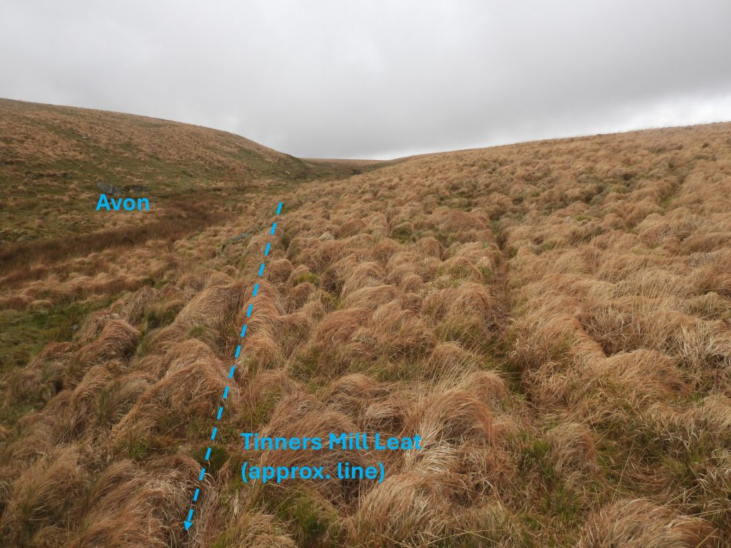
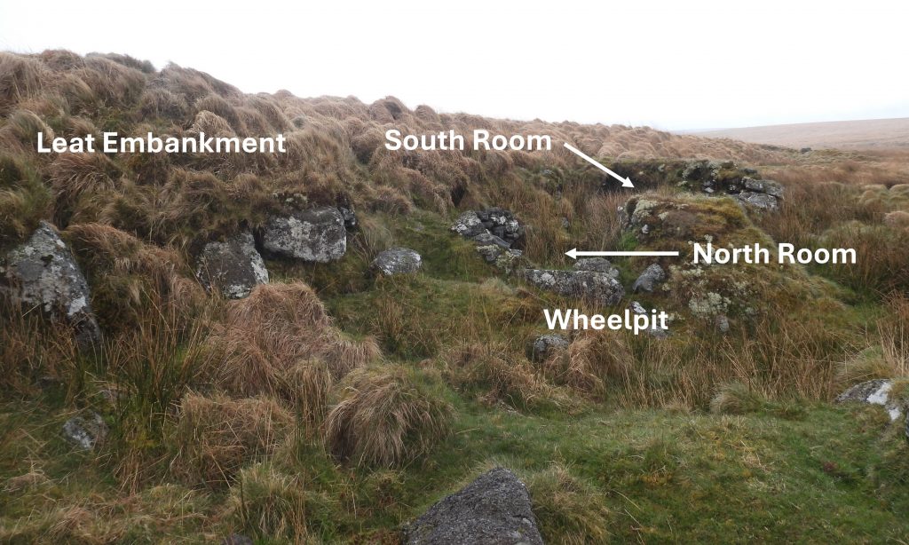
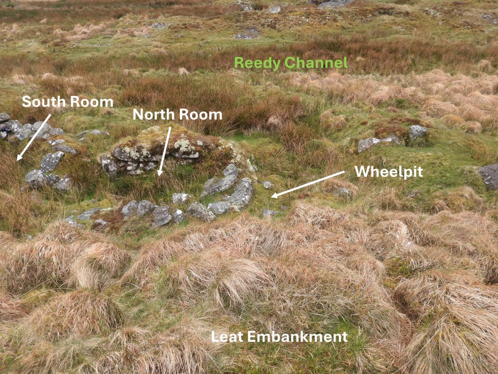
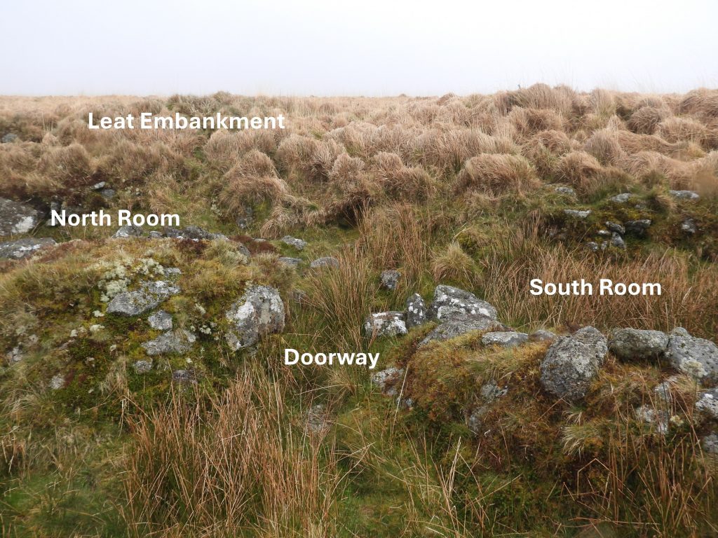
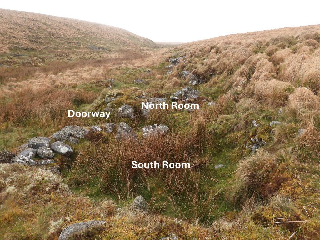
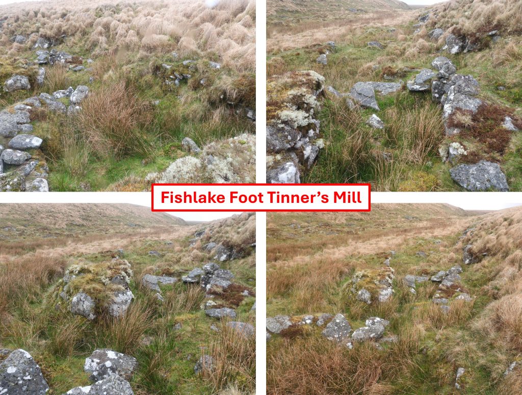
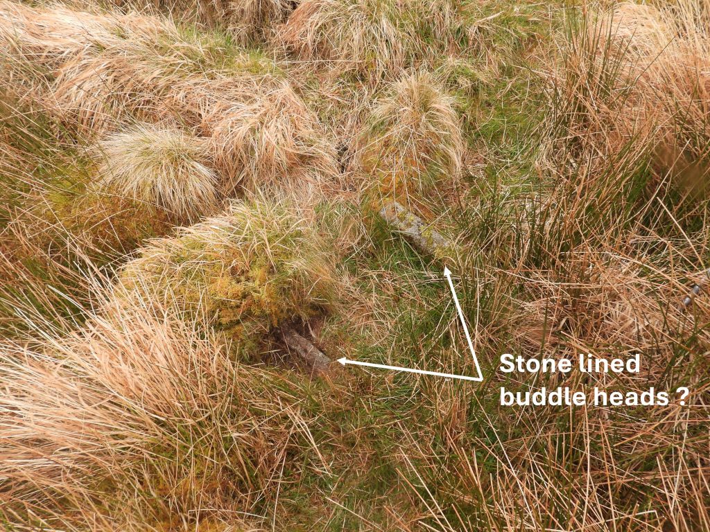
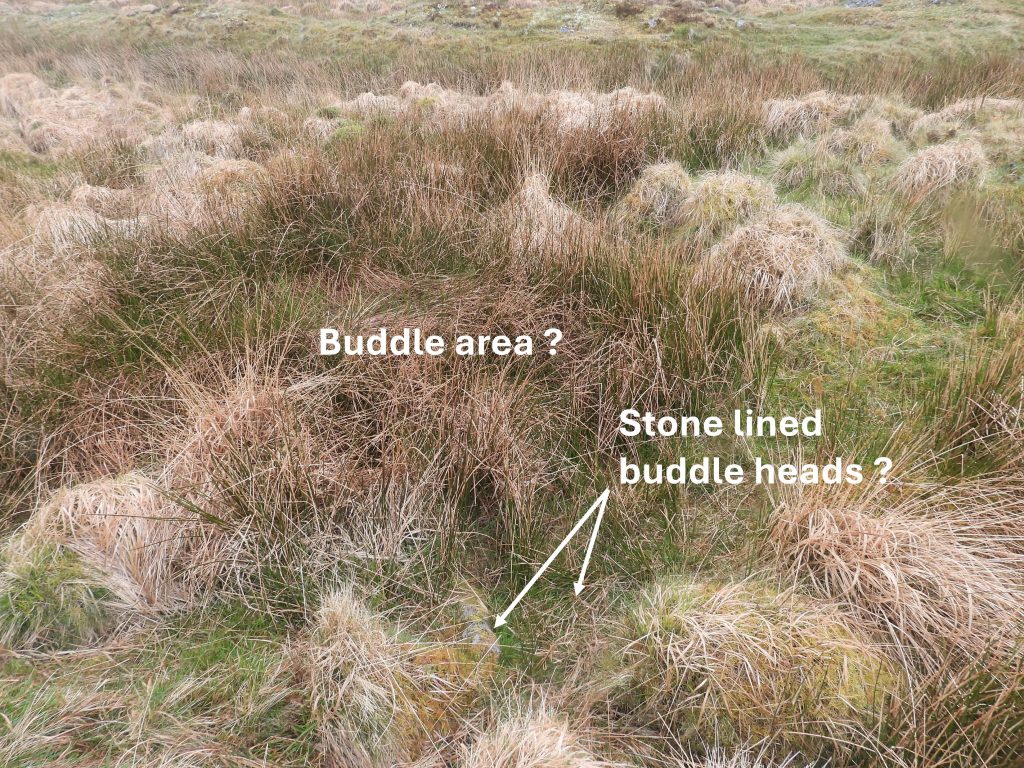
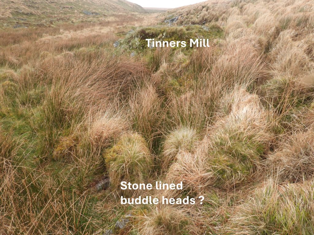
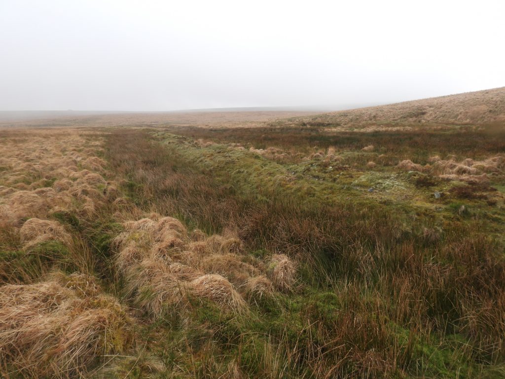
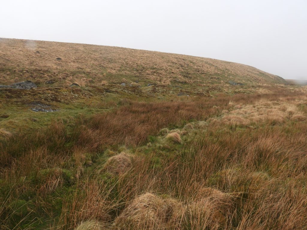
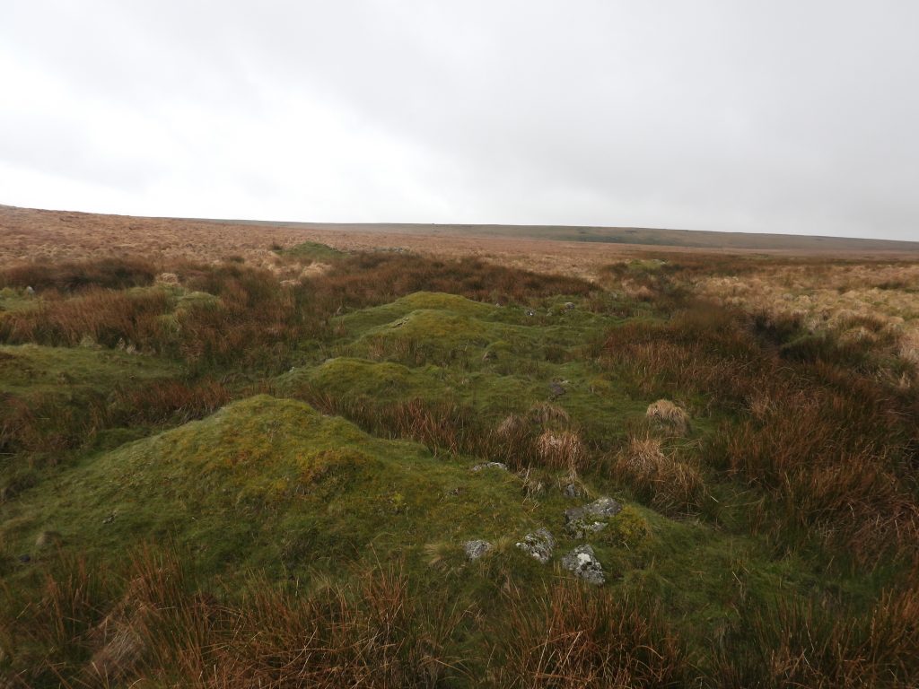
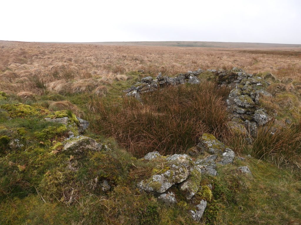
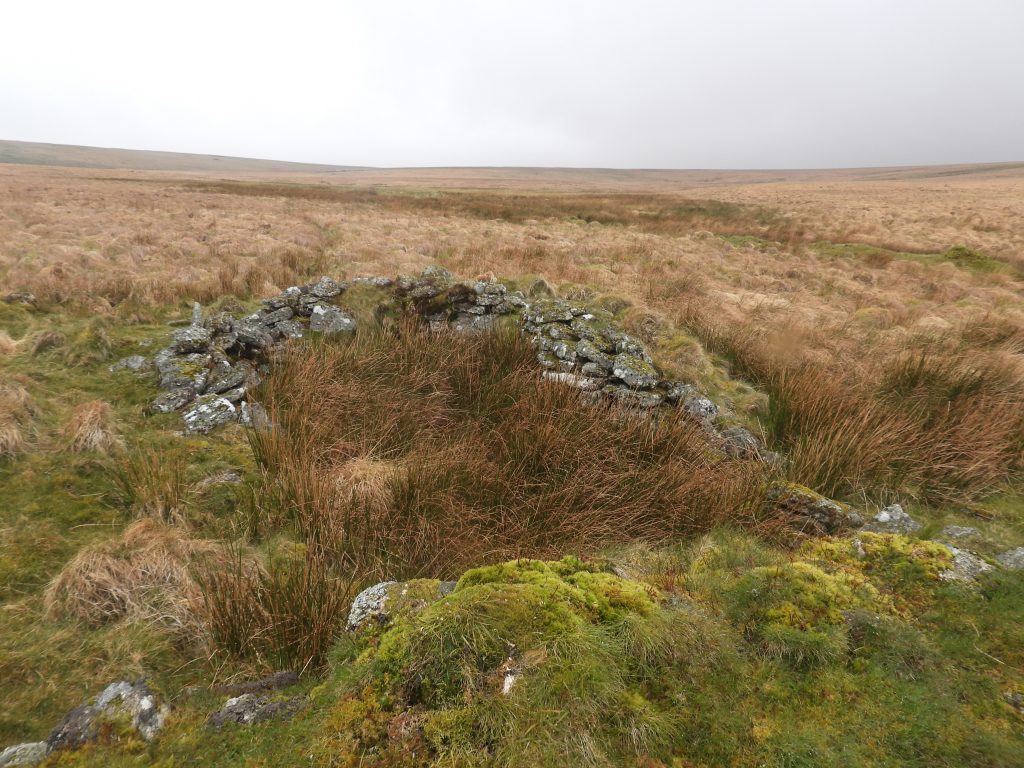
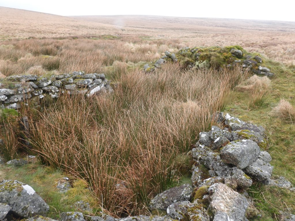
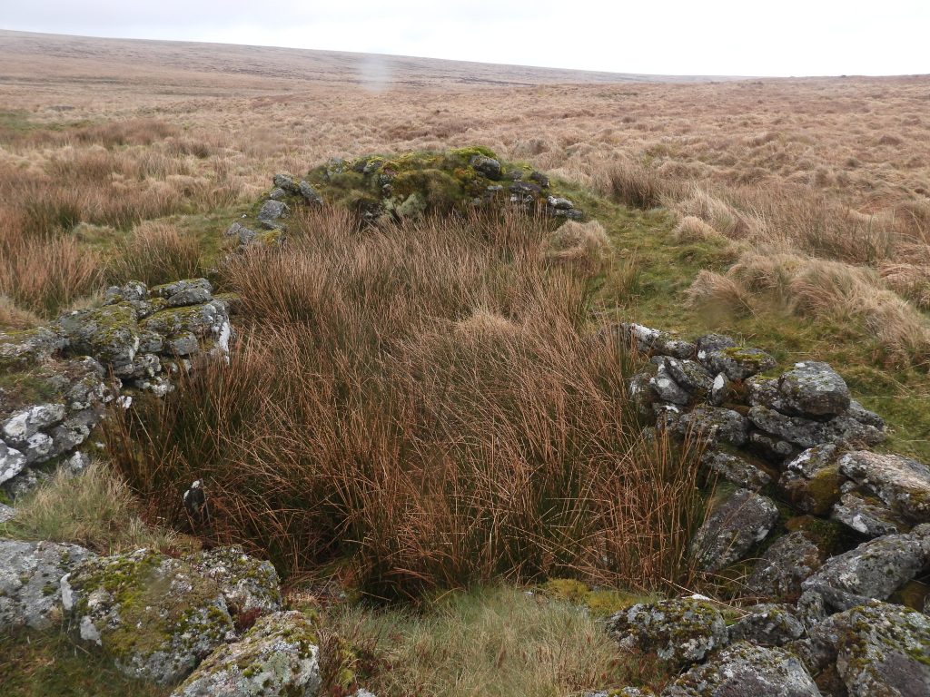
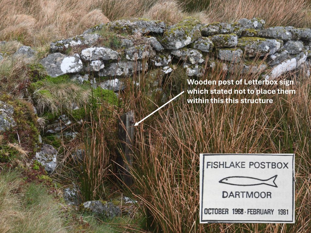
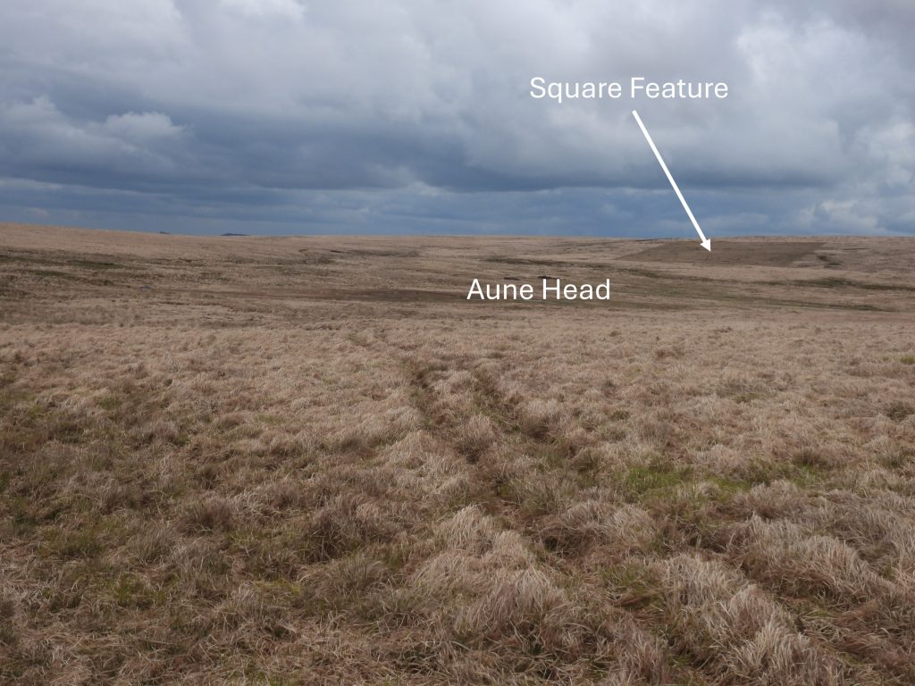
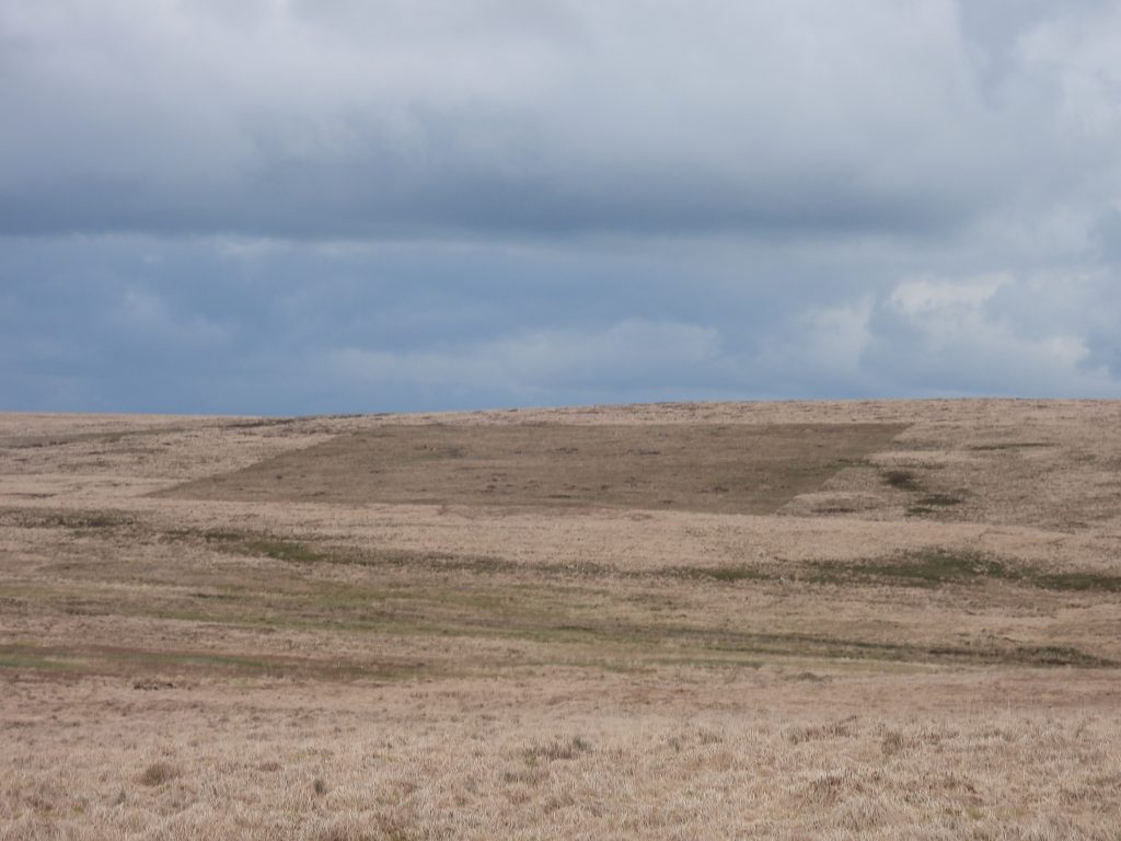
Sketch map of the locations of the four Tinners’ Huts and one Tinners’ Mill covered in this postThe first Tinners’ Hut covered in this post can be found on the north scarp of the Avon Head tin streamworks. A probable entrance is located on the east sideThe Tinners’ Hut is recorded by RCHME as being 6.6m x 2.4m (internally). The walls are 0.5m highThere are great views of Aune Head from the Tinners’ Hut. It is located at SX64745 70285Whilst having a coffee break in the Aune Head Tinners’ Hut, this helicopter came over the hill from the direction of O Brook Head. It was barely 100ft off the groundHelicopter disappearing down the AvonAune Head is a large boggy bowl To the west of the main bowl of Aune Head a large stone known as the Luckcombe Stone can be found. It is located at SX64756 69600Moving south down the Avon, another Tinners’ Hut can be found at SX65030 69044This hut is difficult to initially discern and could easily be walked past without realising it is there. It is located on the west bank of the Avon. If coming from the north (Aune Head), there is a small tributary to cross which in the winter (especially) can be very boggy. This low walled (damp) Tinners’ Hut is approx 5m x 2.5mFurther down the Avon on the NE edge of extensive workings this Tinners’ Hut can be found. It is aligned NW-SE. On closer inspection, it is actually two buildings in one. The ‘new’ building being constructed on an original Medieval StructureThe Tinners’ Hut lies within an area where there are deep gullies, shafts and pits. The walls appear to have been ‘reconstructed’. The original building is probably from 15th-17th centuries but the secondary structure is likely to be 19th or even 20th century (ref: Greeves)The original building was around 5m x 3m but the new construction is barely 1.6m x 1m. Only a very small part of the original building is part of the secondary buildingThe Tinners’ Hut is located at SX64838 68824Tin workings either side of the Avon below a steep scarp which is on the eastern edge of Nakers Hill. The stream workings are likely to date back to the Medieval period There is a mini-gorge here where the Avon passes through amongst the tin workings. The skytip at Redlake can be seen on the horizonExiting the mini-gorge, on the east bank for the river, the outline of a leat can be picked up before it leads into Molinar Grass enroute to a Tinners’ MillThe leat course as it enters a section of Molinar Grass.During a visit to a local charity shop, the author found a fabulous booklet titled: Devon Archaeology – The Dartmoor Issue. It was issued in 1985 and reprinted in 1991). On page 35 in the booklet is a plan of the tinners’ mill above Fishlake Foot by TG (Greeves) and RR (Robinson) which is dated 27.7.83. The above sketch is based on the Greeves / Robinson plan which over 40 years on is still a very useful guide to anyone exploring these ruins. Note that the mill lies on the east side of the river and is annotated as a Tinners’ Hut on OS Maps, which clearly is incorrect.Approaching the Tinners’ Mill from the north. The Devon Archaeology booklet article on the mill (alongside the previously mentioned plan) suggests it dates from 16th CenturyThe end of leat, which can be traced from the Avon, leads to an embankment with a wheelpit below. The wheelpit lies at the north end of the mill. Beyond the wheelpit a tailrace can be made out. The wheelpit is around 2.3m East to West by 1.0mThe mill has two rooms. The north room is adjacent to the wheelpit and possibly could have housed stamps. The north room is wedge-shaped and measures 2.2m north to south by an average of 1.4m The south room measure around 3.3m north to south by 2.2m. There is a probable fireplace at the south endThe leat as it approaches the mill. It is around 0.8m wide and only 0.3m deep View of the mill from the northView of the mill from on top of the leat embankment. Intriguingly in 1950 the Ordnance Survey Archaeology Division described the mill as being : “Two small irregular tinners huts built hard against the river cliff on the east bank of the Avon……..they have opposed entrances 0.8m wide, opening onto a common passage 0.8m wide and up to 1.2m high”. Mill viewed from the south. The mill was measured at SX64890 68336Tom Greeves in 1981, (ref: List of Known Devon Tin Mills c1450 – c1750, No.26), states this is “Definitely the site of a tin mill. Wheelpit, leat embankment and leat seen”. One wonders why OS haven’t annotated their maps accordingly. There is no evidence (in the form of mould stones or mortar stones) to confirm the exact function of this building. That said, there it was most likely a stamping mill as there are probable buddles to the southThese two stones are annotated on the original Greeves / Robinson plan and labelled as “stone lined buddle heads”. Do these suggest the mill was a stamping mill, with the resultant crushed ore being processed here? One of the two stones here was buried (left one in picture) but once re-exposed confirmed the location as per the Greeves / Robinson plan from 1983The Devon Archaeology booklet indicate (page 37/8) there might have been two buddles hereContextual view of the buddle heads and the mill (looking north)Reed filled channel to the south of the buddlesReed filled channels between the mill and the Avon. These channels are shown on modern OS maps as being water filled suggesting a long ‘island’ here made up from the river the the channelsLeaving the Avon to the west up the Fishlake more tin workings can be found. Eric Hemery (High Dartmoor) on pages 301-302 states the name ‘Fishlake’ is derived from the fruits of the waters here. Once Fish Lake had salmon and trout when it was a natural tarn. The basin here was known until the 18th century as ‘Hunavil’s Bed’, which may have been taken from the name of the tinner who drained the area in the 15th centuryA short distance up Fishlake from its confluence with the Avon is a rather splendid Tinners’ Hut, first visited by the author in the 1980s.The Fishlake Tinners’ Hut comprises once large room 6.4m east to west by 2.4m north to south (internally). The wall remains are around 1.2m wide and up to 1.1m high. It flanks the tin working here but it function is unclear The Tinners’ Hut contains two cupboard recesses and the floor (now full of reeds) appears to have been pavedThe Tinners’ Hut is located at SX64610 68082Eric Hemery (High Dartmoor) on page 302, dedicates a couple of sentences to Dartmoor Letterboxing in less than glowing terms. He states that the 21st Plymouth Venture Scouts Unit had used the Tinners’ Hut as a site for their Letterbox. The author has managed to locate a copy of the stamp from that Letterbox (inset). Eric further stated that on 24th August 1972 he wrote in the visitors book (“Thereby incurring the risk of vituperative comment”). His comment in the visitors book was a plea: “I would like to think that visitors take their rubbish home and do not disturb the stones of this medieval tinners’ house”. At some stage (1970s or 1980s) a sign on a wooden stake appeared requesting no letterboxes were to be placed within the structure. The wooden stake of the sign still remains.Returning to Aune Head by way of the track across Nakers Hill (from Black Hut near Fishlake Head) the author noted an almost perfectly square area on the North West slopes of Ryders Hill. The area has been created by grazing cattle using a technique called ‘fenceless grazing’. There are several areas which are being trialled using this technique.Fenceless grazing is being trialled to remove areas of Molinar Grass. Cattle have collars with GPS trackers. An area is defined and as the cattle reach the extremities of the defined area receive a small electric shock and move back from the border of the area. This article provides more information: https://adriancolston.wordpress.com/tag/nofence/