A collection of walks, discoveries, insights and pictures of exploring Dartmoor National Park
April 14, 2021
HOOK LAKE TINNERS’ MILL
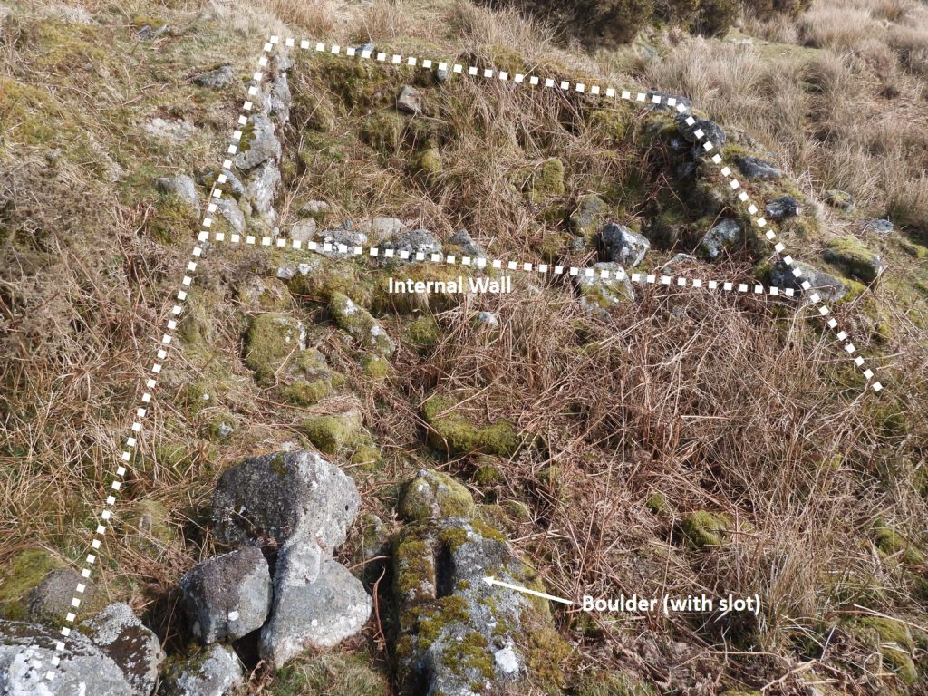
Located near the confluence of Hook Lake and the River Erme, this tinners’ mill is a fine 16th / 17th century example. The features of the mill including an associated leat embankment, a boulder which has worked indentations (plus slot) and a wheel pit, which are quite easy to discern but the use of a plan or description may be of assistance if making a visit. There may be some bracken growth in the summer, which will hide some of the features. Research for this post was obtained from the Historic England website and the Dartmoor HER (MDV5112).
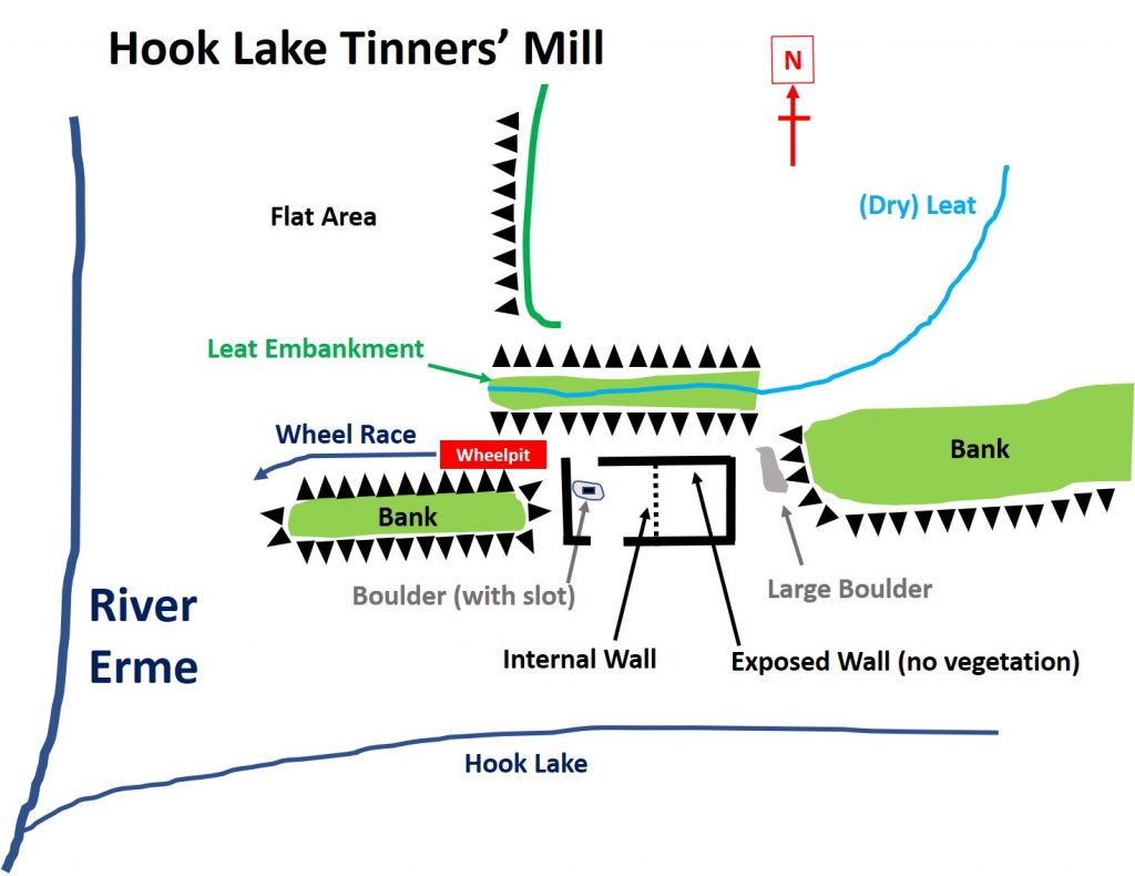
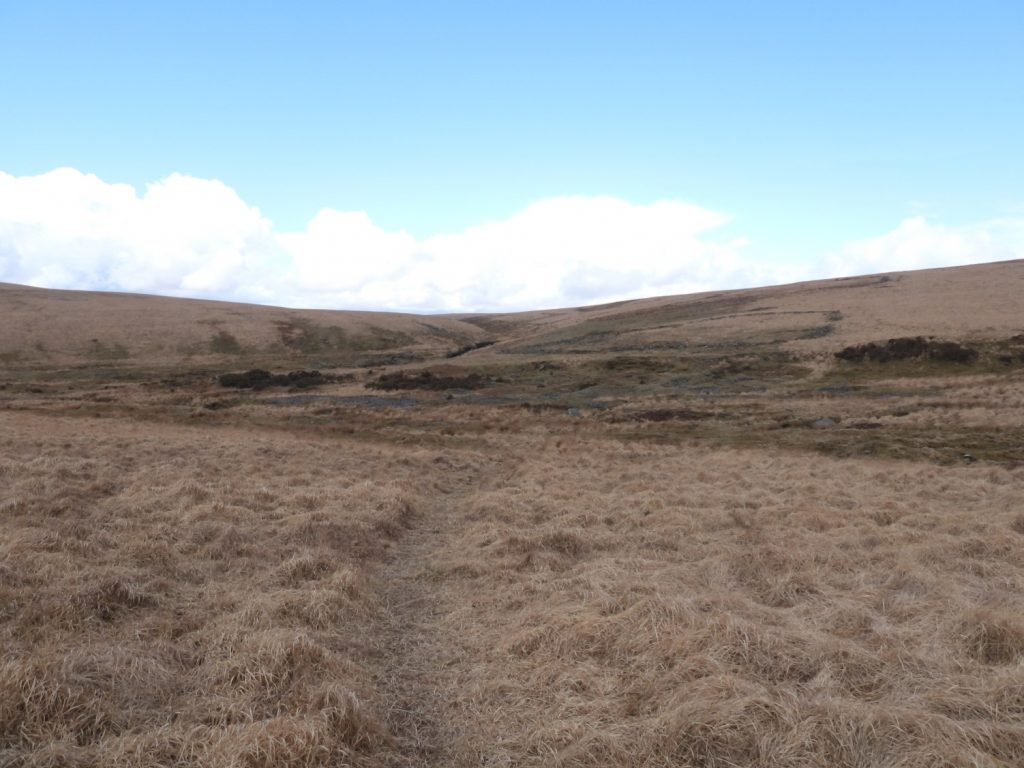
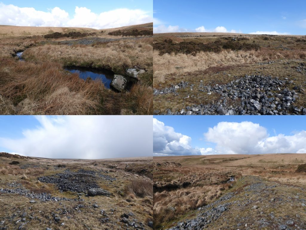
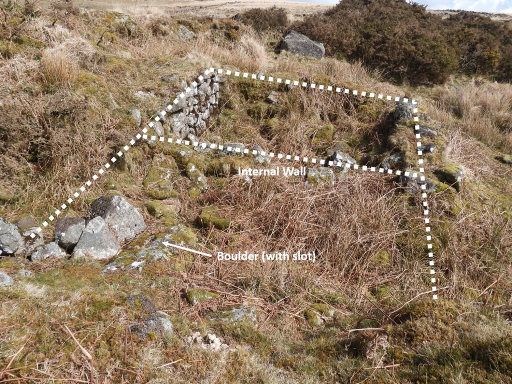
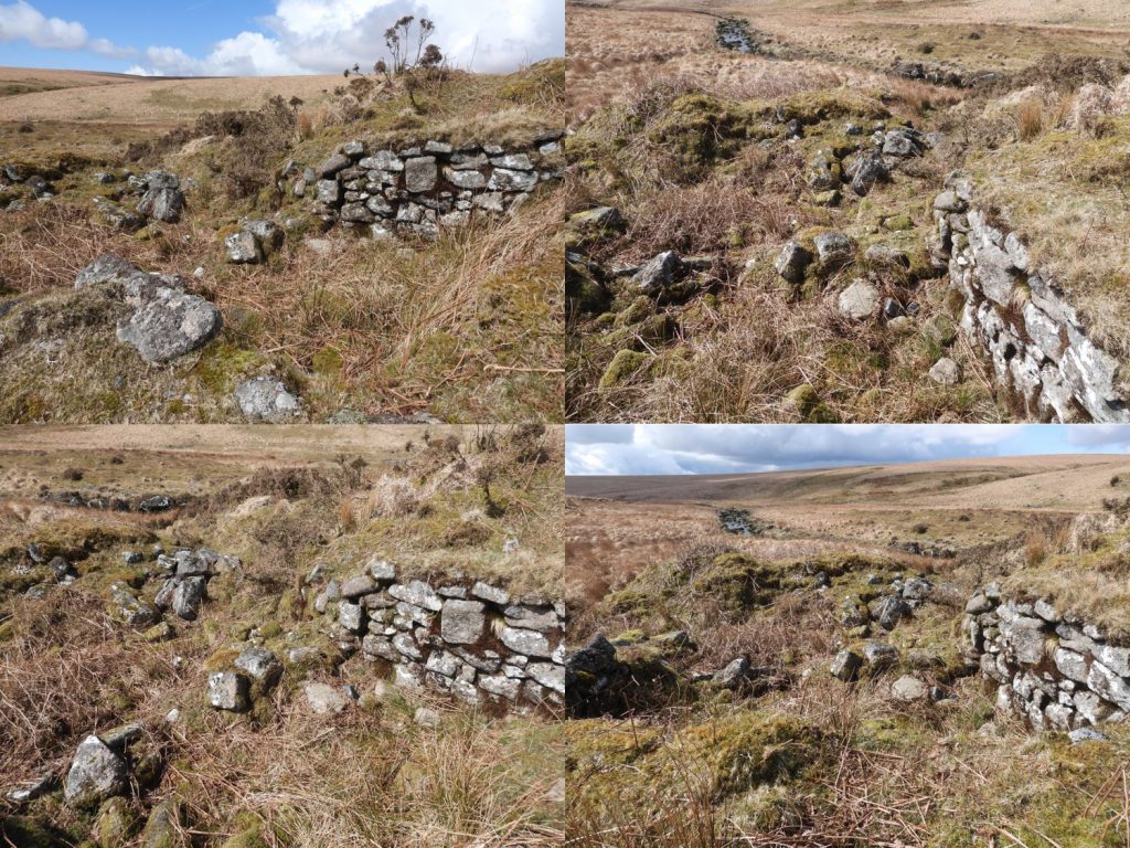
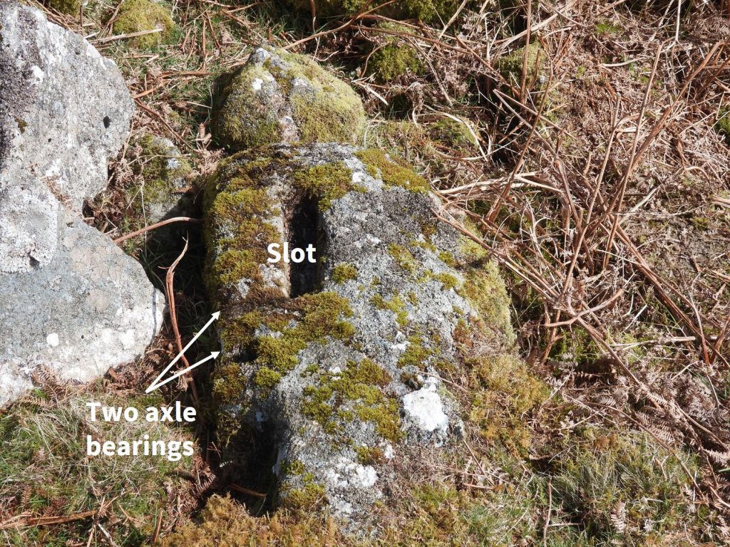
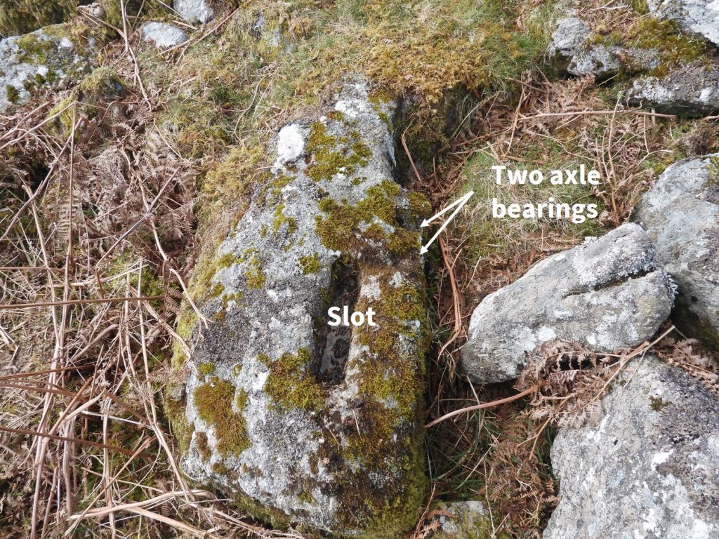
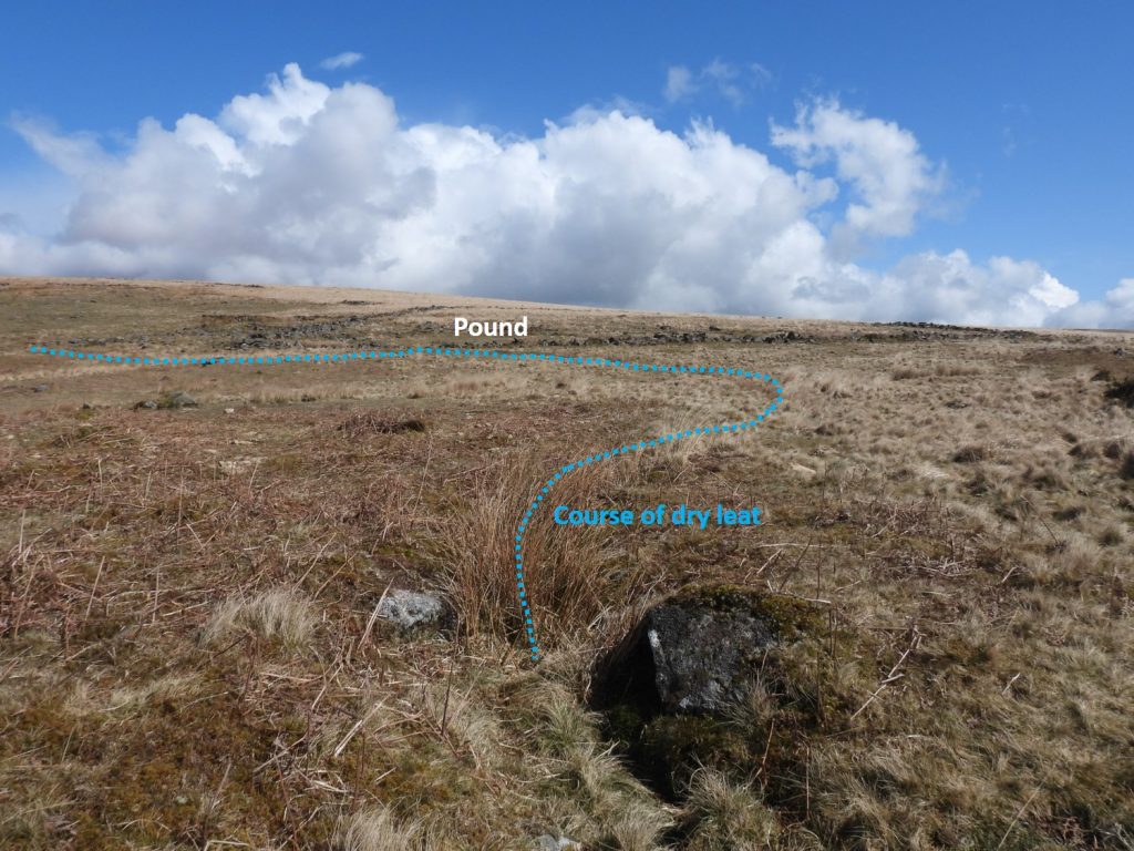
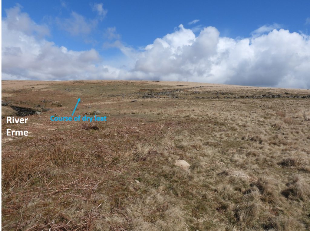
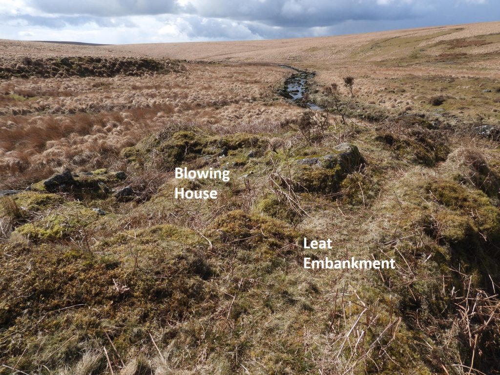
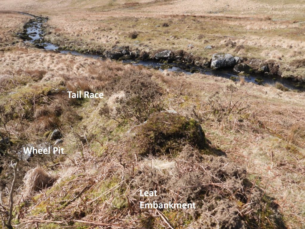
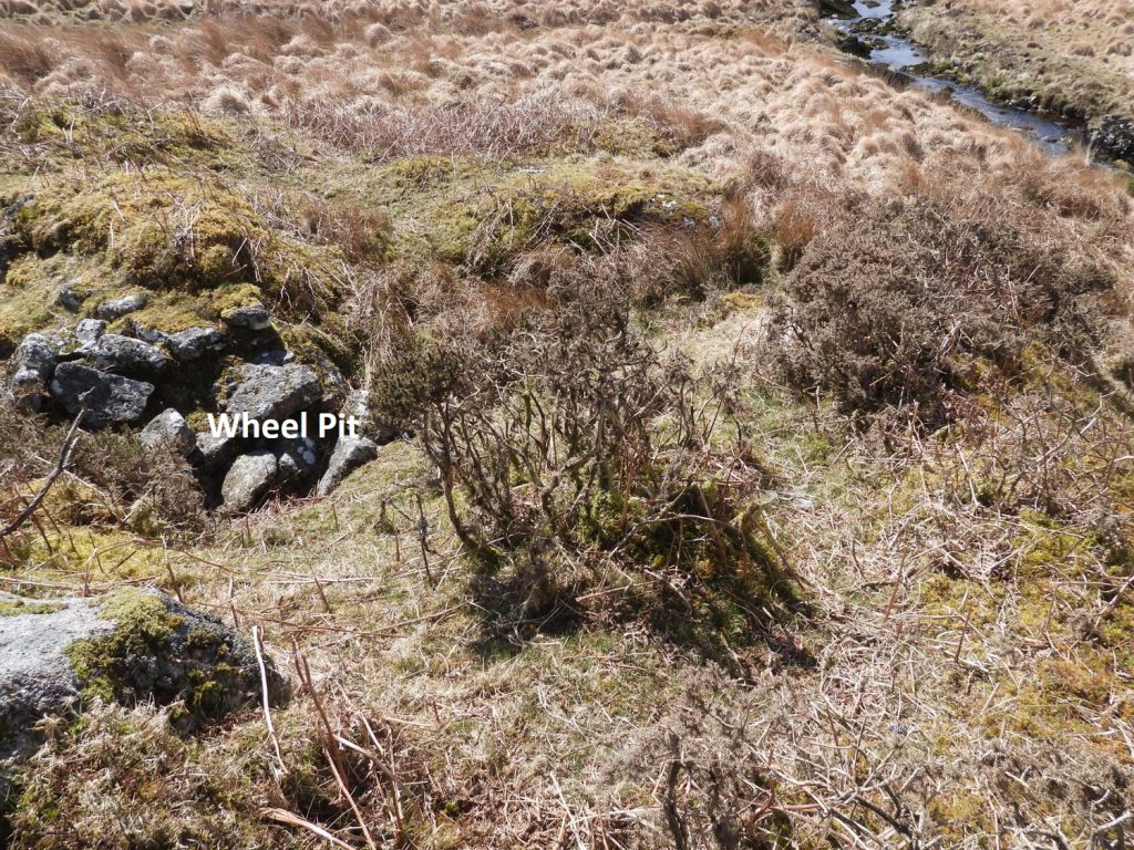
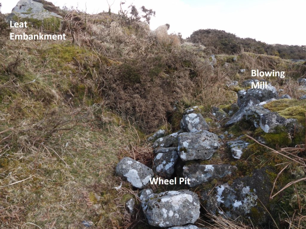
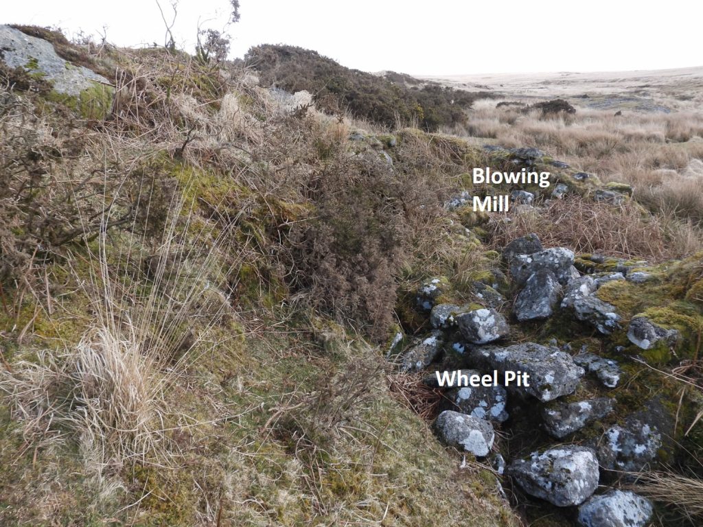
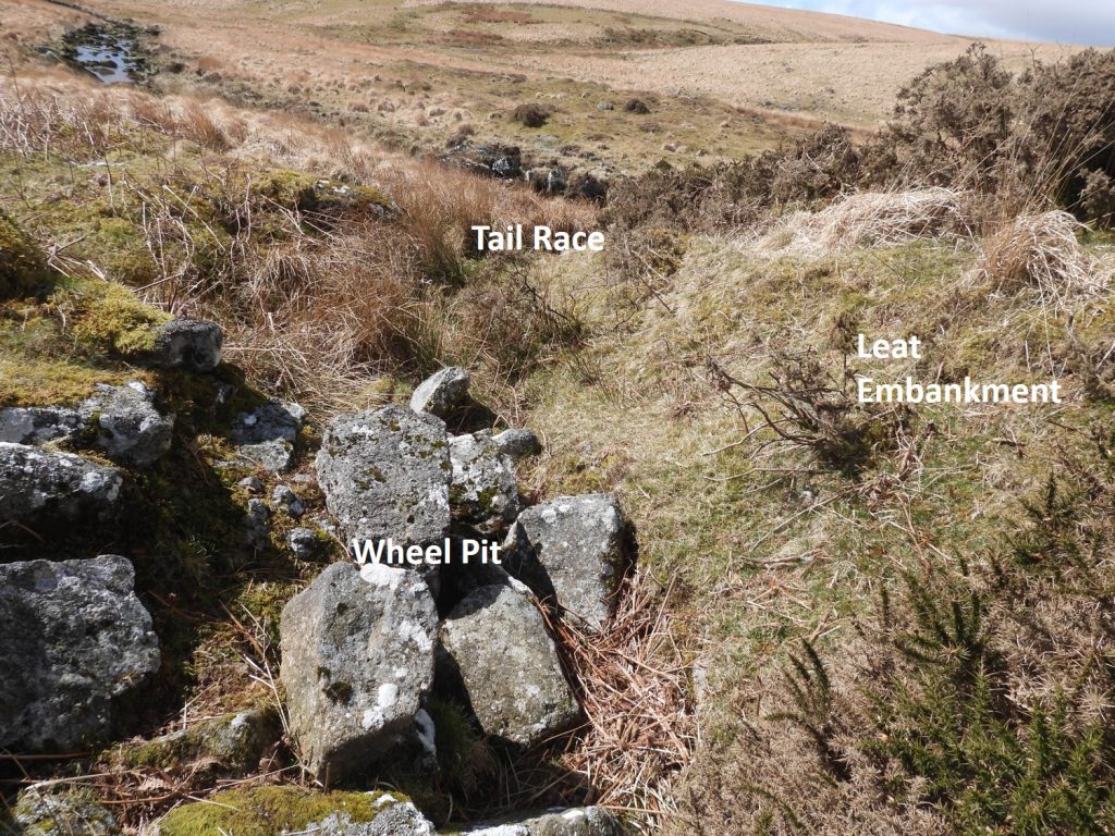
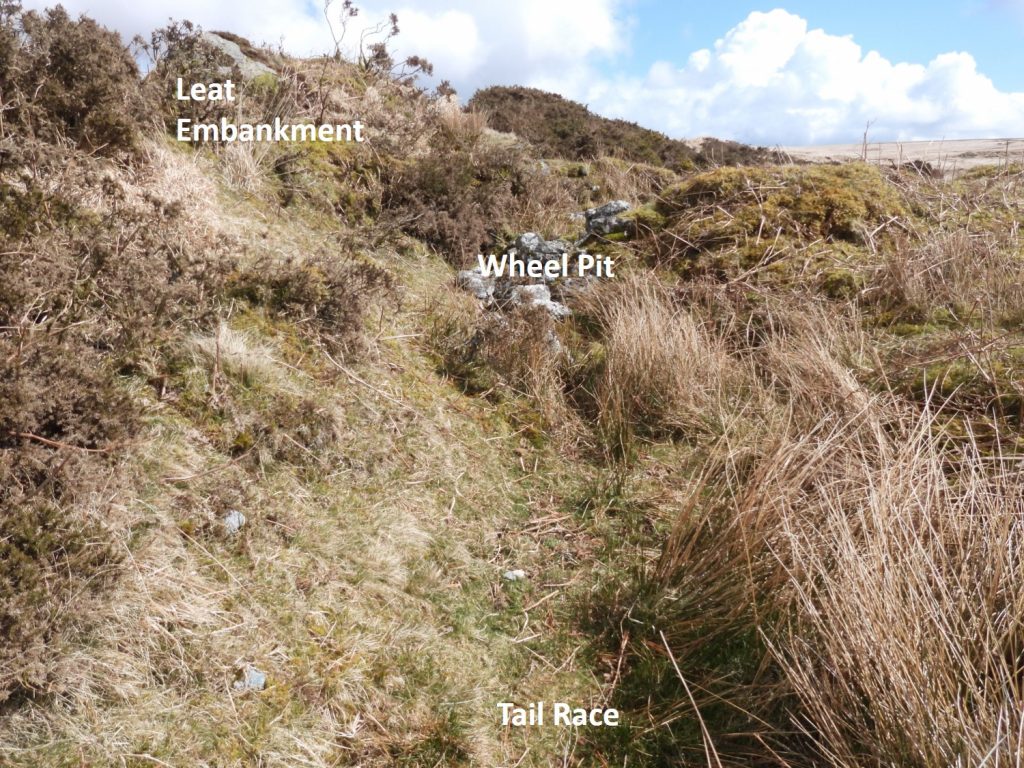
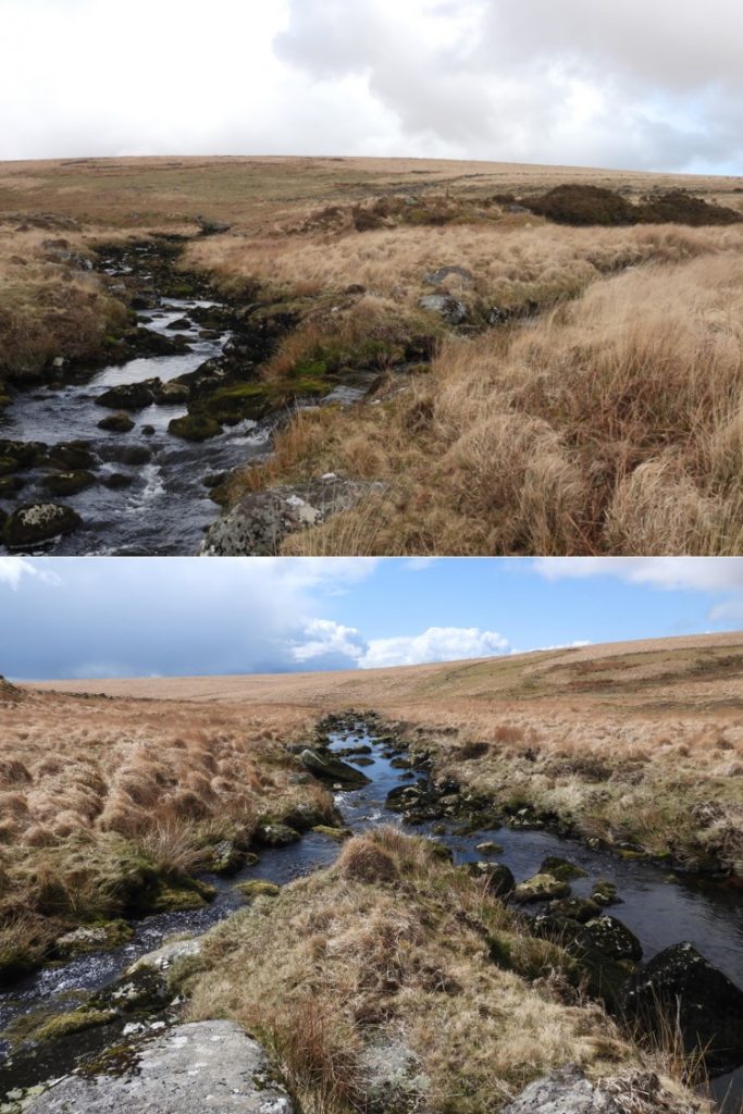
This is the authors first attempt at a drawing of a location without the guidance of those who have been before. It isn’t to scale but hopefully is reasonably representative of what is “on the ground”. The mill is approx. 20m from the River Erme.This is the approach to Hook Lake from the south taking a faint path taken from the Red Lake tramway (which can be located on a bend in the tramway between Left Lake and Quickbeam Hill). The tinners workings can be seen running left / right in the picture and the upper Erme valley to the left (i.e west) of the pound can be seen.Hook Lake tinners workings near the confluence with the Erme. It is a delightfully peaceful spotThe Tinners’ Mill as viewed from its western end. R.H Worth describers the building as measuring internally 6.76 metres long by 3.81 metres wide at one end and 3.96 metres wide at the other. He further stated that it is divided into two compartments by a cross wall, which appears to be of later date than the main walls. Source: The Dartmoor Blowing House, 218, 249-50 (Article in Serial). SDV154693.Historic England describe the tin mill survives as a “rectangular drystone structure measuring 6.3 metres long by 3.8 metres wide internally with walls of up to 0.7 metres wide and 1.5 metres high. Inside there is a section of narrower cross walling which appears to be a later addition. The entrance is in the southern wall at its western end. Internally, there is a large stone which has a rectangular depression thought to be a mould stone, a long slot and two axle bearings on one edge”General views of the mill. A Dr. Phil Newman description includes “The northern wall is a revetment which reinforces the slope and survives to over 1 metre high. Other walls have tumbled and the interior is strewn with fallen stone”. Source : The Upper Erme Valley, Dartmoor National Park, Devon: An Archaeological Survey, Appendix 1 (Report – Survey). SDV362921. The mill (centre) can be located at SX63927 65094.All the research describes a boulder which has worked indentations and mould cavity. The picture shows this boulder which is internal to the mill at its western end. R.H Worth in 1940 describes this boulder thus: “The two supposed sample moulds are really bearings for an iron axle, of about 51 millimetres diameter. One bearing is roughed out, the other polished by use. The other sinkage in the stone is a slot, 305 millimetres by 89 millimetres and 89 millimetres deep. May have taken the plummer-block of the water wheel. Source: The Dartmoor Blowing House, 218, 249-50 (Article in Serial). SDV154693.Historic England suggests that the presence of this stone suggests a possible function as a blowing mill for smelting tin. National Monuments Record further suggest this building was probably first a blowing house and subsequently a knacking-mill. Of note is that opposite Hook Lake is a valley called Knackersmill Gulf. It is worth knowing that sometimes stamping mills (for crushing ore) were referred to as knocking or knacking mills. The English word Knakke means to strike or crack. The boulder can be located at SX63926 65091.To the north of the tinners’ mill a dry leat can be discerned leading to the side of the nearby poundThe dry leat course can be traced upstream to the Erme.Above the Tinners’ Mill / Blowing House a leat embankment can be found where the dry leat terminates. This picture shows the location of the mill in relation to the Erme. The top of the leat embankment can be located at SX63921 65099.Below the leat embankment an old wheel pit can be found, beyond which is the tail race where water would have been returned to the Erme.The wheel pit has been largely in filled with tumbled stone.Interestingly R.H Worth appears to have been very precise with his measurements and states: “There is a raised bank to conduct the water to the wheel, the wheel pit is well preserved and the wheel may have been 2.591 metres in diameter and 457 millimetres brest”. The wheel pit is located at the western end of the north side of the building as can be seen in the photograph. The wheel pit can be located at SX63921 65095.Another view of the wheel pit, leat embankment and tail race in relation to the Erme. Knackersmill Gulf can be seen in this picture.Picture taken from the tail race (foreground) looking back at the wheel pit and leat embankment.Confluence of Hook Lake and River Erme.