A collection of walks, discoveries, insights and pictures of exploring Dartmoor National Park
March 20, 2023
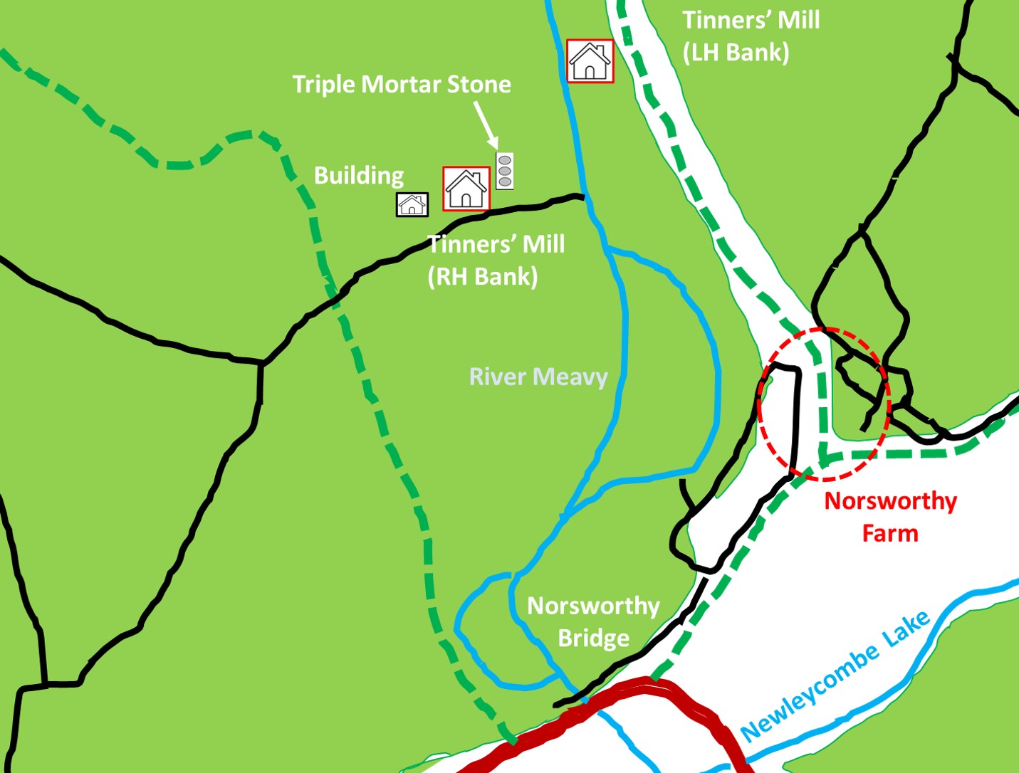
Norsworthy Bridge (RH Bank of River Meavy) Stamping Mill
Between Leather Tor and Nosworthy bridges, on or near both banks of the River Meavy, lie the ruins of two Tinners’ Mills. The Tinners’ Mill on the left (east) bank of the River Meavy, which is close to the path between Norsworthy Farm ruins and Leather Tor bridge, is the most well known and visited mill, noted for having a large number of mortar stones.
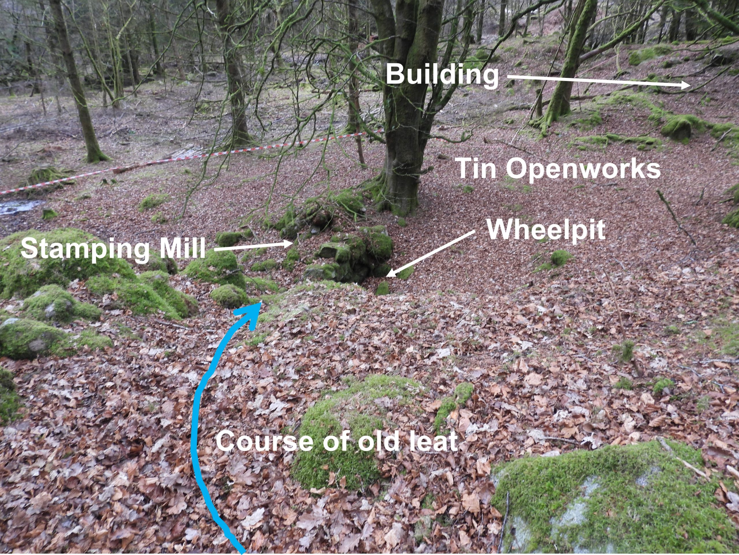
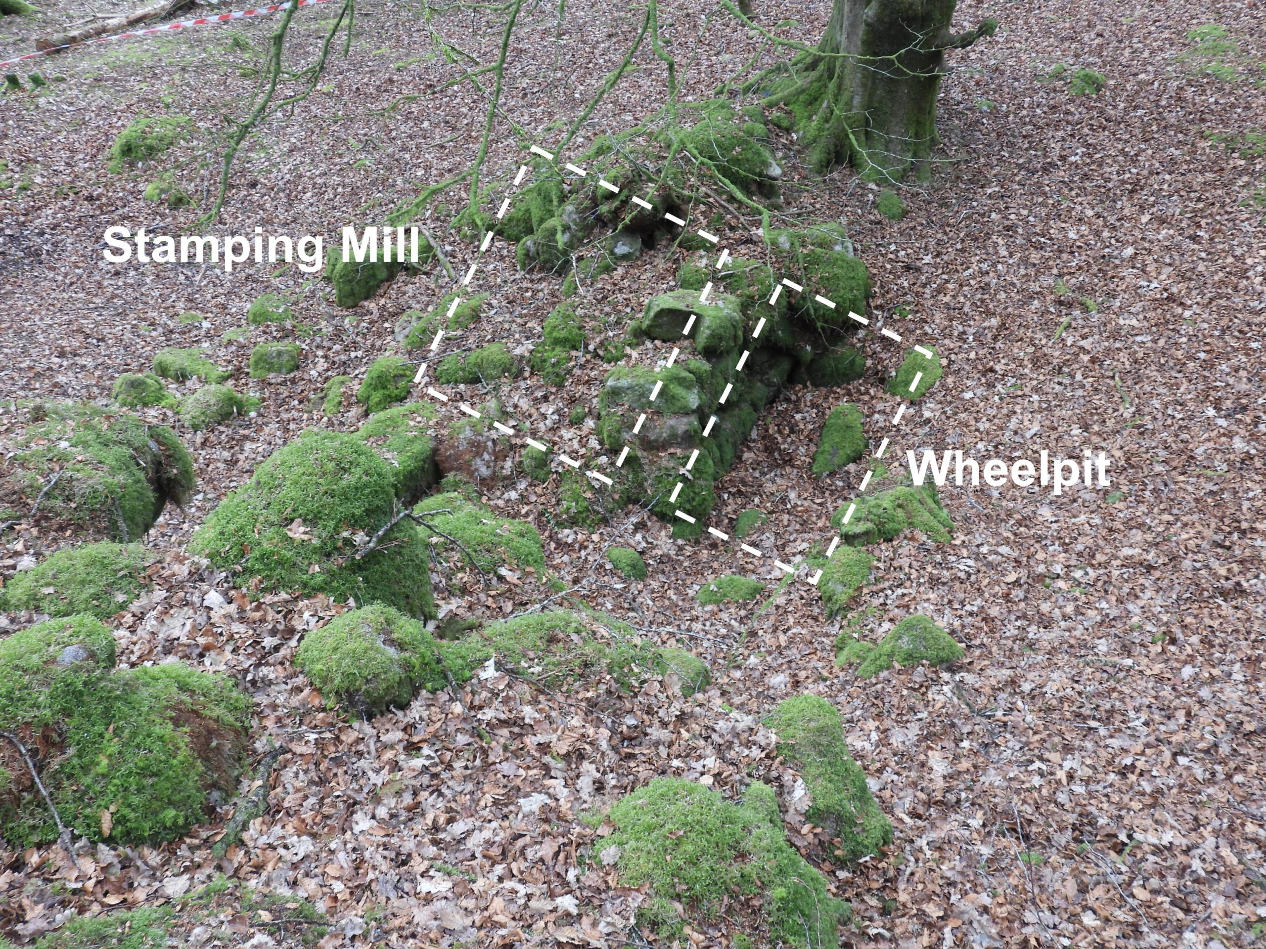
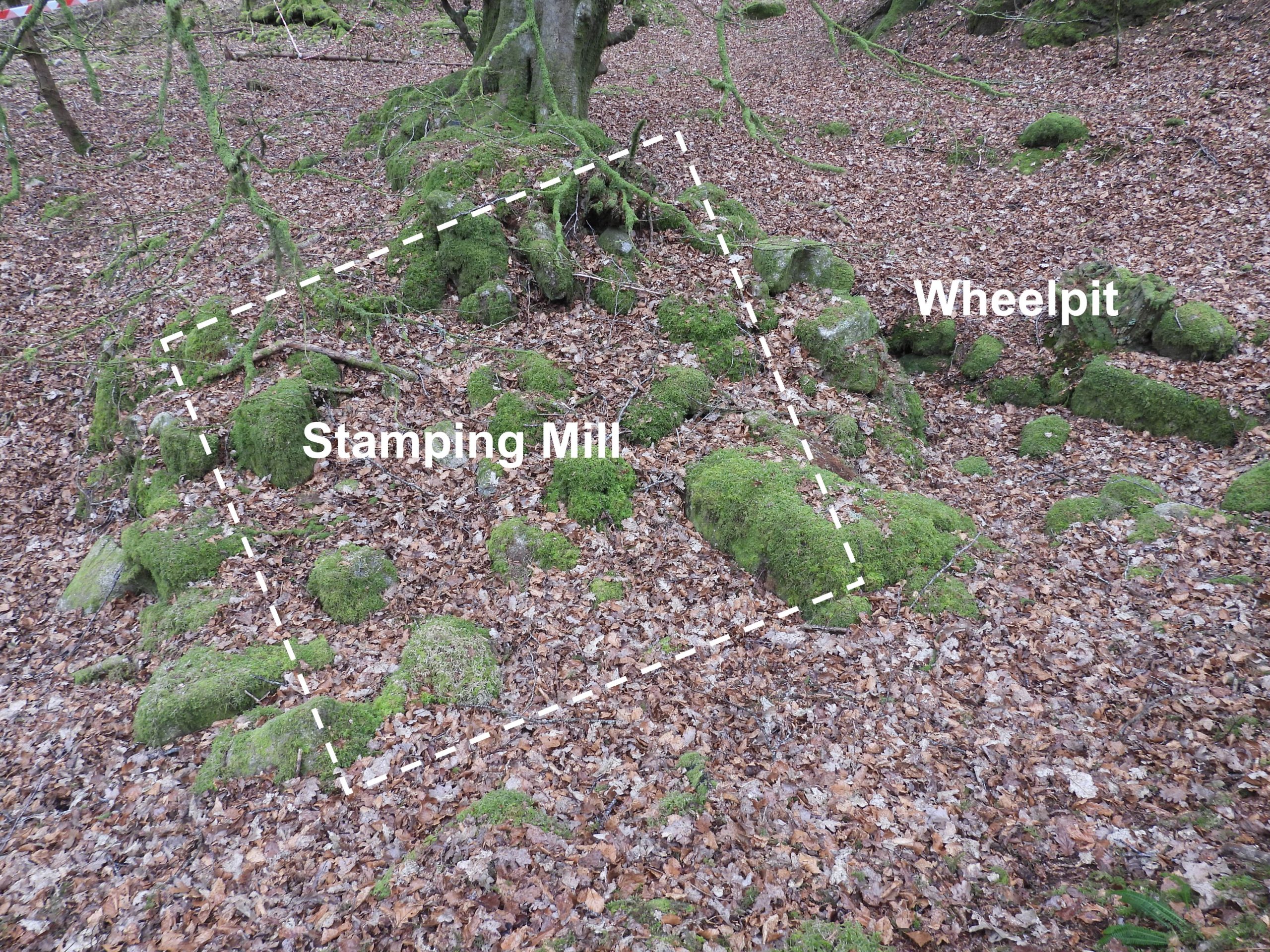
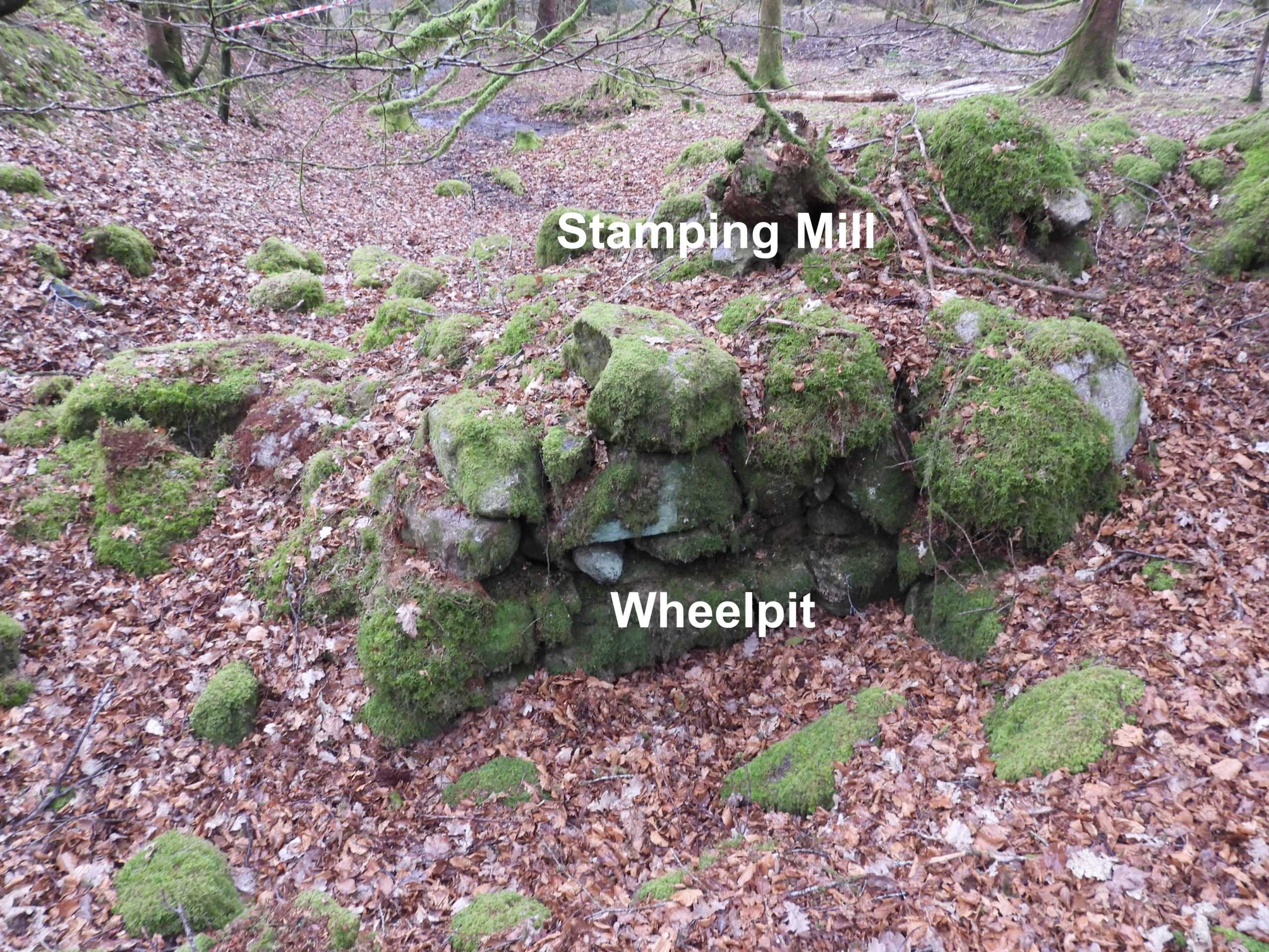
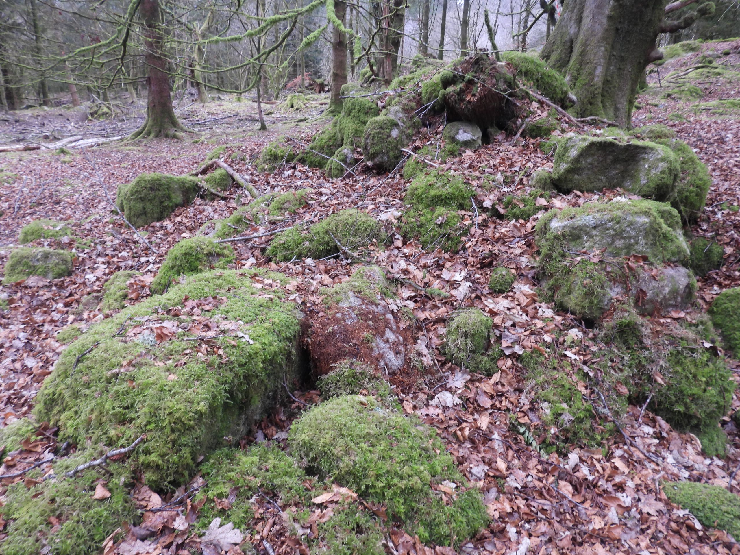
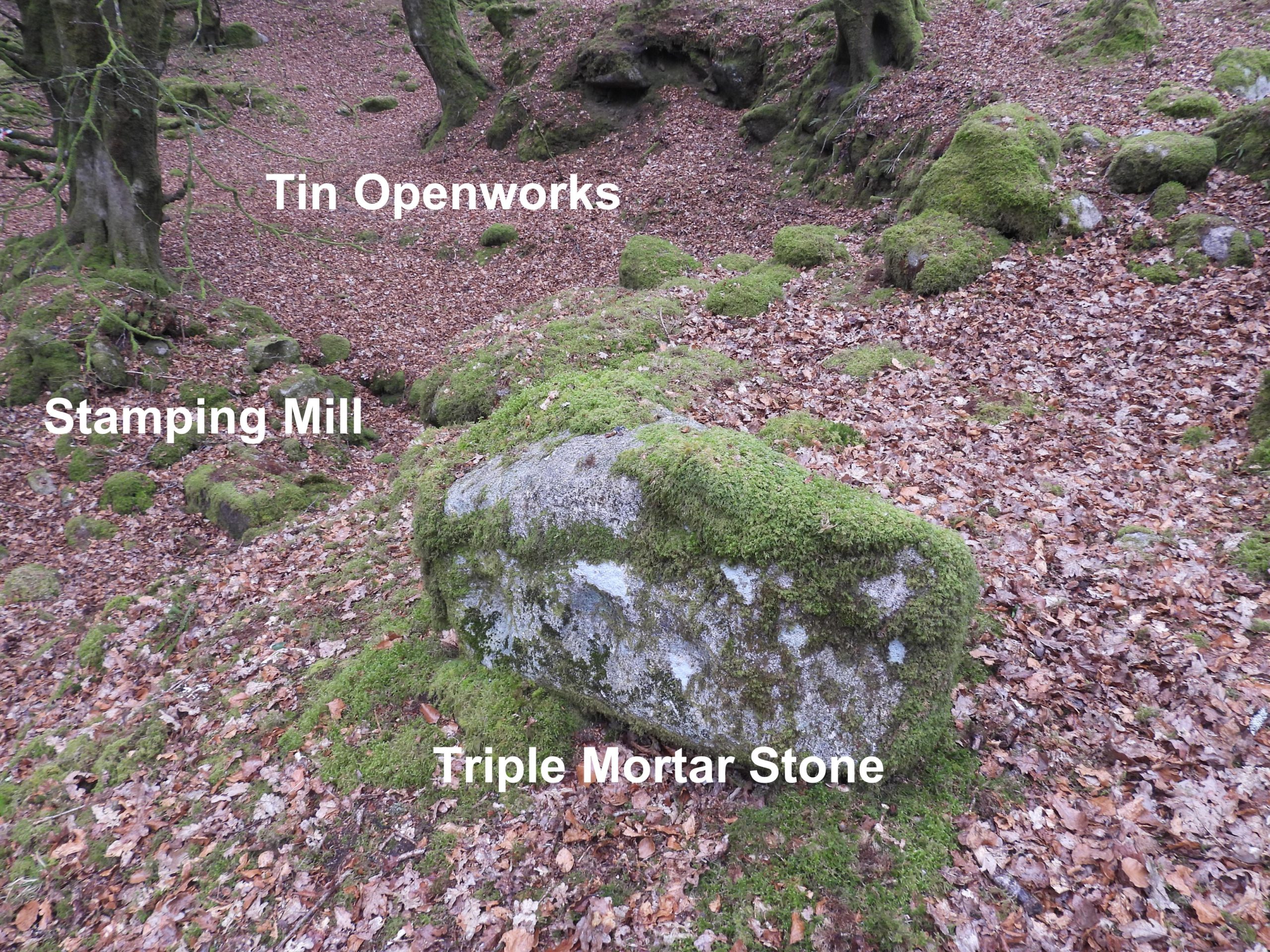
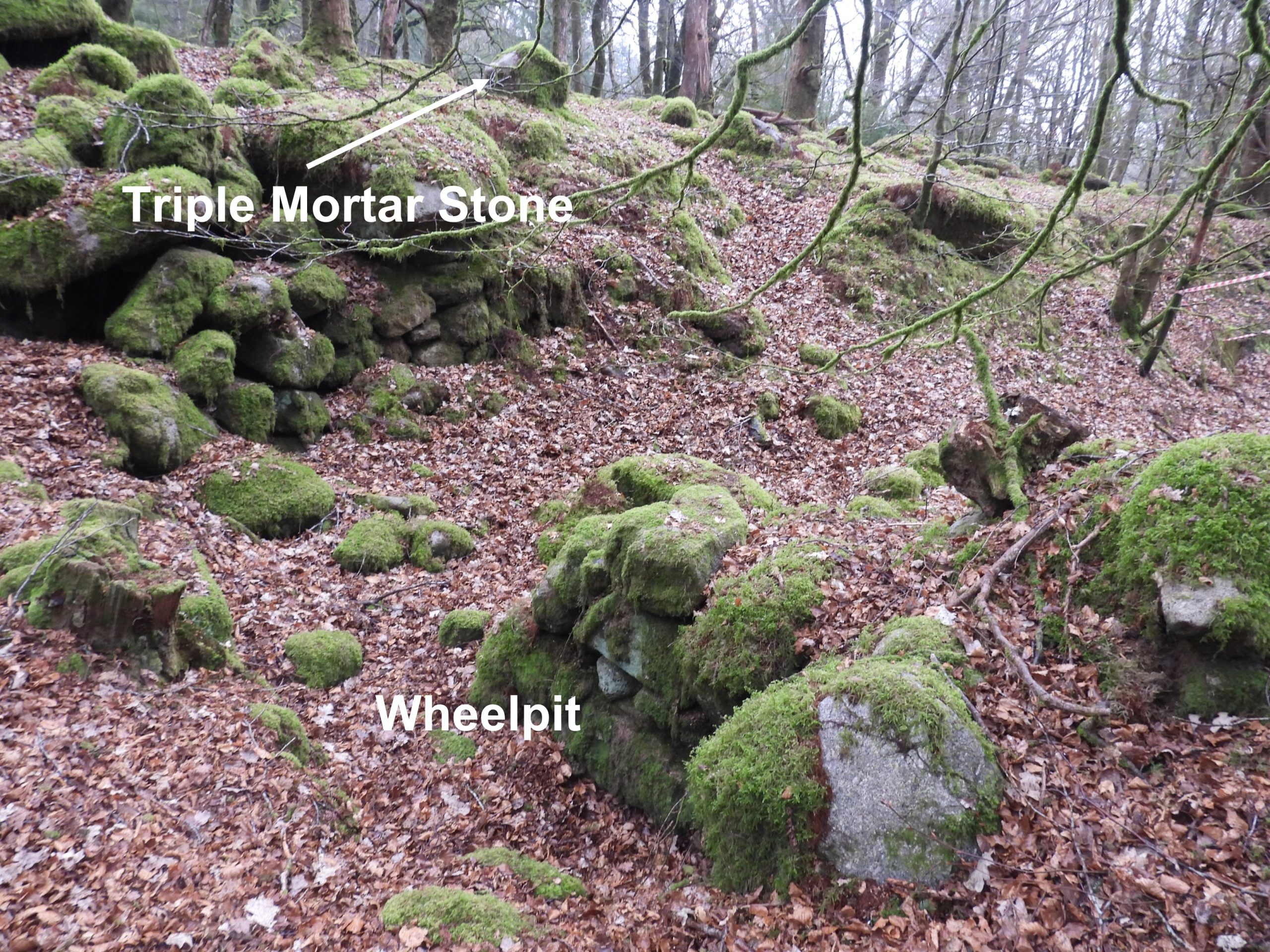
About 75 m from the right (west) bank of the River Meavy is a less well known and less visited Tinners’ Mill with a further ruinous building of unknown origin close-by to the west. They both lie in a gully measuring up to 3.5m deep, which is likely to have been an old tinners’ openwork. This Tinners’ Mill ruins comprises a wheelpit and a small stamps building (for ore crushing). Between the Tinners’ Mill (known as a Stamping or Knocking Mill) and the river on top of the gully, a triple mortar stone can be found suggesting the mill once had three heads of stamps. It is all these features on the right (west) bank of the Meavy, which are the subject of this post.
Bibliography
Tom Greeves, 1971, A Tinners Mill in Walkhampton parish, (SDV250178).
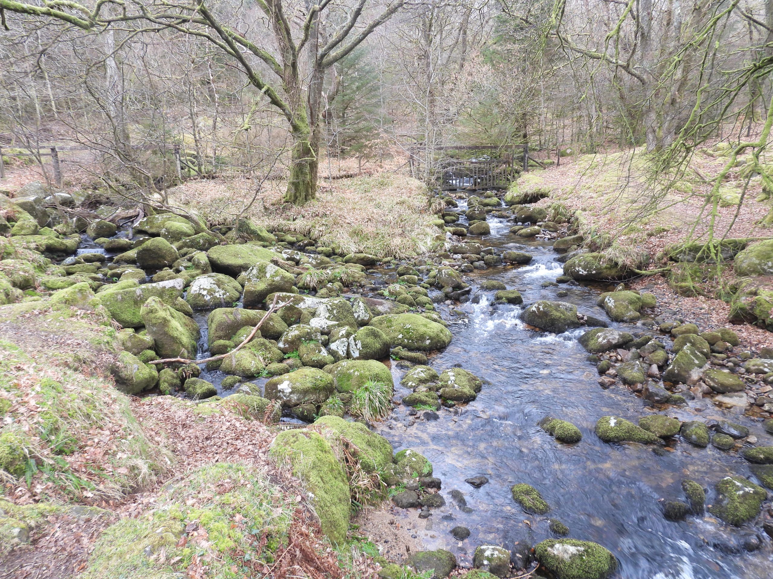
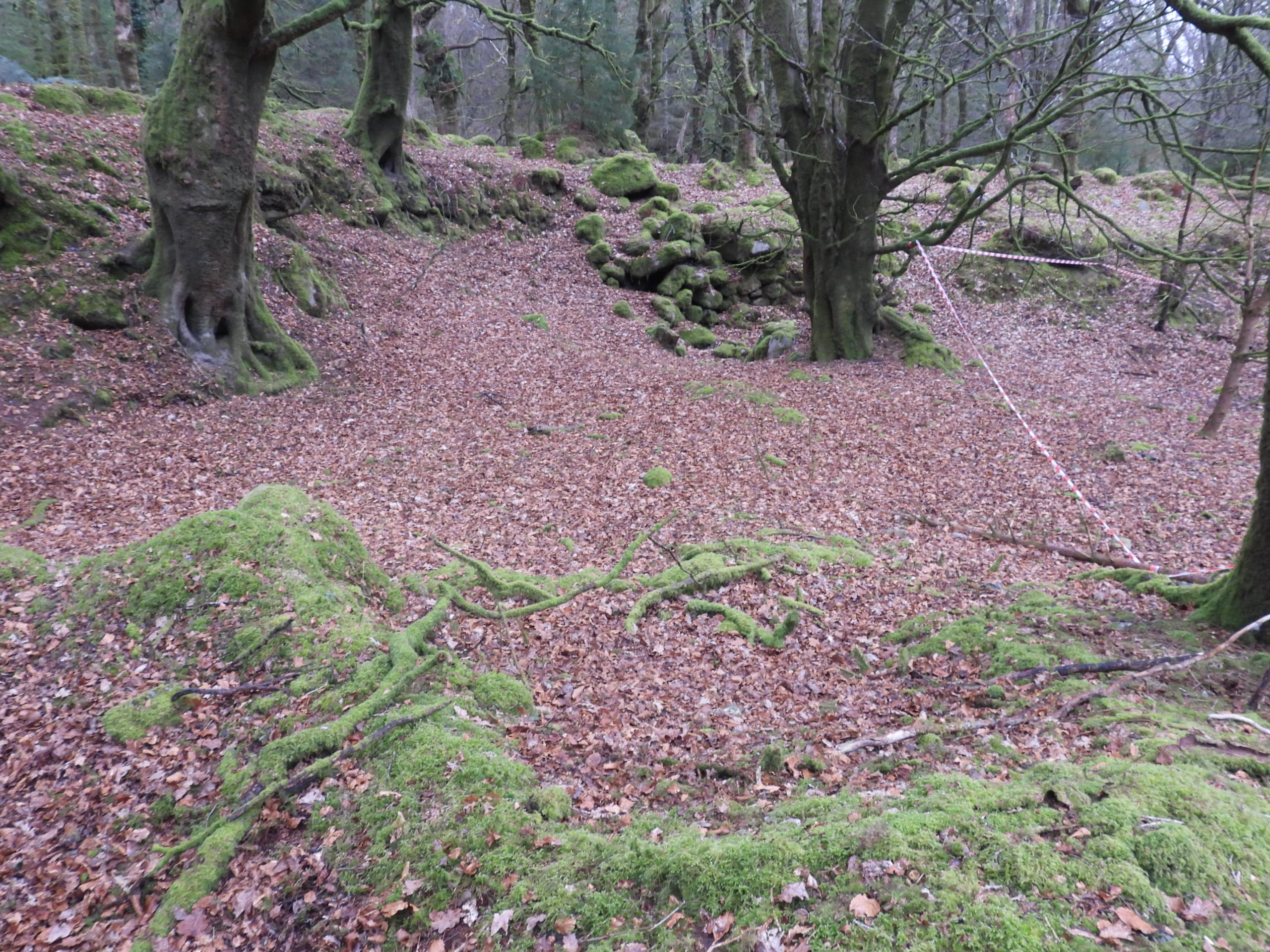
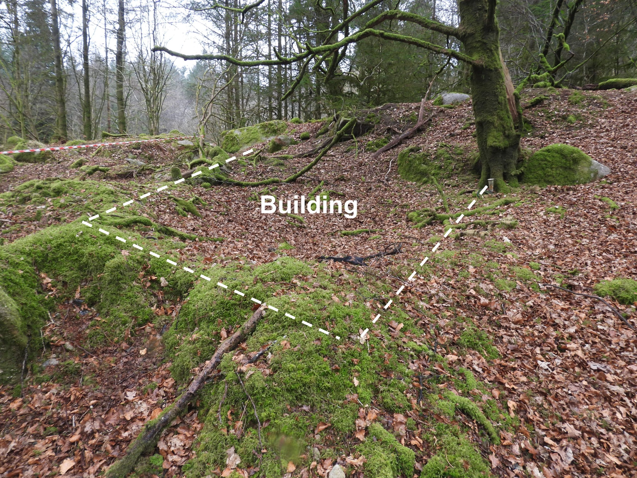
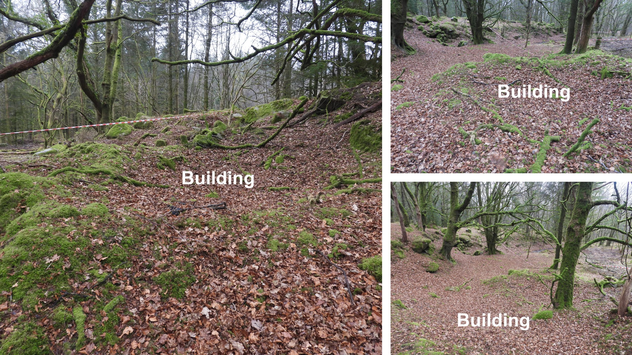
Sketch map of the locations of the Tinners’ Mills on both sides of the River Meavy. These mill and associated features on the right (west) bank of the Meavy are the subject of this post.View from Norsworthy Bridge, looking north.General view of the Tinners’ Mill, openworks and further building as seen from on top of the bank at the east end of the site. There appeared to have been a lot of forestry work being undertaken in the area, when a site visit was made, which the author believes is why the red/white tape in the pictures are evident.Looking down on the wheelpit and stamping mill.The stamping mill comprises drystone walling. The wheelpit lies on the north side of the mill.The mill is filled with a lot of loose rubble.The stamping mil / wheelpit is located at SX56735 69544The wheelpit has been recorded (Gerrard) as measuring measures 4m long x 0.94m wide. The wheelpit wall is recorded (Gerrard) as being up to 1.2m high adjacent to the mill and 2.5m high on the other side.The stamping mill, as recorded by Gerrard is 4.6m long x 3m wide.On the bank above the mill (to the east) is a displaced ‘Triple Mortar Stone’, which is likely to indicate the Stamping (or Knocking) Mill had three heads of stamps. Why such a large boulder was moved to the top of the bank, presumably taking a lot of effort, is unclear.The Triple Mortar Stone is located at SX56742 69547The location of the ‘Triple Mortar Stone’ in relation to the wheelpit. The size of the bank becomes evident from this angle.Sandy Gerrard records that the location in this valley bottom may suggest that it was formed by alluvial streamworking. The date of the tin openworks would certainly be earlier than Tinners’ Mill. is it possible the later tinners’ were reworking the small valley and needed a mill to crush the ore ?A short distance to the west of the Tinners’ Mill lies a rectangular earthwork. Gerrard records : “…….probably represents the site of a shelter or other structure associated with the nearby stamping mill”. He further states: “It is possible that the earthwork represents the site of a prospecting pit, but if so it has been severely distorted”. The ‘building’ is recorded as measuring 5m x 2.5m, with a rubble bank wall 1.8m wide and 0.8m high. It is located at SX56718 69548.