Dartmoor Explorations

A collection of walks, discoveries, insights and pictures of exploring Dartmoor National Park

Little Hentor (or Shavercombe Foot) deserted farmstead

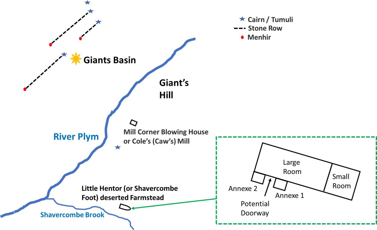
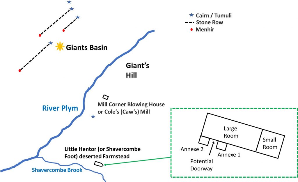
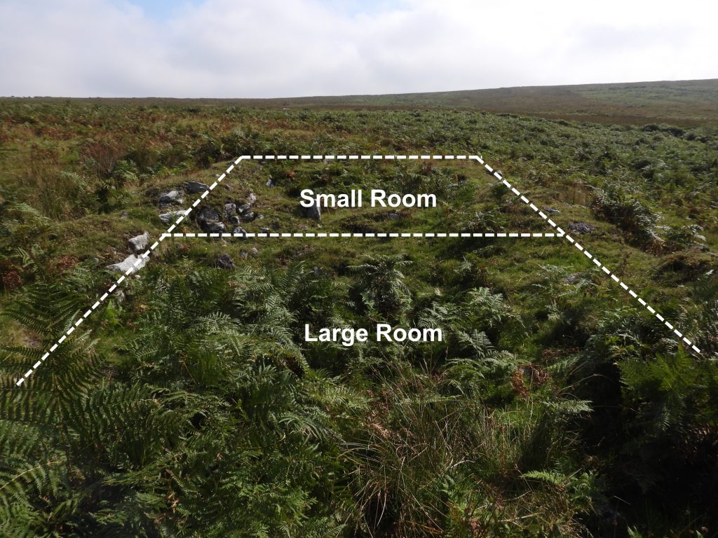
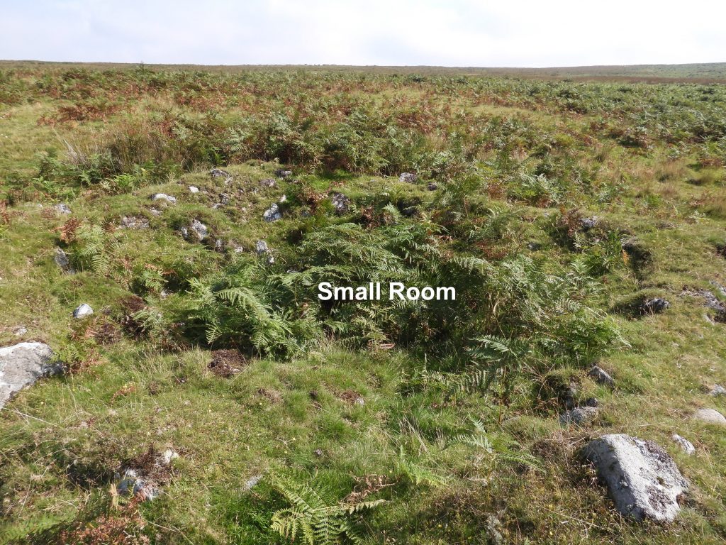
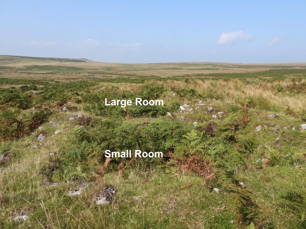
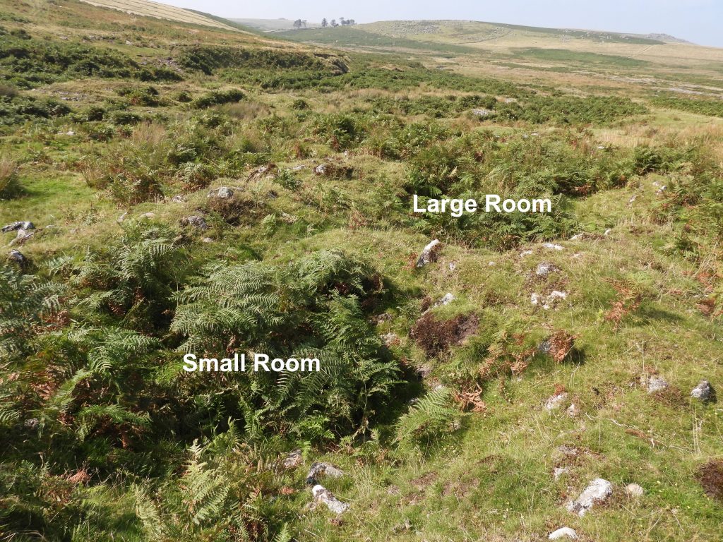
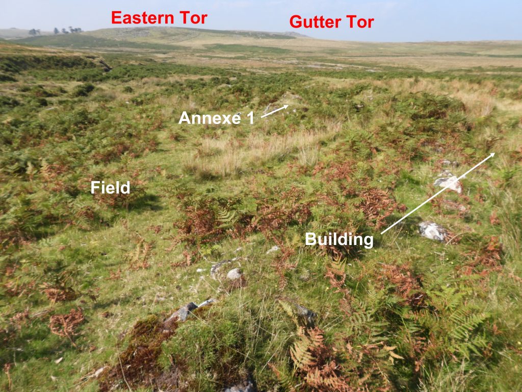
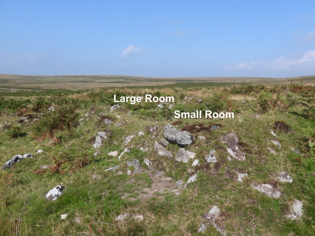
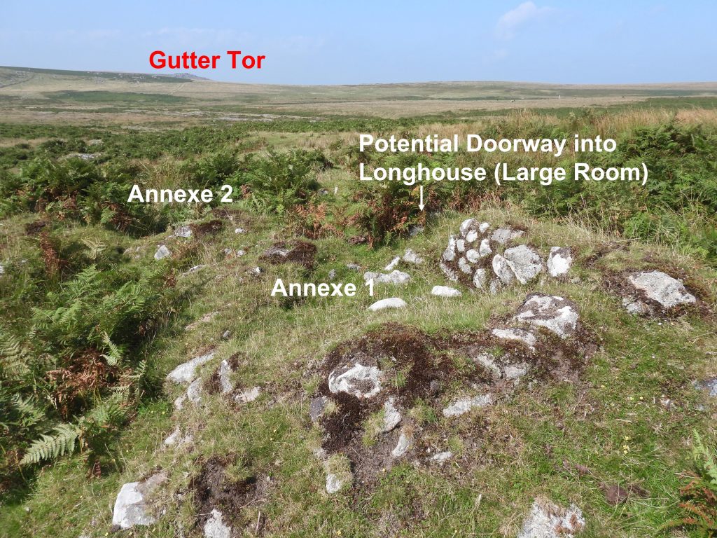
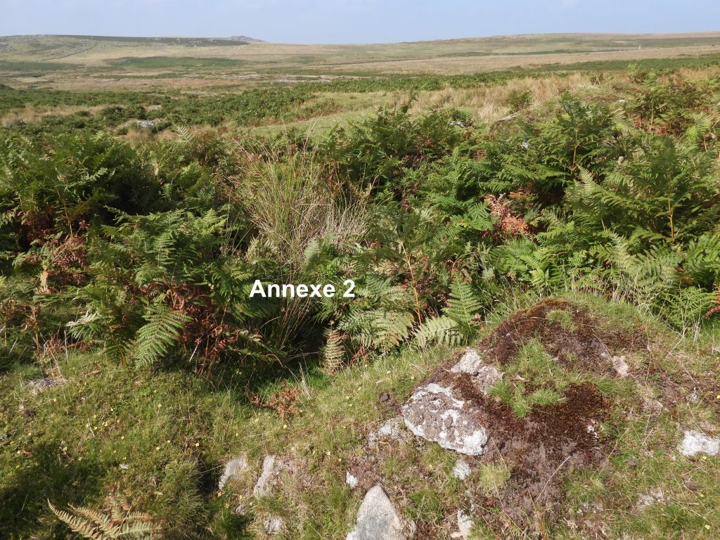
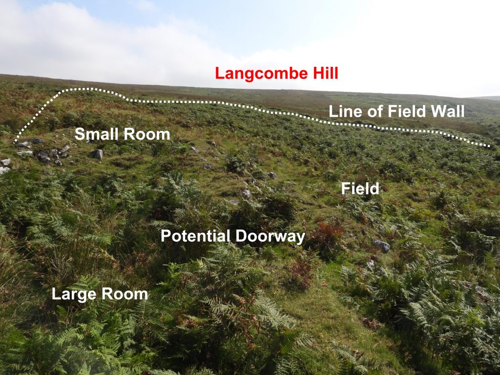
The settlement / farmstead is recorded as being possibly of medieval origin, but most likely 18th and 19th century in date. It comprises of a well-preserved two-roomed rectangular structure with two external annexes and an attached yard and fields. In the immediate area there are at least 2 fields and a tin openwork. This farmstead may be Hentor Cottage, the residence of a farm labourer in the 19th century. It has also been known as Shavercombe Foot farmstead.

Map
Sketch map showing the location of the farmstead in relation to other features in the area,
LHF1
The building structure has course boulder walls and measures 16.5 metres east to west by 4.0 metres
LHF2
The small room in the building can be located at SX59312 66550 (measured at the centre of the room).
LHF3
An internal partition lies 13.2 metres from the north-west end of the building.
LHF4
The centre of the large room is at SX59305 66552.
LHF5
To the south west of the building lies a field, whose walls are just discernible.
LHF6
Walls are drystone and measure 1.2 metres wide.
LHF7
A potential doorway / entrance is flanked by two outshuts / annexes that adjoin the main wall of the structure on the south west side. Annexe 1 can be located at SX59306 66548.
LHF8
Annexe 2 can be found at SX59301 66547
General view of the building looking south towards Langcombe Hill. A field wall can just be discerned in the bracken.
Total Page Visits: 2428 - Today Page Visits: 3

Next Post

Previous Post

Leave a Reply

© 2024 Dartmoor Explorations

Theme by Anders Norén

Social media & sharing icons powered by UltimatelySocial