A collection of walks, discoveries, insights and pictures of exploring Dartmoor National Park
May 9, 2024
Tinners’ Mills, Huts and Workings around the River Avon from Heng Lake to Huntingdon Cross
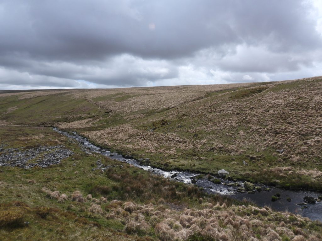
Around the River Avon, from Heng Lake to Western Walla Brook (Huntingdon Cross) are extensive medieval and later streamworks. Also in the area, located on the west side of the Avon was Wheal Dorothy, a tin prospect. Associated with these workings are two Tinners’ Mills (one stamping and one blowing), two Tinners’ Huts and a possible further Tinner’s building. Aside the Blowing Mill near Broad Falls, each of the other Tinner’s features could easily be missed when hiking through this picturesque valley.
Historically, this area was also synonymous with warrening, for which there are numerous features still discernible. There are over 100 pillow mounds, at least four vermin traps, several buildings and structures as well as the main Warren House.
This post records the aforementioned Tinners’ artefacts and a few of these warrening features which are located around the Avon Valley. To complete the post the author has included the unique Keble Martin Chapel near the Western Walla Brook.
An exploration of this remote part of Dartmoor, is best approached from either Shipley Bridge or Lud Gate.
Bibliography
Royal Commission for the Historical Monuments of England (RCHME), 1993-1998, Dartmoor Royal Forest Project
R.H. Worth (1940), The Dartmoor Blowing House
Dr Phil Newman (2007), Archaeological Field Investigation (Report – Survey).
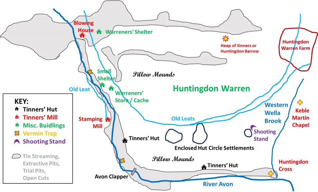
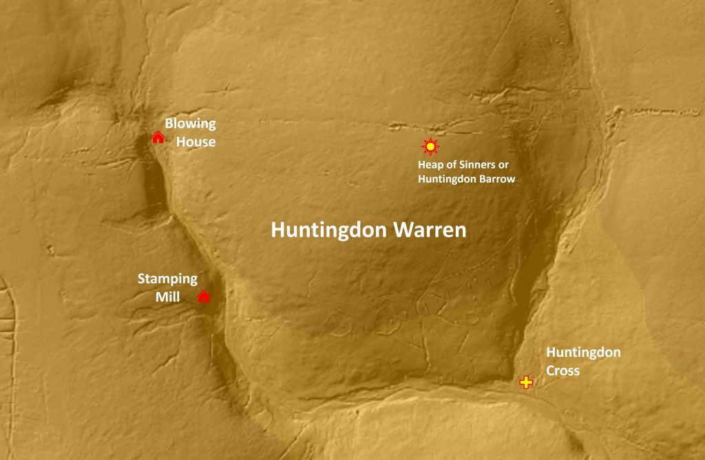
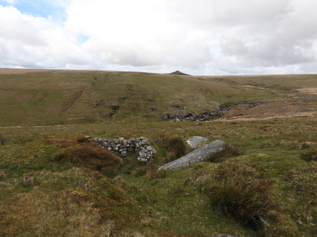
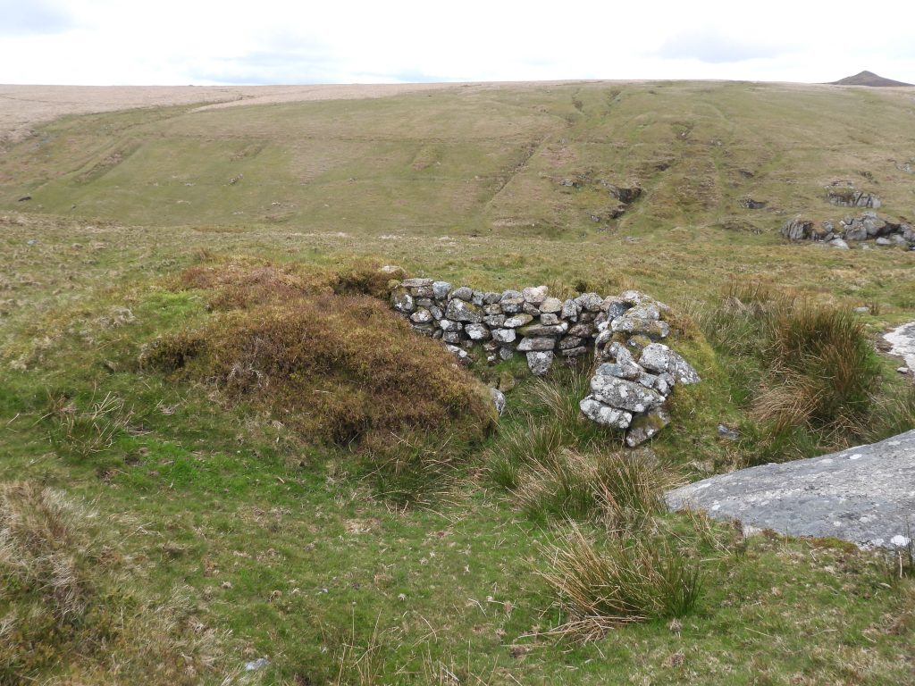
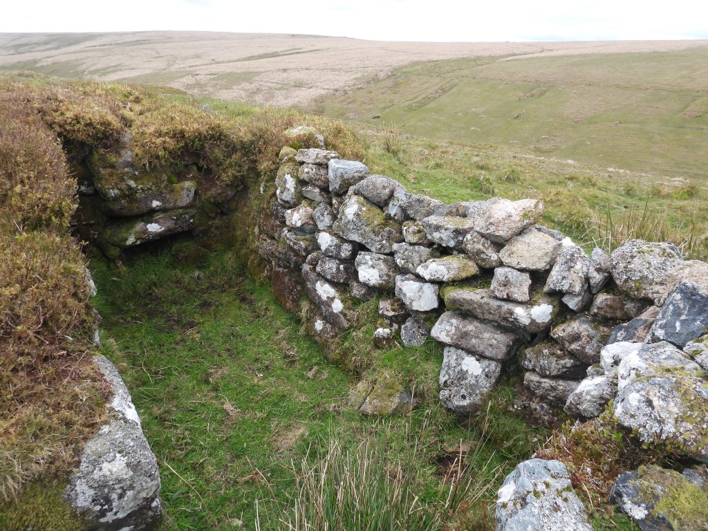
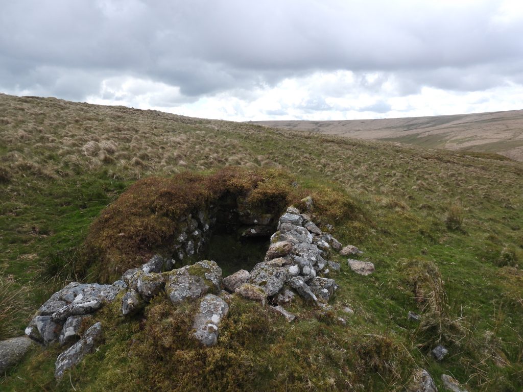
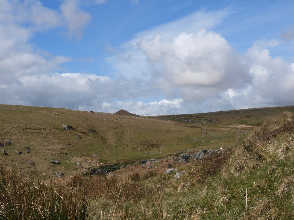
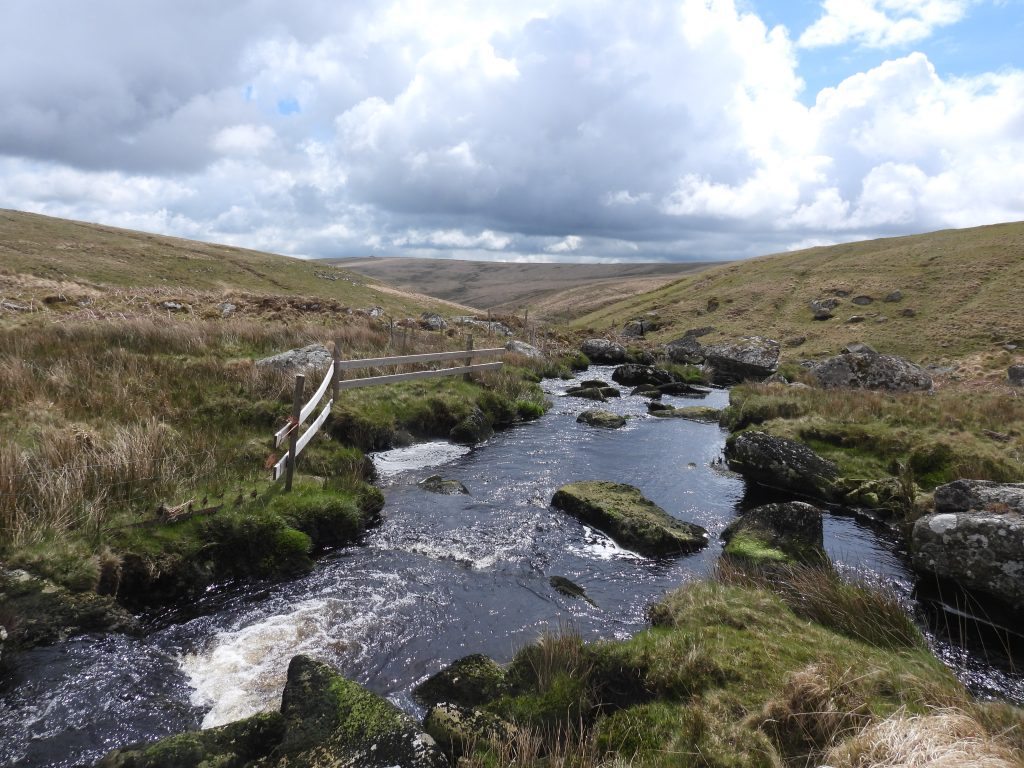
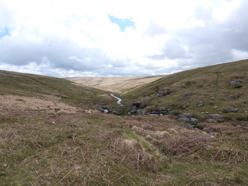
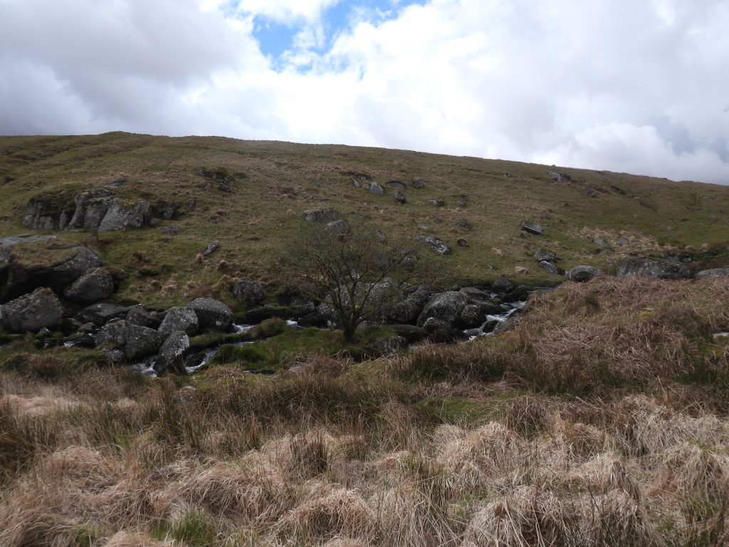
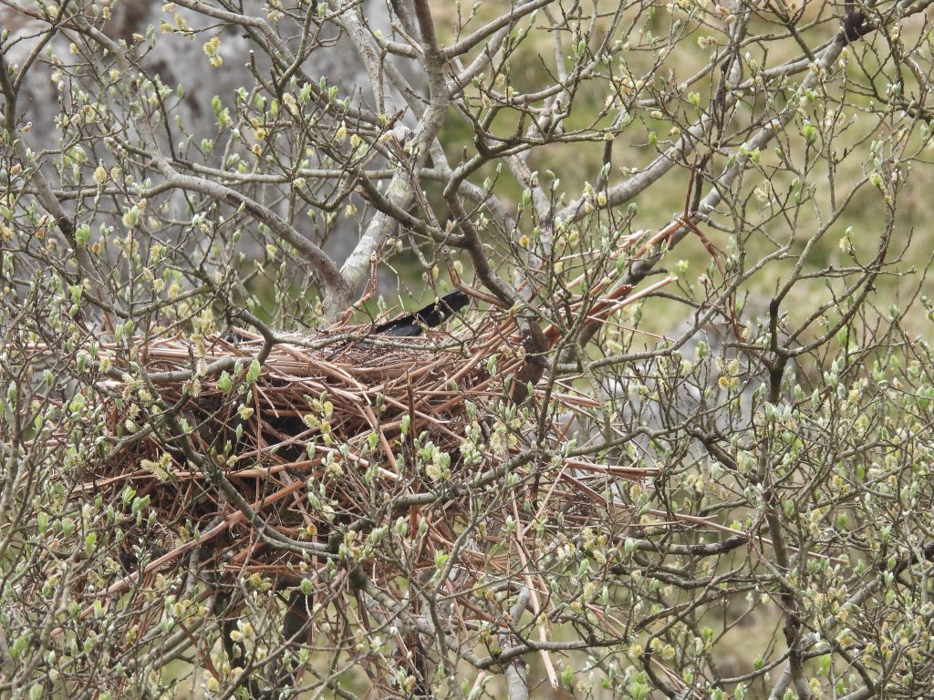
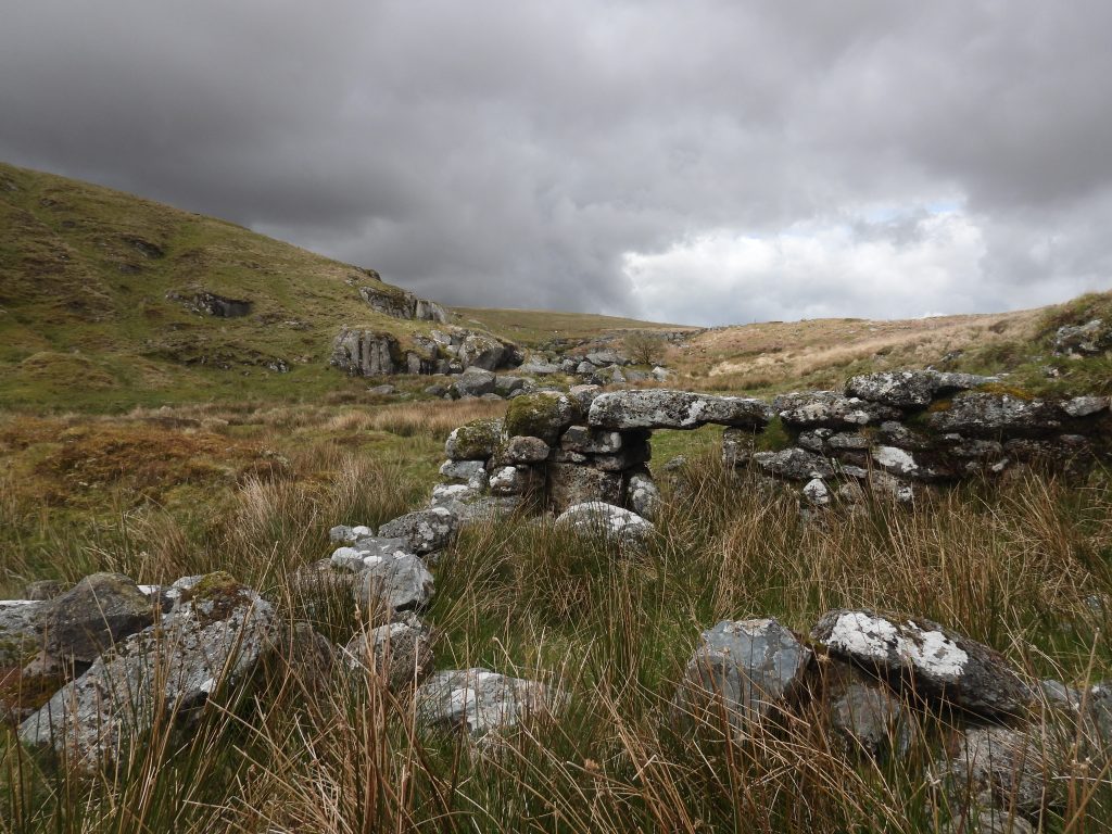
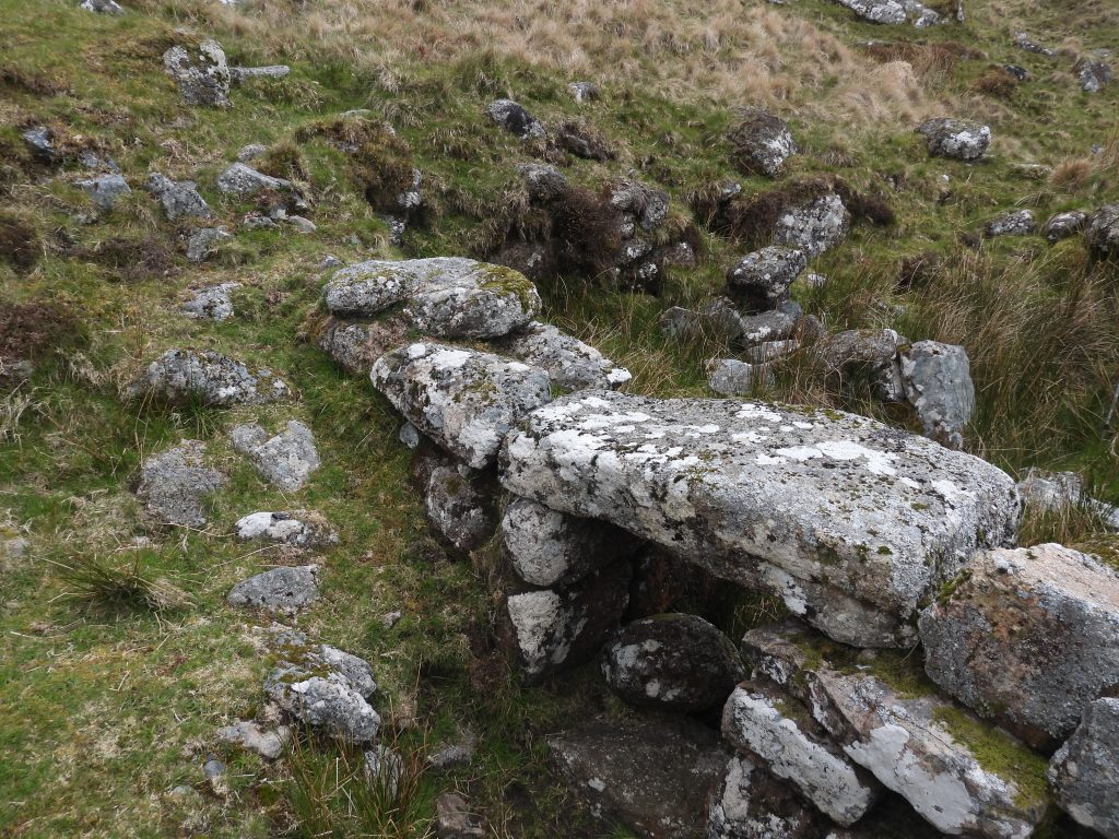
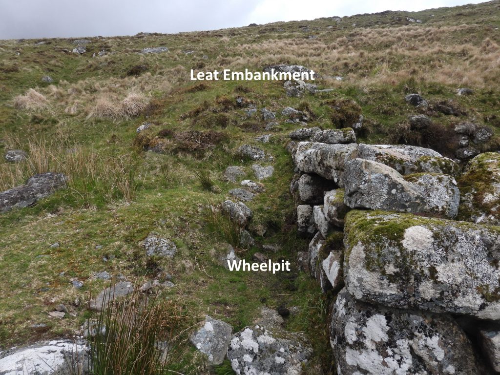
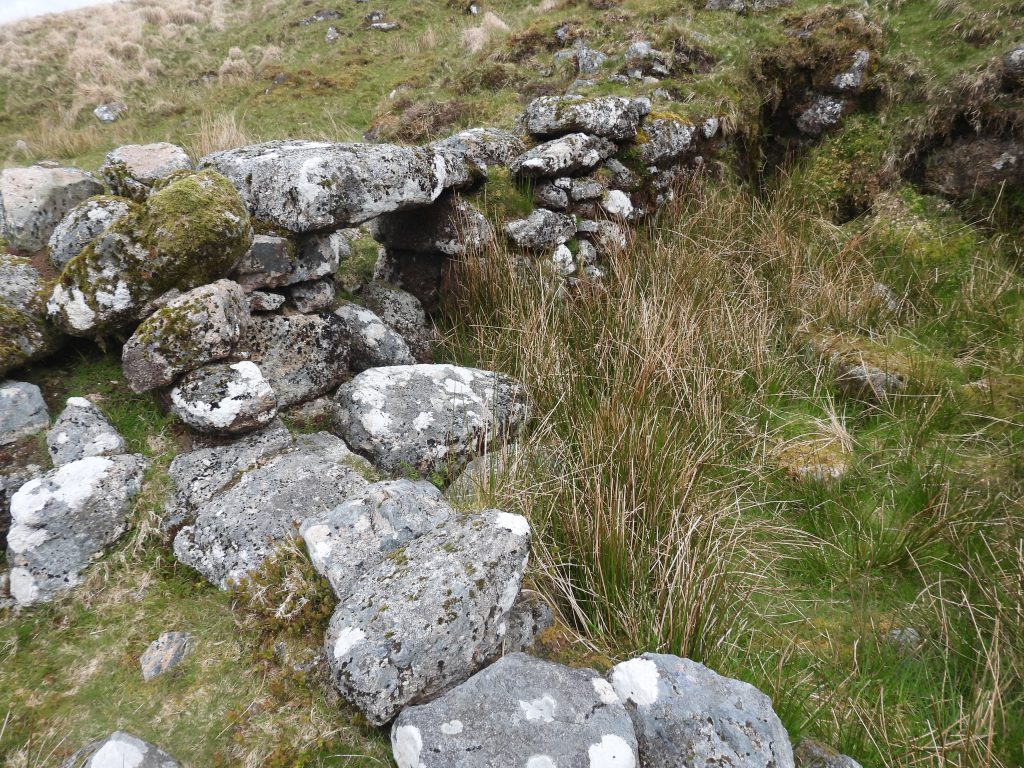
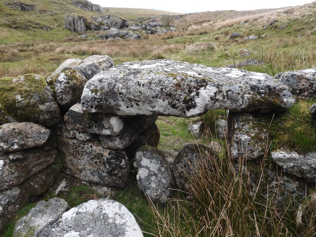
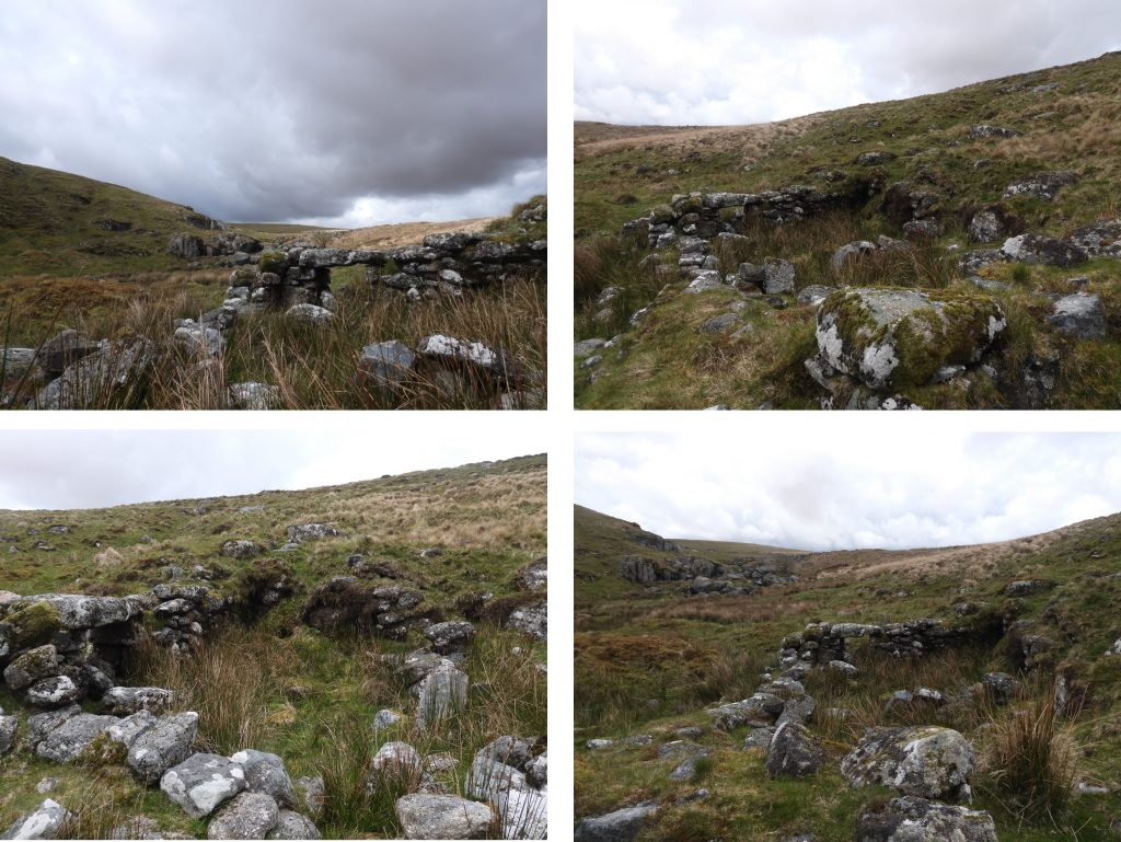
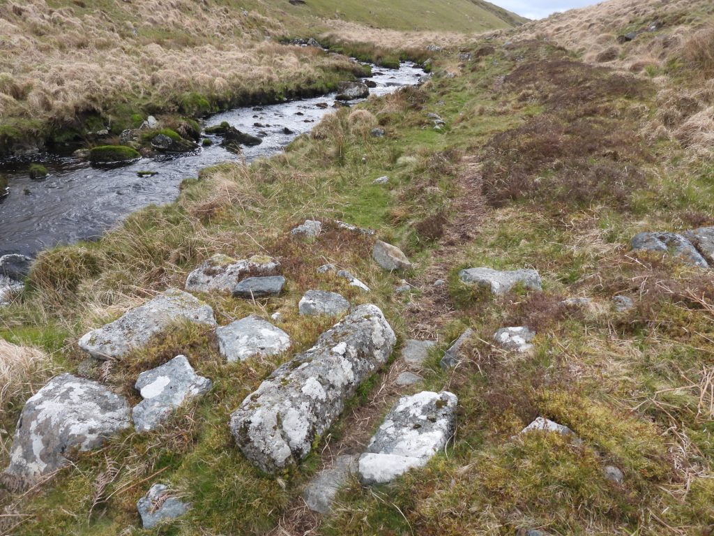
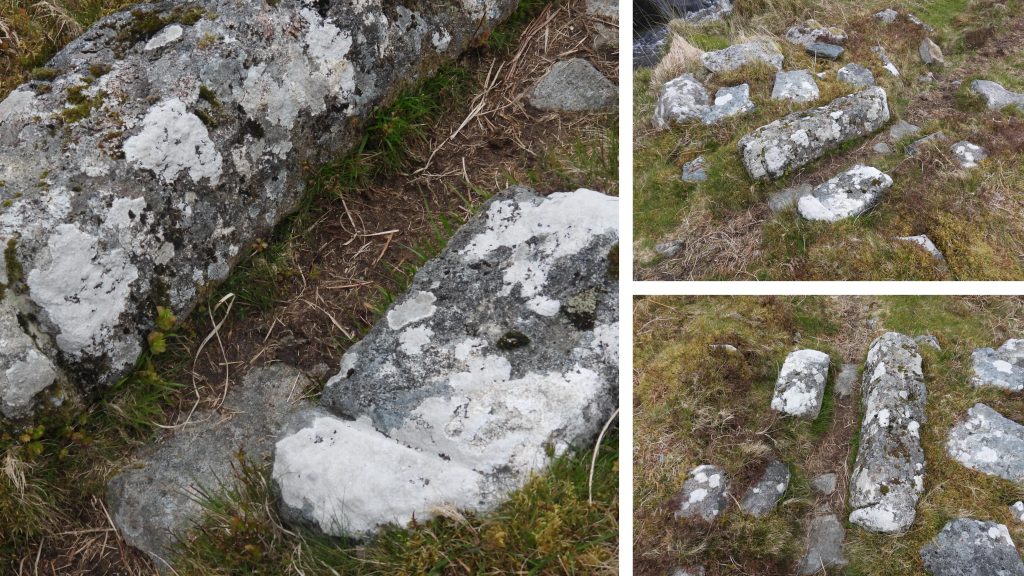
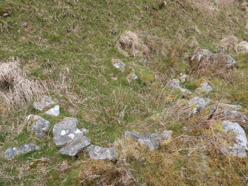
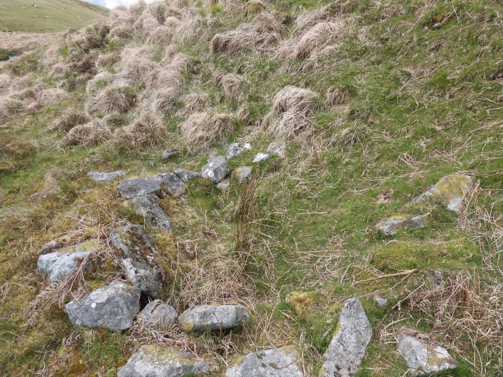
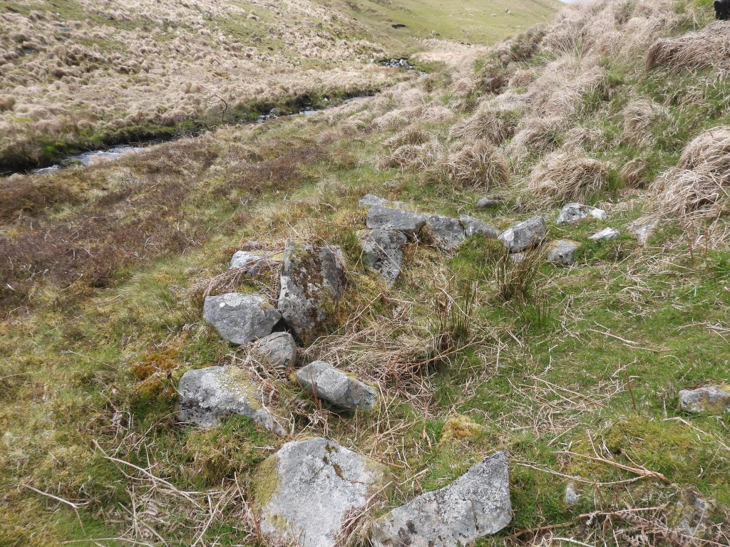
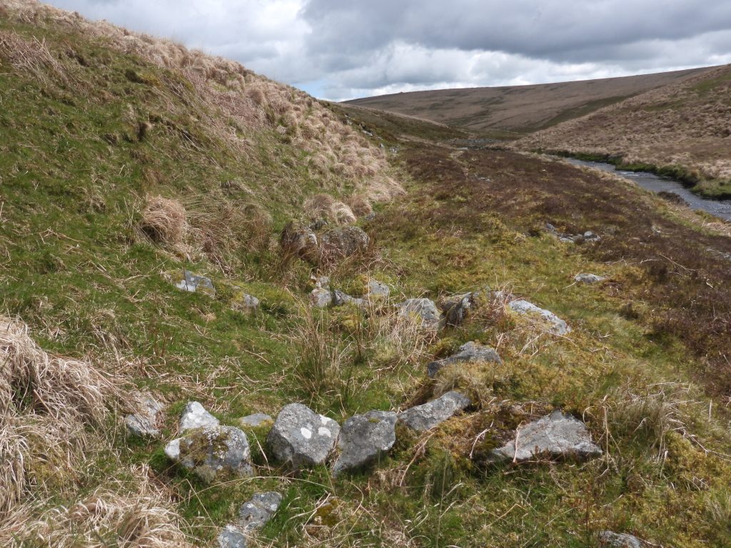
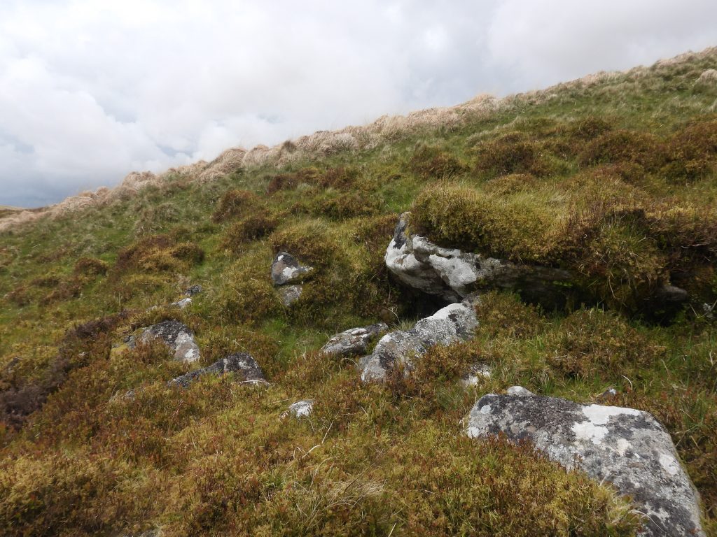
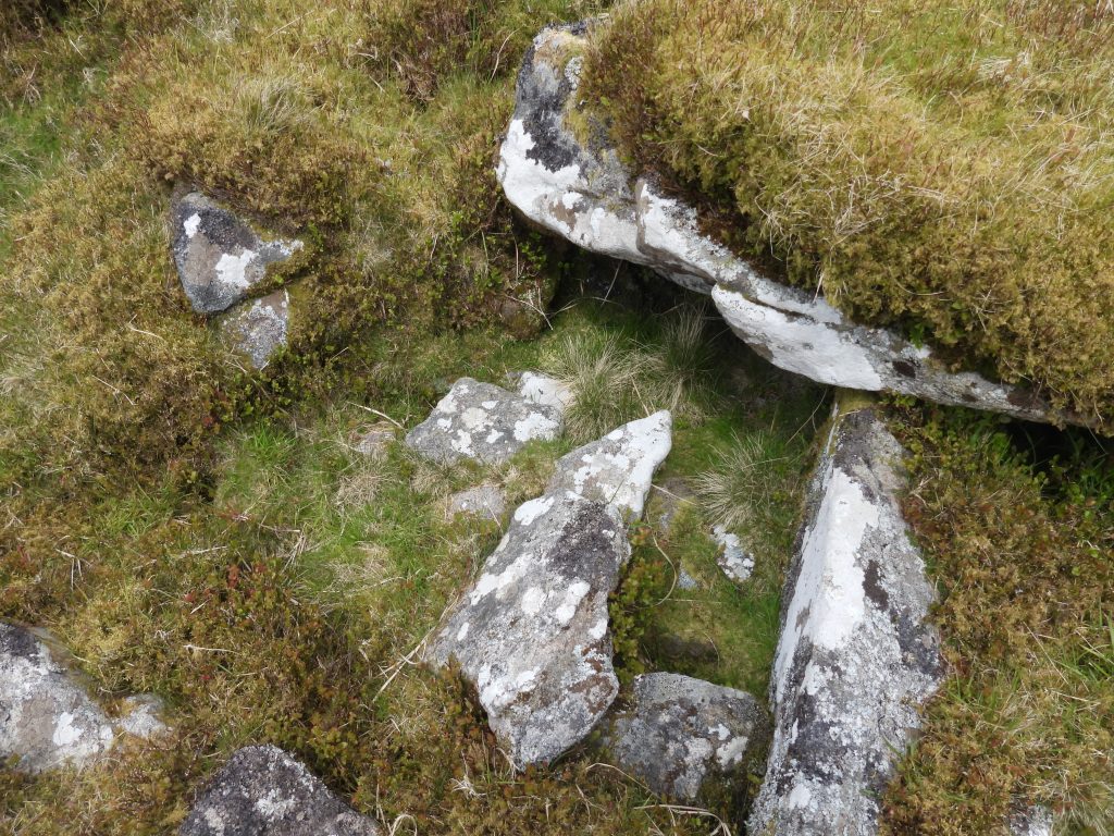
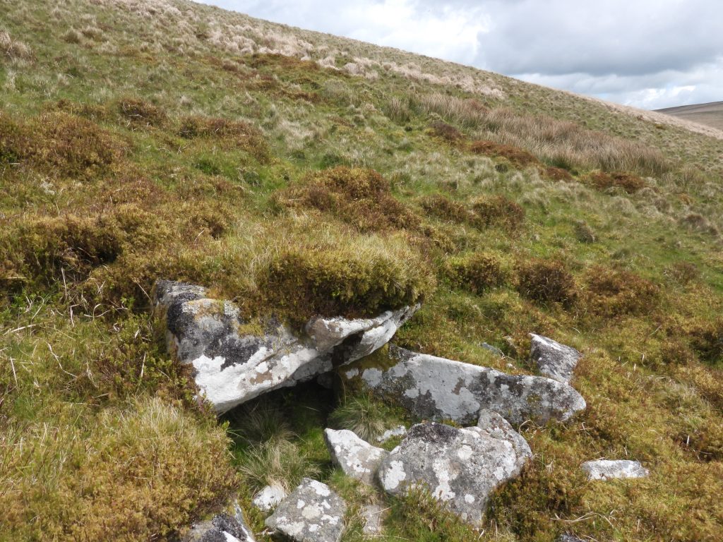
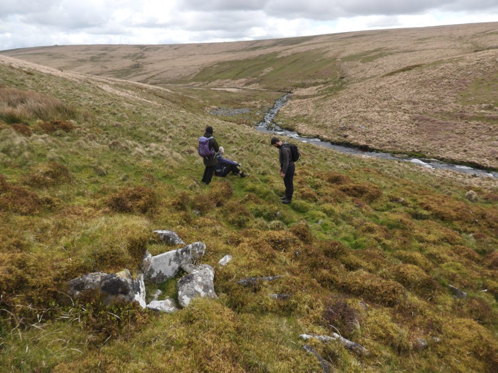
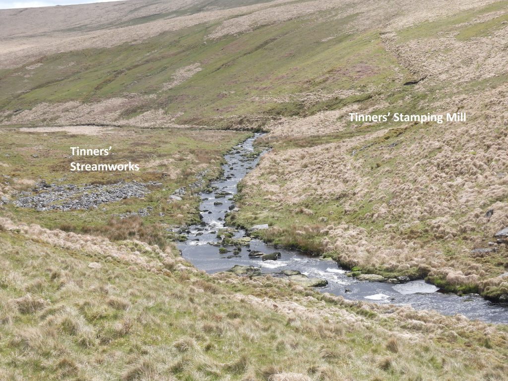
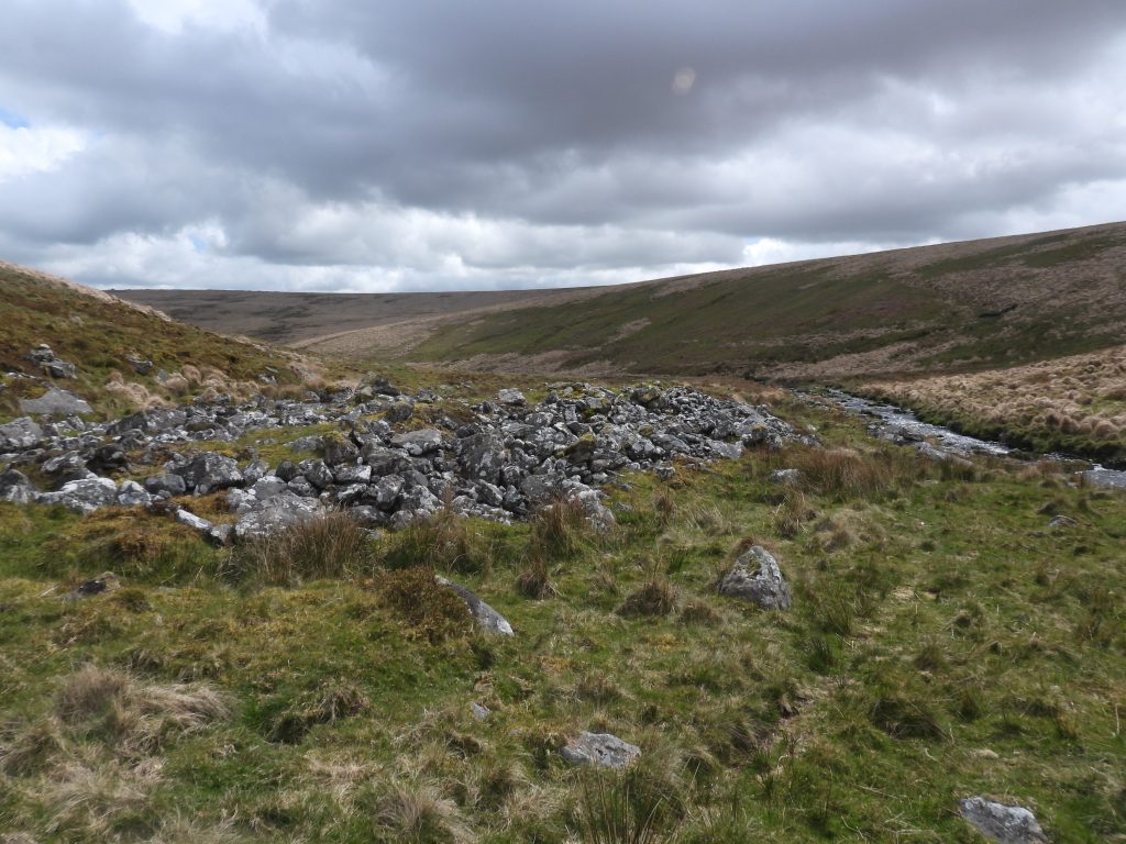
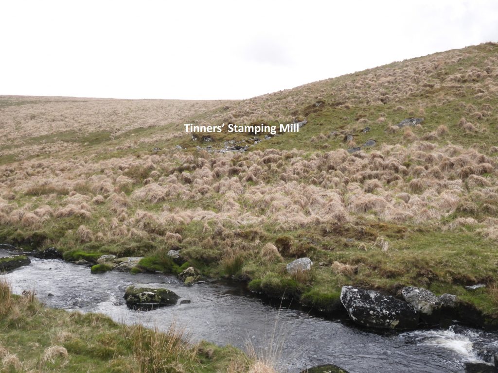
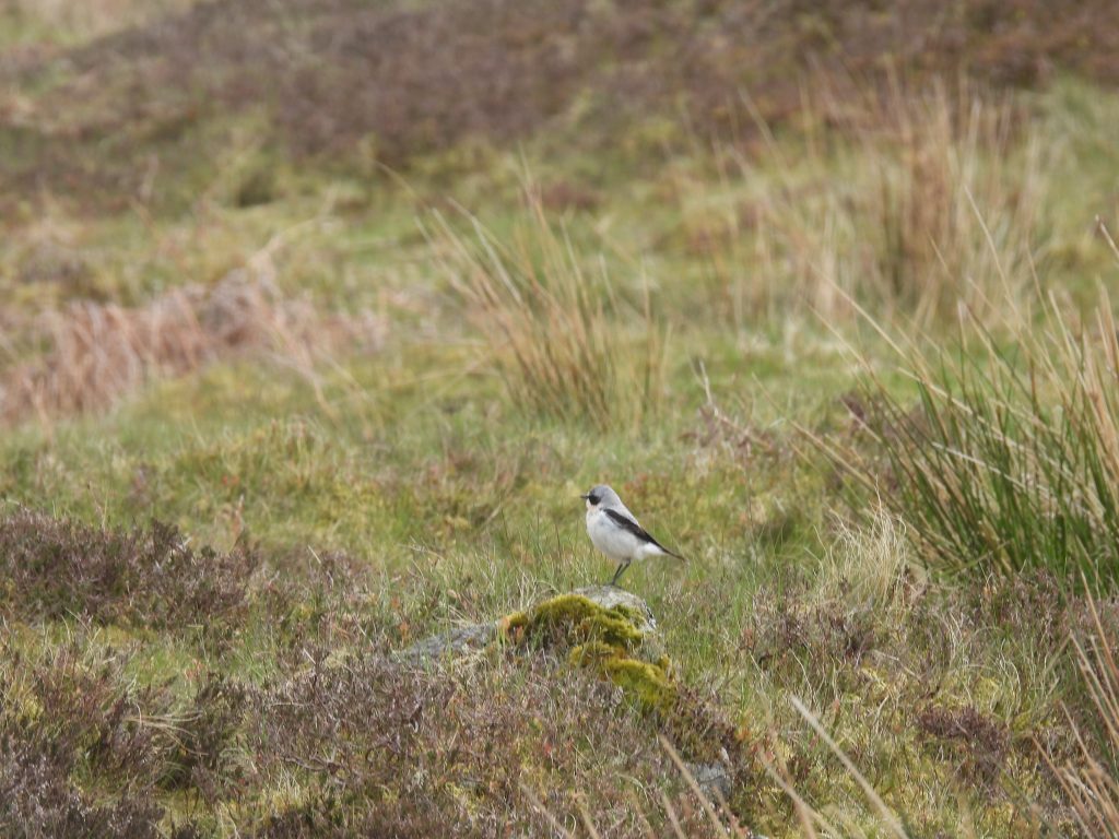
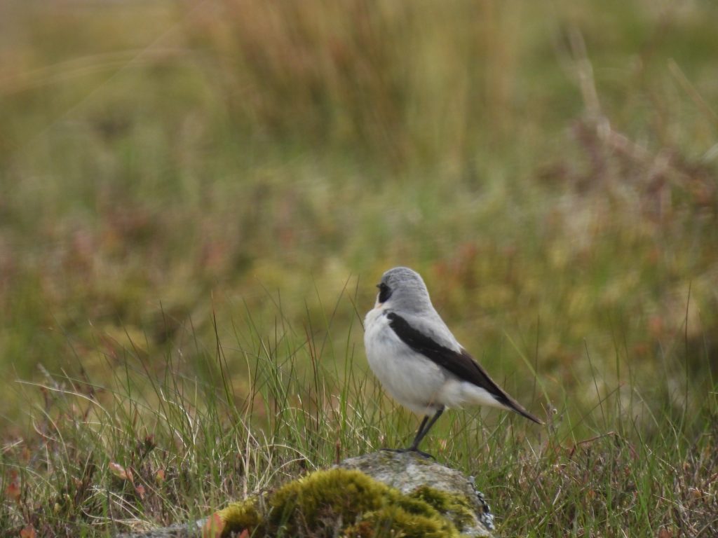
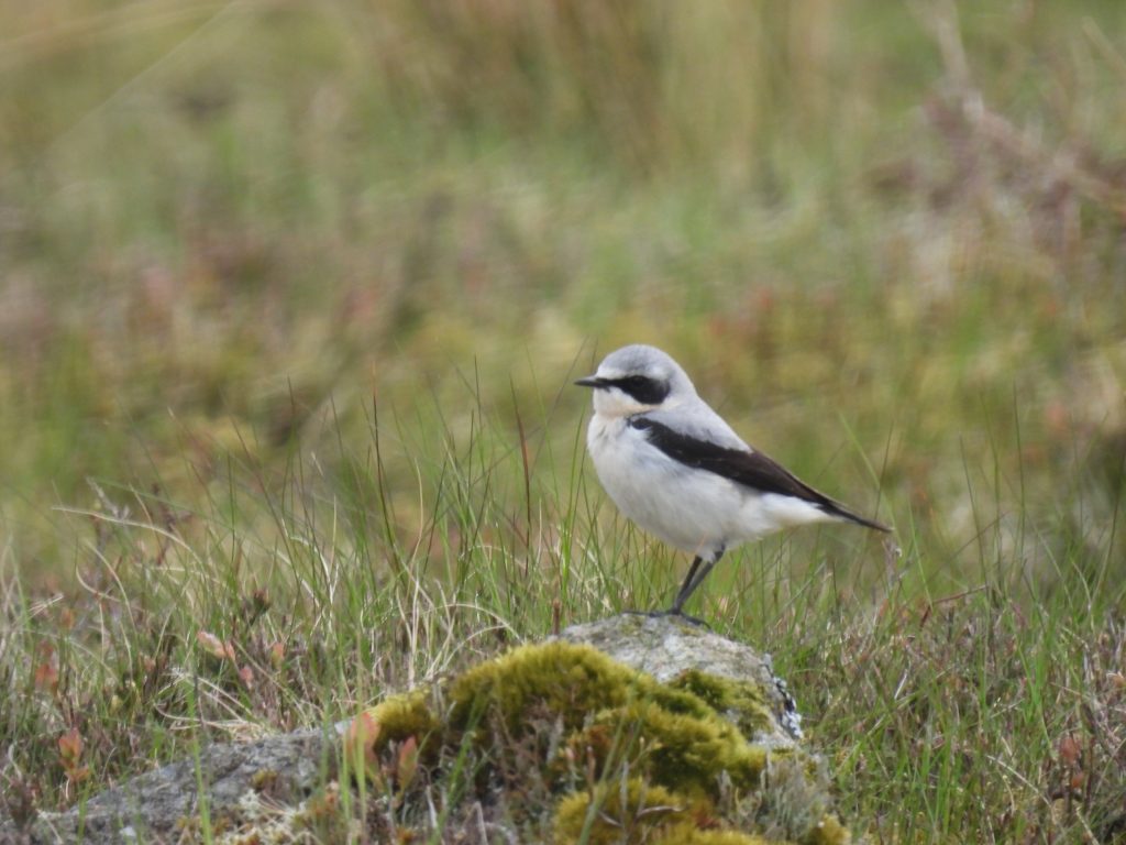
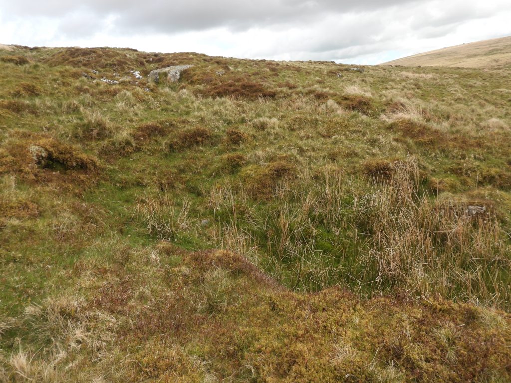
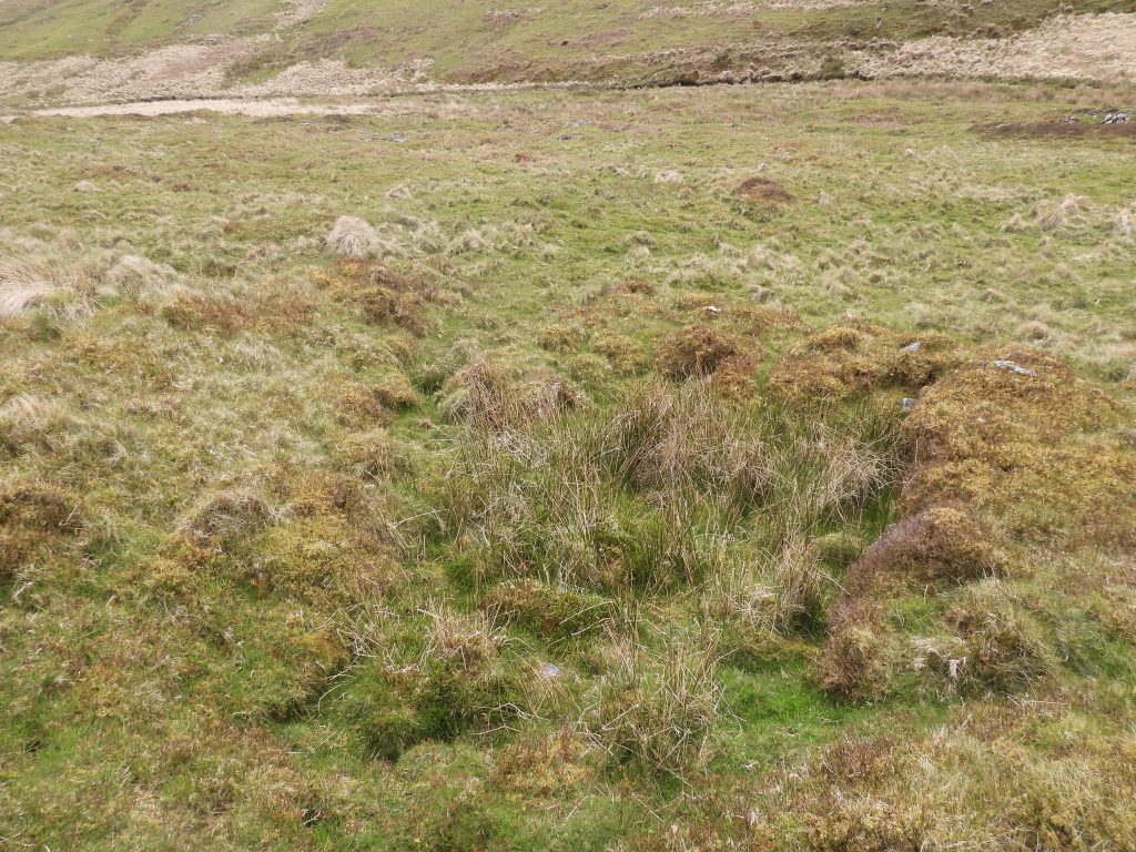
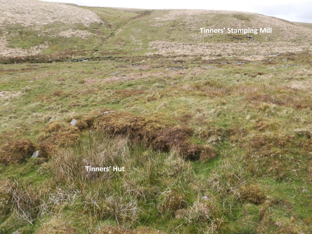
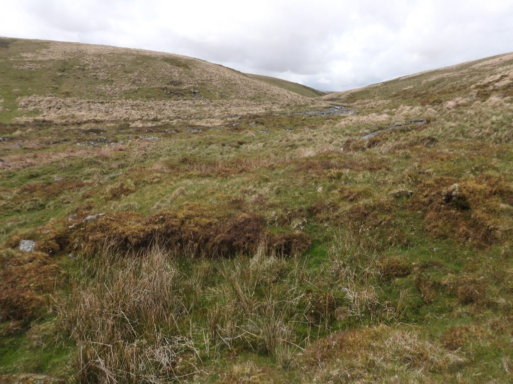
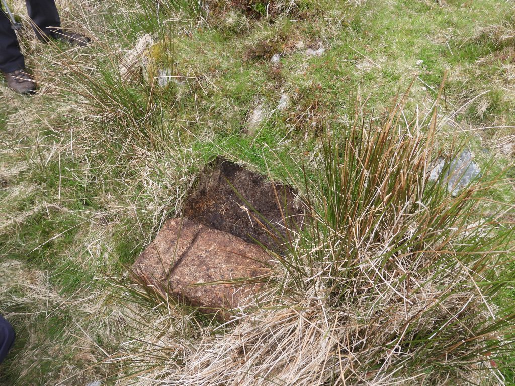
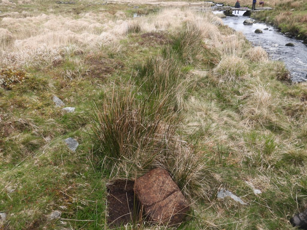
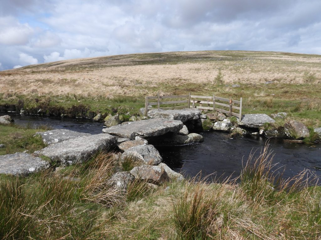
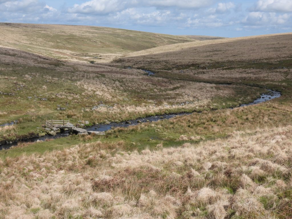
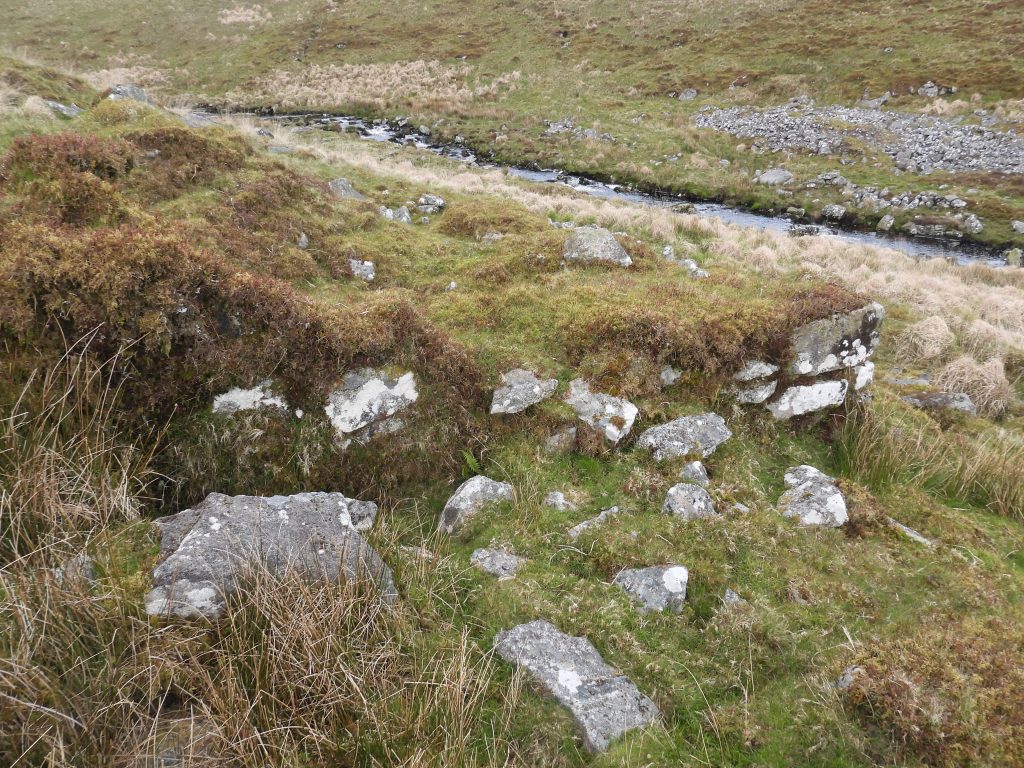
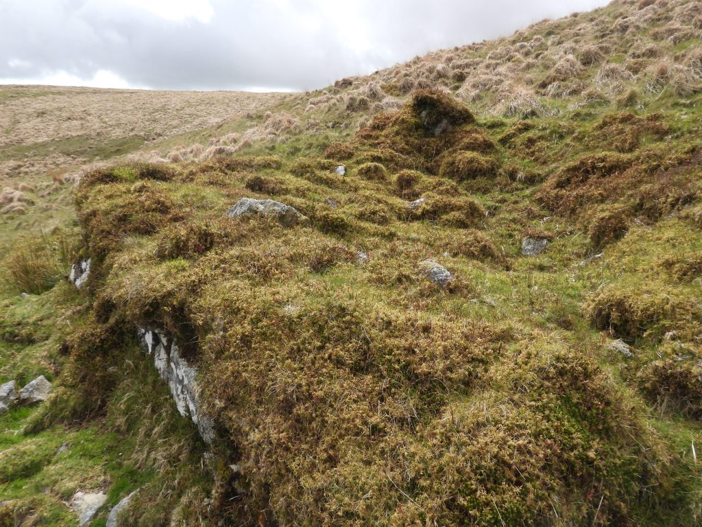
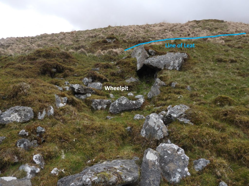
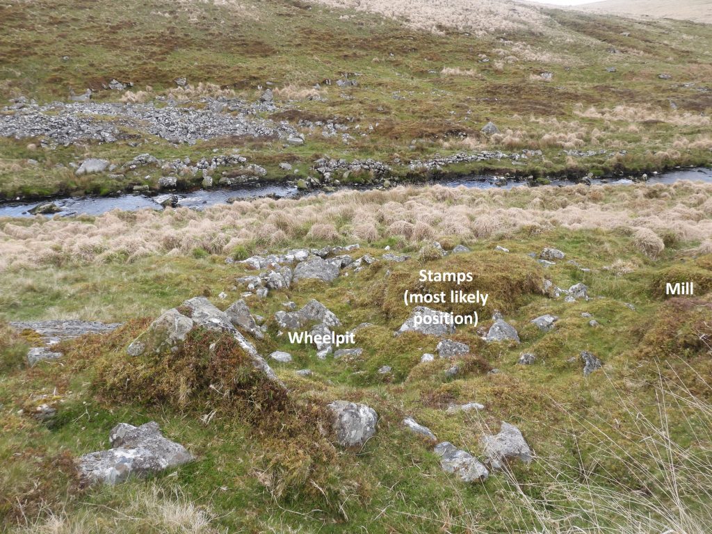
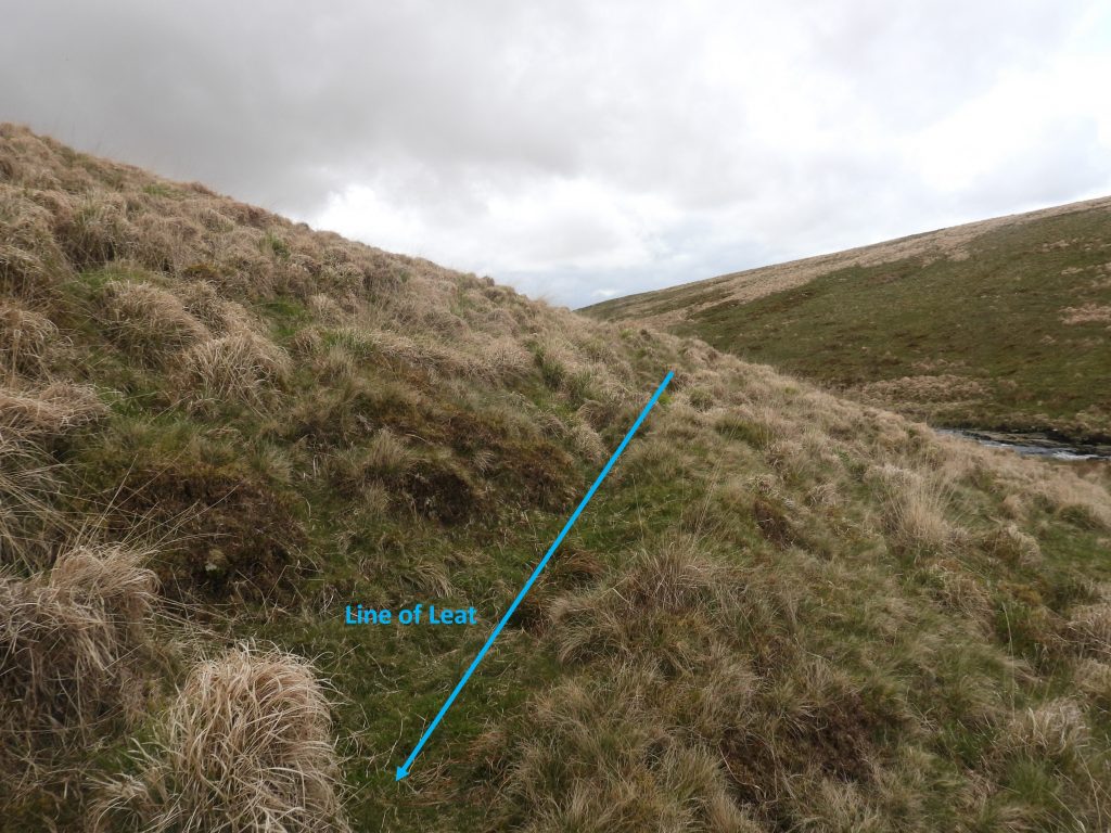
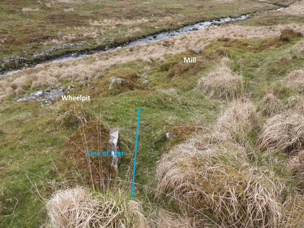
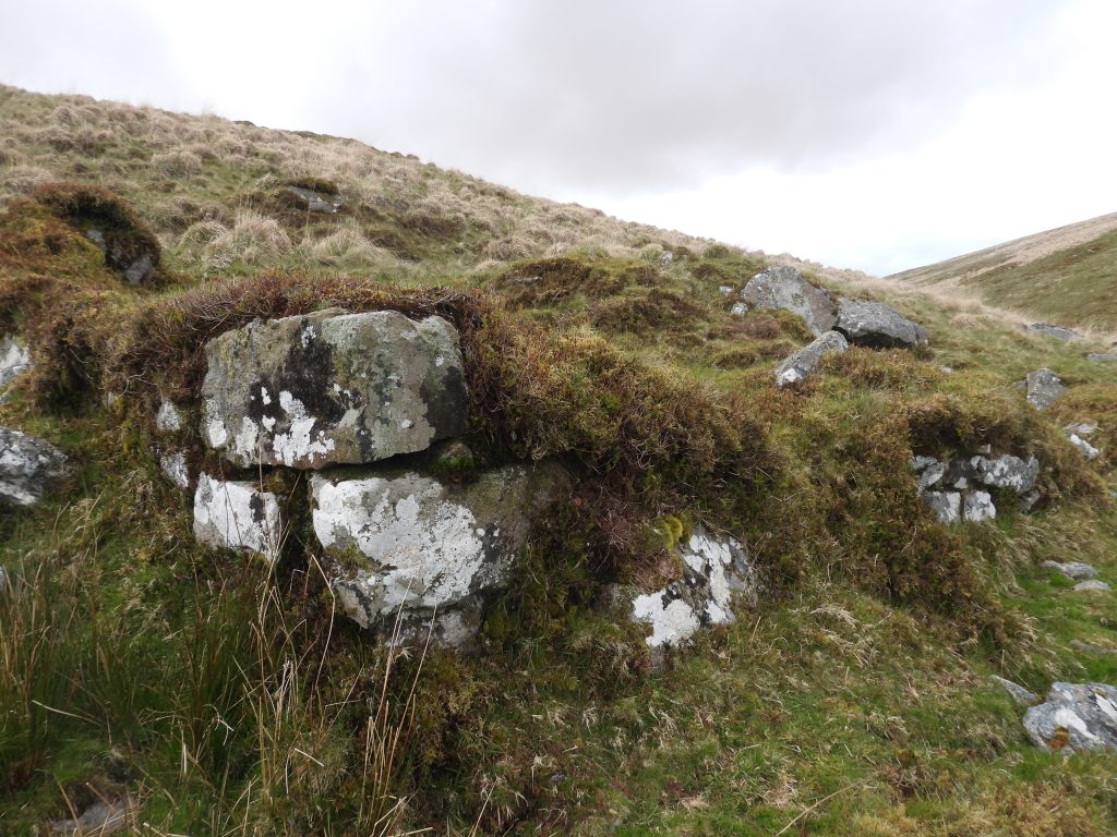
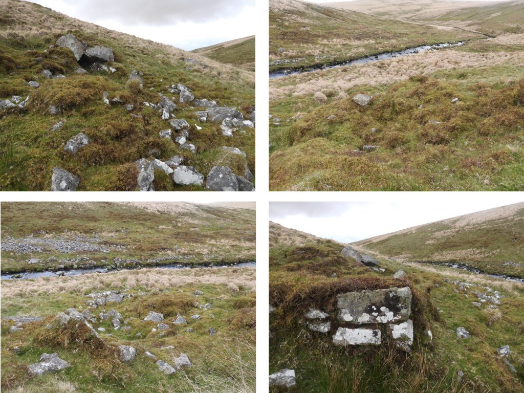
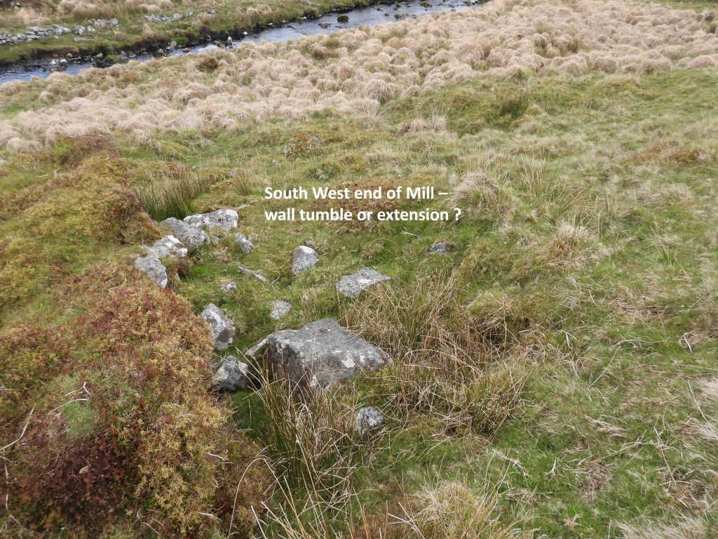
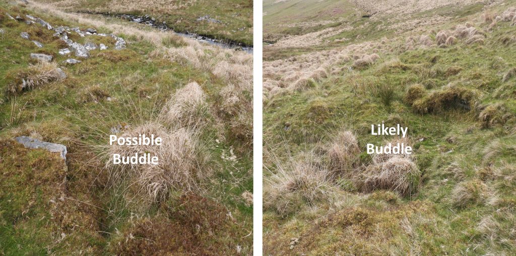
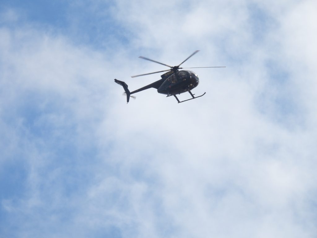
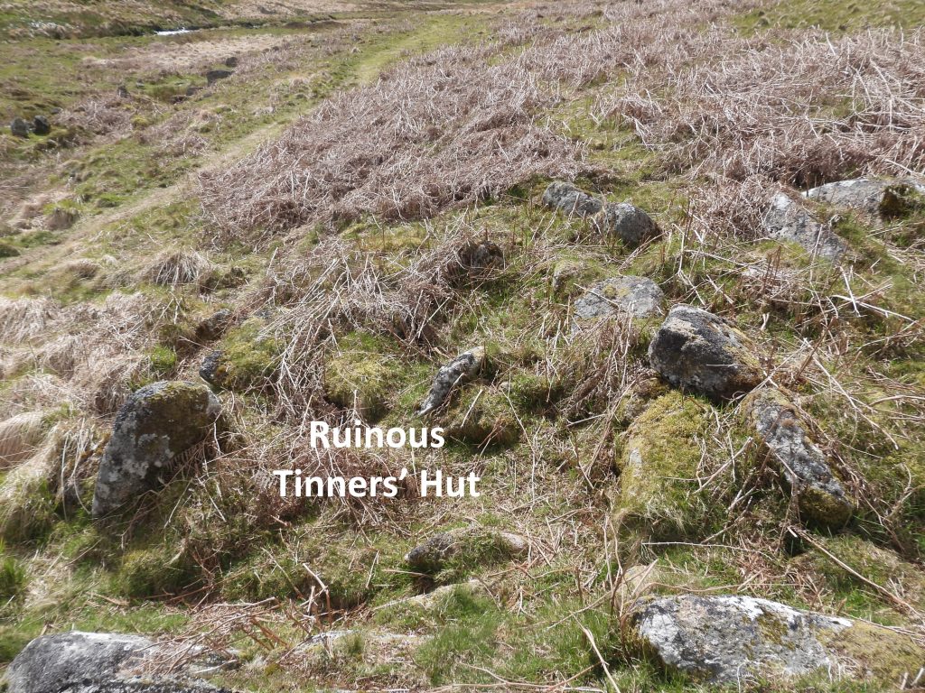
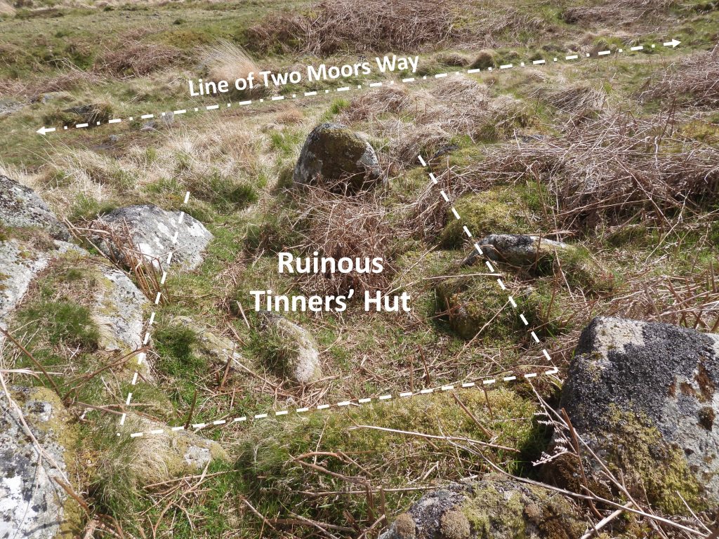
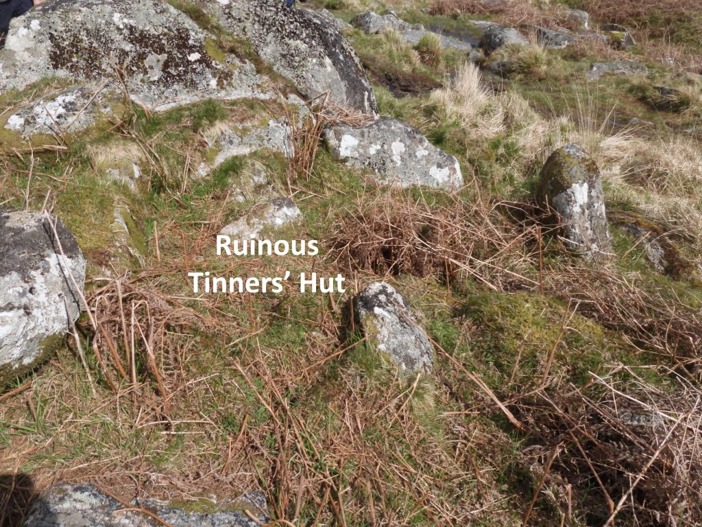
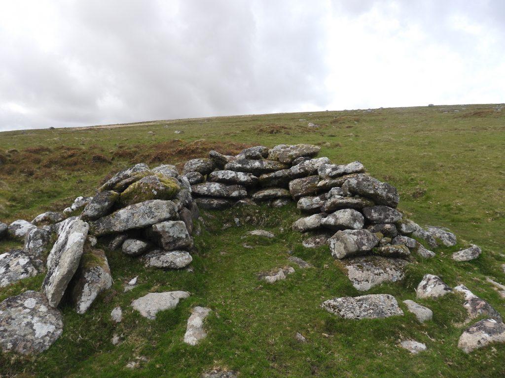
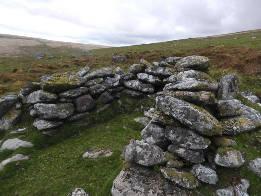
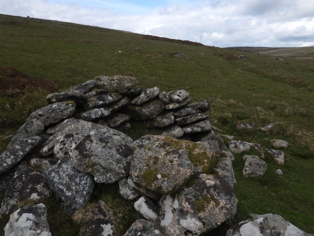
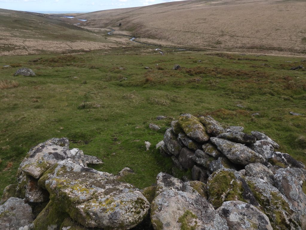
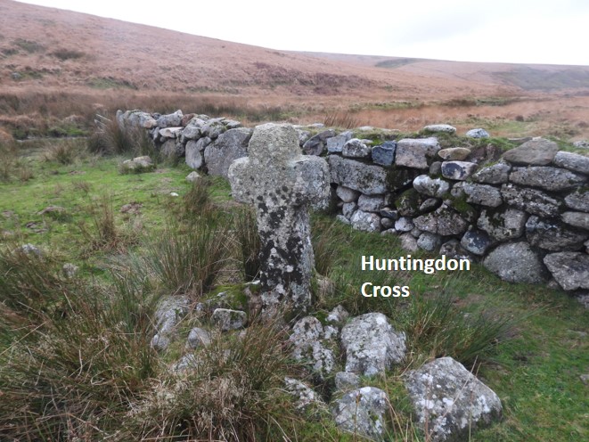
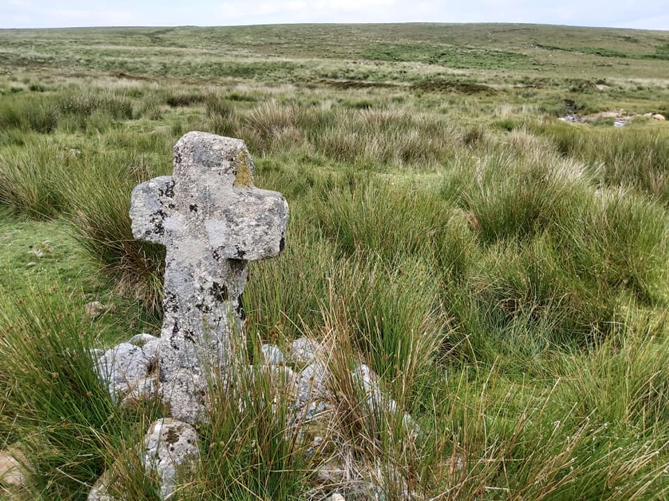
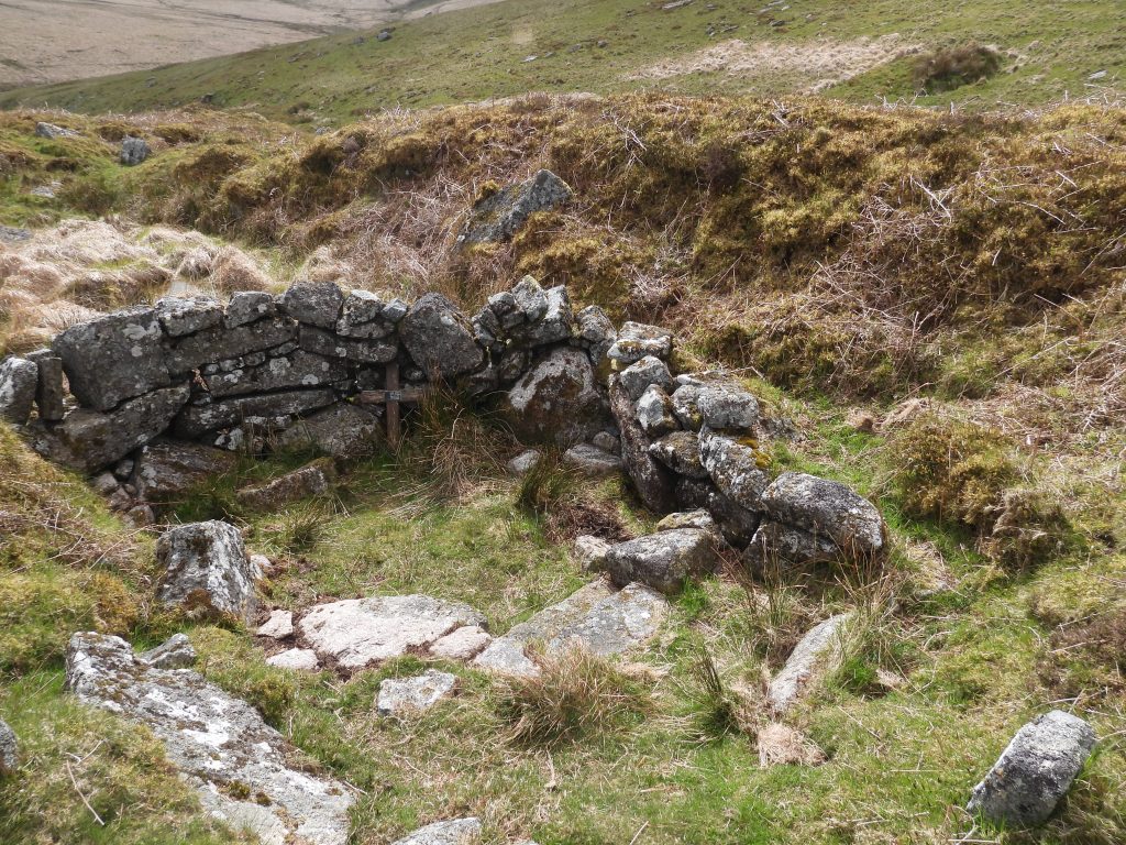
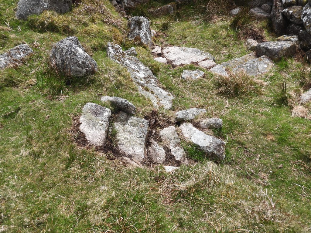
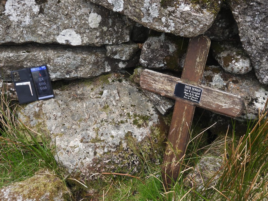
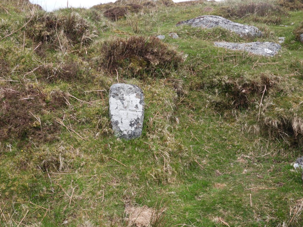
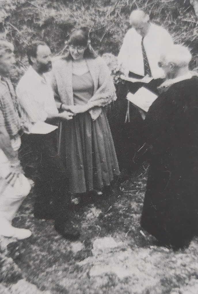
Sketch map showing the relative locations of the features (mainly relating to tin working and warrening) covered in this postLIDAR (Light Detection And Ranging) plot showing the area covered in this post. It is interesting to note the scars left behind by the tinners’ and the lines of the conspicuous enclosed hut circle settlements. The plot also shows the Redlake Tramway (far left) and a dry leat curving around the Huntingdon Warren hillsideOn the west-facing slope high above the left bank of the River Avon is a single roomed shelter which lies within a concentration of small tin pits. It is partly built into a spoil heap. From this high position Redlake tip, Heng Lake and Broad Falls can be seen. On the opposite hillside tinners’ openworks can be seen with a dry leat passing through them (left to right), which lead to the Stamping Mill, which is covered later in this postSome Dartmoor observers have suggested this is a Tinners’ Hut, whilst others believe it does not resemble one both in form or location. It appears to be post medieval in origin and most likely was constructed as part of the warrening activities in the area. There is a well defined entrance on the north east cornerThe record on the Heritage Gateway (RCHME) states the measurements of this shelter as being: “2.6 metres N to S by 1.1m internally with coursed boulder walls 0.8m wide and a maximum 1.1m high”. There is a small cupboard recess (which might even have been a fireplace) in the south wallThe shelter is located at SX65521 66952View from tinners’ pits on the north western slopes of Huntingdon Hill overlooking Heng Lake and the AvonRiver Avon at the top of Broad Falls. Some fencing has appeared next to the river in recent times presumably to prevent animals straying into the river. Near Broad Falls looking south down the Avon valley, a wonderful Dartmoor vistaThis tree just below Broad Falls on the Avon has a large nest in itClose up of the nestBlowing house is built against the river ‘cliff’ near the left (east) bank of the River Avon. Richard Hansford Worth measured the mill in 1940 as 17’6″ by 12′ 3″ internally with walls being 2’6″ thick. The mill is located at SX65429 66921The conspicuous lintel is the likely position of where the water wheel axle passed through and connected to the bellows in the millThe leat embankment feeding the waterwheel is obvious. Further up the hill, the line of a leat can be traced (more of less) back to the Avon upstream from Broad FallsEntrance to the mill. The recess at the back is where the furnace is assumed to have been located.A shaped rock near the entrance doesn’t look natural with its ‘scooped out’ sectionThe Blowing House lintel opening is 0.6m squareInterestingly, in 1933, Richard Hansford Worth recorded there being “two mortar stones here, one with two mortars on either face (four in all), the second stone has but one mortar, oval in plan”. No mortars are obvious now. That said, if mortars were located here this suggests evidence of a stamping mill, unless they were transported here for some reason, albeit this is unlikely. Was the mill once a stamping mill and a Blowing House (maybe at different times)A short distance downstream from the Blowing House are the remains of a Vermin Trap, a remnant of the warrening in this area. Note the footpath, passes through the trap.The slots in the long and short side walls very evident in this Vermin Trap. The trap is located at SX65510 66668Further downstream from the Vermin Trap before the main tinners’ spoil at Stony Girt is this small shelter which lies within tin streamworking remains – it is easily missed. It is located at SX65527 66649This small building is very small and is built up against a pile of tin streaming debris. The small (presumed Tinners’) building only measures 1.7m N to S by 1.8m internally with walls 0.5m wide and 0.4m high (ref: RCHME)Contextual view of the small building, which is uphill from the path leading down the valleyUphill from the small Tinners’ Building is this structure, which is believed to have once been a Warreners’ Cache / Store. The building is situated on a ‘shelf’ on a steep SW-facing slope.RCHME describe this feature as measuring “1.2m square internally, being formed by three short coursed boulder walls built against a large earthfast boulder”. It is located at SX65584 66636Being located amongst a group of Pillow Mounds, it is extremely likely that this structure was once associated with the warrening activity in the areaContextual view of the ‘Warreners’ Cache / Store’ overlooking the AvonAvon at Stony Girt. A Tinners’ Stamping Mill can be made out across the river from this viewContextual view of the Tinners’ Streamworks at Stony Girt and the Tinners’ Stamping Mill which is assumed was once associated Wheal DorothyStony Girt StreamworksThe Tinners’ Stamping Mill lies near the foot of the steep E-facing slope above the right bank of the Avon. The mill is shown on modern OS maps (as a small black rectangle above the ‘y’ in the label (‘Stony Girt’)Wheatear (Oenanthe oeanthe) at Stony GirtBeing shy facing awayThat’s better, nice side on profile This very ruinous Tinners’ Hut is located close to Stony Girt streamworking on the left (east) bank floodplain of the River Avon.The Tinners’ Hut is located between waste mounds and is covered in reeds, moss and heather. RCHME record the structure as: “measuring 5.4m north to south by 2.4m internally with revetted boulder walls 0.8m wide and 1.2m high. No interior details are visible though a possible entrance lies in the SE corner”.The best angle to show the walling of the Tinners’ Hut is facing north west towards the Stamping Mill across the Avon.The Tinners’ Hut is located at SX65653 66394The first mention of Huntingdon was in the 15th century and the site is believed to have had a longhouse during the 17th century. At the start of the 19th century, the warren came into its own when Thomas Michelmore took on a lease from the duchy (1806). The warren is believed to contain around 116 buries (pillow mounds) and at least 4 vermin traps, which are synonymous with the majority of warrens throughout the moor. This slotted stone is part of a vermin trap located at SX65691 66211Contextual picture of the slotted stone. Please note it is an obvious square stone close to the river, which was turned over by the author (then turned back before leaving!)The Avon Clapper with a rather crudely constructed fence and stile on the east side. The author decided not to use the stile for fear of it collapsing. To visit the Tinners’ Stamping Mill, cross via the clapper and walk up the right (east) bank for around 10 minutesThe Avon looking south east from the hillside above the clapperWalking up the the right (west) side of the Avon towards the Tinners’ Stamping Mill. Stony Girt lies on the east bankThe Tinners’ Stamping Mill is a well constructed building which comprises un-mortared boulder walling which is 0.8 m wide and up to 1.0 m highThe building was measured by OS Archaeology Division in 1977 as being 5.1 m by 4.8 mThis rectangular stony hollow (approx. 5m x 1.8m) is presumed to have been the wheelpit. The line of a dry leat can be found above adding to the evidenceView of the Stamping Mill from above near to where the dry leat appears to terminate. The wheel was fed by this leat which drew water some 300m upstream on the Avon. The leat can be seen from the east side of the Avon (near the warrens’ lodge / shelter covered earlier in this post)The leat termination point. Water possibly once flowed between two boulders above the wheelpit The Stamping Mill is located at SX65566 66463Writing in 1990, Dr Tom Greeves suggested this tin mill was associated with Wheal Dorothy. The layout of the site (ref: Dr Phil Newman) suggests late 18th / early 19th century dateSouth west end of the building. Possible wall tumble or possible extension ? (probably the former)Within the level area to the south and west are the outlines of two possible rectangular buddlesThis helicopter took a couple of laps around the area before flying awayReturning to the east (left) bank of the Avon, this ruinous Tinners’ Hut can be found at SX66091 66206The ruinous Tinners’ Hut is located close to the Two Moors Way. The structure measures 2.2m N to S by 2.9m internally with coursed boulder walls 0.8m wide and a maximum of 0.4m high (ref: RCHME)The hut is quite difficult to discern from certain angles. It is located next to a very large earthfast boulderThis small three-sided structure lies close to several pillow mounds associated with Huntingdon Warren at SX66351 66425The structure measures 1.2m N to S by 1.1m internally with walls 0.7m wide and 1.1m high (ref: RCHME)Recorded by some observers as a Tinners’ Hut, but resembles a shooting butt / stand in appearance. It directly faces several pillow moundsContextual view of the ‘Shooting Stand’. The Royal Commission for Historic Monuments of England suggest the structure is of relatively recent originHuntingdon Cross looking up the River Avon. The wall behind the cross is a recent addition from late 20th century.It is believed by some that this cross was originally erected as a waymarker for the Abbots’ Way. That said, the term “Abbots’ Way” wasn’t named as such until 1794 by a traveller called John Andrews. In reality, this is not a true monastic route but part of a Jobbers Way or Jobbers Path (A Jobber bought wool or woven cloth from fatms and monastic houses, selling it onto spinners on the moorland edges). The cross appears to have been used by Sir William Petre (c. 1505 – 1572), as one of four crosses used to mark the boundary of the manor of Brent. The other three crosses were sited at Three Barrow, Western White Barrow and Buckland Ford. Therefore, the cross is likely to be from 16th centuryThe Chapel at Mattins Corner was built in 1909 by Rev William Keble Martin (9 July 1877 – 26 November 1969) and his companions during one of their annual summer trips when they would explore the moor from this base. Of note is that Rev Keble Martin, wrote the book The Concise British Flora in Colour, which is beautifully illustratedThe steps at Keble Martin Chapel appear to have been cleared (May 2024)The chapel is located at SX666 666 (see mobile phone GPS reading). The cross at the west end of the chapel dedicated to a letterboxer, Derek Newman : “Dad and Grandad – Always in our Hearts, Too well Loved to ever be forgotten”. He married Caroline Atchley at the chapel in 1990, after they met whilst letterboxing. Derek passed away in October 2014Rev. Keble Martin in his autobiography (1968, p66) wrote: “Each year we blocked the tumbling brook, the Warren Stream, with rocks in order to make a bathing pool, into which we could take headers, i.e. dive in the early morning sunshine. The stream and the pool were full of trout. And after catching about a hundred, there were nearly as many in the pool on the last day. We also had permission from the Duchy of Cornwall to shoot rabbits… We had a little sheltered gulley in the rocks, which was our church, and Arthur inscribed a cross at one end on an erect stone. We had morning service here and called it Mattins Corner“.The black and white image is of Derek Newman and Caroline Atchley, who had their marriage blessed at Keble Martin Chapel on 12th May 1990. The groom had camped overnight on 11th, so not to be late ! Information and photograph taken from Dartmoor Magazine, Autumn 1990 edition