A collection of walks, discoveries, insights and pictures of exploring Dartmoor National Park
November 23, 2021
High House Waste Farmstead
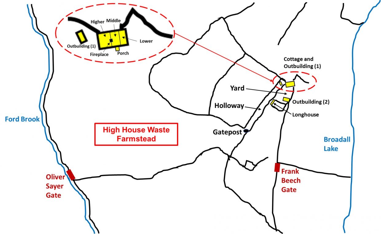
This farmstead is set within its own enclosures between Ford Brook in the west and the valley side of Broadall Lake in the east. The area is best accessed via the Oliver Sayer Gate by Ford Brook. The farmstead is approx. 400m in a easterly direction from the gate, with the final approach being via a good sunken lane (Holloway) leading in from the south-west.
The farmstead survives as four separate buildings, a yard, as well as the holloway and field systems. Some research information was gleaned from the Dartmoor HER.
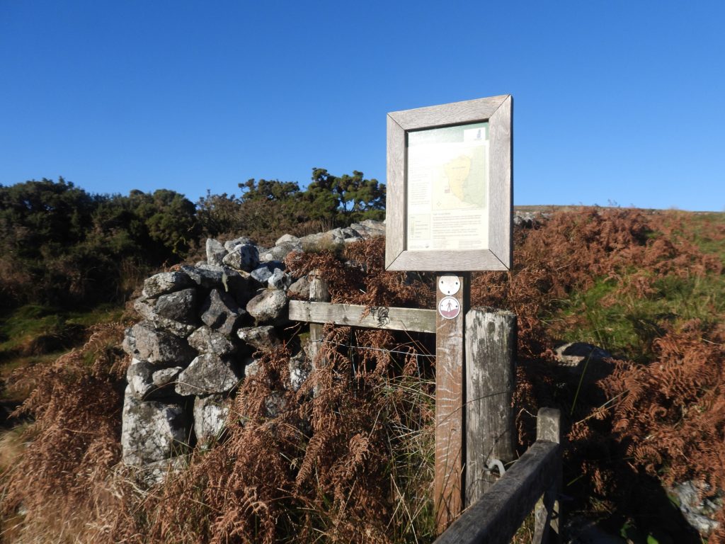
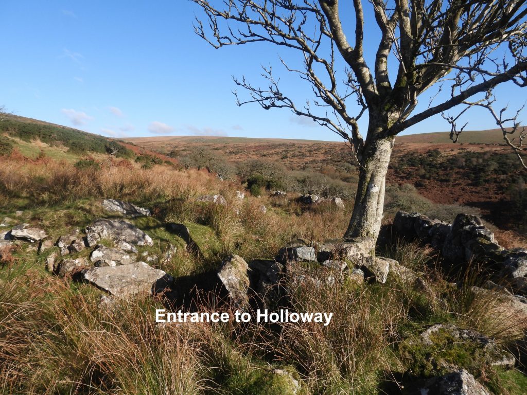
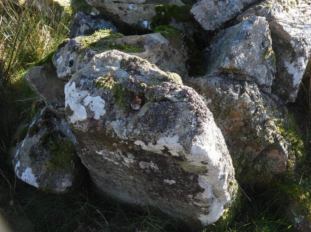
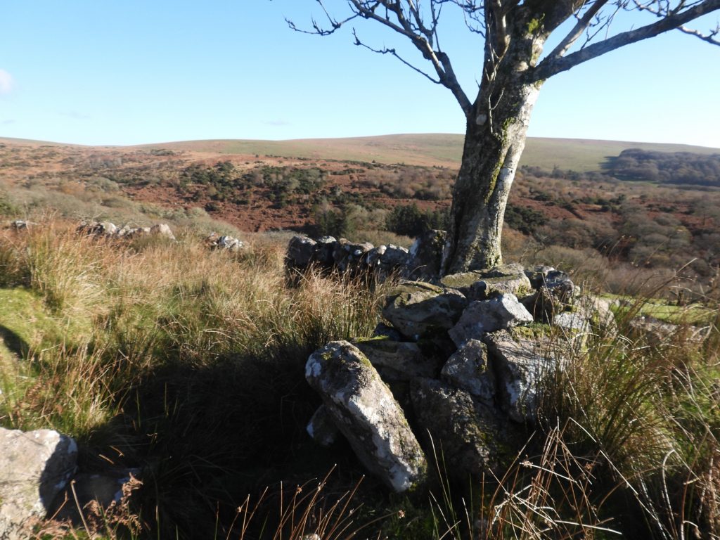
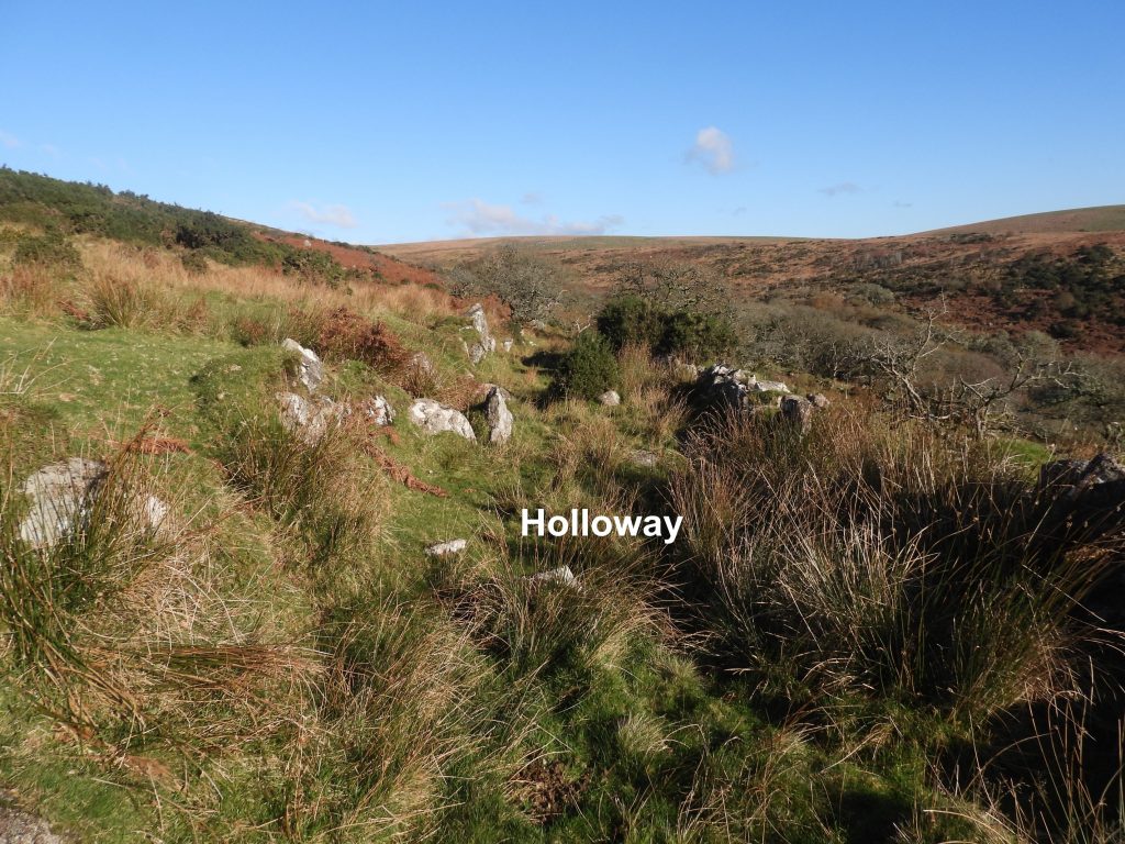
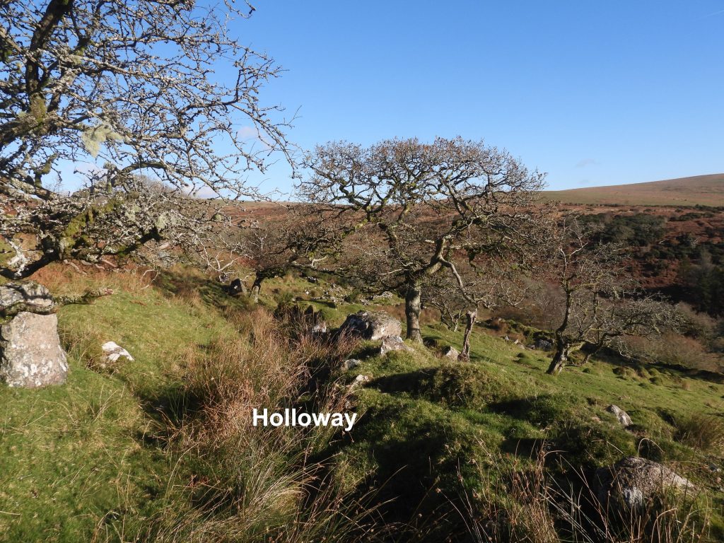
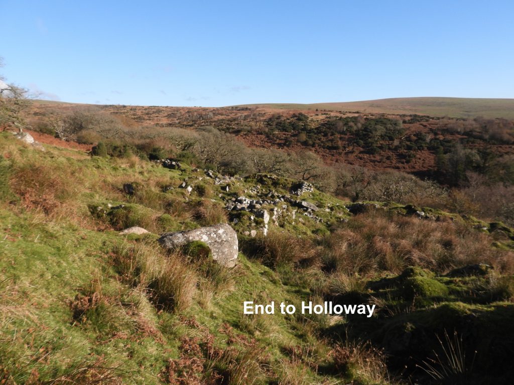
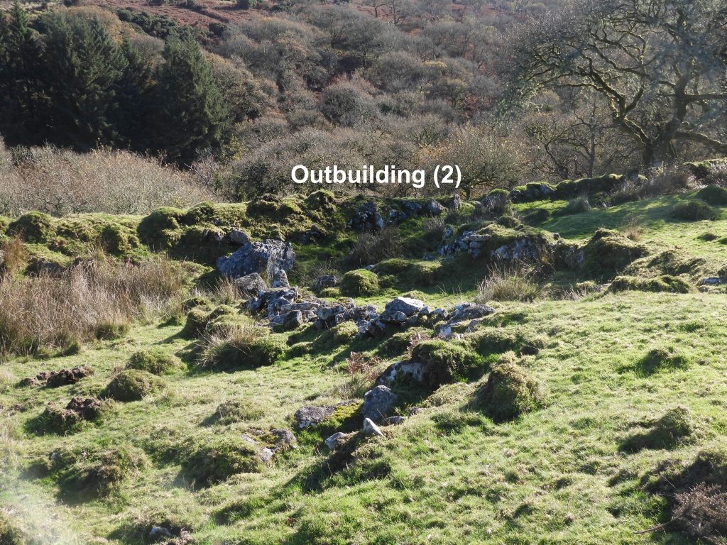
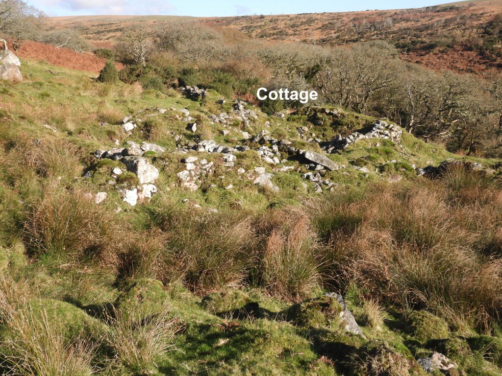
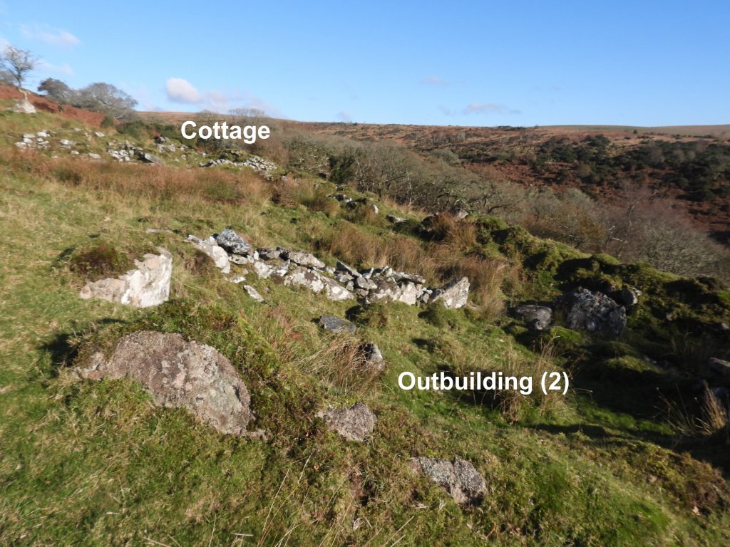
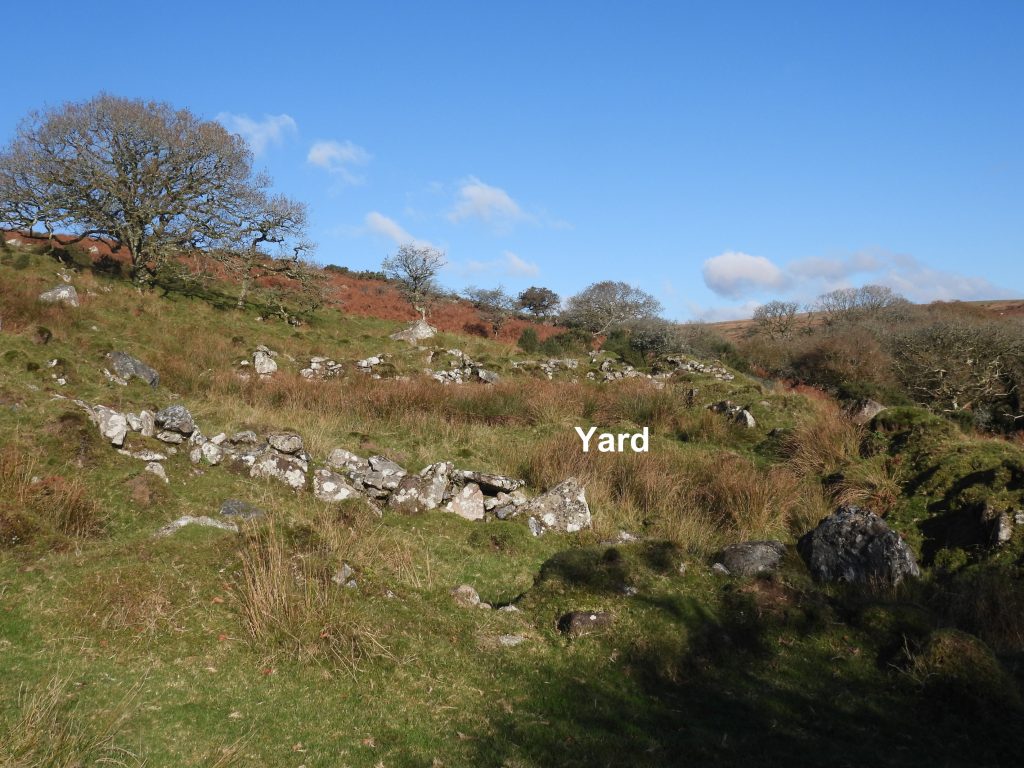
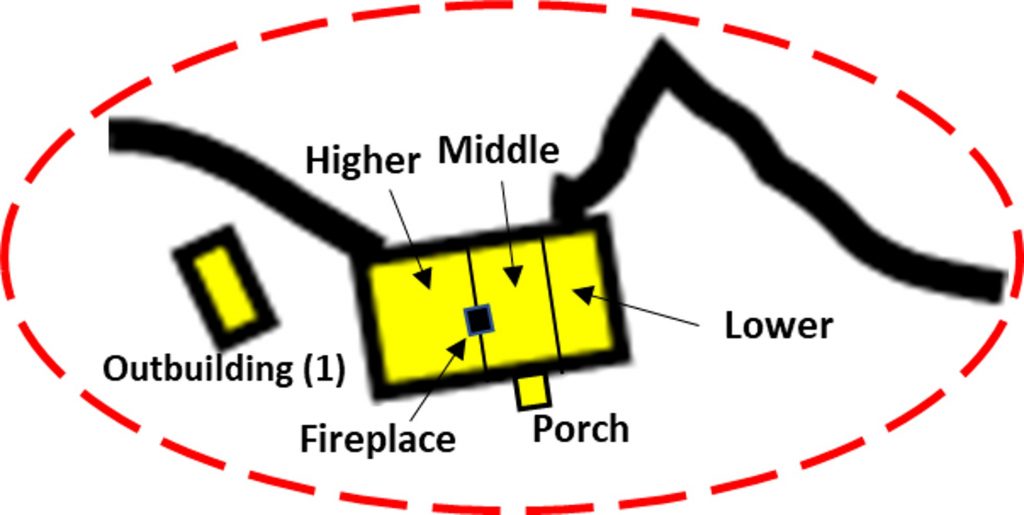
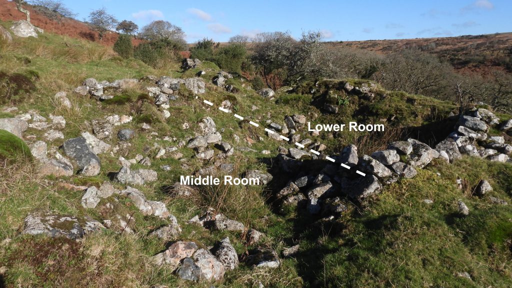
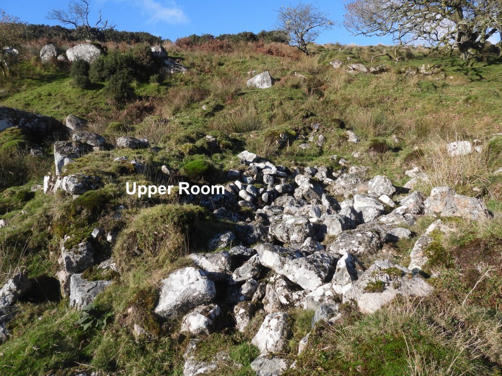
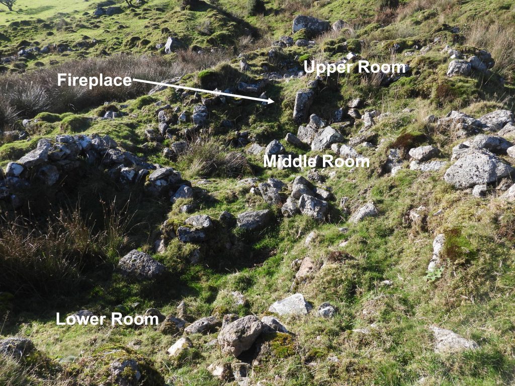
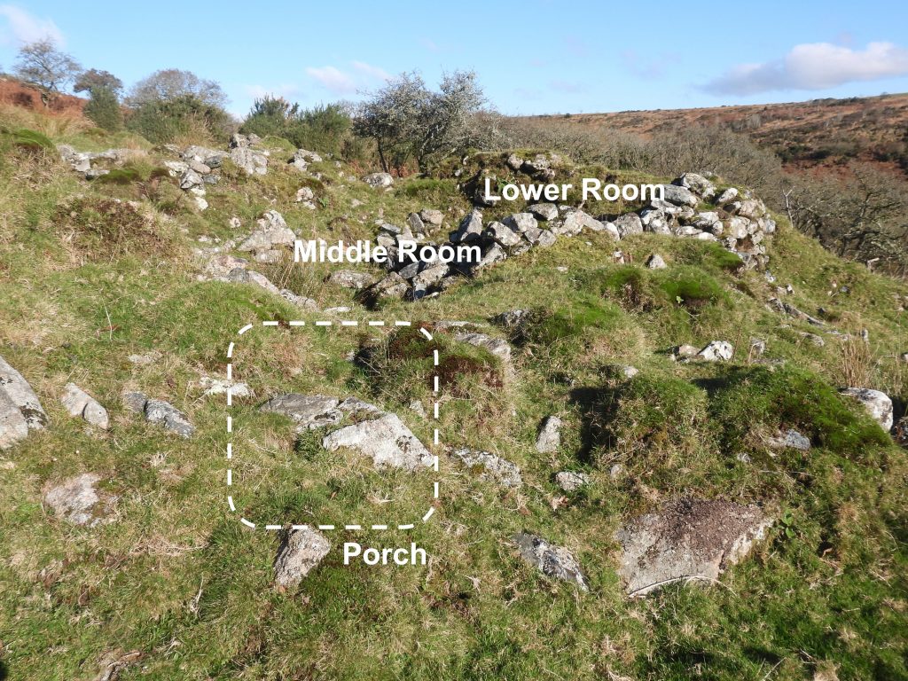
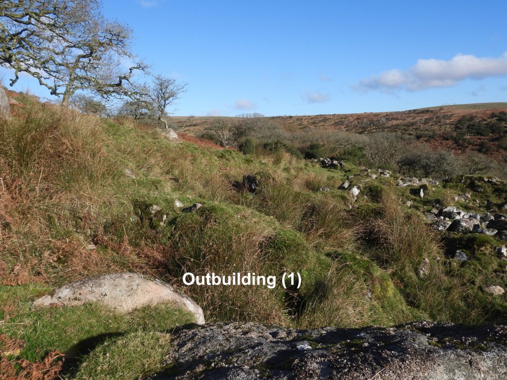
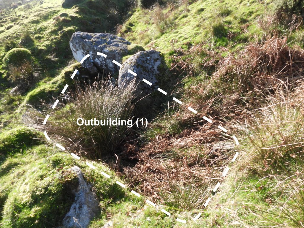
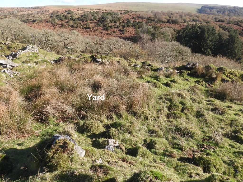
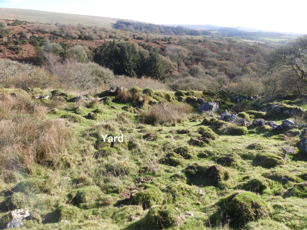
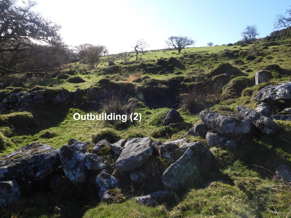
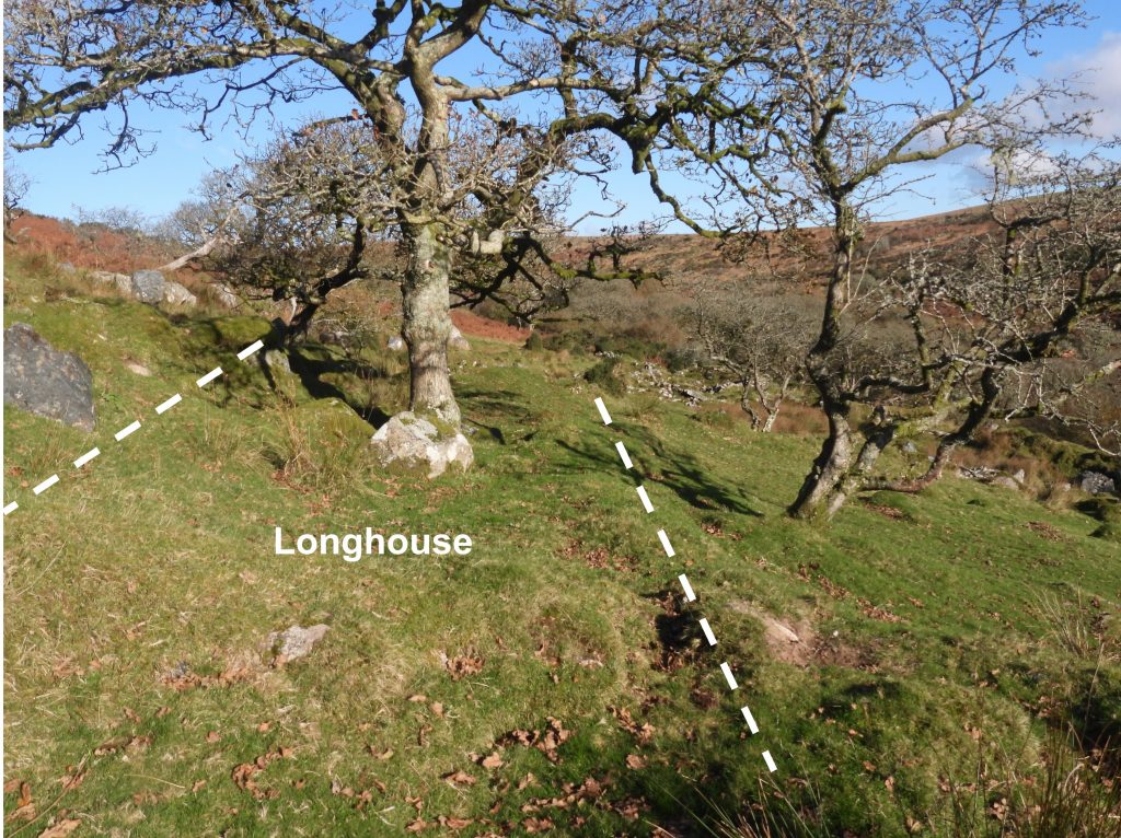
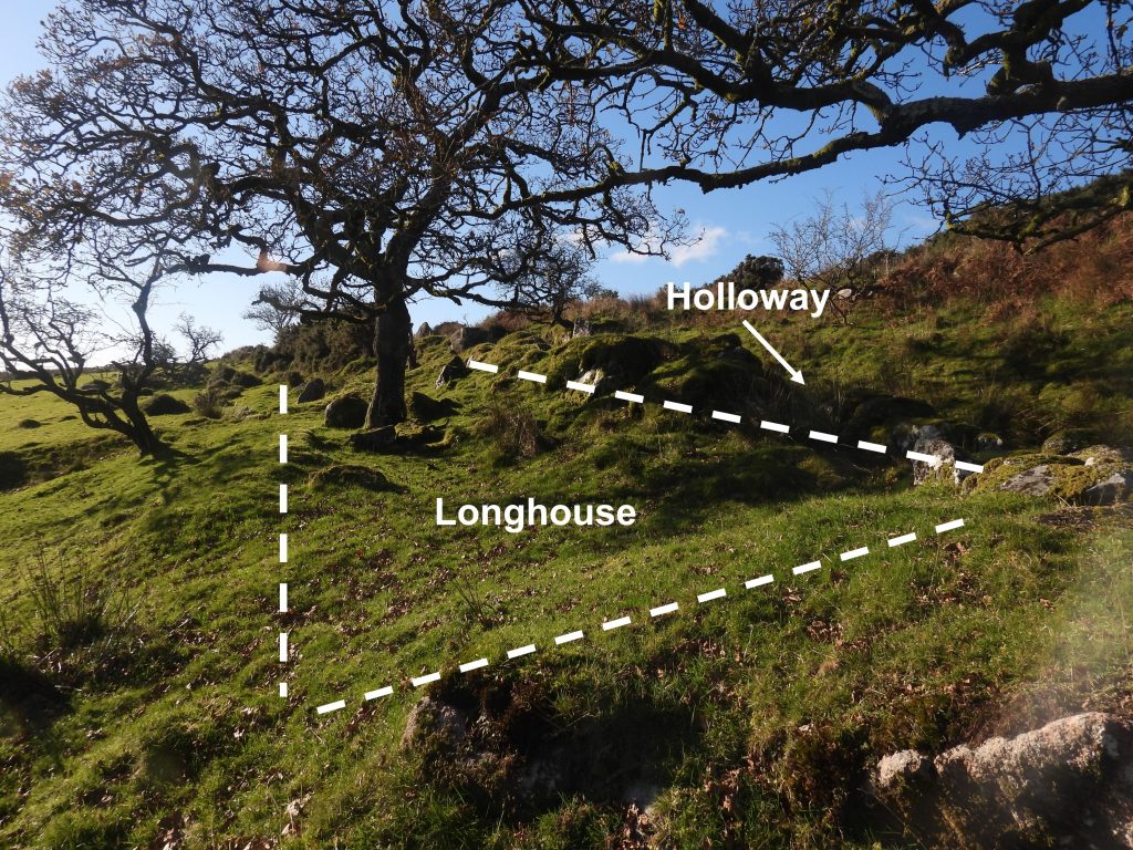
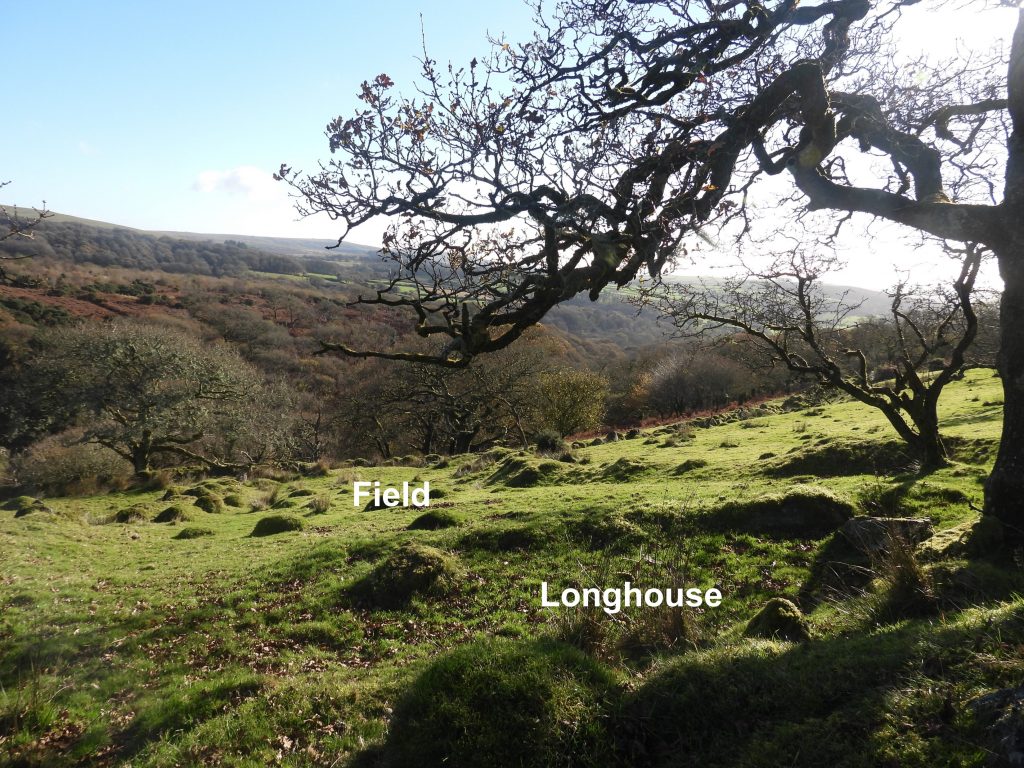
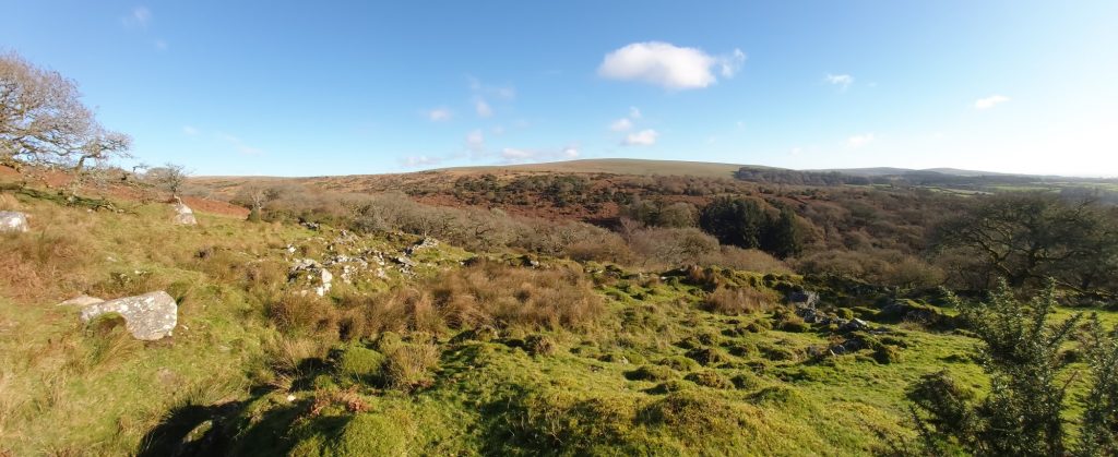
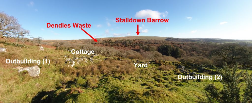
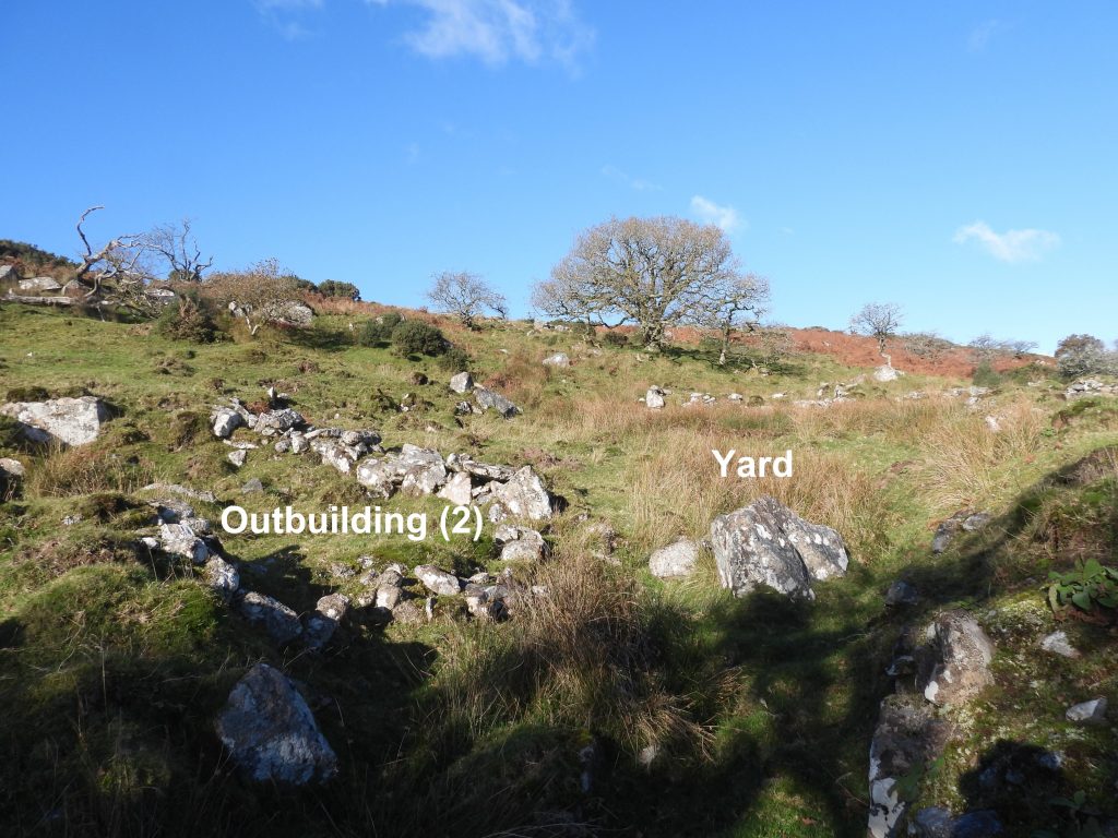
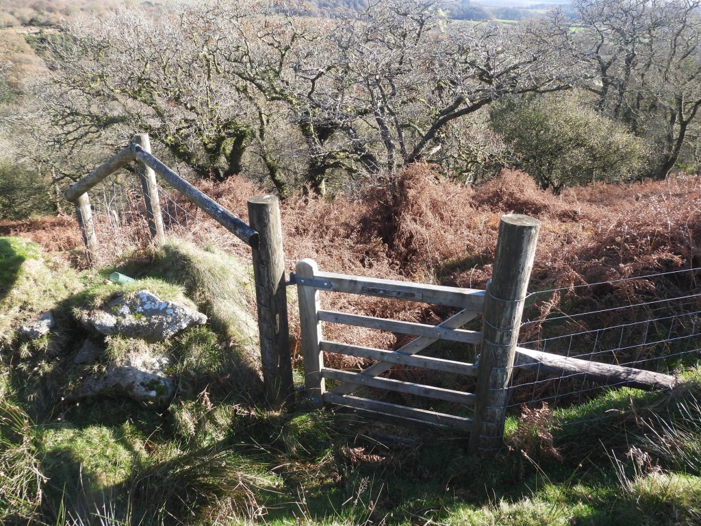
Sketch map showing the location of High House Waste Farmstead and the access gates into the areaOliver Sayer gate is the easiest access point and is located next to Ford Brook at SX 60729 62306. The information board / map here shows all the access points into this area.The lane (Holloway) entrance to the farmsteadThe gatepost at the entrance to the Holloway has evidence of once having an iron hanger. It is located at SX61017 62381Time to enter the Holloway.Mid way along the Holloway with fantastic views across Broadall Lake valley to Hawns and Dendles Waste.Further down the Holloway, approaching the farmstead.The end of the Holloway with the farmstead cottage ruins in sightFrom the end of the Holloway, looking south east, the ruins of outbuilding (2) can be seen.Looking north east from the end of the Holloway the substantial ruins of the cottage can be seen. A description in the Dartmoor HER, states “The cottage measures 14.8m long by 4.9m internally defined by coursed, small boulder mortared walls measuring up to 0.8m wide and 1.2m high, with well dressed quoins”.Outbuilding (2) and the Cottage. The yard area was located between the two.The yard area.Detailed sketch of the cottage at High House Waste Farmstead, showing the key features.On first viewing the cottage looks as if there were only two rooms. However, the east section is in fact two rooms (middle and lower). The lower room was recorded at SX61097 62460 and the middle room at SX61094 62460. The upper room was recorded at SX61091 62464.A view from the east of the three internal rooms of the cottage, the central (middle) of which has the tumbled remains of a fireplace.There is a tumbled porch on south side leading to the central (middle) room. Initially this is difficult to distinguish amongst the tumbled boulders but can be made out. Outbuilding (1) lies to the west of the cottage and is recorded on the Dartmoor HER as being measuring up to 4.5m long and 2.5m wide internally. As with the cottage it leads onto the yard. The outbuilding is also located near the end of the Holloway.Outbuilding (1) was recorded at SX61081 62460.The yard lies between the cottage and outbuilding (2) and is a large grassy / reedy area.The yard (centre) is located at SX61089 62448.To the south of the yard is the outbuilding (2), which has two rounded corners and as described in the Dartmoor HER is “built of roughly coursed walls and measures up to 5.5m long by 5.3m wide internally”. It was recorded at SX61088 62436Approximately 70m to the south west of the cottage adjacent to the Holloway, a fourth building can be located. It is a rectangular low-walled structure measuring 15.2m long by 3.5m wide internally and is stated (Dartmoor HER) as probably an earlier longhouseThe centre of the Longhouse (by the tree) was recorded at SX61061 62430.Looking down the valley (south east) beyond the Longhouse, some of the original field system connected with the farmstead can be seen.A panoramic view of the farmstead looking east over Broadall Lake valleyAn annotated version of the panoramic picture – fabulous viewsOne final view of the farmstead before departureThe Frank Beech gate was the exit point for this visit, which leads the explorer down to Broadall Lake and onto Hawns and Dendles Waste. The gate is located at SX61075 62323.