A collection of walks, discoveries, insights and pictures of exploring Dartmoor National Park
May 21, 2023
Combshead Tin Mine / Tinner’s Mill
The Dartmoor Tin Research Group (DTRG) in 2016 hosted a conference: ‘Celebrating the Tinworking Landscape of Dartmoor in its European Context – Prehistory to 20th Century’. The accompanying conference booklet (page 20) recorded Comb(e)shead Tin Mill with some intriguing history. The information summarised in this post uses this source of information (plus the Heritage Gateway).
The history of the site of the mill appears to be multi-phased and spanning three centuries from the 16th to the 19th. There is recorded evidence of a stamping mill around 1833 at ‘Combshead Tin Mine’ and an ‘Old Mine and Stamps’ in 1873. The most obvious features on the site today are the remains of a building and wheelpit, which are the 19th century remains. The DTRG article (written by Dr Tom Greeves) believe that the area was possibly ‘re-used’ from an earlier mill (the historic Harthill Tin Mill). The name Harthill derives from the words ‘hurt’ or ‘wort’ which relate to Hartillberries (or Whortleberries or ‘Hurts’). The raised ground above Narrator Brook at the location of the mill / mine being recorded at ‘Wort Hill’ in the 19th century. These names appear to be important in the history of this site.
In the aforementioned DTRG publication and in the ‘List of Known Devon Tin Mills c1450 – c1750’ (Greeves – 1981) the names Combeshead / Harthell / Harthill / Dombshed were recorded as a Blowing mill / knocking mill in documents from 1571, 1581 and 1584 (Hugh and Juliana Littletor leased a ‘Blowing House’ from 1571). The name ‘Wort Hill’ and ‘Hart Hill’ seem to be synonymous with the same location therefore the 16th century references and the 19th century mill / mine appear to be one of the same thing and marry up the theory of a ‘re-used’ mill here. The author is grateful to DTRG for the recording of the site, to which additional information and features have been added in this post.
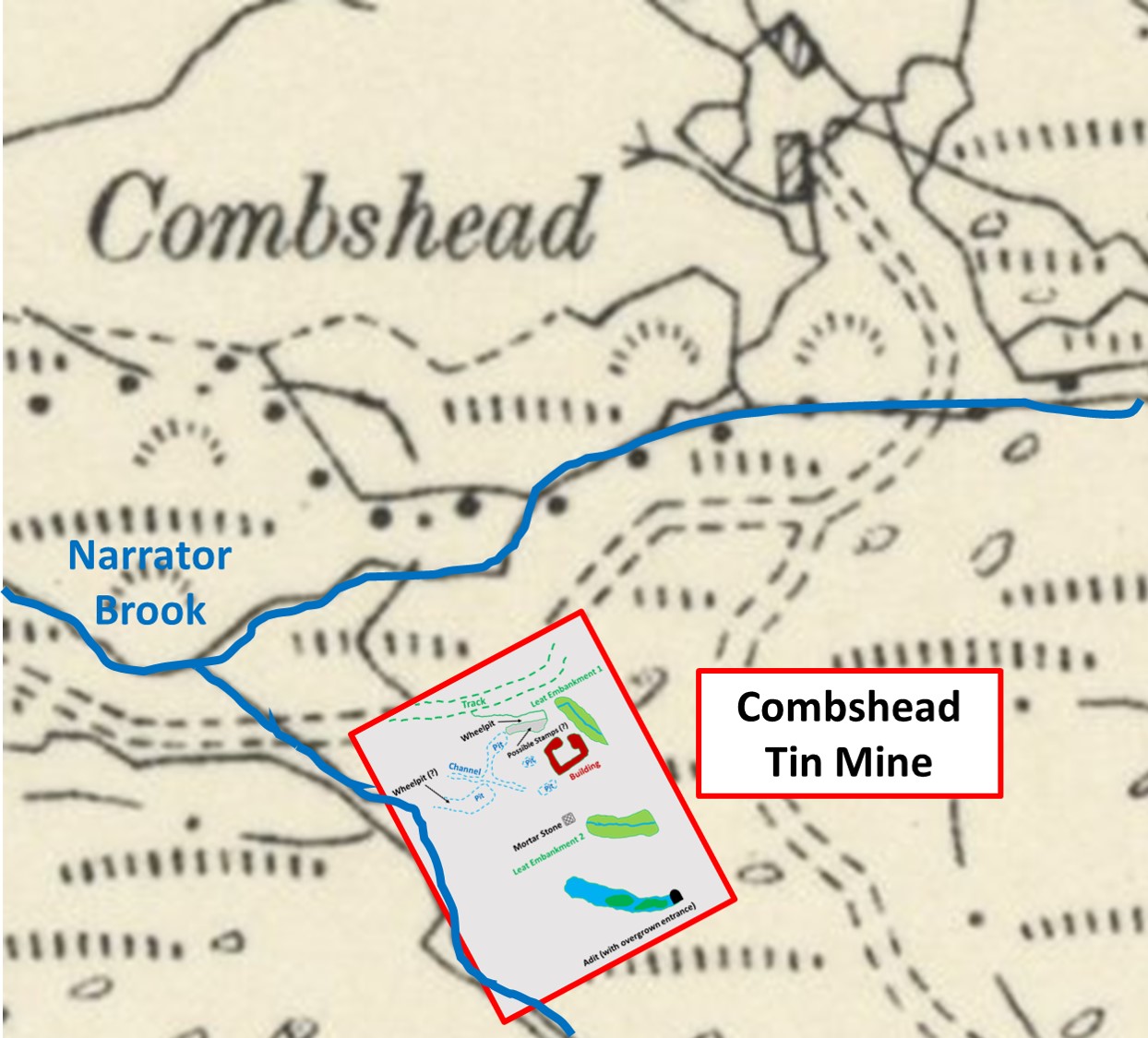
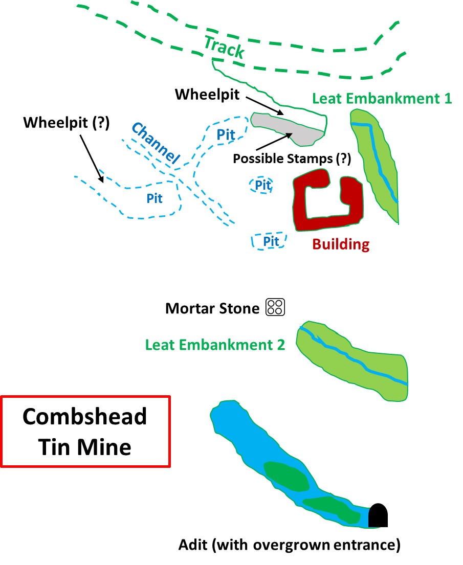
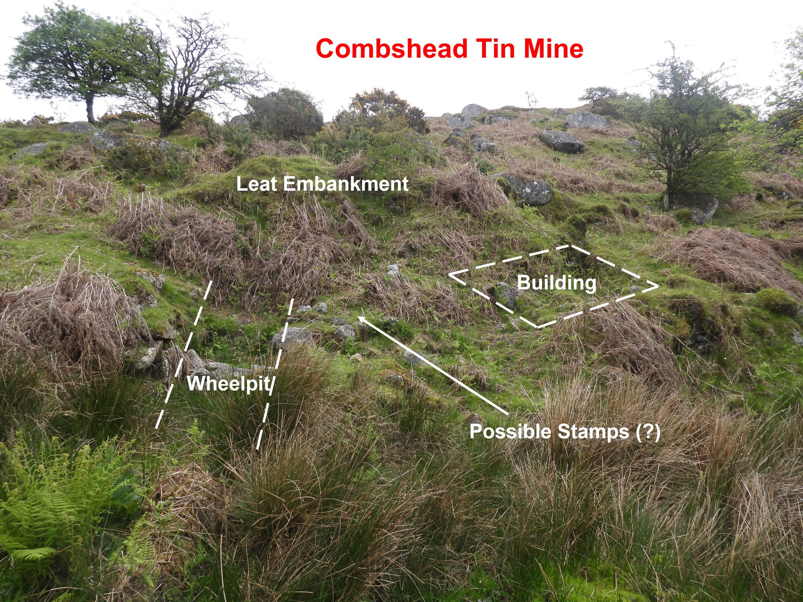
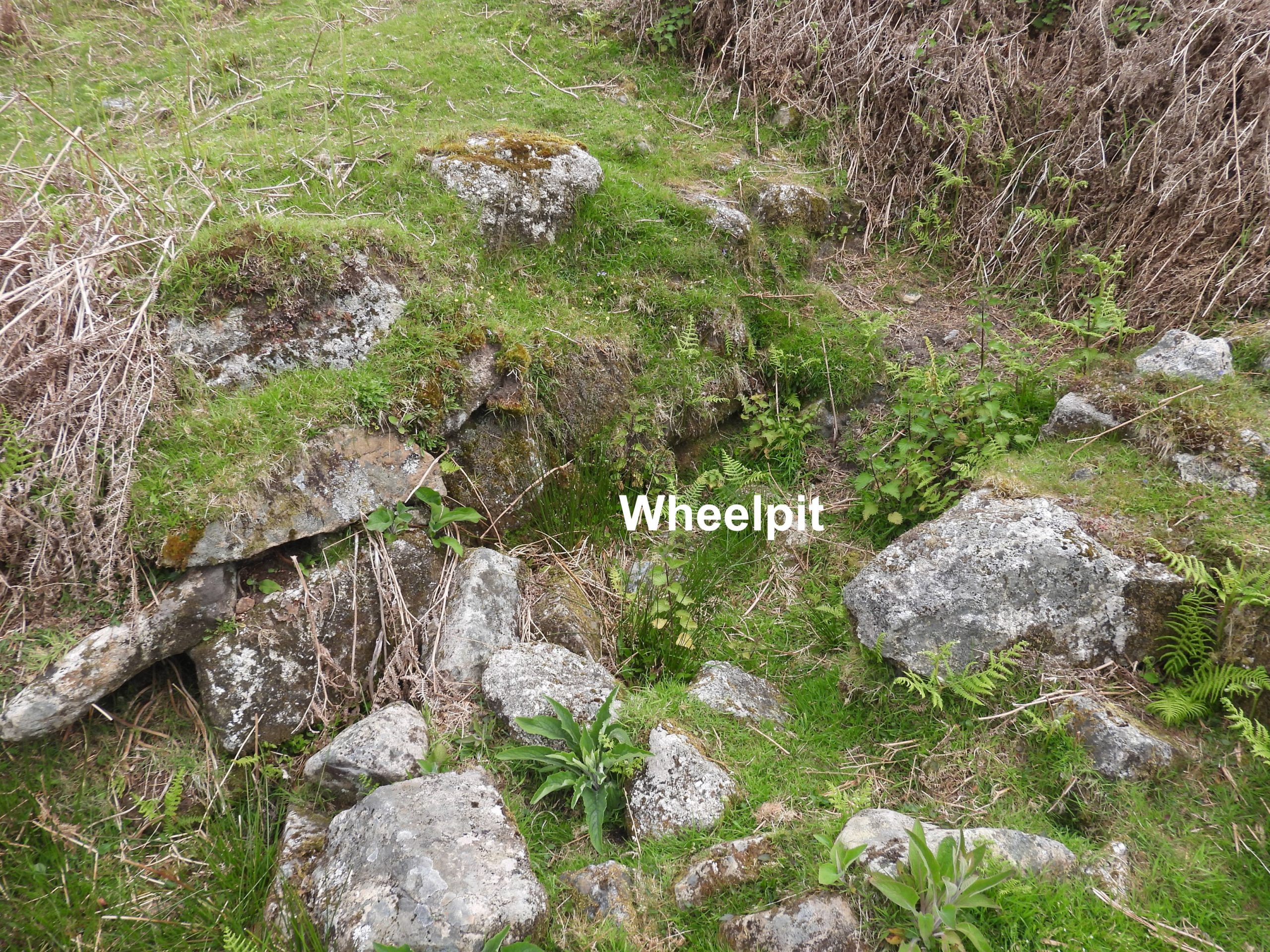
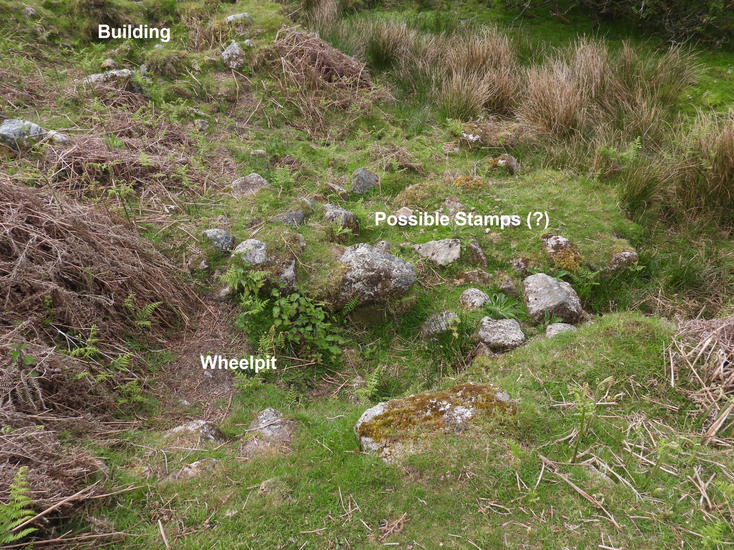
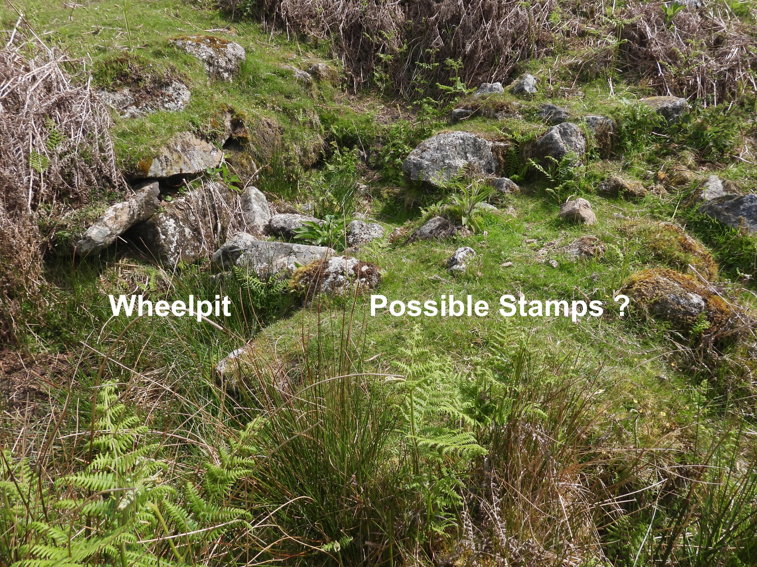
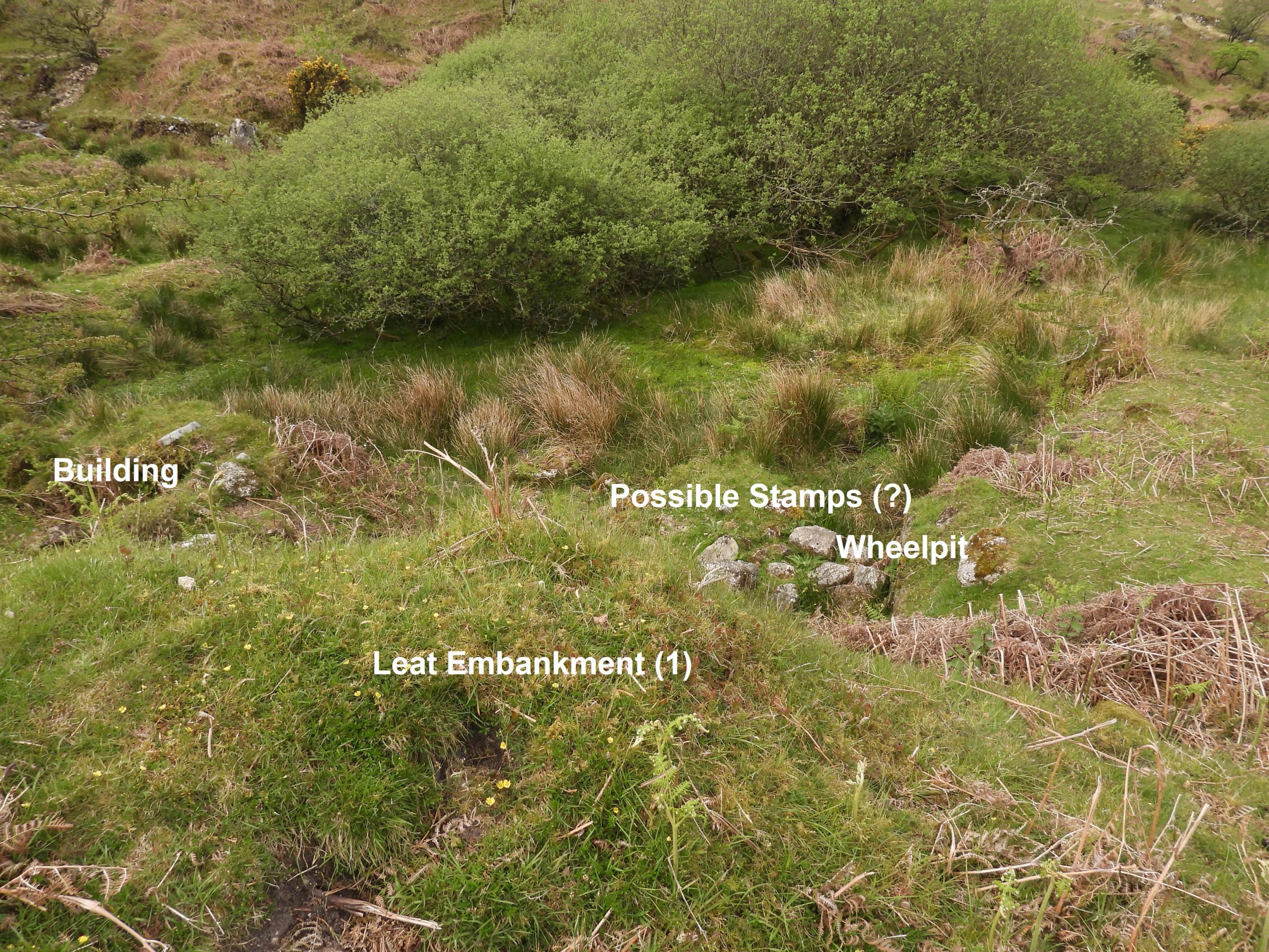
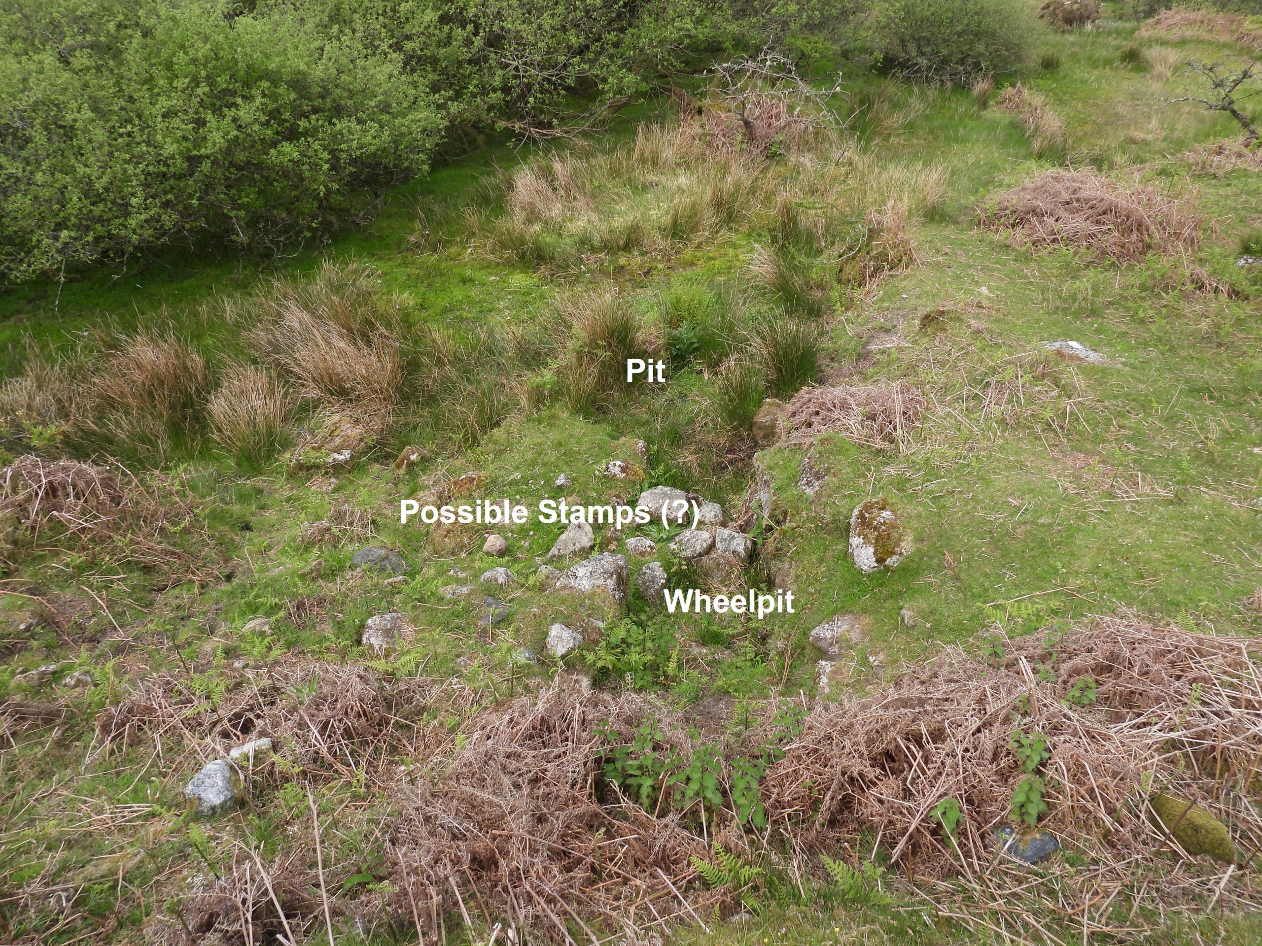
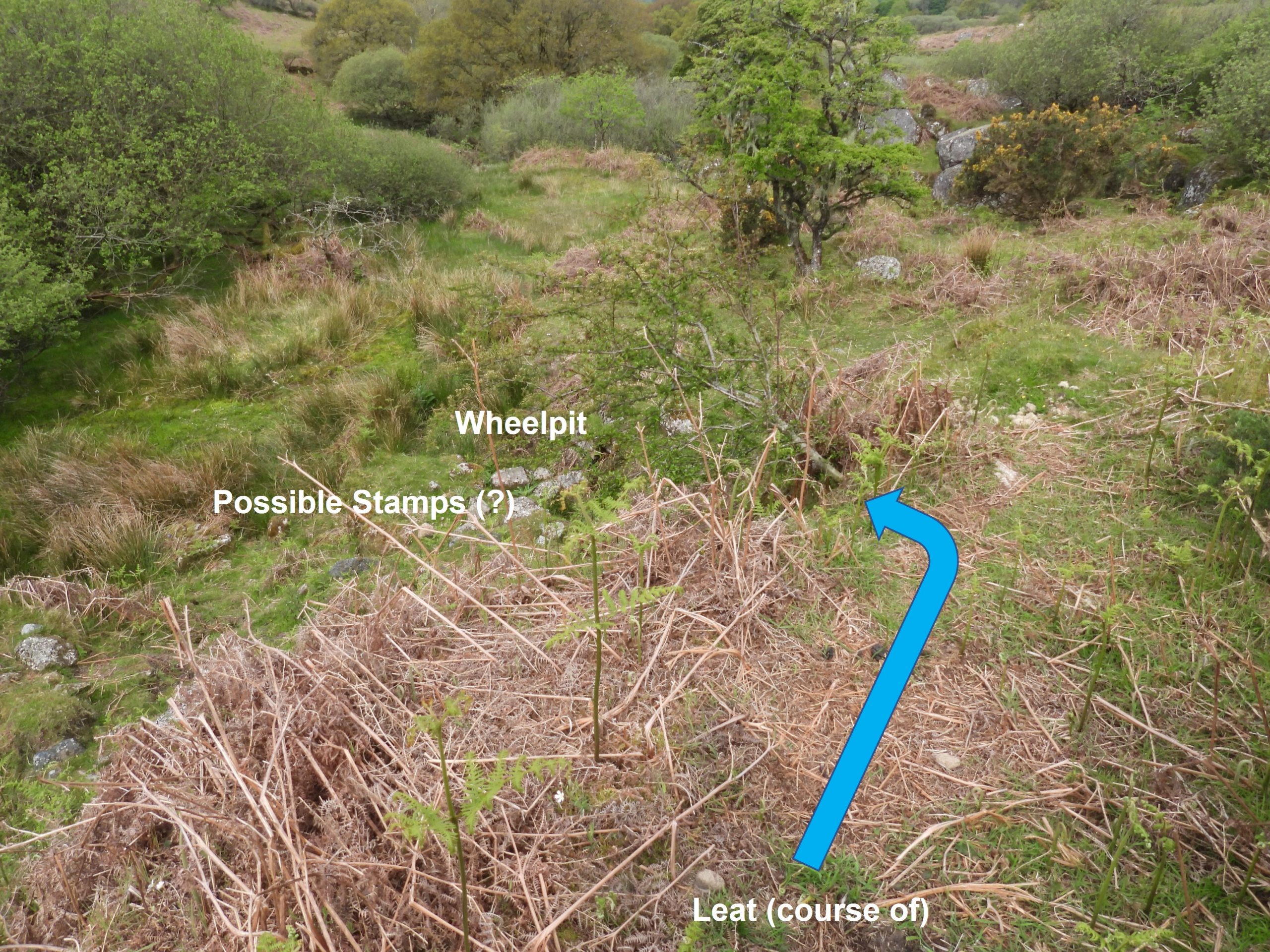
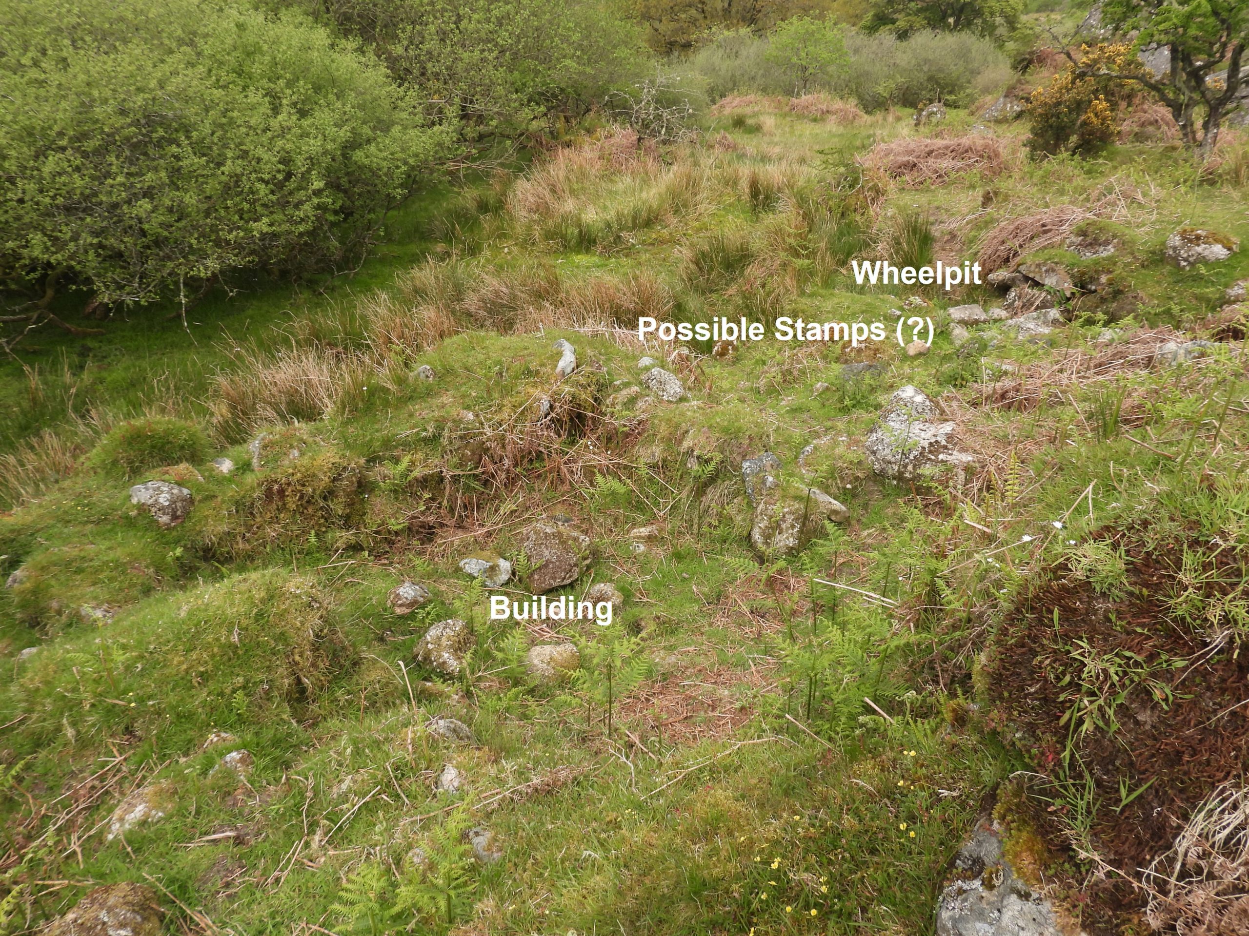
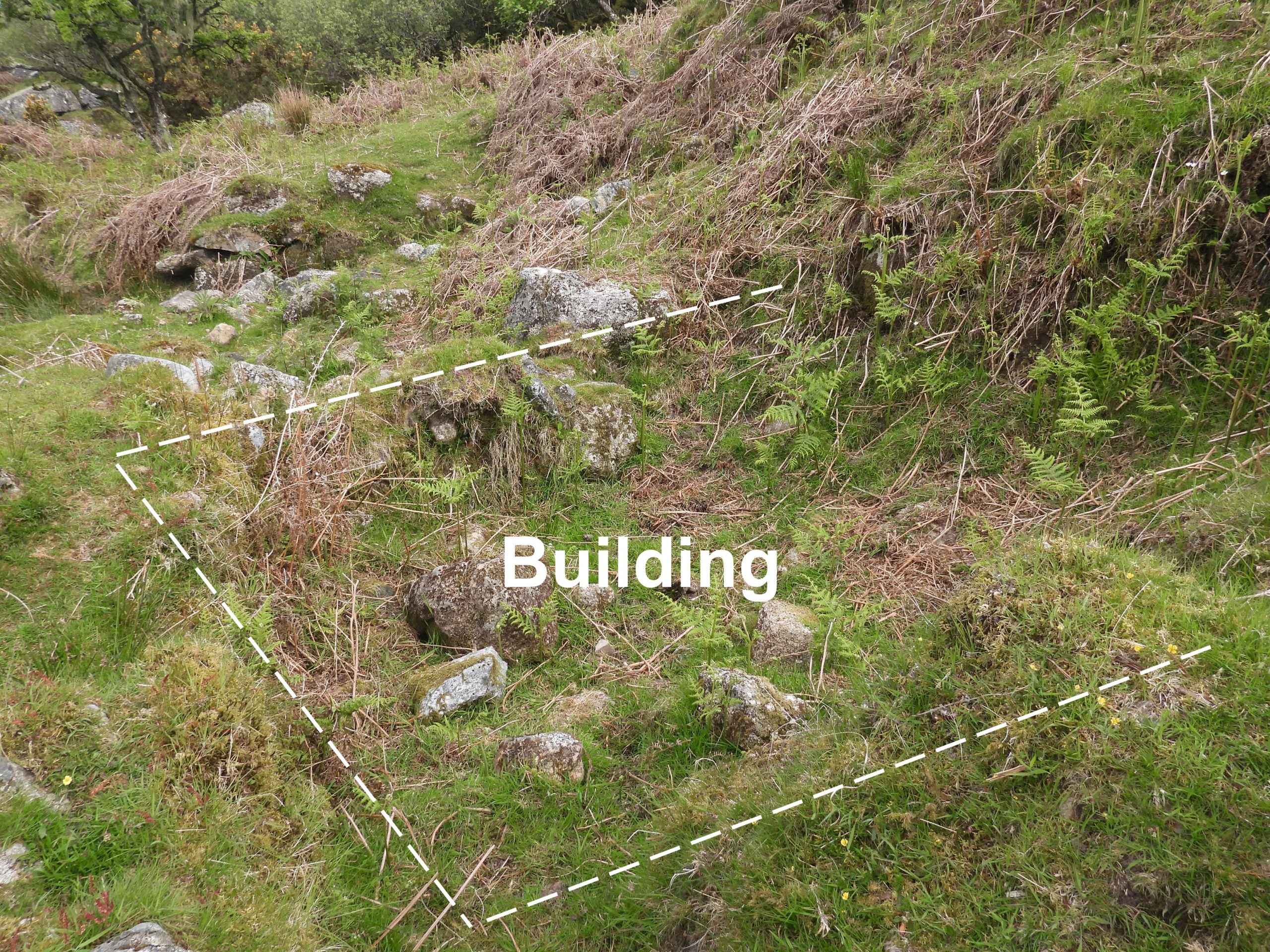
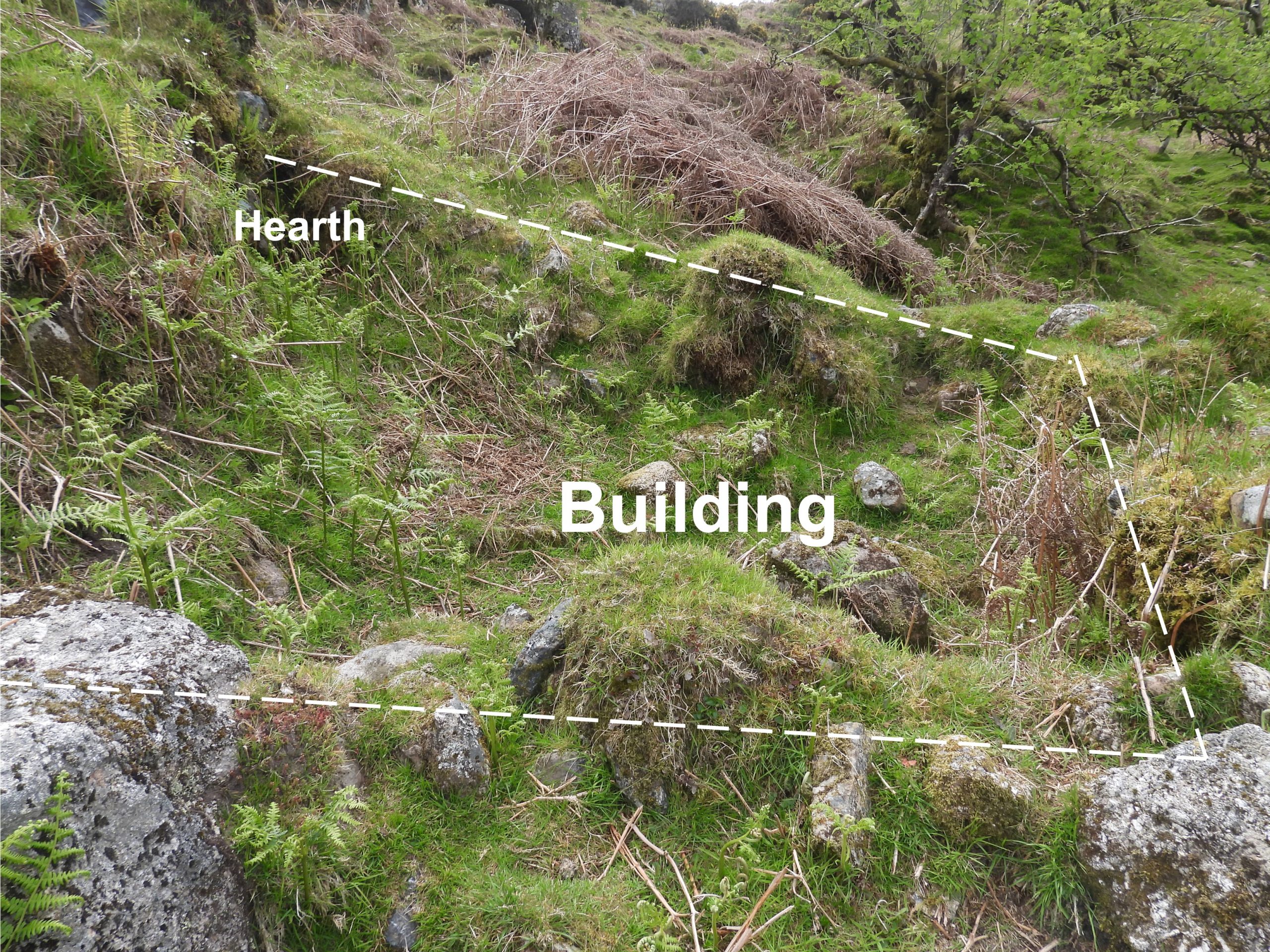
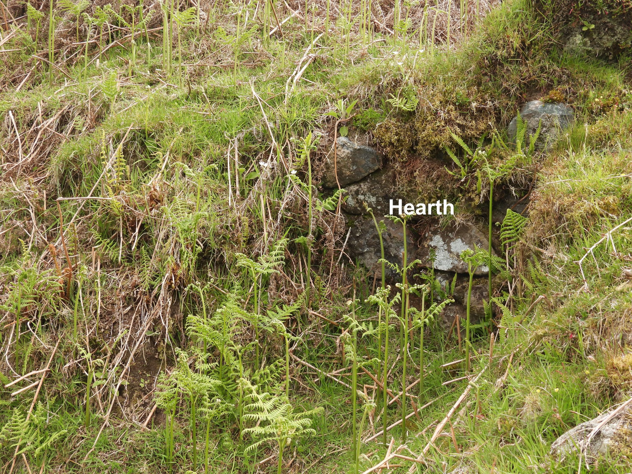
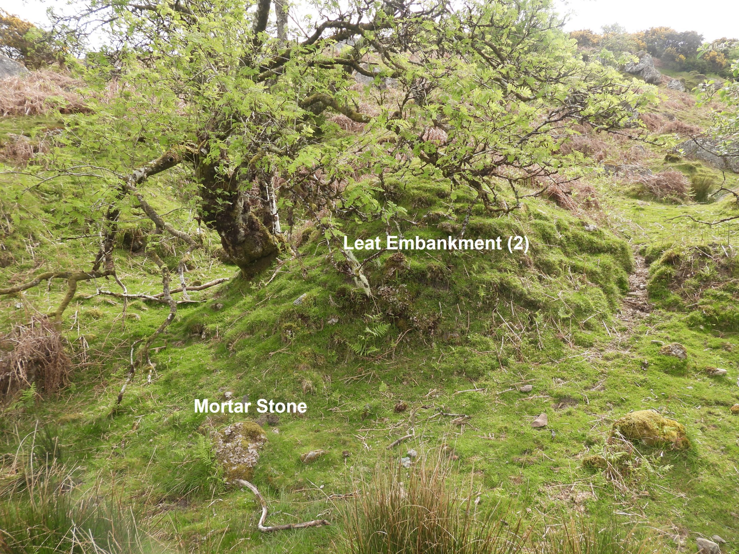
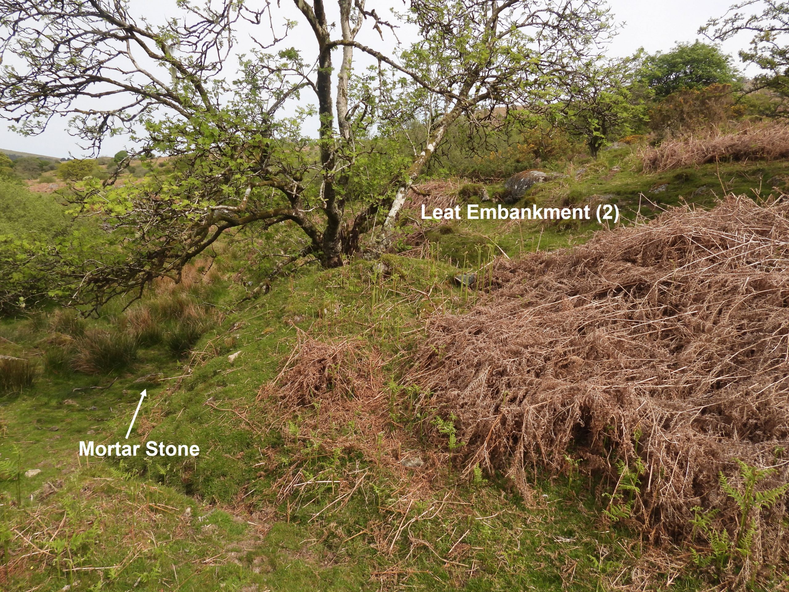
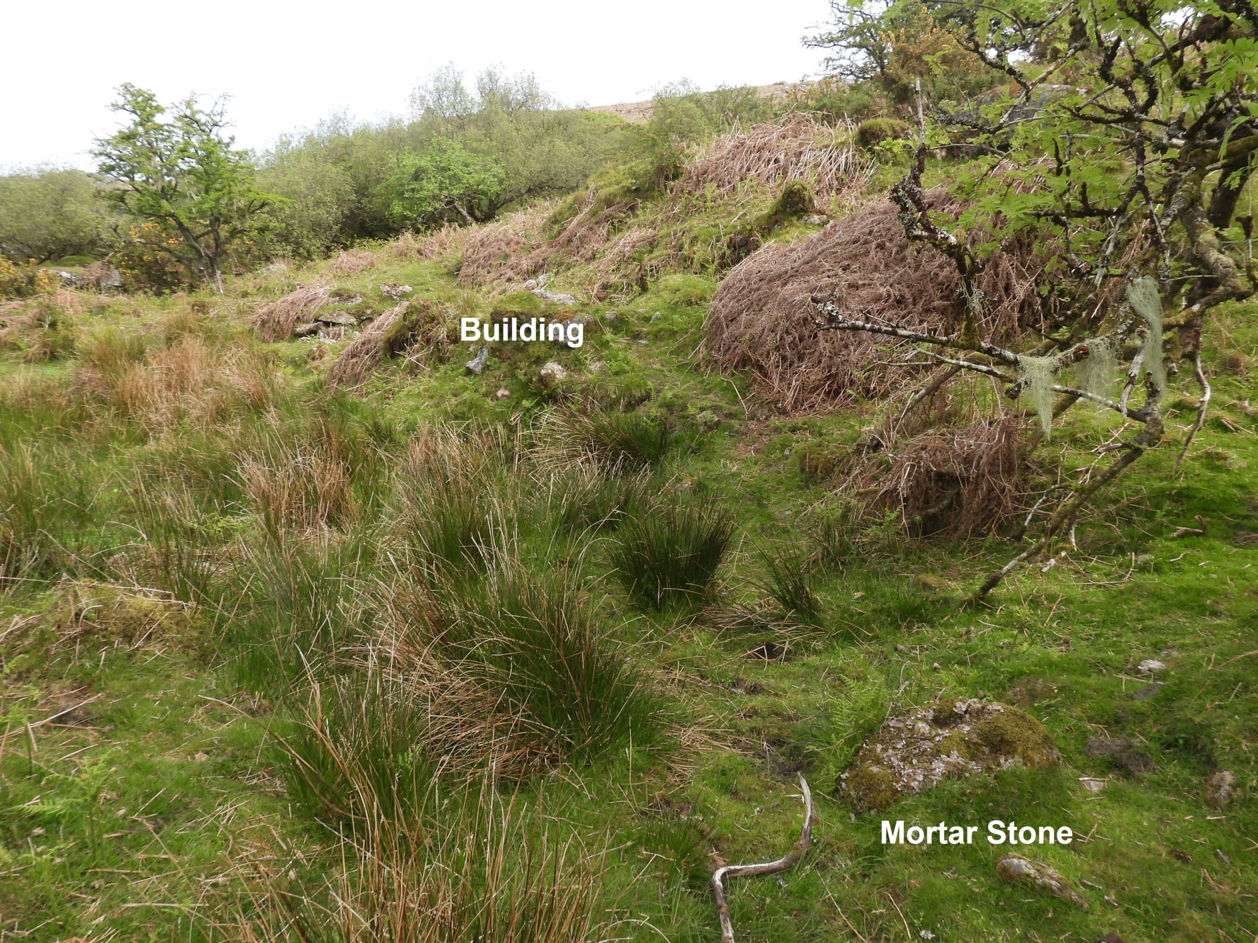
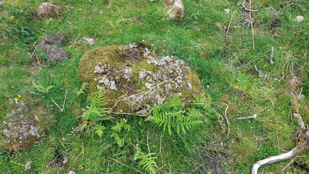
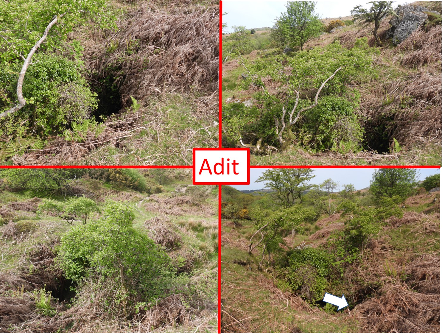
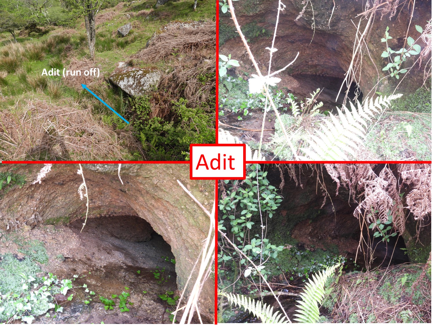
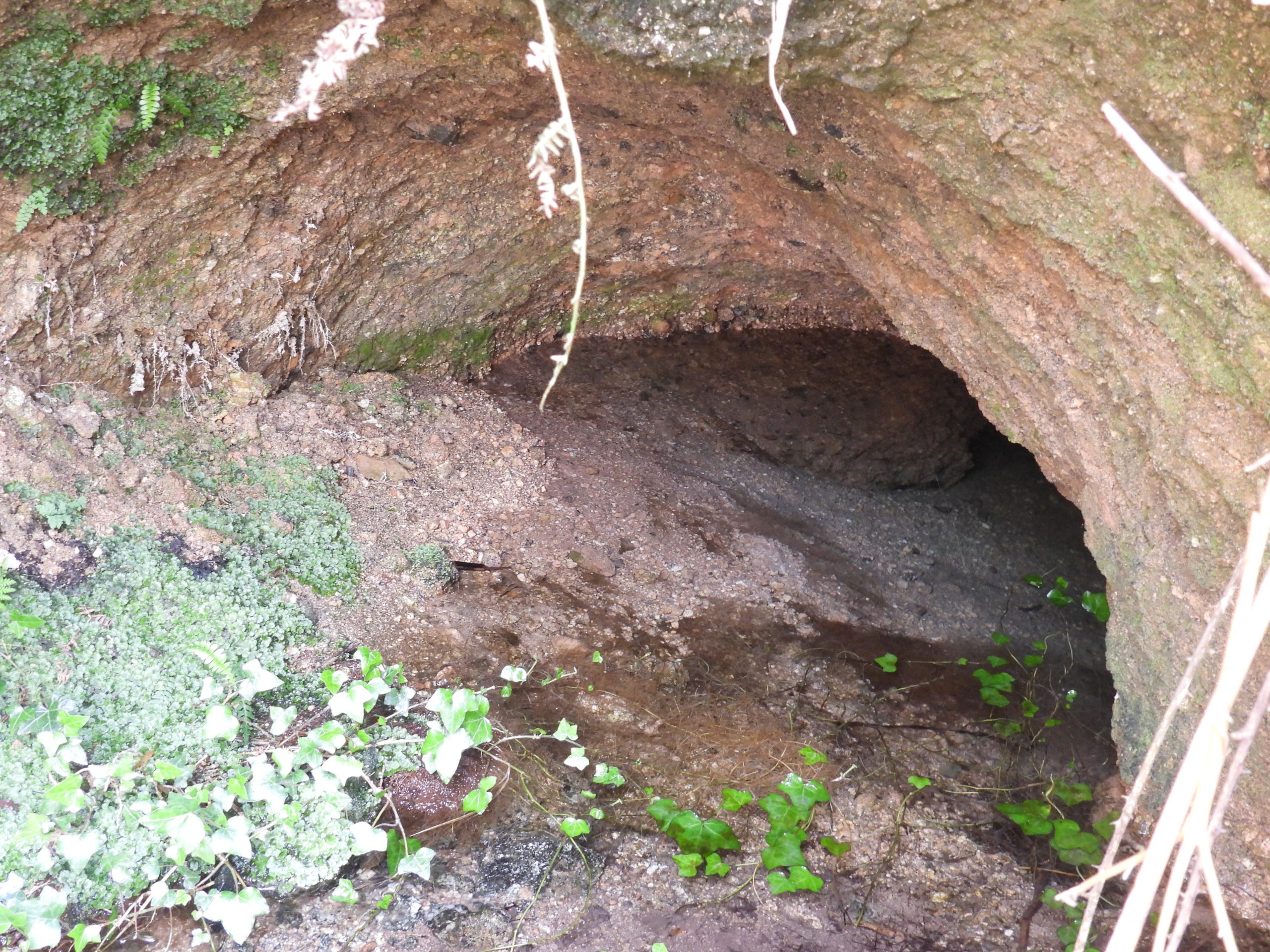
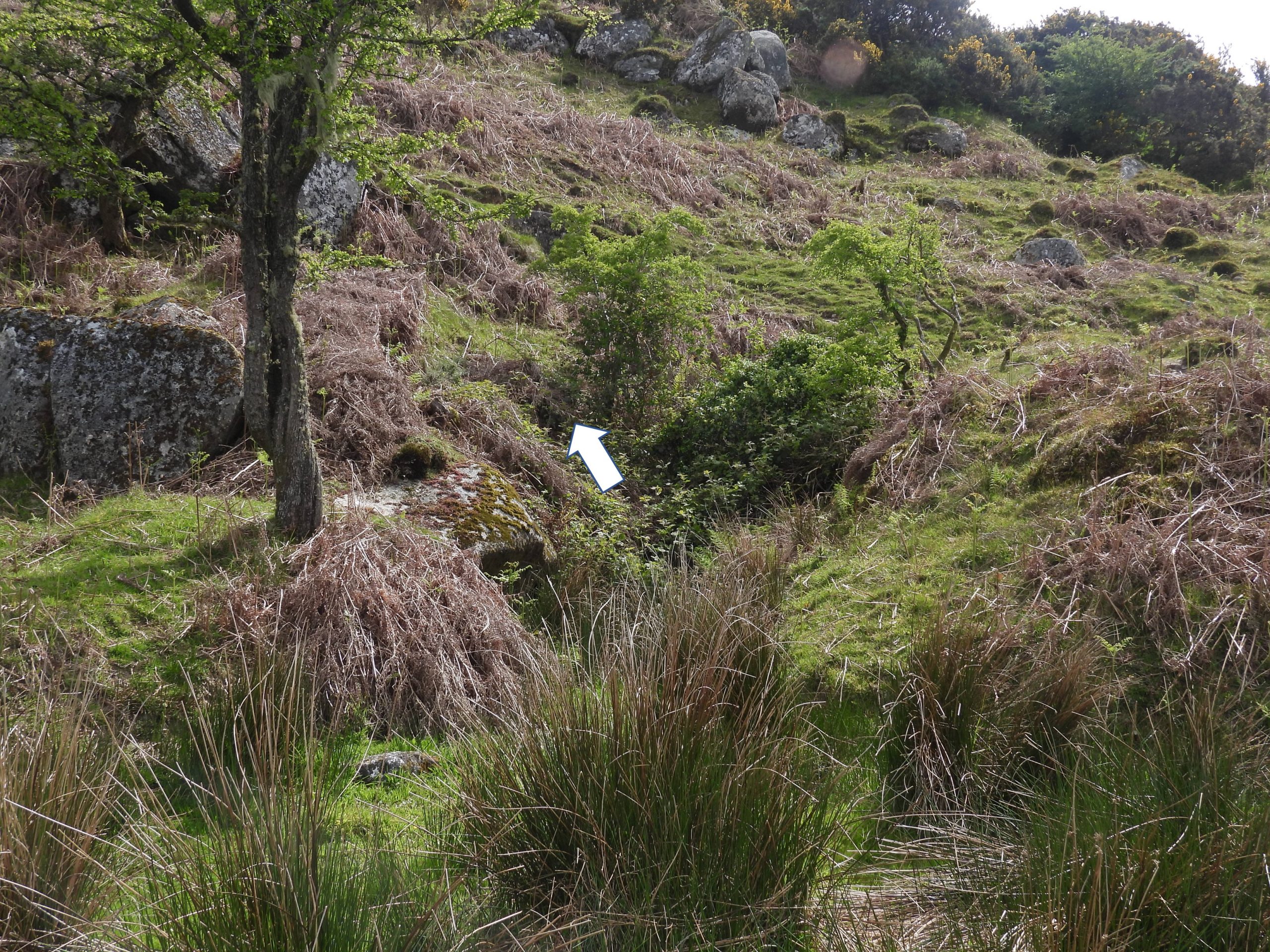
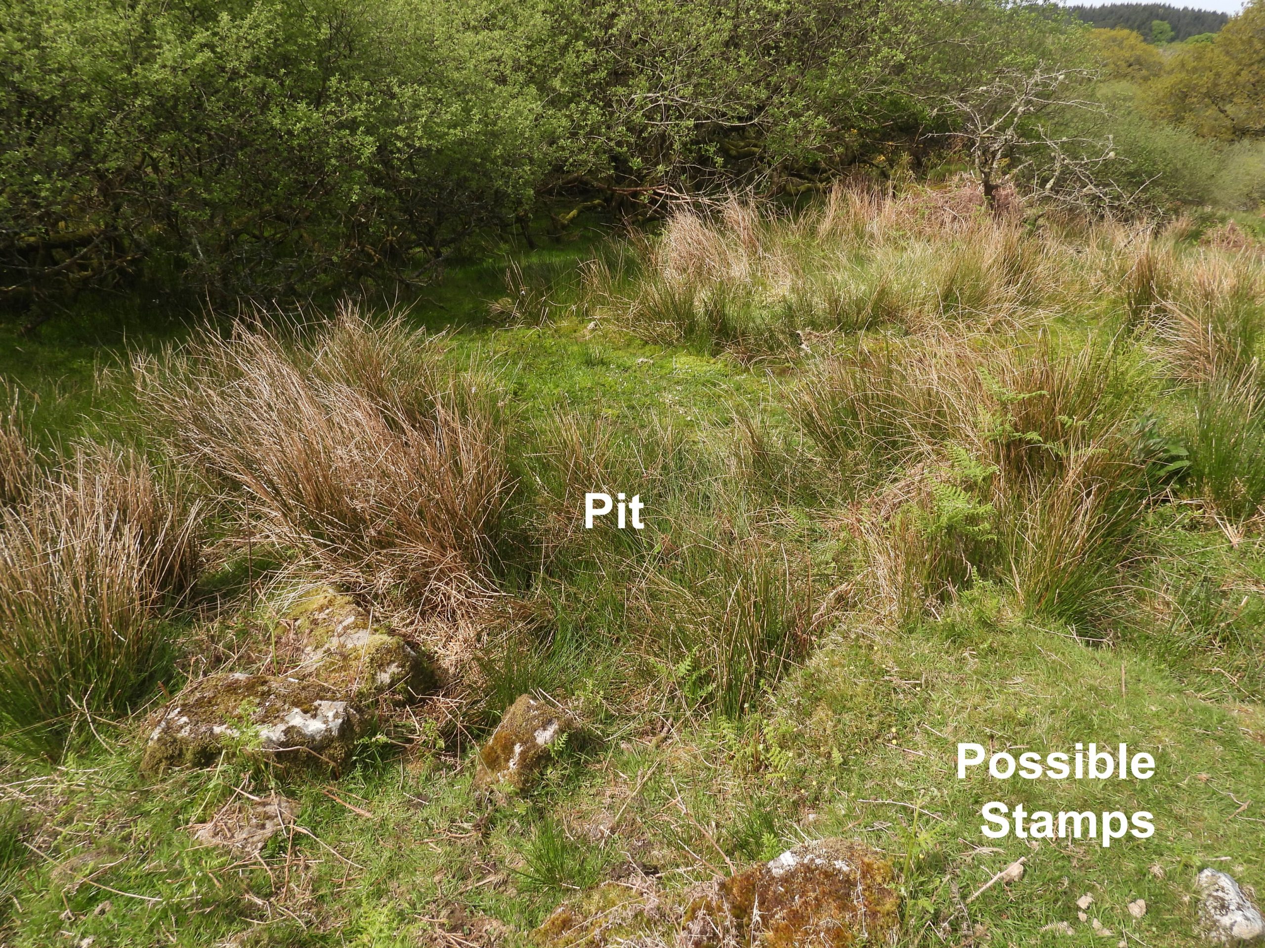
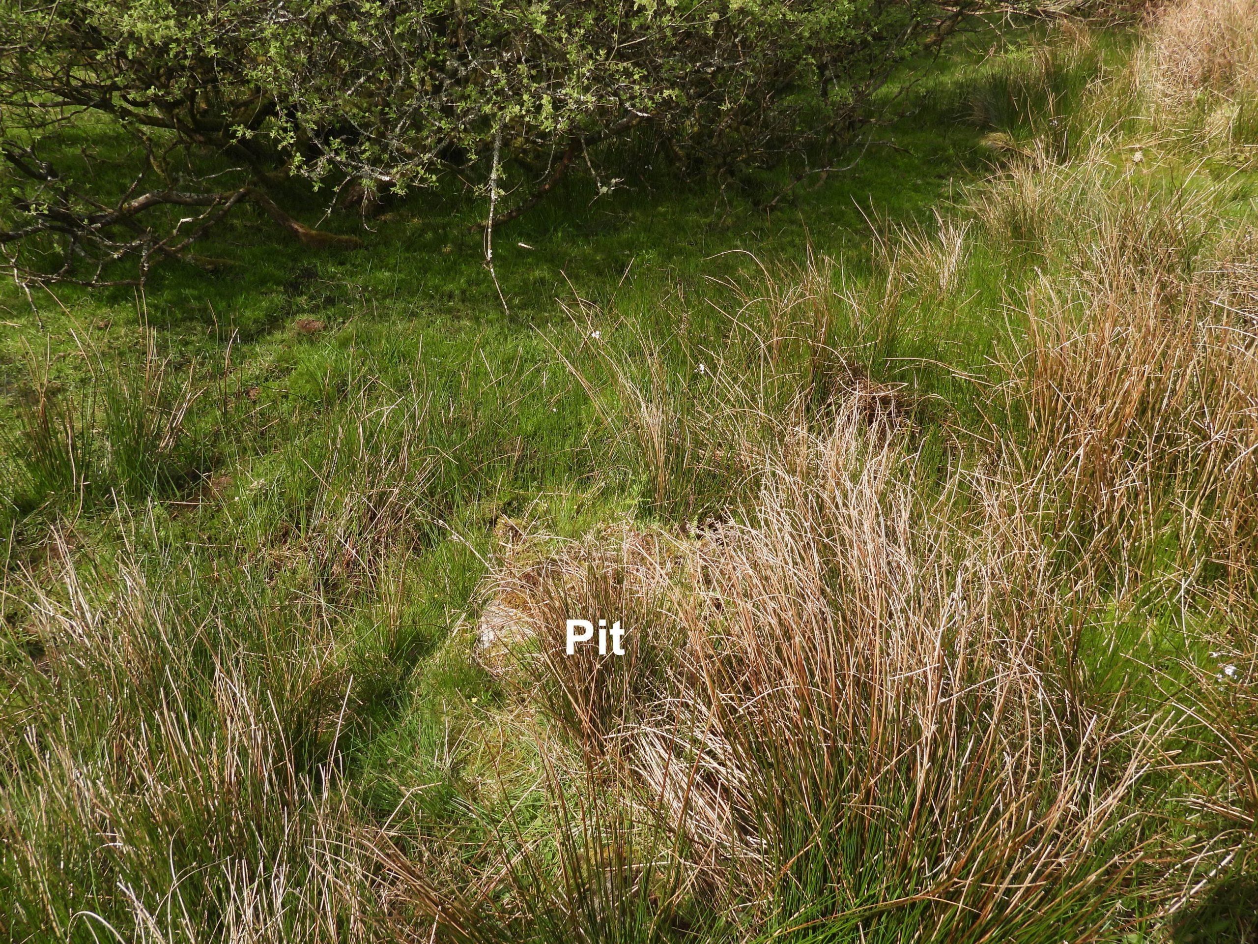
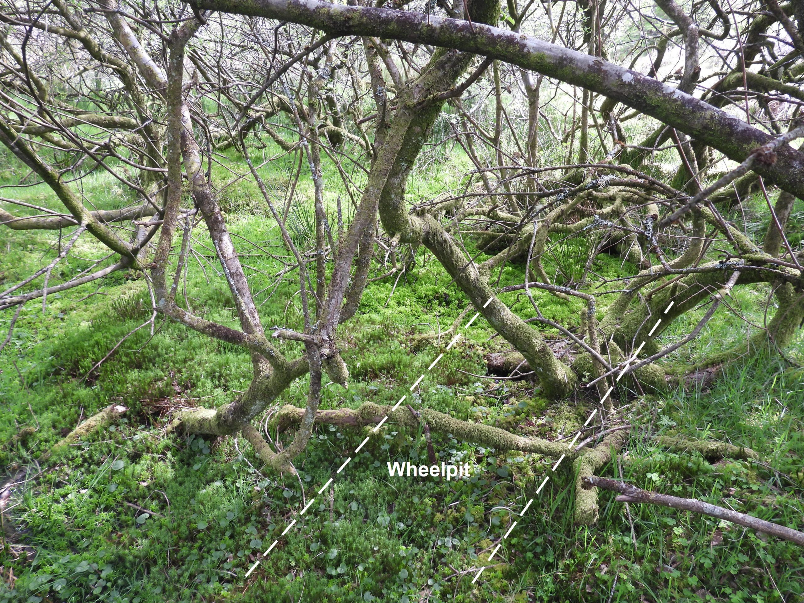
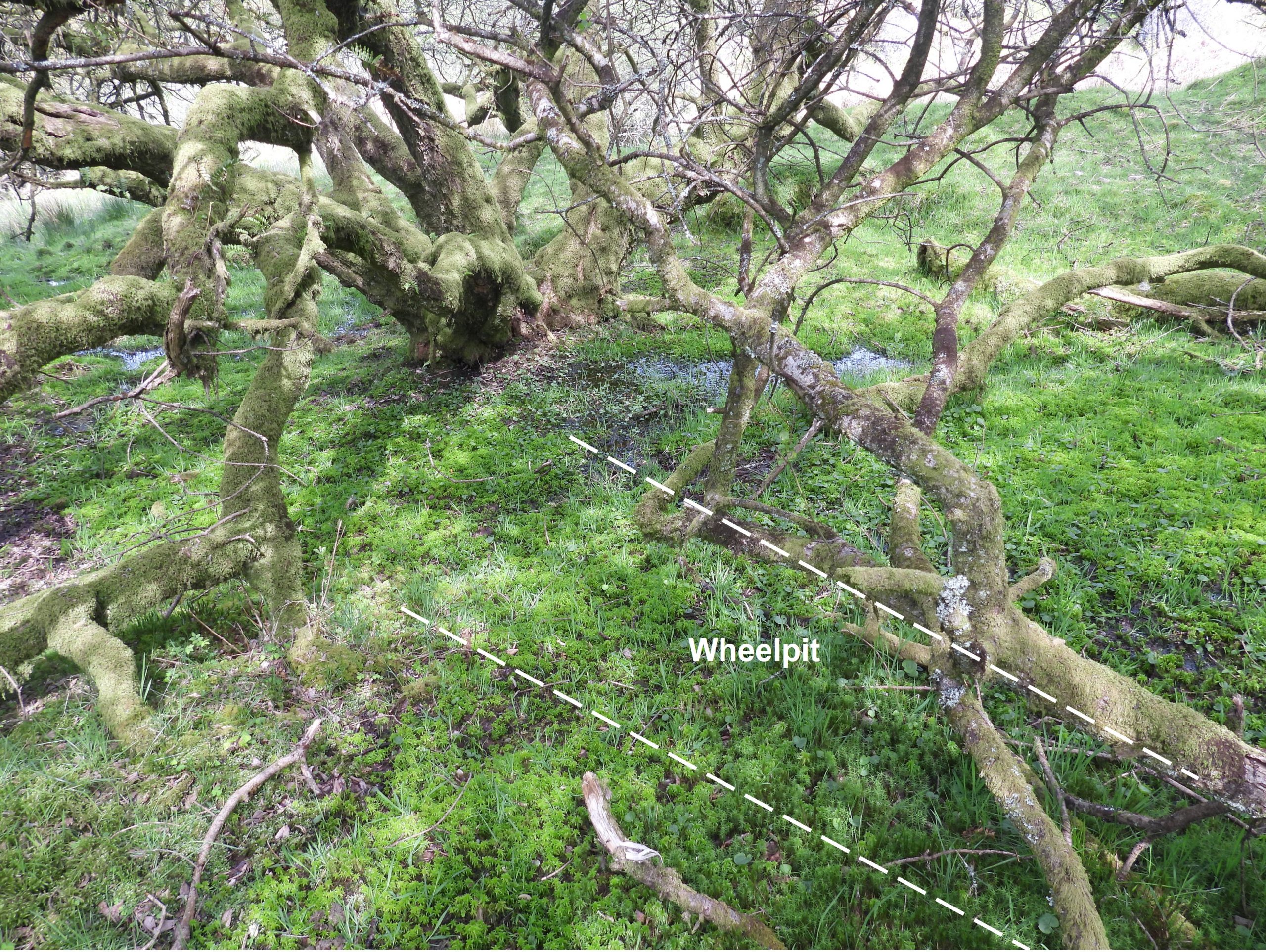
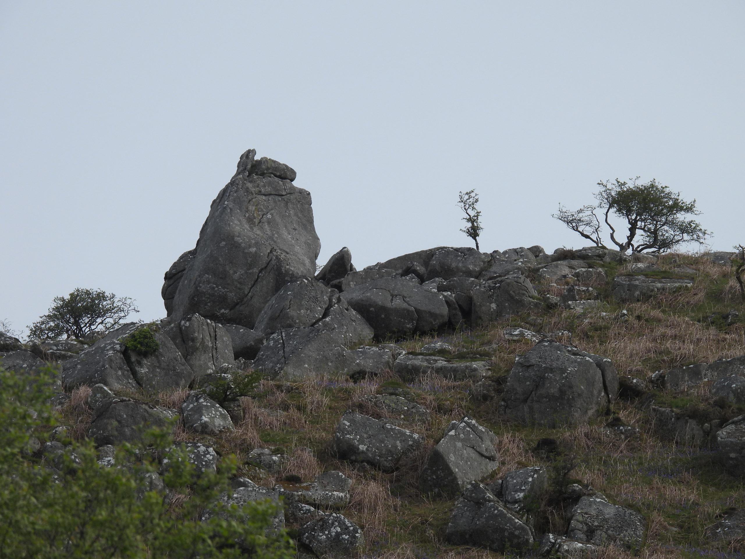
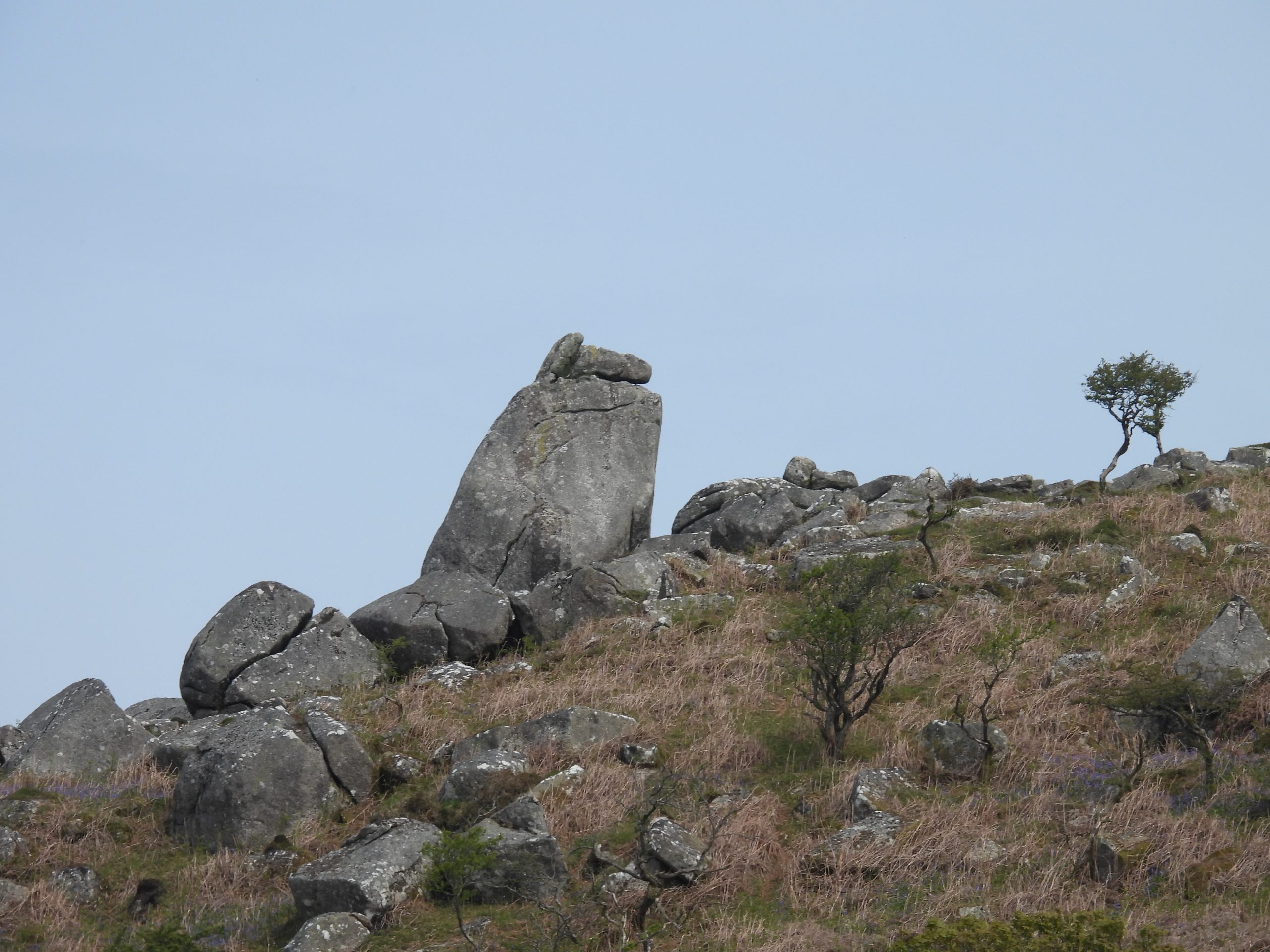
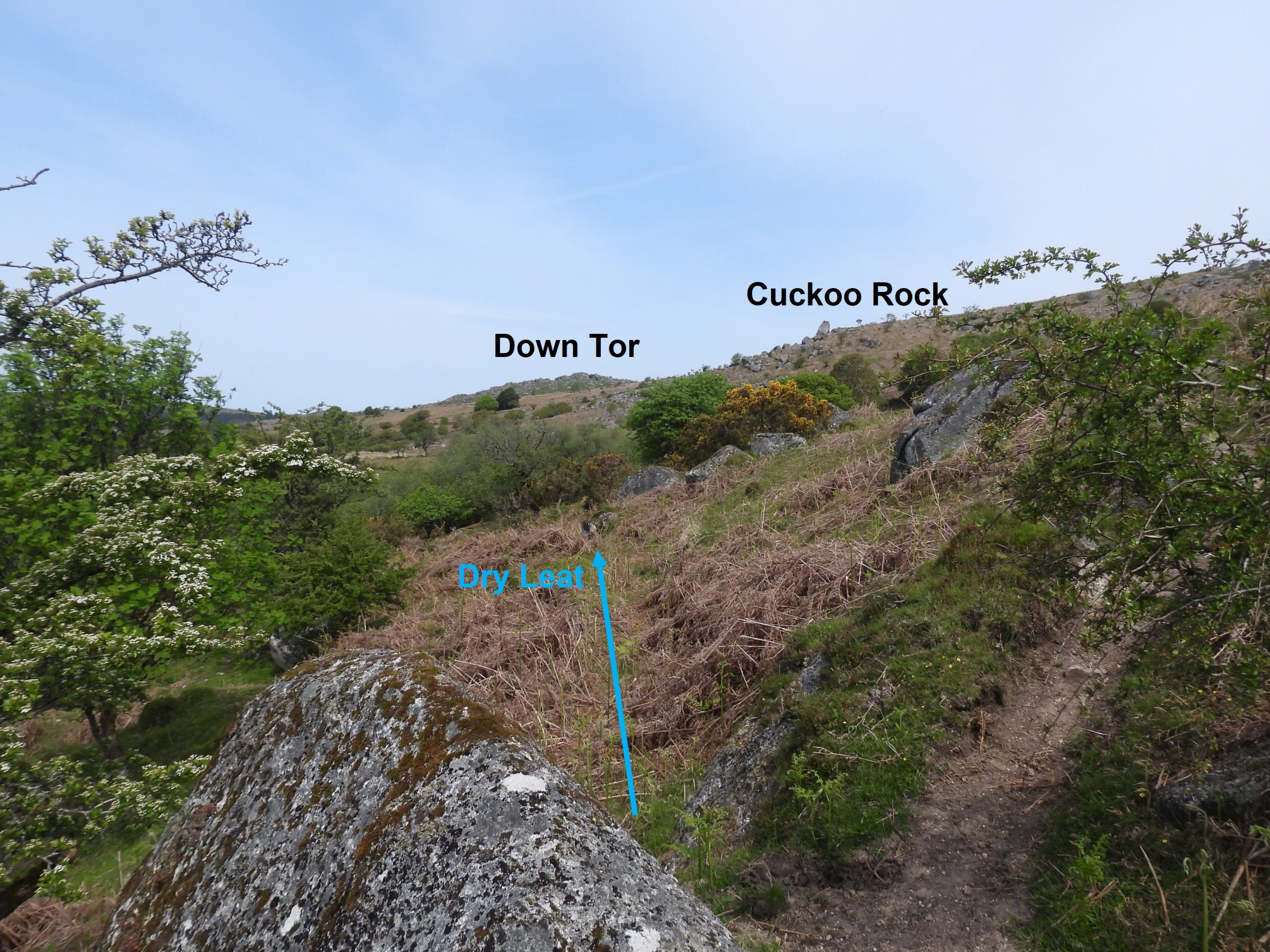
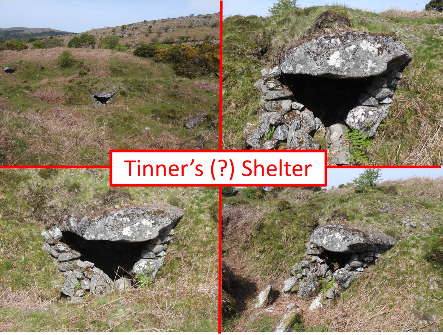
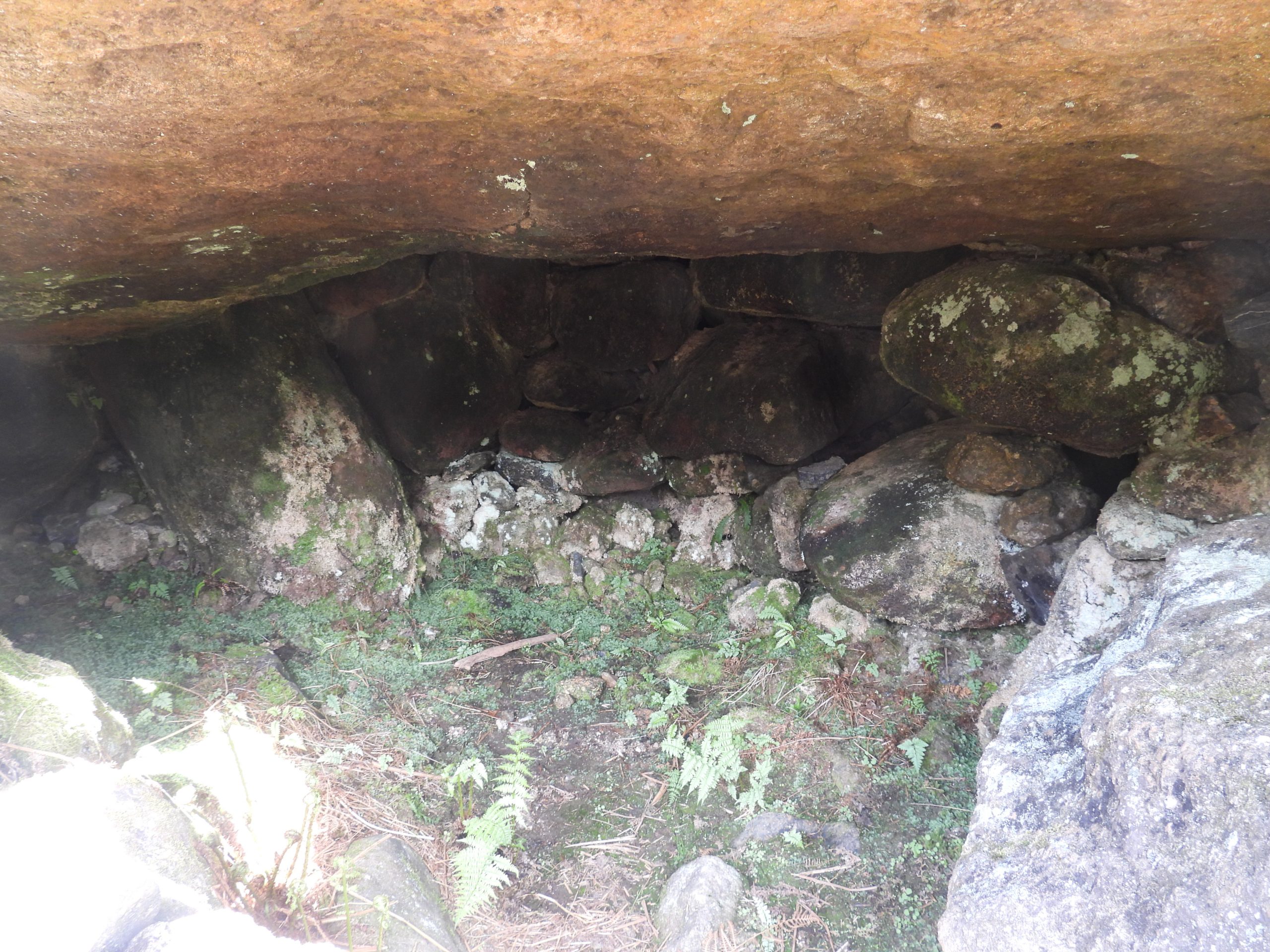
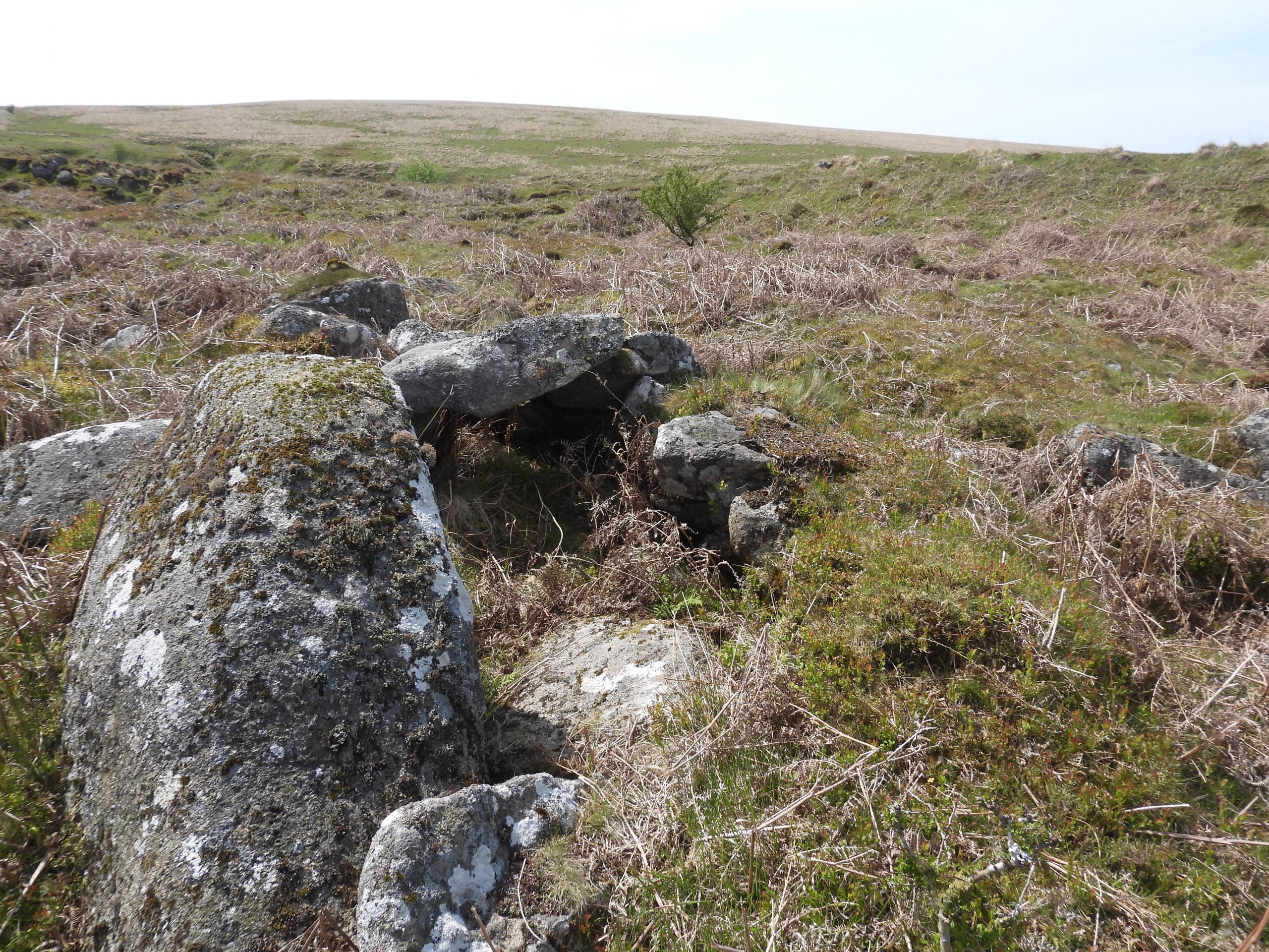
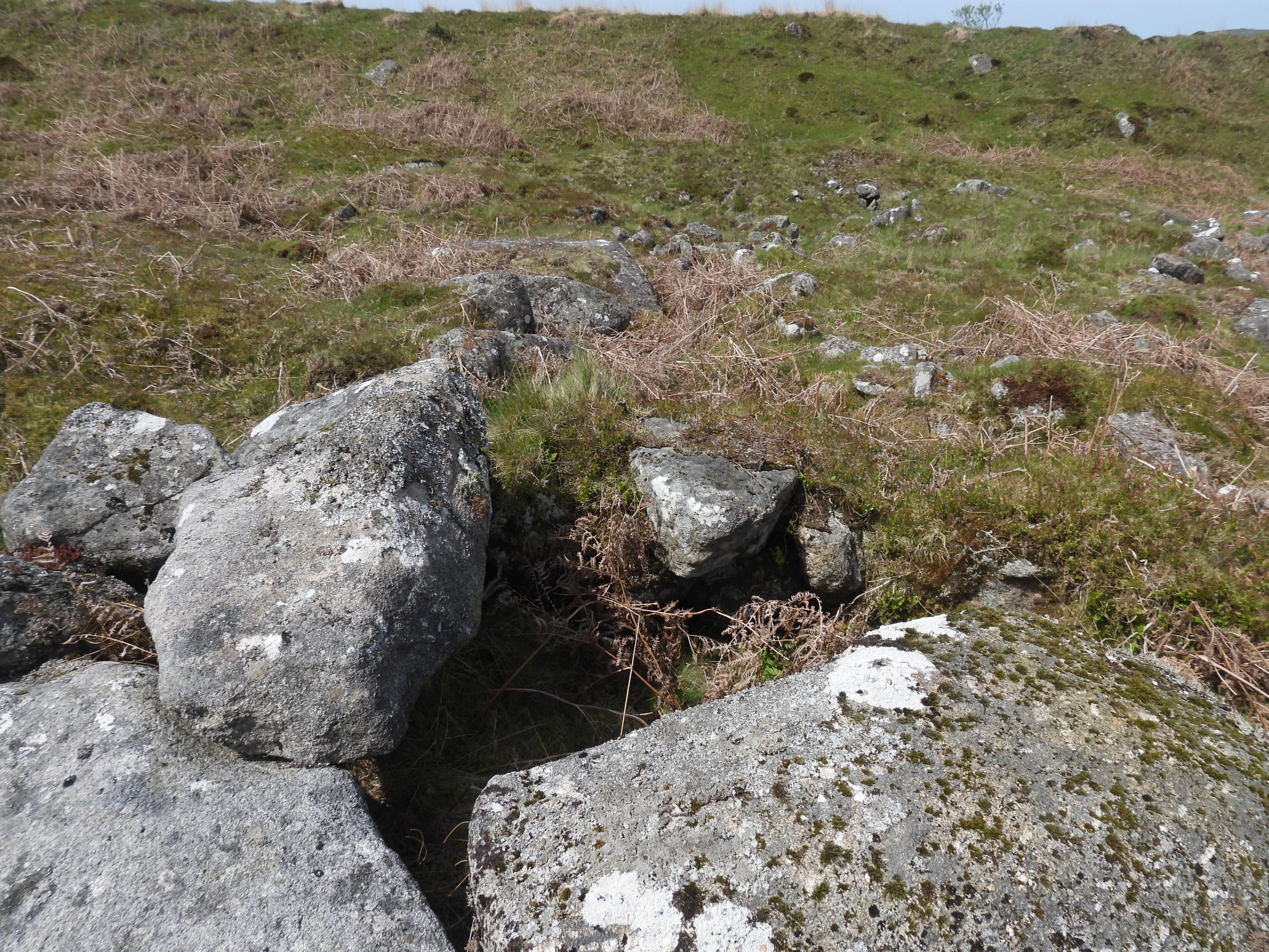
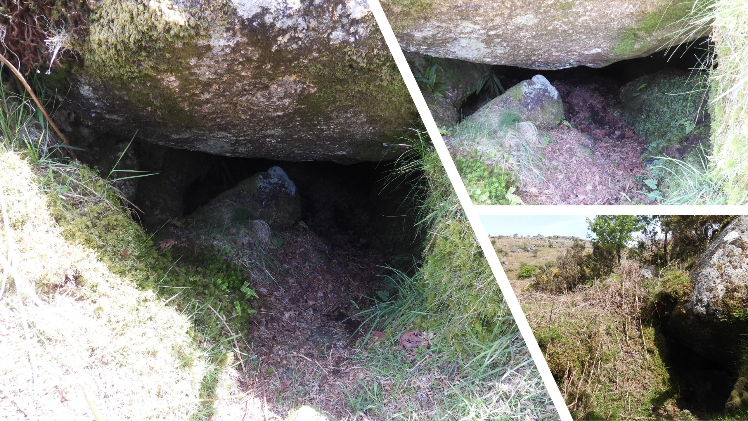
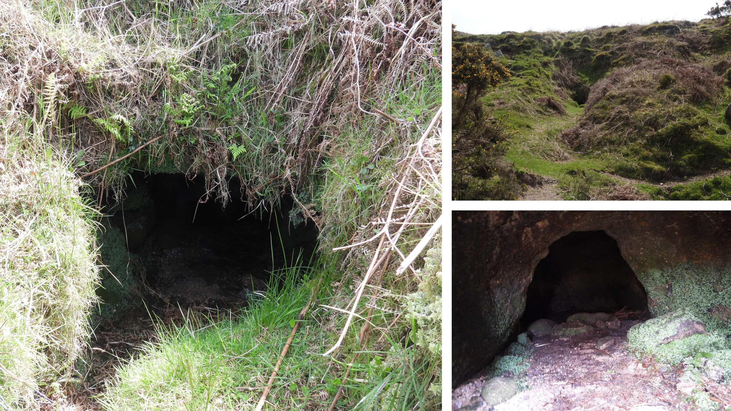
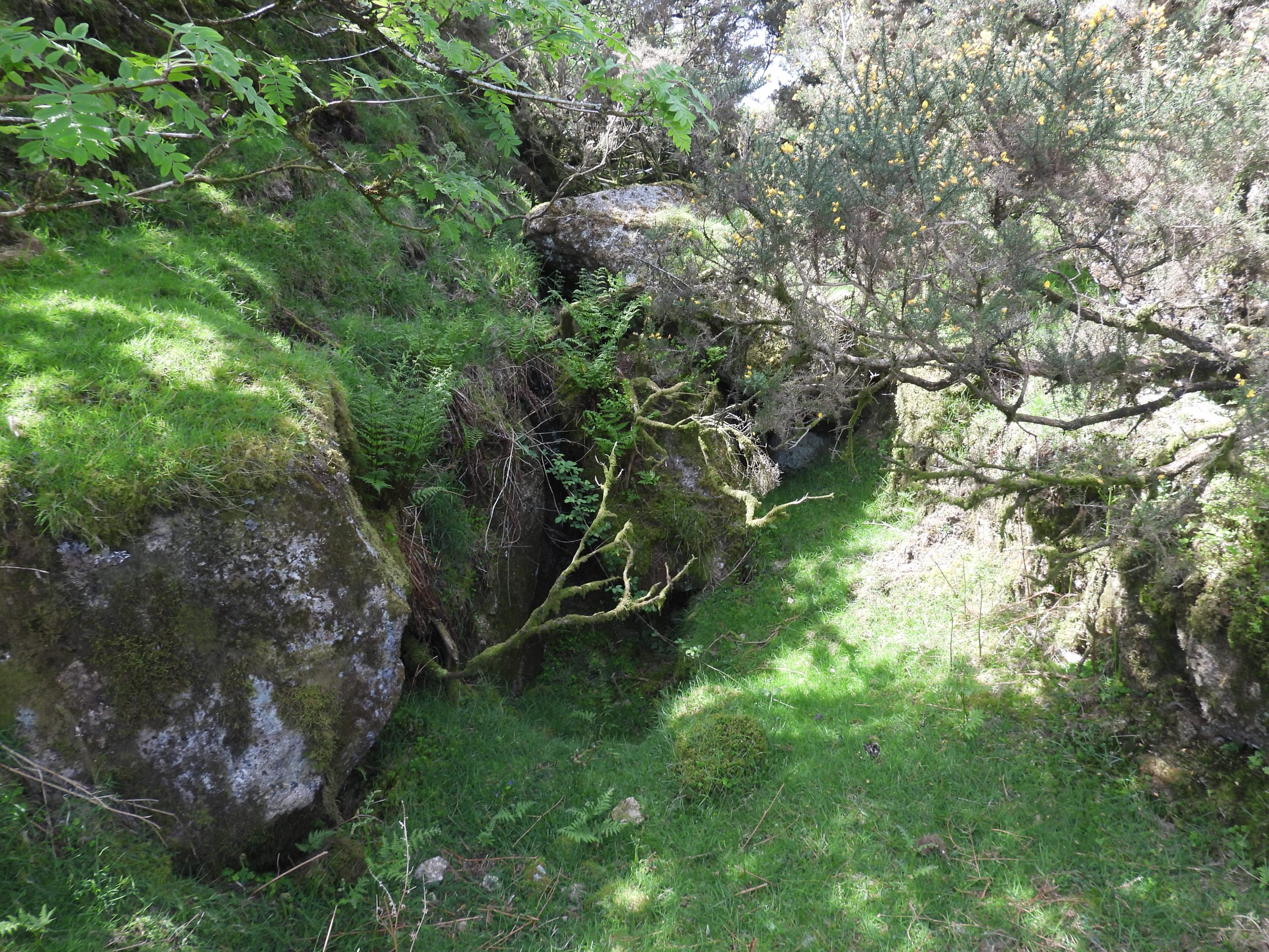
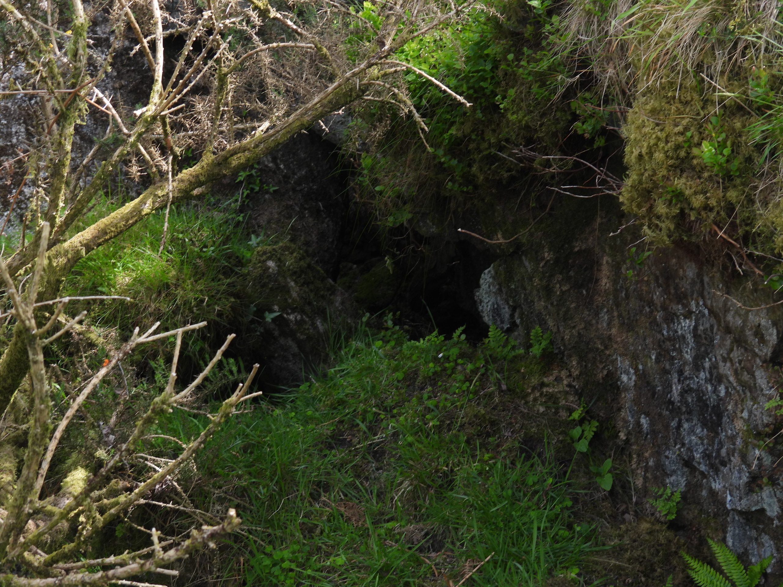
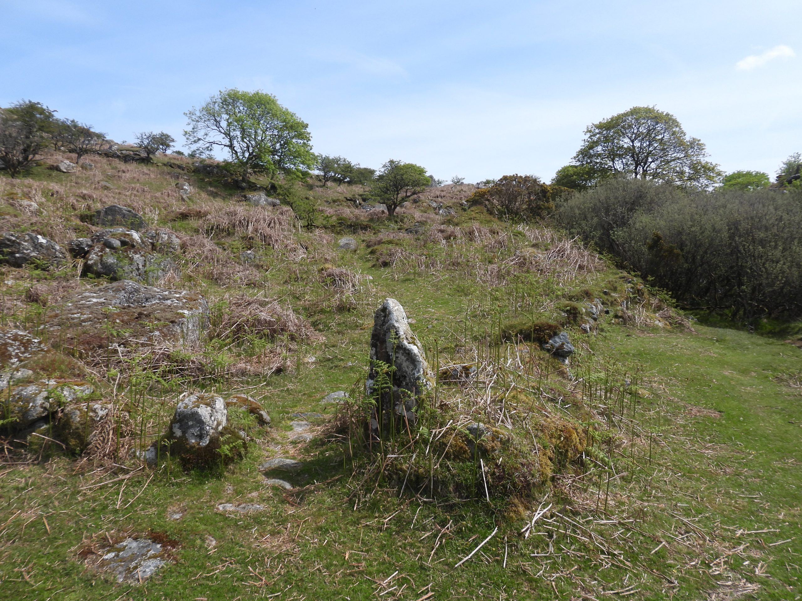
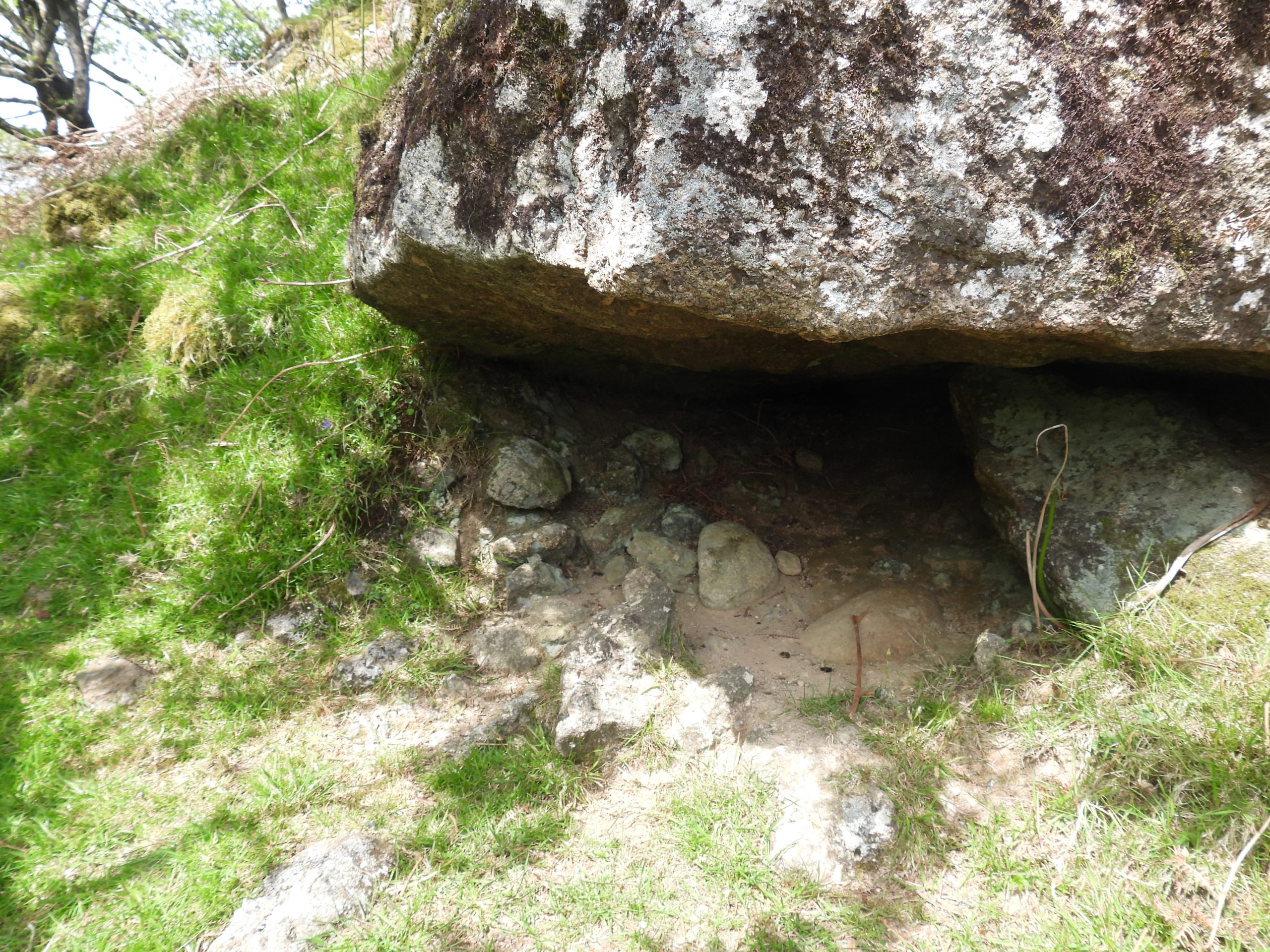
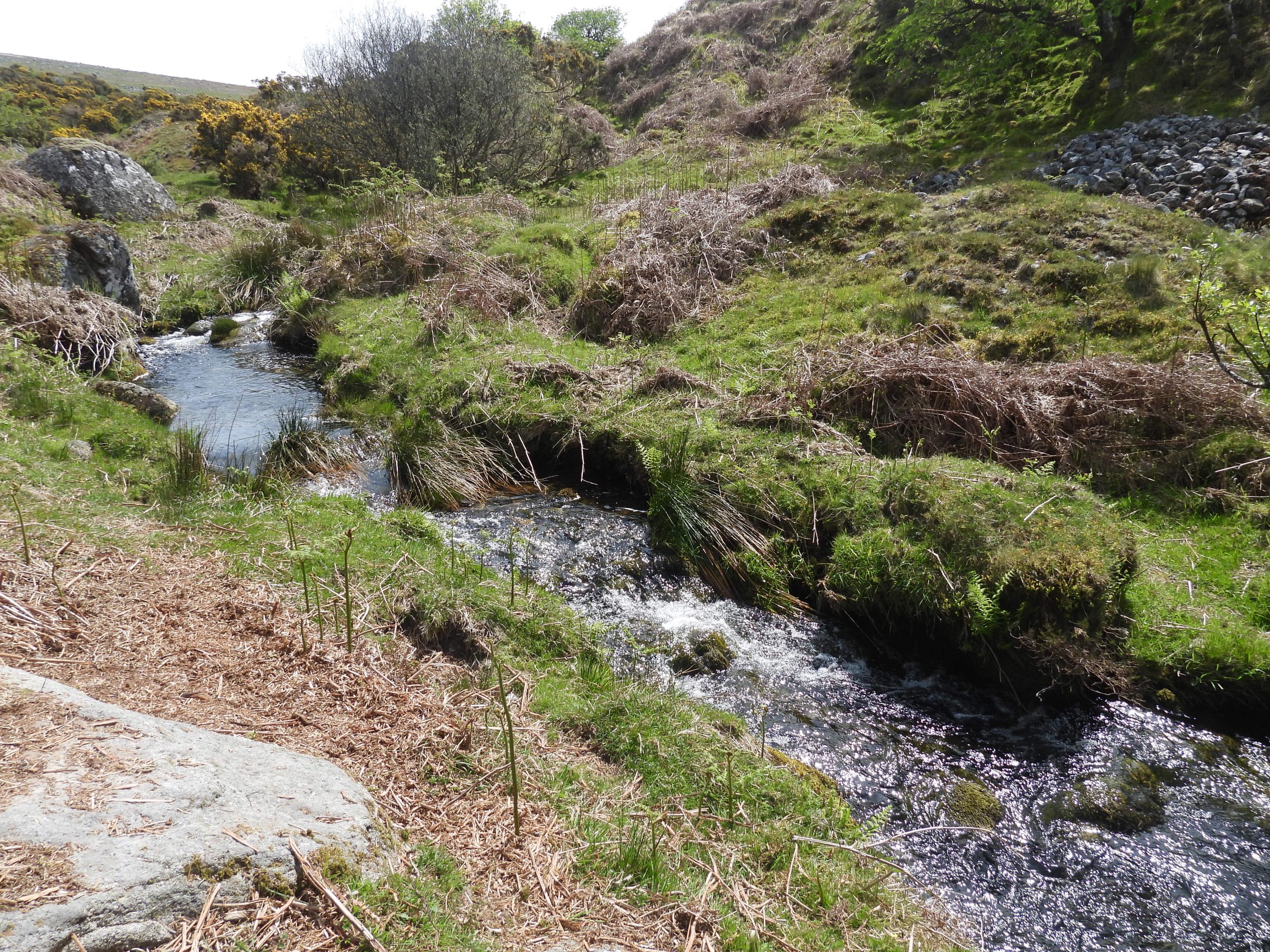
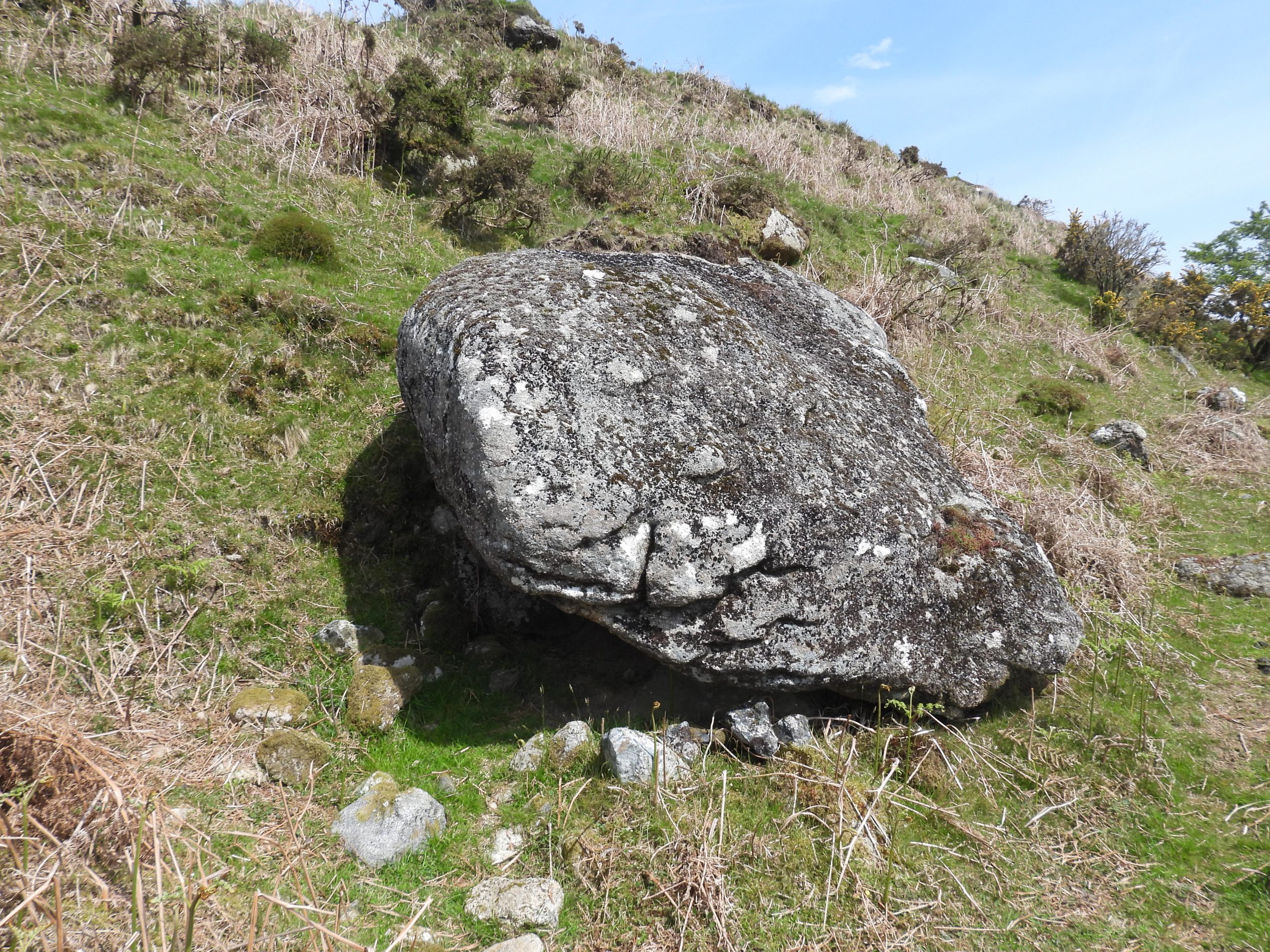
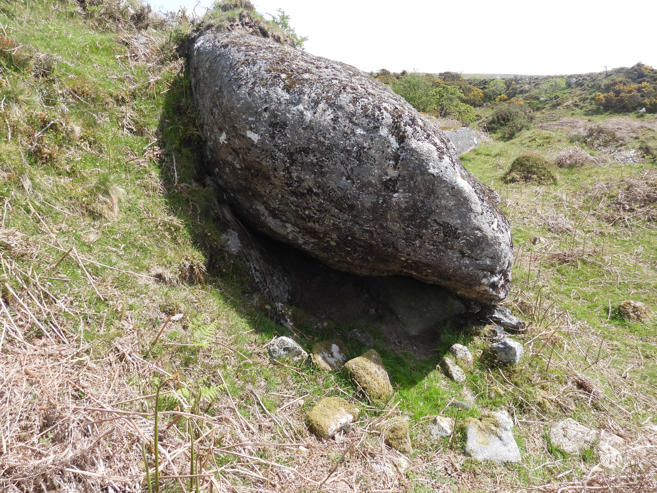
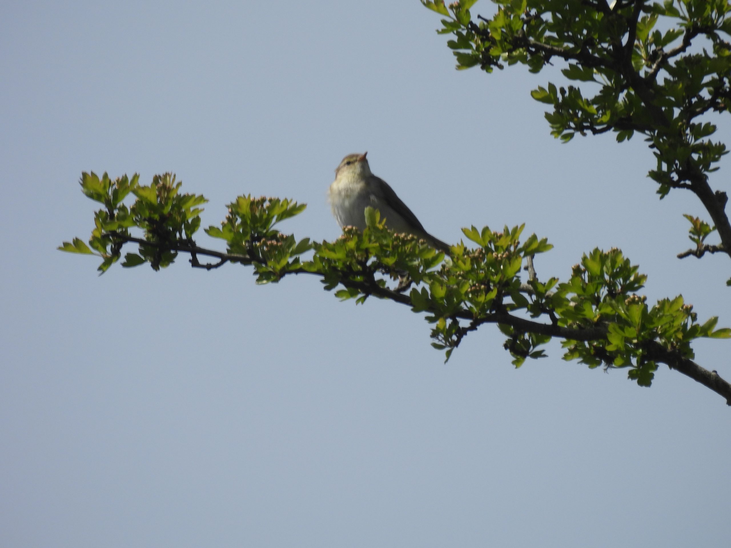
Combshead Tin Mill / Mine is located between the two tributaries of Narrator Brook, just to the south of a track which leads up the valley from Outholme Farm and Tinner’s Mill.The mine site comprises a wheelpit (possibly two), (possible), stamps area, a building, some (probable) settling pits, a mortar stone, two leat embankments and an adit. This sketch is based on one produced by Greeves and RobinsonGeneral view of the mine remains. The wheelpit and the building are the two most obvious features here.The wheelpit lies below and obvious leat embankment (marked as number 1 on sketch). The wheelpit is constructed of moorstone and is rubble filled. It is located at SX58495 68403Between the wheelpit and the building are the possible remains of the stamps area. The Heritage Gateway record suggests the wheel worked a two-headed stamp and that the internal dimensions of the wheelpit is 11 metres long and 1.1 metres wideThe south corner of the stamps area was recorded at SX58496 68400View from leat embankment 1. The leat which supplied the waterwheel can be traced (as a shallow ditch) for approximately 45 metres to the north.Another view from on top of leat embankment 1. Below the wheelpit is a “pit” area, which was probably part of the original tail race.The leat leading onto the (probable overshot) waterwheel would have taken a right angle course at the end of the leat embankment.There is quite a substantial ruined building is situated to the south east of the wheelpit.The Heritage Gateway records the building as having internal dimensions of 3.4 metres long by 2.5 metres wide with walls surviving to a maximum height of 0.8 metres.The building is located at SX58505 68396In the south east corner of the building is a small alcove which is suggested might have been a hearth. The building is unlikely to have contained a furnace, due to its distance from the wheelpit. If this is a hearth was it just a normal fireplace?To the south of the building is a second leat embankment (labelled as number 2 on the sketch). Below the embankment is an abandoned mortar stone. The Heritage Gateway suggests there were originally three mortar stones on the site.A contextual picture of the location of the mortar stone in relation to the building.Close up of the mortar stone, whose hollows does suggest there was two-headed stamps at the mine. The mortar stone is located at SX58502 68388There is a large (very overgrown) adit which can be found around 20m-30m upstream from Combshead mine, which is almost certainly associated with it (ref: Townsend).With extreme care the adit portal can be accessed by climbing down alongside a tree which is hiding a view of the adit from the top of the bankThe adit portal. The adit is located at SX58528 68368The adit was viewed from the run off is obscured by trees and vegetation.In a Dartmoor Tin Research Group (DTRG) sketch of the mine, there was another mortar stone located on the edge of the pit near the possible stamps area. The mossy stones to the left of the picture are candidates. On inspection, no hollows were found but, may, of course be underneath. The author refrained from disturbing these stones.The Heritage Gateway suggest there are remains of “two rectangular buddles survive as waterlogged and reedy earthworks beside the building”. The picture may well be one of these. Further to this, also in a Dartmoor Tin Research Group (DTRG) sketch of the mine, there was a third mortar stone located in this ‘pit’. There is a mossy stone here but on inspection, no hollows were found but, may, of course be underneath. The author refrained from disturbing this stone.Also on the DTRG sketch a possible second wheelpit was suggested. Intriguingly there is a second leat embankment (the one with the mortar stone below it), which would have provided water to a wheelIf this site is the location of a second wheelpit then there is no remaining features still visible. The location is SX58482 68392There are some wonderful views towards Cuckoo Rock from the area. During this field visit a cuckoo was heard in the area (May 2023).Another zoomed in picture of Cuckoo RockOne of the dry leats leading to the mineThe area to the east of the mine is labelled ‘Tin Workings (dis)’. Amongst these workings are a number of ‘shelters’ (or caches) which are possibly related to the tinner’s. The shelter (#1) in the picture is quite substantial but was it built by tinner’s ?Inside the ‘shelter’ which is located at SX58708 68432A second ‘shelter’ amongst the workings. This one is recorded on Dartefacts as a ‘Corbelled cache ruin’.Tinner’s shelter #2 is located at SX58890 68353Tinner’s shelter (or cache) #3 is located at SX58666 68436Tinner’s shelter (or cache) #4 is dug into the hillside at SX58643 68405Tinner’s shelter (or cache) #5 is (in the authors humble opinion) an unlikely candidate albeit it does look like an area disturbed by man. Tinner’s shelter (or cache) #5 viewed from the west side.Next to the Narrator Brook there is evidence of the Combshead Farmstead. This gatepost and walling are just a few metres from the brook. Walking up the brook from this point two more potential Tinner’s shelters (or caches) can be found.Tinner’s shelter (or cache) #6 may well be just an animal shelter. It is located at SX58693 68478Peaceful and tranquil Narrator Brook. Note the area of stones to the right of the picture which indicate Tinner’s workings.Tinner’s shelter (or cache) #7. The line of small stones at the foot of this large boulder suggest that at one time the base of the rock was blocked to make a shelterTinner’s shelter (or cache) #7 is located at SX58794 68482Birdlife along Narrator Brook.