A collection of walks, discoveries, insights and pictures of exploring Dartmoor National Park
October 3, 2022
Director of Convicts Prisons Boundary Stones
The prison at Princetown was constructed between 20th March 1806 (laying of the foundation stone by Sir Thomas Tyrwhitt) and 22nd May 1809, as a result of the war with Napoleonic France which had started in 1803. The thousands of prisoners captured by the British were initially accommodated on redundant warships known as ‘the hulks’, which were at anchor in Plymouth Sound. Conditions were so bad on the hulks with poor sanitary arrangements, poor diet and little exercise that the death rate rose to an unacceptable level. Therefore a prison on land was decided upon with Princetown considered as the most suitable location. The first prisoners arrived in May 1809 but the prison was full by the end of that year. In April 1813, the prison saw the arrival of American prisoners, which added to the already crowded conditions. By 1816, all prisoners of war had been repatriated and the prison closed. A few prison buildings were used as a Naptha plant in 1846, but the main prison didn’t reopen until November 1850. The reopened prison was as a male convict public works prison and ‘H.M. Prison, Dartmoor’ took 150 convicts in its first year.
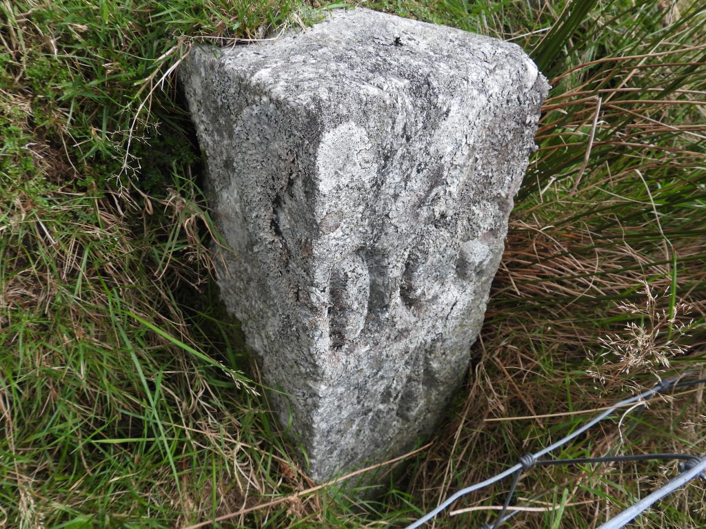
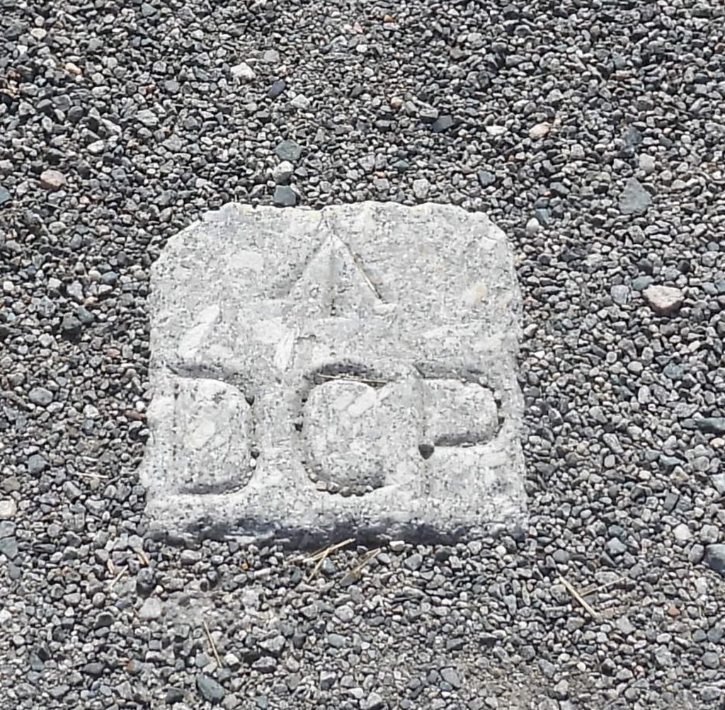
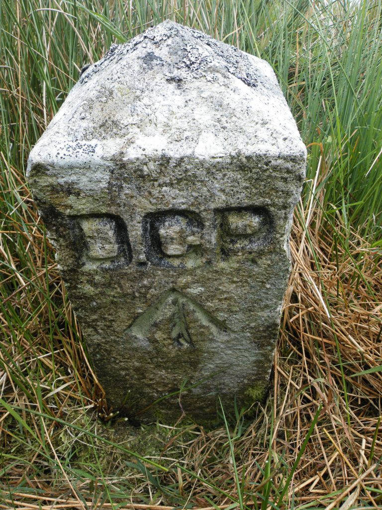
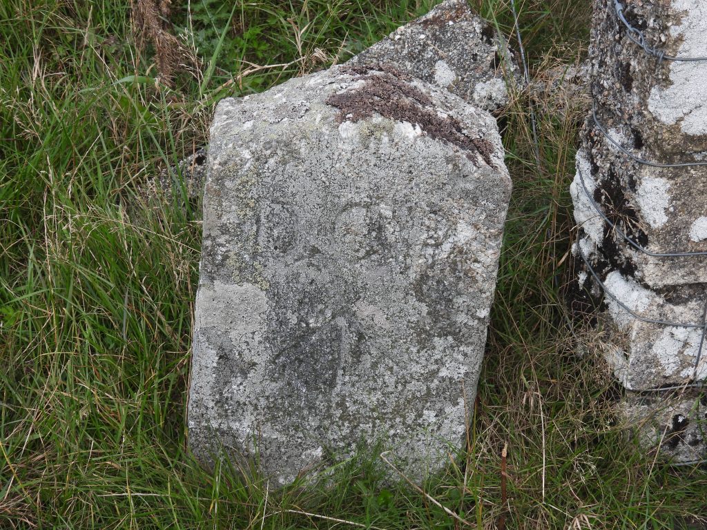
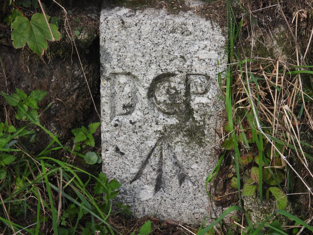
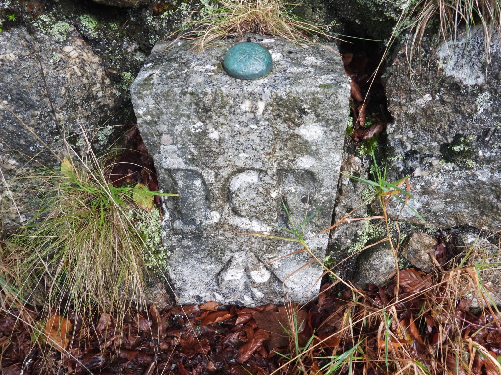
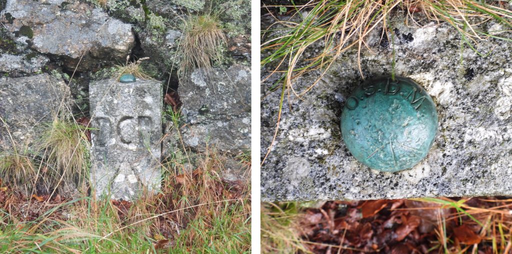
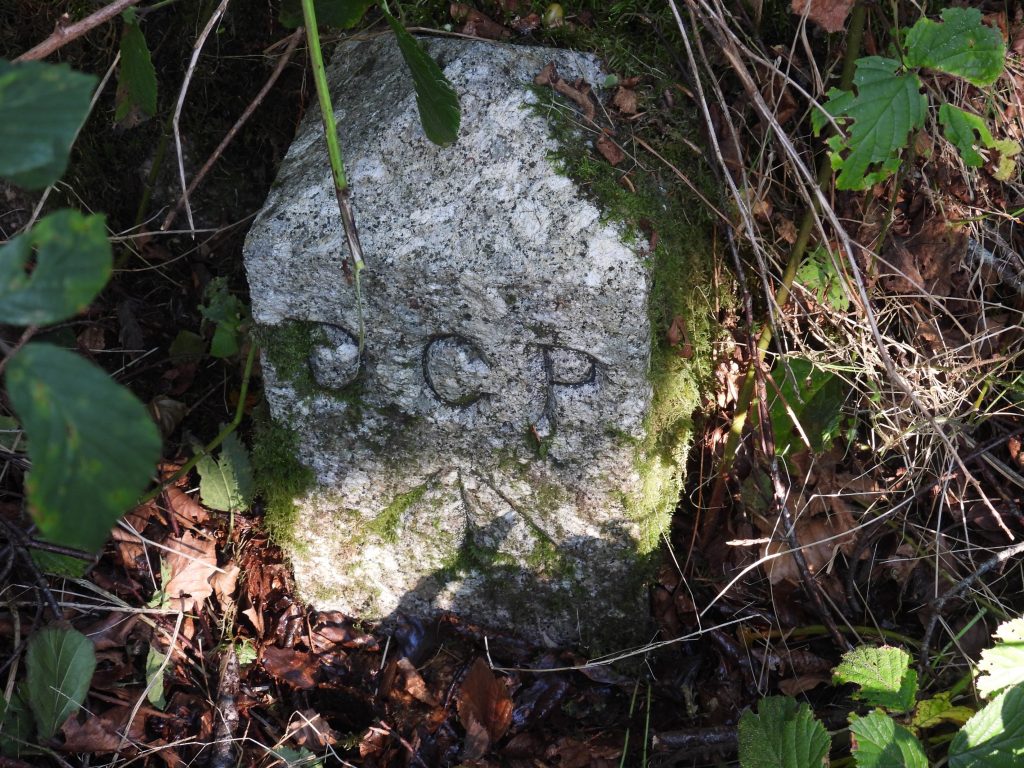
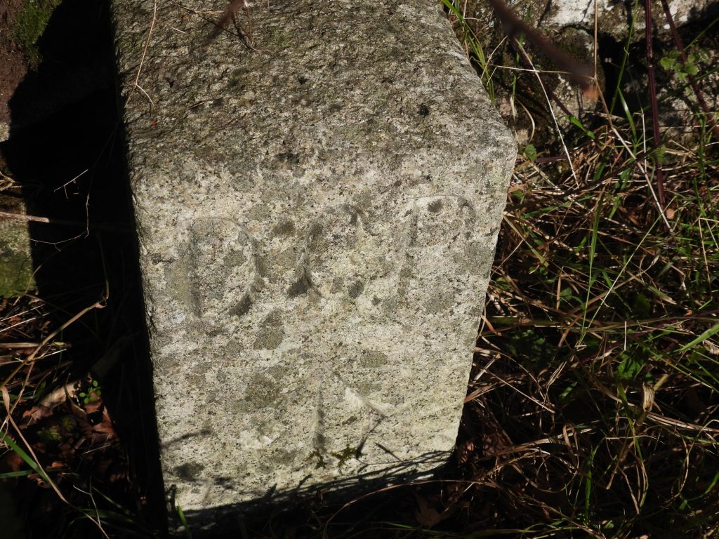
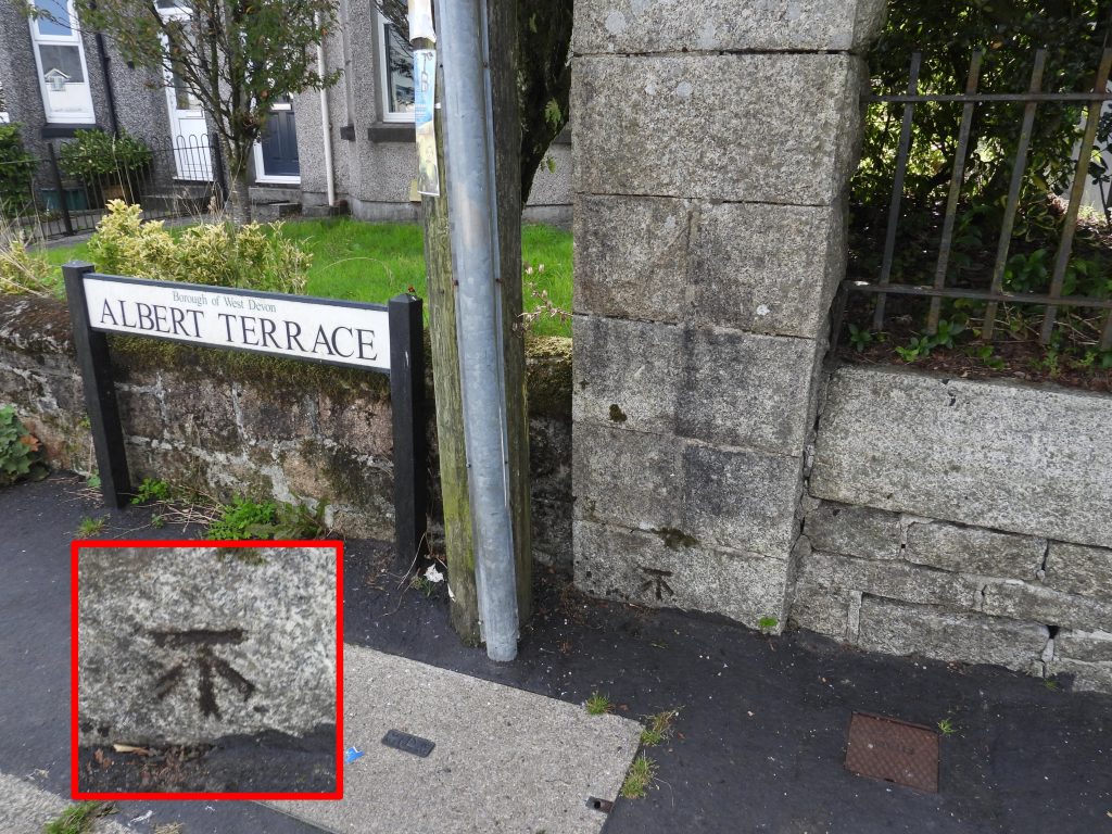
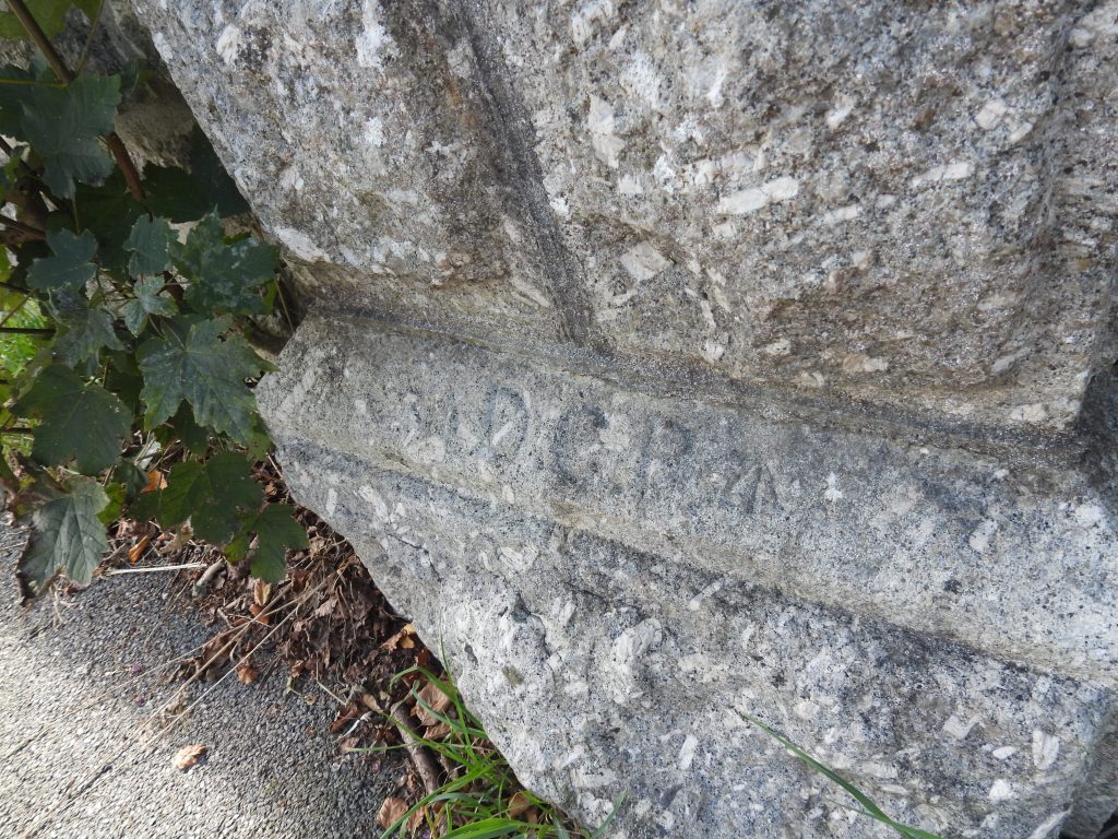
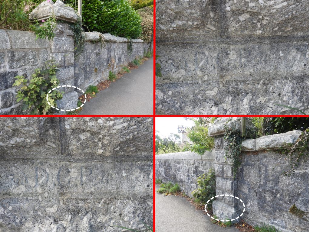
In 1850, the prison lands comprised 390 acres which had been granted on a 99 year lease by the Duchy of Cornwall. A series of boundary stones were erected to mark the prison boundary, each were of red granite and had an incised ‘broad arrow’. In 1867, the prison boundary was extended by a further 1000 acres under a new lease. With this new boundary a new series of boundary stones were erected, this time not only with a ‘broad arrow’ but with the initials D.C.P which stands for Directors of Convicts Prisons. This post has been made possible with the assistance and information provided by Mark Fenlon (Dartmoor News Issue 166) and from the publication Dartmoor Boundary Markers (2nd edition) by Dave Brewer.
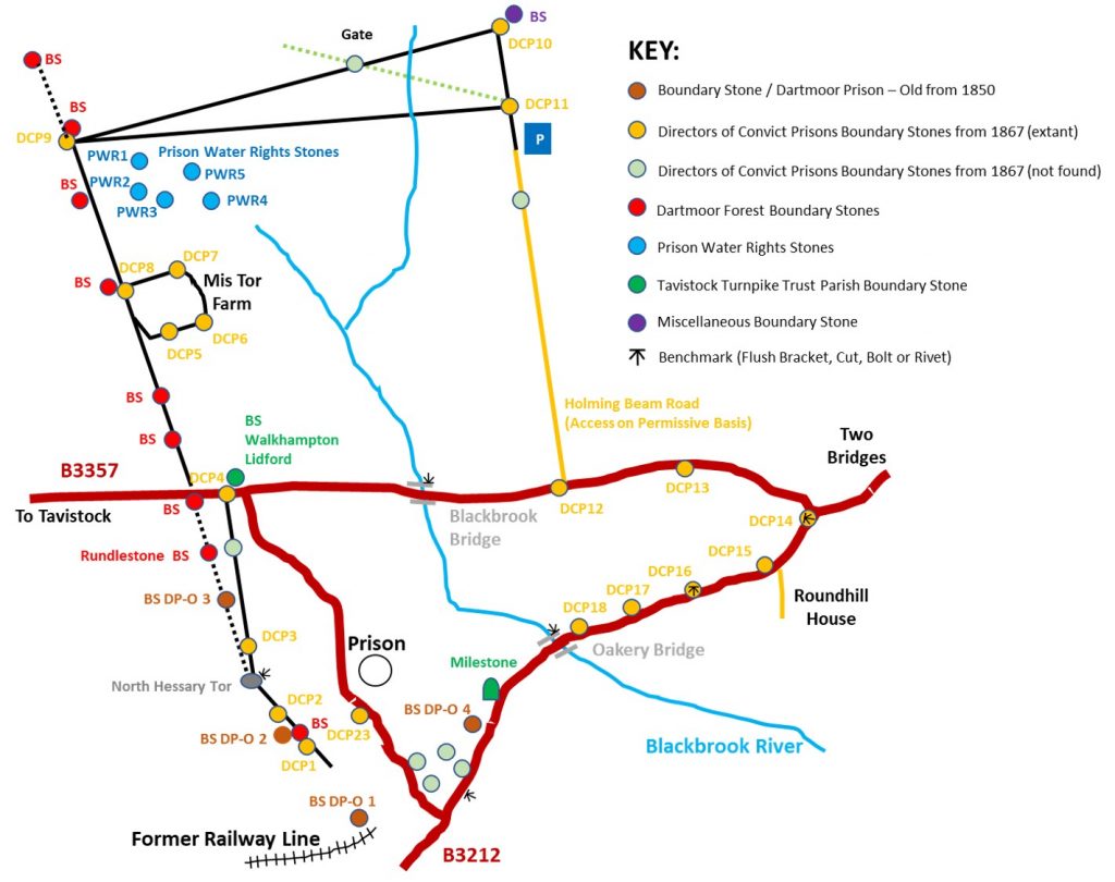
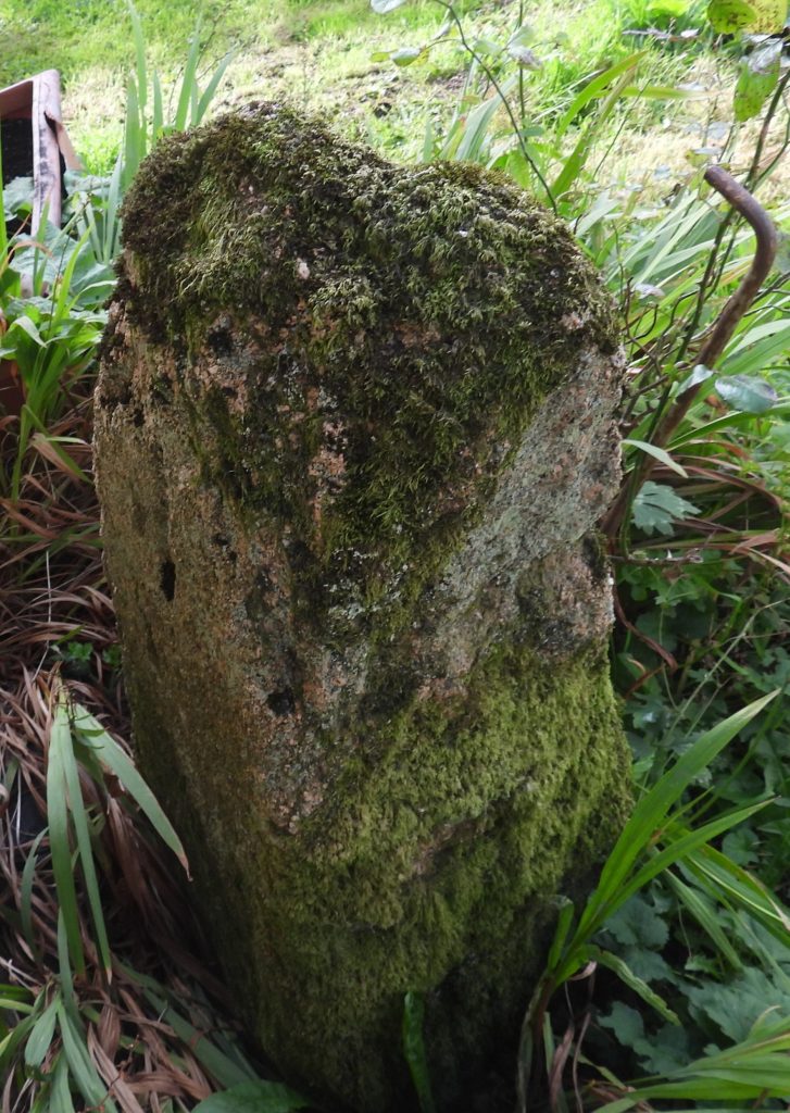
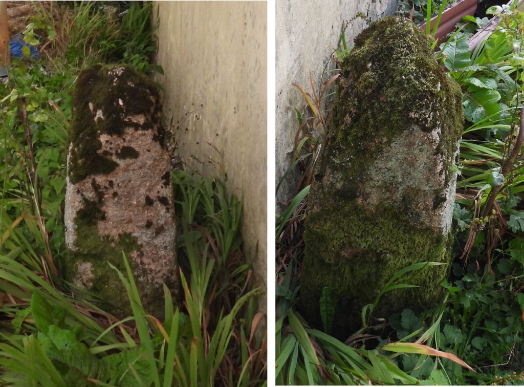
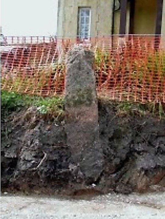
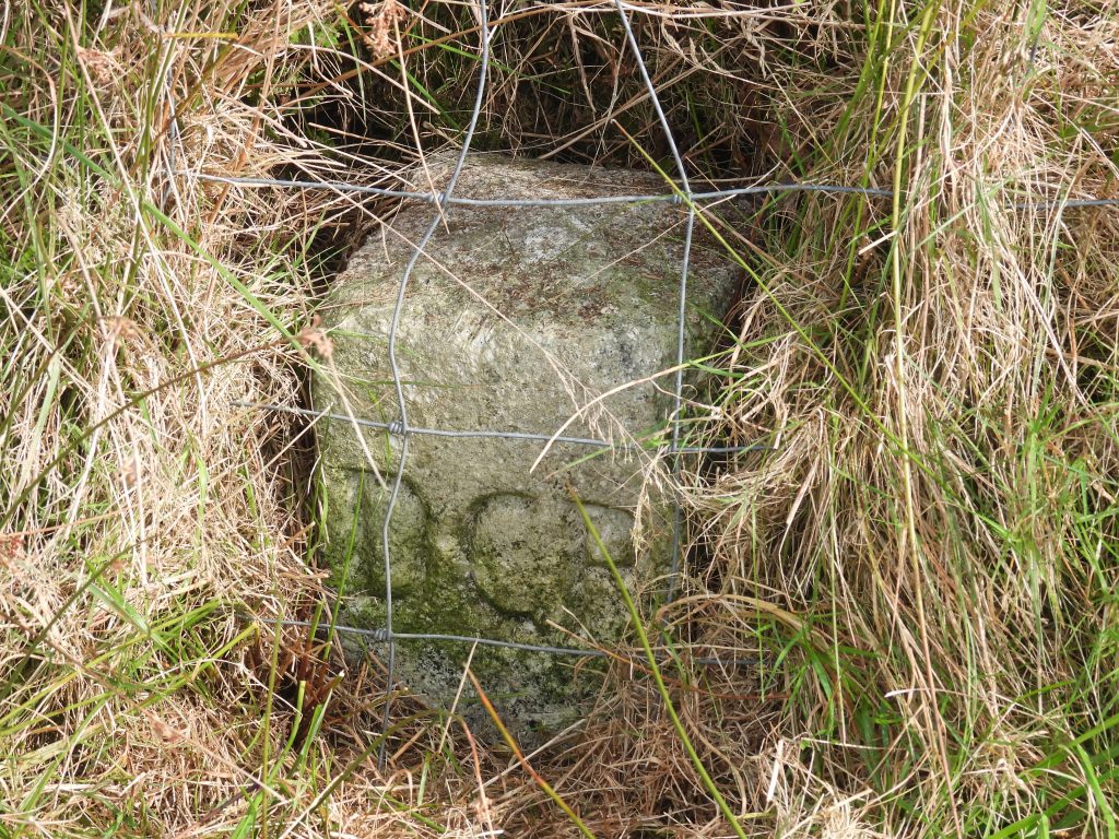
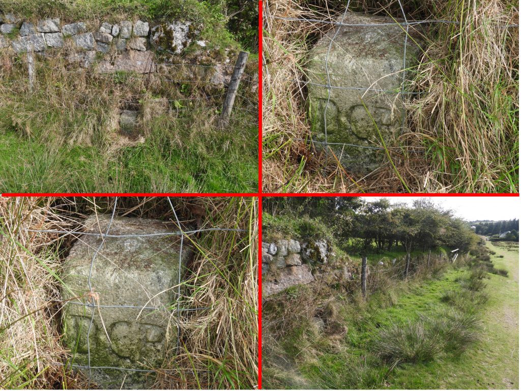
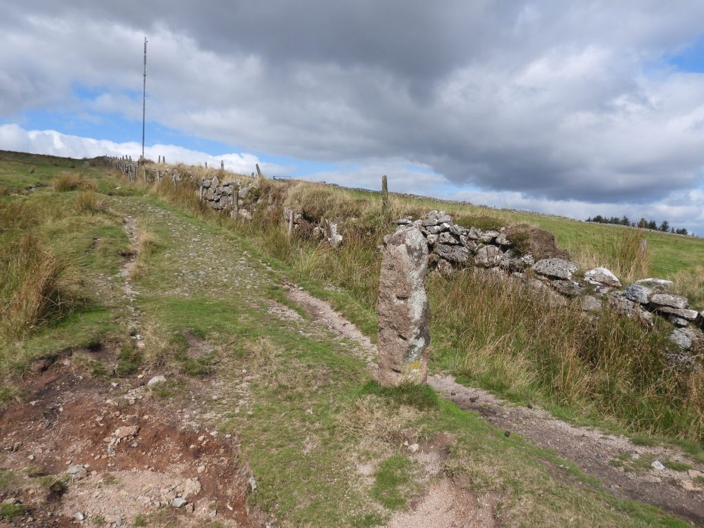
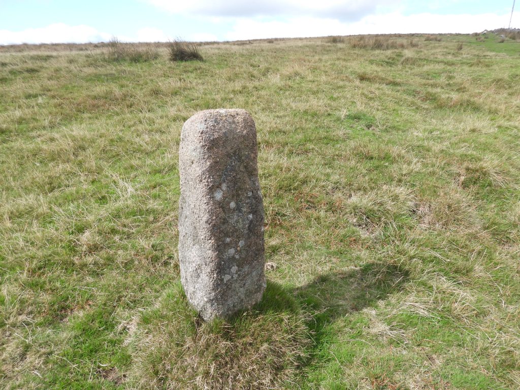
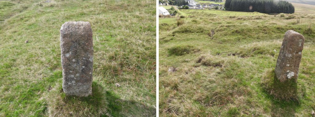
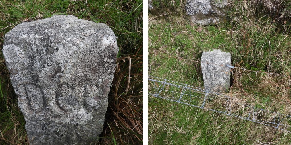
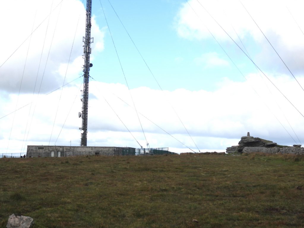
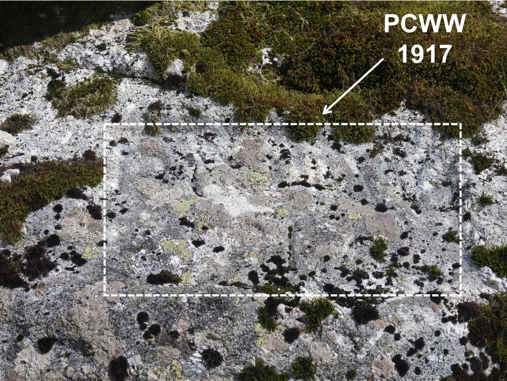
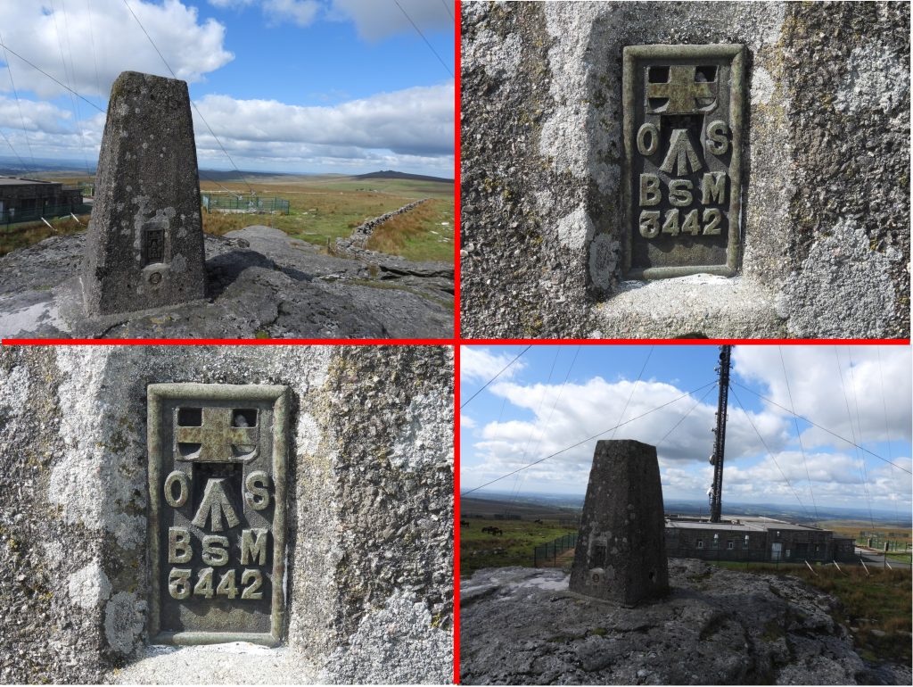
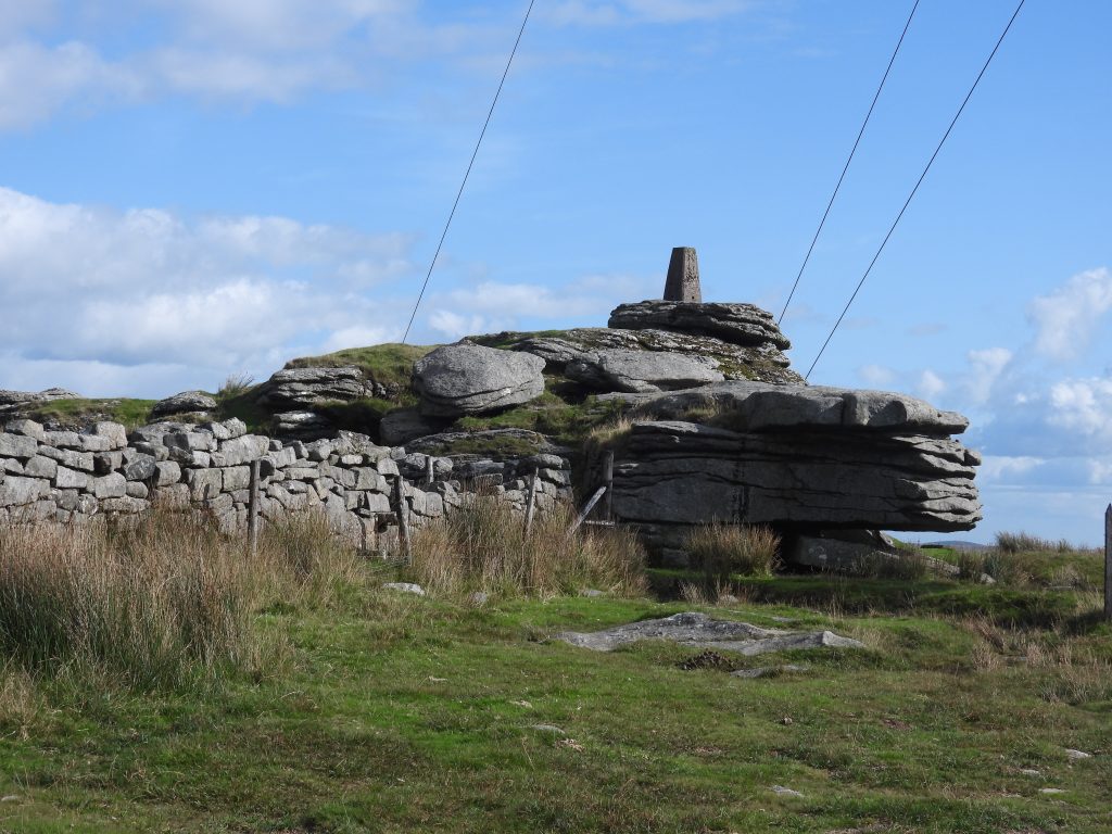
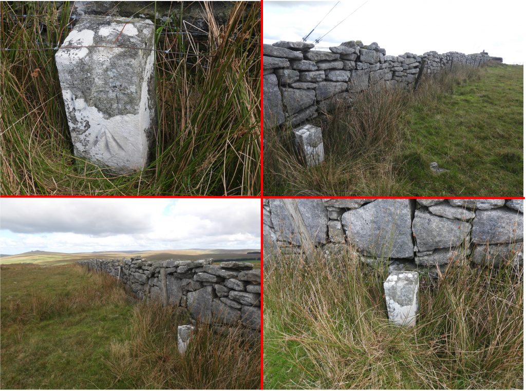
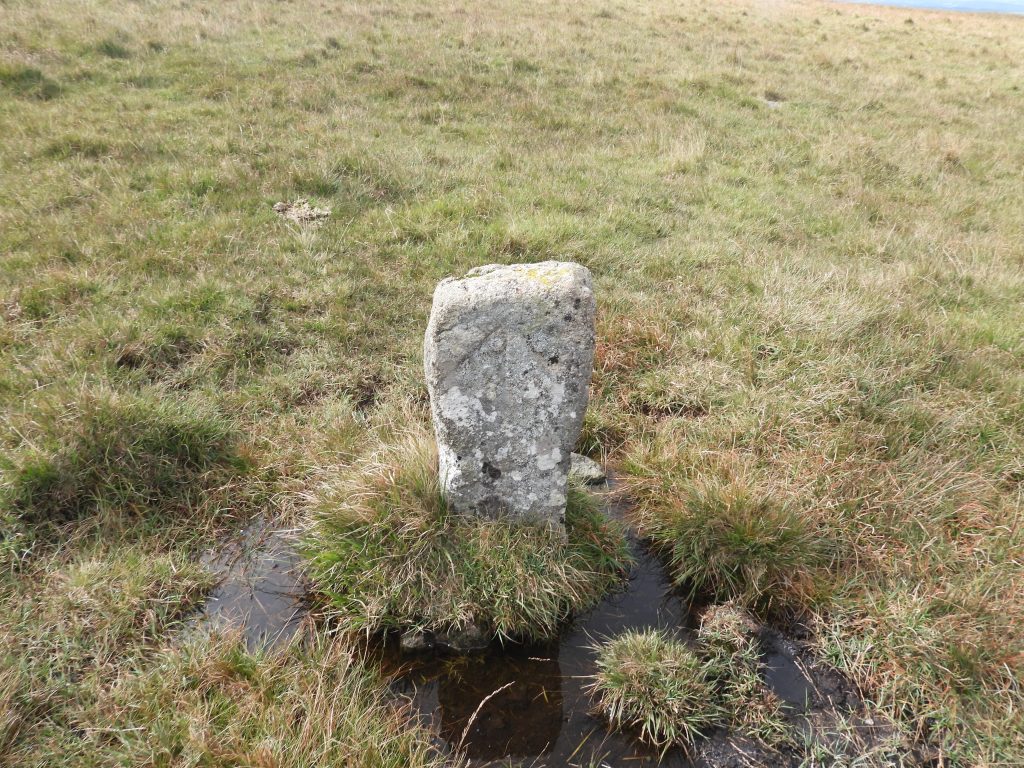
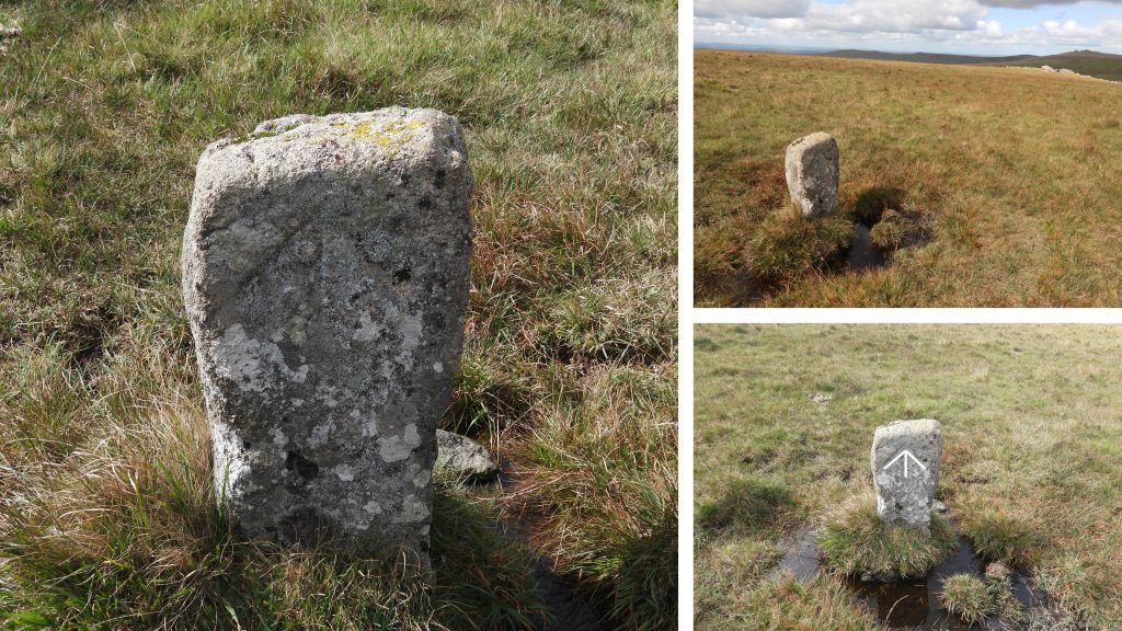
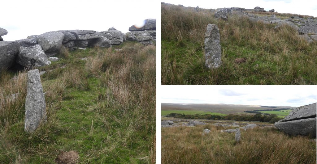
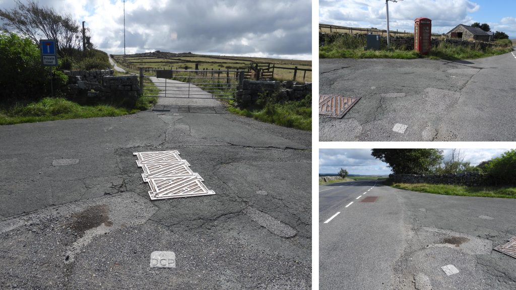
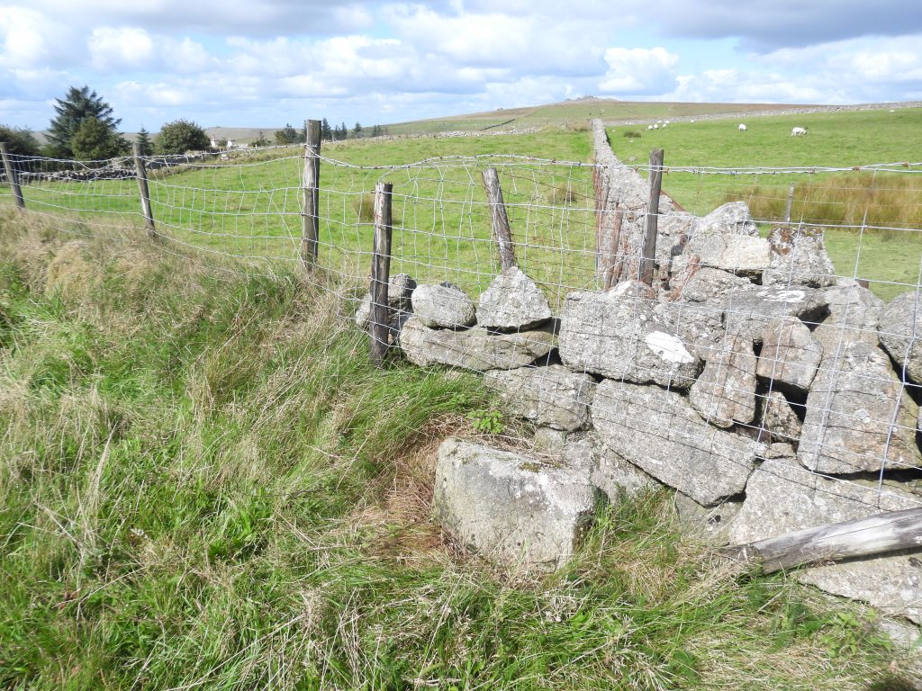
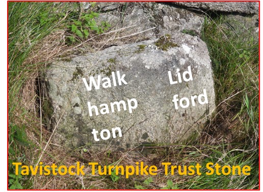
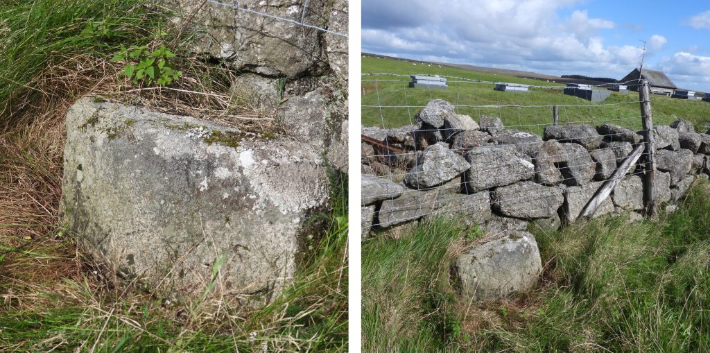
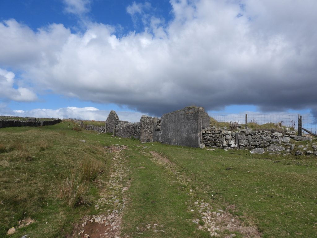
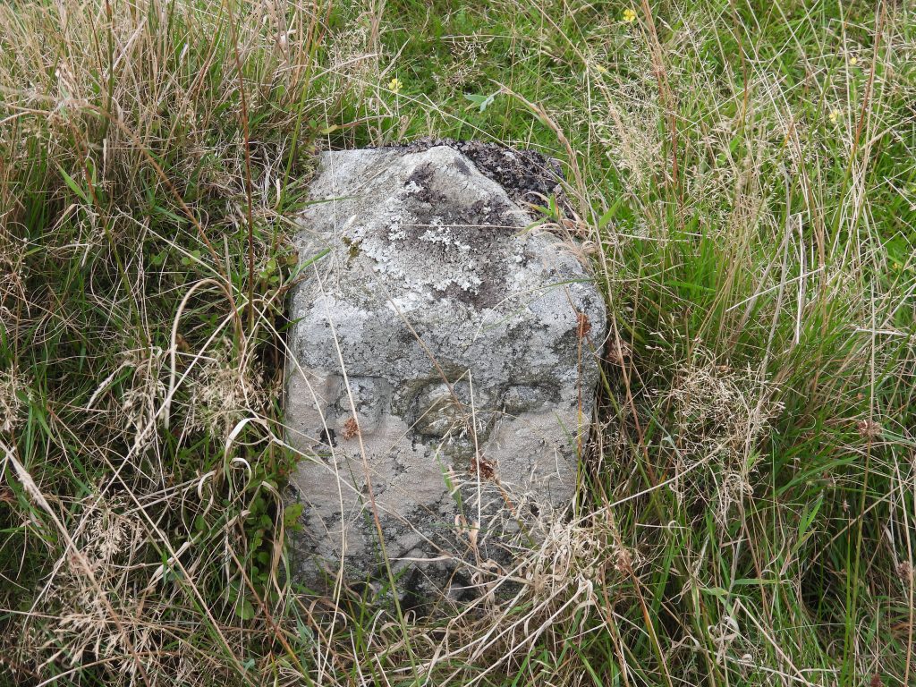
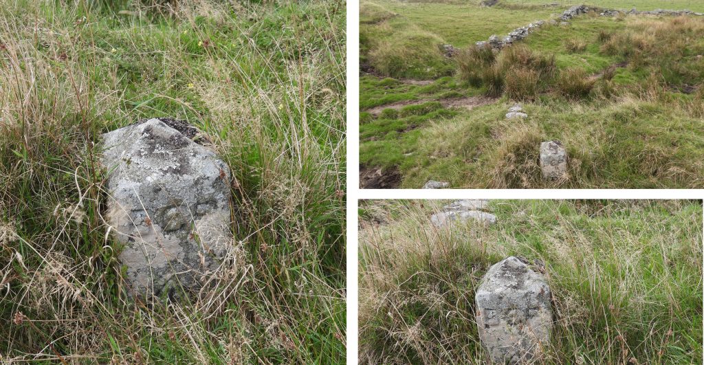
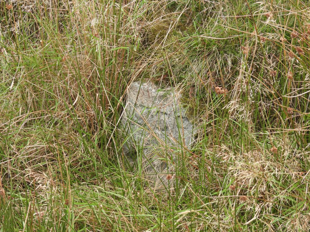
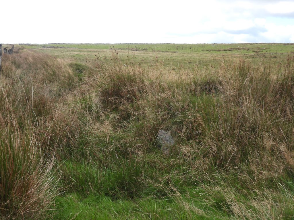
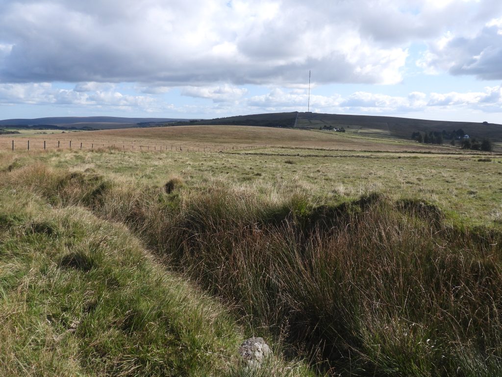
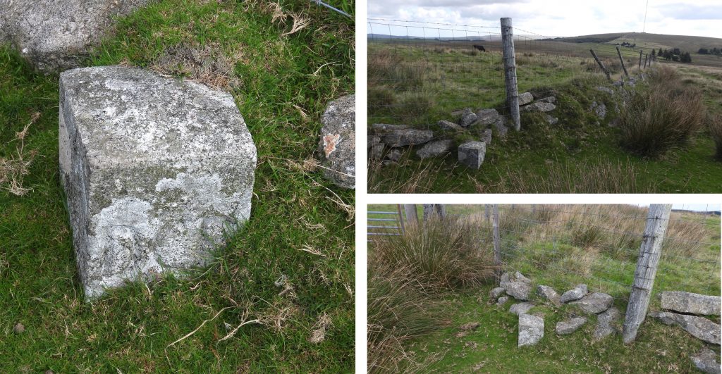
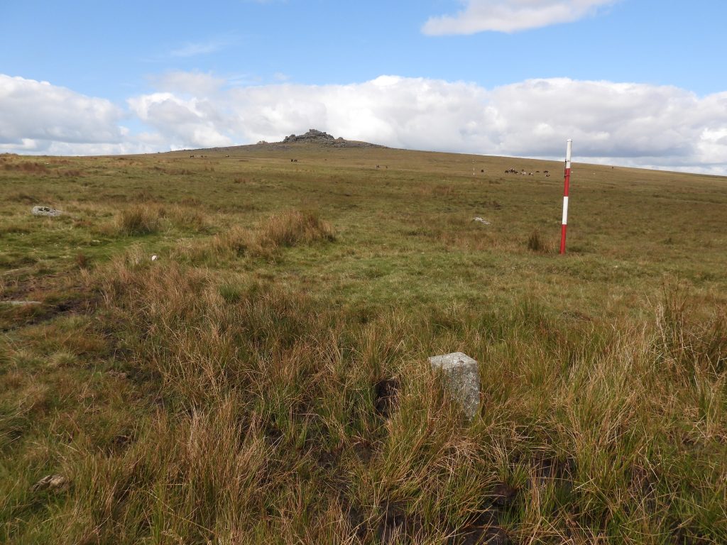
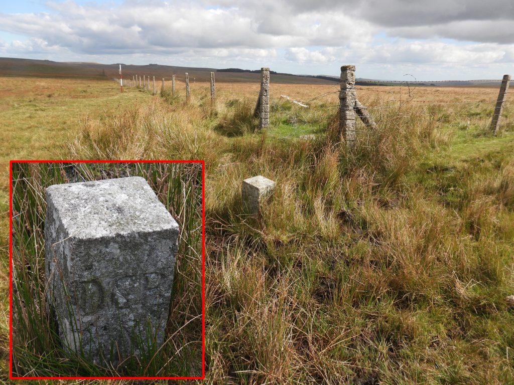
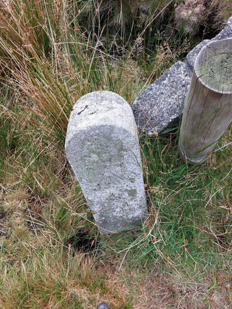
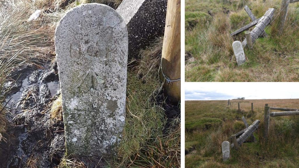
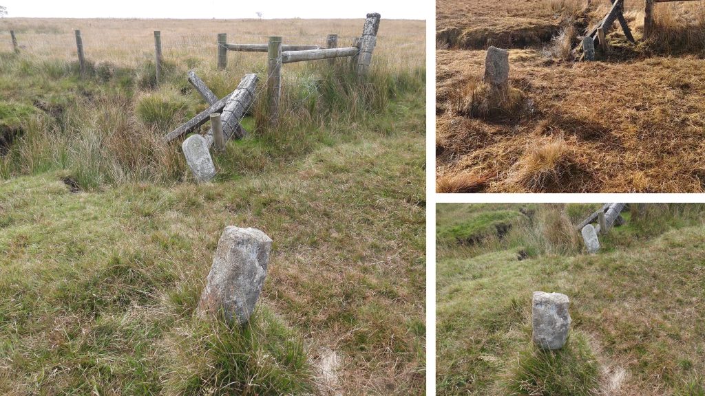
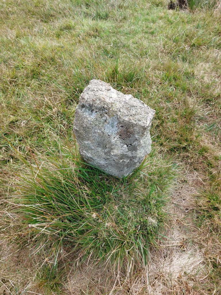
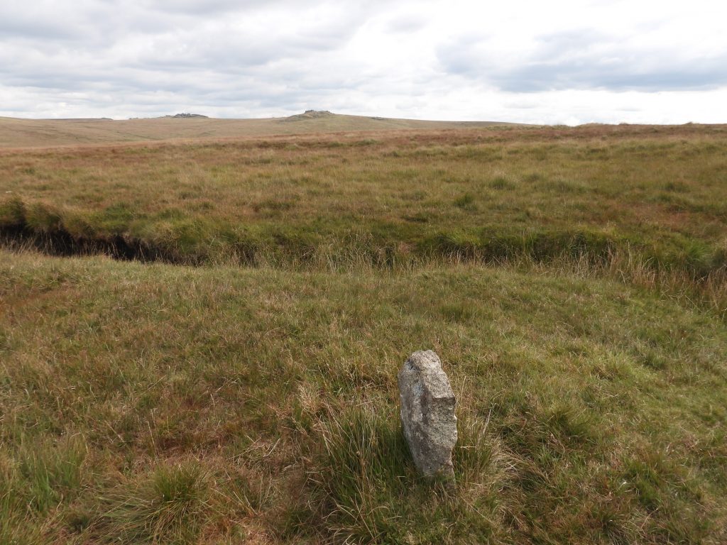
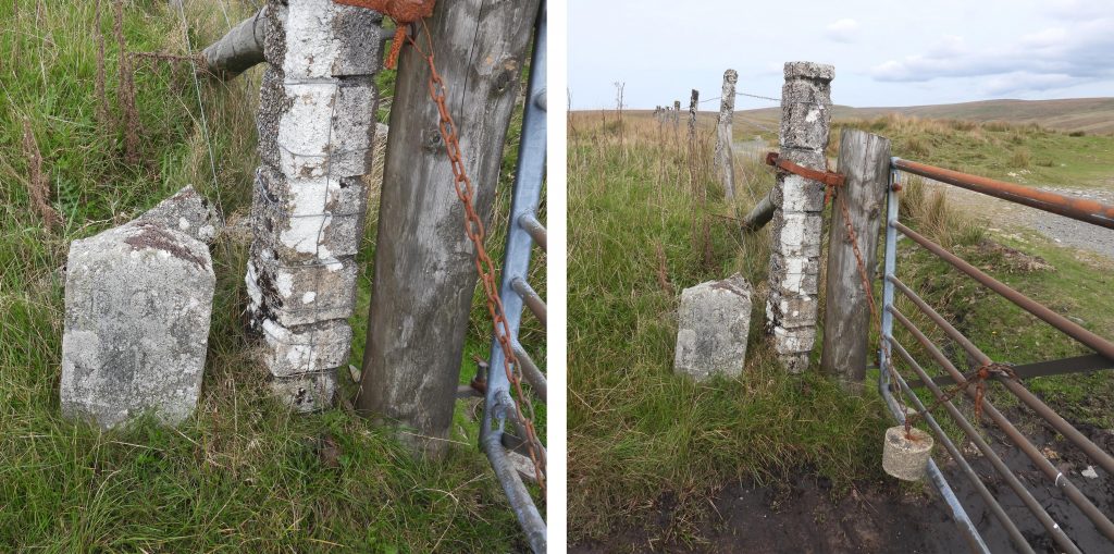
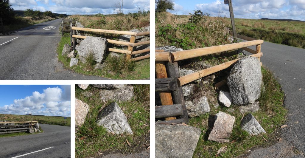
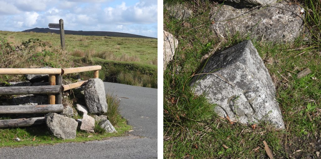
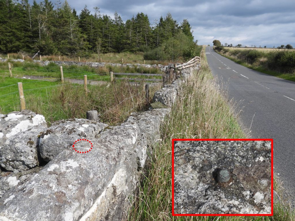
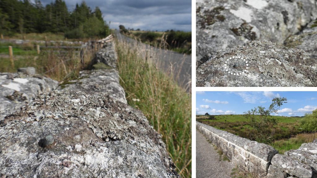
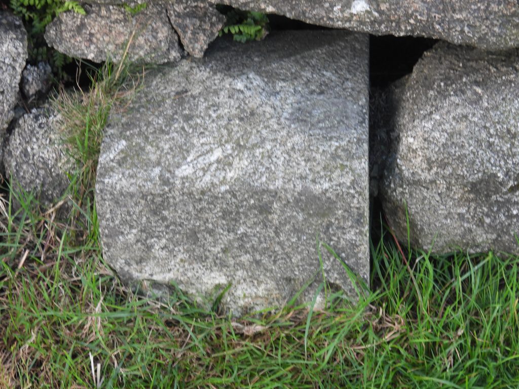
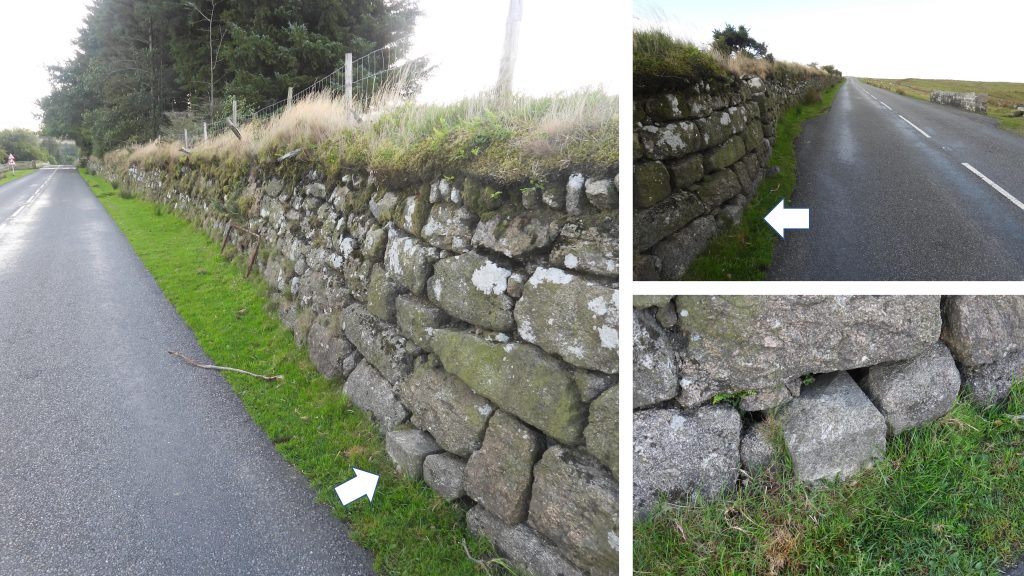
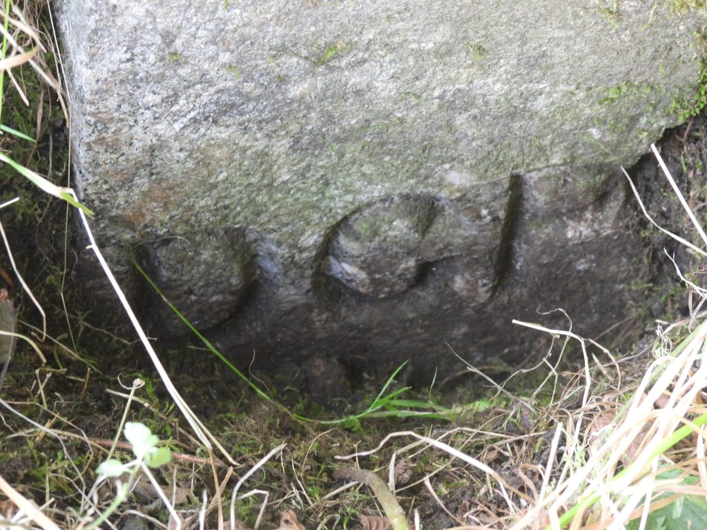
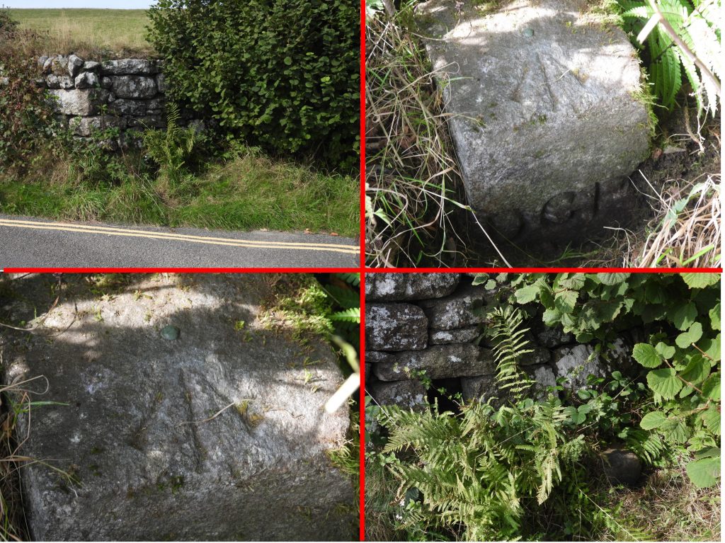
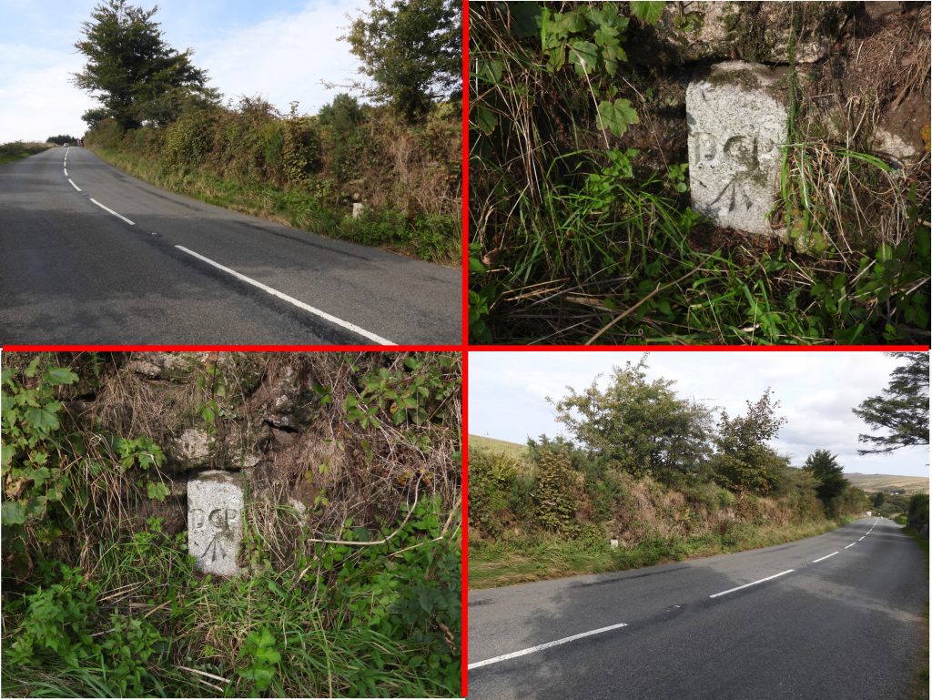
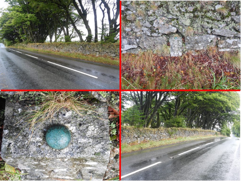
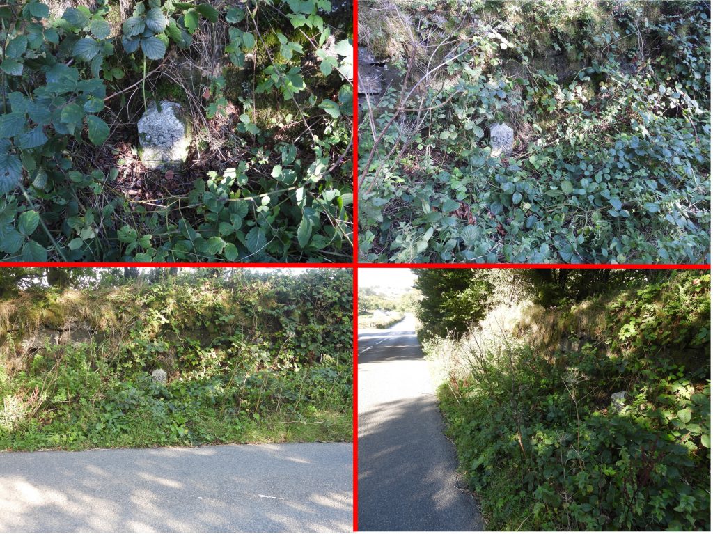
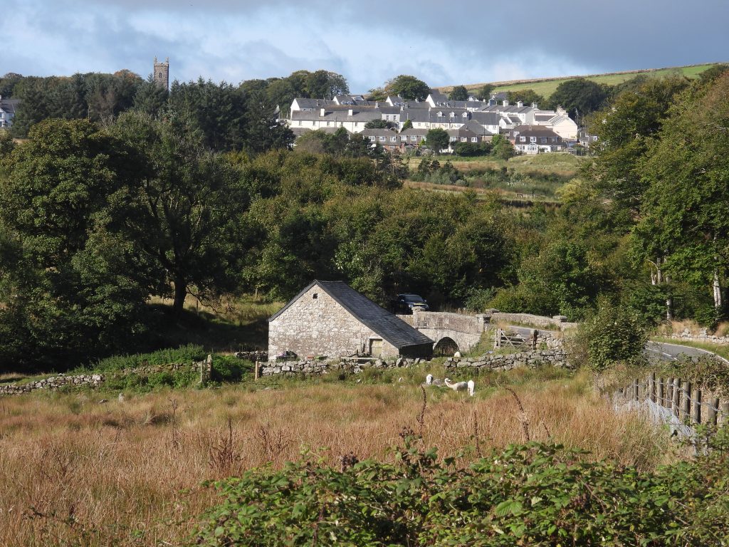
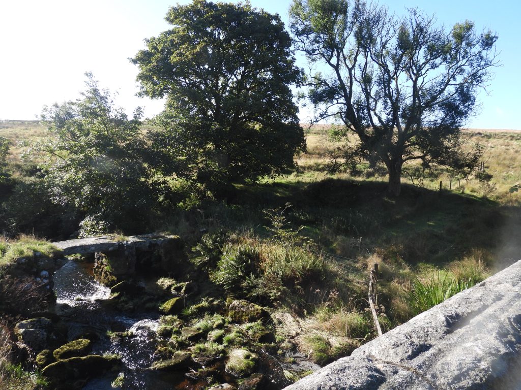
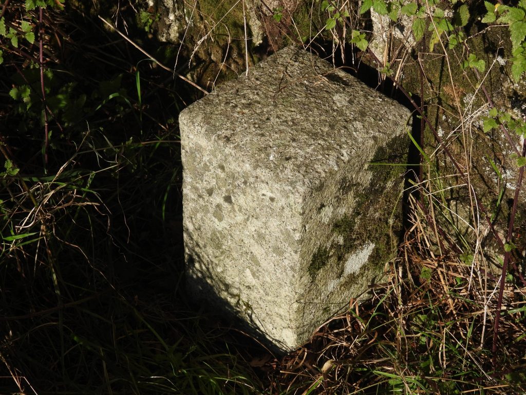
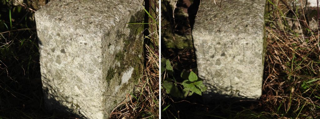
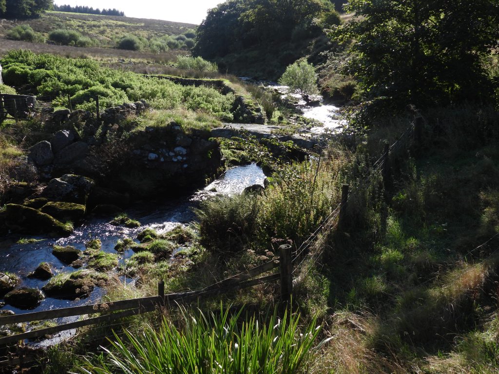
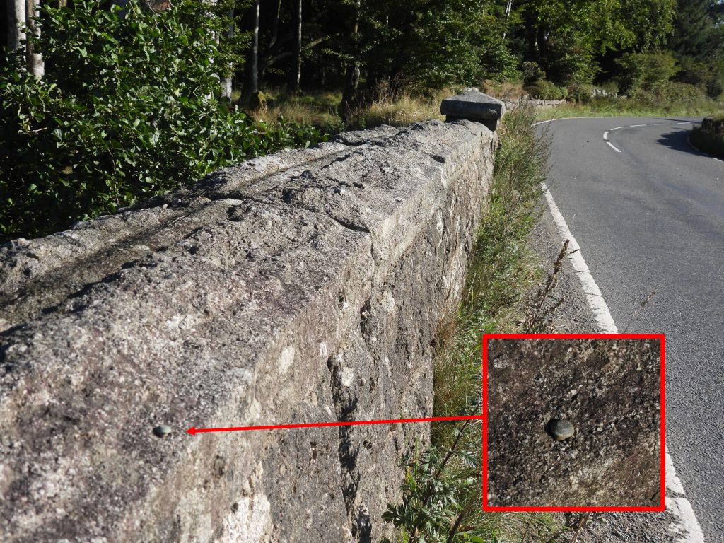
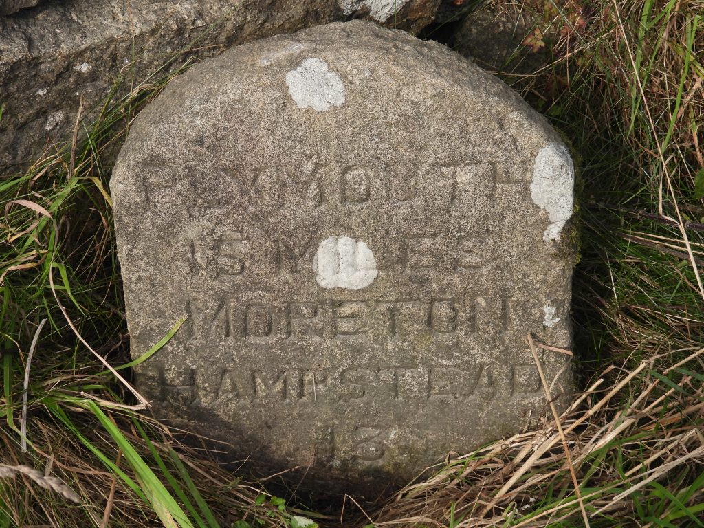
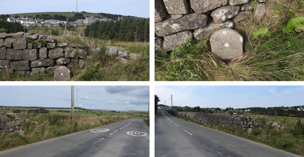
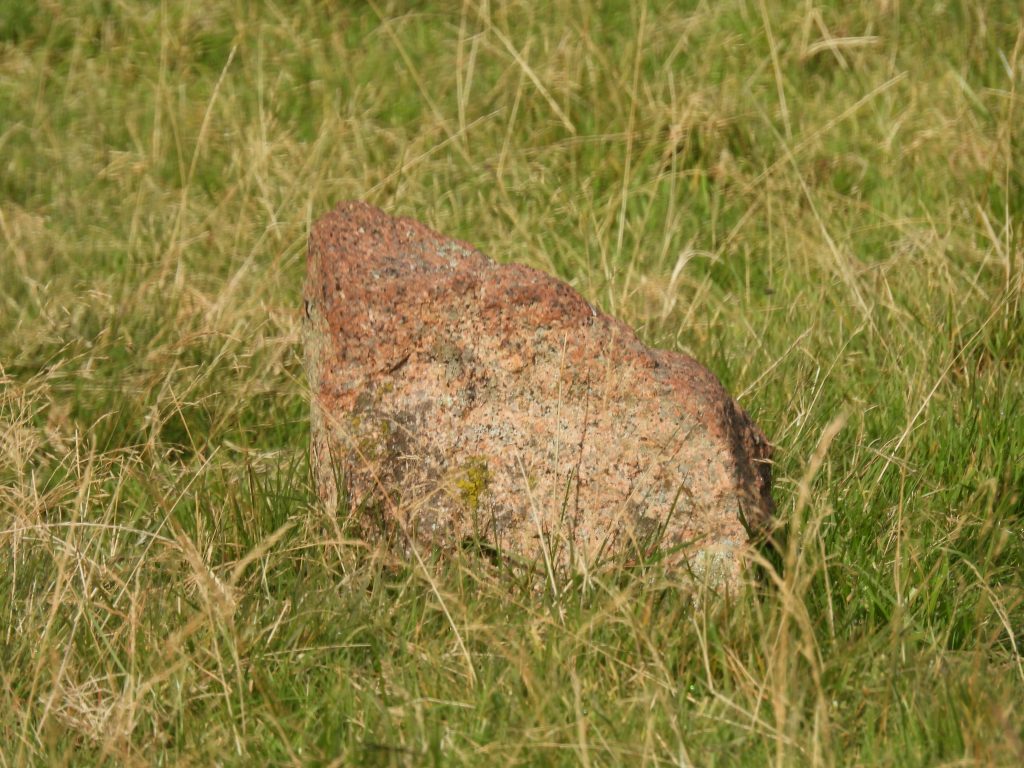
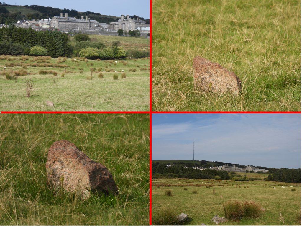
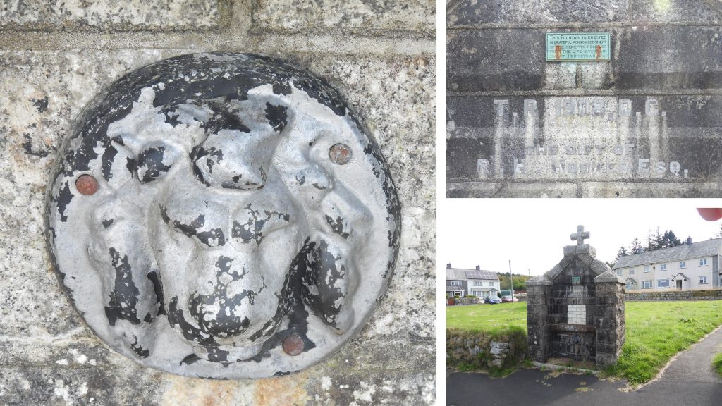
This sketch map is based upon the original sketch map produced in Dartmoor Boundary Markers (Dave Brewer) – Figure 90 (page 261). The sketch was further adapted by Mark Fenlon and the labelling and numbering of that adaptation has been used here to be consistent with already published articles on this subject. This version of the map has made a few ‘tweeks’ to the aforementioned. This post does not cover the 5 plain boundstones marked as ‘Prison Water Rights Stones’ as they are covered on another post on this website: https://dartmoorexplorations.co.uk/prison-water-rights-stones/The Station Masters House, now No.5 Station Road. The first 1850 boundary stone is located alongside (and behind) the wall of the (relatively) newly built garage. The author saw the owners of the property (as they were on their way out) and explained what he was trying to photograph. This is the first 1850 boundary stone, labelled as BS DP-O 1 by Mark Fenlon. The nomenclature used stands for Boundary Stone Dartmoor Prison – Old. Please note this stone is on private ground.BS DP-O 1 is at SX58631 73452, and can be seen on 19th century maps from National Library of Scotland.This photograph of BS DP-O 1 was taken by Dartmoor Chris before the aforementioned garage was built. It is interesting to note how tall the stone is.The first of the 1867 DCP stones – DCP1. The stone lies behind a wire fence and alongside the wall on the south east slopes of North Hessary. It was very overgrown and the author conducted some gardening for the photograph. Contextual picture of DCP1. It can be found at SX58492 73663This boundary stone is marked simply as BS on the sketch map. It lies between DCP1 and DCP2. It can be found at SX58357 73728. The BS stands on the Forest of Dartmoor boundary.The second 1850 DCP boundary stone (BS DP-O 2), simply inscribed with a ‘Broad Arrow’.BS DP-O 2 can be found at SX58355 73726DCP2, like DCP1 lies behind a wire fence and alongside the wall on the south east slopes of North Hessary. The DCP inscription and broad arrow is very deeply inscribed.DCP2 is located at SX58272 73999Approaching North Hessary Tor.On the west side of the tor, there is an inscription “PCWW 1917” which stands for Plymouth Corporation Water Works. More information can be found here: https://dartmoorexplorations.co.uk/plymouth-corporation-water-works-pcww-granite-boundary-posts-and-cast-iron-markers/Between 1935 – 1962, Triangulation pillars were established which not only assisted with surveying heights but also assisted with improved accuracy of locations. Many of these pillars, use ‘flush brackets’ which had been used since 1912. The ‘flush bracket’ on the North Hessary Tor triangulation pillar is numbered OS BSM 3442.North Hessary TorDCP3 with contextual views at SX57827 74303BS DP-O 3 at SX57732 74448BS DP-O 3 is in an unusual location (as a 1850 DCP) as it is not on the original prison boundary (which went through Herne Holne Tor or Little Torr). It is too far west for the DCP boundary but is exactly on the Forest of Dartmoor boundary. Is it possible that this stone was originally placed elsewhere on the prison boundary, circa 1850, then moved in 1867 when the duchy reclaimed part of their boundary in the same year the new DCP’s were erected. Thus, was it once a old DCP stone and became a Forest of Dartmoor BS ? Or did the prison authority incorrectly mark a forest boundary stone which was already extant ?One of the nine Forest of Dartmoor Boundary Stones between North Hessary Tor and Great Mis Tor. There is a separate post on this and the other BSs on this website, which can be found here: https://dartmoorexplorations.co.uk/erroneous-dartmoor-forest-boundary-change-in-18th-century-at-rundlestone/DCP4 is embedded in the road at the junction of the B3357 and the access road to North Hessary mast. It can be found at SX57559 74957DCP4 is unique in the series of boundary markers insofar as it being embedded. That said, the stone was formerly in the wall fronting onto the road but the wall was set further back around 1955, when the mast was erected at North Hessary Tor. it is possible that its location is where the original wall was located.Tavistock Turnpike Trust parish boundary marker is located at SX57551 74970The Tavistock Trust road was built between 1772 to 1776. The inscriptions on the obtusely angled faces of the stone, which is today is completely illegible reads: Walk / hamp / ton and Lid / ford (Ref: E.N Masson Phillips – 1943). By an act of parliament, the Tavistock Trust (formed in 1762) were bound to erect suitable milestones and boundstones where their roads crossed a parish boundary. Dave Brewer comments that it was the site of the ‘Rundle Stone’, which would have caused the Tavistock Trust to site this stone (incorrectly as its 150m inside the boundary). The 1881 sketch by OS mentions this stone and not the ‘Rundle Stone’.The Tavistock Turnpike Trust Stone is on the opposite side of the road to where the DCP stone is inlaid in the road. It was described by Crossing as a new stone and is believed to have been located here around 1822 (Source: Tim Jenkinson – 2004). The stone was sketched in the Ordnance Survey Boundary ‘remark book’ from 1881.Mis Tor Farm also known as Mount View.DCP5 can be found on the south east boundary of Mistor Farm enclosureDCP5 is located at SX57128 75638DCP6 can be found on the south west boundary of Mistor Farm enclosureDCP6 is located at SX57261 75683DCP7 can be found near the north east boundary of Mistor Farm enclosure at SX57168 75861. This picture is courtesy of Mark FenlonDCP7 is located amongst these reeds. DCP8 can be found on the north west boundary of Mistor Farm enclosure at SX56939 75799The most north westerly of the 1867 DCP stones can be found at New Forest Corner.DCP9 is located at SX56574 76410The most north westerly of the 1867 DCP stones is at the corner of the New Forest enclosure.DCP10 is located at SX58860 77288A few metres away from DCP10 lies an uninscribed boundary stone of unknown originThis plain BS is located at SX58860 77290View of the plain BS looking towards Beardown Tors.DCP11 is located just inside a gate near Long PlantationDCP11 is located at SX59004 76888DCP12 is located at the bottom of the tarmac road which leads up to Holming BeamDCP12 is located at SX59557 74968Between the Holming Beam road and Rundlestone lies Blackbrook Bridge, upon which (north parapet) is a benchmark rivet.The rivet B.M. on Blackbrook Bridge is located at SX58812 74974DCP13 is located on the southern side of the B3357 between Holming Beam road and Two Bridges.DCP13 is located at SX60224 75035DCP14 is located near the junction of B3312 and B3357. It is located next to a wall in the undergrowth by a large bushDCP14 is unusual, insofar as it has and deeply inscribed benchmark and a rivet on its top surface. It can be found at SX60594 74877DCP15 is located at a rather dangerous location on a corner close to Roundhill House.DCP15 is built into the lower part of a drystone wall.DCP15 with contextual pictures. It is located at SX60502 74679DCP16 has a rather splendid Ordnance Survey bolt which was used for the 3rd Geodetic Levelling (between 1950-1968) and is at 394.535m above sea level.DCP16 with contextual pictures. It is located at SX60005 74389The top of the mushroom shaped head of the bolt is beautifully engraved with O.S.B.M. and has the trademark arrowDCP17 is nearly opposite the sewage works entrance.DCP17 is located at SX59737 74298Princetown, Oakery Barn and Oakery Bridge from near DCP17Oakery Bridge and clapper near DCP18DCP18 is on the north side of B3312 close to Oakery Bridge.Close up of DCP18 DCP18 is located at SX59504 74208Blackbrook river and clapper.A benchmark rivet can be found on the north west parapet of Oakery Bridge at SX59490 74190Milestone near New London inscribed: PLYMOUTH / 15 MILES / MORETON / HAMSTEAD / 13The milestone is located at SX59266 73822The (possible) stump of BS DP-O4 can be seen in a field to the west of New London. The stone is marked on 19th century maps.BS DP-O 4 (according to National Library of Scotland, side-by-side maps) is located at SX59211 73709Entering Princetown near Oakery Close is a fountain with a date of 1908 on it. A small plaque is inscribed “THIS FOUNTAIN IS ERECTED / IN GRATEFUL ACKNOWLEDGEMENT / OF THE BENEFITS RECEIVED / FROM THE LIFE-GIVING AIR / OF PRINCETOWN”. A benchmark (B.M. 1363.4) can be found on the end of the wall outside the Old Methodist Chapel at SX59121 73524The final DCP inscription is not on an erected stone but on the north wall of the churchyard where it abuts onto the former Chaplain’s House. Labelled DCP23, this inscription is located at SX58661 73781