A collection of walks, discoveries, insights and pictures of exploring Dartmoor National Park
September 29, 2022
Trena / Oakery Bridge
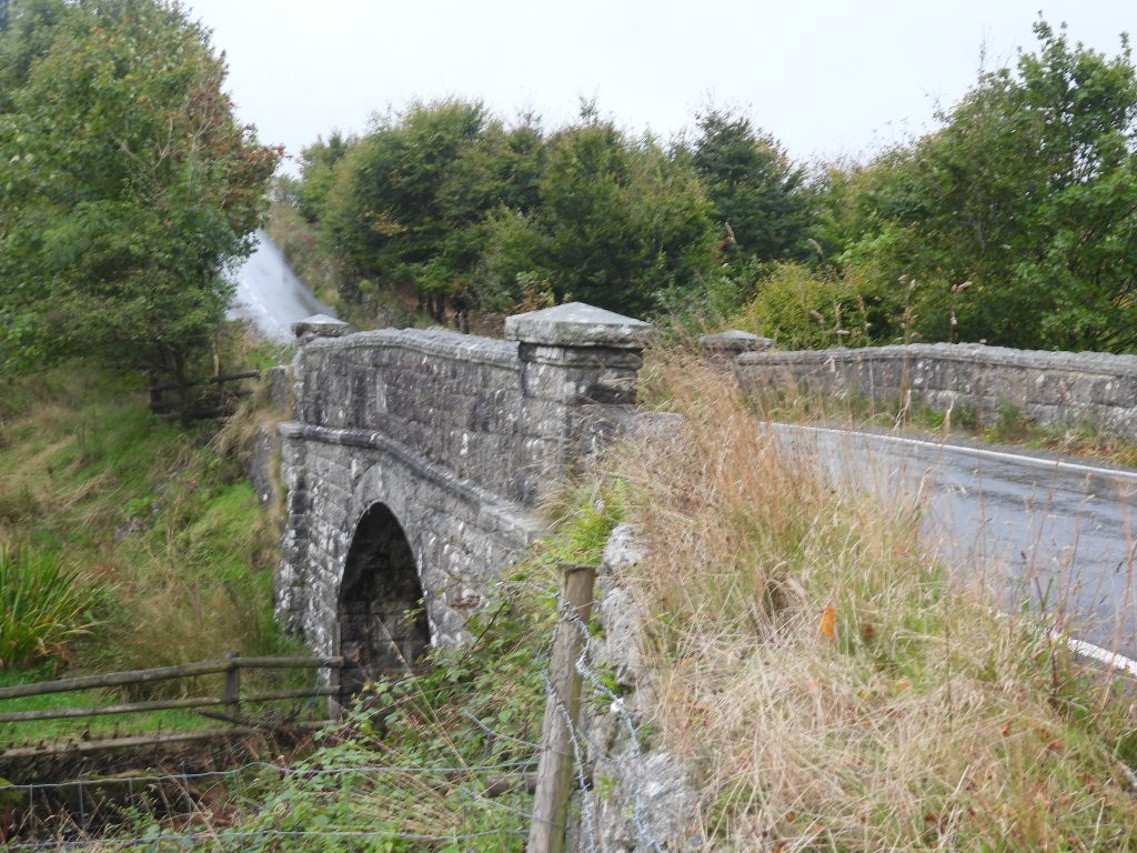
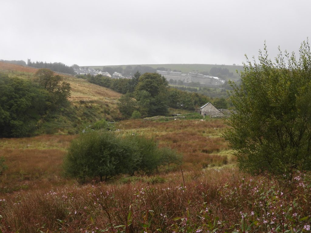
In the early 19th century, the bridge over the Blackbrook River to the east of Princetown en-route to Two Bridges was called Trena Bridge. It was still named as such on some late 19th century maps after which the bridge at this location became known as Oakery Bridge (or Ockery Bridge). The original Trena Bridge was replaced in 1901 by the current road bridge. There appears to have been a “transition” in the name from Trena to Oakery in the late 19th century as some maps show, but it seems that new name was permanently adopted around the time the replacement bridge had been completed. It is very likely the name Oakery is due to its proximity to Oakey Cottage and Barn alongside the river which had been constructed in the early 19th century.
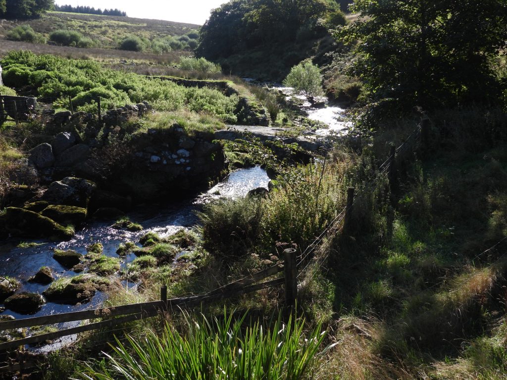
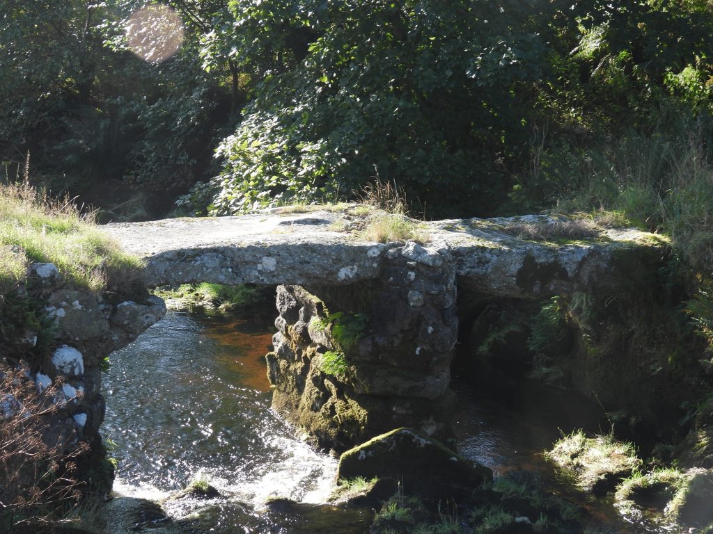
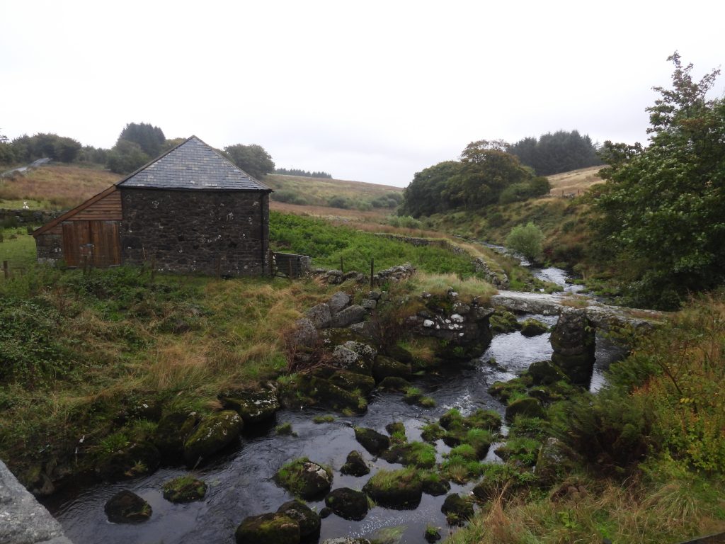
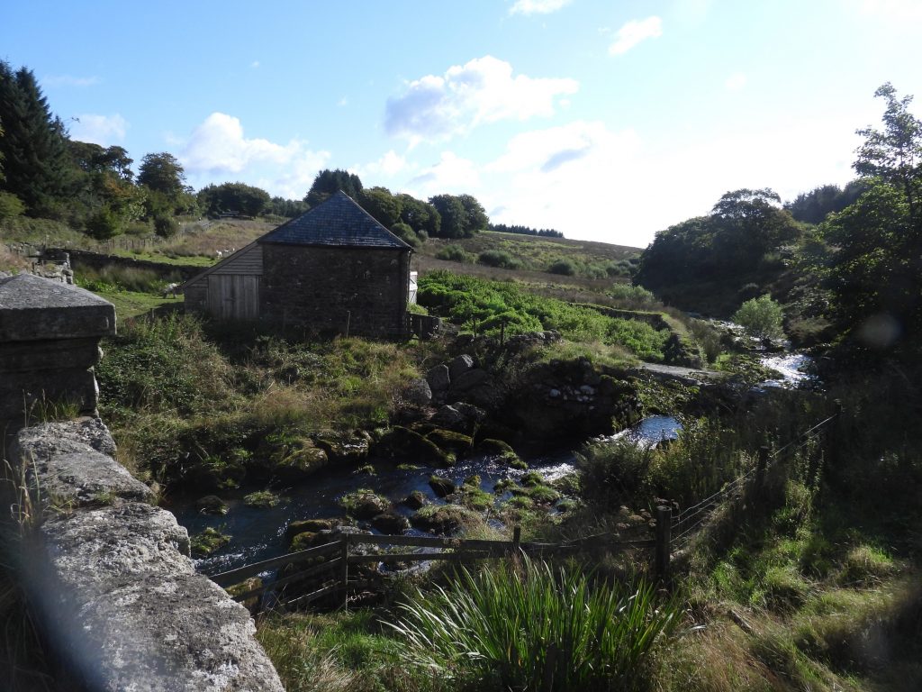
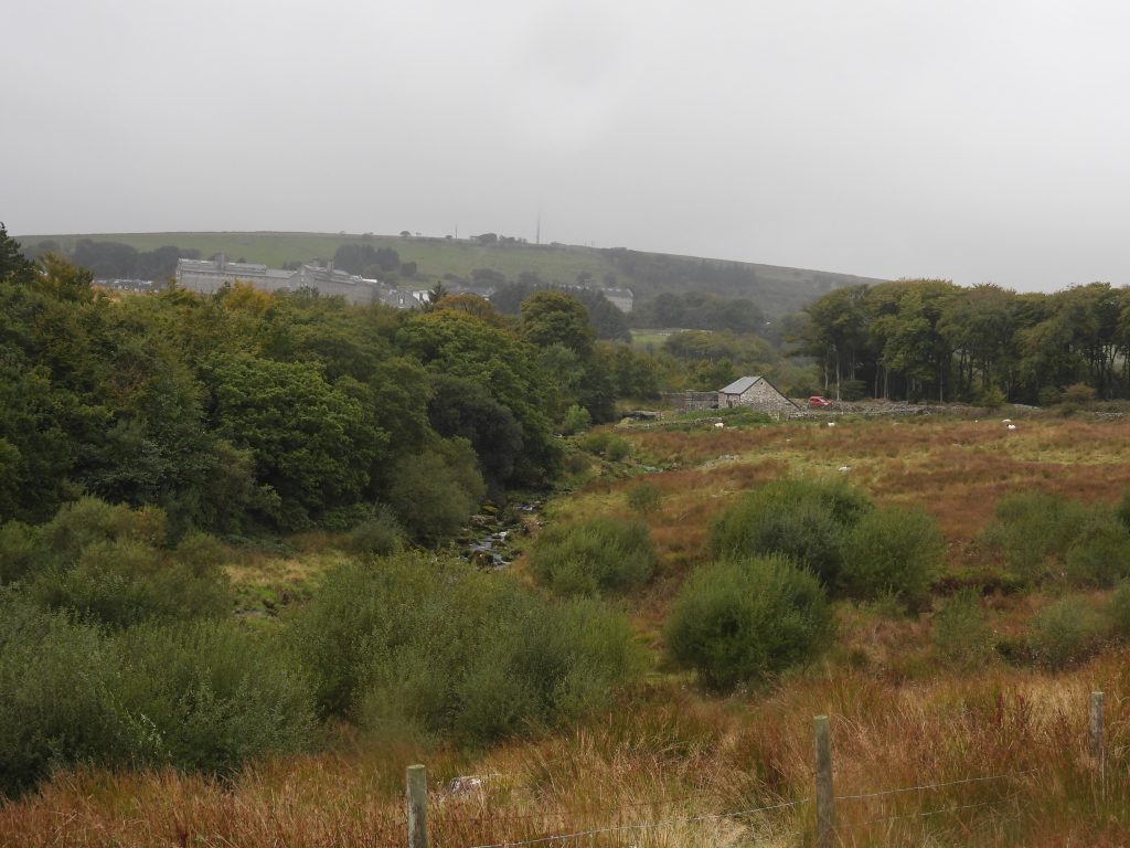
The most well known feature (and probably photographed, albeit it is on private land) in the vicinity is the small two-pier clapper bridge a few metres to the south east of the current road bridge, which connected Ockery Cottage and Barn. This clapper bridge would have been the original packhorse bridge. Within the environs of the (two) bridges are several boundary stones and some cairns marked on the modern OS map. Aware of these many features in the locale and being in possession of two early 20th century postcards of Ockery Cottage and Barn as well as the bridge, this post has been created to compare 20th century views with those in the 21st century and record all the other aforementioned features.
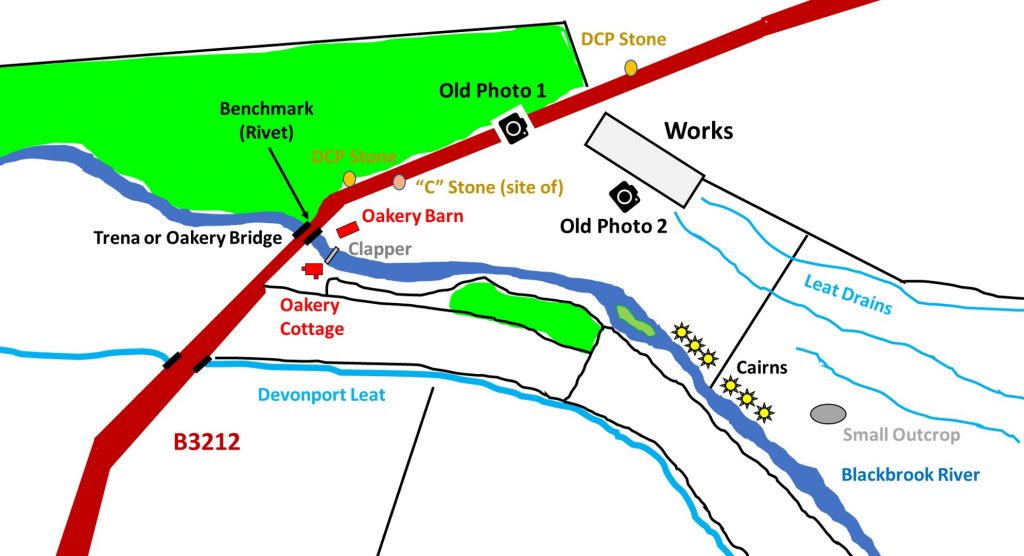
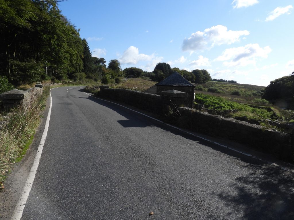
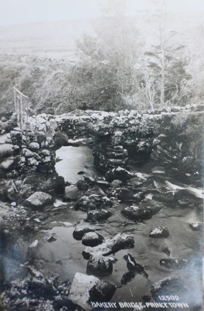
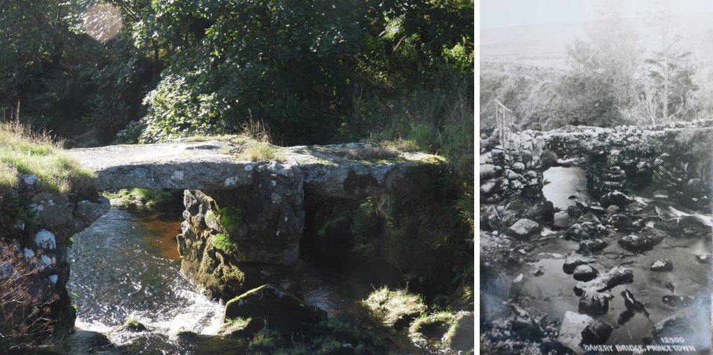
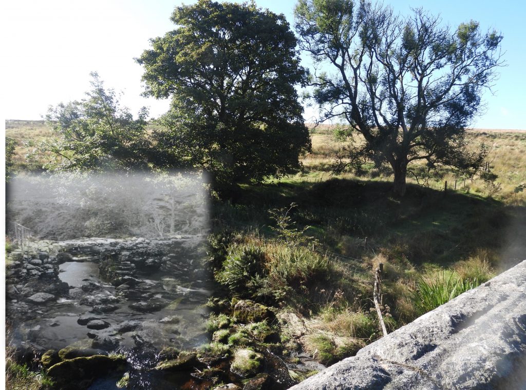
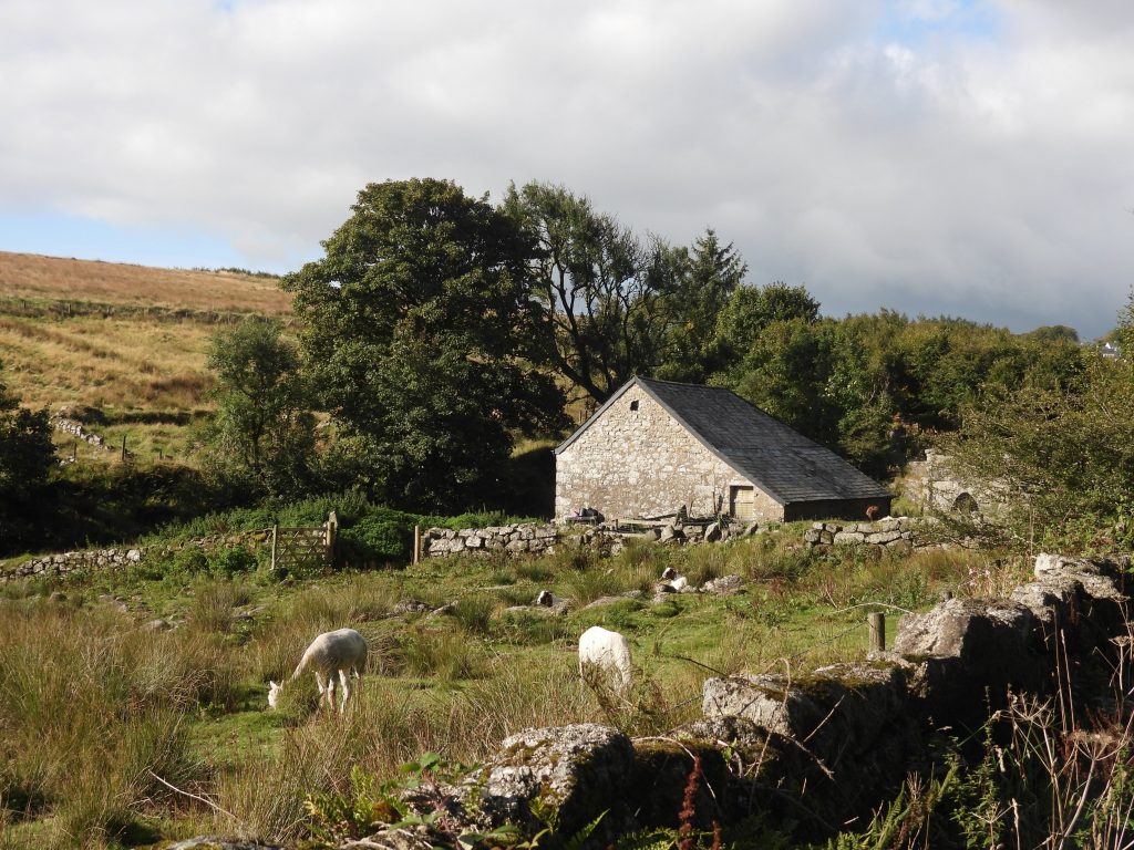
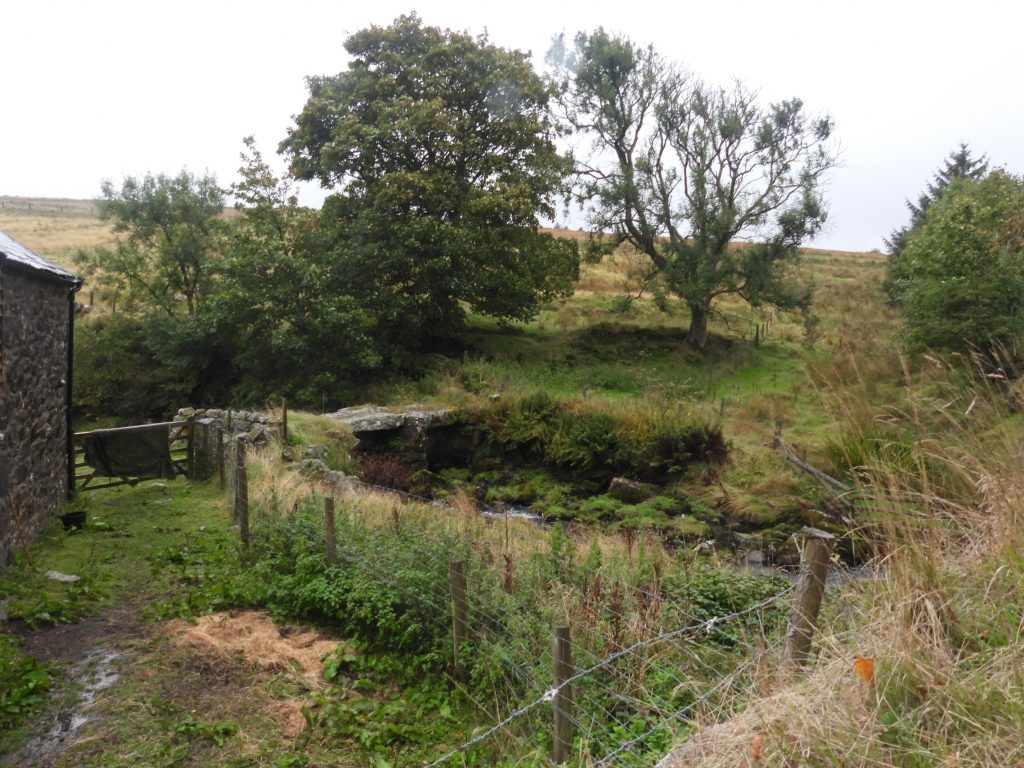
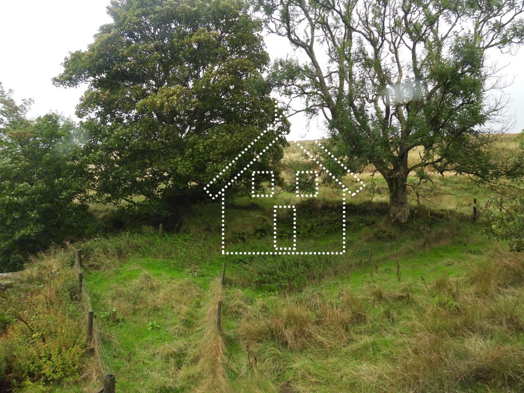
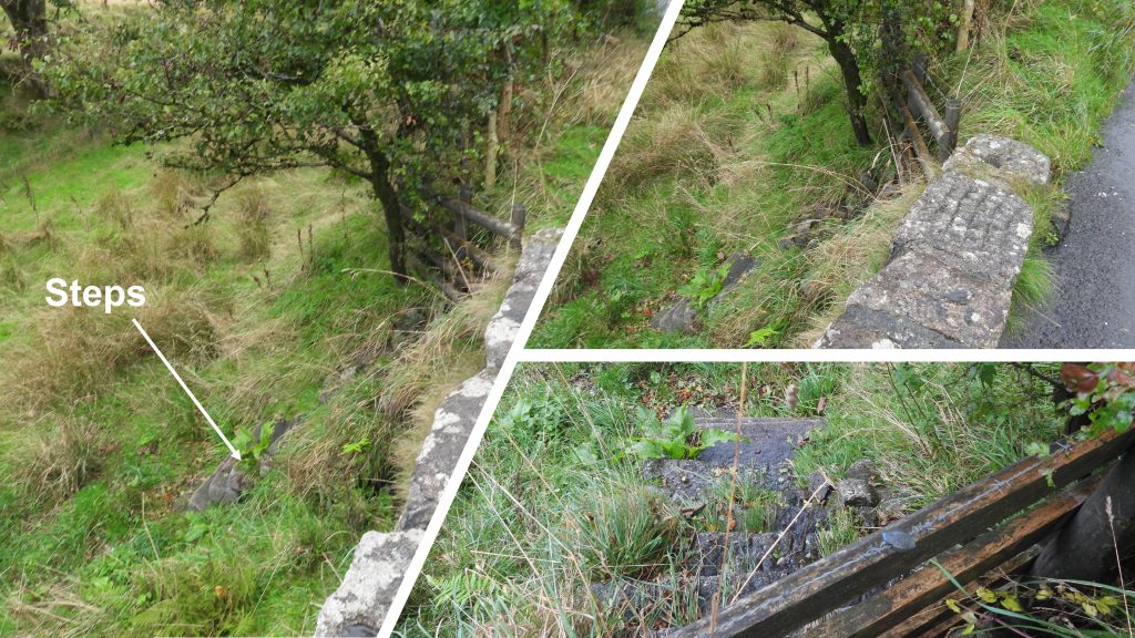
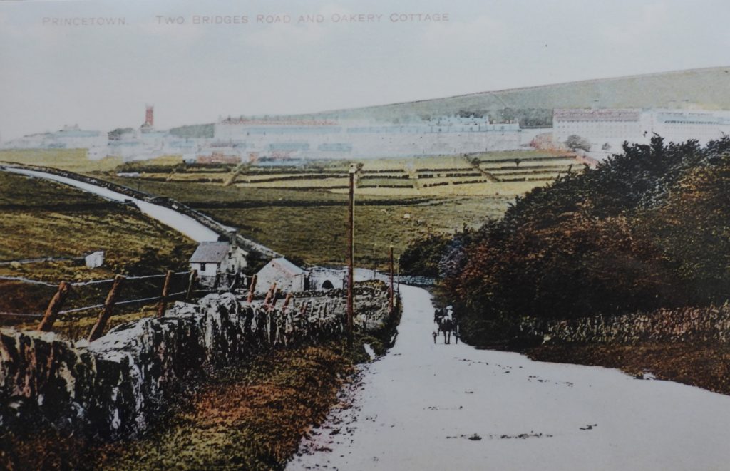
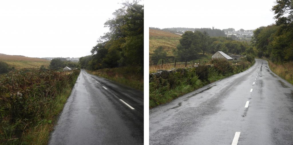
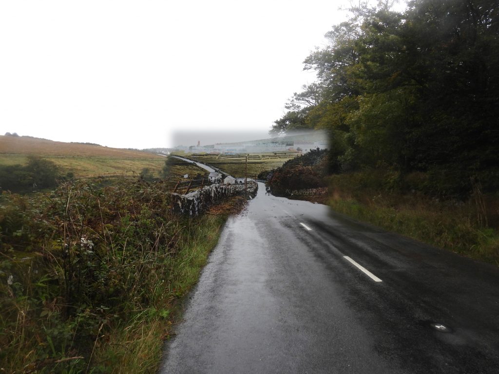
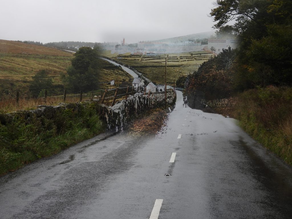
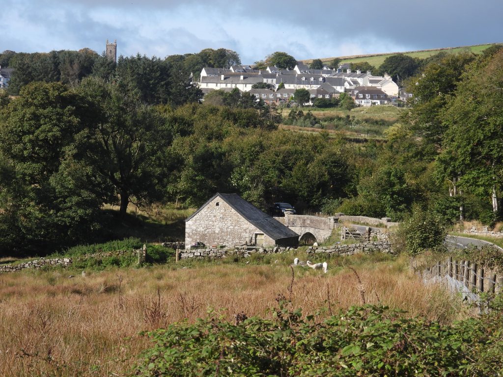
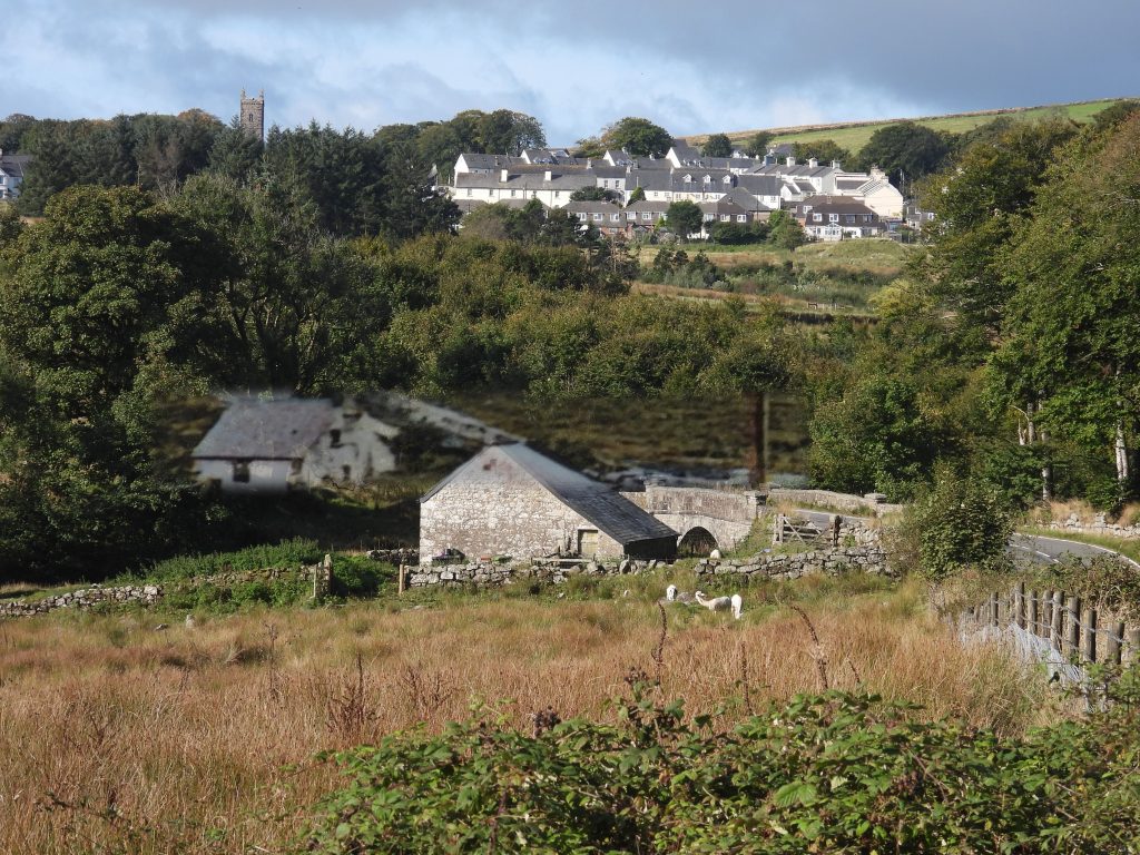
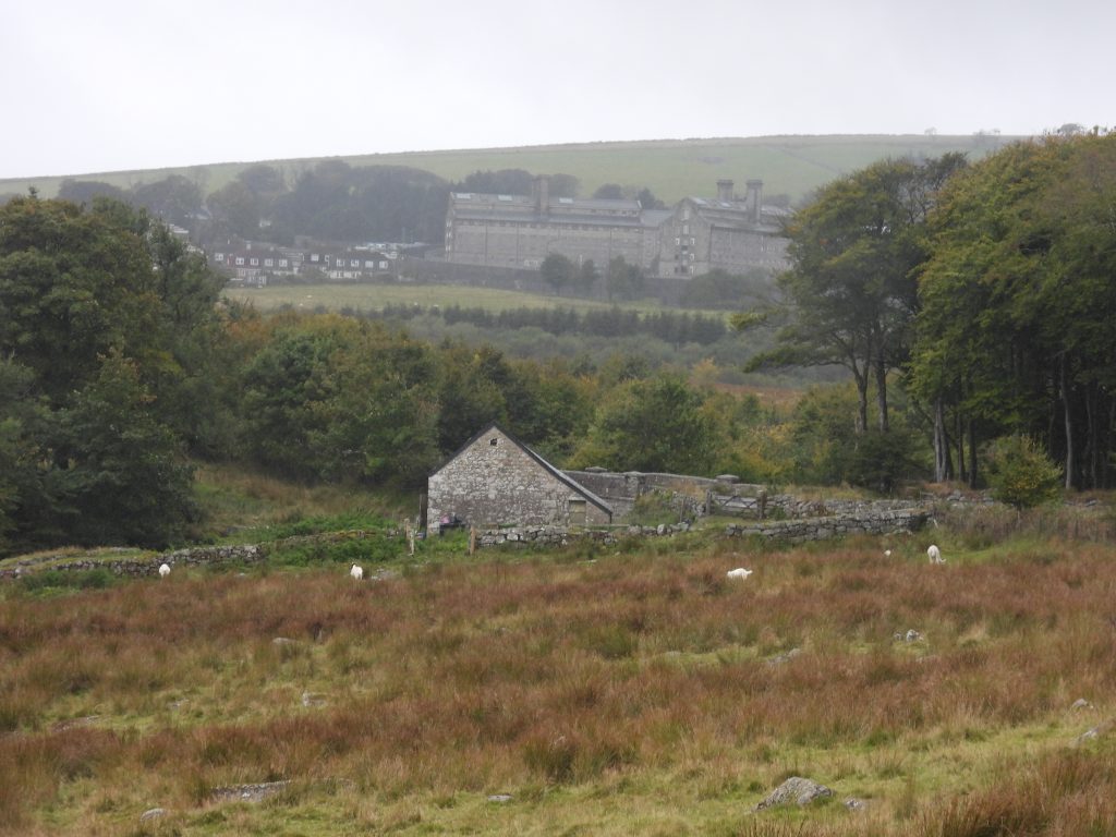
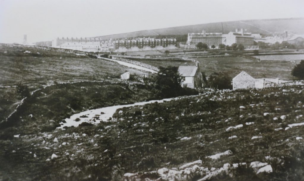
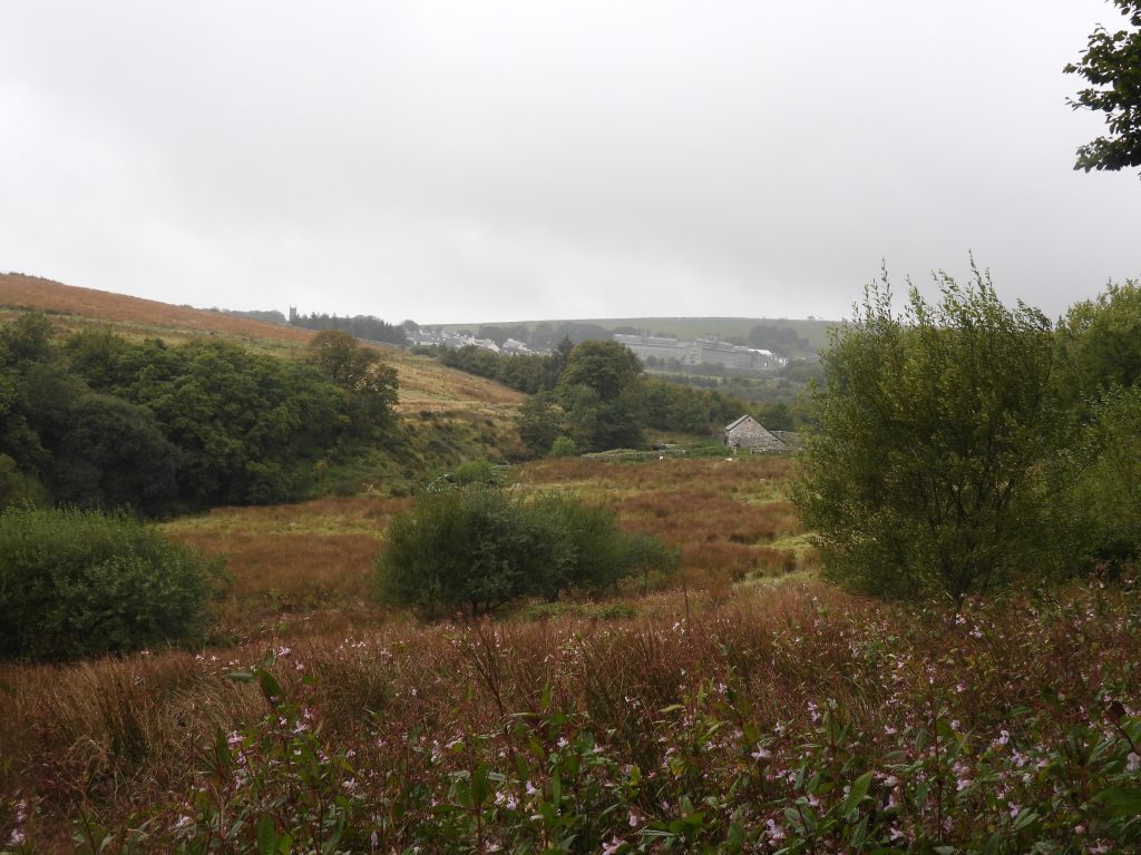
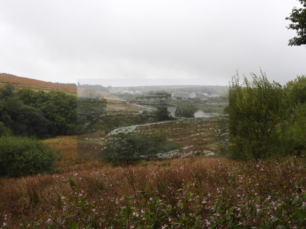
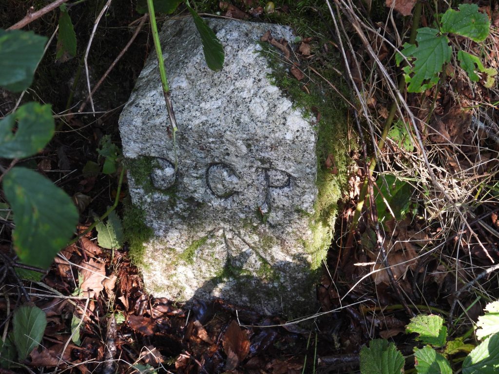
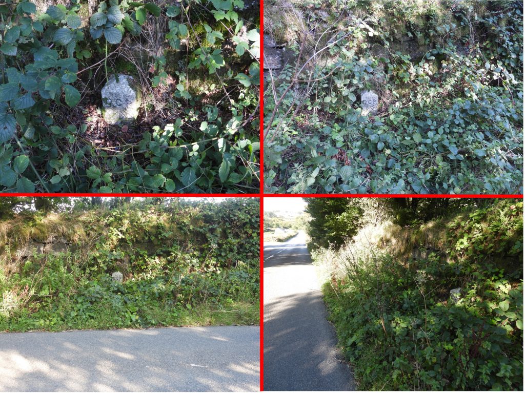
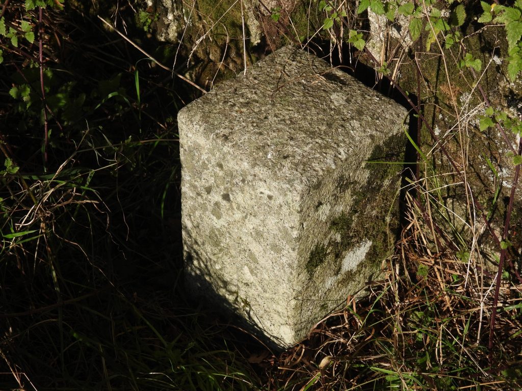
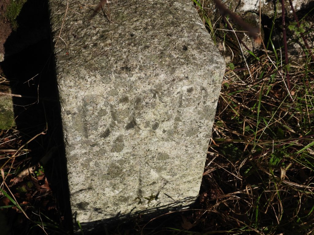
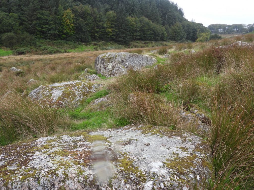
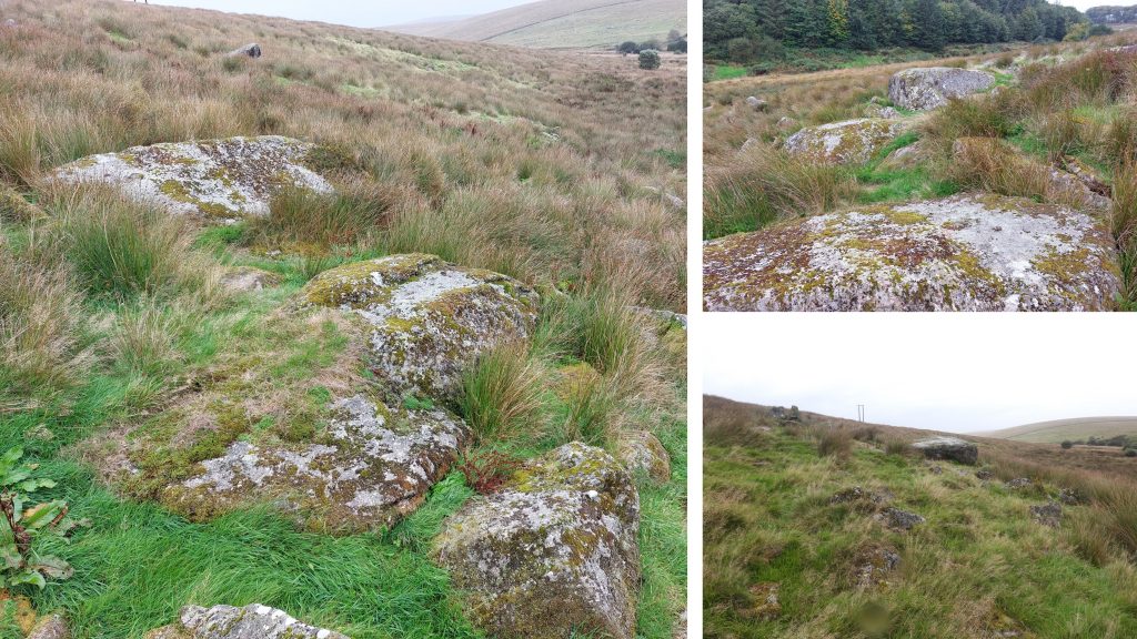
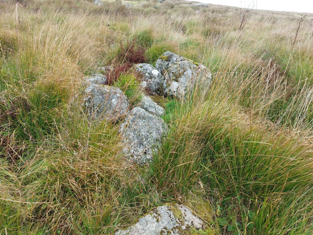
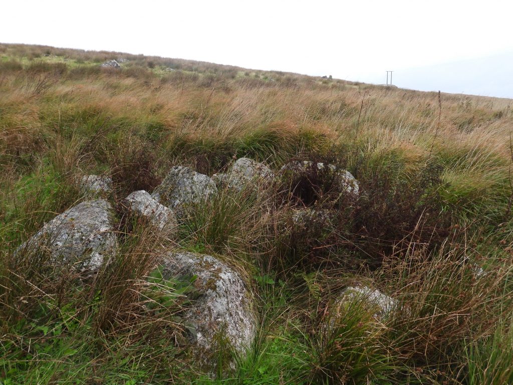
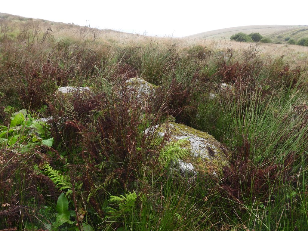
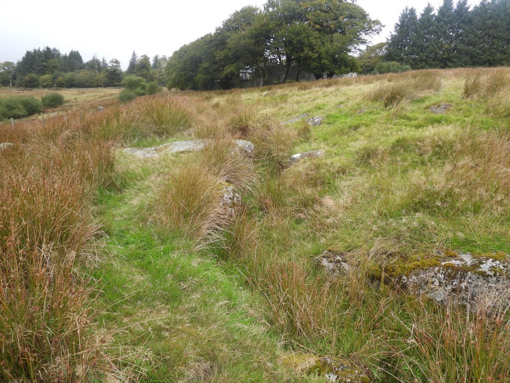
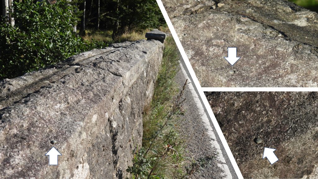
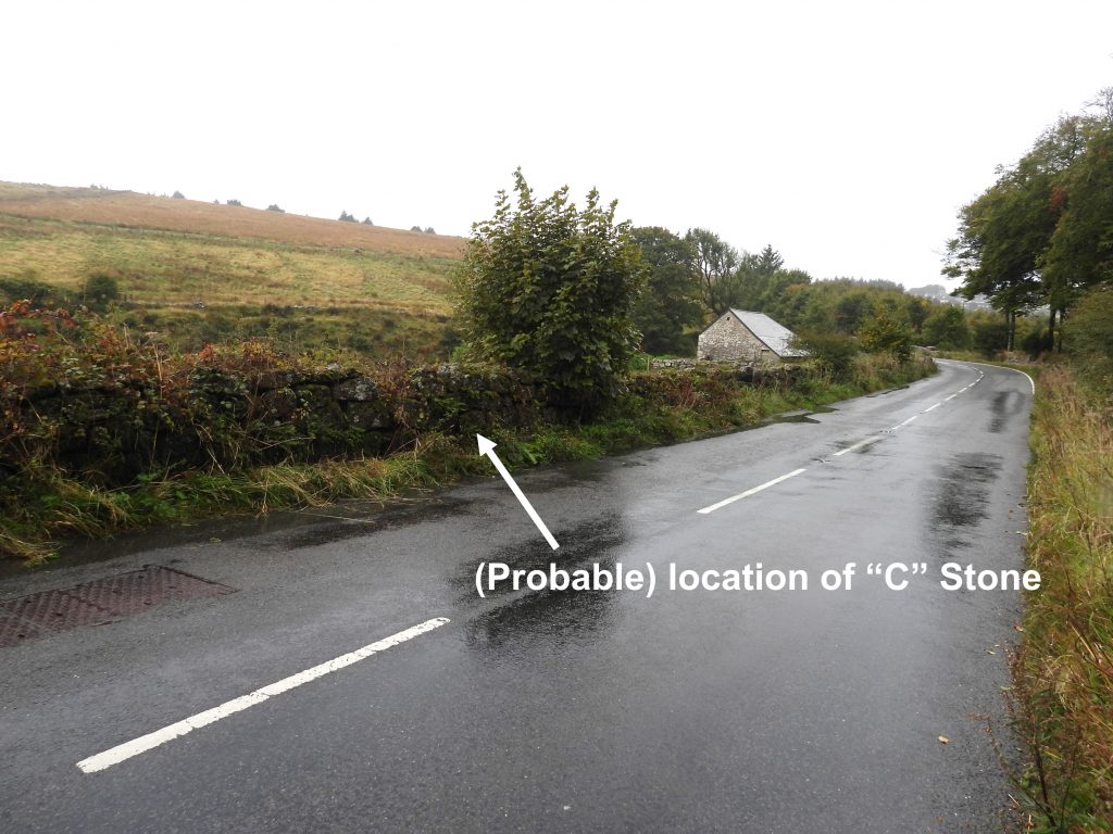
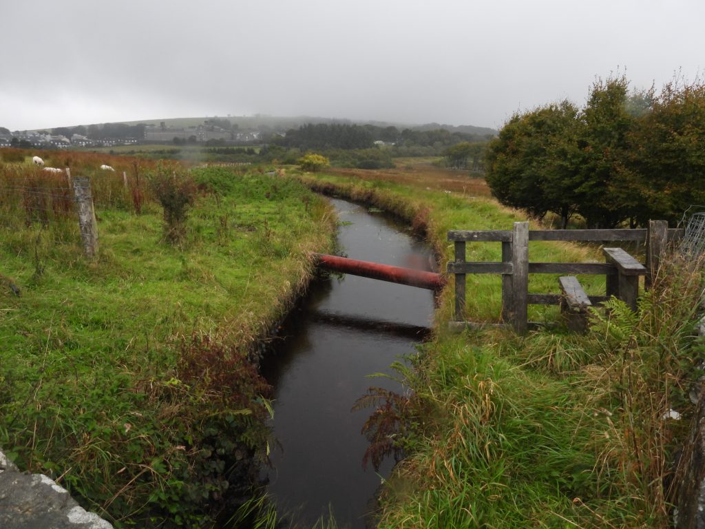
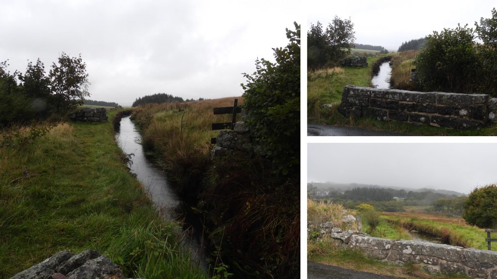
Sketch map of the locale around Trena or Oakery Bridge. The two camera ‘icons’ show the approx location of the photographs in the two early 20th century postcards and from where comparisons in this post are taken. Of note, is that the land to the south east of the road between the bridge and the modern sewage works which appears to be access land on modern OS maps, but cannot be accessed from the road. Instead, access to the small outcrop, cairns, leat drains and the location of ‘old Photo 2’ should be made from the south and the Bachelors Hall area.Oakery Bridge on a wet day in September 2022. In the publication ‘Dartmoor Boundary Markers’ (second edition) by Dave Brewer – 2002, it is recorded that “Trena Bridge was replaced by the present road bridge in 1901”. How much “replacement” actually took place is unknown. Another view of the bridge taken on a sunnier day in early September 2022. The Blackbrook river and the one time original pack-horse bridge (clapper)The clapper has two piers. On closer inspection, the left (easternmost) slab looks slimmer and has less lichen that the right (westernmost) slab.This view of the clapper bridge is from an early 20th century. Interestingly it is labelled “Oakery Bridge”. The left (easternmost) slab looks slimmer in the 2022 picture than that shown above which must be at least 100 years earlierComparing the two pictures which must be around 100 years apart, clearly shows the slab differences. The answer is recorded by J.G. Wilkinson, (ref: SDV214449) in the Dartmoor HER, where it is stated “One of the two capstones has been displaced and a new granite slab has recently been set up in its place by Dartmoor National Park department”. This entry was dated 10th April 1981Superimposed 20th century picture on the 2022 view. In the area in the shade is where the original Oakery Cottage would have been.Oakery Barn and the clapper. The barn was associated with ‘The Oakery’ (or Ockery) cottage and was built around 1808. From the angle of the picture an extension made to the barn is easily discernible. The barn was a part of the smallholding leased from the Duchy of Cornwall by the Kistle family for most of its early history (source: Dr Tom Greeves Ockery Barn, Princetown (Worksheet). SDV363589).The barn on a sunny morning in September 2022 with two llamas (or possibly alpacas)The lower part of the barn slate roof from this angle can be seen to be “different” from the upper part, showing the dividing line between the original building and the extension.‘The Ockery’ cottage was built around 1805 and was demolished around 1925 and was located to the west of the clapper (by the trees in the picture).The Ockery was a pretty thatched cottage and was said to have been built in the style of a Swiss chalet (Source: Elisabeth Stanbrook: 1991).There is a myth surrounding the idea that the Ockery was built for two French generals or (more plausible) that they merely just stayed there for one night. The two generals (Rochambeau and Boyé) were parolees and in 1811 they probably stayed here as they made their way to Plymouth for repatriation.The original building was built by Sir Thomas Tyrwhitt who was the lessee of the Tor Royal Estate. There is a rather fabulous post on the Legendary Dartmoor website, which provides more history relating to the building. A link to that website can be found here: https://www.legendarydartmoor.co.uk/okery_oakery.htmOn the west side of Oakery Bridge a series of steps leading to Ockery Cottage can be found and are possibly the only evidence that remains that there was once a dwelling here.A postcard from early 20th century of the Two Bridges road and Oakery. It is interesting to note the horse and cart, the view of Princetown and the views of Oakery Cottage and Barn. As the cottage was demolished in 1925, the postcard must pre-date this. The cottage was derelict from around 1916 and it is difficult to tell from the picture whether to cottage was being lived in.The September 2022 view of where the early 20th century postcard picture would have been taken. The location is labelled ‘Old Photo 1’ on the sketch map in this post.Superimposed 20th and 21st century picturesSuperimposed 20th and 21st century picturesA zoomed in view of Oaker Bridge and Barn from near the modern sewage works.Another superimposed of 20th and 21st century pictures, which shows what the view would look like if Oakery Cottage was still intact.This (zoomed in) view was taken from near the sewage works (location ‘Old Photo 2’) as shown on the sketch map. An old postcard view (from location ‘Old Photo 2’) from the early 20th century.This (zoomed out) view was taken from near the sewage works (location ‘Old Photo 2’) as shown on the sketch map. Superimposed 20th and 21st century pictures. There appears to be more vegetation and trees in the 21st centurySlightly different angle of Oakey from the location of ‘Old Photo 2’The fence in the foreground prevented the author proceeding further north, in spite believing the map shows it as access land.Back at the main road (B3312) there are two inscribed DCP (Directors of Convicts Prisons) stones which dates from 1867 when the prison bounds were extended by 1000 acres from the original 390 acres. It possesses the inscription DCP above a broad arrow on its exposed face.This stone is located close (but opposite side of the road) to the entrance to the sewage works. This stone is located at SX59737 74298A second DCP stone, near Oakery Bridge. This stone measures 0.86m long and 0.23m square and was recorded as recumbent (Probert) in 2002. This DCP stone is located at SX59504 74208Between Bachelors Hall Brook (which cascades into the Blackbrook river) and the B3312 is a small outcrop. It can be seen on google earth.The outcrop is un-named on modern OS maps and is located close to the C in the “cairns” label. It would be nice to think this set of rocks had an historic name, but the author suspects this is very unlikely. A name like ‘Blackbrook Rocks’ might be suitable. The outcrop is located at SX59854 74068.The “cairns” marked on modern OS maps are nothing more than clearance cairns. There are two groups of three cairns on the north bank of the Blackbrook River. Only the southern set of three cairns are accessible due to a barbed wire fence preventing access to the northern group of three. This clearance cairn can be be found at SX59813 74055Jeremy Butler in the publication , Dartmoor Atlas of Antiquities: Volume Four – The South-East, 230, Map 65 records that the six cairns (two groups of three) are between 3.0 to 4.5 metres diameter. The cairns are aligned along the north bank 10 metres from the river and are “merely collections of casually piled boulders, from a dozen to about thirty and are not prehistoric constructions”. This cairn above is located at SX59798 74066The third cairn of the southerly set is located at SX59791 74070This is one of three (leat) drains depicted on the OS maps and are contour-following channels. They are stated (Dartmoor HER) to have conveyed water from sewage settling tanks to the Blackbrook and were probably dug for this purpose.Back to Oakery Bridge, where on the north parapet is a benchmark rivet. In the Dave Brewer publication “Dartmoor Boundary Markers” (second edition) on page 219, it is stated there is a County “C” stone on the east side of Oakery Bridge. Of course, any “C” stone would have related to Trena Bridge and not the more modern Oakery Bridge. Using the National LIbrary of Scotland maps (side by side) the author suspects the stone could (or was) located at SX59577 74231The Devonport Leat passes under the B3312 uphill from Oakery Bridge. It was constructed from 1795-1802 to supply water to Plymouth Dock (known as Devonport after 1824). The original leat came from Blackbrook rivers. Later it was extended to take water from the Cowsic and the West Dart.More views of “Dock Leat”, which would have been completed just a few years before Oakery Cottage and Barn were constructed.