A collection of walks, discoveries, insights and pictures of exploring Dartmoor National Park
July 13, 2021
Tavistock Turnpike Trust “Take Off” Stones.
Trusts were set up following Turnpike acts of Parliament from the 17th but especially during the 18th and 19th centuries , with powers to collect road tolls for maintaining the principal roads in Britain. At the peak, in the 1830s, there were over 1,000 trusts administering around 30,000 miles (48,000 km) of turnpike road in England and Wales, taking tolls at almost 8,000 toll-gates and side-bars. One such trust set up was the Tavistock Turnpike Trust.
The Turnpike acts regulated the weights which might be drawn on roads during the seasons of the year, the number of horses (or beasts) which might be used for drawing and the size (width) of wheels which could be used. There was an allowance on hilly sections of road (gradient not less than 1:9) where extra horses could be used. The Tavistock Trust erected “Take Off” stones as part of the concession, which indicated where extra horses had to be “taken off” at the end of the concession. The Tavistock Turnpike Trust “Take Off” stones are believed to date from mid 1820s.
Source of information taken from Dave Brewer, Dartmoor Boundary Markers (2nd Edition, 2002) and Wikipedia.
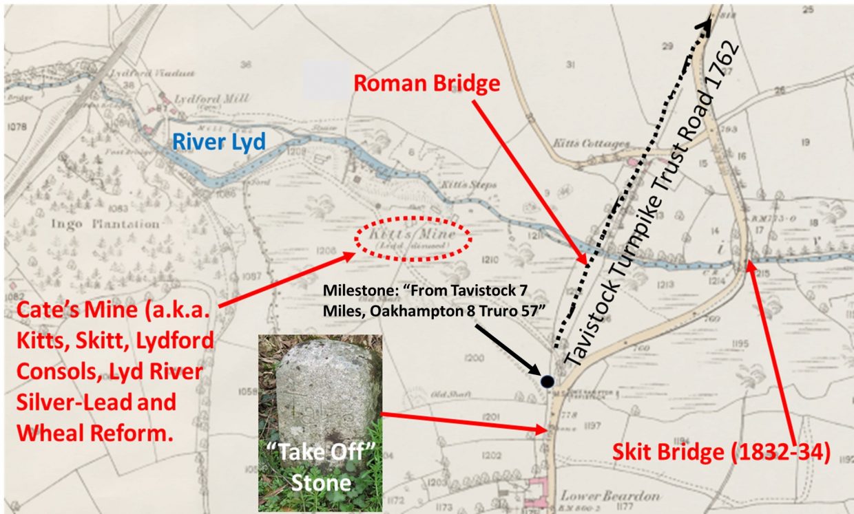
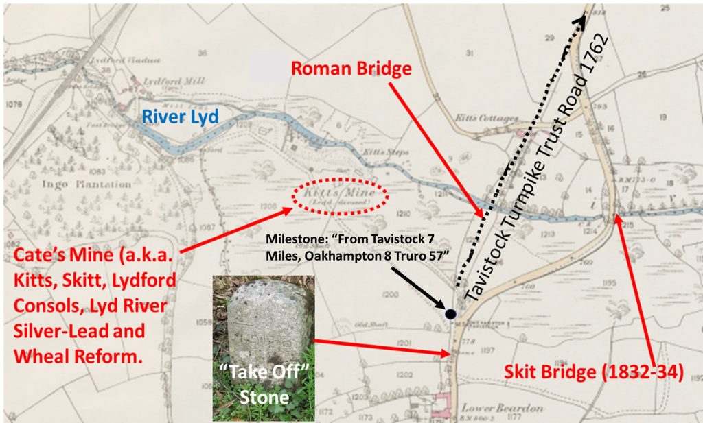
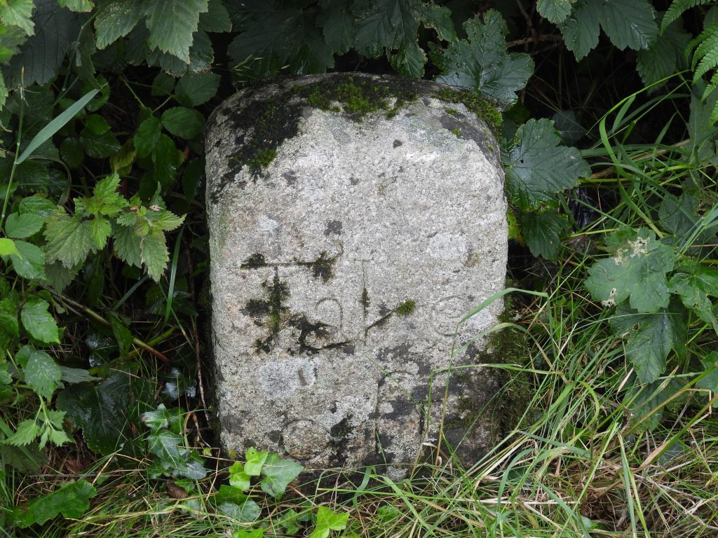
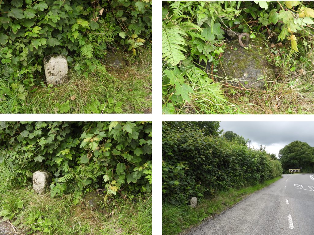
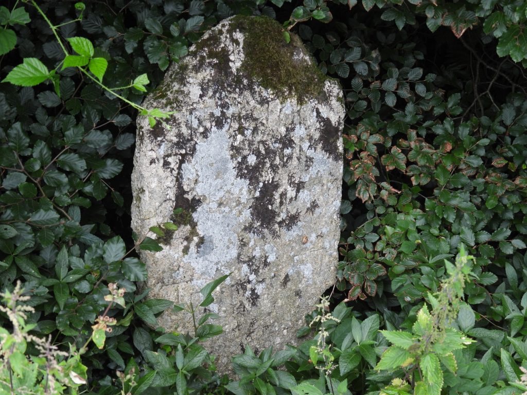
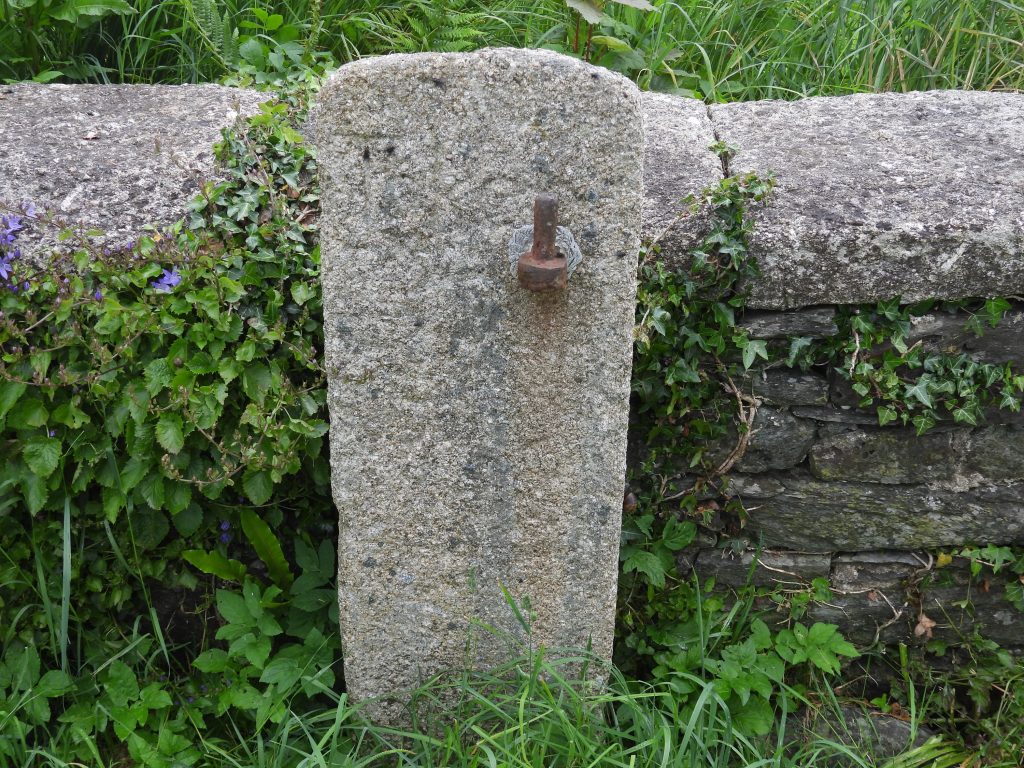
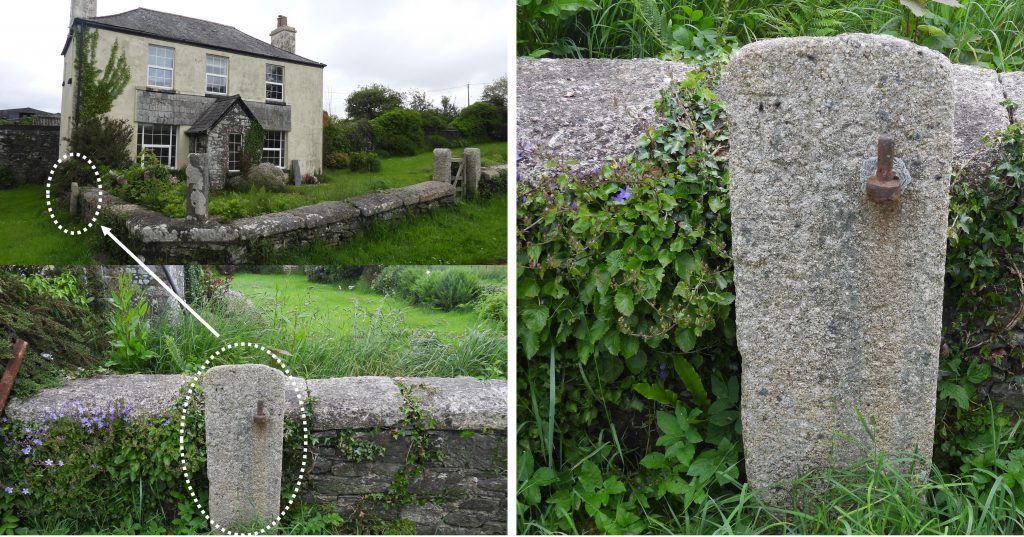
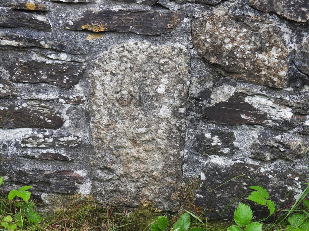
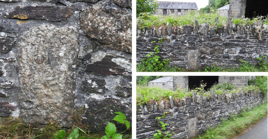
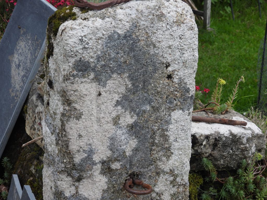
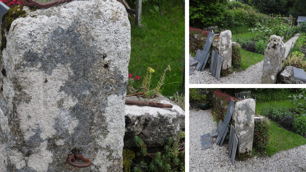
One example of one of these Tavistock Trust “Take Off” stones has been known about for a long time, thanks to the writing of William Crossing. The stone (now believed to be a replica of the original) can be found at Beardon, next to the modern A386. The road originally would have gone down to the river (Lyd) in a straight line on the old Turnpike Road to Roman Bridge before Skit Bridge was built in the 1830’s in an attempt to lesson the incline. There is an old milestone between the “Take Off” stone and the river.The Beardon “Take Off” stone has a rounded top and in summer is often hidden by the overgrowth in the verge.Next to the Beardon “Take Off” stone is a ringed stone, which according to E.N. Masson Phillips had no relevance to the Turnpike Trust albeit one could imagine it being used to tether the extra horses used to and from this point. It is believed the tethering stone was placed in this location in 1950’s.The milestone between the Beardon Take Off stone and the River Lyd. It is located at SX51837 84324. The inscription isn’t very discernible. It says: “From Tavistock 7 miles, Oakhampton 8, Truro 57”A second “Take Off” stone can be found at Hurdwick farm about a mile north of Tavistock. It is now located next to the garden wall of the farm (next to a public footpath). It was probably located further down the Brentor road during the times of the Turnpike Act, where the road rises steeply up from the town.The pictures of the Hurdwick Farm “Take Off” stone shows its location today. It has a gatehanger set into it as it once a gate post located on the west side of the farm, not far from its current location. It is approx. 4ft tall by 1ft wide.A third example of a “Take Off” stone can be found at Fullamoor Farm, near Plasterdown. It is set in a slate-stone wall next to a very narrow lane.The original site for this “Take Off” stone is unknown (its current location being on a very flat section of road). It is recorded that this stone was found in a job lot of stone bought in Tavistock.A fourth example of a “Take Off” stone can be found in a private garden in Lydford. The rear of the stone can be seen from a footpath but to see the (faint) inscription permission from the owner should be sought. The author is grateful to the owner of the property for allowing him access. The exact location of the stone is not being published in this post.The Lydford example of the “Take Off” stone, is being used as a gate post (hence the hook). It is recorded that this stone was found “close by” and its original location was probably originally located on the way into Lydford from the bridge. Dave Brewer states that this road was turnpiked from 1825 and as a footnote, as all the aforementioned stones appear to be carved by the same hand (as the inscriptions are very similar) could possibly date the stones from the same period.