A collection of walks, discoveries, insights and pictures of exploring Dartmoor National Park
May 2, 2021
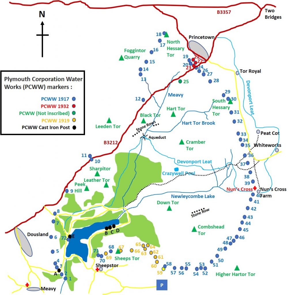
Plymouth Corporation Water Works (PCWW) granite boundary posts and cast iron markers
In the late 1970’s, I came across my first PCWW granite boundary post on Sheepstor (it was inscribed PCWW 1919). I didn’t realise the full significance of this stone, except that it signified the water catchment area for Burrator Reservoir. In the intervening forty plus years, I regularly passed, what seemed like 100’s of these markers and got to learn a little more about them. Finally in 2021, I now have a photographic record of them all, which are shared in this post, with there grid references and a potted history. I am indebted to the “Old Plymouth Society”, who have created a fabulous 4 page report on the history of the markers and to Dartefacts website for additional location information.
In 1893, the Plymouth Corporation Water Act was approved, which effectively gave them the right to “impound the water of the River Meavy and its tributaries”. Subsequently the reservoir at Burrator was constructed and was completed in 1898 effectively replacing Drake’s Leat (the previous source of water dated from 1591), which had become inadequate. The reservoir watershed, however, was owned by others, in the main Sir Henry Lopes of Maristow. The area of the watershed was 5300 acres. The selling of the watershed lands to the Plymouth City Water Works in 1916, 1919 and 1932 led to the erection of the granite boundary markers.
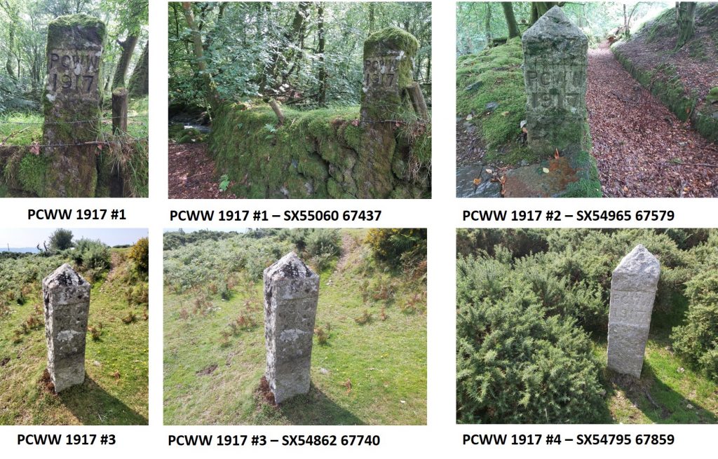
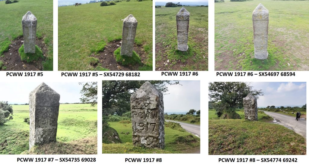
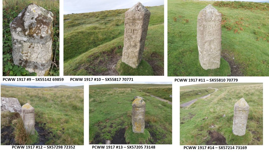
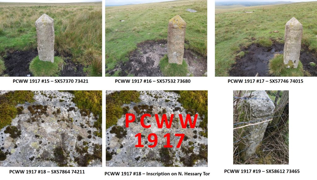
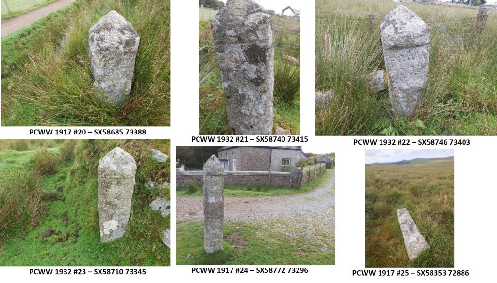
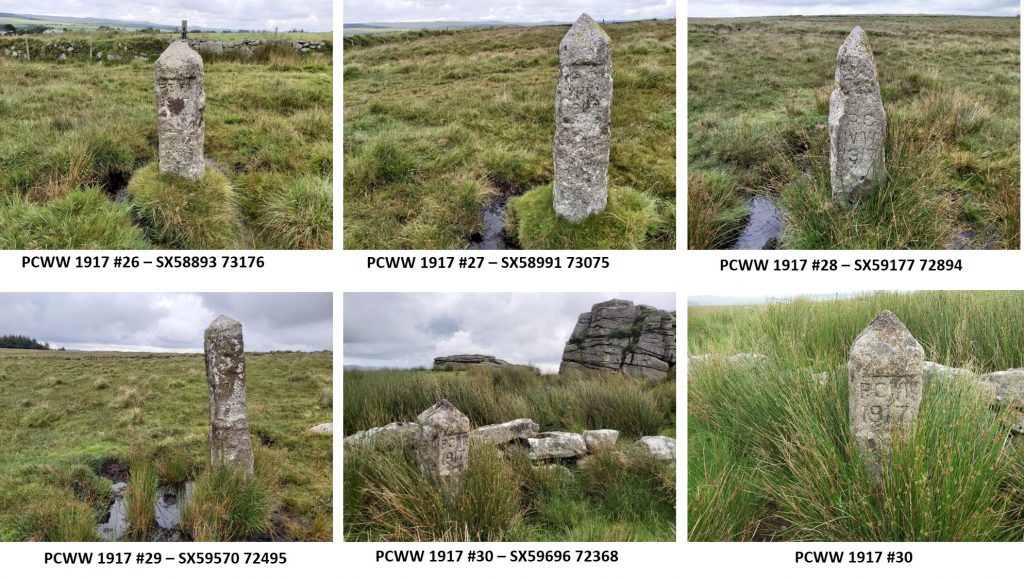
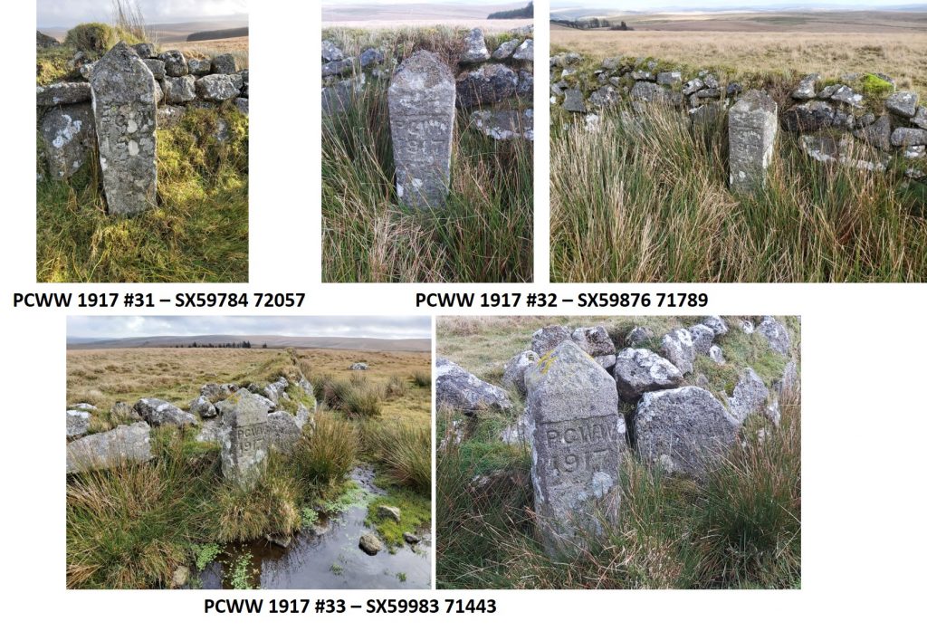
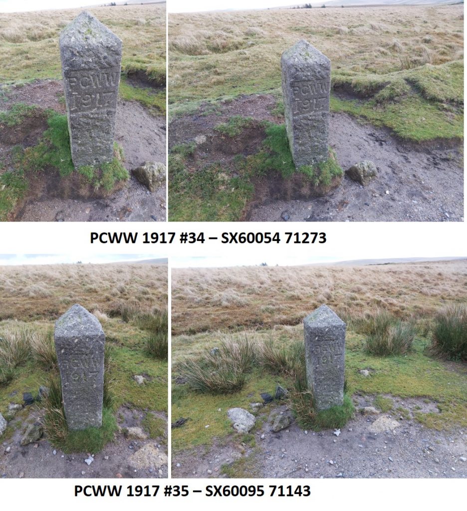
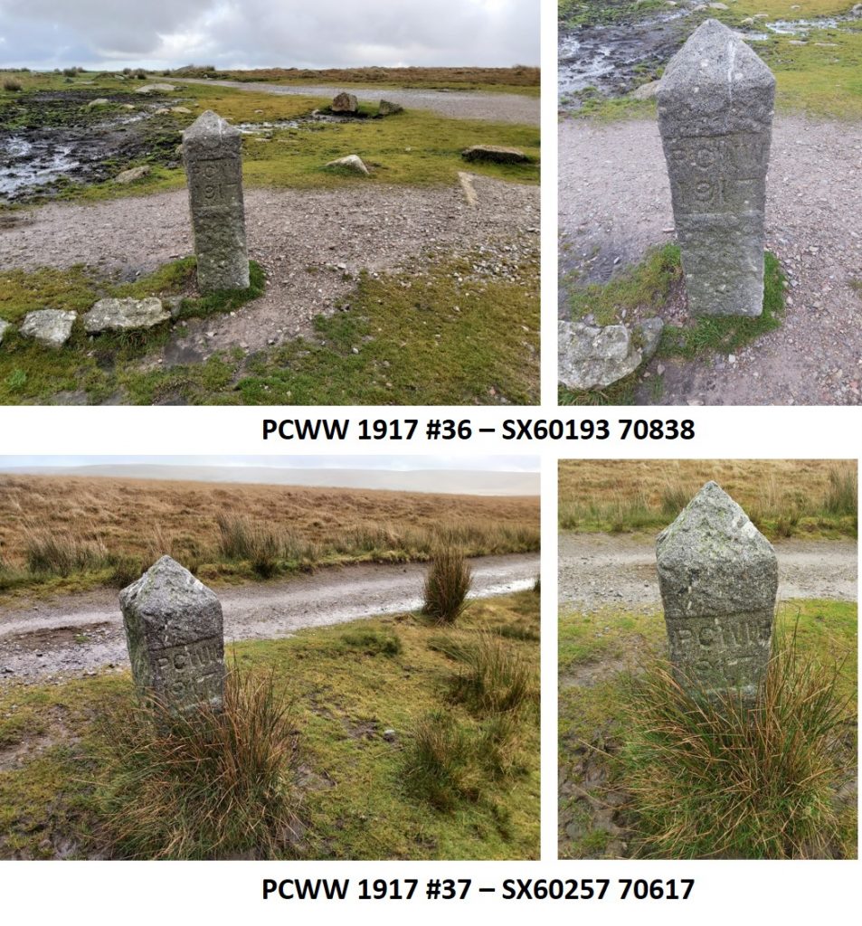
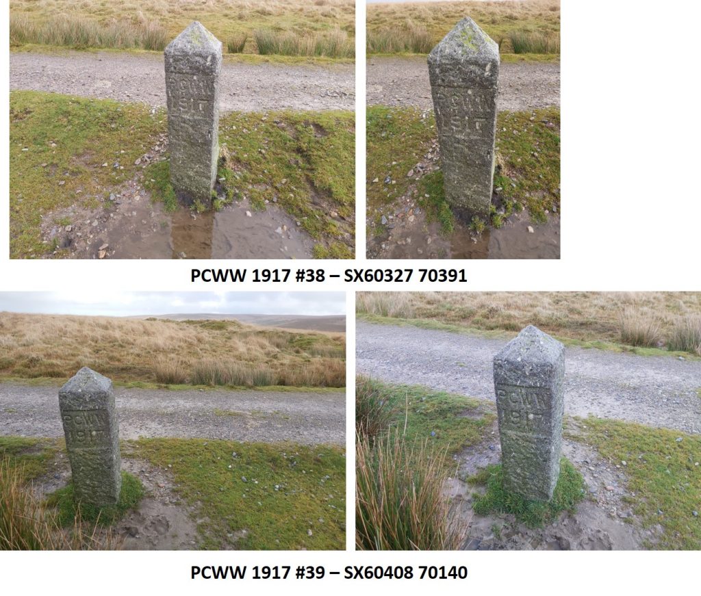
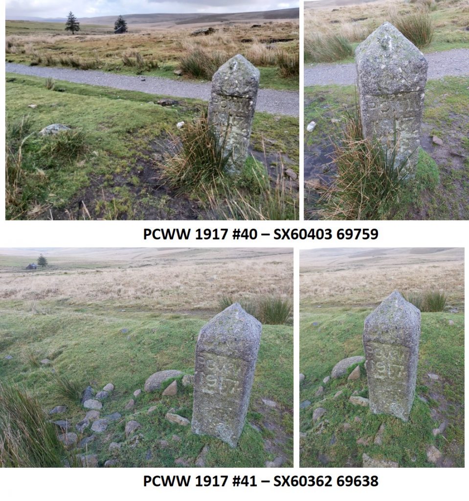
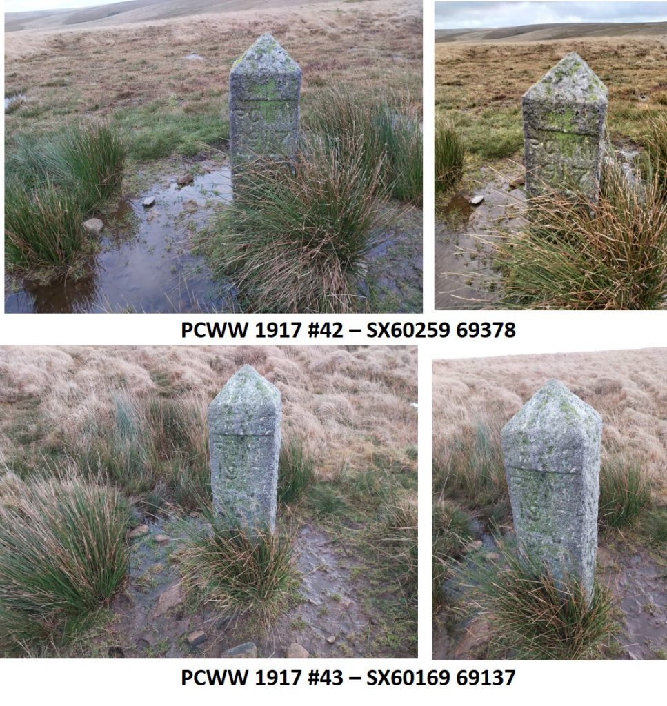
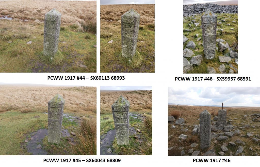
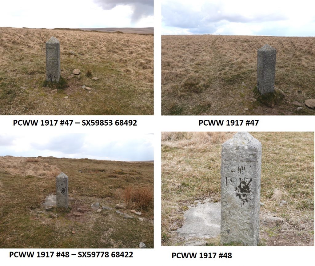
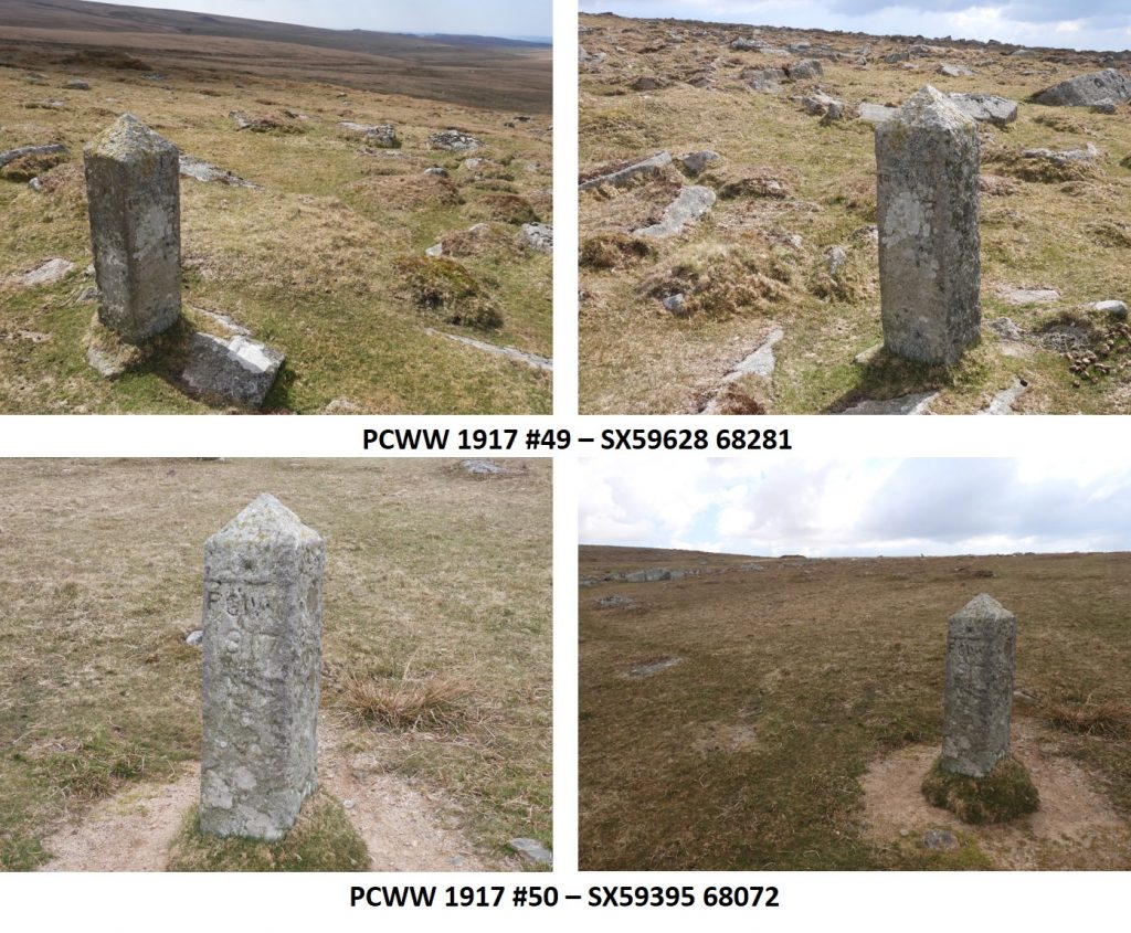
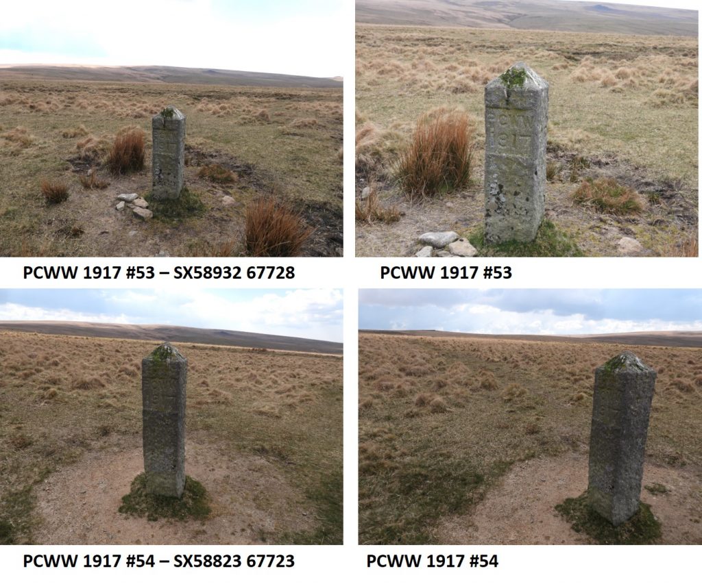
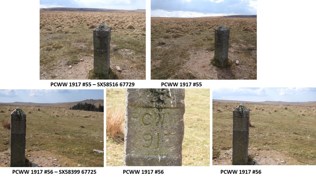
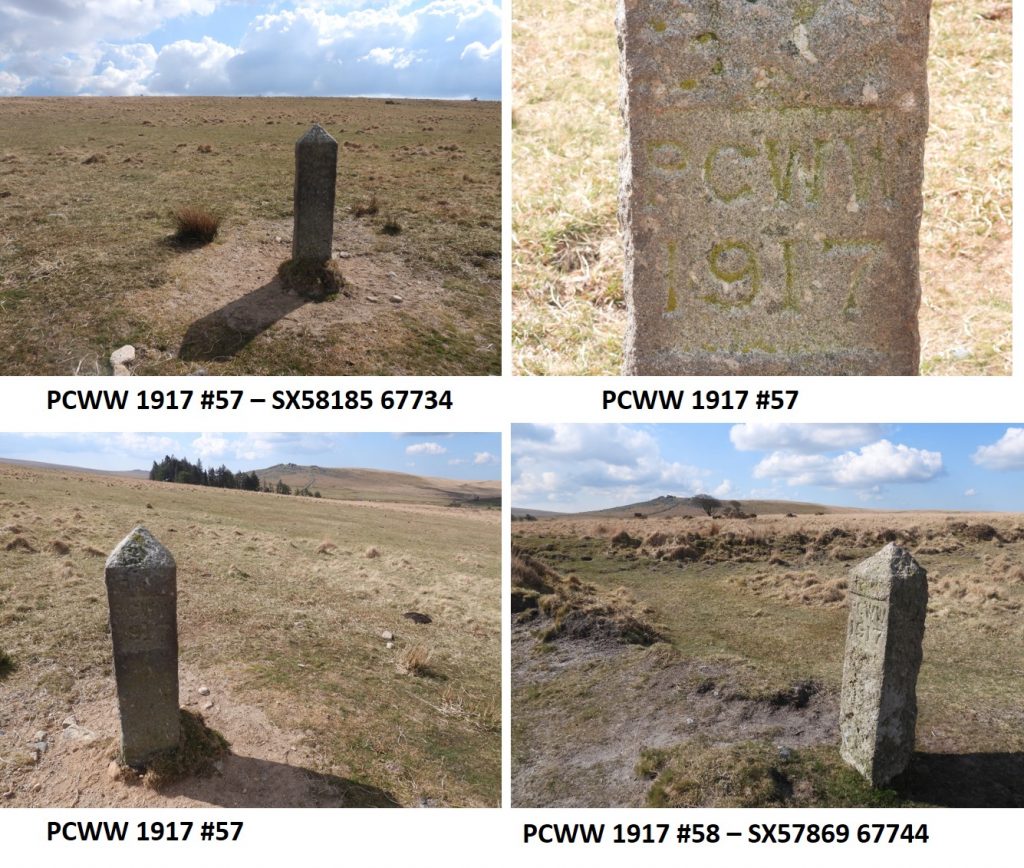
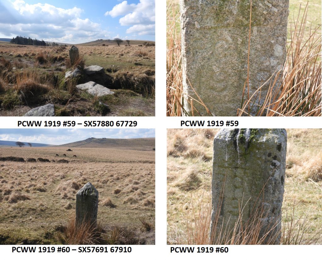
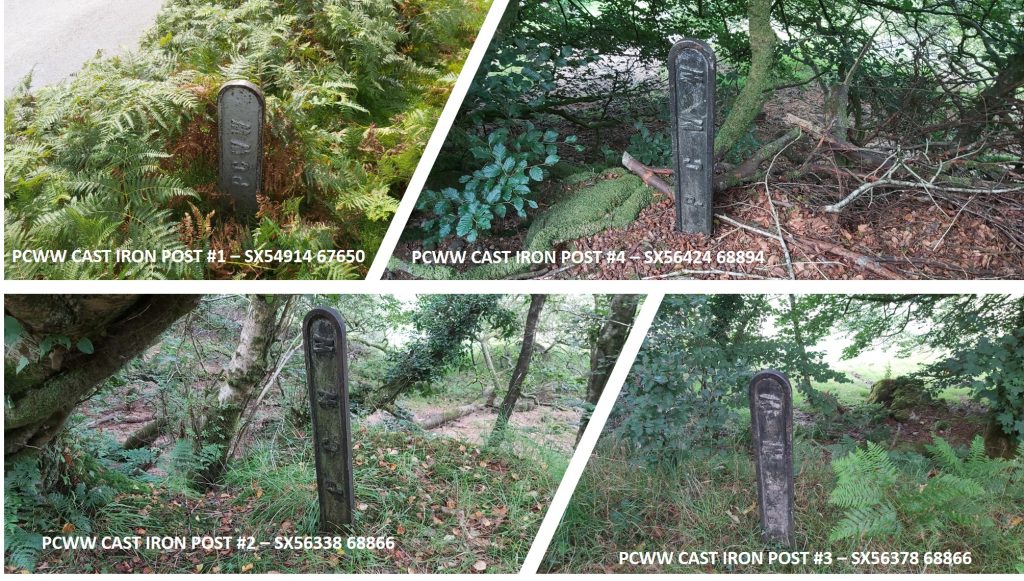
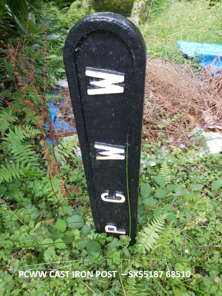
There are 71 granite boundary posts as follows: PCWW 1917 (57) , PCWW 1919 (10) and PCWW 1932 (3) plus one post which is not inscribed and one inscription on North Hessary Tor (total 72). These are labelled PCWW 1-72 and this post has been faithful to the nomenclature of the “Old Plymouth Society”. As well as the granite markers there is a series of smaller cast iron marker posts in the vicinity of the reservoir, which are undated and whose purpose is unclear.
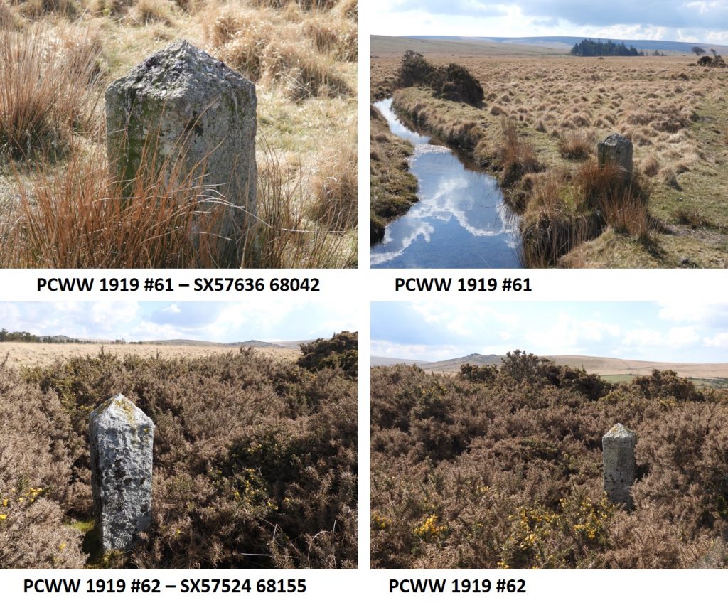
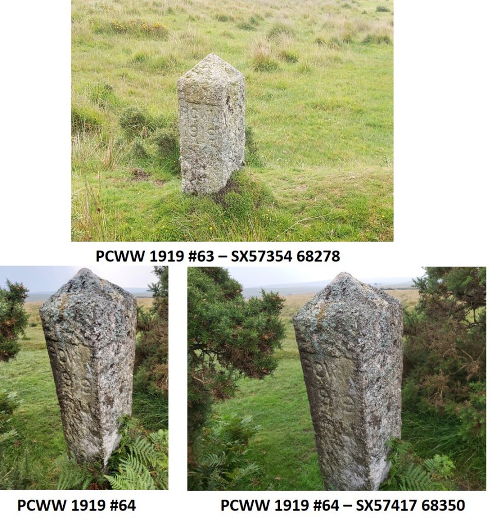
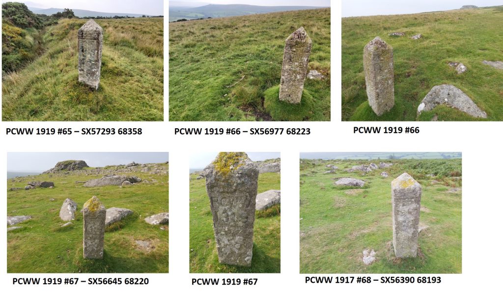
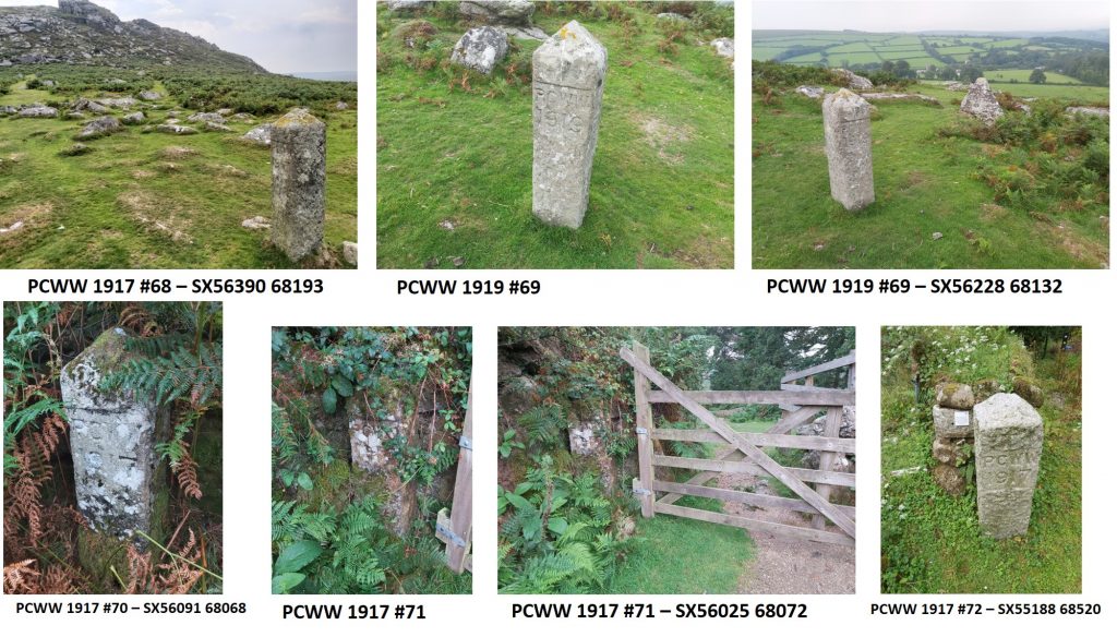
All the PCWW granite markers are located around the 21km (13 mile) boundary of the water catchment area for Burrator Reservoir as can be seen on the attached map (marked in blue, red, green and orange). The cast iron markers (found by the author) are marked as black circles on the map and are all close to the reservoir. In 1916, Sir Henry Lopes agreed to sell his holding within the reservoir catchment area to the Plymouth Corporation. This comprised 4891acres (of the 5300 acre total). The land was conveyed in 1917 and was associated with the erection of inscribed boundary marker posts. These were the “PCWW 1917” markers. Markers #1 to #4 are located between the River Meavy and Yennadon Down.Markers #5 to #8 are located on Yennadon Down.Markers #9 to #14 are located across Walkhampton Down from Peek Hill through to the old Princetown railway line.Markers #15 to #19 are located from the old Princetown railway line up to North Hessary (which is inscribed “PCWW 1917”) through to Princetown. Marker #19 is in Princetown and appears to have been unloved over the years and is surrounded by fencing.Markers #20 to #25 are located around Princetown. #21-#23 are inscribed “PCWW 1932” and are located around a small marshy area of the River Meavy headwaters and are assumed to have been erected when the land was acquired from the Duchy of Cornwall. #25 is an anomaly as it is not inscribed and is located away from the expected boundary. This marker appears to be of the same size and shape of the PCWW 1917 markers, but its history is unknown.Markers #26 to #30 are located from Princetown to South Hessary Tor.Markers #31 to #33 are located from to South Hessary Tor heading south towards Nuns Cross Farm. In 2012 the Dartmoor Society initiated a project with South West Water and the Maristow Estate amongst others to ensure that the PCWW boundary markers between South Hessary Tor and Eylesbarrow mine track were in good condition for 2017, the centenary of their erection.Markers #34 to #35 are located from South Hessary Tor heading south towards Nuns Cross Farm.Markers #36 to #37 are located from heading south towards Nuns Cross Farm.Markers #38 to #39 are located from heading south towards Nuns Cross Farm.Markers #40 to #41 are located from Nuns Cross Farm heading up towards Eylesbarrow.Markers #42 to #43 are located from Nuns Cross Farm heading up towards Eylesbarrow.Markers #44 to #46 are located from Nuns Cross Farm heading up towards Eylesbarrow. #46 is located next to the iron spike (excalibur) on Eylesbarrow.Markers #47 to #48 are located heading downhill south west from Eylesbarrow. Markers #49 to #50 are located heading downhill south west from Eylesbarrow.Markers #51 to #52 are located heading downhill south west from Eylesbarrow, near the miners track from Gutter Tor car parkMarkers #53 to #54 are located between the miners track from Gutter Tor car park to Eylesbarrow and Yellowmead DownMarkers #55 to #56 are located between the miners track from Gutter Tor car park to Eylesbarrow and Yellowmead DownMarkers #57 to #58 are located between the miners track from Gutter Tor car park to Eylesbarrow and Yellowmead DownMarkers #59 to #60 are located beside the Longstone or Sheepstor Leat (shown on OS maps, but not named). They are inscribed “PCWW 1919” and commemorate when the land around Sheepstor was acquired from the Bayly family.Markers #61 to #62 are located beside the Longstone or Sheepstor Leat.Markers #63 to #64 are located beside the Longstone or Sheepstor Leat.Markers #65 to #68 are located across Sheepstor from the eastern to the western slopes including the summit.Markers #69 to #71 are located on the lower slopes of Sheepstor towards Maiden Tor and Joeys Lane. They are a combination of “PCWW 1917” and “PCWW 1919” inscribed markers. #72 used to lie recumbent near the Sheepstor Dam having been used as a stile before that. It has now located at the Burrator Discovery Centre on the opposite side of the reservoir.There are eight cast iron marker posts recorded. All are undated and there are three different patterns. The author has discovered five of these markers. The picture above shows four of them.The fifth cast iron marker found by author is located at Burrator Discovery Centre.


Mark Fenlon June 5, 2021
Regarding the PCWW Cast iron posts, I presume you know where to look for the three that you have not listed. Did you look for them but fail to find them? There are grid refs on the Plymouth boundary stone pages.
https://www.plymouth.gov.uk/visitorsandtourism/museumsandheritage/boundarystones/leatstoneswaterworksandwatercatchments
SteveGrigg1961 June 5, 2021 — Post author
Thanks Mark, I never looked for the remaining three. Thanks for the information.