A collection of walks, discoveries, insights and pictures of exploring Dartmoor National Park
October 4, 2022
‘Castle’ and Castle Farm
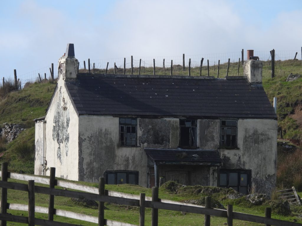
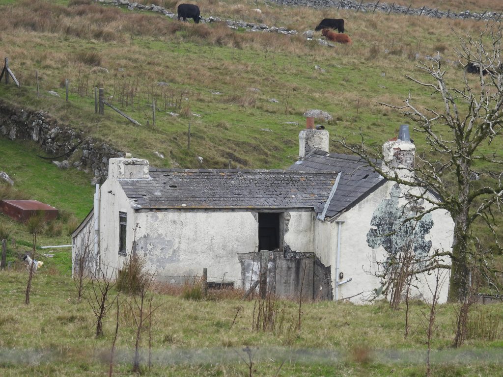
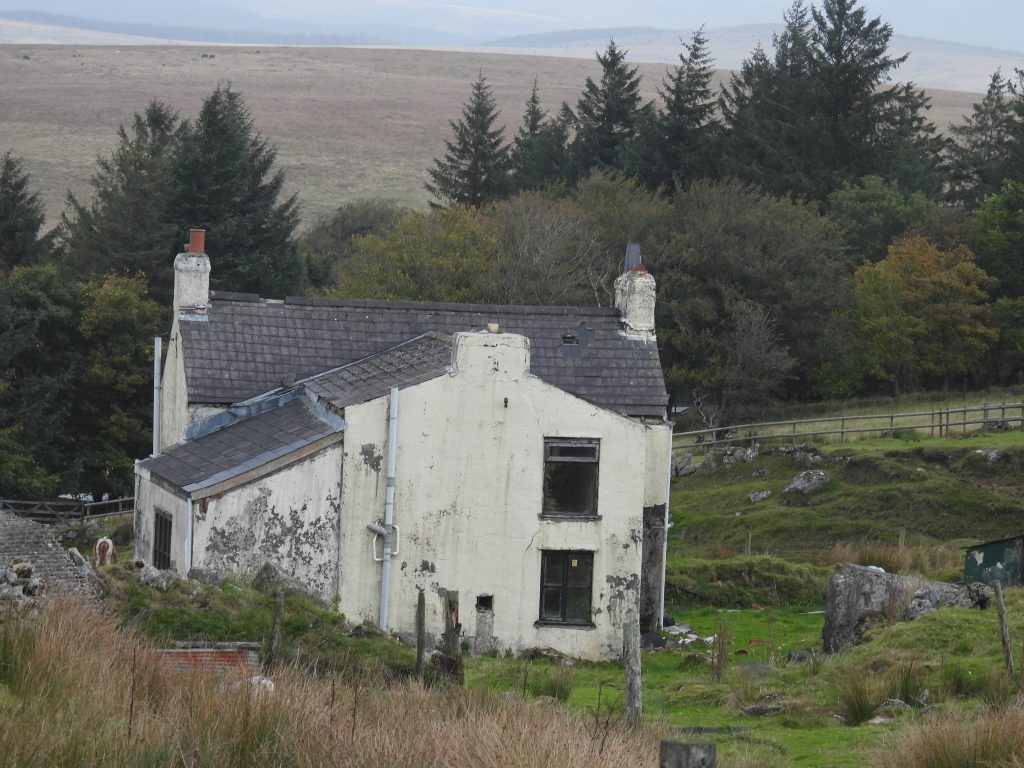
On Tor Royal lane near Peat Cot is an forgotten farm and at the time of writing this post looks very much unloved. Having been empty for a few years, Castle Farm, seems to have been abandoned (albeit it is believed to be owned by the Duchy) and if left unchecked is likely to become ruinous very quickly, which given the history and location would, in the authors humble opinion, be very sad indeed.
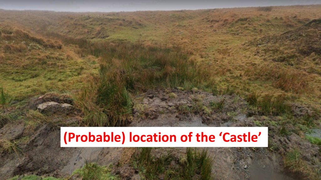
The farm lies to the east of the road near to the Peat Cot lane turning and has been synonymous with the Worth family who lived in the area and who also had the Wesley Chapel built nearby. The story of the farm and immediate area, however, begins on the 19th century tithe map, where what looks like a marked property called ‘Castle’ appears to the west of Tor Royal Lane. The ‘Castle’ was in a different position to the later 19th century historic mapping of ‘Castle Farm’, where it is shown in its current position to the east of the lane. The original ‘Castle’ appears to have disappeared from OS maps by 1870’s and the new ‘Castle Farm’ appearing. Therefore, the disappearance of one (possible) building and the construction of another probably took place sometime between 1840 and 1870 (ish). To confuse matters there was a ‘Look-out Castle’ (tower) built in the area, which might be the ‘Castle’ as shown on the tithe map, but possibly could have been further west on the South Hessary Tor / Nun’s Cross ridge. This post uses information obtained from the Dartmoor HER (Chapman, S., 2020, Castle Farm, Princetown (Report – Assessment). SDV363572), Eric Hemery’s ‘High Dartmoor’ and from an article from Plymouth Herald, who interviewed local historian David German around May 2020.
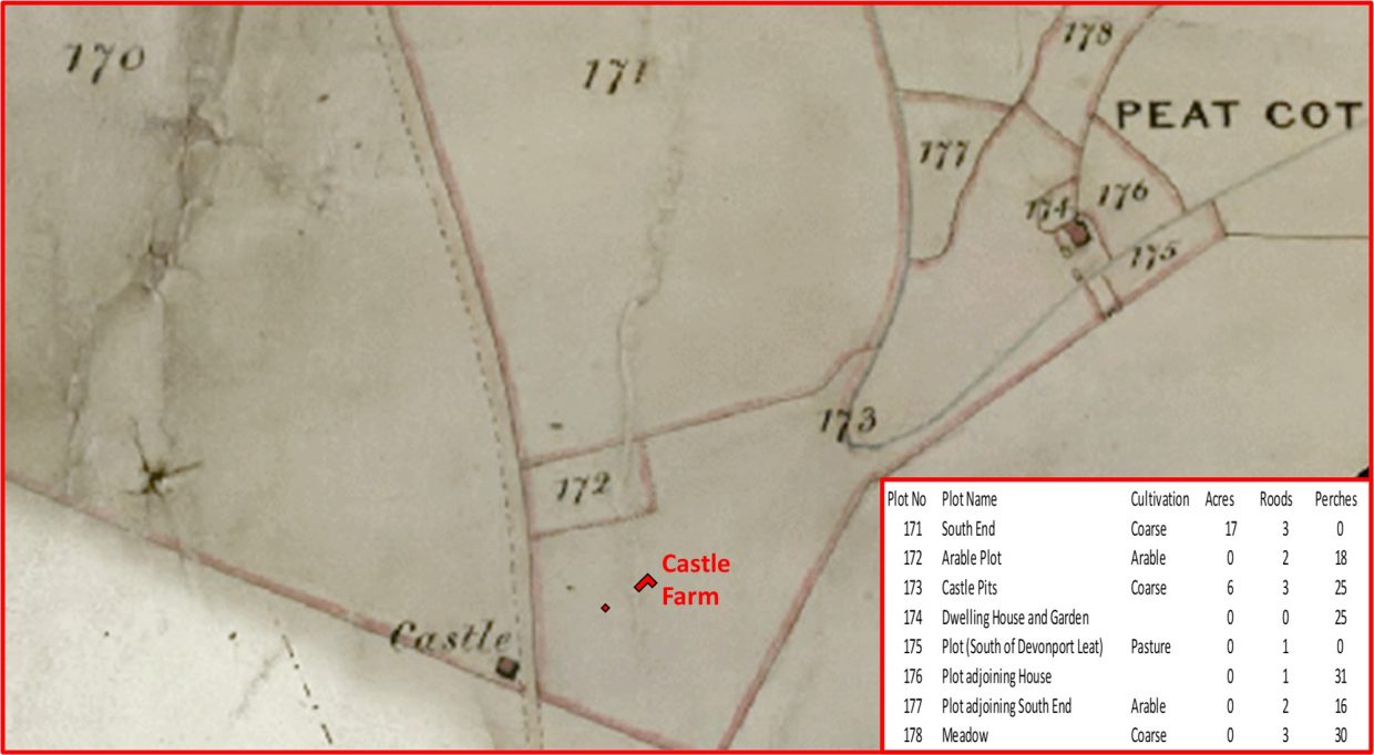
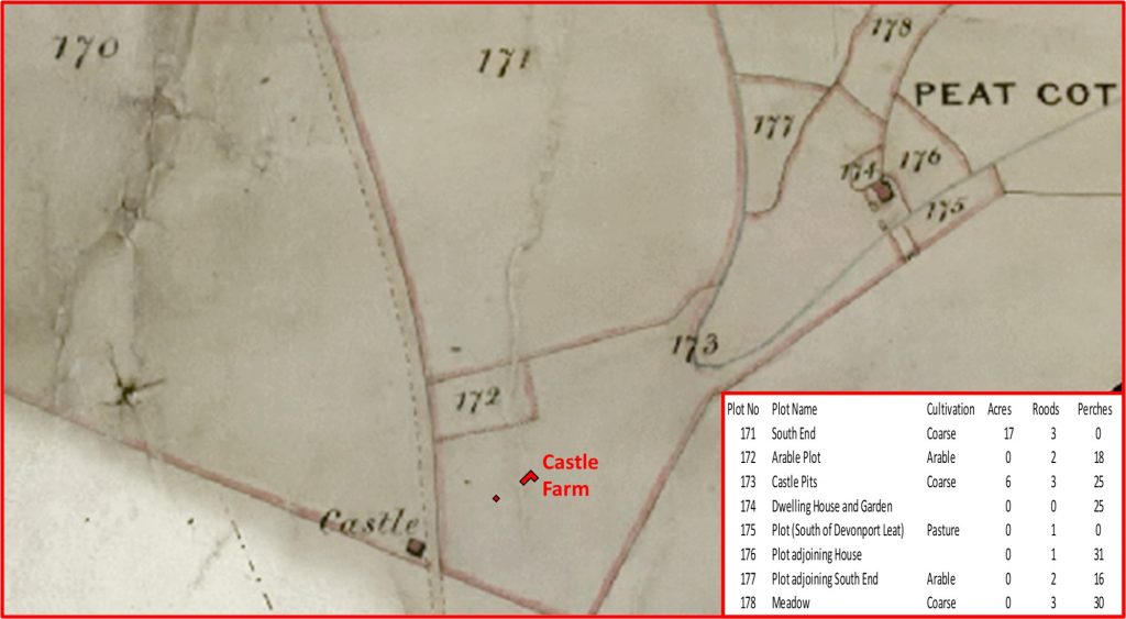
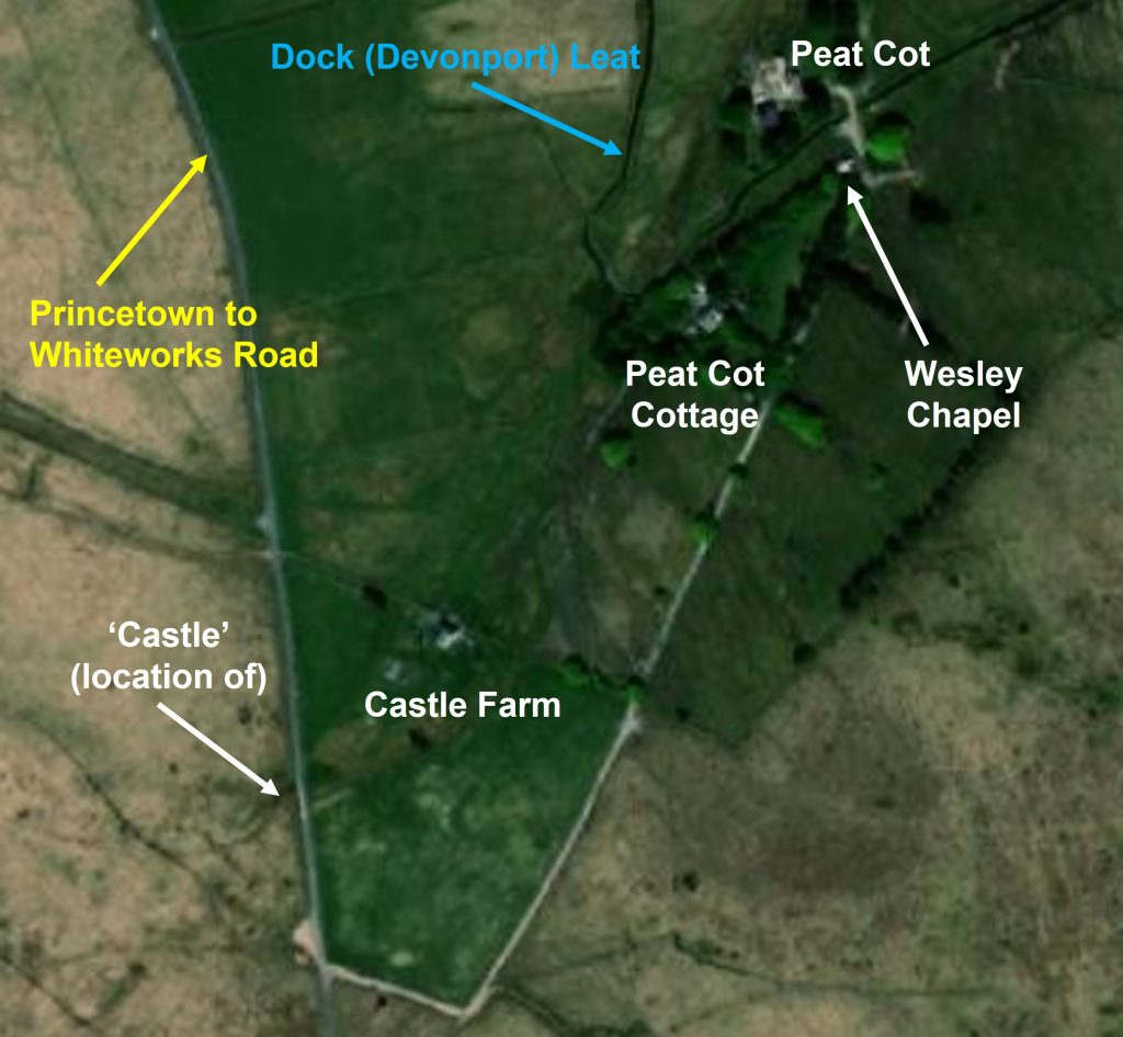
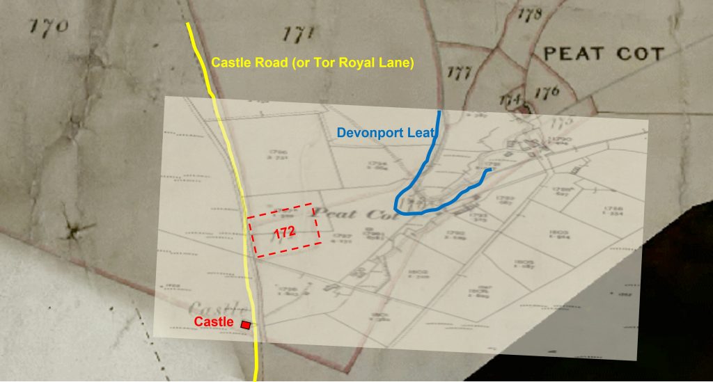
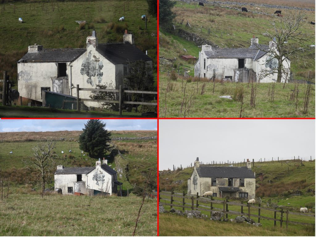
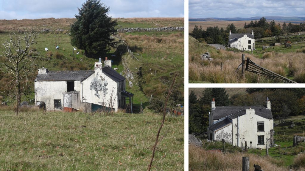
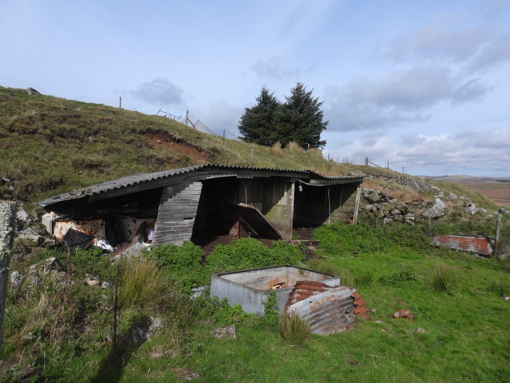
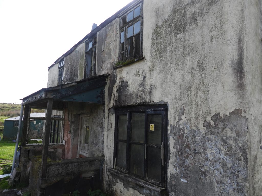
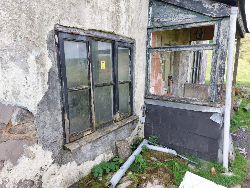
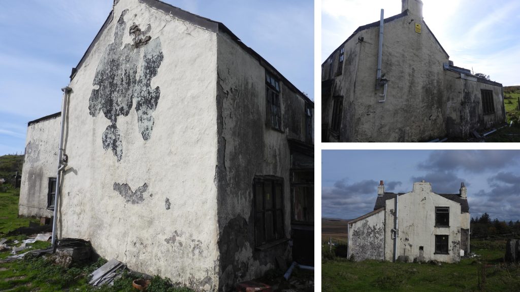
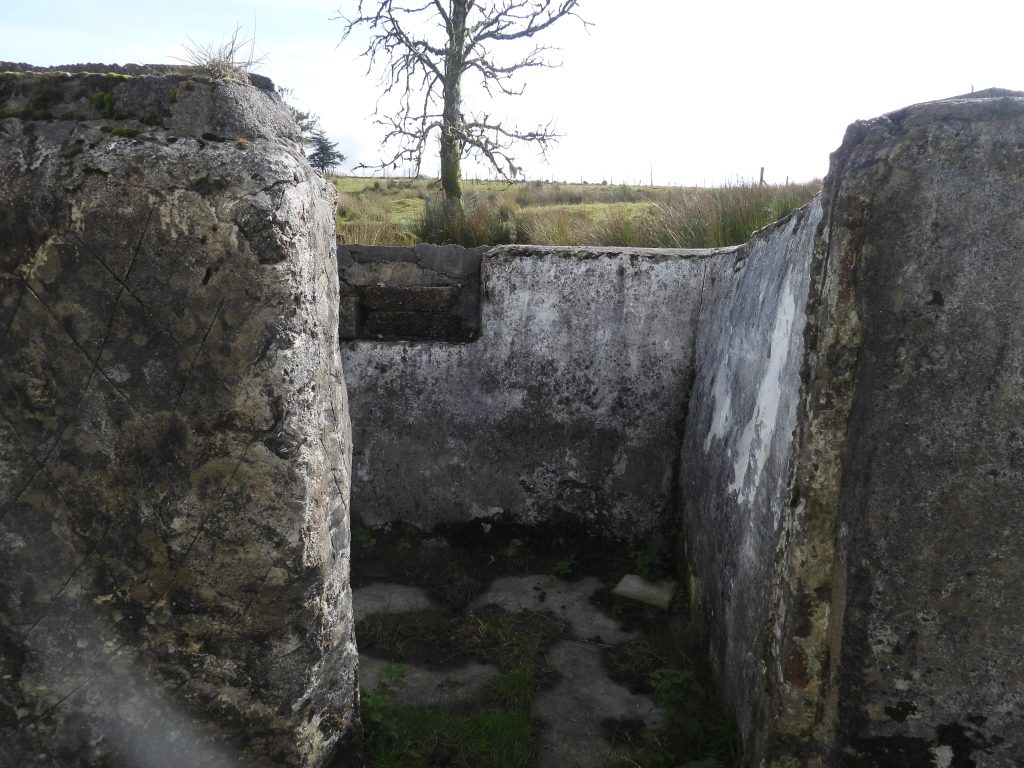
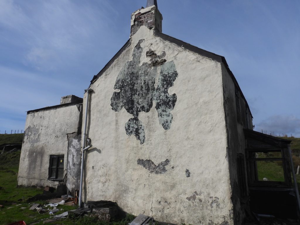
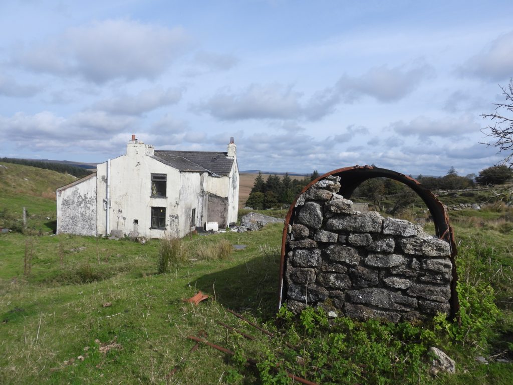
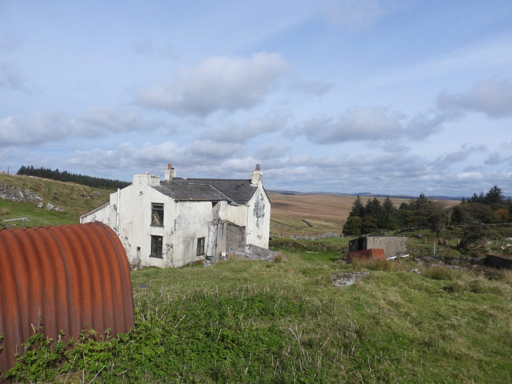
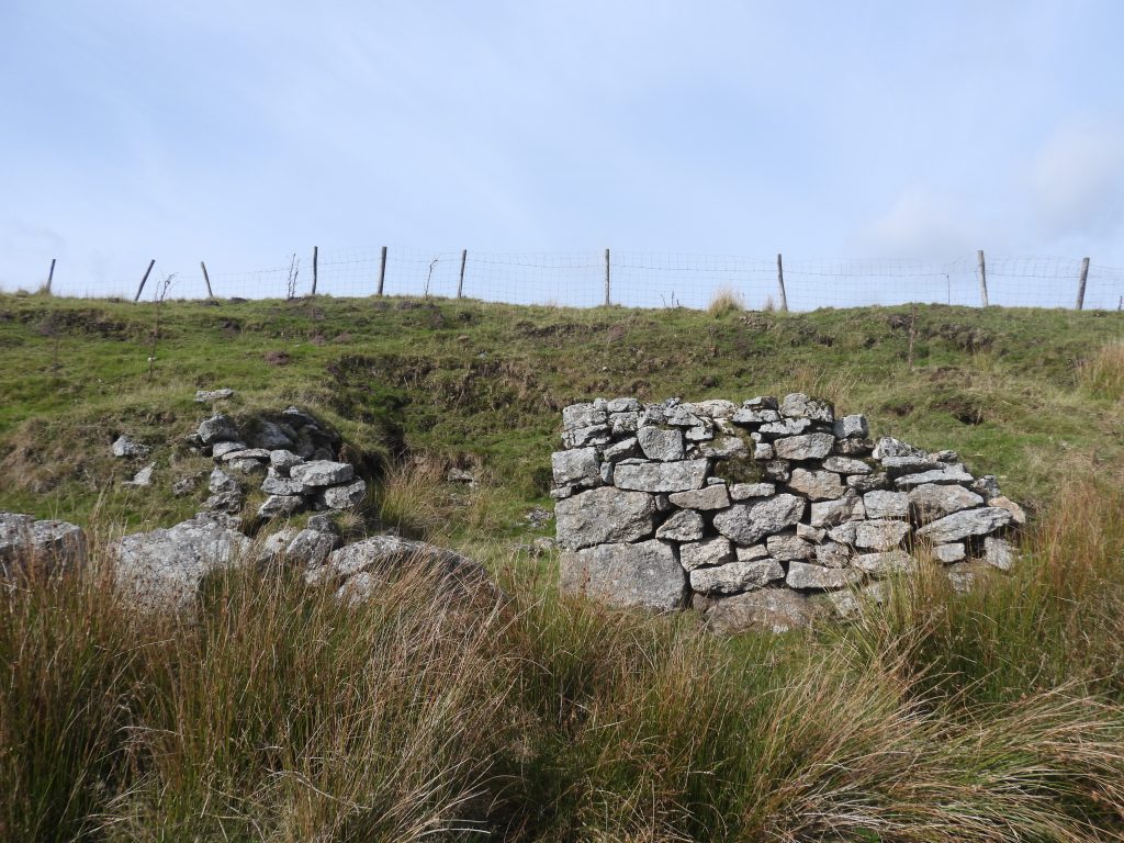
Tithe map from 1840 shows the ‘Castle’ and Peat Cot but not Castle Farm. Of interest is the name ‘Castle Pits’ relating to plot 173, which probably relates to the tin workings below (to the north east) of the current Castle Farm. The ‘Castle’ appears to have been built in (just inside) plot 170 which borders plot 173.Annotated google earth view of the ‘Castle’ and ‘Castle Farm’ area. The author believes that Castle Farm is now commonly known as Peat Cot Farm, but will use Castle Farm throughout the post.In an attempt to overlay an 1892 map with the 1840 tithe map, the author suspects the scaling on the tithe map is slightly skewed. That said the ‘Castle’ appears alongside Tor Royal lane (aka Castle Road).A lookout tower made of stone and timber was once built in the area to warn the local population of any impending invasion by Napoleon (High Dartmoor p134 – Eric Hemery). The description in the Hemery publication of the ‘Look-out Castle’ locates the tower as being on the South Hessary Tor / Nun’s Cross ridge, which is a few hundred metres to the west from the location of ‘Castle’ suggested by the 1840 tithe map. So is the label ‘Castle’ on the tithe map, the tower or was it an original cottage? With the overlay of the tithe map and late 19th century map the author believes the ‘scooped’ out area opposite the south west gate to the current Castle Farm is where the original ‘Castle’ would have been located. Whilst the prison at Princetown was being built, Sir Thomas Tyrwhitt during this time had cottages built for the farm workers and the author speculates that ‘Castle’ (the one on the tithe map) was one of them and that the ‘Look-out Castle’ was a separate entity. At the 1840 tithe, the landlord of the plot where Castle was located as being George Nicholson and the tenant was Peter Hannaford.The sign for Castle Farm is still extant next to the northern of two gates leading to the farm from the Whiteworks roadThe Castle Farm sign appears to be on a piece of slateCastle Farm viewed from north east along Peat Cot lane. On viewing the footprint of the late 19th century map, it would appear that the entire frontage of this (north) elevation is an extension from the original building. Castle Farm viewed from east along Peat Cot lane. The (north) extension is more obvious from this angle and is the part with the two taller chimneys.Castle Farm viewed from the south west near where the original ‘Castle’ was located. As well as a north extension there appears also to have been an extension to the west.The original Castle Farm building was originally a simple rectangular shape and had a large granite fireplace to the south (which given the fact the chimney is still there is most likely to be still in situ).In the Dartmoor HER (ref: Chapman) the following observation is made: “As a simple cottage most probably associated with the local tin extraction”. One of the first tenants of the farm was John Worth who came from Walkhampton.One of the outbuildings of the Farm nestling into a south east facing bank. It is shown modern OS maps.The front door of the farm building is located on the north east (extension) frontageThis picture shows how dilapidated the building is.Thankfully the building is has two CCTV cameras which (in theory), should help protect the building from unwanted visitors.Inside an outbuildingClose up of the southern elevation.An unusual outbuilding with corrugated iron stretched over a drystone wallAnother view from the south west. There are nettles growing inside the building behind the south west elevation window.The old outbuilding nearest Tor Royal Lane appears to be the oldest and built into a south east facing bank.
Steve: The ‘Castle’ was a stone and timber Napoleonic invasion lookout tower. See ‘High Dartmoor’ p134. When I looked for it a few years ago I thought it was a relatively small, flat, squarish piece of land with shorter grass than the surroundings so not sure if that is what you found. – Nigel
Nigel: The look-out tower mentioned by Hemery is shown alongside Castle Road / Tor Royal Road on the tithe map. Overlaying a late 19th century map and the tithe map suggests it is approx where I located it. I suspect the tithe map and Hemery’s description are not exactly the same location. I would be grateful if you could provide me with your NGR of the location you found. Many thanks, Steve
Steve: I may have to back-peddle slightly because when I’m convinced I’ve found an item I log the photo and the grid ref. I’ve checked and in this case I did neither so obviously I wasn’t sufficiently certain. Not having seen your map, the ‘platform’ like location I found was the other side of the track centred (I recall) at approx SX6031671074. – Nigel
please I was wondering what the rent is on Castle farm as it is because I wise to do the repairs on it and make it a working farm again so how much is the rent on it please 🙏 yours truly lisa honeywill


Nigel Machin October 5, 2022
Steve: The ‘Castle’ was a stone and timber Napoleonic invasion lookout tower. See ‘High Dartmoor’ p134. When I looked for it a few years ago I thought it was a relatively small, flat, squarish piece of land with shorter grass than the surroundings so not sure if that is what you found. – Nigel
SteveGrigg1961 October 5, 2022 — Post author
Nigel: The look-out tower mentioned by Hemery is shown alongside Castle Road / Tor Royal Road on the tithe map. Overlaying a late 19th century map and the tithe map suggests it is approx where I located it. I suspect the tithe map and Hemery’s description are not exactly the same location. I would be grateful if you could provide me with your NGR of the location you found. Many thanks, Steve
Nigel Machin October 5, 2022
Steve: I may have to back-peddle slightly because when I’m convinced I’ve found an item I log the photo and the grid ref. I’ve checked and in this case I did neither so obviously I wasn’t sufficiently certain. Not having seen your map, the ‘platform’ like location I found was the other side of the track centred (I recall) at approx SX6031671074. – Nigel
Lisa Honeywill August 1, 2025
please I was wondering what the rent is on Castle farm as it is because I wise to do the repairs on it and make it a working farm again so how much is the rent on it please 🙏 yours truly lisa honeywill
SteveGriggDartmoor August 3, 2025 — Post author
Hi Lisa,
I believe the farm is Duchy owned and they would be able to inform you of the rent
Regards,
Steve (Dartmoor Explorations)