A collection of walks, discoveries, insights and pictures of exploring Dartmoor National Park
September 26, 2022
Erroneous Dartmoor Forest Boundary change in 18th Century at Rundlestone
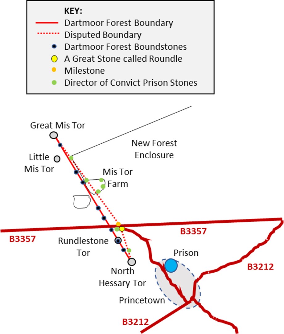
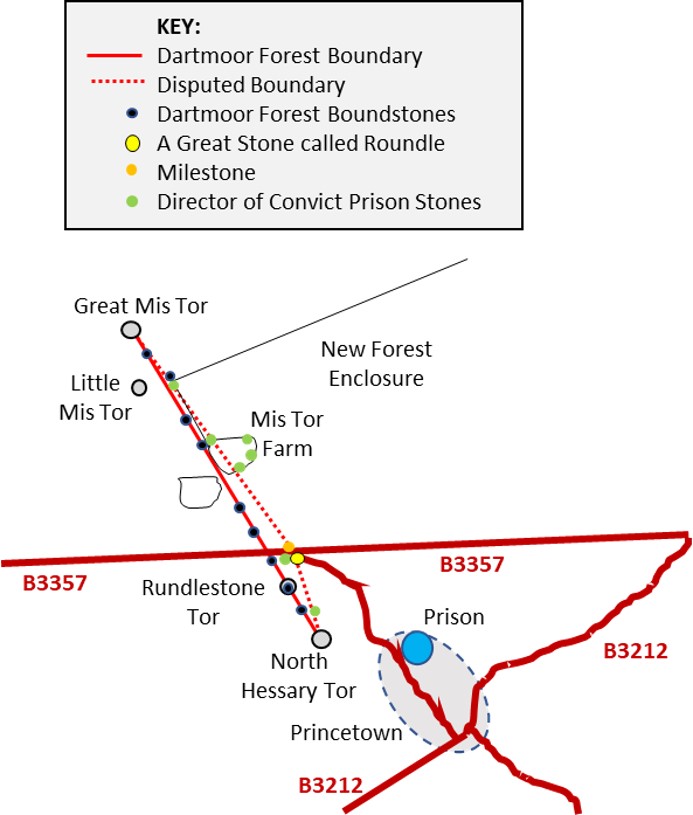
The bounds of Dartmoor Forest as first perambulated in 1240, then in 1608 stated the confirmed boundary between North Hessary Tor and Great Mis Tor was a straight line between the two locations. However, sometime at the turn of the 18th century (according to evidence given in 1702), this straight line made a deviation from North Hessary Tor to near Rundlestone Corner then onwards to Great Mis Tor. It was not corrected until 1867. Indeed, 15 years prior to the change in 1852, the Duchy were leasing (correctly) the sliver of land between the correct boundary and the erroneous boundary, and the correction in 1867 was the Duchy merely reclaiming what was theirs. The boundary correction was reflected with the Duchy erecting a series of plain boundstones.
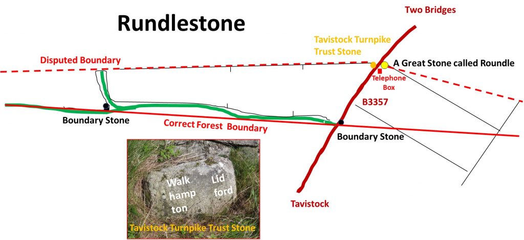
The erroneous boundary change seems to be due to naming an intermediate reference point ‘Rundlestone’ between North Hessary and Great Mis Tor in 1702. Of course, there is a tor which is named Rundlestone but in the 18th century there was also a large granite pillar called the ‘Rundle Stone’ (sometimes referred to as “A Great Stone called Roundle” – Ogilvy’s maps of Devon). Rundlestone Tor lies on the direct line between North Hessary and Great Mis Tor, but the ‘Rundle Stone’ was located near to Rundlestone Corner, where the (relative) modern telephone box is located. So, it appears that the ‘Rundle Stone’ was incorrectly used as an intermediate marker. This post covers the 1867 boundstones and some features between North Hessary and Great Mis Tor relating to the story of the erroneous boundary. The author has largely referenced “Dartmoor Boundary Markers” (second edition) by Dave Brewer 2002.
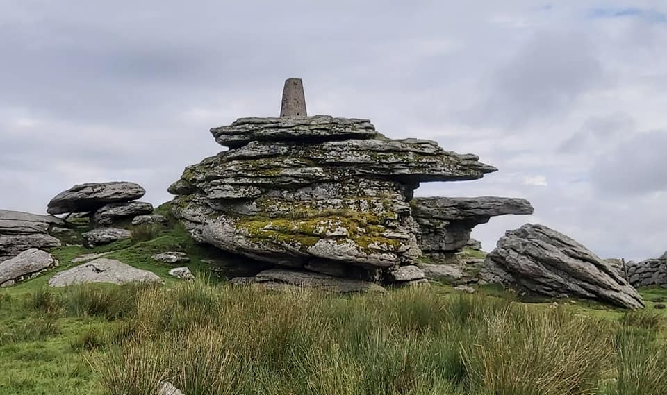
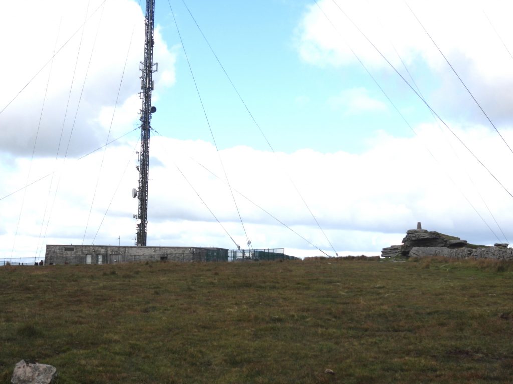
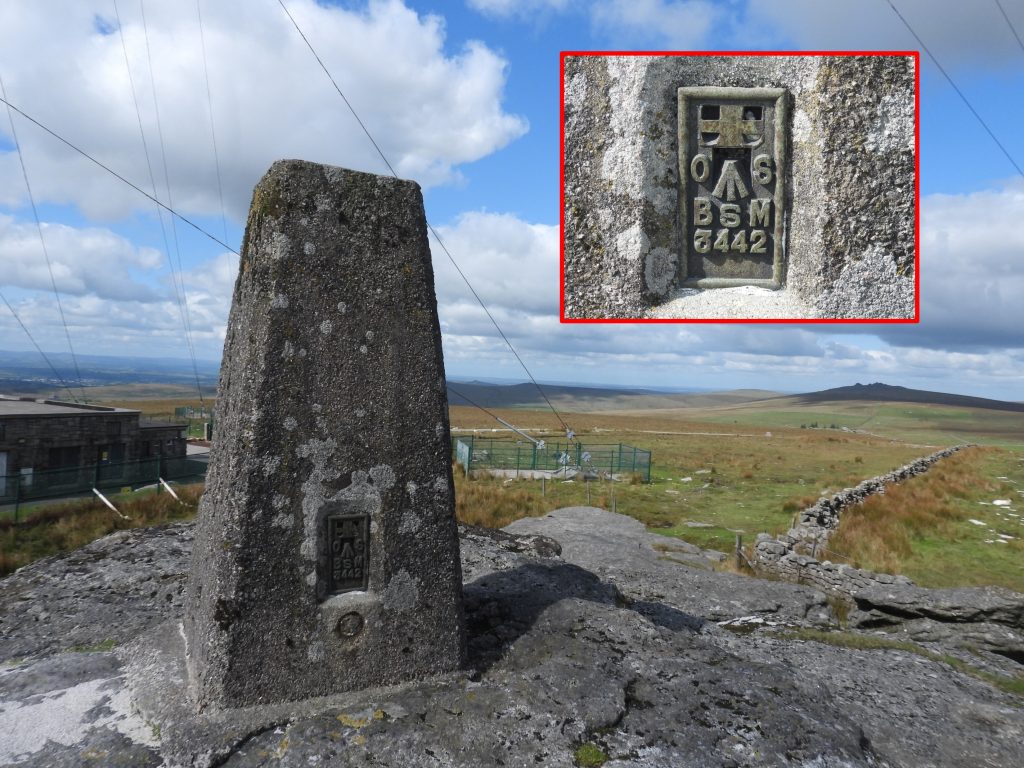
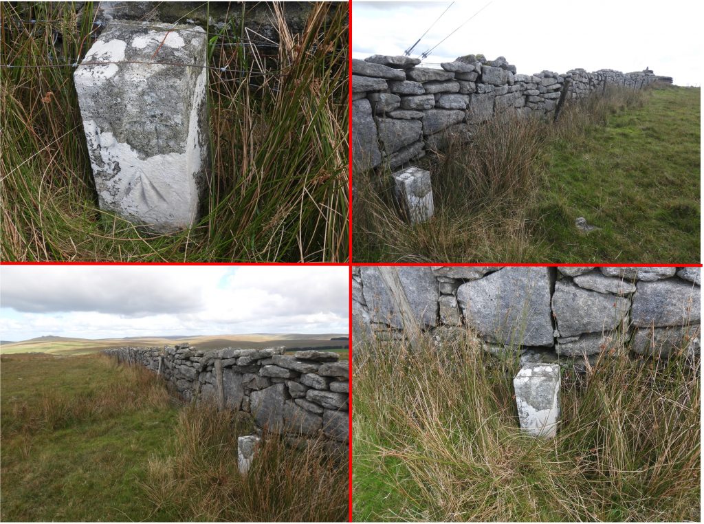
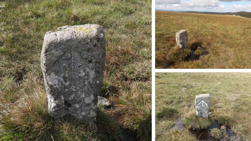
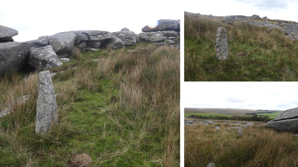
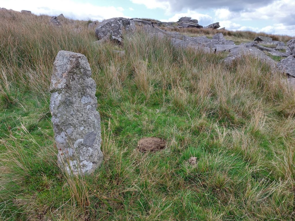
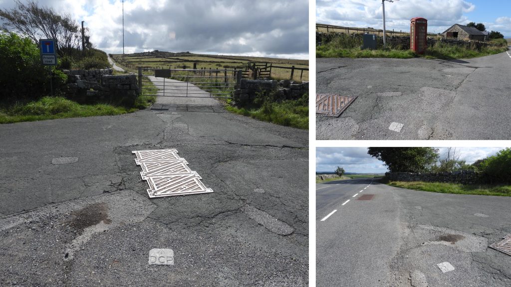
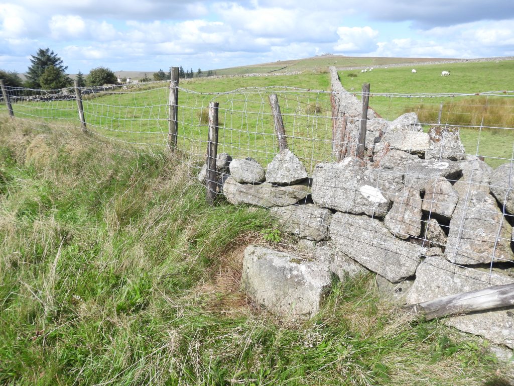
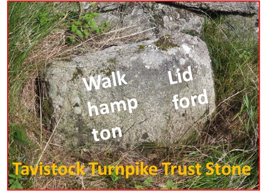
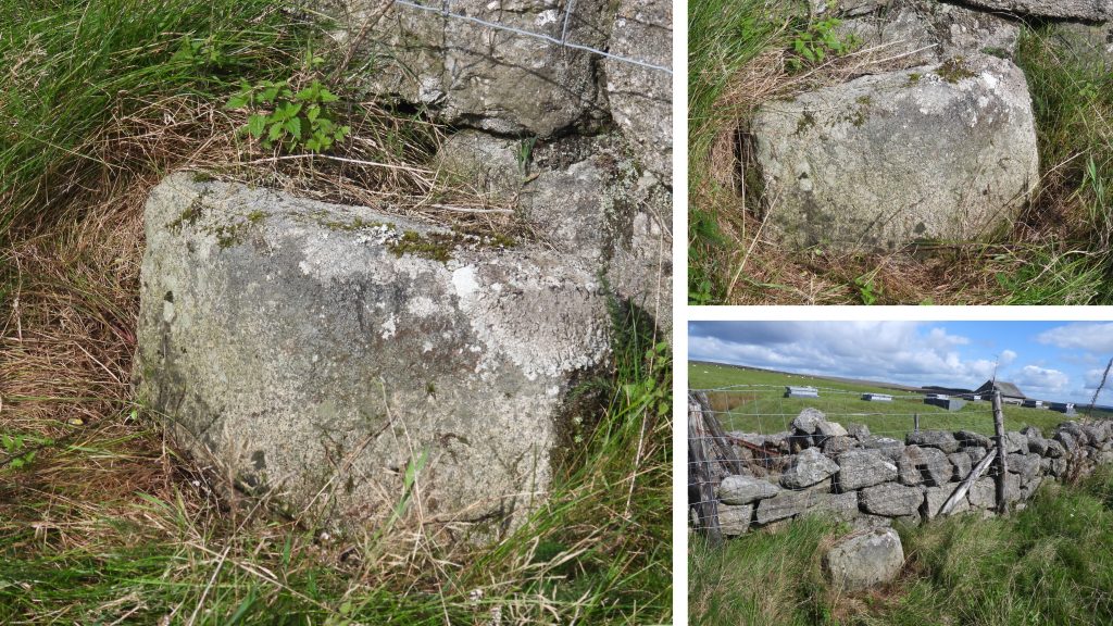
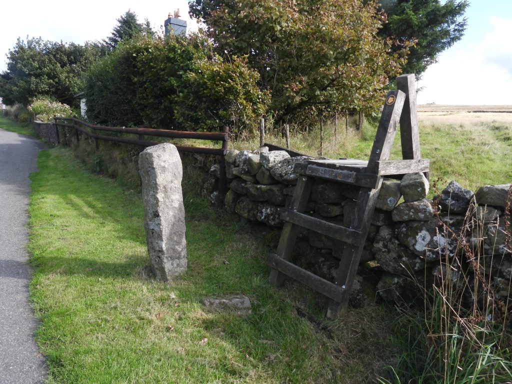
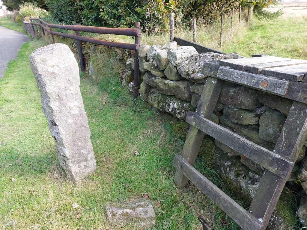
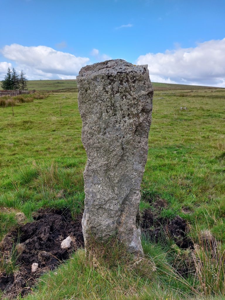
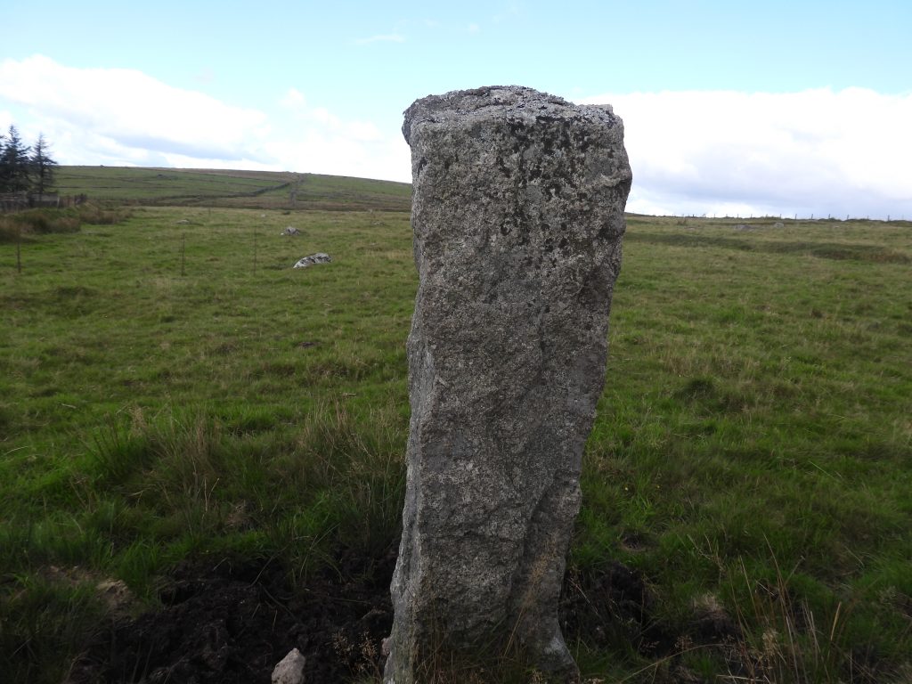
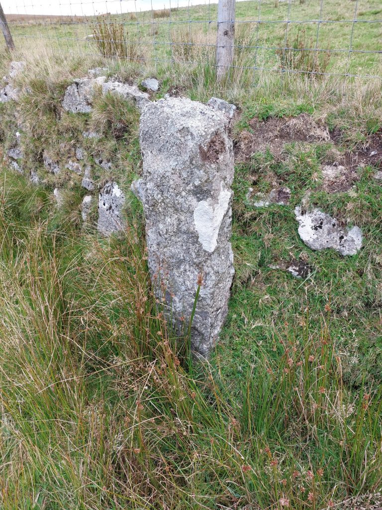
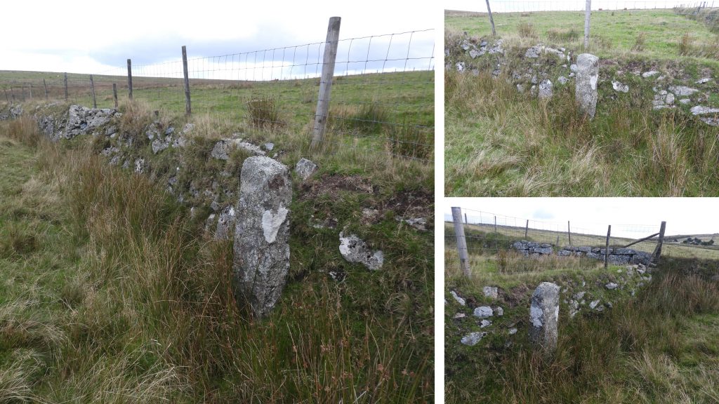
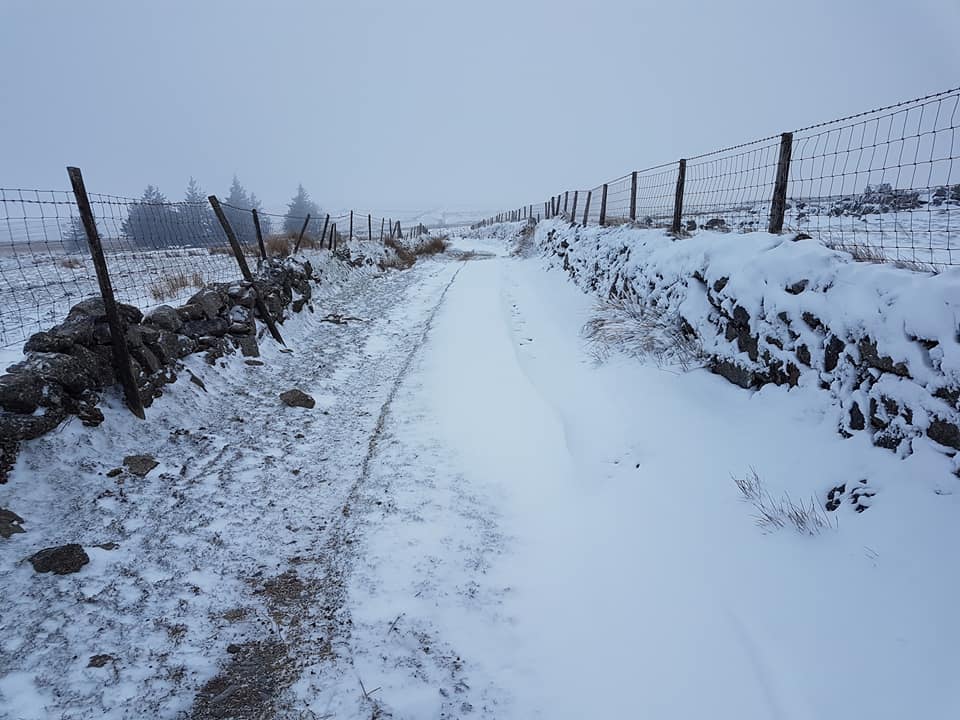
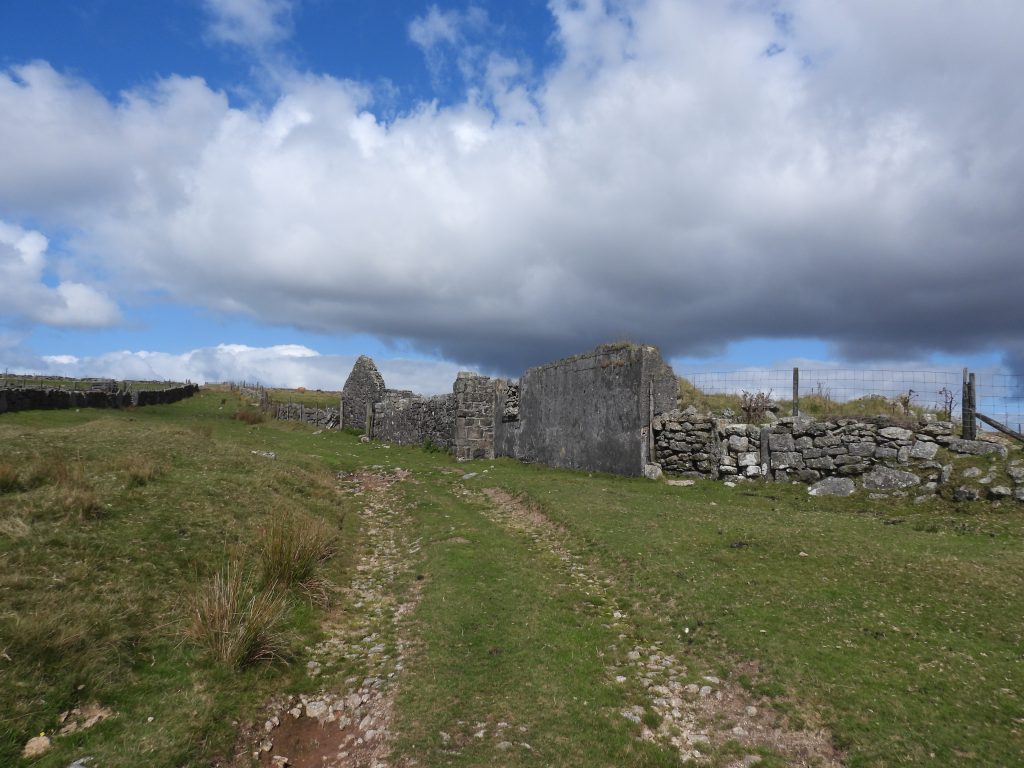
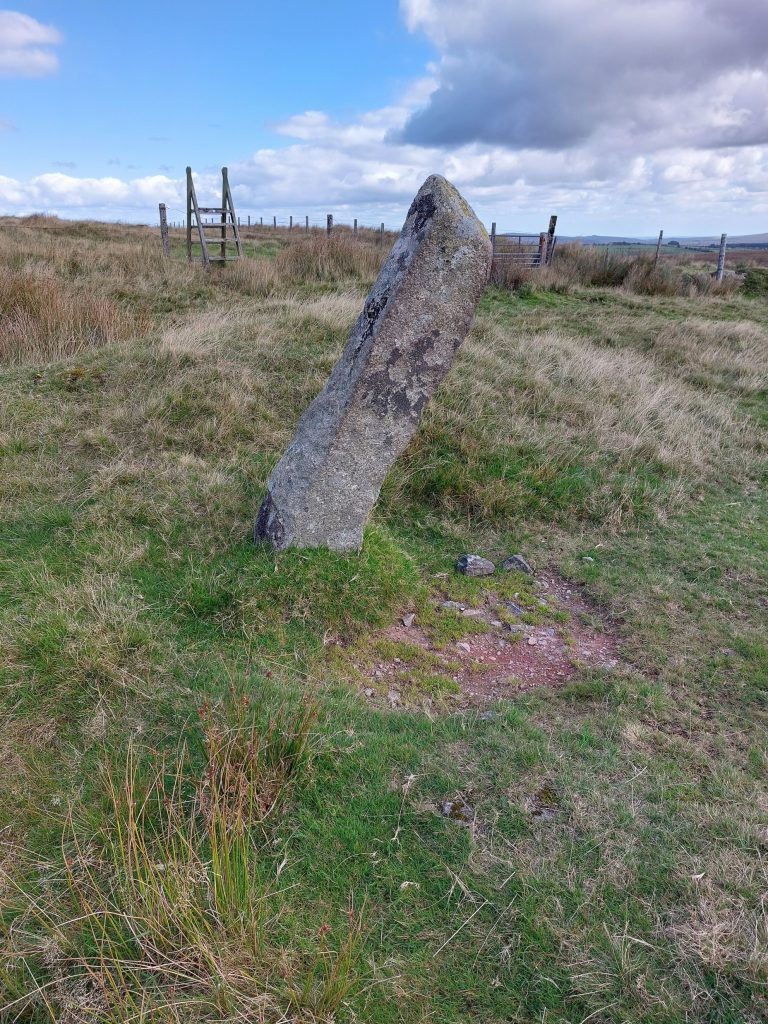
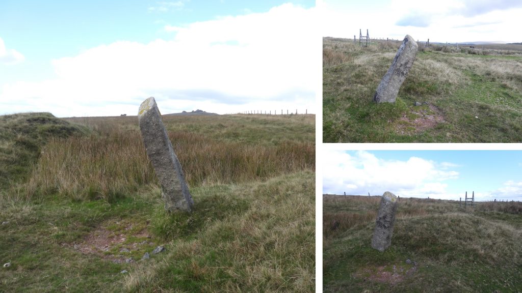
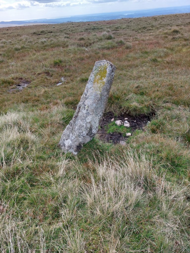
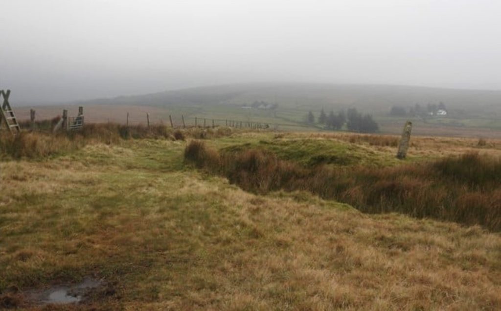
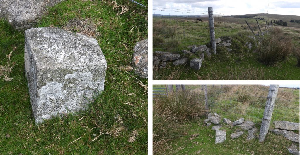
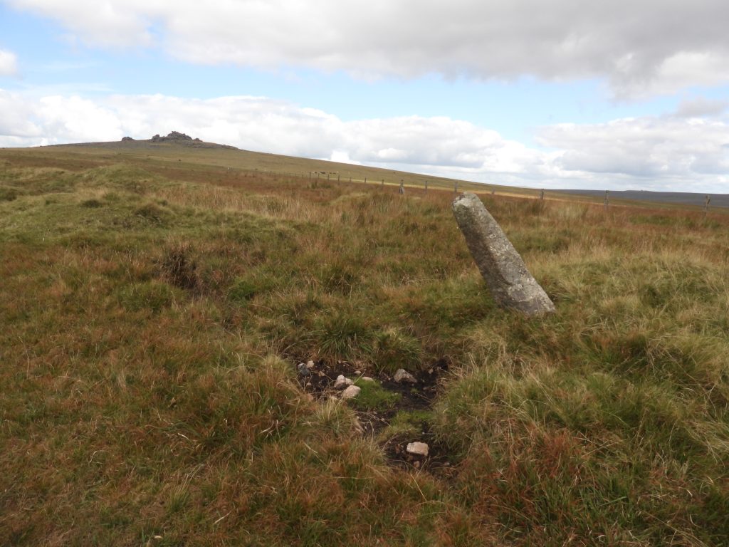
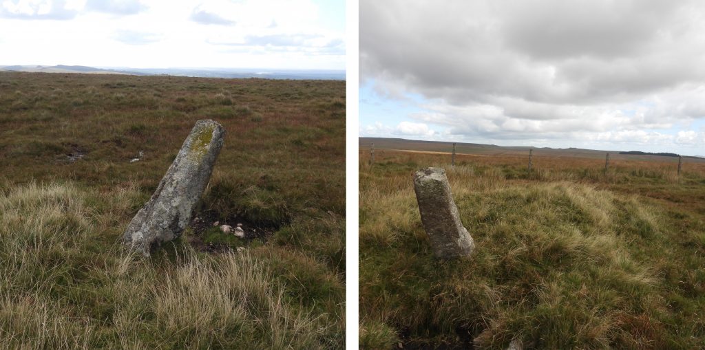
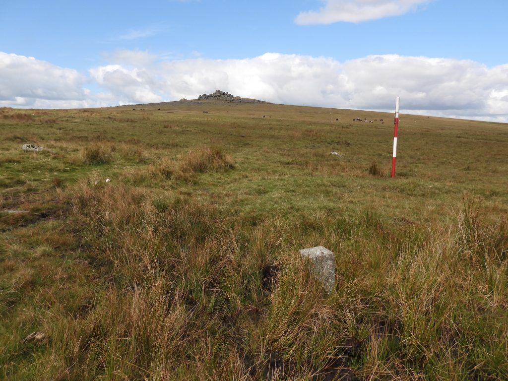
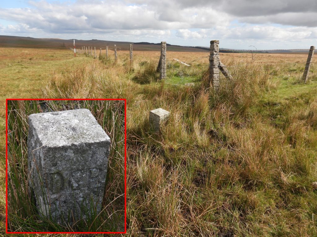
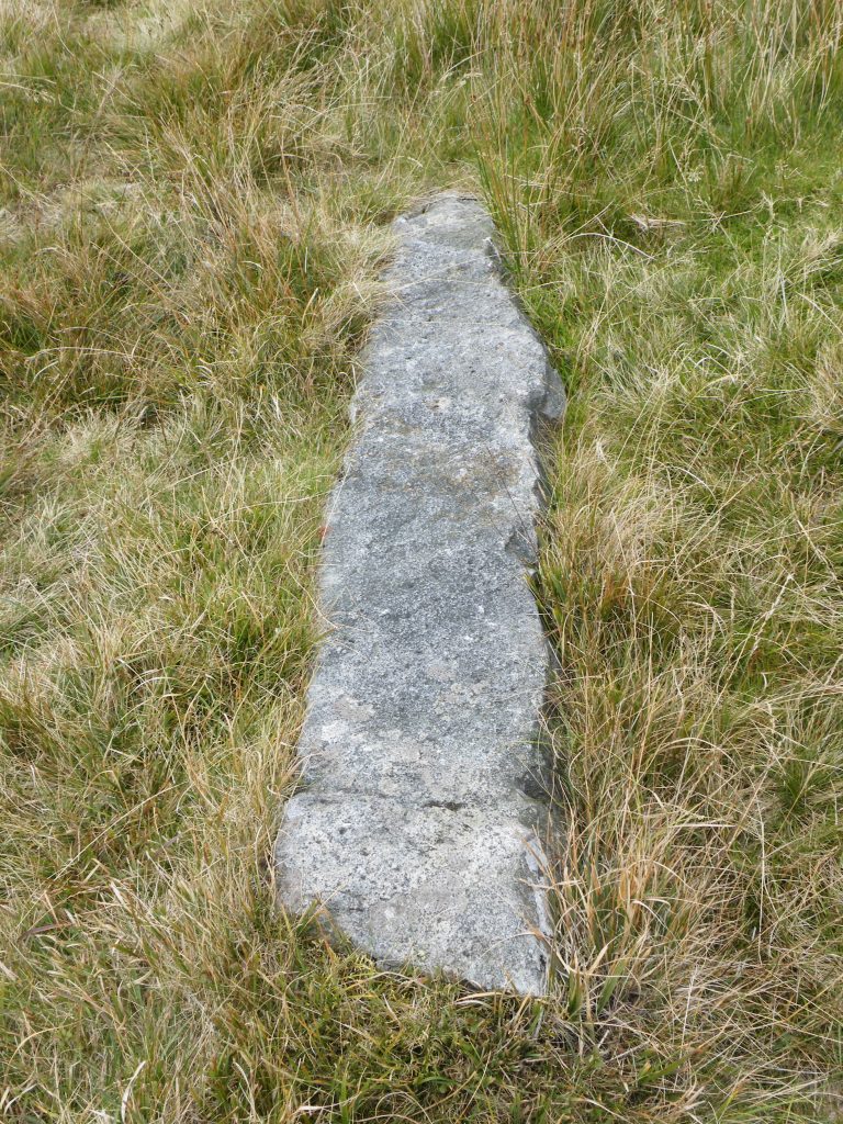
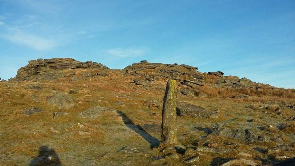
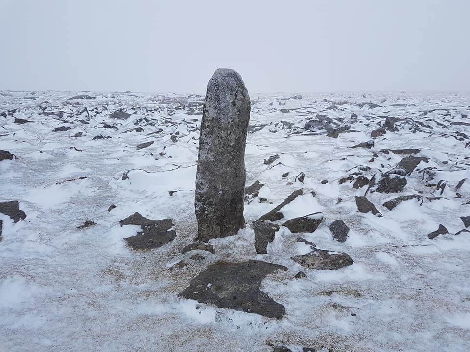
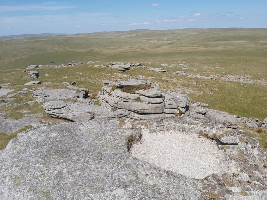
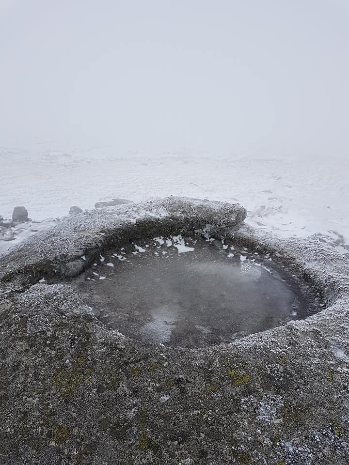
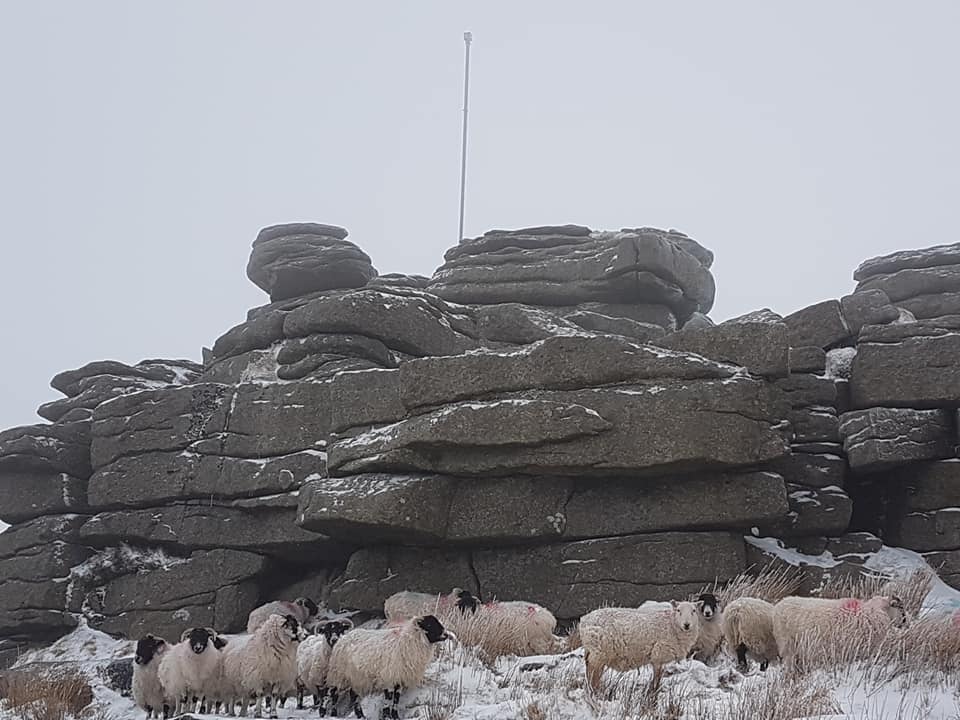
Sketch map of the Dartmoor Forest Boundary between North Hessary and Great Mis Tor and the boundstones between them on both the original and erroneous boundaryDave Brewer in his publication (page 36), re-sketched a map from the Ordnance Survey Boundary ‘remark book’ from 1881. Above is the authors adapted effort on the same sketch which helps to explain the reason why the erroneous boundary was made. The Rundle Stone (or “A Great Stone called Roundle”), which appears to be at the centre of the confusion has been recorded or written about by notable Dartmoor Authors such as: R. Hansford Worth, Mrs Bray, John Lloyd and William Crossing. The Rundle Stone was said to have been inscribed with an “R” and was 7ft (2.13m) tall and 4ft (1.22m) around. With a granite pillar of such dimensions, it is easy to seen why it may have been incorrectly used as an intermediate boundary marker. The original OS sketch from 1881, as recorded by Dave Brewer, unlike the above version, did not show the Rundle Stone, so it is speculated that the stone disappeared sometime before that date. North Hessary Tor. With careful exploration an inscription “PCWW” can be found on the tor which relates to Plymouth City Water Works boundary from 1917. The trig pillar dates from the 1930s.The North Hessary Tor mast was officially opened on 22nd May 1956. In August 1951, when the BBC announced their proposals, North Hessary standing at 1696 ft (517m) above sea level, was deemed the only suitable place for a 5kW television station / mast for maximum coverage of 405 line television to serve Plymouth, Torquay, Exeter and East Cornwall. It was built in 1955 and must have been very controversial for the fledgling National Park. Between 1935 – 1962, Triangulation pillars were established which not only assisted with surveying heights but also assisted with improved accuracy of locations. Many of these pillars, of course use ‘flush brackets’ which had been used since 1912. The North Hessary flush bracket is referenced OSBM 3442. The picture shows a view to Great Mis Tor (in the shade).Not far from North Hessary Tor, a Director of Convicts Prisons (DCP) stone can be located alongside a drystone wall. This stone was erected in 1867 when the Prison Authorities bounds were extended by 1000 acres from the original 390 acres lease. The location of this stone suggests the Prison Authorities used the same “erroneous” boundary as previously mentioned, otherwise this stone would have been erected away from the wall by a few ten’s of metres. It is located at SX57827 74304This upright boundary stone has an upwards arrow inscribed on it. This was a pre-1867 DCP stone, which lies exactly on the original Dartmoor Forest Boundary Line. A letter dated September 1952 (Brewer) records expenses to the erection of two stones, this being one of them. That said, this early DCP stone does appear to be too far west and is misplaced as the prison bounds were never granted on the Dartmoor Forest Boundary. The boundstone should have been erected next to the enclosure wall (as per the DCP in the previous pictures) as this is where their bounds were granted. This boundstone is located at SX57732 74448.At Rundlestone Tor, on the boundary of the Dartmoor Forest / Walkhampton parishes, there is a drill-split granite post which measures 1.2m high, 0.3m wide and 0.25m thick. It is assumed this was erected by the Duchy in 1867 as part of the “correction” for the erroneous boundary. The tor gains its name from the fact it has “roundels” or rock basins caused by weathering, which today have slipped down the east side of the tor.The upright stone at Rundlestone Tor is located at SX57630 74615At the entrance to the private road which leads to North Hessary Tor and mast is a DCP stone inlaid into the road at SX57559 74957. It is almost certain this stone was once upright and dates from 1867. The ‘Rundle Stone’ is believed to have been located near to where the “No Through Road” sign is located today. William Crossing claims the Rundle Stone was broken up when a wall was constructed nearby, therefore, it is not inconceivable that an “R” inscribed stone may be found one day.Opposite where the Rundle Stone would have been and where the DCP stone is inlaid in the road is a Tavistock Turnpike Trust Stone. Described by Crossing as a new stone it is believed to have been located here around 1822 (Source: Tim Jenkinson – 2004). The stone was sketched in the Ordnance Survey Boundary ‘remark book’ from 1881.The Tavistock Trust road was built between 1772 to 1776. The inscriptions on the obtusely angled faces of the stone, which is today is completely illegible reads: Walk / hamp / ton and Lid / ford (Ref: E.N Masson Phillips – 1943). By an act of parliament, the Tavistock Trust (formed in 1762) were bound to erect suitable milestones and boundstones where their roads crossed a parish boundary. Dave Brewer comments that it was the site of the Rundle Stone, which would have caused the Tavistock Trust to site this stone (incorrectly as its 150m inside the boundary). The 1881 sketch by OS mentions this stone and not the ‘Rundle Stone’. So, one can summise that the Rundle Stone was extant in 1822 but had disappeared by 1881.The Tavistock Turnpike Trust parish boundary marker is located at SX57551 74970Next to a stile which leads into the Rundlestone enclosures and for any perambulator to follow the true Dartmoor Forest Boundary is one of the 1867 boundary markers which measures 1.3m high, 0.35m wide and 0.3m thick.The upright boundary marker is located at SX57418 74971Crossing the B3357 and heading up Mis Tor Lane the next 1867 boundary marker can be found. It is behind a wire fence, so the picture has been taken through a gap.The marker stone measures 1.2m high, 0.4m wide and 0.3m thick.This marker stone is located at SX57286 75189Further up Mis Tor Lane the next 1867 boundary marker can be found. It is to the east of the main track near a right angle of two drystone walls. It measures 1.2m high, 0.3m wide and 0.25m thick.This marker stone is located at SX57213 75315A snowy Mis Tor lane from March 2018‘Mis Tor Farm’ as shown on modern mapping. However, it was shown as ‘Mount View’ on the late 19th and early 20th century maps. R.G. Haynes in the 1960s suggested when being demolished, explosives may have been used and was left as “an enormous pile of featureless rubble”. As Mis Tor Lane enters open moorland, the next 1867 boundary marker can be found. The marker stone has a slight lean to the south-west and measures 1.5m high, 0.4m wide and 0.3m thick.The marker stone can be found at SX56917 75807Looking south towards North Hessary (in the mist) near the boundary marker. This photograph was taken in November 2020, whilst the author was completing his fourth “perambulation”.Next to the gate shown in the previous photograph another 1867 DCP stone can be found at SX56939 75799Just outside the New Forest Newake there is another 1867 Forest boundary marker. It measures 1.4m high, 0.25m wide and 0.25m. Great Mis Tor can be seen in the background.This boundary marker is located at SX56661 76237At the north west corner of the New Forest Newtake is another 1867 DCP stone.This DCP stone is located at SX56574 76410New Forest Corner recumbent BS at SX56565 76417. Picture courtesy of Mark FenlonThe final 1867 Forest Boundary marker can be found just below Great Mis Tor. The stone stands 1.65m high and measures 0.4m wide and 0.3m thick at its base. The boundary marker taken in March 2018. It is located at SX56343 76784The original Dartmoor Forest Boundary would have been defined by a line through Mistor Pan but this changed when an iron bar (cobra), similar to the ones found at South Hessary Tor and on Eylesbarrow Hill was placed at the centre of the same eastern pile of rock. The “Cobras” were mentioned in the Ordnance Survey Remark Book of 1881, but is no longer extant. It was marked “WB” and FB” for Walkhampton Bounds and Forest BoundsA frozen Mistor Pan from March 2018It is likely that to old Great Mis Tor “cobra” is where the military have erected a flag pole. The picture shows sheep sheltering from a bitter easterly wind in March 2018.