A collection of walks, discoveries, insights and pictures of exploring Dartmoor National Park
August 12, 2021
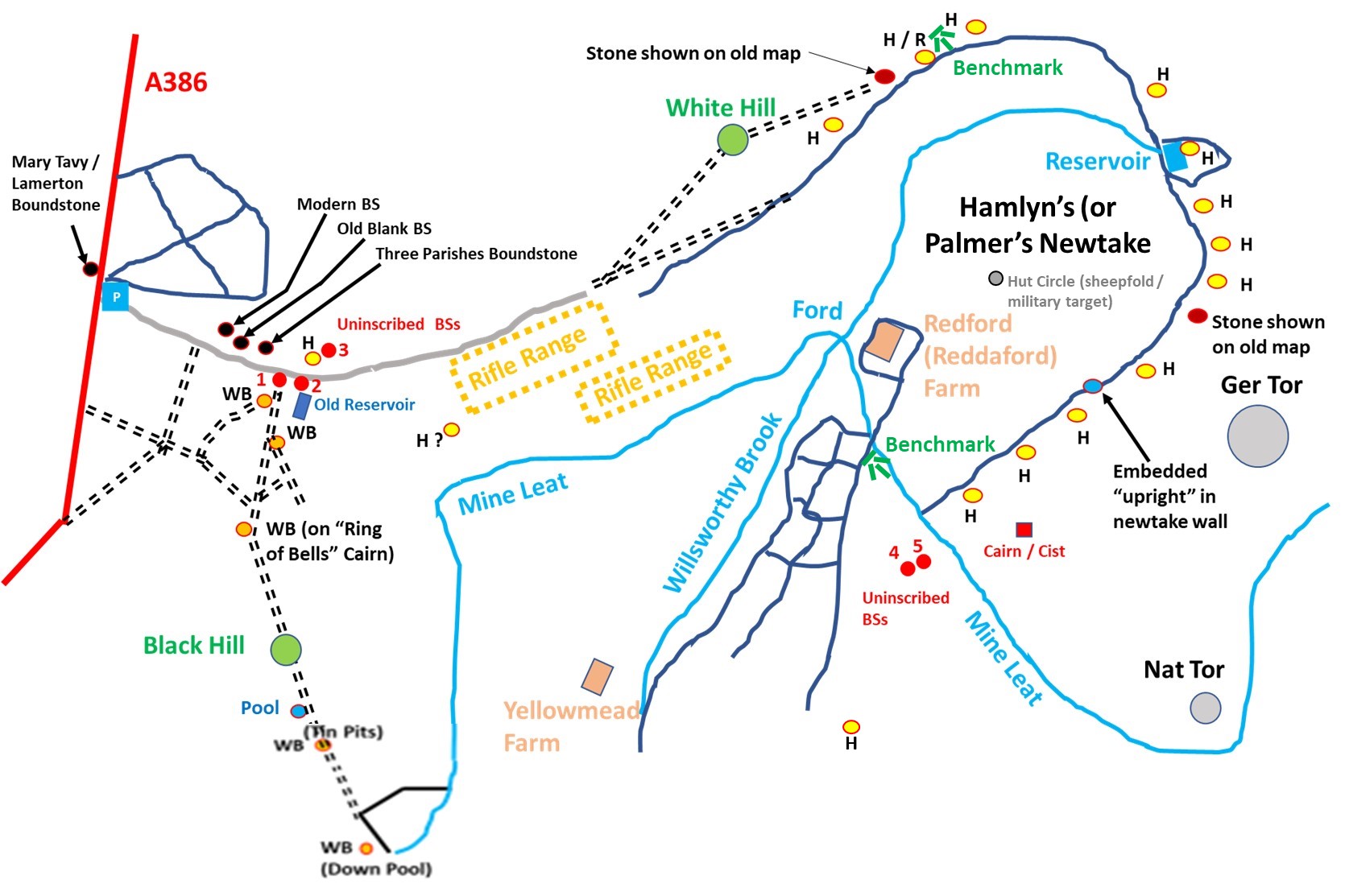
Willsworthy Manor (“WB”) and Hamlyn Newtake (“H”) Boundstones
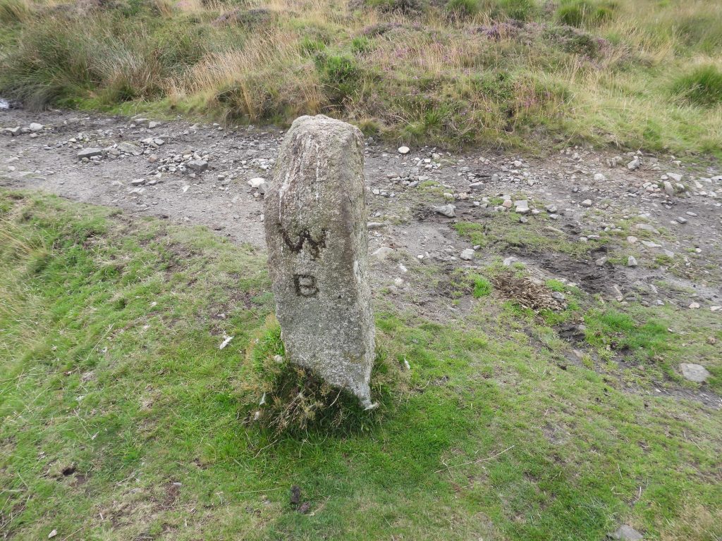
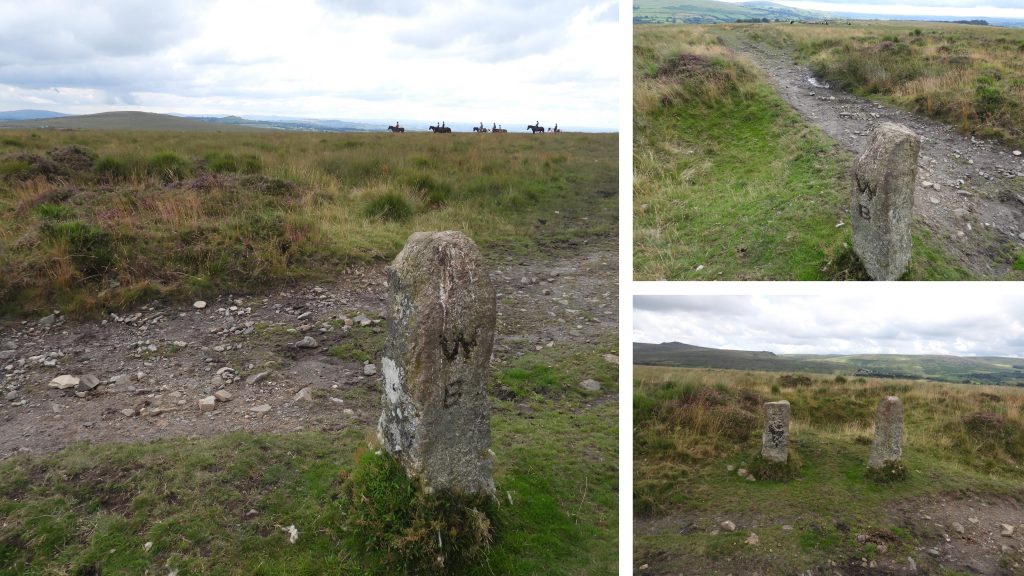
The Willsworthy Range is located on a tract of land that the War Department purchased in 1903. The route follows virtually the line of the old Willsworthy Manor bounds, with some slight variations (of about 3200 acres) which were purchased from the Calmady-Hamlyn family. Defining part of the western bounds of the former manor are five 19th century stones inscribed “WB” from Down Pool, through Tin Pits and Ring of Bells to the Willsworthy Range access road.
William Crossing in his ‘guide’ (page 167) under ‘Excursion from Lydford’ records the Hamlet of Willsworthy, thus: “From Buddla Corner on Black Down, by the Bondstones running by Down Pool, Tin Pits and the Ring o’ Bells to Prescombe Corner; thence to Sounscombe Head and Sounscombe Foot and Beardon Gate; thence to Lissicombe Head and down the hill to Lissicombe Foot; thence to Greenwell, and across the marsh to the Walla Brook, and up that stream to a bond mark in Doe Tor Bottom; from Walla Brook Head to a cairn* between Hare Tor and Sharp Tor; thence to Dead Lake Head and so down to the Rattlebrook; thence to the Tavy, and up the Tavy to Red Lake Foot; up Red Lake nearly to the head, and thence to a pile of stones; thence to the head of Bagga Tor Brook, and down the Brook by Bagga Tor Farm and Hare’s Double to the Tavy; thence down the Tavy to Hill Bridge, and up by the stream on the edge of Chilly Wood to the enclosures, and thence to Buddla Corner”.
* The cairn between Sharp Tor and Hare Tor is known as ‘Hay Tor Bound’ (Hare Tor and Little Hare Tor sometimes being referred to as Great Hay Tor and Little Hay Tor). The ‘Hay’ is a corruption of ‘Hey’ meaning high place.
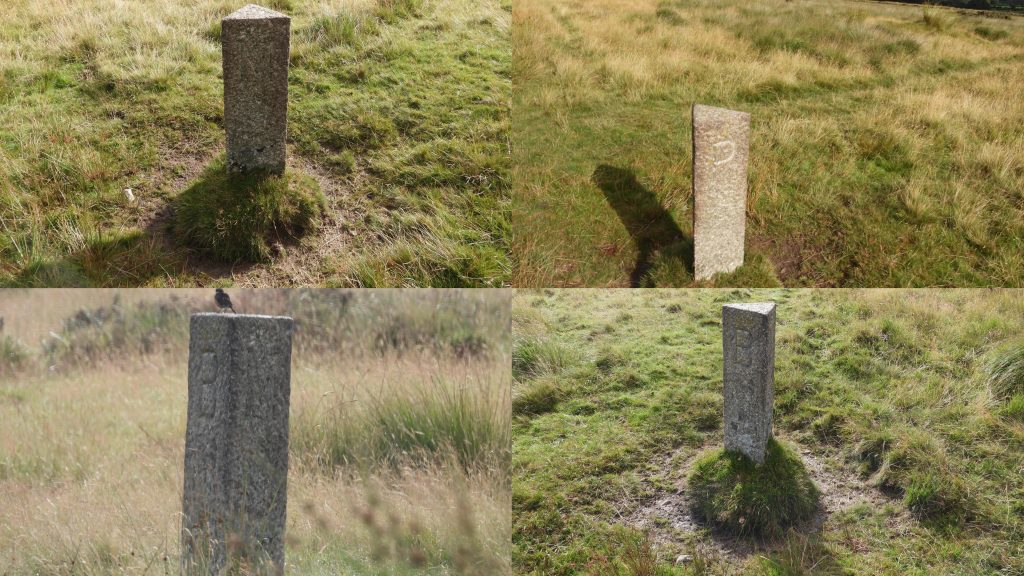
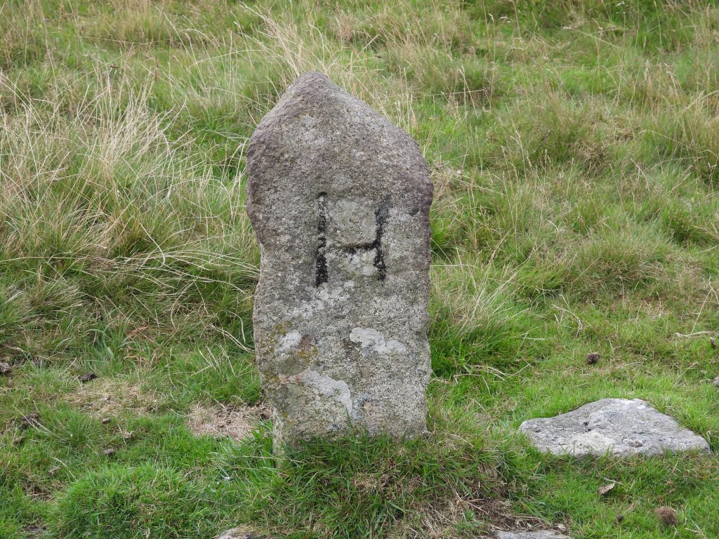
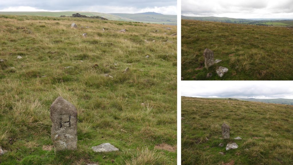
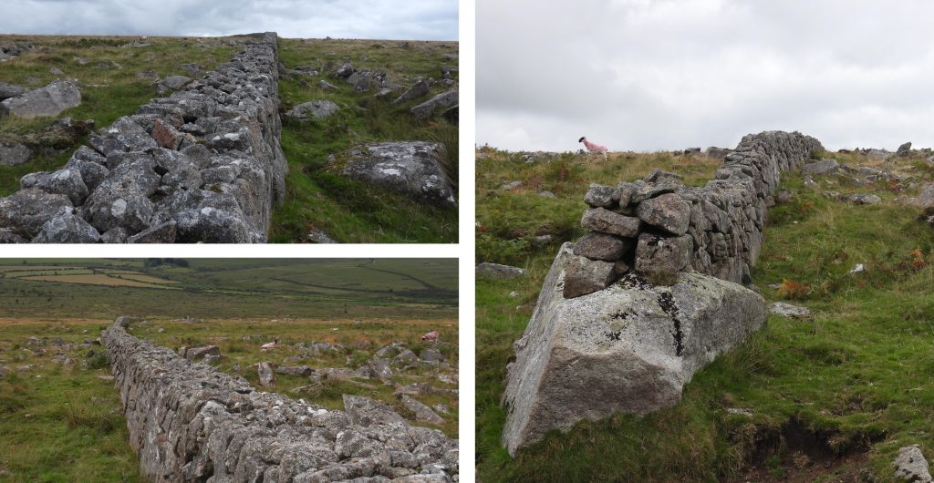
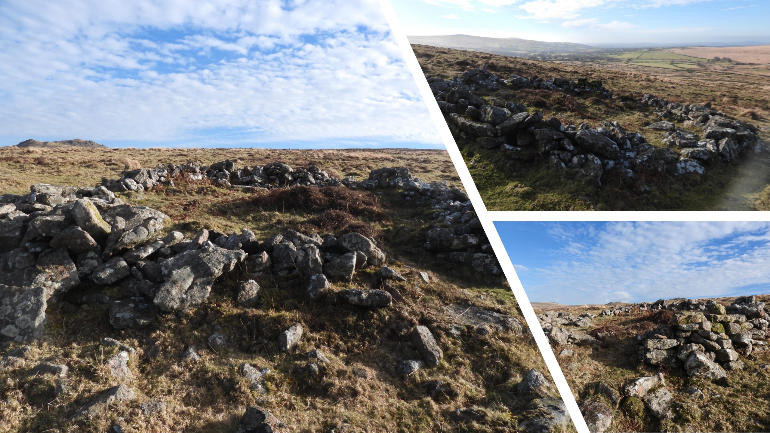
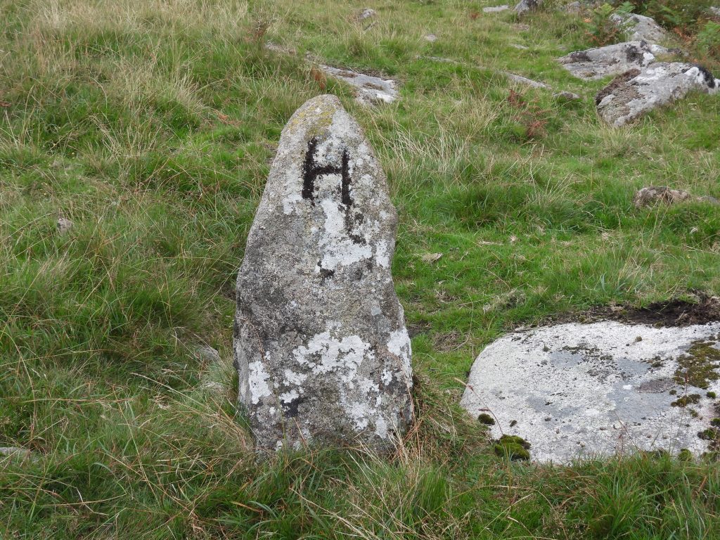
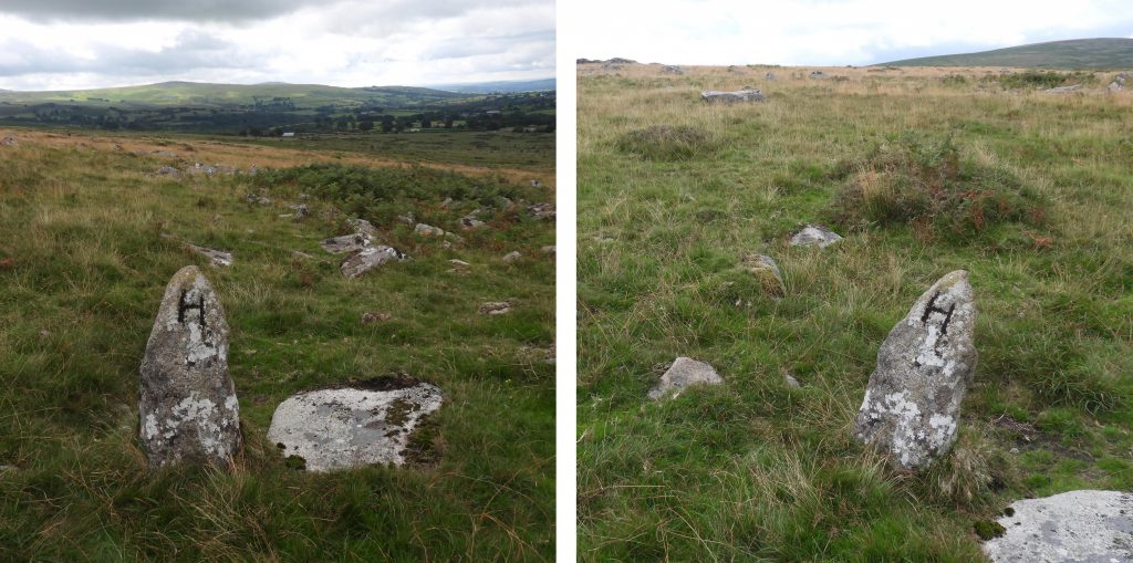
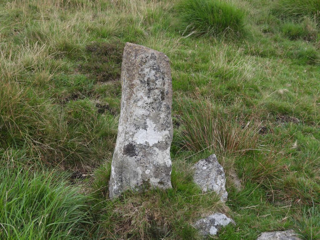
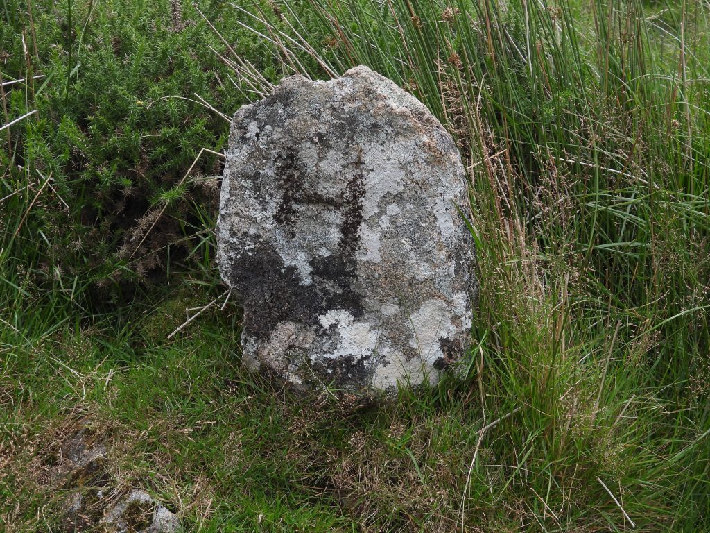
Further to these Willsworthy Bounds (WB) stones in the area, there is also a series of older “H” stones which relate to the Hamlyn family and an enclosed area of land (newtake). Much of the ‘Hamlyn’ Newtake (also known as Palmer’s Newtake) is defined by a reave, broken bank or a rather magnificent granite block wall. Eric Hemery calls the enclosure ‘Palmer’s Newtake’ and it is intriguing to note that he describes one of the ‘H’ stones as being associated some late 18th century moor ‘improver’. The “H” stones are all roughly set and most lie close to the newtake wall. There are, however, three other locations).
The main theme of the post is the “WB” and “H” Boundstones. However, other features in the area as shown on the sketch map also recorded.
Bibliography
Dave Brewer – Dartmoor Boundary Markers (2nd edition).
William Crossing – Guide to Dartmoor
Eric Hemery – High Dartmoor
Mike Brown – Gazetteer of Dartmoor Names
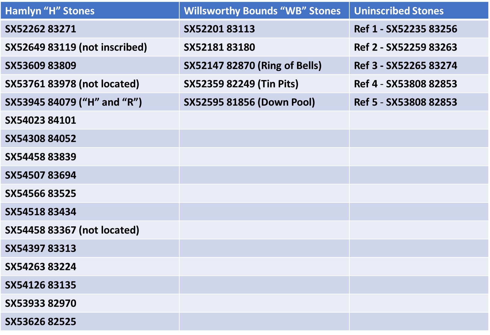
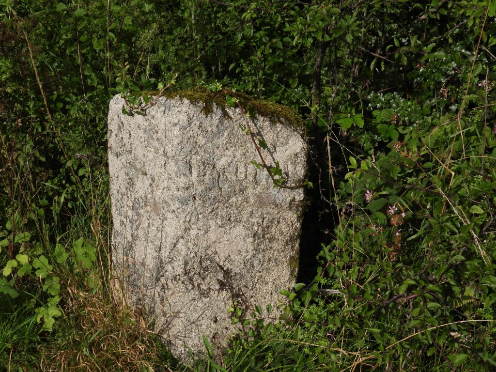
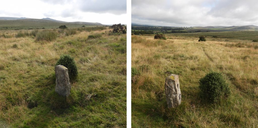
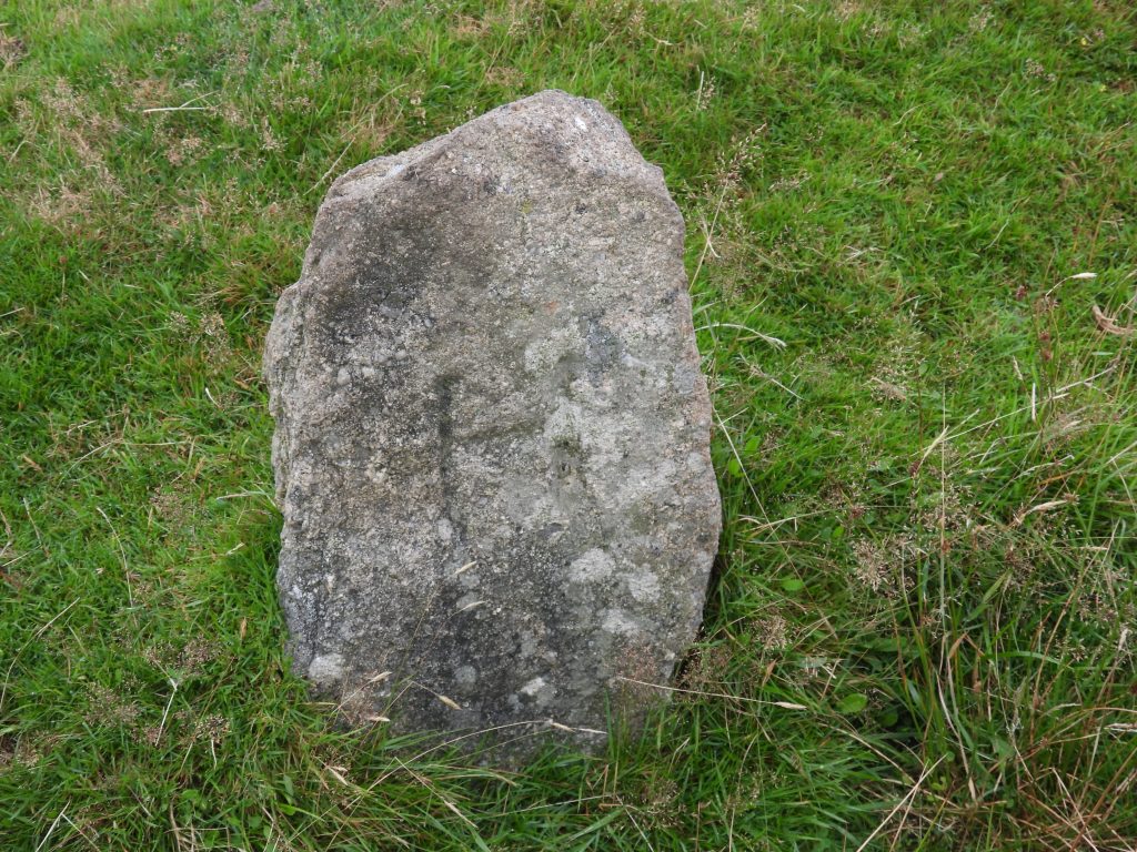
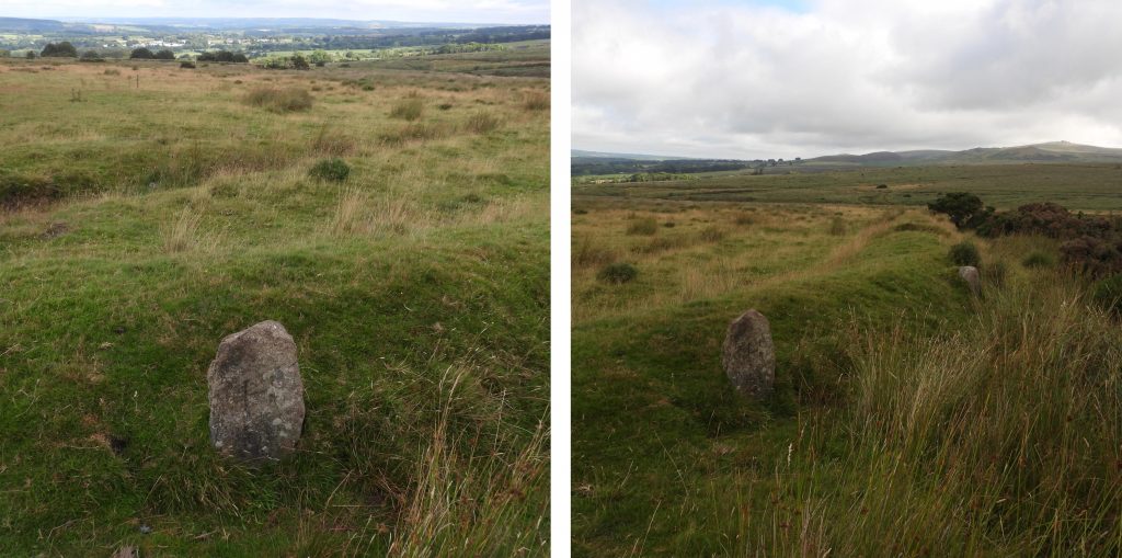
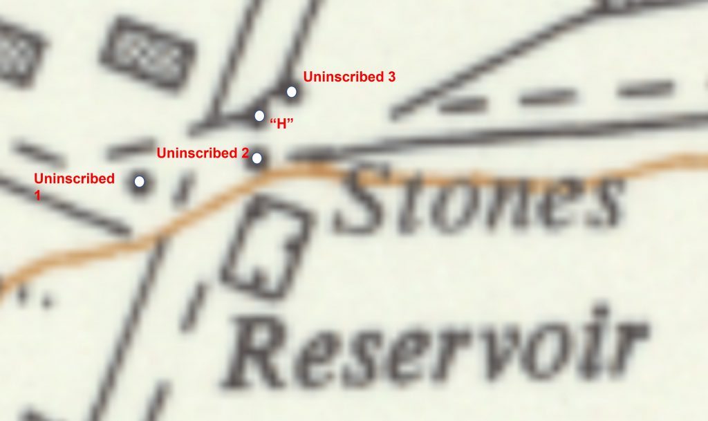
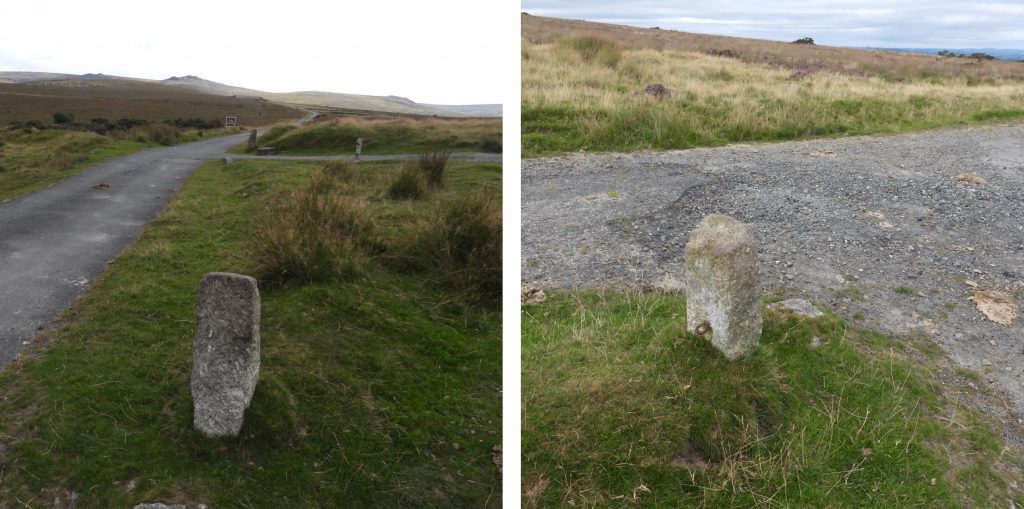
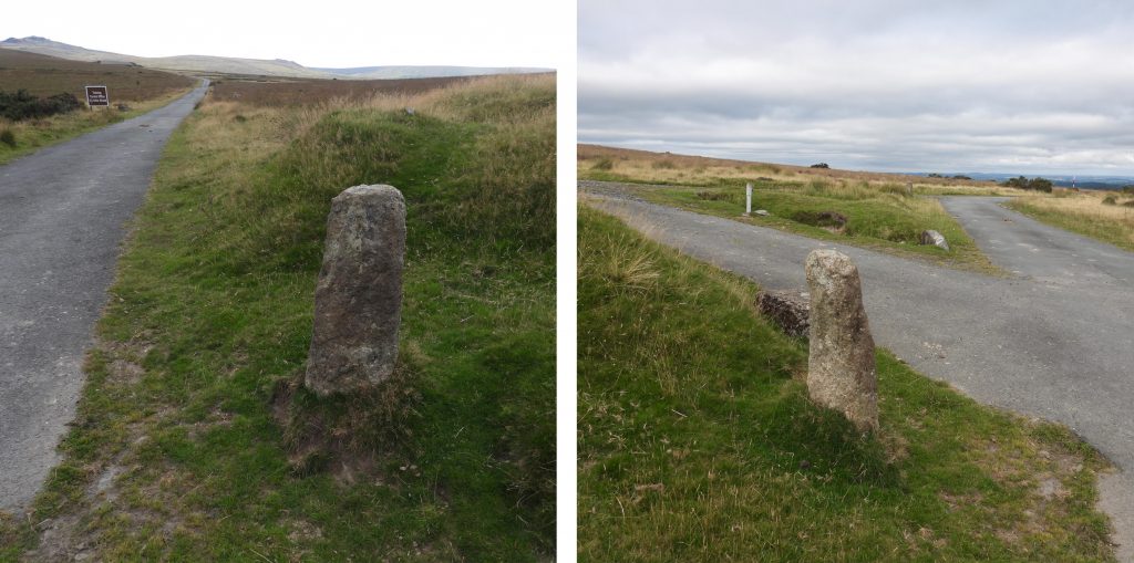
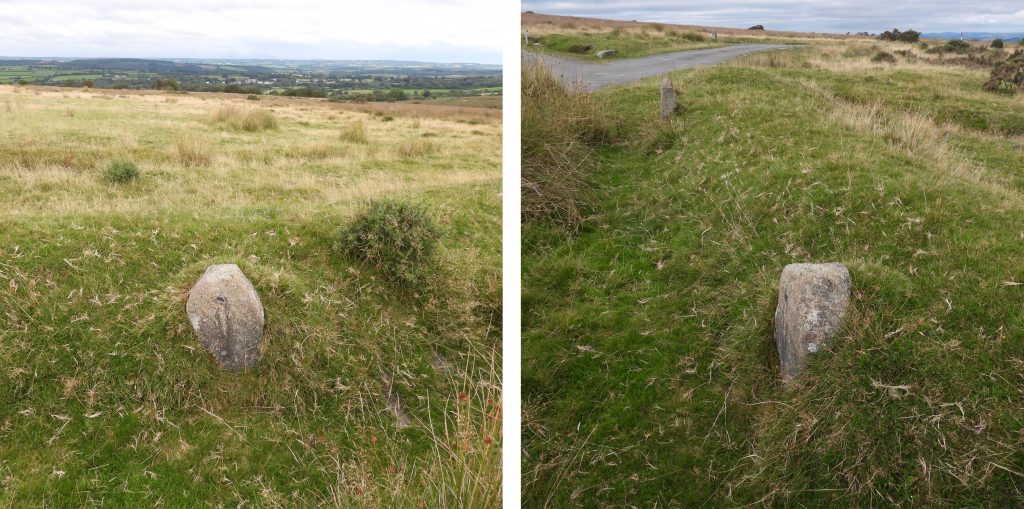
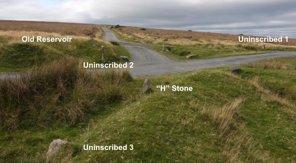
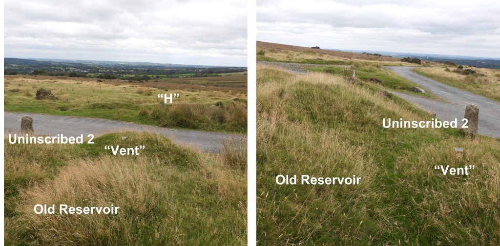
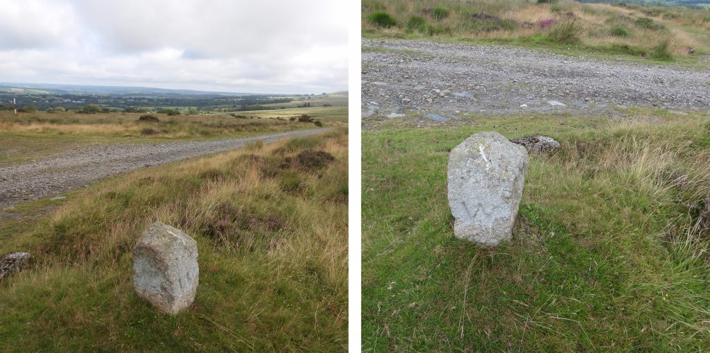
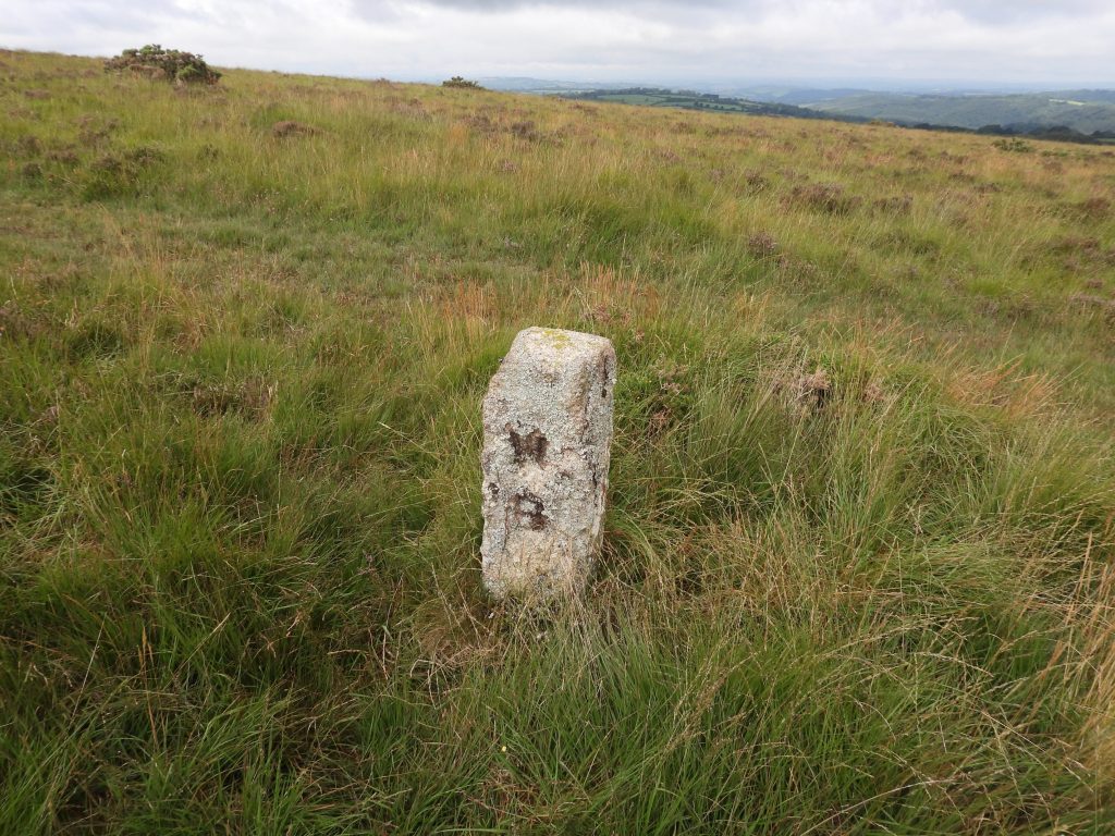
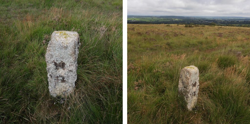
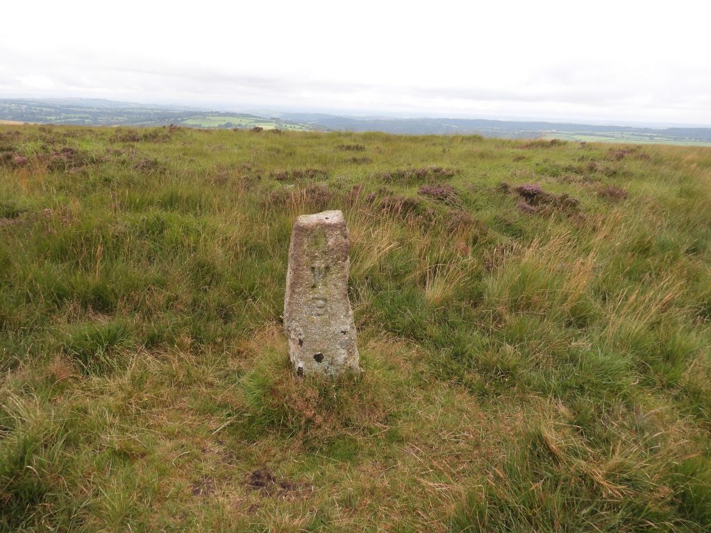
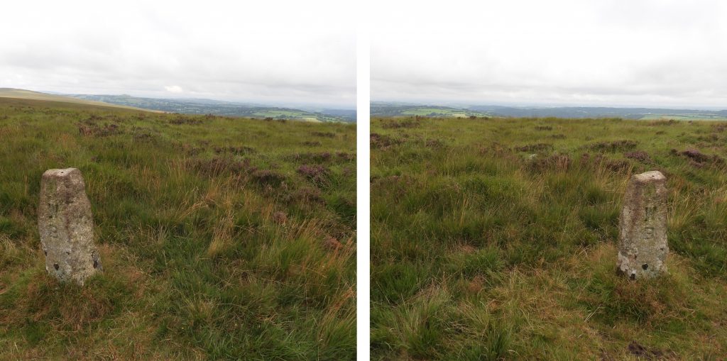
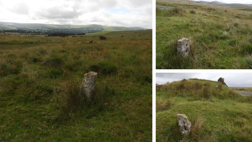
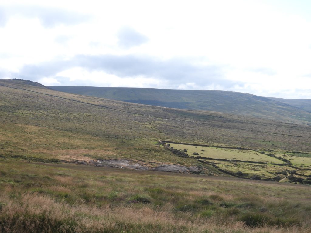
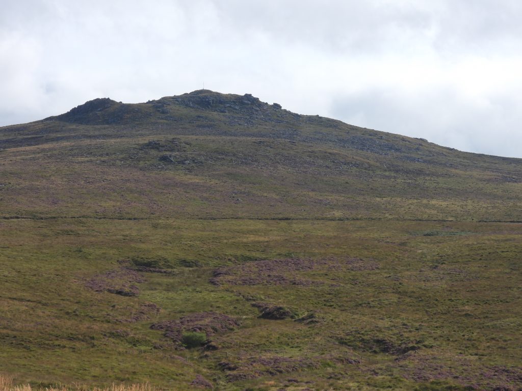
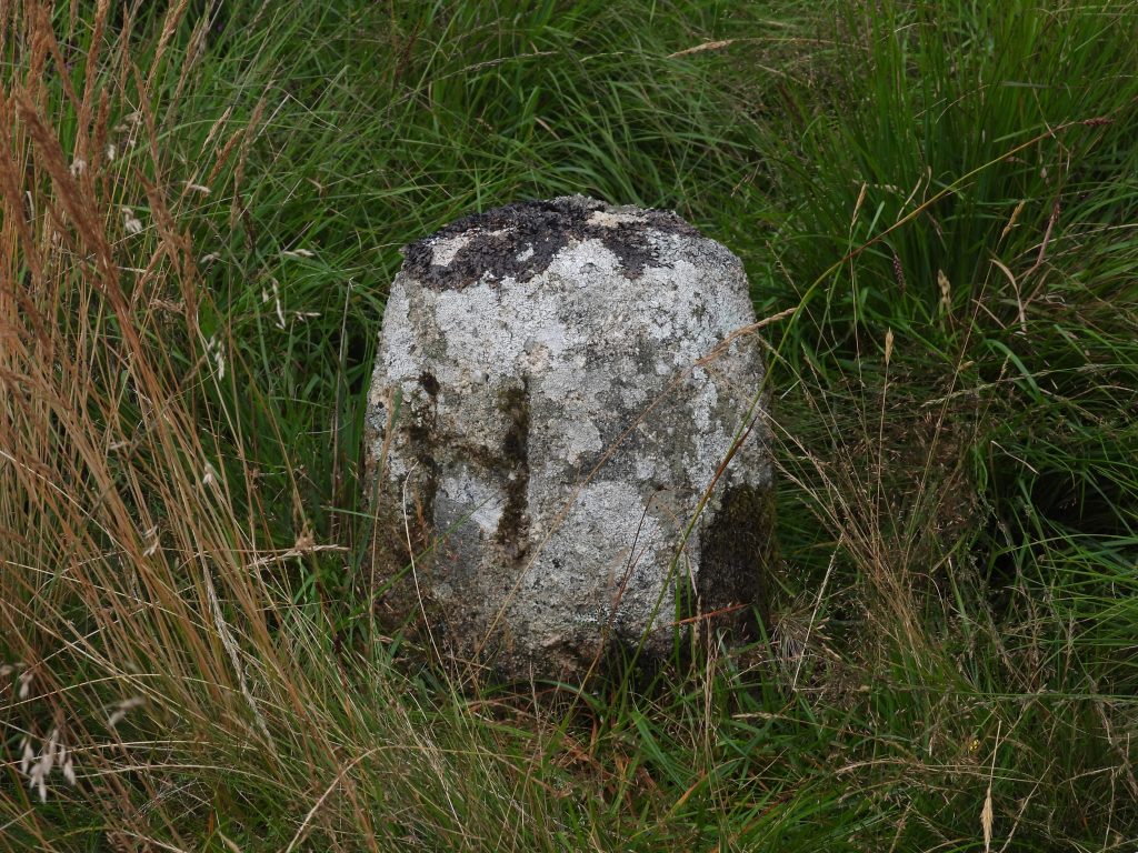
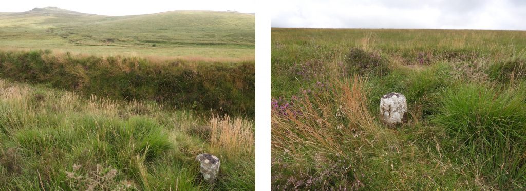
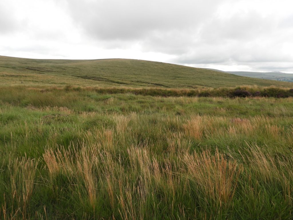
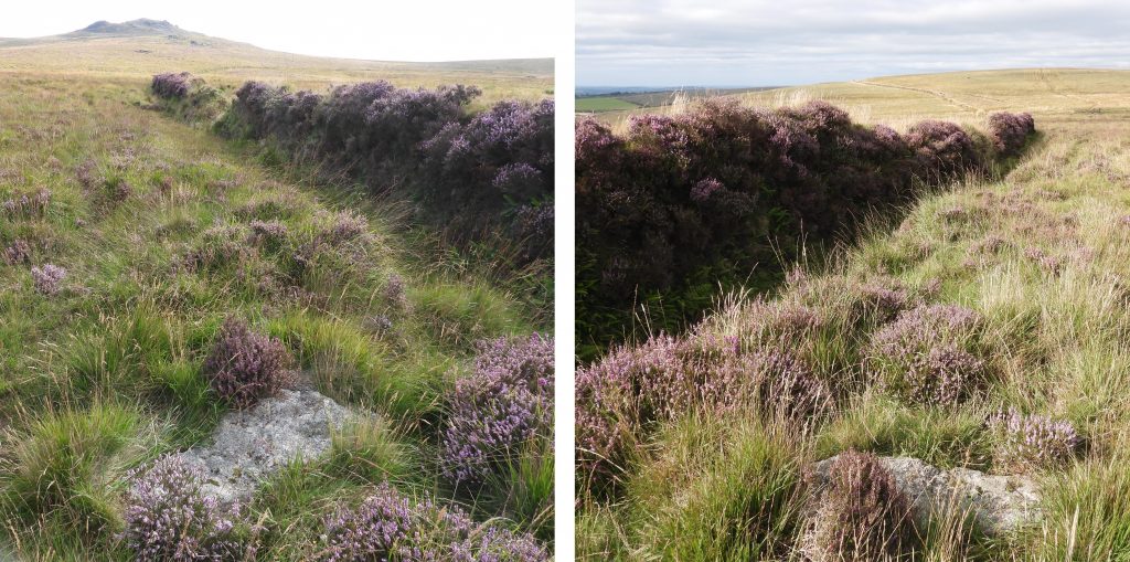
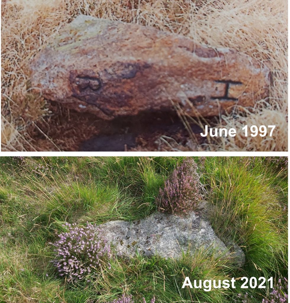
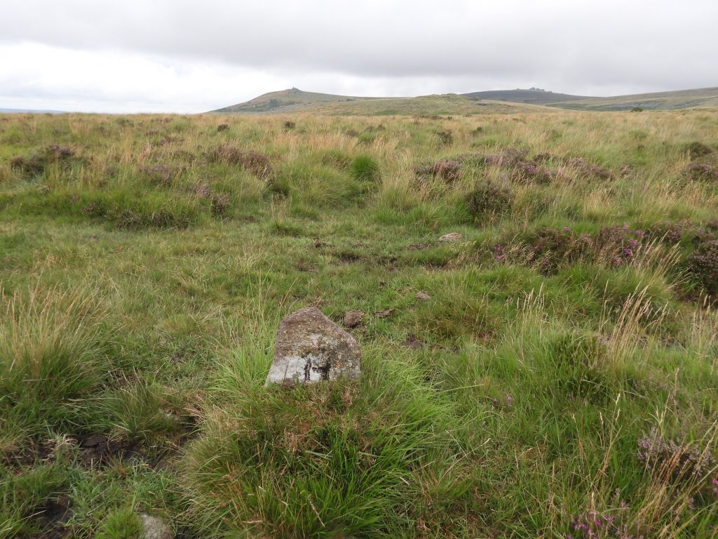
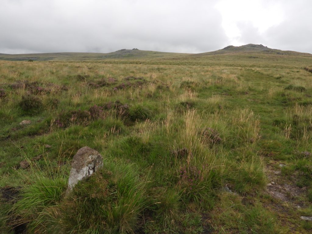
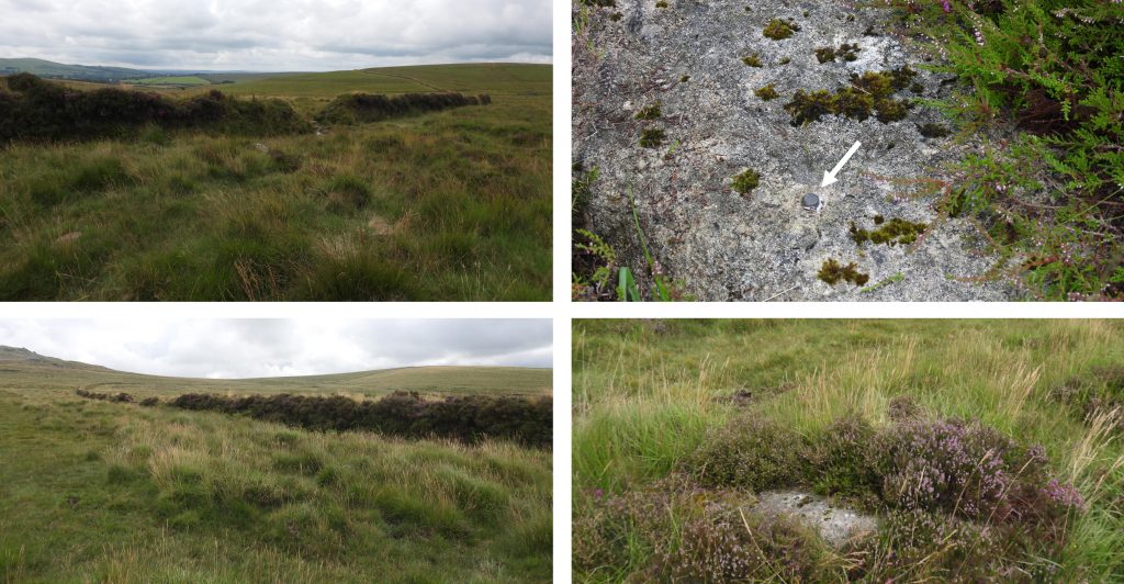
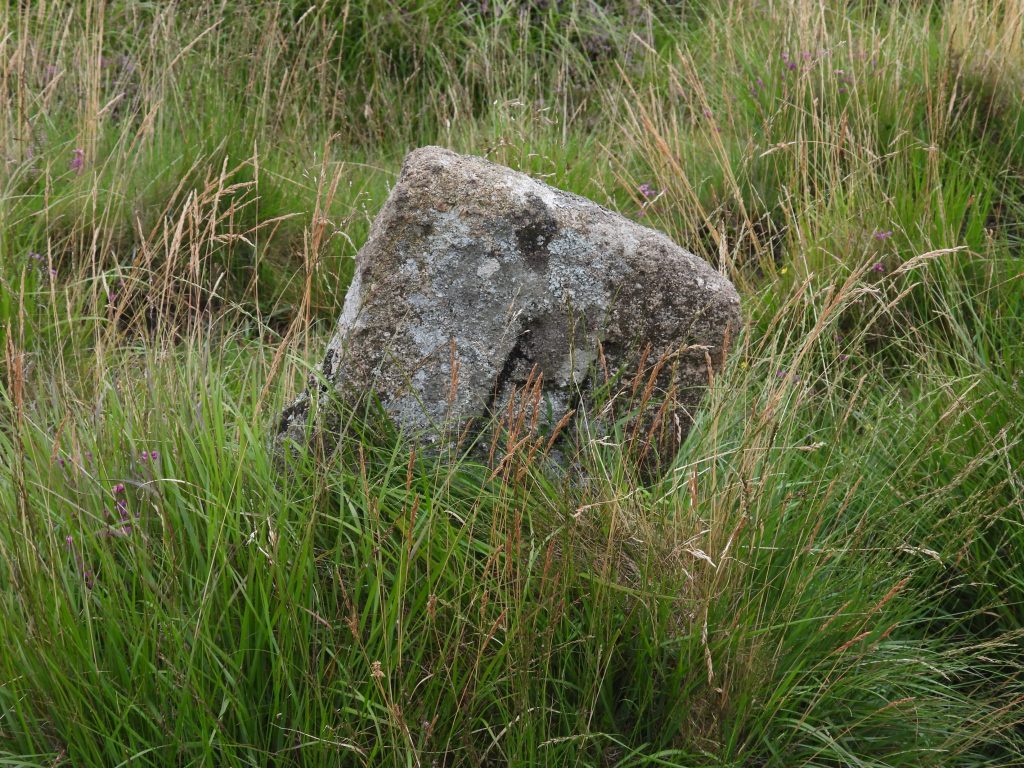
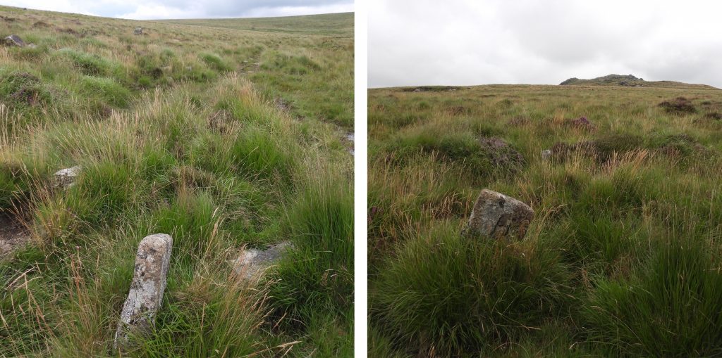
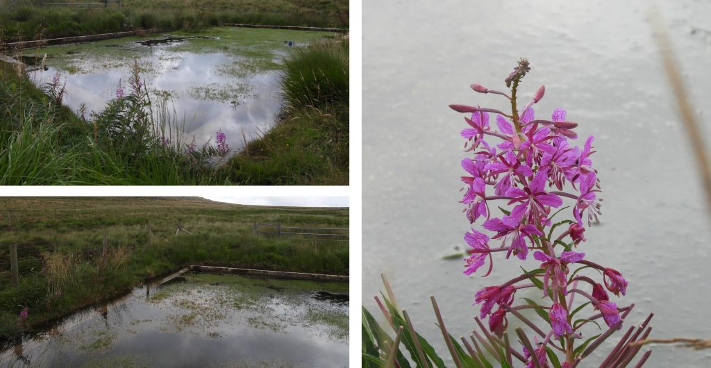
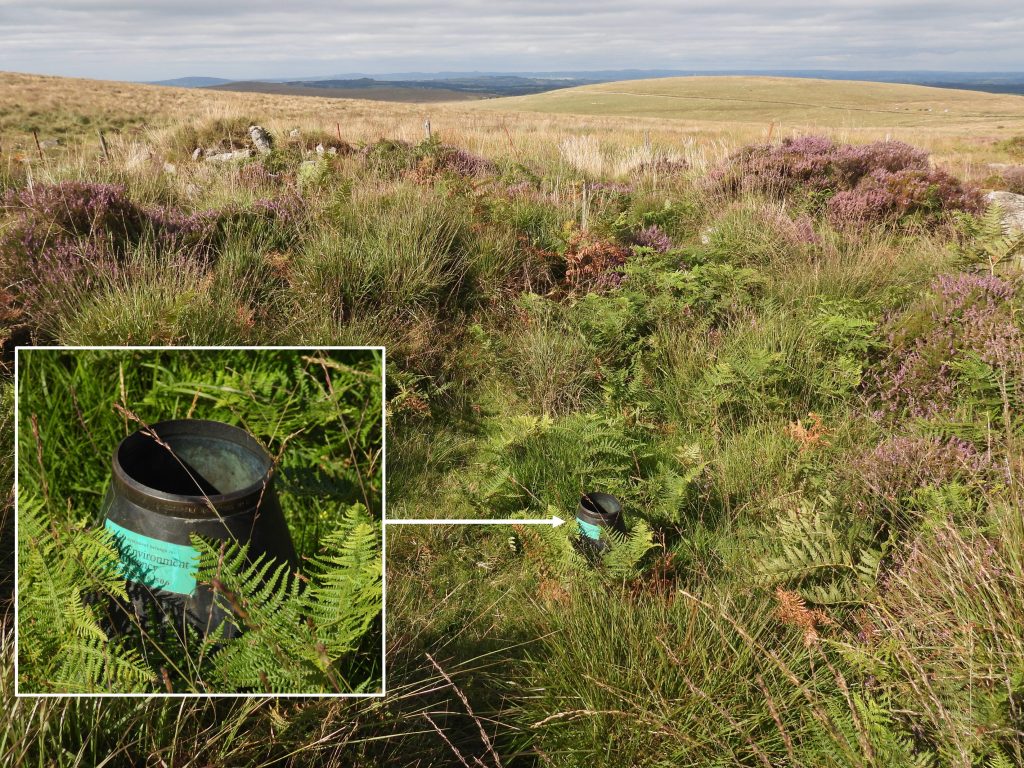
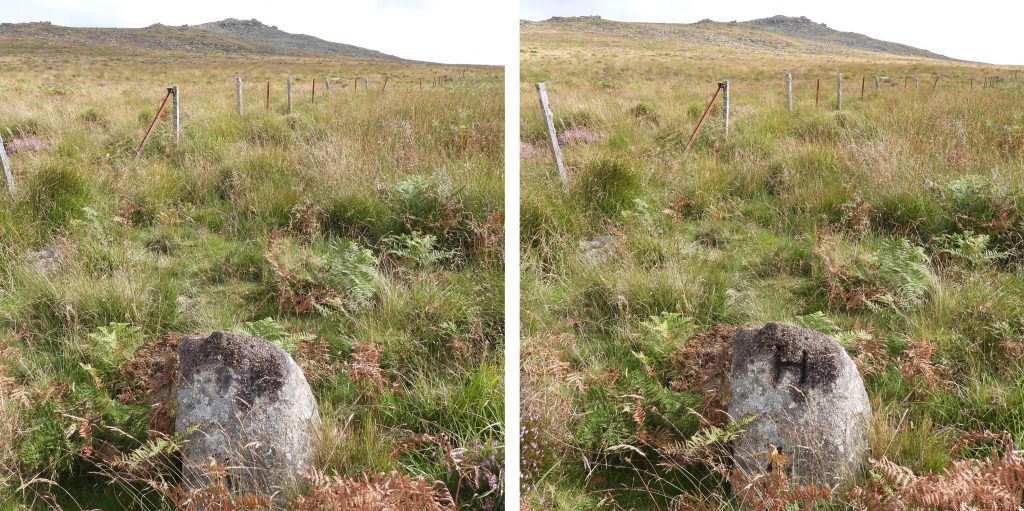
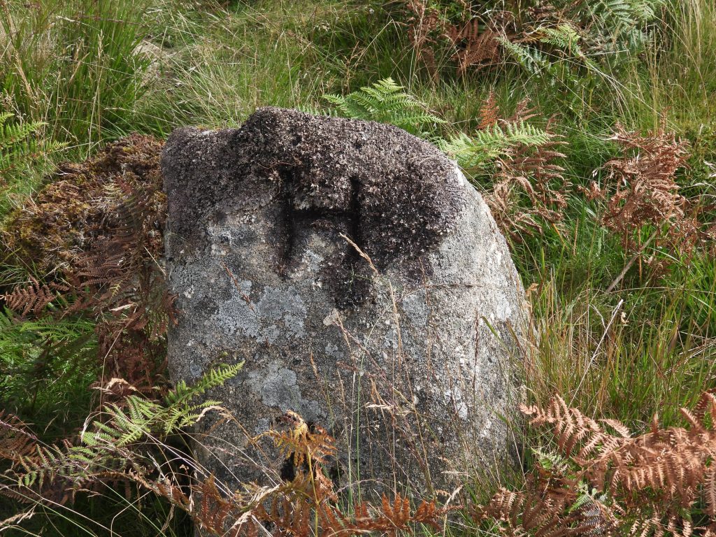
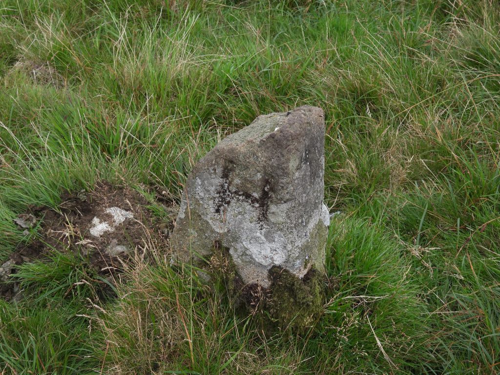
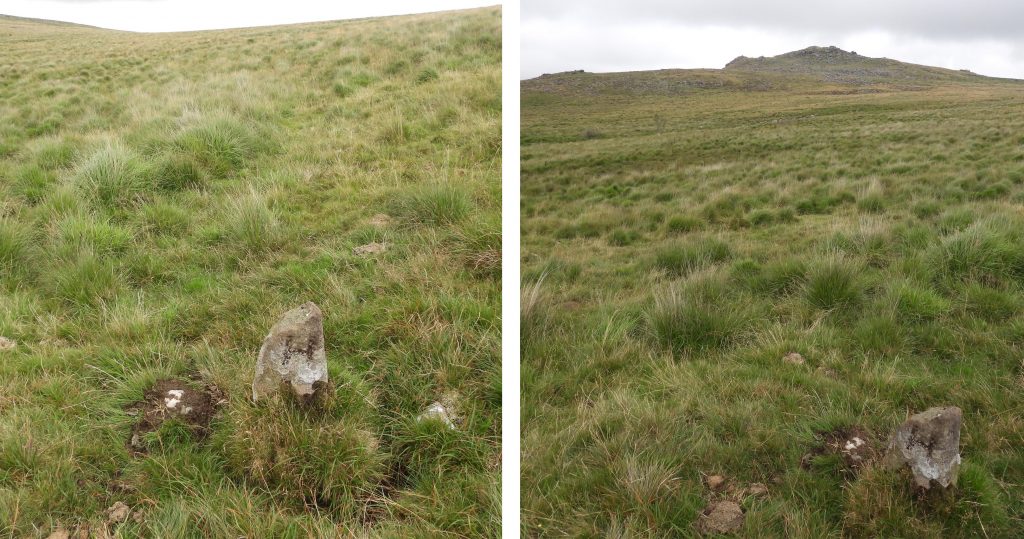
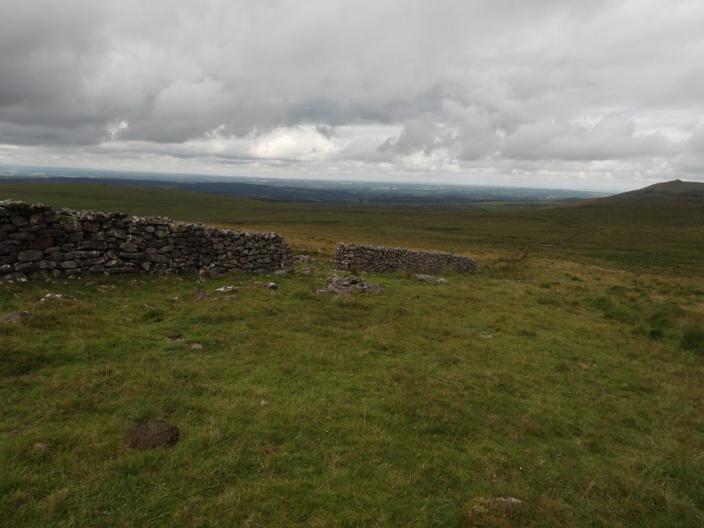
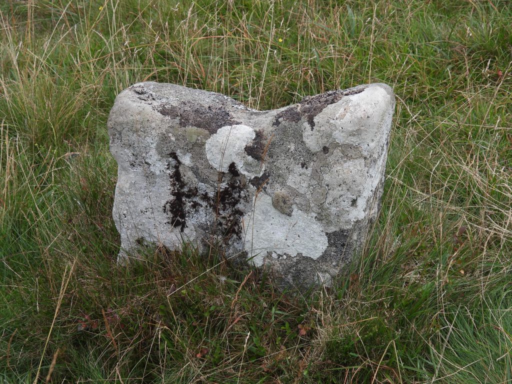
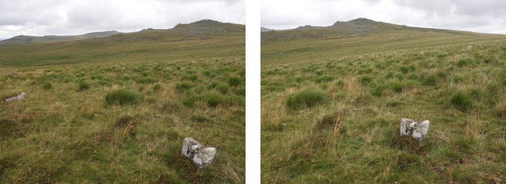
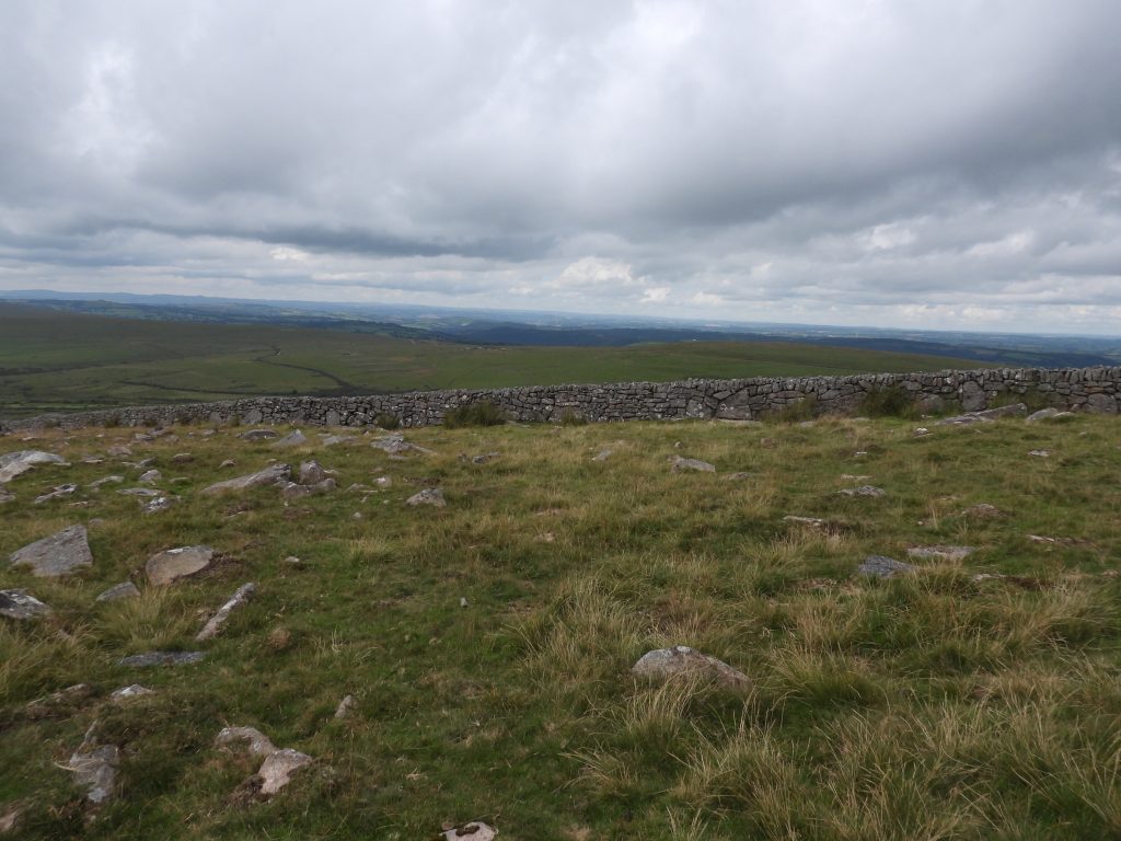
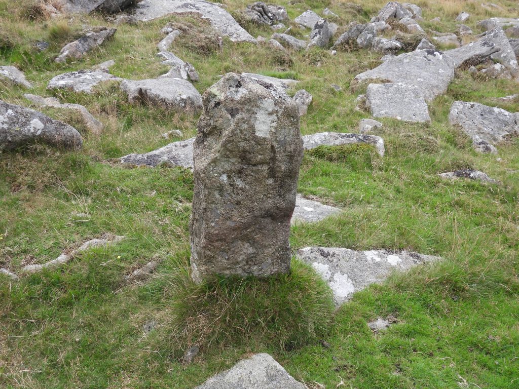
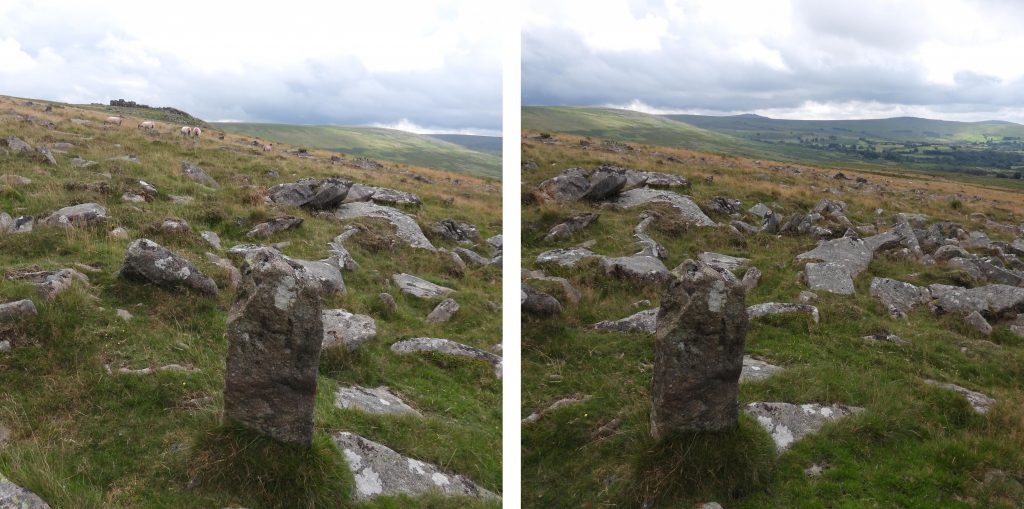
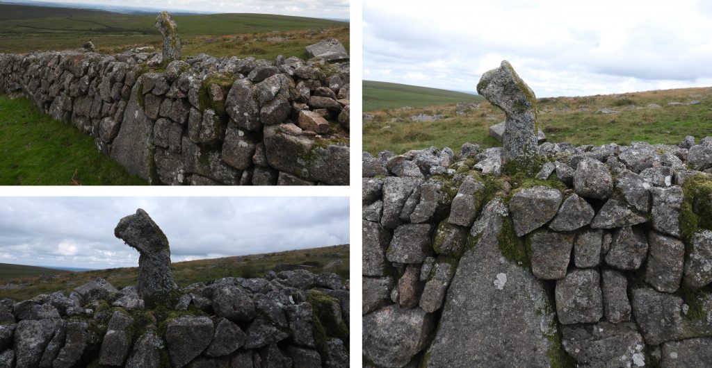
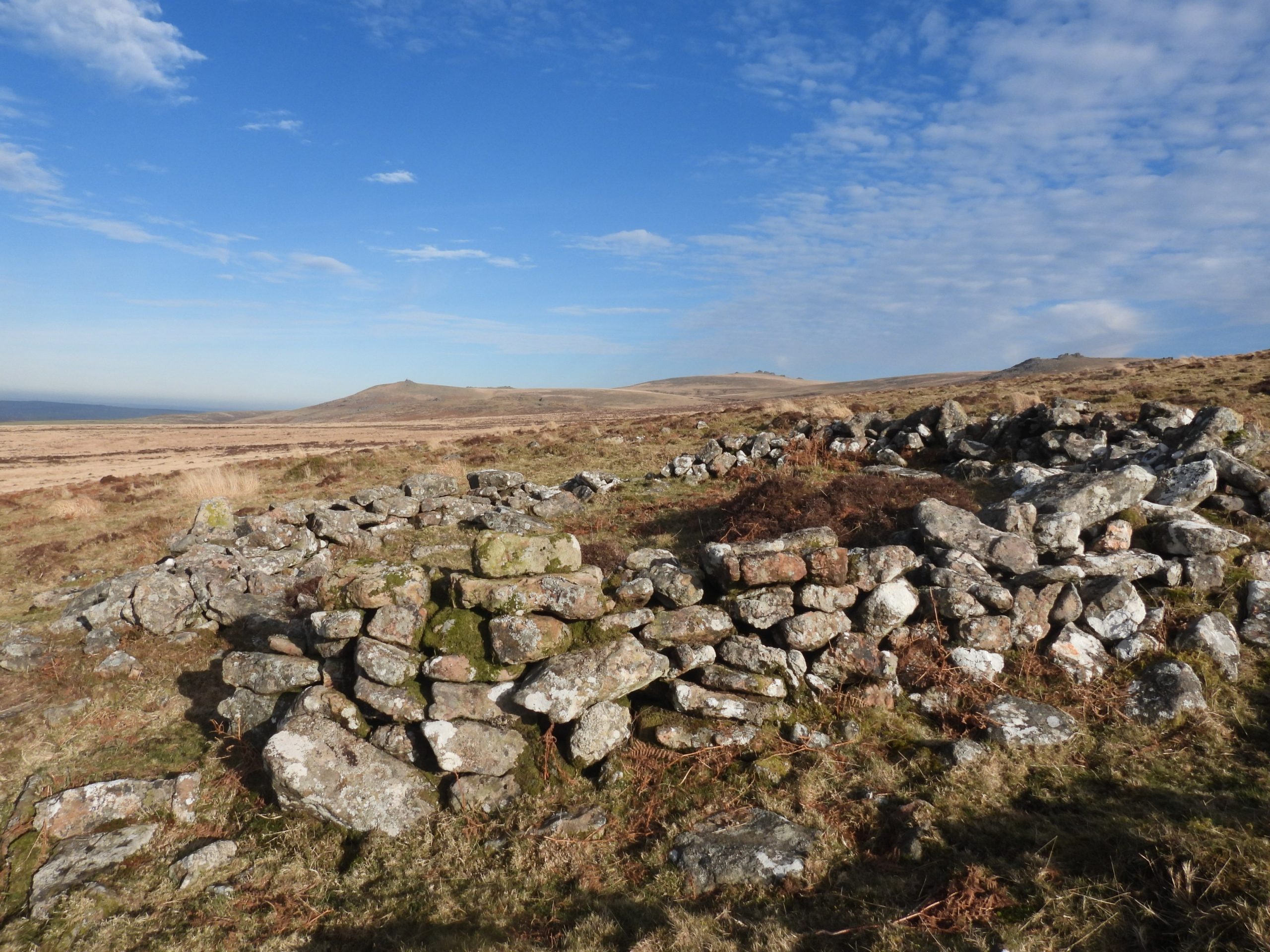
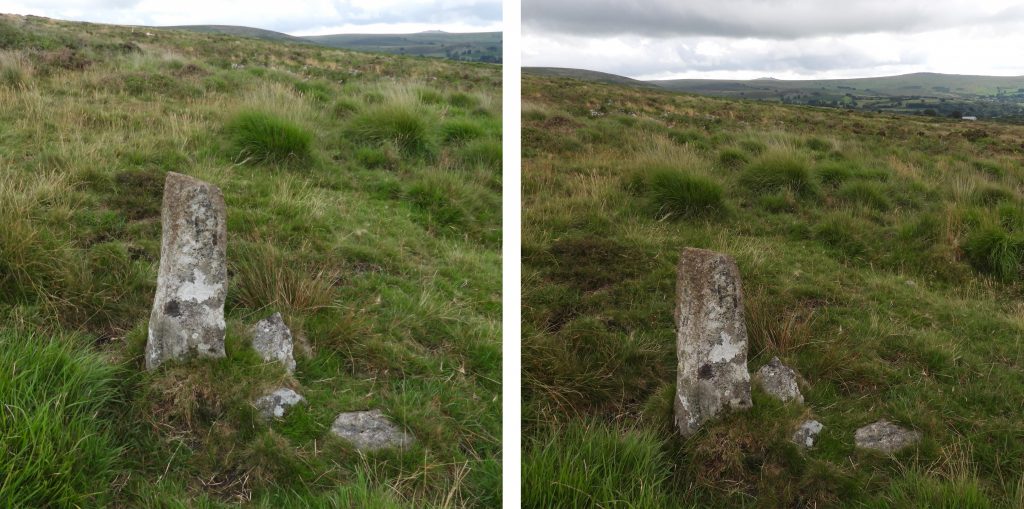
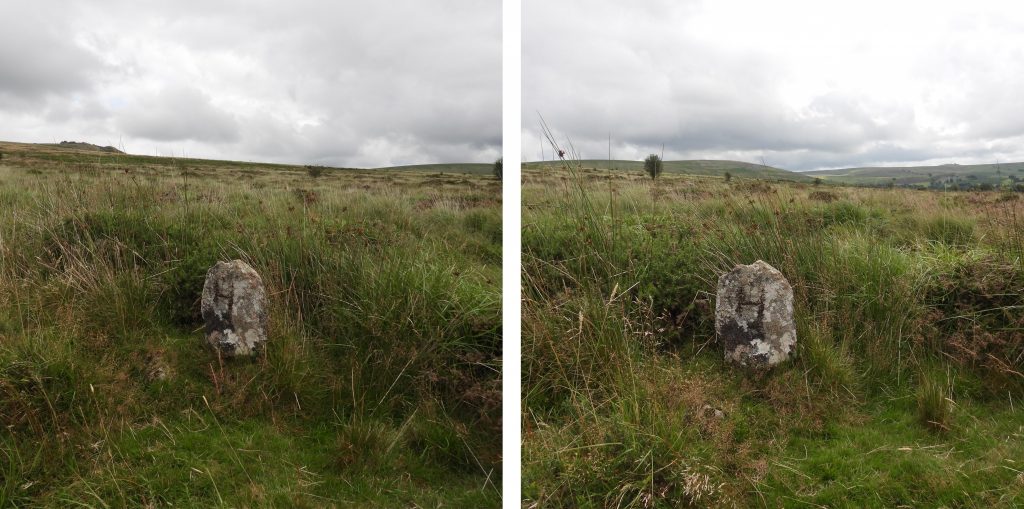
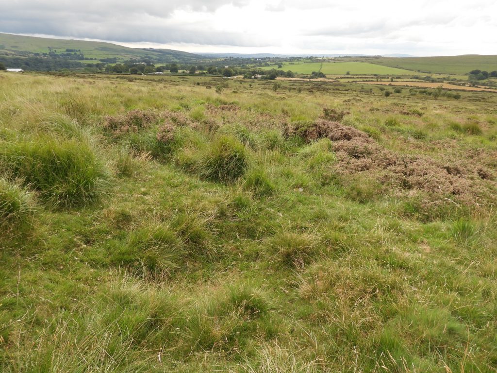
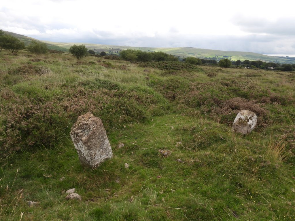
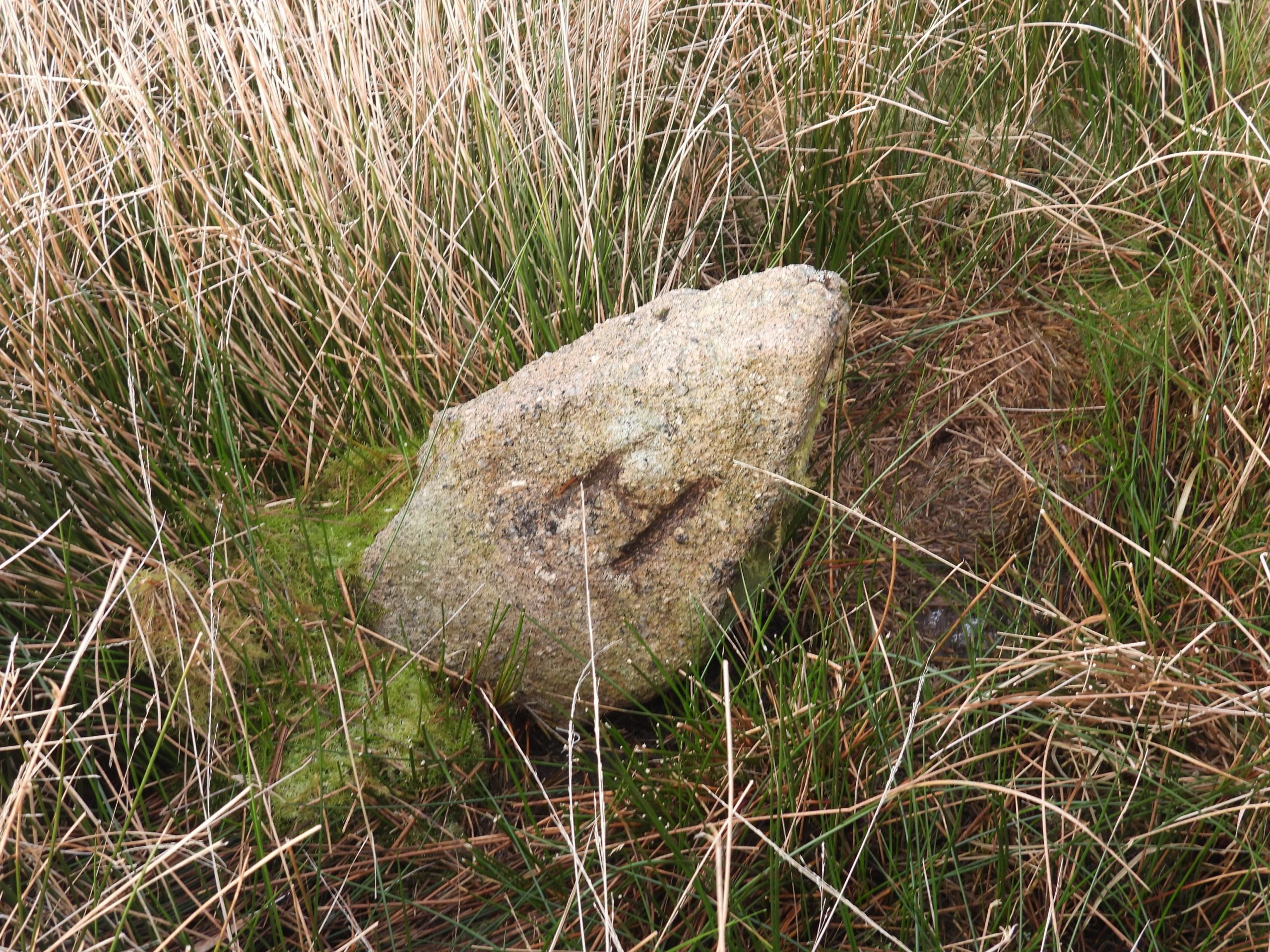
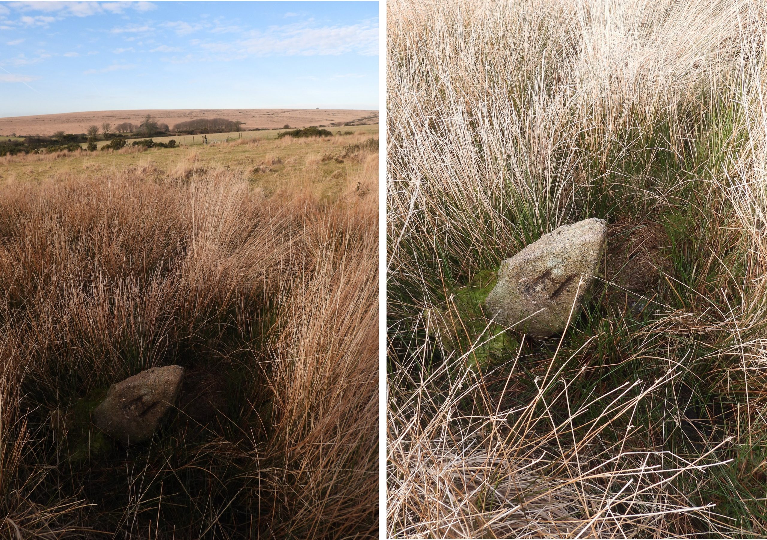
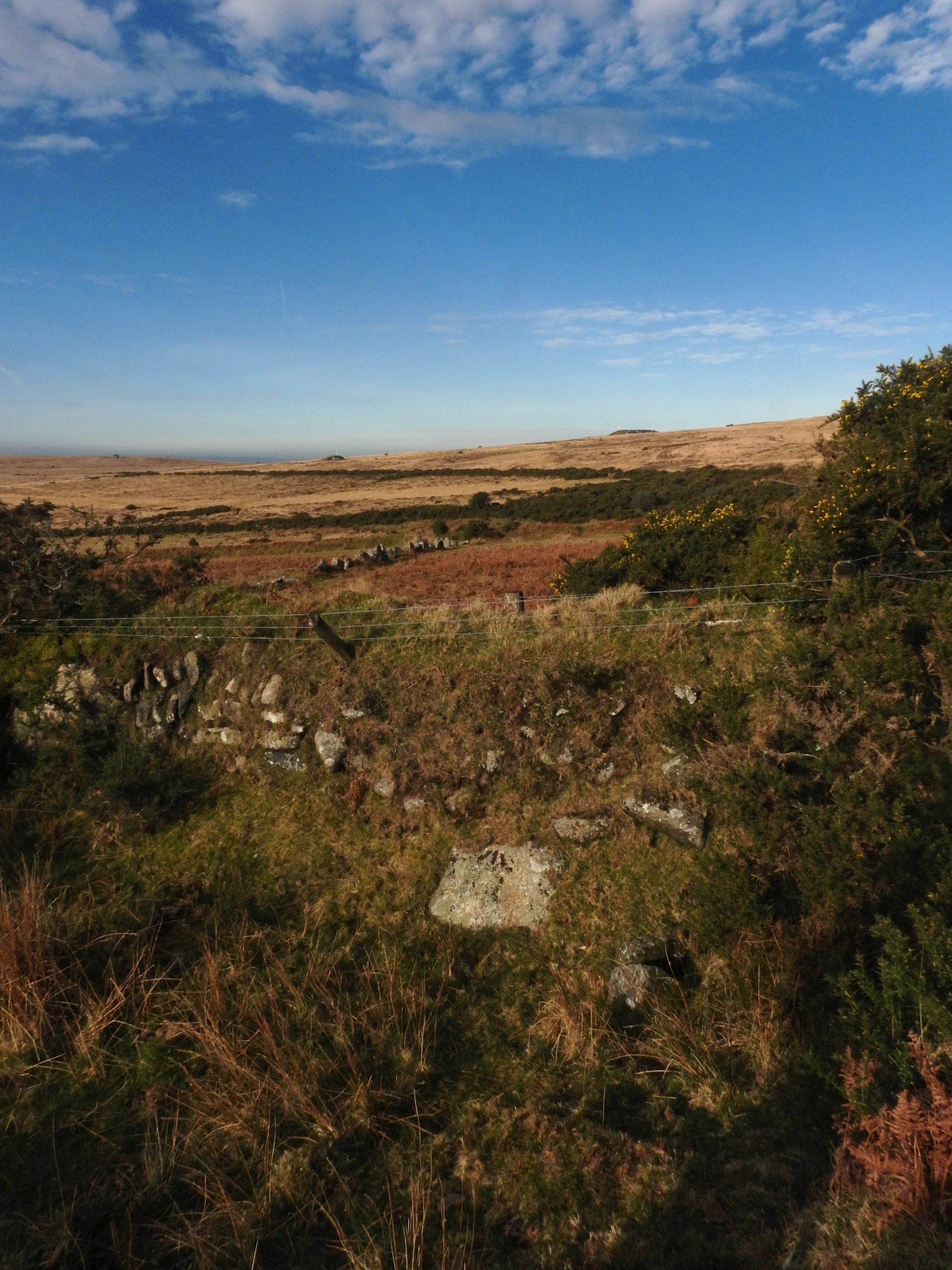
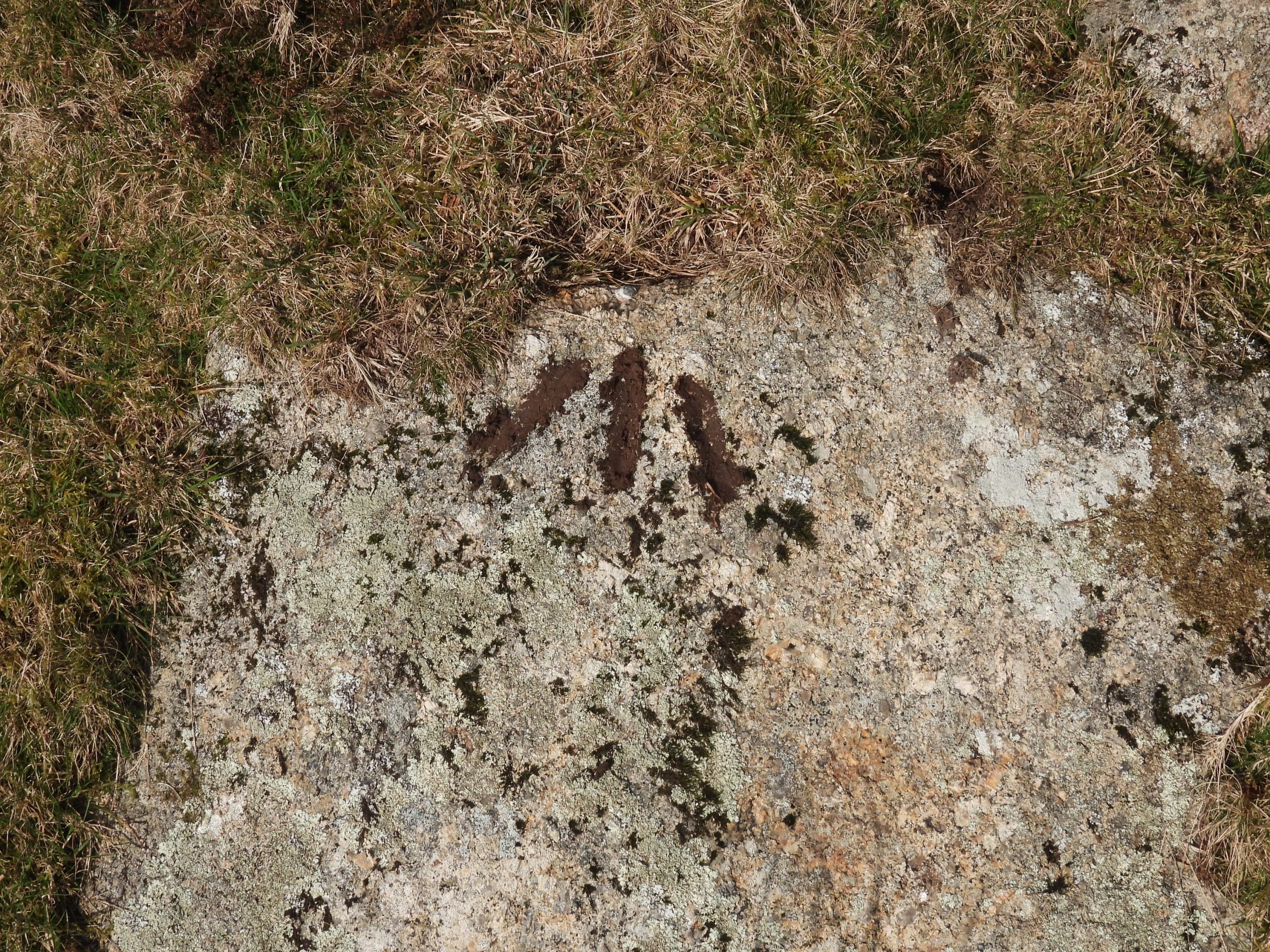
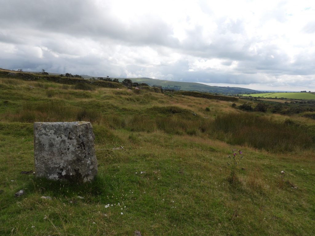
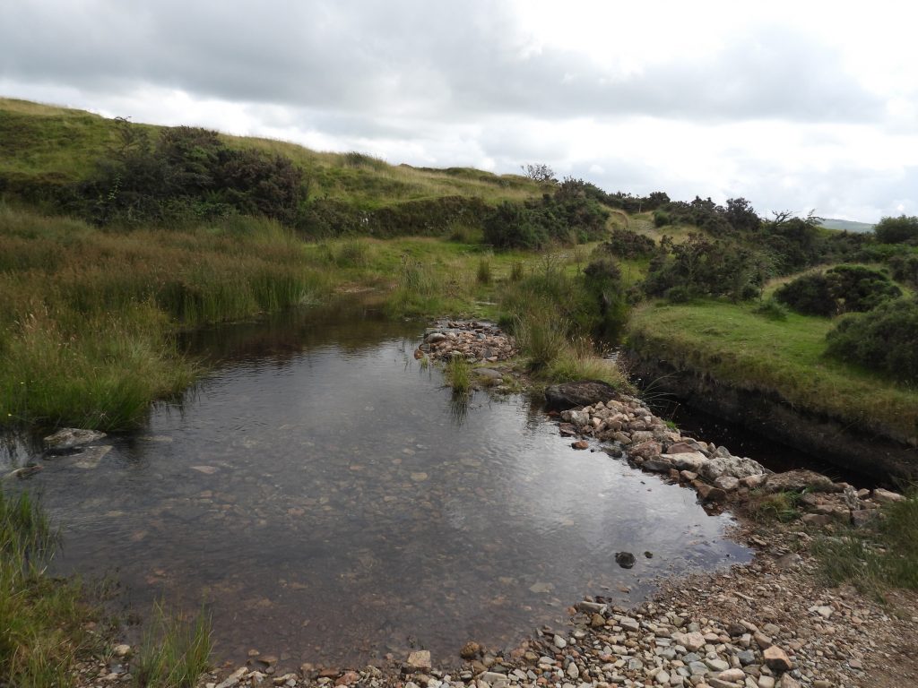
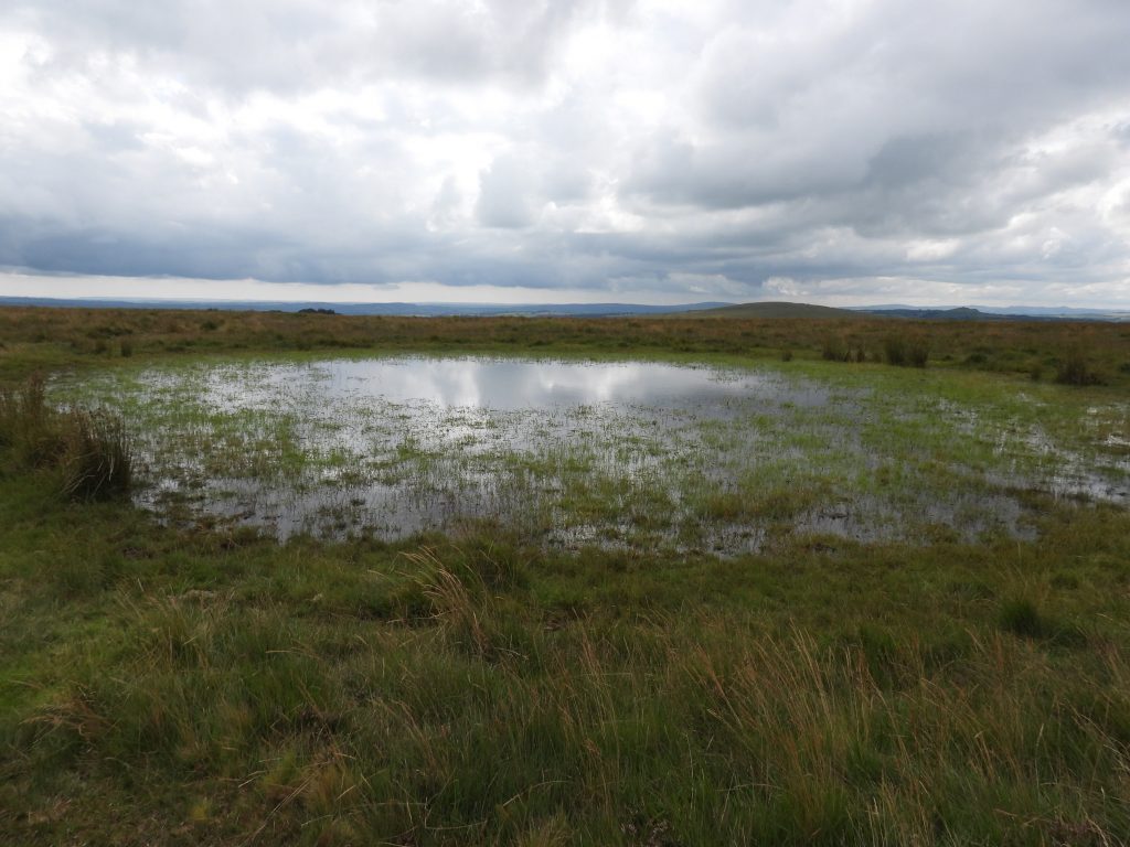
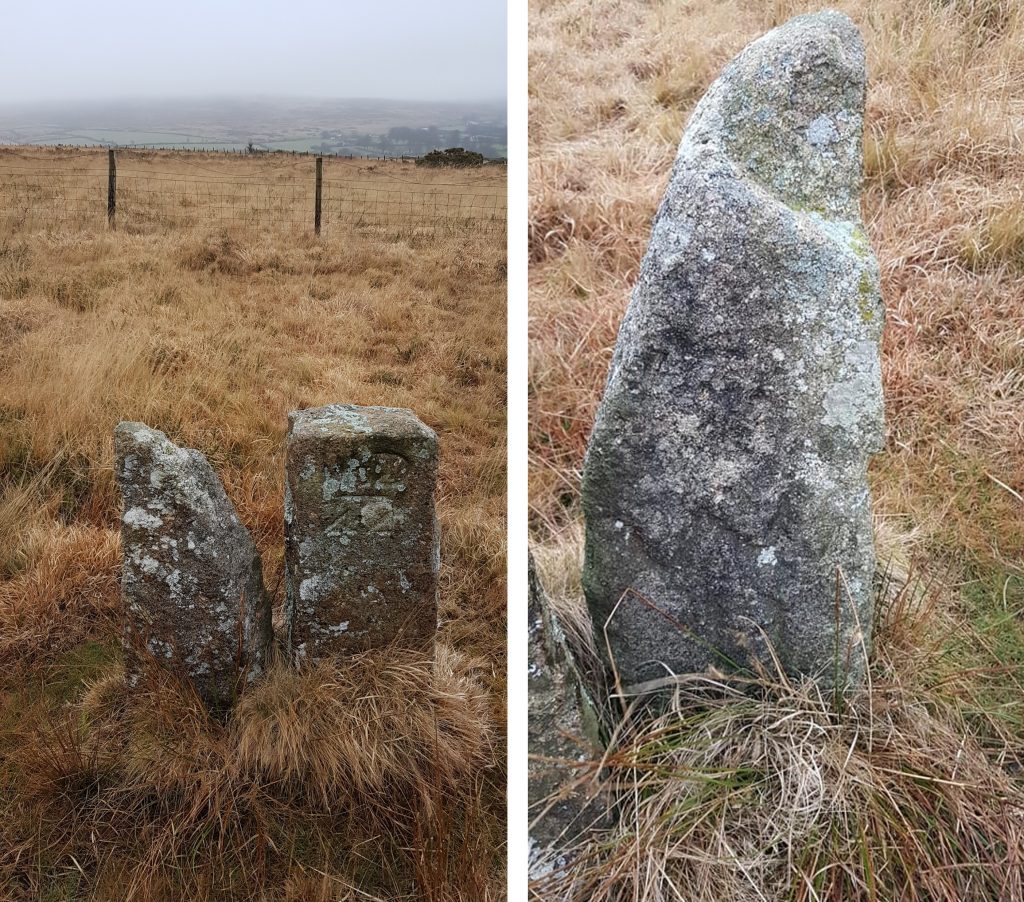
This sketch map was inspired by a similar one found in the Dave Brewer Dartmoor Boundary Marker (2nd edition) book (page 176). The sketch was generated by initially overlaying the modern OS map (before the latter was deleted leaving the sketch) – therefore it is reasonably accurate in terms of scaling between locations. It is interesting to note that Eric Hemery (Pages 984 – 986) and Mike Brown refer to Hamlyn’s Newtake and Palmer’s Newtake.Summary table of Grid References for the Hamlyn “H” stones, Willsworthy Bounds “WB” stones and Uninscribed Stones covered in this post.Lamerton / Mary Tavy Boundstone on the west side of the A386 road at SX51771 83509, installed by the Tavistock Turnpike Trust.Modern Boundstone (uninscribed) near to the tarmac road leading to the Willsworthy Ranges. It can be found at SX520088 83366.Old Boundstone (age and history unknown) can be found near the Modern Boundstone. It is uninscribed and can be located at SX52114 83340The Three Parishes Boundstone is located on the former Willsworthy Manor Boundary, close to Prescombe Corner. On its three sides is inscribed “P” (Peter Tavy), “M” (Mary Tavy) and “B” (Brentor). It can be located at SX52192 83321. It was erected in 1987 and is a replacement for one destroyed by Americal Forces in WW2. The stone is not on the OS map and due to boundary changes it is no longer on the corner of the three parishes either!The first of the “H” (Hamlyn) stones can be located at SX52262 83271 in a bank / reaveWider angles showing the general location of the “H” Hamlyn StoneUsing side-by-side maps (OS 1949-70) and zooming in on the location of the “H” stone at SX52262 83271, there are three other stones shown and an old reservoir.Uninscribed Stone 1 (as marked on the previous map). It has a gate hanging ring on its north side. It is located at SX52235 83256.Uninscribed Stone 2 is north of uninscribed stone 1 near an old (not obvious) reservoir. It can be located at SX52259 83263.A few metres along from the “H” stone in the reave is the 3rd uninscribed stone at SX52265 83274View of the 3 uninscribed stones, the “H” stone and the old reservoir.The old reservoir next to uninscribed stone 2 is not very obvious. It is assumed that it was part of the former Willsworthy Camp whose buildings were located in this area. There is a small plastic vent near one edge and on top of it an old iron pipe can be found.The first of the “WB” (Willsworthy Bounds) Boundstone, which marks part of the boundary of the former Willsworthy Manor can be found next to the military track leading up to Black Hill. This stone was re-erected in 1988 by the Dartmoor National Park having been in two parts for many years prior to that. The boundstone can be located at SX52201 83113. The second of the “WB” (Willsworthy Bounds) can found a little further up the hill (Black Hill) from the first stone These stones have a very distinct “W” on top of a “B”. This stone can be located at SX52181 83180.More pictures of the “WB” boundstone at SX52181 83180.The third “WB” stone is located next to a cairn called ‘Ring of Bells’The ‘Ring of Bells” “WB” Boundstone can be found at SX52147 82870.Moving onto the Willsworthy Range, a possible Hamlyn Boundstone can be found adjacent to an old target railway. Recorded in the Dave Brewer Dartmoor Boundary Markers (2nd Edition) on page 176 (Fig 54) as “H ?” it can be located at SX52649 83119. The stone does not appear to be inscribed.Various views of the Willsworthy Range, which for the explorer will be passed through if approaching Hamlyn Newtake from the west.Reddaford Farm Enclosures with the Hamlyn Newtake wall descending the hill on the mid-horizon.View of Little Hare Tor and Hare Tor looking across the tin stream works in the Newtake.The Hamlyn Newtake “H” stones are shown at an approximate location in the original Dave Brewer sketch. They circumnavigate the newtake and in order to maximise the possibility of finding all the “H” stones, the author used ‘side-by-side’ maps to obtain a GR for each of the stones. The author found 12 locations around the newtake marked “stone” on various side-by-side maps. This stone was the first to be found close to the newtake wall as in was circumnavigated in a clockwise direction.The “H” stone was located between a military track and the newtake wall. It was amongst some very long grass, which meant the side-by-side created GR was very valuable to locate it. The stone can be located at SX53609 83809.The location of another “stone” according to side-by-side maps was at SX53761 83978. As can be seen from the picture, the grass was very long on the day of the exploration of the area (August 2021). No boundstone was found here.This recumbent stone is inscribed with an “H” and and “R”. It is mentioned in Dartmoor Magazine, Issue 75, page 42 in a letter by Maureen and Robin Vane. It can be found at SX53945 84079.The “H” and “R” inscribed recumbent stone appear to have either been turned over since June 1997 (original picture by M and R Vane) or the picture is “reversed”. The author suspects the inscriptions could be exposed if the appropriate edge on the stone has its grass and earth dug away. The conjecture is that “H” may be for Hamlyn but the “R” could relate to the Roskilly family who farmed nearby (there is another “R” stone near “WD 42” near Snap Lane. The mystery, however, is two-fold because if the stone were to be re-erected the “R” would be buried and the “R” appears to be different from the other Roskilly Stone. Could the “R” relate to the nearby Reddaford (Redford Farm). The next “H” stone as the newtake is circumnavigated was located at the GR used from side-by-side. Nearby is an old benchmark “bolt” on top of a heather covered rock. As with all the “H” stones, it is roughly inscribed on a rough set moorstone.Another view of the “H” stone also shown in the previous picture. Views to Little Hare, Hare and Sharp Tors to the west are shown. This stone is located at SX54023 84101This collage of pictures shows the newtake wall near the north-west corner (two left hand pictures) and that of the benchmark “bolt” near the “H” stone (two right hand pictures). The benchmark reference is BM 1245.44, and is located at SX54017 84095.The next “H” stone can be found close to a small enclosed reservoir.More views of the “H” stone which is close to the small reservoir. It is the closest stone to Little Hare and Hare Tors. This stone can be located at SX54308 84052Small reservoir (marked as “Tank” on older OS maps) near the head of Willsworthy Brook. The GR recorded on the edge of the reservoir was SX54421 83809. The author has been made aware that this reservoir is used as a water supply for Willsworthy Range and there is a further treatment plant at Willsworthy Camp which treats the water and makes it potable. The reservoir is believed to be around 50-80 years old and holds water of the Willsworthy Brook, before it cascades through some old tin streamworks before feeding “mine leat” near to Reddaford (Redford) farm. Next to the reservoir is a rain gauge, which can be found at SX54425 83833Also next to the Willsworthy Brook reservoir is a small stone shelter, whose previous use is unknown to the author. It can be found at SX54418 83826.Just inside the Willsworthy Brook Reservoir another “H” stone can be found. It is also recorded by Maureen and Robin Vane, this time in Dartmoor Magazine # 123, page 77. It is also mentioned by Dave Brewer in his Dartmoor Boundary Stones Book as being ‘a possible one (“H” Stone) inside an wired enclosure’.Close up of the “H” stone inside the fenced off area (with its “mud” makeover) can be found at SX54458 83839.The first “H” stone up the slope (south east direction) from the reservoir.More views of the first “H” stone up the slope (south east direction) from the reservoir. It can be located at SX54507 83694.Hamlyn Newtake wall orientated NW – SE.This “H” stone is the last one before the newtake wall corner where it turns from NW – SE orientation to NE – SW orientation. It looks like a saddle ! The “saddle” stone can be found at SX54566 83525.“H” stone near to the wall corner at the highest point of the newtake.The “H” stone near the wall corner with view of Ger Tor behind. It can be located at SX54518 83434. The location of yet another “stone” according to side-by-side maps was at SX54458 83367. As can be seen from the picture, there was quite a lot of rock in the area. It is possible that the stone is still there but recumbent. No boundstone was found. The first “H” stone heading downhill from the newtake corner.This “H” boundstone can be found at SX54397 83313Views of the Hamlyn Newtake wall going downhill NE – SW. Some large boulders have been incorporated into the structure.In the newtake wall is an “embedded upright”. The reason for it being here is unknown but the author speculates it might have been used for tethering. If anyone knows of the real reason for this being here, the author would be grateful to hear. It can be found at SX54282 83254.Towards the centre of Hamlyn’s Newtake there is a rather well built ‘Hut Circle’ at SX54179 83492. Probert, Fletcher and Newman, (1998, Willsworthy Training Area, Peter Tavy, Devon: An Archaeological survey by the Royal Commission on the Historical Monuments of England) suggest the walls are obviously recent constructions and the interior is sloping and rubble strewn. They further state there is no evidence to suppose that this feature was originally a prehistoric hut circle.Another observer (Gerrard) states that: “The visible walls are clearly of post-medieval date and probably represent a sheep-fold constructed on the site of an earlier stone hut circle”. Jeremy Butler describes it a an animal pen.The first “H” stone after the embedded upright moving down the newtake wall This “H” stone can be found at SX54263 83224.Our next “H” stone in the clockwise perambulationThis “H” stone on our clockwise perambulation of the newtake can be found at SX54126 83135The last Hamlyn “H” boundstone can be found as the newtake wall approaches mine leat.The penultimate “H” stone can be found at SX53933 82970.A cairn / cist can be found approx 100 metres from the newtake wall. It is a bit of a battle through the long grass, heather and gorse and is rather uninspiring. It can be located at SX54090 82951On the side-by-side map (1873-1888) below mine leat, there is another “stone” marked. In reality at the map location there is a pair of uninscribed BSs. Quite possibly they may have been a pair of gateposts, but do not look as such by the author. They can be found at SX53808 82853.The final “H” stone on a clockwise perambulation of the newtake can be found near Lane End. The author first looked from this stone in August 2021, without success. However, following it being ‘re-found’ my Mark Fenlon and Paul Rendell in August 2022, deep into a slightly marshy and reeds strewn area. The author was able to locate it with additional information being supplied by Mark.This “H” stone is located at SX53626 82525This benchmark (with rivet) can be found in an old wall just below (to the south of Mine Leat) and close to a gate. B.M 1067.76 (ref 1949-1972 OS Map from National Library of Scotland Maps) is located at SX53723 83124Reddaford (Redford) Farm – The most striking feature, which draws the attention at SX53704 83364, this being a fireplace slab. A post detailing more information on the farm can be found at: https://dartmoorexplorations.co.uk/reddaford-redford-farm-willsworthy/Just below Reddaford Farm is a ford, which is where Willsworthy Brook feeds the mine leat.Following the mine leat and climbing Black Hill, the explorer can find this pool, which is on the former Willsworthy Manor boundary.To the east of the pool on Black Hill, the penultimate “WB” boundstone can be found. The location is known locally as Tin Pits.The “WB” stone (Willsworthy Bounds) at Tin Pits is located next to a War Department stone (WD45). The location is SX52359 82249. The Willsworthy Range ‘WD’ standing stones map out the tract of land that the War Department purchased in 1903. The route follows virtually the the line of the old Willsworthy Manor bounds, with some slight variations (of about 3200 acres) which were purchased from the Calmady-Hamlyn family. A post on the “WD” stones can be found at : https://dartmoorexplorations.co.uk/willsworthy-range-wd-war-department-standing-stones/The final (5th) “WB” stone can be located next to “WD 44” at a location known as Down Pool. This is quite close to where the mine leat feeds Wheal Jewell reservoir. It can be located at SX52595 81856.
Hi Steve,
Enjoyed your study of the some of the boundary stones in and around the Willsworthy Range.
A noticeable typo ‘grateful to here’ in the text for the ’embedded upright’.
One incorrect piece of information is to be found in the first stone that you describe as a ‘Lydford / Mary Tavy Boundstone’. It is a ‘Lamerton / Mary Tavy’ boundstone installed by the Tavistock Turnpike Trust.
I wonder if you can amend the details, for the 15th Hamlyn Newtake BS, to read found by Mark Fenlon and Paul Rendell (editor of Dartmoor News), please..


Mark Fenlon August 30, 2021
Hi Steve,
Enjoyed your study of the some of the boundary stones in and around the Willsworthy Range.
A noticeable typo ‘grateful to here’ in the text for the ’embedded upright’.
One incorrect piece of information is to be found in the first stone that you describe as a ‘Lydford / Mary Tavy Boundstone’. It is a ‘Lamerton / Mary Tavy’ boundstone installed by the Tavistock Turnpike Trust.
SteveGrigg1961 August 30, 2021 — Post author
Thanks for your comments Mark.
I have updated the post accordingly.
Regards,
Steve
Mark February 12, 2023
Hi Steve,
I wonder if you can amend the details, for the 15th Hamlyn Newtake BS, to read found by Mark Fenlon and Paul Rendell (editor of Dartmoor News), please..
SteveGriggDartmoor February 14, 2023 — Post author
Hi Mark,
I’ve amended to state it was (re)found by you and Paul.
Kind Regards,
Dartmoor Explorations (Steve)