A collection of walks, discoveries, insights and pictures of exploring Dartmoor National Park
October 9, 2020
REDDAFORD (REDFORD) FARM, WILLSWORTHY
Steve Grigg and Frank Collinson
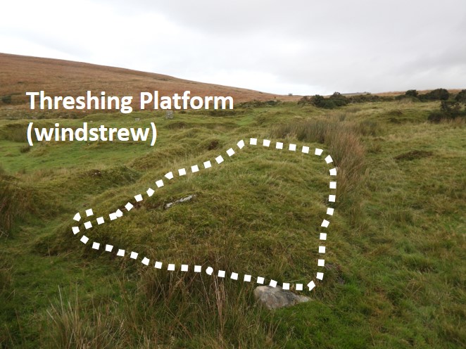
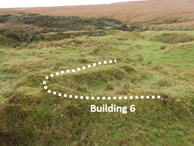
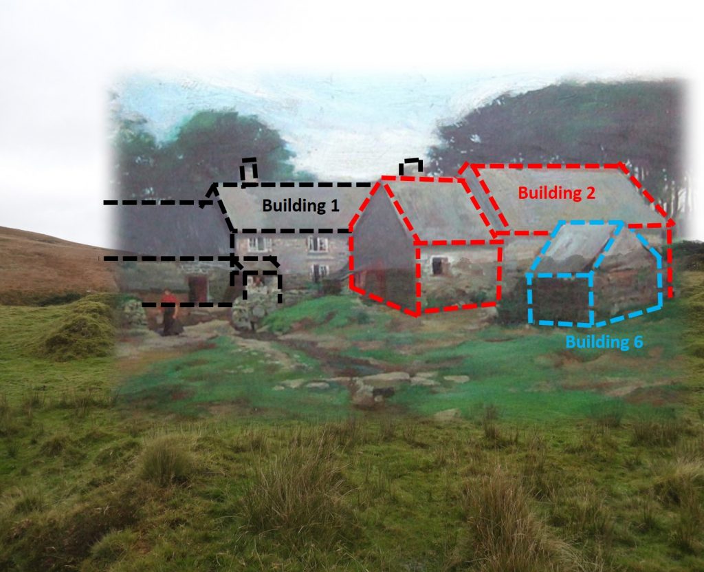
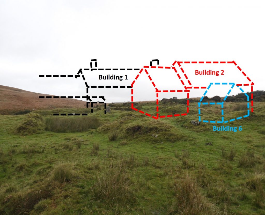
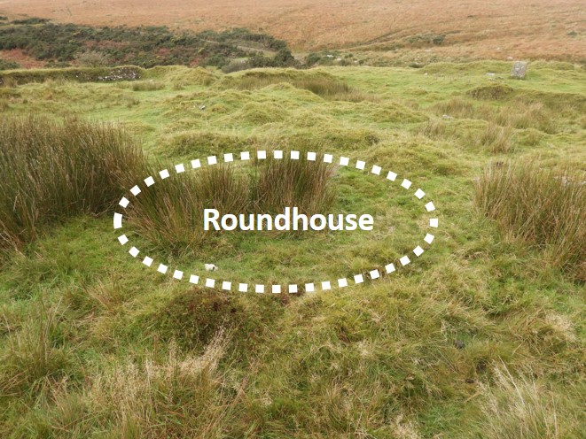
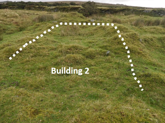
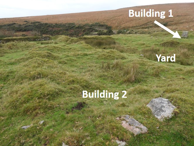
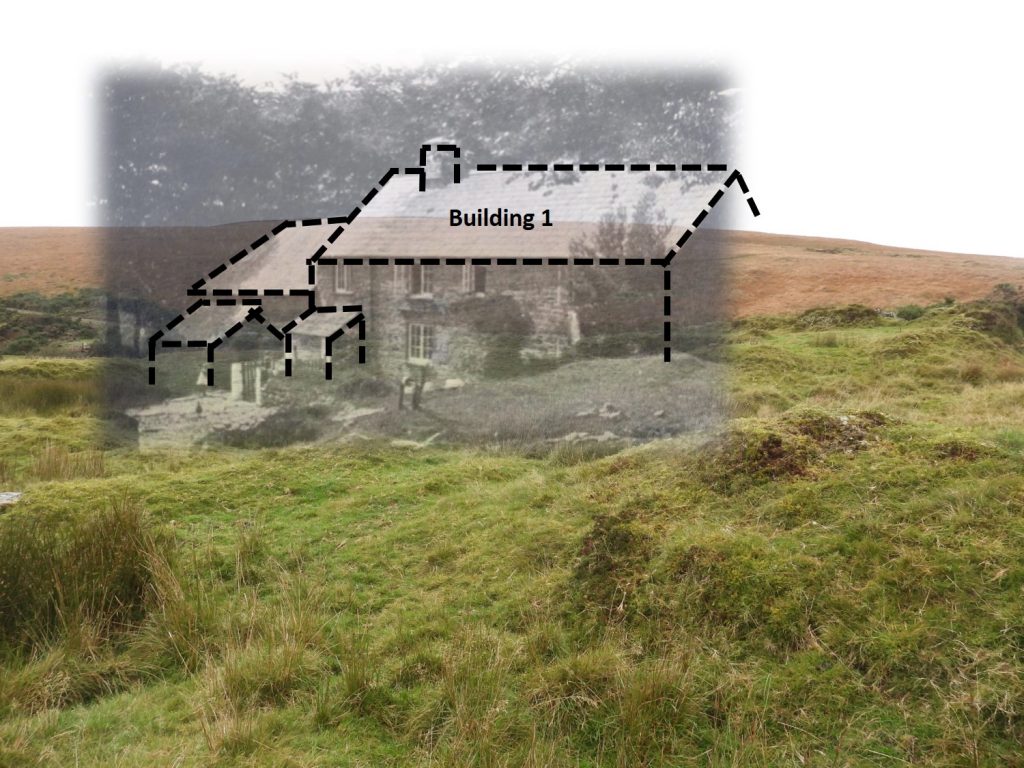
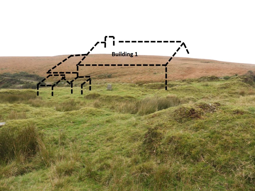
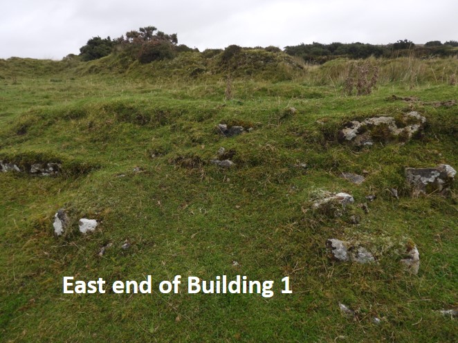
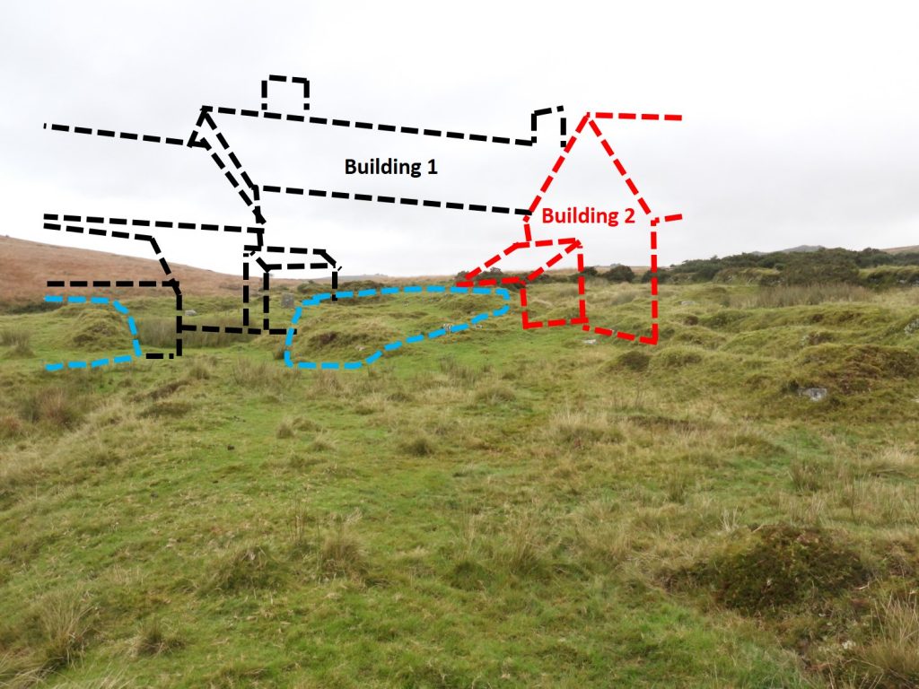
When the war office wanted to create a firing range at Willsworthy at the start of the 20th century, Reddaford Farm (Redford on OS maps of that period) was purchased. The purchase took place in 1905 and the then tenants left in around 1907. During or shortly after the 2nd World War the buildings had been totally razed to the ground and today there is very little left of the farm to the casual observer. Armed with a survey conducted by Dr Tom Greeves, commissioned for the MOD, this post is a photographic record of the key features recorded from that report.
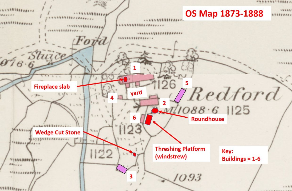
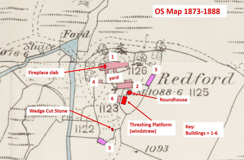
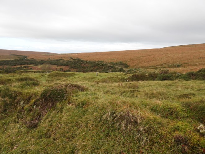
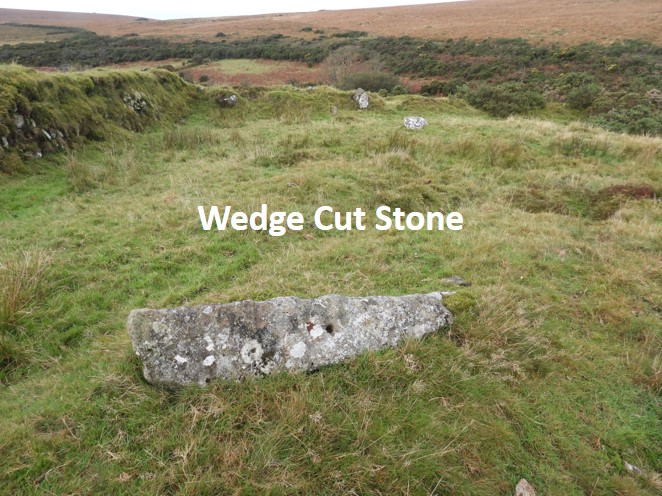
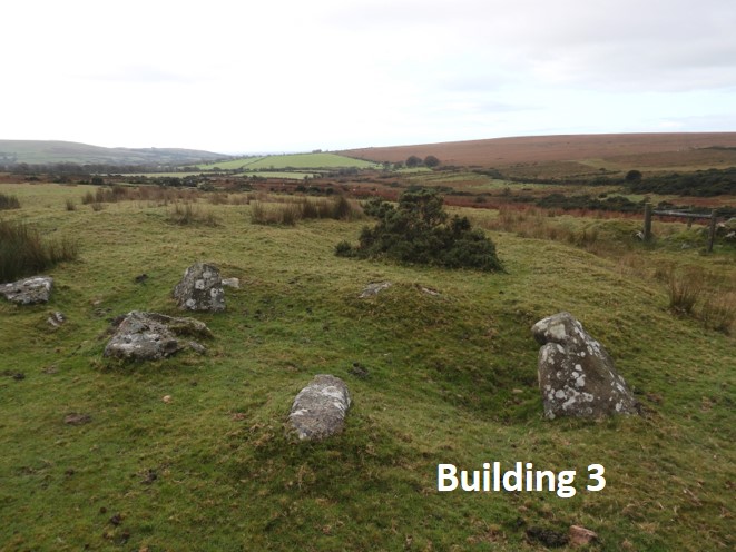
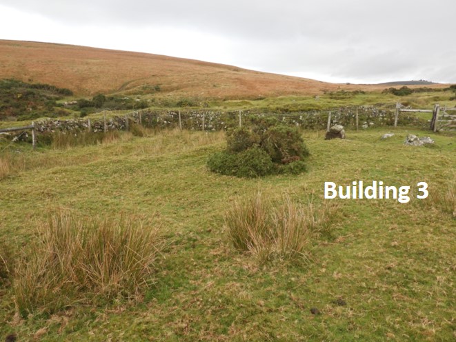
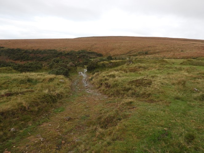
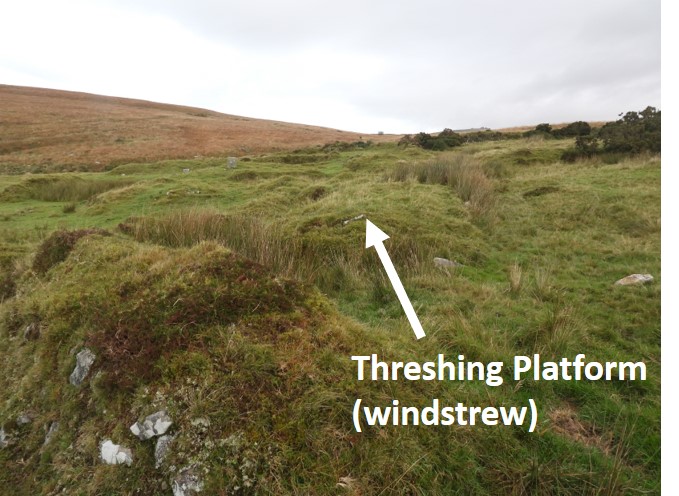
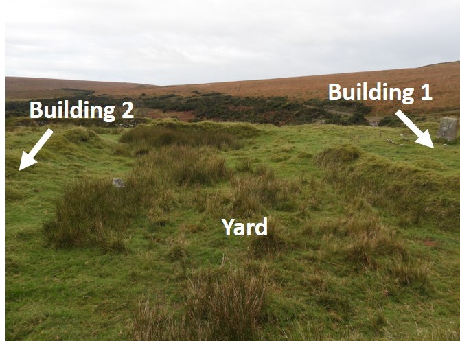
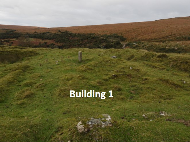
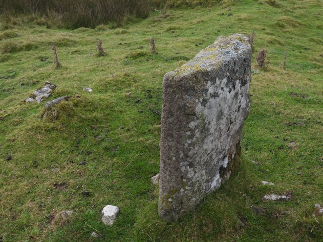
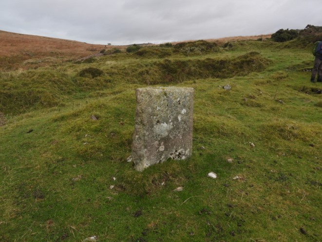
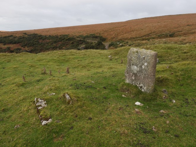
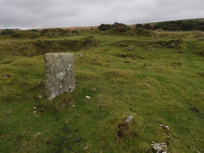
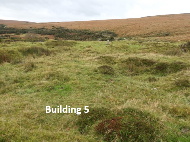
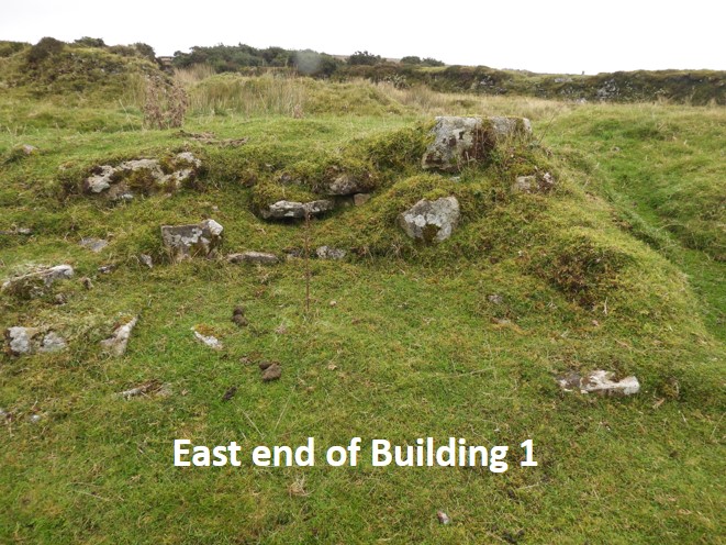
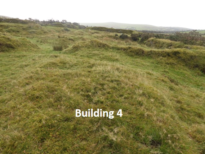
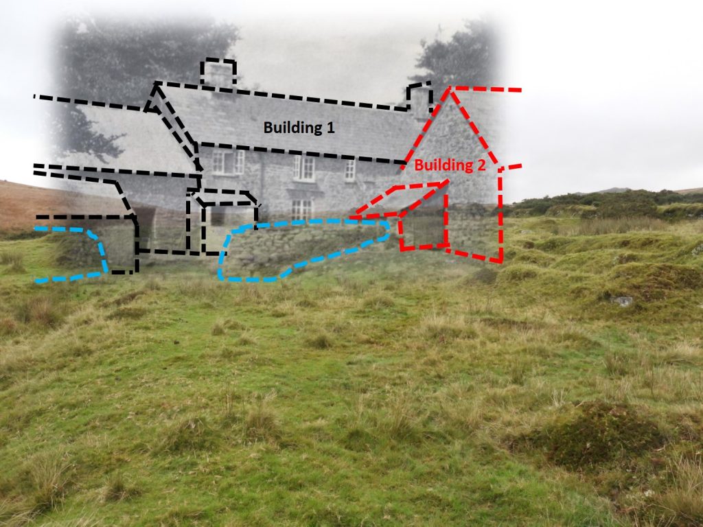
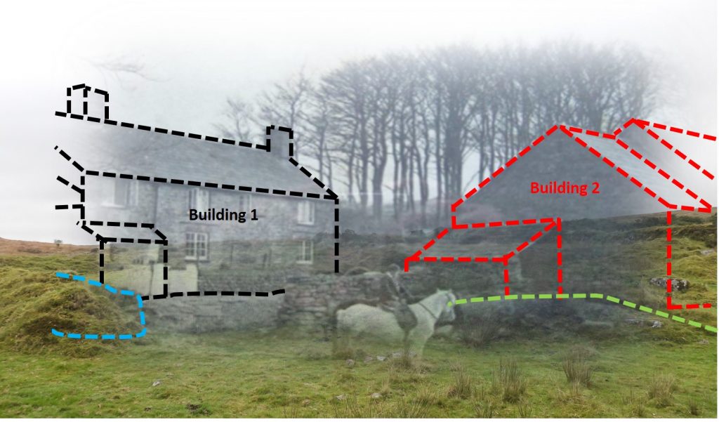
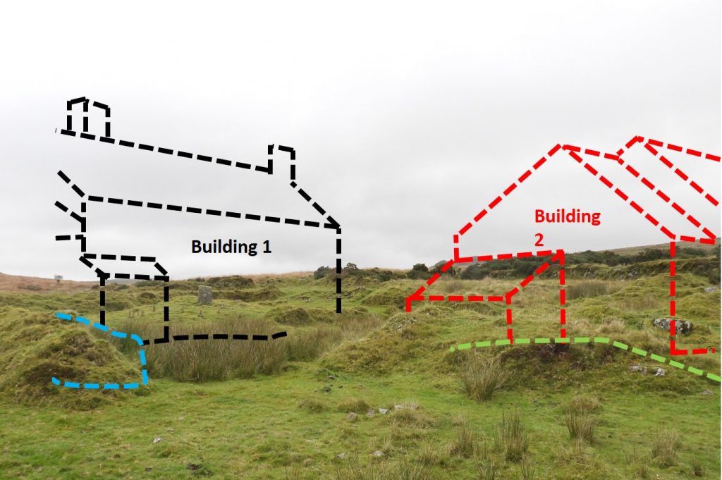
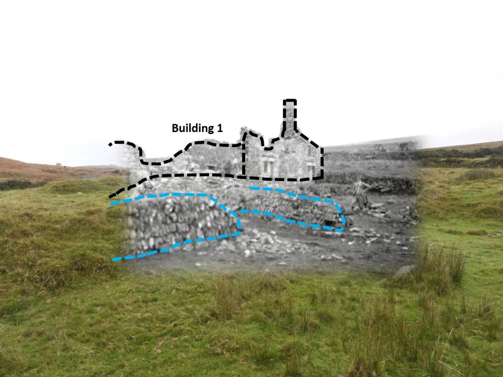
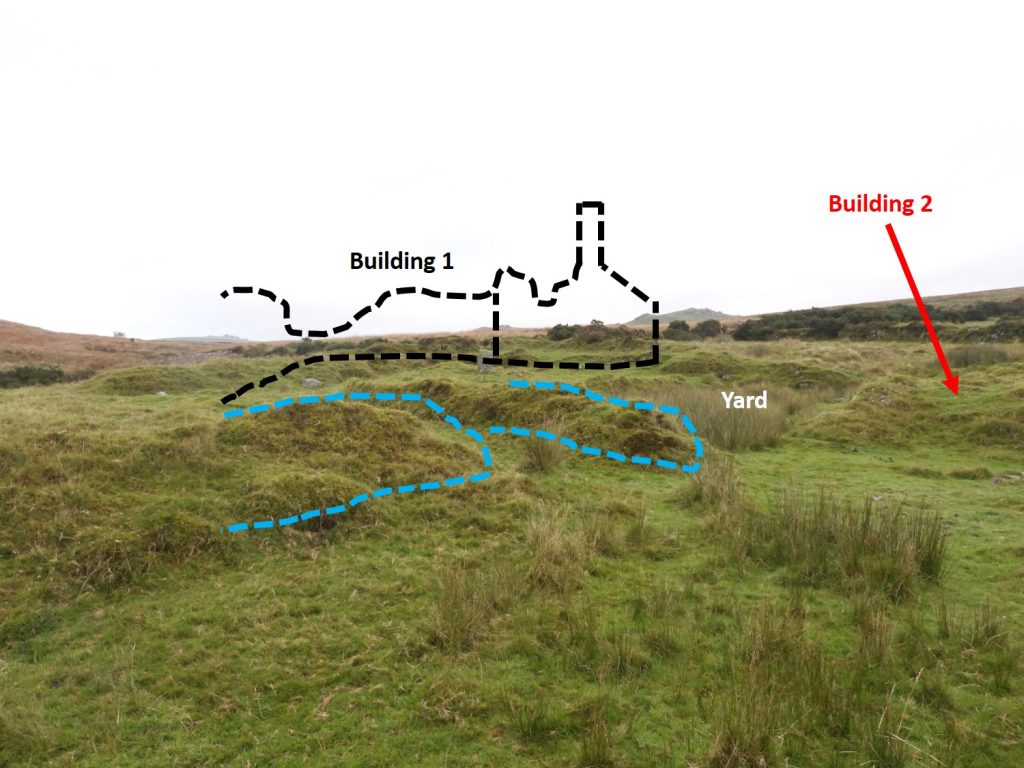
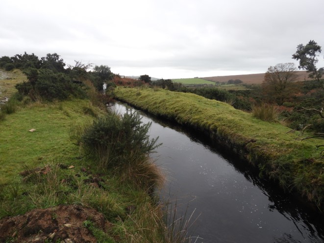
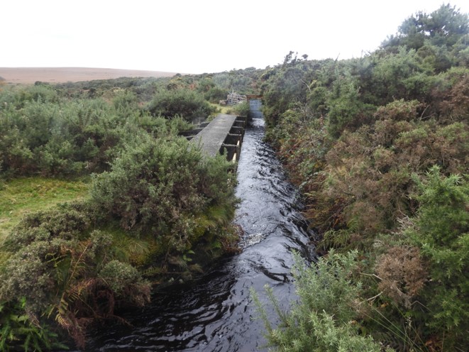
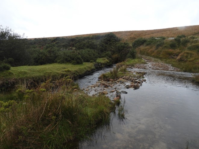
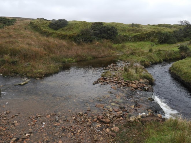
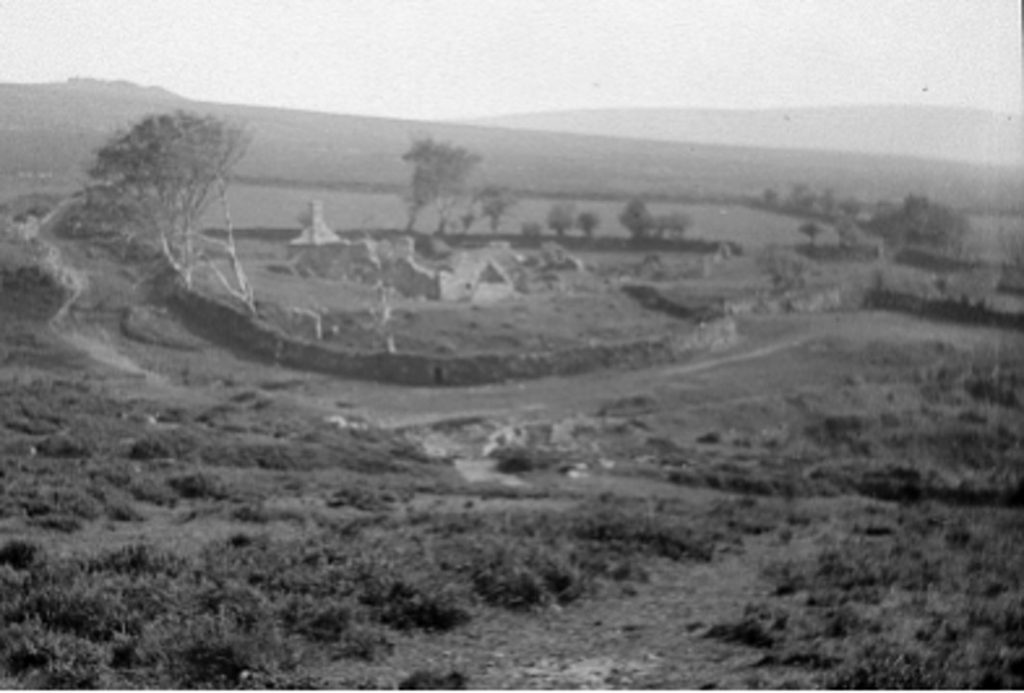
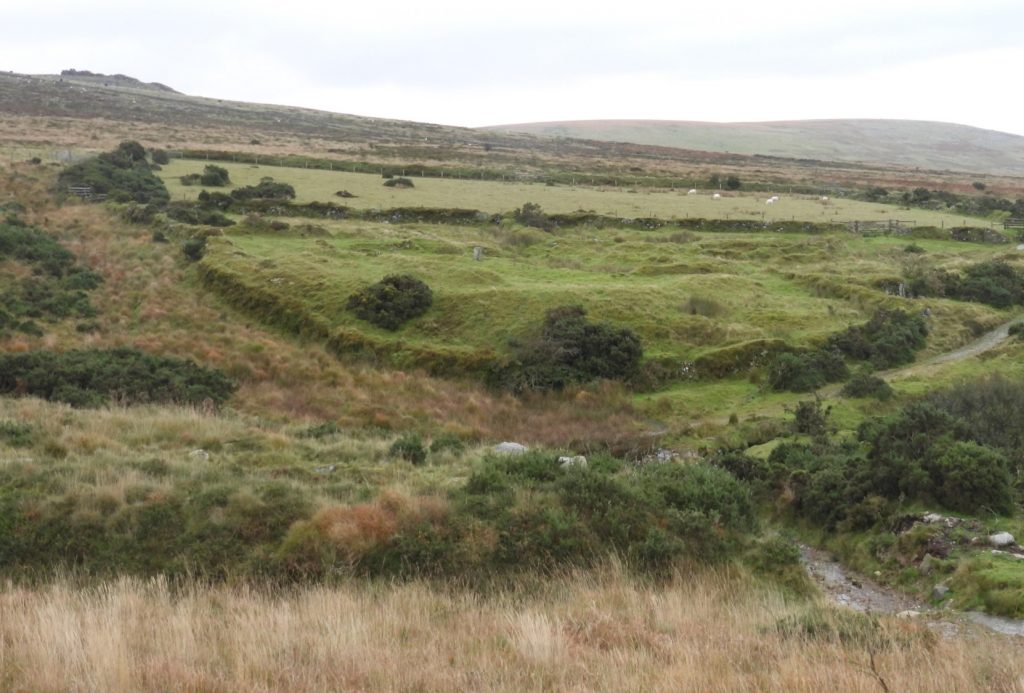
This map dates from the late 19th century and has been overlaid with the key features. Note that the farm was called Redford. At some stages in its history, the farm was also called Riddiford. Approaching the farm from the west, looking across to White Hill and the Willsworthy ranges. The scene looks rather desolate and difficult to image there had been a farmstead here since the 14th century. One of the features of interest at the farm is a stone near the southern end of the farm which has been split with iron wedges, and as stated by Dr Greeves: “the technique predates c. 1800”. The stone can be found at SX53700 83312.Building 3 lies outside the main farm enclosure. Its dimensions have been recorded as approximately 11m x 6m, and it is conjectured that it could be of medieval origin but is of unknown function. Another view of Building 3, from the south showing the gate into the main farm enclosures. Building 3 is at SX53694 83299.Entering the main farm enclosure, there is track running north-west towards Willsworthy range via a ford and the edge of the mine leat which runs close by.Just beyond the wedge shaped stone is a raised platform, which is believed to have been a threshing platform, known as a windstew. Eric Hemery in his book High Dartmoor – Land and People, published in 1983 made the suggestion that: “the platform was almost certainly a windstrew.”The windstrew is at SX53709 83342Next to the windstrew is building 6. This building was noted by Dr Greeves from a painting on the front cover of the report, which is inscribed (on back) “With kind regards to Mr & Mrs Palmer from C. Edmond Brock 14/10/1901”A softened and merged in picture of the previously mentioned painting on a 2020 photographWhat a difference 119 years make ! The stark difference apart from the buildings is all the large trees have gone.Between buildings 2 and 6 and more specifically adjacent to the threshing platform is a faint circular feature around 7m across. This was first noticed by Hemery who interpreted it as a possible ‘corn-grinding mill’. Dr Tom Greeves adds: “By this he may have meant a roundhouse which provided the energy (from a horse walking round and turning gearing) to power threshing machinery.” This feature is at SX53715 83341.Just north of the roundhouse and building 6 is building 2 at SX53711 83349. From photographic evidence this appears to have been quite a substantial building, which was a barn. Looking at the map it appears that this building may well have had a benchmark on it and an extension on its north east corner. As measured by Dr Greeves “Its eastern compartment has internal measurements of approximately 7.6 x 3.9m. To the west is another compartment which measures 4m x 2.8m internally.”Another view of the barn footings, then across the yard to the main farmhouse (building 1)A softened and merged picture from c1900 looking across the yard from the NE corner of building 2 (barn). Once again the trees are evident. You can just about make out what looks like a grinding wheel in the foreground.The 2020 picture in stark contrast with the building outline behind.The yard between the main farmhouse (building 1) and the barn (building 2). The yard is at SX53713 83358.Now to the main farmhouse (building 1). As measured by Dr Greeves the building: “has a total internal length of approximately 21m and a maximum internal width of 4.8m. Its larger, upslope eastern portion is approximately 12m x 4.8m internally.”The most striking feature, which draws the attention in 2020 is at SX53704 83364, this being a fireplace slab.The fireplace slab The slab stands is 0.9m in height and 0.8m wide, with a maximum thickness of 0.25mThe east end of the slab (edge seen) has two vertical fluting groovesThe west end of the slab (edge shown) is damaged. From this angle the rest of the farmhouse foundations can be seen (west to east) with a second fireplace at the far end.Building 5 is close to a west wall of the main farm enclosure. Site of building shown on the OS map. Little remains at SX53731 83357Location of east gable endWas this the location of the fireplace ?Site of Building 4 shown on the OS map. Little remains at SX53687 83355. It is located close to the yard.A softened and merged picture from c1900 looking across the yard from the south near building 4. Once again the trees are evident.The 2020 picture in stark contrast with the building outline behind.Another softened and merged picture from c1900 looking across the yard from the south near building 4. Of interest is the gentleman with two horses in the foreground…..and the 2020 position from the same locationAnother softened and merged picture from 1931, by this time the farmhouse was in ruin. The view once again is looking across the yard from the south near building 4. There is a figure in the yard. Note that the trees from 30 years previous have now disappeared.89 years after the previous picture, the building walls have disappeared and the farm walls are overgrown.The mine leat from near the ford below the farm to the westMine leat overflow into the Willsworthy BrookFord and mine leatFord and mine leat1920 view of Reddaford Farm2020 view. The landscape has “softened” and all the trees around the farm have disappeared. This picture was recreated farm SX53616 83411