A collection of walks, discoveries, insights and pictures of exploring Dartmoor National Park
August 9, 2021
Riddon Ridge Inscribed Stones
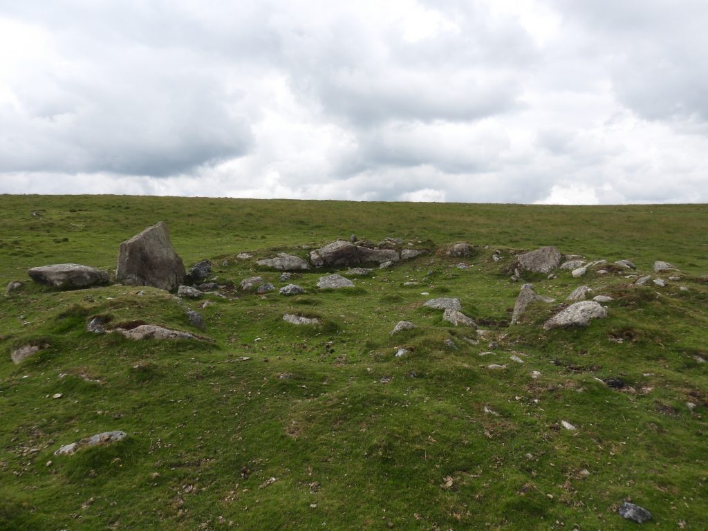
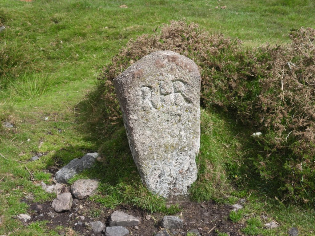
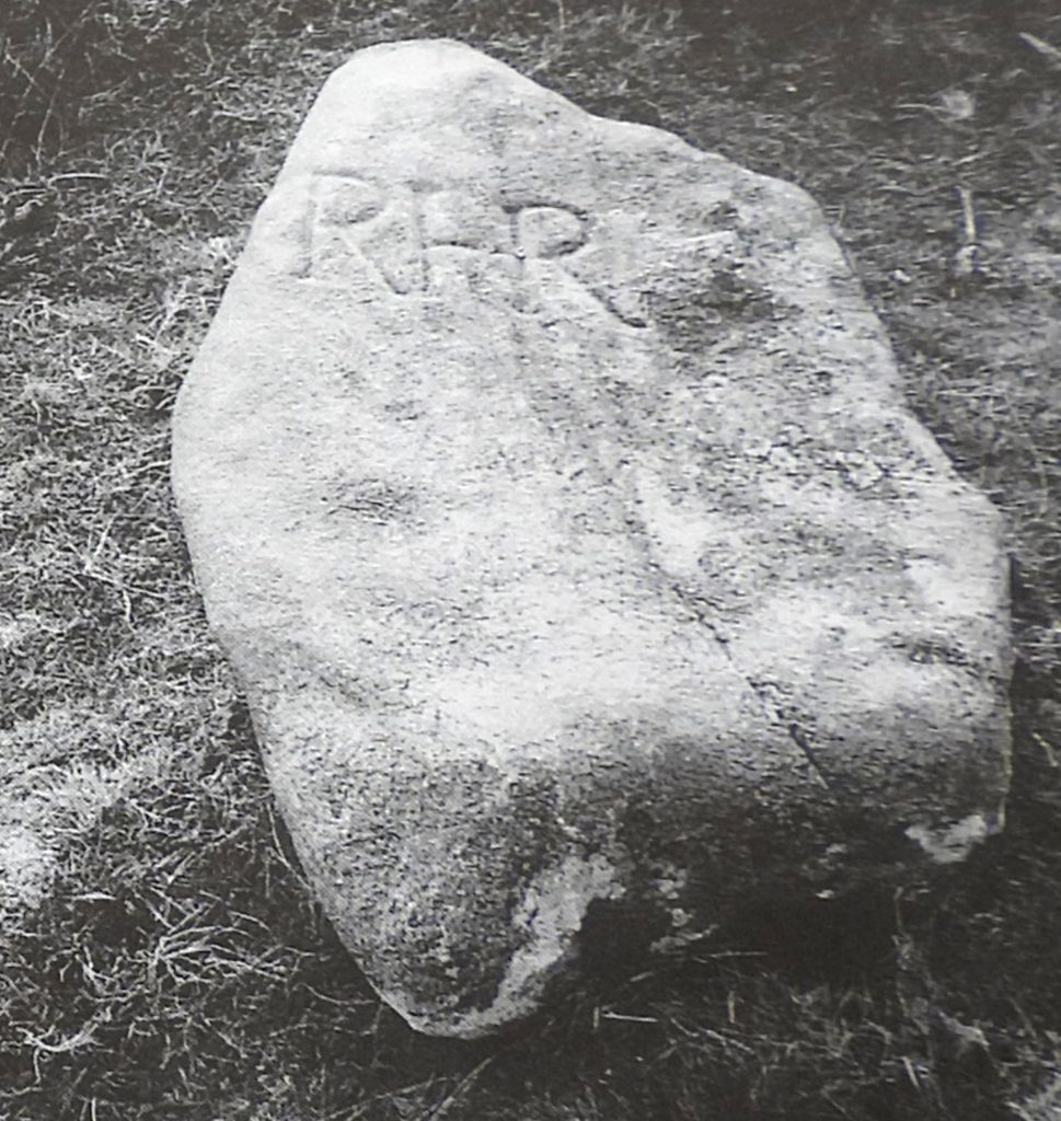
Lying between the East Dart and the Walla Brook, Riddon Ridge has evidence of tinners’ trial pits near its summit. This fact probably perpetuated the idea that the ten inscribed stones in the area were once believed to relate to tinners’ bounds. In addition to this, there is a further (11th) stone, inscribed RHR, which is located at the late Lady Sayer’s property at Cator. Hansford-Worth was shown this stone, which was being used as a well cover and he thought it was probably a tinners’ bound too.
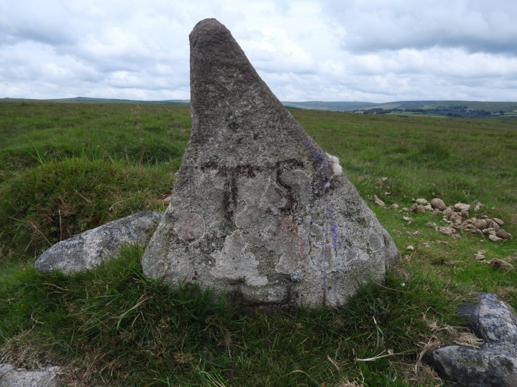
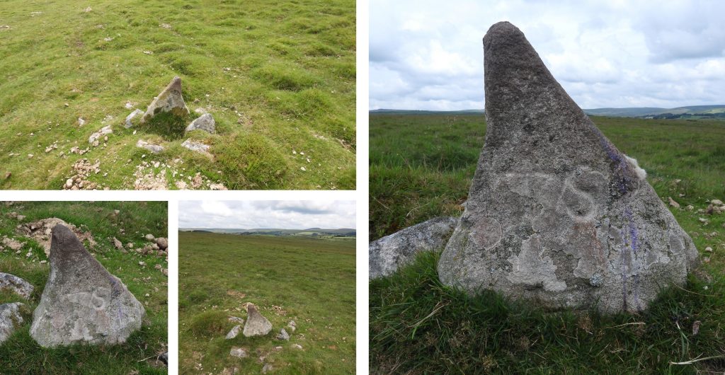
In Dartmoor Magazine, Summer 1999 edition and Dartmoor Boundary Markers by Dave Brewer (2nd edition) following some research, the possible reason for the stones existence has been recorded. Most of the stones are inscribed RHR, SL, TS or TS H or indeed a a combination of these. The reason for the stones is believed to be related to farming. Dave Brewer speculates that the stones my be related to the rights to cut vags as the higher part of the ridge was never enclosed. The inscriptions are ; “RHR” which relates to Robert Henley Rogers, “TS” or “TS H” which relates Thomas Smerdon and “SL” which relates to Rev. Samuel Lane. There is conjecture that the stone near the Walla Brook is inscribed “FS”; if this is correct then no records exist as to whom this may refer.
This post covers information relating to the 10 inscribed stones, with reference to the aforementioned publications plus a couple of other interesting features located between the water courses of the East Dart and the Walla Brook.
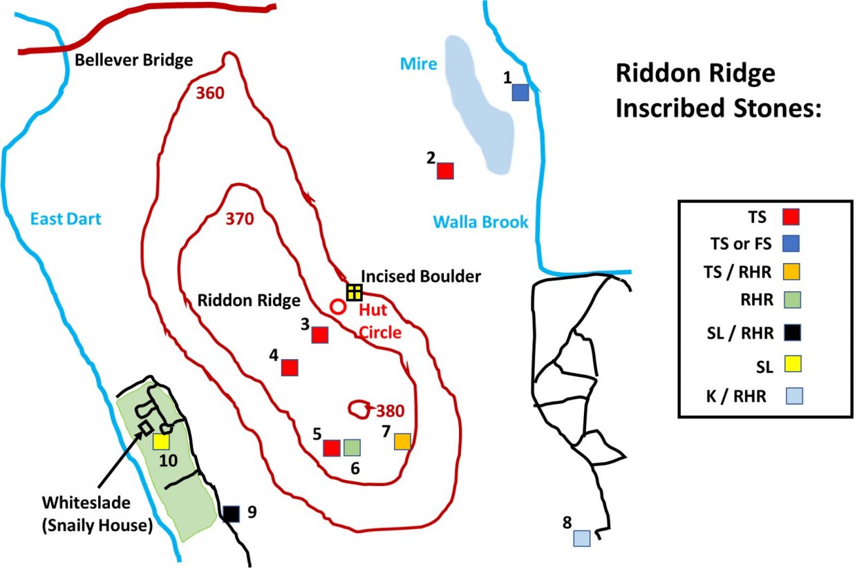
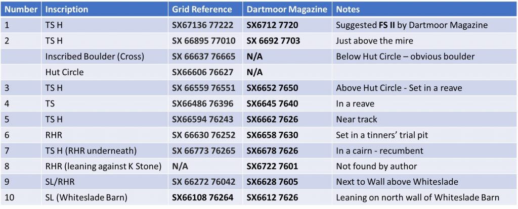
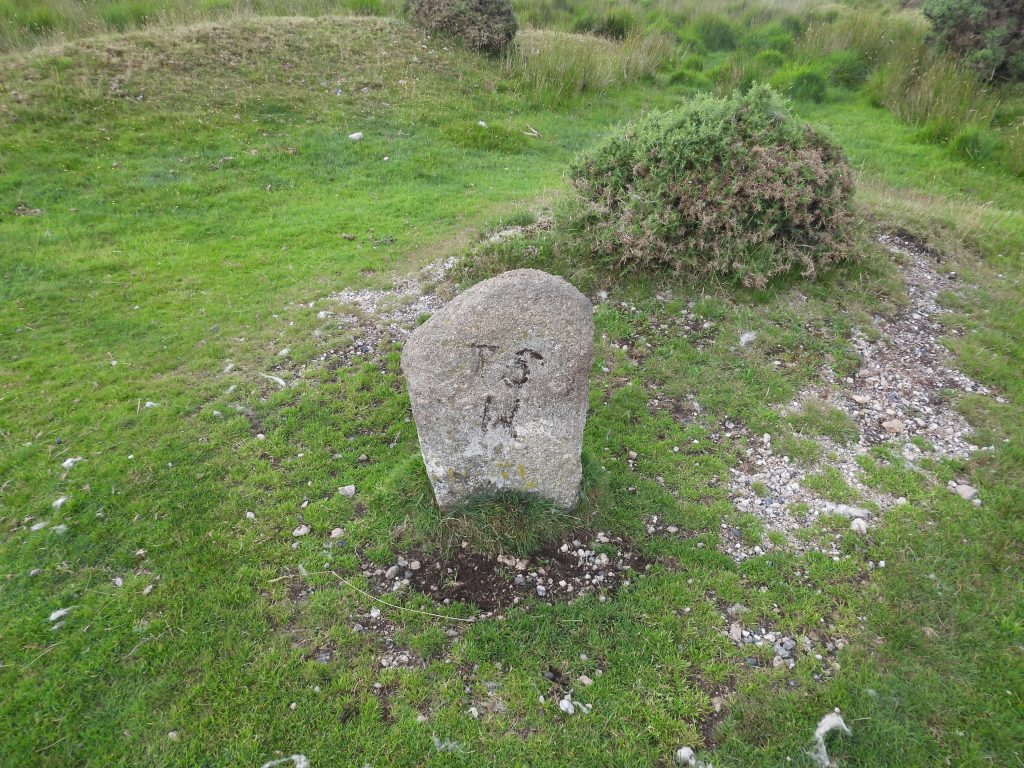
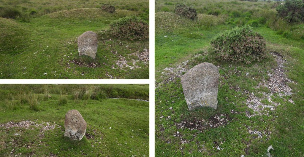
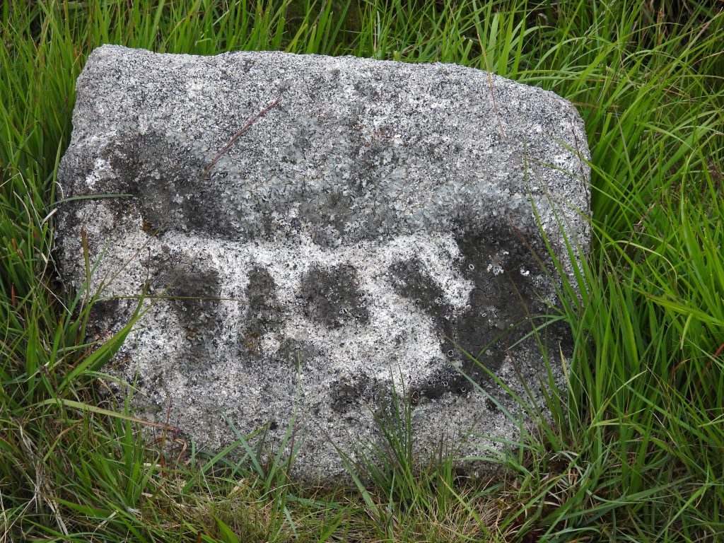
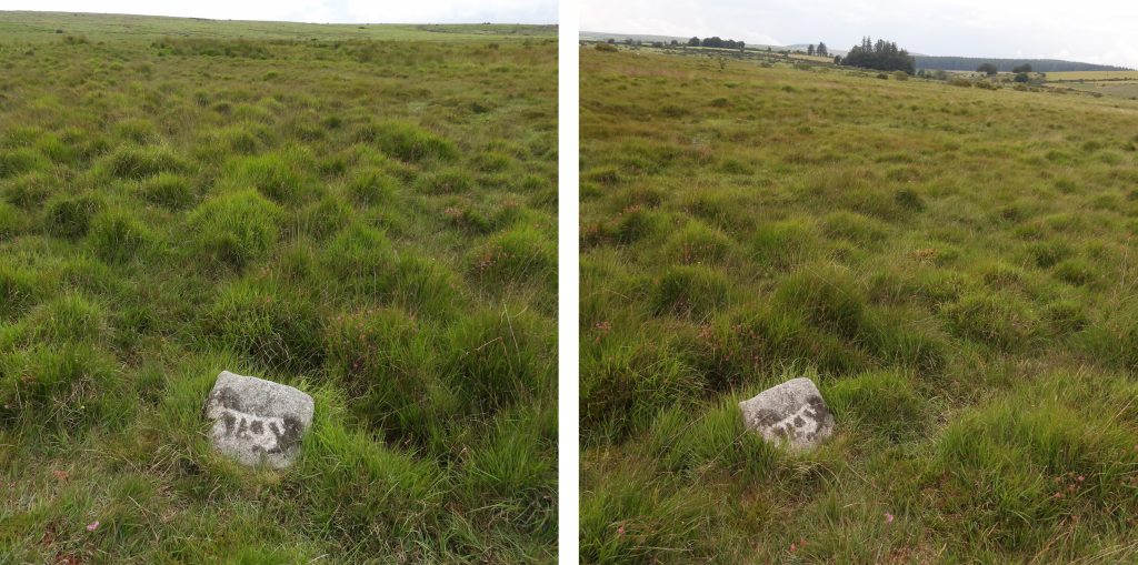
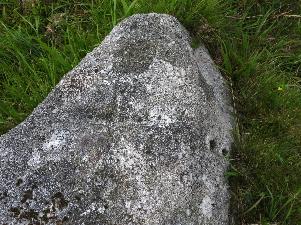
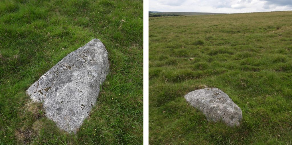
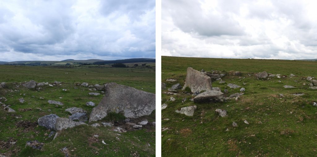
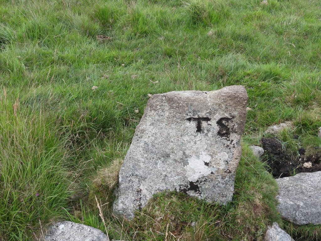
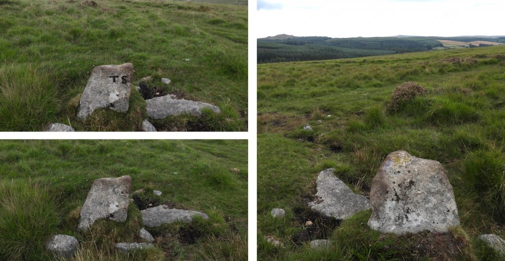
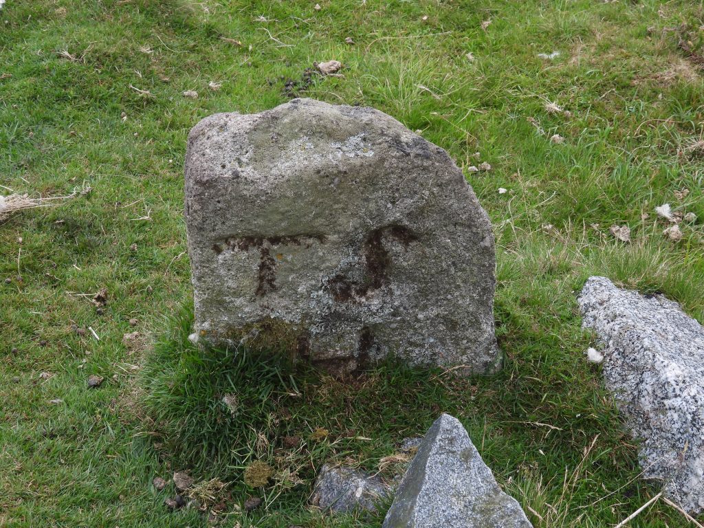
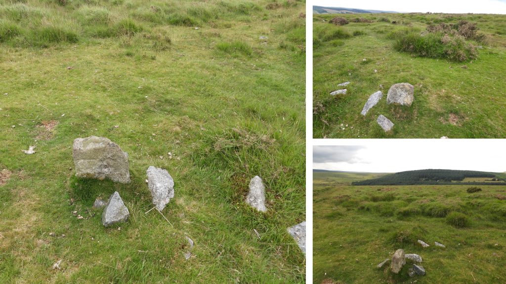
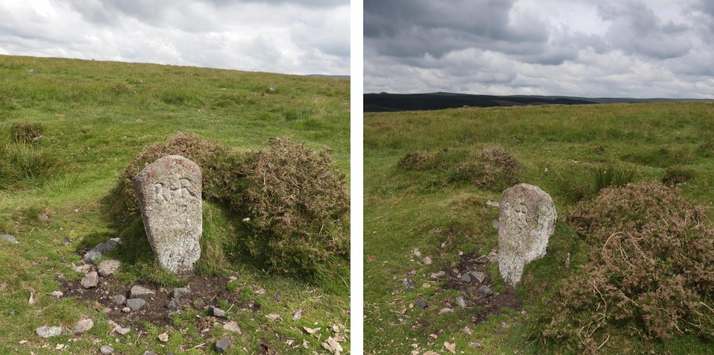
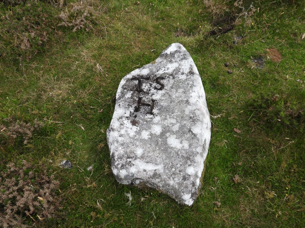
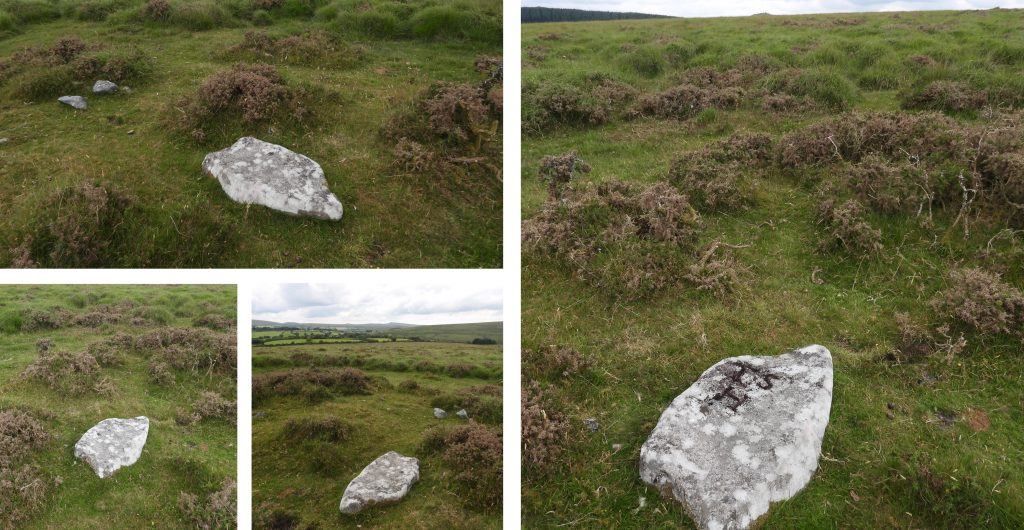
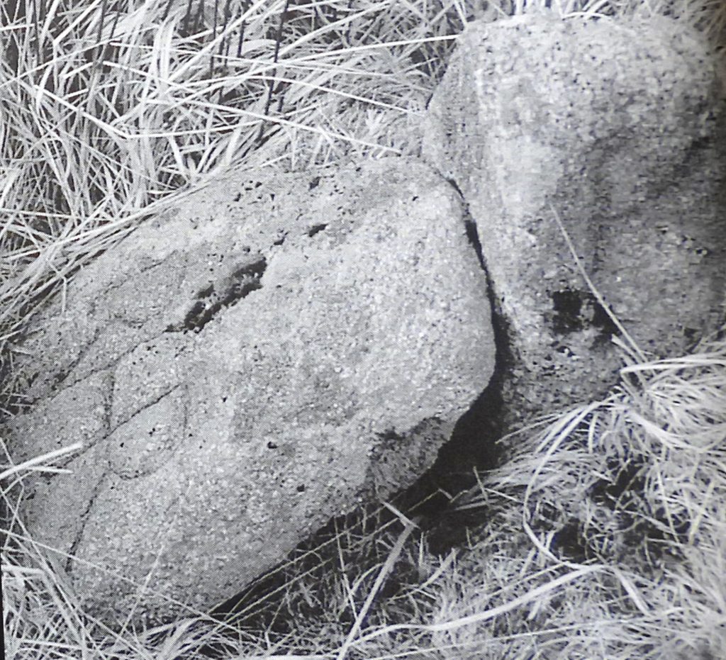
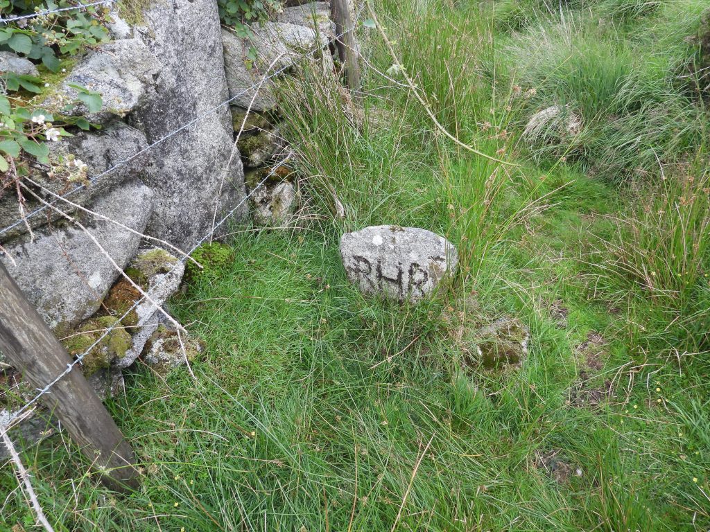
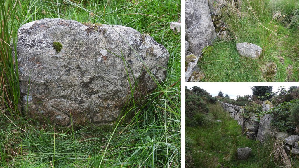
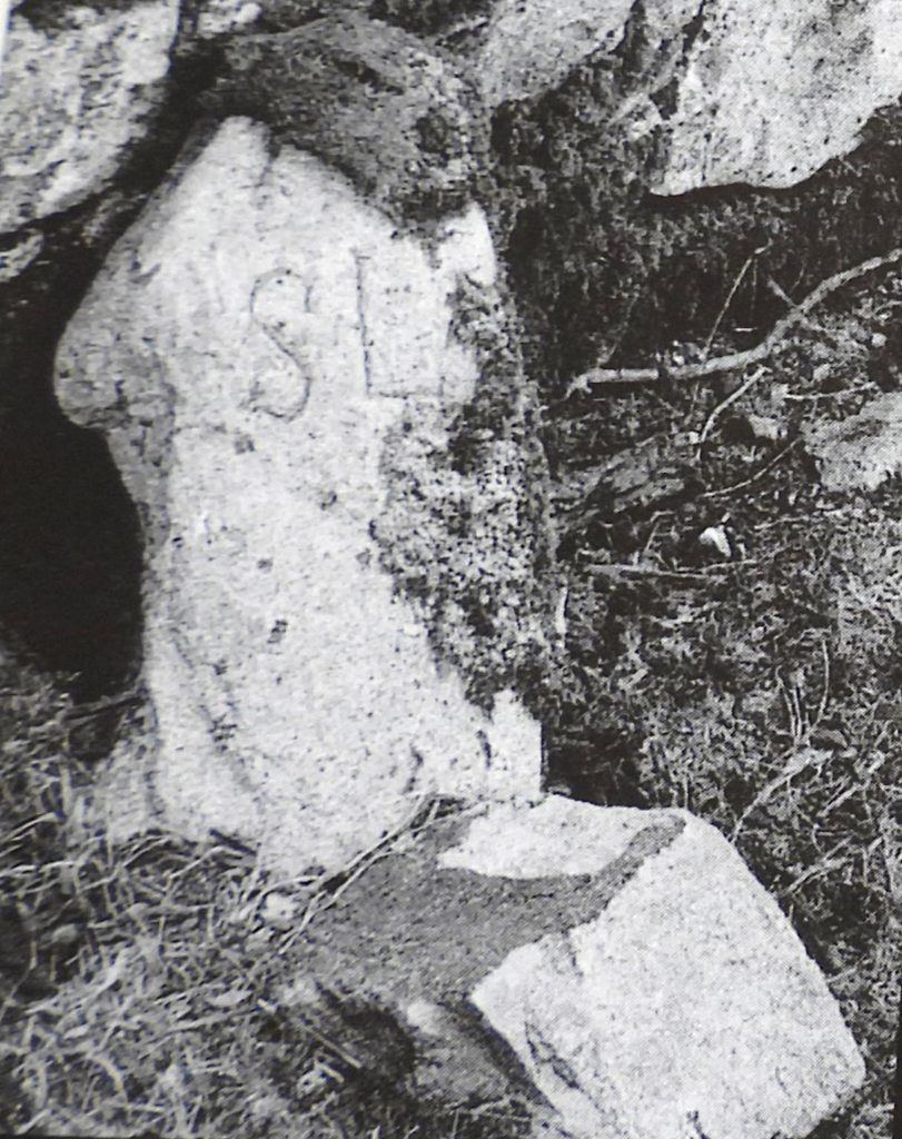
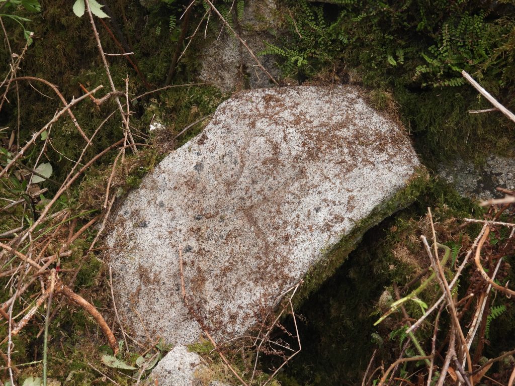
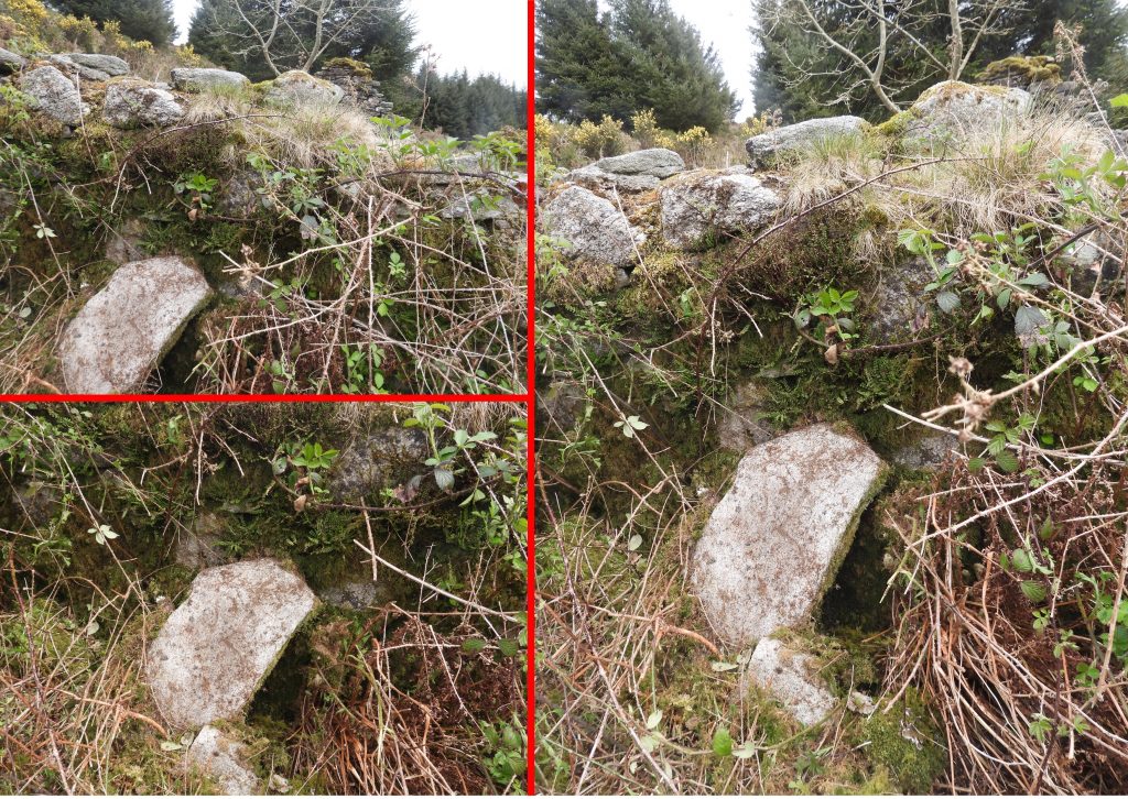
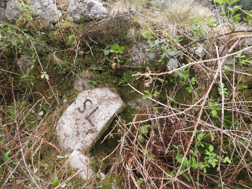
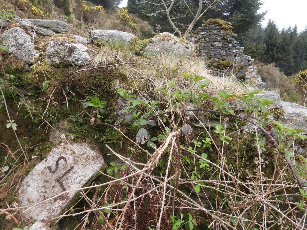
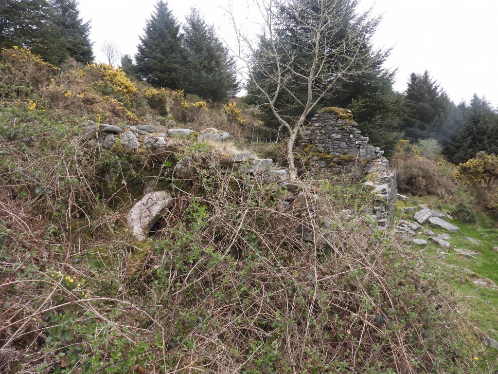
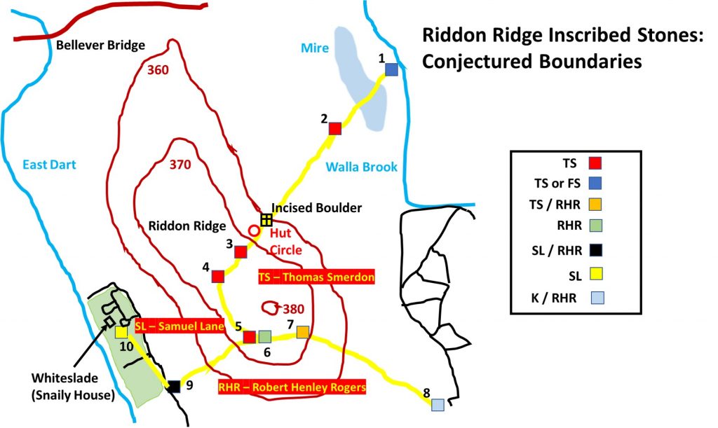
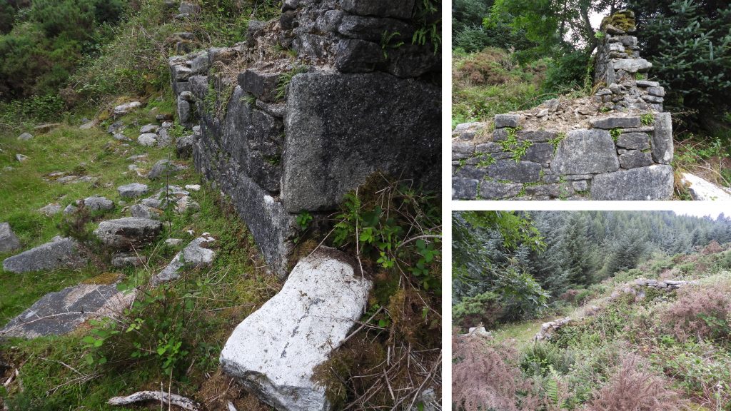
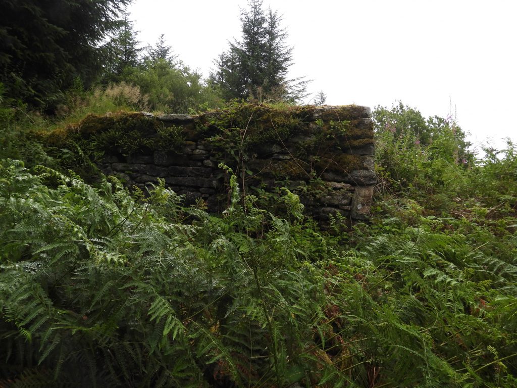
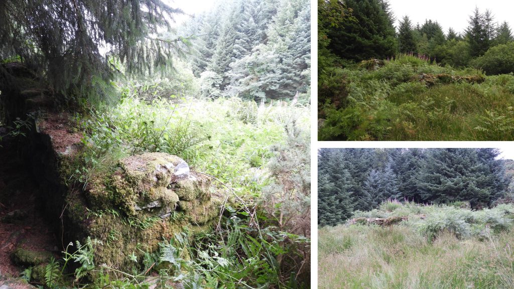
Sketch Map showing locations of the inscribed stones and other features covered by this post. The stones are believed to have been inscribed / erected as follows: c. 1754 (Thomas Smerdon – TS), c. 1800 (Robert Henley Rogers – RHR) and c. 1810 (Samuel Lane – SL). Whiteslade pre-dates the stones having initially been enclosed in 1721. Grid Reference locations of the inscribed stones and other features covered by this post Map Reference 1. This stone is located a few metres to the west of the Walla Brook. It was conjectured in the article in Dartmoor Magazine that this stone is inscribed FS II. The magazine further states that no reference relating to “FS” could be found. The author believes (after a “mud makeover”) that the stone is actually inscribed TS H. The stone is in line with others marked TS or TSH, in a line up the ridge. If the inscription is “TS”, it relates to Thomas Smerdon and the H is possibly Hamlyn.Map Reference 1. This stone is located at SX67136 77222.Map Reference 2. This stone is located on the edge of the mire which lays to the west of the Walla Brook. It is stated in the backchat section of Dartmoor Magazine No 59, Summer 2000 that this stone is inscribed TS H. The stone today appears to only show TS but the pictures from 2000 do show TS H very clearly. Thomas Smerdon is believed to have been a copyhold tenant and the TS stones are believed to have been erected circa 1754.Map Reference 2. This stone is located at SX66895 77010. A large boulder on the East side of Riddon Ridge just below the large Hut Circle has an inscribed “cross” at one end. In the Legendary Dartmoor web entry on Ridden Ridge the theory as to why this stone is inscribed is that: “It could well be that this cross marked a route which led from the ancient tenement of Riddon and joined the Lych way at Bellever?”The boulder with the inscribed cross can be found at SX66637 76665This large hut circle lies about 30m south west of the cross inscribed boulderThe hut circle can be found at SX66606 76627.Map Reference 3: This “TS H” (Thomas Smerdon) inscribed rock is approximately 30-40m south west from the large hut circle on the east side of the ridge. In the Dartmoor Magazine article it states that the name Smerdon has associations with Brimpts Farm, together with their relations to the Hamlyns – is this a clue for the “H” ?Map Reference 3. This stone is located at SX66559 76551.Map Reference 4. On the ridge line is another “TS” stone. This is more or less in line with the stones referenced 1, 2 and 3. The alignment is approx. NE – SW.Map Reference 4. This stone is located at SX66486 76396Map Reference 5. Laying south of the previous “TS” stone (reference 4), along the ridge line another stone can be found. This one is inscribed “TS H”. The “H” is partly buried.Map Reference 5. This stone is located at SX66594 76243.Map Reference 6: This “RHR” (Robert Henley Rogers) inscribed stone lies in a tinners’ trial pit. The “H” and the last “R” are unusually combined and would have saved labour and space. Robert Henley Rogers was the third son of Sir Frederick Leman Rogers. When Sir Frederick died in 1797 he left his Babeny interests (he had three copyhold tenancies) to Robert. The estate was sold in 1813. The stone inscriptions are likely to have been made between 1797 and 1813 when Robert acquired land on Riddon Ridge.Map Reference 6. This stone is located at SX66630 76252Map Reference 7: This recumbent stone lies in a cairn. It is inscribed “TS H” on one side and “RHR” on the reverse (although the latter is no longer visible).Map Reference 7. This stone is located at SX66773 76265Map Reference 7: On the reverse of this stone is the inscription “RHR”. Once again the “H” and the second “R” are combined. The picture is 20 years old. In the intervening period the stone (which is very large and heavy) has been turned over. It would be nice to see the stone re-erected.Map Reference 8. These stones were not located by the author but are said to be located at or near SX6722 7601. One stone is engraved “RHR” (with combined “H” and “R”) and the other with “K”. The grid reference provided take the explorer into a very boggy area. A further visit is needed to get a picture and more accurate GR. The “K” is suggested might relate to “Knight”, a name associated with areas of the forest of Dartmoor in 18th century (Dartmoor Magazine). Dave Brewer suggests “K” stands for Kivill, who had a tenement at Babeny.Map Reference 9. This stone was re-erected on 8th March 2000 having previously been found recumbent by Colin and Jean Rolfe. It is inscribed “RHR” on one side and “SL” on the reverse. On this occasion the “H” and the second “R” are not combined. “SL” refers to Rev. Samuel Lane. By 1810, Rev. Samuel Lane was in possession of a Babeny tenement, which was sublet. Rev. Samuel Lane had land which bordered Robert Henley Rogers and the eastern wall of the Whiteslade newtake. This stone is located next to the eastern wall of the Whiteslade newtake. Rev. Lane died in 1834 and the land passed to his son, another Samuel, who died in 1868.Map Reference 9. This stone is located at SX66272 76042 Map Reference 10. This stone is inscribed “SL”. The picture was taken circa 20 years ago and the stone was recorded as being located at or near SX6612 7626, against the ruins of Whiteslade barn. (ref: Dartmoor Magazine, Summer 1999).Map Reference 10. This stone with its “SL” inscription has alluded the author for several years. The area around Whiteslade outbuilding (barn) has been very overgrown on its north and east sides. The author assumed that the stone, is it was still in situ, must lie within this very overgrown section.Map Reference 10. This stone was found by the author after some substantial “gardening”. The stone was heavily mossed over and had chest high brambles in front of it.Map Reference 10. This stone was finally found having “hacked” through 5m of chest high brambles. With a mud paint the “SL” for Samuel Lane.Map Reference 10. The “SL” stone was recorded as being at SX66108 76264.Map Reference 10. A wider angle view of the “SL” stone shows its position against the north wall of Whiteslade outbuilding (barn). The bramble clearance is evident. This sketch map was constructed by firstly overlaying an OS map with the locations of the features covered in this post, then drawing in the features, before finally deleting the original over layed OS map. The result is a relatively accurate sketch. It clearly shows the “TS” stones running NE – SW, initially then turning south before heading east.. The “RHR” boundary appears curved to the south of the main ridge and the “SL” boundary is next to the Whiteslade newtake. The yellow lines and labels are merely conjectured boundaries and do not relate to any records found by the author.Whiteslade outbuilding (barn) can be found down stream from Whiteslade House and up the slope in an easterly direction.Whiteslade outbuilding (barn) – the “SL” stone can be found leaning against the north wall (opposite end to gable which is still in situ).Whiteslade House (Snaily House), where it is said there once lived two old sisters who lived on a diet of slugs (snails). Whiteslade House (Snaily House) : It is said that curious locals saw the two old sisters eating the slugs. The locals were trying to understand why the sisters looked so healthy, in spite the fact they had no livestock and their garden was overgrown. From that day onwards Whiteslade became known as the ‘Snaily House’ and is still labelled as such on OS maps.