A collection of walks, discoveries, insights and pictures of exploring Dartmoor National Park
August 25, 2021
Butterbury Boundary Stones – an attempted land enclosure
In 1877, a William Maddick Hill and his brother Walter Hill of ‘Butterbury and Little Butterford’ (Higher Butterbury and Lower Butterbury Farms) set up a series of granite posts / markers which were / are inscribed with an “H” in an attempt to (illegally) enclose and claim rights to common land just to the north / north east of the Langstone Moor menhir. The Ordnance Survey map from 1890 shows a series of 9 “stones” associated with reaves and what are now banks / ditches in the area, which apparently shows the granite posts / markers put up by the Hill brothers.
William and Walter Hill were sued by John Reddicliffe of Middle Wapsworthy with the case being reported in the Devon and Exeter Gazette on 25th October 1897, some 20 years since the posts / markers were set up. At that time, it was reported that in 1895 the boundary posts had been taken down and replaced with hedges or banks. The source of the above information is contained in the Dartmoor Boundary Markers (2nd Edition) by Dave Brewer. Armed with this information, conducting some research using the Dartmoor HER and side-by-side maps (to get accurate GR’s), the author conducted a field survey, the results of which are contained in this post.
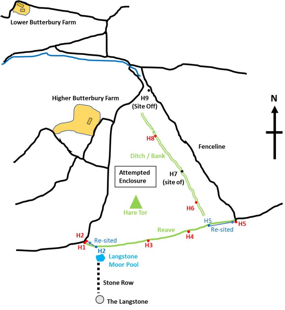
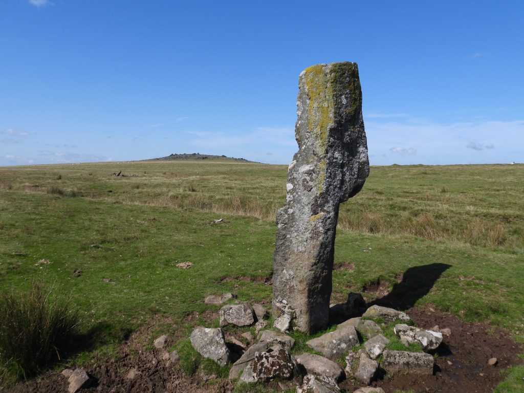
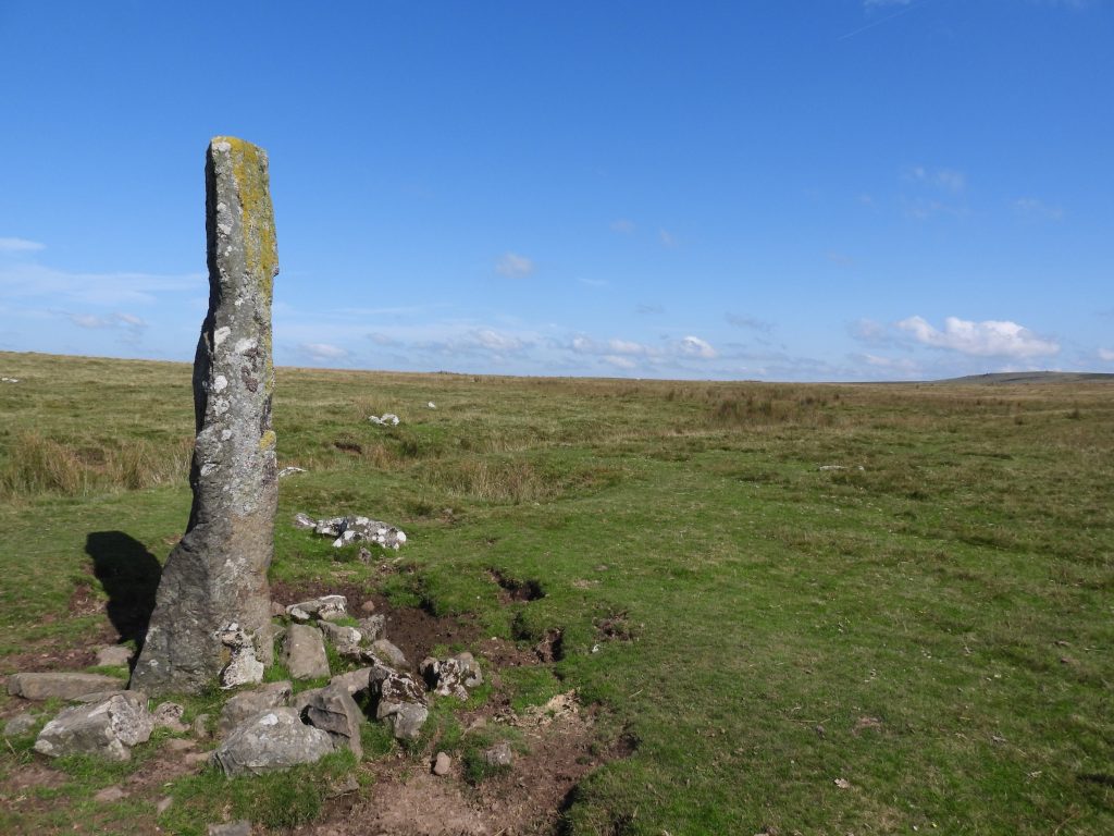
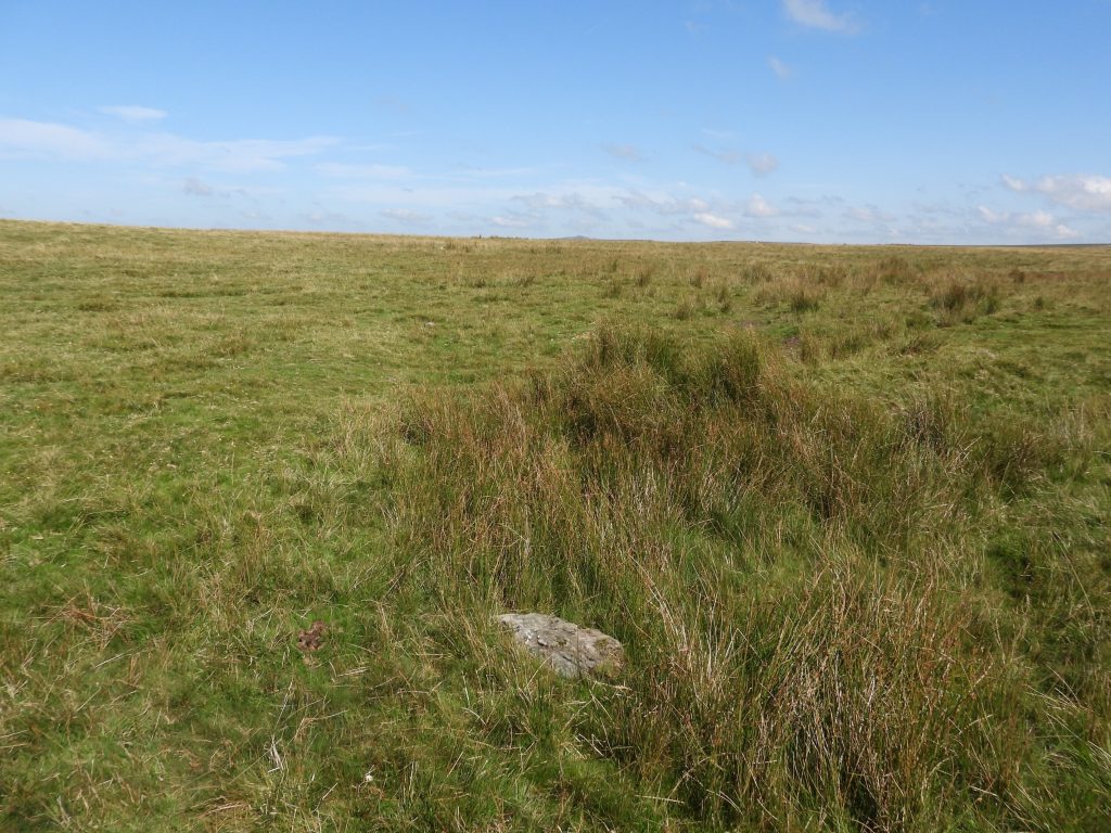
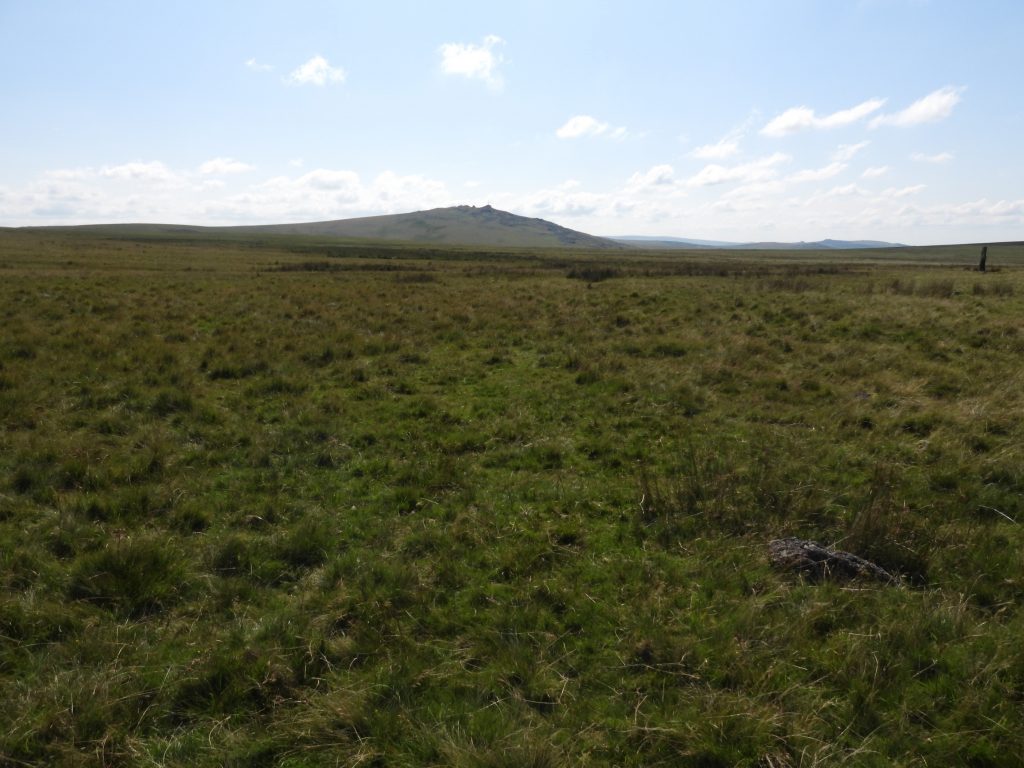
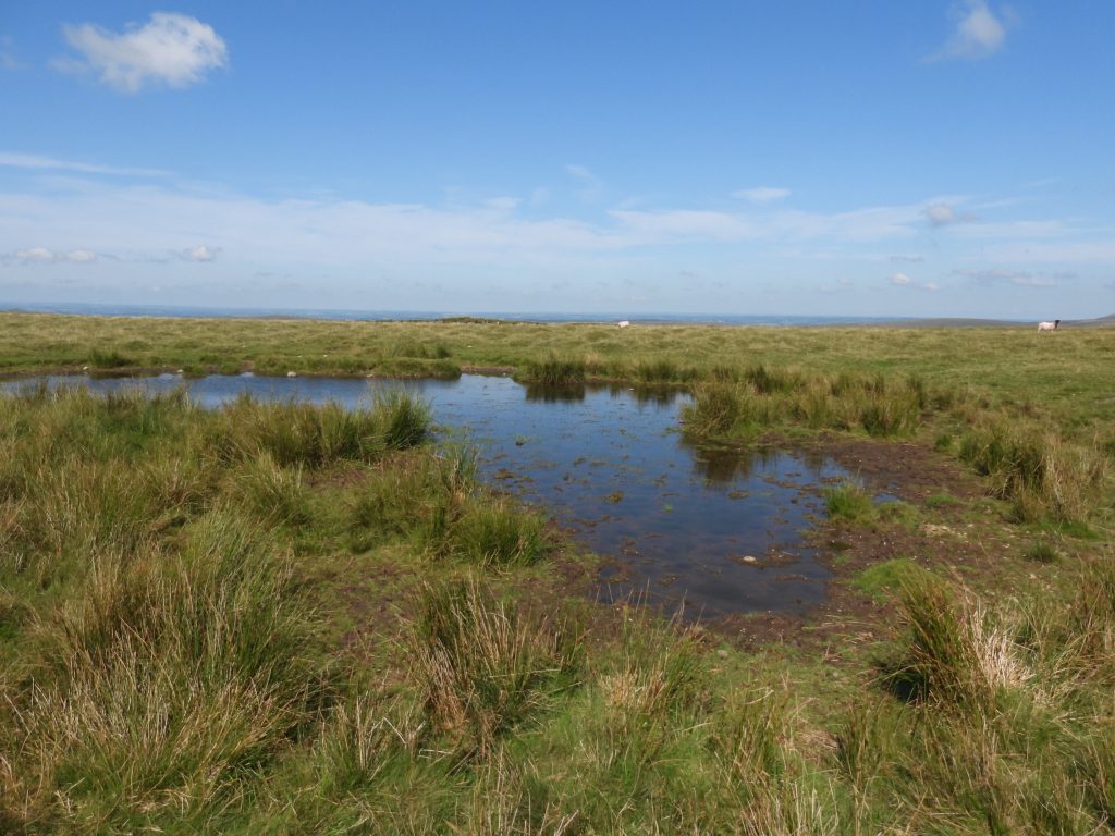
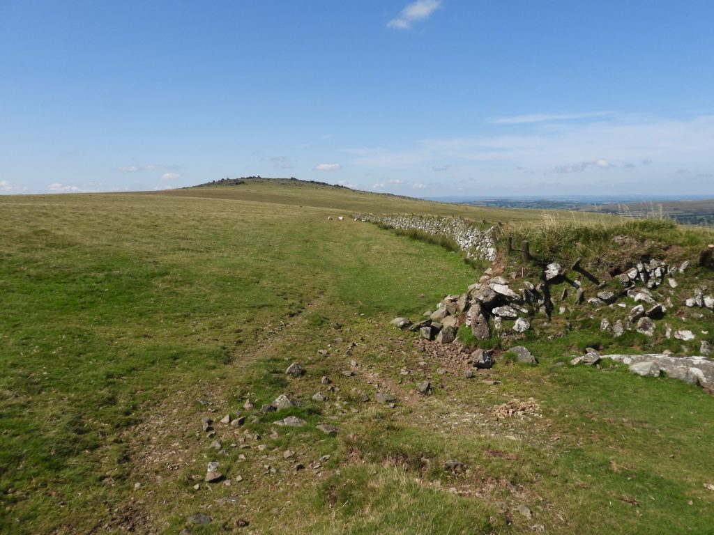
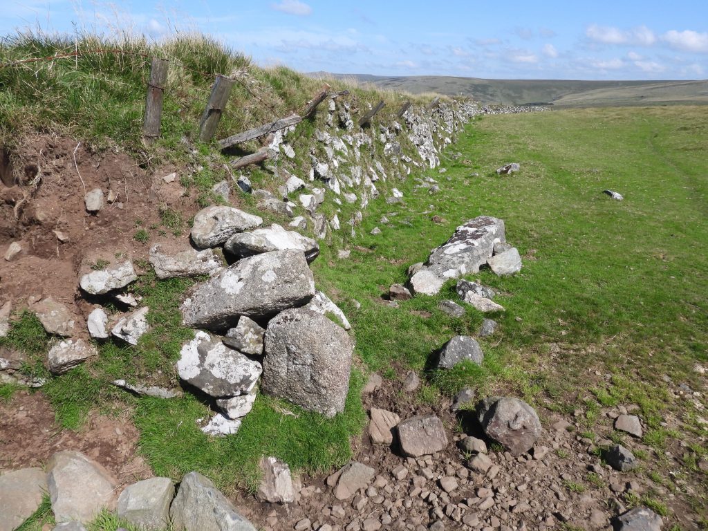
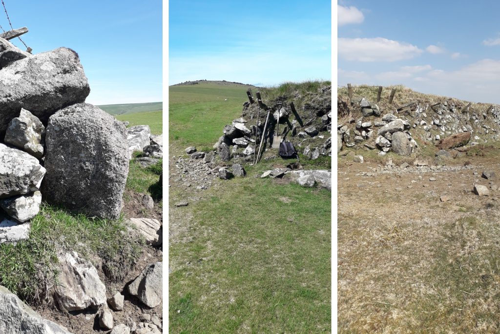
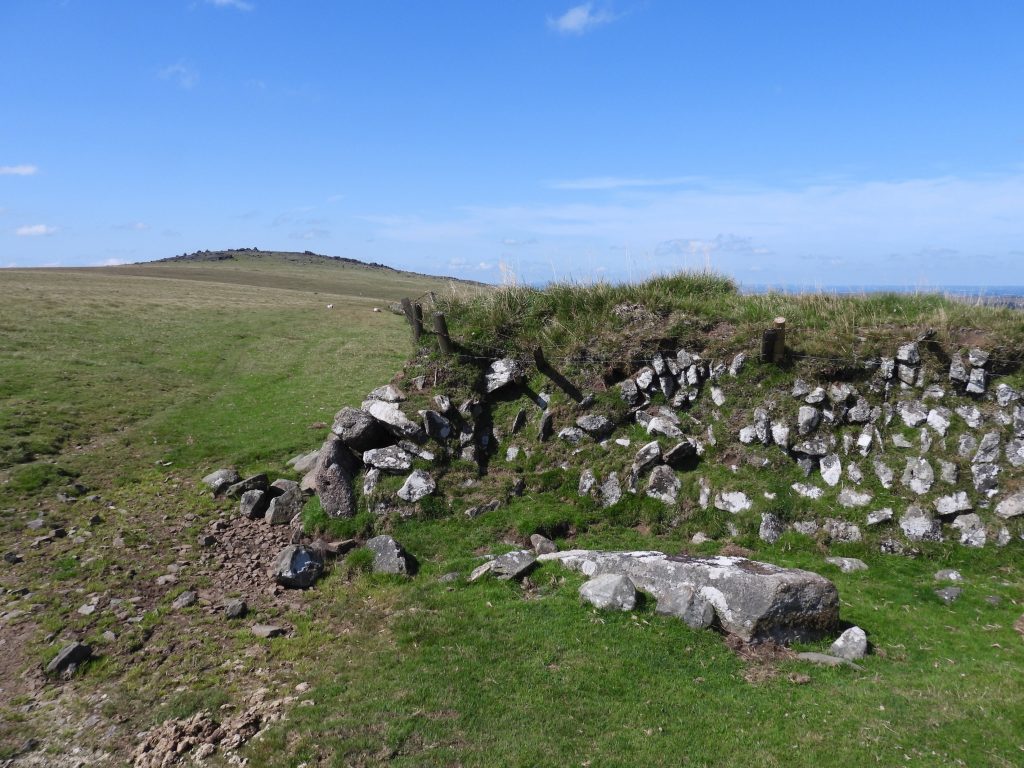
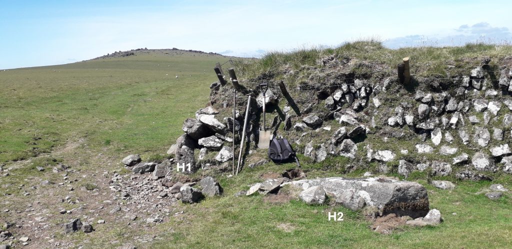
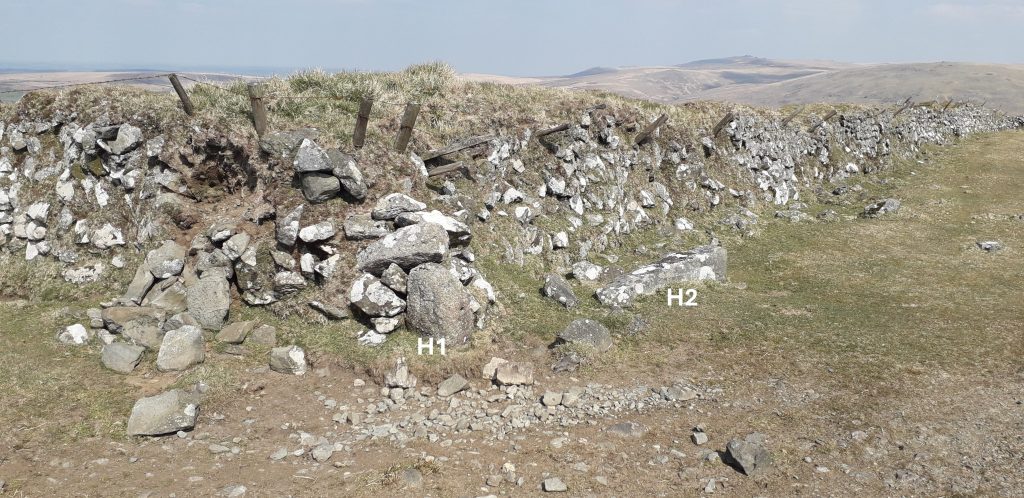
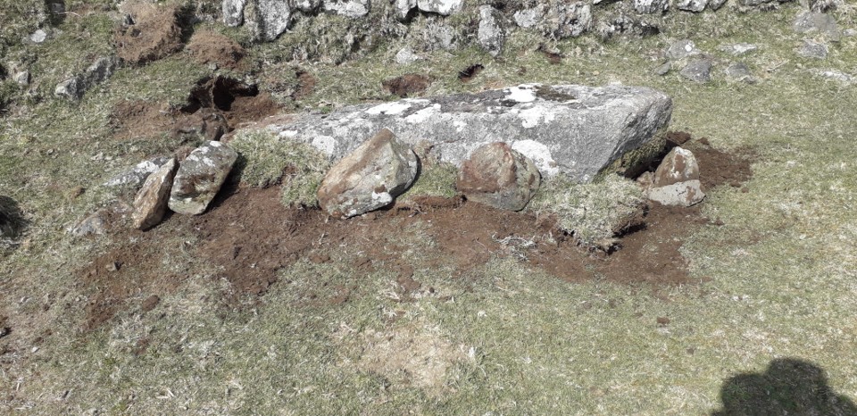
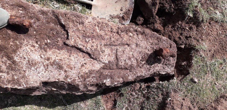
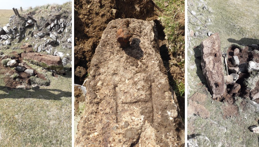
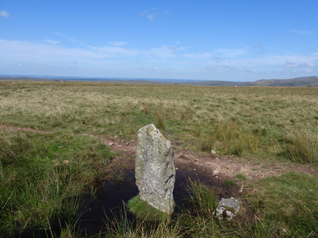
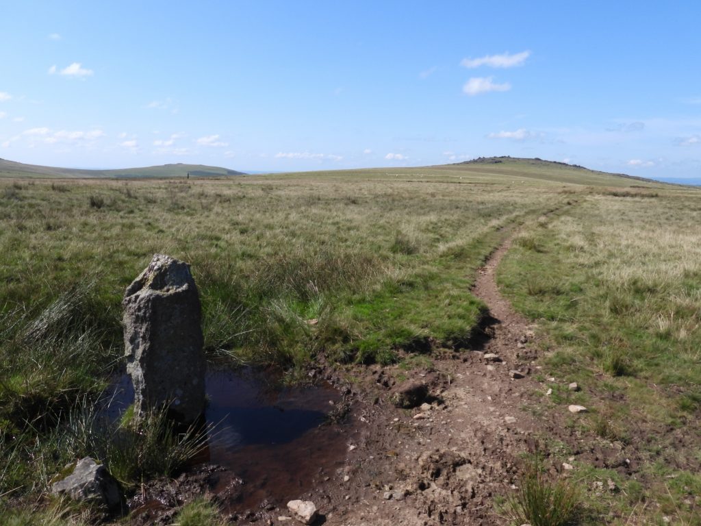
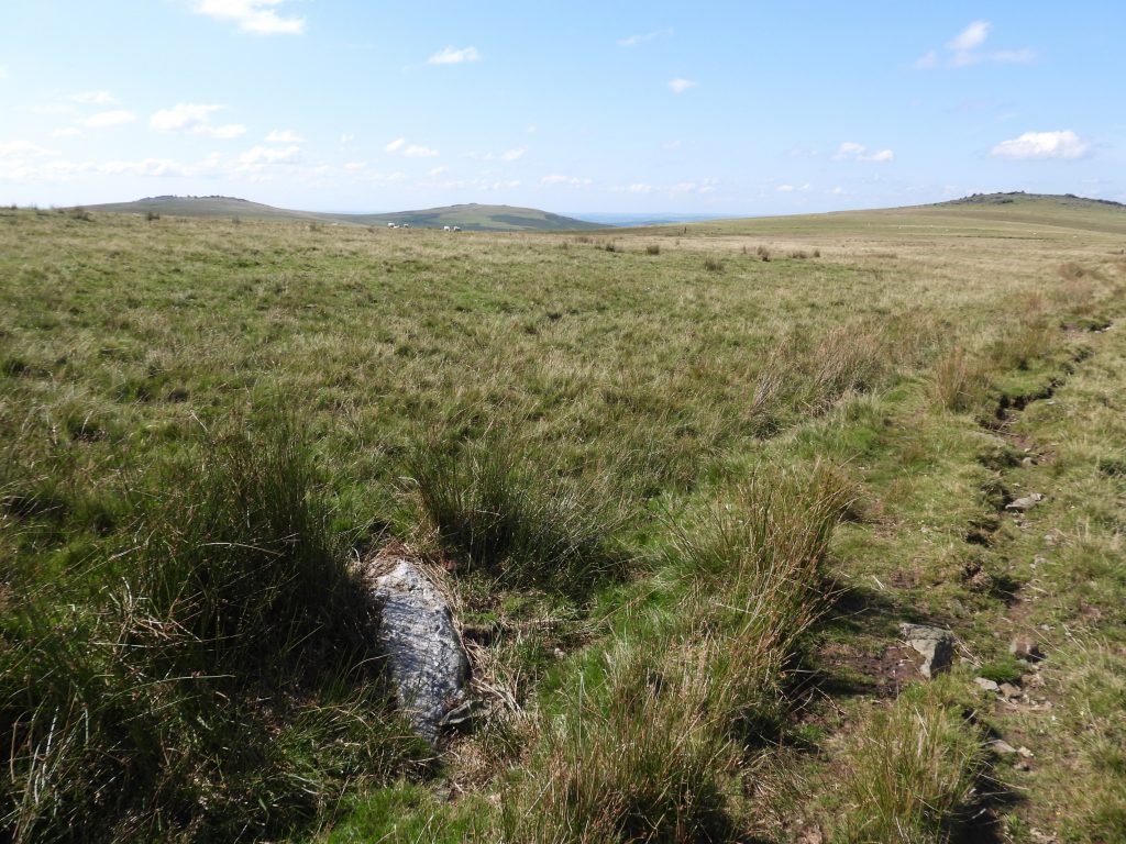
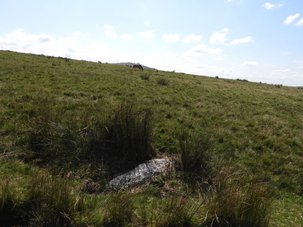
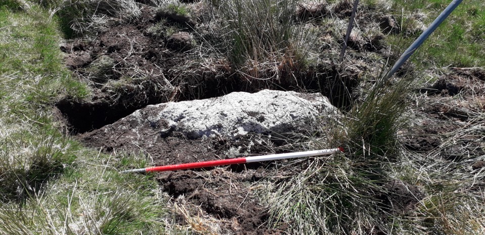
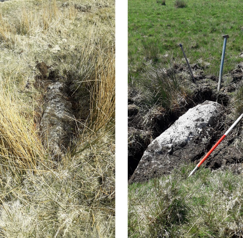
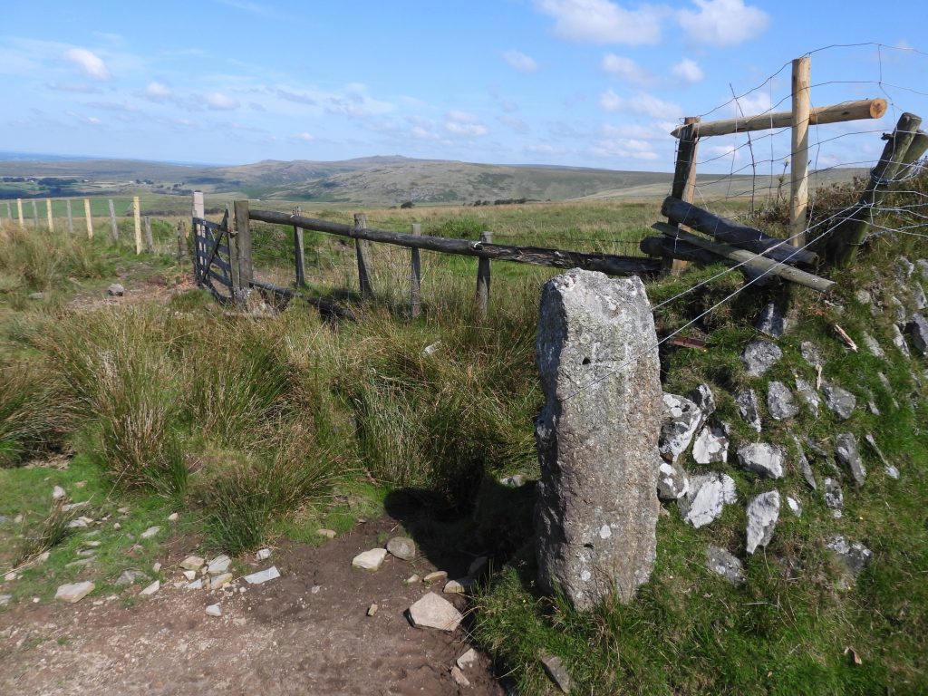
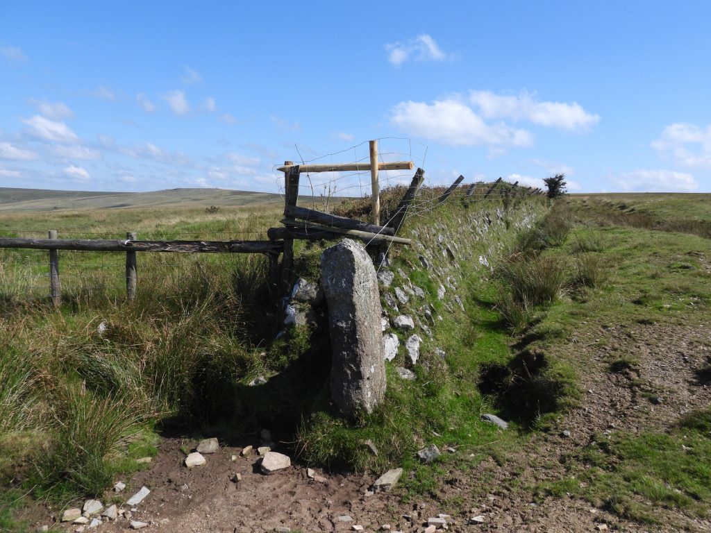
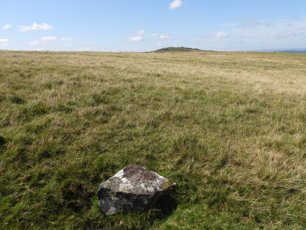
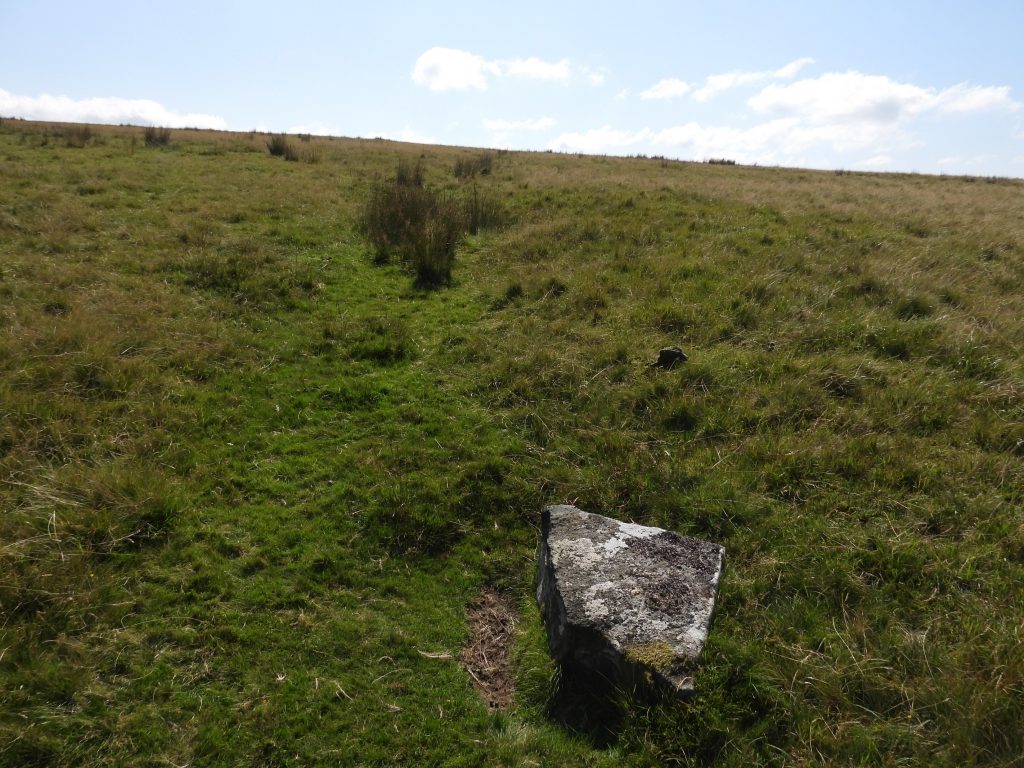
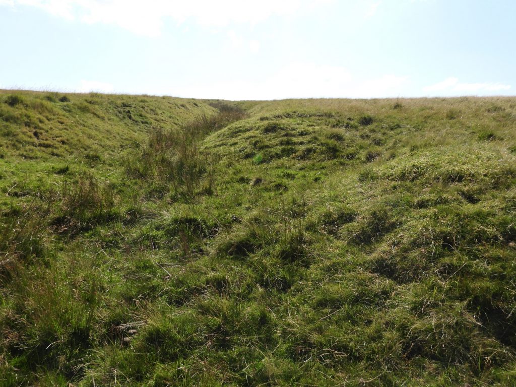
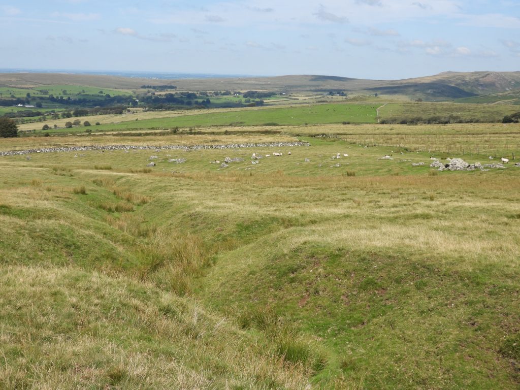
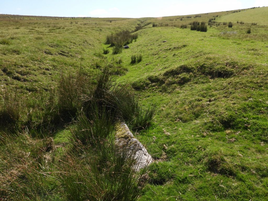
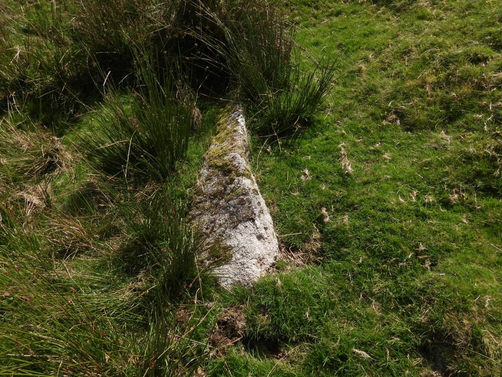
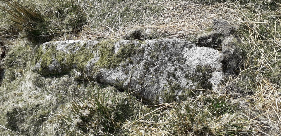
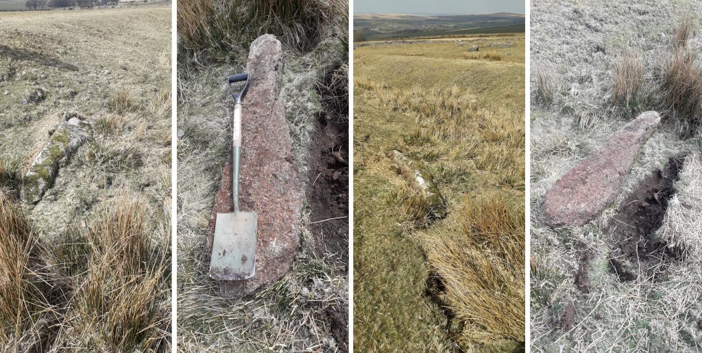
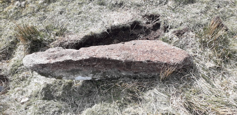
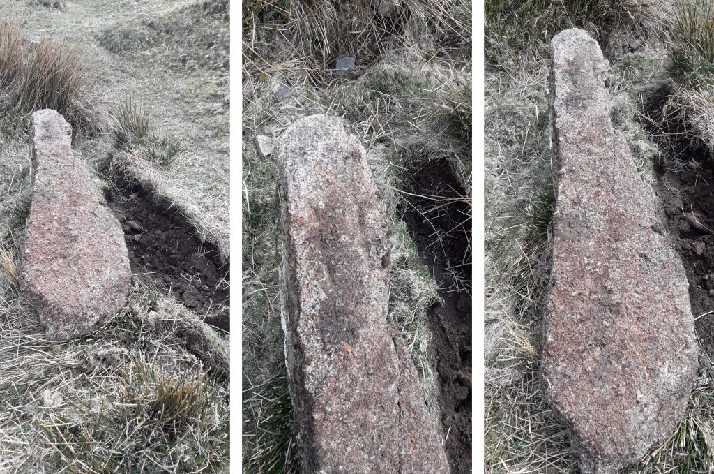
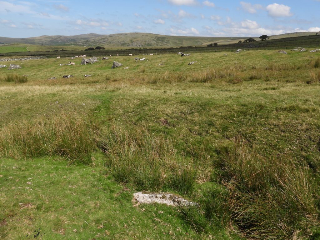
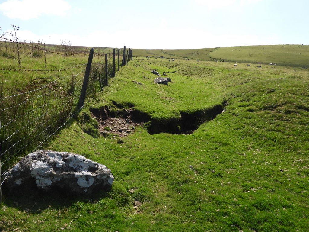
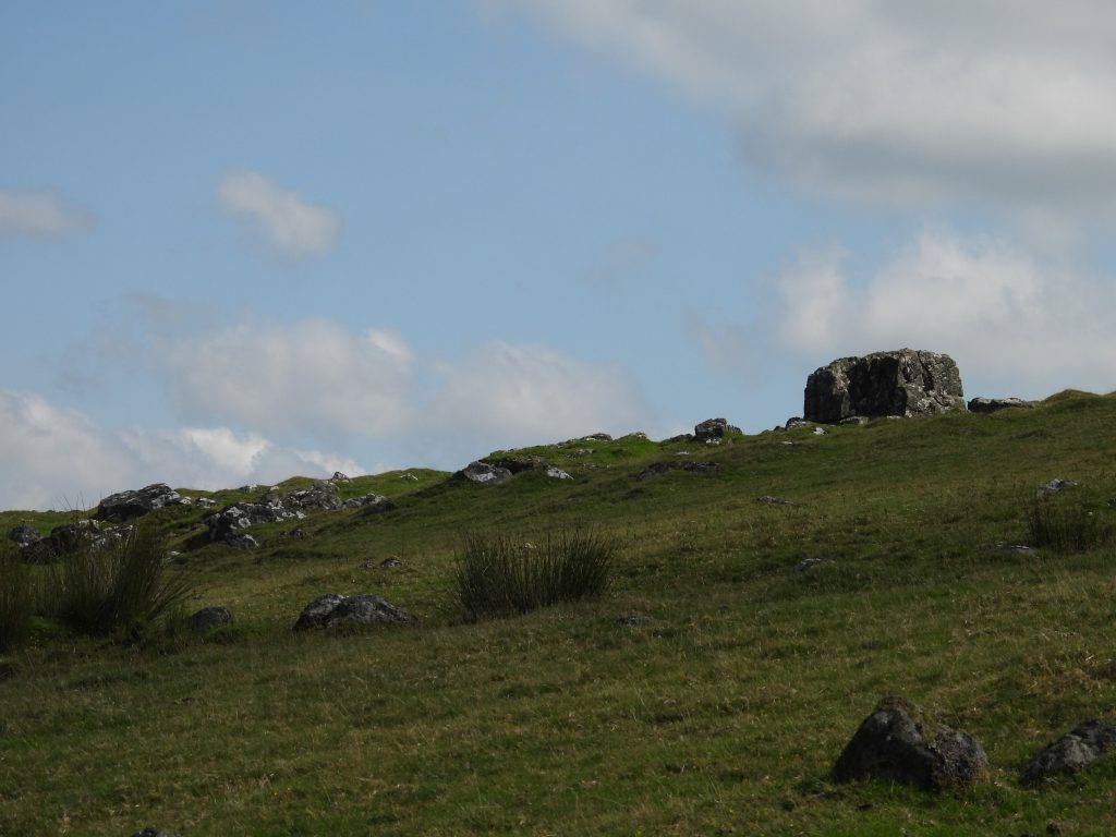
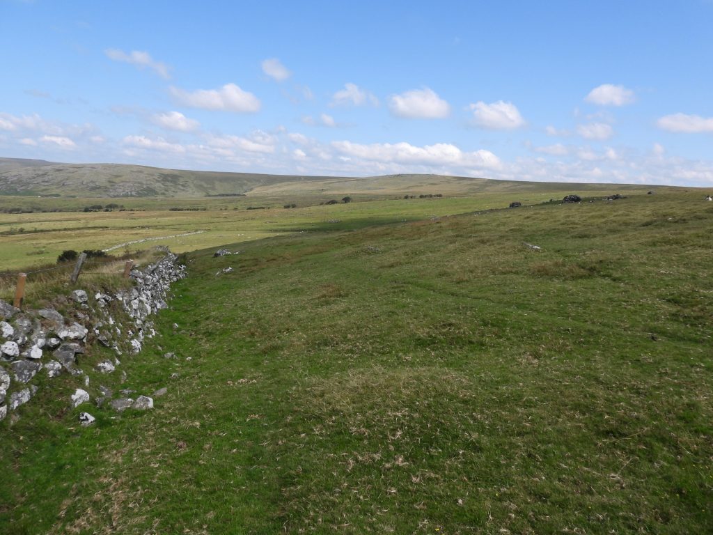
This sketch map shows the area covered in this post. It was created using an “overlay” technique to get as accurate a picture as possible as all the relative features covered in this post.The Langstone with White Tor in the background. This Standing stone lies at the southern end of a stone row. The HER describes that this stone might have formed one of the way-signs for the Lych Way after passing White Tor on the way to Whittabarrow. The stone was re-erected in 1893 being put into its original socket. This standing stone is a good location to start the exploration of the area.Another view of the Langstone, which stands to a height of 2.75 metres. The stone was damaged during war years, being target practice by American troops. It has impressions from ordnance impacts on the west face. The Langstone is the only standing stone on Dartmoor that is not granite as it is composed of a metamorphic rock local to Whittor (White Tor). Immediately to the north of the Langstone is a stone row. Historic England record states “The stone alignment includes a 128m long, single row of twenty-seven stones, although only thirteen remain in place and these have an average height of 0.19m”. The stone row is not easily discernible, and the Langstone is useful as a “guide” to its location.A view of one of the stones in the row with Great Mis Tor in the background and the Langstone at the top right of the picture. The Lych Way might have passed across the stone row. The Langstone Moor pool measures 28m by 24m according to the HER and is one of over 40 such ‘sacred’ pools identified on Dartmoor that are thought to have potentially been designed during the prehistoric period. The pool lies at the northern end of a stone row and therefore is close to where the Hill brothers enclosed land is located.A short distance from the Langstone Moor pool lies an obvious corner of a wall. It is here where the first of the Hill brothers stones can be found.With reference to the sketch map, the stone marked “H1” can be found at SX54966 78917. This is consistent with the location referred to on the 1890 OS map. The “H” inscription is easily discernible. It is thought that this post was once a gatepost but now only the top remains. Corner of the Newtake where H1 is located. The tools were being used to turn over H2 (gatepost) – pictures courtesy of Simon Dell“H2” according to the 1890 OS map should have been located at SX55008 78918. However, it is surmised by Dave Brewer in his Dartmoor Boundary Markers book that the recumbent gatepost adjacent to “H1” could be “H2”. There is no inscription on the upper surface of this gatepost. It is located at SX54970 78920.H1 and H2 locations – picture courtesy of Simon DellH1 and H2 locations – picture courtesy of Simon DellH2 (gatepost) – picture courtesy of Simon DellH2 (gatepost) turned over. Dave Brewer was correct, the stone does have an ‘H’ inscription and therefore is definitely H2- picture courtesy of Simon DellH2 (gatepost) turned over with ‘H’ inscription – picture courtesy of Simon DellAs the explorer moves in an easterly direction from “H1” and “H2” along a reave, the views to the north are simply stunning. The photograph shows (amongst others) Ger Tor, Hare Tor and Great Links Tor looking across the south west end of Tavy Cleave.“H3” is an obvious stone along the reave. It can be found at SX55173 78933, consistent with the location identified on the 1890 OS map. It was (re) erected in this location by the DNP having been found recumbent.View of “H3” looking toward White Tor. The Langstone and Cox Tor are also just discernible in the photograph.“H4” location is SX55324 78956. Once again this GR is consistent with the location on the 1890 OS map. It is assumed that this was one of the stones which had been removed (upended) in 1895 (as reported in 1897).Another view of “H4” with view towards Great Mis Tor, which is just visible.Attempts to turn over H4 – Picture by Simon DellAttempts to turn over H4 – Pictures by Simon Dell“H5” is the most easterly of the stones and can be found at a wall corner known as “Daw’s Corner”. This is another stone which is not on its original site. It appears to have been relocated from SX55399 78984 to SX55505 79007. “H5” appears to have been used as a gatepost and has two drill holes in it. It clearly has an “H” inscribed on its southern face.According to the 1890 OS map “H6” should be located at approx. SX55349 79068. At this location this stone was found. It looks as if it has been “placed” at this location and may well be the original “H6” (albeit it is not an “upright” shaped stone) or alternatively just a marker when the original “H6” was removed in 1895.This stone (“H6” ?) is located at the top of a ditch which descends the hill.There is no obvious stone or feature next to the ditch where “H7” was located (SX55315 79179).Looking north west down the ditch, where “H6”, “H7” and “H8” are / were located. the field systems of both Higher Butterbury (William Hill) and Lower Butterbury (Walter Hill) can be seen. There is very little to discern of these two ancient settlements which lie on non-public access land.There is no mention that Dave Brewer found “H8”. That said, this long recumbent stone located at SX55213 79305 and is exactly where the 1890 OS map states one of the stones should be. The (possible) “H8” stone is considered, by the author, to be one of the Hill brothers stones made recumbent in 1895. Recumbent H8 – Picture courtesy of Simon DellTurning H8 over – Pictures courtesy of Simon DellH8 turned over – Picture courtesy of Simon DellTurned over H8 with clear ‘H’ inscription – Pictures courtesy of Simon Dell“H8” looking north. Interestingly the ditch where “H6”, “H7” and “H8” are located is not shown on the Dartmoor HER. Is it possible that the ditch is from the late 19th century and was dug by the Hill brothers?The last stone “H9” is shown on the 1890 as being located at SX55202 79447, which is the location of the stone shown on the photograph. It is intriguing that this stone is not on the same “line” as the ditch and the three previous stones. Is is possible that this stone in the photograph relates to “H9”. It does look natural, however and doesn’t appear to have been “placed” (unlike “H6”). One suspects that the mystery of “H9” might never be solved.Inside the attempted Butterbury enclosed land lies Hare Tor Close up of Hare TorOn the west boundary of the attempted enclosed land is a lovely newtake wall, which one assumes the Hill brothers used as part of their plans. In the photograph, Hare Tor is on the right and the Higher and Lower Butterbury farm fields can be seen over the wall. The two farms are ancient settlements and were recorded as early as 1330. Higher Butterbury, is recorded as consisting of six buildings with associated yards and small enclosures with Lower Butterbury being recorded as consisting of at least four buildings with associated yards and small enclosures. Butterberry has also been known as ‘Butworthy’, ‘Butsworthy’, ‘Butterford’, ‘Butaford’ and ‘Boterworthi’