A collection of walks, discoveries, insights and pictures of exploring Dartmoor National Park
May 9, 2021
Willsworthy Range WD (War Department) Standing Stones
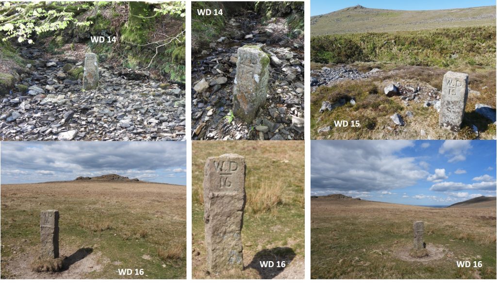
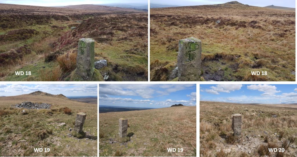
The Willsworthy Range ‘WD’ standing stones map out the tract of land that the War Department purchased in 1903. The route follows virtually the the line of the old Willsworthy Manor bounds, with some slight variations (of about 3200 acres) which were purchased from the Calmady-Hamlyn family. There is some debate surrounding WD 14 (which may have been moved), the correctness of the locations for WD 15 and WD 16 (in relation to being thought to have been erected on Duchy land) and the mystery surrounding the ‘missing’ WD 17. There are 45 “W.D” stones in total, which have a distinctive “W.D” underlined with the appropriate number underneath. These stones (according to Hemery) were cut in the ‘locality of Nattor Down’ and taken to their sites by Fred Palmer of Lane End Farm. They are generally 0.6m high and bare tare and feather marks.
The source of information for the post has been from Dartmoor Boundary Markers (1st edition; 1986 and 2nd edition; 2002) by Dave Brewer.
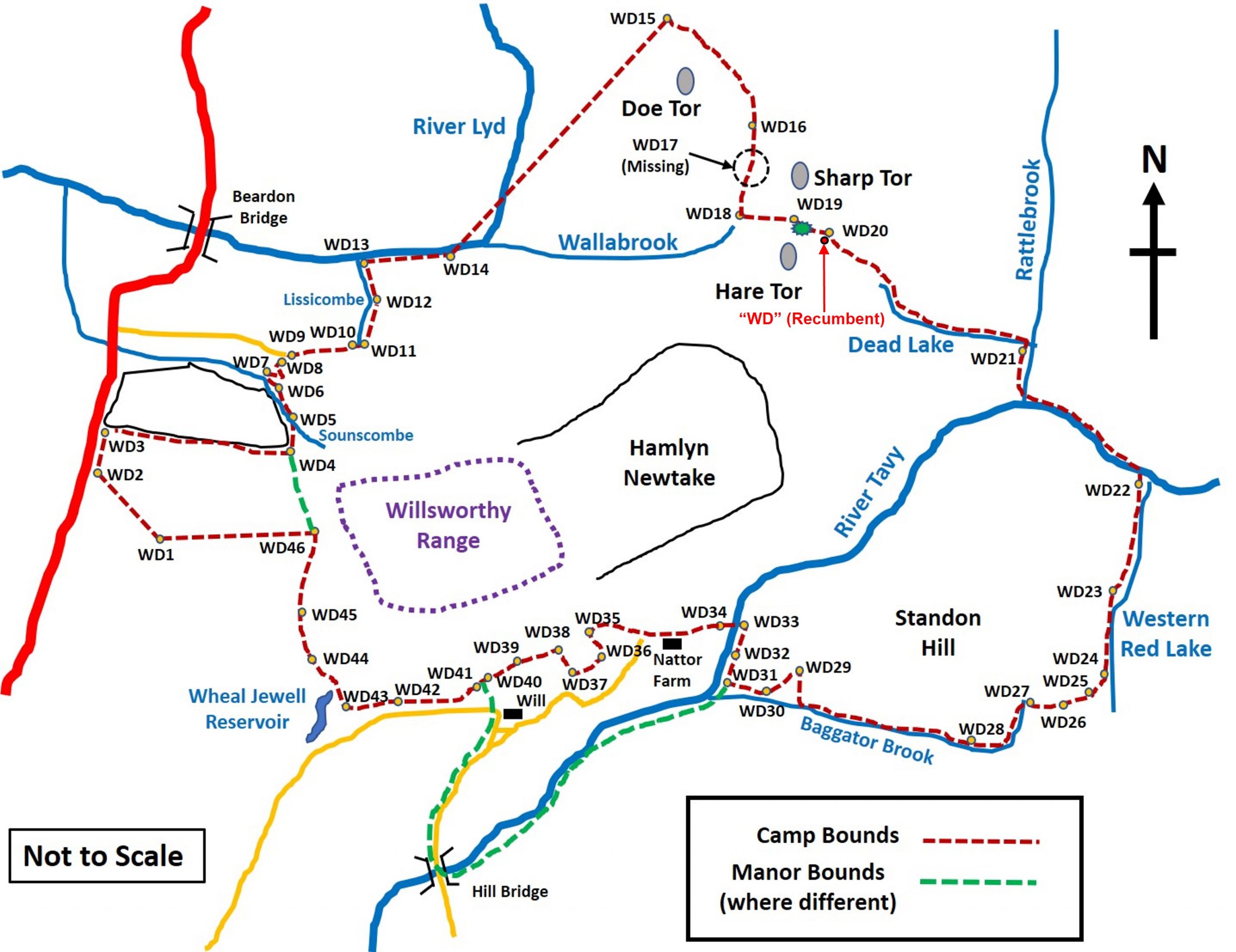
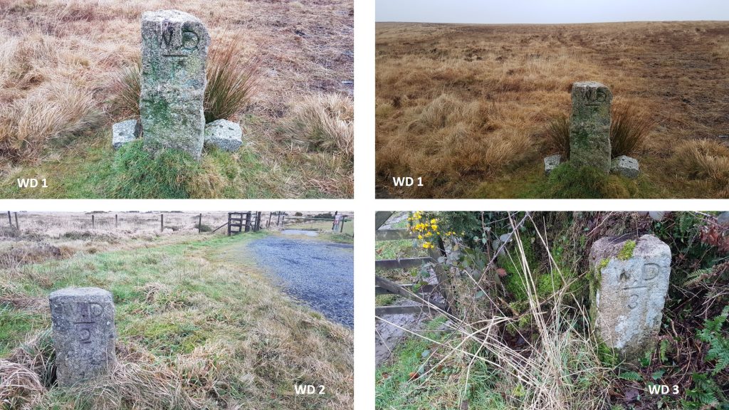
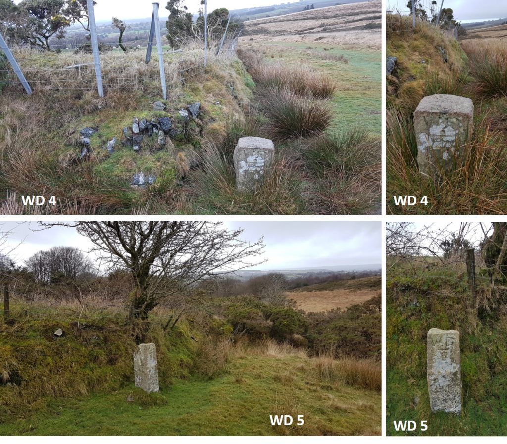
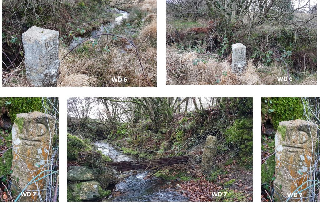
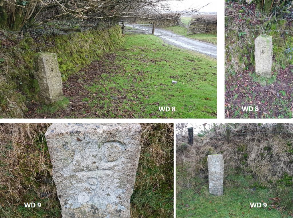
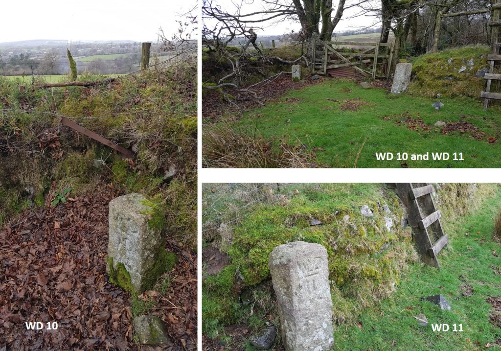
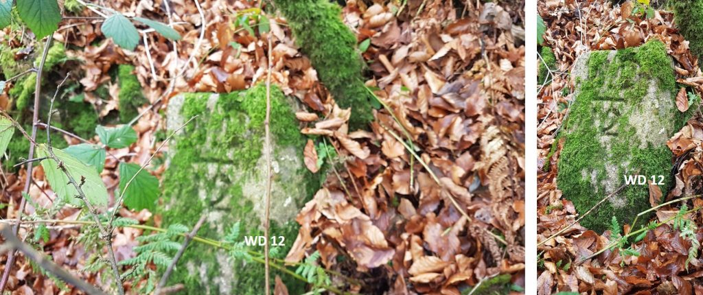
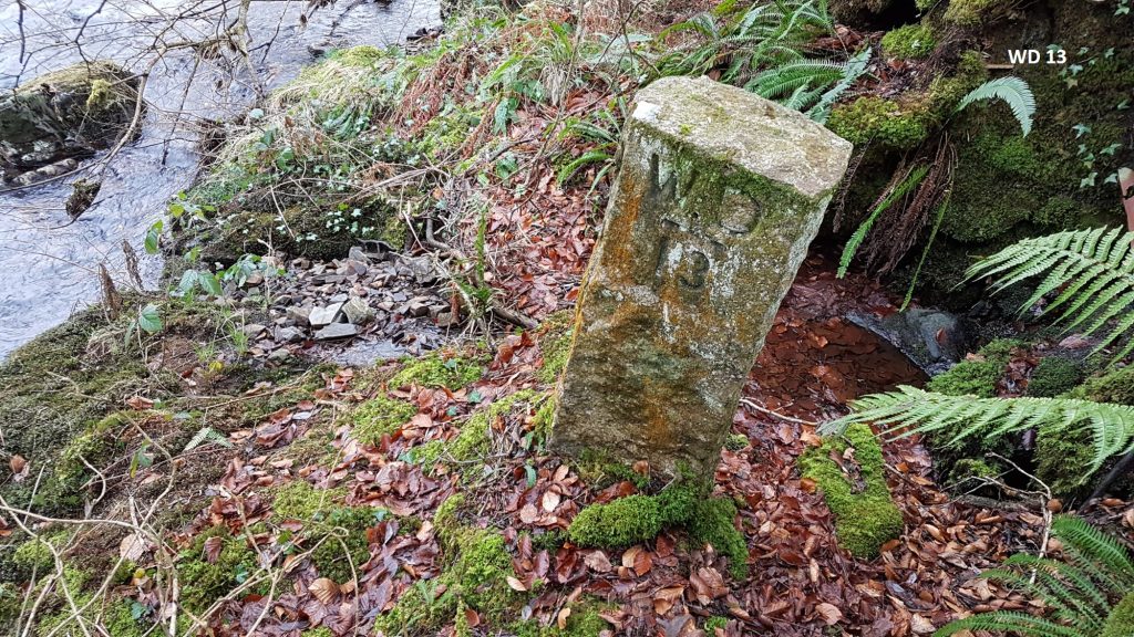
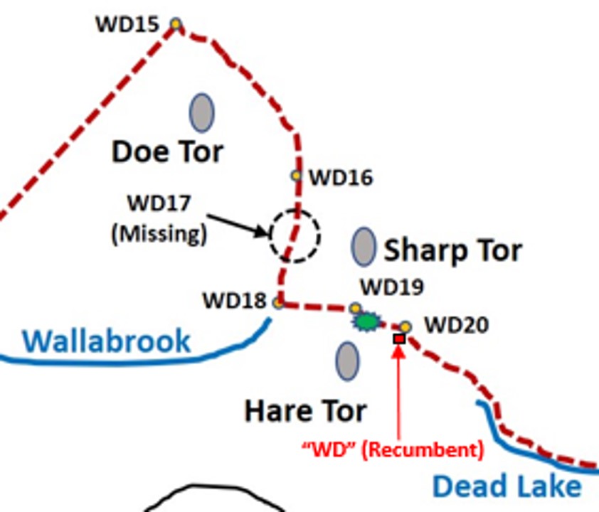
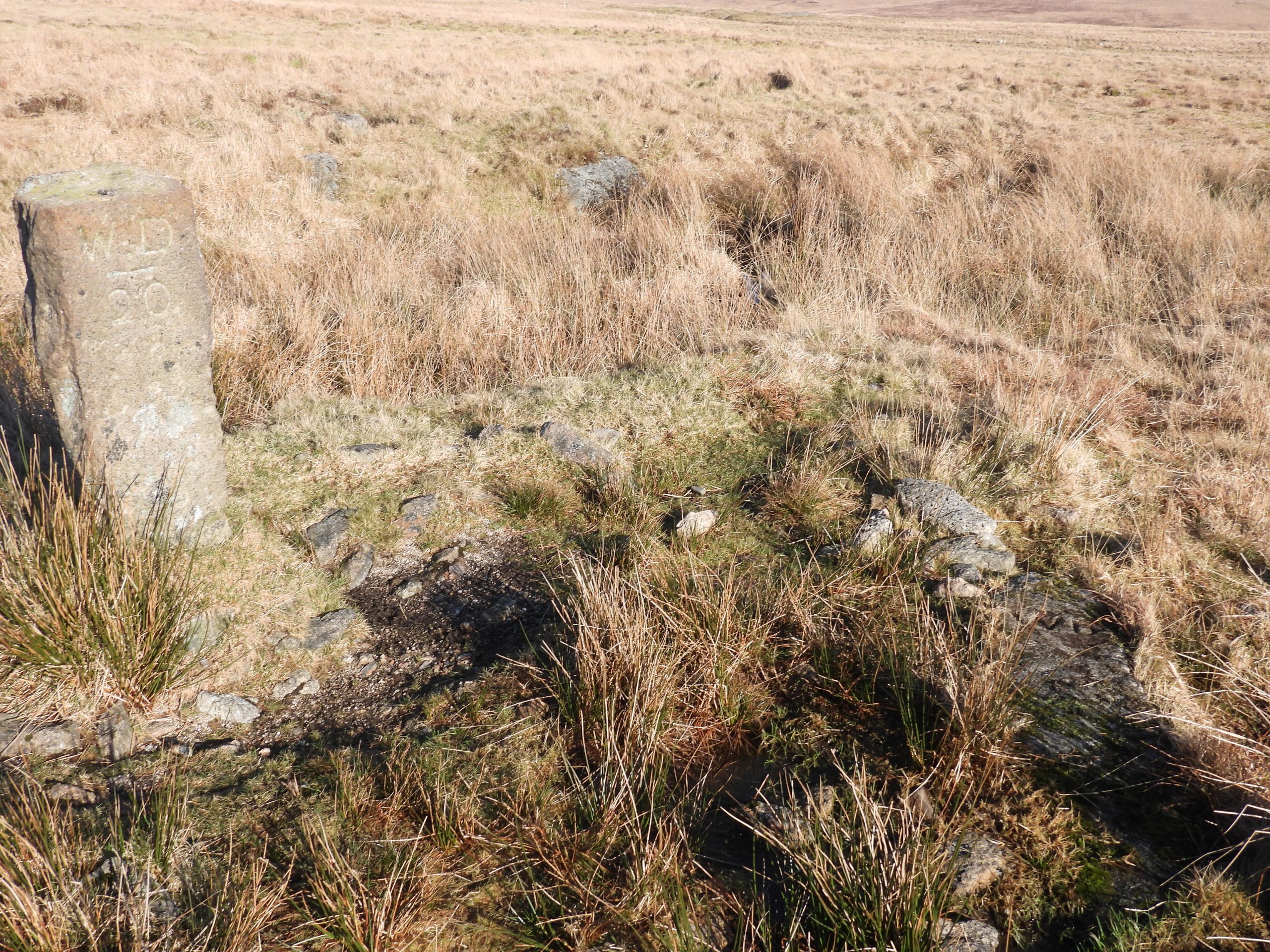
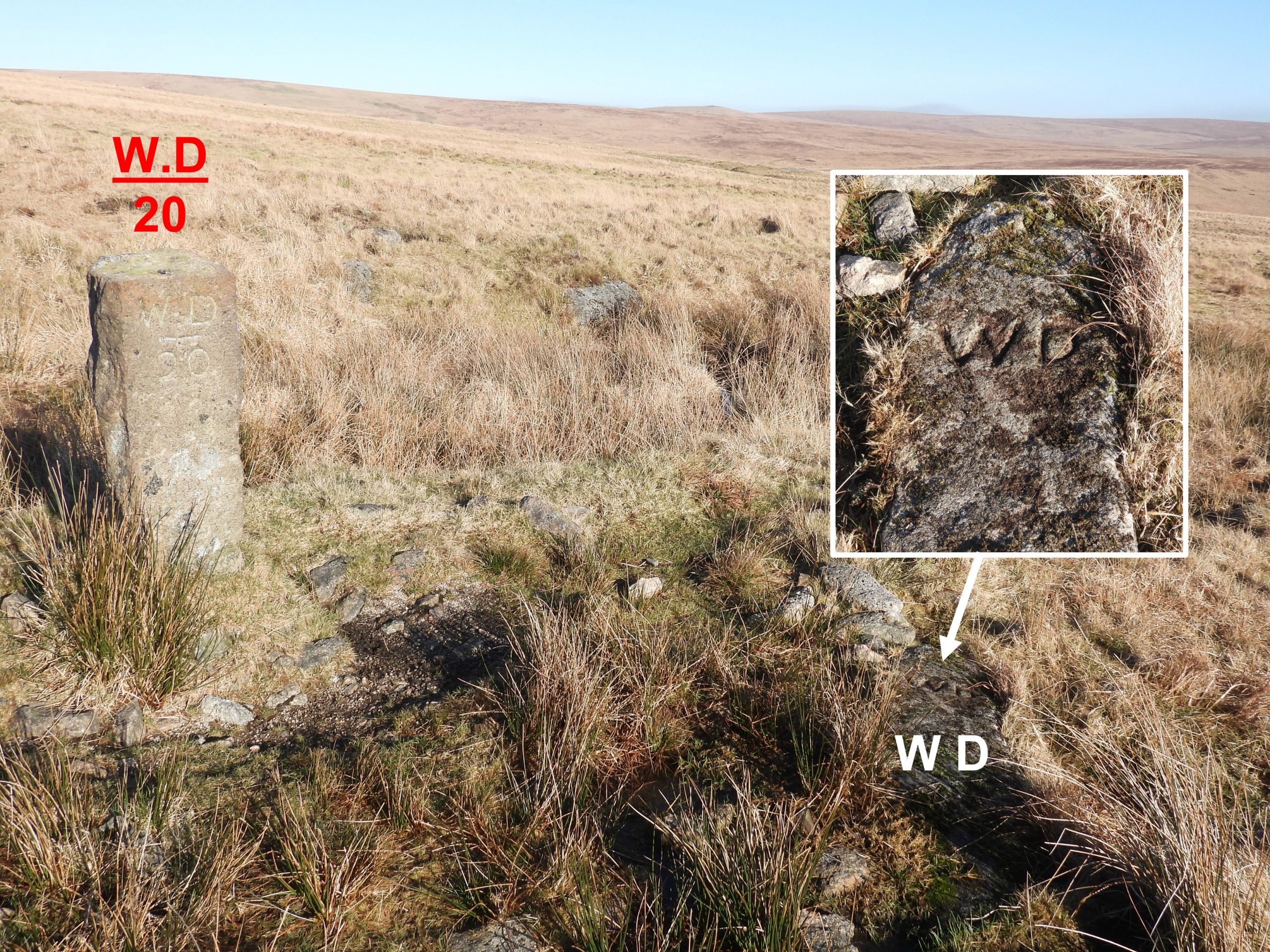
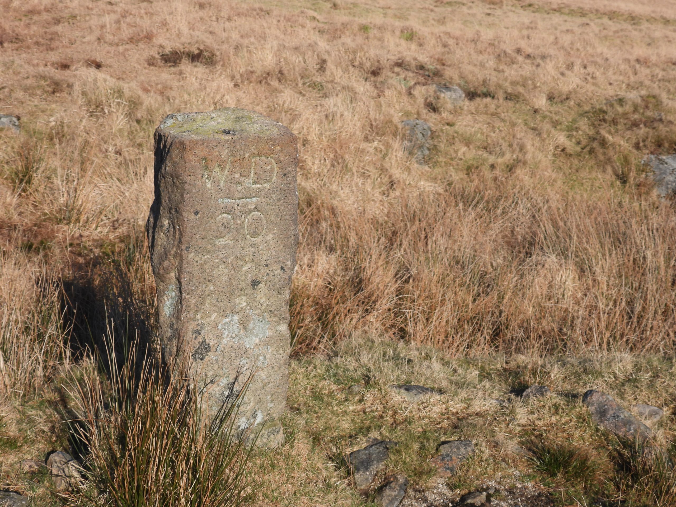
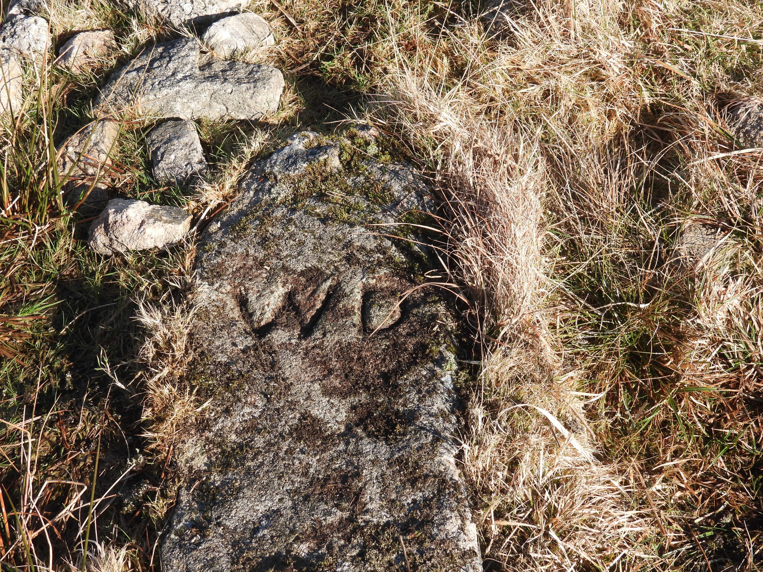
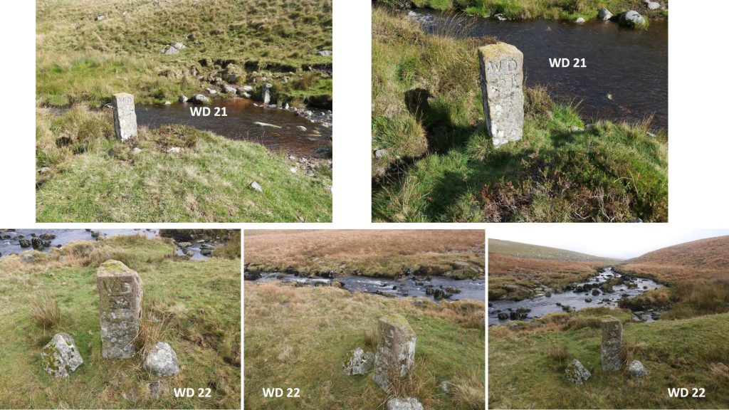
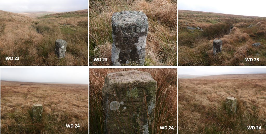
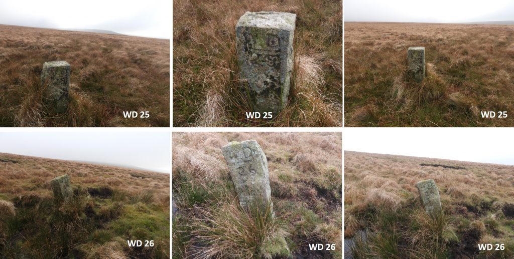
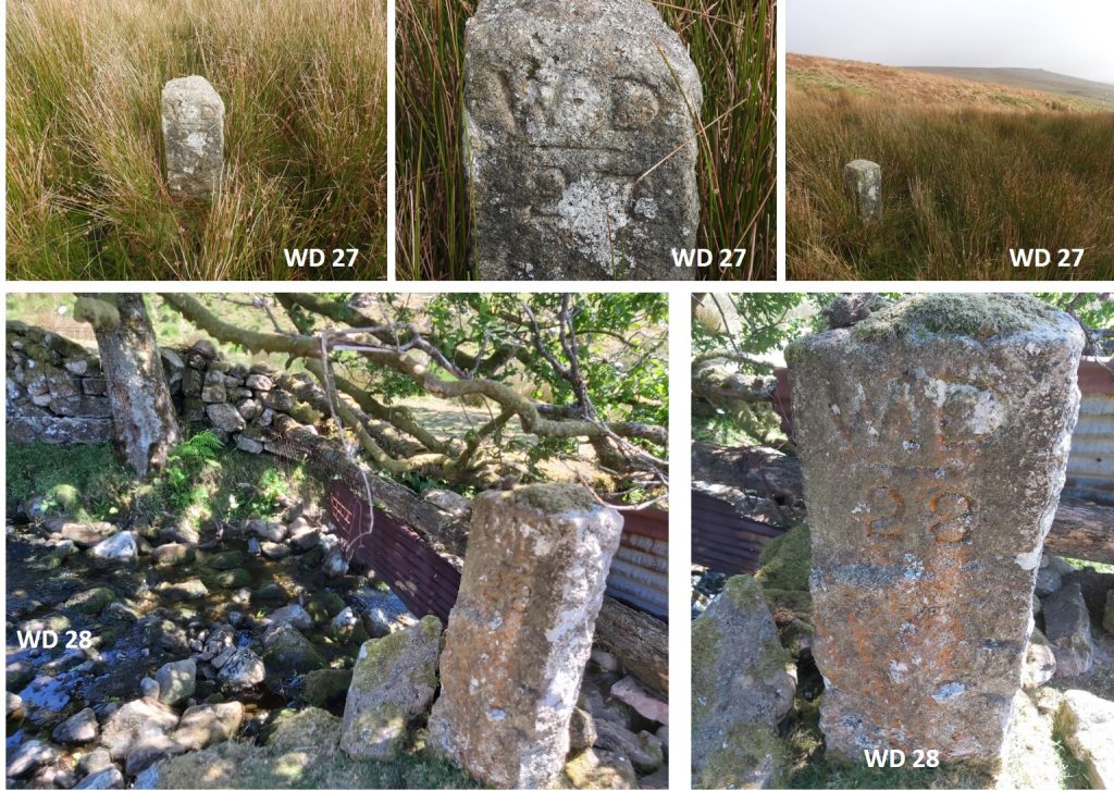
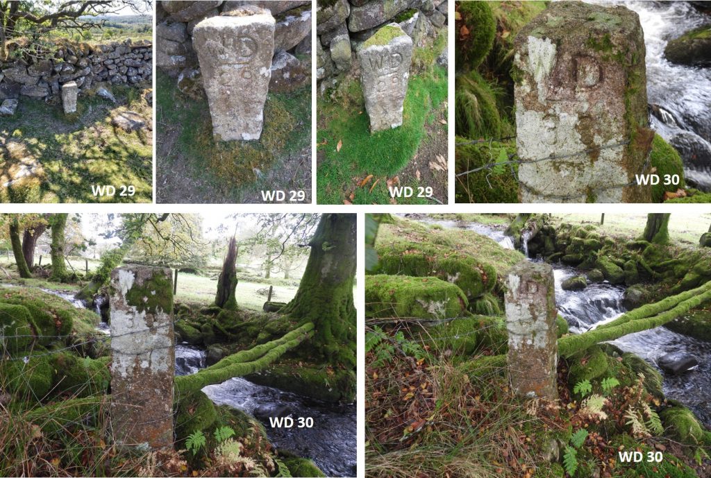
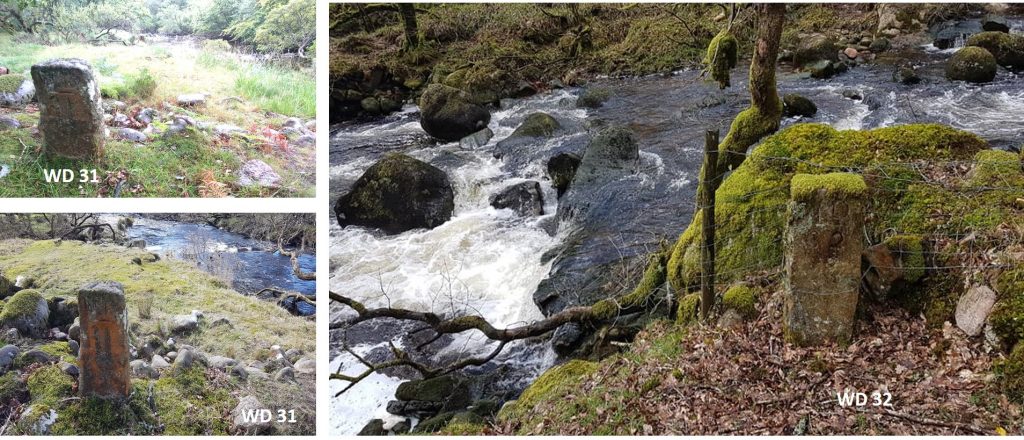
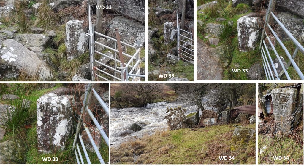
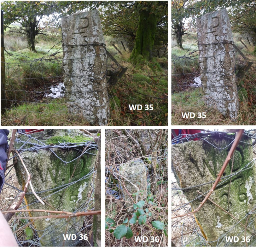
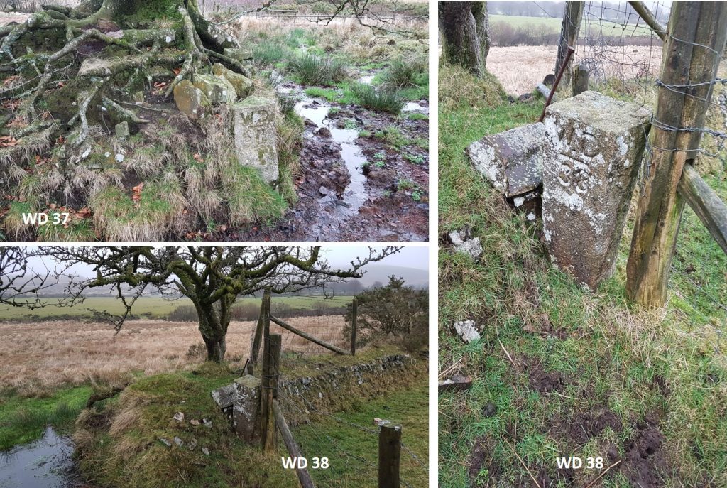
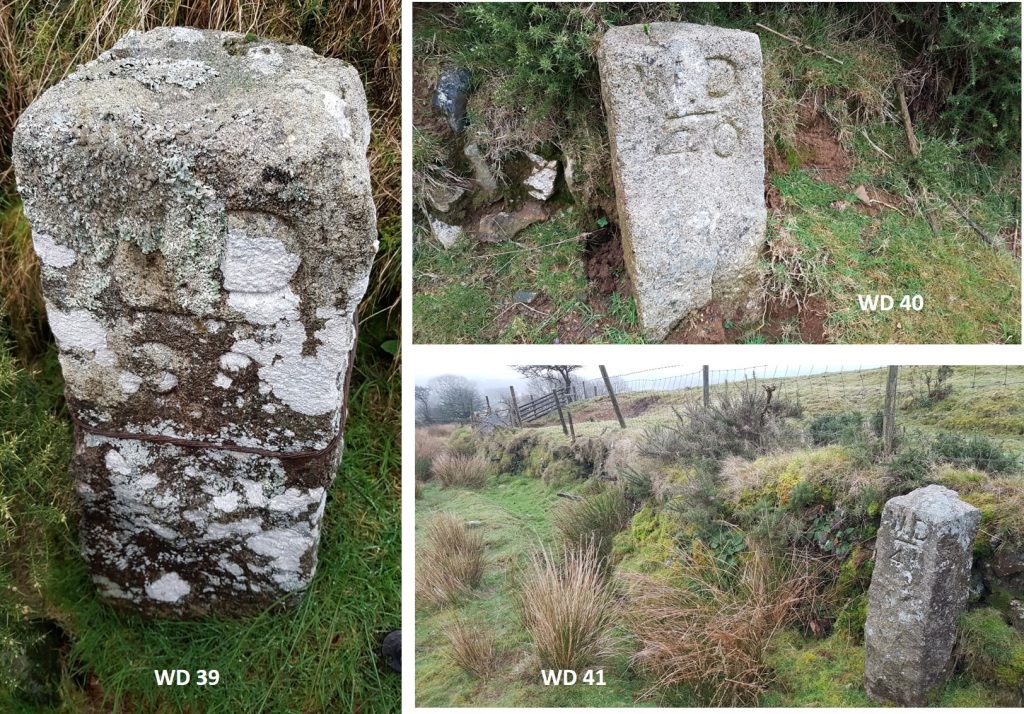
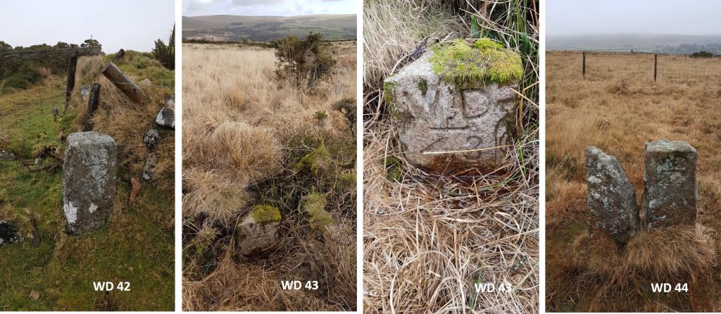
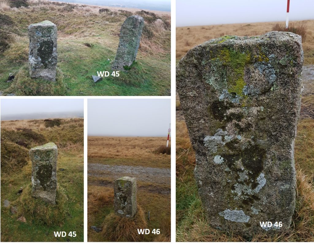
This plan is adapted from the map found in the Dartmoor Boundary Markers (1st edition – 1986) book by Dave Brewer and shows the locations of all the stones. The actual National Grid Reference locations of all 45 stones (WD1 – WD16 and WD18 – WD46) can be found on the Dartefacts website here (you will have to register to get the information) : http://dartefacts.co.uk/walk/the-willsworthy-wd-war-department-stones-walk/WD1 – On Black Hill ; WD2 – On Tavistock / Okehampton roadside ; WD3 – At Willsworthy Gate. According to (Eric) Hemery all the boundary stones / markers were ‘cut in the locality of Nattor Down’ and taken to their sites by Fred Palmer of Lane End Farm. All the stones are around 2ft (0.6m) in height and are square of section. They also bare marks of tare and feather.WD 4 – At Prescombe Corner ; WD 5 – At Sounscombe HeadWD 6 – On Sounscombe Brook ; WD 7 – At Sounscombe FootWD 8 – At Beardon Gate (south side) ; WD 9 At Beardon Gate (north side)WD 10 – At Lissicombe Head (west side) ; WD 11 – At Lissicombe Head (east side)WD 12 – Bewtween Lissicombe Head and FootWD 13 – At Lissicombe Foot at junction with River LydWD 14 – On bank of River Lyd (below Bearwalls) ; WD 15 – At Doe Tor Bottom near Tavistock Water Intake ; WD 16 – Near cist east of Doe Tor. On old 6 inch OS Maps WD 14 was originally located on High Down (near the farm). Also, it is speculated that the War Department followed the Doe Tor Brook route in error, when they should have followed the Wallabrook (once called Black-a-Brook). In the Dartmoor Boundary Markers (2nd edition) by Dave Brewer it is further suspected that WD 15 and WD 16 are incorrectly sited as they were originally located on Duchy land and as long ago as 1938 the War Department wished to purchase a further 550 acres on Doe Tor common, which was contested by Lydford parishioners. Furthermore, in 1988 the DPA confirmed that WD15 and WD 16 were in a “dry training” area which was only held ‘under licence’ from the Duchy of Cornwall, which one suspects is the area of land the War Department had wished to purchase. WD 18 – At Wallabrook Head ; WD 19 – Near cairn between Hare Tor and Sharp Tor ; WD 20 – At Deadlake Head. The expected location of stone WD 17 reveals it is conspicuous by its absence. A former Willsworthy warden is recorded to have indicated that he understood that the bounds once went up to and included Sharp Tor (although he didn’t know exactly when this was) and that at a later date the bounds were amended to go directly from WD 16 to WD 18. Did the WD 17 stone get moved at this time and was it related to the Duchy of Cornwall informing the military that they only held this area of land under licence for ‘dry training’? There is an argument that the line of the boundary should follow the Wallabrook to WD18 then to WD19 and so on excluding WD15, WD16 and the missing WD17. Of note, approx 1-2m from WD20 near Dead Lake Head, lies a recumbent “WD” stone with no number inscribed on it.WD 20 – At Deadlake Head. The inscribed “WD” (recumbent) stone can be seen on the right side of the photographWD 20 – At Deadlake Head. Dave Brewer’s story of the missing WD 17 stone continues at Deadlake Head. He states “In 1988, at the beating of the bounds of the newly created civil parish of Lydford, another stone simply inscribed “WD” was found lying recumbent near to WD 20 (see picture). At first, it was thought that this stone may have been the intended WD 17 at Sharp Tor. However, on closer inspection, not only was it un-numbered but the inscription was quite crude and there wasn’t a ‘stop’ after the W”.WD20 close up with distinctive underlining of W.D with a dot / stop between the W and the D. It is at SX55474 84610Close up of the recumbent “WD” stone near WD20. This stone obviously pre-dates WD20, but it is unclear why it still remains here at SX55475 84608WD 21 – At Deadlake Foot ; WD 22 – At Western Redlake Foot.WD 23 – Midway up Western Redlake ; WD 24 – Near Western Western Redlake Head.WD 25 – Near head of Baggator Brook ; WD 26 – Near head of Baggator Brook.WD 27 – Near head of Baggator Brook ; WD 28 – At north-west corner of South Common Plantation.WD 29 – At north-west corner of Baggator Woods ; WD 30 – At south-west corner of Baggator Woods.WD 31 – At Cataloo Steps ; WD 32 – At Standon Steps.WD 33 – On left bank of River Tavy ; WD 34 – On right bank of River Tavy.WD 35 – On the edge of Yellowmeade enclosures ; WD 36 – On the edge of Yellowmeade enclosures. These two stones are the most difficult to photograph and locate. WD 35 (if you keep to access land) is across a very boggy field then over a stream. WD 36 is facing in an awkward direction to get a decent photograph and is surrounded by a large gorse bush.WD 37 – On the edge of Yellowmeade enclosures ; WD 38 – On the edge of Yellowmeade enclosures.WD 39 – On the edge of Yellowmeade enclosures ; WD 40 – On the north side of Buddla Corner ; WD 41 – On the south side of Buddla Corner.WD 42 – On the edge of Willsworthy Enclosures ; WD 43 – On the edge of Willsworthy Enclosures ; WD 44 – Near Wheal Jewell reservoir, at Down Pool next to a ‘W/B’ (Willsworthy Manor) boundary stone.WD 45 – At Tin Pits, near a ‘W/B’ (Willsworthy Manor) boundary stone on slopes of Black Hill ; WD 46 – On the crest of Black Hill.
1 Pingback