A collection of walks, discoveries, insights and pictures of exploring Dartmoor National Park
June 10, 2026
Wisdome Farm – Threshing Barn
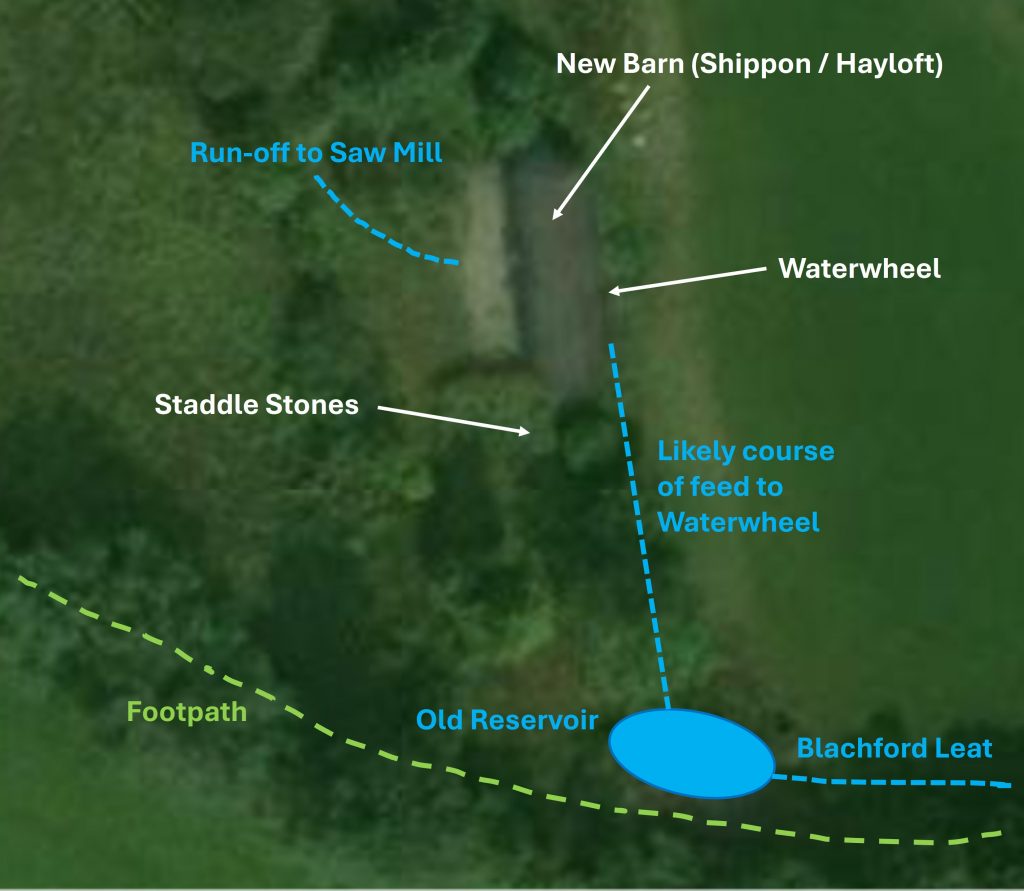
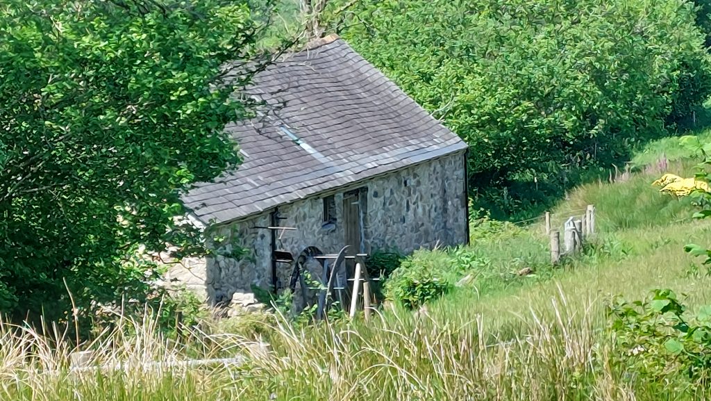
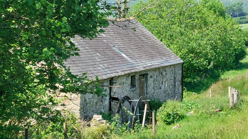
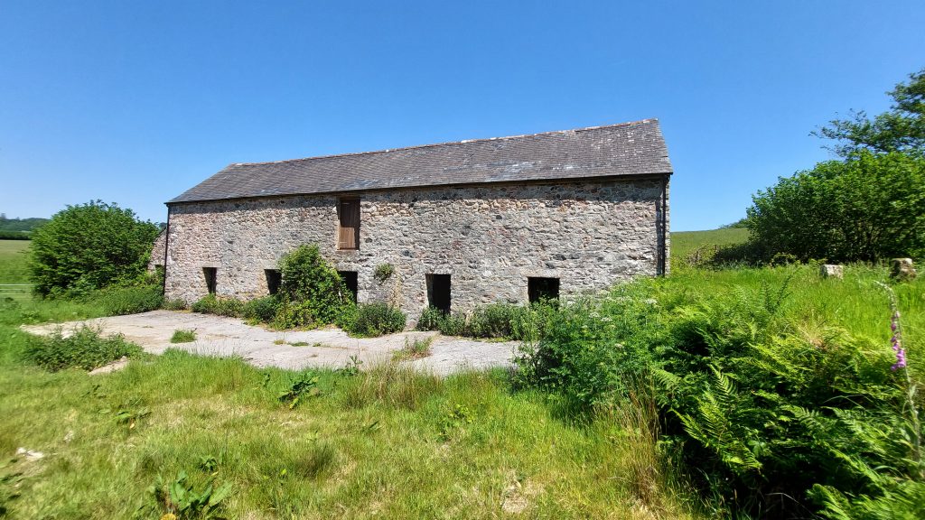
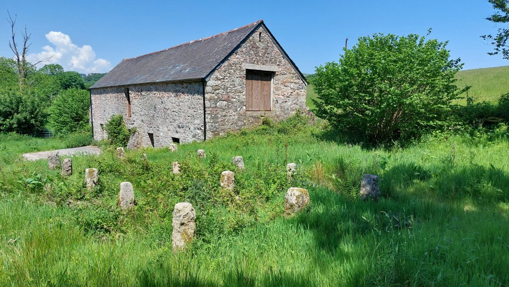
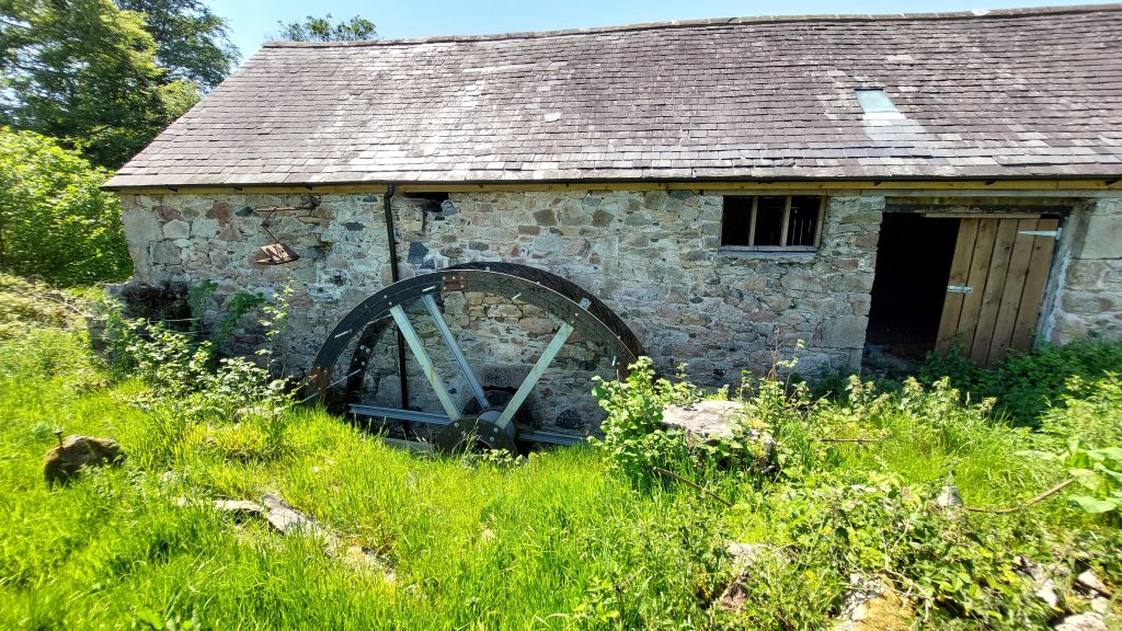
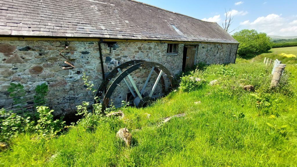
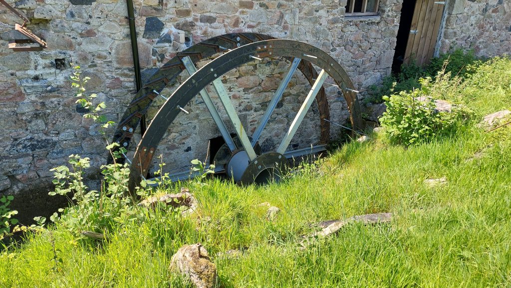
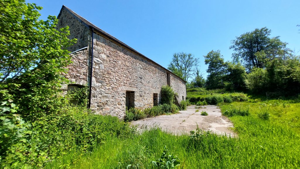
On Wisdome Farm, in the Parish of Cornwood, there is a late 18th to early 19th century Threshing Barn which comprises a Shippon with Hayloft over. There is an adjacent Mowhay where there is a group of 15 Staddle Stones. Of note is that the building appears to have been adapted to include Water Wheel and associated water management, where water from Blachford Leat runs through the building before flowing onward down the hill for use at a former Saw Mill.
Bibliography
C.Vint – (2022) – New Barn, Cornwood (Un-published). SDV364729
Dartmoor Trust and Dartmoor National Park Authority -(2010) – Dartmoor Trust Leats Project 2009-2010 (Report – Survey). SDV347530.
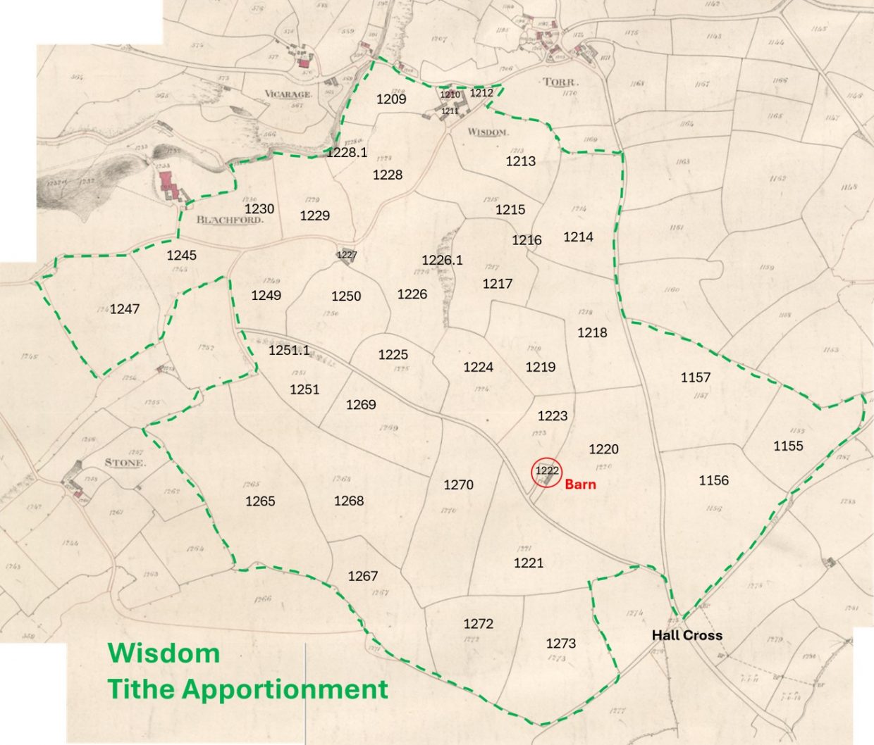
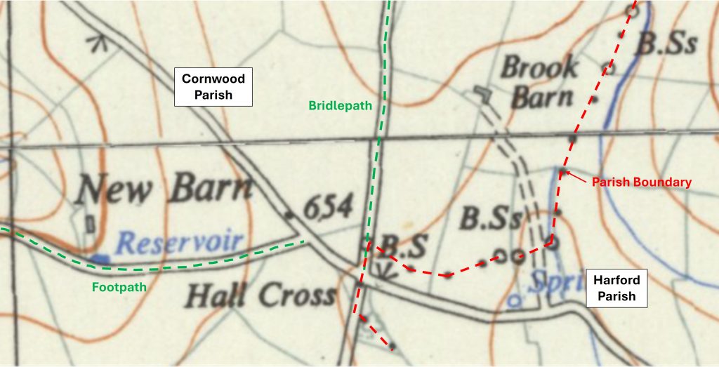
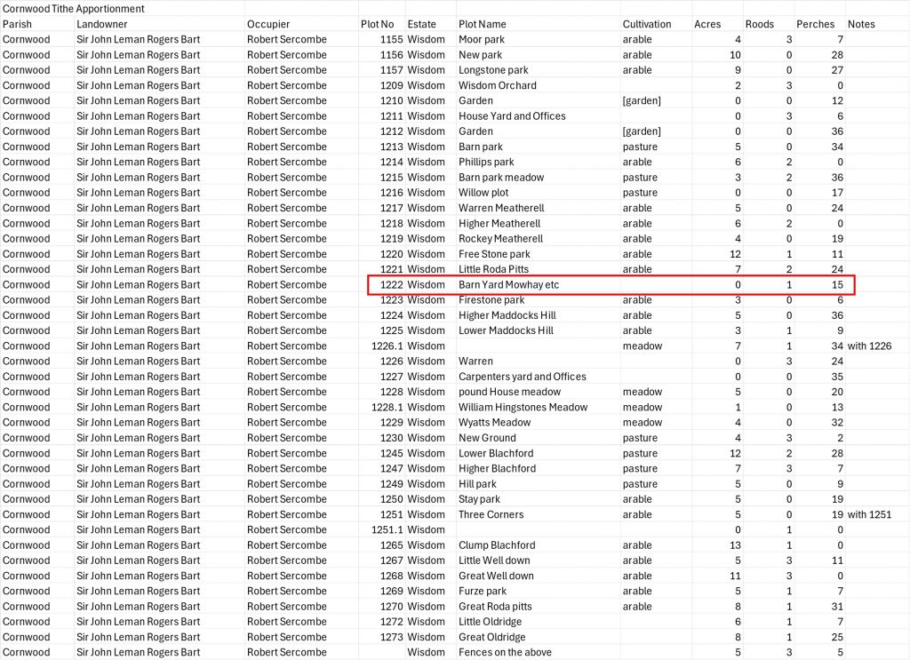
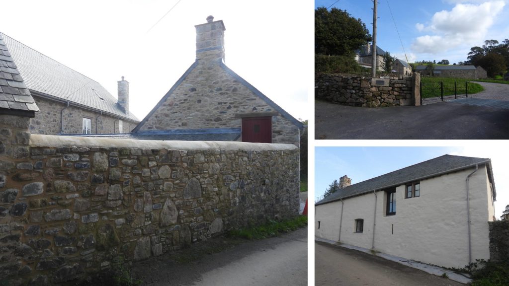
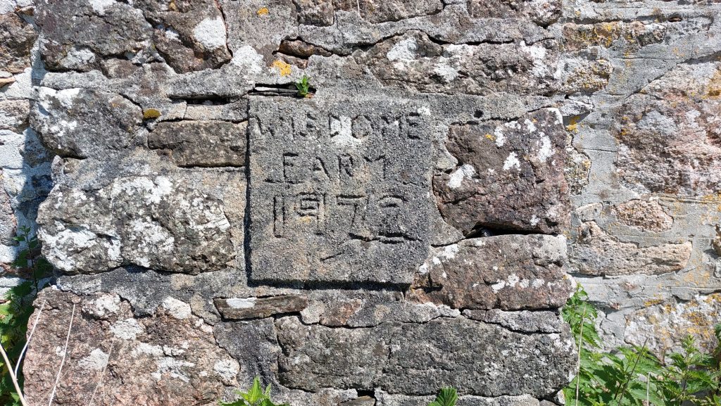
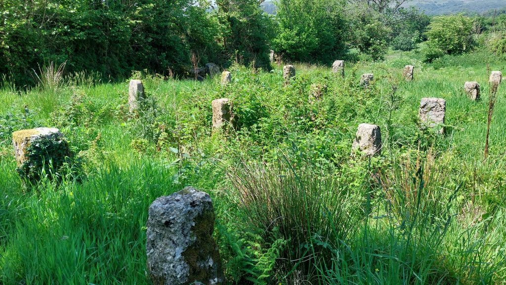
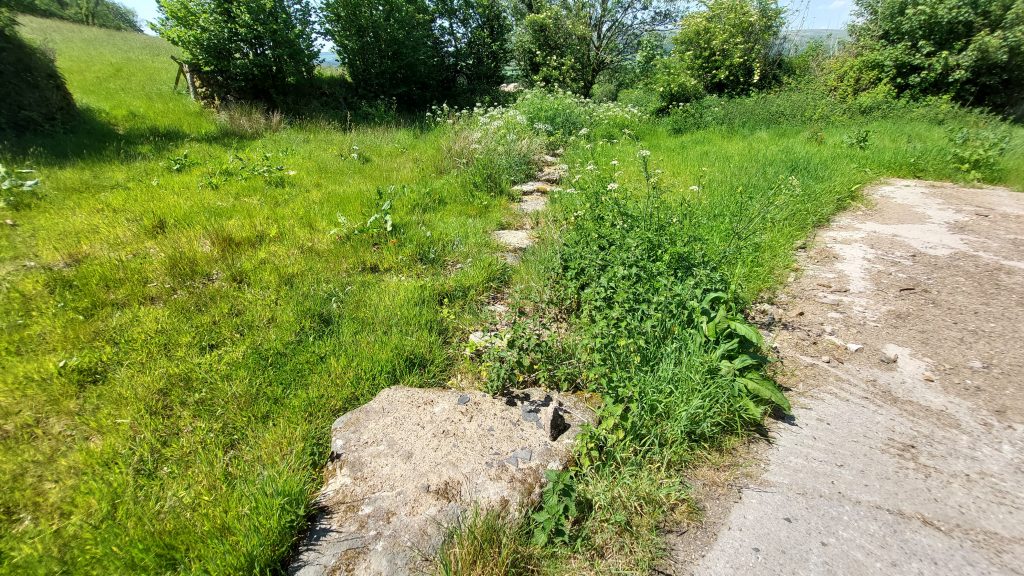
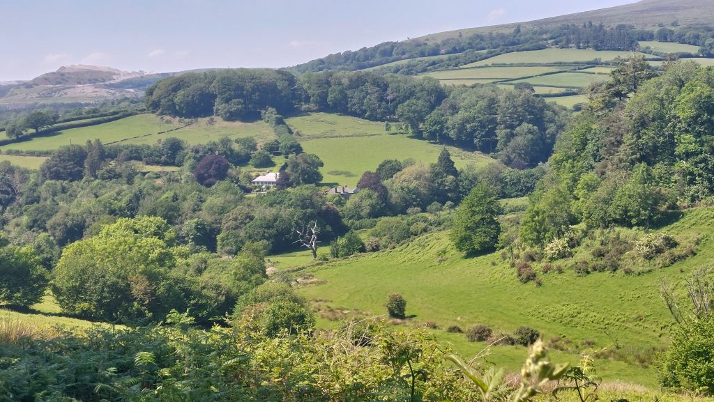
The above annotated (1956) map shows the location of the Threshing Barn (aka New Barn) adjacent to a footpath and a short distance to the west of Hall Cross. Close to and running through Hall Cross is the Harford-Cornwood Parish Boundary with its associated Boundary Stones. More information can be found here: Harford – Cornwood Parish Boundary Markers – Dartmoor ExplorationsGoogle Earth plot of the Threshing Barn showing the key features including the line of Blachford Leat which Leat running from SX6259 6143 (the Take Off was at Redaven lake near Watercombe / New Waste near the former parking area) to the Saw Mill at SX6167 6002The extent of Wisdom Farm as per the Tithe Apportionment (30th June 1842) stretched between Blachford and Torr in the north and Stone to Hall Cross towards the south. As well as the threshing Barn on plot 1222, there was also a Carpenters Yard (on modern OS maps called ‘Saw Mill’) on plot 1227.The entry for Wisdom (no ‘e’ on end) in the Tithe Apportionment. The Threshing Barn was plot 1222 being 1 rood and 15 perches is size. The total size of the farm was 215 Acres, 3 Roods and 35 Perches (Note: 4 roods to the Acre and 40 perches to a Rood).Wisdome Barton is a recently restored 16th-17th century farmhouse. It was purchased by John Rogers in 1690.‘New Barn’ (as annotated on modern OS Maps from the footpath The Threshing Barn is located at SX62101 59894West side of the Threshing BarnSet into the wall is a cemented name and date which reads: “WISDOME FARM 1972”The adjacent Mowhay (ref: Vint), where there is a group of 15 Staddle Stones (steddle stones, or straddle stones). These were originally used as supporting bases for Granaries or Hay Ricks The staddle stones lifted the granaries above the ground, thereby protecting the stored grain from vermin and water seepage.Staddle stones were also used on other food and animal feed stores such as hayricks and game larders. Other examples of Staddle stones within the Dartmoor National Park include Hucken Farm and Stanlake Farm. In Middle English staddle, or stadle, is stathel, from Old English stathol, a foundation, support or trunk of a tree. Staddle stones can be mainly found in the UK, in Norway (where they are known as stabbur), in Galicia and Asturias (Northern Spain), in Ireland (corn stacks) and also in Northern Portugal
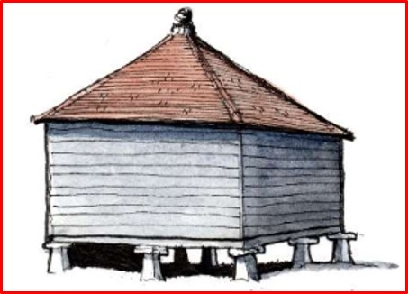
Typical Granary Store on Staddle Stones. There might not have been a structure at this location though. Certainly, there is no evidence of a ‘mushroom’ top on the stones here.
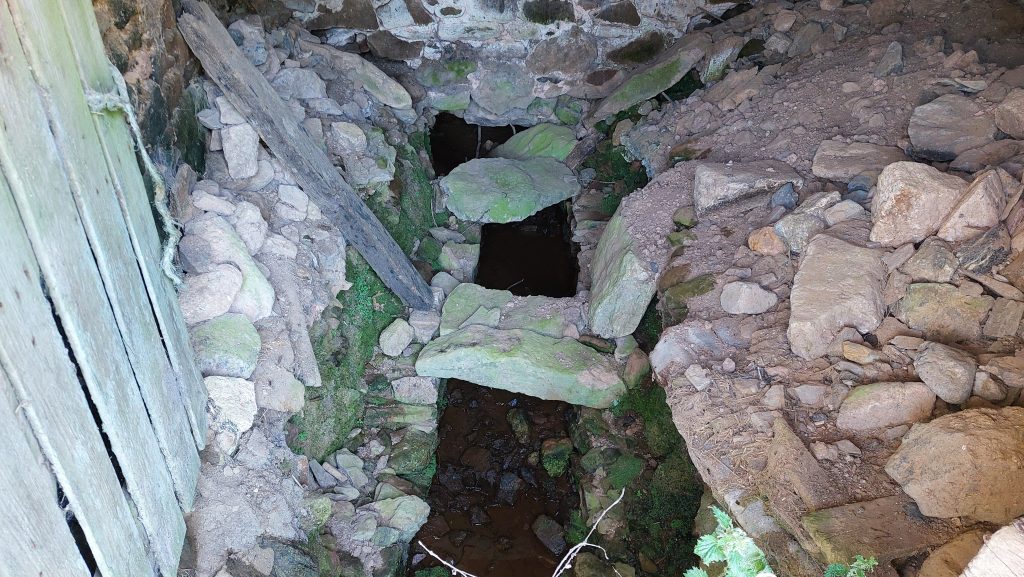
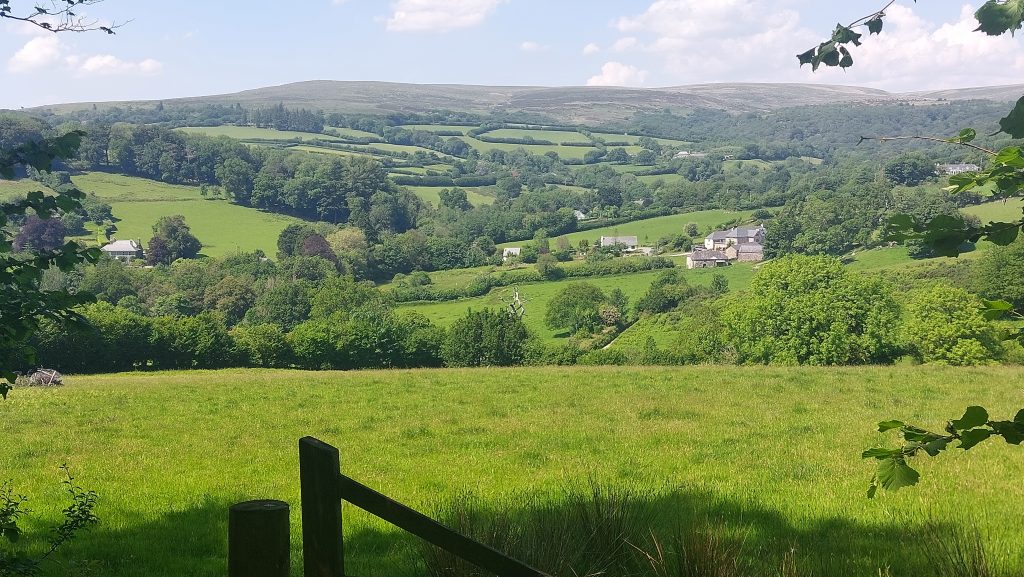
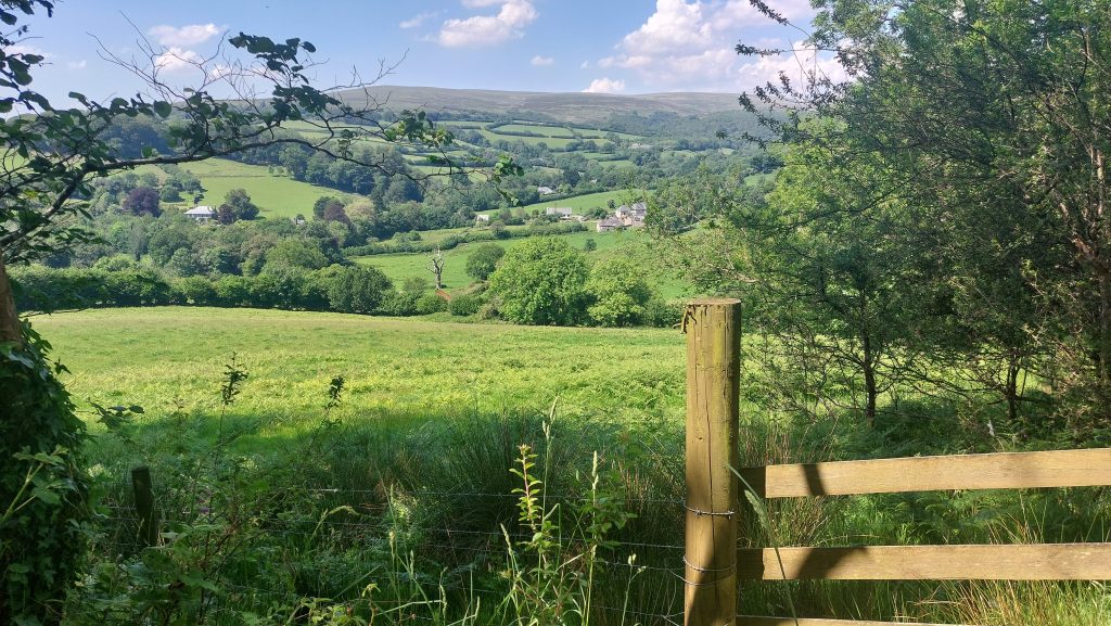
Side on view of the eastern side of the Threshing Barn and its (modern) Water WheelThe Water Wheel appears to be here for aesthetics only and is totally non-functionalThe original wheel here would have been served by water from Blachford Leat and a small holding reservoir to the southView of the Threshing Barn from the north west cornerWater course inside the buildingCovered leat run-off where water leads down hill to the Saw MillView across Wisdome farmland with the farm buildings mid-right of picture. The Yealm Valley and Shell Top can be seen on the horizonWisdome Farm min-picture. The building mid-left is Glebe House (the former vicarage)The valley where the Saw Mill is located (not far from the dead tree, mid-picture)