A collection of walks, discoveries, insights and pictures of exploring Dartmoor National Park
November 20, 2021
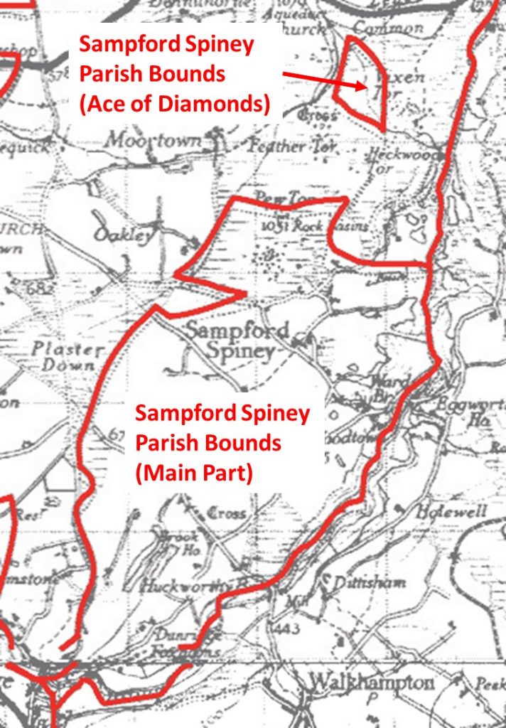
Ace of Diamonds – Sampford Spiney Parish
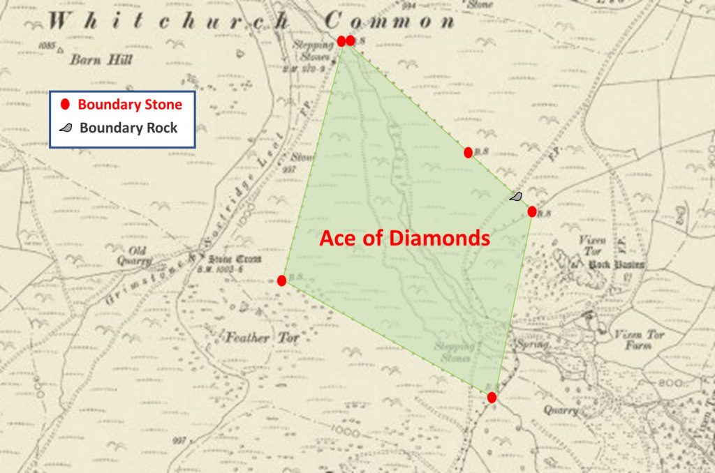
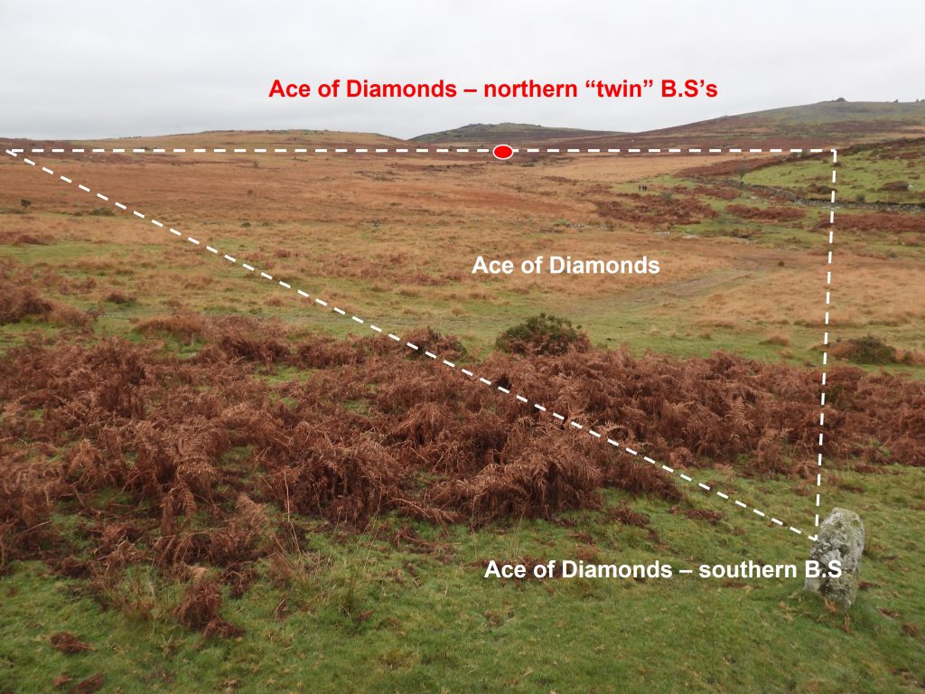
The ‘Ace of Diamonds’ is an area outlined by six boundary stones (and a boundary rock) that marks the northern section of the Sampford Spiney Parish bounds. It is an old (local) place name that has also been ascribed for the common on which they stand. The area enclosed is shaped like a ‘lozenge’ or ‘diamond’ and covers a large area of marsh between Vixen Tor and Feather Tor. The Boundary Stones in this post are labelled with the same nomenclature stated in a report titled: “Sampford Spiney Part One” written by Mark Fenlon. Although the lines connecting the boundary stones and the rock resemble a diamond, the parish boundary is marked on maps as following the Vixen Tor enclosure wall thus the south east corner of the diamond in reality has a chunk missing !
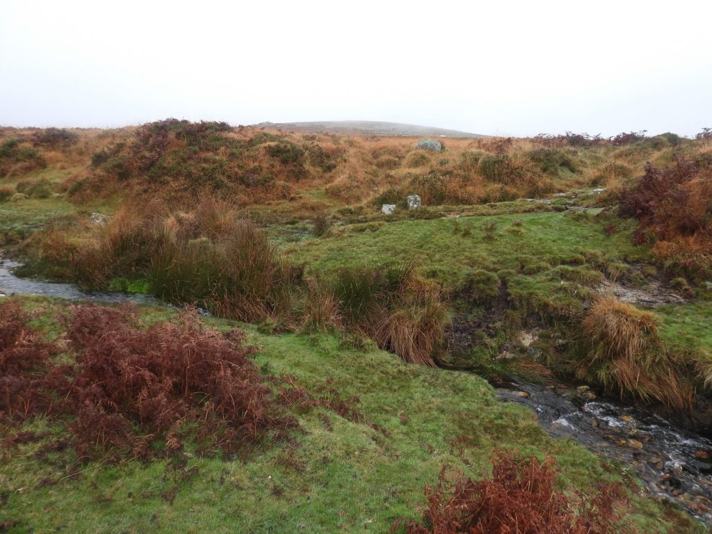
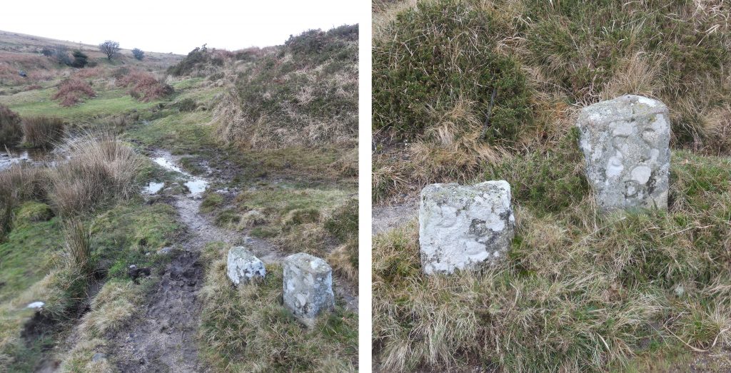
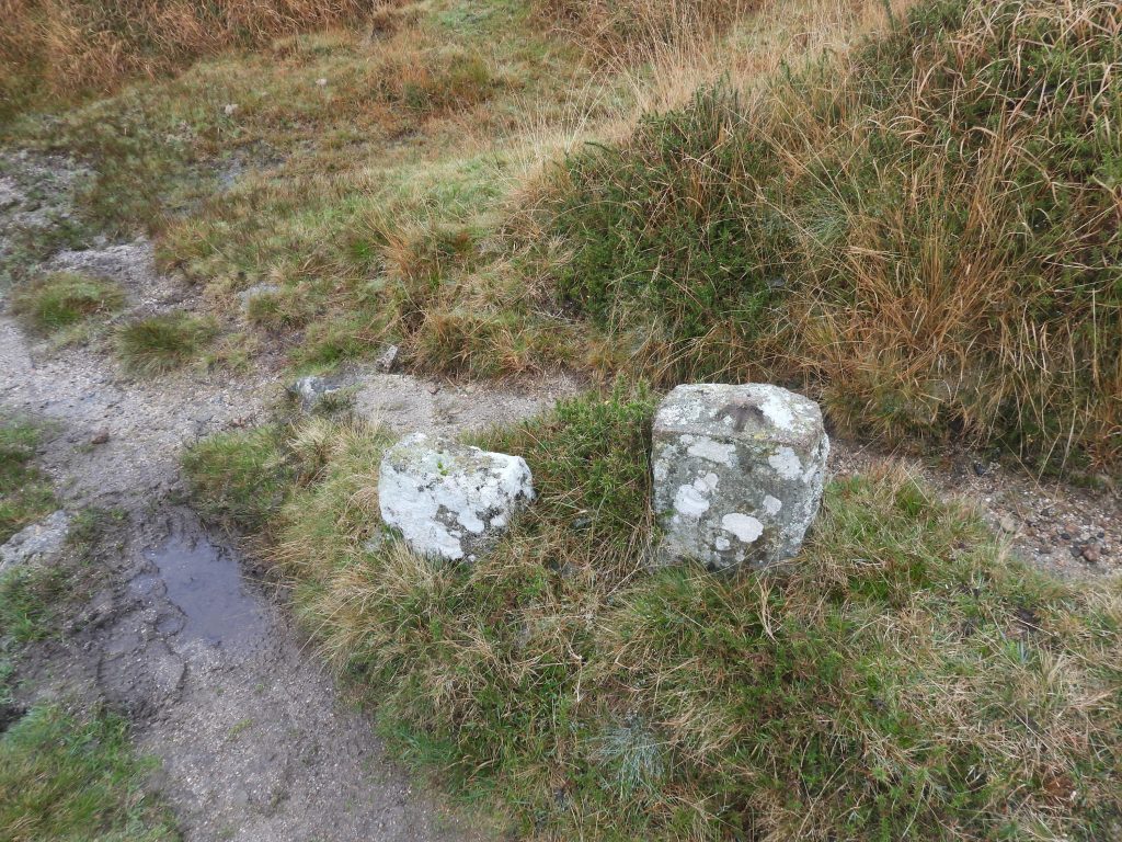
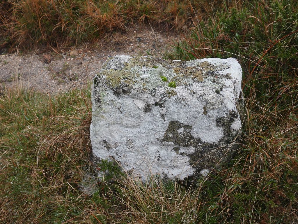
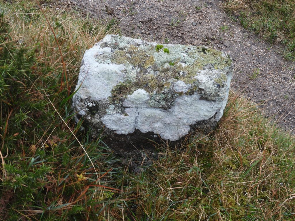
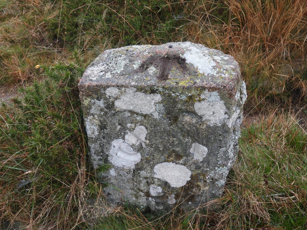
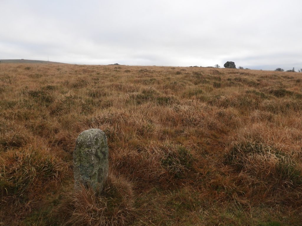
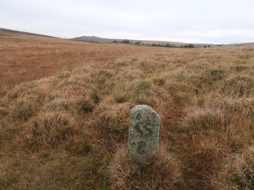
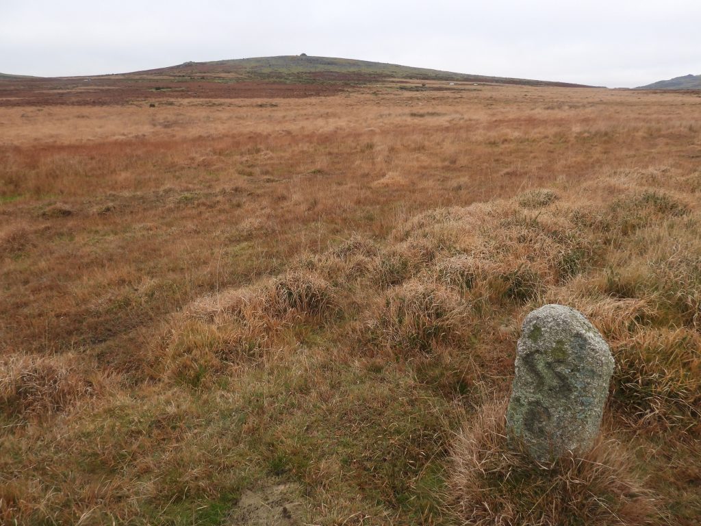
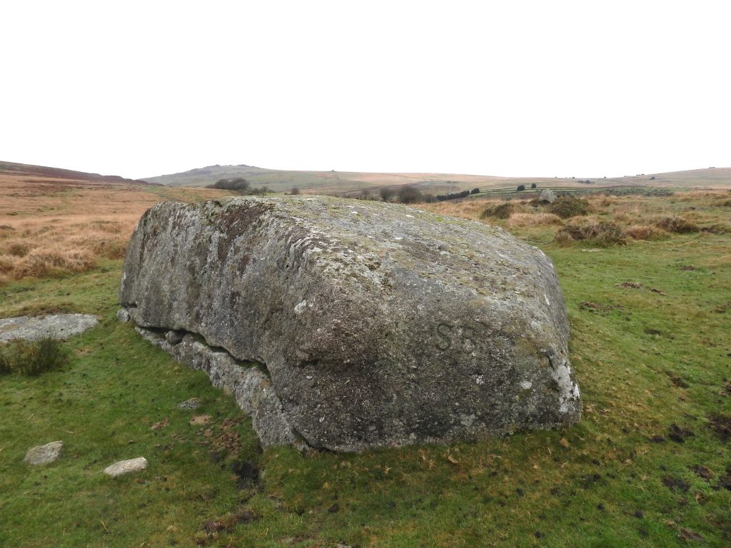
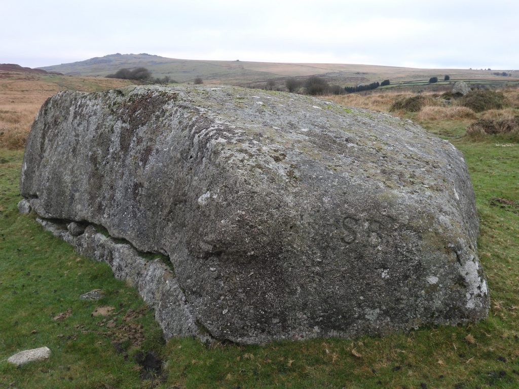
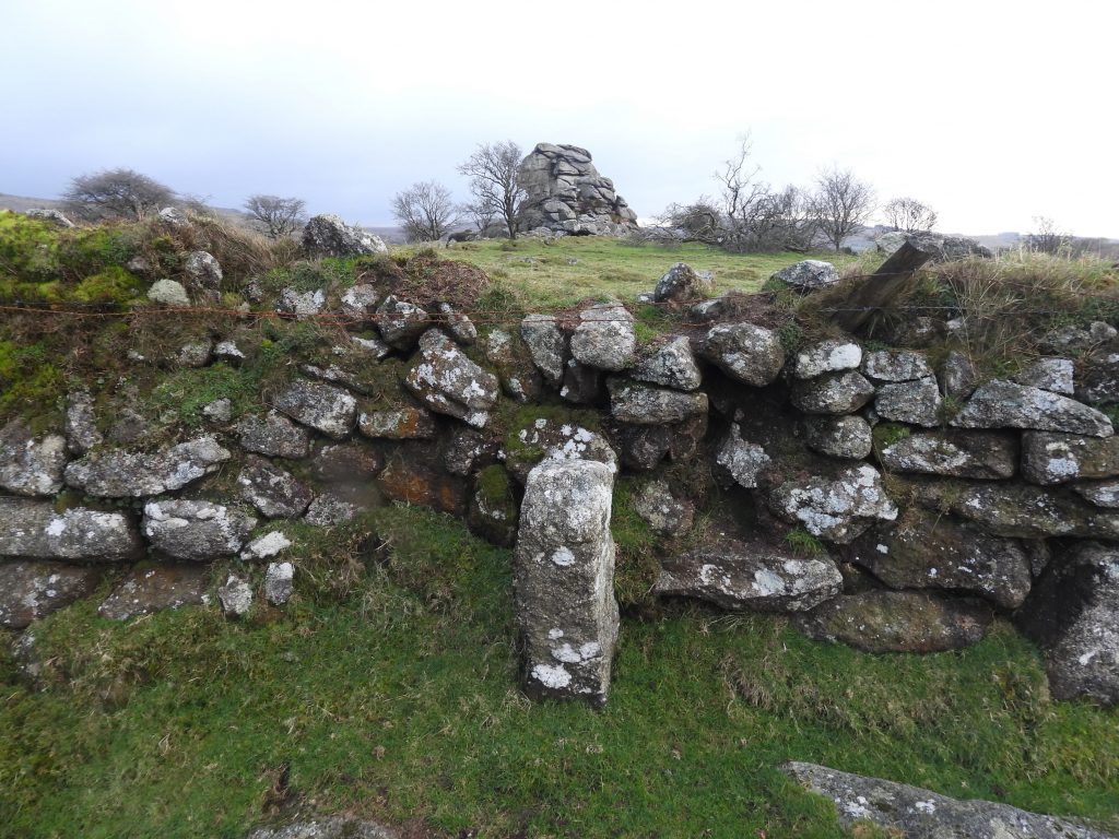
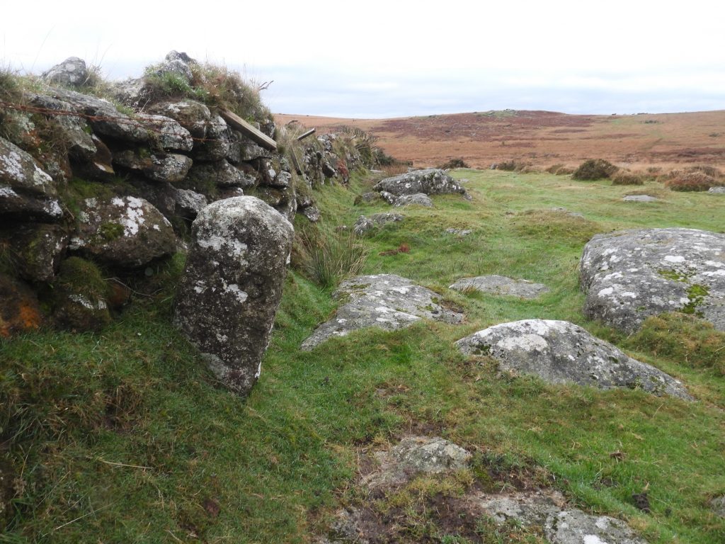
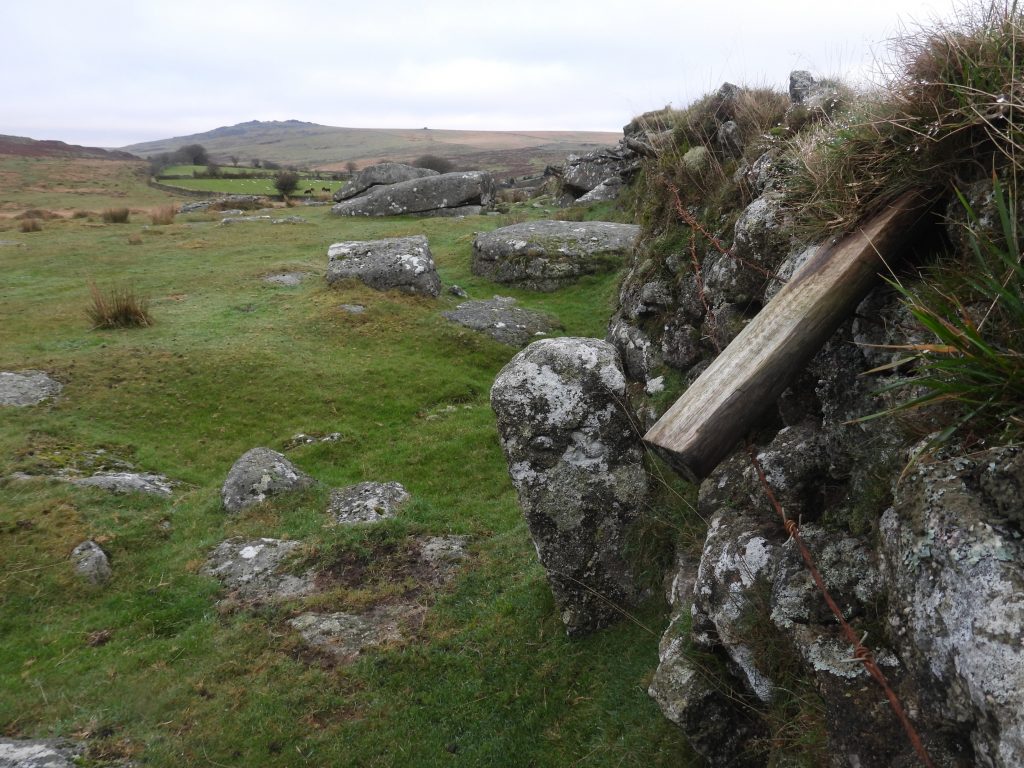
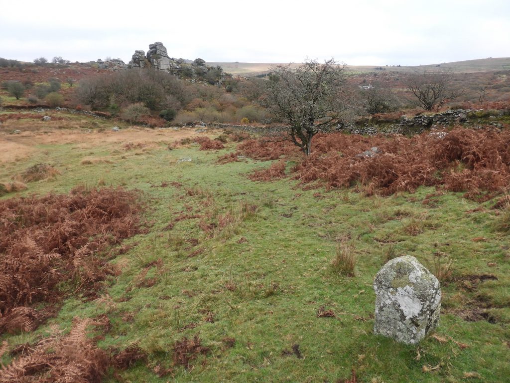
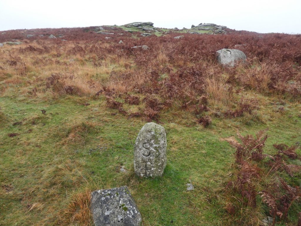
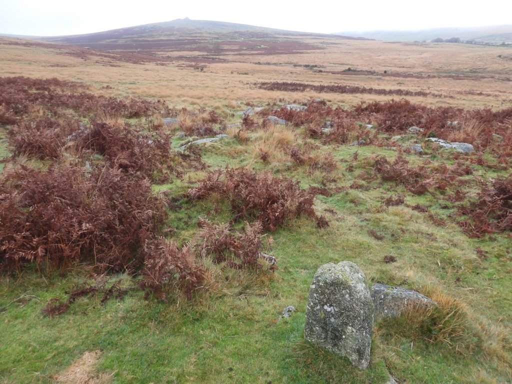
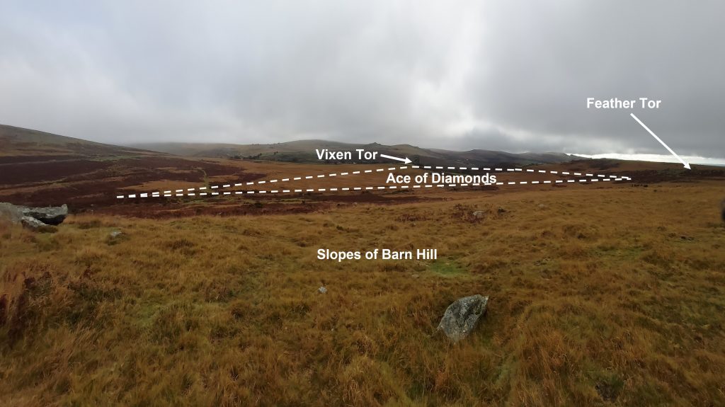
The map shows the location of the six boundary stones (and a boundary rock) marking the ‘Ace of Diamonds’ area. The north point of the ‘diamond’ is marked by two (side-by-side) boundary stones on which lie on the east side of Beckamoor Brook. The north-east side of the ‘diamond’ is marked by a straight line between the two aforementioned twin boundary stones via a boundary stone approx 200m north-west of Vixen Tor to a boundary stone which is set against the Vixen Tor enclosure wall. The southern boundary stone of the ‘diamond’ point is south of Beckamoor Brook heading towards Heckwood Tor. The western point of the ‘diamond’ is marked by a boundary stone which lies slightly north-east of Feather Tor. There is also a large boundary rock, which lies on the north east portion of the diamond as shown on the map.The ‘Ace of Diamonds’ represents the open moorland part of Sampford Spiney parish and is separate from the main part of the parish. It is described thus: “The moorland part of the parish is denned by stones, which run up into the common land belonging to Whitchurch, and for a little distance is but a mere strip. The boundary lines then diverge, one running towards Vixen Tor and the other nearly to the Windy Post. They then converge, and meeting form a figure resembling a lozenge in heraldry, or, as one may be told in the neighbourhood, like the Ace of Diamonds, by which name this part of the parish is sometimes referred to”. Source: https://archive.org/stream/guidetodartmoort02crosuoft/guidetodartmoort02crosuoft_djvu.txtThere are a pair of boundary stones which mark the “top” of the diamond. They are located close to a ford on the east side of Beckamoor Brook. The pair of boundary stones are inscribed SSP (Sampford Spiney Parish) on their southern faces The eastern most of the pair of boundary stones has a benchmark on top which includes a rivet.Southern face of the western most pair of boundary stones. This stone is labelled as SSP 23 by Mark Fenlon. Northern face of the western most pair of boundary stones. The pair of stones were recorded at SX53761 74731 Southern face of the eastern most pair of boundary stones, showing more clearly the benchmark and rivet. Mark Fenlon label is SSP 24From the pair of boundary stones, moving clockwise, the parish boundary follows a south easterly direction. A third boundary stone (labelled SSP 25) is located in an area of rough ground approx. 200m from the Vixen Tor enclosure. Vixen Tor can be seen in the background of this photograph.The boundary stone with view to Great Mis Tor in the distance. Another view of the third boundary stone can be found at SX54009 74488.Between the third boundary stone and the Vixen Tor enclosure wall, a large boulder (known as Saddle Rock). It is labelled as SB/T13 (being Sampford Bounds/ Tithe 13). It has “SB” inscribed on its southern face.Close up of the Boundary Rock. It can be found at SX54083 74410.The fourth boundary stone marks the eastern “point” of the diamond and is located alongside the Vixen Tor enclosure wallThe north east side of the boundary stone has “WB” inscribed on it (Whitchurch Bounds). The boundary stone is labelled SSP 26. The south west side of the boundary stone has “SSP” inscribed on it (Sampford Spiney Parish). The stone is located at SX54132 74363The fifth boundary stone marks the southern “point” of the diamond. It has “SSP” inscribed on its west face. It is labelled SSP 27. The stone is located near the enclosure wall not fare from Rouge Tor and between Vixen and Heckwood Tors.The fifth boundary stone has “WB” inscribed on its west side. The stone is located at SX54035 73979.View of the “Ace of Diamonds” from the southern boundary stone. The Vixen Tor enclosure wall towards the right of the photograph demonstrates how the “diamond” bisects the parish boundary (which follows the wall).The sixth and last boundary stone marks the western boundary of the “diamond”. It has “SSP” inscribed on its north east face and is located north east of Feather Tor. The sixth boundary stone looking north. The stone is located at SX53625 74216 and is labelled SSP 22.The “Ace of Diamonds” as viewed from the slopes of Barn Hill.