A collection of walks, discoveries, insights and pictures of exploring Dartmoor National Park
February 15, 2022
Harford – Cornwood Parish Boundary Markers
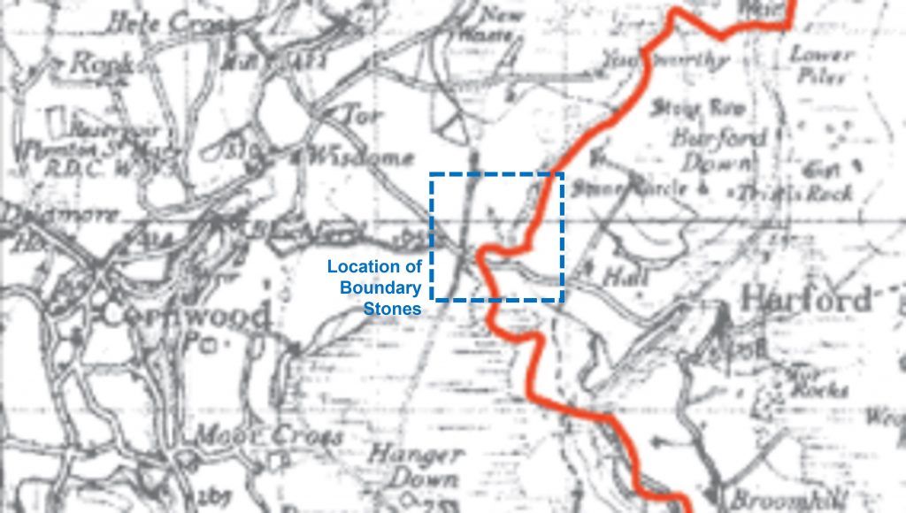
The Harford / Cornwood parish boundary extends from near Stowford Mill in Ivybridge in the south to Red Lake Foot in the north. Much of the boundary is “natural”, being the River Erme, the exception being a section which deviates from the river to the west of the Harford hamlet. In this section of the boundary there are / were a series of boundary markers inscribed “H” (for Harford) and “C” (for Cornwood). This post explores the location of these boundstones, which the author believes are 19th century in origin.
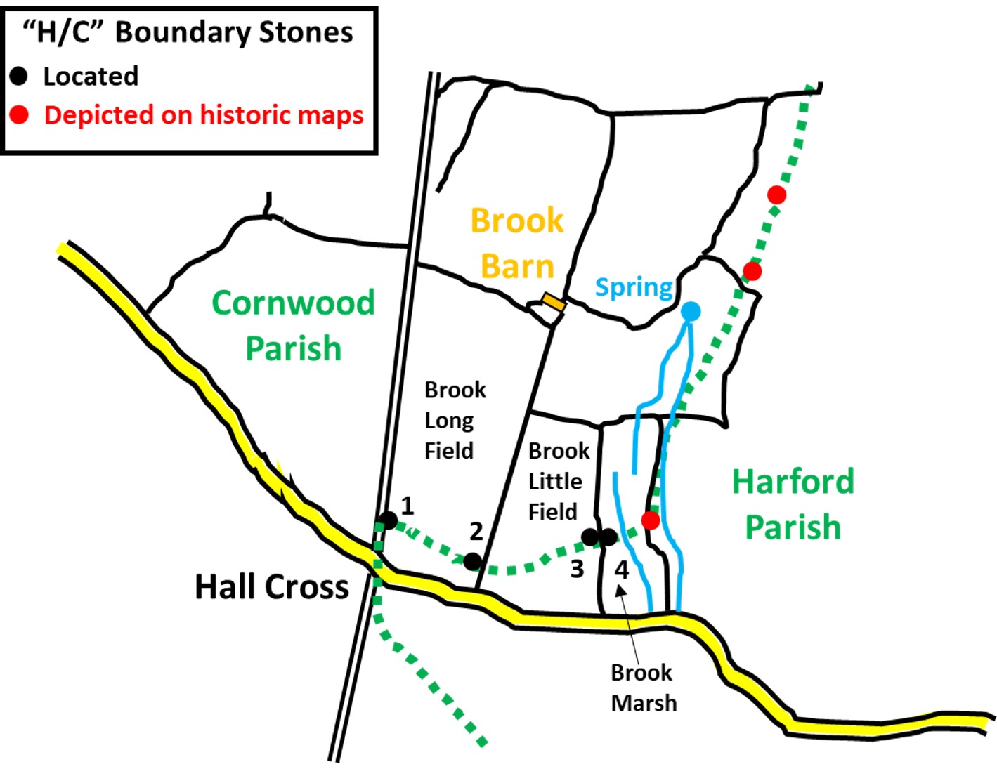
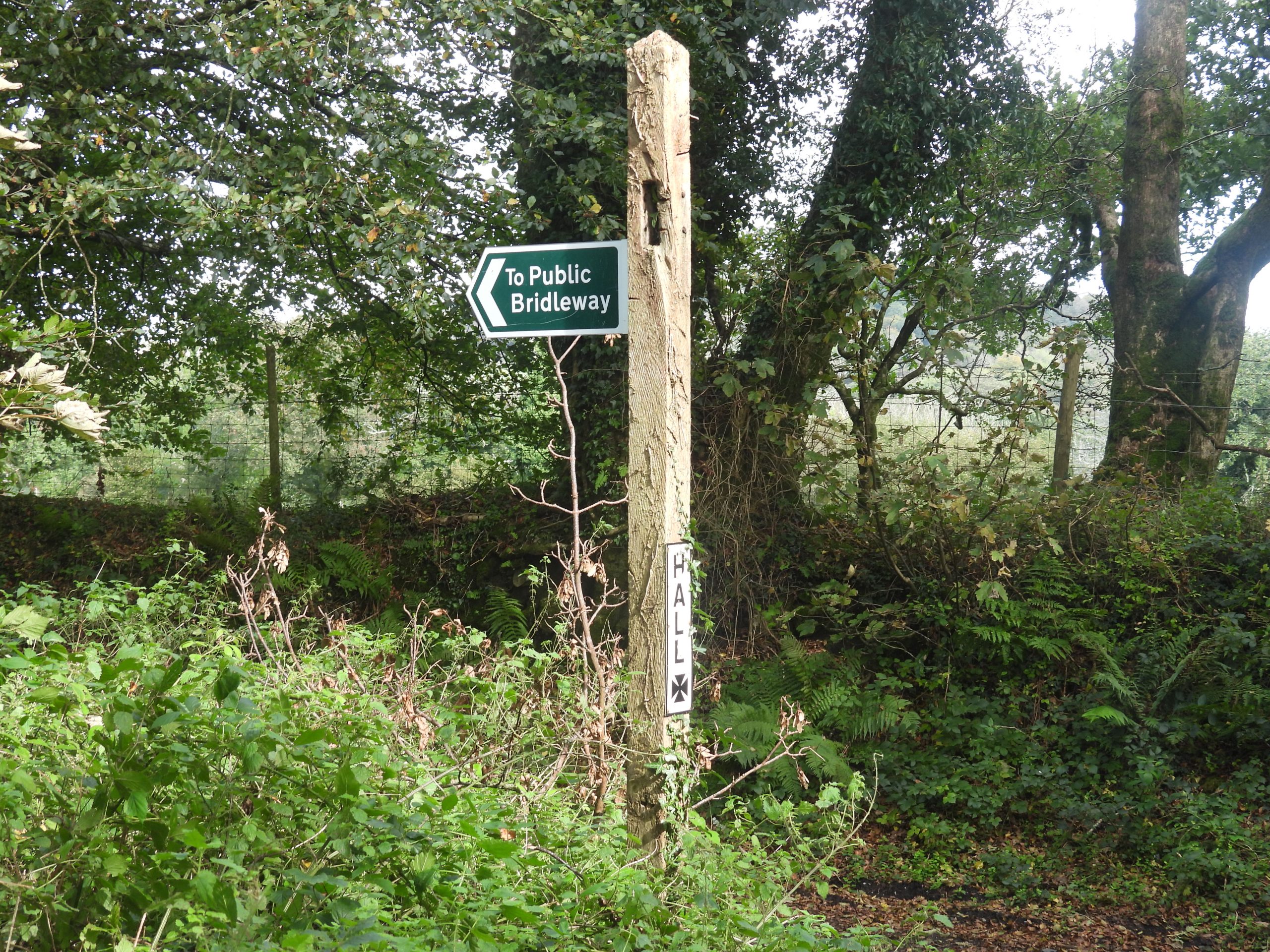
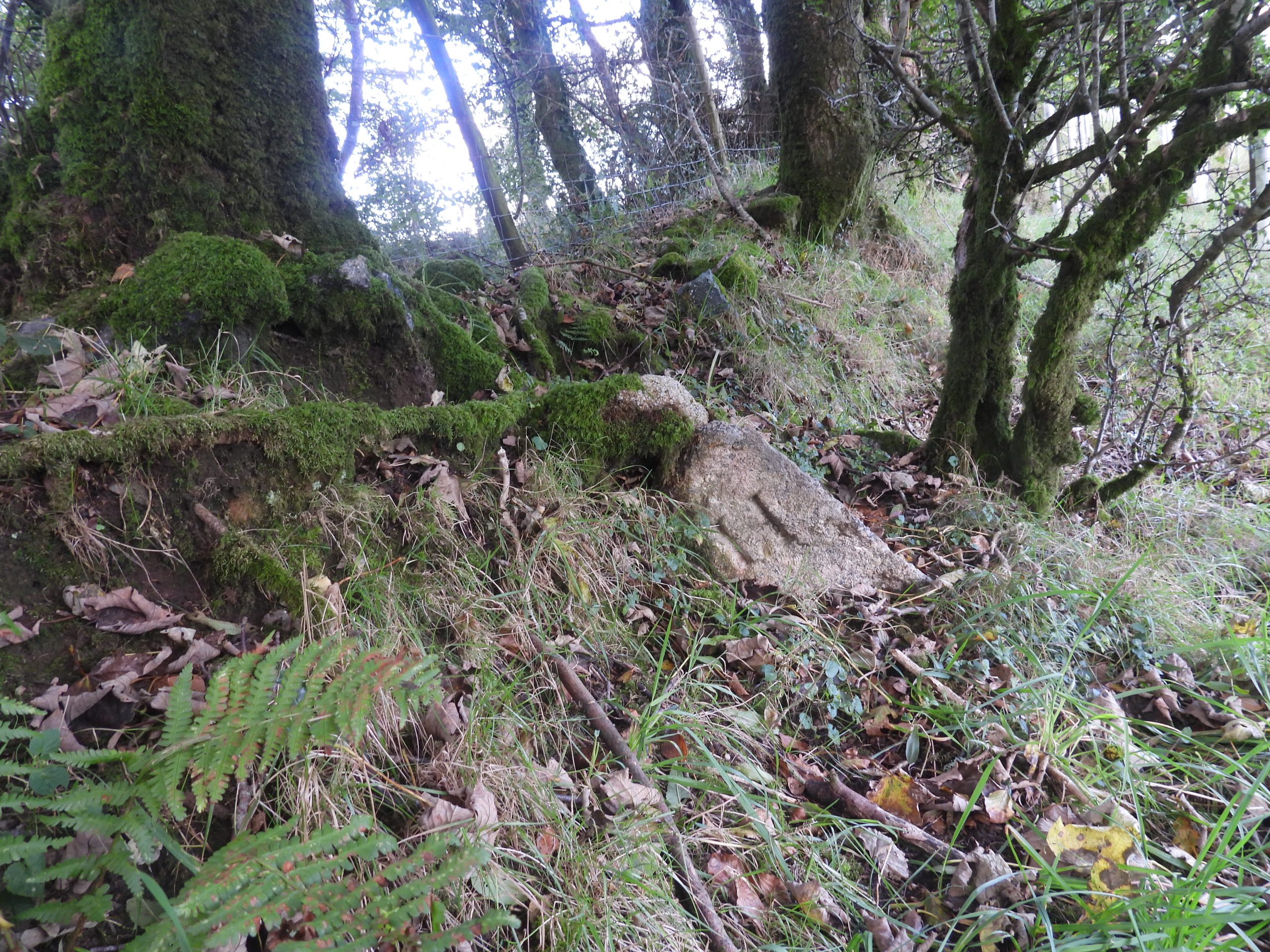
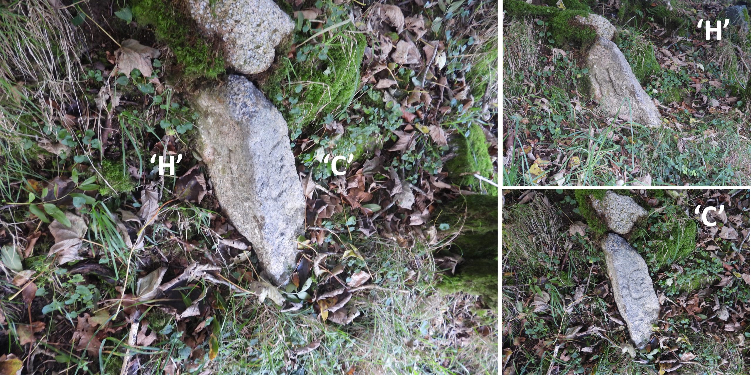
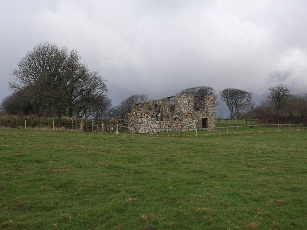
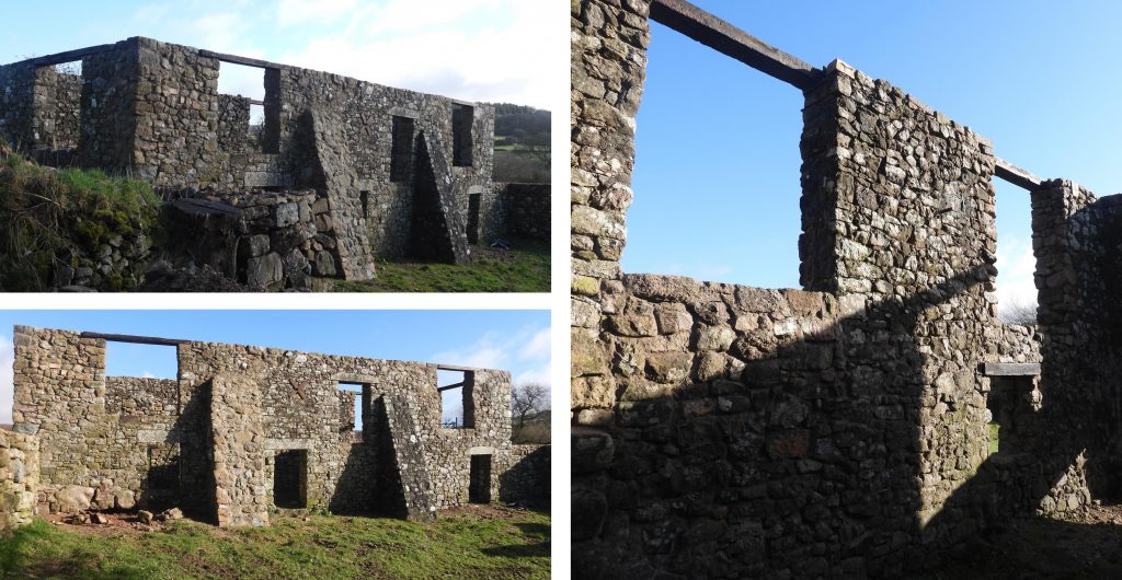
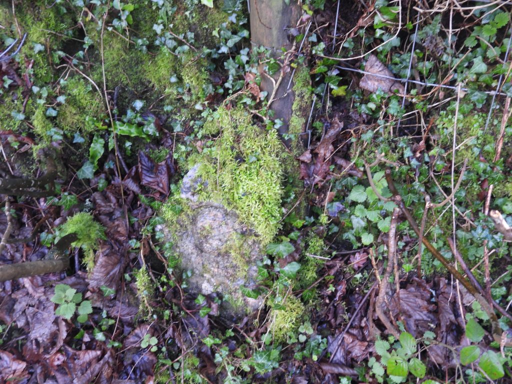
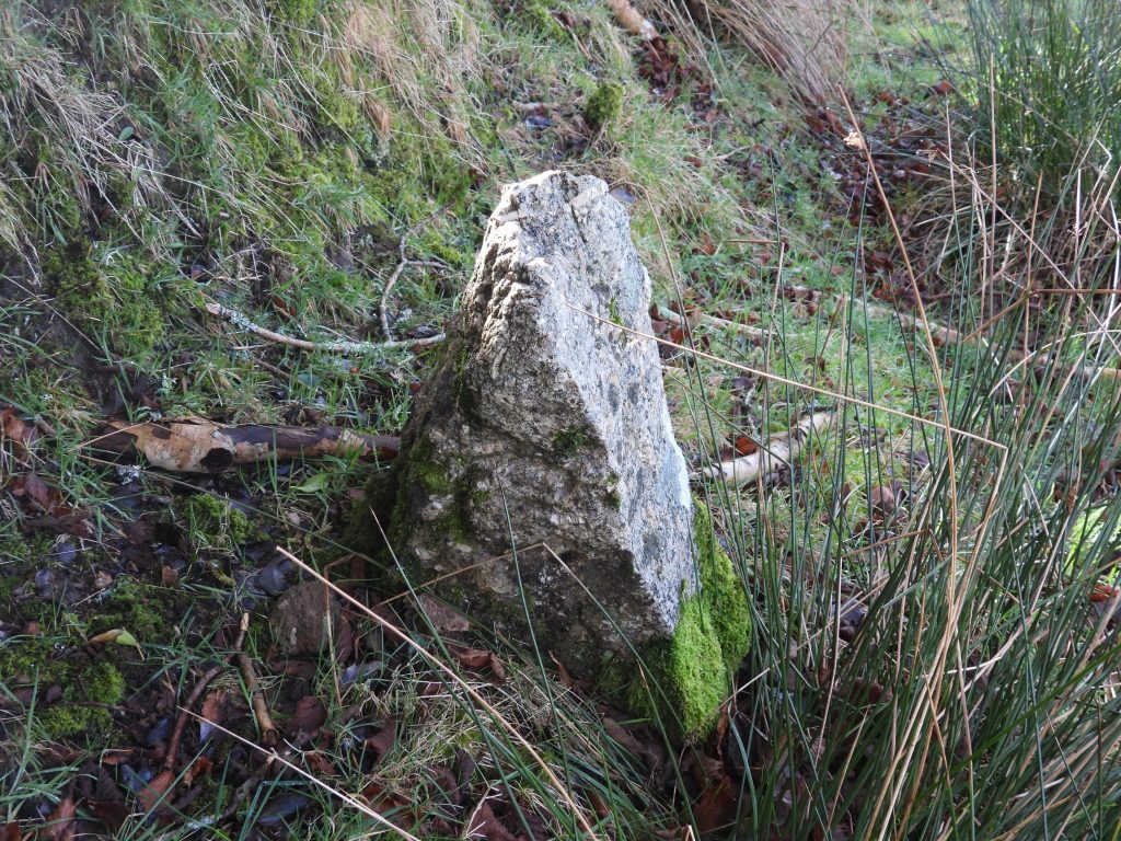
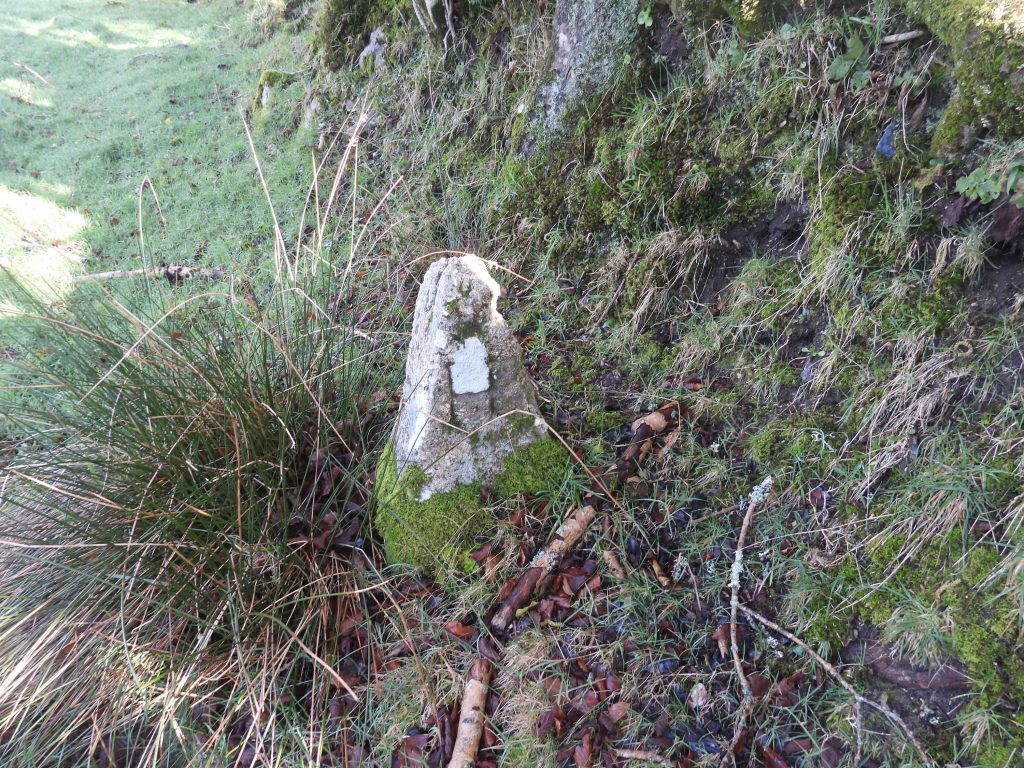
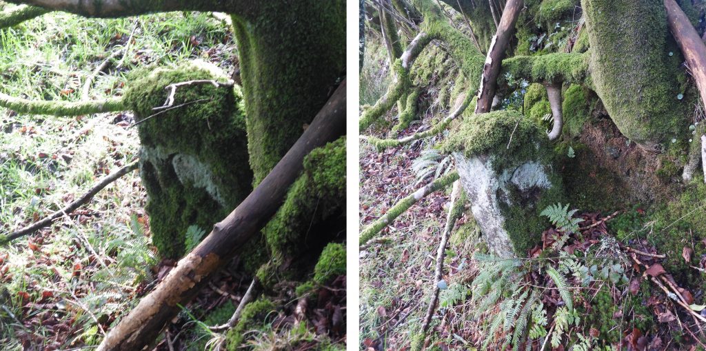
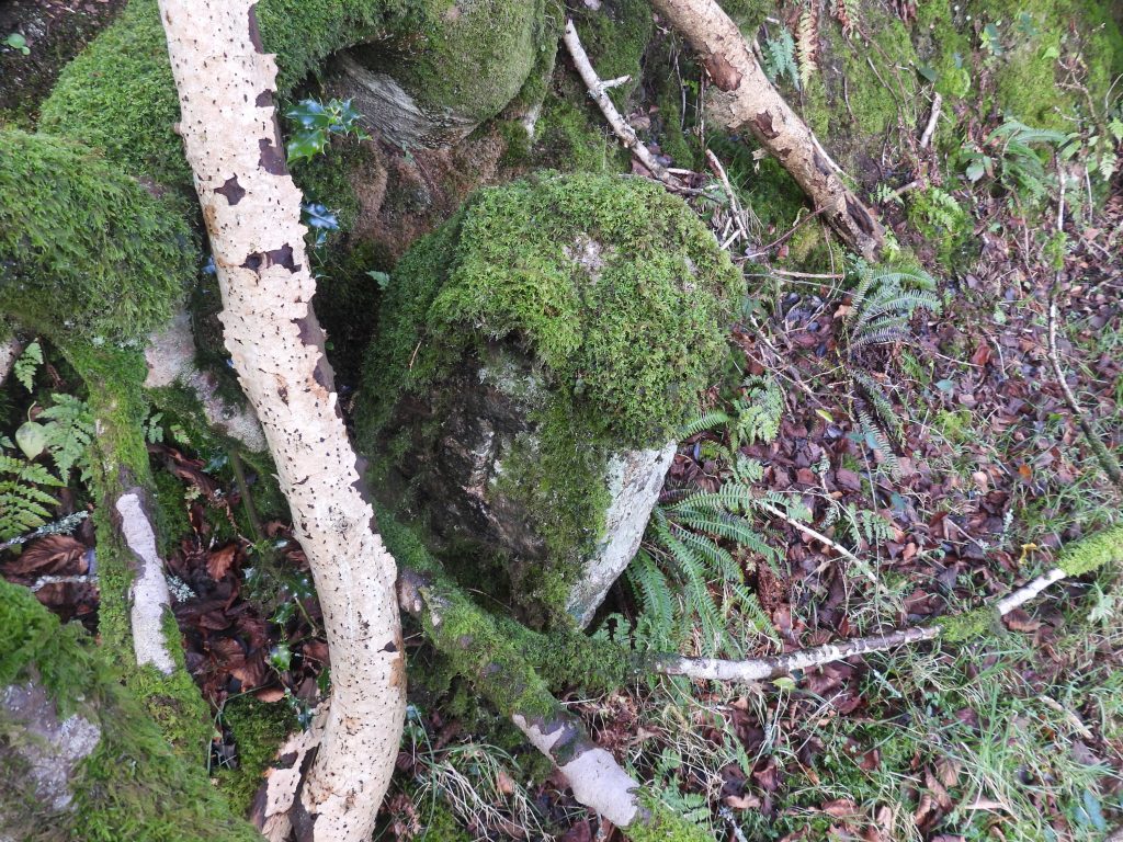
Area covered in this post, which lies immediately to the north of the Cornwood / Harford road at Hall Cross.Sketch map of the locations of the parish boundary markers covered in this post. The boundstones 1,2,3 and 4 are extant and their locations are marked in black. There were, at one time 3 other boundstones (marked in red), which were marked on 19th century maps (plus the the modern OS map) which the author believes are no longer in situ (and which is backed up by the Dartmoor HER)Hall CrossThe boundary stone marked number ‘1’ on the sketch map lies on the west edge of “brook long field”. This boundstone took two visits to find and the author is grateful to Mark Fenlon for finding it and cleaning it, which now makes it easy to find. The Heritage Gateway listing states in may not be in position !Boundary stone marked number ‘1’ is inscribed “C” (for Cornwood) on the north side and “H” (for Harford) on the south side. It is located at SX62462 59860Brook Barn is believed to be of 18th or 19th century origin and lies just inside the Cornwood parish boundary.Brook Barn appears to be undergoing some stabilisation work or renovation work (February 2022).The boundary stone marked number ‘2’ on the sketch map lies on the east edge of “brook long field”. It is recorded in the Dartmoor HER as a rough cut stone 76.2cm above ground, width 33cm. It shows the inscription “C” (for Cornwood) clearly with the “H” (for Harford) being hidden by the hedgeline. It is located at SX62543 59823.The boundary stone marked ‘3’ on the sketch map lies by the east hedge of ‘brook little field’. It is a rough cut stone 71cm high, by 20.3cm wide. Unlike boundstone ‘1’, this boundstone is sufficiently away from the hedge so that both the inscribed “C” and “H” can be clearly seen. The picture shows the “C” inscription.Boundstone ‘3’ showing the “H” inscription. The boundstone is located at SX62654 59843.The boundary stone marked number ‘4’ on the sketch map lies on the other side of the hedge from boundstone ‘3’. Its location is effectively the west hedge of ‘brook marsh’. The pictures show the inscription “C”. Boundstone ‘4’ is a rectangular granite post , 91.4cm high, 25.4cm wide. The stone stands under a holly tree and the “H” is not easily seen. This boundstone lies at SX62660 59839.