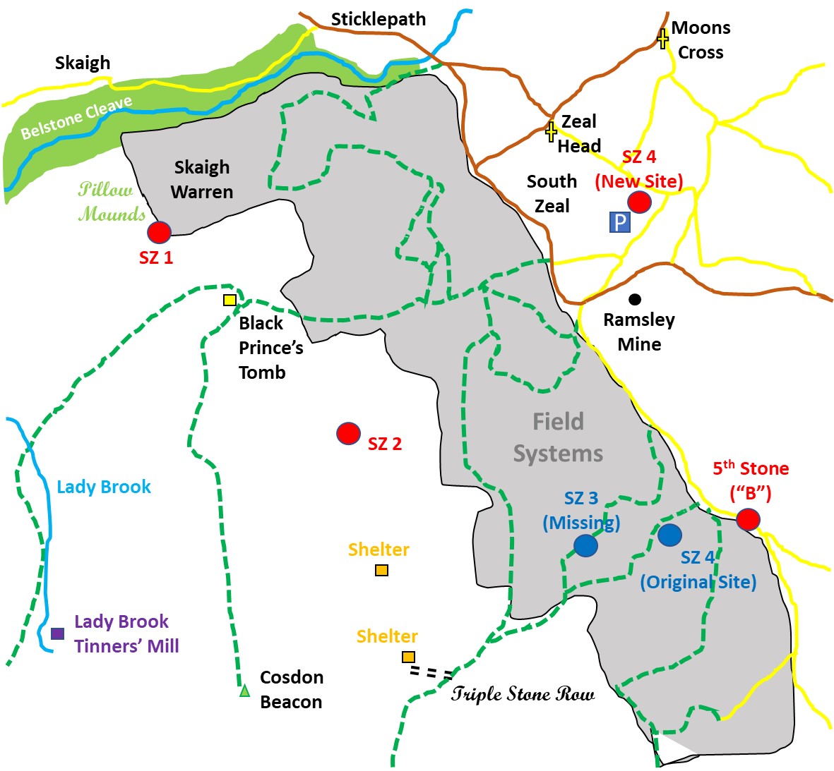
A collection of walks, discoveries, insights and pictures of exploring Dartmoor National Park
January 6, 2023
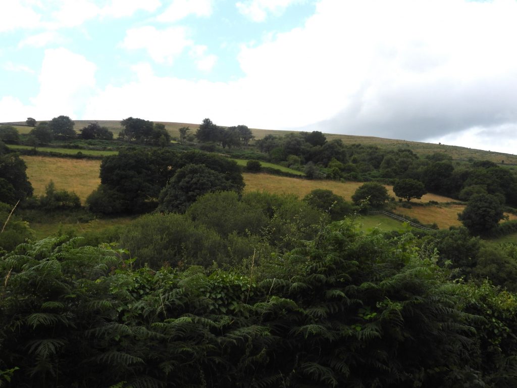
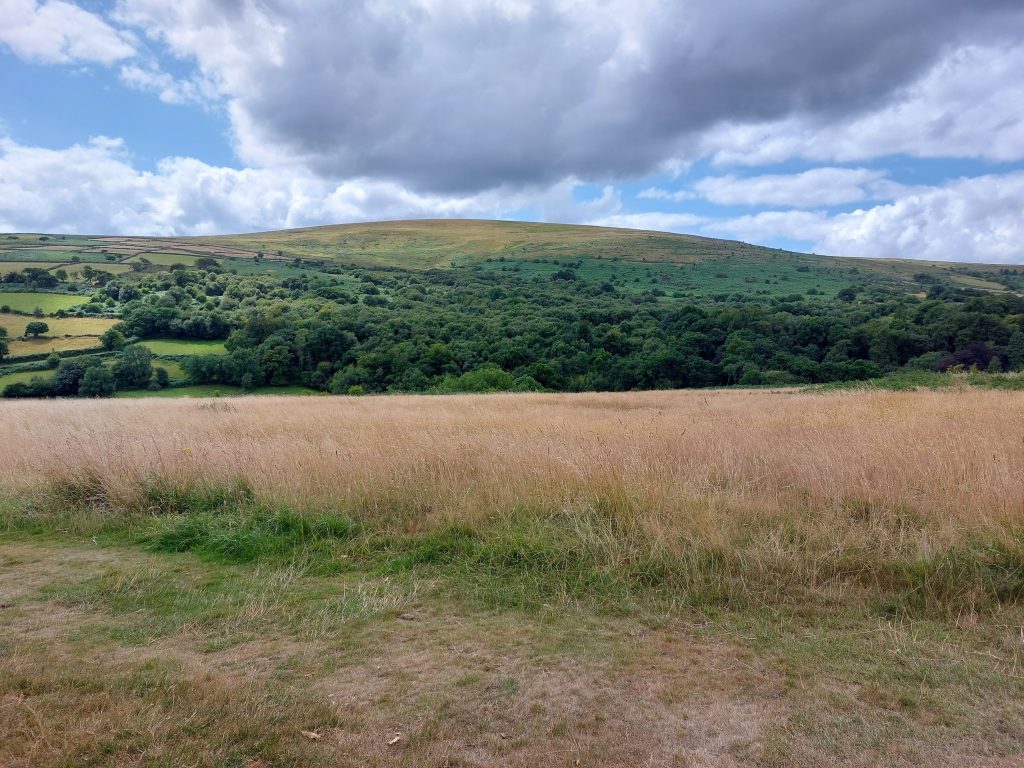
South Zeal / Duchy of Cornwall Boundary Standing Stones and the environs of Cosdon
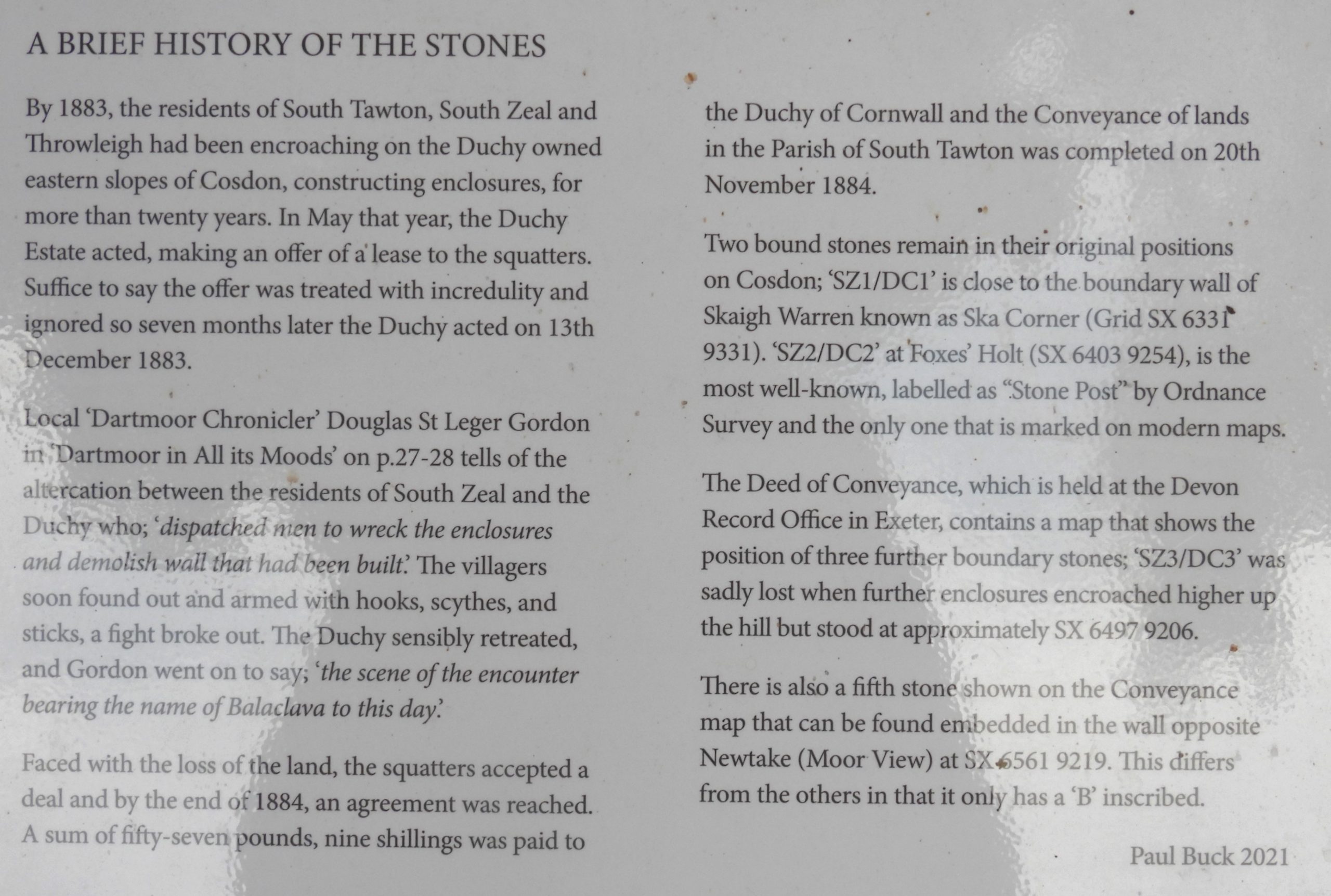
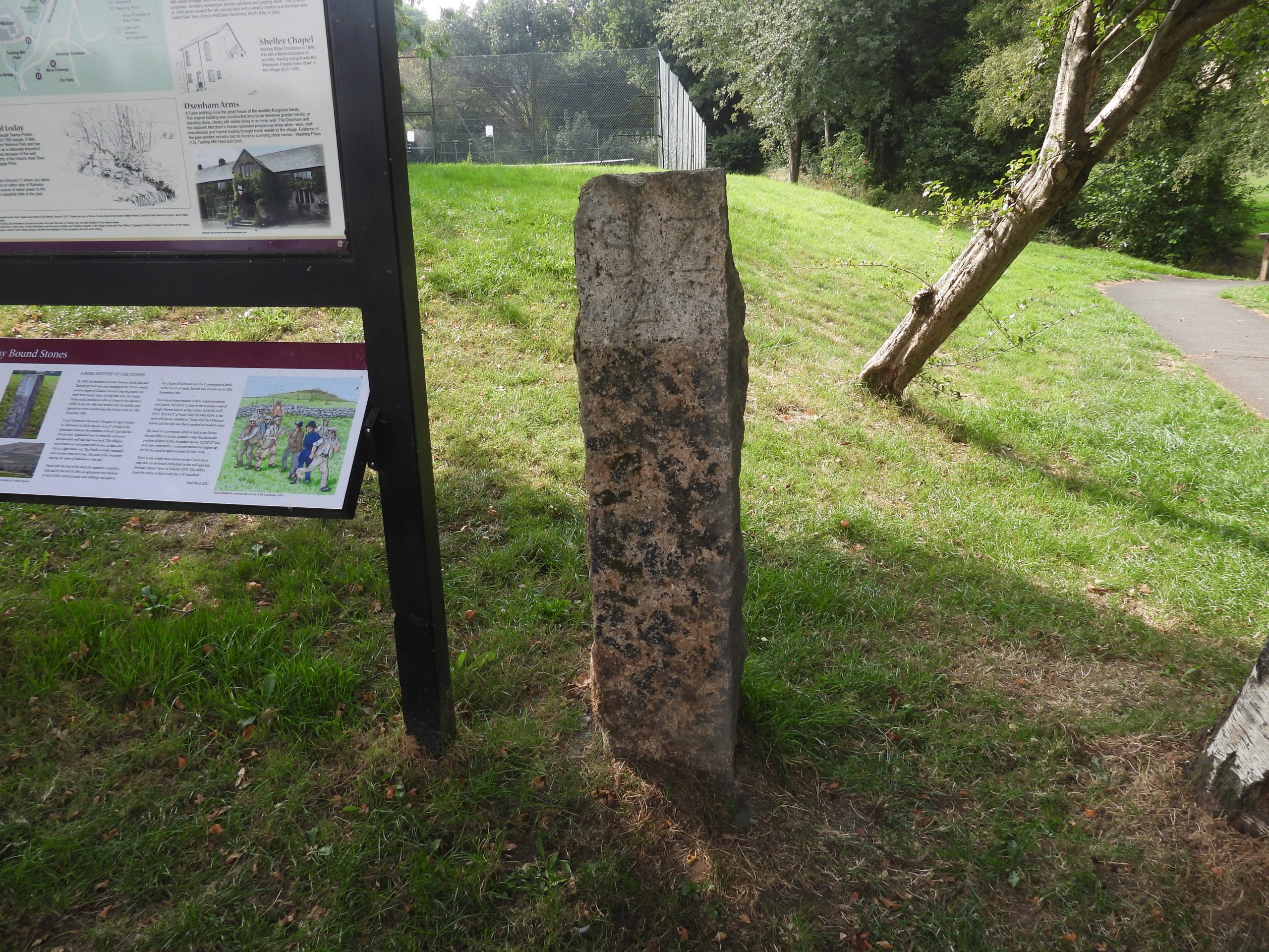
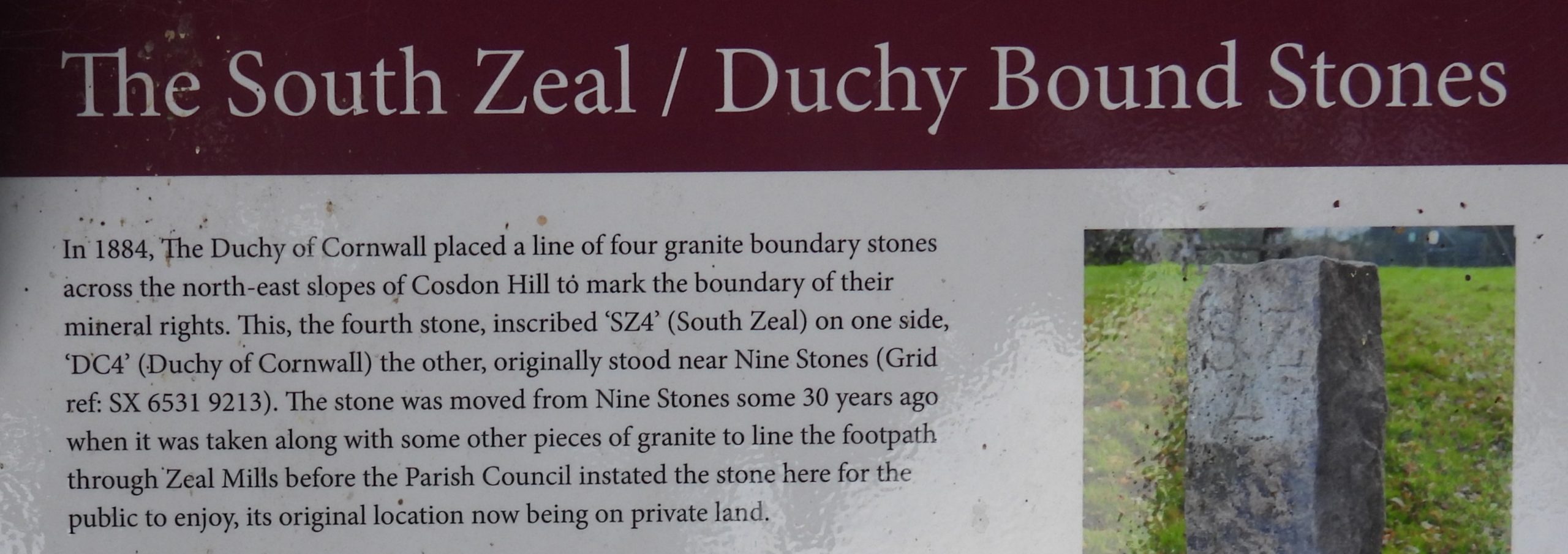
This post was inspired by the excellent ‘information board’ (installed March 2022) in South Zeal which was erected alongside a moved boundary marker (SZ4 / DC4), which has been instated 7 months earlier in August 2021. The information board was written by Paul Buck and tells the story of the altercations that took place in 13th December 1883 between the villagers of South Zeal (South Tawton and Belstone) and Duchy of Cornwall authorities as a direct result of areas of land on the eastern flanks of Cosdon having been enclosed and cultivated by the villagers which the Duchy of Cornwall authorities claimed as being their property.
The villagers had been constructing enclosures for more than 20 years and had ignored the Duchy when they had been offered to lease the land to them. On the fateful day in December 1883, a fight broke out between men from the Duchy, who had been dispatched to demolish ‘illegal’ walls and villagers who were armed with the hooks, scythes and sticks ! Douglas Francis Edward St. Leger Gordon who, in his book ‘Dartmoor in All its Moods’ (1931), wrote the scene in December 1883 bore the name (Battle of) “Balaclava”.
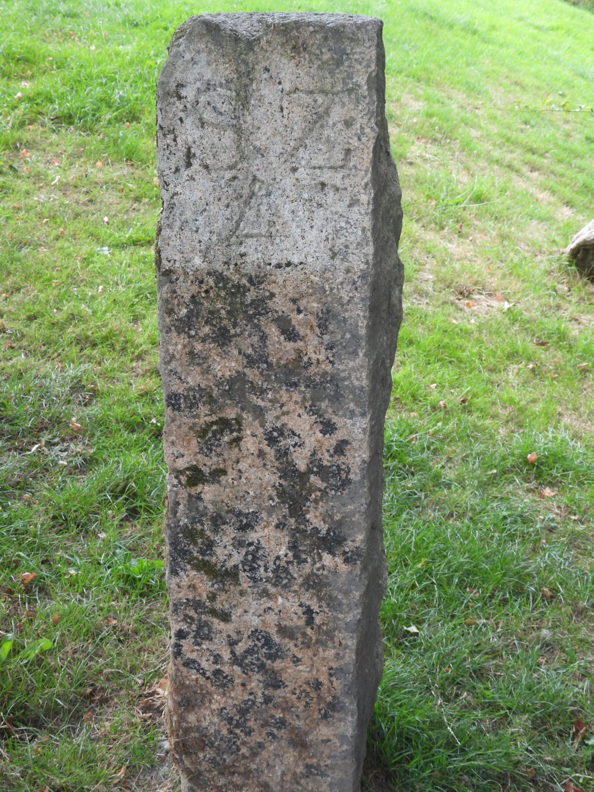
Faced with a loss of land the villagers agreed to a deal with the Duchy (for the sum of £57 9s) which was completed on 20th November 1884. The deed of conveyance was complemented with the erection of 5 stones (4 inscribed “SZ/DC” and a 5th with a “B”). This post covers the area of the dispute plus some of the interesting well known (and some less well known features on Cosdon and around South Zeal
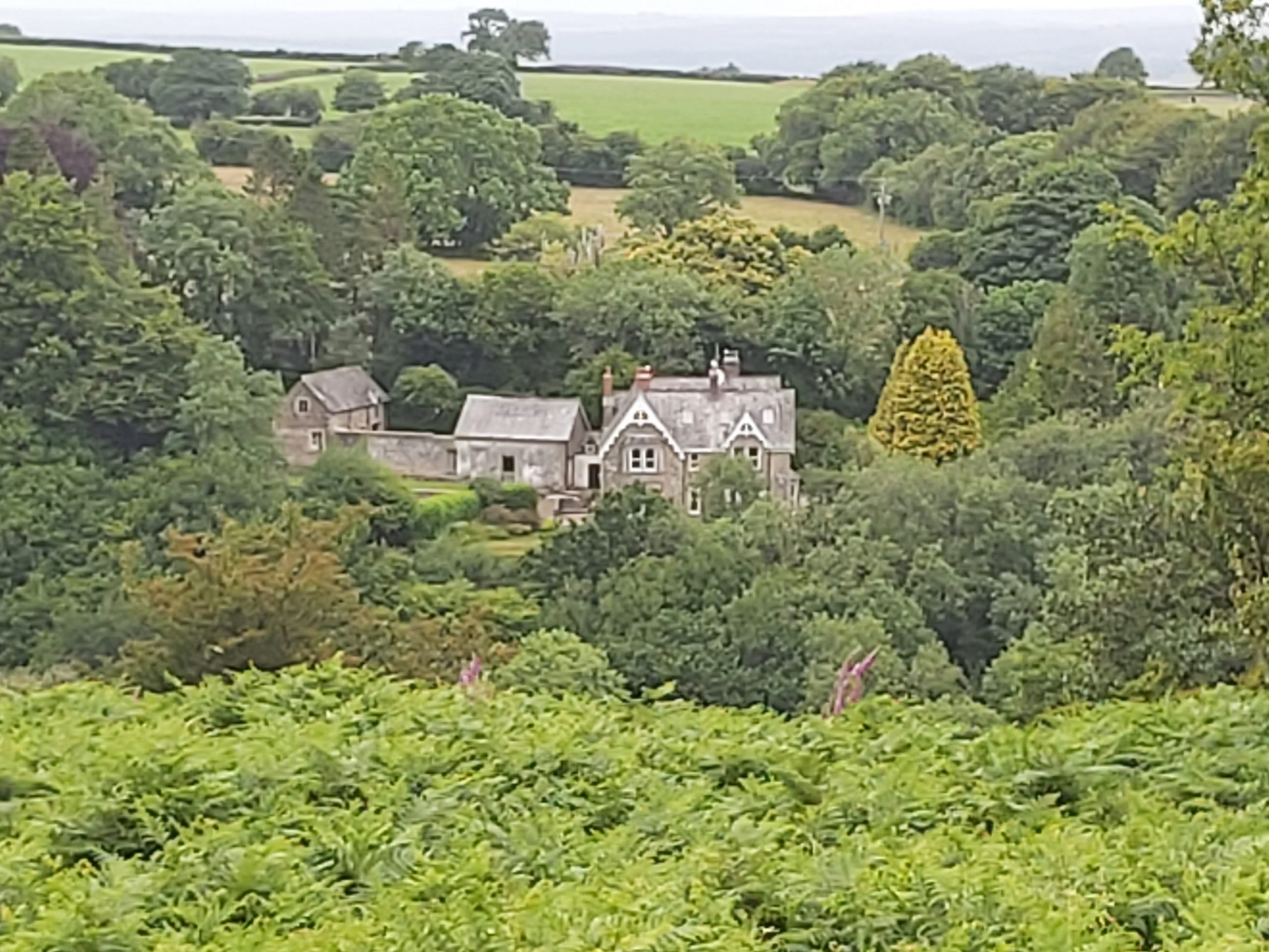
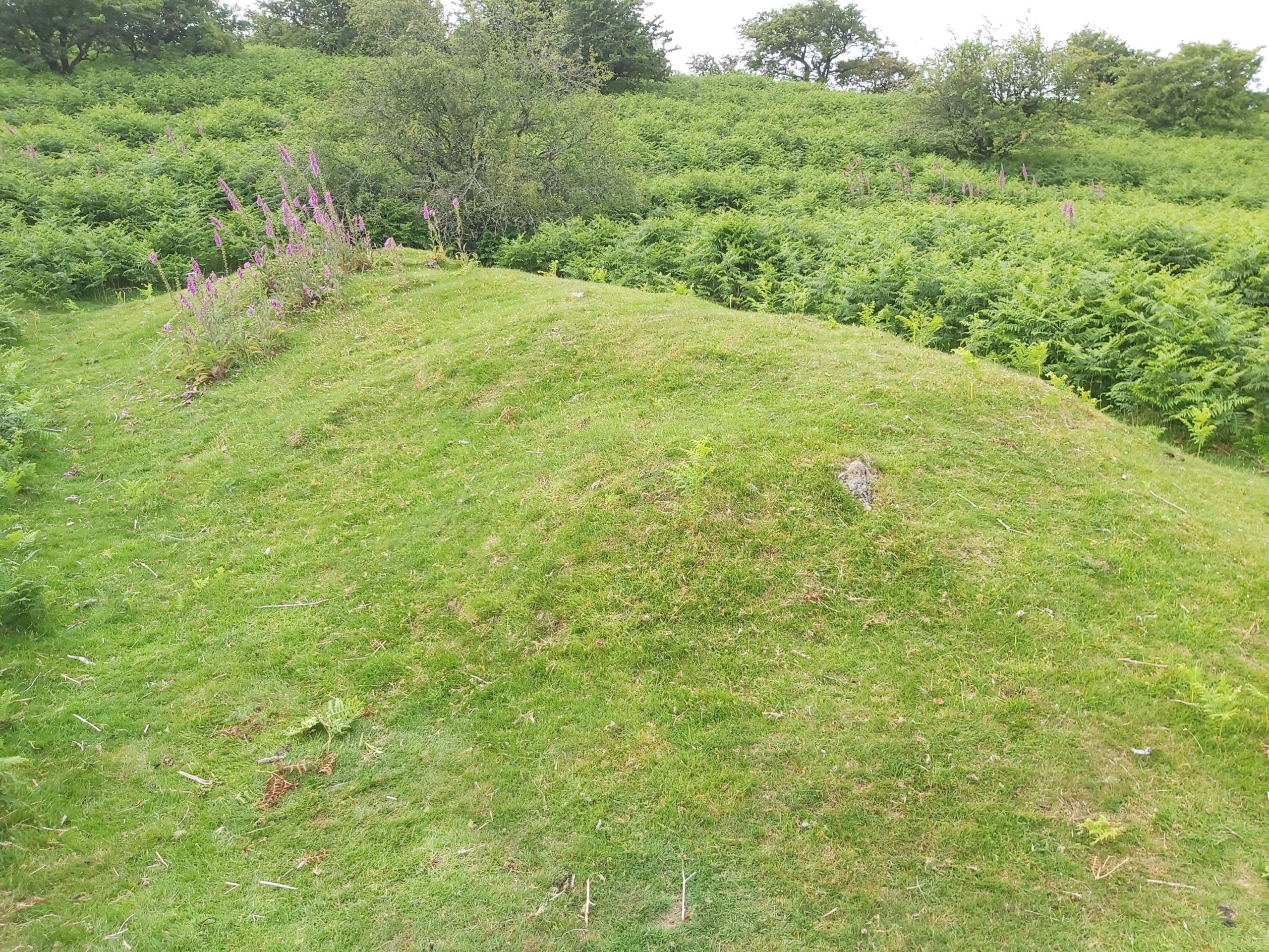
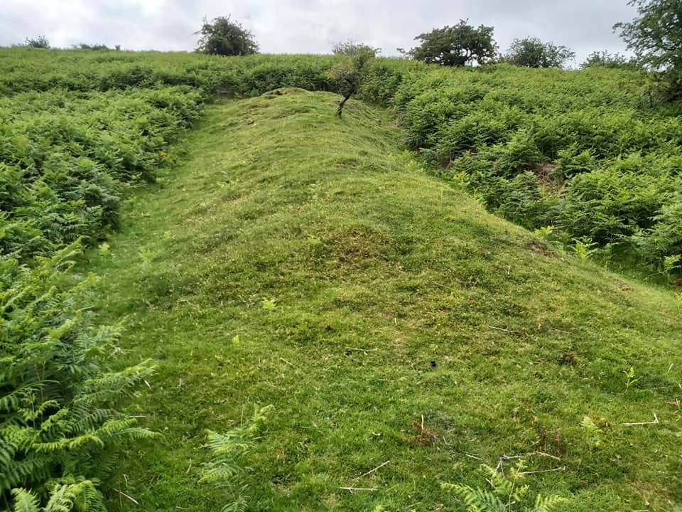
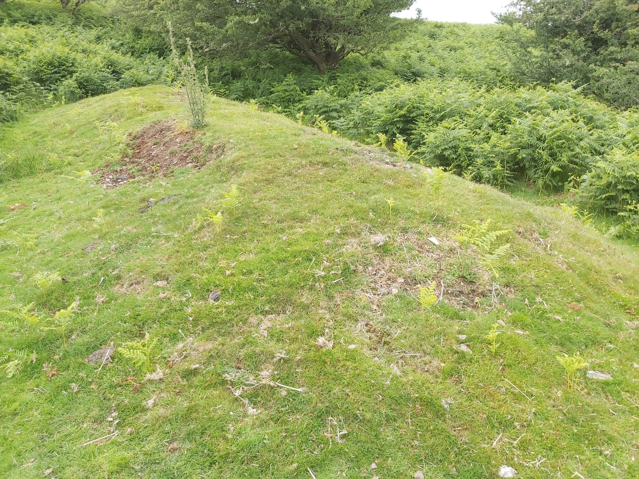
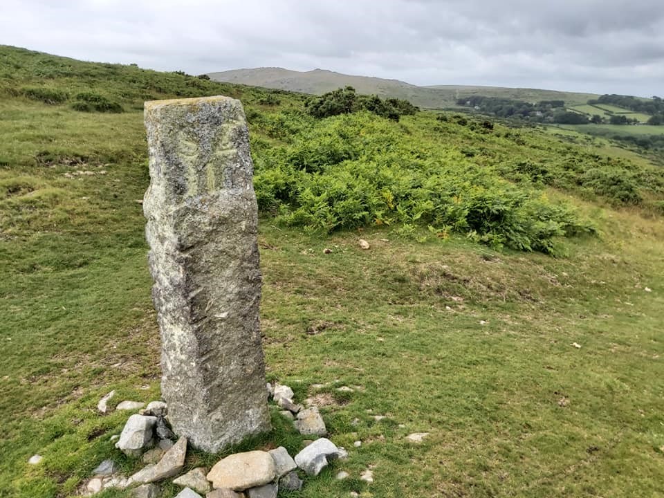
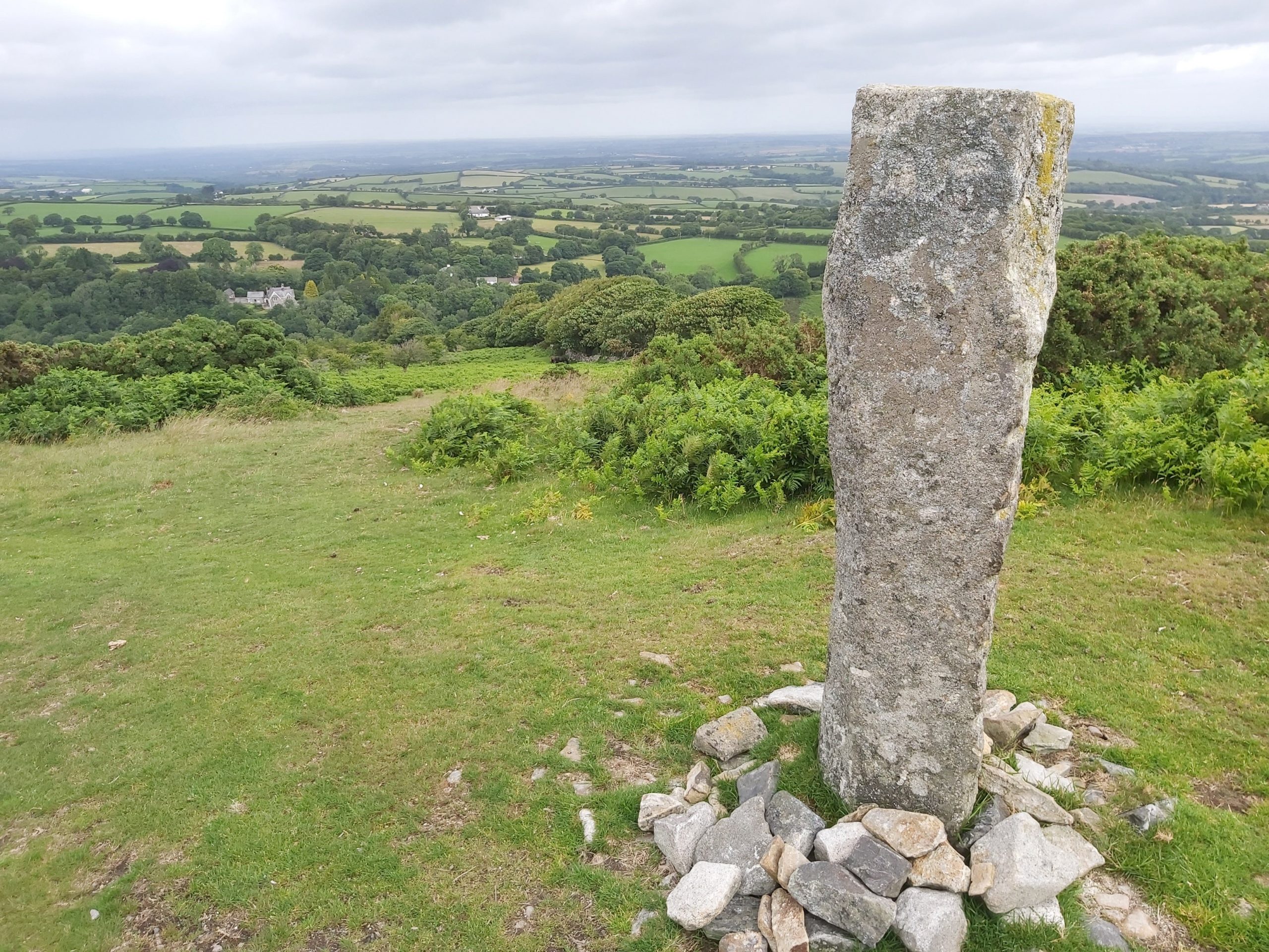
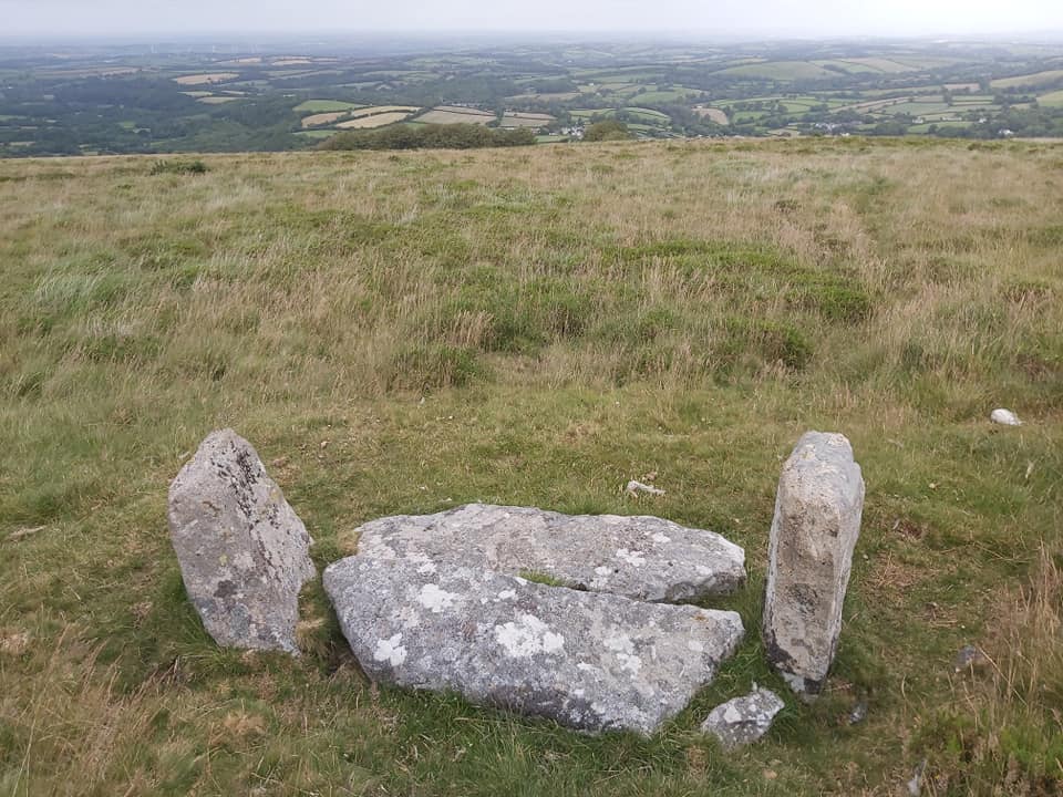
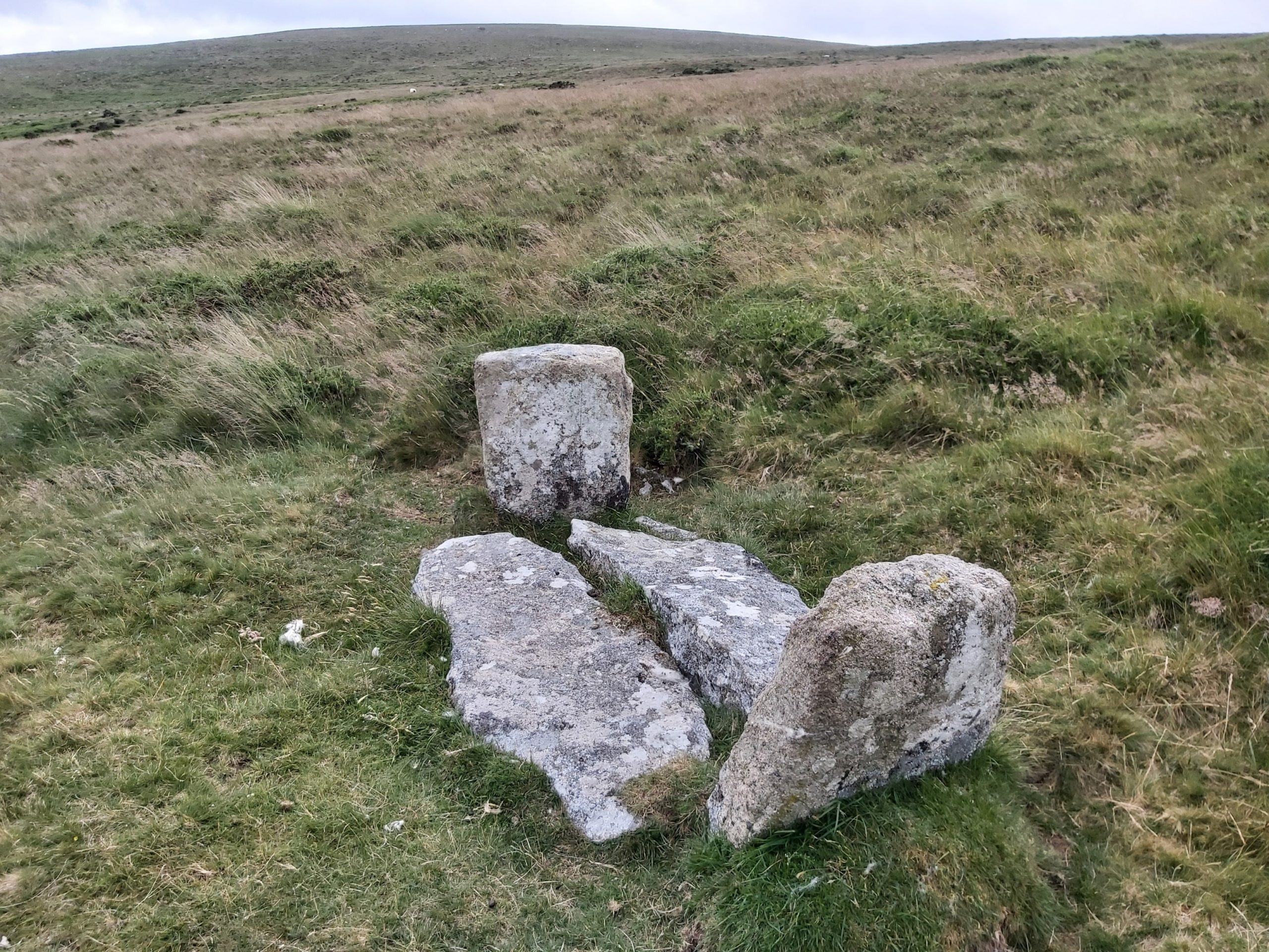
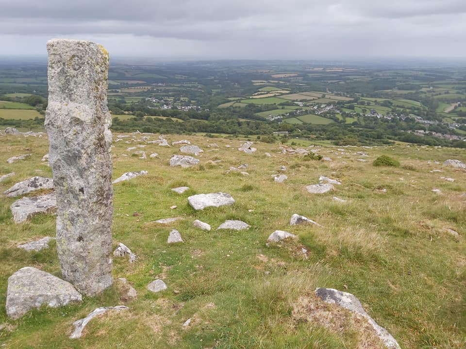
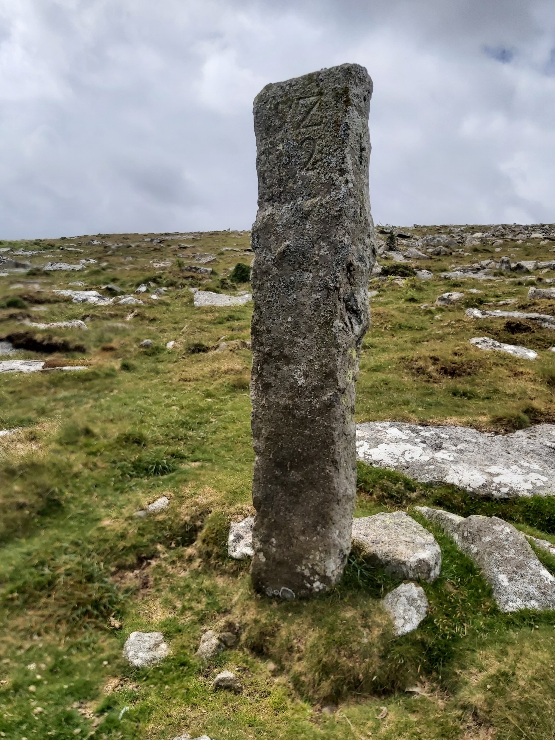
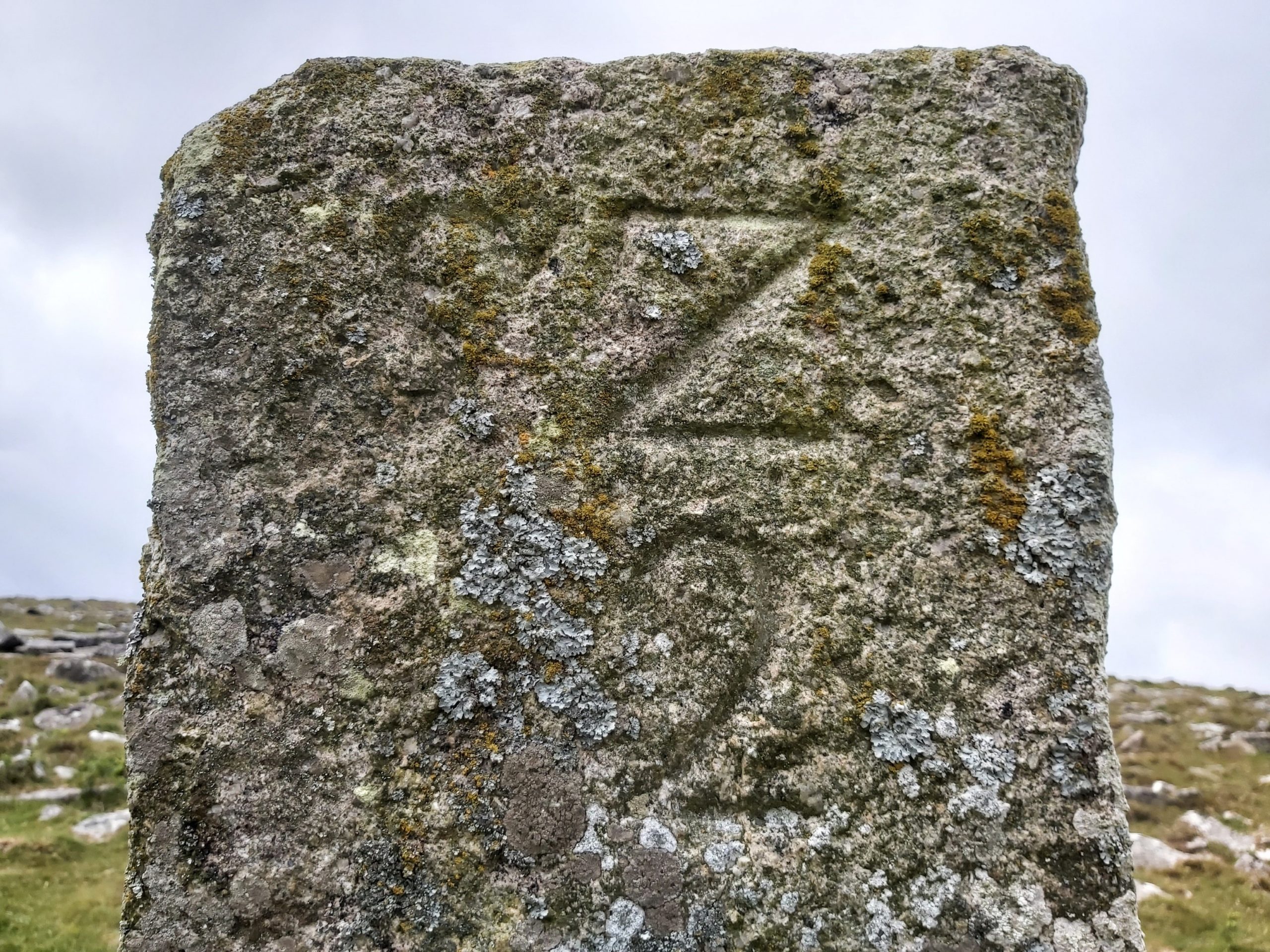
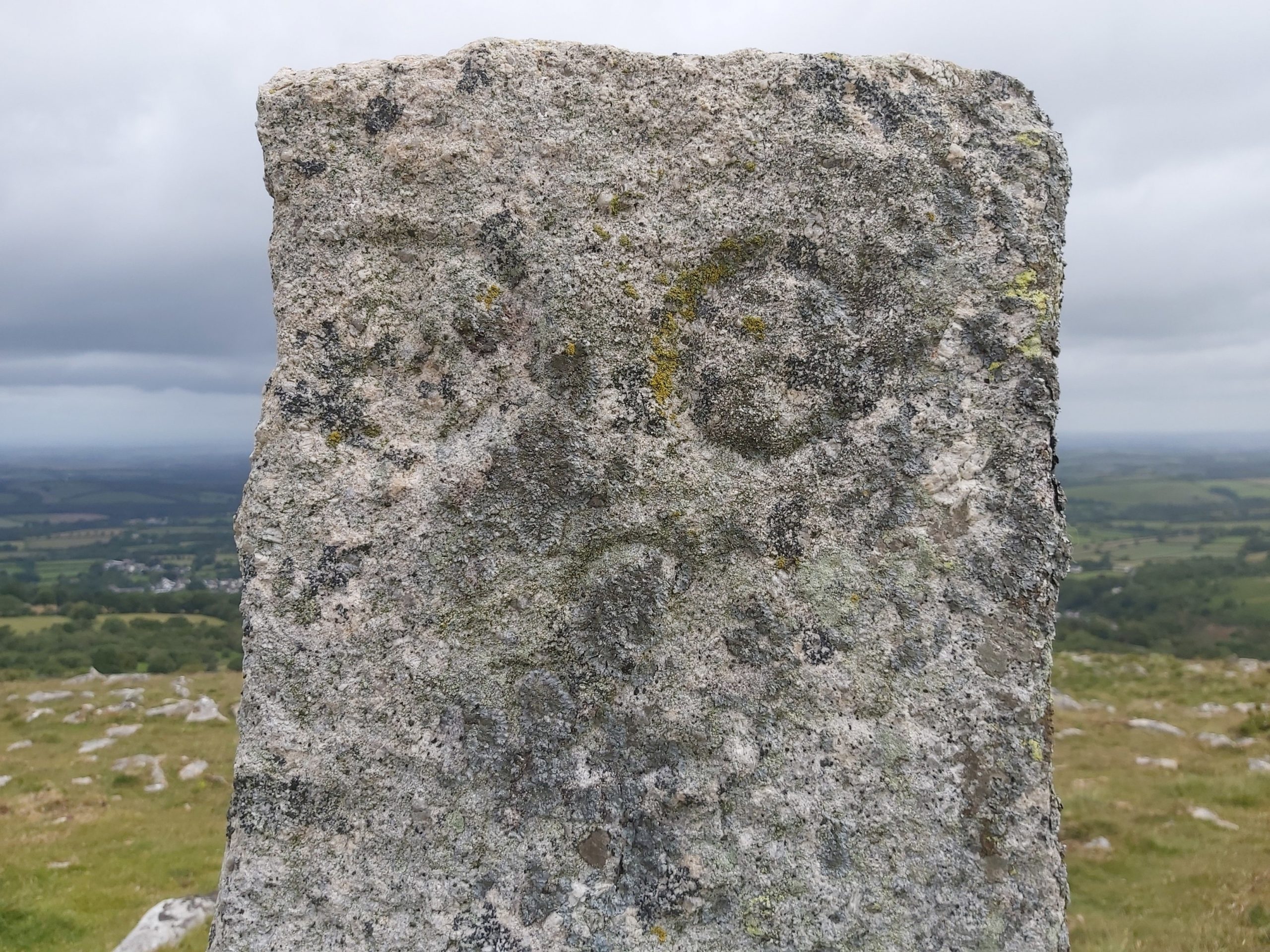
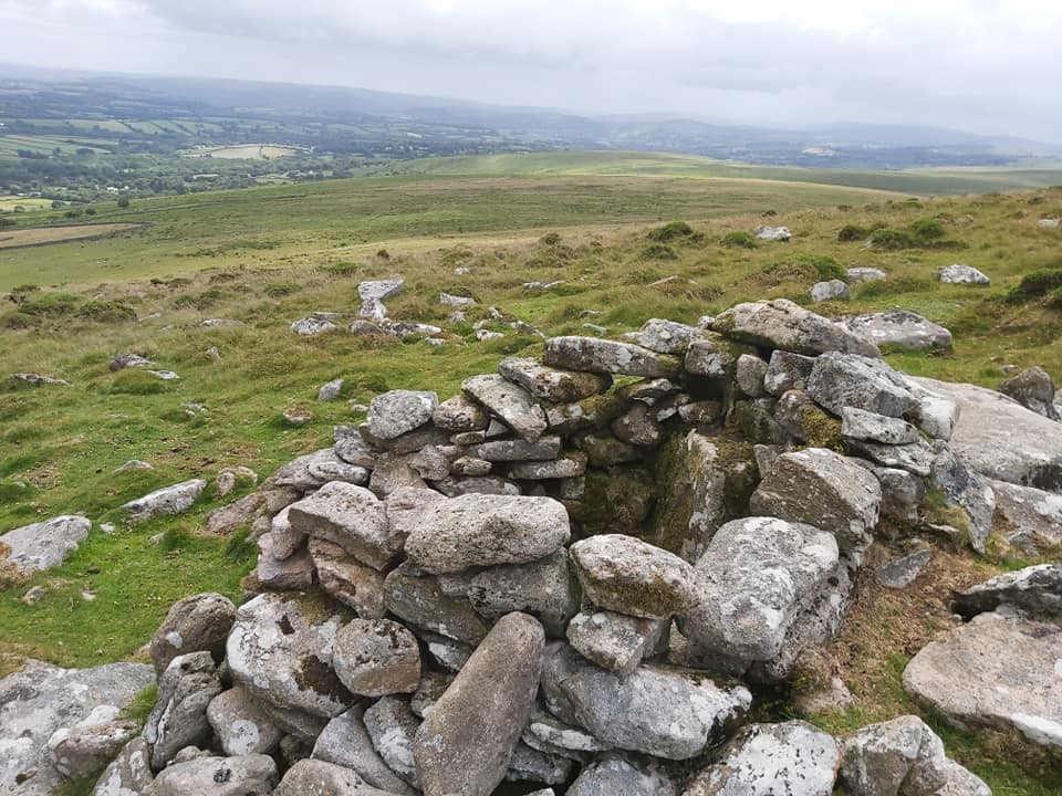
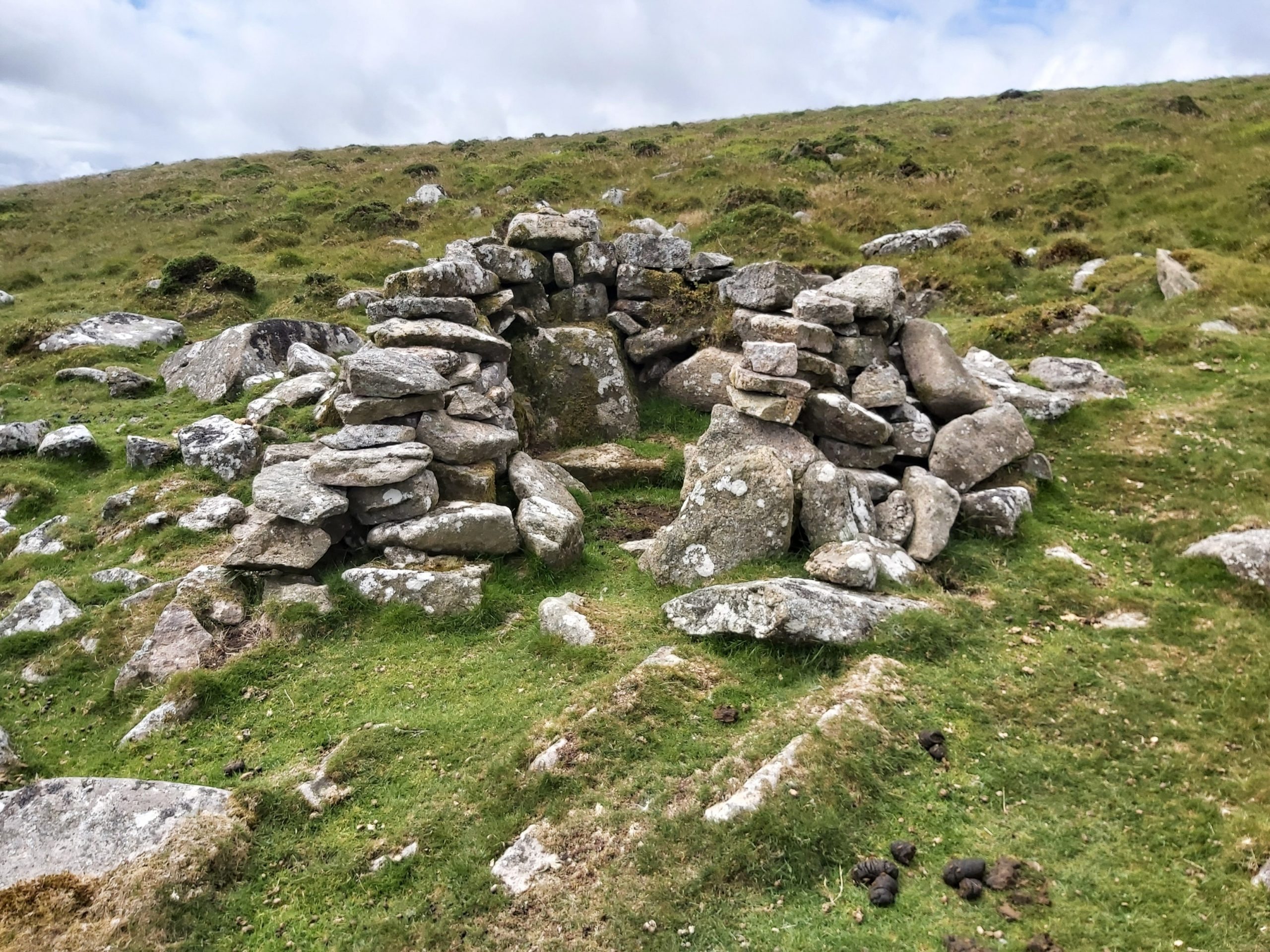
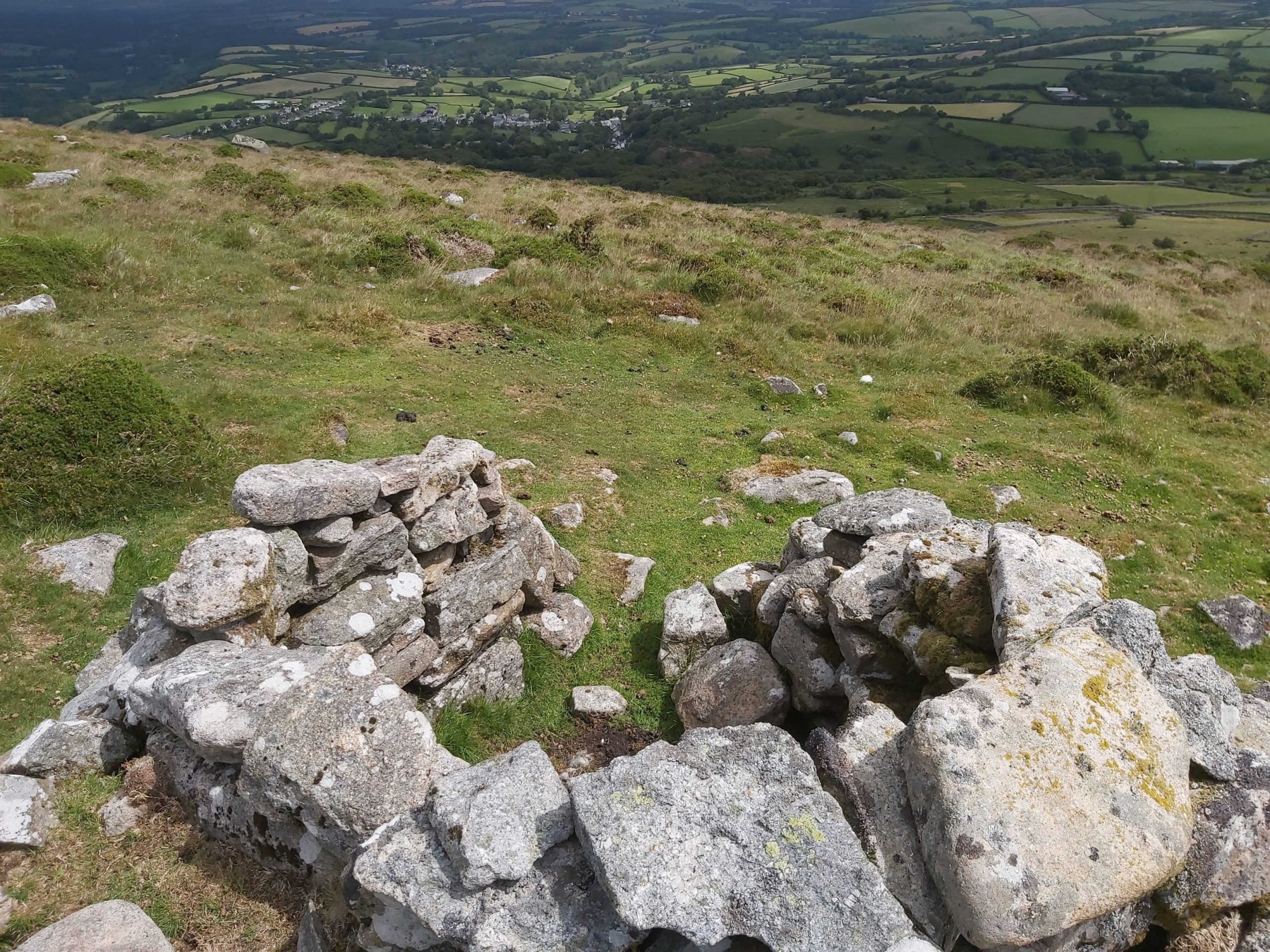
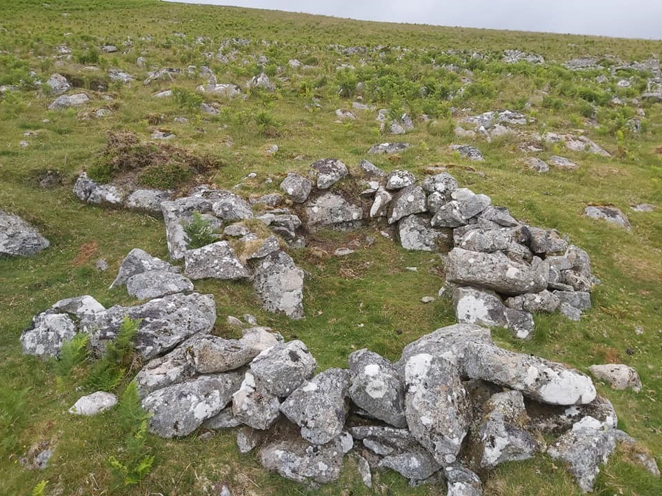
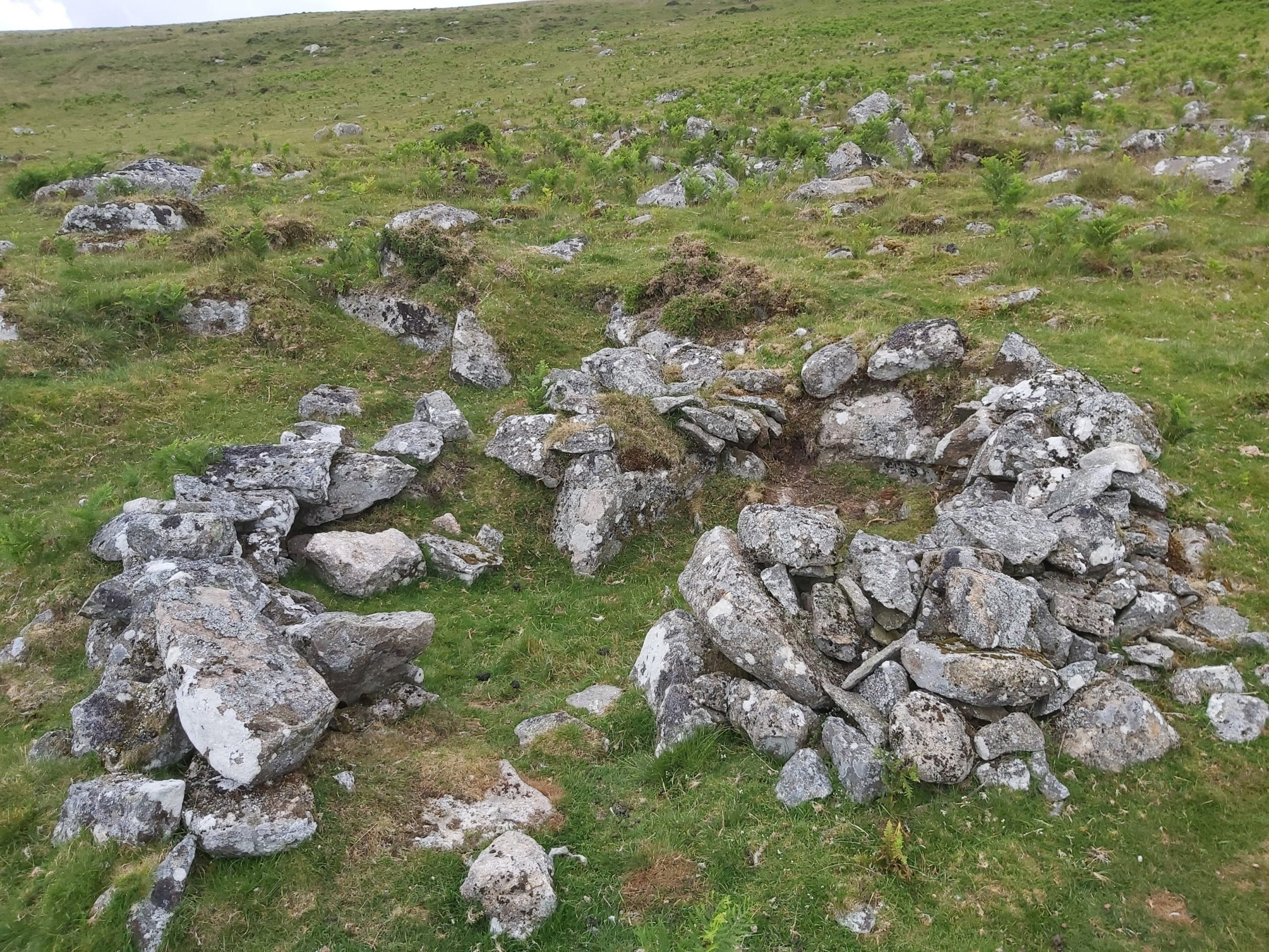
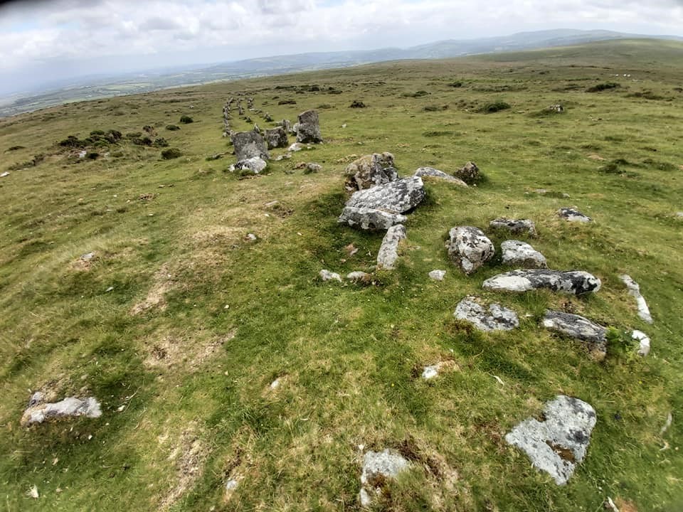
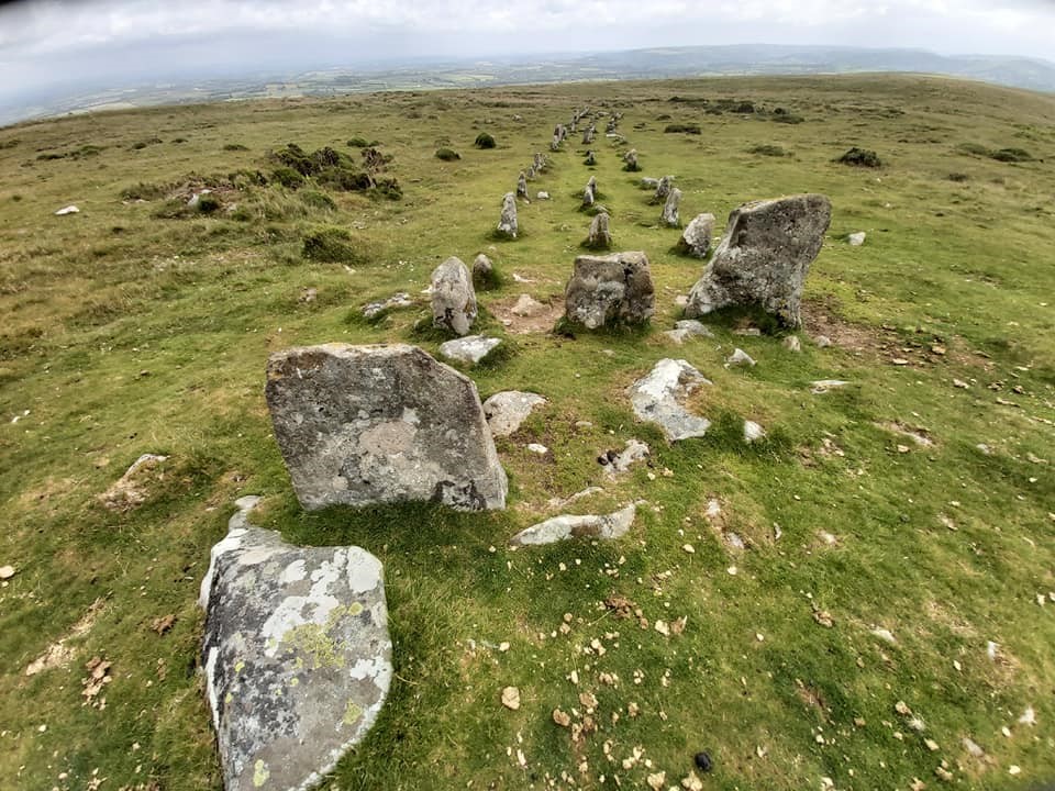
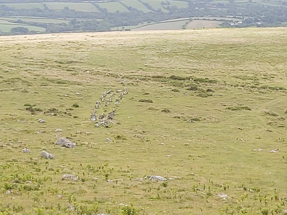
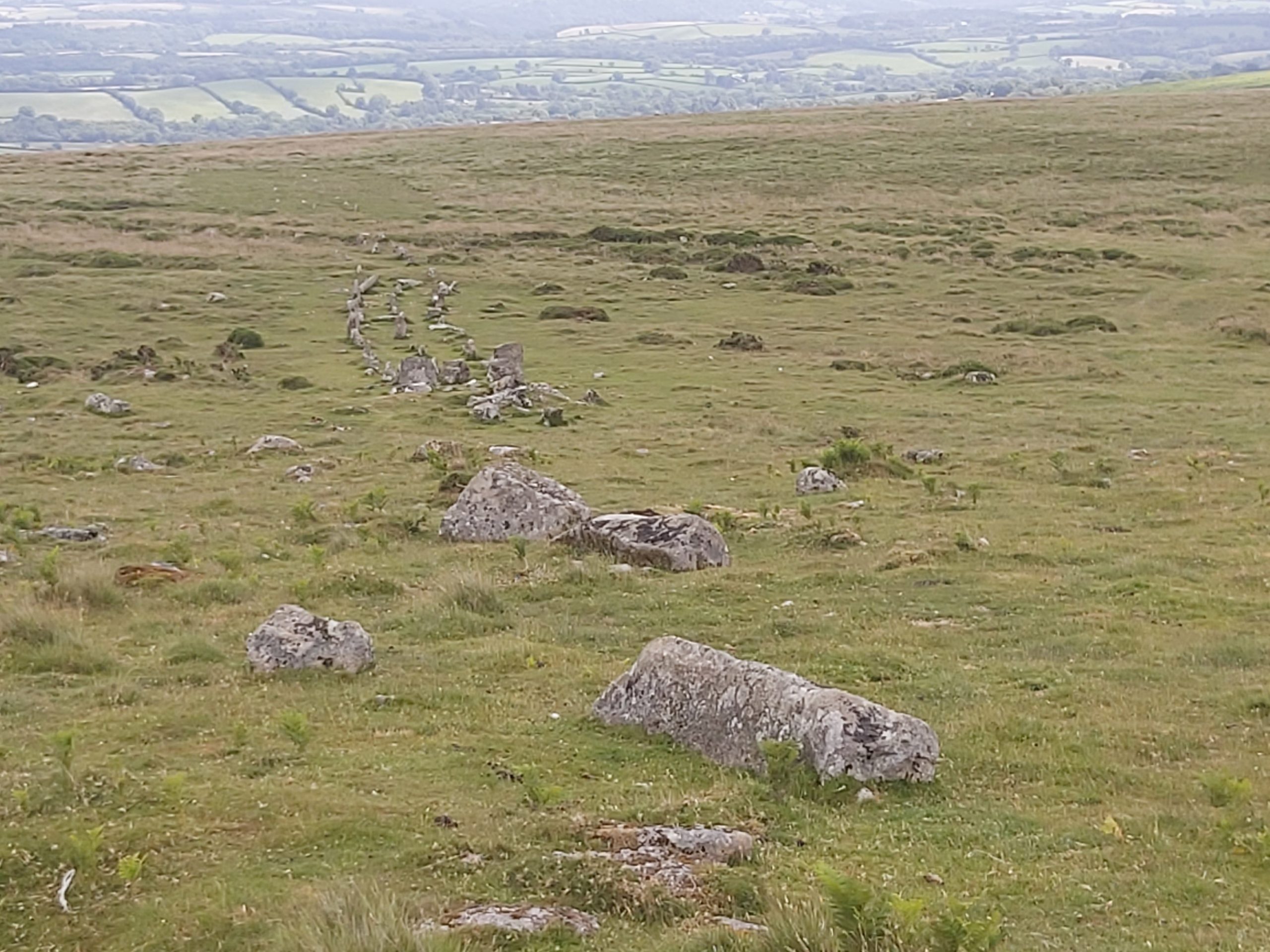
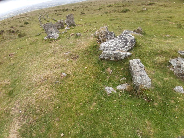
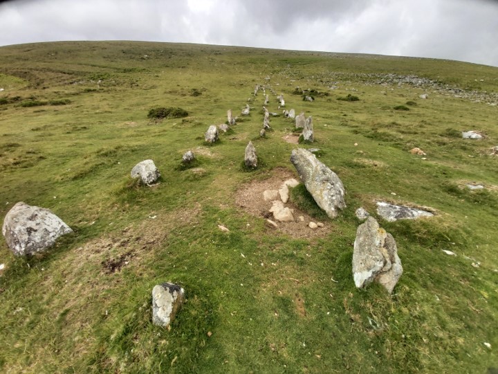
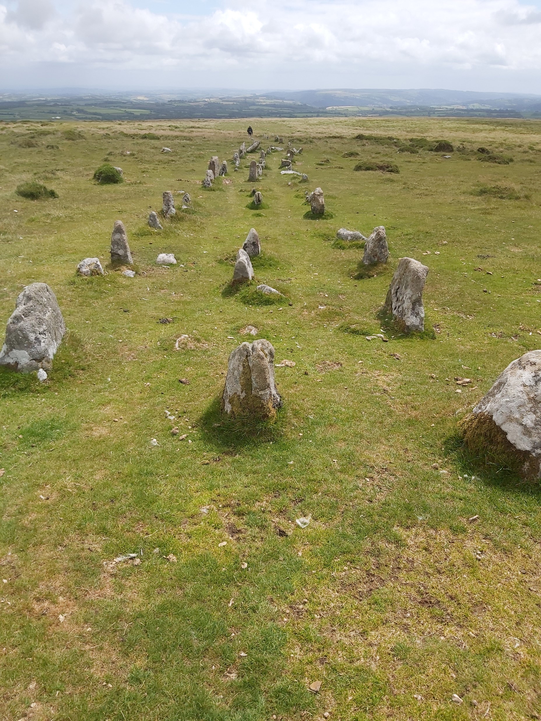
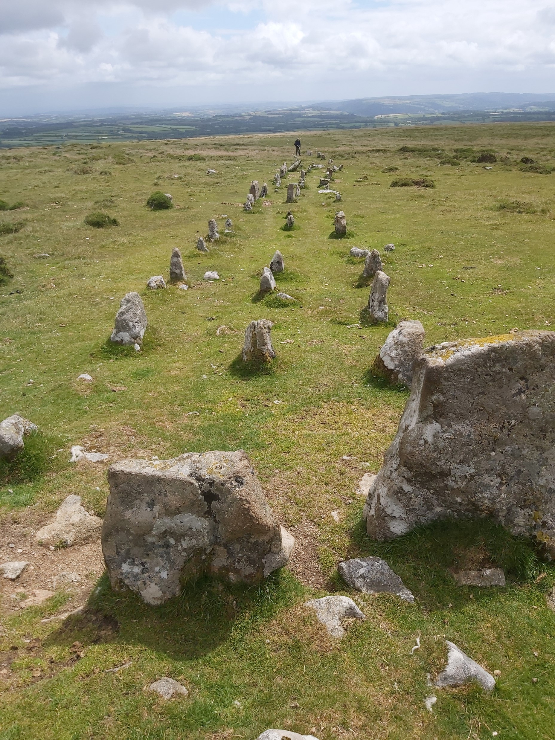
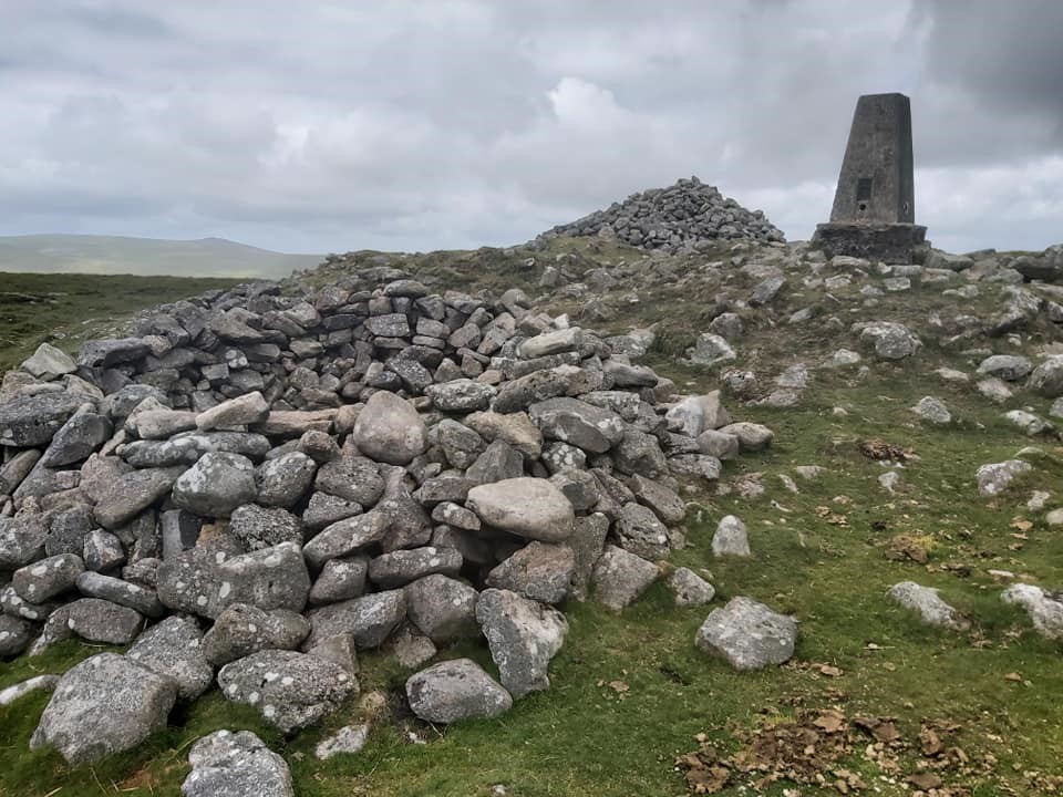
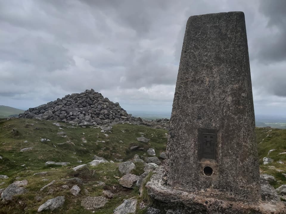
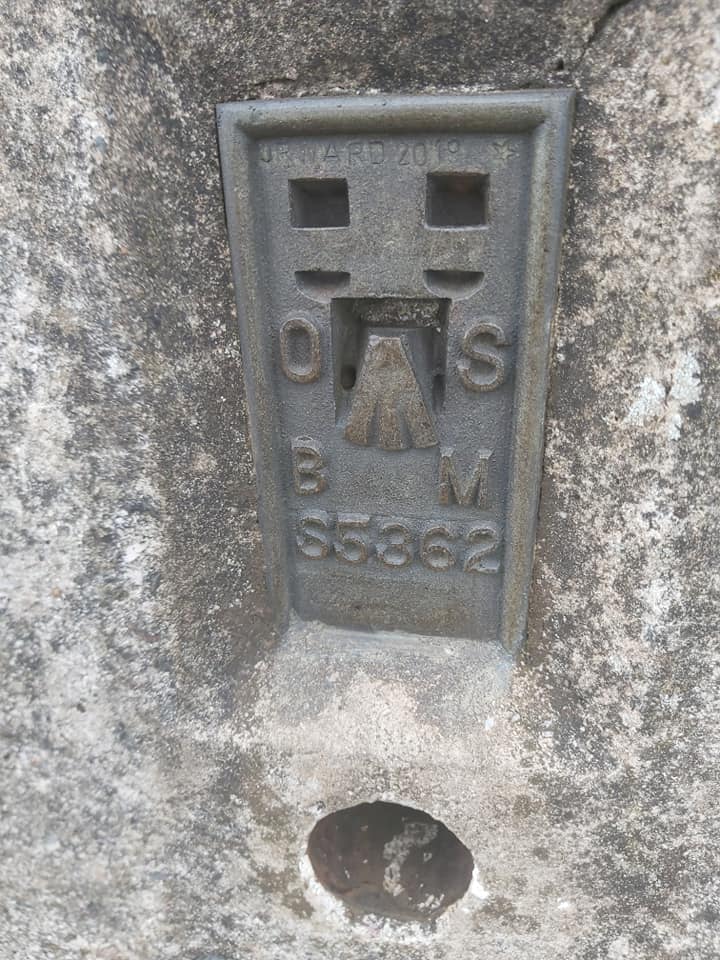
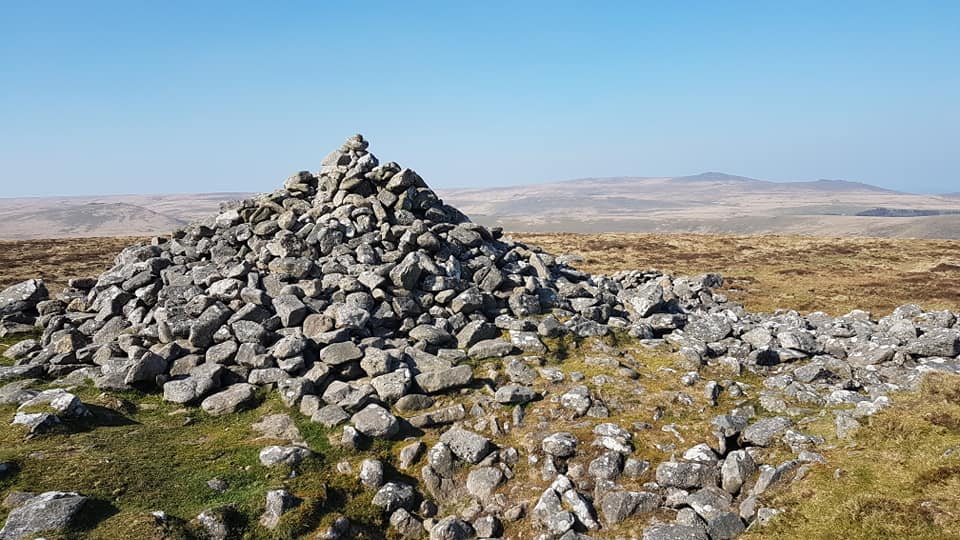
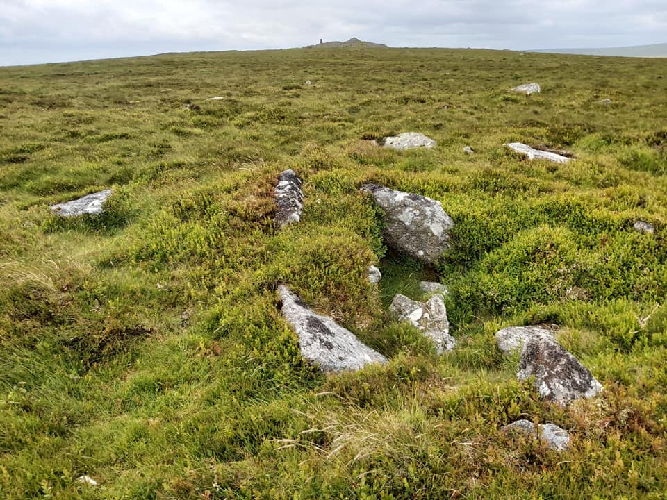
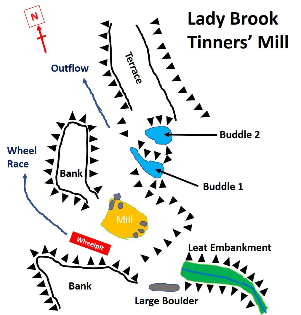
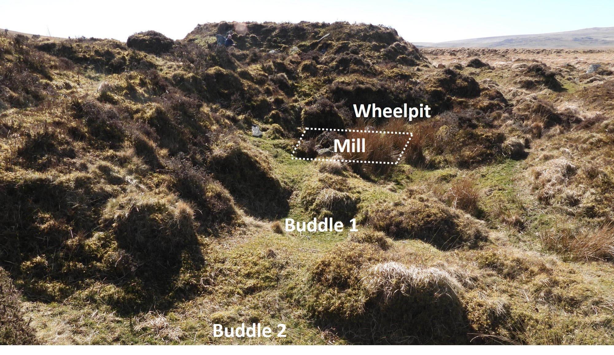
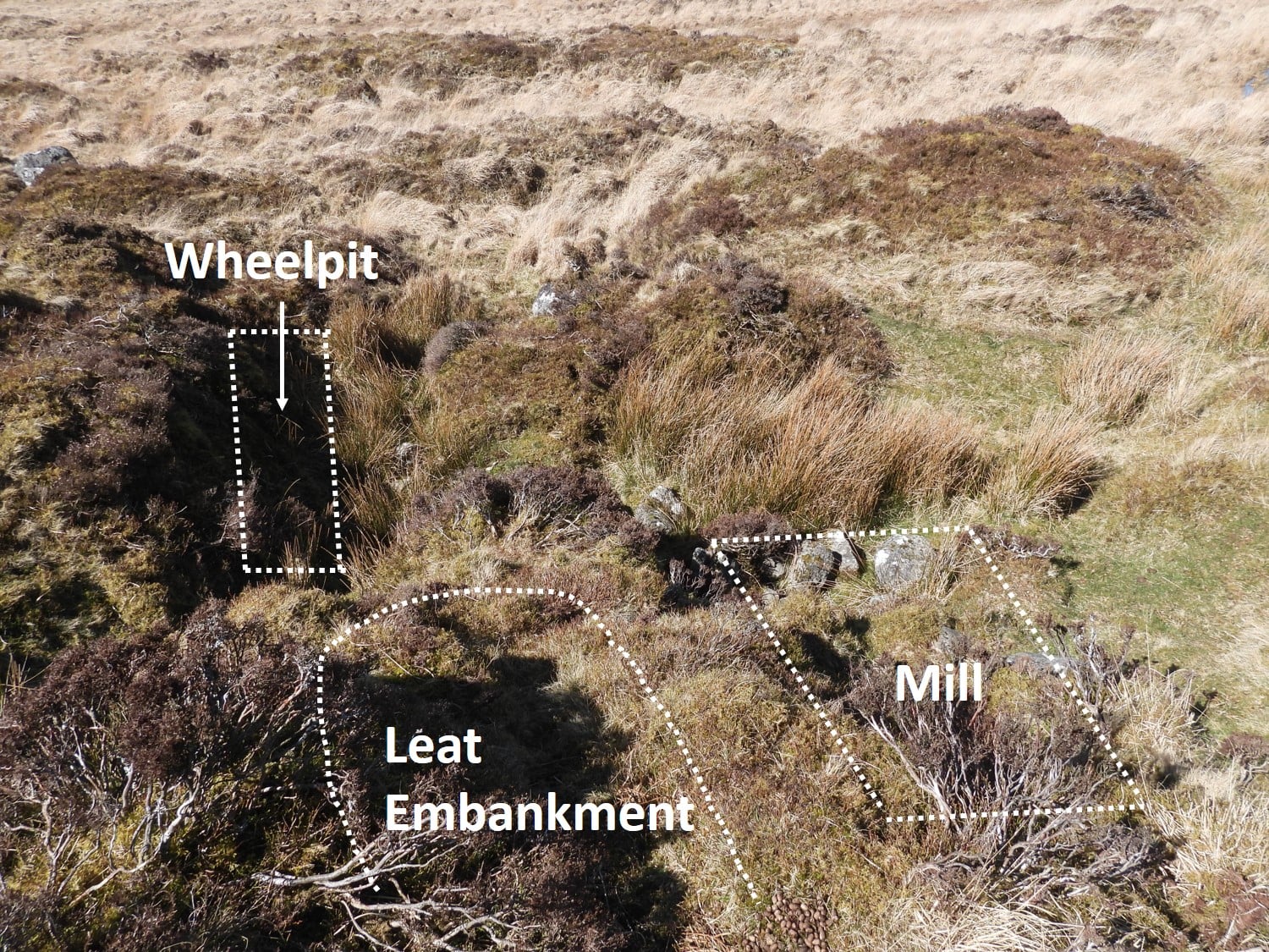
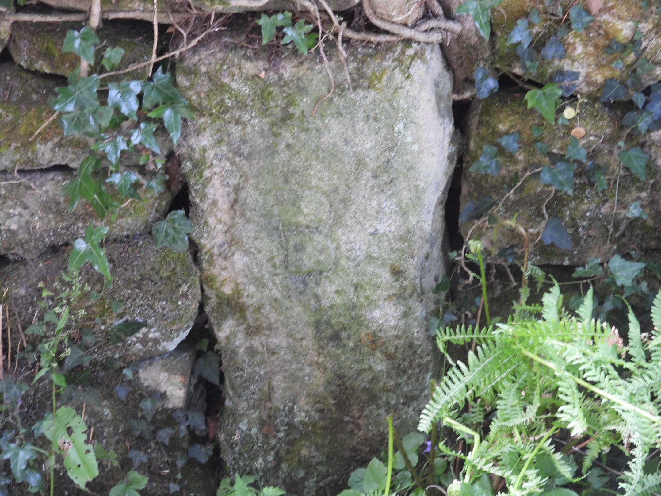
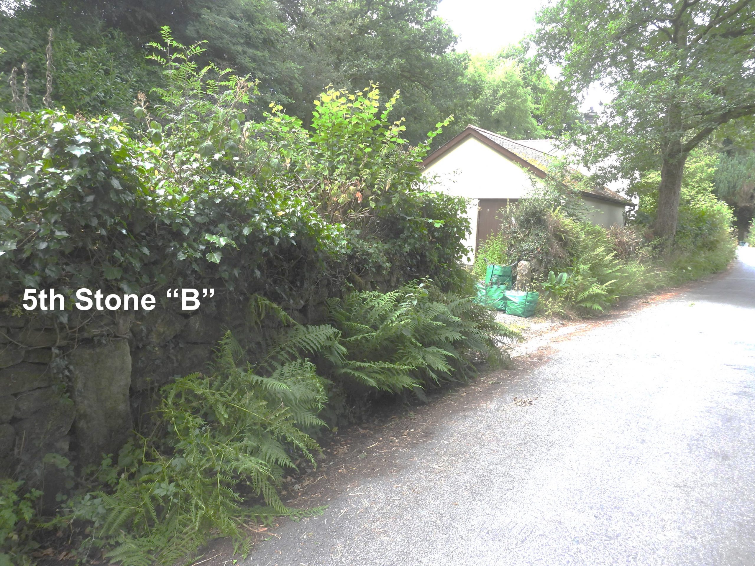
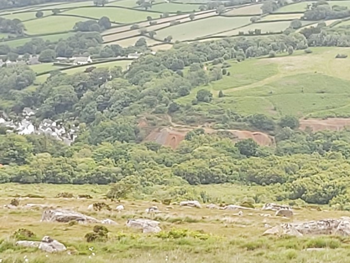
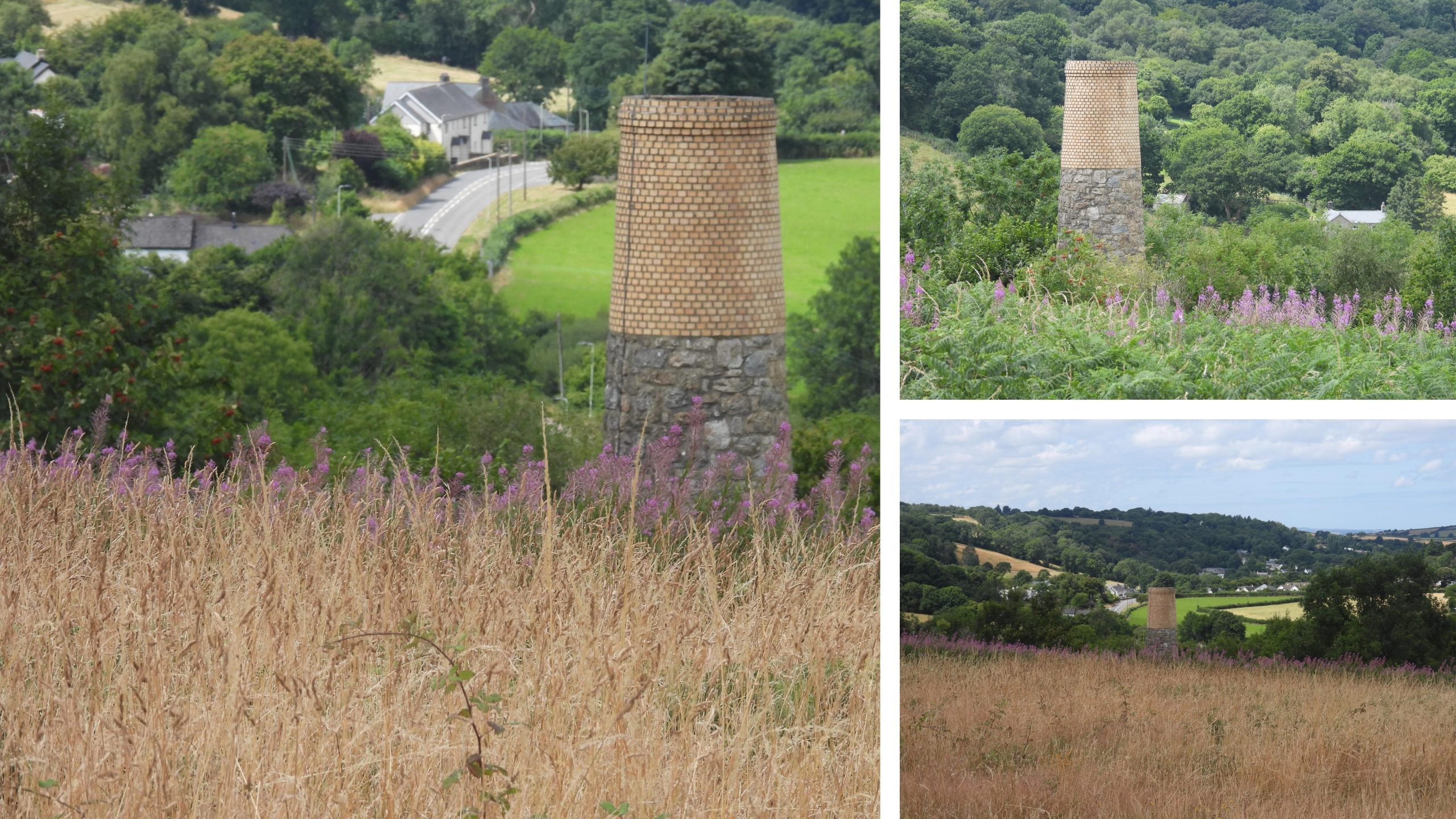
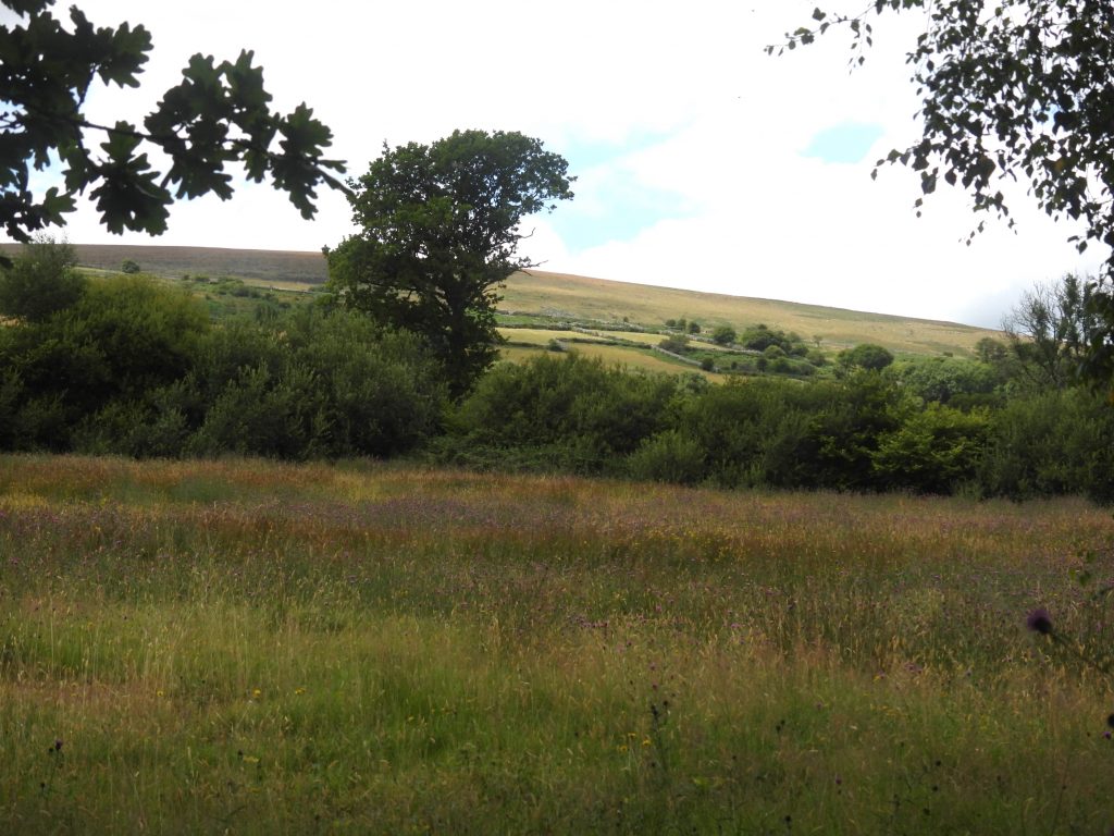
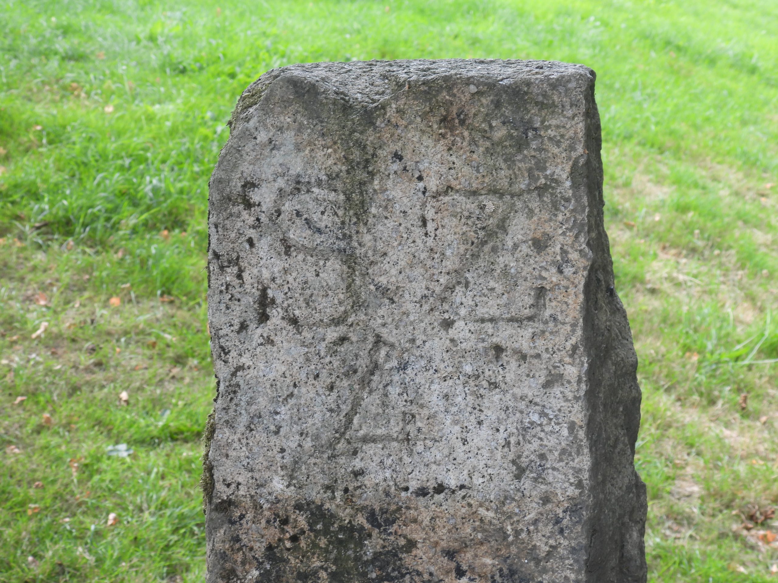
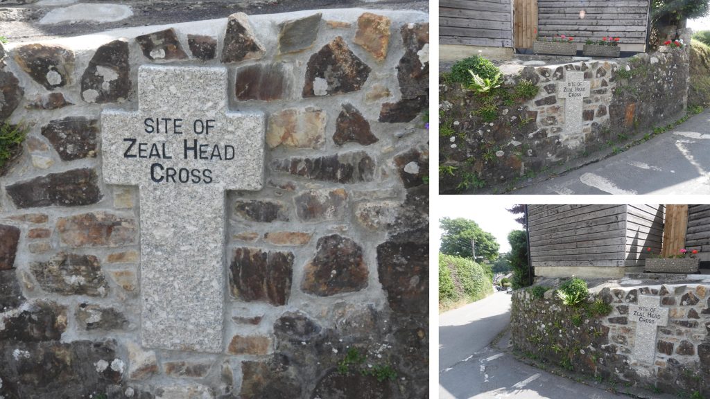
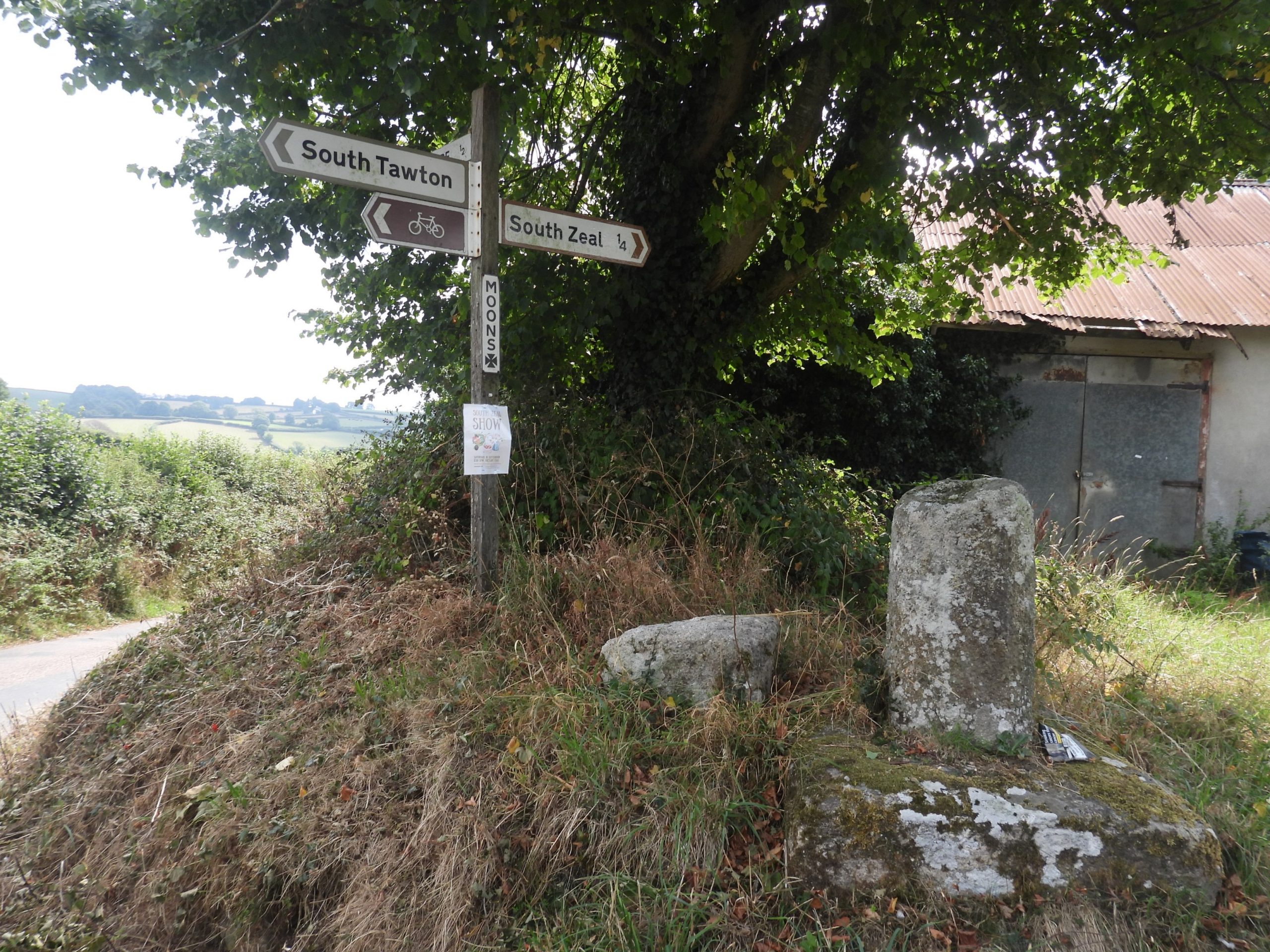
Sketch map of the area and features covered in this postThis is part of the excellent Information Board at South Zeal. Paul Buck has also written an in depth blog on the subject which can be found here: https://www.torsofdartmoor.co.uk/blog/2021/09/01/dartmoor-the-south-zeal-duchy-of-cornwall-stones/Skaigh House from across the River Taw valley near Skaigh (or Belstone Rabbit Warren). Skaigh House, was built on the site of a ruin, sometimes known as “old castle” and in the late 19th Century it was called Rockside.Climbing the hill across Skaigh Warren there are a number of Pillow Mounds. This one is at SX63065 93592.A second Pillow Mound can be found at SX63101 93579A third Pillow Mound can be found at SX63164 93579The first of the boundary stones is located at SX63315 93314 near Ska Corner. It is inscribed SZ 1 (South Zeal) and DC 1 (Duchy of Cornwall). The “SZ 1” inscription (see picture) is very discernible.The reverse “DC 1”. It is 2 metres high and is square, measuring 30cm x 30 cm. This stone is also known locally as ‘Stumpy post’This is the remains of a possible cist within a possible cairn, consisting of two stone slabs set facing each other, 1.7 metres apart with a pair of longer stone lying between them (ref: Butler, 1991, Dartmoor Atlas of Antiquities: Volume Two – The North, 207, Map 40). It may also be (Butler) the remains of a well-known stone setting called the ‘Eight Rocks’ which existed on the hillside here until sometime in the 19th century. Unusually it is sometimes known as ‘Black Prince’s Grave’ and is located at SX63607 93070R. St. Ledger-Gordon in ‘The Witchcraft and Folklore of Dartmoor’ from 1972, (p58) makes reference to this cist / cairn being called ‘Black Prince Grave’ but the author is unaware as to why.The second of the boundary stones is located at SX64031 92544 . It is inscribed SZ 2 (South Zeal) and DC 2 (Duchy of Cornwall). The “DC 2” in the picture is very discernible.The modern OS map shows this as a ‘stone post’ at Foxes’ Holt.Close up of “SZ 2” inscriptionClose up of “DC 2” inscriptionSmall building (Shephard’s Hut ?) a few hundred metres to the south of SZ 2 / DC 2This small building can be found at SX64175 92008View from the small building looking towards Ramsley Mine and South Zeal Further south from the first building an close to the triple stone row is a second building (shephard’s shelter ?)The second building is located at SX64309 91615Cairn with two conjoined cists at the western end of a triple stone row The triple stone row is locally known as ‘The Cemetry’ or ‘The Graveyard’. Gerrard records that the triple stone row is 138 metres long, and has at least 118 stones whose heights gradually increase uphill towards the cairn.R.N Worth, in 1892 (The Stone Rows of Dartmoor) suggested that two phases are represented: one row for the standing stone, two rows for the cairn. Jeremy Butler (1991), Dartmoor Atlas of Antiquities: Volume Two – The North, pages 204-6 states: “Uphill the rows end symmetrically at a ruined cairn, the middle row orientated towards it centre. The Dartmoor Exploration Committee re-erected an unknown number of fallen slabs in the rows in 1896 when they also excavated the cists”.Historic England have recorded an unusual feature in the triple row insofar that “….there is a marked curve in the alignments of about 3 degrees to the north from a point 70m from the western end”.The stone alignments are cut through by a ‘hollow way’ (where the figure is in the picture). The hollow way is believed to be part of a track which lead from South Zeal to Hangingstone Hill (to carry peat from the moor) and dates from medieval times.At the western end of the triple rows are three blocking stones up to 1 metres high.Cosdon Beacon with summit cairns and trig point.The trig pillar dates from 1930’sFlush Bracket OSBM S5362Cosdon summit cairnCairn / cist to the north of Cordon summit. A lesser known tinners’ mill lies on the western slopes of Cosdon Hill. More information can be found here: https://dartmoorexplorations.co.uk/lady-brook-tinners-mill/The site is best located by looking for a very large mound (see top of picture) which is a few metres to the south of the mill.View of the Mill and Wheelpit taken from the top of the Leat Embankment. The presence of tin slag on this site demonstrates that it was a smelting site.The 5th South Zeal / Duchy of Cornwall Boundary Standing stone mentioned on the information panel in South Zeal. This one differs from the others insofar as it is only inscribed with a “B” which presumably means ‘bound’. It is embedded in a wall.The 5th stone is located at SX65617 92193 opposite Moor ViewRamsley Mine (phone image, so bit fuzzy). It was a Copper Mine, which is recorded (Dartmoor HER) as being “one of the most important of several 18-19th century copper mines around the northern fringe of Dartmoor. Ceased in use in 1909”. The mine was marked as ‘Emily Mine (Copper)’ on the First Edition OS map (around 1880s).Ramsley Mine chimney was severely damaged by lightning on 3rd January 1998. Subsequently, the stack is to be rebuilt by South Tawton Council.Some of the fields which were part of the original encroachmentClose up of part of the encroachmentThe ‘Cosdon Encroachment’ – the fields seen at top left of the above photograph.Paul Buck in his blog on the SZ / DC stones ascertains the original position of ‘SZ 4/DC 4’ was at SX65308 92130. Paul Buck further reveals in his blog that this stone was being used “as an edging stone behind Zeal Mills in South Zeal at SX65084 93471 for some thirty years, having been moved from Nine Stones with other granite to line the pavement”.Close up of SZ4 inscription.Part of the information panel in South Zeal with the history of ‘SZ 4 / DC 4’.Zeal Head Cross or Townsend Cross is mentioned by Crossing as having formerly stood at the junction of the road to South Tawton and Sticklepath. There is an interesting entry by OS in the Dartmoor HER, which states: The original cross was “destroyed by a man who was afterwards hanged for forgery according to crossing (Citing Masson Phillips, 1937)”.Moon Cross on the road between South Zeal and South Tawton. Today, all that remains here of a 15th century cross is a stump and socket stone.