A collection of walks, discoveries, insights and pictures of exploring Dartmoor National Park
June 15, 2026
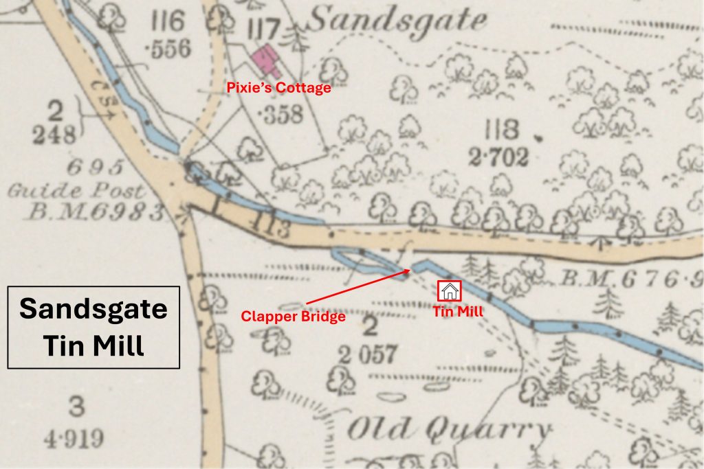
Sandsgate Tin Mill
Sandsgate Tin Mill is mentioned by Tom Greeves in his paper ‘The Tinworking Landscape of Dartmoor in a European Context’ (2016) as a small structure with a possible wheelpit and is recorded as a likely tin mill.
It is located on the right bank of White Water (Brook) below the modern A382 road between Moretonhampstead and Whiddon Down and close to Sandsgate Cross.
Bibliography
Dr. Tom Greeves – (1989) – Archaeological Features in Rushford Wood, Chagford (Un-published). SDV249082
The Tinworking Landscape of Dartmoor in a European Context – (2016) – Paper presented by Dr Tom Greeves – Lodges and Mills: The Field Archaeology of Tin Accommodation, Stamping and Smelting on Dartmoor at the conference (6th – 11th May 2016) at Tavistock – NOTE: Sandsgate Tin Mill is listed as Mill number 140 in the paper
Jane Marchand – (2007) – Archaeology within Great Tree Park Wood, 2 (Report – Survey). SDV365053.
Department of Environment – (1988) – Drewsteignton, 39 (List of Blds of Arch or Historic Interest). SDV336831
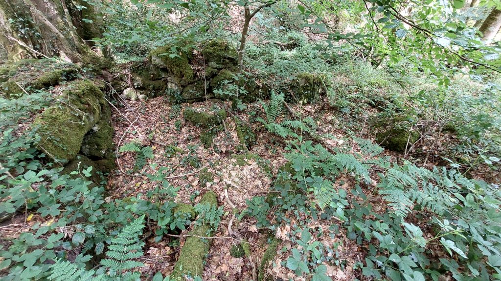
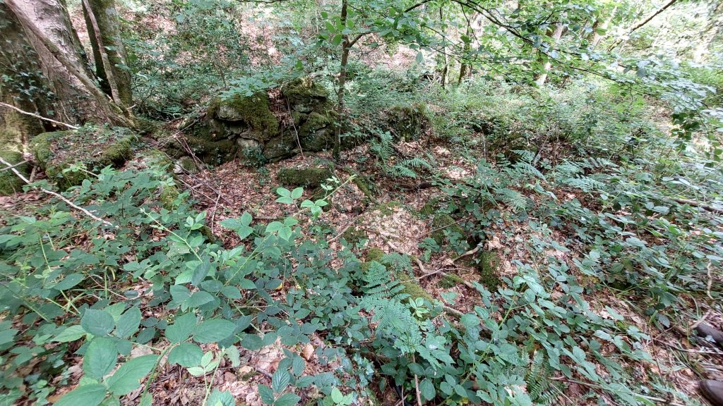
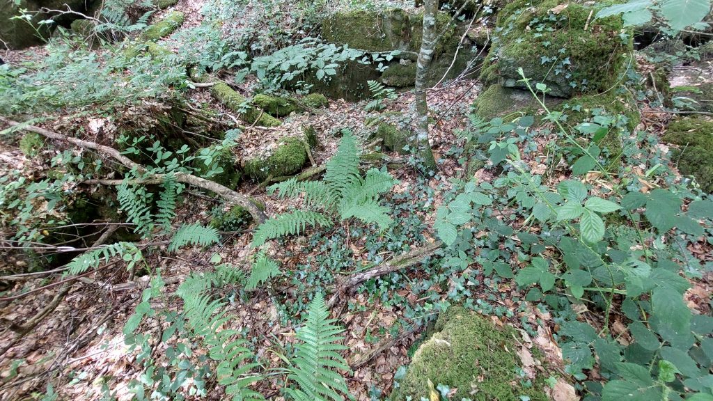
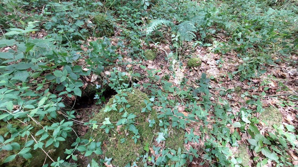
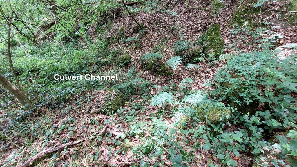
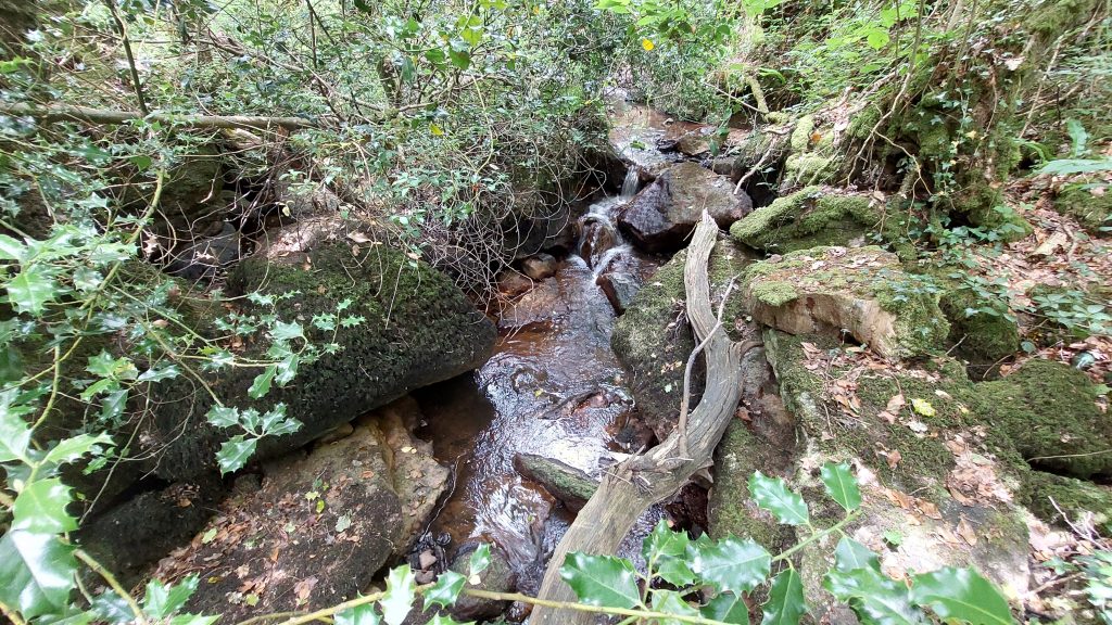
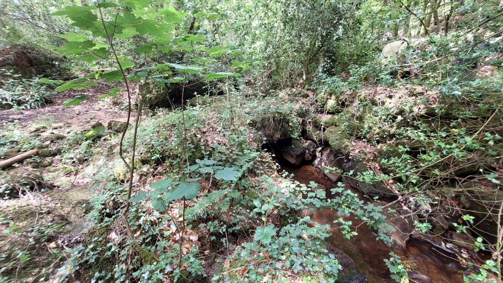
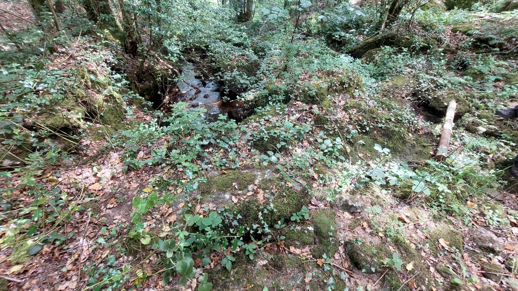
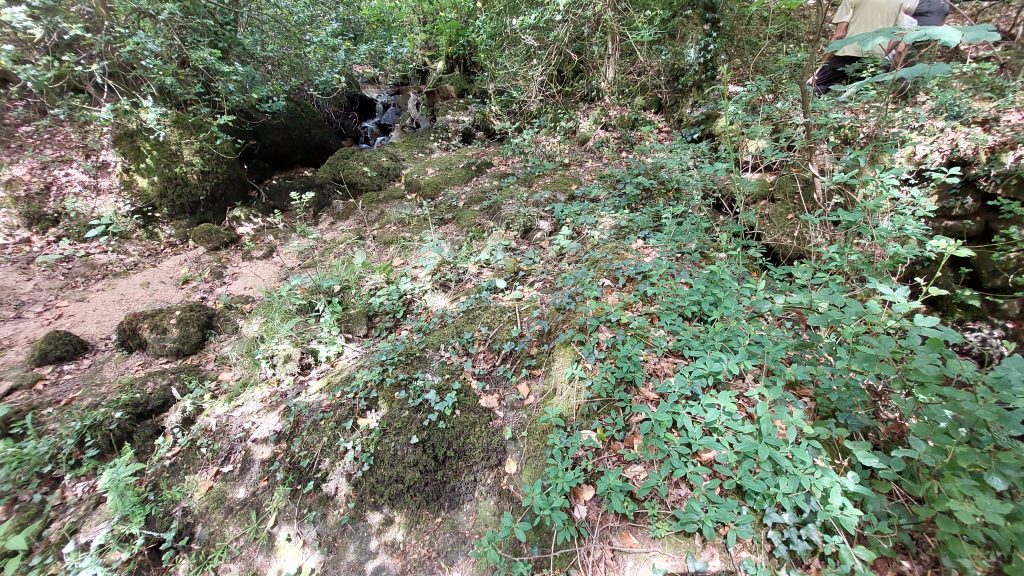
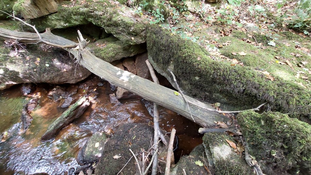
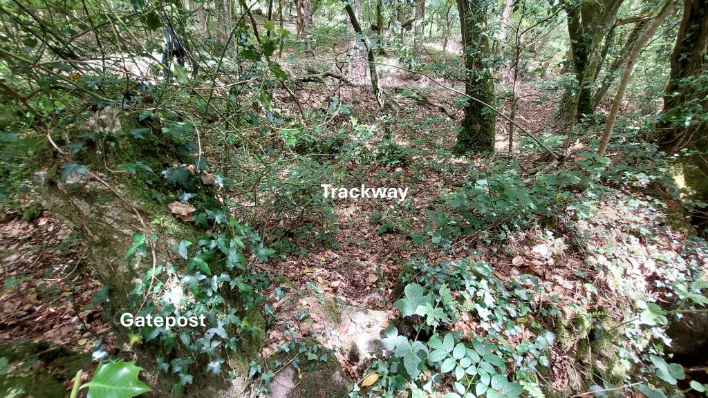
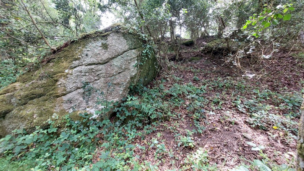
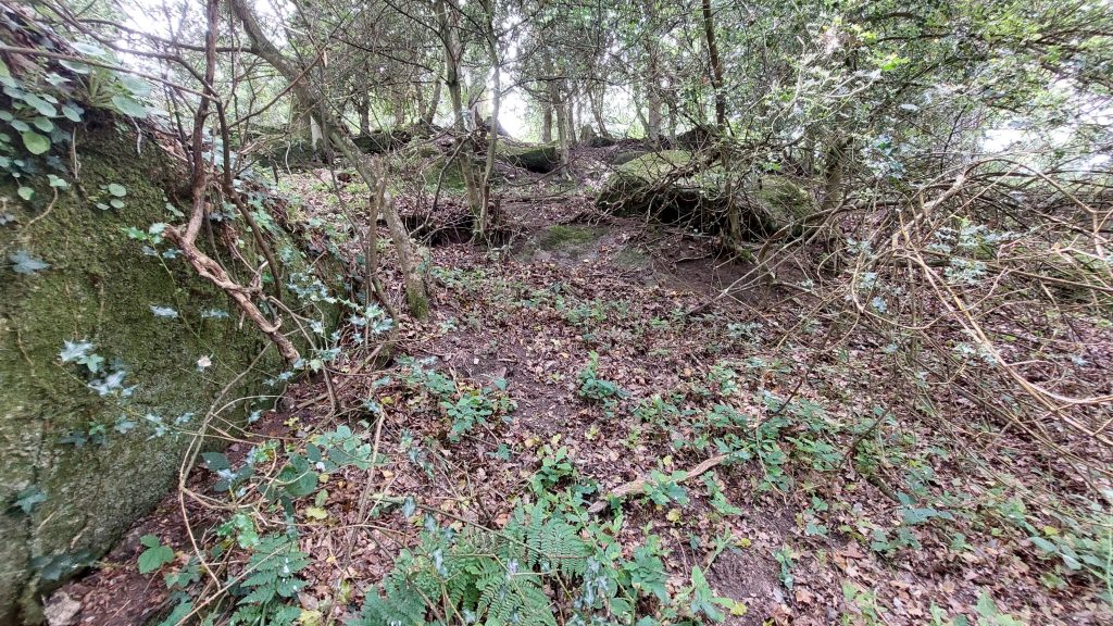
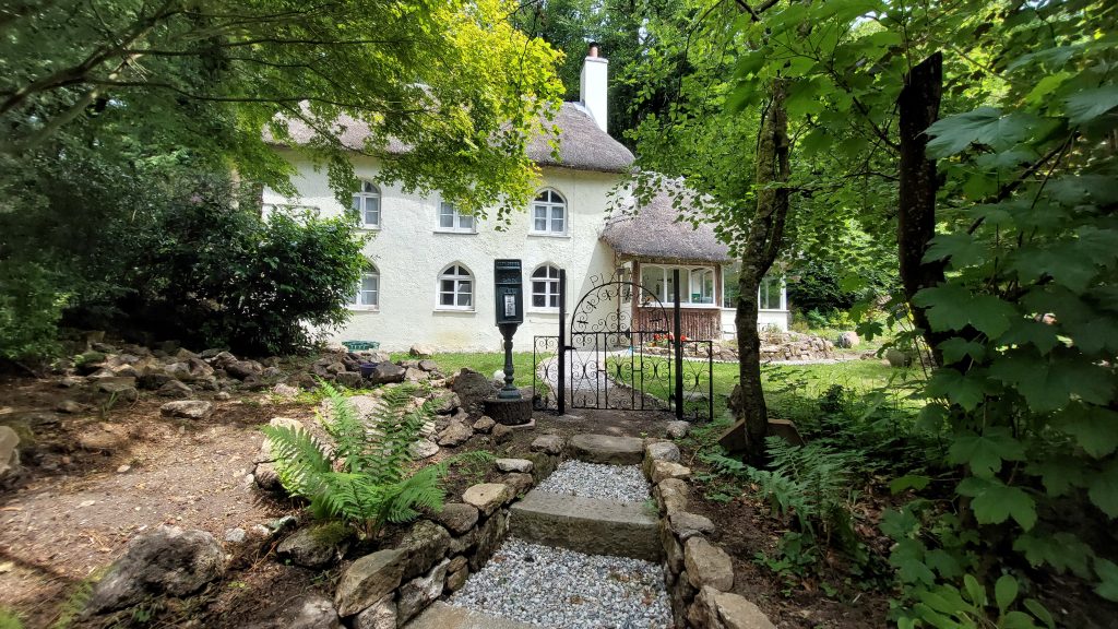
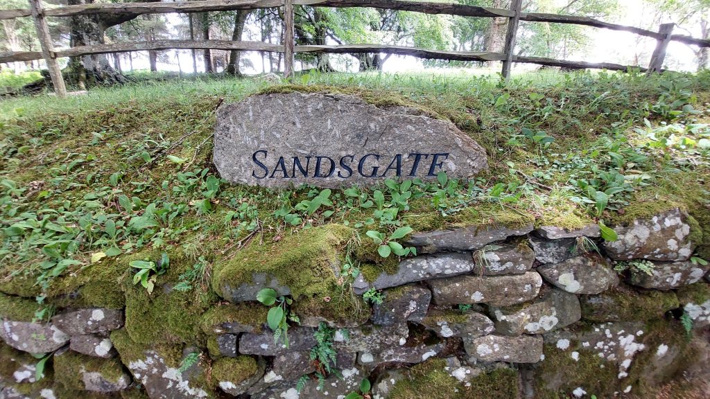
This 19th century annotated map shows the location of Sandsgate Tin Mill in relation to where White Water crosses the busy A382 Sandsgate Tin Mill is a small drystone structure on right bank of the White Water located close to the modern A382The mill measures internally approximately 4m by 3.5m. It is located at SX69884 90200The north end of its west wall has a recess approximately 0.7m wide by 0.3m deep (Greeves), which is thought could represent the head of an internal wheelpit or else possibly a fireplace.A few metres to the south east of the mill is a possible water outlet which leads to a culvertThis culvert channel leads away from the south-eastern corner of the building, possibly implying some internal drainage from the mill. The culvert overflow appears to supplement a leat further to the south east. The culvert supplements a leat. Jane Marchant (2007) recorded: “It is unclear where the leat was taking water to, possibly its destination was the tin mill (now very ruinous)”. This second Tin Mill is recorded by Dr Greeves as Mill 139 in his paper of 2016 and is located at SX7024 9002White Water near a clapper bridge and where there is reported to have been a weirSix impost clapper over White Water which carries a track from the main road (A382) into Rushford WoodOn top of the Clapper Bridge looking downstream. It is located at SX69859 90212On top of the Clapper Bridge looking upstreamUpstream (western most) impost of the Clapper BridgeGatepost and Trackway north of the Clapper BridgeUn-named rocks near to the Mill at SX69866 90182These rocks like so many of the Eastern side of Dartmoor National Park are hidden from view and rarely visited. The author is unaware of the having any provenance or being recorded anywherePixies Cottage is a mid – late 19th century dwelling with circa 1970 extensions. According to 19th century and 20th century maps, it was called Sandsgate, a name now attributed to a lodge, house and estate further up the lane towards Higher Shilstone / Spinster’s RockSign for the ‘modern’ Sandsgate house, lodge and estate