A collection of walks, discoveries, insights and pictures of exploring Dartmoor National Park
December 14, 2023
Hemsworthy Mine
Hemsworthy Mine is effectively a ‘Drive-Thru’ as it lies either side of the road a short distance south east from Hemsworthy Gate, en-route to the car parks at Saddle Tor and Haytor. The mine originally was worked as opencast by the streamers (the ‘old men’) on small quartz – tourmaline strings before being developed in the 1840’s by various short-lived companies, with names such as Hemsworthy, Somerset, Ilsington and Teignmouth Mines. During this period, the work at the mine is recorded as being little more than just prospecting with small shafts and levels of no more than 10 fathoms deep (ref: Hamilton Jenkin)
The halcyon days of the mine began at the start of the new decade, the 1850’s after Haytor Consols was created (1851). The company amalgamated three relatively insignificant mines in the vicinity; namely Hemsworthy Mine, Bagtor Mine and Crownley Parks Mine under a single management. Haytor Consols appear to have ‘kick-stared’ the mining ventures in the area with the Devonport Journal reporting on Thursday 9th December 1852: “Haytor Consols: – A large number of men are employed at Hemsworthy near the Haytor Granite Quarries, this mine bids fair to be a capital speculation. The tin lodes are rich. A railway cutting for conveying the ore to be crushed about a mile below the mine”. The railway (or tramway) referred to here is believed to have been 2ft gauge and conveyed ore from the mine, along the valley of Bagtor Brook, to mine dressing floors at Crownley Parks.
By May 1853, an Engine Shaft had been sunk and a steam engine was set to work. The shaft was sunk on the Hemsworthy North Lode reaching 168 ft, 18 fathoms below adit level which had been driven 90 fathoms west and 130 fathoms east of the shaft (ref: Dines). The production from the mine’s three lodes (North, Middle and South Lodes) was recorded as being 16 tons of black tin was recorded for 1853-1855. The author has seen a reference to Haytor Consols being in business from 1851 to 1856, so suspects the mining venture here finished around 1856 as no further references after this date can be found.
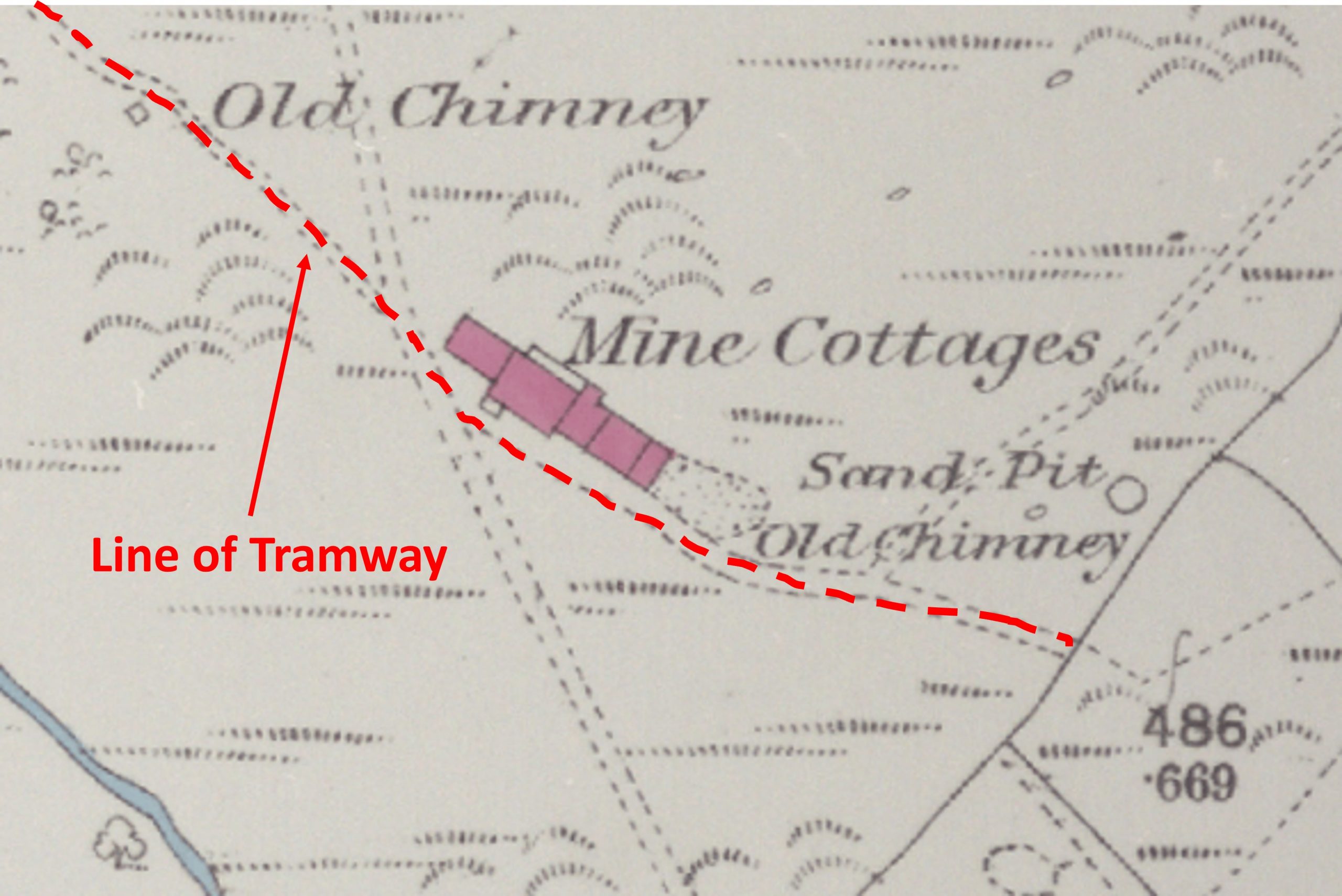
This post covers an exploration of the mine and follows the tramway across Bagtor Down to Bagtor Cottages where the tramway disappears across (now cultivated) fields. The author would like to especially acknowledge Dartmoor Chris for providing information and the sketch map, without whom this post would not have been as detailed as it is.
Bibliography
Helen Harris, 1968, Industrial Archaeology of Dartmoor
A.K. Hamilton Jenkin, 2005, Mines of Devon
Dr PhilNewman, 2015, Rippon Tor Premier Archaeological Landscape, Dartmoor National Park
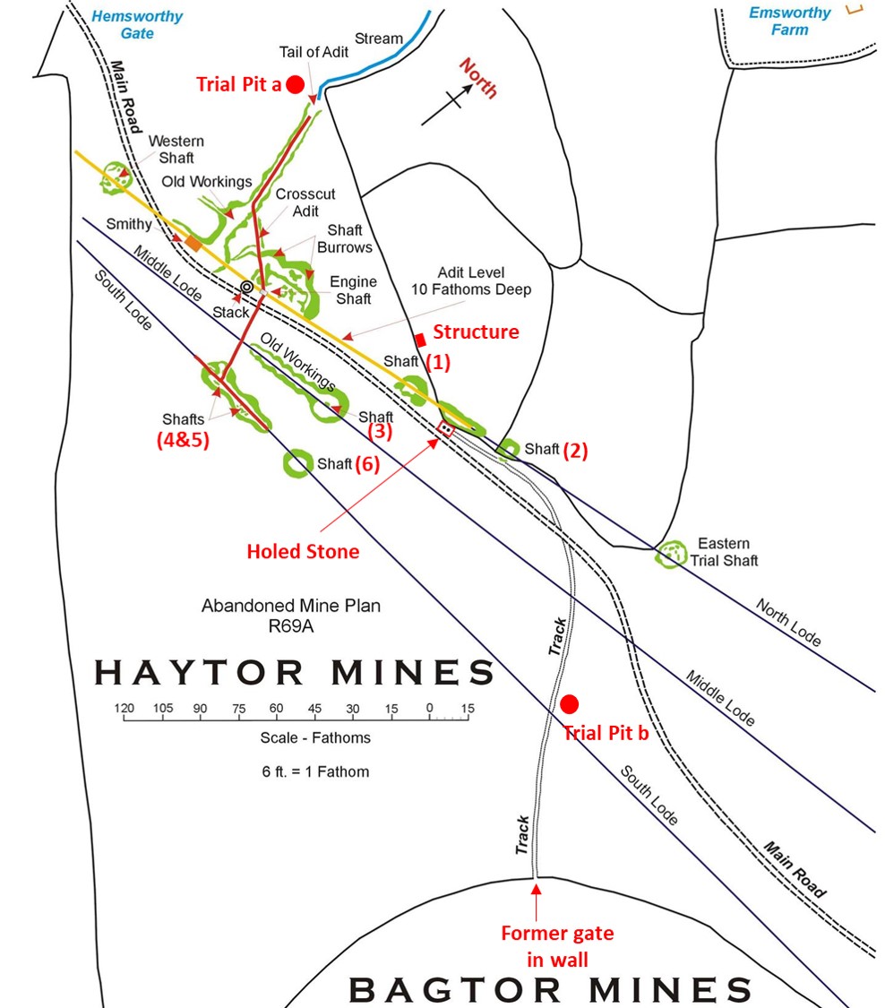
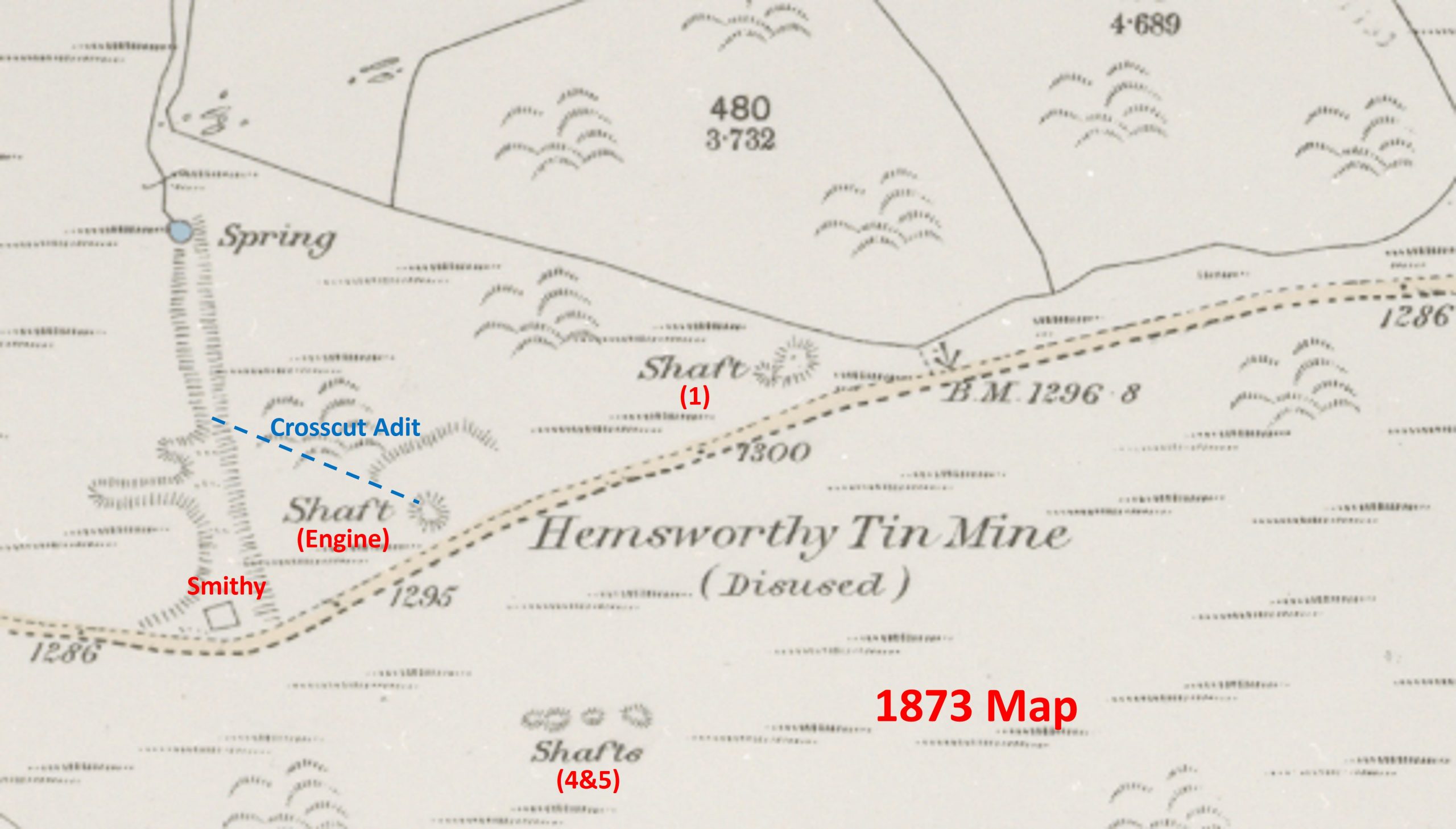
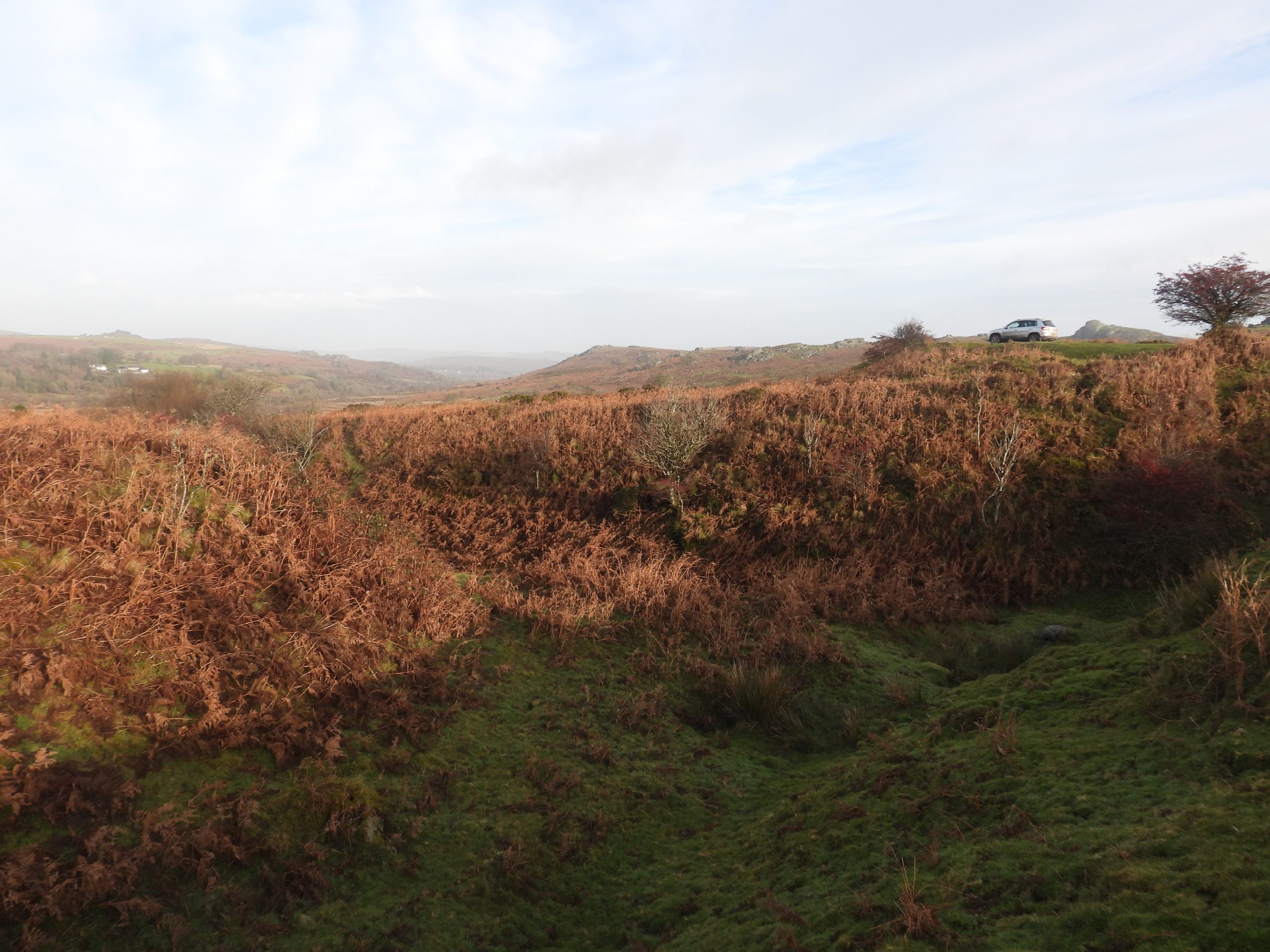
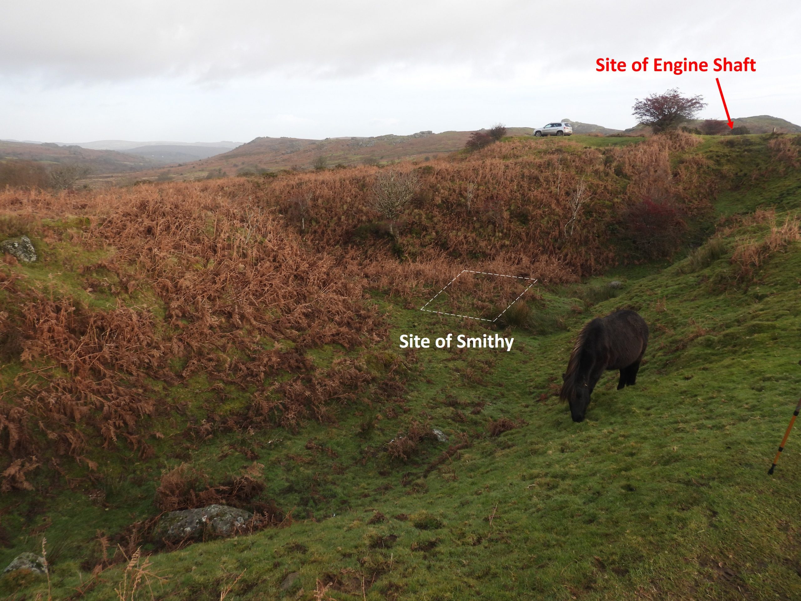
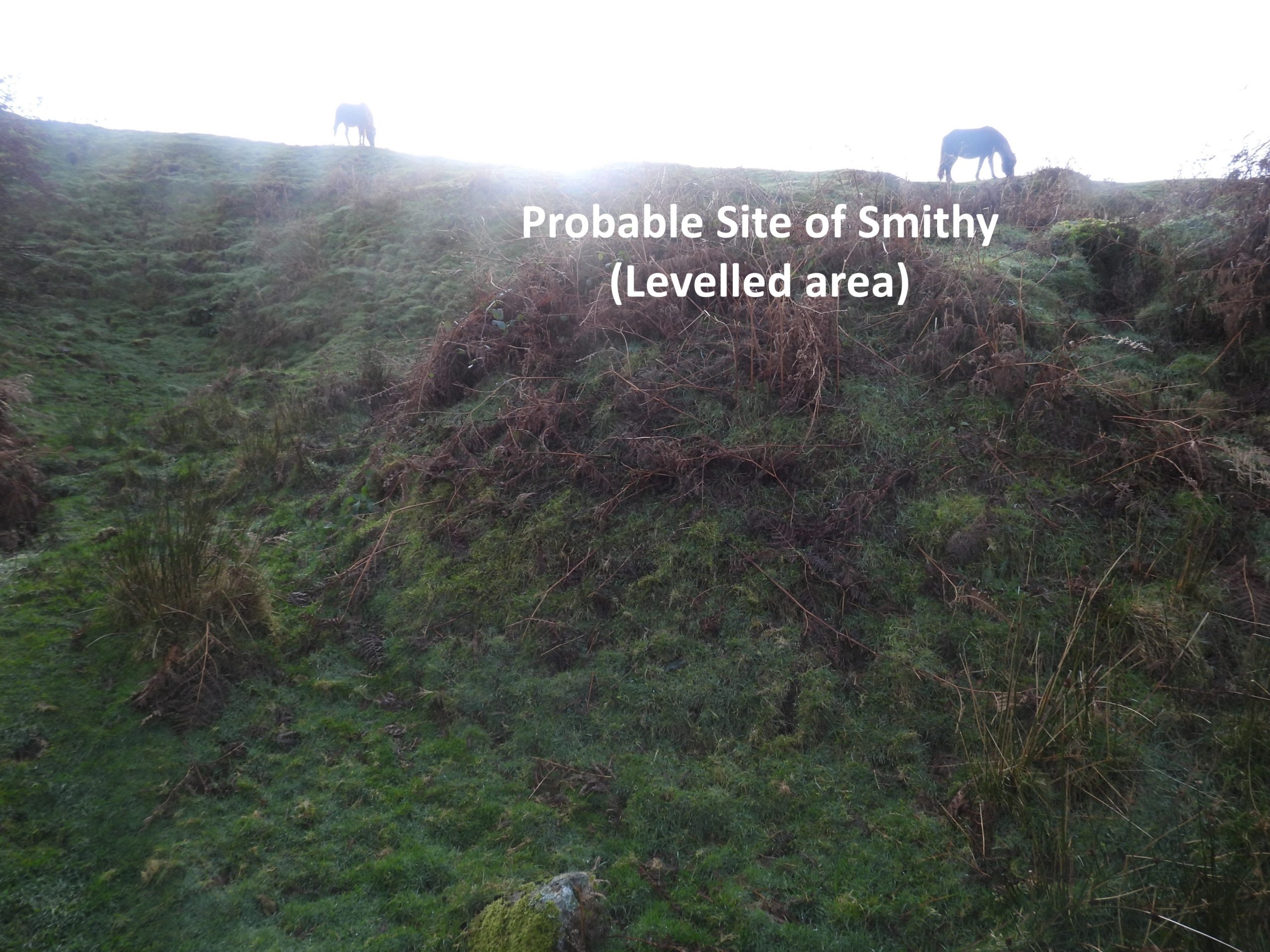
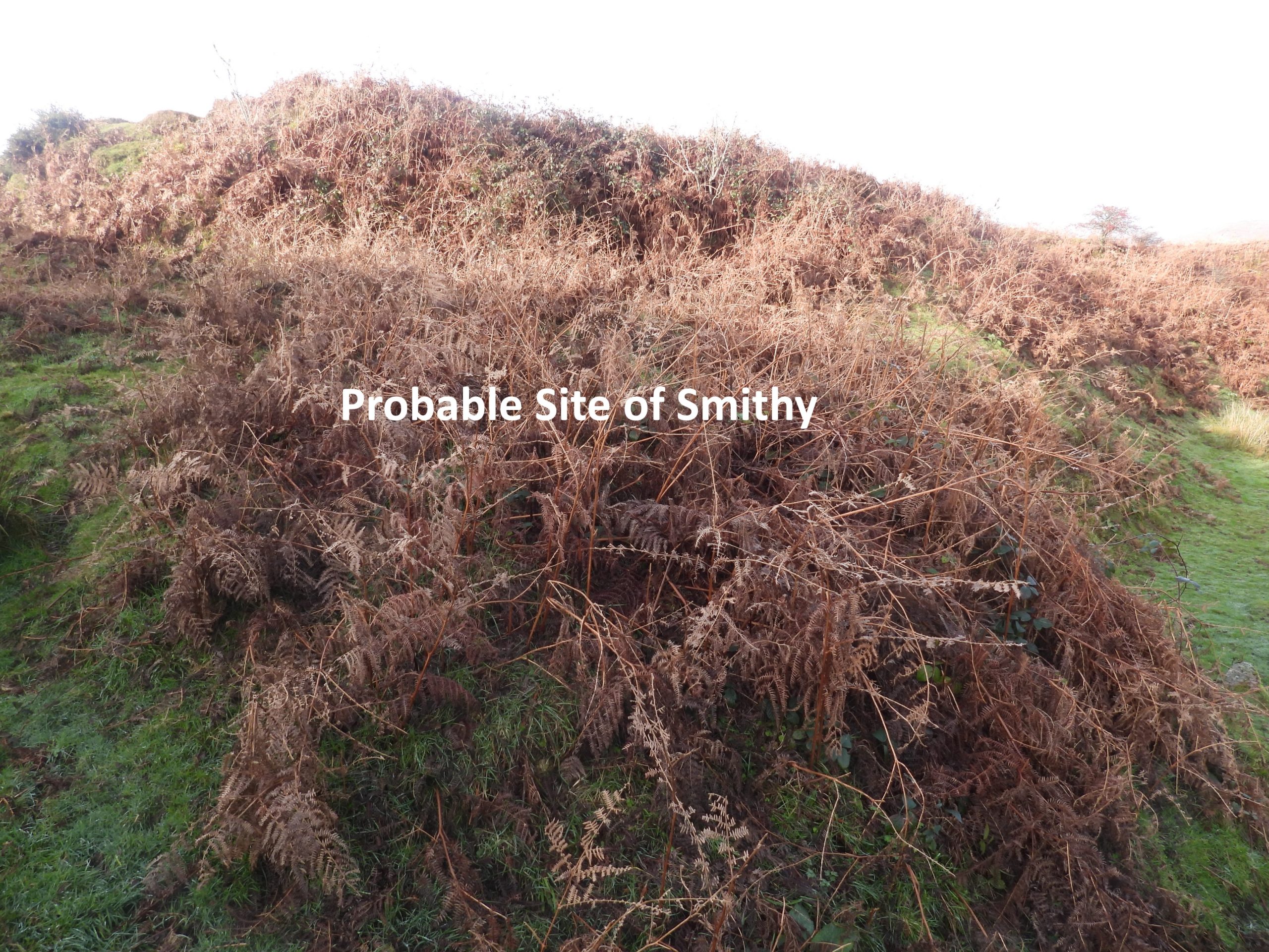
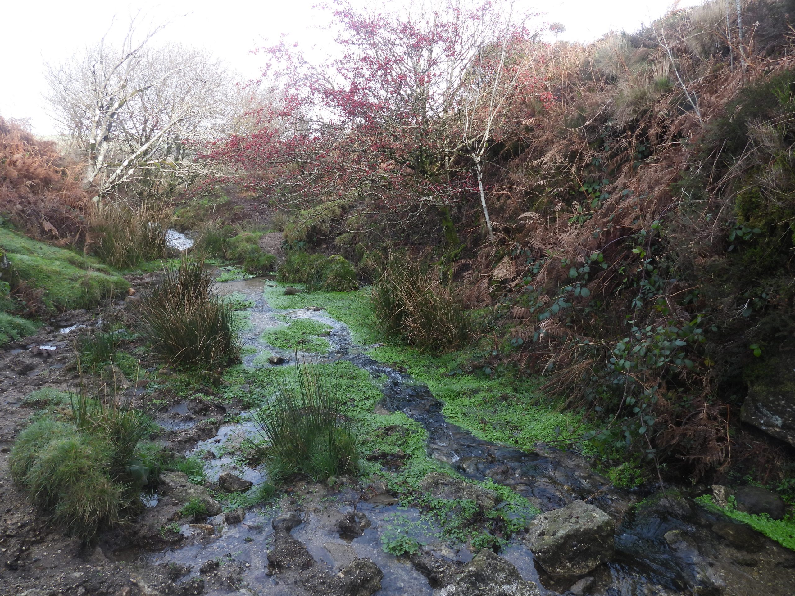
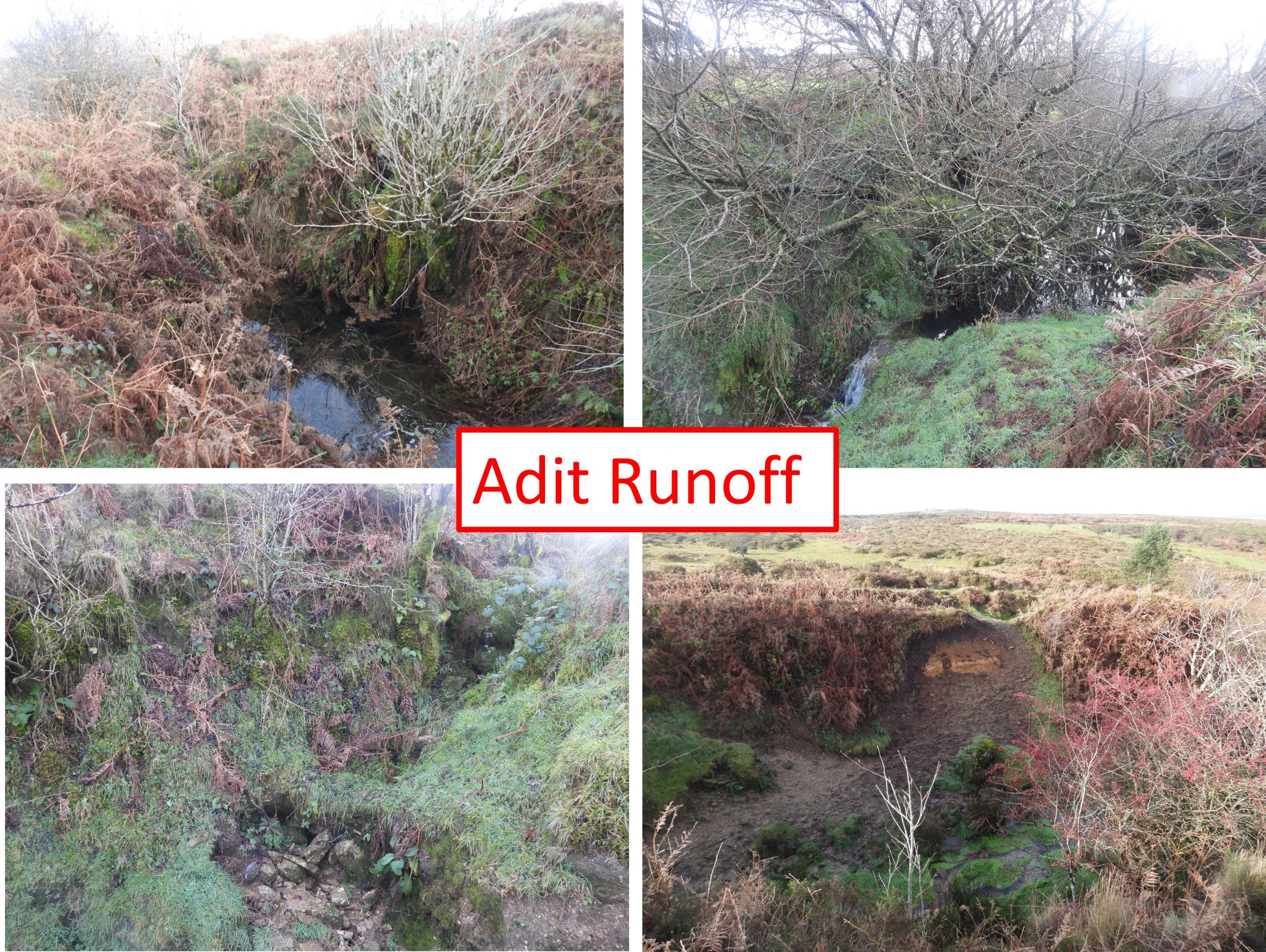
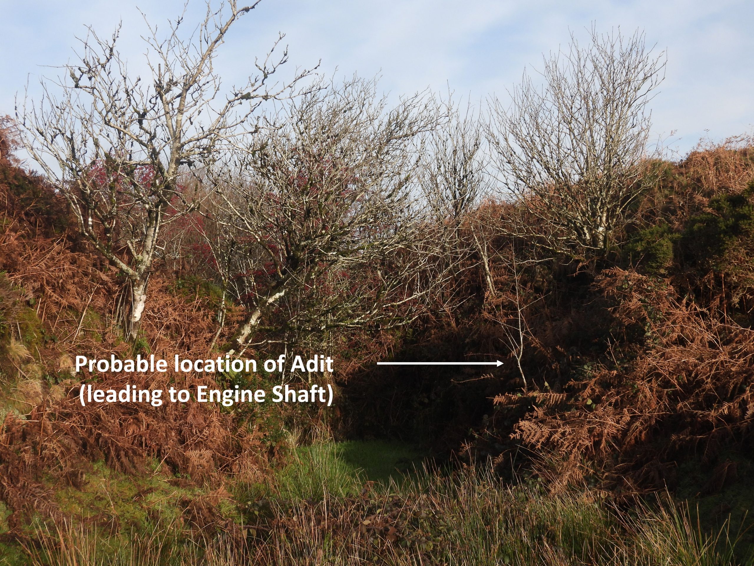
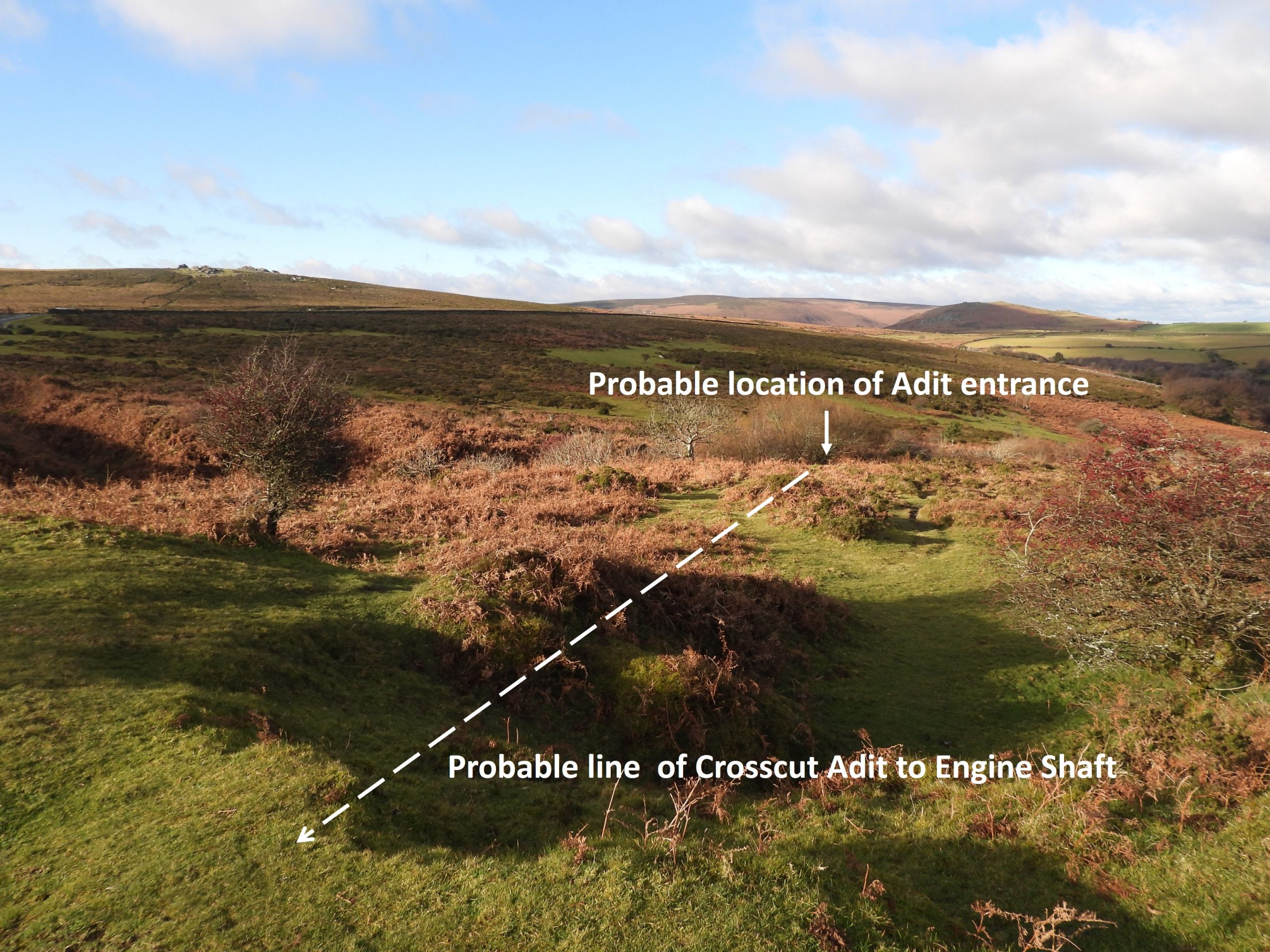
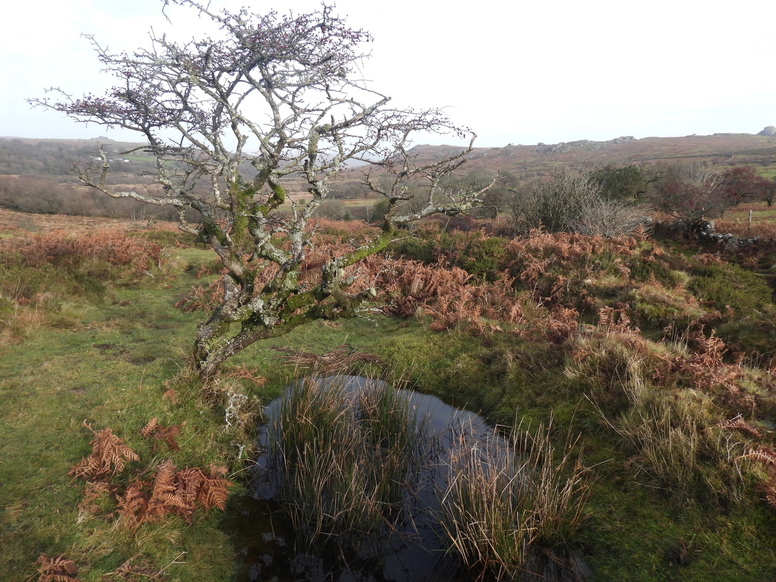
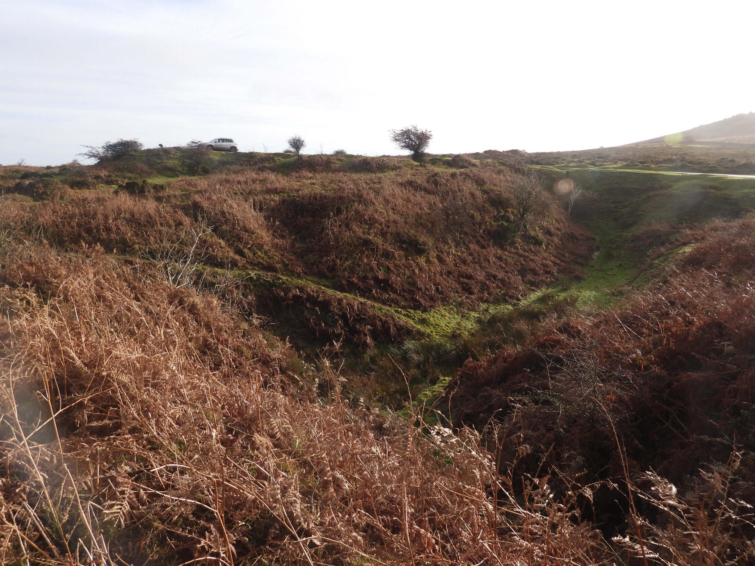
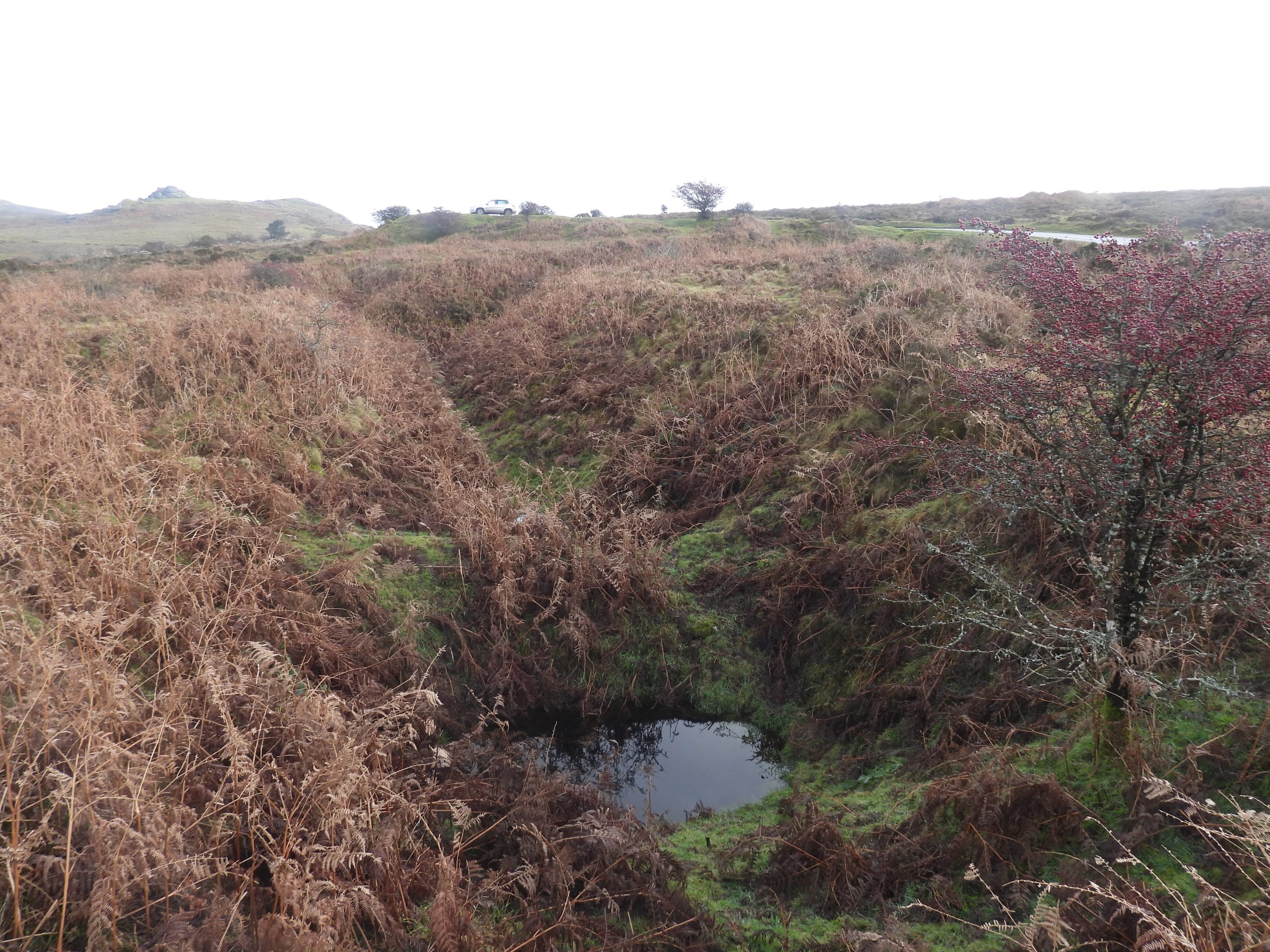
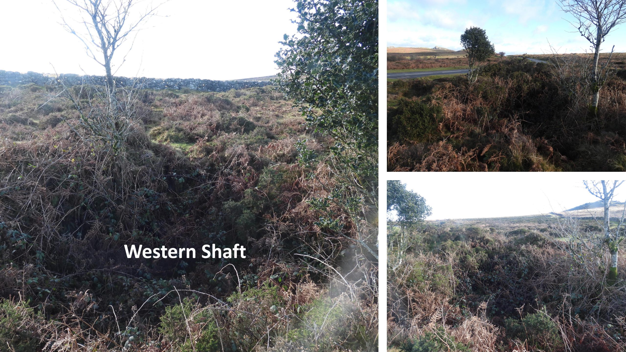
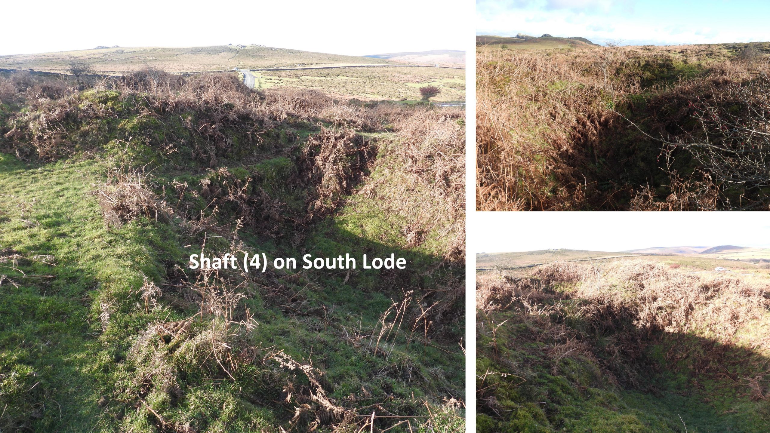
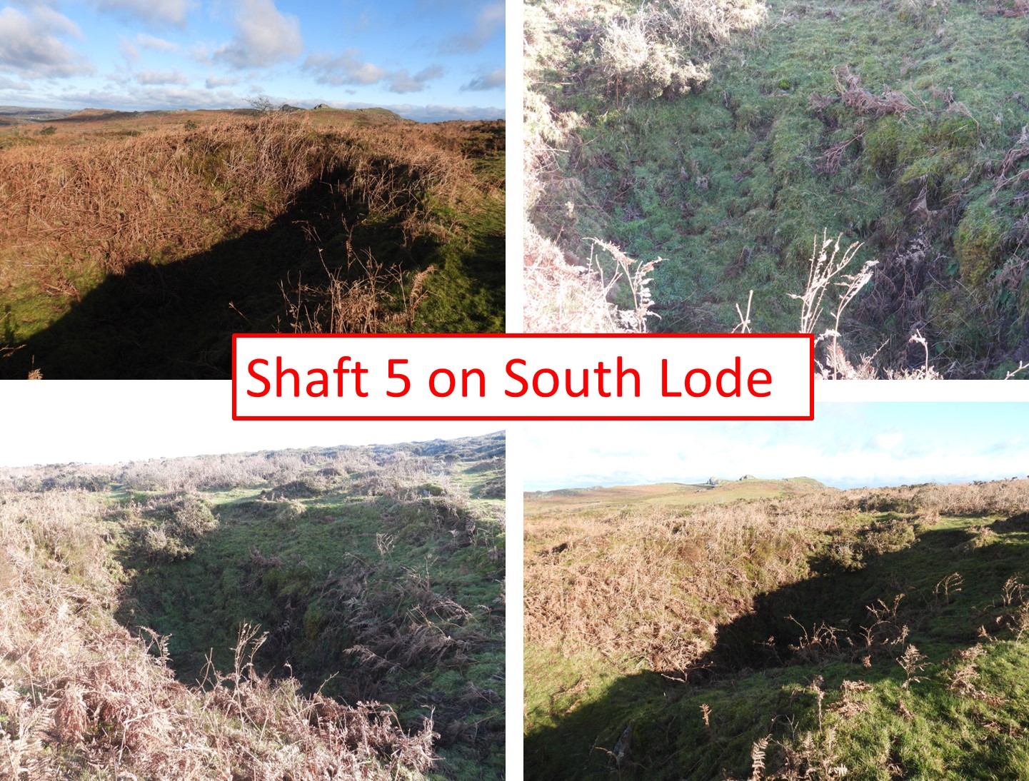
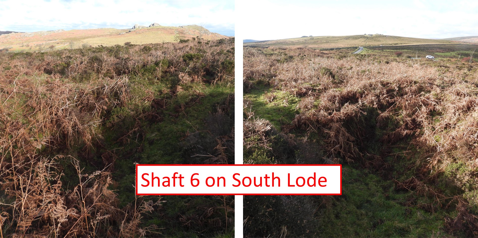
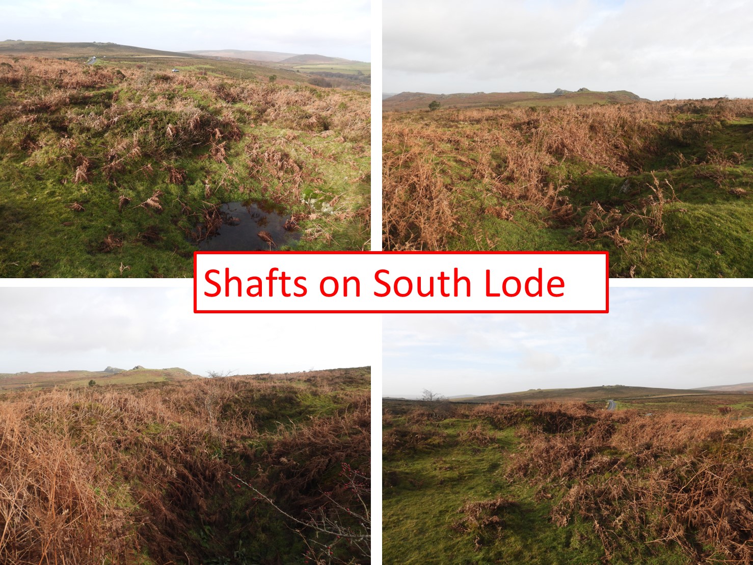
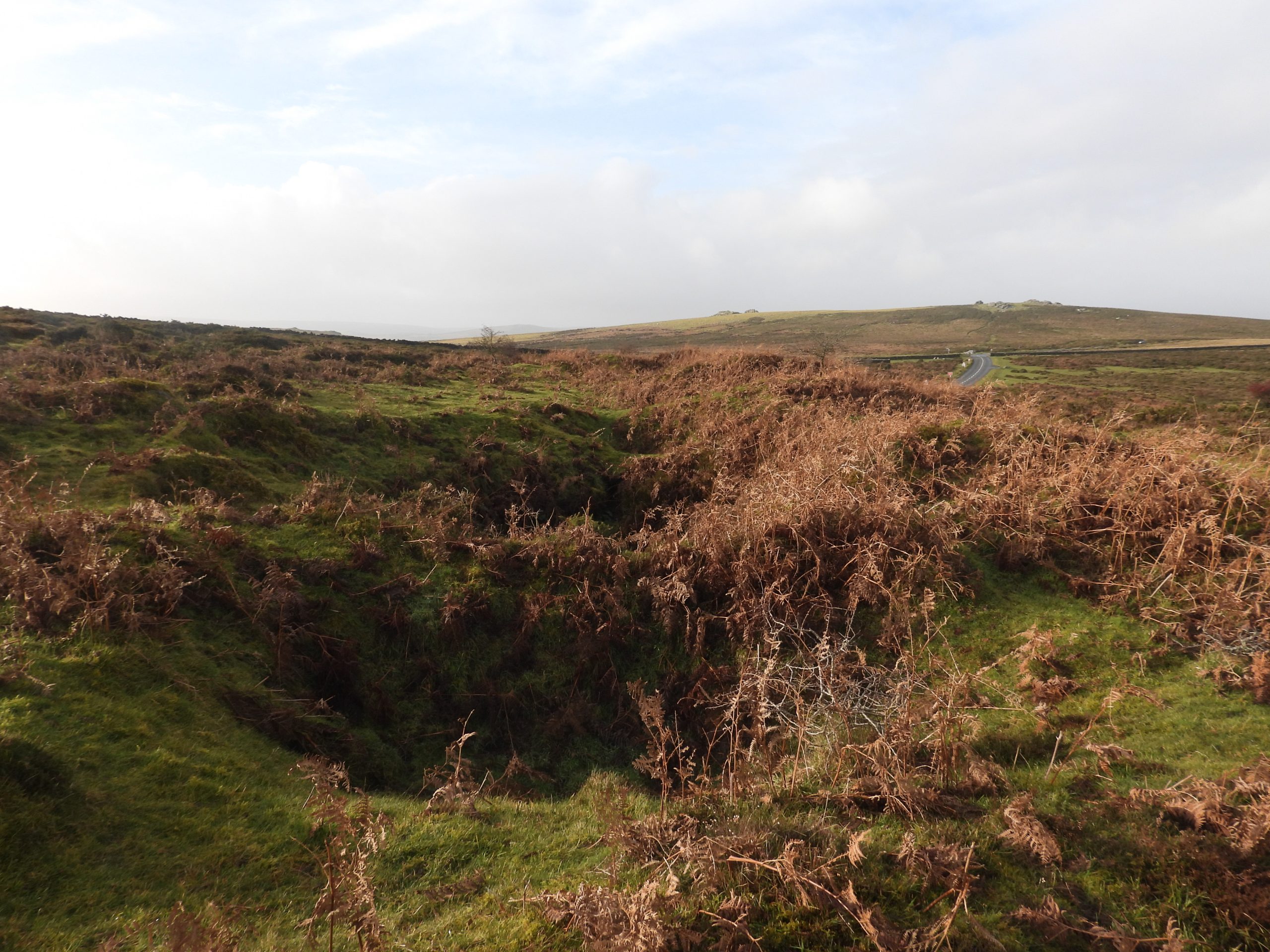
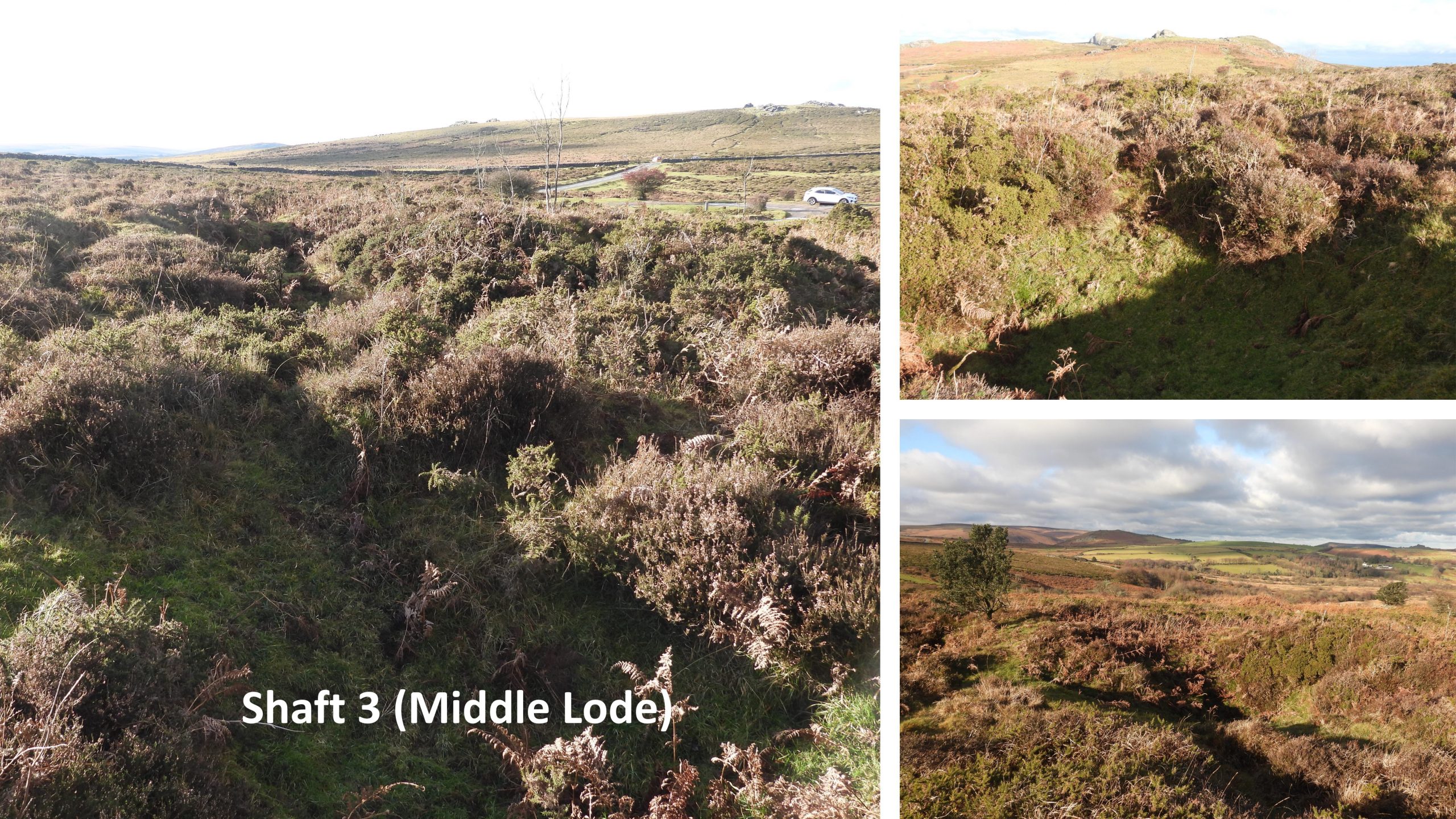
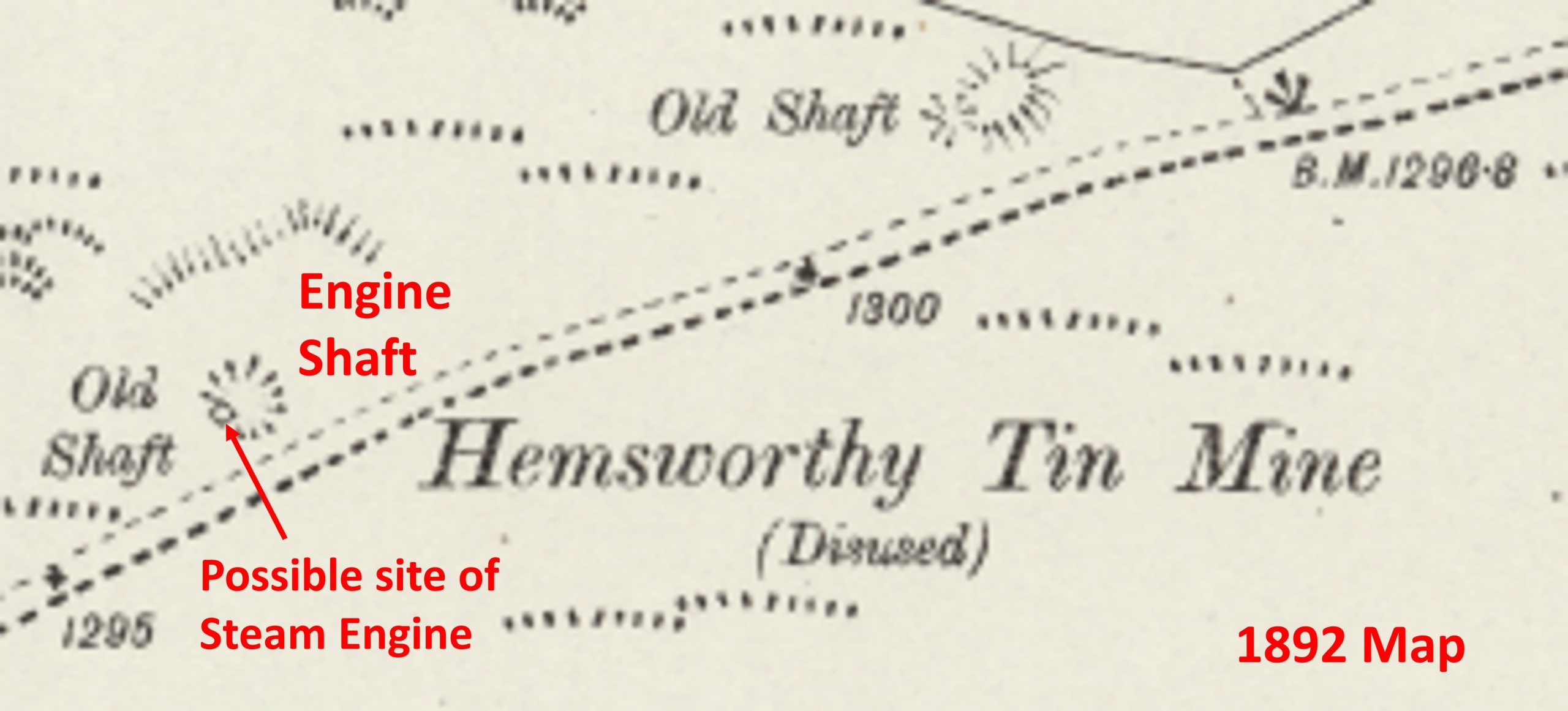
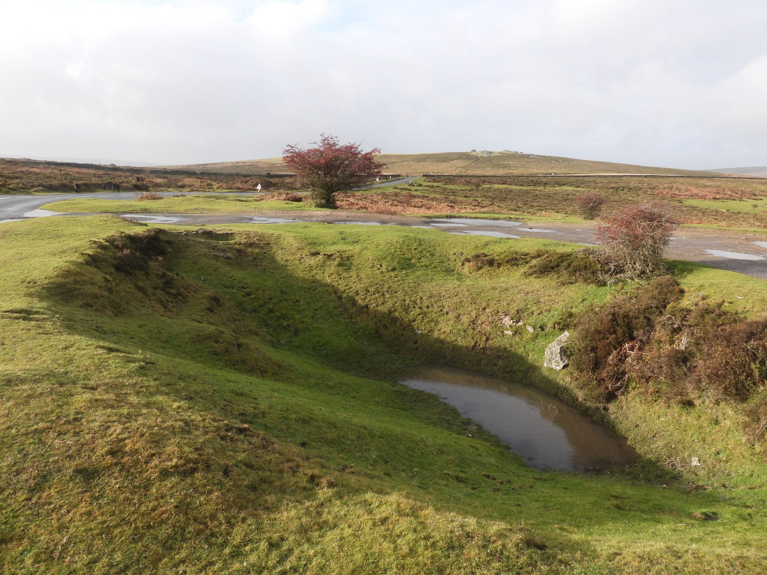
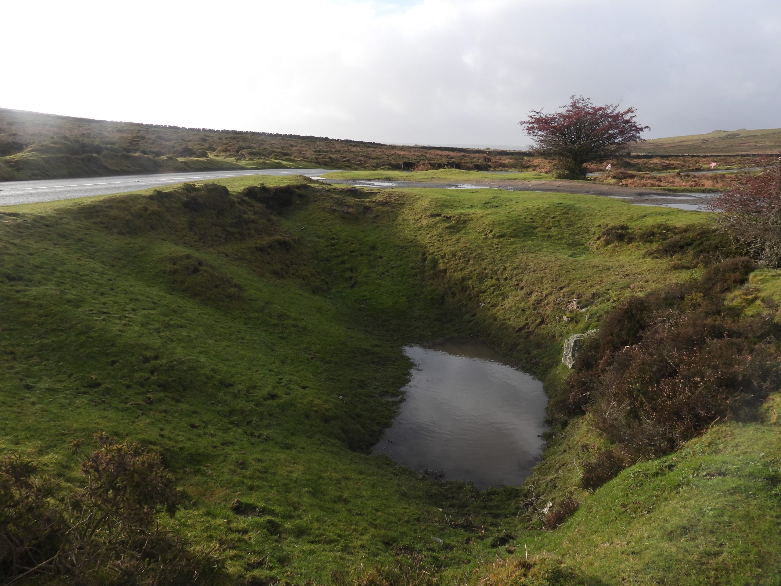
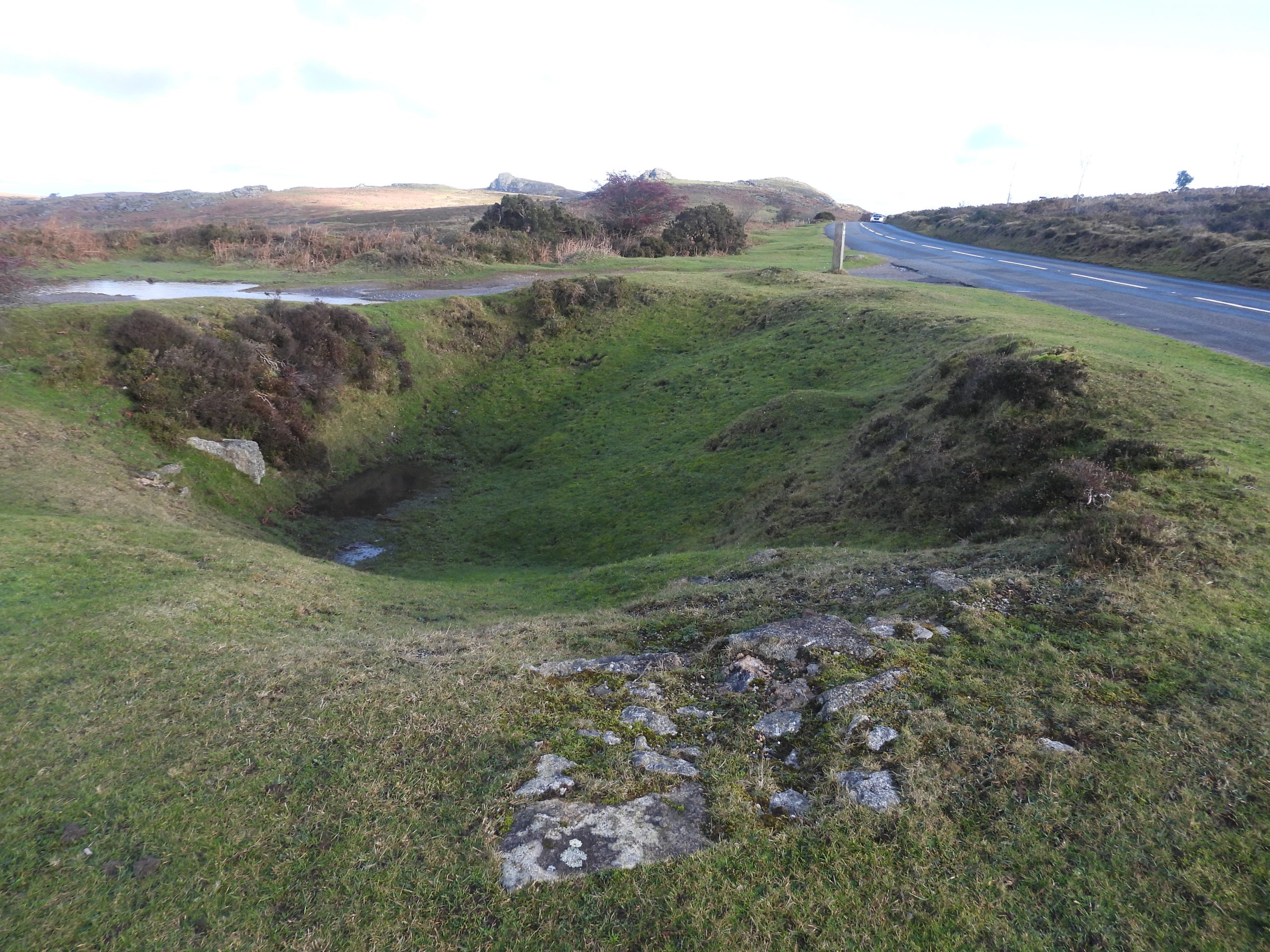
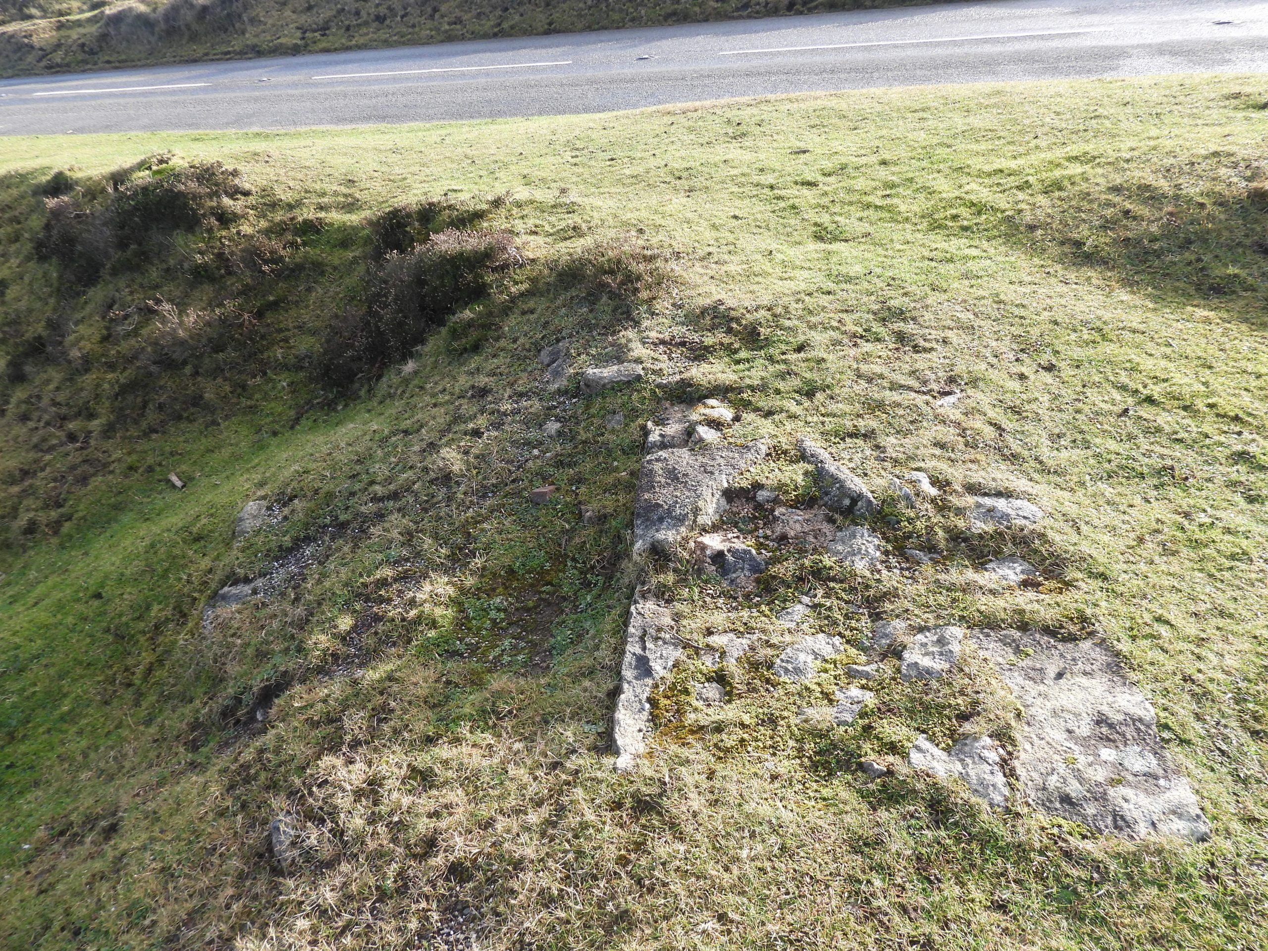
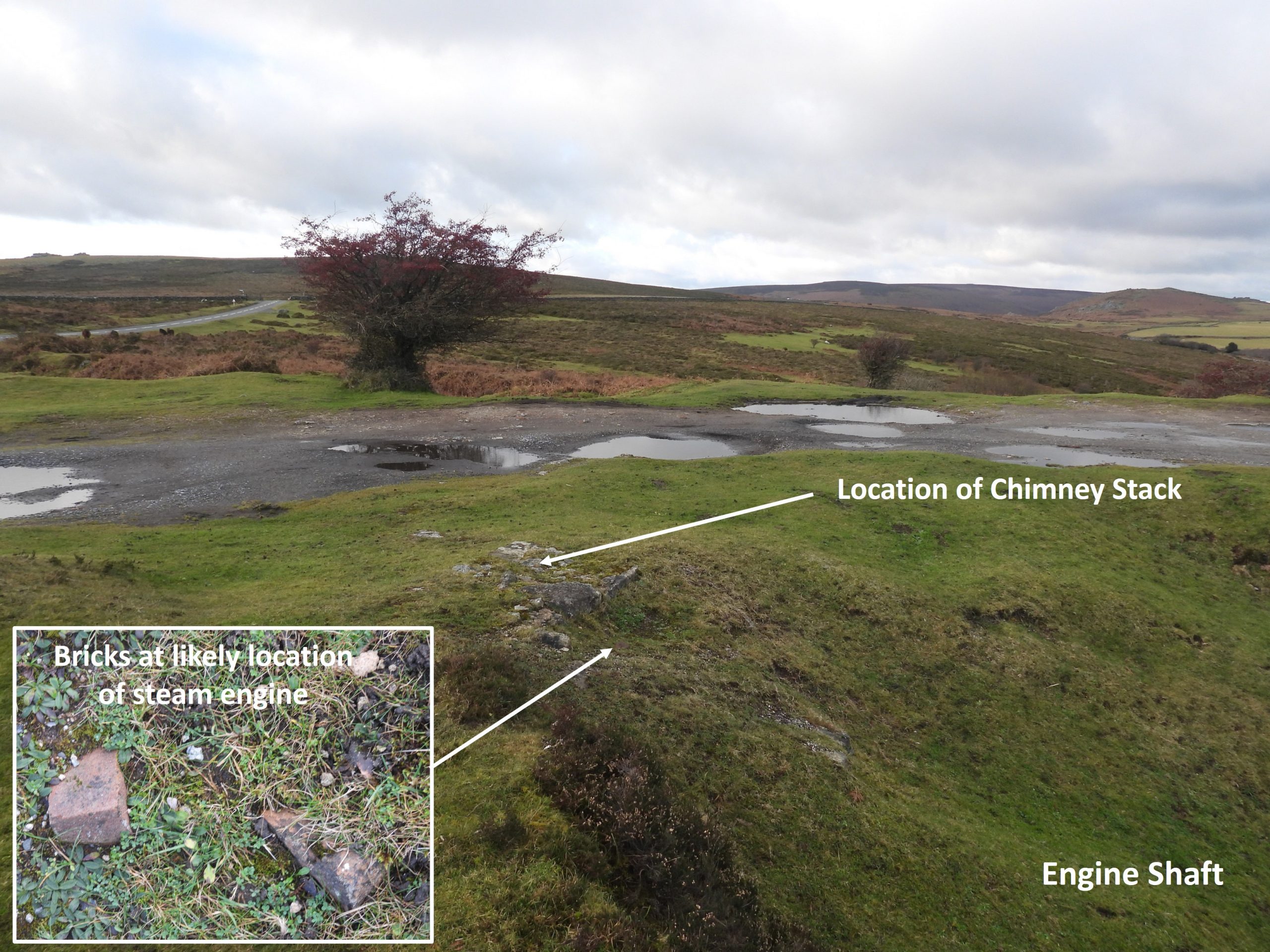
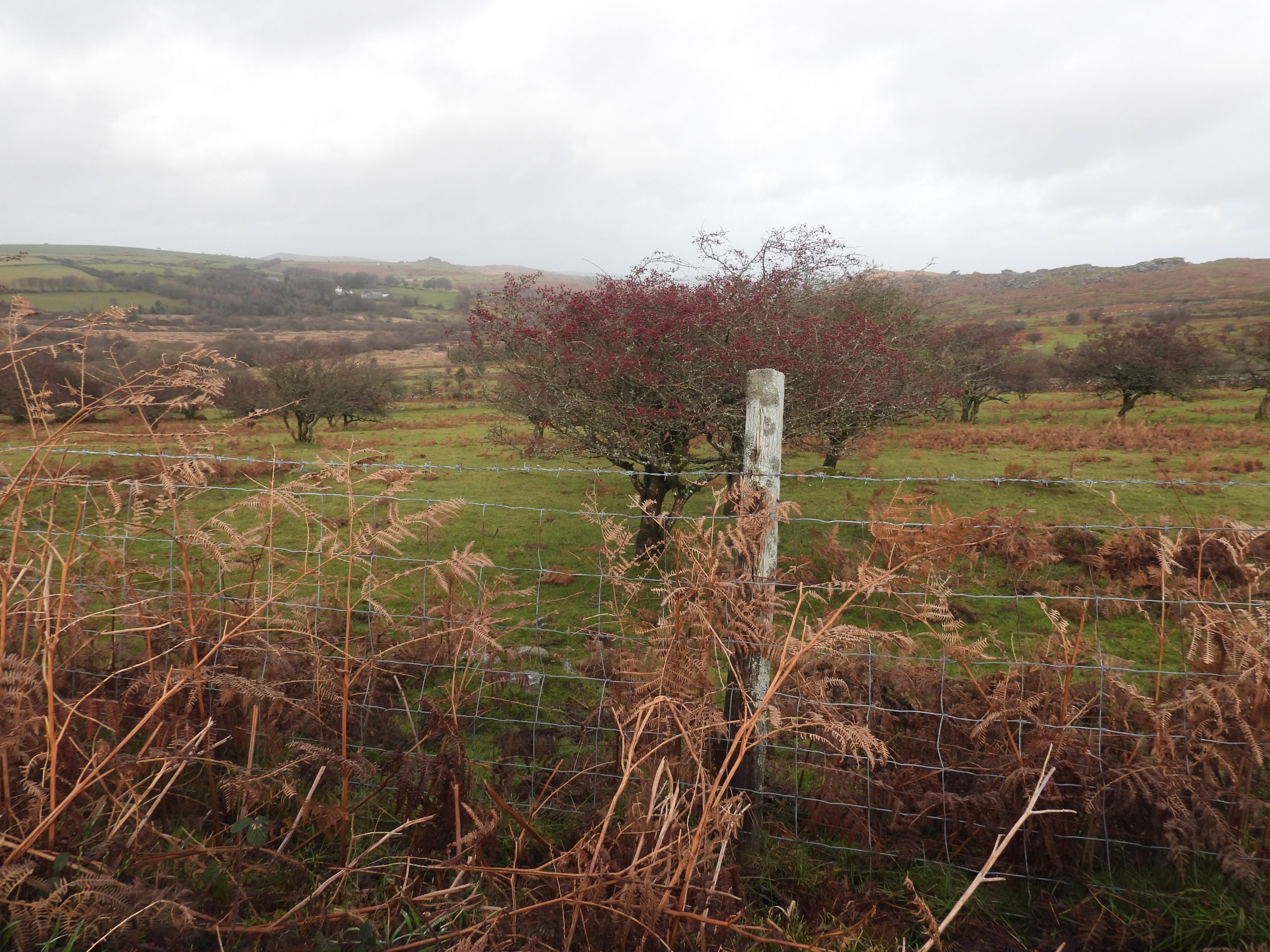
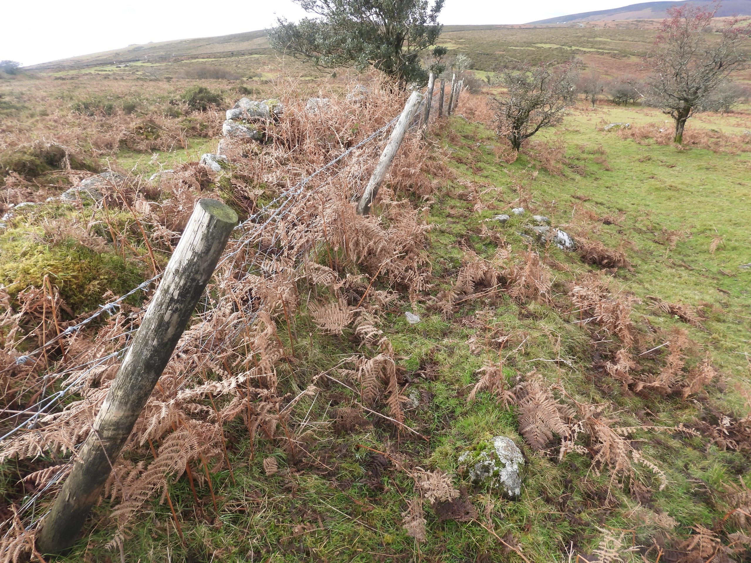
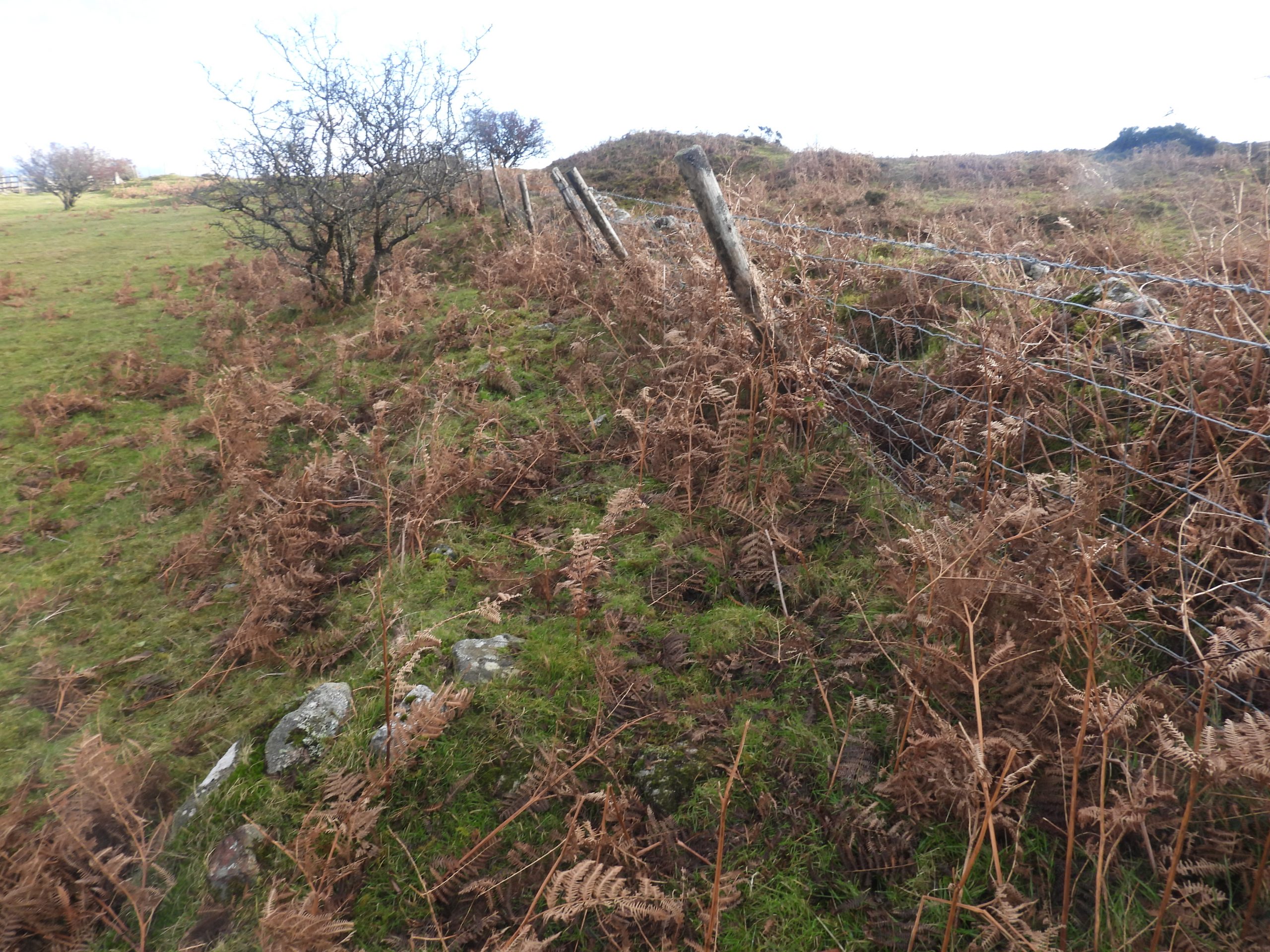
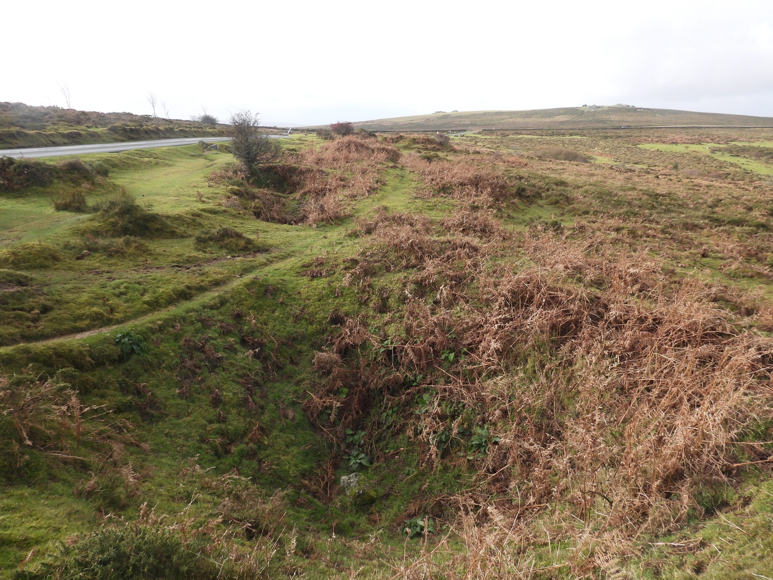
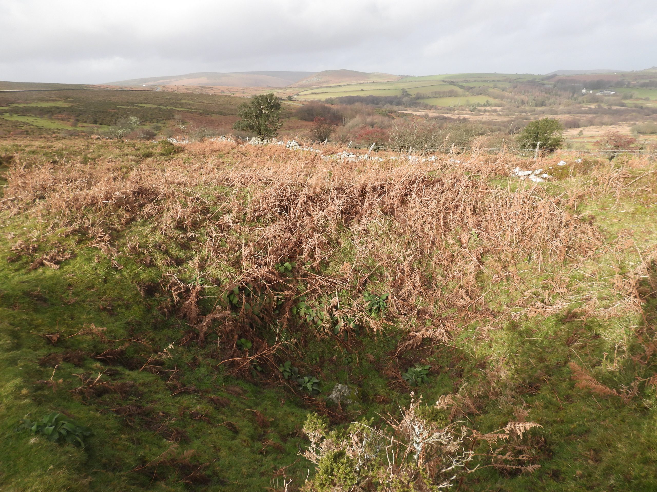
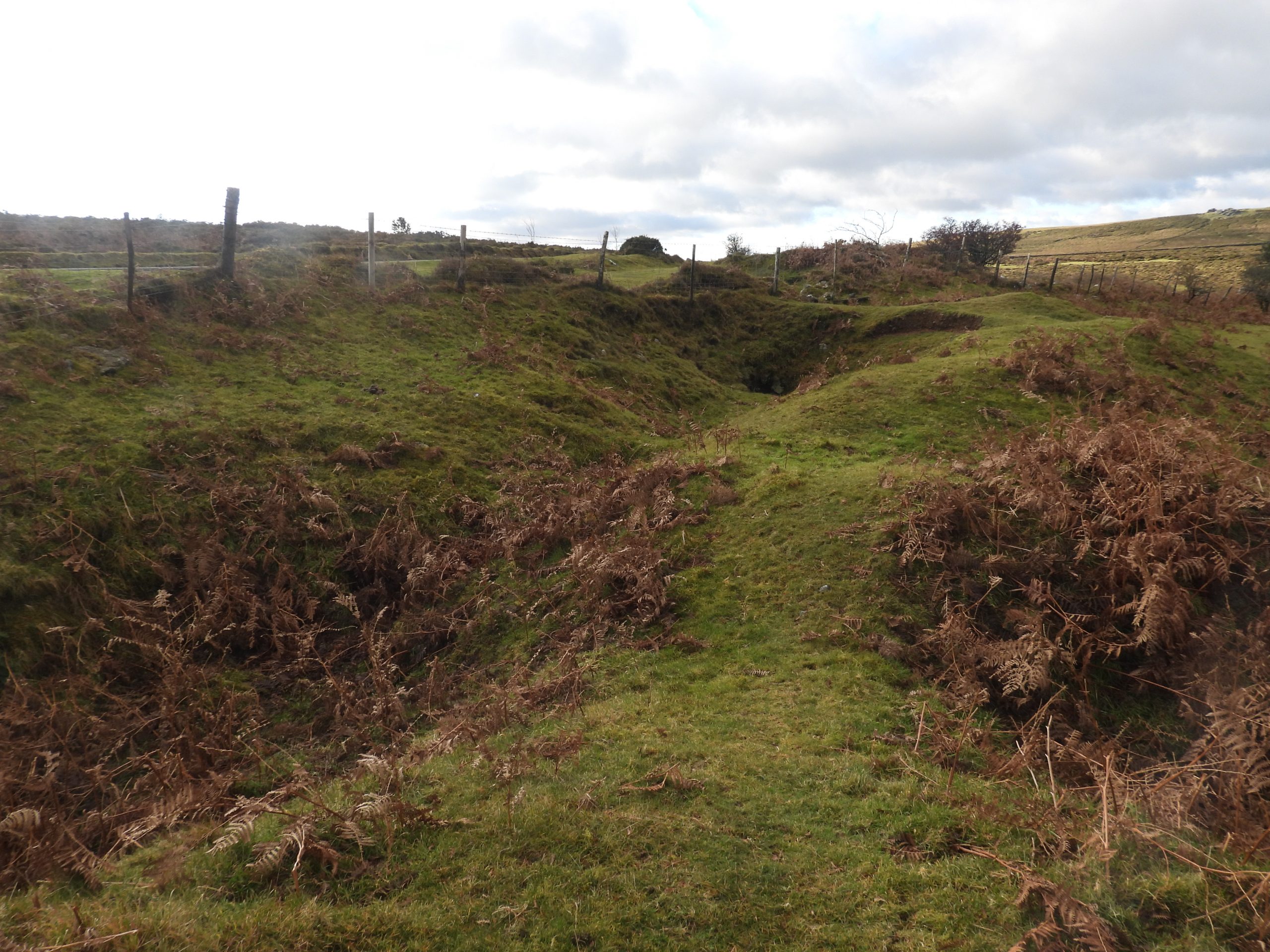
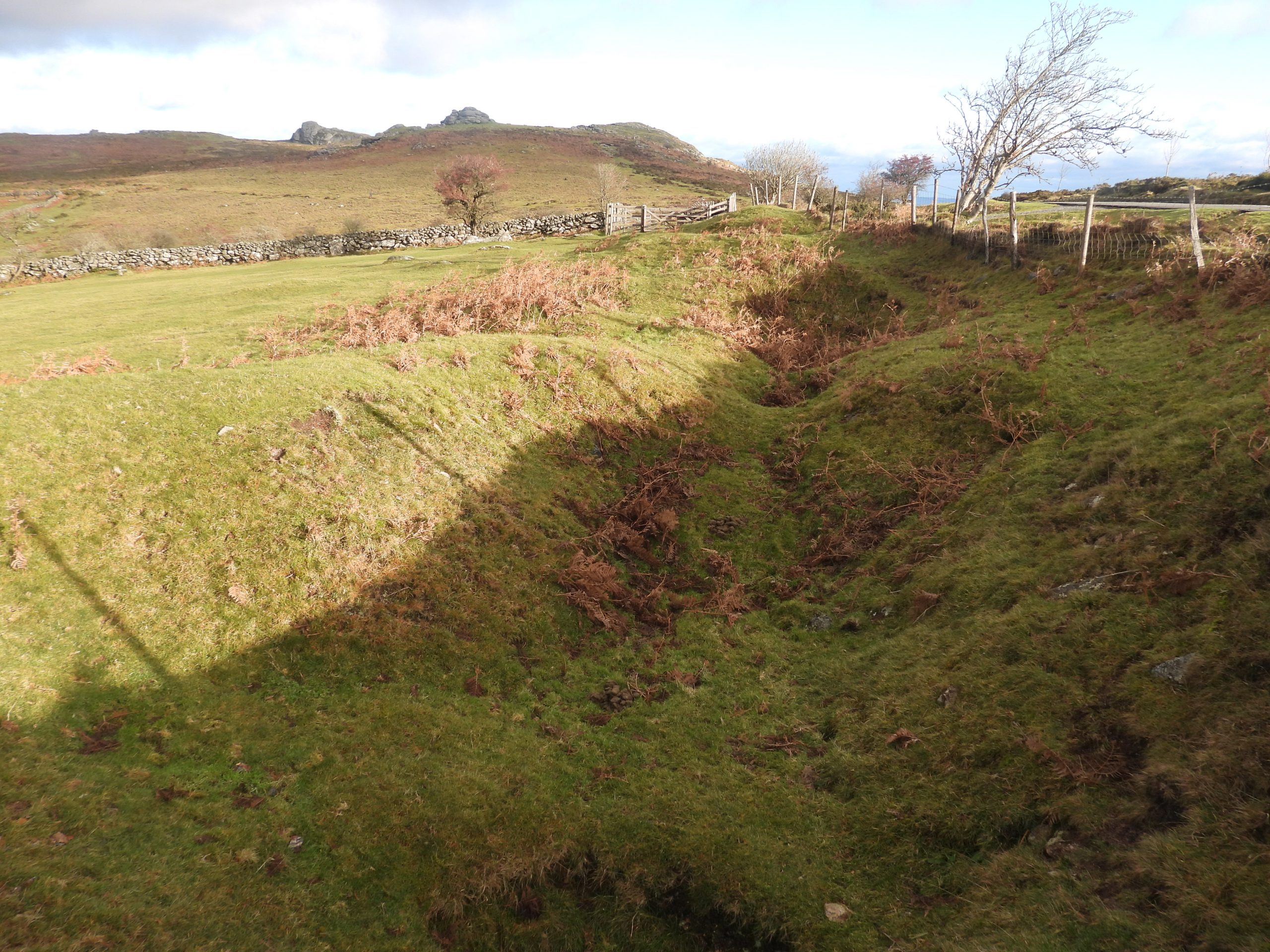
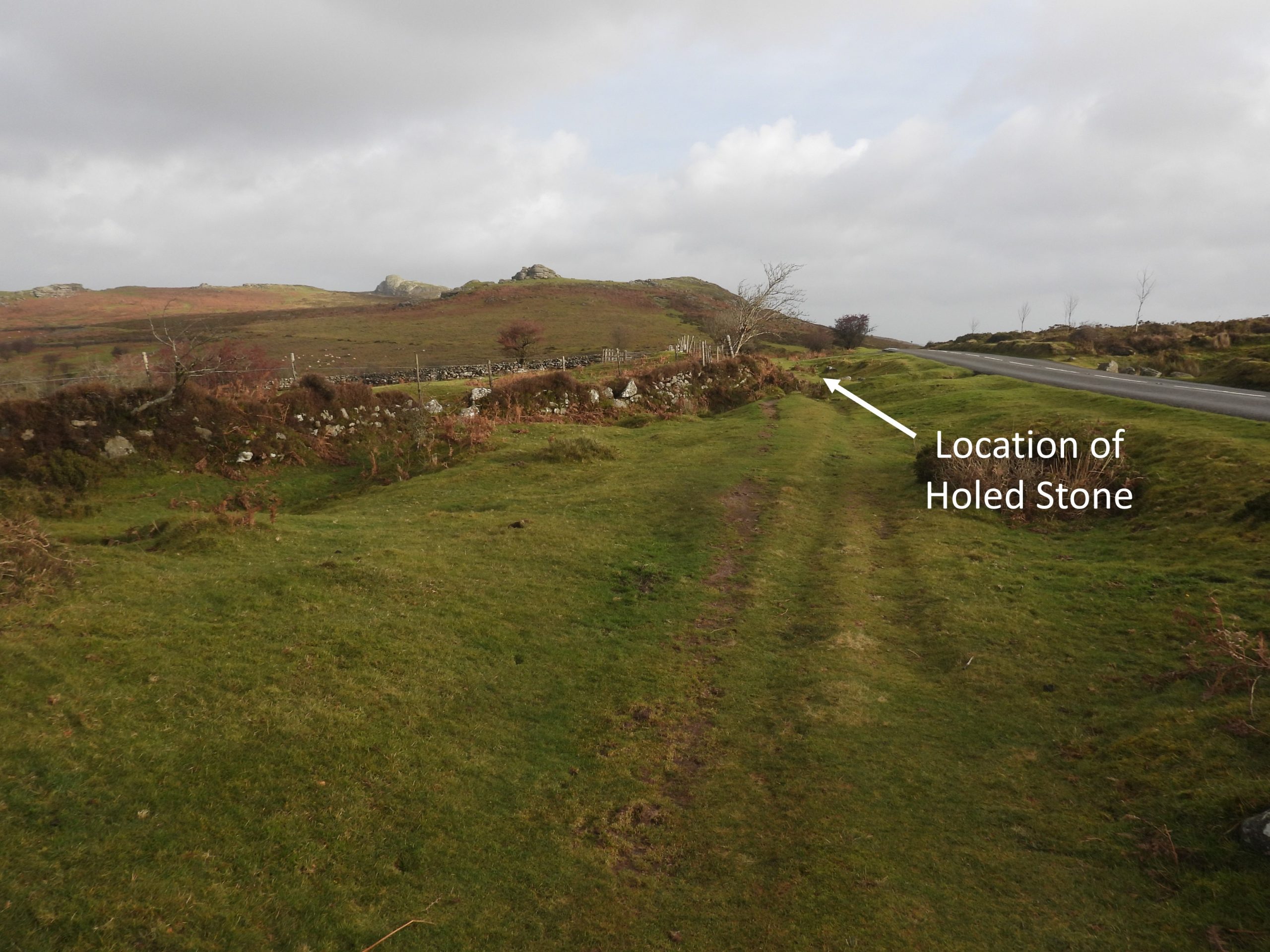
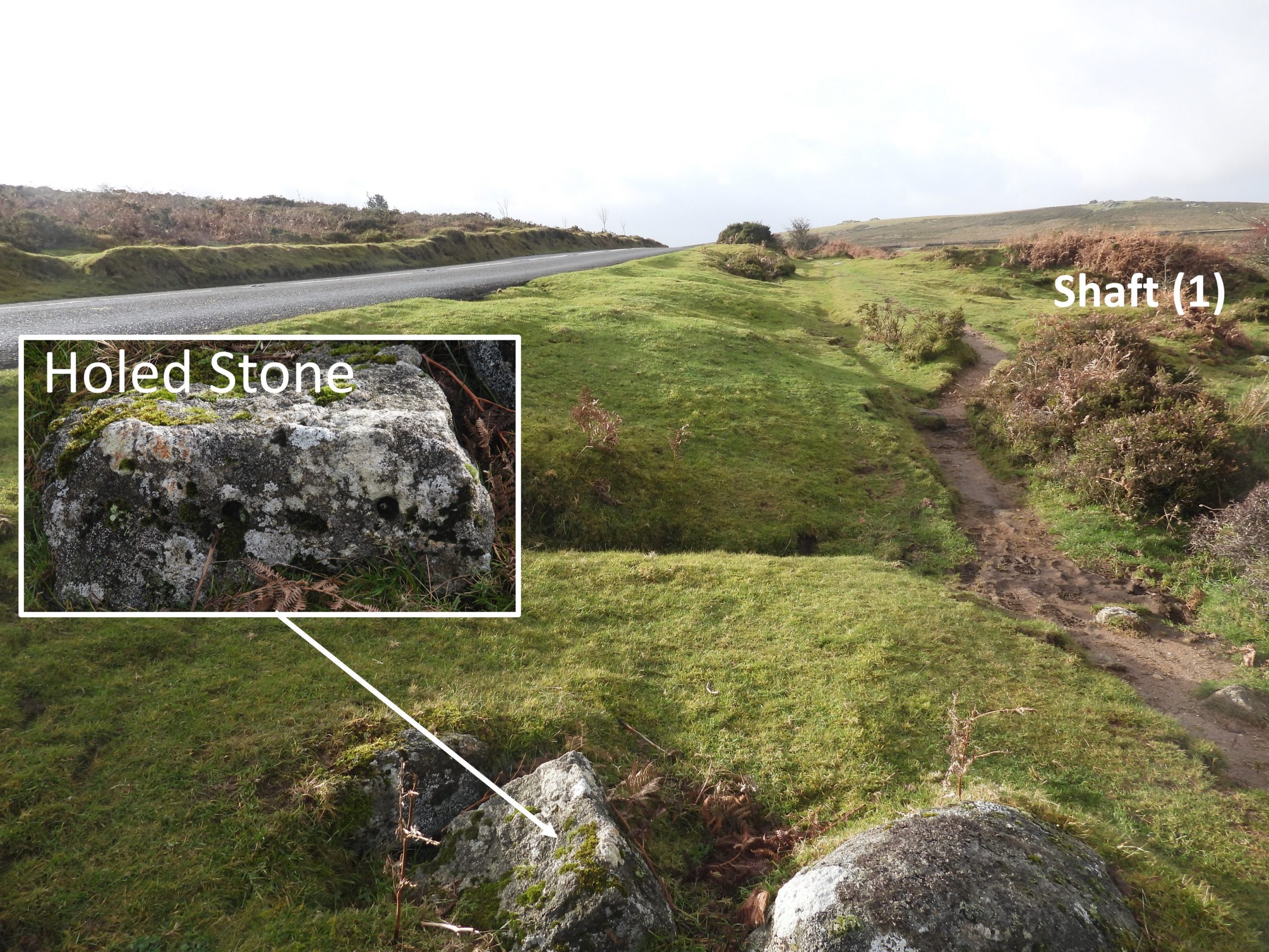
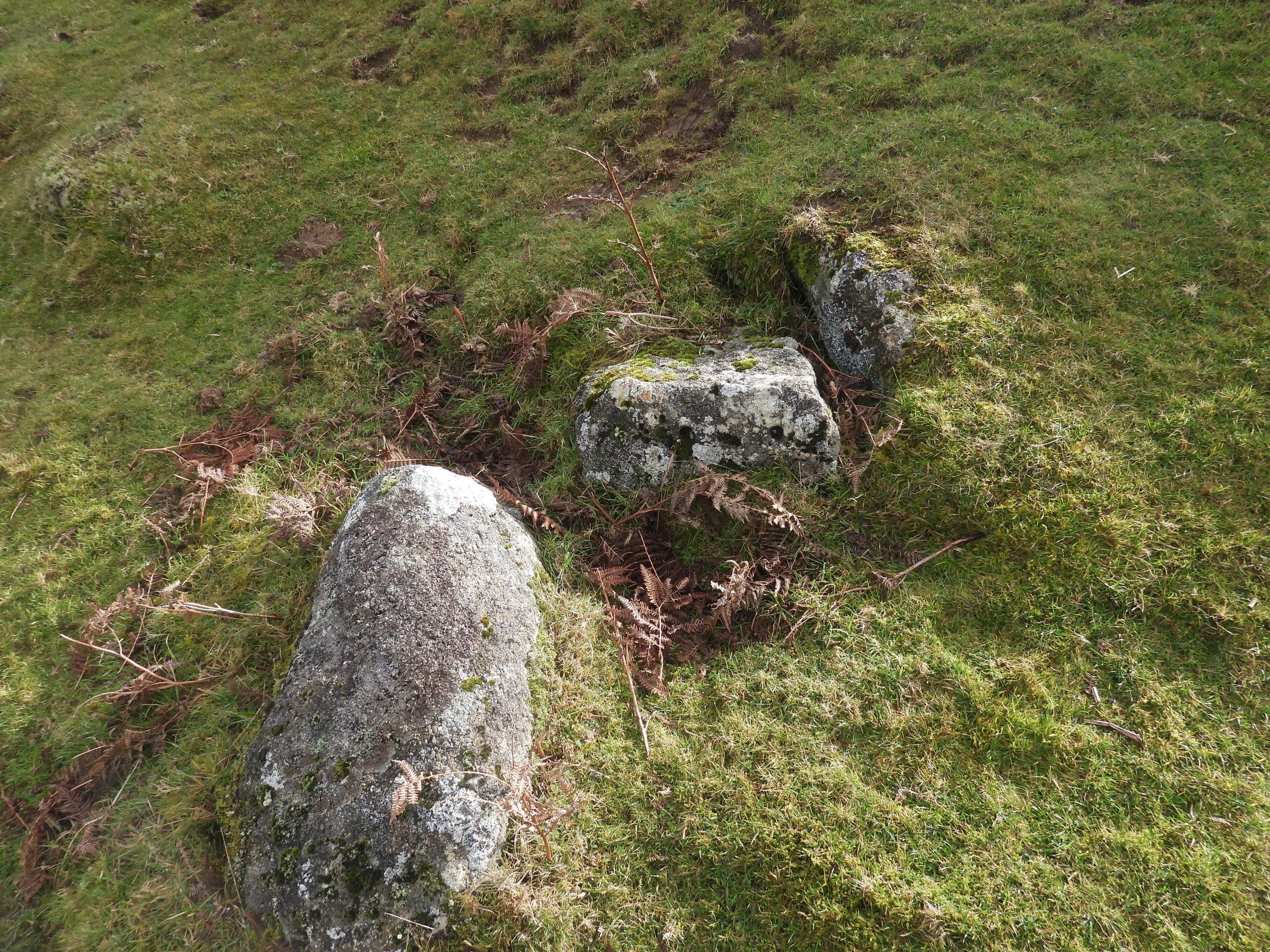
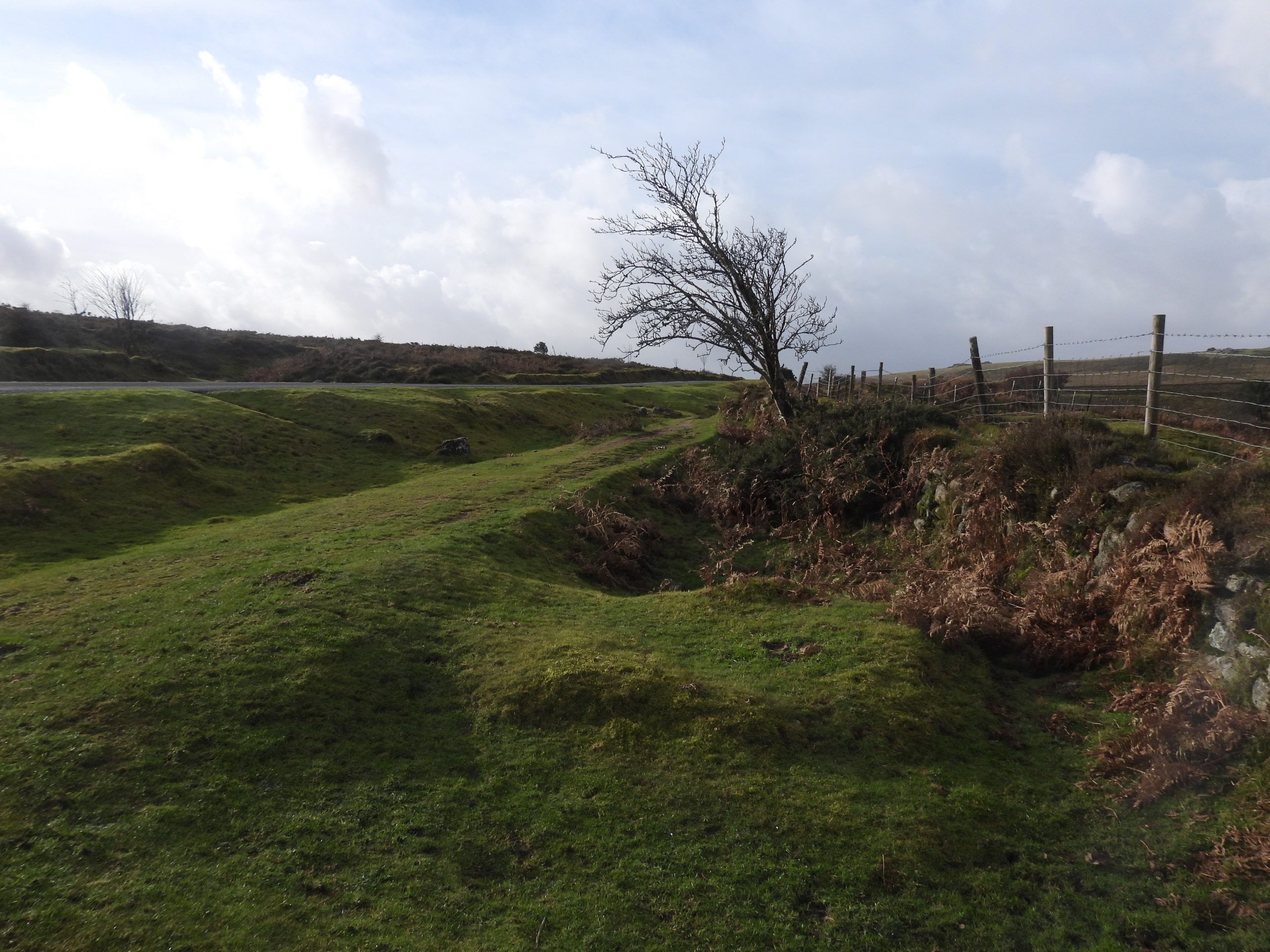
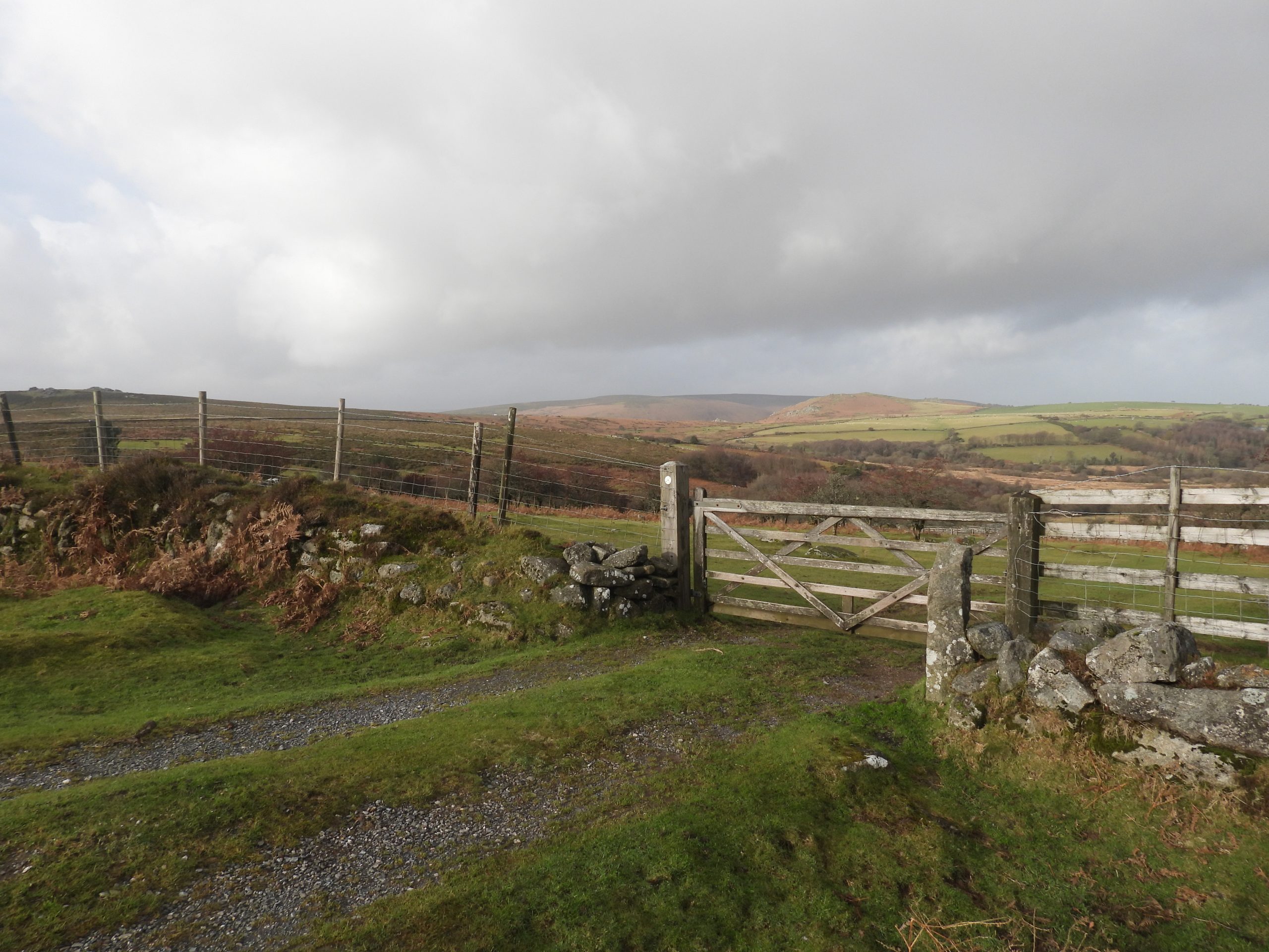
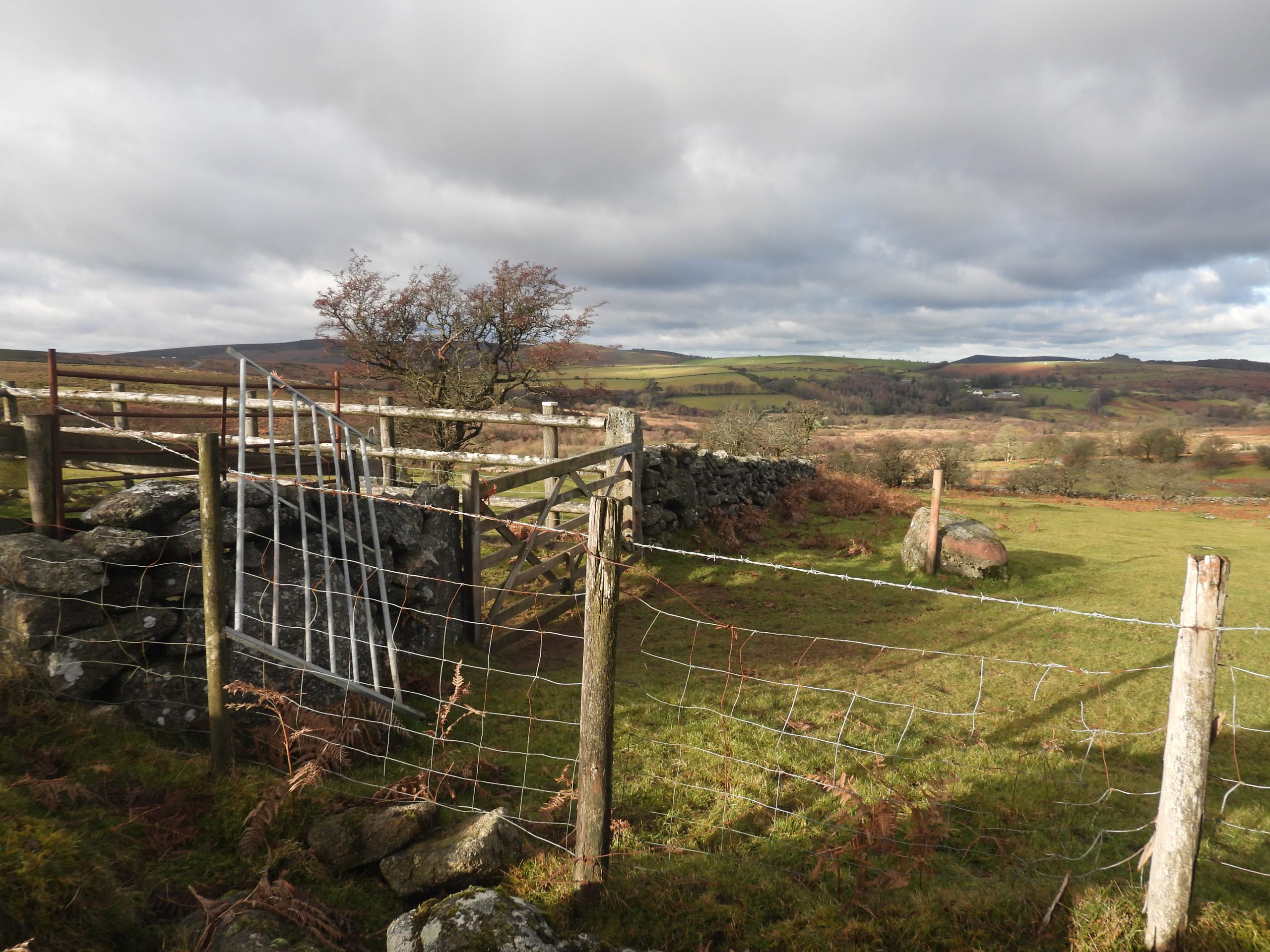
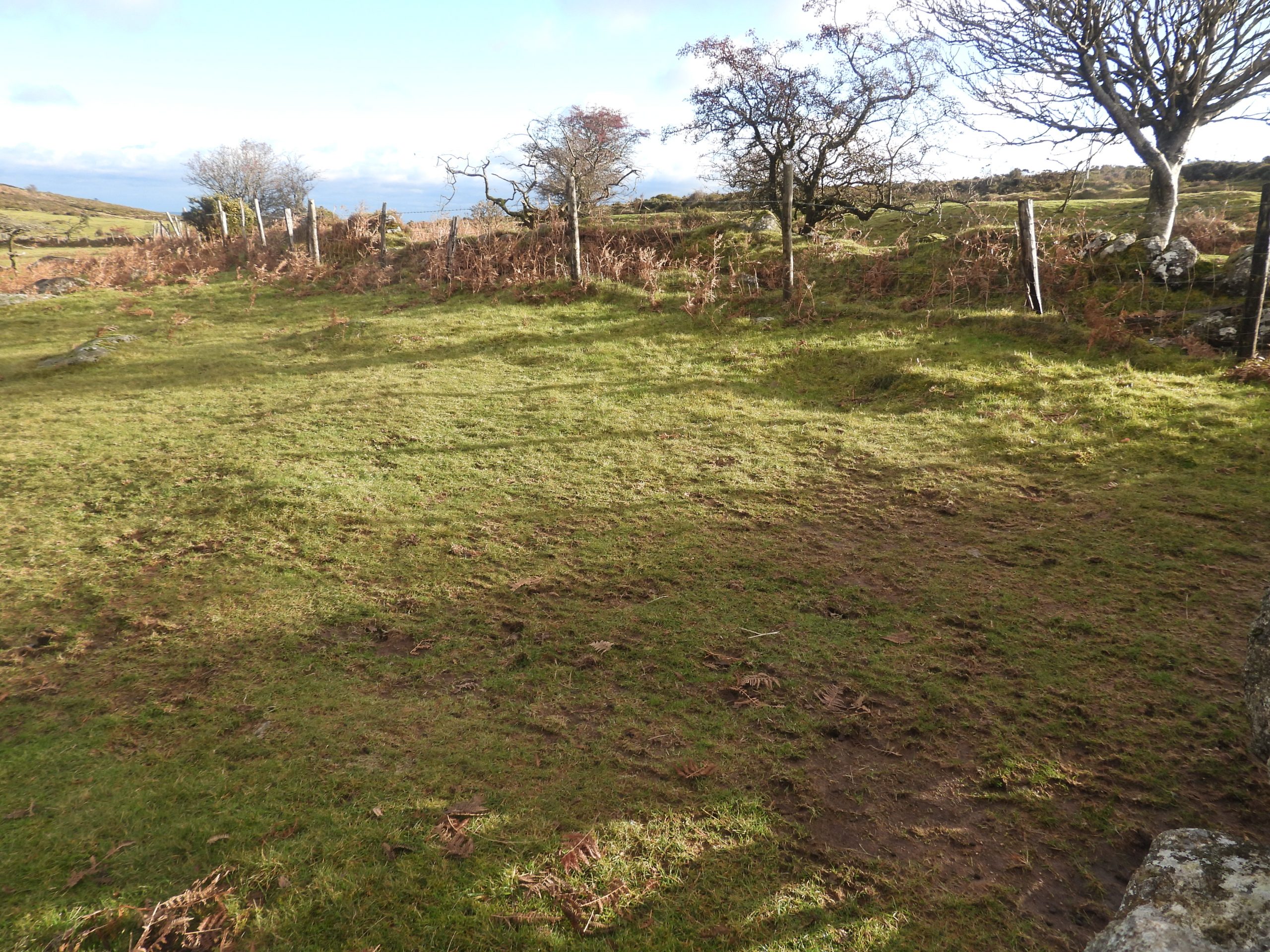
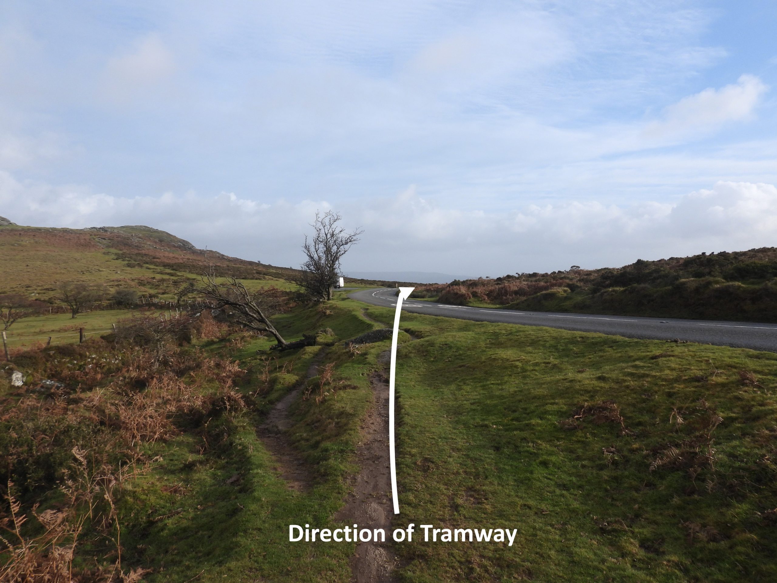
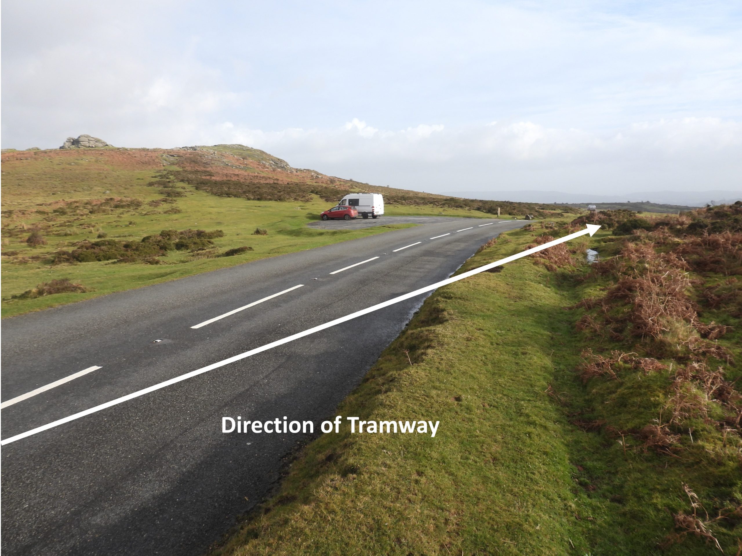
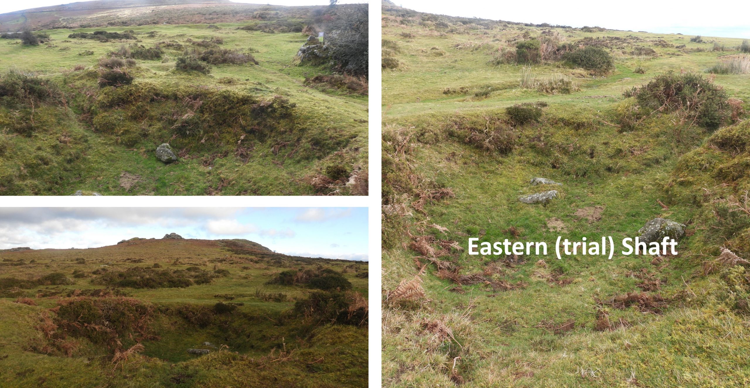
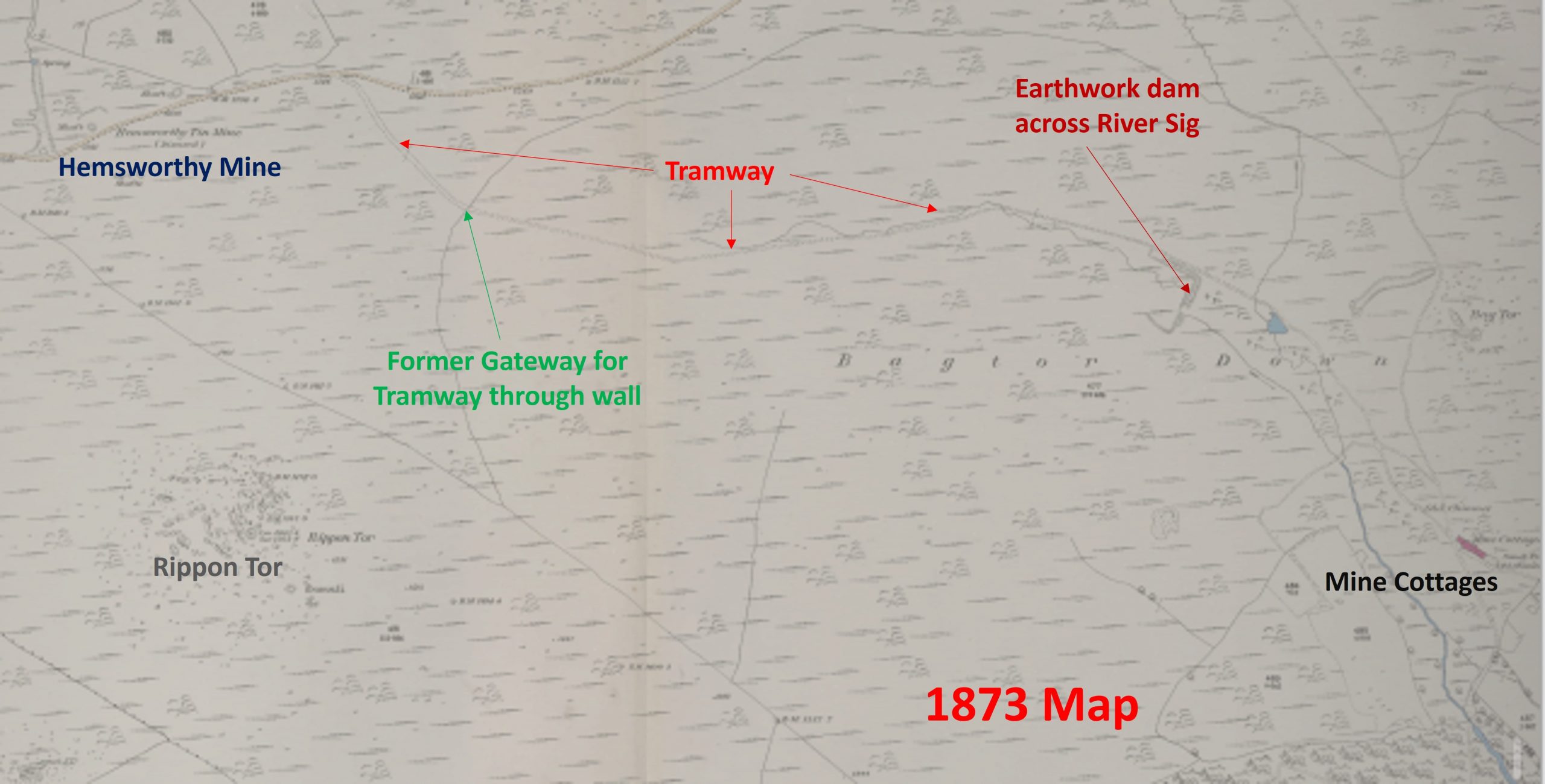
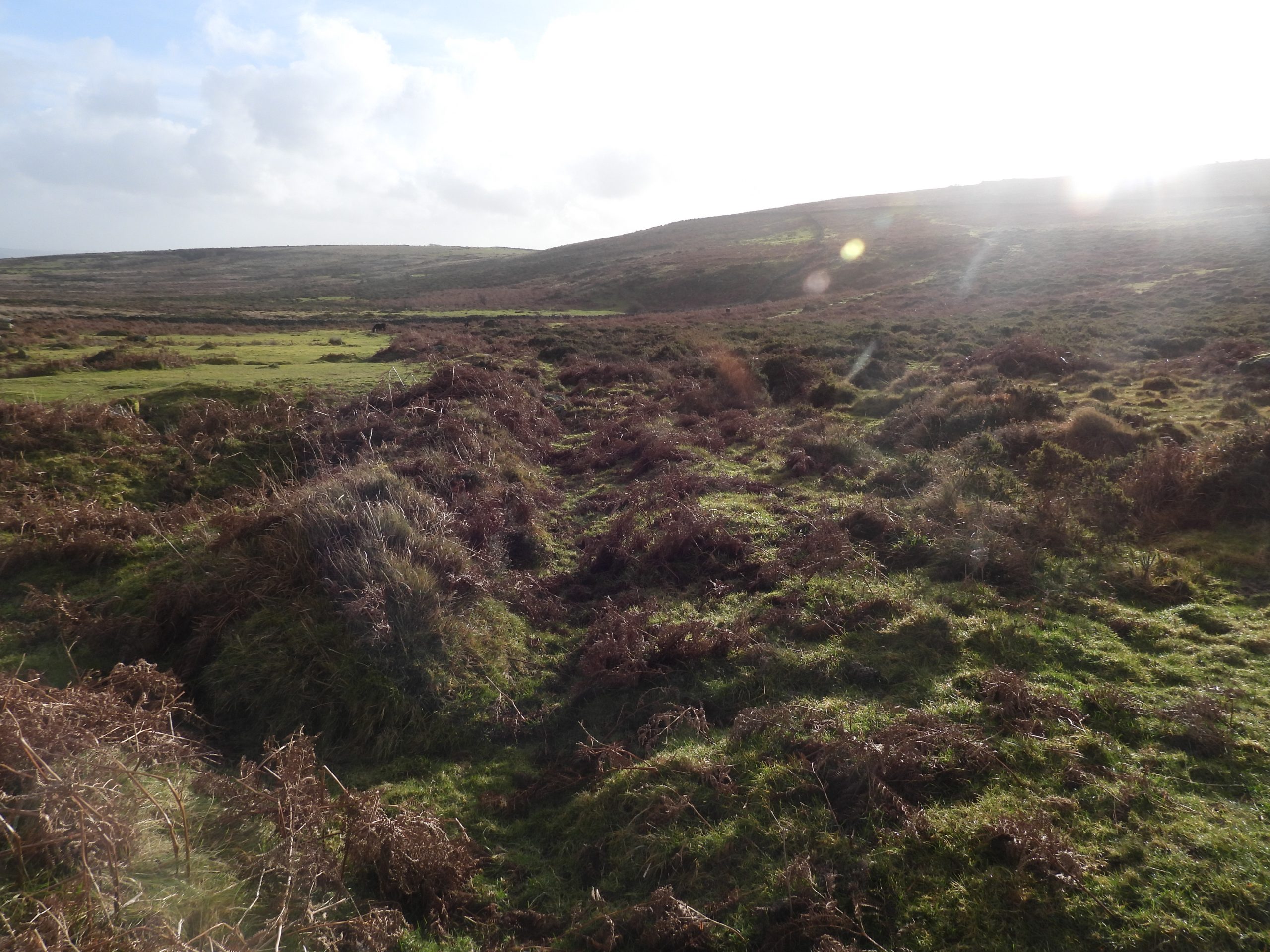
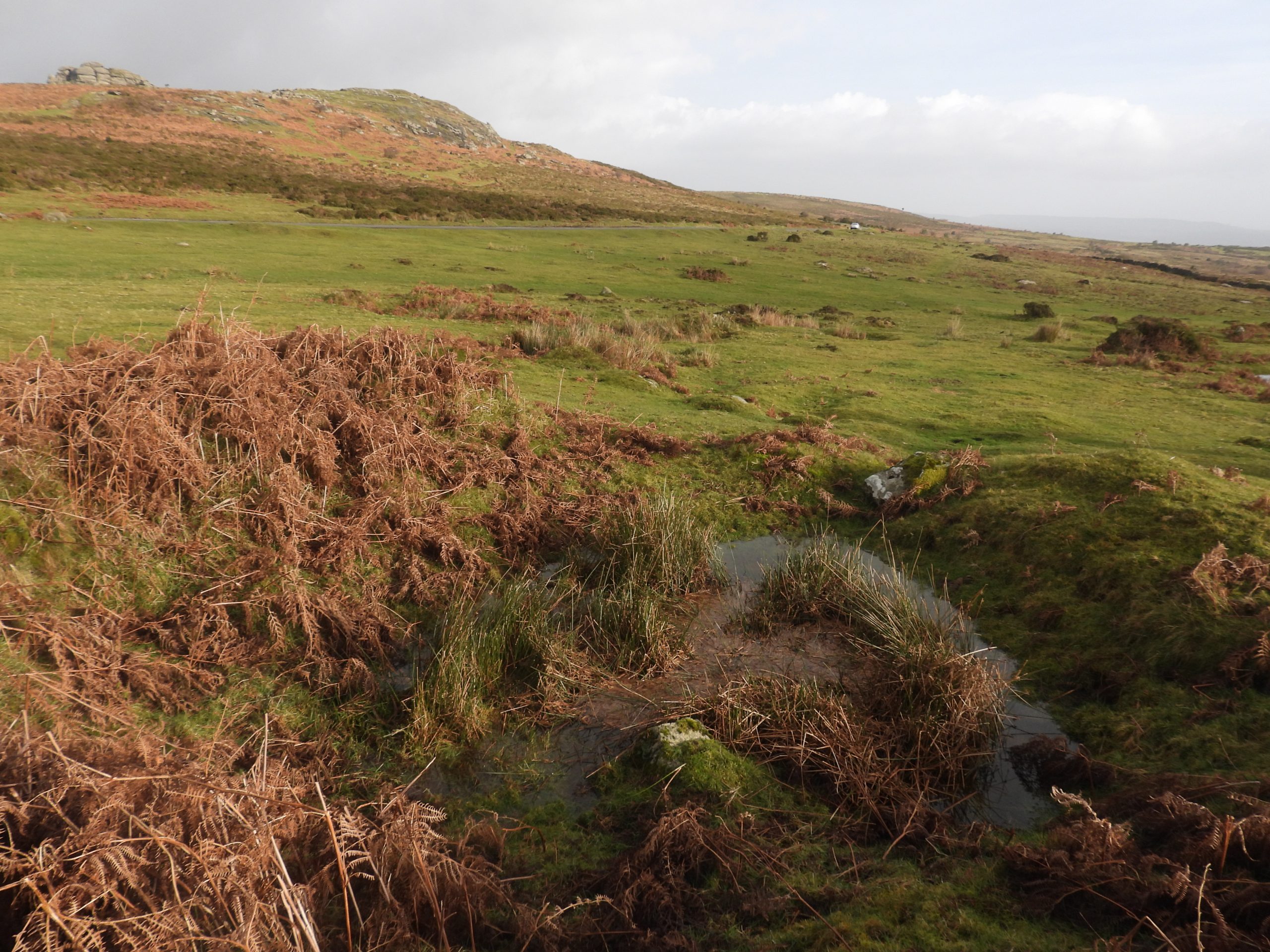
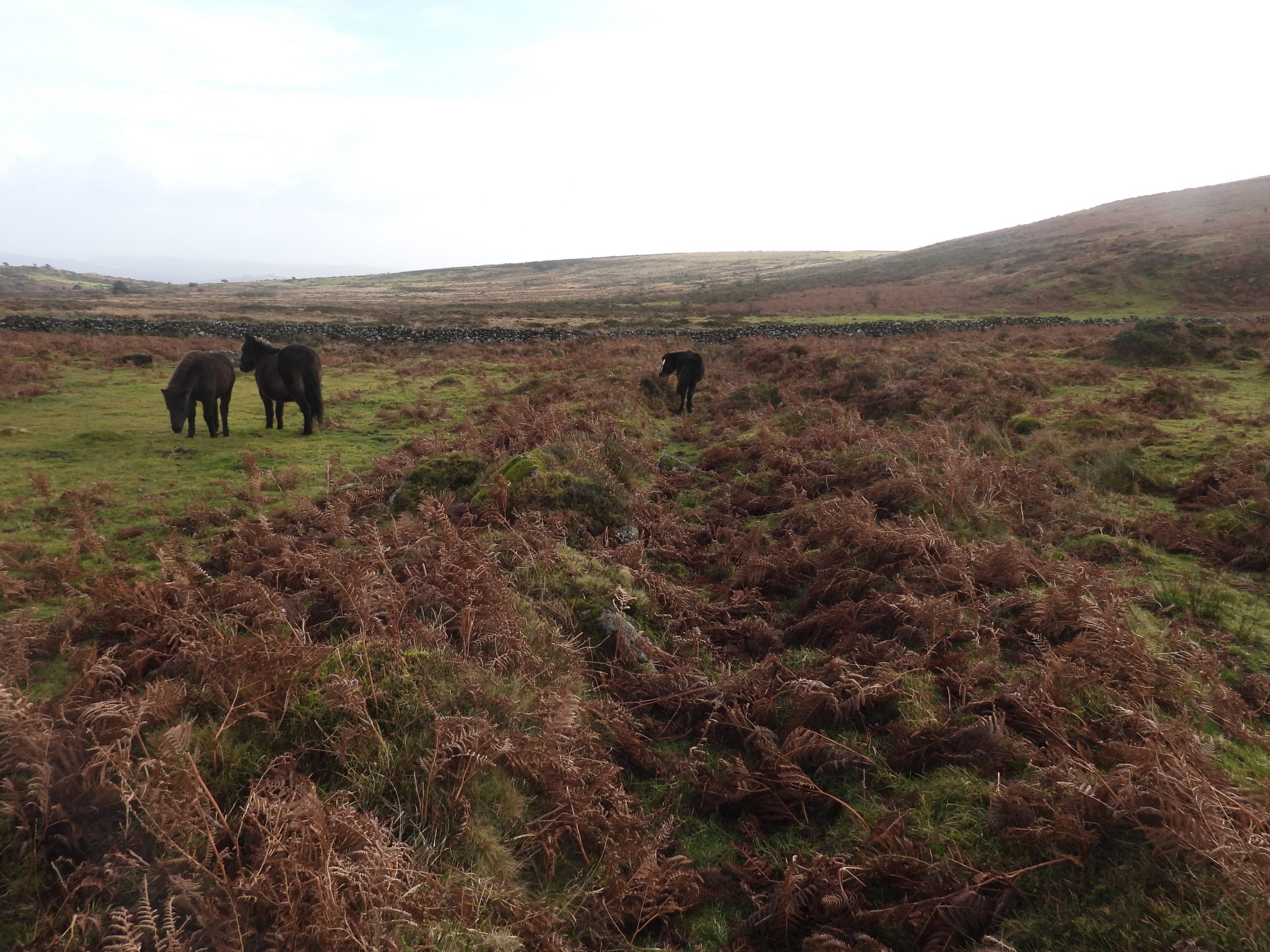
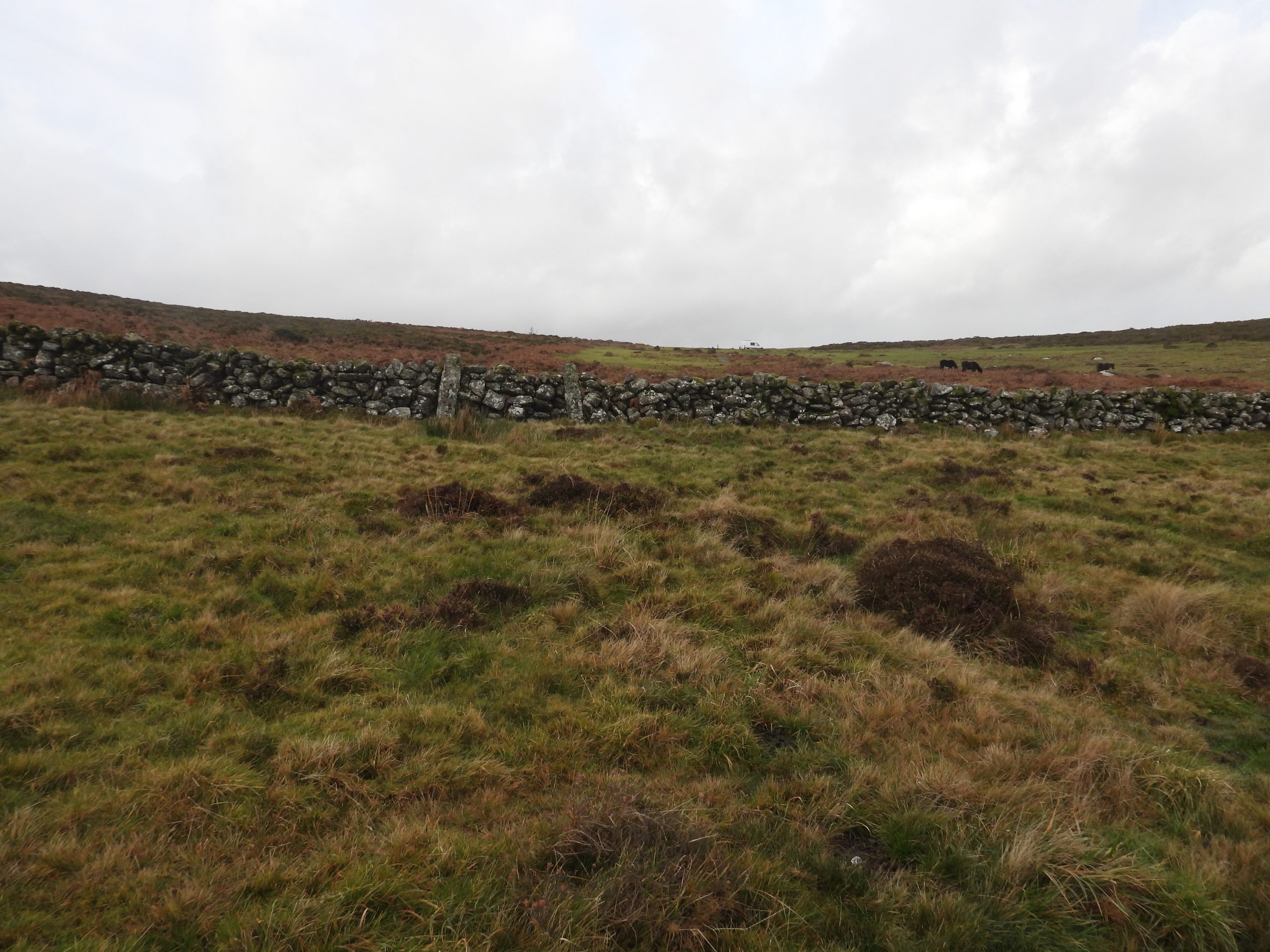
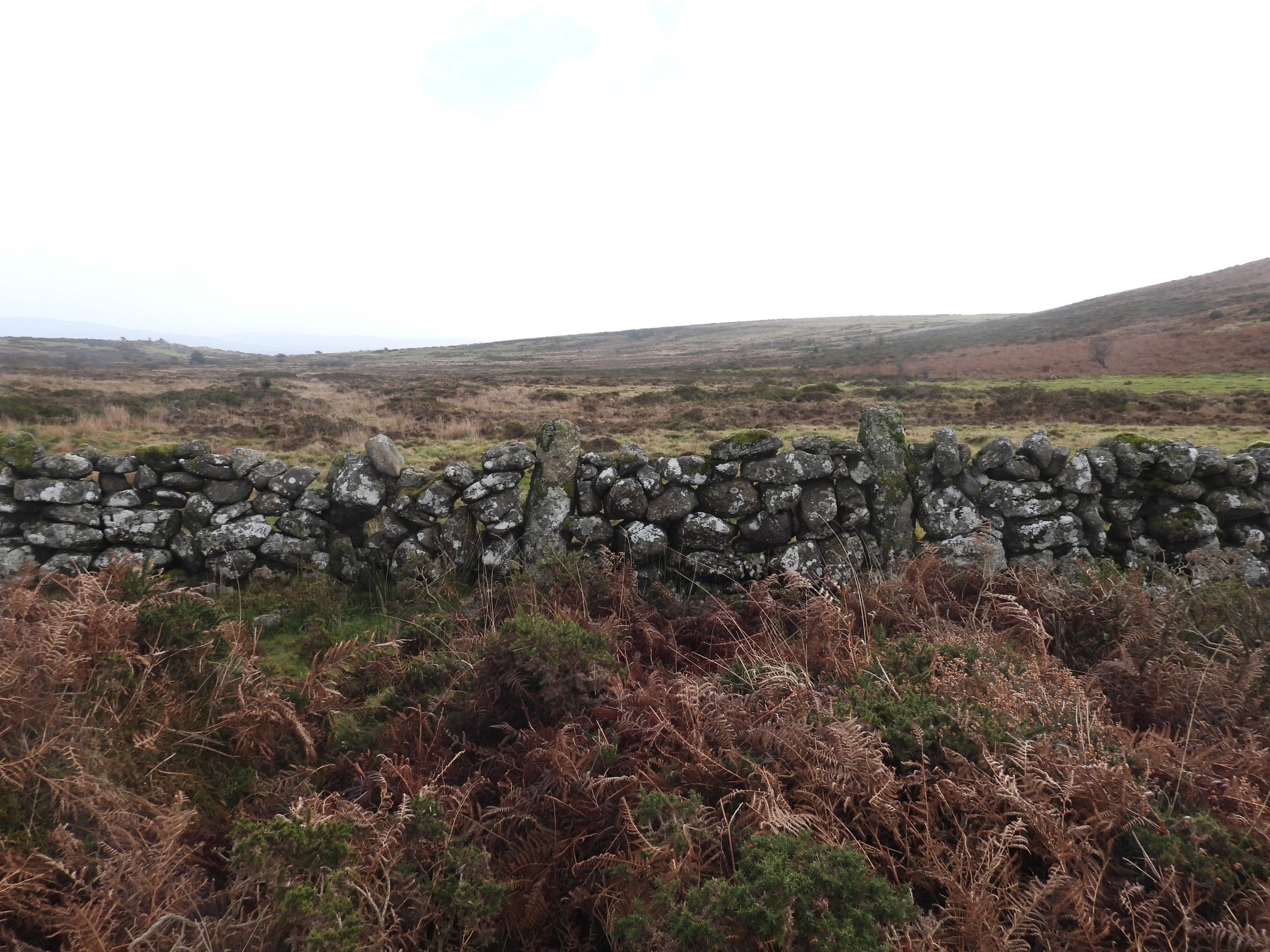
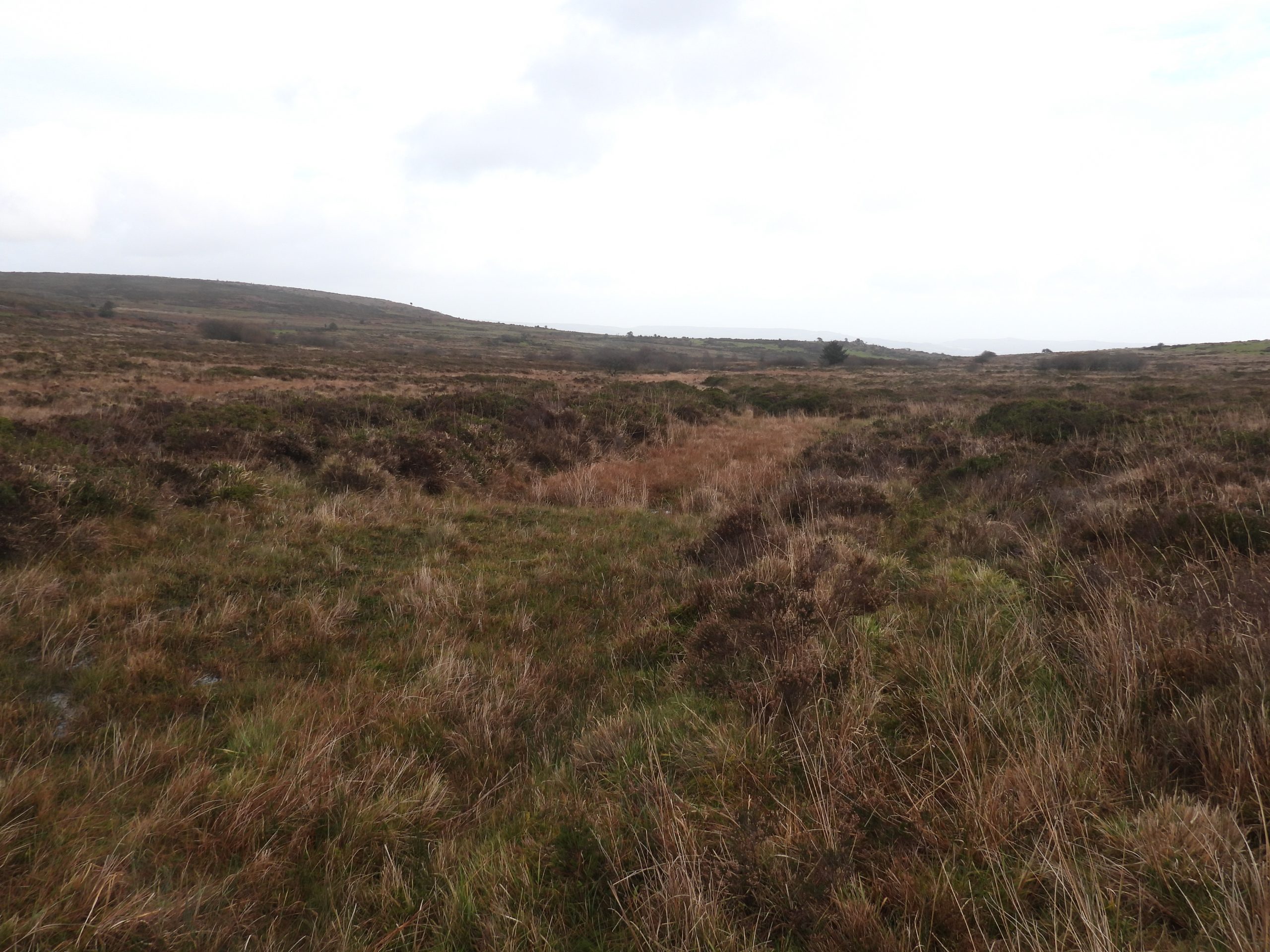
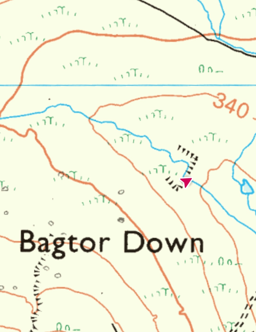
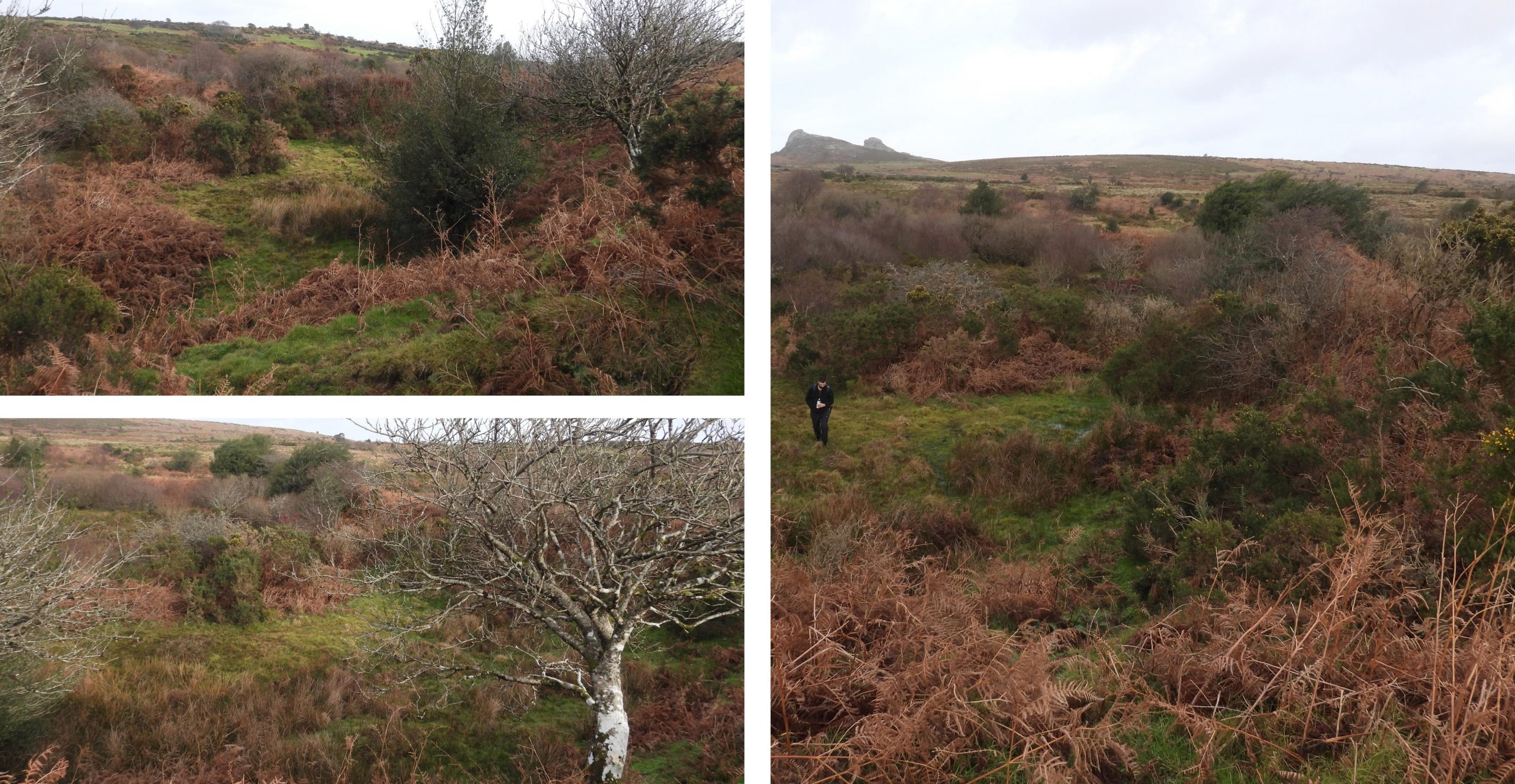
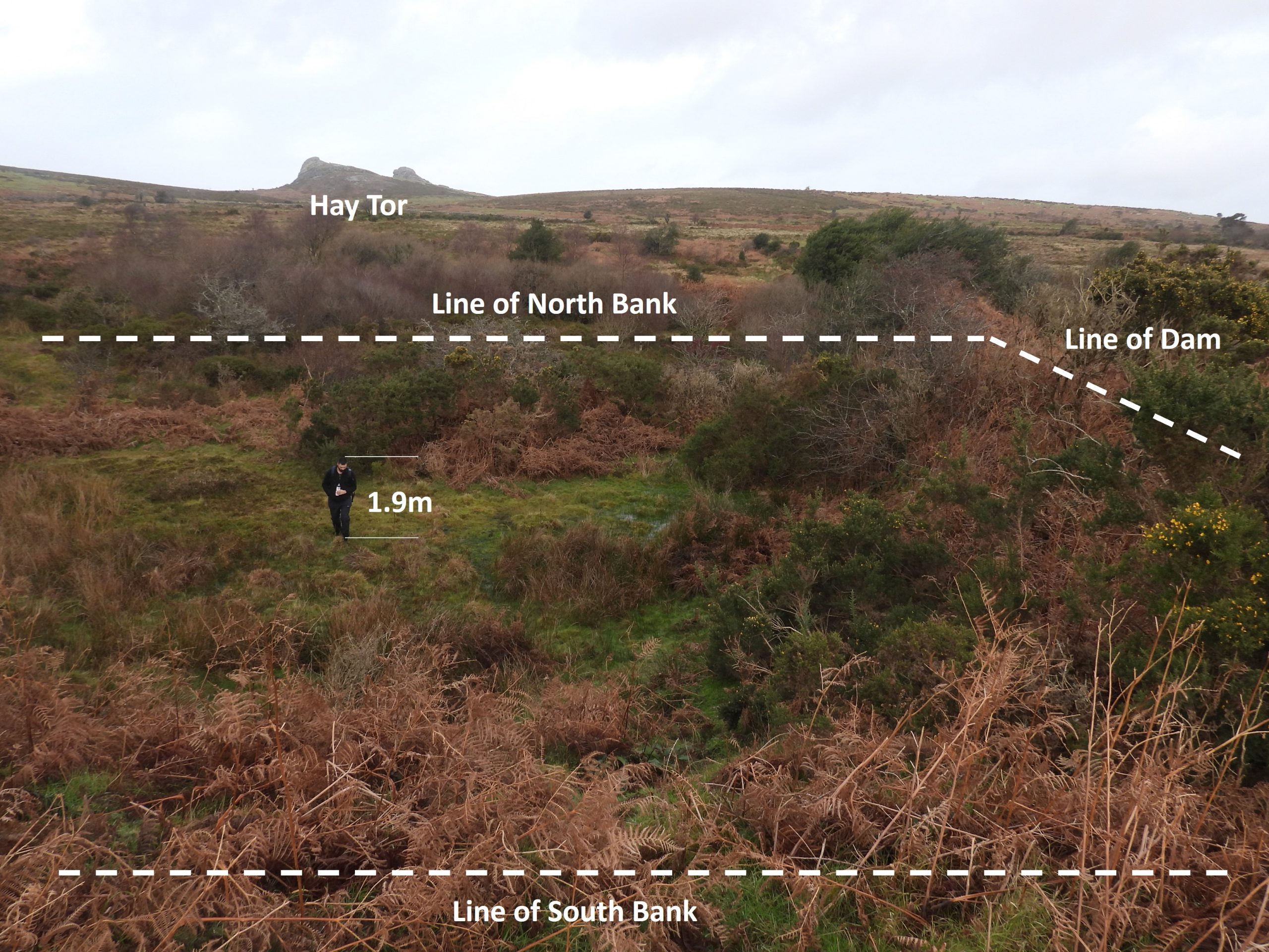
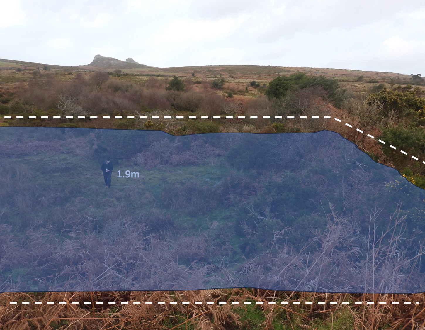
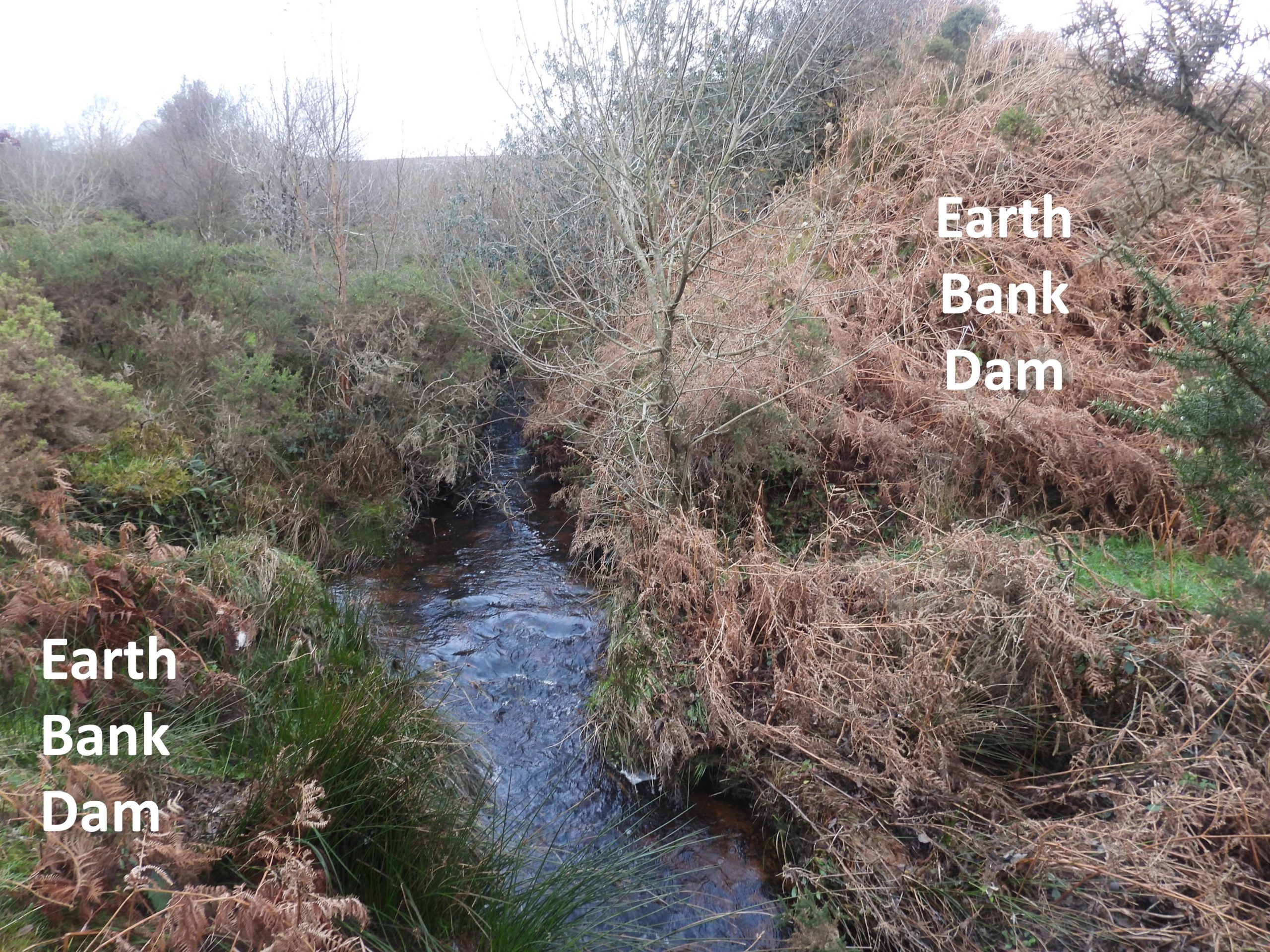
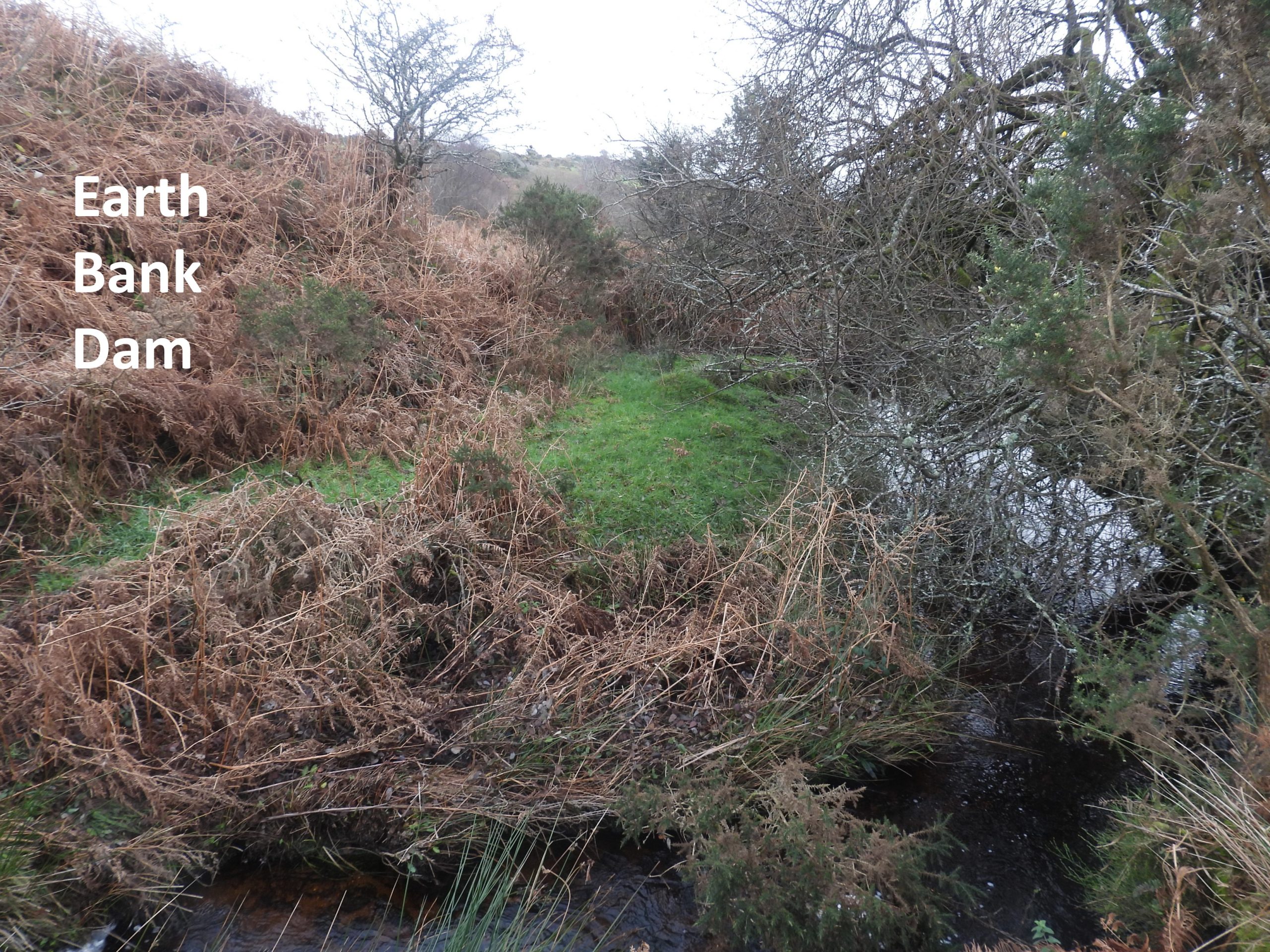
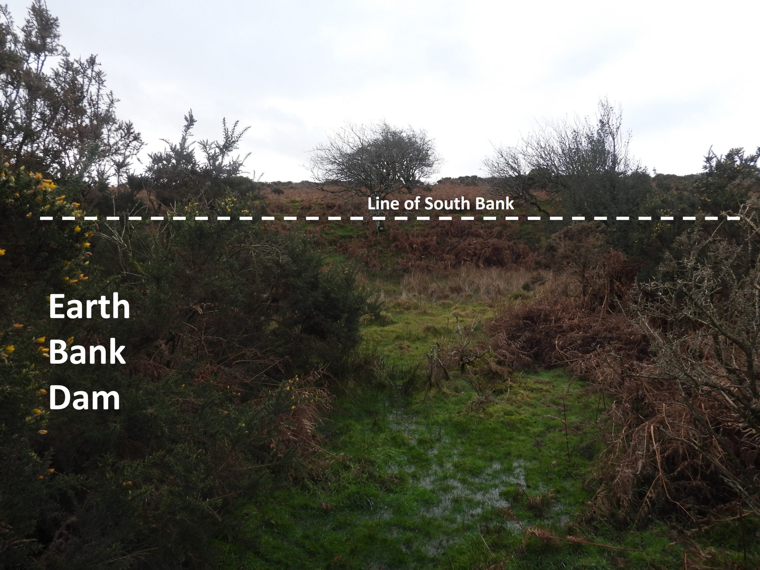
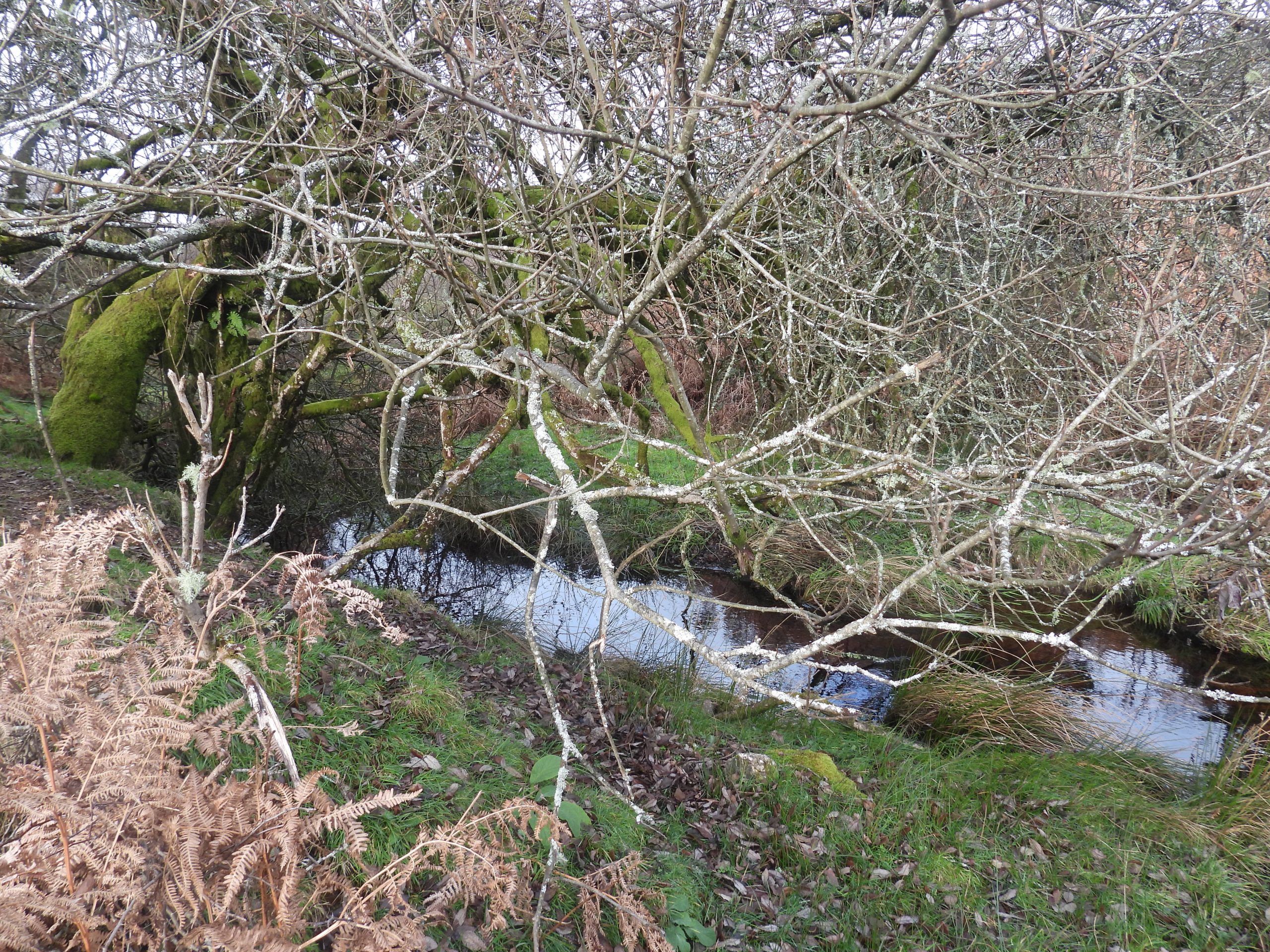
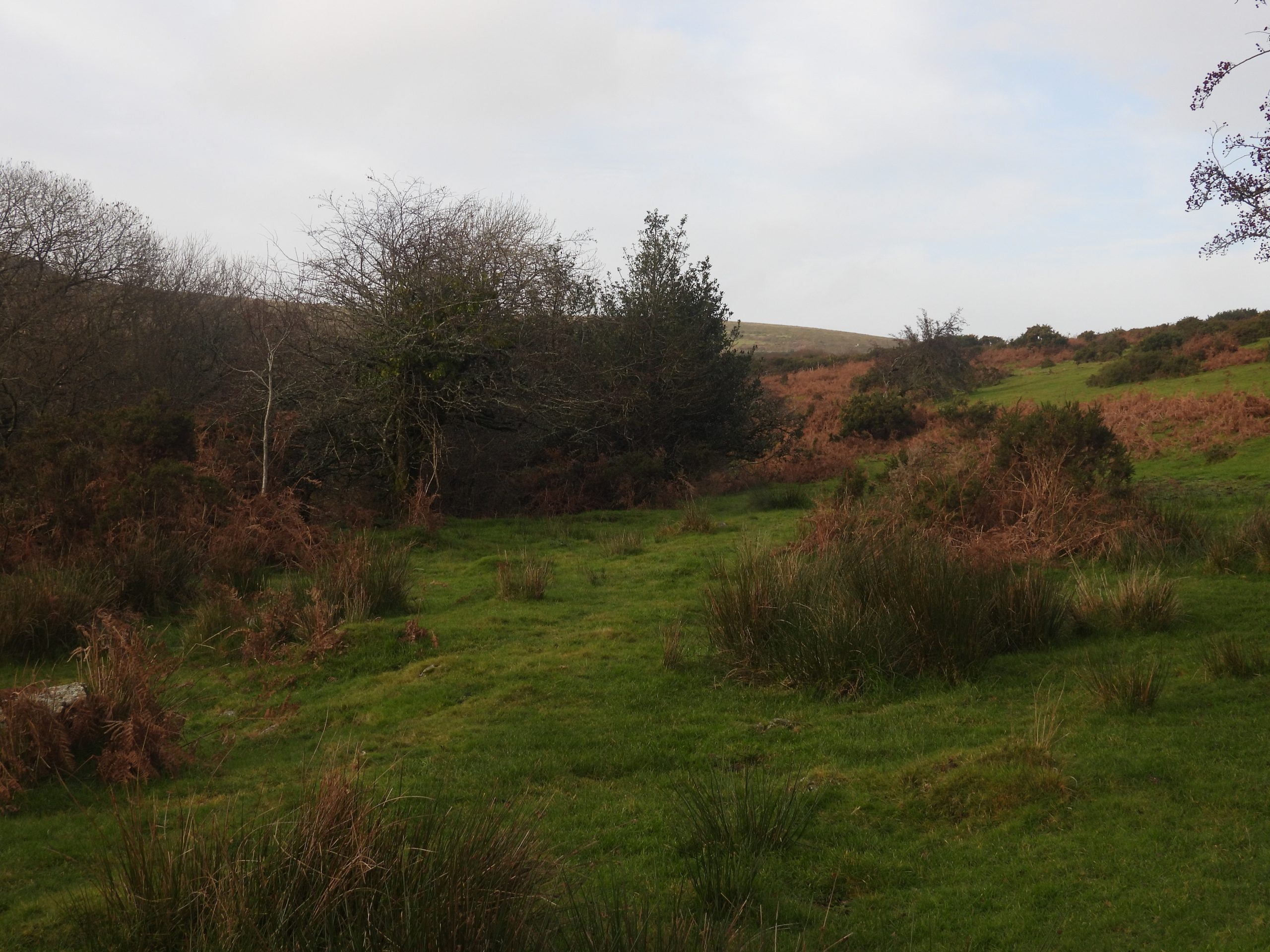
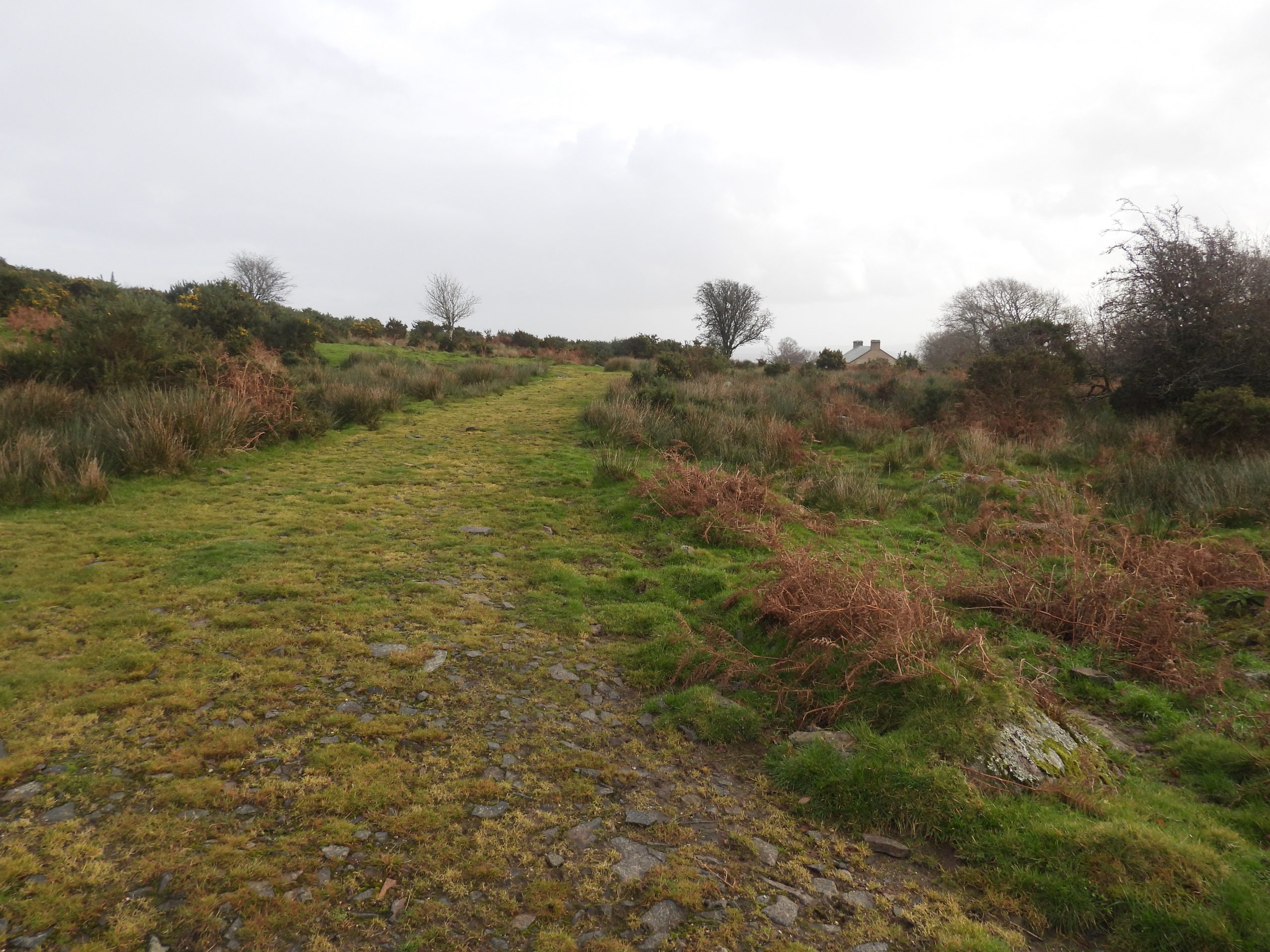
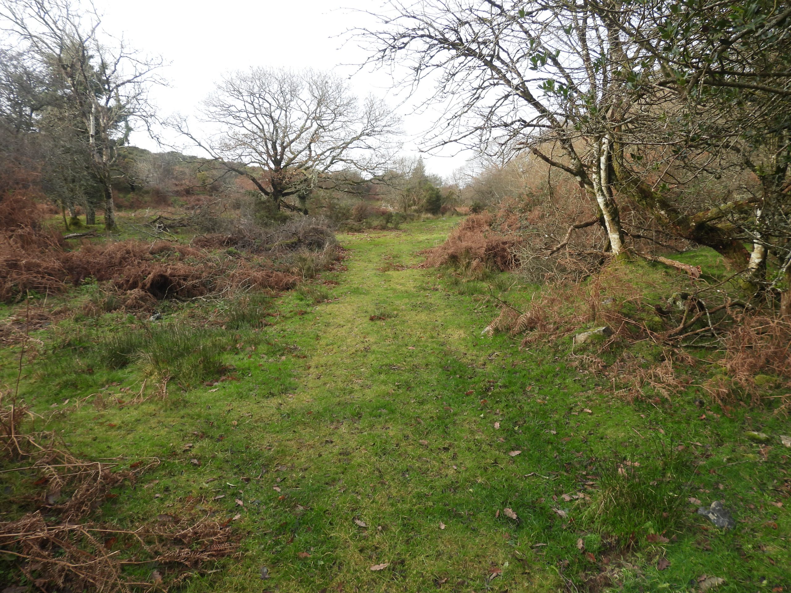
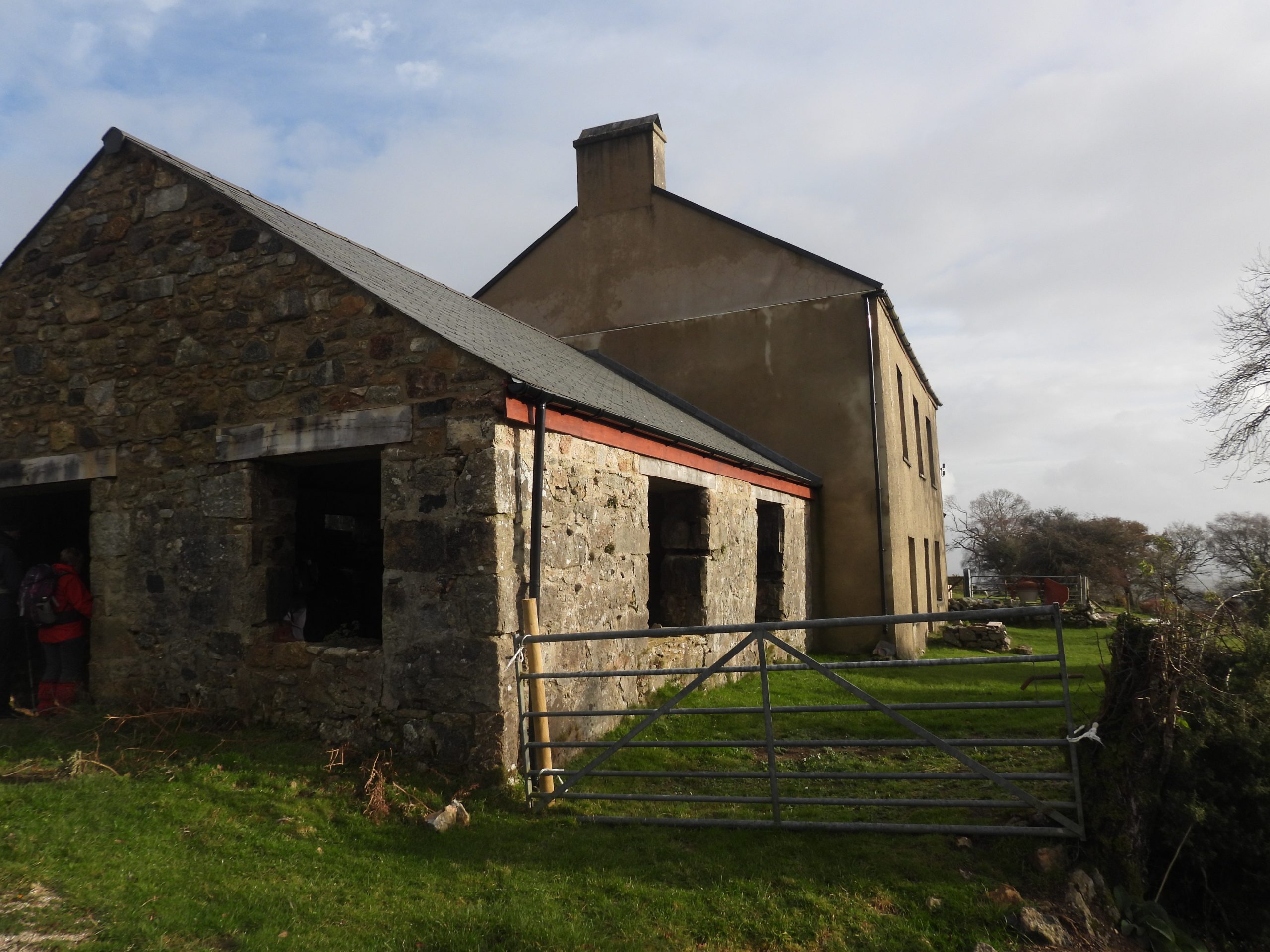
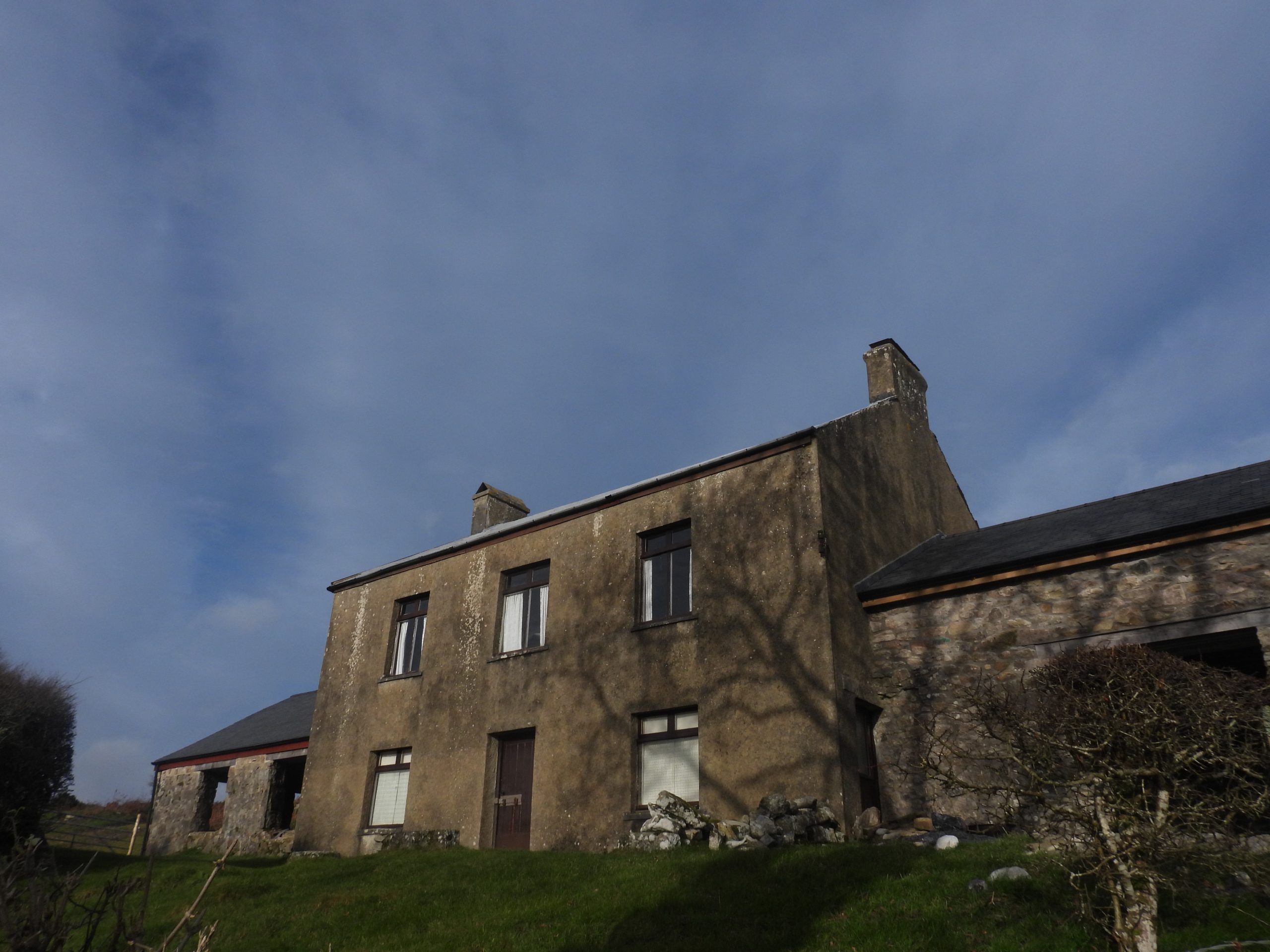
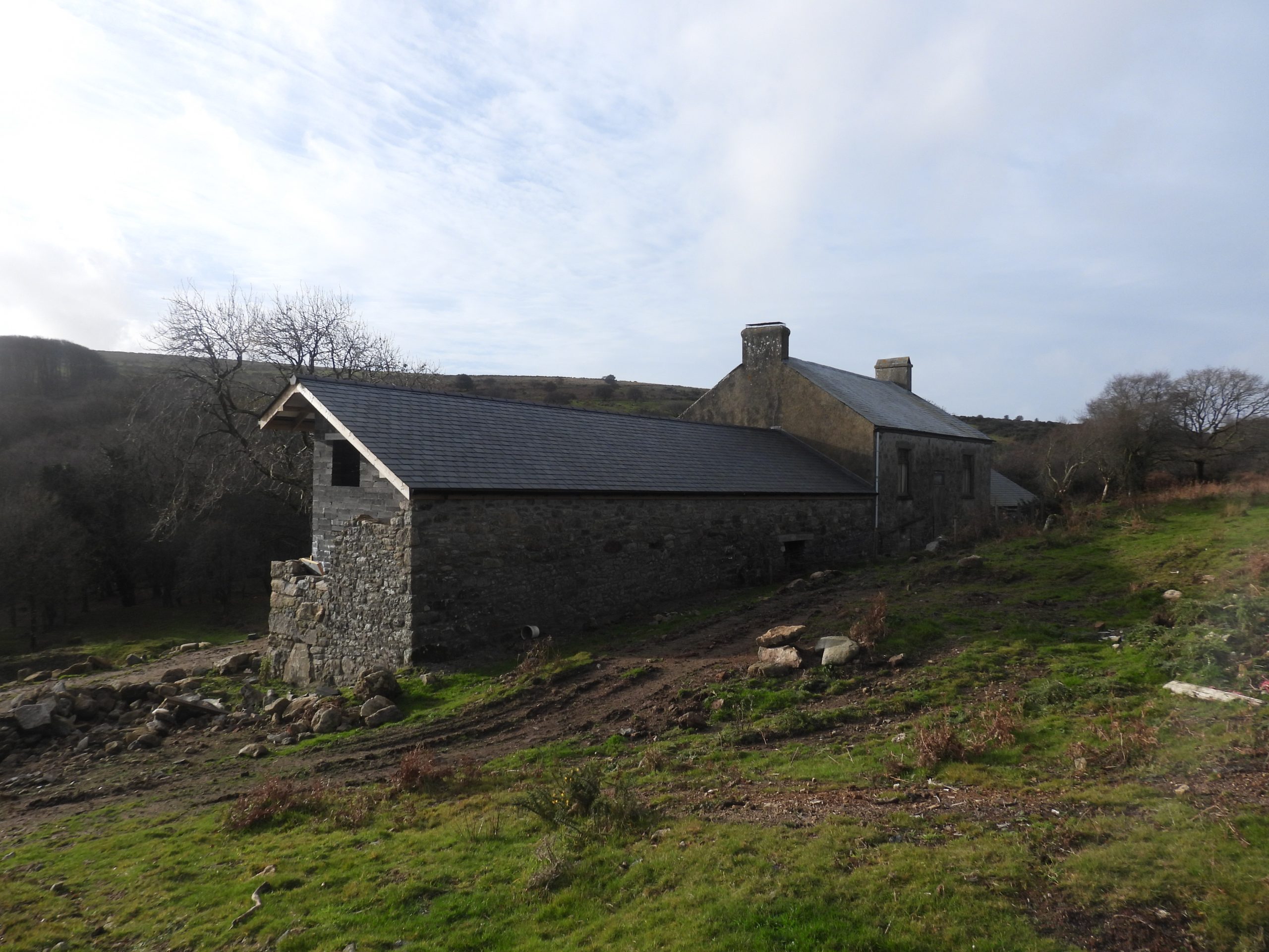
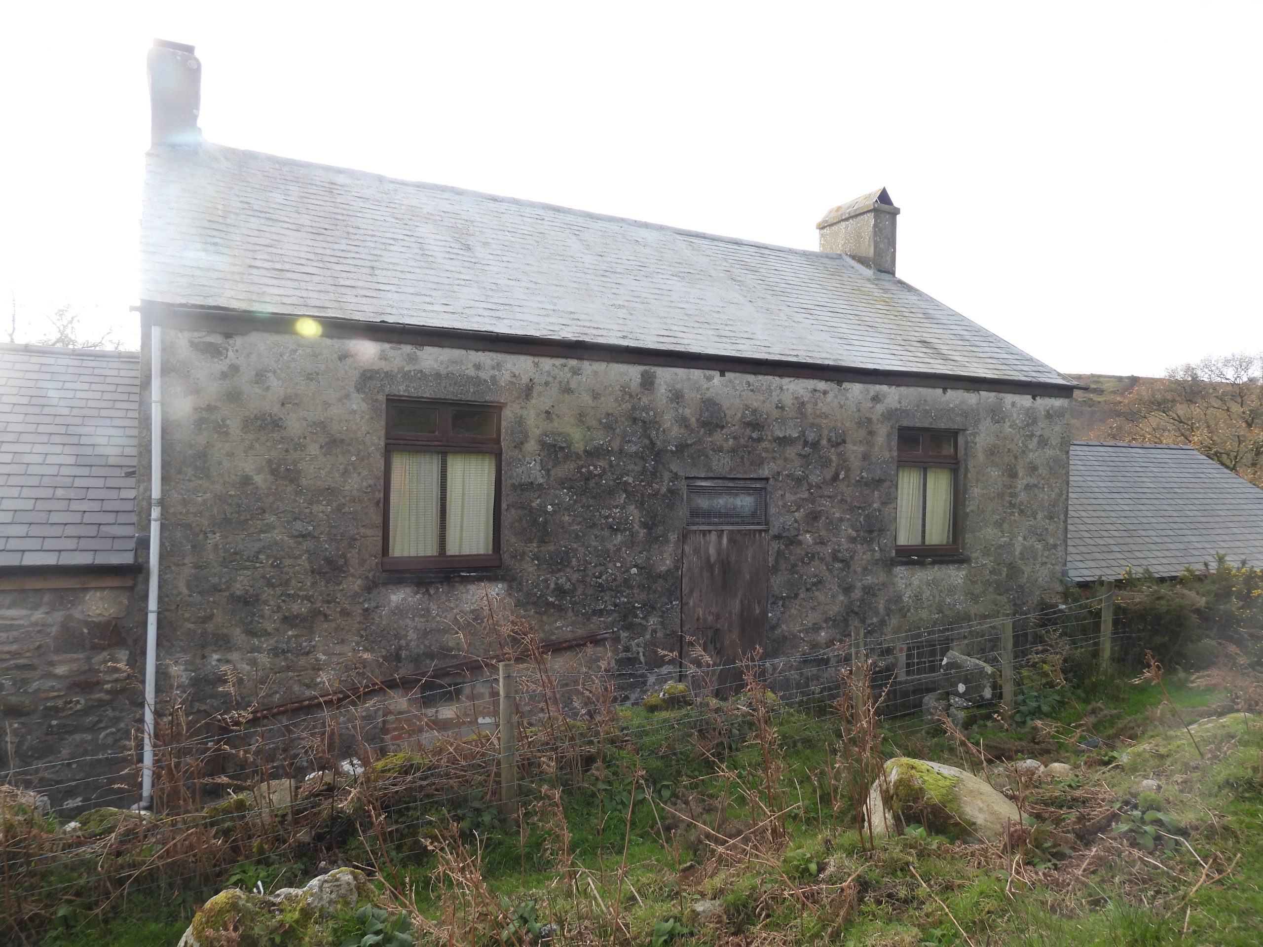
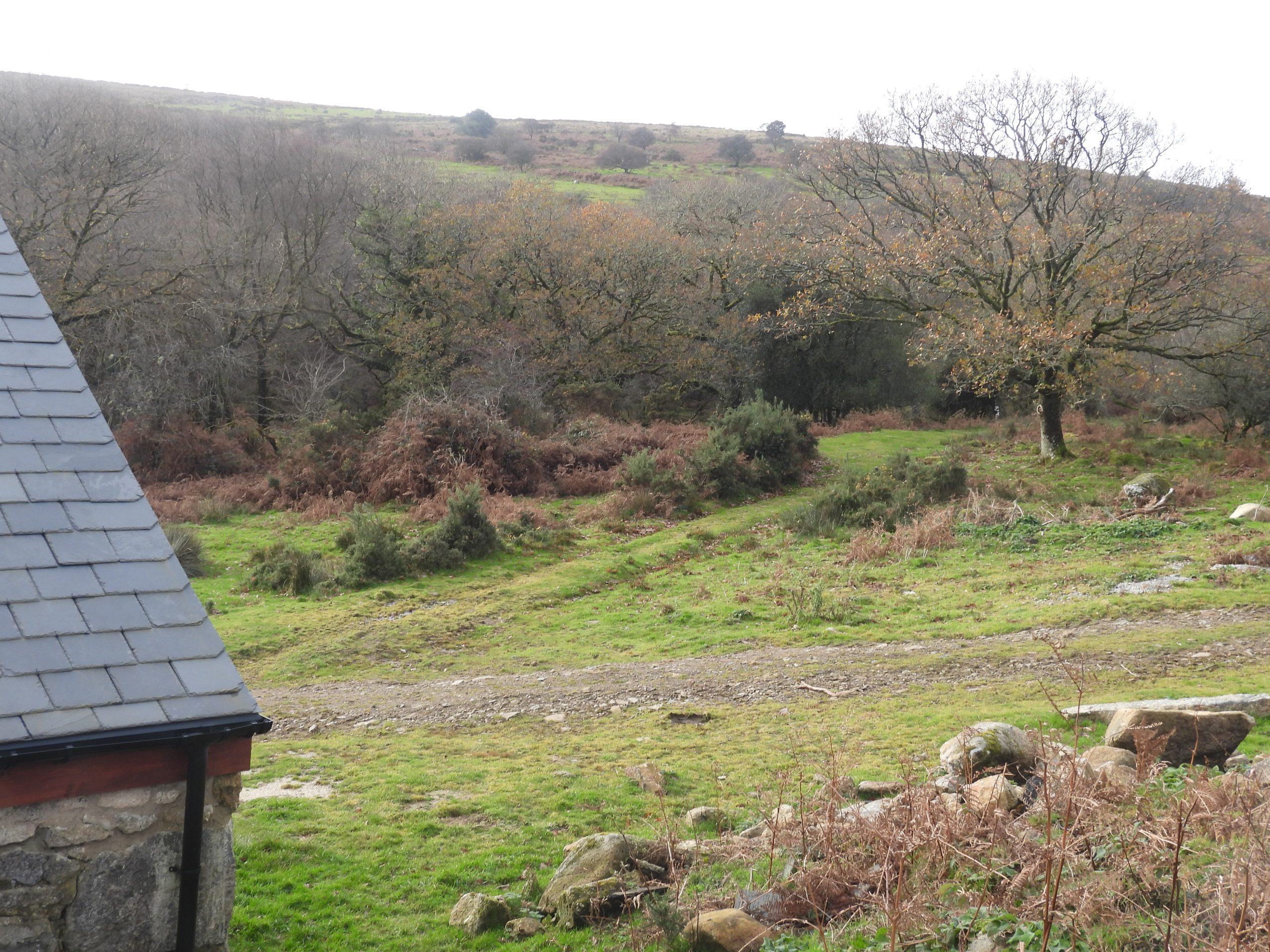
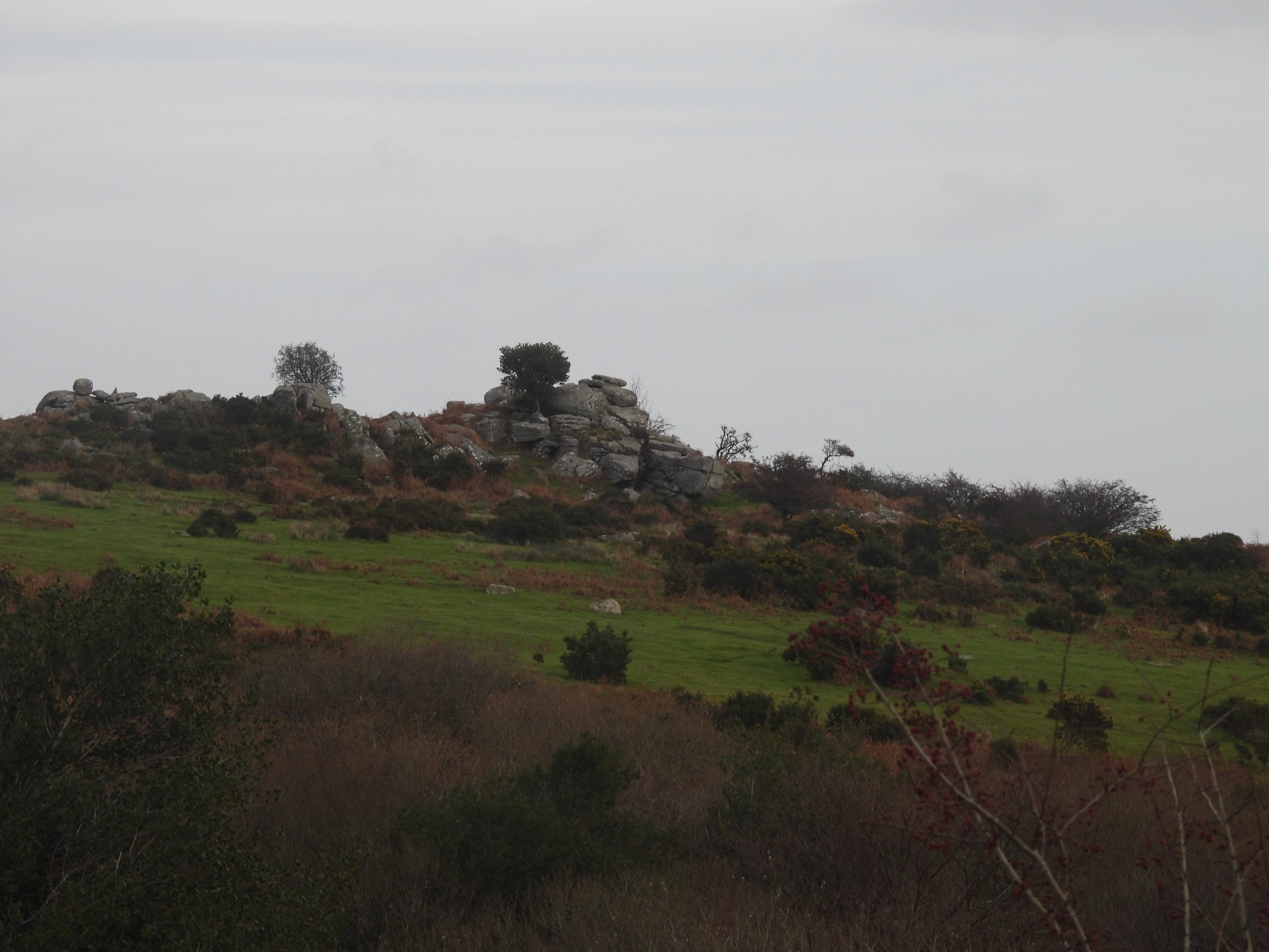
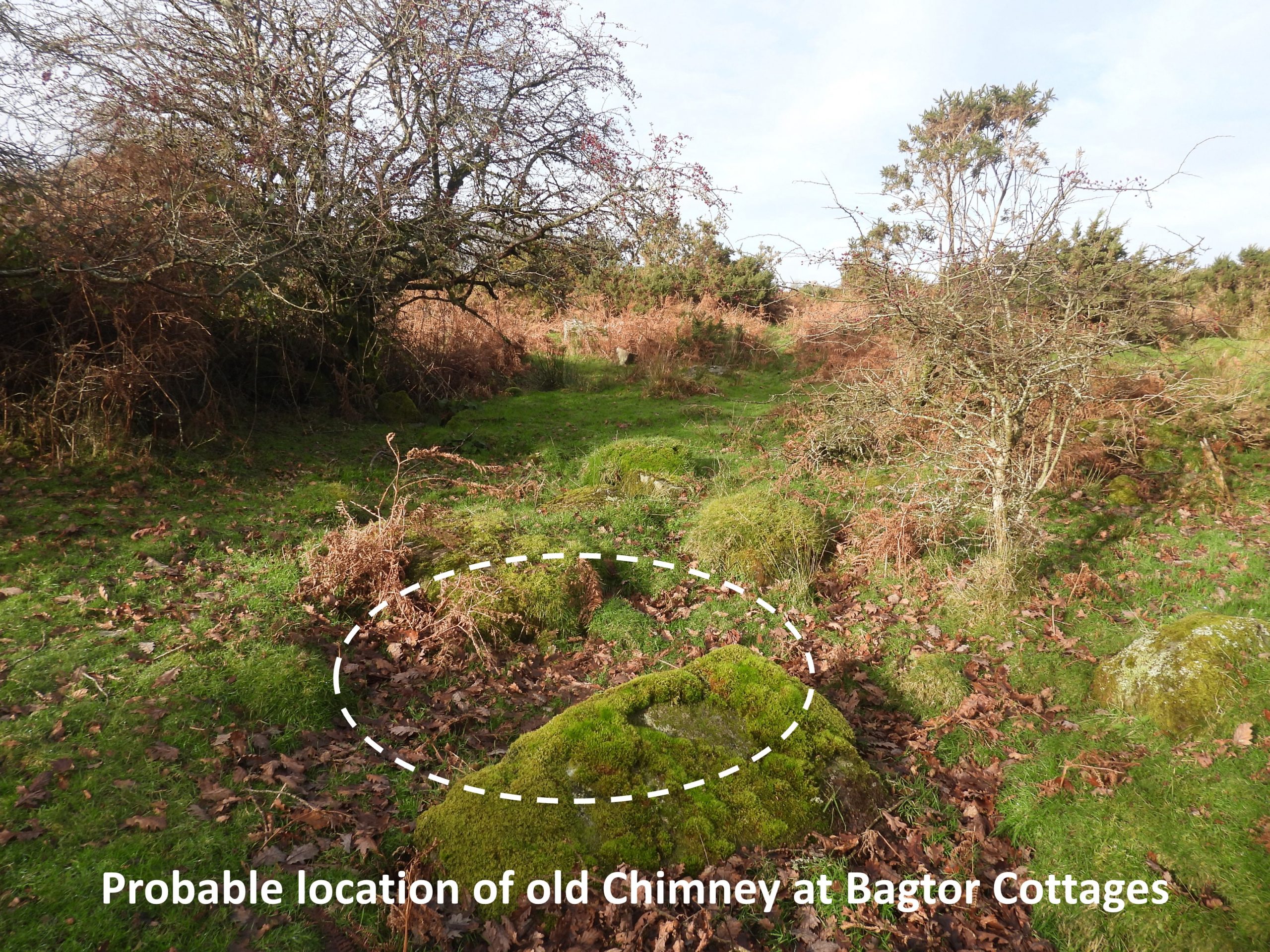
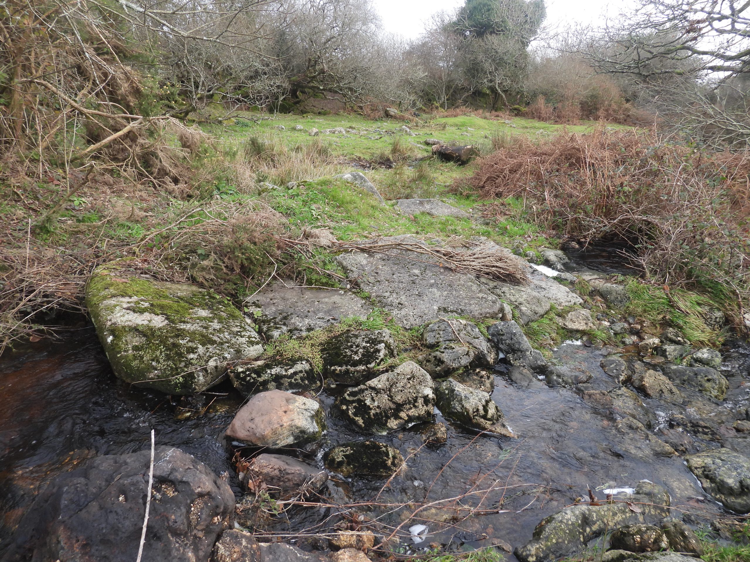
This sketch map was kindly provided by Dartmoor Chris and has been annotated by the author labelling the shafts and adding other artefacts which have been photographed and are referred to in this this post. Note that at the ‘Engine Shaft’ is a modern day car parkAn annotated 19th century map of the mine, which indicates its closure. The ‘square’ by the road at the top end of the old workings is of interest and on the mine plan sketch is suggested was the location of the smithyThe old workings as viewed from the road. Note the car at the top right of the photograph, which is close to the original ‘Engine Shaft’. Considering the mine sketch and the 19th century map, the author has suggested the probable location of the mine smithyThe probable location of the mine smithy is on a banked up levelled area at the top end of the old workingsThe probable site of the smithy is at SX74411 76071Inside the old workings, where trees now flourishView of the very overgrown old workings (from the period of the ‘old men’), which make it virtually impossible to walk throughTowards the middle and lower end of the old workings the discharge of water from the adit is evident. This picture was taken at SX74395 76156, near to the point where the modern OS maps show the start of the water outflow from the hillVarious pictures of the adit run offThe mine sketch shows a ‘crosscut adit’ which the author believes was a driven adit from the old workings through to the Engine ShaftView from the car park (by Engine Shaft) indicating the probable line of the crosscut adit. The adit would have continued in a southerly direction (under the road) where it intersected two other lodes, Middle and South both of which have short east and west drives upon them (Hamilton Jenkin)A possible trial shaft (as recorded in the Heritage Gateway). It is located at SX74368 76201 and annotated on the mine sketch map as Trial Pit a. The adit tailrace can be seen to the right (east) of the tree and pitAnother view of the ‘old workings’ with the car park at Engine Shaft, the road and the slopes of Rippon Tor in the photographThere appears to be some possible trial shafts located on the western ‘arm’ of the old workingsThe Western Shaft lies on the North Lode near to the road and Hemsworthy Gate. It is located at SX74326 76048 (NGR taken alongside the shaft). The upthrust of earth from the shaft being very evident from the road. Shaft 4 (as annotated on the mine plan sketch) on the South Lode is located at SX74487 76019Shaft 5 (as annotated on the mine plan sketch) on the South Lode is located at SX74526 76027 (NGR taken from side of shaft)Shaft 6 (as annotated on the mine plan sketch) on the South Lode is located at SX74573 76034General views of the shafts of the south lode which are only about 50m-75m from the road. Some of these may be air shafts or just collapses from the underground workings. The adit was driven to this lode from the Engine Shaft. The alignment of shaft runs west to east and extends for around 125 metresView of the line of shafts / workings along the south lode. Hemsworthy Gate can be seen in the photograph as can Foale Arrishes, Top Tor and Pil Tor beyond. The mine managers report from January 1854 stated: “The South Lode had been cut in the adit at a depth of about 15 fathoms, and the adit driven on it about 45 fathoms, while some 200 fathoms of backs had been stoped* during the previous four months. It was intended to cross-cut at the 20-fathom level to the South Lode, which at the time was producing 3 tons of tin a month, but which was expected to produce 5 tons”. * verb (in mining) to excavate a series of steps or layers in (the ground or rock). Of interest is that the manager also recorded: “The average price for stoping was 10s. per fathom, and the lodes worked were about 2½ ft. wide”.Shaft 3 (as annotated on the mine plan sketch) on the Middle Lode is located at SX74551 76076. This shaft can easily be located as it is next to a holly treeThis 1892 map shows a ‘square’ alongside Engine Shaft. The author believed this was the site of the 40 h.p steam engine which together with the adit was used to drain the mine. The Engine Shaft on the North Lode extended below the adit level, hence the need for a the steam engine pump.Site of the Engine Shaft, the surround of which is now used as a car park. The Engine Shaft reached 10 fathom level under the adit level and had been extended 20 fathoms east and west of the shaft. The adit level had been driven about 60 fathoms east, and 50 fathoms west of the shaft. (ref: Managers Report from January 1854). Note: The figures in Dines and in Hamilton Jenkin ‘Mines of Dartmoor’ does state slightly different length / depth figures from those quoted aboveThe Engine Shaft is located at SX74460 76080. It has been recorded that the sales of black tin totalled 16 tons 10 cwts. 2 qrs. realising £965.9s.6d. between 1853 and 1855. This is equivalent to around £150,000 in 2023The mine sketch map indicate there was a ‘stack’ here which one assumes was associated with the steam engine also located here. There is a small square shown on the 1892 map showing these foundations next to the Engine Shaft which are believed to have been those from a chimney stack and is located at SX74450 76076This view of the steam engine / chimney stack perhaps suggests how these features were once laid out. The ‘cut out’ on the left may have been the platform where the steam engine was located and the square piece on top may have been the chimney stack. Just below the levelled area (where the author believes the chimney stack was), in the ‘cut out’ area the remains of two bricks were found. The author believes this is where the steam engine was located. Of course the chimney and engine were probably all part of one structure.The Heritage Gateway record there is a ‘Structure’ on the north south side of wall / fenceThe ‘structure’ is only a few metres wide and about 4m long. Could it have been part of the mine operations ? The author suggests this would have depended upon when the wall was built (ie before or after the mine operations). The author surmises that the wall was most likely extant when the mine was operational and therefore the structure is unlikely to have been associated with the mine as it was the ‘wrong side’ of the wall (ie north side)The structure is located at SX74553 76150Shaft 1 (as annotated on the mine plan sketch) on the North LodeShaft 1 is located at SX74573 76120. It lies between the road and Emsworthy enclosure wallsWorkings (or collapses) between shaft 1 and shaft 2 on the North LodeView towards shaft 2 (by gate) with Saddle Tor and Haytor beyondOn the south side of the fence line and north of the road between shaft 1 and shaft 2 is a track which leads to what is recorded as the start of the tramway and where a holed stone is located.The holed stone appears to mark the start of the tramway, which lead done to Crownley Parks across Bagtor DownThe two holes in this stone will have most probably been part of the tramway. It is located at SX74614 76128The start of the tramway between the holed stone and shaft 2 (at the gateway). The levelling of the ground is very evident here.Gateway to Emsworthy Enclosure and beyond which Shaft 2 was locatedBeyond the fence and adjacent to the gateway is where shaft 2 is believed to have been locatedLooking over the gateway the very faint outline of shaft 2 (north lode) can just about be discerned. It has been filled in very well ! It is located at approx. SX74650 76157Beyond (to the east) of shaft 2 and the gateway, the line of the tramway can be followed. Towards the wall corner and before the car park below Saddle Tor the direction of the tramway crosses the roadThe point where the tramway crosses the roadThe Eastern (trial) Shaft lies on the North Lode, close to a car park below Saddle Tor at SX74781 76189This annotated 1873 map shows the course of the tramway as it leaves Hemsworthy Mine, passes through a gateway in a wall, goes across Bagtor Down, past an old earth work dam and past Bagtor Mine cottages. After the cottages the tramway would have descended across fields to Crownley ParksCourse of the tramway between the road and Bagtor enclosuresTrial Pit b (as annotated on the sketch map) next to the tramway. It is located at SX74837 76077The tramway approaching Bagtor enclosures. Some locals looking on. Interestingly the author has found another record which states: “This tramway was probably installed by the Great Central Mining Company in 1859” (DRO Brook Index, Ilsington). This date is likely to be in error as all the other information found contradicts this. The word ‘probably’ in the reference suggests the author may not have been sure of the fact.The tramway entered the western end of the Bagtor enclosure through a gateway, which is now blocked offThe old gateway is located at SX74934 75968The tramway across Bagtor Down. It is very wet and boggy here !This feature on Bagtor Down is an earthwork dam across the Bagtor Brook. The tramway from Hemsworthy Mine (through very boggy ground) ran just to the north of the dam. The earthwork dam was constructed to create a large reservoir with the water collected supplying water wheels and other processes to nearby mines.The main dam comprises a bank 75-80 m long by 4 metre high. A ‘side’ banks run at right angles to the first on the north side of the river with which it runs parallel to the river for 85 m. Even in winter the earthworks are difficult to discern from photographs. The next set of photographs are annotated to emphasise the size of the construction.This annotated photograph hopefully gives some scale to the area of the earthwork dam. The guy in the photograph is 6ft 4in (1.9m) and appears dwarfed inside the tinners’ reservoirIf this reservoir held (say) 2m of water then there would have been approx 12.75 million litres (2.8 million gallons) of water – wow ! Even if only 1m of water held, this would have been some head of water to power water wheel(s) further down the valleyThe point at which the earthwork dam was built across the river. The central opening of has been recorded as being 9 metres. There was once a sluice here but in all likelihood the opening has been widened after abandonment.The dam opening is a lovely lunch spot. It is located at SX75826 75815Looking across to the line of the south bank from the earth banked dam opening where the river runs throughIt is suggested that the dam may date from 1862 when a large water wheel was installed further down the valley. This would post date it from Hemsworthy Mine1873 map of the Bagtor Cottages area where the tramway from Hemsworthy Mine passed enroute to Crownley Parks further down the valley where the ore was crushed and processed. Line of the tramway just upstream the modern ford across the River SigTrack to Bagtor Cottages from the modern ford. This track joins a second track (just visible in the photograph coming in from the left) which originates from the Widecombe – Haytor road and which passes by Bagtor and passes through the medieval tinworks on the lower slopes of Pinchford Ball further up the valleyTramway near the River Sig, below the modern ford, leading to Bagtor CottagesBagtor CottagesThese are mid-late 19th century mine cottages, probably associated with Bagtor Mine. There are ongoing renovations and extensions being carried out here.The modern extension at the south end of the cottagesThe part was probably the original 19th century constructionNorth corner of the cottages with the gravel track from Bagtor area coming in from the right and the line of the old Hemsworthy Mine tramway beyond by the gorseBagtor. On the ‘Tors of Dartmoor’ database they states it is also known as Bagathora, Bagtor Down, Baggy Tor, Bog Tor. Eric Hemery (High Dartmoor) on page 703 under Lemon Country, describes the area thus; “The major pile rises amid the ruins of smaller ones and is of interest on three counts: the great fall of slab granite at its east foot, a remarkable rock basin, and the fine view it provides of the steep-sided Sig gorge pointing towards the Channel coast…” Depicted on the late 19th century historic maps and most likely associated with the Bagtor miners cottages, were two chimneys. One chimney was to the south-east of the cottages with the other to the north-west. The photograph may be the location of the north east chimney at SX76118 75571Near to the tramway and a short distance downstream from a ford across the River Sig is what looks like an old clapper bridge, comprising four imposts. This bridge does not appear on the Heritage Gateway or on any 19th century maps the author has seen. It is located at SX76036 75595.
Hi Steve, I walked the tramway last night – it’s still very boggy despite the relatively dry August.
I’m hoping to return with wellies and trace it all the way through the boggy section to Bagtor Cottages; have you managed to do so ever? Matt
Matthew Johnson August 22, 2024
Hi Steve, I walked the tramway last night – it’s still very boggy despite the relatively dry August.
I’m hoping to return with wellies and trace it all the way through the boggy section to Bagtor Cottages; have you managed to do so ever? Matt
SteveGriggDartmoor September 7, 2024 — Post author
Hi Matt,
The tramway is wet but I’ve managed to walk it through to the cottages in the winter (in boots not wellies)
Kind Regards,
Dartmoor Explorations