A collection of walks, discoveries, insights and pictures of exploring Dartmoor National Park
December 23, 2023
19th Century Walkhampton China Clay Sett
One of the apparent lesser known pieces of industrial history relating to Dartmoor is recorded in Dartmoor Boundary Markers (2nd Edition) by Dave Brewer. He records that a lease dated 19th September 1835, was granted by Sir Ralph Lopes to George Stone Baron of Plymouth for the permitting of digging china clay for twenty one years on ‘certain lands in Walkhampton’. Prior to this around 1826, in his introduction to Carrington’s Dartmoor Poem, Burt mentioned clay deposits ‘in some deep cuttings of the railway between Swell Tor and King Tor’. Although there appears to be little physical evidence of clay working in the area there is still some extant evidence of this sett, in the form of various bound stones. Additional information regarding the clay sett was recorded in an article in the Dartmoor Magazine from Autumn 1990. Both the aforementioned sources have been used in the creation of this post and contain some excellent information.
The 1835 lease granted by Sir Ralph Lopes included clauses to pay dues of 2/-d per ton for the first 7 years, then 2/6d for the next 14 years (£1 in 1835 is over £150 in 2023), so the potential value of the venture doesn’t appear to have been that great. Payments were due on Lady Day (Feast of the Annunciation around March 25th) and and Michaelmas day (around 29th September being associated with St Michael and the coming of autumn) each year. The lease was written on two skins of parchment with each being stamped (a photograph of the lease is shown in the Brewer book).
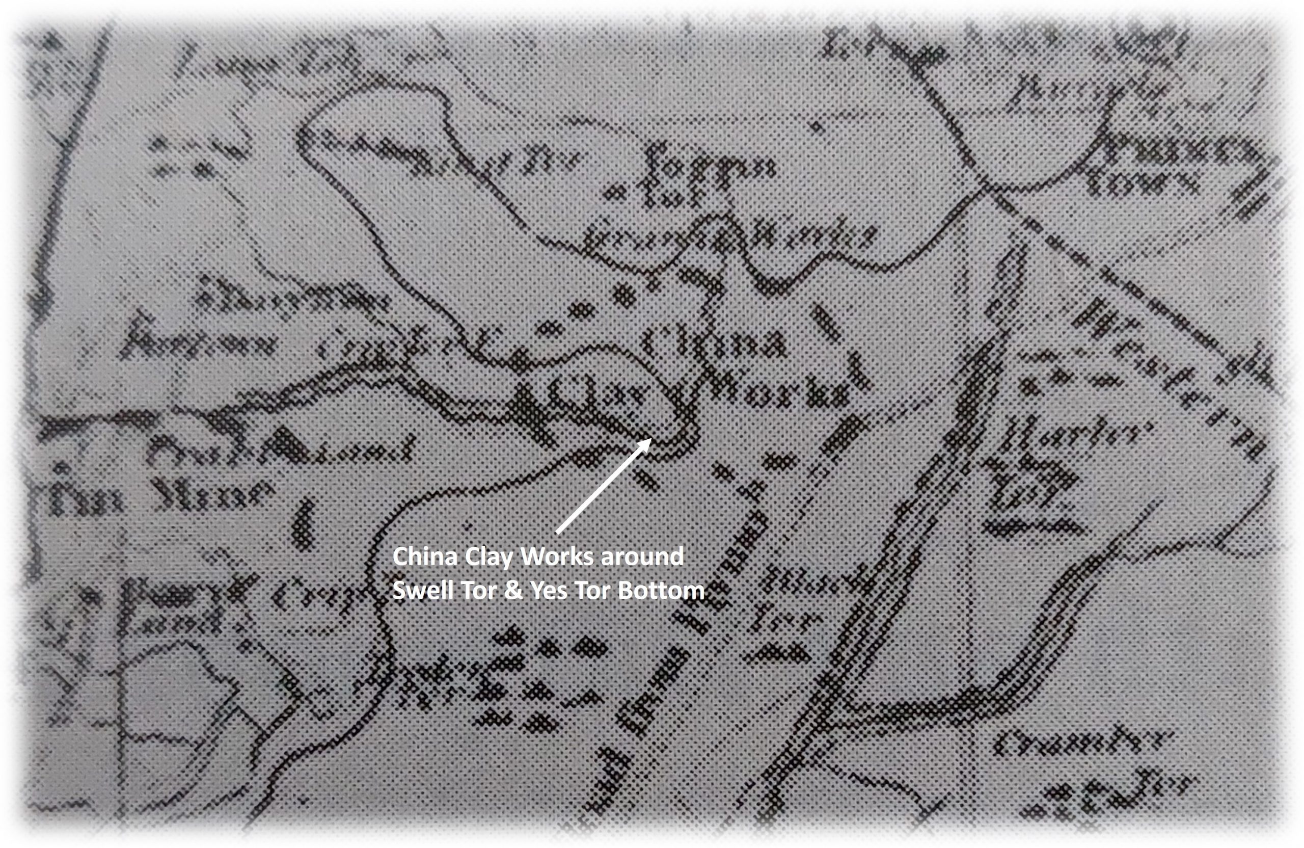
By June 1837, workmen had not been paid, so the venture ground to a halt and the ‘venturers’ had ‘gone to ground’ so to speak. One of the venturers, a Francis Botterall, wrote to Sir Ralph Lopes in November 1837, begging that the men of the ‘Walkhampton Clay Works’ be withdrawn for the winter. It was agreed that work would cease but would restart on 15th March 1838. Before the restart, Botterall was summonsed to the magistrates for unpaid wages of £14 9s 6d (over £2000 in 2023 terms) for five of the workmen. By 14th May 1838, work hadn’t recommenced and Botterall was sent a notice to quit letter with a copy being also sent to George Stone Baron. On 26th August 1839, a further letter was sent to George Stone Baron requested the surrender of the lease, which was agreed in the October. After a little more correspondence, unsurprisingly, the lease was surrendered on 1st January 1840. The china clay works as small as they may have been, appear to have been concentrated around Swell Tor and Yes Tor Bottom (as they are marked on William Wood’s map from around that period).
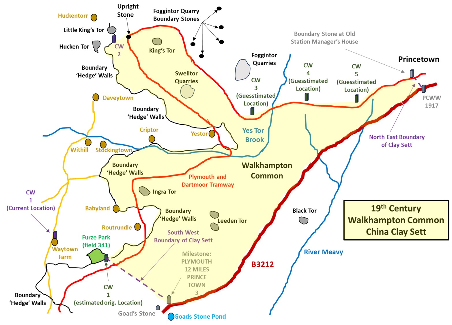
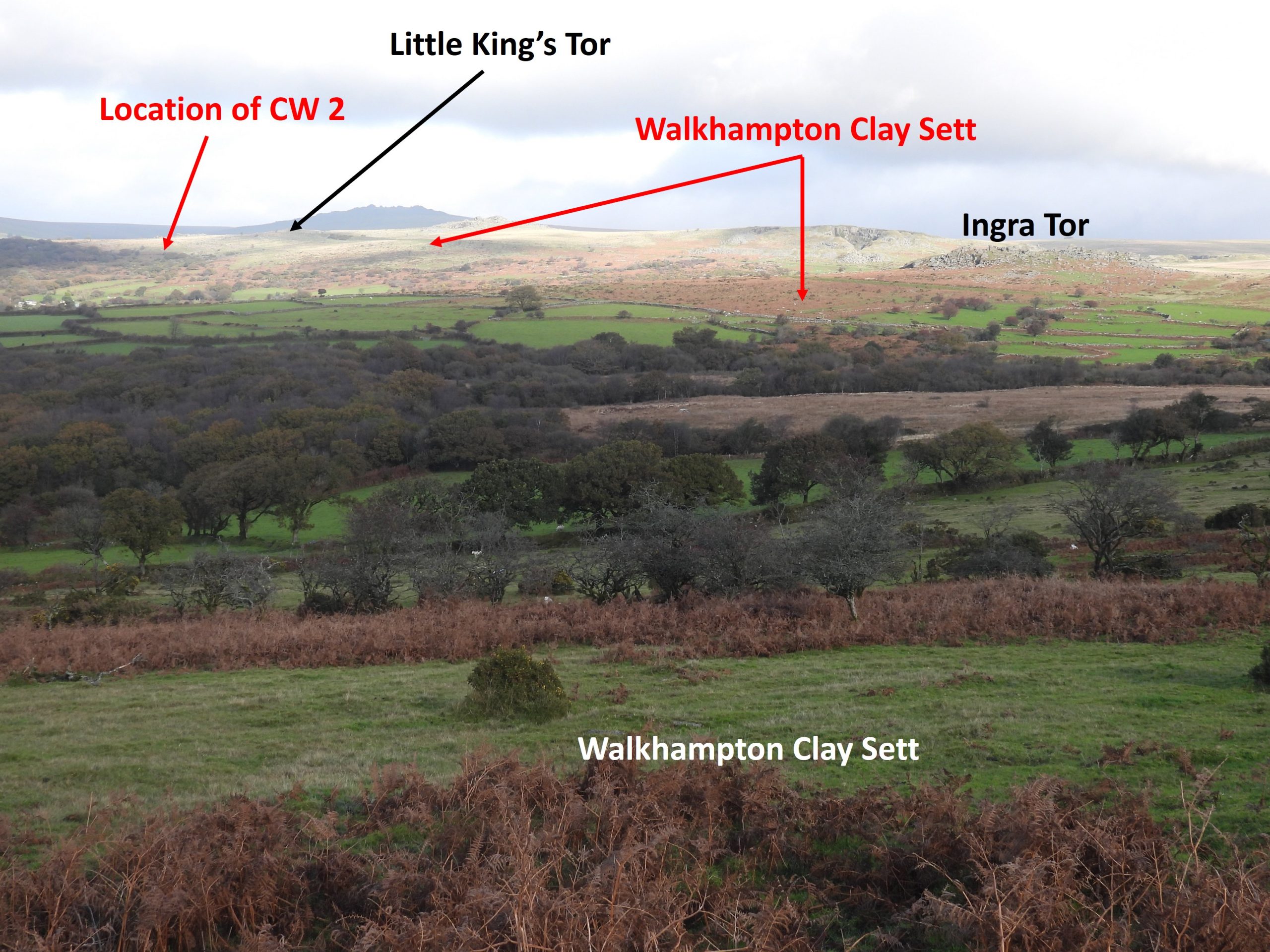
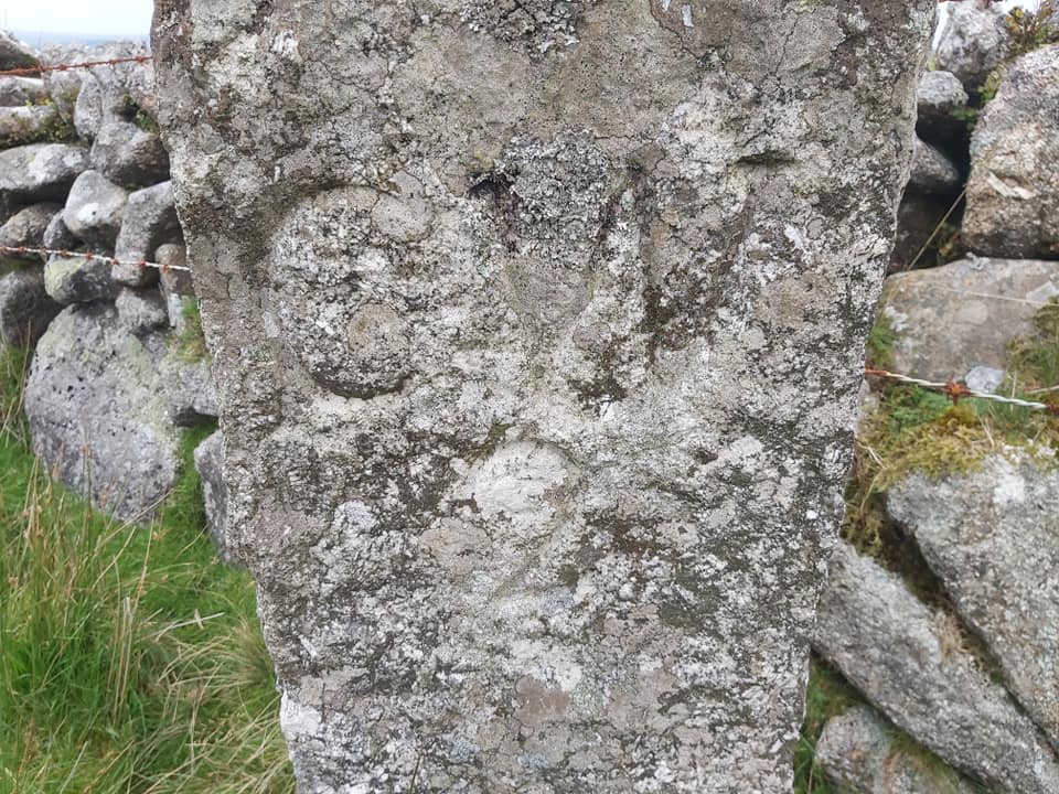
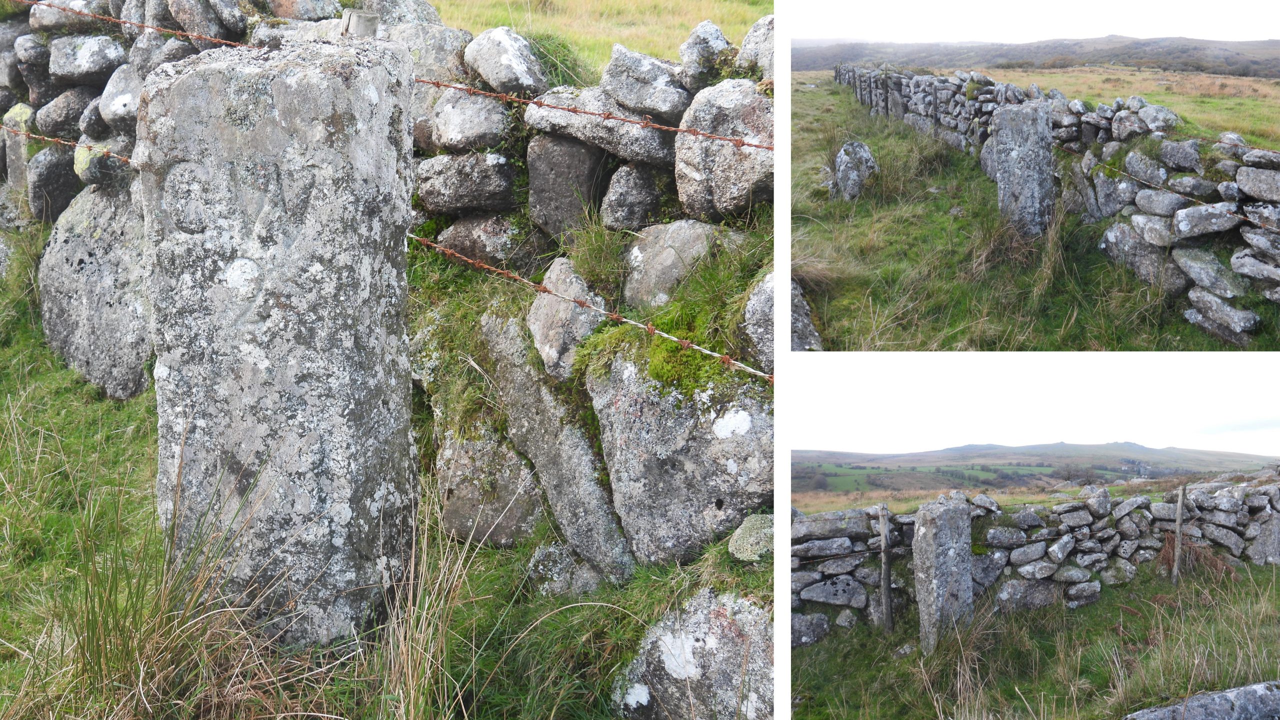
The overall bounds of the 1835 leased sett were quite extensive and comprised (approx.) the road between Goads Stone Pond and Princetown, the Plymouth and Dartmoor Tramway (1823-6) and the field boundaries of various farmsteads on the east side of the Walkham Valley. The bounds were described as follows: “From Little Kings Tor along Plymouth and Dartmoor Railroad on south side thereof to a certain bound stone on said railroad near Princetown which bound stone is inscribed with ‘W’ on one side and ‘D’ on the reverse side thereof and from the said bound on to another bound stone similarly inscribed at or near the high road until a post is reached denoting 12 miles from Plymouth and from the said milestone on a direct line to another bound stone inscribed ‘CW1’ near a hedge of a certain field called Furzepark part of a farm called Waytown, and from thence by the outside of boundary hedges of Waytown, Routrundle, Babyland, Stockington, Withill,Criptor, Yestor, Daveytown and Huckentorr to another boundstone inscribed ‘CW/2’ on the western side of Little Kings Tore aforesaid and thence to Little Kings Tor where the said bounds began”. The inscription ‘CW’ is likely to mean ‘Clay Works’ albeit some observers over the years have suggested it may stand for ‘Criptor Waste’.
A further note relating to the sett states: “……about midway between Little Kings Tor aforesaid and the first mentioned bound stone situated and lying on the northern side of the said railway and (compulged) within the limits distinguished by three bound stones these set up and severally inscribed ‘CW/3’, ‘CW/4’, ‘CW/5’ “.
This post explores the complete boundary of the sett, the extant bound stones and considers the site locations of other bound stones.
China Clay on Walkhampton Common, a Nineteenth Century Search – Dartmoor Magazine (P.Rendell) – Issue 20 (1990)
The Yelverton to Princetown Railway – Anthony Kingdom (1991)
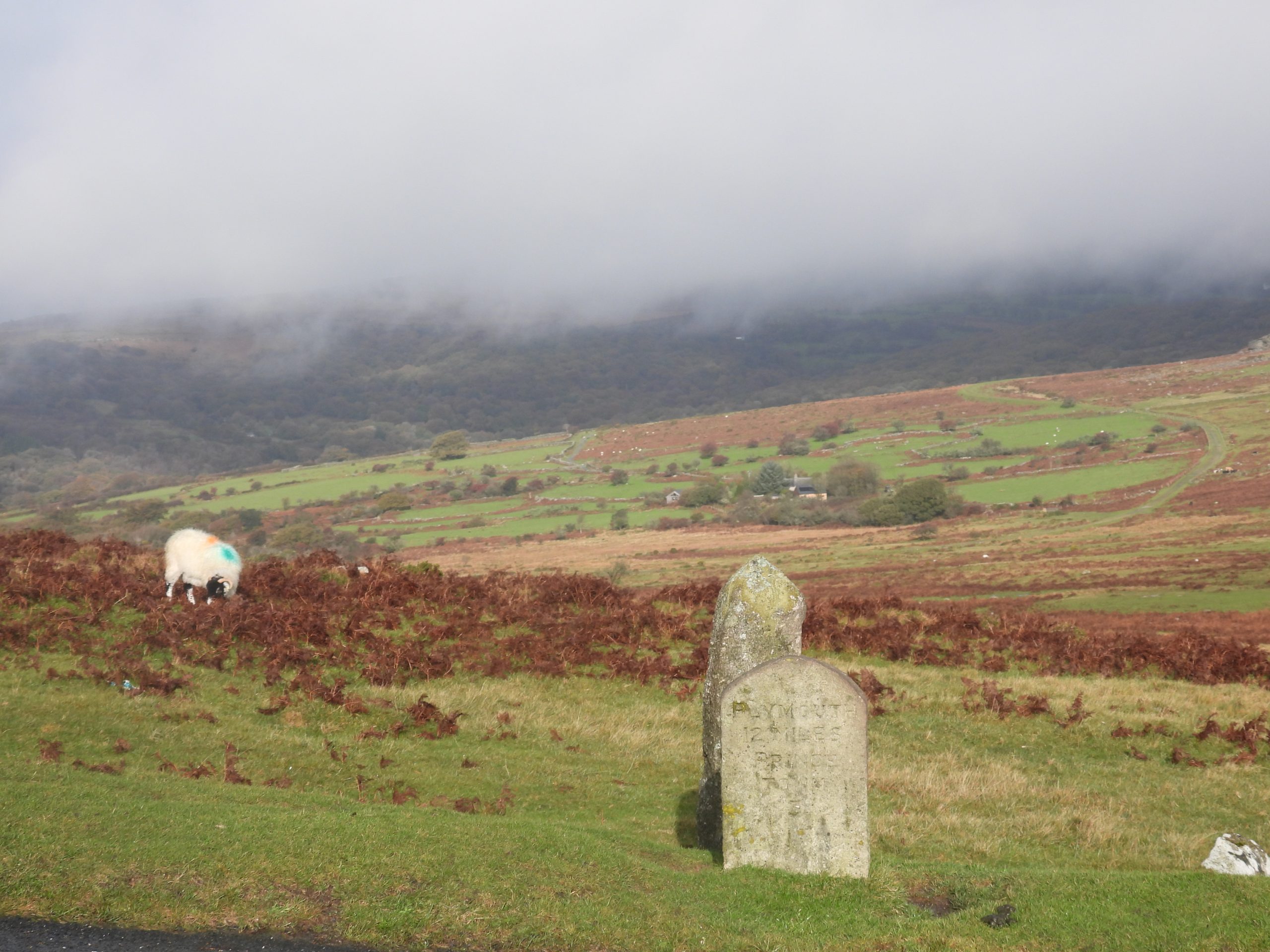
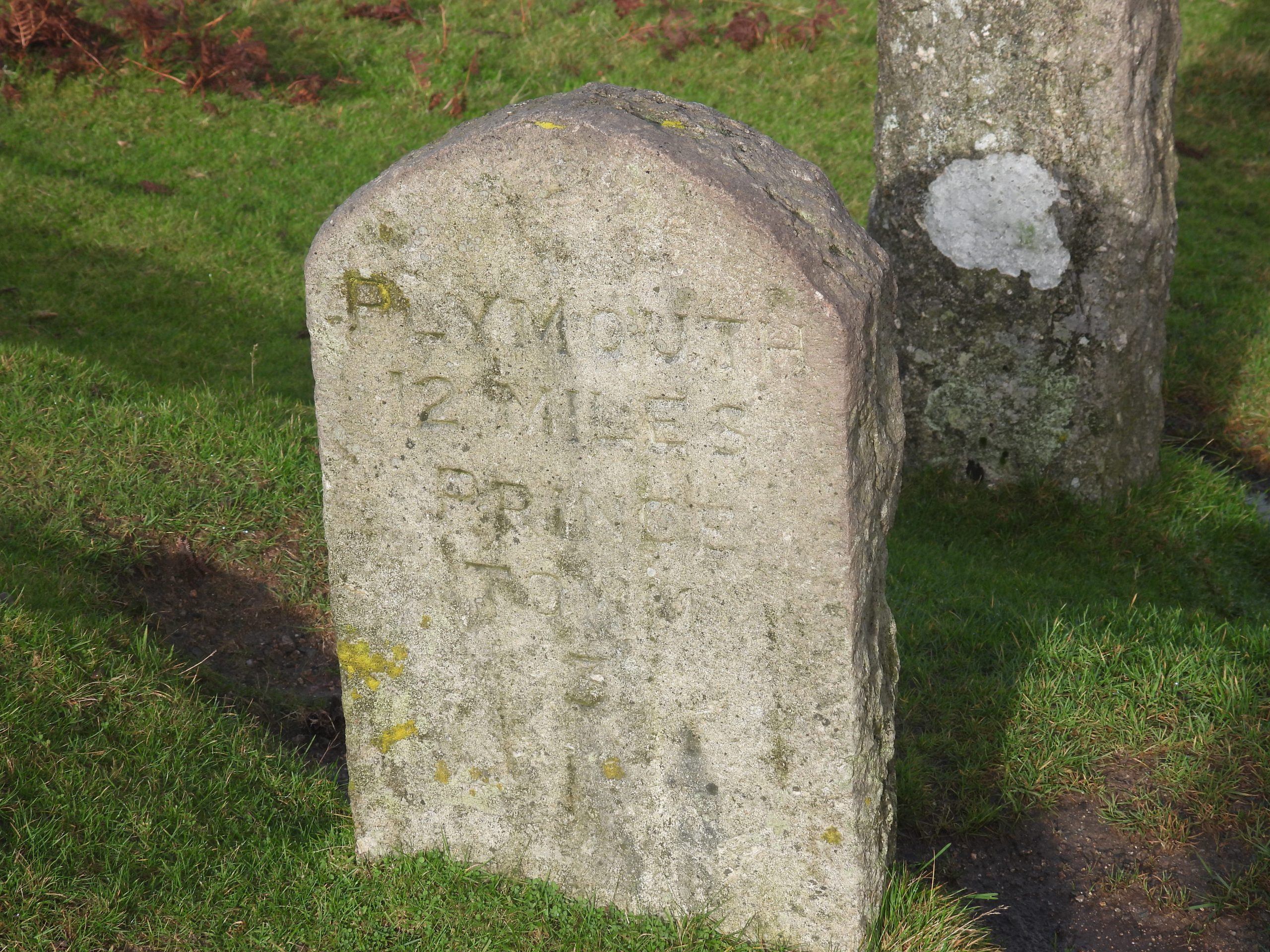
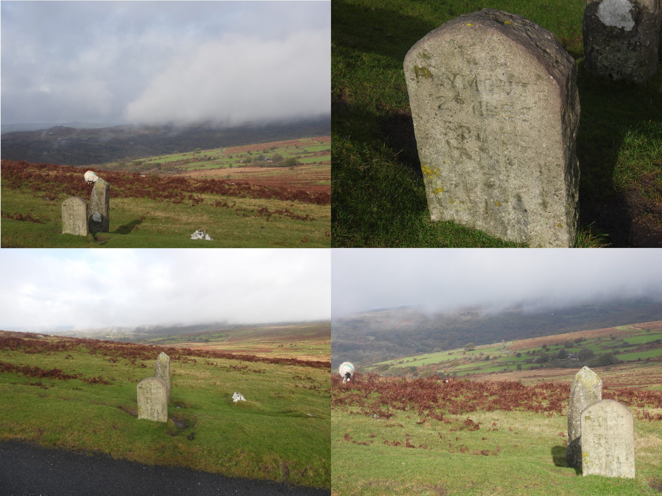
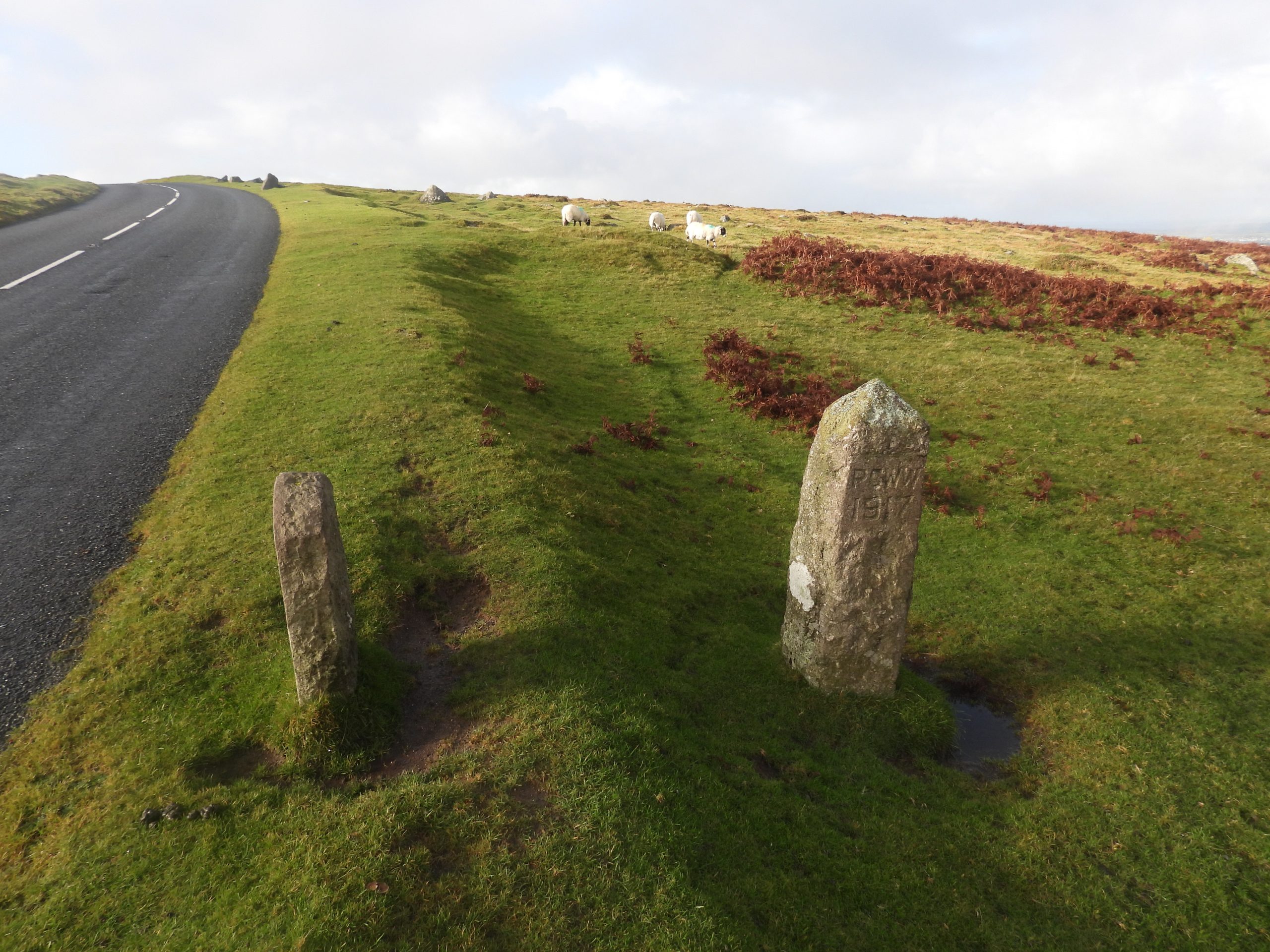
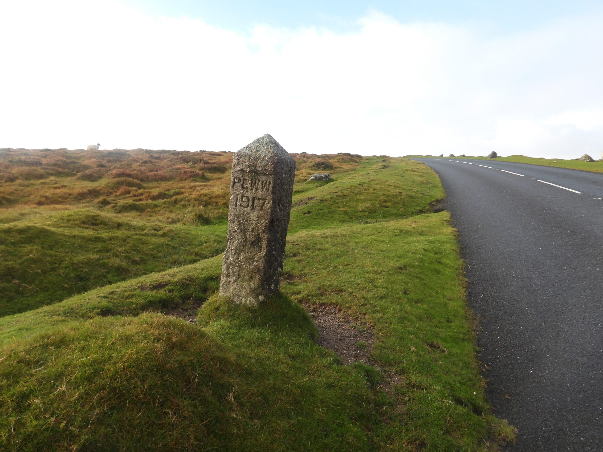
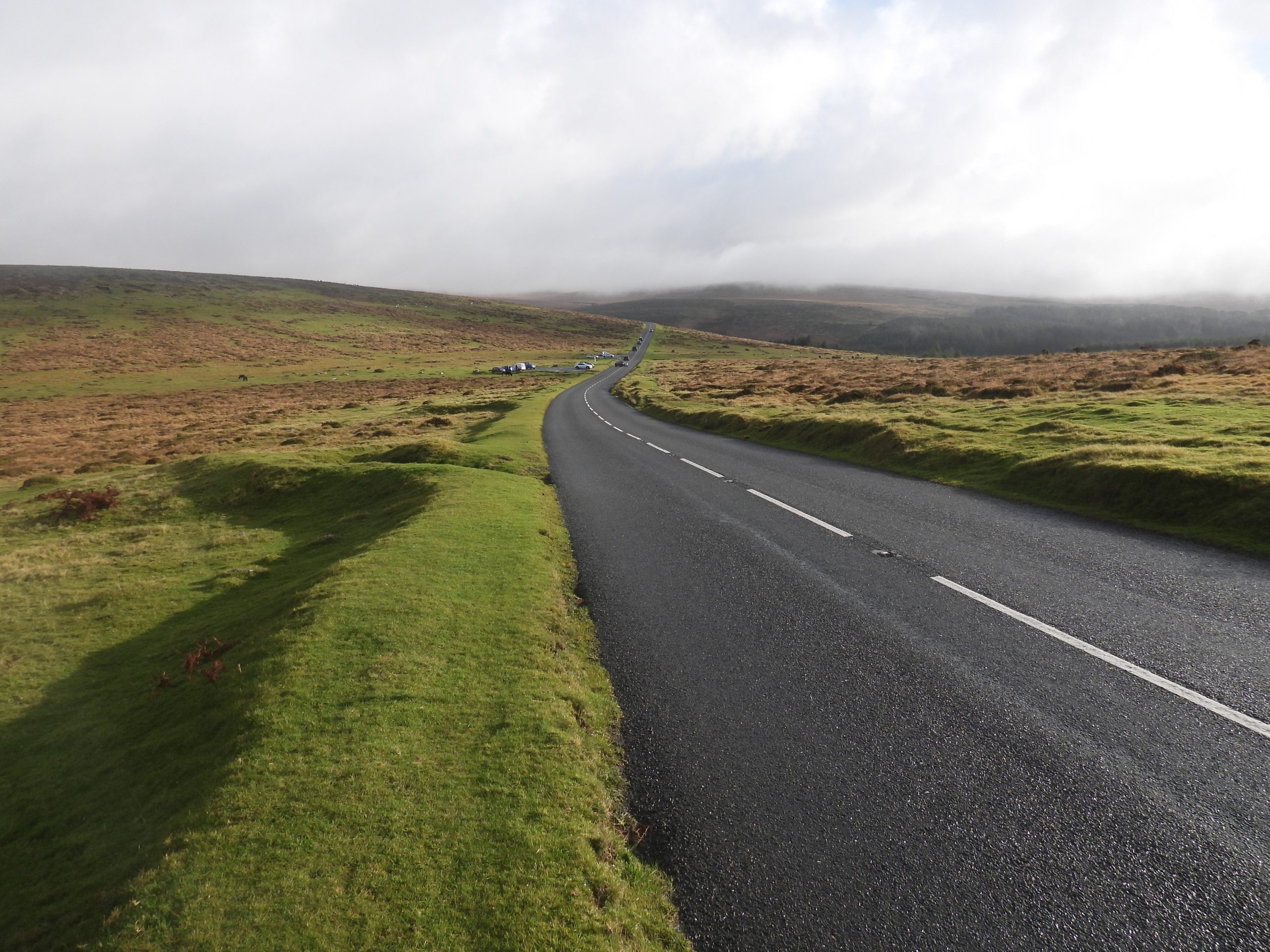
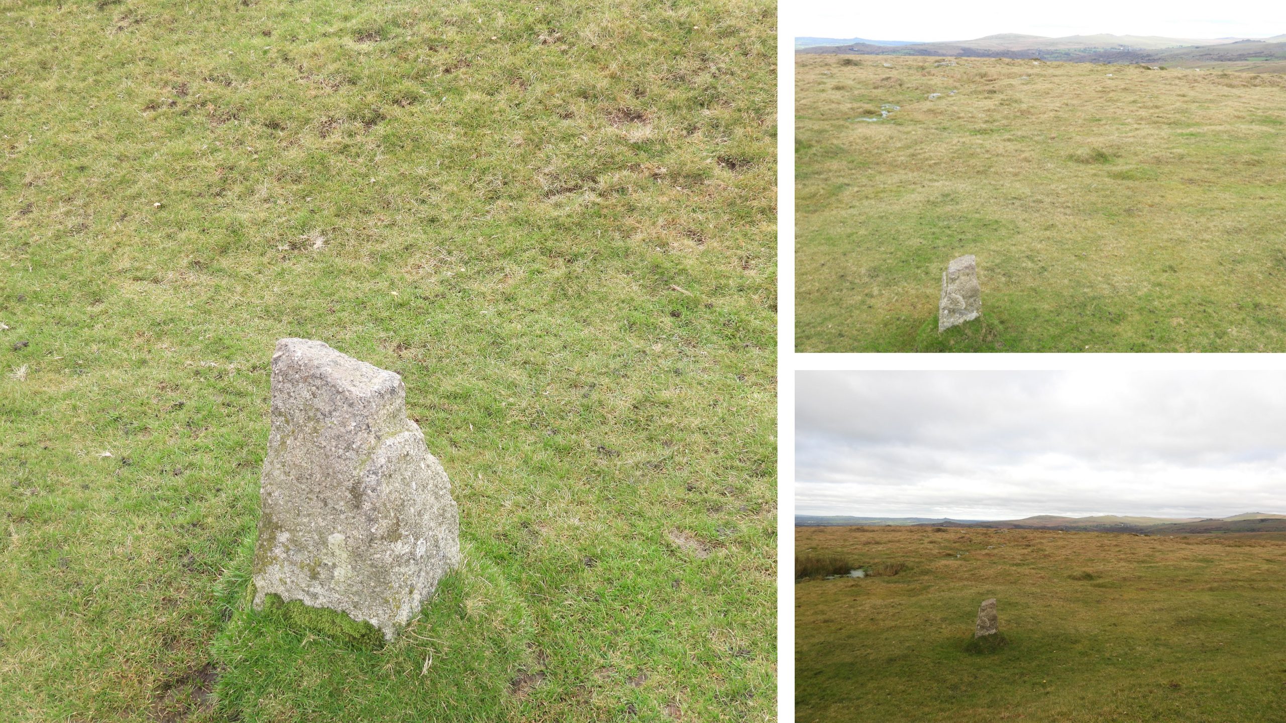
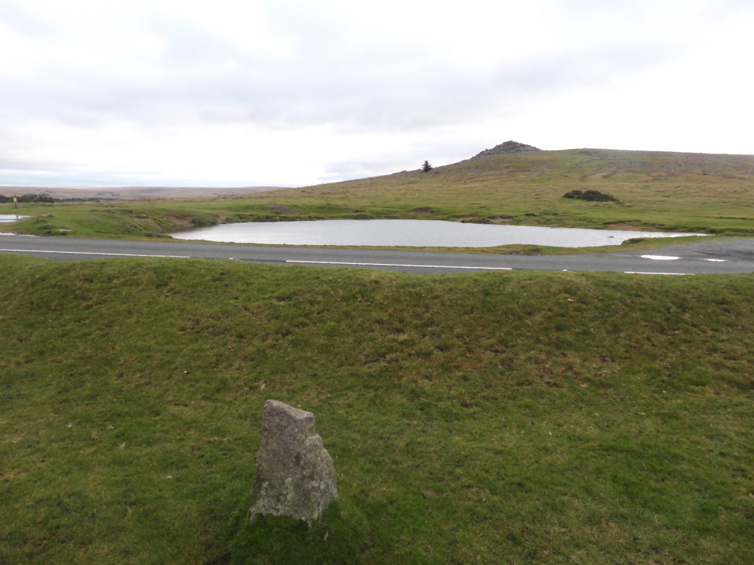
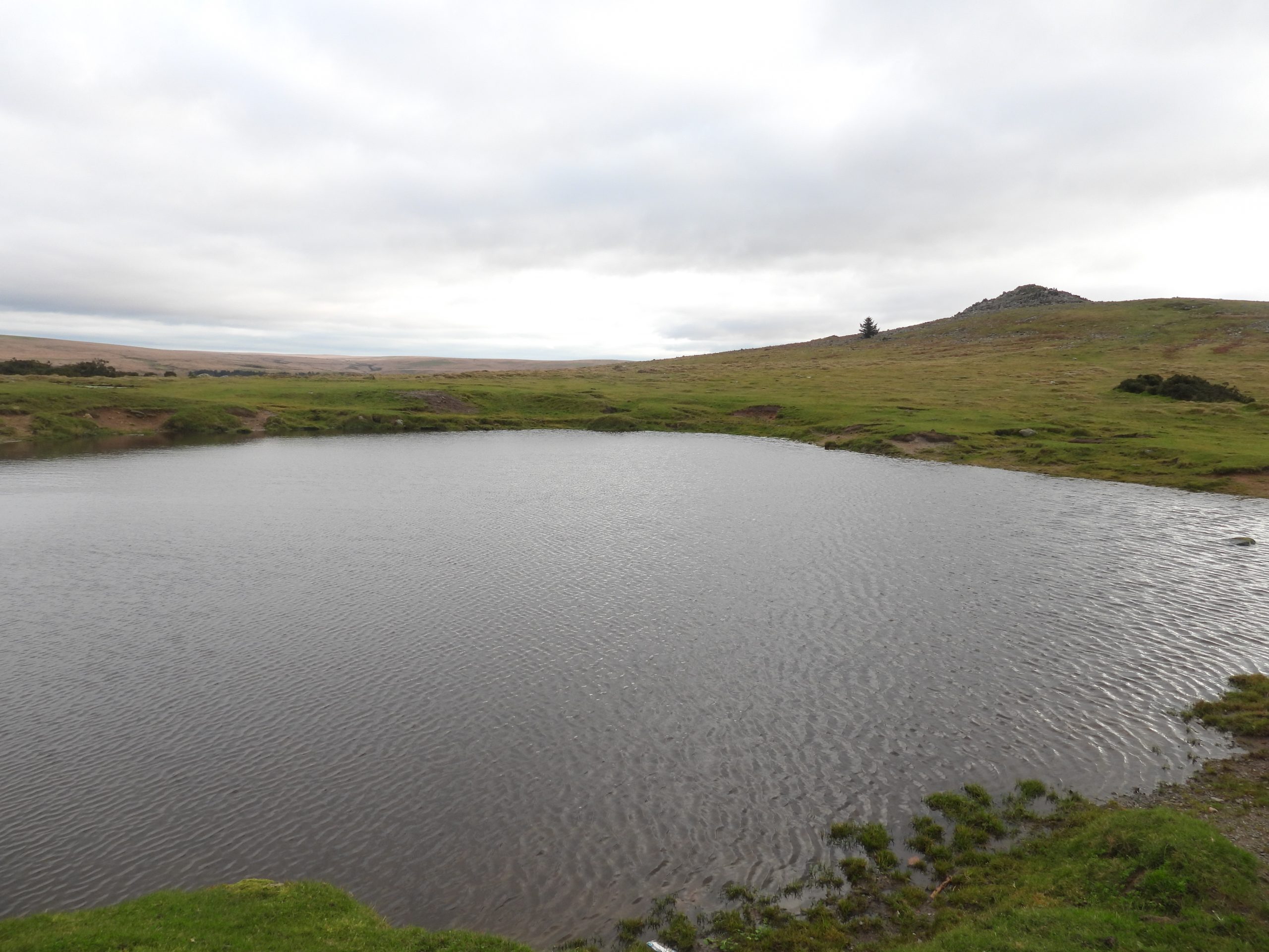
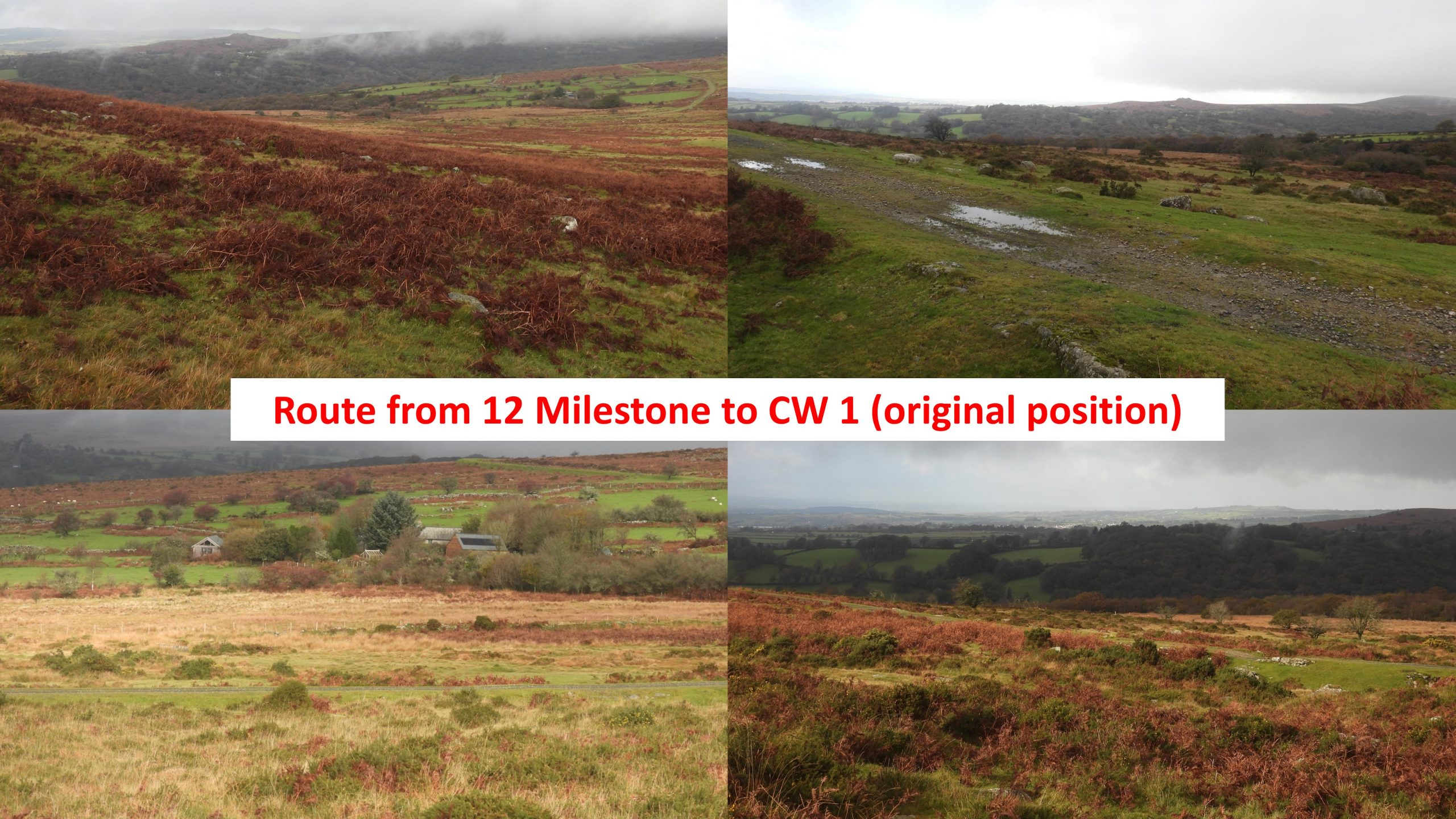
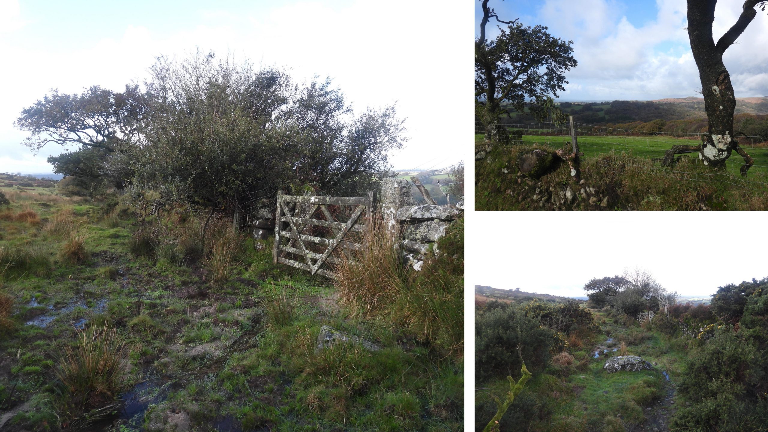
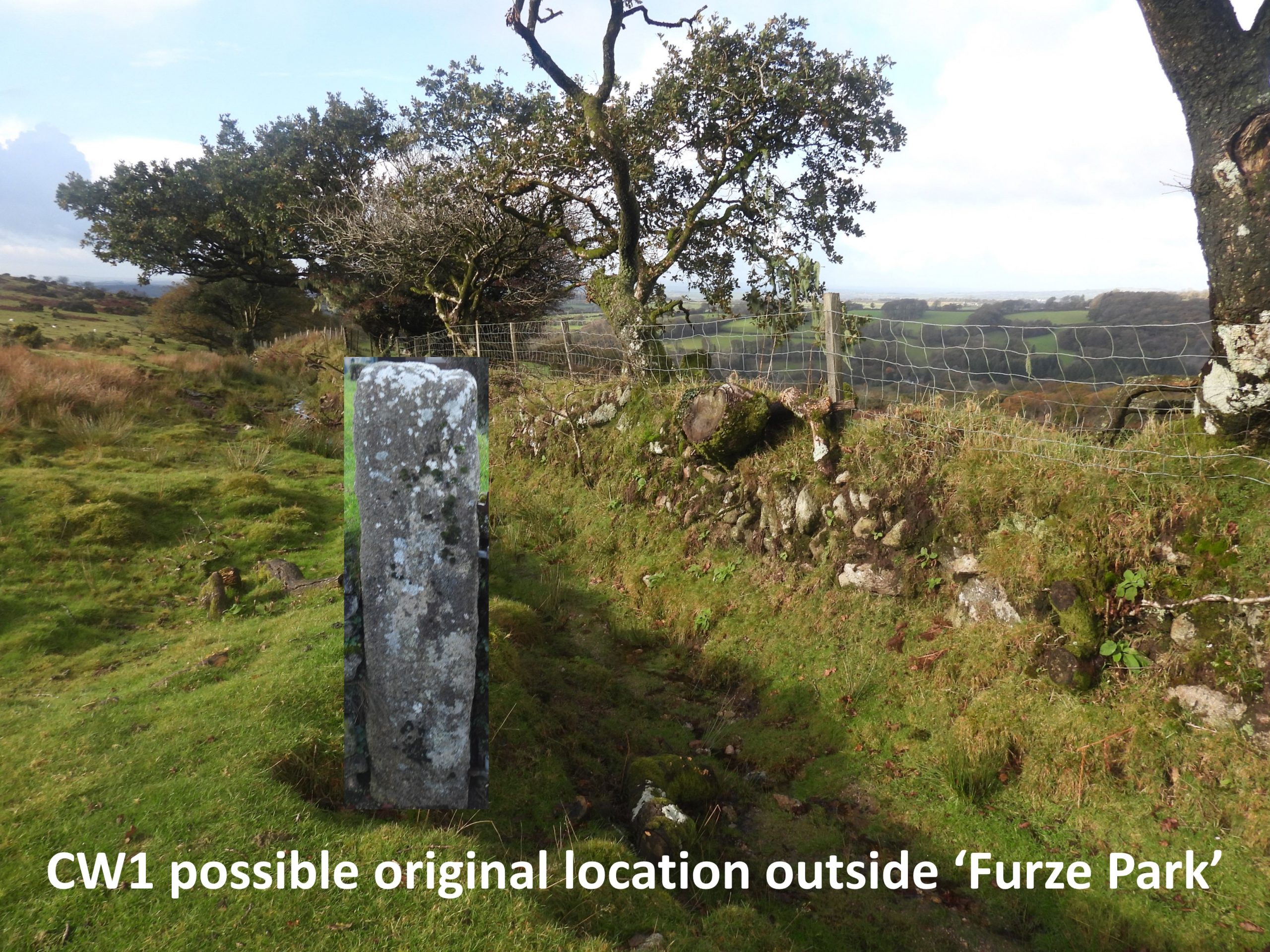
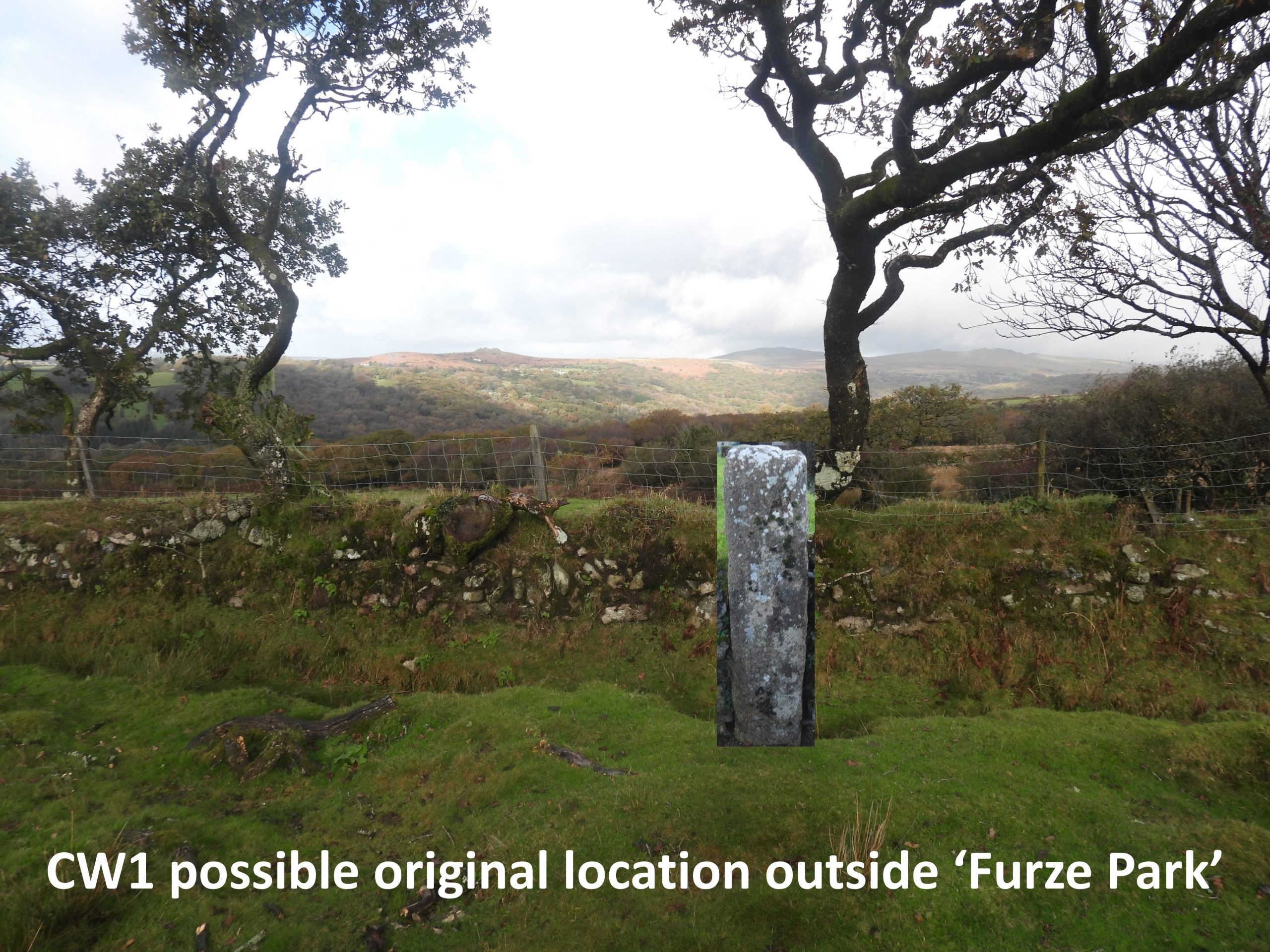
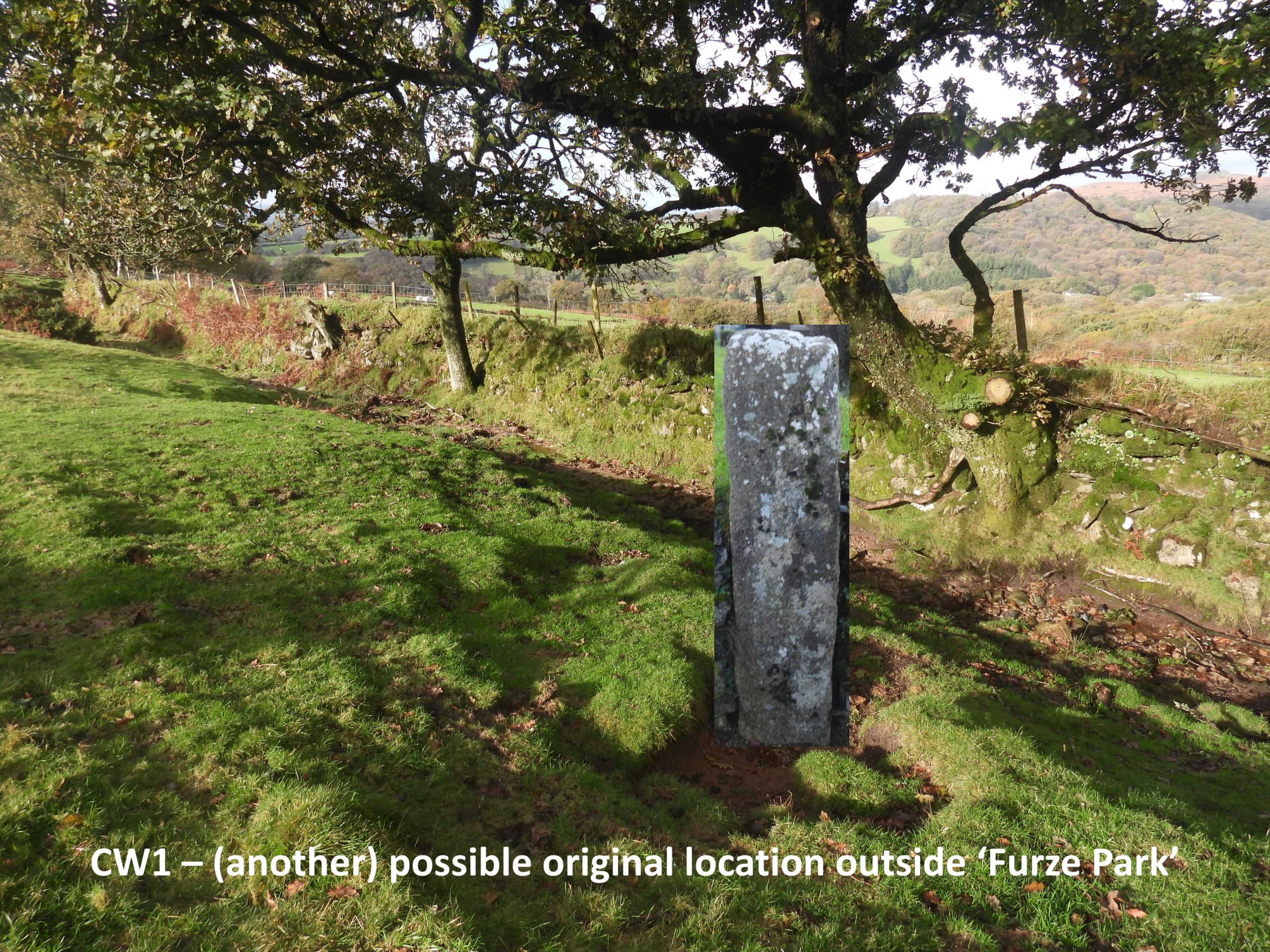
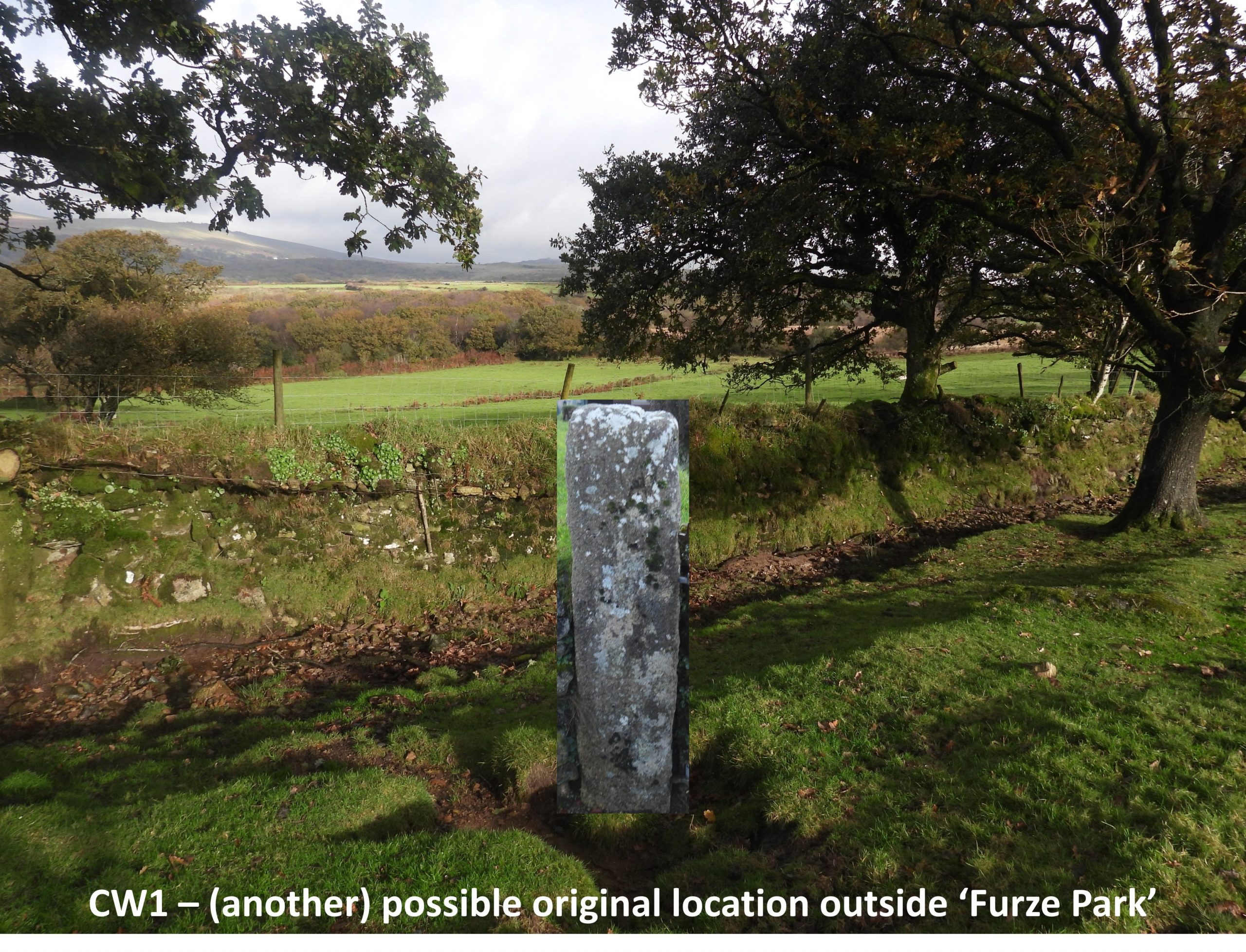
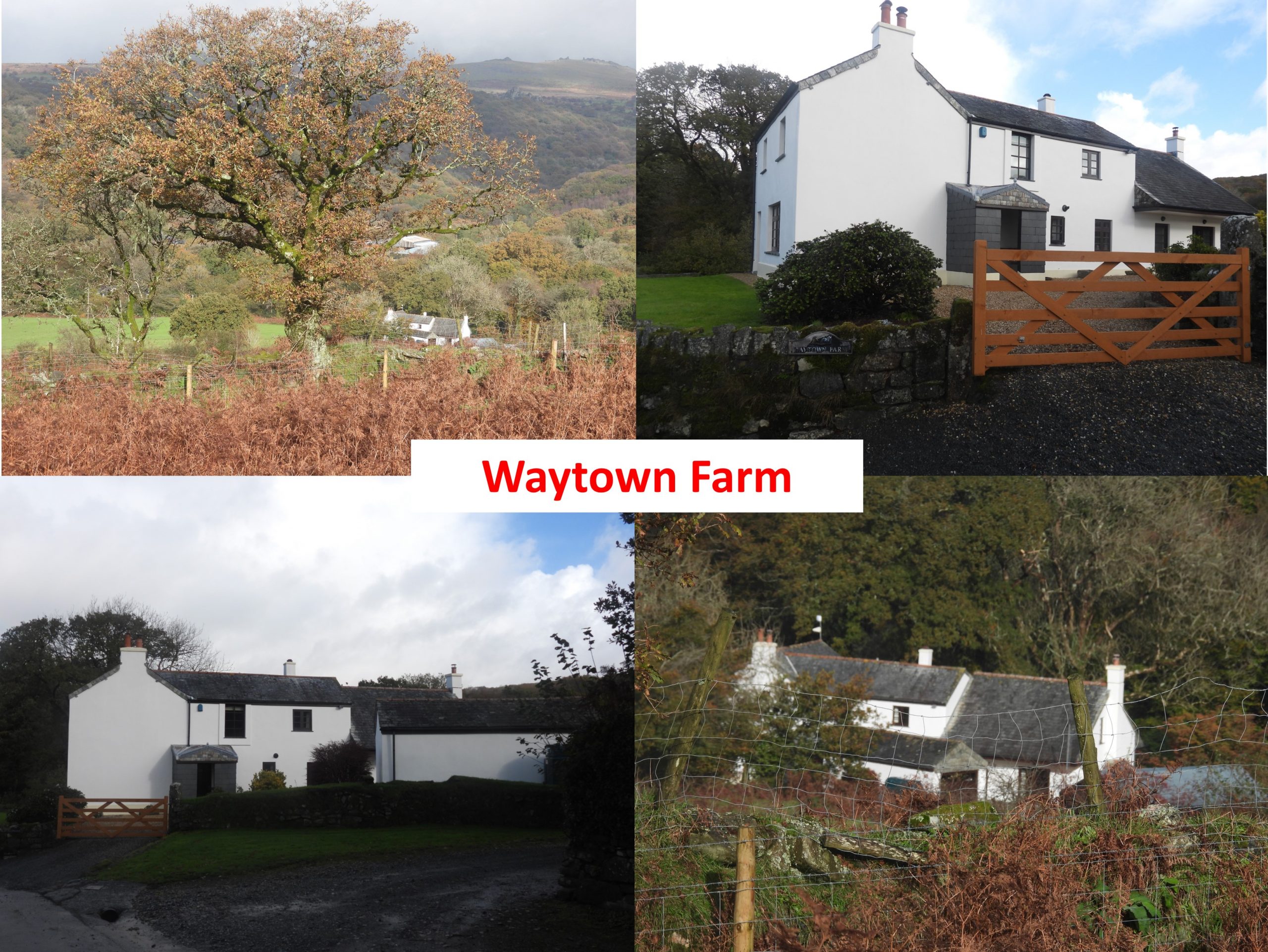
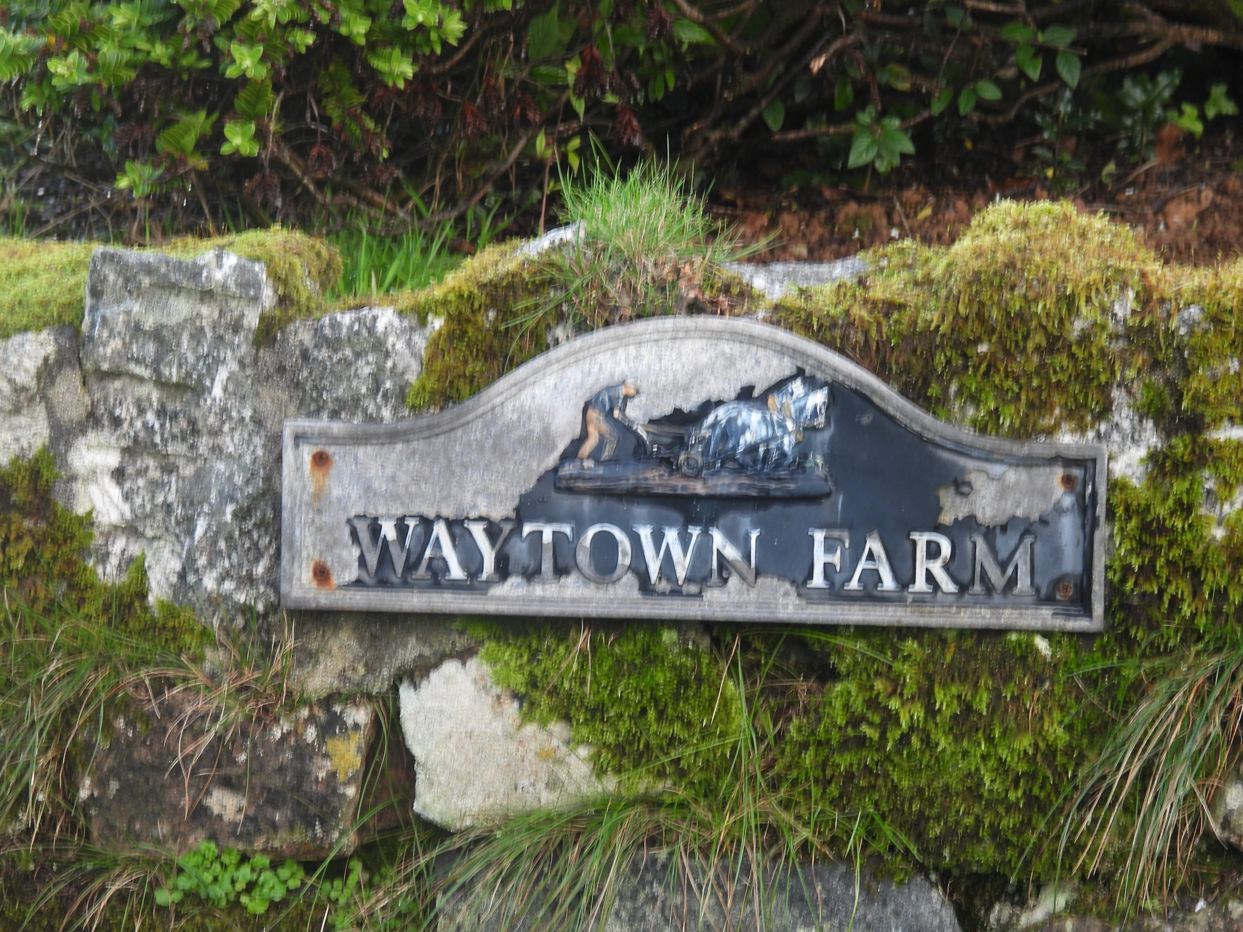
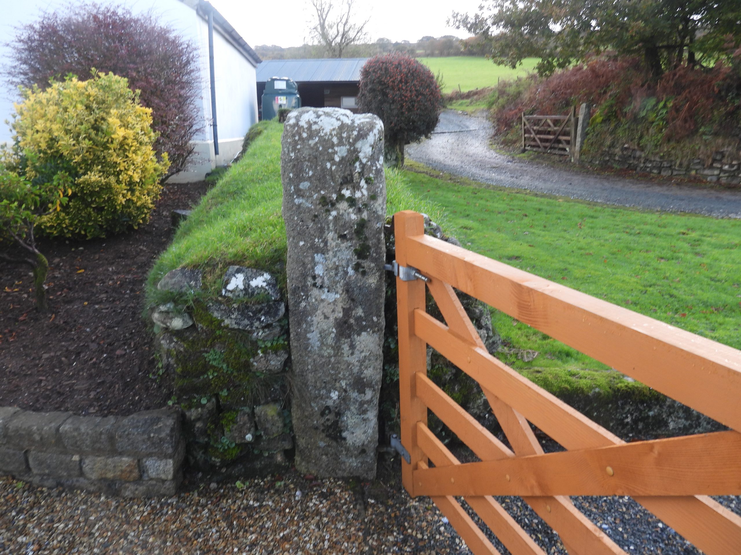
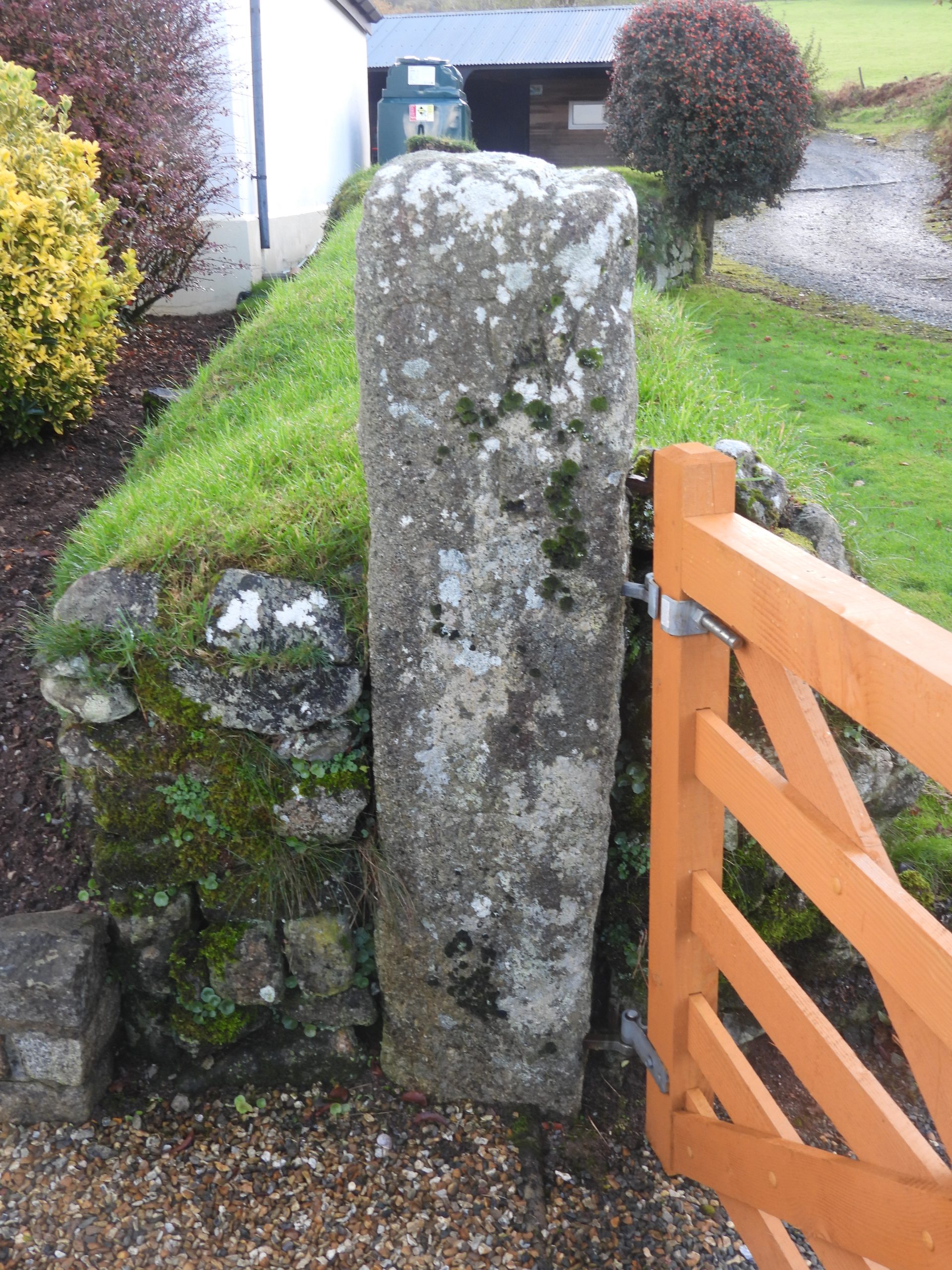
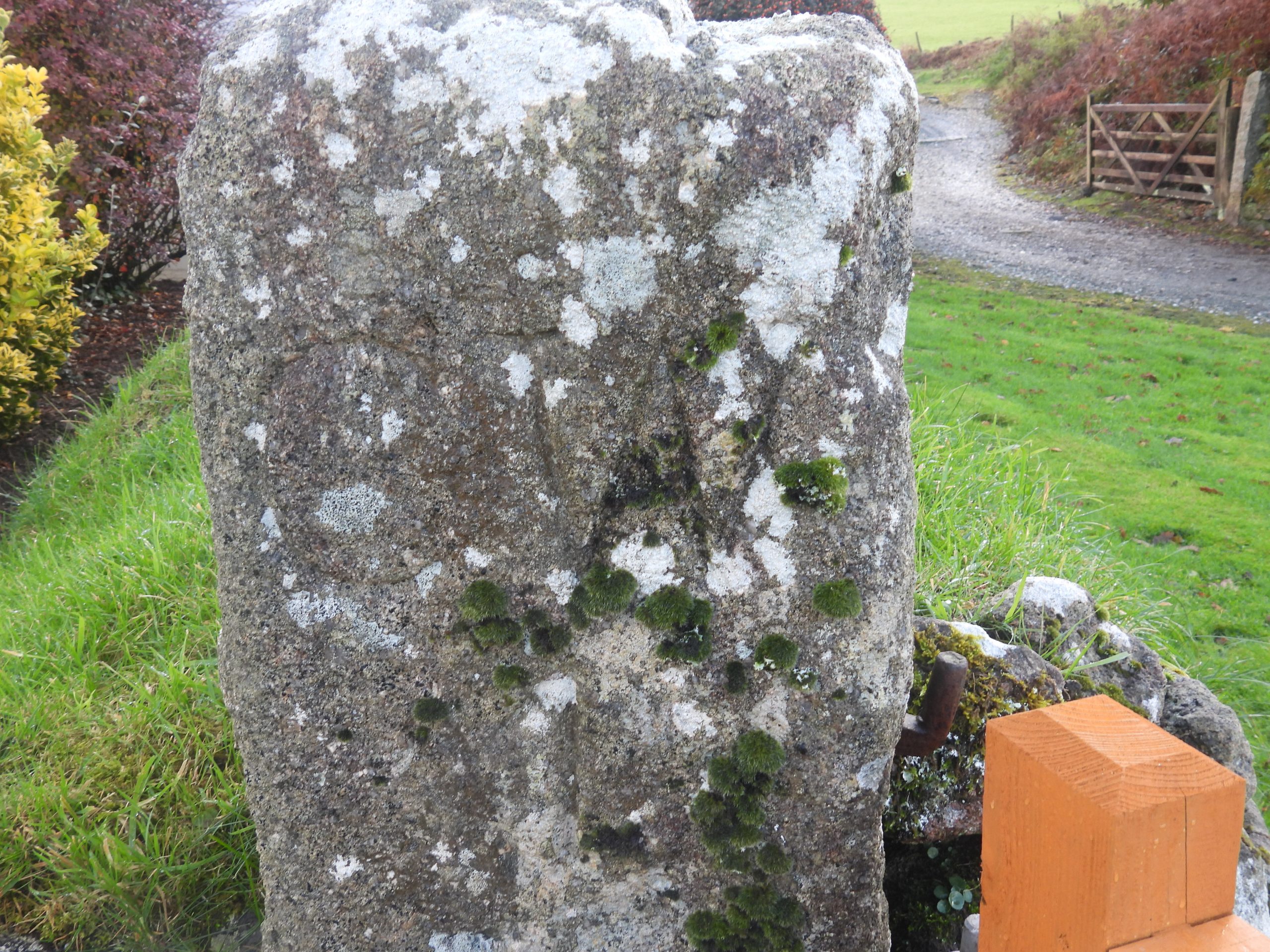
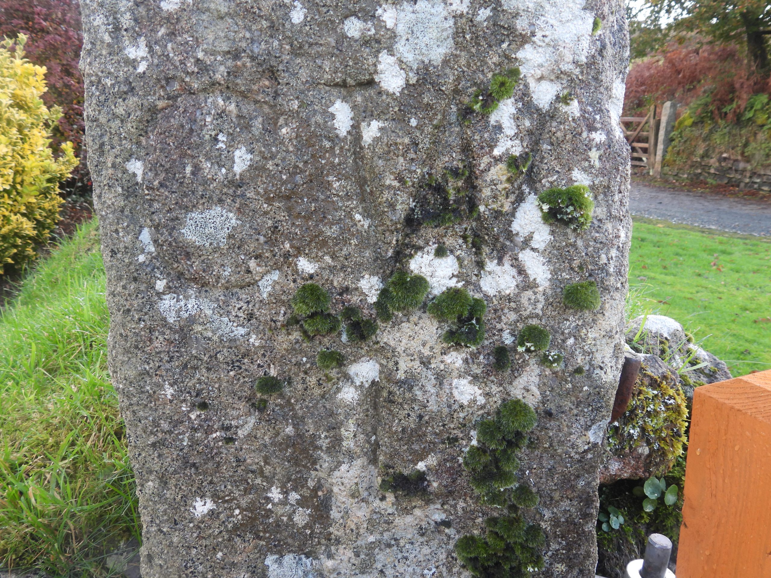
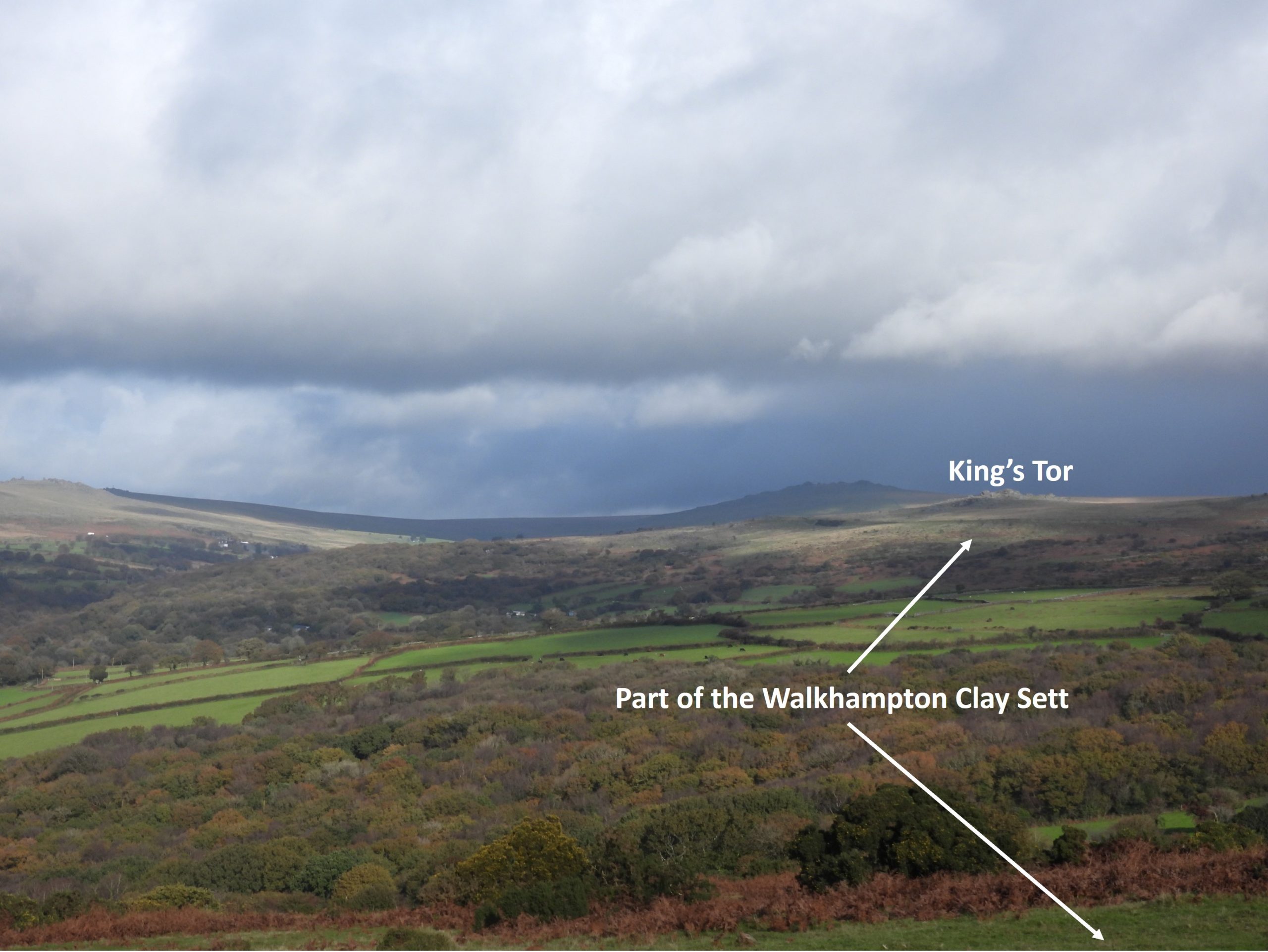
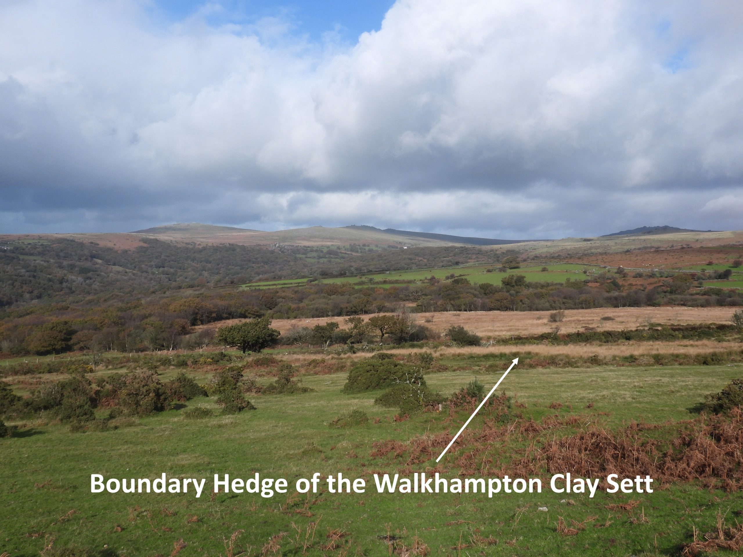
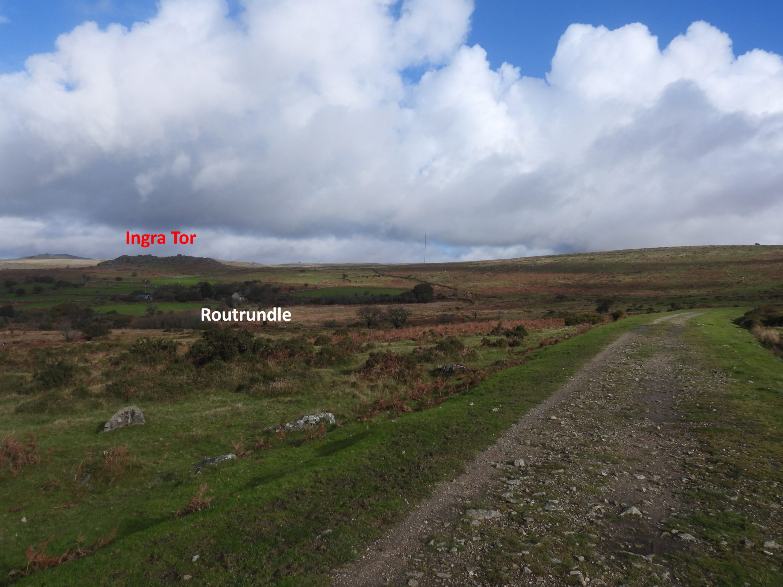
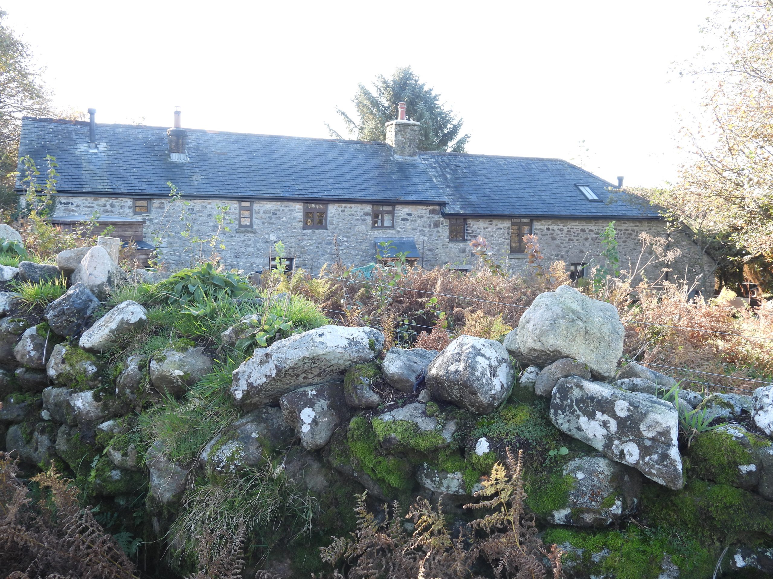
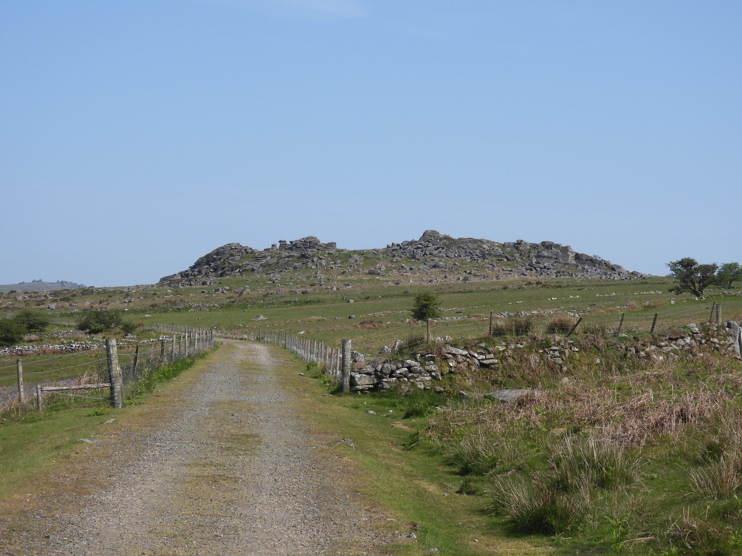
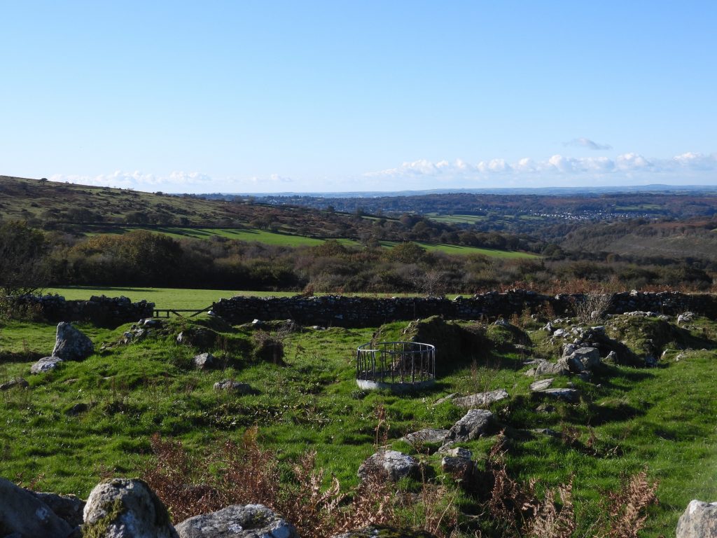
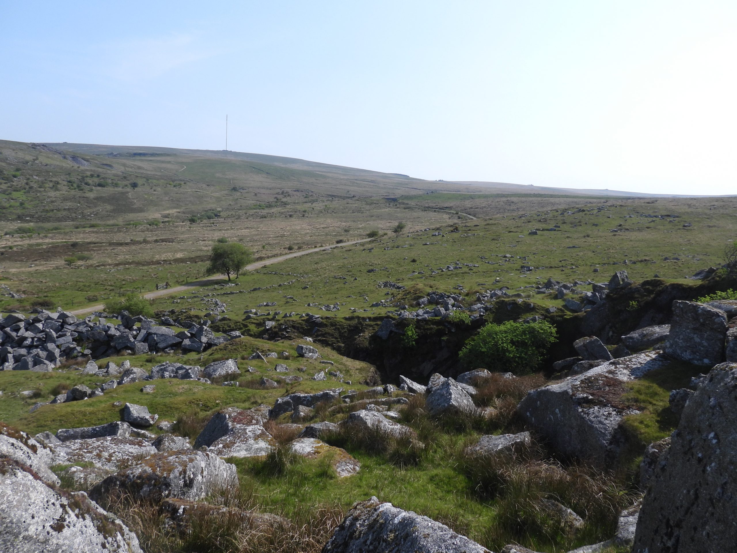
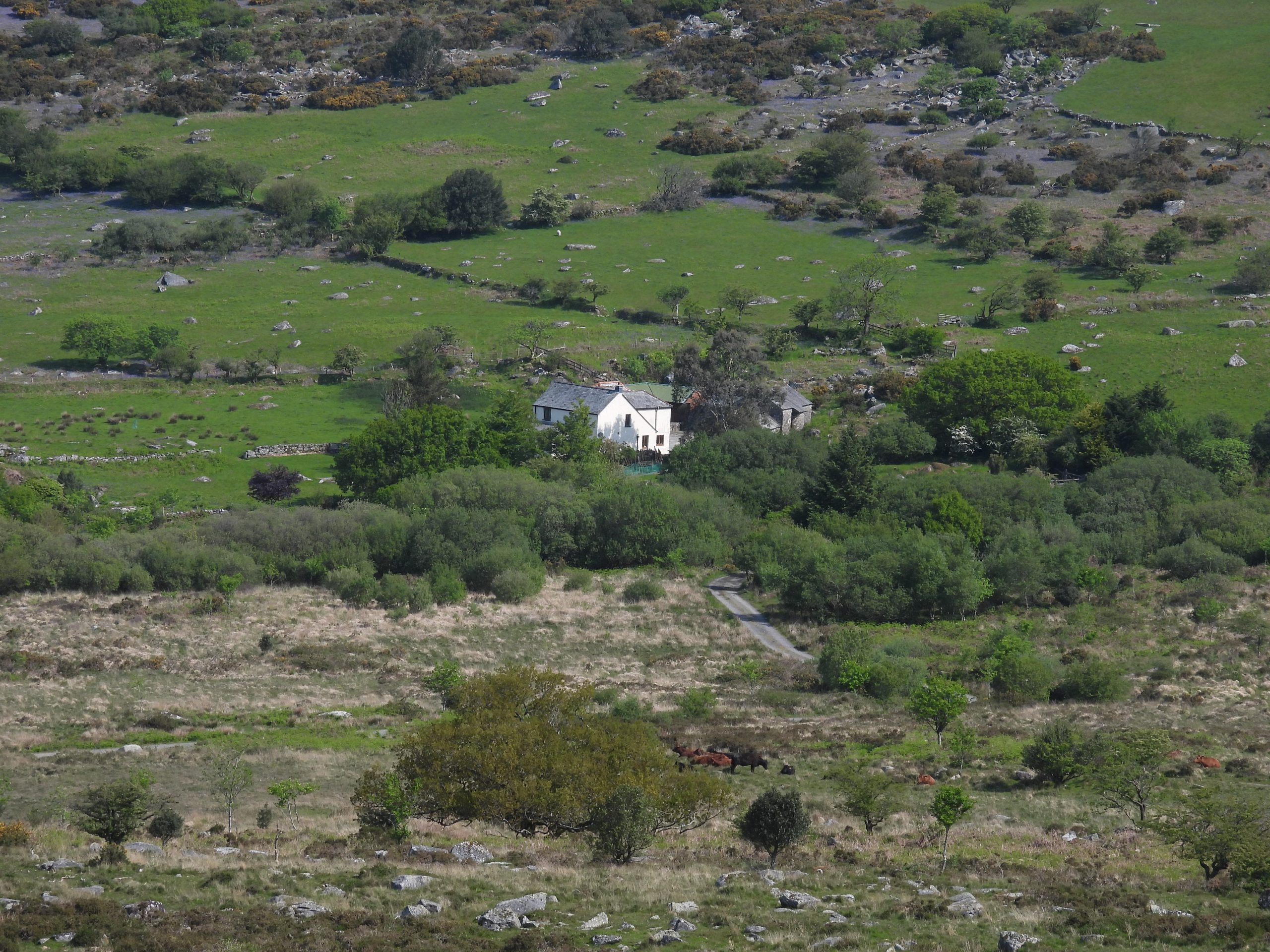
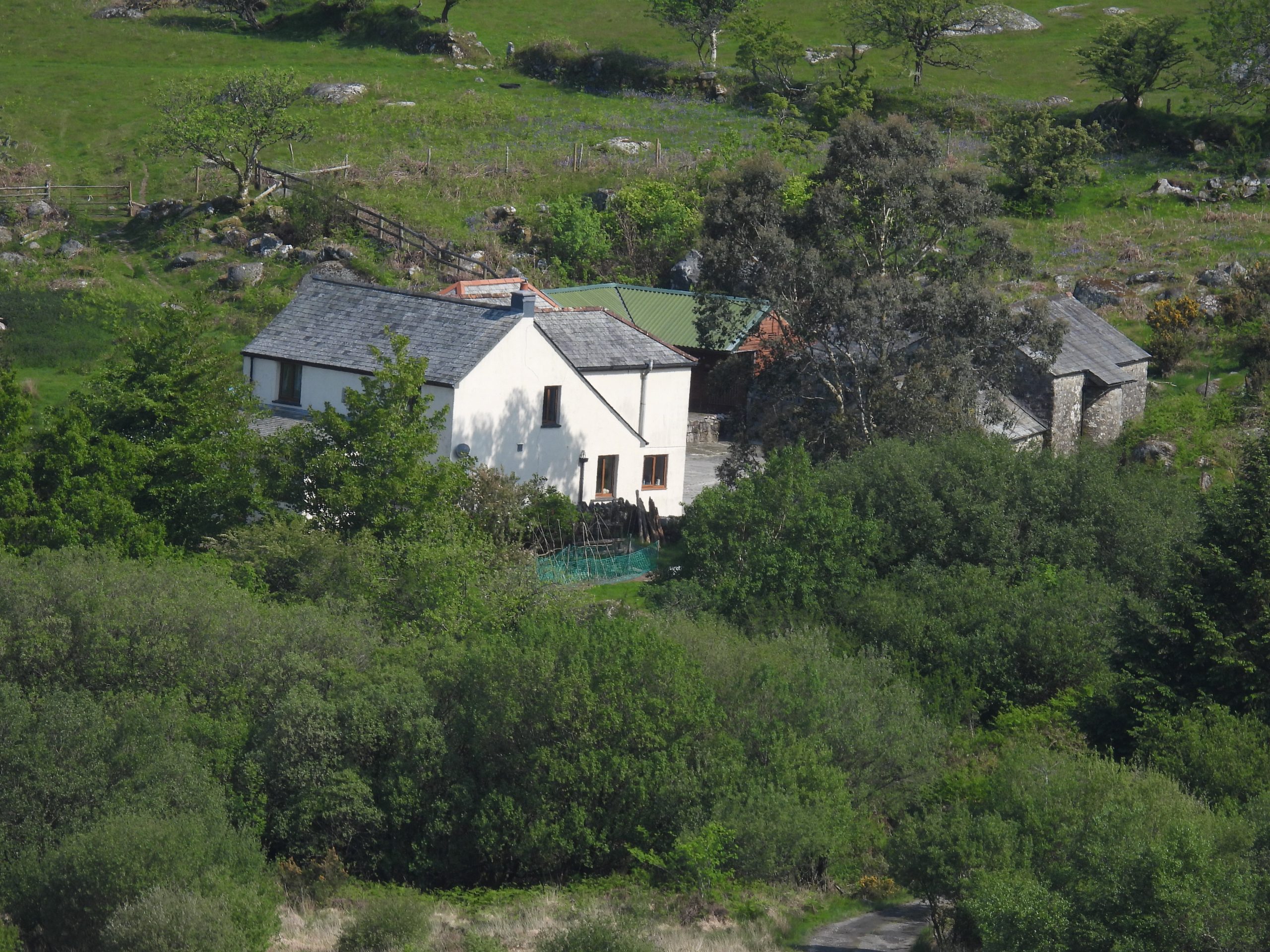
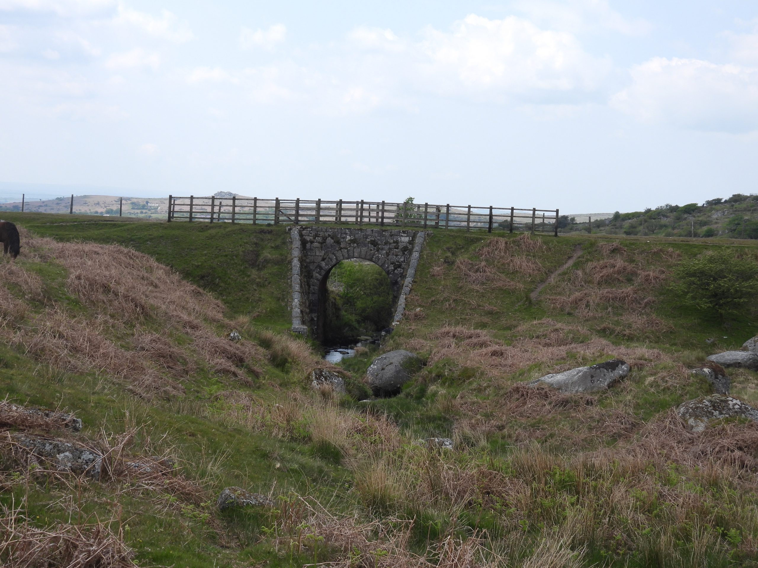
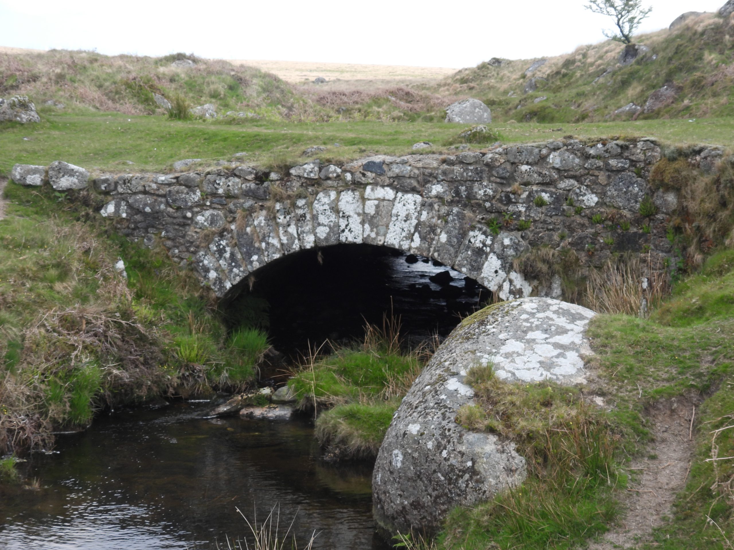
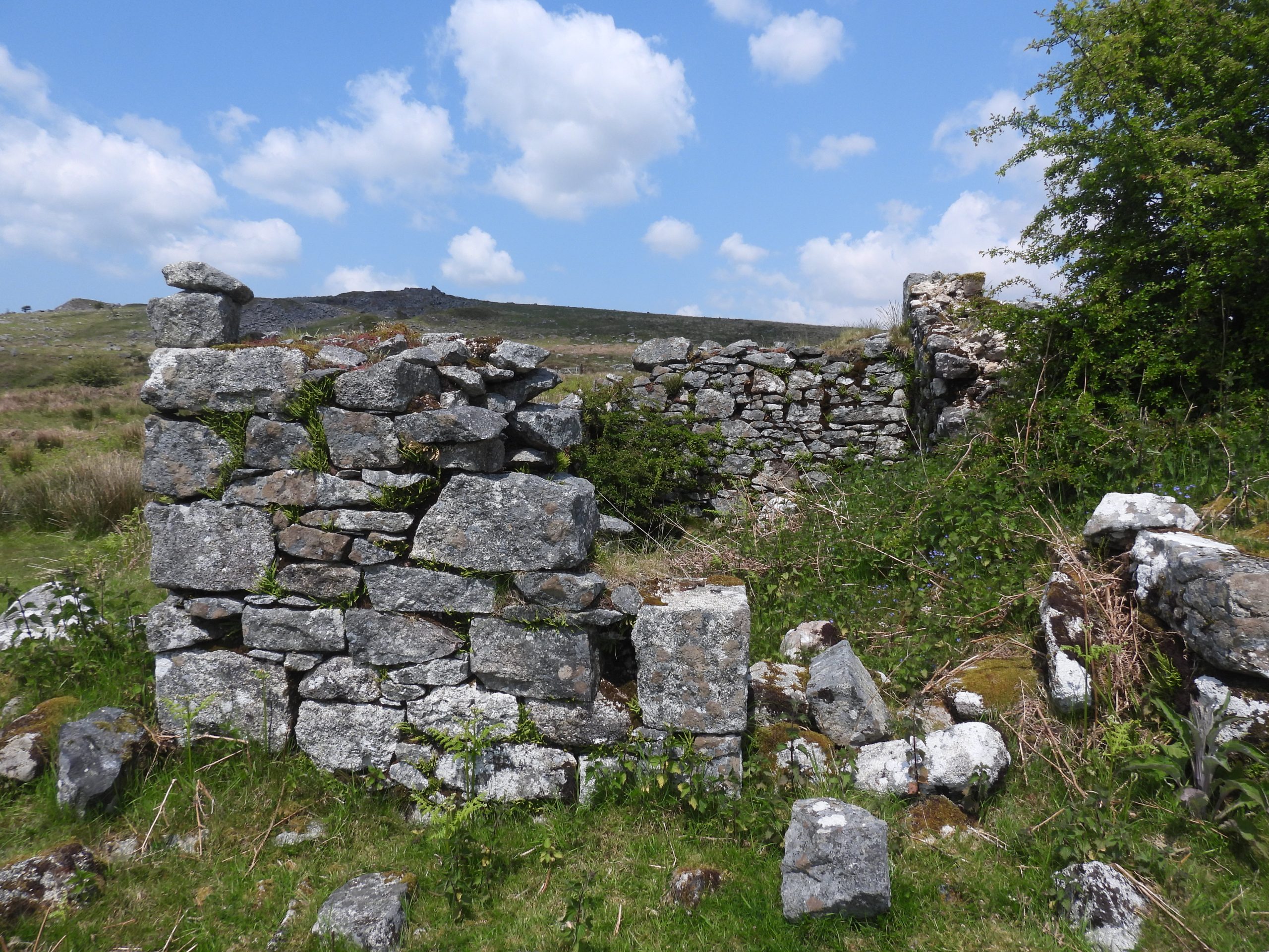
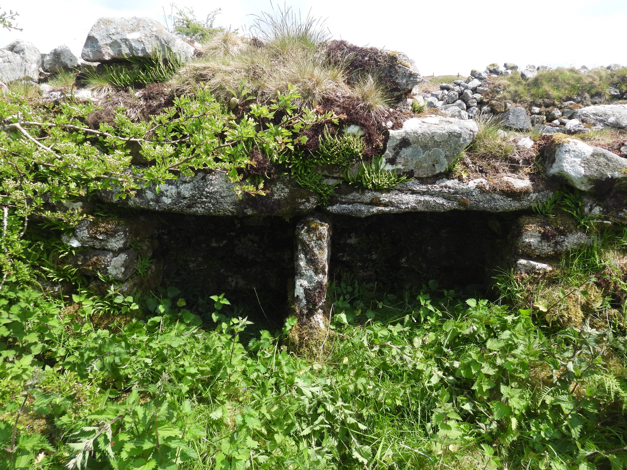
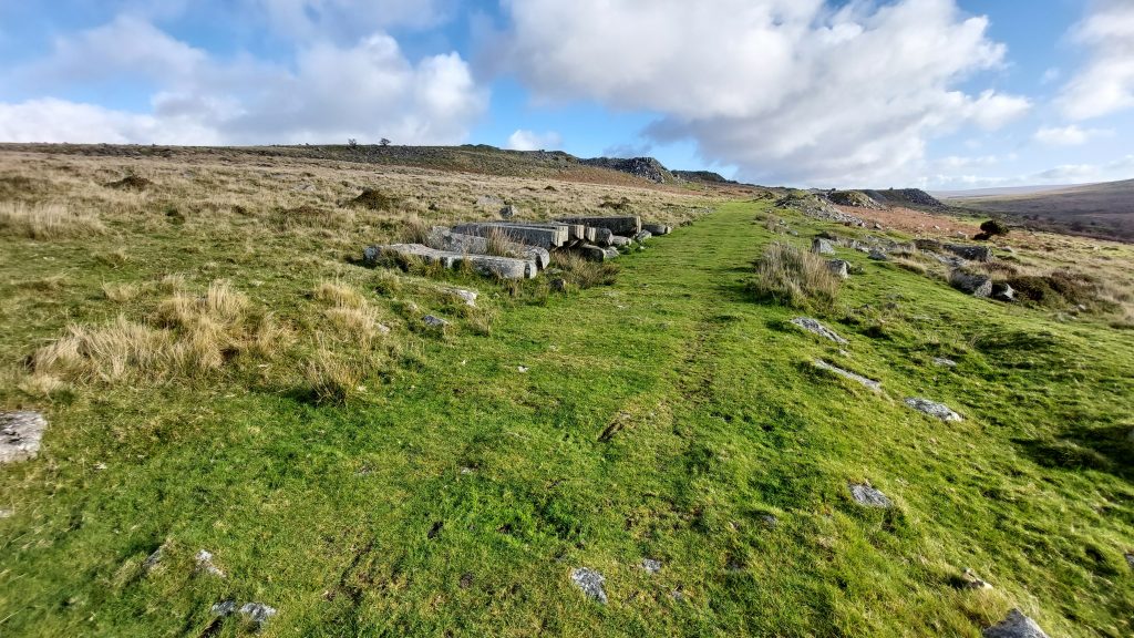
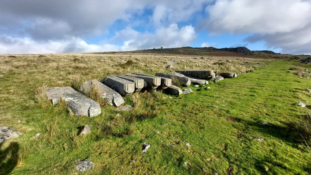
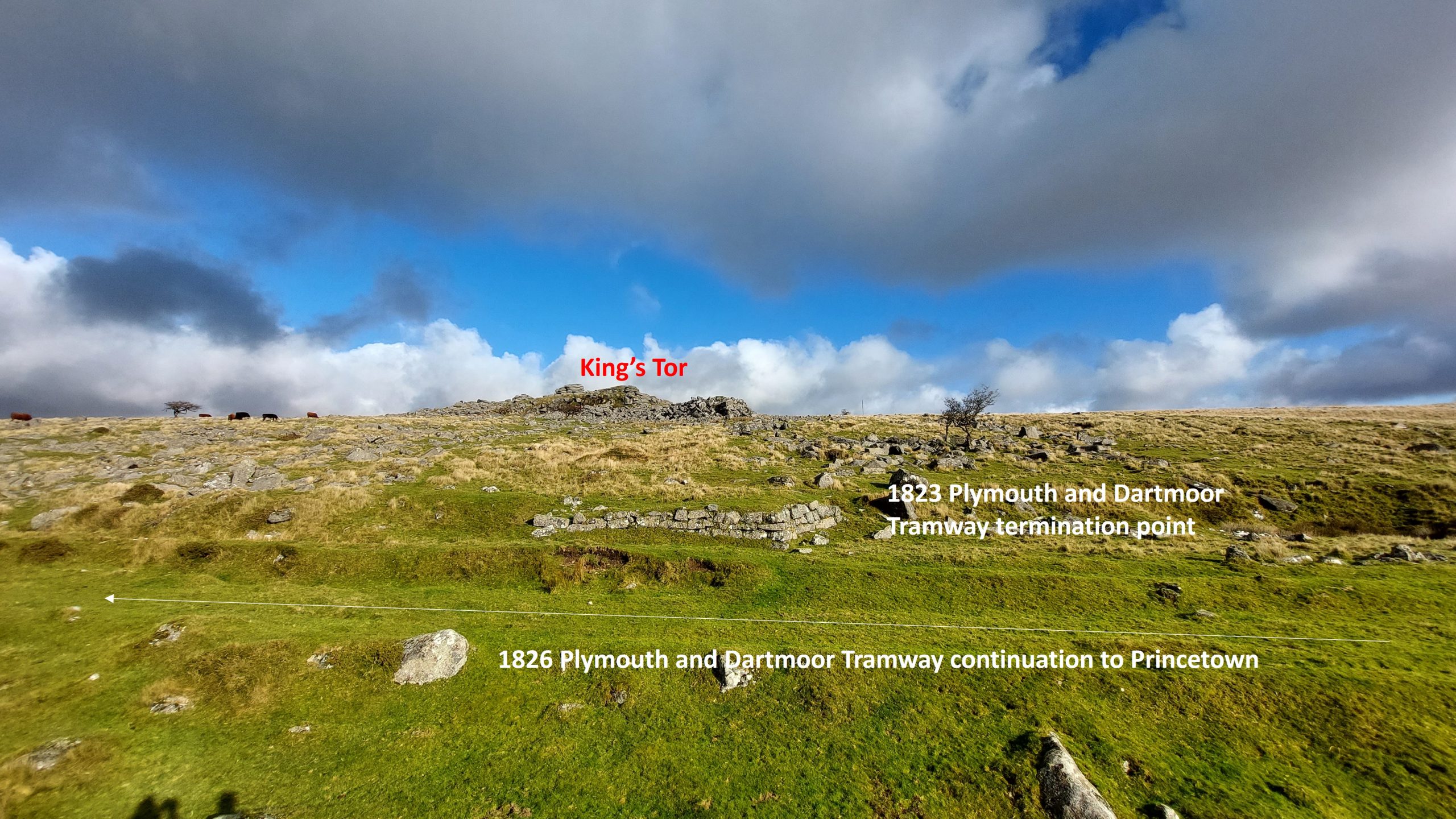
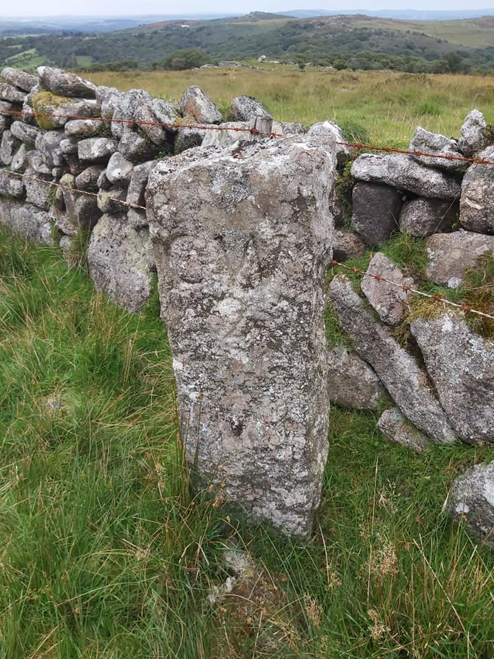
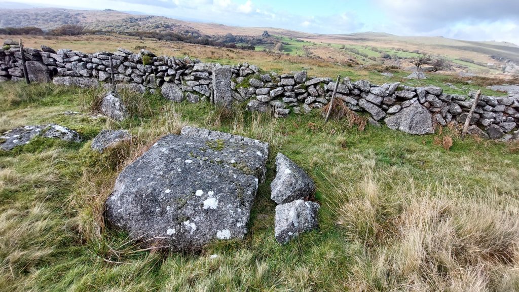
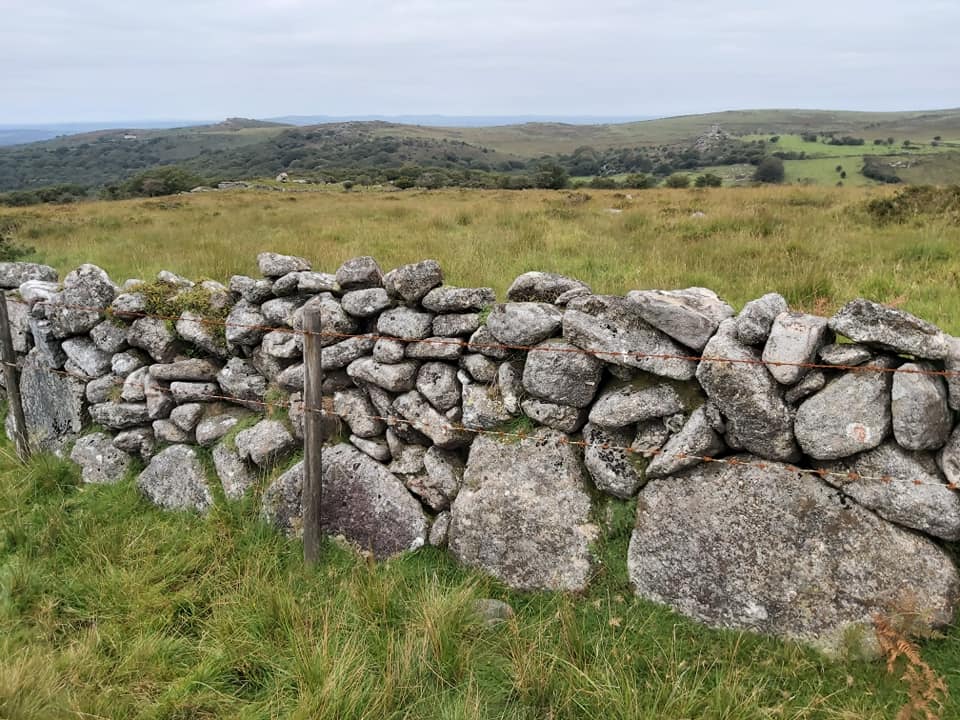
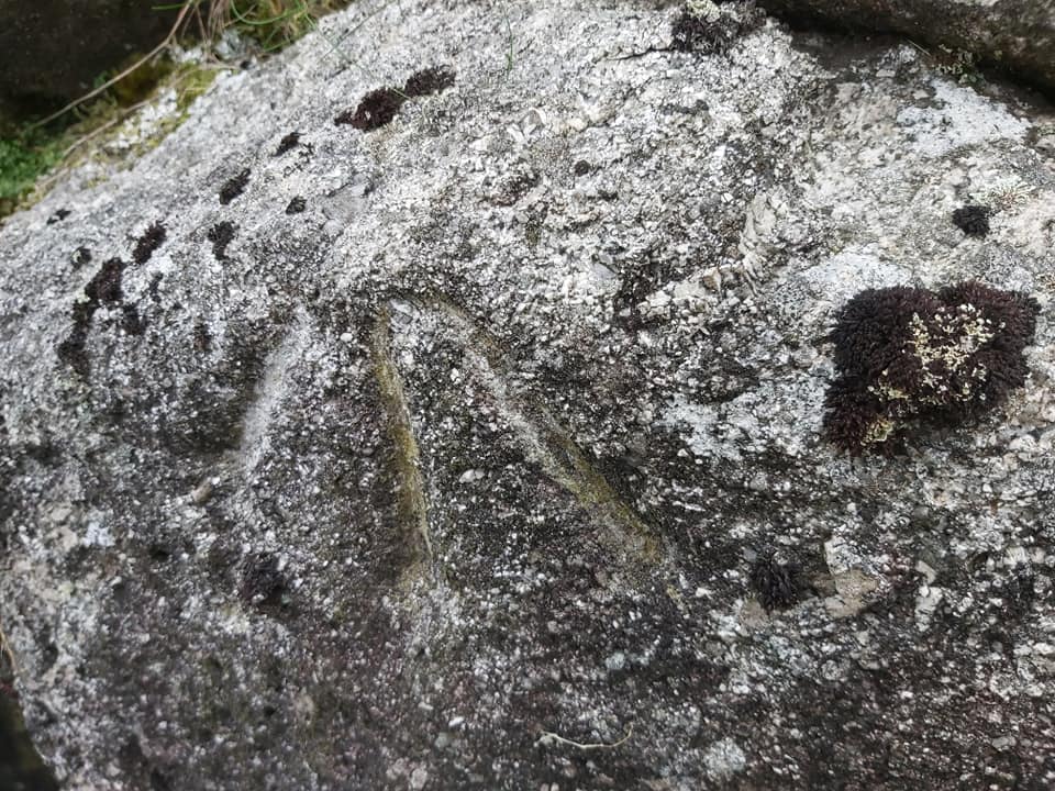
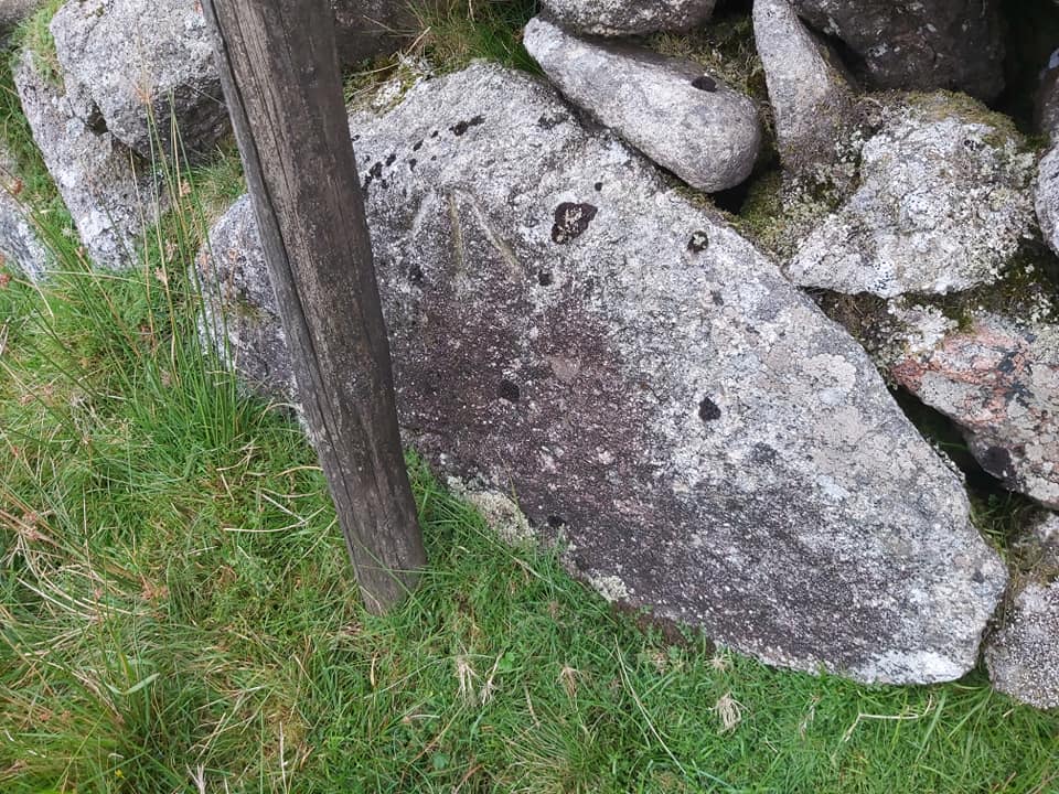
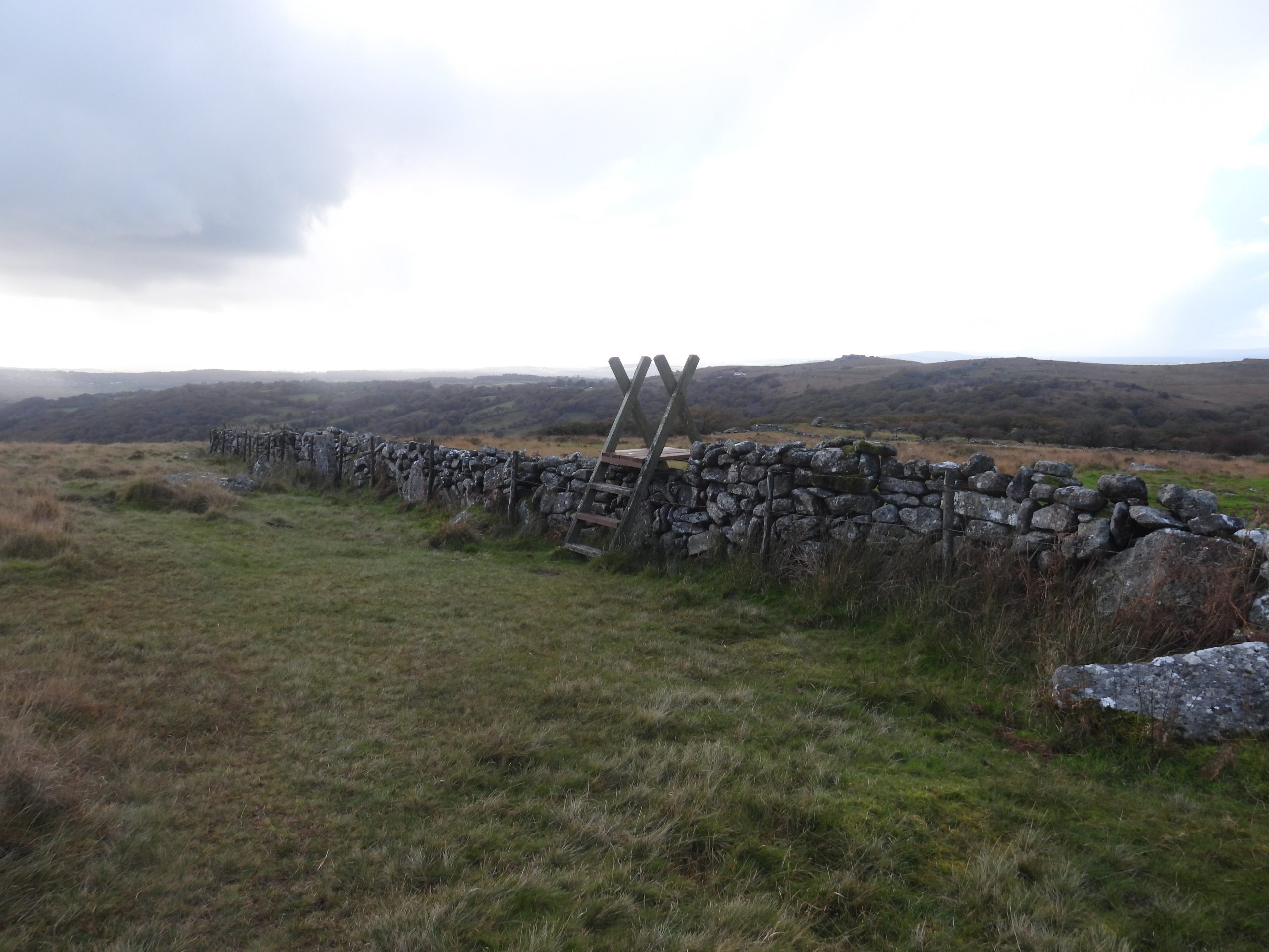
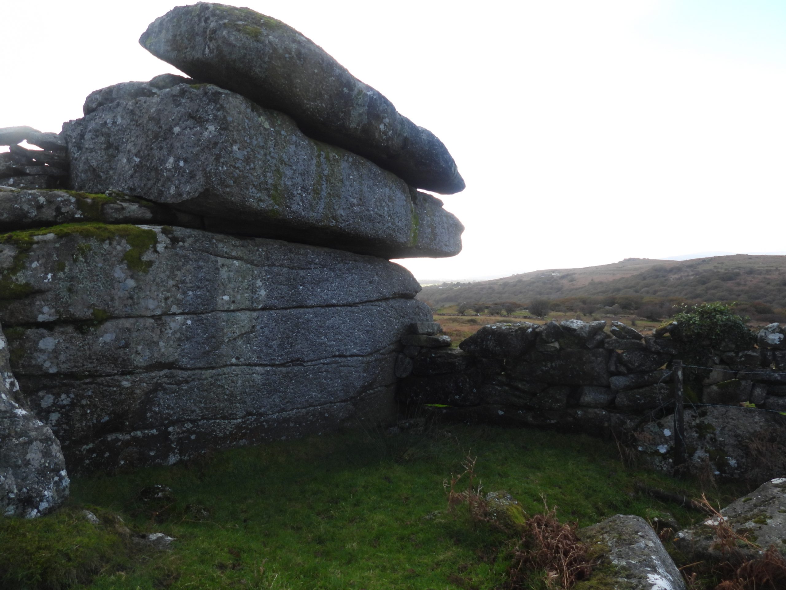
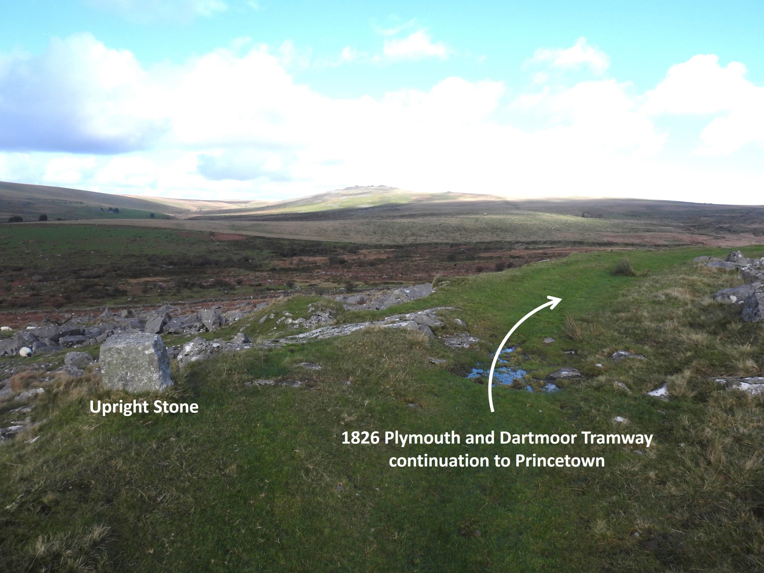
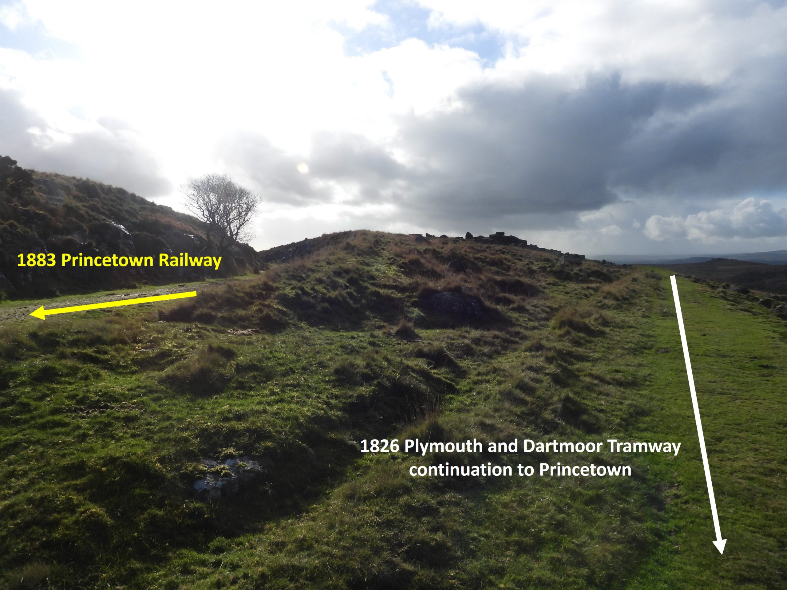
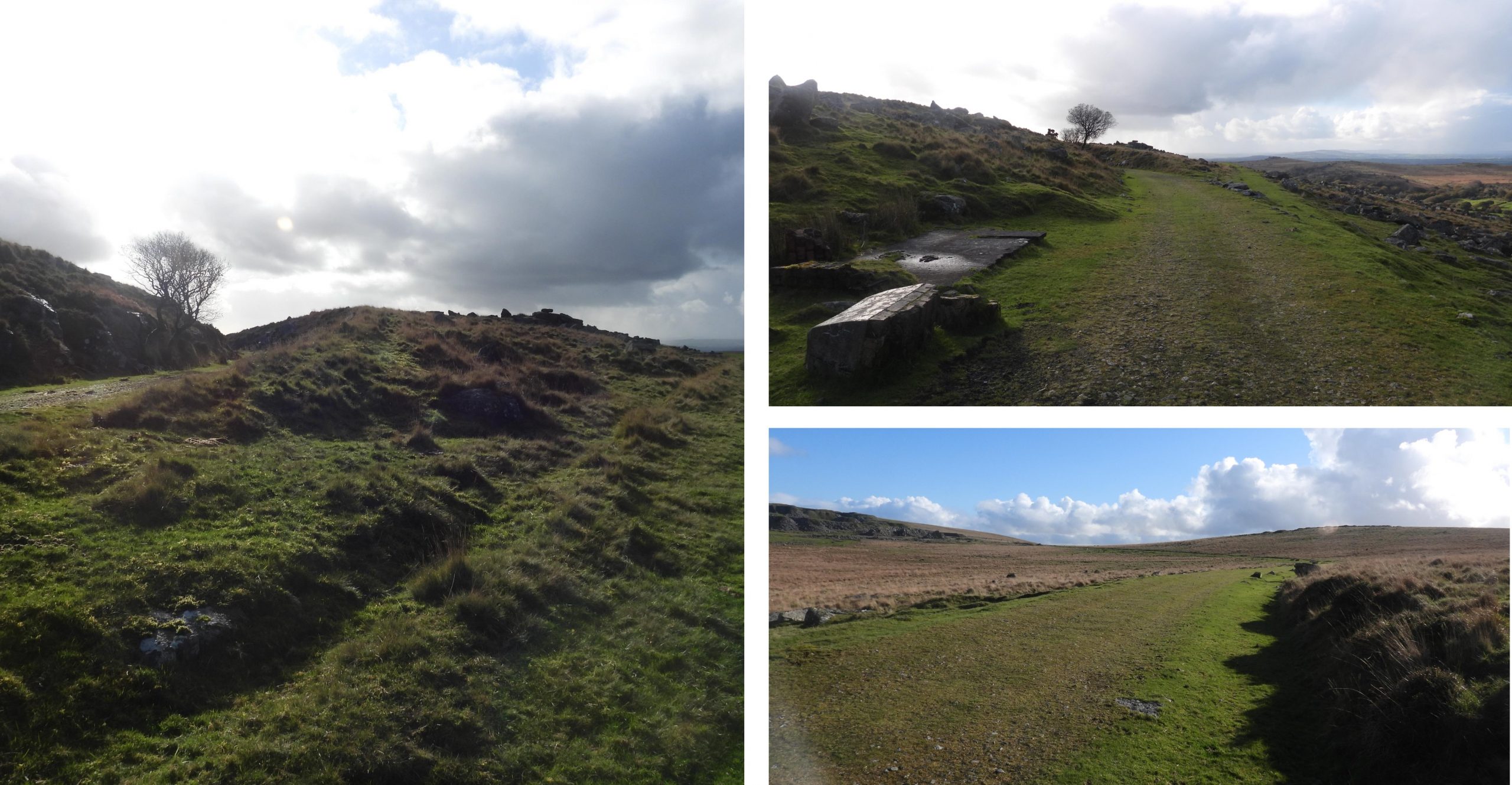
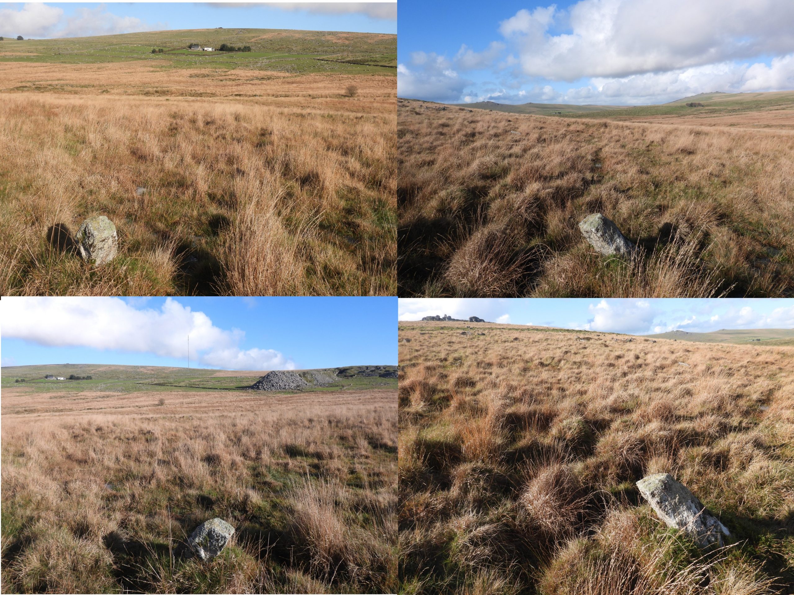
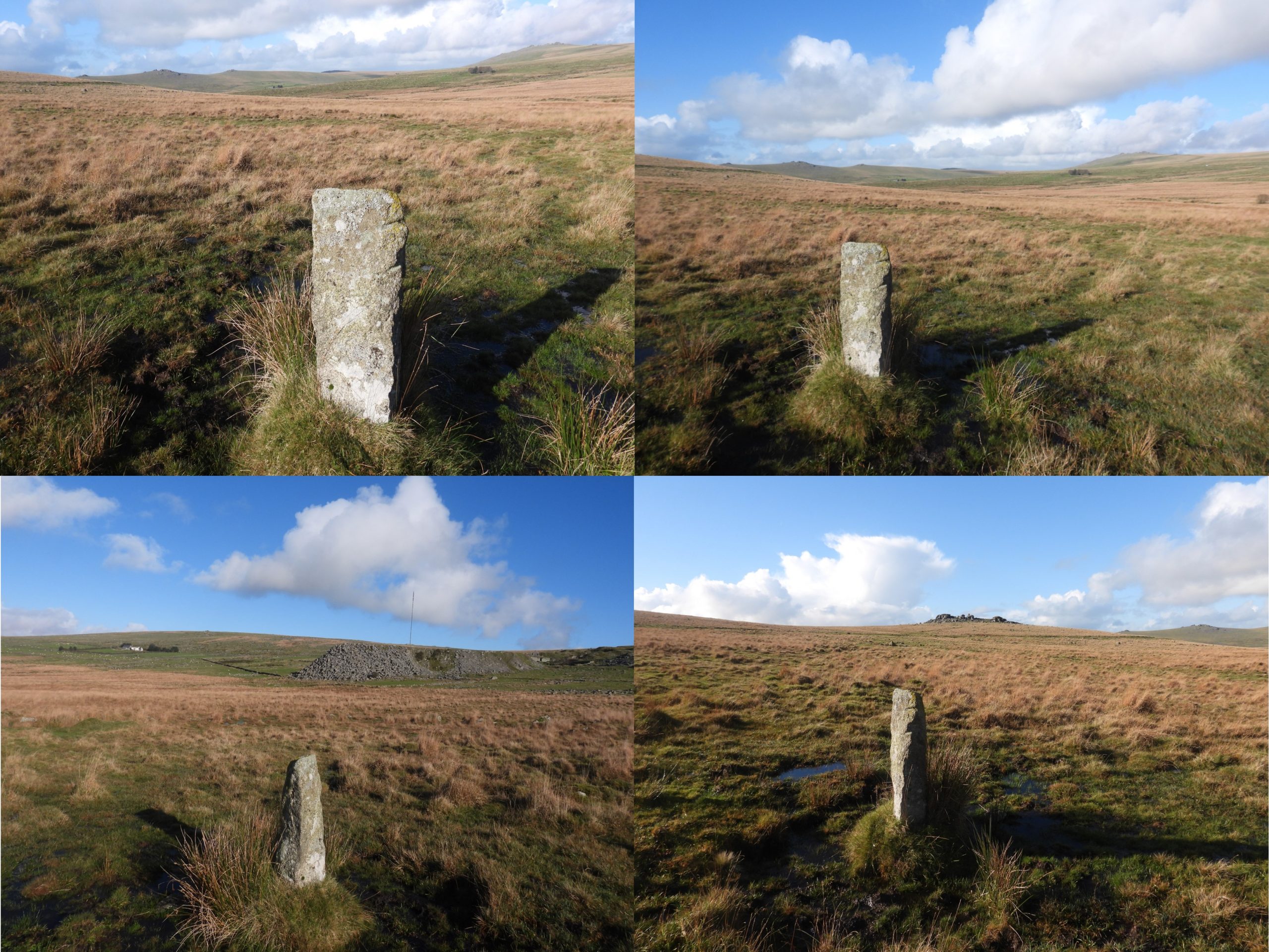
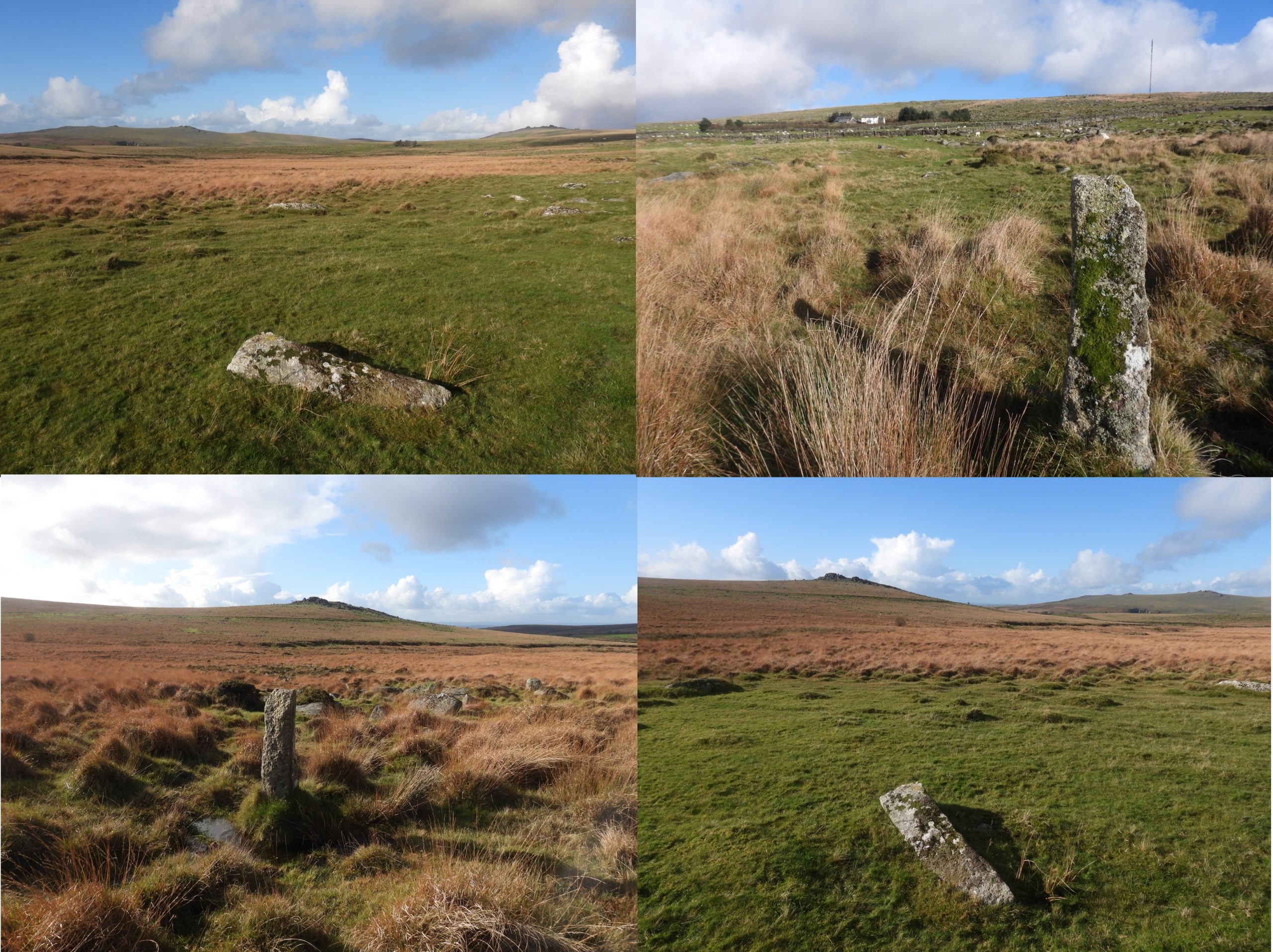
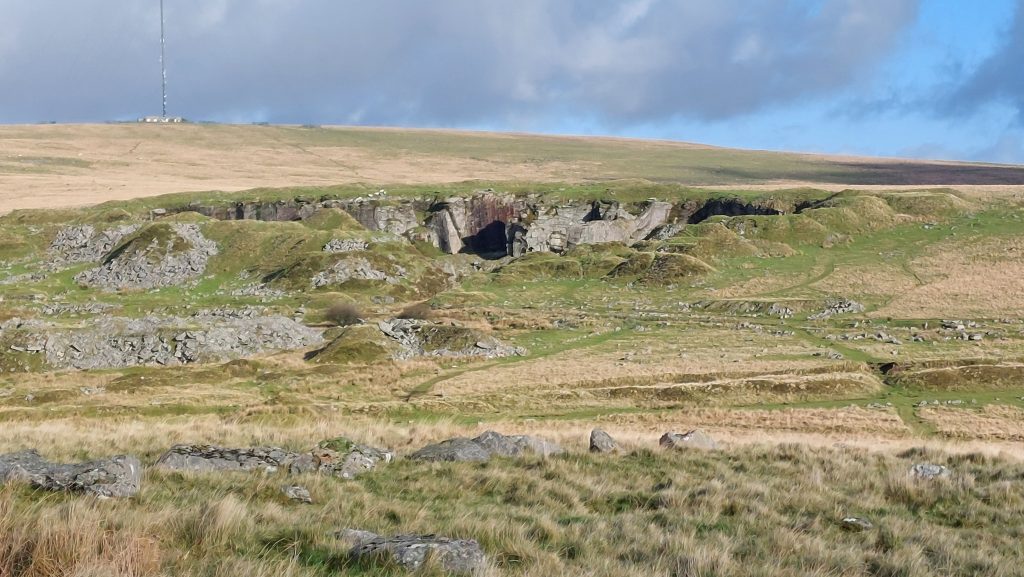
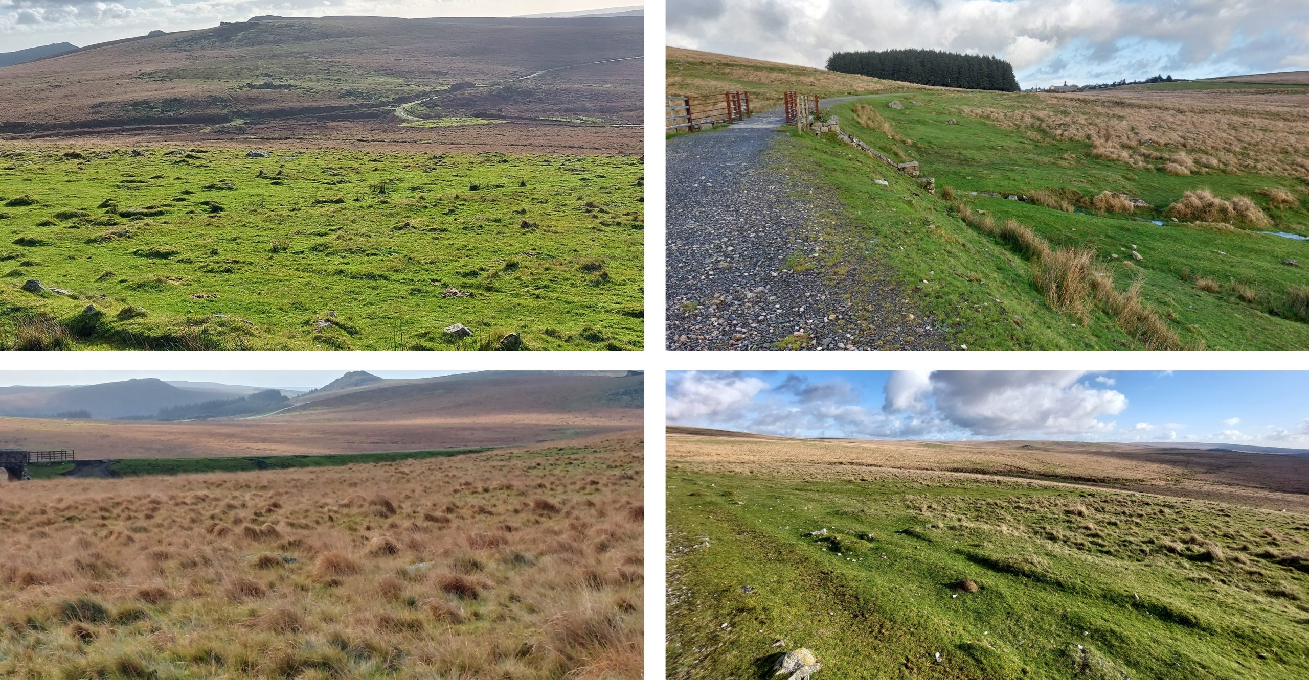
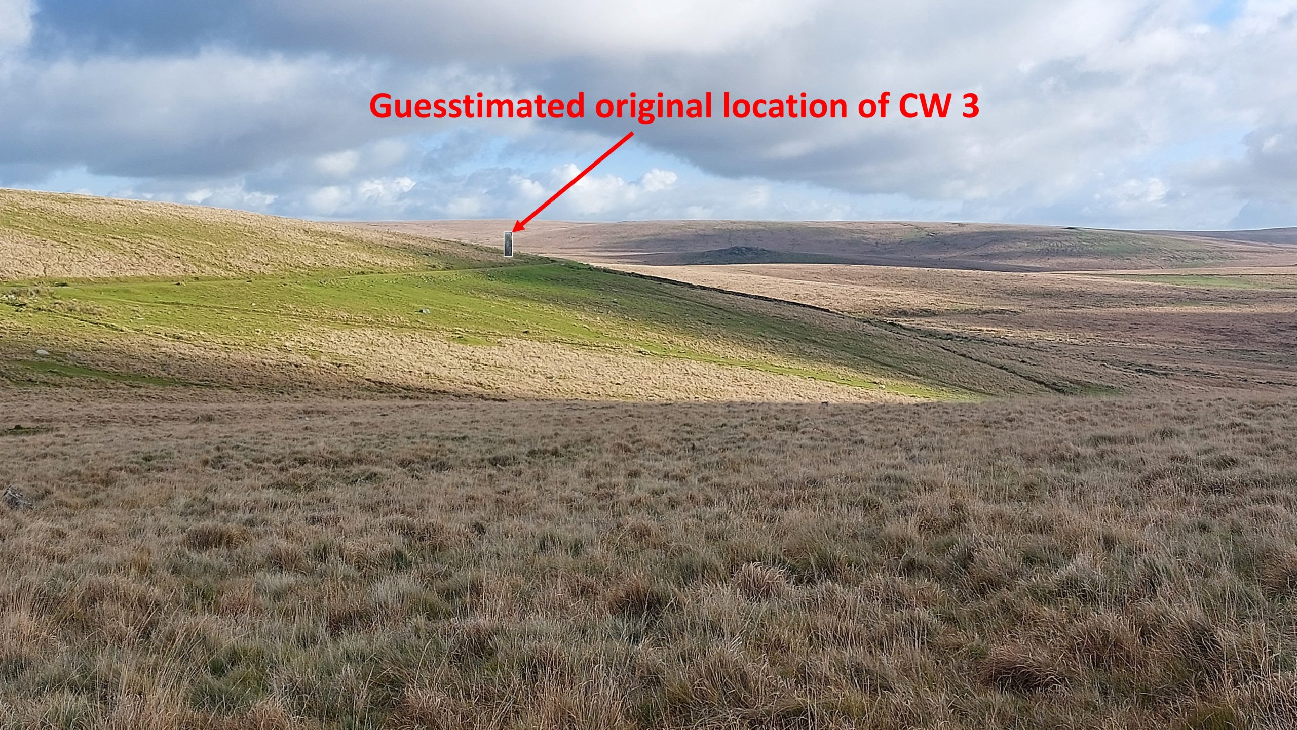
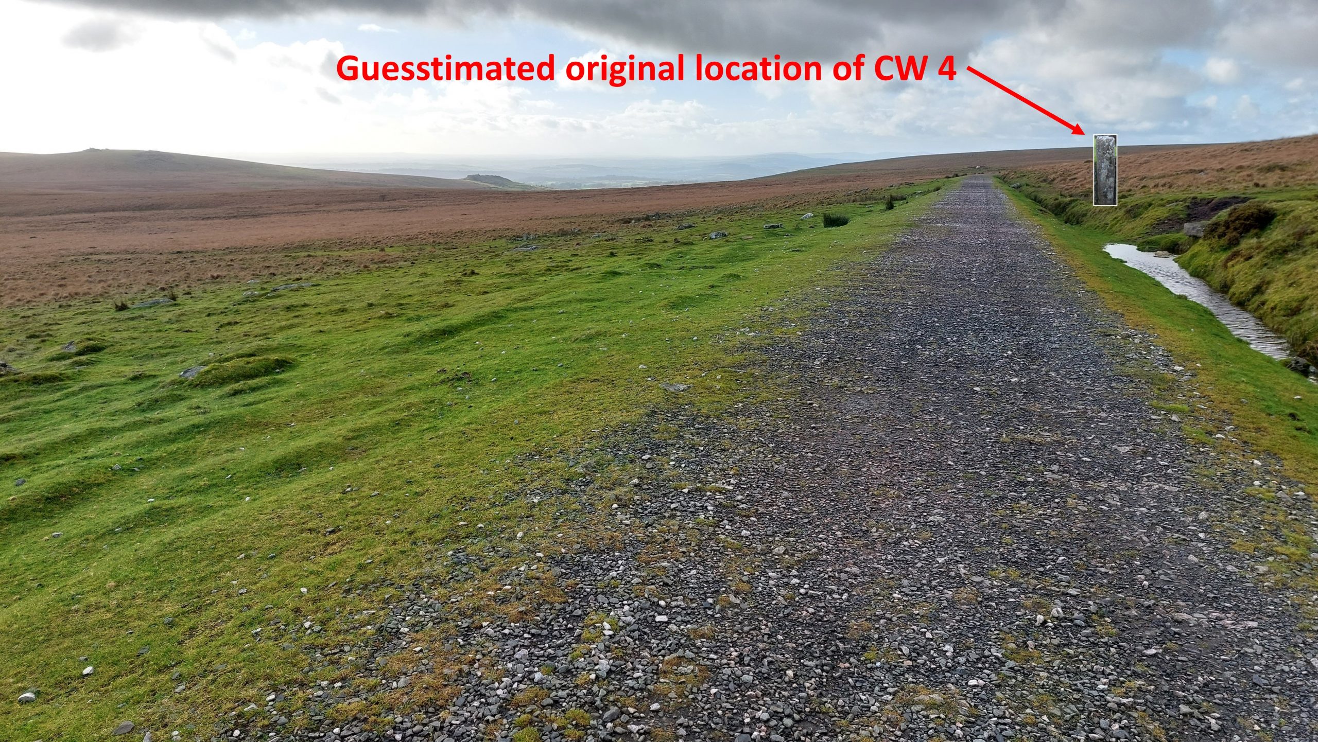
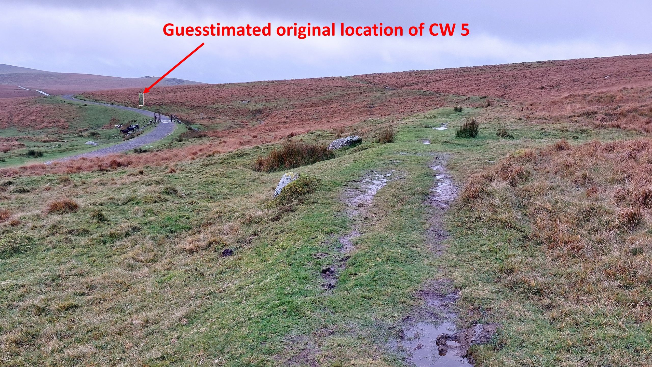
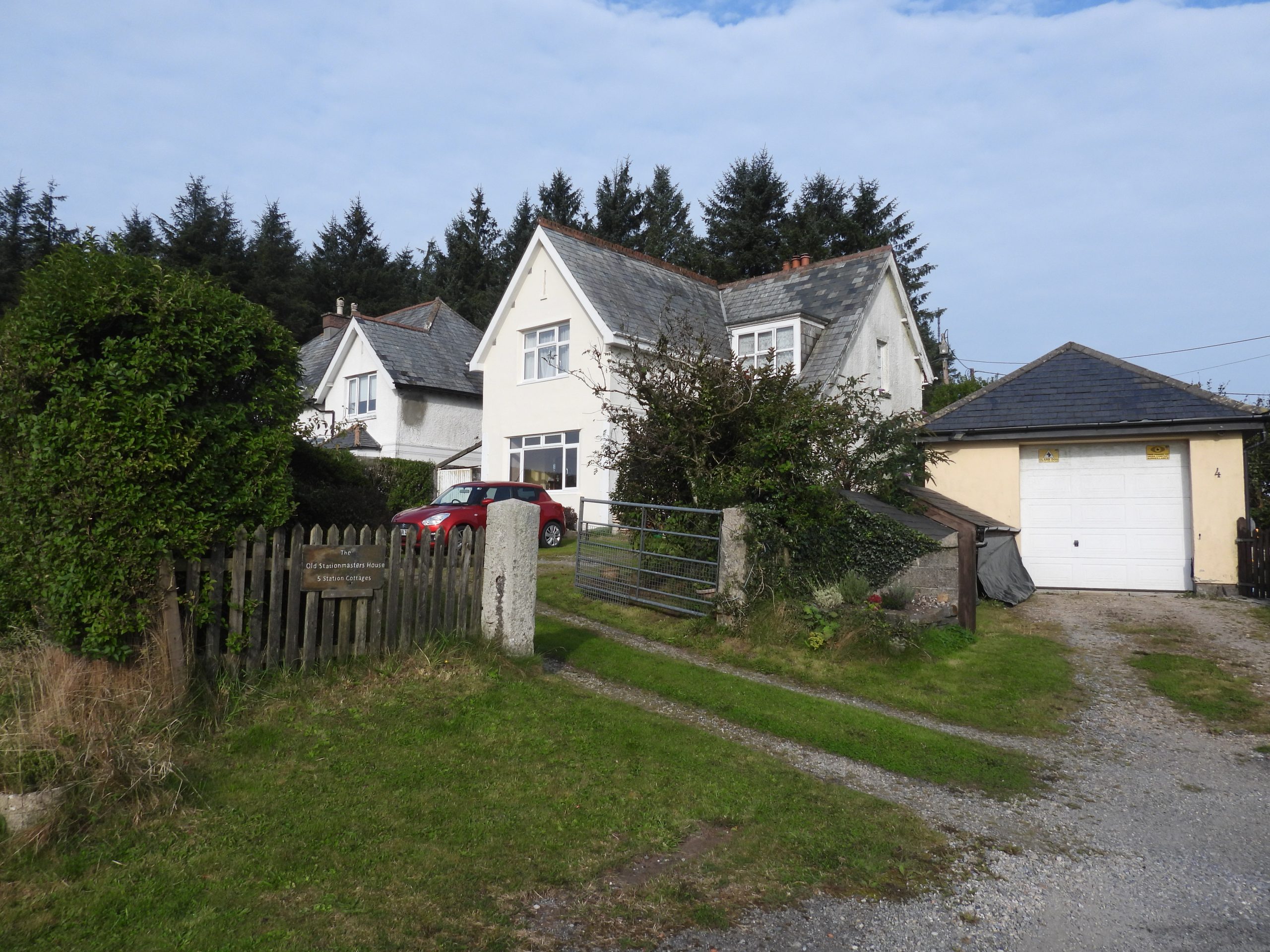
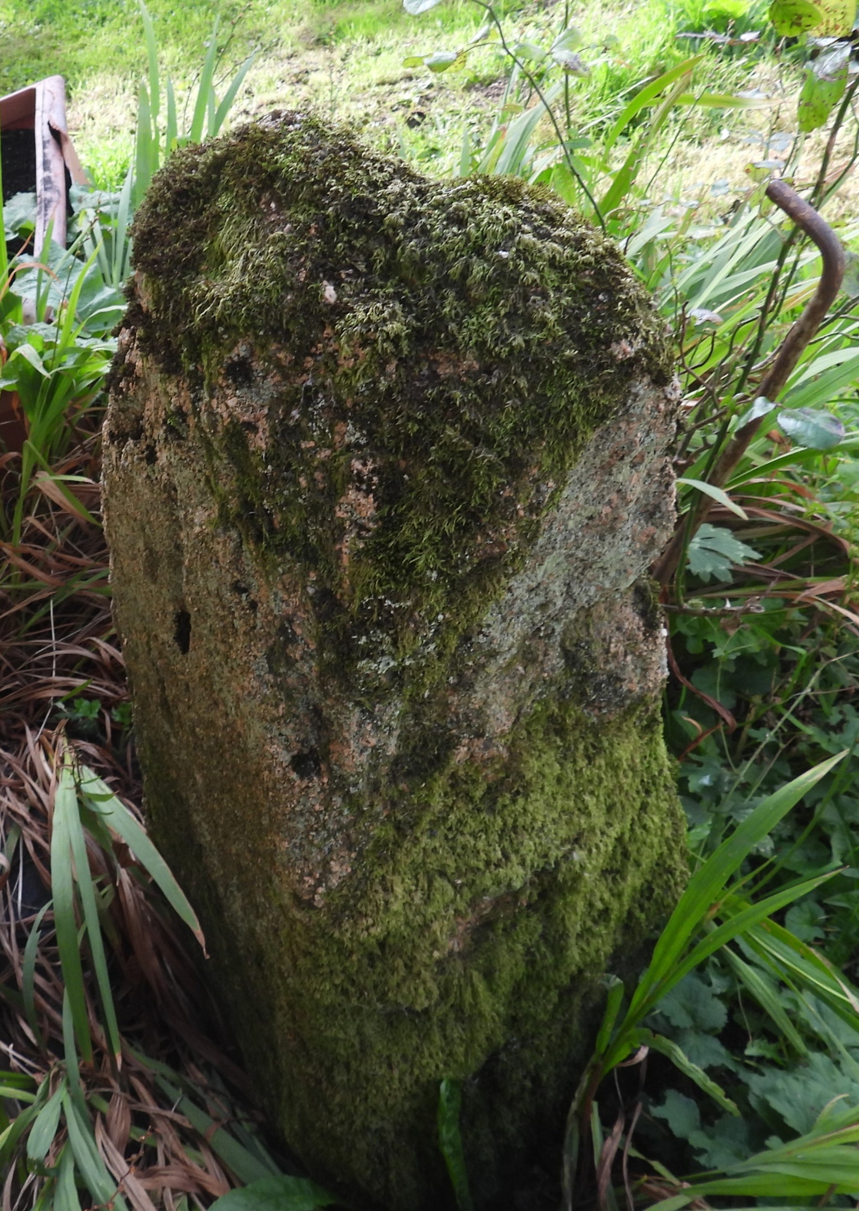
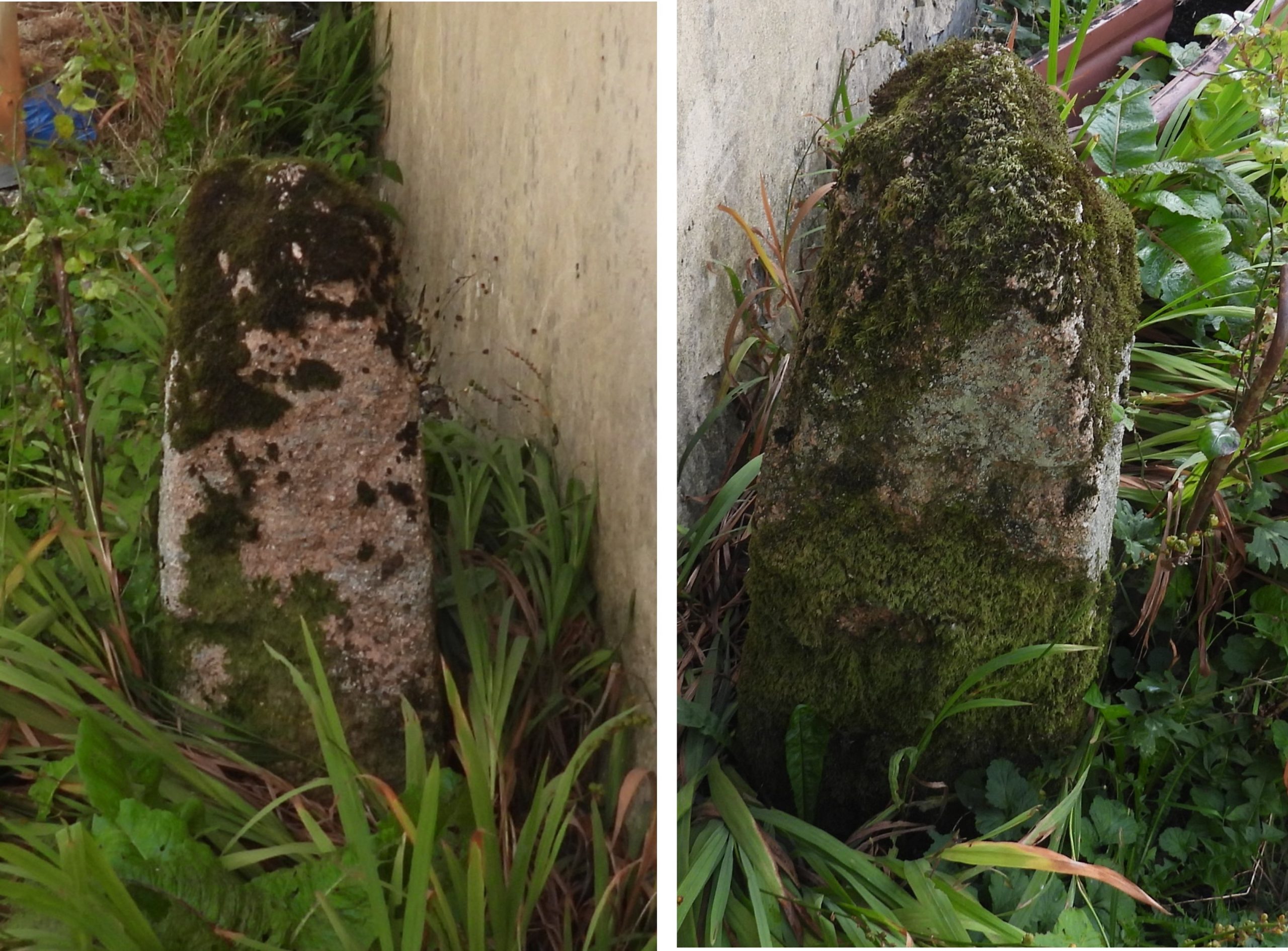
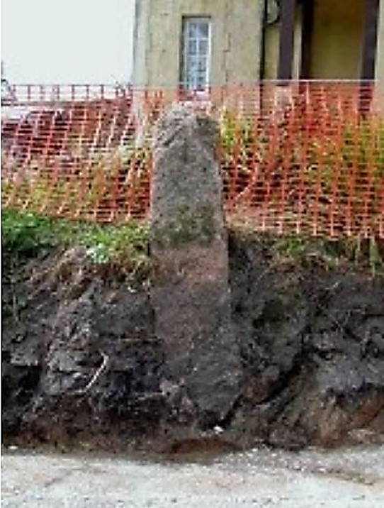
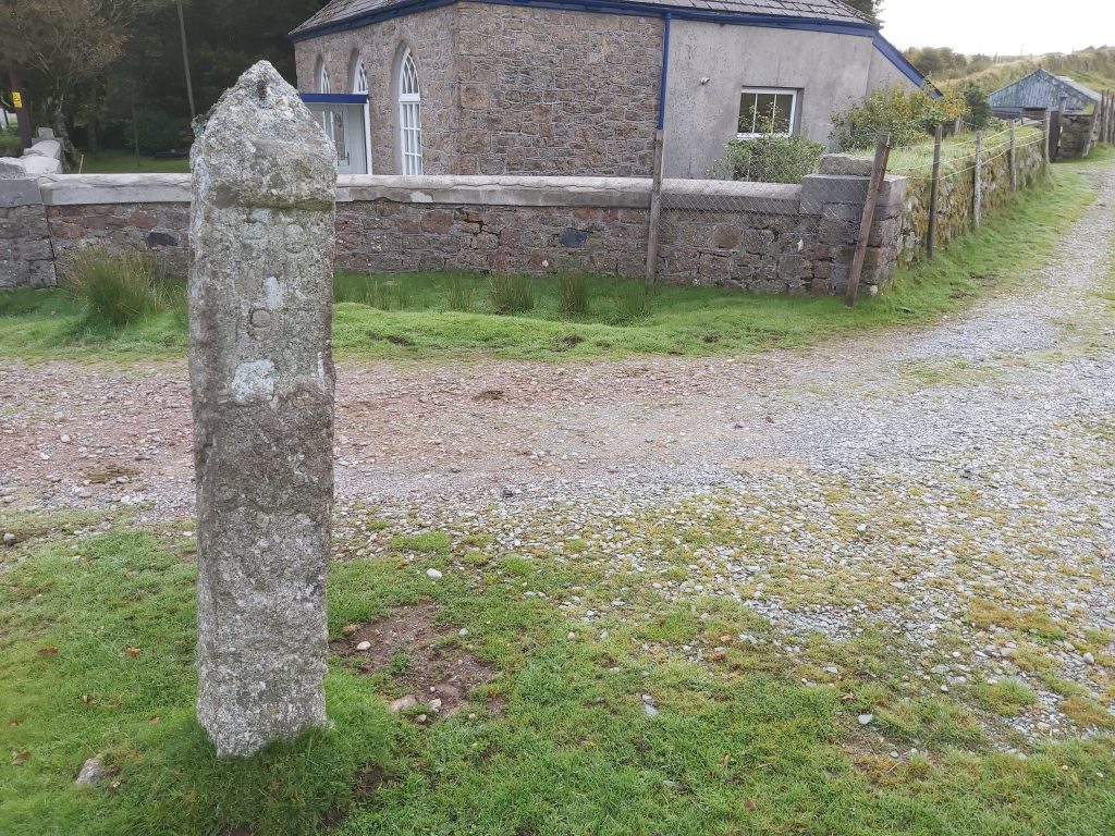
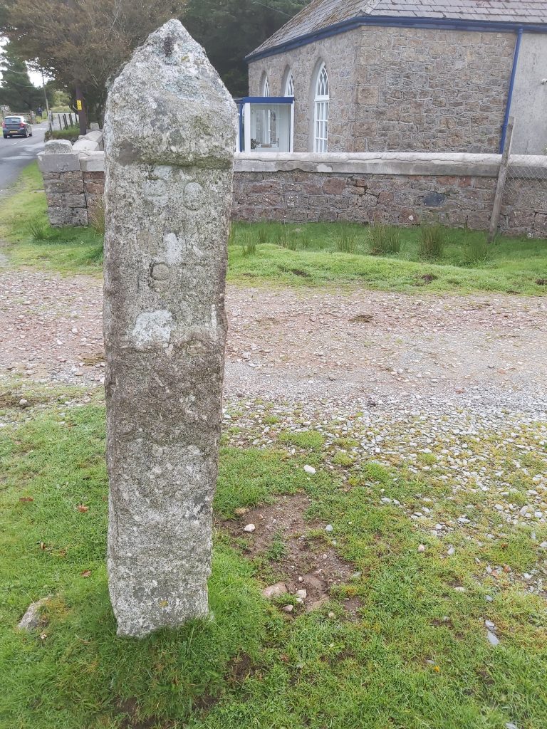
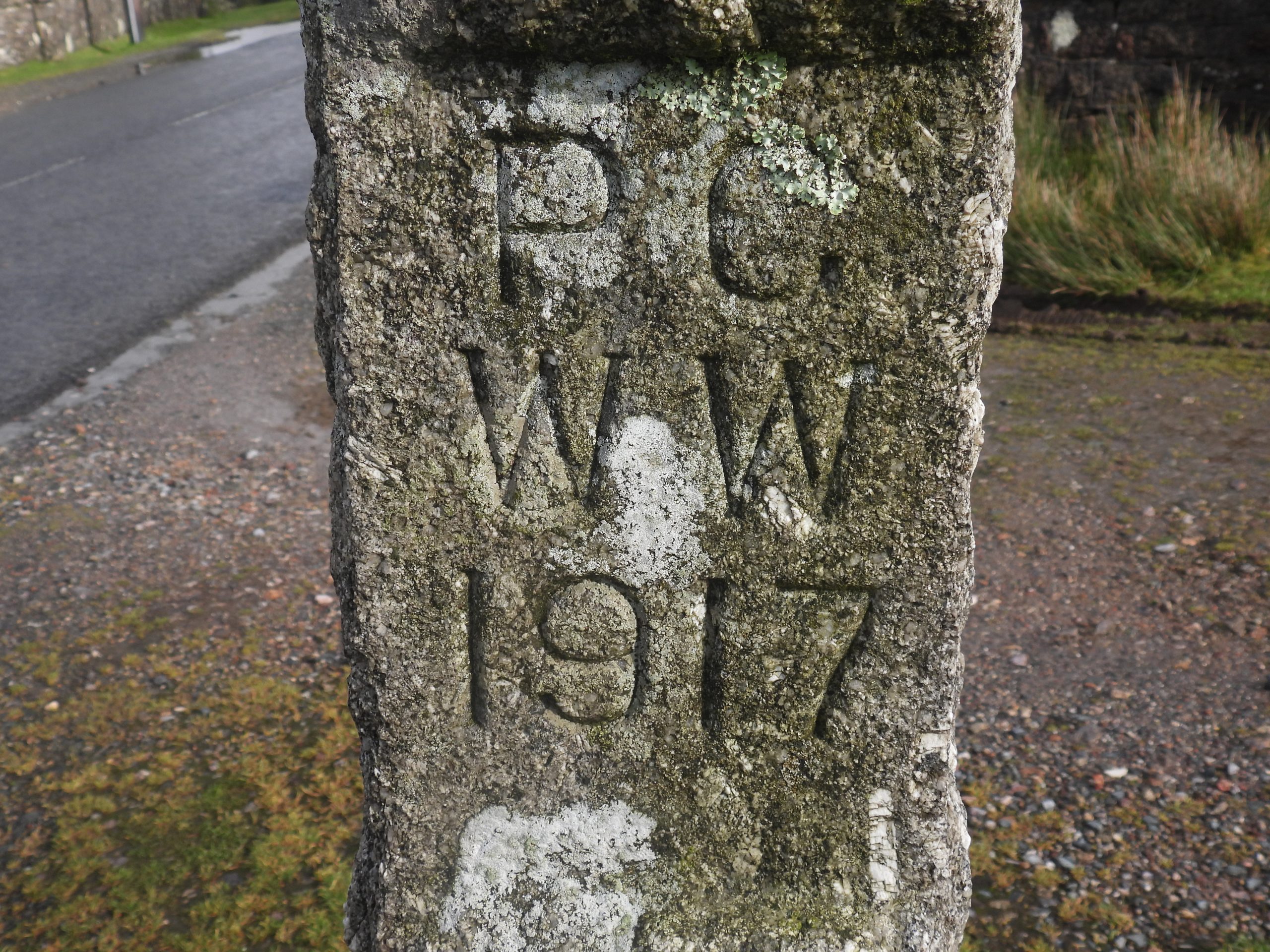
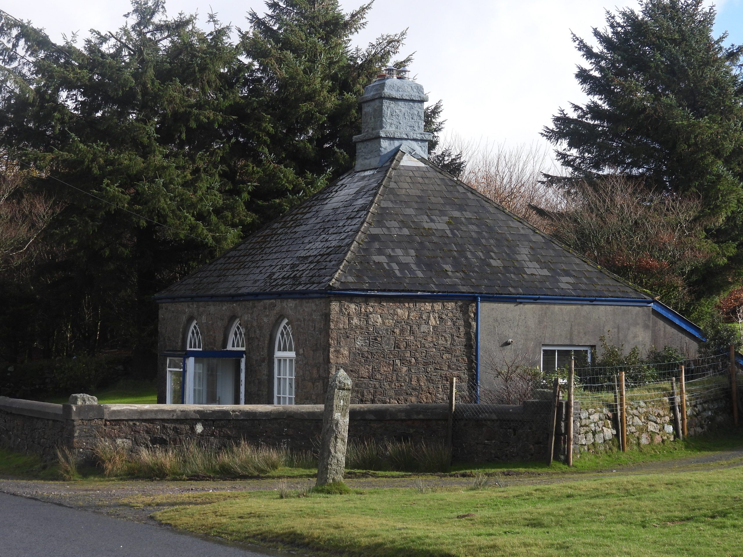
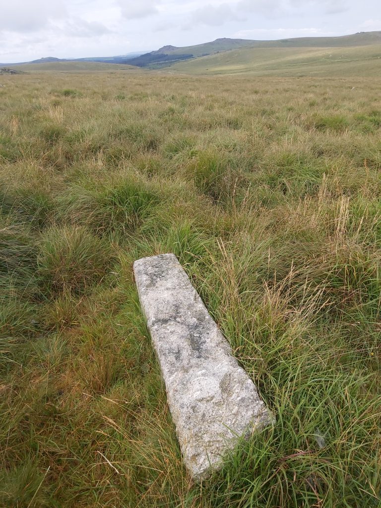
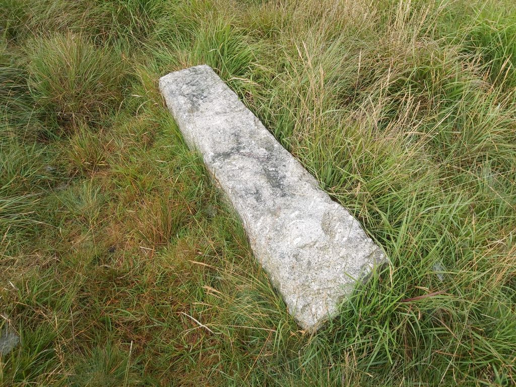
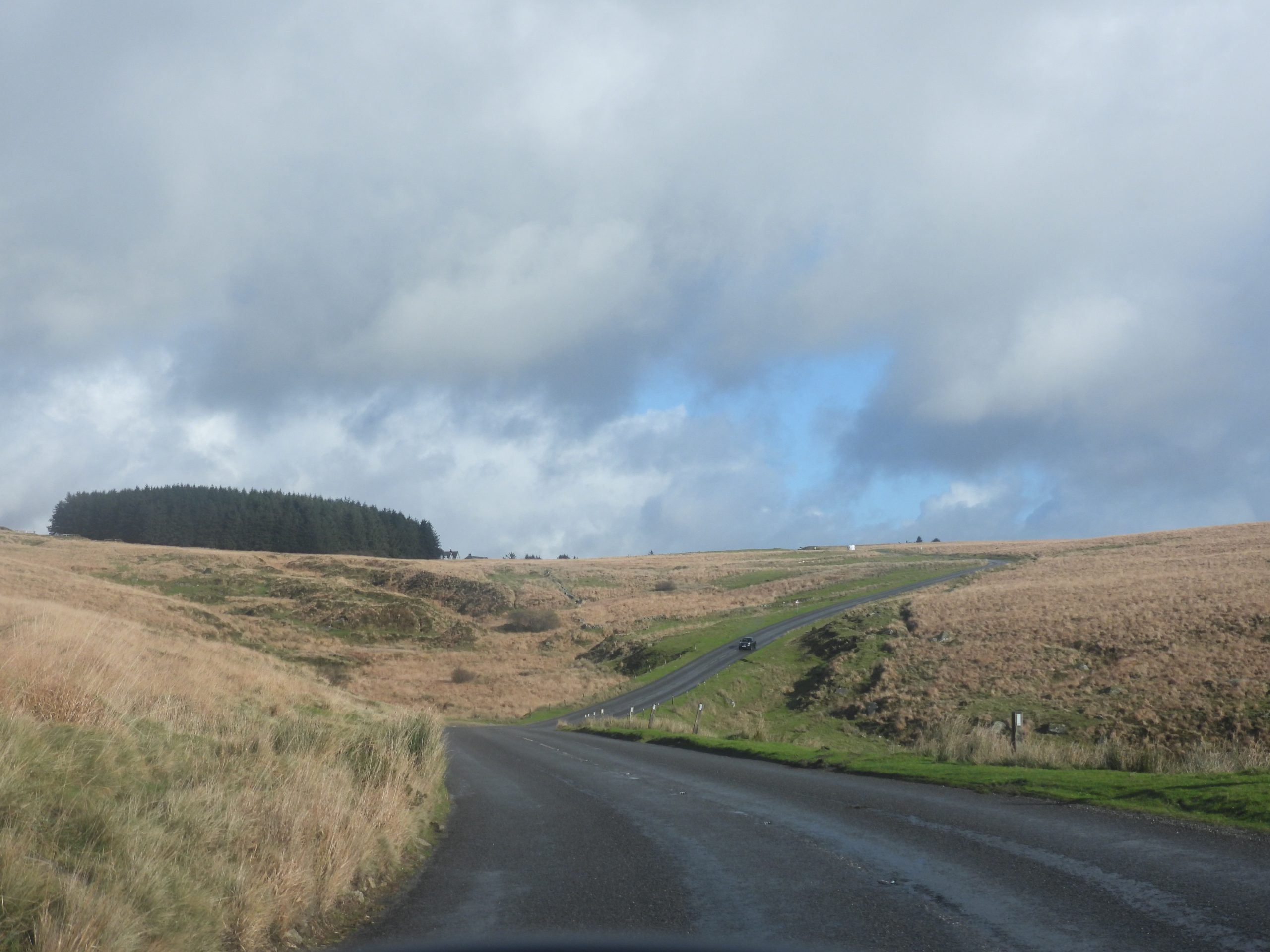
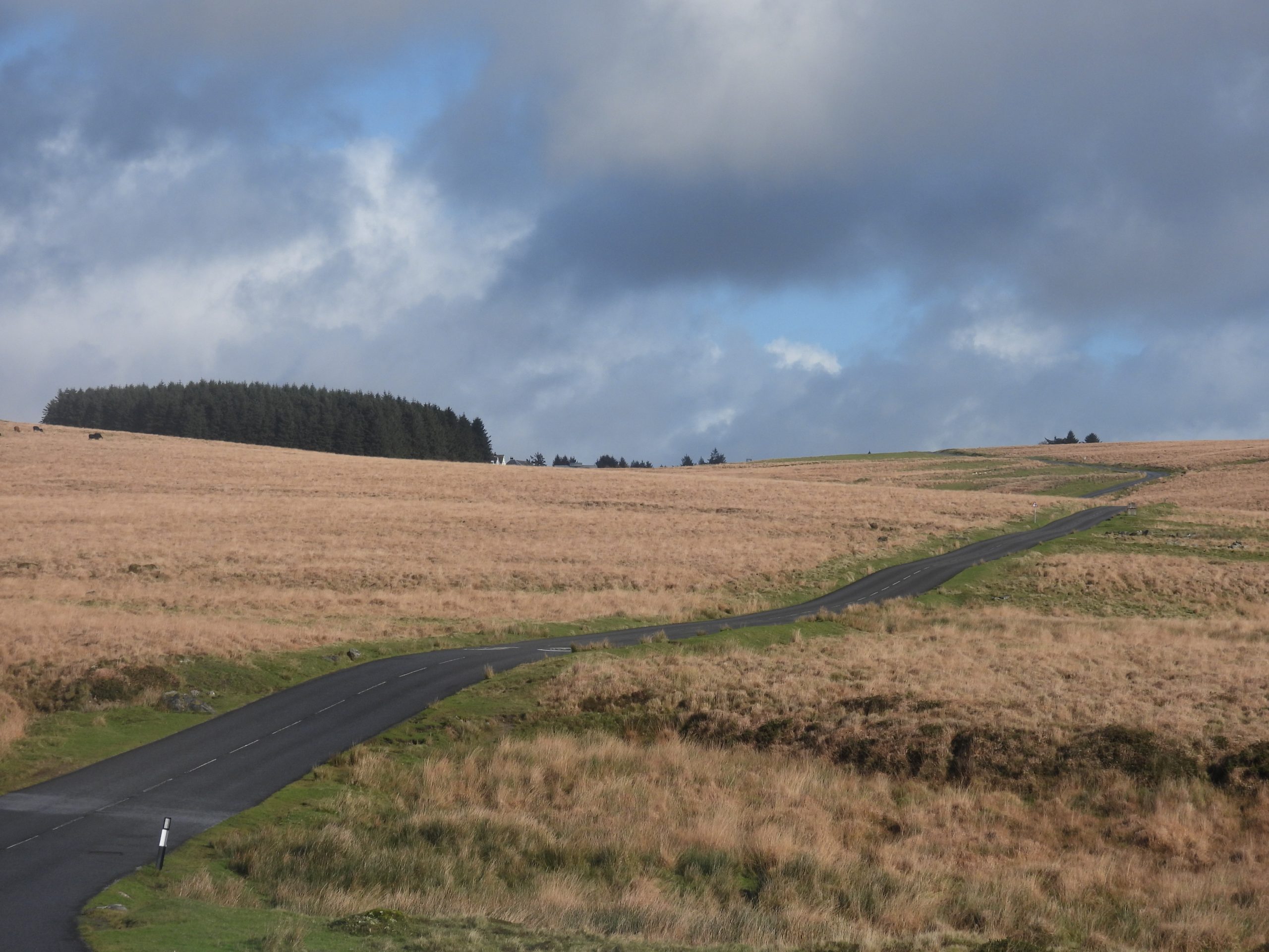
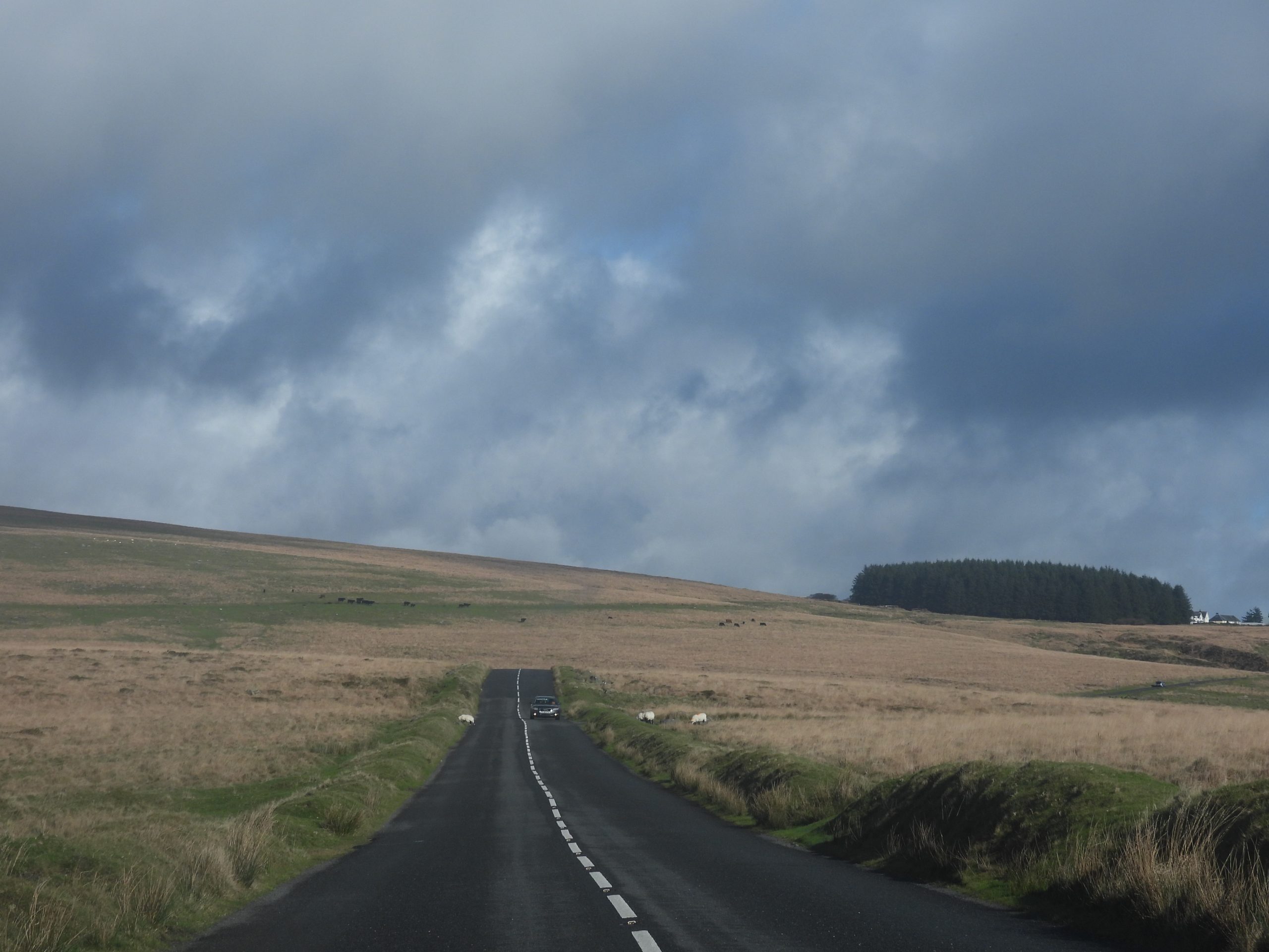
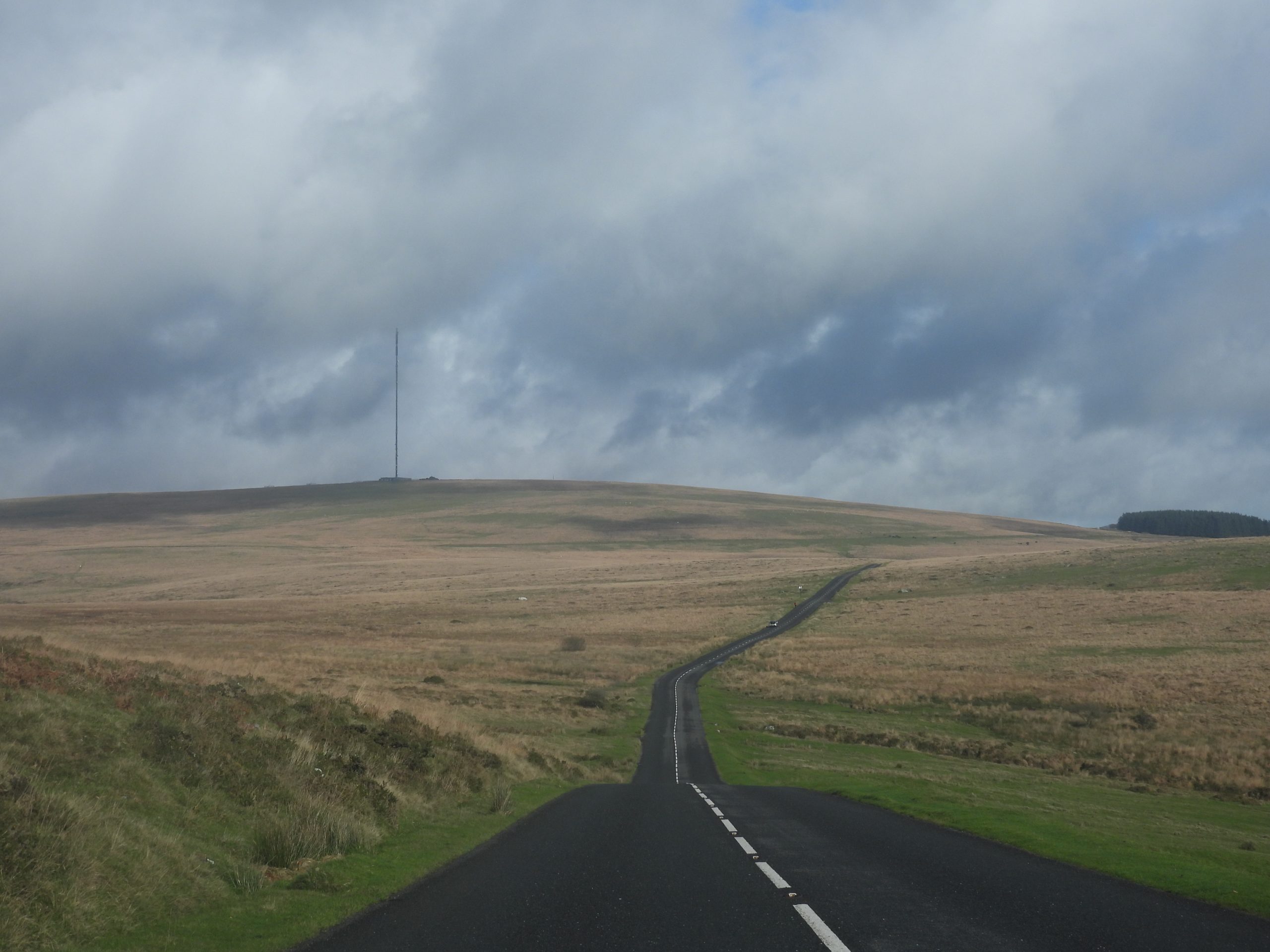
This sketch shows the (probable) extent of the Walkhampton Common China Clay Sett. The boundstones CW1 and CW2 still exist albeit CW1 has moved (at least twice) since 1835. There were three other CW stones (CW3, CW4 and CW5) which are described as once being north side of the old Plymouth and Dartmoor Railway (1823) between Foggintor and Princetown. In all likelihood CW3, CW4 and CW5 have long since been removed either for repurposing as gateposts perhaps or just taken when the Princetown Railway was completed in 1883The southern point to the Walkhampton Clay Sett was marked by the ’12 miles from Plymouth’ milestone. The view is looking north towards Routrundle, Babyland and the old Princetown Railway line (formerly the Plymouth and Dartmoor Tramway)The milestone was erected around 1812 and is inscribed over 6 lines, thus: PLYMOUTH / 12 MILES / PRINCE / TOWN / 3 / MILES. It is a little over 0.5m tall. Intriguingly, William Crossing confuses the reader by assigns this milestone (and another further up the hill) as the ‘Goads Stone’. From page 91 of his guide he states (referring to the 12 milestone) : “Half a mile further on (ie westward) we reach the twelfth milestone from Plymouth. This is known as the Goad’s Stone”. The ’12 miles to Plymouth’ milestone is straddled by two Plymouth Corporation Water Works stones dating from 1917 which denote the selling of the watershed lands a year earlier. The milestone and the northern of the two PCWW 1917 stonesOn the opposite side of the road from the milestone is the southern PCWW 1917 stoneLooking north east along the B3212, which was known as the ‘trans Dartmoor route’. It was built and maintained jointly by the Tavistock and Moretonhampstead trusts in 1772. The road forms the western boundary of the Walkhampton Clay SettOn the brow of the hill above the ’12 miles from Plymouth’ milestone is a small erected rough moorstone. This too was mentioned by William Crossing as being the Goad’s Stone. In a series of articles in the Western Morning News (from 1905) titled Early Historic and Medieval remains on Dartmoor’, Crossing states: “The Exeter road enters the moor at Peek Hill, not far from Dousland, and is carried over the shoulder of the eminence. On its northern side, and on the left of the way going to Princetown is a stone, which may not improbably be one of these erected some two centuries earlier by Plymouth Corporation. It is known as Goad’s Stone, and marks a point where a green track coming up from Walkhampton, joins the highway”. I suspect most Dartmoor observers (including the author) know this as Goad’s Stone with the rather conspicuous Goad’s Pond being on the opposite side of the roadThe Goad’s Stone with Goad Stone Pond or simply Goads Pond beyond. Sharpitor is on the horizon. Eric Hemery (in High Dartmoor, page 108) links the word ‘Goad’ to a West Country Tinners’ boundary mark. Hamilton Jenkin suggests a Goad is a land measure relating to mining. The author wonders why the ’12 milestone’ and not the Goad’s Stone (being on brow of the hill) was chosen as a boundary marker for the Walkhampton Clay SettGoad’s Stone Pond or simply Goads Pond. The pool measures 30 by 28m and is mentioned by Dr Tom Greeves as being one of over 40 such ‘sacred’ pools identified on Dartmoor that are thought to have potentially been designed during the prehistoric period (ref: Dartmoor Magazine, Issue 137, Winter 2019)From the ’12 milestone’ taking a route in a north westerly direction, the approx route of the Walkhampton Clay Sett is followed. The sett boundary is described as following a direct line from the milestone to bound stone inscribed ‘CW1’ which is ‘near a hedge of a certain field called Furzepark’. This particular field can be identified from the Walkhampton Tithe apportionment (field 341).Near the south eastern boundary of the field called ‘Furze Park’ is this gate at SX55102 71331. The author was aware that ‘CW1’ was no longer at this location, but was intrigued to see where it had once been erected.The hedge line of Furze Park, where ‘CW1’ may have been erected. The overlaid bound stone is ‘CW1’ which is now being used as a gatepost at Waytown Farm. The author chose this location to photograph as there was cut out of turf where an erected stone (notwithstanding natural erosion) may have once stood. This location is SX55085 71322A second location outside Furze Park, which the author identified as being a possible original location for ‘CW1’The author chose this second location to photograph as once more there was cut out of turf where an erected stone (notwithstanding natural erosion) may have once stood. This location is SX54900 71253Waytown Farm. The farmhouse appears to have been rebuilt in the early 20th century since on 19th century mapping it shows Waytown Farm formerly stood to the south of the present farmstead. The Tithe apportionment records Waytown as a house, court and garden (plot 328) which was occupied by Thomas Luckett. He also had tenancy for the field called Furze Park, where CW1 was located. The landowner (unsurprisingly) was Sir Ralph LopesThe ‘CW1’ bound stone in its current location being used as a gatepost at Waytown Farm. It is sited at SX54430 71592Close up of the inscription. ‘CW’ referring to clay works.The author is grateful to the current owners of Waytown Farm for letting him take the photographs. The current owners of the farm were not aware of the significance of the inscription and during a conversation it transpires that the gatepost was only moved to its current location in more recent times, having been used elsewhere on the farm (on the west, Walkhampton side, of the road). This its current location is at least its third location ! Originally erected circa 1835, it would have been moved after 1840 (when the clay sett lease was surrendered), then moved again late 20th / early 21st century. One wonders if Thomas Tuckett moved the stone in his time at Waytown Farm in the 1840’s ?Back to the clay sett boundary near Furze Park. The above picture shows two parts of the sett across the woods and enclosures on the eastern flanks of the Walkham ValleyTo the east of Furze Park and the boundary hedge delineating the Walkhampton Clay Sett. The lease George Stone Barton signed in 1835 did not allow him to search for copper, tin or other metals. He was also prohibited from removing granite. However, had he wished to prospect for anything other than china clay, he had to apply for a grant within 6 months. It is assumed he did not take this upViews from the Princetown Railway line showing the extent of the Walkhampton Clay Sett towards Little Kings Tor and the second extant bound stone ‘CW2’. Routrundle from the Princetown Railway line which is mentioned in the original bounds of the sett. RoutrundleIngra Tor and the boundary hedges which marked the edge of the settThe ruins of Babyland Farmstead on the boundary of the clay sett. More information can be found here: https://dartmoorexplorations.co.uk/babyland-farmstead/View looking east from Ingra Tor across to Yes Tor Bottom, where the clay operations (as small as they may have been) appear to have been located (assumed as they are marked here on William Wood’s map from around that period). A part of the terms of the 1835 lease to George Stone Barton was that after the 21 years had expired he had to leave any buildings standing and in good repair. There is no record of him having erected any buildings.Criptor is mentioned in the clay sett lease. In addition to this, Brewer found later references for Clay on Walkhampton Common referring to the area around Criptor. In some Maristow papers, there is a copy of a letter dated 22nd June 1906 from the estate secretary which stated : “Met Mr Nicholls and Captain Rowe of St. Austell at Princetown with reference to their application for a lease to the china clay in this part of the estate, we went over the land around Routrundle towards Mistor, then through the valley east of the old quarries at Foggintor and on the other side of the railway above Criptor. The formation indicates clay ground in each of these places and formal application is to be made for a licence to sink trial pits. The whole whole ground inspected is outside the limits of the Plymouth watershed”. In 1906, Sir Masey Lopes (son of Sir Ralph) would have owned the land – he died in 1908)The original Longhouse, (now a farm building) is believed to have dated from the 16th or possible 17th century being altered in late 19th/20th century. Continuing the story around the Maristow papers, mentioned by Brewer, on 28th June 1906, the estate secretary further wrote: “Messrs Nicholls and Gavin met me in Mr Wolferston’s office with reference to their application for a lease to the china clay in Walkhampton Common…….Their proposal is to wash the clay and conduct it in pipes down to as near Dousland Station as practicable and there construct their dries”. These two letters from June 196, seem to add credibility to clay being present around Yes Tor Bottom valley and by September 1906, there is a record of someone sinking a trial pit in the area. The Princetown Railway bridge over Yes Tor Brook. This bridge was built for the railway in the 1880’s and wouldn’t have been extant when the clay sett lease was issuedThis small bridge was built to carry the Plymouth and Dartmoor Railway over Yestor Brook. It dates from circa 1823. Did any clay extraction or prospecting take place here ?Yes Tor Farm, another farmstead mentioned in clay sett licenceOf interest in the ruins of Yes Tor farm is this double recess which have been surmised as being possibly a butter well or bee boles. More information on the farm can be found here: https://dartmoorexplorations.co.uk/yestor-farm-easter-green-and-environs/The Plymouth and Dartmoor Tramway from Sutton Harbour to Princetown was opened in 1823 and was used mainly to transport granite. The old tramway has been obliterated along most of its route by the Princetown Railway from 1883. This is one of the few places where the original tramway can be found. The tramway would have run through Swelltor quarries which are believed to have began working around the time of the opening of Plymouth to Dartmoor Railway (officially opened on 26th September 1823). Three years earlier, an agreement was signed on 21st September 1820 when William Johnson and his business partner Brice were granted a long lease for the granite of Walkhampton Common from Sir Ralph Lopes.The picture shows part of the tramway (where timbers and iron spikes can still be found) and where the abandoned corbels that never made it to London Bridge, can be found. The picture shows the original 1823 Plymouth and Dartmoor Tramway termination point below King’s Tor and the 1826 continuation of the same tramway to Princetown. This picture is close to the north west boundary of the clay sett. The 1826 continuation of the Plymouth and Dartmoor Tramway taking a more curvaceous route and the 1883 Princetown Railway a less curvaceous route through a blasted or dug out cutting. Bound stone ‘CW/2’ is the only extant one of the 1835 clay sett which is still in its original position. Close up of the CW/2 inscription. The font of the inscription being identical to that of CW/1. The bound stone can be found at SX55154 73882‘CW/2’ appears on 19th century maps and is located next to the drystone wall just to the south of Little King’s TorContextual picture of ‘CW/2’. There is a large boulder in front of it shows evidence of having been worked by the quarrymen. A few metres to the south of ‘CW/2’ in the wall (behind the wooden post) is a benchmark. Hucken Tor can be seen a few hundred metres beyond the wallClose up of the benchmark (B.M. 1077.8)The benchmark is located at SX 55145 73876A few metres to the north of the ‘CW/2’ bound stone is a stile, which gives access to Hucken Tor. The stile is located at SX55159 73891Little Kings Tor lies on the boundary of the clay settDrawing a straight line from Little King’s Tor to the nearest point of the Plymouth and Dartmoor Tramway leads to the location shown in the picture. At this spot is an upright stone, which the author believes either marked the edge of the tramway (before a drop off) or marked where the clay sett met the tramway (albeit it isn’t mentioned in the sett licence).The clay sett would have followed the Plymouth and Dartmoor Tramway (on the right in this picture). The 1883 Princetown Railway cutting is shown on the left in this pictureThe tramway to the north of King’s Tor, where the boundary of the sett was said to be to the south of the tramway. There are said to be a few shallow pits between King’s Tor and Swell Tor, which may have related to the venture and which were labelled ‘Old Quarries’, as three separate features on late 19th century mapsTo the north of the tramway between KIng’s Tor and Royal Oak sidings (at Foggintor) there are two a couple of plain bound stones. These, however, relate to the boundary of Foggintor Quarry as opposed to the clay sett. The (quarry) bound stone shown in the picture is located at SX56065 73821The second (quarry) bound stone shown in the picture is located at SX56181 73670According to 19th century maps there were a further three more quarry bound stones located on the west side of Foggintor quarry. There are only two extant which are shown in the pictures above. The upright bound stone is located at SX56396 74035, the recumbent bound stone is located at SX56407 73845Foggintor Quarry with the tramway running left to right (west to east) at the centre of the pictureThis section of 19th century map shows the China Clay Works located around the Swell Tor and Yes Tor Bottom area.Various views of the clay sett and the old tramway / railway. The top left picture showing a large proportion of the area marked on the William Wood’s Map circa 1850s where the ‘China Clay Works’ were shown to be locatedBeyond Foggintor the boundary of the clay sett switches to the north side of the tramway. It was recorded that there were three more boundstones ‘CW/3’, ‘CW/4’ and ‘CW/5’, which the author has guesstimated were located approx equi-distant between Foggintor and Princetown. With this guesstimate in mind ‘CW/3’ might have been located as shown in the pictureGuesstimated location of ‘CW/4’ Guesstimated location of ‘CW/5’ The first of the two bound stones inscribed ‘W’ and ‘D’ (referring to Walkhampton and the Duchy (of Corwall)), which marked the Princetown end of the clay sett is believed to have been located at what is now 5 Station Cottages (the old Station Managers House). The stone is now located on private land in the garden behind the (relatively) newly built garageThe bound stone lies on the boundary of Walkhampton parish and the Duchy (forest) boundary. If ‘W’ and ‘D’ are inscribed on this stone they are not very discernible. Note: The author saw the owners of the property (as they were on their way out) and explained what he was trying to photograph as this bound stone lies within the boundary of their propertyThis bound stone is located at SX58631 73452, and can be seen on 19th century maps from National Library of Scotland.The ‘WD’ bound stone as the garage was being built. Picture courtesy of Dartmoor Chris. Note the amount of stone below the surface level of the land here !Near the southern of a pair of identical lodge houses on the western outskirts of Princetown is a PCWW 1917 bound stone, which is believed to have replaced the second ‘W/D’ bound stone which was once located here. Brewer in Dartmoor Boundary Markers, states that the two sites of the ‘W/D’ stones on the outskirts of Princetown were shown as ‘Walkhampton Bound Stones’ on a “Plan of lease from H.R.H The Prince of Wales to Mr Joseph Nicklin dated 18th November 1808”, thus giving credence to these locations being the eastern end of the clay sett as described in the 1835 lease.This PCWW 1917 bound stone is the most unusual of all the series of these stones insofar as the ‘PC’ and the ‘WW’ appear across two lines. All the other bound stones in the series have ‘PCWW’ on one line. It would be a romantic notion to think that this bound stone was a repurposed ‘W/D’ stone, except for the fact it has a shaped pointed top and on the reverse side there doesn’t appear to be any inscription. The ‘PCWW 1917’ side could easily have obliterated one of the two ‘W/D’ inscriptions had this been the same bound stoneClose up of the ‘PCWW 1917’ inscriptionThe bound stone is located on the boundary of Walkhampton parish and the Duchy (forest) boundary. The two lodges are 20th century in originTo the south of the B3212 there is an un-inscribed recumbent bound stone, the history of which is unknown. Was it intended to be part of the PCWW 1917 series or an old forest bound stone? The un-inscribed recumbent bound stone can be found at SX58353 72886Devils Bridge or Devils Elbow on the B3212 marking the clay sett boundary which followed the ‘trans Dartmoor route’, which was built and maintained jointly by the Tavistock and Moretonhampstead trusts in 1772. In 1852 a man called Babb was said to have found a clay bed just inside the forest boundary near Butchery Stream which flows eastward from Devil’s Bridge. The gully of Butchery Stream can be seen in the picture.The B3212 crossing Walkhampton CommonMore views from B3212. The clay sett would have been to the north (left side of the road looking towards Princetown)The B3212 below Leedon Tor near the bend which leads from Goad’s Stone Pond and the ’12 milestone’ which marked the start of this post. Thus the 19th clay sett has been circumnavigated ! The aree enclosed is very large and one wonders what the landscape would have looked like if clay in any quantities has been found.