A collection of walks, discoveries, insights and pictures of exploring Dartmoor National Park
December 30, 2023
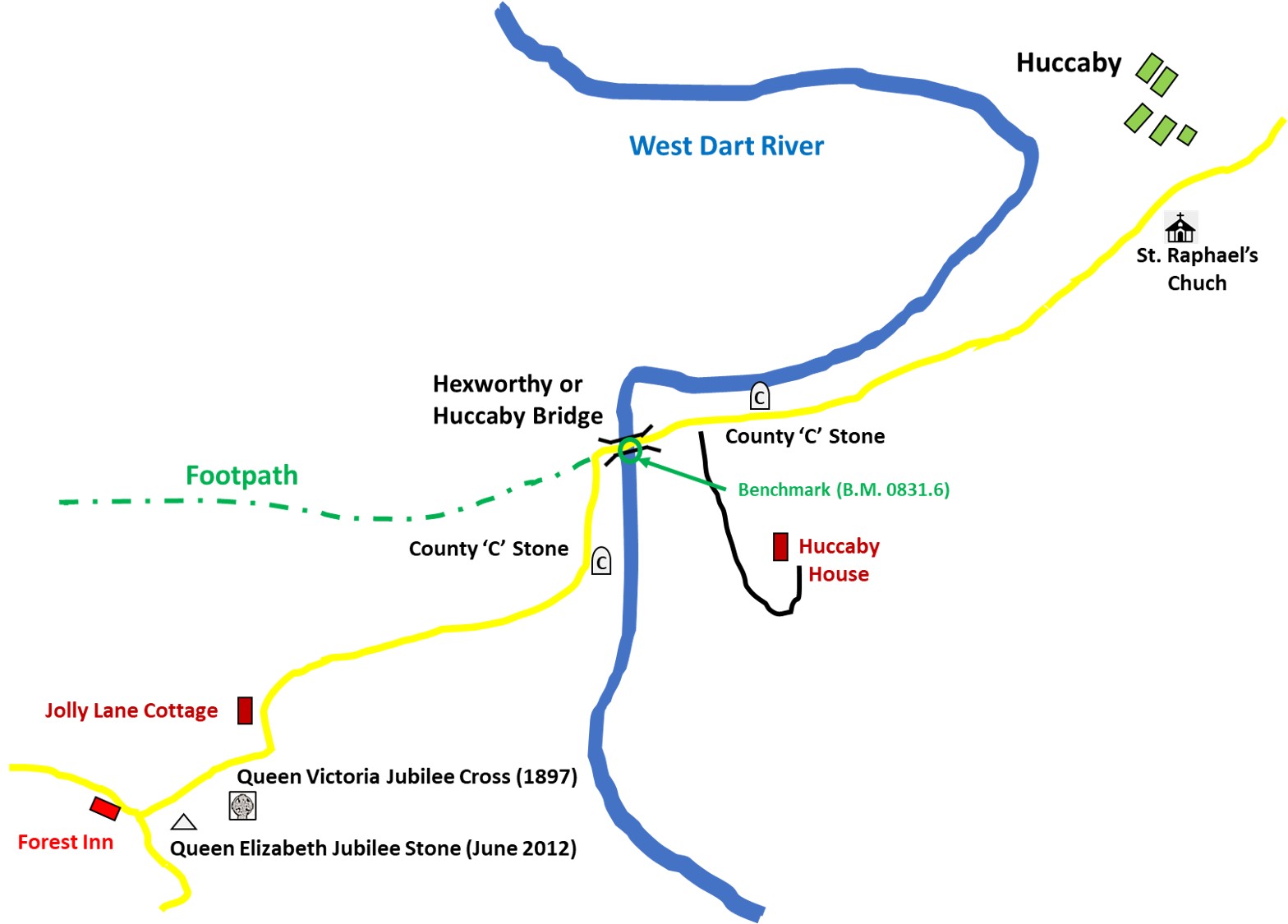
Hexworthy or Huccaby Bridge (and environs)
This post covers features around Hexworthy (or Huccaby) Bridge from Forest Inn in the south west to St. Raphaels Church in the north east. The post includes details of two commemoration artefacts for two Diamond Jubilee’s, two ‘C’ (county) stones and the last cottage on Dartmoor to have been constructed in a single day.
Bibliography
Quick, (1992), Dartmoor Inns, 45-6
Gover, Mawer + Stenton (1931), The Place-Names of Devon: Part One, 194
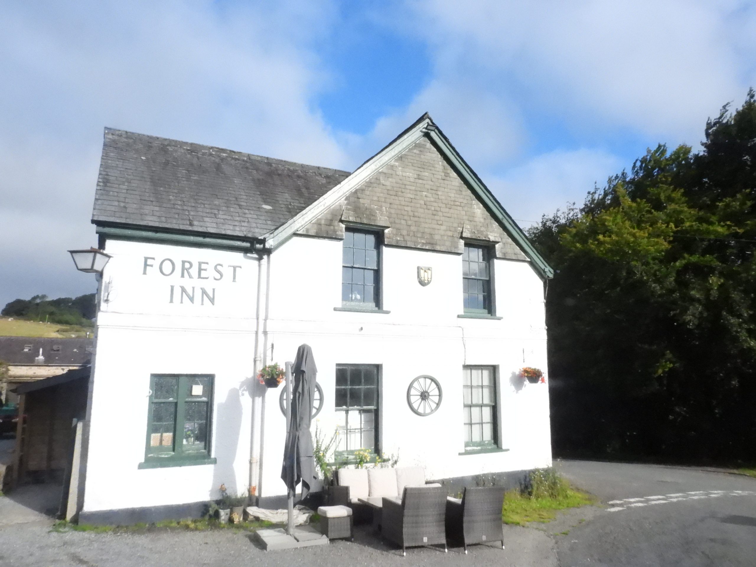
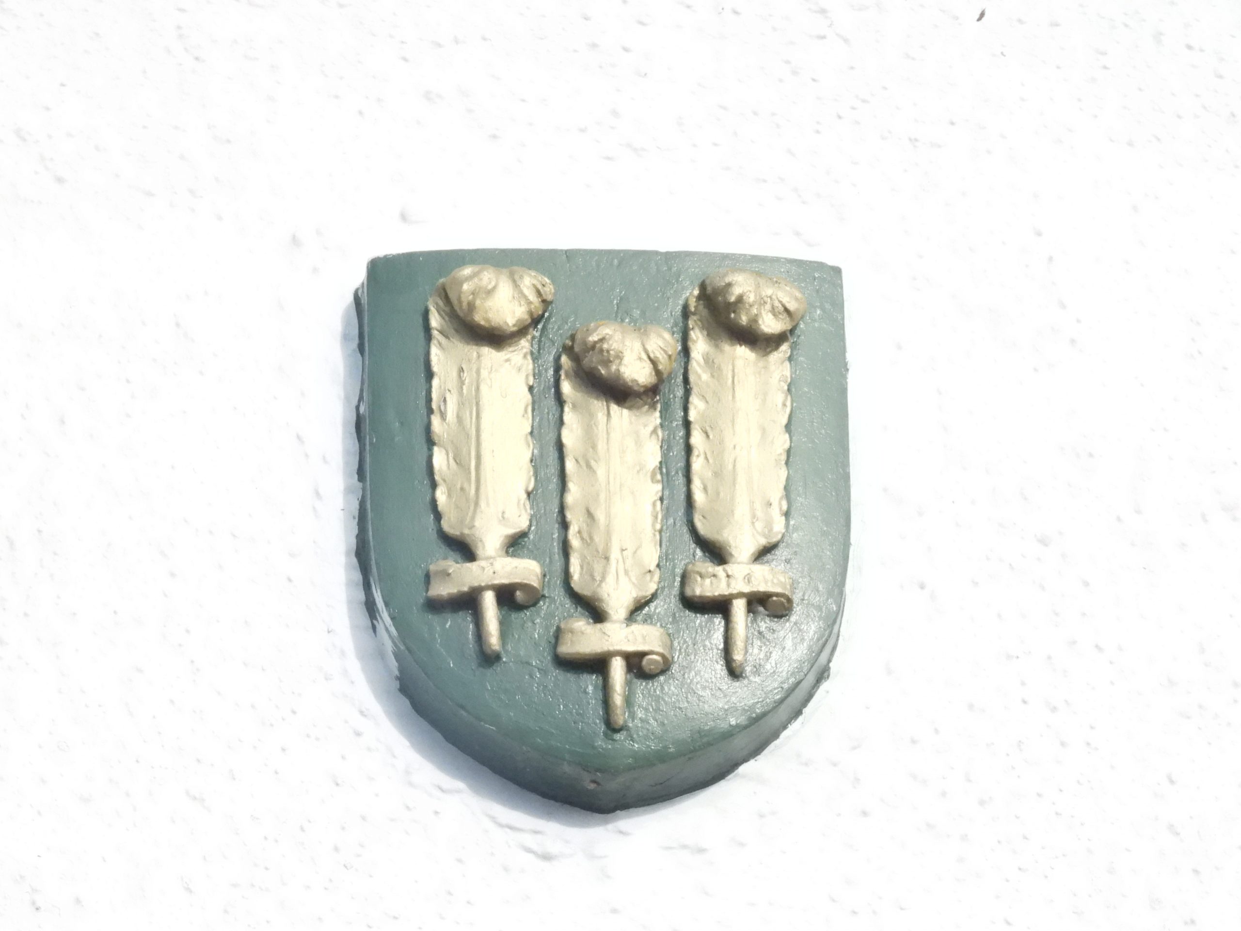
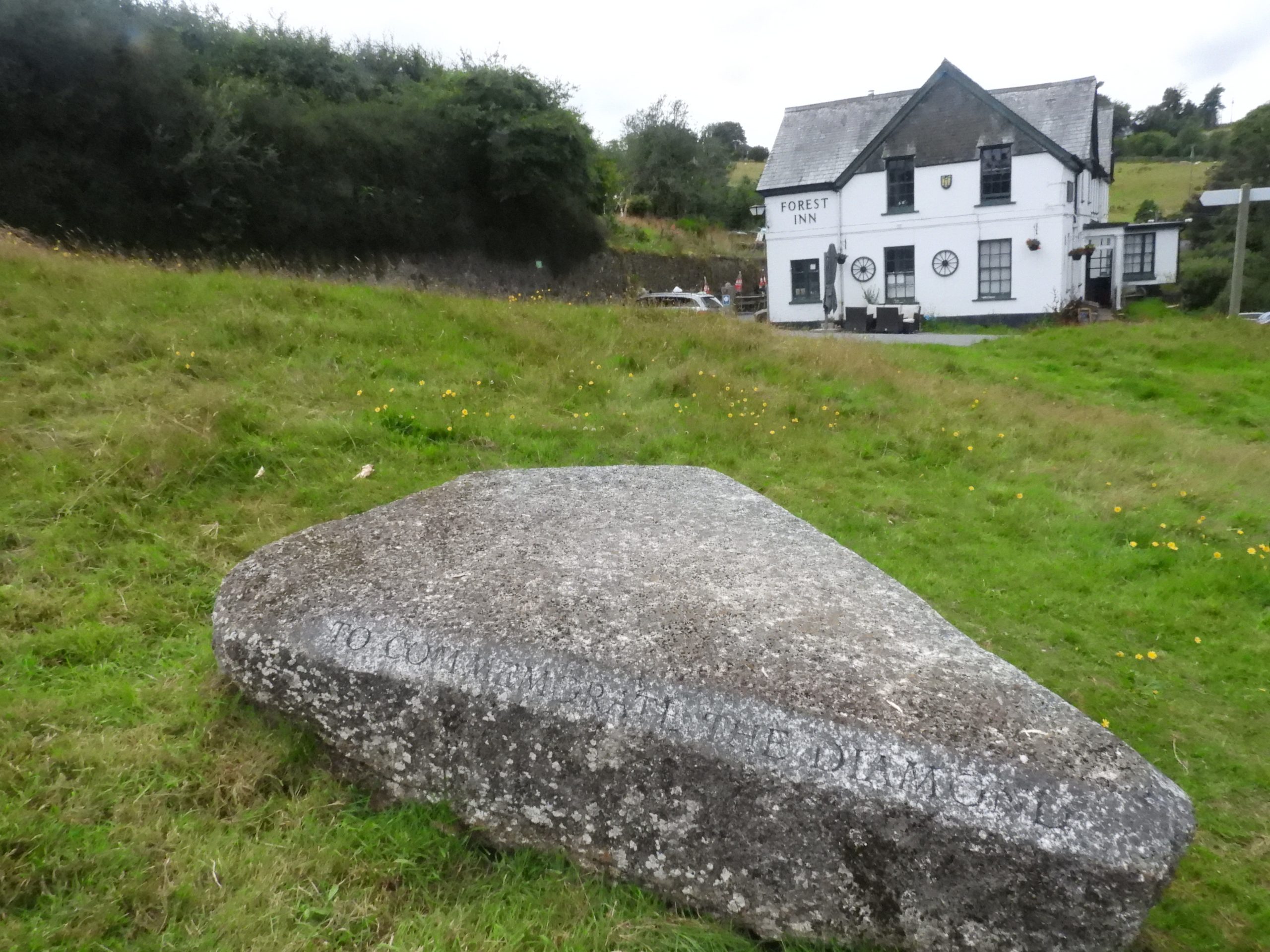
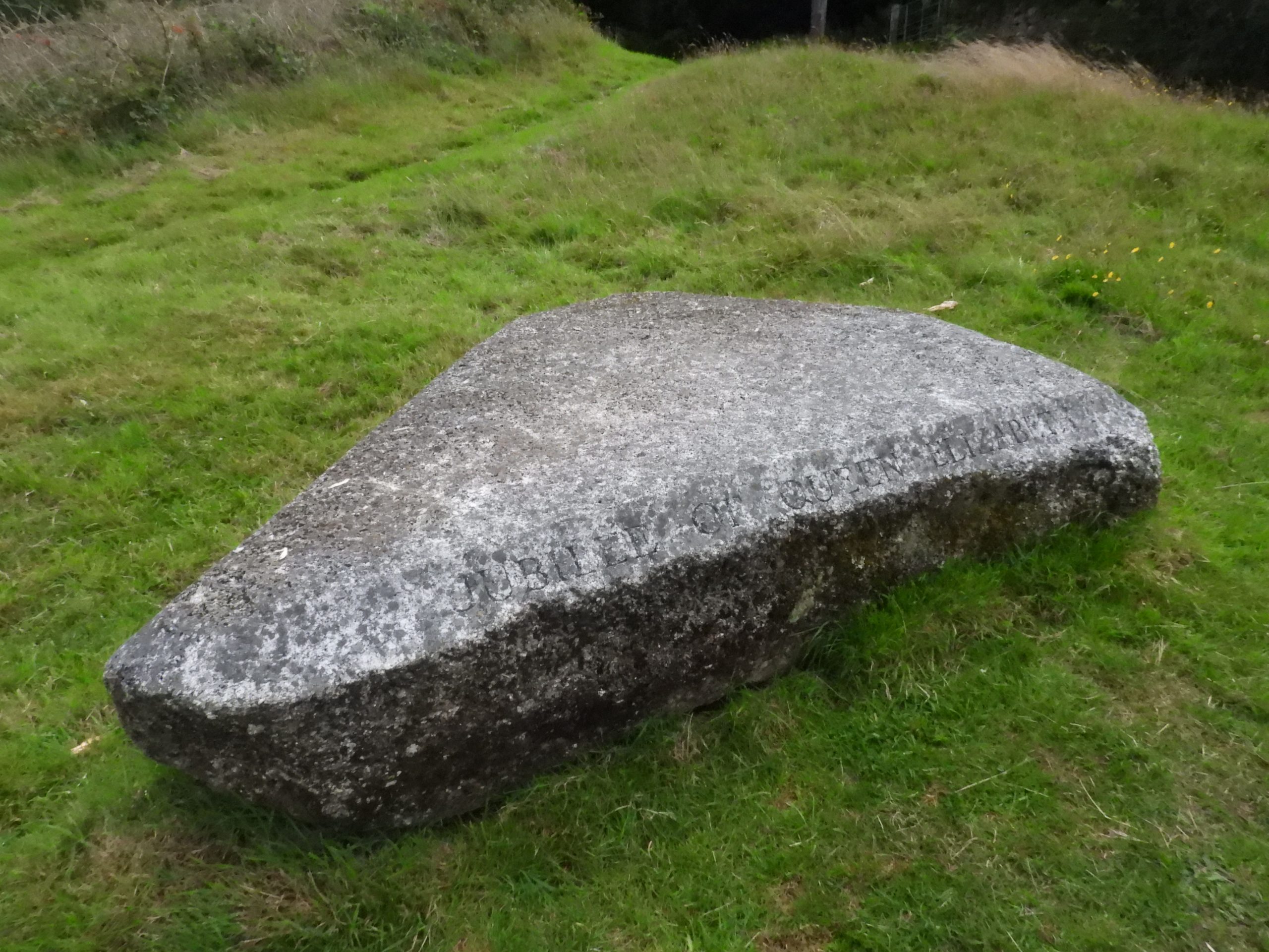
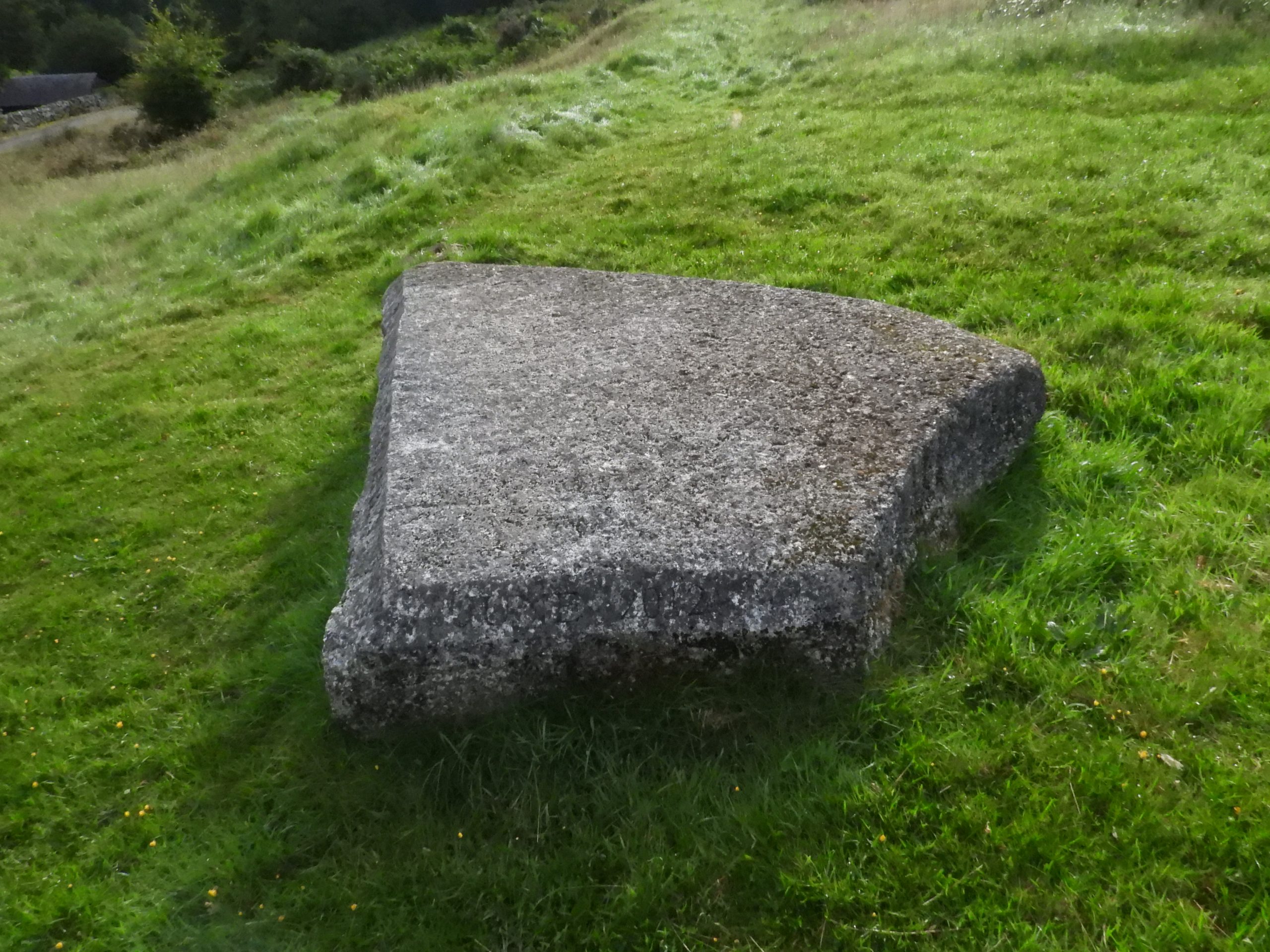
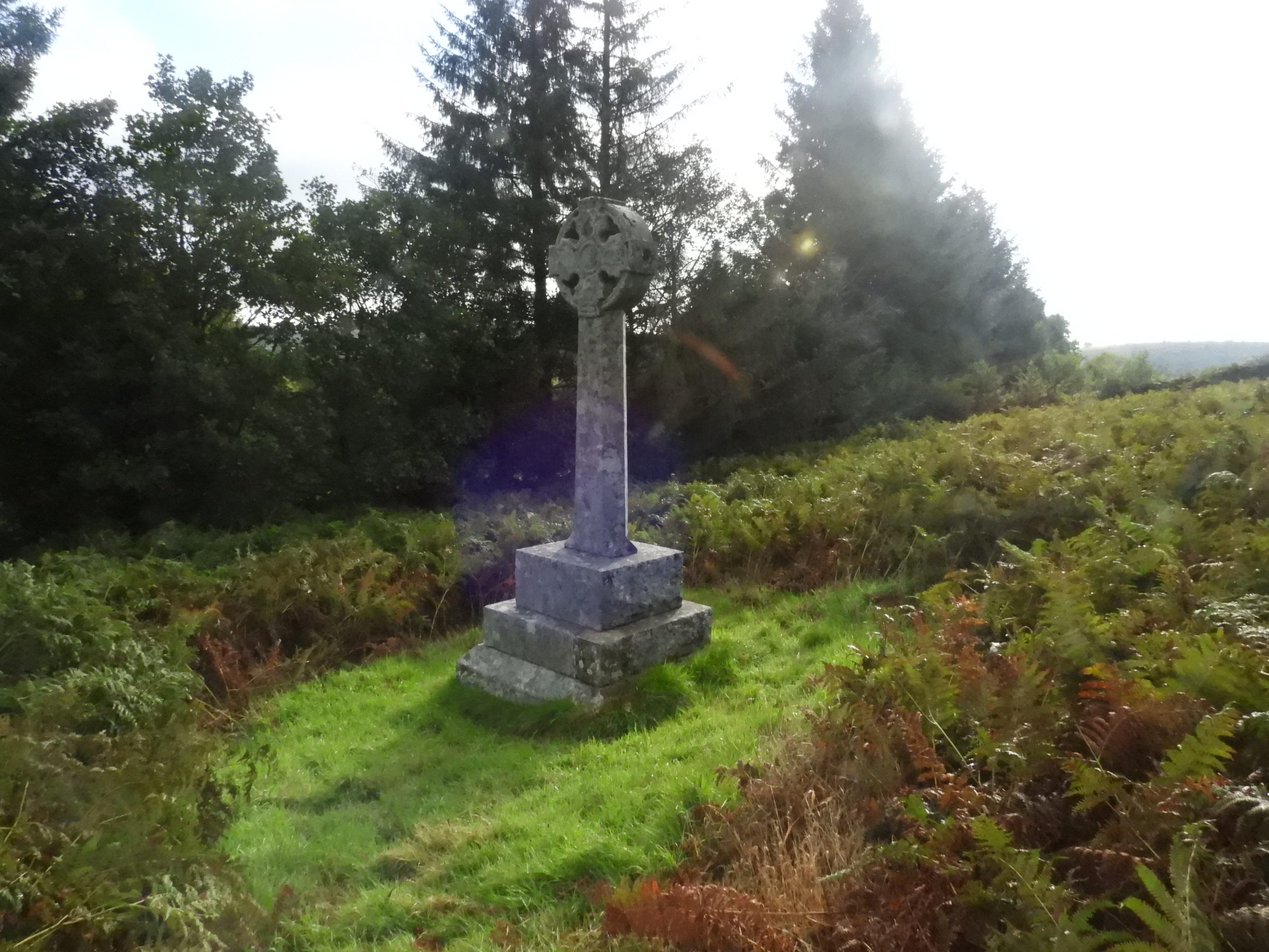
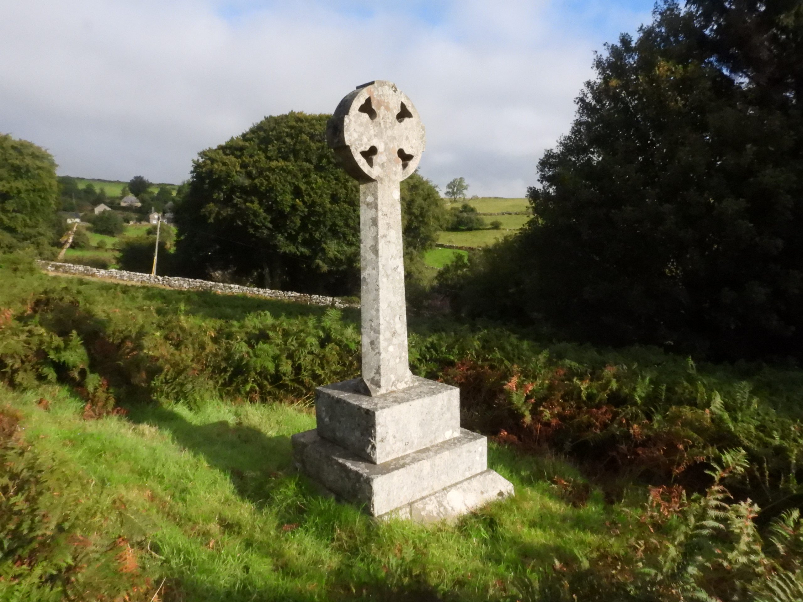
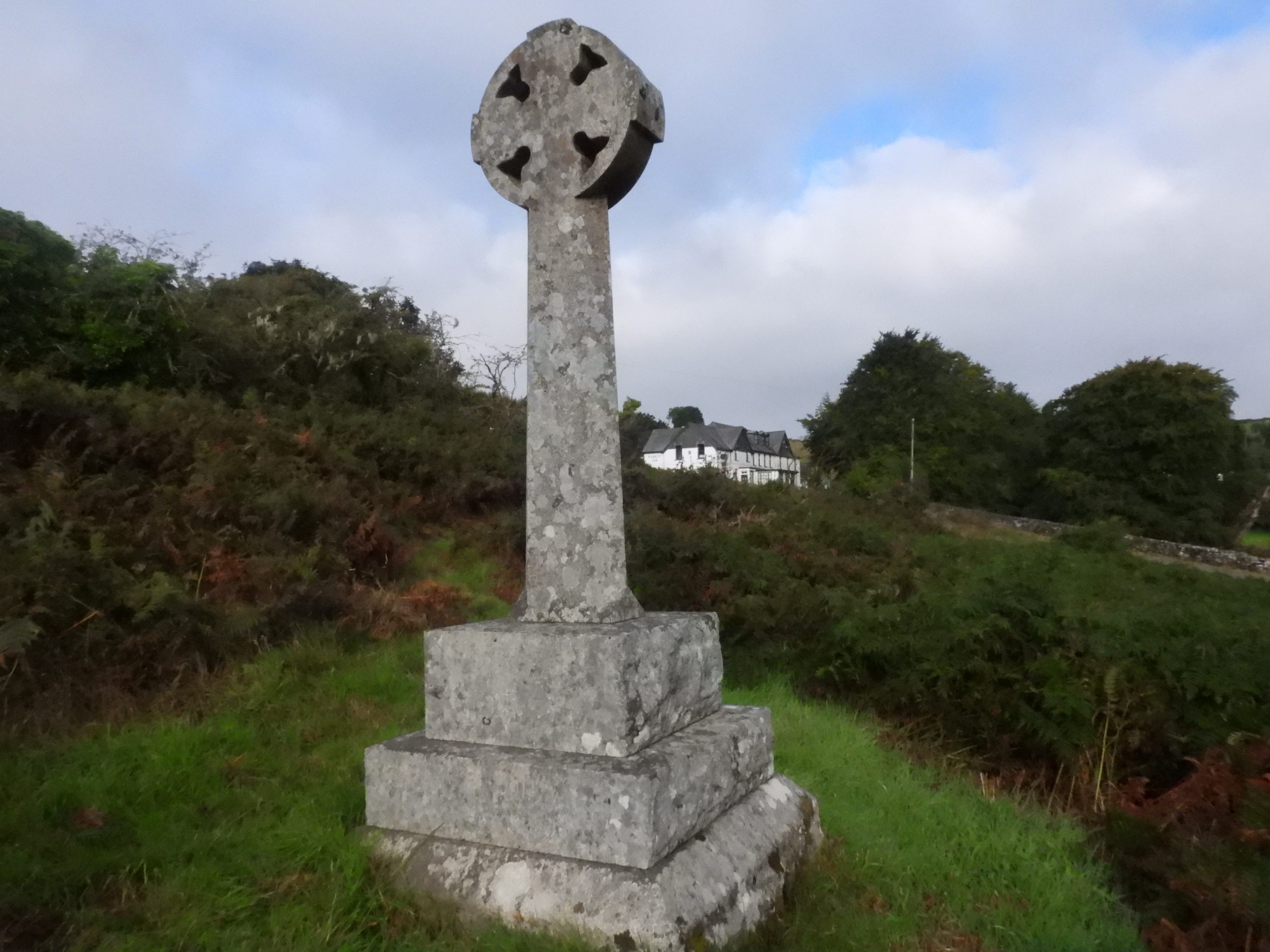
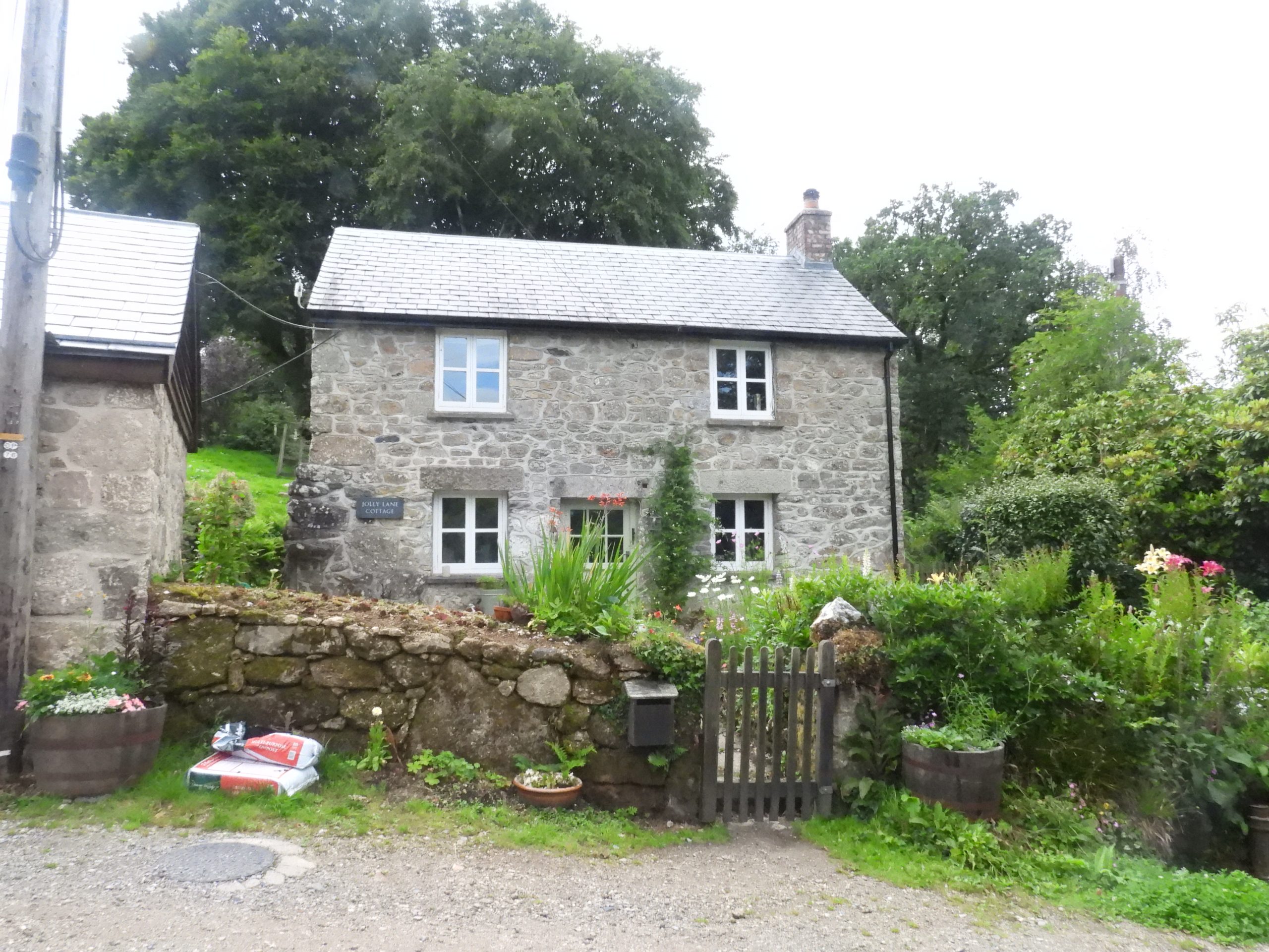
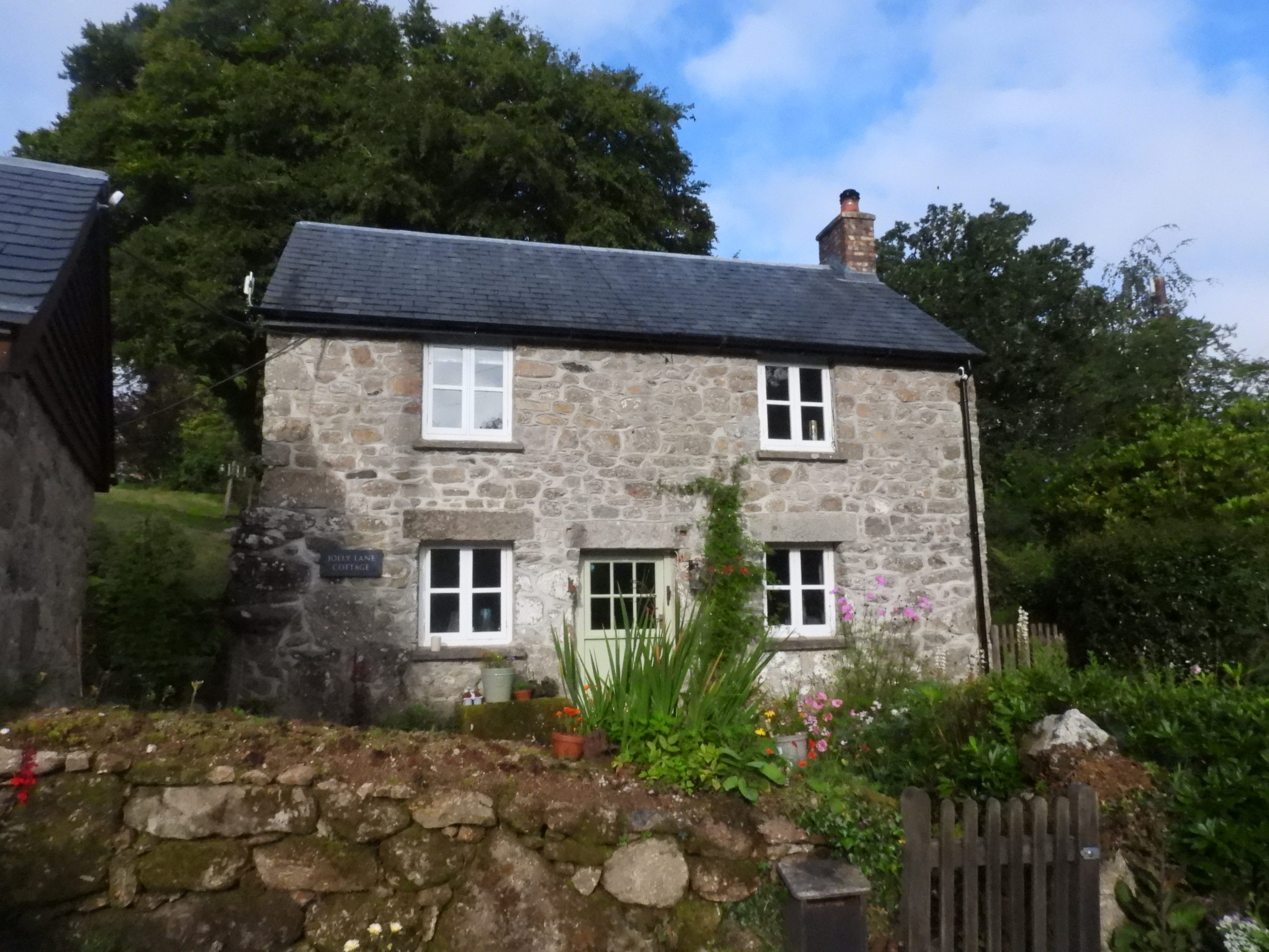
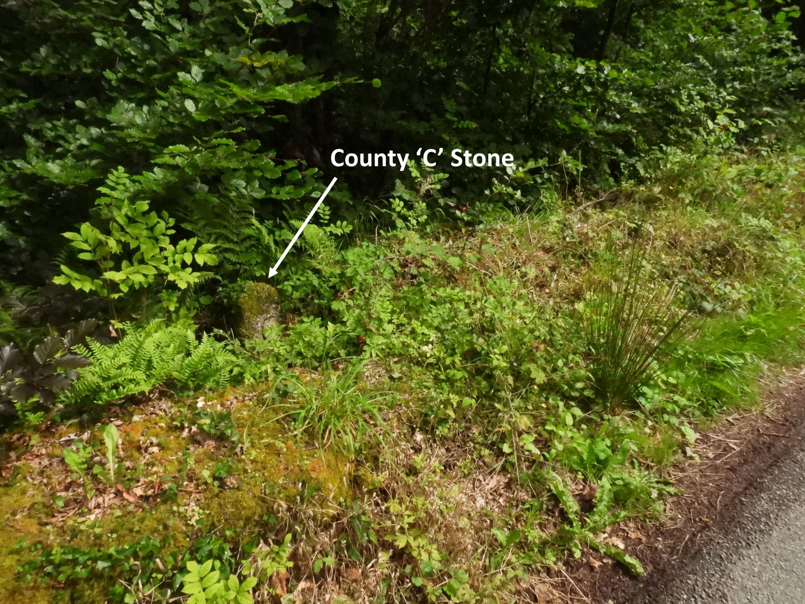
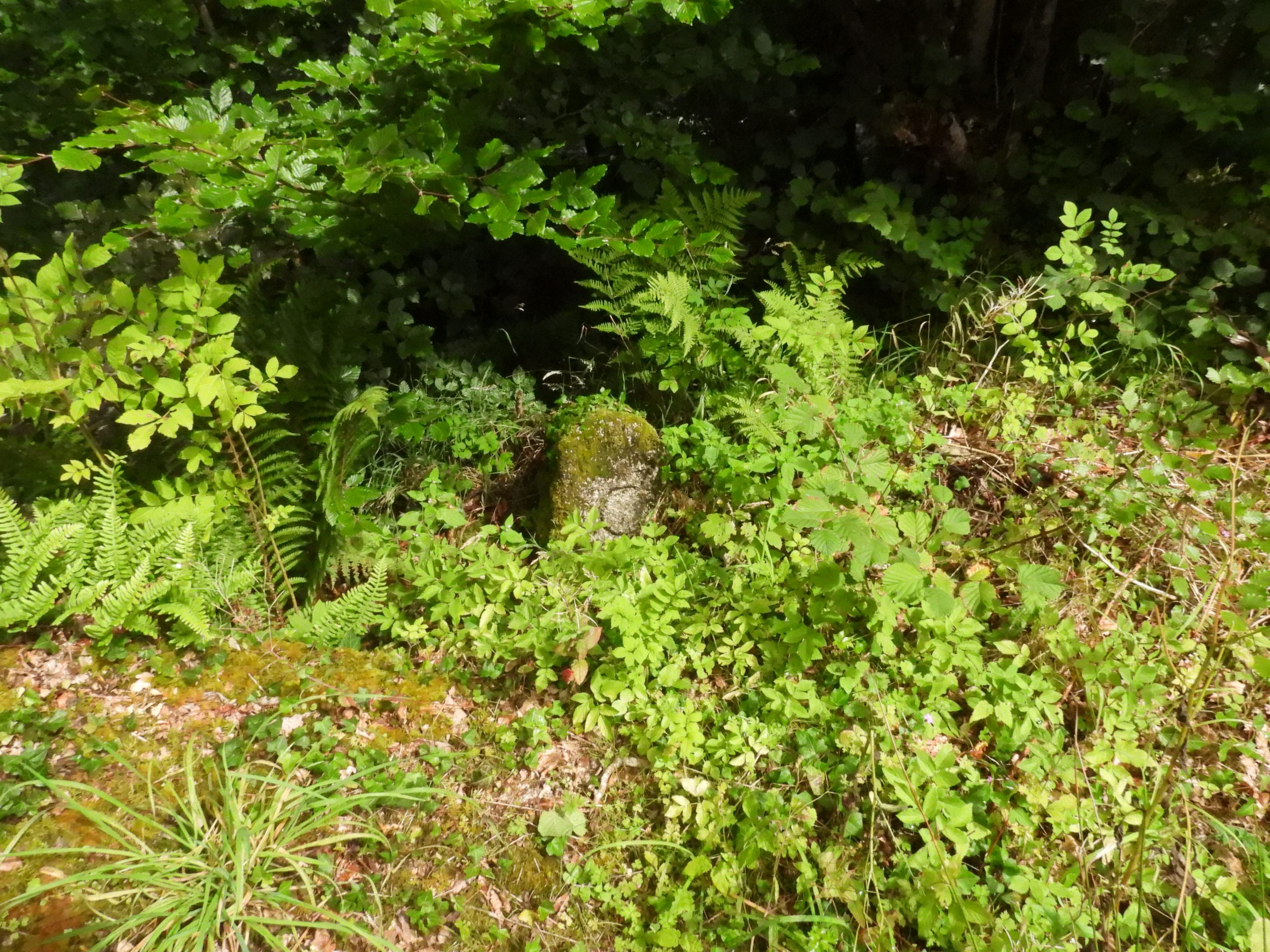
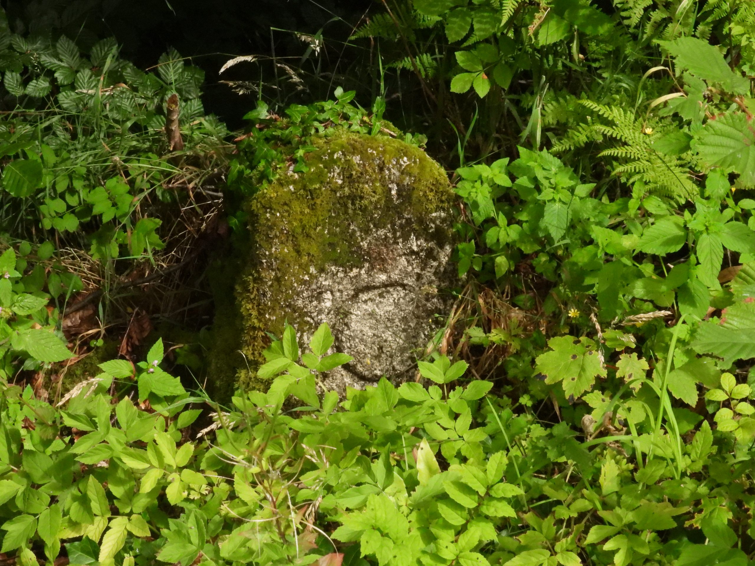
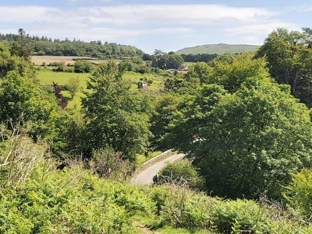
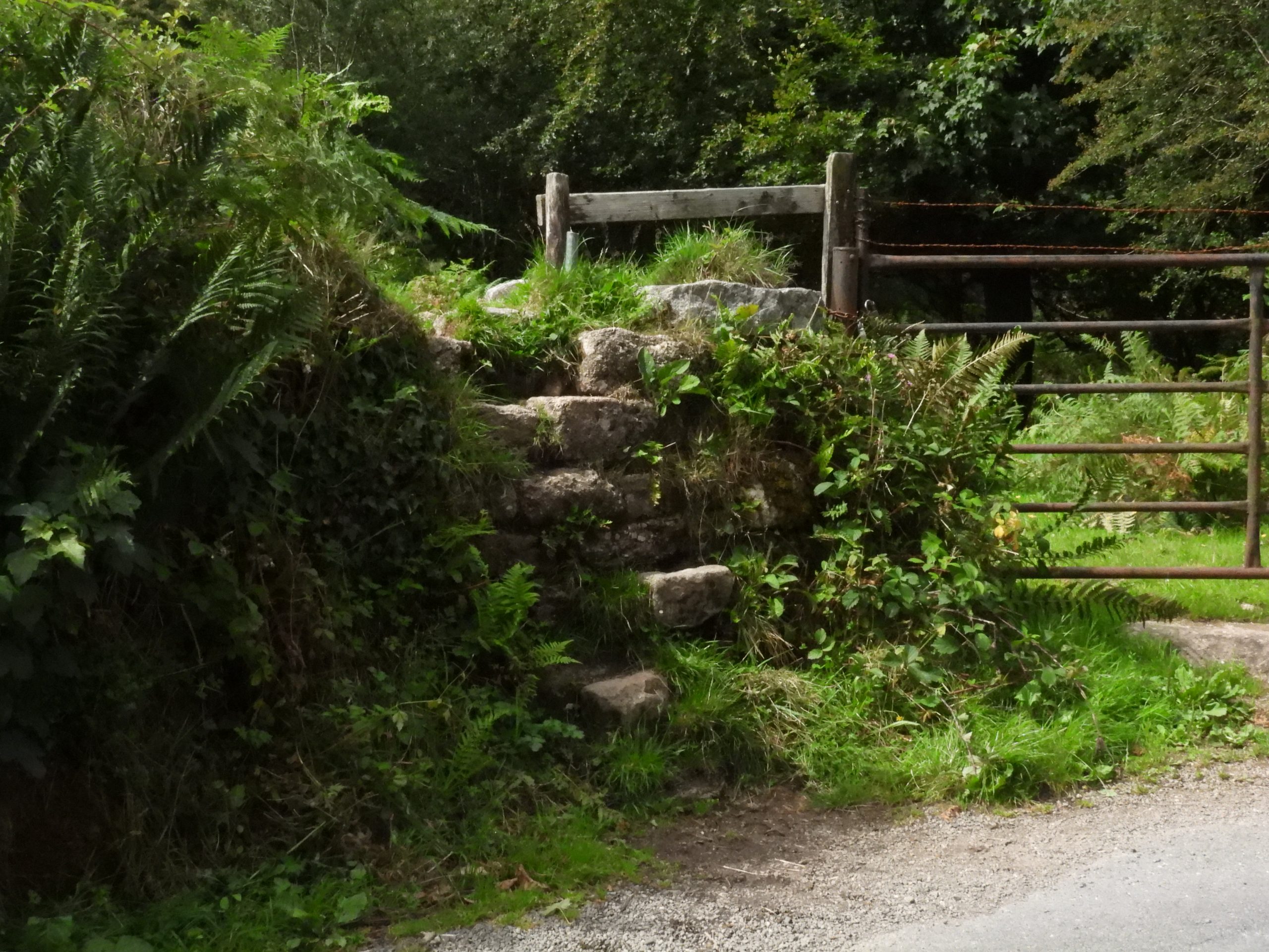
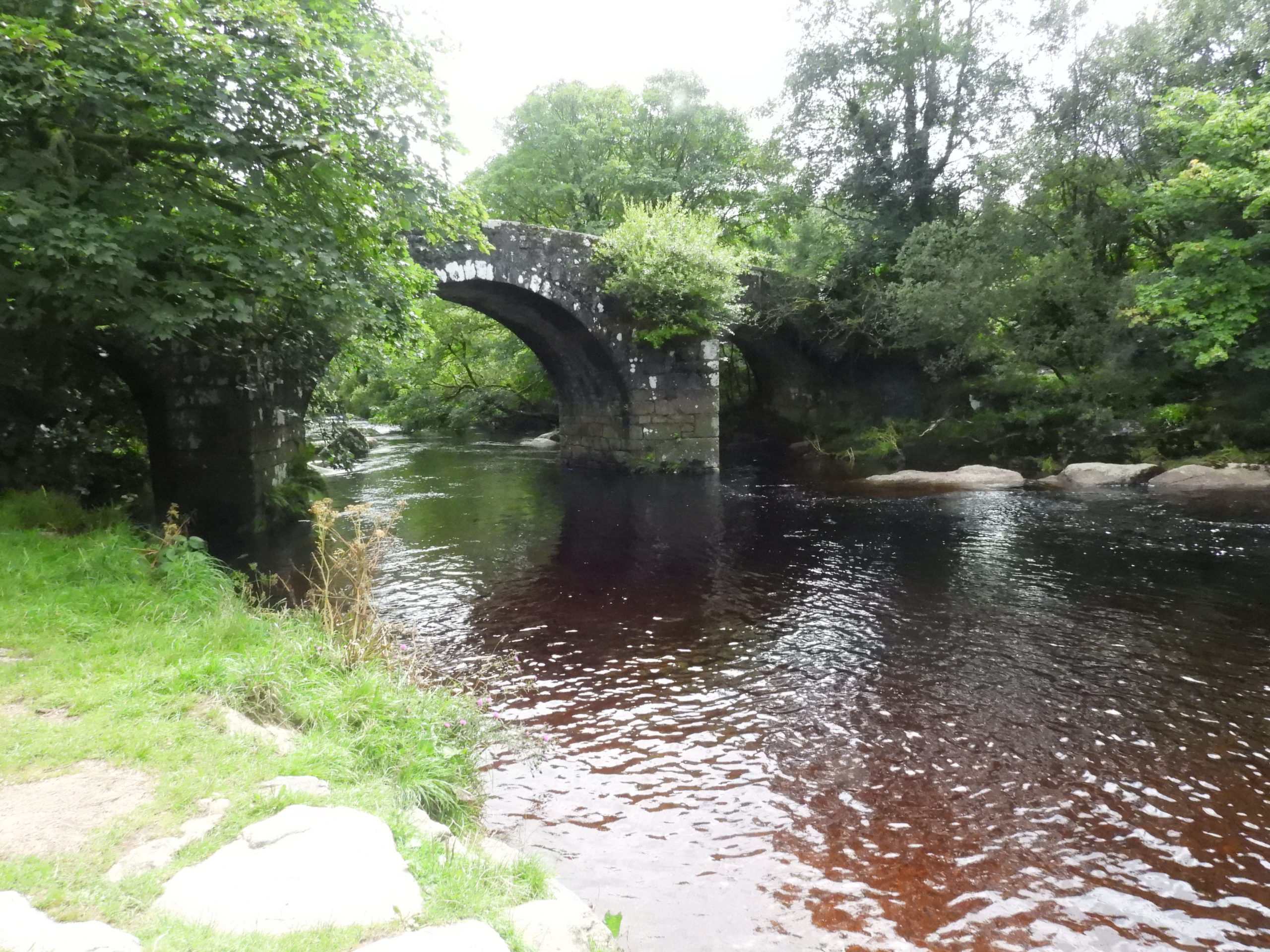
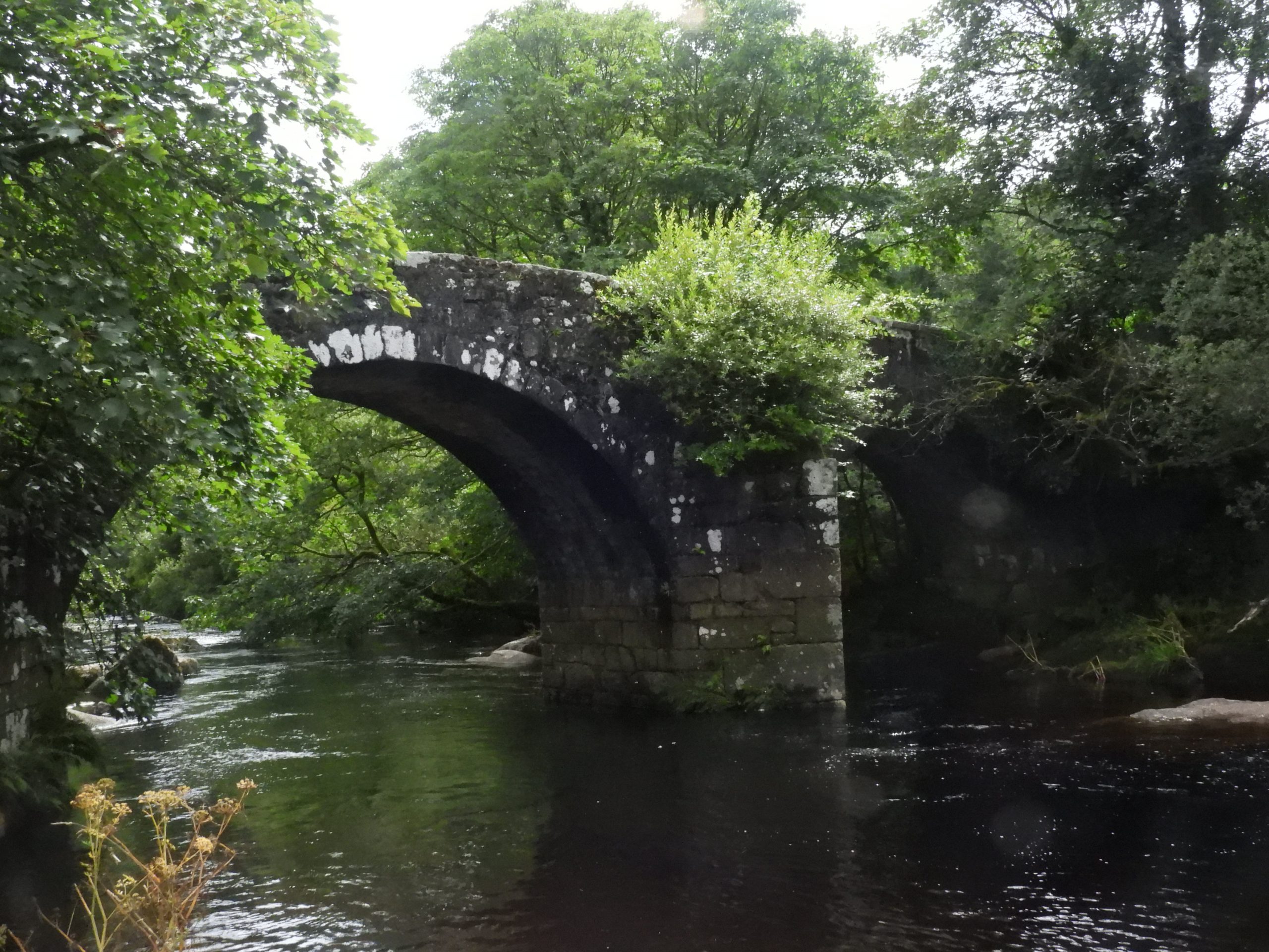
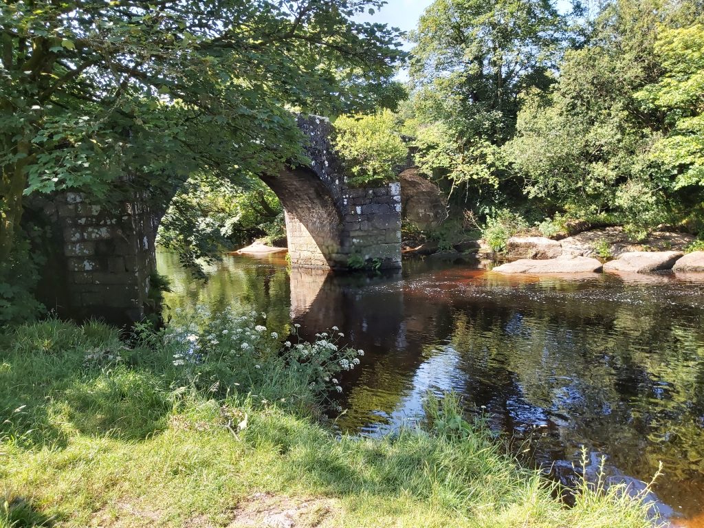
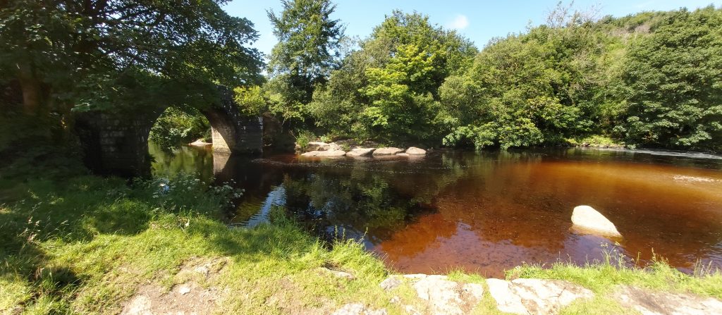
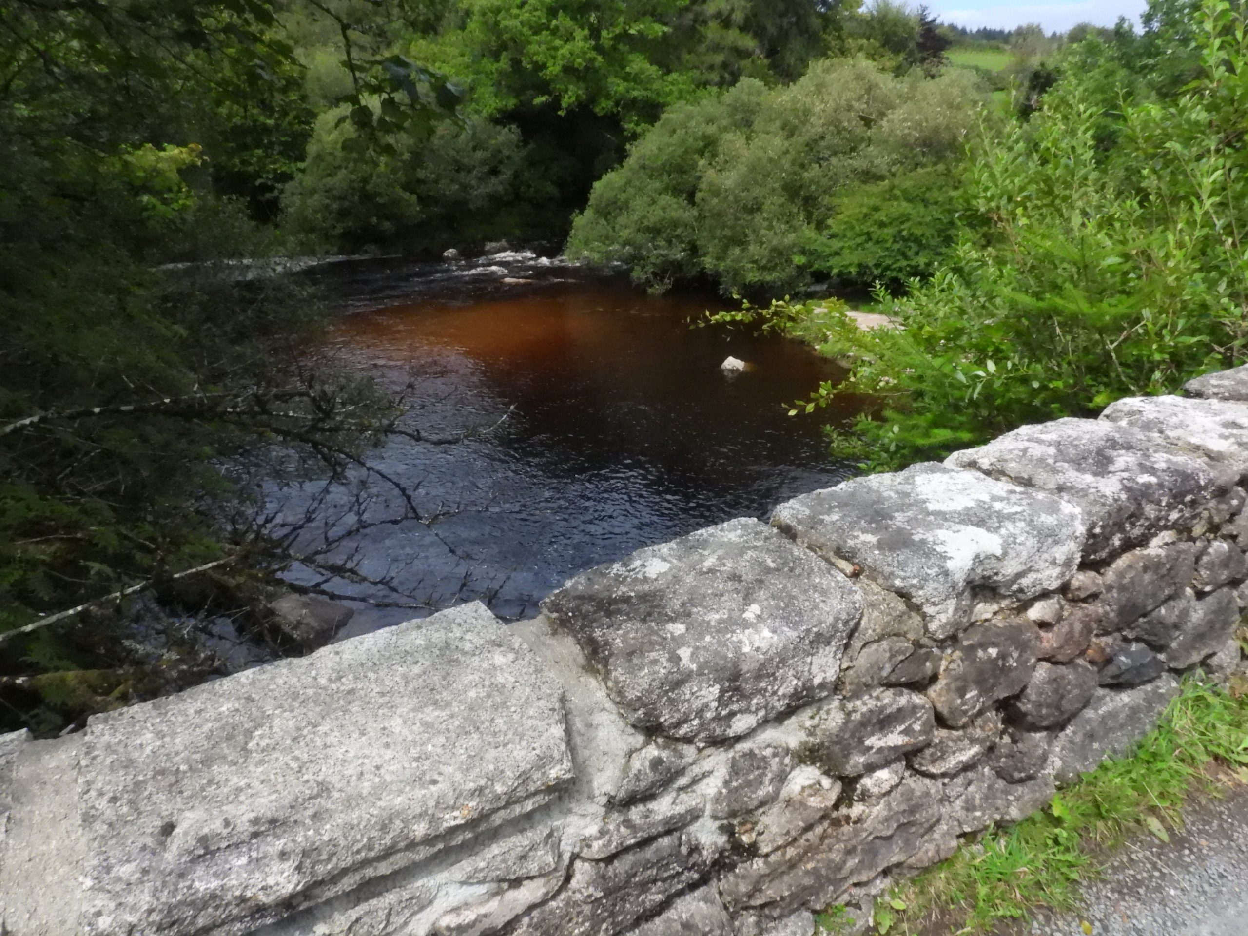
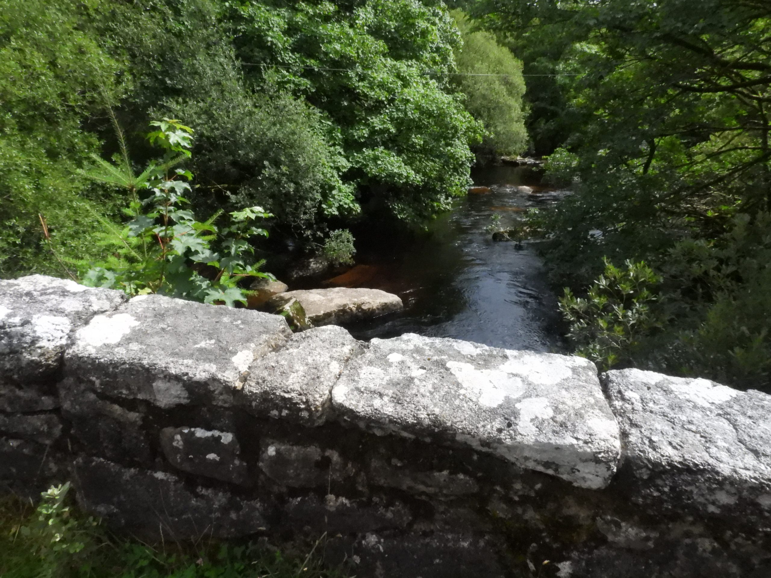
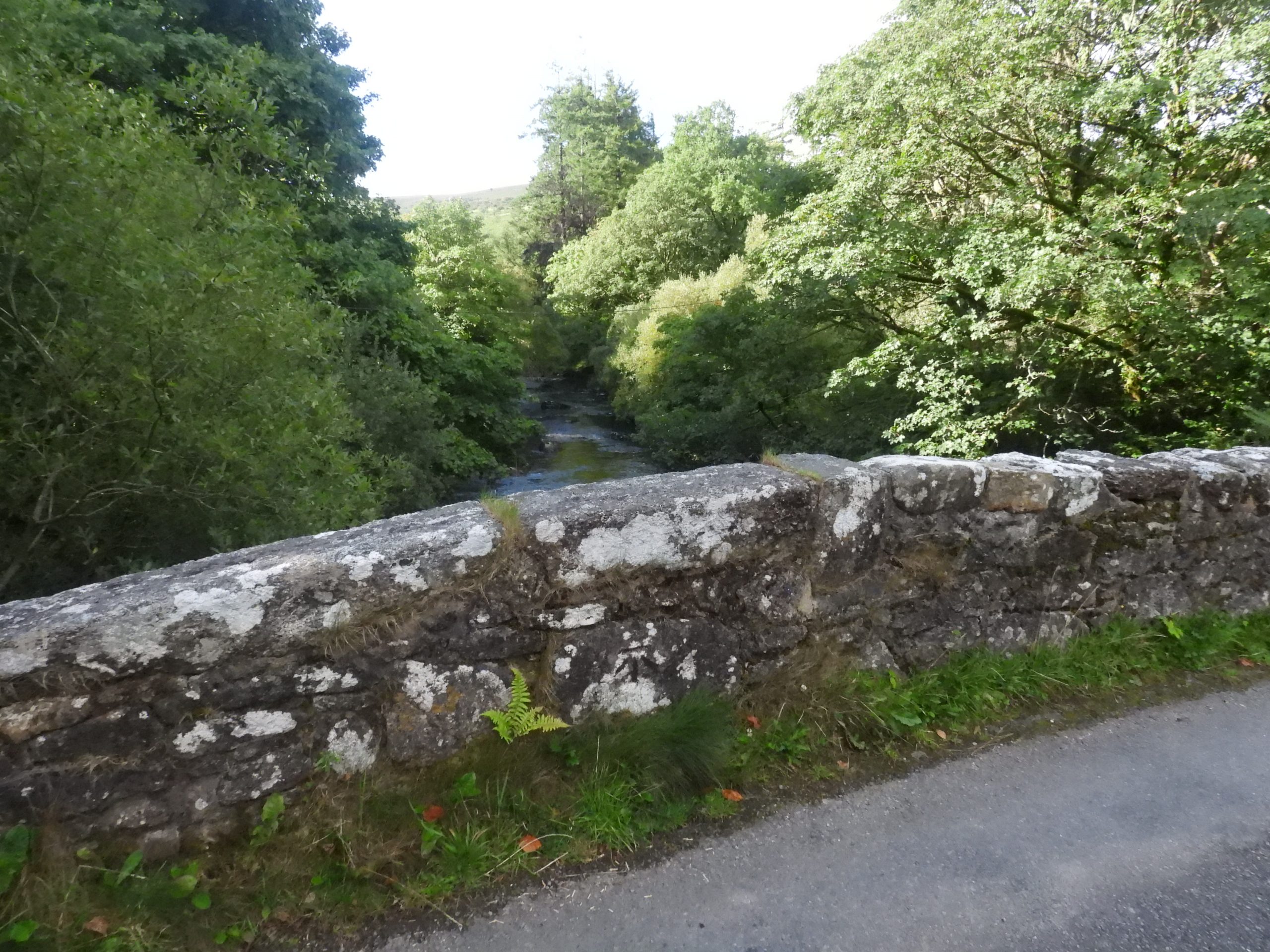
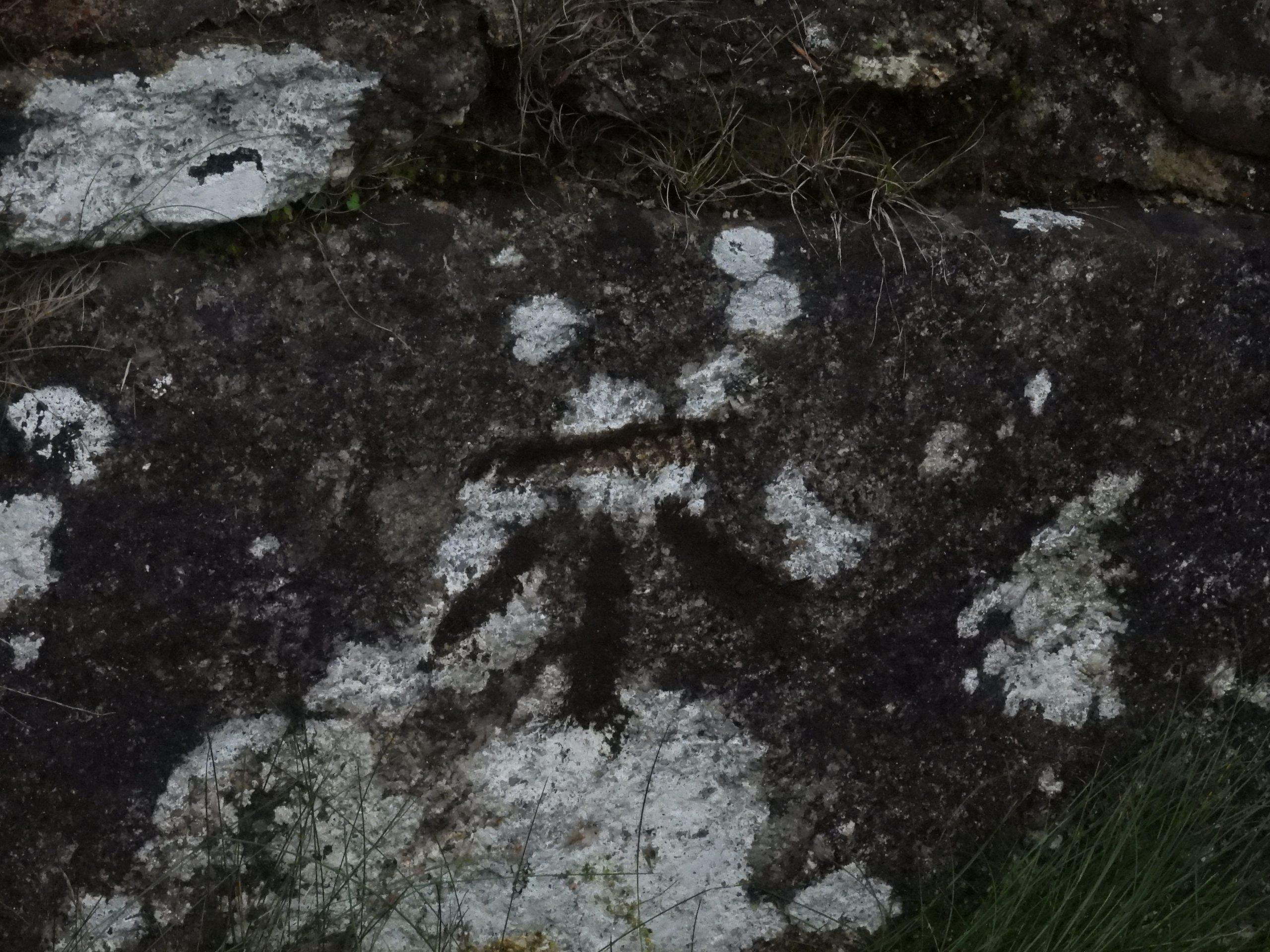
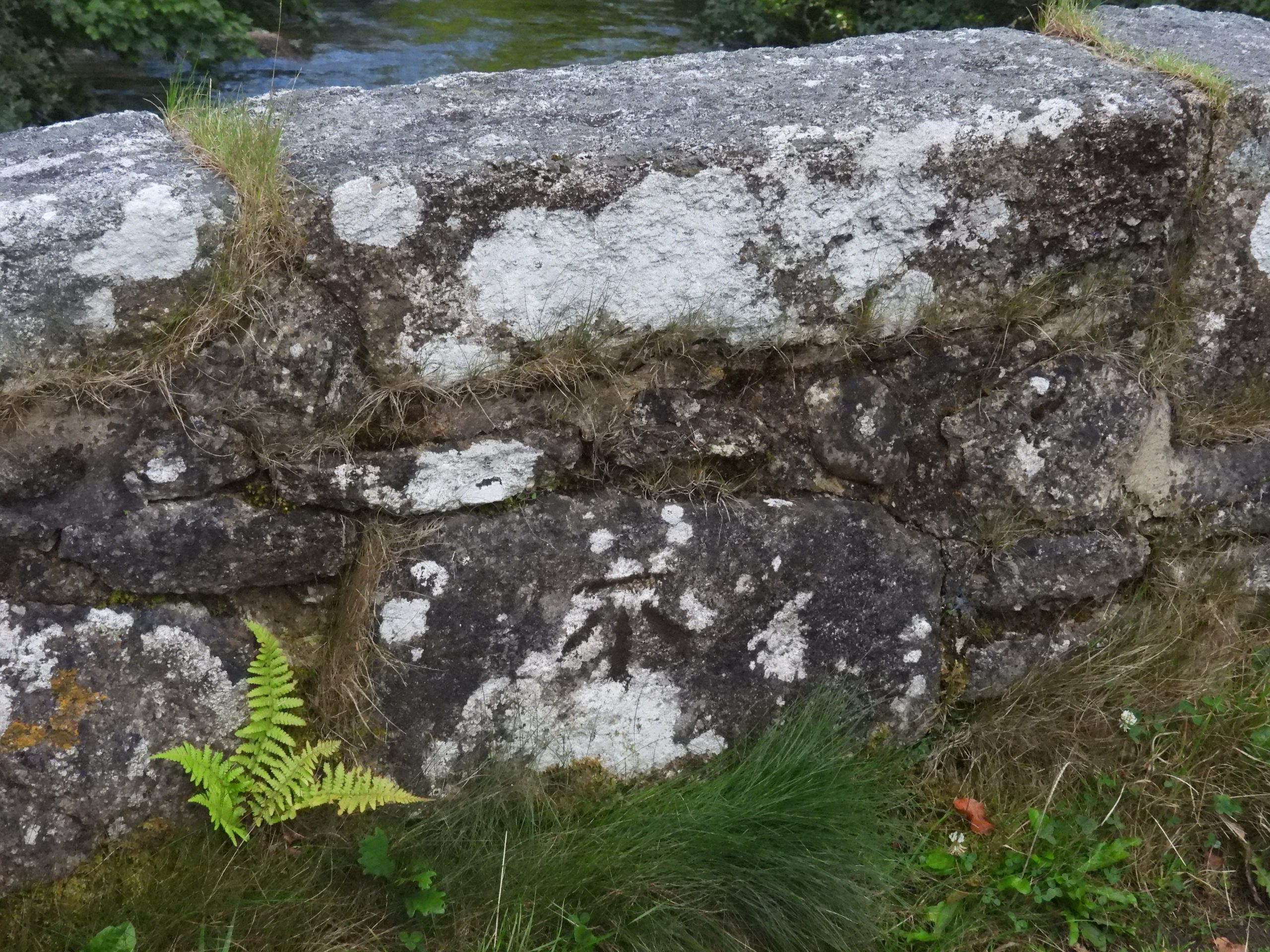
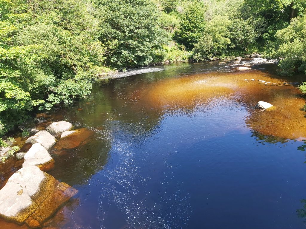
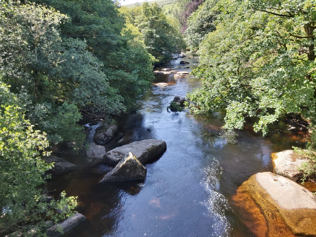
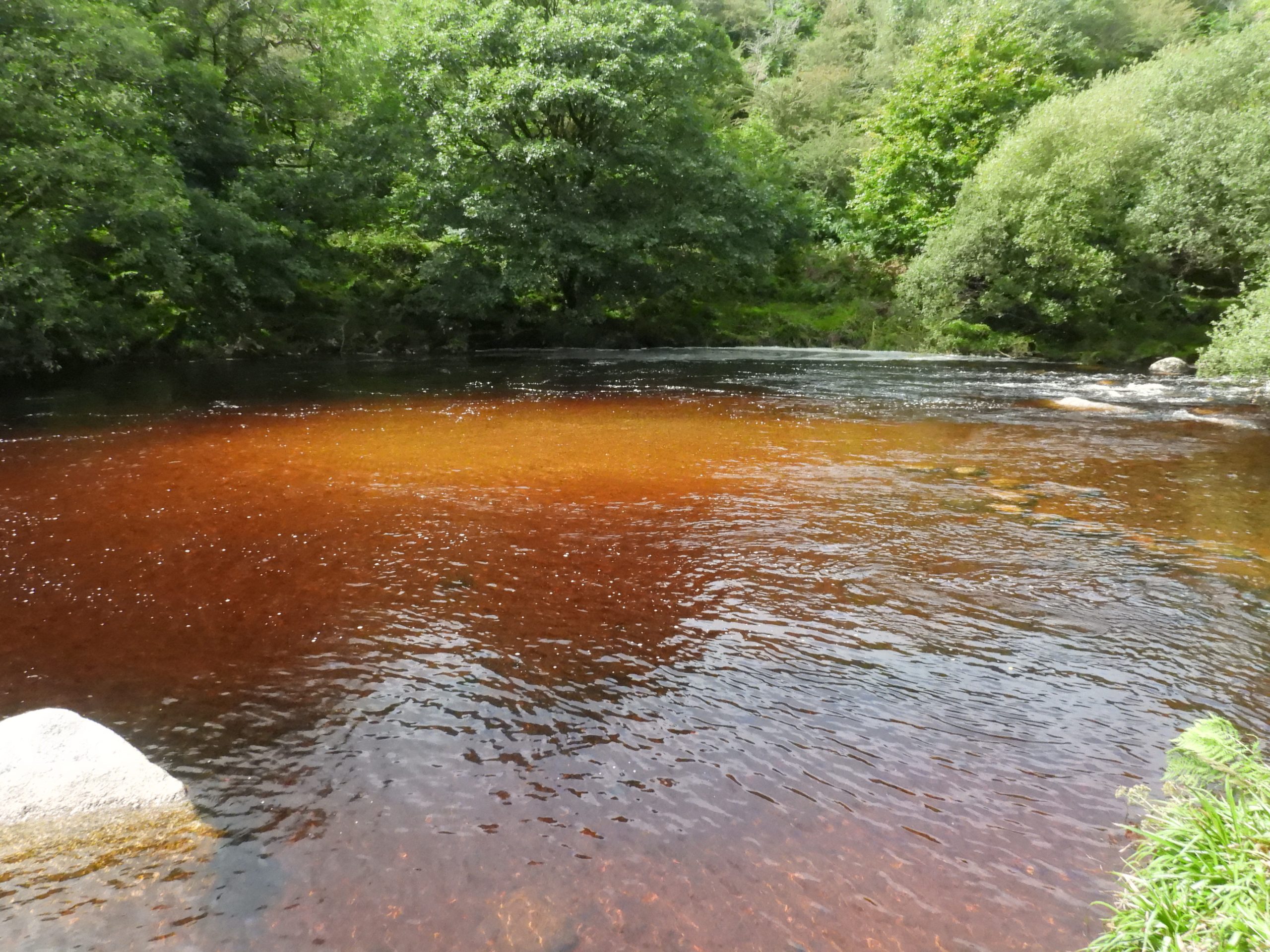
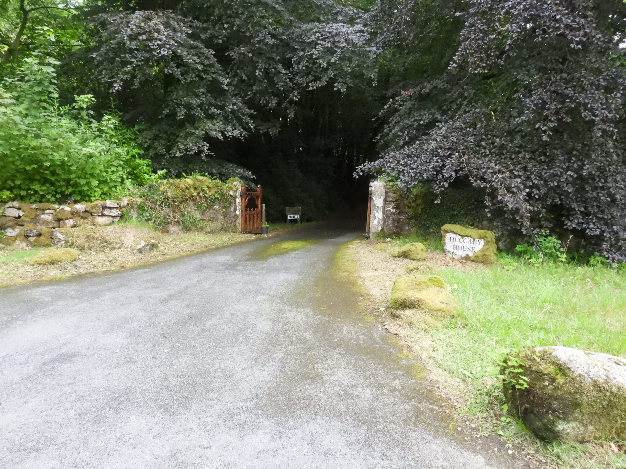
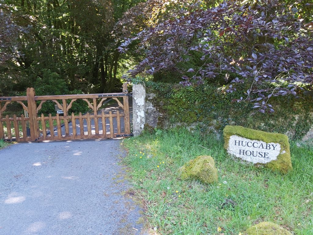
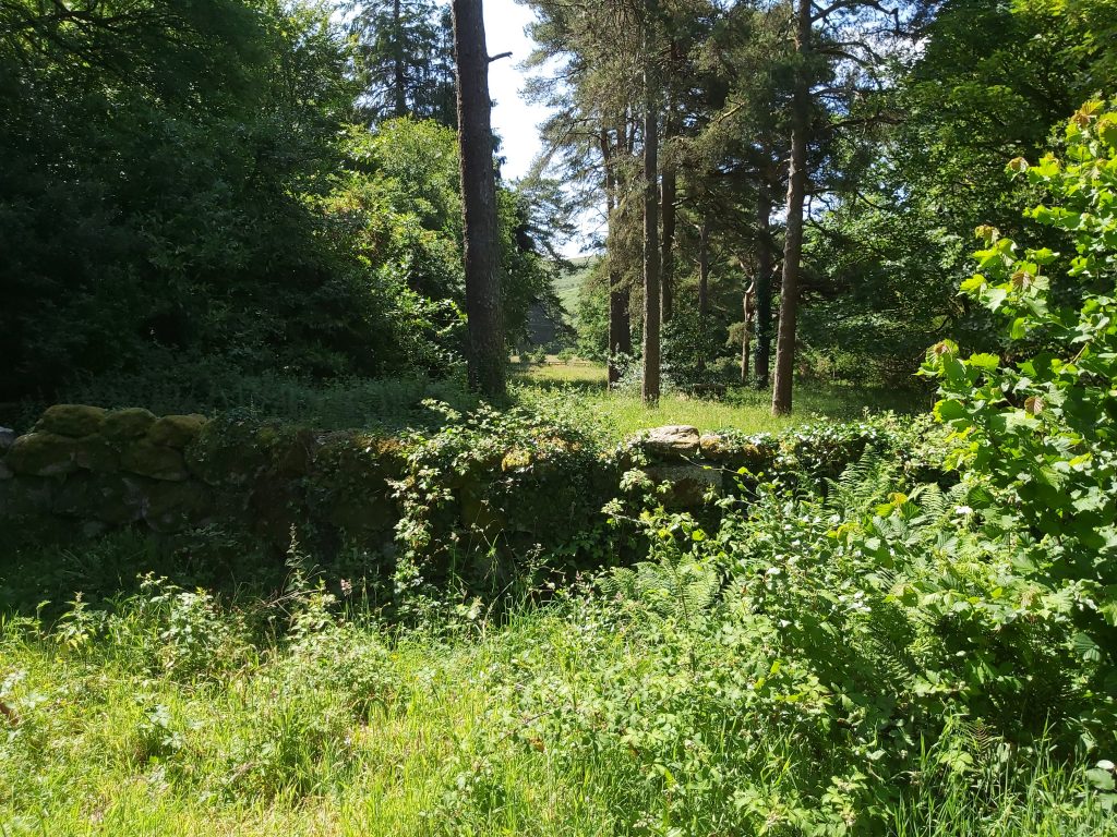
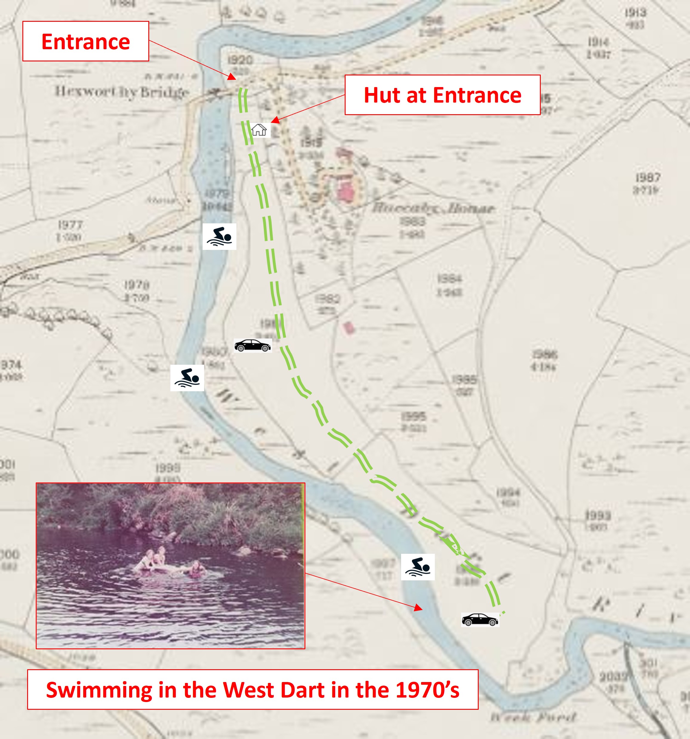
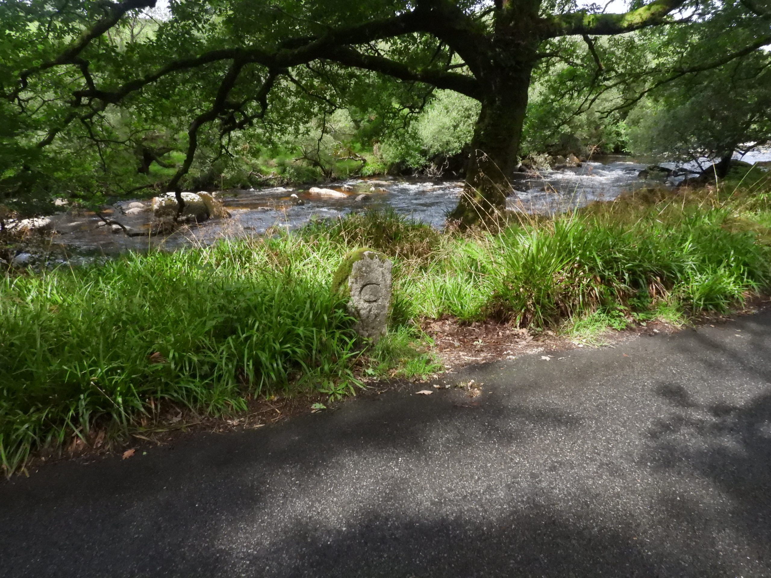
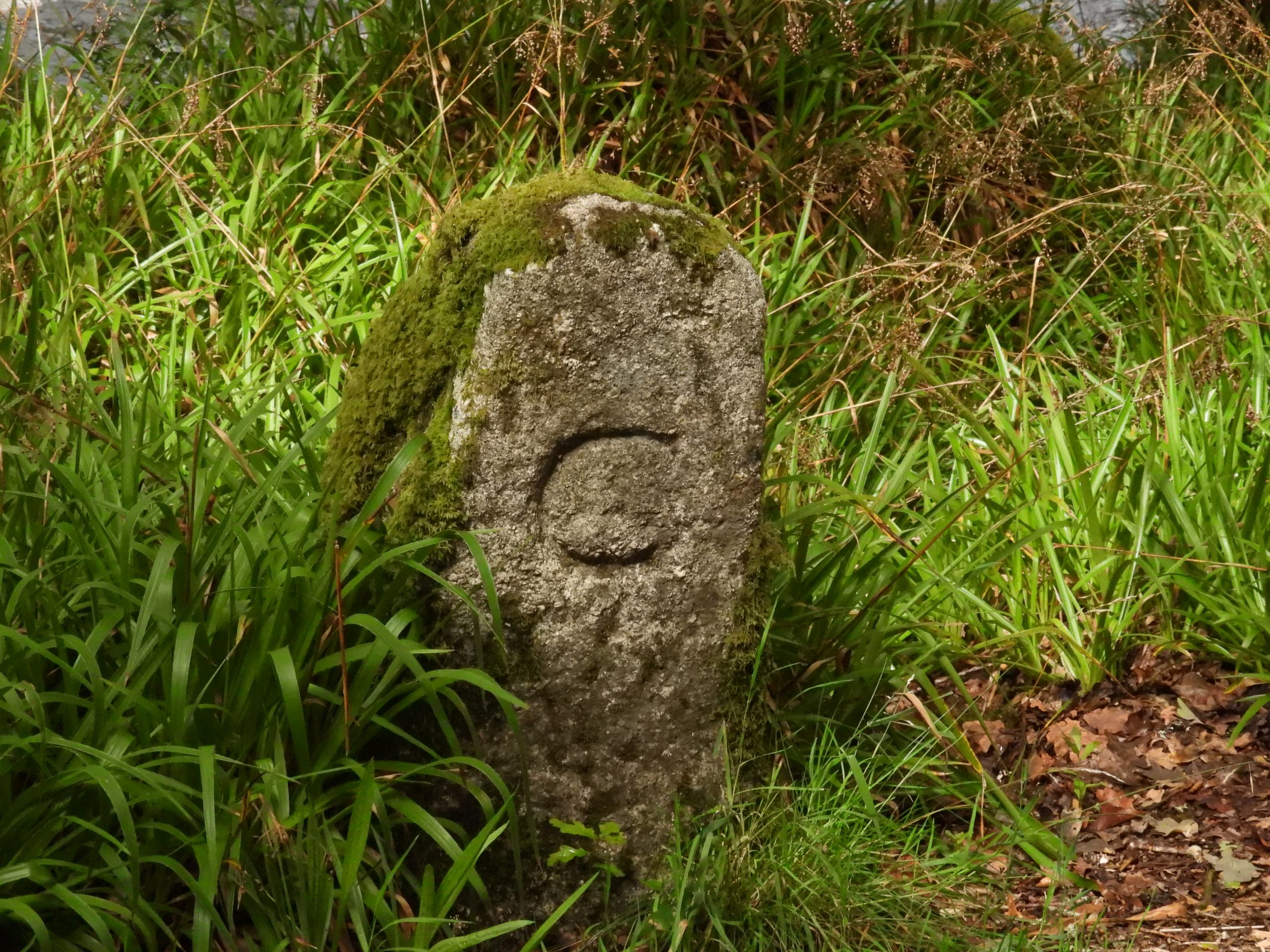
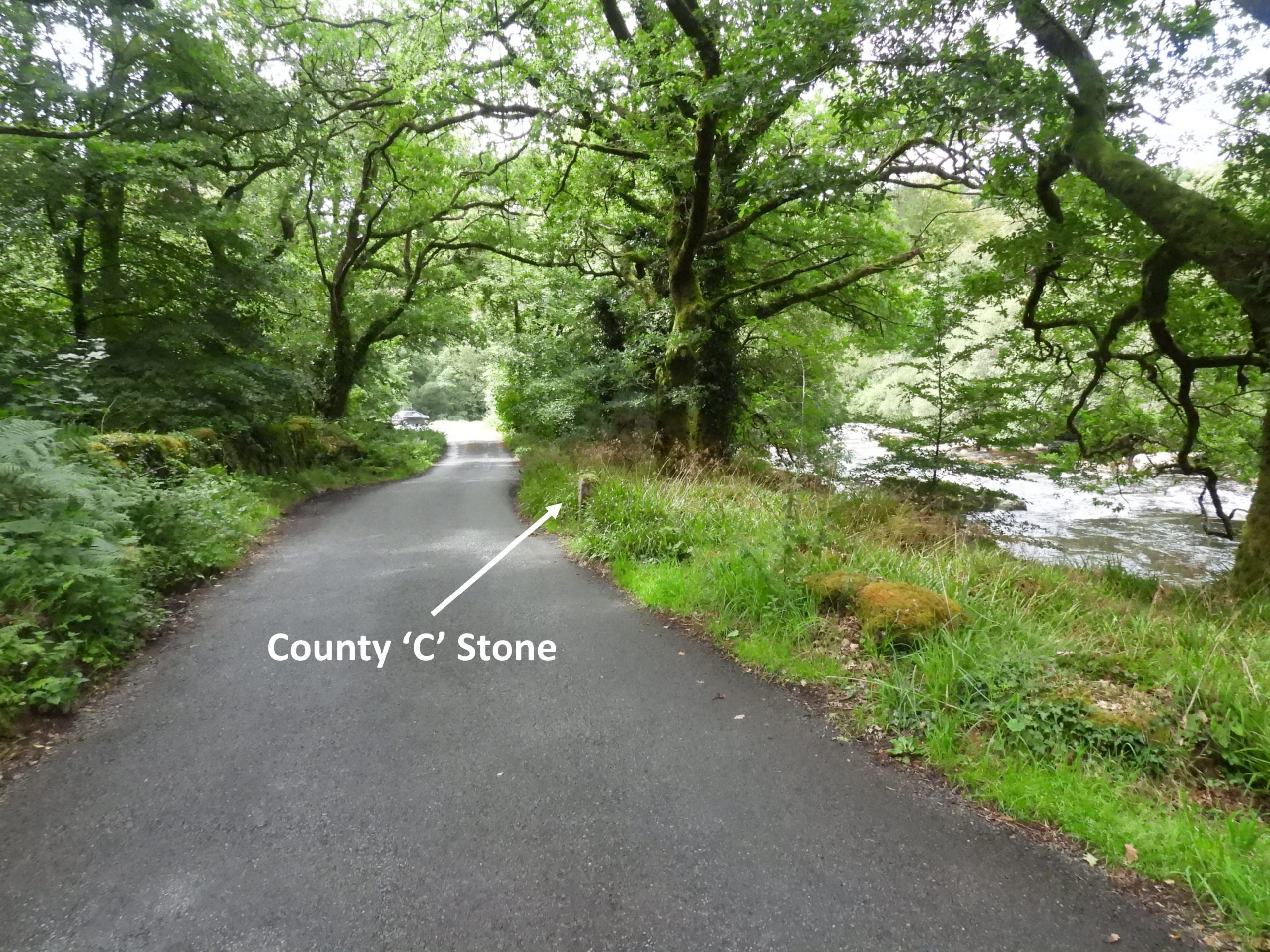
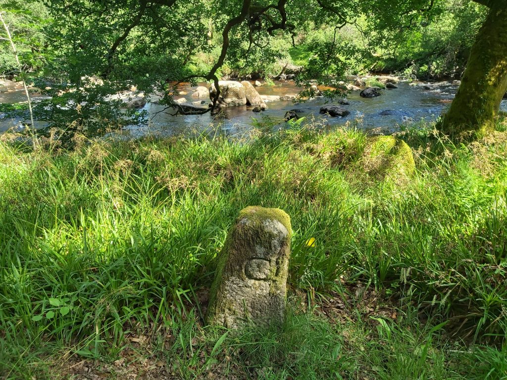
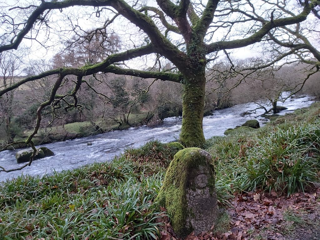
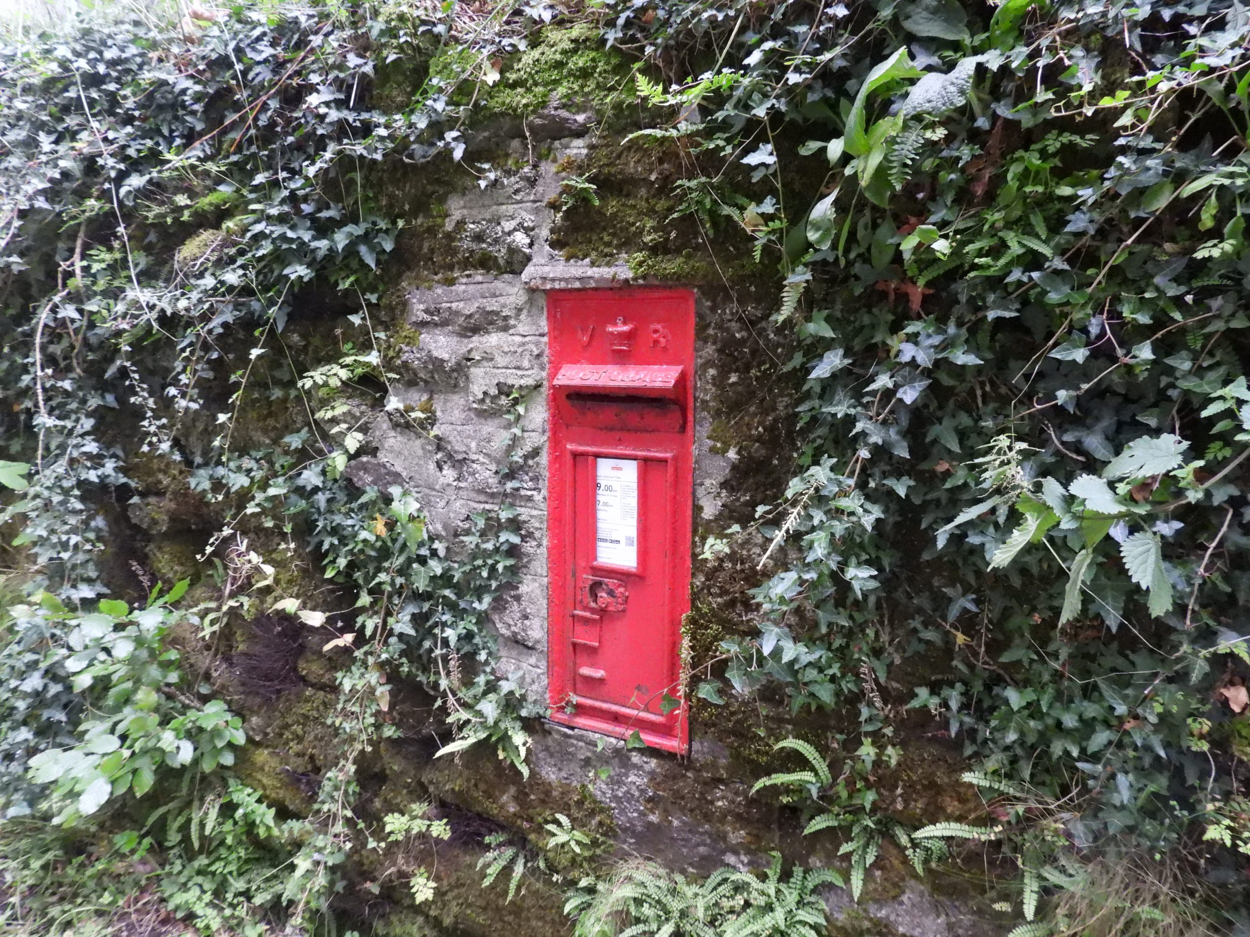
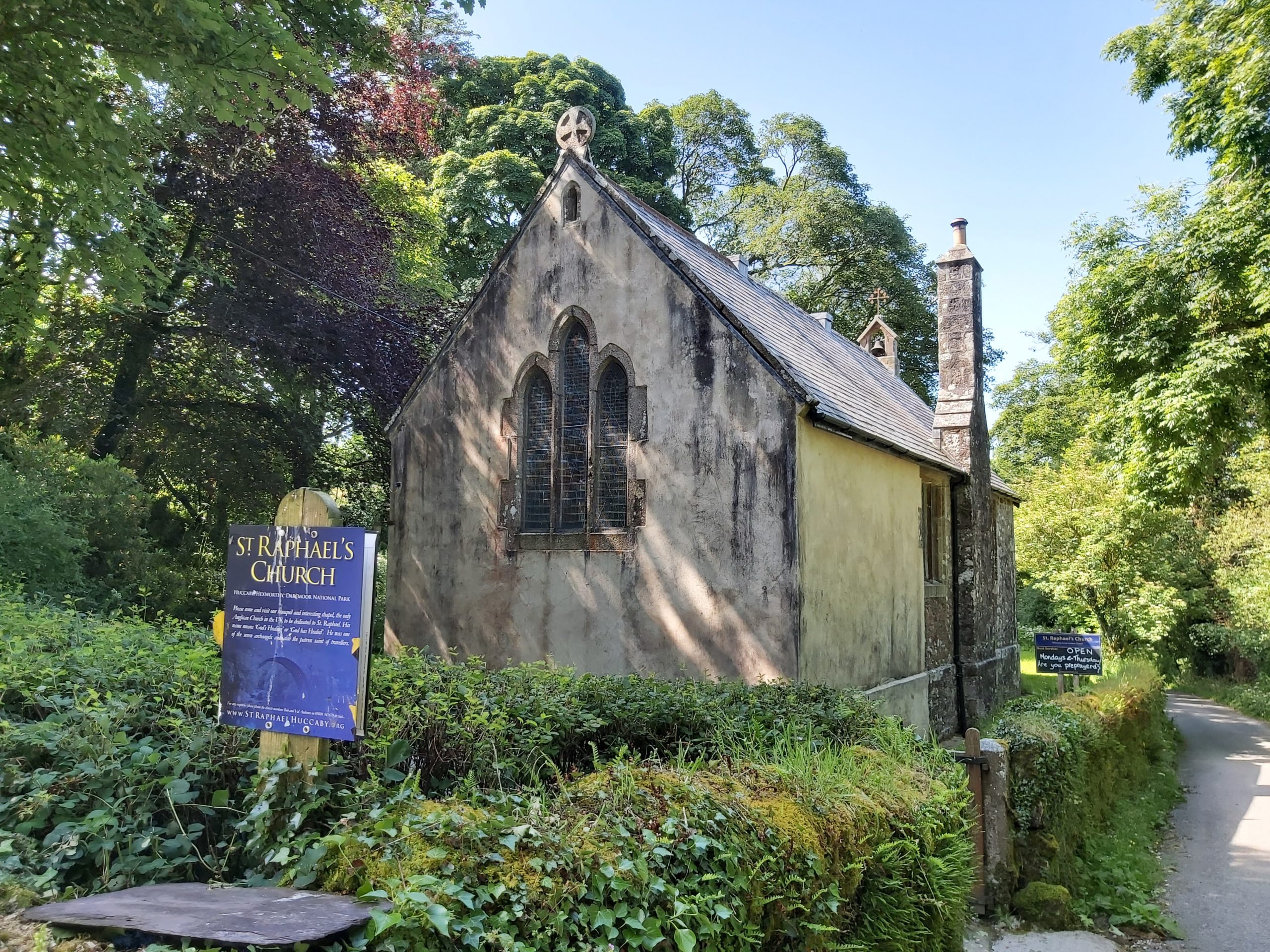
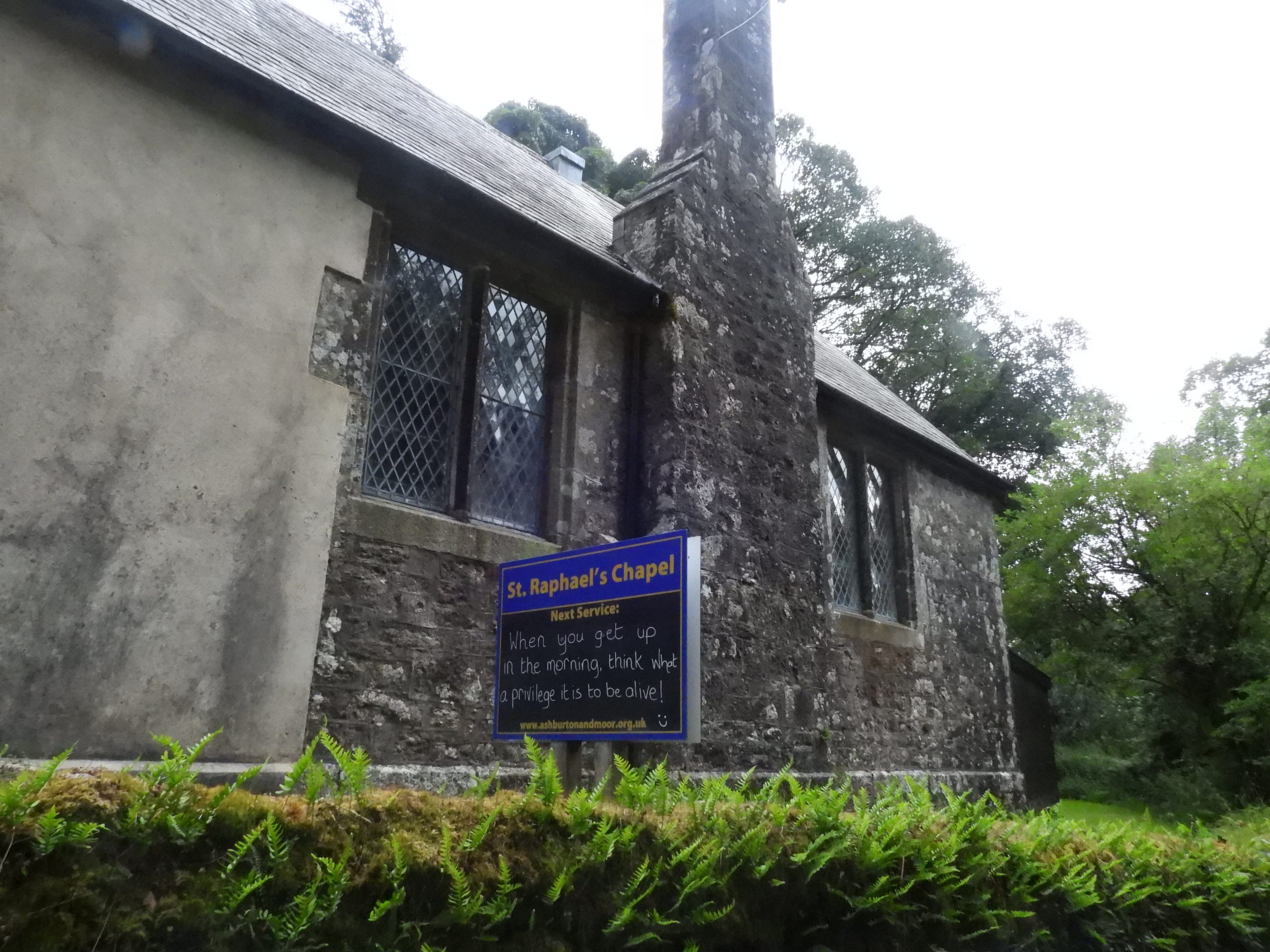
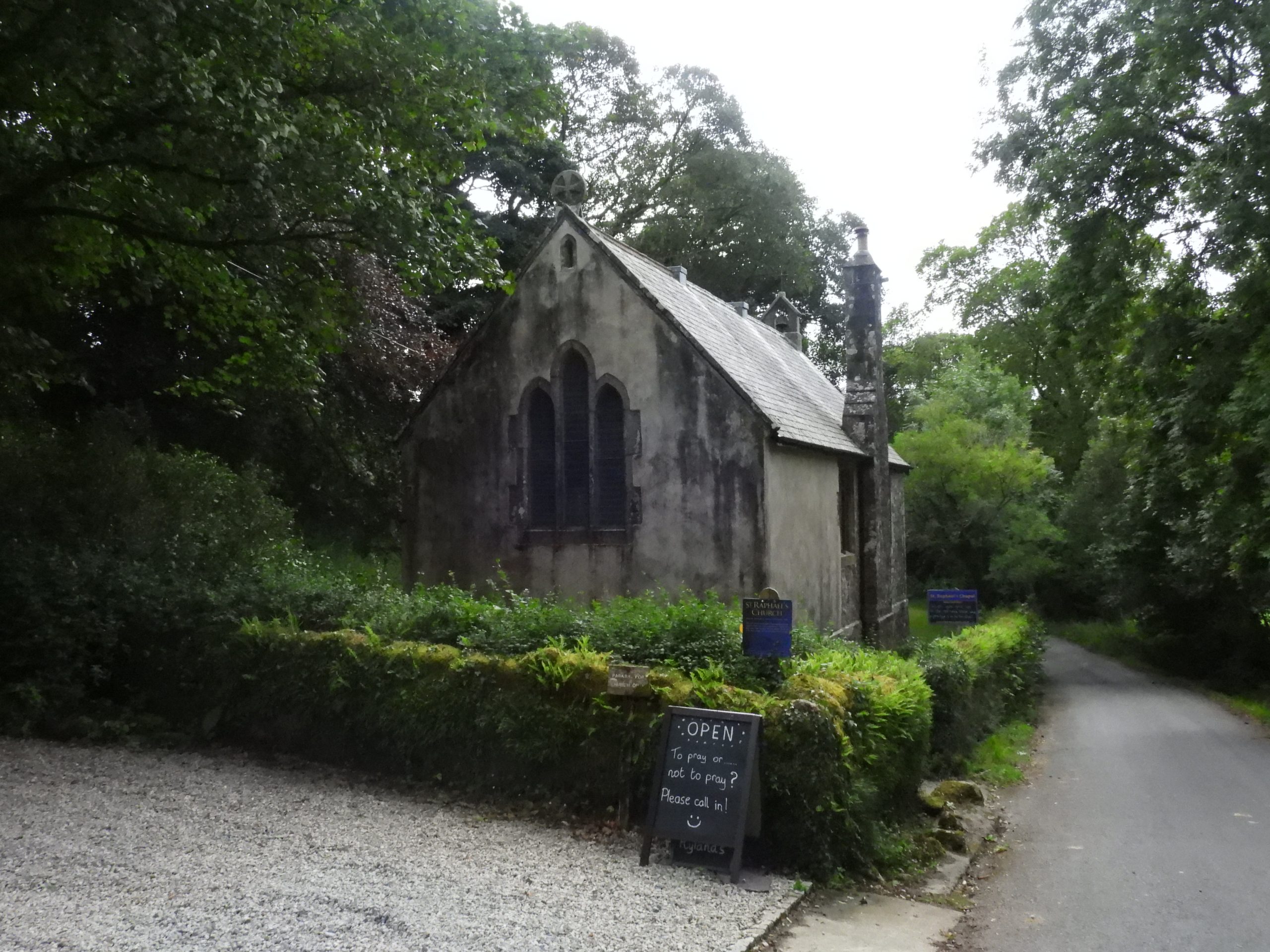
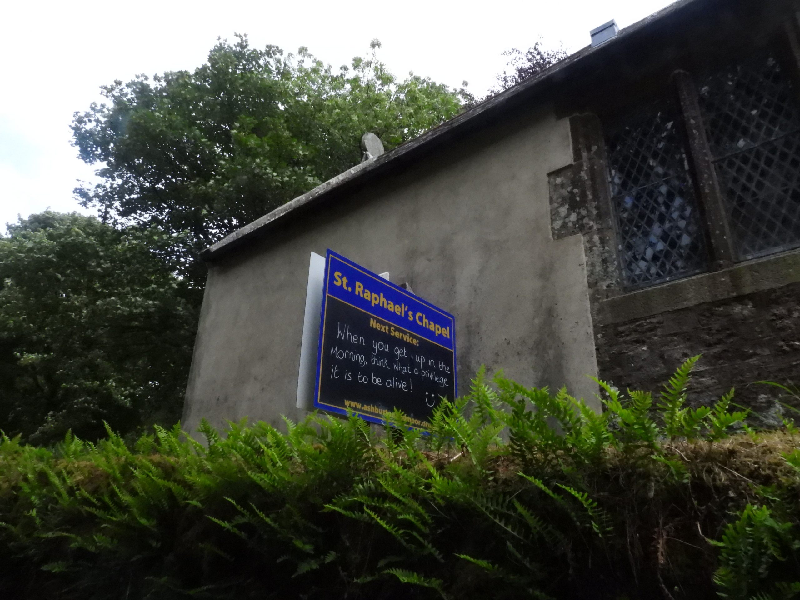
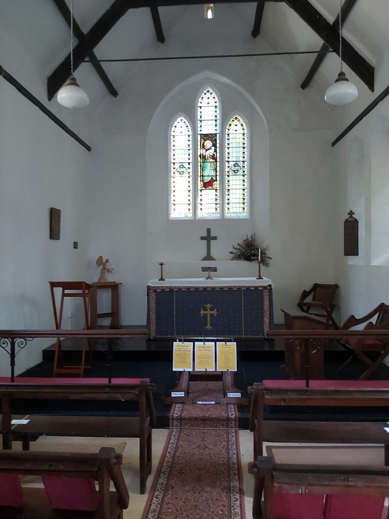
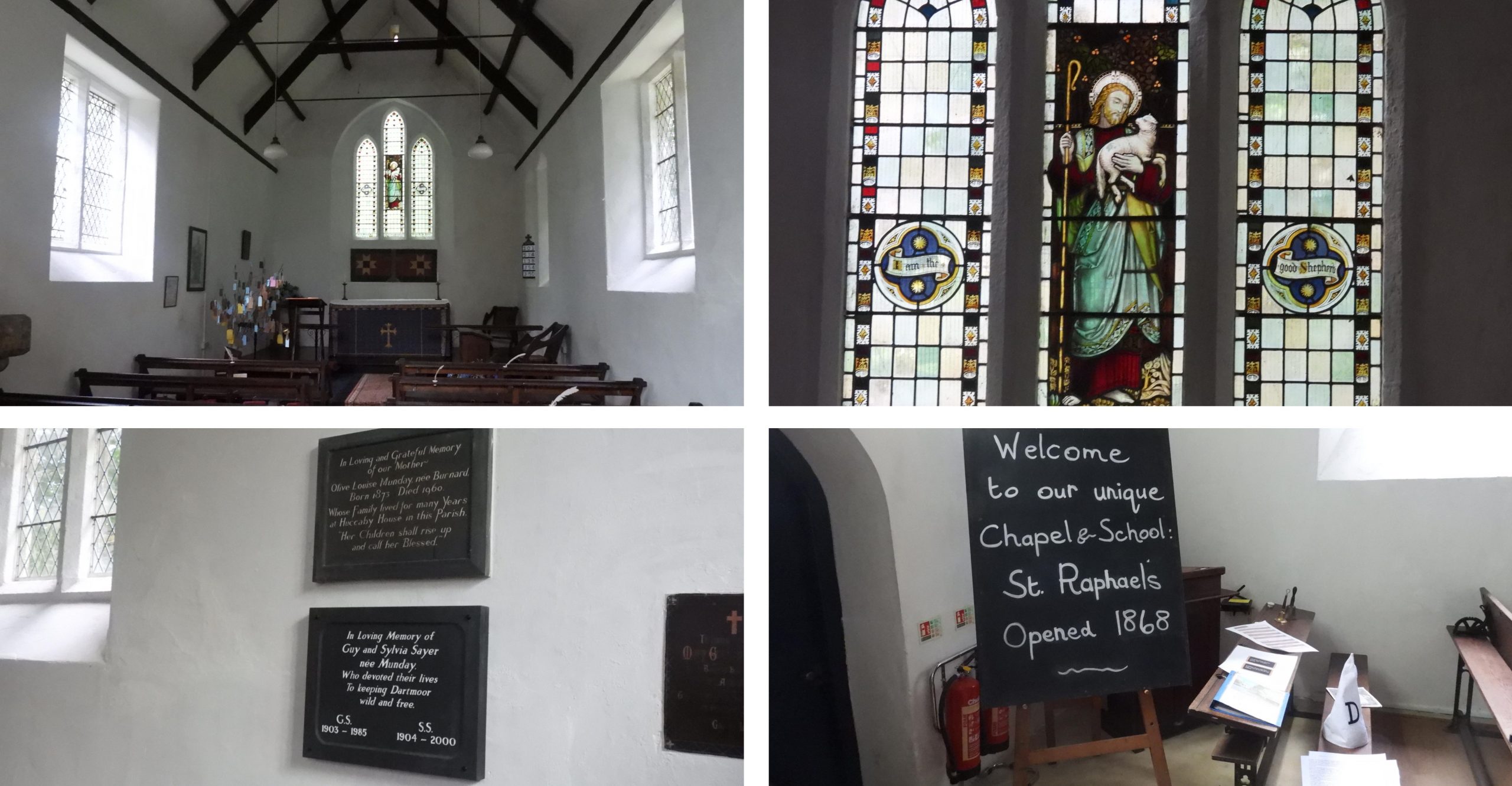
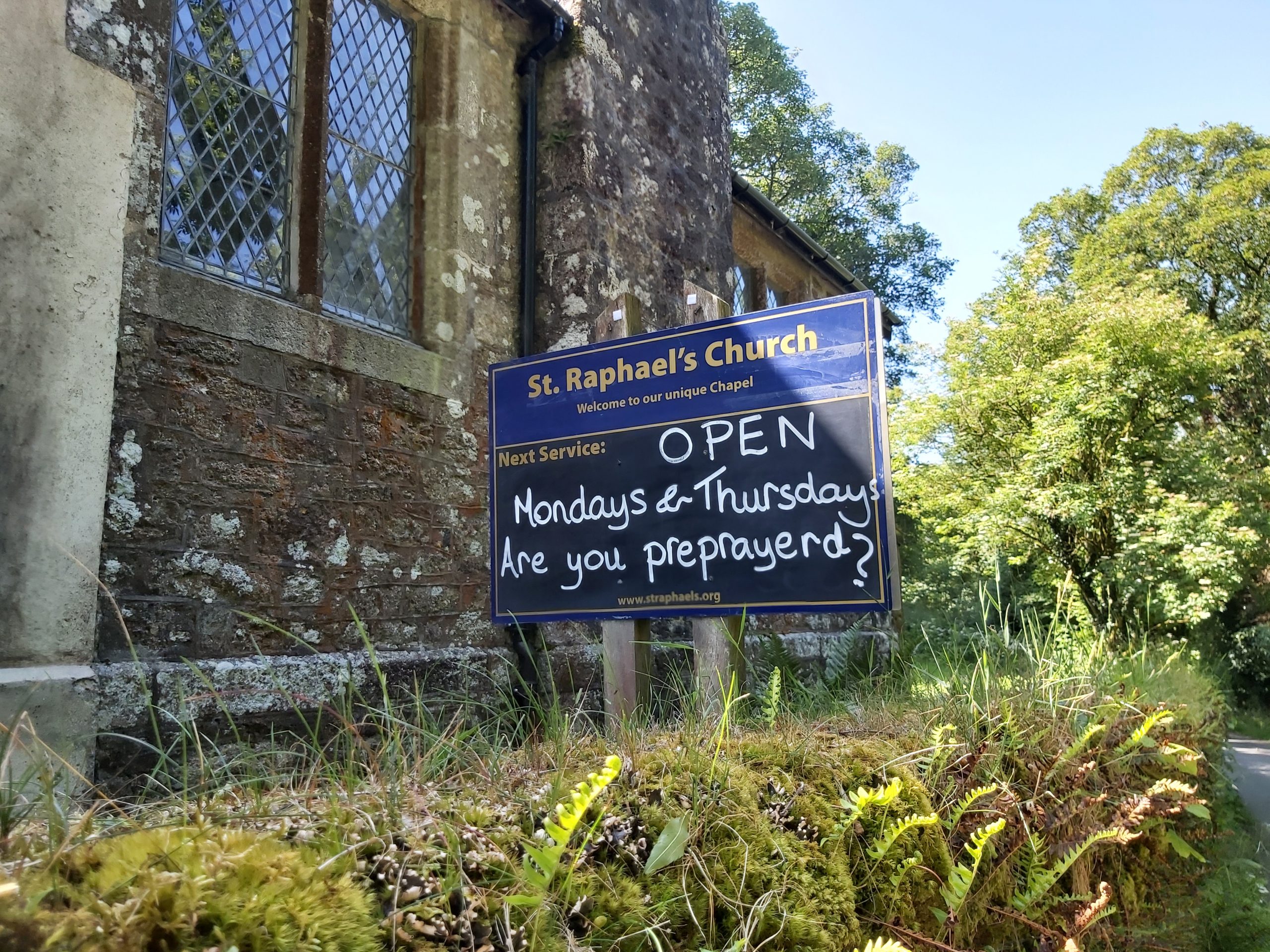
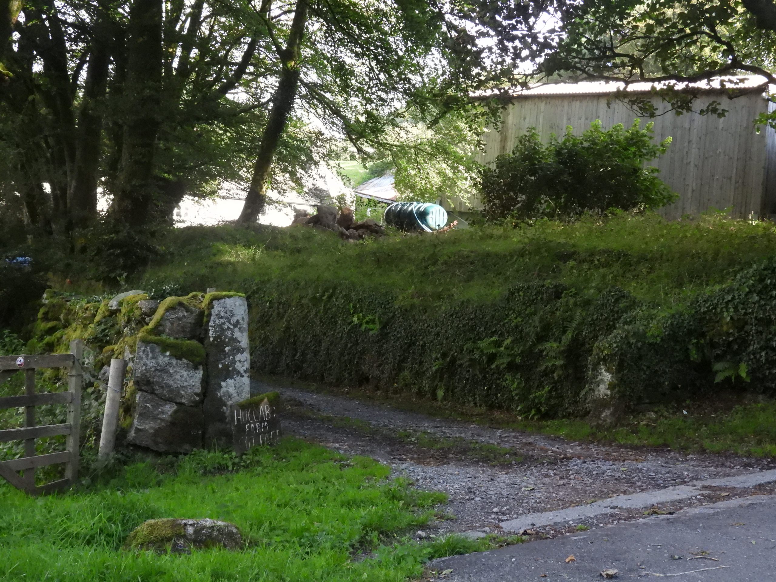
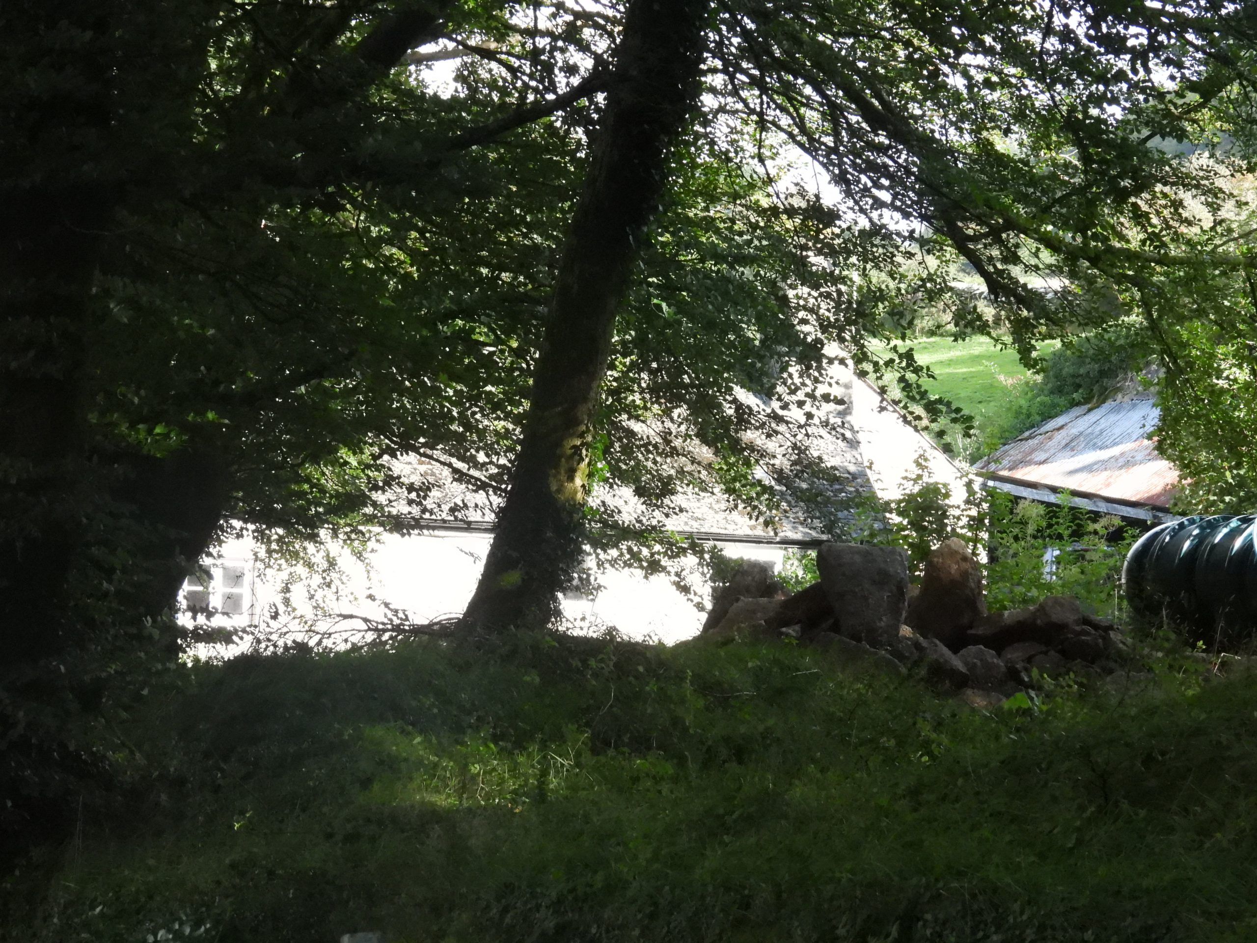
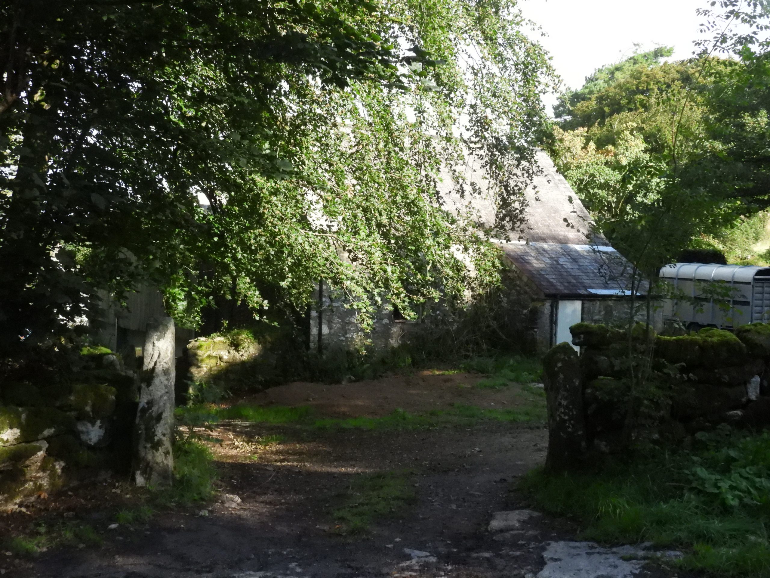
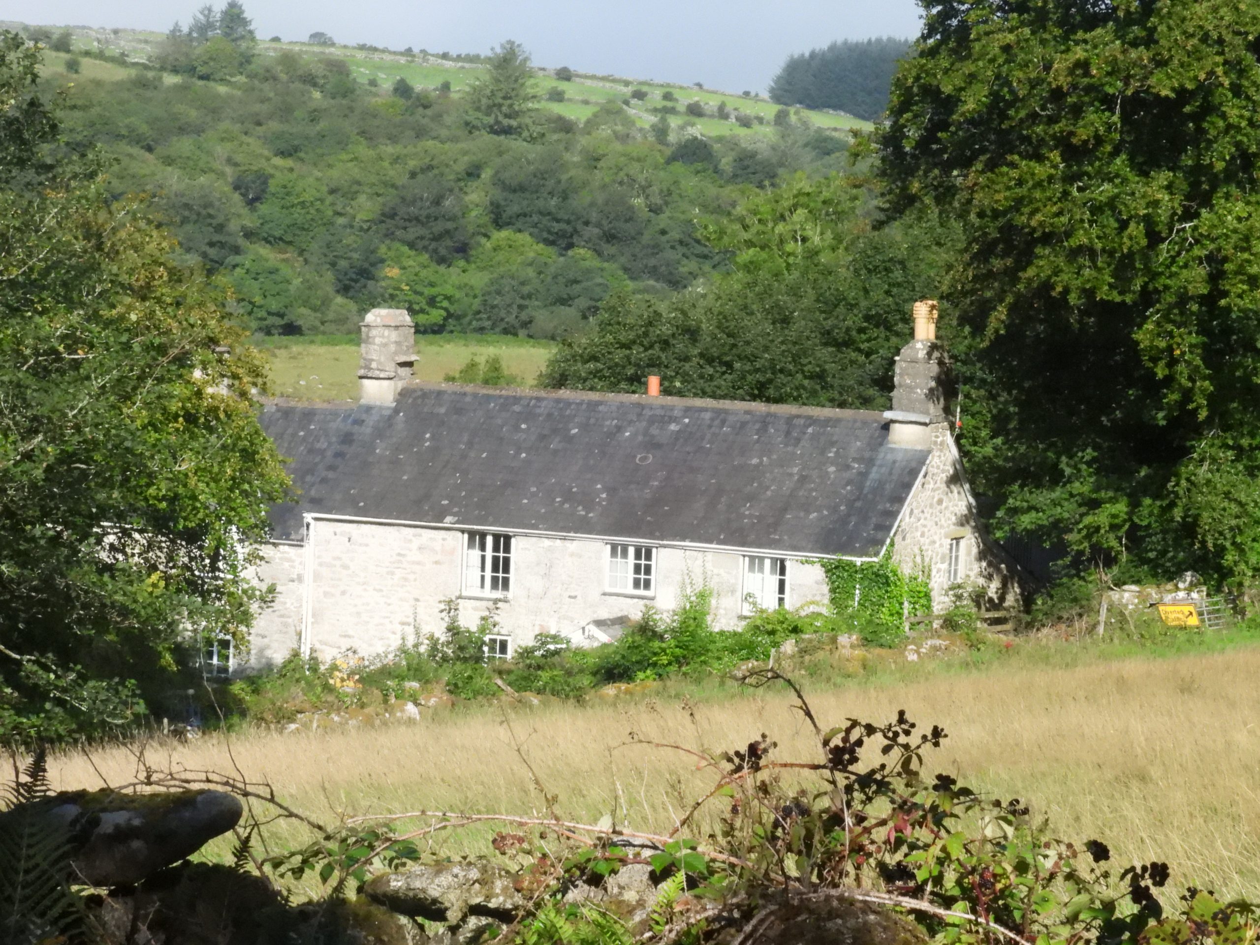
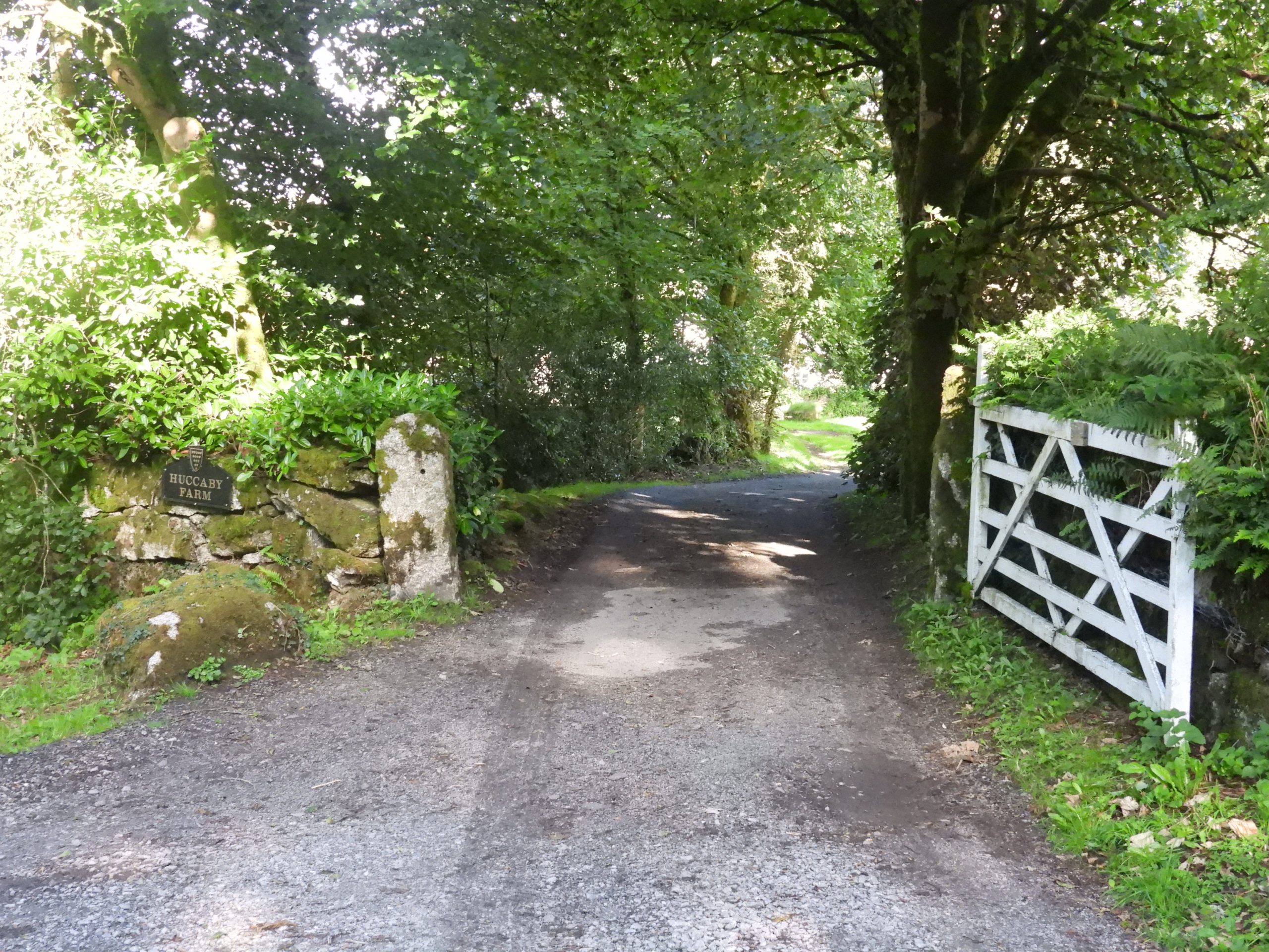
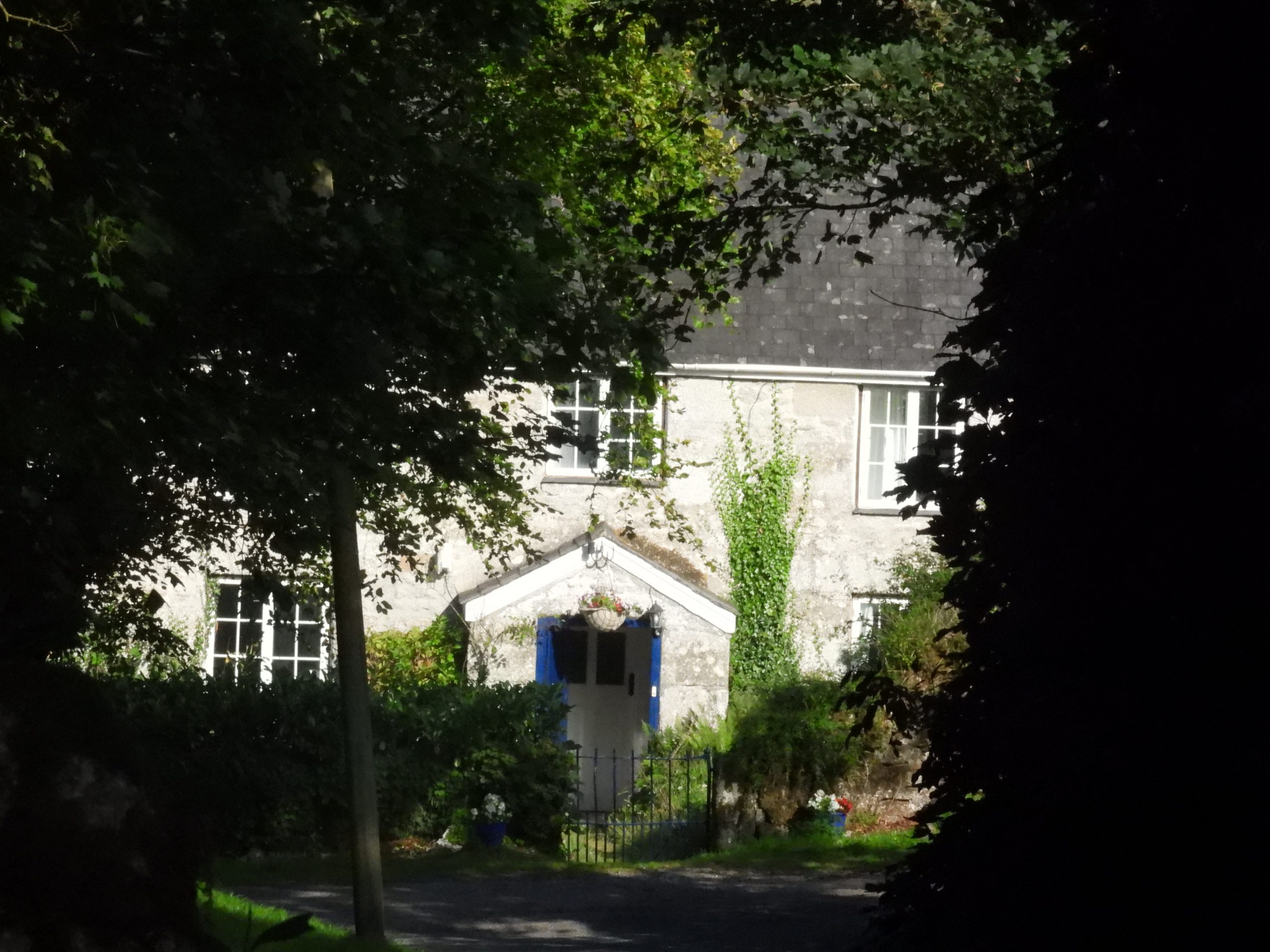
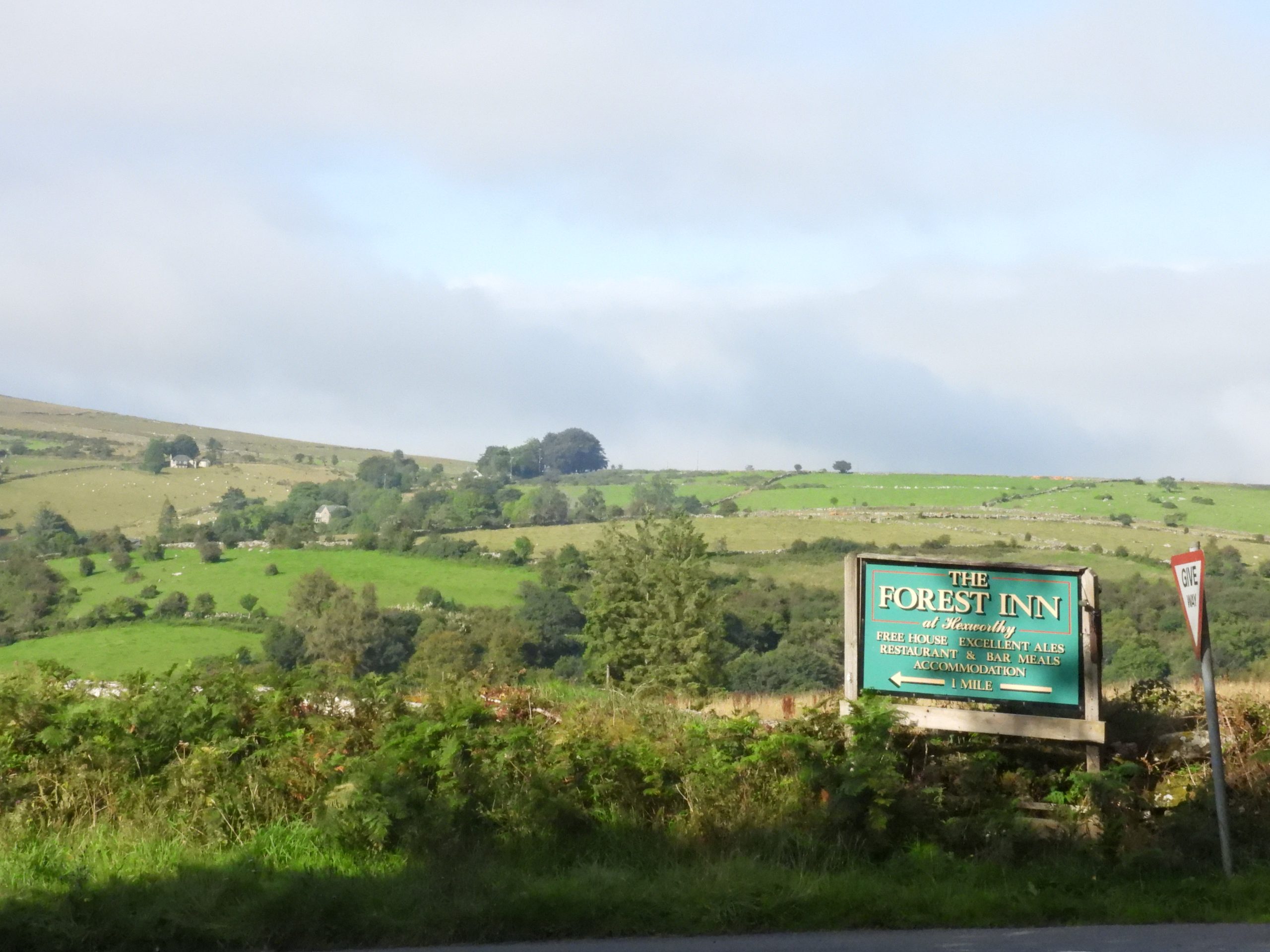
Sketch map of the area and features covered in this postThe original Forest Inn was built in the mid-19th century and was owned by the Duchy of Cornwall. In 1913, the Inn had a major fire (the roof was thatched) and most of the building was destroyed. The inn was rebuilt by 1916 and almost all traces of the original building were removed. The inn is said to have been a favourite haunt of William Crossing, the famous Dartmoor guide and author.The three Duchy feathers on the side of the Forest Inn. The first Duke of Cornwall was Edward, the Black Prince (1330-1376) and it was he who first used the shield of Sable, three ostrich feathers argent, described as his “shield for peace”. Each of the feathers has a scroll bearing the inscription ‘Ich Dien’ (I serve).On the green near the inn is a commemorative (almost triangular shaped) rock for the Diamond Jubilee of Queen Elizabeth II. The side shown in the picture is inscribed “TO COMMEMORATE THE DIAMOND”The second side shown in the picture is inscribed “JUBILEE OF QUEEN ELIZABETH”The third side as shown in the picture is inscribed “JUNE 2012”This ‘Maltese Cross’ was sculptured from stone quarried at Merrivale. It was erected in 1897 to commemorate Queen Victoria’s Diamond Jubilee.There is an inscription on the shaft along with a crown, viz: “VR – 1837 – 1897”The three step pedestal is also inscribed, viz: “In commemoration of the – 60 years of – Queen Victoria’s Reign – JCX – Erected by public subscription”.The original Jolly Lane Cot was built by a Thomas Satterley in 1835 and was allegedly built and occupied in one day. The cottage was for Thomas’s father-in-law who wished to remarry and provide a home for his new wife. The cottage is depicted on the Tithe Map and later 19th century historic maps but has been updated and extended in the 20th century.The story of the original construction suggests that the local farmers refused to help (being absent at a festival). However, their labourers got together and helped to construct the house. On return from the festival the farmers witnessed that a fire had already been lit in the completed house, which by the law at that time constituted it being a freeholding and so he could not be dispossessed.As with many bridges across the moor (and county) there are or at least were two “C” (for County) inscribed stones up to approx 100m from each end of the bridge identifying that the county was responsible for maintaining the bridge and approaches between the two stones. This is the Hexworthy / Huccaby ‘south west’ stone. The south west ‘C’ stone is sometimes difficult to find in the summer months due to the undergrowth in spite its proximity to the roadClose up of the ‘C’ stone which is located at SX65863 72797Overlooking Hexworthy / Huccaby Bridge from the footpath aboveStep stile near the bridge which leads to Hexworthy hamletHexworthy or Huccaby road bridge over the West Dart river was constructed in the late 18th century. The bridge is split into 3-span segmental arches with projecting keystones. The central arch considerably wider than its counterparts on either side. The divided by triangular cutwaters have been built in diminishing courses.Upstream from the bridge is a popular swimming location. 50 years ago, day trippers were able to swim downstream from the bridge on the Huccaby estateView looking upstream from the bridgeView looking downstream from the bridgeThere is an obligatory benchmark on the bridge. It is located on the north side of the south parapet and was ‘mud painted’ for the photographThe benchmark reference is B.M. 0831.6The benchmark is located at SX65897 72880The swimming area near the bridge on the upstream sideDownstream side of the bridgeThe relative calm waters and sandy bottomed portion of the West Dart RiverThe entrance of Huccaby House. The house was built for Reverend Edward Harris in 1875 as a fishing lodge. Charles Burnard bought the lease from the Duchy of Cornwall in 1883 and Robert Burnard (the renowned author, Dartmoor antiquarian, photographer and founder of the Dartmoor Preservation Association) lived there from 1904.Robert Burnard established the Dartmoor Preservation Association in 1883 and was the grandfather of Lady Sylvia Sayer. An old entrance (in the 1970s) went through this wall and into three fields for access to the West Dart for swimmingAnnotated map of my (50 year old) recollections of swimming in the West Dart at Huccaby. Inset picture kindly supplied by Jackie Porter who records: “We used to go there often in the 70’s. Great memories. I say every time we drive by there what a shame it is not to have access anymore. I had my 12th Birthday party there in 1975. There was a huge rock just under the surface we’d swim to”. Like Jackie, the author remembers the ‘swim up rock’ The ‘C’ (County) stone on the (north) east side of the bridgeThe ‘C’ Stone is located at SX65988 72895Contextual view of the ‘C’ stone looking down the road towards Hexworthy / Huccaby BridgeClose up of the ‘C’ StoneThe ‘C’ Stone with the West Dart beyondVR letterbox outside the chapelSt Raphael’s Chapel The church of St. Raphael dates from 1868, was erected by Reverend H. Fuller.St. Raphael’s was built as a mission chapel. William Crossing stated it was built on some ruined old cottages that were thatched with rye straw.A lovely profound message The good shepherd window, donated by the Adams family of Huccaby, in memory of Edward Adams, who died in 1888 aged only 11 years.Plaques remembering Robert Burnard’s daughter, Olive Munday and his grand daughter, Sylvia Sayer can be found in the church. Sylvia Sayer was a patron of the Dartmoor Preservation Association, which had been created by her grand father. The author always looks out for the ‘witty ditty’s’ outside the chapelLower Entrance to Huccaby Farm Sneeky peek of Huccaby Farm Part of Huccaby FarmsteadThe farmstead dates to at least the late 13th century. According to Gover, Mawer, and Stenton , Huccaby was named as : ‘la Woghebye’ in 1296 document, ‘Woghby’ (1317), ‘Woghebi’ (1340), ‘Hogheby(e)’ (1417), ‘Hoockaby’ (1573), ‘Hookeby’ (1608). Name thought to derive from the Old English ‘woh’, meaning crooked, and ‘byge’ meaning bend, curve; a reference to the big loop of the West Dart hereHigher entrance to Huccaby Farm‘Huckaby’ is depicted on the Lydford Tithe Map, with a collection of four main buildings in plot 1027: ‘Dwelling, outhouses, court and garden’. Junction of the Huccaby / Hexworthy road with Two Bridges – Dartmeet road near Snider Park Plantation. Sherberton can be seen on the skyline
Lovely collection of clear photos of the Huccaby area and some lovely detailed photos of smaller features of real interest.
Thank you for writing down and allowing us to follow the link to the collection.
It’s great to see so many people’s response and comments to the original request re recognising the bridge!!
Roger Smith January 13, 2024
Lovely collection of clear photos of the Huccaby area and some lovely detailed photos of smaller features of real interest.
Thank you for writing down and allowing us to follow the link to the collection.
It’s great to see so many people’s response and comments to the original request re recognising the bridge!!
SteveGriggDartmoor January 14, 2024 — Post author
Hi Roger,
Thank you for your email. Hope this helped answering your question.
Regards,
Dartmoor Explorations (Steve)