A collection of walks, discoveries, insights and pictures of exploring Dartmoor National Park
November 5, 2021
Babyland Farmstead
Babyland and newtake are recorded on the Tithe Map and Apportionment and are believed to be possibly the forerunner of Routrundle Farm a short distance to the south – east down the lane. The farmstead is not on public access land but can be easily viewed from the adjacent gateway. This farmstead is said to have or had a datestone ‘1866’ (not confirmed by the author) and the associated house may have occupied the site of a former Medieval longhouse.
There are other items of interest in the immediate area, which includes an inscribed stone (most likely dating from the 19th century), a benchmark and an unusual drilled stone.
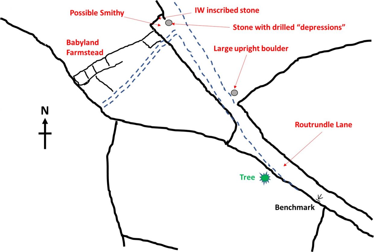
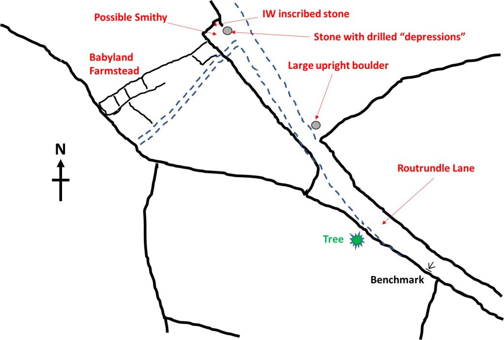
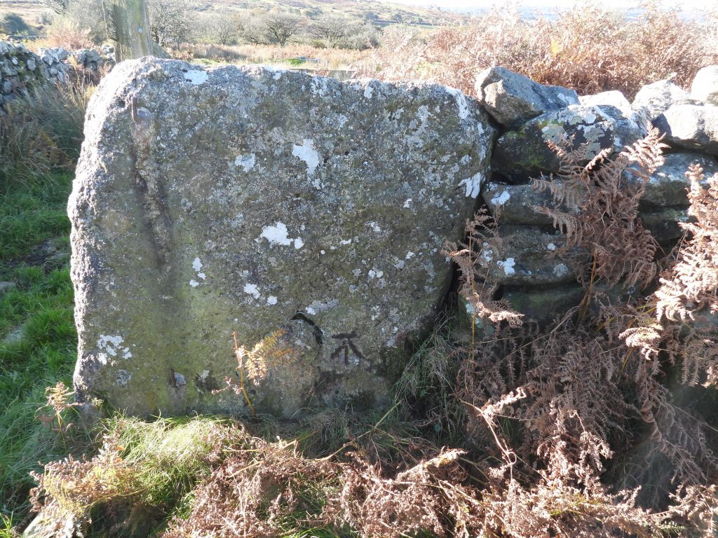
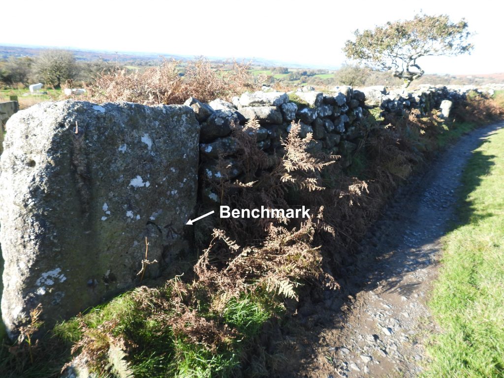
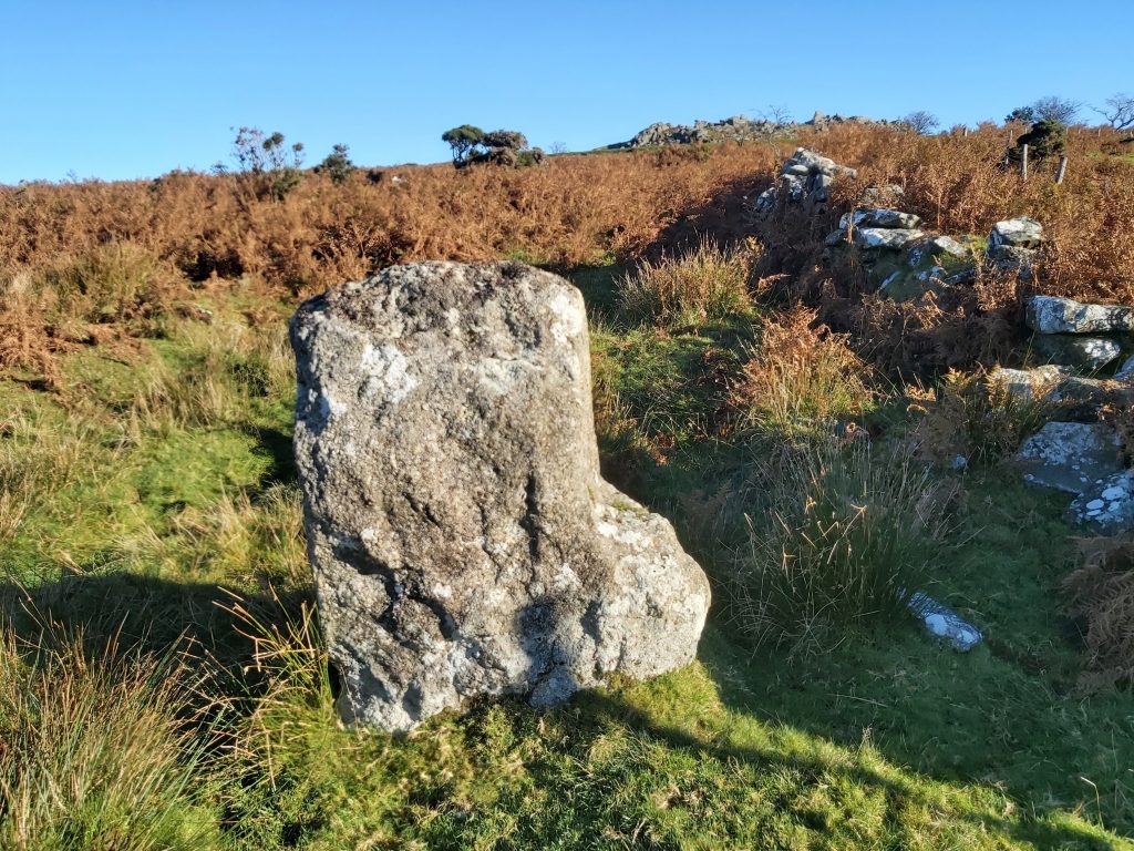
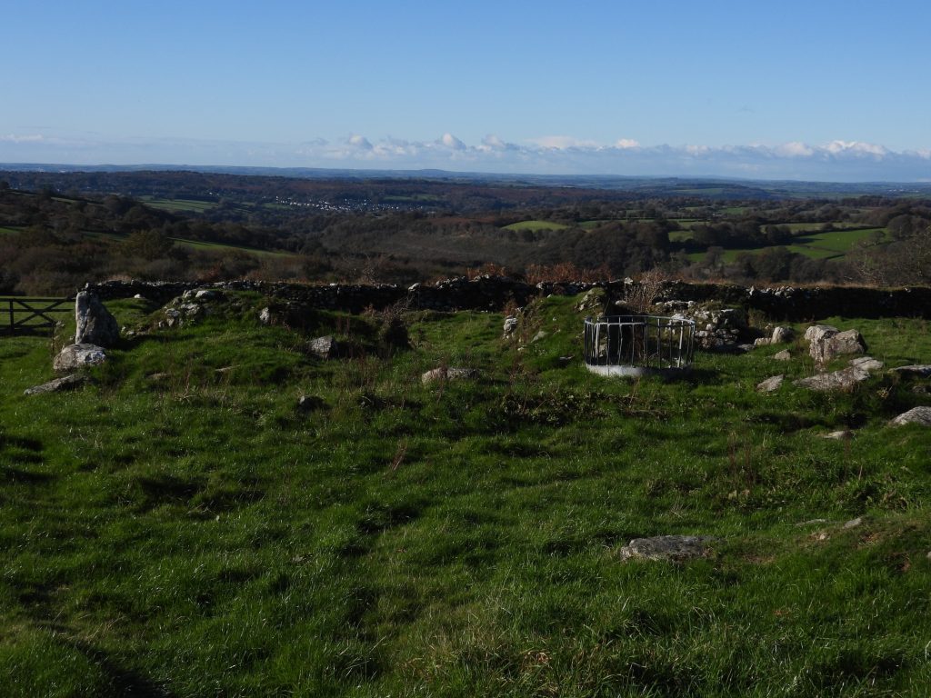
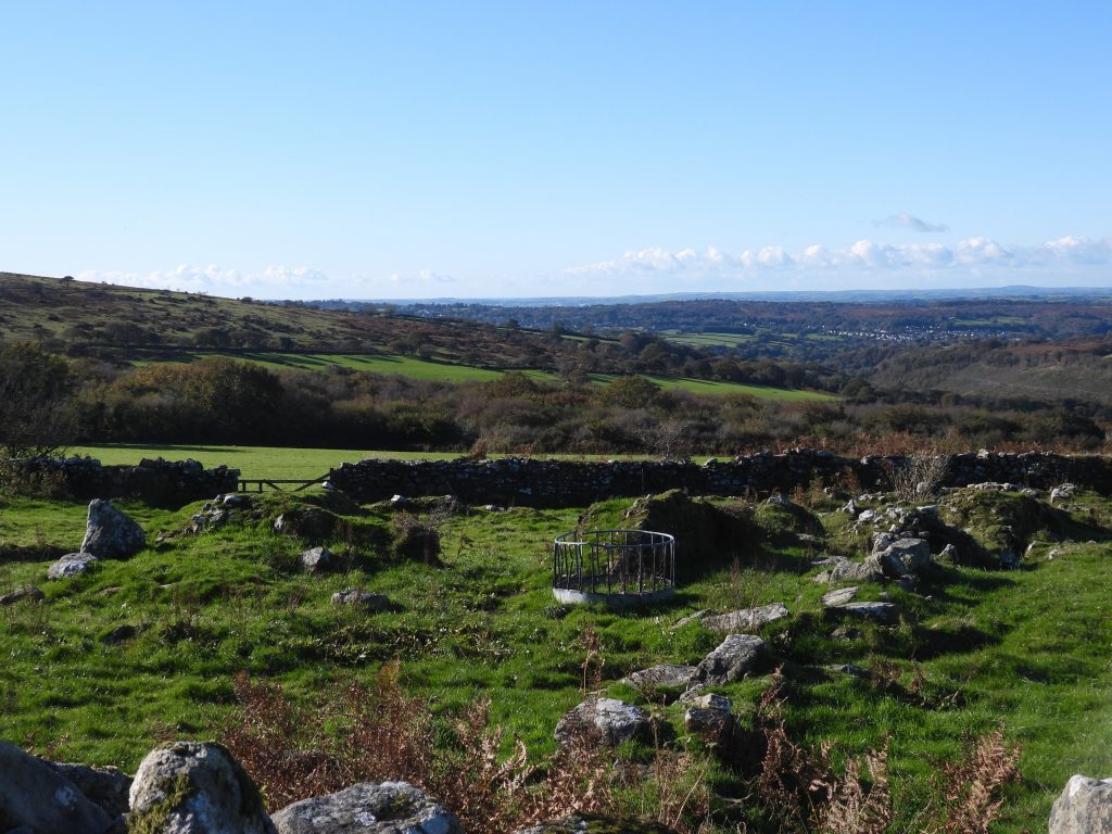
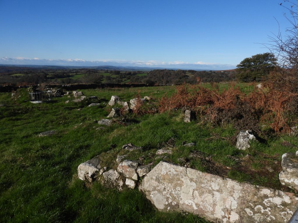
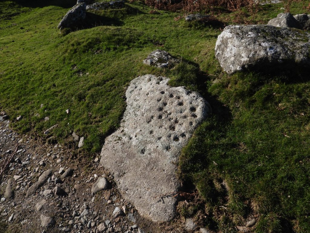
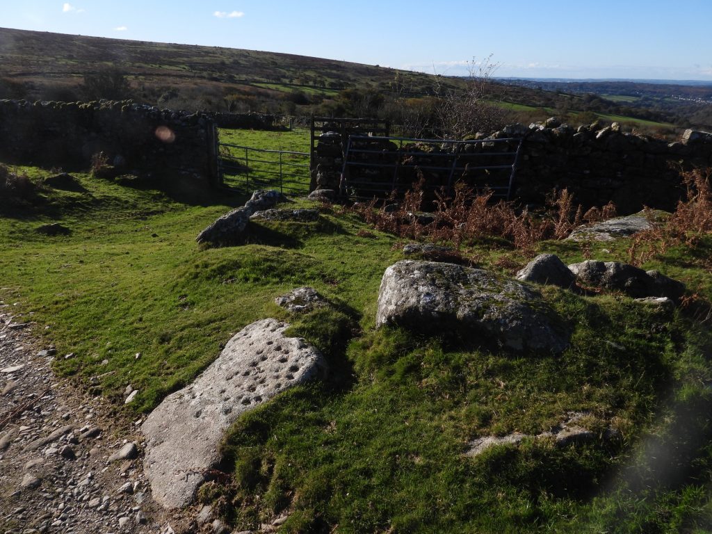
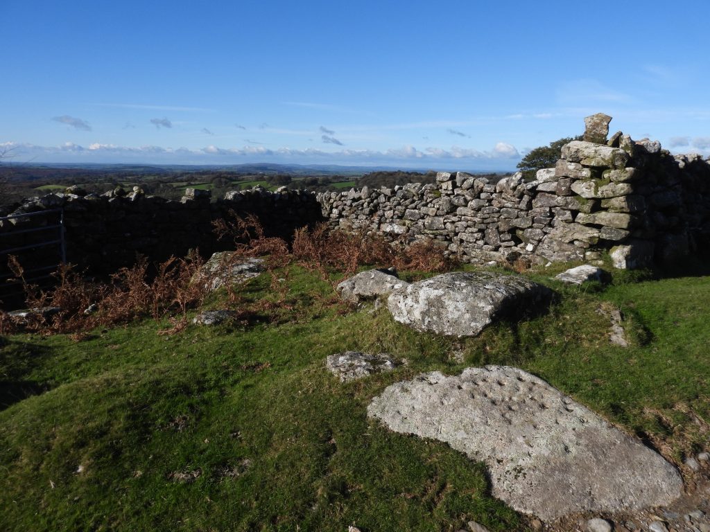
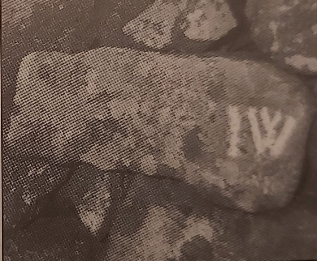
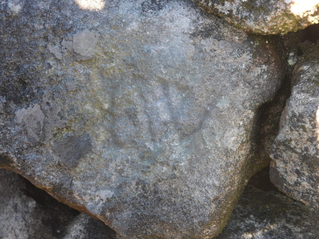
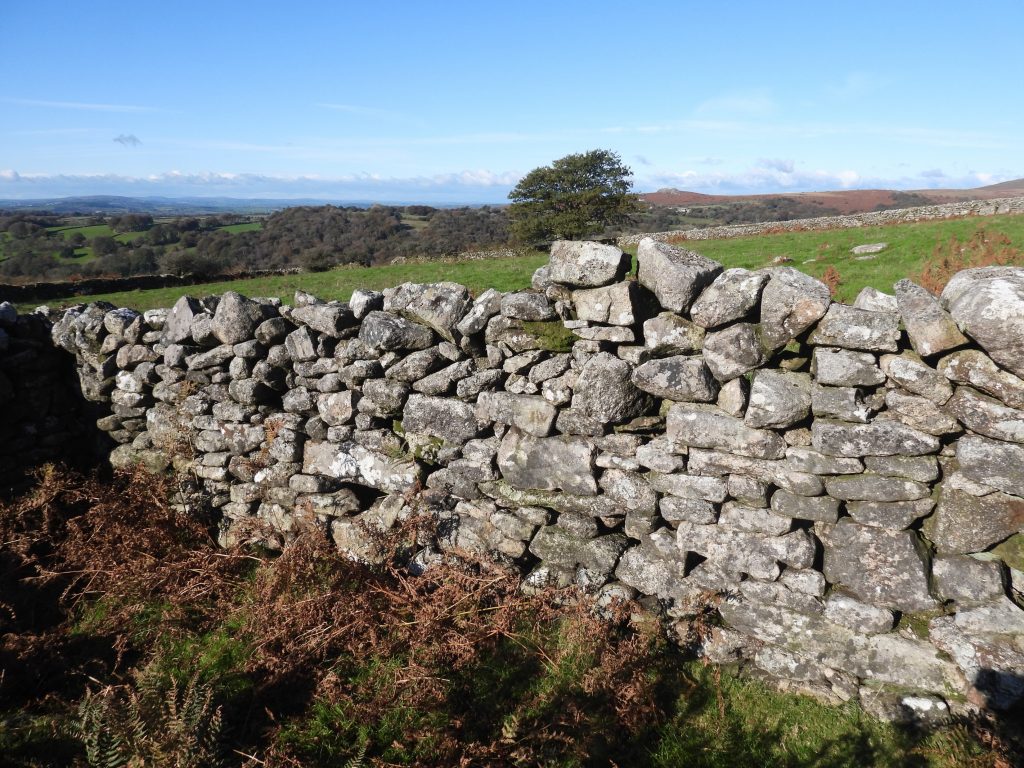
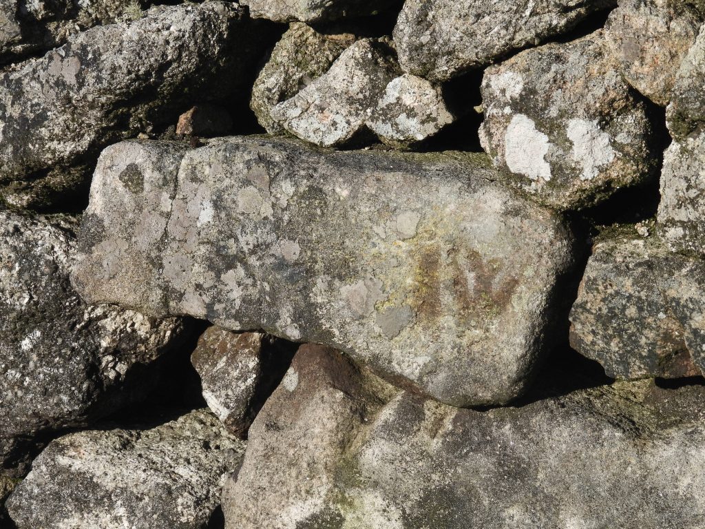
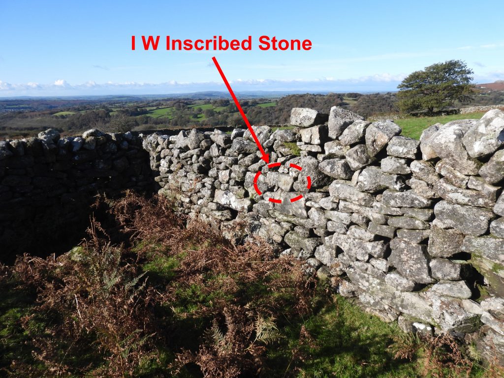
Sketch map of the locations of the items covered in this post.This benchmark was found in Routrundle Lane at SX55274 71832 on the south – west side of the lane. It doesn’t appear on 19th century side-by-side maps. It appears on the 1949-1970 OS map and on the Devon County Council Environment viewer though. Contextual picture of the location of the benchmark.This large upright boulder is located where Routrundle Lane exits onto open moorland. The boulder looks “out of place” and one wonders if the hand of man has played a part in its location and orientation ? I think I will call it “Routrundle Rock”. It can be found at SX55233 71879.Babyland Farmstead as viewed from the gateway. The ruined farmstead is recorded on the Heritage Gateway as comprising a house of two rooms and outshut, a walled garden or yard and three small subsidiary buildings.The views from the farmstead are extensive towards Horrabridge. The farmhouse, excluding the outshut is recorded at the south-west end of the site and is recorded as being 12.3m. long overall and 4.7m. wide.Close to the gateway, to the north – east end of the site is what appears to have been one of the outbuildings.Near the gate and next to the track to Routrundle Farm, there is a large earthfast stone, which is described on the Heritage Gateway as being covered with several dozen depressions 2 to 3cms across and from 1 to 2cms deep. This source, further speculates that the stone was created by stone cutters in “idle moments”, the rounded bases to the hollows suggesting that they were not made with a mechanical drill but with a “jumper”.The stone with drilled depressions is located at SX55206 71912. Dave Brewer in his book, “Dartmoor Boundary Markers”, 2nd edition (page 202) suggests the depressions were caused by the sharpening of tools by quarrymen from the nearby Ingra Tor quarry.Beyond the stone with the depressions lies a semi-enclosed space, which Dave Brewer suggests might have been a smithy. What makes this space interesting is that set into the wall is an inscribed stone.This picture is from the Dave Brewer publication, which shows the inscribed letters “I W”. The author suggests that there might also be a small “v” inset into the capital “W”. The picture was taken before 1998 as recorded in the book it was not found in 1998, possibly due to poor light.The inscribed stone in 2021. The stone was found after much searching by comparing the shape of the stone and surrounding rocks with that of the picture in the Dave Brewer publication, which must of been taken approx. 25 years previously. The inscription wasn’t obvious and wouldn’t have been found of it hadn’t been for the Brewer photograph.The inscribed stone can be seen in the centre of this photograph after a slight mud makeover. Dave Brewer states that in the Tithe Apportionment of 1839 the then occupier of Routrundle Farm was John Westlake, which suggests this stone might be attributed to him. NOTE: “I” was often a replacement for “J” in those days, so IW could read JW for John Westlake.Close up of the “IW” inscribed stone, which can be found at SX55197 71916. To add to the difficulty in locating this stone, Dave Brewer recorded it at SX5525 7184, which is several 10’s of metres away. That said, his picture and description assisted greatly in locating it. Contextual picture of the “IW” inscribed stone.