A collection of walks, discoveries, insights and pictures of exploring Dartmoor National Park
November 19, 2023
Securing the protection of Areas X, Y (Shaugh Moor) and Area Z (Lee Moor) from China Clay operations plus the Whitehill Yeo China Clay Works northern boundary
The China Clay industry near the south west corner of Dartmoor historically and up to modern times has comprised of at least 7 major works, namely; Shaugh Lake, Lee Moor, Wotterwaste, Cholwichtown, Whitehill Yeo, Headon and Brisworthy. The area north of the Beatland Corner / Wotter / Cornwood road covers an area of around 3-4km east-west and 3-4km south-north (note this excludes Headon), albeit the shape isn’t precisely square. If one researches old maps, it is unsurprising to note the clay workings and operations have increasingly and extensively encroached onto moorland in the 20th century. The original ‘permissions’ relating to the winning and continued working of china clay specifically at Shaugh Lake (and Headon) date back to dates between the 1950s and the 1970s although there is a far longer history of working china clay and other minerals in this area due to its complex geology. Further to the east of Shaugh Lake, the main Lee Moor working area was granted a further extensive permission as the result of a major planning inquiry determined in 1972.
The permitted working and tipping areas for Shaugh Lake and Lee Moor in 1972 included 165ha (approx. 400 acres) of land within the Dartmoor National Park and these were known as Areas X, Y and Z). Area X and Y were associated with Shaugh Lake and Area Z by Lee Moor. This 1972 permission required the Operators to agree the nature and capacity of their tipping. By 1978 a ‘joint’ tipping agreement had been reached for the two Operators, which comprised a signed comprehensive legal agreement which set out the final profiles (and landscaping) for the main tips in the Lee Moor and Shaugh areas. The Dartmoor Preservation Association played a big part in the agreement.
The Environment Act of 1995 ensured mineral operators had to update the conditions attached to their historic permissions. This process is known as a ROMP (Review of Old Mineral Permission). Dartmoor ‘ROMPs’ began in the summer of 1998, which was particularly and especially relevant to Areas X and Z. Thus began the journey to secure the protection of areas X, Y and Z for future generations.
This post explores the history of Areas X, Y and Z since 1978 when DNP land was in danger of being encroached upon to how the ‘protection’ of these areas was ultimately secured in 2014. The post includes photographs of many of the artefacts, which might have been lost had Areas X, Y and Z ever been used for working an tipping.
Also covered in this post is the area to the east of Area Z and to the north of Whitehill Yeo China Clay Works where there are a series of boundary markers which delineate the open moor from the clay operations, where other artefacts appear to have once been in danger from being lost.
Bibliography:
South Hams District: Environment Act 1995 – “Stalled” Schedule 13 Reviews of Old Mineral Permissions (ROMP); Lee Moor, Headon and Shaugh Lake China Clay Works, Plympton, Nr Plymouth – 17th April 2013
‘Dartmoor Boundary Stones – Revisited: Shaugh Moor, Lee Moor and Penn Moor’ by Mark Fenlon in Dartmoor News, Issue 184
Dave Brewer (2002) Dartmoor Boundary Markers, Halsgrove, pp. 231
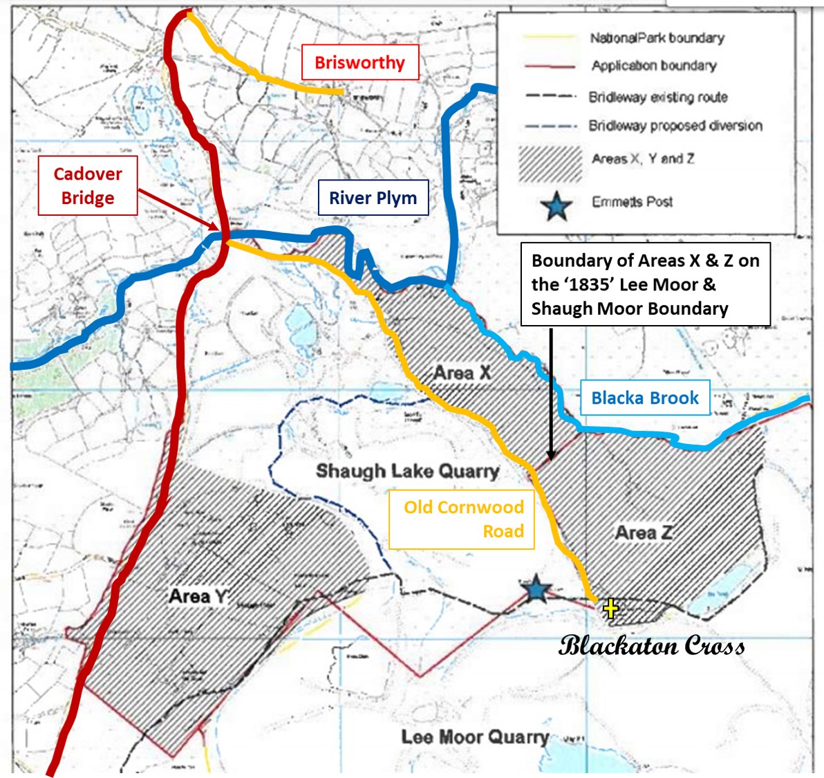
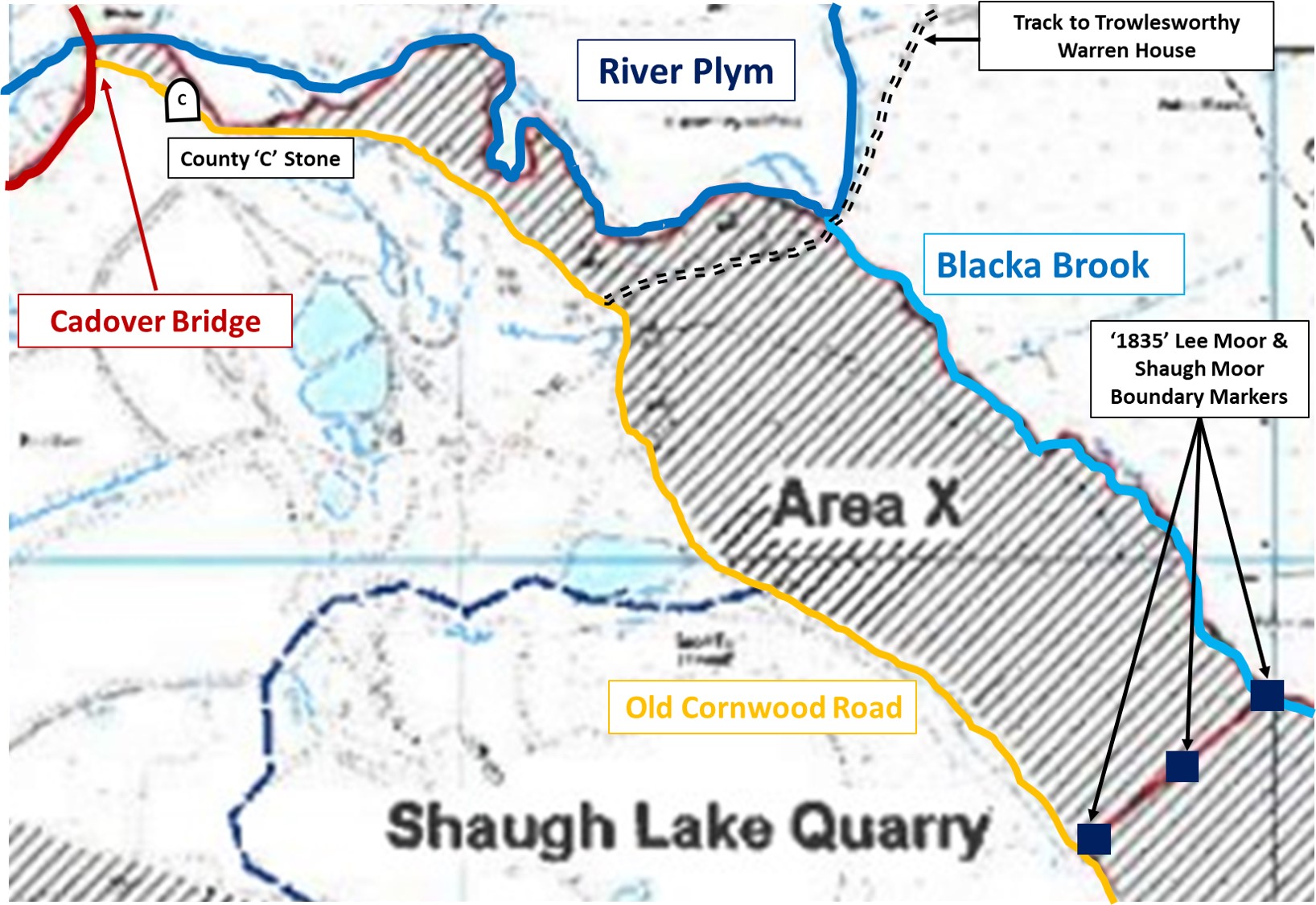
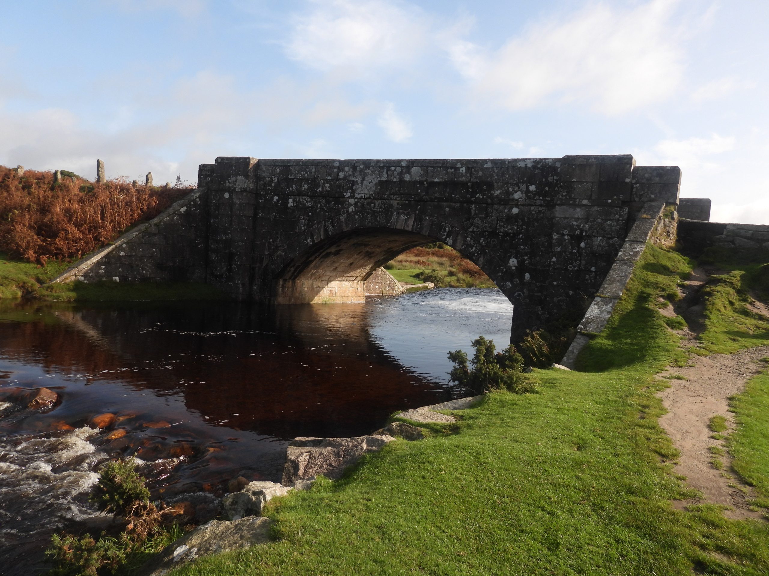
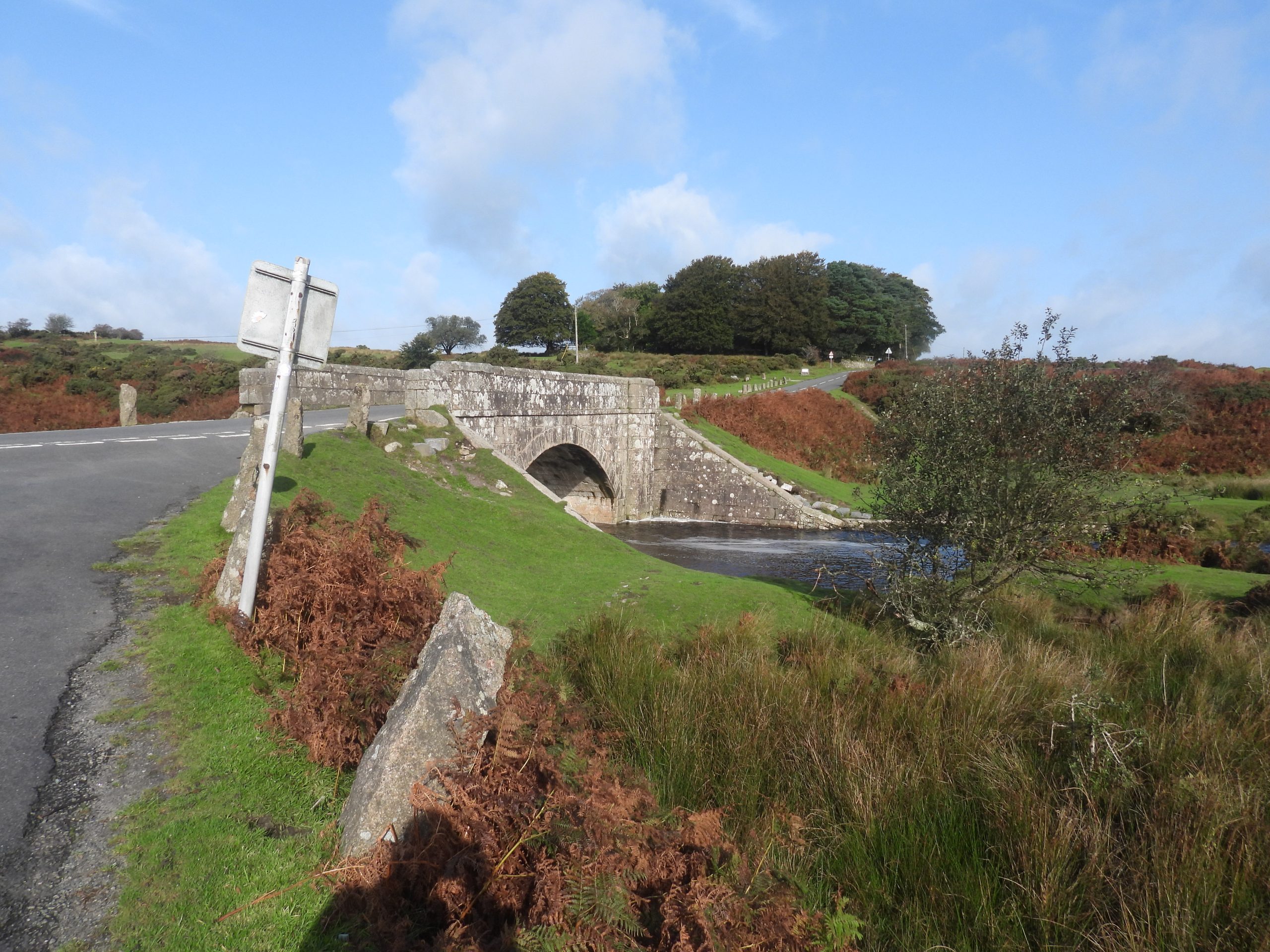
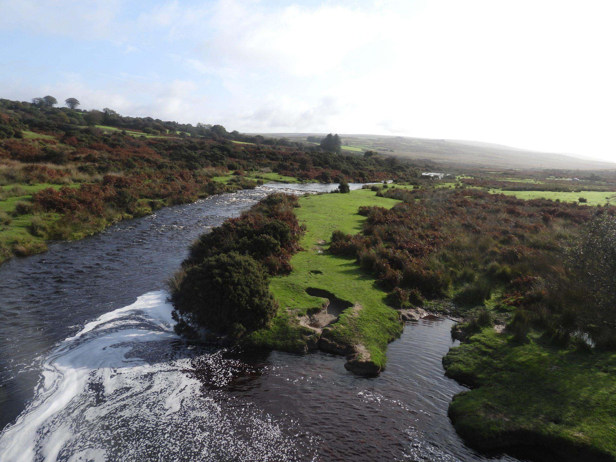
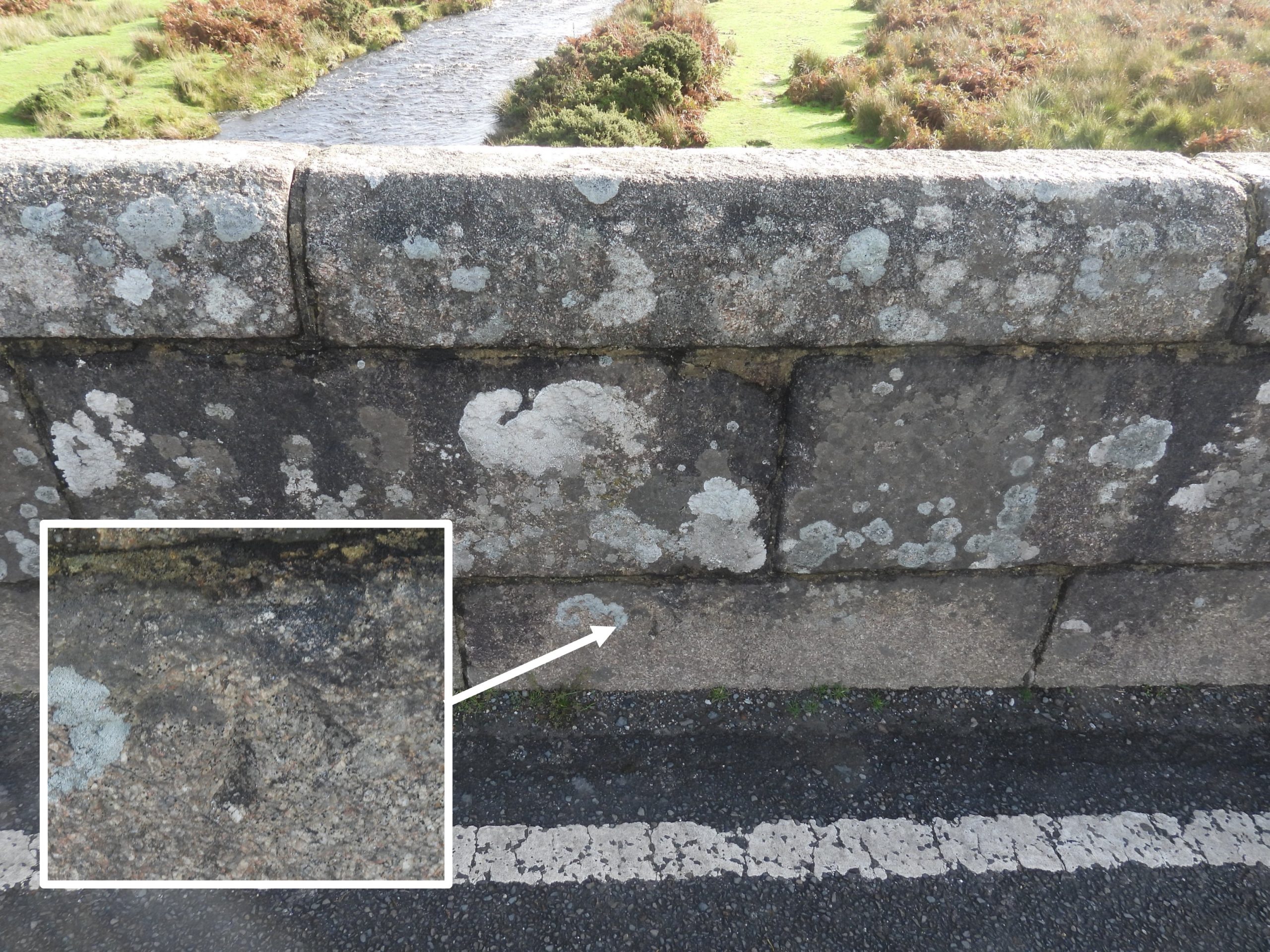
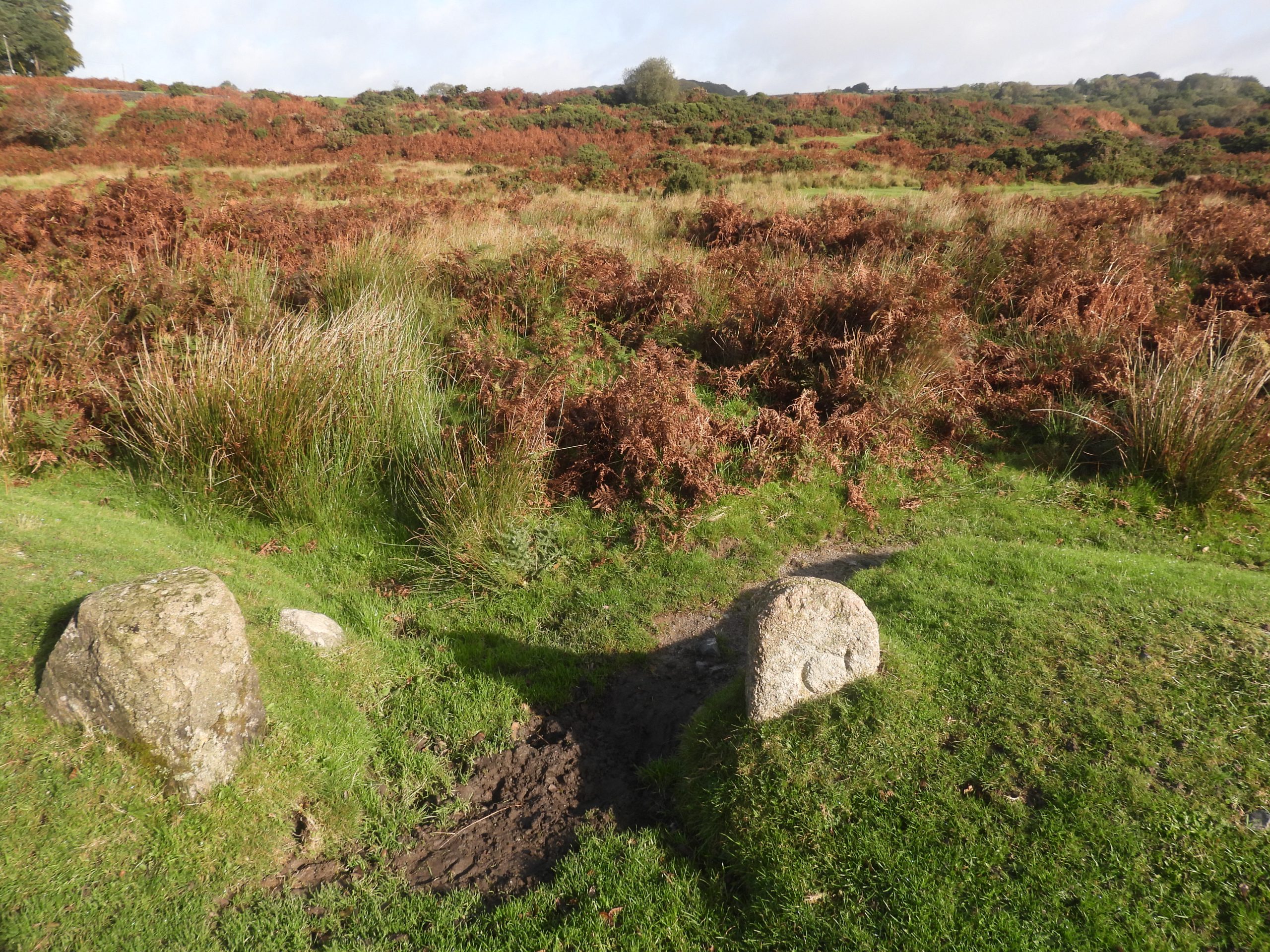
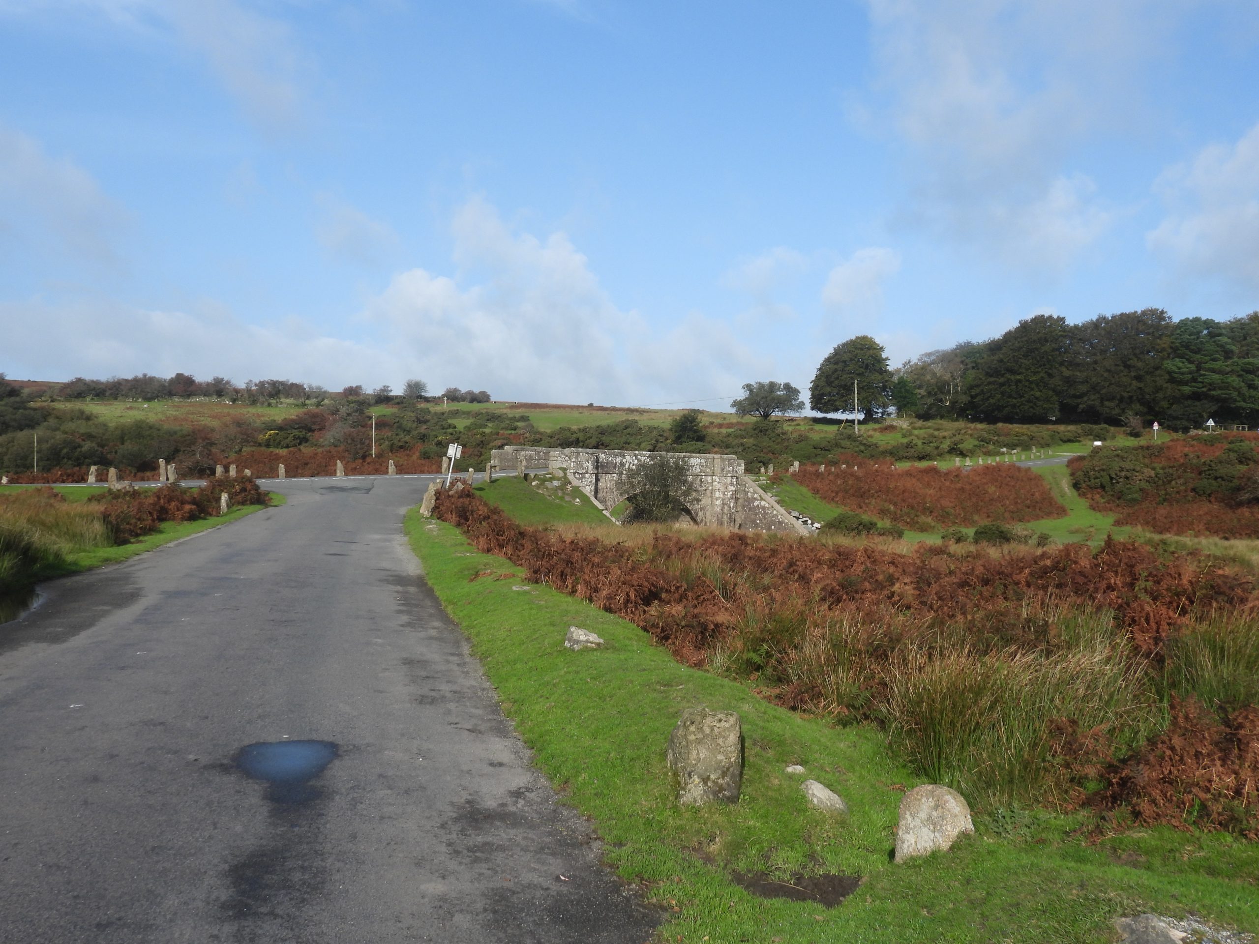
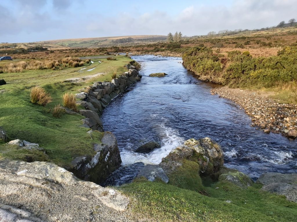
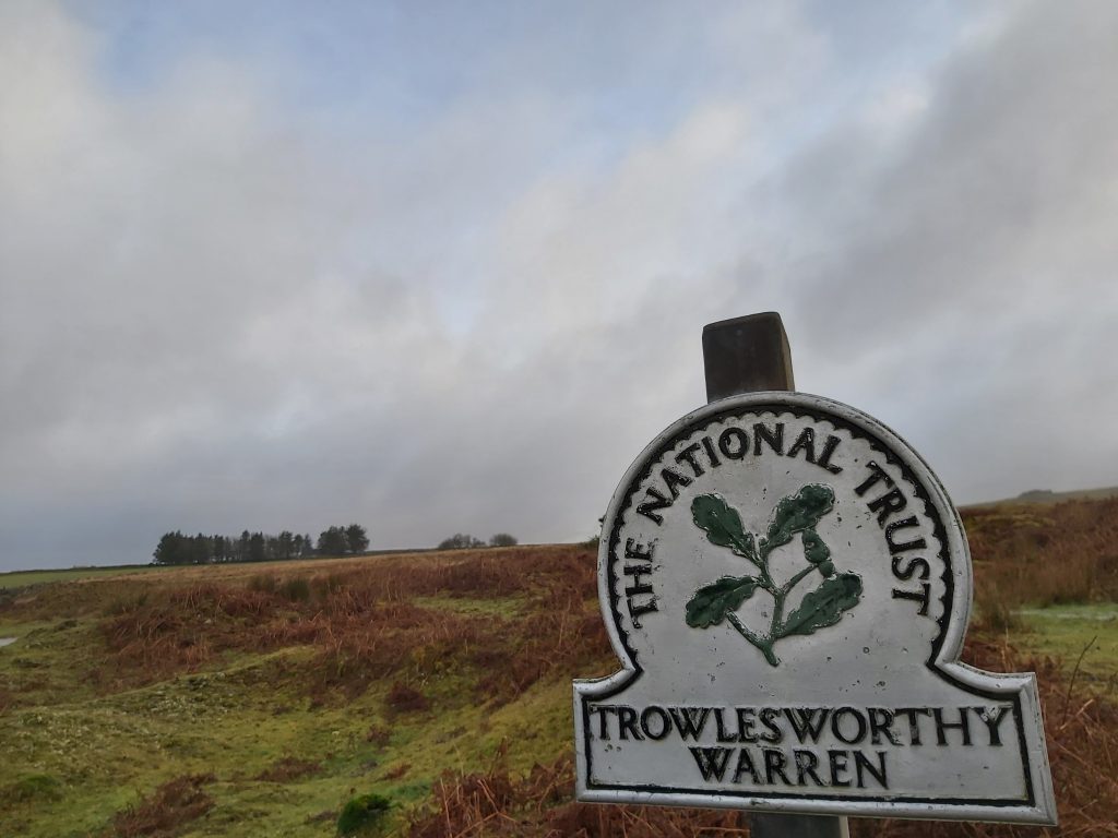
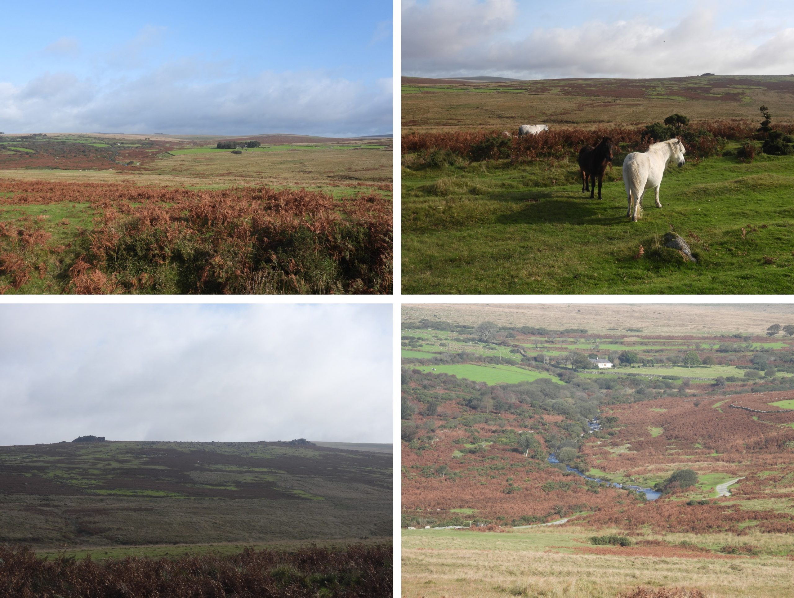
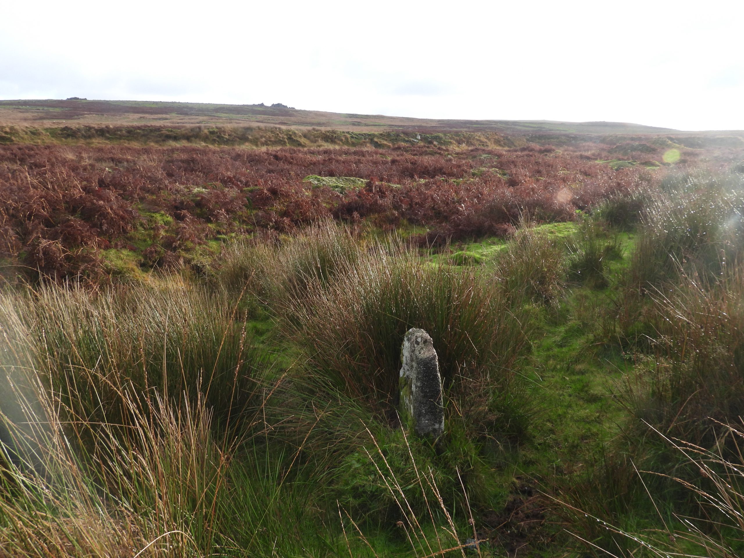
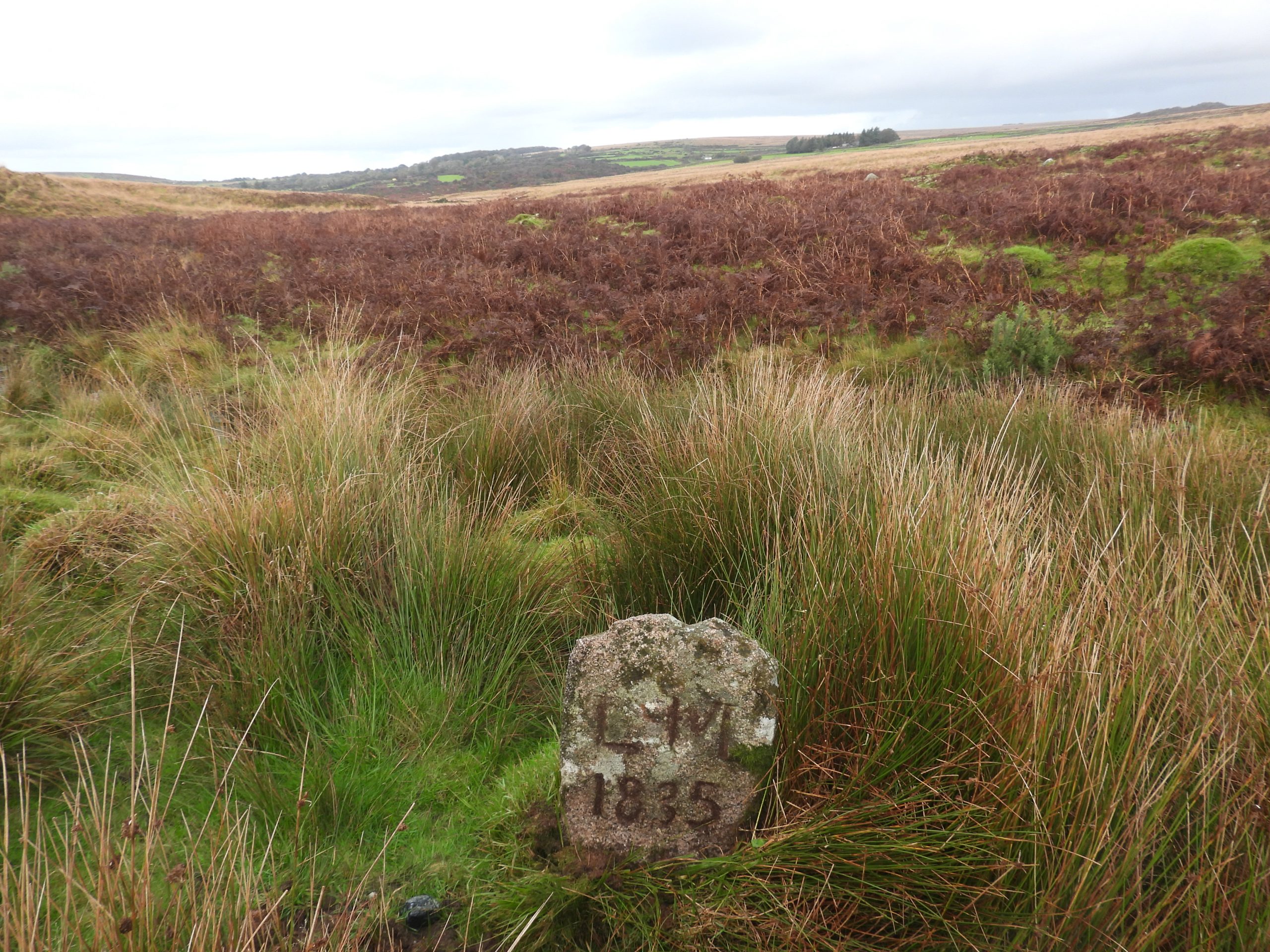
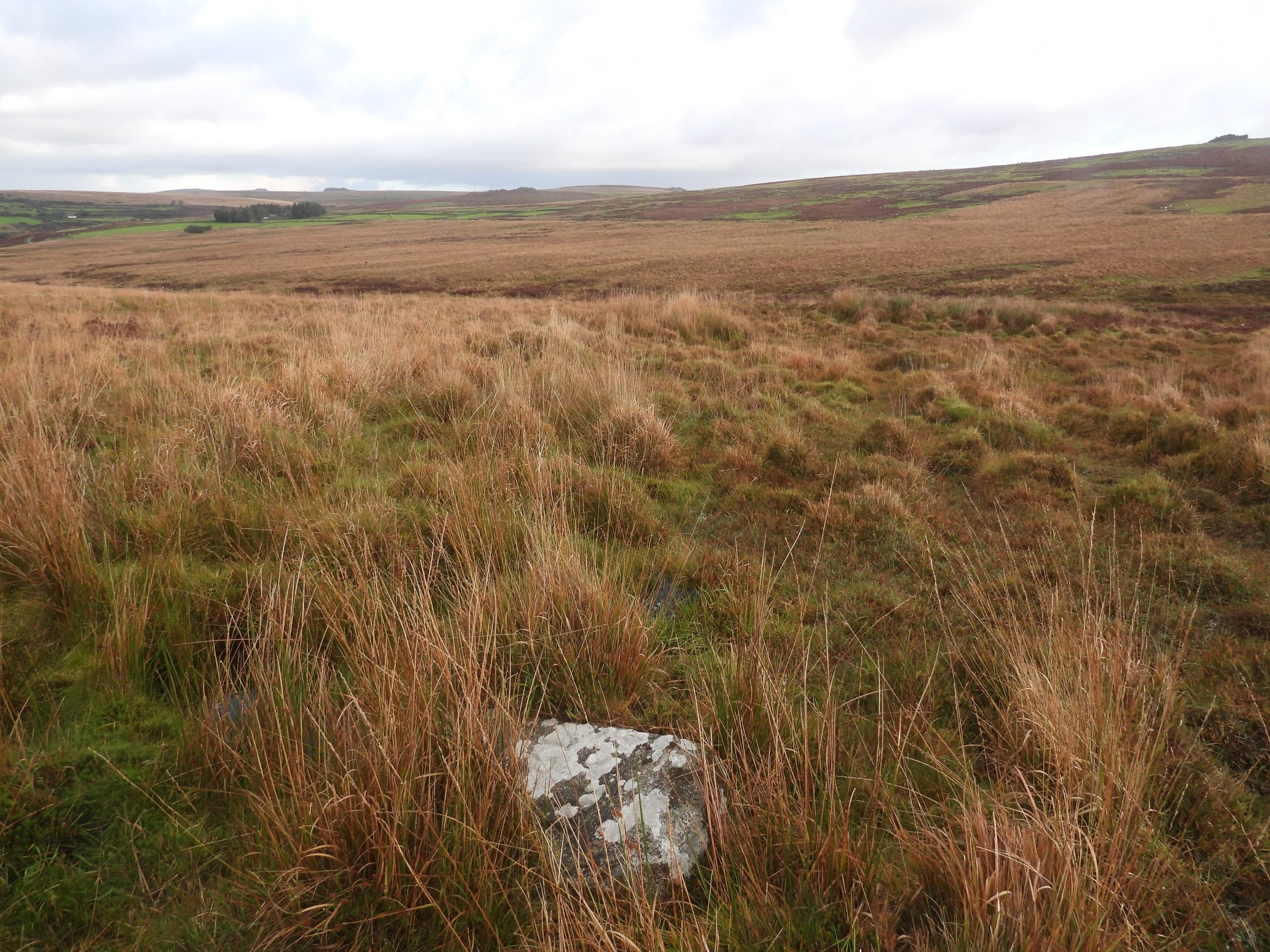
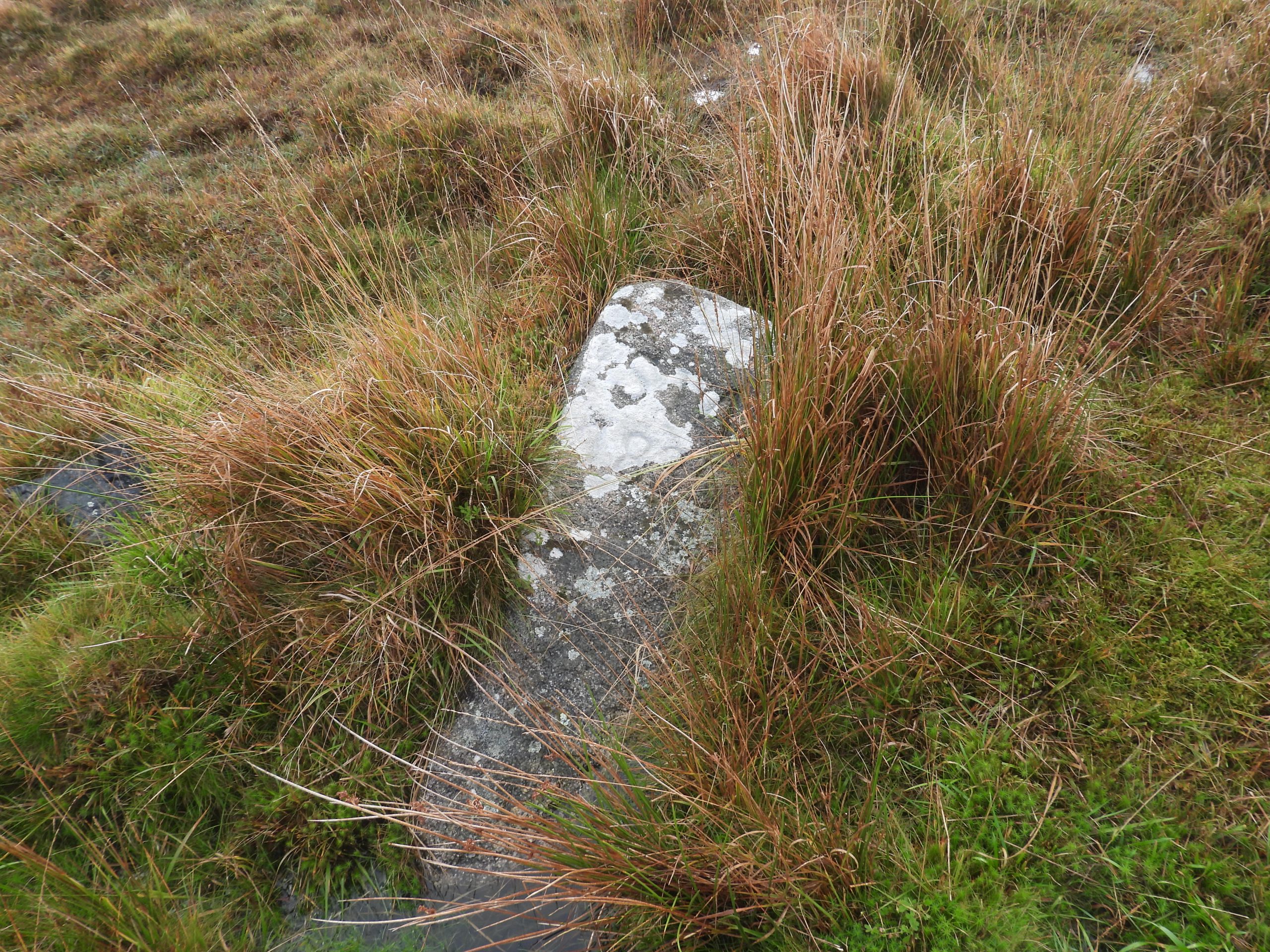
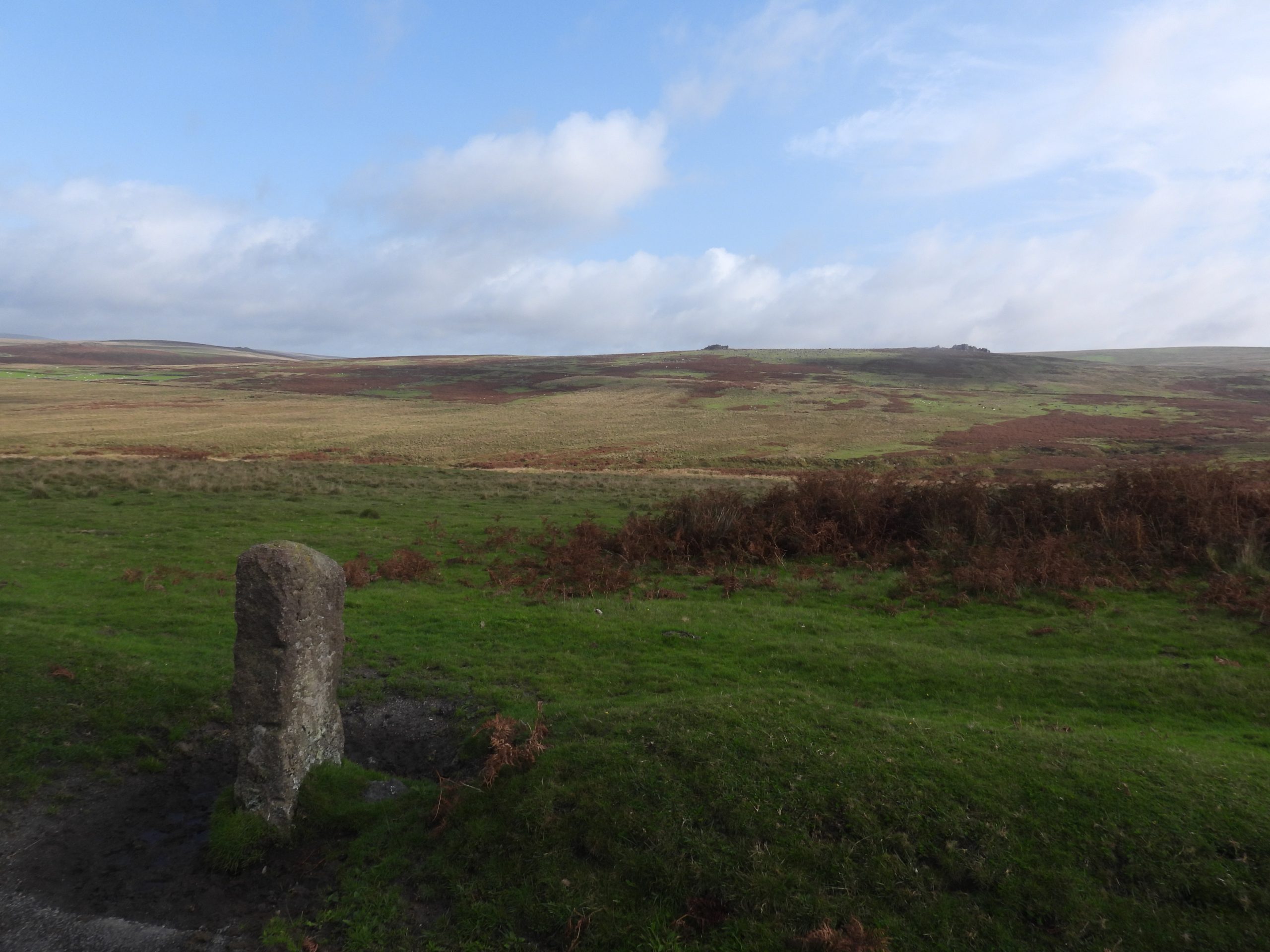
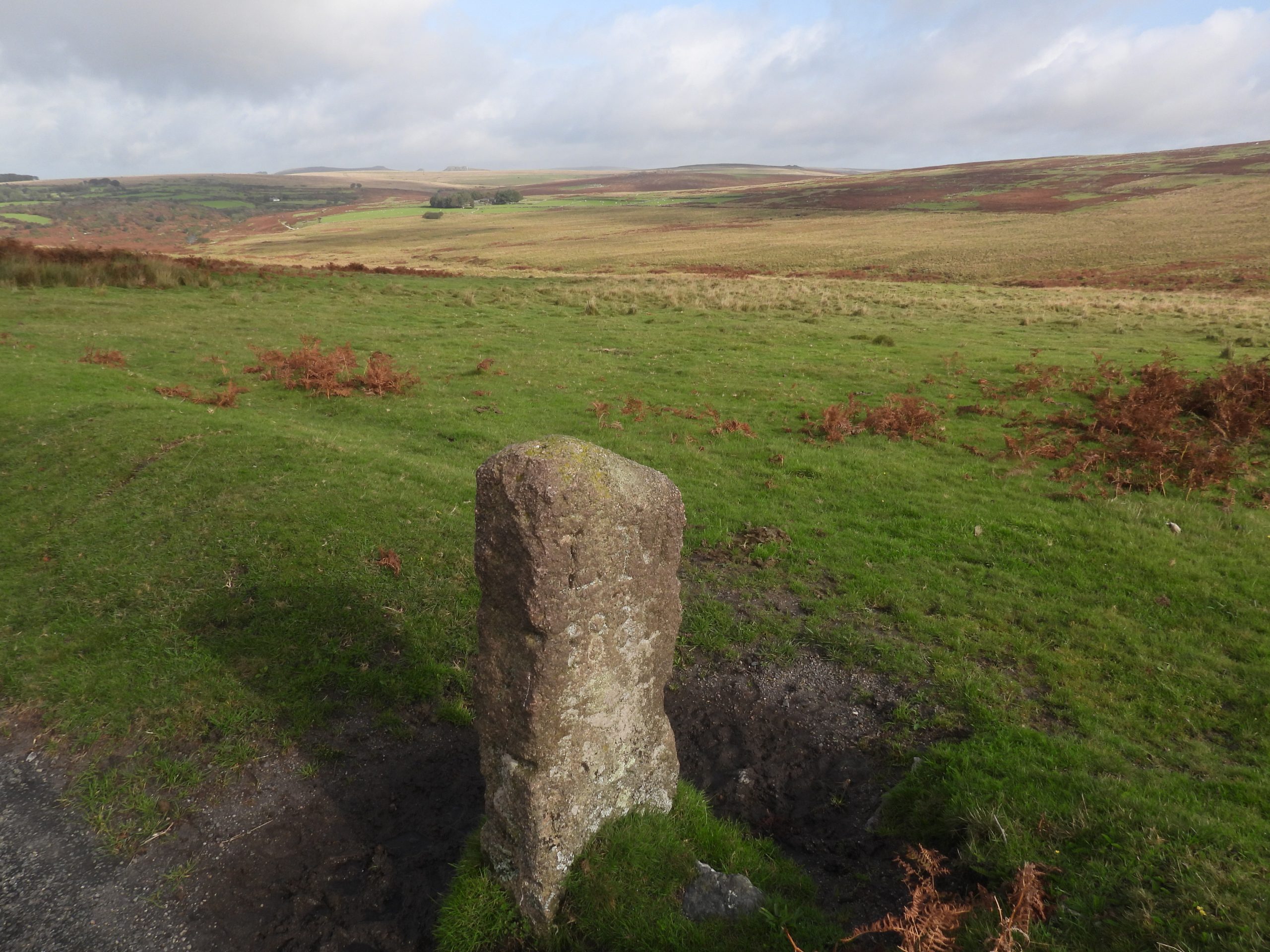
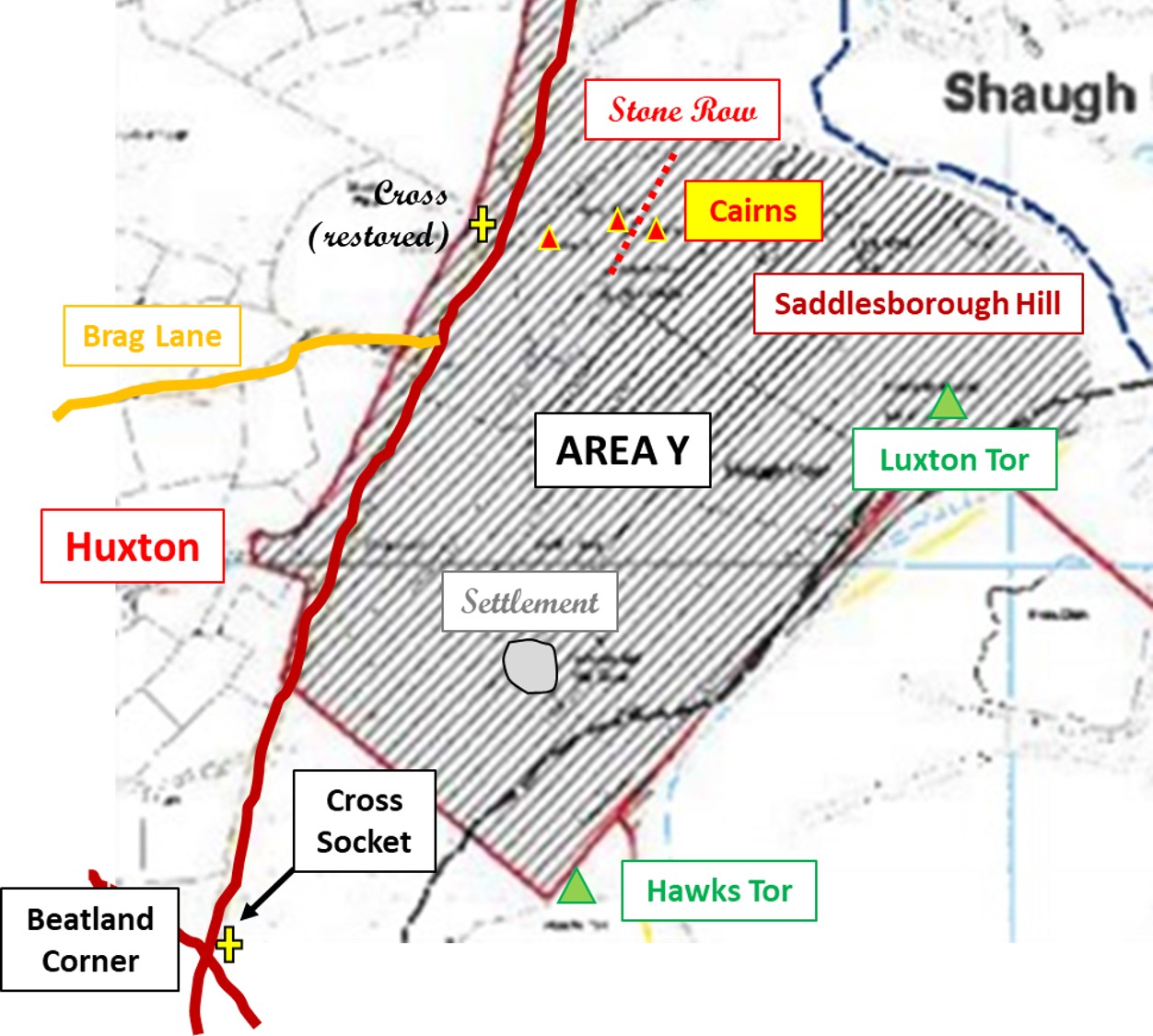
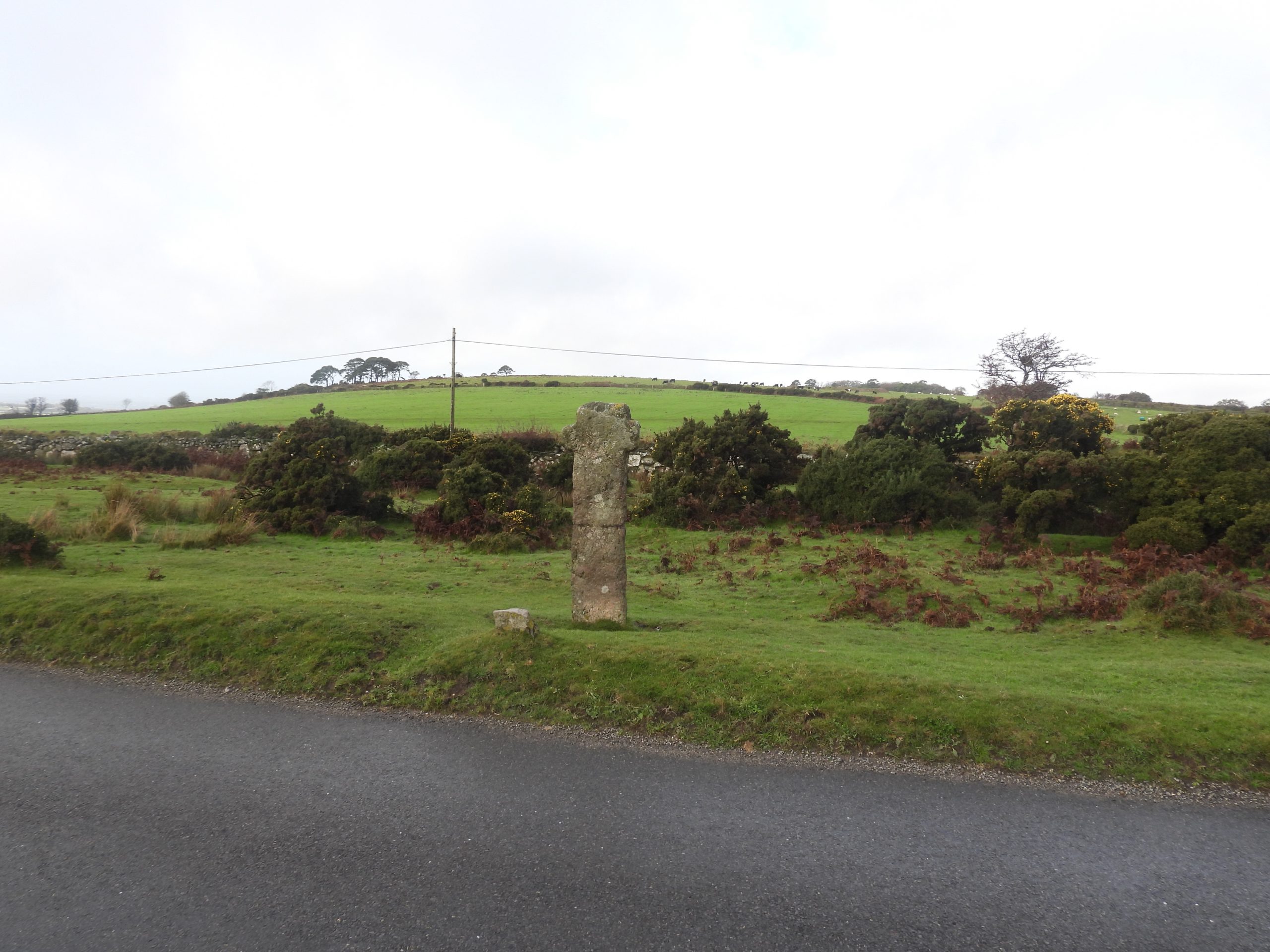
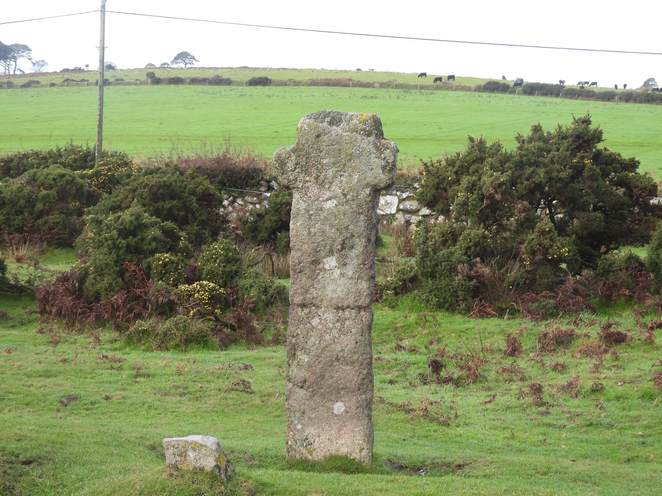
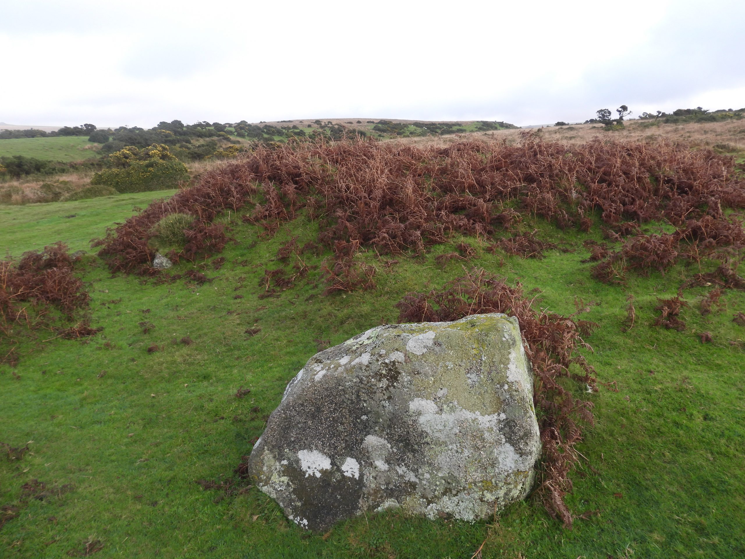
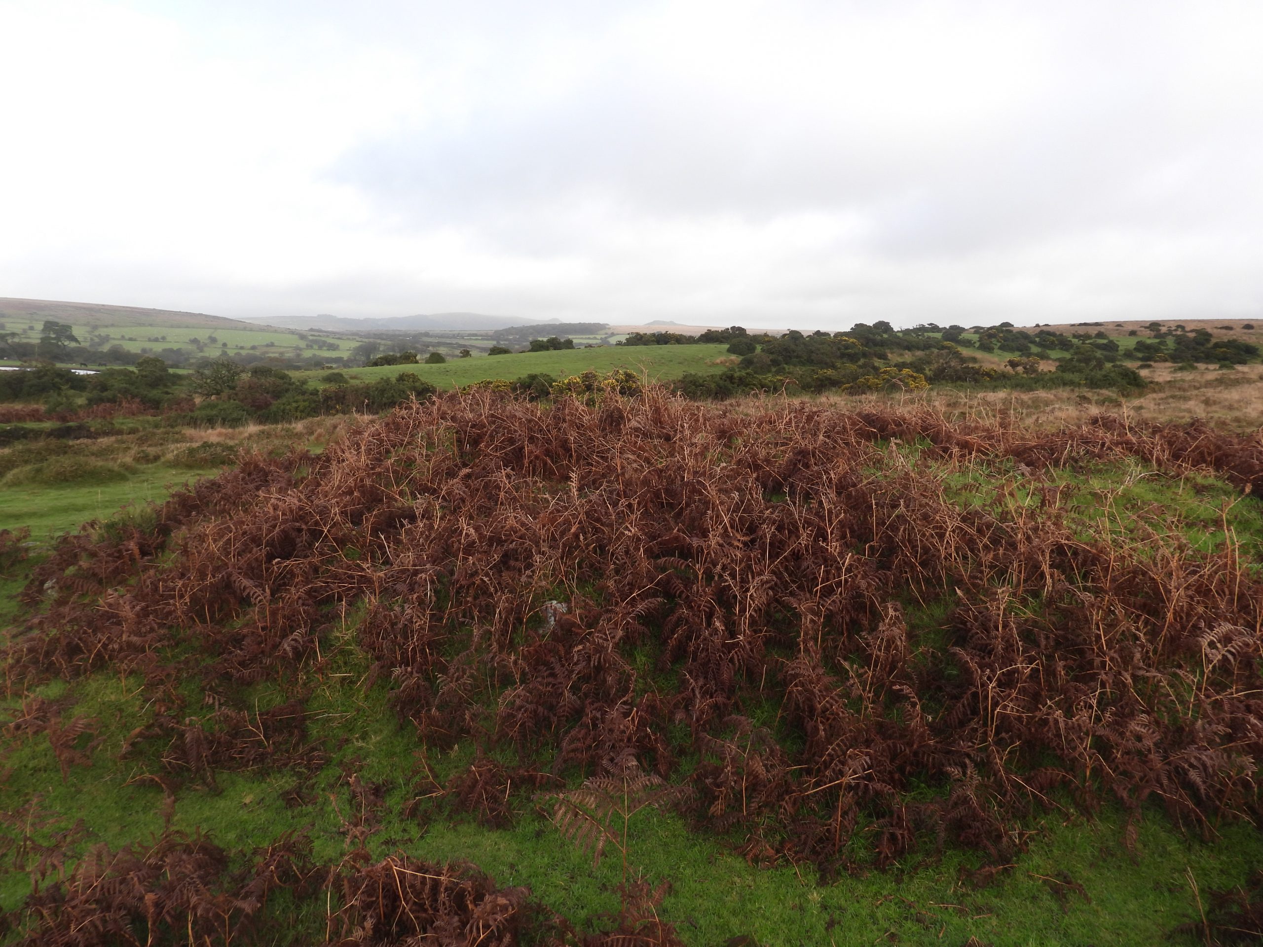
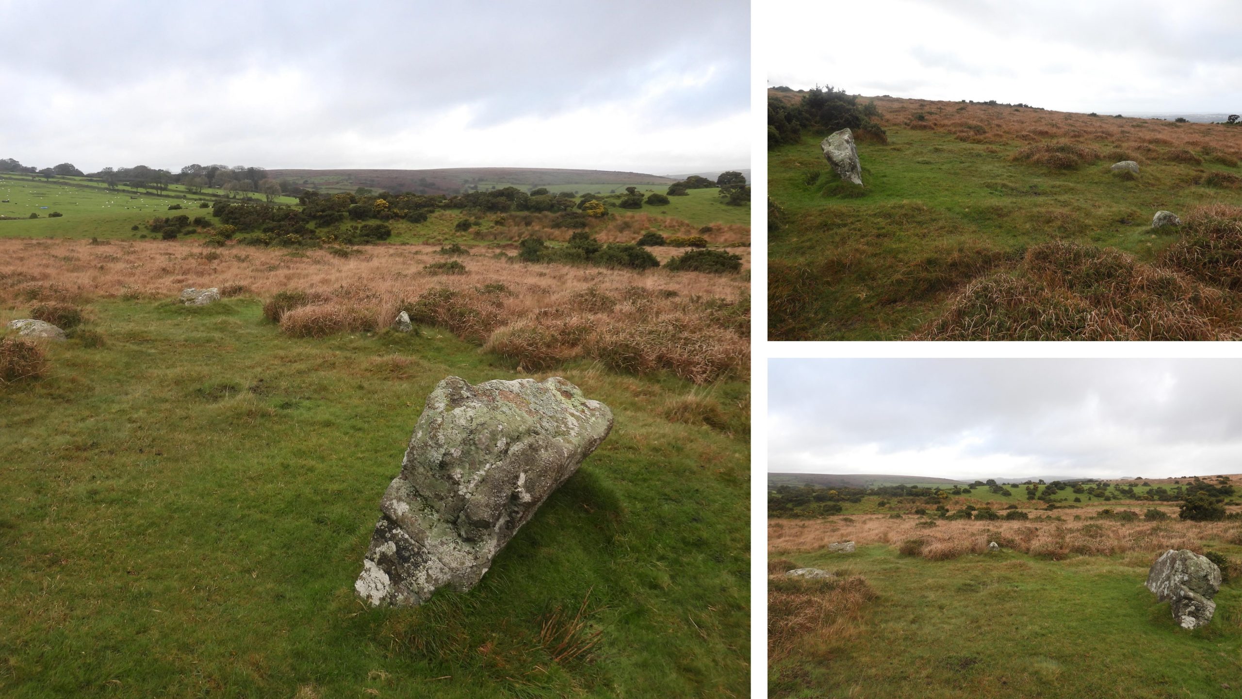
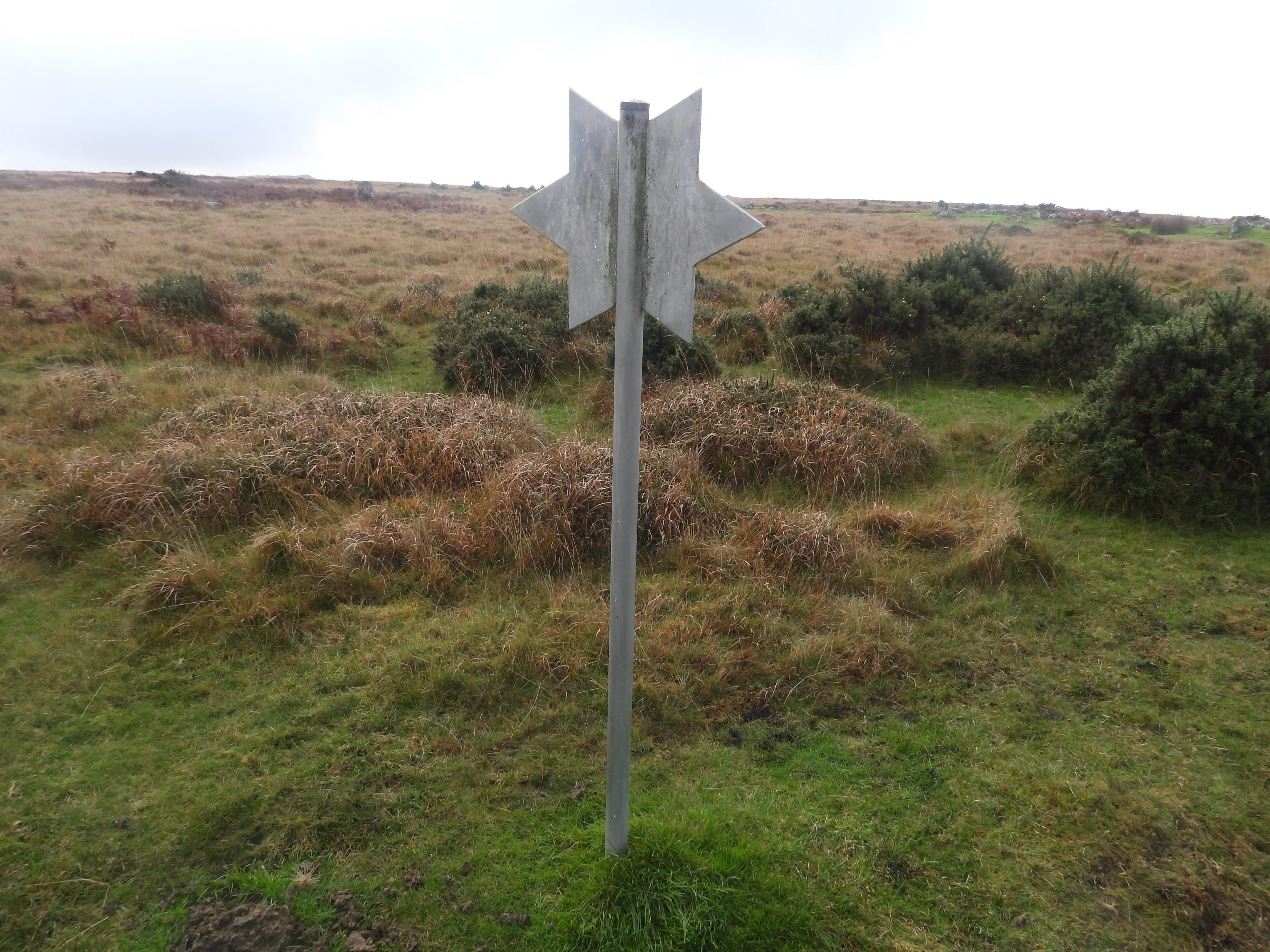
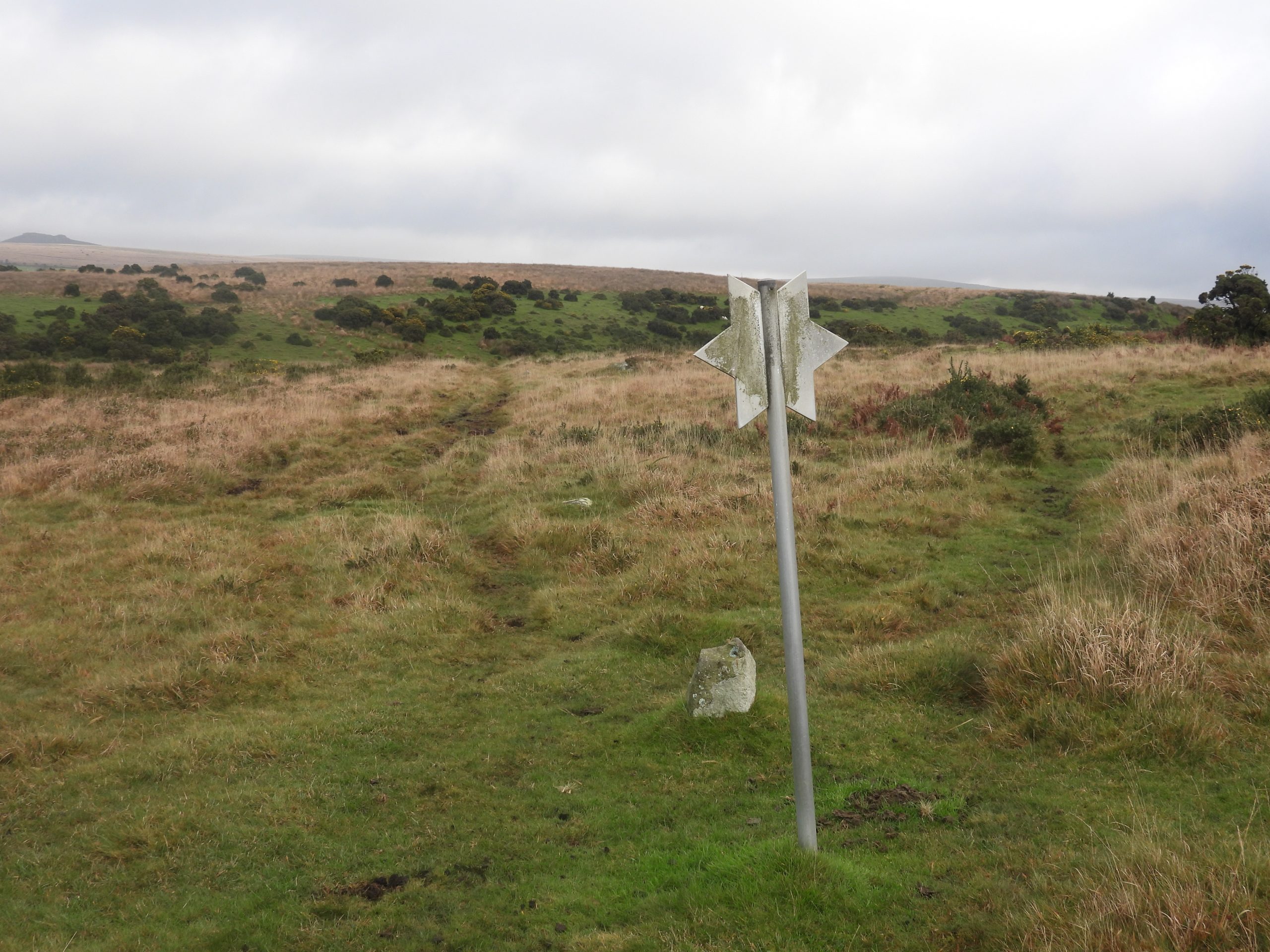
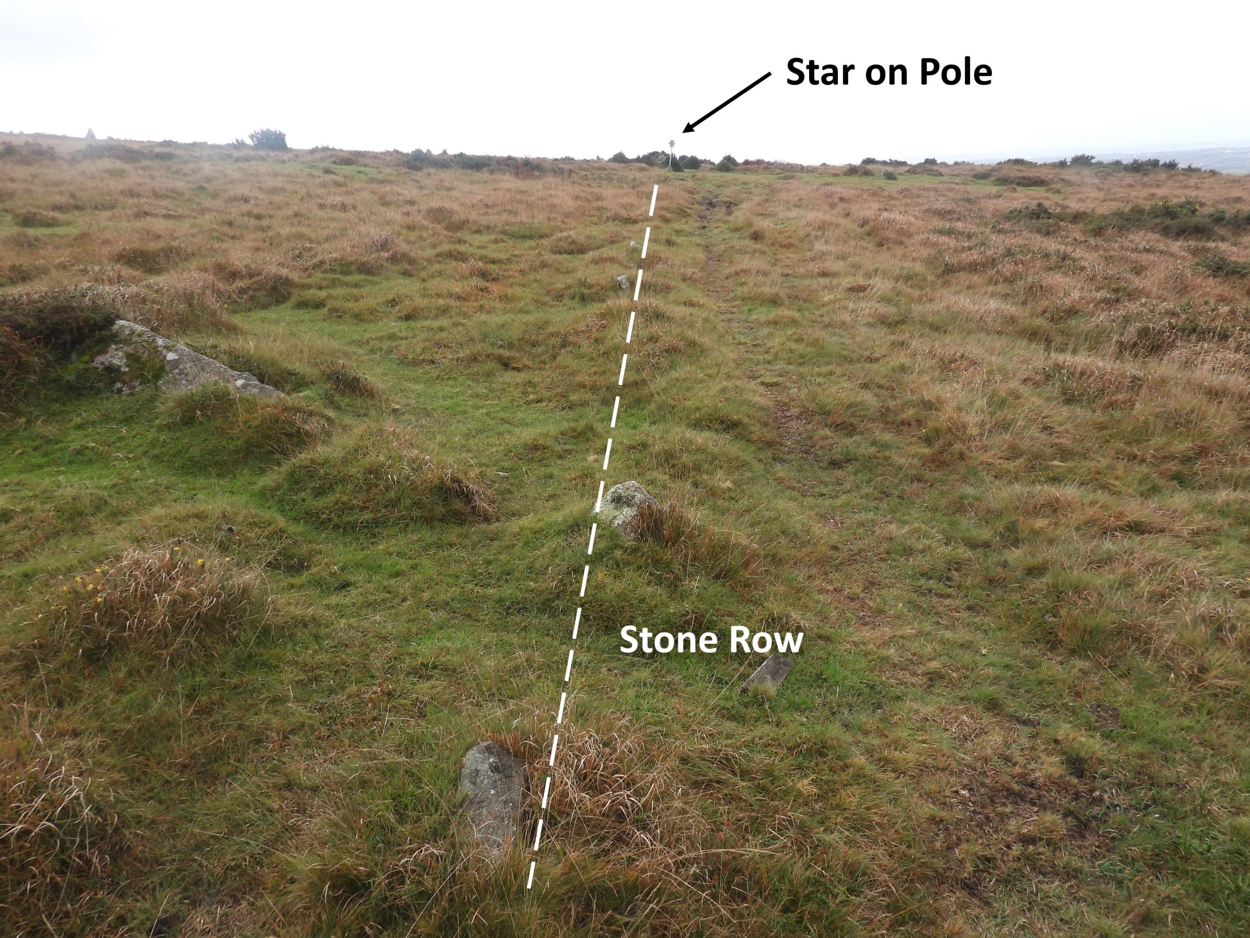
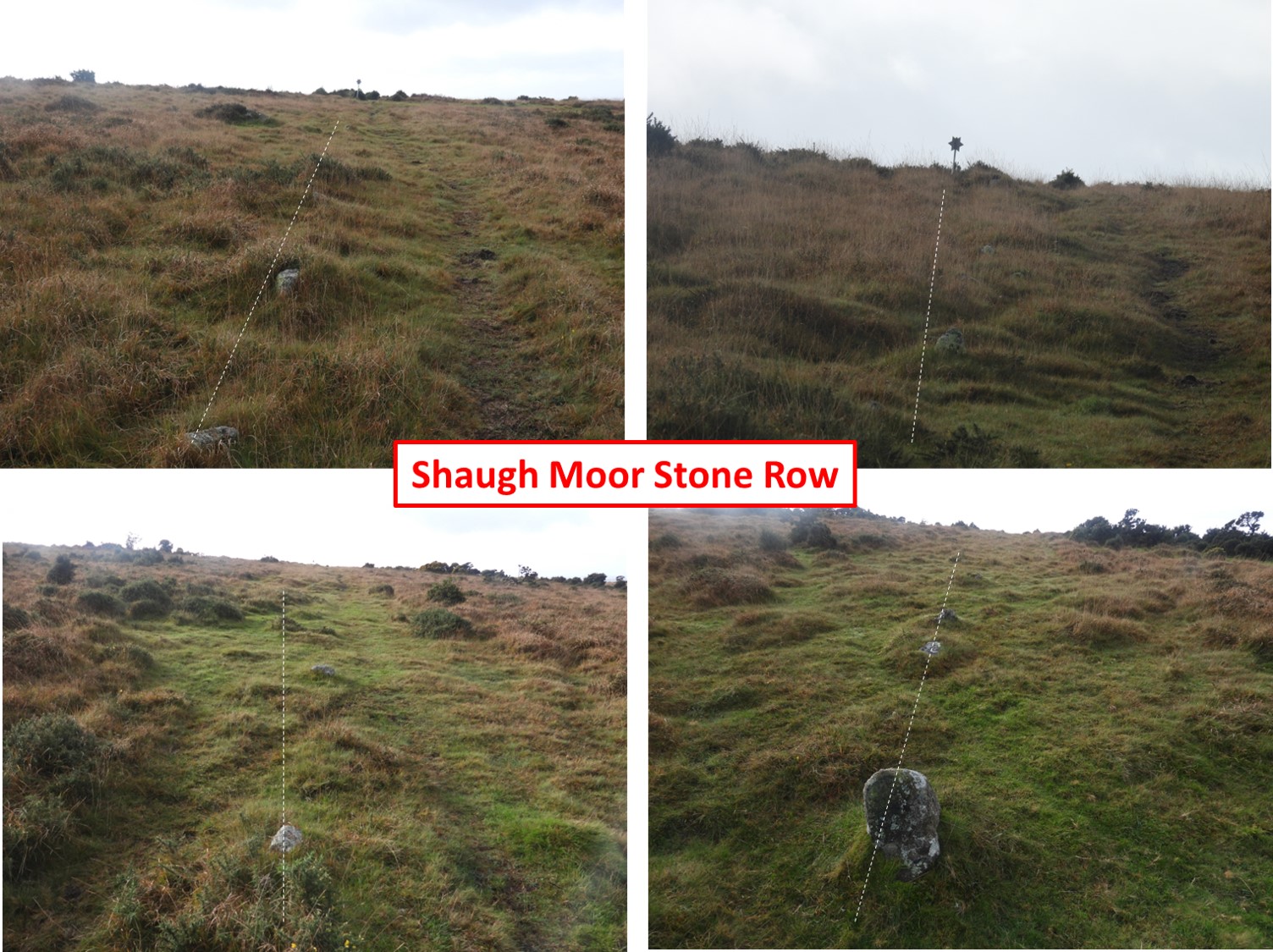
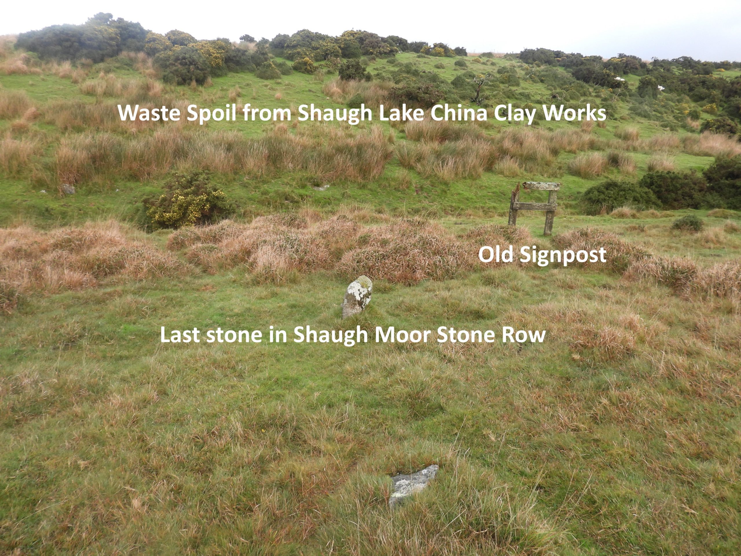
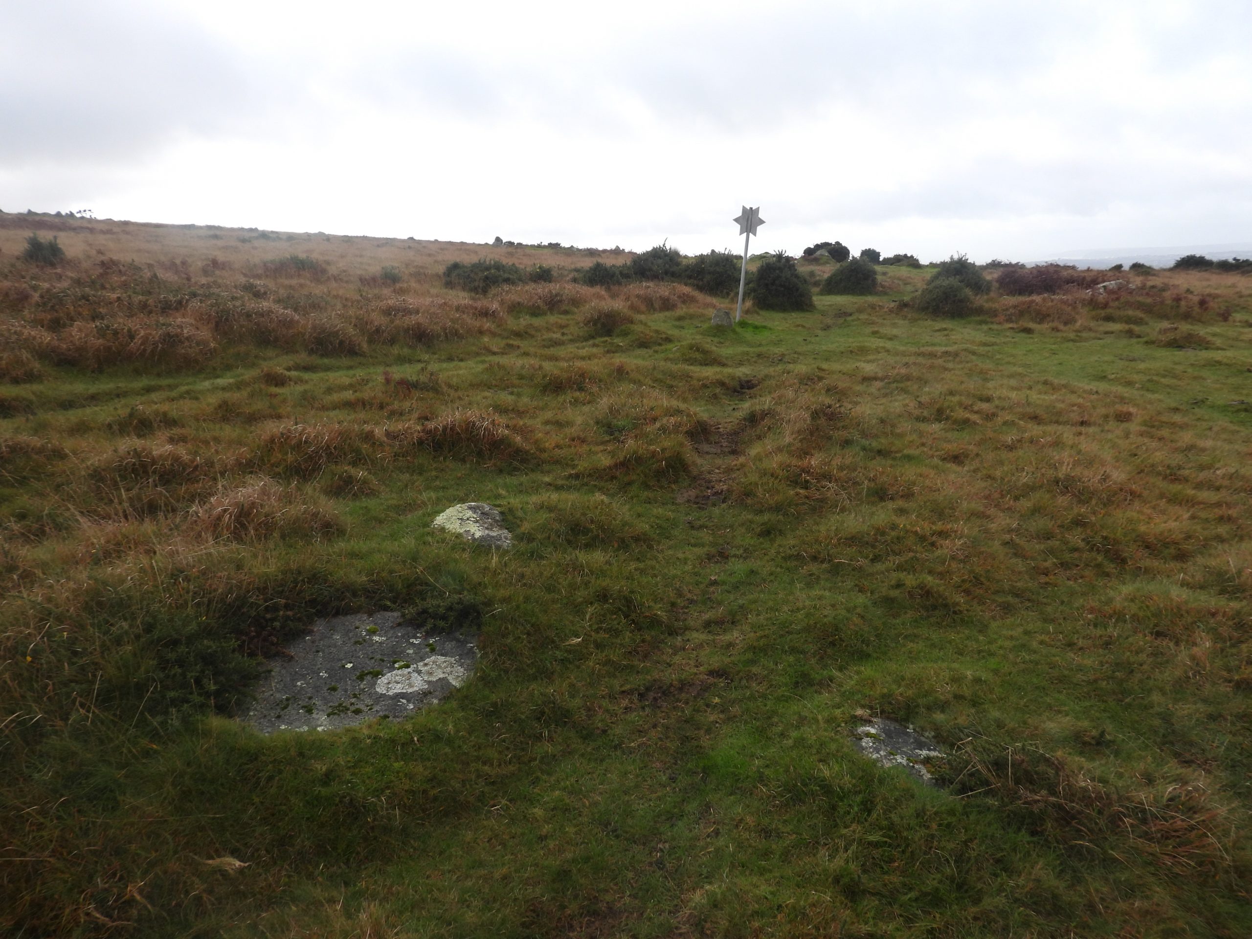
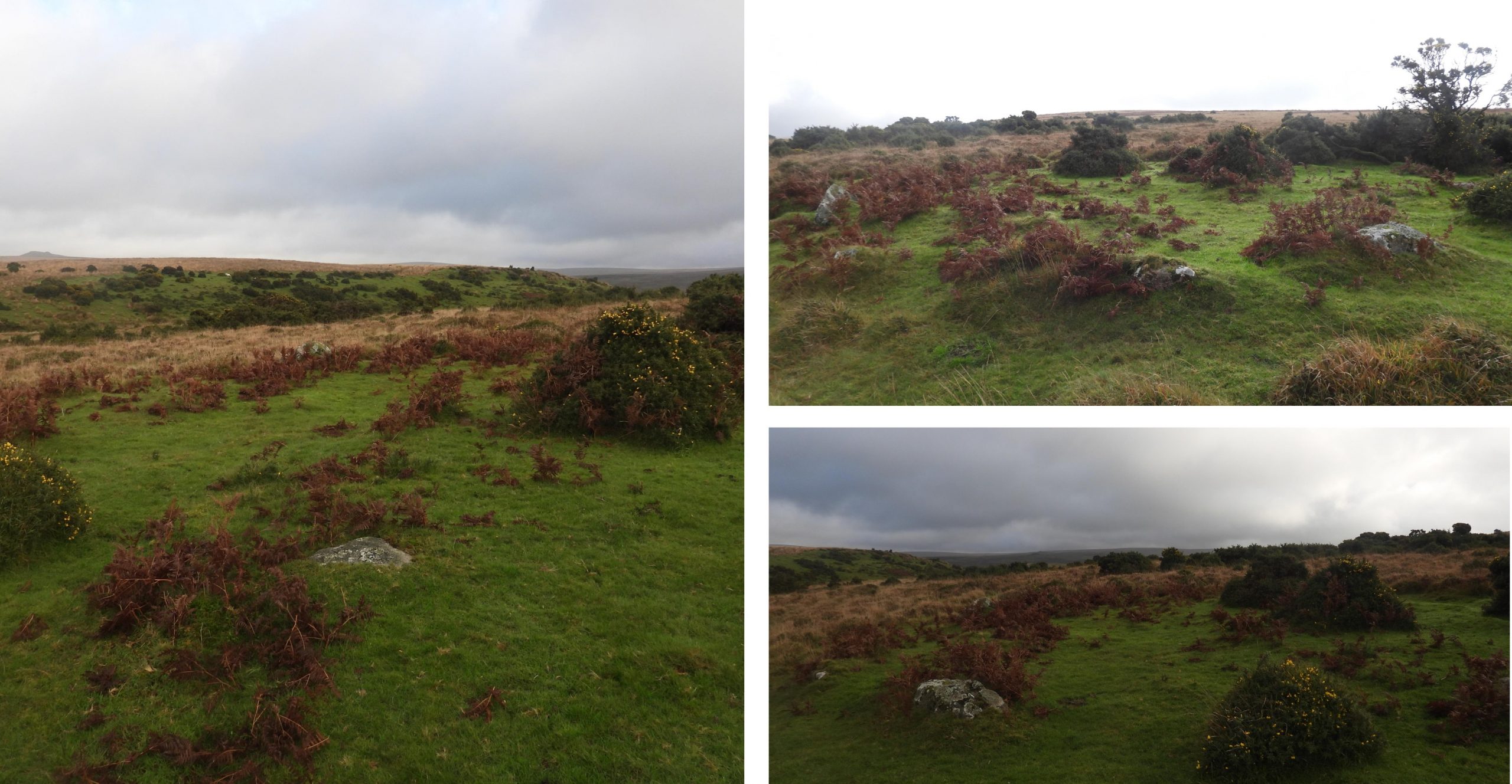
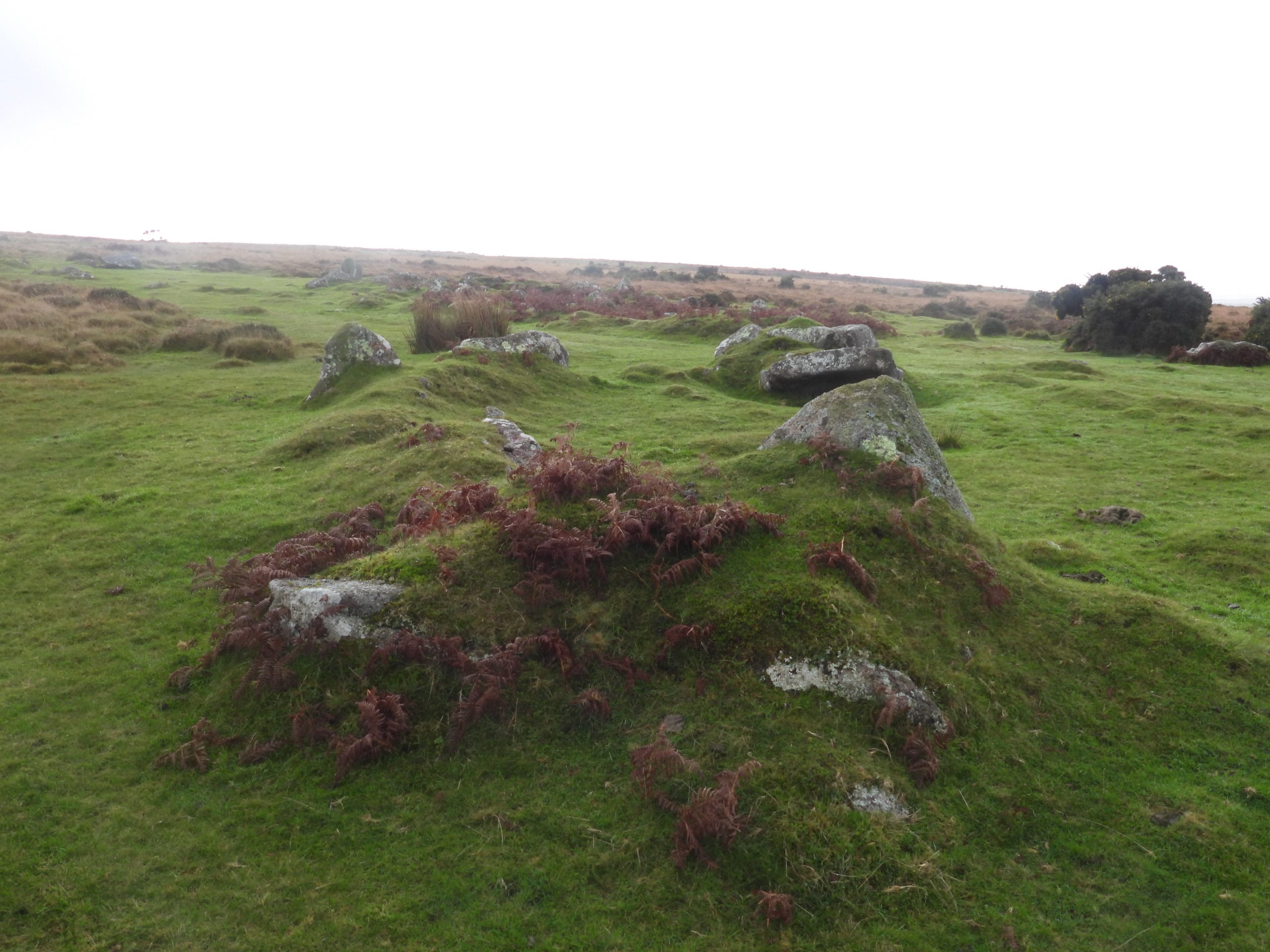
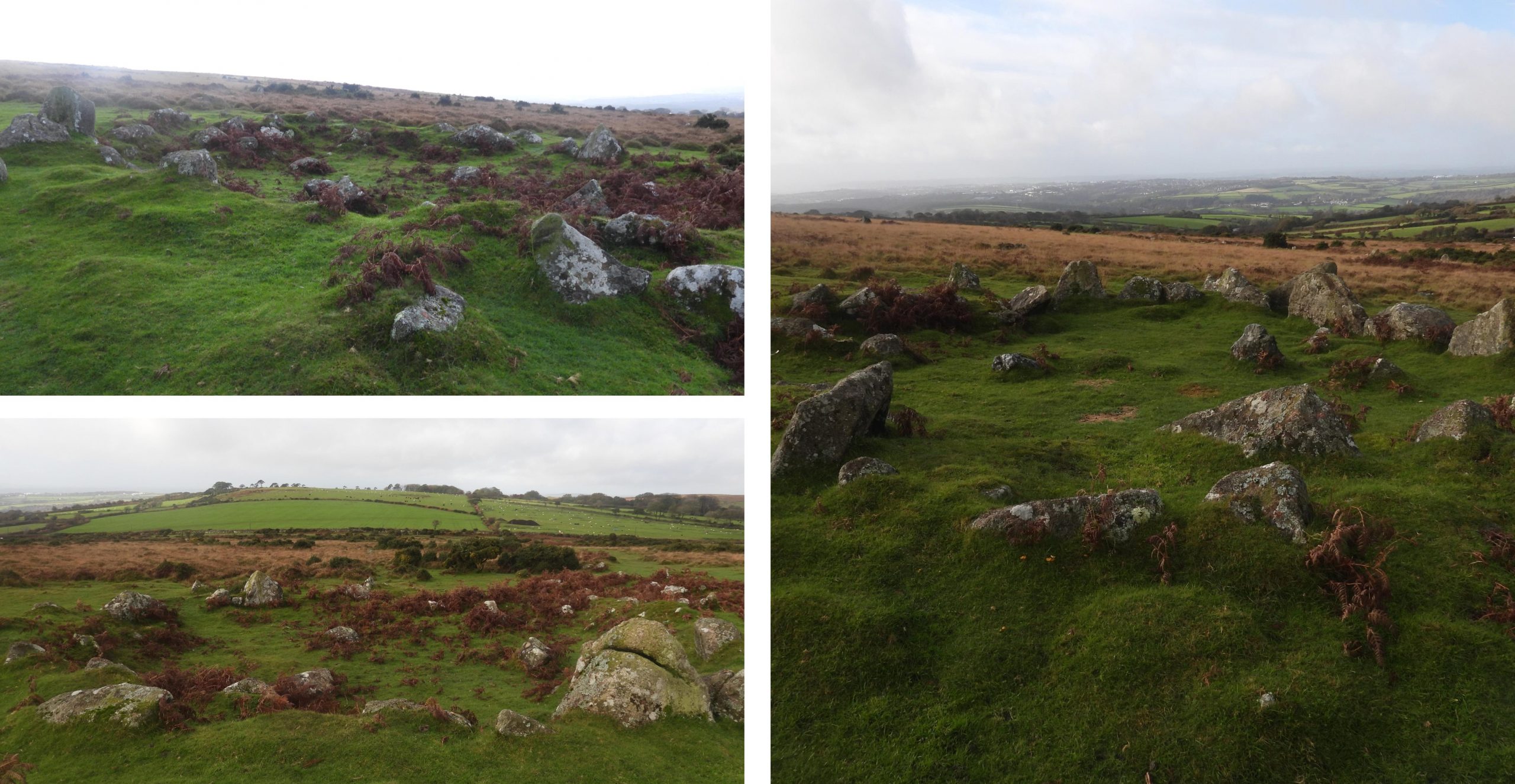
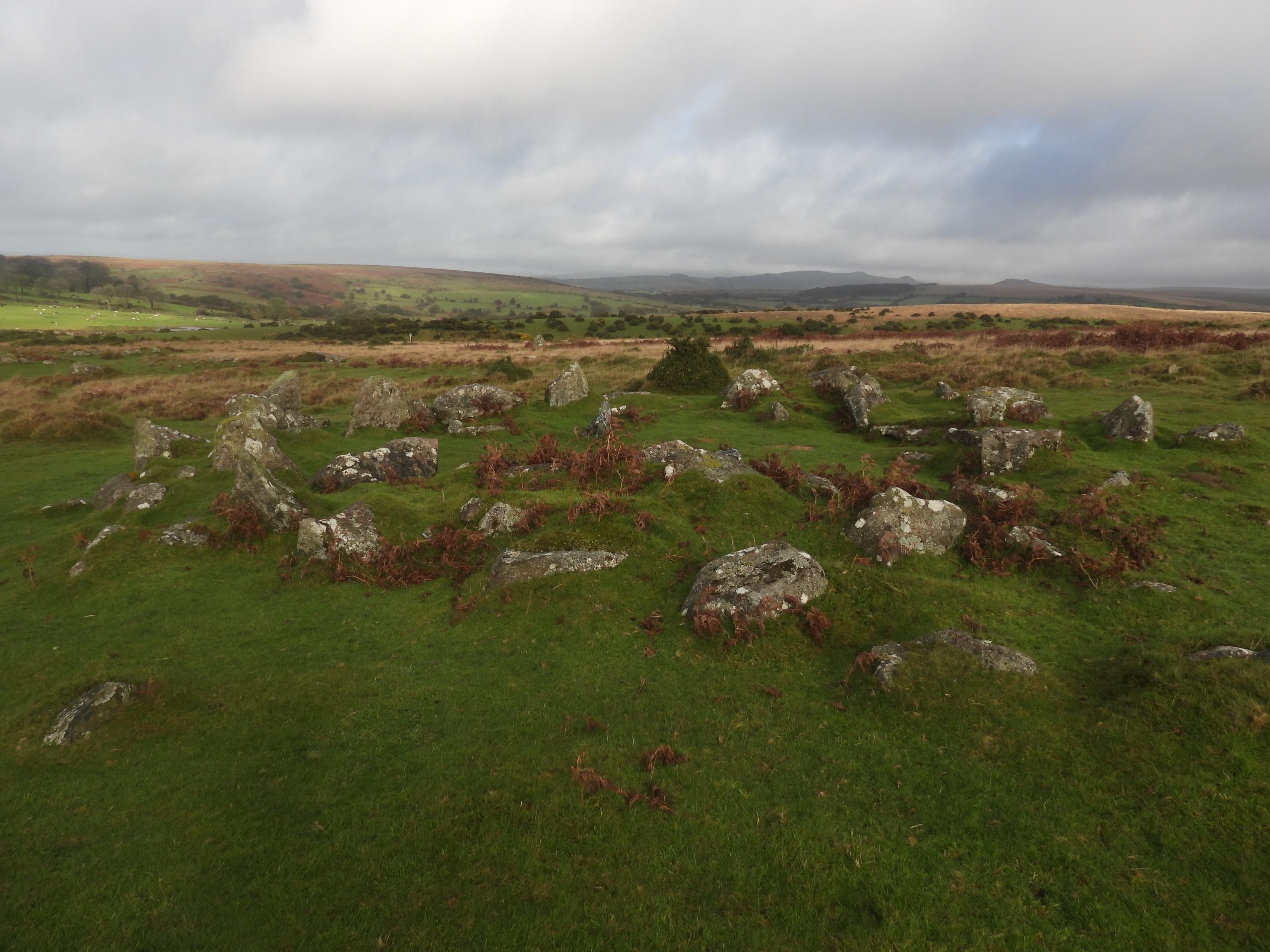
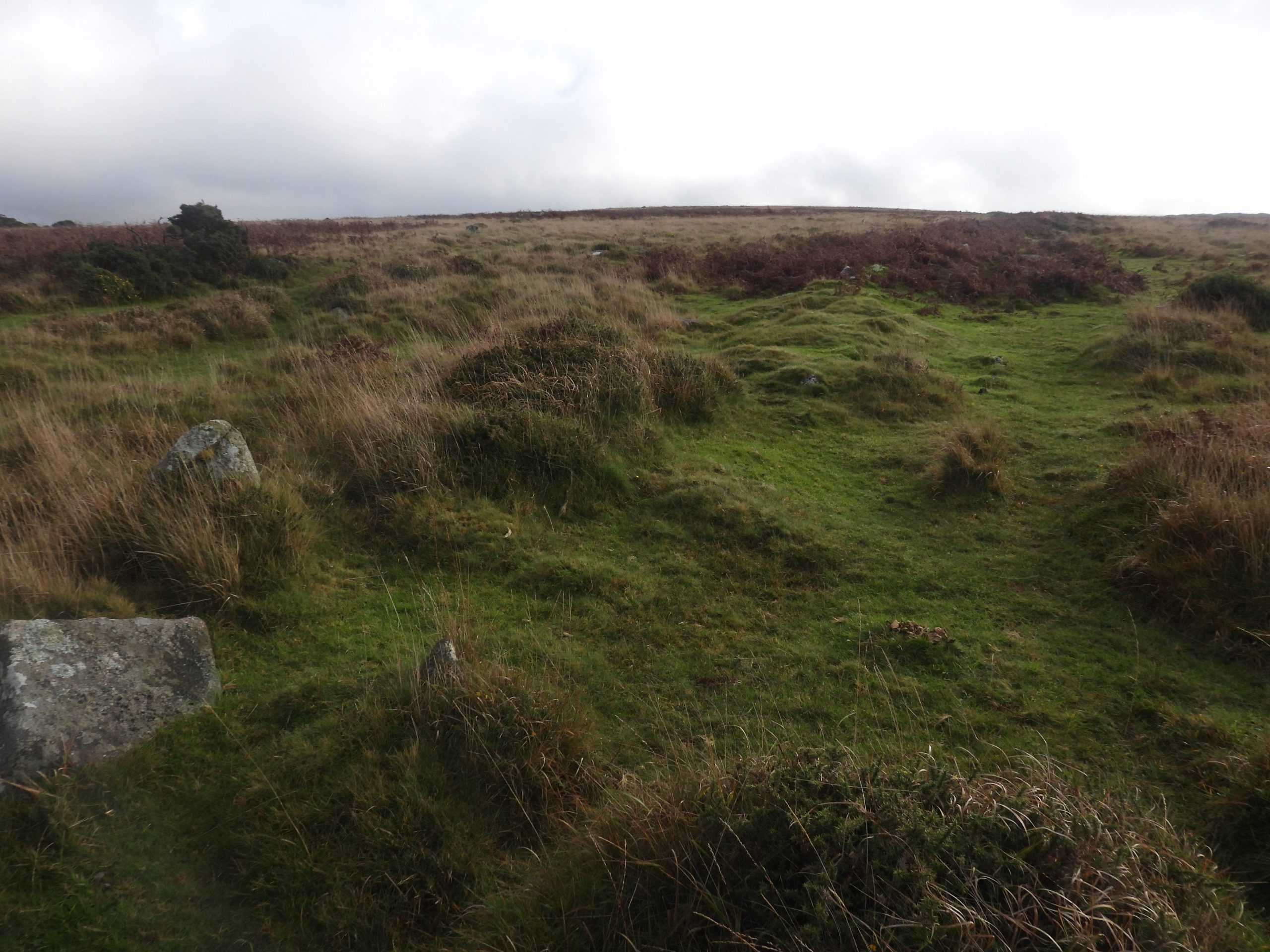
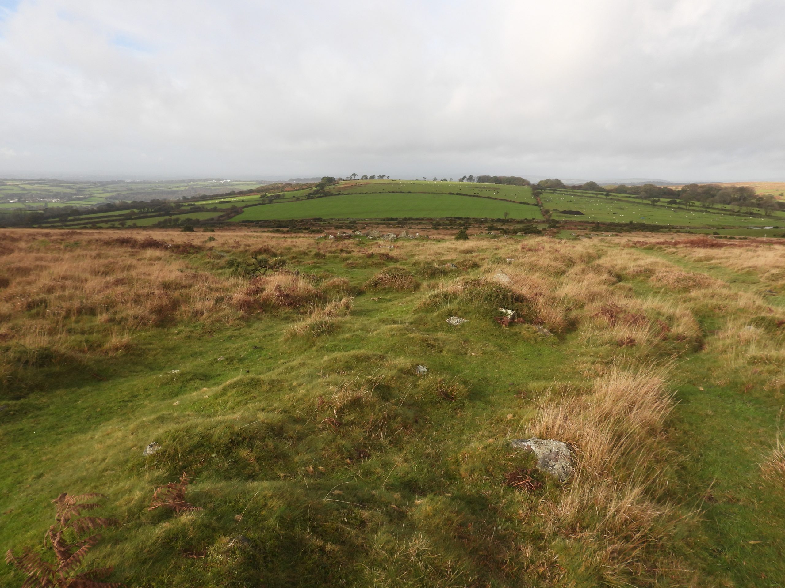
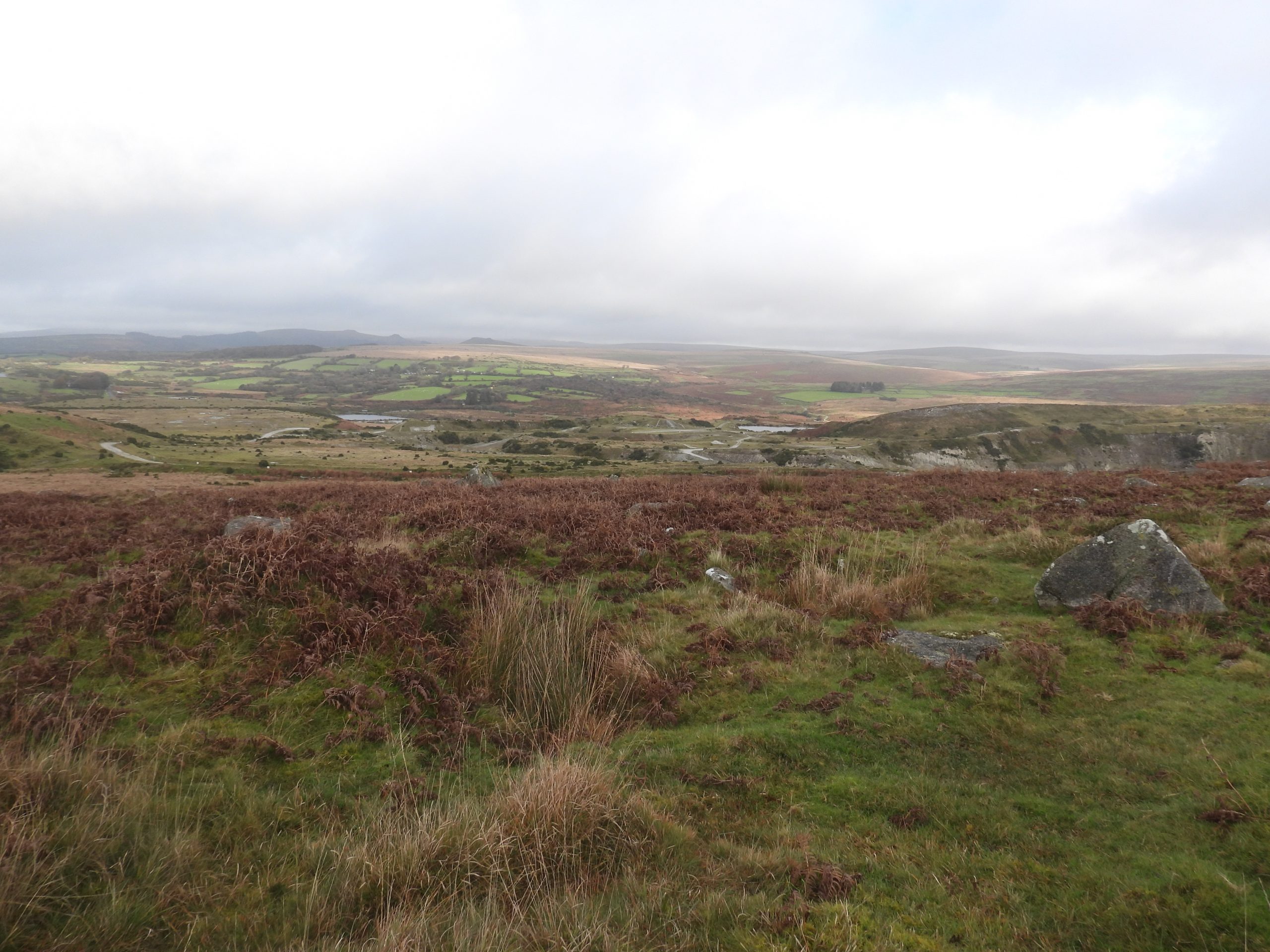
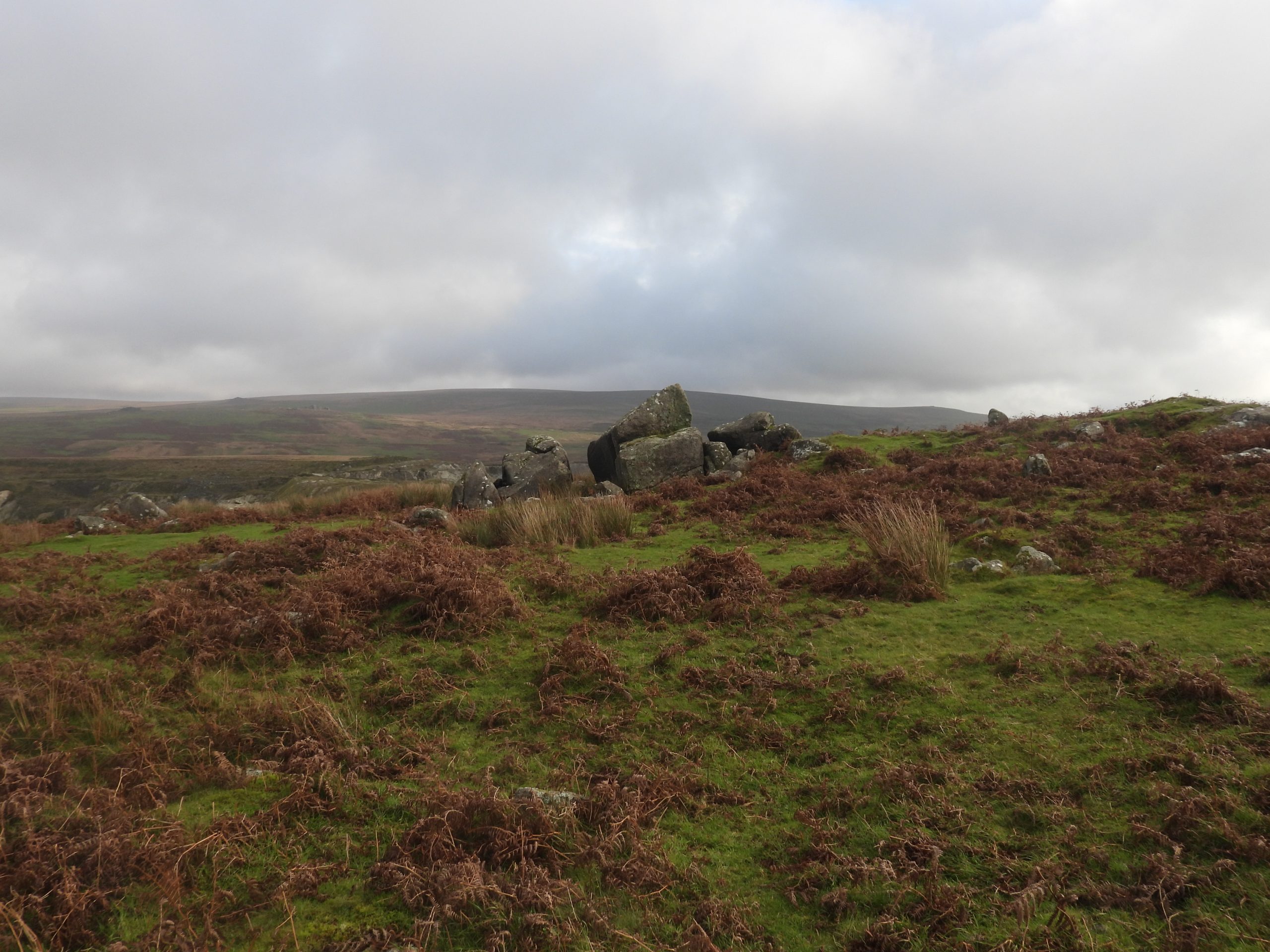
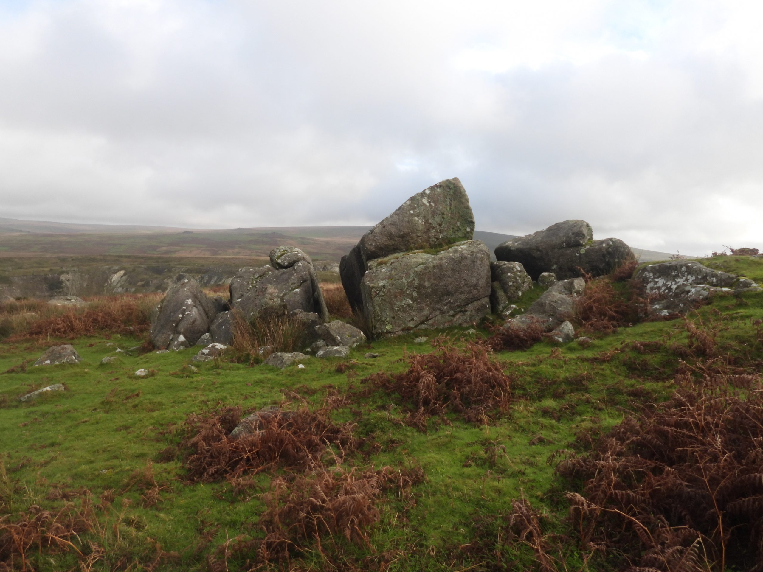
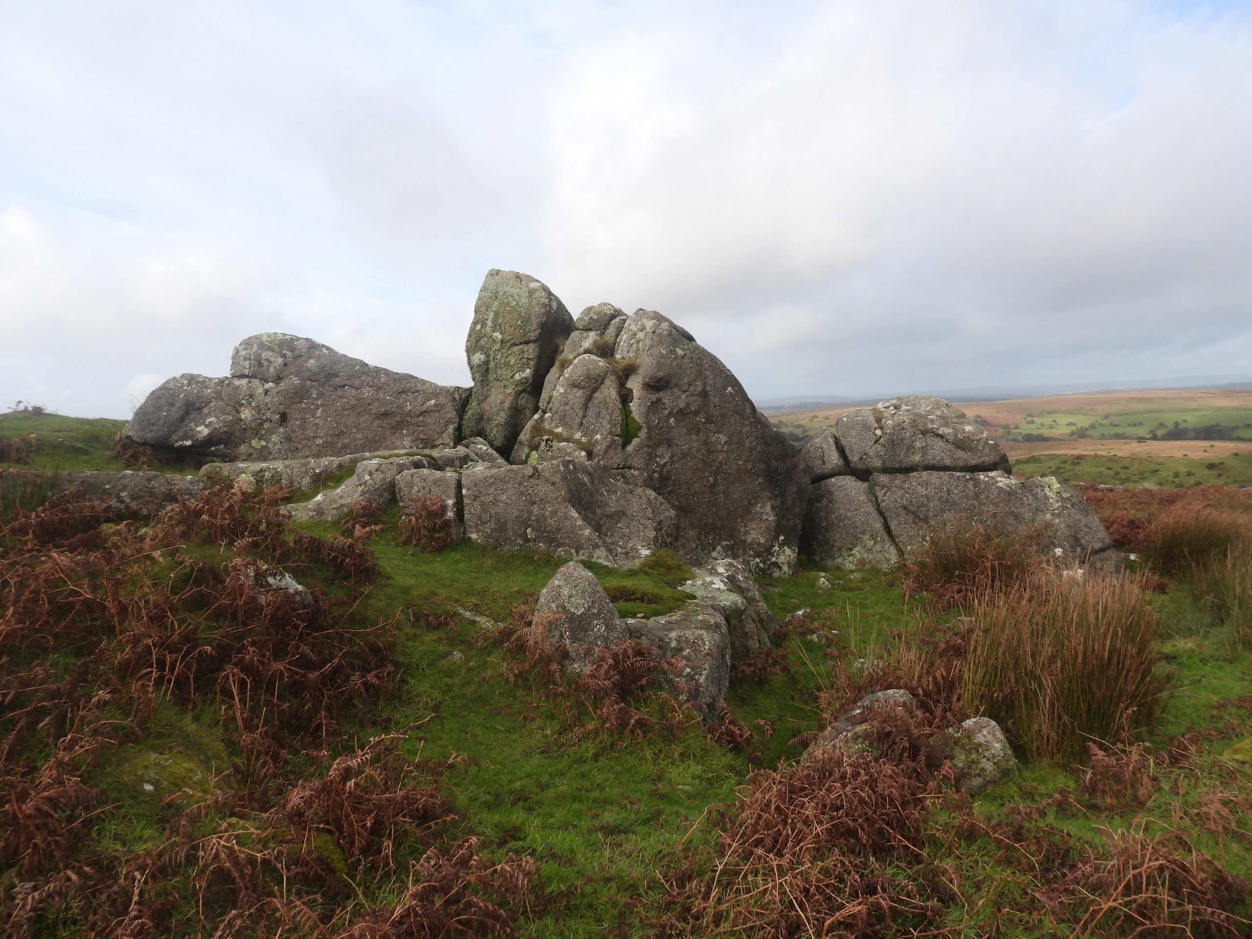
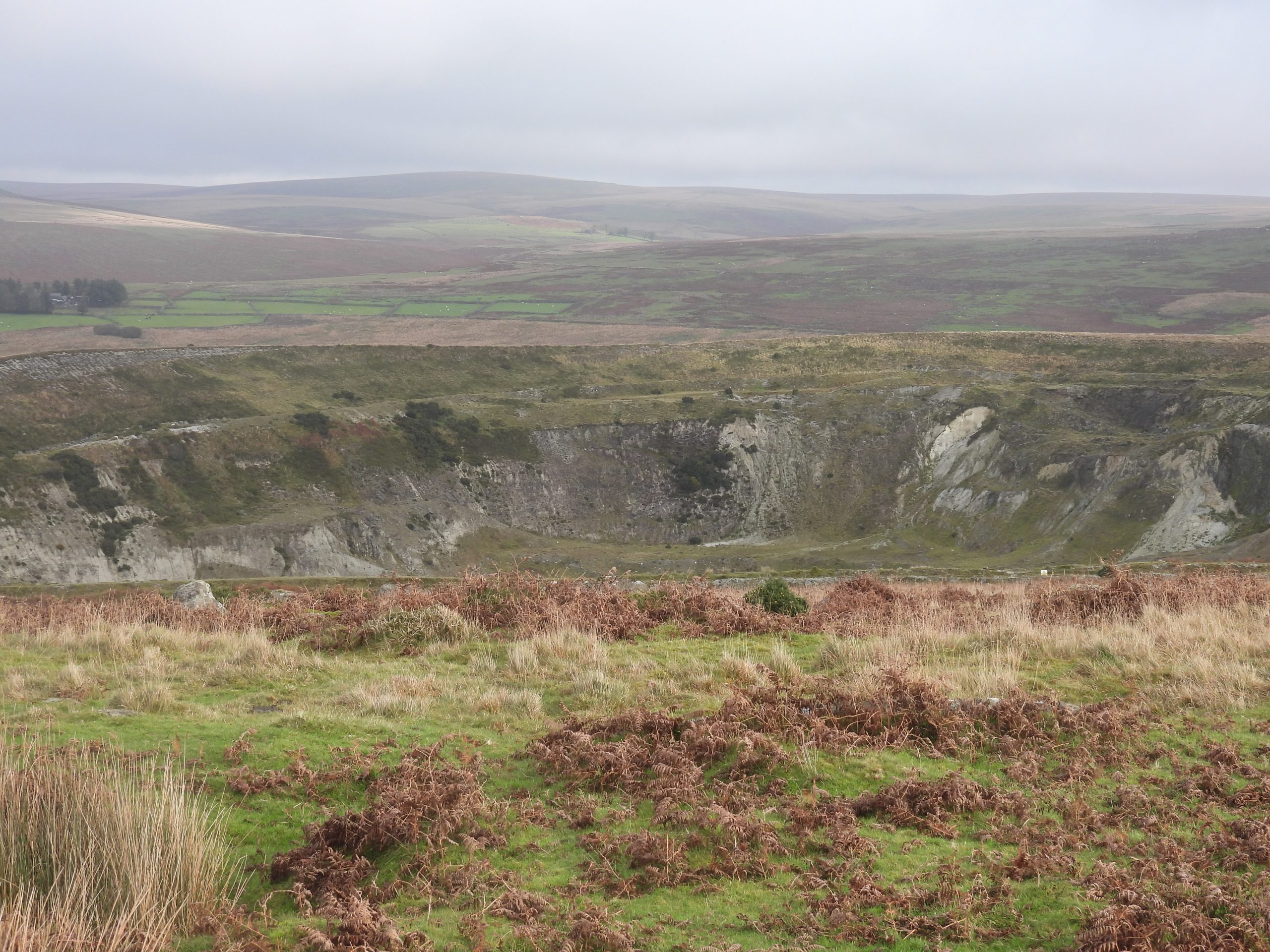
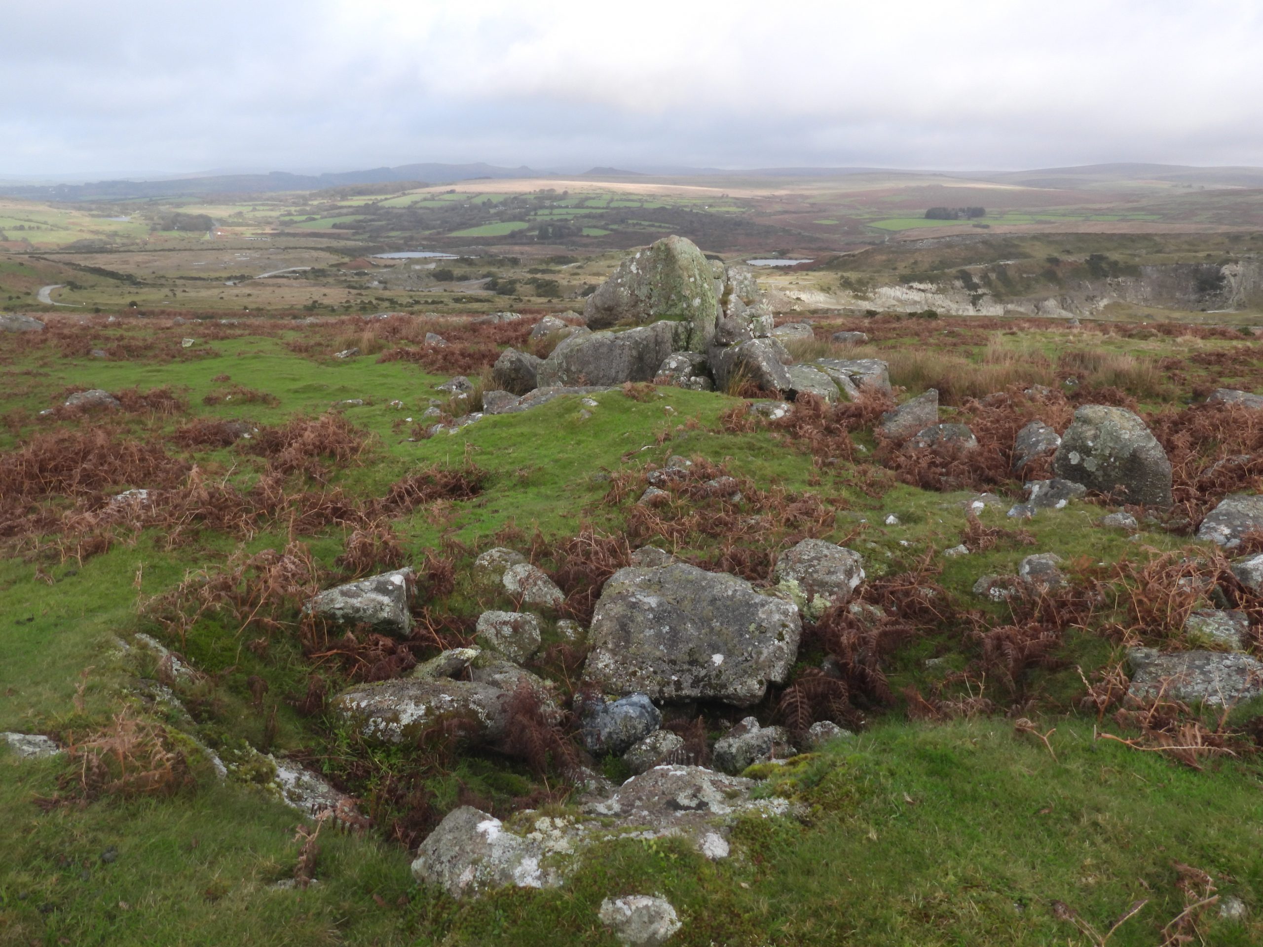
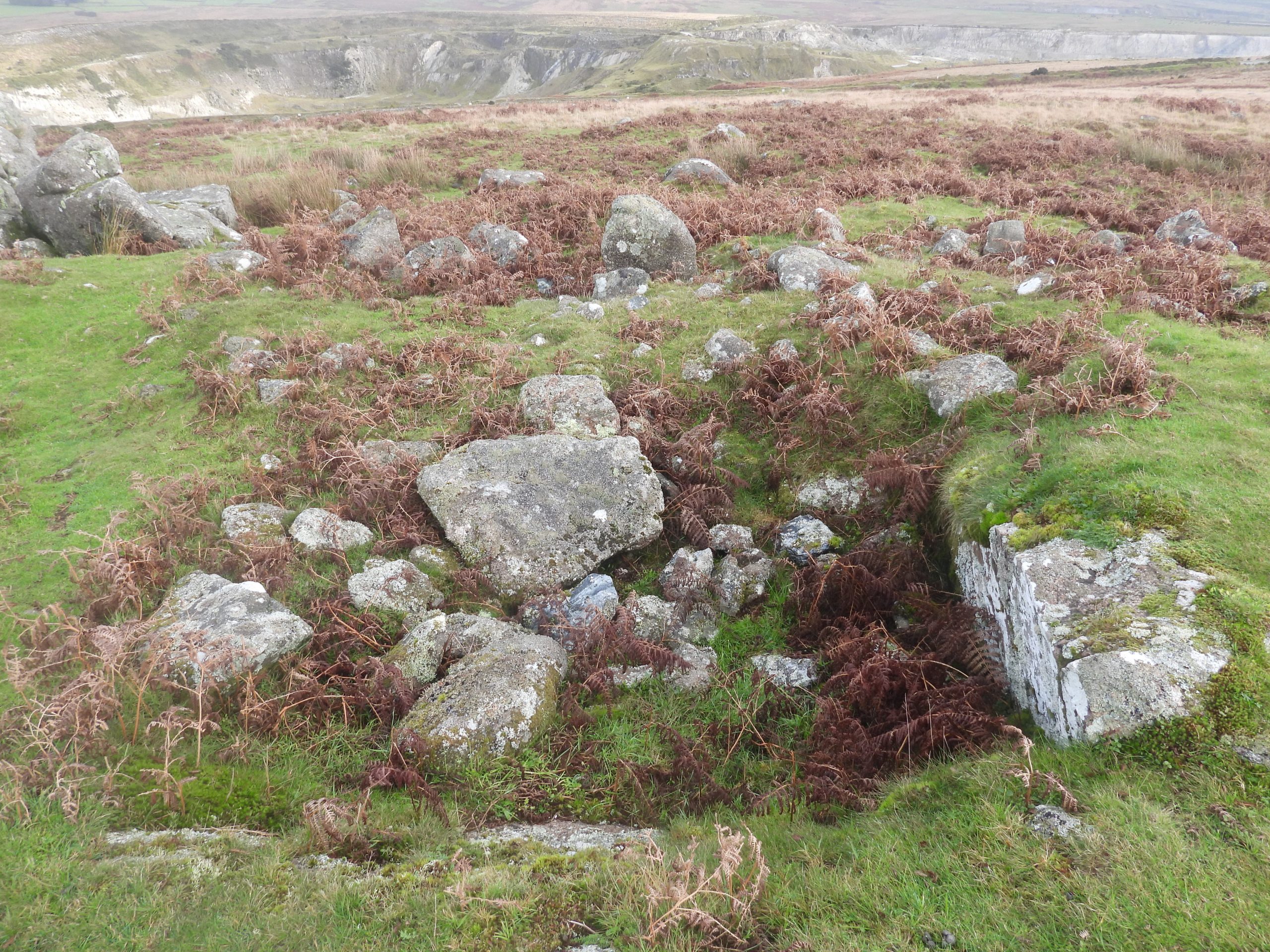
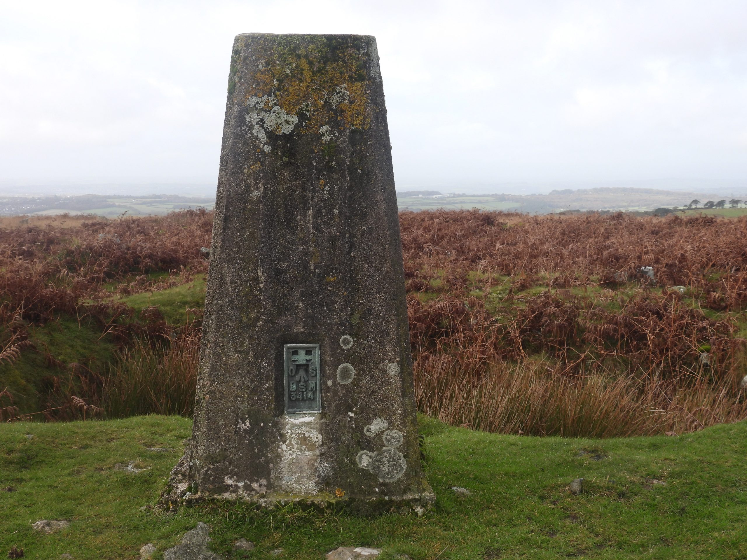
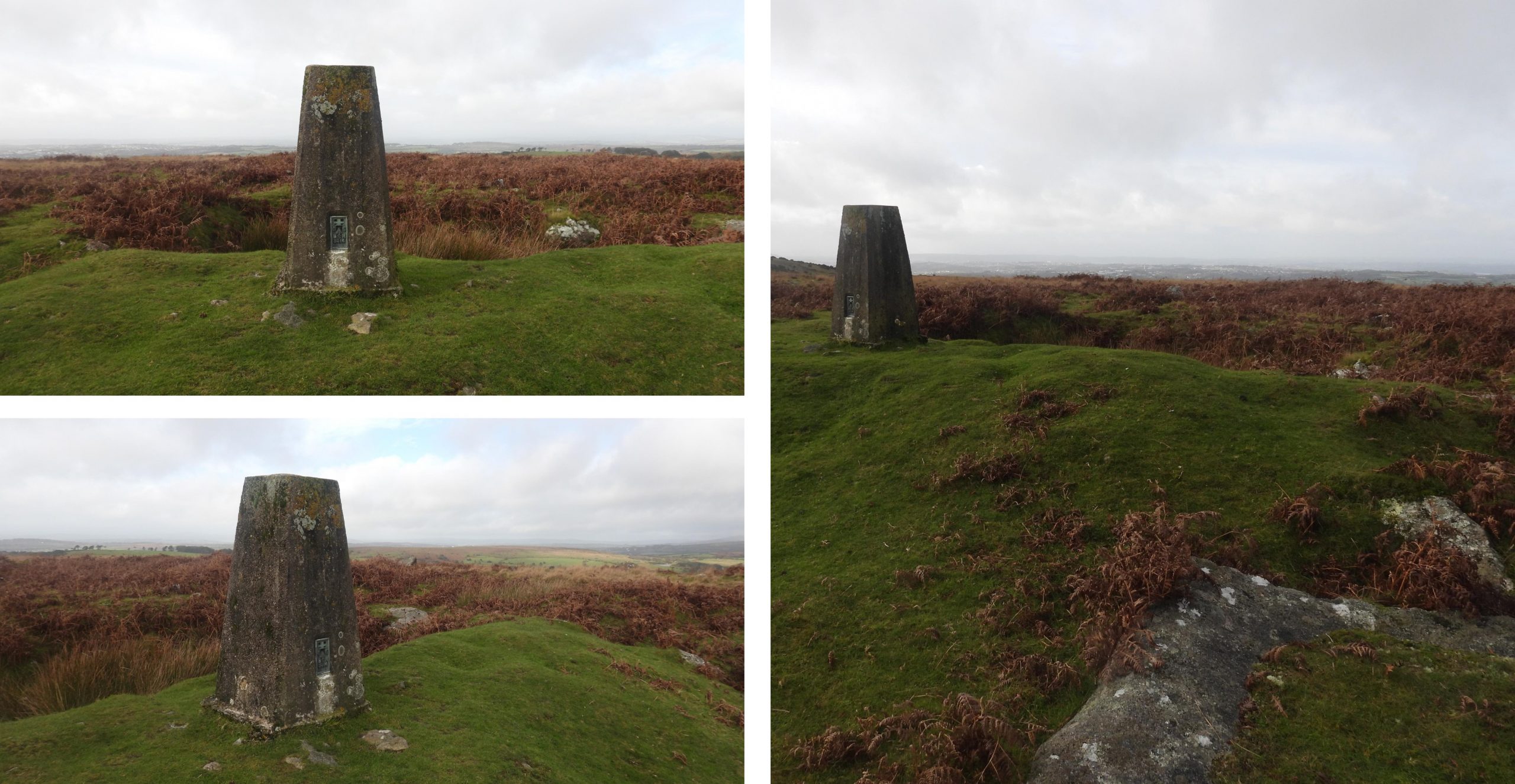
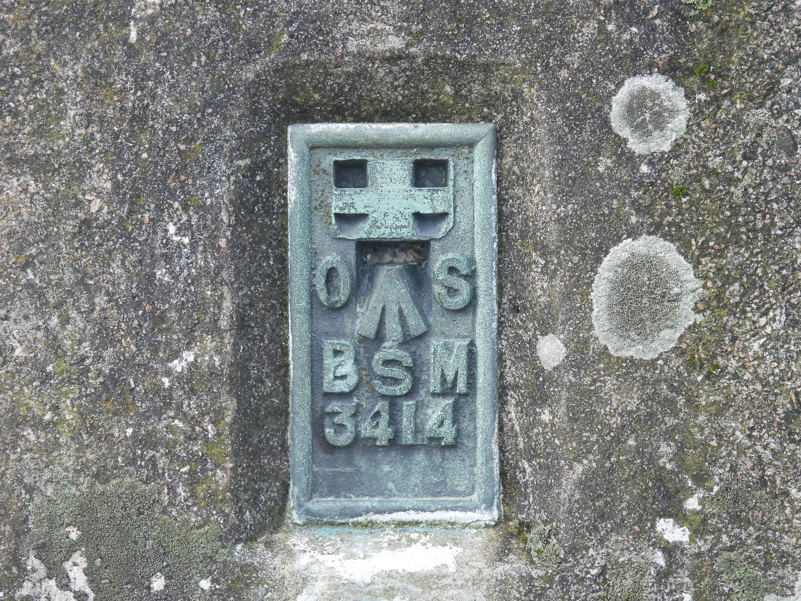
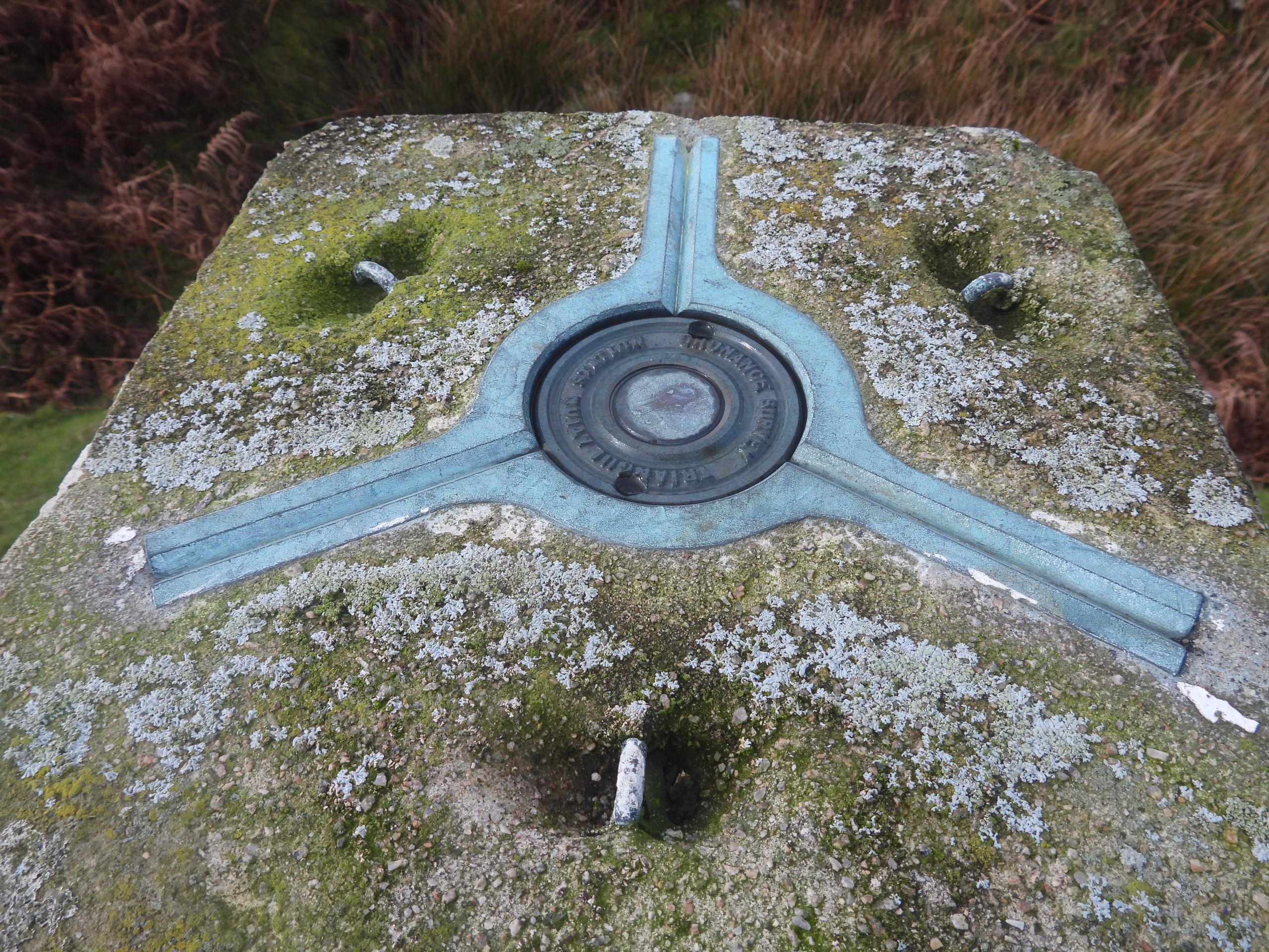
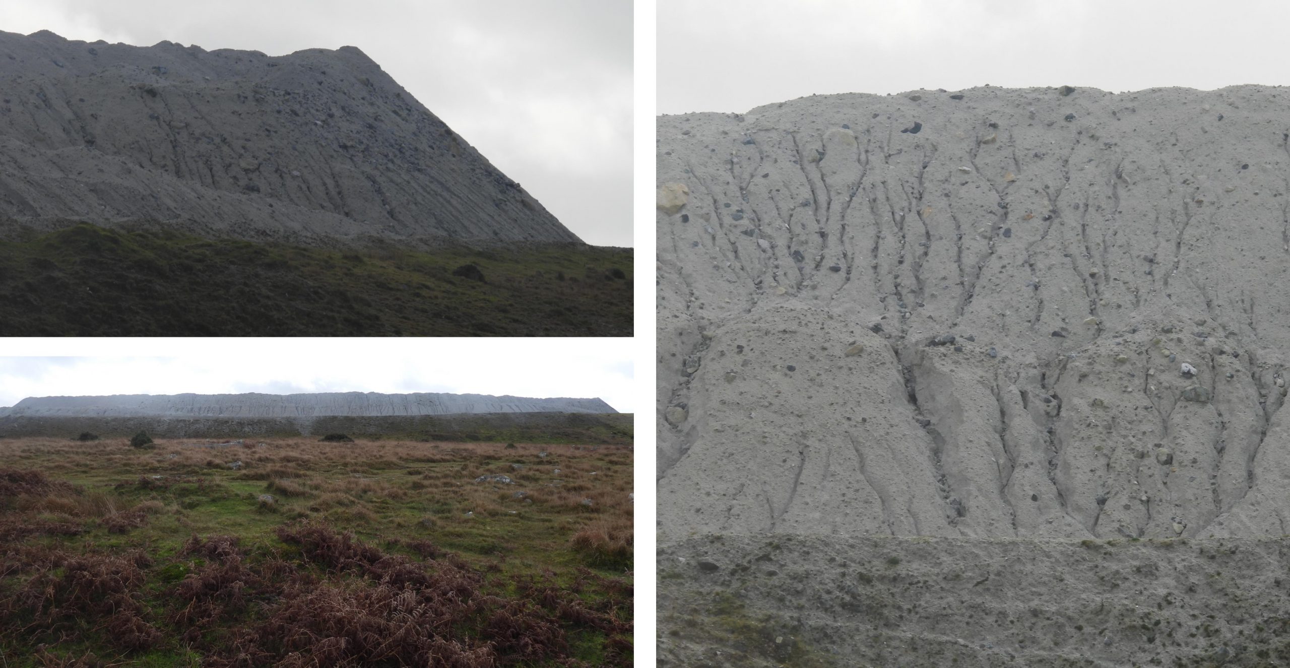
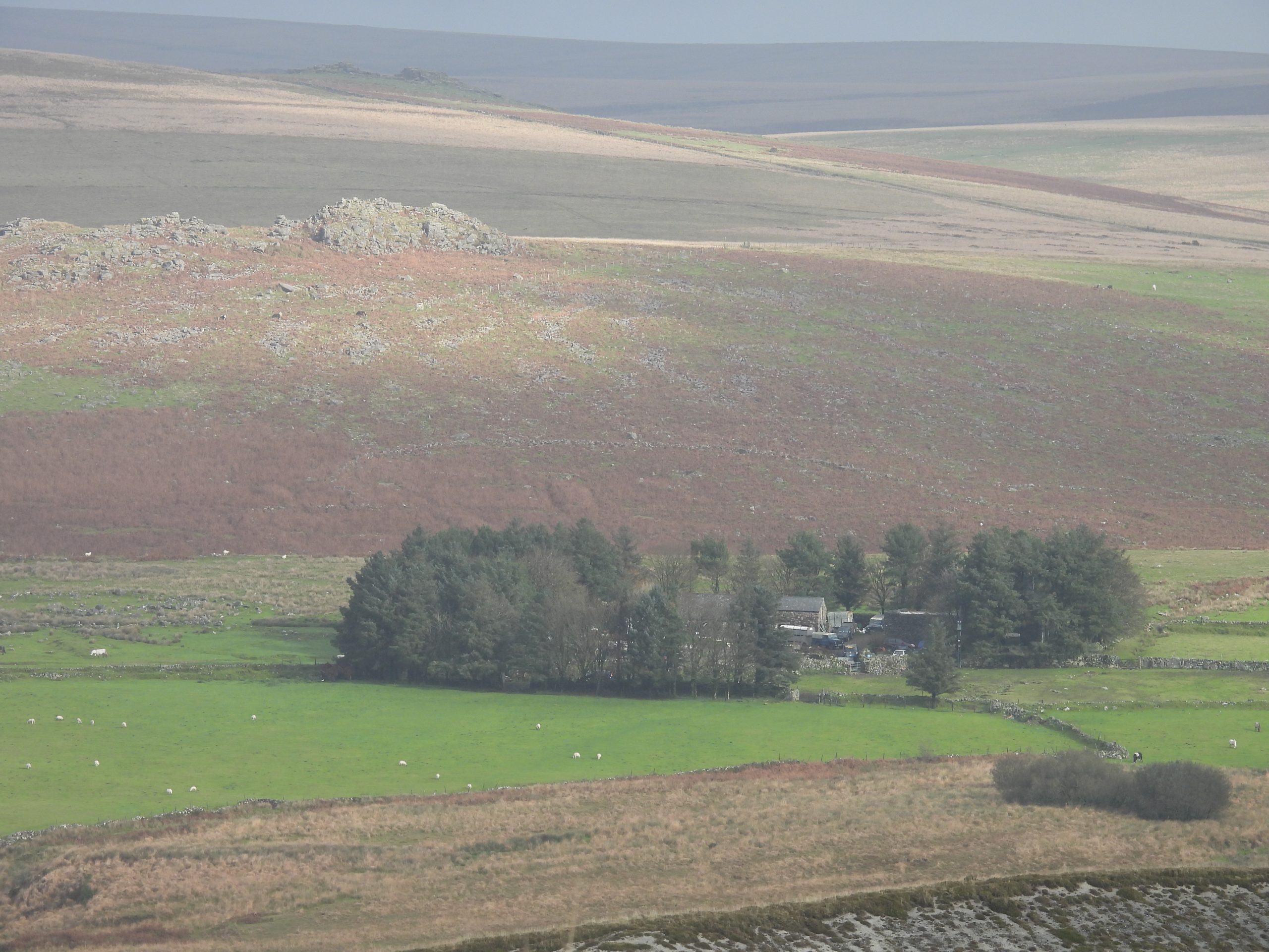
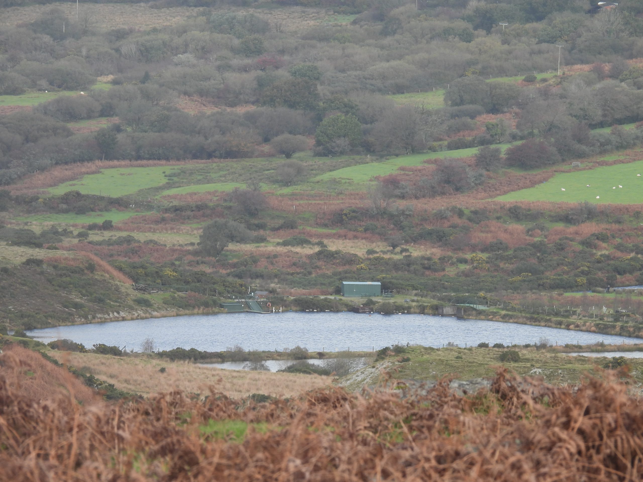
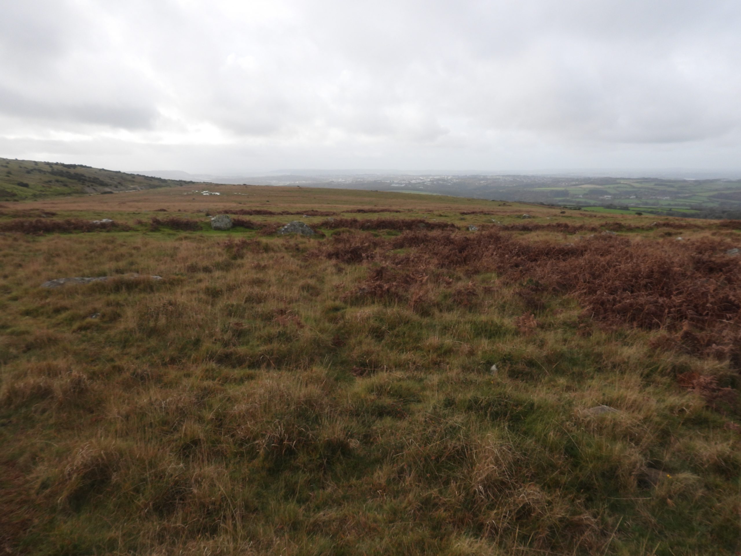
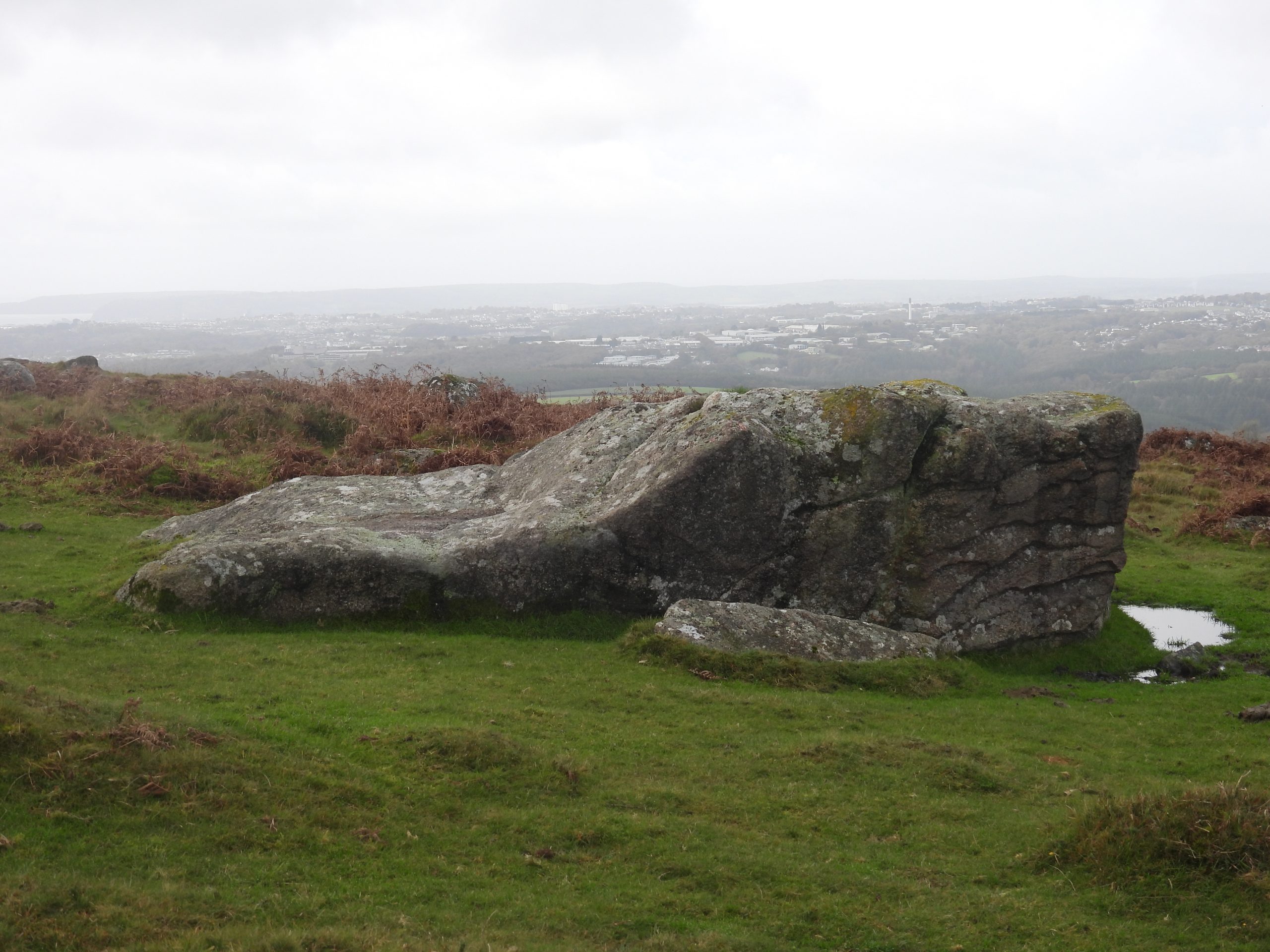
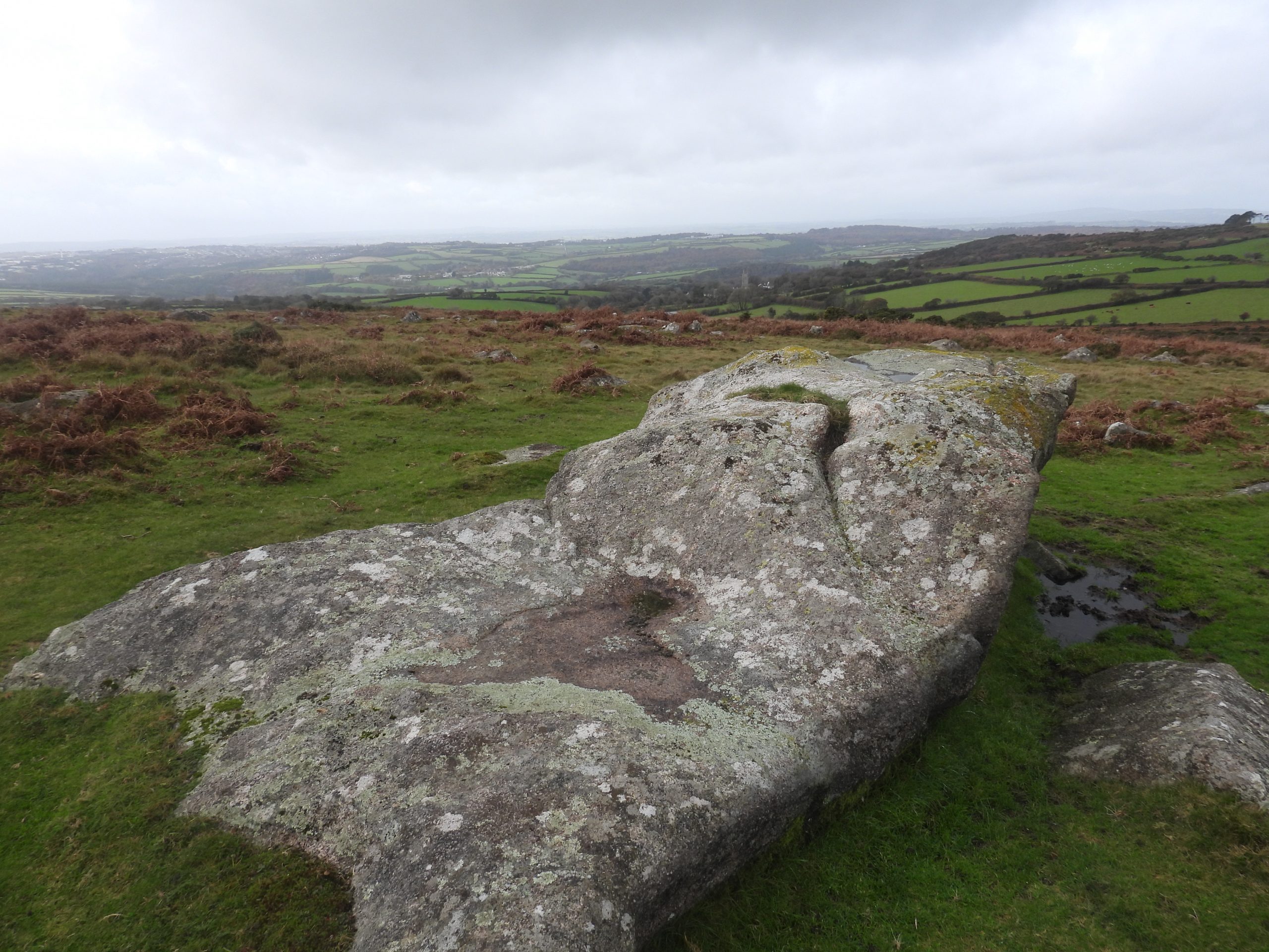
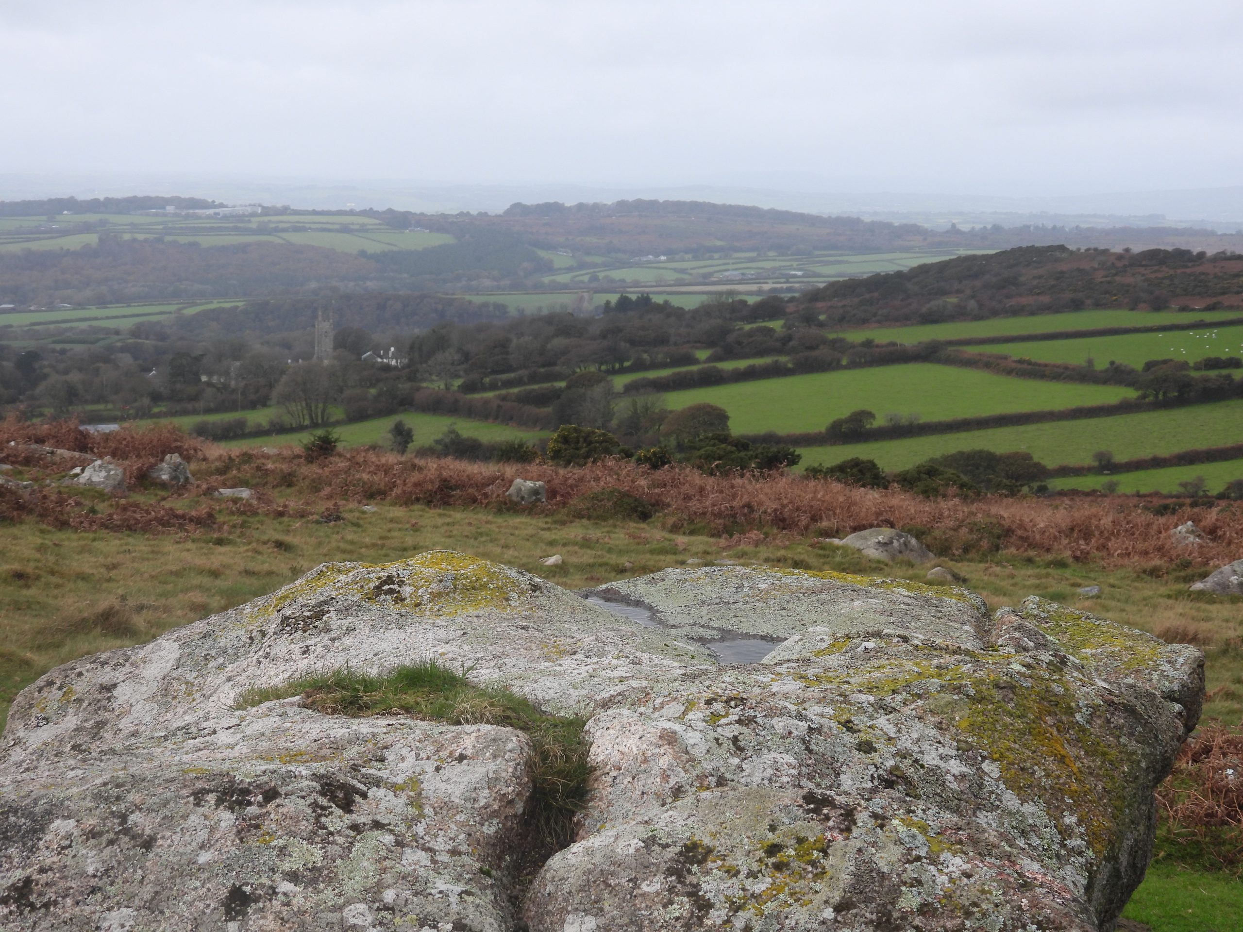
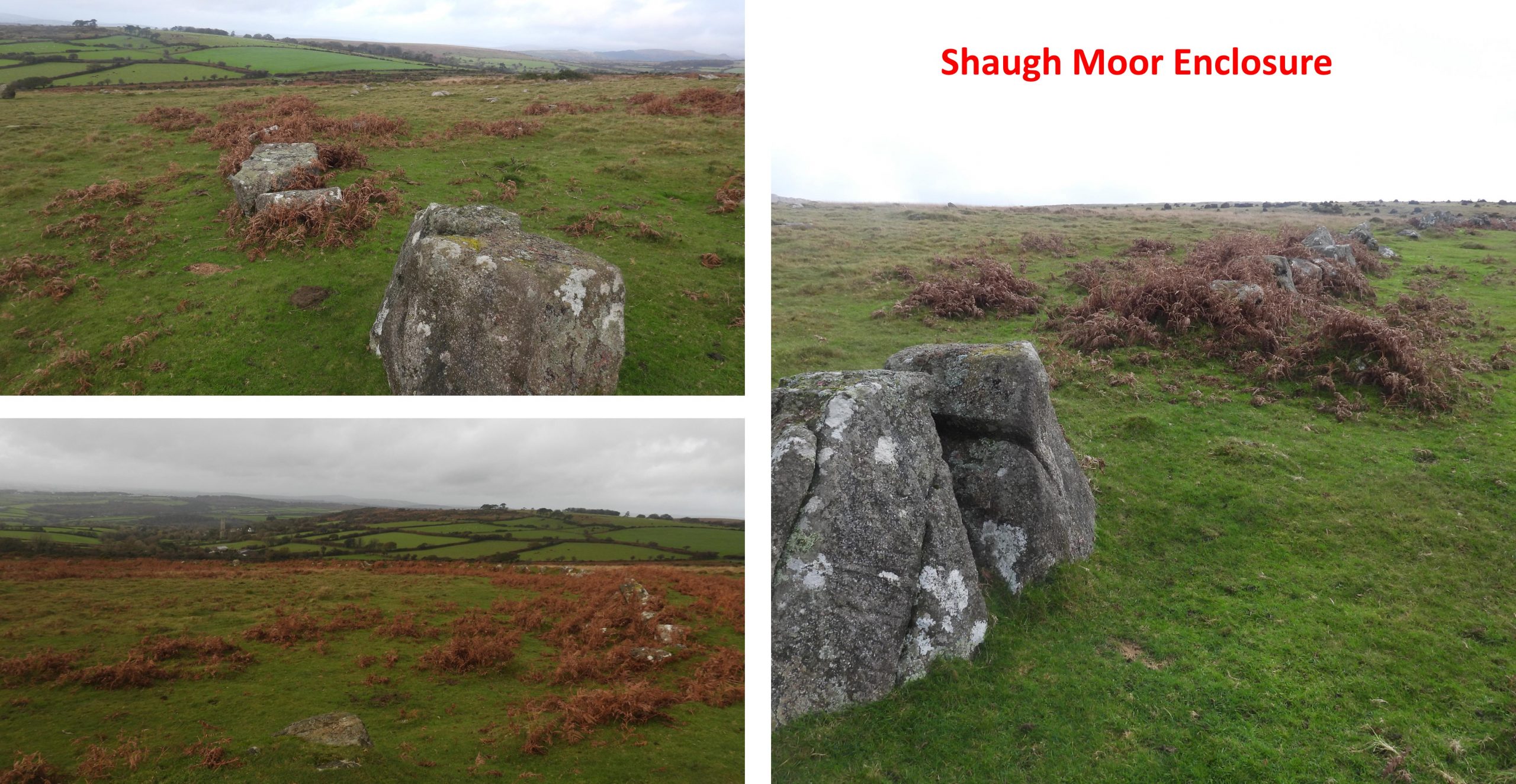
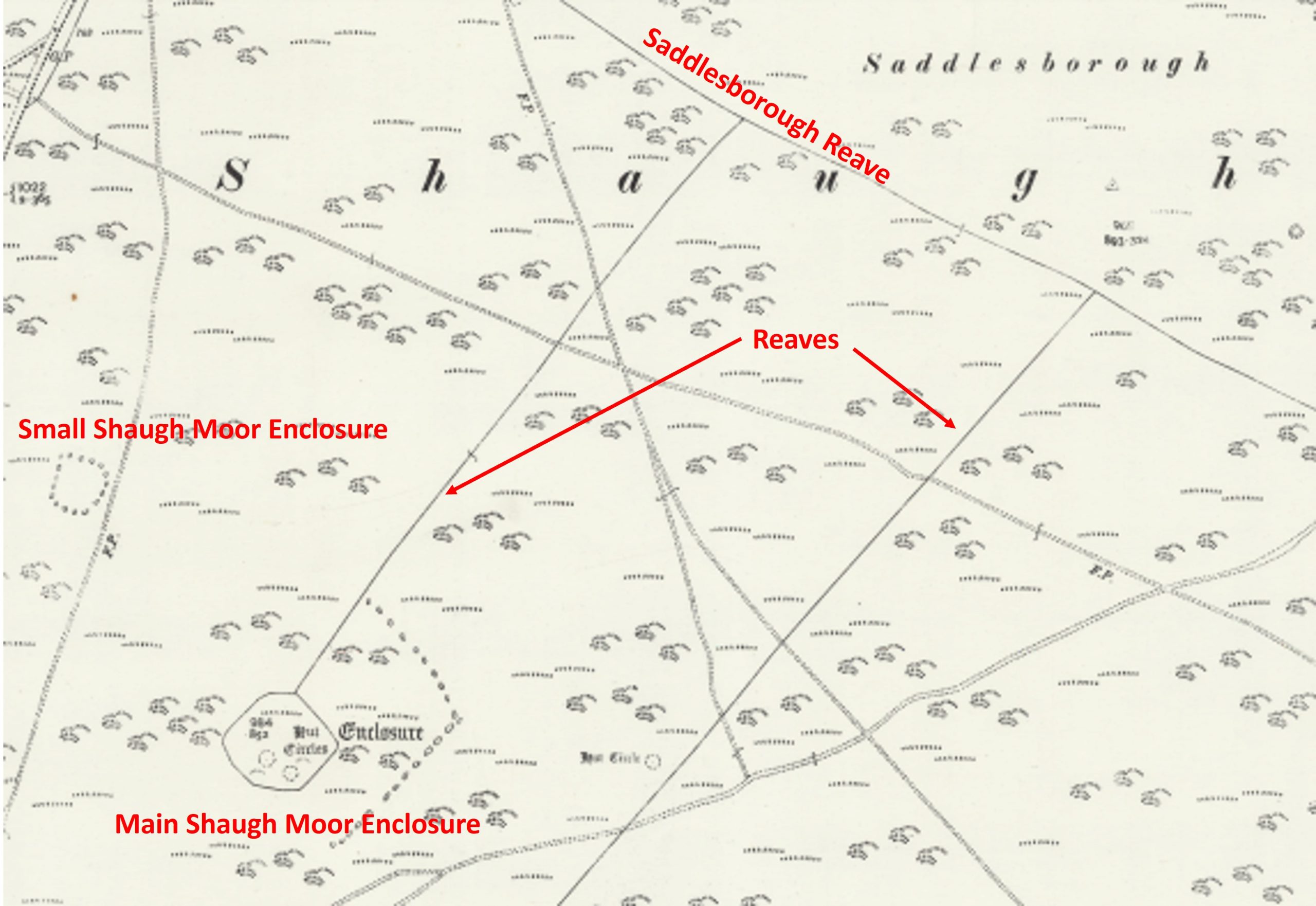
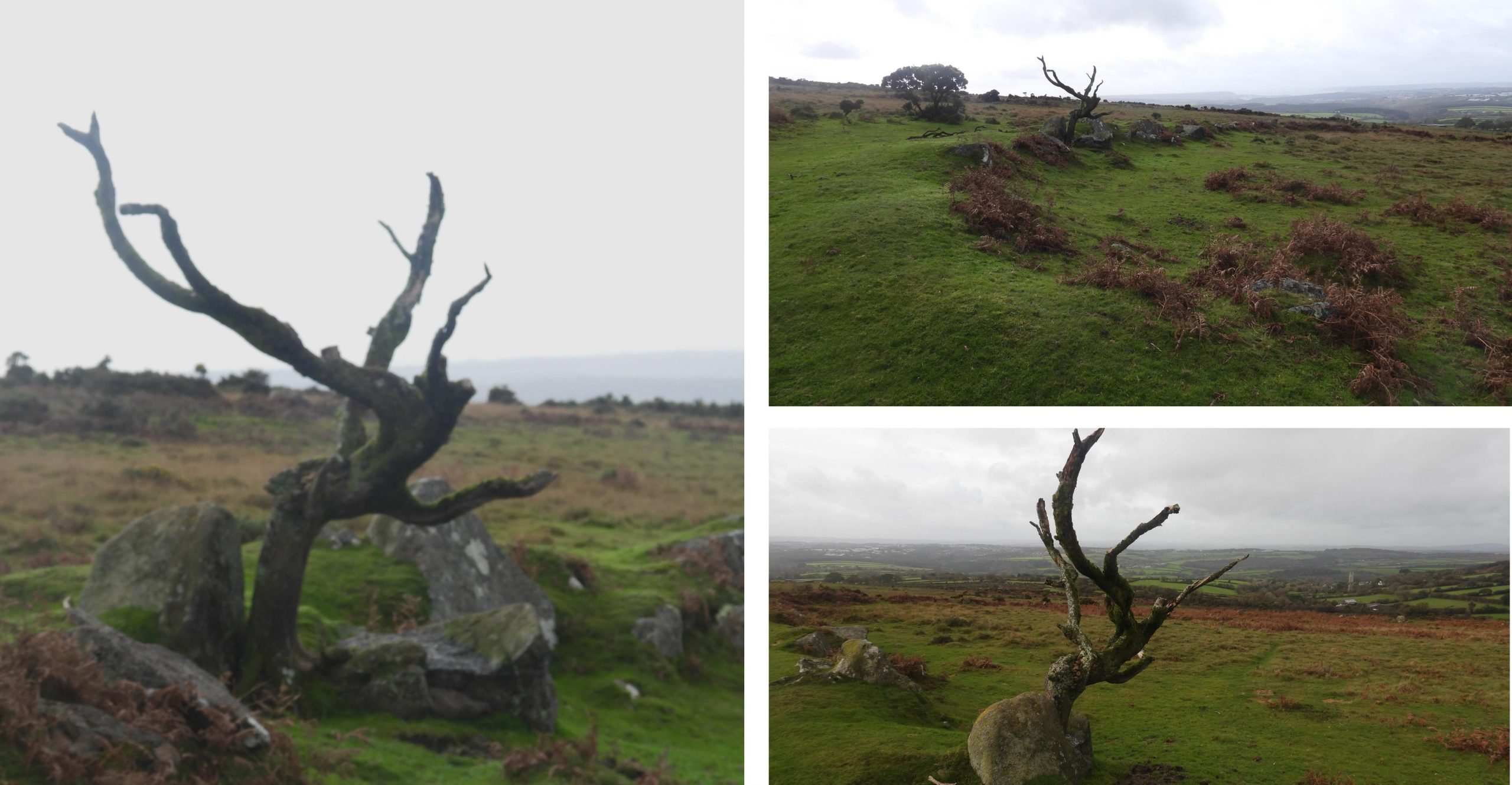
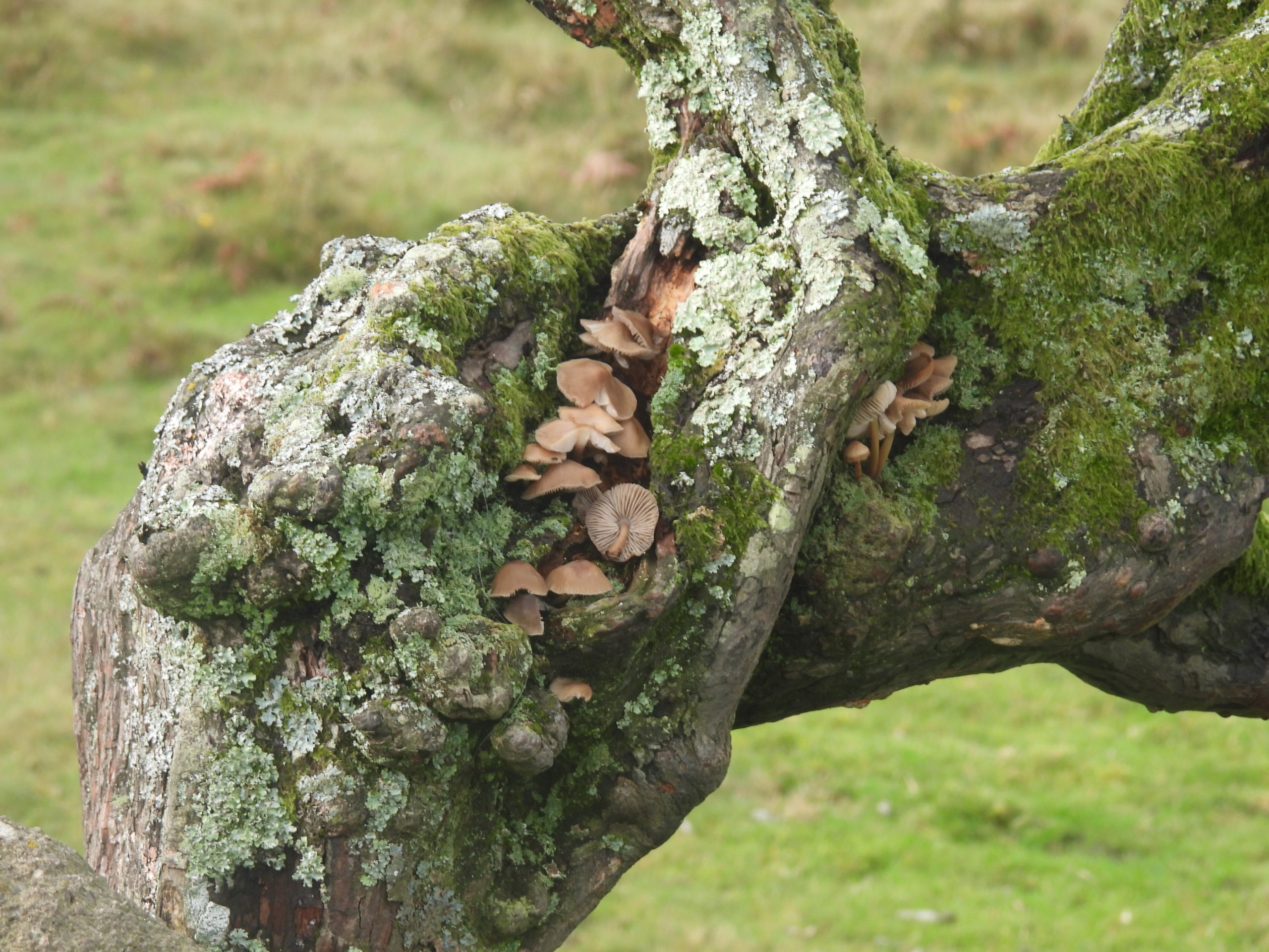
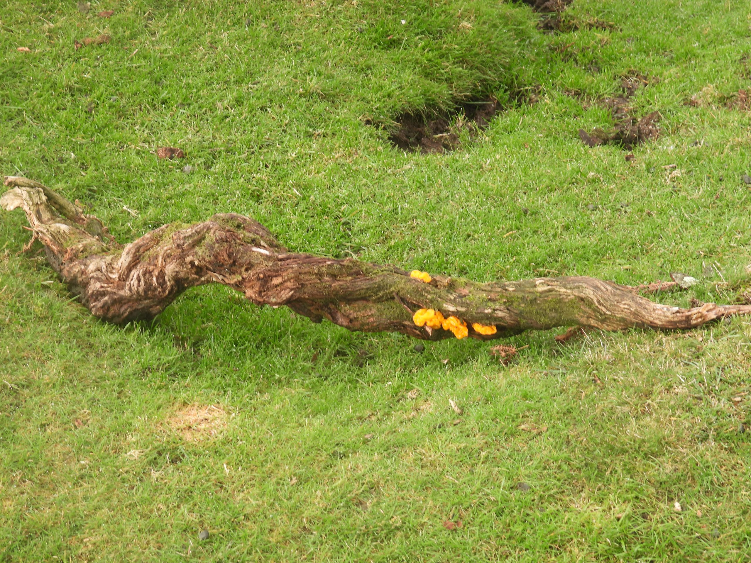
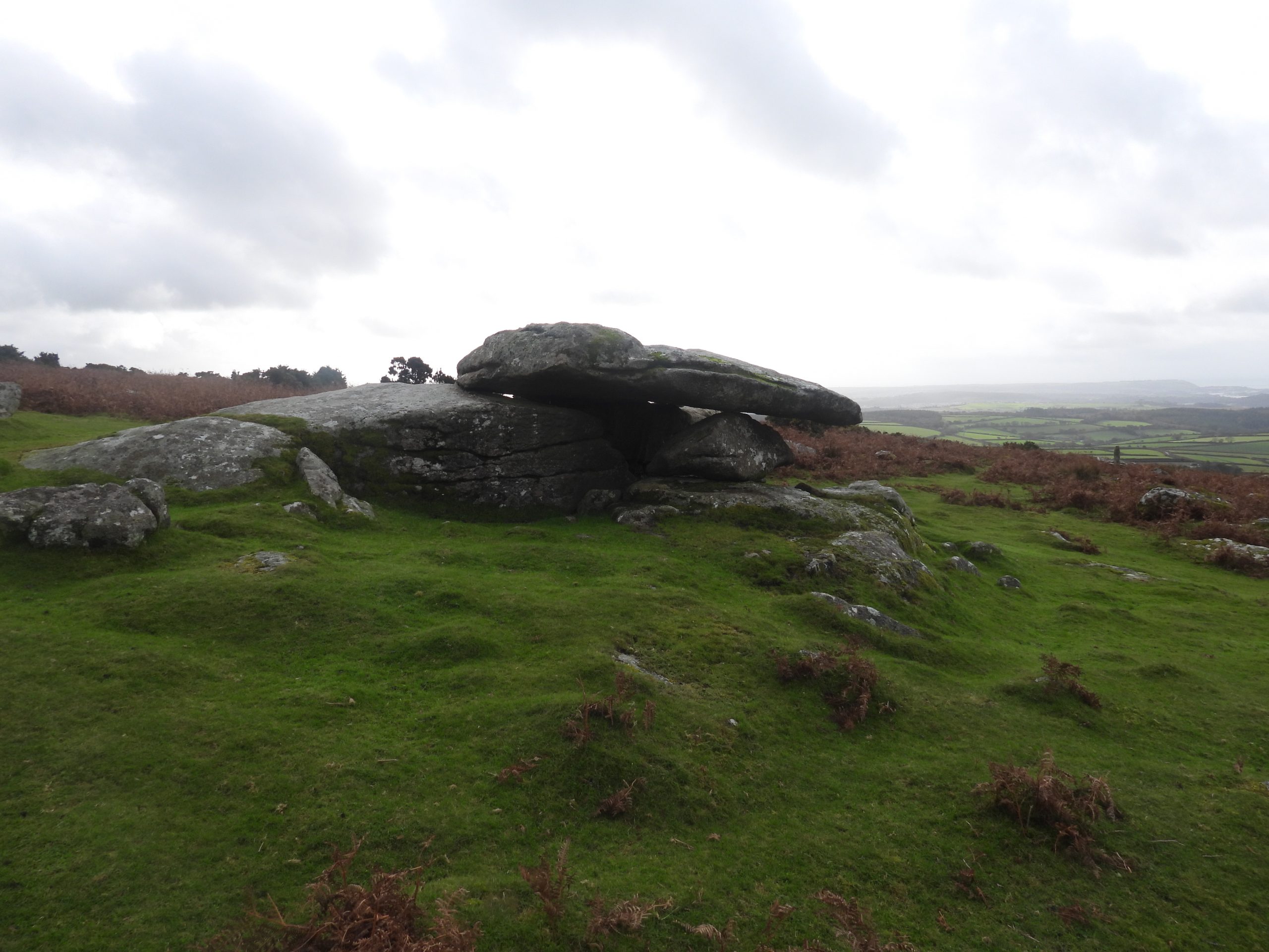
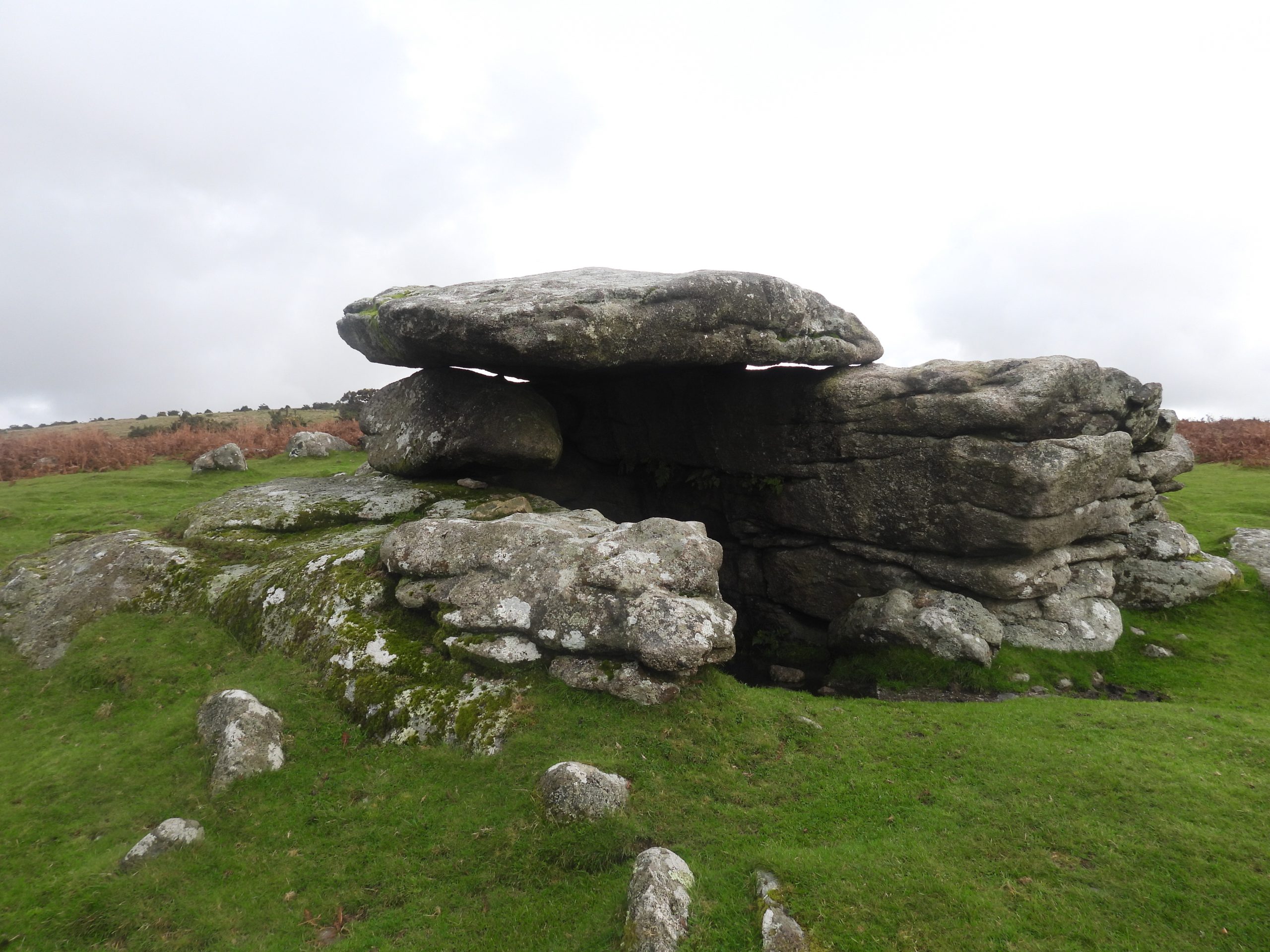
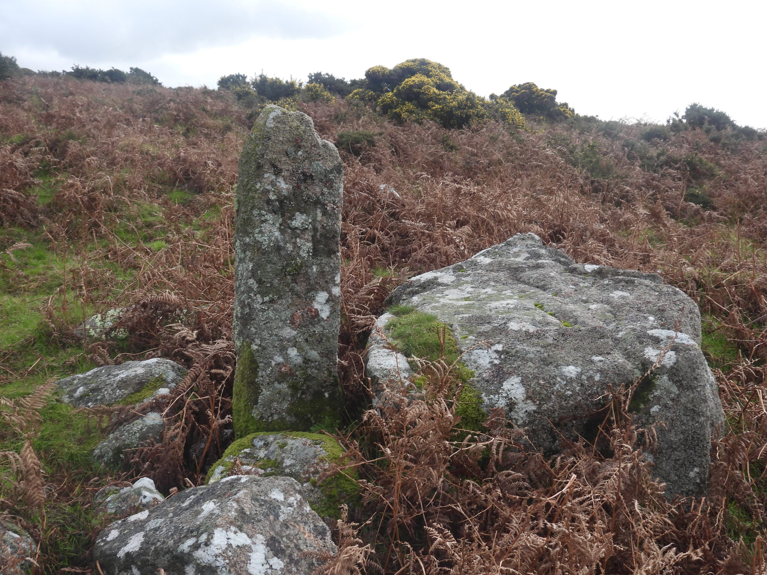
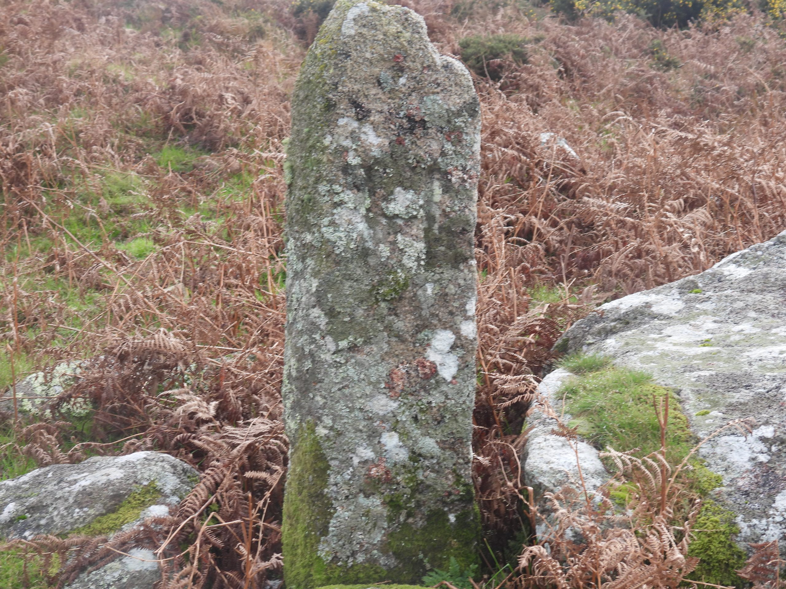
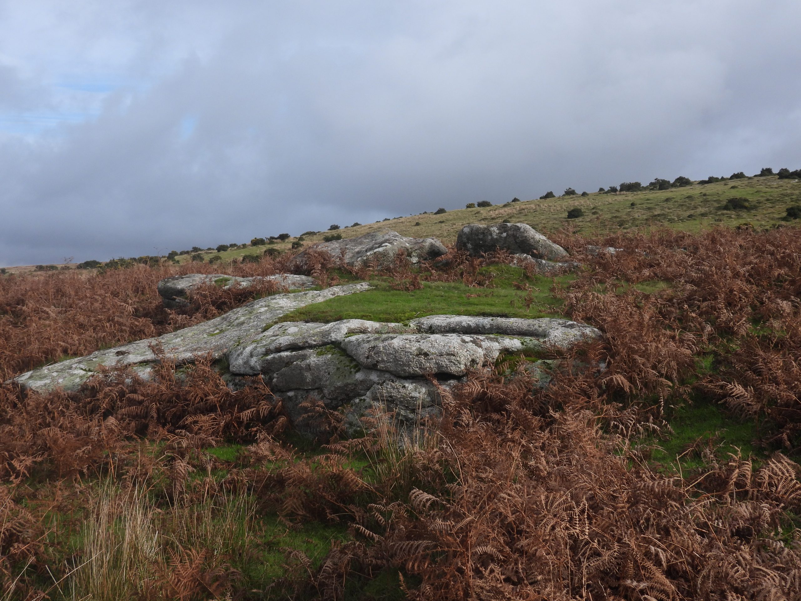
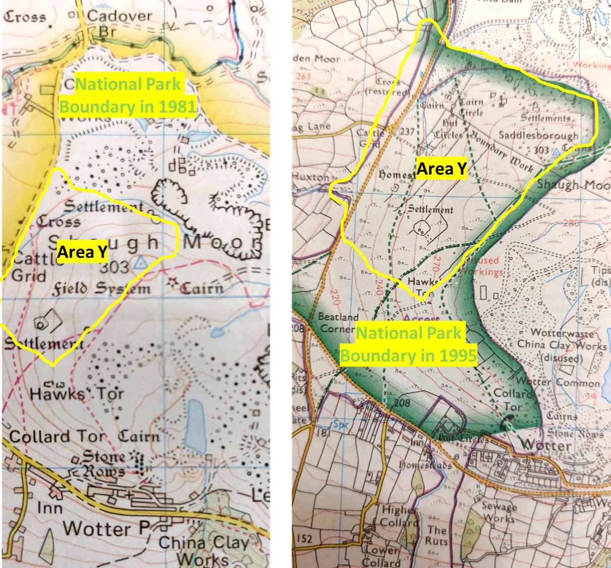
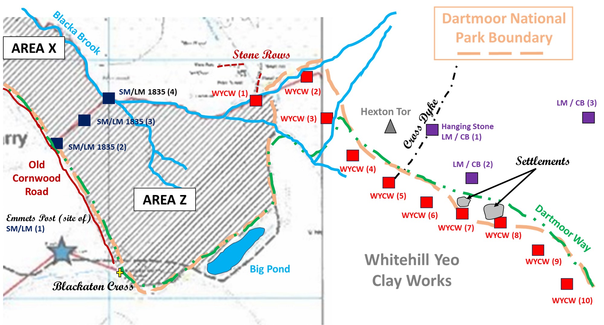
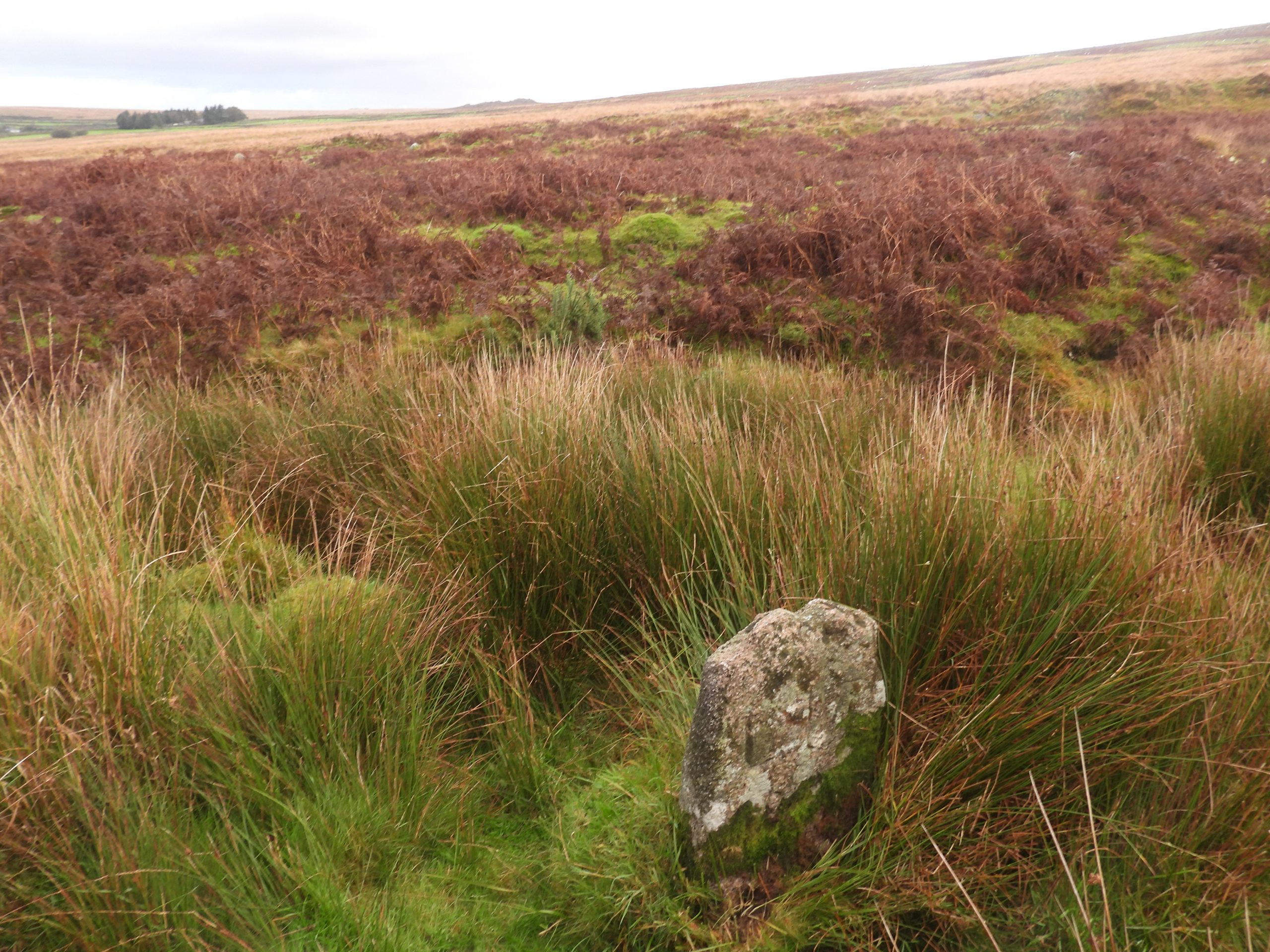
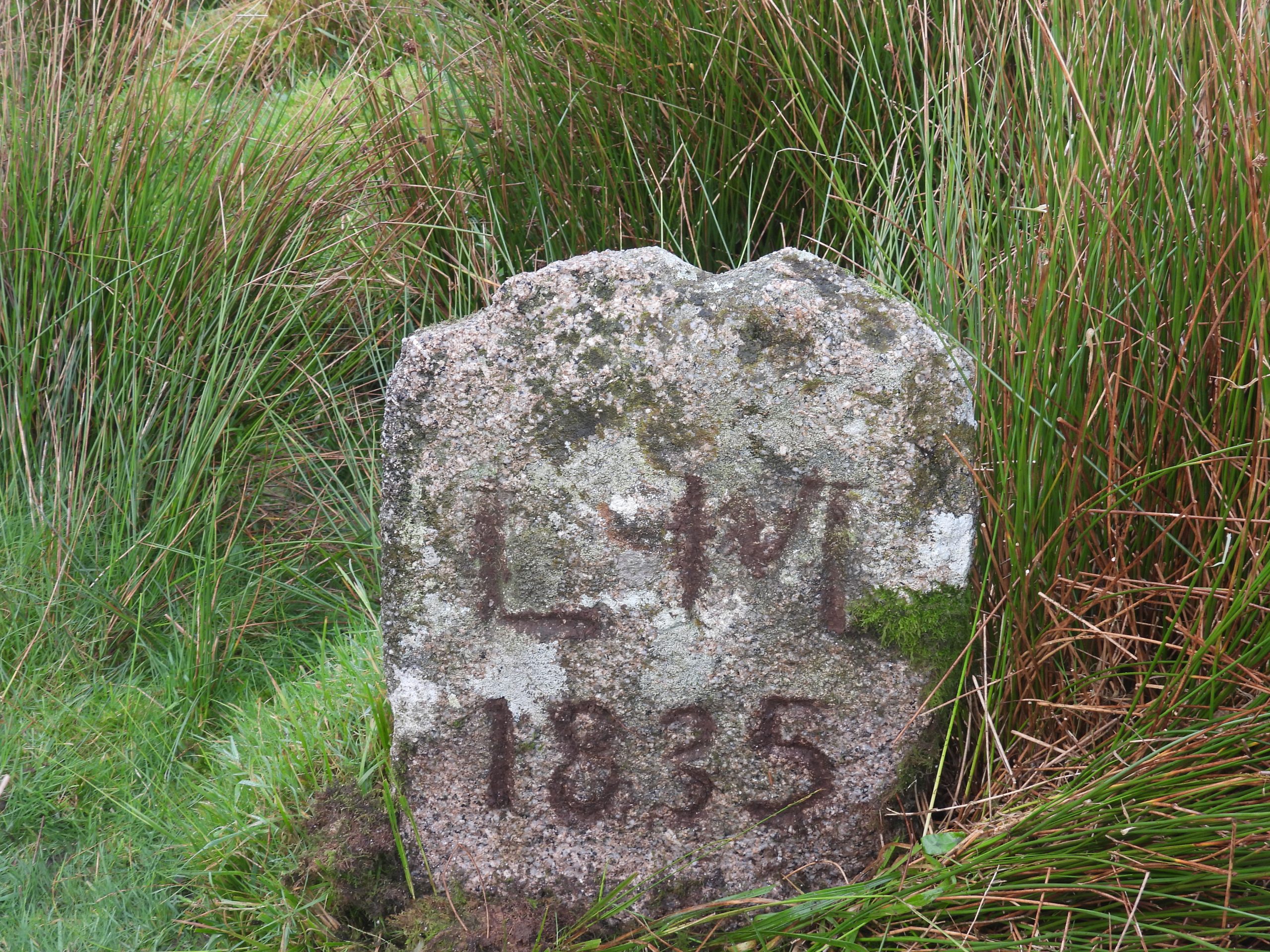
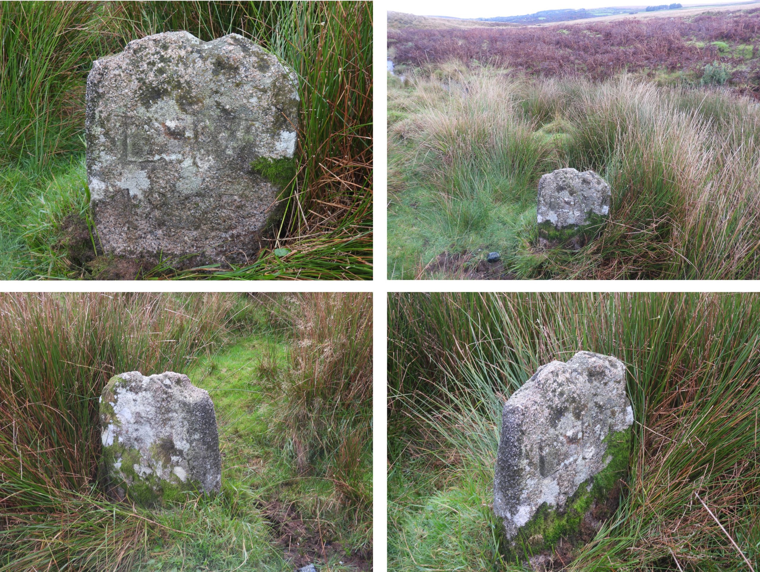
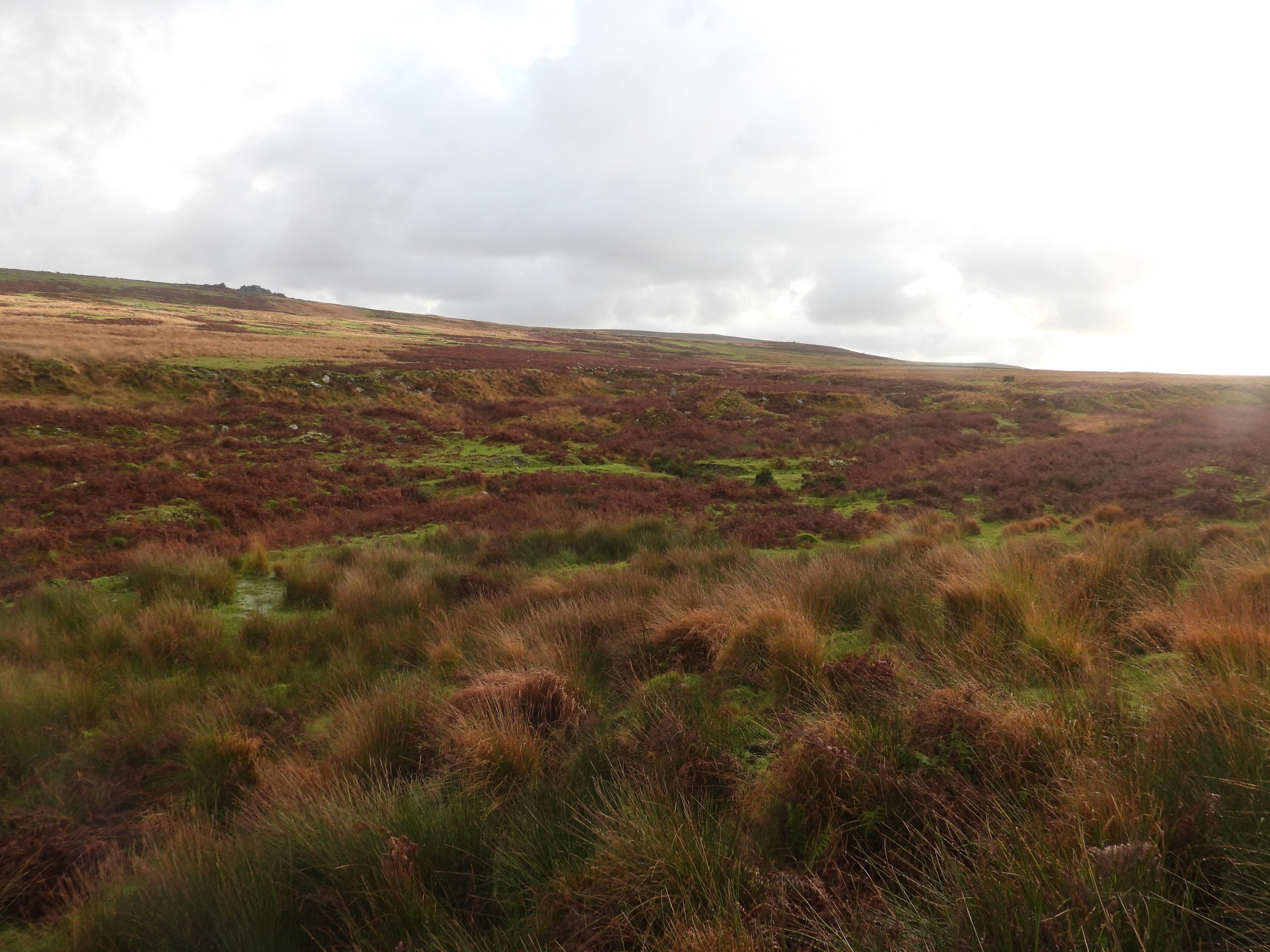
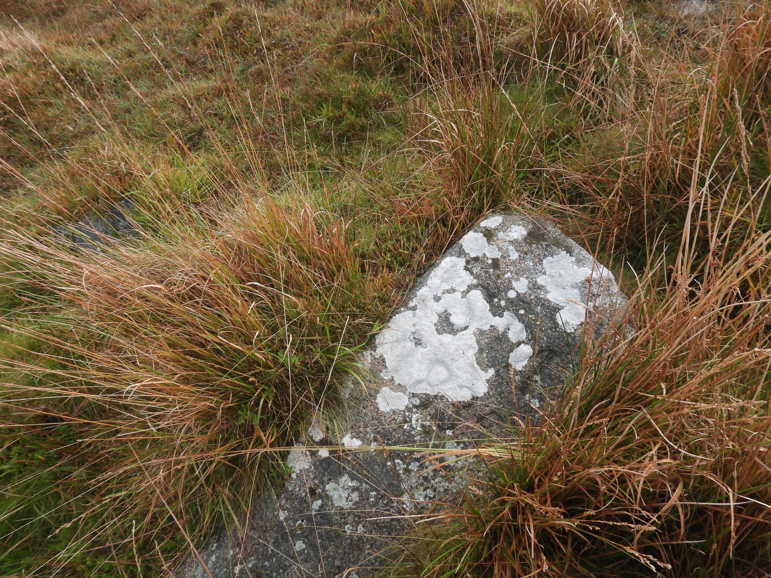
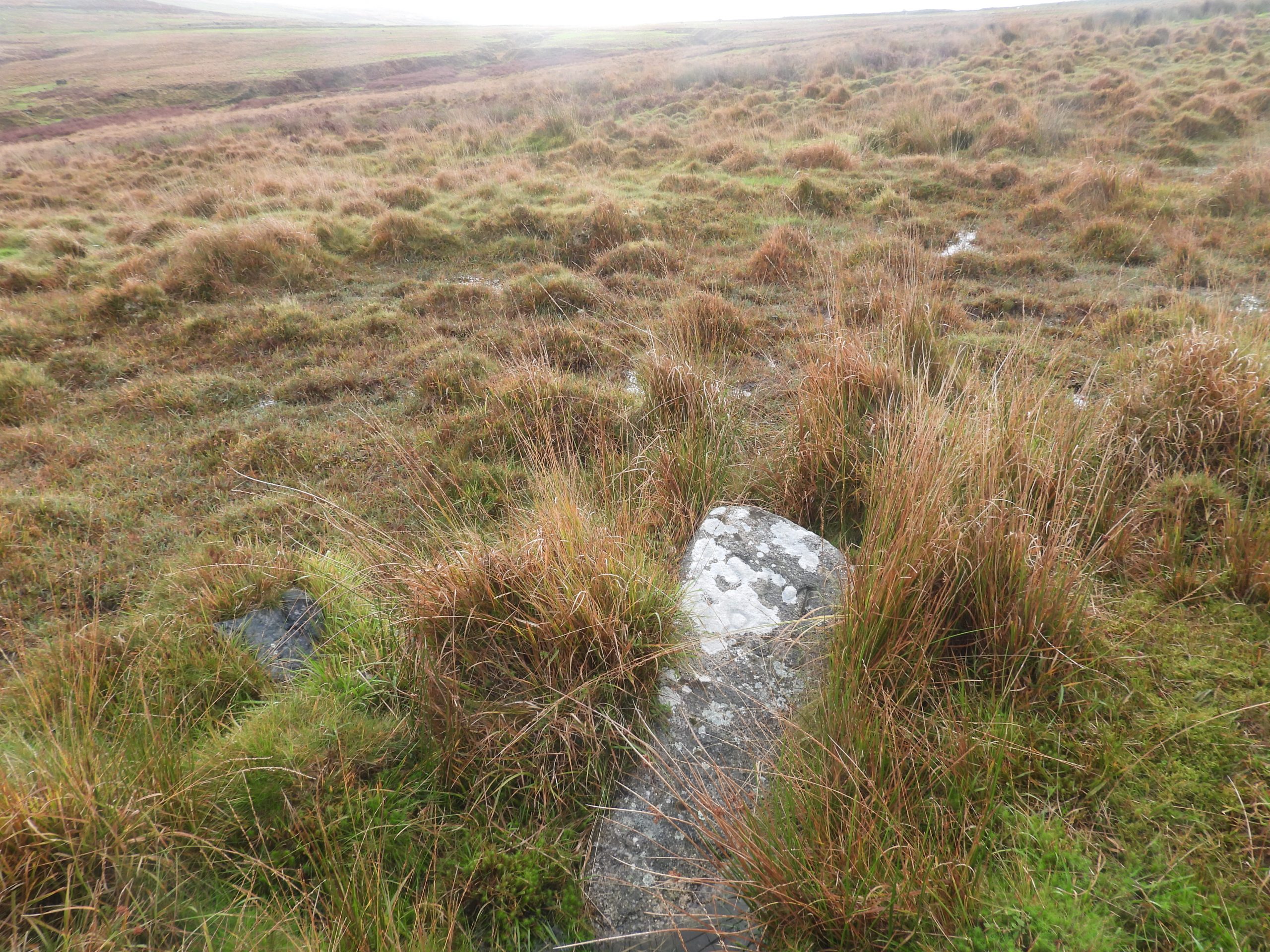
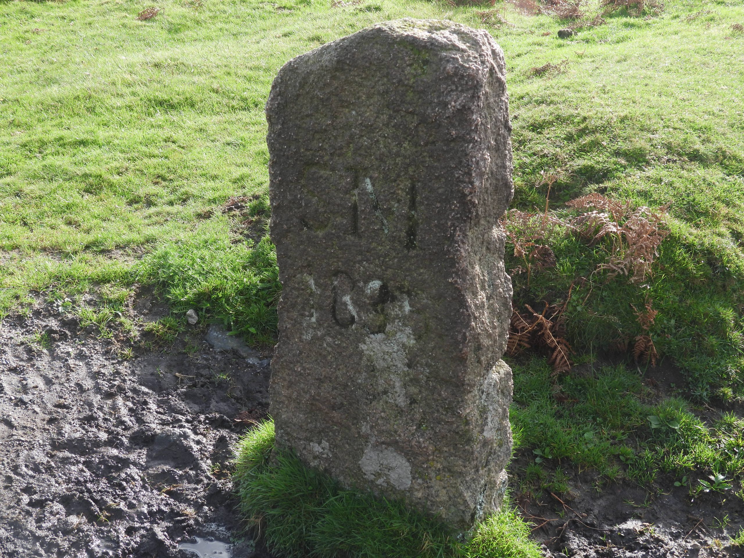
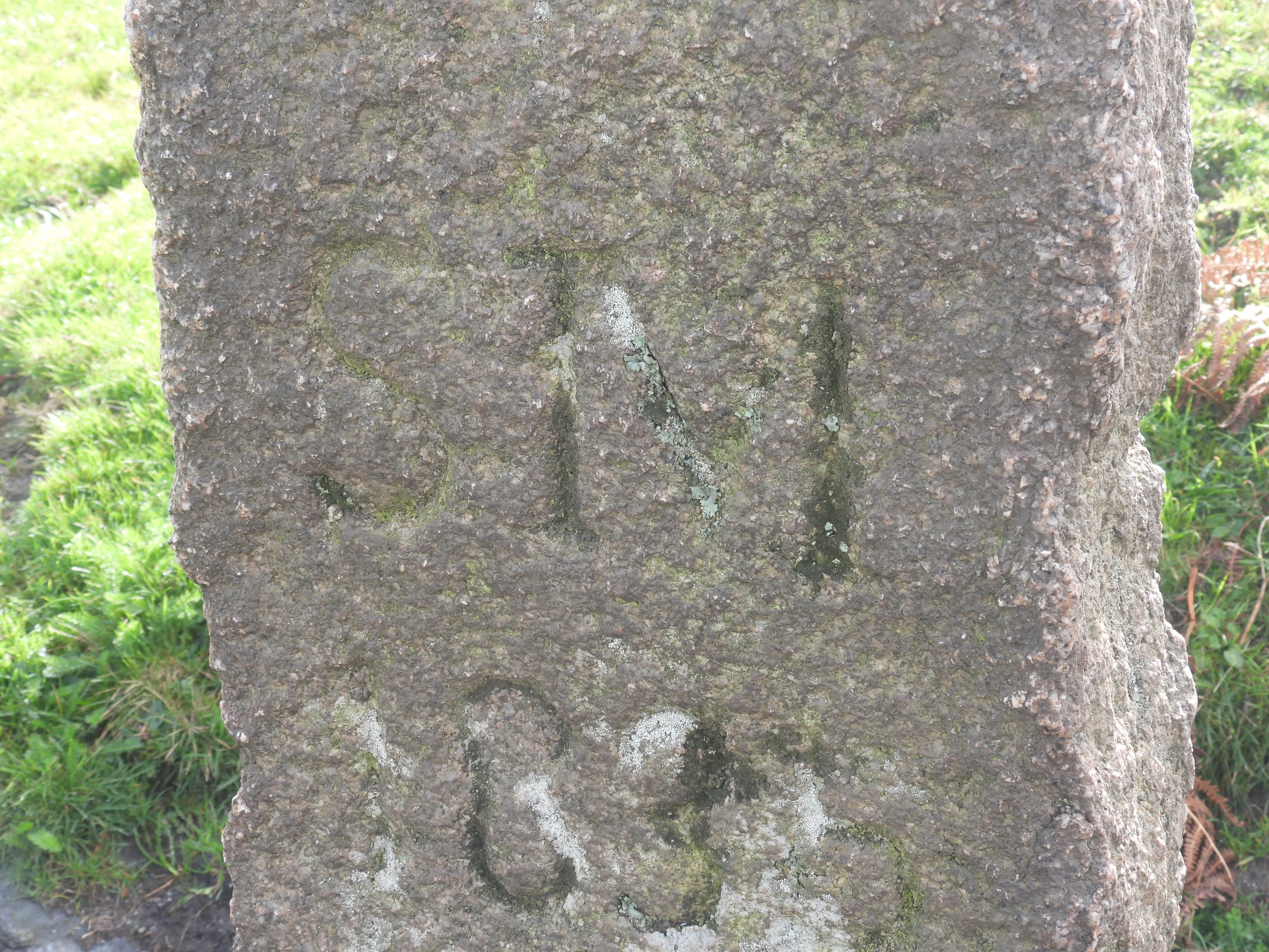
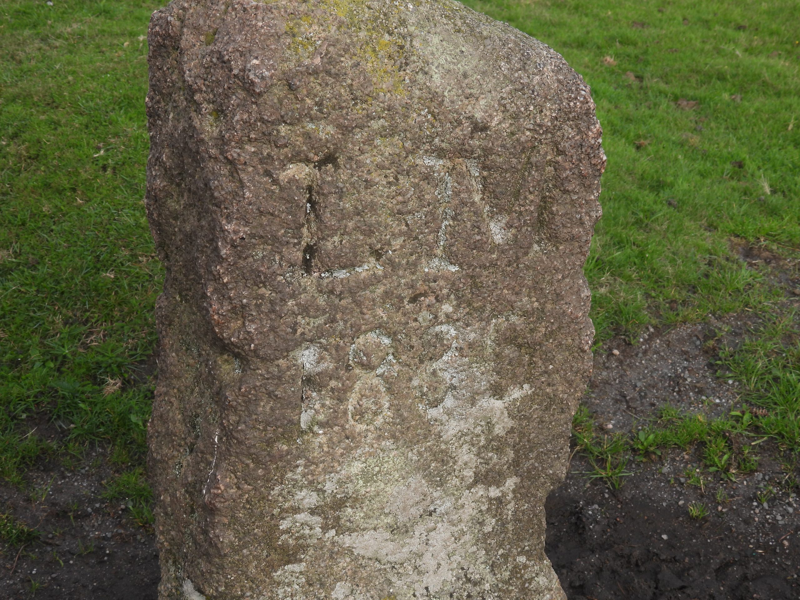
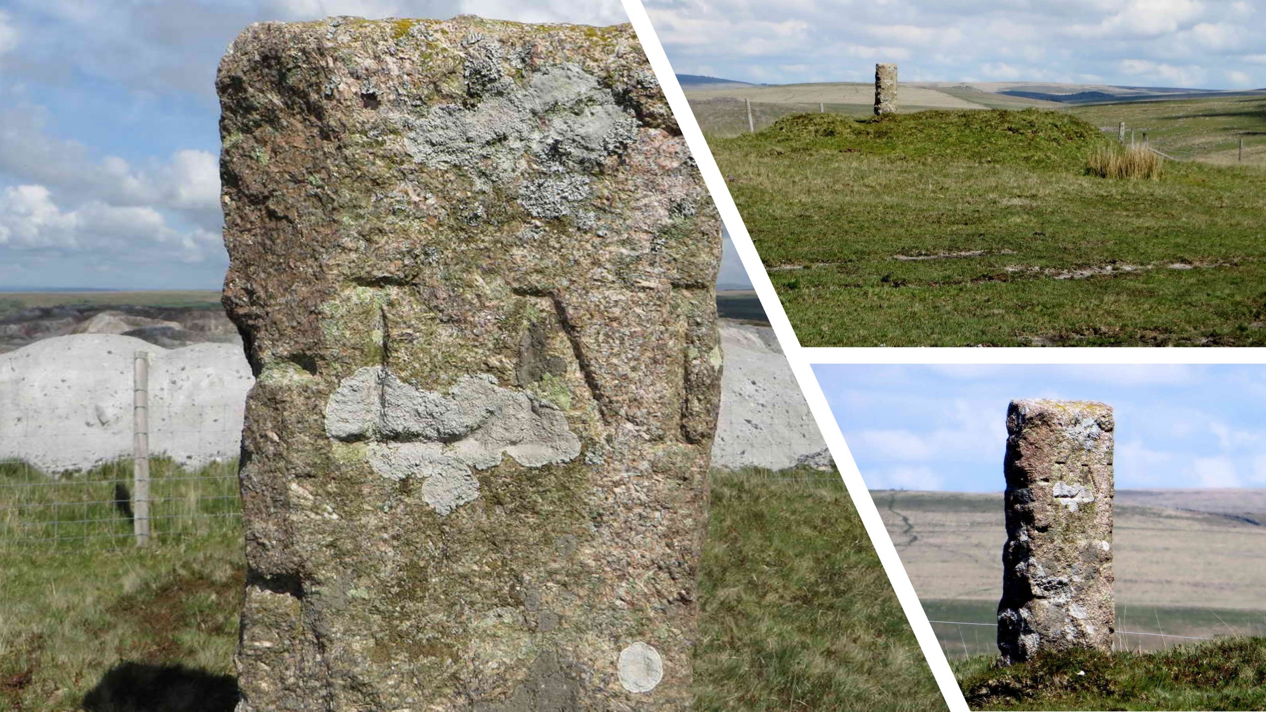
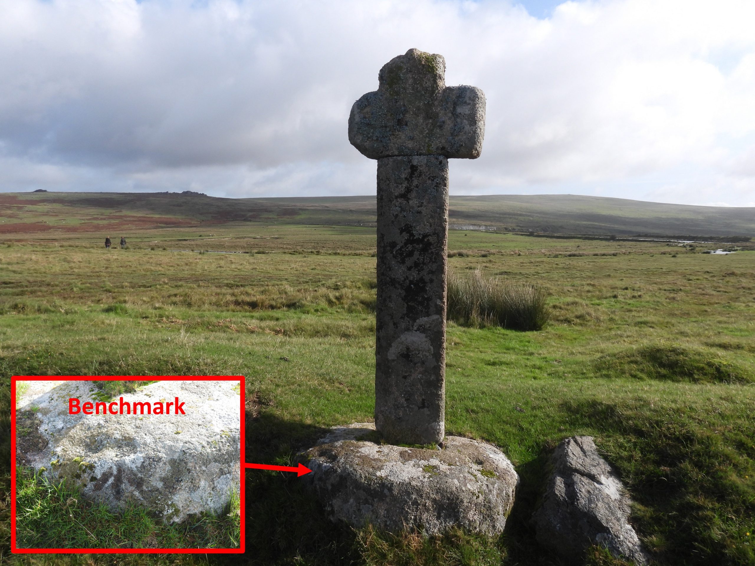
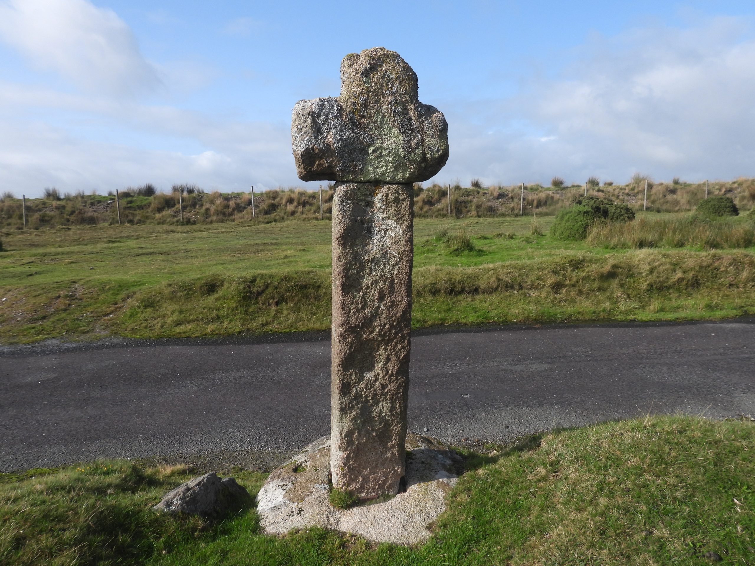
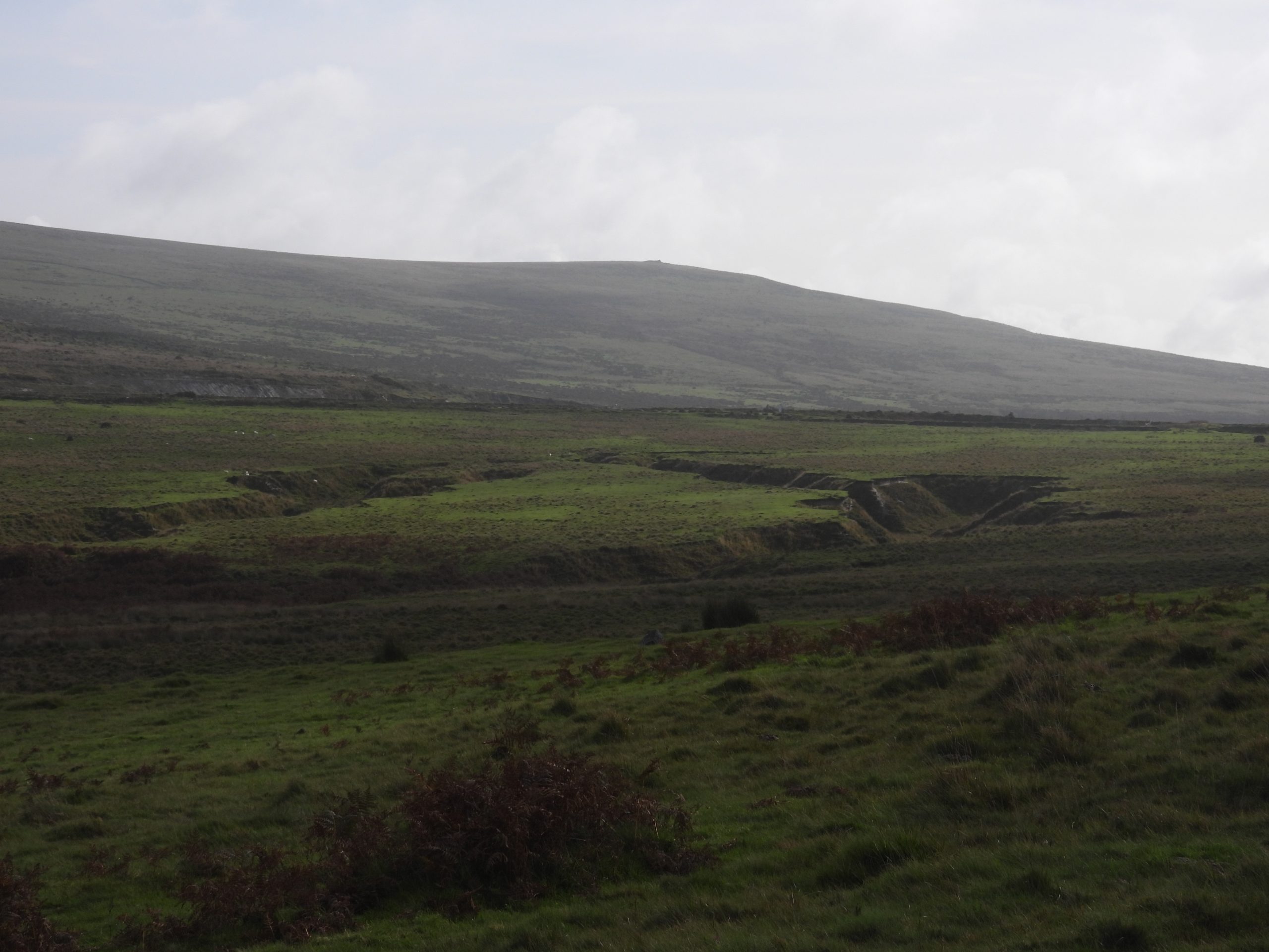
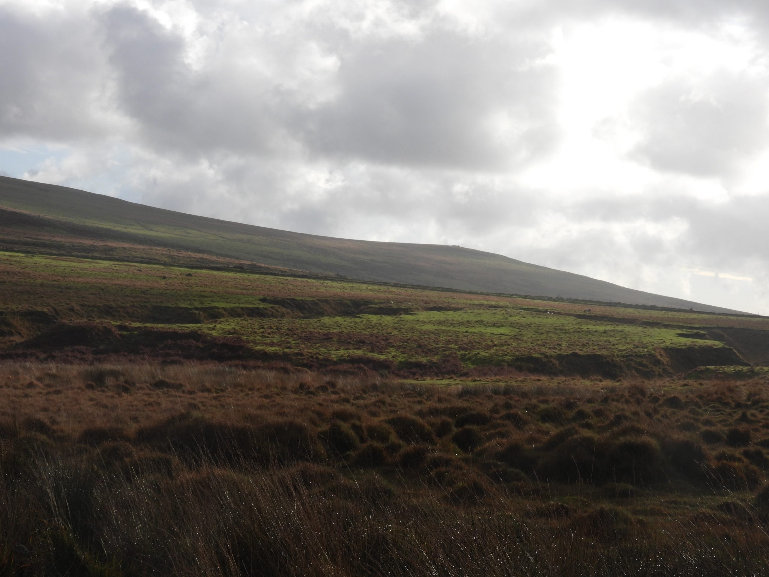
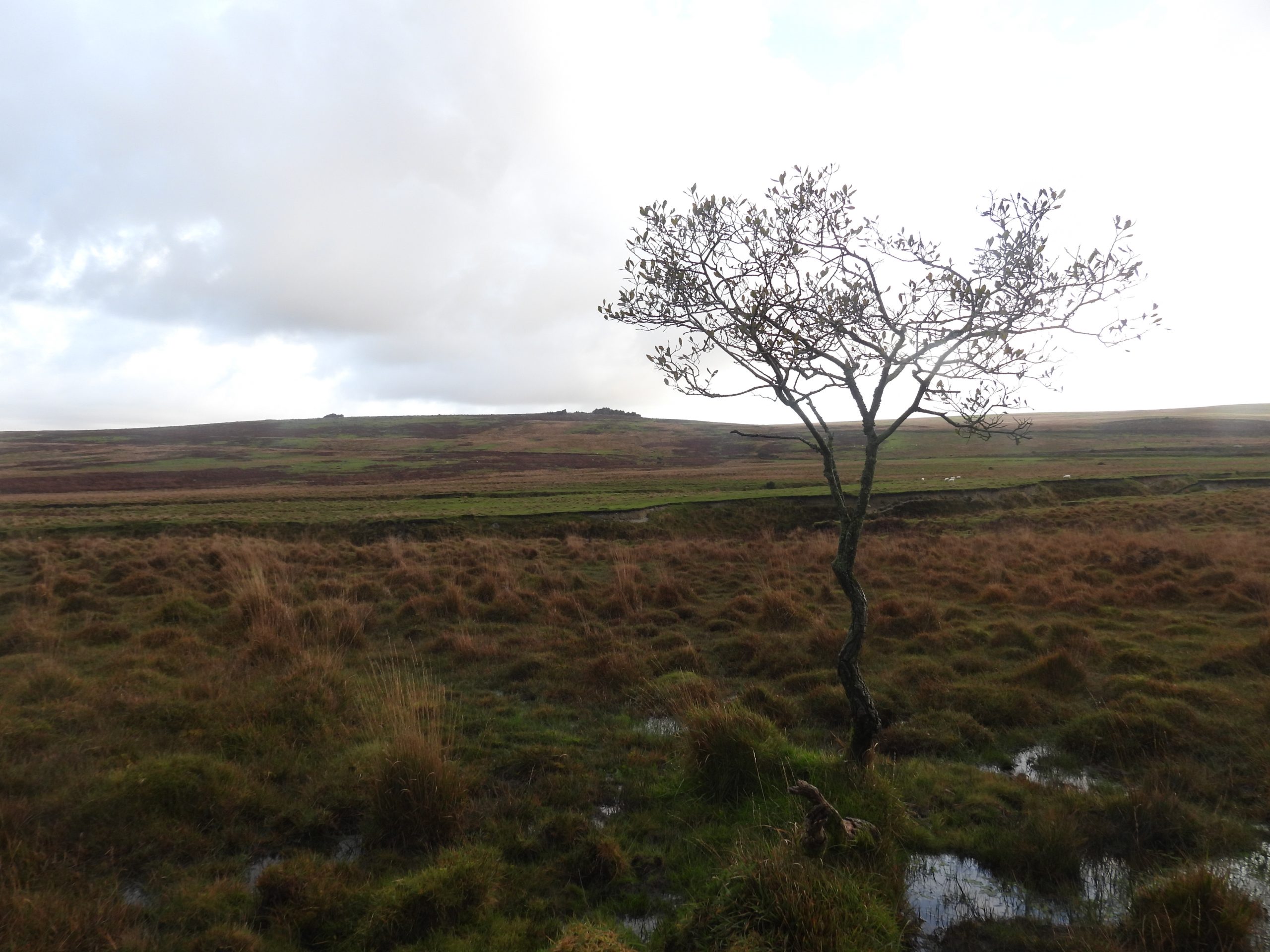
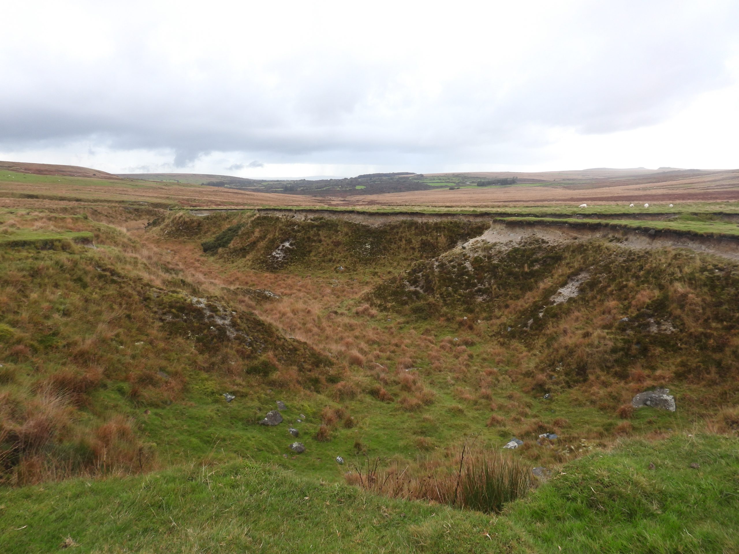
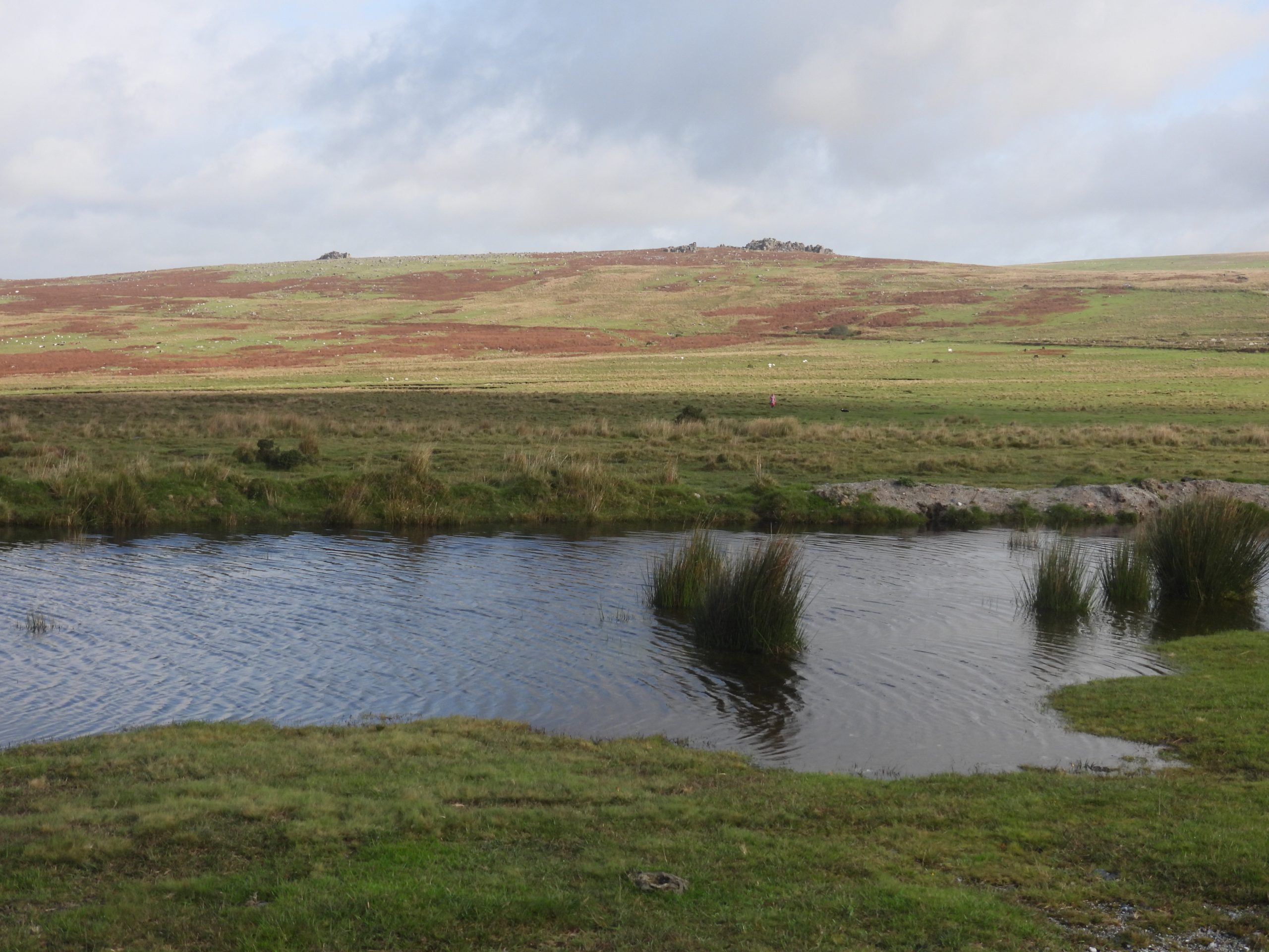
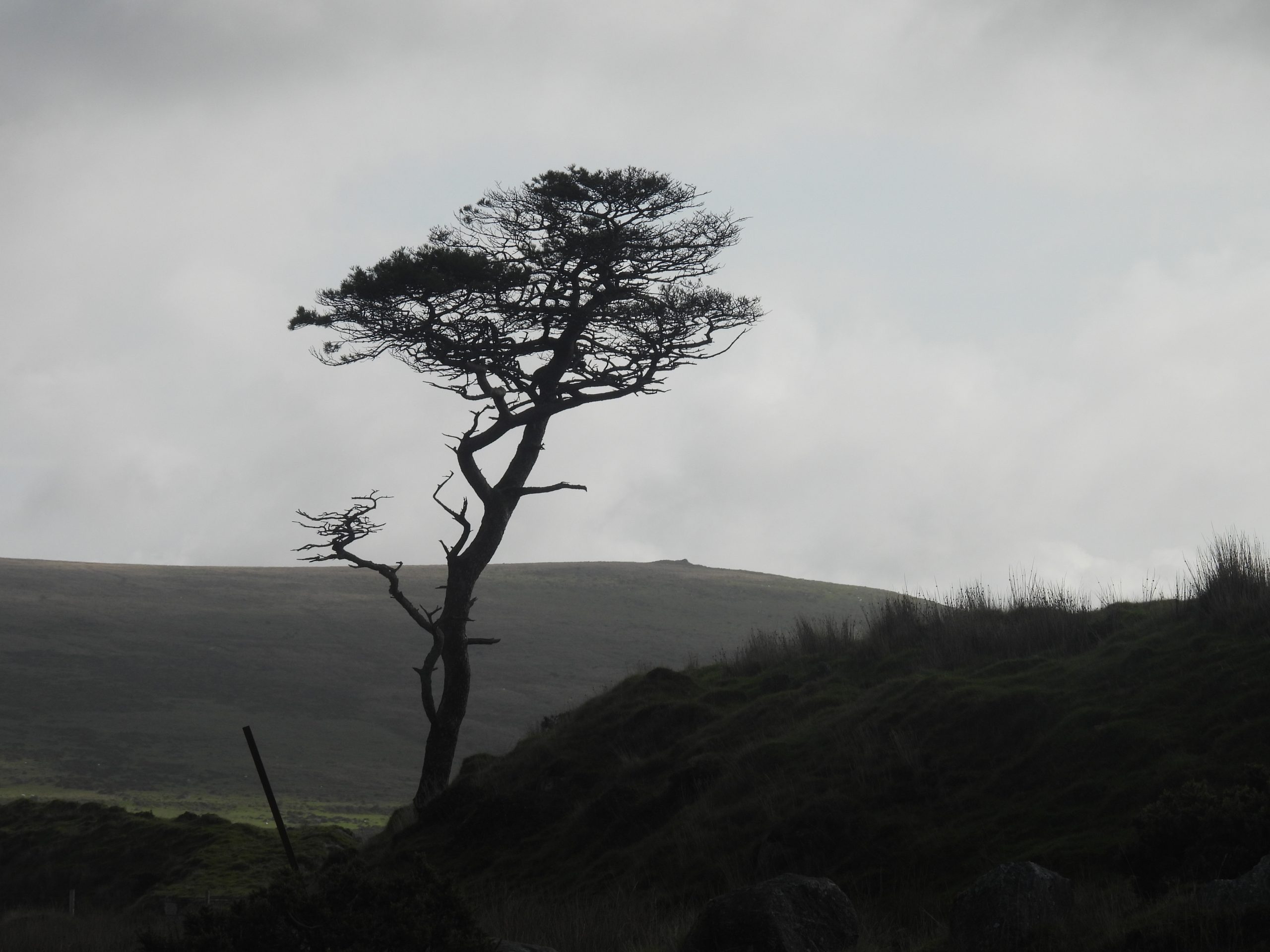
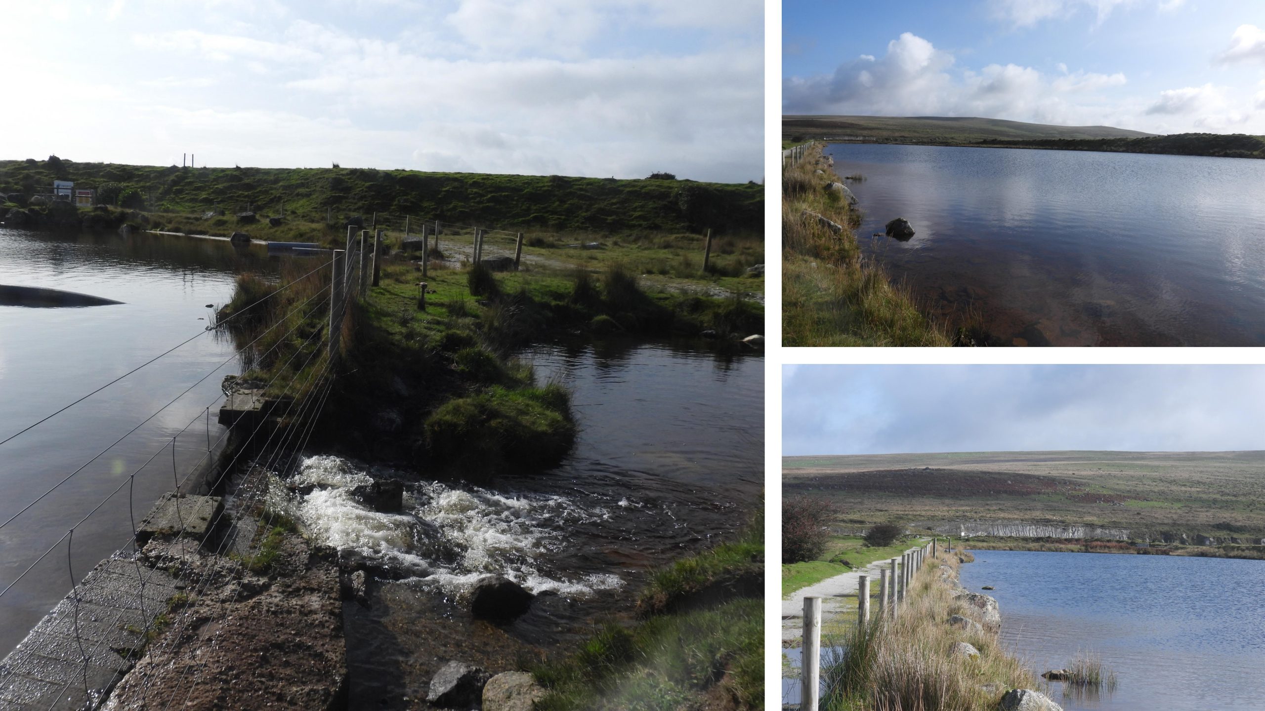
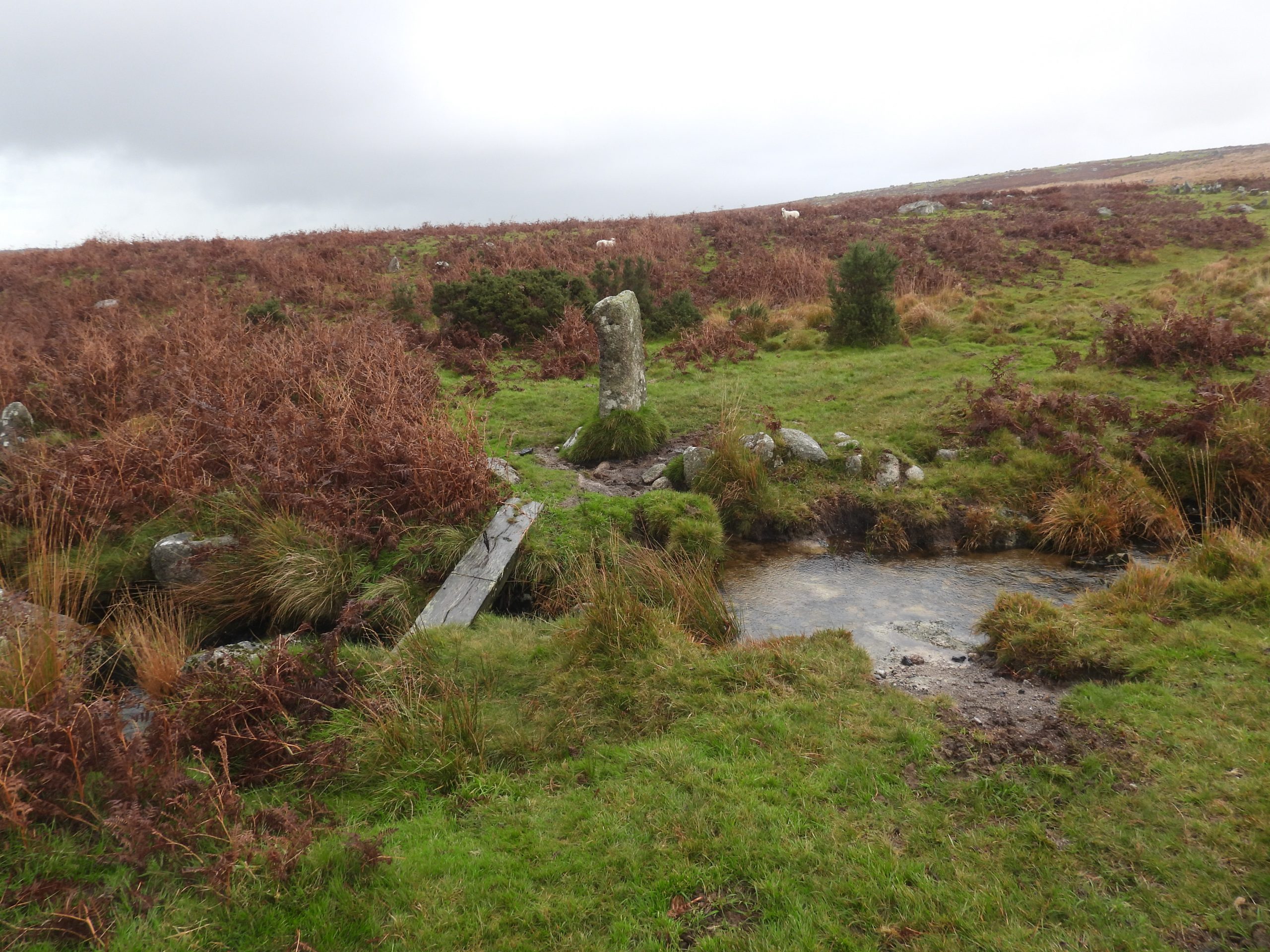
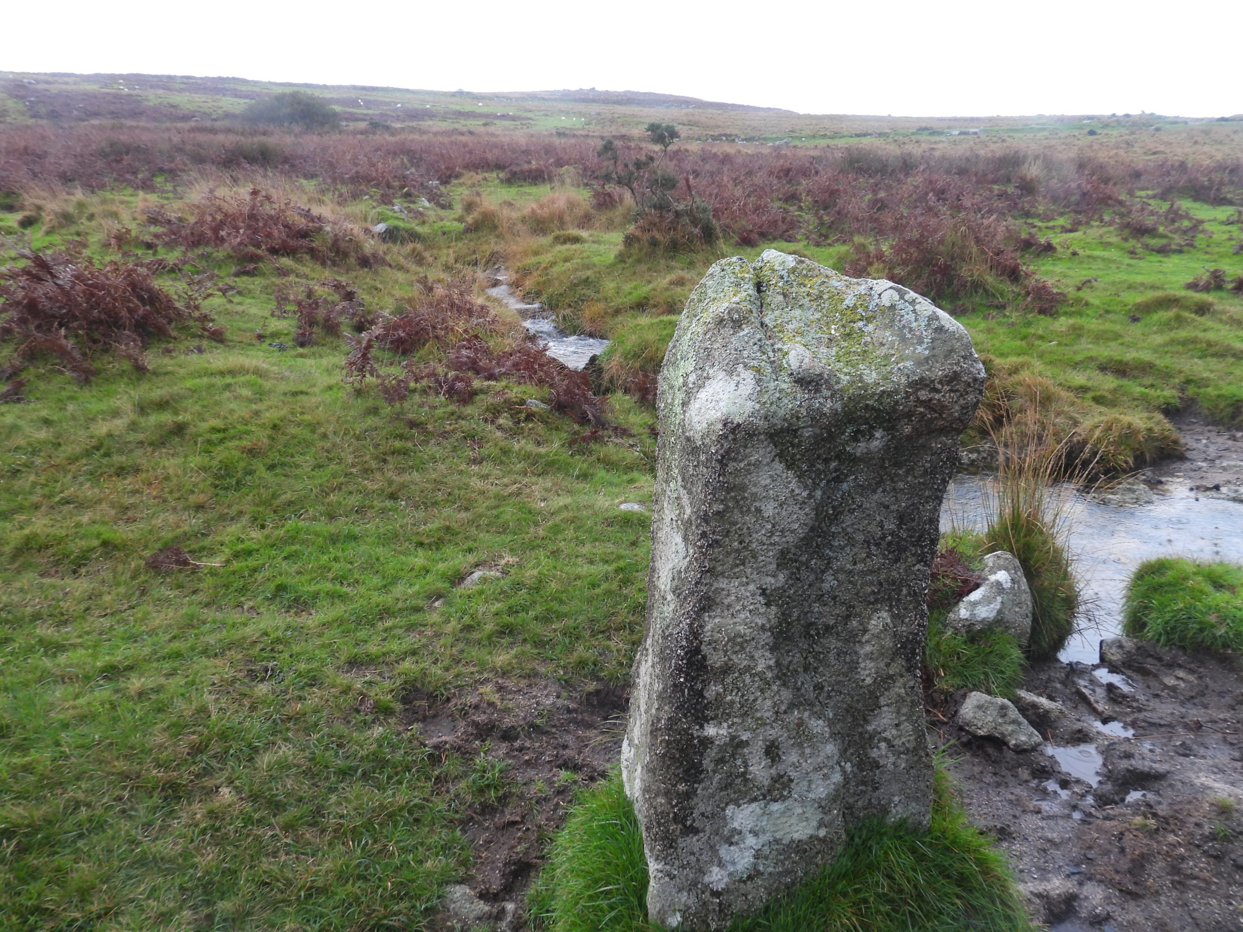
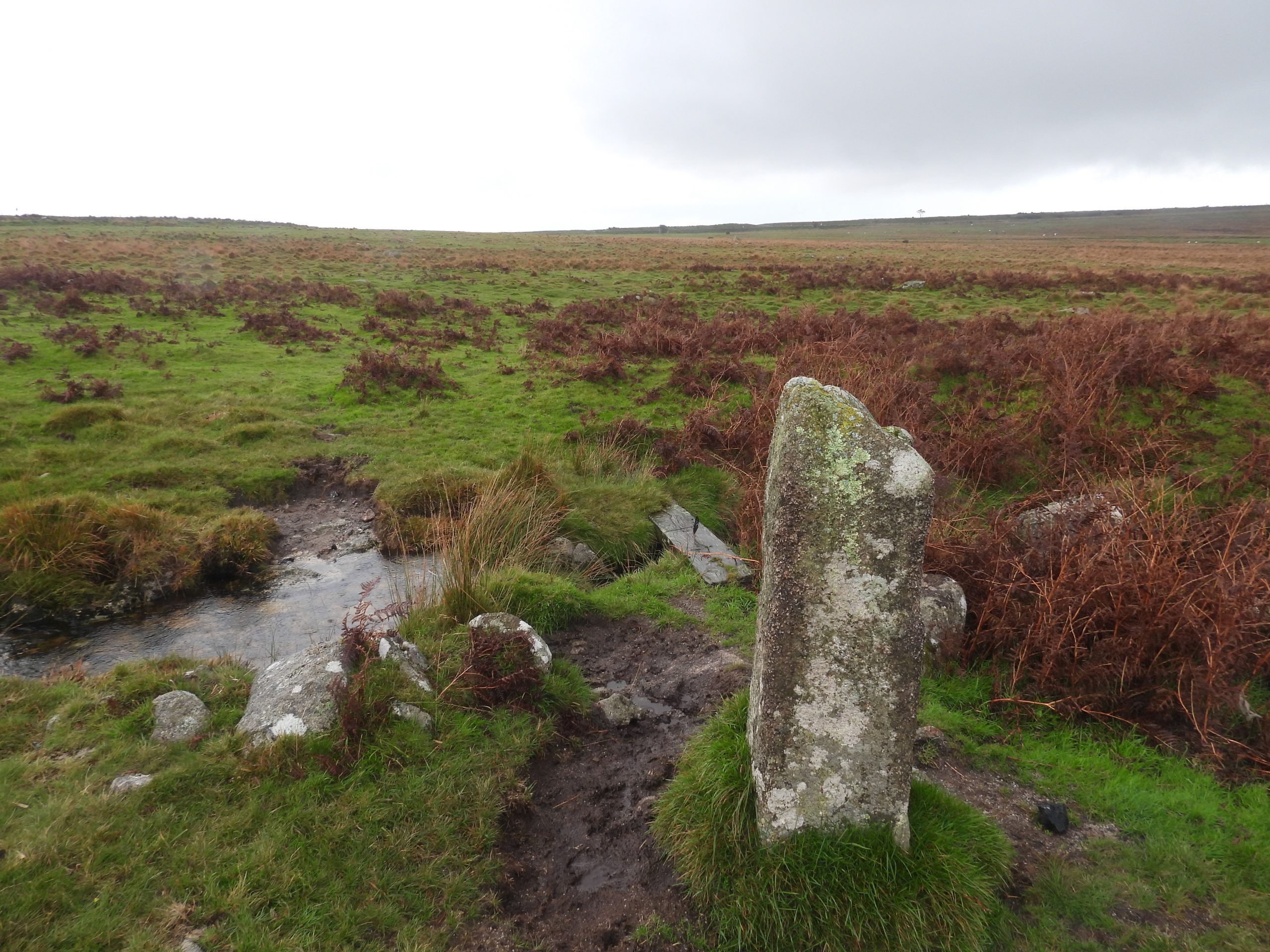
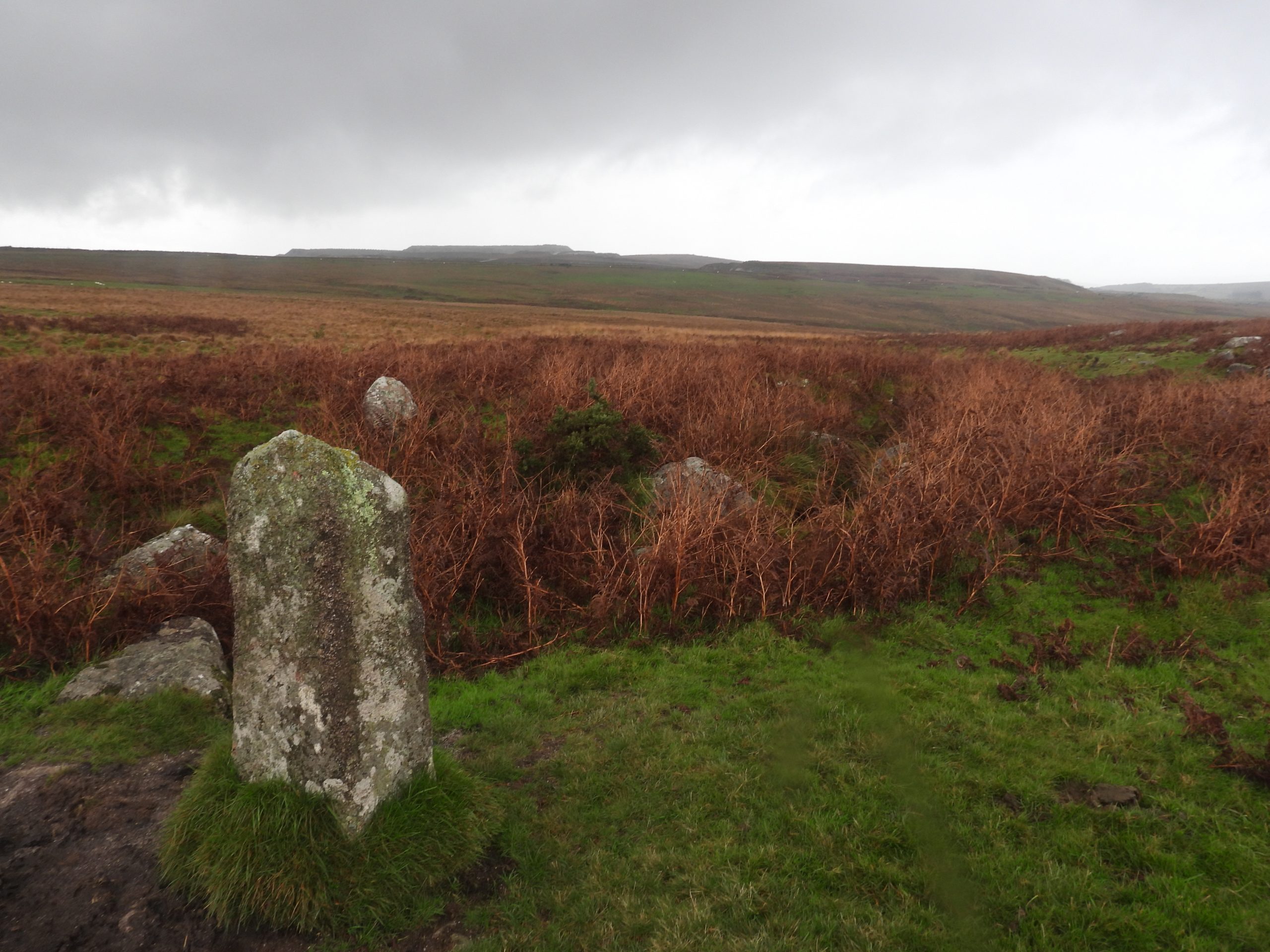
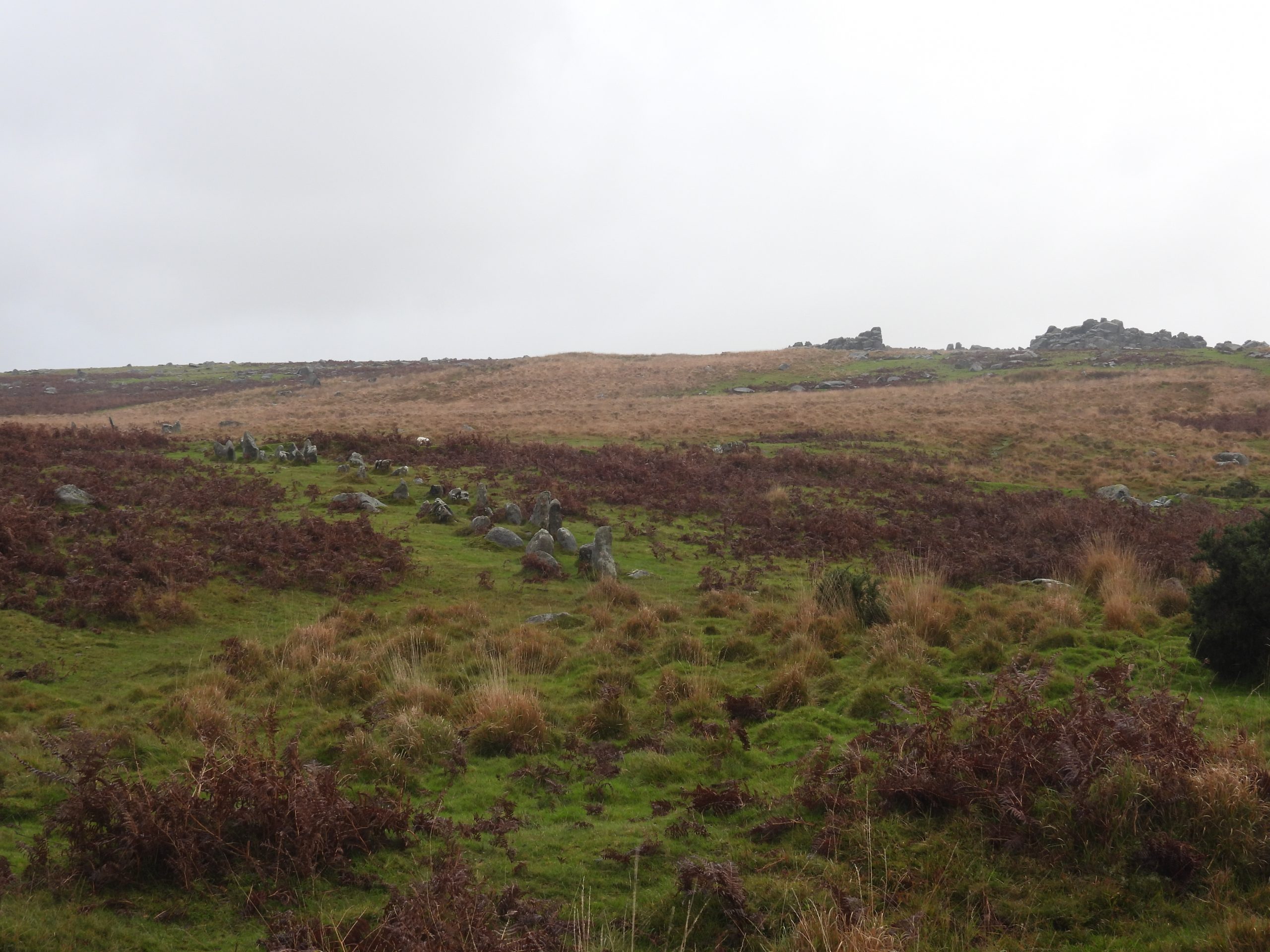
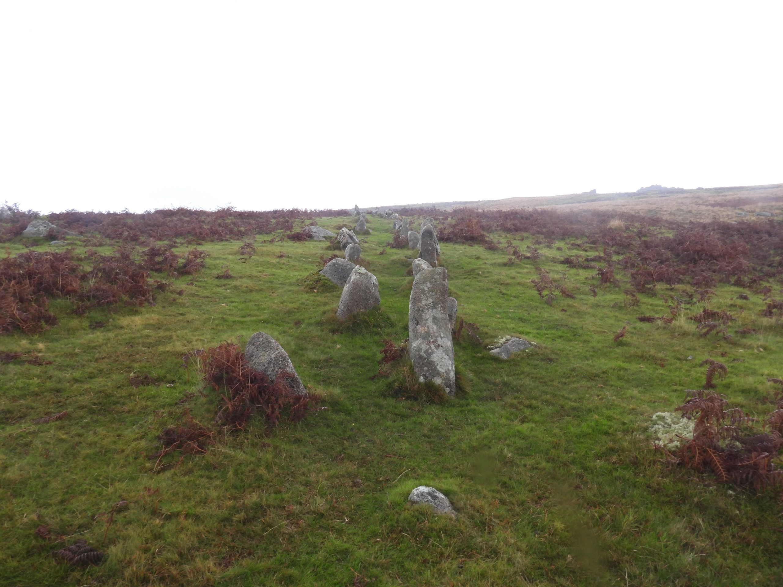
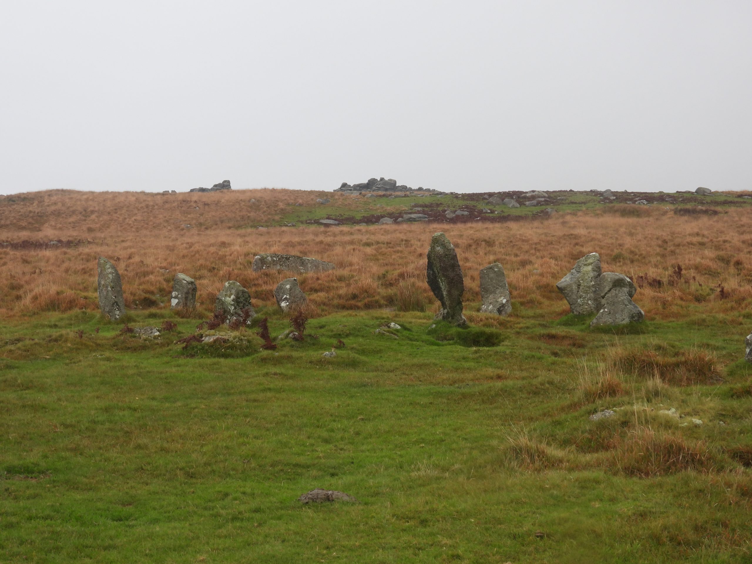
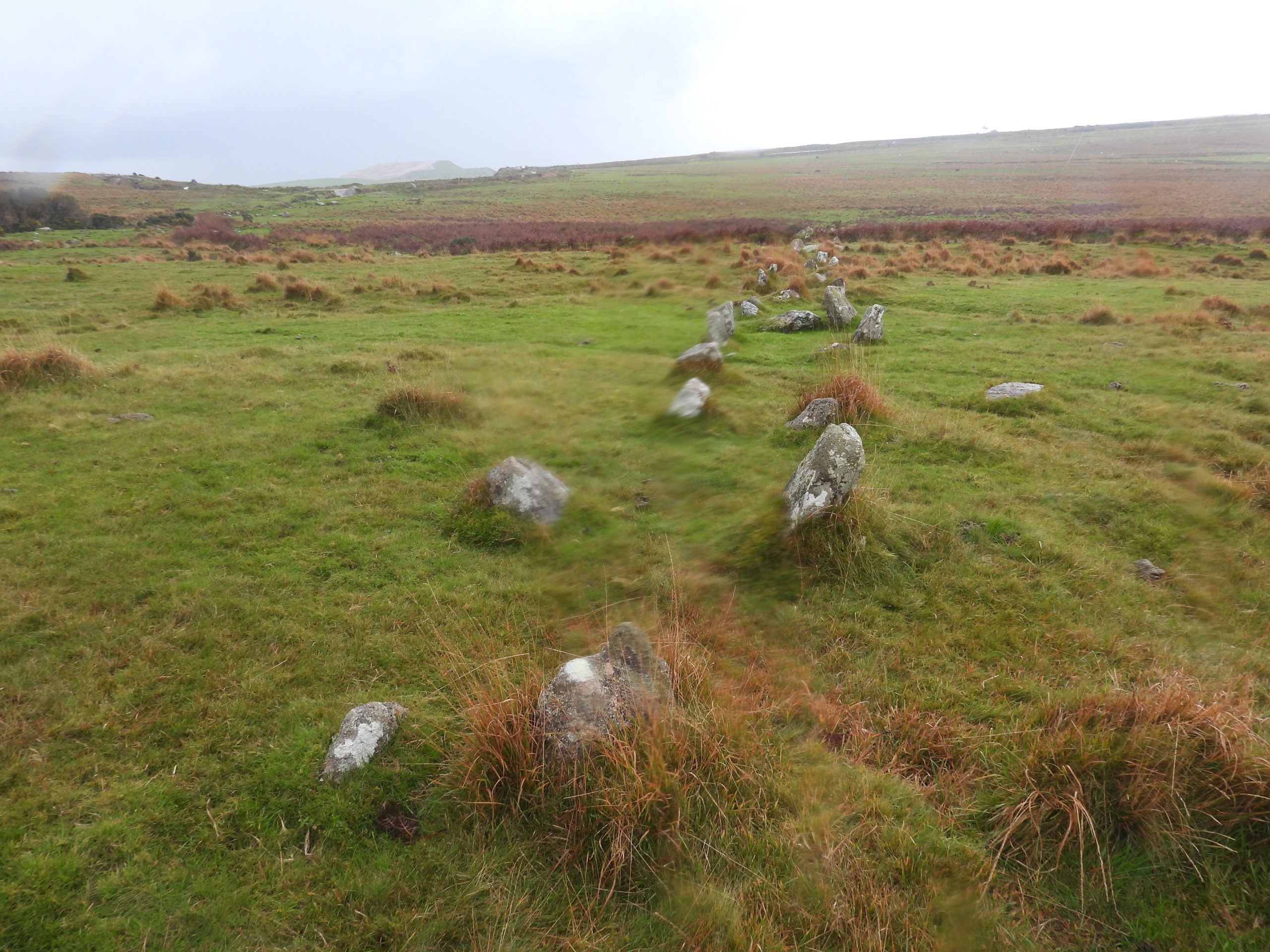
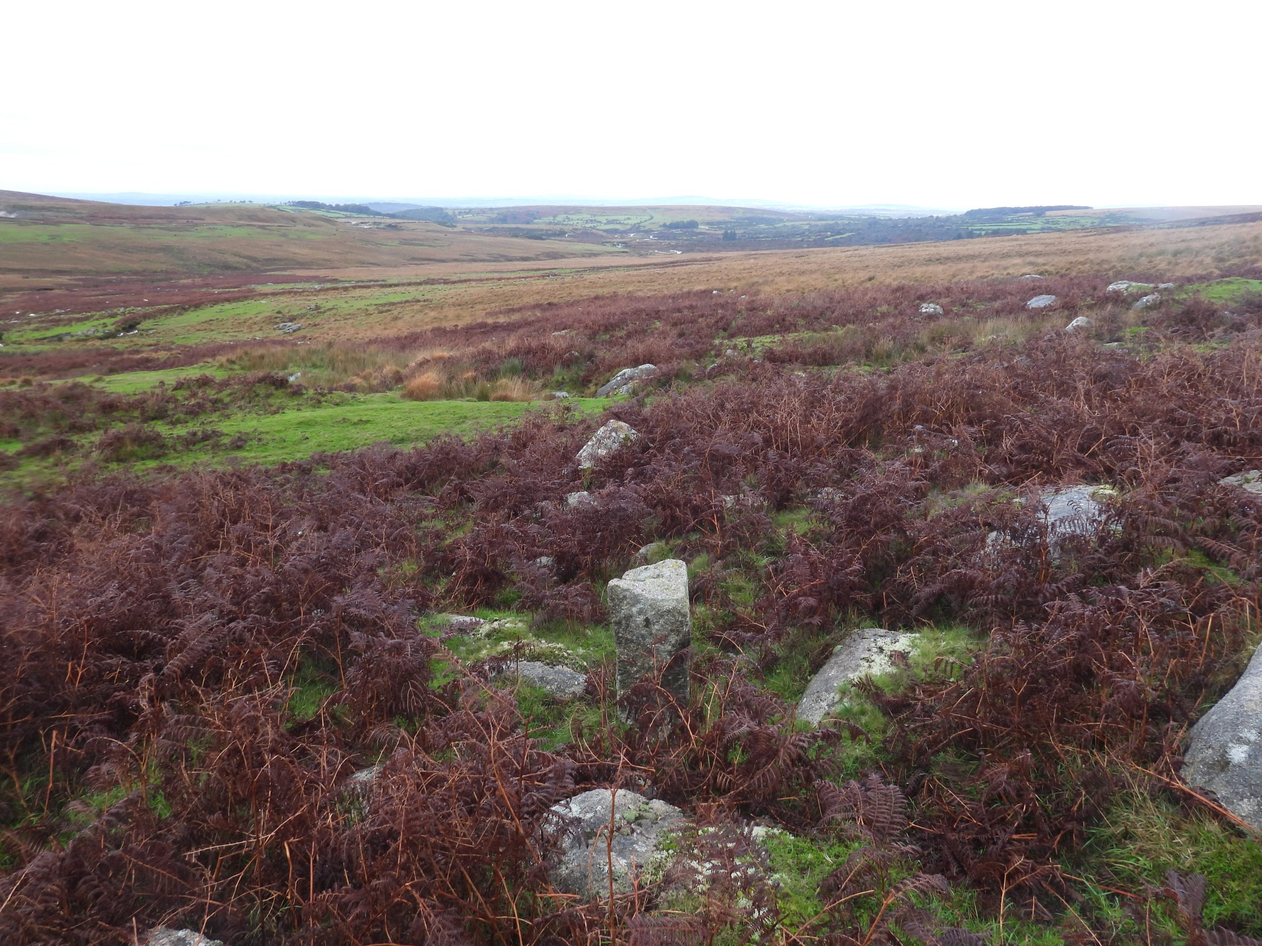
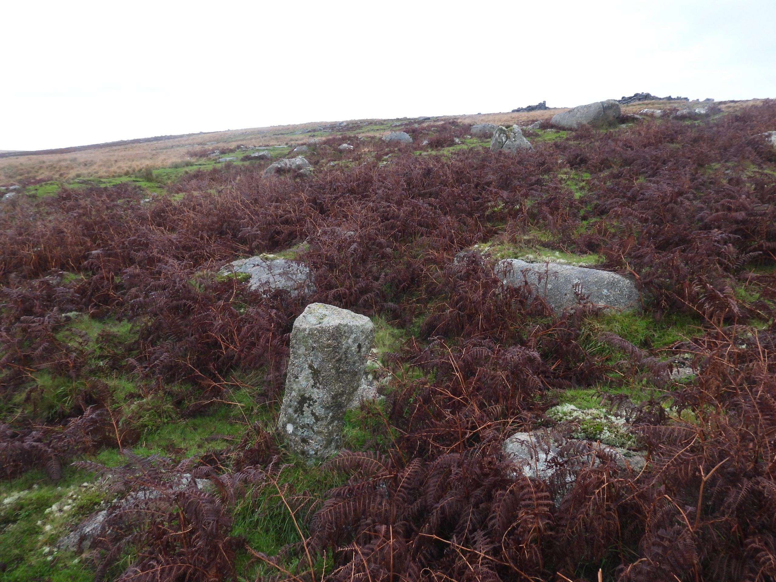
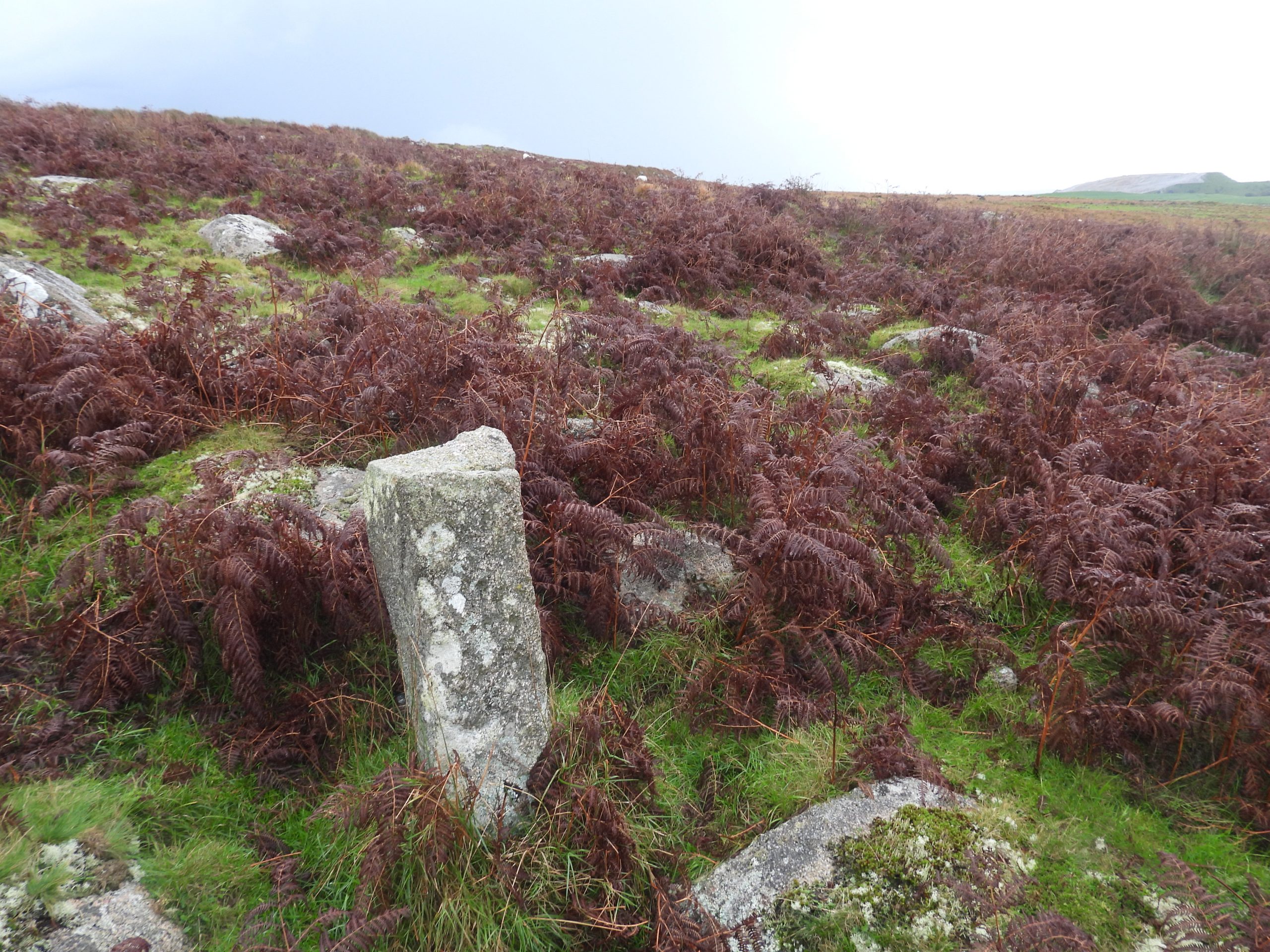
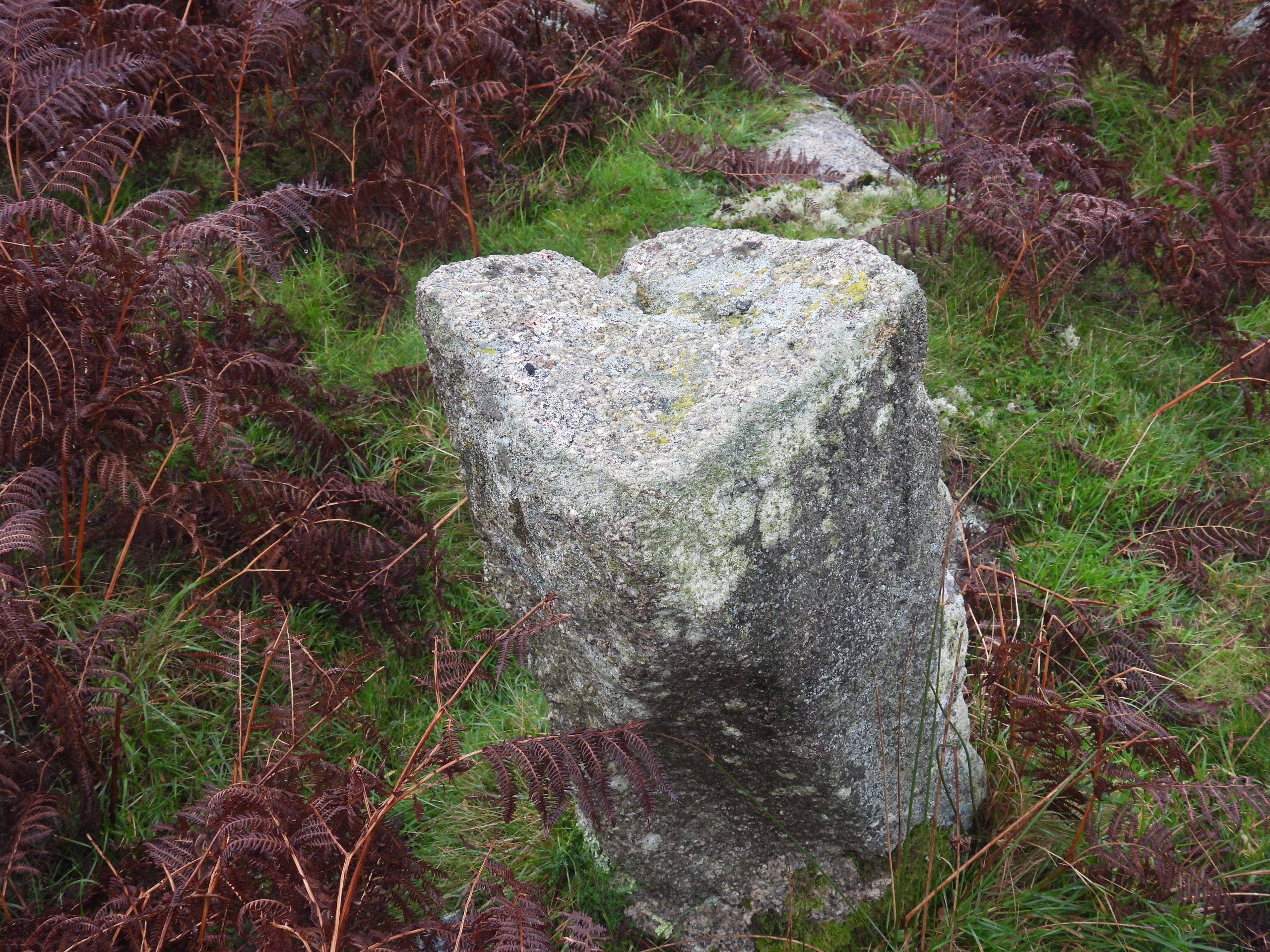
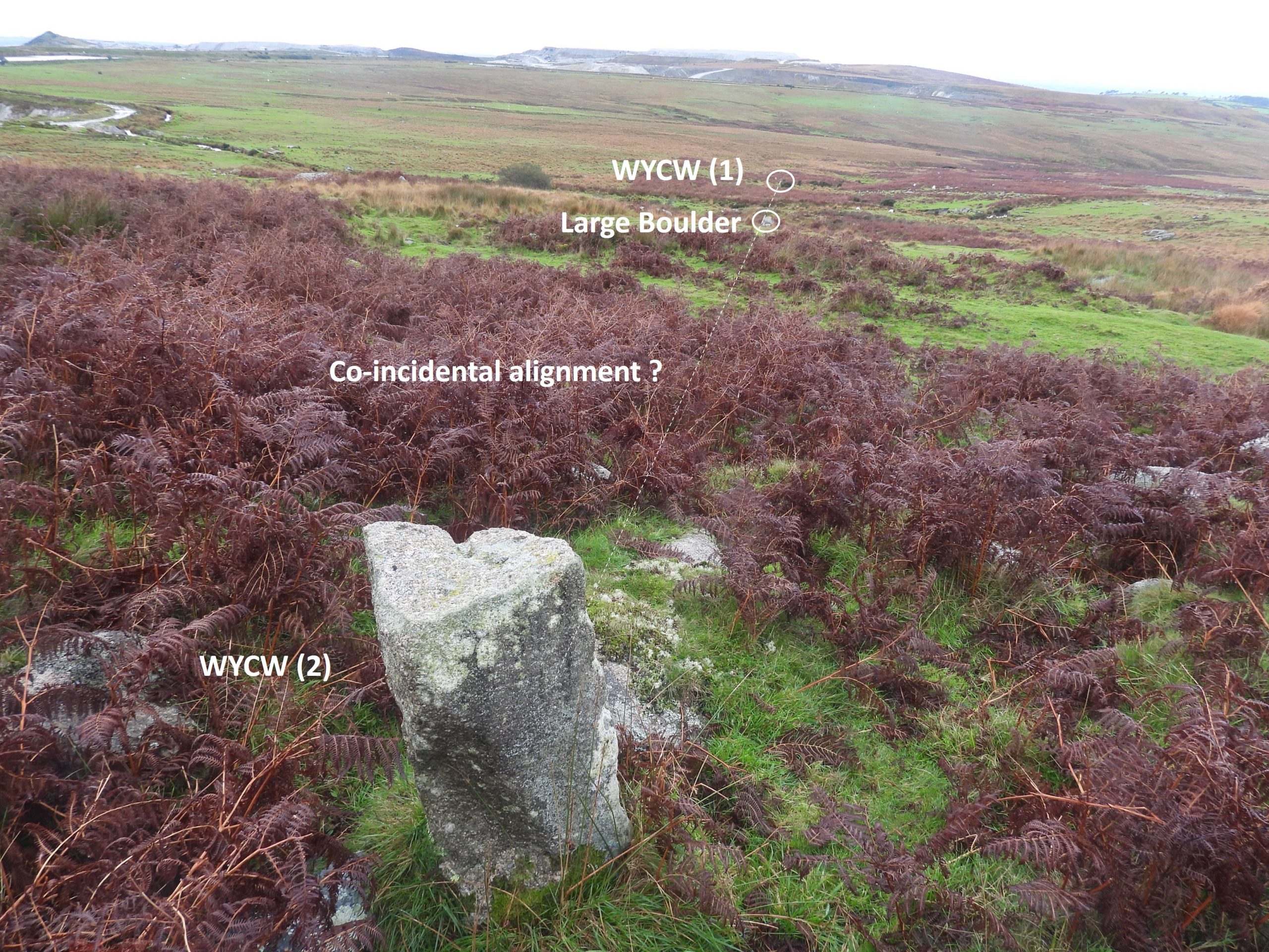
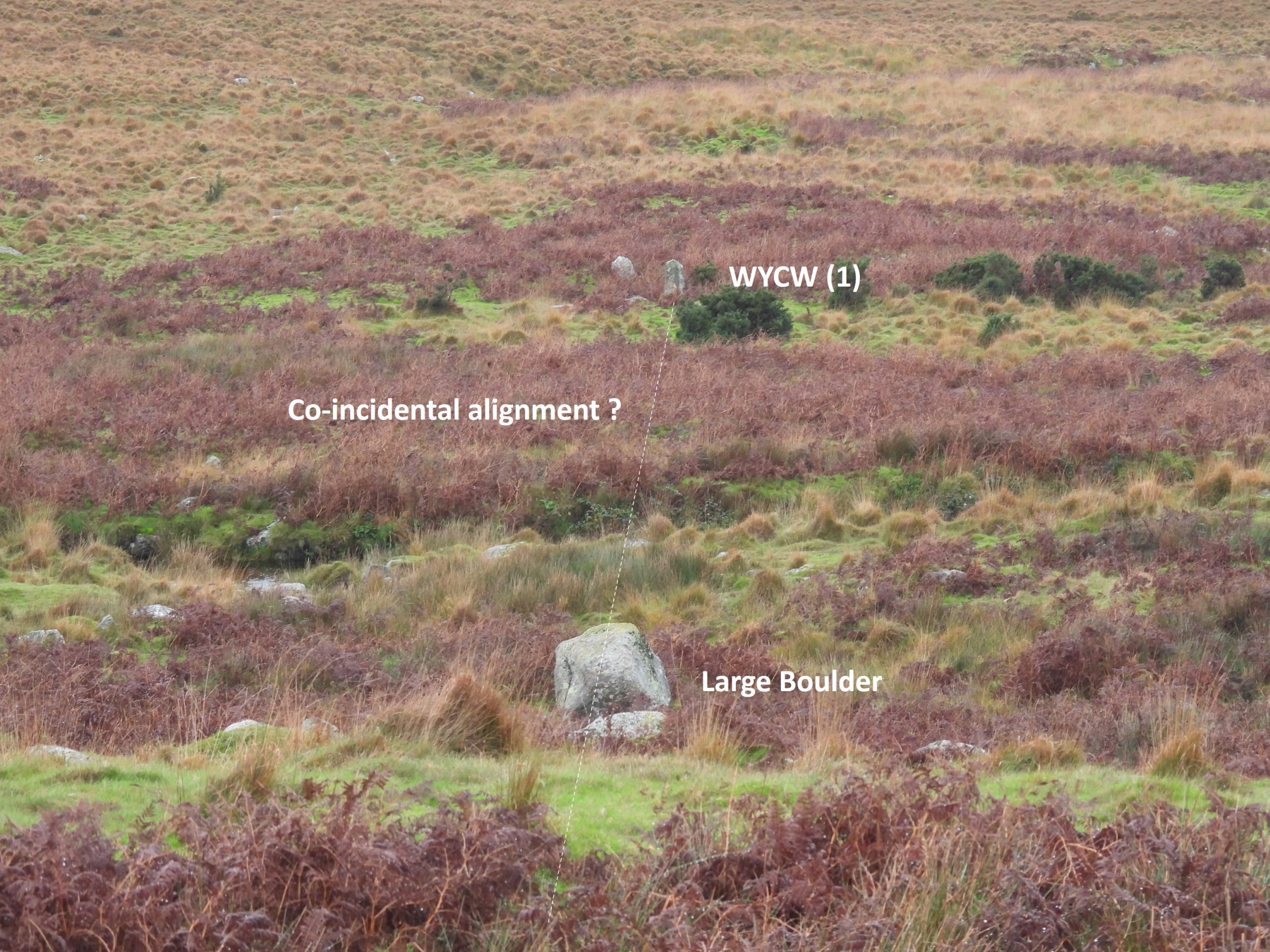
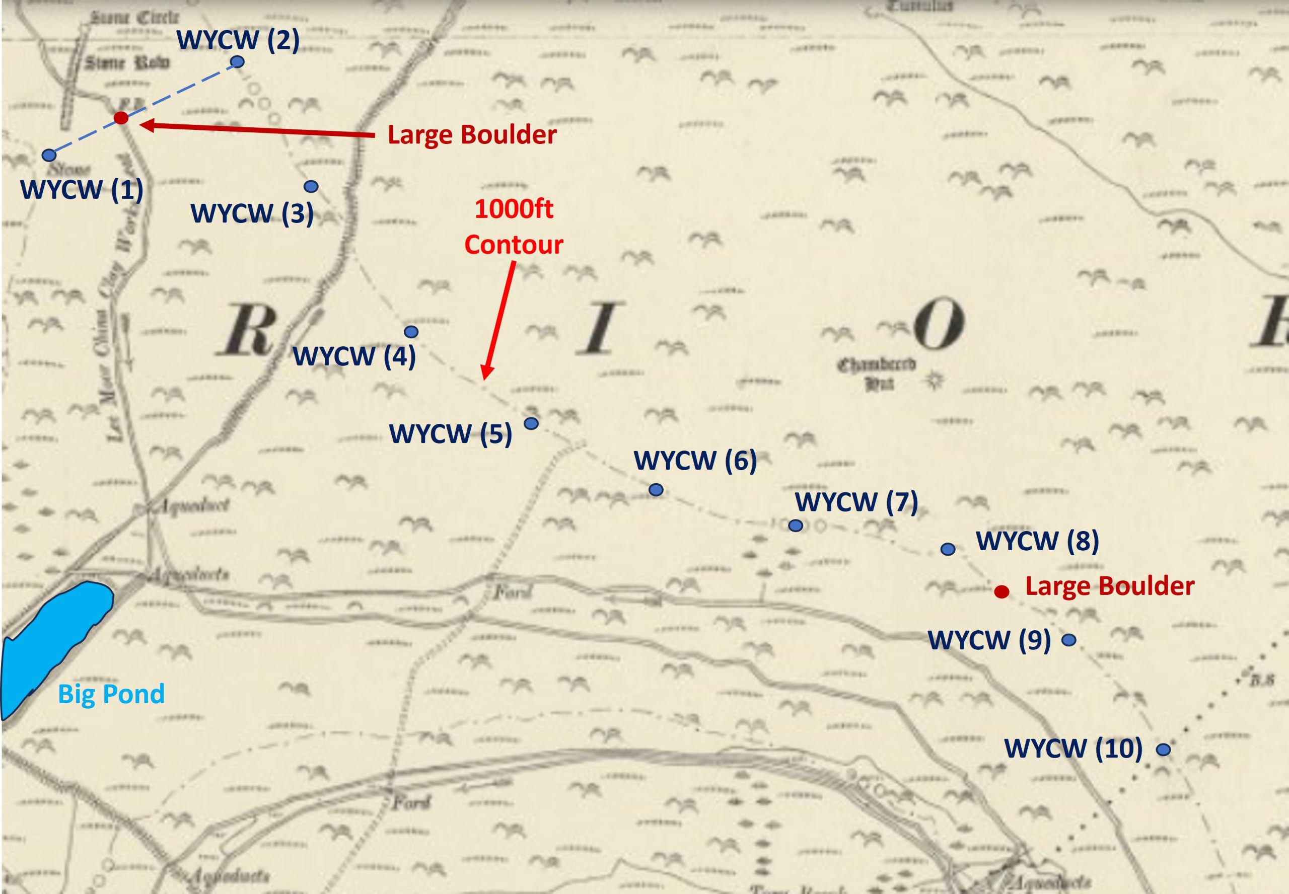
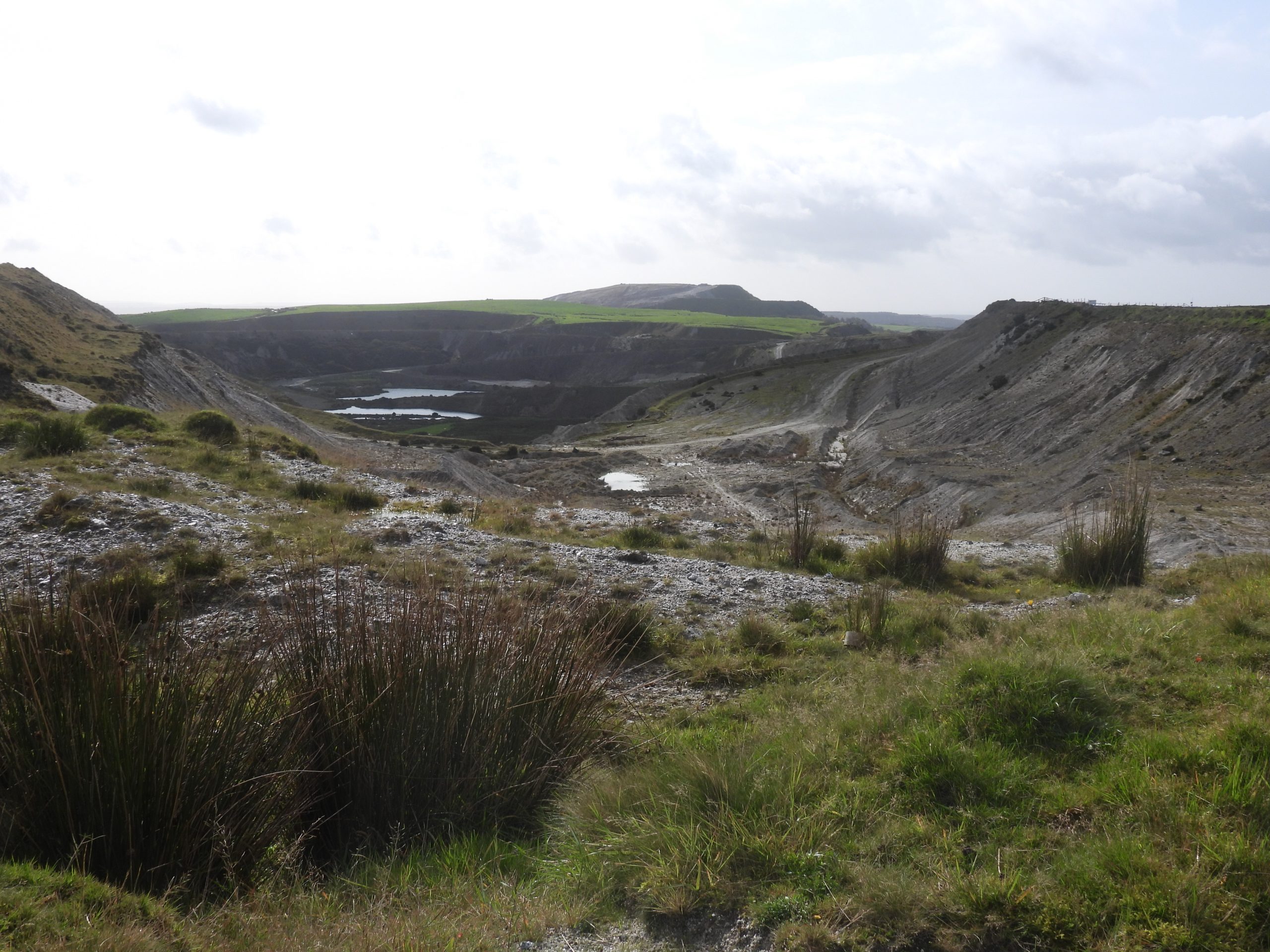
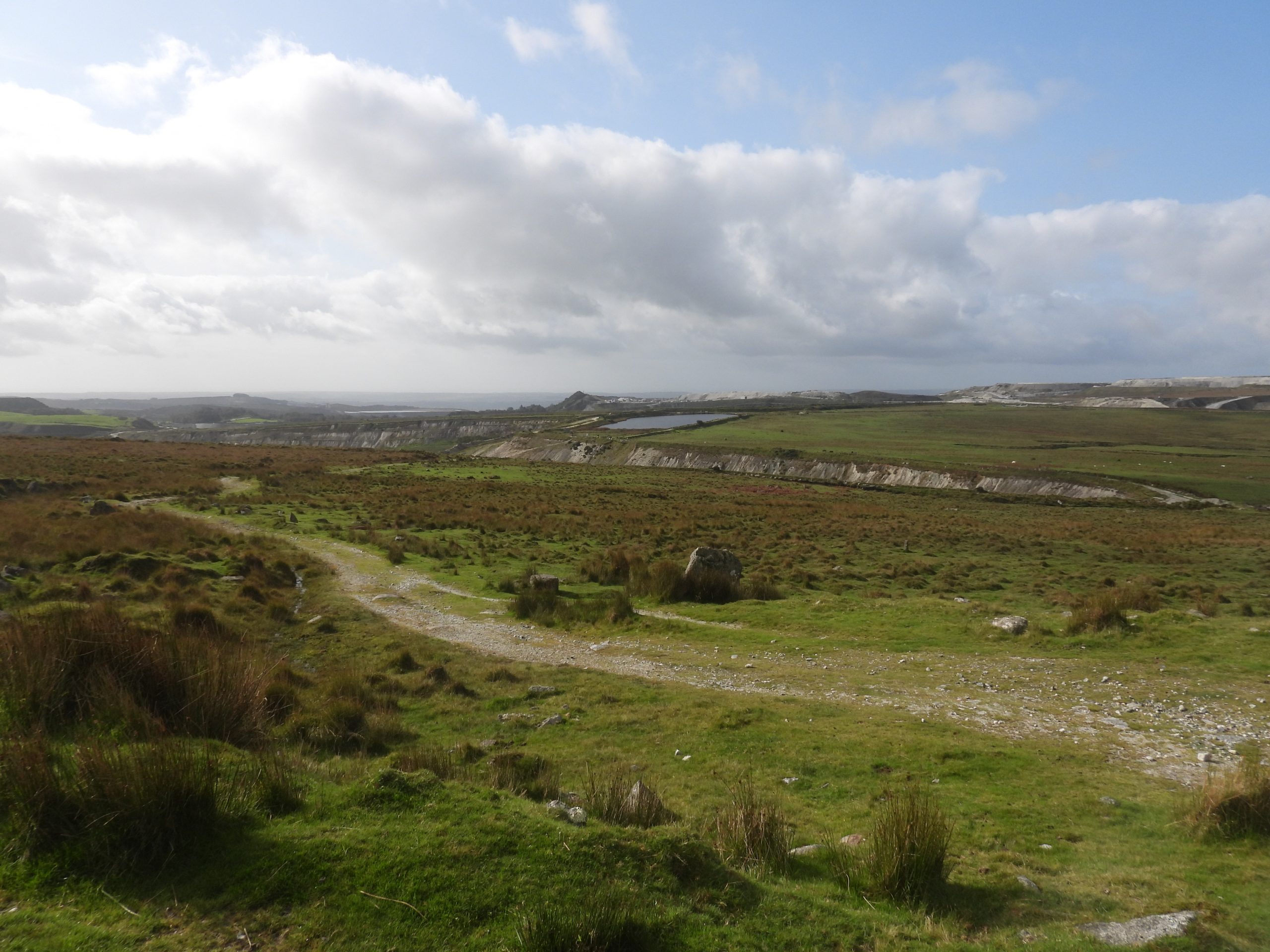
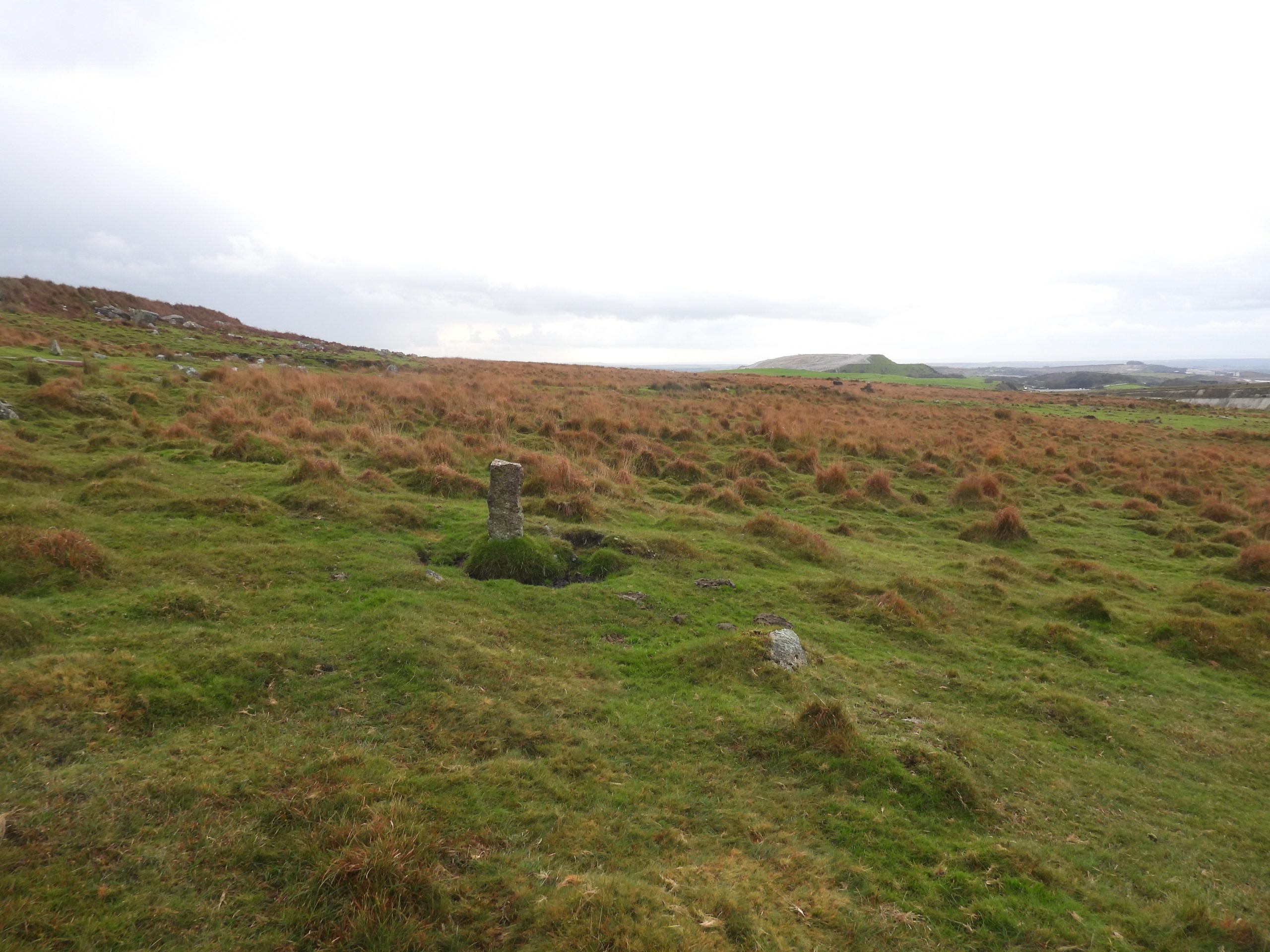
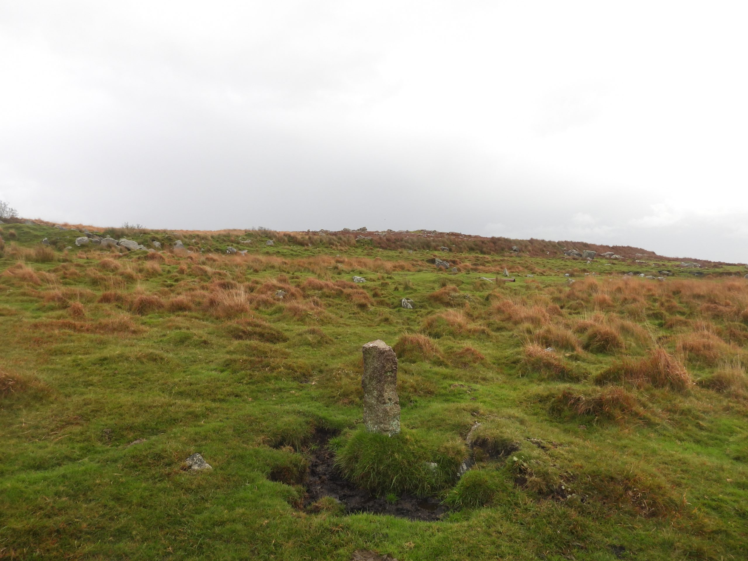
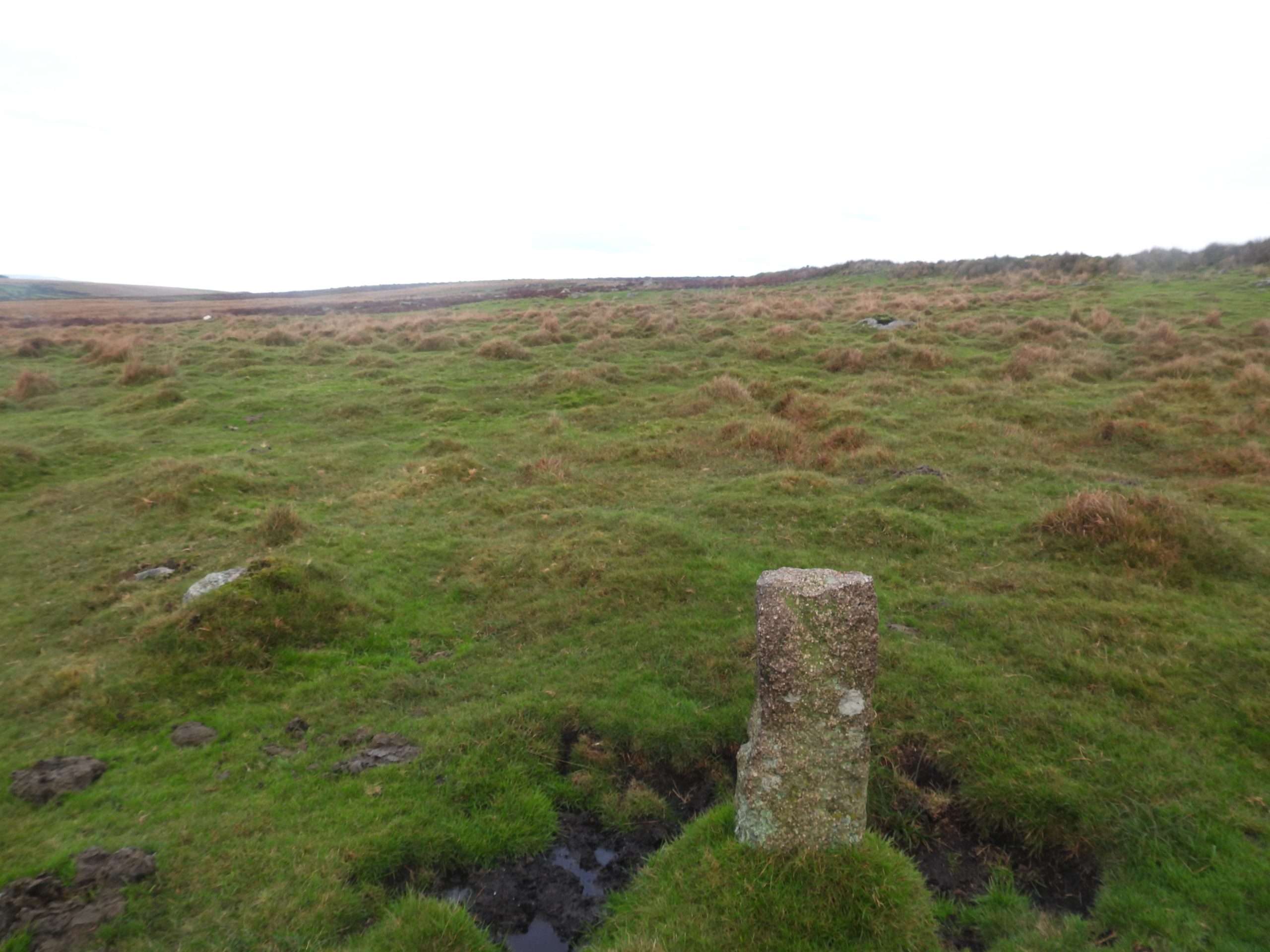
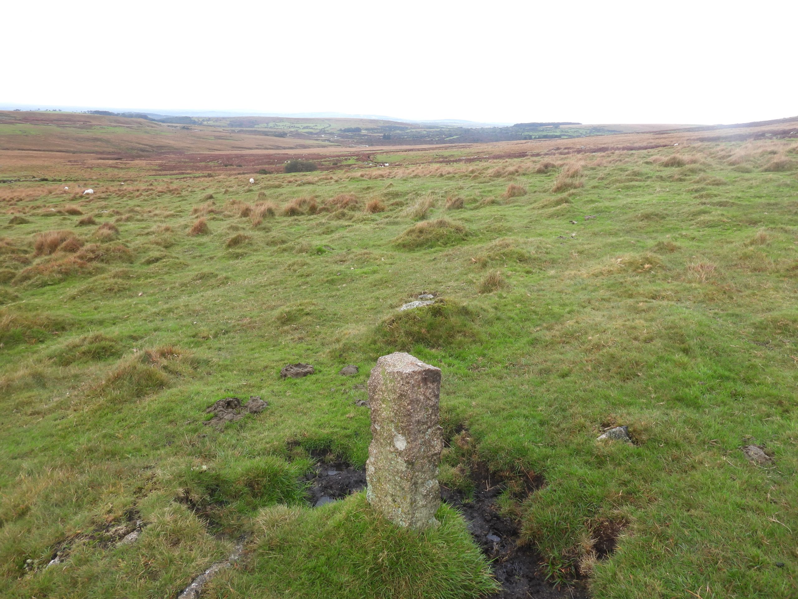
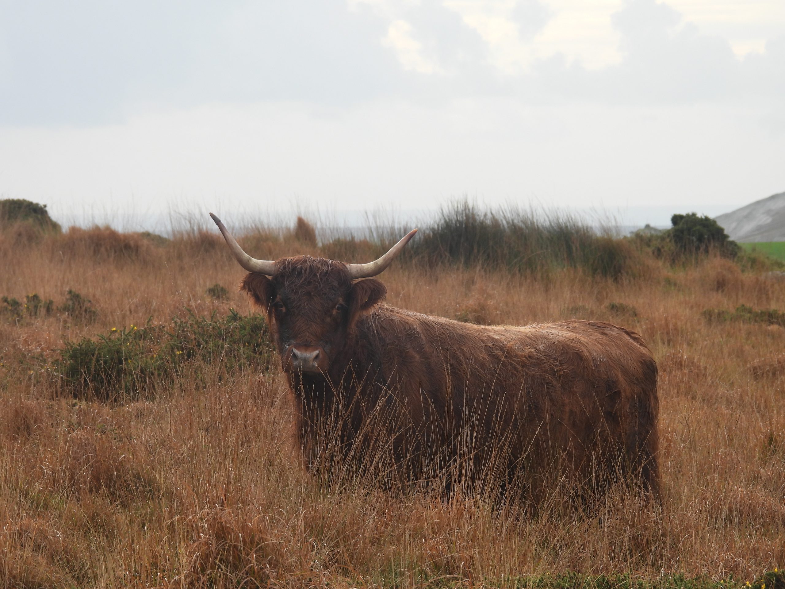
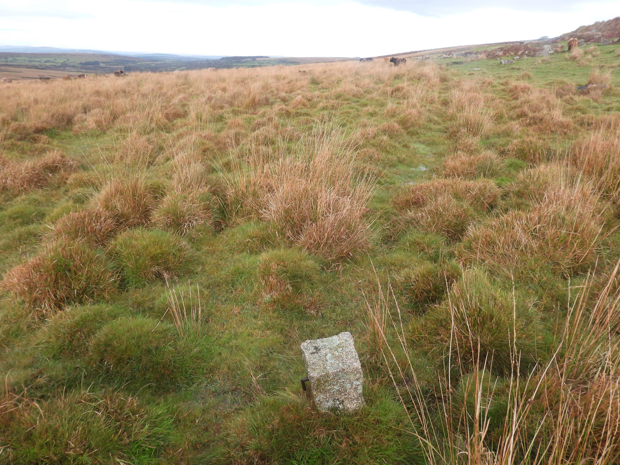
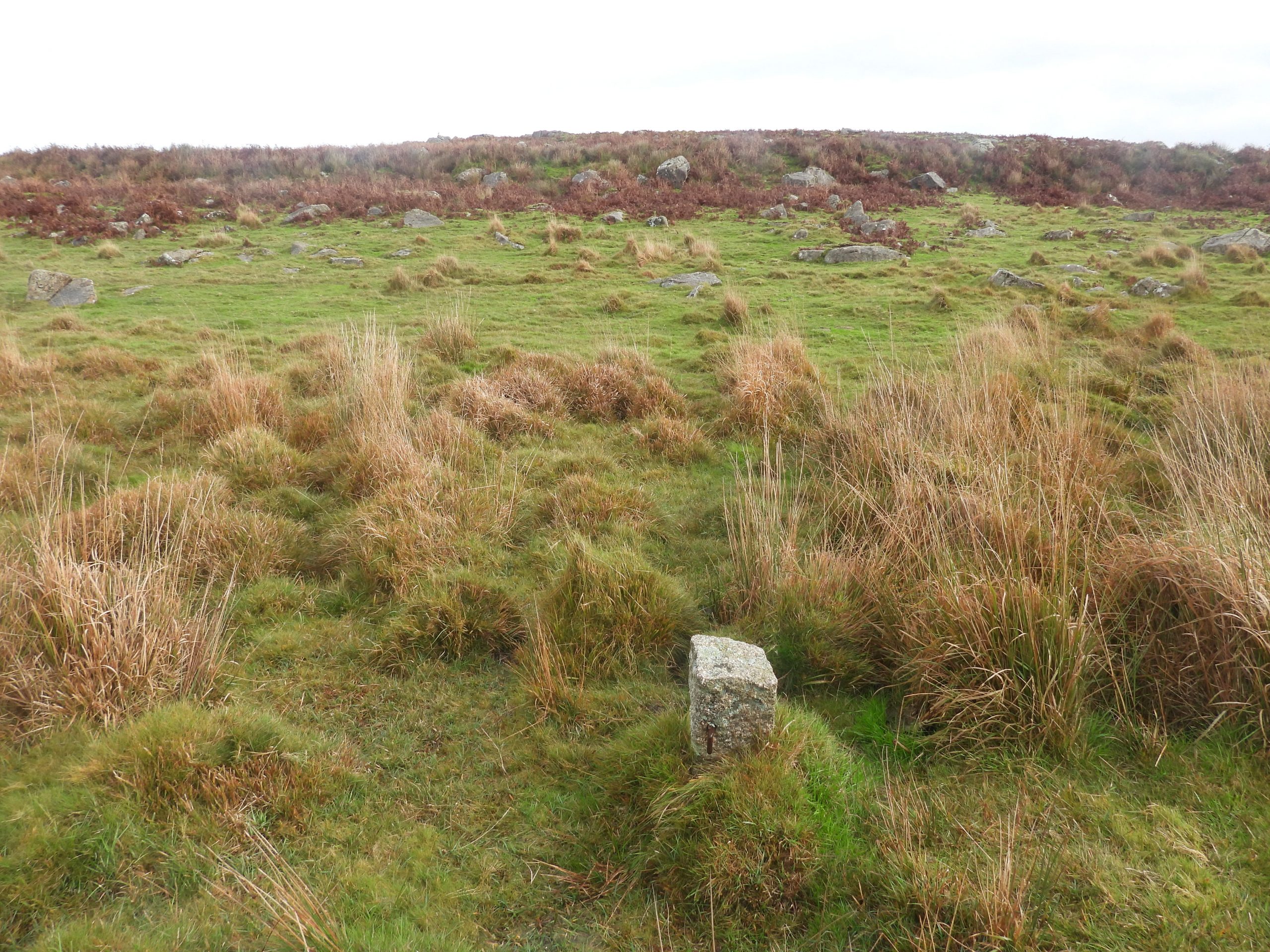
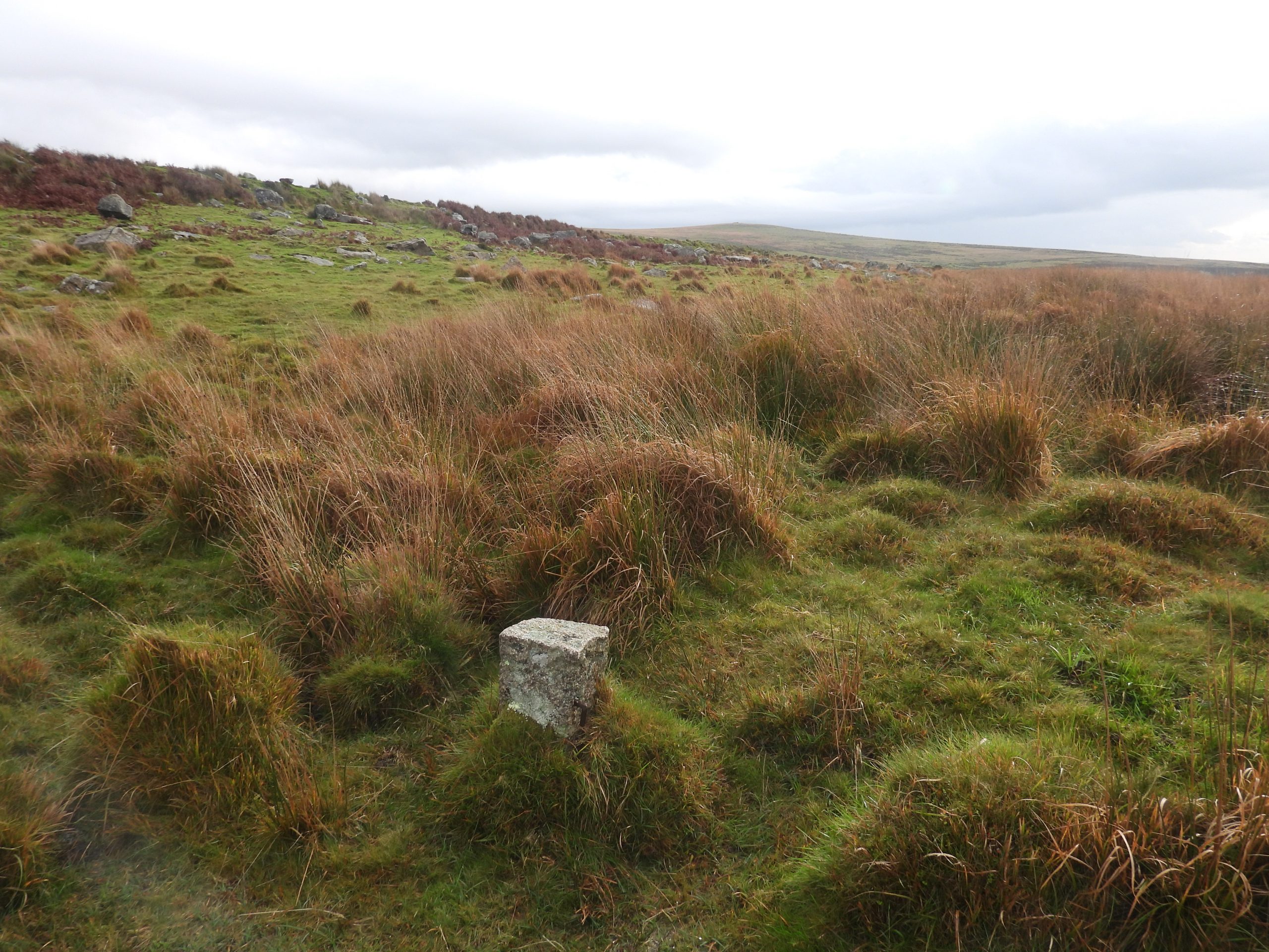
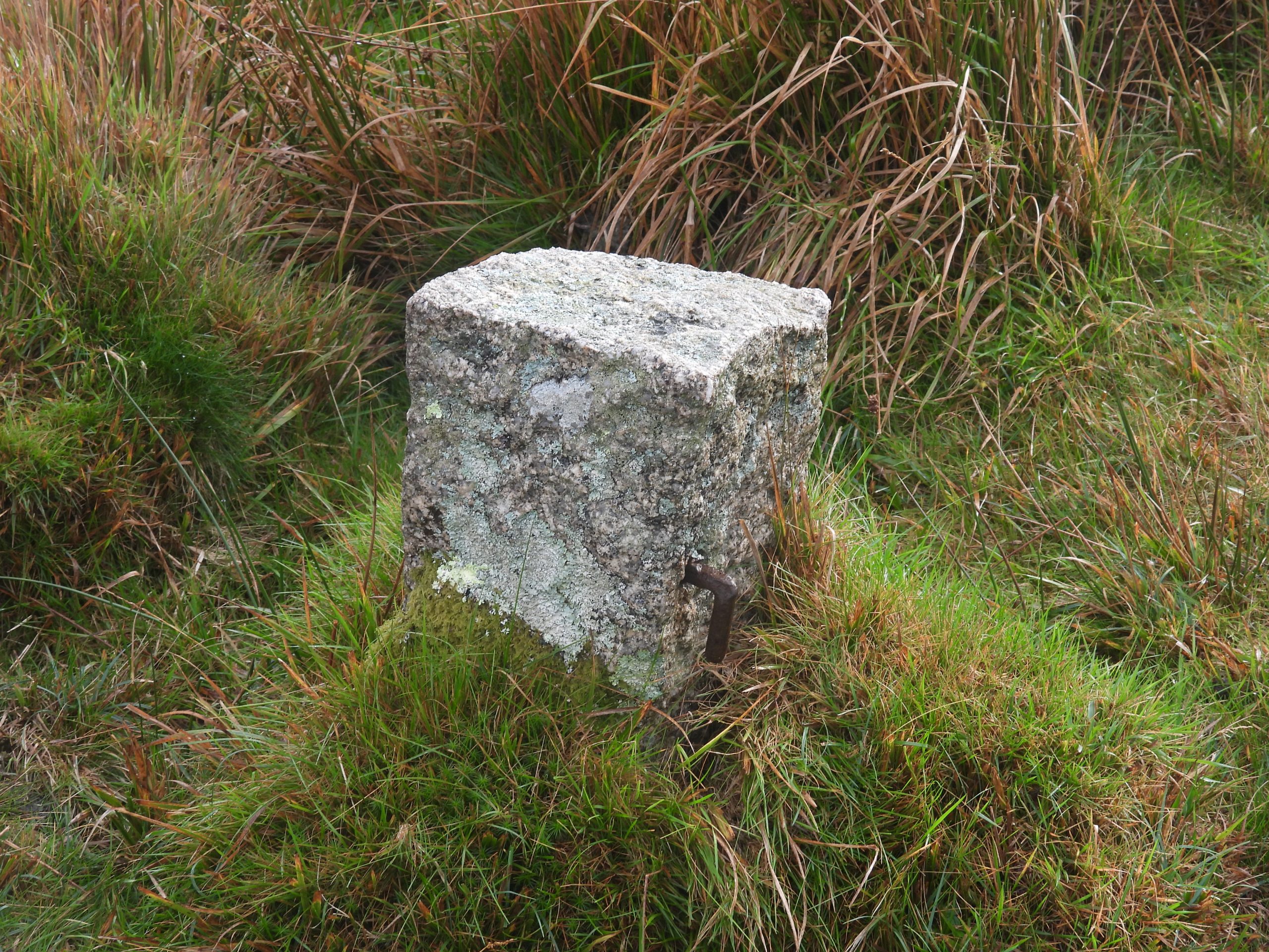
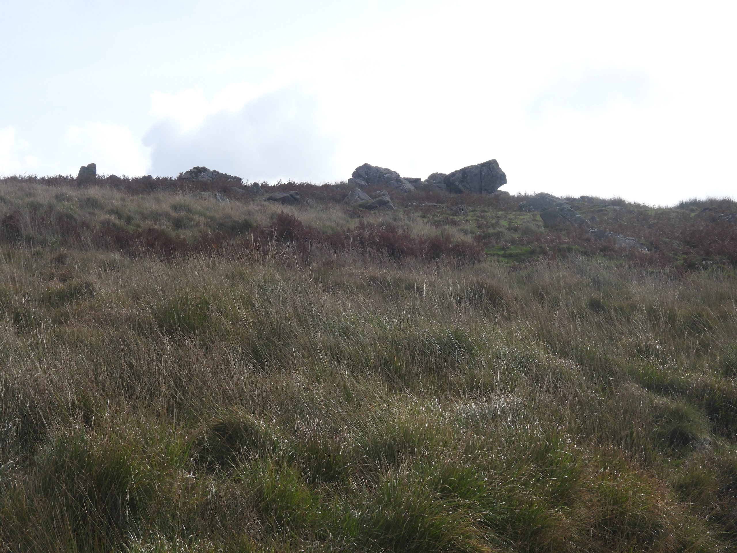
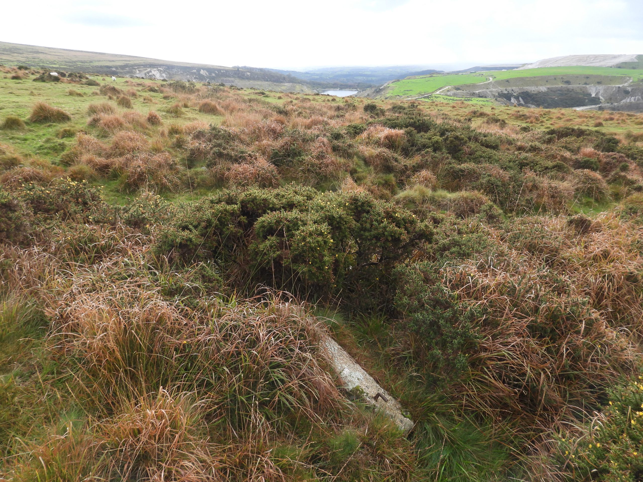
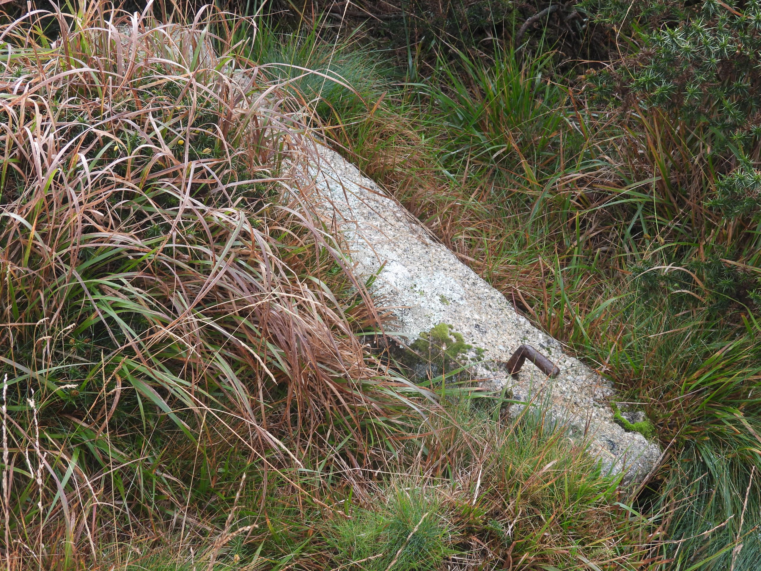
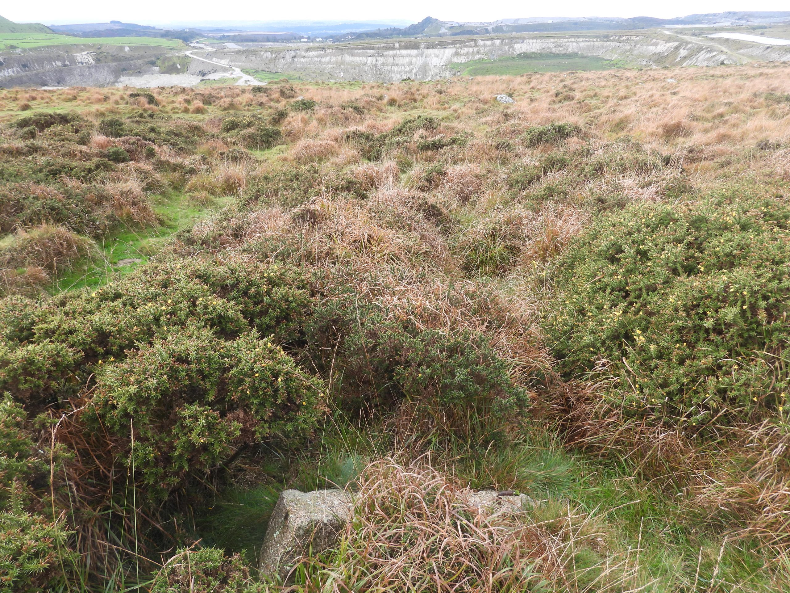
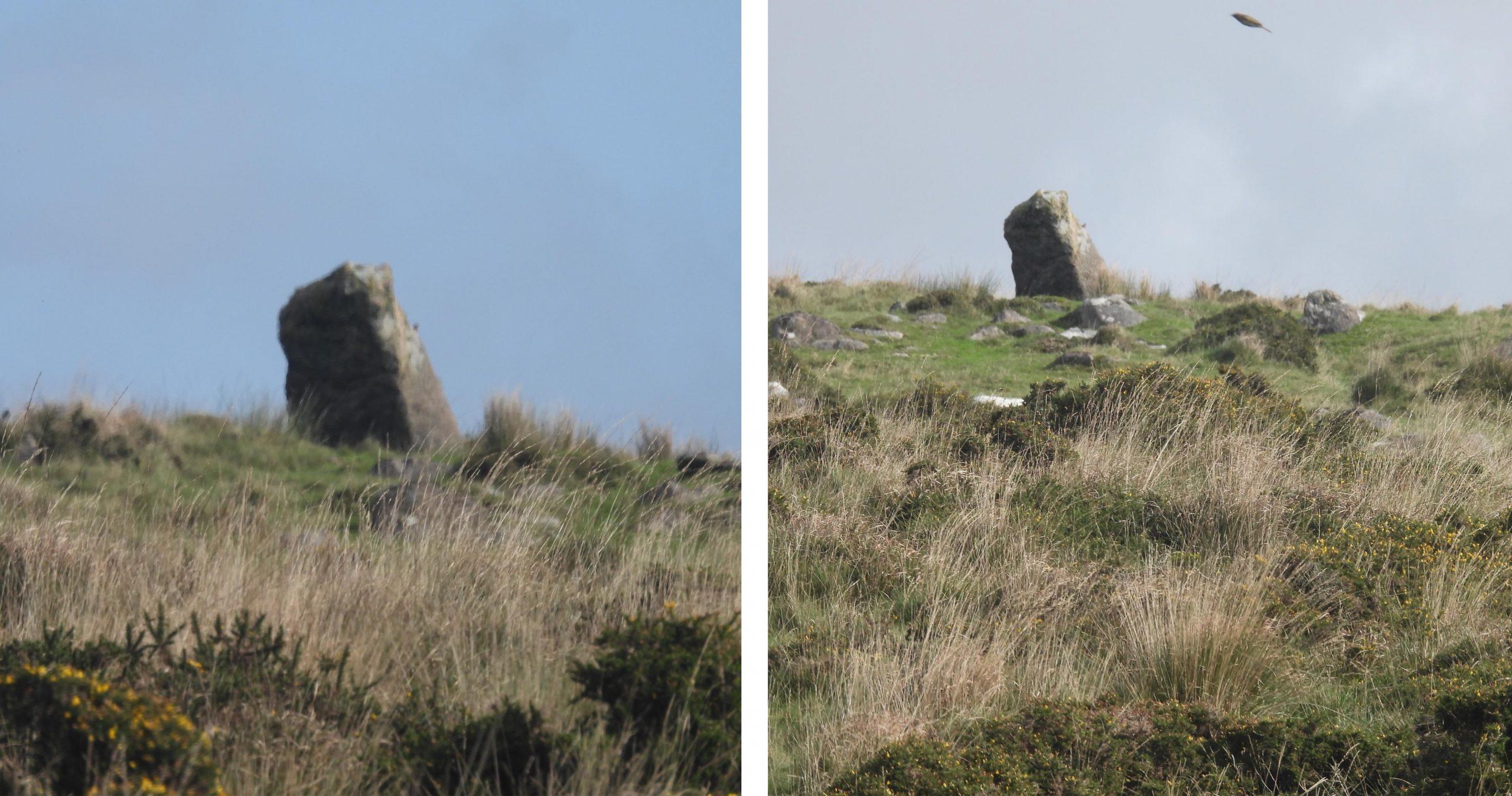
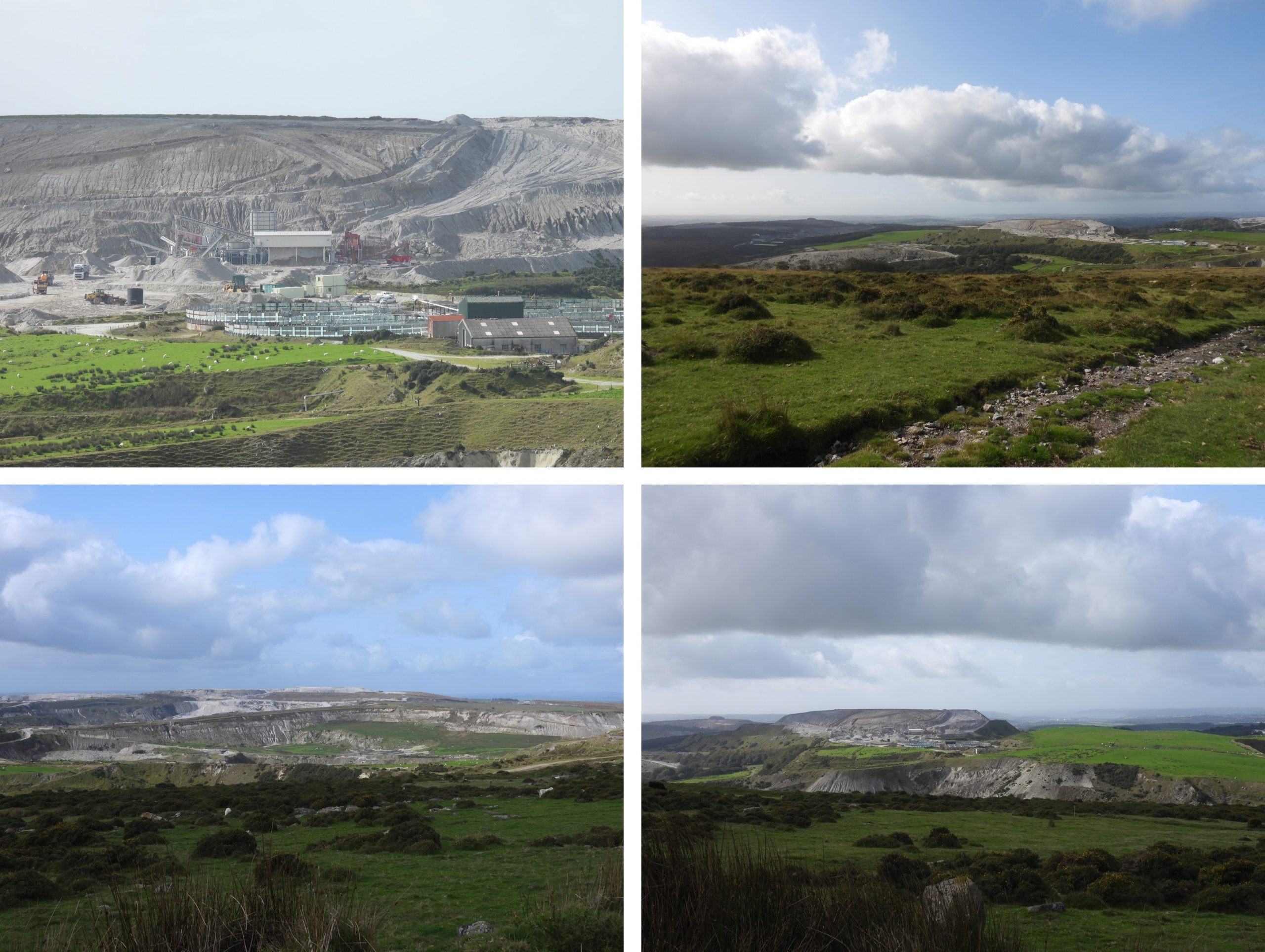
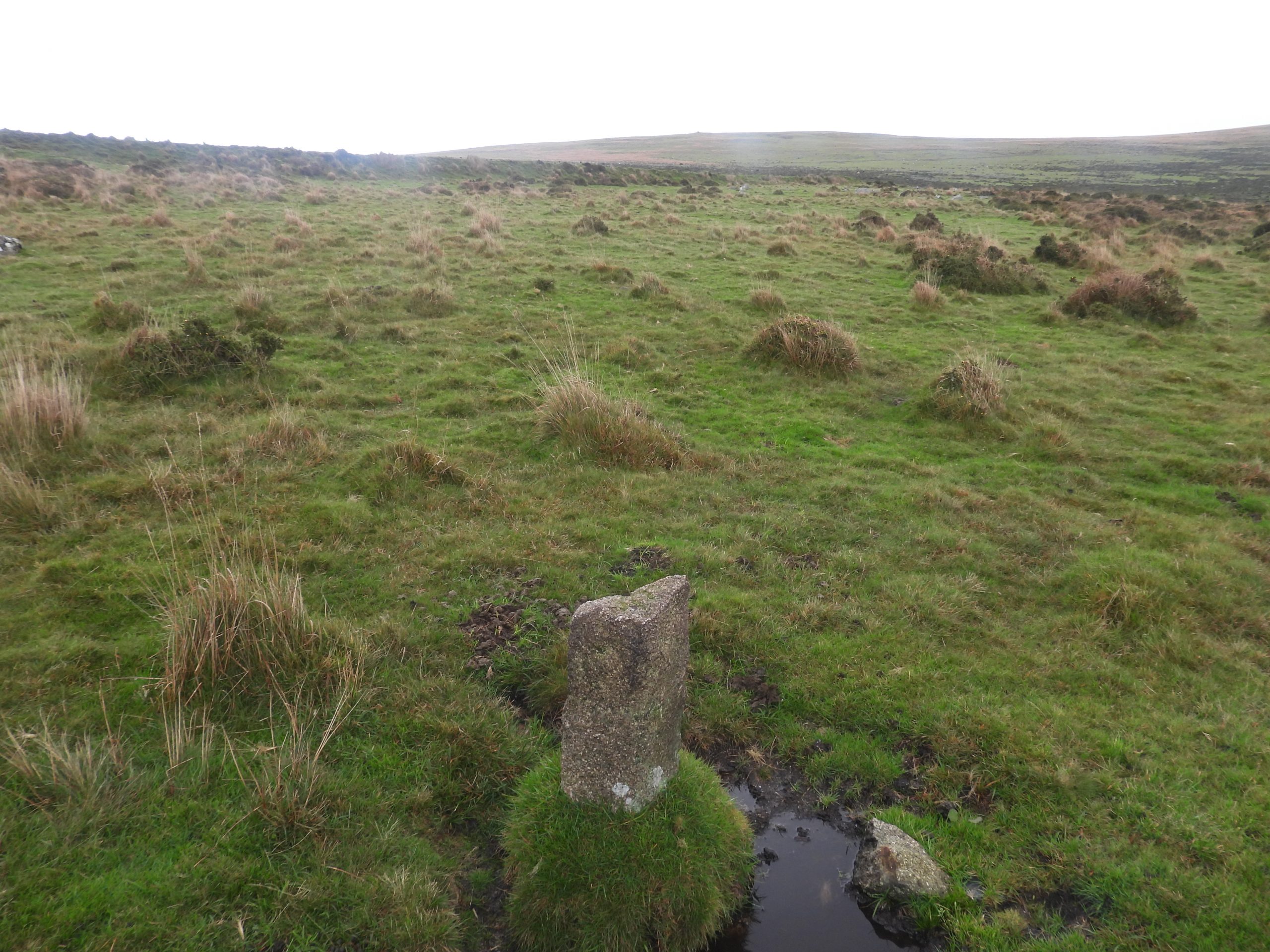
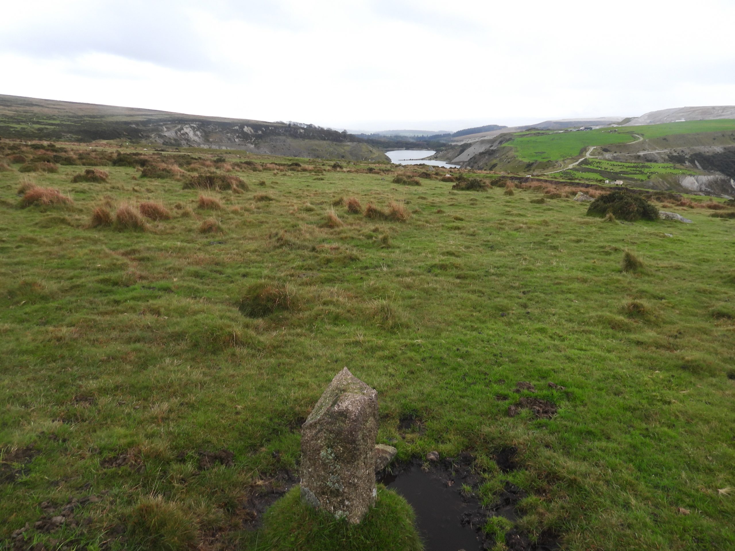
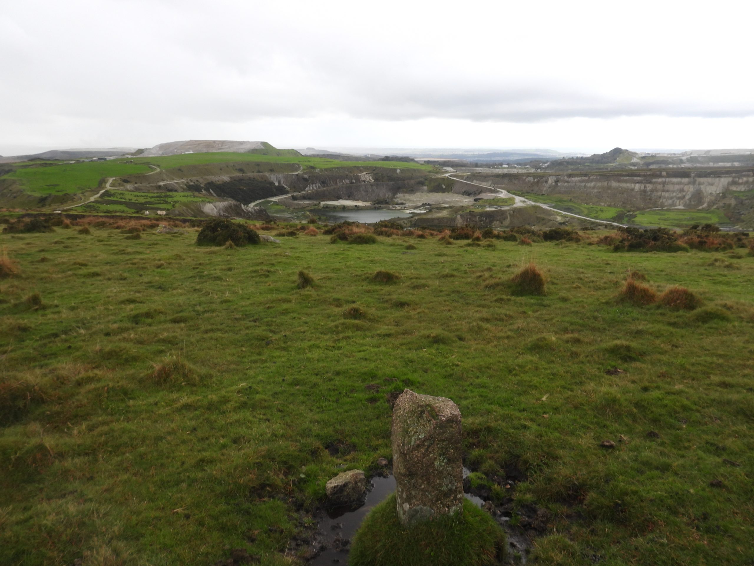
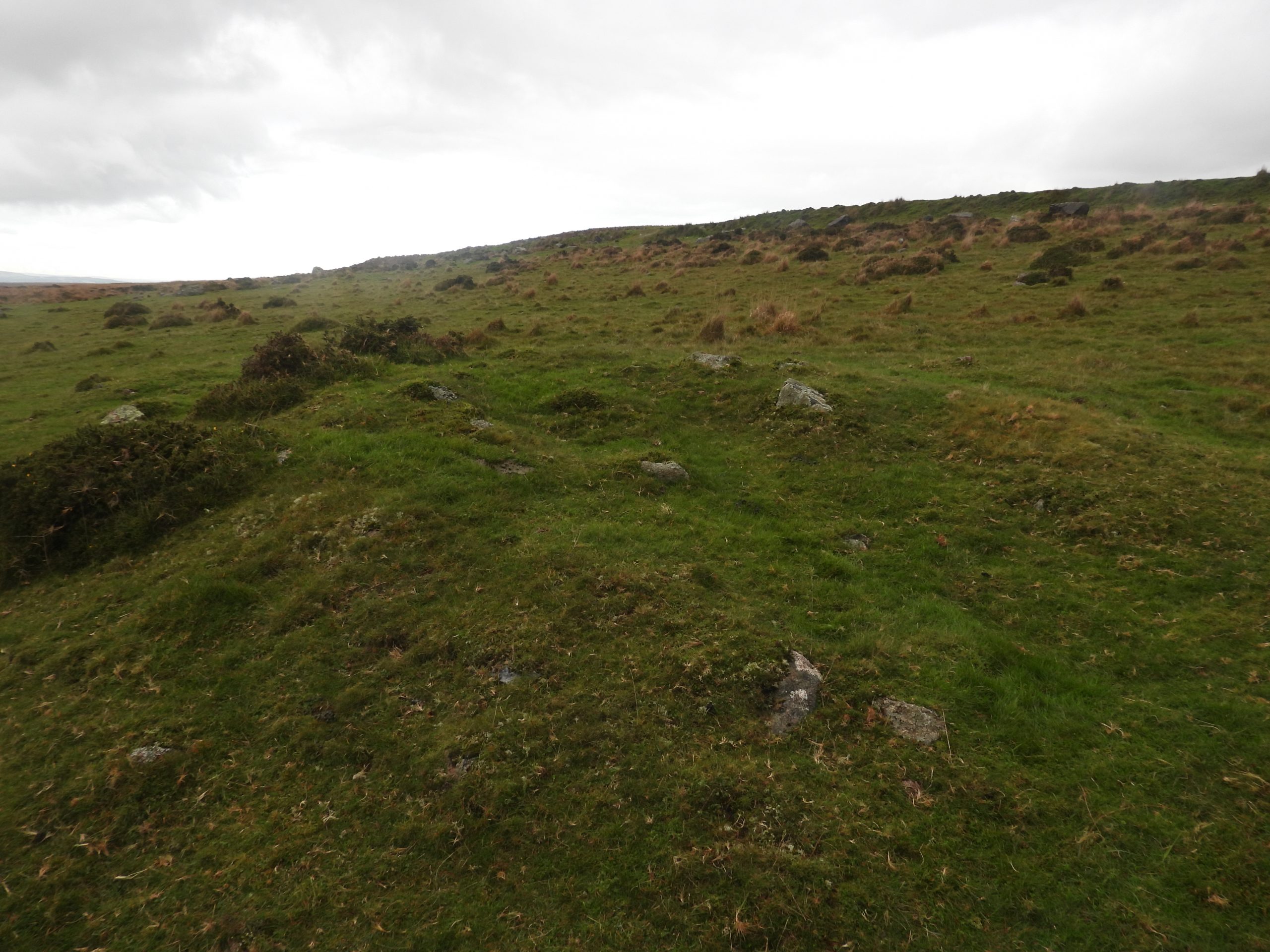
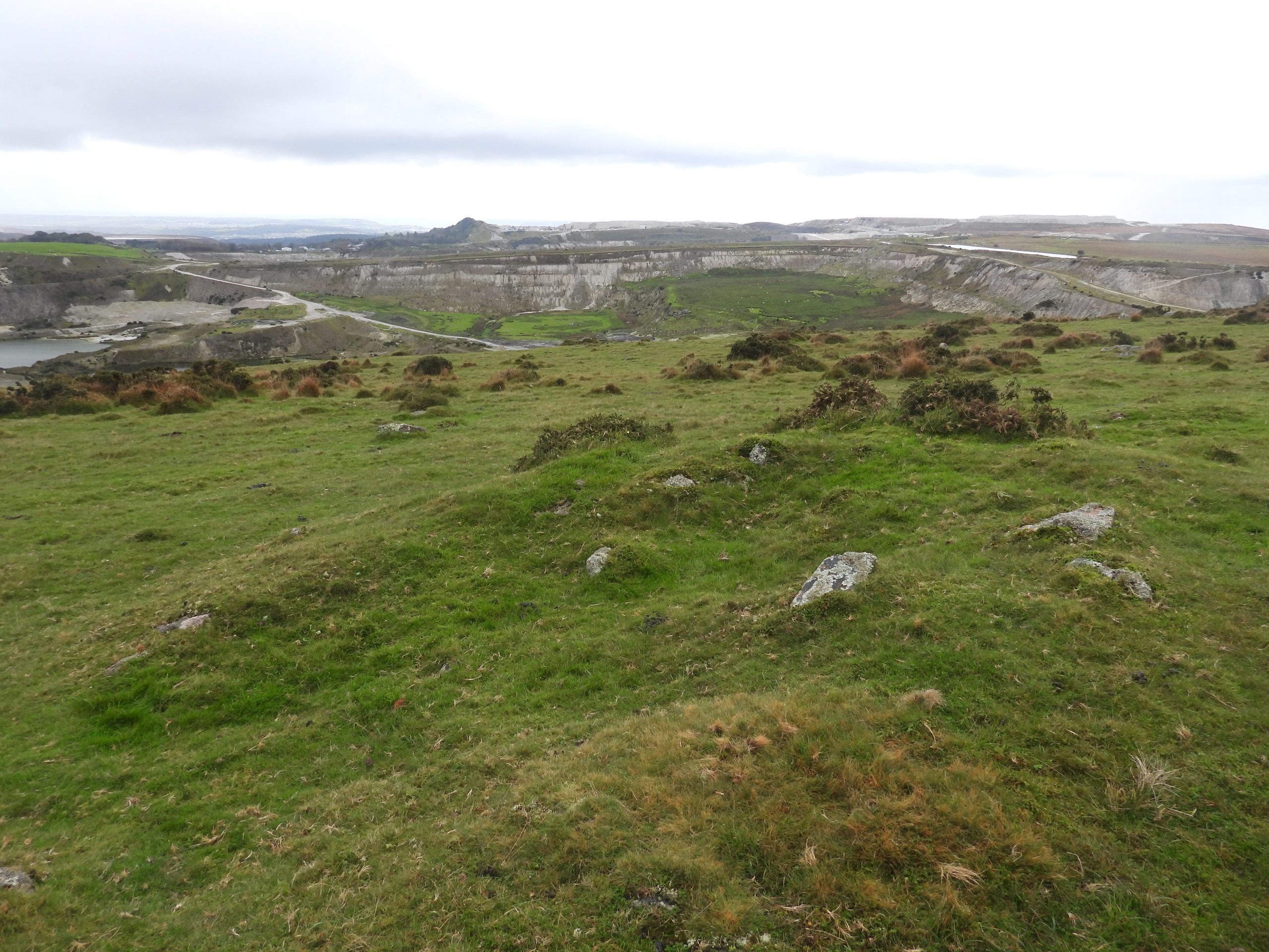
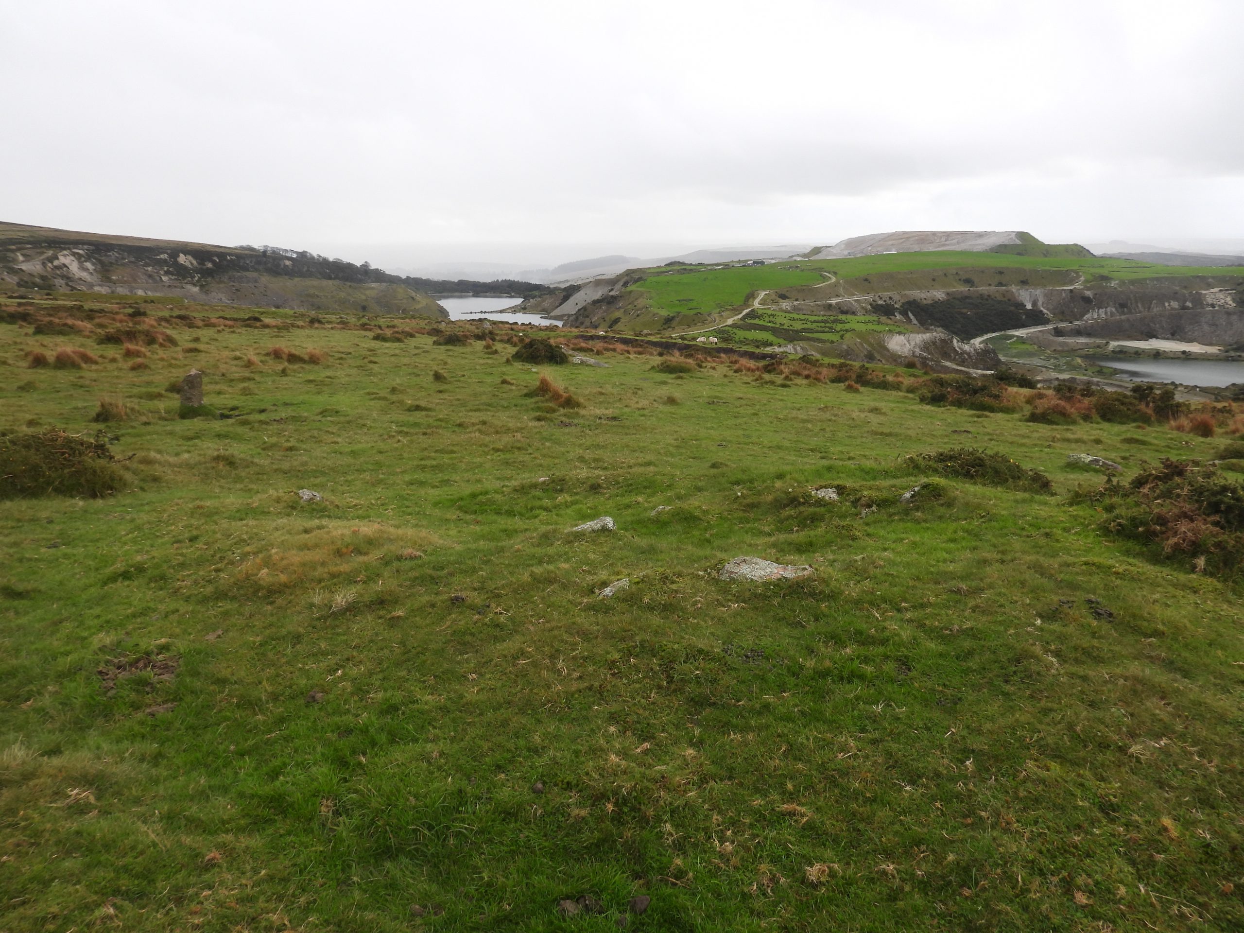
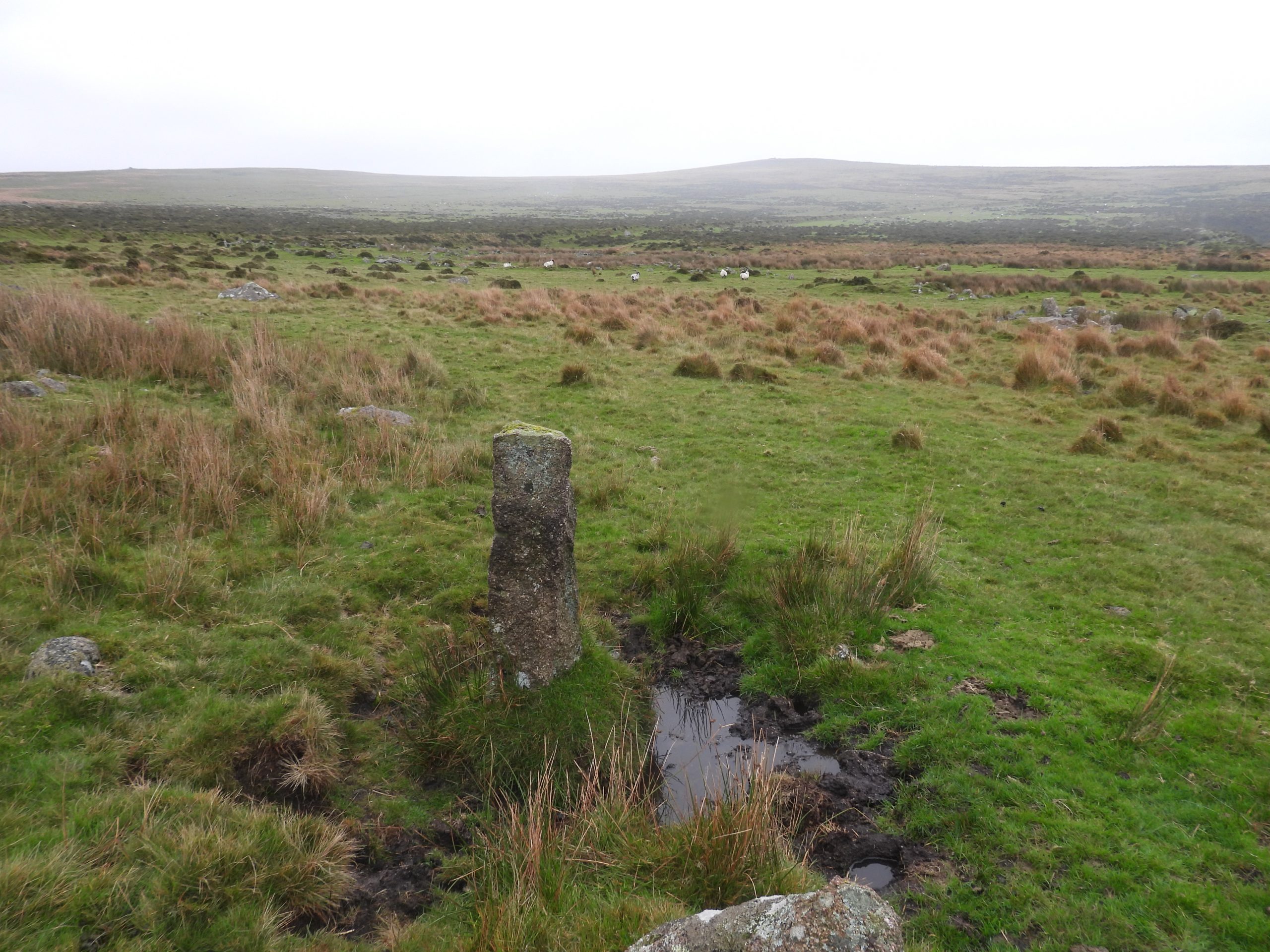
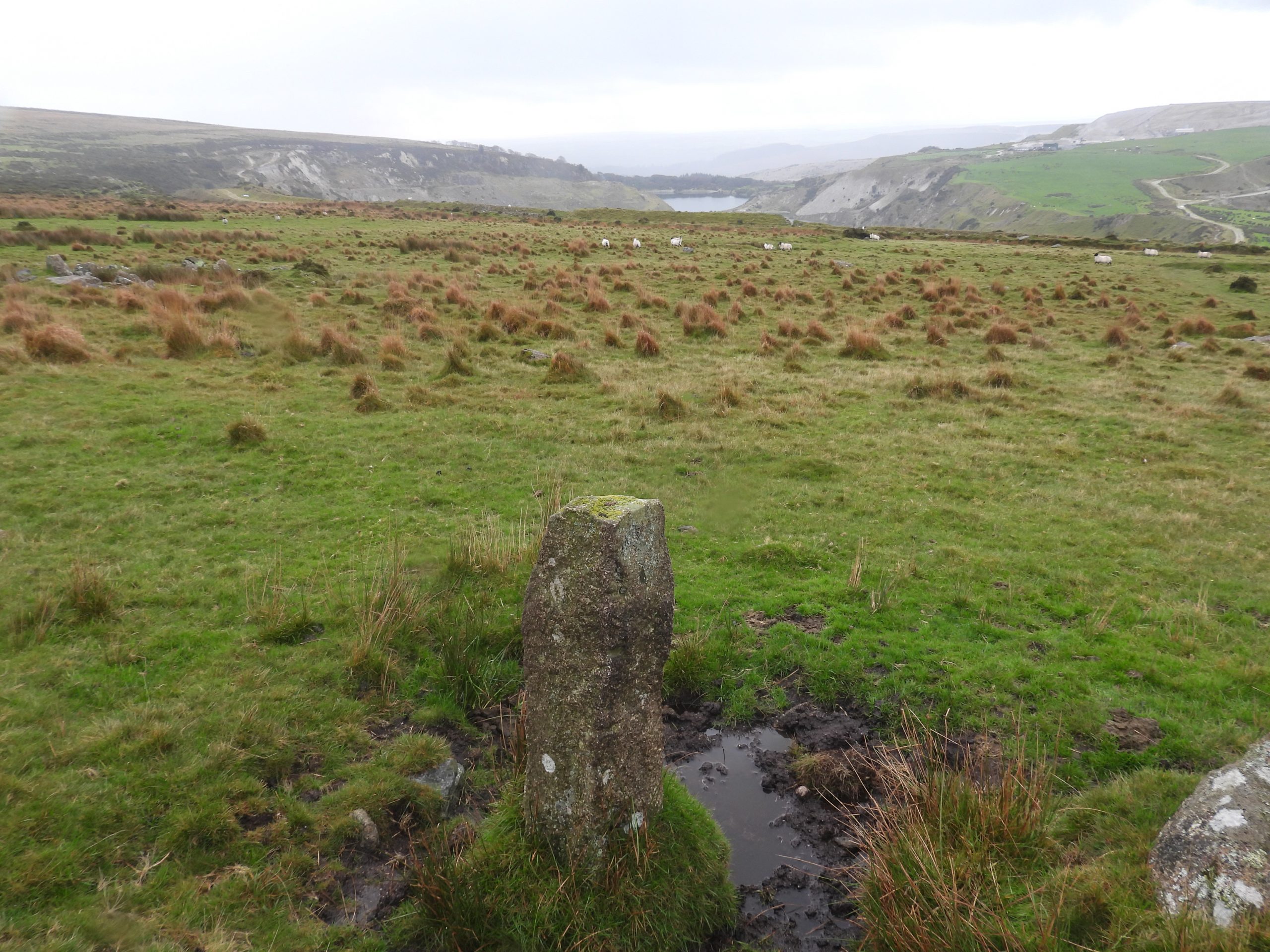
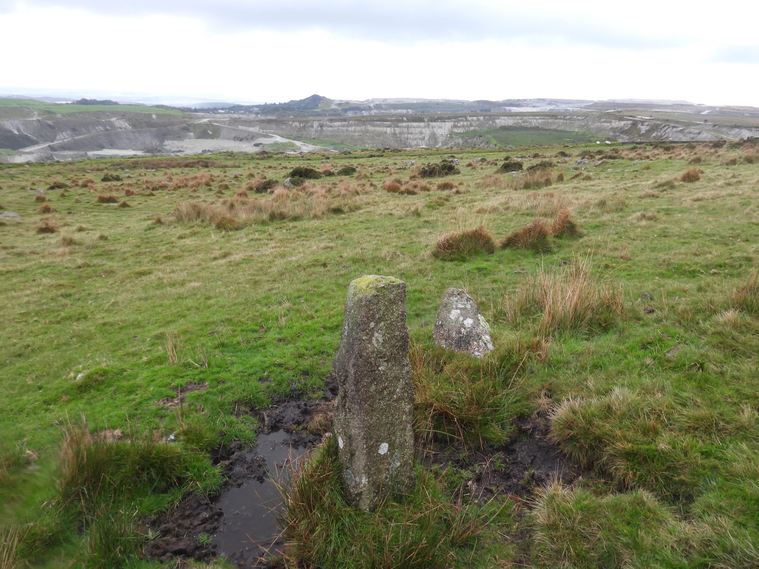
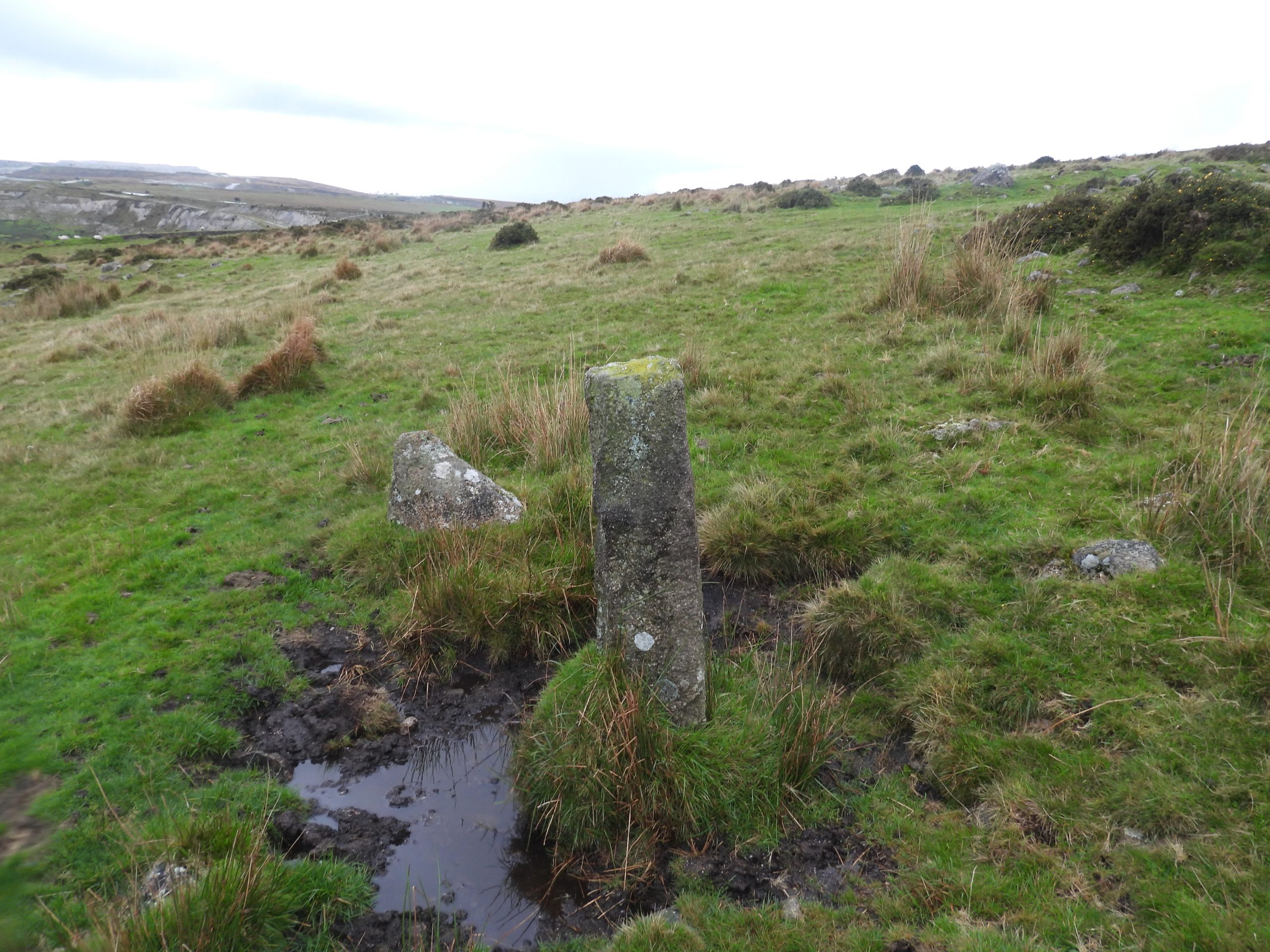
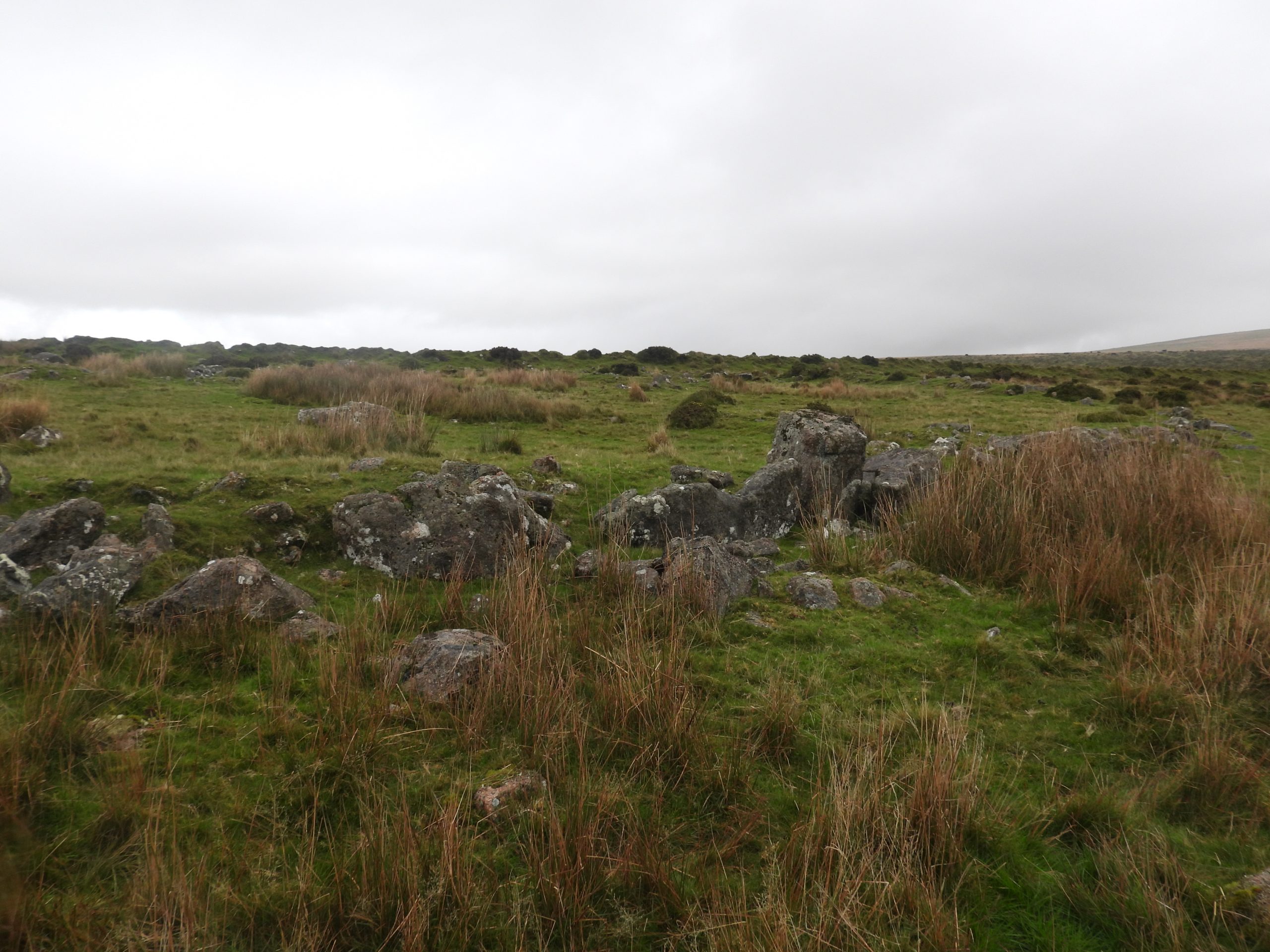
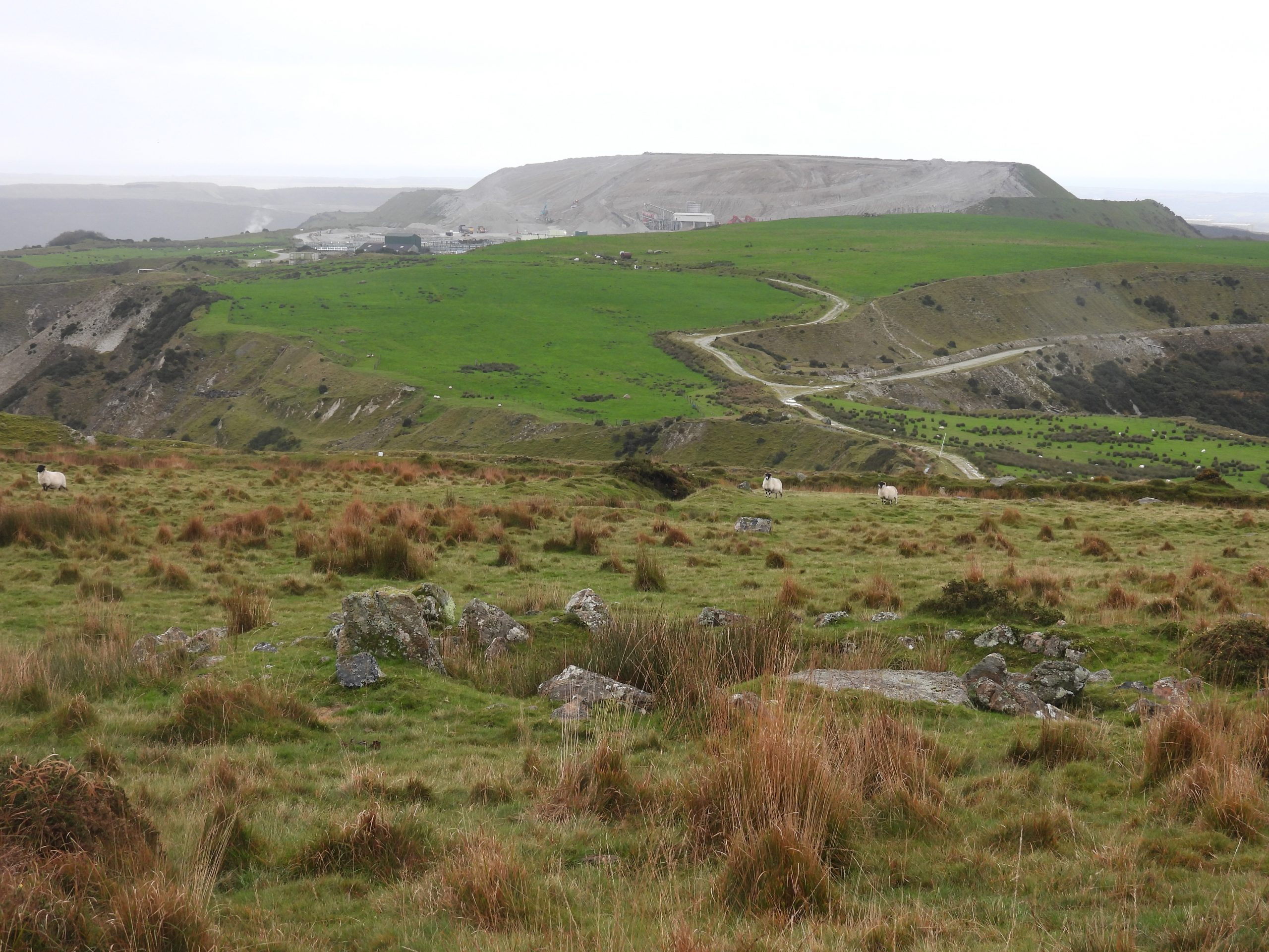
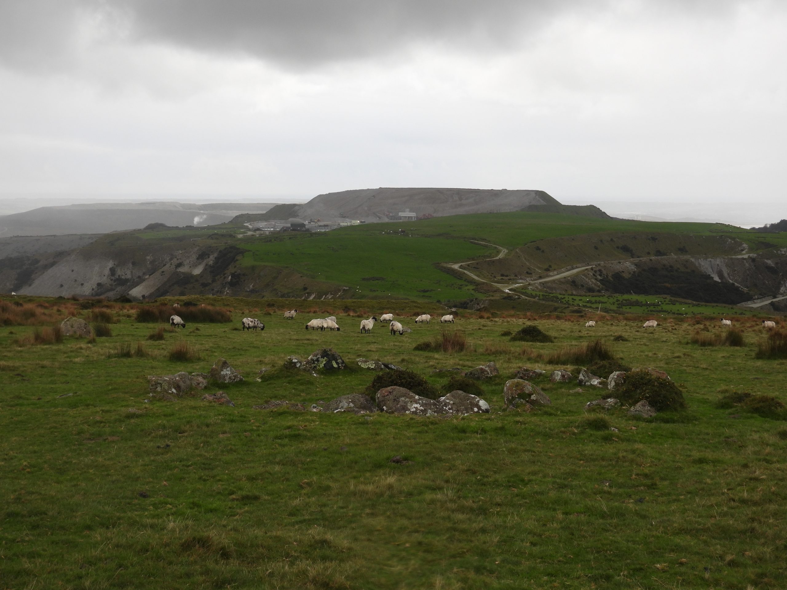
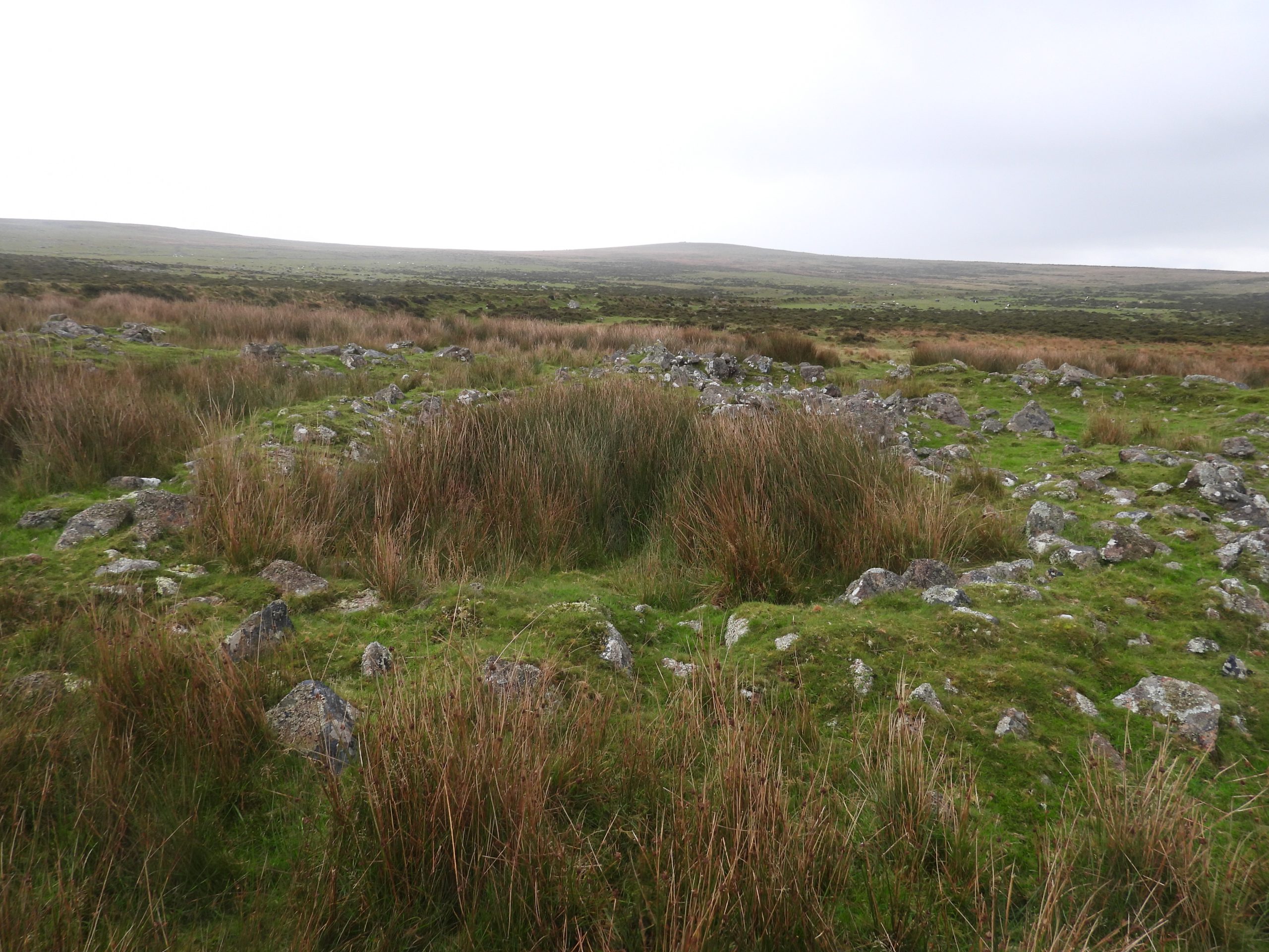
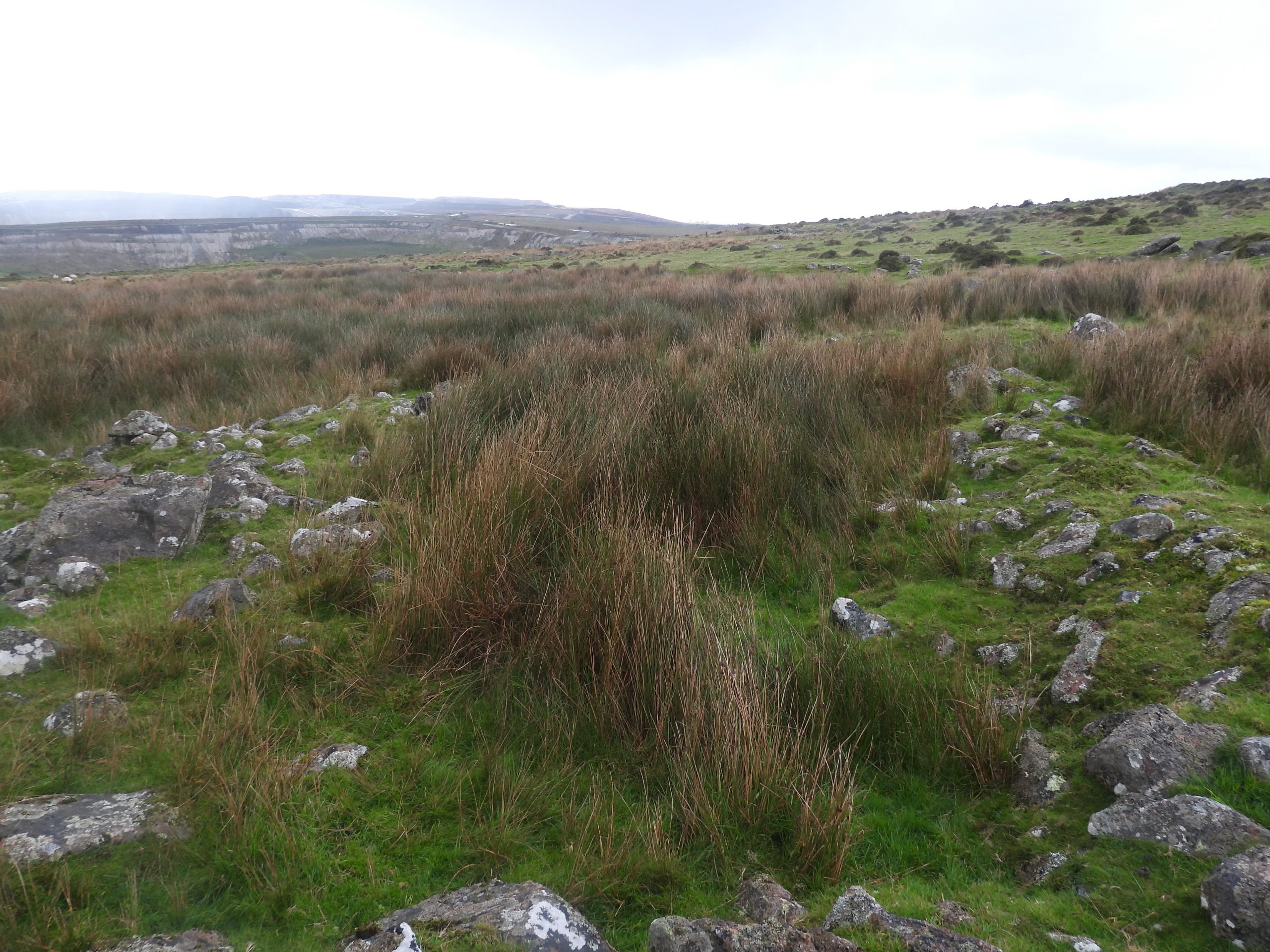
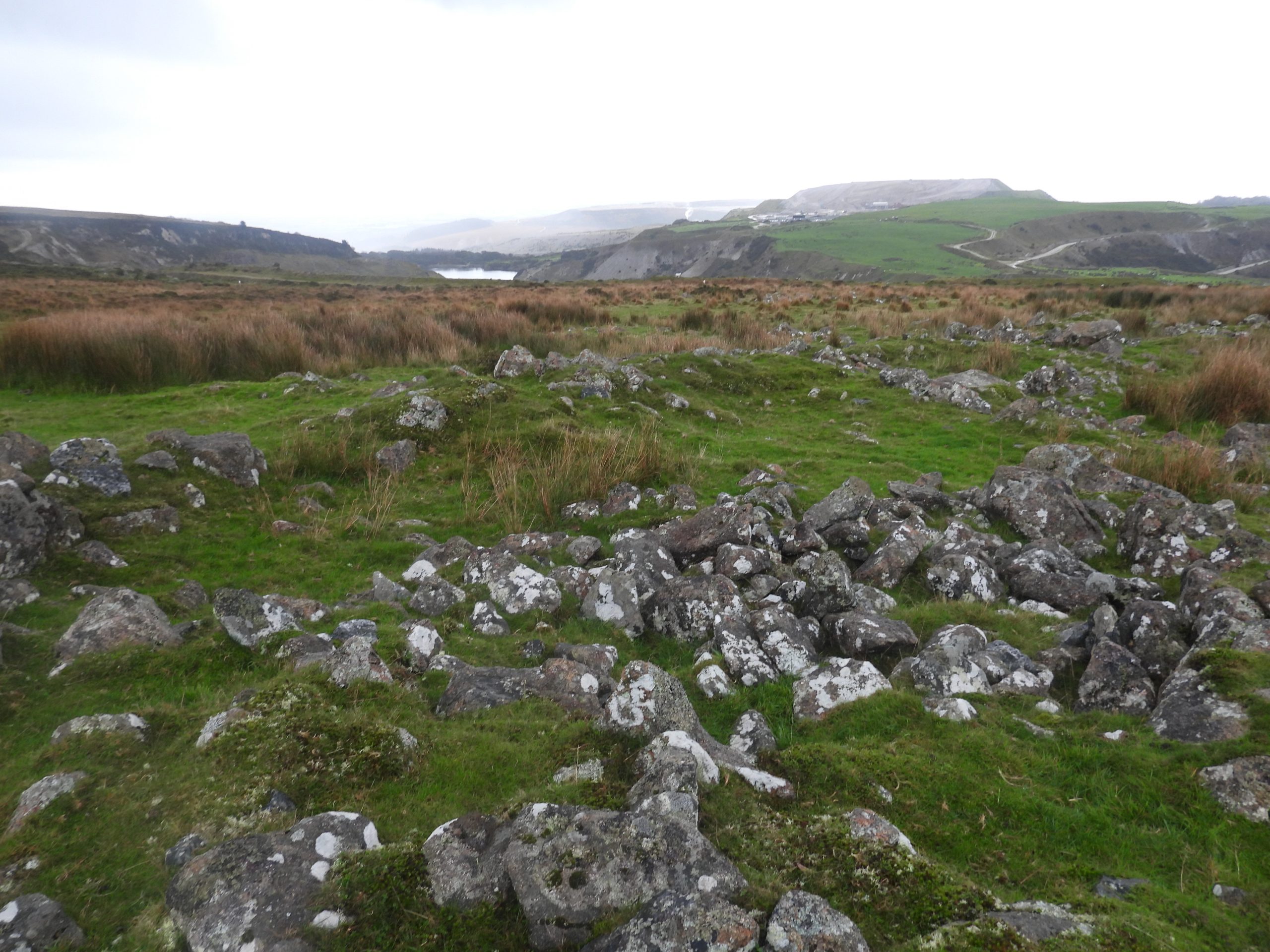
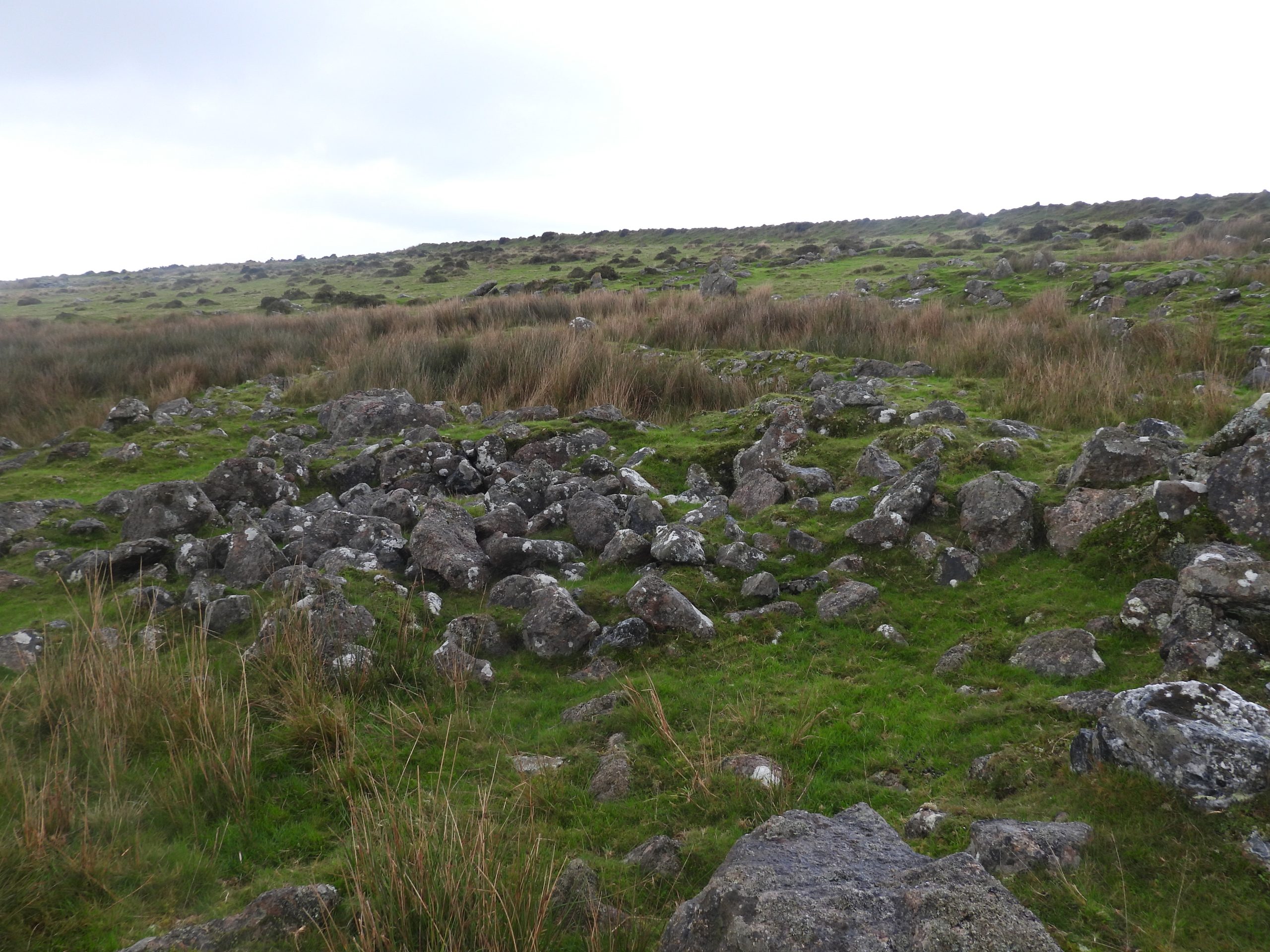
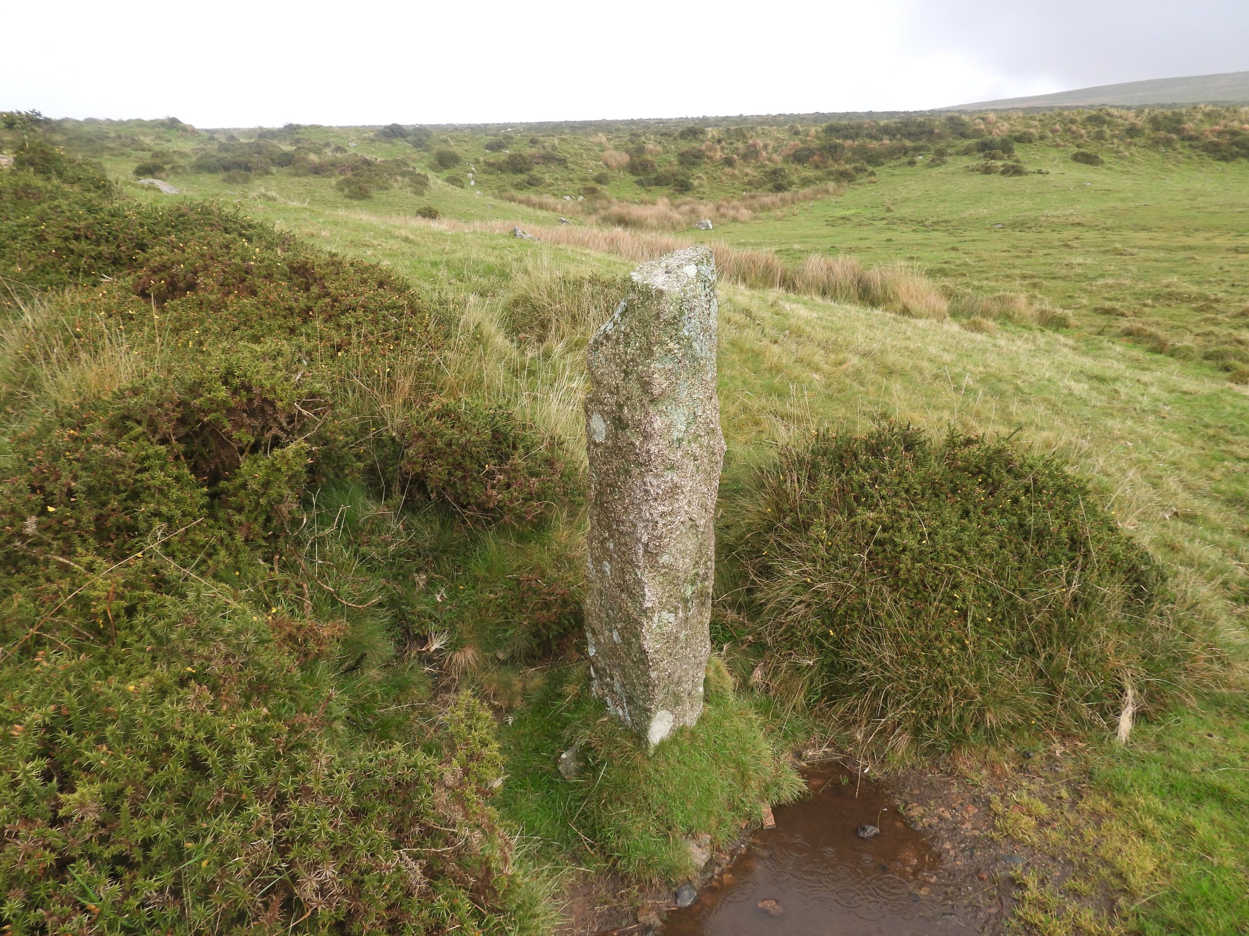
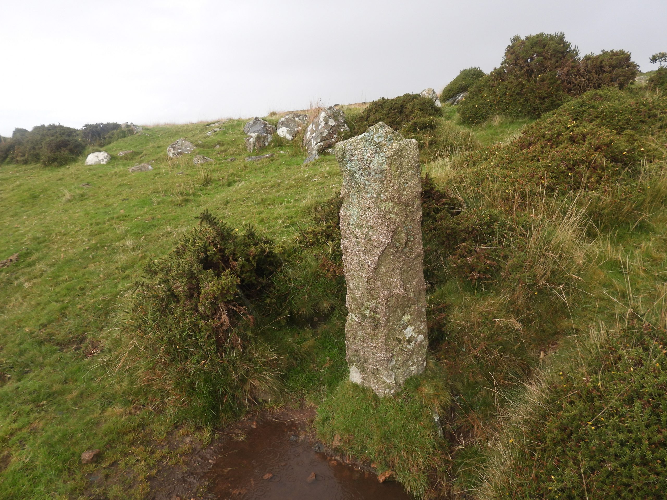
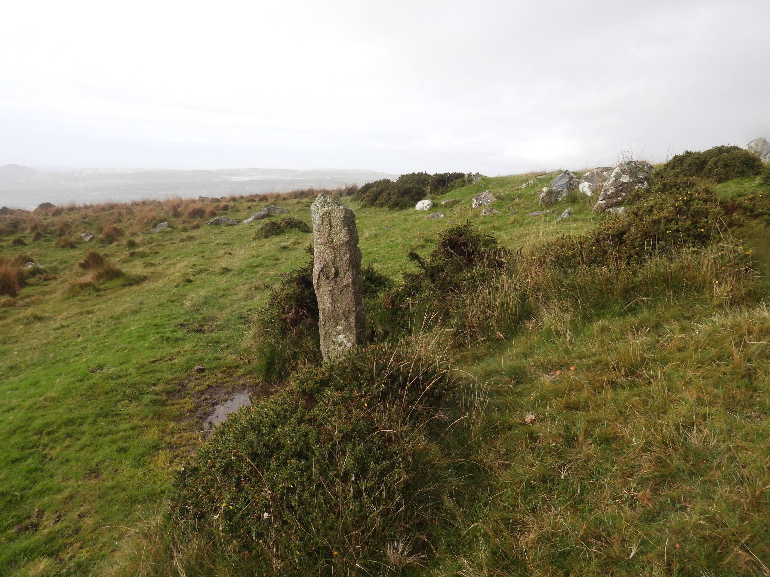
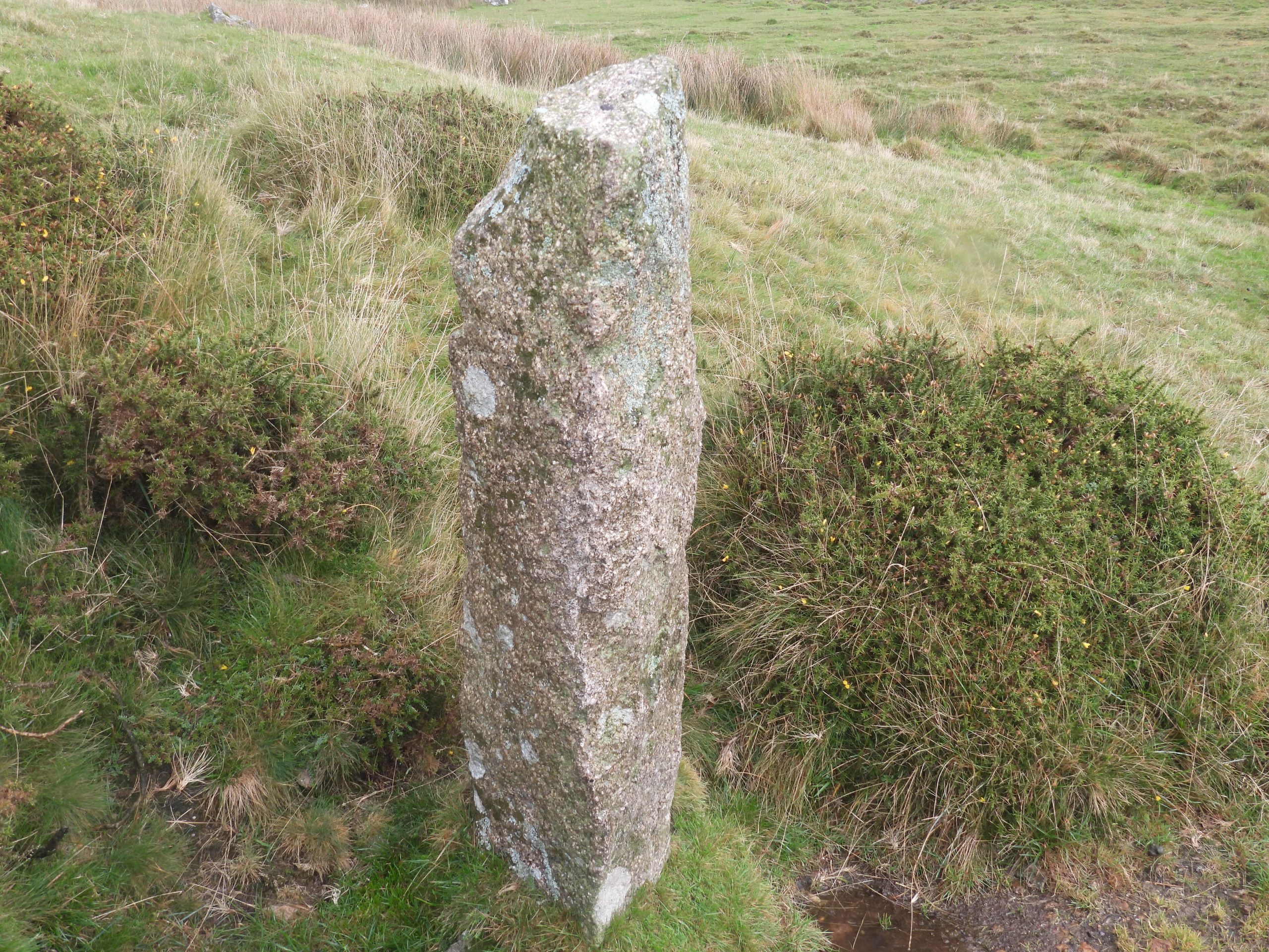
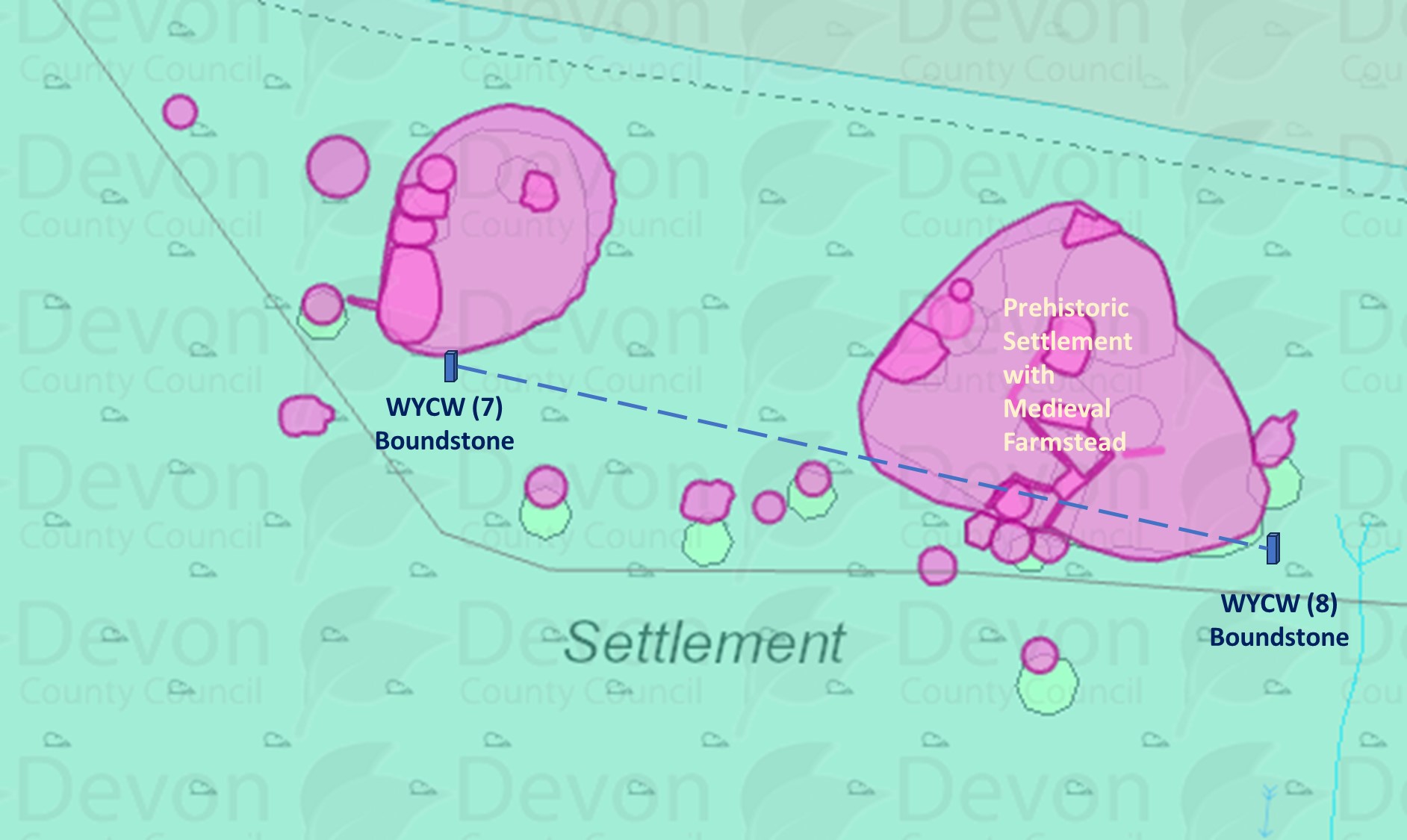
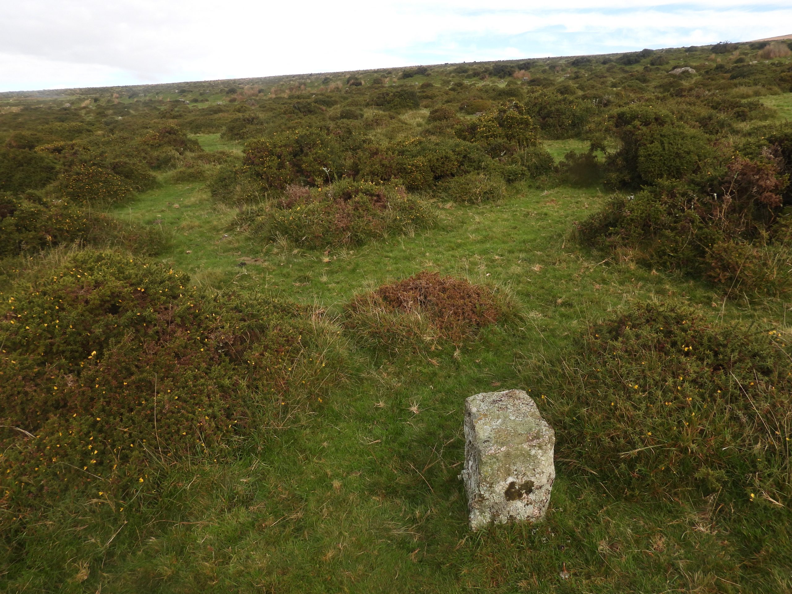
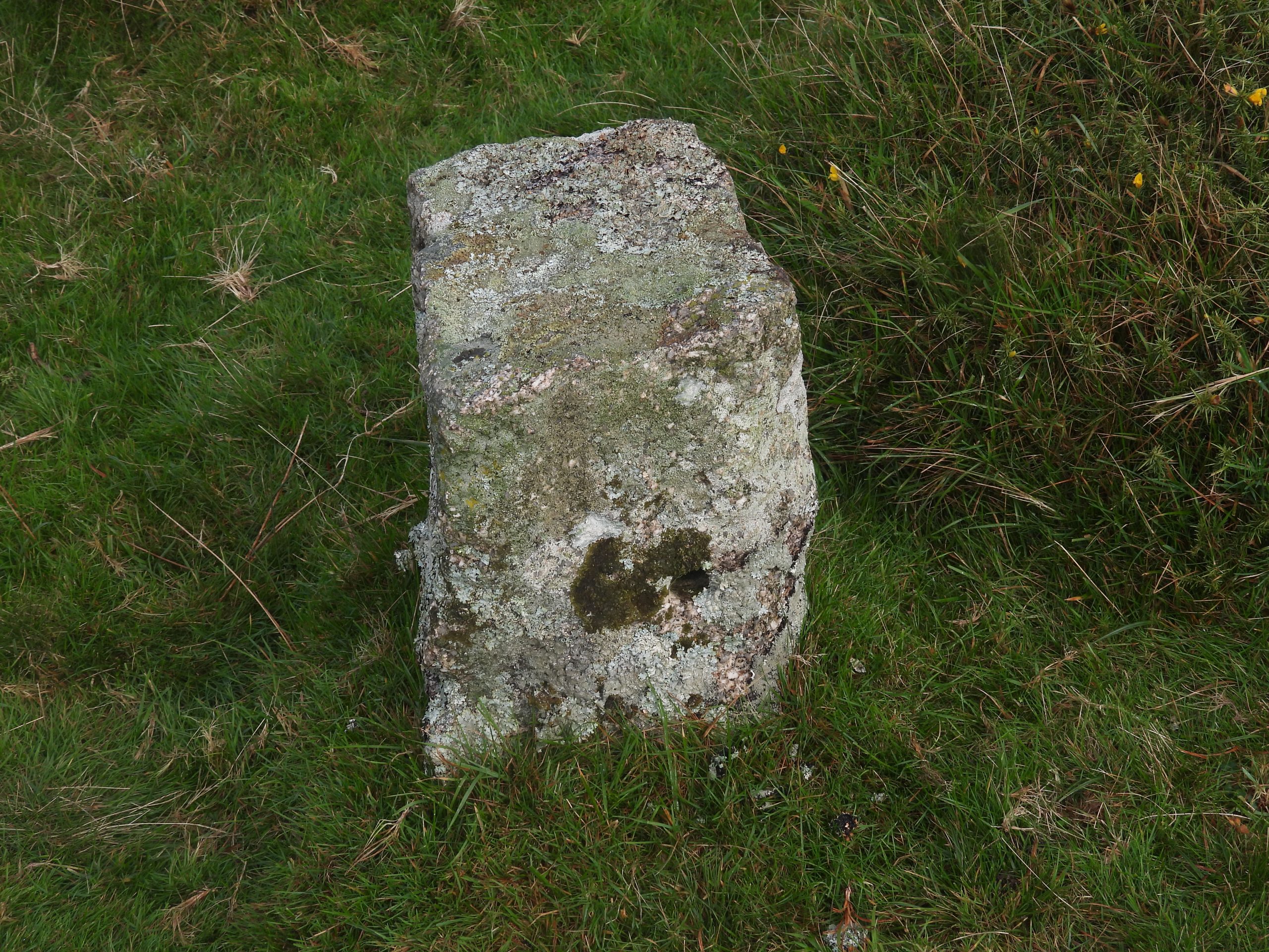
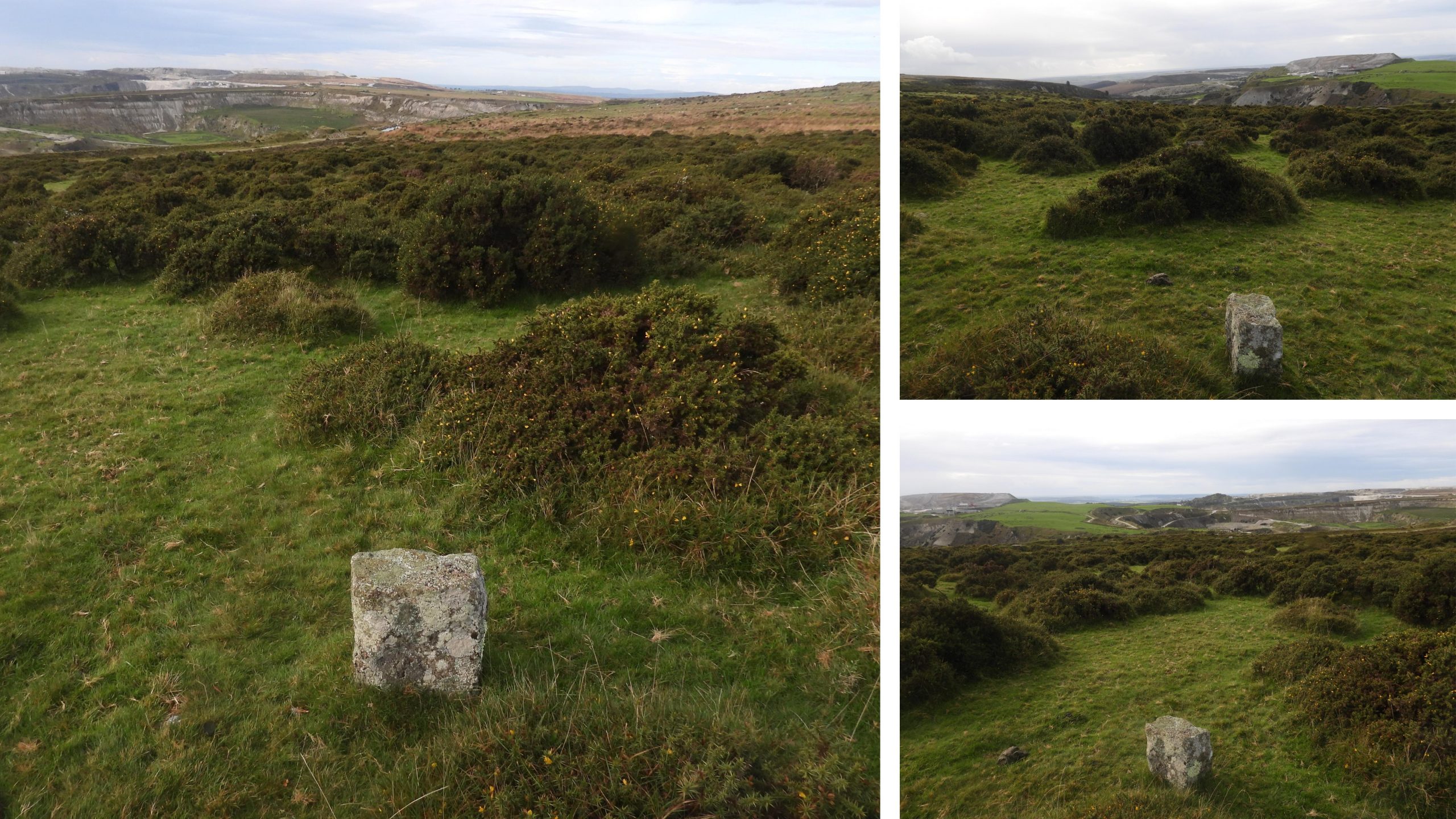
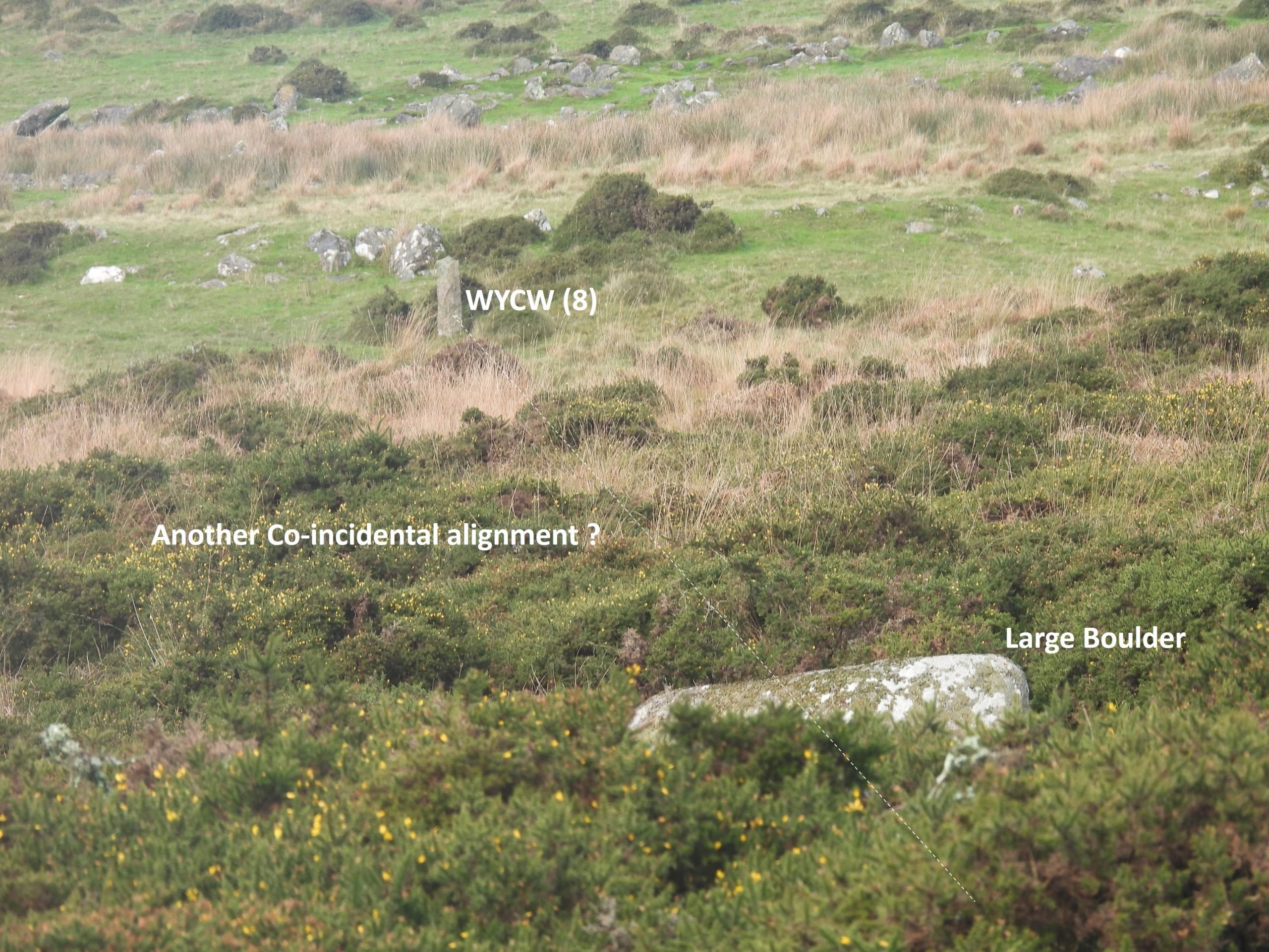
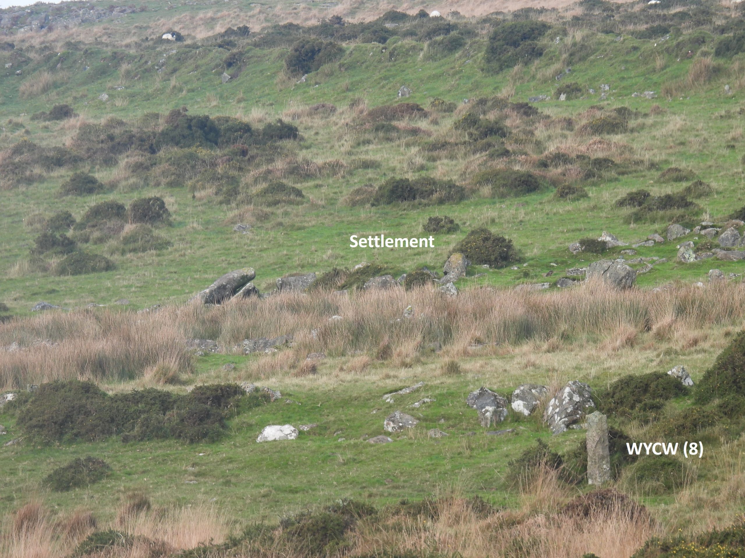
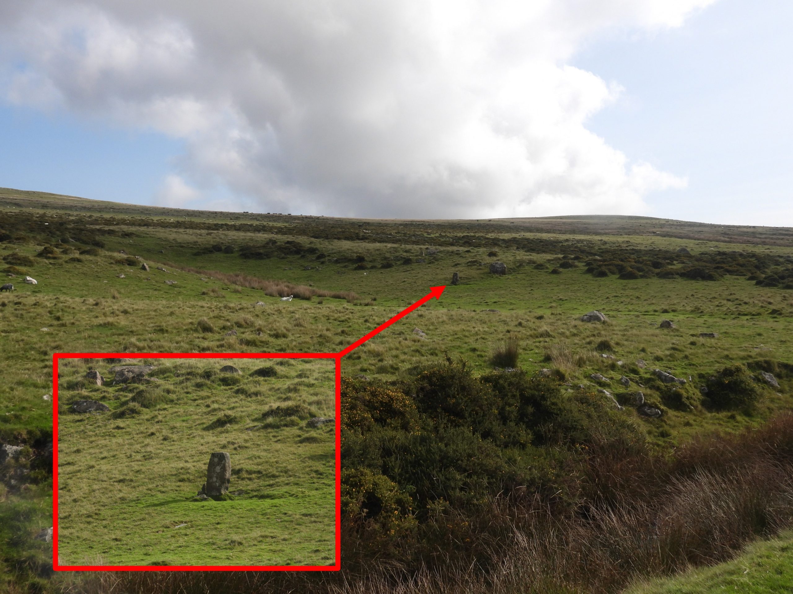
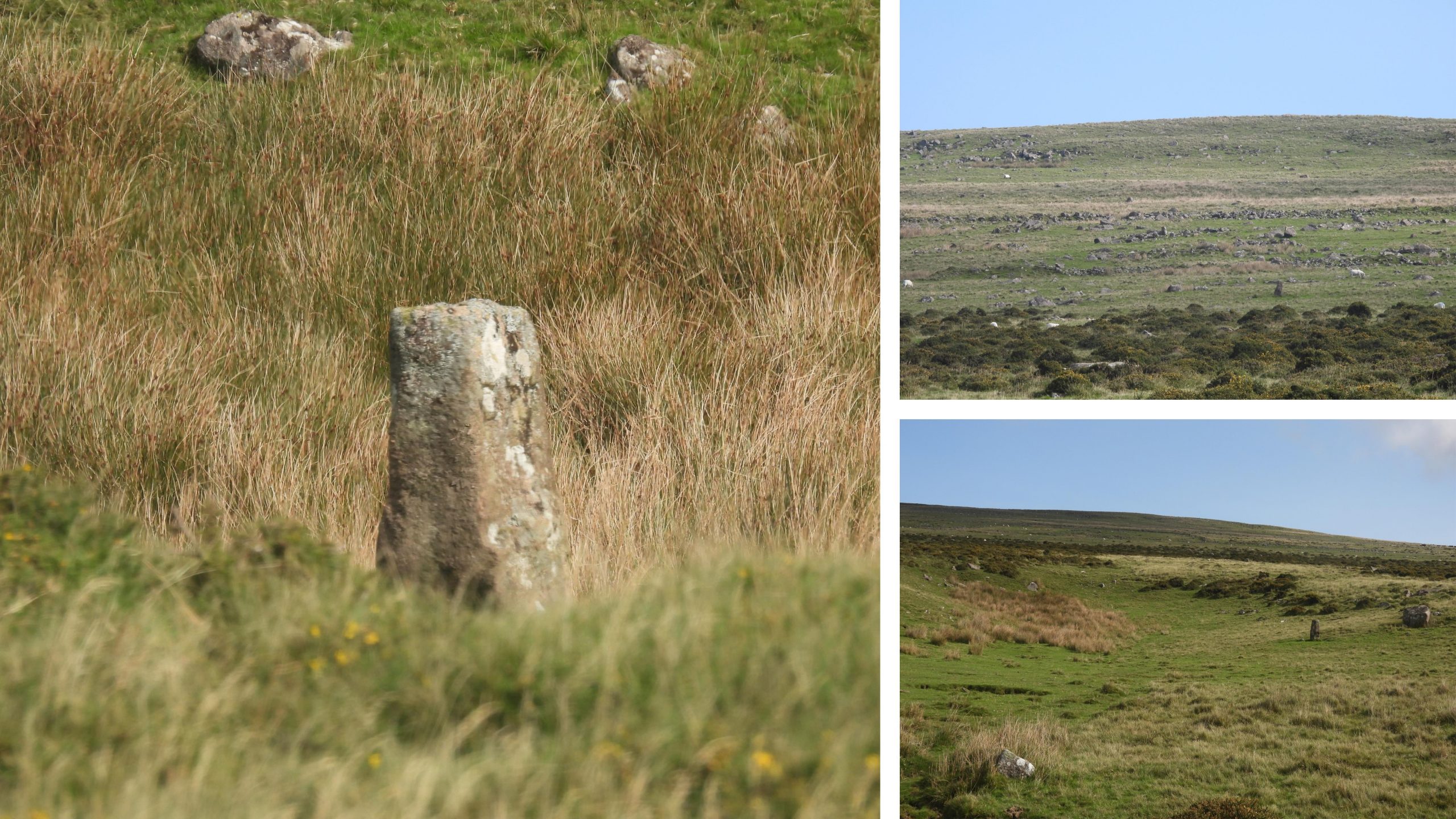
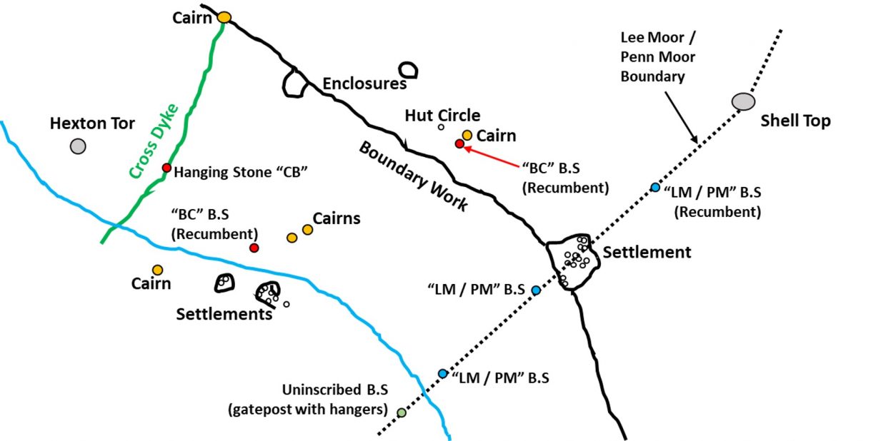
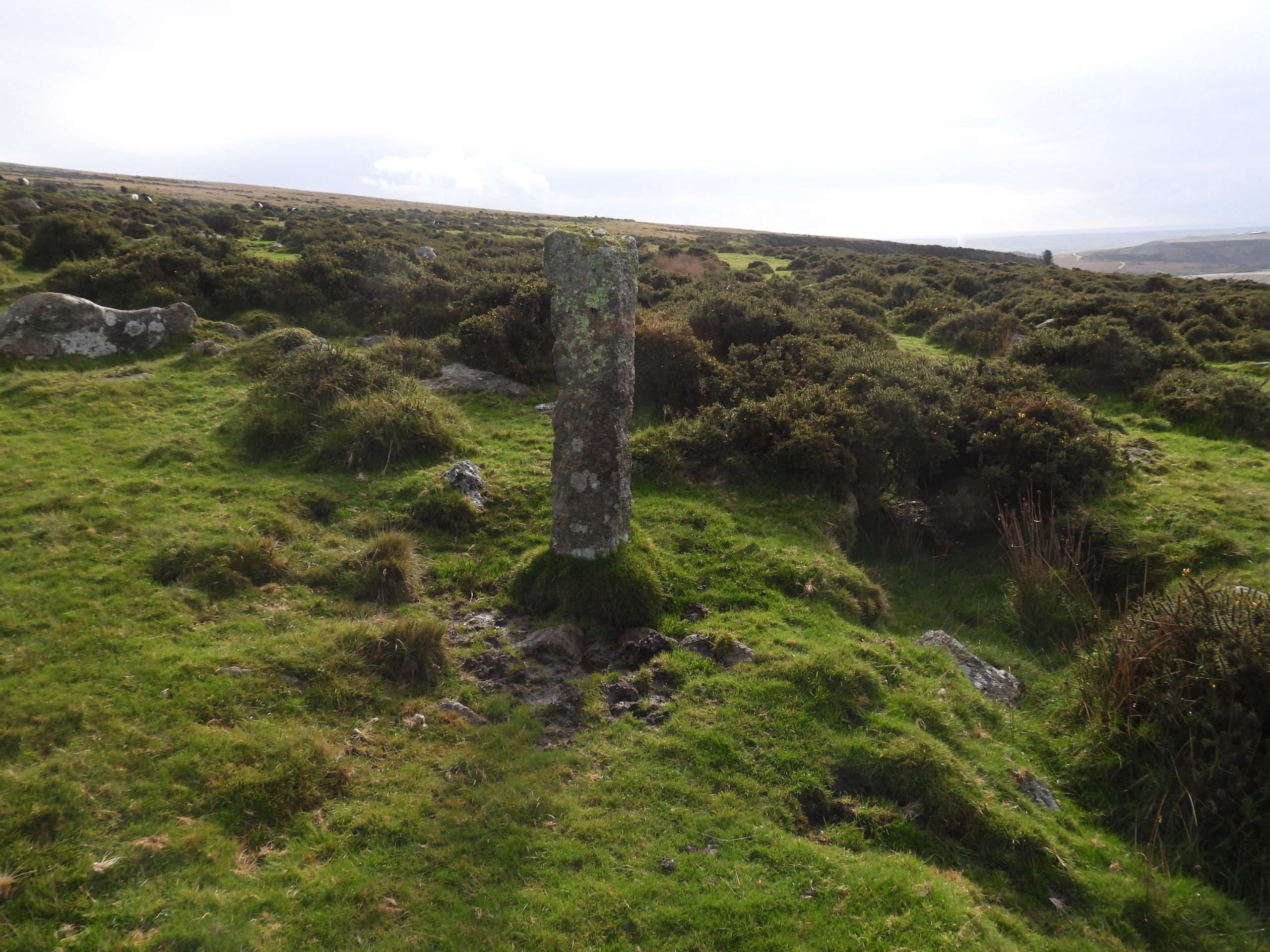
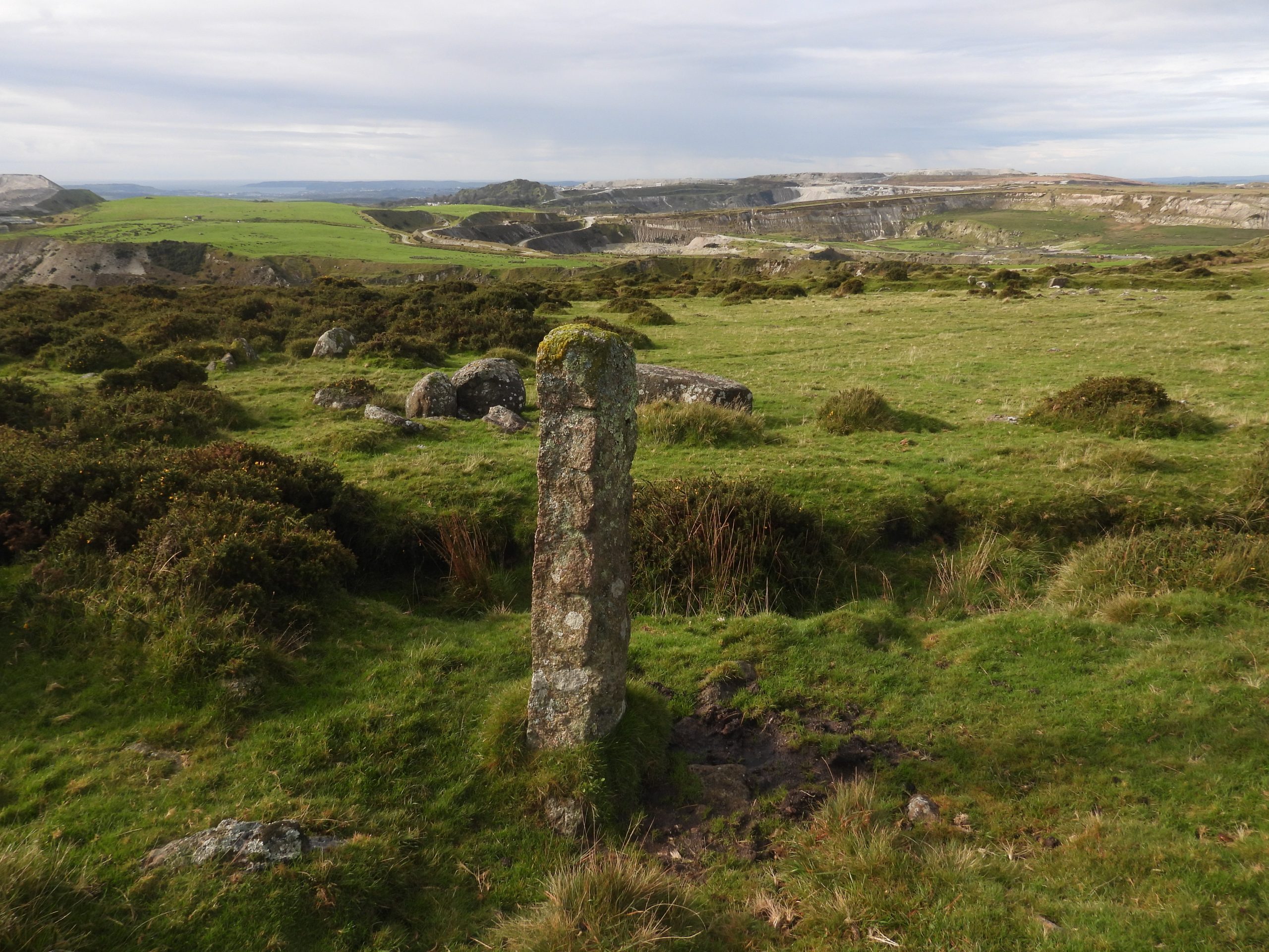
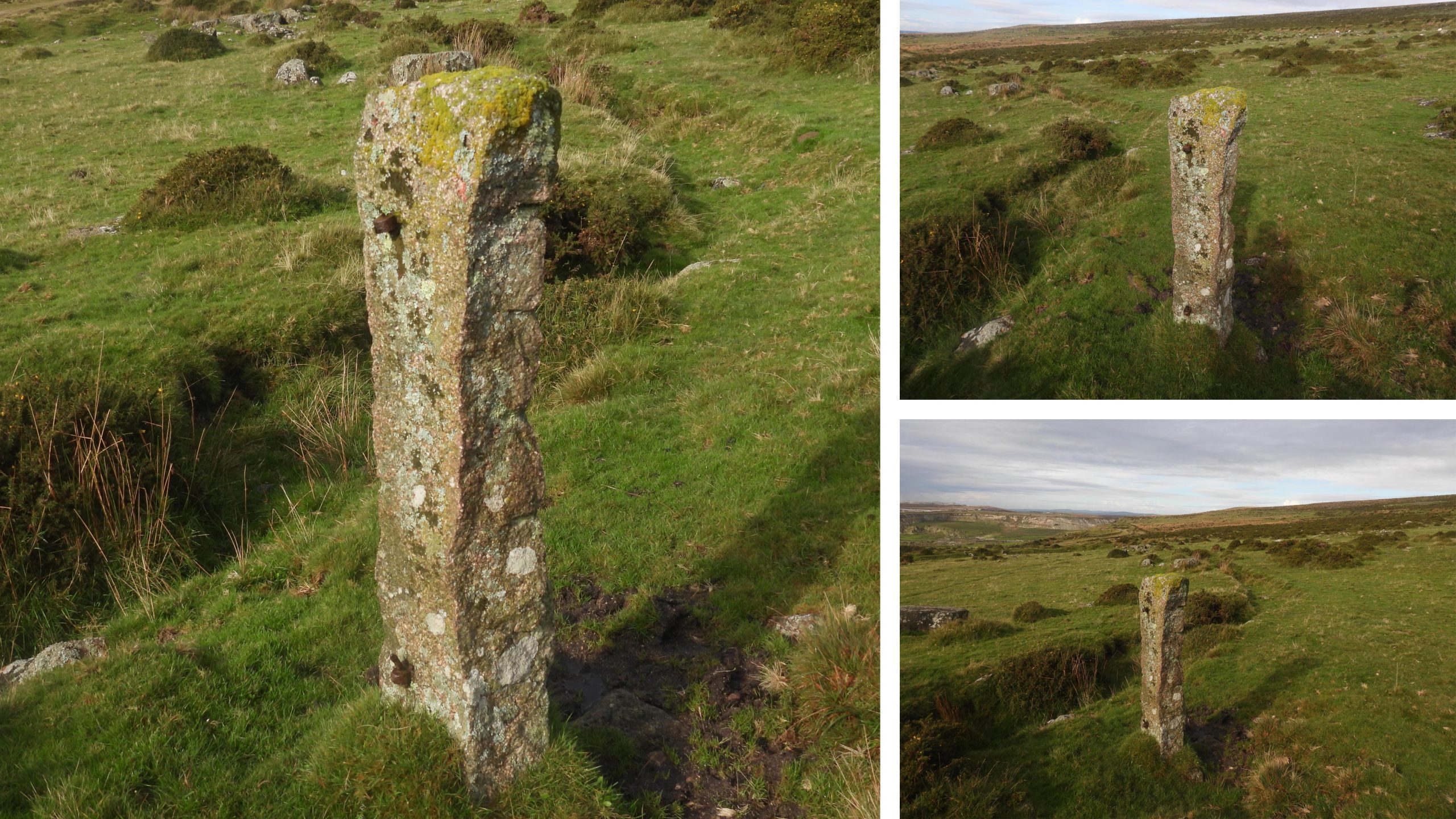
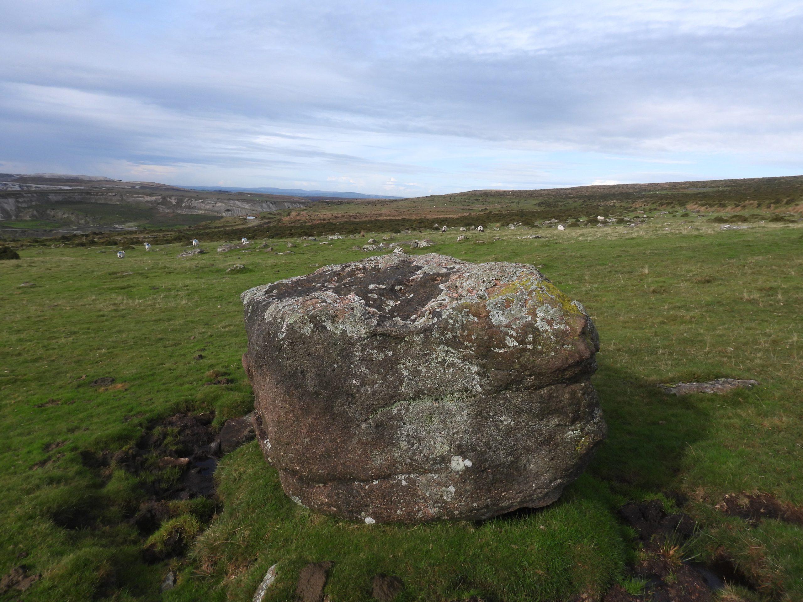
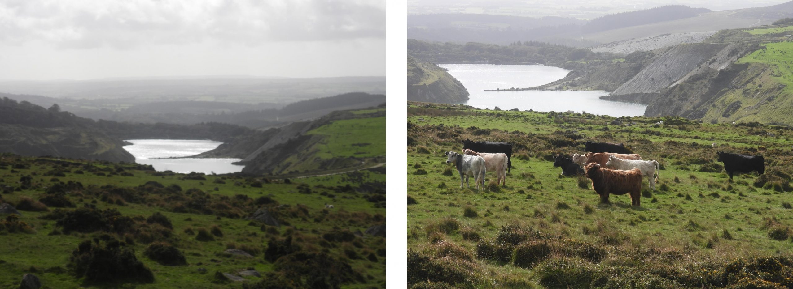
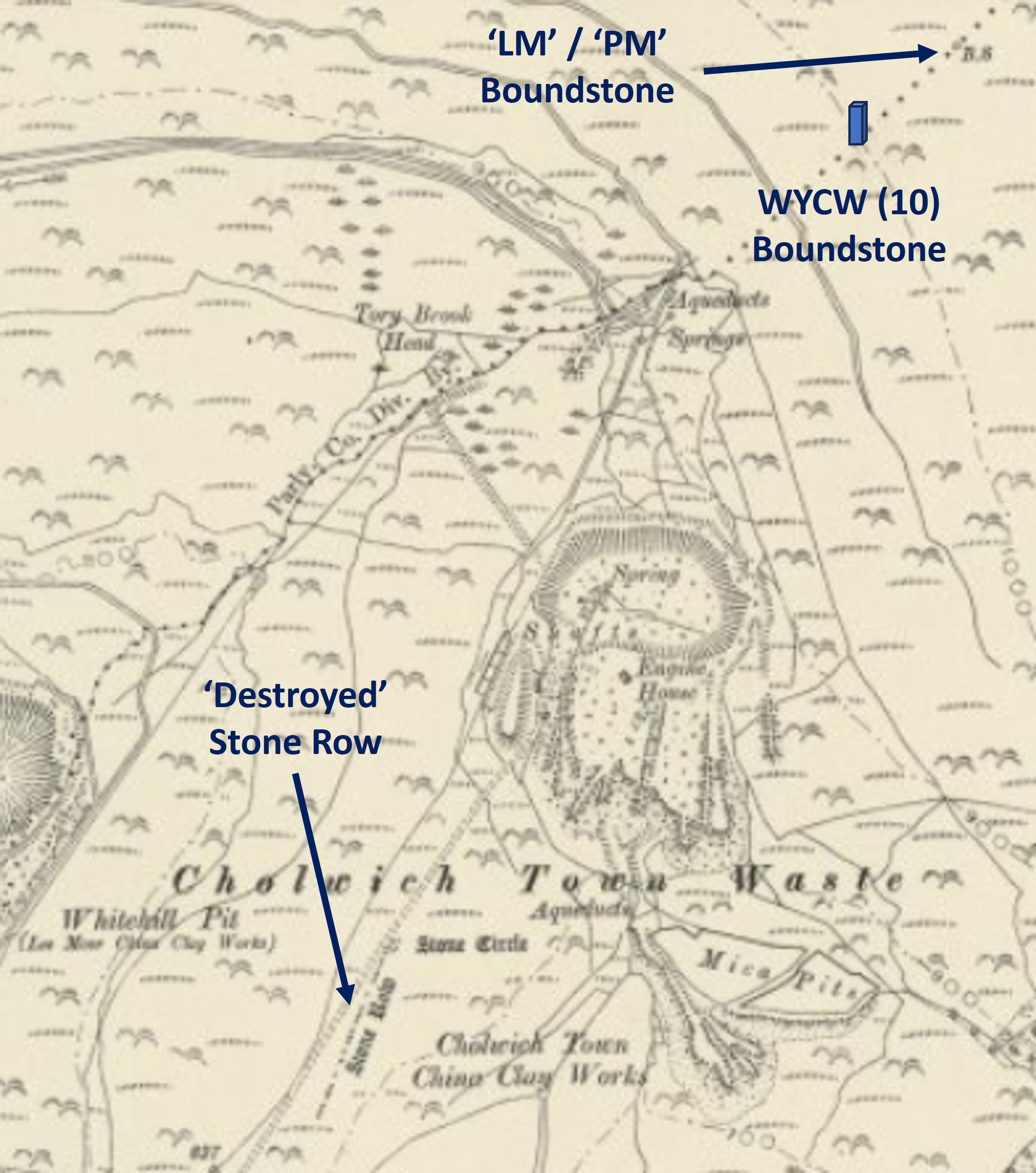
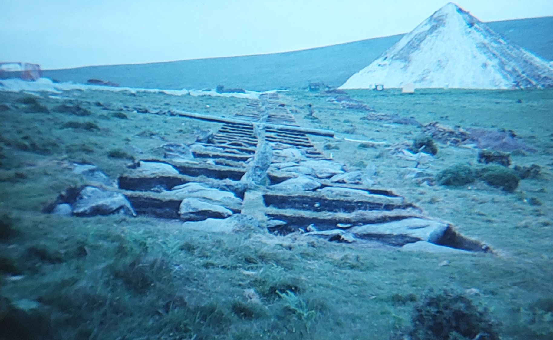
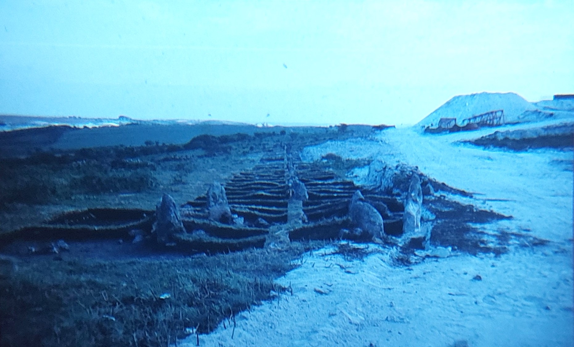
The above annotated map shows the permitted working and tipping areas for Shaugh Lake (X and Y) and Lee Moor (Z) from the 1970s. Fortunately, the new millennium brought about fresh thinking and in 2001 the mineral operators indicated that they may be willing to give these areas up. The proposal in 2001 was for there to be a programme of joint working, with the Shaugh Lake and Lee Moor Pits merging thereby accessing the clay beneath the joint boundary. The price to pay would be the loss of Emmets Post (a barrow with an old boundary stone on it) and a footpath from Blackaton Cross through to Saddlesborough Hill.Area X is bounded by the Plym and Blacka Brook, the three ‘1835’ Lee Moor & Shaugh Moor Boundary Markers and the old Cornwood road from Cadover Bridge. It is unbelievable to think that the clay companies once had permission to work and dump their tip waste right up to two water courses, one a major Dartmoor river. In area X, there is no major archaeology but the impact of the area had works and dumping been undertaken would have been immense and access to Trowlesworthy Warren House would have been compromised.Cadover Bridge dates from 1940’s and is the north-western point of Area XA bridge at ‘Cadaworth’ or ‘Cadworth’ is mentioned in a charter of Isabella de Fortibus in 1291. A ‘holloway’ (not shown in picture) to the west of the present bridge may have led to an earlier bridge. It was known as ‘Cadworthy Bridge’ on the 19th century Tithe Map and as ‘Cadaford Bridge’ on the late 19th century map.View from Cadover Bridge looking upstream. The strip of land to the right (south) between the river and the old Cornwood road was once designated as Area XBenchmark (B.M. 0691.0) on Cadover BridgeCounty ‘C’ Stone associated with the Bridge at SX55602 64606. Area X is sandwiched between this stone and the riverCounty ‘C’ Stone in foreground in relation to the bridgeOld Cornwood road with Trowlesworthy Tors in the distance. Had Area X been used for working and dumping of waste with the extension of the Shaugh operations, this road would probably have been engulfed.The river Plym close to its junction with the Blacka Brook. Trowlesworthy Tors and Hexton Tor (just) can be seen in the skylineUnusual holed rock near the junction of the Plym and the Blacka Brook. The track to Trowlesworthy Warren House passes close to this rockThe small waterfall of the Blackabrook cascading into the Plym. The boundary of Area X continues in a south easterly direction at this point, following the Blacka Brook as the Plym turns sharply northView of the Blacka Brook waterfall from above on the clapper bridge which carries the track from the old Cornwood road to Trowlesworthy Warren HouseNational Trust ‘Omega’ of Trowlesworthy Warren. Views of Area X from old Cornwood roadThe eastern boundary of area X (butting up to area Z) was defined by the old ‘1835’ boundary between Shaugh Moor and Lee Moor. This boundary is defined by three boundstones. The first boundstone is located next to Blacka BrookThe boundstone next to Blacka Brook has ‘LM 1835’ inscribed on its eastern face. ‘LM’ stands for Lee Moor. It is inscribed ‘SM 1835’ on its western side. ‘SM’ stands for Shaugh Moor. It is located at SX56983 63838The second boundstone on the area X / area Z boundary is recumbent with only its inscribed face ‘SM 1835’ showing. It is located approx half way between Blacka Brook and the old Cornwood RoadThe inscription ‘SM 1835’. This boundstone is located at SX56874 63736The third boundstone on the area X / area Z boundary is located adjacent to the old Cornwood road. It is also inscribed ‘LM 1835’ on one face and ‘SM 1835’ on its other face.The ‘LM 1835’ inscription. Much of the area in the foreground looking towards Trowlesworthy Warren House is area X. The boundstone is located at SX56770 63650Area Y is bounded on its north and east sides by existing clay operations and to the west by the Beatland Corner to Cadover Bridge road. There is a short south west section from near Hawks Tor to the road. It is approx 114 acres (46 ha) in area. One of the principal parts of the (November) 1978 joint agreement was that the operator; Watts, Blake and Bearne (at Shaugh Lake) would not commence tipping on this area for a period of 30 years (until 2008). However, in 2008 there was an interim (but not legally binding) working conditions agreed with Sibelco (the latest operators at Shaugh Lake) in relation to the expansion of their pit and in particular the potential impacts on archaeology, which from the annotated map, one can see includes a number of cairns, a stone row and at least one settlement. In July 1997 there had also been an agreement not to tip in Area Y for at least 15 years (until 2012), thus extending the long term threat by another 4 years.Shaden Moor Cross was mentioned by William Crossing, in his 1902 book ‘The Ancient Stone Crosses of Dartmoor’. He recorded that the medieval section of cross was found in use as the bottom stone of a stile, at nearby Shaden Moor Brake. It was this discovery that led to its alternative name of Shaden Brake Cross”. Crossing also stated that it sometimes was referred to as ‘Stony Cross’. This cross lies on the eastern edge of area Y. One doubts if Shaden Moor Cross was ever in danger though as it is on the west side of the road. Shaden Moor Cross was originally only about 1m tall, when it was discovered at Shaden Moor Brake. The cross is said to have been re-erected in 1915 by the Reverend H. Hugh Breton. Also, sometime around 1915, a first replacement shaft was made for the cross only for it to be replaced again in 2001. The reason for the second new shaft was that the first replacement 86 years previously was a very poor match! Further information can be found at: https://dartmoorexplorations.co.uk/mysteries-surrounding-shaden-moor-cross/This Cairn can be found not far from the road at SX55316 63457, which is covered in fern and best viewed in Autumn or Winter. It is located next to the Saddlesborough Reave and one of many antiquities within Area Y.The cairn is about 9-10m in diameter and historically has been recorded by R.N Worth in 1885 (7th Report of the Barrow Committee) and by R.H Worth in 1946 (The Stone Rows of Dartmoor. Part 1)This stone circle or damaged cairn lies to the west of the stone row at around SX55417 63484. It comprises of a partial ring of five boulders with an off-centre earthfast boulder. The overall diameter is around 10m. This metal star dates from circa 1980s and was one (of three or four) in area Y which were intended to indicate where an antiquity was located (in this case the south west end of a stone row). It is located at SX55425 63434View from the star looking north east along the stone row towards the gorse covered (spoil) bank of the Shaugh Lake China Clay WorksRichard Hansford Worth in 1946 (The Stone Rows of Dartmoor, Part 1, 291) recorded this single stone row as being 180 metres in length. He recorded the spacing of the stones varying between 0.9 metres and 1.5 metres.M. Fletcher and S. Probert in 1998 painstakingly counted the number of stones in the row which revealed 68 upright and semi-buried stones and 11 probable sockets. Thankfully, this stone row survived the clay operations (unlike in the east where Cholwichtown Stone Row was engulfed)The northern end of the stone row, which is very close to the old spoil of Shaugh Lake Clay Works. The last stone is located at SX55502 63577. There is also a old signpost here which once warned hikers of the nearby clay works (behind the spoil tip). At the south of the row (just beyond the star) is a terminal cairnTo the east of the stone row at SX55470 63473 is a probable platform cairn which has a diameter of around 8-9m. This earthwork mound has been interpreted as being from probable Bronze Age date.There are 4 hut circles to the south of the stone row which straddle Saddlesborough Reave. There is one which is located to the north of the reave (pictured). It is recorded by Butler (Dartmoor Atlas of Antiquities – Volume Three – South West – Map 48) as being 8m in diameter.Two more hut circles near to Saddlesborough ReaveThe final hut circle of the four either side of Saddlesborough Reave is slightly up hill from the other three. It is labelled by Butler as Hut 1. M.Fletcher and S.Probert record this hut circle wonderfully, viz; “It measures overall 10.0 metres in diameter with a level interior which is 7.0 metres across with 0.4 metre front and back scarps. The walling which is damaged in the south-east quadrant has a boulder/stone core with inner and outer facings of slabs and boulders a maximum 0.7 metres high”. Saddlesborough Reave runs across Shaugh Moor. It is fairly substantial, being up to 1.0 metre thick and 0.4 – 0.5 metres high. There are signs of robbing near to the hut circles Saddlesborough Reave (dates from middle to late Bronze Age) looking west. Disappointingly Approximately 400m of the south-east end of this visible earthwork was destroyed by the clay operations in the late 20th century.View towards Saddlesborough settlements and enclosures where there are 27 hut circles, beyond which is the Shaugh Lake China Clay Works flooded pits Luxton Tor on Saddlesborough Hill. A small diminutive tor which might have been lost to the clay operations. Eric Hemery appears to have been the only person to refer to this pile as Luxton (ref: Tors of Dartmoor website)Luxton Tor close up. The author has heard some refer to this as Saddlesborough Tor due to its proximity to the summit of the hill with the same name.Shaugh Lake Clay Works, now no longer operational. There is a lot of ground disturbance near to Luxton TorThis dug out square area is located at SX55903 63250. It looks a small quarried area but isn’t mentioned by anyone in the Heritage GatewayTriangulation pillar on Saddlesbrough Hill. Between 1936 and 1962 around 6,500 of these were built to form a new network to re-map Britain. The first Trig Pillar was commissioned on 18th April 1936.Ordnance Survey describe these pillars as being ‘1.2 m high with a brass plate set into the top to accept a survey instrument’. The author is no Tarantino or Spielberg but hopes the attached You Tube video explains how a flush bracket was used: https://youtu.be/Ix8XjI4t0eMThe ‘Flush Bracket’ on Saddlesborough Hill is numbered OSBM 3414. According to OS records this trig pillar was set up on 1st June 1950 and ‘refixed’ in 1984.The top of the Saddlesborough Trig PillarThe ‘wall’ of Wotterwaste Works spoil tip at the eastern edge of Area Y. View from Saddlesborough Hill across Shaugh Lake Clay Works. Trowlesworthy Warren Farm with Legis Tor and Gutter Tor beyondMica Dam and flooded pit from Shaugh Lake China Clay Works. This is between Areas X and Y and is close to the Cadover Bridge to Blackaton Cross roadLooking south from Saddlesborough Hill near the reave looking across Area Y in the direction of Hawks TorThis large boulder in Area Y has been named by some Dartmoor observers as Little Luxton Tor, albeit the author can find no historical provenance for this name. The outskirts of Plymouth can be seen in the distanceLittle Luxton Tor is located at SX55441 62995Little Luxton Tor with views towards Shaugh Prior, Shaden Moor and West DownShaugh Moor (main) Enclosure is one of two which are evident across the hillside. There are several reaves which run north east / south west perpendicular from the main Saddlesborough Reave which joins the main enclosure. The main enclosure ‘Shaugh Moor field system has two internal hut circles of 6m and 8m in diameter. The enclosure is approx 60m in diameter.Shaugh Moor enclosures and reaves in Area Y. The main enclosure is a quite spectacular antiquity. Also in Area Y is evidence of wartime with at least 3 bomb craters at SX55067 62592, SX55028 62691 and SX54989 62808On the north east boudary of the main Shaugh Moor Enclosure is a very gnarly and twisted dead tree Fungi on the dead treeMore fungi near the main Shaugh Moor main enclosureThe rock shelter at one of the Hawks Tor outcrops is said by R.H Worth in the 1940s to be a natural group of rocks, but Rowe (in 1848) regarding it as a cromlech (megalithic tomb). This ‘shelter’ lies just outside the defined boundary of Area Y. Eric Hemery suggests that the ‘artificially’ placed slab might have been a shelter for a shepherd.The large cleft in the outcrop which is covered doesn’t look natural with many observers suggesting the possibility of the massive granite slab being levered over the gap and supported on one side by a large boulder being done in antiquity. The tor has also be named as Oxter, Hauetor and Oxen Tor (ref: Tors of Dartmoor website)To the south west of the Hawks Tor ‘Shelter’ lies another part of the torNear the ‘shelter’ is a standing stone inscribed with an “H”.The boundstone is one of four in the area, which Dave Brewer suggests relate to the nearby Huxton. More information can be found here: https://dartmoorexplorations.co.uk/h-boundstones-on-reaves-and-medieval-walls-possibly-part-of-huxton-farm-boundary/To the north east of the ‘shelter’ is a third outcrop of Hawks TorDartmoor National Park boundary changes between 1981 and 1995. The earlier map showing Area Y being outside the park boundary with the later map (and still today) showing Area Y inside the park boundary. Thankfully the stone row, cairn circles, hut circles, reaves and settlements within Area Y have been saved.In June 2001, the mineral operators (Imerys and Watts Blake Bearne) indicated that they may be willing to give up the three areas (X,Y,Z) and agreed to a programme of joint working. The aim was to enable them to merge the Shaugh Lake and Lee Moor Pits thereby accessing the clay beneath the joint boundary. This came at a cost with the loss of an old barrow (Emmets Post) which was located to the west of Area Z as shown on the annotated map. Of interest, on the north east boundary of Area Z continuing first east then south east are a series of ten boundary stones which are believed to delineate the boundary of the Whitehill Yeo Clay Works. They are annotated on the map as WYCW (1) to WYCW (10) as per an article written by Mark Fenlon titled: ‘Dartmoor Boundary Stones – Revisited: Shaugh Moor, Lee Moor and Penn Moor’. This post explores each of the ten ‘Whitehill Yeo’ boundstones, their locations and theorises as to why they are located where they are.The first of three LM / SM 1835 inscribed boulders on the Area X / Area Z border. It marks the boundary between Lee Moor and Shaugh Moor. This boundstone also shown earlier under Area X in this postLM = Lee MoorMore views of the first LM 1835 / SM 1835 located next to the Blacka Brook. It is annotated as LM/SM 1835 (4) on the map in this postThe Blacka Brook valley bottom marks the northern boundary of Area Z and has extensive alluvial streamworks.The second of three LM / SM 1835 inscribed boulders on the Area X / Area Z border. Only SM 1835 is visible on this recumbent boundstoneA contextual view of the second of three LM / SM 1835 inscribed boundstones. It is annotated as LM/SM 1835 (3) on the map in this postThe third of three LM / SM 1835 inscribed boundstones. This boundstone is located next to the old Cornwood road near to Blackstone Cross. It is annotated as LM/SM 1835 (2) on the map in this post. Of interest, Dave Brewer in his publication from Dartmoor Boundary Markers (2002) on page 231 states: “It was in 1830 that Lord Morley, the landowner, first leased out land on Lee Moor to John Dickens and John Cawley to extract clay. These small beginnings were taken over by William Phillips in 1833 at a fee of £75 per annum, joined by his son John in 1835”.Close up of the SM 1835 inscriptionClose up of the LM 1835 inscriptionThe former boundary stone at Emmets Post is annotated as LM/SM (1) on the map in this post. The top right photograph shows that the boundstone was once located on top of Emmets Post, a prehistoric bowl barrow. The barrow was 10m in diameter and during September and early October 2014, was excavated and recorded before succumbing to the clay operations in exchange for the relinquishing of Areas X, Y and Z. The mound containing the bowl barrow had until 2014 survived in a precarious situation, perched on a thin strip of land between two clay operations of Lee Moor and Shaugh Moor. The agreement between the DNP and the clay operators were subject of a legal agreement (under section 106 of the Town and Country Planning Act) whereby the clay operators agreed not to oppose a modification order to be made by the Dartmoor National Park to permanently remove areas X, Y and Z from the planning permission area. Of note, the boundstone is now in storage. Backaton Cross consists of a modern shaft, originally cut for a window sill added in the second half of the 19th century), which accounts for one of its edges being bevelled. The cross stands in an ancient circular socket stone and is surmounted by the ancient head and arms. There is an OS Benchmark on the base with an associated rivetBlackaton Cross is located on the boundary of the former Area Z. It was formerly known as ‘Romans Cross’ but its true name seems to be ‘Blackaton Cross’, which probable comes from a spot nearby named Blackaton Slaggets where much peat has been cut in the past. (ref: Watson, 2007-2017, Devon Crosses)More of the extensive alluvial streamwork situated within the valley bottom of the Blacka Brook. The view in this photograph shows much of Area ZCrossing Area Z, near to the extensive alluvial streamwork to the east end of a tributary of Blacka Brook.A lone tree in Area Z with Trowlesworthy Tors on the horizonThe head of a tributary of Blacka Brook looking westLooking across Trowlesworthy Waste towards Trowlesworthy Tors. Much of the view in the foreground is Area Z. The ‘line’ in the mid-distance is Lee Moor China Clay Leat, which is approx 4.4km long which has its headweir on the Plym. It still carries water and now empties into Big Pond. It is thought the leat was built to serve Bottle Hill Mine and possibly dates as early as 1809.Lone tree near Big Pond with Shell Top on the hill in the distanceBig Pond on the boundary of Area ZIf the Blacka Brook is followed upstream below Great Trowlesworthy Tor and the nearby stone rows, next to a wooden ‘footbridge’ is an upright stone. This is a boundstone which is one of ten uprights which are believed to mark the northern / north western boundary of Whitehill Yeo China Clay Works. It lies on the boundary of Area Z as can be seen on the annotated map.This upright boundary marker (and the other nine) are mentioned by Mark Fenlon in an article titled ‘Dartmoor Boundary Stones – Revisited: Shaugh Moor, Lee Moor and Penn Moor’ published in the Dartmoor News. To be consistent with the aforementioned article, the nomenclature for all the upright boundary stones have been kept and annotated to the map in this post as WYCW (1) to WYCW (10).WYCW (1) is located at SX57605 63821WYCW (1) looking south into Area Z and the Clay operations in the distance. The Ordnance Survey Archaeology Division in 1977 stated that this upright is: “A roughly dressed granite post, 1.4m. high and 0.45m. by 0.3m. in section, which stands at the edge of a stream to the southwest of a stone row. It seems unlikely that it has any connection with the row since gate hangar holes are drilled into one face and it may have been subsequently erected as a rubbing post”. Just outside Area Z lies a lovely stone row with a stone circle. Great Trowlesworthy standing on the horizonHad Area Z been used by the clay operators, this double stone row would have only been a few 10’s of metres away. It is a double row and is 130m long (R. H Worth, 1946)At the northern end of the double stone row is this stone circle. It is 7 metres in diameter with eight stones up to 1.3 metres in height. There is no trace of a cairn within the circle. On 17th May 1941, RH Worth visited and suggested the tallest stone had been “interfered with” (ref: Retaining Circles Associated with Stone Rows, Dartmoor, 231-2) Looking south eastish down the double stone row. The dark line where Blacka Brook is located can be seen near the end of the row, where Area Z was located. R. N. Worth, in 1892, The Stone Rows of Dartmoor, 401 (Article in Serial) recorded the row consists of 118 stones which today has been suggested as being only 103 stones. R.H Worth in 1946 recorded that the row had been disturbed by workmen in 1859.A second upright is located close to the east bank of the Blacka Brook. This is WYWC (2) as annotated on the map in this post. Logically this is on the boundary of the Whitehill Yeo China Clay Works and is on a ‘continuation’ of the line of the northern boundary of Area Z. WYWC (2) with Great Trowlesworthy in the background. At this point the line of WYWC boundstones change direction from north east / south west to north west / south east.WYCW (2) is located at SX57834 63933Close up of WYWC (2)Looking in a roughly south west direction from WYWC (2) towards WYWC (1) there is a very large boulder which is located next to Lee Moor leat directly in line between the two boundstones. Is this alignment co-incidental or was it planned ? Area Z can be seen beyond the label WYWC (1).Close up of the (co-incidental?) alignment to WYWC (1) from WYWC (2). The author believes this alignment was by designThe author was intrigued by the alignment of WYWC (1), a large boulder and WYWC (2). Having annotated a 19th century map with the locations of all ten WYWC stones, the author would like to offer this theory. Firstly, WYWC (1) is located next to the Blacka Brook, which in itself is a boundary (latterly Area Z). WYWC (2) appears to be located on a line from WYWC (1) which is slightly east of the Blacka Brook and ‘just’ avoids the stone row through the line of the large boulder. WYWC (2) is also located exactly on the 1000ft contour, which surely isn’t a co-incidence. Annotating all subsequent WYWC boundstones on the map, it is evident each one (3-10) are also located on the 1000ft contour. This also cannot be pure co-incidence. Finally, WYWC (10) is not only on the 1000ft contour but also the bisection of the Lee Moor / Penn Moor (or Shaugh Prior / Cornwood parish) boundary. This seems to be a logical explanation as to why this boundary was set up. There is likely to be a document which describes this boundary but has yet to come to the attention of the author.The Whitehill Yeo China Clay WorksThe track / bridle way (Dartmoor Way) above Whitehill Yeo China Clay Works. The line of the boundstones labelled WYWC (4) through WYWC (10) are located between the track and the edge of the clay pitWYWC (3) is located a short distance to the west from the track. WYWC (3) with Hexton Tor just visible on the horizon beyondWYCW (3) is located at SX57923 63771WYWC (3) with Area Z (the dark brown area) on top left portion of the photographBeing stared out by a cowWYWC (4) is the shortest of the ten boundstonesWYWC (4) lies just below the Dartmoor Way, which is just discernible in this photographWYCW (4) is located at SX58031 63591WYWC (4) close up shows it has a gate hanger. The boundstone would have been an old gatepost and is most probably standing upside down to how it may have been orientated originally.Hexton Tor from the trackWYWC (5) is recumbent and located amongst deep grass and gorse. WYCW (5) is located at SX58189 63487WYWC (5) like other boundstones in this series appears to have been an old gatepost as it has an old iron gate hanger The Hanging Stone Standing Stone at the bottom end of Cross Dyke reave. It is inscribed with ‘CB’ that could relate to ‘Cholwich Boundary’ or ‘Clay Bounds’Views of Lee Moor Clay Works from the Whitehill Yeo northern boundaryWYWC (6) with Shell Top in the backgroundBetween WYWC (6) and the clay operations, there is a few hundred of metres. One wonders if the clay operators ever considered extending up to this boundary, which would have brought them very close to some bronze age antiquities. The 1000ft contour appears to have been the deciding factor not the antiquitiesWYCW (6) is located at SX58339 63399Between WYWC (6) and WYWC (7) is this cairn, which might have been under threat at one pointThe cairn has a diameter of 6m. and is 0.7m. high. It does not appear to have an associated cist. Its location in relation to the clay workings is evident in this picture. The cairn lies west of several enclosures and hut circles.The cairn is located at SX58330 63407. The boundstone WYWC (7) can be seen just a few metres away in this pictureWYWC (7) looking eastWYWC (7) looking south eastWYCW (7) is located at SX58496 63352WYWC (7) looking westOne of two enclosed settlements between WYWC (7) and WYWC (8). Interesting to note that the national park boundary ‘kinks’ below the track (Dartmoor Way) above to incorporate the two settlements. The westerly enclosure is 50 m by 40 m and is divided into a number of compartments with two hut circlesOne of five hut circles between the two settlements which are very close to the clay operations. Thankfully they appear to be safe from any further encroachment. The hut circle is approx 6m in diameterAnother one of five hut circles between the two settlements, also around 6m in diameterThe easterly of the two prehistoric settlements has a medieval farmstead within it which comprises two rectangular structures and a small yard which are believed to have been a medieval farmstead. According to the Heritage Gateway the northern building (as shown in the picture) measures 7.4 metres east-west by 4.7 metres with walls 0.9 metres wide, standing 0.6 metres high. The northern medieval building in the prehistoric settlement is located at approx SX58625 63347There is a second medieval building within the prehistoric settlement which is a little less easy to discern. It is around 5m north-east to south-west by 2.2 m. Its walls are about 0.9 m wide and 0.4m high. The second medieval building is located at approx SX58626 63333A few metres to the east of the second settlement is WYCW (8).WYWC (8) lies on the very edge of the eastern settlement (the one with the medieval farmstead)WYCW (8) is located at SX58665 63319Close up of WYWC (8)The location of WYWC (8) boundstone and WYWC (7) boundstone suggests whoever erected them (or set up the boundary) didn’t consider the two settlements as a ‘direct line’ between the two boundstones bisects parts of the eastern settlement and isolates several hut circles. This is clearly shown in the above annotated map. Were the clay operators ‘pushing their luck’ with where the boundary was located sticking to the 1000ft contour. Maybe the clay operations would never have been extended to this boundary, one certainly hopes this might have been the case. WYCW (9) is the penultimate boundstone and is partially hidden amongst gorseWYCW (9) is quite a short square-ish boundstone and only around 0.5m tallWYCW (9) is located at SX58833 63191Contextual view of WYWC (9) with clay operations in the backgroundBetween WYWC (8) and WYWC (9) there appears to be a very large boulder. Is this possibly another one of those co-incidental alignments ?Zoomed in view of WYWC (8) and its location in relation to the prehistoric settlement. It lies very close to the outer (south eastern) wall of the settlementOne of three boundary stones inscribed ‘LM’ (Lee Moor) and ‘PM’ (Penn Moor) leading from the track uphill towards Shell Top which mark the boundary between the two ‘moors’. More information can be found here: https://dartmoorexplorations.co.uk/boundary-markers-in-china-clay-country-lee-moor/This standing stone as mentioned lies on the Lee Moor / Penn Moor boundary which subsequently was the Cornwood / Shaugh Prior boundary. The boundary stone can be found at SX59054 63148Map of the Lee Moor / Penn Moor boundary. The annotation “Uninscribed B.S (gatepost with hangers)” is WYWC (10) in this postThe final Whitehill Yeo boundstone is WYWC (10), not only on the 1000ft contour but also appears to lie on the Lee Moor / Penn Moor (or Cornwood / Shaugh Prior) boundary (see previous map). The evidence is compelly that this was done by design !WYCW (10) is located at SX58951 63050WYWC (10) still has two gate hangers in situ. Its location on the Lee Moor / Penn Moor (or Cornwood / Shaugh Prior) boundary suggests (when looking at the modern OS Maps) that the boundary separated Whitehill Yeo China Clay Works to the north west and Cholwichtown China Clay Works to the south east.There is a large isolated boulder, which looks out of keeping in the area. It is located at SX58991 63101The pits of Cholwichtown China Clay Works. These china clay works unfortunately destroyed a single stone row with terminating circle in 1961.Cholwichtown Town Waste before the China Clay works were extended and destroyed a stone row. WYWC (10) location shown on this mapCholwichtown Stone Row view looking north towards Lee Moor and Penn Moor, taken in 1961 just before the clay operators destroyed it. The patchwork pattern was due to it being excavated for analysis. Jeremy Butler in his Dartmoor Atlas of Antiquities-The South West (pages 109-110) recorded that ‘pollen analysis showed that the stones were put up in a woodland glade and the presence of cereal pollen indicated that an unrecorded settlement existed nearby’. Picture courtesy of Gillian and Steve Garlick from the Ted Dixon slide collection.Cholwichtown Stone Row view looking south from the ‘circle’ end of the row, taken in 1961 just before the clay operators destroyed it. The ring / circle at the northern end was recorded as being about 4.9m with a large circular pit 2.2m across but had no signs of a cairn. The 1961 excavation revealed the original length of the row was 217 metres which had 91 stones, albeit 38 were lost. Jeremy Butler records that ‘much of the damage seems to have occurred about 1848 when the monument was ‘despoiled’. A tall standing stone of 3.7 metres had been removed before that date but no socket hole was located’. Picture courtesy of Gillian and Steve Garlick from the Ted Dixon slide collection. It is sad to think that this row and circle have been lost to the clay operations alongside Emmets Post bowl barrow. That said, the dedicated work of the National Park and others like the Dartmoor Preservation Society, thankfully saved Areas X, Y and Z for future generations.