A collection of walks, discoveries, insights and pictures of exploring Dartmoor National Park
May 27, 2023
Yestor Farm (Easter Green) and environs
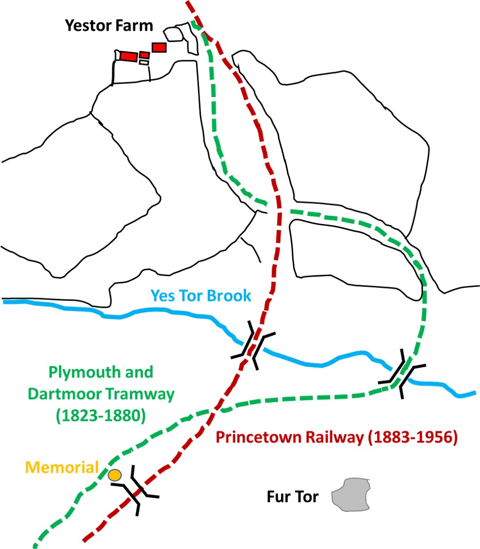
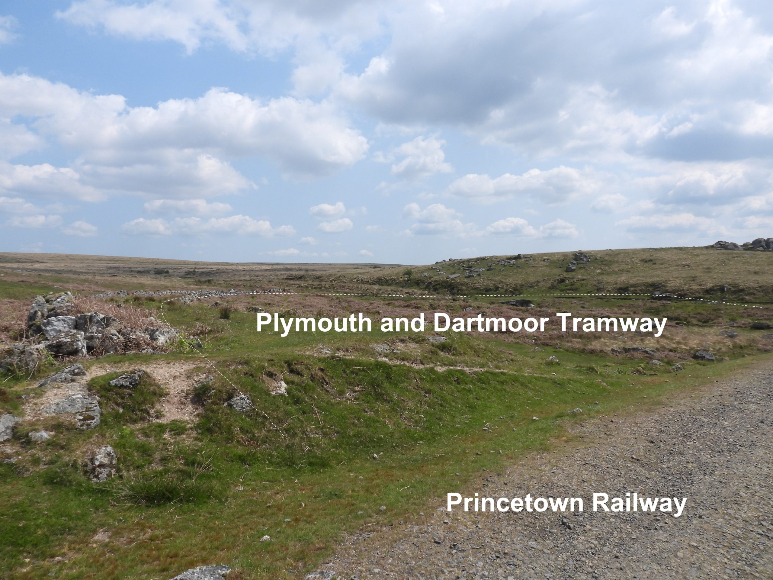
‘Yestor’ Farmstead is so named on 19th and early 20th century maps but is labelled as ‘Easter Green’ on the 19th century Tithe Map (as plot 459). In 1838, the farmstead in the Walkhampton Parish and Church Account Book was called ‘Yestor alias Easter Green’. The field systems surrounding the farmstead shown on the tithe extend either side of the Plymouth and Dartmoor Tramway (from 1823) originally then Princetown Railway (from 1883) latterly. The field plots on the tithe shown either side of the tramway are labelled 460-467. Interestingly, the Plymouth and Dartmoor Tramway is labelled as 1352 on the tithe.
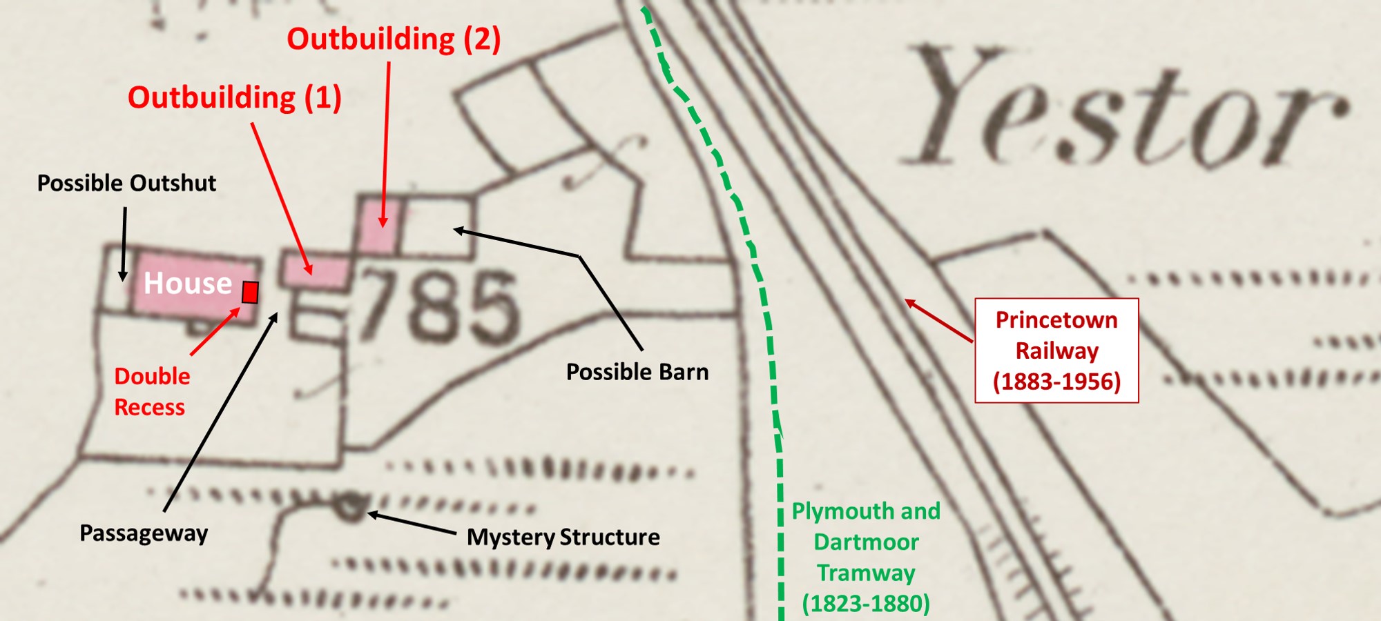
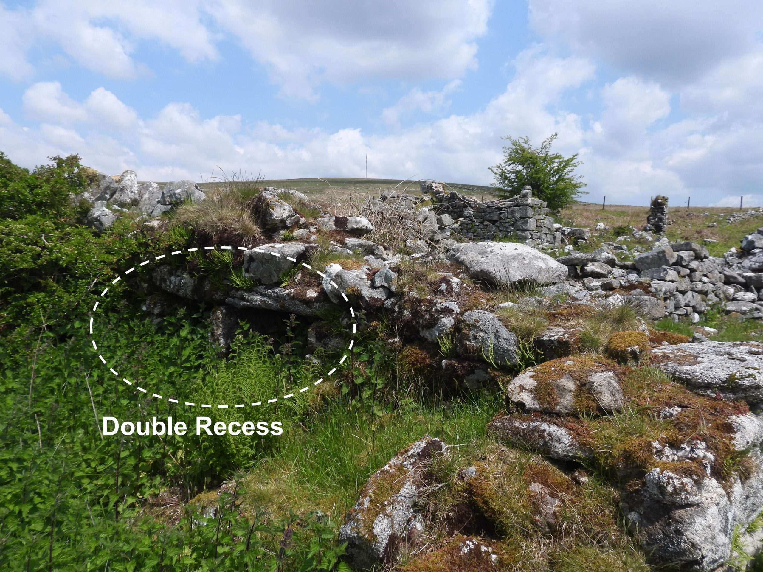
The farm was first documented in 1795 in the Land Tax List when Edward J. Peek was chargeable and appears to have been abandoned in the 1860’s, with the last tenants being John Turner (agricultural labourer) and John Sloman (quarry labourer), who are mentioned in the 1861 census. On the Heritage Gateway (Dartmoor HER) most observers comment on the unusual layout for a Dartmoor farm insofar the buildings are arranged in a line rather than around a yard. Another ‘feature’ at the farmstead commented on by some observers are some ground level recesses which can be found within the ruins.
The location and surrounding topography of the farmstead makes for an interesting visit to the area with the courses of the Plymouth and Dartmoor Tramway and Princetown Railway snaking and criss-crossing each other as they cross Yes Tor Brook and pass by the farmstead.
Bibliography:
Eric Hemery, 1983, High Dartmoor – Page 1032-3
Stephen Woods, 1988, Dartmoor Stone, Pages 163, 165
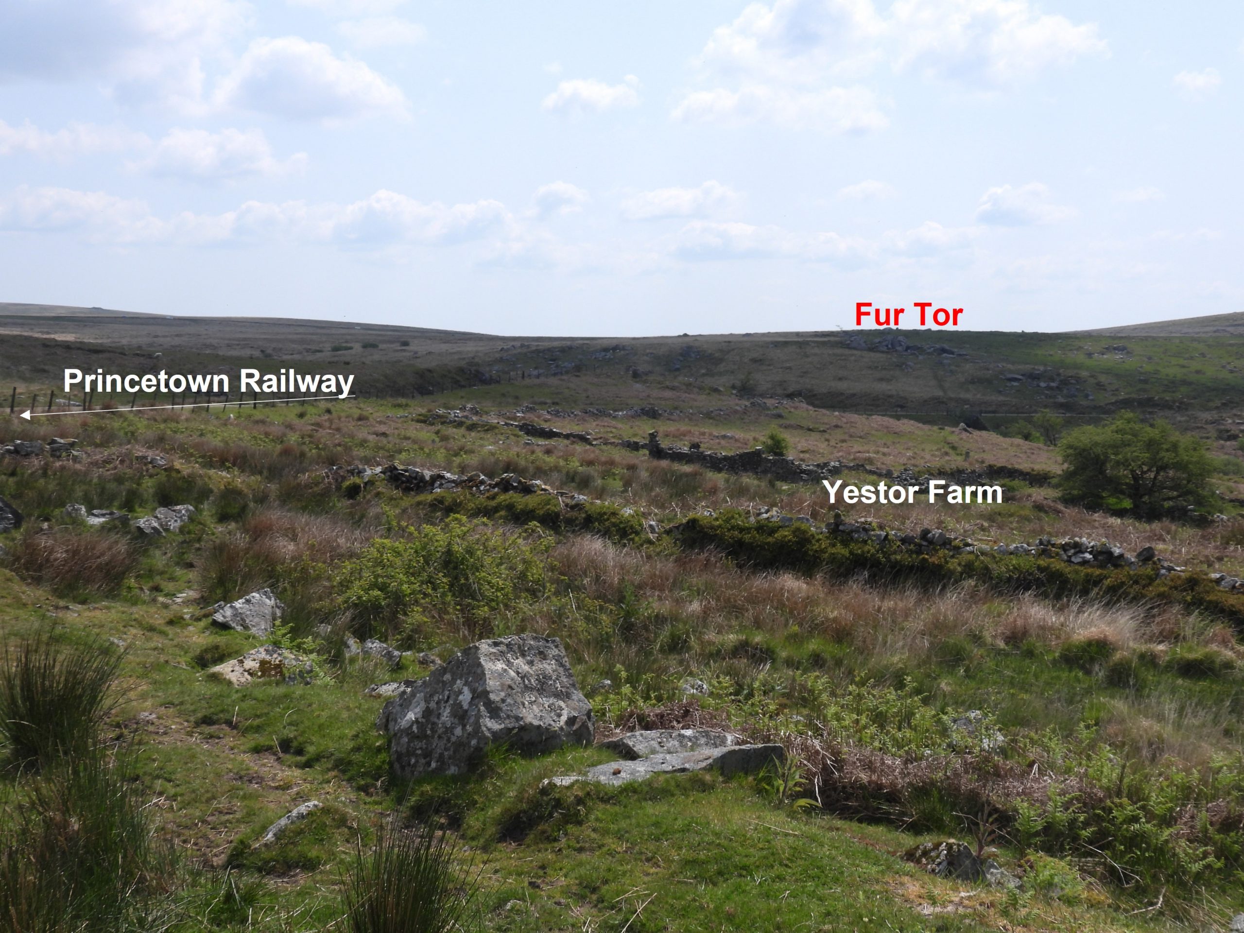
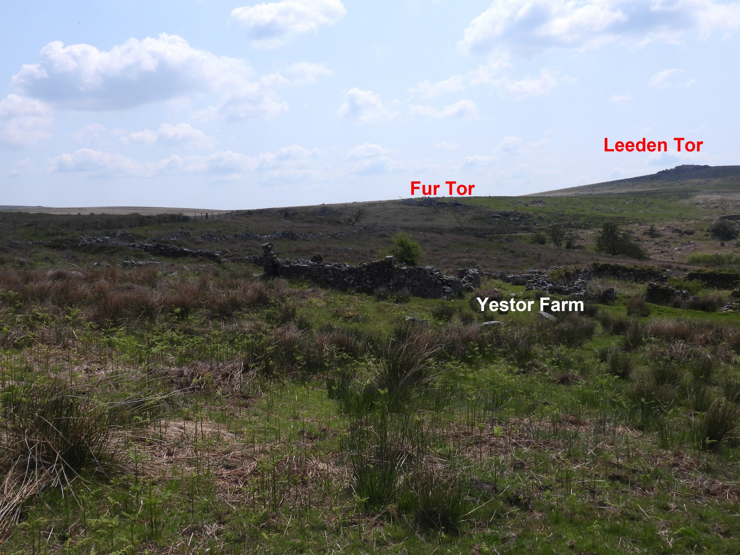
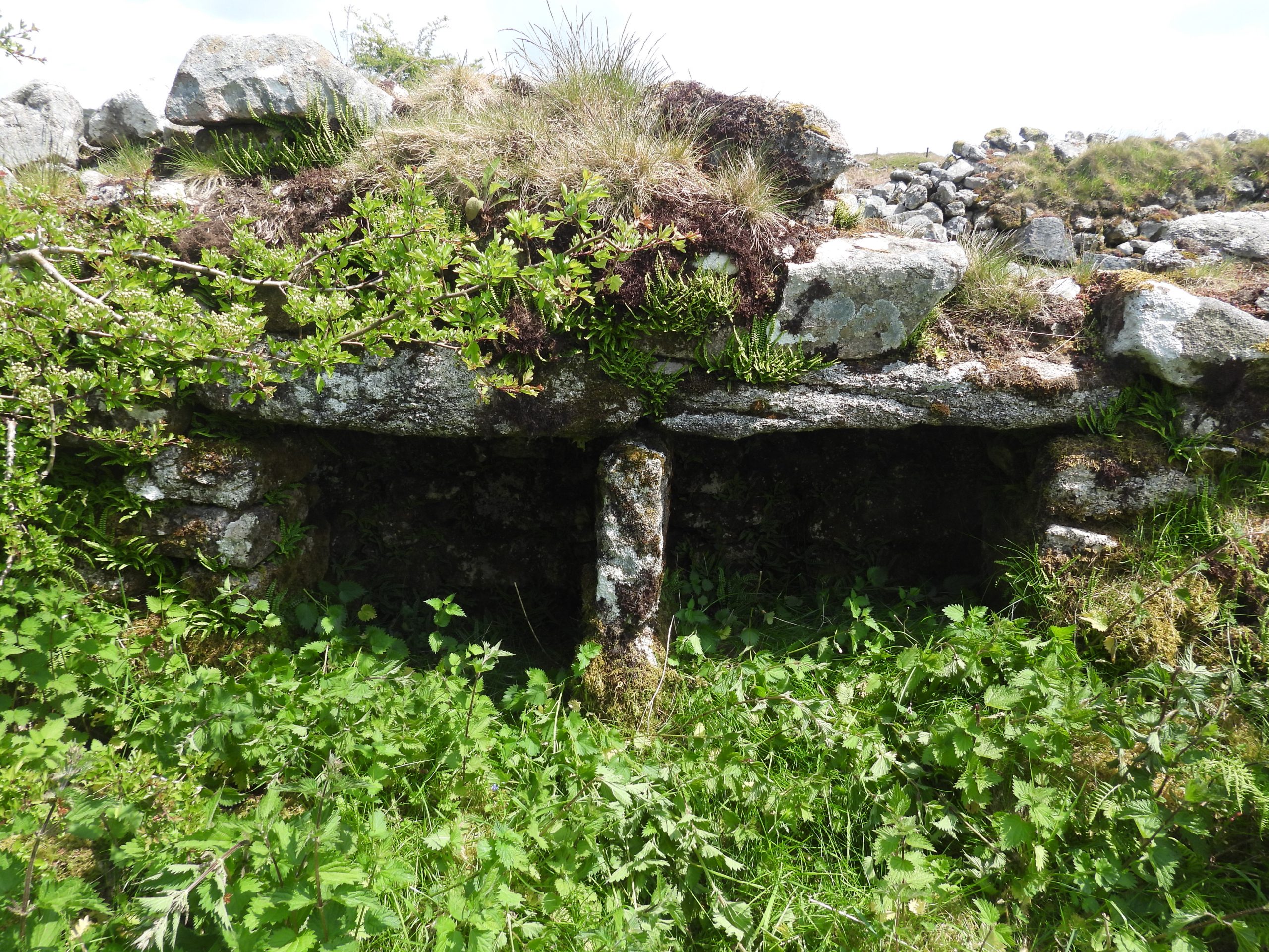
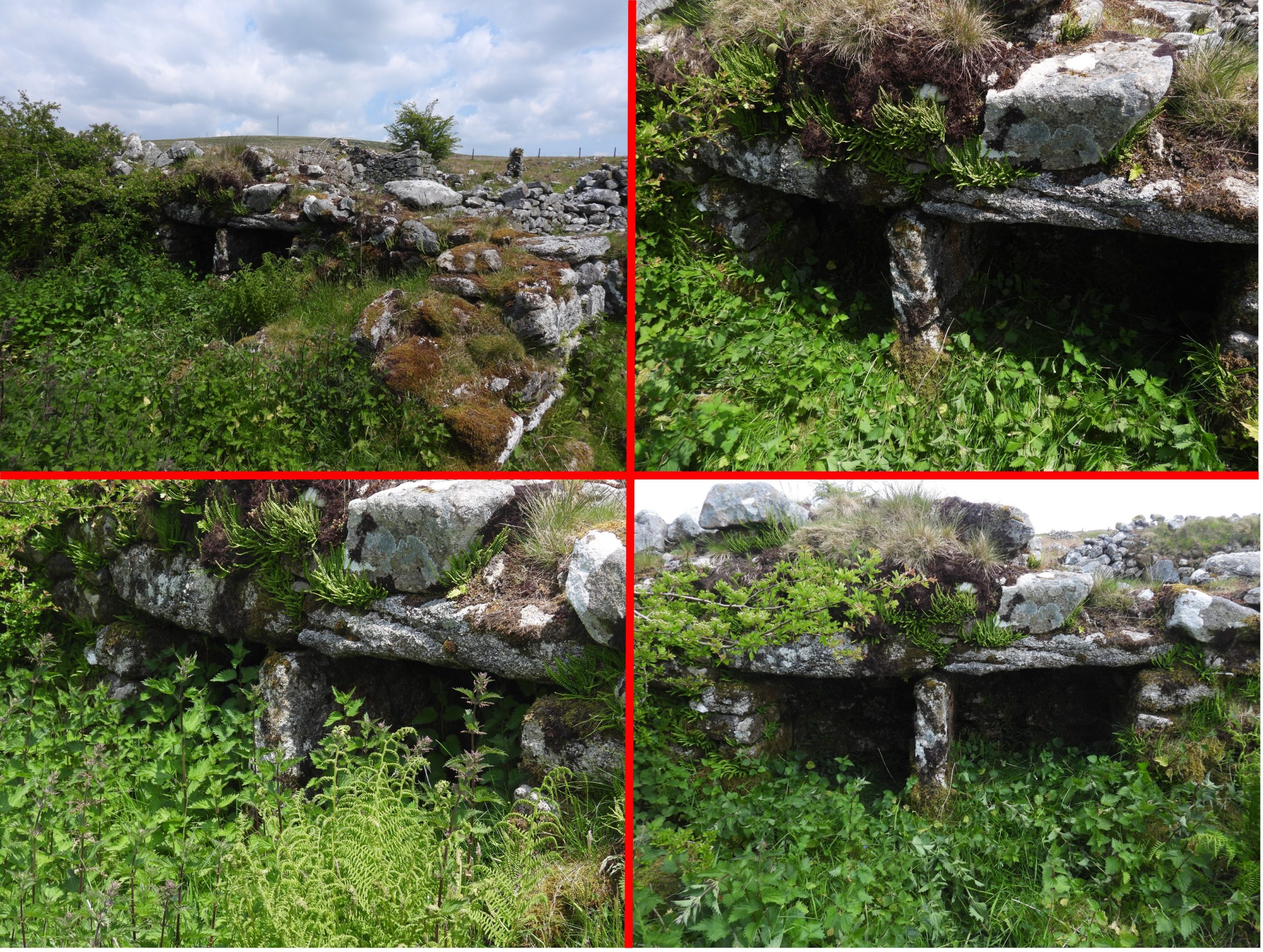
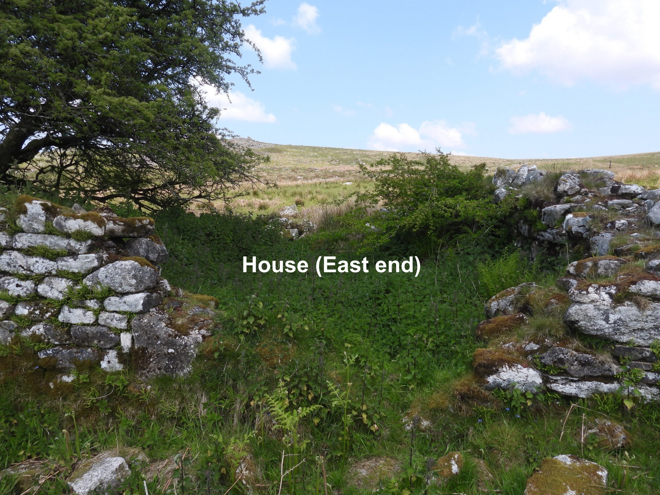
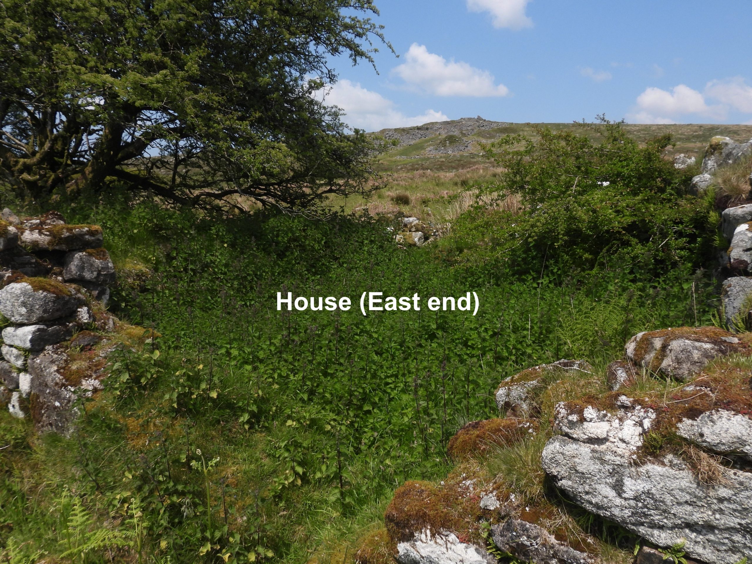
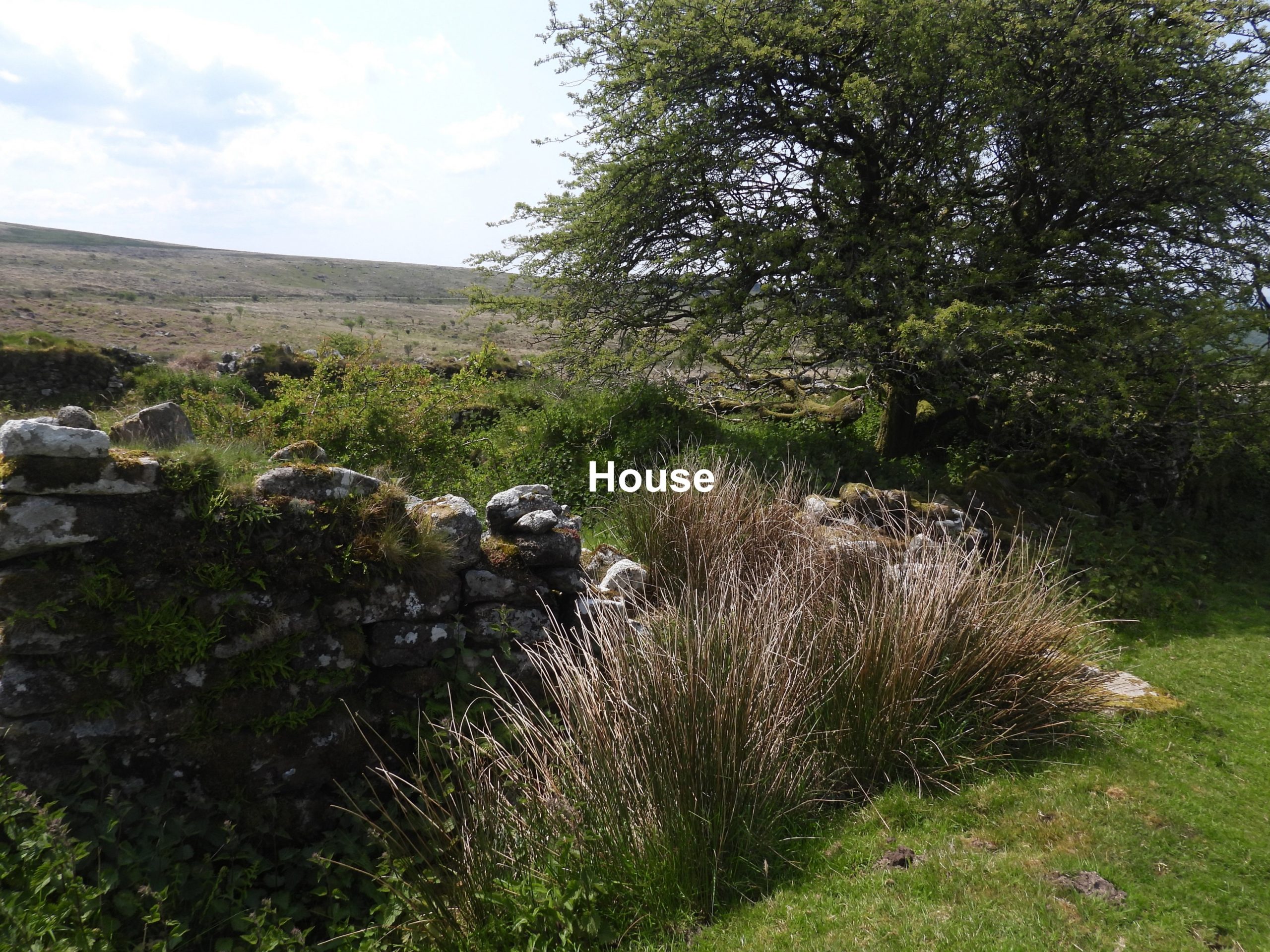
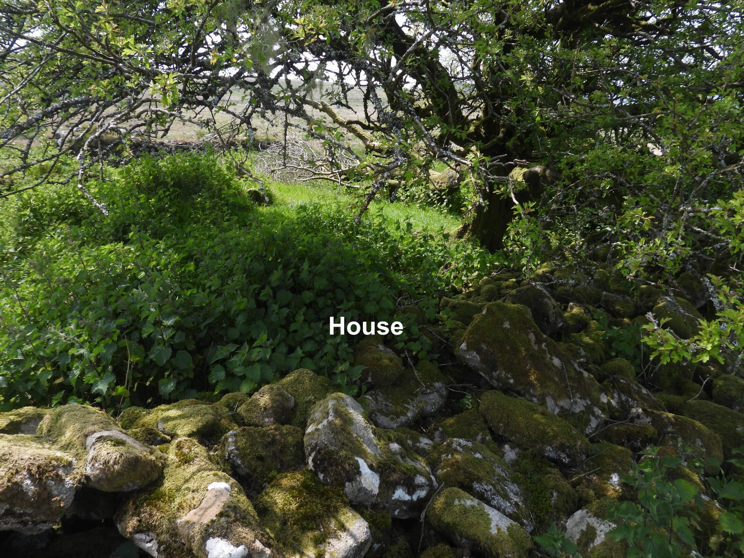
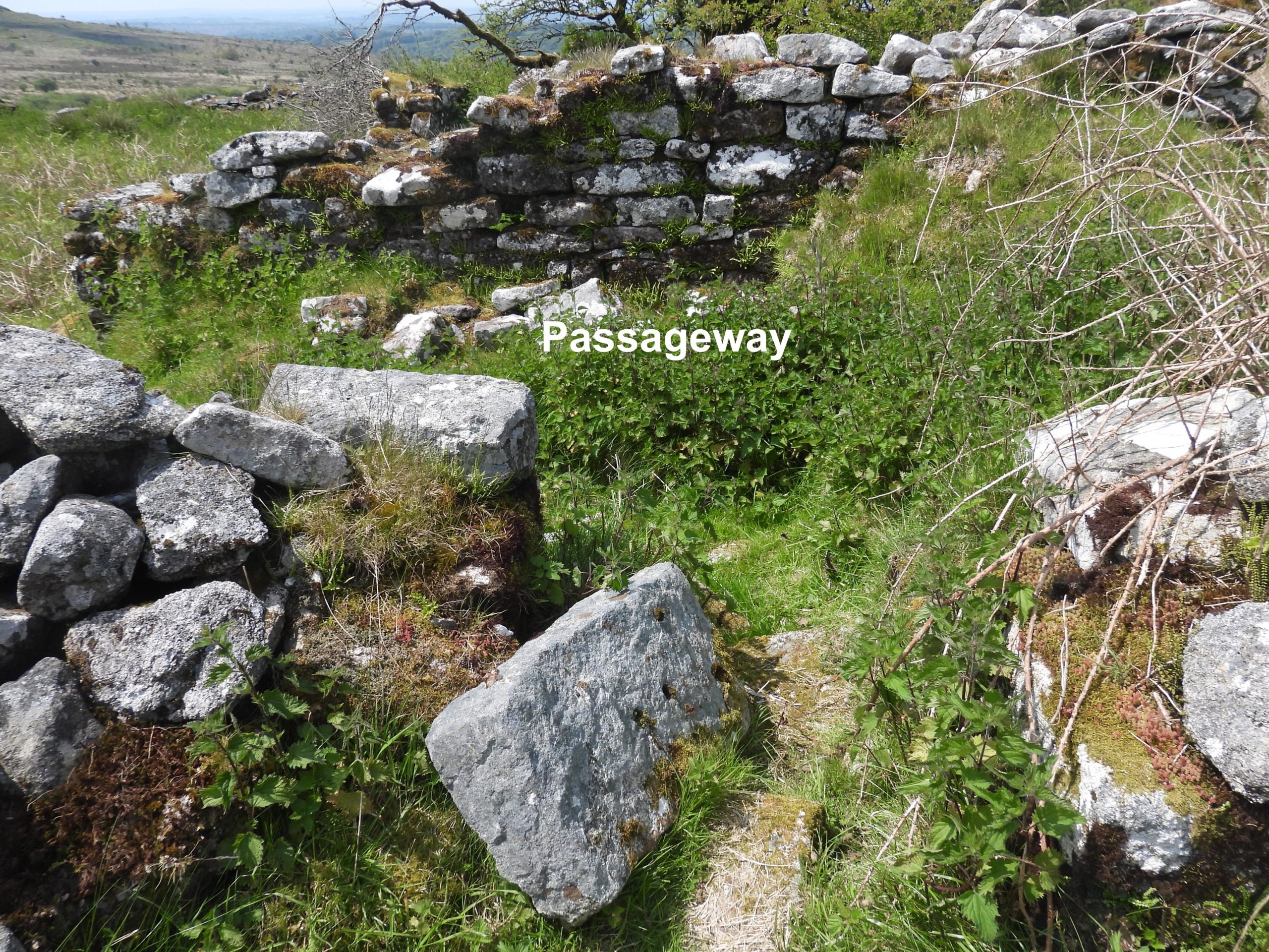
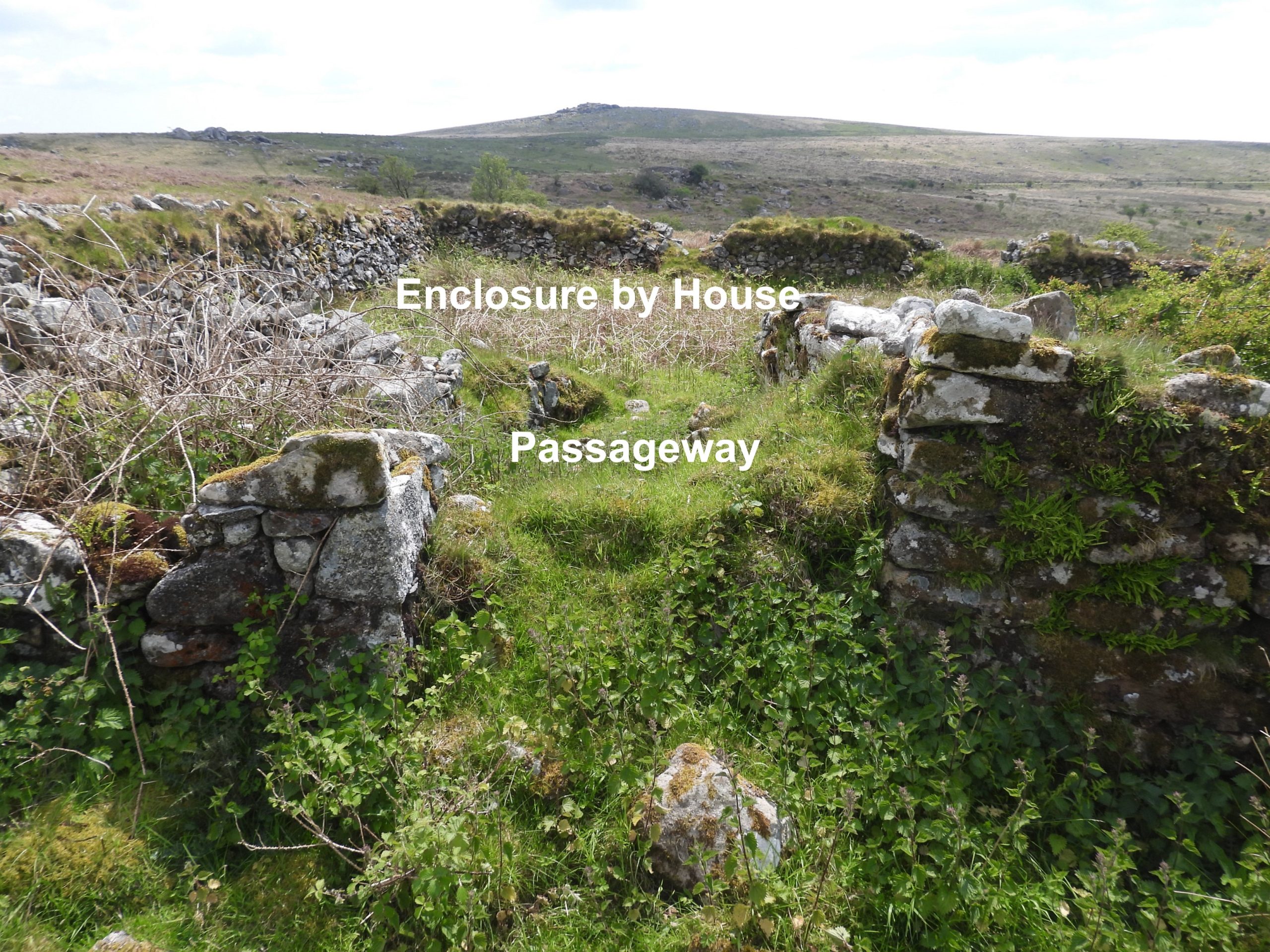
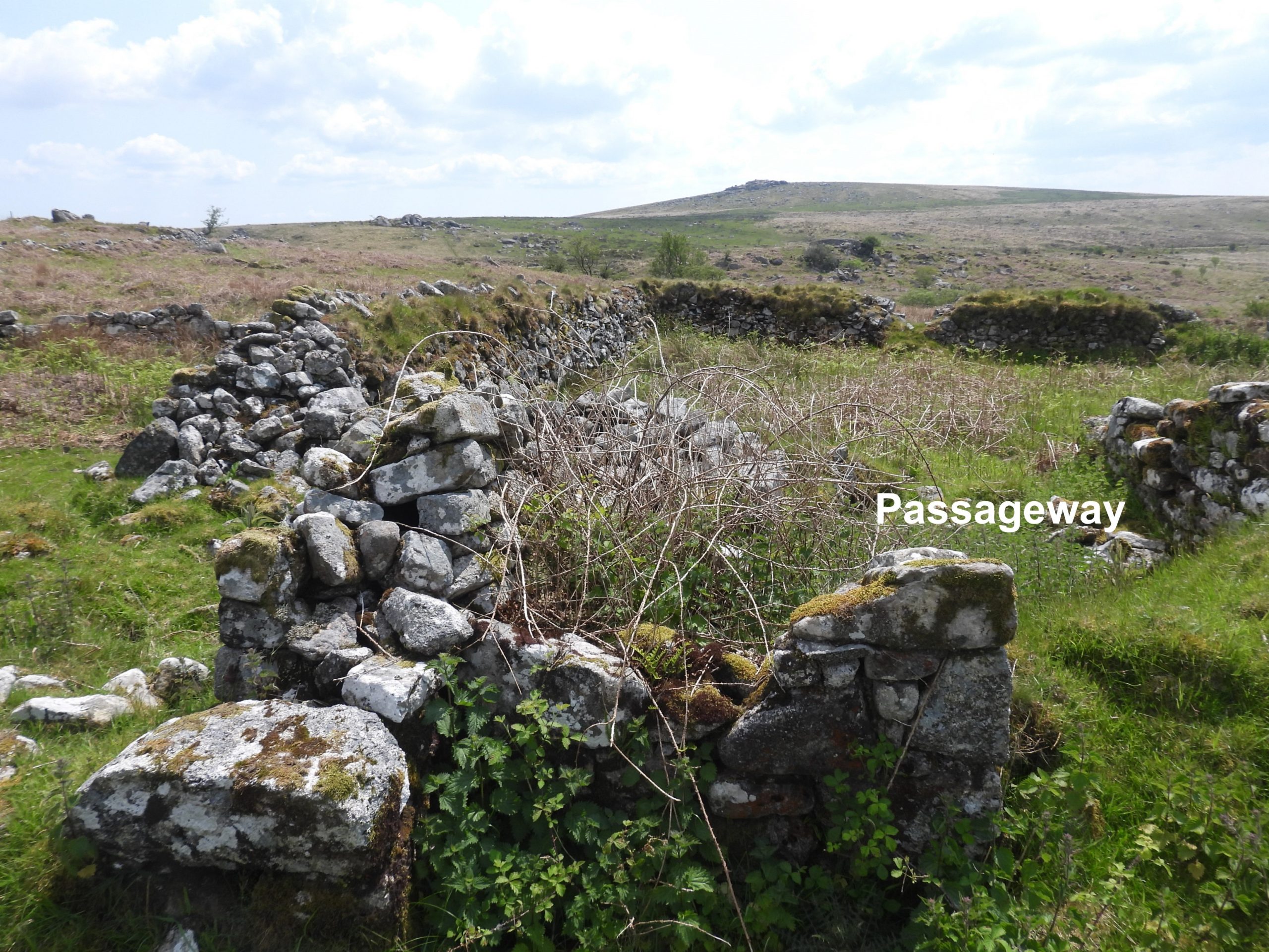
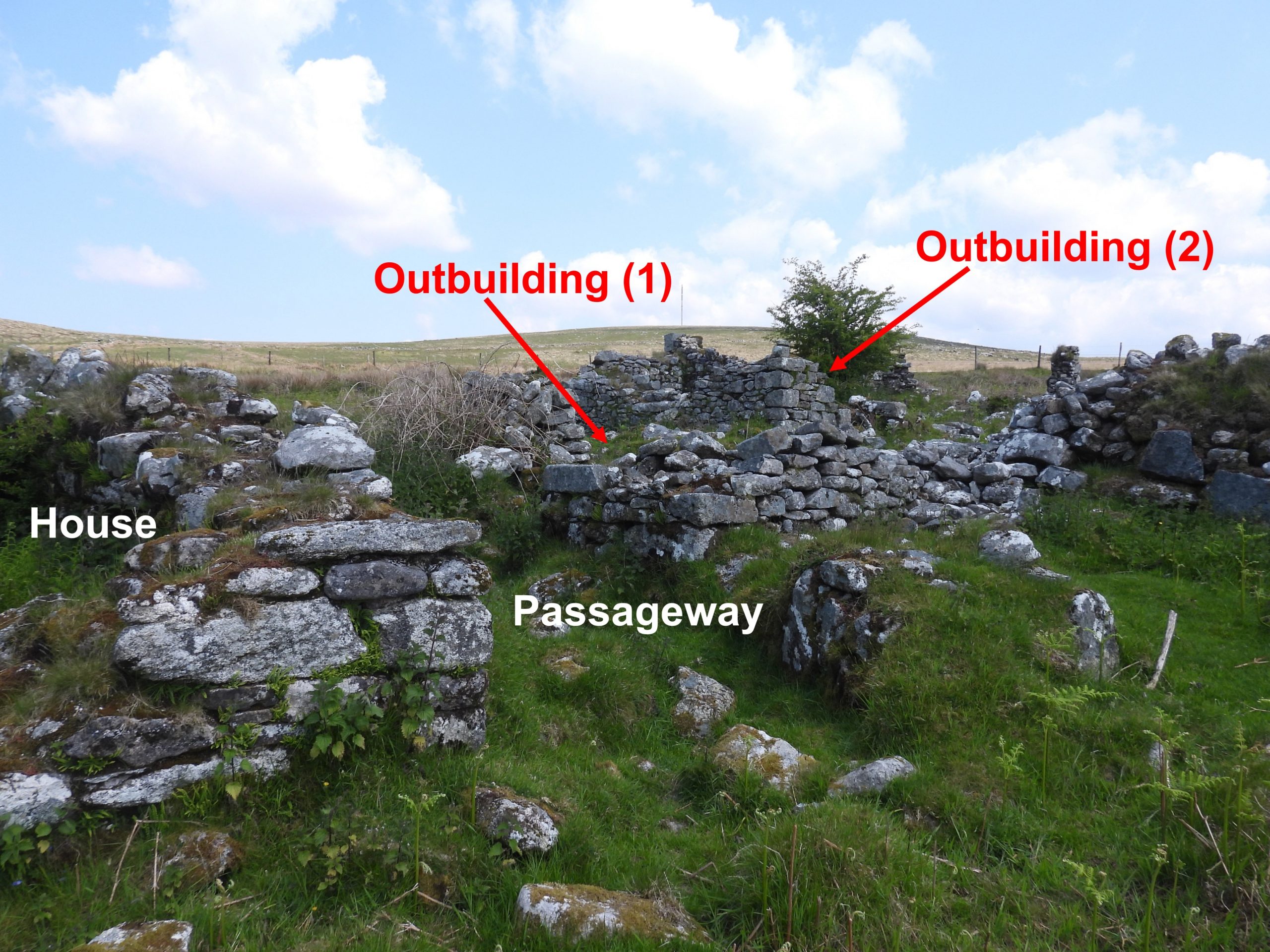
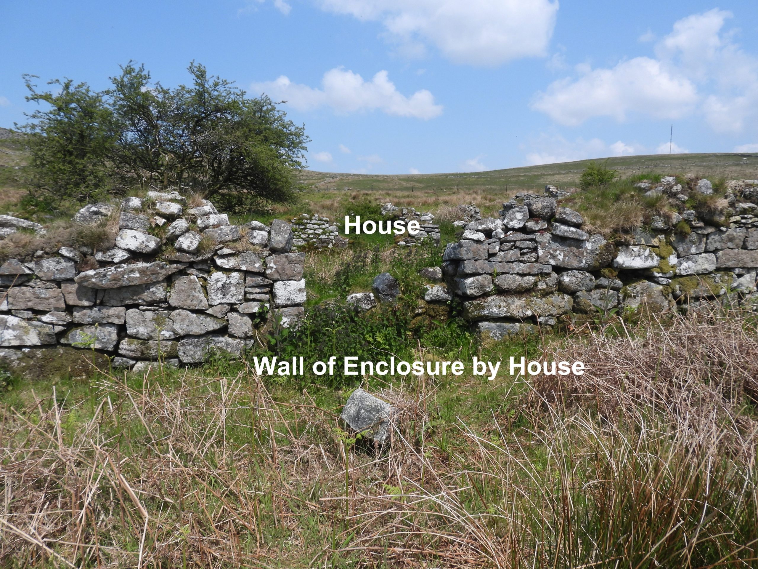
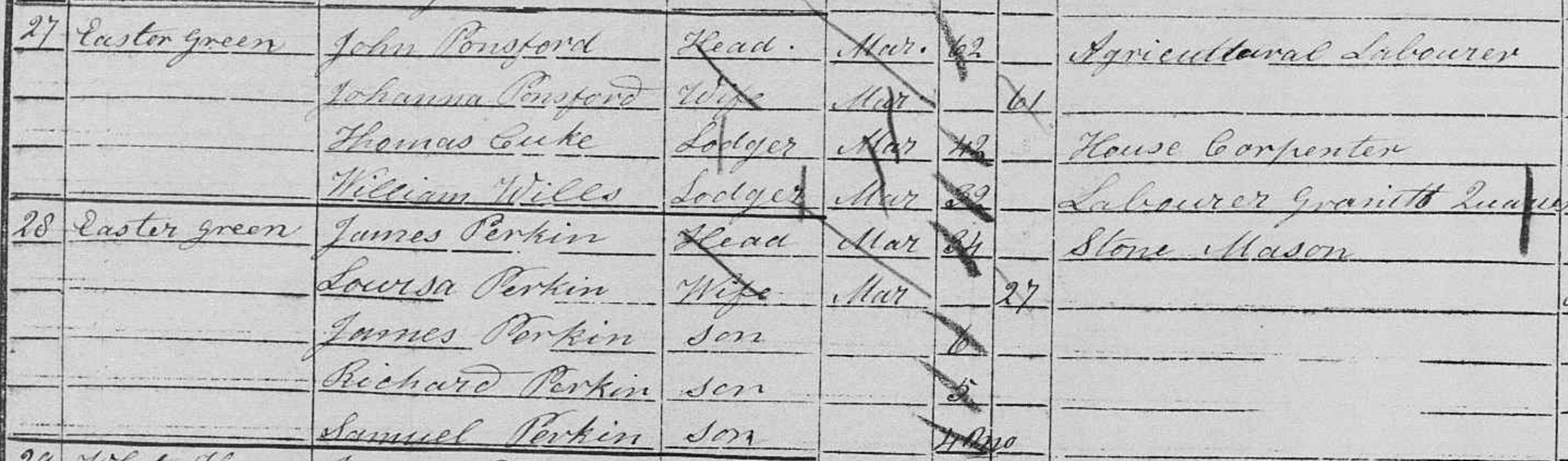
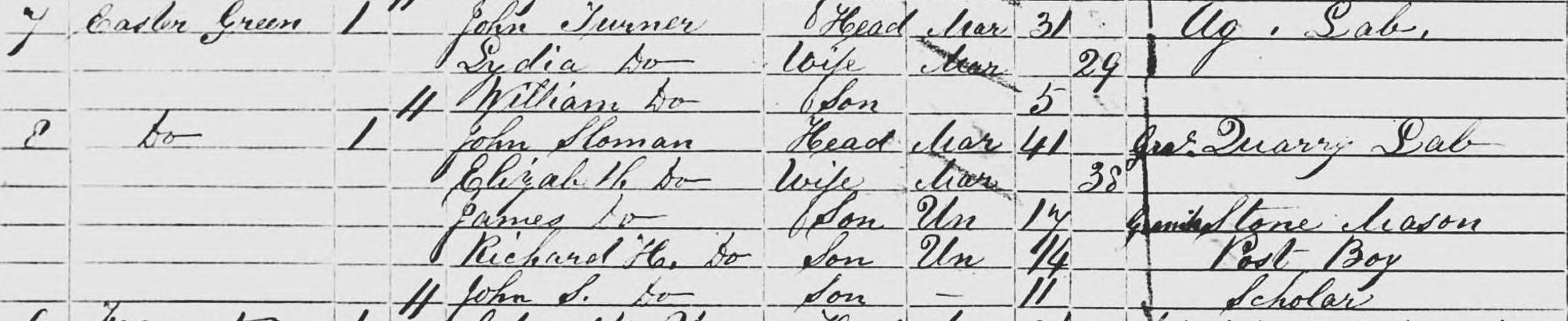
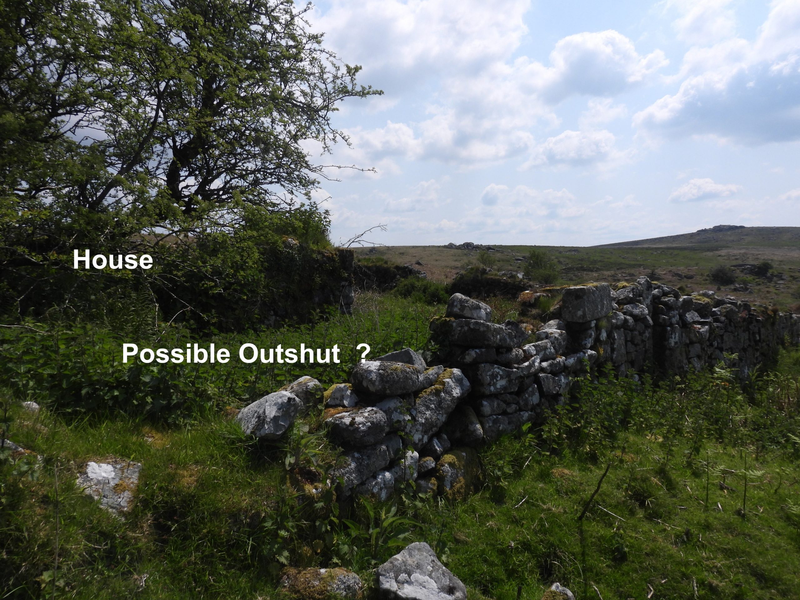
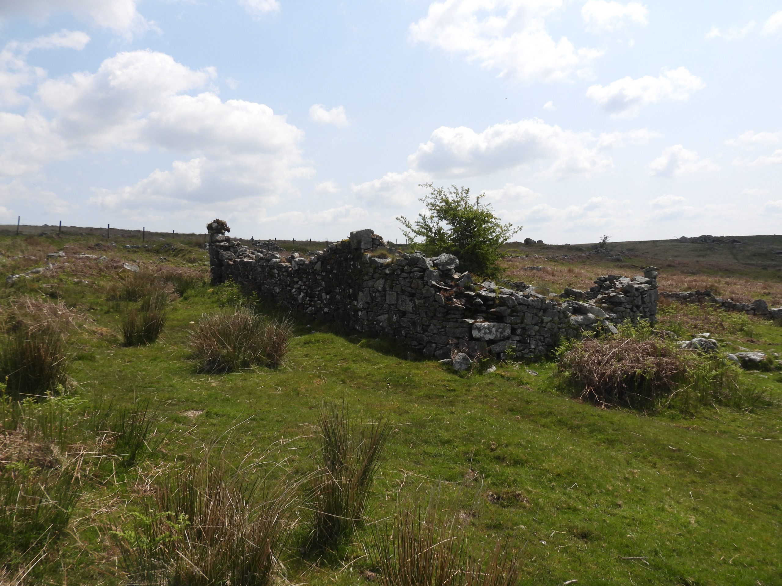
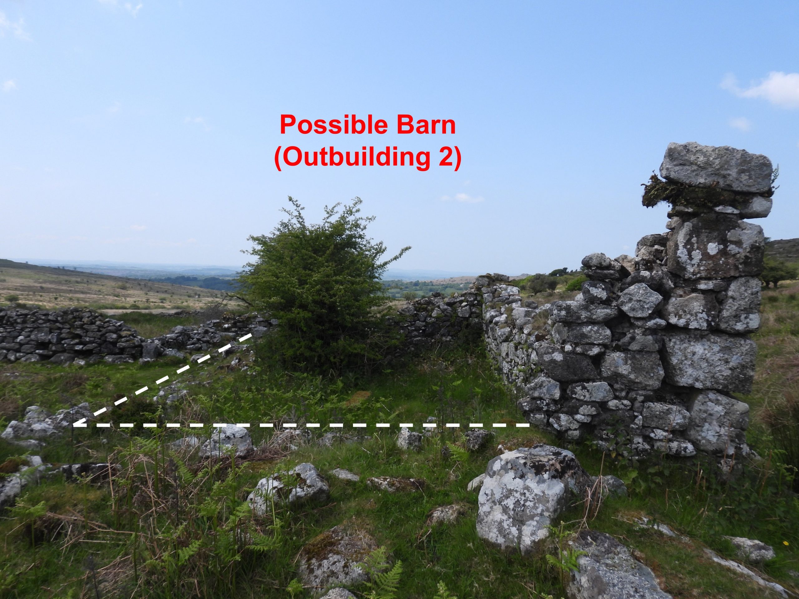
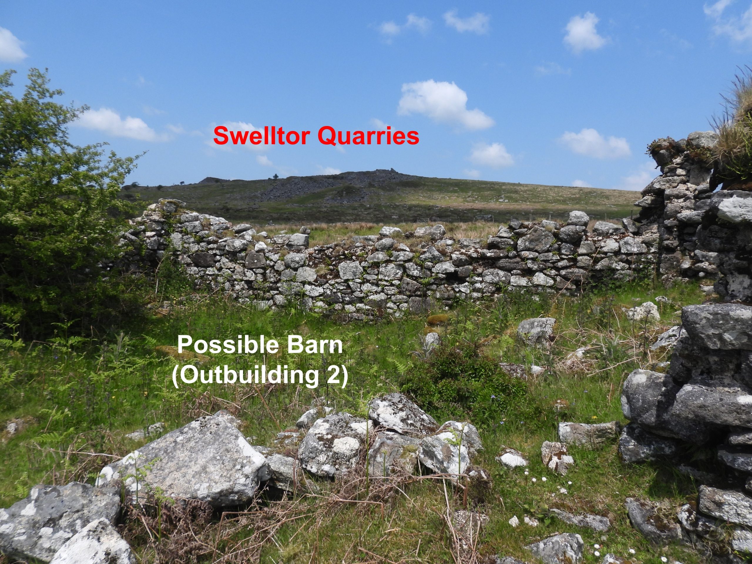
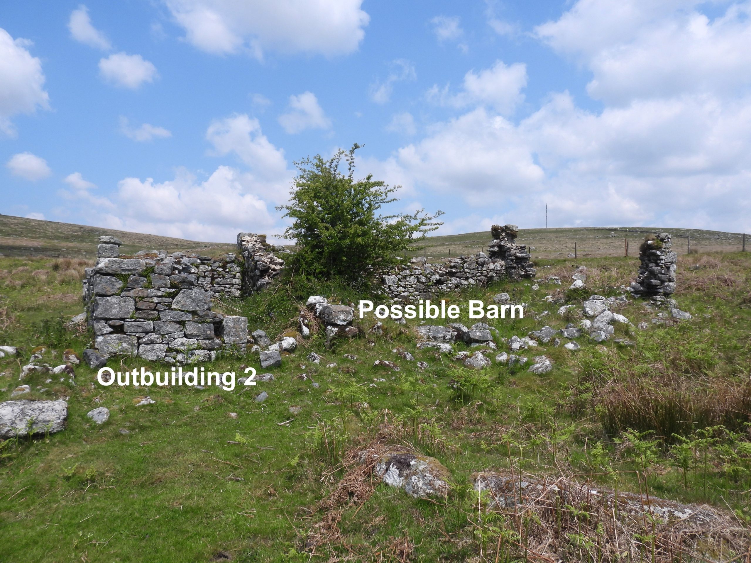
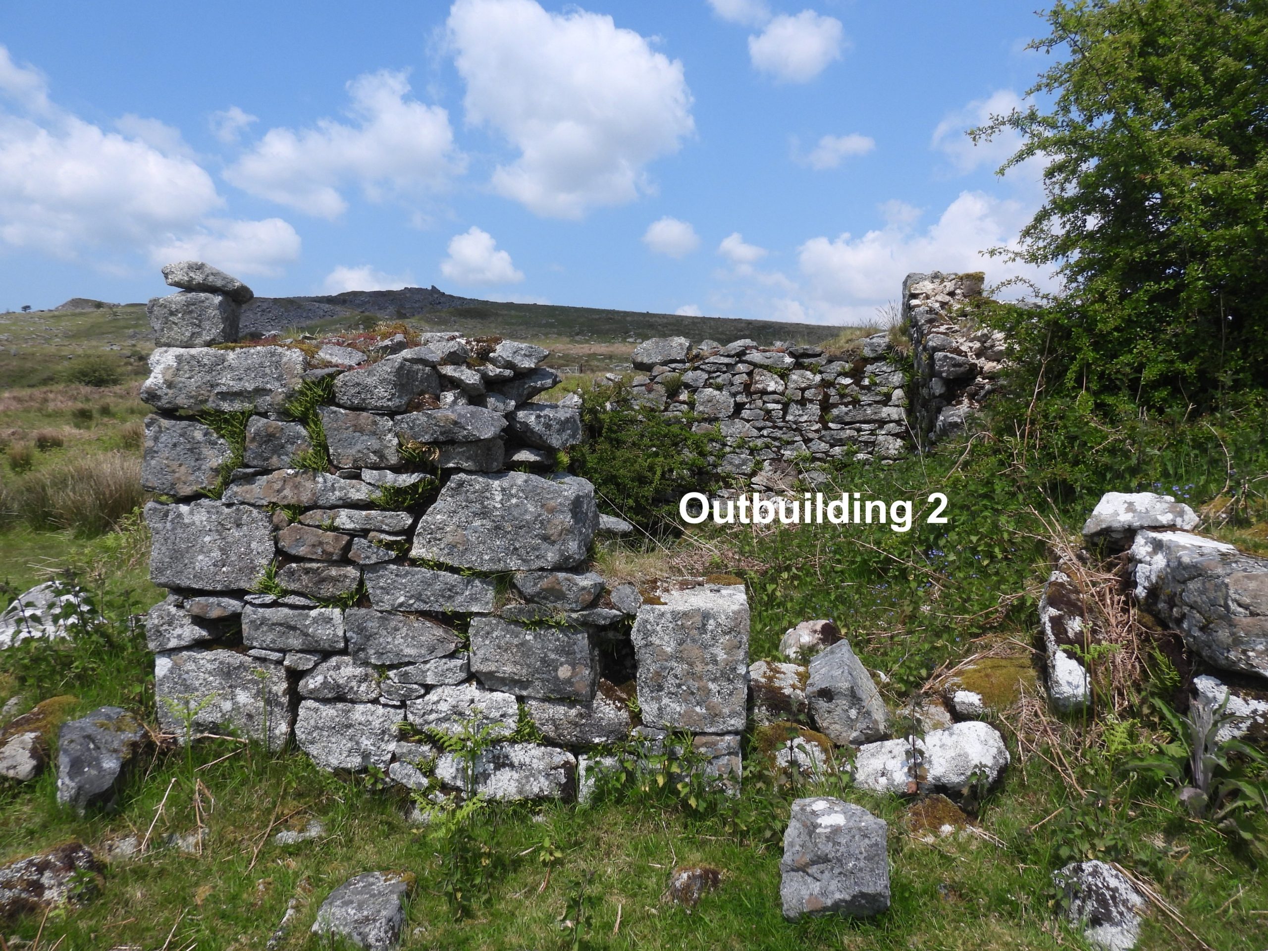
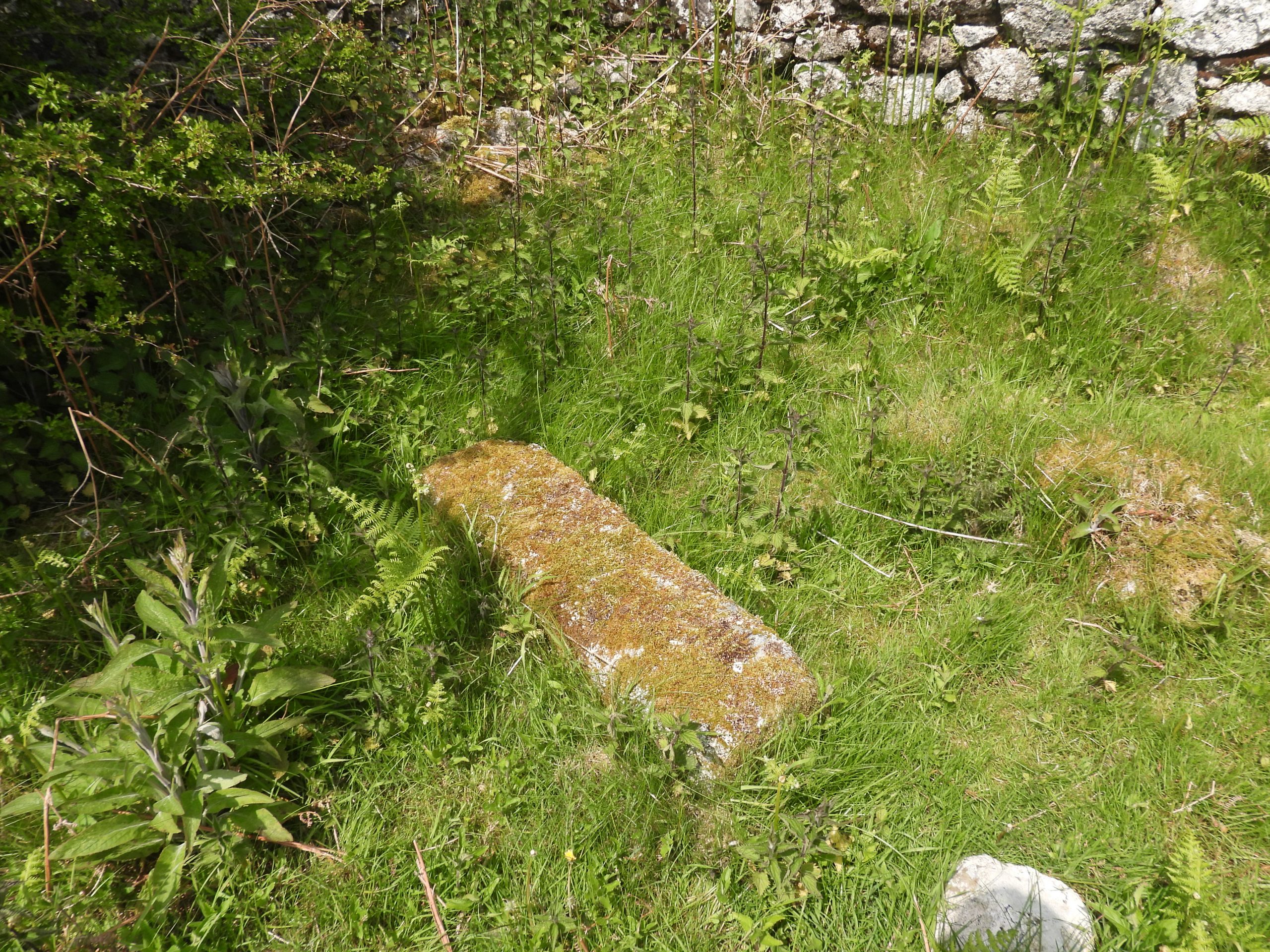
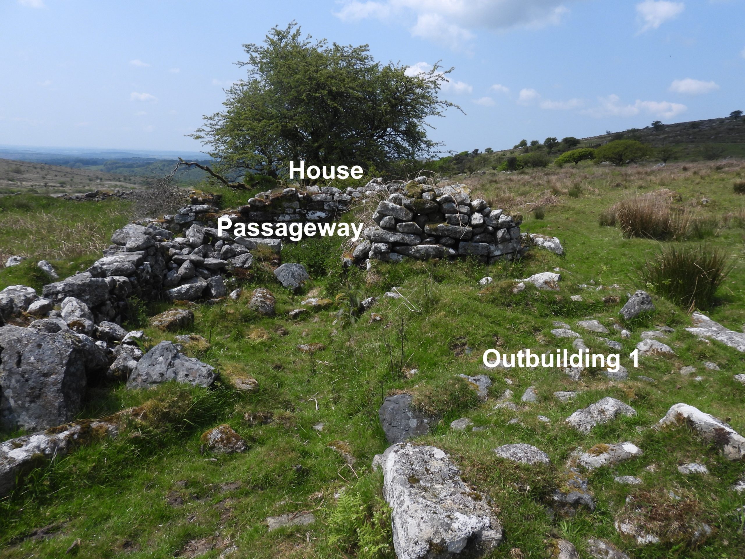
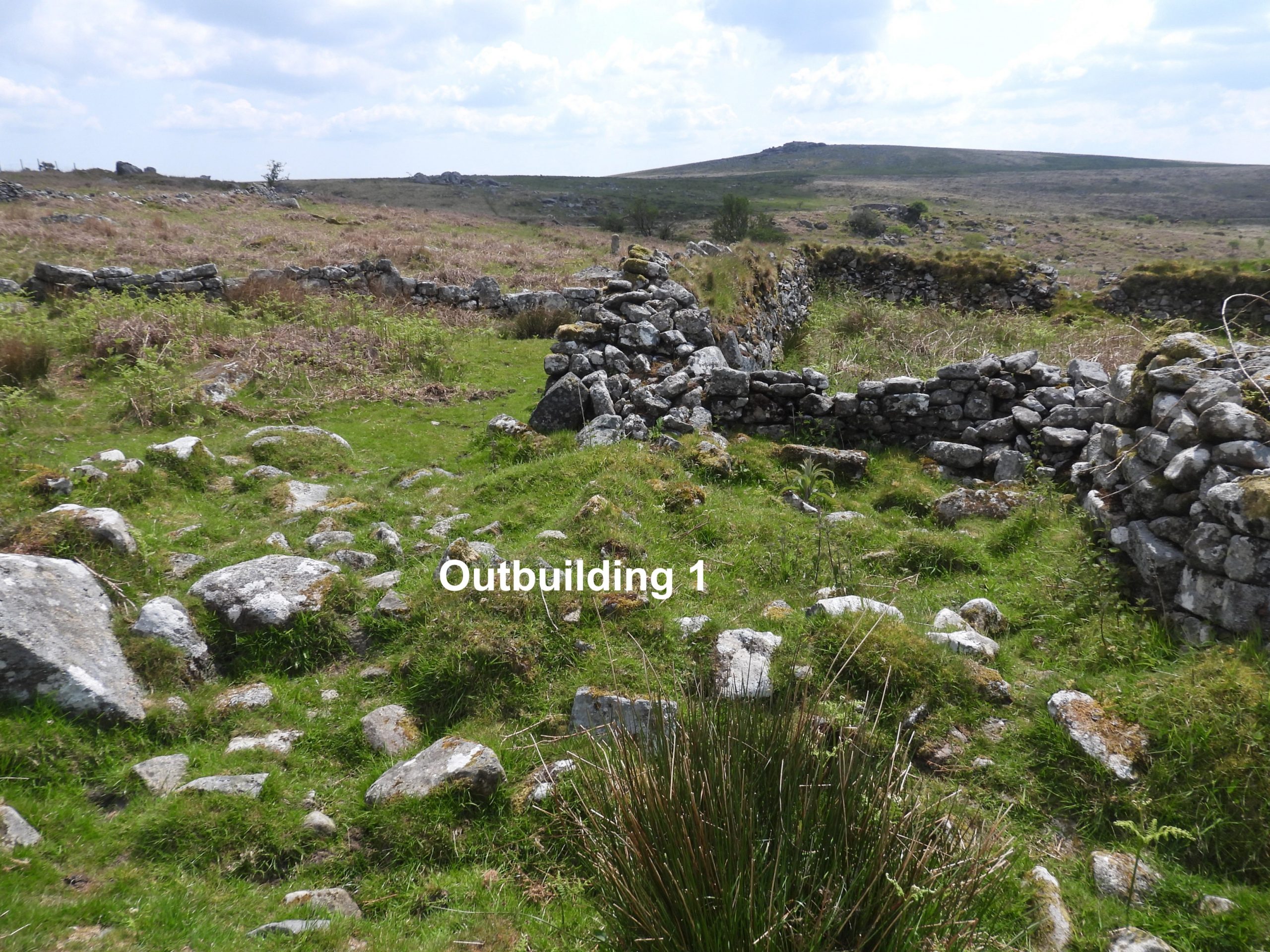
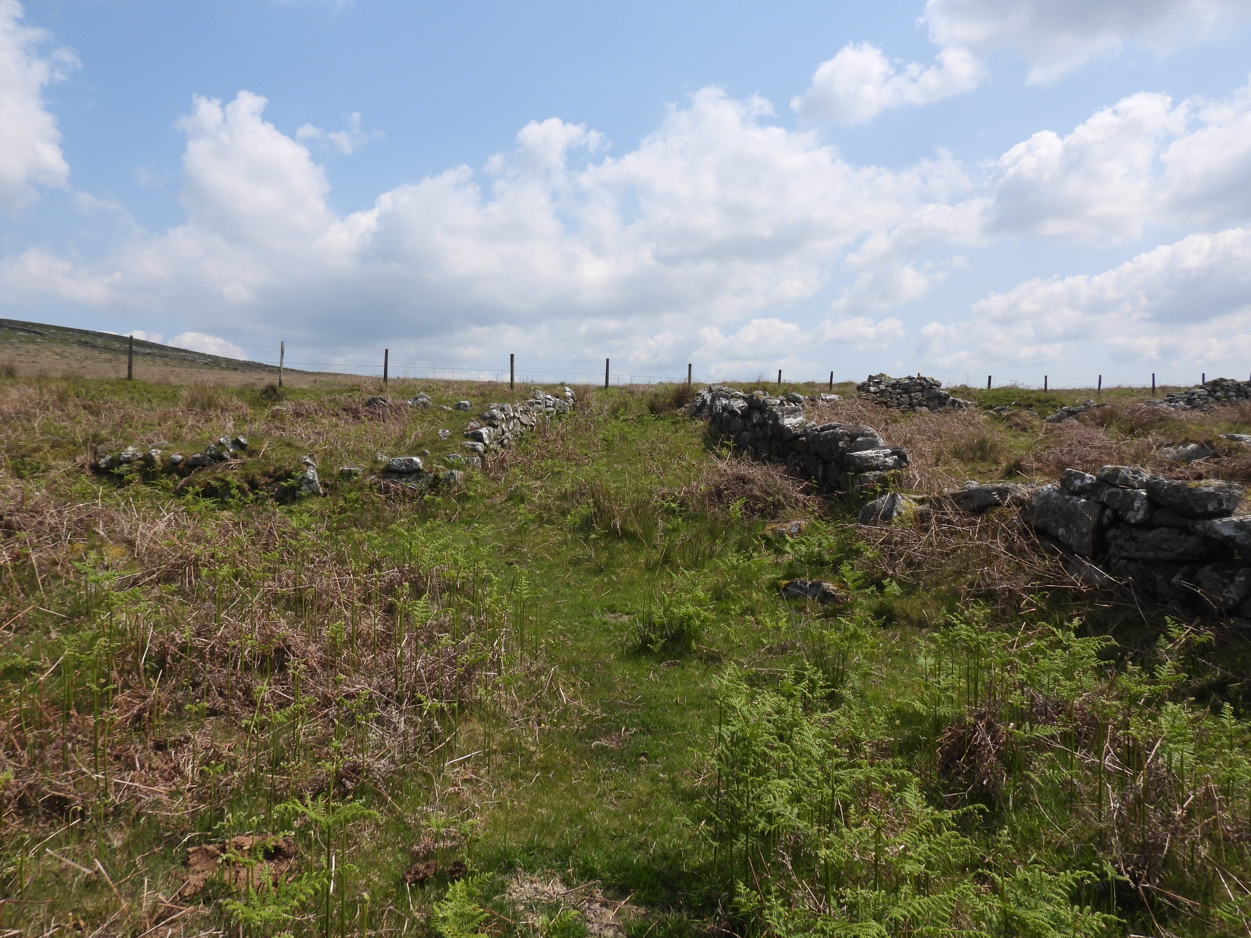
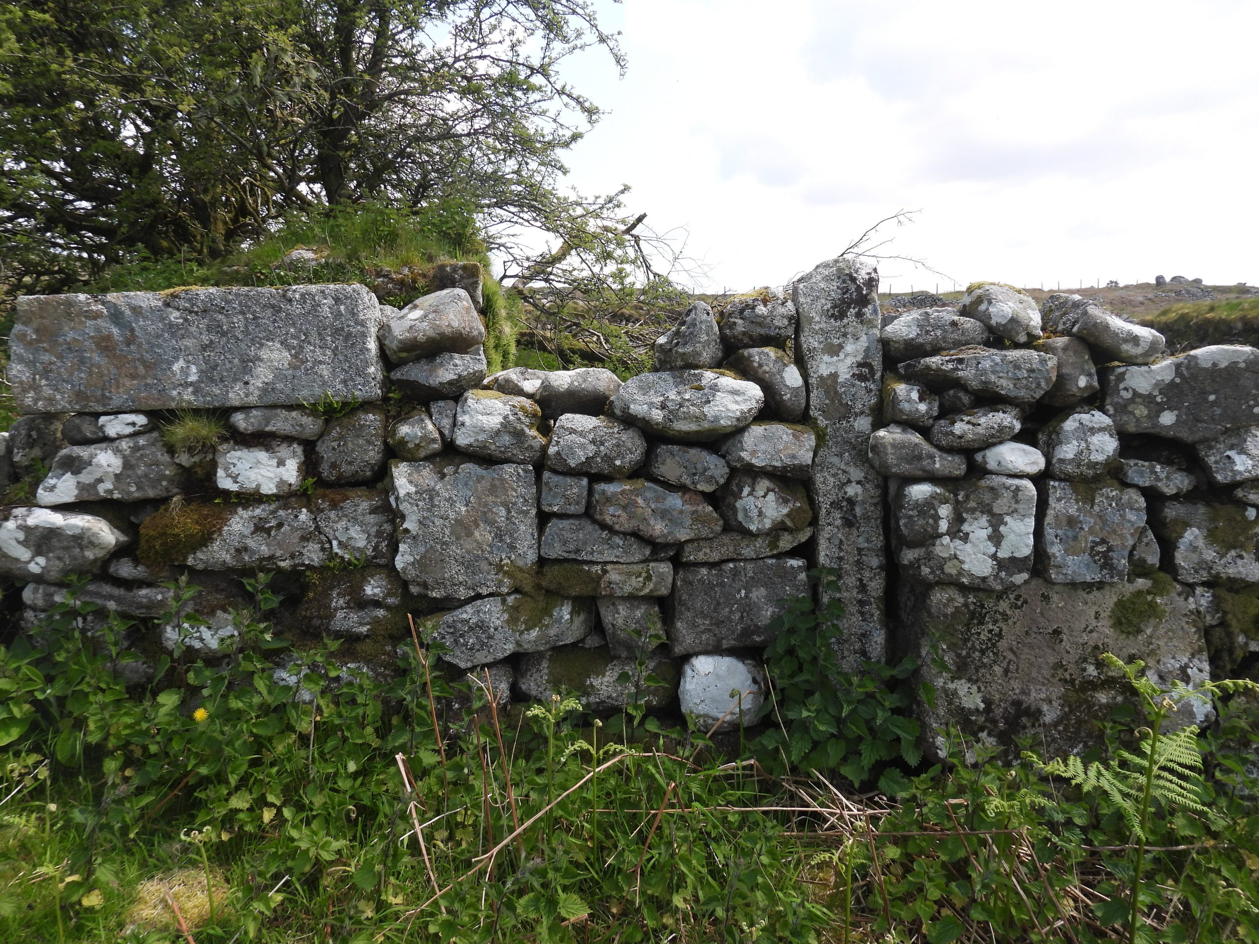
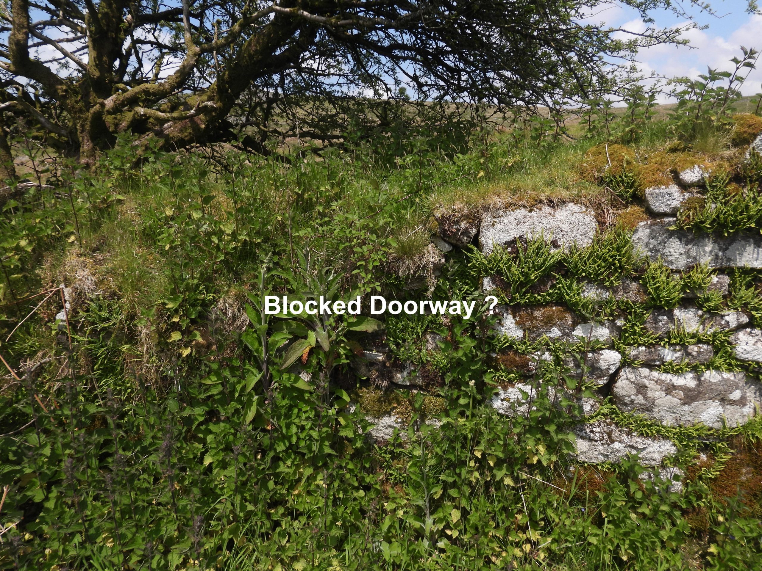
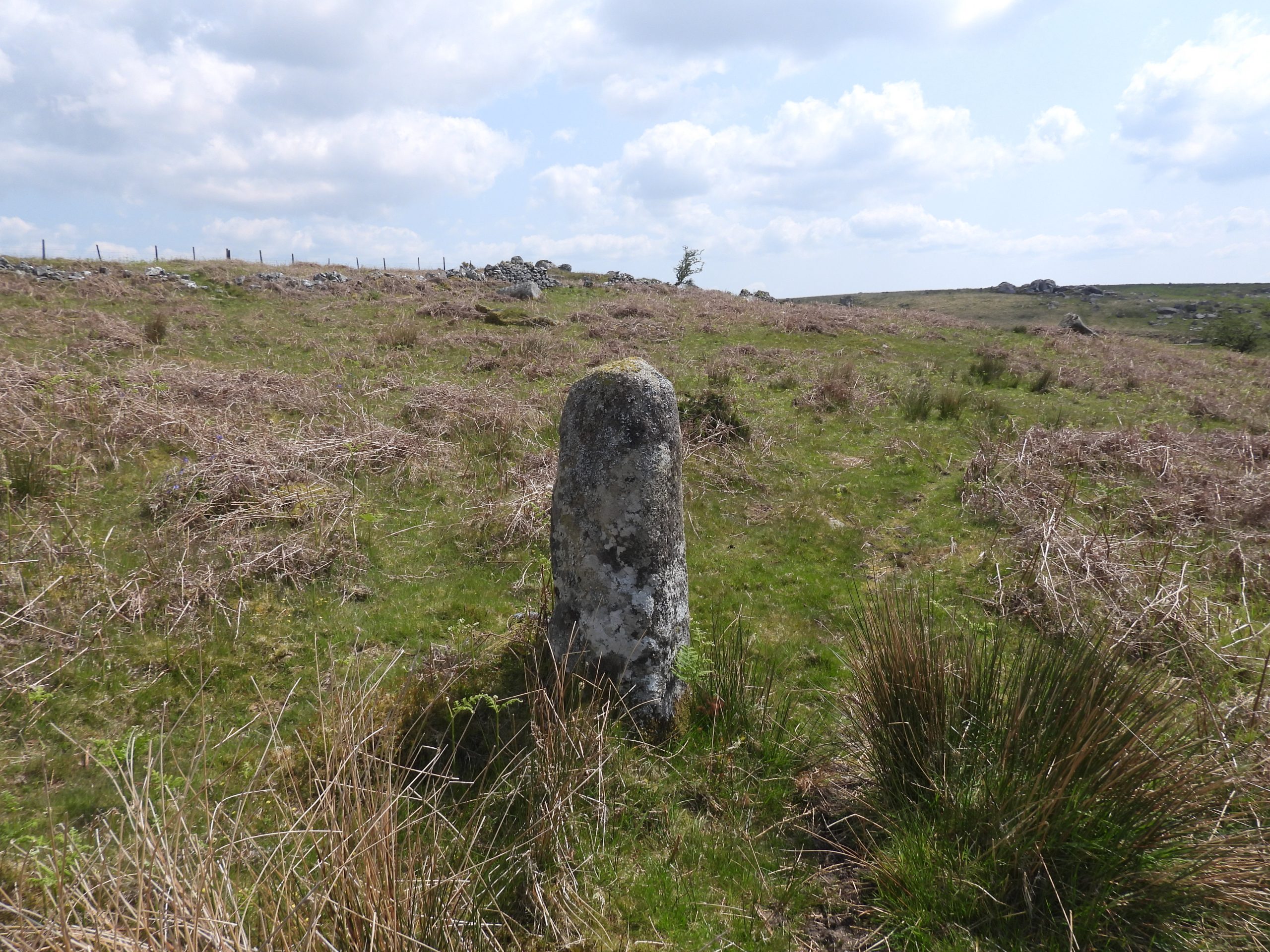
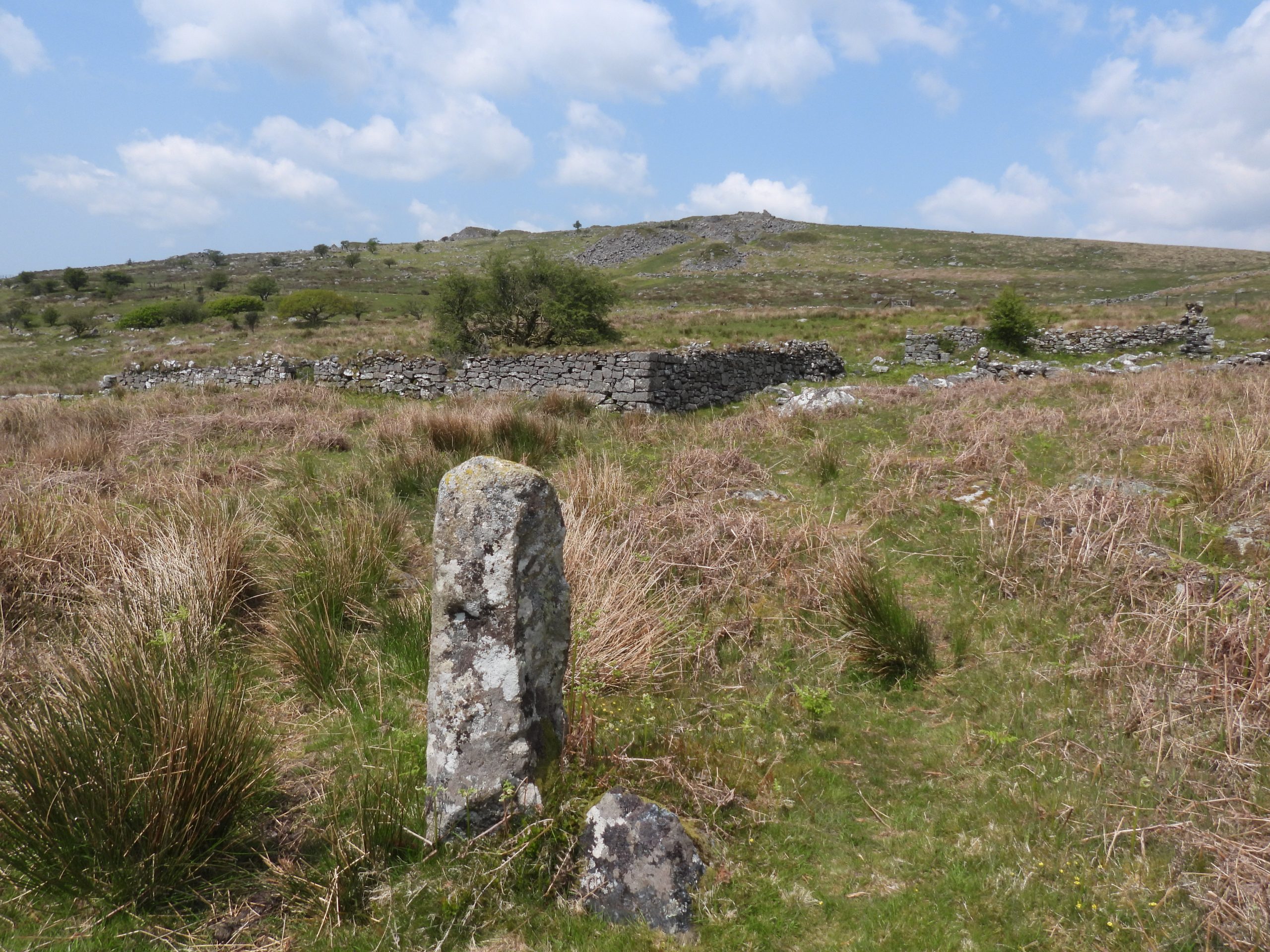
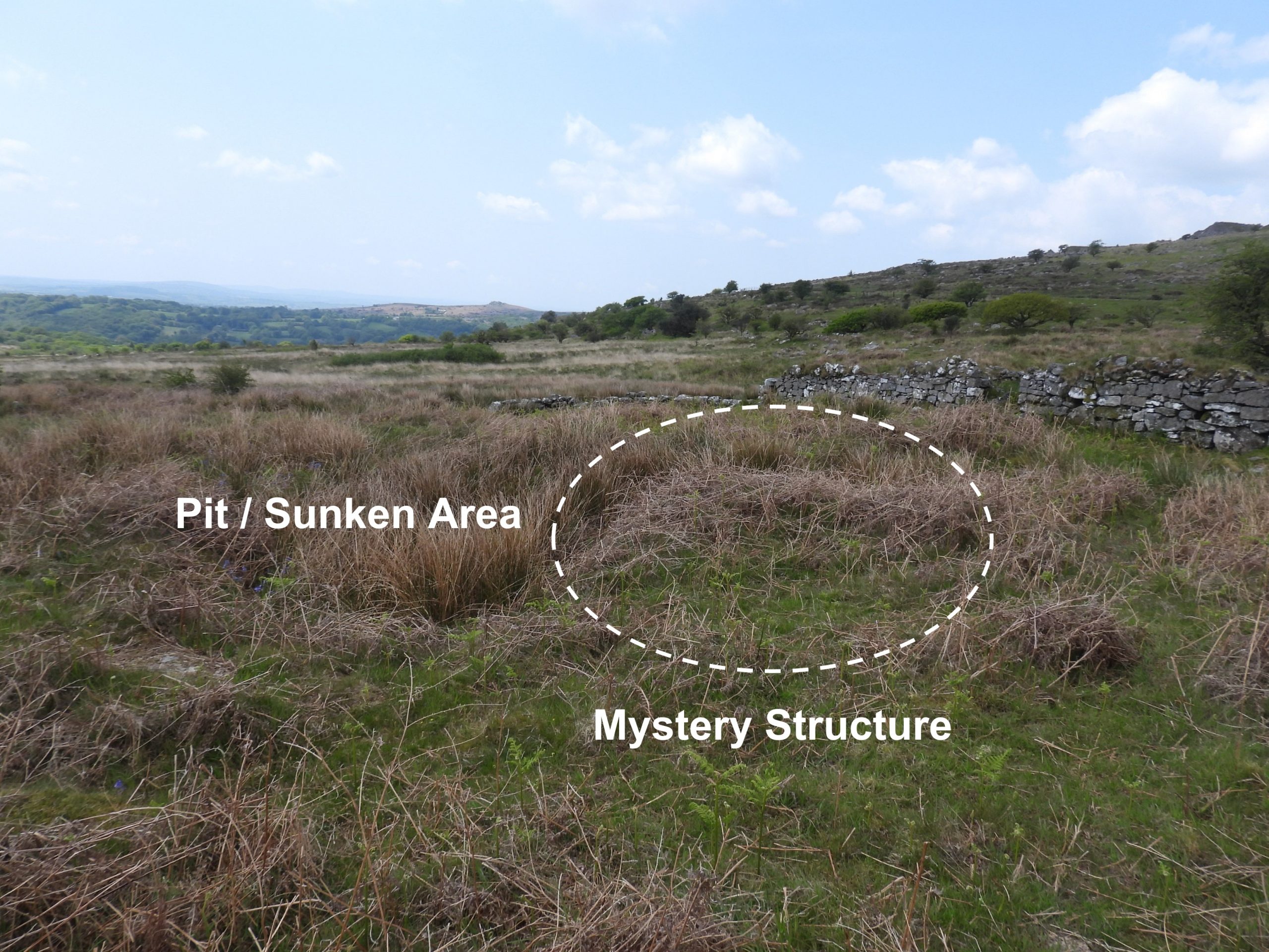
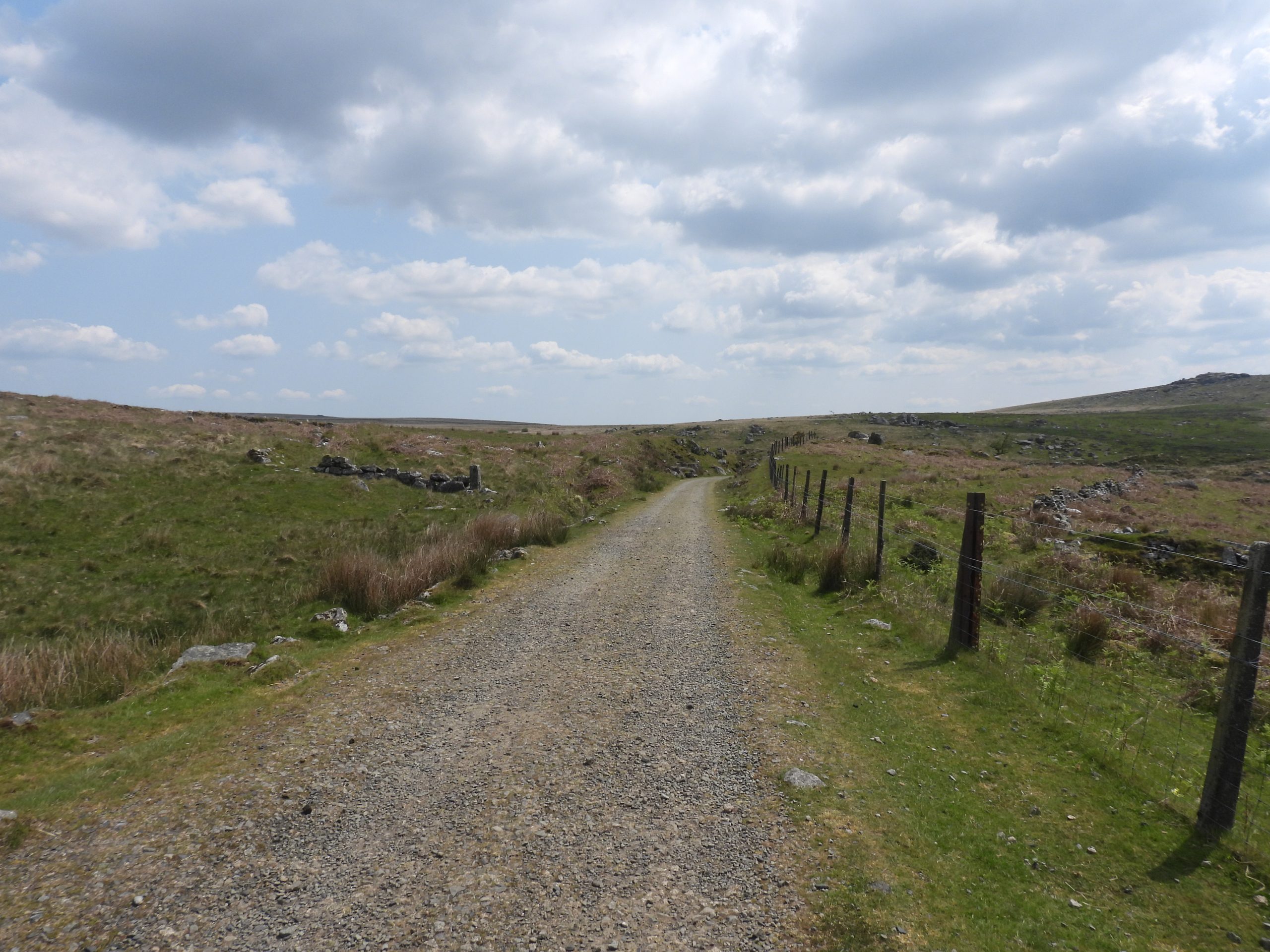
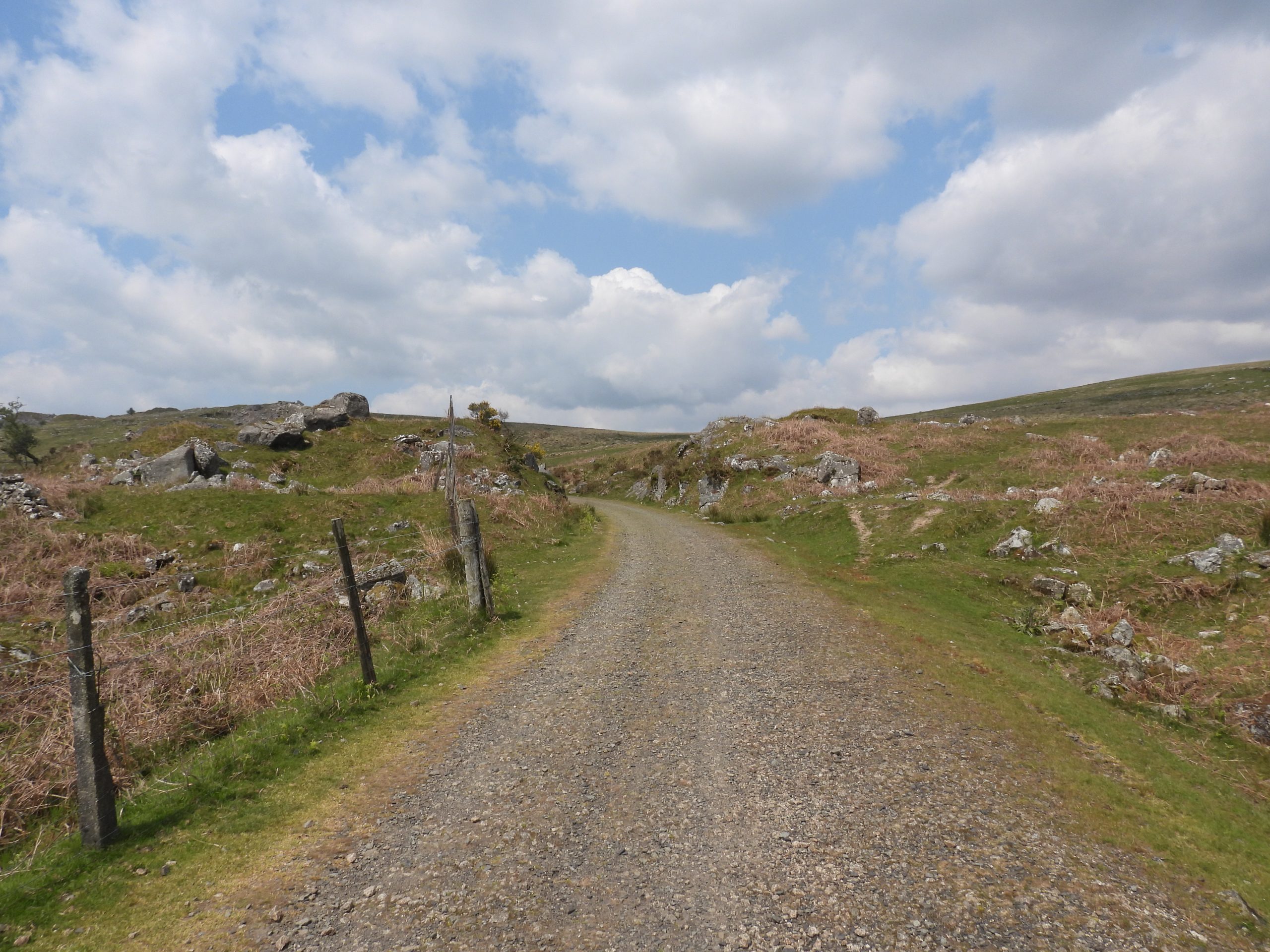
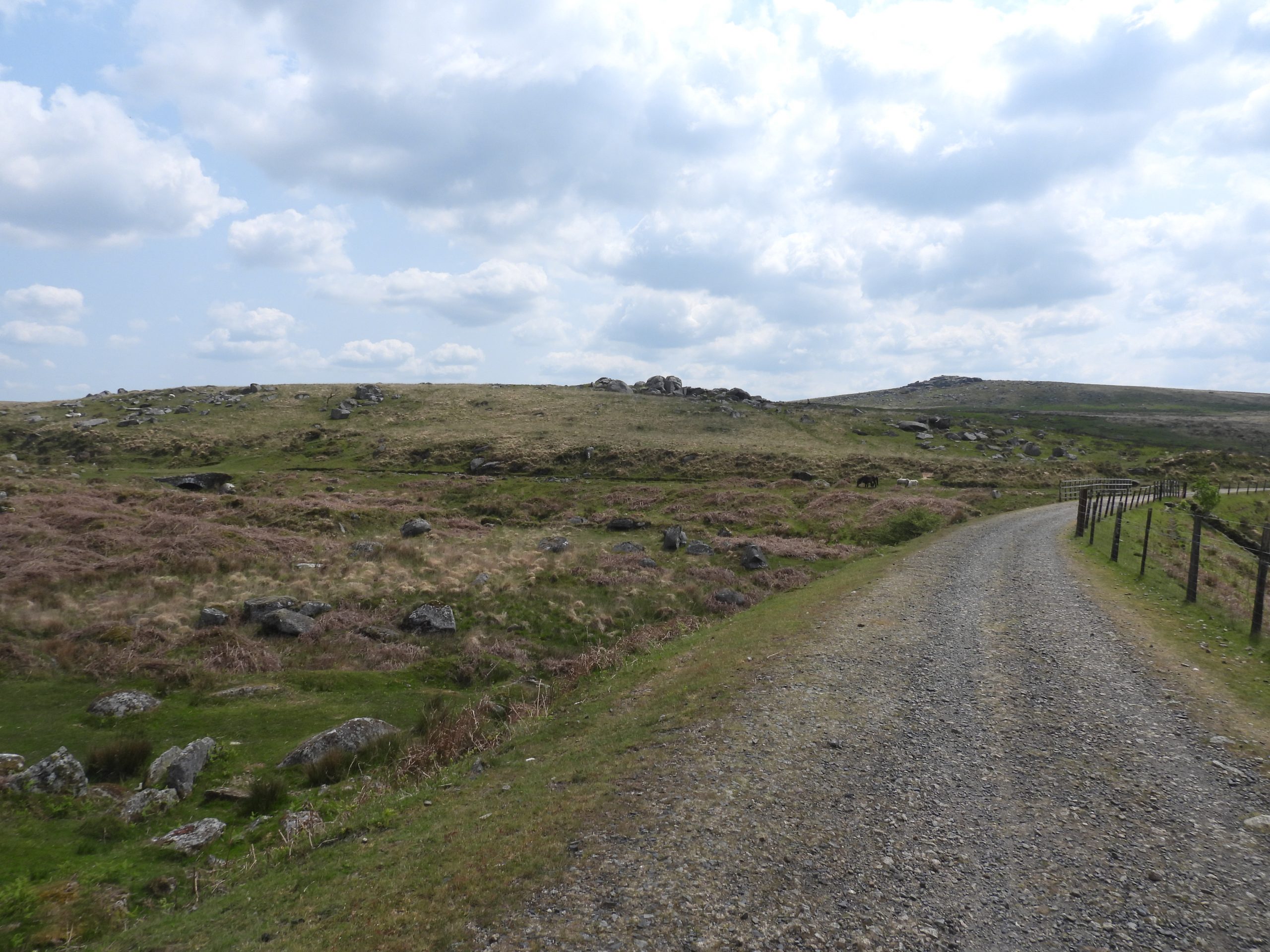
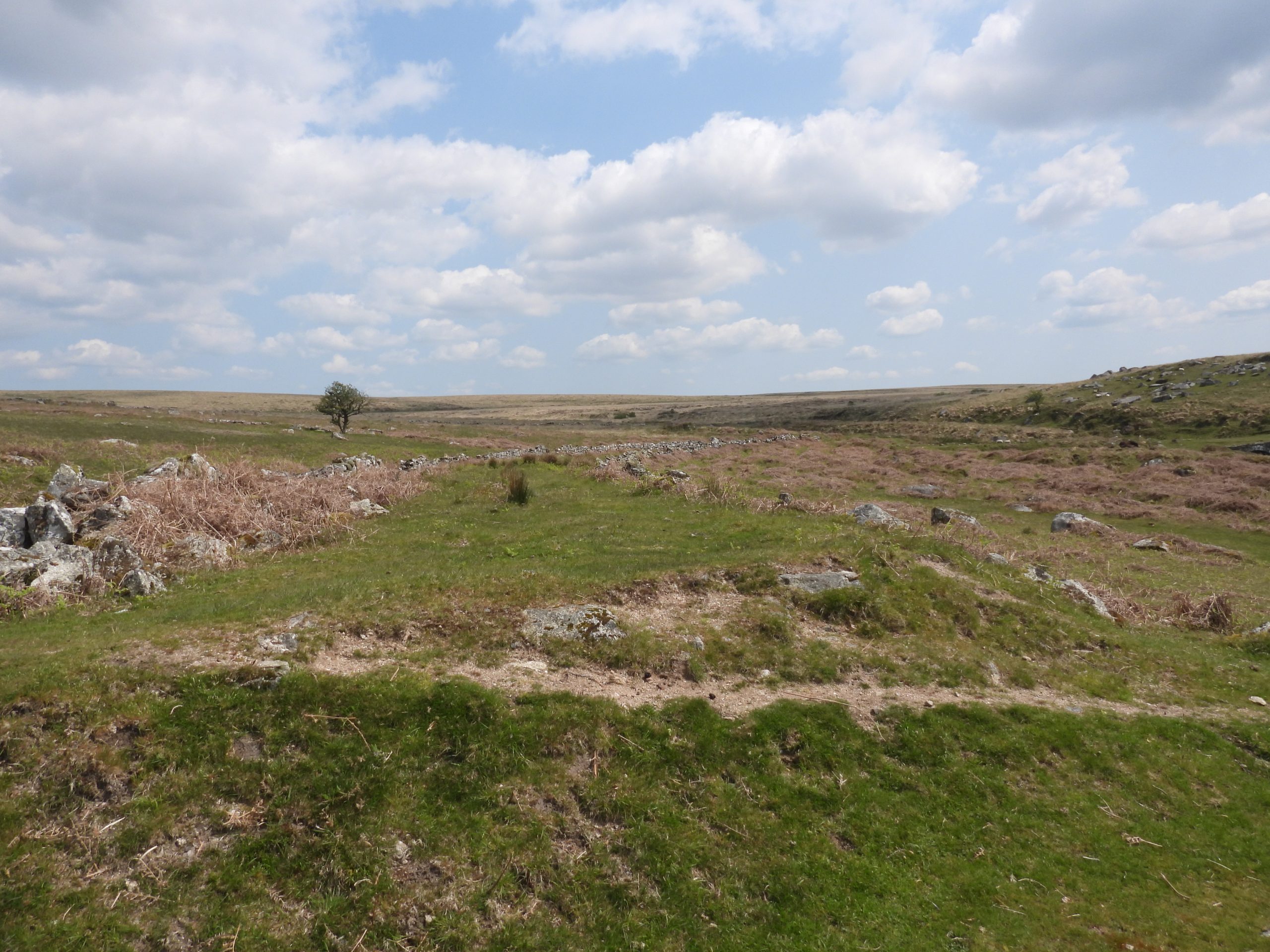
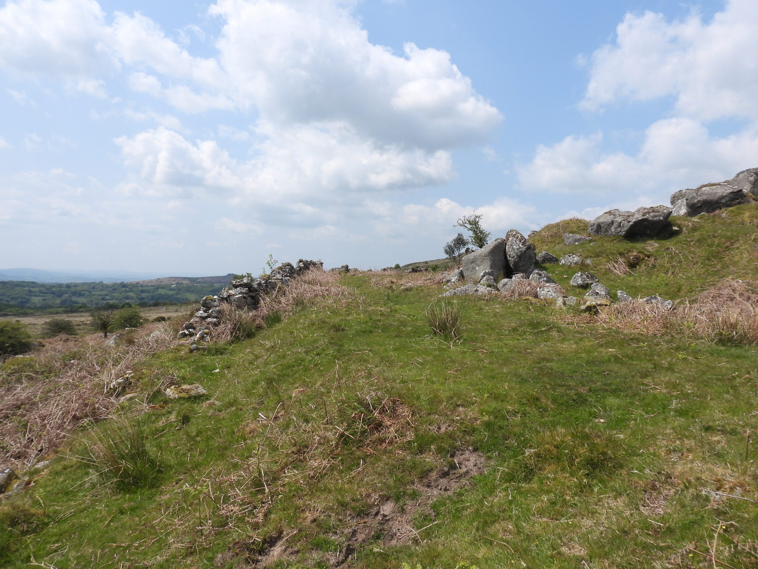
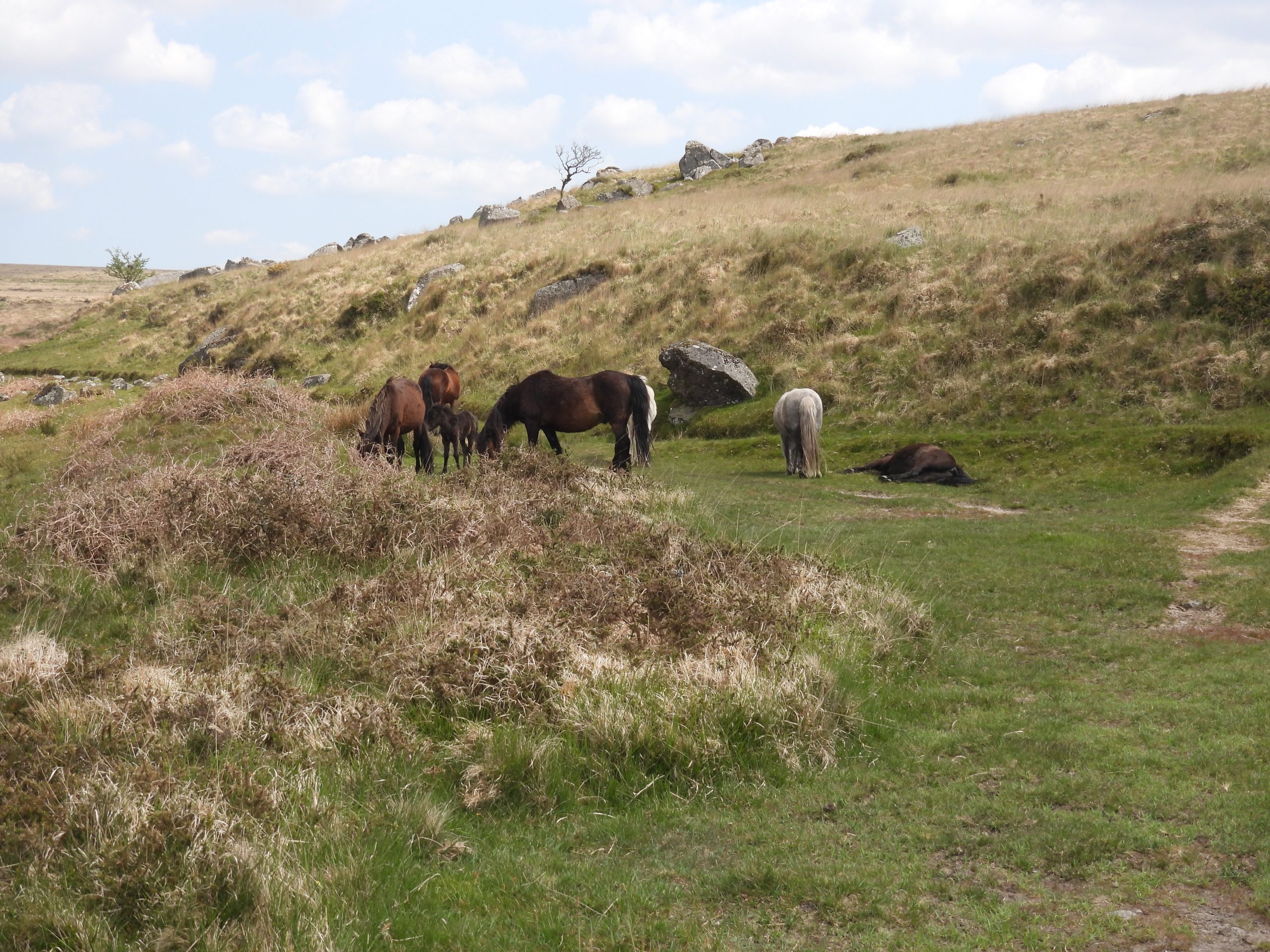
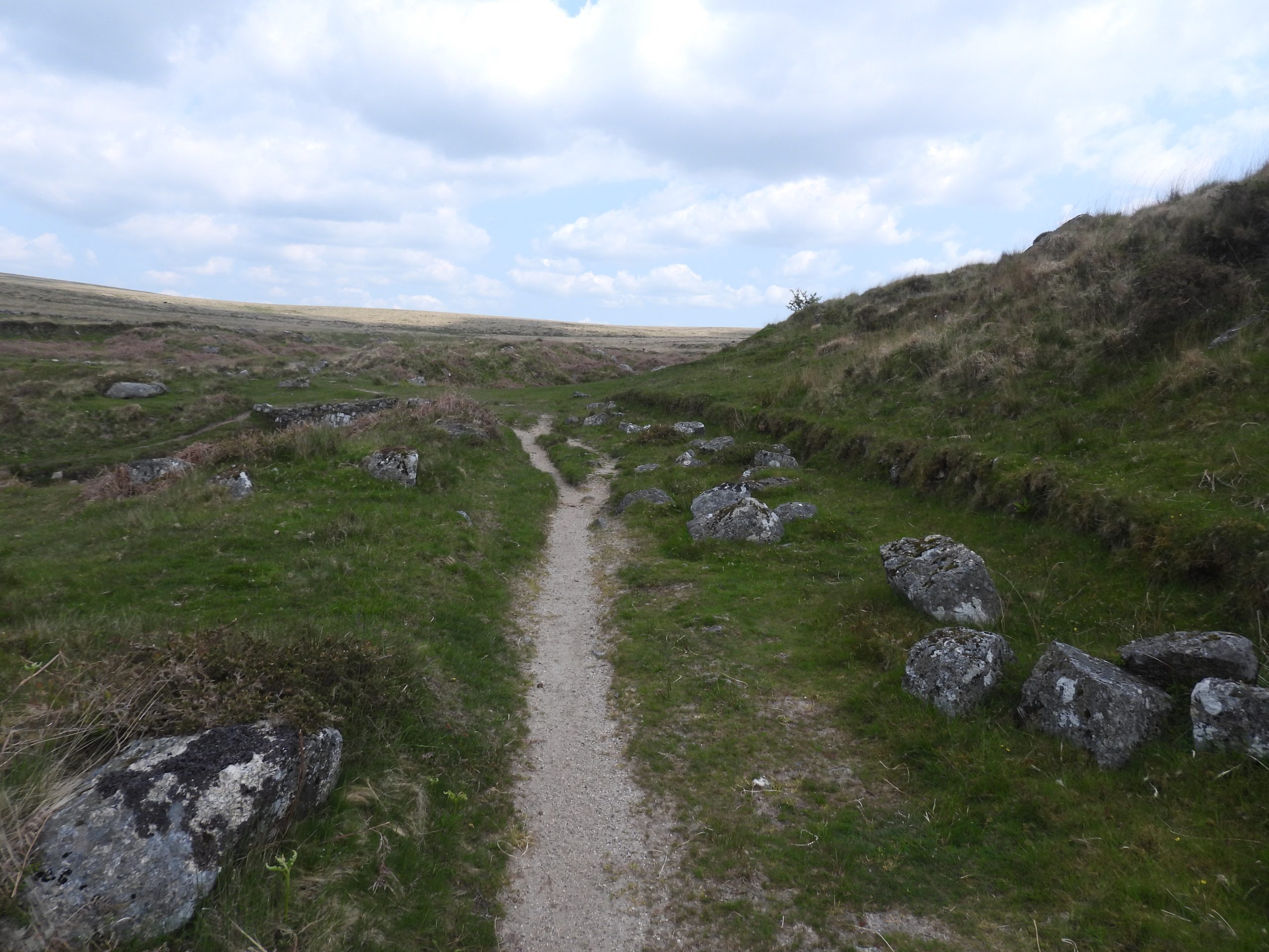
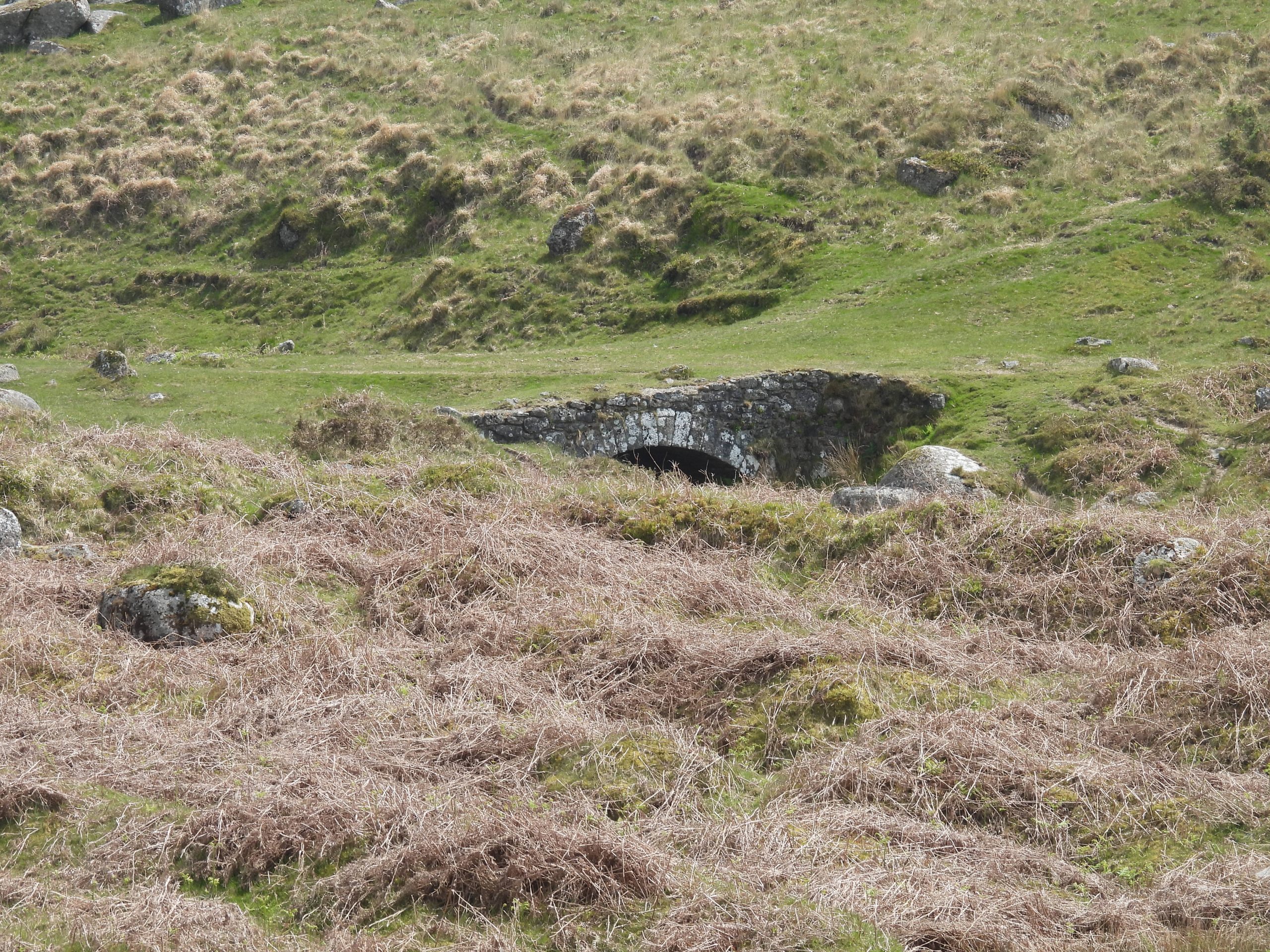
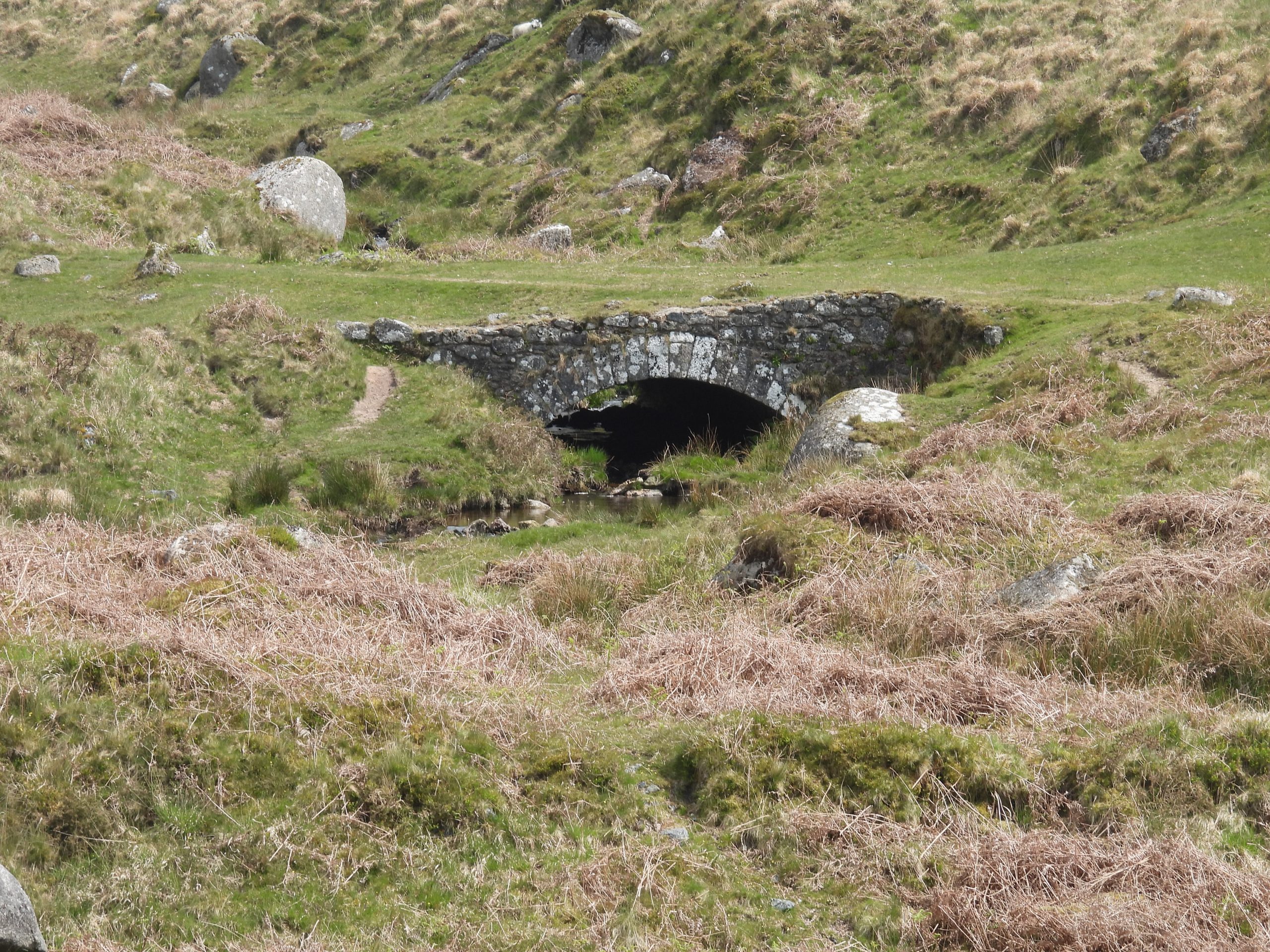
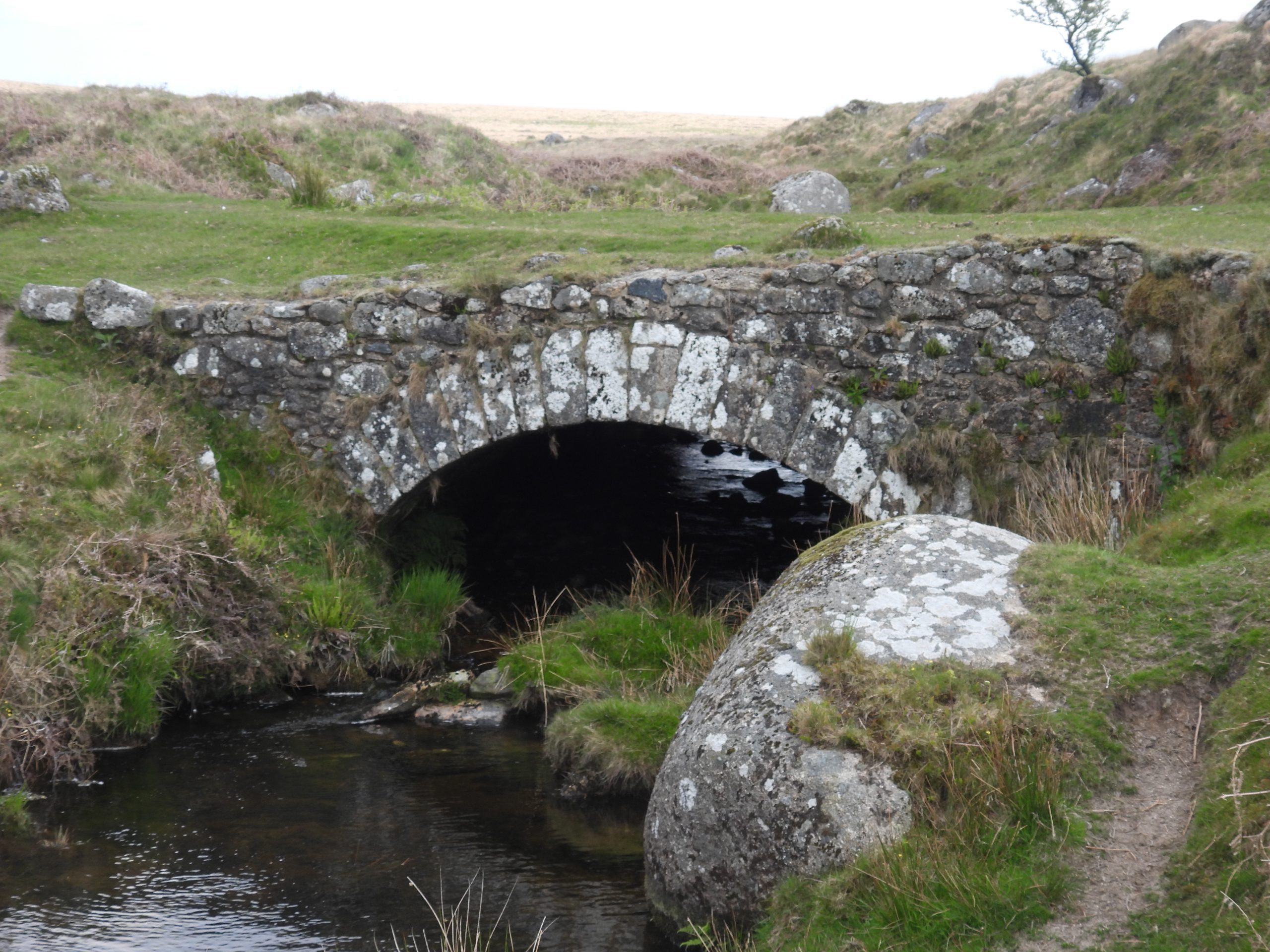
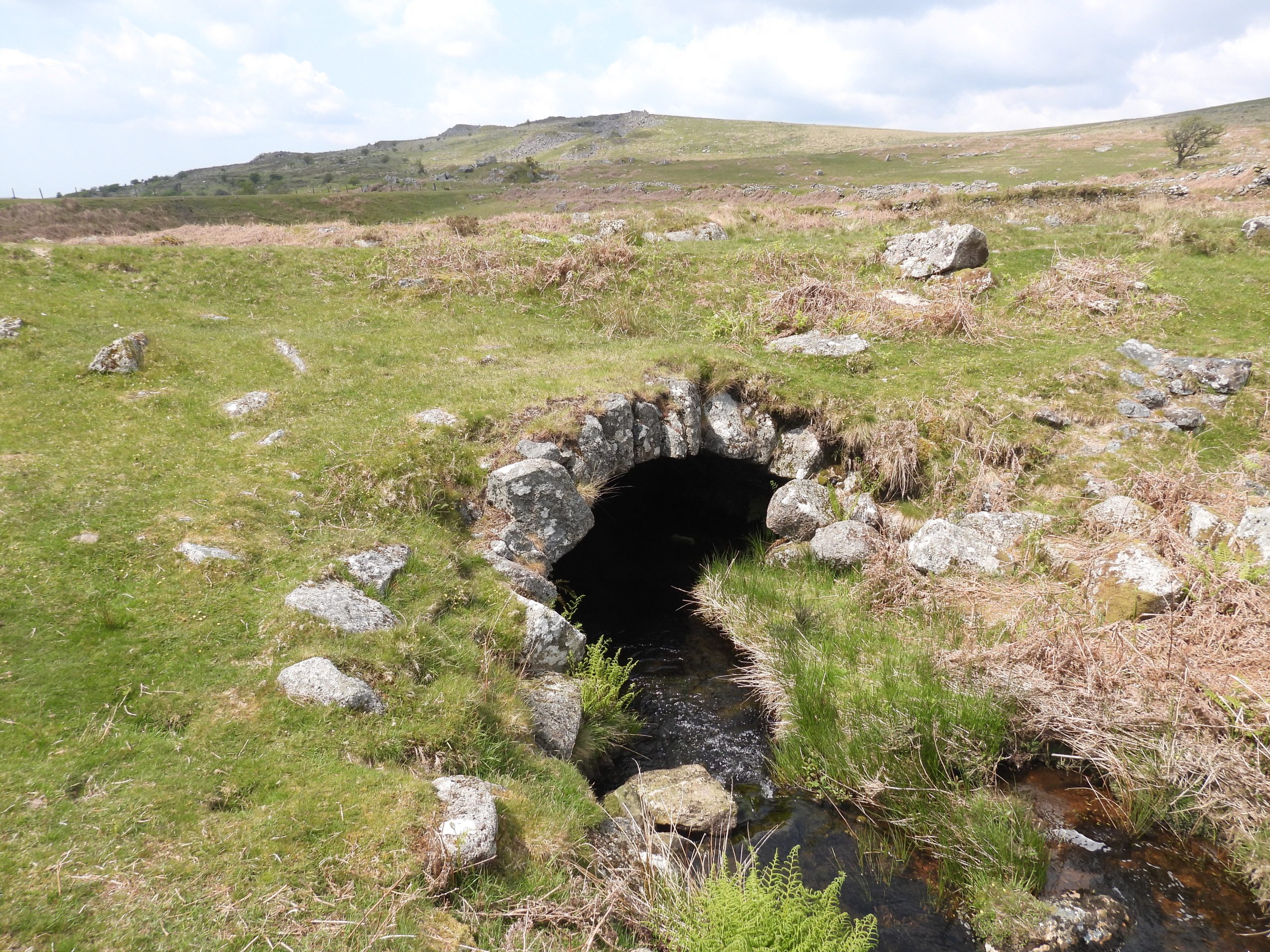
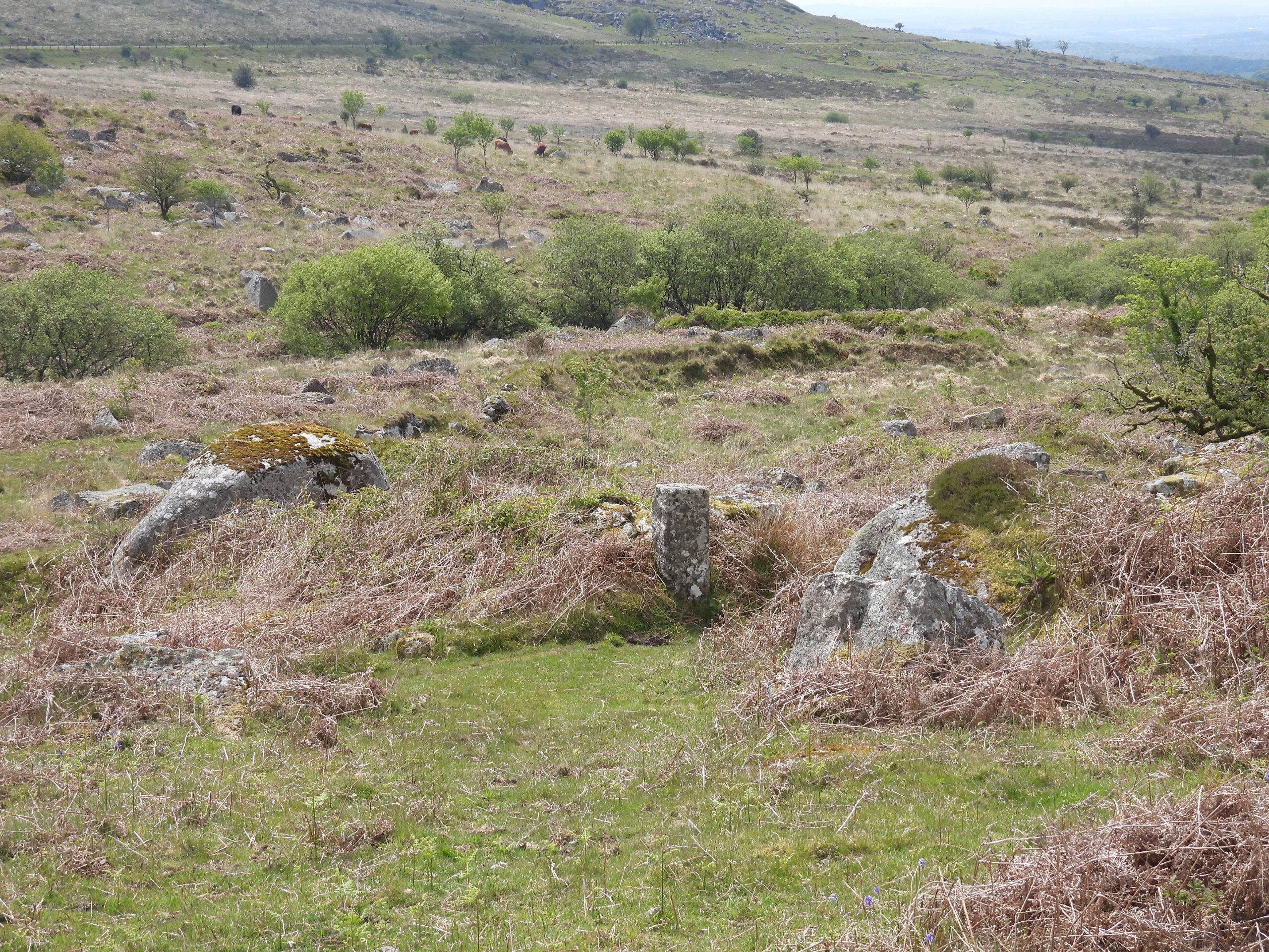
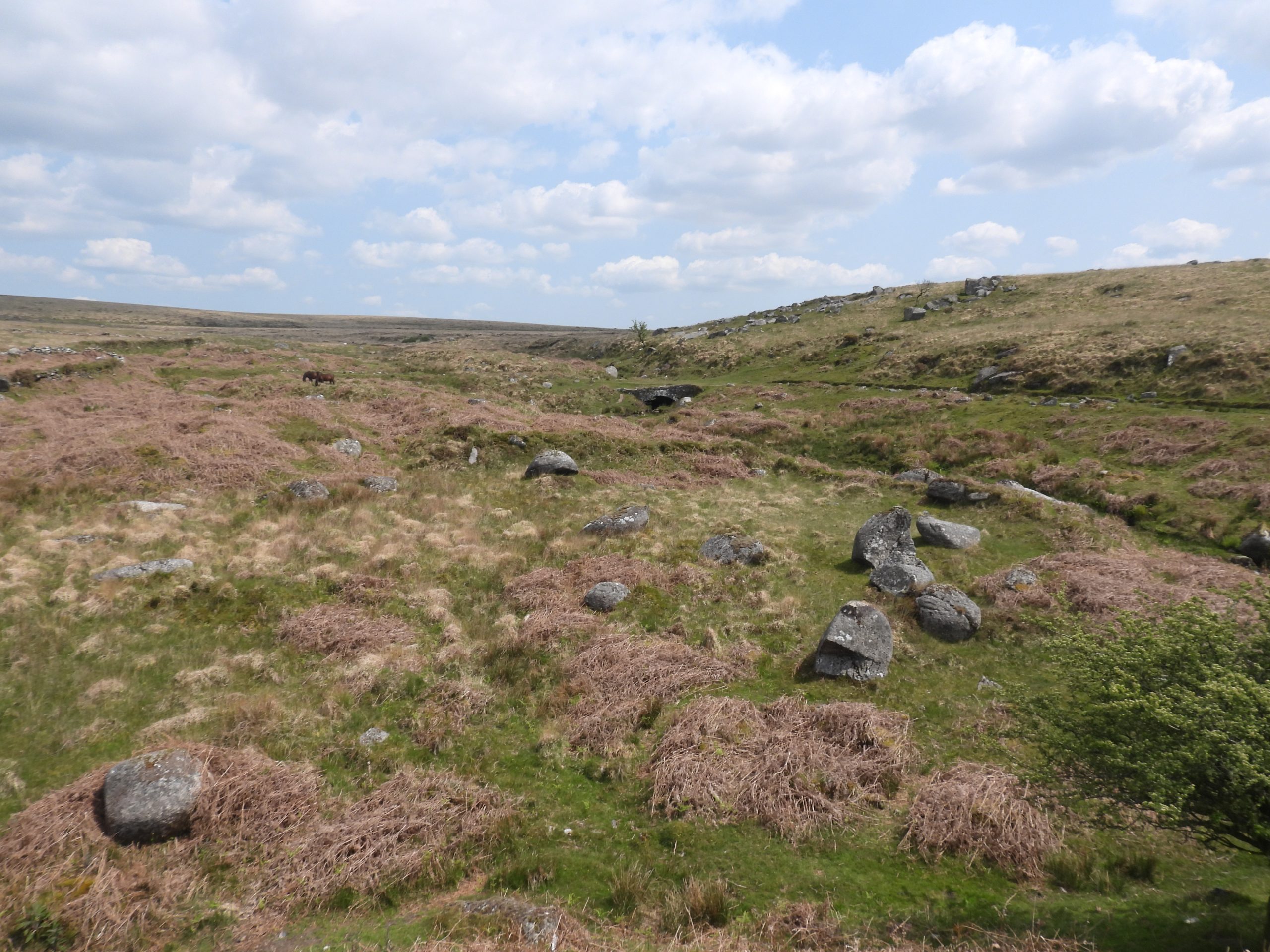
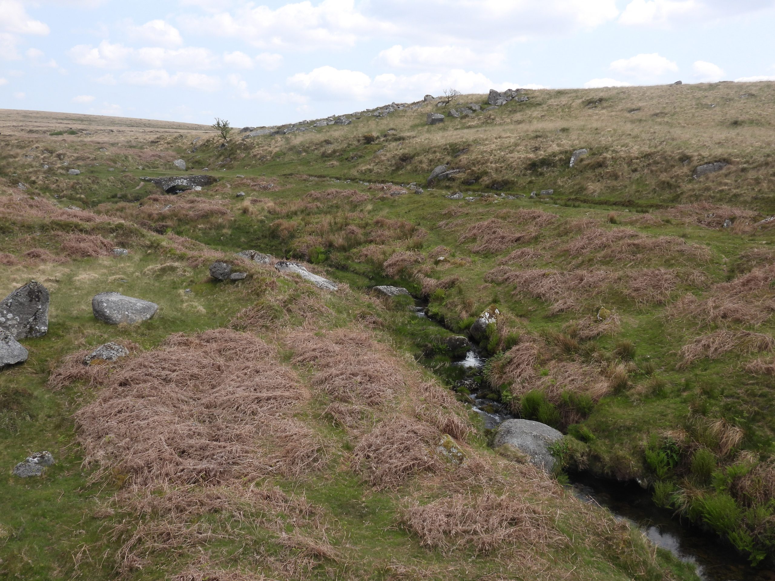
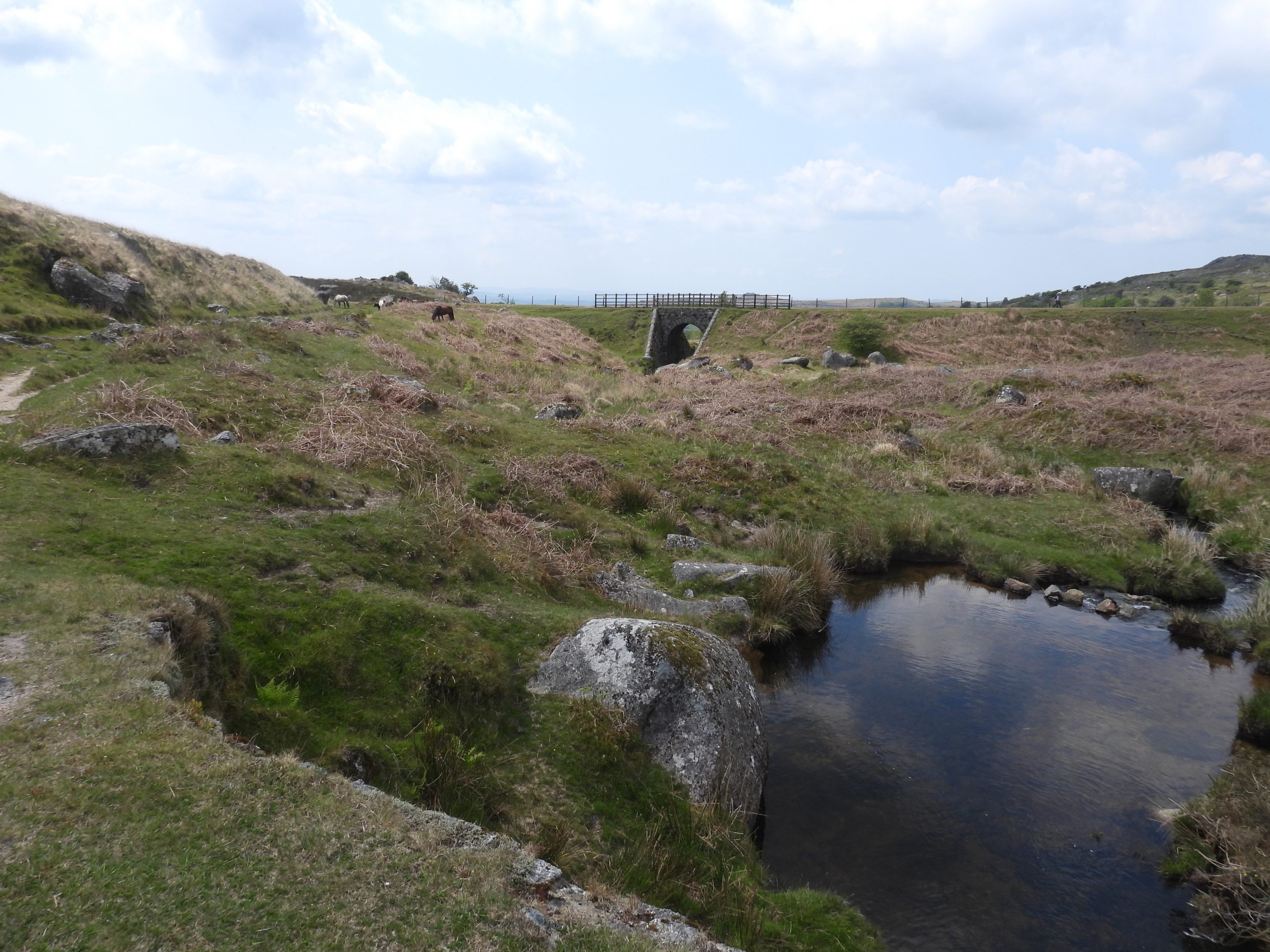
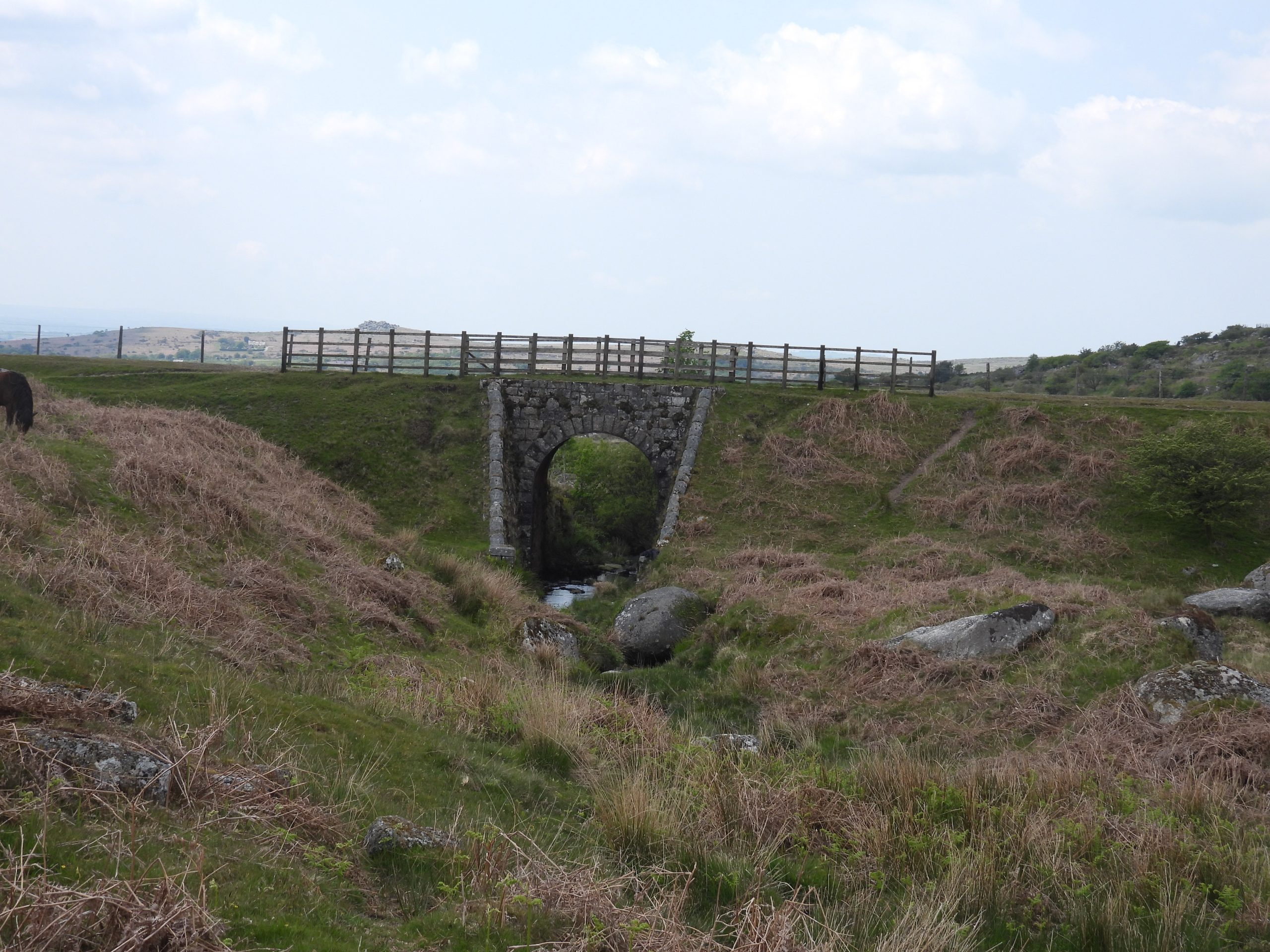
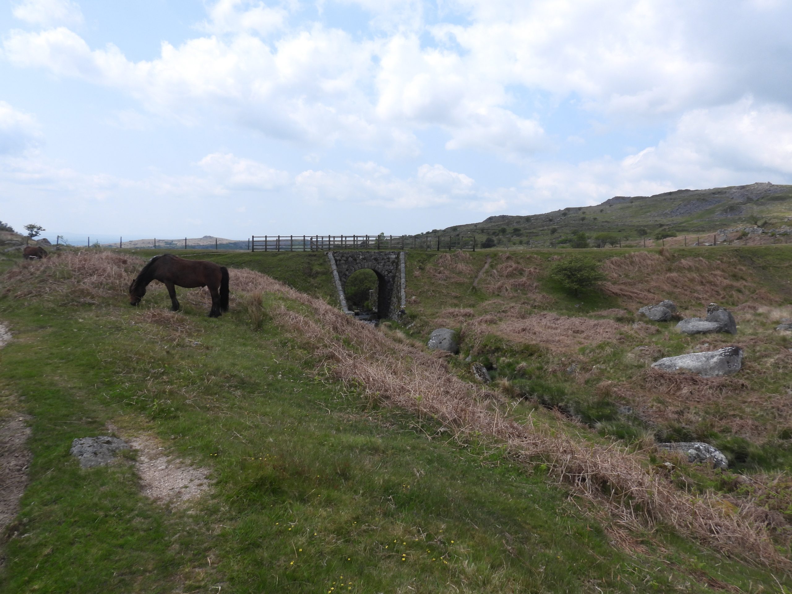
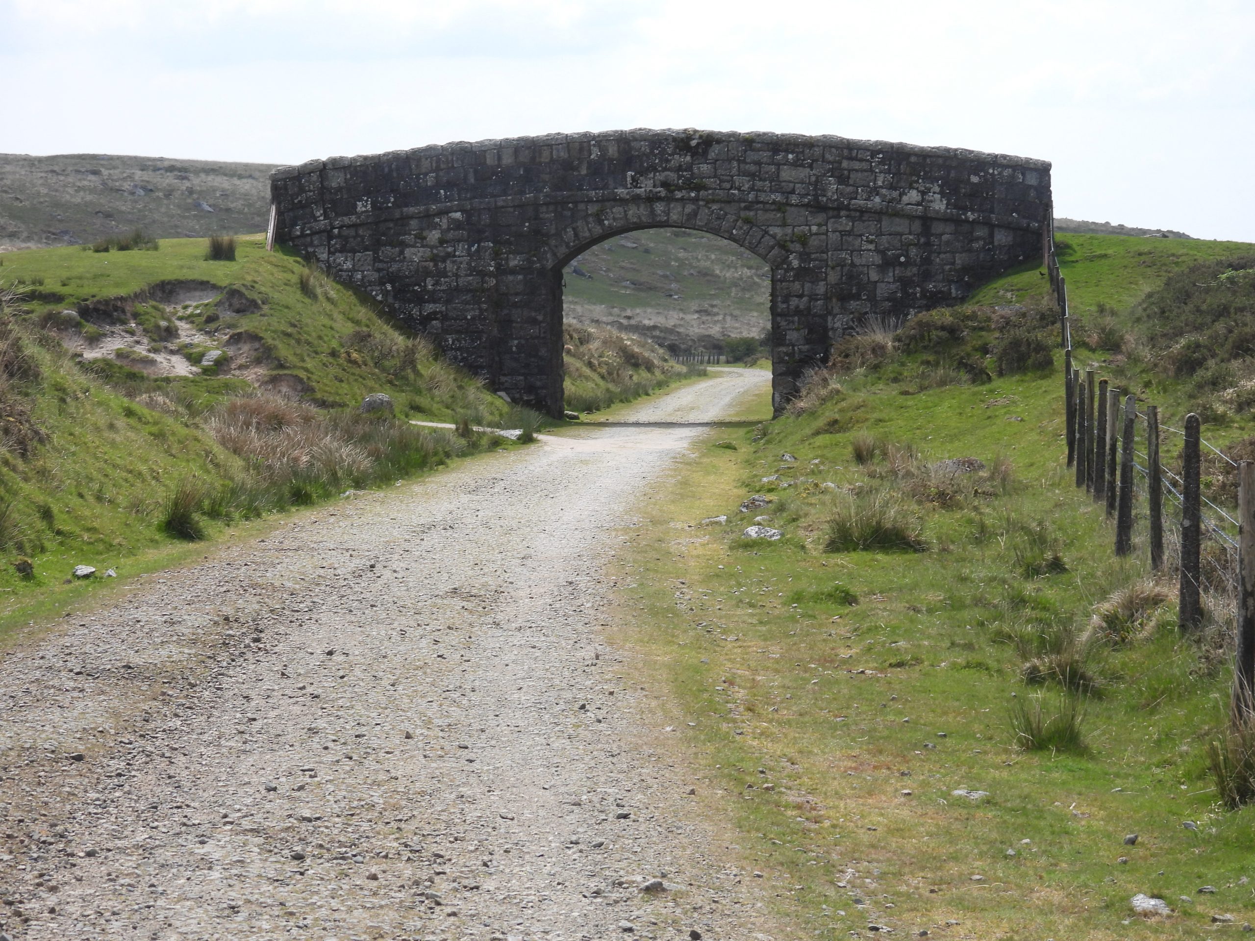
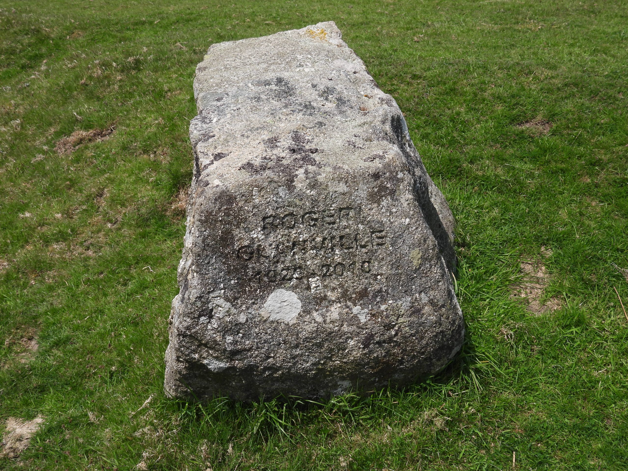
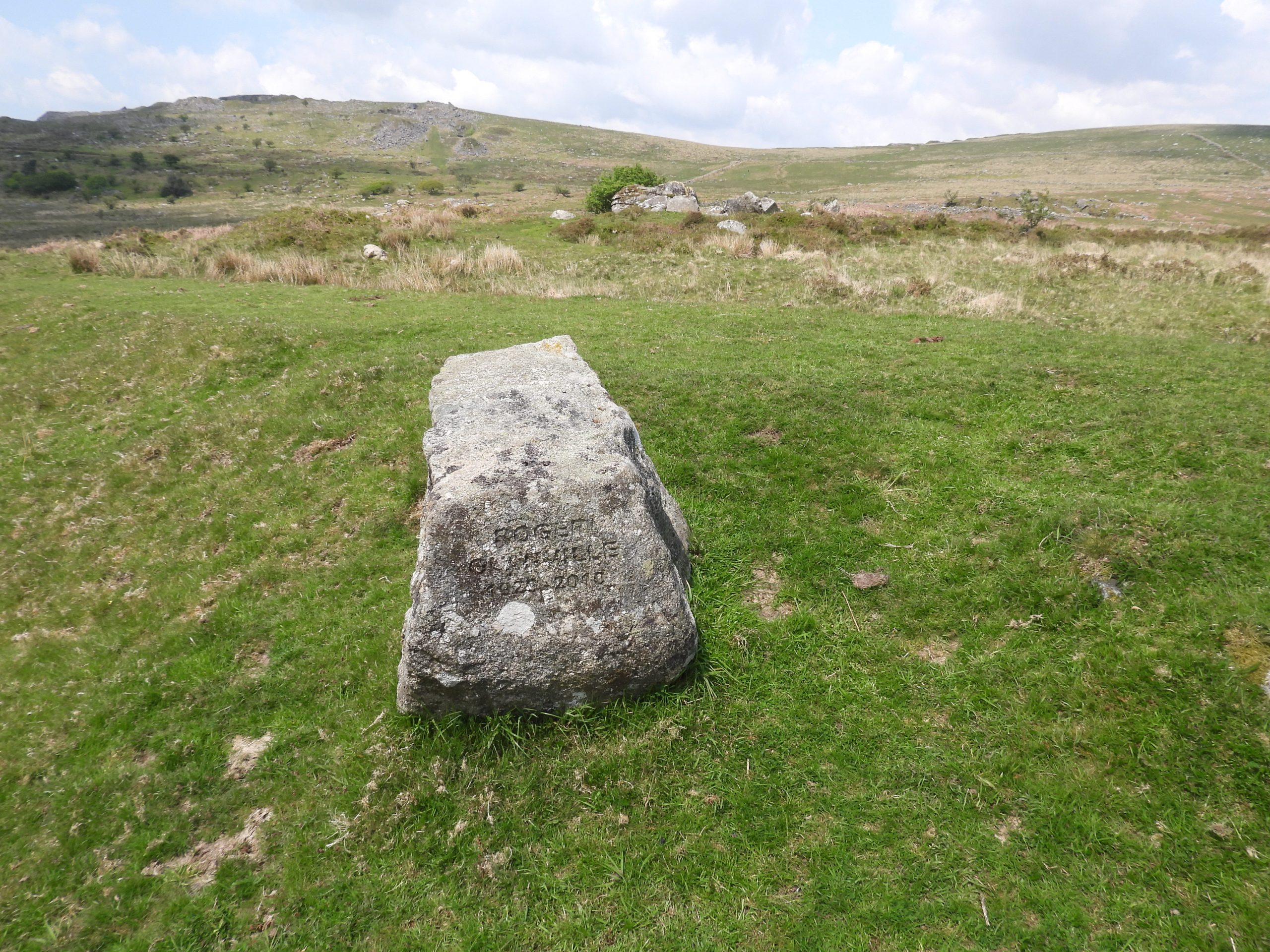
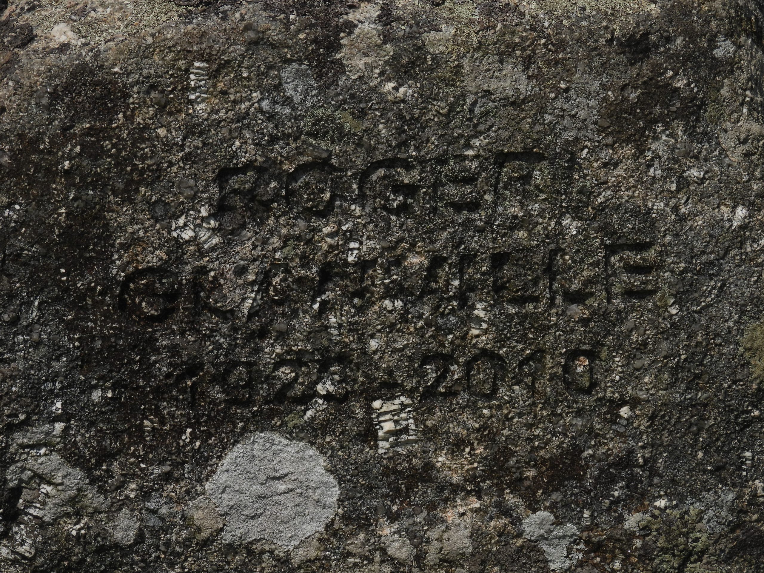
Sketch map of the location and immediate environs of Yestor farmsteadThis annotated map (1873-1888) show three buildings with roofs (rooves) as indicated by the pink shading. This post covers pictures of the buildings, the ‘double recess’, possible barn, possible outshut, passageway and mystery structure. The farm can be approached from the north via a gate which is alongside the old Princetown Railway line.Approaching the farmstead. The first building which catches the eye is the one to the left of the ‘Yestor Farm’ label on the picture. This is outbuilding (2) from the sketch map.Inside the house at its east end is a ‘Double Recess’, which was recorded by Stephen Woods (1988) in his book Dartmoor Stone, (pages 163, 165) as being possible bee boles. Stephen Woods states “These look out onto a small, private courtyard”. The author casts doubts as whether these are bee boles simply because they are internal to the building (confirmed by using the National Grid Reference for the location and comparing with National Library of Scotland (1873) interactive map). That said, Hemery records “bee-butts, which stand within a small enclosure 13 1/2 feet by twelve feet”, but does not state the exact location. Additionally, Tim Sandles states that: “The International Bee Research Association hold a register of the bee boles and other beekeeping structures one of which that appears is the Yes Tor farm”. The author has been told that a former Dartmoor National Park archaeologist did not believe that these structures were bee boles.Close up of the ‘Double Recess’ which can be found at SX56290 72782. It is unlikely that these were a fireplace as there is no associated flue or chimney. The author is indebted to Alan Endacott who theorises that these could have been a butter well; a structure that would be well insulated and, with the addition of a trough or basin of water, a shelf over and a muslin or linen curtain across the front to keep the flies off, would keep dairy products and/or meat cool. The cloth would have been kept damp to cool the interior by evaporation. If any reader of this post could offer up any other alternatives, he would be grateful to hear from them.The author has recorded this as the ‘east end’ of the main house, insofar as it appears to have been roofed on the 1873 map and was part of one structure (see the annotated map). One wonders if this was the Hemery enclosure with ‘bee-butts’ as this is where the ‘Double Recess’ is located?The house is recorded by the Ordnance Survey Archaeology Division (1980) that internally the house measures 15m. by 5m. The east end is approx. 7.5m x 5m (ie half of that recorded in 1980). Swelltor quarries can be seen in the background of this picture.This view of the house is from the north side. Hemery records that in 1885, the tax for the farmstead was paid by Stephen Spurr. He further states that: “The Walkhampton Parish and Church Account Book shows lessees of the farm as Richard Adams in 1820 and Samuel Hannaford in 1824”.This view is of the west end of the house which now has a tree growing in it. In 1825 the lessee was John Johnson, who was the manager at Swell Tor Quarry. At this time, some of the enclosures were called ‘Smith’s Shop Field’ and ‘Quarry Park’.To the east of the house is a passageway, which can clearly be seen on the 1873 map.View of the passageway from the north with the enclosure by the house beyondBy the passageway (in the foreground of this picture) is a rather substantial construction, for which the author can find no explanation for. It is at the west end of ‘Outbuilding 1’Looking north with the passageway and outbuildings 1 and 2 beyond.This picture is from outside the enclosure by the house. In the 1851 census a John Ponsford, aged 62, ‘Agricultural Labourer’ was the occupant (with his wife and two lodgers), together with James Perkin, aged 34, ‘Stonemason’ (with his wife and three sons). Perkin’s father lived at Whitethorn, a cottage on the southside of King Tor near the railway (ref: Hemery). The two entries from the 1851 census, show the farmstead still being called Easter Green. There were 6 adults and 3 children living at the farmstead.Entries from the 1861 census which shows the last (known) tenants being John Turner, aged 31, ‘agricultural labourer’ and John Sloman, aged 41, quarry labourer. John Turner had a wife and son. John Sloman had a wife and three sons. The farmstead was still known as Easter Green,At the west end of the house is what the author has labelled an outshut, albeit it is quite large. The 1873 map shows it as an unroofed small enclosure. Ordnance Survey Archaeology Division (1980) recorded that : “There is an outshut on the west end of the house”.This structure is shown as being part roofed on the 1873 map. It has a dividing wall, which is still extant, as shown on the aforementioned map.Looking at the east end of the structure which was unroofed on the 1873 map. The structure is conjectured by the author as having once been a barn (it certainly seems large enough) The possible barn with Swelltor Quarries beyond.The author has labelled the structure as ‘Outbuilding 2’ and ‘Possible Barn’. The ‘Outbuilding 2’ appears to have been roofed in 1873. The ‘Possible Barn’ has high enough extant wall corners to have perhaps once to have been also roofed.Outbuilding 2 may have been a shed ?Inside the ‘Possible Barn’ is a well shaped lintel. It is located at SX56306 72788The outline of ‘Outbuilding 1’ is not as well defined as the others. It is, however, clearly shown as being roofed on the 1873 map.‘Outbuilding 1’ as viewed from the north. One wonders why this building has been virtually raised to the ground whereas the walls of the other buildings and enclosures are still very visible.Enclosure to the east butting the railway line. These aren’t separated out in the tithe map and are part of the the farm (labelled 459).R.G Haynes, (1966-1969), Ruined Sites on Dartmoor, recorded that the farmstead had: “Curious features with the filling in of a number of doors and windows in the outbuildings, even the garden gate”. The picture is of the west wall of the house enclosure and which may well be the ‘garden gate’ in fill mentioned by R.G. Haynes.Is this a blocked doorway on the main house. The 1873 map suggests there was doorway with a porch at this location.This gatepost / standing stone is located at SX56306 72745The gatepost / standing stone with the farm to the north. The stone was most probably a tethering post or a cattle scratching post. The author would welcome any comments on other reasons for this structure.The 1873 map shows a mystery structure (black circle). There is little discernible her except a small raised bank next to a pit / sunken area. A mystery indeed. Location is SX56291 72754Leaving the farmstead and moving south the enclosures can be seen either side of the Princetown Railway. The Princetown Railway cutting here would have been made around 1880 (in anticipation of the opening of the line in 1883). The course of its predecessor, the Plymouth and Dartmoor Tramway can be seen to the right of the fenceline in the picture. It ran to the the left (east) side of the curved walling and the fenceline.The Princetown Railway line cutting viewed from the south. The Plymouth and Dartmoor Tramway course ran from right to left in this picture (just before the cutting)Approaching the bridge over Yes Tor Brook. with Fur Tor and Leedon Tor prominent. The Princetown Railway opened in 1883. The builders converted and reused large sections of the Plymouth and Dartmoor Tramway. The line failed to pay its way and was closed in March 1956.The course of the Plymouth and Dartmoor Tramway as seen from the Princetown Railway. The sweeping curve would have been perfect for the horse drawn tramway but rather impractical for a steam locomotive. The Plymouth and Dartmoor Tramway operated from Sutton Harbour to Princetown and opened in 1823. It was used mainly to transport granite. View of the course of the Plymouth and Dartmoor Tramway looking east (on the north side of Yes Tor Brook)Plymouth and Dartmoor Tramway on west side of Princetown Railway leading to the enclosures of Yestor FarmPonies chilling out on the old Plymouth and Dartmoor TramwayView of the course of the Plymouth and Dartmoor Tramway looking east (on the south side of Yes Tor Brook)View of the small bridge which took the Plymouth and Dartmoor Tramway over Yes Tor Brook. The bridge at SX56470 72547The west end of the bridge. A wonderful construction, now 200 years old.The east end of the bridge.A gatepost at the southern end of the Yestor Farmstead enclosures as seen from the Princetown Railway line.View of the Yes Tor Brook valley, looking east.Yes Tor Brook descends over a series of waterfalls heading towards a small ‘gorge’ where the Princetown Railway Line bridge was built. The builders of the Plymouth and Dartmoor Tramway preferred a easier crossing of the brook a short distance upstream (as can be seen from the location of their bridge in the picture). View from the Plymouth and Dartmoor Tramway bridge looking west to the Princetown Railway bridge. The small ‘gorge’ of Yes Tor Brook. The Princetown Railway builders had to construct embankments either side of the brook leading to the bridge. The Princetown Railway bridge with the Plymouth and Dartmoor Tramway (to the left of the pony). Referred by Hemery as a ‘Cow Bridge’ crossing the Princetown Railway approx. 100m from Yes Tor Brook.Near the north end of the ‘Cow Bridge’ is a memorial stone.The memorial stone is located at SX56272 72473The inscription reads: “ROGER / GLANVILLE / 1920 (or possibly 1929?) – 2010”