A collection of walks, discoveries, insights and pictures of exploring Dartmoor National Park
April 10, 2023
Pennaton Clay Settling Pits and Brick Kiln
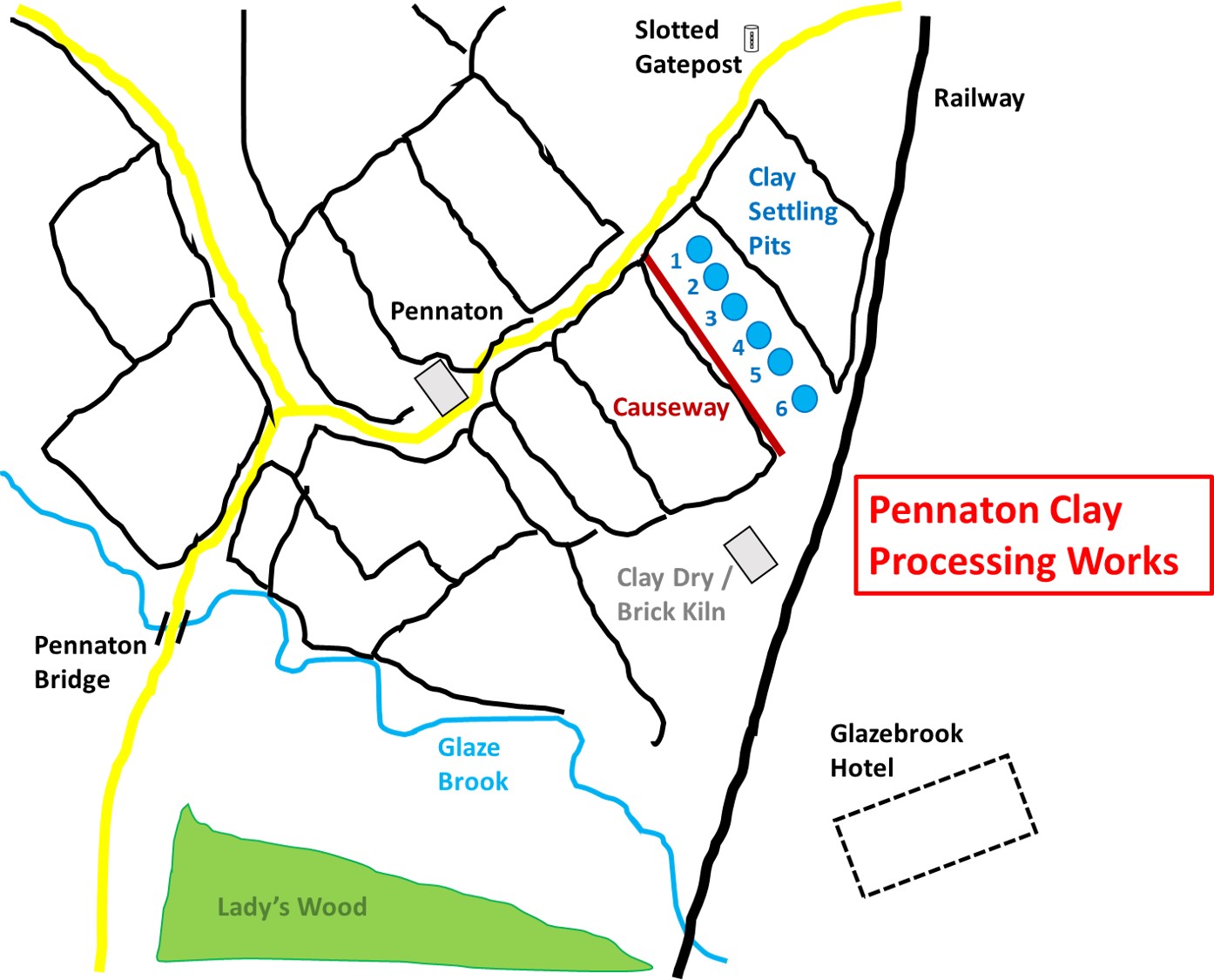
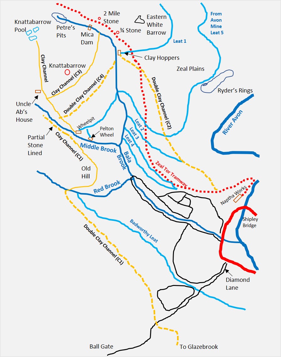
To the north east of Lady’s Wood and Pennaton bridge in two PRIVATE fields, sandwiched between the lane connecting Cheston with Aish and the main railway line are the remains of 6 clay settling pits (dries), a causeway and an associated clay dry / brick kiln building. The complex is located at the termination of a china clay pipeline which lead down from the open moor from the Knattabarrow clay pit and Petre’s Pits.
The author was fortunate enough to have been given permission, along with Tim Ferry to visit the site (as part of a recording of the condition of the clay dry / brick kiln for the Heritage Environment Record) in 2020. Access is not open to the public, however, the clay dries / settling pits and the adjacent causeway can be viewed from the gate in the lane.
The process appears to be as follows: Piped liquid clay from the moor entered onto the causeway via a launder, from which sluices controlled its passage to the 6 clay settling pits (dries). This was the first stage of the drying process to remove the majority of the excess water (which would have been needed to carry the clay in ‘suspension’ from the moor through the pipes). The final drying took place in the kiln building. The evidence gathered by the author suggests that it is (most likely) between 1865 (the earliest possible date given a brick found on site) and 1880 (when similar ventures in the area closed due to the depressed price of clay). The site may have been chosen due to its proximity of the railway, which was completed here in 1848.
Robinson 1977-1979, South Brent Parish Checklist, 485-88 of 821, sketch (Worksheet). SDV151046.
Tim Ferry, 2020, Pennaton China Clay drying kiln building, South Brent (Report – Survey). SDV363876.
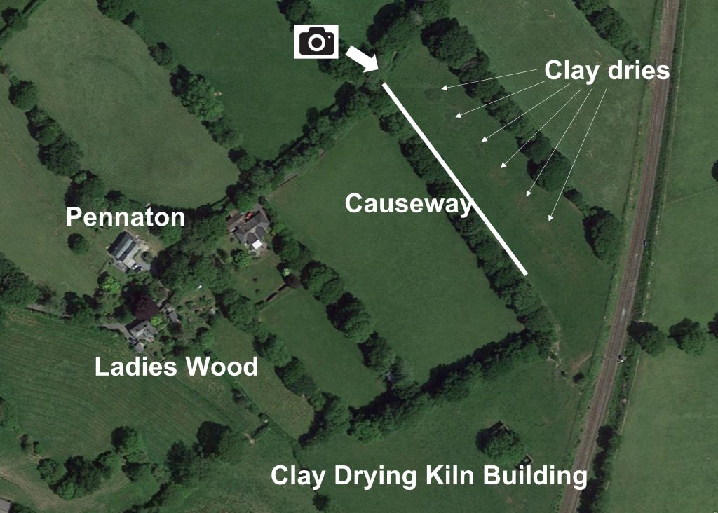
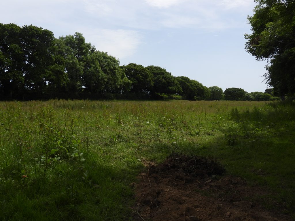
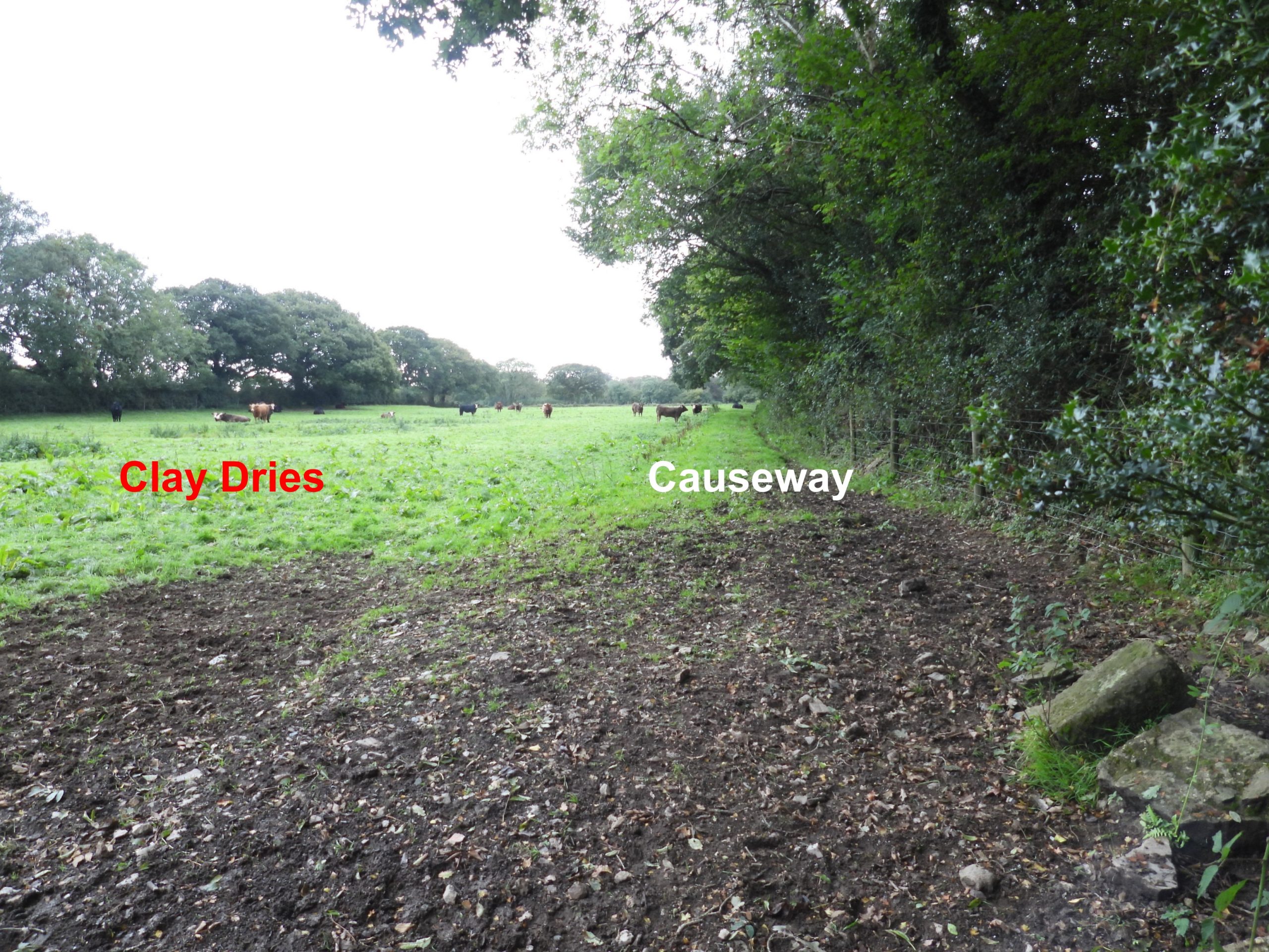
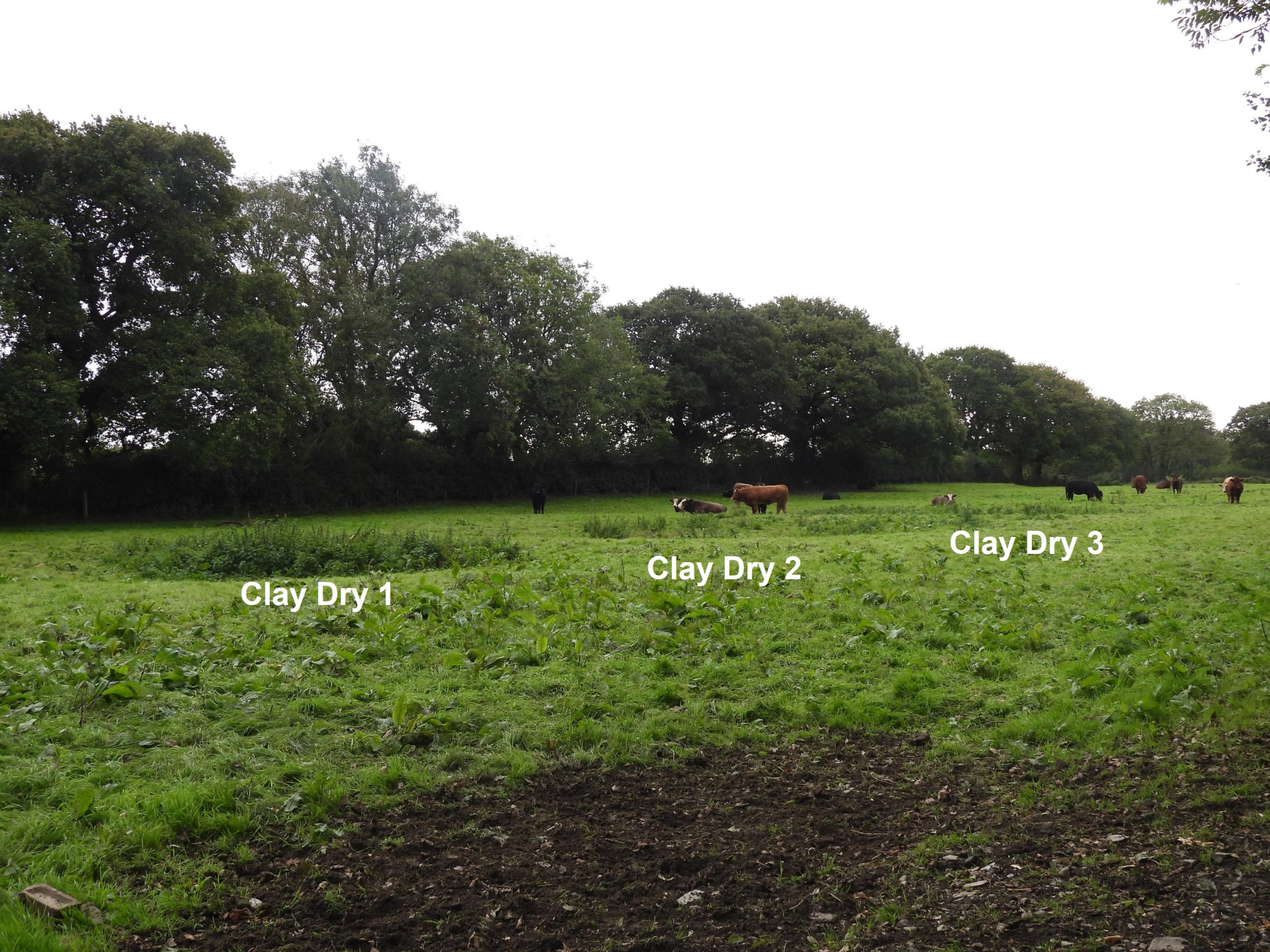
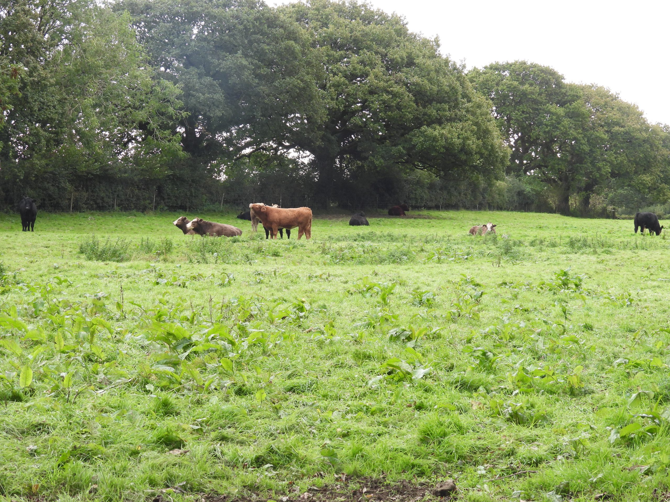
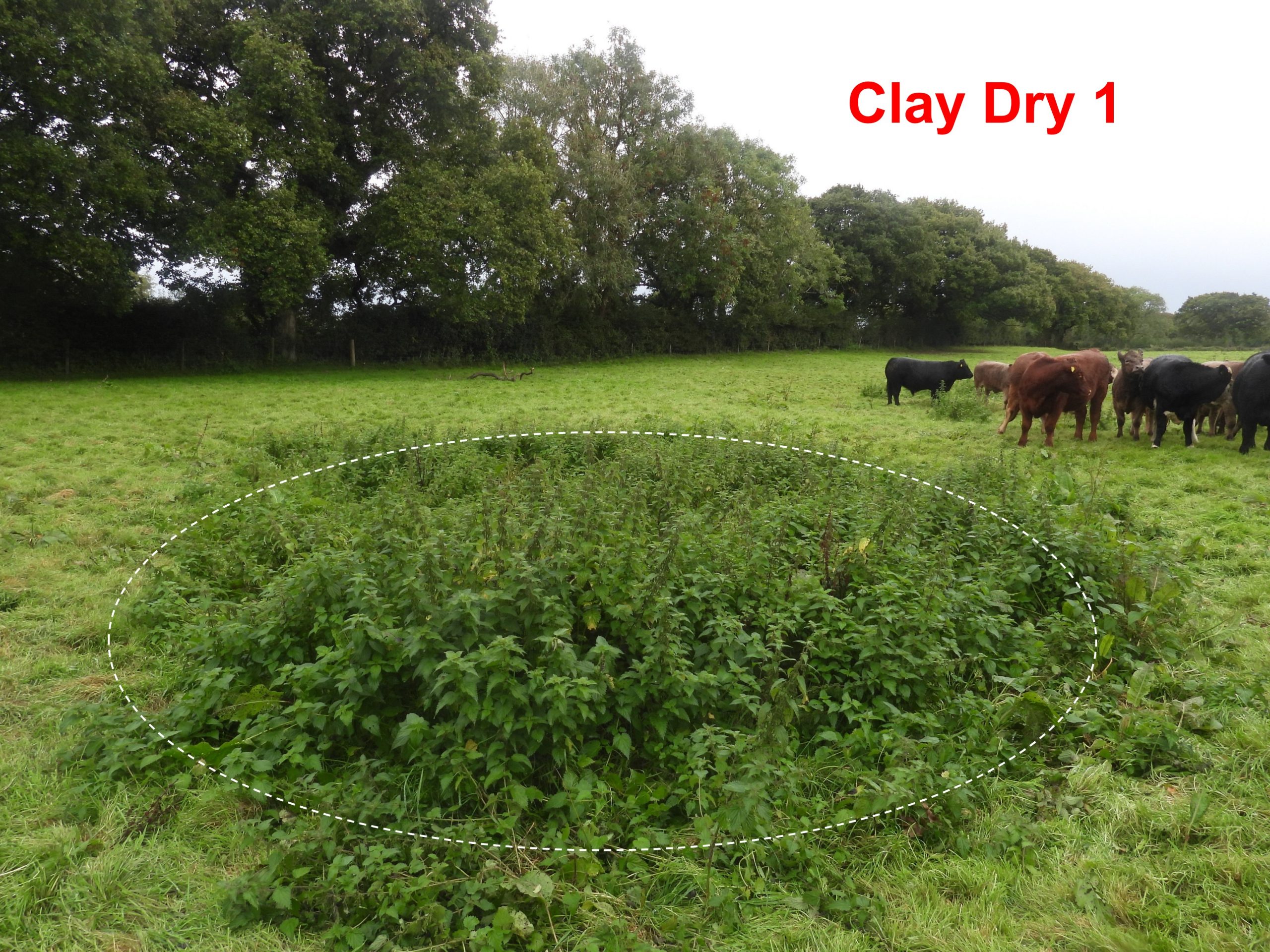
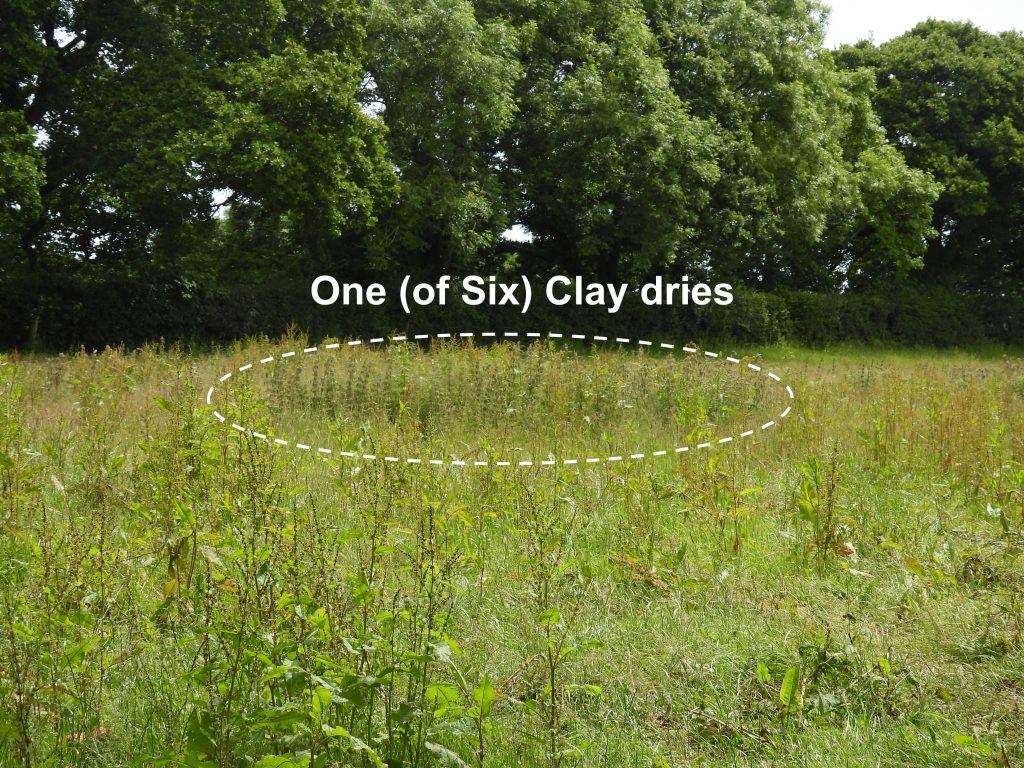
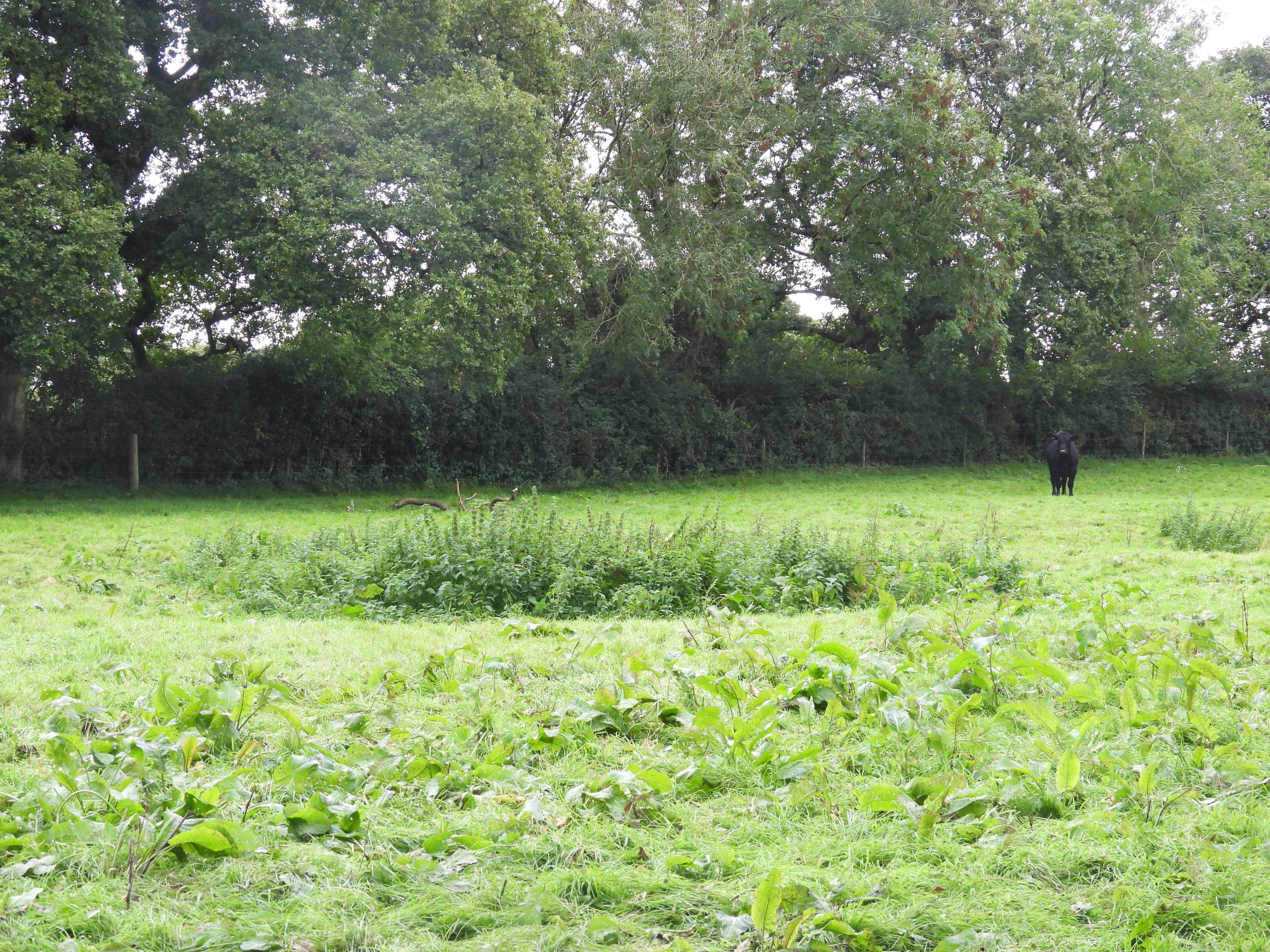
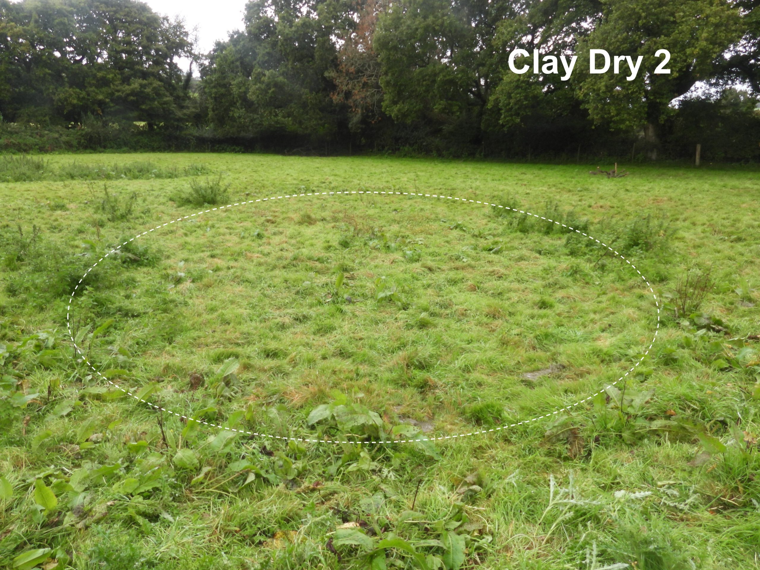
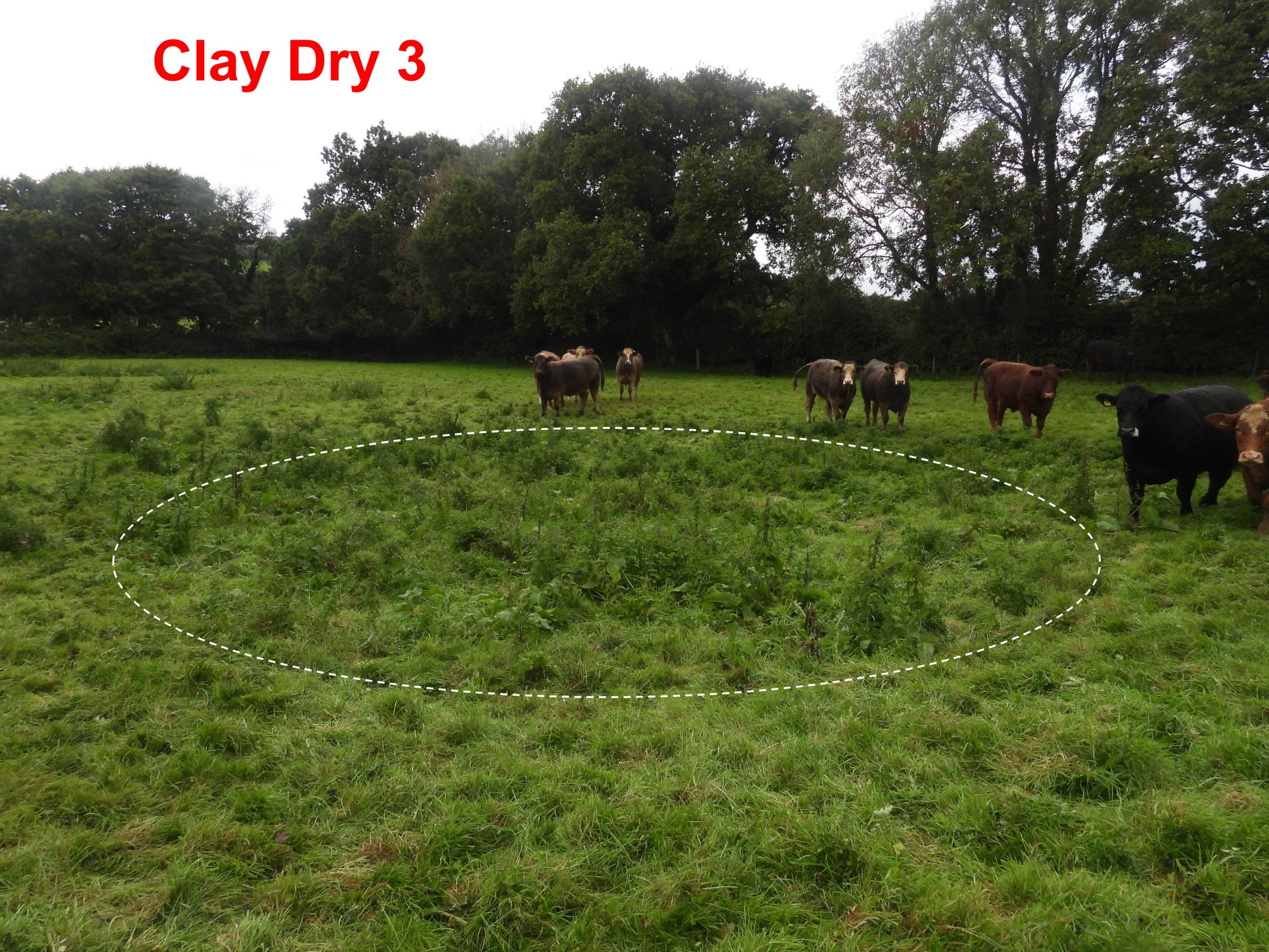
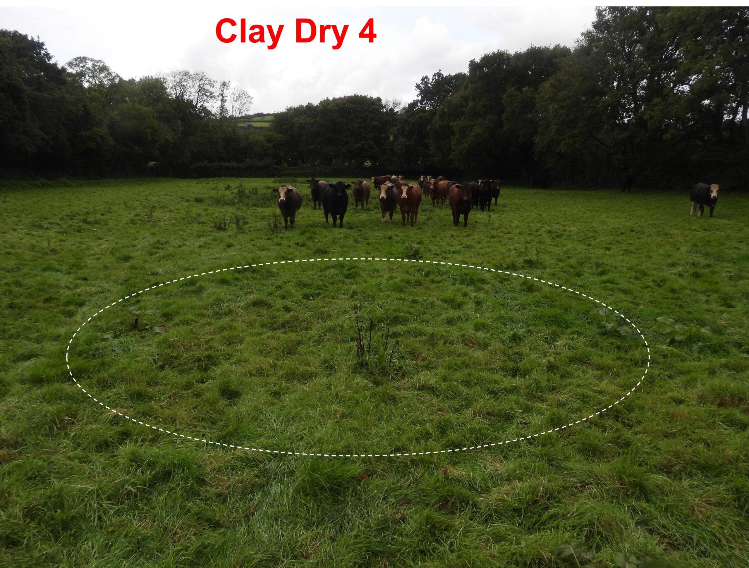
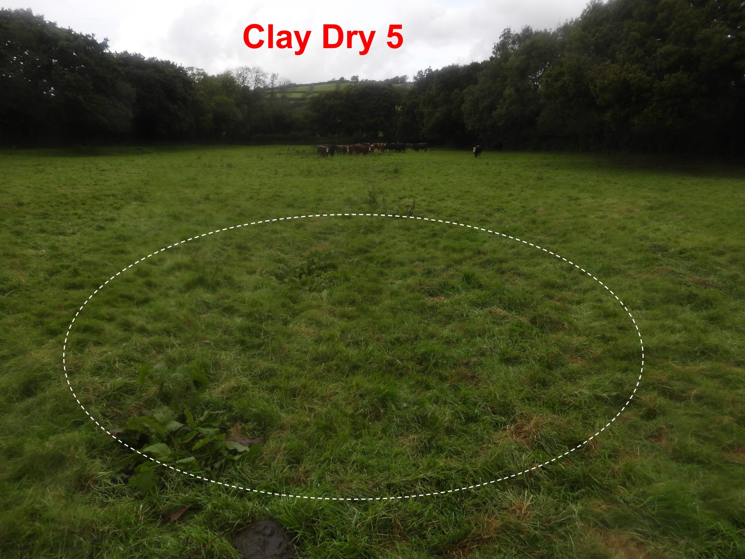
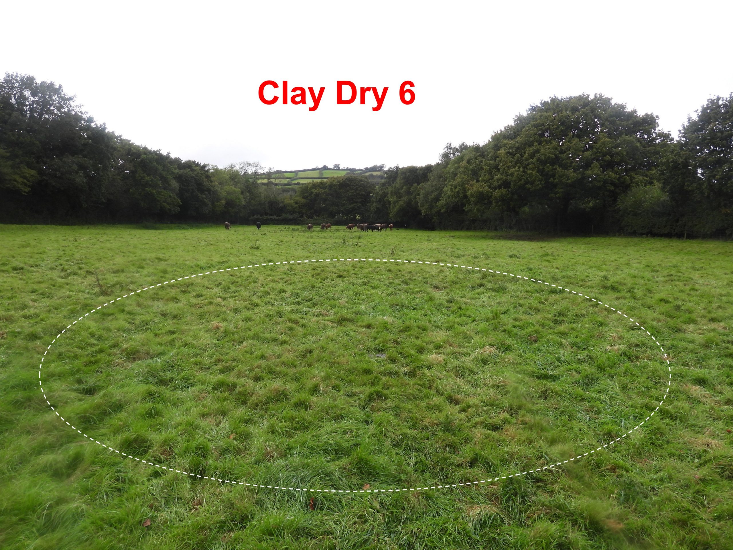
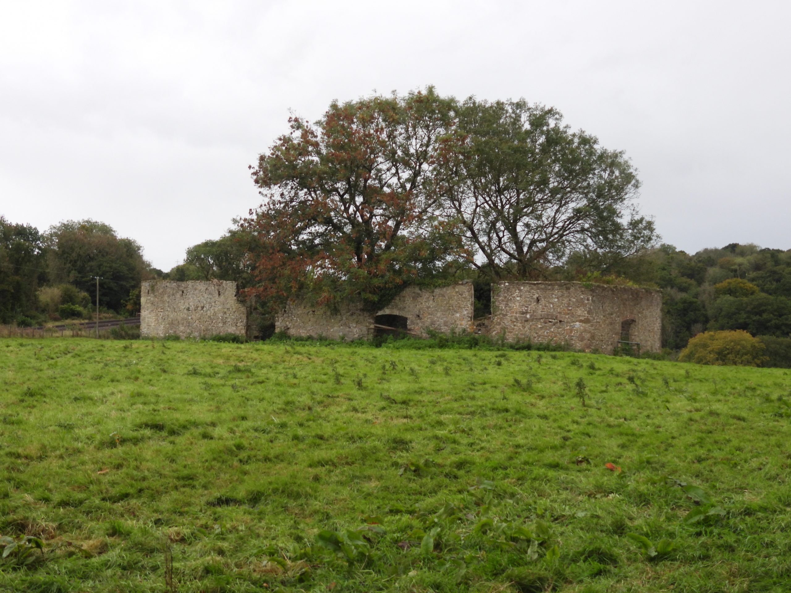
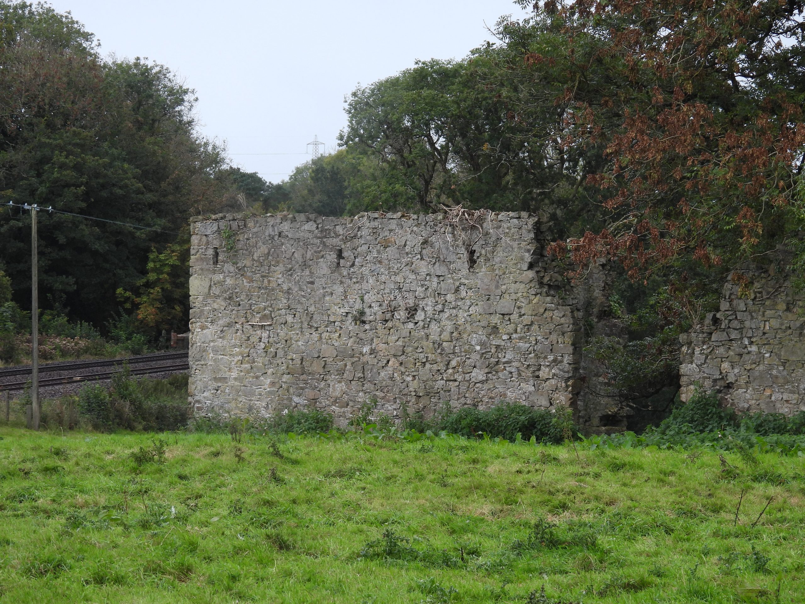
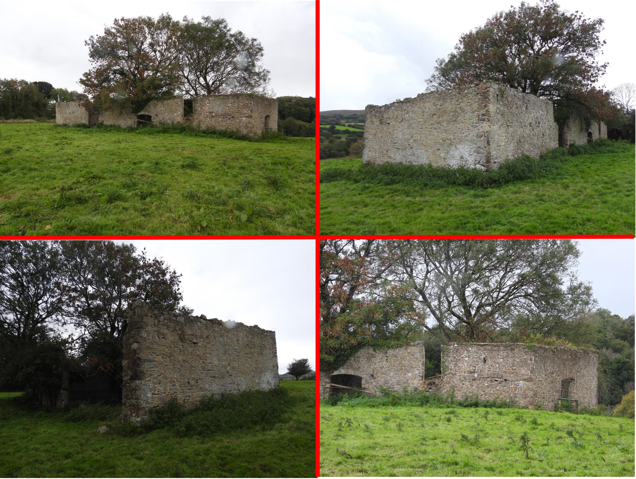
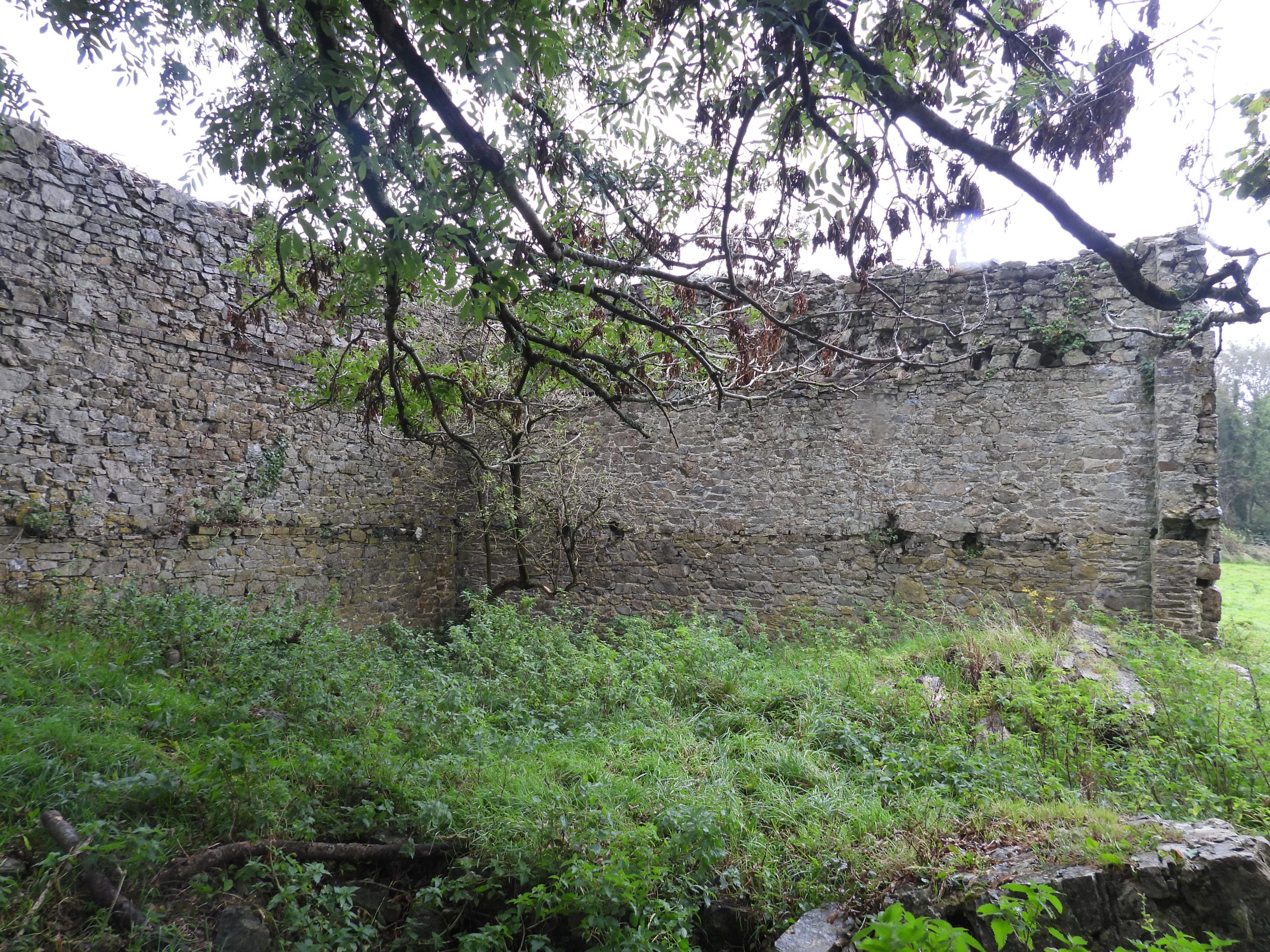
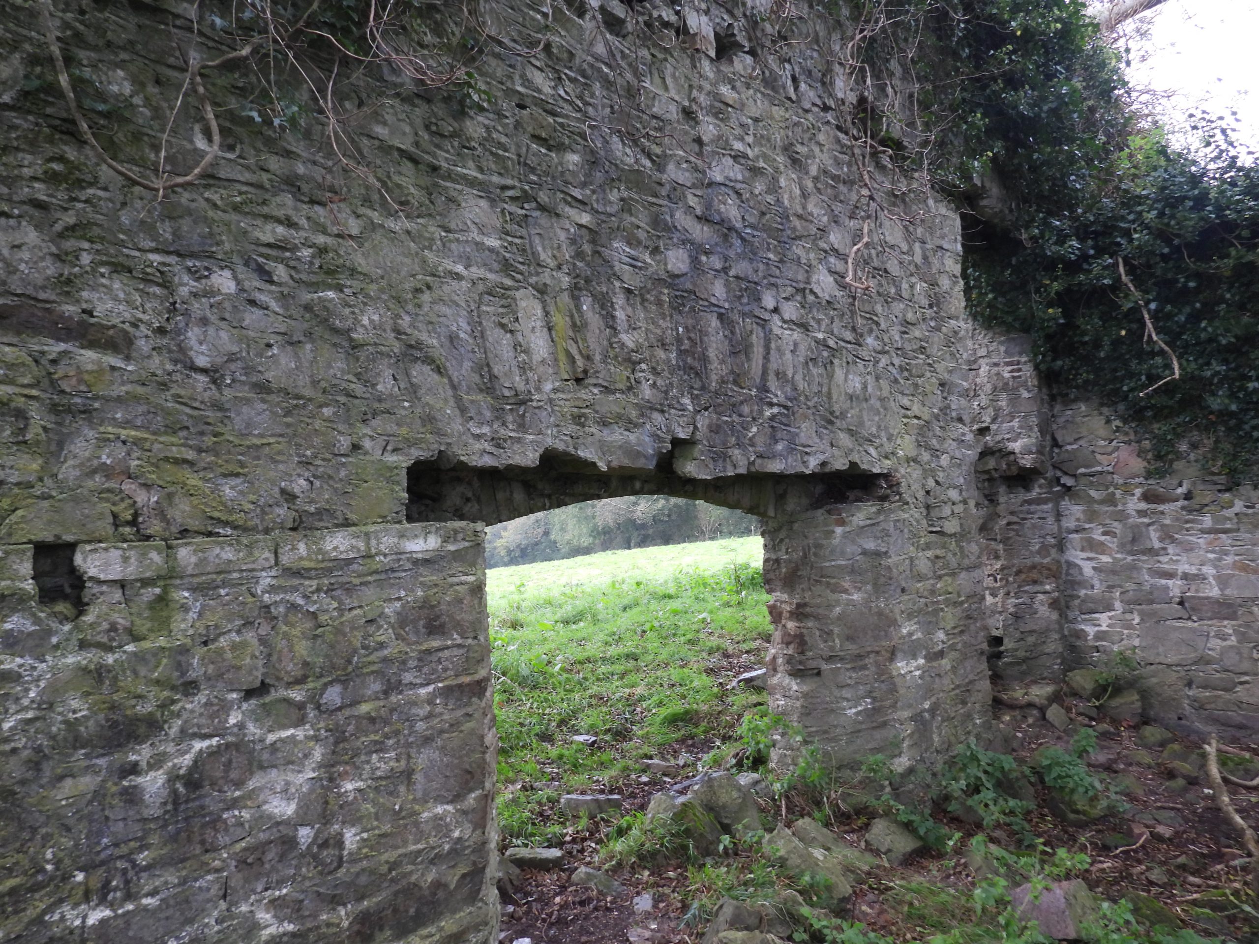
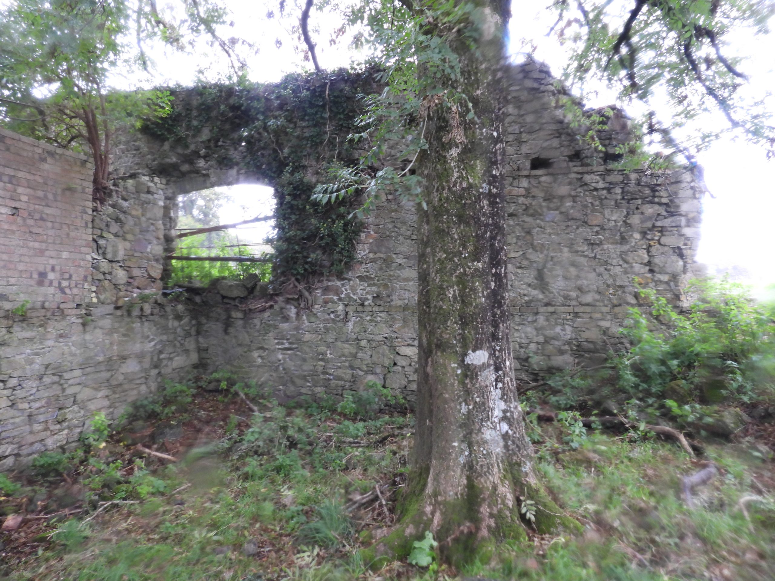
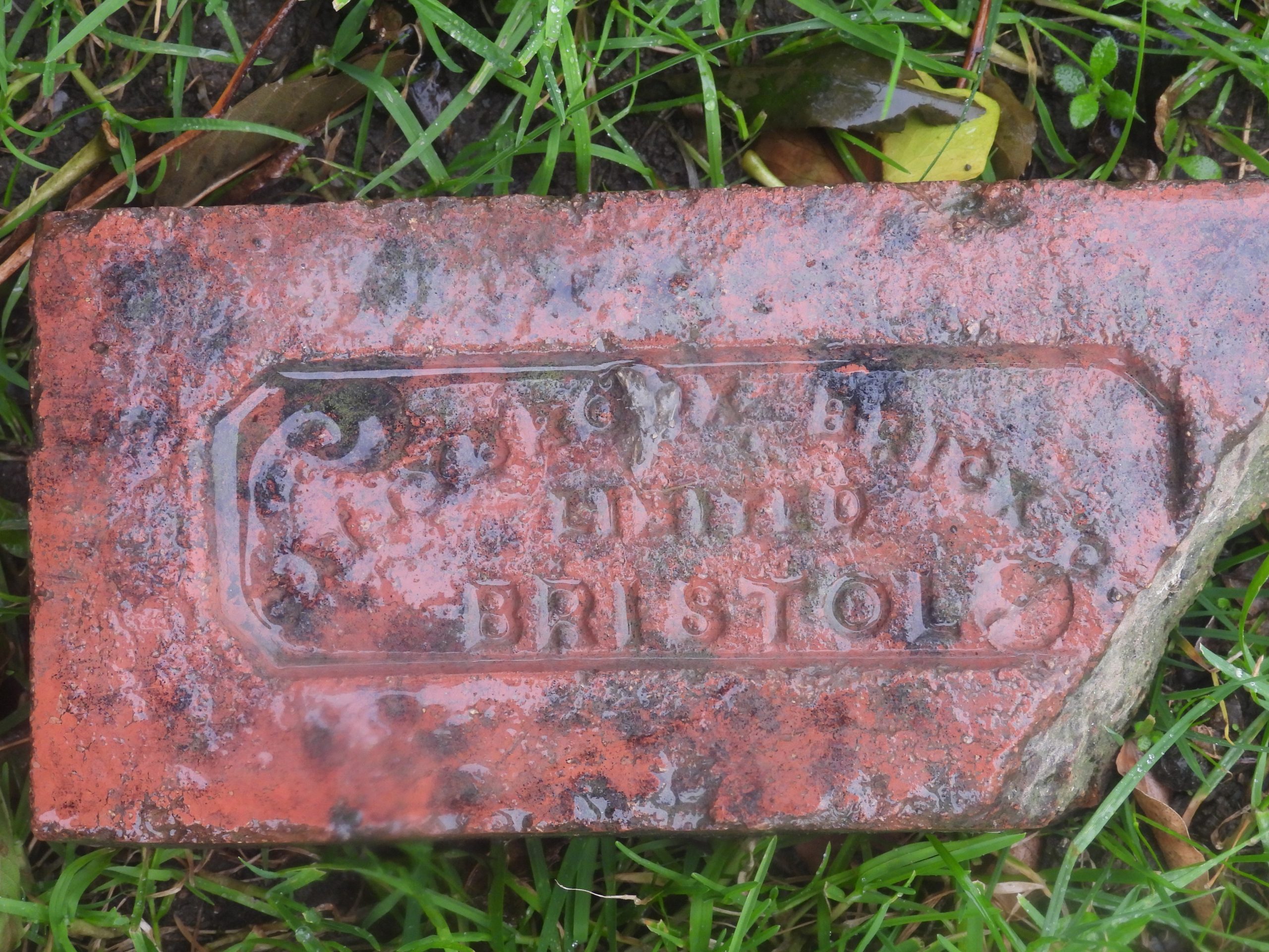
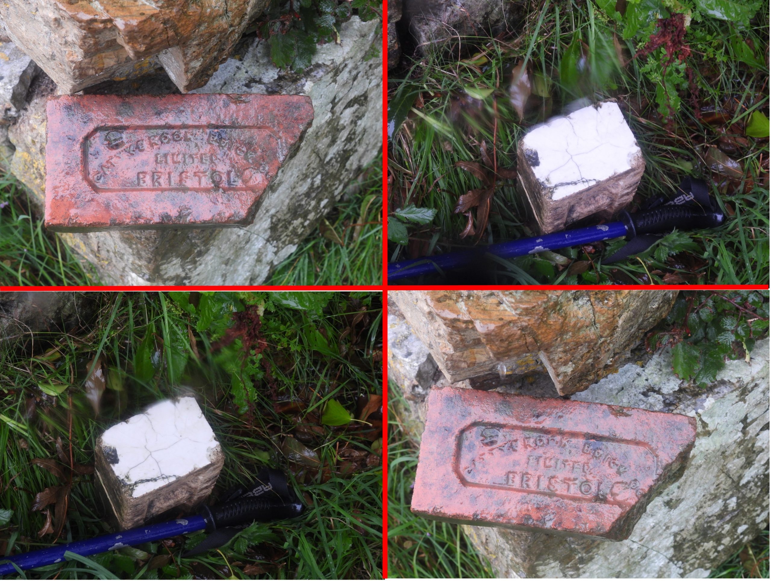
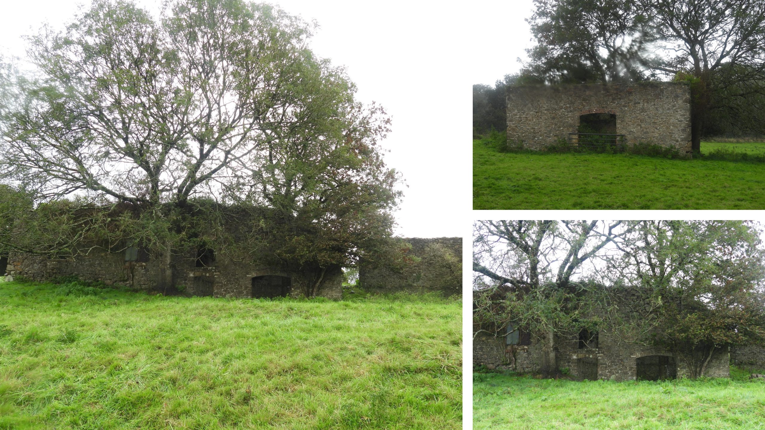
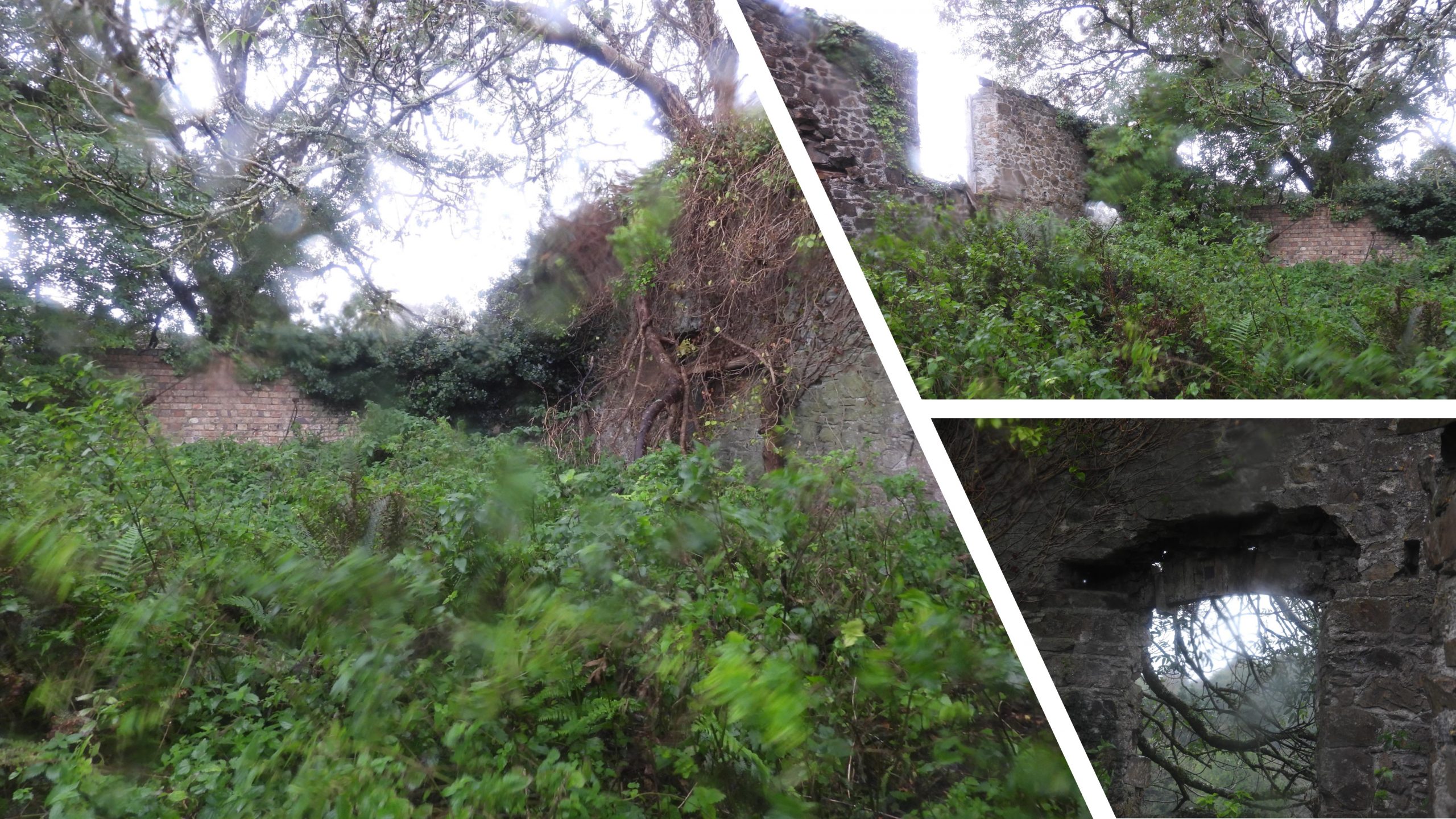
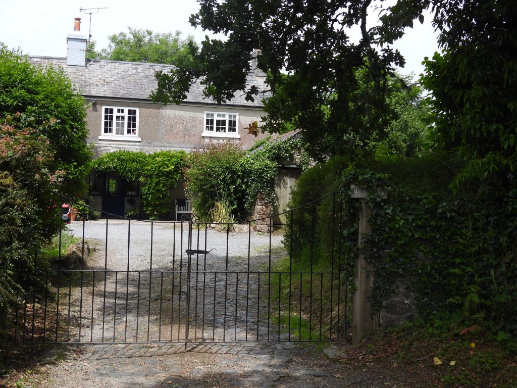
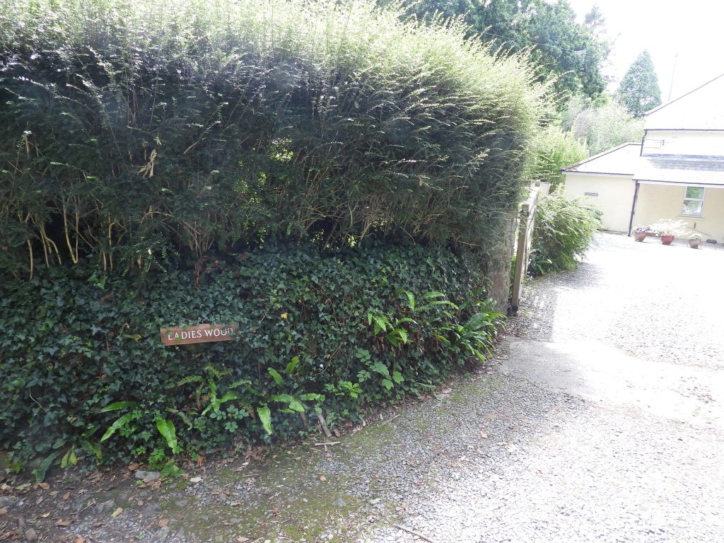
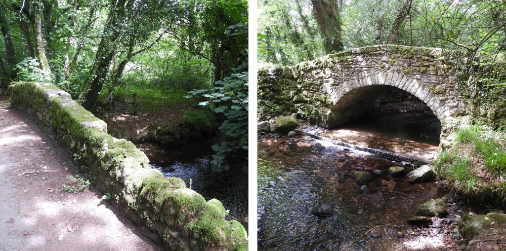
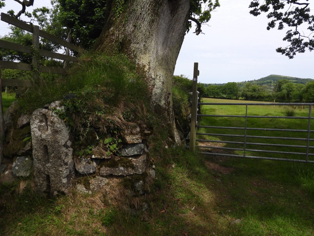
Sketch Map showing the location of the siteThe China clay settling pits (dries) are in a (private) field which is labelled 798 (Long Close on the tithe map) but is known locally as Claypits to the tenant. Today they can be seen from the lane (where the camera icon is) as six circular depressions. Alongside the field is a causeway which is believed to have carried the china clay liquid in a launder from which sluices controlled its passage to the settling pits. To the south of the causeway and settling pits (unseen from the road) is a building standing alone in a field which is believed to have been a clay drying kiln.The open moorland section of the clay channels / pipes, much of which is still discernible today and can be followed. The ‘Double Clay Channel (C1)’ shown leading ‘To Glazebrook’ is how the clay got to Pennaton.The clay dries as seen from the gate into the field.View of the causeway and clay dries (settling pits) as seen from near the gate to the lane. The causeway is 2.7m wide and is 0.7m in height (above field level). It is suggested that the causeway carried the china clay liquid in a launder from which sluices controlled its passage to the settling pits.The depressions of clay dries 1-3 are quite discernible (albeit they have been filled in). Each of the dries / settling pits are around 15m in diameterClose up of clay dries with the field being used as pasture. The young cattle were quite inquisitive of their visitors on the day of the visit.Clay dry 1 at SX68810 59569 is the most north west of the six.Overgrown clay dryClay dry 1 close upClay dry 2 at SX68822 59551 is less discernible very close upClay dry 3 at SX68837 59551Clay dry 4 at SX68853 59517Clay dry 5 at SX68869 59491Clay dry 6 at SX68888 59469‘China clay building with brick kiln’ was the description provided by Robinson in the 1970’s. Robinson’s description is very good describing it as being “clearly not an ordinary barn, having three large arched openings on the east side and a regular series of arched window openings on the west side”.The building is sited adjacent to one of the few points on the railway where there is neither cutting nor embankment, which might suggest that it was built here deliberately to link with the railway. The railway was opened between Totnes and Laira on 5th May 1848, which might add to the timeline of the venture. The building is located in a field designated by Ordnance Survey as plot 477 and on the tithe map as number 1481 (North Park).The visit to the sight was on a rainy day, hence a few water droplets on the camera lense. Part of the building (northern end) had been renovated for use as a barn but this is no longer in use. The building is roofless and it had, according to Robinson, a first storey at one point. There is a ‘modern-brick section’ of the dividing wall which most likely dates from the conversion of the north-western section to a barn. It closes the opening through which hot air entered the clay dry from the furnace.The internal of the building suggests that there may have actually been two storeys in this building. This is the southern end of the building and is assumed where the clay drying took place (with the kiln being in the northern section of the building).An internal view of one of openings in the building. Was this the access / egress points for the clay?A large tree growing inside the ruinThe Cattybrook Brickworks, founded in 1865, is still operated at Almondsbury by Ibstock Bricks. The takeover of Cattybrook was in July 1972. Does the finding of this brick in the ruined building help to date it ? It is known that in 1872, under the Brent Moor Clay Co. there was a clay processing at Shipley Bridge which continued until 1880 when the company was forced to close due to the depressed price of clay. Perhaps the clay drying here at Pennaton was at around that same time (1872) or perhaps just before ? The author speculates the operation might have had a maximum of 15 years (between 1865 and 1880).As well as Cattybrook Brickworks ‘brick’, there was a glazed brick in the ruins as well. One assumes the glazed brick is a ‘refractory brick’ primarily used to withstand high temperature and therefore was part of a kiln here. These bricks also had low thermal conductivity for greater efficiency. The kiln was probably used as the final drying process (after the settling pits has eliminated the majority of the liquid in the clay). Large kilns were used at Cantrell as part of the drying process for clay coming from Left Lake and Red Lake operations in the early 20th century. https://dartmoorexplorations.co.uk/cantrell-processing-plant-to-redlake-clay-extraction-a-journey-following-the-tramway-pipeline/The building was measured by Robinson as being 10 metres wide. Its length wasn’t recorded.Robinson records that the “possible brick kiln (beehive type) nearly filled the north half of the interior of the building”. The northern half of the building is very overgrown and none of the features recorded by Robinson are discernible. He stated there were “low footings of a circular structure, which measured 6.0 metres in external diameter and the walls which are about 0.65 metres wide are composed of stone externally and brick internally”. Pennaton Farmhouse. The farmhouse is recorded as being extant from 17th century, albeit the current farmhouse is clearly dated from a later period. Records show that ‘Pennaton’ was included in surveys of 1594 and 1627 of the lands of the Furse family. (ref: HER MDV13147)Ladies Wood, a modern dwelling between Pennaton bridge and the clay dries.Pennaton Bridge, believed to date from the early 19th century and was probably extant when the clay dries were operational.Nearby is a slotted gate post next to a metal gate through which the Dartmoor Way passes. This gatepost is a fine example and was recorded in detail by R.Robinson in the Dartmoor HER thus; “Height 1.4m, width 33cm, depth 18cm. Three vertical slots one above the other 18cm x 5cm x 4cm deep”. This is a fine example and therefore the author thought it worth a mention in this post, albeit unconnected to the subject matter.