A collection of walks, discoveries, insights and pictures of exploring Dartmoor National Park
February 7, 2022
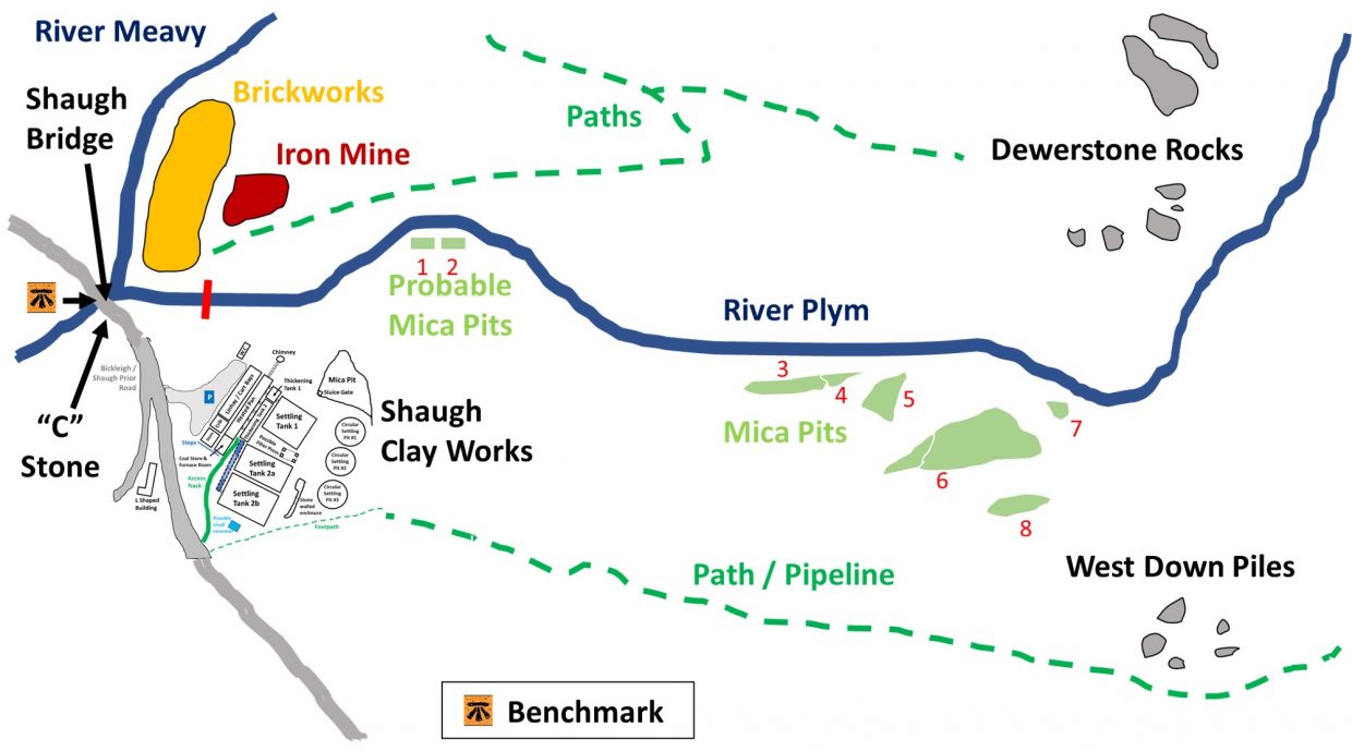
Shaugh Bridge Mica Pits
The Shaugh Bridge Clay Works near Shaugh Bridge are the most visible evidence of clay processing in the area, having been purpose built between 1870 and 1895 in three different phases before finally closing down in 1952. It is recorded that extraction of china clay had began around 1860, therefore a question is raised regarding how did the claymen processes their clay between 1860 and 1870. Looking at old 19th Century Maps, some old Mica Pits are shown between West Down Piles / Clay Pipe Path and the River Plym. With no record of these Mica Pits existing on the Dartmoor Historic Environment Record (HER), the author speculates that these pits most likely pre-dated the Shaugh Bridge Clay Works and were operational between 1860 and 1870.
Clay was first found in the area by John Warrick at Whitehill Tor in 1827. The china clay extraction expanded around 1860 in the Shaugh Moor area. Clay (before the pipeline) was initially transported using an open leat, so the supposition of the date of the Mica Pits seems reasonable. When extracted, the quarrymen would have had a mixture of water, kaolin (China Clay), sand and mica in the form of a slurry which flowed to the lowest point in the pit(s). The quarrymen would then have removed the unwanted sand and mica.
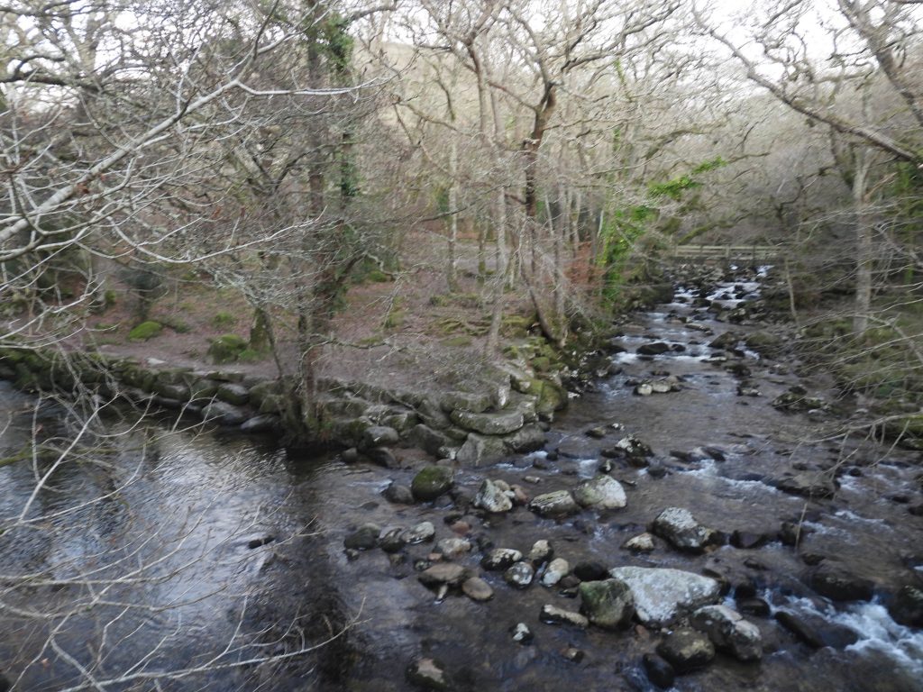
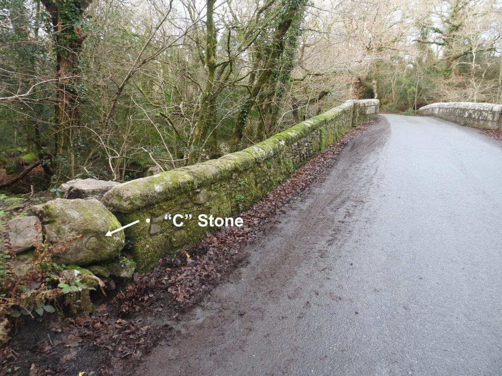
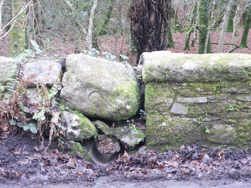
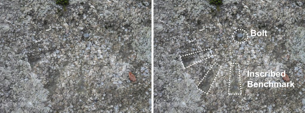
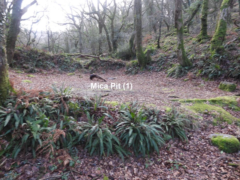
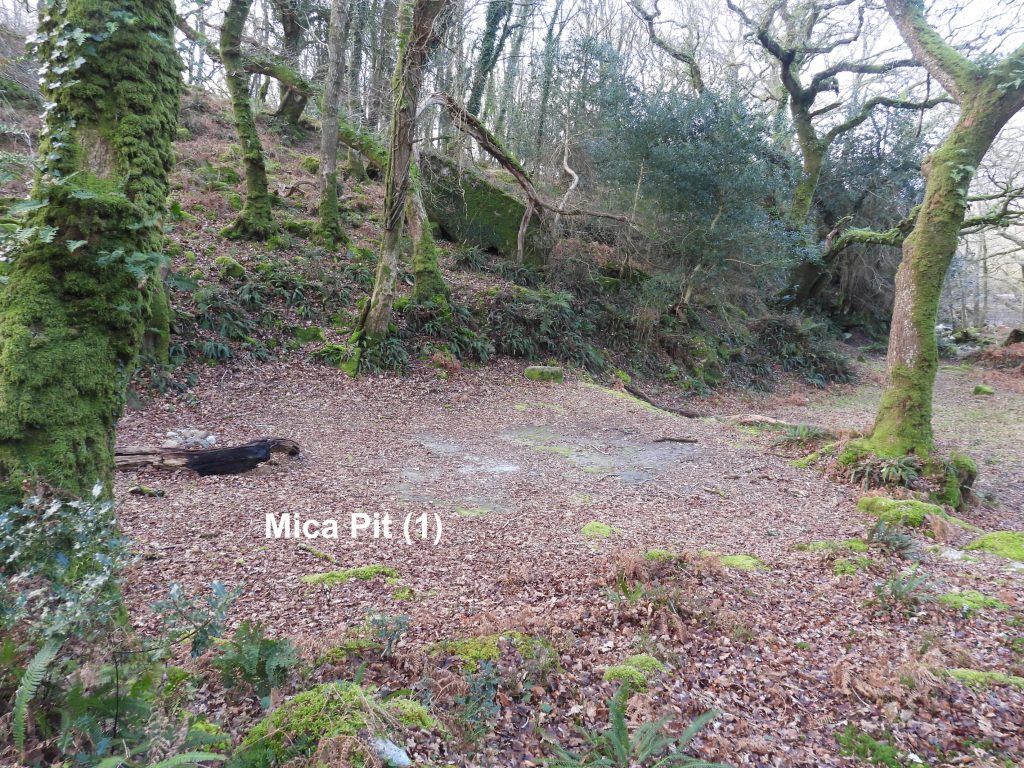
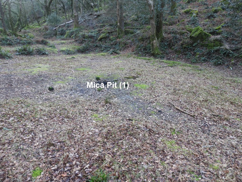
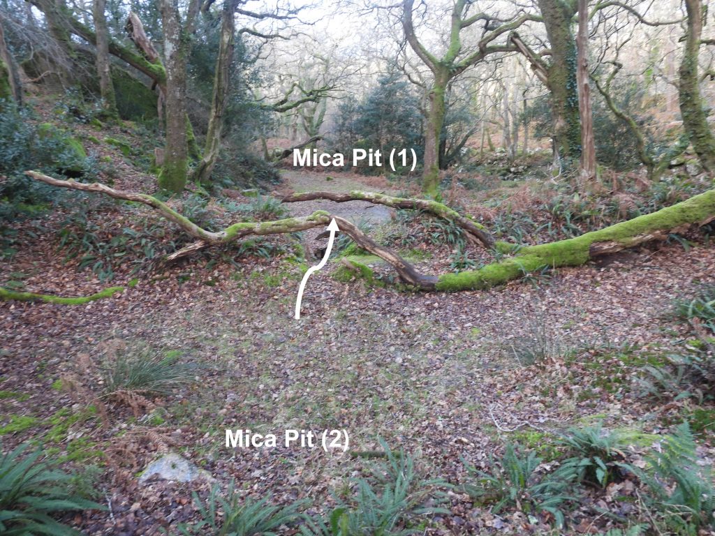
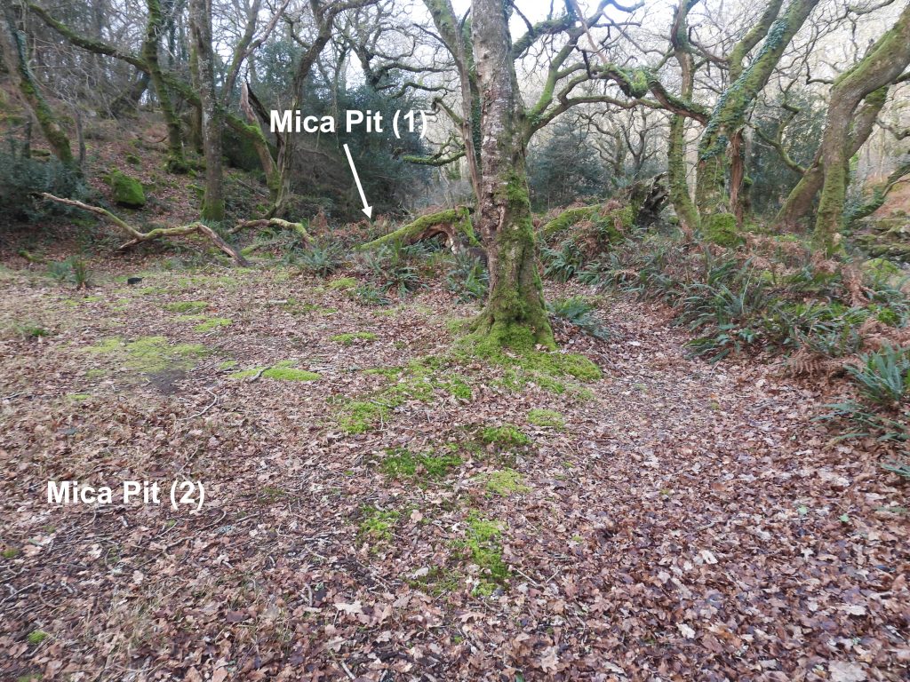
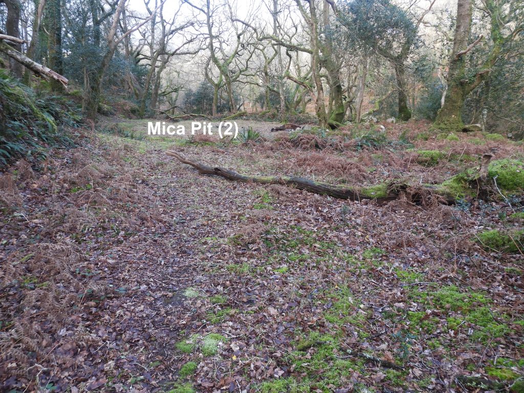
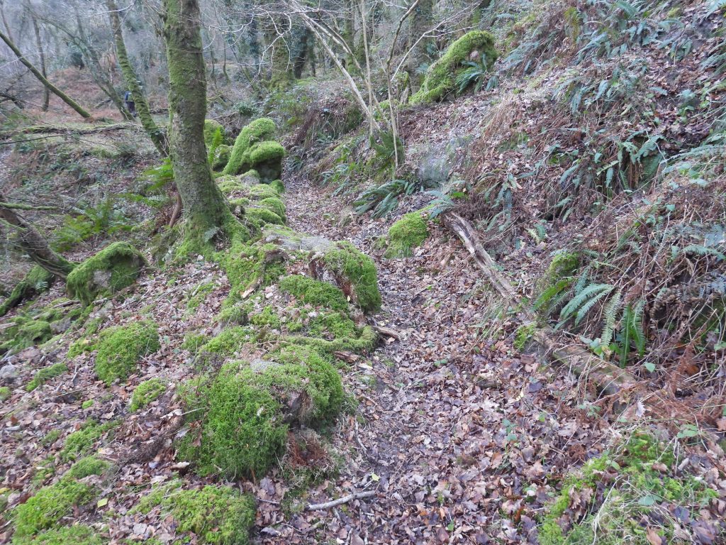
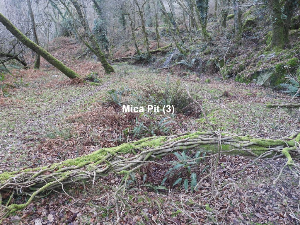
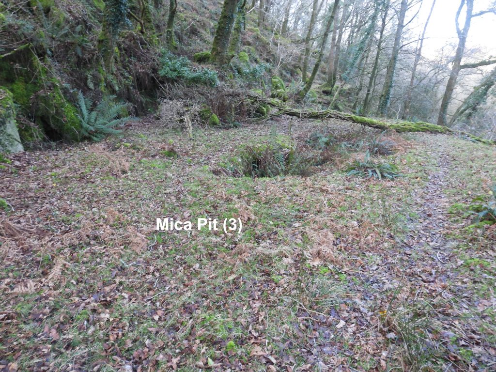
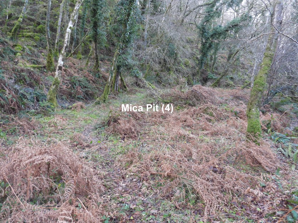
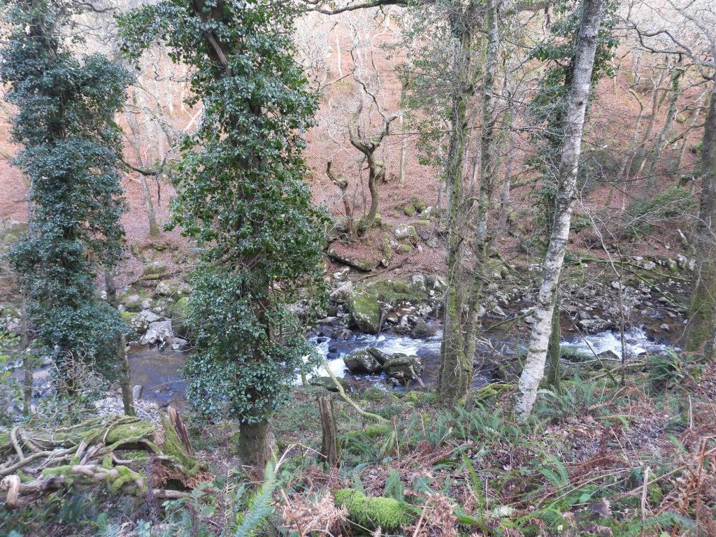
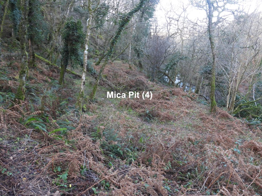
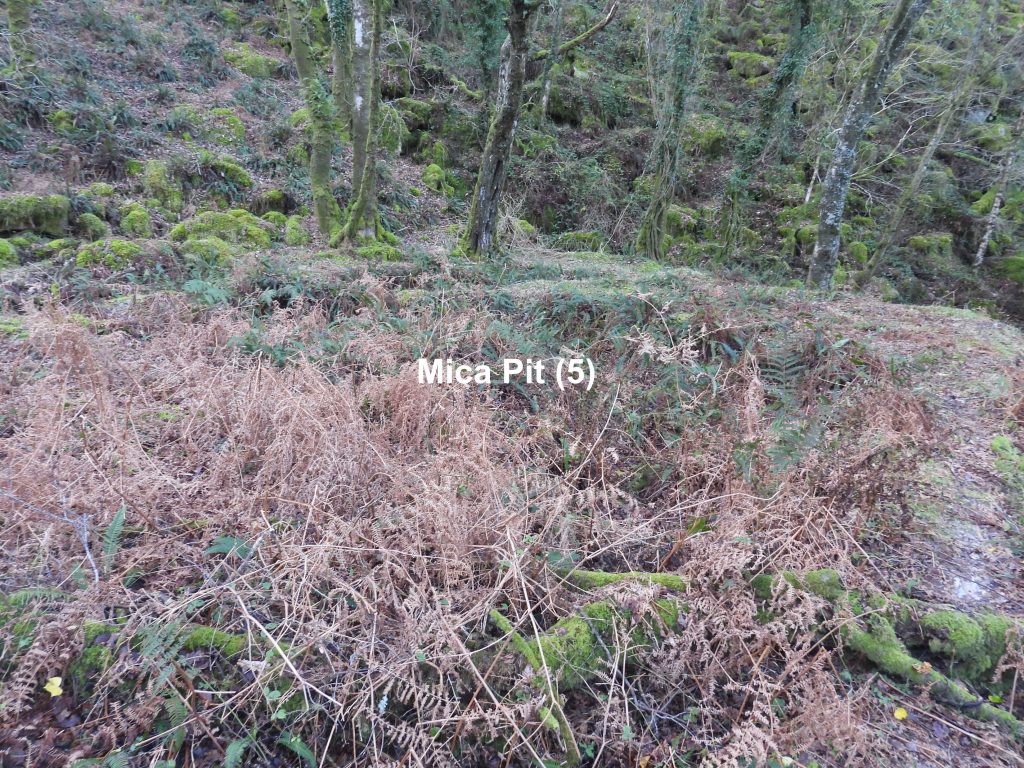
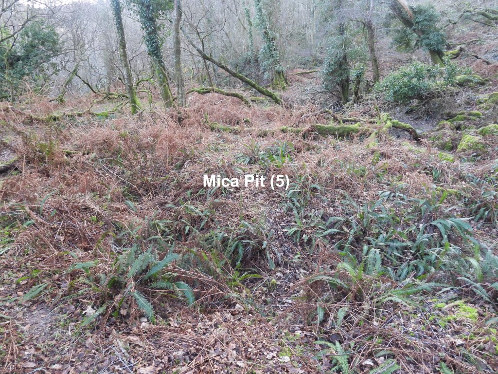
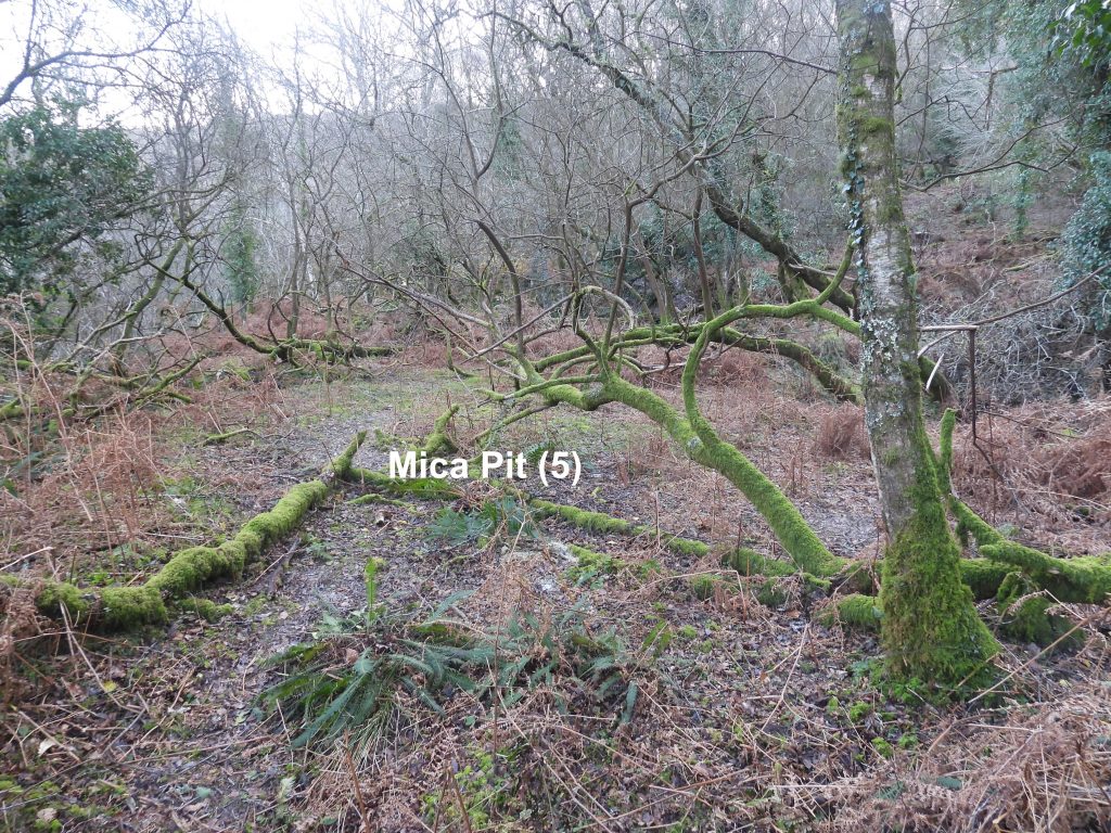
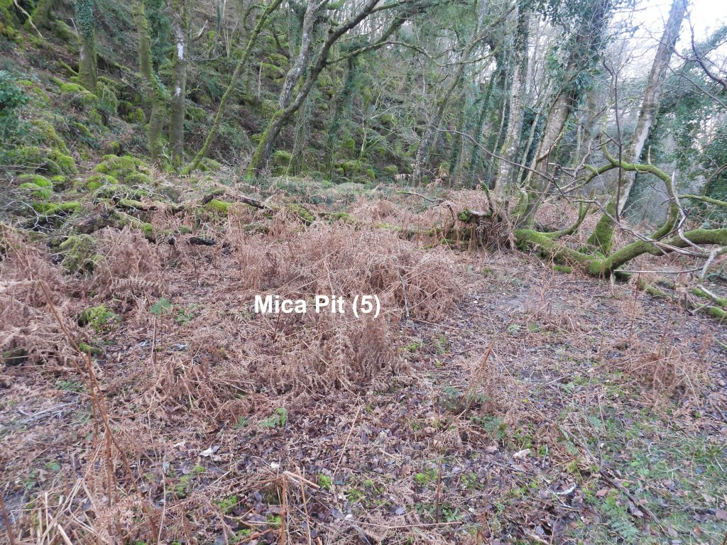
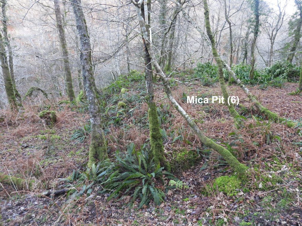
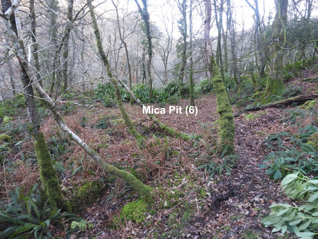
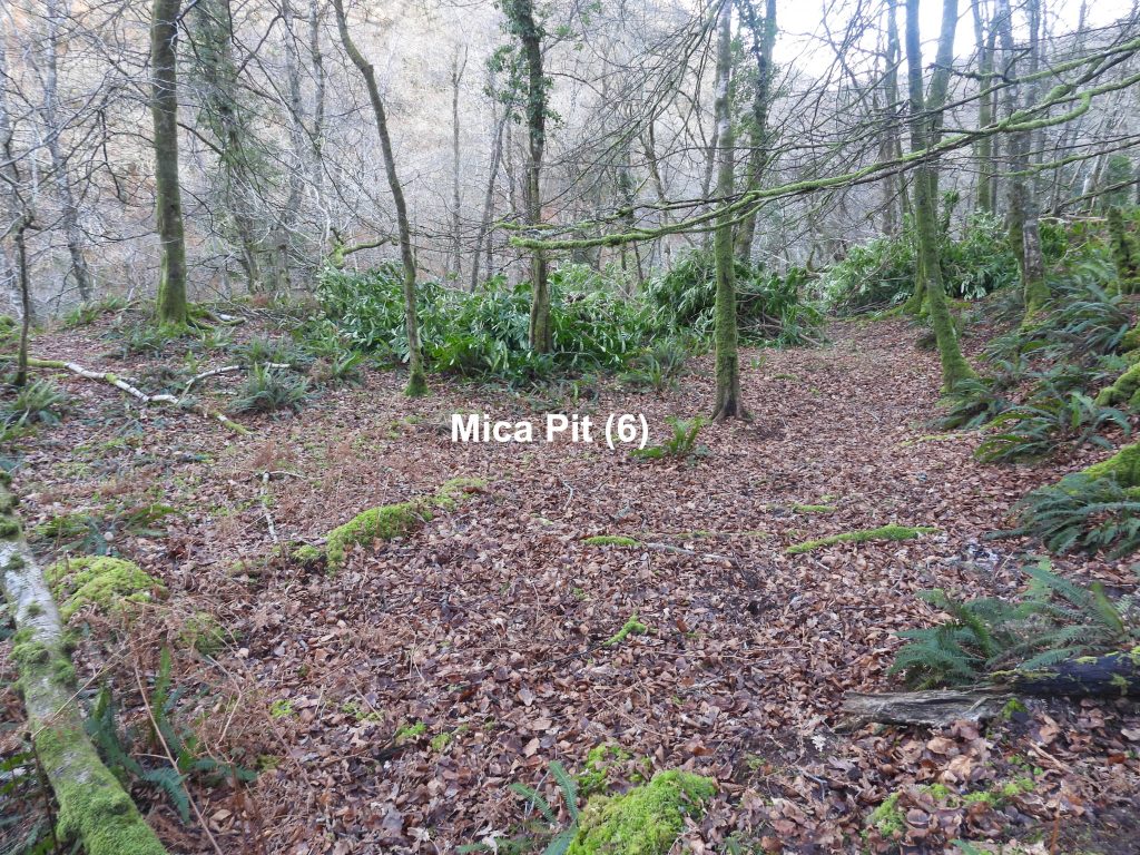
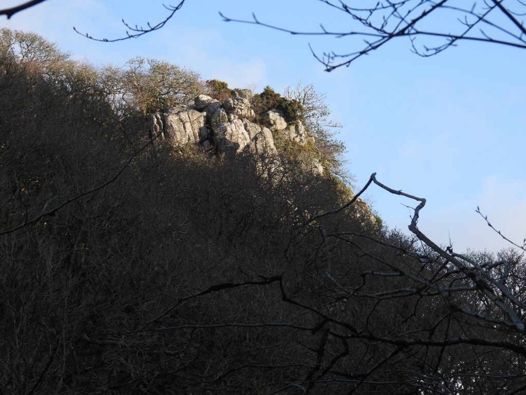
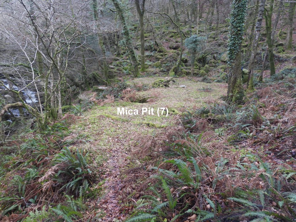
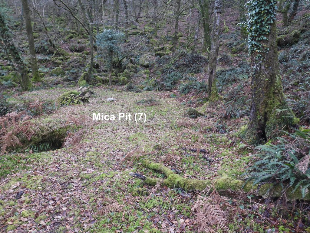
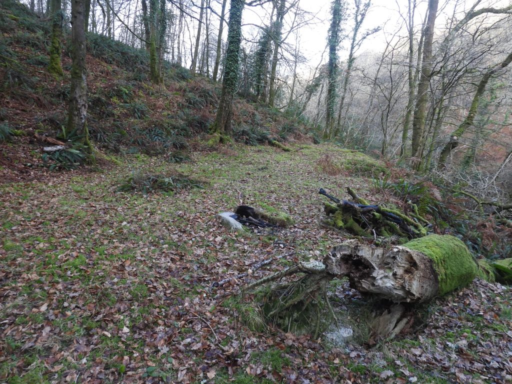
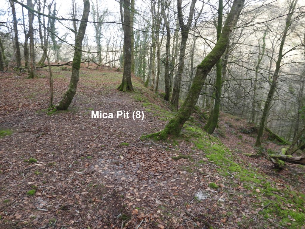
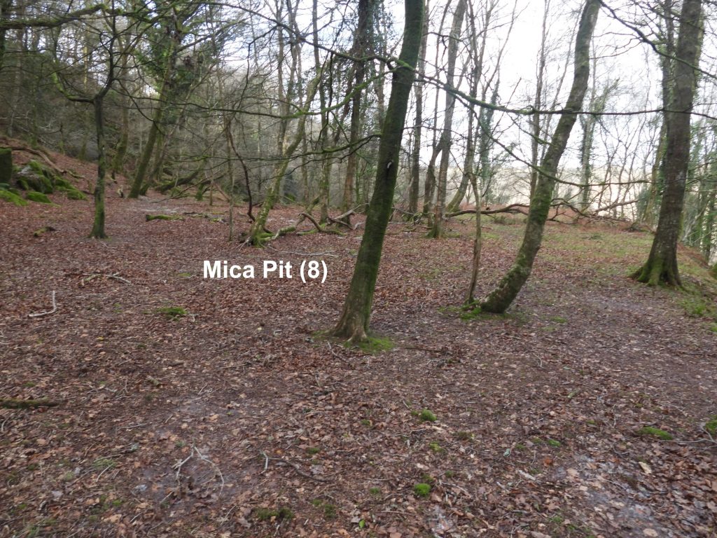
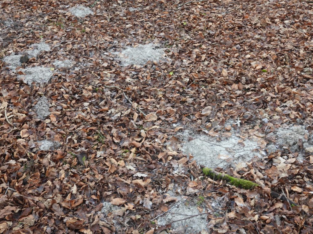
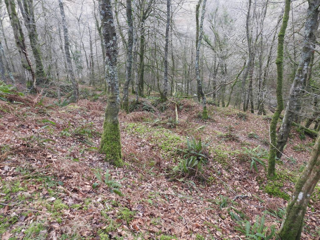
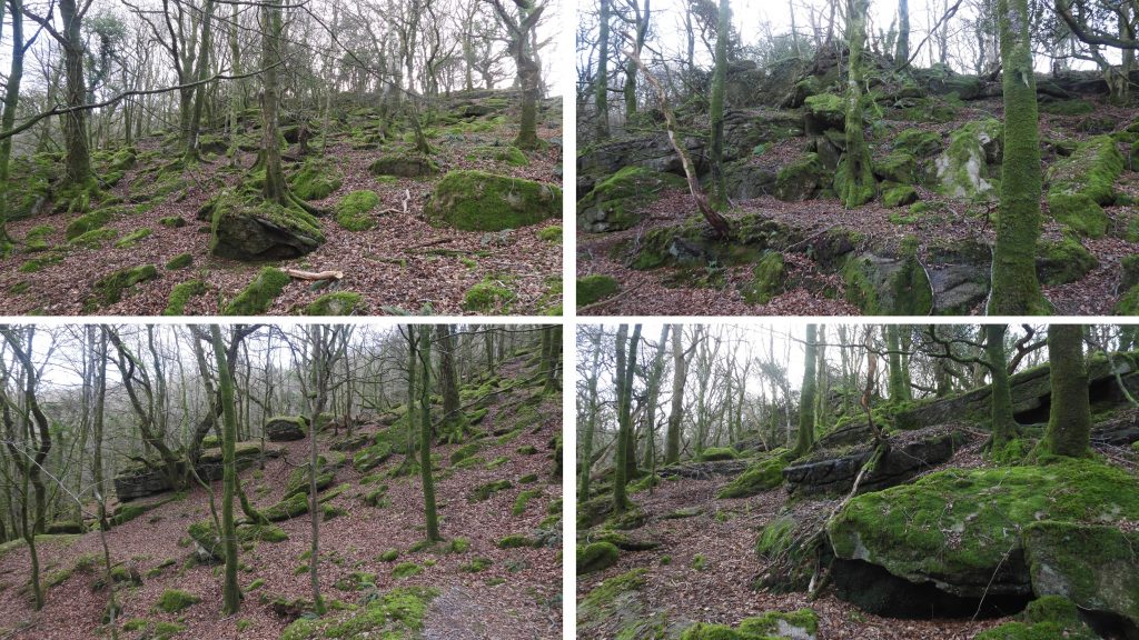
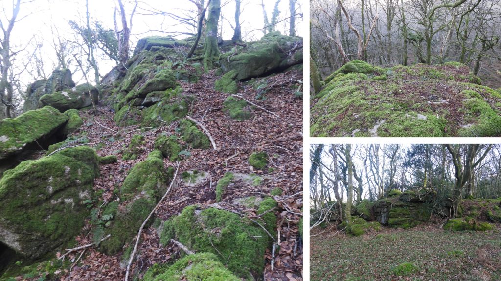
This post covers an exploration from Shaugh Bridge, following the south bank of the River Plym visiting the Mica Pits and finishing up the hill at the south east area shown on the sketch map at West Down Piles. View from the parapet of Shaugh Bridge looking over where the River Meavy (left) meets the River Plym (right)Shaugh Bridge ‘C’ County Stone. These stones represent the acknowledgment that it was the county’s responsibility to maintain the upkeep of the bridge. These were placed on either side of the bridge. Unusually, this stone, is not recorded in any of the usual places (ie 19th century maps, Dartmoor HER or the Dave Brewer book on Dartmoor Boundary Markers). The arches of the bridge were destroyed by floodwater due to a sudden thaw during the winter of 1823-4. The “C” stone can be found at SX 53278 63645The benchmark on Shaugh Bridge comprises three inscribed marks in the classic “arrow” plus a bolt where the OS surveyor would have placed his instrumentation. The benchmark is on top of the SW parapet of Shaugh Bridge is located at SX 53260 63670. Taking the south bank of the River Plym upstream from Shaugh Bridge, a flattened area, which the author speculated was an old Mica Pit, can be found.It is possible that the “probable” Mica Pit may have been the foundations for a building. That said, no features are recorded on any 19th century map the author has seen. The centre of this flat area was recorded at SX53459 63686.Detailed view of the very flat area, which the author describes as Mica Pit (1).A second probable Mica Pit is located to the east of Mica Pit (1), with a possible outflow between the two.Mica Pit (2) appears to have a low embankment on the north side (nearest the river), which adds to the evidence that this was a clay processing pit. As with Mica Pit (1), this area does not show as a feature on any 19th century map that the author has seen.The centre of Mica Pit (2) was recorded at SX53475 63680Moving east from Mica Pit (2) there appears to be a leat, which may have been used to transport clay slurry ?The first Mica Pit shown on 19th Century Maps is designated as Mica Pit (3) by the author.Mica Pit (3) appears to have a sunken section at its west end. The Mica Pit was recorded at SX53646 63610.Mica Pit (4) is connected to Mica Pit (3) to the east.View of River Plym from Mica Pit (4).Mica Pit (4) is a flat platform located at SX53665 63608.Mica Pit (5) lies to the east of Mica Pit (4).Mica Pit (5) was recorded at SX53675 63589.Mica Pit (5) as with the previous ones recorded in this post, is a very flat platform.Mica Pit (5), as with others is likely to be very overgrown in the Summer months.Moving south east and uphill from Mica Pit (5), the next Mica Pit can be found.Mica Pit (6) is located at SX53723 63603.In the vicinity of Mica Pit (6), the author found evidence of the cutting down of what appeared to be Rhododendron bushes.An unusual viewing angle of Dewerstone Rocks.Mica Pit (7) is a small platform close to the River Plym.Mica Pit (7) was recorded at SX53798 63584Climbing uphill from Mica Pit (7) and Mica Pit (8) several platforms can be seen like the one in the photograph, but which are not shown on the old 19th century maps.The level platform of Mica Pit (8) is the highest on the slope.The centre of Mica Pit (8) was recorded at SX53773 63529There is evidence of animal diggings within Mica Pit (8). The white / grey colour evidence of the mica.The hillside between Mica Pit (8) and the River Plym, appears to have been terraced. Was this part of the quarrymen’s workings ?West Down Piles sprawl down hill from near the pipeline to close to Mica Pit (8). The rocks are named “West Down Piles” on the Tors of Dartmoor database. The history of the name is unknown but the author suspects, it may have been named by the authors of the database. For more information : https://www.torsofdartmoor.co.uk/tor-page.php?tor=west-down-pilesThese rocks really deserve a “Tor” designation in the humble opinion of the author. The top of the main outcrop was recorded at SX53837 63502.