A collection of walks, discoveries, insights and pictures of exploring Dartmoor National Park
September 22, 2022
Holming Beam Anti Tank Range – Target Railway
Lying within the Merrivale Range on north Dartmoor, the area around Holming Beam near Princetown has been a location for military training from at least as far back as the second world war. Having found evidence of an old military target railway at Holming Beam on an old map (OS 1949-1971) on the National library of Scotland website the author decided to investigate. The author has walked across the tracks where the tramway once stood since the 1980’s but had never taken a closer look as the area had always been a transitory area en-route to longer hikes to places like Cowsic Head, Beardown Man and beyond.
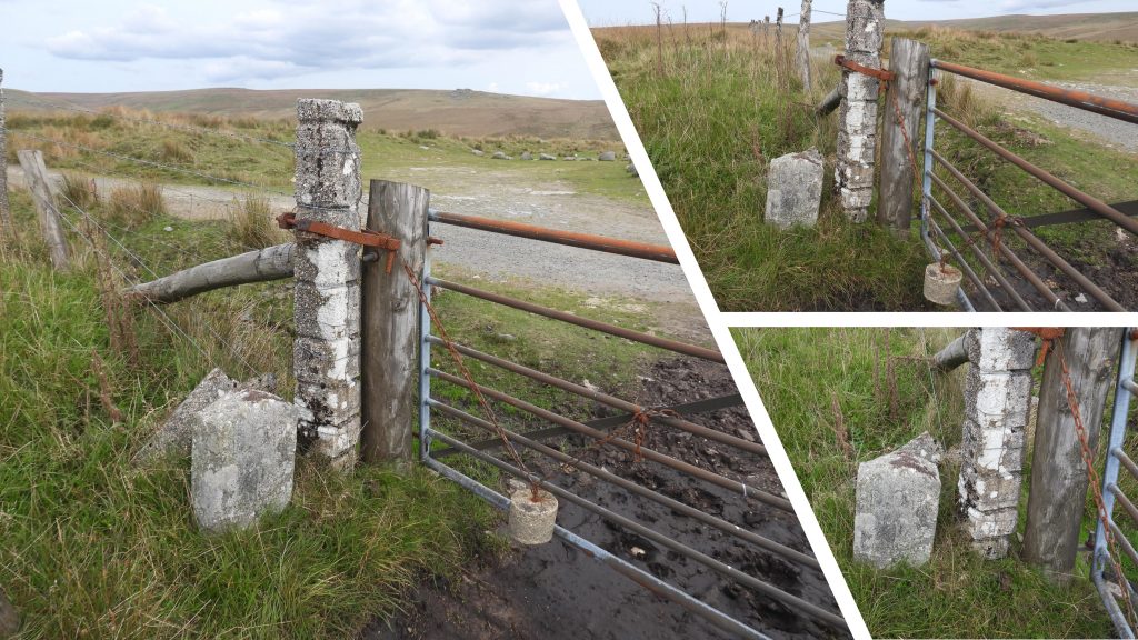
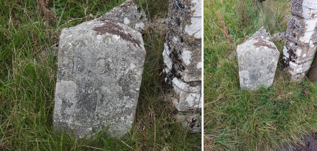
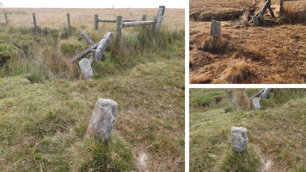
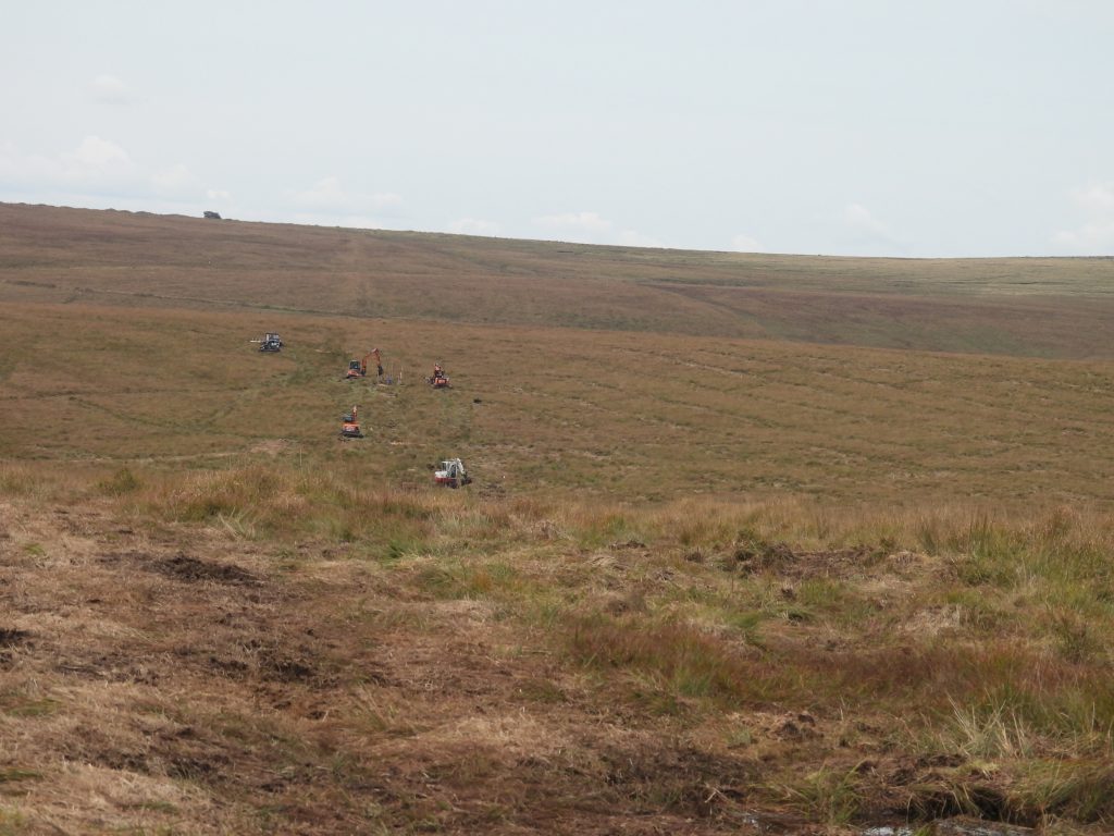
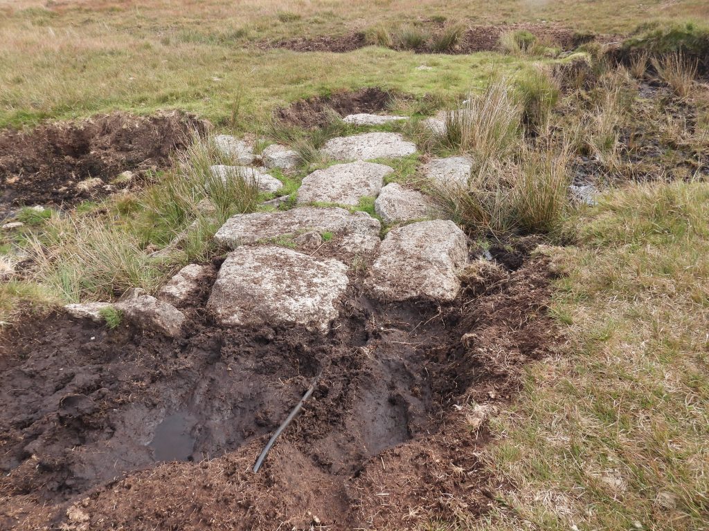
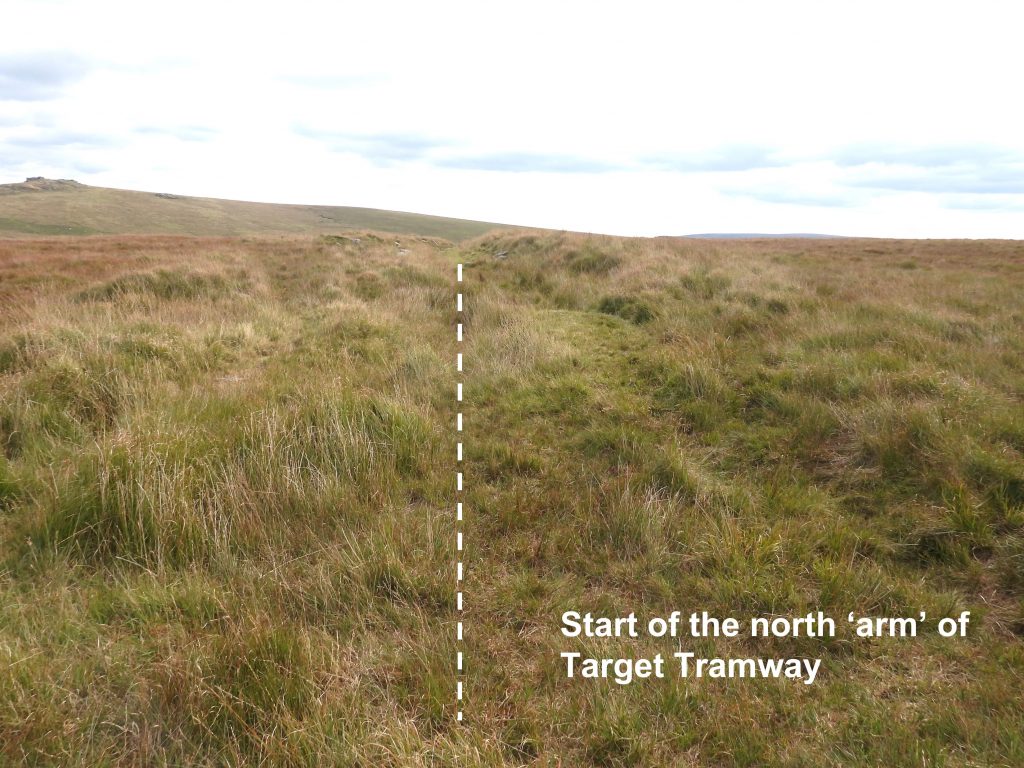
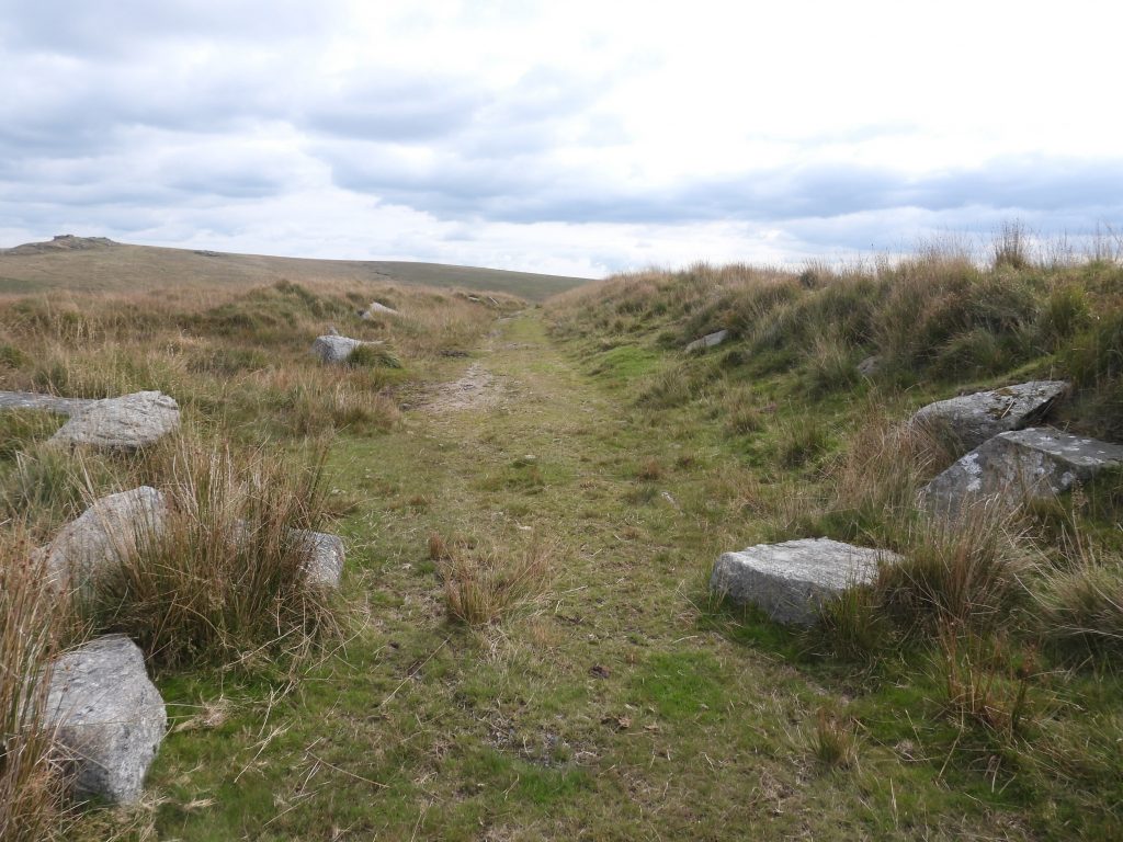
Very little seems to have been written about the target tramway with the Dartmoor HER surprisingly having sparse details in the two entries dated from 2018. The one document with some detail is ‘The Military and Dartmoor Information for Walkers and Riders’ published by assets publishing service (.gov.uk) where on page 26 it states: “The American Army’s 4th and 29th Divisions trained in the South West from 1943 in preparation for D Day. Many lived in tented camps around the Moor, where they trained. Anti tank guns were fired from Holming Beam at moving targets hauled by cables along a sunken trackway”. The full document can be found here:
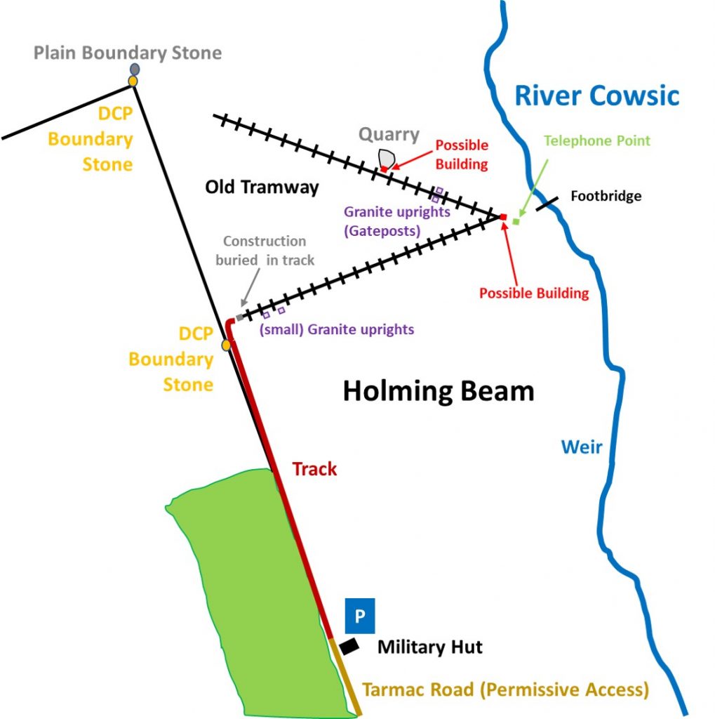
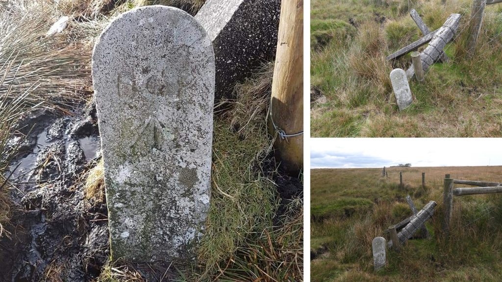
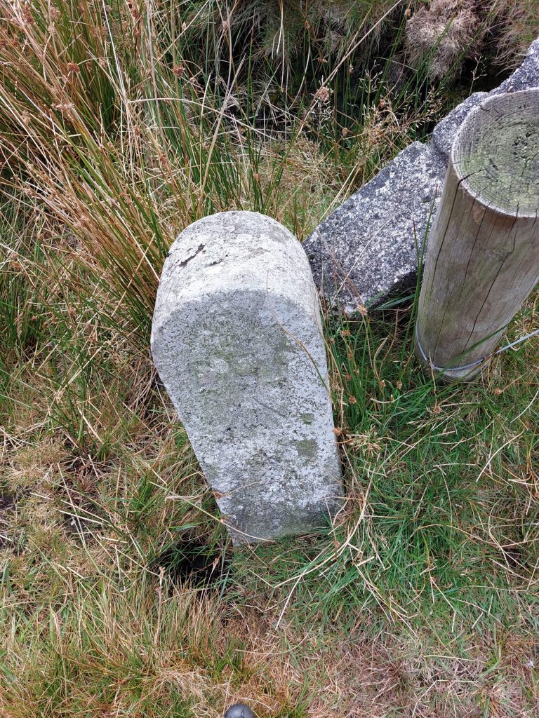
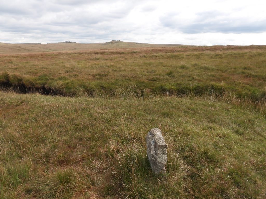
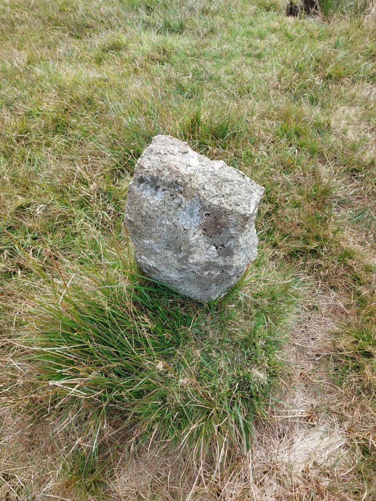
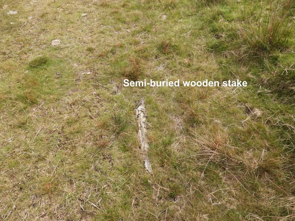
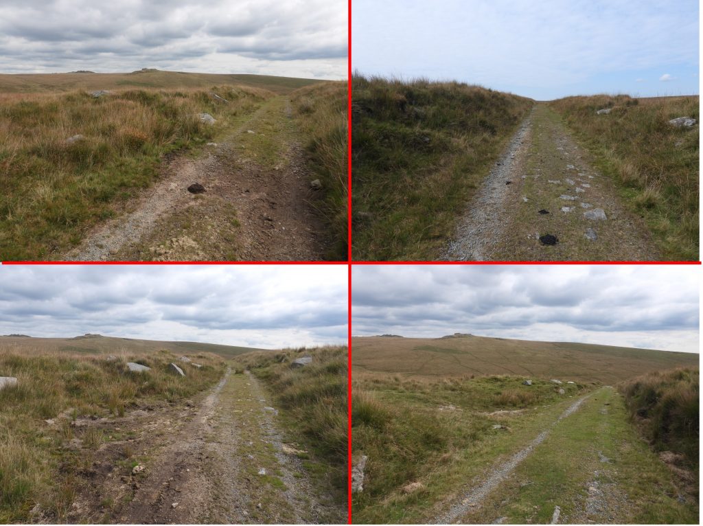
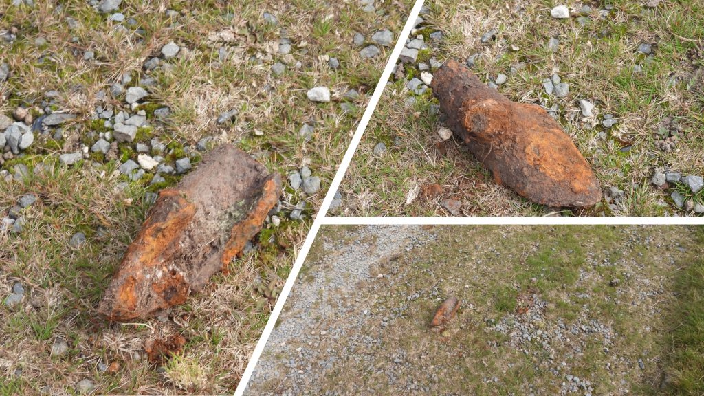
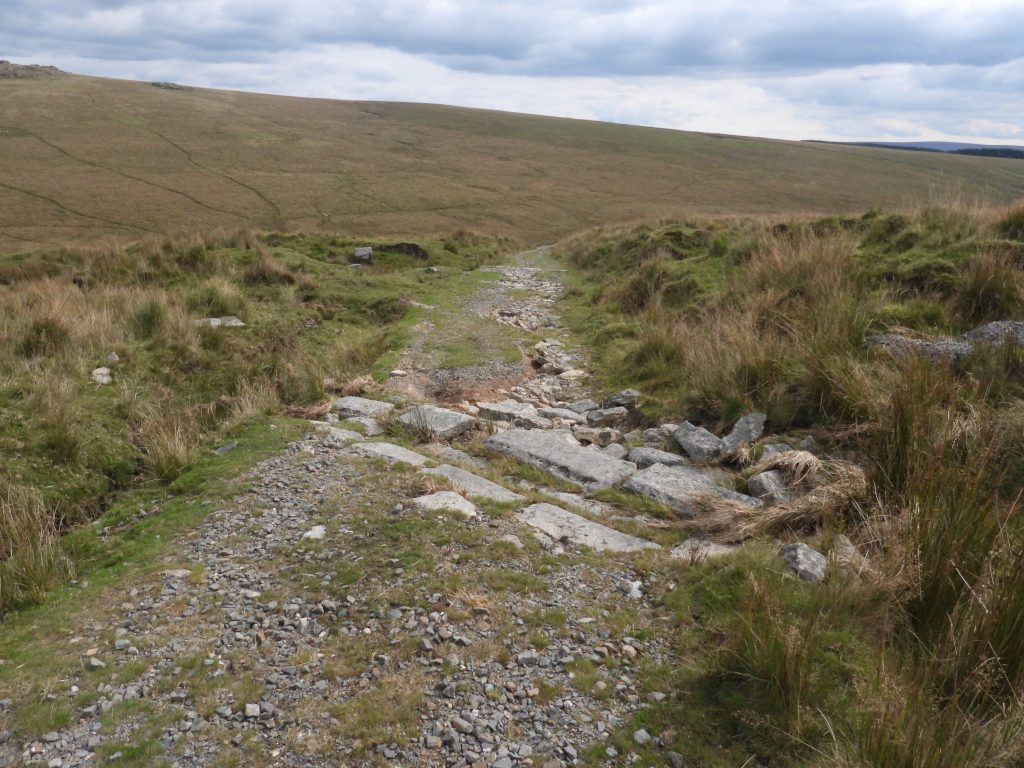
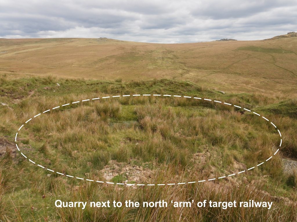
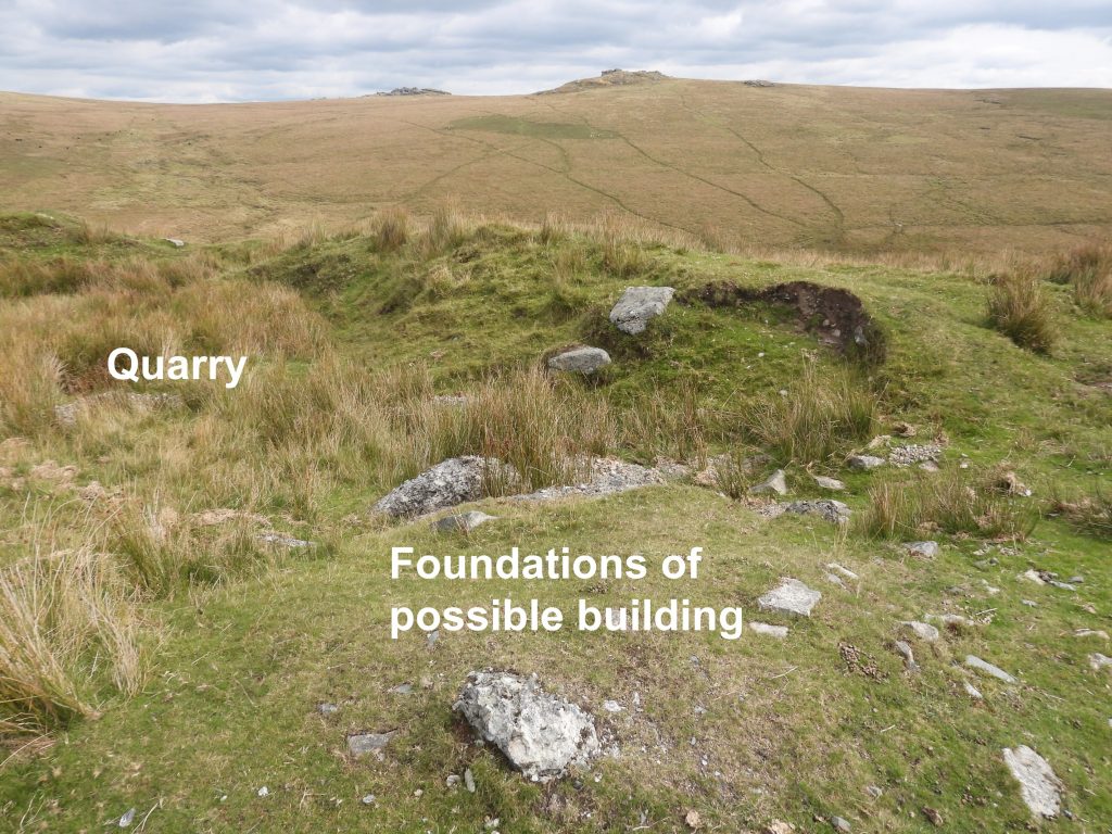
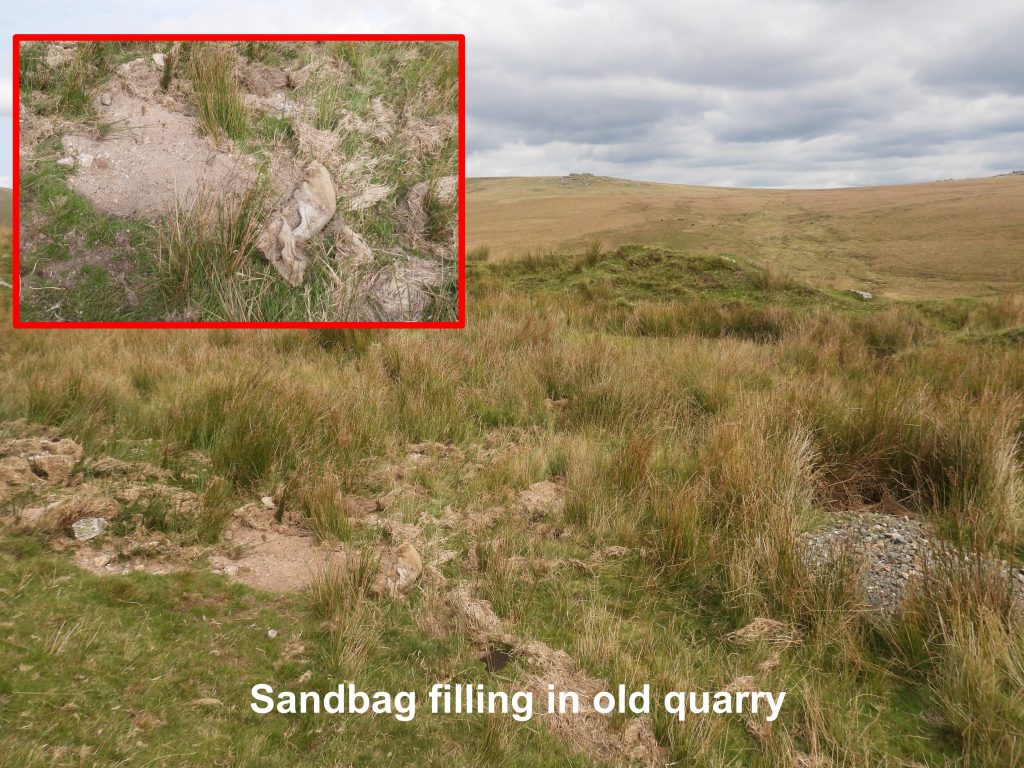
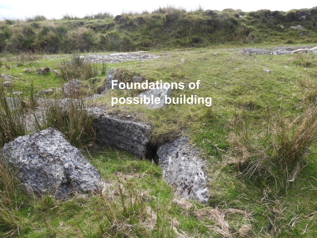
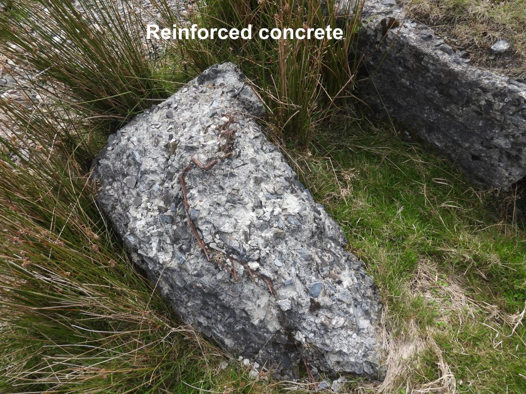
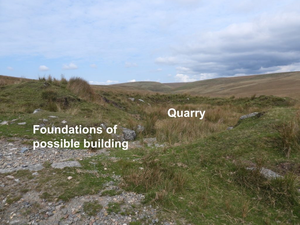
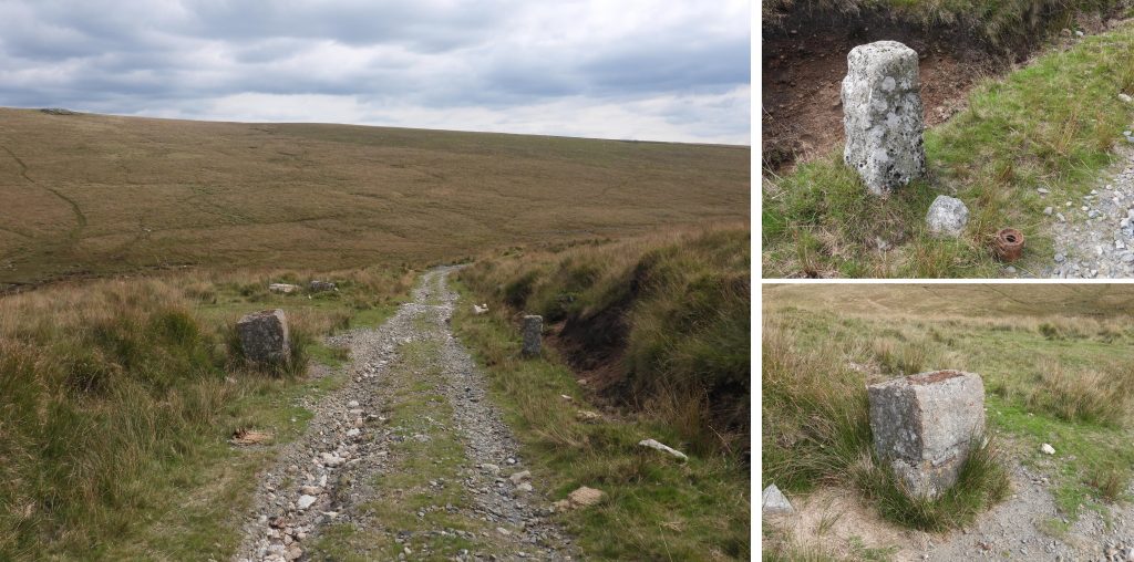
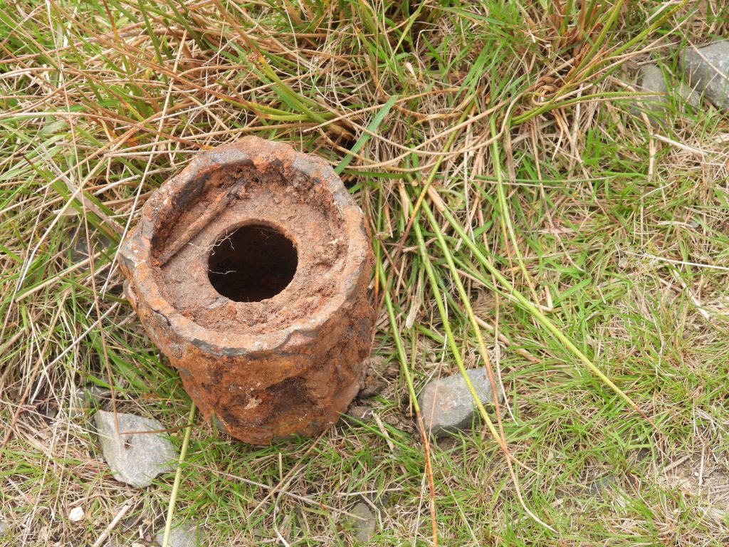
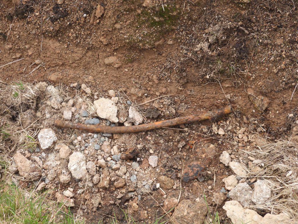
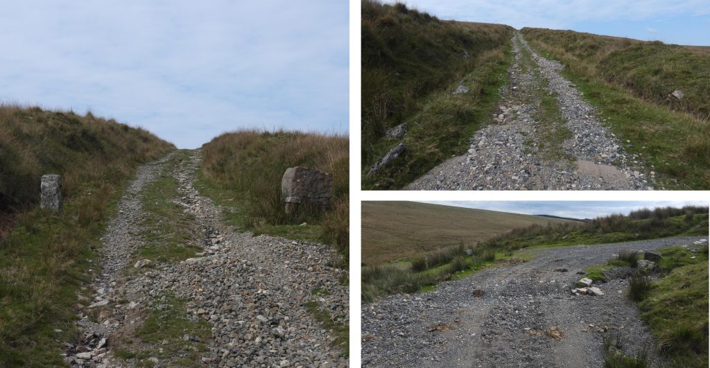
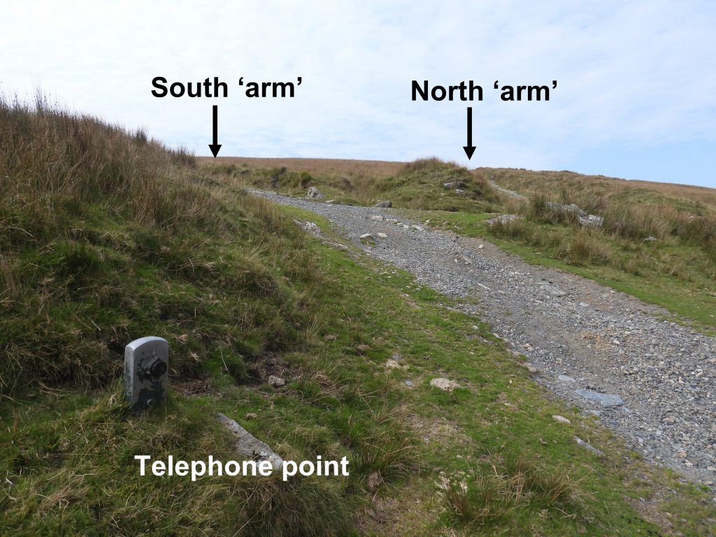
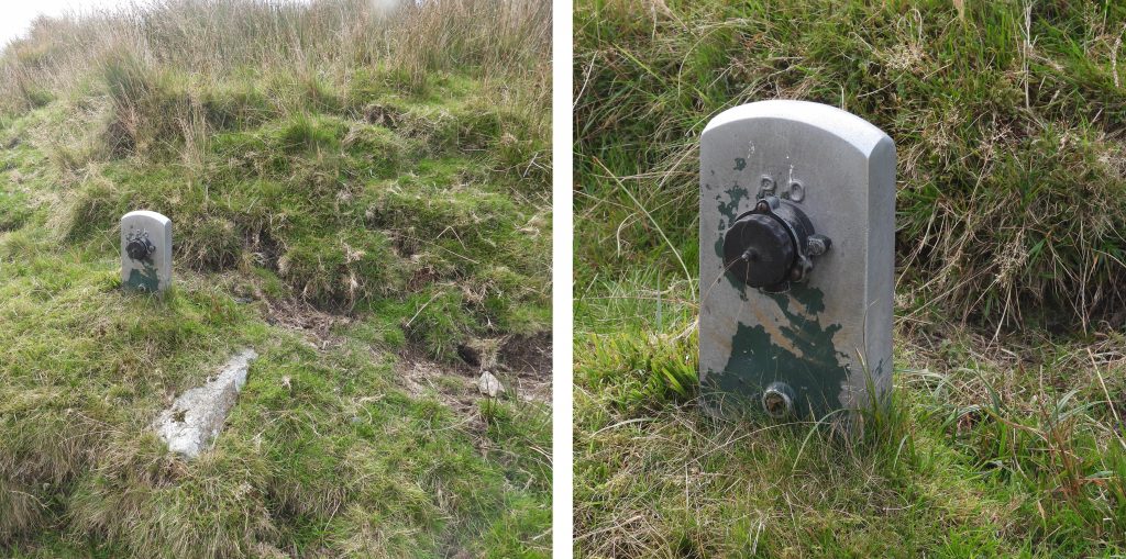
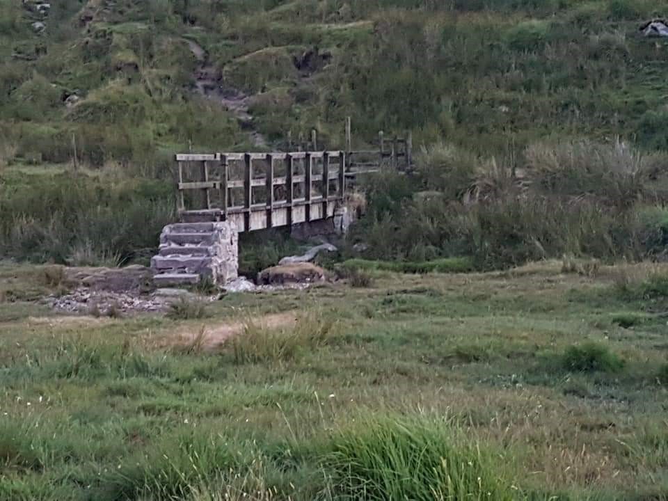
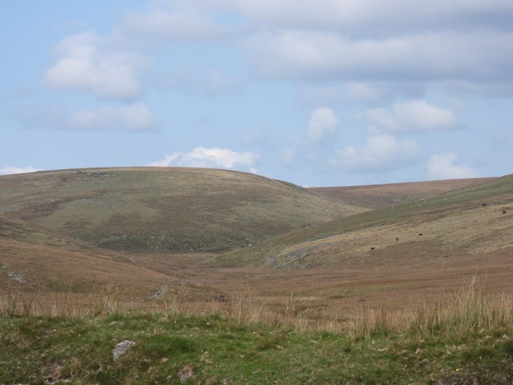
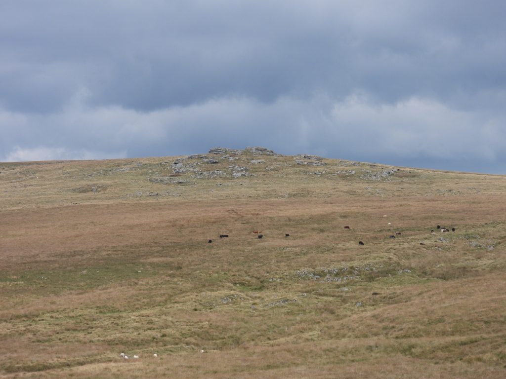
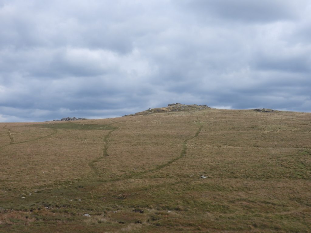
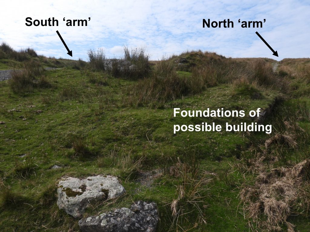
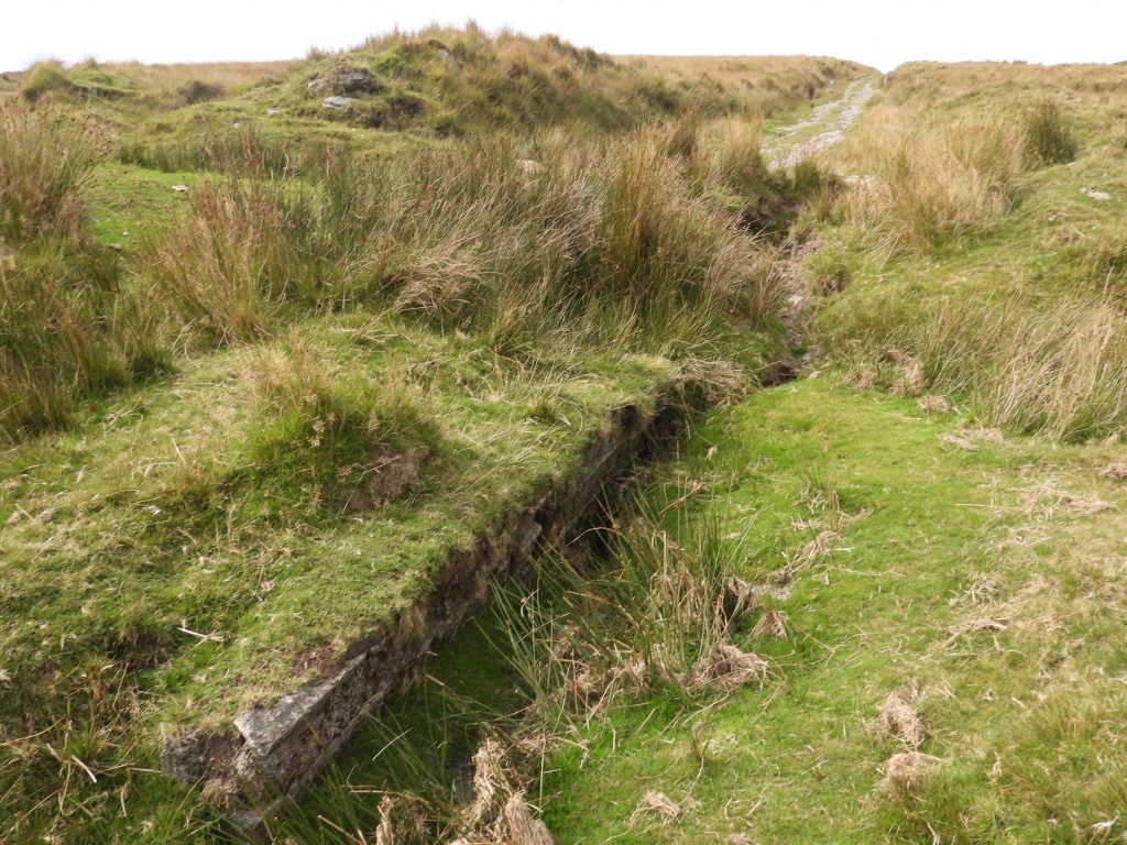
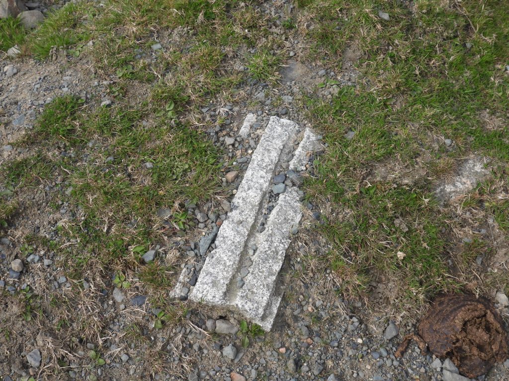
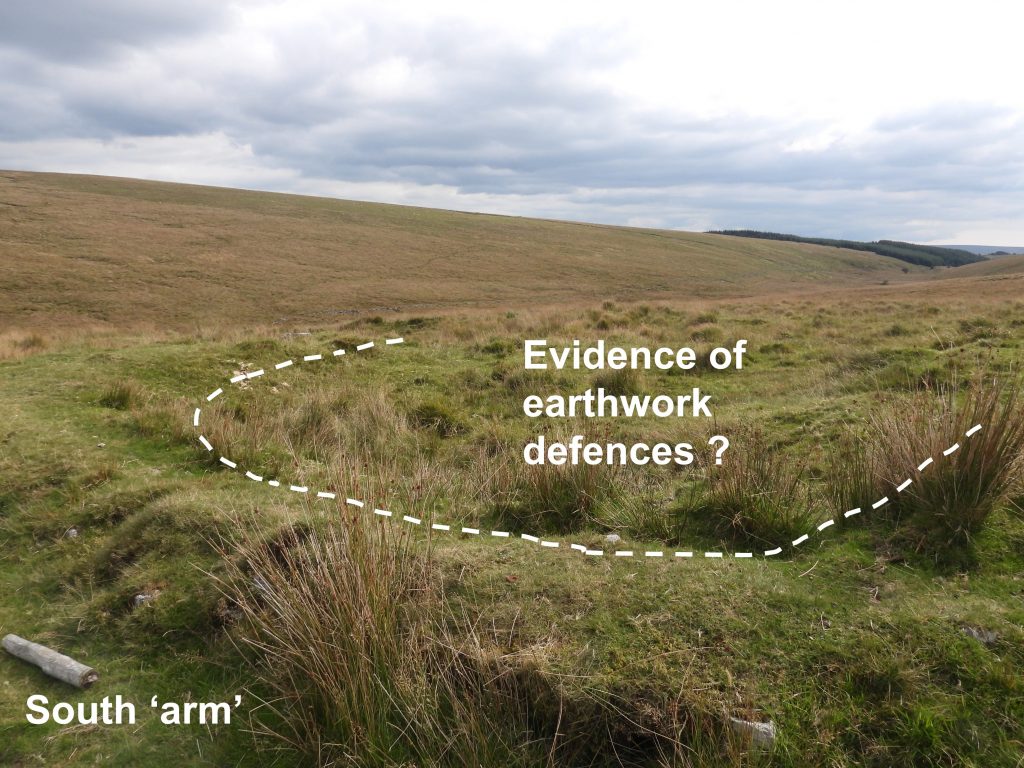
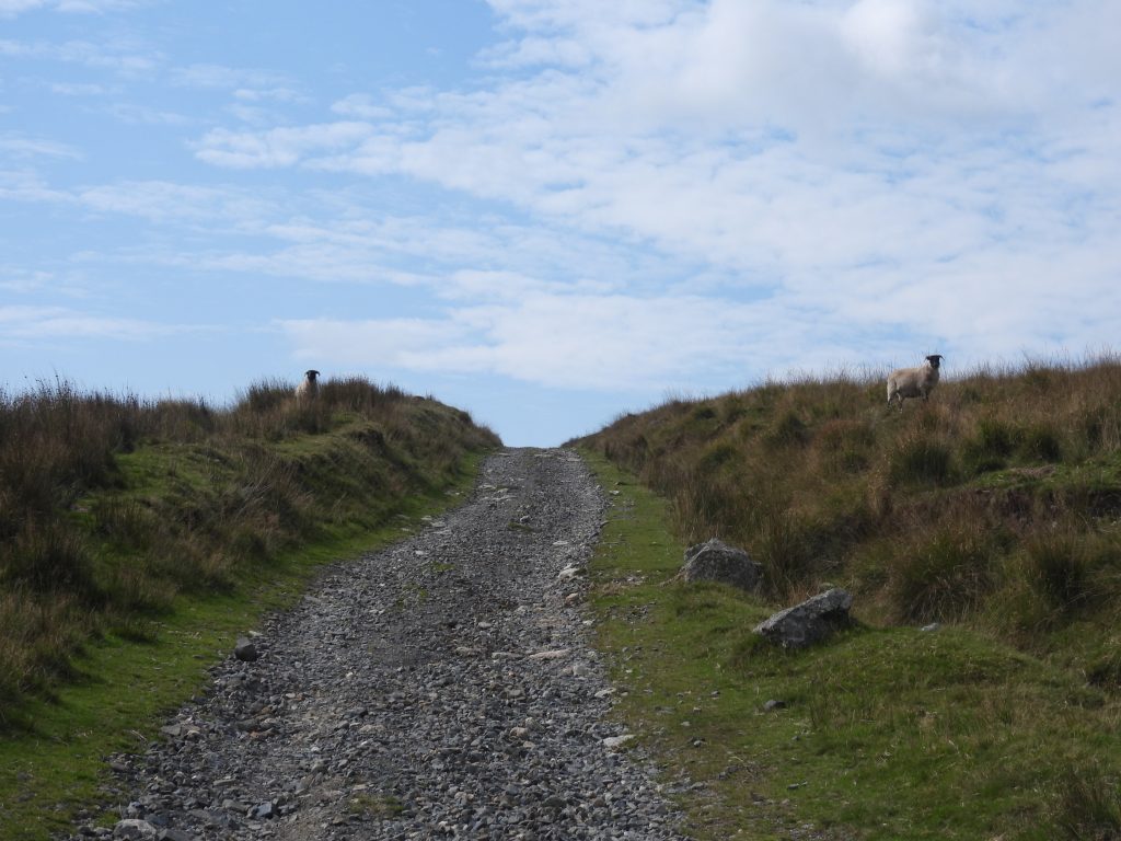
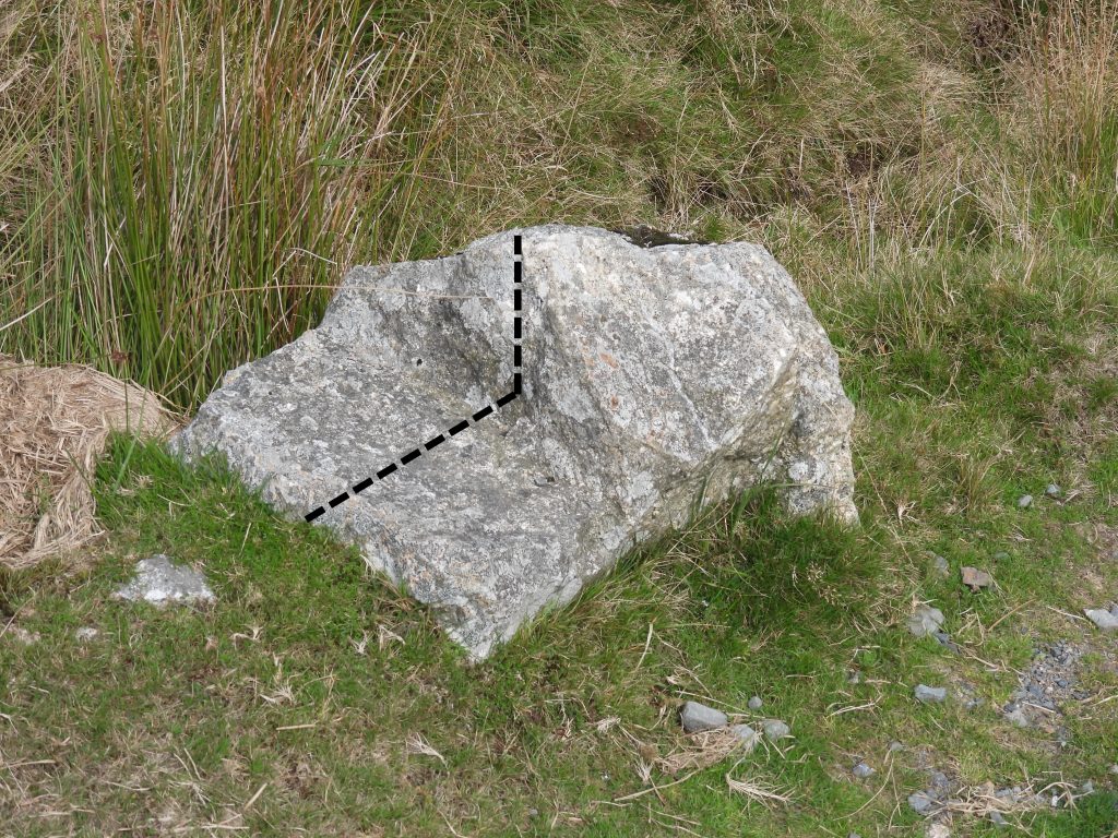
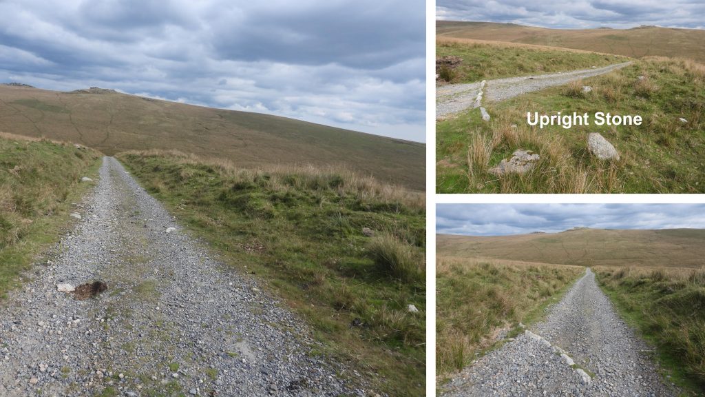
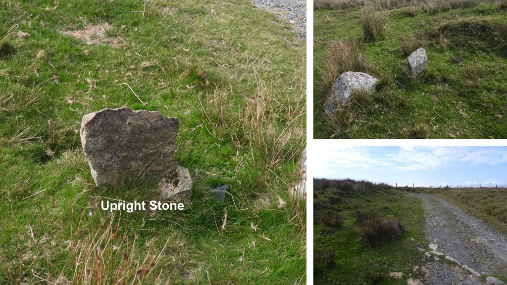
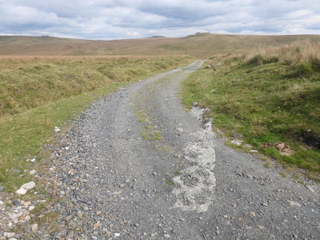
The sketch map shows features covered in this post. The parking area at the end of a side road from the Tavistock – Two Bridges road can be used by the public on a permissive basis, when there is no firing within the Merrivale Range. Moving along the track, the post starts from the southerly of the two Directors of Convicts Prisons (DCP) boundary stones shown then moves northwards to the second DCP boundary stone. The post then covers features down the north ‘arm’ of the target tramway / railway to the Cowsic and a footbridge and the back up the south ‘arm’.The most southerly of the Director of Convicts Prisons (DCP) boundary stones. It is located next to a gate as shown and close to the top of the south ‘arm’ of the target tramway. It is located at SX59004 76888The original Dartmoor Prison bounds encompassed an area of 390 acres which was granted a 99 year lease. Its bounds were further extended in 1867 by 1000 acres under a fresh lease with the boundary marked by a series of DCP (Directors of Convicts Prisons) boundstones. This stone lies on the 1867 boundaryThere are two boundary stones at the north west boundary (enclosure) of the 1867 prison bounds. The enclosure is known as ‘New Forest’. One of the stones is a DCP stone the other is plain and is not inscribed.The DCP stone is located at SX58860 77288. This DCP stones is the only one from the whole boundary which is shaped like this.The reason for the plain B.S a few metres from the DCP stone at the north east corner of New Forest enclosure is unknown.The plain BS is located at SX58860 77290Whilst in the area of New Forest enclosure the author noted five vehicles on the slopes of Black Dunghill which presumably were being used as part of the peatland restoration project. Granite bounders covering a peat channel (and a cable) near the north east corner of New Forest enclosure. These boulders have been here for a long time and are used by walkers en-route to Black Dunghill and Conies Down. The start (most north westerly) point of the target tramway / railway is located at around SX58963 77247Intriguingly, the Dartmoor HER only considers the ‘north arm’ of the track to be the former target tramway, whereas the National Library of Scotland map considers both the ‘north arm’ and ‘south arm’ to have been a part of the military construction. A semi-buried wooden stake found in the tramway. No doubt of military origin. SX58997 77231The ‘north arm’ of the target tramway / railway described by the Dartmoor HER as : “Earthwork remains of a 500 metre-long, 20th-century target railway to the north of Holming Beam, associated with Merrivale small arms training area”. The bank on the southern edge appears to be slightly higher than the bank on the northern edge, which perhaps indicates the line of fire was from the south to the north. Some military detritus found along the track. It may be the remains of an old shell ? Of course touching anything metallic in the military training areas is actively discouraged. On the Legendary Dartmoor website it is recorded that in 1953 a man was killed whilst clearing ‘military litter’ from Holming Beam.Of interest, when researching the Holming Beam area, the author found in a Dartmoor Society document a record of a debate of military use of Dartmoor where is stated ordnance used “…….comprises 5.56mm rifle bullets, 7.62mm machine gun rounds, a small amount of light mortar fire and about 0.5% was heavy mortar fire”. It further records that “…..a small arms round can travel 3km and allowance has to made for ricochets in planning an exercise. For example, an exercise based at Holming Beam requires the whole of the area from Baggator to Cut Hill to be closed for safety purposes”. Certainly makes you think !A feature which is still marked on 21st century maps is a small quarry. There is evidence of possibly two buildings or structures in the area, so the author speculates that this quarry was used to obtain stones for those constructions and possibly for the hardcore footings for the tramway / railway. At the edge of the quarry there are foundations of a possible building or some such construction, which almost certainly was used as part of the tramway / railway.Within the quarry there is evidence of sandbag filling, which must be related to the modern militaryThe foundations of the possible building or construction relating to the tramway / railway are located at SX59248 77127. This structure and the quarry are approx 2/3rds the way down the hill of the ‘north arm’. The author is certain the tramway / railway used gravity as a means to move their targets.The foundations of the possible building or construction relating to the tramway / railway appear to be reinforcedView of the possible building foundations and the quarry with the Cowsic valley beyond.Heading towards the ‘point’ of the tramway where the two ‘arms’ meet, a pair of upright posts can be found. It is likely that a gate once stood here, but from what era ? Are they part of the original tramway / railway construction and operation. The southernmost (smallest) post has a hole in it and is at SX59325 77084More military detritus was found along the track. This piece by the side of the granite upright (gatepost).A metal pipe in the drainage channel alongside the trackNear and at the bottom end of the ‘north arm’Just below the ‘point’ where the two ‘arms’ meet is a telephone point, which looks more 21st century than 20th century. There would have, no doubt been some form of communication system with the operation of the tramway / railway.Close up of the Telephone point.Just below the tramway and telephone point is a footbridge over the Cowsic which enables the hiker to reach Beardown Tors and Lydford Tor View from the ‘point’ of the two ‘arms’ of the tramway – Cowsic Valley where the Lych Path crosses at Travellers Ford.View from the ‘point’ of the two ‘arms’ of the tramway – Lydford TorView from the ‘point’ of the two ‘arms’ of the tramway – Beardown TorsAt the ‘point’ between the two ‘arms’ there are foundations of another building or construction presumably associated with the tramway / railway Close up of the building / construction, which is located at SX59404 77056Heading up the ‘south arm’ there is some shaped stone constructed into the track. Might this have been a part of the original tramway / railway ?Just to the south of the south ‘arm’ there is evidence of an earthwork – was this part of a military construction ? Two woolly guardians of the south ‘arm’ heading up the track in a westerly direction. The earthbanks here seemed pretty equal in height. Was this part of the tramway / railway (as per the National Library of Scotland map) or just an access track ?Another shaped stone – this one had a well defined 90 deg cutMore views of the ‘south arm’. Near the top (west end) are two upright stones, which are close to but not directly alongside the track. It is unlikely the one shown in the top right picture was identify the edge of the track as it was too far set back. The upright was definitely placed upright and not natural. It was located at SX59098 76954A second upright stone near the top of the ‘south arm’. This upright is located at SX59022 76935A stone construction in the track at the very top (westerly point) of the ‘south arm’. SX59000 76931. Having taken a closer view of the whole of the Holming Beam tramway / railway, there certainly is evidence of military use but an interpretation of some of the features is difficult. No railway tracks or setts were found.